A special piece of the Murray
On our last day in Echuca we set off for the Barmah Red Gum region which is up into NSW along the Cobb Highway, something like 60 km all up. It is a bit of a twisting drive and the road comes back on itself such that the small township of Barmah (in NSW) actually has Victoria more or less to the north of it.
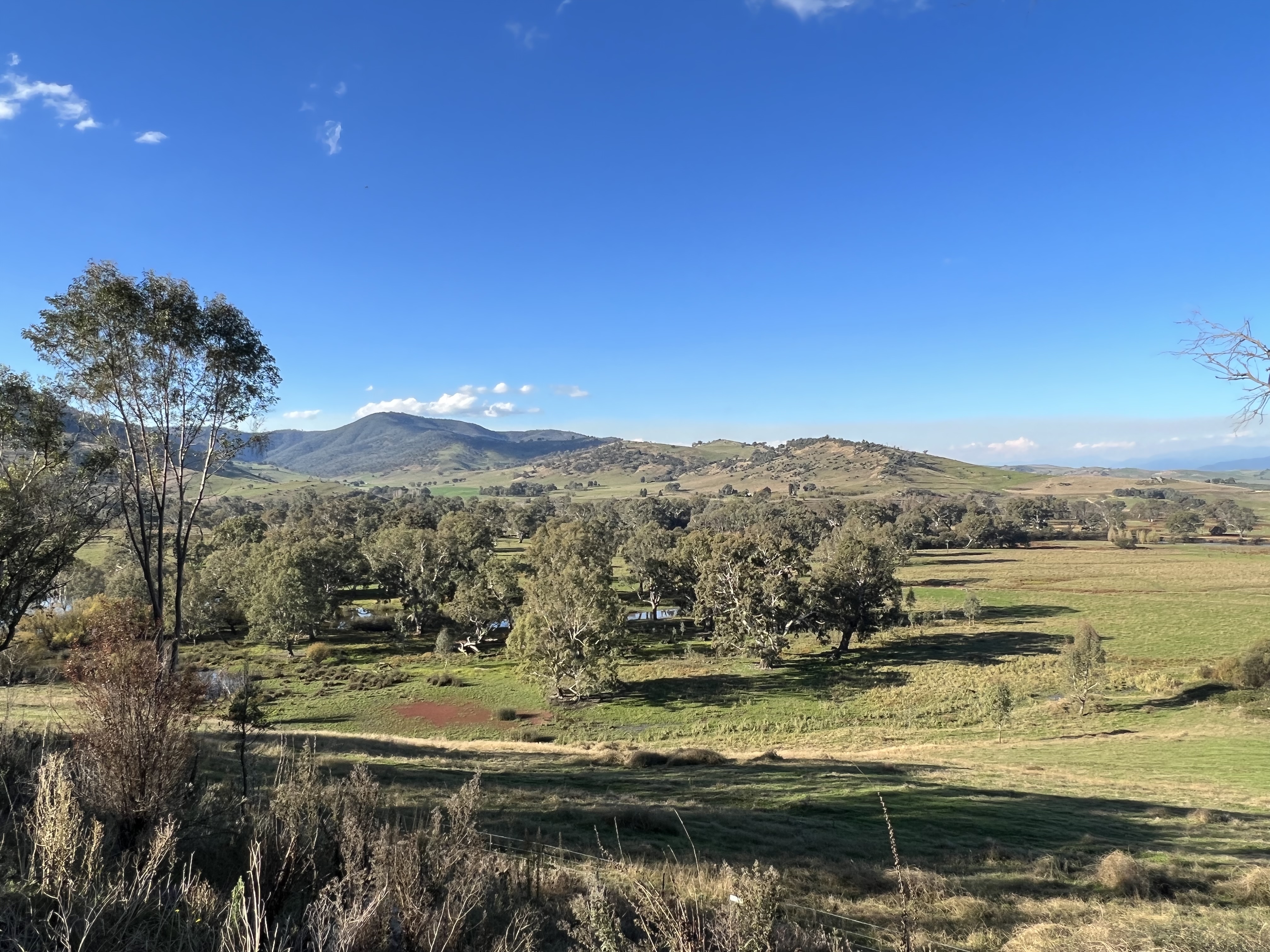
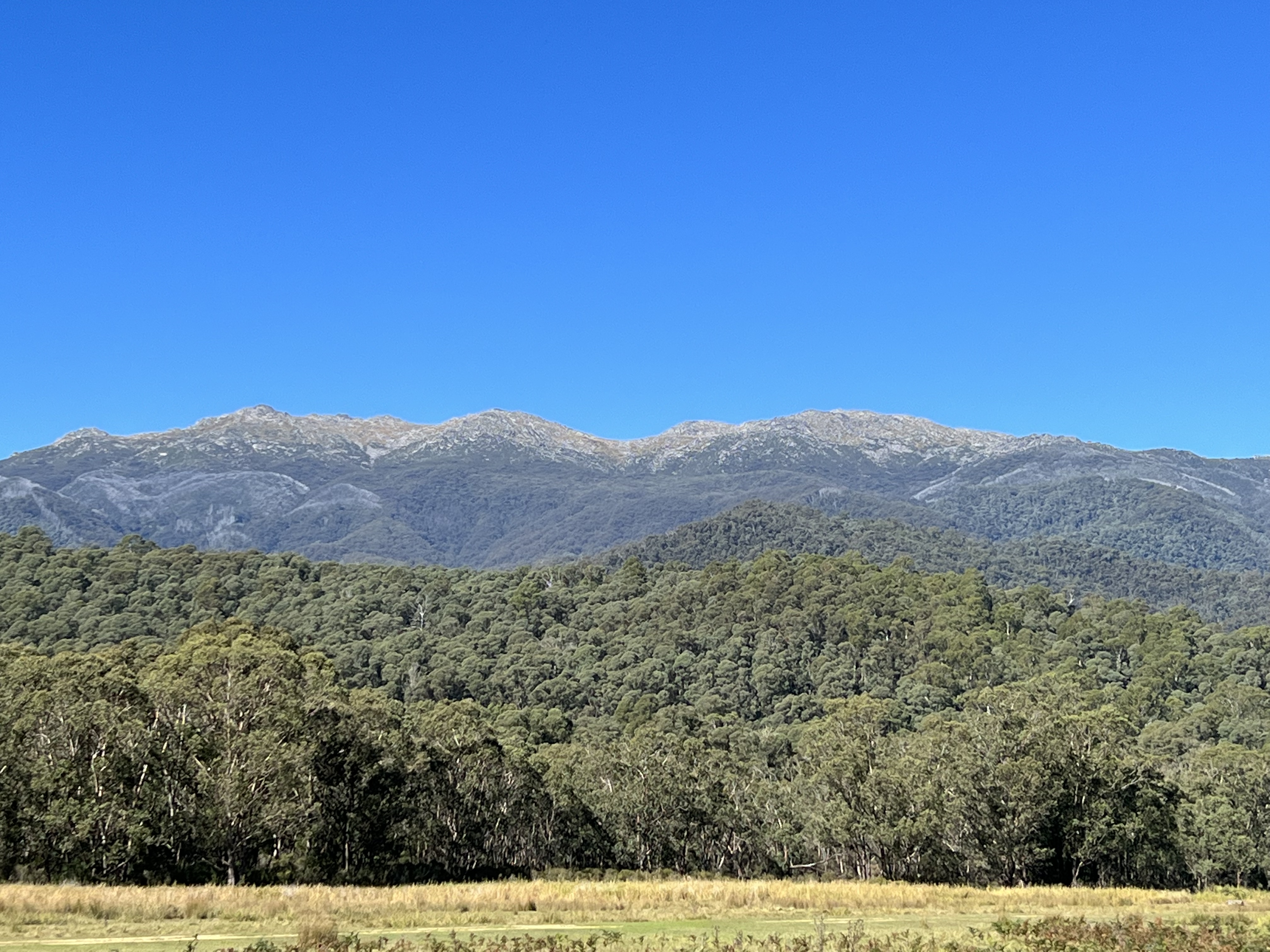
The Barmah Red Gum region is a special area because it is the largest red gum forest in Australia. The area was logged during the paddlesteamer days and the trees taken down the river to Echuca to the saw mills there. The forests are starting to recover. The flood plain of the Murray is quite extensive in this area and that is why the red gums flourish here. Red gums need to be periodically flooded and can withstand their feet being in water for several months, the flooding also enables the seed of the trees to germinate.
As we drove along an interesting geological feature appeared beside the road. It was a ridge line 10-15 metres high running away beside the road, almost like a big flood levee. At one point the road went through a cutting to the other side , the land was considerably higher than on the side we had come from. Allthego climbed up for a photo of the fault line.
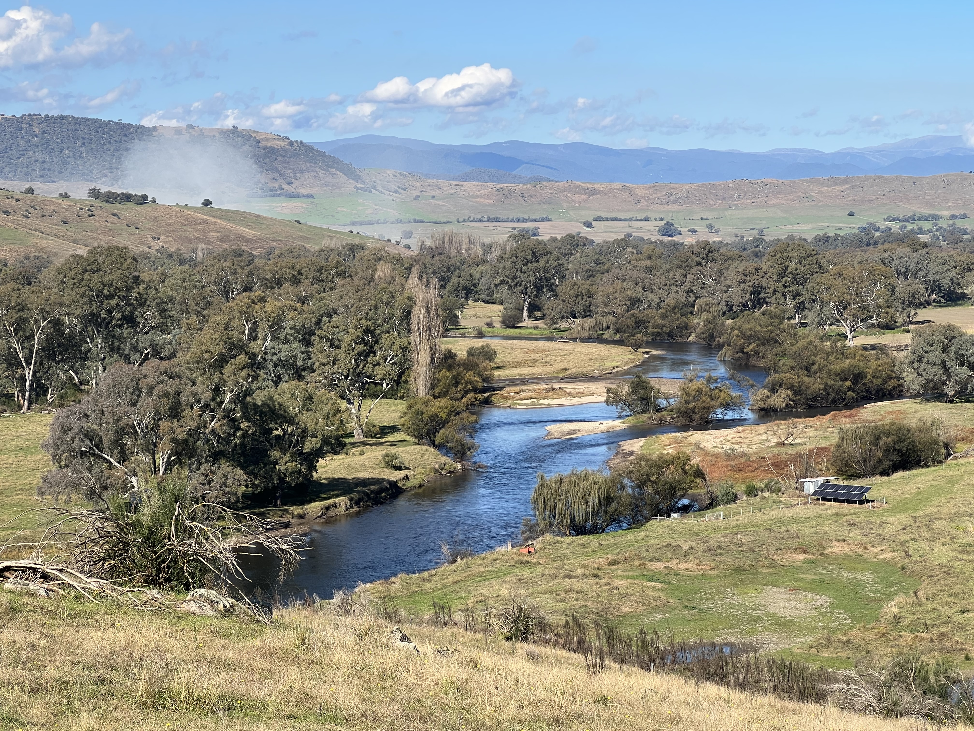
We had stumbled over the Cadell fault line! So what you might say! This fault is particularly important in the geological history of the Murray River. Now, if I am losing any of my dear readers here then I am sorry. Allthego likes a bit of geology and geography! I have had a brief look at Wikipedia to check up on this stuff. After all we are following the river and a little bit of geology want hurt, I hope. The Murray is about 130 million years old, having formed when the great inland seas receded from the interior. Some 25 million years ago there was a great continental uplift that gave rise to the fault and ridge line. The fault line runs from Deniliquin in NSW down to Echuca in Victoria. It cut right through the Murray and the river’s course was diverted into a number of channels and lake systems, creating the flood plain. Almost like an inland delta. The perfect habitat for the red gums!

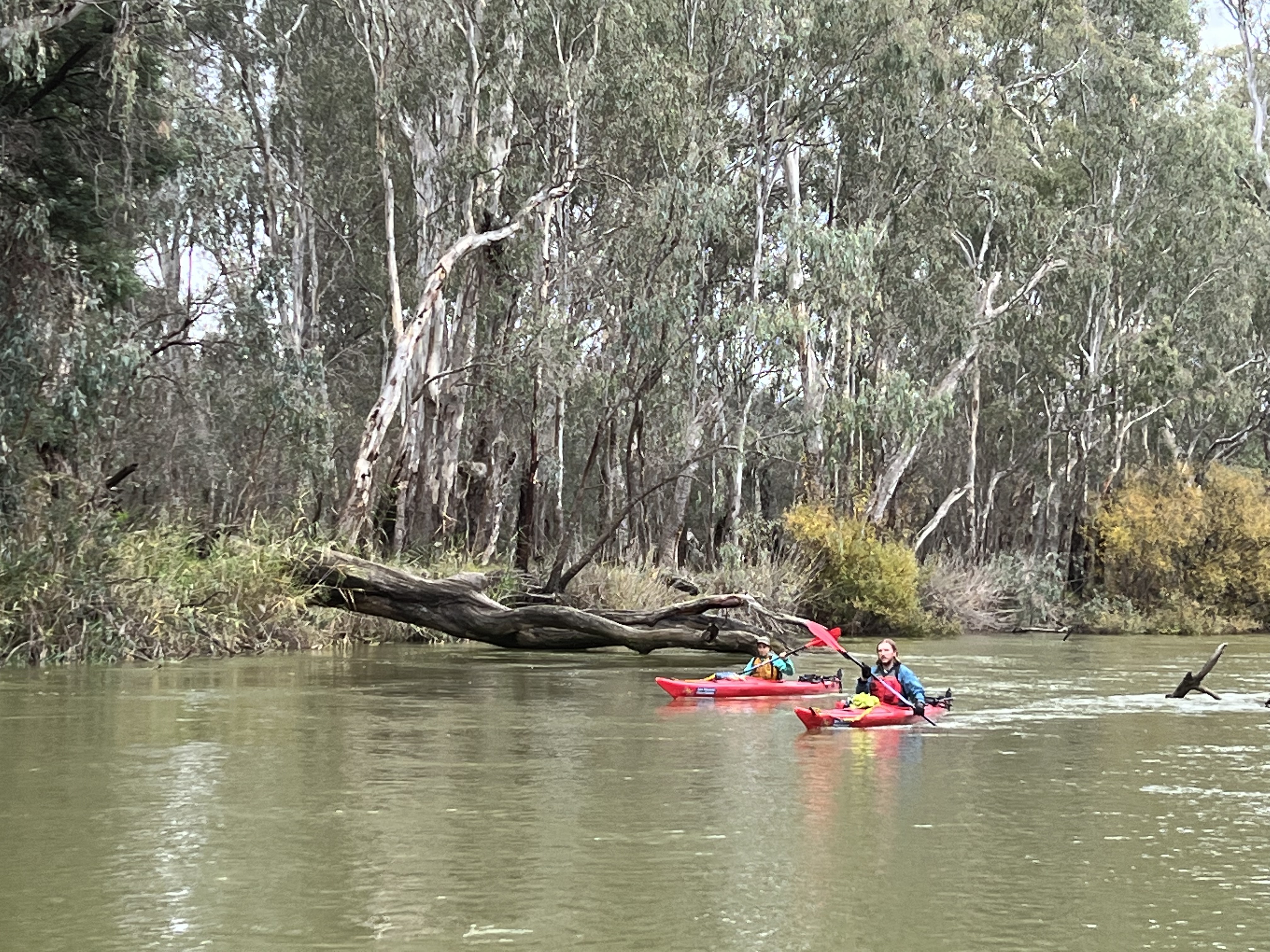
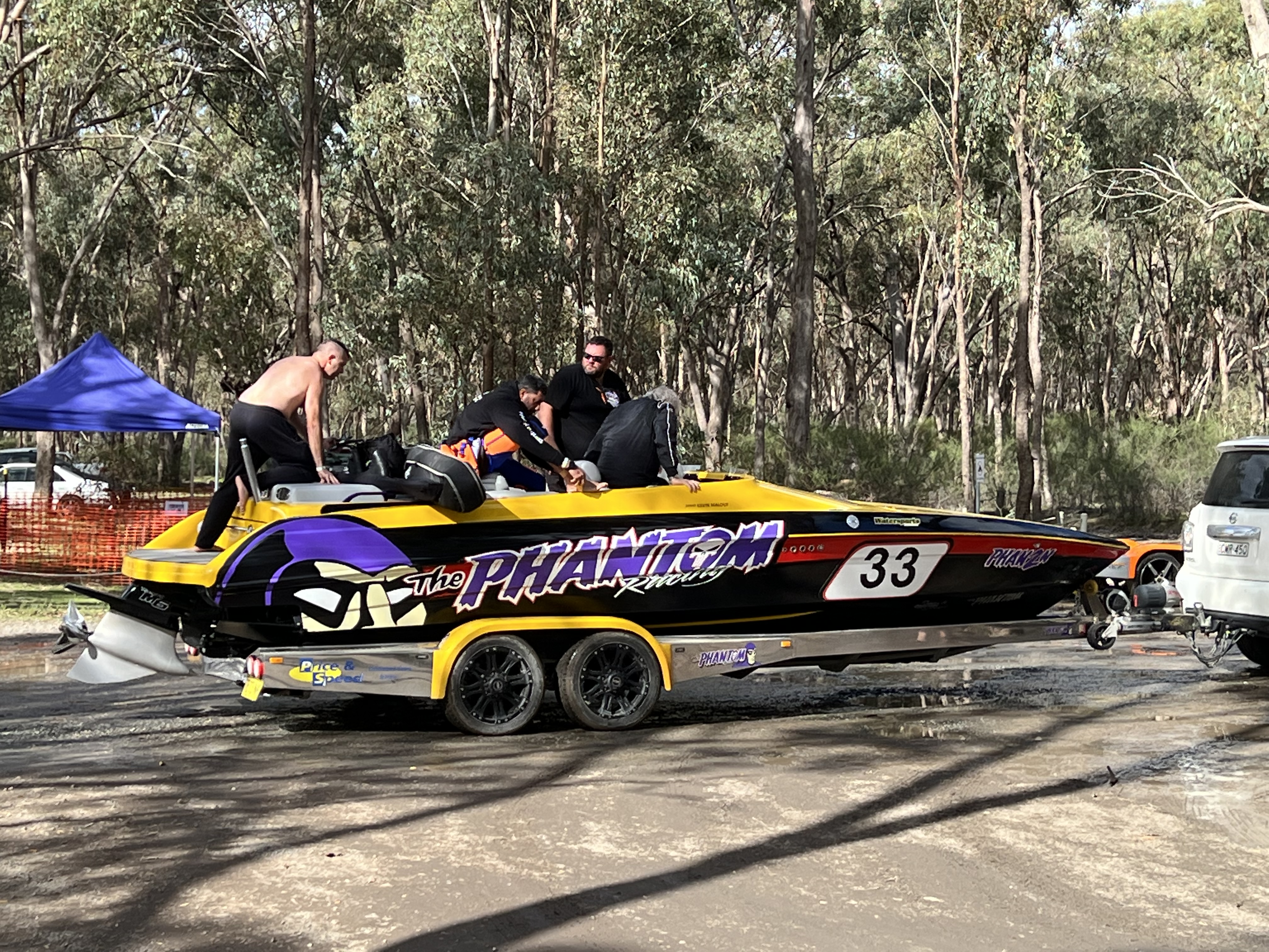
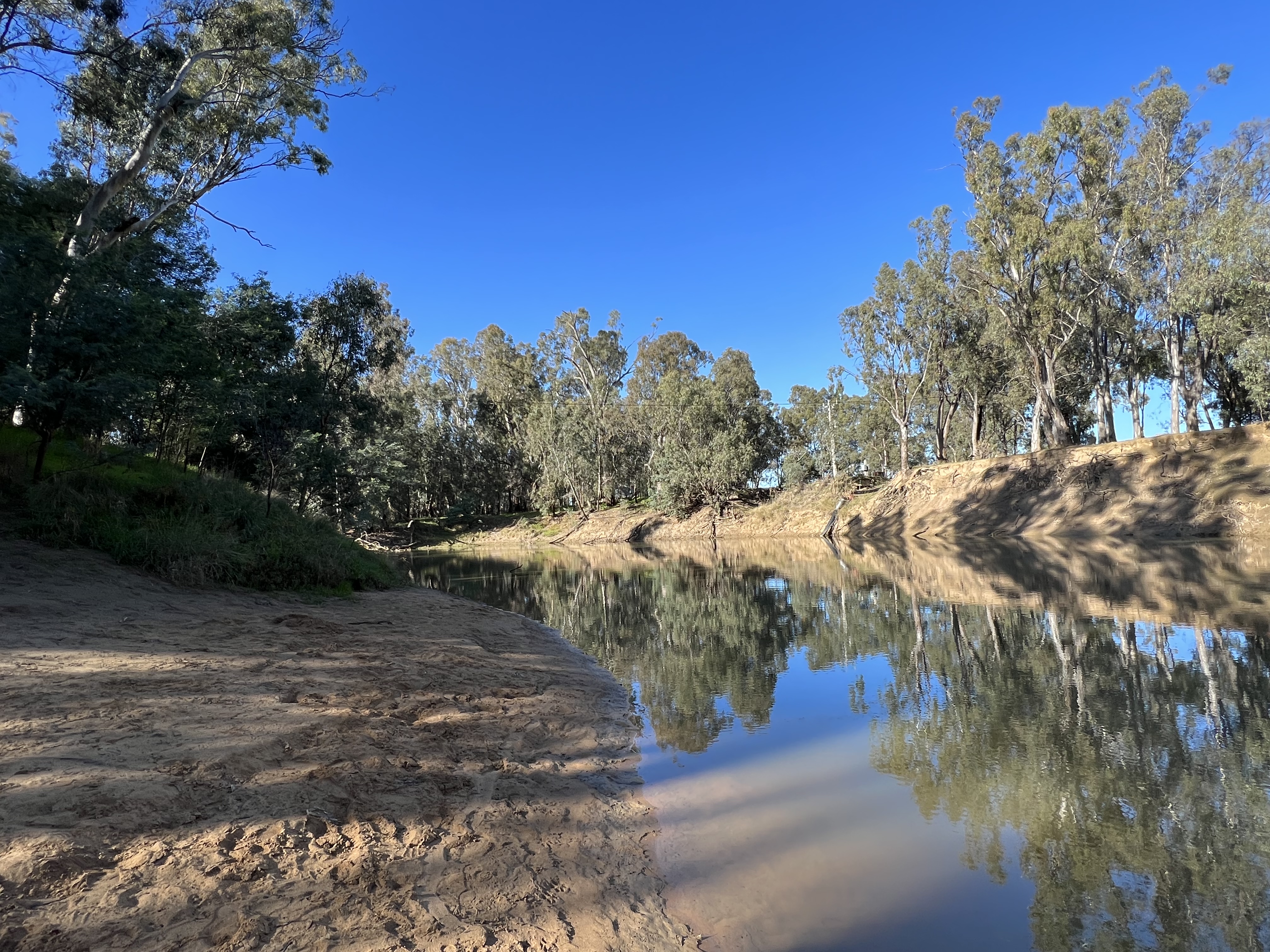
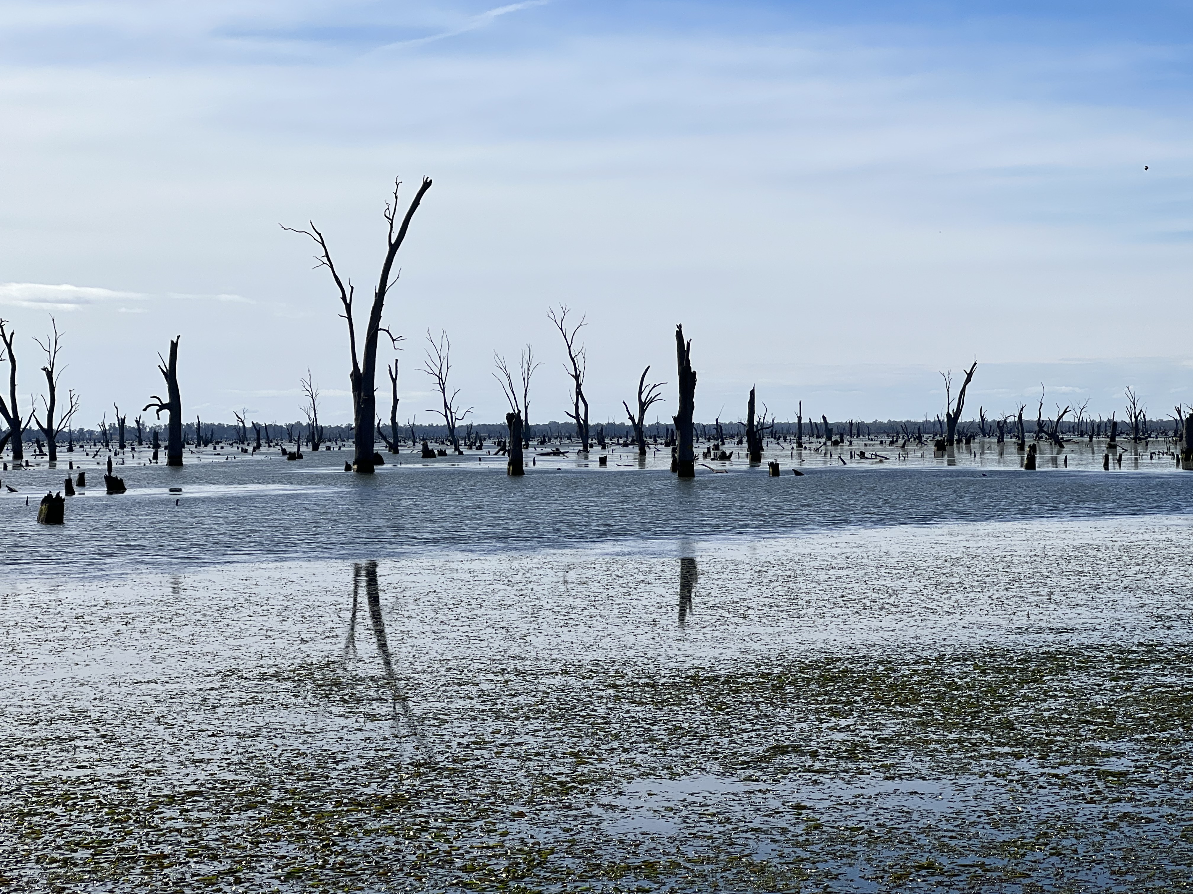
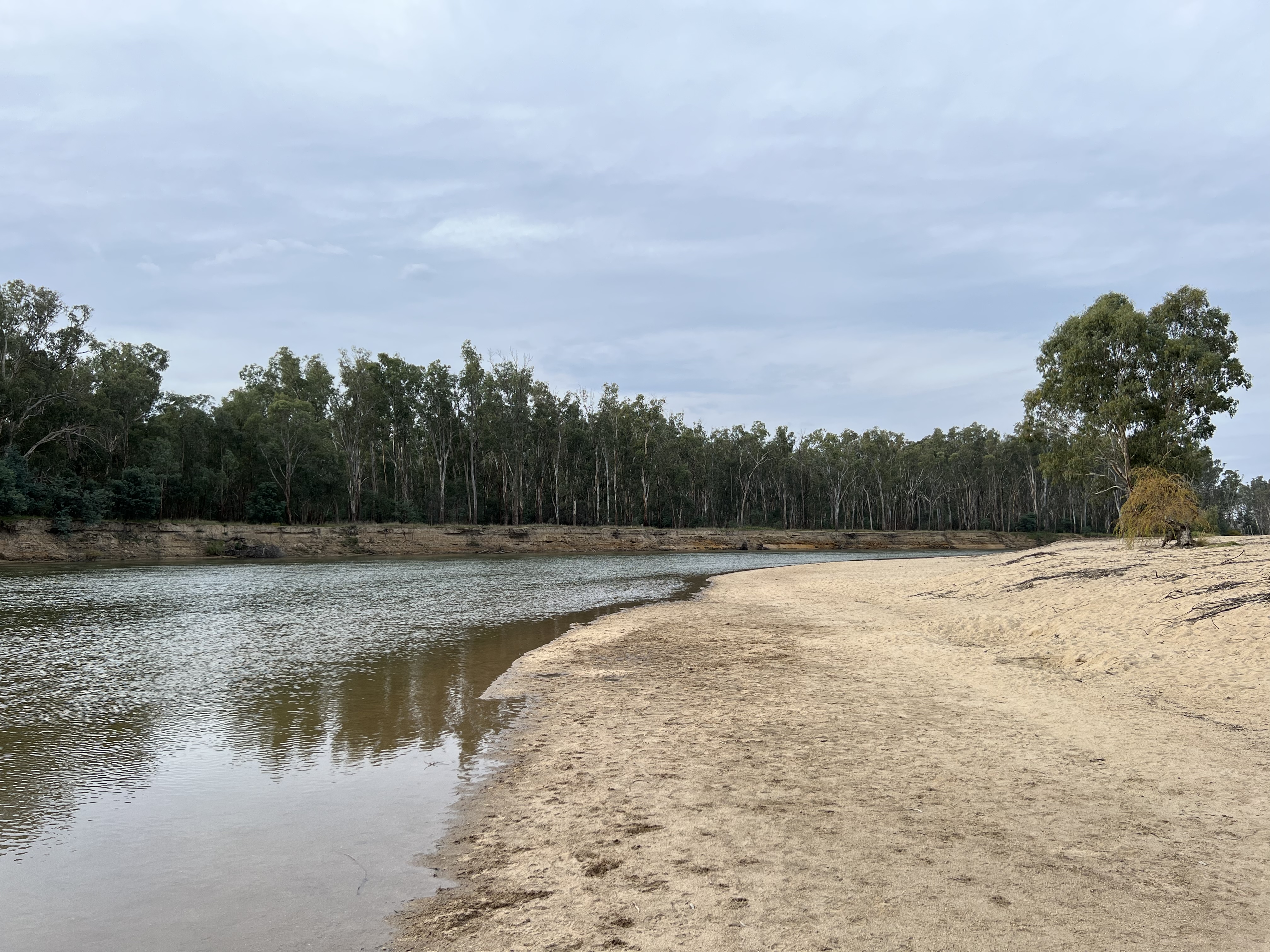
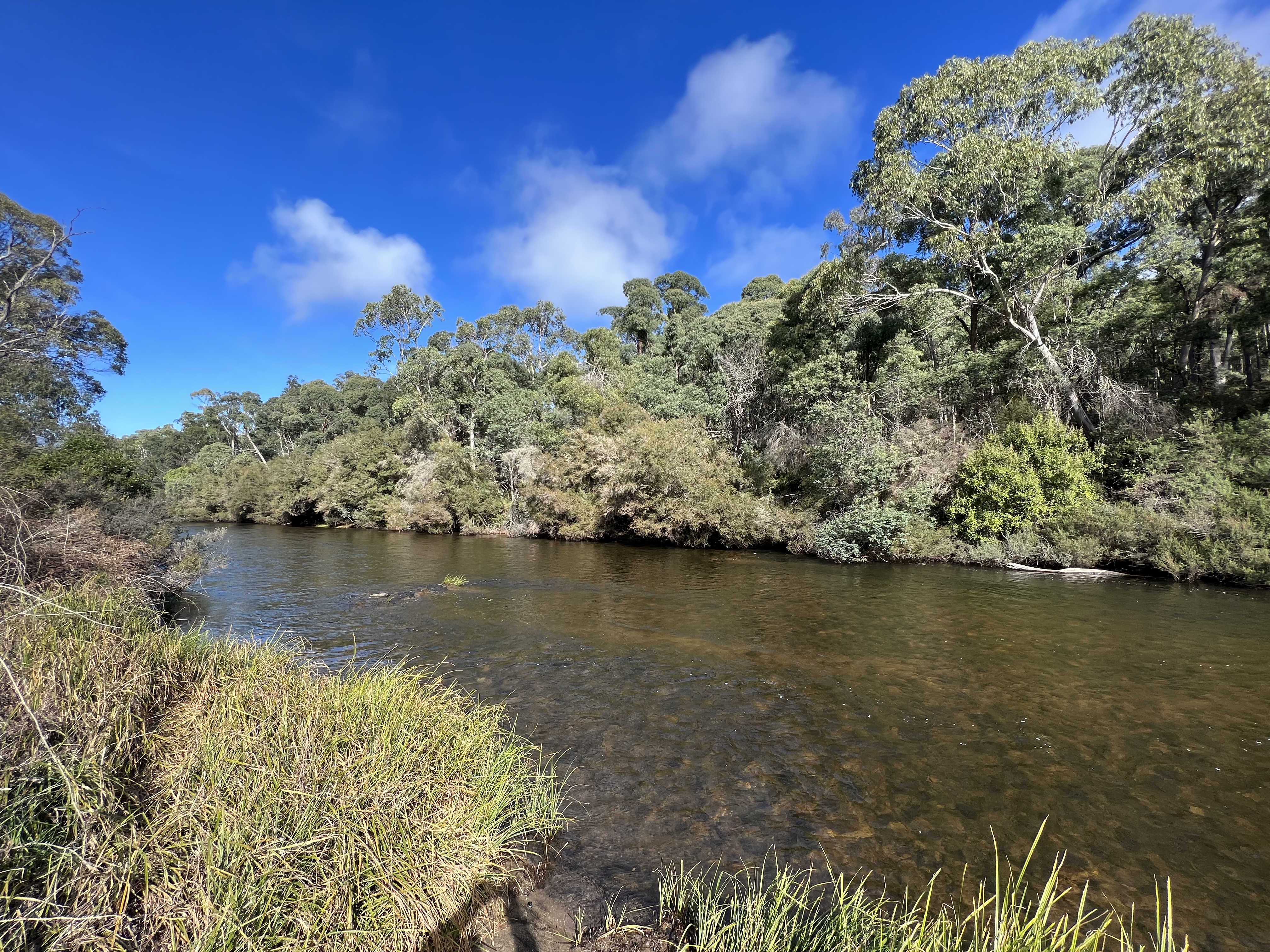
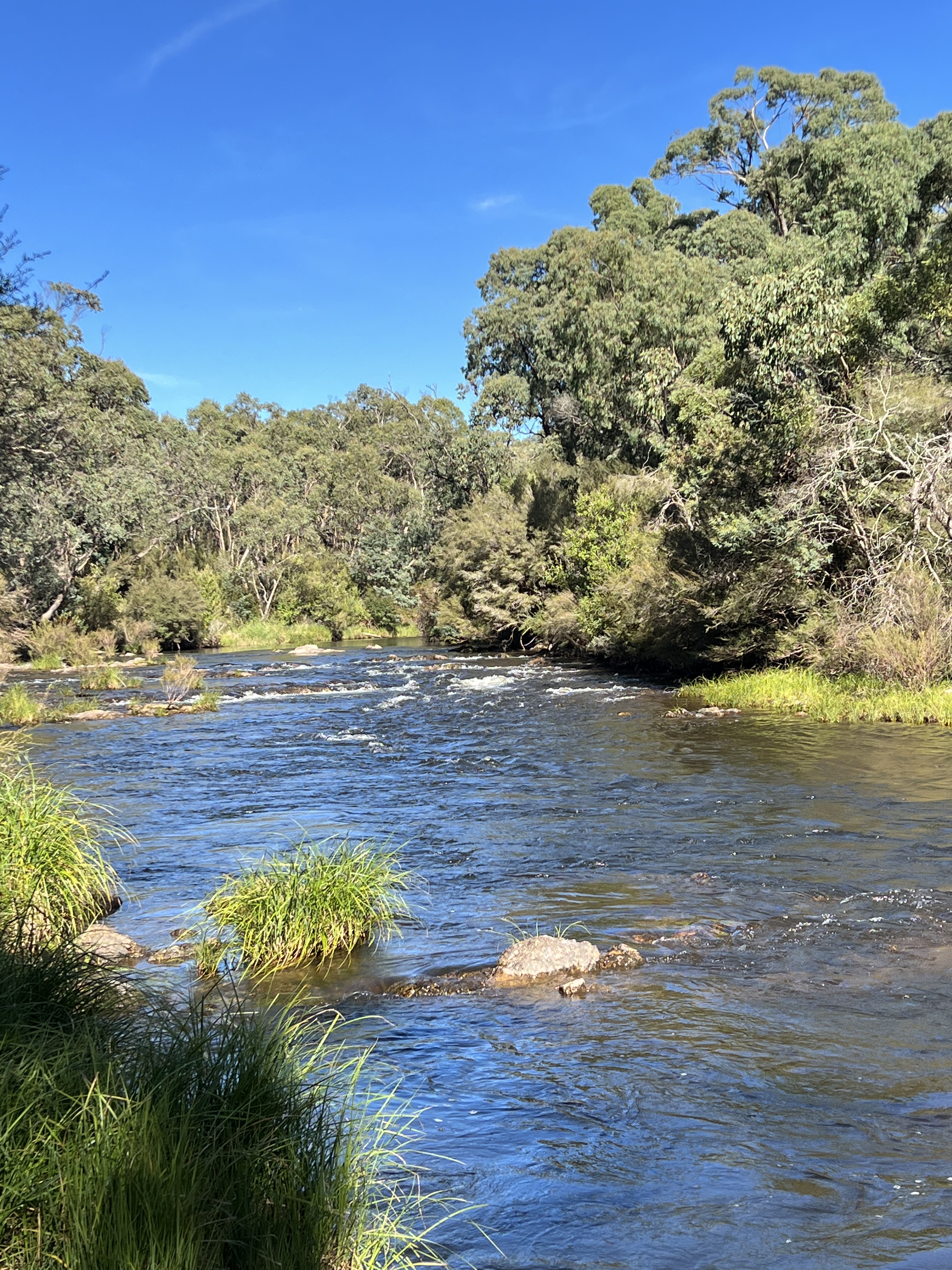
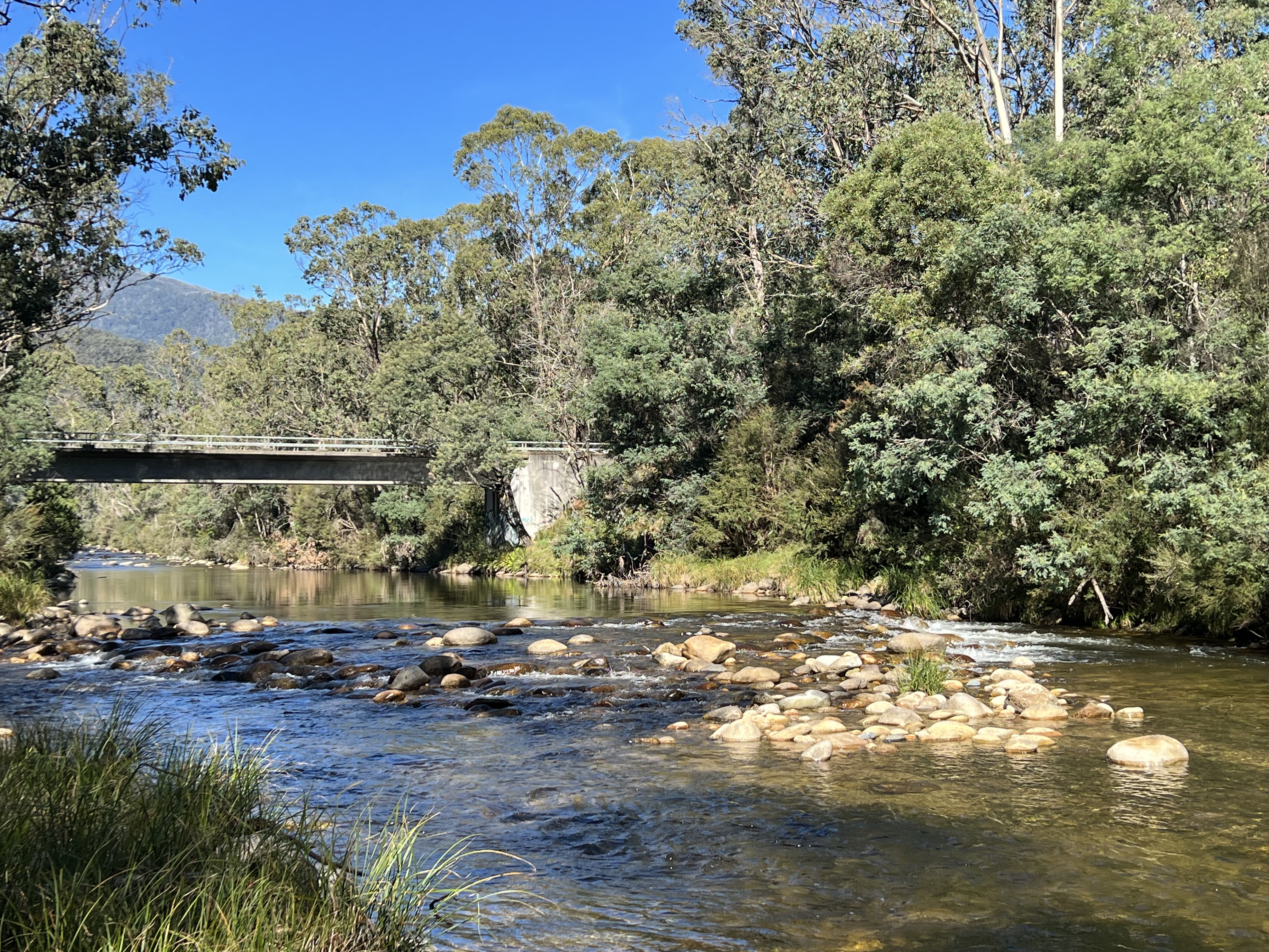
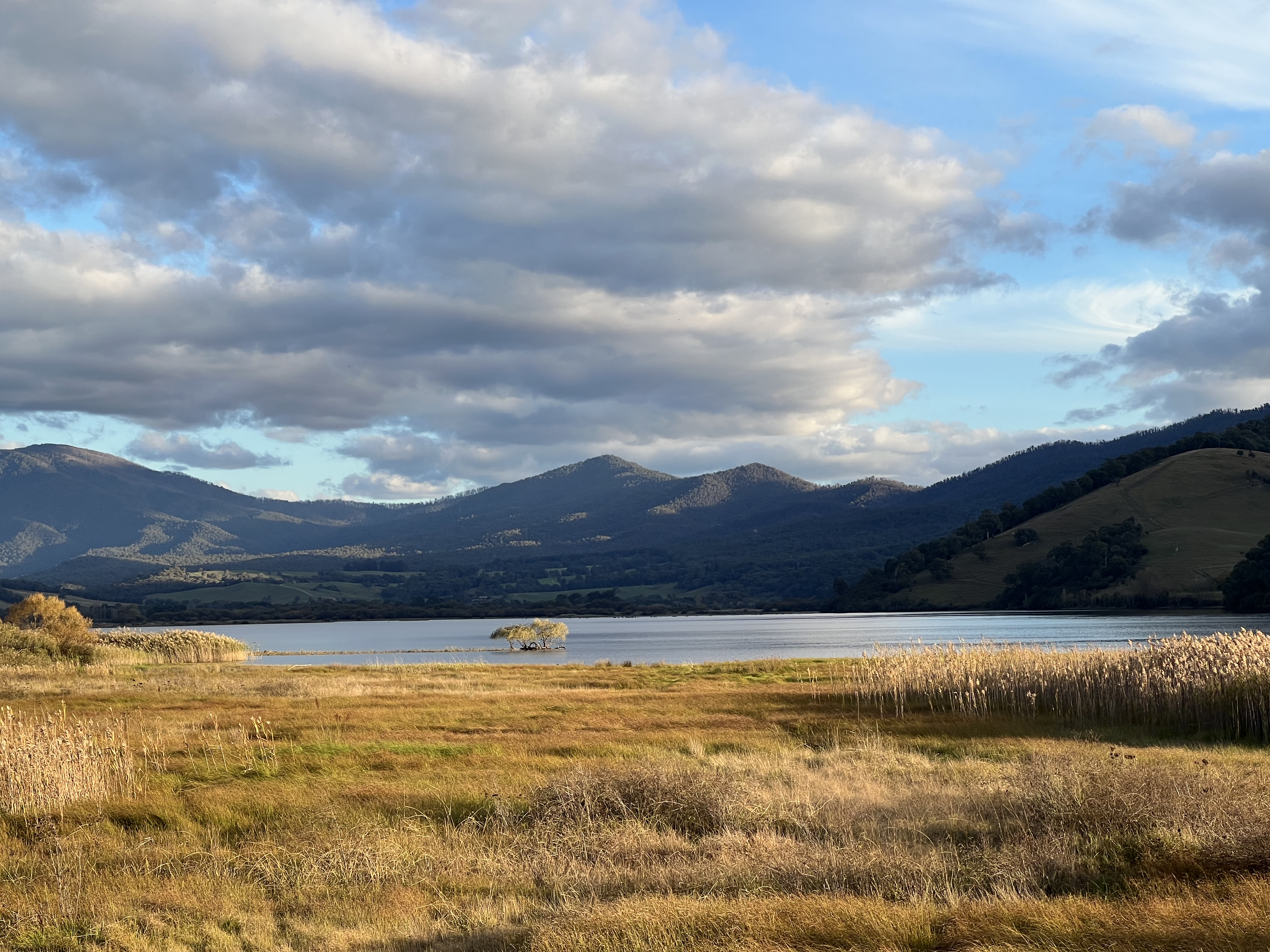
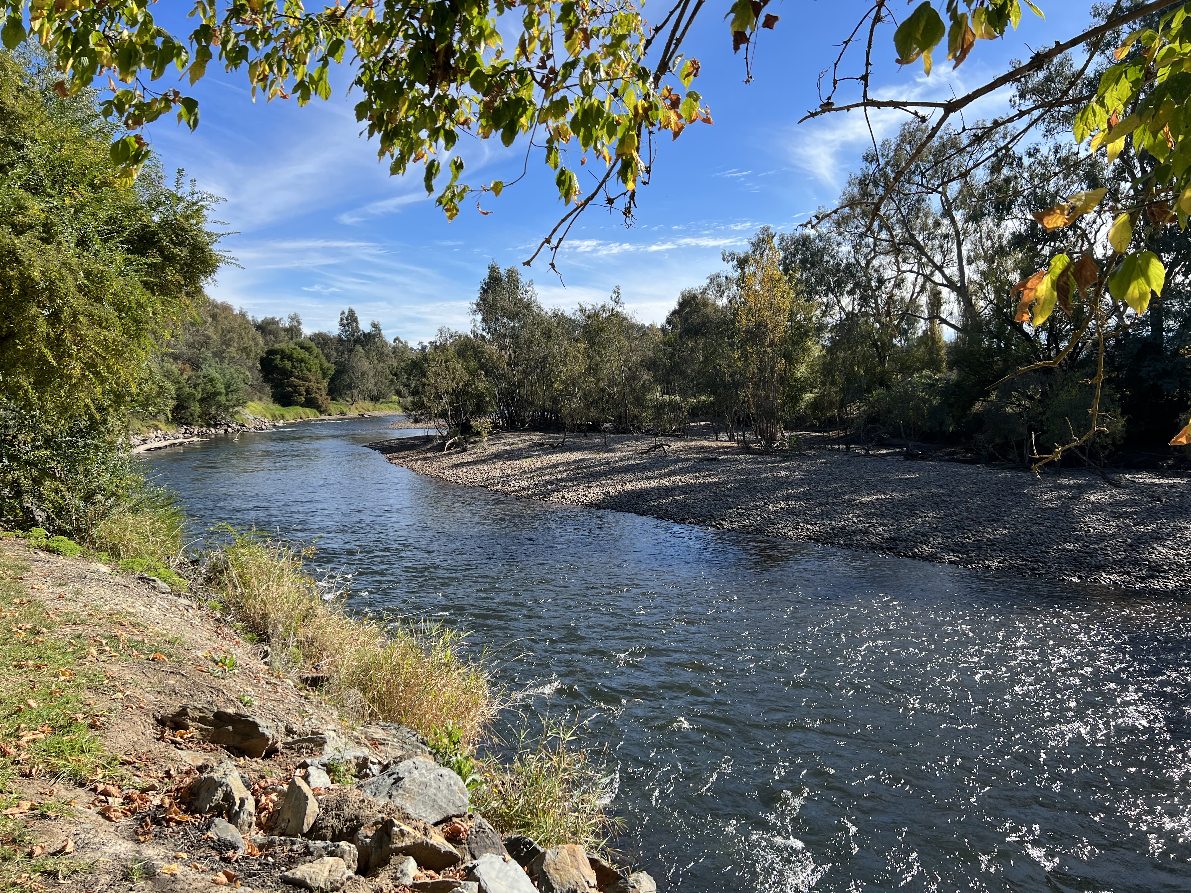
Now, we have come up here to do an eco boat trip on the river. The 2 hour journey takes us up and back along a section of the Murray known as ‘the Narrows’ or the ‘Barmah choke’. At either end of the ‘narrows’ the Murray is much wider. In the narrows it is about 10 -15 metres or so wide but is lined by red gums, a number have fallen into the river and stick out into the stream, the boat navigates around these, the water is a couple of metres deep. Because of the fault line, the river is also flowing down a steeper gradient and is doing about 7-9 km an hour compared to the normal Murray pace pf 3-4 km. Coming back, the current assisted and we did the journey much quicker. The intiguing thing is that this section of river is thought to be geologically very young. Evidence suggesting the river having had another course change in the mid 1500s. The banks are quite straight up and down and the river’s channel is perched above the plain either side. Apparantly, it is one of the world’s best examples of fault induced river course changes. Enough!
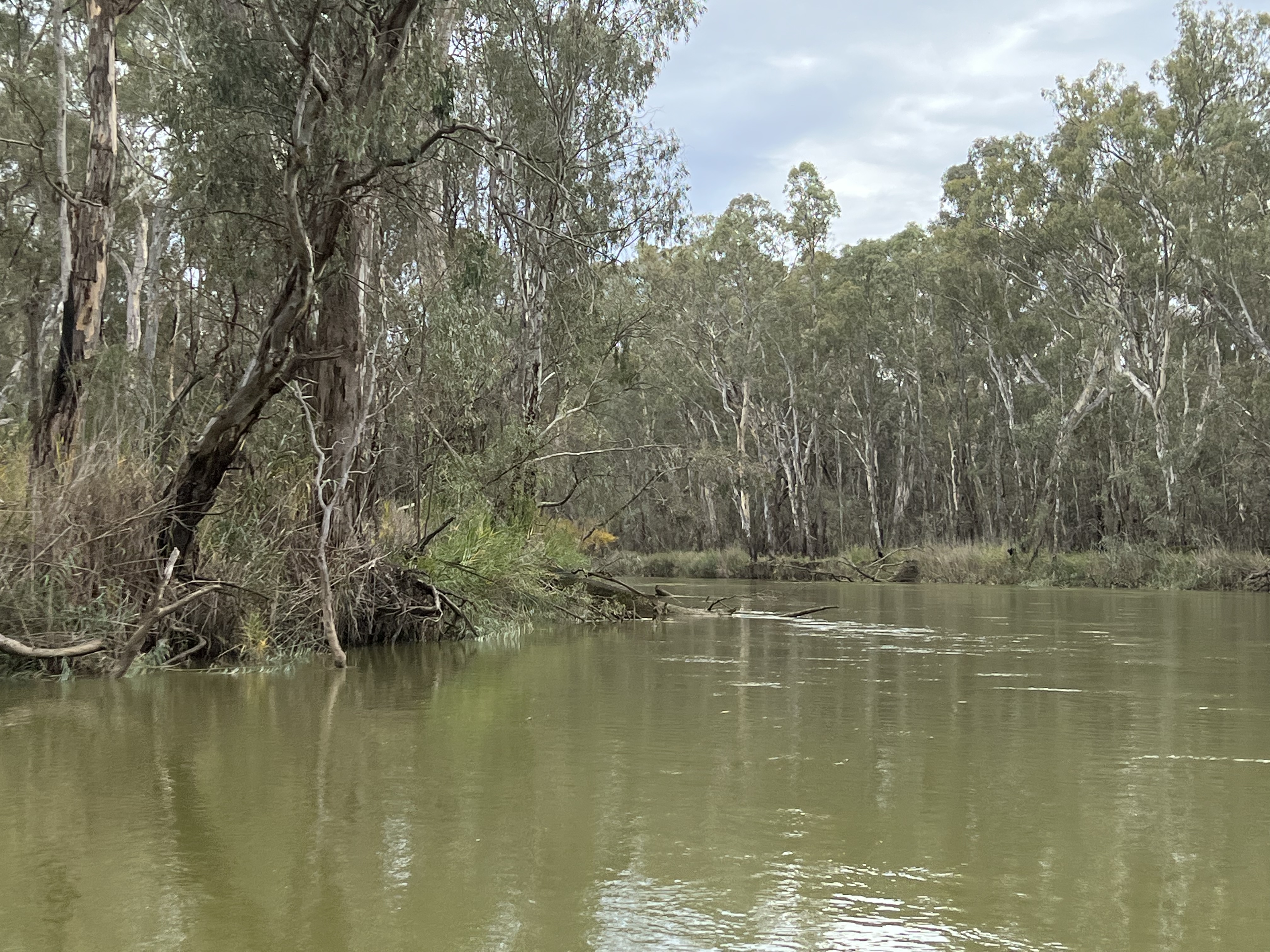
It was a great journey on the river, bird life abundant. We saw many azure kingfishers in the reeds and branches dangling riverside. A few people fishing and canoing along as well. The overcast weather an actual advantage as glare and shadows did not hinder the experience. The big red river gums were quite special. Some grotesque shapes. Also, stumps left behind from the logging days were dangling in the river and in other cases had sprouted again sending new growth out. An interesting place to camp and experience the river environment.
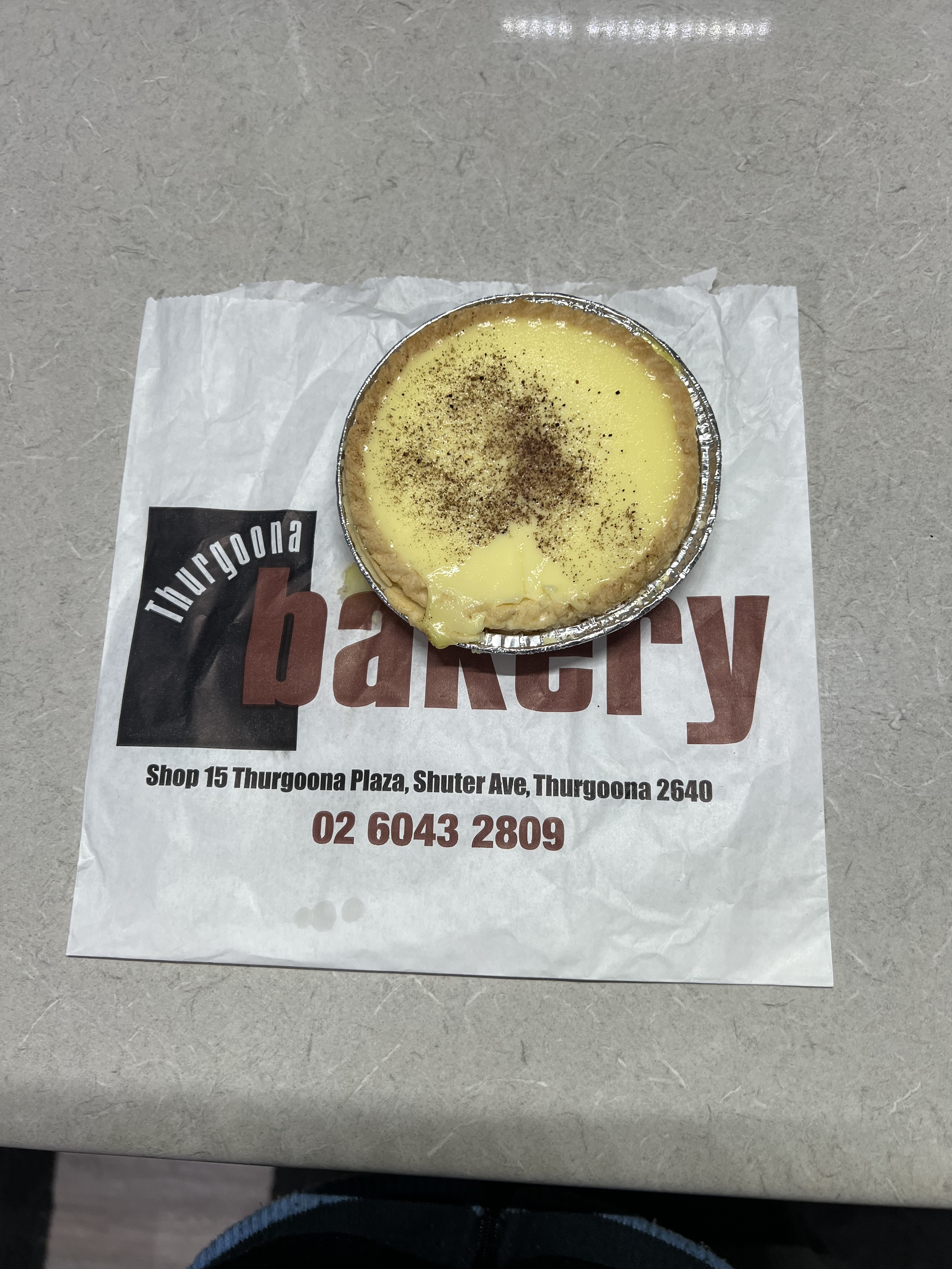
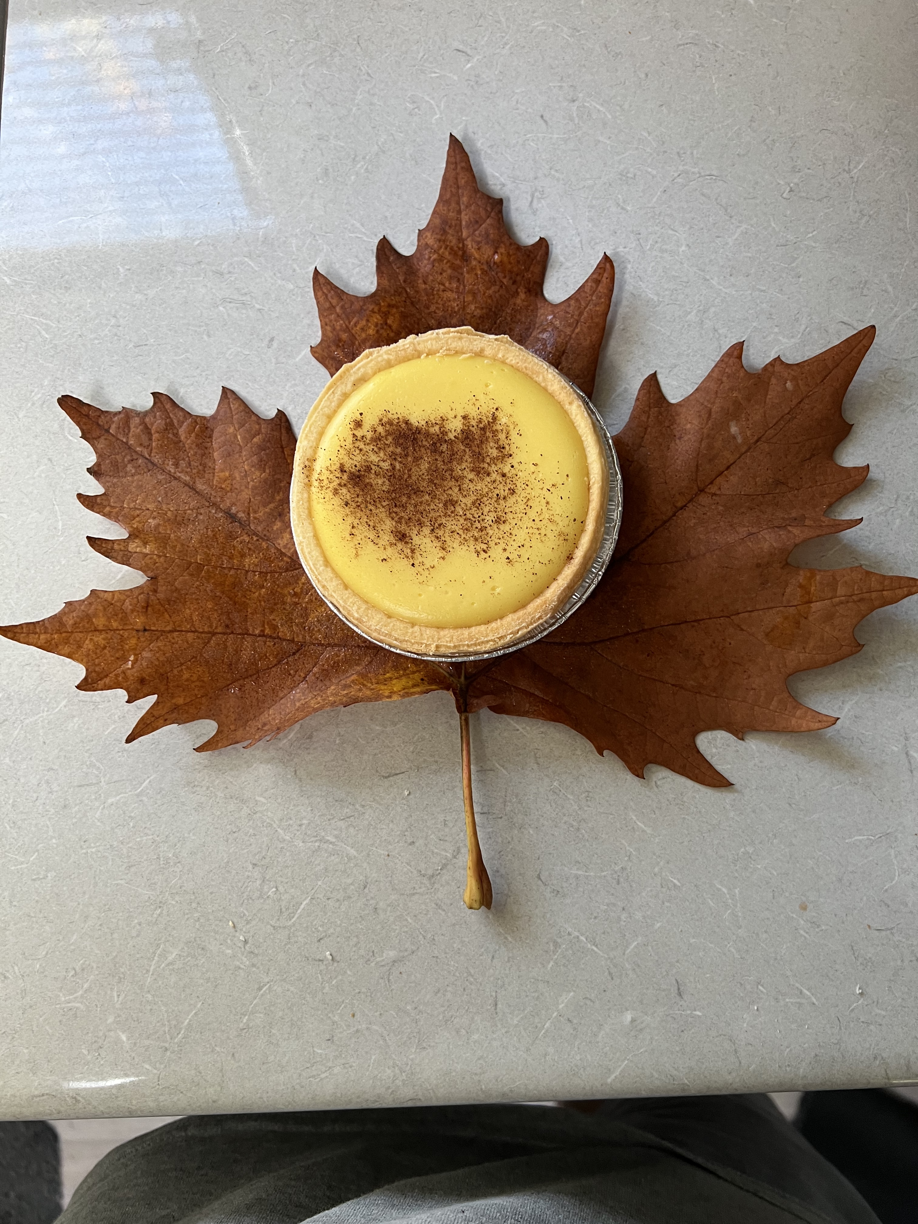
We returned to Echuca to ready for the onward journey. A short note though on custard tarts. Glenrowan and Tocumwal had been devoid of tarts, couldn’t get one at all. So in Echuca we thought we needed to find some as a matter of importance. Two specimens were acquired one from a bakery based in Moama (on the NSW side of the river) and one in Echuca, in fact a branch of the Beechworth Bakery.
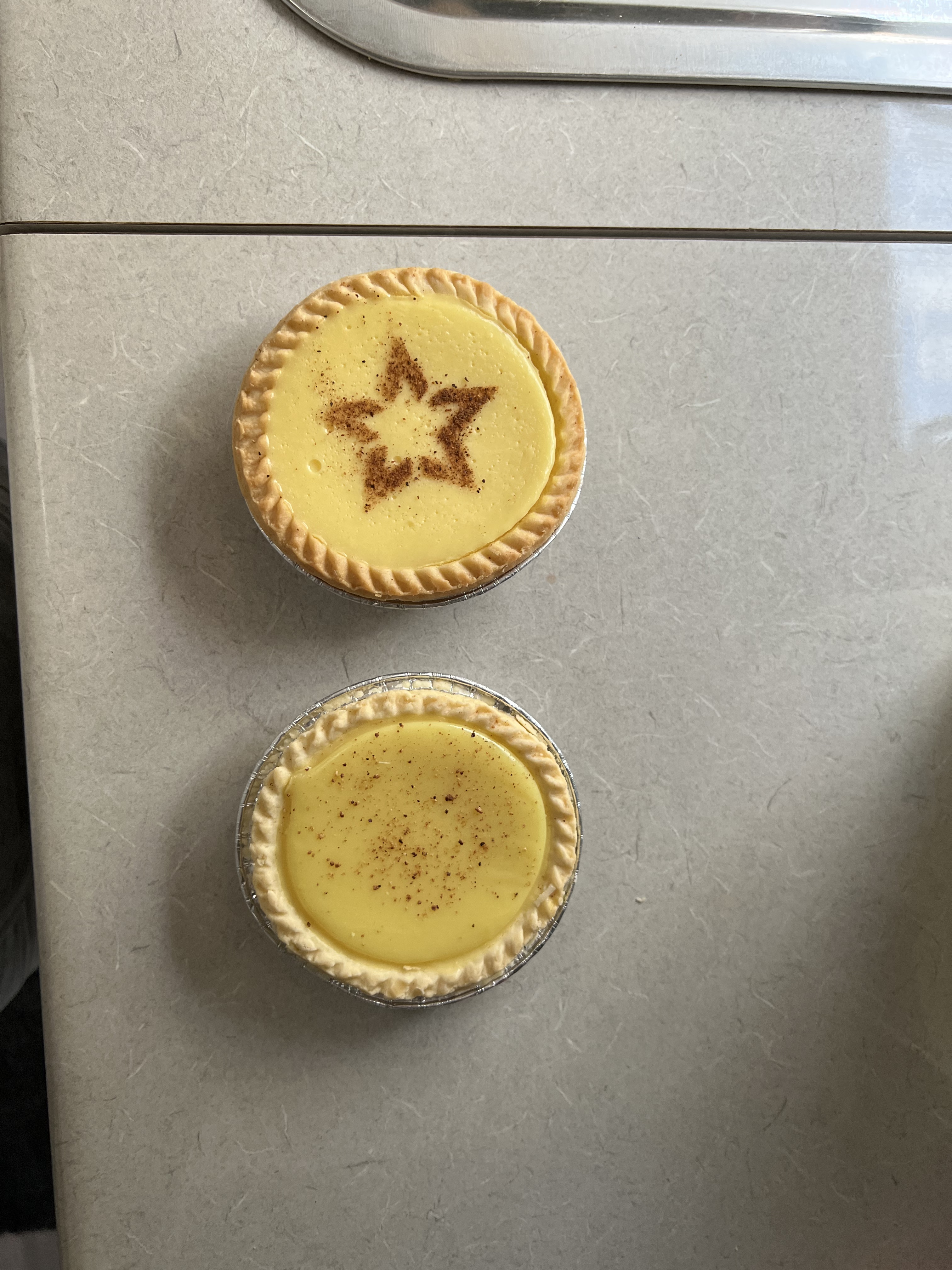
They were not overly inspiring. However, the Beechworth one had an innovative design by using a stencil to create a nutmeg star rather than just a pile of dust. They also did a spirally stencil swirl. Looked a bit like a flat white coffee topping. Our vote went to the Beechworth tart because of the initiative of the stencil pattern. Look forward to more tarts at our next stop!
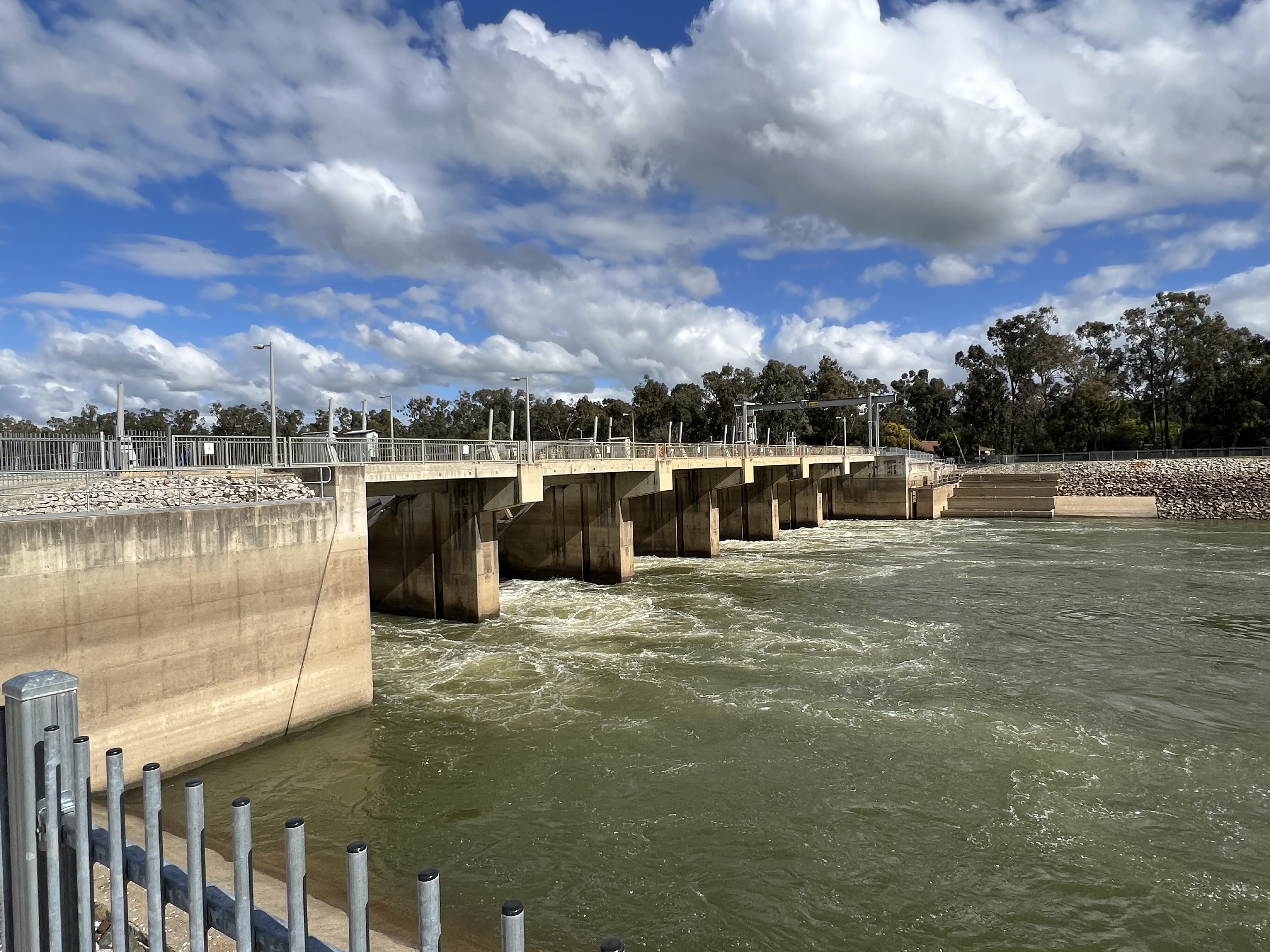
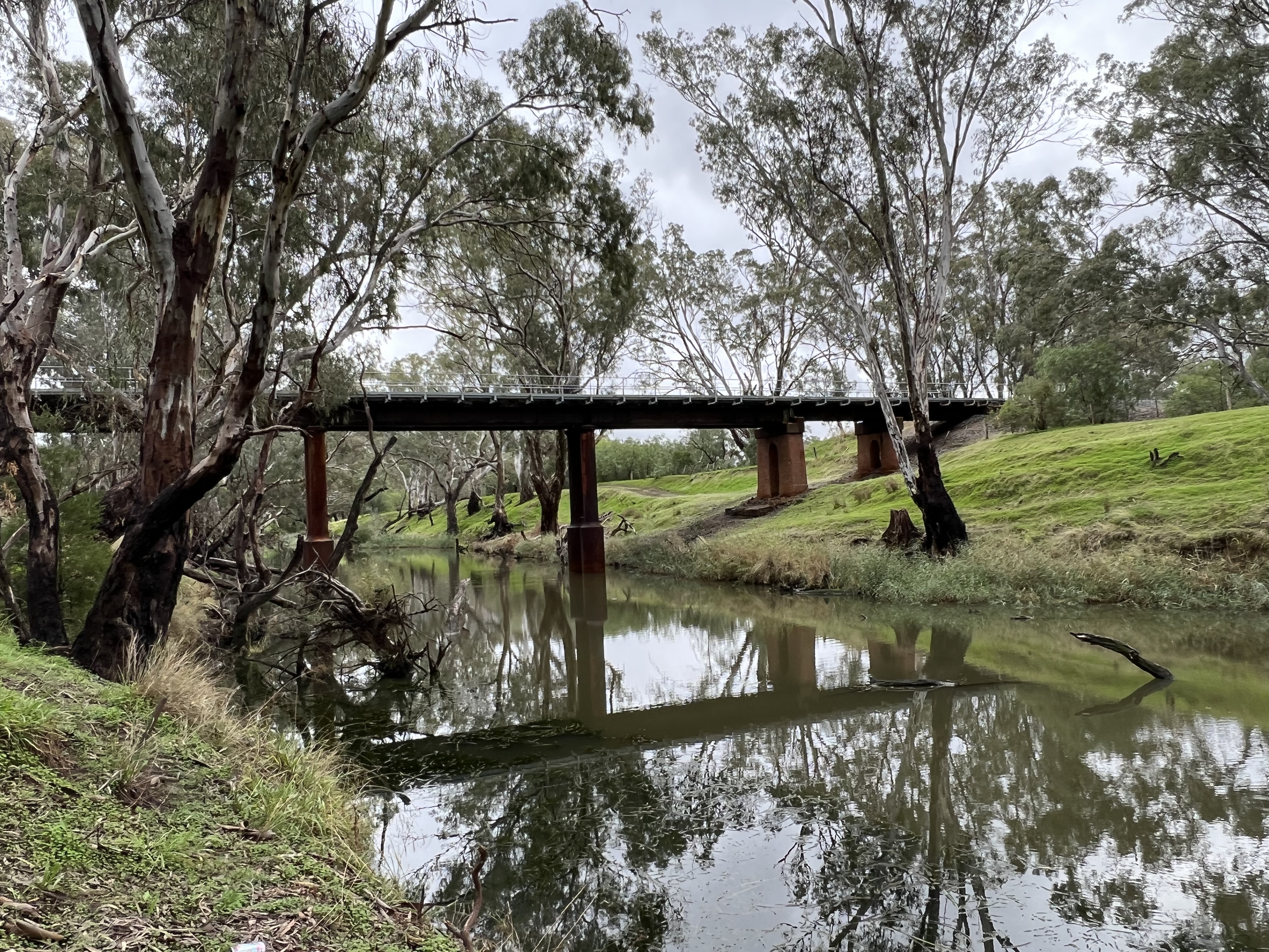
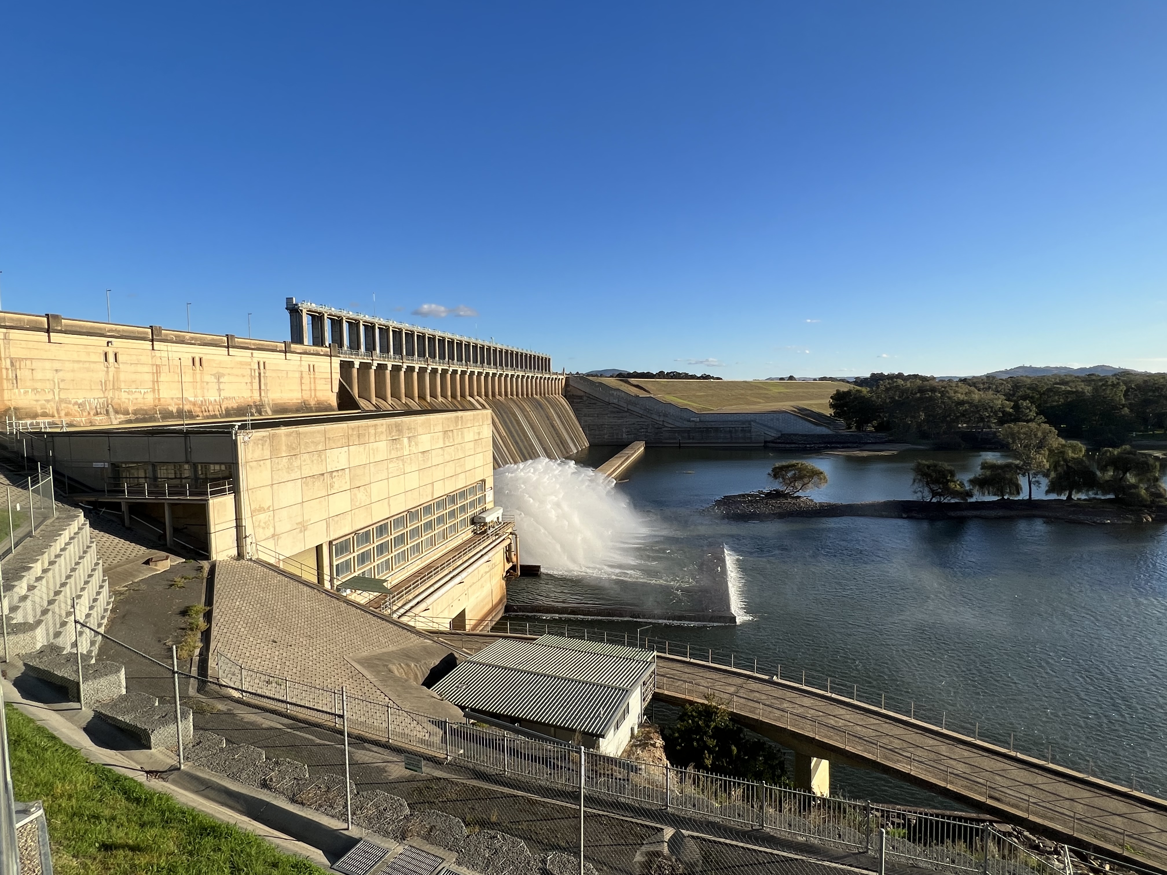
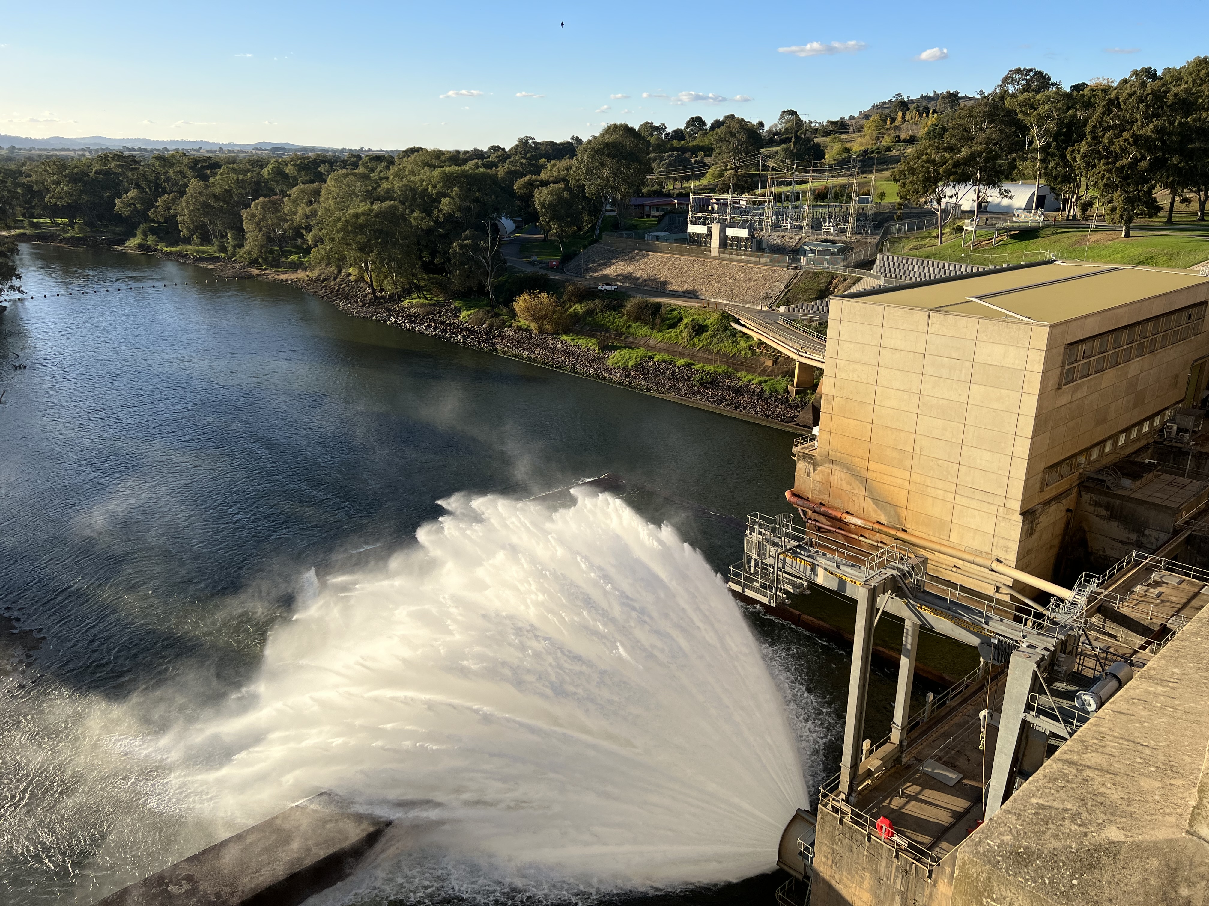
The next morning we packed up and left Echuca for Swan Hill. It is about 150 km. But we have a couple of stops in mind along the way. The first is at Torrumbarry about 30 km along the road. By river, through all the twists and turns it is 80 km. Torrumbarry is where Lock 26 and a weir is on the Murray. It is 1628 km to the rivers’s mouth over in S.A. The river flows slowly here, it is only 86 metres above sea level.
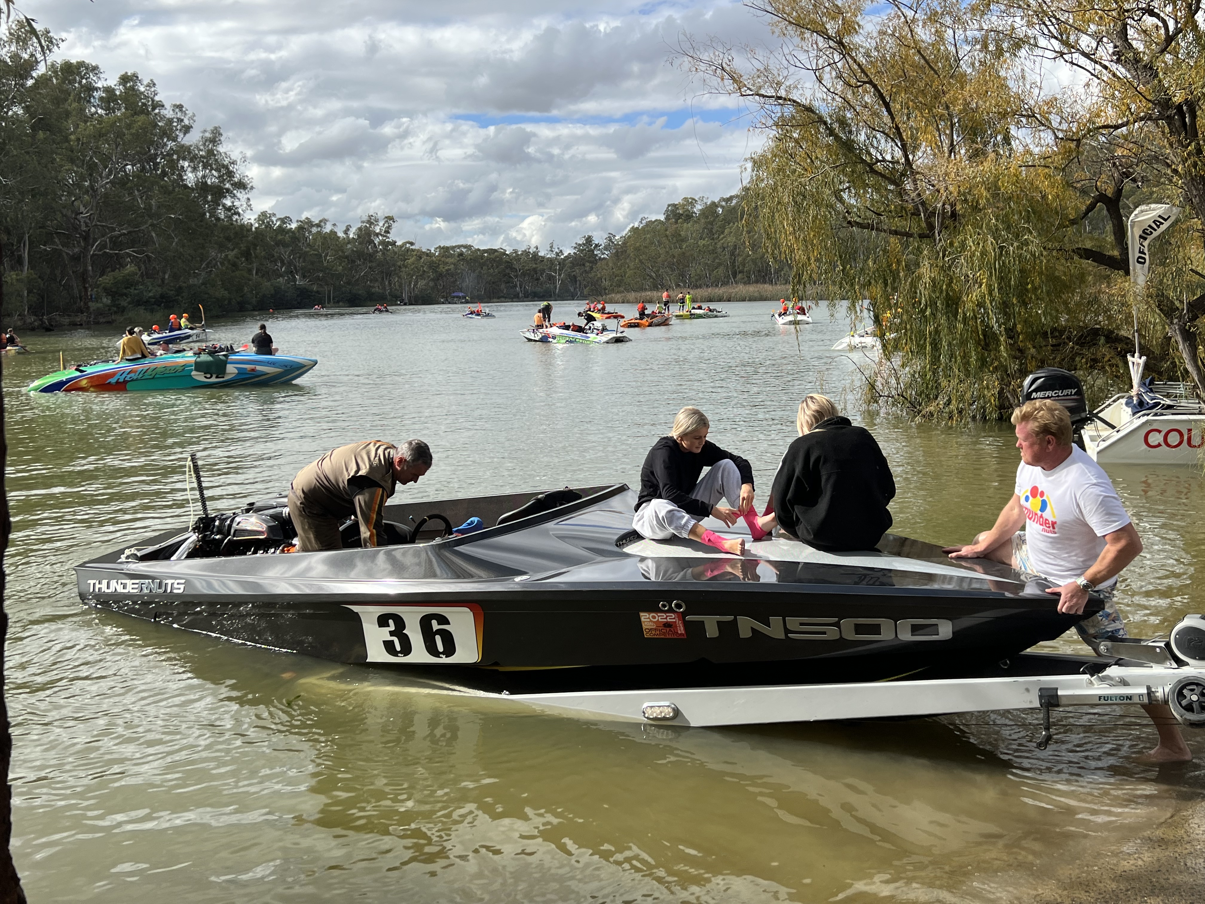
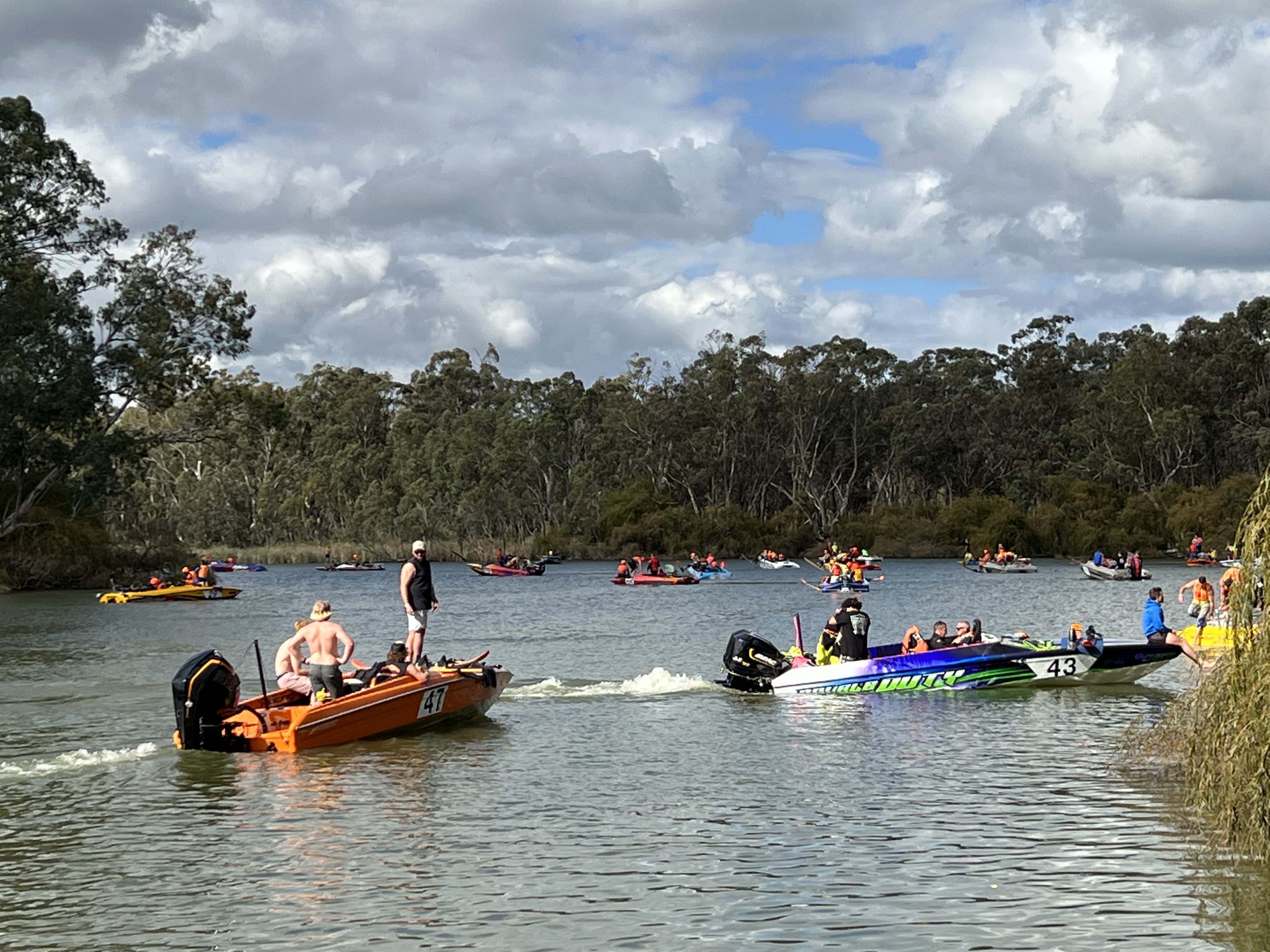
When we arrive at the weir there is a large jam of cars and speed boats on the road into the river. The delayed, due to Covid, Southern 80 water ski race is on today. How could we not avoid it? There are numerous classes of entries. Some powerful jet boats indeed. The race leaves the weir and heads 80 km upstream back to Echuca. The fastest boats and skiers do it in 40 miniutes, or thereabouts. There are two skiers behind each boat, on one ski each. The water was a mass of colour and throbbing motors as boats messed around before moving to the start point. We had morning tea and lunch here watching the action.

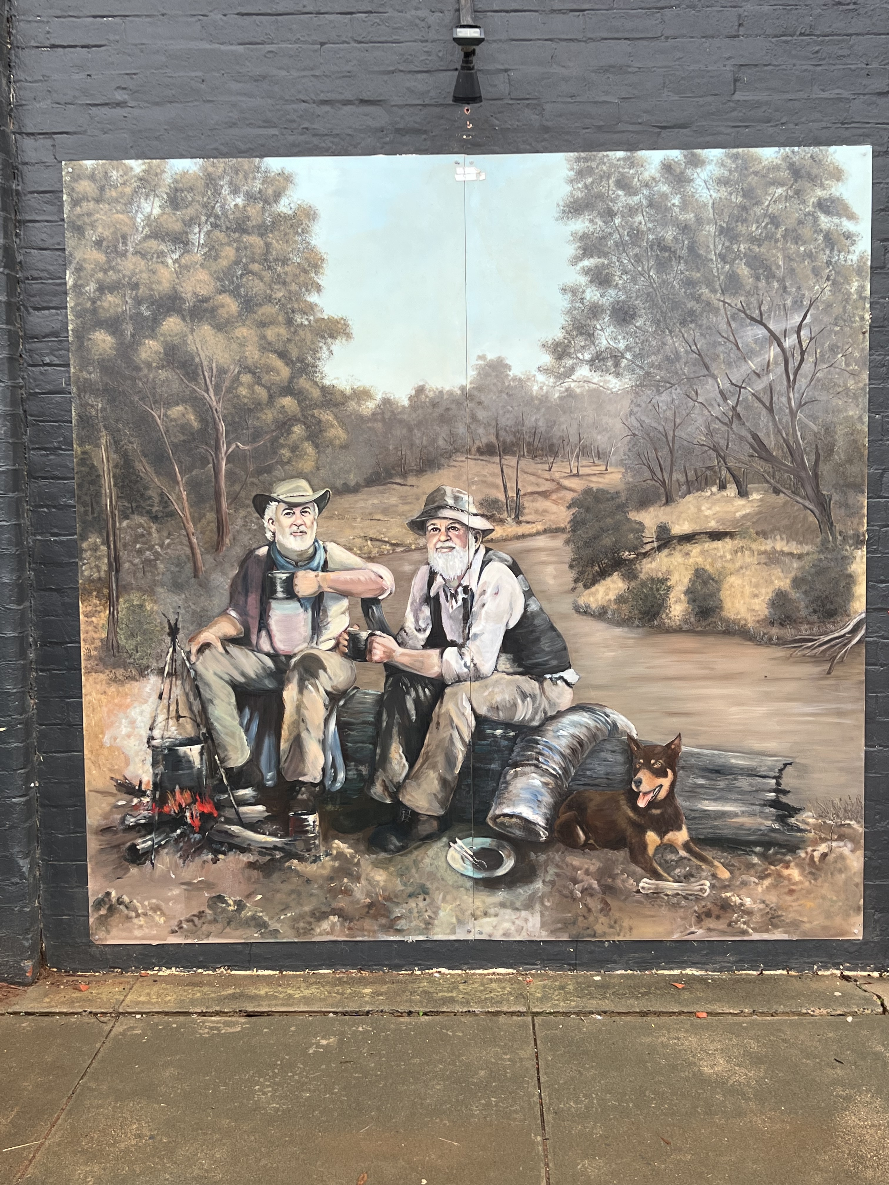
Time moved on though and we continued on our way passing through the small town of Gunbower at the southern end of Gunbower Island. The island is the largest inland island in Australia, 26,400 hectares formed by an anna branch of the Murray (Gunbower Creek) and the Murray itself. An anna branch is a section of the river that diverts from the main channel and then rejoins the main stream further downstream. The local hotel has a splendid mural that has recently been completed by the same fellow who did the ones at Rochester.
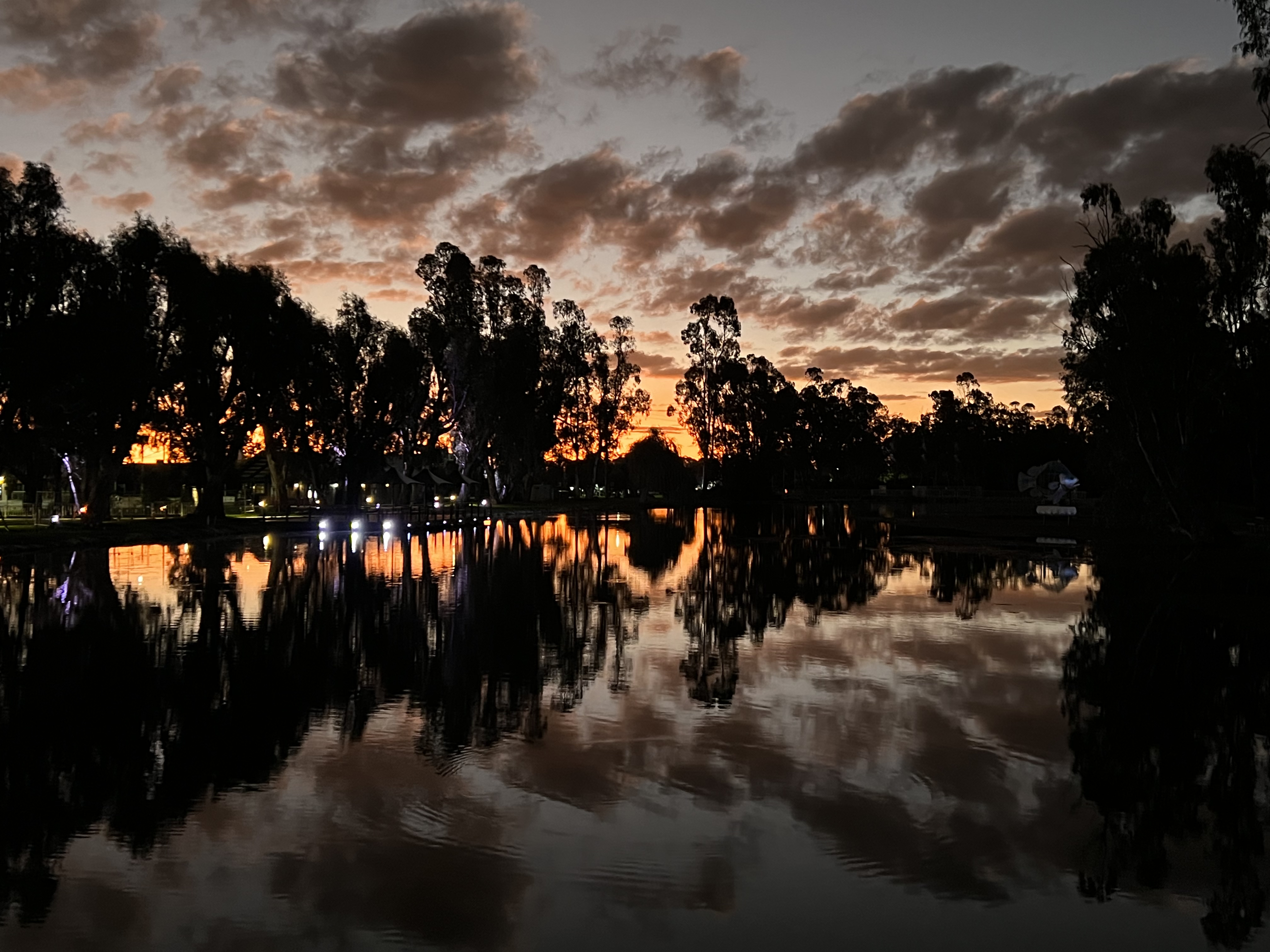
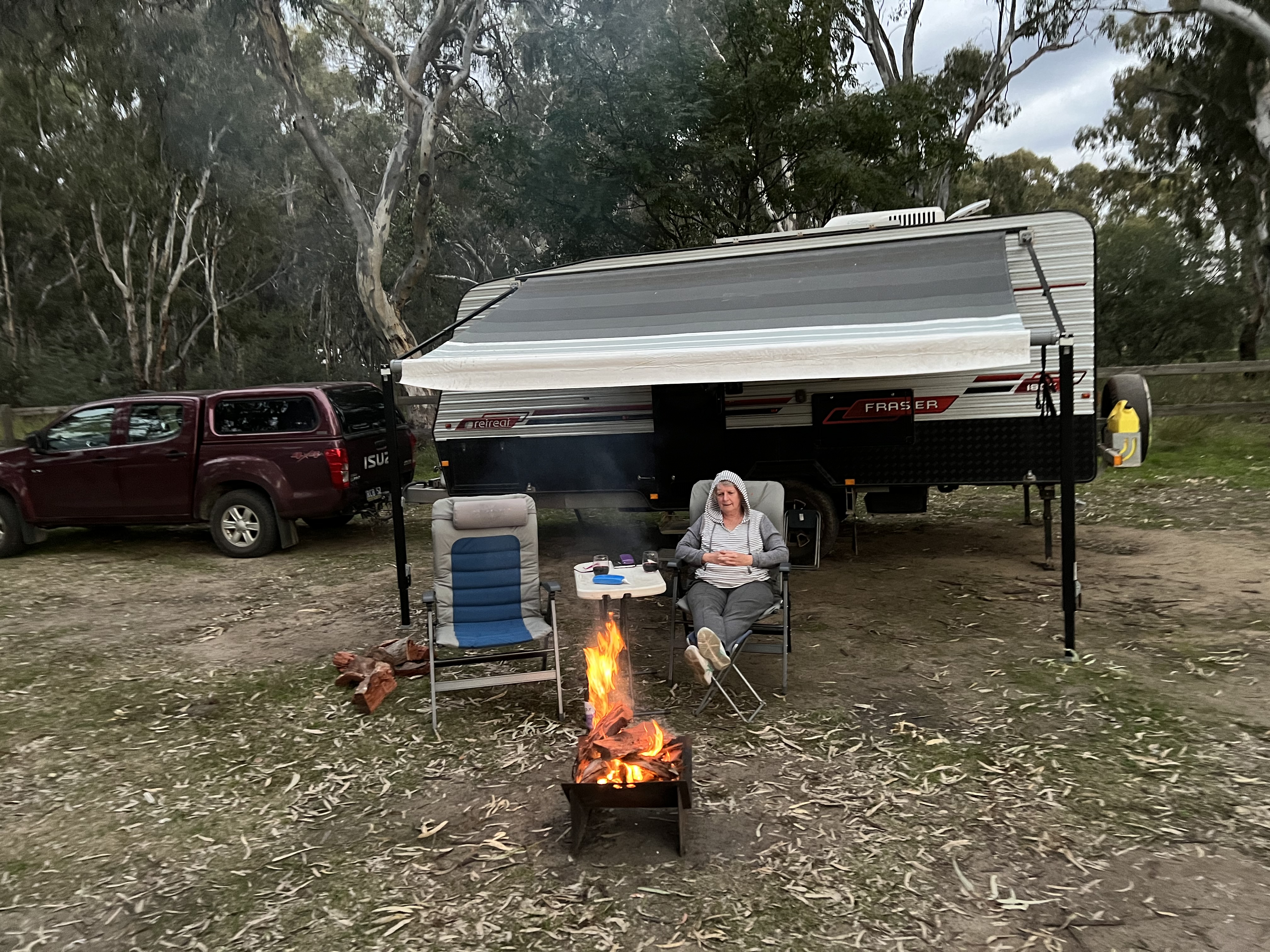
Further along we decide to stop the night at a free camp beside Gunbower Creek at Cohuna, it is a great free camp opposite the town. It is Sunday and Allthego was hoping to catch the Eels playing at the local hotel over dinner. But alas the pub is closed for food and there is only AFL on the big screen. We stopped in for a drink and are entertained by a couple of old timers bemoaning how times have changed in the town, they had a limited vocabulary and descibed most things as ” ….. this and …. that”. We moved on and picked up some fish ‘n chips at the local cafe for dinner. First fish ‘n chips for nearly a month! Great sunset at the freecamp. We will make it to Swan Hill in the morning!
Echuca
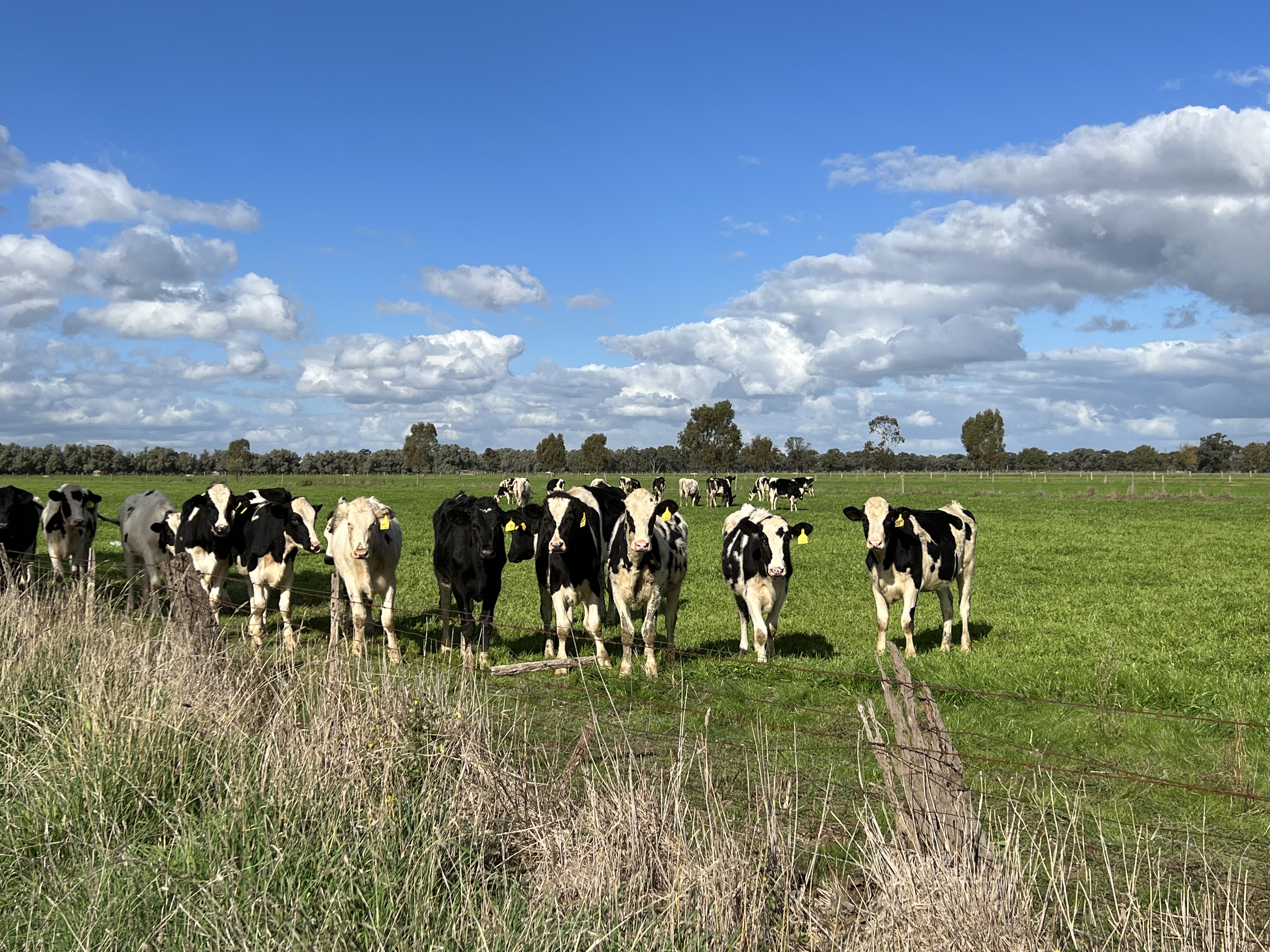
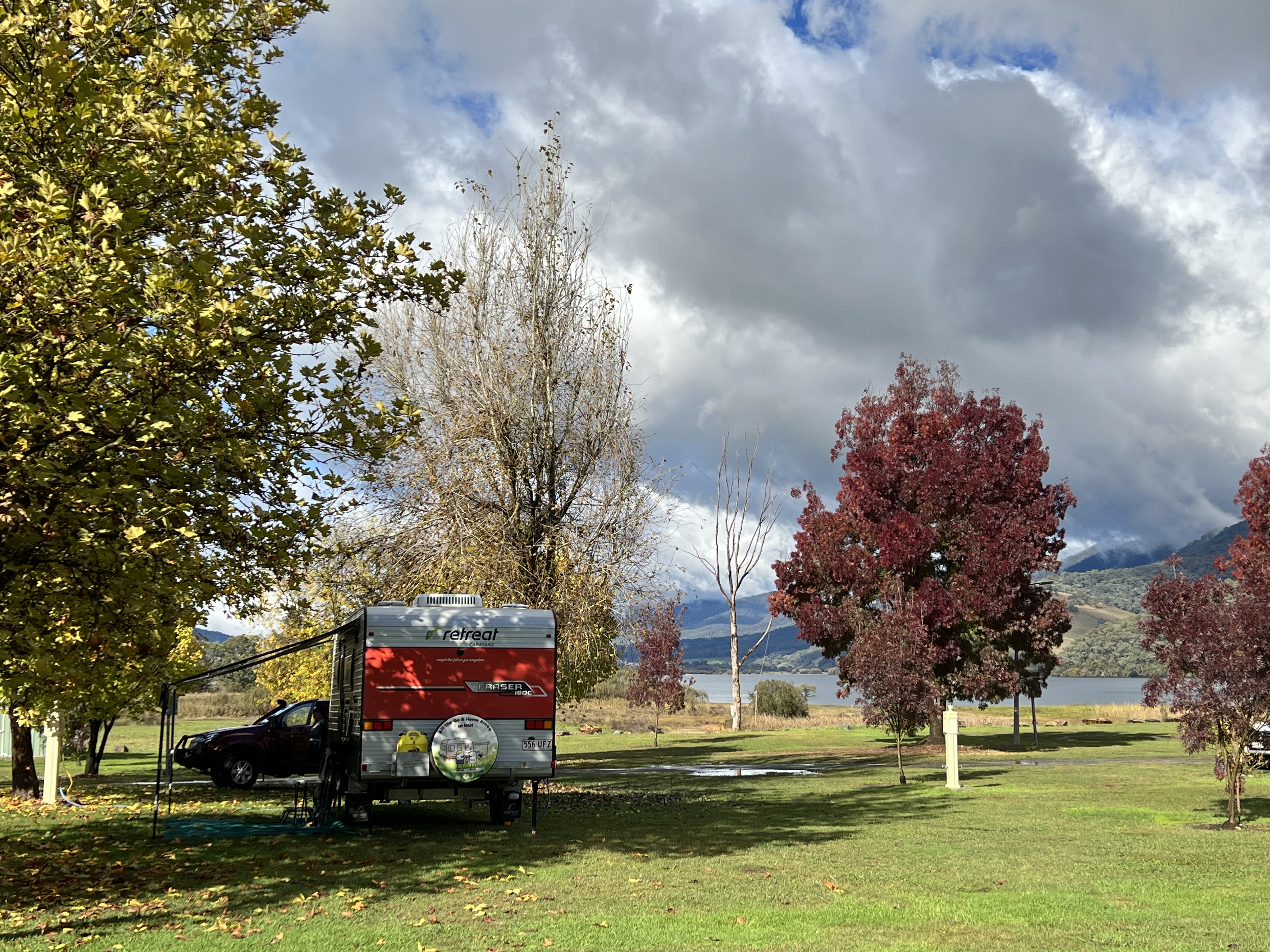
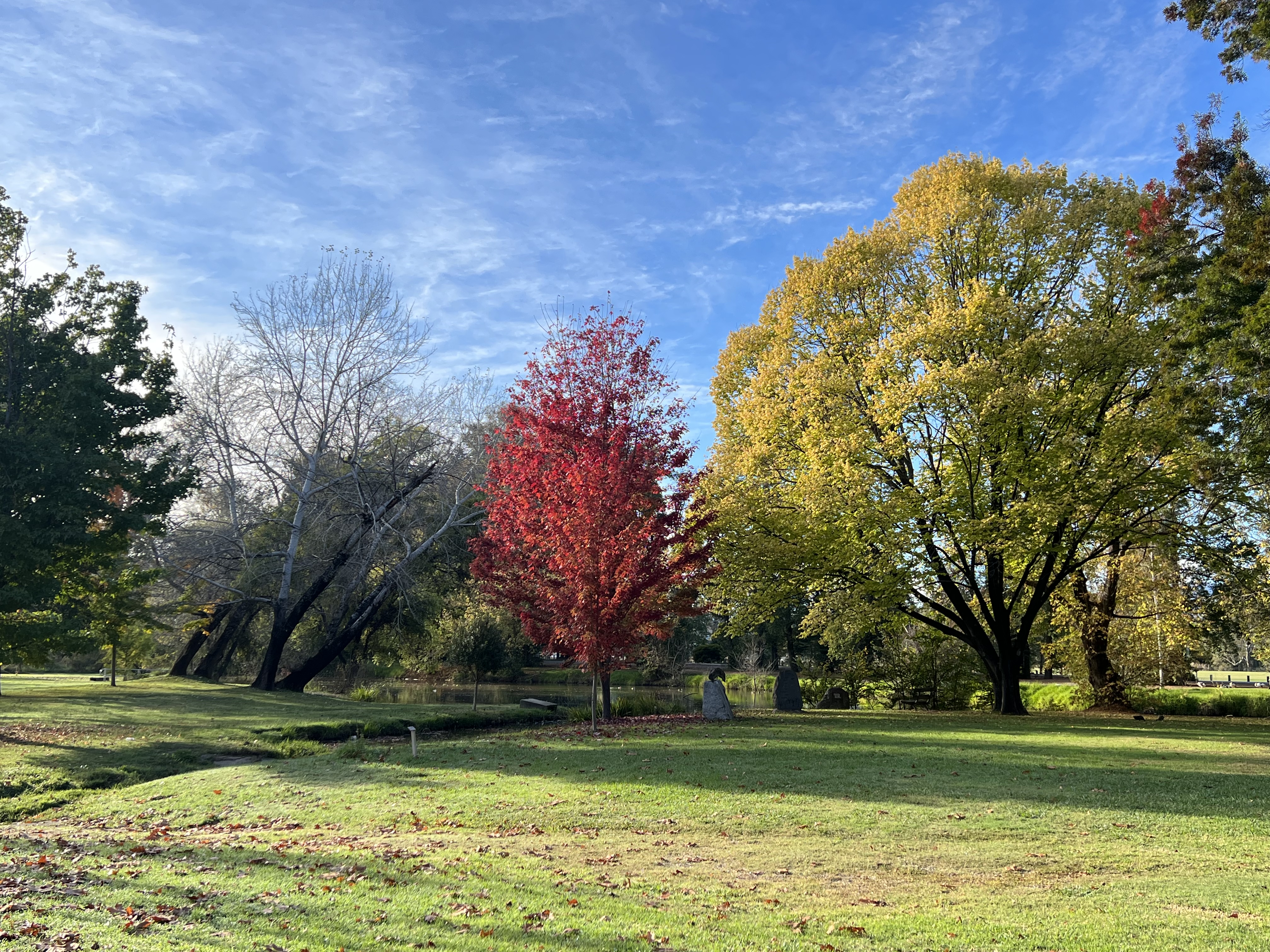
We are at Echuca, albeit down by the Goulburn River about 20 km out of town. The sun has come out a bit and we have decided to head off on a regional drive to take in some of the scenery away from the town. We seem to be between planting seasons, many of the paddocks are either fallow or have recently been ploughed, not sure what they grow around these parts. The irrigation ditches are full of water though and criss cross the countryside. Plenty of dairy cattle and some sheep are around. We stopped off in Tongala, a milk place, to check out the towns murals and street art. Murals are a thing here and they have an annual festival to promote the action. Despite being a small town they not running out of walls to adorn.
There is an interesting war memorial in the town that connects the WW1 campaigns of the Light Horse Brigade with the Vietnam campaign. Apparantly, the Light Horse brigade morphed over the years into one of the regiments that first set foot in Vietnem during that campaign. So Tongala has a memorial connecting the horseman of WW1 via a pathway to the Vietnam memorial. Quite involved but effective, as is their walk of honour of trees recently planted and plaques for 24 Vietnam veterans who didn’t return.

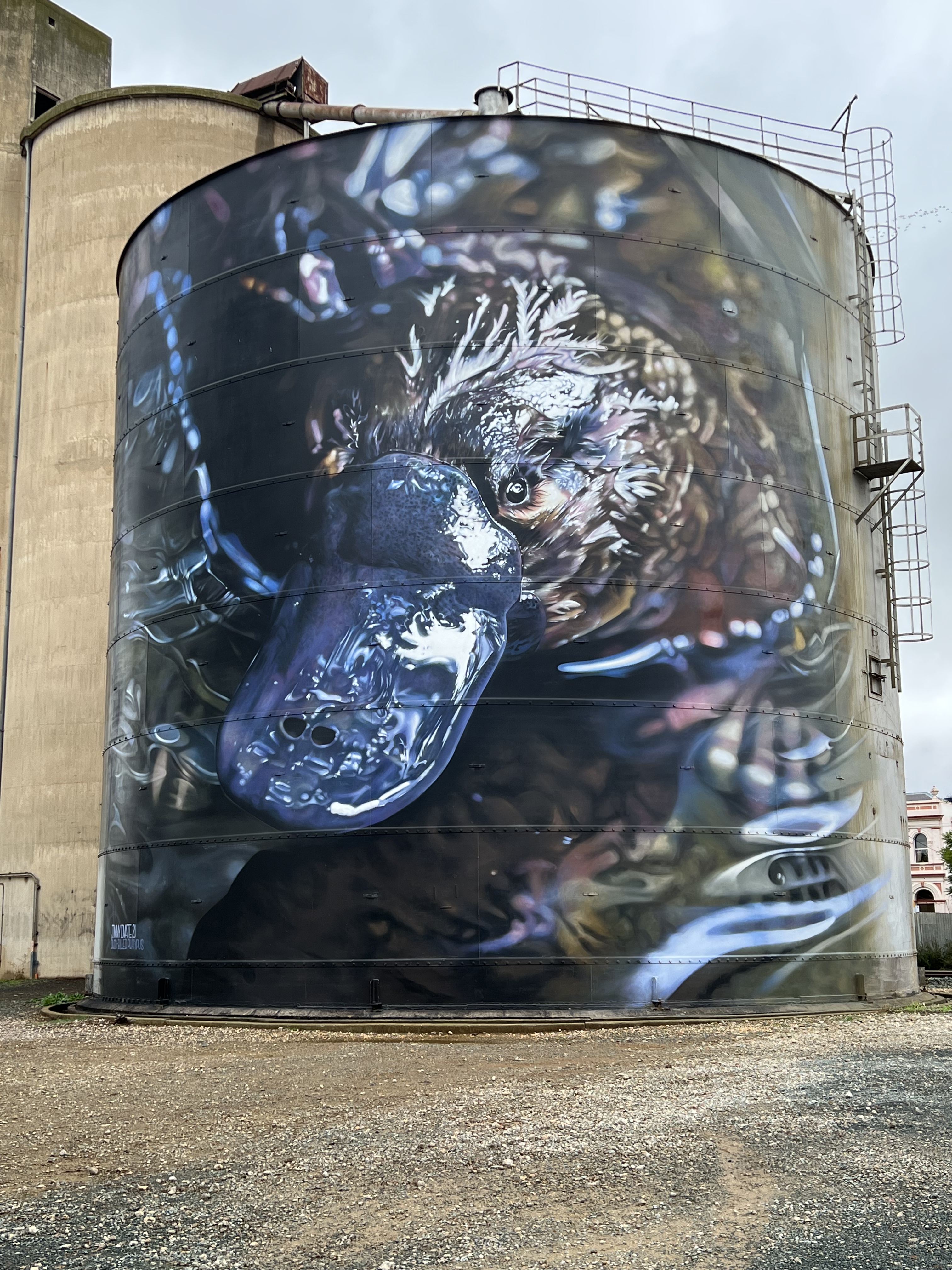
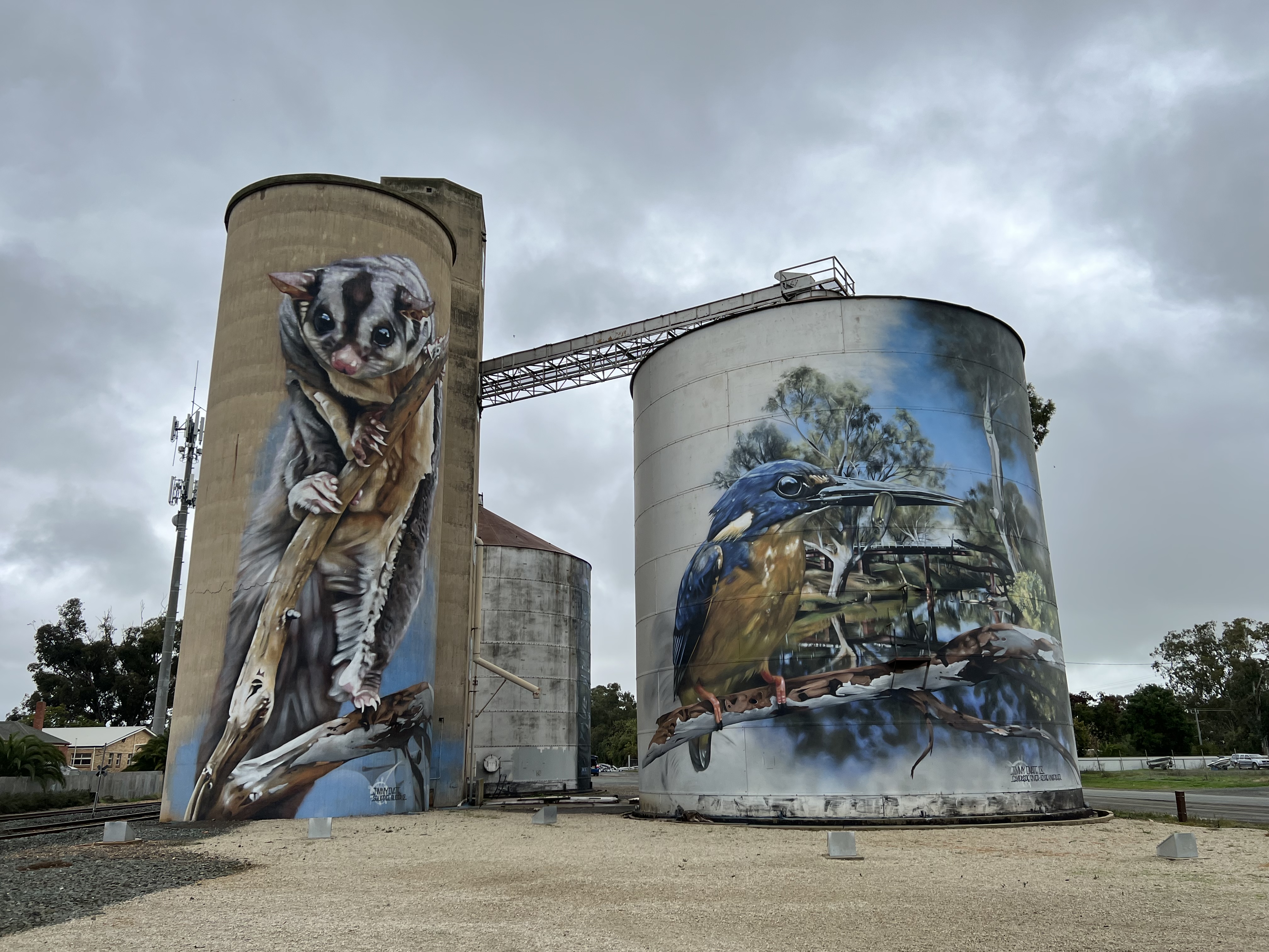
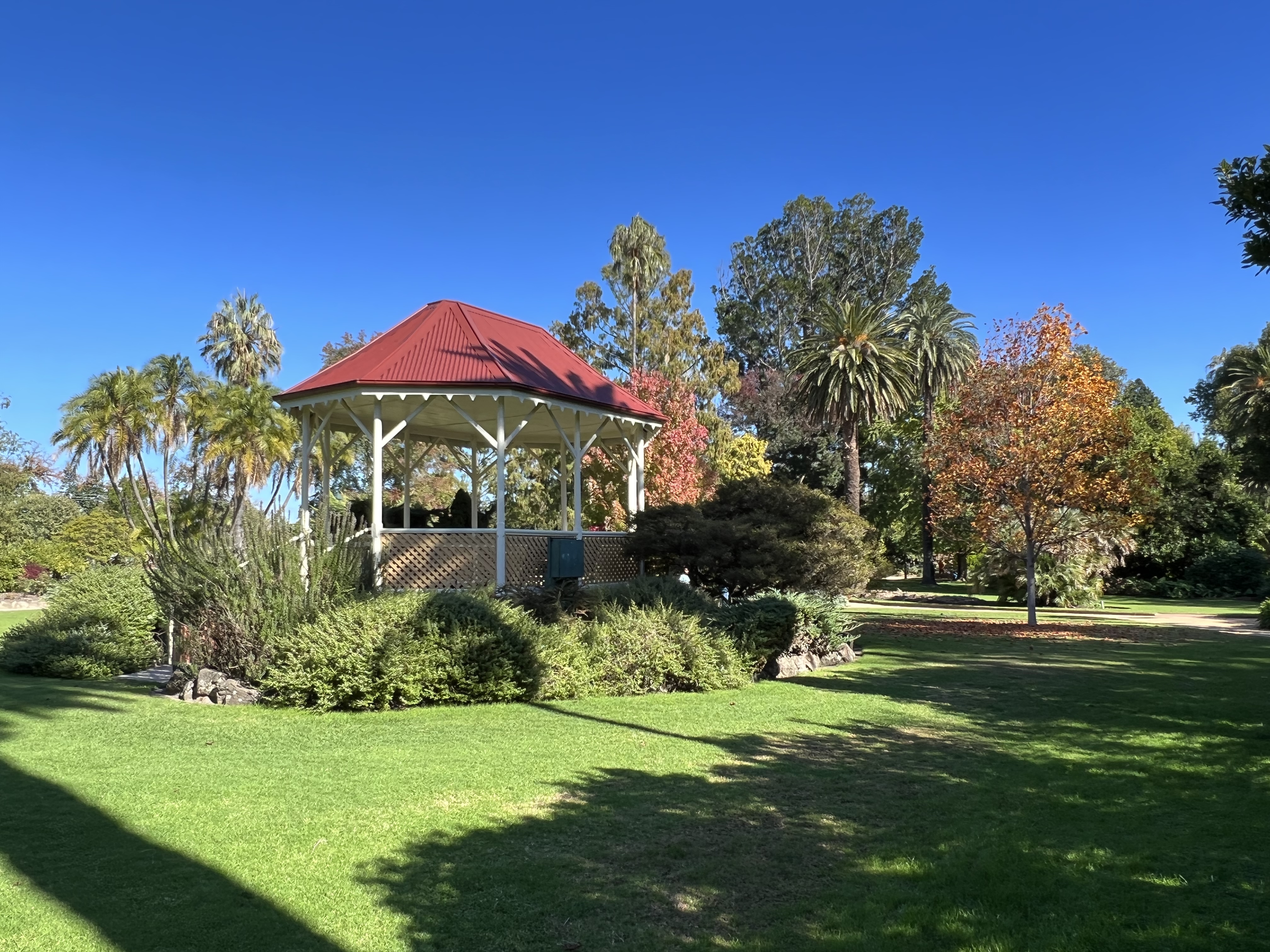
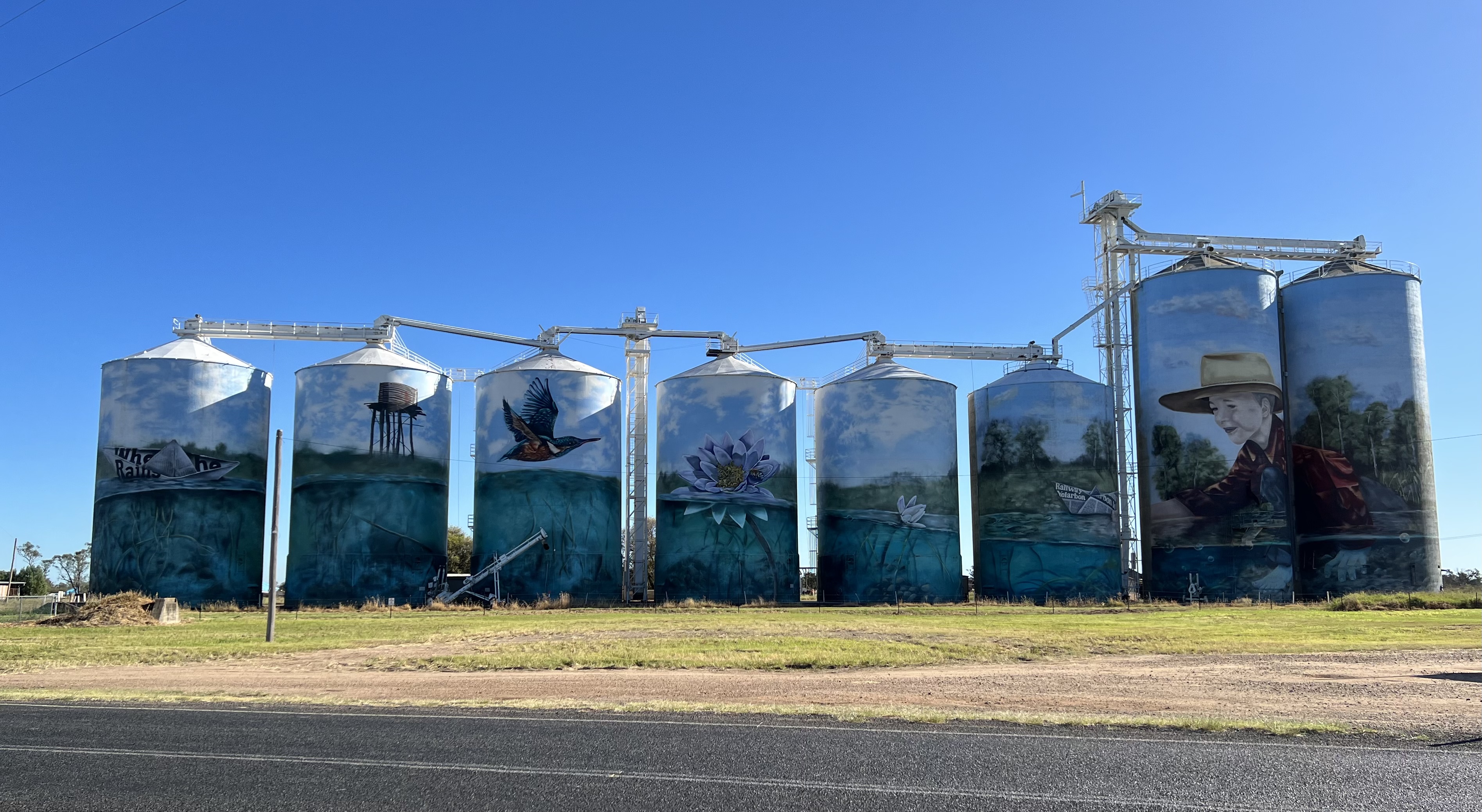
From Tongala we moved on to Rochester to see some some silo art, quite impressive work. Three silos have been painted up, the most recent with a platypus. It actually looks wet and its eyes stare out at you. A great attarction for the town.
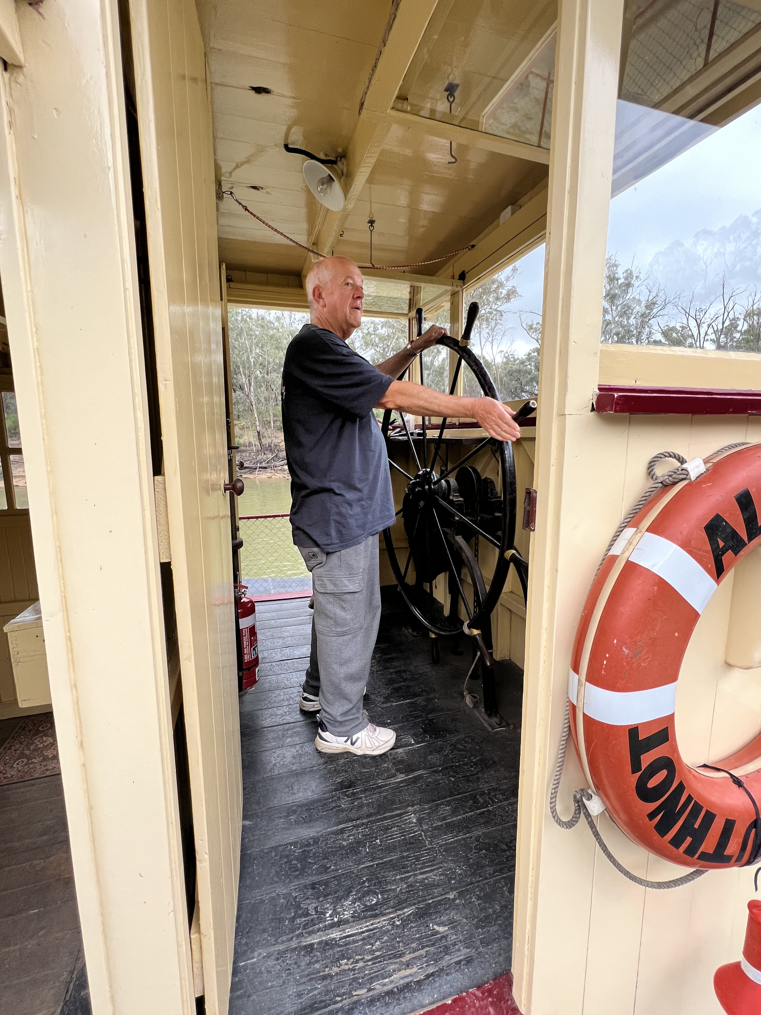
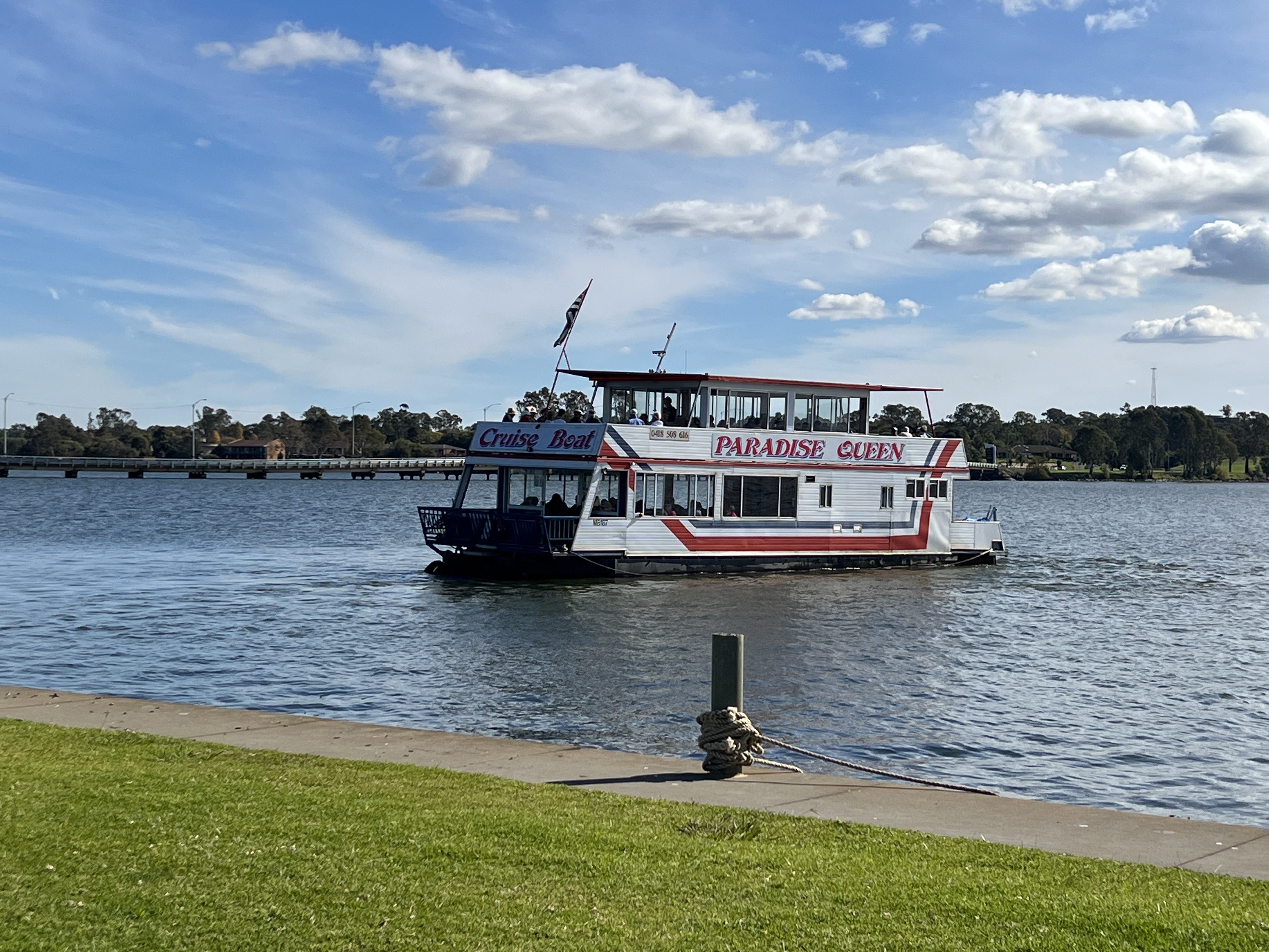
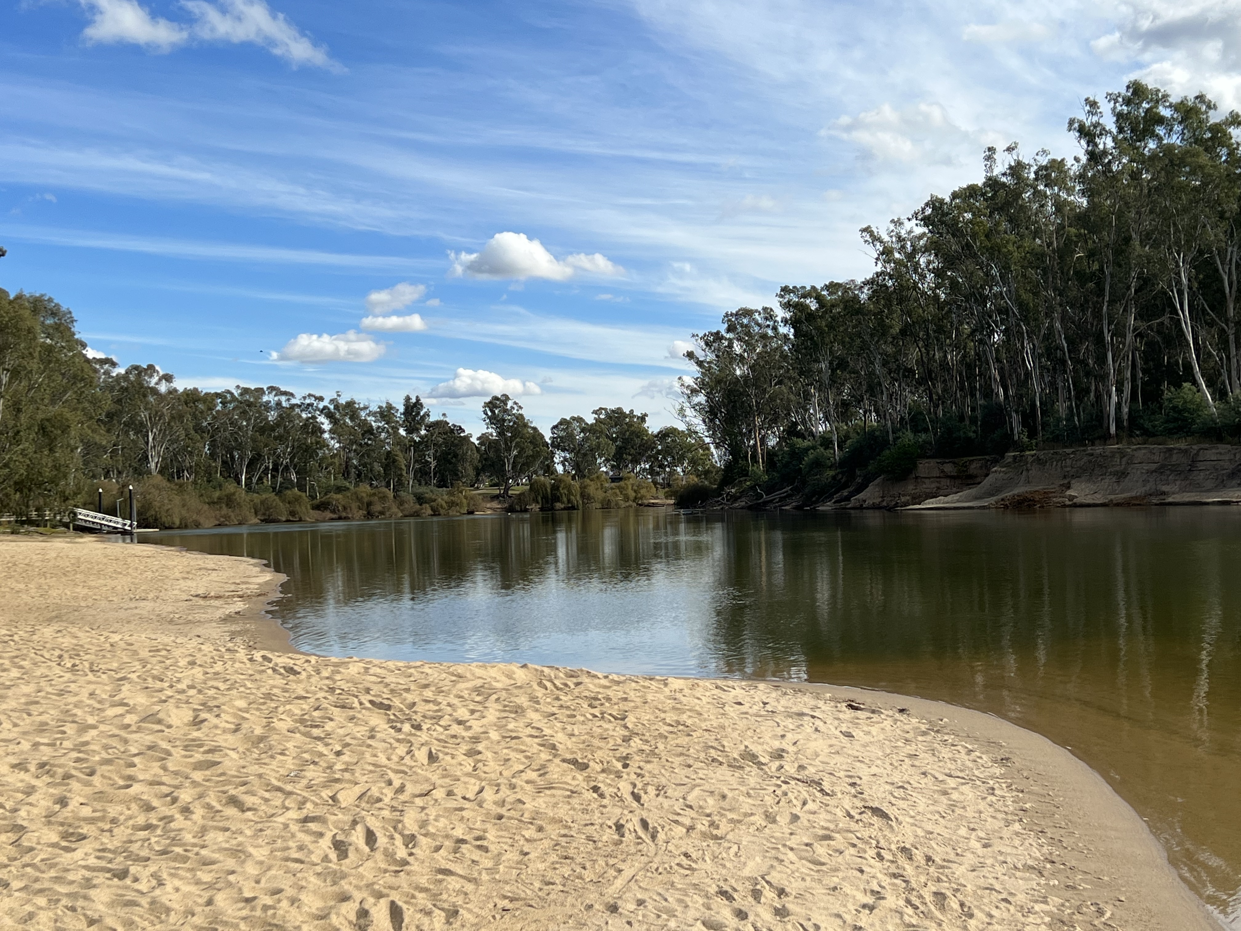
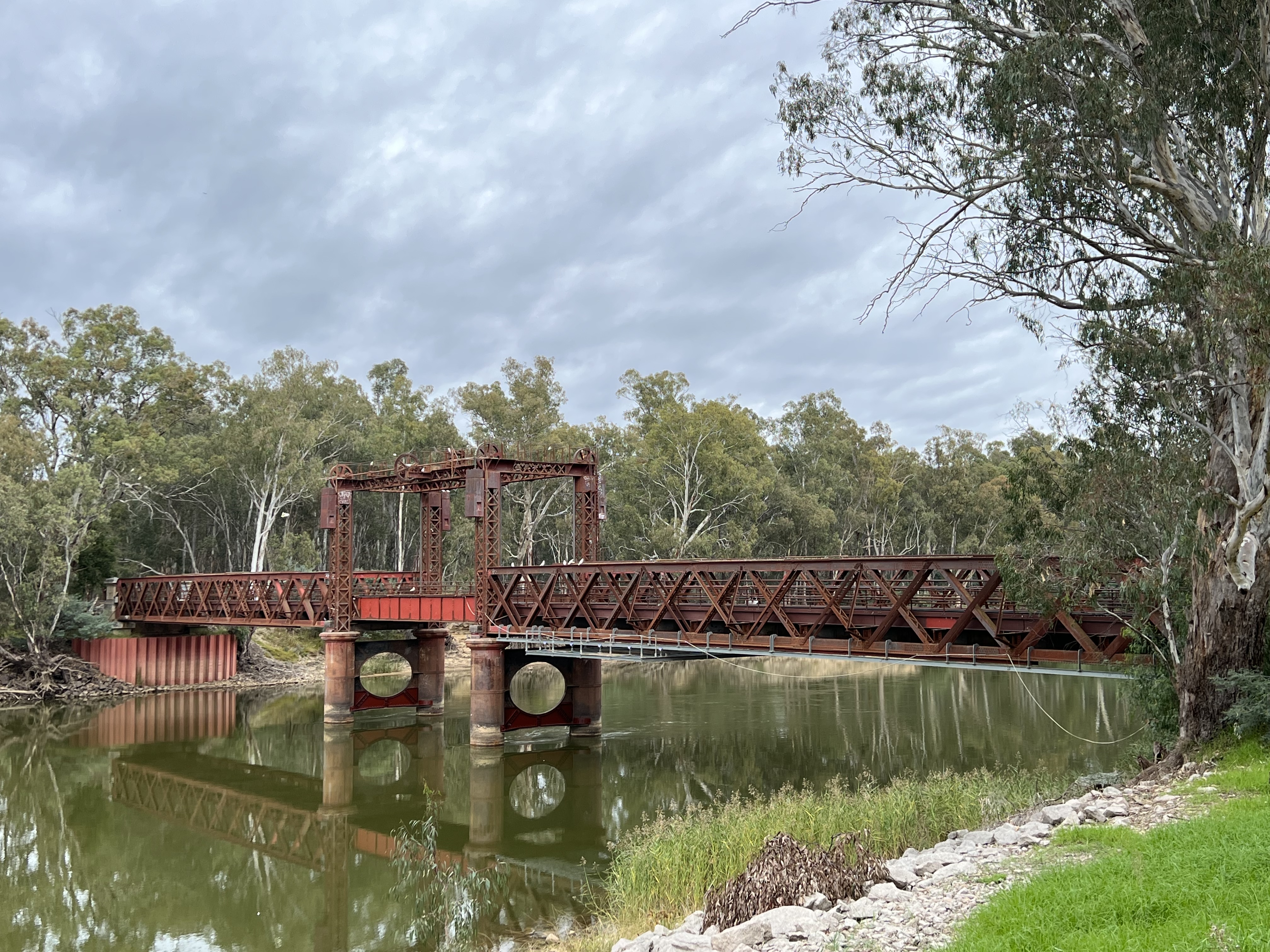
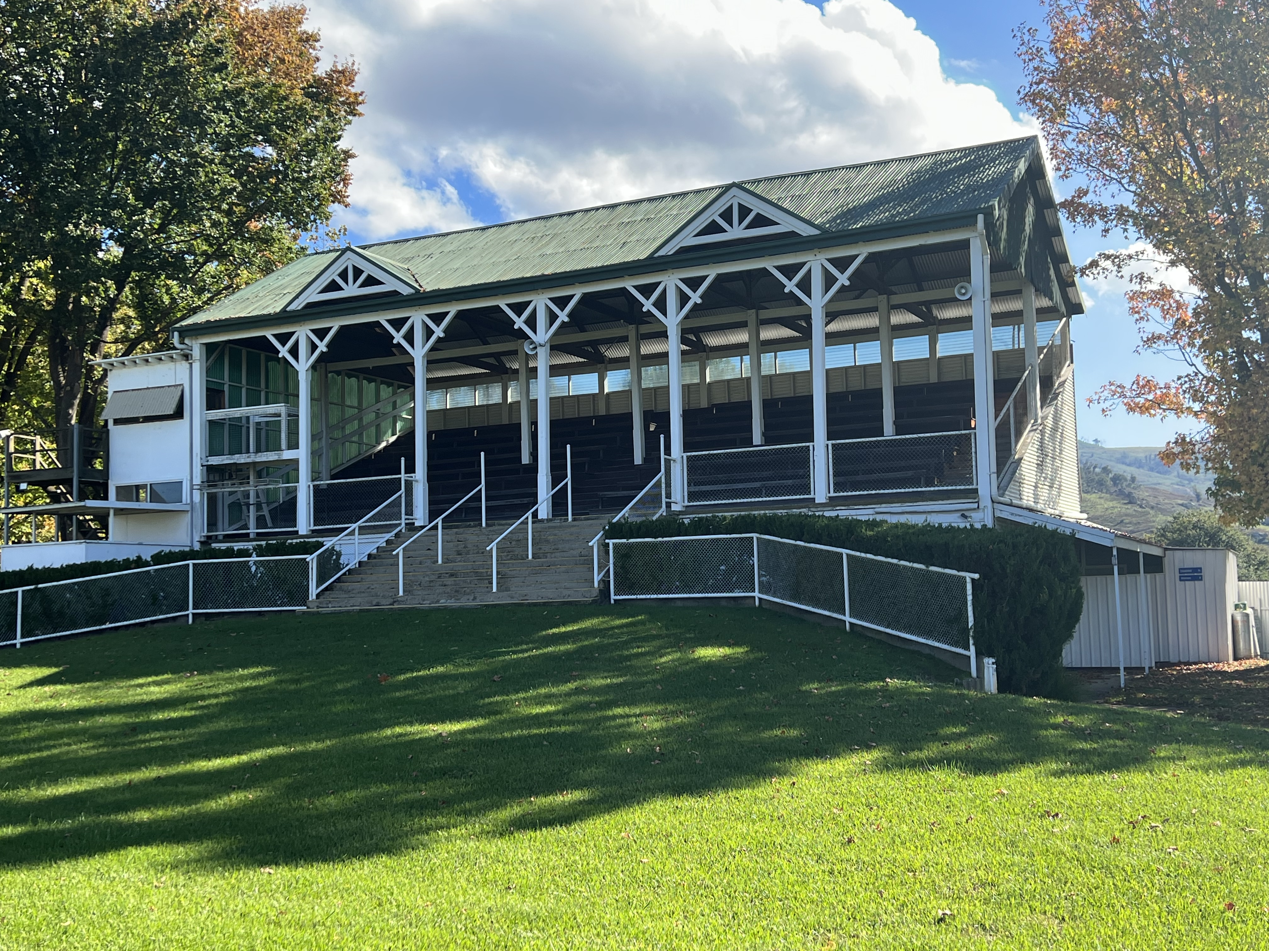
Back in Echuca we have made it down to the historical wharf precinct to look around and join an afternoon cruise on the PS Alexander Arbuthnot up the Murray for about half an hour and then back to the wharf. Allthego took control of the wheel at one point but was not able to execute a turn despite his past experience on such a manoeuvre.

There are a few other restored paddle wheelers tied up at the wharf and it is an interesting spot to wander around soaking in a bit of history. One of the old boats used to tow three barges behind it loaded with timber from the red gum forests upstream destined for the timber mills in the town. Quite an impressive feat.

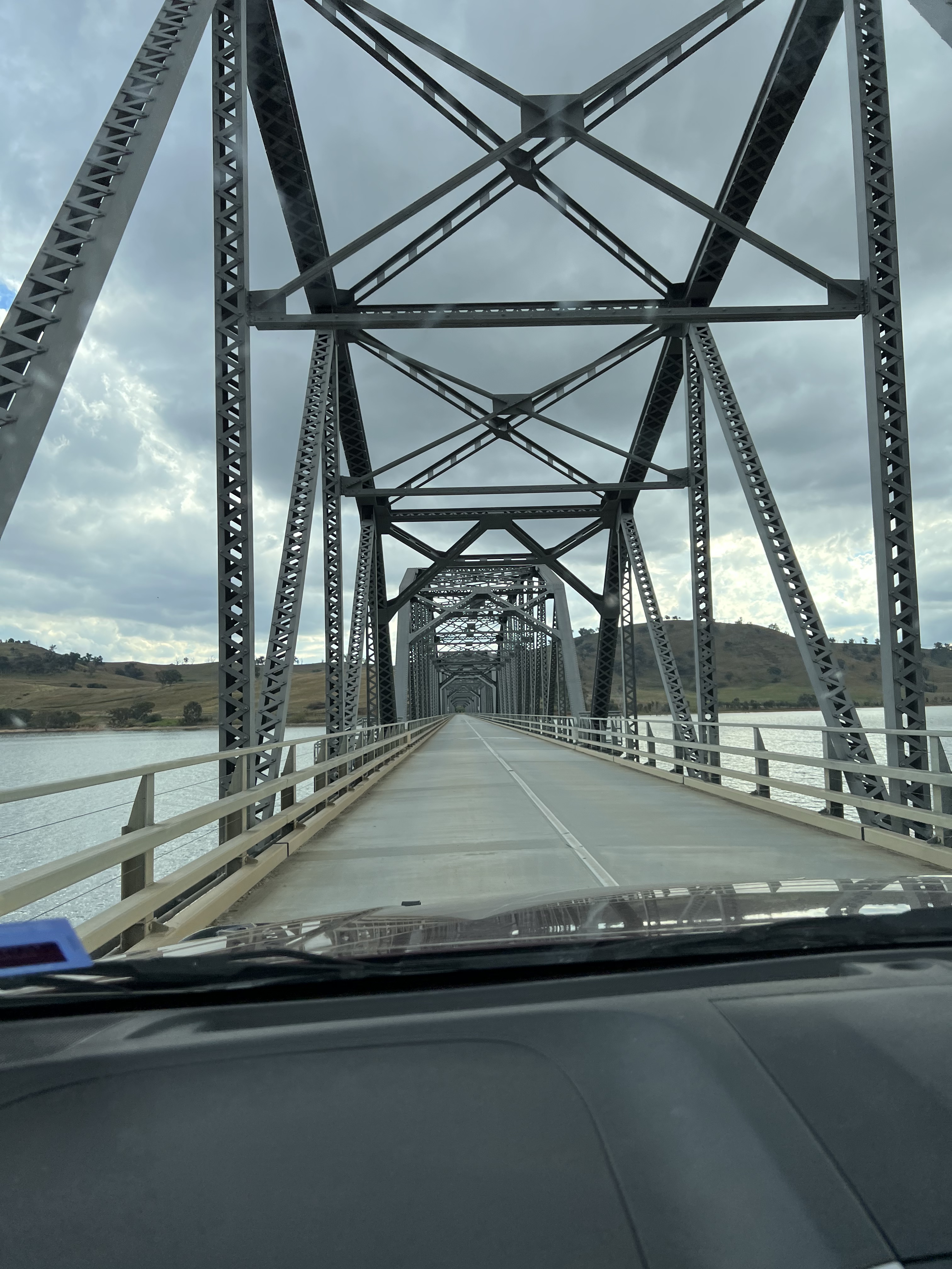
So, after a full day of wandering around Echuca and its surrounds we returned to Riverbend. Avoided that bridge ! We next head off for an eco cruise along a special section of the river, but more of that next time !
Heading to Echuca
Allthego has had great trouble spelling Euchcuca, no it is Echuca. Postcards that he has sent have had errors in them. But he is getting on in years. We are headed for Echuca after leaving Rutherglen and stopping overnight at Tocumwal. By the way Allthego only sends postcards to himself and Homealone on these trips, no one else does, so why not? At least we know where we have been when we eventually get home and read them! There is a great pile of them back at Bedwell Place with interesting stamps!
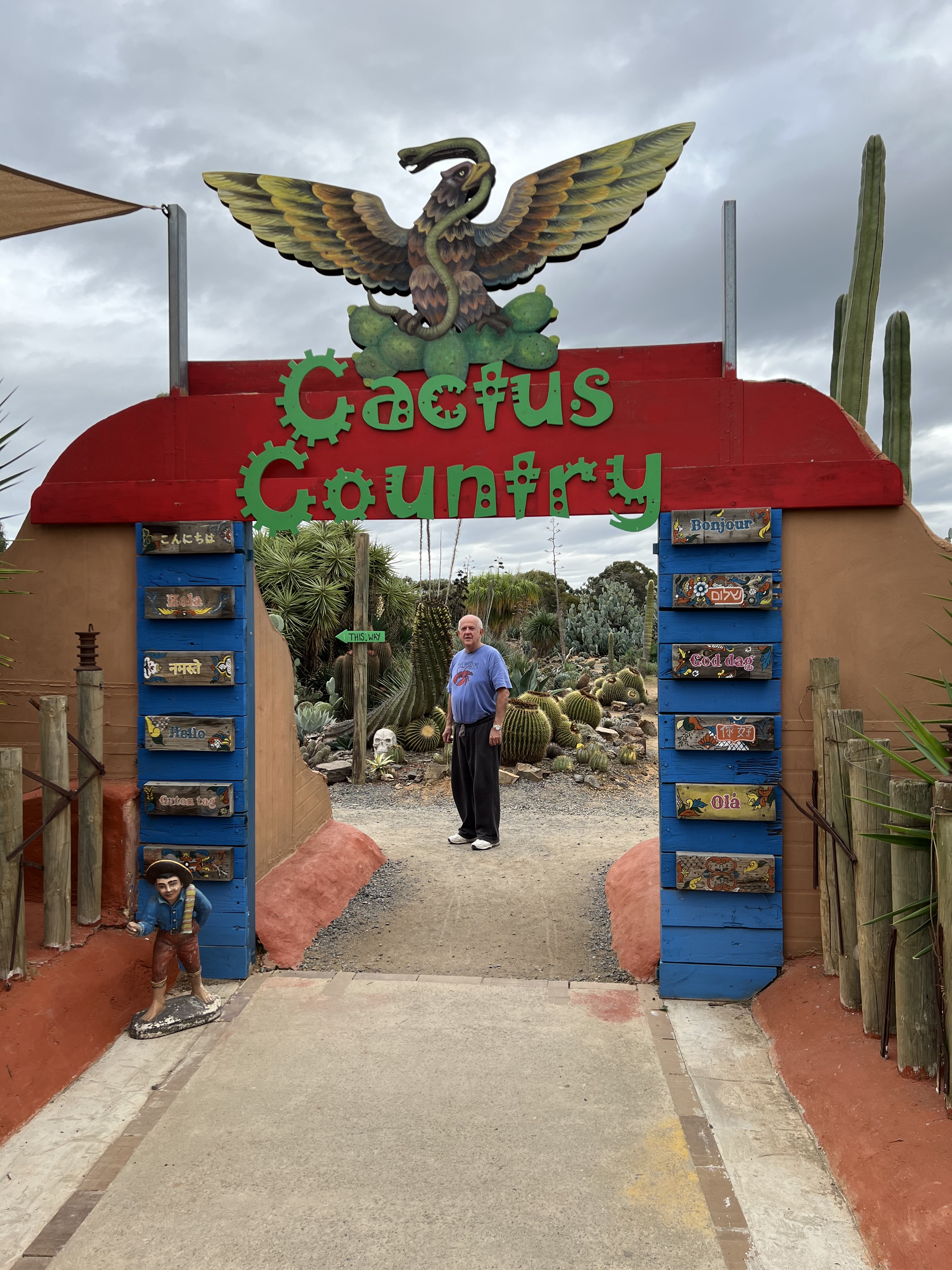
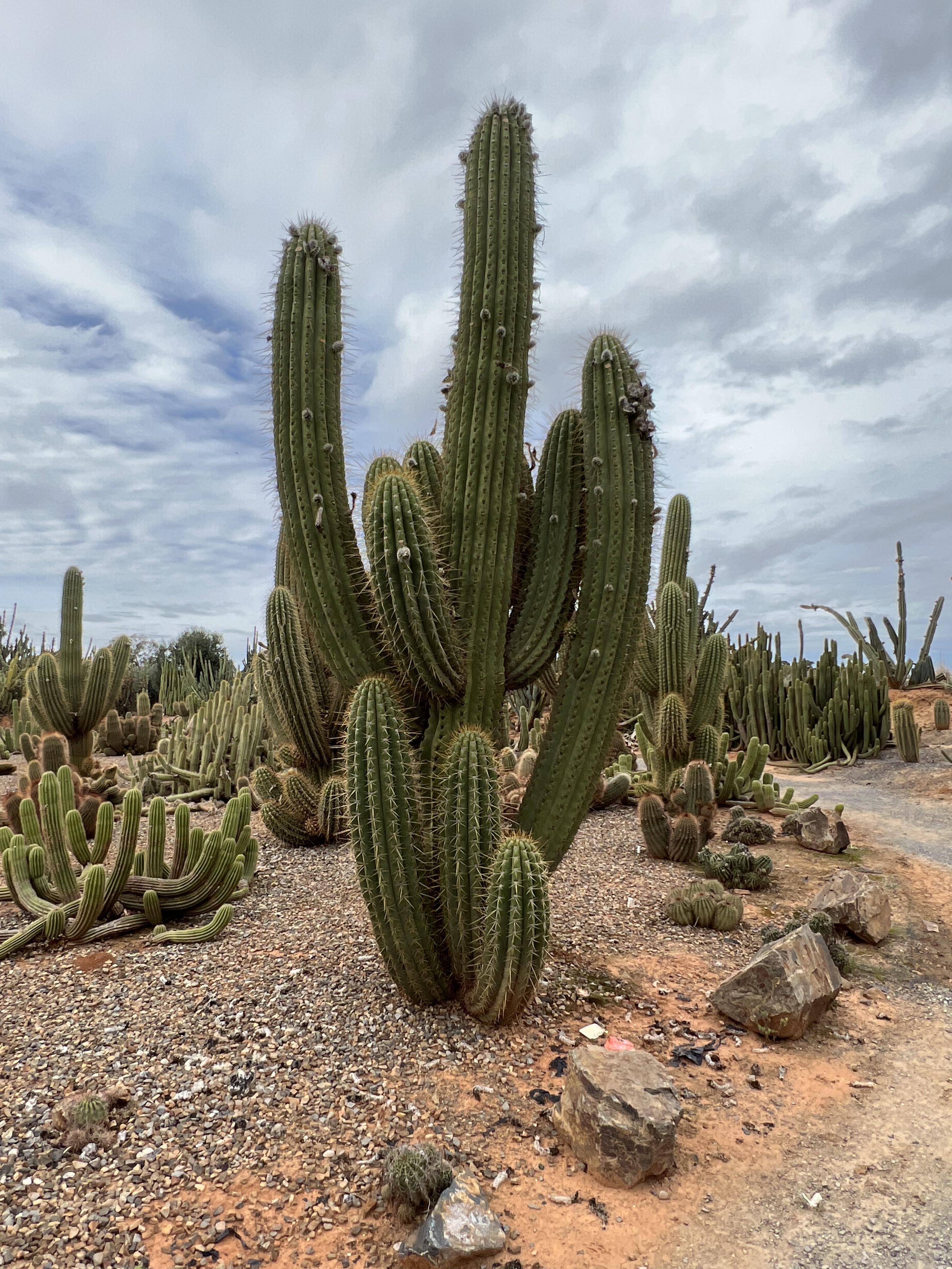
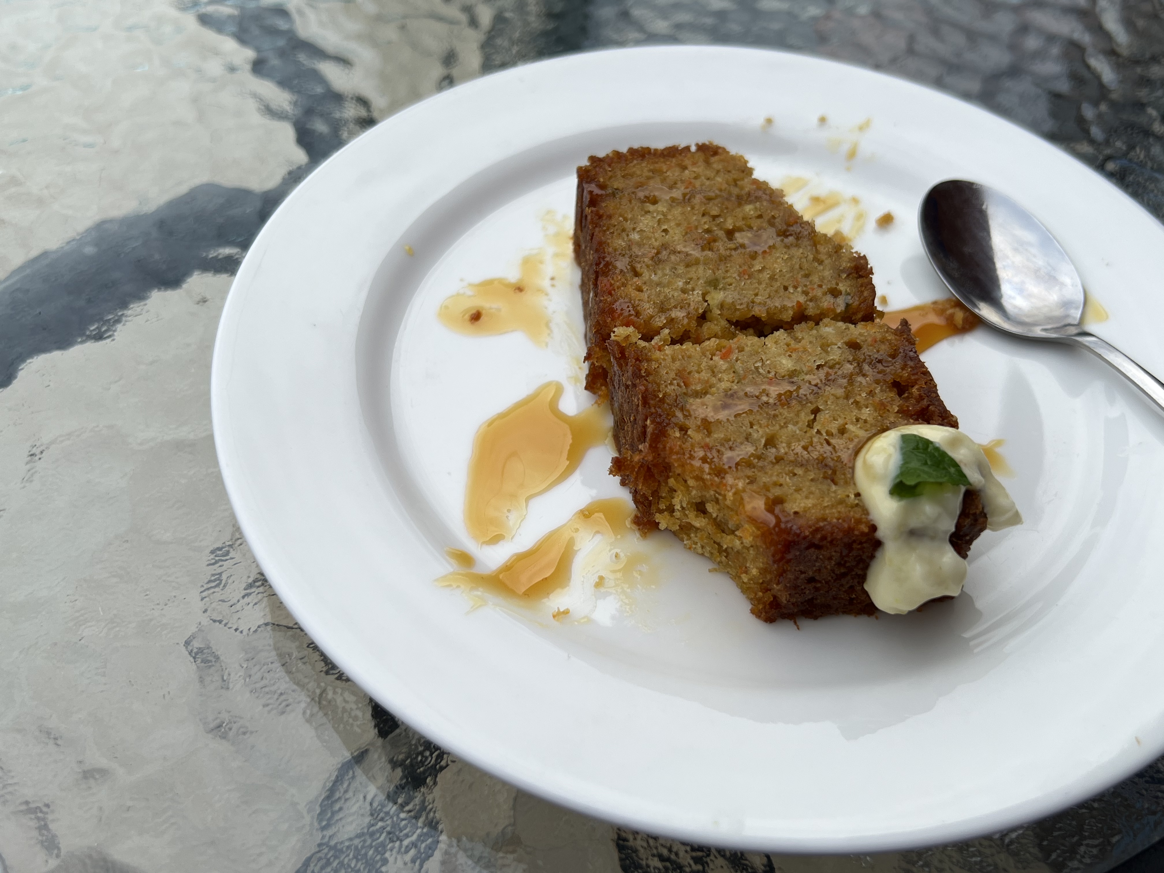
We are trying to do that Farm Gate Trail. Success is almost immediate when we pull into Cactus World. You walk through the gate and think you are in southern US or Mexico, Cactus everywhere, or is that Cacti? Great walk around in an unusual attraction. We had a coffee/tea after checking out the cactusss (plural?) and tried a piece of cactus cake, based on carrot cake but having a slab of prickly pear substituted for the carrot. Not unpleasant but the honey treacle and a dash of creamy stuff helped indeed!
We dithered around at the Cactus place a bit long before heading off trying to find some of the other Farm Gate Trail places as we headed towards Echuca. We wandered down side roads and beside irrigation canals on the lookout for these establishments but it was so frustrating, not many to be found. Or they were at the back of beyond and people were not home. The interesting dairy and cheese place was not open, closed for some work on the facilities. Ah! Ah! It was back to the main road and on to Echuca.
It was getting late in the afternoon and the chosen booked van park was at Riverbend Echuca. Now Allthego sometimes reads things and takes them at face value. He is a reasonable sort of chap in this regard. Somehow, he thought this place was about 6 km out of town, Echuca that is. Now this was an error. This campground was 20 km out of town and actually beside the Goulburn River, Victoria’s longest river that joins the Murray somehere in the scrub where we are to stay. But, it was a pretty good van park, devoid of guests and very quiet. Still a bumpy 20 km drive into town to check out the sites and sights.
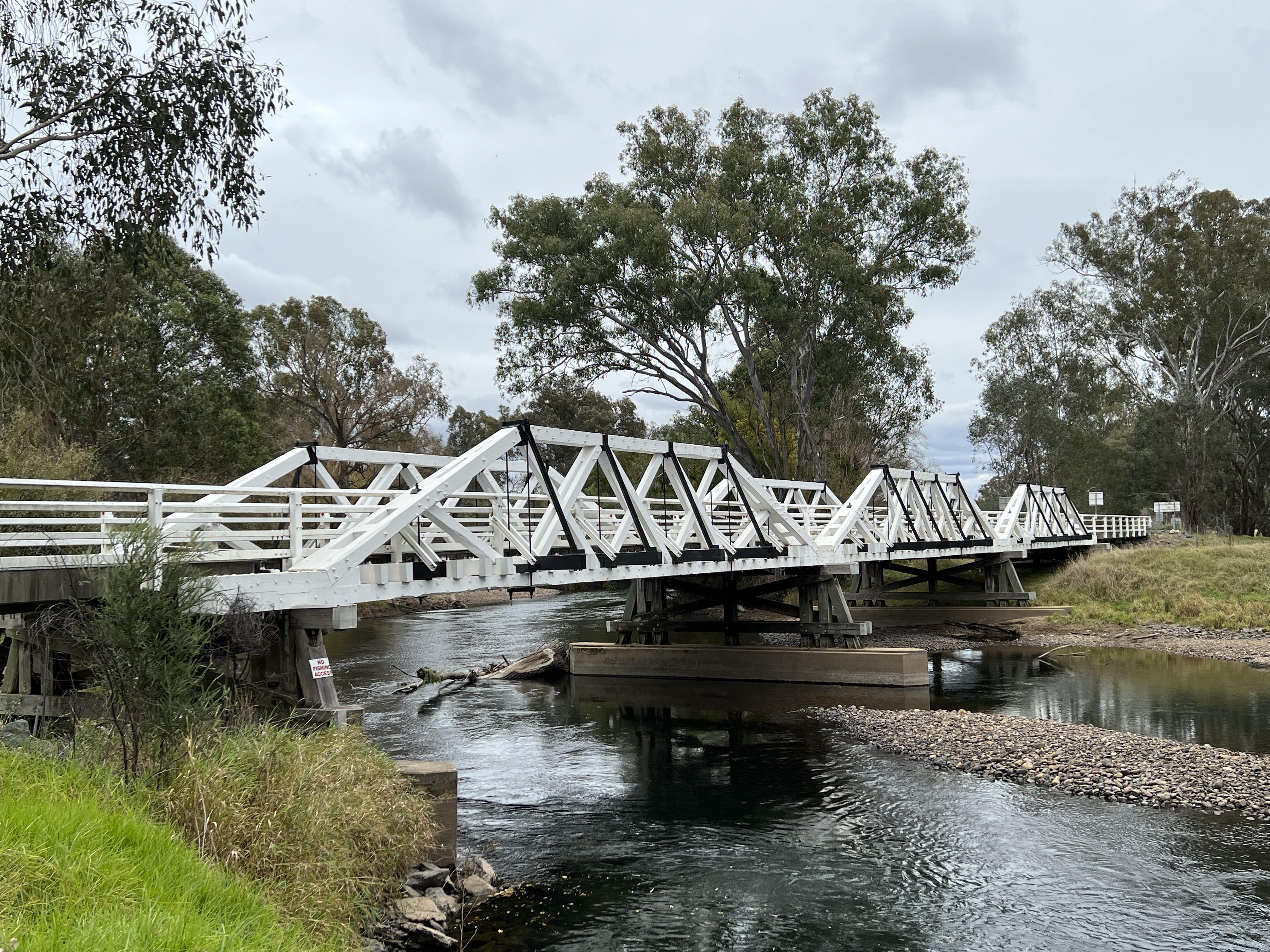
The only issue though was the road in, for 10 km it is sealed but the last 10 km or so it is potholes and corroguted dirt. The major drama was crossing the Goulburn River, the bridge had suffered some recent flood damage and Allthego was reluctant to take the single lane crossing to get to the campground. The bridge seemed to have seen better days.
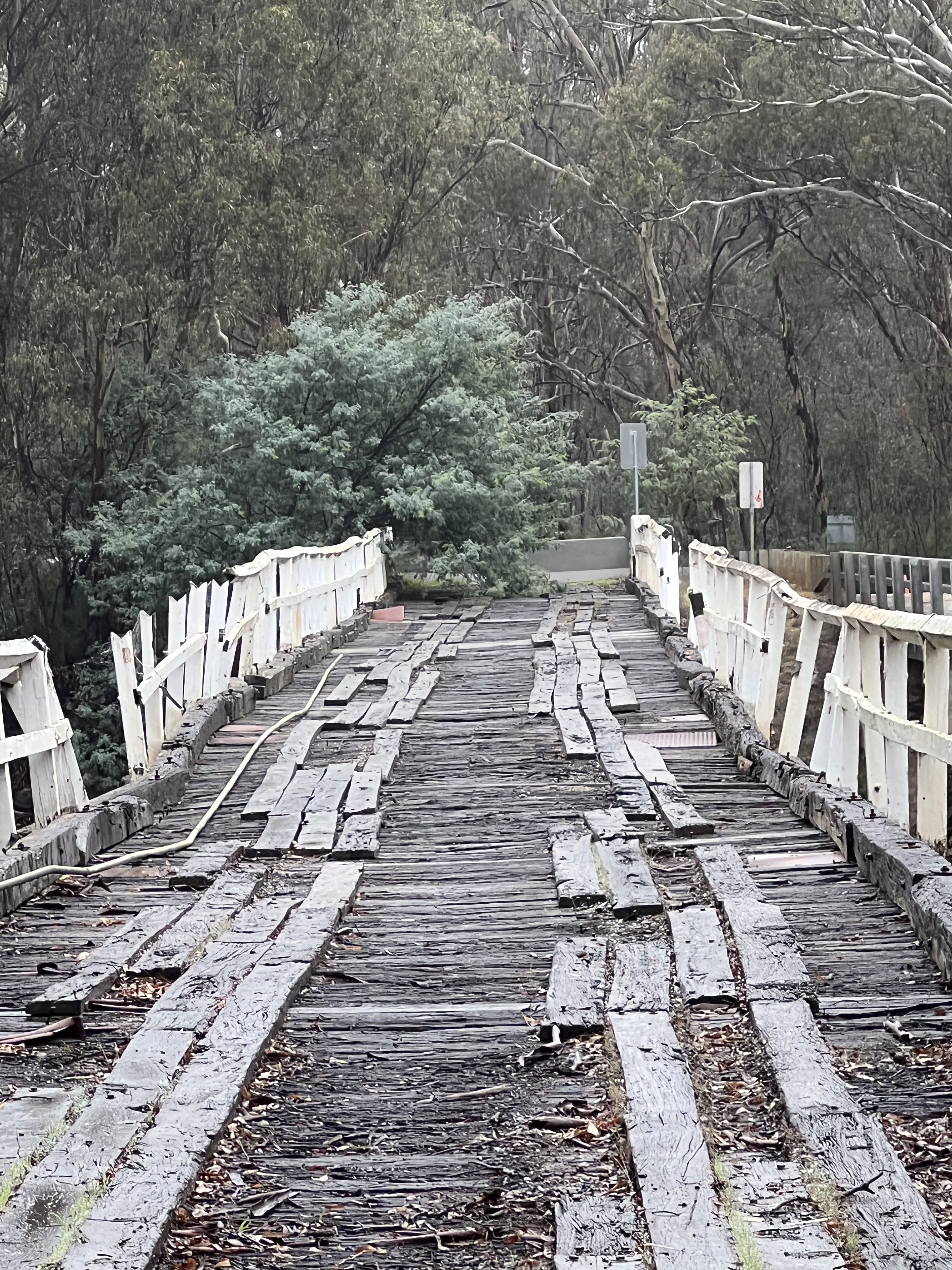
So, we decided to take the adjacent relatively new concrete bridge instead! No worries there.
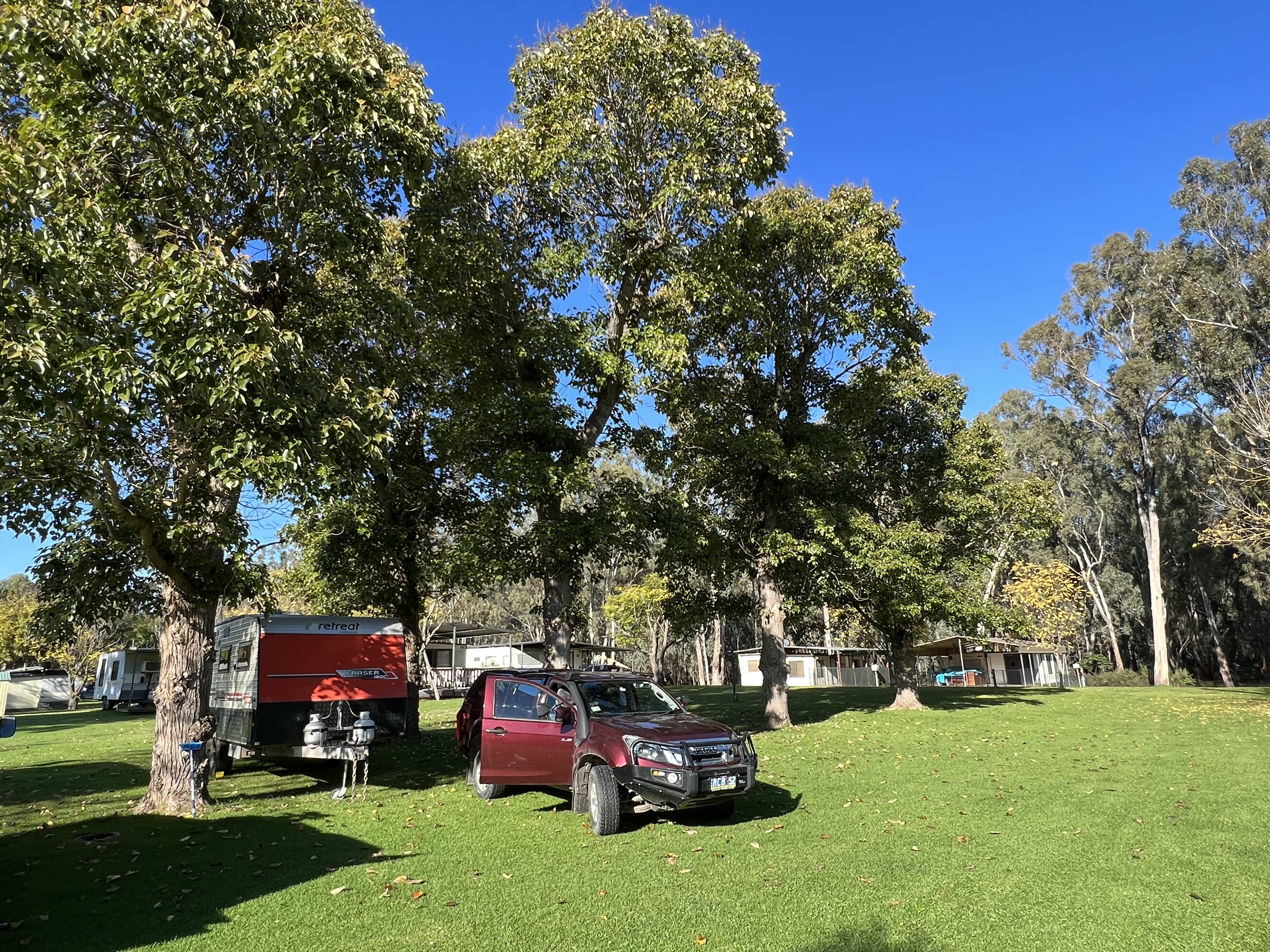
The weather turned here at Echuca and our first day at River Bend was declared a day of rest by Homealone. It rained on and off most of the time and we holed up in the van. The sun came out the next morning and a vital load of washing was done before we headed off to see some Echuca sites and sights.
Tocumwal
Leaving Rutherglen we headed back up through Corowa to Tocumwal, situated right on the Murray River. Along the way we passed through Yarrawonga and Lake Mulwala. The Lake is quite full and we stopped there to have lunch and watched a number of people joining a luncheon cruise on the Lake. Quite an interesting process as the stream of grey nomads (and the like) hopped on board the boat for a cruise around the foreshore and then up amongst the ‘sticks’ sticking out of the water, an old drowned Red Gum forest.
Some found the step on board easier than others, much help and frivolity involved. Looked a nice afternoon of cruising around. Apparantly, the Lake (held back by a weir) is to be emptied to try to rid it of thick weed, the waters will recede back to the river course of the Murray and things will be allowed to dry out before the Lake level is restored. This is like a 3-4 month project, so there will be reduced luncheon cruises while all this happens. It would be interesting to see the bottom of the lake and the old Murray’s course, I suppose it means that water will not be let down from the Hume Dam. The Ovens River, from the Victorian Highlands joins the Murray here at the Lake, so water from that will have to be dealt with as well somehow. Leave that to others to worry about! We are moving on to Tocumwal.
It is a one night stop here beside the River at the free camp down at Town Beach, not quite free as it is $10 the night plus $10 for some wood for a fire. A very pleasant spot as the sun went down, time for some spaghetti bog in front of the flames. it would have been nice to have enjoyed a custard tart here, but they have been scarce along this part of the drive.
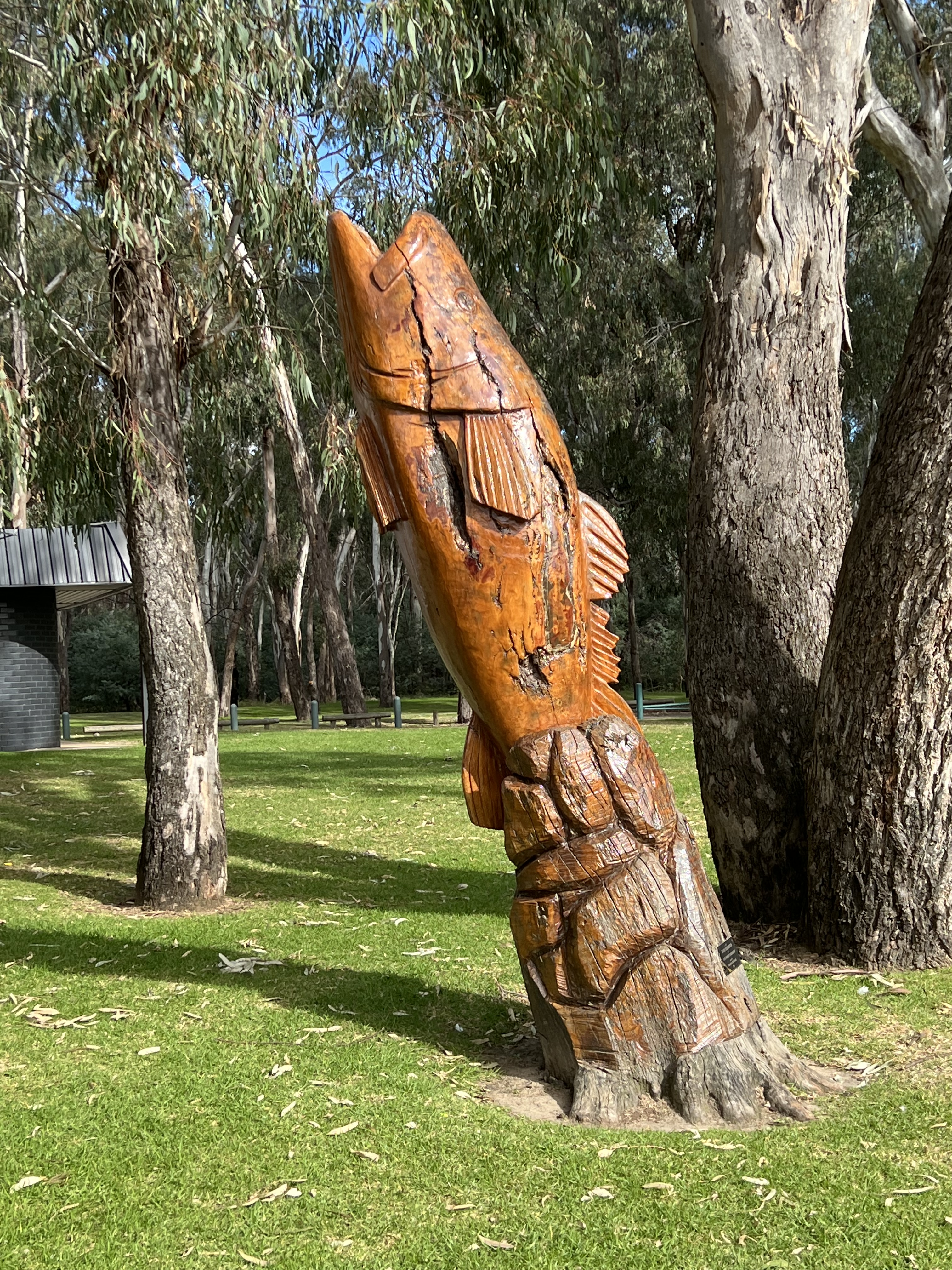
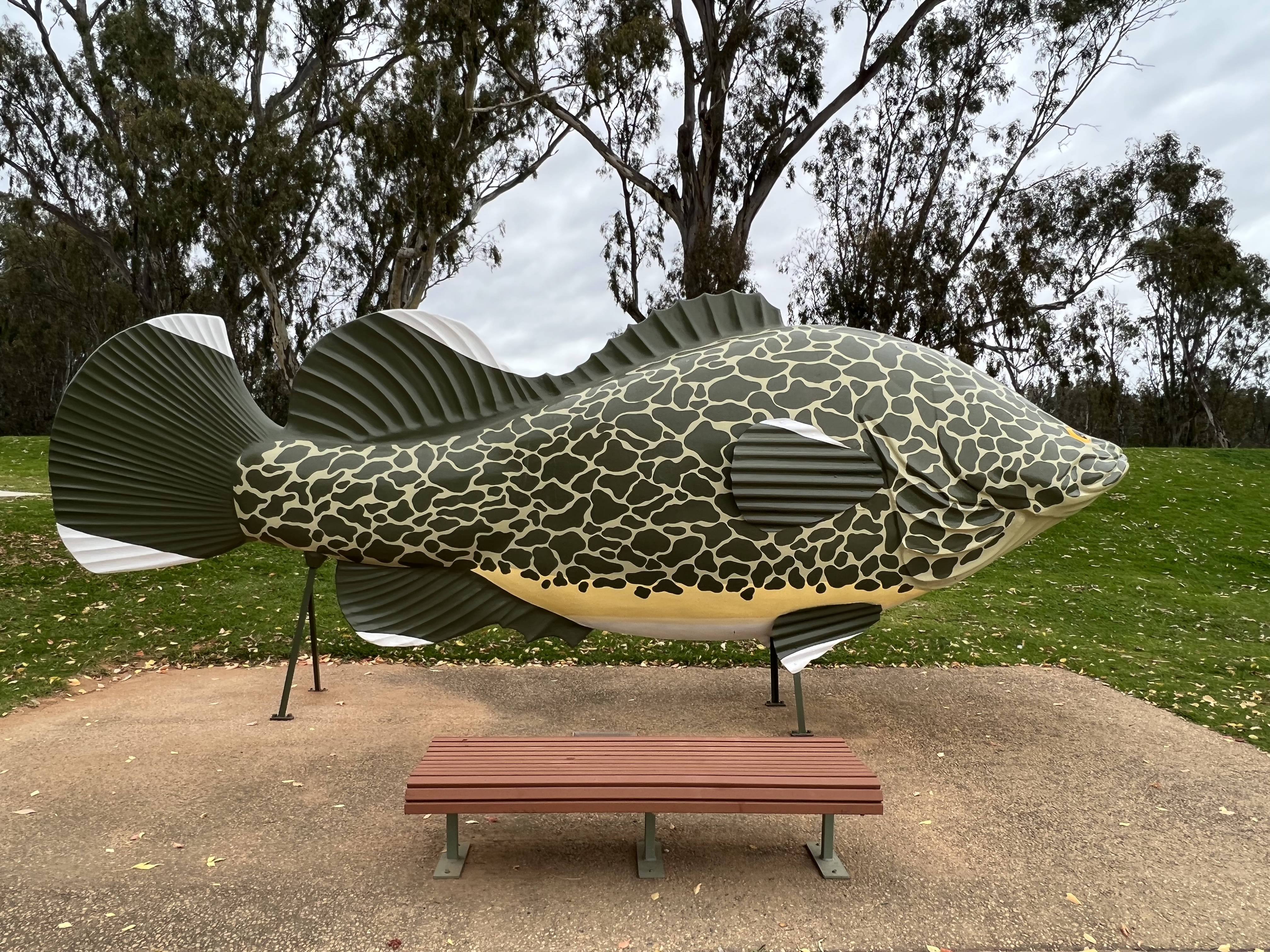
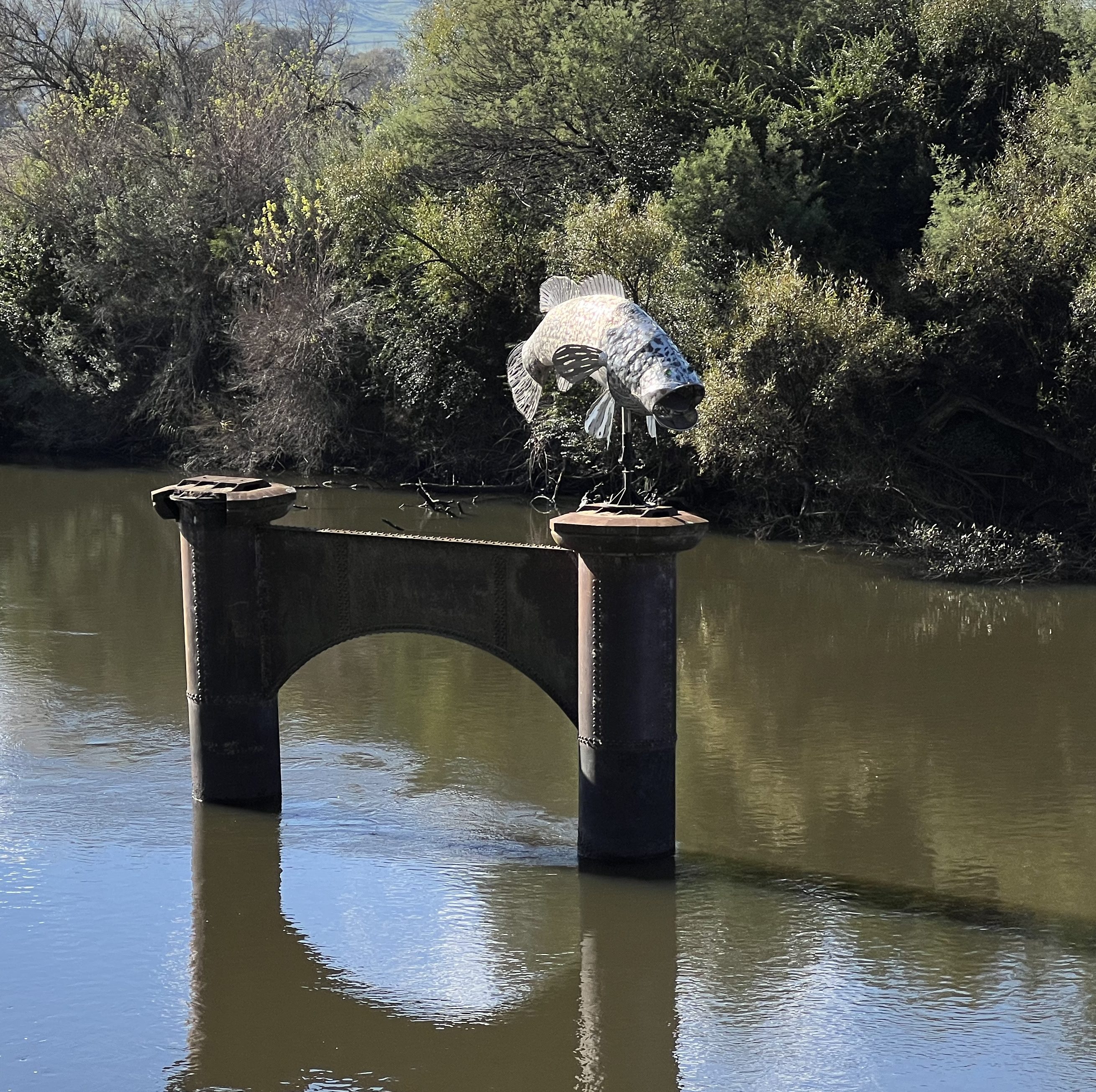
Followers may have noticed that various depictions of the ‘Murray Cod’ adorn the River banks at almost every stop we have made. There seem to be more of these than actual fish in the water. Catching the elusive cod is heavily controlled (NSW) by way way of bag limit (two a day) and size (between 55 and 75 cm only can be kept). There are possession limits too and rules differ between States and whether you catch them in streams or dams etc. All very confusing. There are closed seasons too to contend with. A 50 cm fish, considered a mature fish, may be anywhere between 3 and 6 years old. The biggest cod recorded was 1.8 m long and weighed 113 kg, a 50 cm Cod might be 2-3 kg. It is triuly an iconic fish!
Next morning it was off down the road to Echuca and the chance to get into some of the Farm Gate Trail places, as it was Wednesday and they should be open. And maybe some custard tarts!
Rutherglen
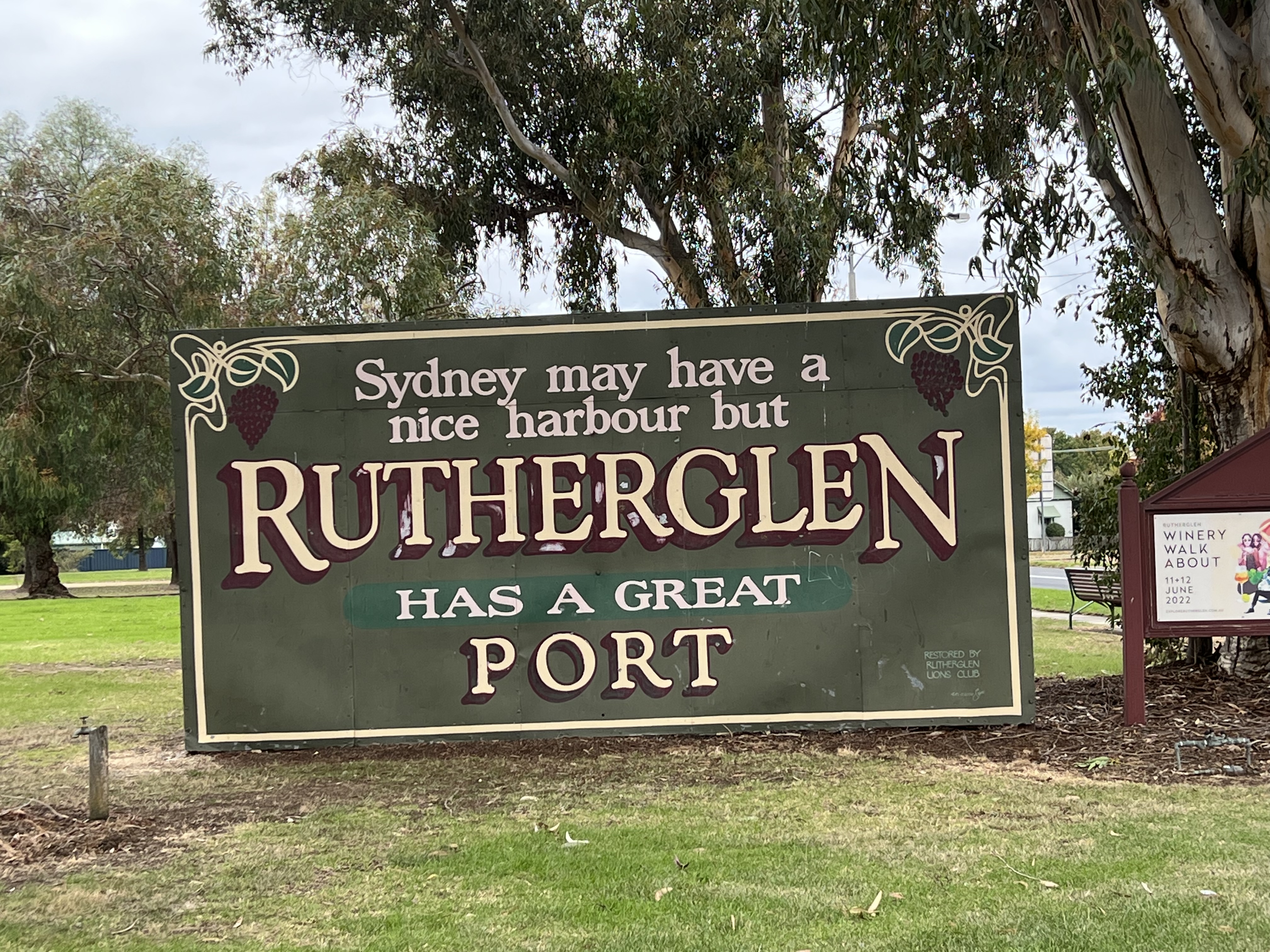
After returning to Howlong from Brockelsby we turned off the Riverina Hwy and away from the river and headed off to Rutherglen. Allthego viewed Rutherglen as a compulsory stop in order to sample some of the famous reds, ports and muscats the region is known for, it is not unlike Glenrowan (home of Baileys where we often drop in on the way further south along the Hume Hwy) in this regard. Rutherglen is not shy about its famous ports and reds.
It was also Mothers Day weekend and the town had been swamped by Melbournians escaping to the country after the long period of COVID imprisonment. We were lucky to get into the caravan park, took an unpowered site for one night and then moved onto power the following morning for a further two nights. The caravan park is quite small and overlooks the town lake and is a street back from the centre of town.
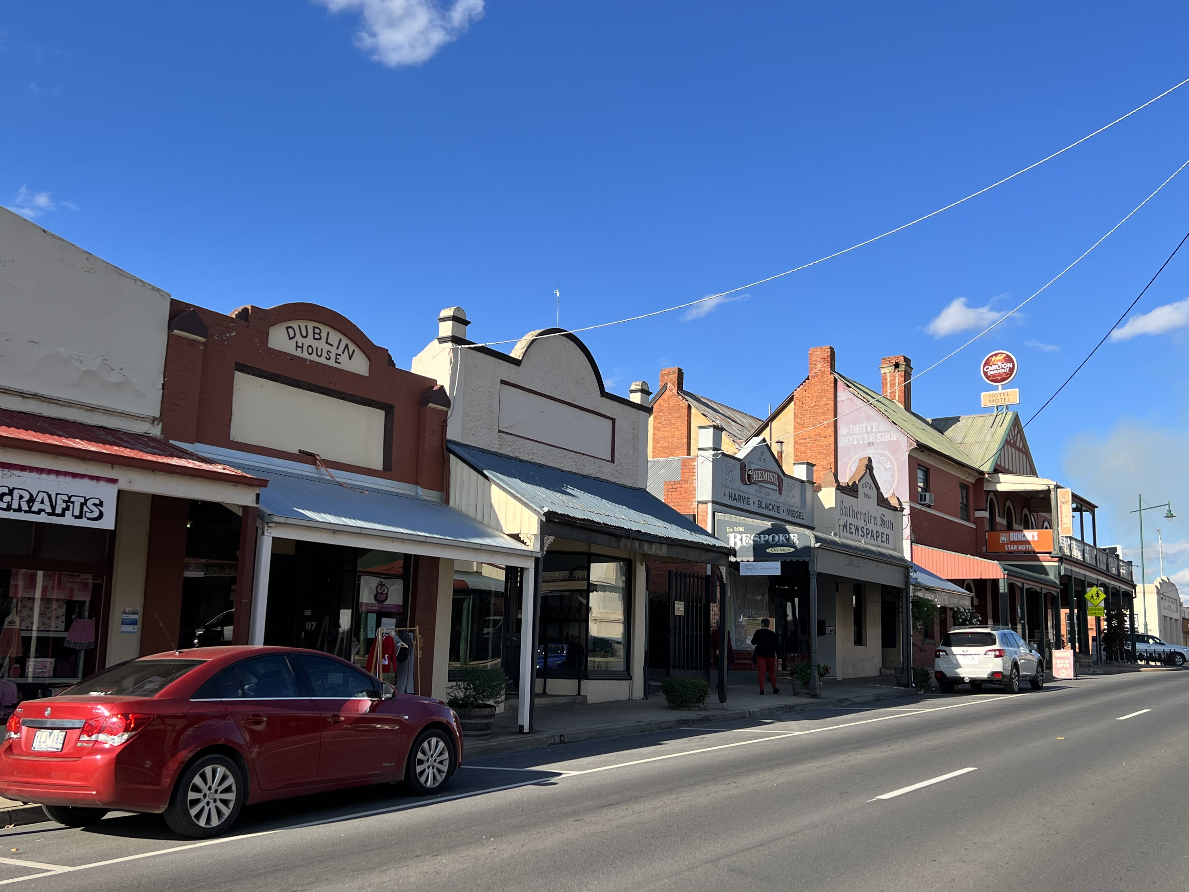
All the motels/hotels and other accommodations were booked out and many of the eating establishments , including those at several of the vineyards, were booked out for Sunday lunches. The town’s main street is littered with eating places of all sorts, operating from the old shop fronts of businesses long closed. The streetscape is well preserved.
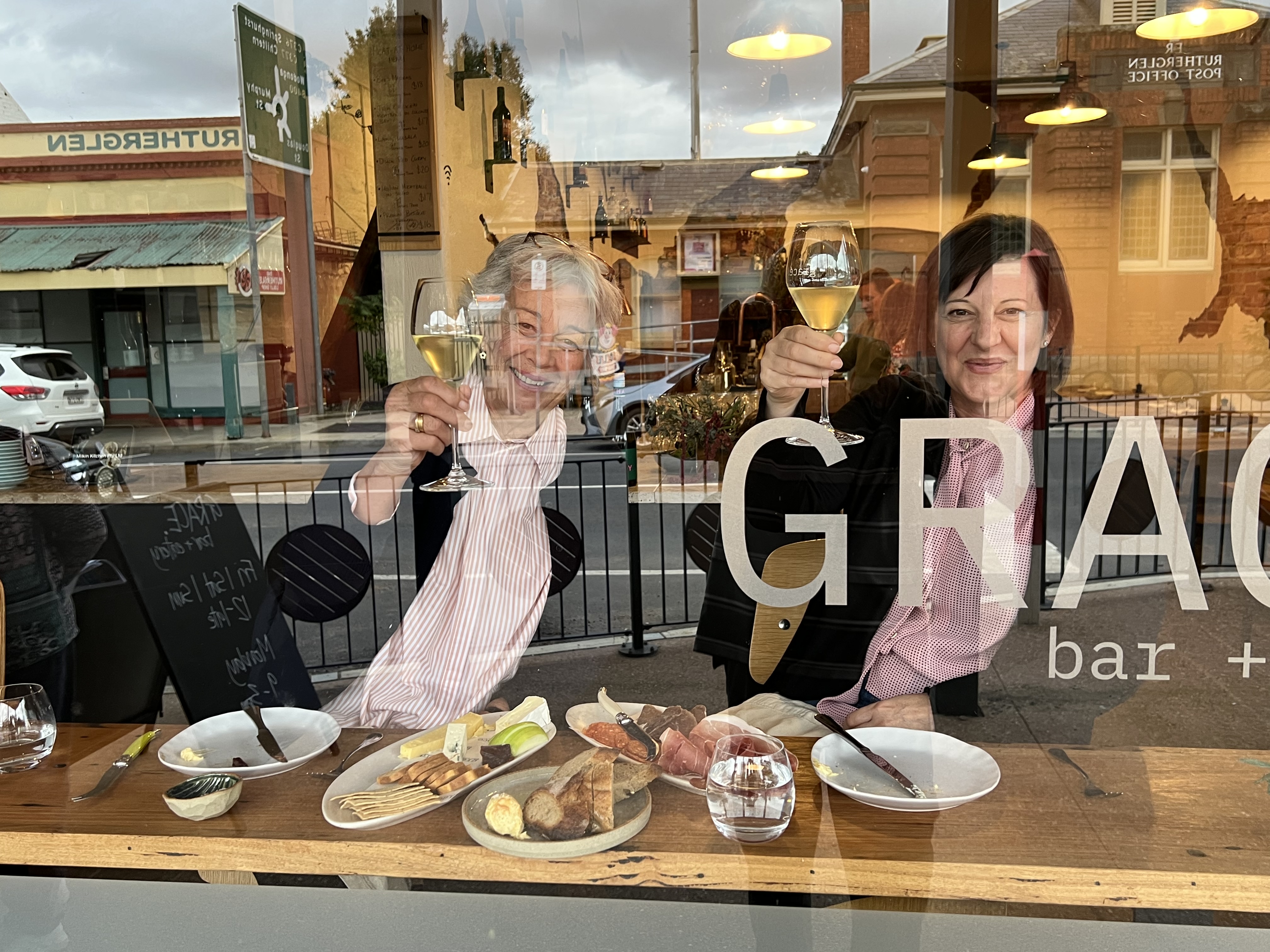

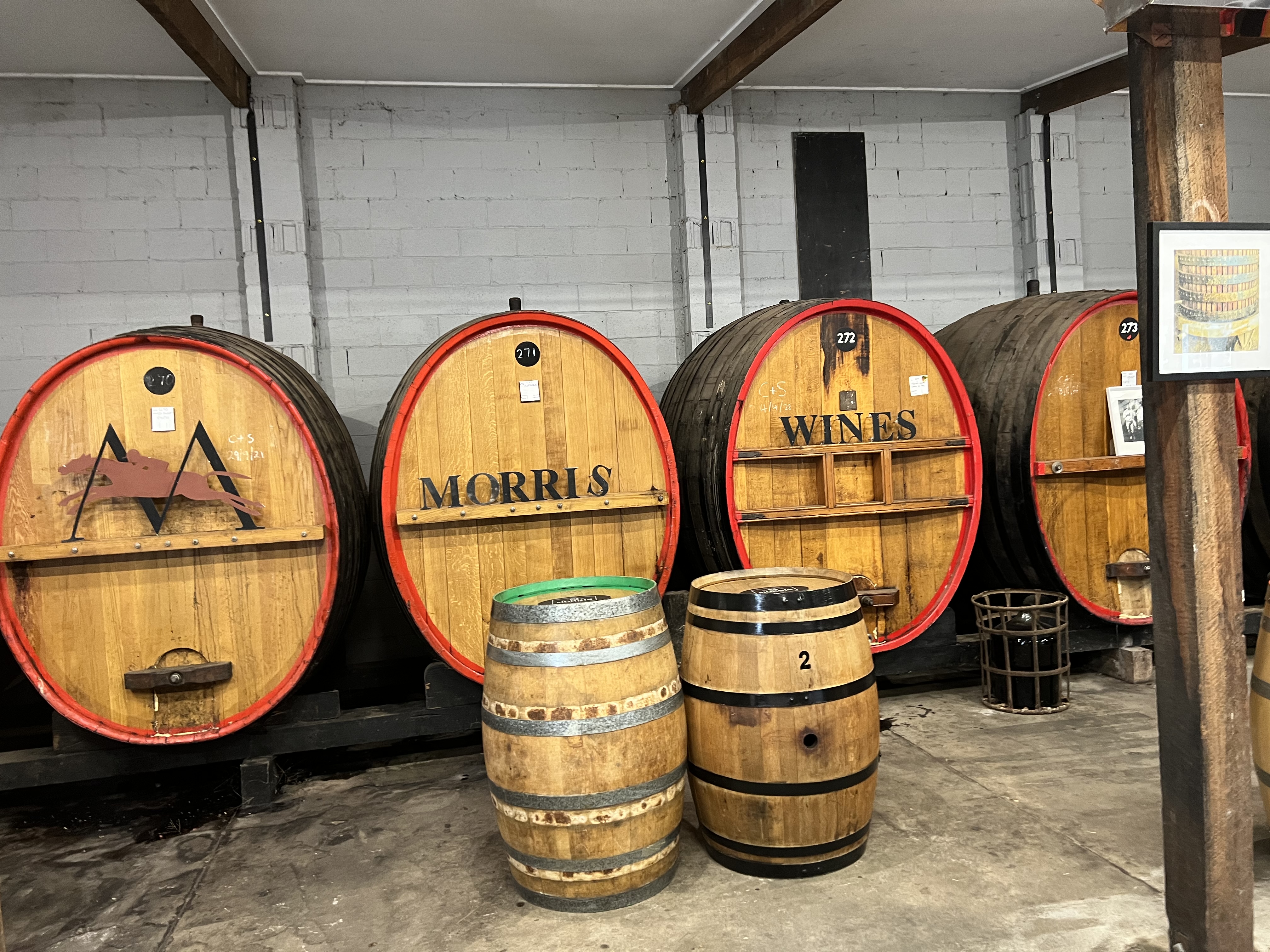
So we decided to have Mothers Day sunday lunch early on Saturday night at the Poachers Hotel, very nice steak and pork cutlet. Can be recommended if you are ever there, as is their pizza. In the course of the couple of days we managed to get to a couple of old famous vineyards. Morris and All Saints. They both do the reds well, not to mention the muscat and port. Joined mailing lists and have some bottles being sent home towards the end of the trip. Allthego likes to be home when these arrive so that he can keep track of them. Wouldn’t like for them to get into the wrong hands if left on doorsteps by delivery people.
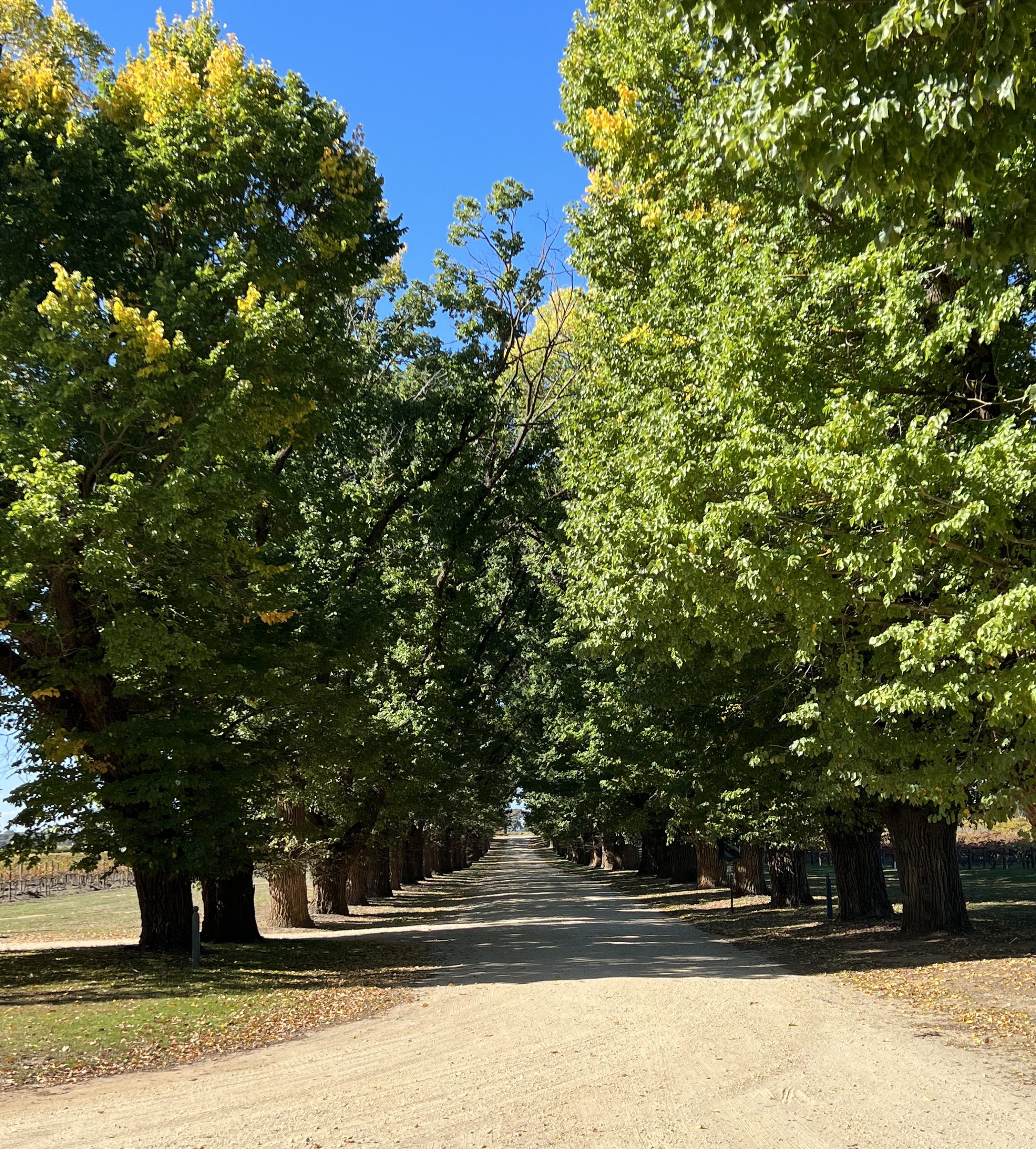
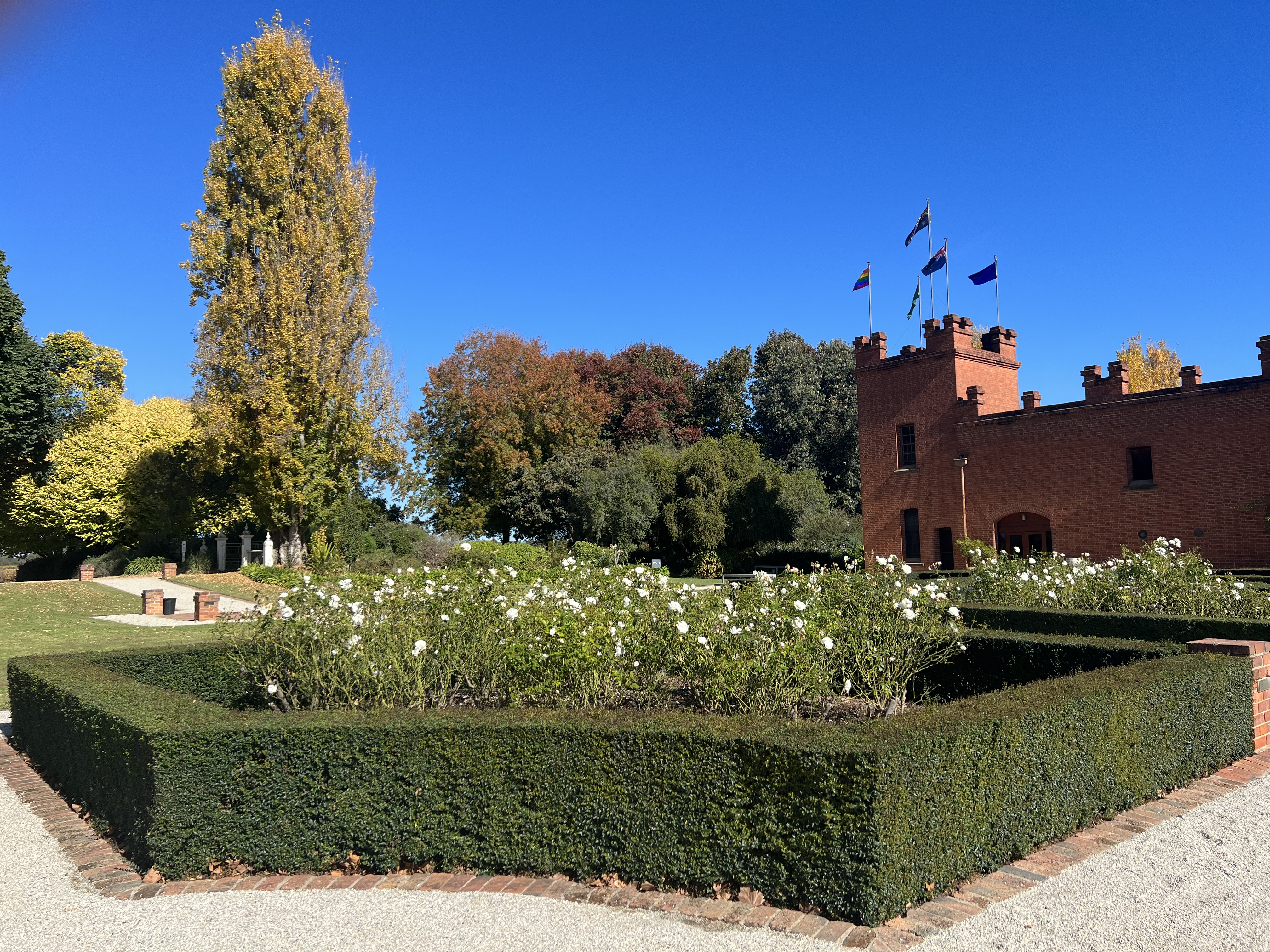
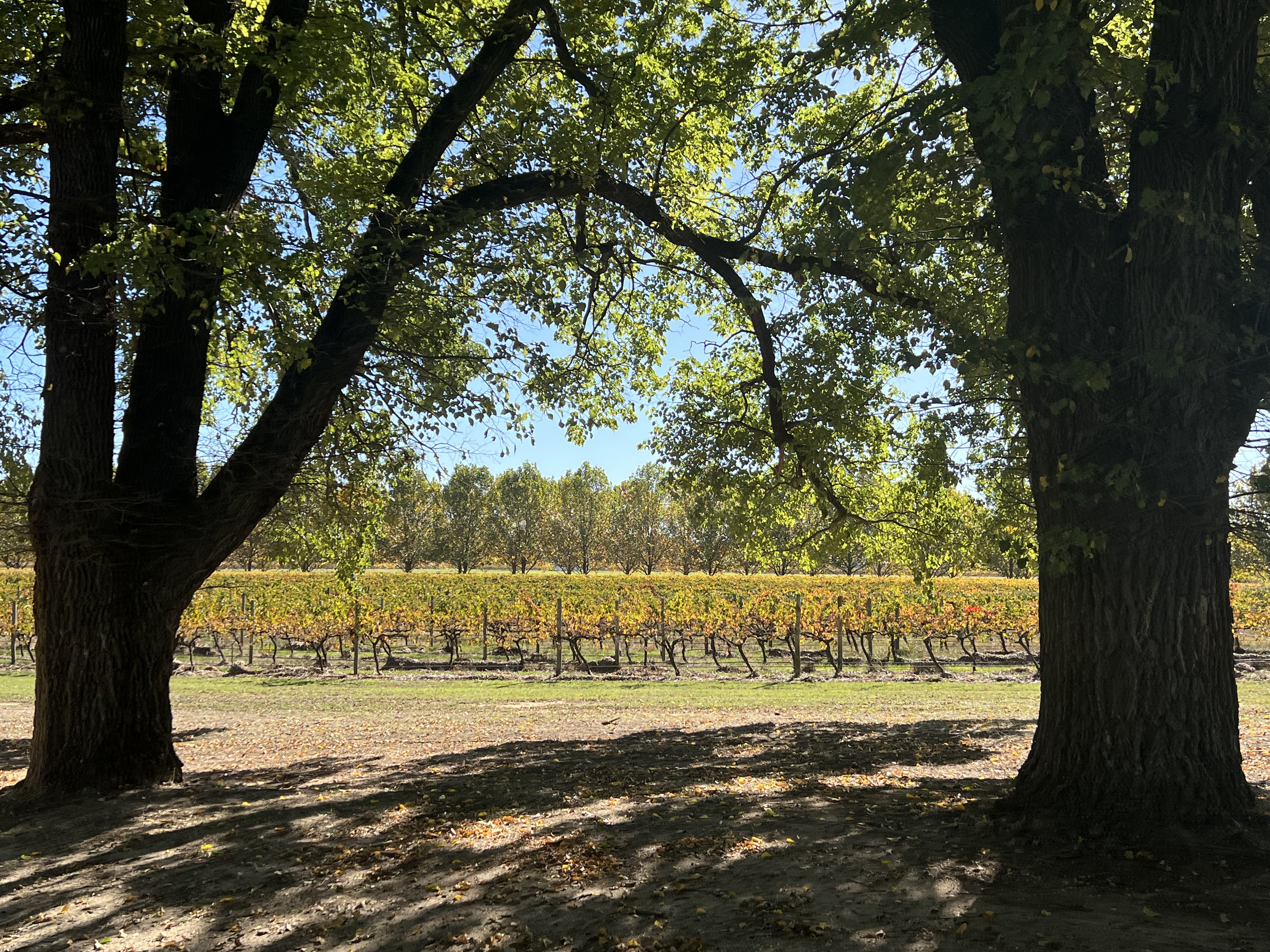
The vineyards are also looking great at the moment with the leaves on the vines turning from green to orange as autumn advances. All Saints is particularly well groomed. A long avenue of elm trees well over hundred years old line the driveway into the vineyard castle built in 1864.
While here we have also slipped up to Corowa, a nearby sister town, which is astride the Murray. There just happens to be a tempting whisky and gin distillery here. Interesting place in an old flour mill or something like that, they also do chocolates. This establishment is one of those on the Murray Farm Gate Trail.

The Farm gate Trail winds around the area highlighting various foody places. Problem was, we were doing this on a Monday and then were to continue along its path when we left the next day for Tocumwal. Many of the places were closed on Monday and Tuesday! A bit disappointing and frustrating driving around discovering this, more research required next time! So maybe after our one night stay at Tocumwal we will catch some on Wednesday!
Albury
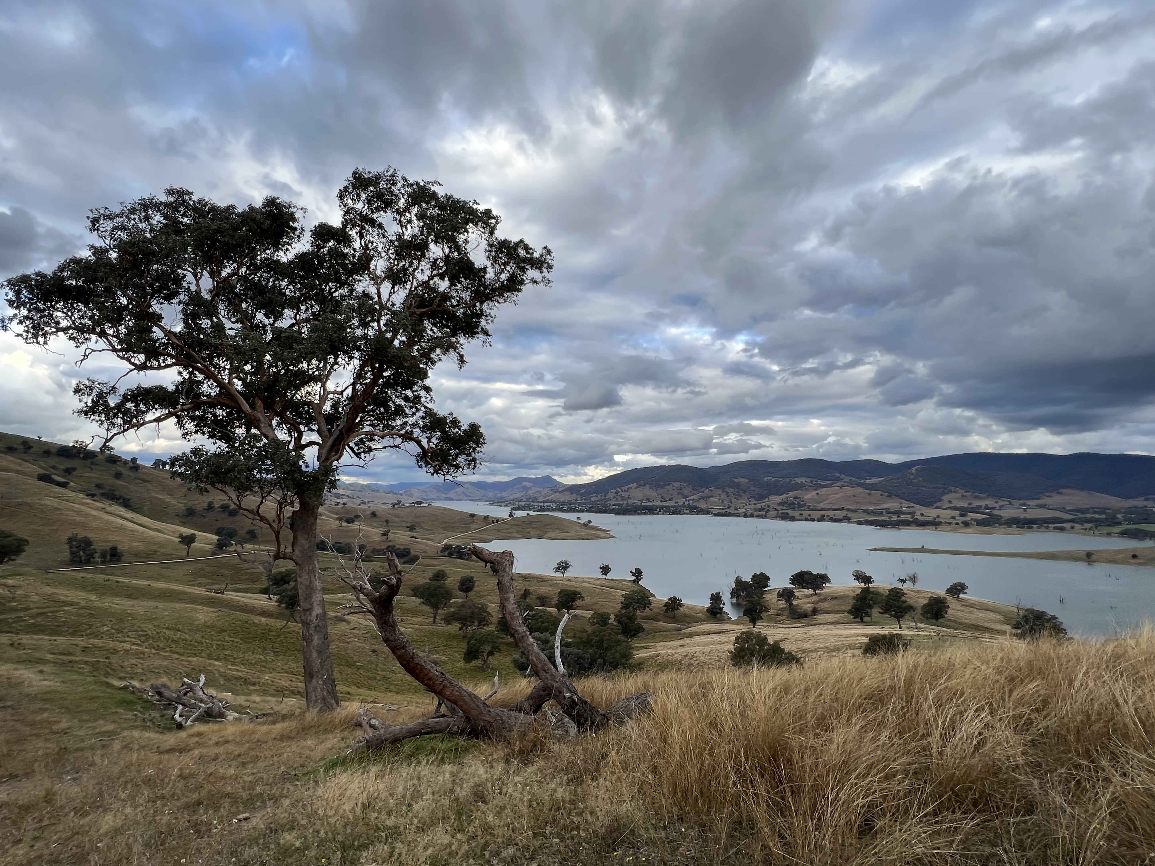
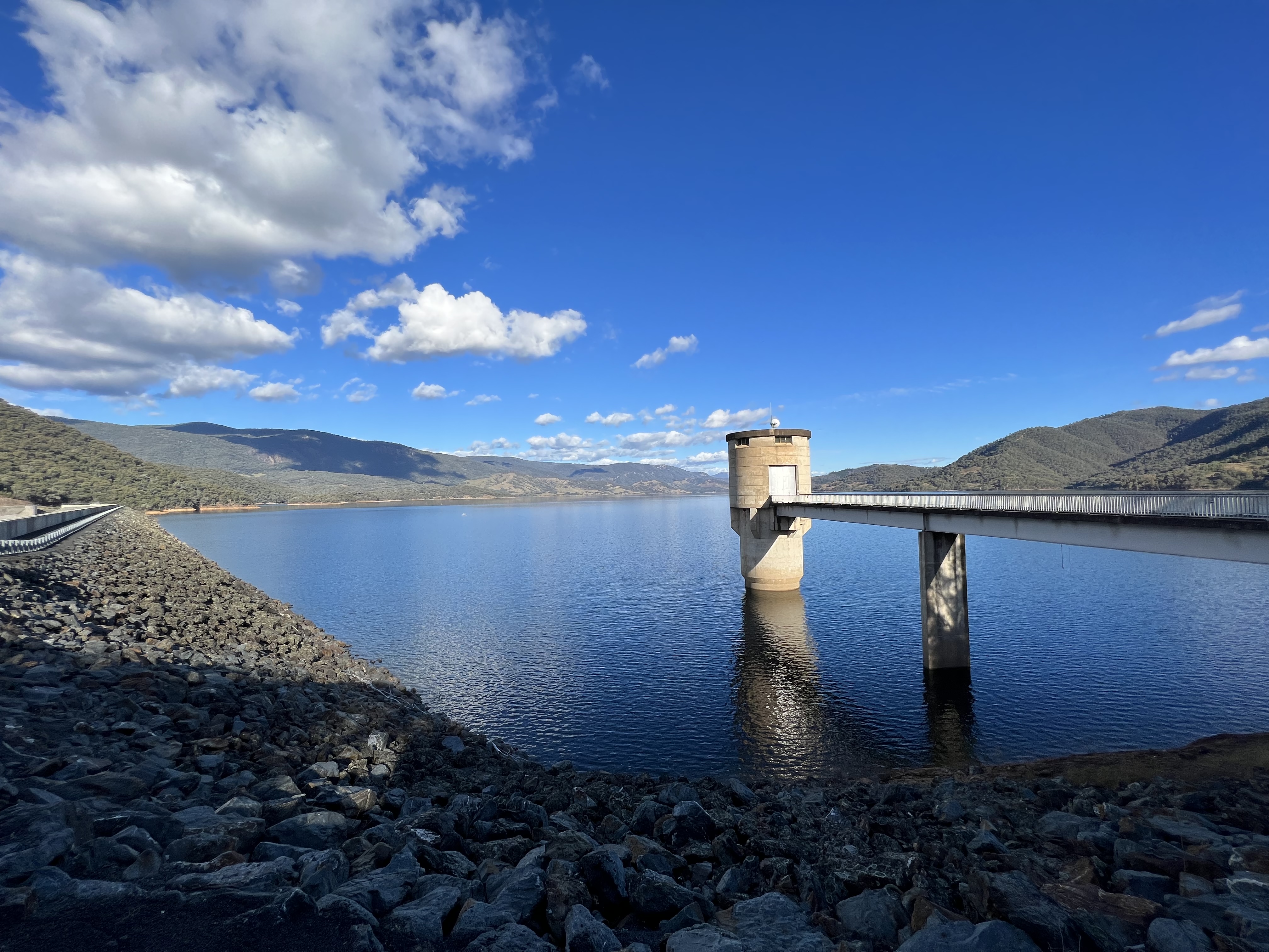
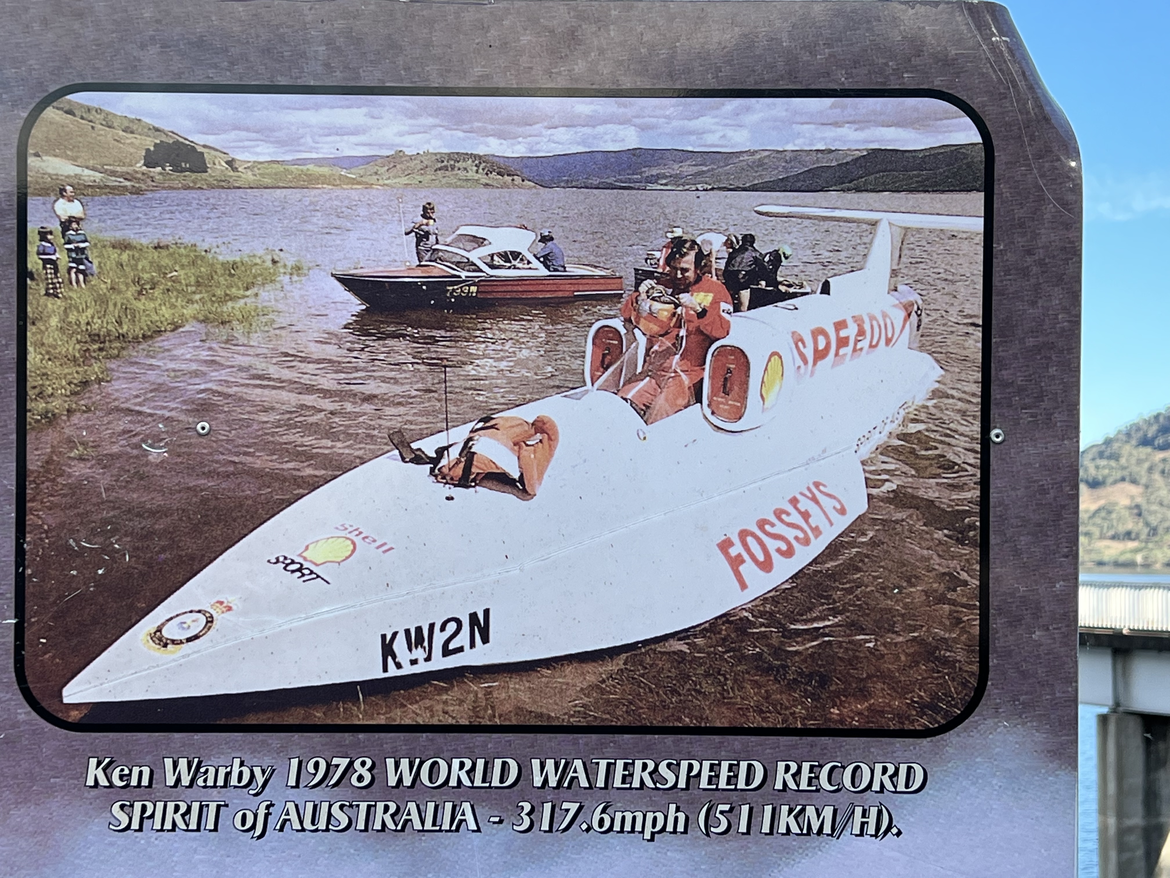
We are staying at the Van Park beside the Hume Weir about 10 km from town. The internet isn’t great, down by the water, around a corner looking out over the dam. Few other people here. This is one of those caravan parks that is being consumed by huts, eating up caravan spots and taking good locations. Building work in full swing. If not careful it will become a little gulag by the dam. For a hut they get three times what a caravan spot is and I suppose this is the attraction for the operator. Annoys the grey nomads though! The dam spill way is spectacular at the moment, oddles of water being let go.
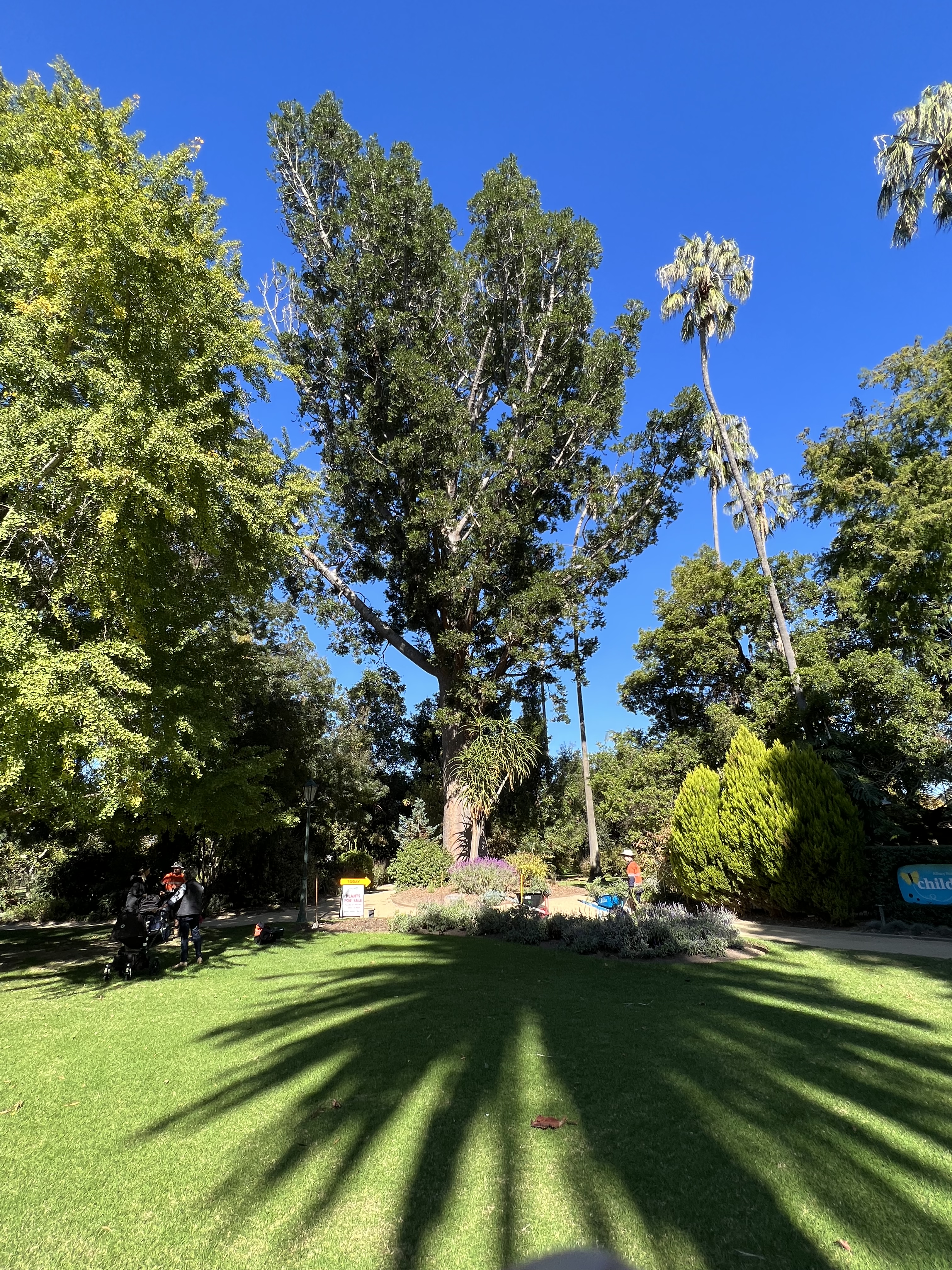
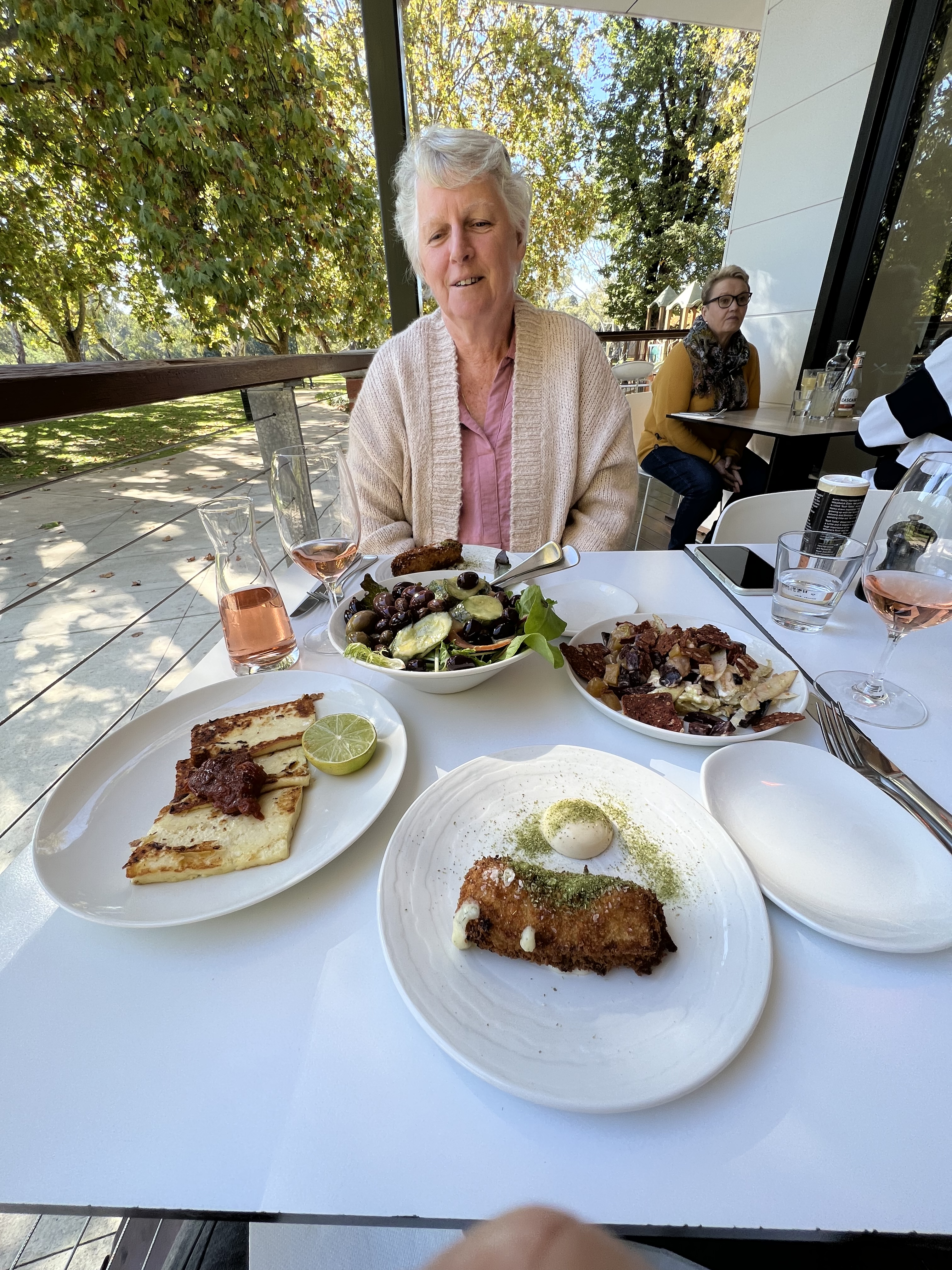
Have had a day wandering around Albury town, looked into the Botanical Gardens, plenty of autumn colours. Some hundred year old plus trees in the park, an enormous Kauri bears down on the grass. Later we head down to the river for lunch, as I recall it the ‘Top Deck’ cafe. we decided to try some Murray Crayfish croquets, quite nice but the flavour seemed to get lost in the accompanying sauce. One of Allthego’s bug bears; water food (fish, crabs etc) is best just grilled or pan fried with a little salt and lemon juice. Avoid fancy coatings and sauces. Having said that fish in a beer batter is not bad, with some chips of course, and by the sea. Forget about vinegar though.
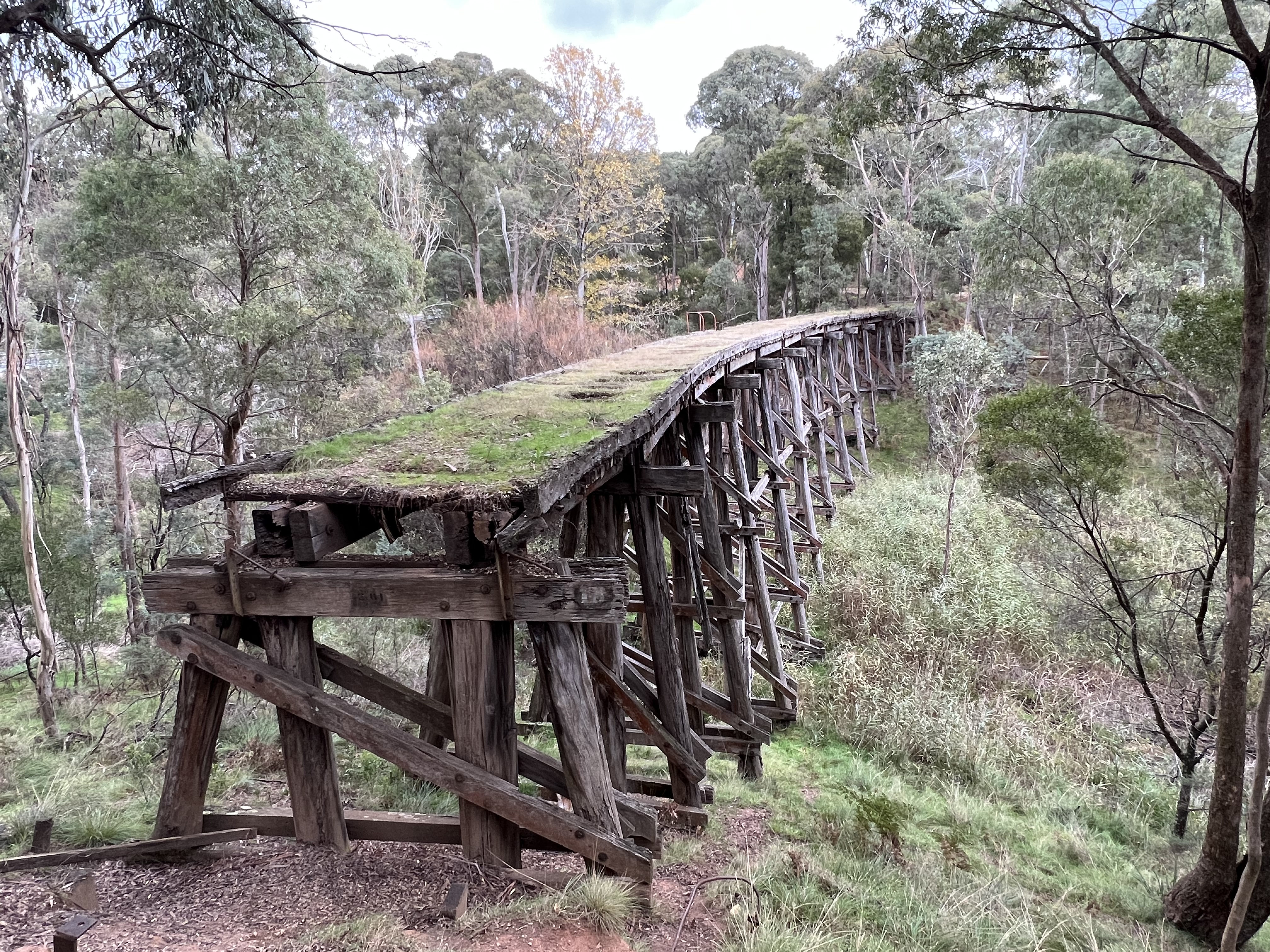
We have also set out along the other side of the river back towards Corryong, along the Murray Valley Hwy to Tallangatta, a new town that grew up in the 1950s when ‘Old’ Tallangatta was moved to higher ground to accomodate the expansion of the Hume Weir. Further on we reached Koetong a stop along an old rail line from Albury. There are still a number of remnants of the line, which is now a rail trail, along the way. Allthego wandered down the trail for a short distance to catch an early 1900s trestle bridge across a gully two stories high. Steam trains used to ply this route and in the 1950s it was used to transport materials for the Snowy Scheme into the highlands.
Whilst in Tallangatta we paused for a short break and managed to find a custard tart. this was an interesting specimen because it appeared to have been cooked differently to the ones we have had to date. The egg custard appears to have been put into an uncooked casing and then all baked at once! Result, soggy pastry! Allthego and Homealone think the pastry has to be cooked first and then the cusrtard added, to keep it all nice and crunchy. A short distance from the Hume Weir we had found another bakery, next door to a Woolies, its custrad tart was unimpressssive, lacked flavour, although a reasonable yellow eggy colour. We are no closer to the great custard tart! But they are starting to look the same. Why no variety? Why not some stewed apple under the custard?

We head back to the Dam via ‘Old ‘ Tallangatta, a narrow winding road with a lengthy gravel stretch, but through green farmland and great views of the lake.
Albury is a large town and it is hard to get a grip on it in a couple of days, perhaps loosing touristy flavour to the urban sprawl and business life. We leave for Howlong a little further west and a diversion to Brockelsby, about 20 km north. This is where in the early 1950s Homealone’s father was posted as a minister at the local Presbyterian Church. Homealone, unlike an elder sister never lived here, but visited from time to time. Much seemed to have changed, Homealone can’t place terribly much about the small town. However, we did manage to track down the old church hall, which apparantly was used as the church after the old church was burnt down some years earlier.
The old church hall now seems to be a transport depot for a local resident who filled us in on this detail. He bought the hall six years ago. He did think that the house next door was the old manse, perhaps where the family lived back in the early 50s? Maybe some of my readers can add to this tale by way of comment. We couldn’t find the old garage business owned by the family friends of that time.
So it was back on the road to Rutherglen.
The great big swing west
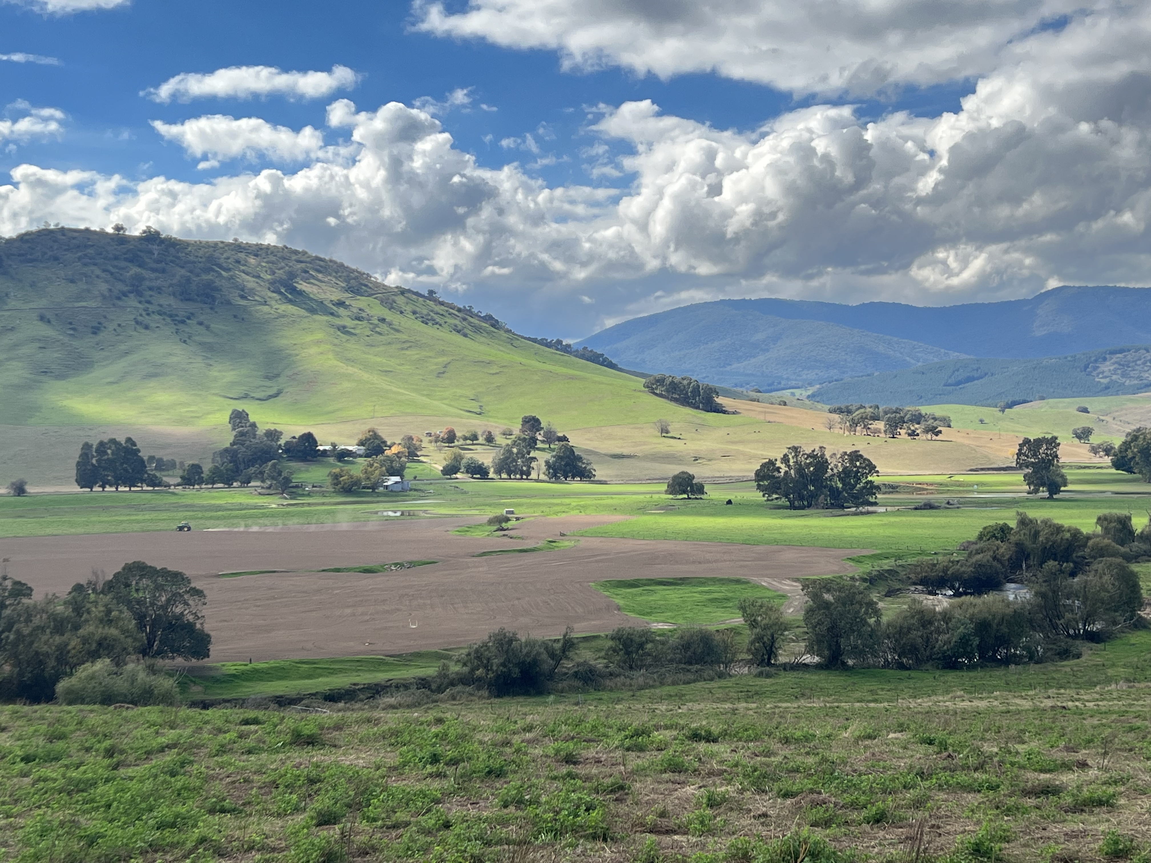
We are now heading off down the Murray along the Great River Road along its great arc west. The River leaves the Snowy Mountains in a northwest directon before swinging west towards Albury. One could drive this in a day, but miss many of the twists and turns along the way.
The drive is just that, not a lot to talk about just great scenery and a bit of history. There is a sculpture trail at the small towns along the way showcasing aspects of the natural river environment. We are fortunate in that the weather is basically clear, clouds and sunshine. Not too cold!
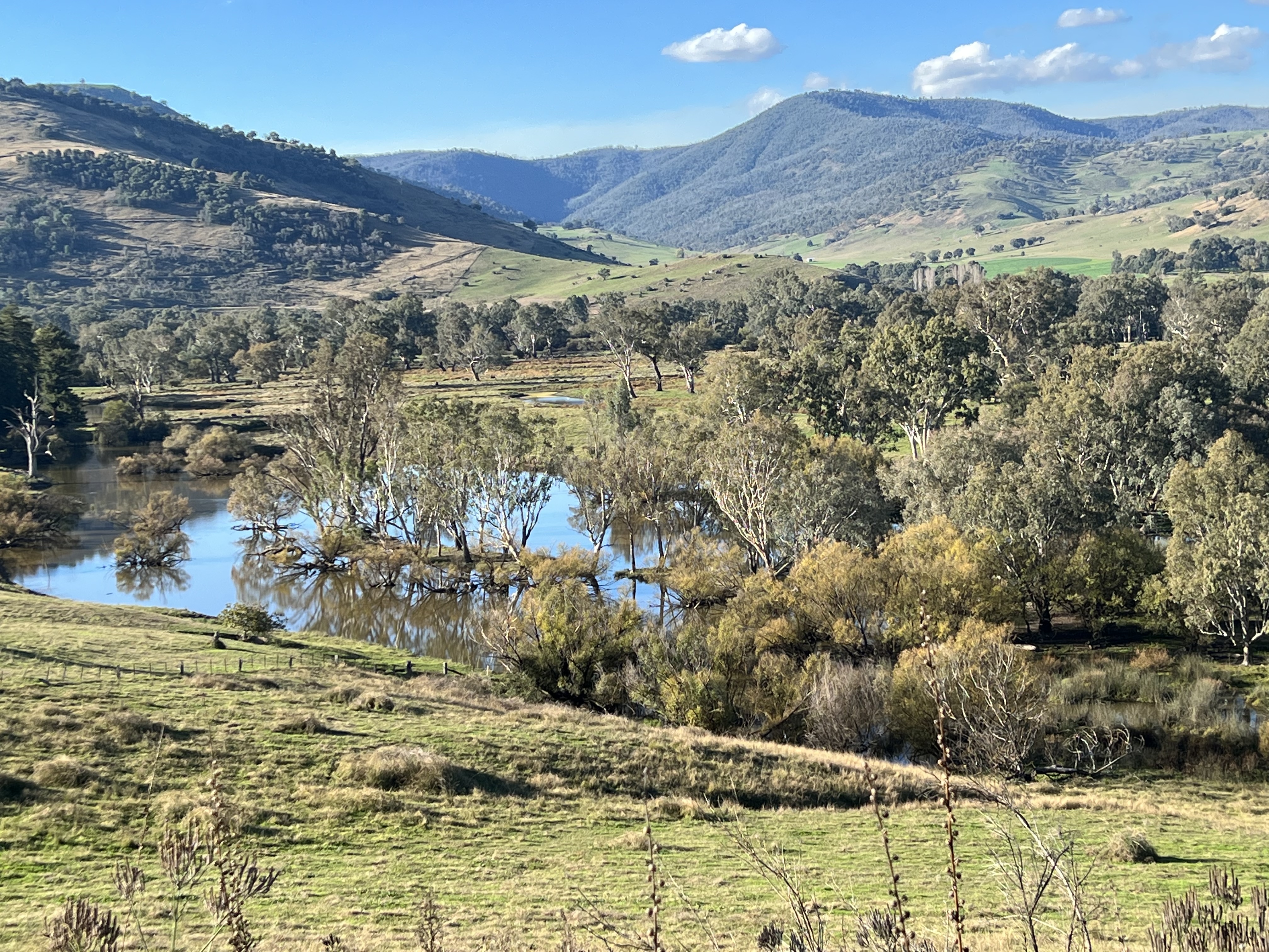
The views of the Murray Valley are great. In these parts the river is still wild and flows quite quickly. At some point along this section of the river the gradient starts to ease as it flows towards Lake Hume. I need to check the statistics but I believe that between Lake Hume (where we will be staying in a day or two) and the sea over in South Australia there is only a 250 metre drop over about 2000 km of flow. Will check this out, would hate to tell a porky or mislead readers of the blog. The River becomes sluggish and lanquid, well some of us become sluggish too, not sure about lanquid! At times.
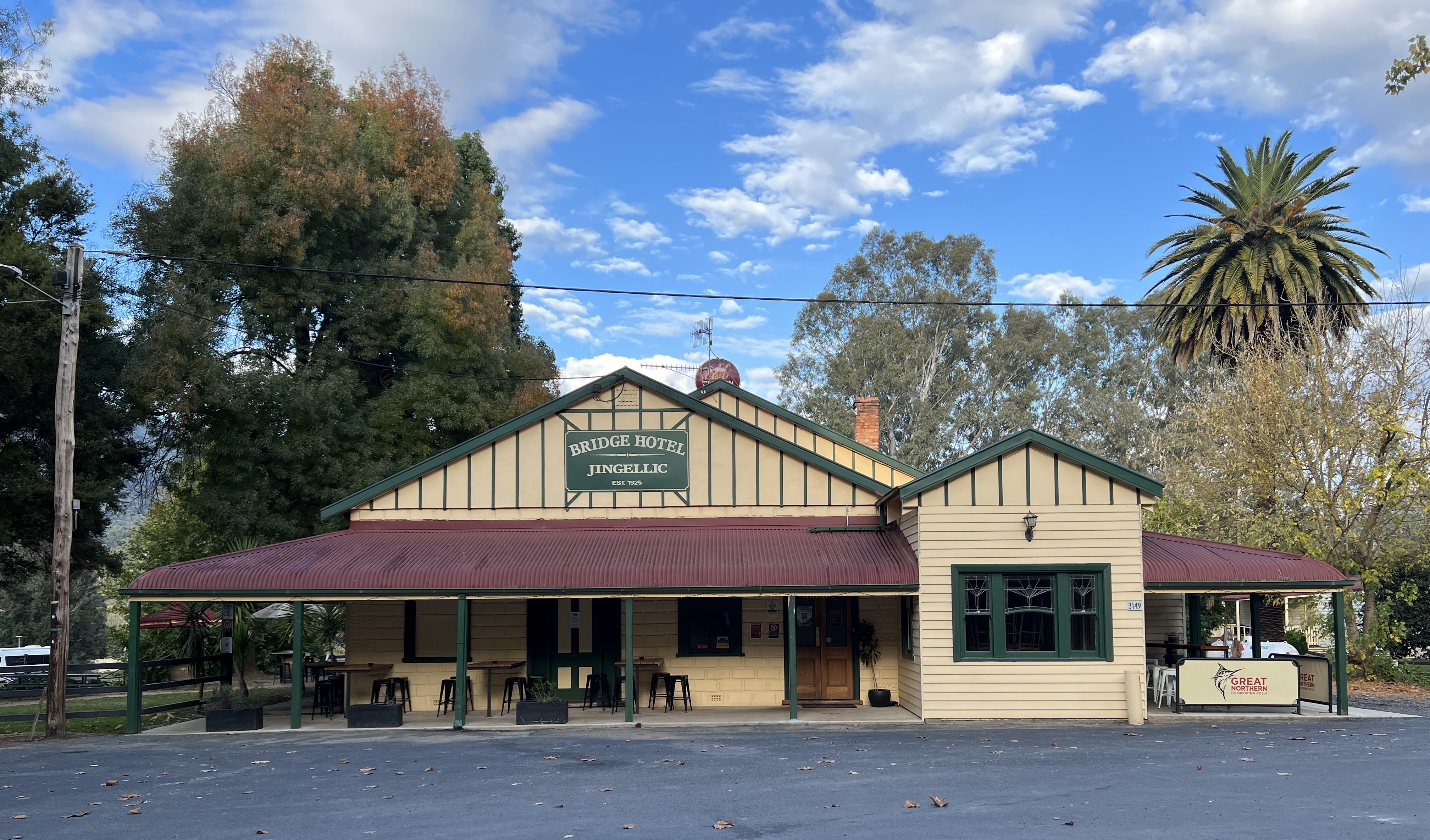
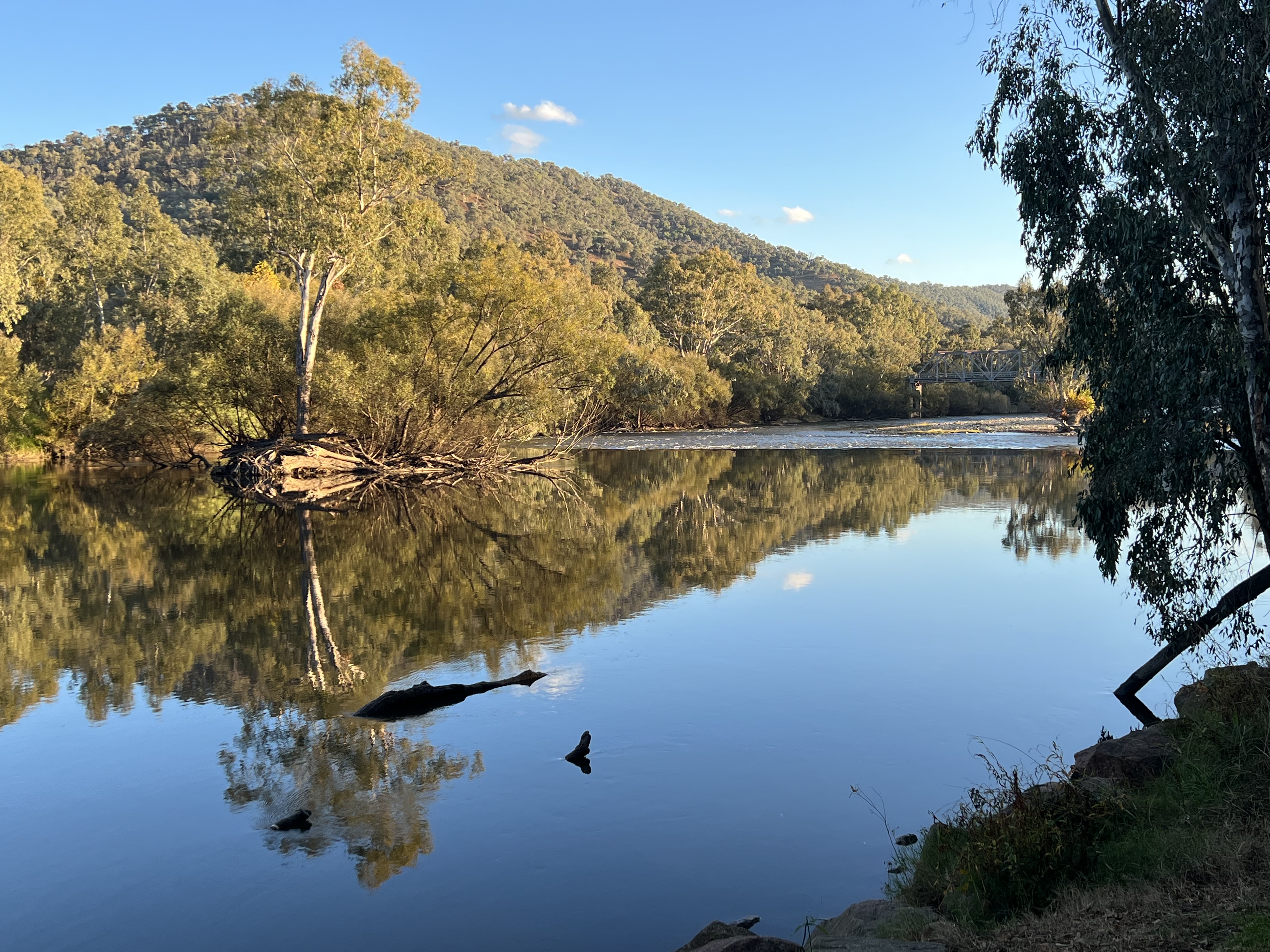
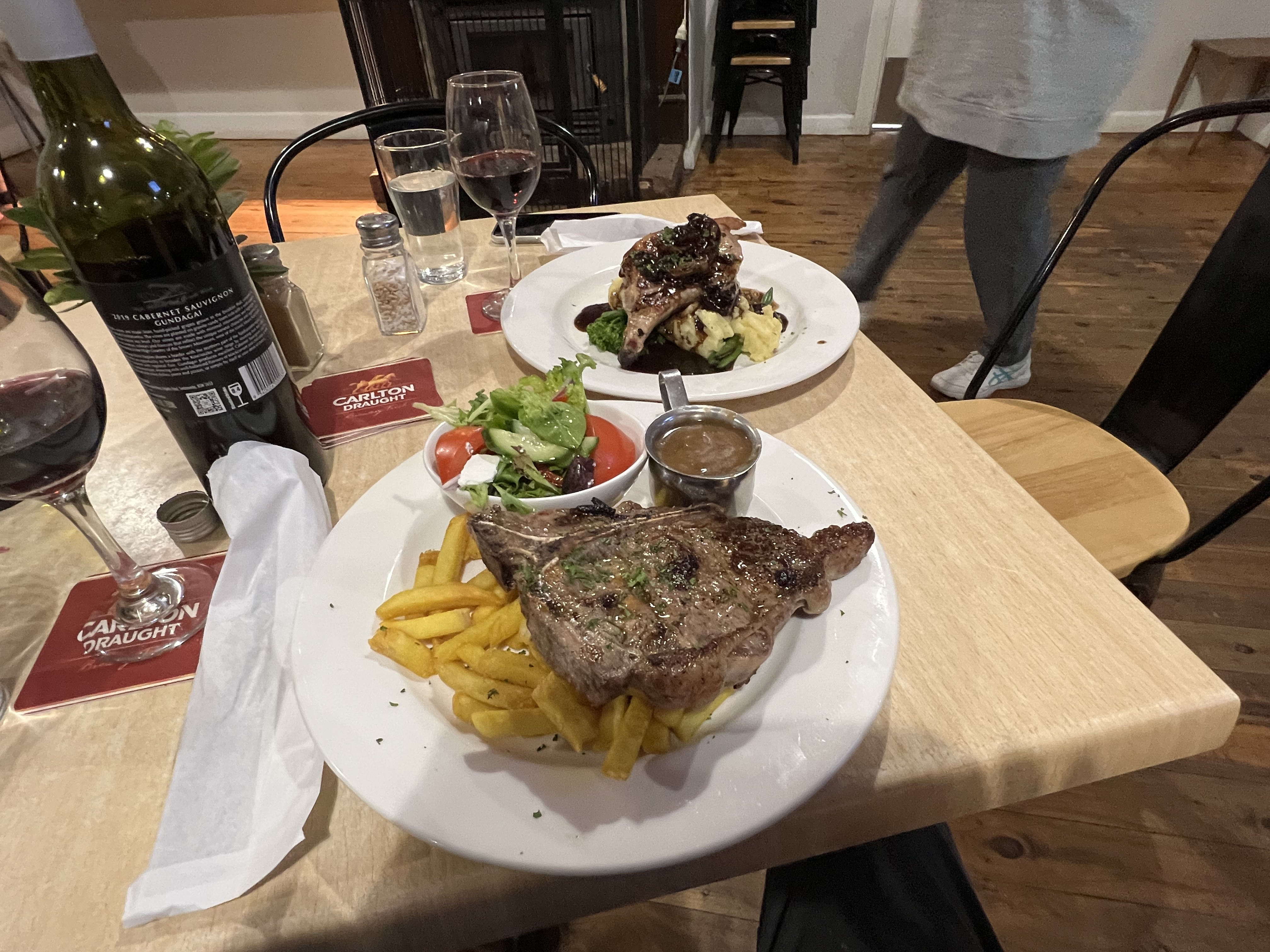
We stop about half way along the route at Jingellic in a free camp on the river, below the Bridge Hotel. This is a great spot beside the river and a short walk to the hotel for a country meal of steak and pork chops. The pub seems to thrive off the grey nomads camped by the river. Grey nomads love to hunt out a free camp, but are then happy to lash out at the nearby pub on steaks and other stuff! One of the great ironies of travelling in the van!

The Great River Road drive ends at the outskirts of Albury. The Hume Dam holds the Murray back in a vast catchment, it seems that there is currently an abundance of water in the system as the water catchment stretches back a long way along the road as we come into the Lake Hume Dam wall area. We are here for a few nights to explore the delights of Albury.
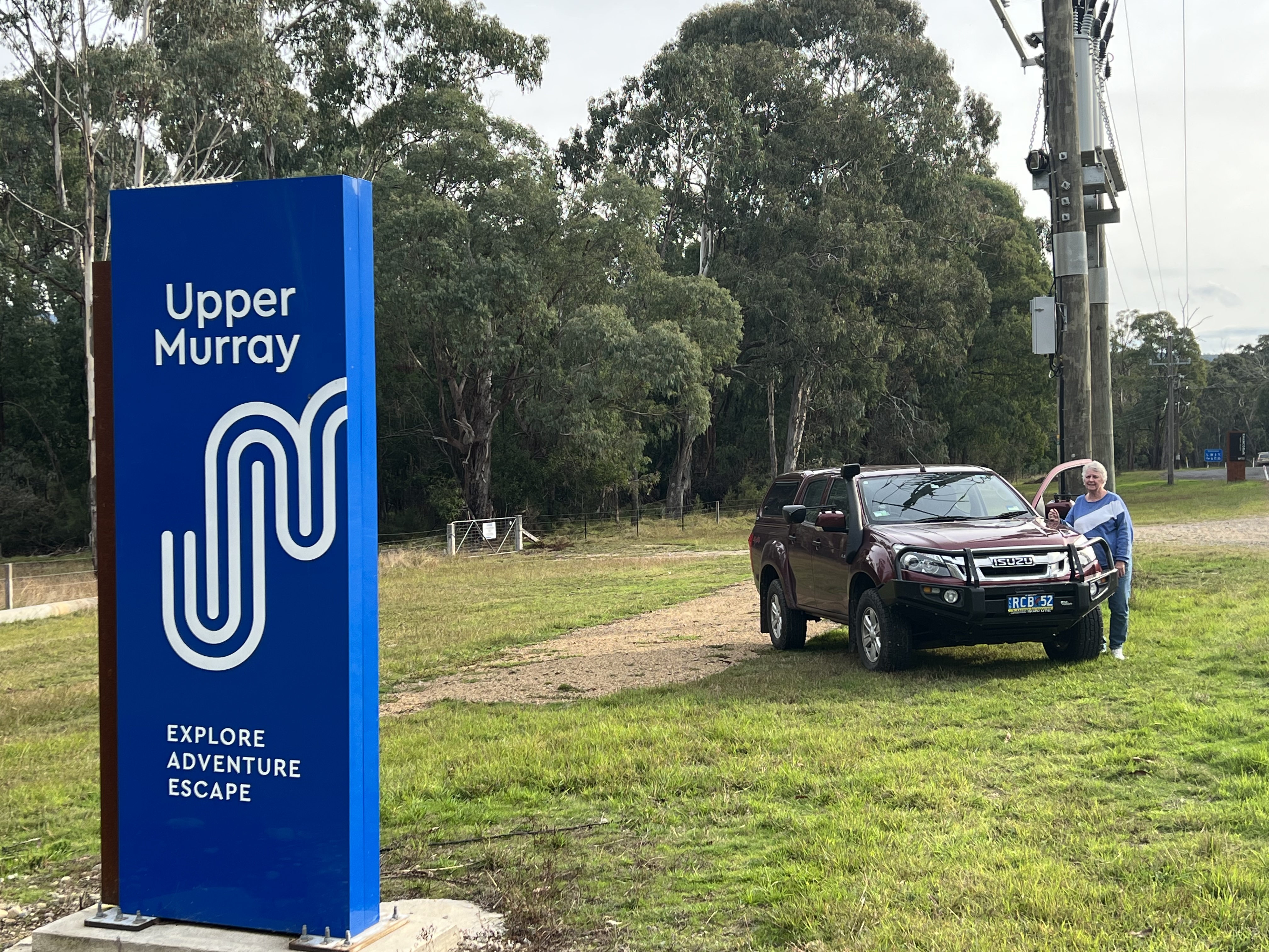
The Great River Road
This is the name that the travel consultants have given to the drive from Khancoban to where the Murray banks up against the Hume Dam about 15 km from Albury. Goodness knows what they were paid for the fancy logo! But it is not a bad one.
We have left Tom Groggin and headed back down the Alpine Way to Khancoban, getting used to this drive. It has been a chilly couple of days in the mountains, no internet. Solar power and gas keeps us going and the tanks hold enough water for sparten hot showers. Isolated from the daily news barrage, have not missed the political classes struggle on the hustings and the media drivel that follows them.
After topping up with water and emptying the potty at the dump point at Khancoban we move on . I don’t have any pictures of the dump point process but will take some at the next available opportunity to share them with my dear readers, who may not be familiar with the activity.

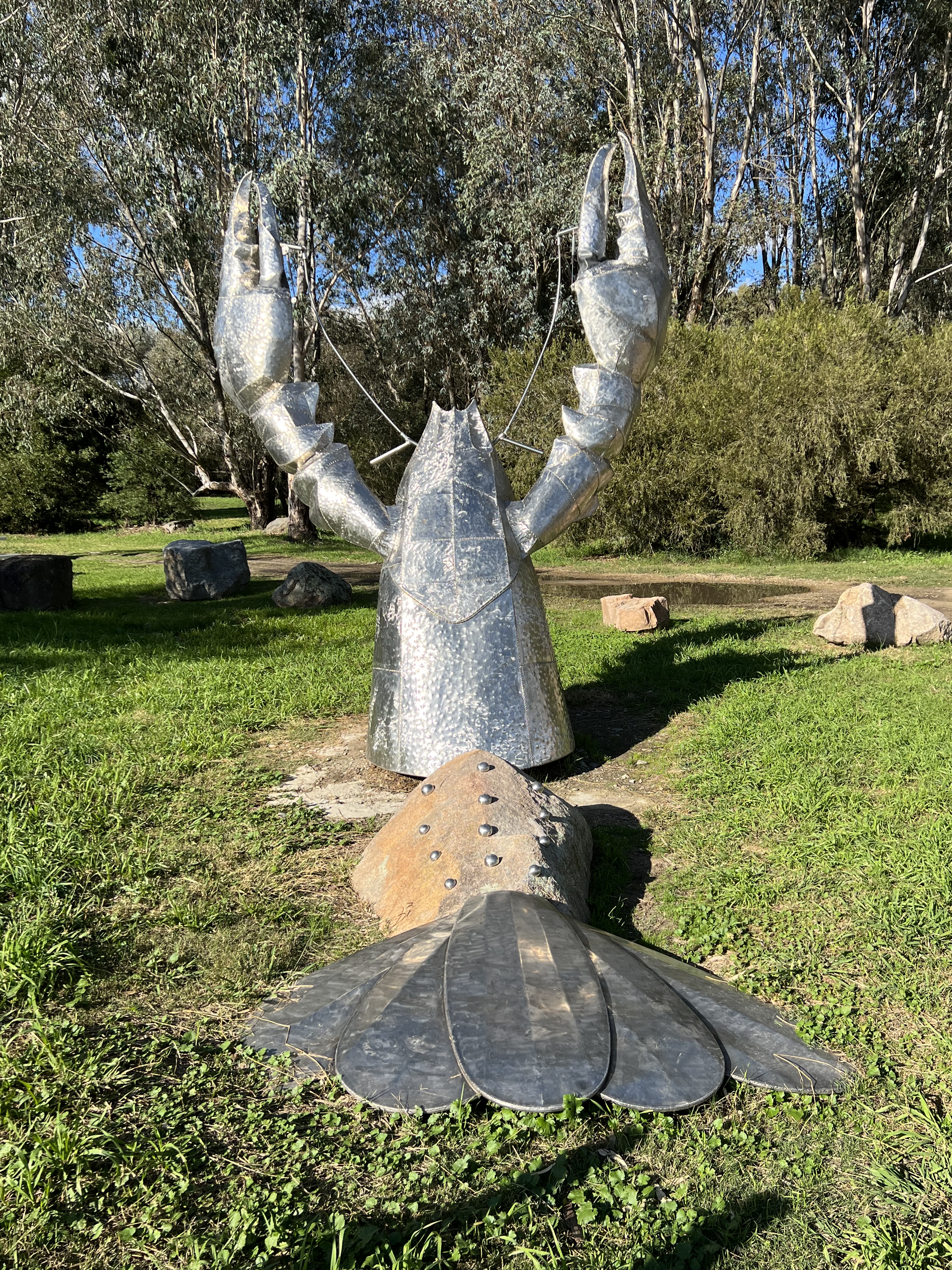
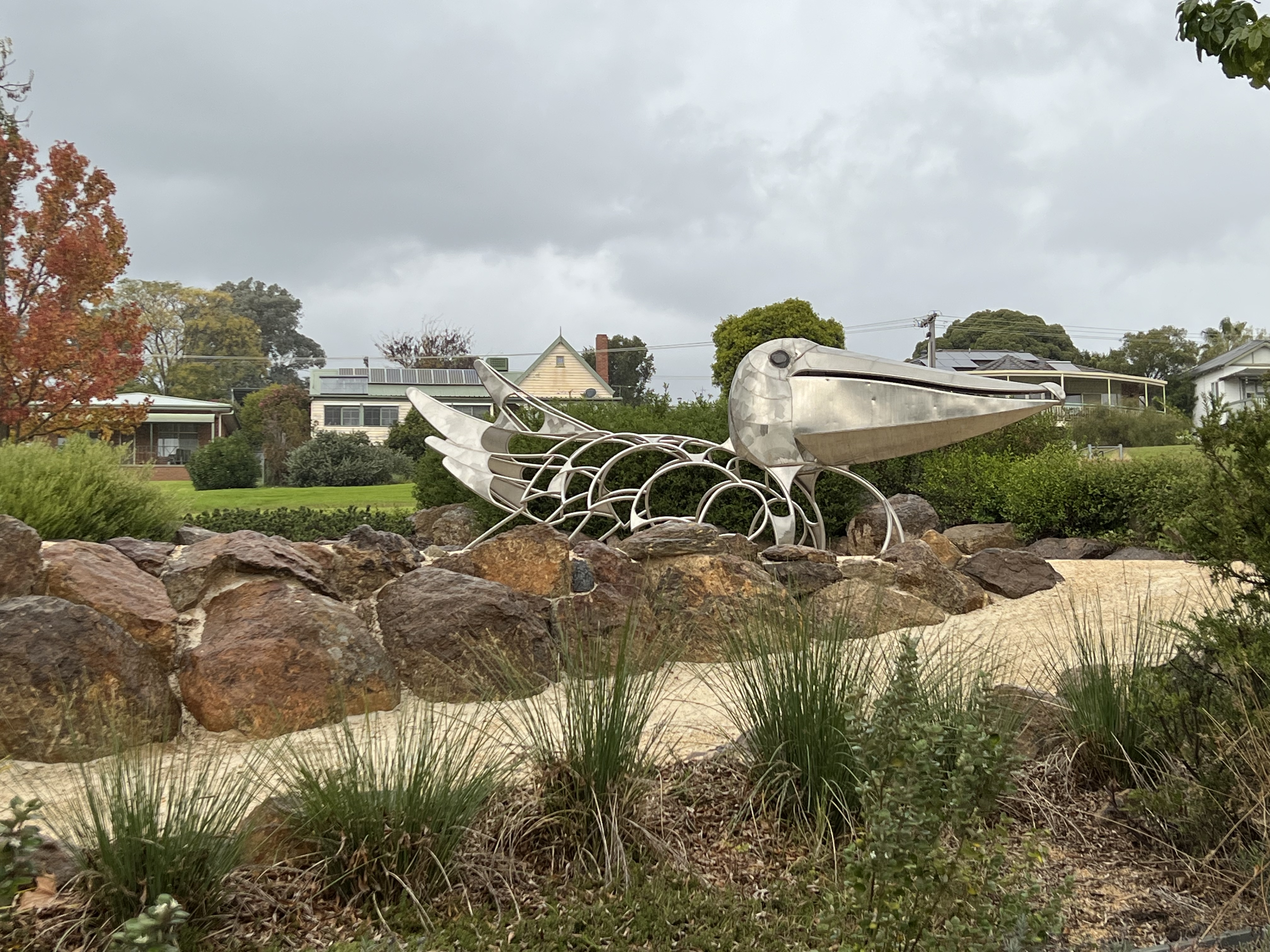
We cross the Murray and enter Victoria for the first time on our journey at the Bringenbrong Bridge. It is a great little spot showcasing the Murray as it continues the rush downstream. Along The Great River Road a number of sculptures have been placed highlighting aspects of river life. Here it is the Murray River Crayfish, a sort of big yabbie. It is I believe the second largest fresh water crayfish in the world, it can be caught (subject to seasonal and bag limits) and features on regional menues along the river.
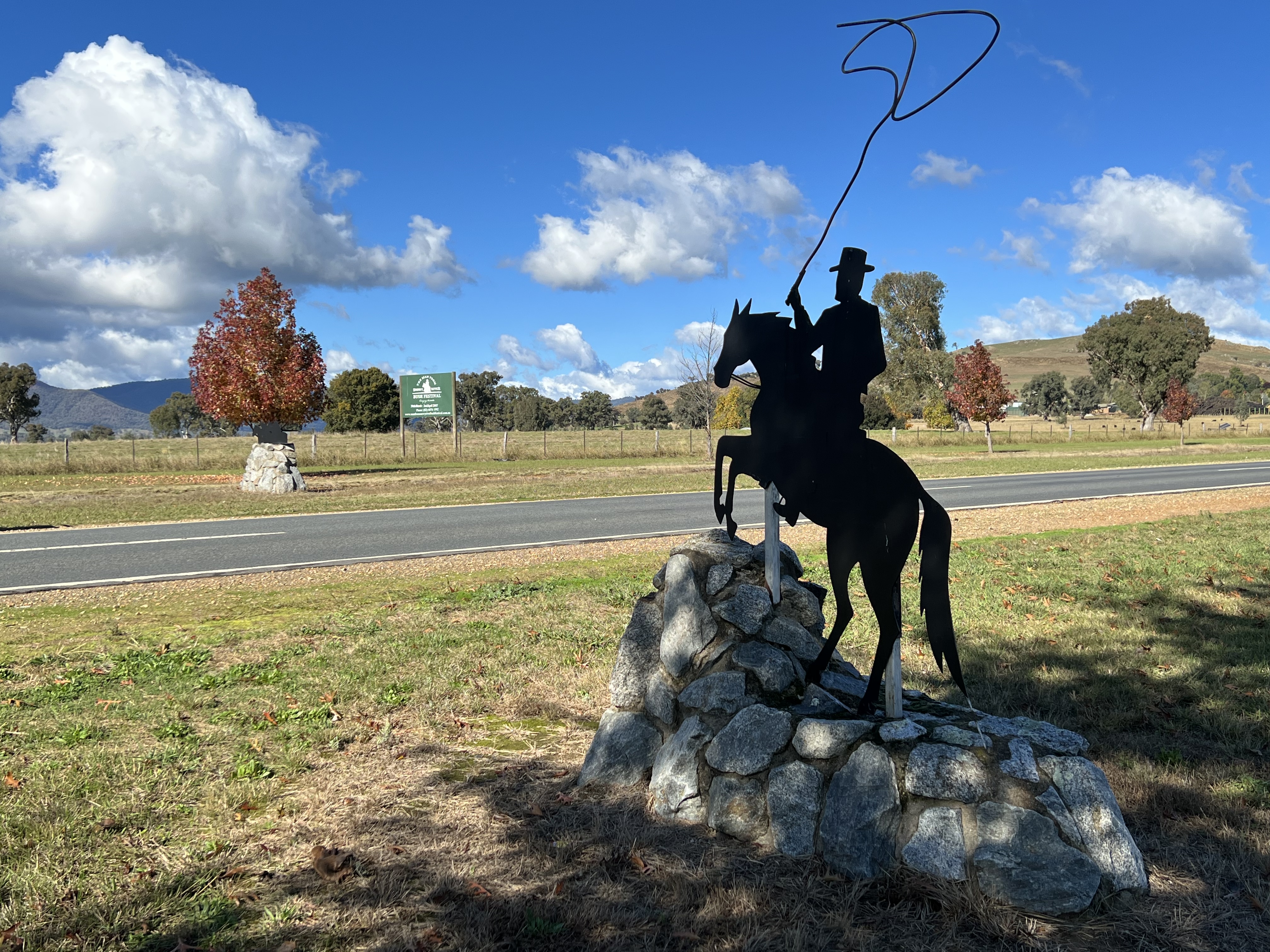
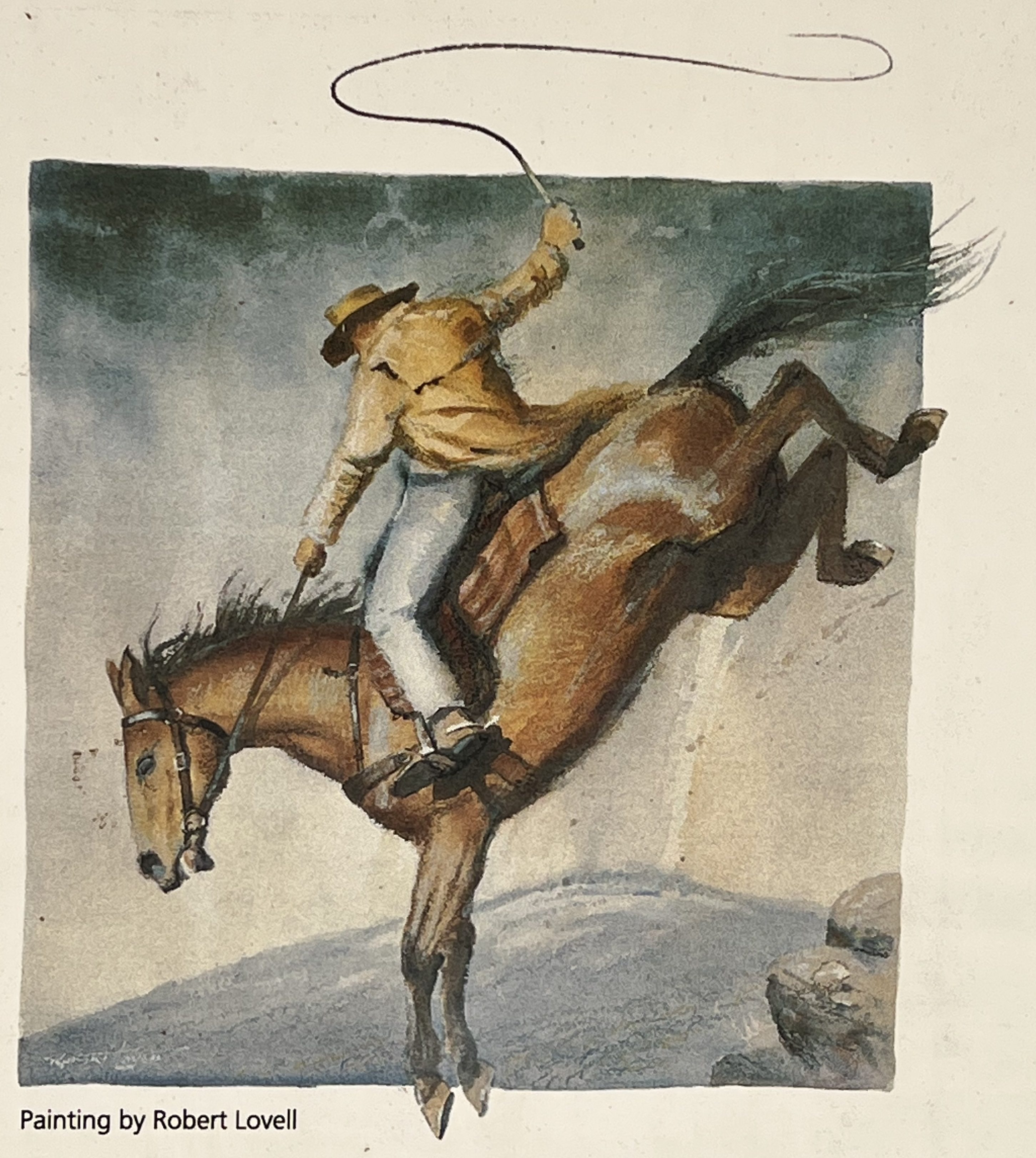
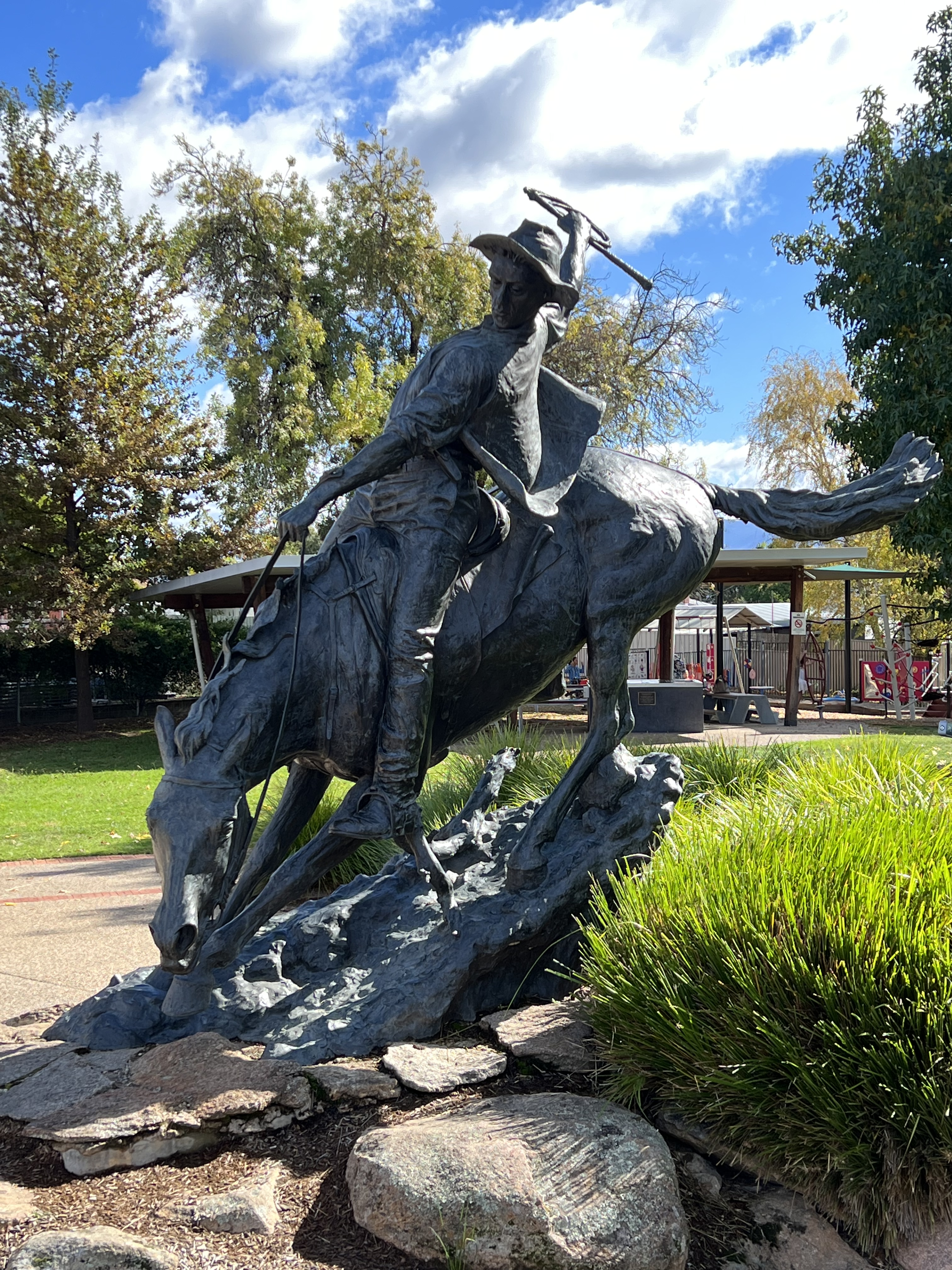
Further along we take a side trip off the road and drop into Corryong, The Man from Snowy River (MFSR for short) Bush Festival takes place here each year. Corryong is the MFSR capital of north east Victoria. it has a stranglehold on the poem written by Banjo Patterson, ‘The Man from Snowy River’ not to be confused with ‘Clancy of the Overflow’. Allthego struggles with this not being a student of the poem(s), or perhaps ‘tales’ is a better description. There are a few sculptures, murals and other oblisques around the town commemorating the story and its central character.
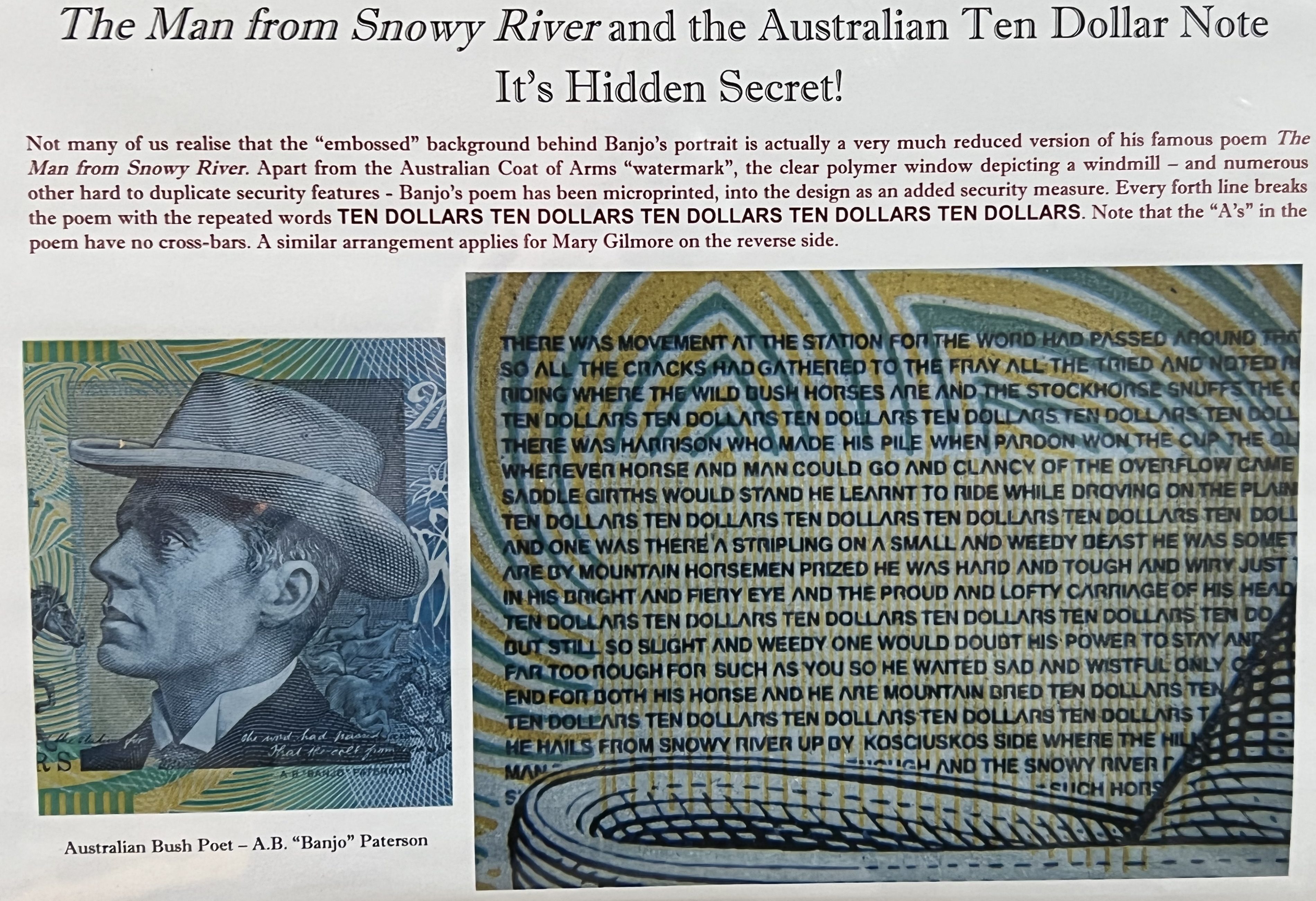
Even our $10 note has Banjo’s tale immortalised behind his portrait.
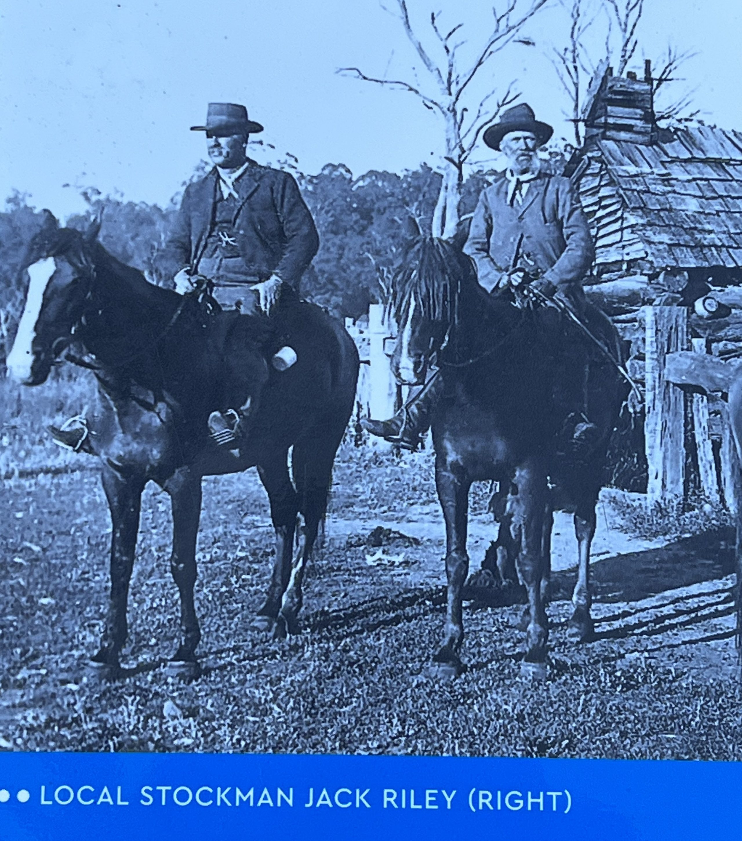
We headed off up to the local cemetery to see the grave of Jack Riley. Riley was a mountain recluse and lived in the high country, a tough old coger who died while being brought down to a doctor in terrible conditions. Patterson had visited Riley at his hut on Tom Groggin Station in 1890 and it is thought that one of Riley’s stories was the inspiration for the famous poem. Prior to his death Riley said that ‘Yes , he was the man, but Clancy wasn’t there’. Well who knows. It is a good tale!
But, we have to move on for lunch at the Bottom Hotel, this establishment is at the bottom end of the town. We didn’t check if there is a Top Hotel at the other end of town. At the Bottom Hotel though Allthego enjoyed a Rainbow Trout and Homealone a chicken parmie. Allthego last had a Rainbow trout something like 50 years ago when he was camping with an old mate, Robert Ebert, at Jindabyne. Caught one way back then and had it grilled. It really is a sweet fish, great with a bit of salt and lemon.

So it was then back on the road and we will see where that takes us next time.
At the spot, but not quite, but close enough.
We have made it to Tom Groggin Campground. A pleasant enough drive along the Alpine Way from Khancoban, 52 km or so. It is another 58 km onto Thredbo. The road was fine, steep and a bit narrow in sections. Some great views out over the ranges and valleys below.
We had the campground at Tom Groggin mostly to ourselves, a couple of other campers were there, but they came and went after a night stopover. The campground is the most accesable point to the Murray River from its source which is more than several km further upstream in the vicinity of ‘The Pilot’, a 1580m peak that sits out on its own. One can drive up a bit closer on mountain tracks but then face an overnight hike to the source at what is known as the ‘Indi’ spring.
The river at Tom Groggin is swift flowing and only a metre or so deep, but it is a great spot, smoother flowing waters upstream and some mini rapids below the campground. All very tame though.
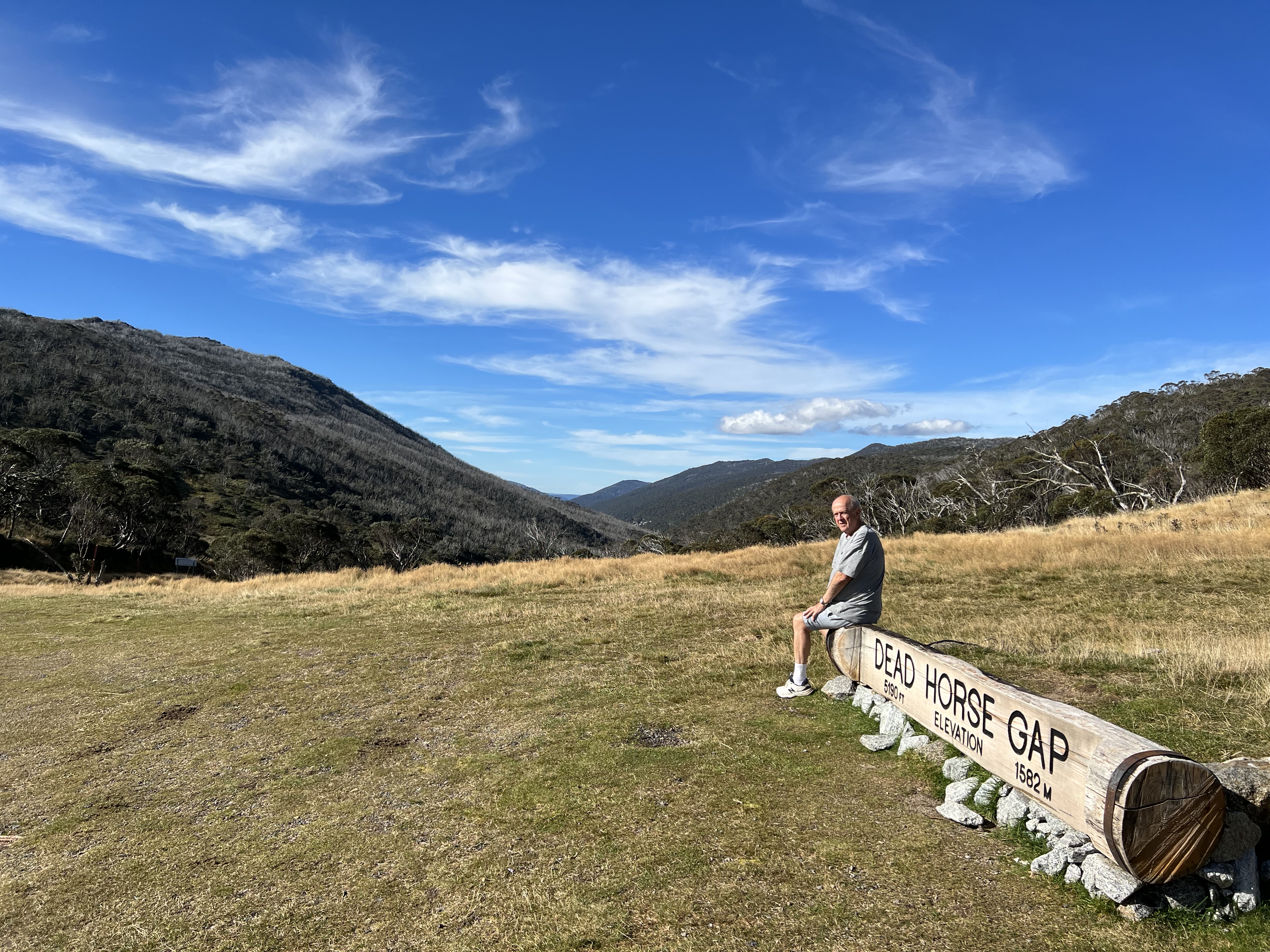
We have used Tom Groggin as a base to head further along the Alpine way to Thredbo, ultimately going down to Jindabyne to get fuel, Sundays are not a good day for fuel at Thredbo. Along the way we passed the ‘Pilot’ lookout, we felt no desire to pursue the source of the Murray further in its direction. Coming into Thredbo the road passes through Dead Horse Gap, requisite photo taken on the log looking down into the valley below. We retraced our steps to Tom Groggin, these sort of testing drives always seem easier on the return, one knows the bends I suppose!
We have no power or water at the campground so are reliant on the sun to top up our batteries and the water tanks to last. Renewables have proven a boon for campers but you do really hope the sun shines. We don’t have one of those diesal generators as support or for that matter a EV battery charger point to rely upon. Oh, well, lets rely on the sun for the time being others seem willing to do!
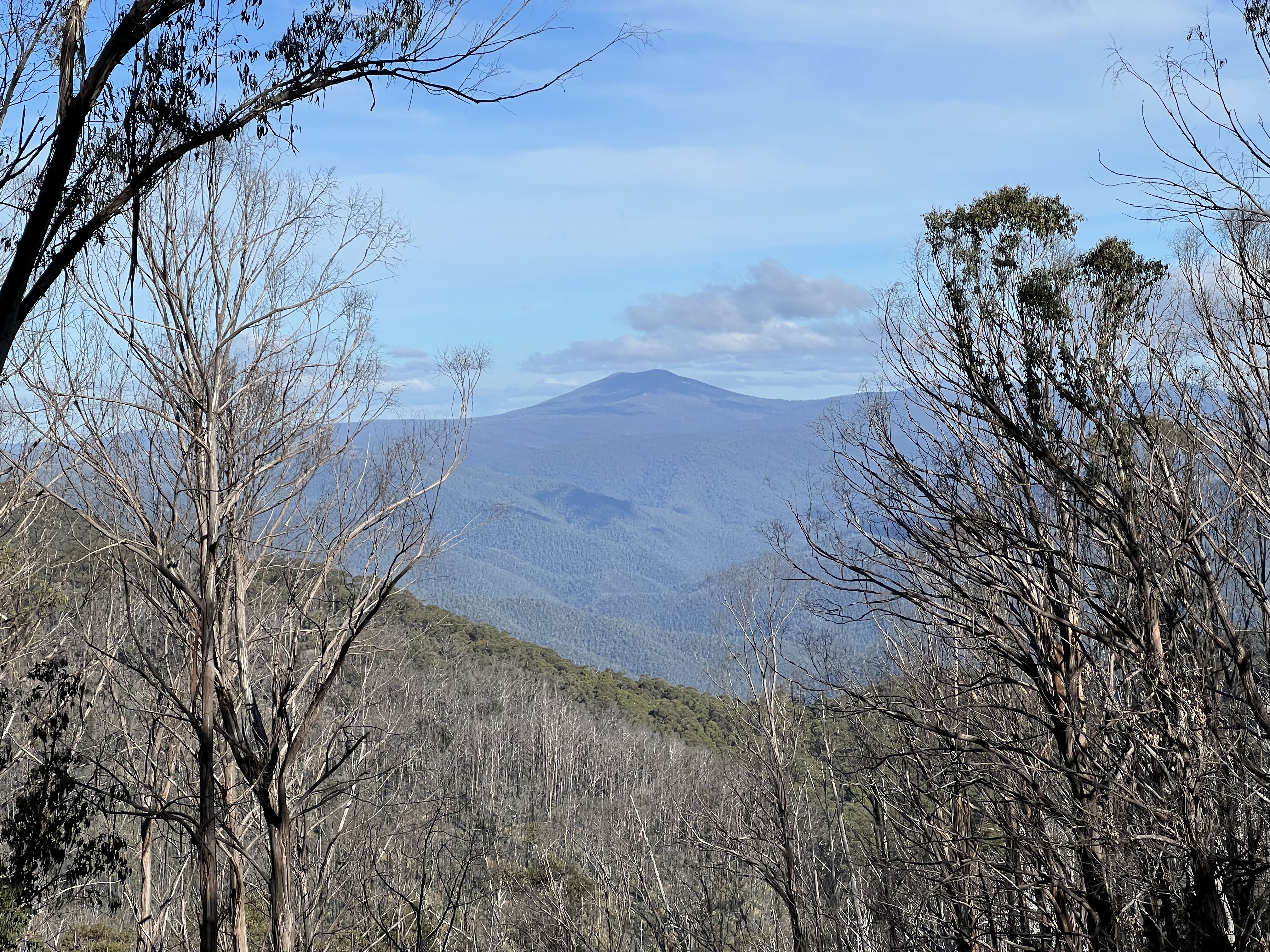
Along the Alpine Way there are a number of lay by points which allow views over the ranges and valleys below. A number of side tracks take one to lookouts, Scammels Spur and Olsens Lookout provide great views of the main range, Mt Kosciuszko albiet hidden behind another peak on the right. The Swampy Plains River is crossed at the Geehi Camping area, a great riverside camp spot.
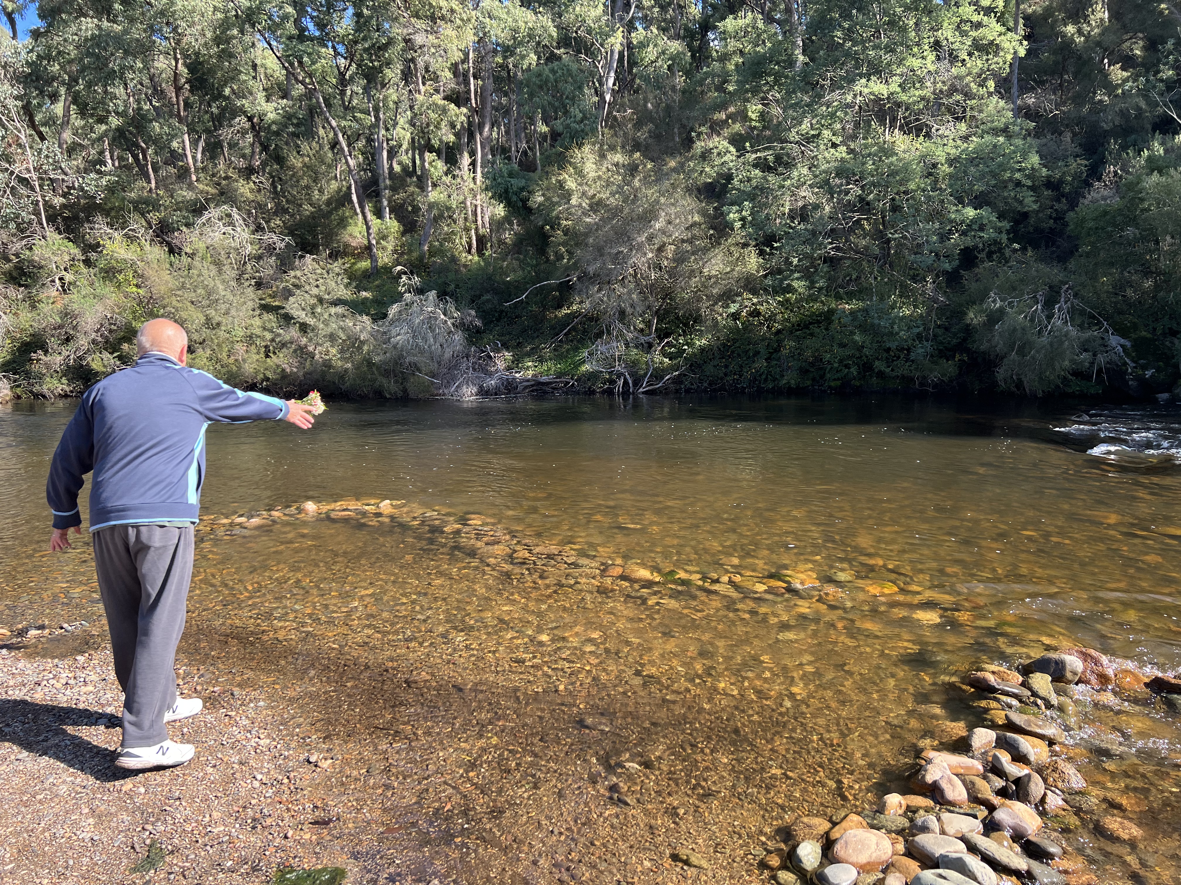
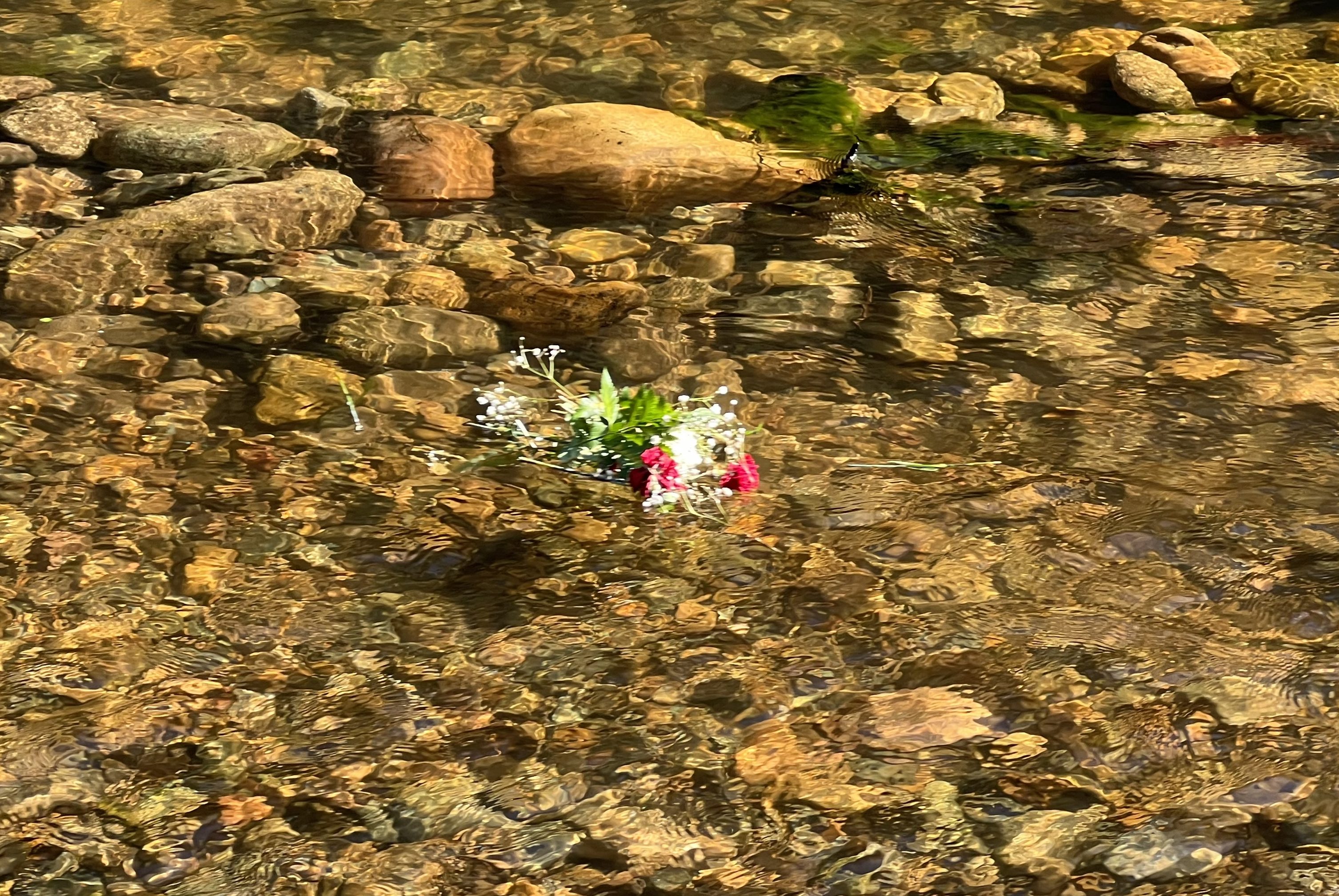
A couple of days before we set off on this journey it was the time of our wedding anniversary. The old romantic had picked up some flowers to help celebrate the occasion. The flowers proved resiliant and Allthego thought it appropriate to take them on the road. As might be expected thay withered and at Tom Groggin it was acknowledged that their time had come. So Allthego tossed them into the Murray and they set off on a long passage to the sea in South Australia. Maybe they would wash onto a bank along the way and we would stumble upon them?

We have taken the opportunity at Tom Groggin to have some fires, in part to keep warm but also to experience that great outdoors feeling of heat and a bit of smoke. Had some steak one night over the fire and the other a freshly made meat lovers pizza in the Weber and then enjoyed by the fire. It was a pretty cool night; doona, blanket and rug keep the chills at bay! Some brumbys charged through the campimg ground during the early night hours, they lingered it seems and left tell tale signs of their passage.

Tom Groggin is the start of our Murray River passage, but we need to head back the way we have come to Khancoban and then continue along what is known as “The Great River Road’ beside the Upper Murray.
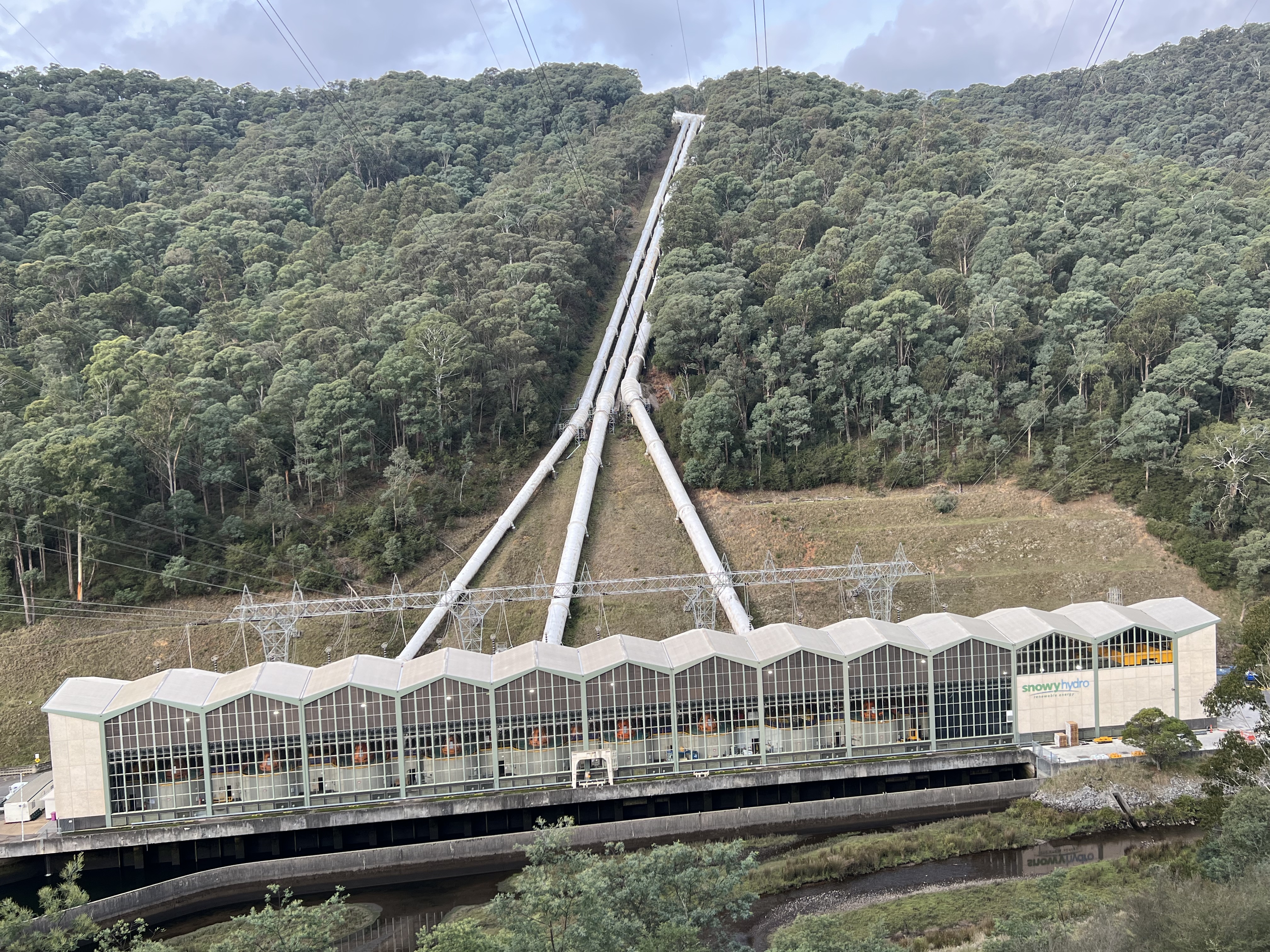
Khancoban and where all the waters run.
Khancoban is an interesting little town beside Lake Khancoban, it is really one of the Snowy Scheme dams built about 60 years ago, say it quick and it doesn’t seem that long ago.
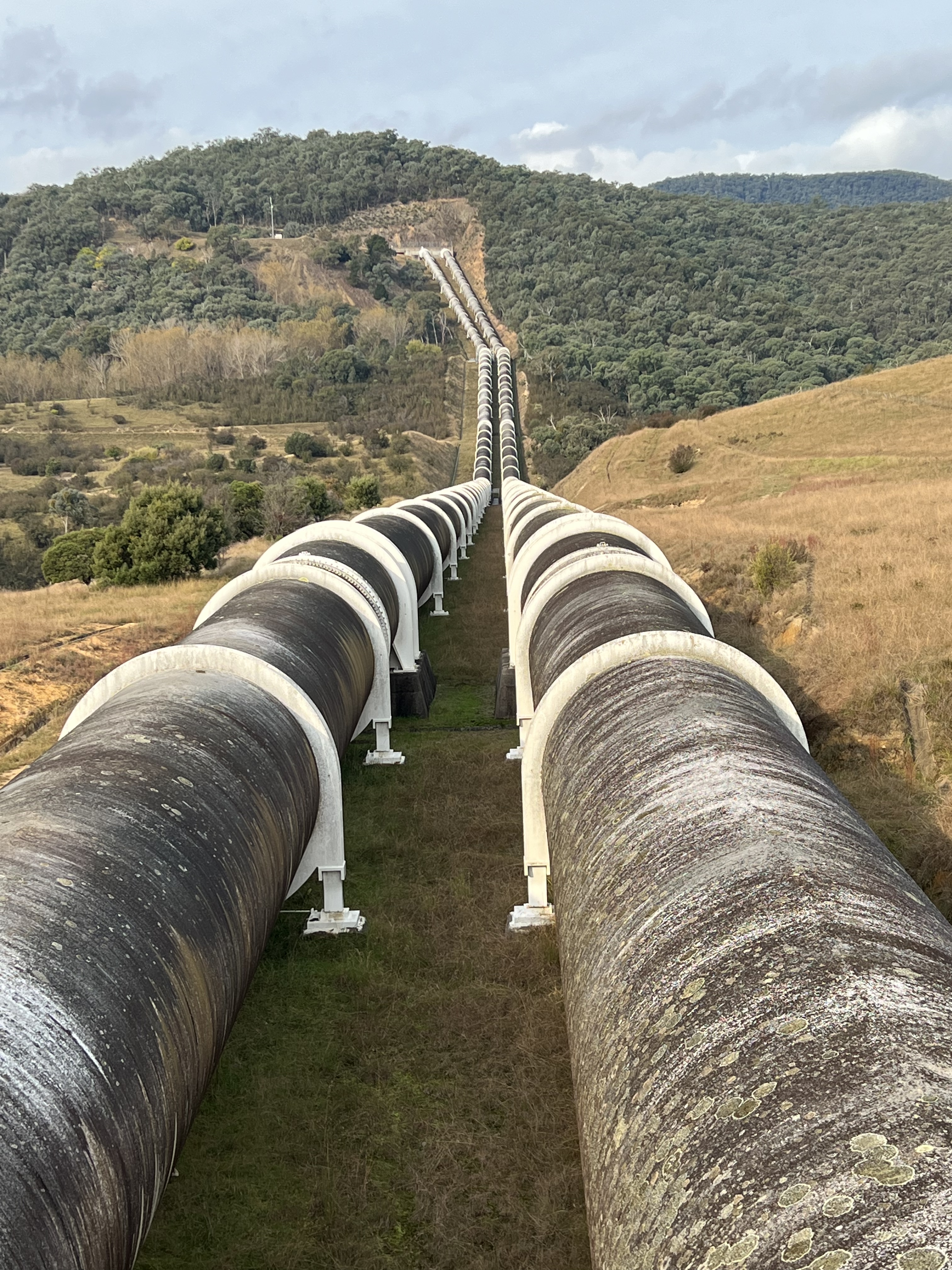
We are using Khancoban as a base to do some touring around the area before heading into the ‘high country’ up to Tom Groggin along the Alpine Way. Khancoban sits on the western flank of the Snowy Mountains and the waters that flow into the dam are headed for South Australia. The two main streams are the Geehi and Swampy Plains Rivers, these rivers are prominent features as you drive around, as well as the power stations and pipelines descending from high above.
Over on the eastern side of the range the Snowy River rises, the source of which (like the Swampy Plains River), is in the shadow of Mt Kosciuszko and it runs east and then south ultimately into Bass Strait. In recent years we have added a ‘z’ into Kosciuszko. To do with properly reflecting the name of the Polish patriot after which it was named, (I think this is the reason). Didn’t have a ‘z’ in it when I was at school, but I was never much of a speller back then anyway. The Snowy runs down and it’s waters are collected in the Jindabyne Dam. Here water is pumped through tunnels and ultimately ends up in Khancoban Lake, some is allowed to flow down the course of the Snowy River below the Jindabyne dam wall. There is great argument about these flows and the environmental impacts.
Allthego must apologise to his readers for this little treatise, it is very brief, omits much and probably suffers from the odd inaccuracy of detail. But who cares I an trying to give some context to where we are. Here is a little map to help put things in perspective.
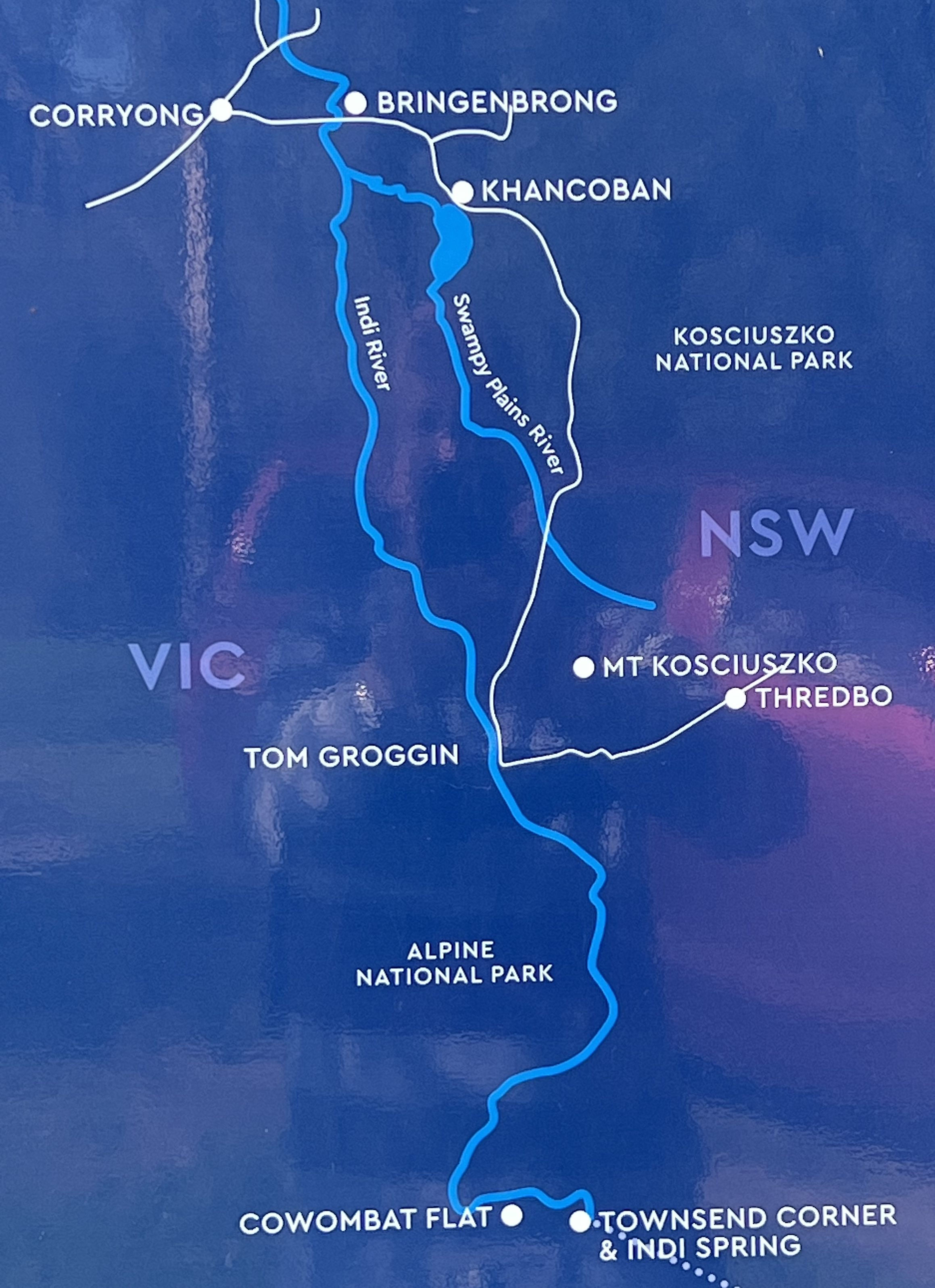
Back in Khancoban the Swampy Plains River flows out of the spillway of the dam and meanders along for awhile before joining the Murray River near Bringenbrong. The bridge over the Murray here is a starting point for many canoe etc type trips on the river. So the interesting thing about the Upper Murray is that it is a free flowing river and its waters were not harnessed by the Snowy Scheme.

The Murray, also known up here as the ‘Indi’, an indigenous name perhaps meaning ‘you’, rises on the western side of the range in quite remote country near a mountain named The Pilot, but more about this later from Tom Groggin.
On the morning that we were to head off to Tom Groggin we had the pleasure to farewell a young couple heading off on an adventure of a life time with two horses and two kids. The mum and dad weren’t riding the horses but the kids were riding the mum and dad! The horses seemed to be carrying everything else that was needed for this excursion, hope they had enough nappies.
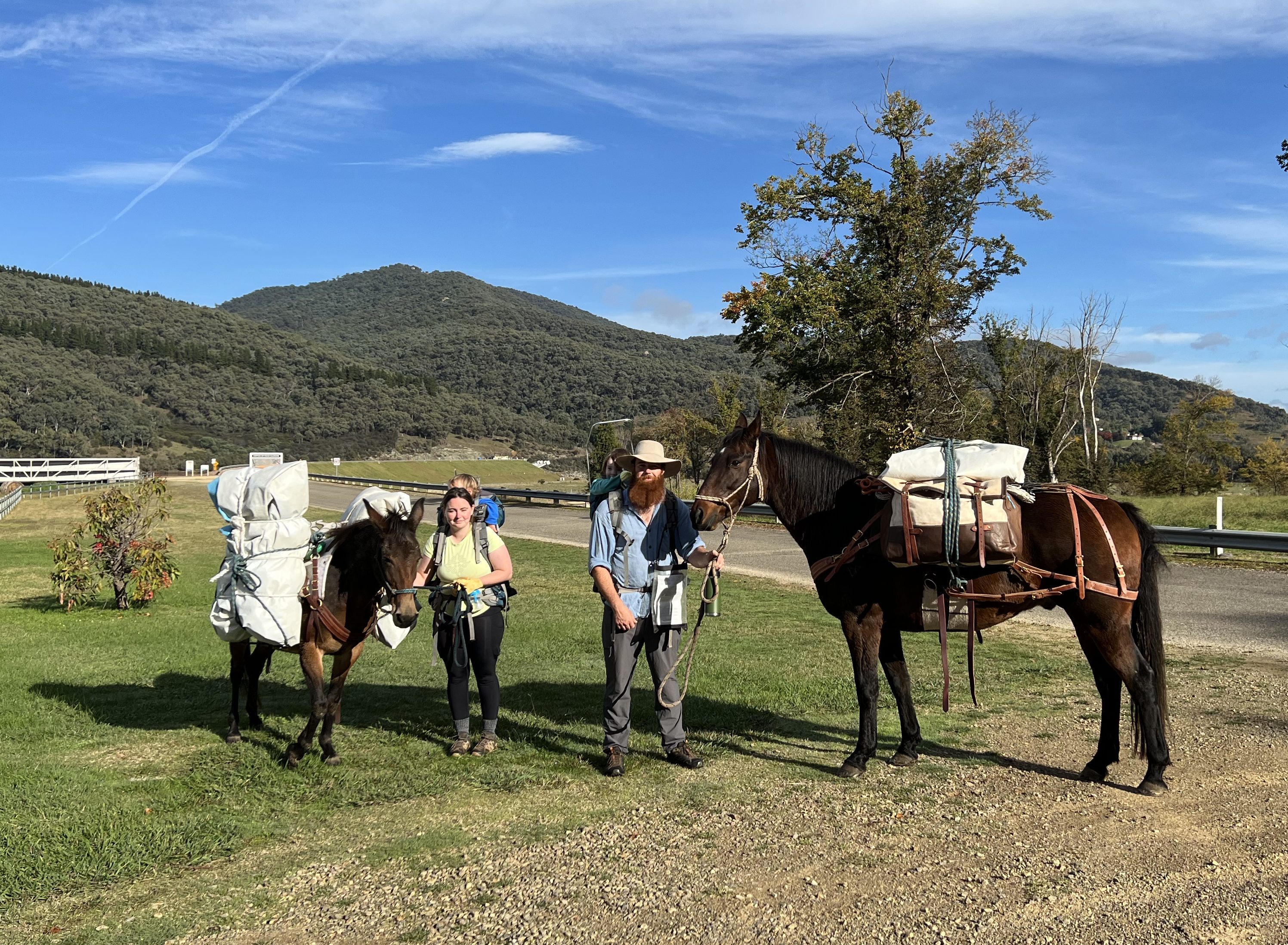
The family were setting off on a six week trek from Khancoban through the mountains and over the NSW western plains finishing in the Blue Mountains, west of Sydney. Well on that note that is definitely enough for the moment!
Tumut to Khancoban
It is a short hop, skip and a jump to Khancoban, 142 km, but we decided to stop about half way at Tumbarumba. The weather was not looking good further along so we decided to hole up here to see if it would pass. We wanted fine weather up in the high counntry at Tom Groggin so an overnight stop at Tumbarumba might just allow that timing slot. We will see.

Great little caravan park not far from the centre of town, plenty of trees around us in full colour. Not to mention an enticing bakery. There was a choice of two sizes in custard tarts, a big one (the normal size I suppose) and a slightly smaller one. Allthego selected the larger one because it is shared with Homealone. Not a bad tart….there was a splash of nutmeg rather than a dusting which made it distinctive. Quite tasty. Nice and firm.
Took the short drive out to the nearby hamlet of Rosewood for lunch at a nursery, ‘Gone Barny’. Great spot and a nice cafe type lunch. Tumbarumba to Rosewood is a popular 20 or so kilometre rail trail for cyclists, along the old railway line from Albury, long closed of course. Rural scenery special, plenty of horses in paddocks.
Next morning it was back on the road to Khancoban which is on the western side of the Snowy Mountains. It is the last town on the Alpine Way before entering Kosciuszko National Park and sits beside Lake Khancoban, really one of the Snowy Scheme dams. There are some great views of the High Country along the way. Sections of the road are lined by poplars and other varieties.
Our campground is beside the lake and we are greeted there by a rainbow trout sculpture. Further up the Alpine Way is Tom Groggin Campground beside the upper reaches and not far from the source of the Murray River, known as the Indi River in this section of its course. Tom Groggin is our next destination, weather permiting for two nights, for the start of our run down the Murray.
Tumut
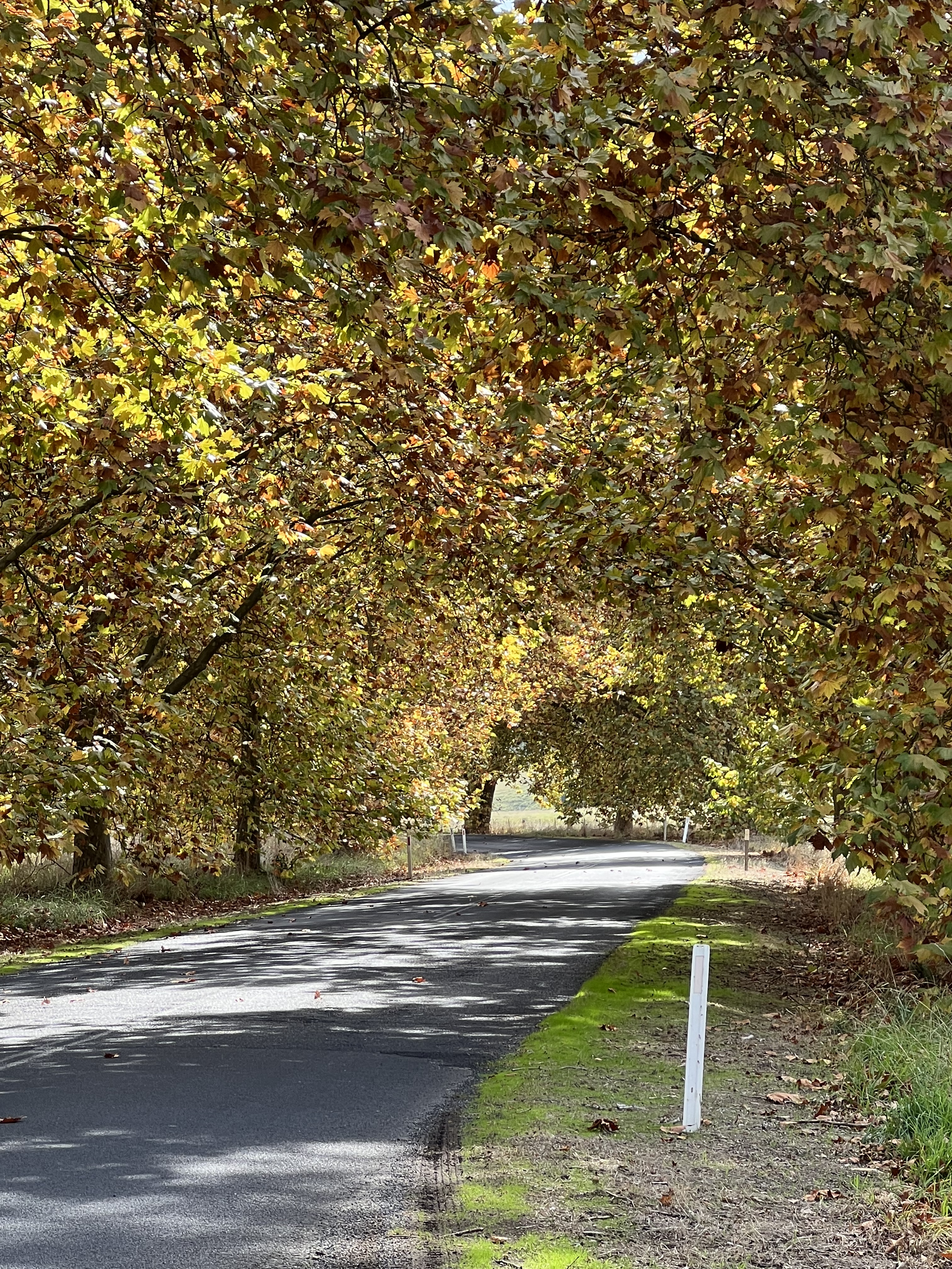
We have made it to Tumut. This is a neat little town and we are camped on the banks of the Tumut River a few hundred metres from the centre of town. Sort of too far to walk but not far enough to drive. So it depends what mood you are in and what you have to carry back of course! Allthego set off early one morning along the river walk, very pleasant stroll into town. The objective was to pick up a loaf of bread for breakfast from the local bakery, but what does one find at a bakery, all sorts of goodies. So back he came with some bacon and cheese topped buns and a custard tart, as well as the bread of course. Carting this stuff back resulted in the bread being a little crushed in order to save the rolls and the buns. The buns though were excellent along with some bacon and eggs for breakfast beside the shallow swift flowing river. This part of the world is now showing the full colours of the autumn transformation. The poplars, elms and liquid ambers are golden in colour with splahes of orange and red here and there. Fallen leaves cover the campsite.
Tumut is a very outdoors sort of place being in the foothills of the Snowy Mountains. The Tumut River is a tributary of the Murrumbigee River, Australia’s second longest river. The headwaters of the Tumut, as well as its tributaries, have been harnessed by the Snowy Scheme for hydro electricity production through a series of power stations. The water ultimately collects in Blowering Dam a few kilometres away from the town before being released downstream, past our caravan site, to ultimately join the Murrumbigee to supply irrigation waters for the Riverina agricultural region. The Murrumbigee River later joins the Murray at Boundary Bend, near Balranald.
We have had good weather to date. Sunny, dry and blue skies but the forcasters are pointing towards some rain. So we set off to look around the district with an afternoon trip to Blowering Dam and along the Snowy Mountains Highway for awhile towards Talbingo. Next day it was off to nearby Batlow to check out the apples and cider. We came back to Tumut via a loop road through Adelong, a small town famous for its gold mining heritage in the Adelong Gorge. Here, along the gorge banks are the remnant stone works of a major 19 th century gold mining enterprise. Quite an interesting site to view from the top looking down. It must have been a hive of activity a hundred and sixty years ago.

Have finally managed to get to that custard tart for morning tea after a walk around the camp ground. The custard was a nice deep yellow, maybe organic eggs? Plenty of nutmeg on top too for flavour. Quite stiff as well with a nice crusty pastry. A top custard tart from Tumut, superior to the one from Inglewood.
Have had lunch today at the Tumut River Brewing Company, an enterprising spot with a good range of craft beers and ciders. We enjoyed a meat lovers pizza to help with the liquids.
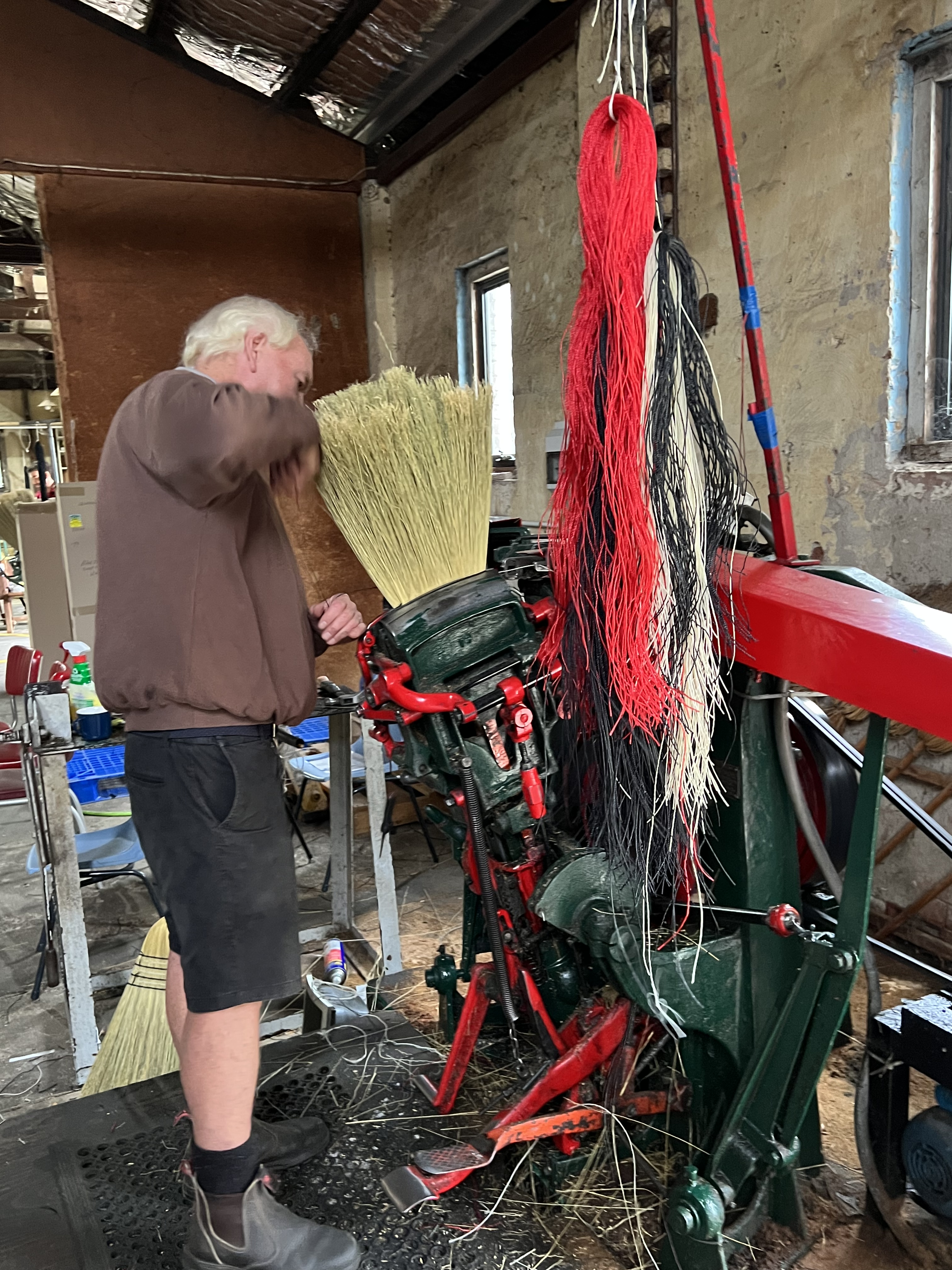
Next door is the Tumut Broom factory which has been making millet brooms since 1946. It is a bit of a cottage industry which now relies on the import of millet from Mexico. Back in the old days Australia produced a lot of millet but sadly our local production is quite small and can’t support this business. The brooms are distributed through hardware groups such as Mitre 10. It seems most people who stop by here leave with a broom! A bus load of grey nomads on tour was here when we arrived and many brooms left with them. Also with us, it will be very useful sweeping the mat outside the van. Got to find room for it somewhere though!
Our last day here in Tumut has been dampened by the onset of drizzle which is forecast to continue for a few days until late in the weekend when the sun returns. We leave in the morning and are not sure of where our next stop will be. We are hoping to time the weather so that we will be high in the mountains near the source of the Murray with some sunshine and blue skies.
Grenfell
It is not far from Forbes to Grenfell, about 65 km. Bob was wrong, two nights is required in Grenfell, unless you wanted to go out and do a few bushwalks in the Weddin Mountains NP, in which case you would need another night or two!
Now, one of the things we have come to learn in our travels is that Australian country towns really like to highlight famous sons and daughters. Grenfell lays claim to four. In no order of importance, Stan McCabe, Jan O’Neill, Ben Hall and Henry Lawson. The last two are quite prominent.
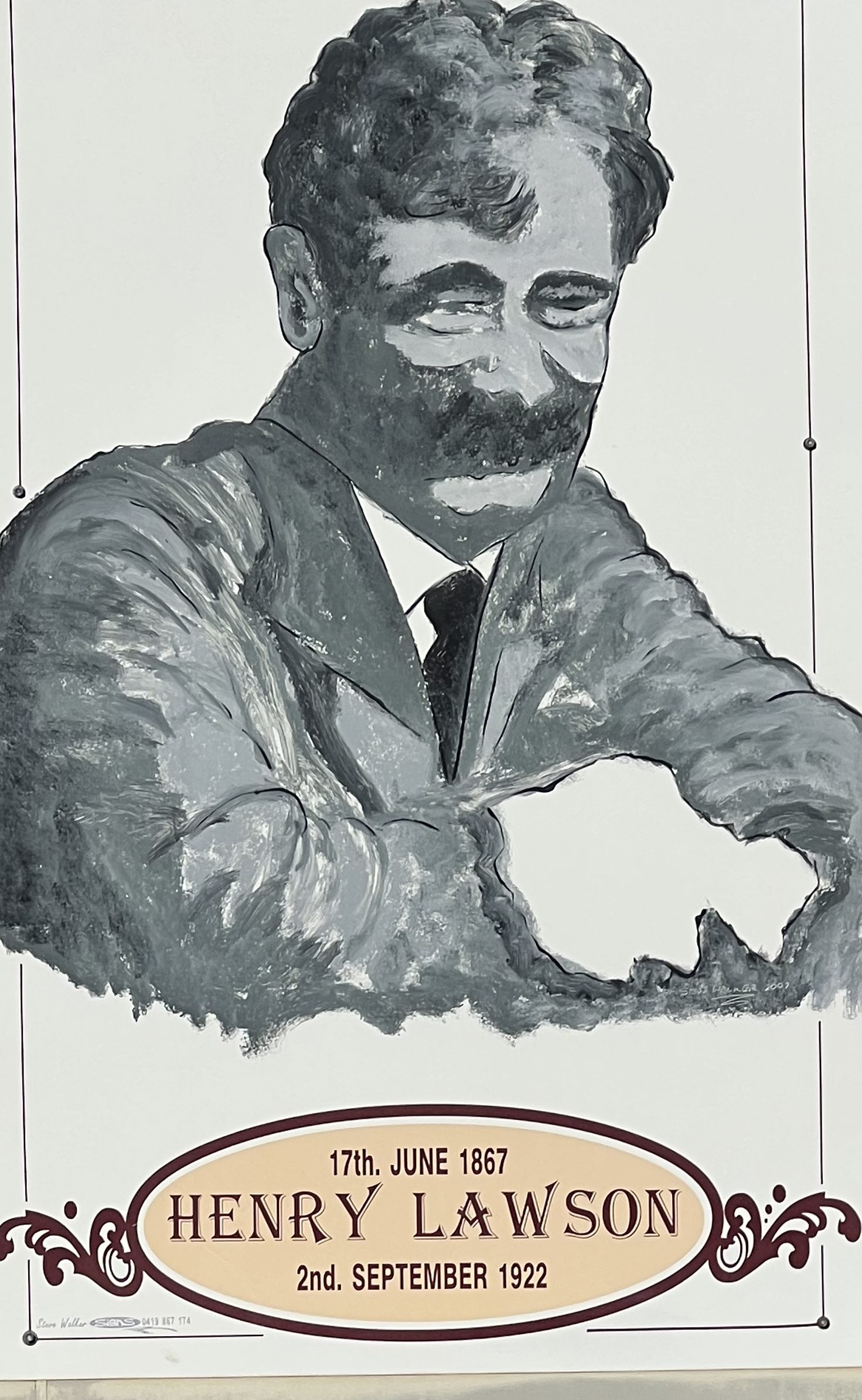
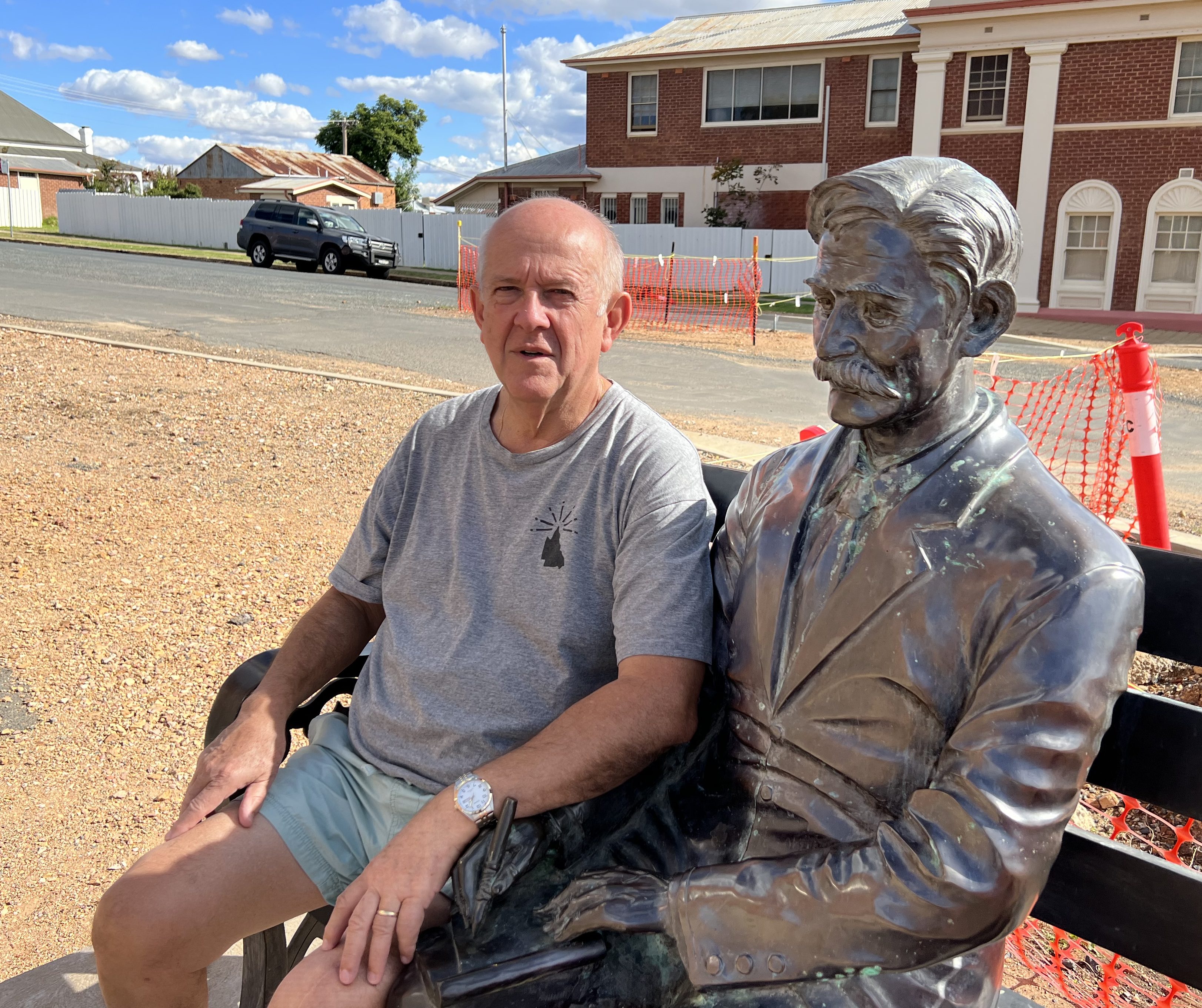
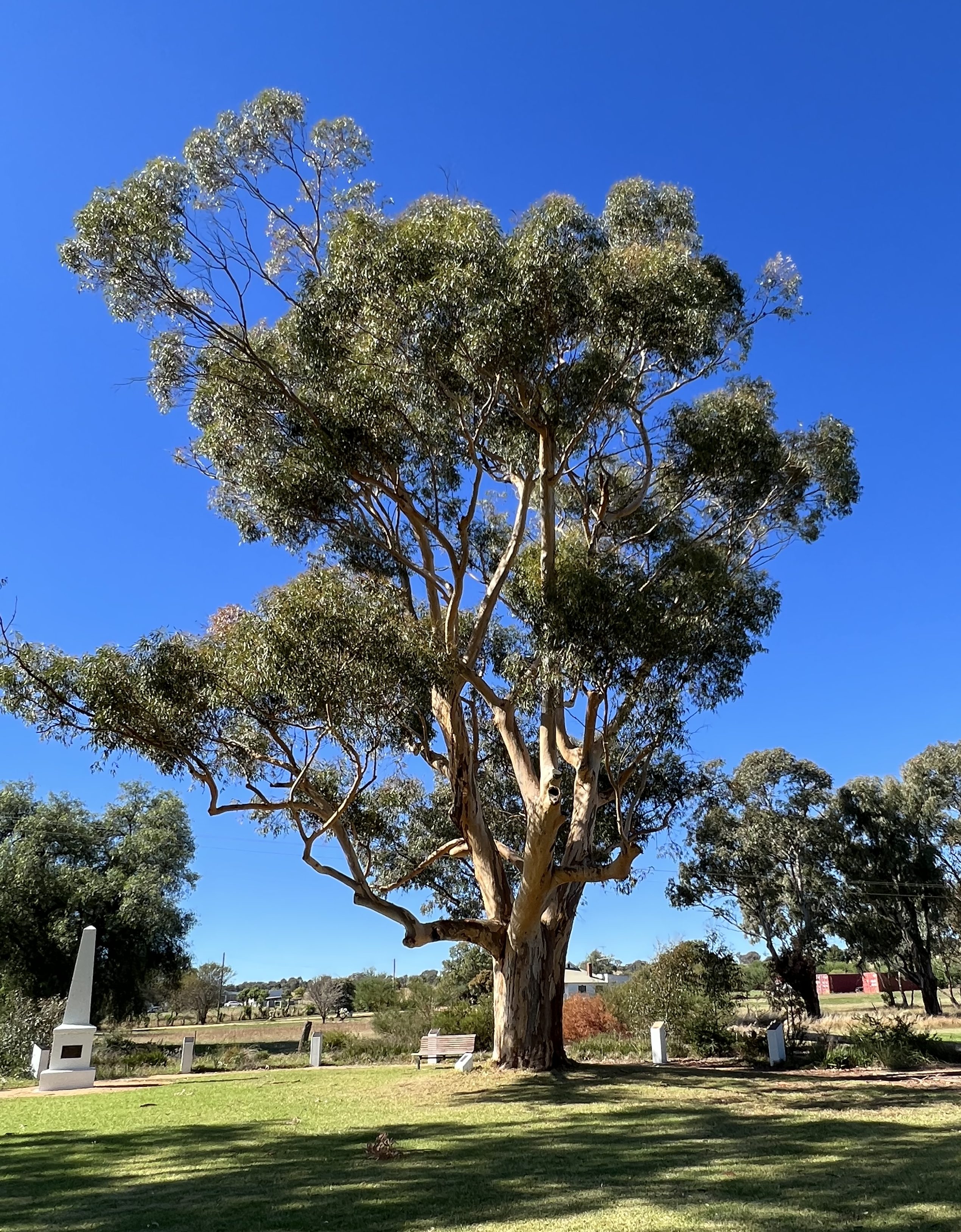
The town has the annual Henry Lawson Festival. Lawson was born on the gold fields in Grenfell in 1867. He left, never to return, several months later as a child in arms. After leaving town as a youngster he became profoundly deaf after illness and with limited formal education he went on to be one of our celebrated late 19th Century early 20th Century poets and story tellers. Much is made by Grenfell of the Lawson heritage. There is a sugar gum planted in 1924, near where he was born, that is growing strongly today nearly 100 years later. It looks like it will live for many years yet to come. A statue to sit by on a street corner and a bust with buttons to push that play some of his poetry and tales (only during daylight hours of course!).
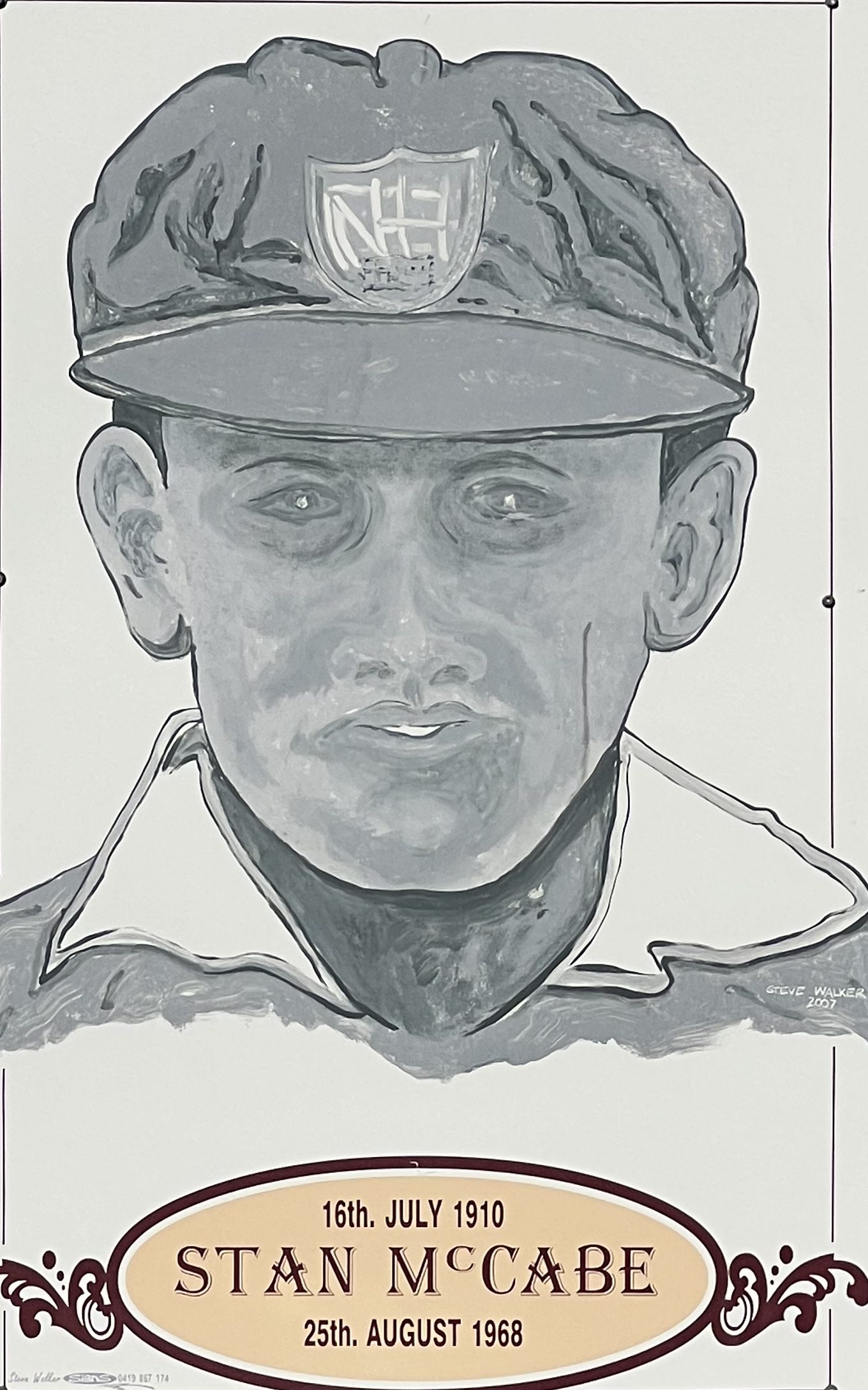
Stan McCabe was born in Grenfell in July 1910. Cricket tragics of Allthego’s vintage will know the name, if not the record. He was a contemporary of Donald Bradman in the Australian Test team during the 1930s. He played 39 tests for Australia and averaged 48. Not bad. There is an oval in the town named after him, nothing much else. Prominent in the town museum though!
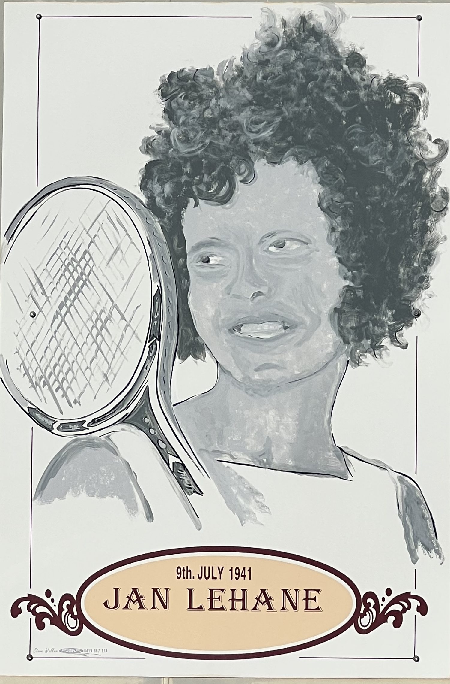
Jan (Lehane) O’Neill was born near Grenfell in 1941 and went on to be one of our leading Australian female tennis players in the late 1950s early 1960s, she reached a career ranking of 7 in 1963. She won a number of Australian junior tournaments and went on to win overseas, but never the big ones. She was a contemporary in the Australian women’s team with Margaret (Smith) Court. She was beaten by Smith in the final of the Australian championships four years in a row, 1960-63. She was the first leading female with a double-handed backhand.
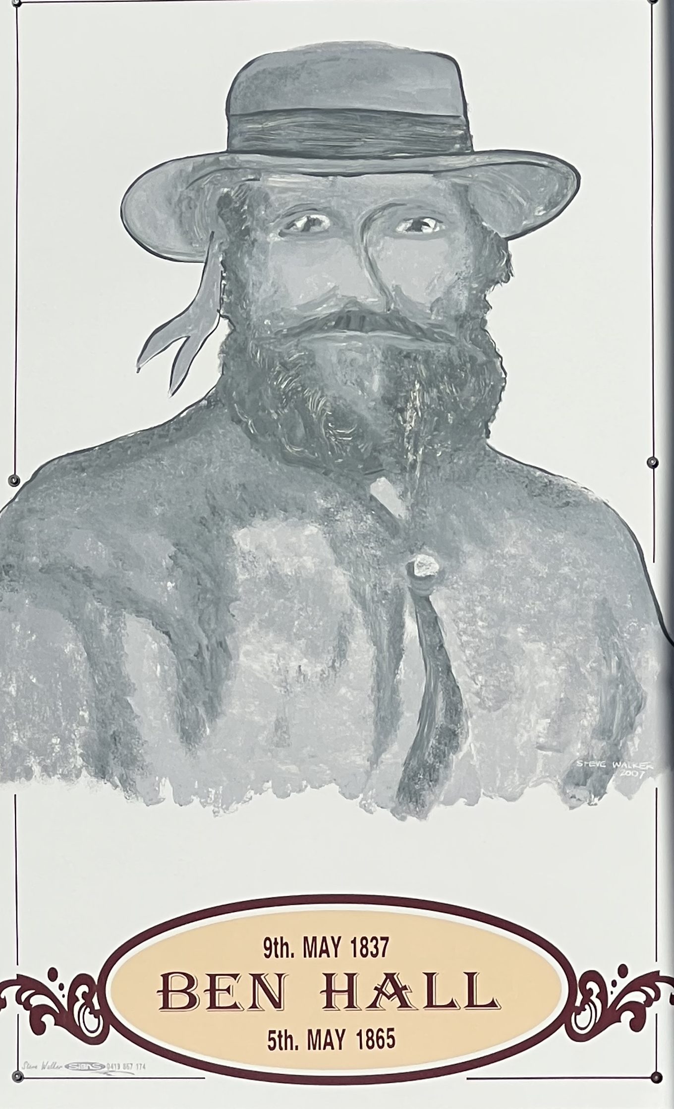

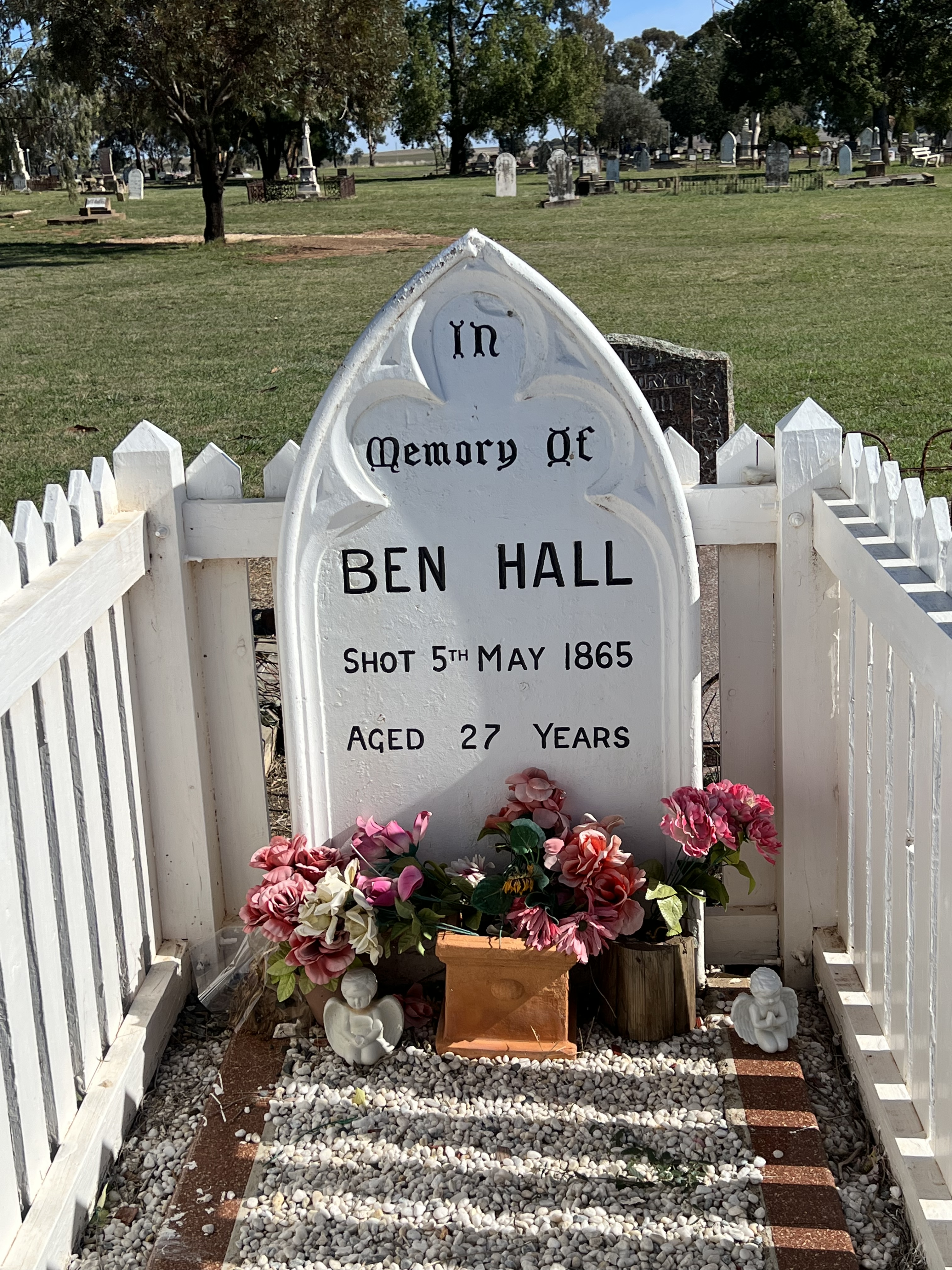
Ben Hall, the bushranger was shot in 1865 in Forbes at the age of 28. Over hundred robberies were attributed to Hall and his associates. We saw his grave in the Forbe’s cemetary. He was a Grenfell identity though and frequented the region, using the area as a base for his activities. A cave in the Weddin Mountains is thought to be one of his hide-outs, we did the short walk up the escarpment to its location. Interesting spot, a good look out for approaching police!

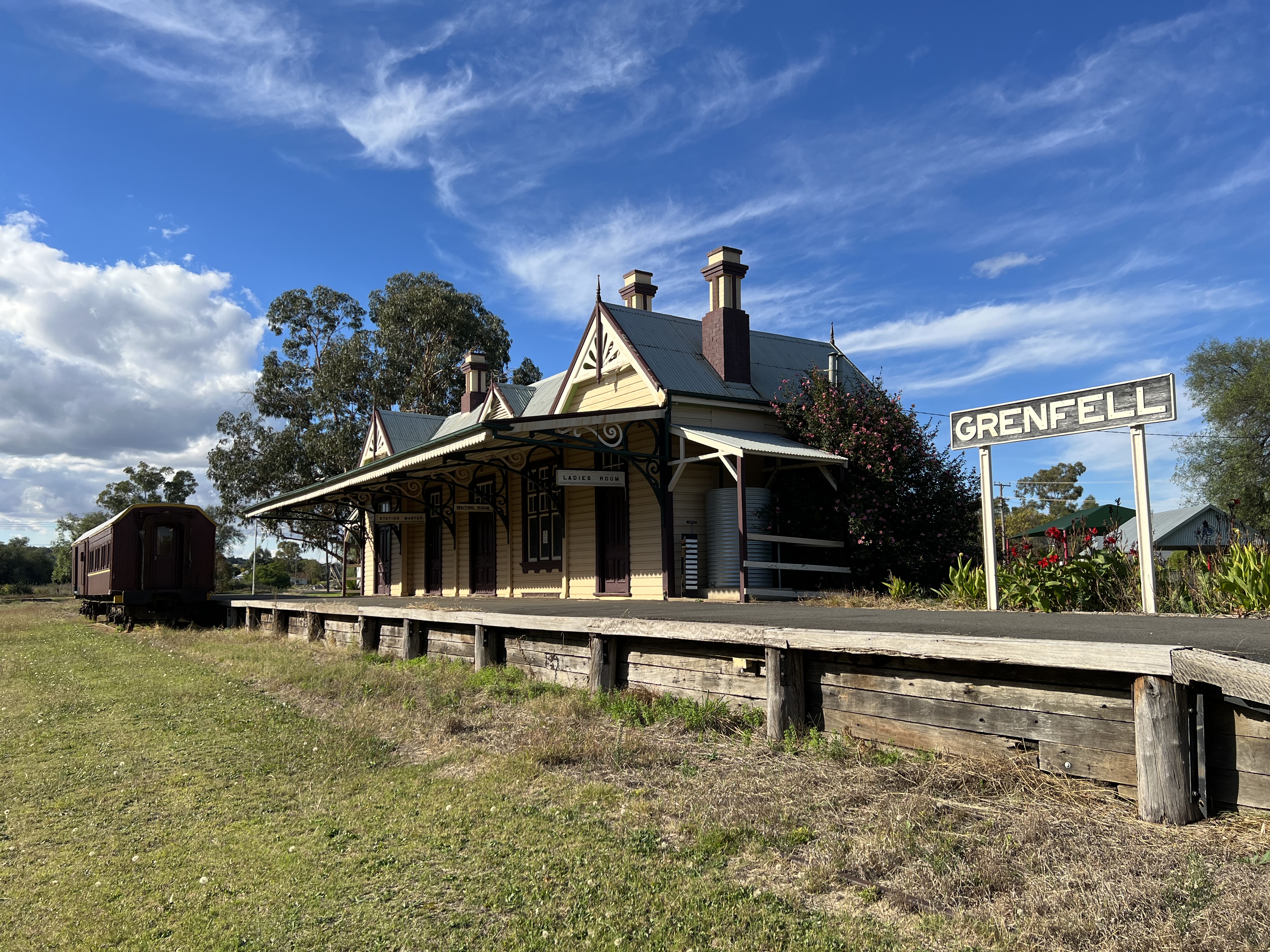
Gold was big in Grenfell too in the 1860s and remnants of the mines are on display on O’Briens Hill. A couple of open shafts and old equipment lie around the workings. There were more than ten thousnad people working on the diggings when Henry Lawson was born. Something like thirty hotels lined the town’s streets, ten banks as well, some of the grander buildings remain today. Trains no longer come to Grenfell to carry away wool and grain, but the restored heritage station and its precincts stand, nearby the free camp site for van travellers.
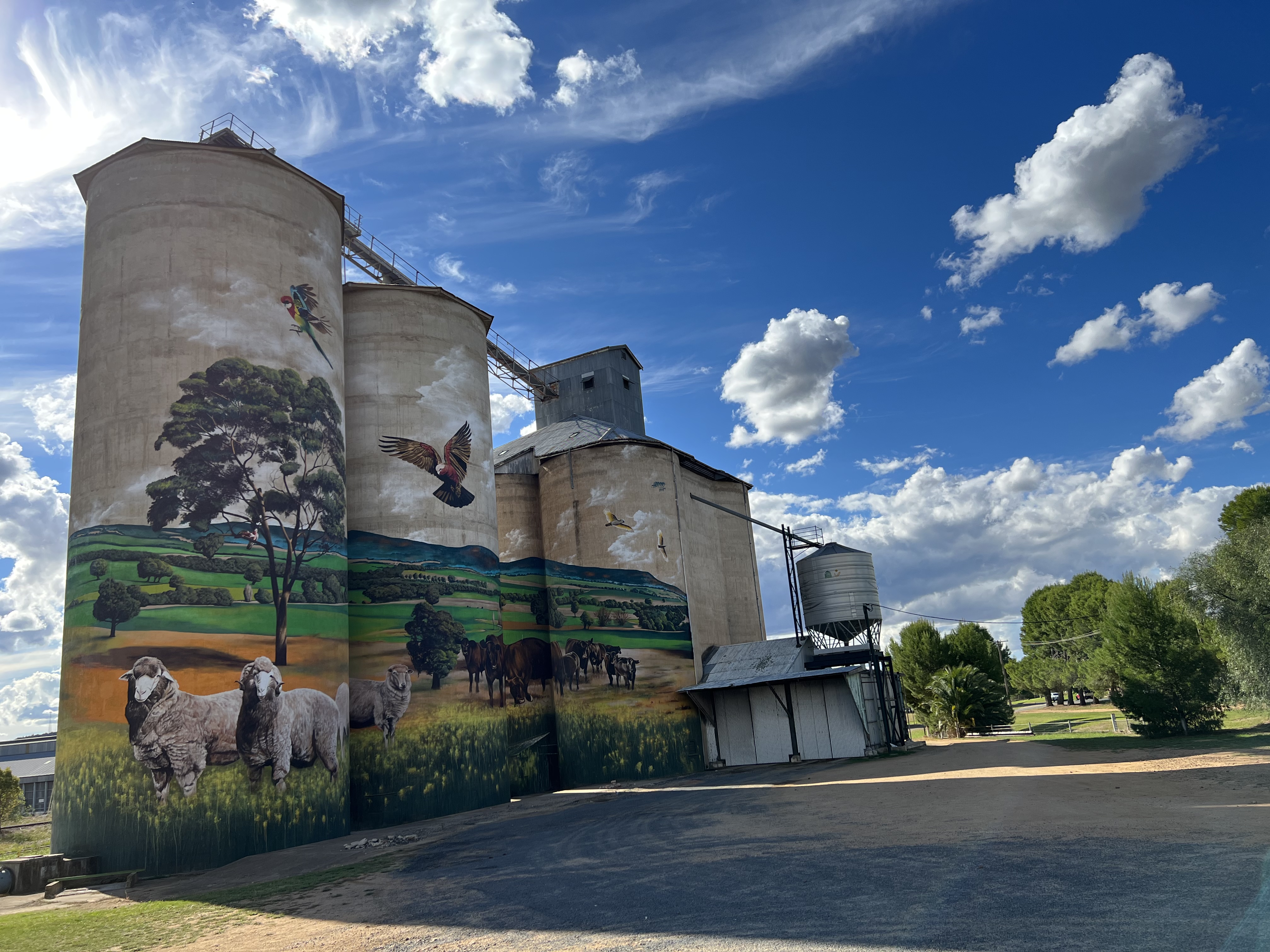
The latest tourist magnet for the town is a painted grain silo. A bit of a gem this is and something to be admired. How these artists paint these panoramic instatallations is amazing, they are only feet from the silo and several metres above the ground, with paint brushes and cans of spray paint. How do they get the perspective? Allthego sent the drone up for a photo, getting a different angle.
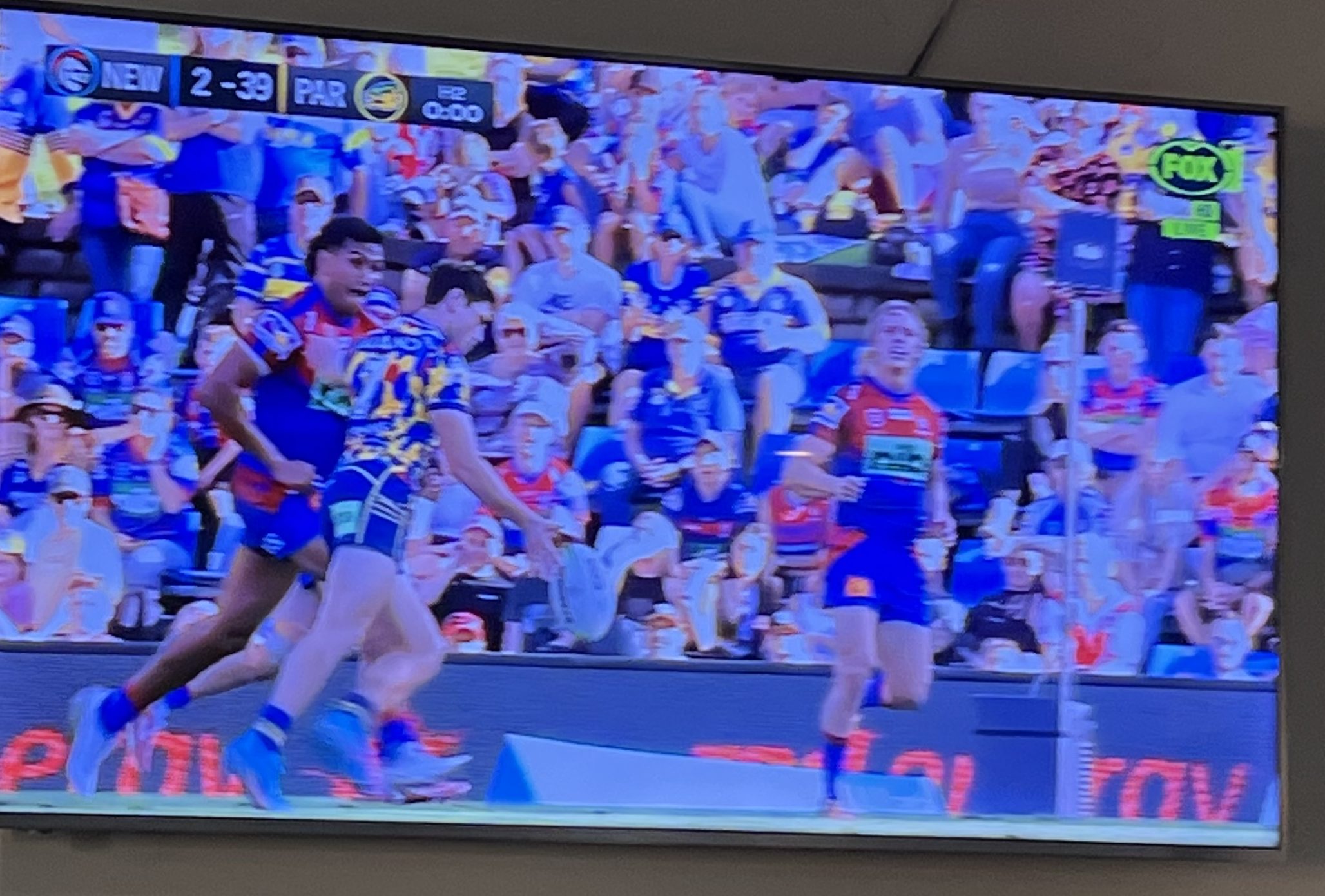
It was a couple of busy days in Grenfell and Allthego almost missed seeing the Parramatta Eels clean up the Newcastle Knights 39-2. The final ten minutes were caught on the big screen late on the Sunday at the Criterion Hotel, with Mitch Moses kicking that last second field goal!
We now head off to Tumut, it is tempting to stay another day! Haven’t checked out the cemetery or had the time to try a local custard tart!
Murray River times
We have escaped the cave after having a dose of COVID and doing the isolation thing. It is off down south to the Murray River, Australia’s longest river at 2,508 km and interestingly, it is navigable for almost 2000 km making it the third longest navigable river in the world; after the Amazon and Nile. Allthego has long thought that it would be an adventure to follow the river from near its source in the Snowy Mountains to where it empties into the sea in South Australia.
So, we are off with the van in tow making our way down the Newell Highway, after heading west from Brisbane through Warwick and Goondiwindi. This is the usual path we follow when going south through central NSW stopping first at a great free camp spot in Inglewood, followed by the John Oxley Caravan Park in Coonabarabran and then the free camp beside the lake at Forbes. Inglewood has an excellent bakery, great bread rolls and a selection of inspiring pastries. On this occasion we had to try their custard tart, it looked very tempting. We are going to test out some other bakeries on this journey and see if their custard tarts are as good as the Inglewood one was. It seems that in Australia we follow the English tradition of custard tarts, the base being a baked egg custard in a crust pastry topped with nutmeg. The Portuguese claim to make a great custard tart but theirs is housed in puff pastry topped with cinnamon, haven’t come across one of these.
After leaving Inglewood we stopped to have a look at the silo art installation at Yelarbon, about 50 km from Goondiwindi. We were last by this way about three years ago and only four (or was it five?) of the silos had been completed, now all eight are done and it is quite an impressive panorama representing the surrounding region.
Down in Forbes we are beside the Forbes Lake in the free camp along with a number of other vans of all shapes and sizes. It is a pretty spot with the sun going down throwing up a colourful sunset, last time we were here we looked across the lake at a huge dust storm. It turned out that Leanne’s brother Stuart and his wife Maree were in town visiting Maree’s father Bob. All three joined us for a short happy hour as the sun started to go down. Nearly three years since we had last seen them.
We are now heading off down to Grenfell for a couple of nights, never been there before. Bob wasn’t sure we needed two nights there to see things.
The Overland Track-Cradle Mountain to Lake St Clair
Thinking it might be his last meal of bacon and eggs, Allthego ordered them for breakfast on the morning of the start of the 60 km walk from Cradle Mountain down to Lake St Clair. Breakfast was at 6am and we then had to gather at 6.40am to meet the others and get set up for the walk. The bacon and eggs were good! Around 8am or so we were off in the bus for the 2.5 hour drive up to Romney Creek, a little way from Dove Lake which sits beneath Cradle Mountain. Allthego, had earlier fessed up to our guides that he was experiencing a little left heel pain and may not trot along at the right pace. There was some concern about this and they said they would need to review progress along the way (there is an opportunity about half way along to walk out). I said fine, but that I was pretty determined to do it.
There are seven (2 blokes and 5 ladies) of us on the walk, supposed to be eleven but four didn’t show up! This made it a good group for the two guides to manage. Two young ladies Sakura and Danah , obviously very fit. They were carrying 20kg (?) packs, compared to our 8 or 9kg (mostly clothes, lunch and water). They were carrying the fresh food, salad vegetables and some meats as well as safety gear, first aid kits and other gadgets. The oldest in our party was celebrating her 70th birthday, a spritely individual and very well travelled/walked. The next oldest was Allthego, not quite 70. The other five were around 50-60, all quite experienced walkers. Some more fit than others.

Here is a sketch map of our route and overnight stops. Each of the six days involved walking an average of about 10km a day, the first two days were the longest at 12 km each. It felt a lot further! Additional kms were done on a number of side trips off to special features such as water falls, lakes and mountain tops. My guess is that I walked and climbed about 65km. It seemed that about 15% of the journey was on boardwalks, no idea really. The rest a series of gravelly paths, rocks of various sizes and shapes, water and mud, tree roots, steps up and down of various depths and heights (some easy some challenging on the knees), hops across small creeks.


We are staying in five ‘private huts’ along the way; hot showers, warm beds, some nice dinners with a little wine and fresh baked bread each morning. There are a number of other groups and individuals on the track as well, carrying tents or sleeping in the ‘public huts’ nearby ours. There is plenty of water and facilities (no hot showers!) at these public huts.


In terms of physical effort the toughest day was the first. It was a long haul up the track past Crater Lake, followed by the climb up Marions Lookout , the steepest section of the whole walk. The posts and chains along this section were of great assistance in getting up the deep steep rocky steps to the top. Up the top there was supposed to be a great view down over Crater Lake, Dove Lake and the up to the spires of Cradle Mountain. Crater Lake was great but Dove Lake and the spires were whited out with mist, fog and light drizzle. So we suited up in wet weather gear and plodded off down the track, arriving at Kitchen Hut where we had lunch. Just as we were leaving Kitchen Hut, the skies cleared and the spires of Cradle Mountain made a magnificent appearance, Dove Lake was no longer in view.


Onwards we went down to Waterfall Valley and our hut for the night. Allthego was at the back of the pack, someway back being followed by one of the guides who kept the pressure up to keep going. We arrived at the hut around 6pm, it had been a long day. The hot shower, cheese platter and Pinot Noir followed by grilled salmon with a salad pleased all. Off to bed about 9pm, looking forward to starting off the next day around 8.30am after breaky and being strapped up (each day) by fellow walker Janet, a physio. Made a huge difference to my heel problem, forever in gratitude for her care!


And so that is what happened roughly for the next five days. The glaciated landscape and vegetation ever changing, from button grass plains, cool temperate rainforest with mosses, lichens and all sorts of ancient trees. Bit of dry scrub too. It rained heavily for most of our second night but cleared the next morning before we set off. The rain livened up the streams and little waterfalls making it quite special. No more rain for the rest of the walk, cloudy skies and patches of sun made it great walking weather in short sleeves. Some great sunsets reflecting on the ancient mountains, glowing red almost like Uluru.


Some of the group climbed Mt Ossa, Tasmania’s highest peak. Allthego passed on that climb, going as far as the ‘Japanese’ garden below Mt Dorris for lunch, a special alpine place indeed.
The track went up and down, long downhill stretches followed by long uphill stretches. The trip notes described it as ‘undulating’. Allthego plodded along at the back, got a reputation for this. But like the tortoise eventually arrived at the huts not too far behind. So they let me finish!


It was a great experience and I could go on and on, but will not. On reaching Lake St Clair it was onto the ferry for the twenty minute journey down Lake St Clair. Allthego will not forget the last three or so kilometres of track down to the ferry. Somewhat behind the pack and closely followed by Secura I was urged to lift my pace significantly, we wouldn’t make it in time otherwise. I sensed she wasn’t being humorous and so I lengthened my stride and upped it a bit. Arriving at the wharf just on 1pm, departure time. No lunch! I suggested to the group it was good timing. And it was, although a bit stressed and sore.

After an hour at the Visitors Centre at Lake St Clair the bus arrived and we returned to Entally Lodge, through the Central Highlands, about a three hour trip.

The Lodge has a neat restaurant with a great side room and a cattle head staring down at the table. I enjoyed a steak before heading back to Brisbane after a memorable time!
