Monthly Archives: August 2023
Manta
After leaving the Canal the journey takes us down to Ecuador and the port town of Manta.
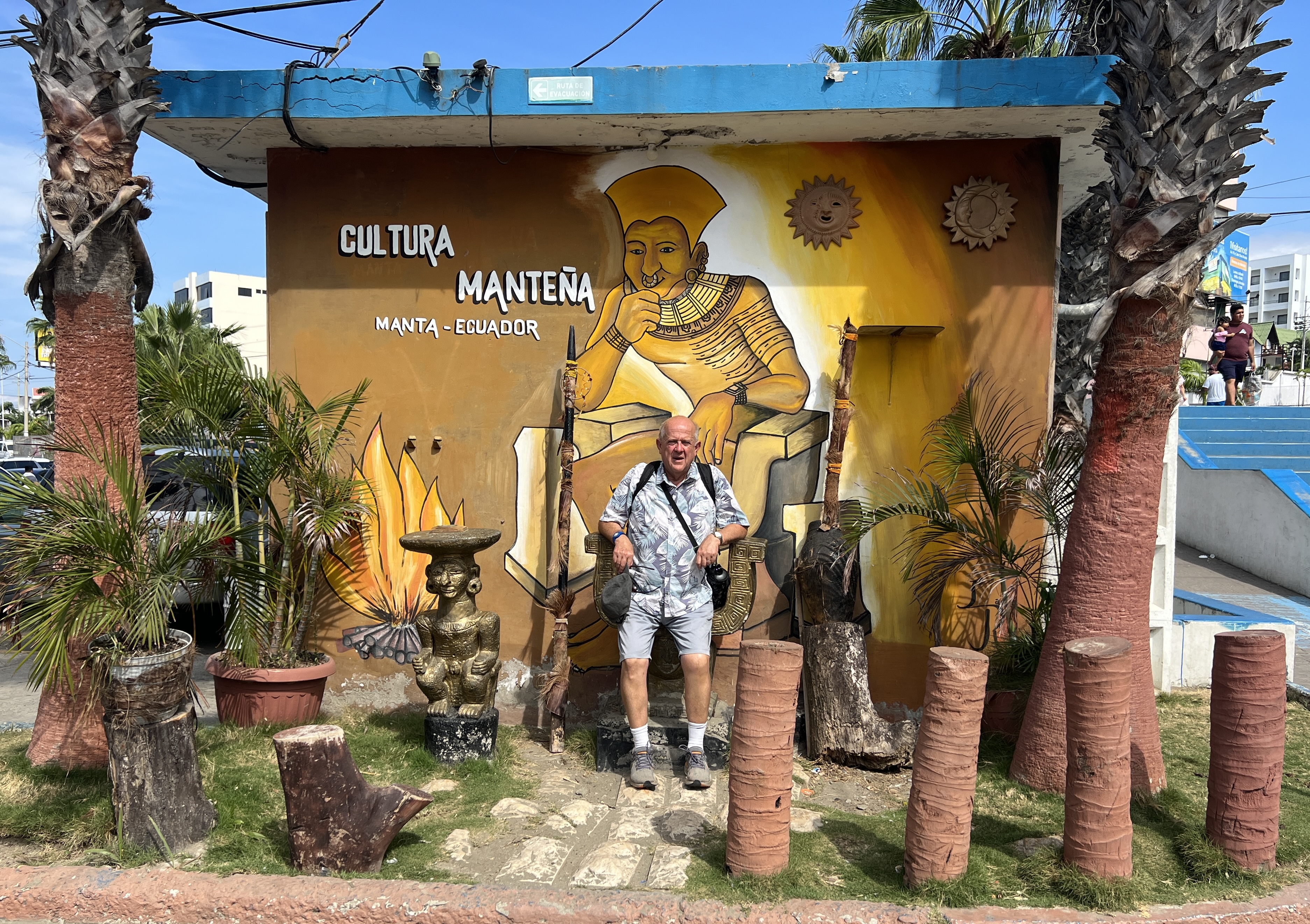
Ecuador is famous for the Panama hat, it originated there and not in Panama. They are one of the country’s largest exports. Got the name ‘Panama’ apparently at the time the Panama Canal was being constructed, Europeans wore them there for sun protection. US President Roosevelt wore one and the craze took off.
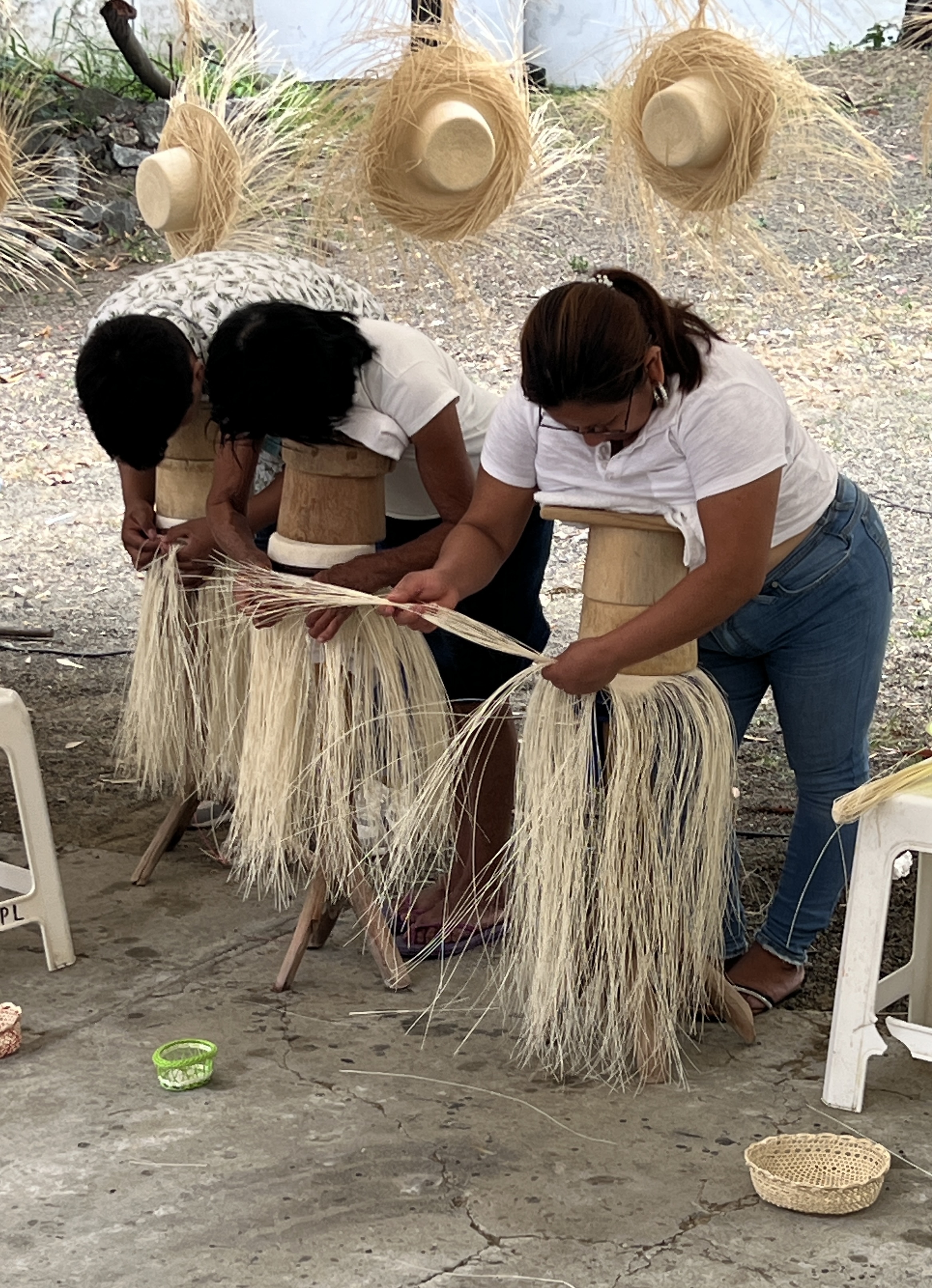
In our tour we visited a place where ‘all things Panama hats’ was revealed. Claimed that all genuine hats are hand made in Ecuador. The process was explained. Quite a back breaking job for the women who make them.
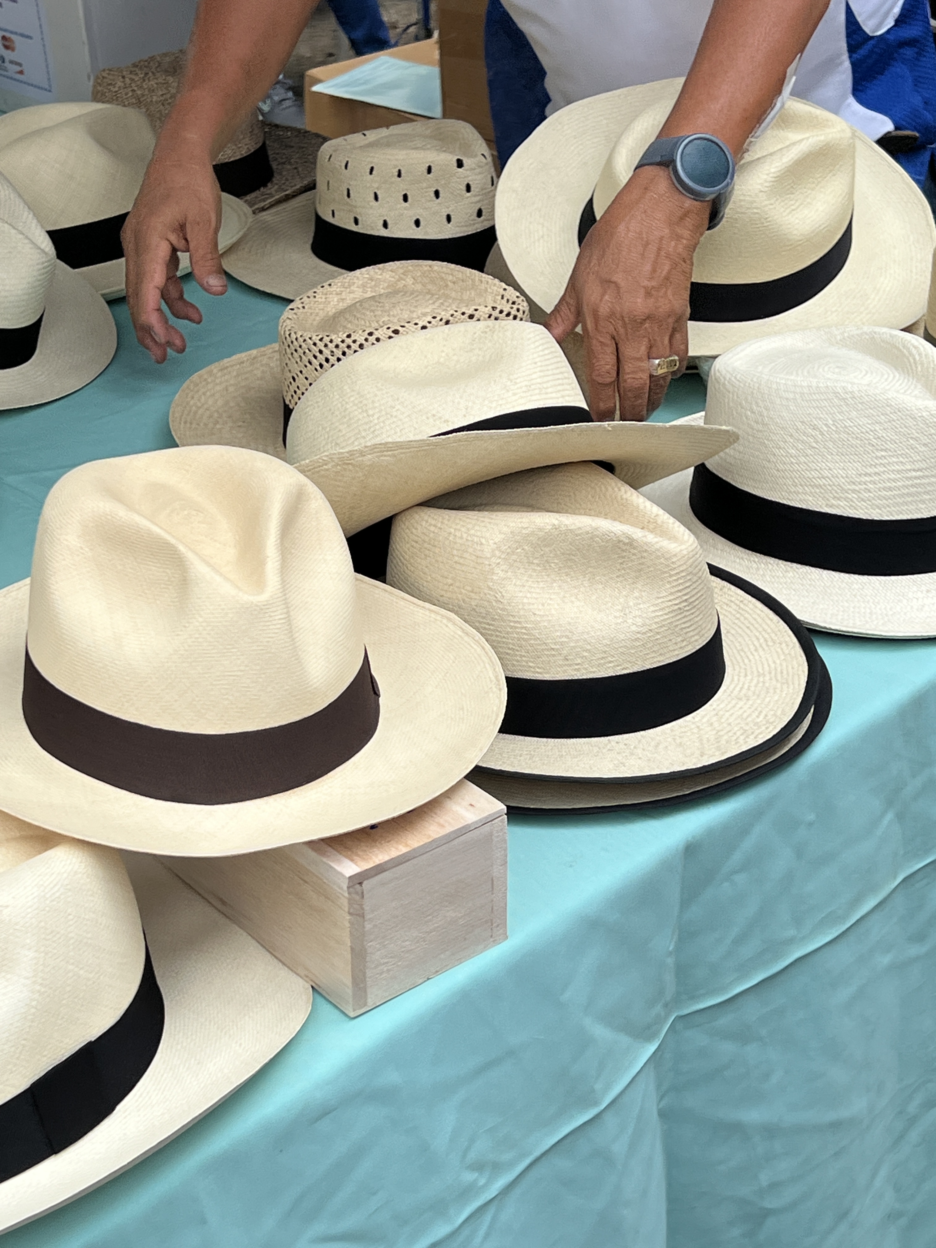
It takes a day to make a basic hat, they start at around $US50-60 prior to striking a deal. More elaborate hats, made using very fine lengths of palm fronds, can take up to three months to make and go for in excess of $US500-600. These ones are very smooth and less textured than the basic ones.
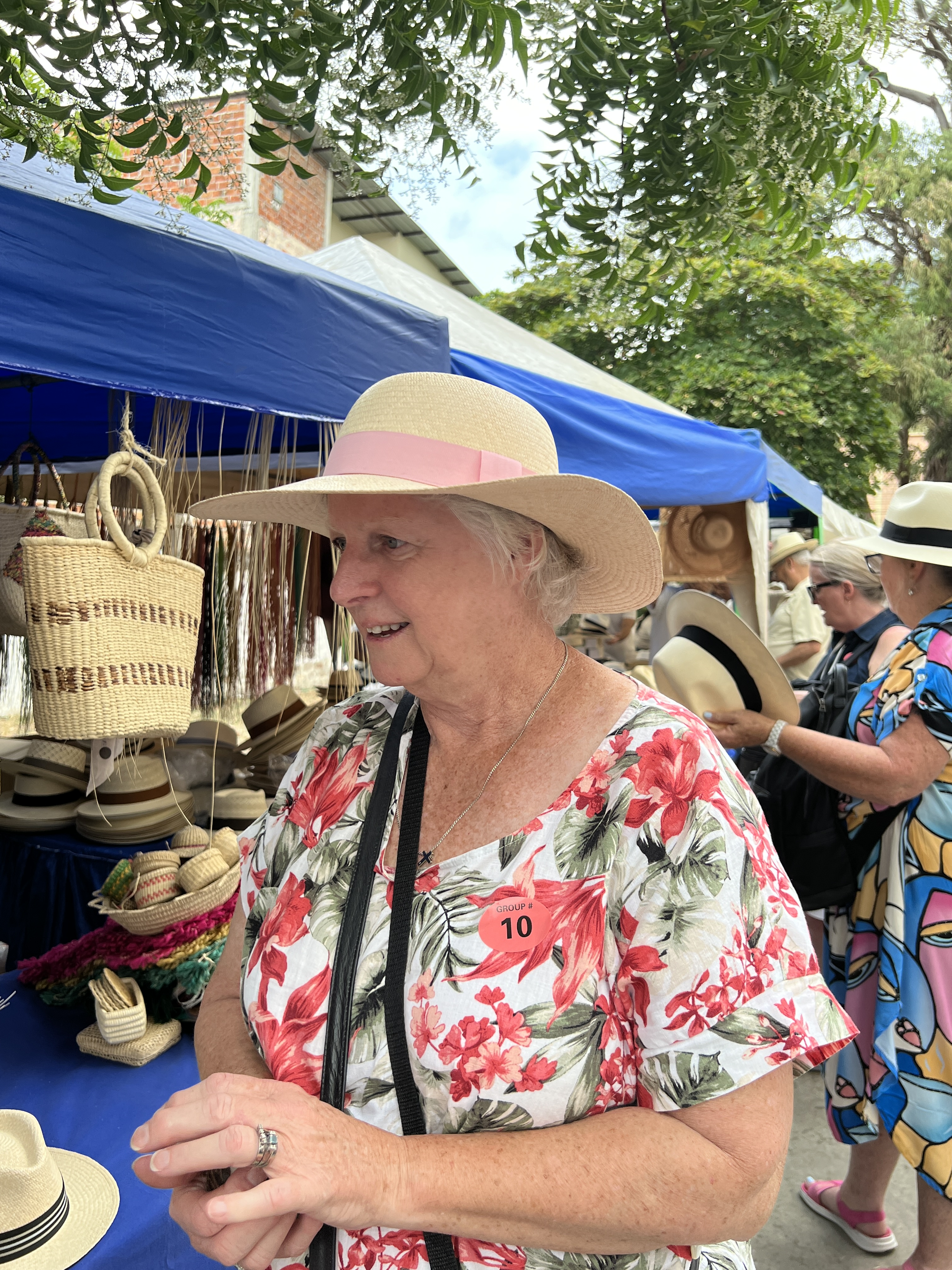
There are hats everywhere, so there must be quite a workforce working to get all these hats made if the making times claimed are correct. There are no machines that make them. The Chinese have had a go at mechanisation, but have failed. Much to the pleasure of the guide!
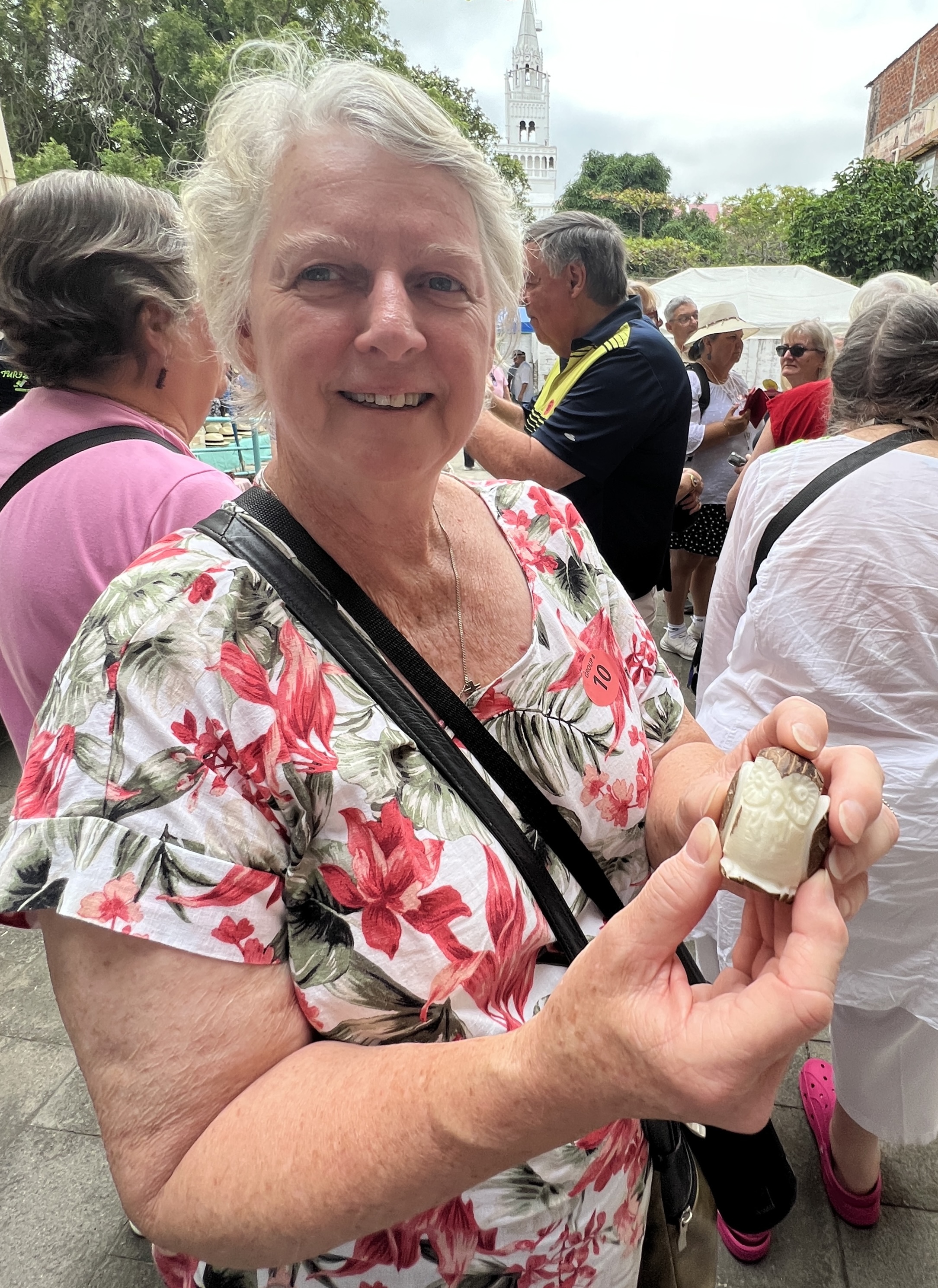
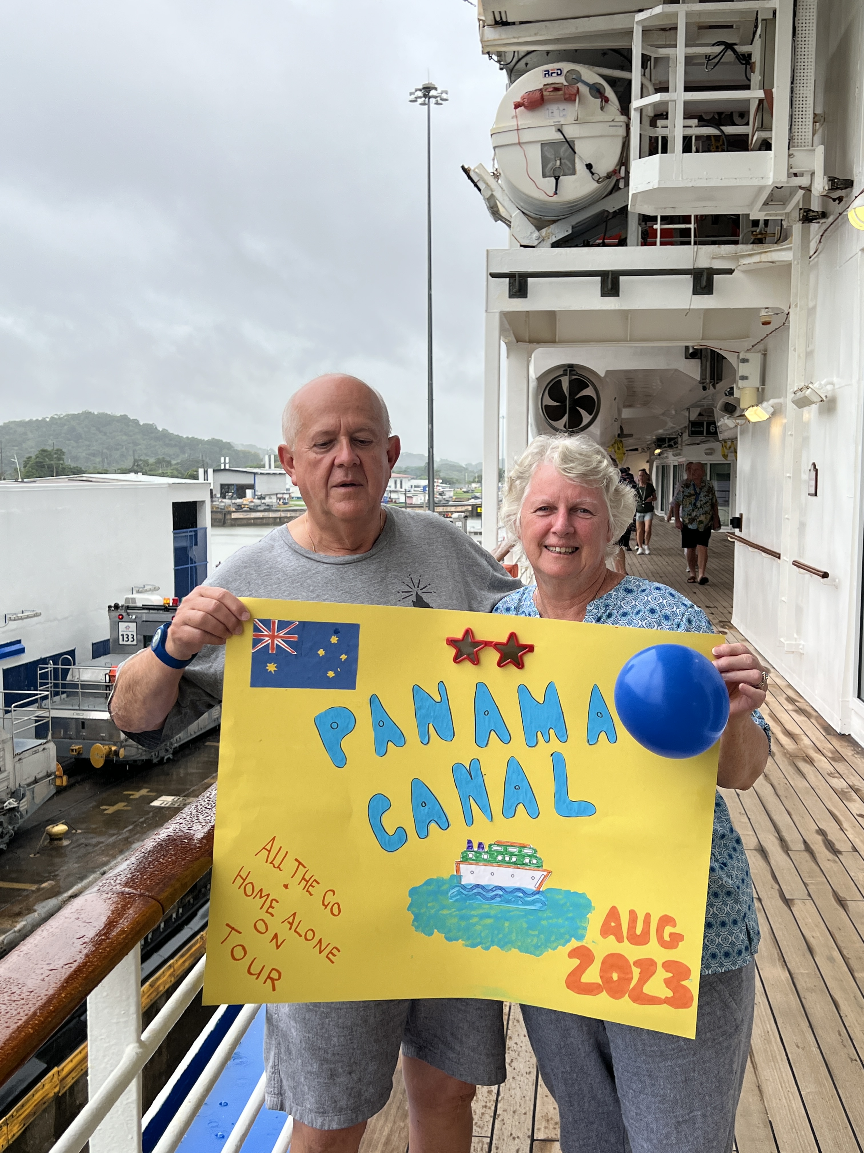
There was also an explanation of the use of the nut from the Tagua palm, ‘vegetable ivory’. All sorts of things are made from this hard white coloured nut; buttons, jewellery, carvings etc. The chap who demonstrated a carving had the onlookers guess what he was going to produce after making some initial cuts. Homealone, being crafty, immediately proclaimed ‘an owl’ and yes it was to be an owl. Upon completion she was presented with the finished item for ‘guessing’ correctly. Well, Slobro was peeved at this. He had been seething over the last couple of days at not being included in the poster photo on the Canal and for that matter not being allowed to get a Panama hat. Also some narky comments that the blog about the Canal had been too technical. In a real grumpy mood and had to be put in the back pack.
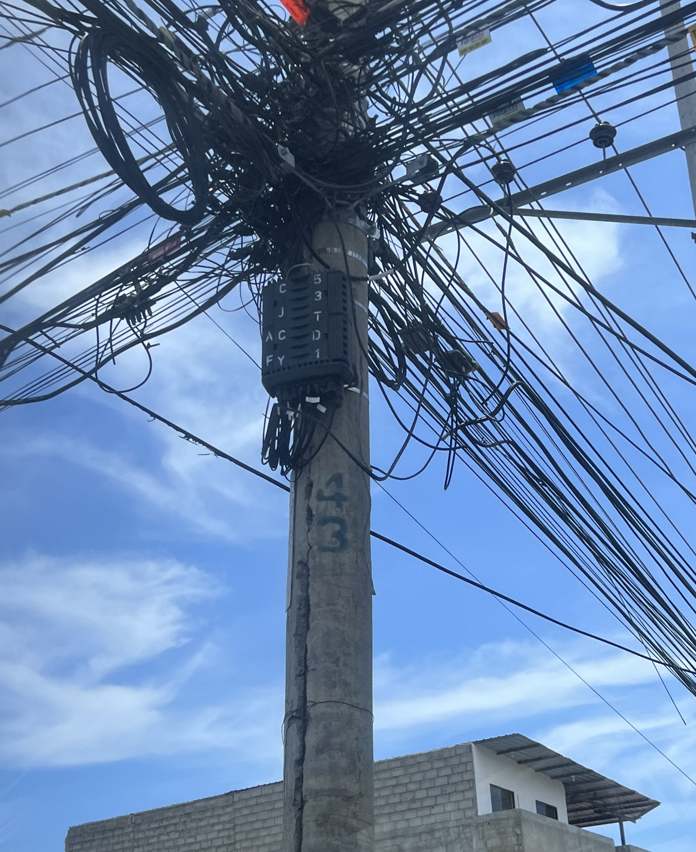
After a drive around town, the electrical installations are an amazing sight, and a short stop at a museum it was back to the ship and the afternoon ashore for lunch and a look around the water front. Ecuador is the worlds largest exporter (but not producer) of bananas, also big in shrimp.
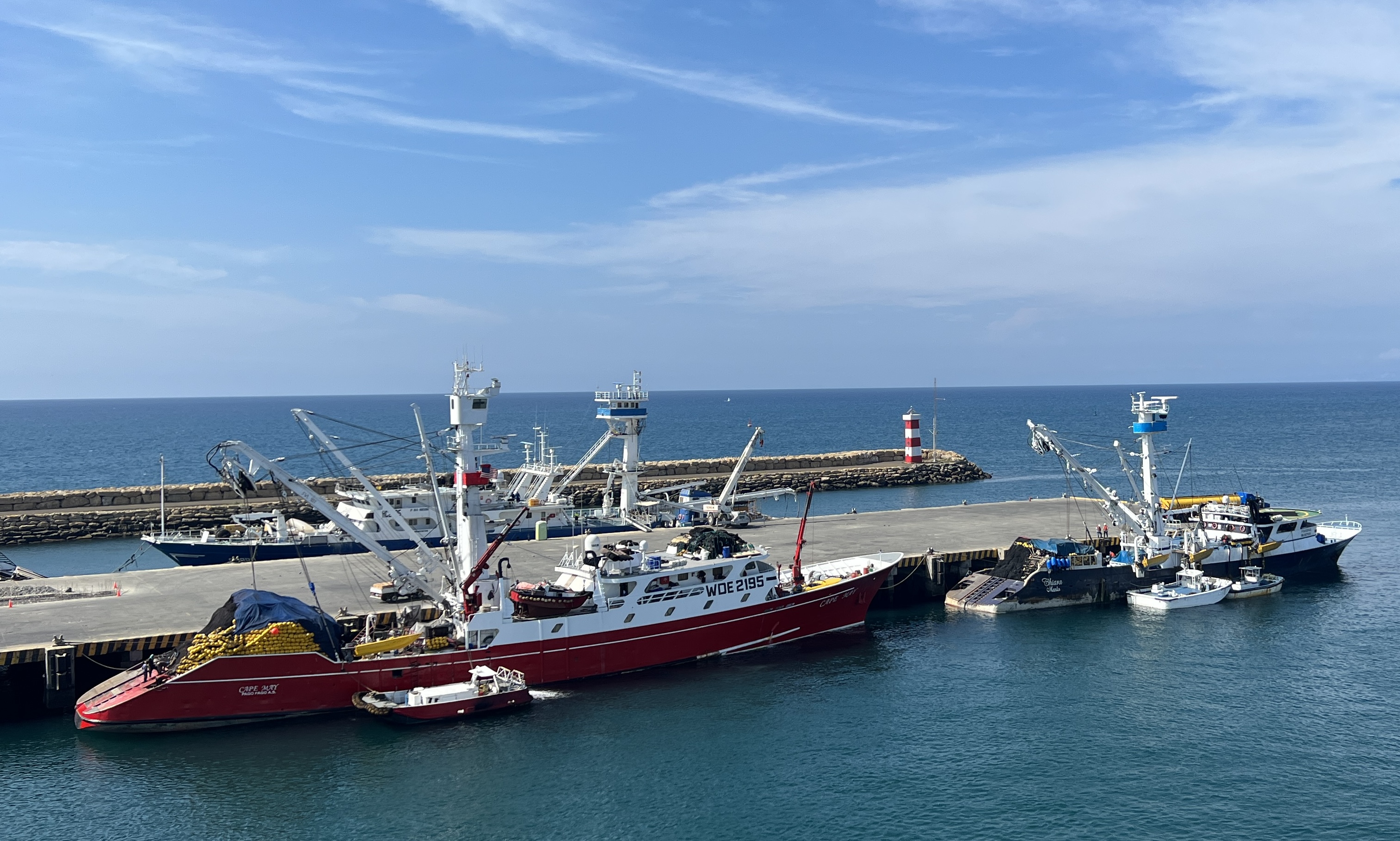
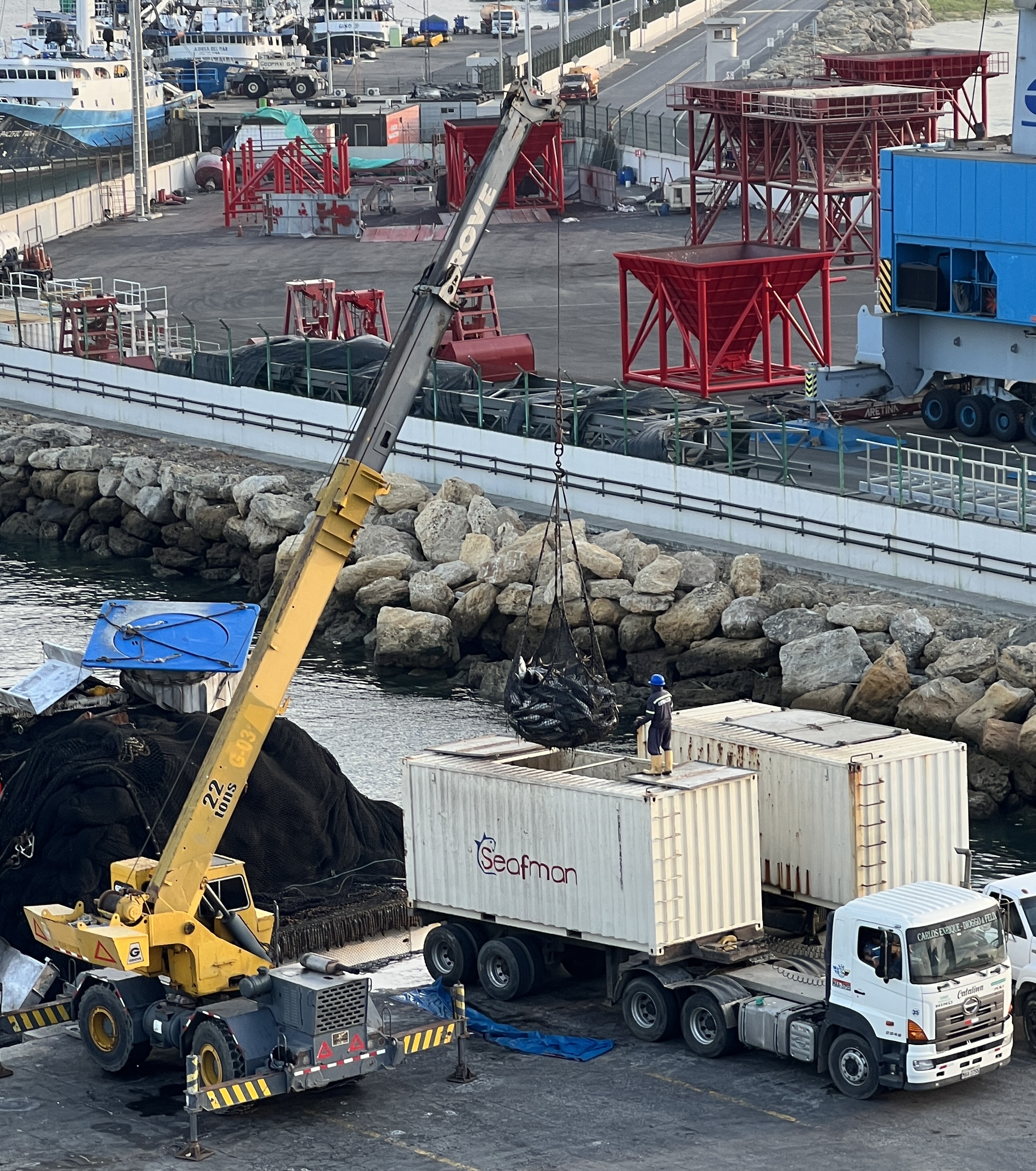
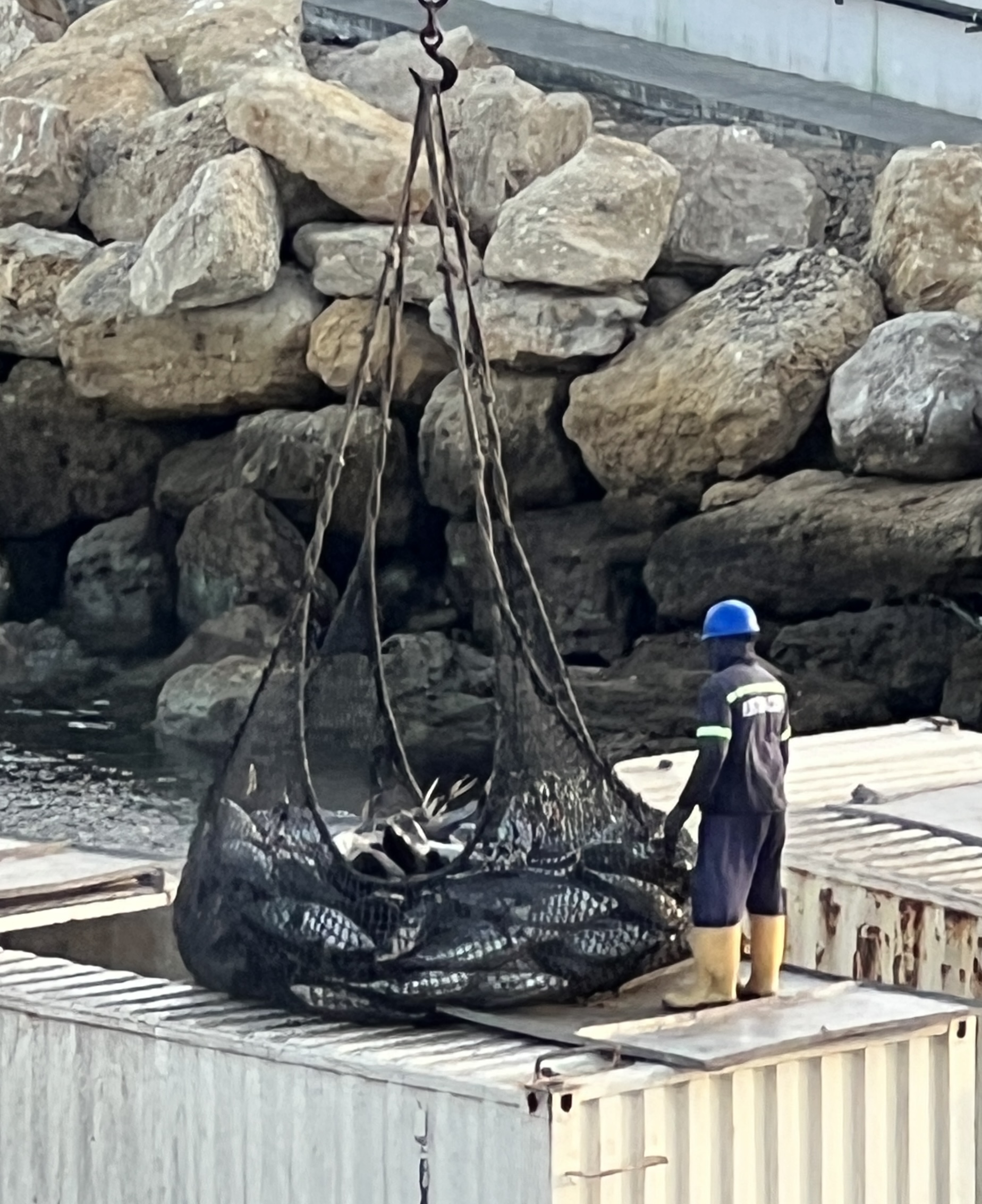
Manta is also known for its large tuna boat fleet and canning capacity. It claims to have the worlds largest tuna operation. Boats everywhere, we witnessed fish being unloaded into trucks from our ship’s deck. Industrial scale of operation.
On the waterfront there were rows of artisan souvenir shops and restaurants, all specialising in seafood. We randomly picked one out and enjoyed lunch. Allthego went for a deep fried whole fish and Homealone prawn and fish with a coconut cream sauce.
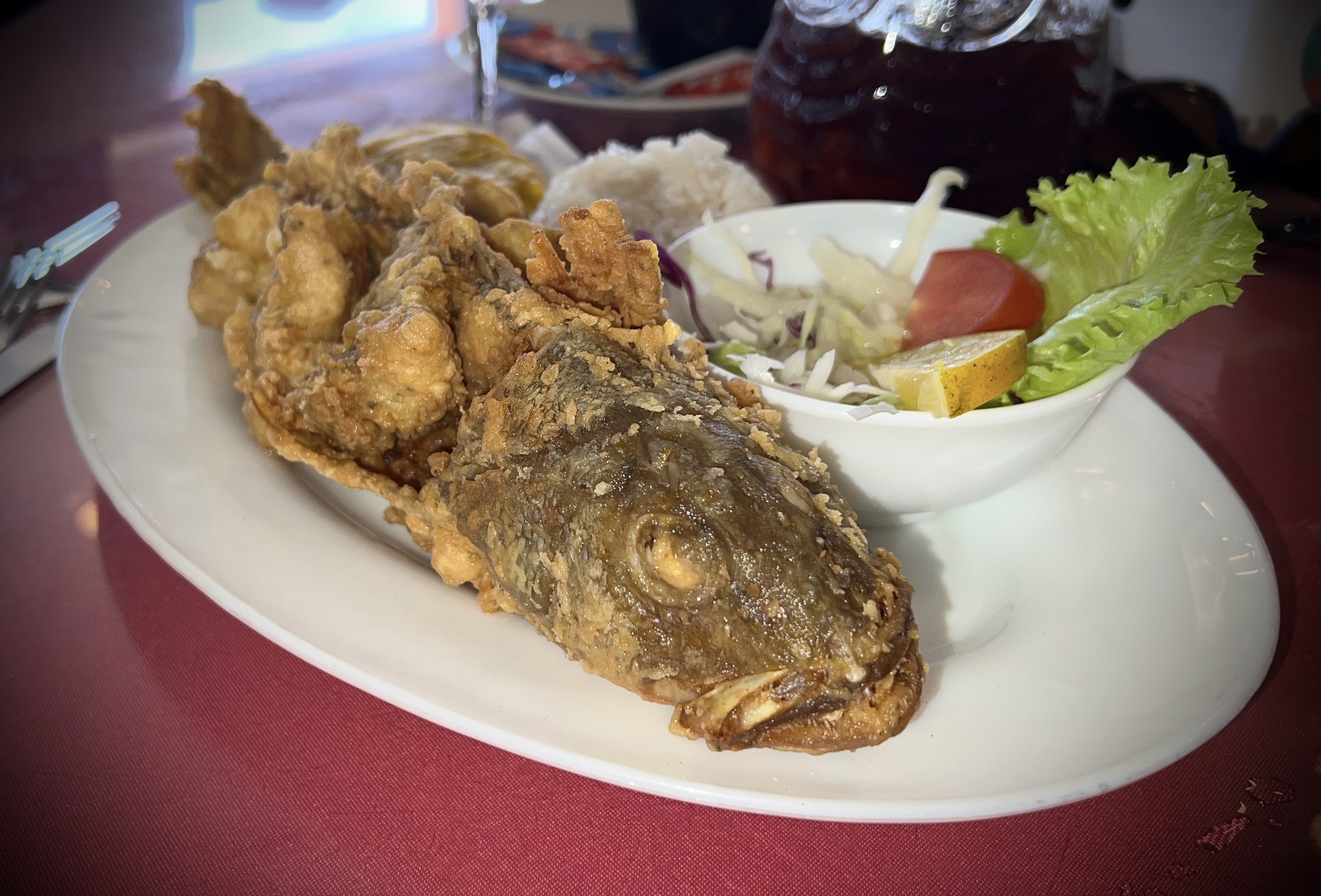
Both were spiced up and very tasty. Some Sangria washed it down. The beachfront was a quite wide expanse of sand, beach goers huddled under rows of shelters along the high water mark. It would get very crowded in summer.
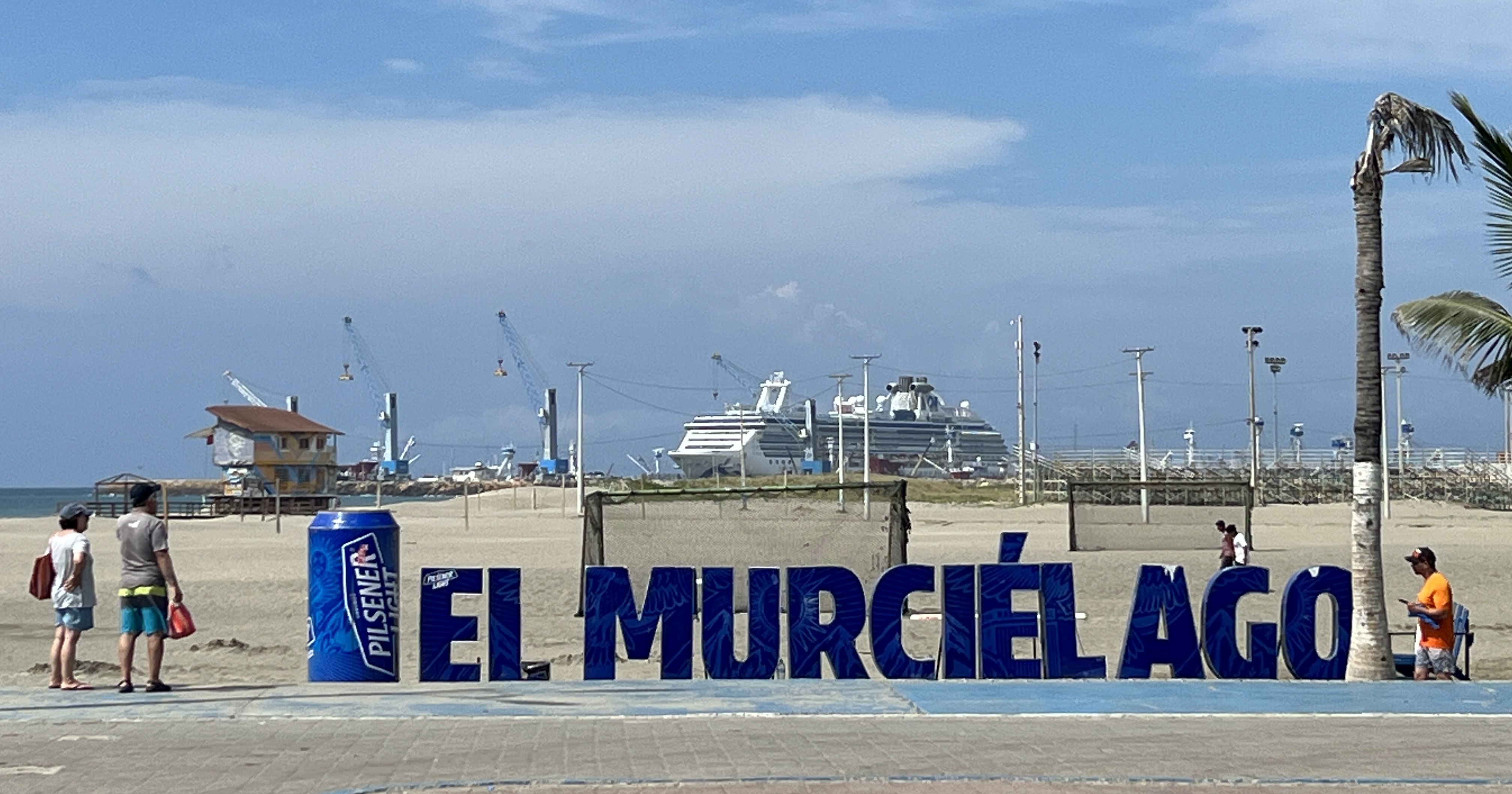

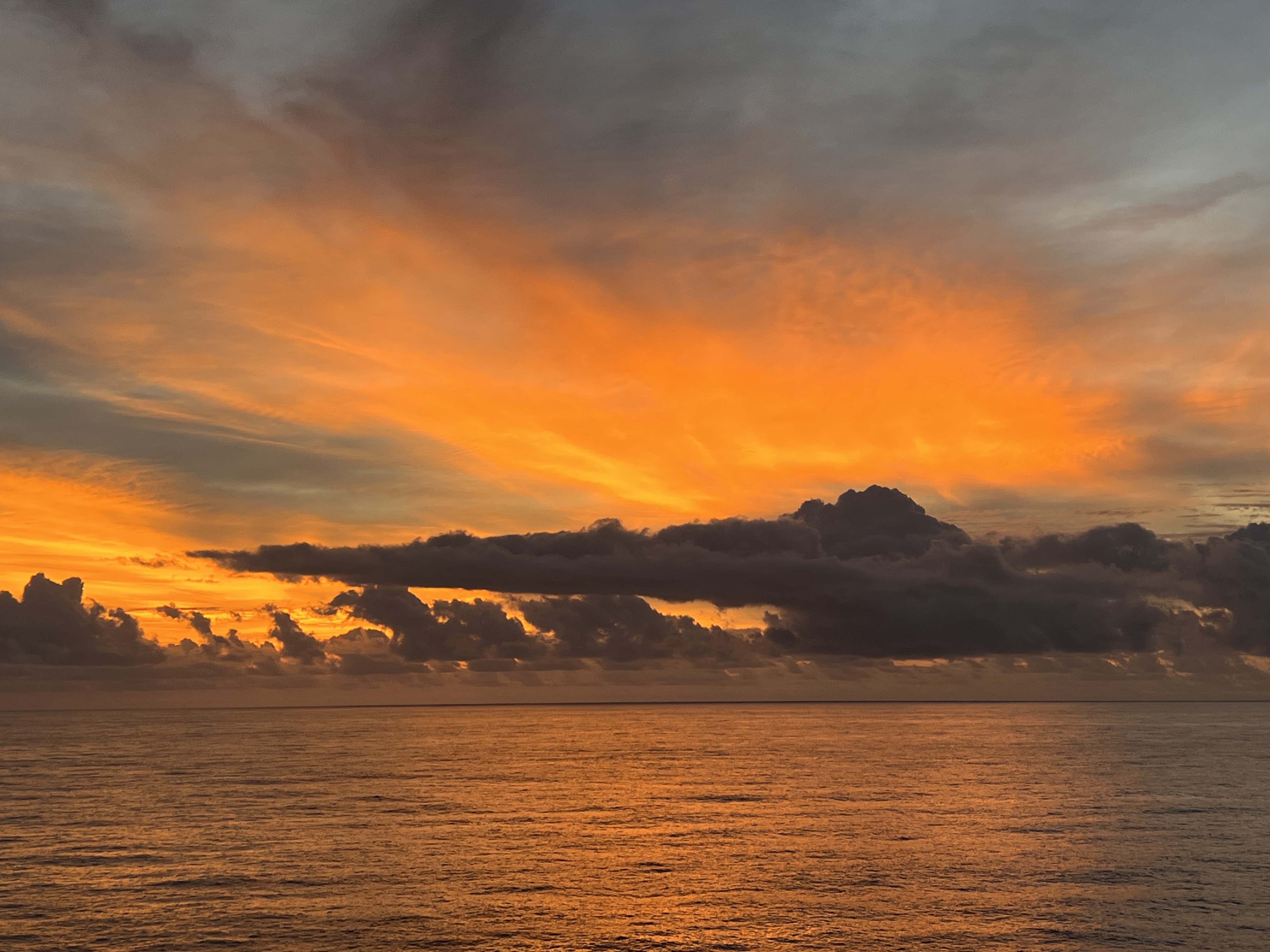
We had an excellent stop over here in Manta, the sun had come out in the afternoon and it made for a pleasant sail away as we headed out to sea bound for Lima.
Panama Canal
The four days cruising down to the start of the Panama Canal were uneventful. Shipboard life much the same, days punctuated by regular journeys to food locations interspersed with craft, reading, trivia and dozing off occasionally during onboard talks. Some garments appear to have shrunk a little in the ship’s clothes dryers.
The weather noticeably warmed up and became more humid as we passed between Cuba and Haiti into the Caribbean Sea. We caught a glimpse of the tail end of Jamaica a little further on. After that there was no land sightings until we anchored for a time off the breakwater near the entrance to the canal. A bit of rough sea accompanied us on this last section, the ship rocked and rolled a little in the swell. No dramas.
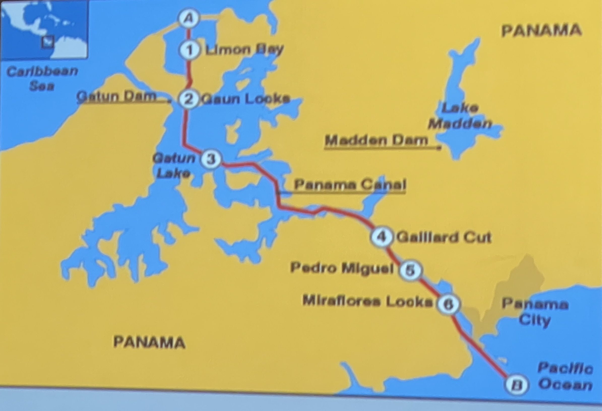
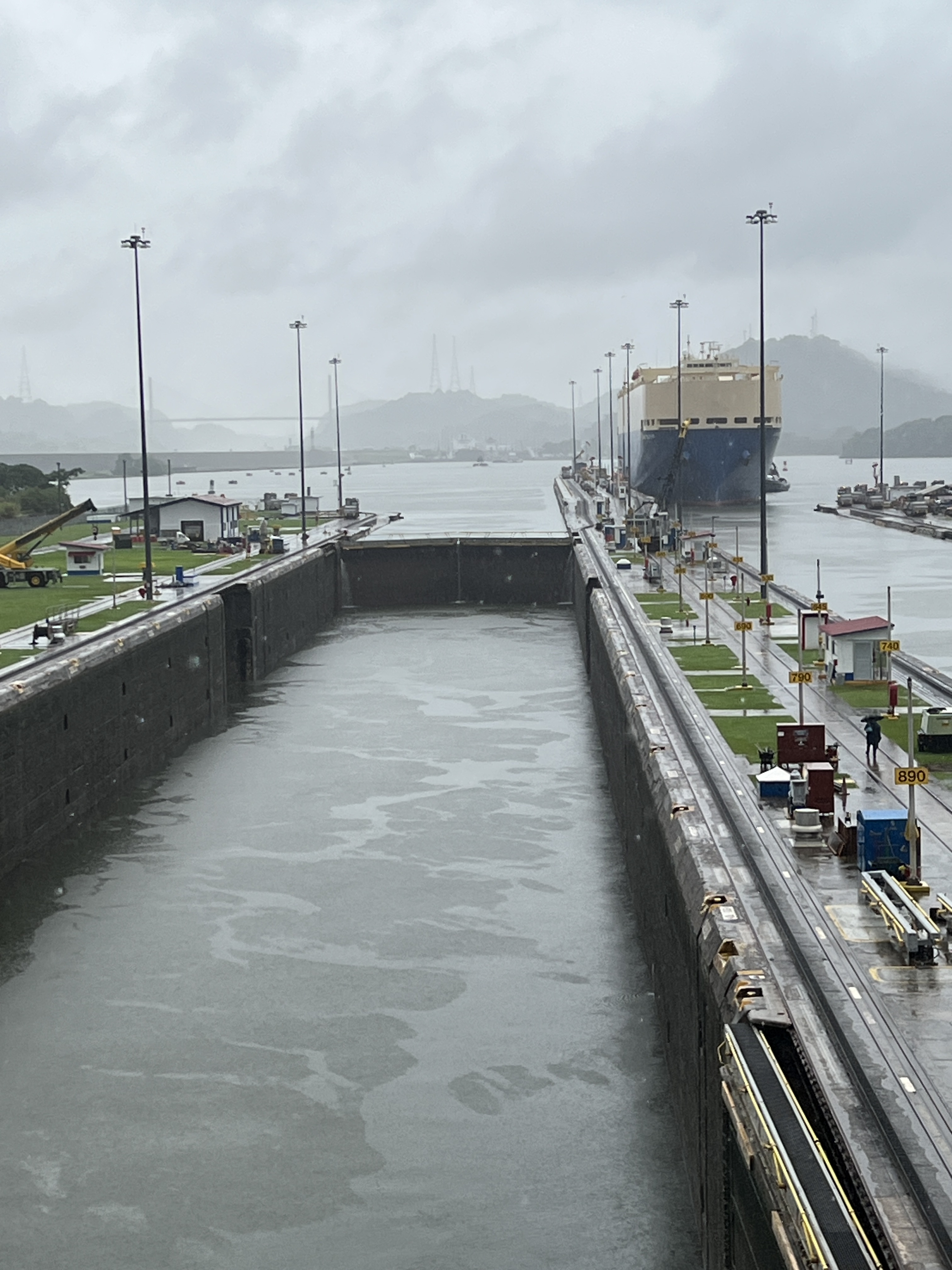
The following is a map of the canal and the numbers are key points in the journey.
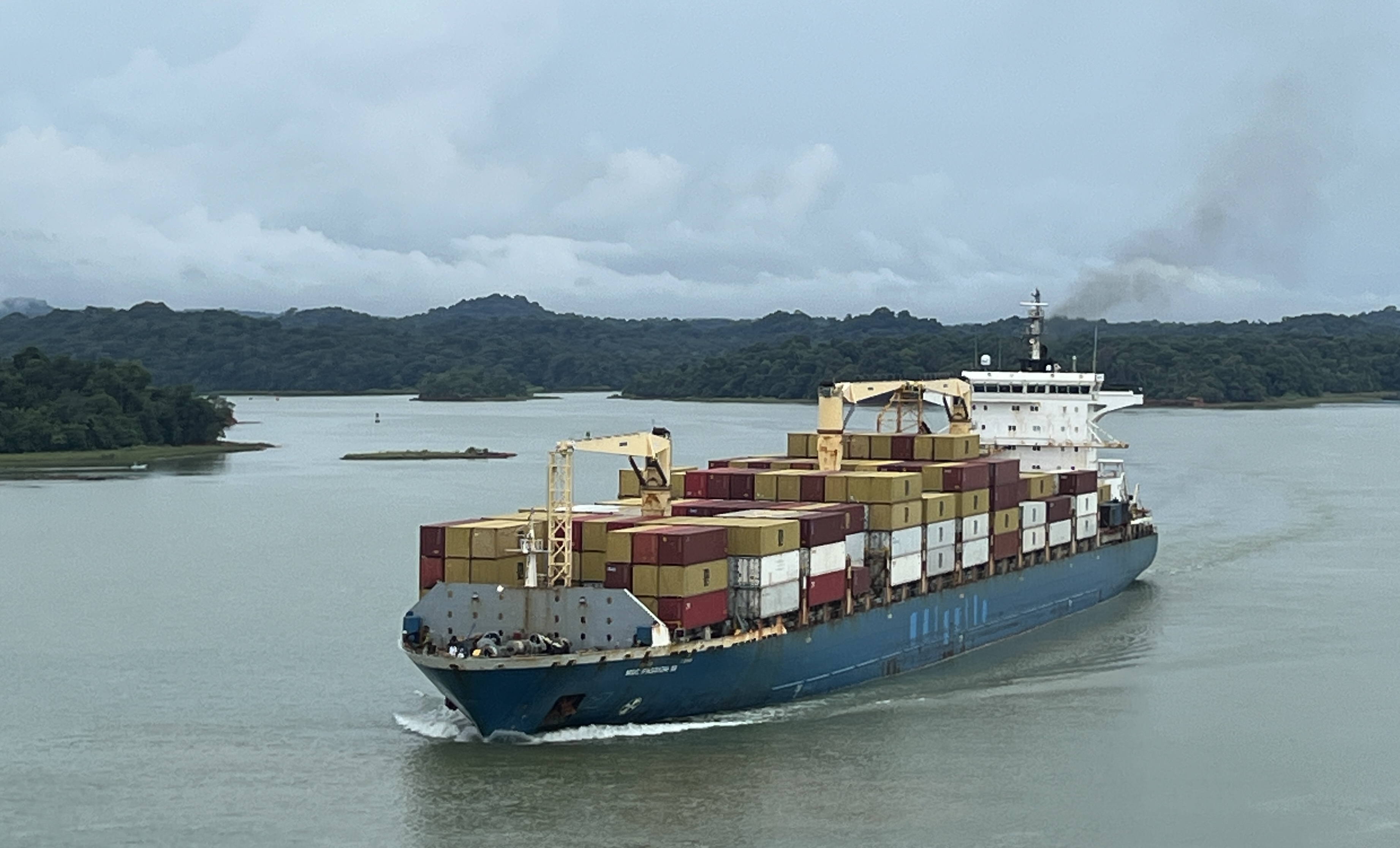
Outside the breakwater there was a great line up of ships. The canal authority has recently reduced the number of ship transits and limited the size of cargoes, due to low water levels following a couple of years of low rainfall. Have read somewhere that there have been well over a hundred ships held up, but I think this is the total at both ends of the canal. Ships can book slots in order to make a transit, this is what cruise ships do and so get preference over other ships that don’t book. I think booking costs more money for the transit, but I could be wrong there.
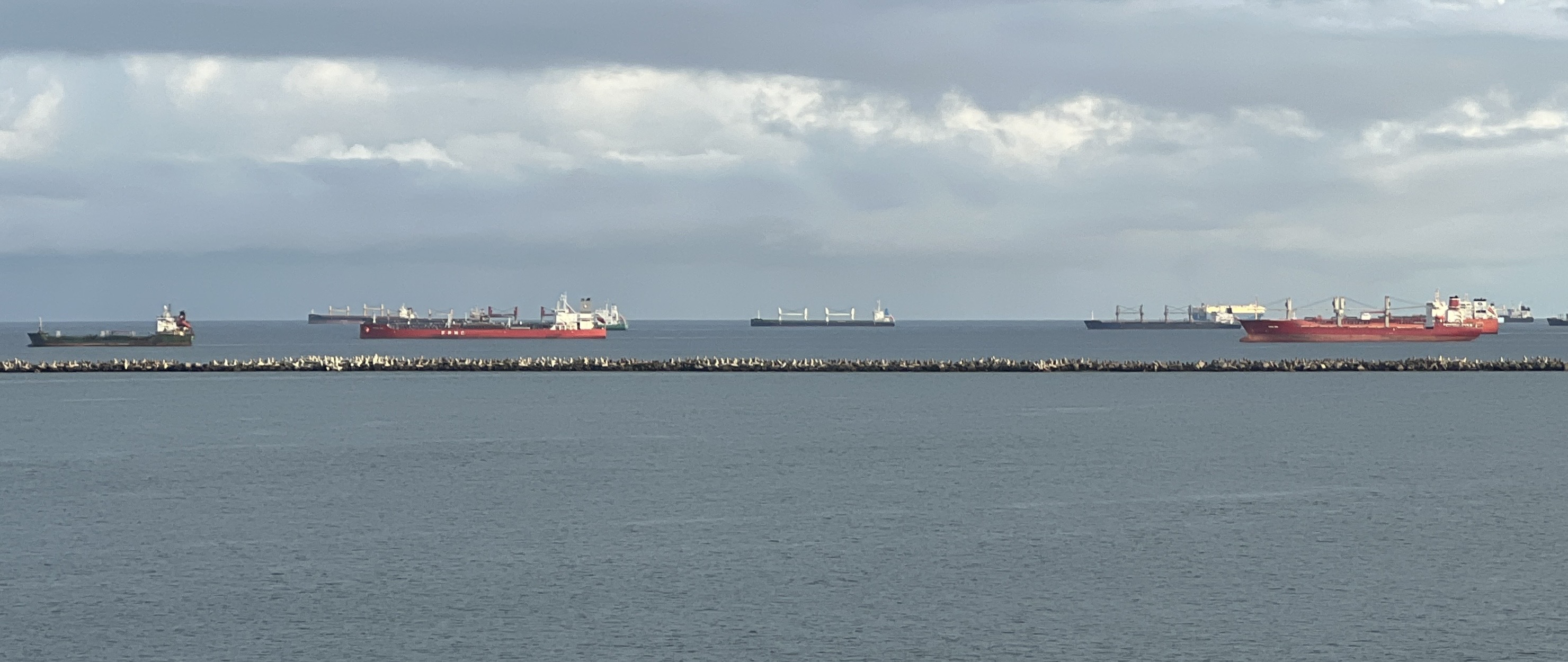
We arrived outside the breakwater around 5.30am and anchored there until 6.30 or so when the canal pilots boarded the ship and we set off into the inner harbour to form up into a convoy with a number of other ships. There were plenty of ships in this inner harbour waiting as well. The Canal operates 24 hours a day, every day. We had a guy on the bridge who gave a commentary as we went along. He said that there were to be about 17 ships in our convoy, that’s in a 24 hour transit. Probably a similar number coming the other way.
Our transit was being made through the Canal’s old original lock system that was opened in 1913. A newer set of locks have opened alongside the old ones that can carry bigger ships, longer and wider. The Coral Princess was built to the size of the old locks, newer Princess ships have to use the new locks. The chambers in the old locks are 1000 ft long and 110 ft wide, our ship is 954 ft long and 105 ft wide. It just fits in, a couple of feet either side to the lock wall. Stainless steel ‘mules’ are attached by cables to the ship to hold it steady in the locks. No tossing of ropes in this set up! The ‘mules’ run up and down beside the ship on cog rail lines.
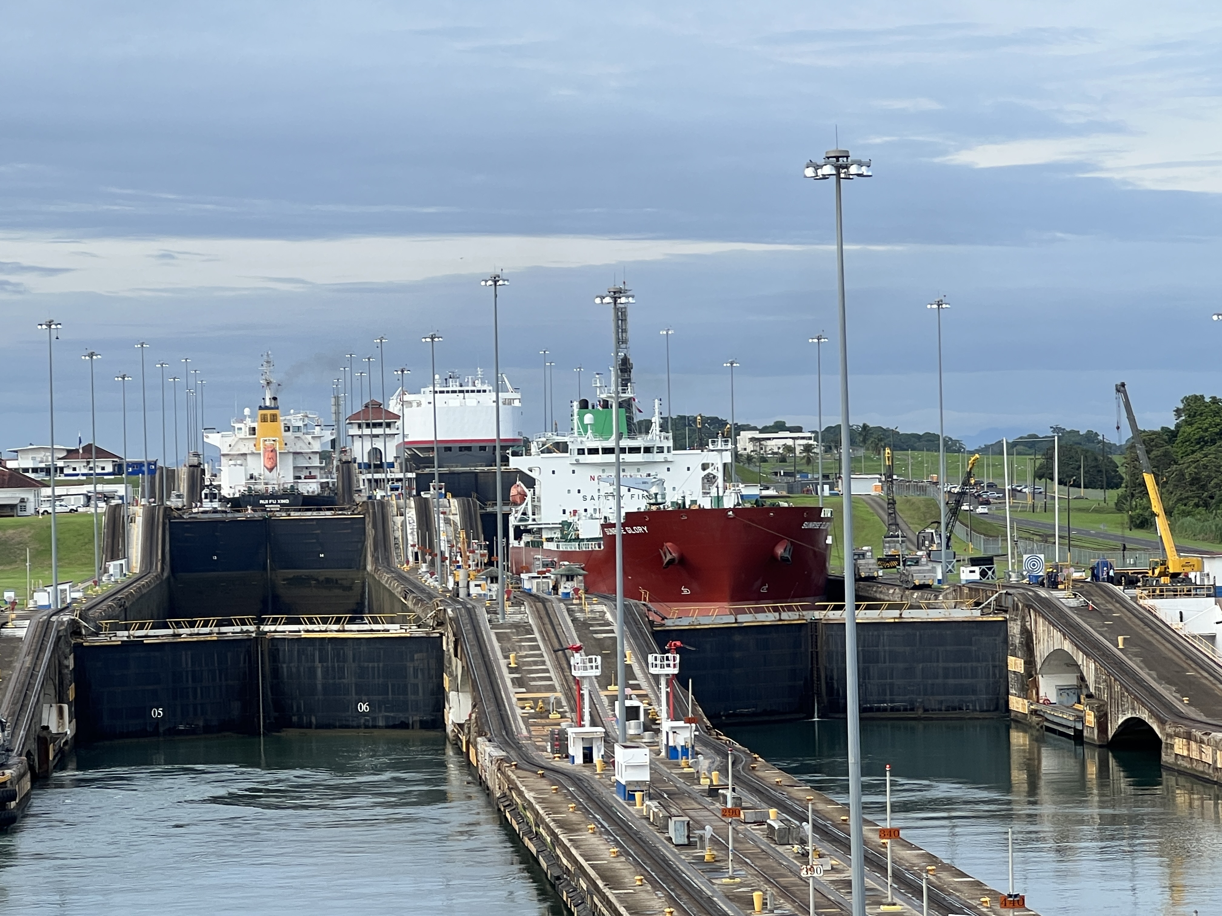
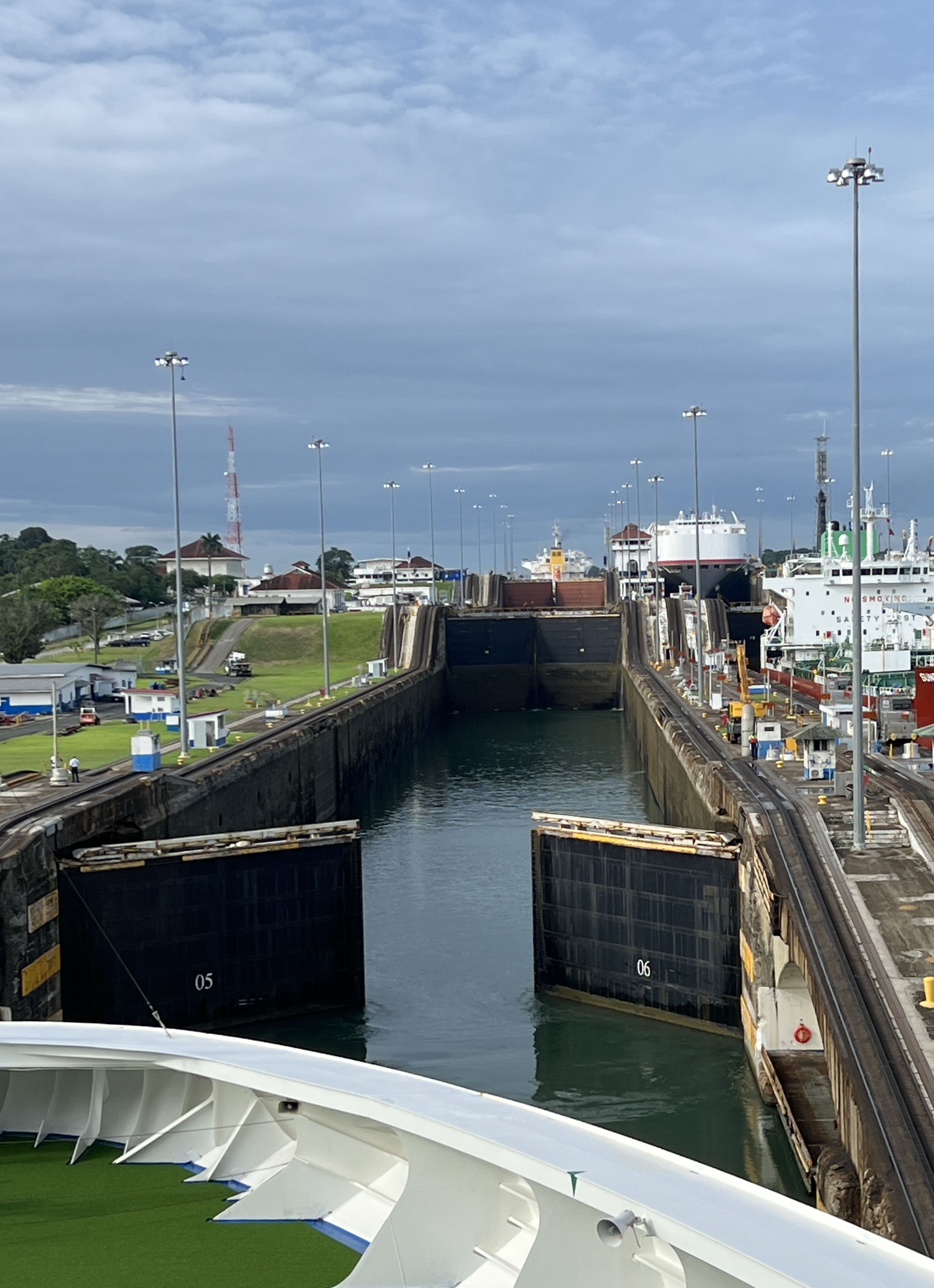
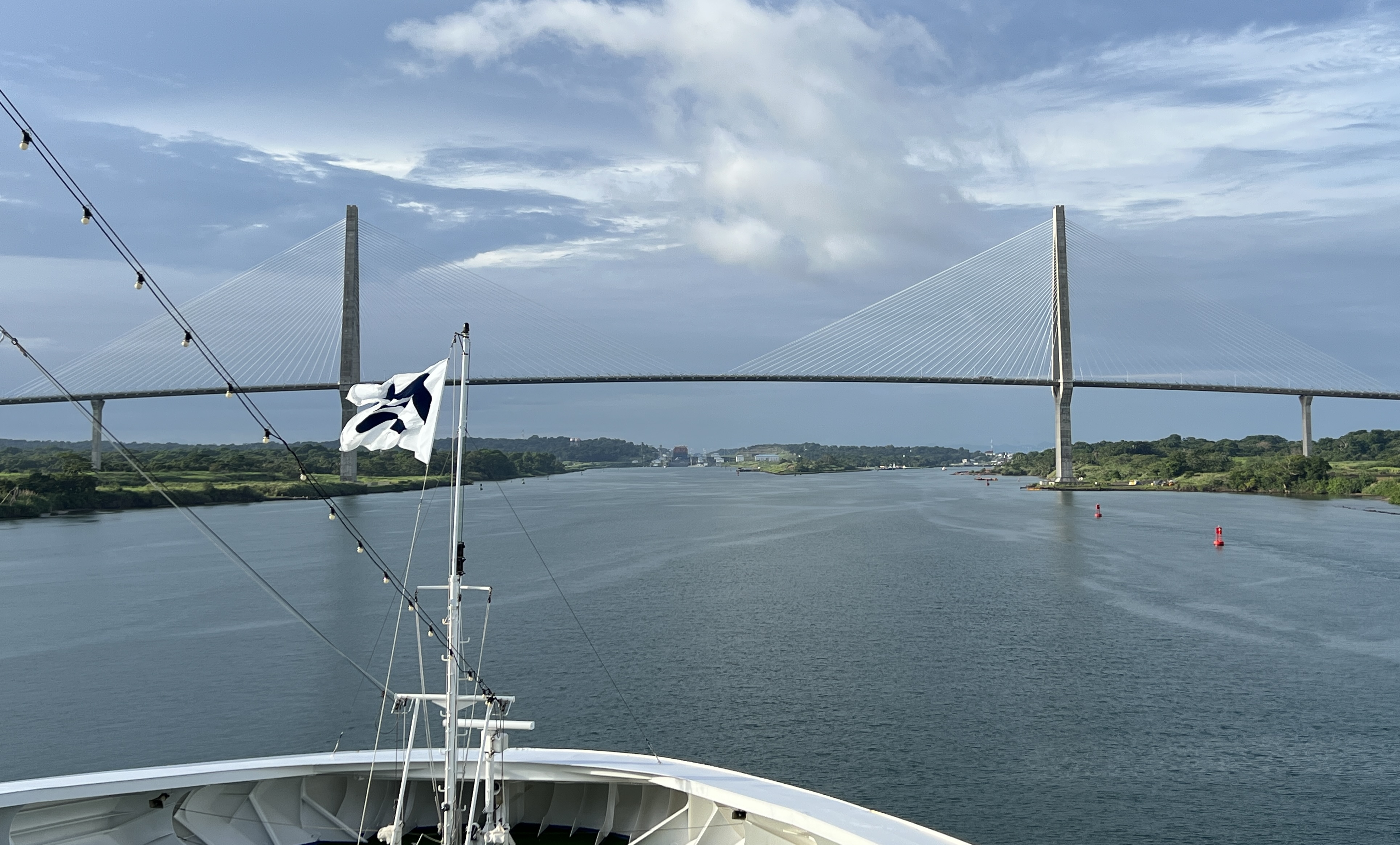
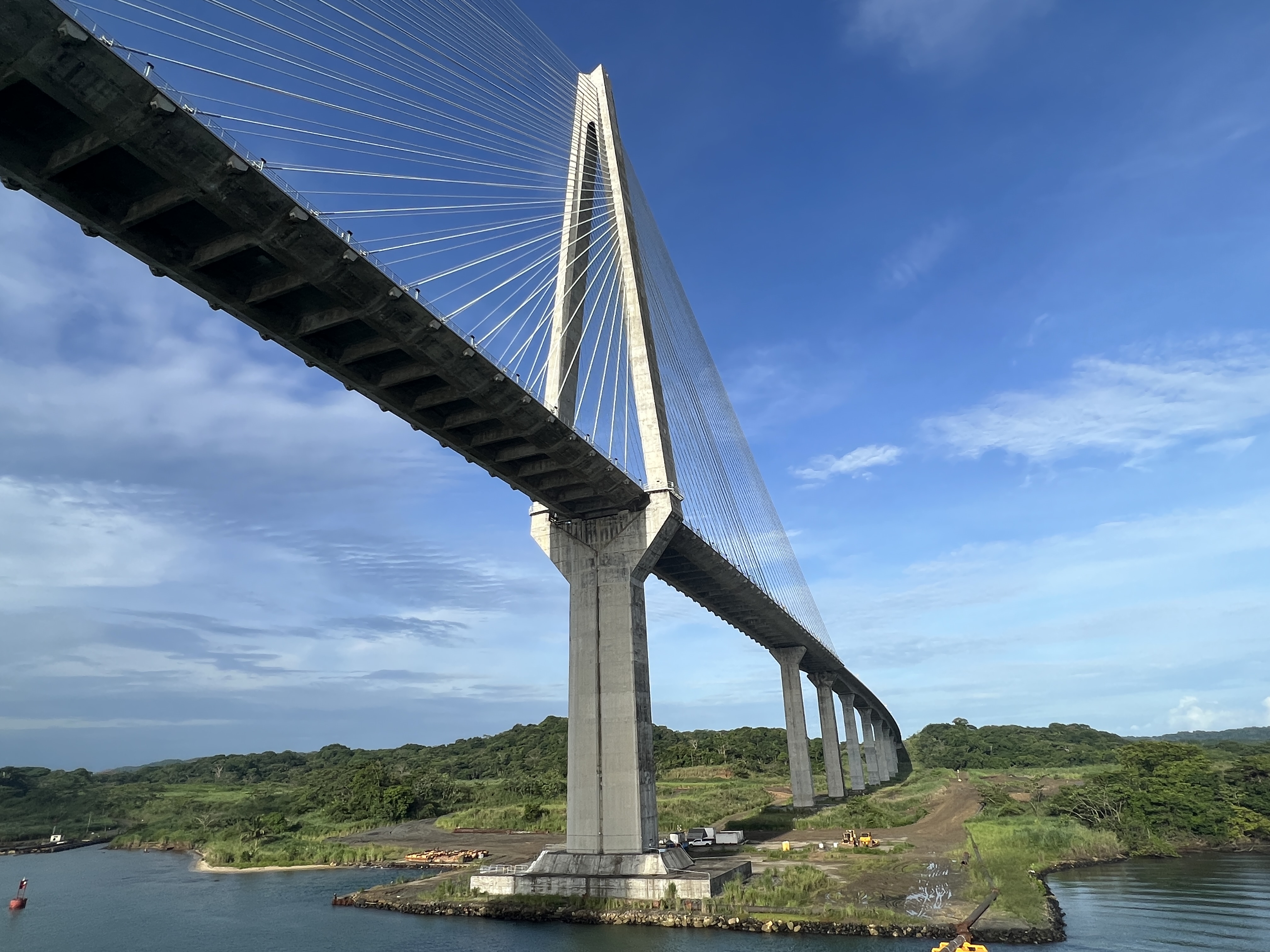
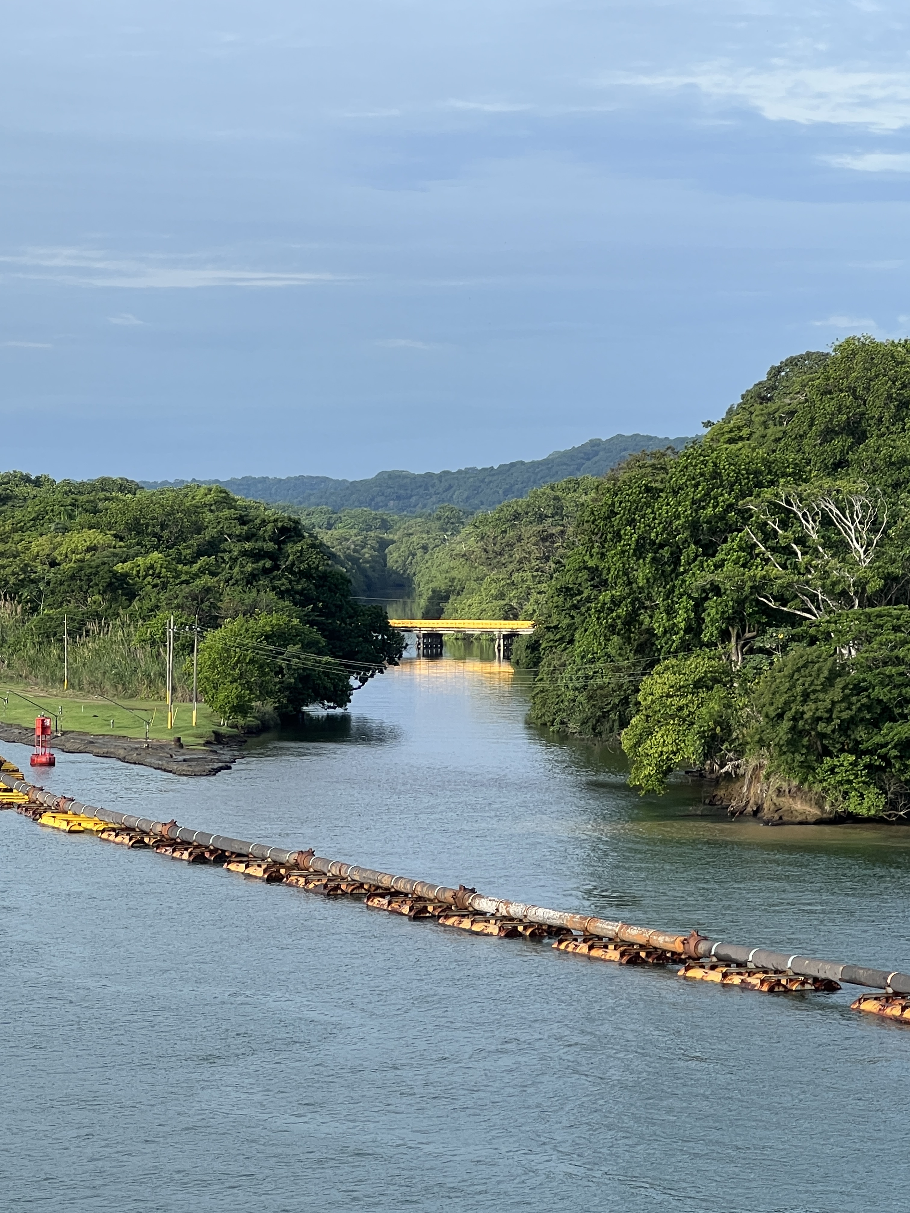
The ship ‘crawled’ along slowly through the Limon Harbour and under the recent Millennium Bridge to make our slot for the transit at 8 am for entry into the lower chamber of the three Gatun locks. These locks raise the ship up 85 ft to Lake Gatun where the Canal starts. The Lake is fresh water, salt sea water is kept out when fresh water is let out of the upper lock to fill the second chamber we enter.
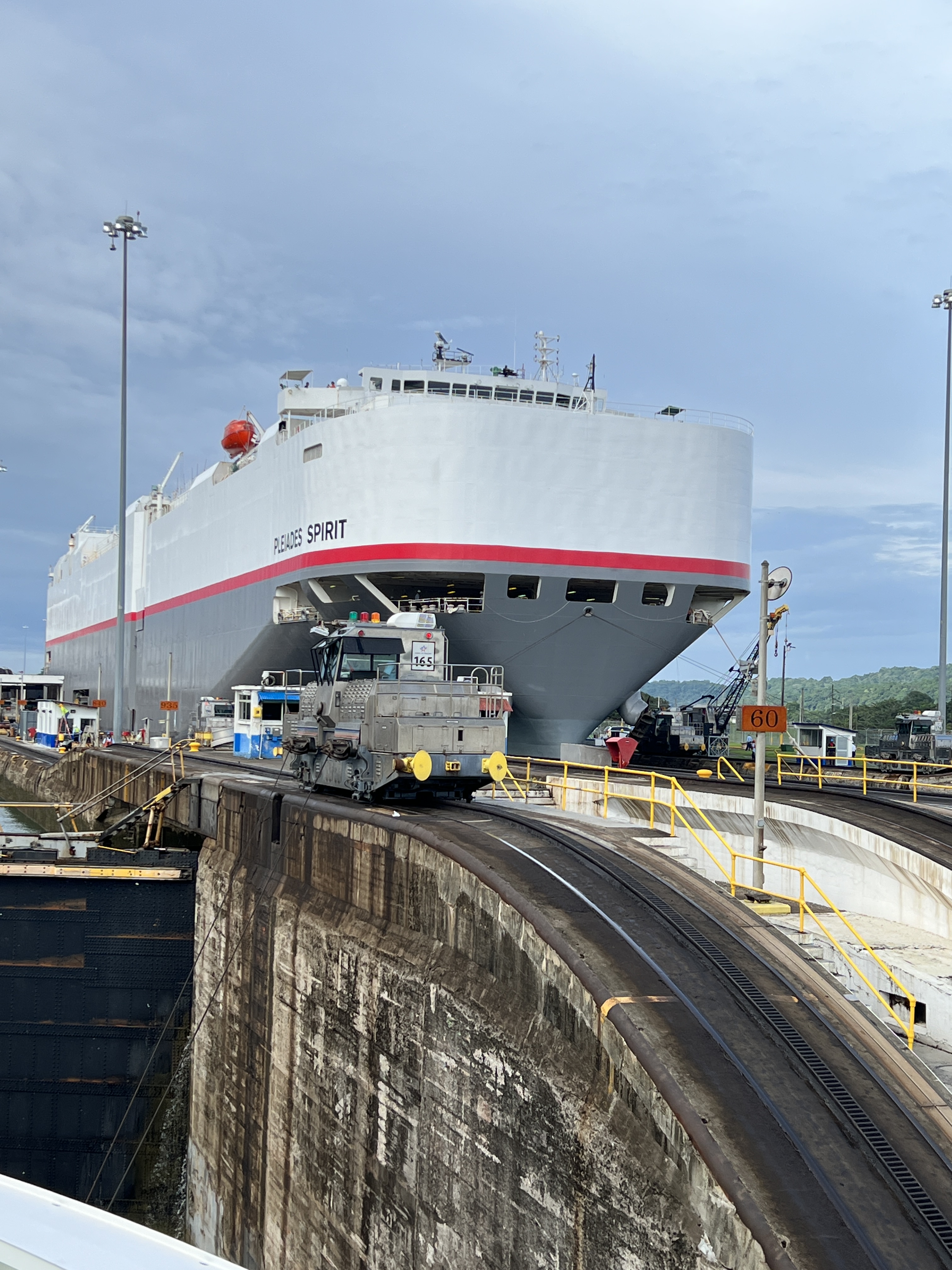
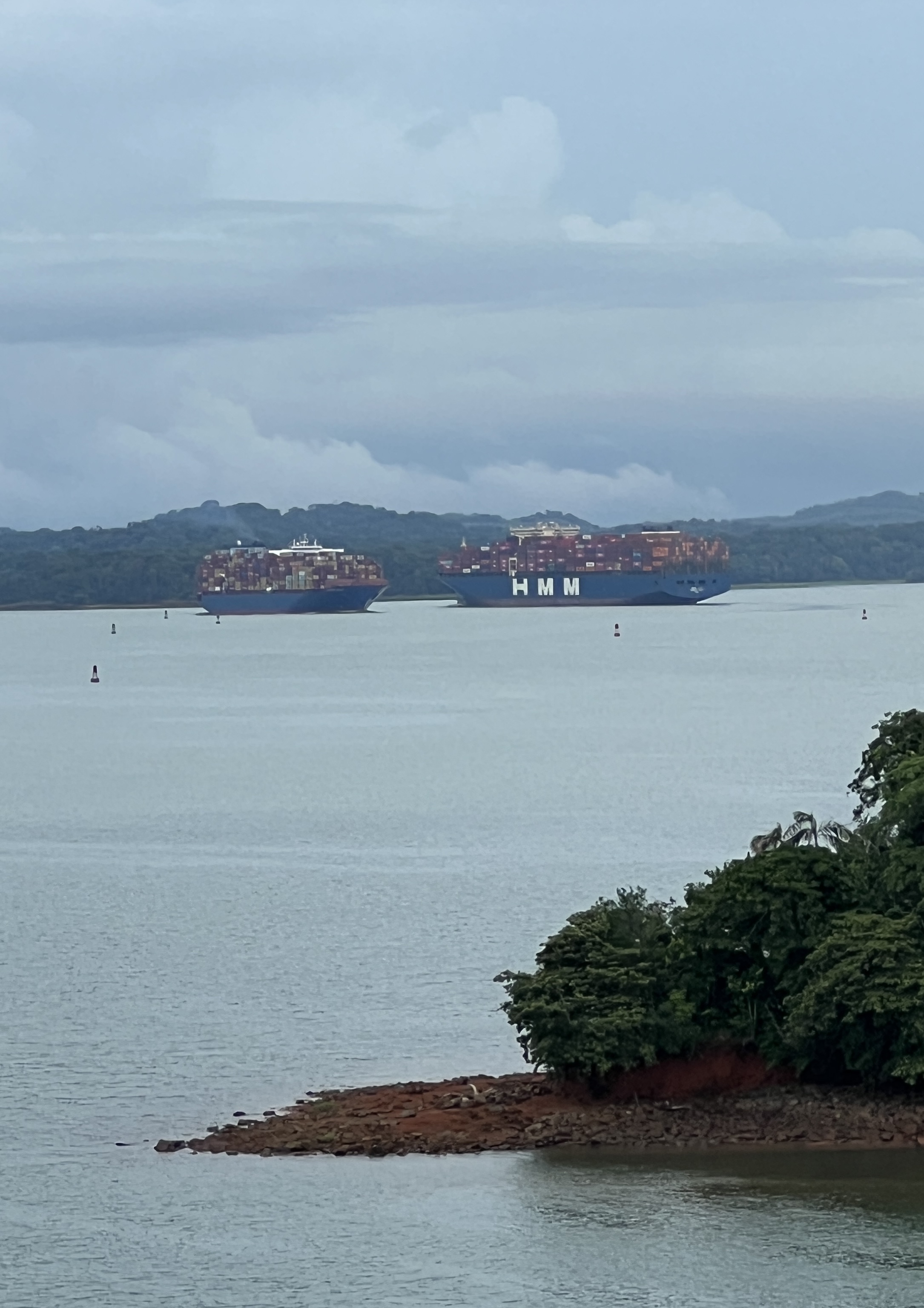
Ships coming the other way descend in the locks beside us.
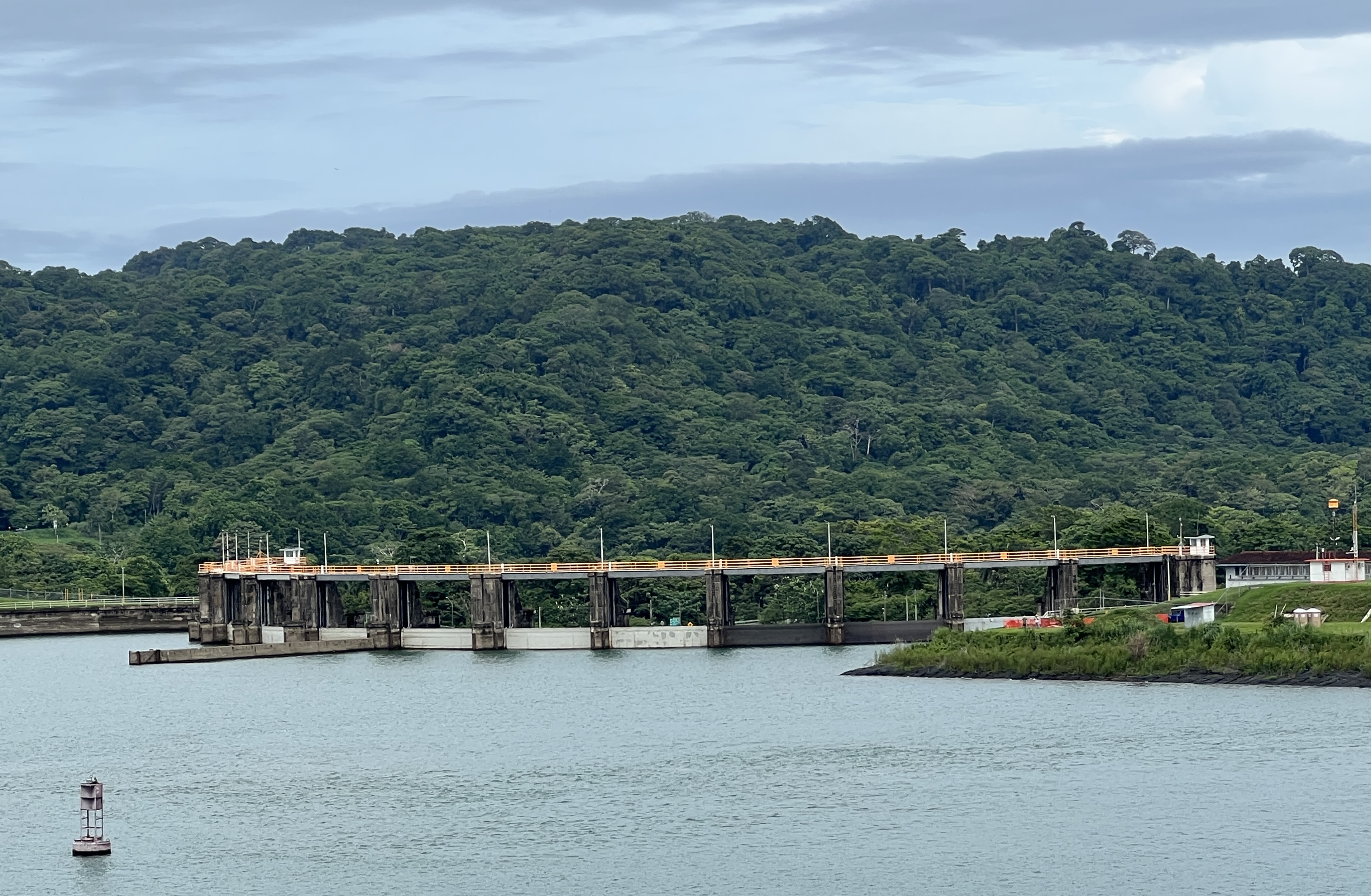
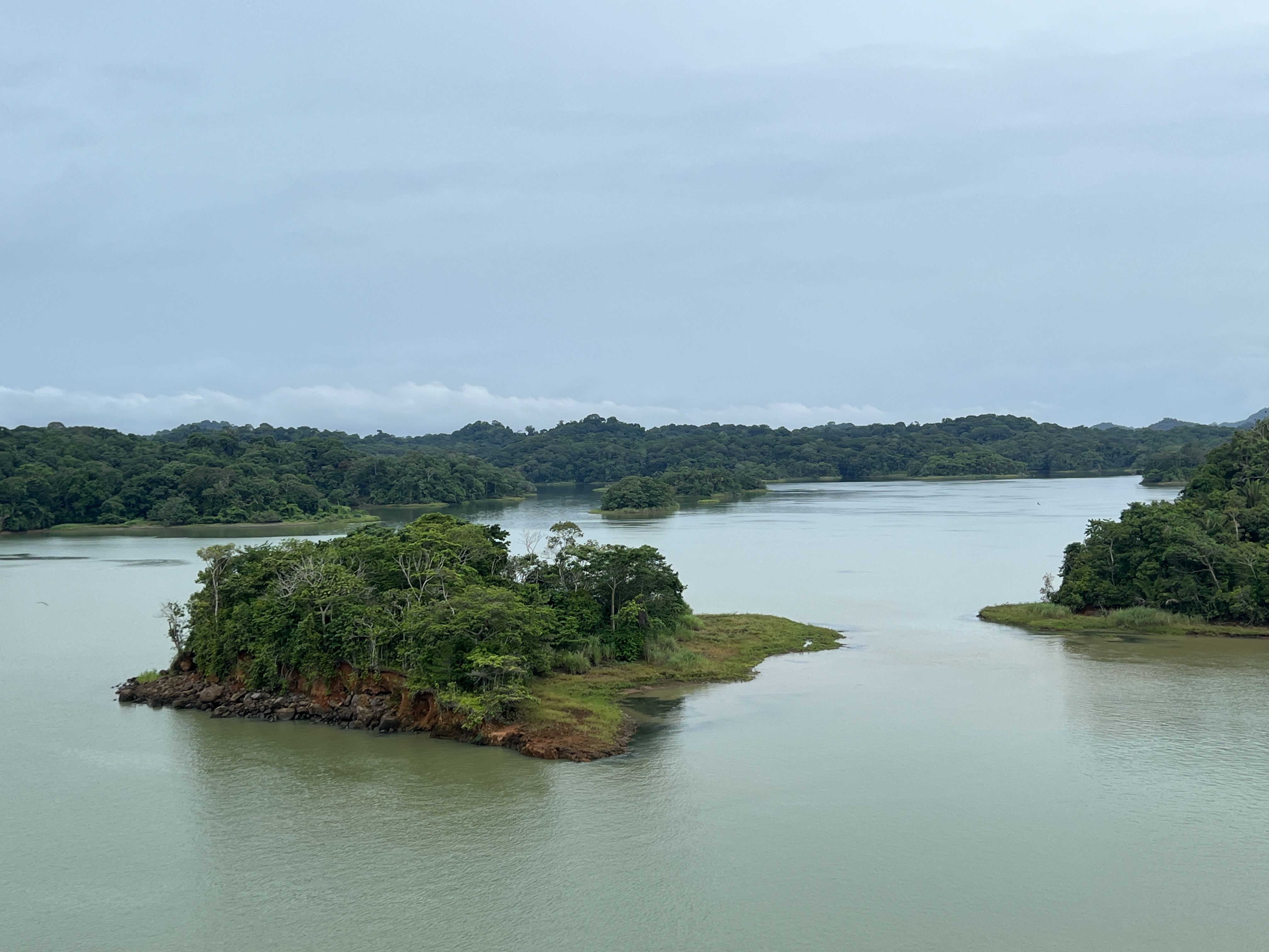
The Canal is actually a narrow channel that twists and turns through the lake. The Lake was formed by damming the Chagres River and its depth varies from 45-85 ft. The channel varies in width from 500-1000 ft. There are numerous islands and nooks and crannies in the shoreline that are actually the tops of the mountain range that was cut through as the Canal was built.
The French started construction of the Canal in 1881, the team was led by de Lesseps who had constructed the Suez Canal in 1869. The French concept was to construct a sea level canal, like the Suez.
This attempt was a massive failure, 22 thousand workers died from yellow fever, typhoid and malaria. The financial costs were enormous and cutting down into the mountain range proved beyond them. The effort was abandoned and the project put on care and maintenance until the Americans took over in 1902. They changed the plan to locks and the lake system we have today.
The project was opened in 1913.
It took us nearly 2 hours to go up the Gatun locks and the rest of the day to cross the Lake and descend the 30 ft Pedro Miguel lock to the small Miraflores Lake.
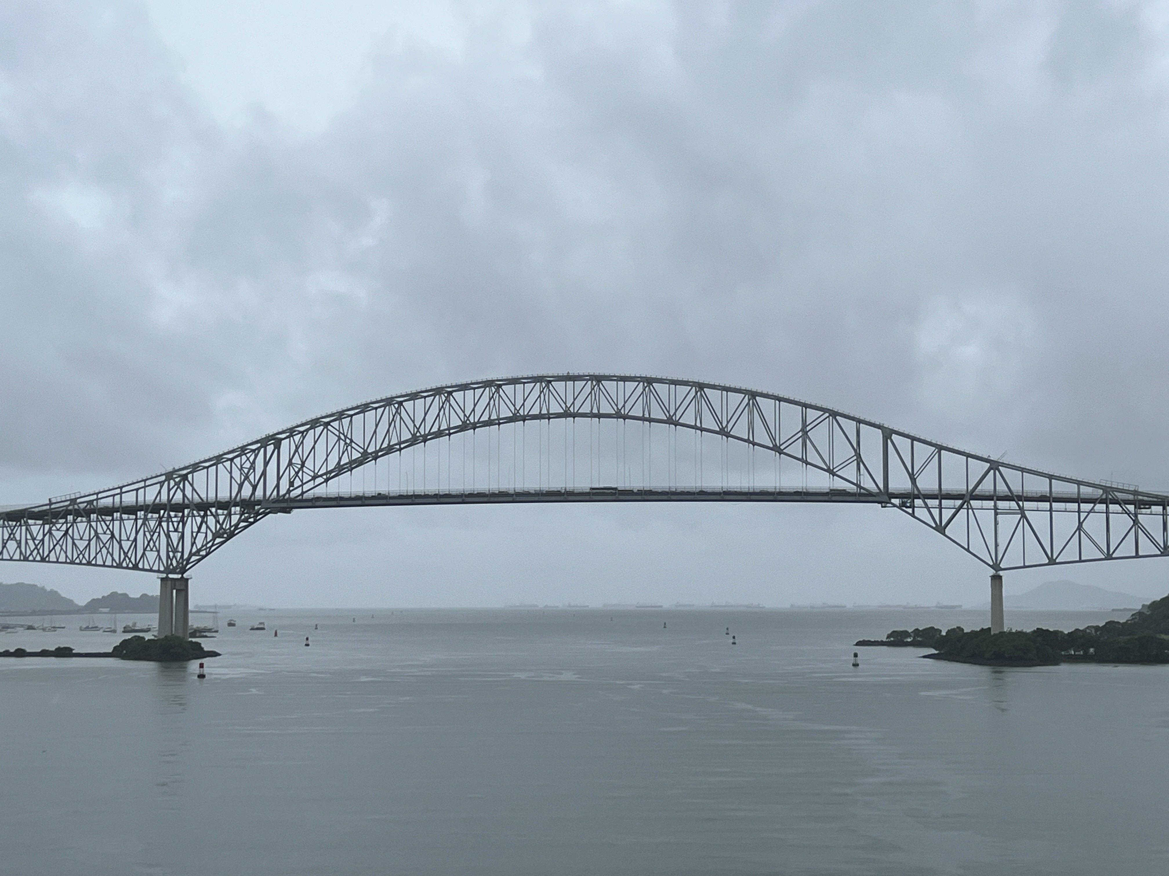
It was then down 55 ft in the two locks at Miraflores before passing under the Bridge of the Americas and into the Pacific Ocean, near Panama City.
The Canal is amazing engineering accomplishment and a great journey by cruise ship.
New York farewell
Slobro was very keen to put up on the blog the map of the world he has on the wall of our cabin. Every morning he has carefully put a dot on where we are and joined it with a line and a number, being days away. The dot is a bit approximate as it is only an average map and a few bits of the world are missing. He is quite proud of it and is wondering which wall to put it up on back home. Homealone is sure there will be plenty of advice offered in that regard.

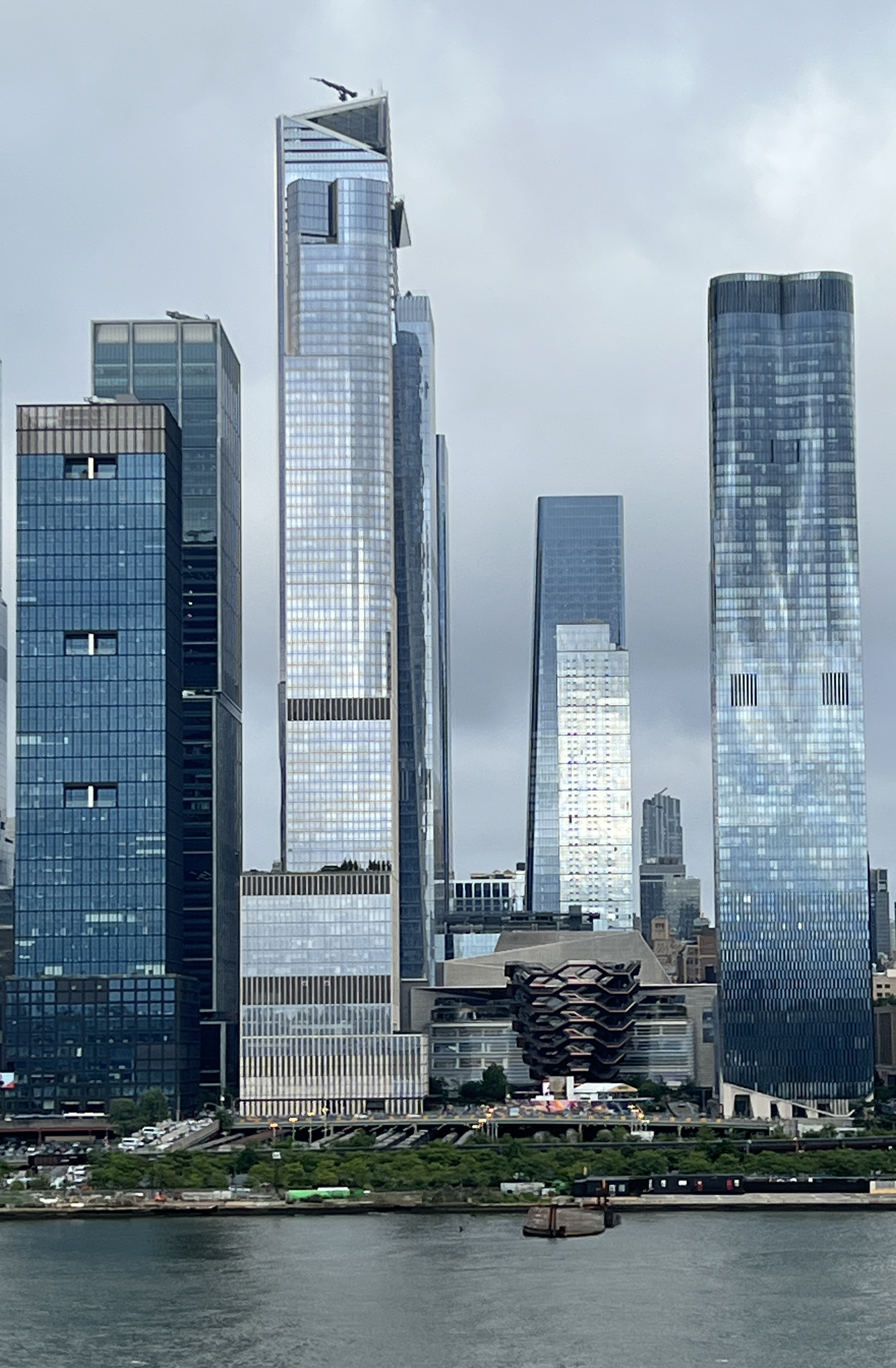
It was a cloudy sail off down the Hudson River past lower Manhattan out into New York Harbour.
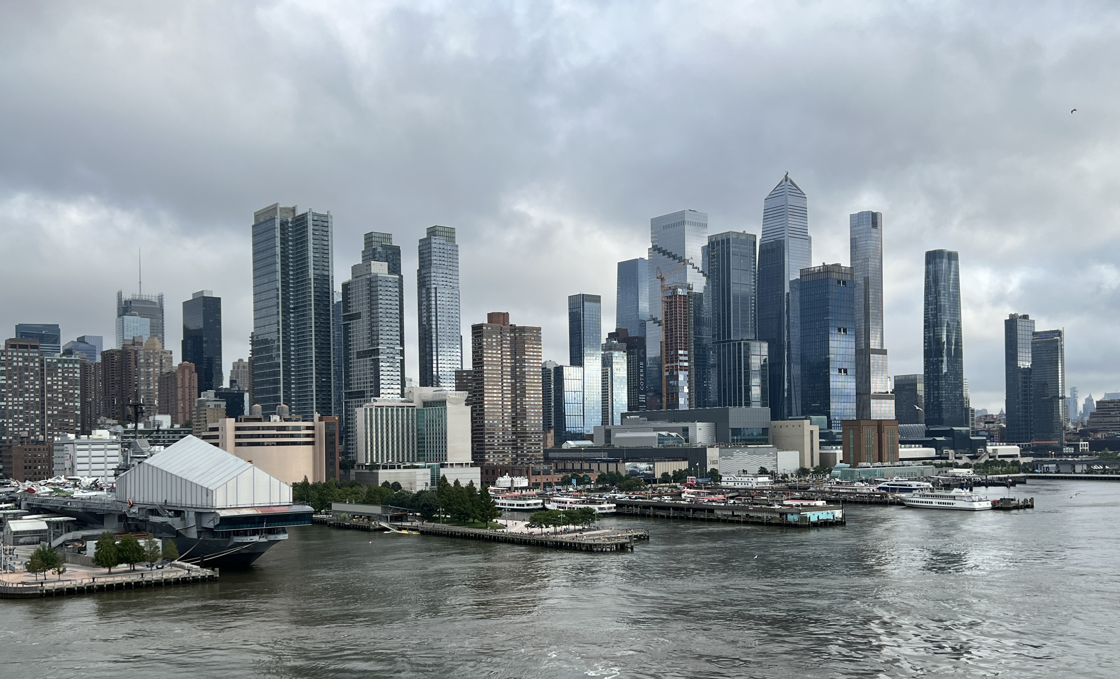
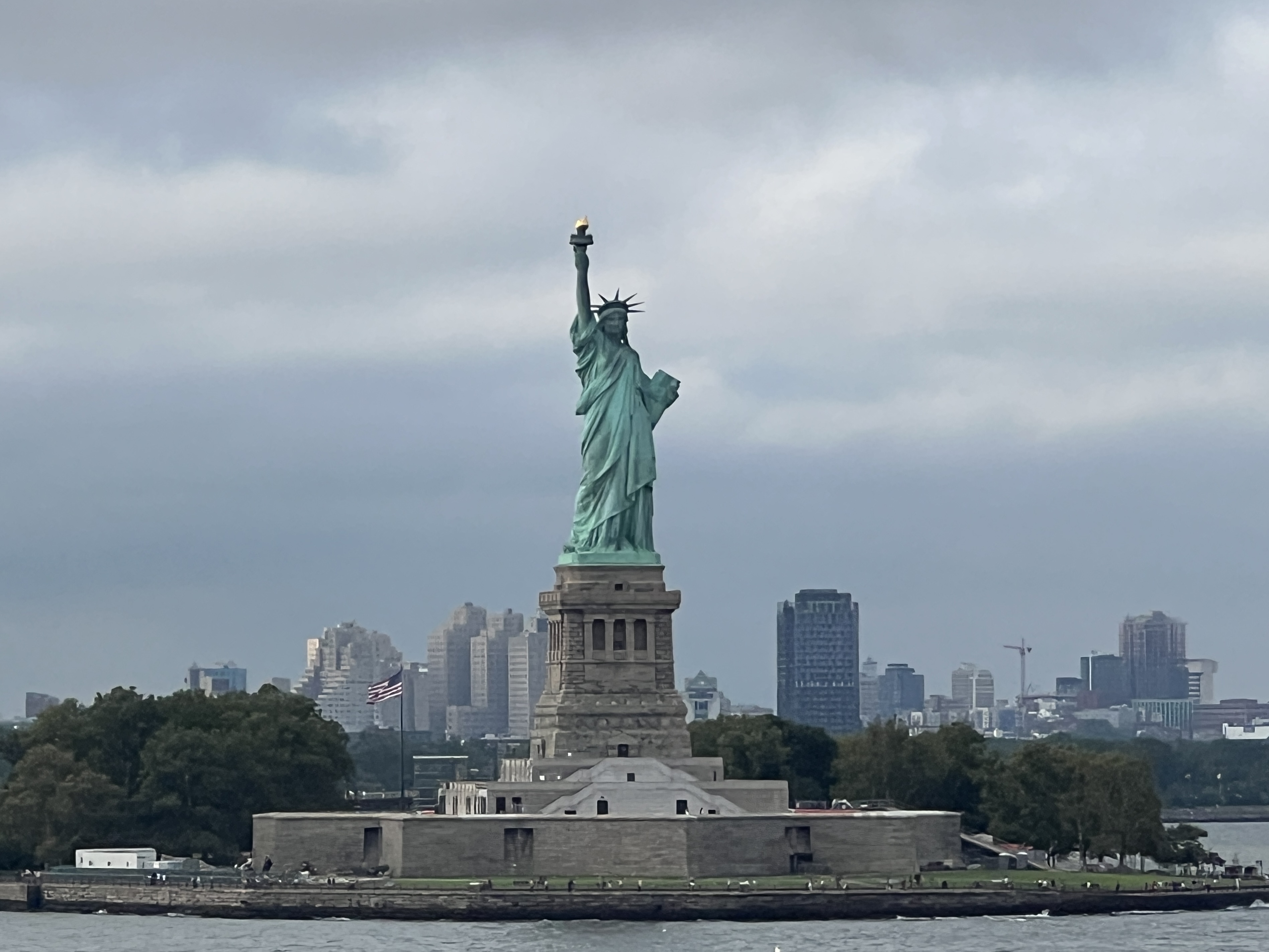
Many were on deck to wave to the iconic Statue of Liberty. It doesn’t take long to then sail up past Staten Island and under the Verrazzano-Narrows Bridge into the Atlantic Ocean. It’s a double decker road bridge, 7 lanes on top and 6 underneath, maybe the other way around.
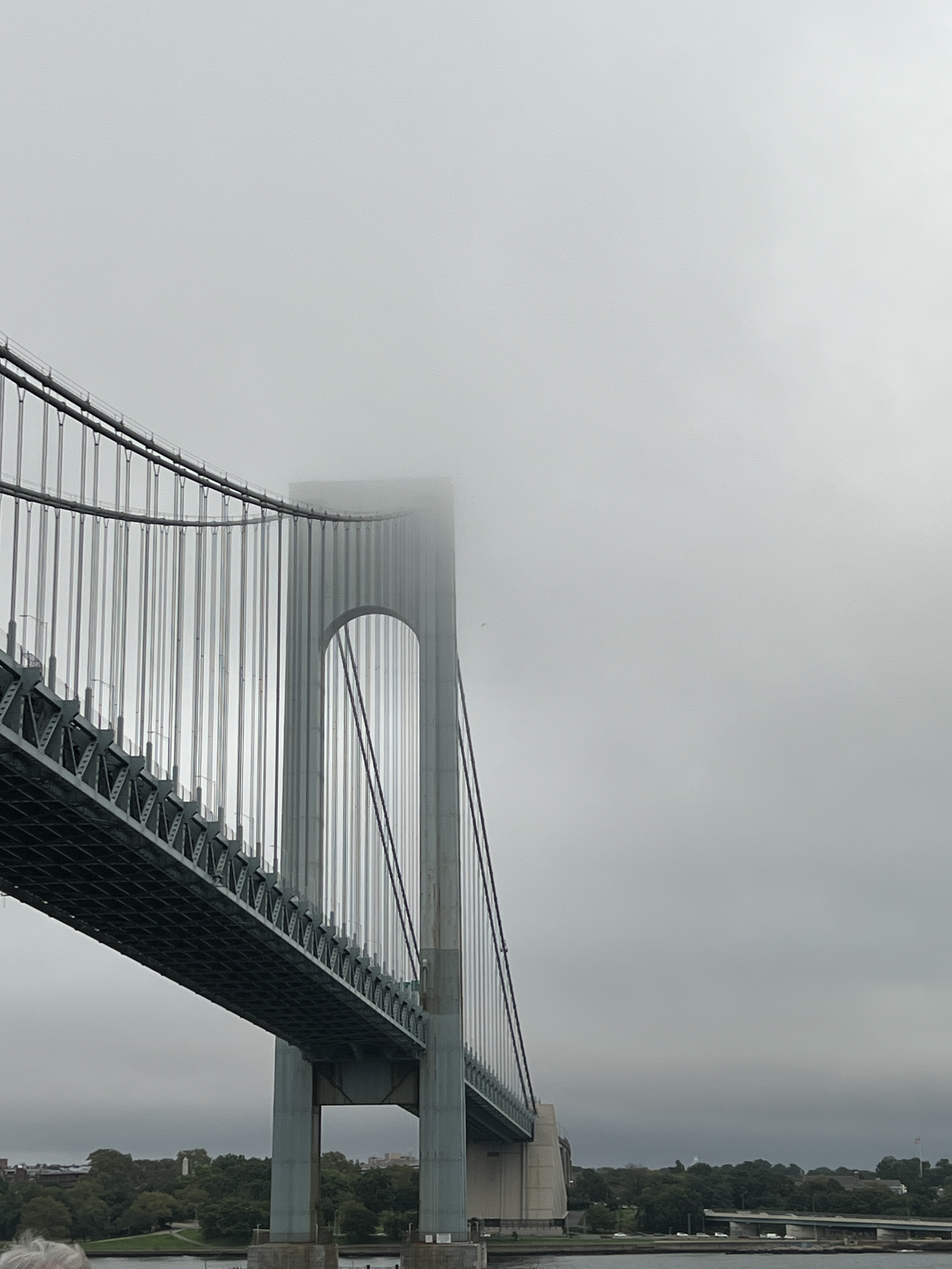
Verrazzano was an Italian navigator, serving under France, and in 1524 was the first European to enter the Harbour. The bridge is a little eerie in the evening mist and cloud.
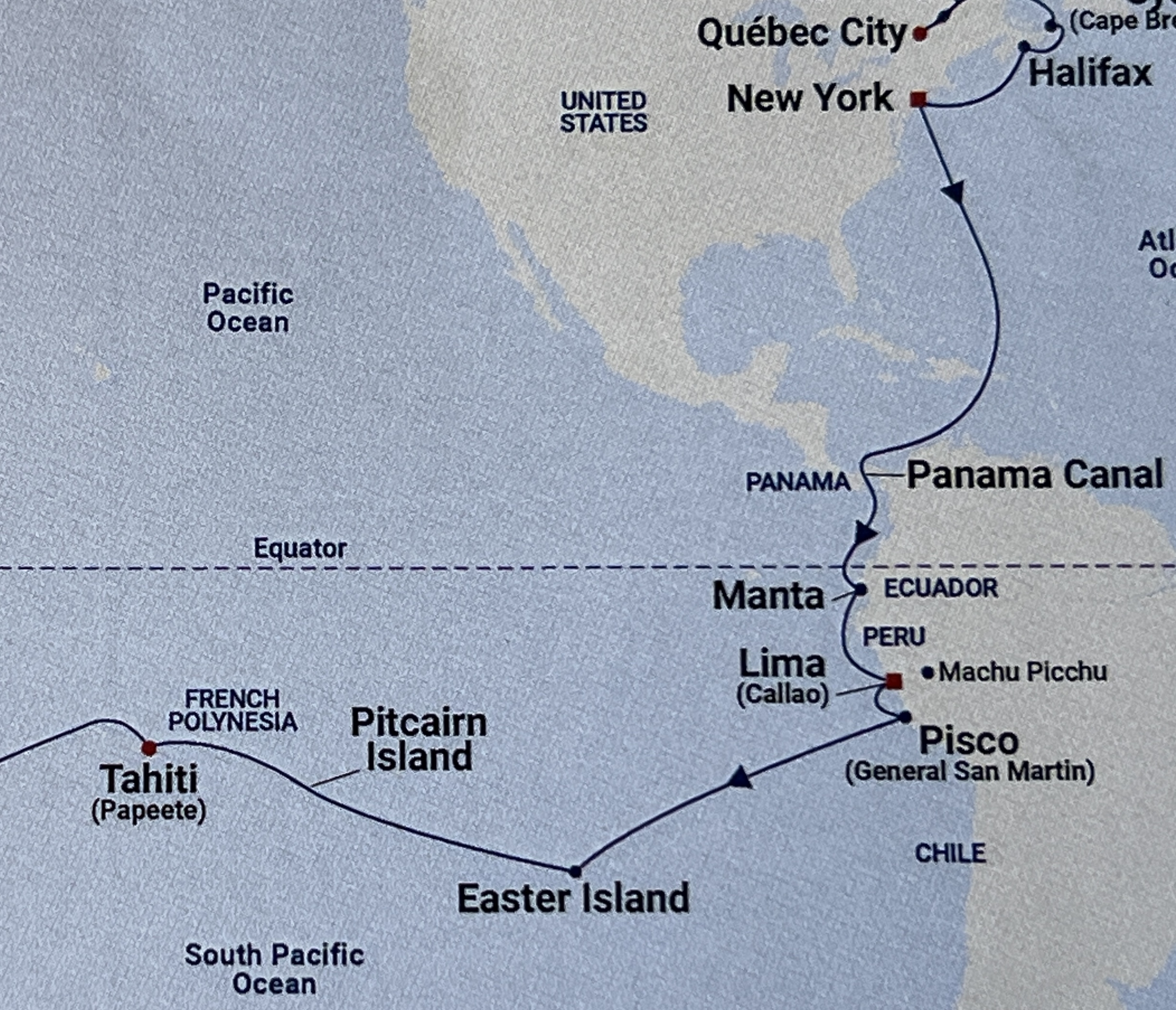
New York was the end of Stage 3 of the cruise which had started back in Dover. The final stage back home to Brisbane first takes us down the east coast of America then through the Caribbean Sea, passing between Cuba and Haiti, before reaching the Panama Canal and into the Pacific. The course through the Caribbean in the map above is not the way we went, the loop is too far east. It takes four days at sea to reach the Canal and the next blog report covering the crossing to the Pacific.
‘Coming to America’
One of Neil Diamond’s memorable songs, well at least for some, is ‘Coming to America’. It is a celebration of all those immigrants arriving on it’s shores seeking a better life. Allthego recalls the Annie Moore statue we saw earlier in this trip at Cobh in Ireland. Annie was the first immigrant to pass through the Ellis Island Immigration Centre when it opened on 1 January 1892.
We passed by Ellis Island on our way through NY harbour to the pier on the Hudson River in Midtown Manhattan. We are not here as immigrants but as tourists and have arrived in totally different personal circumstances compared to Annie Moore. I wonder what she would think of the place today compared to 1892?
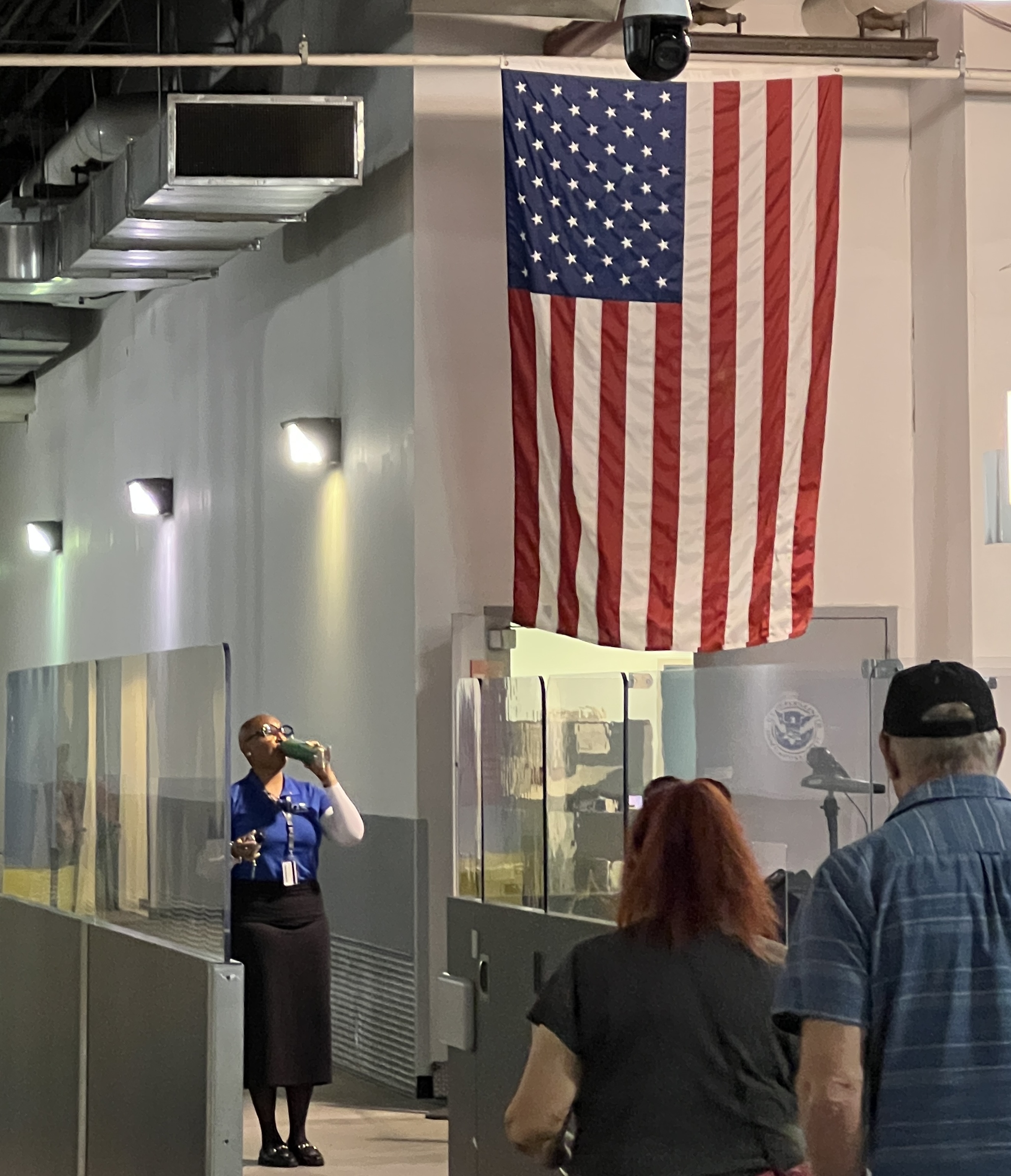
In true American style the system requires everyone, including the crew, to get off the ship and pass through immigration before they will let anyone get back on. The exodus starts around 7.30-8 am and will not be finished till 2 pm. So unless one is prepared and organised to head off straight away it is a long sit in the terminal! Maybe one should just hang around on the ship and be the last to get off and first to get back on!
We were organised though. Having visited the Big Apple before and been around most of the iconic sights we had decided to be low key. So before leaving home tickets had been booked for the Neil Diamond Musical ‘Beautiful Noise’ matinee at 2 pm.
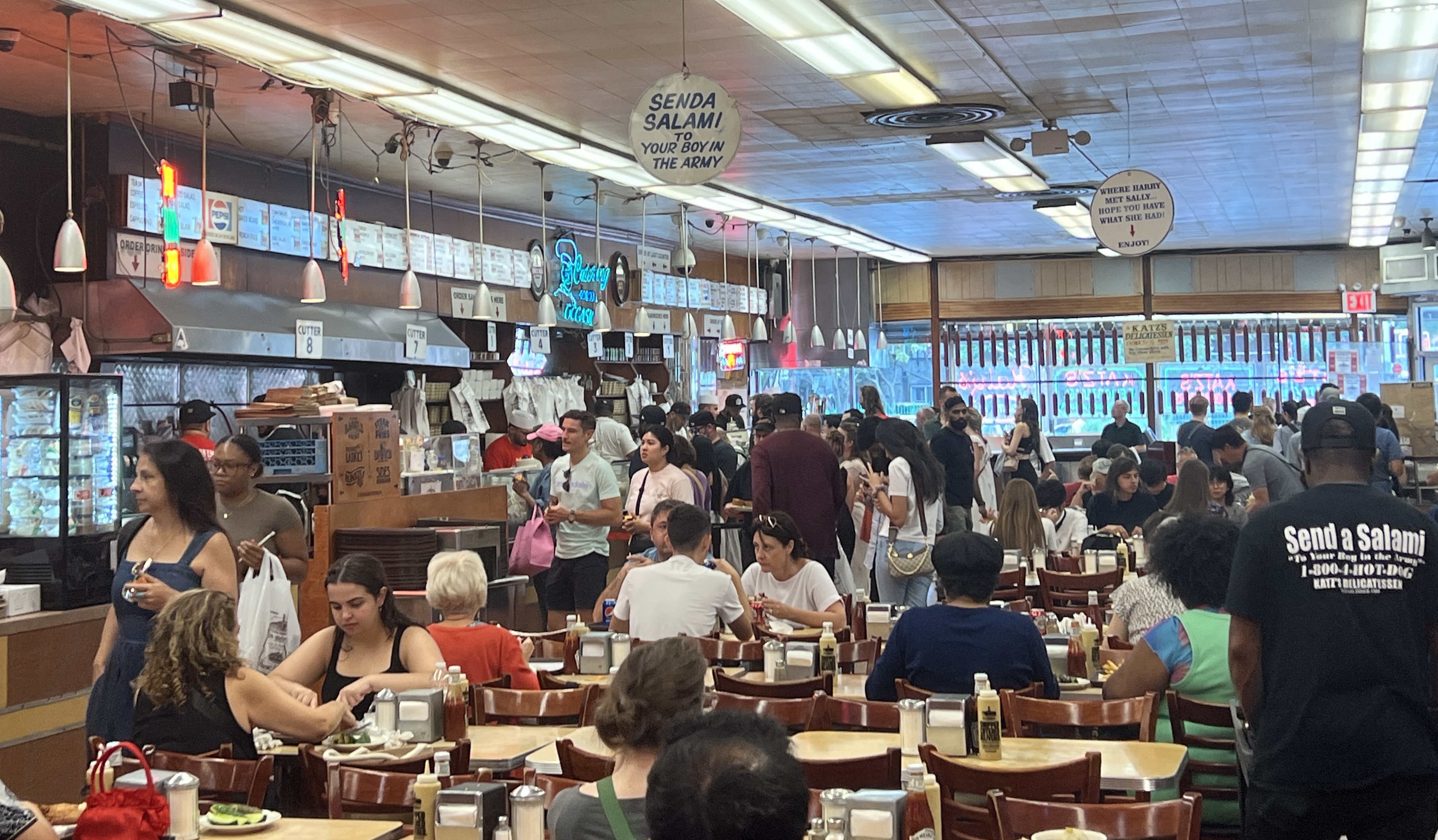
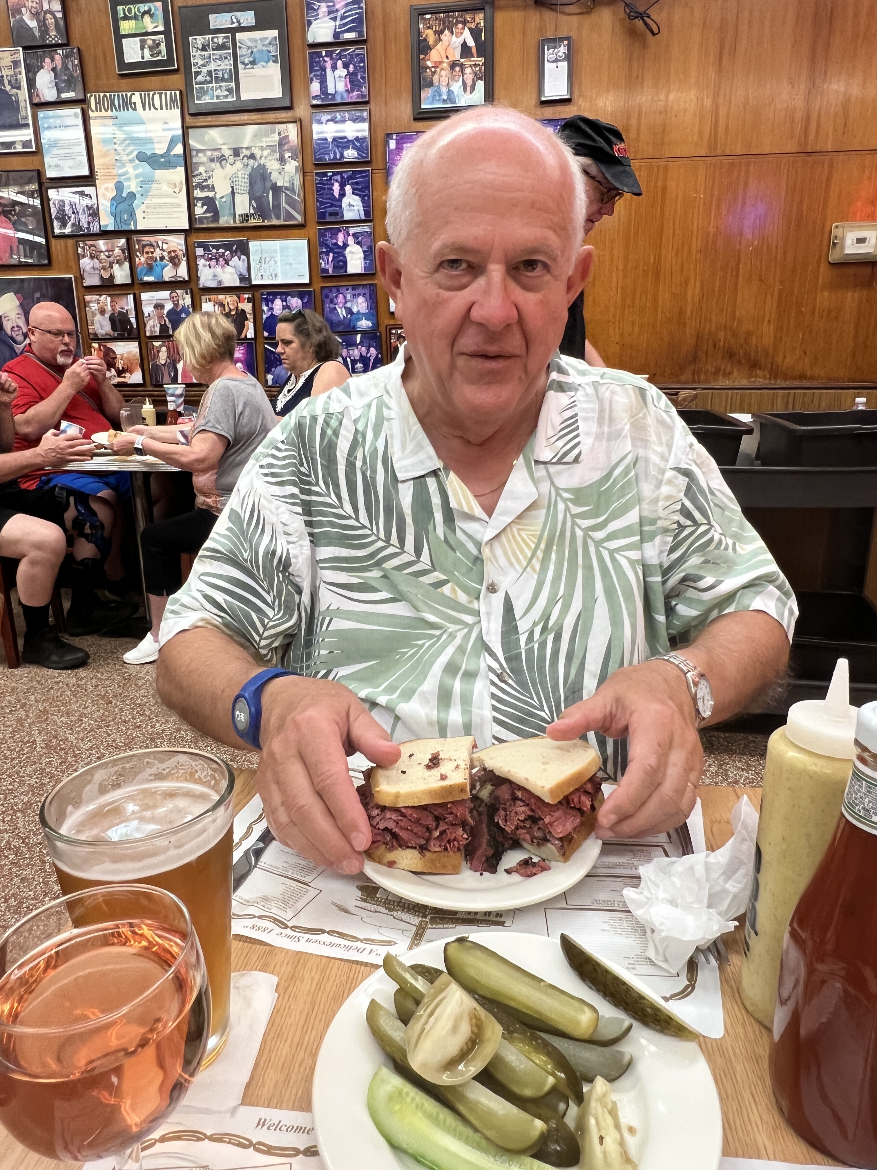
Before the show we took the subway down to Lower Manhattan and then cabbed it east across town to Katz Deli, on the Lower East Side. This Deli is where the famous scene in the ‘Harry met Sally’ movie was shot. Didn’t see any modern day Sallys in action. Allthego though did have one of the pastrami sandwiches, excellent. Homealone’s corn beef one was disappointing, it was a bit tough. Had to taxi back up town to get to the Broadhurst Theatre, just near Times Square, on time for the show.
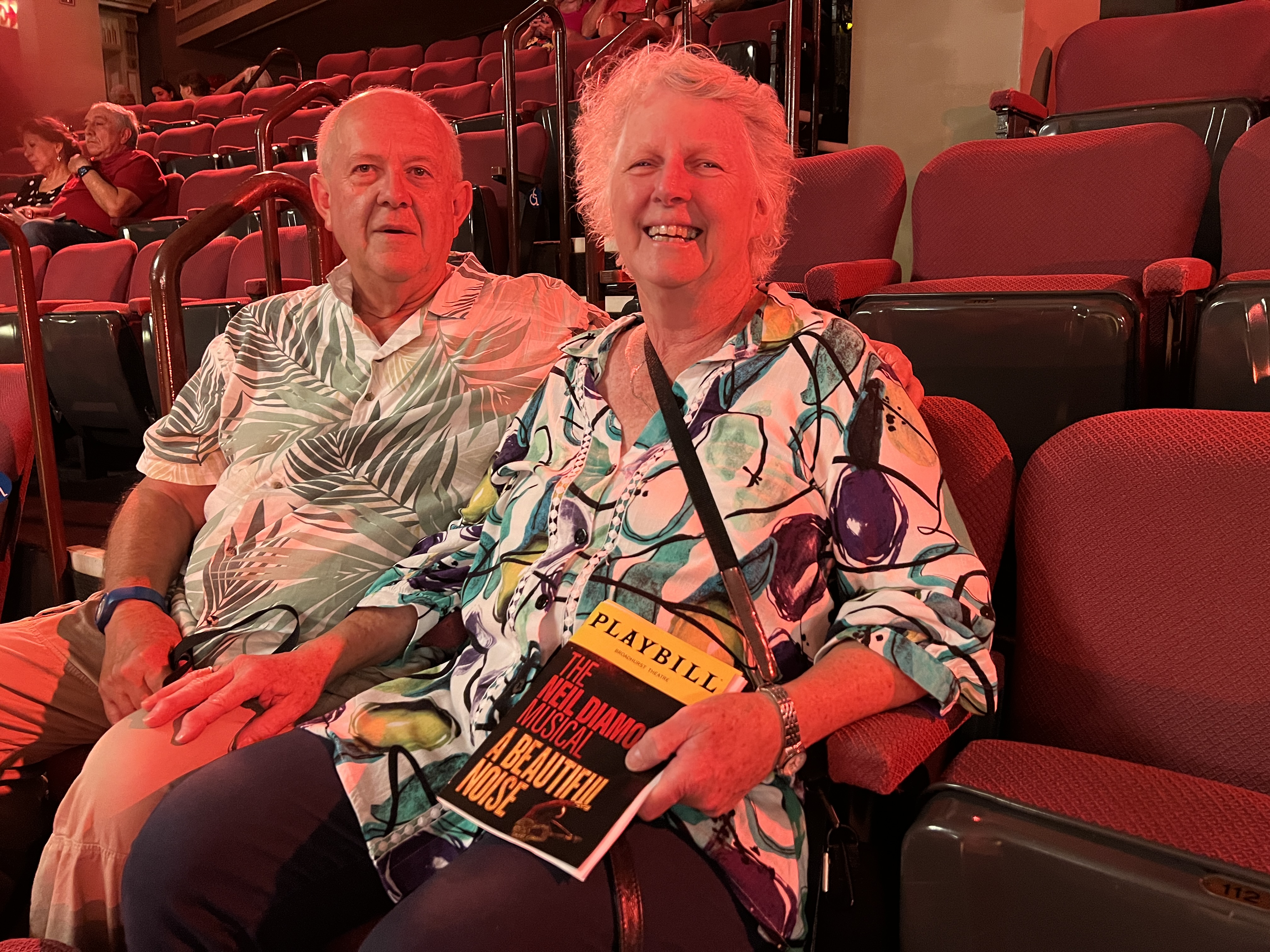
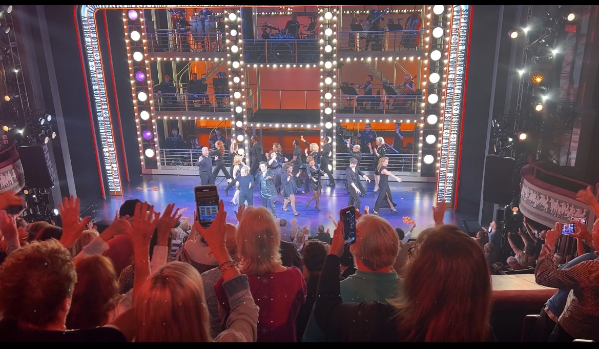
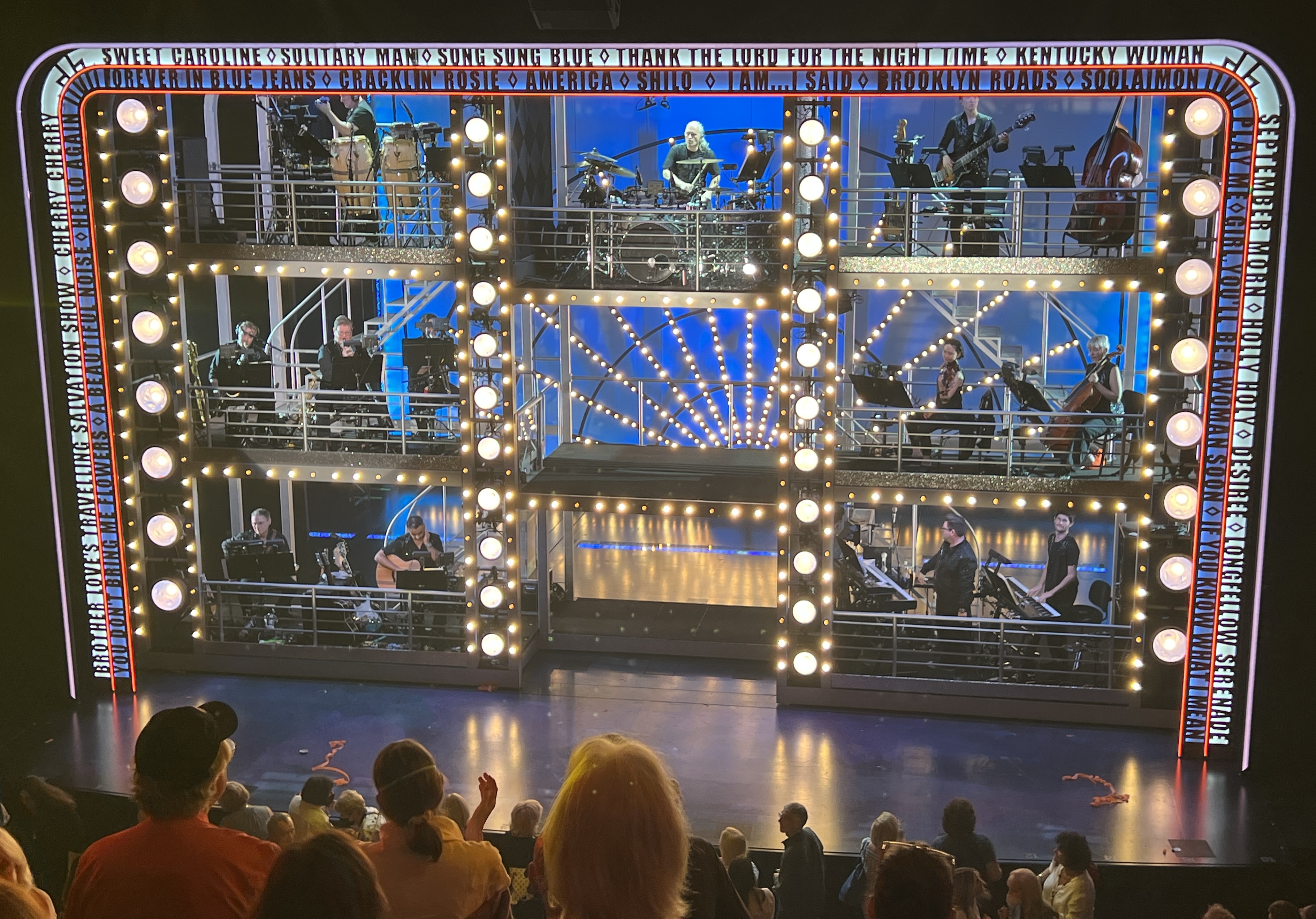
‘Beautiful Noise’ is a musical recap of Neil Diamond’s life in the context of visits to his therapist, after his dementia diagnosis. There is a ‘Neil -Then’ (does most of the singing ) and a ‘Neil-Now’ (who talks to the therapist). Interesting way of doing it and highlighted that many of his songs were markers of ‘highs’ or ‘lows’ in his life. Anyway the sell out audience of Diamond tragics lapped it all up and the ‘Sweet Caroline’ finale had everyone on their feet waving their arms and shouting out ‘too good, too good’. It was!
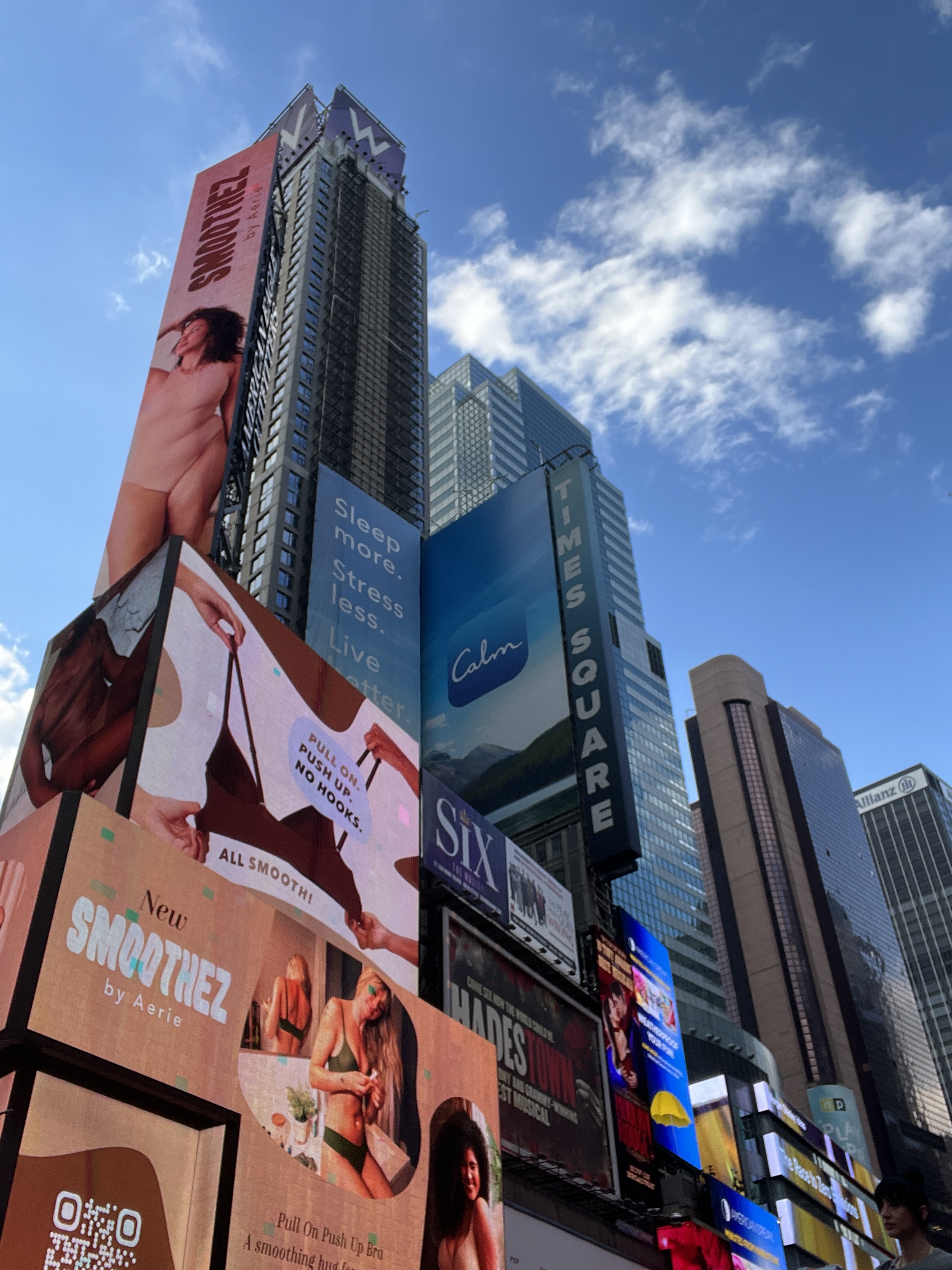
After the show we had an hour to kill people watching around Times Square. There are some strange characters around these parts. Gorillas, Spider Man, Mickey and Minnie Mouse as well as a few young ladies in minimalist attire. All looking for their photos to be taken, for a fee of course.
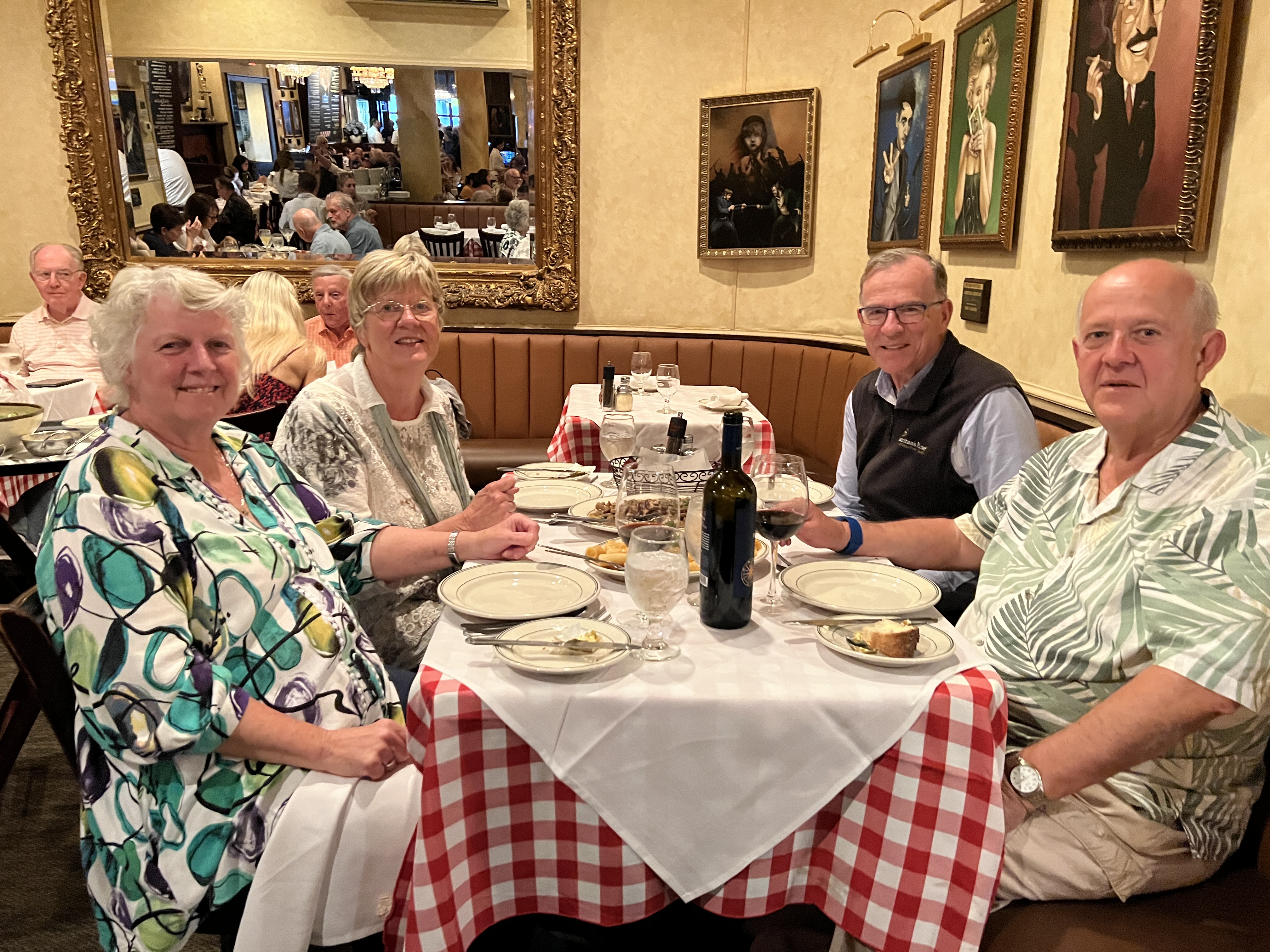
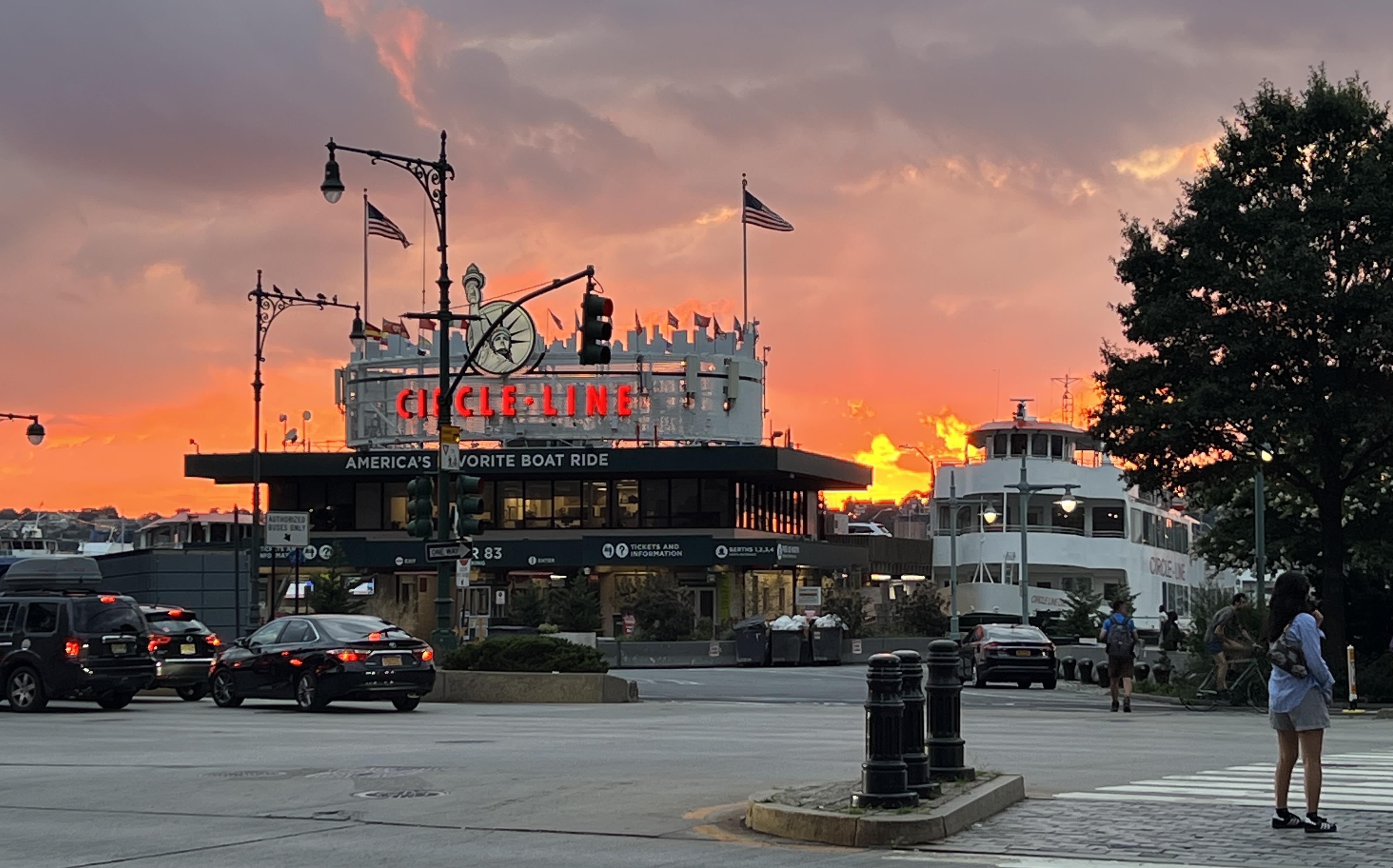
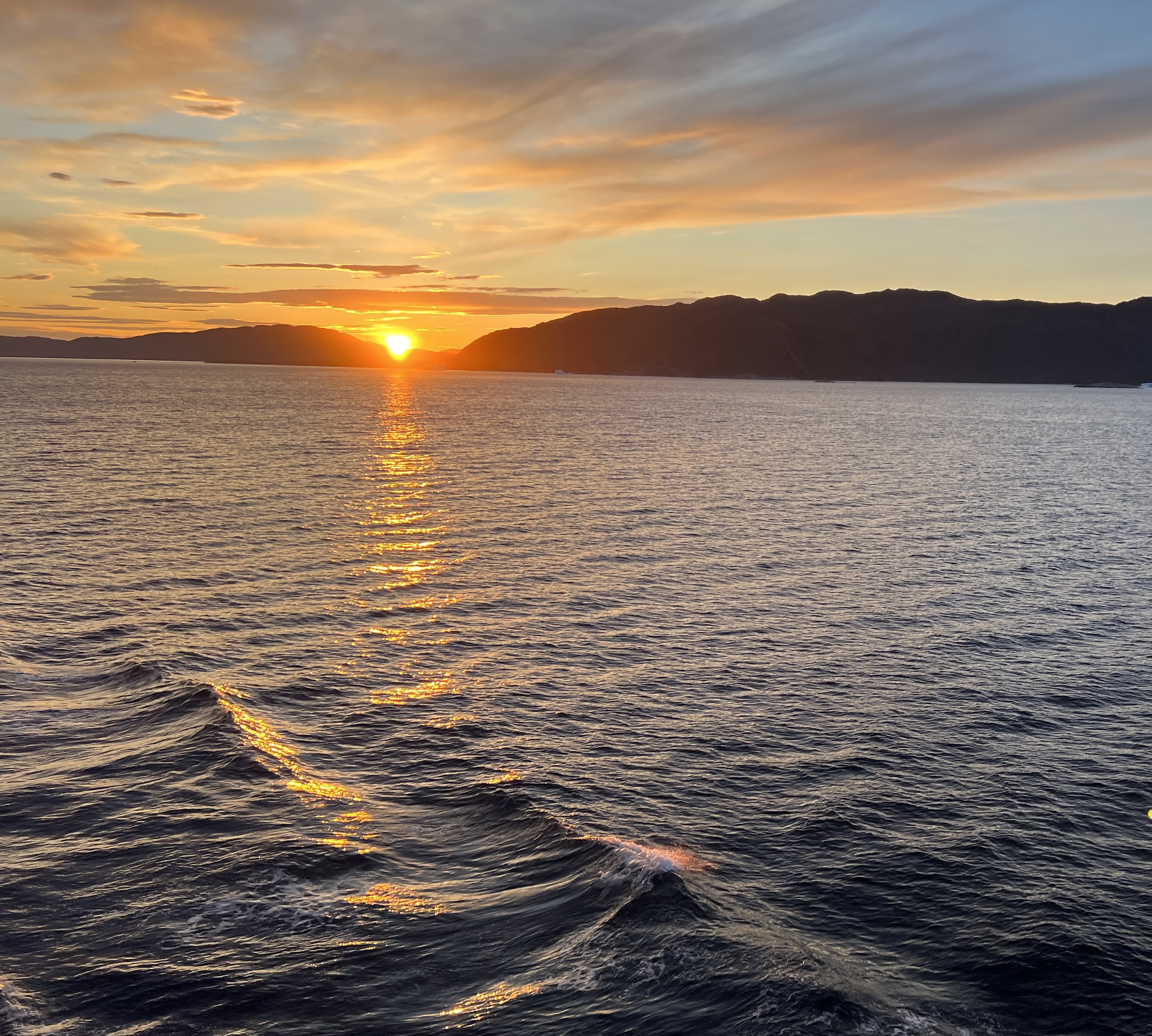
We had dinner with the Berrys at Tony’s Di Napoli, Italian family restaurant. Been there before with the Imlays. A great feed was had, only two dishes and they were enough to feed six. Full of people enjoying the food and noise! Walked back to the ship and was met by a great sunset over the Hudson River.
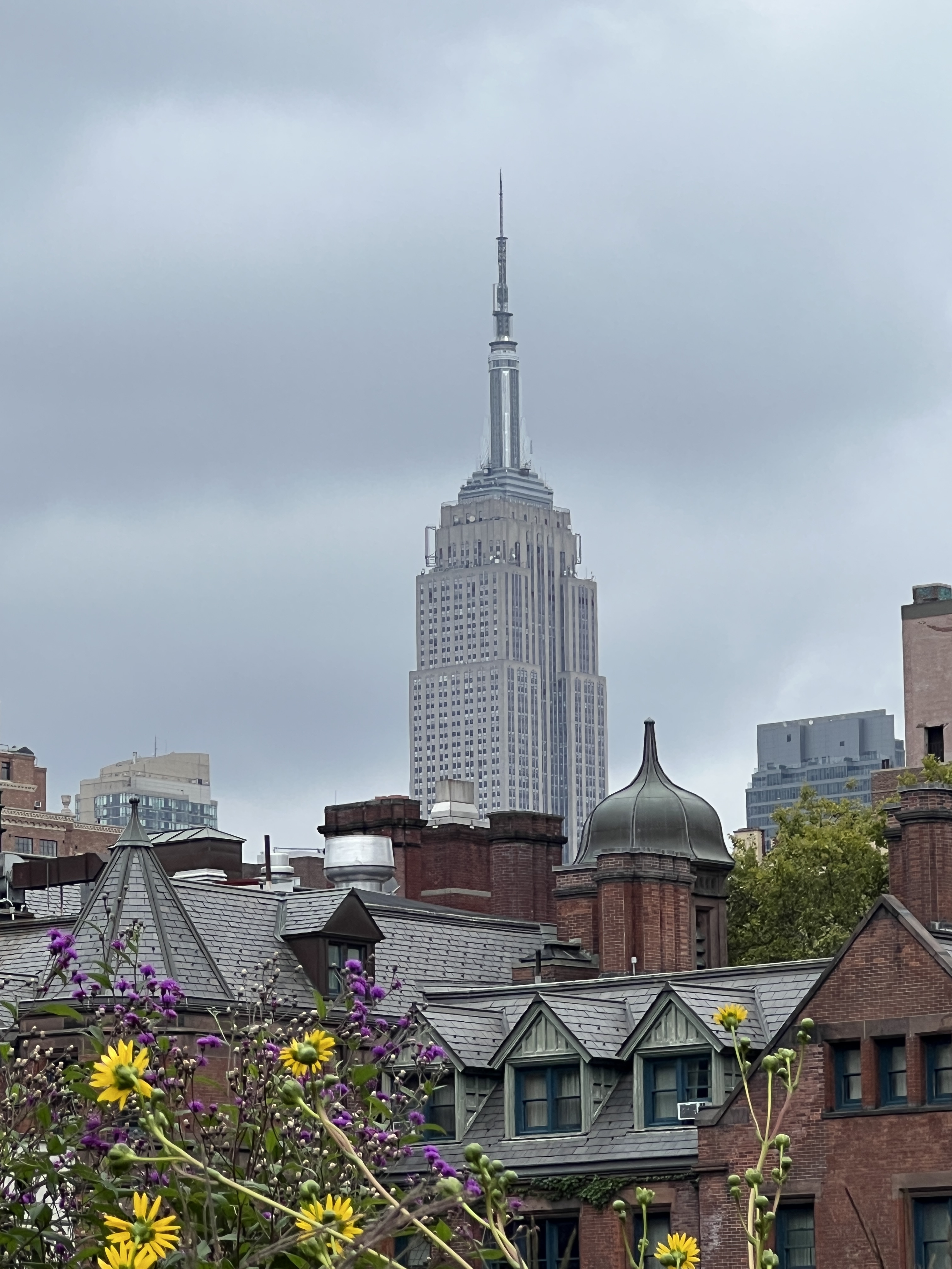
Next day our plans were a bit loose and centred around walking the length of the High Line. The High Line is a contemporary urban park built on a relic of industry.
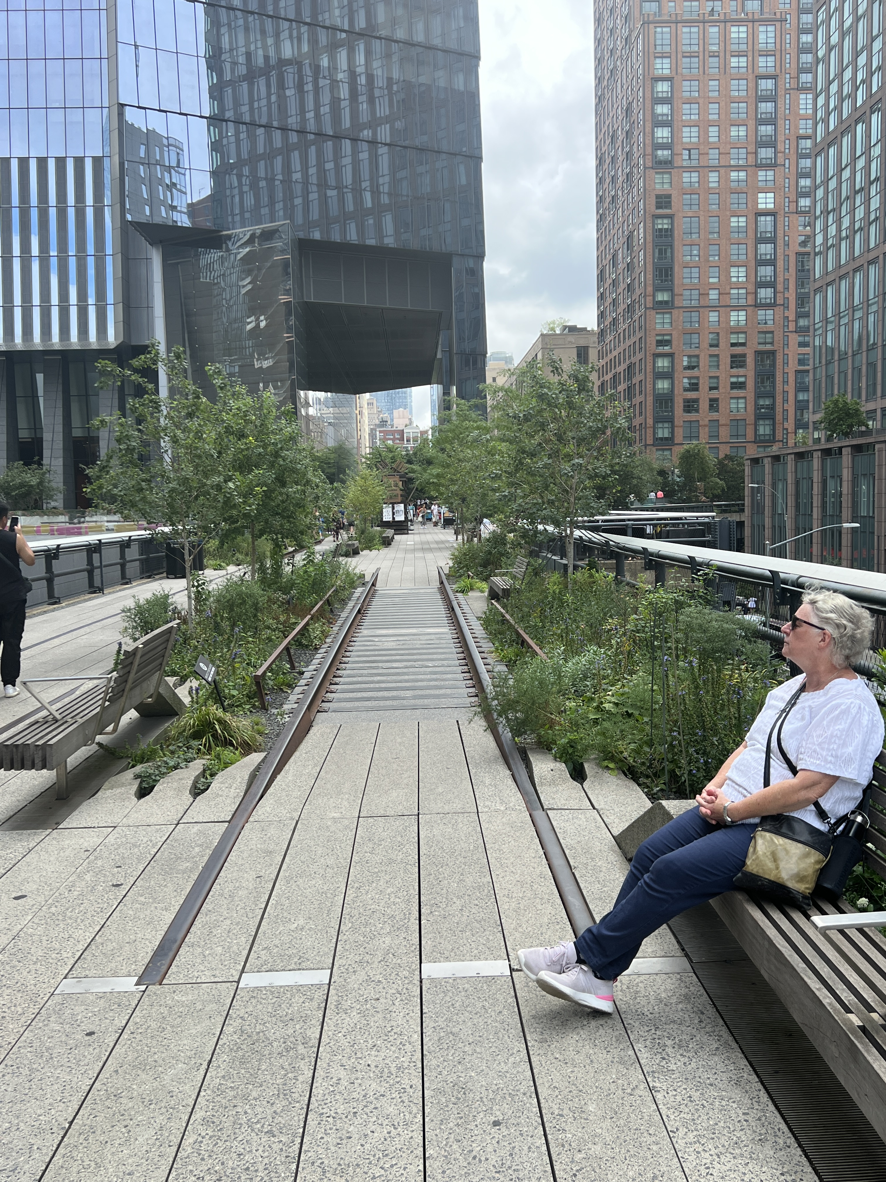
Originally opened in 1934 the rail line ran up the lower west side of Manhattan delivering millions of tons of meat, dairy and produce to the local market as well as the wharves for export. The line was later lifted above street level to ease congestion in the city. In the early 1980s the line fell into disuse and became overgrown with vegetation. It was threatened with demolition but was ‘saved’ in the early 2000s with plans to rehabilitate it as parkland and open space. The first stage opened in 2009 and the last is due to be completed in 2024.
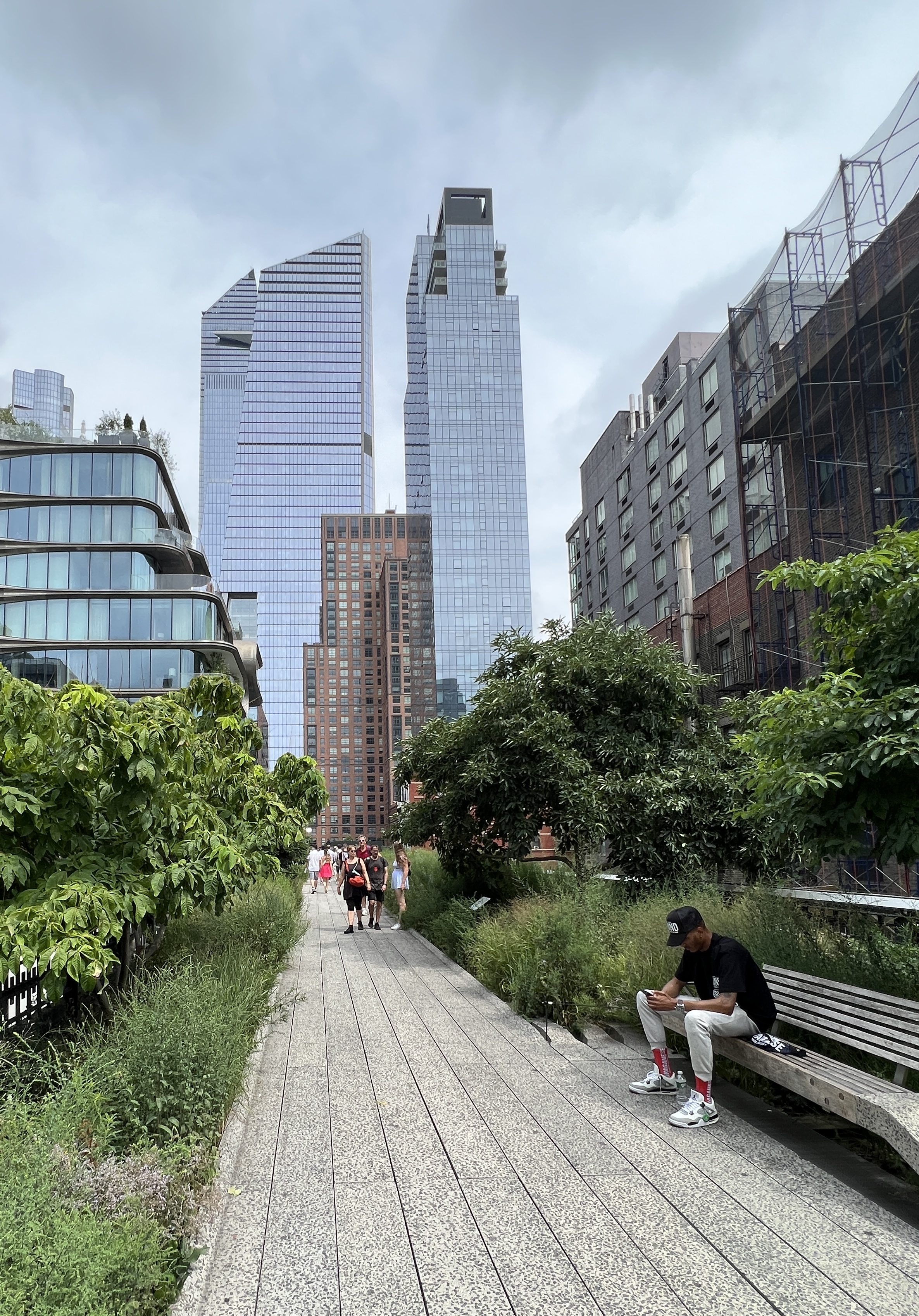
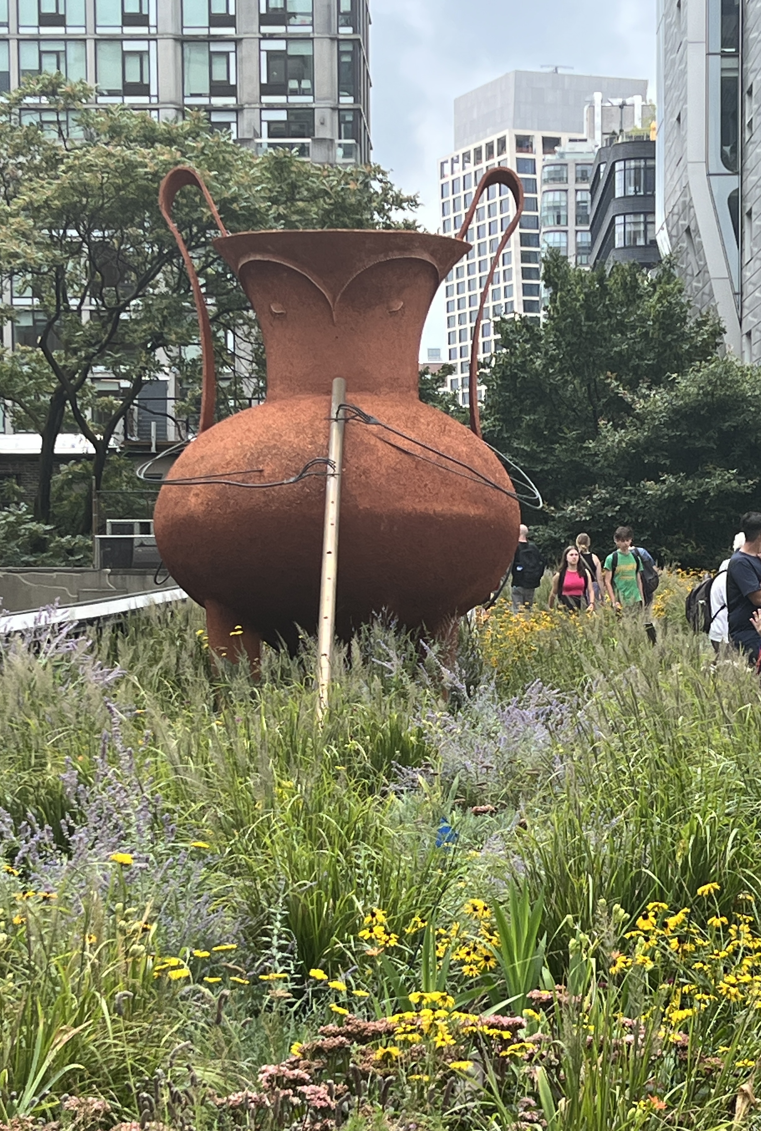
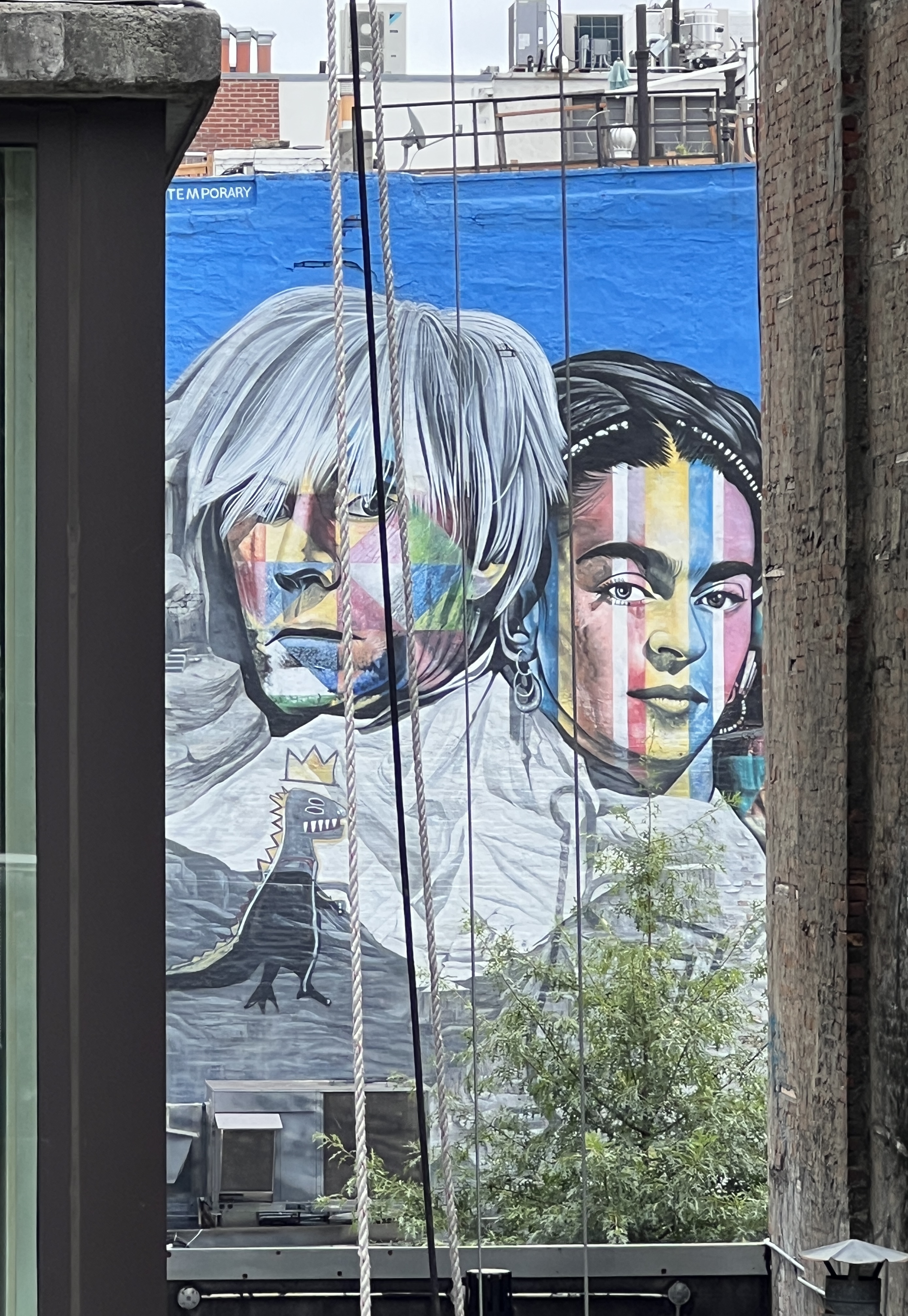
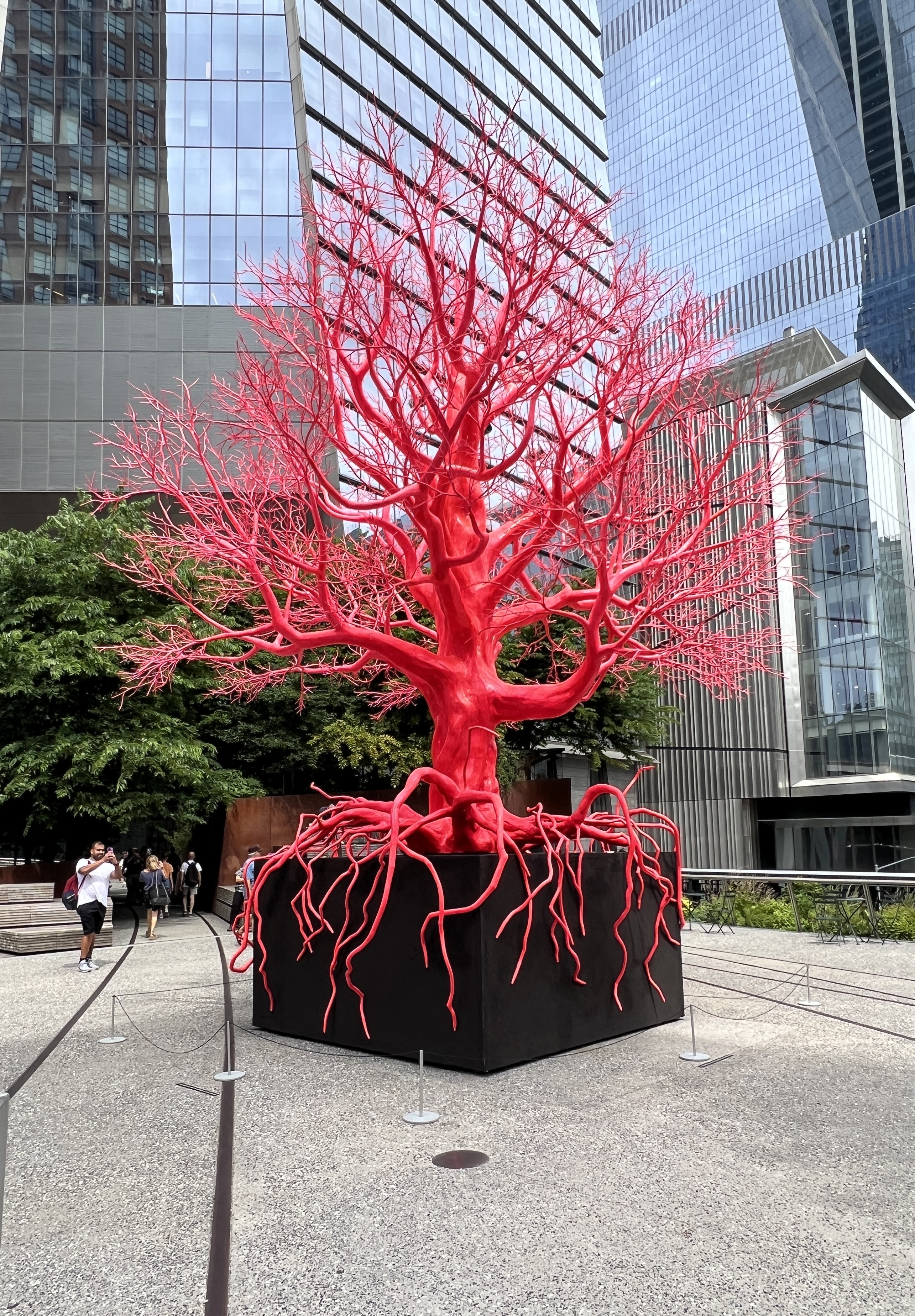
At various points there are elevators and stairs to get up to it from street level. We went down it from north to south. The rail lines were left in place with pathways and gardens constructed around them. There are a number of art installations and murals along the way.
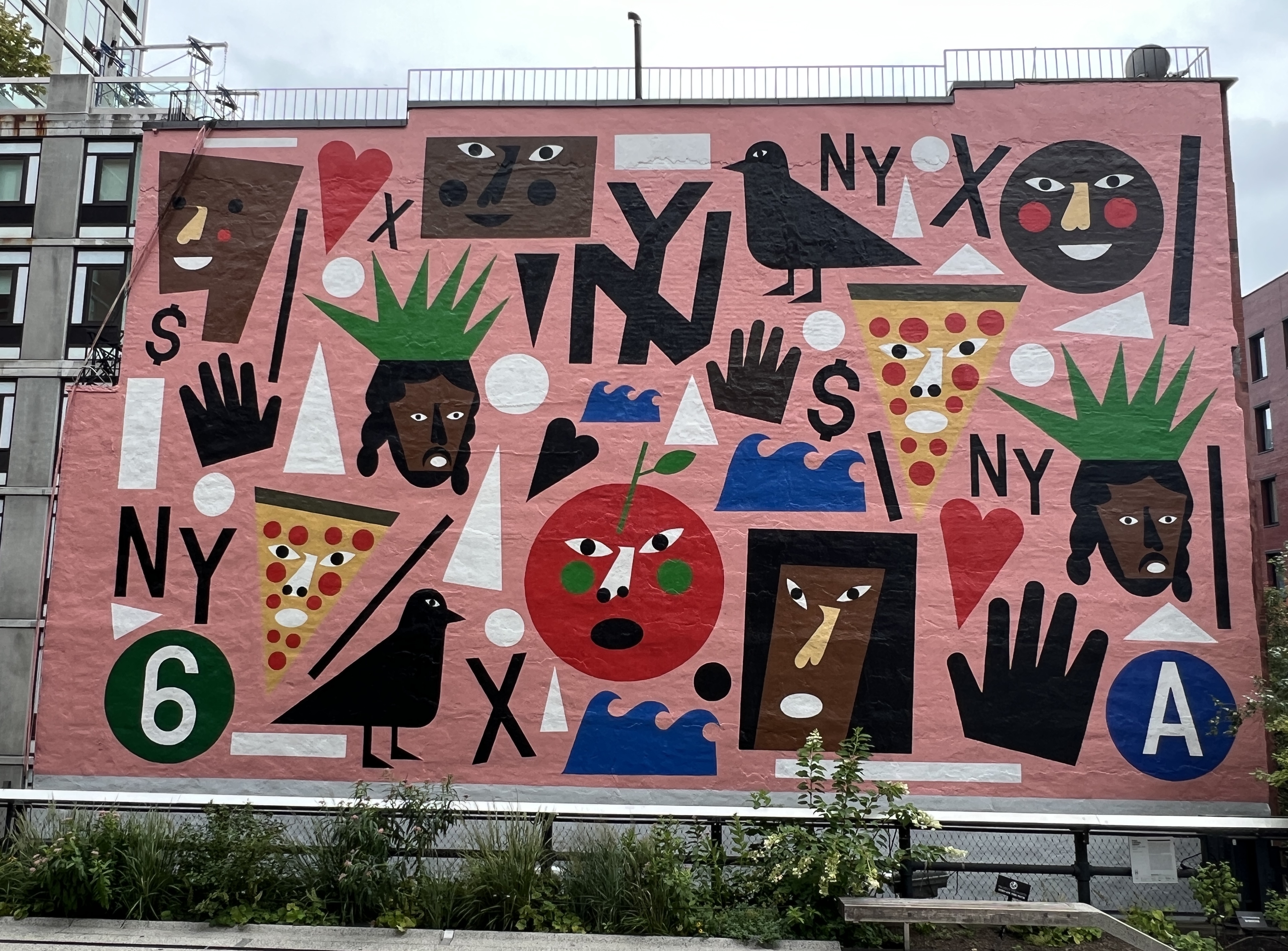
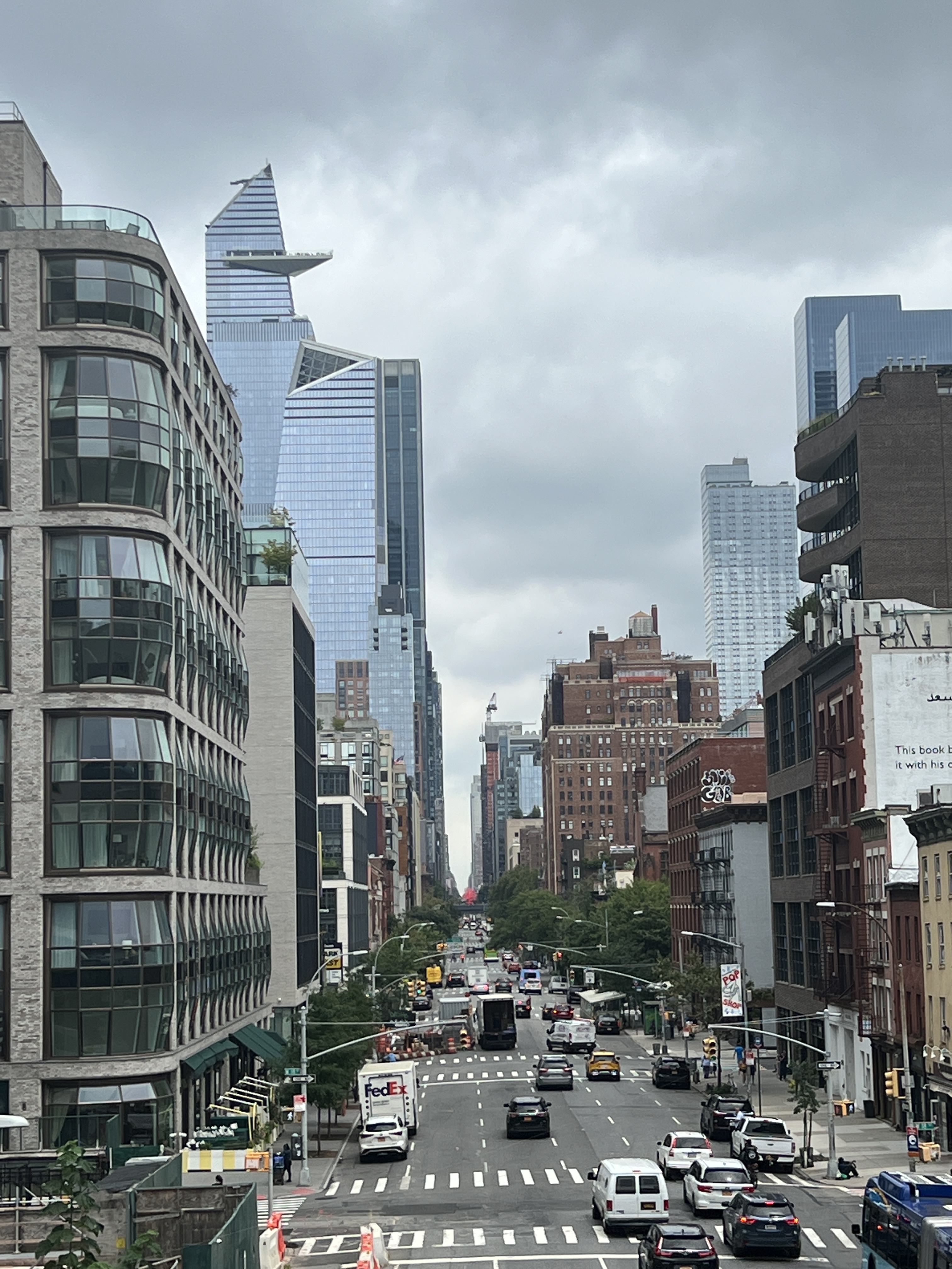
At the end it drops down to the Chelsea Markets, full of eateries and stores in a big old warehouse complex. Looked a great spot for a feed but was very crowded so we enjoyed some pizza slices at Artichoke Basil Pizza before catching a cab back to the ship. It was a great walk and a good use of the old line, it is owned by a not for profit organisation and funded by donations. Some very deep pockets kicked it off and keep it going. Government not involved it seems.
We sailed away out of the harbour at around 5pm with some great views, but more of that next time.
Halifax
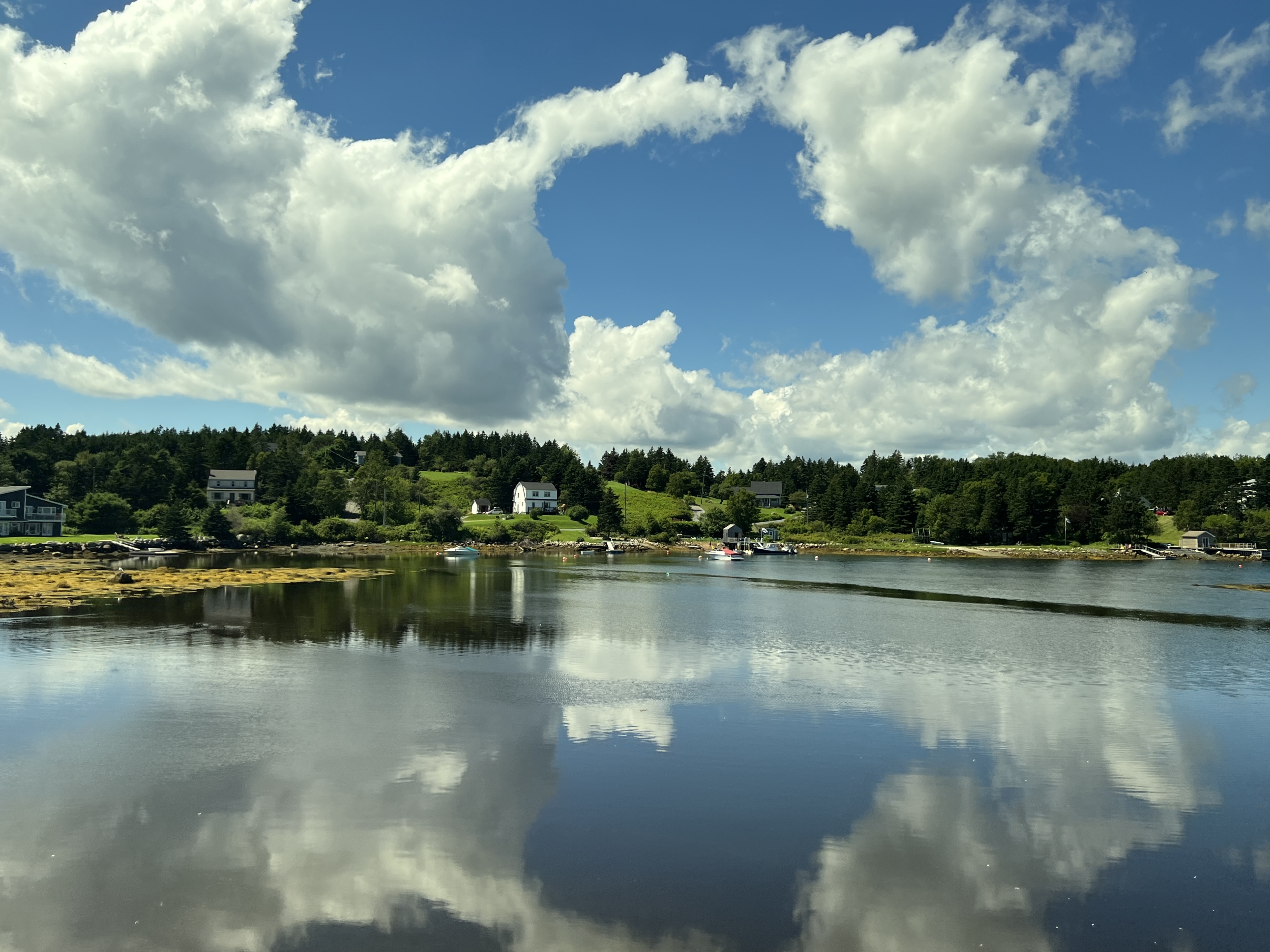
Halifax is our next stop in Nova Scotia, it is the largest city on this part of the east coast and one of the largest natural harbours in the world. It is also a gateway to the countryside and rugged coastline pock marked by small coastal villages.
Between 1924 and 1978 nearly a million immigrants to Canada came through this port. It is also the city from which rescue operations for Titanic survivors was coordinated.
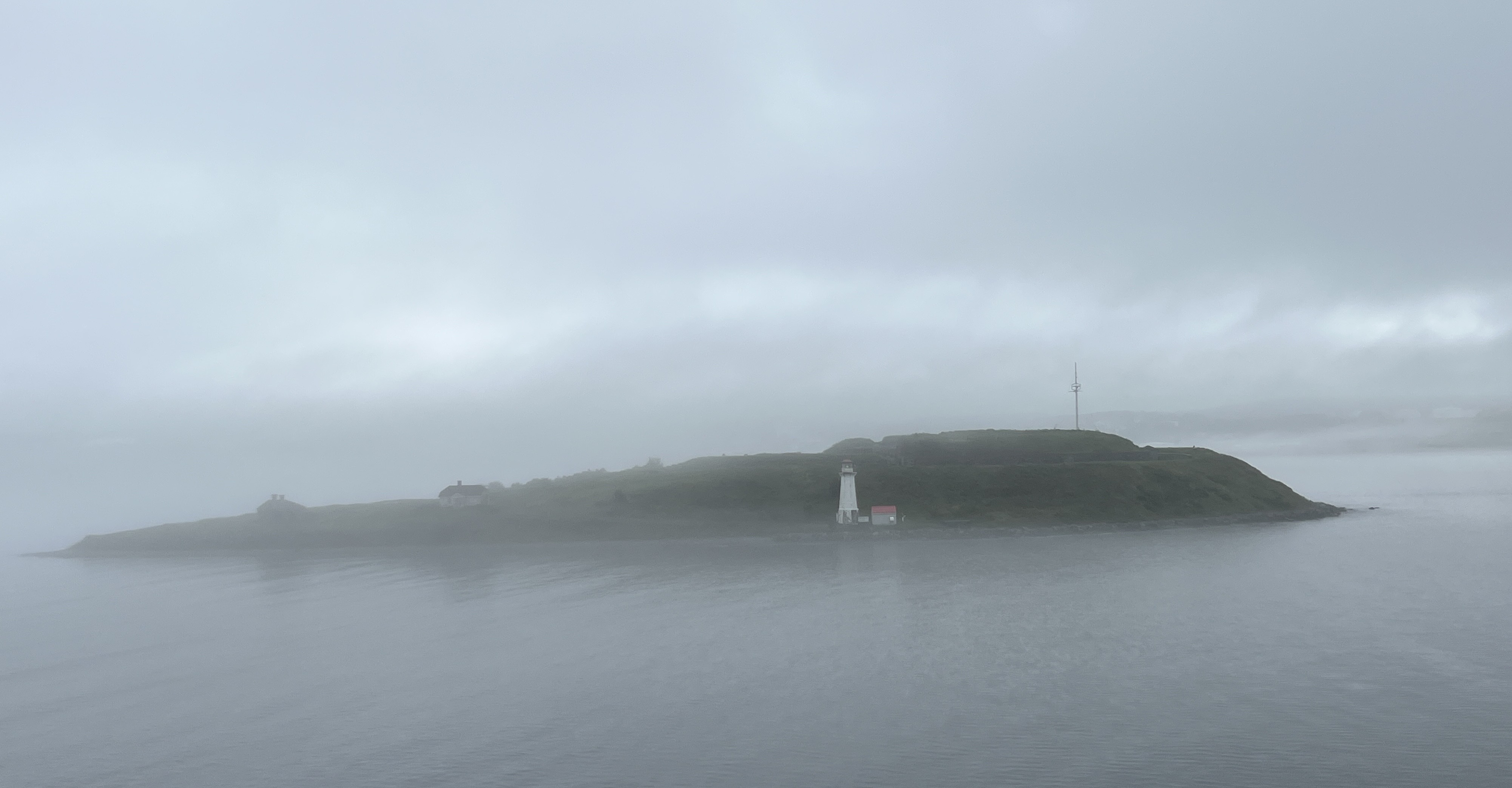
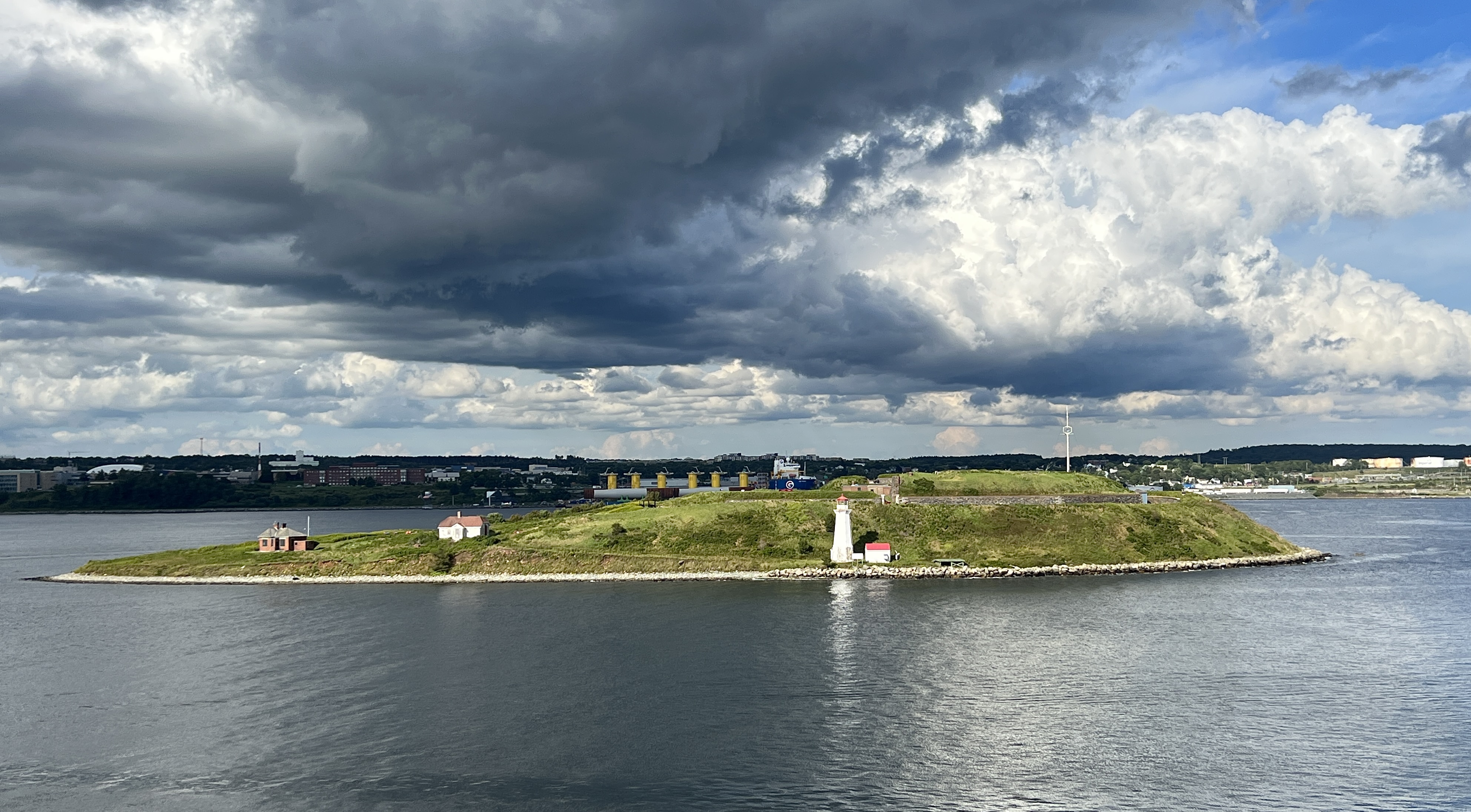
Our arrival in port was accompanied by a thick fog that slowly lifted revealing Georges Island close alongside. Later in the day after the fog had cleared and the sun was retreating a totally different view of the Island was had.
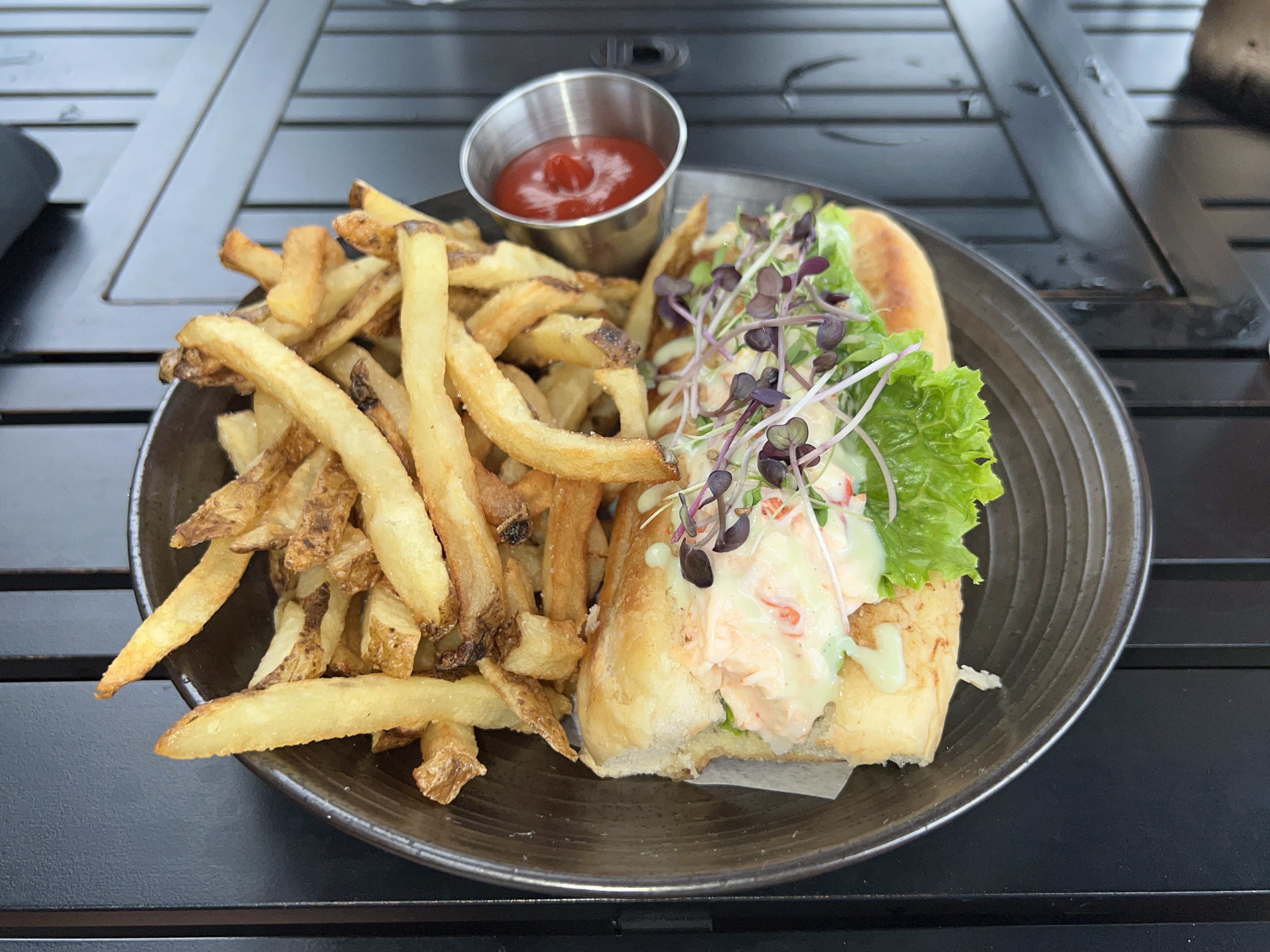
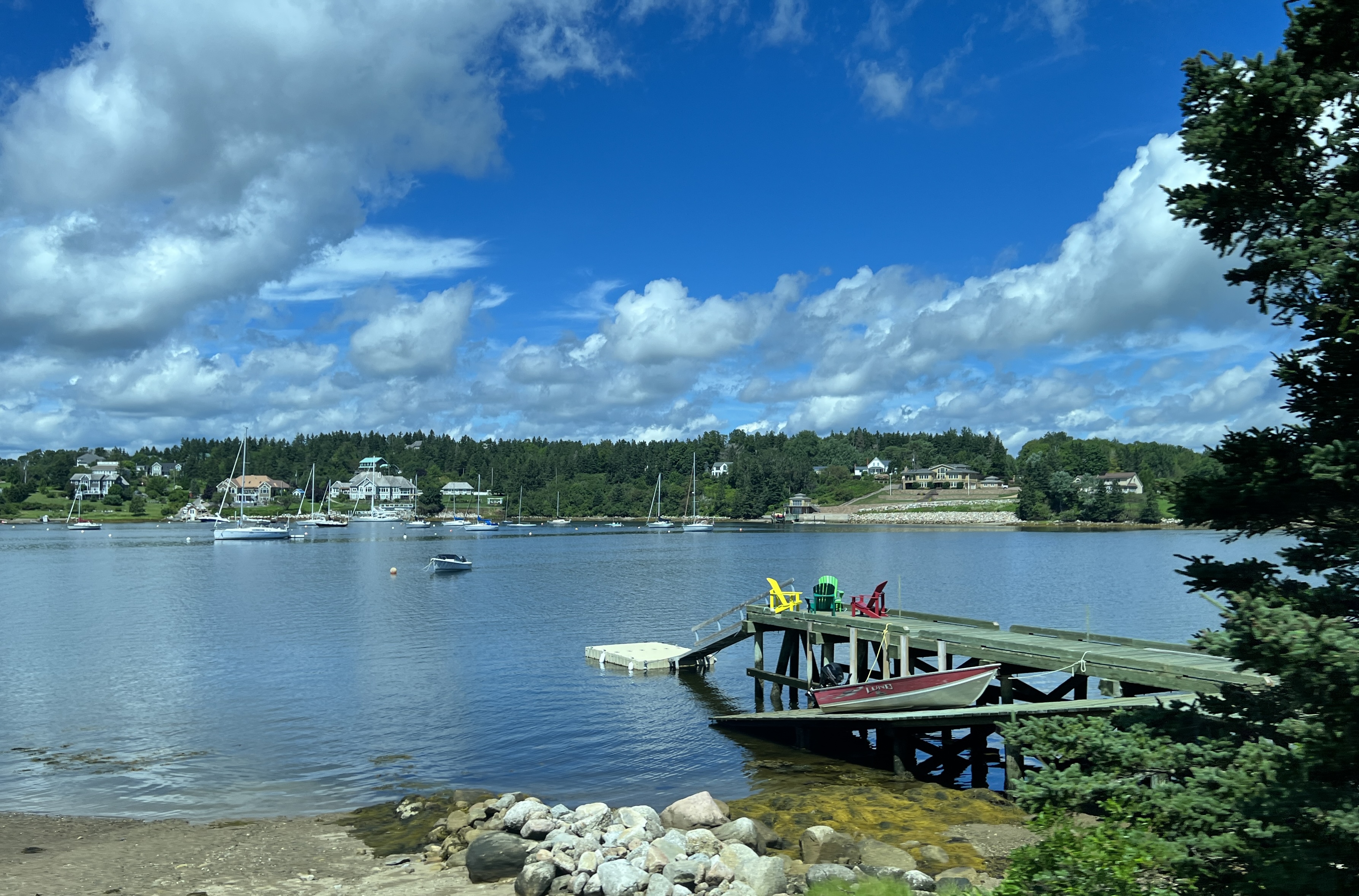
We spent time ashore in the morning looking around the waterfront and seeking out a lobster roll for lunch. We found one too!
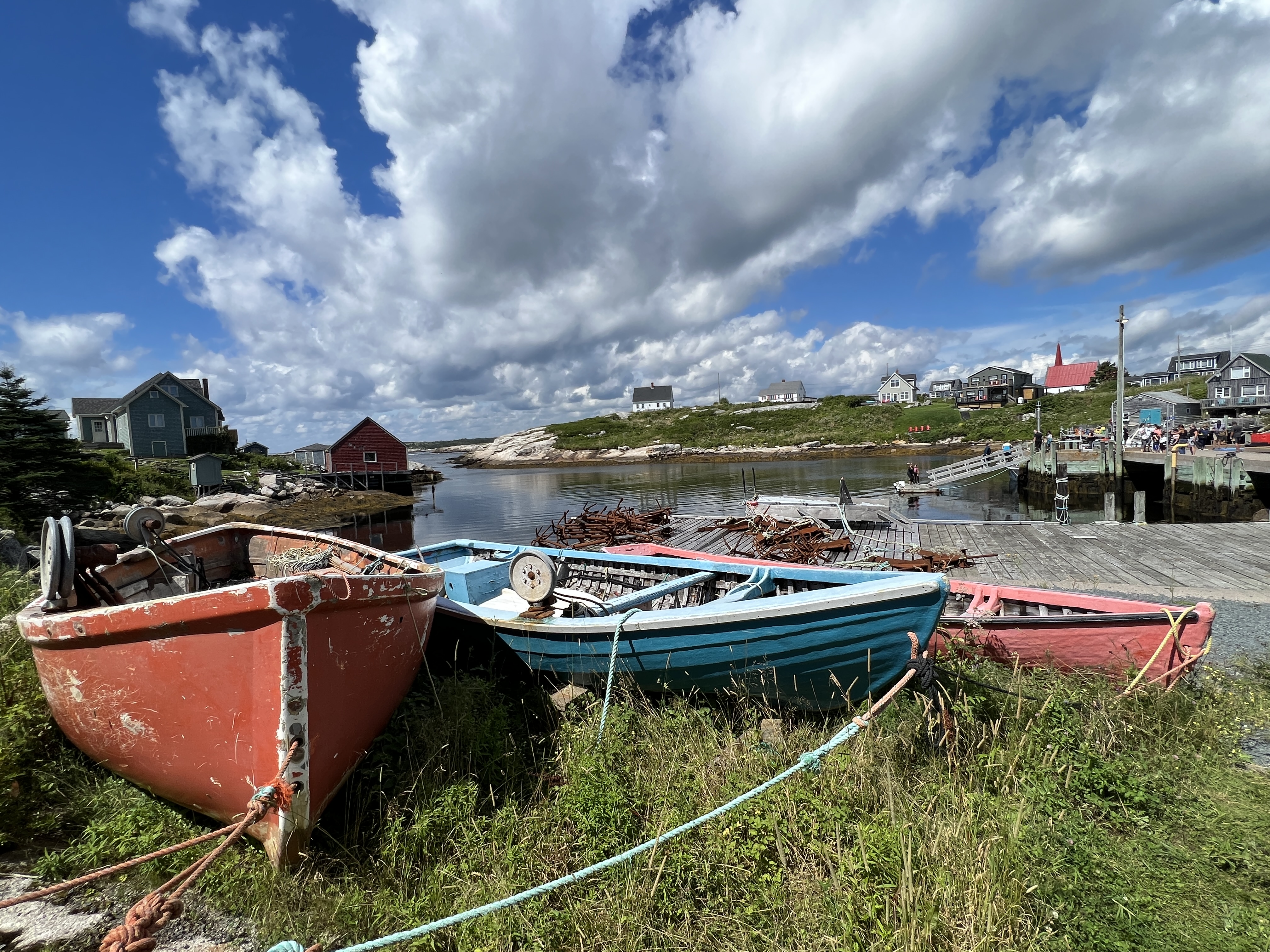
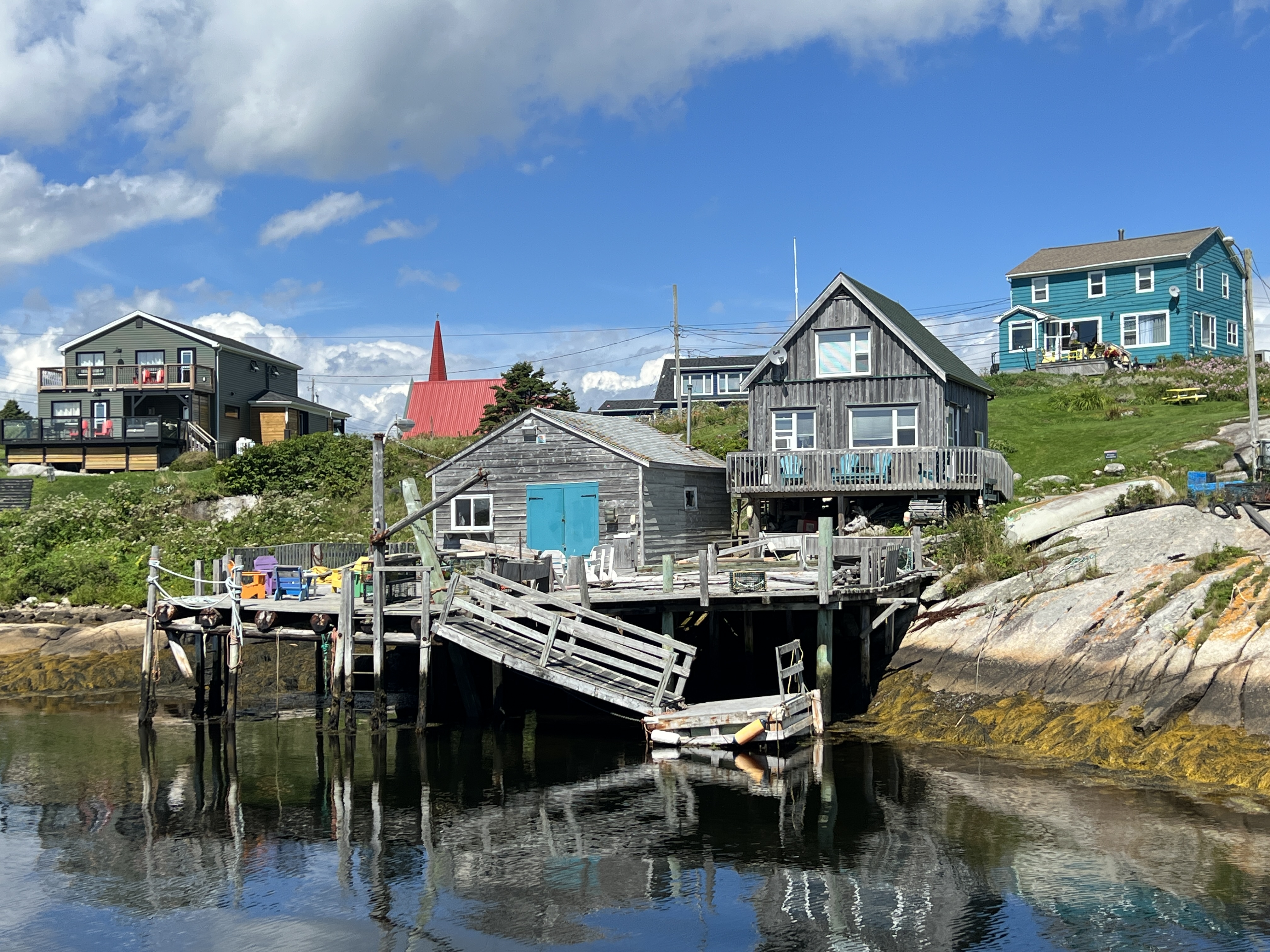
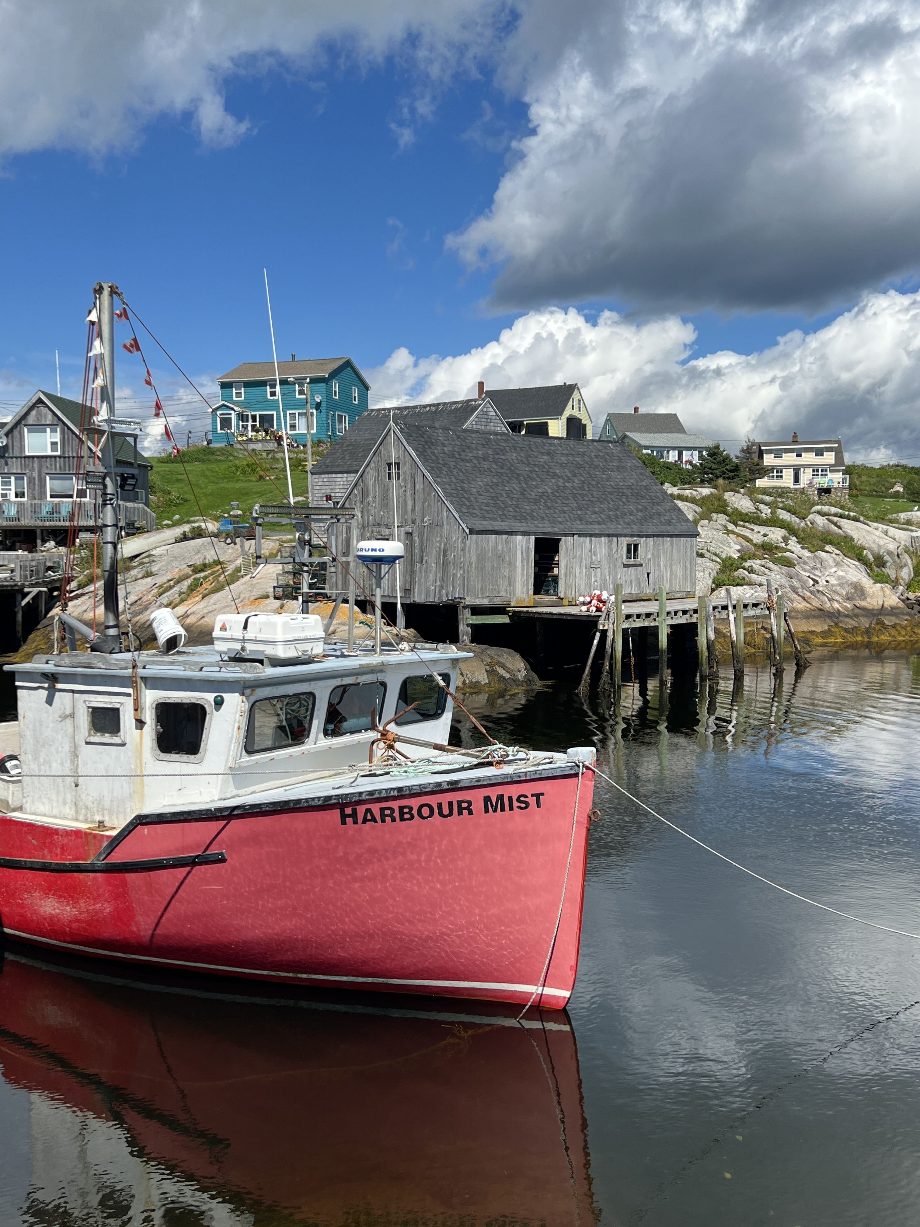
In the afternoon we had arranged a shore tour down to Peggy’s Cove at the end of St Margarets Bay. This is the home of the much photographed lighthouse and fishing village.
We passed by some wonderful countryside and coastline around the bay. It was a bit of a bun fight at the Cove with a few buses arriving and hoards of tourists scrambling on the rocks and lounging around the lighthouse. Have to be here at sun up to get a people less pic!
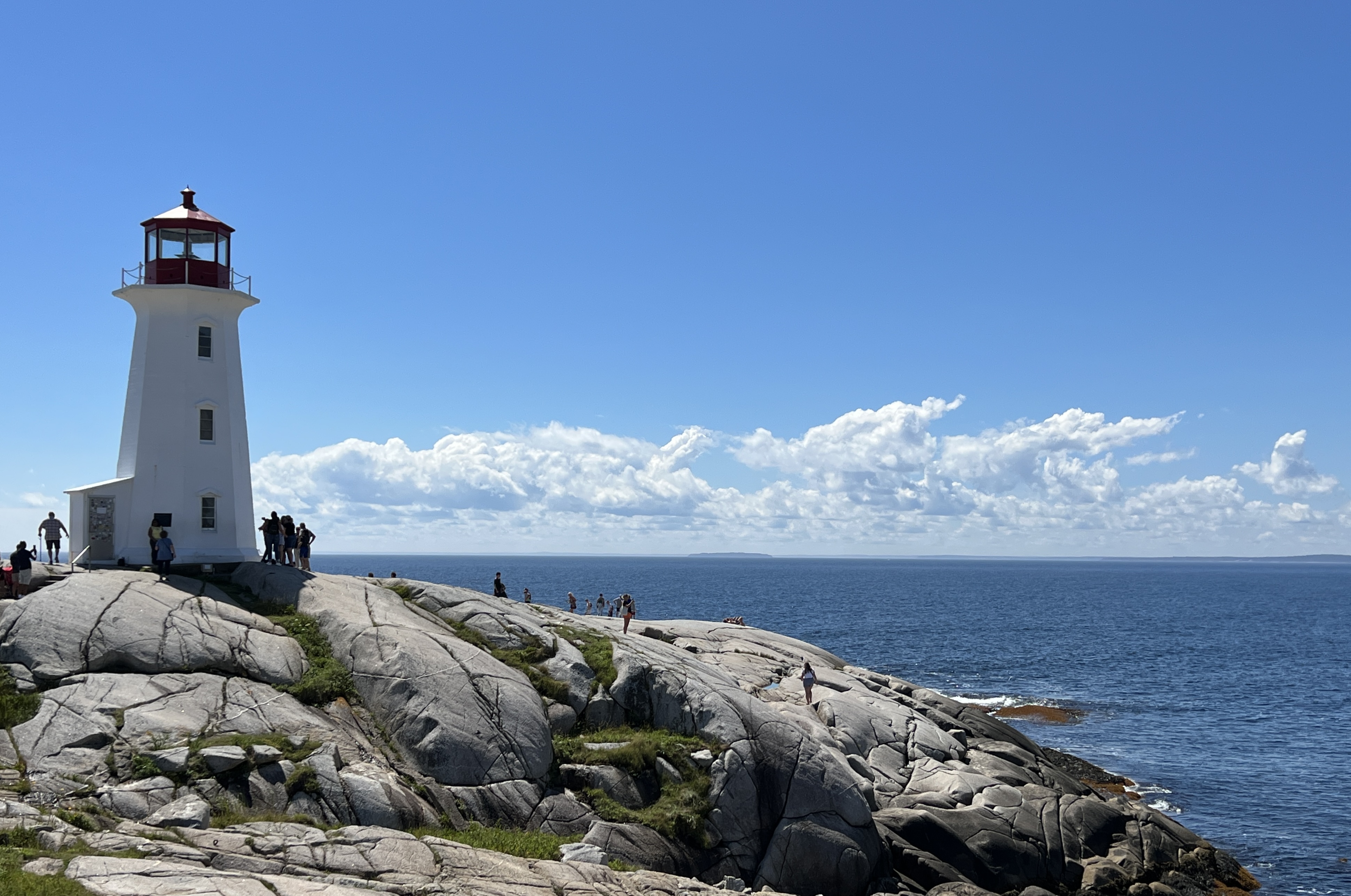
The village and harbour is definitely photogenic and we had some great weather for it.
We returned to Halifax but along the way pulled into the Fairview Lawn Cemetery to have a look at the graves of 120 or so victims of the Titanic sinking in 1912. The graves are arranged in three rows in the form of the bow of a ship, pointing out into the Atlantic to where the ship had sunk.
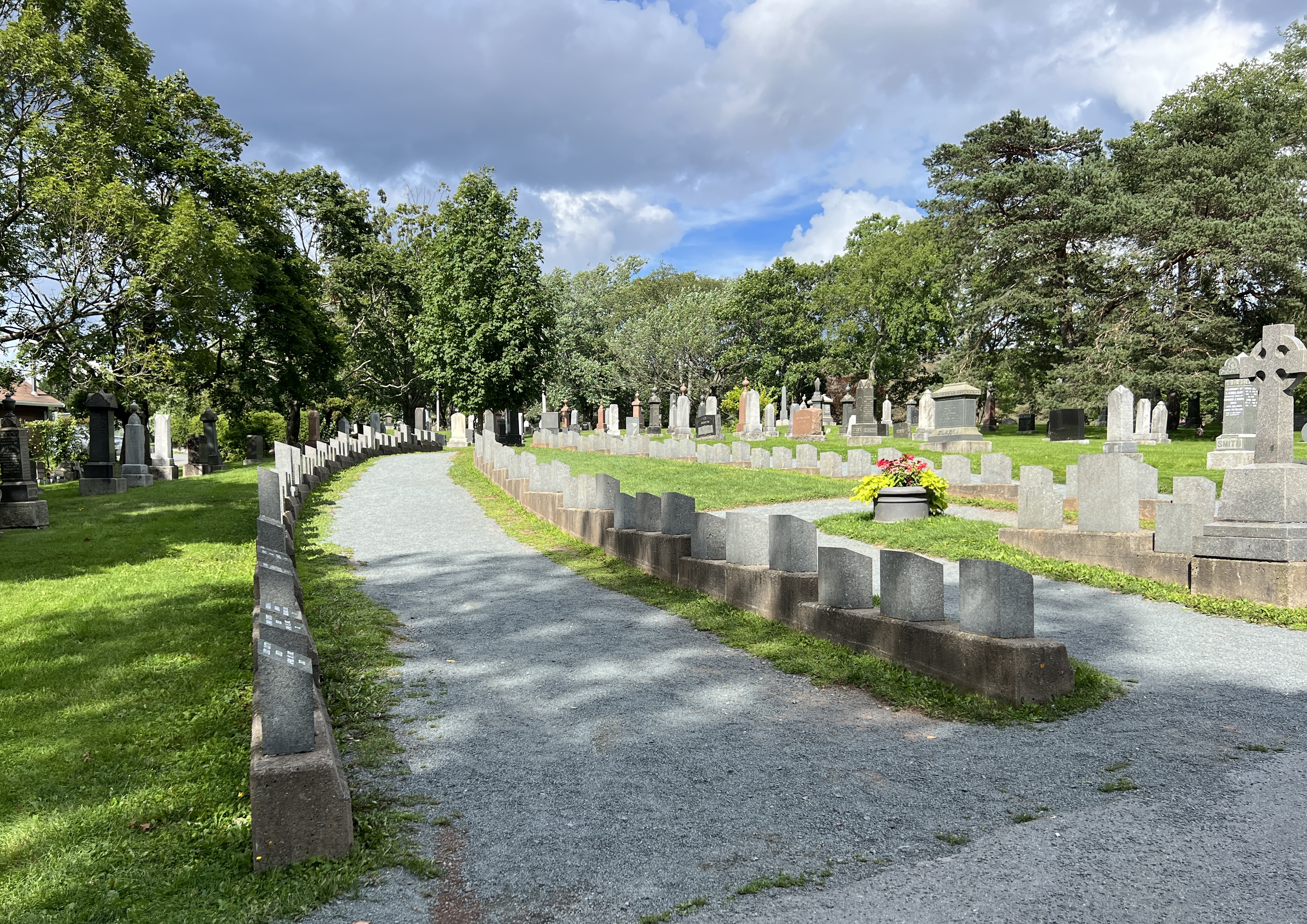
The grave area and headstones had been arranged by the White Star Line, the Titanic’s owners. The headstones were very minimalist. Simply showing a name, a number and the date. The number was allocated when a body was recovered, the name came later after identification. Not always easy for the second class and steerage class passengers.
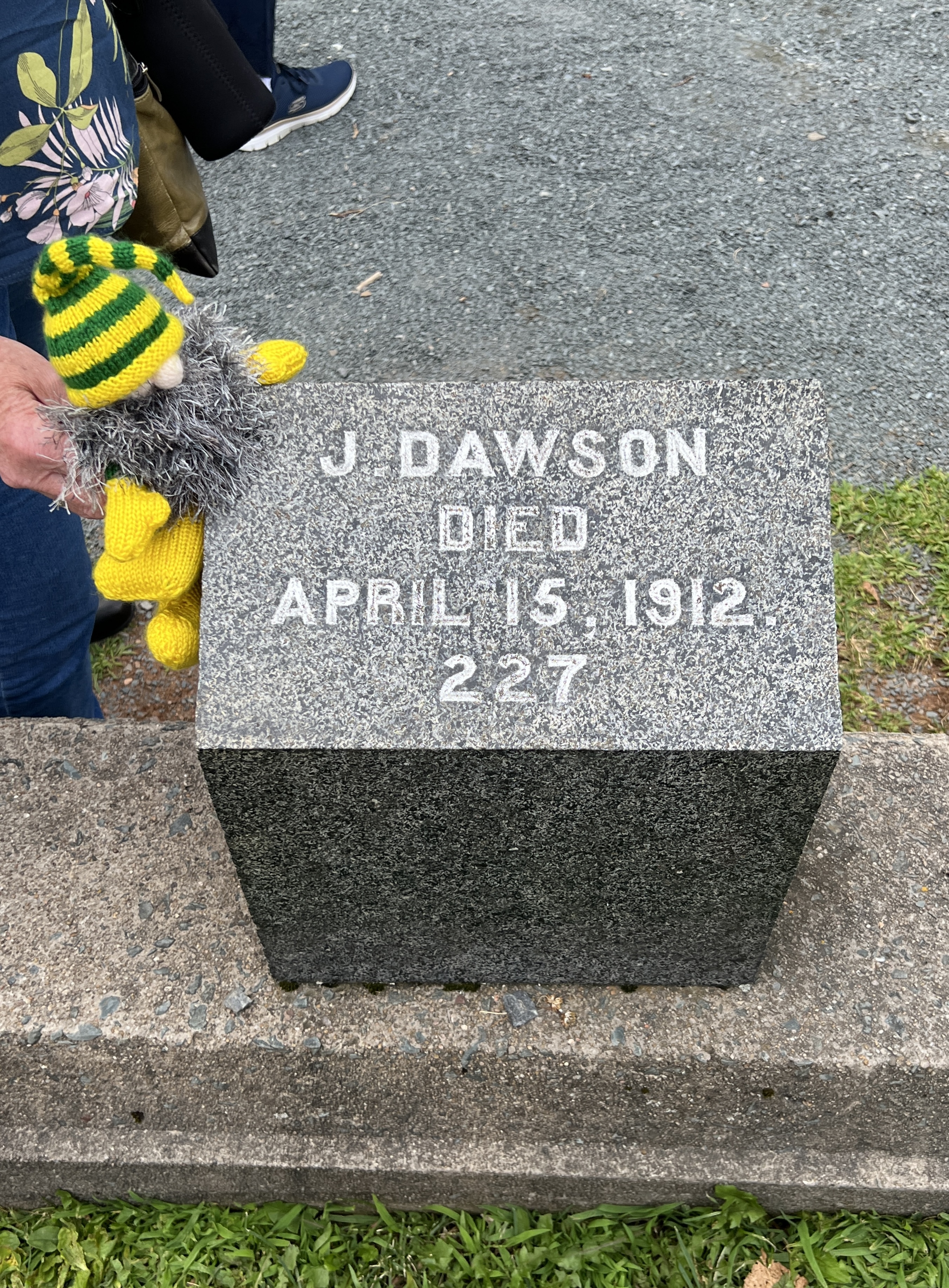
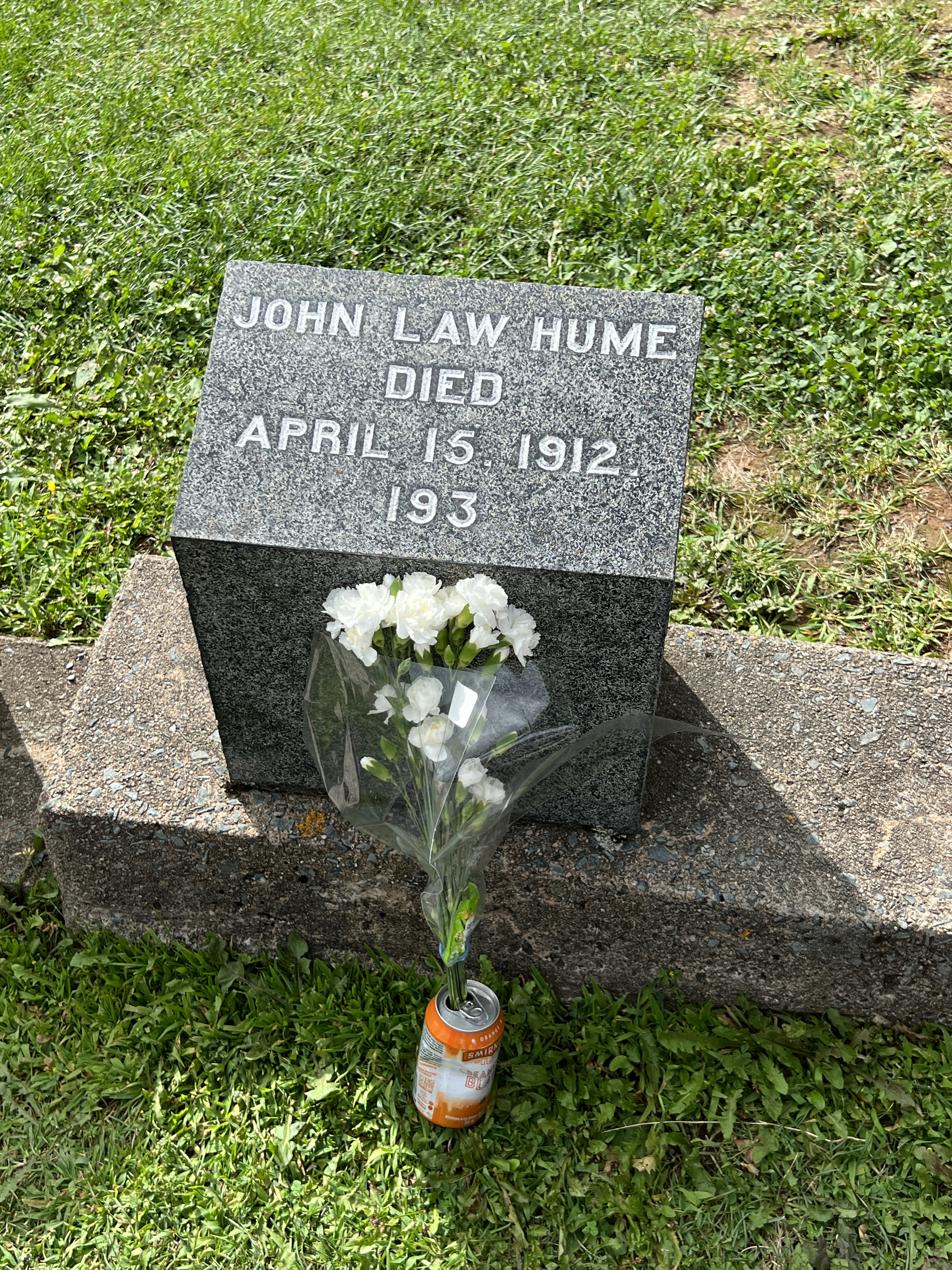
Some bodies were repatriated back to their families, if they could afford the cost. Other families embellished the headstones, or replaced them with more elaborate ones.
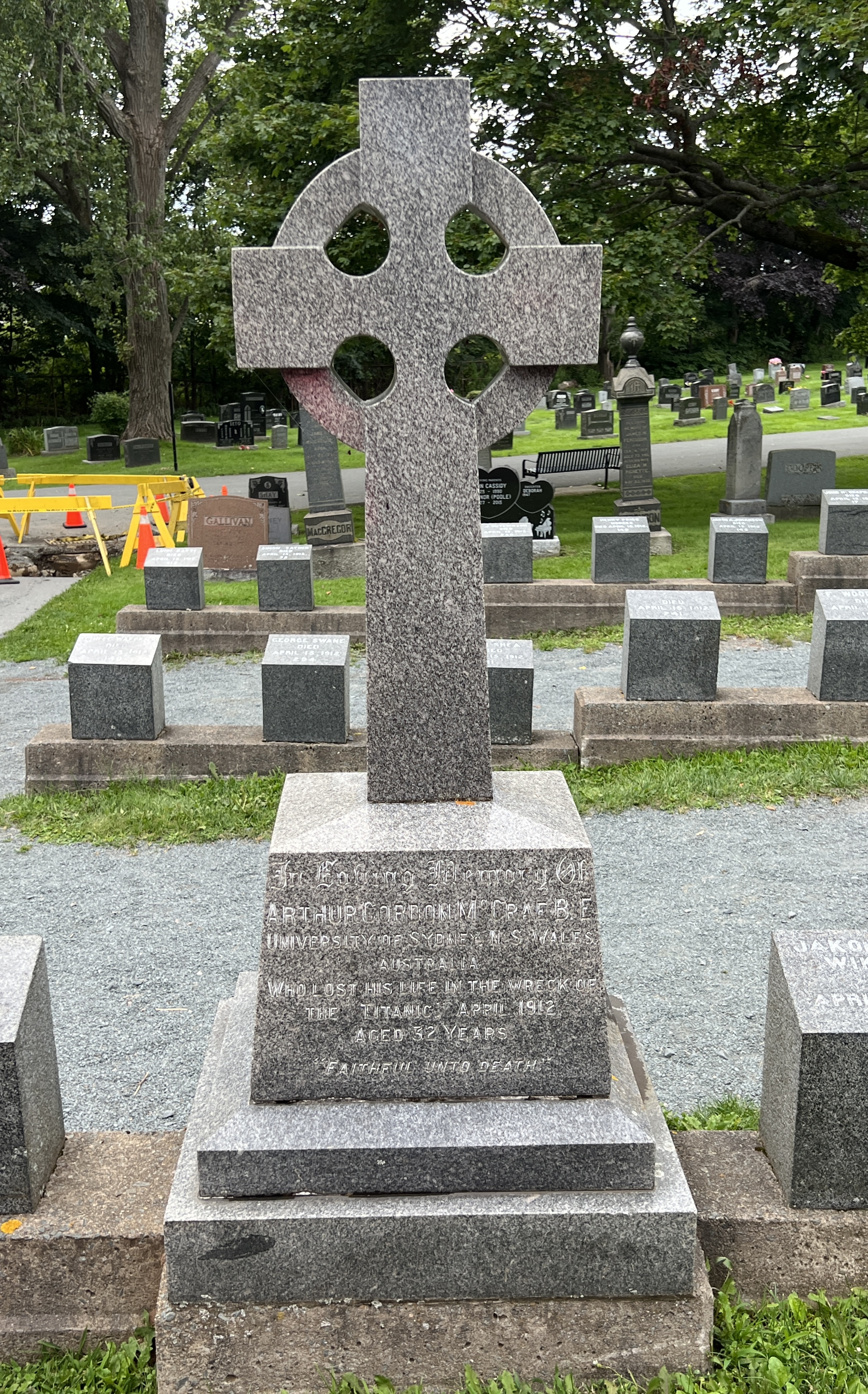
The job of identification was not always easy and there are a number of graves without names. Our guide was a little emotional when he recounted some of the stories lying at and under our feet.
Back on board the ship just in time for departure. We have a day at sea before arriving in the Big Apple.
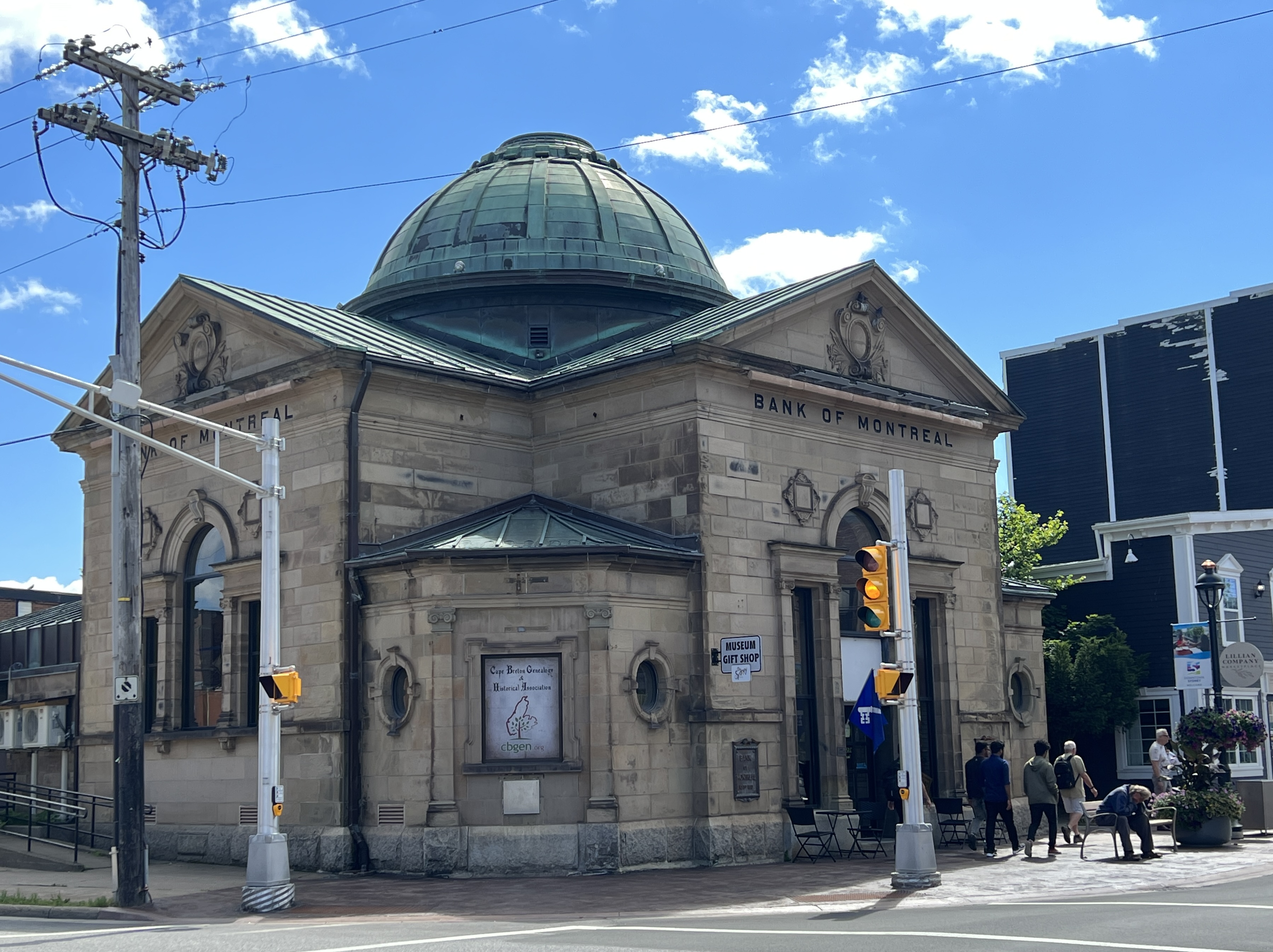
Sydney
We are in Sydney on Cape Breton Island, part of the Provence of Nova Scotia. Slobro was rather confused having woken up thinking we would soon be back in Brisbane. He was soon put right.
We had decided against a shore tour here, instead a wander around the town, some people watching and a local lunch somewhere.
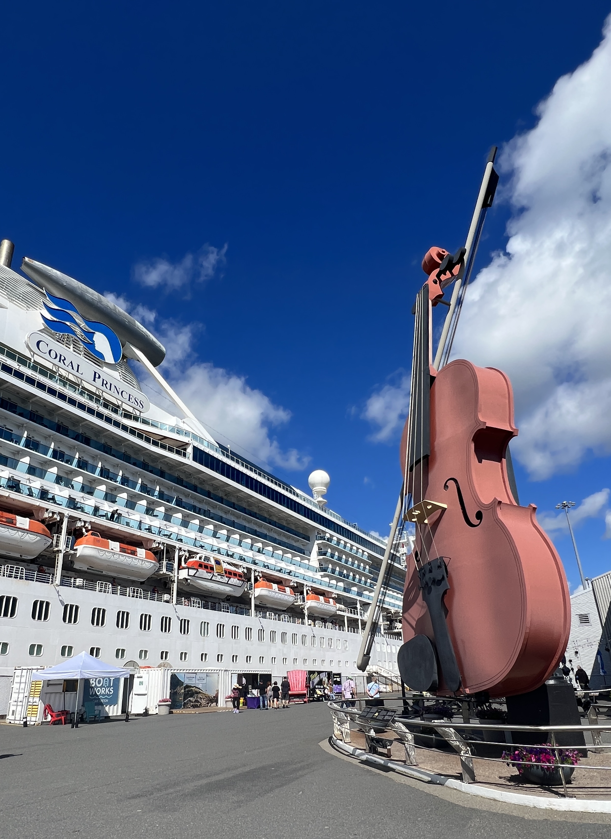
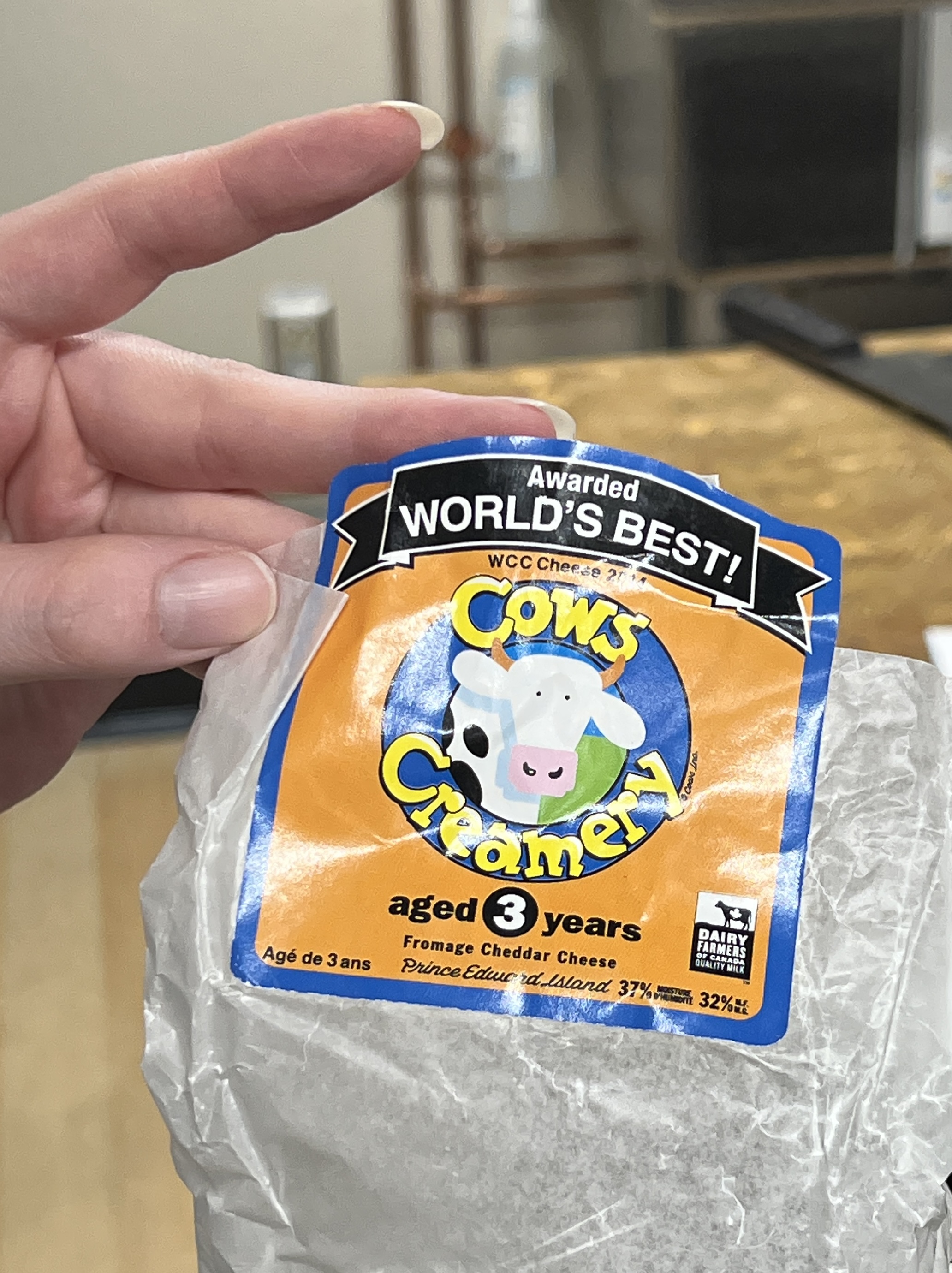
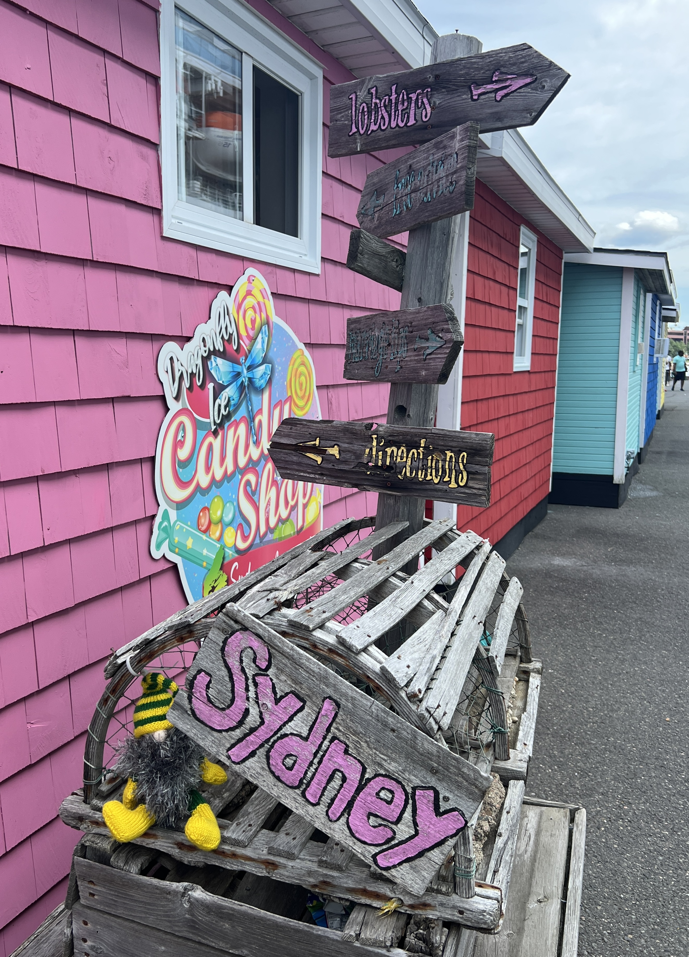
The town is well organised for tourists. There is great array of craft and souvenir places right on the dock when you get off. As we later found out you can’t get back on the ship unless you walk through them. Trap to extract that last dollar, Allthego succumbed and got some local cheddar cheese to take back on board for pre dinner snacks.
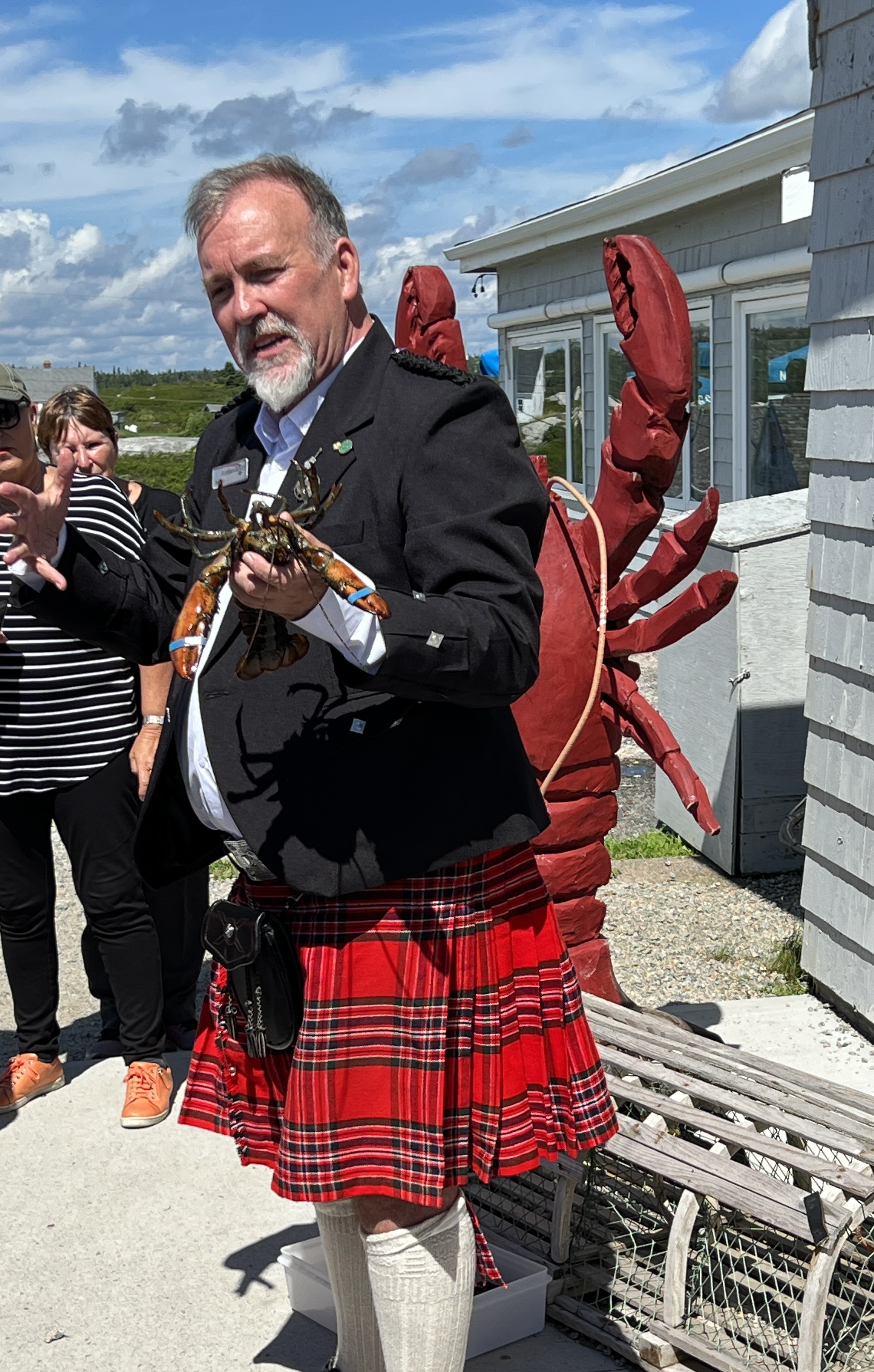
Nova Scotia was initially a colony of France, part of ‘Arcadia’ or New France, in the 1600s and first half of the 1700s. Following the American War of Independence, British loyalists settled here and ultimately the French were evicted after the previously mentioned wars with the English. Sydney was founded in 1785 and a wave of Scottish immigrants followed. Nova Scotia is Latin for ‘New Scotland’. Apparently there is a big Gaelic speaking population here and there are Scottish shops and memorabilia all around the town.
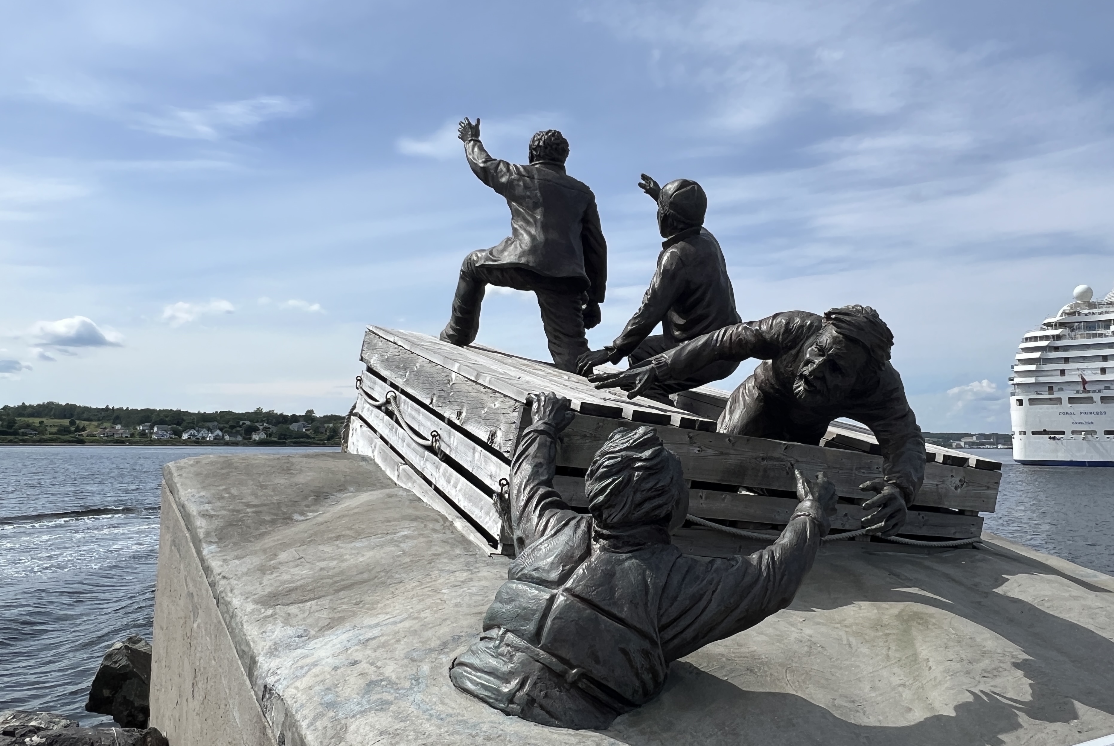
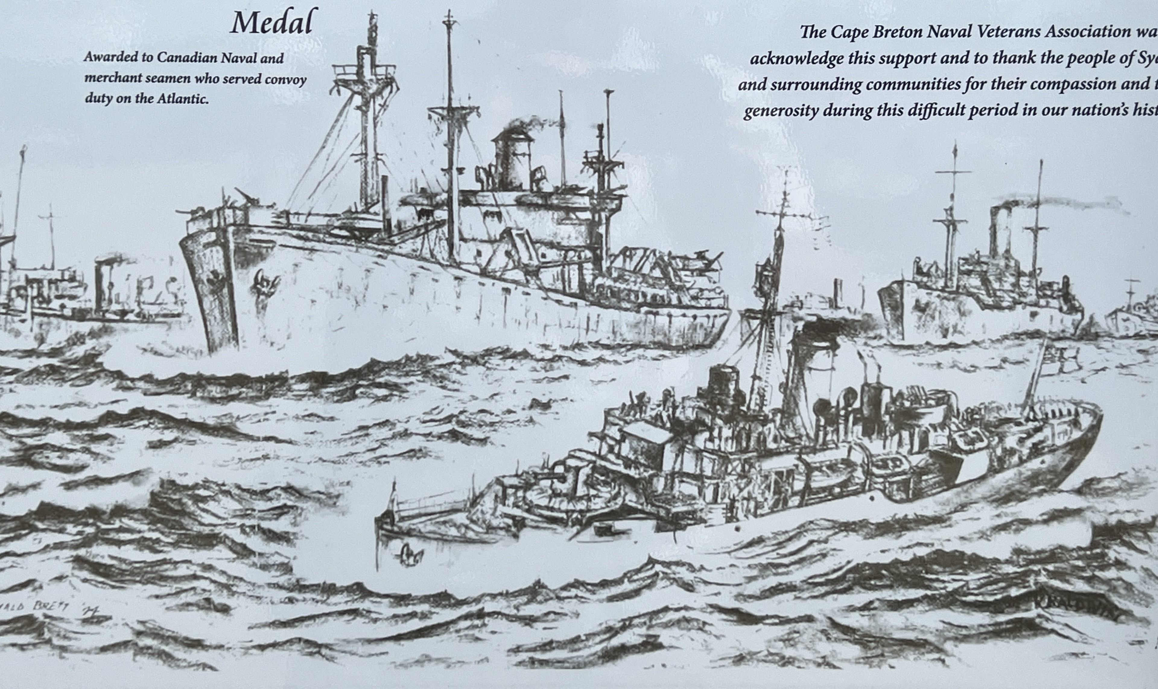
Sydney was a big coal and steel town for much of the 20th century. Steel is now gone but some coal is still mined and exported away. Because of its proximity to Europe, it is the most easterly point of Canada, the large harbour was used as a staging point for convoys to the UK during Botha WWI and WWII.
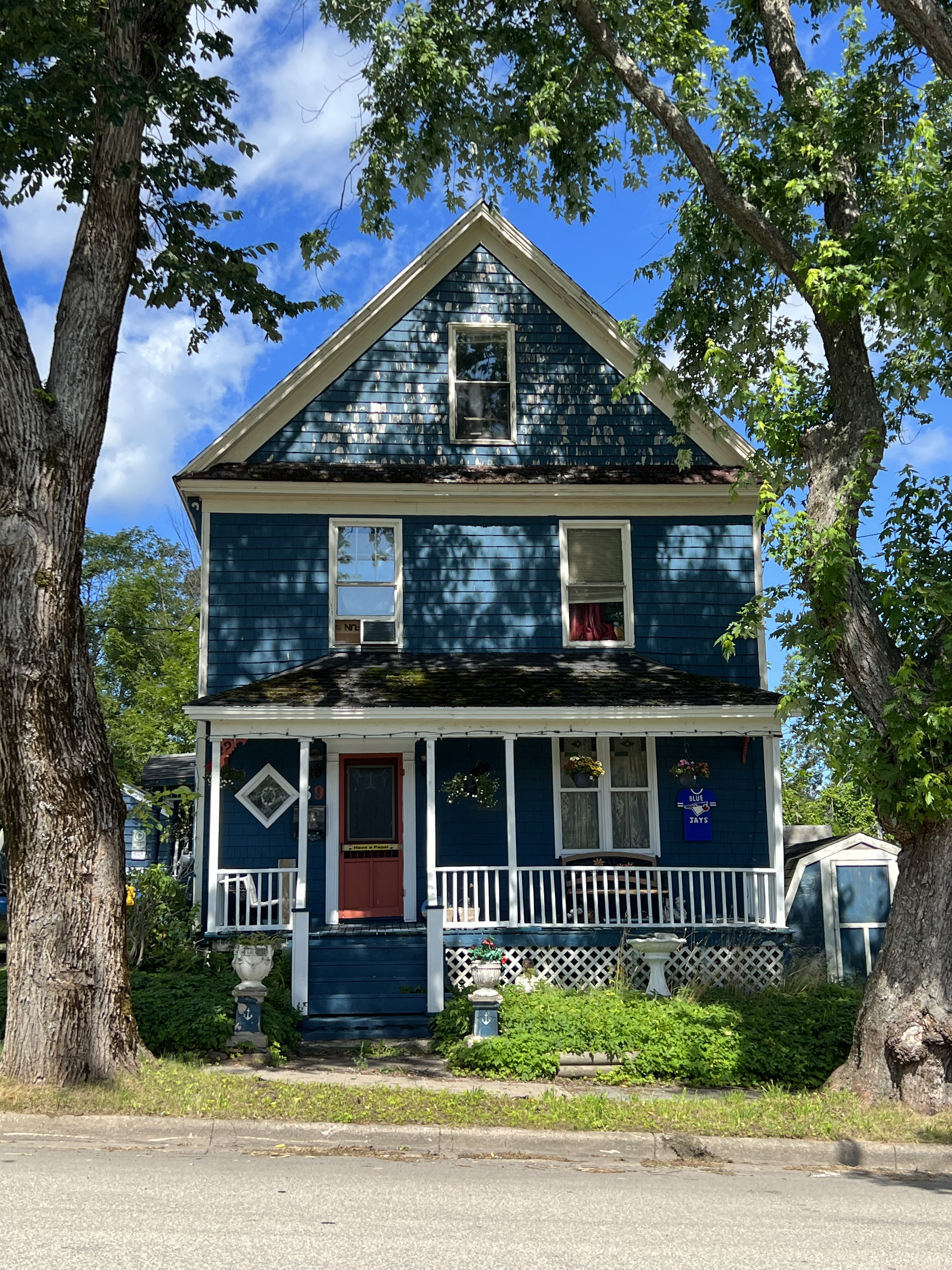
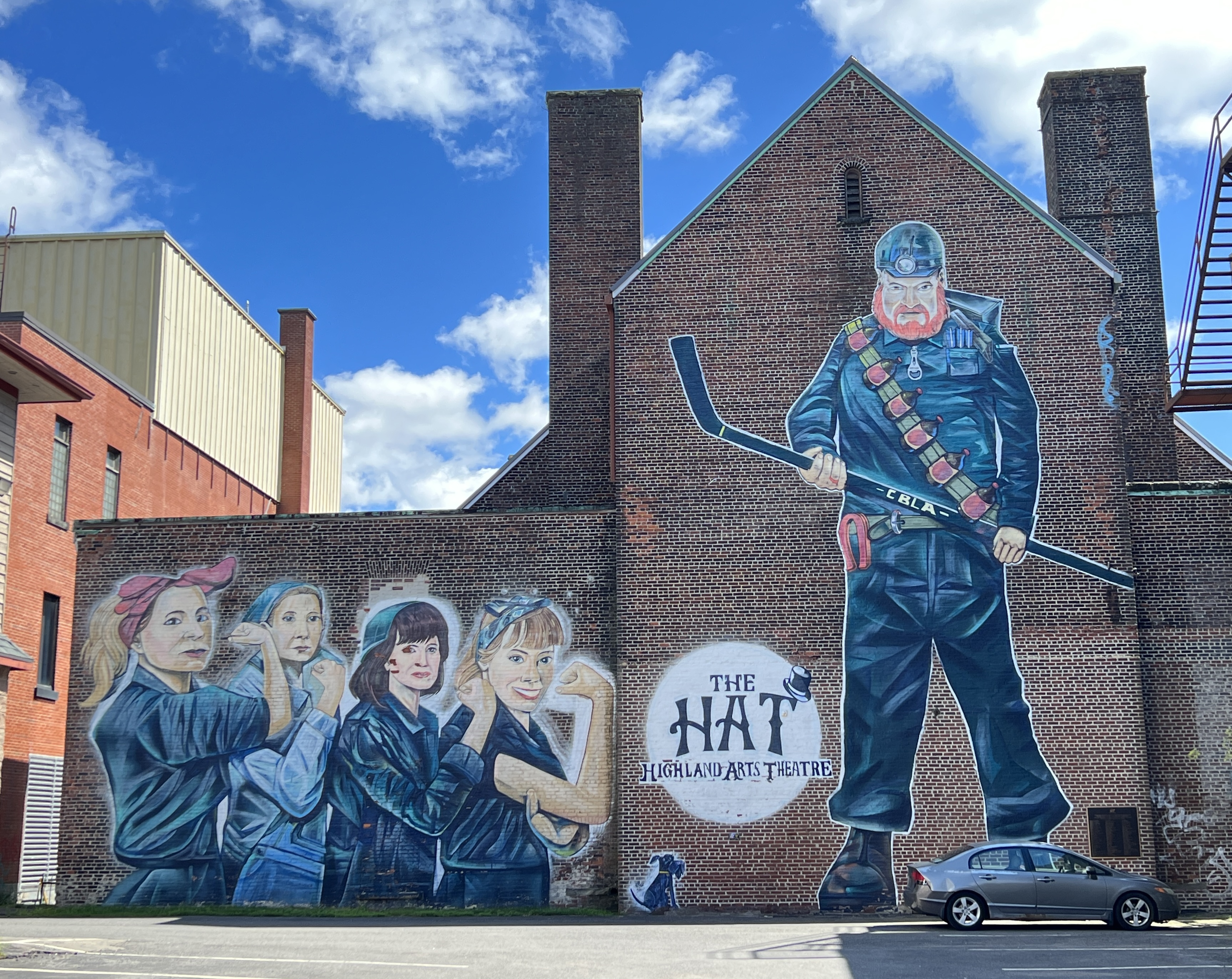
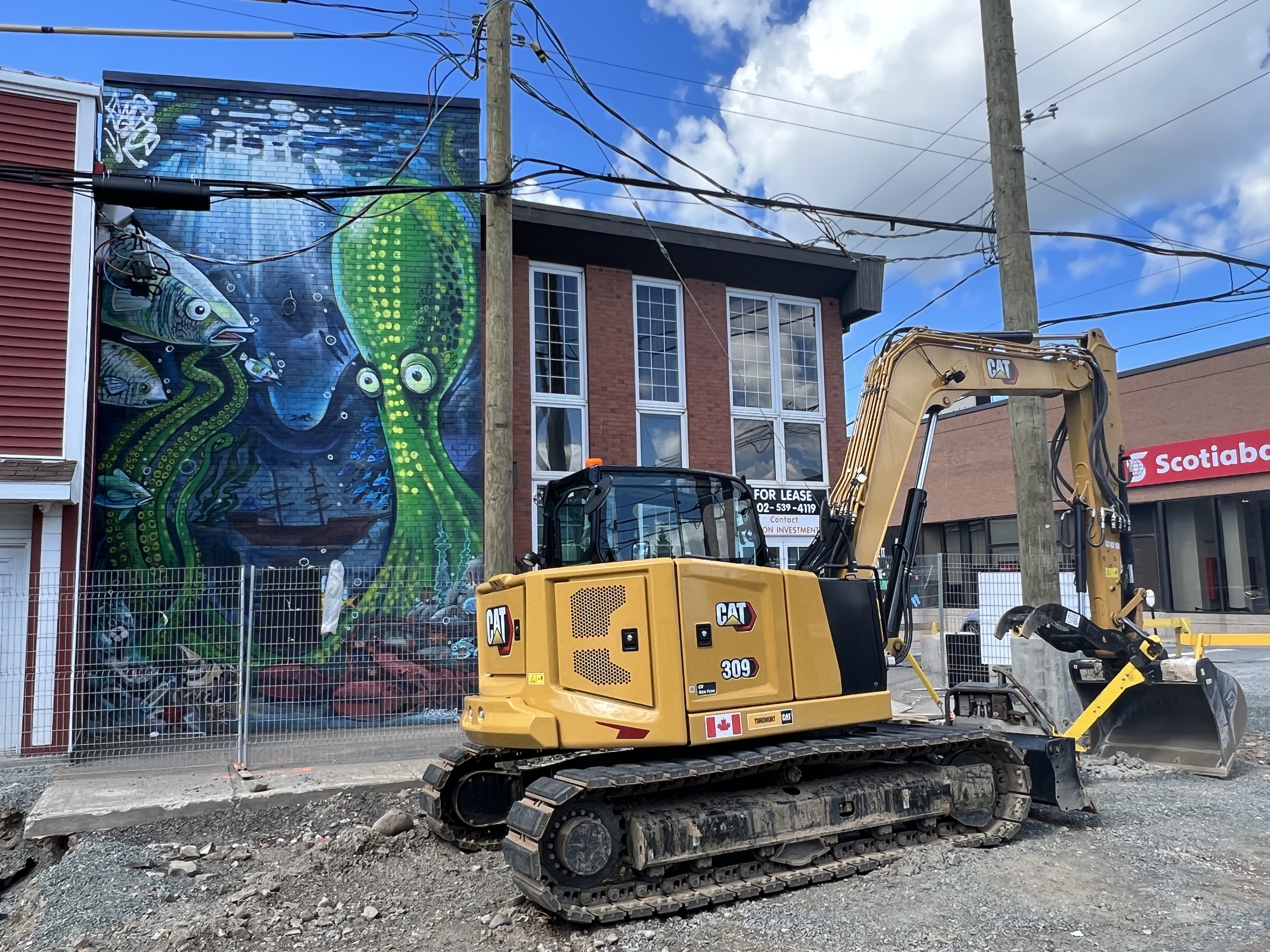
Our walk took us up and around some of the prewar housing areas and then down the Main Street. Avoided the museums. Some great murals along the way particularly near the theatre, a repurposed church complex.
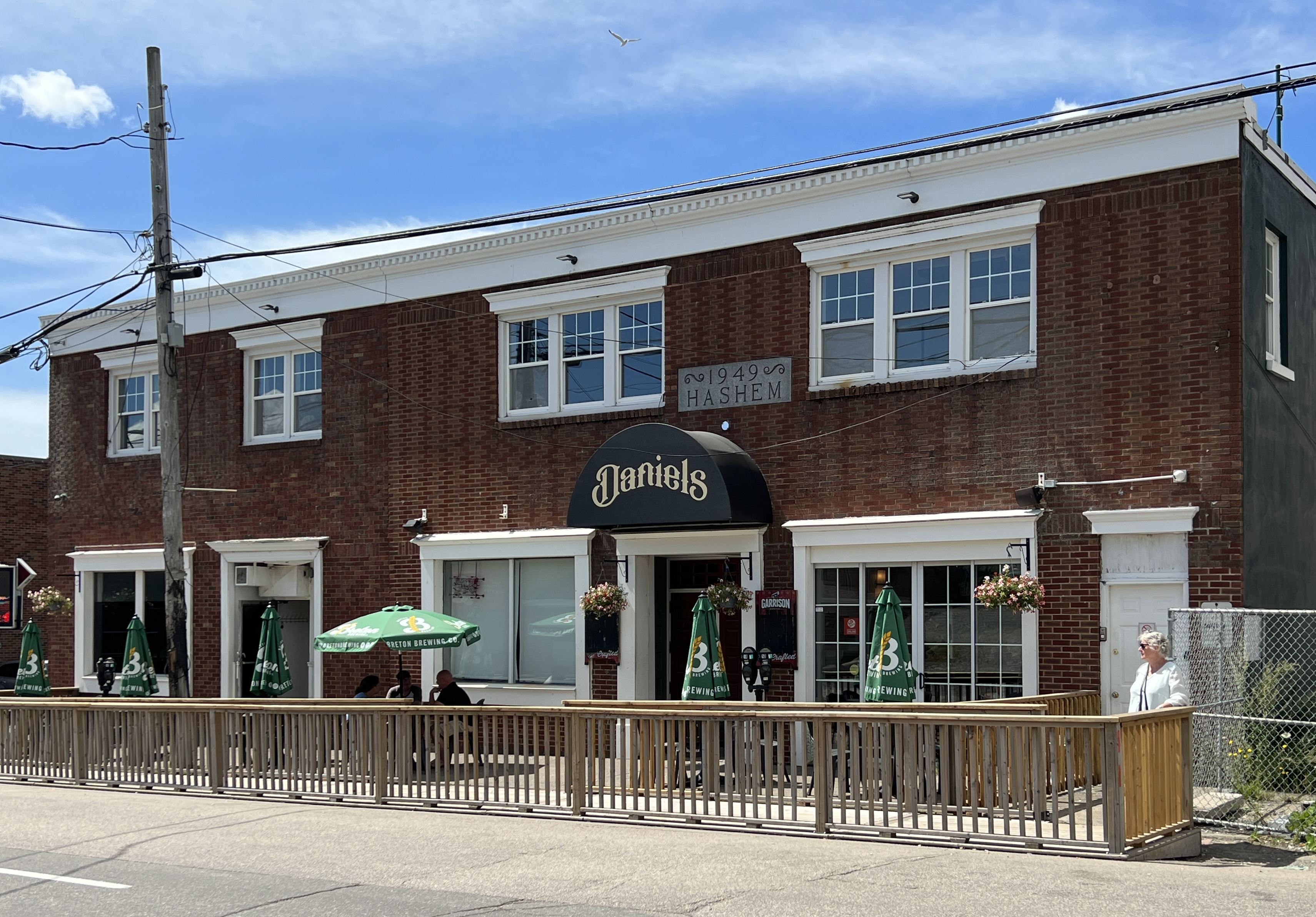
The main game in walking around was to find a place for lunch, it was Sunday so a few of the options were closed .
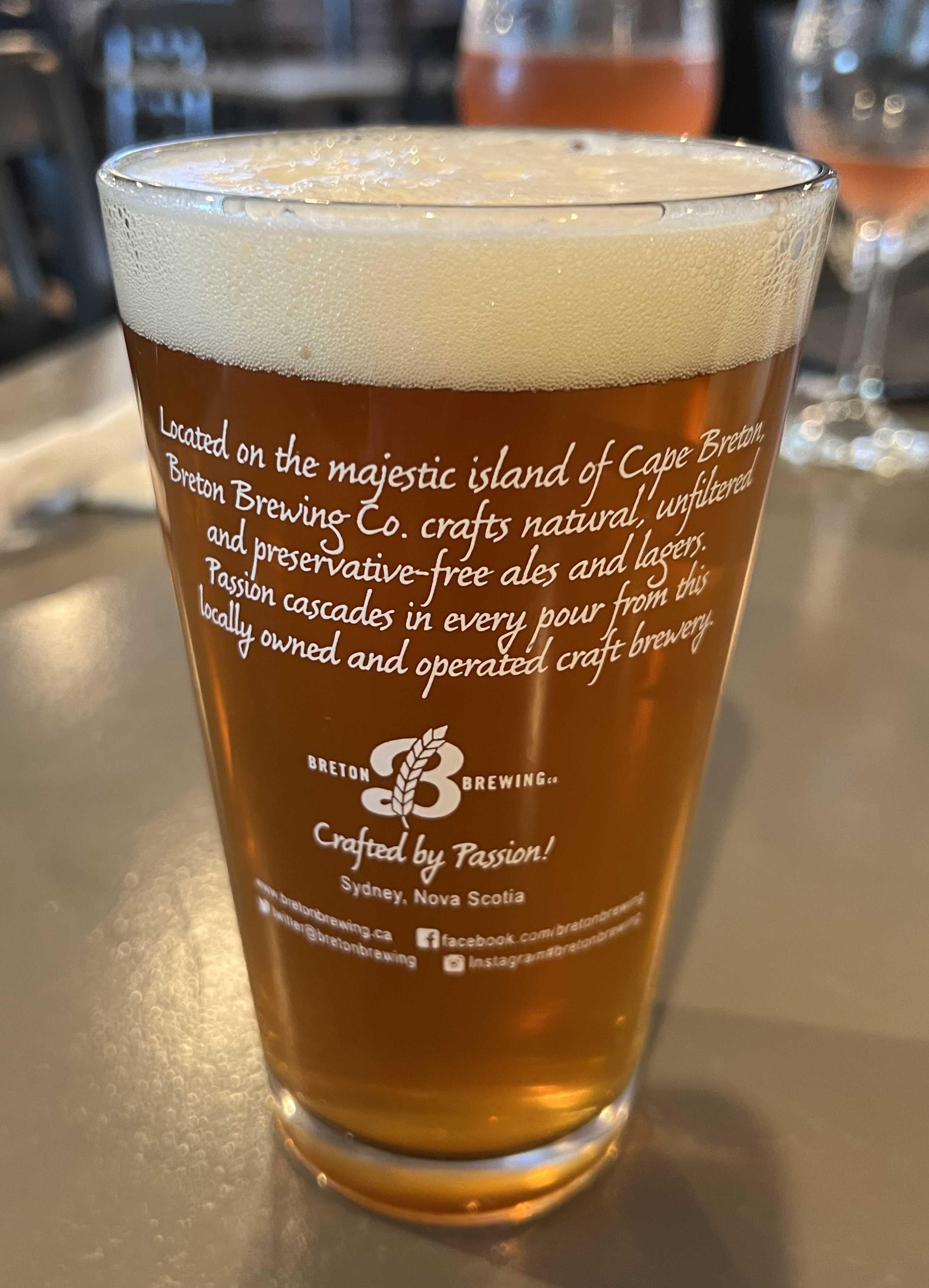
There were a number of French cafes in this closed category, so we ultimately settled for Daniels. It had a Scottish ambience with local craft beers and burgers, wraps etc. Not a bad choice and Allthego was able to secure another glass for the collection back home.
After lunch it was a slow stroll back along the waterfront to the ship, ran the gauntlet of shops with the afore mentioned cheese the only acquisition. Slobro was a little persistent wanting to be photographed with a lobster, settled for an old lobster trap.

Back on board we sailed away down the harbour with great views of the town.
Our next port of call is Halifax, the main city on Nova Scotia. The blog is running a little behind real time. We are now sailing down towards the Caribbean, two sea days out of New York with another two sea days before reaching the Panama Canal. Should be up to date by then!
Saguenay
Saguenay is a night’s sail back down the St Lawrence River and up to the end of the Saguenay Fjord, a left turn off the river to the north west. The fjord is Quebec’s largest and the most southerly fjord in the northern hemisphere. It is 105km long and 270m deep in some places.
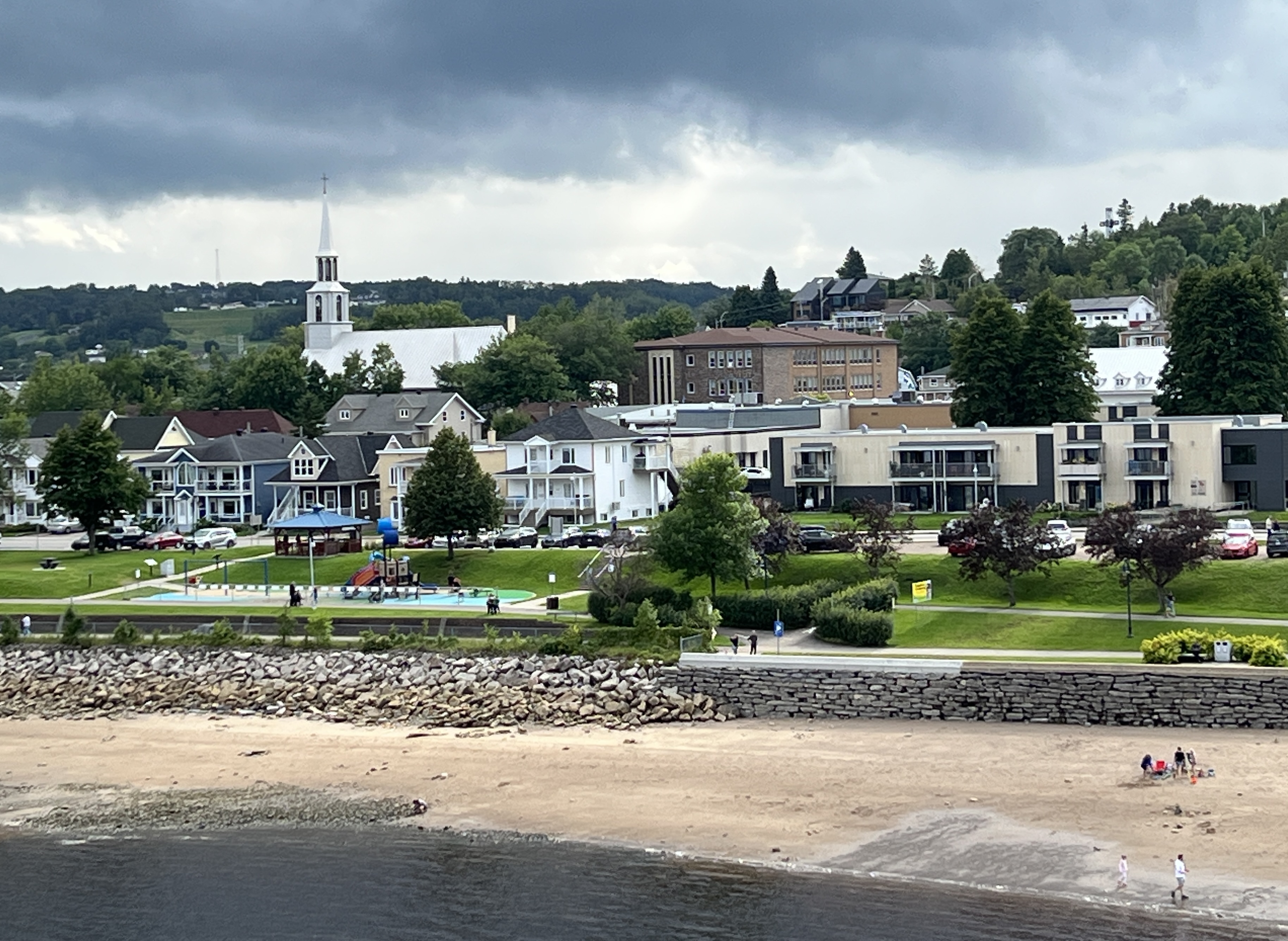
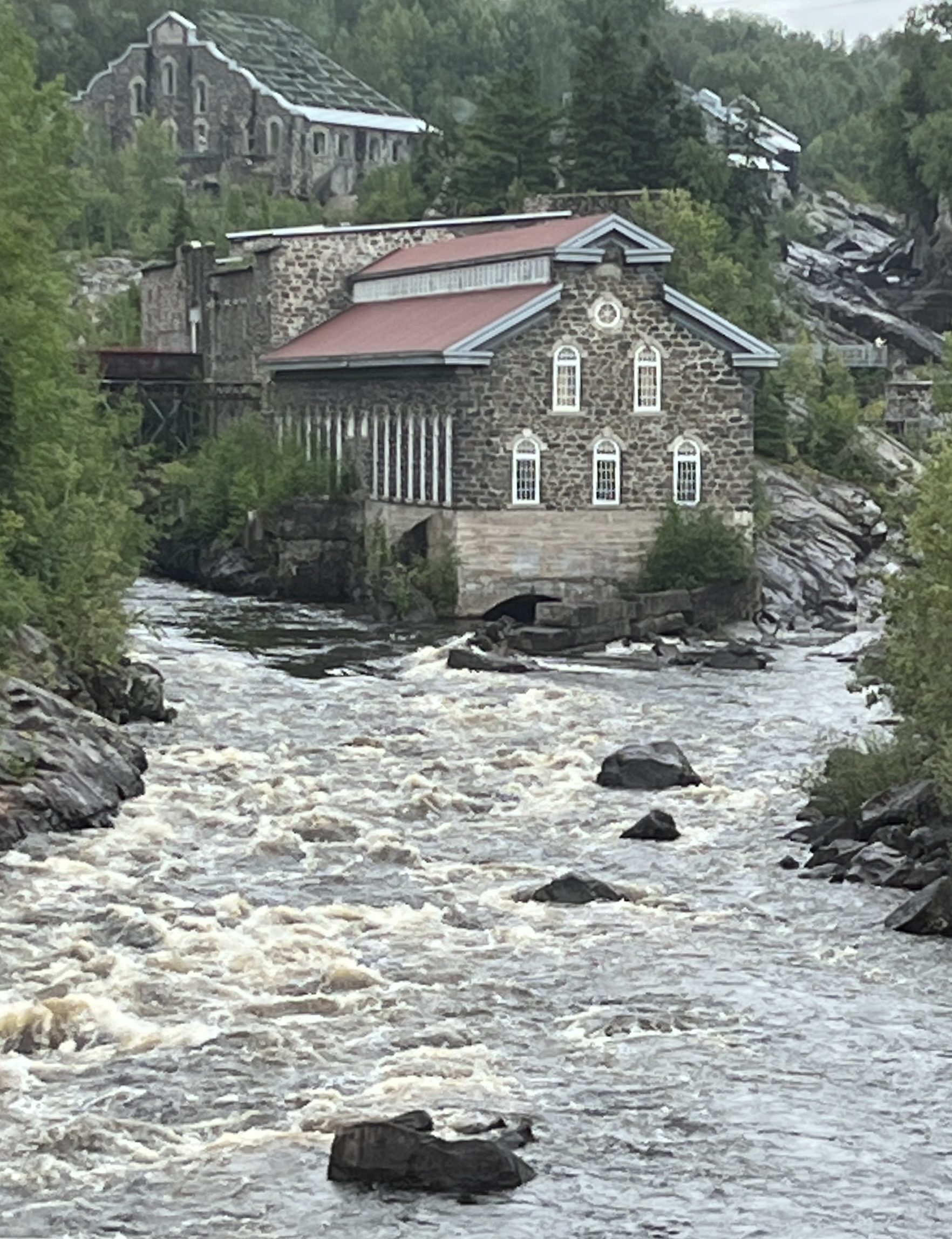
Saguenay is not a place as such but more the name for a region of districts. We dock at La Baie near the confluence of the Saguenay River and the Fjord. This is a small port town, the main commercial area is around Chicoutimi further up the river.
We had a short shore excursion taking us around La Baie and then to Chicoutimi. Along the way we stopped at a Mohair goat farm, this operation did things the traditional way.


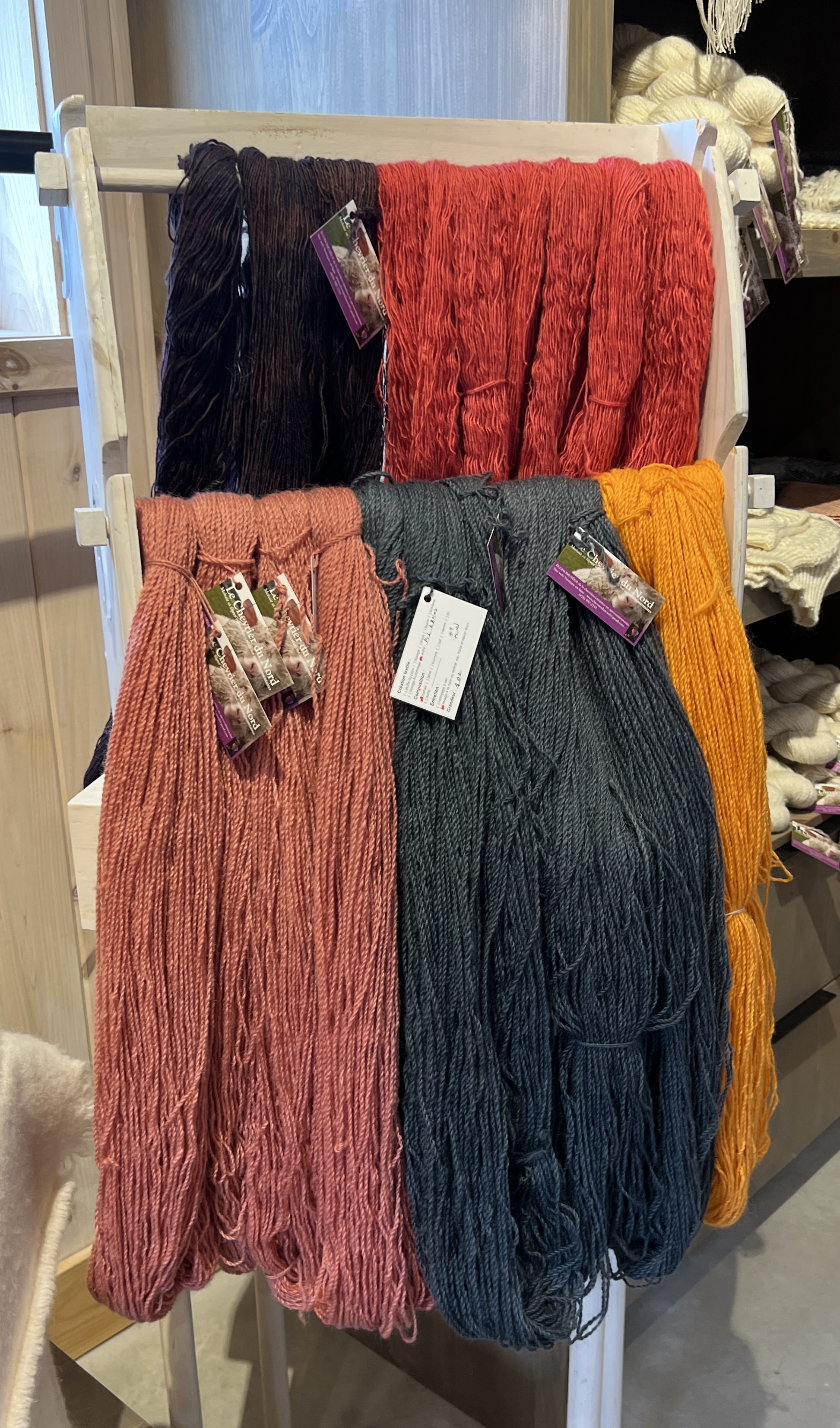
Homealone examined the wool offerings and left with a skein to make something with, not sure what. Allthego found a pair of super socks to keep the feet warm on wintery van trips back home.
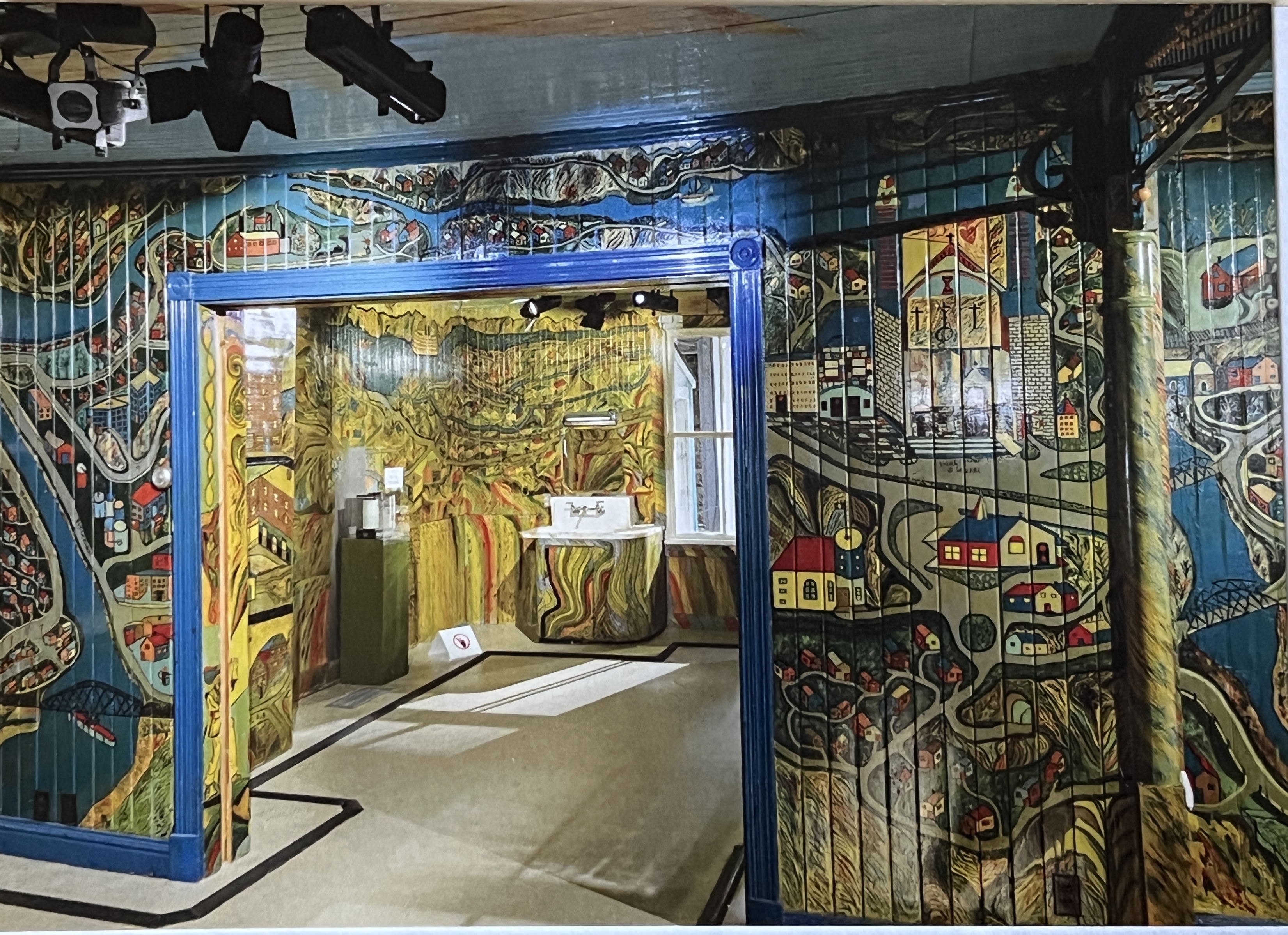
Back on the road we made for the ‘painted house’ of the famous local painter Arthur Villeneuve. This guy used his house as his canvas, apparently a great frustration for his wife. He had a strange style, depicting history, local geography and his life’s activity on the walls of the family home. He wasn’t trained and depicted things in blocks ‘standing’ out from the walls. The house is a maze of frescos in vibrant colours. The house had been relocated to the interior of one of the old paper pulp mills, now a museum. Couldn’t take photos, but the one here is a copy of a postcard.
The other thing the area is known for is the Little White House which survived a devastating 1996 river flood. The house managed to avoid being washed over the falls and sits precariously on the edge. It is the town’s symbol of survival and hope!
Rio Tinto is the town’s major employer at an aluminium smelter. Bauxite feedstock for the smelter comes from various parts of the world, including Rio’s mines in Australia. It is a prominent sight coming into the port after the sail down the magnificent fjord, greenies I suspect think it is a blight on the environment. Probably is!
Saguenay has a very French flavour as we found out after the tour when lunchtime arrived. The east coast of Canada is well known for its seafood. Particularly lobsters, crabs and scallops.
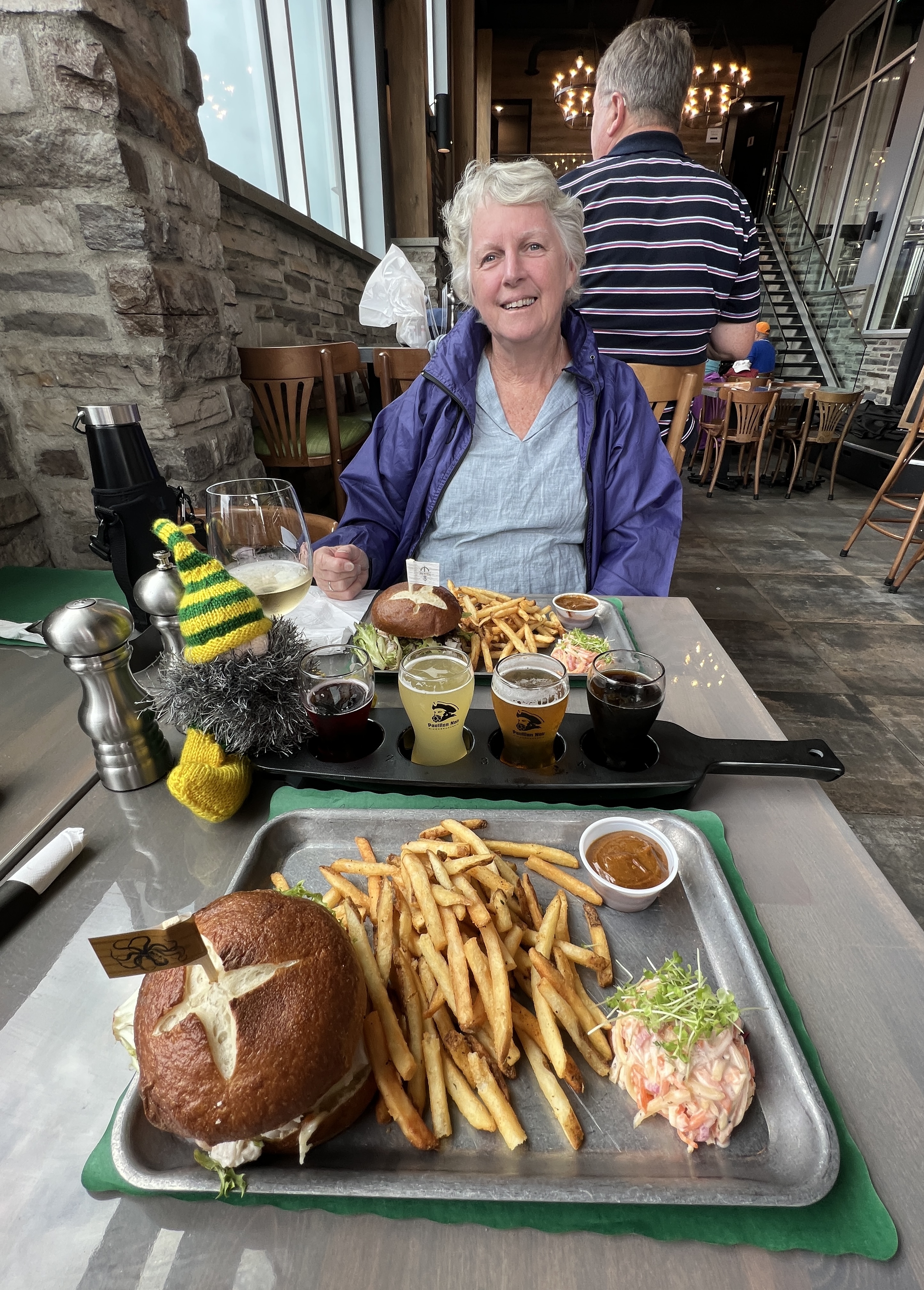
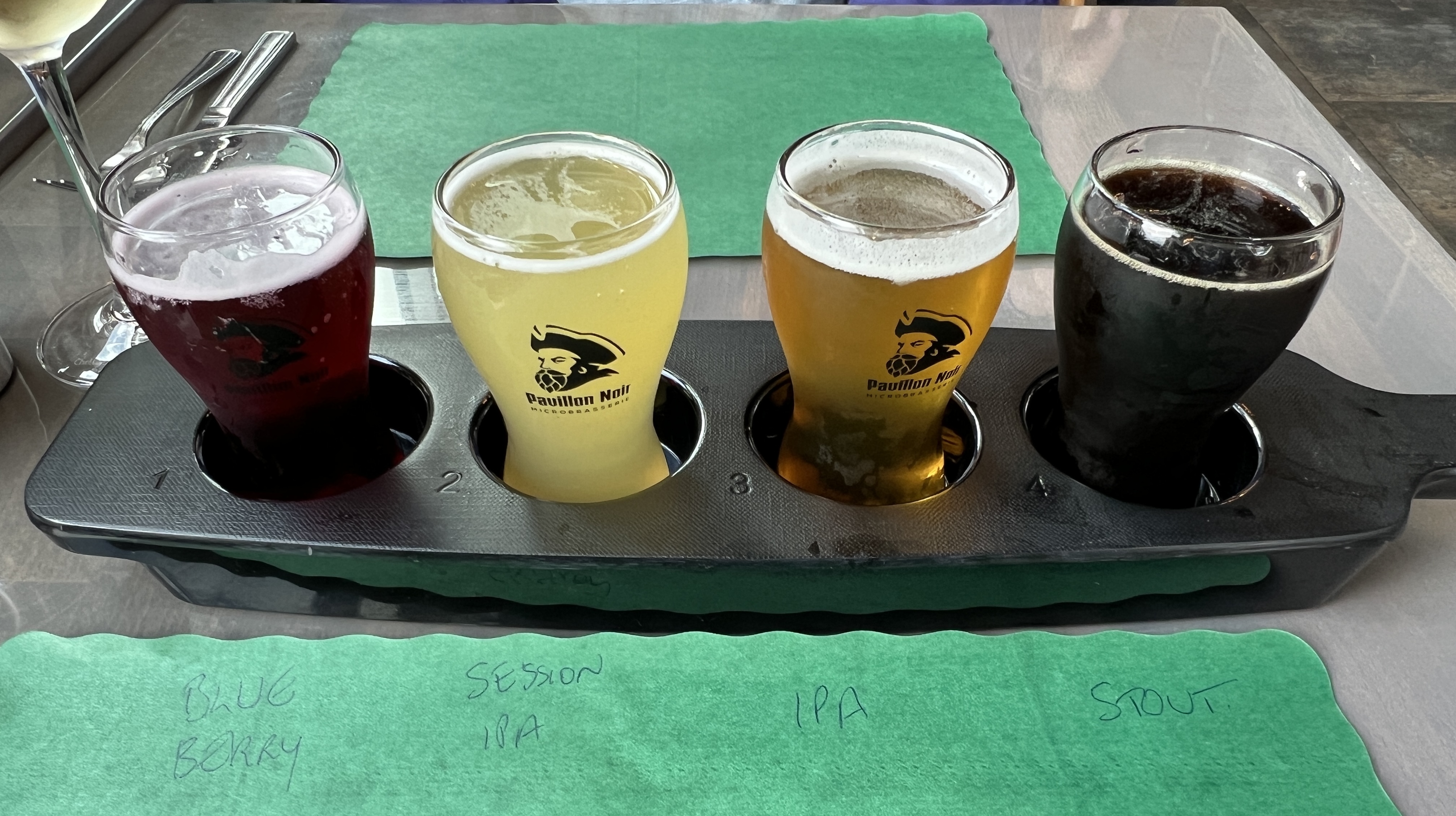
Allthego and Homealone have decided to give these ago in the ports before New York. So we give a seafood burger a go at Pavilion Noir. The waitress struggled with our English, seemed to prefer French. The burgers were great. A combo of crab and scallops in a creamy sauce, with some salad and French fries. A big tick for this place!
Sydney on Cape Breton Island is the next stop, Slobro is very confused thinks we are almost home!
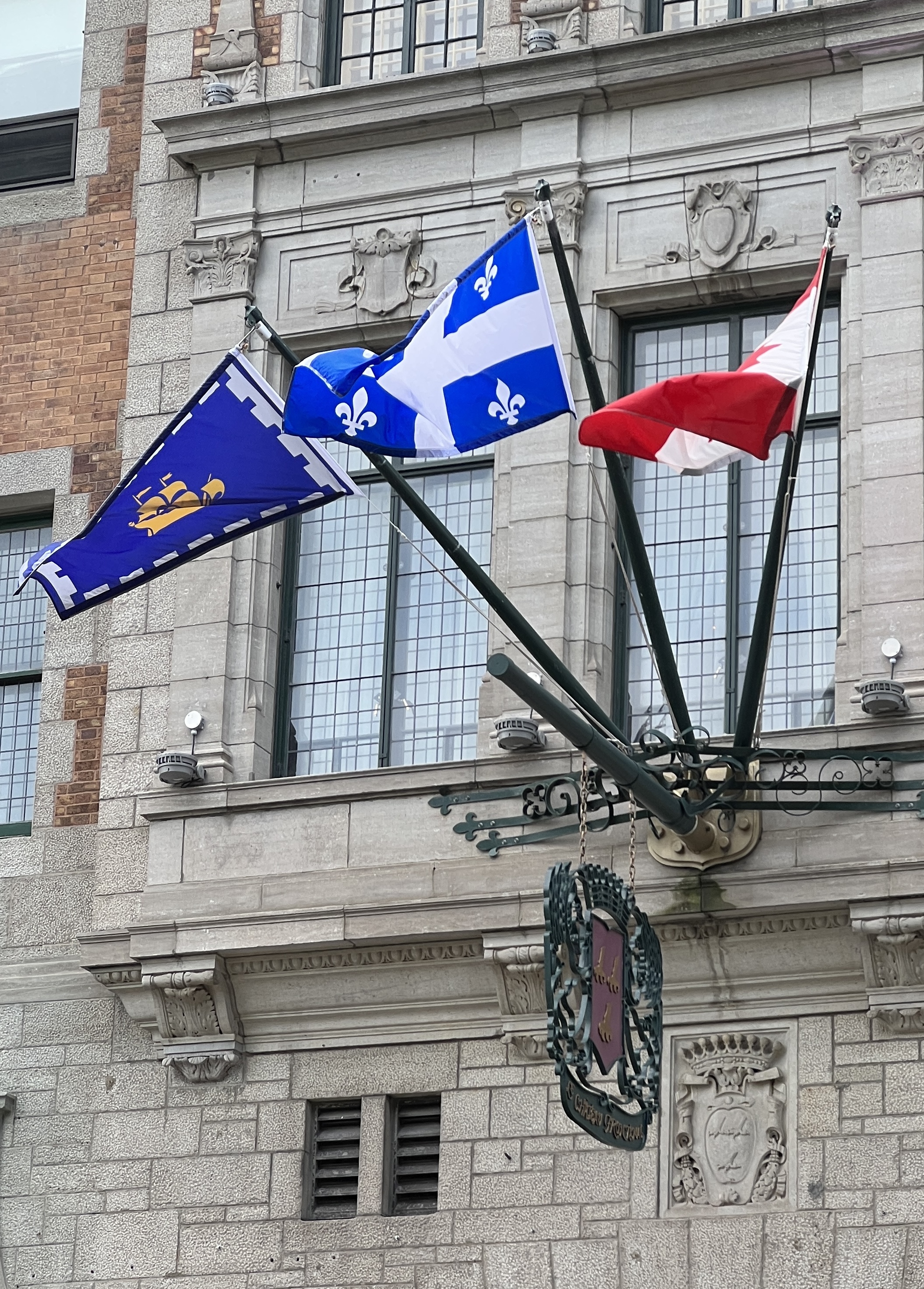
Quebec City
We arrived in Quebec City in good time, the weather not so good on arrival but the skies cleared as the day played out. We are in port until 10pm. We had an all day excursion around the old town and then went further afield into the countryside arriving back in plenty of time to go back for an evening in the streets.
Our guide, looked to be 70ish, was the usual mine of information delivered with a strong gravelly French accent and accompanying nonchalant shoulder shrug as if his English didn’t quite do the job! Not the greatest of guides we have had, thought we were mostly Americans too with a couple of Kiwis thrown in.
He gave us a bit of history about the old town before we had some time to look around. The French established Quebec City in 1608 and hung onto it for the next 155 years when it was ceded in 1763 to England, at the end of the wars mentioned in the last post. Still a very French place though, 95% of the locals speak French in the home as a first language, 3% English and 2% other lingos.
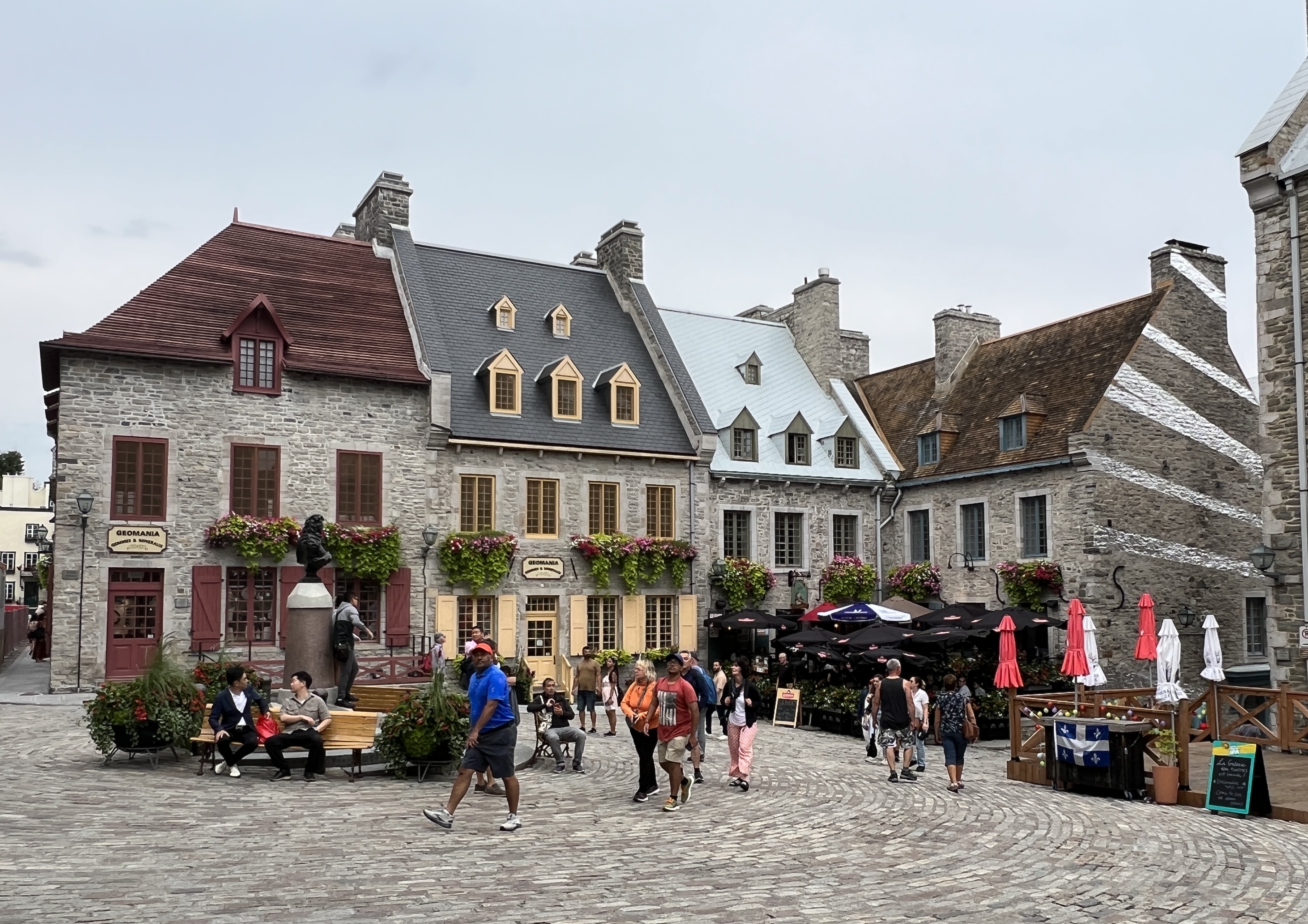
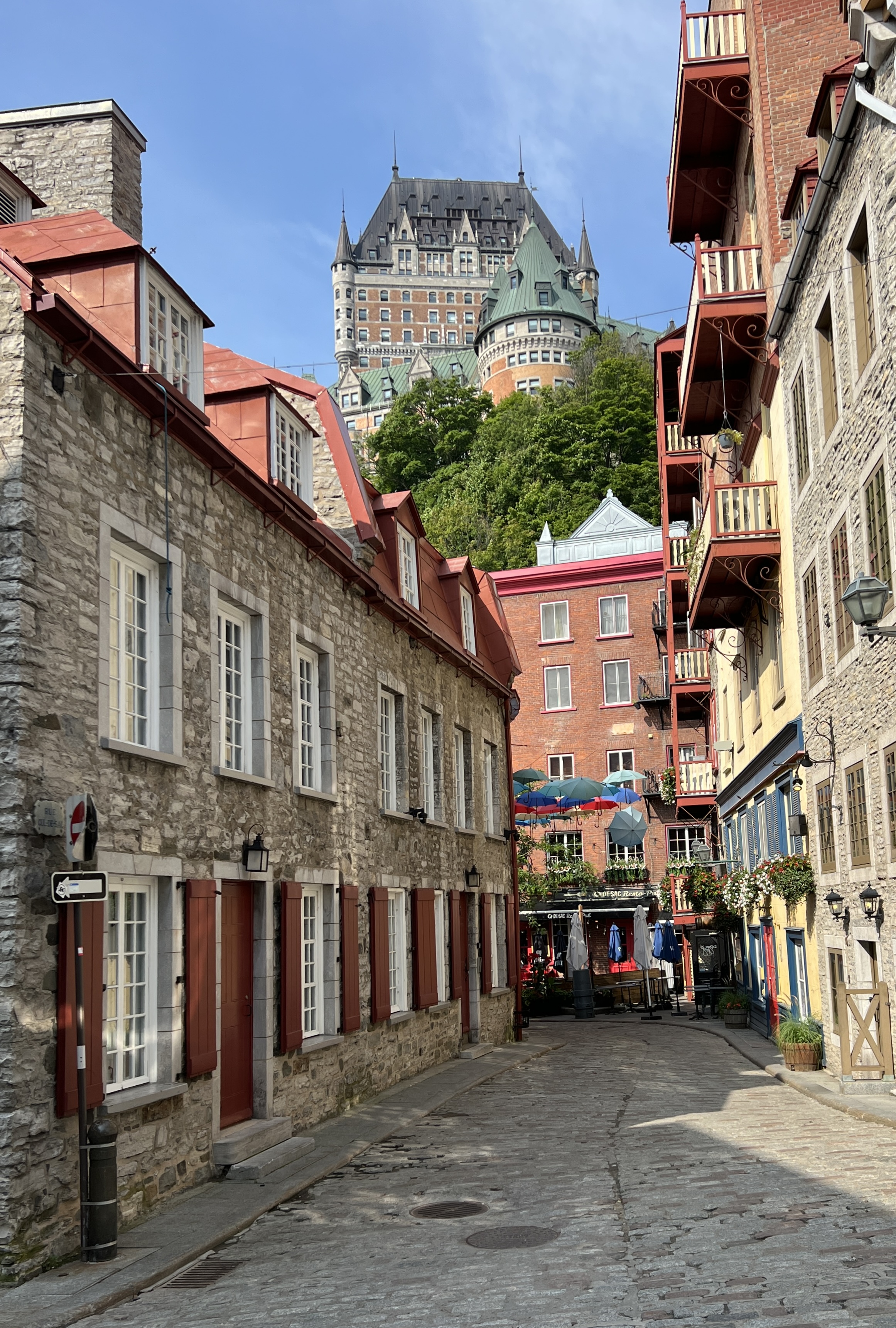
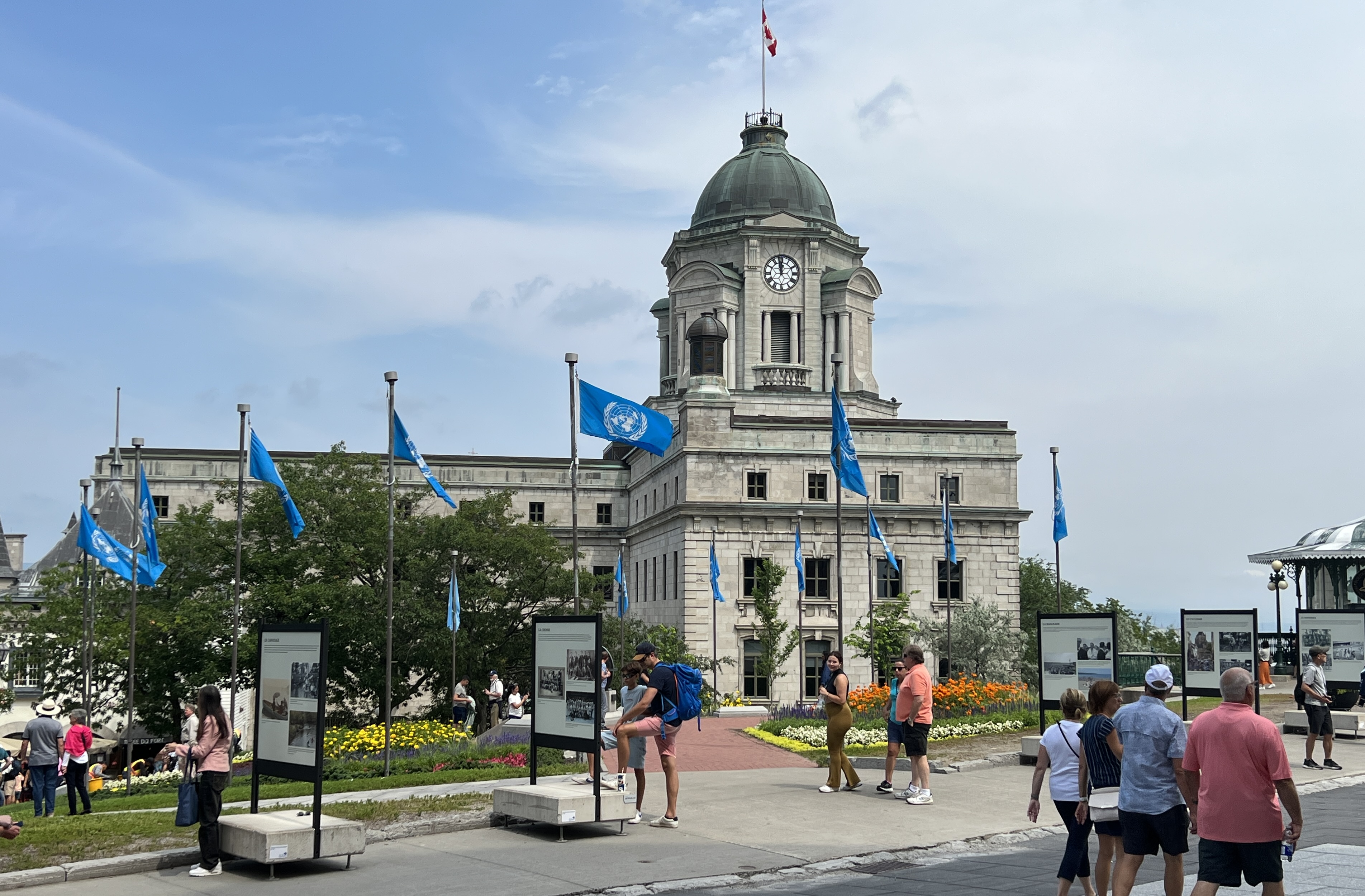
The old town area, the Place Royale, is still surrounded by the city walls and parapets overlooking the St Lawrence River. The old town was originally wooden buildings within a wooden fort, but after a number of fires and wooden rebuilds over the years wood gave way to stone around the 1670s. The whole fortified area is known as La Citadelle.
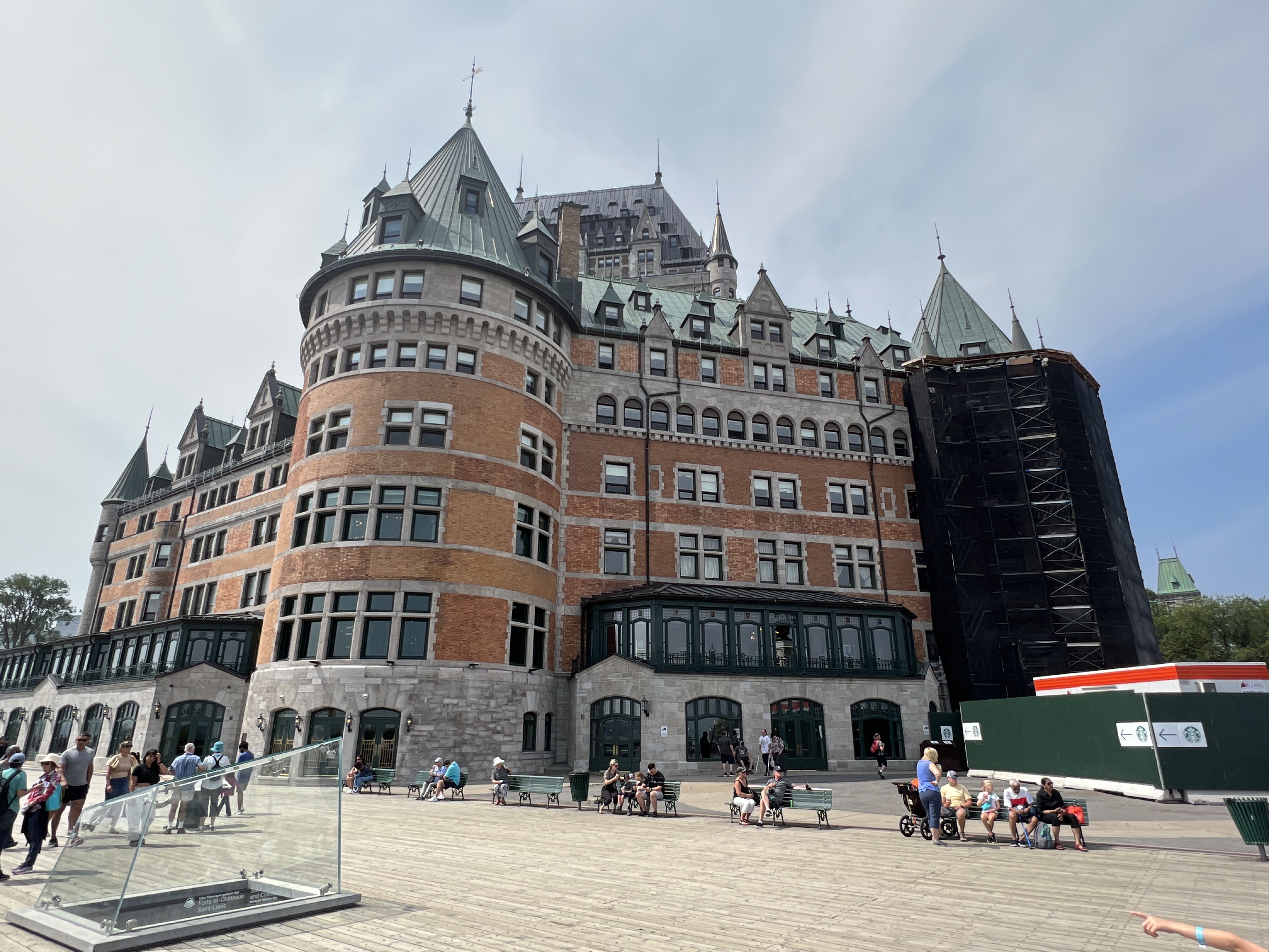

There is a great view from the top across and down the St Lawrence River, ‘spoilt’ today by a thick haze. We have a look inside the foyer of the famous landmark hotel Le Chateau Frontenac. Nice spot to stay!
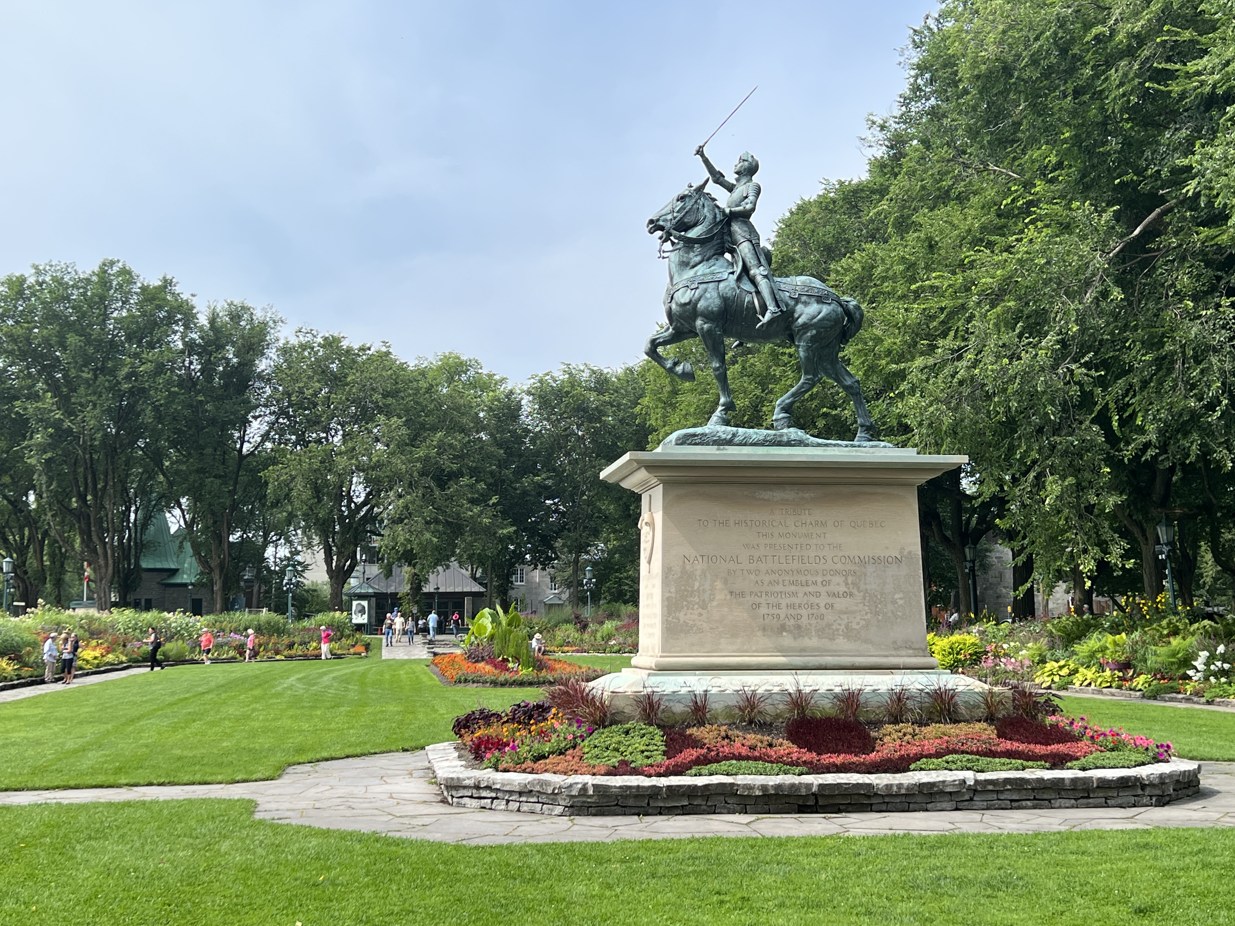
Back on the bus it was a drive by the ‘Plains of Abraham’, the now grassy parklands where the Battle of Quebec was fought, for a photo stop. This whole area is surrounded by cannon after canon lining the roadway. Tucked away on the side is a statue of Joan of Arc in a beautiful garden setting.
It was then out of town and into the countryside for a look at the rural activities in the region. Mostly grain and vegetable crops. Beside us in the port is a huge complex of silos, not a great look. Quebec acts as a major export terminal for the large grain production areas in central Canada and the top end of the USA.
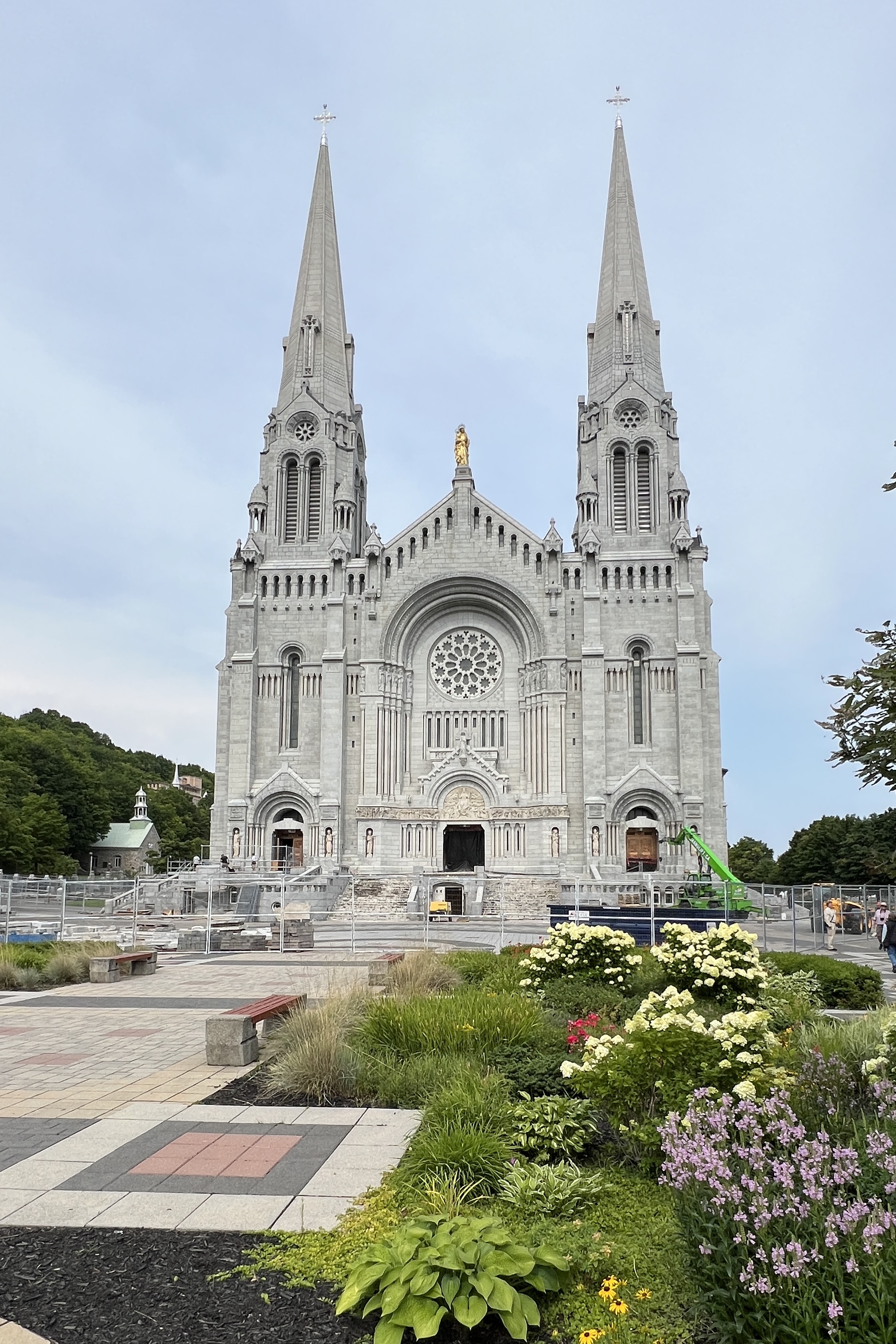
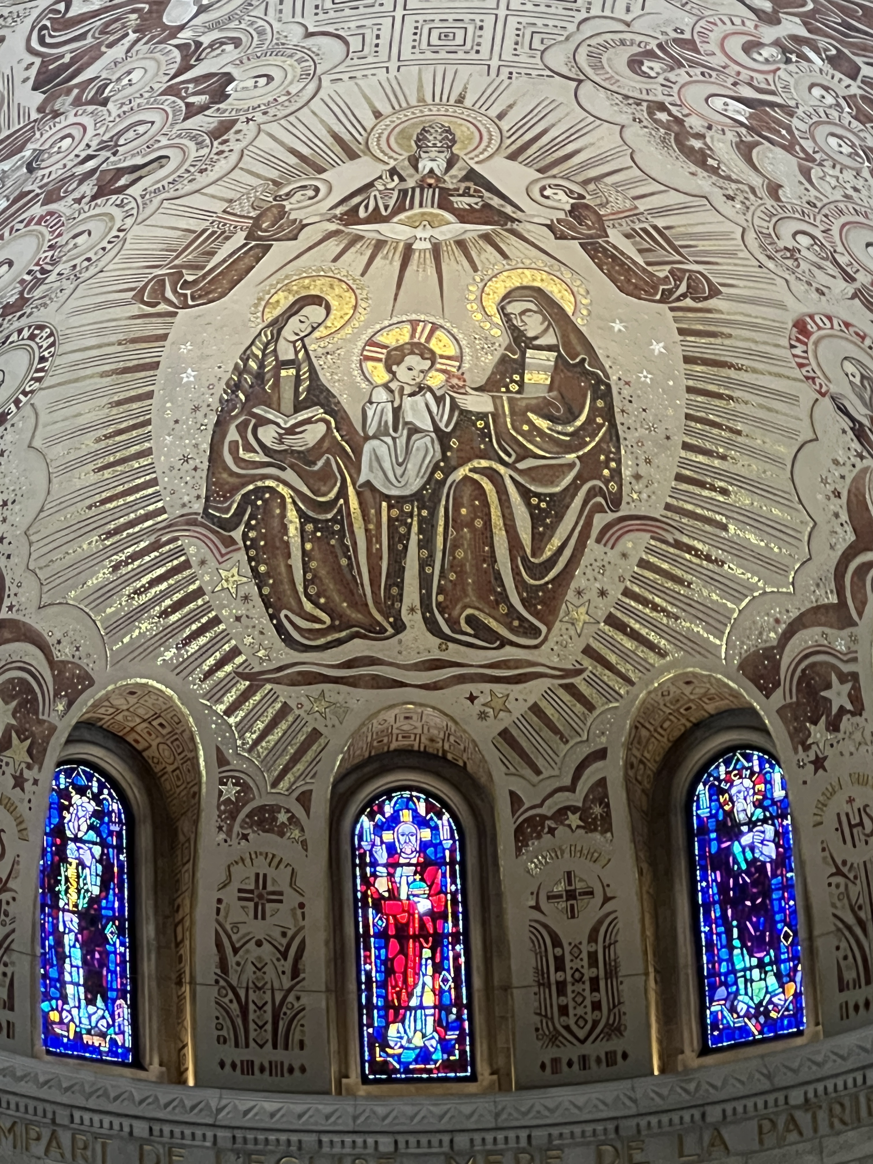
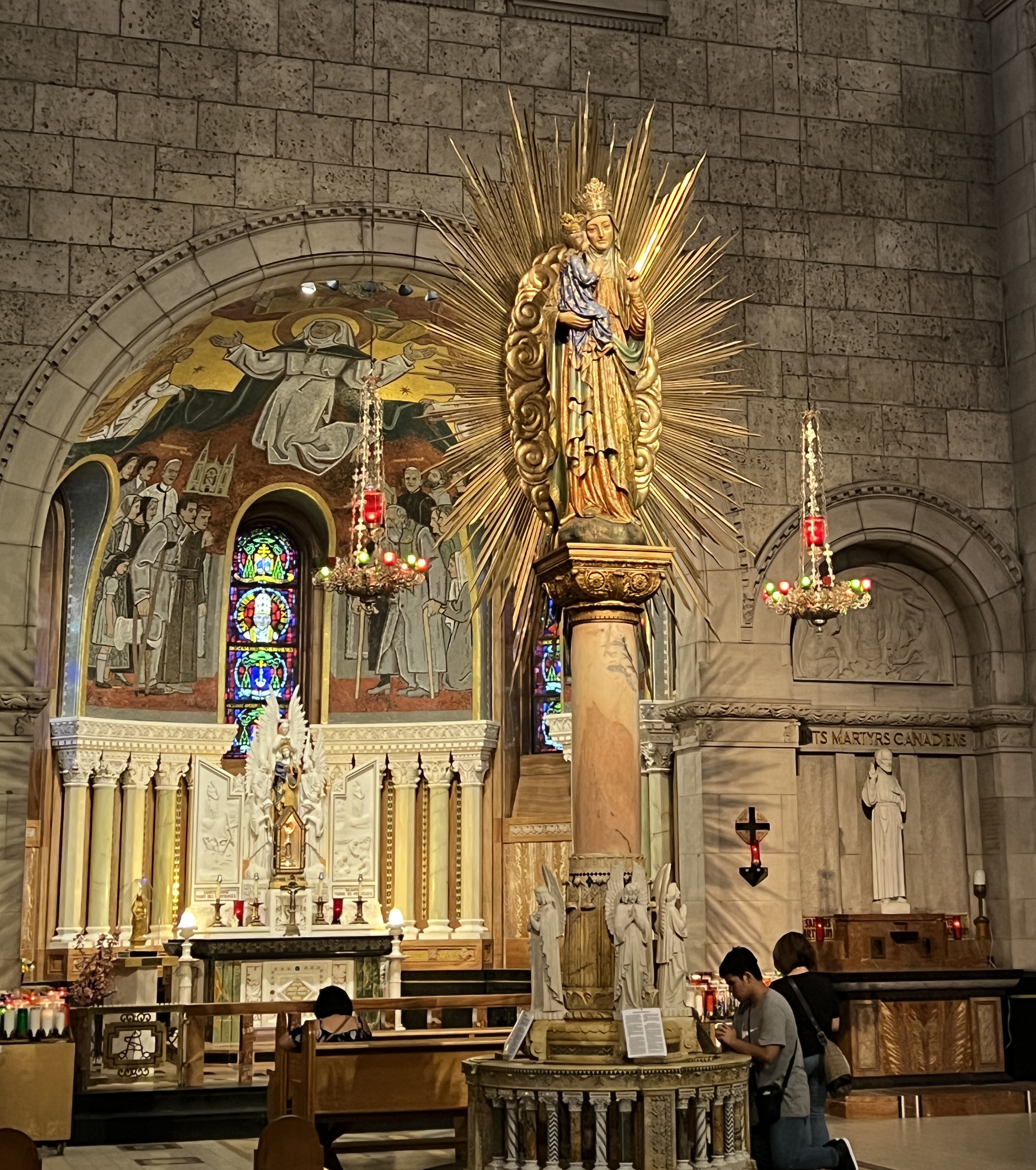
After the rural romp we stopped in at the Roman Catholic Basílica Sainte-Anne-de Beaupre. This was something else I might say. In our travels up in Iceland/Greenland we had got used to Lutheran austerity. Well, this was at the other extreme. What an ornate structure. A couple of pictures say it all.
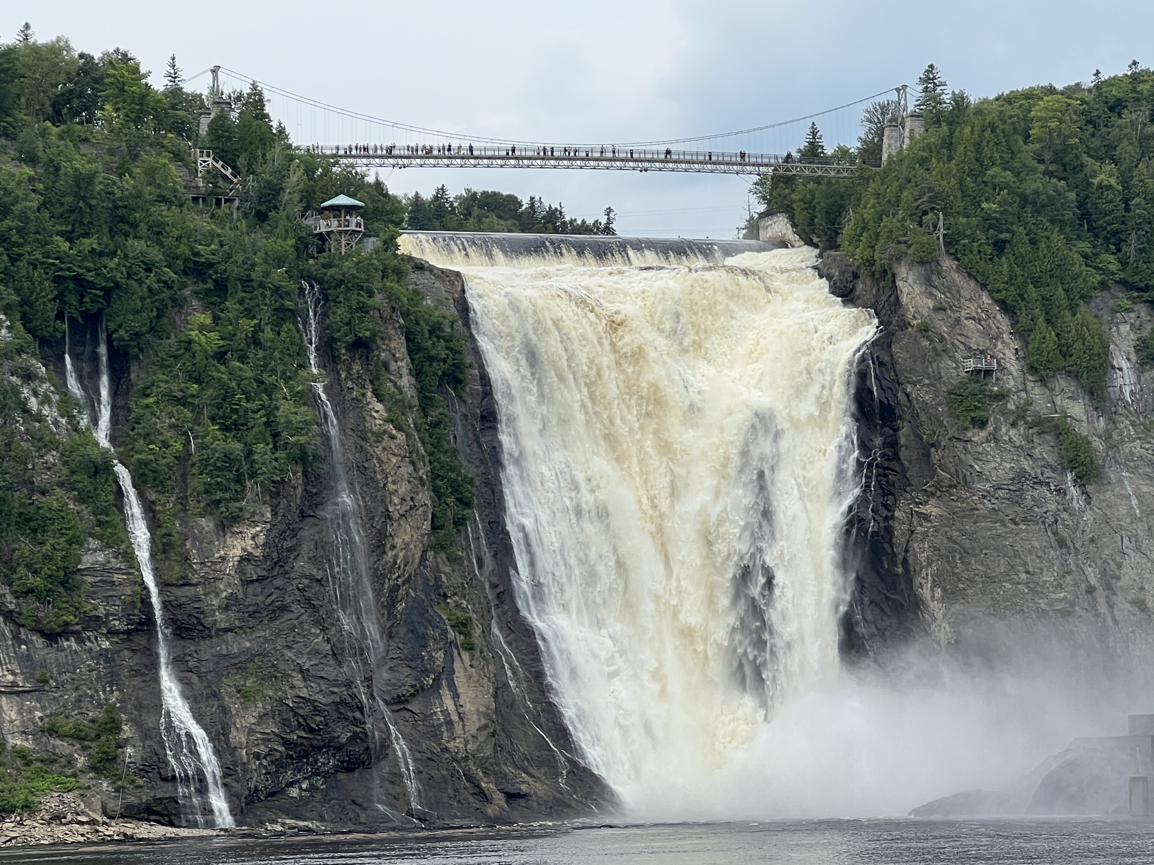
After the Bascilica the nearby falls were the next stop. These are 30m or so higher than Niagara and there was a huge amount of water coming over them from all the recent rain.
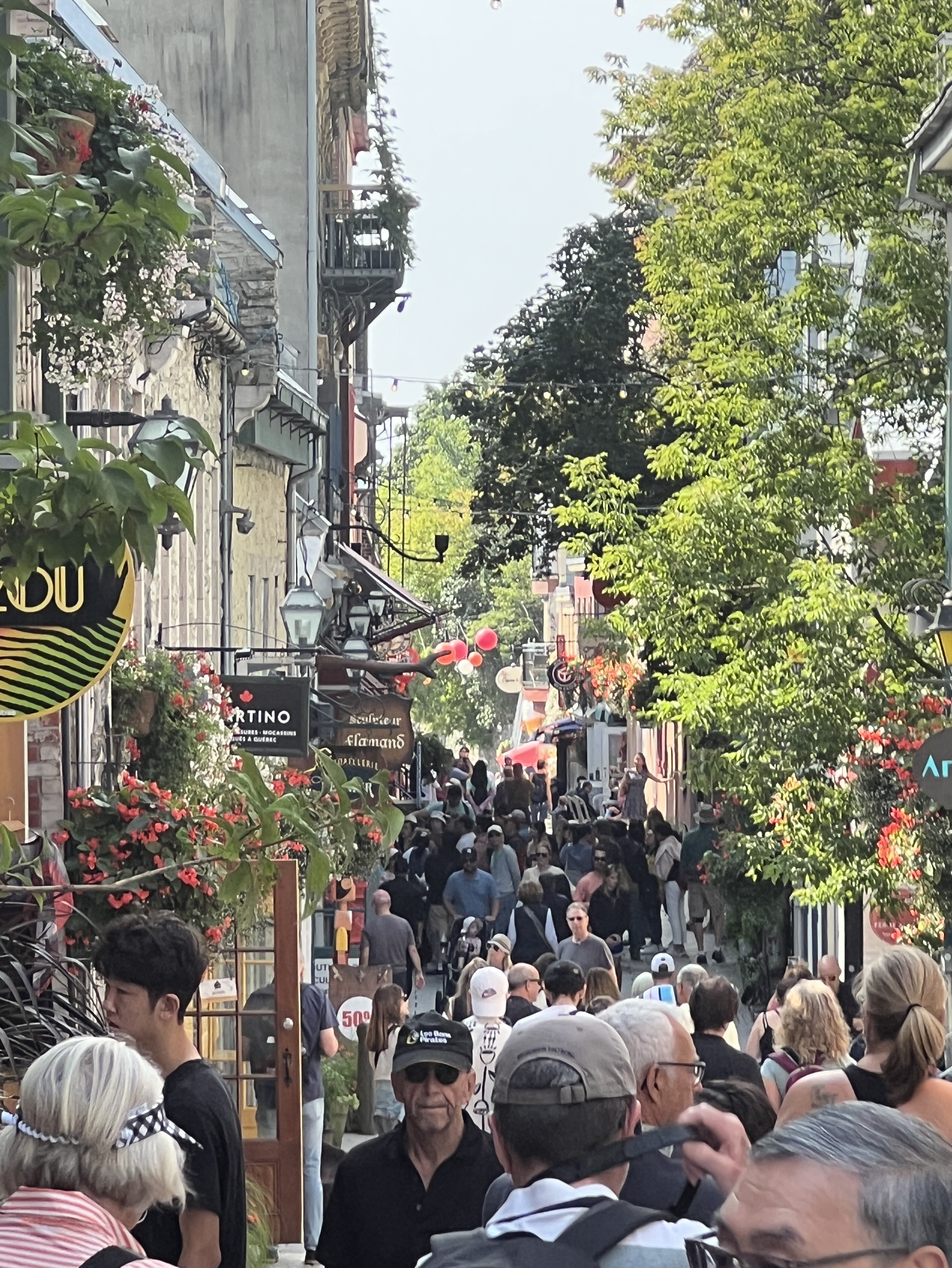
It was then back to the city and some early evening time in the old town. We had a short stop for a light refreshment in a bar and a look see in some of the numerous art galleries and souvenir shops. It was all very reminiscent of Paris.
We thought Quebec was one of those spots you could easily return to again and have more time to explore.
Around 8 pm the smell of rain was in the air and a light drizzle started on the walk back to the ship. A bit of lightning flashed around as we made it back in time.
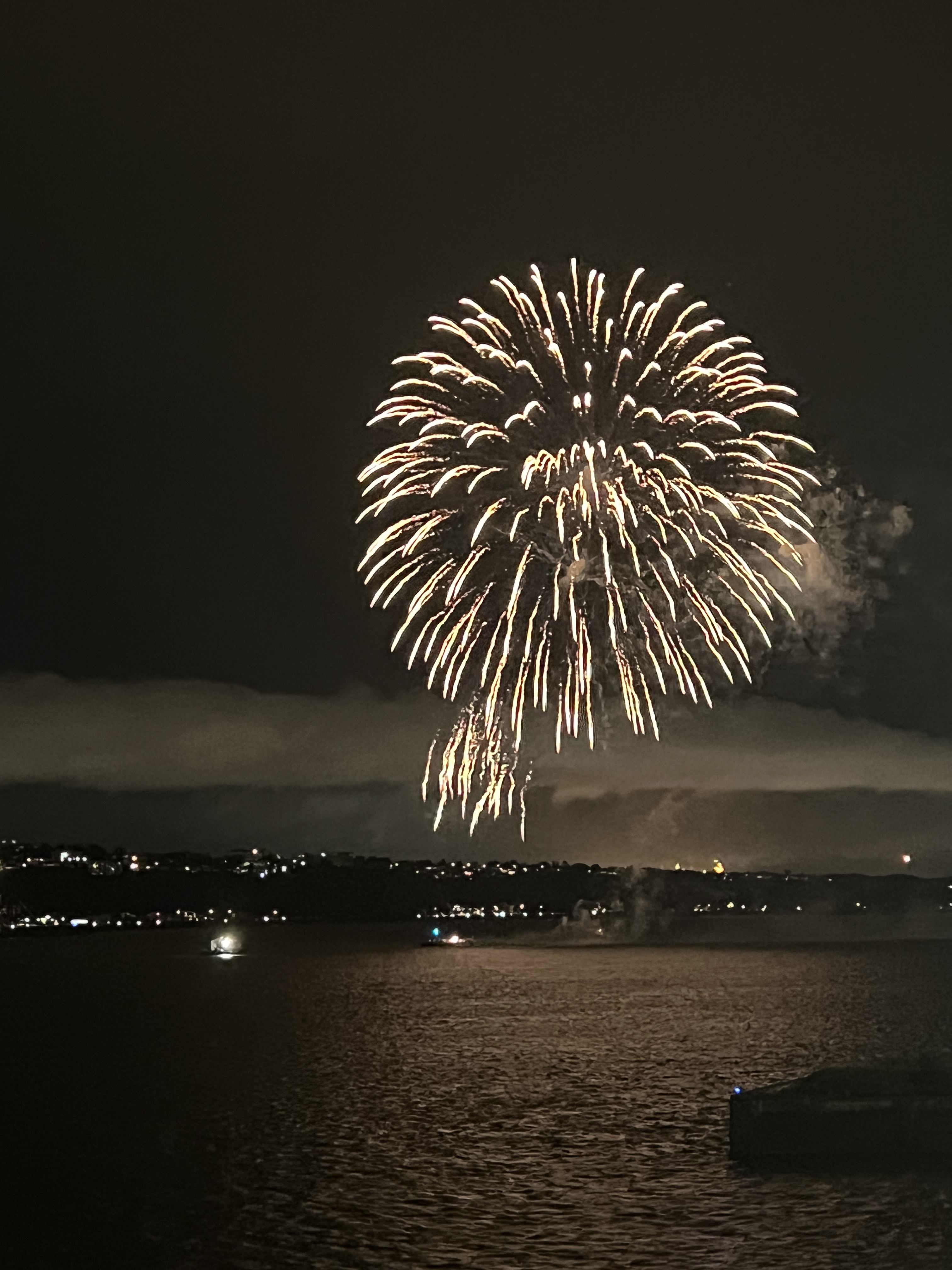
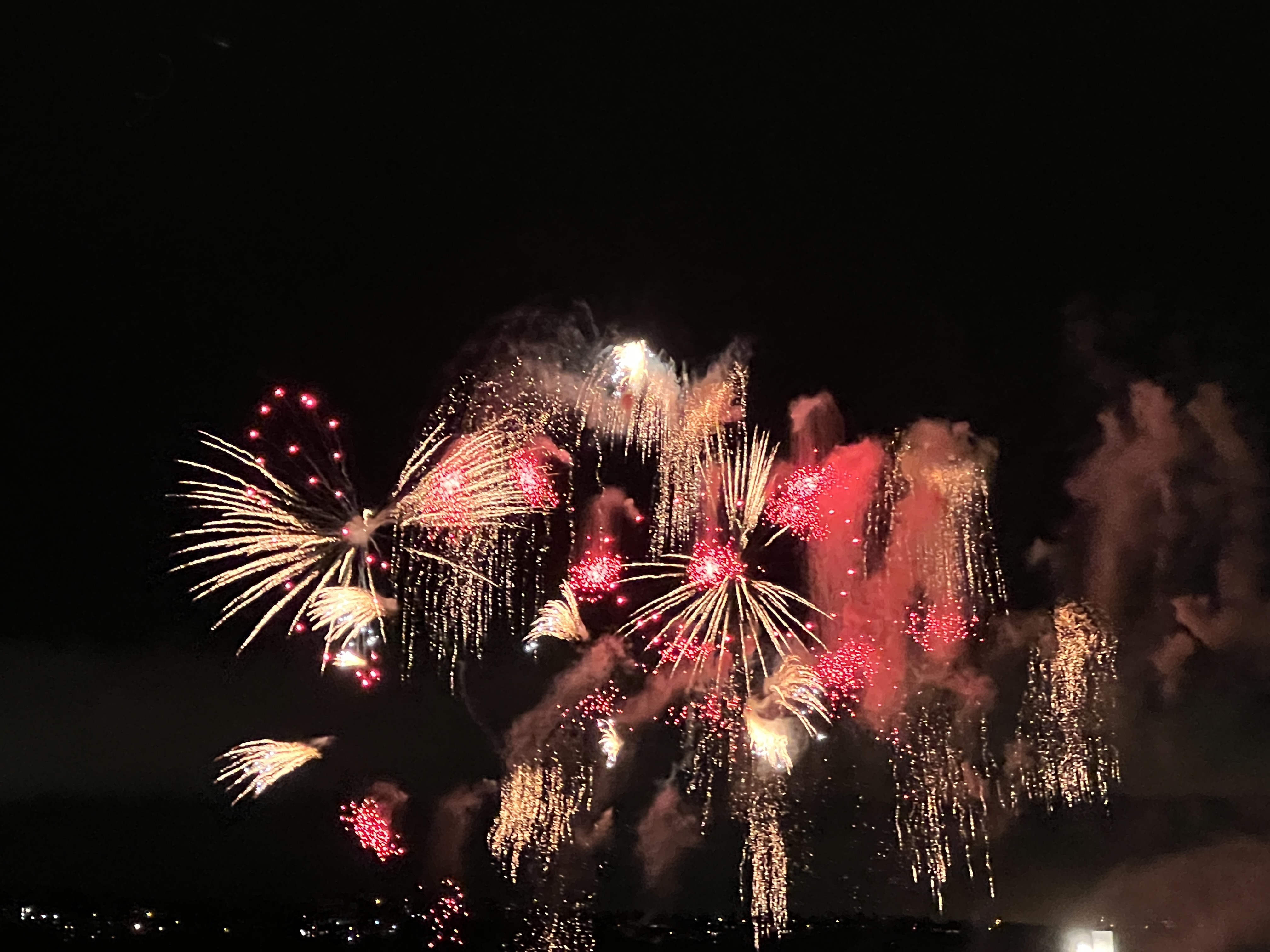
There was no serious rain though and we watched a spectacular fireworks display as the ship sailed away back down the St Lawrence River for the next stop at Saguenay.
Gulf of St Lawerence
According to schedule we arrived at Corner Brook on New Foundland. We had come into the Gulf down the wide channel separating Newfoundland from Labrador, on the mainland. Over the next few days the cruise course takes us further down the Gulf and into the St. Lawrence River to Quebec. We then retrace our path back out into the Atlantic and head south west to New York stopping at a few places along the way.

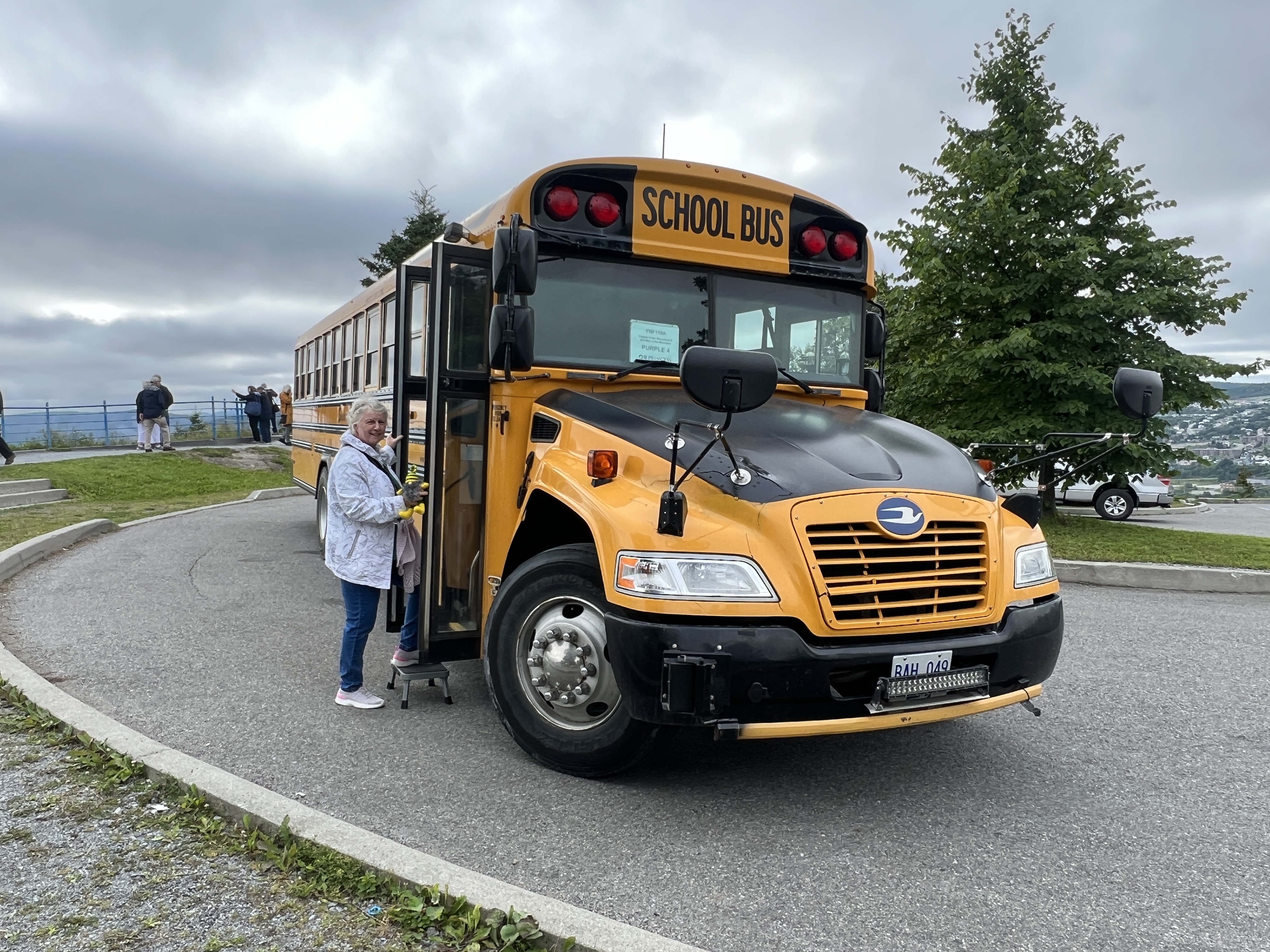
Allthego and Homealone don’t know much about this part of the world and have never been here before. Slobro has no idea. It will be a learning experience. So it is quite appropriate for our tour in Corner Brook to be on a local school bus. This style of vehicle is all over North America.
One of the first things we learn is that Newfoundland and Labrador only became part of Canada in 1949 and there was a contingent of Newfoundlanders at Gallipoli in WW1. A referendum was held offering two options, stay independent or join Canada. 51% went with Canada. An earlier referendum had the USA as another option, none got a majority.
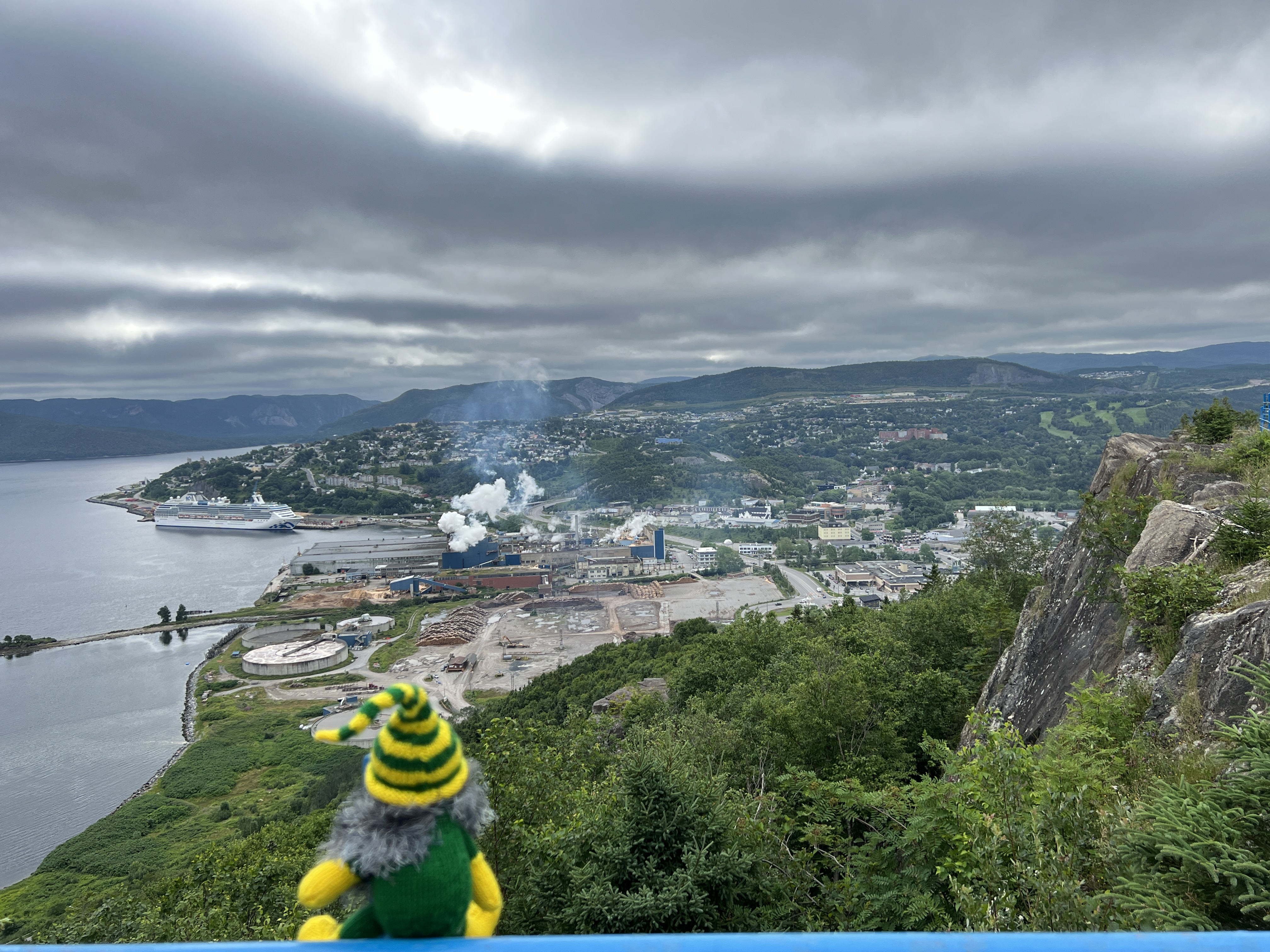
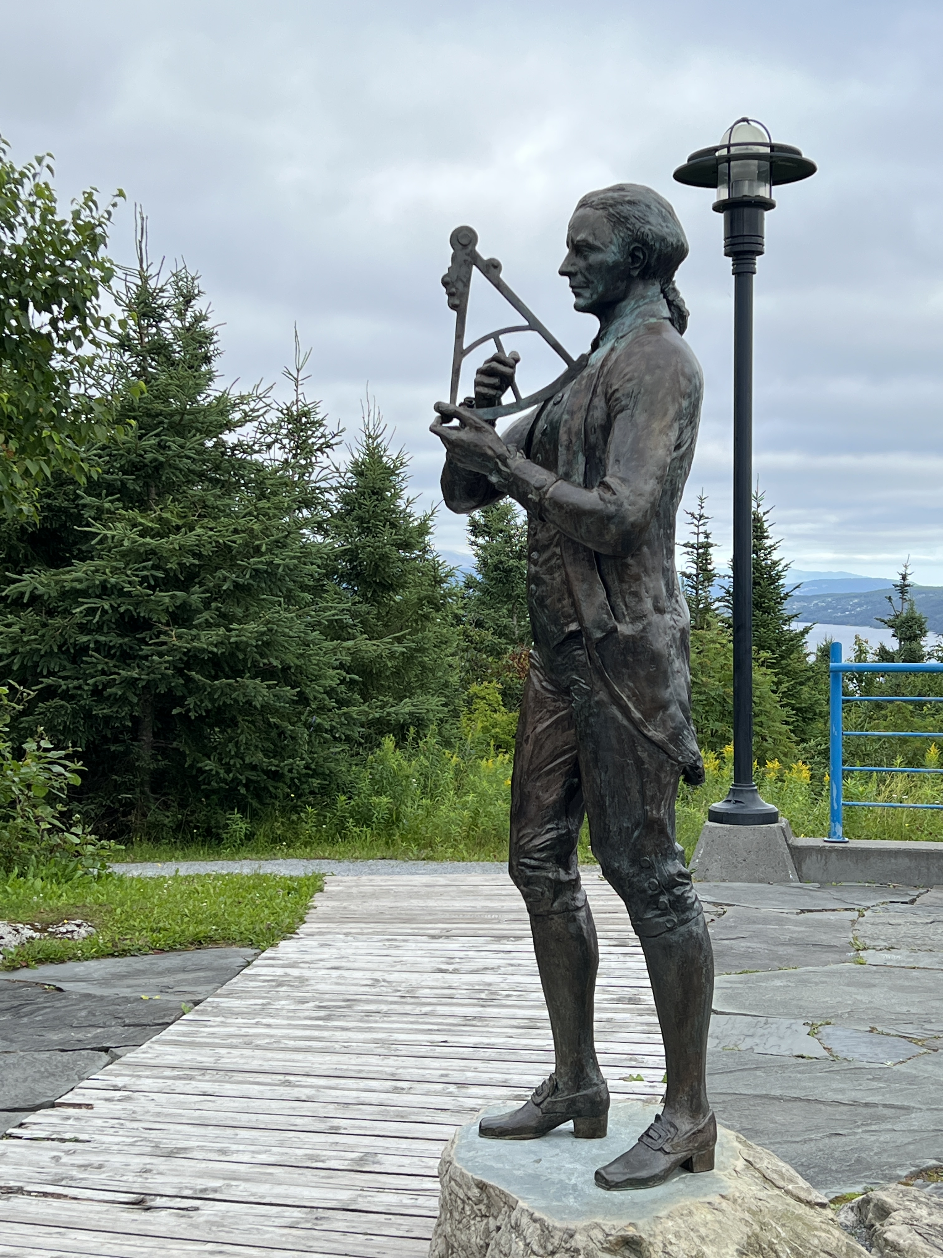
Our tour took us to the Capt. Cook memorial lookout, great views down on the town. Corner Brook has a strong connection with Captain Cook, he was based around here during the late 1750s and first half of the 1760s. This was the time of the squabble between the English and the French about the control of what is now eastern Canada.
The English controlled the seaboard areas from Labrador south to the American colonies and the French the interior region, the present day Provence of Quebec. Without dwelling on this much more the English finally kicked the French out at the Battle of Quebec. Cook was involved in a lot of map drawing of the St Lawrence River, so accurate that they are basically still in use today. The French were always peeved about the loss of New France and it is one of the reasons why they backed the American colonies against the English, with money and men, in the War of Independence some ten years later.
From the lookout the pulp and paper mill is shown to dominate the town’s landscape. It has been here just on a hundred years and is the major employer. For much of its time it was an ecological disaster, a toxic plume extended out into the harbour. Salmon stopped coming and entering the Humber River to spawn. Today, it is a model of ecological success, the plume has gone and the salmon are back.
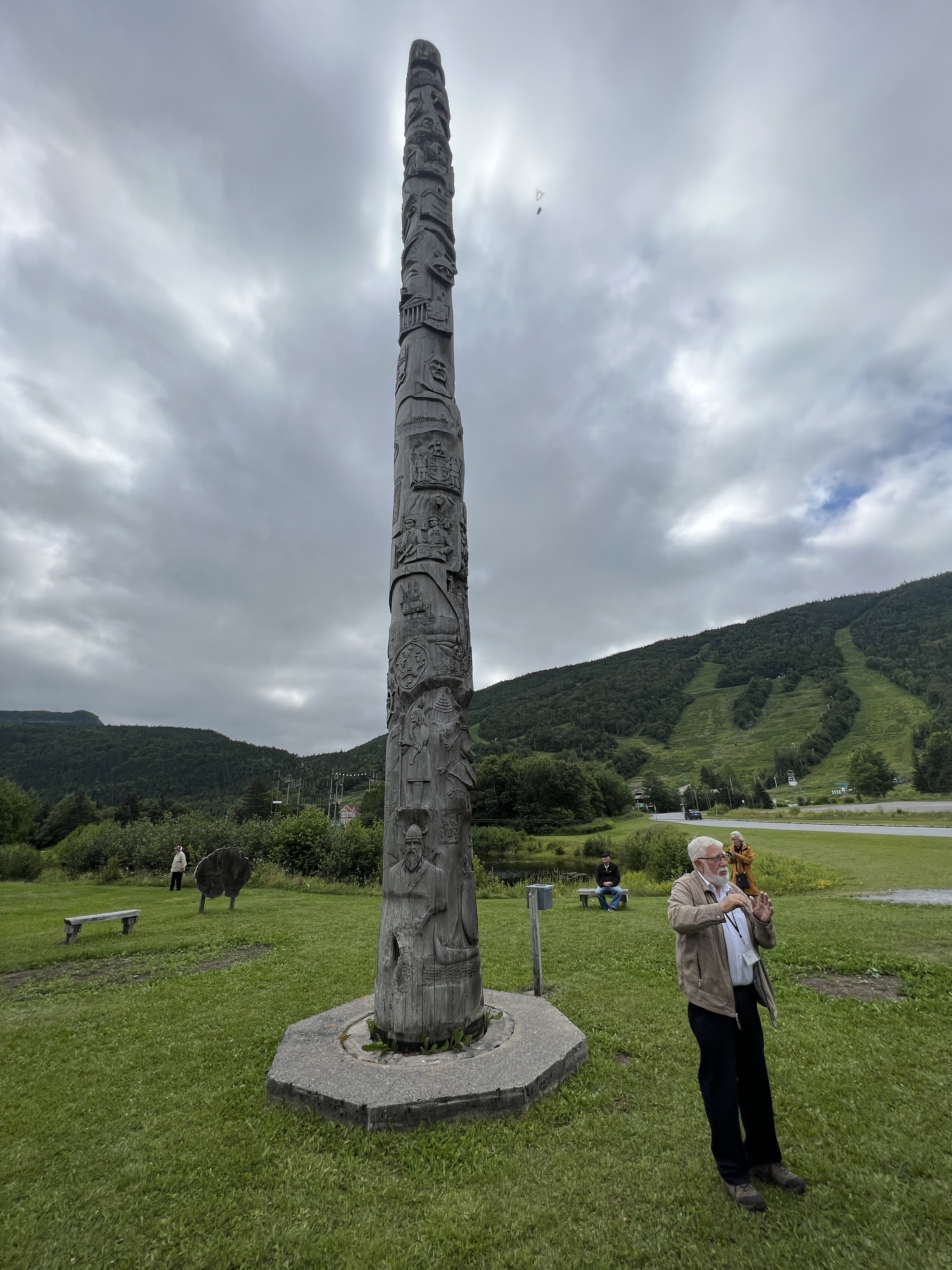
We are then back to town passing by the Heritage Pole, ski fields and the Man in the Mountain (he is watching out for raiders of pirate gold supposed to be buried on the island in the river below). Slobro struggles to see the image!

In town we have a wander around the streets and enjoy lunch at a micro brewery. Allthego was starting to look a little scrappy hair wise so dropped into a local barber for a 3 blade trim up.
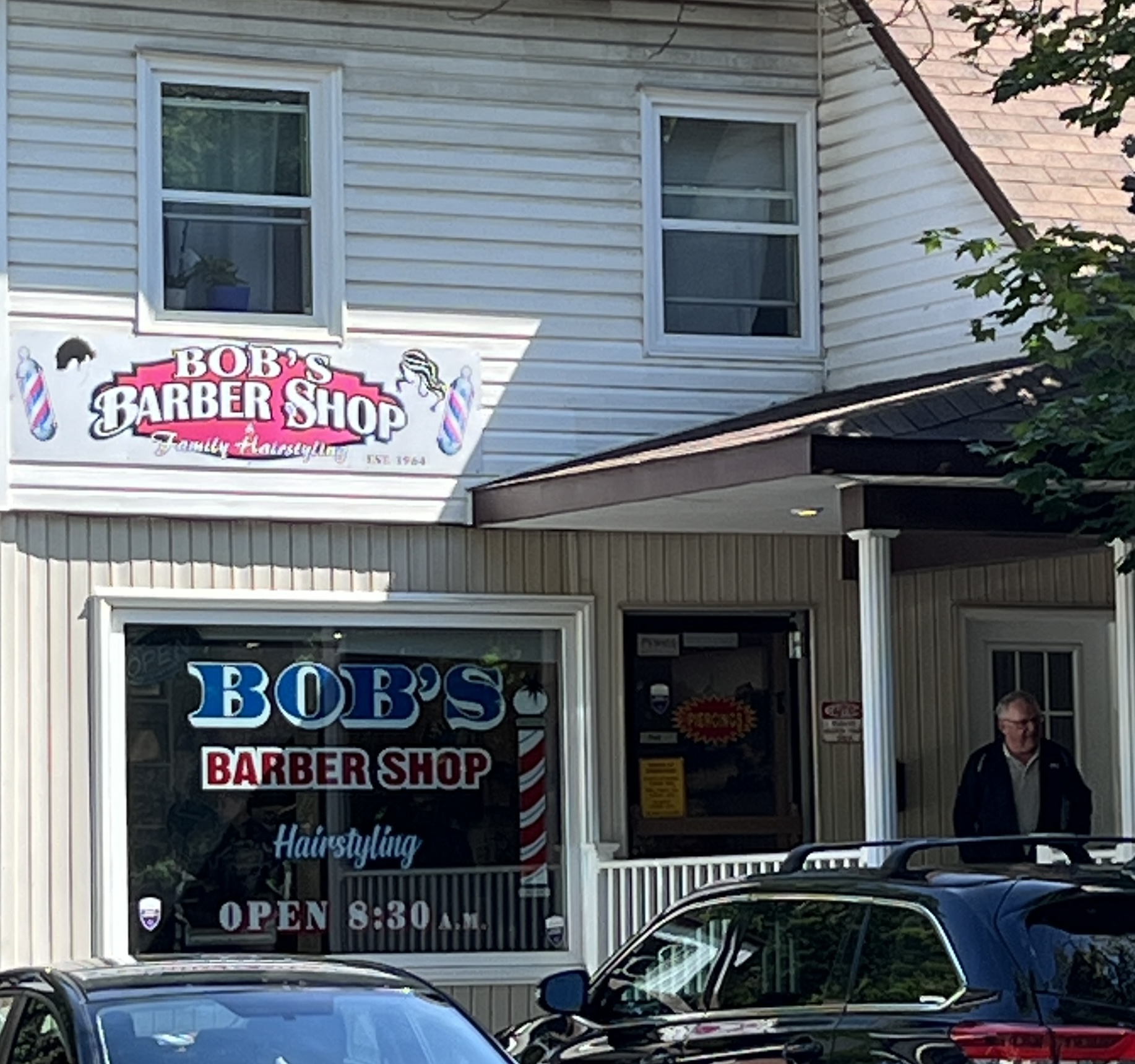
This was looking scary as the barber, a young lady of modest size, with bright orange hair and wall to wall tats did the job. Allthego checked the top of his head for any engravings, none. So all ok, and should make it back to Brisbane before needing another trim.
Next is a day at sea before reaching Quebec.
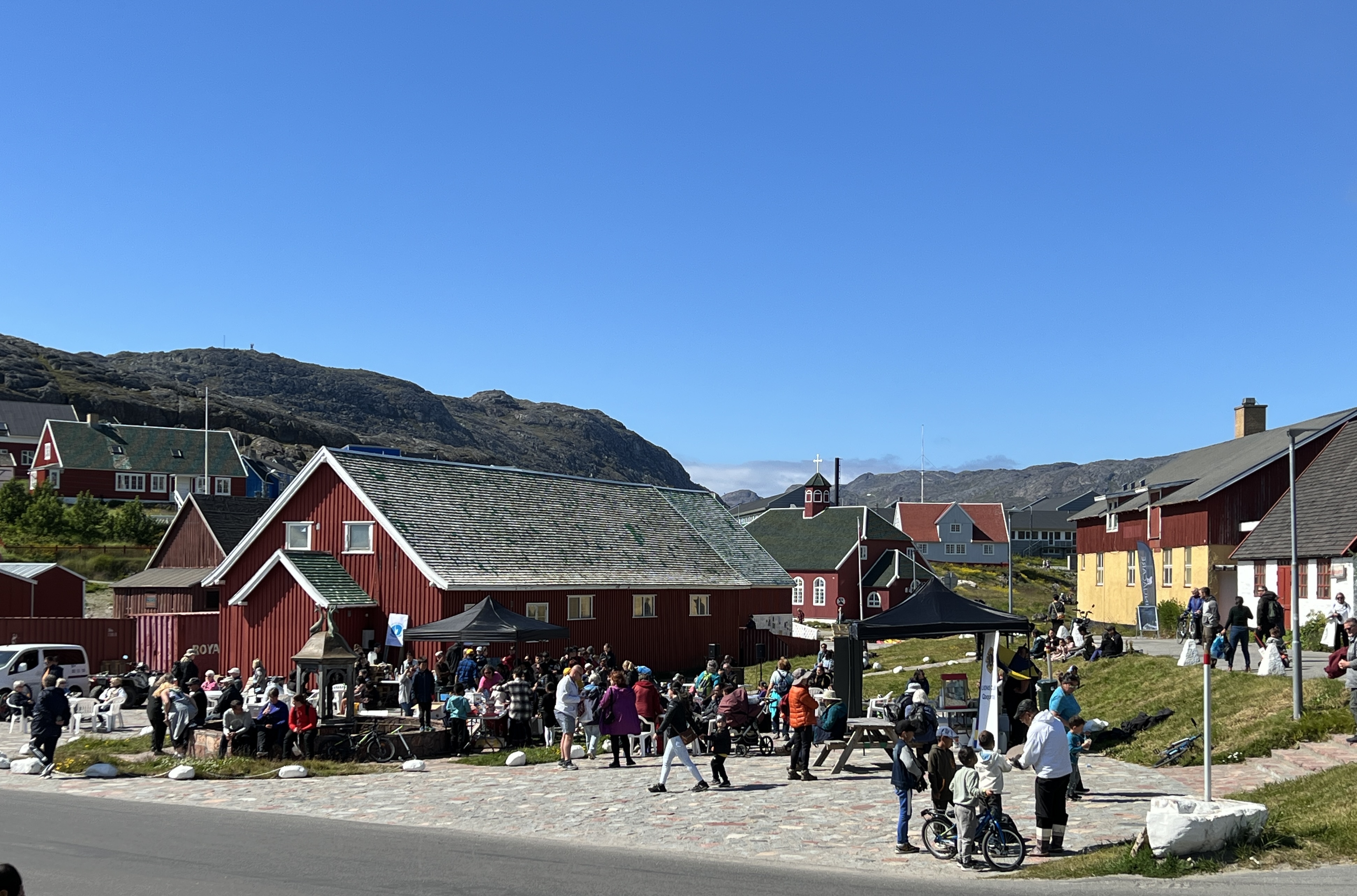
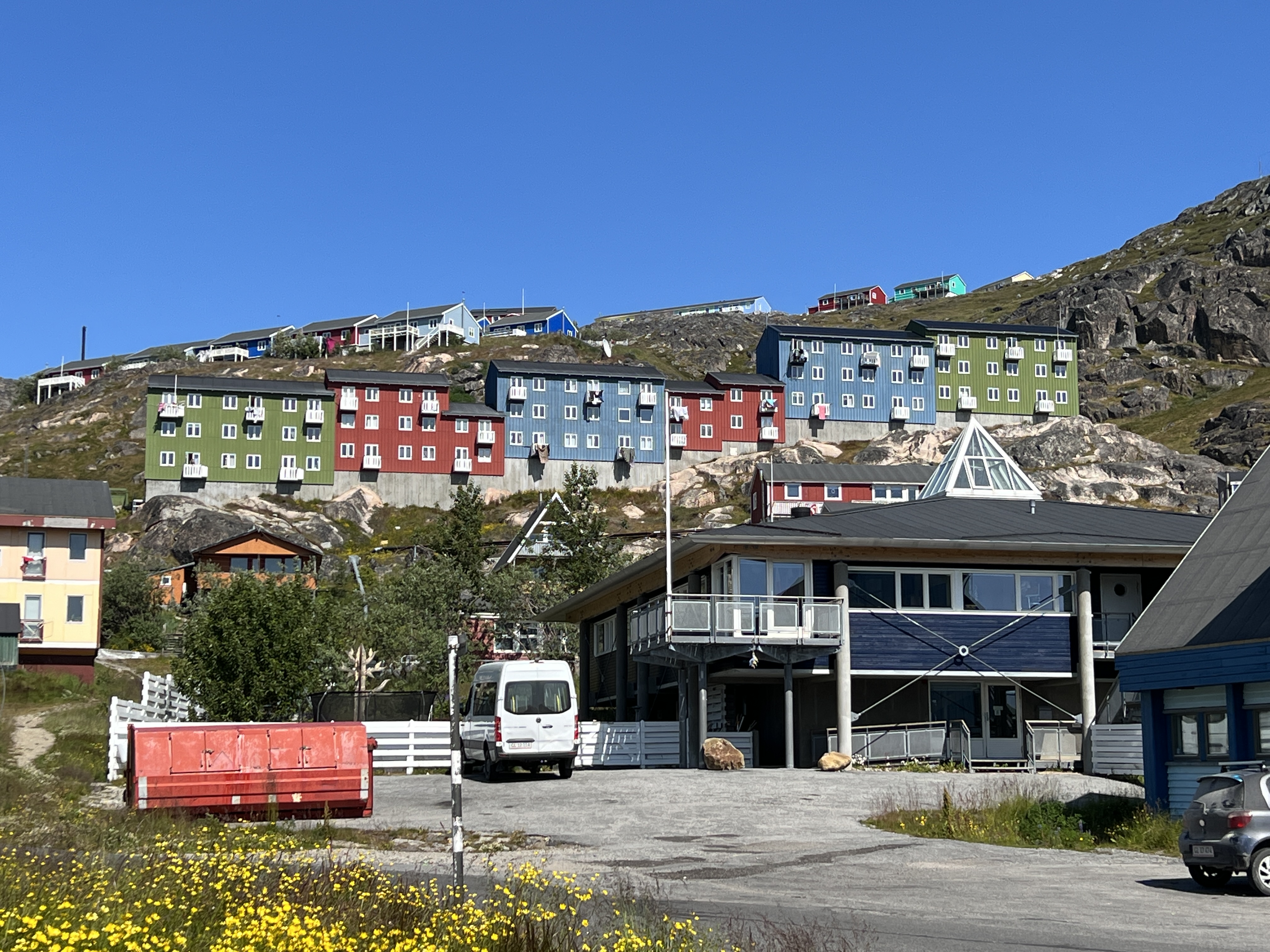
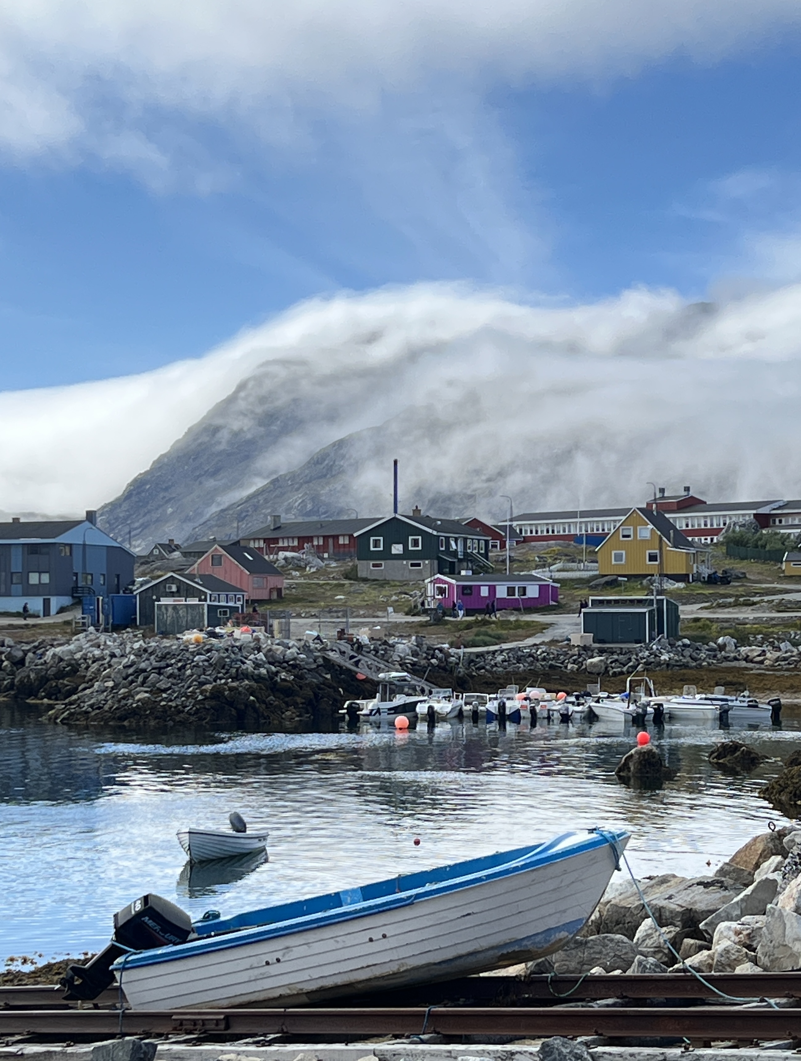
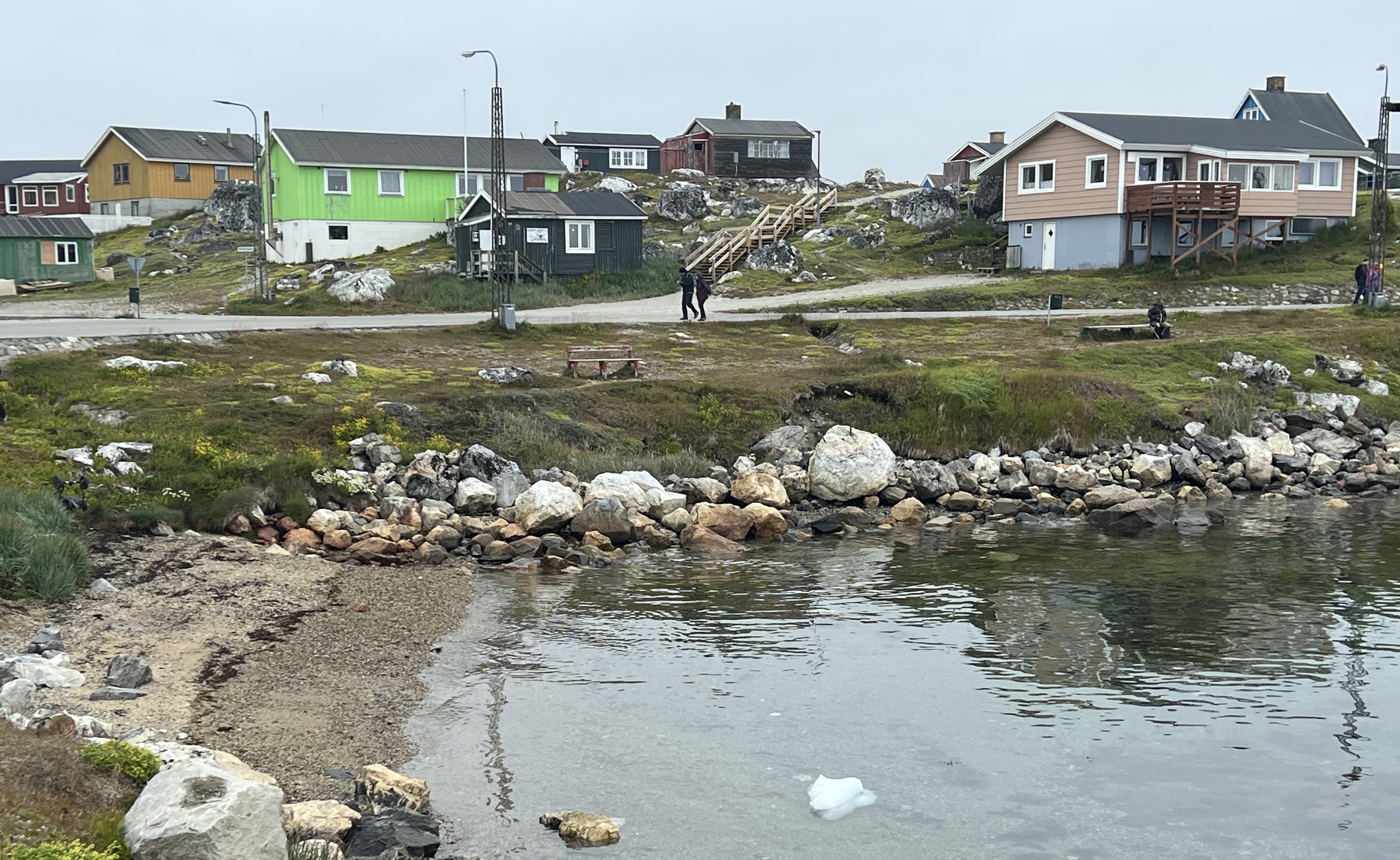
Qaqortoq
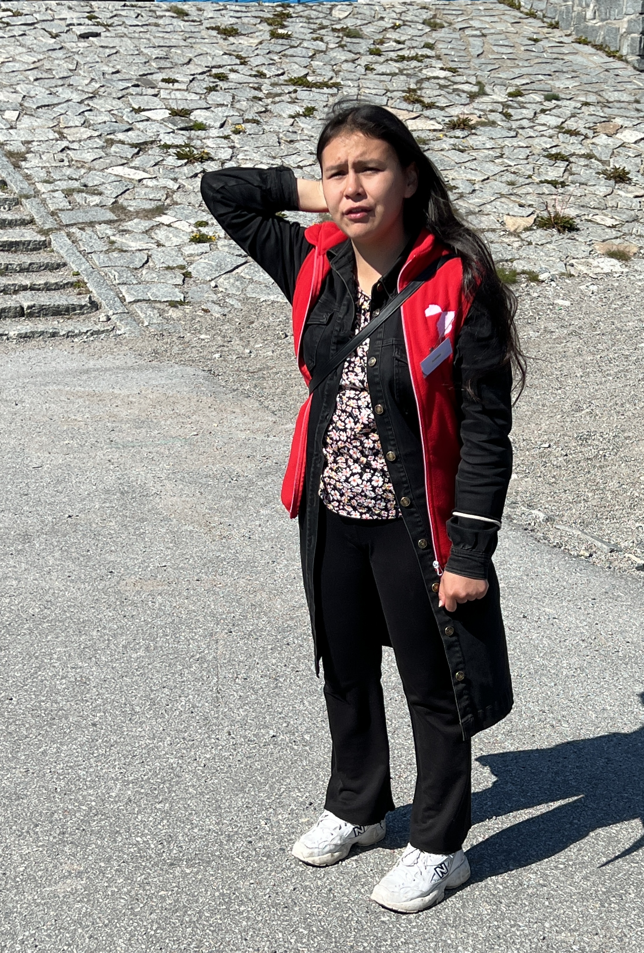
‘Cack-gore-dork’ is the way you say the name of our last stop on the southern tip of Greenland. It was a relatively short stop as we were a bit sluggish in getting up and ashore in the water shuttle.
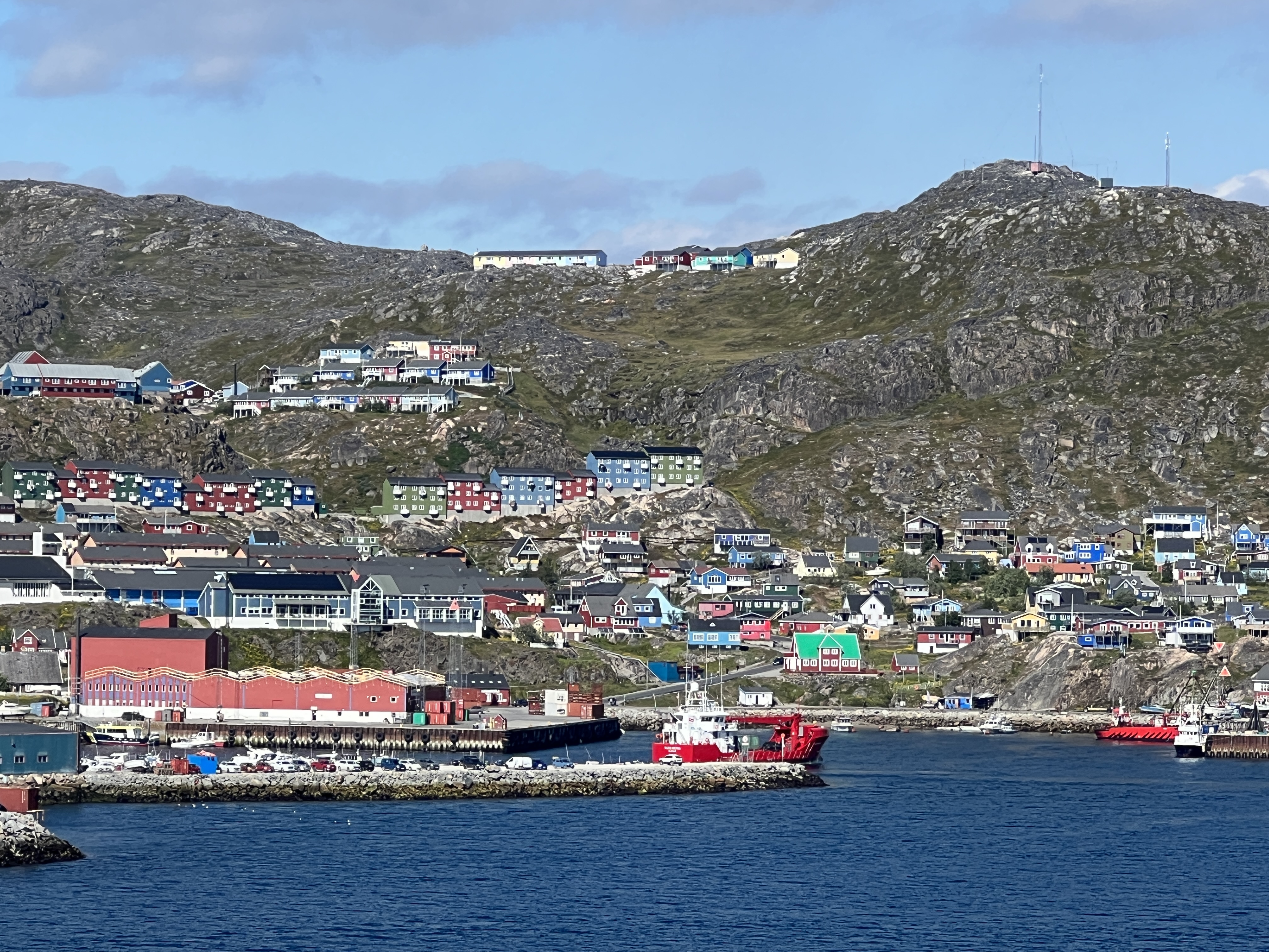
We had a guided town walk organised for 11.30am and had half an hour before for a quick look around the souvenir shop. Really liked the little fluffy stuffed seals made from genuine seal skin and hair, but at around $A50 we passed and found a less genuine fluffy stuffed polar bear for the cabinet instead.
Our guide for the day was an interesting local young lady who lead us around the town, there was a moderate amount of up and down hills road walking for an hour and half. We had a few pauses along the way to hear about life in this part of the world, a chat about society rather than landmarks.
As we learnt she was nearly 18 and eagerly awaiting getting her driver’s license. I am not quite sure why as there are no roads out of Qaqortoq. Most families have small motor boats to get to other places along the coastline. Or, use the helicopter which we saw coming and going several times.
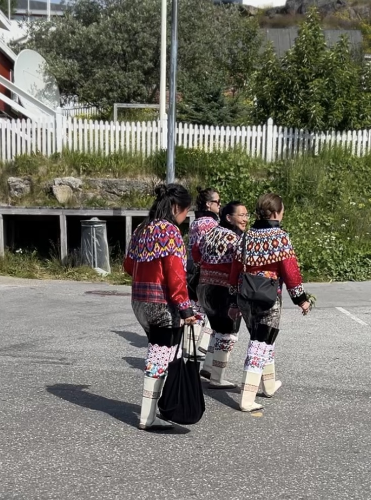
Qaqortoq is Greenland’s fourth largest town, about 3,000 people. Greenland is part of the Kingdom of Denmark, although mostly self governing, with a population of only 65,000.
We hear about the role of the small town square as a social gathering area, the education system, the health system, water reticulation and sewerage. She tells us that by the time kids finish primary school at age 16 they will normally be speaking three languages. Greenlandic being the Inuit native tongue in the home, Danish in school (most of their teachers come over from Denmark) and they learn English in class. She can speak French as well, having spent two years in France on some sort of ‘gap’ period after primary school before high school, which is three years. She doesn’t seem to have completed that yet, not compulsory.
She does like seal and whale meat. Smoked whale meat is served with onions and potatoes. A soup of boiled seal meat, rice and onions is the National dish. A bit foreign to us I suppose but they traditionally live from the fruits of the sea, there are not many ‘fruits’ on the land here, except for farmed sheep and reindeer.
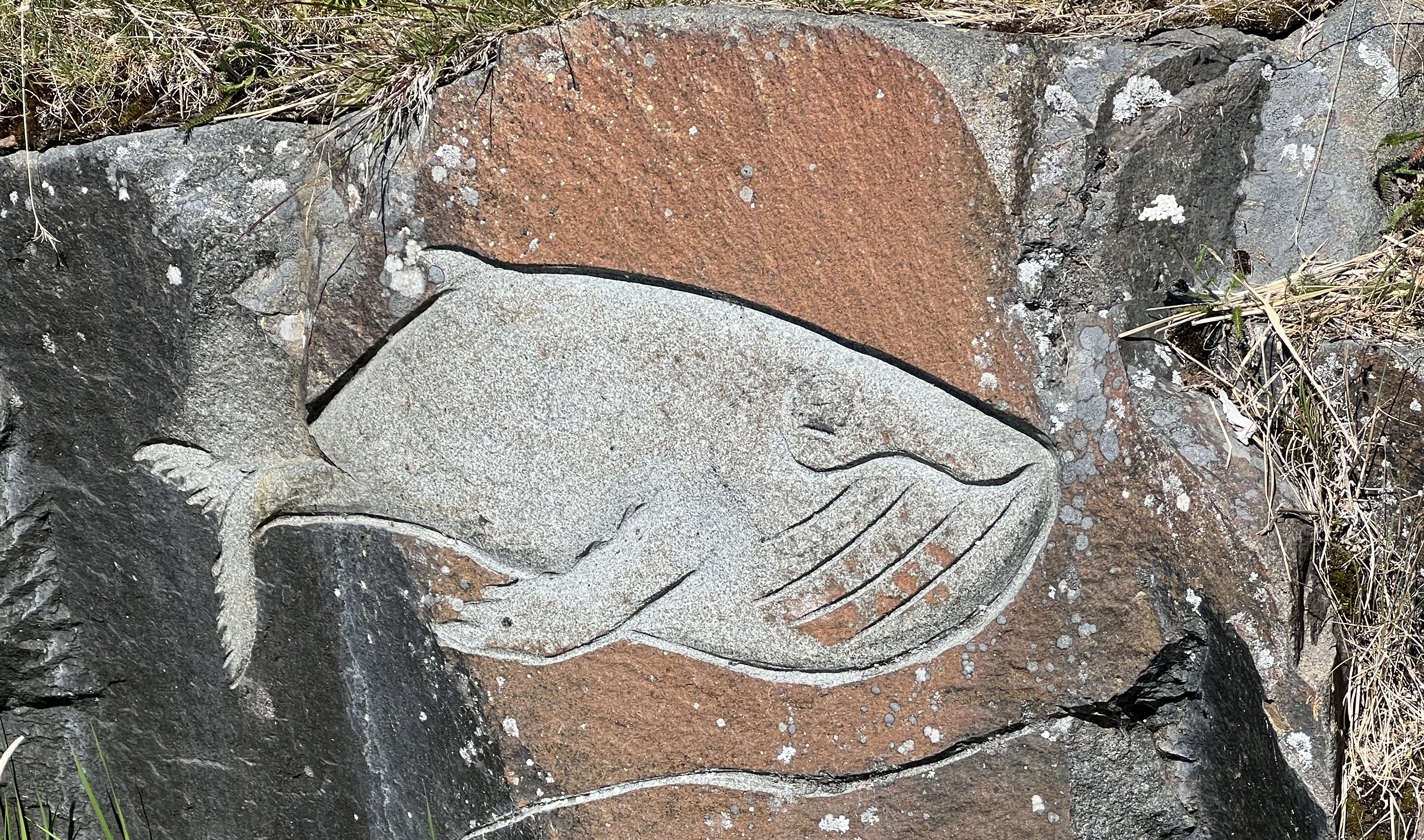
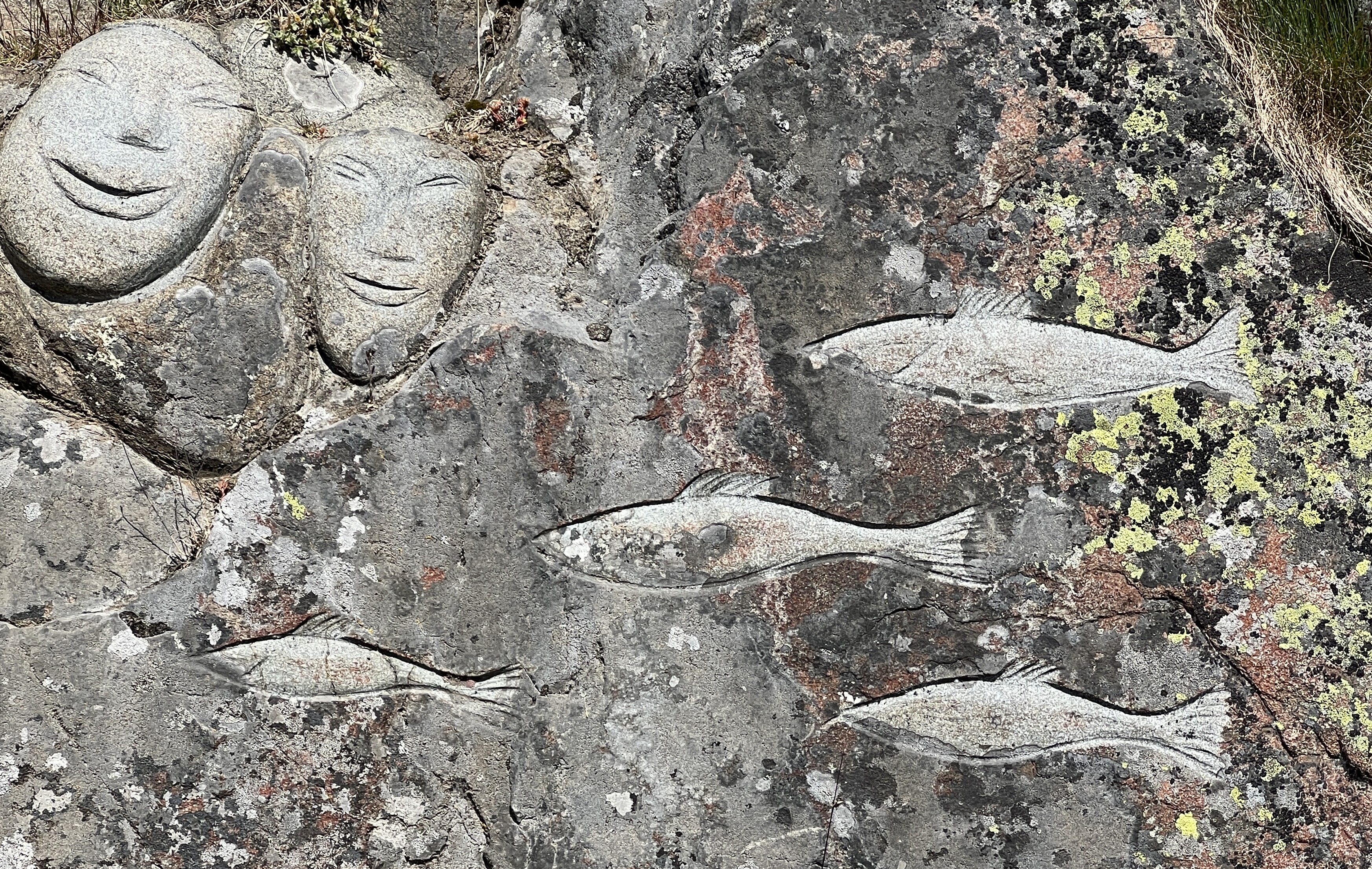
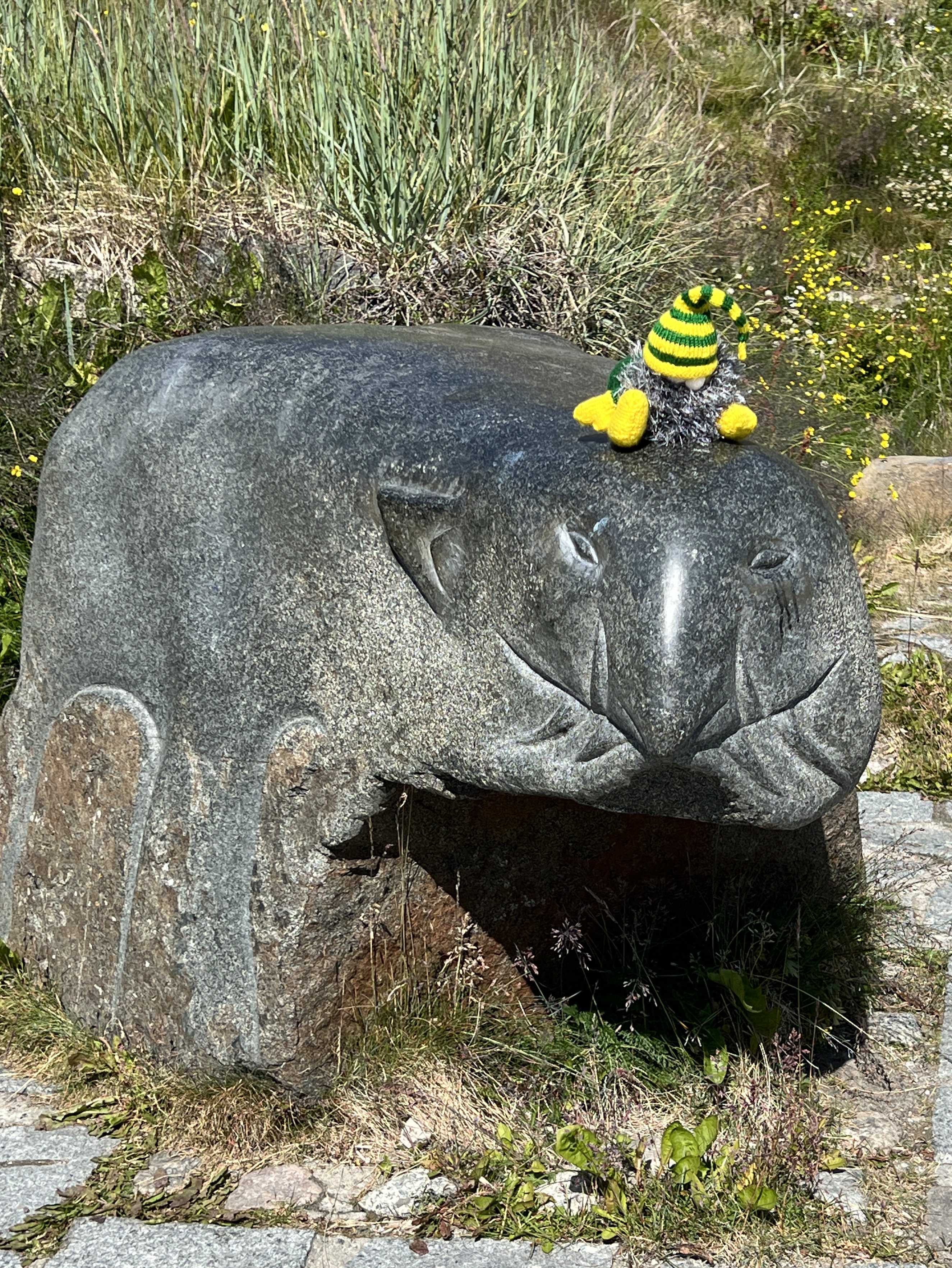
The last stop on the walk is at the town’s ‘murals’, carvings in the rocks around town. The ones we see celebrate whales, seals and fish. Slobro is excited in trying to wrangle a stone polar bear with a head lock, unsuccessful.

After the tour we poked our noses into the souvenir shop and picked up some nick nacks, including a pack of Greenlandic salt laced with some local herbs. Looks ok! It was then back to the ship on the water shuttle for some R & R before the sail away.
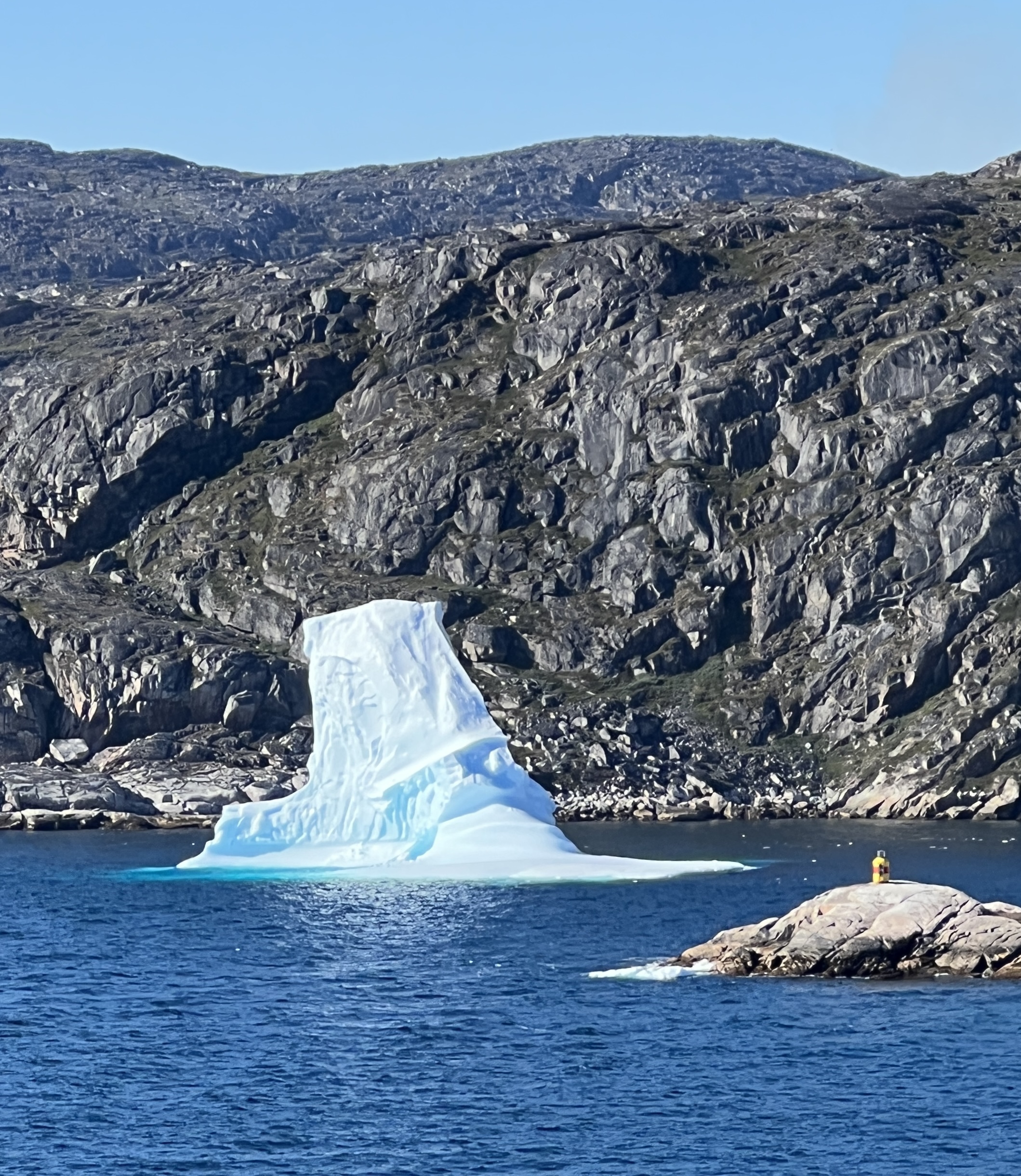
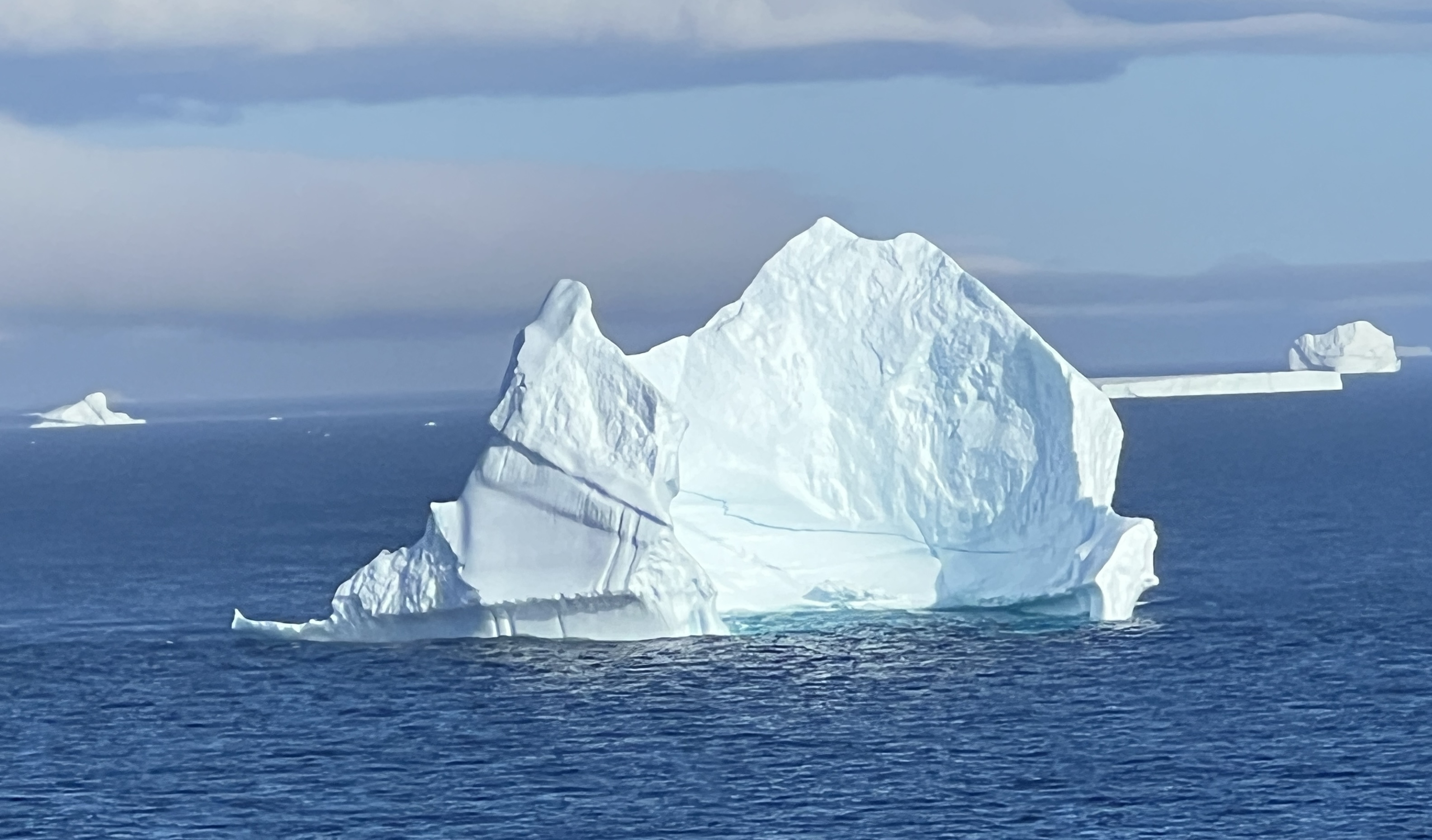
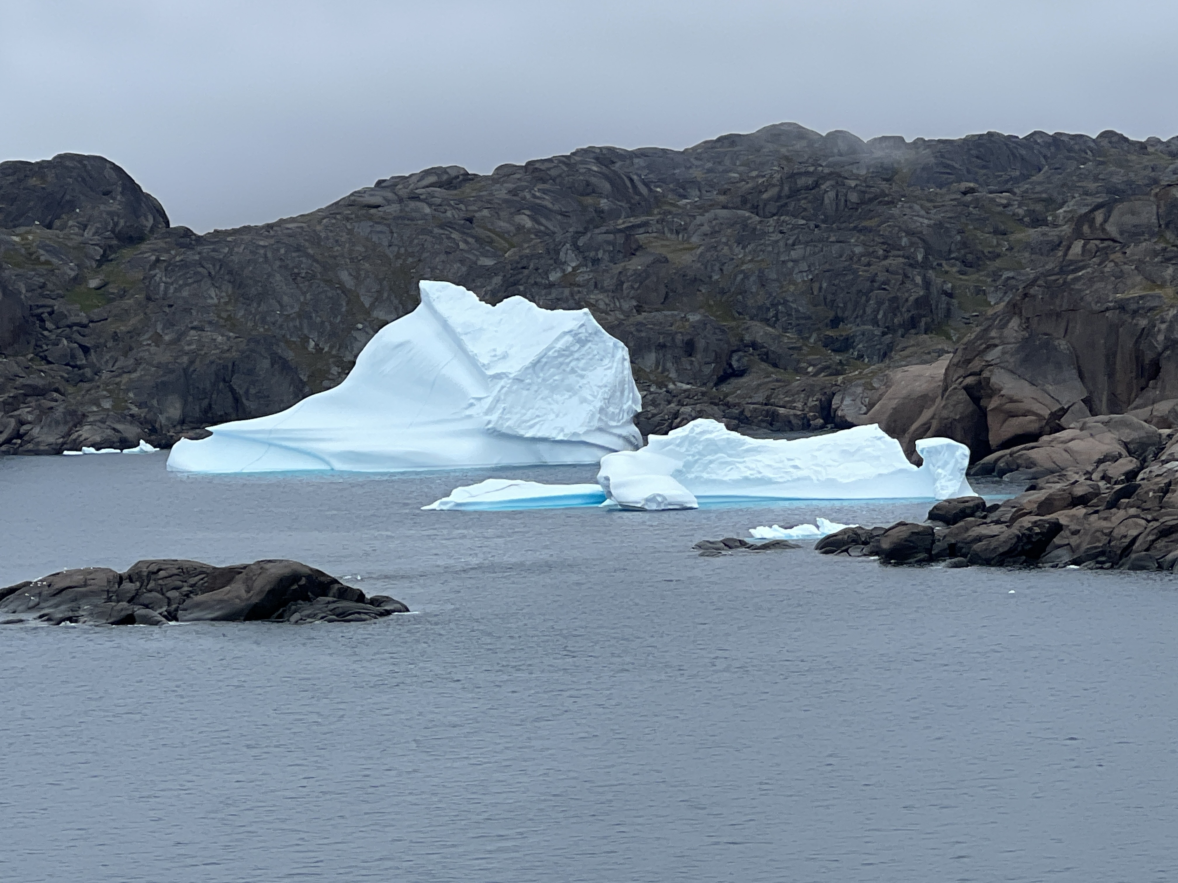
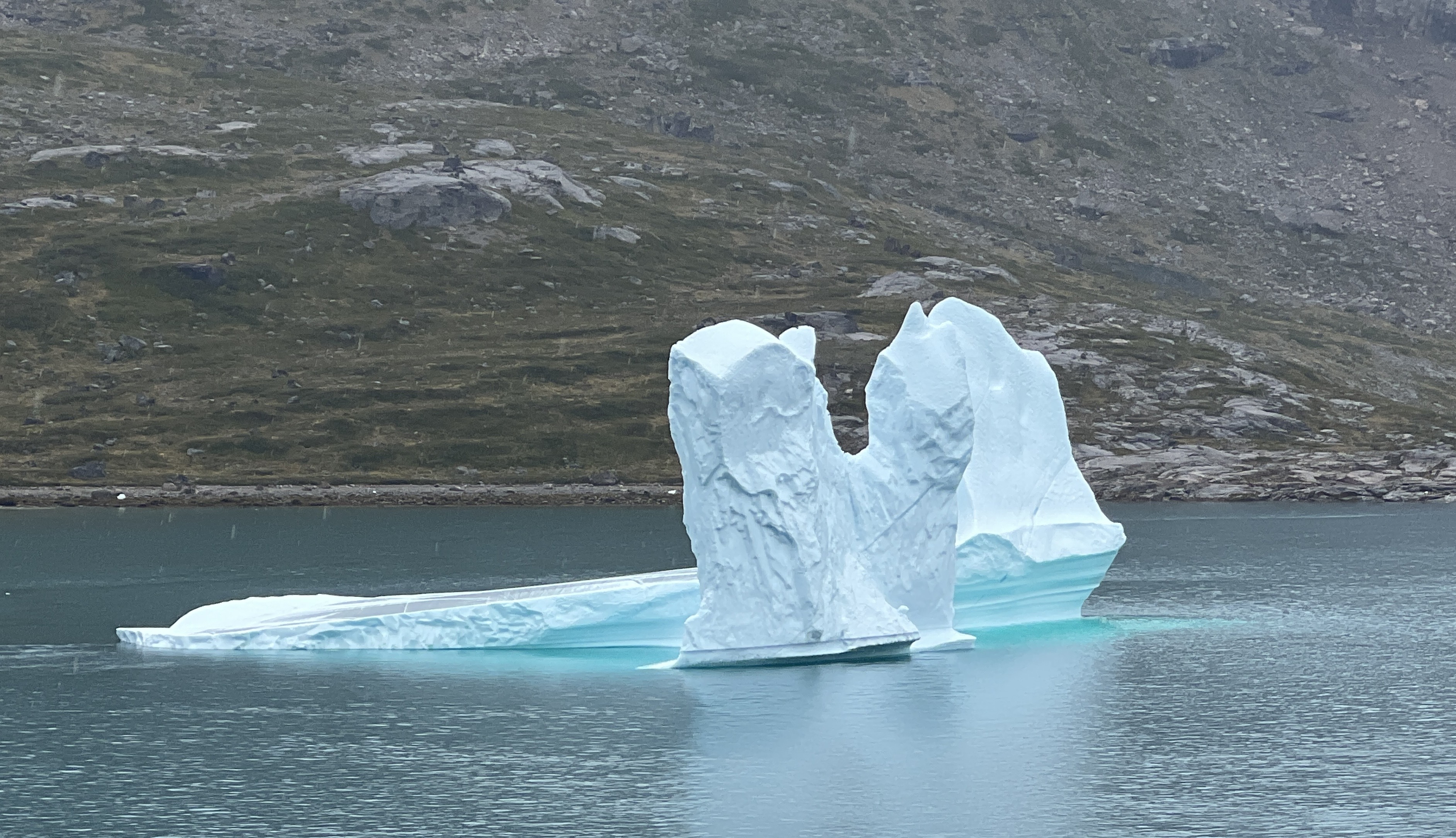
We left the harbour headed for Canada, Newfoundland is the first stop. It was to be our last sighting of icebergs . Sun blazing over a deep blue sea. Things would be warming up soon!
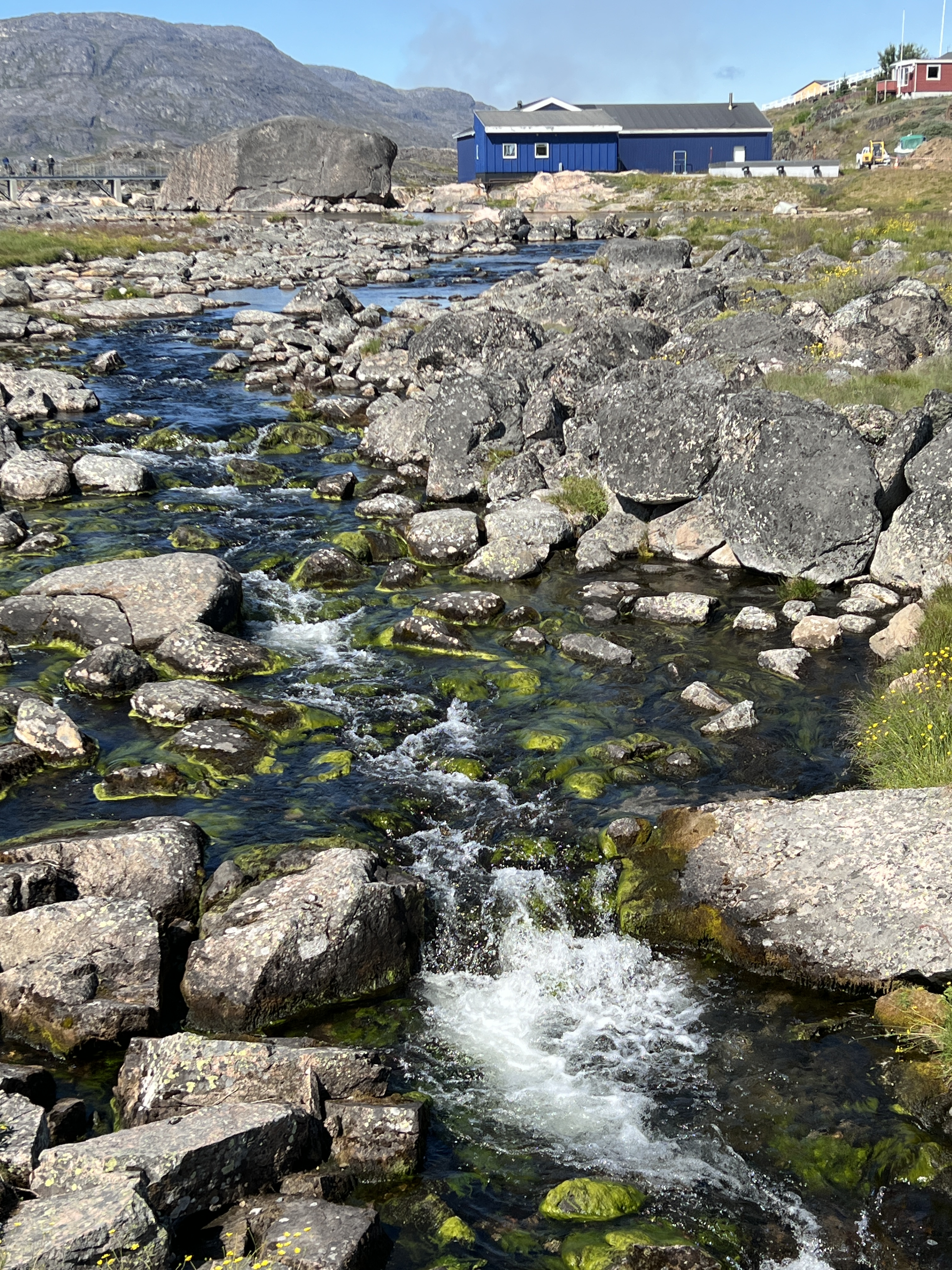
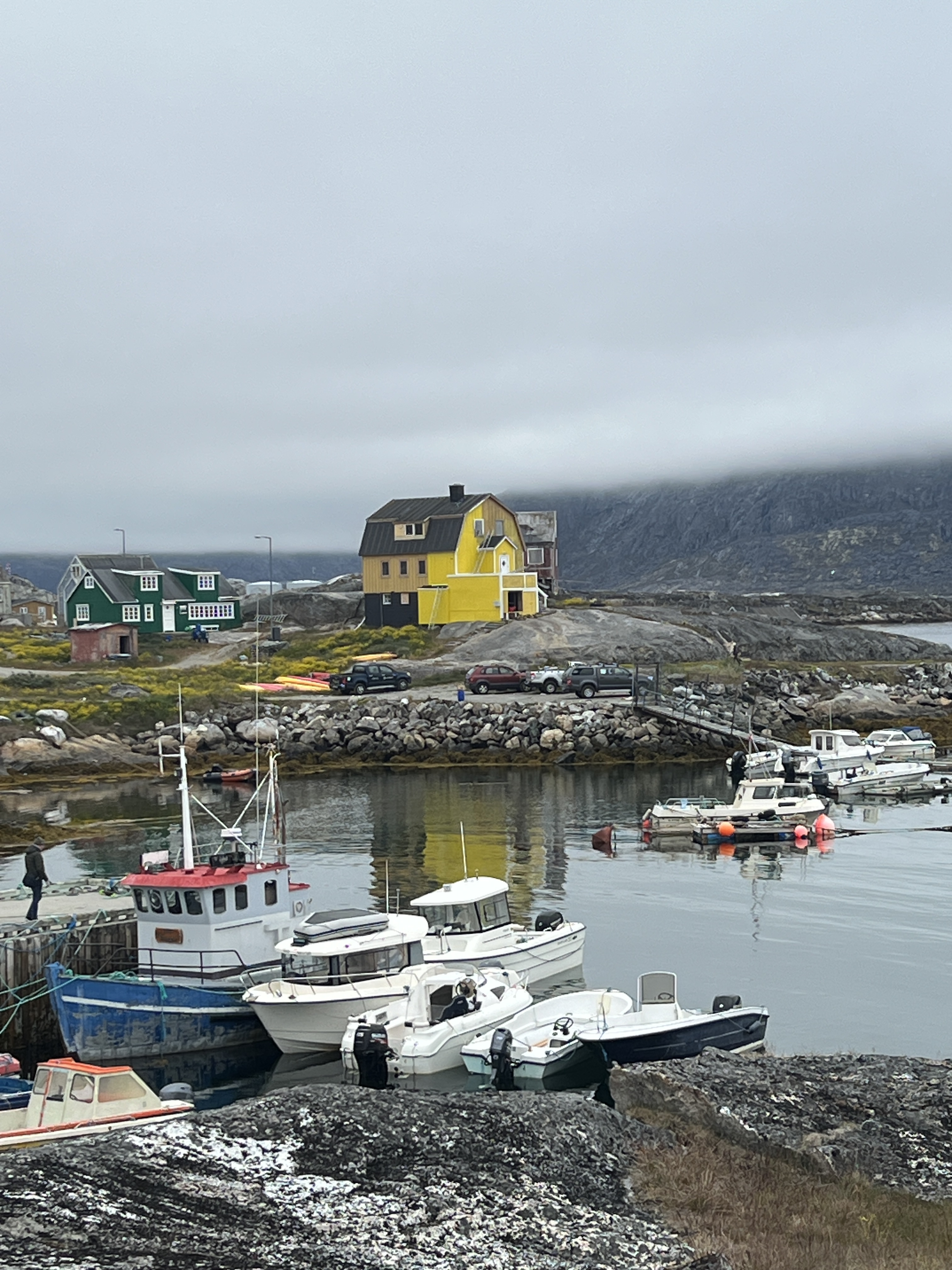
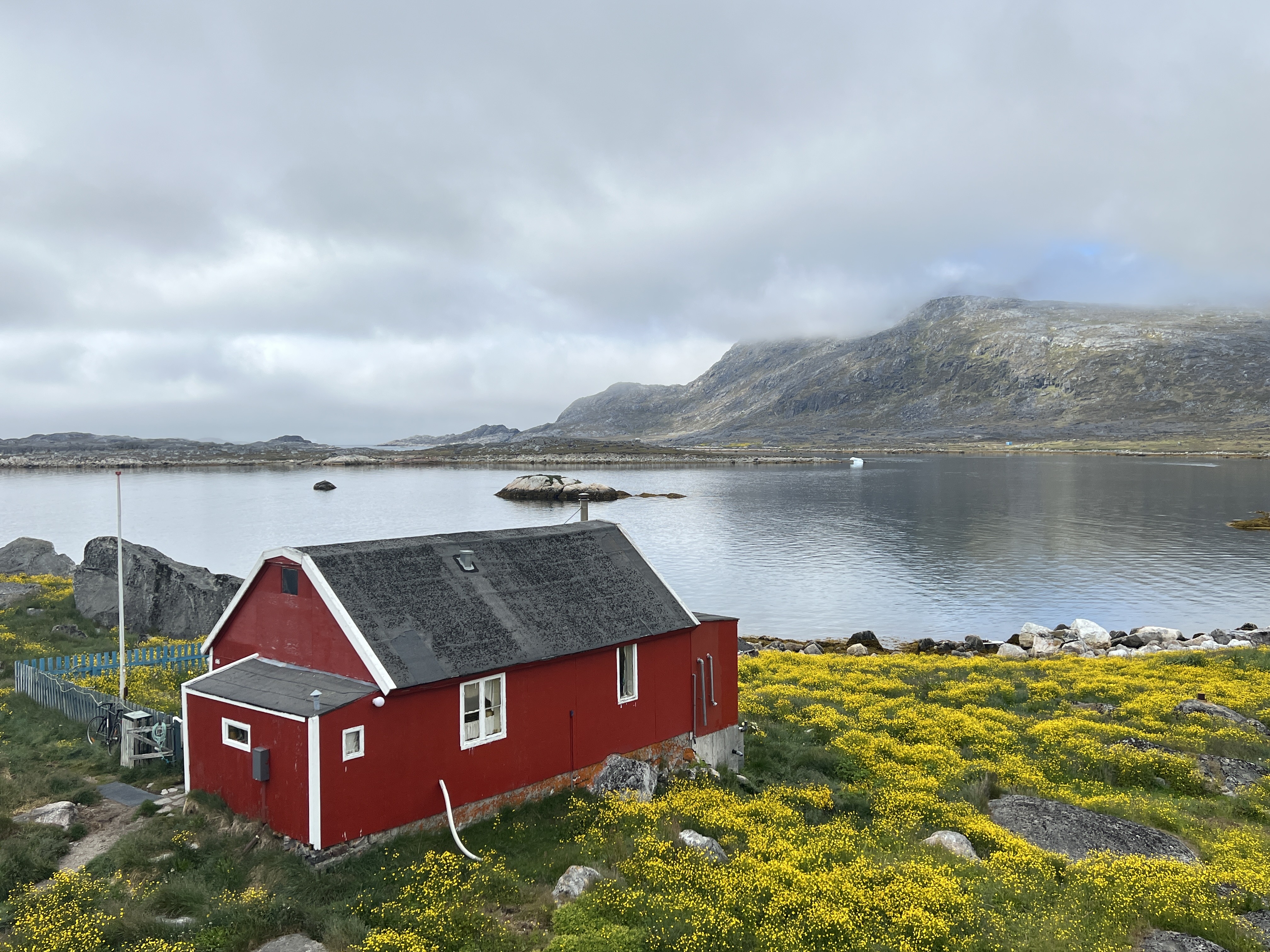
Nanortalik
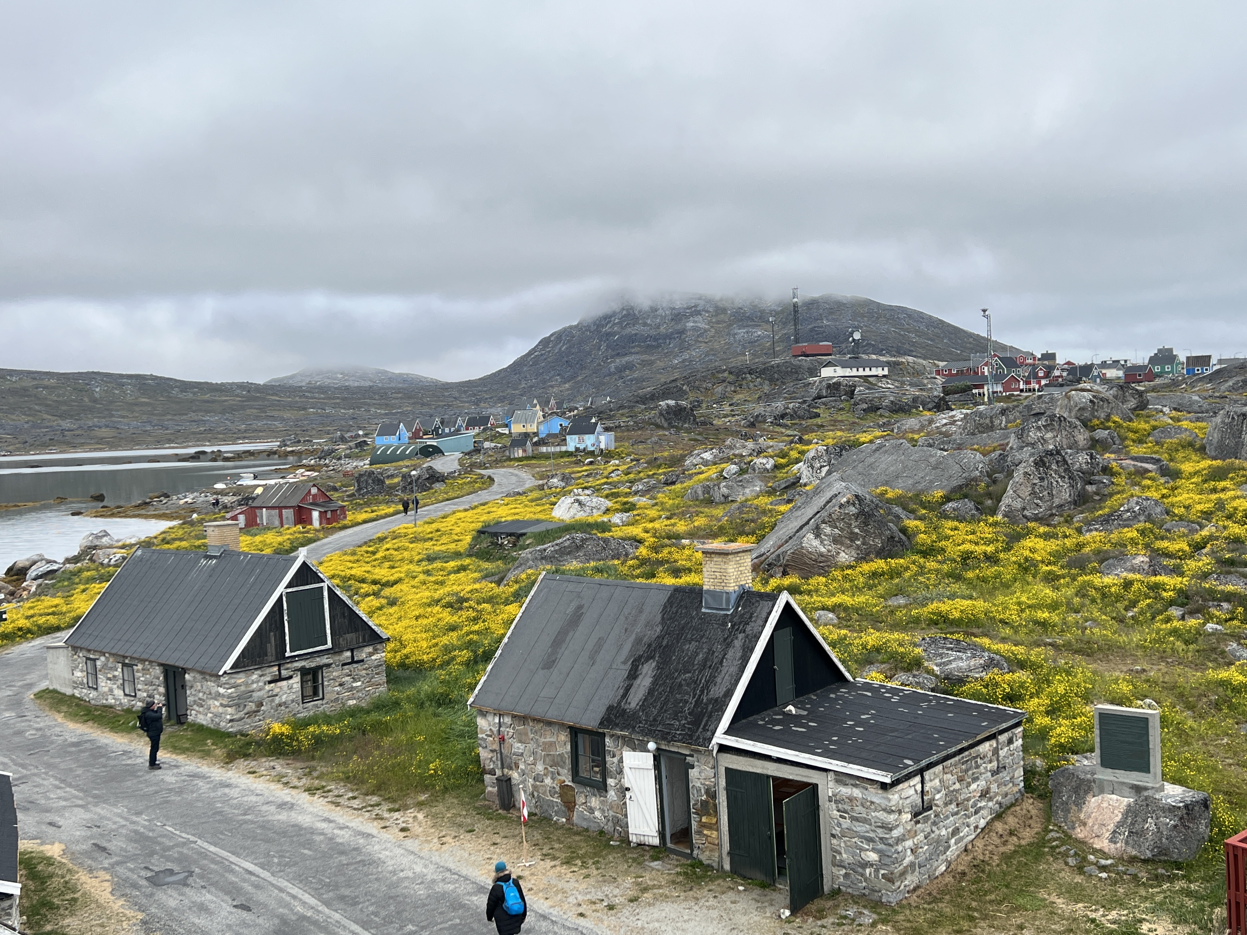
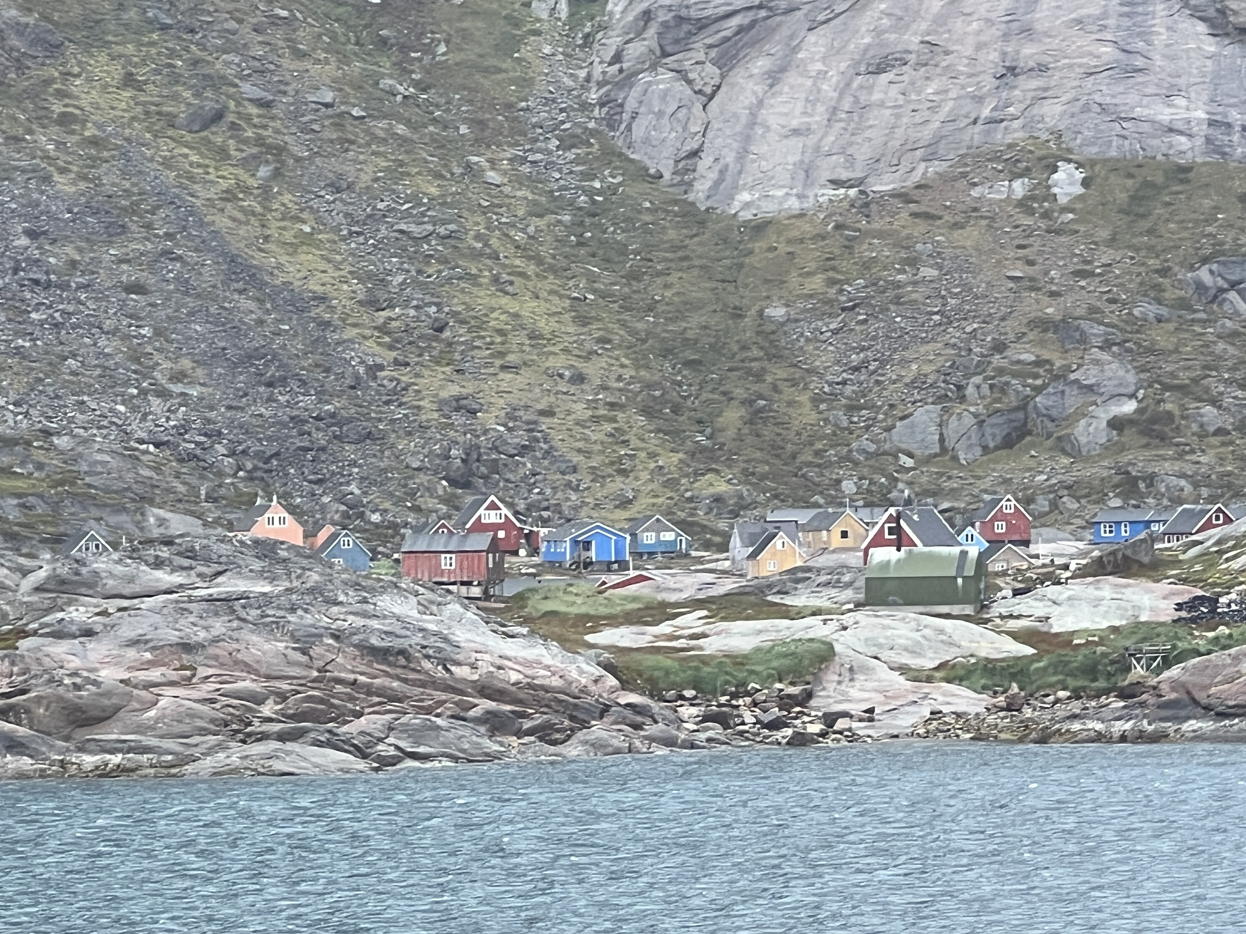
We had a full day in Nanortalik, Greenland’s most southerly town, and went ashore on a water shuttle. No guided tour, just a wander around by ourselves. More substantial bergie bits were floating around offshore the town.
The town is spread out a bit from the small wharf where the shuttles dock. Not a lot of tourist infrastructure around, apart from an open air museum. The buildings appear to be old houses that have been repurposed to house memorabilia. Although the building in which the seal processing techniques from the old days are explained, along with the traditional equipment, appears to be the spot where it all happened.
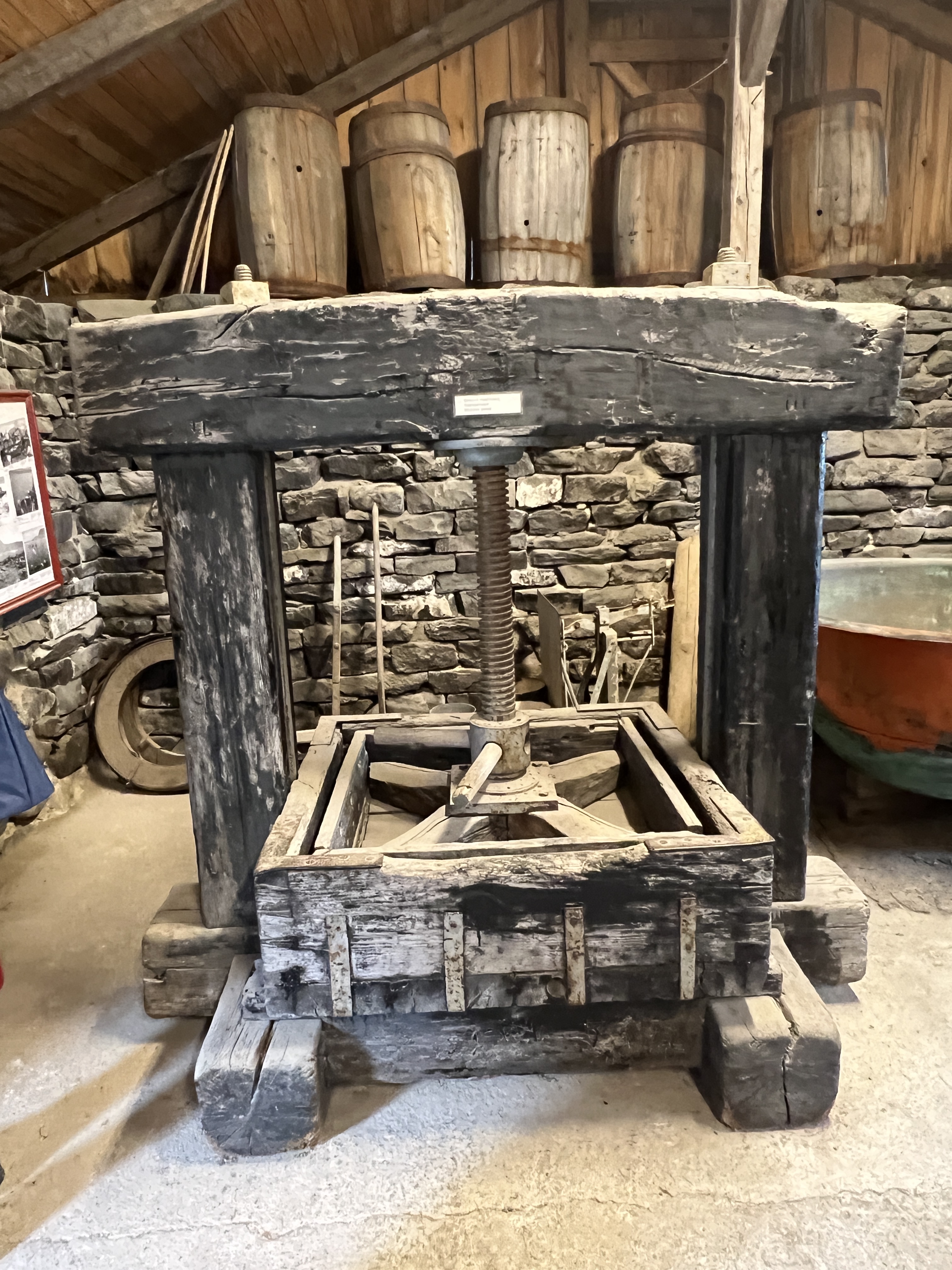
Problem is that most of the signage is in Danish, so a little hard to work out what it all is and does.
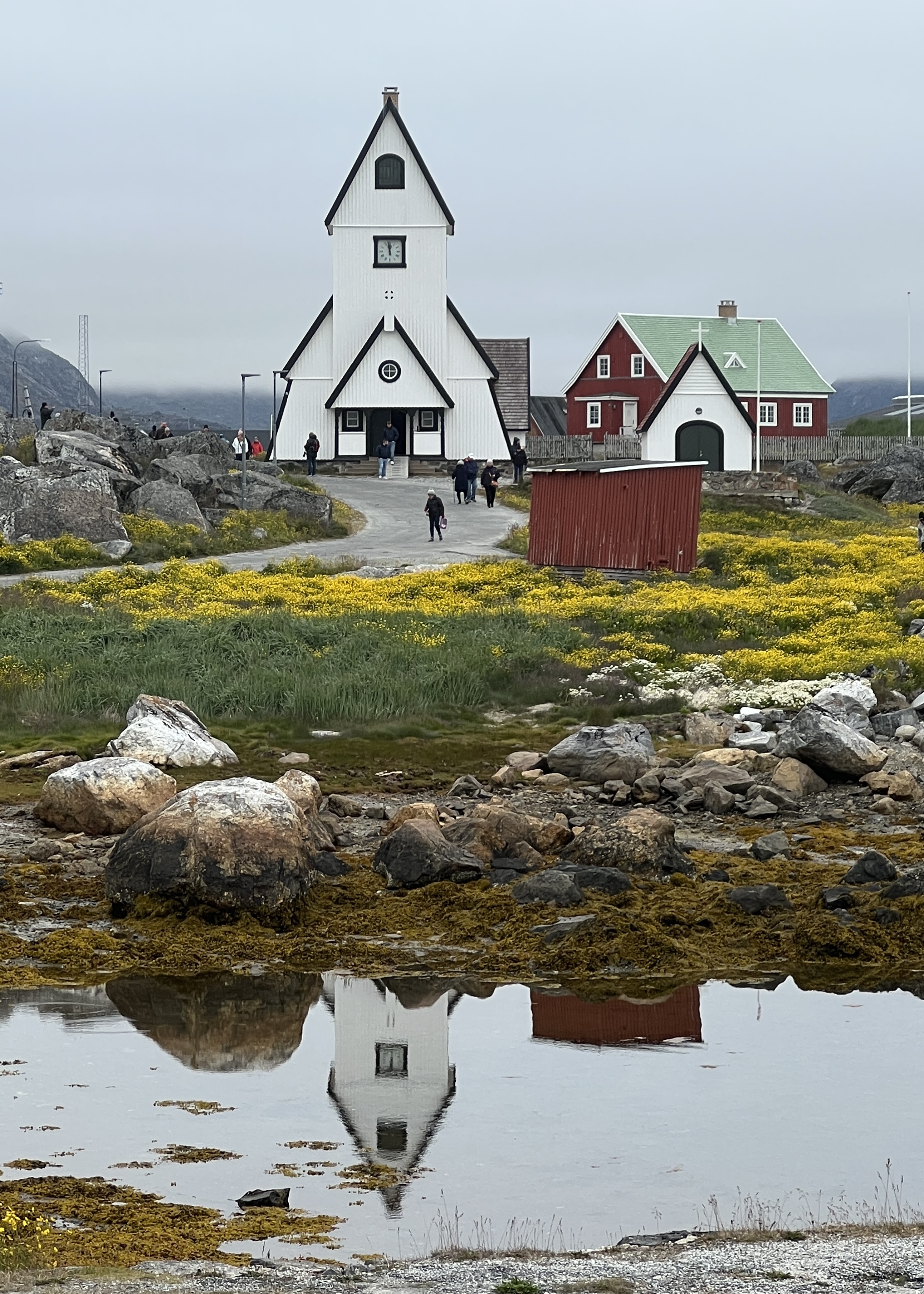
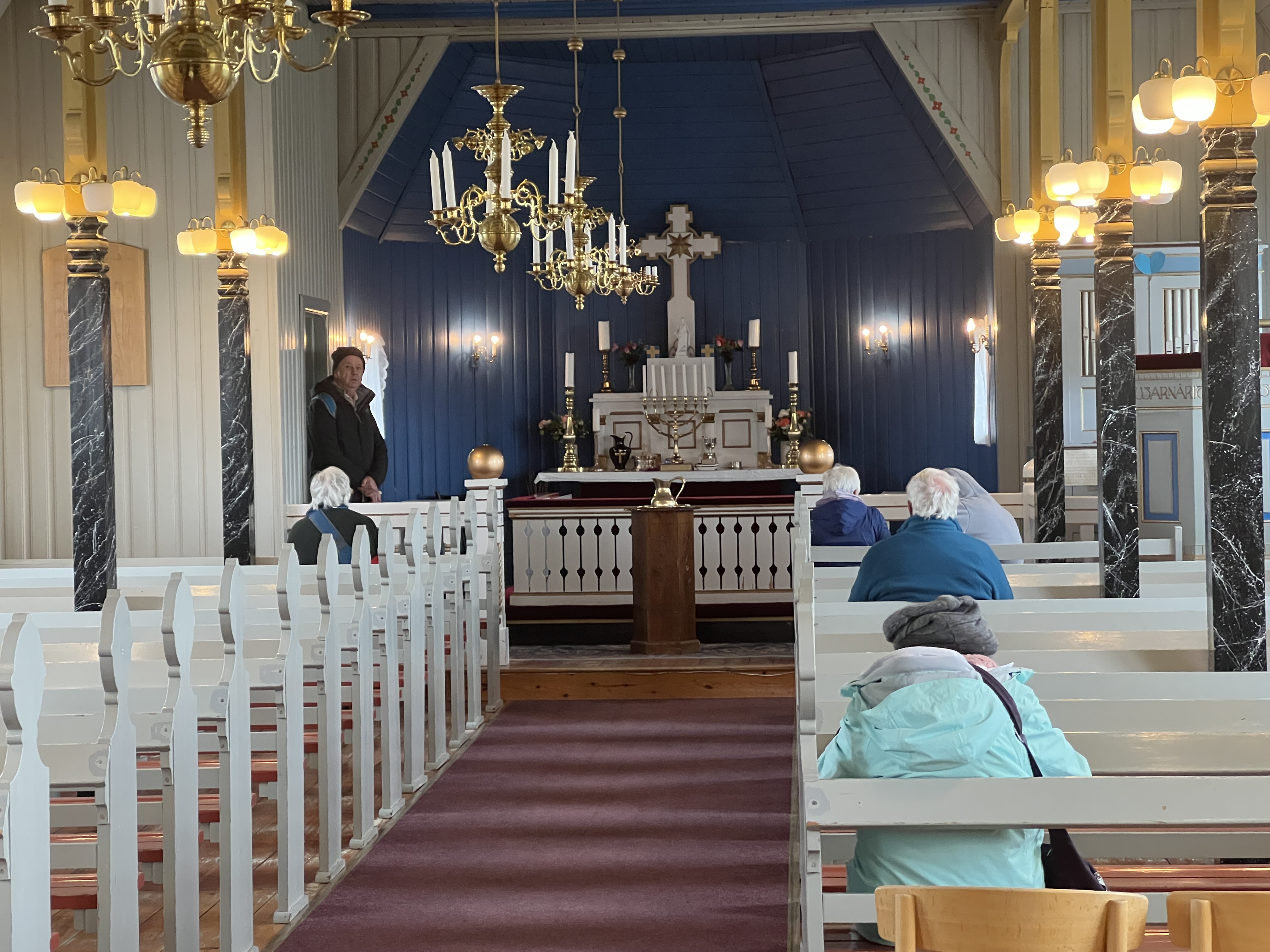
The old Lutheran church dominates the town’s streetscape. An impressive interior.
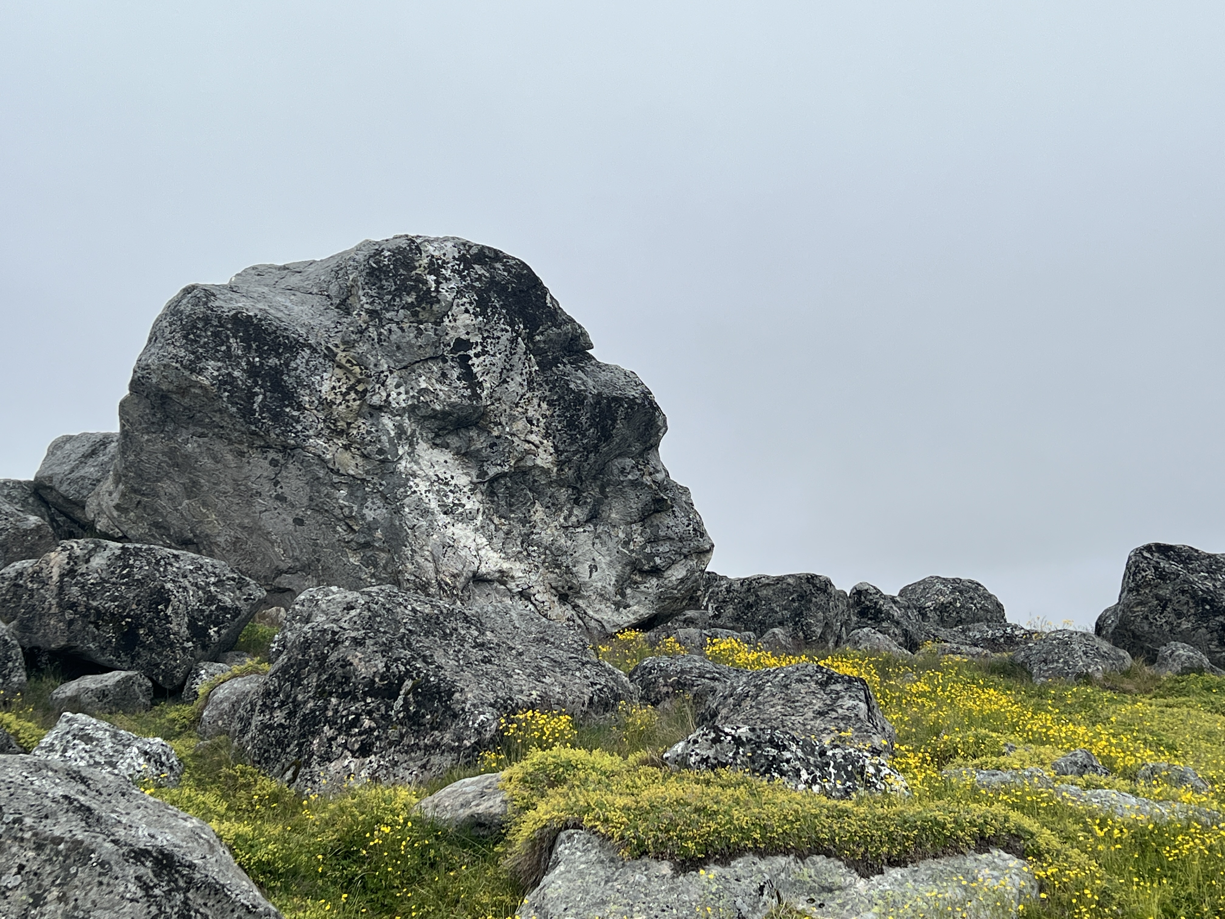
The houses are fairly basic but very colourful and make for interesting photos against the surrounding ground vegetation, rocks and skyline. Buttercups are out and blooming. The face in the rock looks skywards.
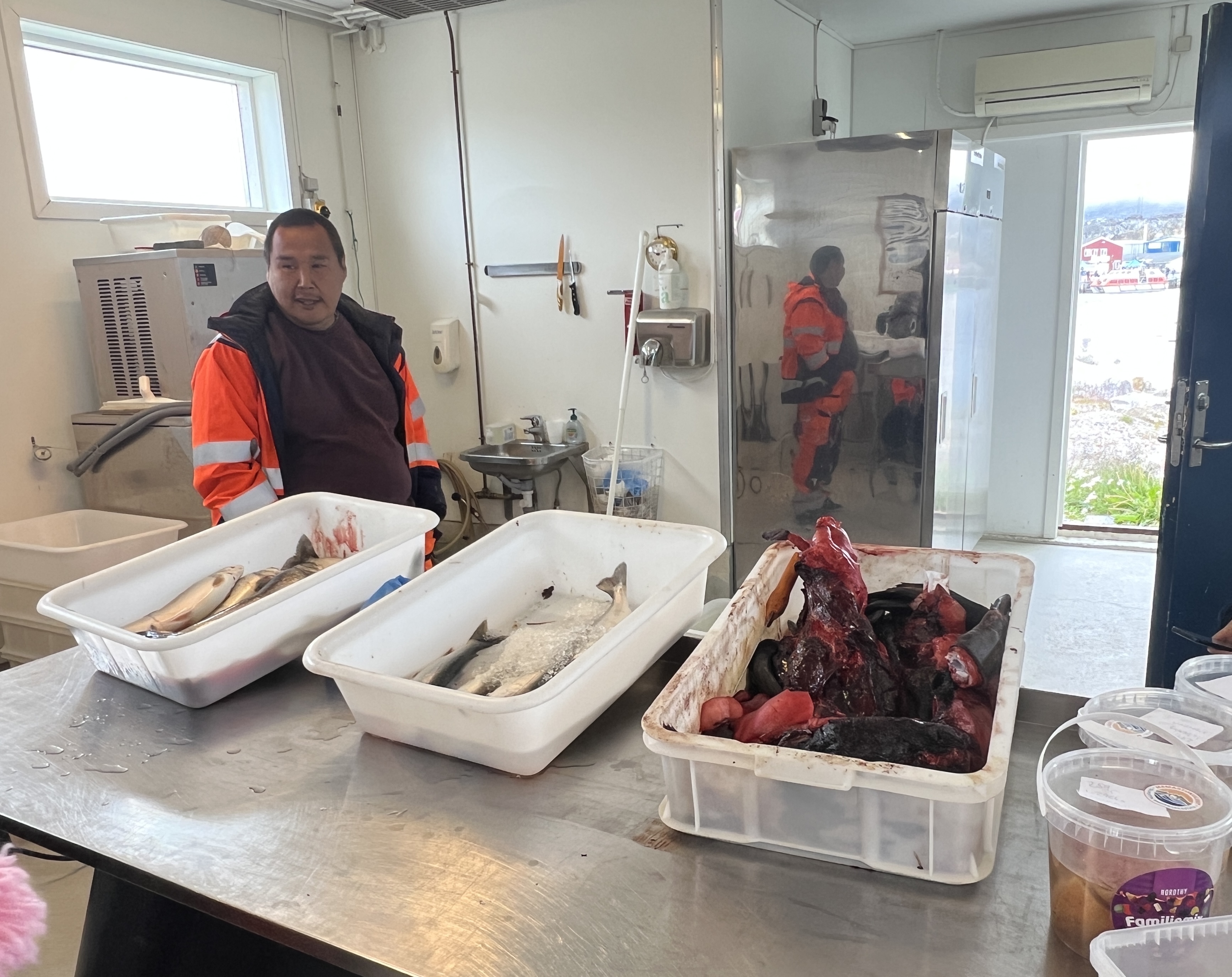
The fish market is also interesting for its offerings of fish and seal meat. The later is a bit off putting, sort of a twisted pile of seemingly bloodied raw stuff! Blubber I suppose. Homealone didn’t want to stay long here and the fish guy wanted $US1 to take a photo!
We headed off to check out the supermarket to see what the locals could get. Everything here is brought in by ship, no local production. Some interesting prices.
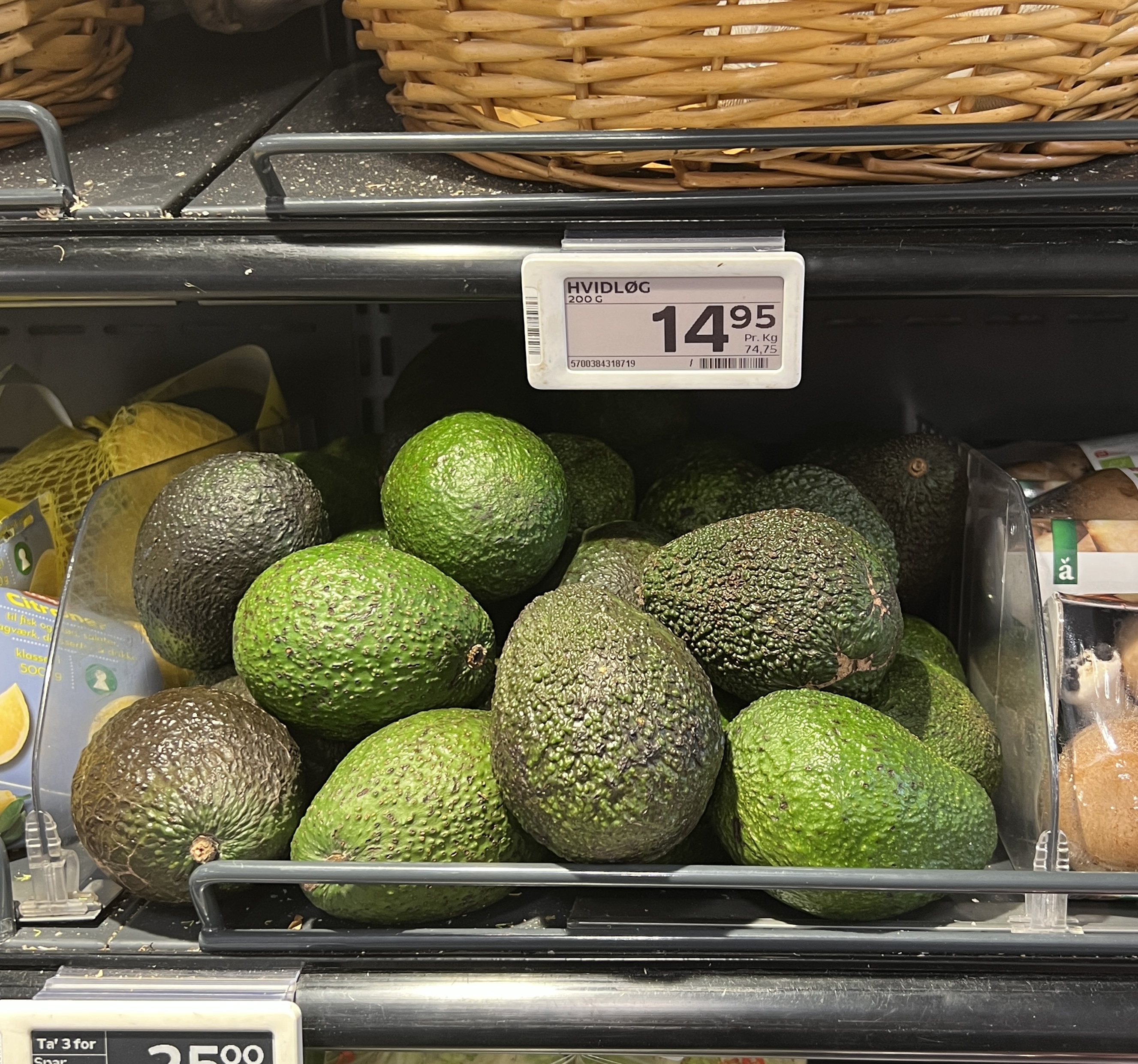
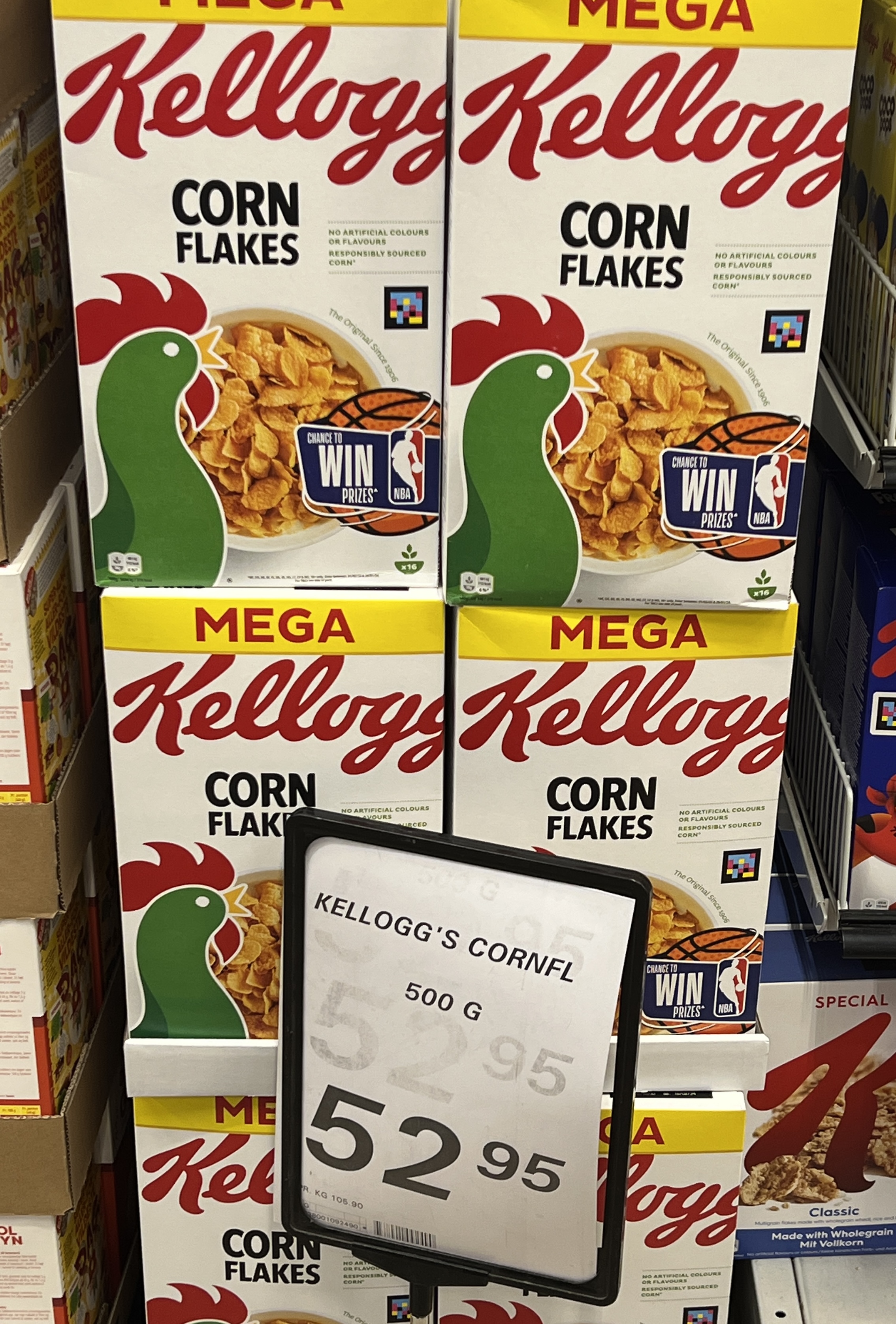
Small avocados $A3.50 and a 500g pack of cornflakes $A12.30. T shirts in the lone souvenir shop circa $A50. The local incomes on average don’t match that back in Aus!
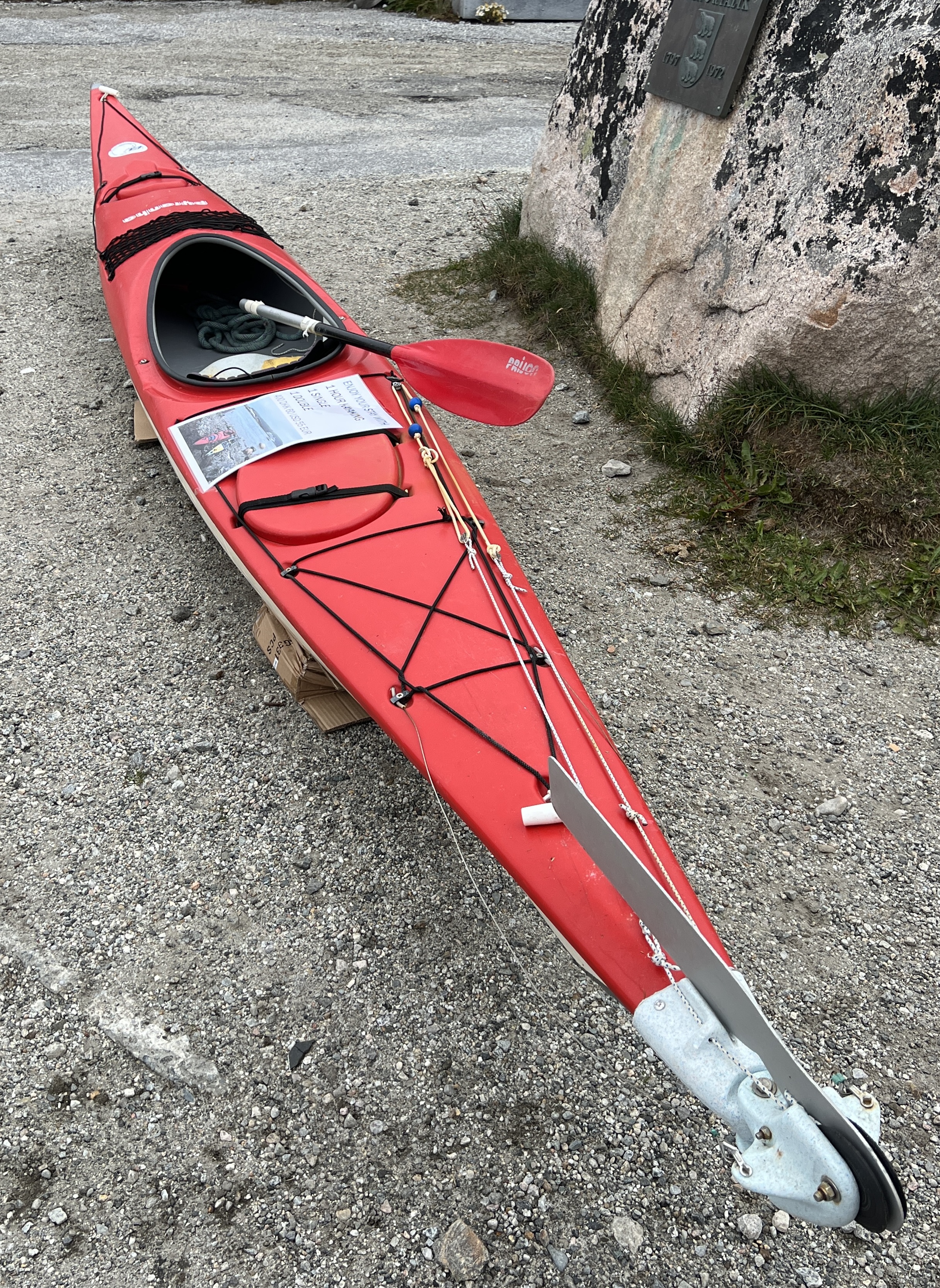
Down on the waterfront a kayak is offered for rent, 1 hour $A91. Slobro had been interested, but his pocket money had run out!
We had a plate of Greenland nachos for a late lunch snack at Cafe 43, before catching a shuttle back to the ship.
The weather for our day in Nanortalik had been excellent and as we sailed off the sun was glistening on the bergie bits. It had been cool, around 5/6 C, so beanie weather!
It was an interesting day looking around the town and observing a culture and environment very different to our own.
The Captain was making a quick run to our next stop at Qaqortoq, about 100 km away, hoping to make it before dark, about 11pm. So avoiding navigating among the growing number of larger icebergs and possibly fog during the dark.
Prins Christianssund
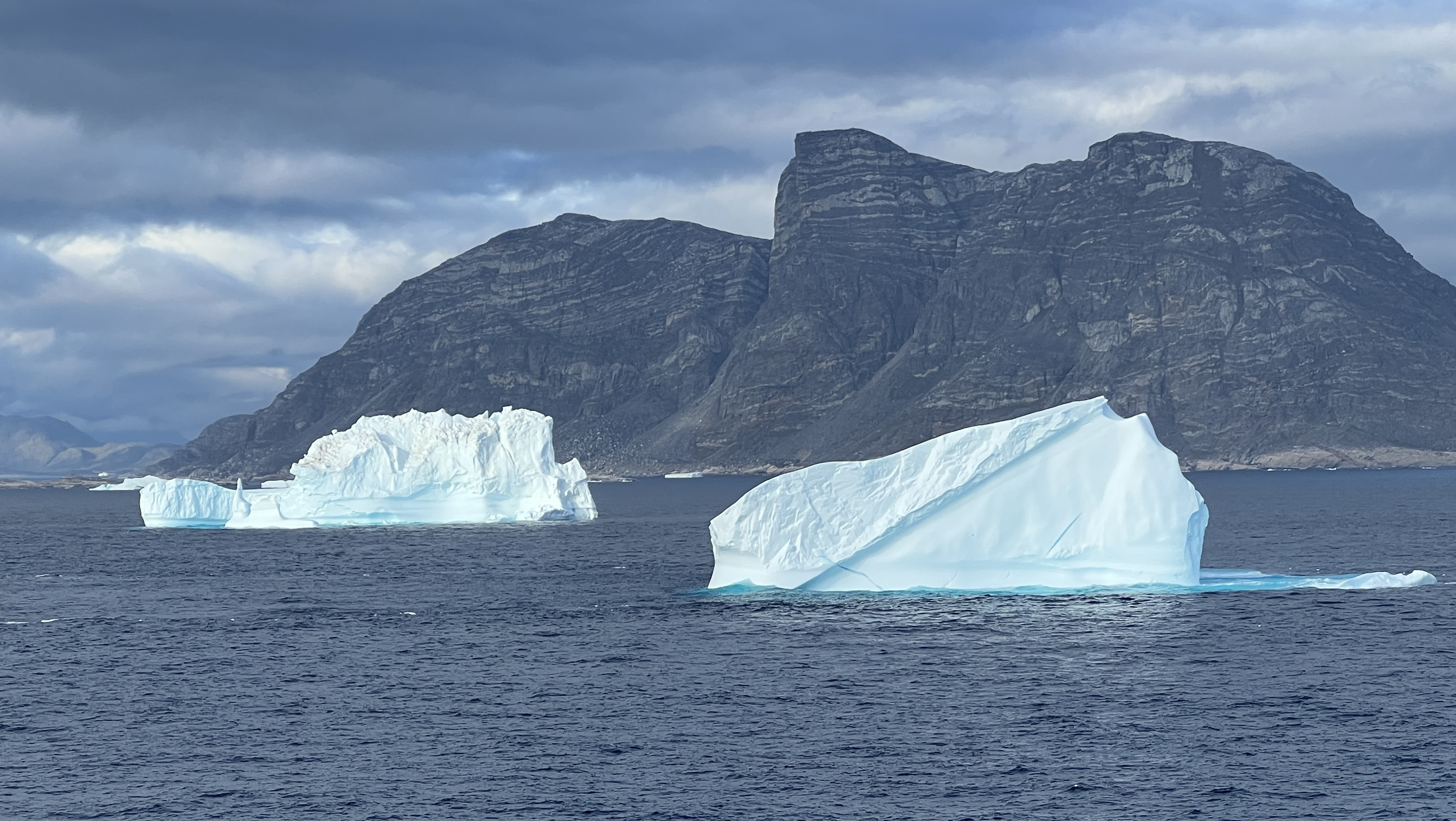
We have had a little surprise on our way to Greenland. The Captain has decided to divert our course and we are going to enter Prins Christianssund at the tip of Greenland.
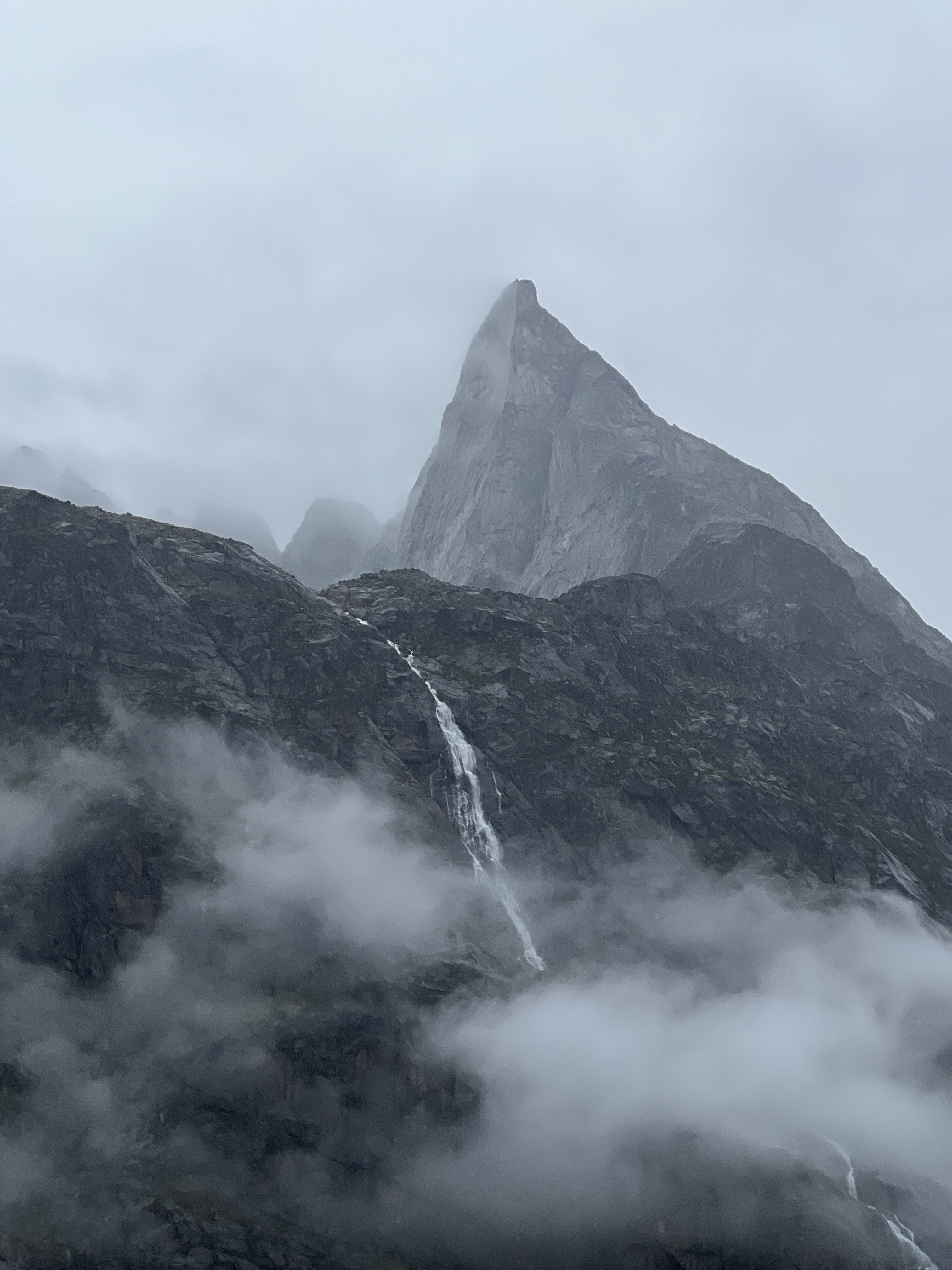
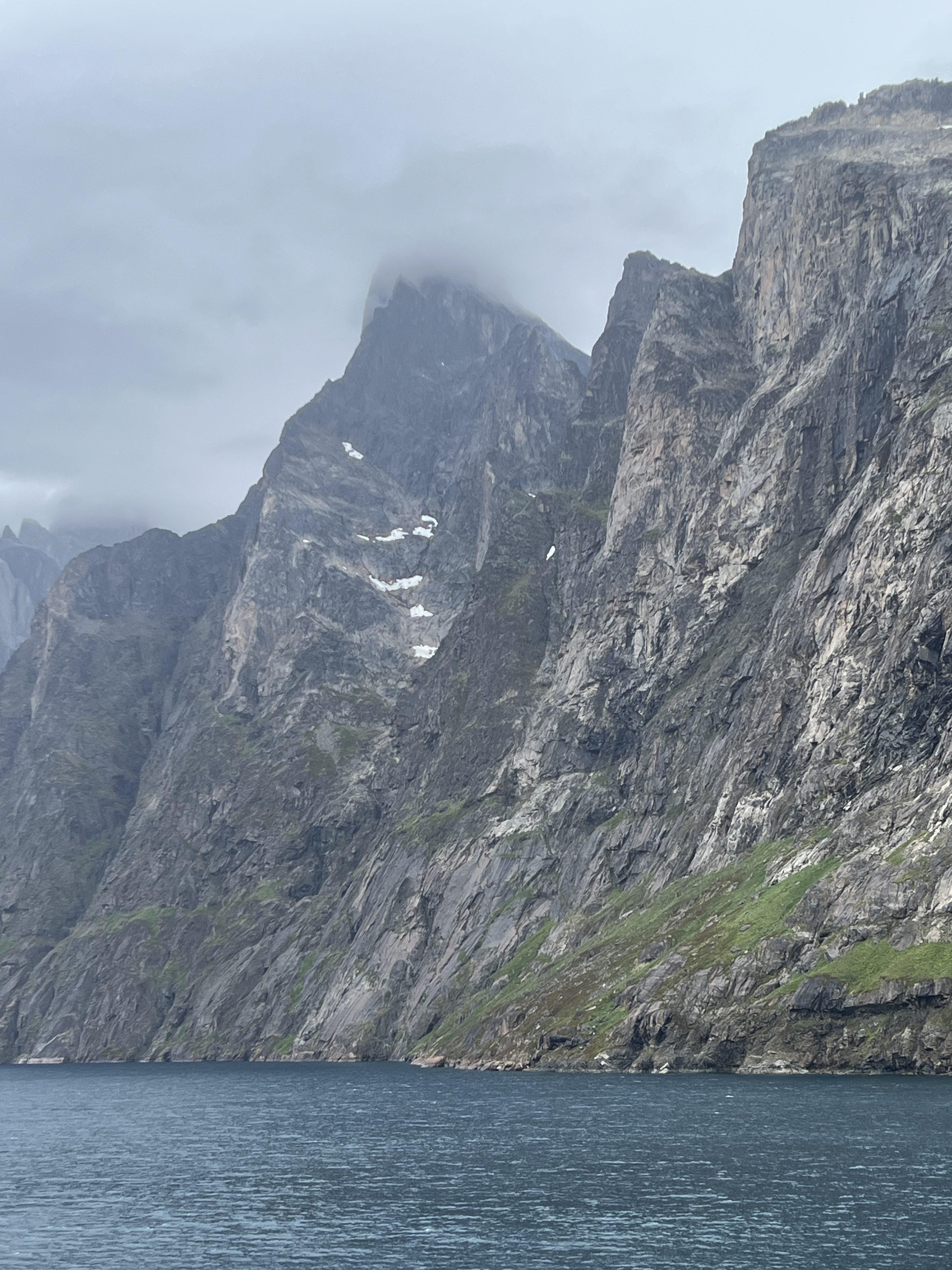
Coming into the channel we see our first bergie bits and growlers. This 100 km channel is awe inspiring.

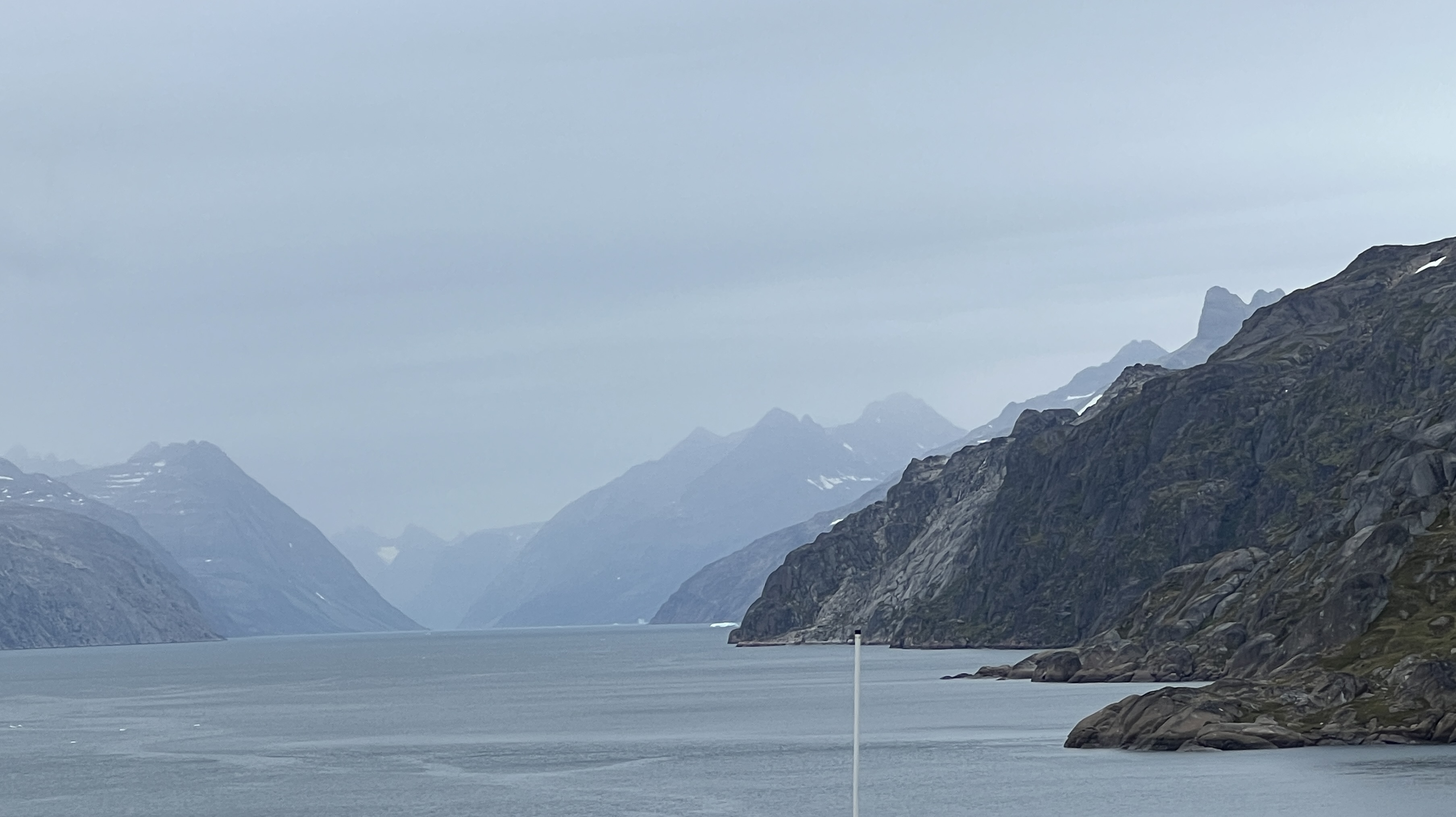
The channel was an ancient glacier cutting sheer walls in a valley that has now been submerged. Higher up the walls are the U shaped valleys of long gone tributary glaciers.

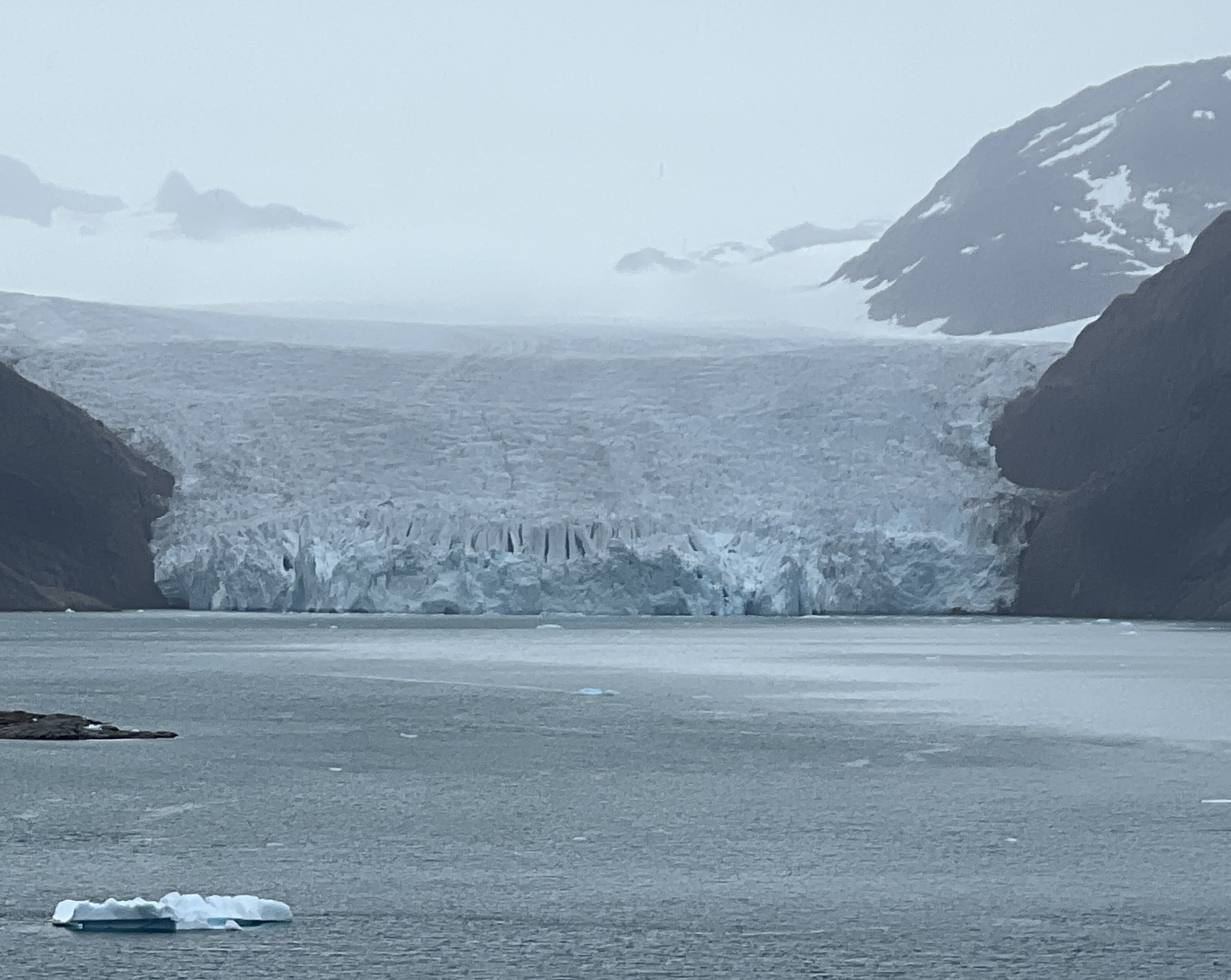
We pass by a number of present day glaciers that feed off the Greenland Ice Sheet that covers most of the country.
The weather is overcast, mist and cloud floating around creates an eerie atmosphere. Bergie bits and growlers float around in the channel.
There is one small village on the edge of the channel, seemingly in the middle of nowhere.
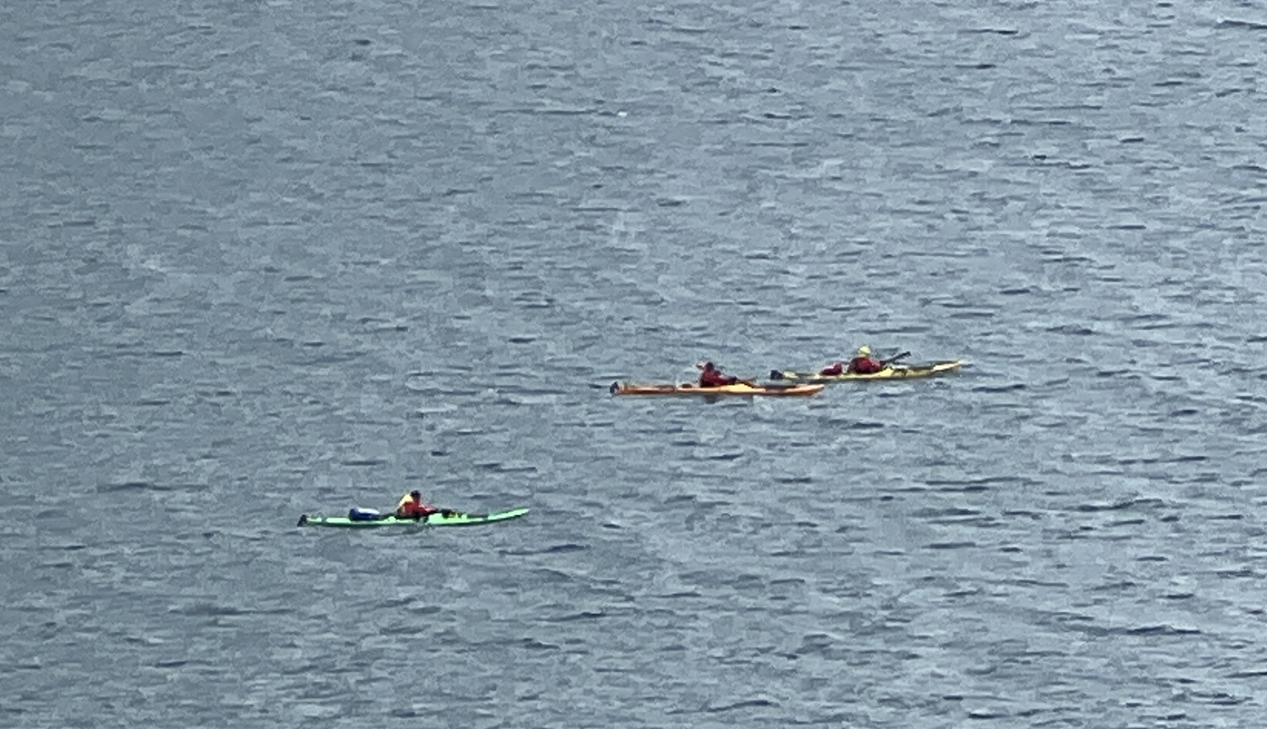
Three kayakers paddle by!
The channel narrows considerably and finally joins fjords and the ship twists and turns through these making its way to the open sea.

Our first stop in Greenland is to be the small village of Nanortalik, on an island of the same name. About 1300 people live there. It has taken all day to navigate along the channel and fjords and we will reach Nanortalik in the morning.
Land of Fire and Ice
During the two days at sea on the way to Iceland the weather has greatly improved and we have blue skies and a brightly shining sun. Akureyri, on the north coast is the first of two stops in the Land of Fire and Ice, or Ice and Fire, depending on what you read! The sail here has taken us, during the early hours of the morning, briefly over the Arctic Circle. Slobro looked overboard but couldn’t see it, unlike when we crossed the equator and there was a bump he said. It is not getting dark in these parts until around midnight and the light comes at about 3.30am.
Akureyri sits at the end of the 37 mile long Eyjafjorour, Icelands longest fjord. We have a full day ashore here on a tour out into the countryside.
The town itself is quite small and the town highlights section of the drive is quite short, there is a colourful central shopping area and the impressive double towered church overlooking the harbour area.
The drive out into the countryside is awe inspiring, we were blessed with the one day in ten average ‘sun out’ day in summer and it got up to 19C. Green fields and rolling hills rise steeply from the fjord. The green keeps going when we get up onto the largely treeless long ago glaciated plateau.
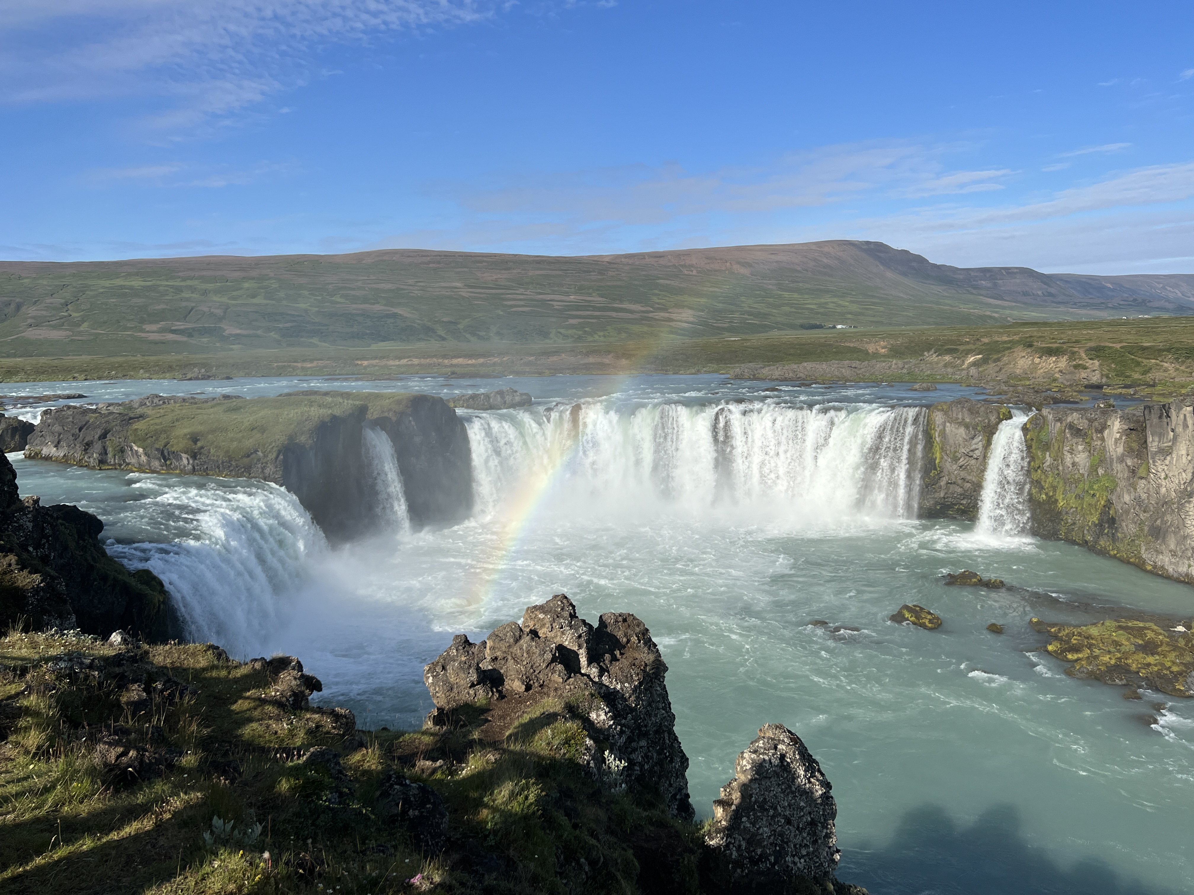
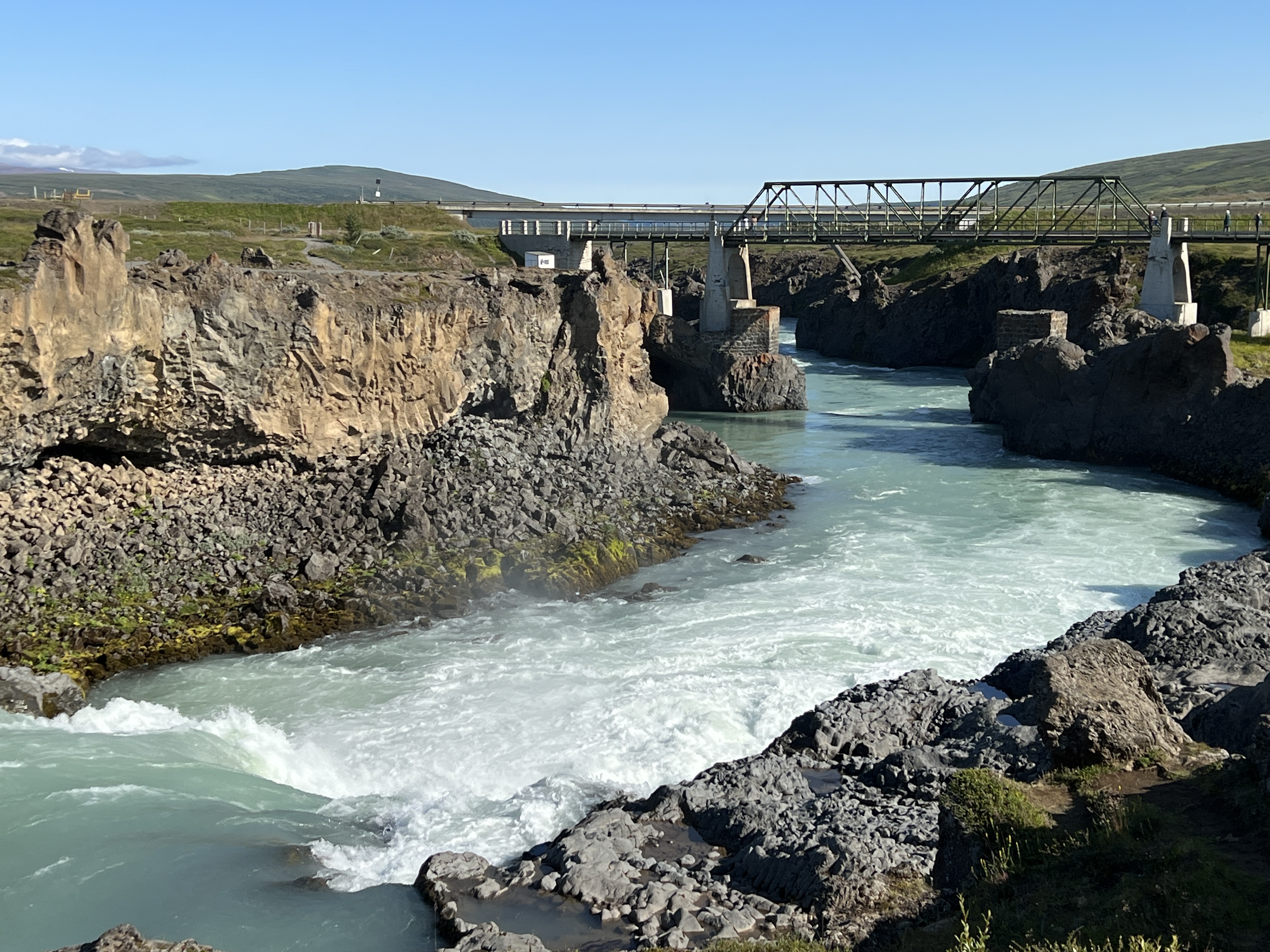
Our first stop is at Godafoss Waterfall, the ‘Waterfall of the Gods’. So named because, according to Icelandic sagas, the then king after converting to Christianity through his statues of the Norse gods into the waterfall. Pretty impressive landscape!
I may need correction, but Iceland only has a 10% permanent ice cover, there is plenty of snow though in winter. Greenland on the other hand has an 80% cover. This gives rise to the suggestion that Iceland should be called Greenland and Greenland should be called Iceland.
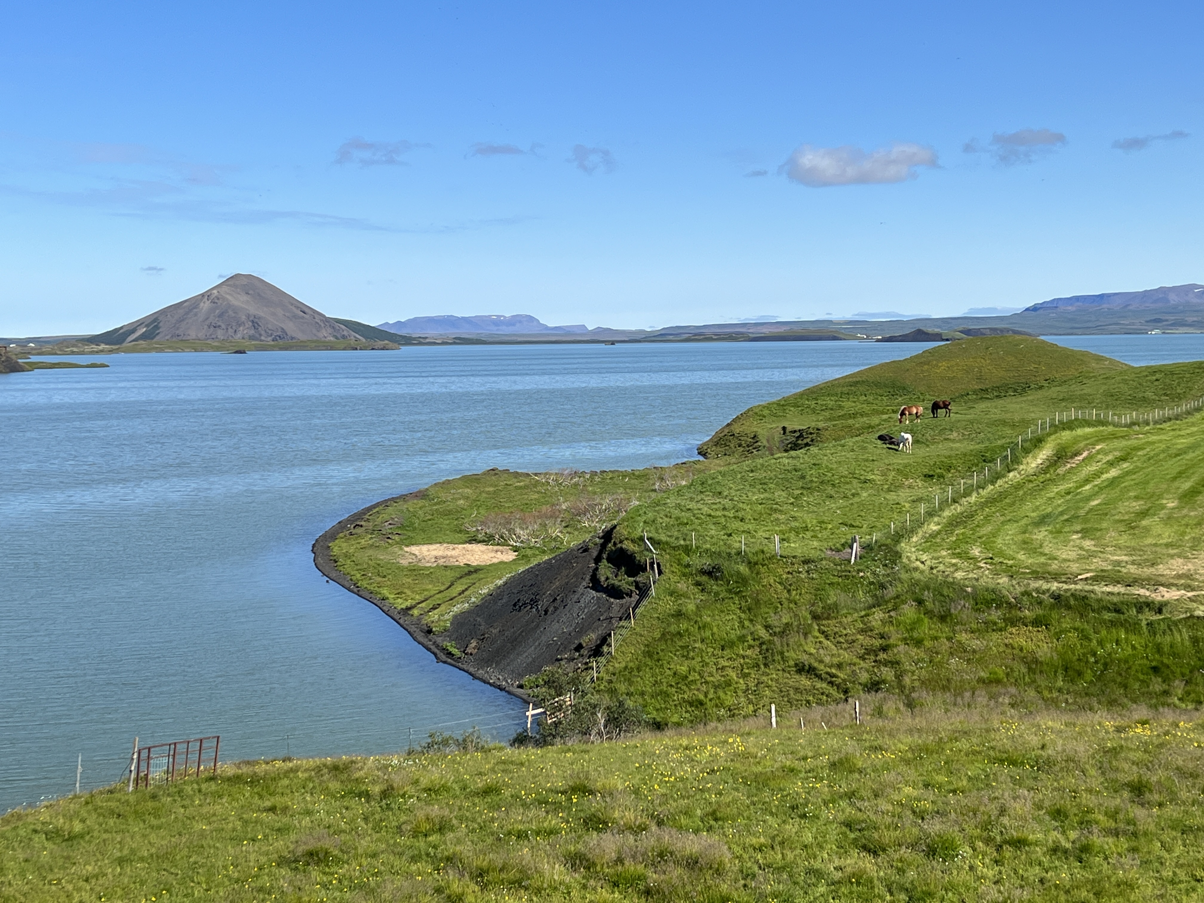
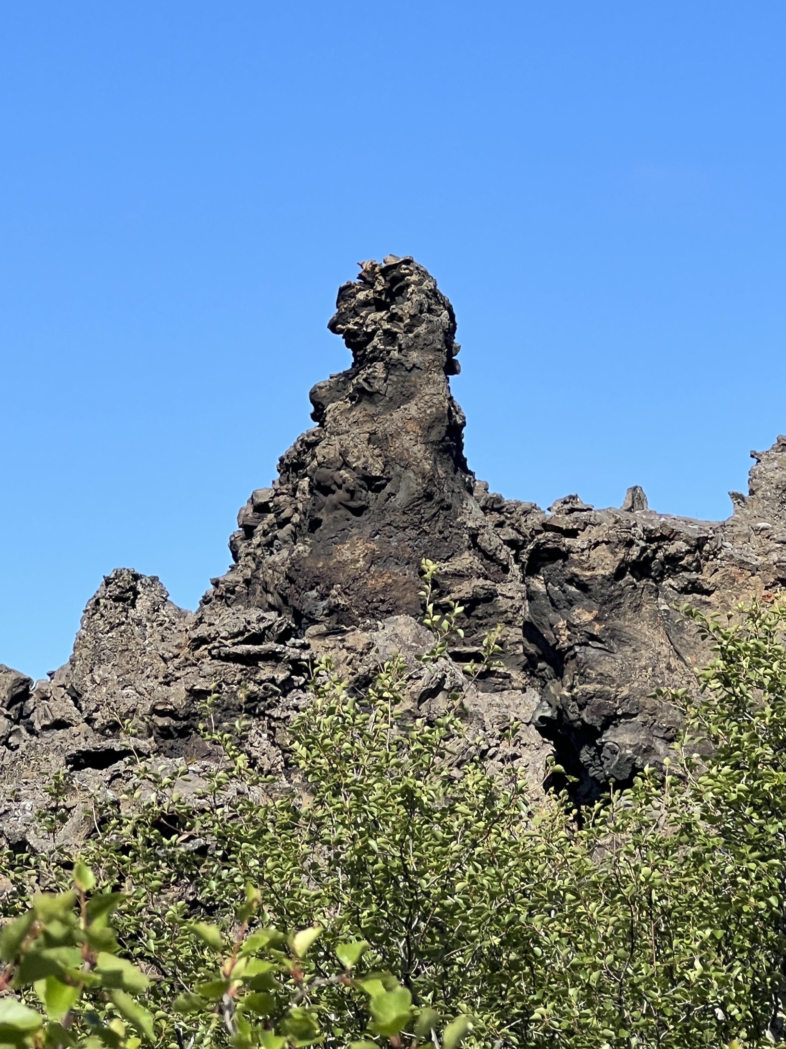
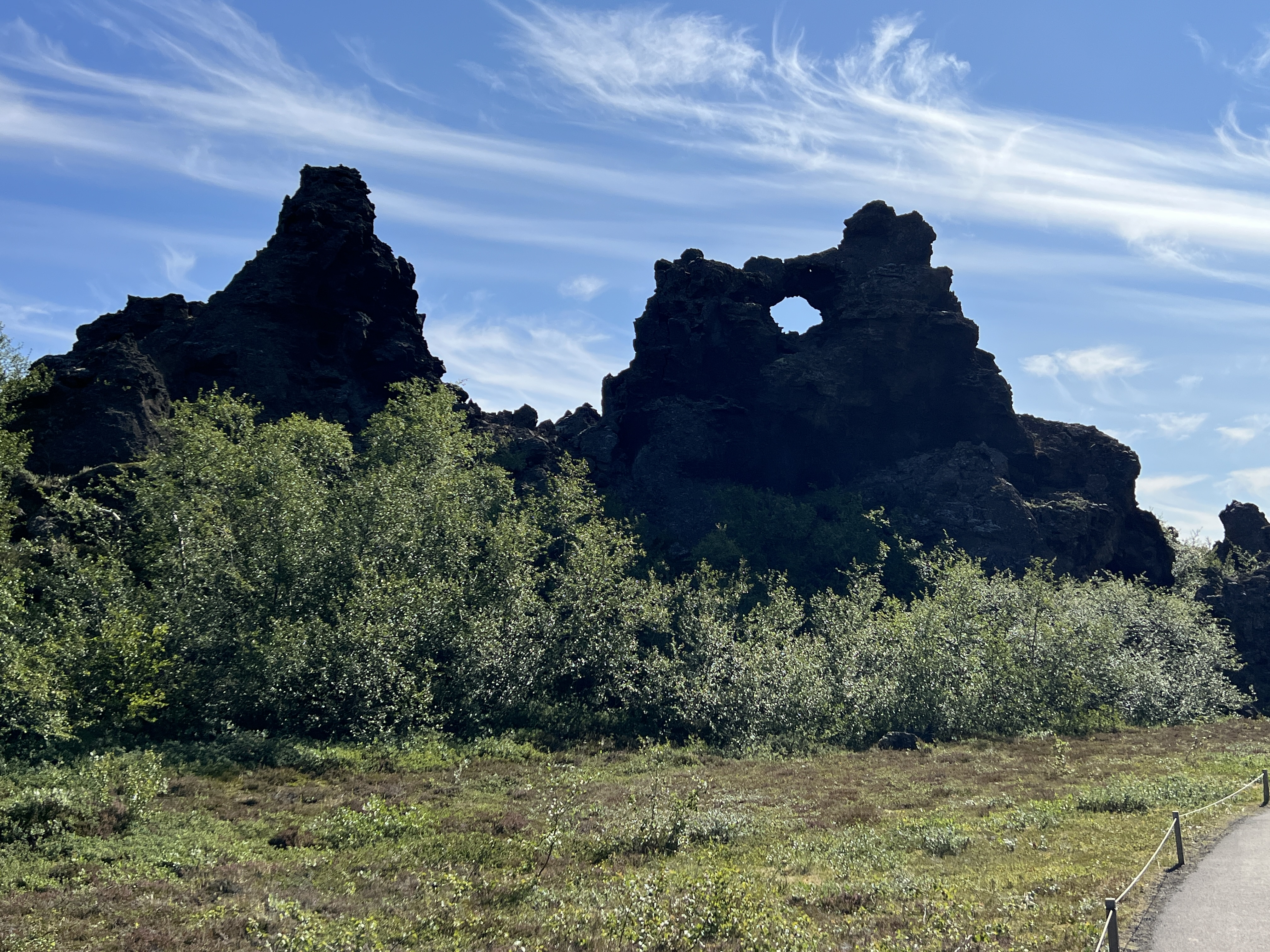
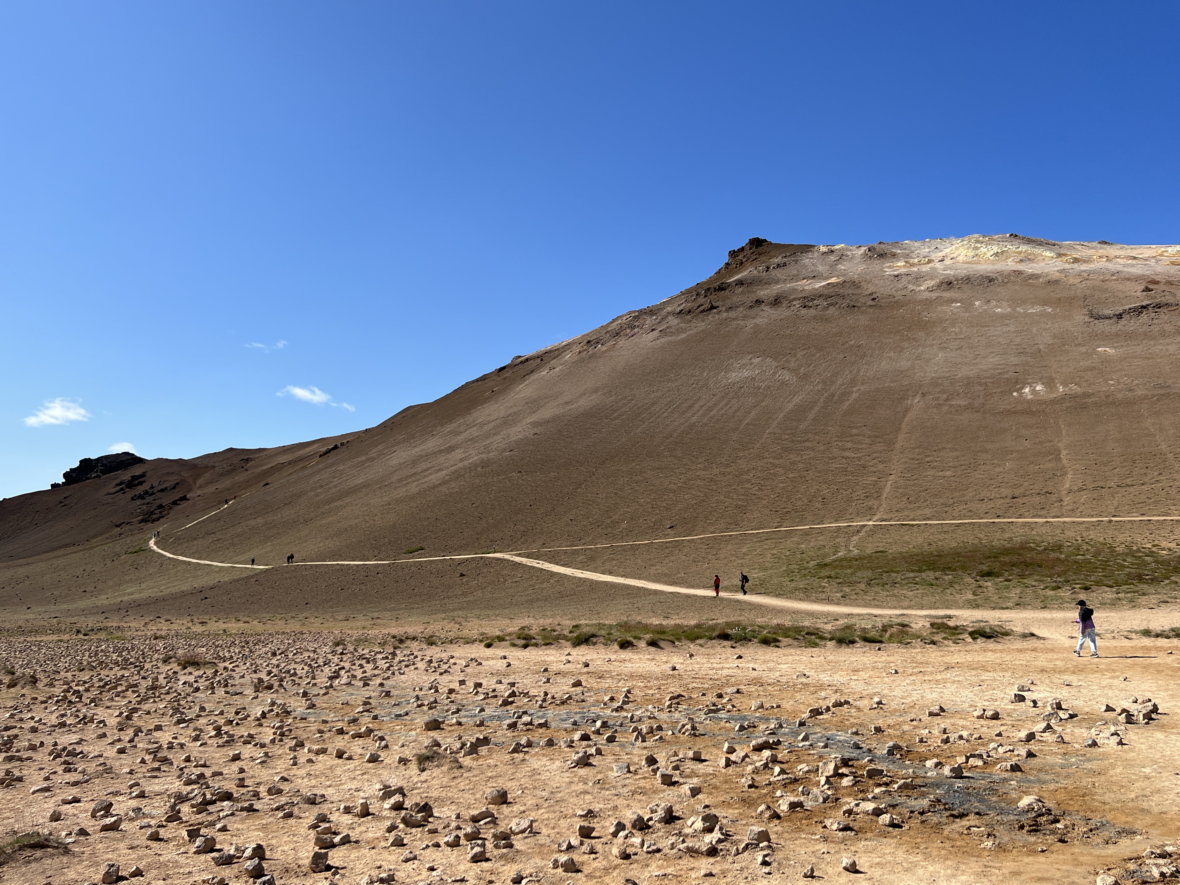
Next stop is to view Lake Myvatin, situated in the centre of a geologically active area and at the heart of a major lava flow several thousand years ago. We have several stops in these parts to look at different aspects of the volcanic activity. A walk around the lava field among remnant eroded rock formations, quite eerie in places. Then on to a ‘small’ crater field, the circular depressions caused by ‘pops’ in the lava flow now covered with grasses. Great views of the lake from here.
Iceland is nicely located over the point where the North American and European tectonic plates are grinding against each other. As a consequence earthquakes and volcanic are not uncommon. Hence land of ‘Fire and Ice’. On the way to our next stop at a hot springs sight we pass by an exposed fissure in the rocks showing where the two tectonic plates are pushing up against each other, at a rate of 2cm a year according to the guide.
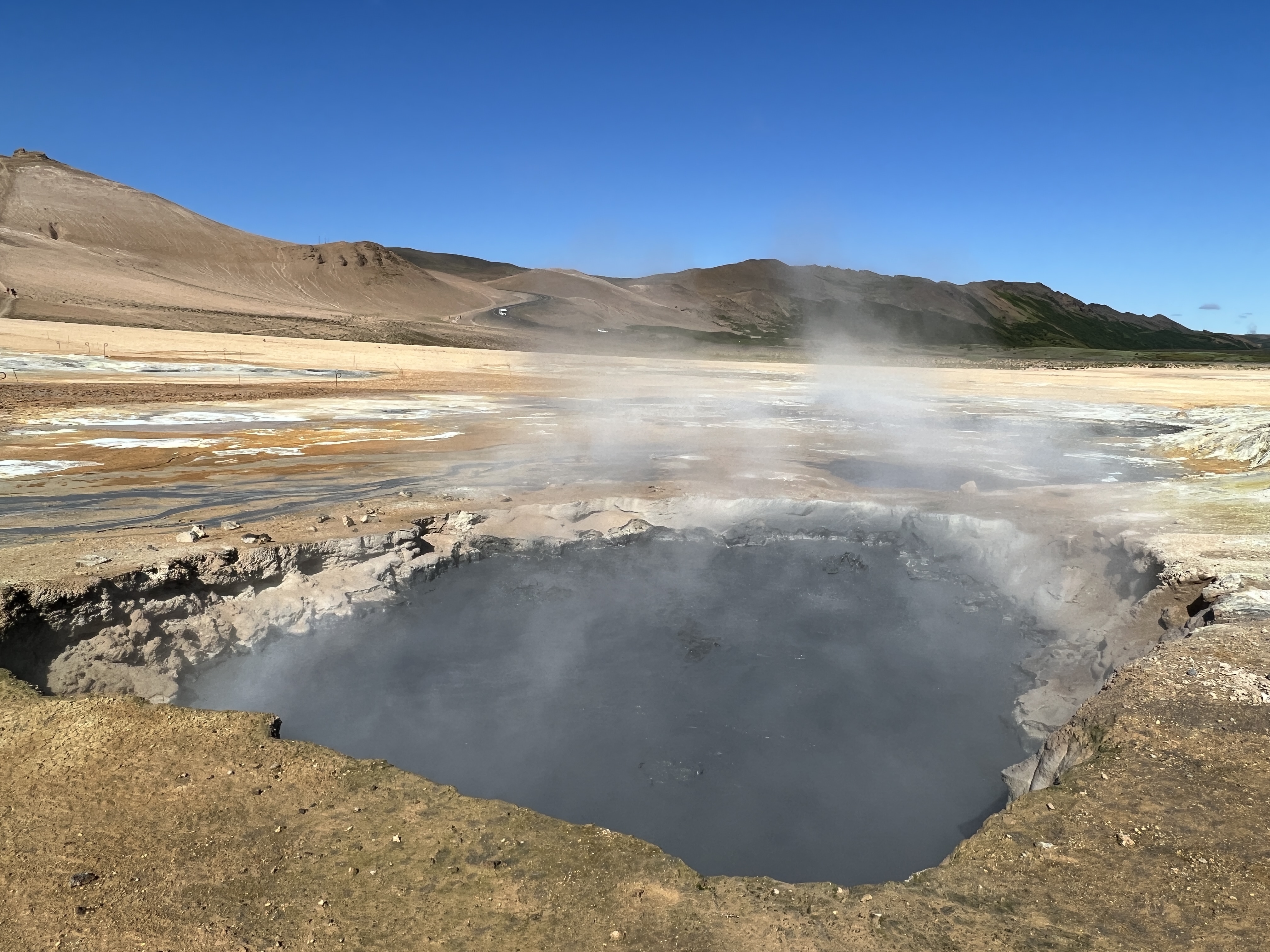
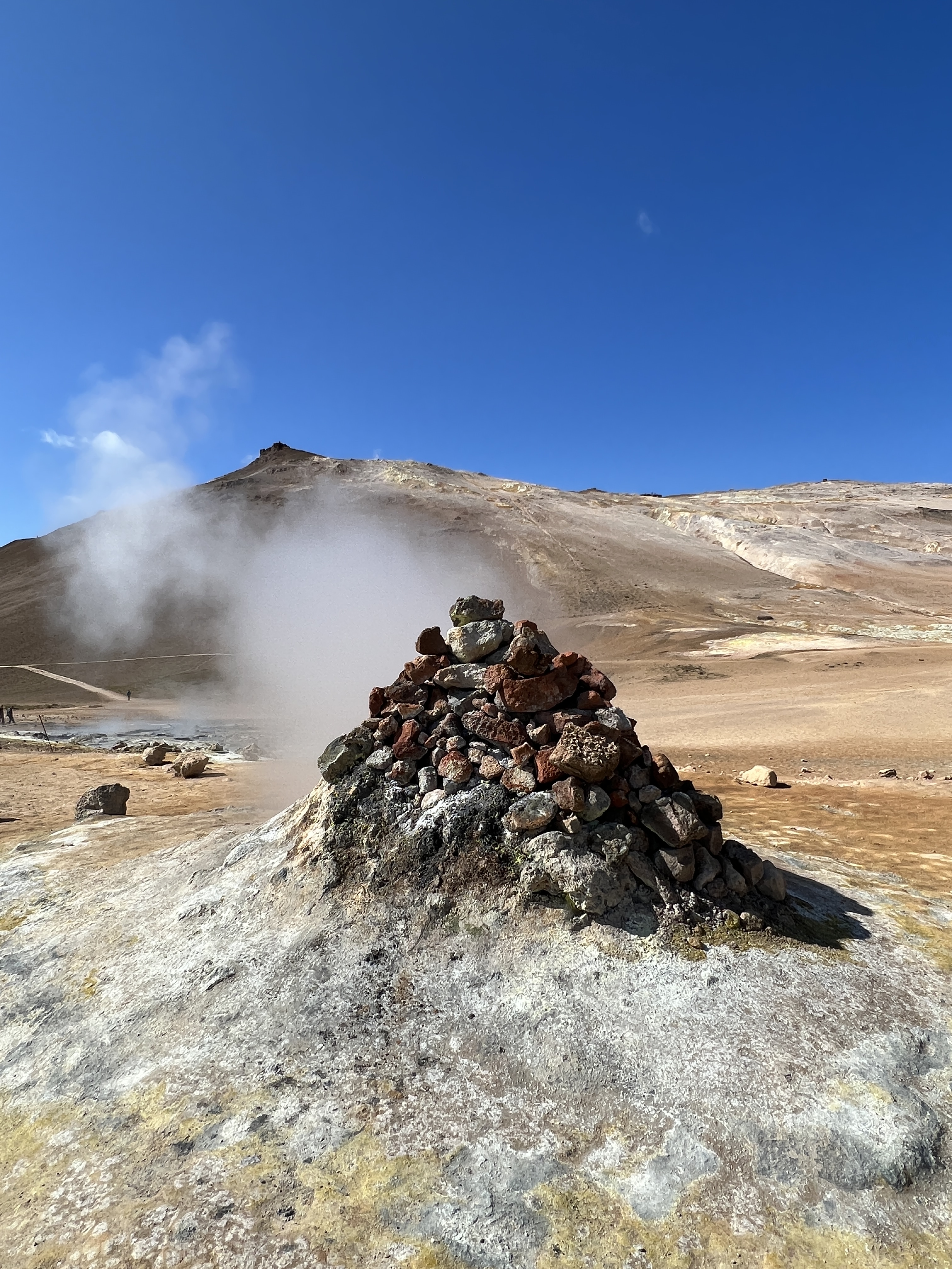
The hot springs sit at the base of a tree ridge line where they bubble and hiss away, strong sulphur odours waft around the site.
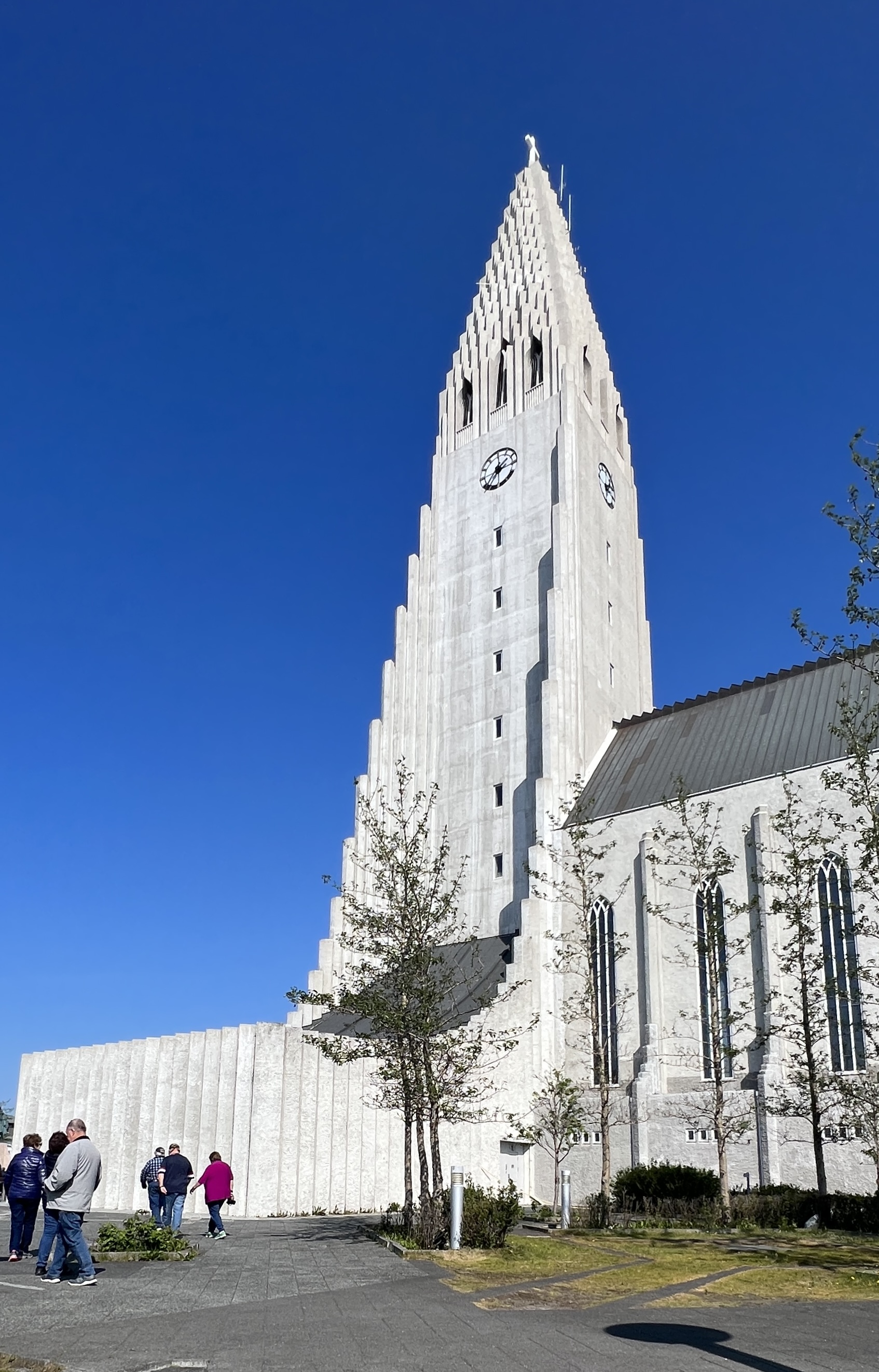
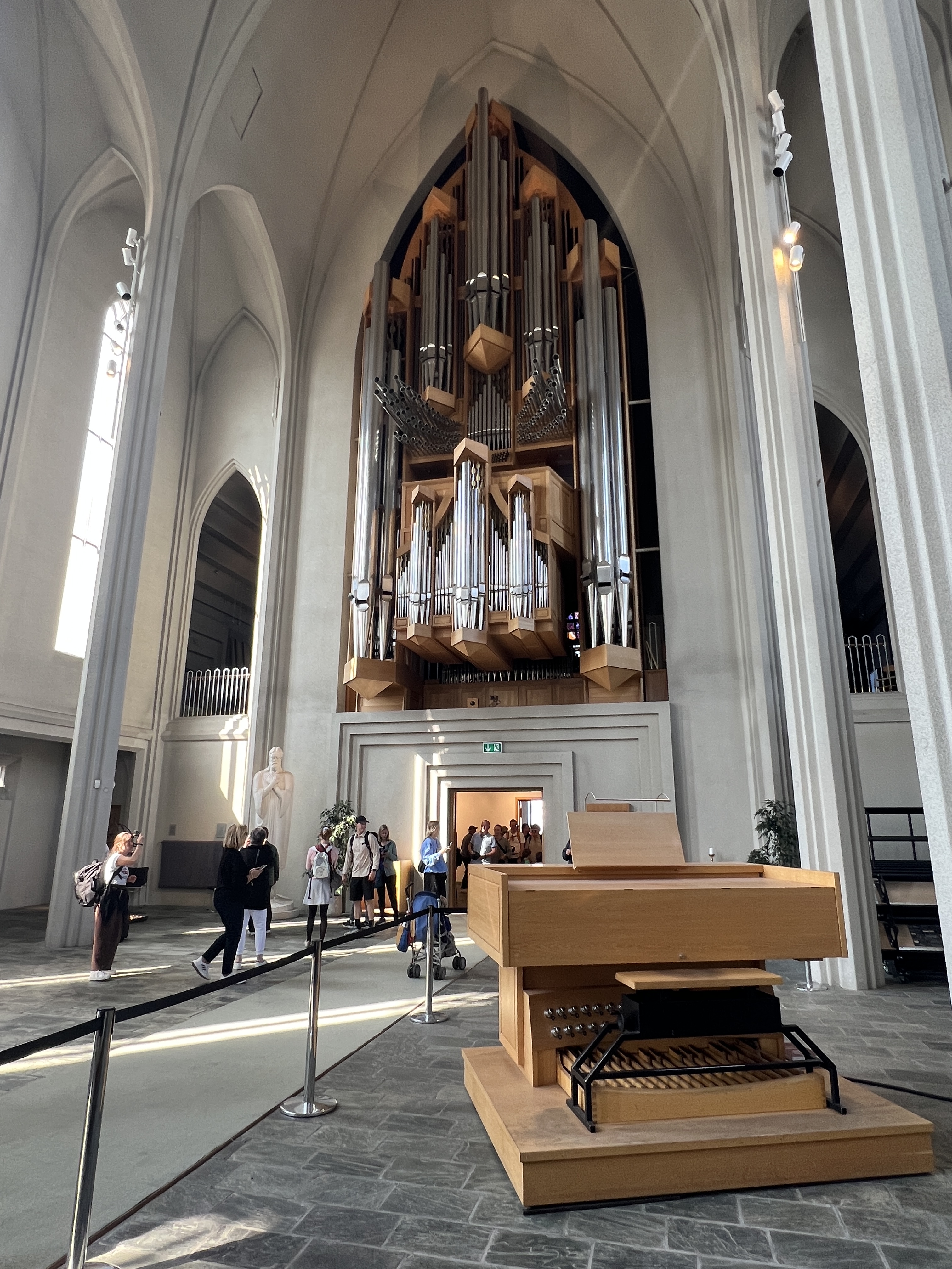
The drive back to the ship takes us the same way we came. Few alternative routes in the country. Overnight we cruised around the island to the southern side and docked at Reykjavik at 12 noon, but didn’t leave till 11pm. We decided here on a city tour around the town. Stopped for a photo of the old house where Reagan and Gorbachev met to end the Cold War and the on to the skyline dominating Lutheran Church. Apart from the organ, the inside was quite austere and in line with Lutheran traditions.
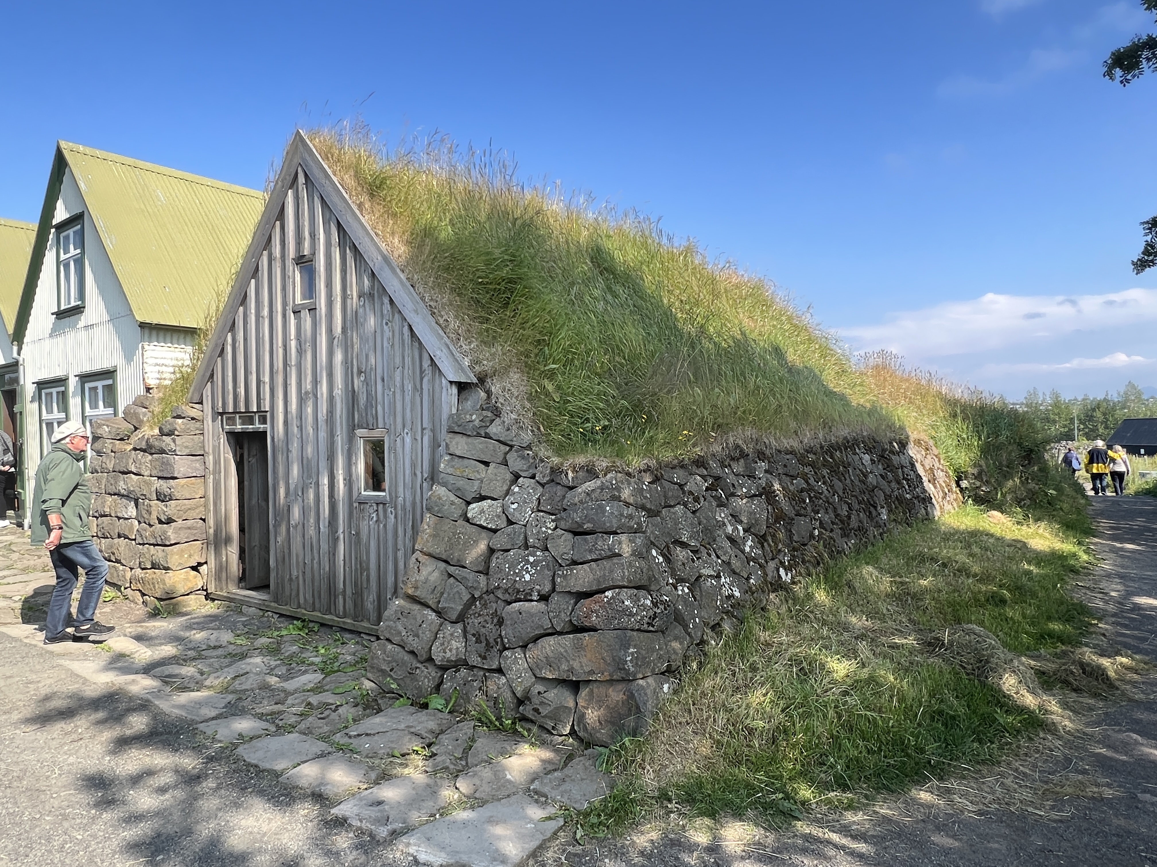
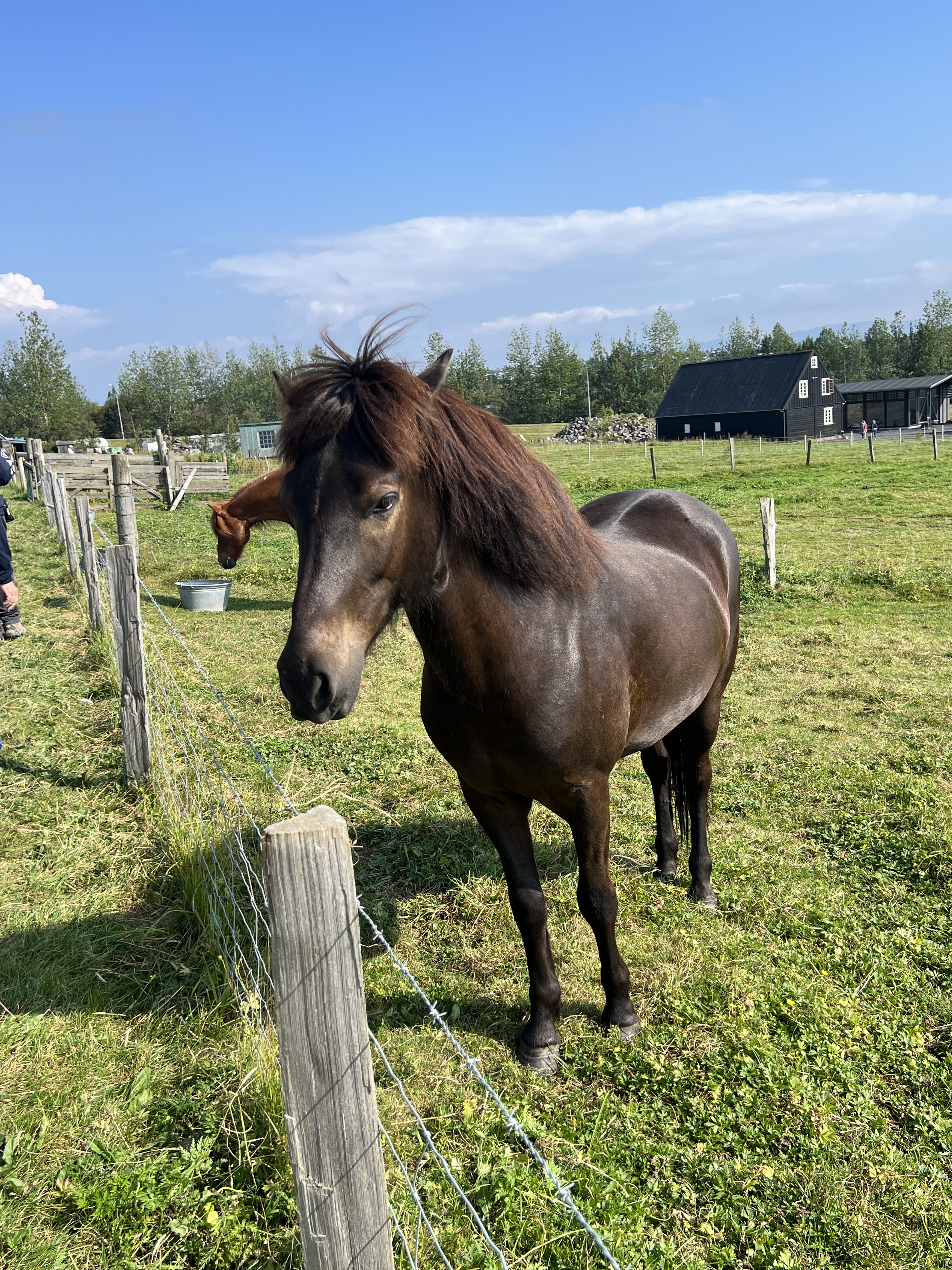
Then onto an open air museum where traditional Icelandic buildings have been moved for preservation in the face of the city’s expansion. It is the site of an historic farm area, with original turf river structures still in place. Interesting stop. The Icelandic horses very friendly!
After a short time back on the ship we took the shuttle back into town for a wander and some dinner. There are quite a few tourists about due to three cruise ships bring in port.
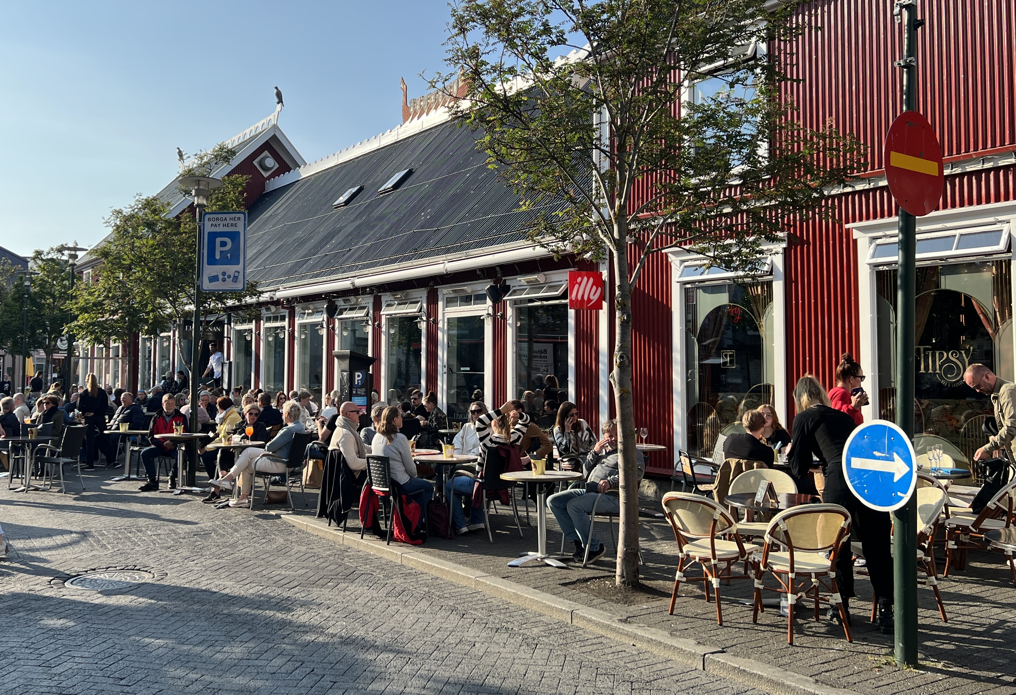
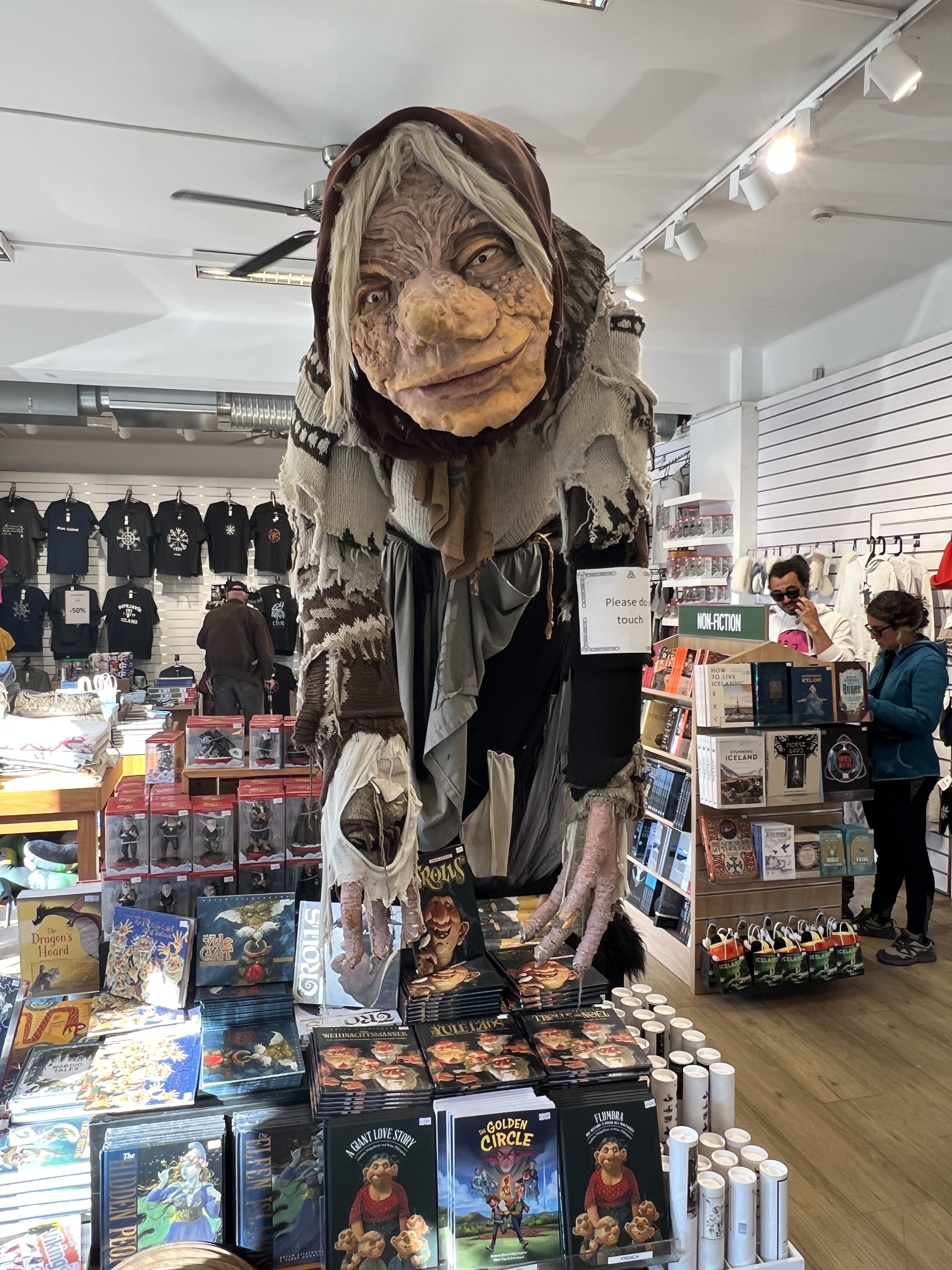
Souvenir shops selling the usual array of stuff, trolls are an ever present temptation for the shelf back home. Resisted. One particular restaurant was a great temptation for those wanting a traditional tasting plate of Icelandic tit bits.
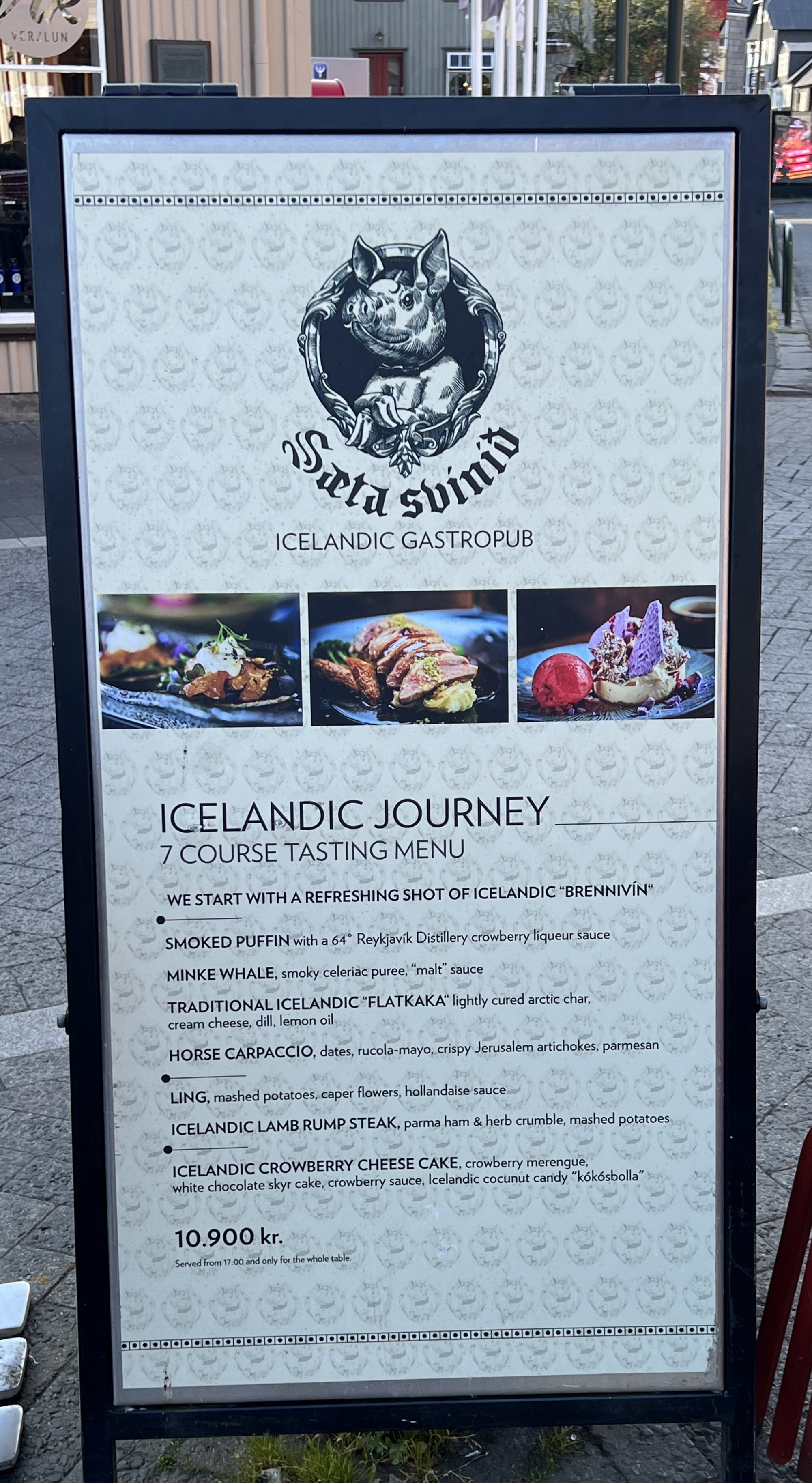
Homealone was not particularly keen, the menu shows how to use what is available. Contrasts with back home where we have crocodile, camel, kangaroo, goanna etc ! So we settle for the dependable old fish n chips, with a local Viking ale.
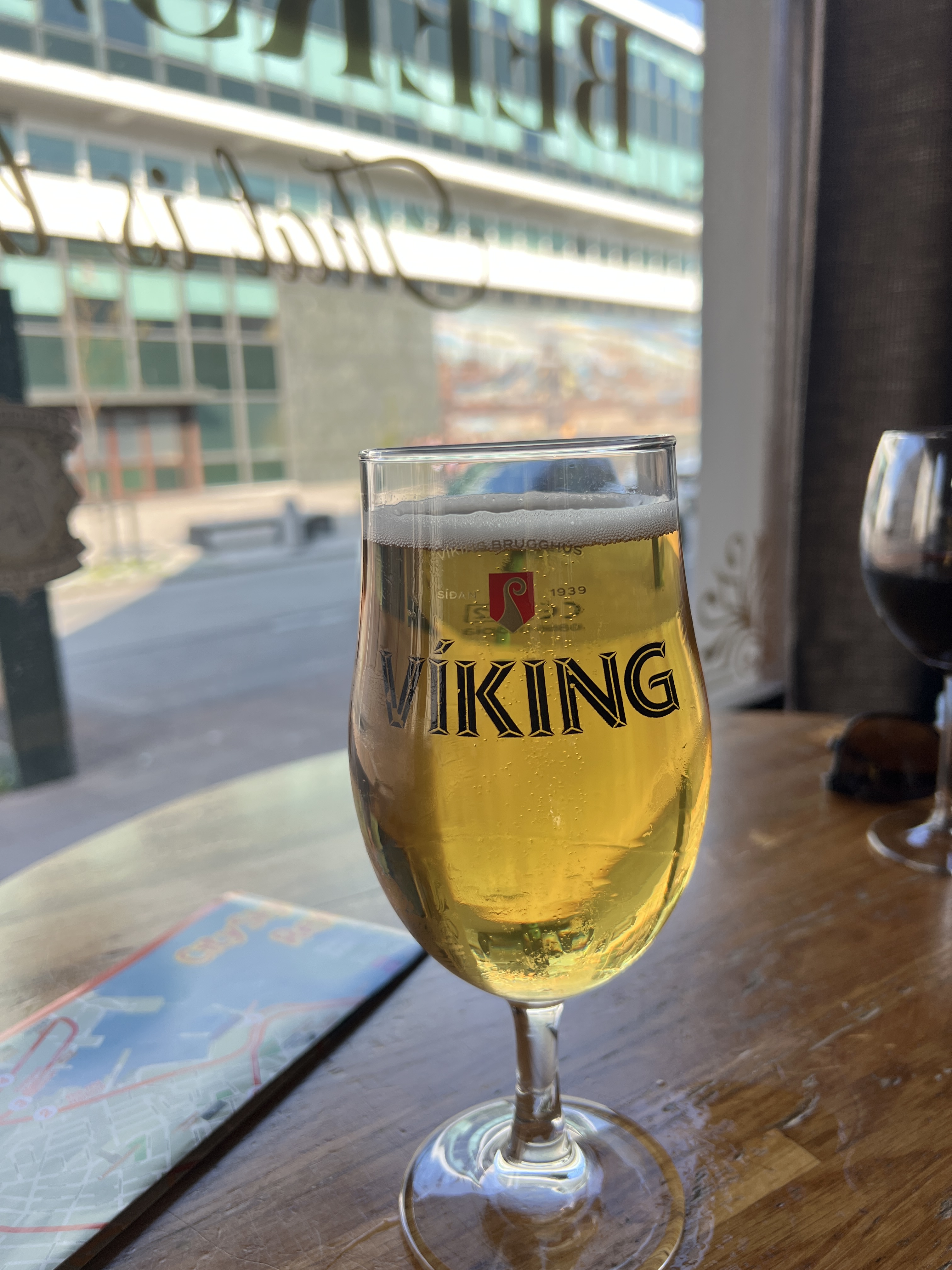
Allthego was able to negotiate with the waitress to acquire a Viking ale glass to join the others in the cupboard back home.
After dinner and farewells to those Nordic heroes, Eric the Red and Leif Eriksson , it was back to the ship around 8pm to settle in for the night. We are off now for two sea days bound for Greenland.
Back to Scotland
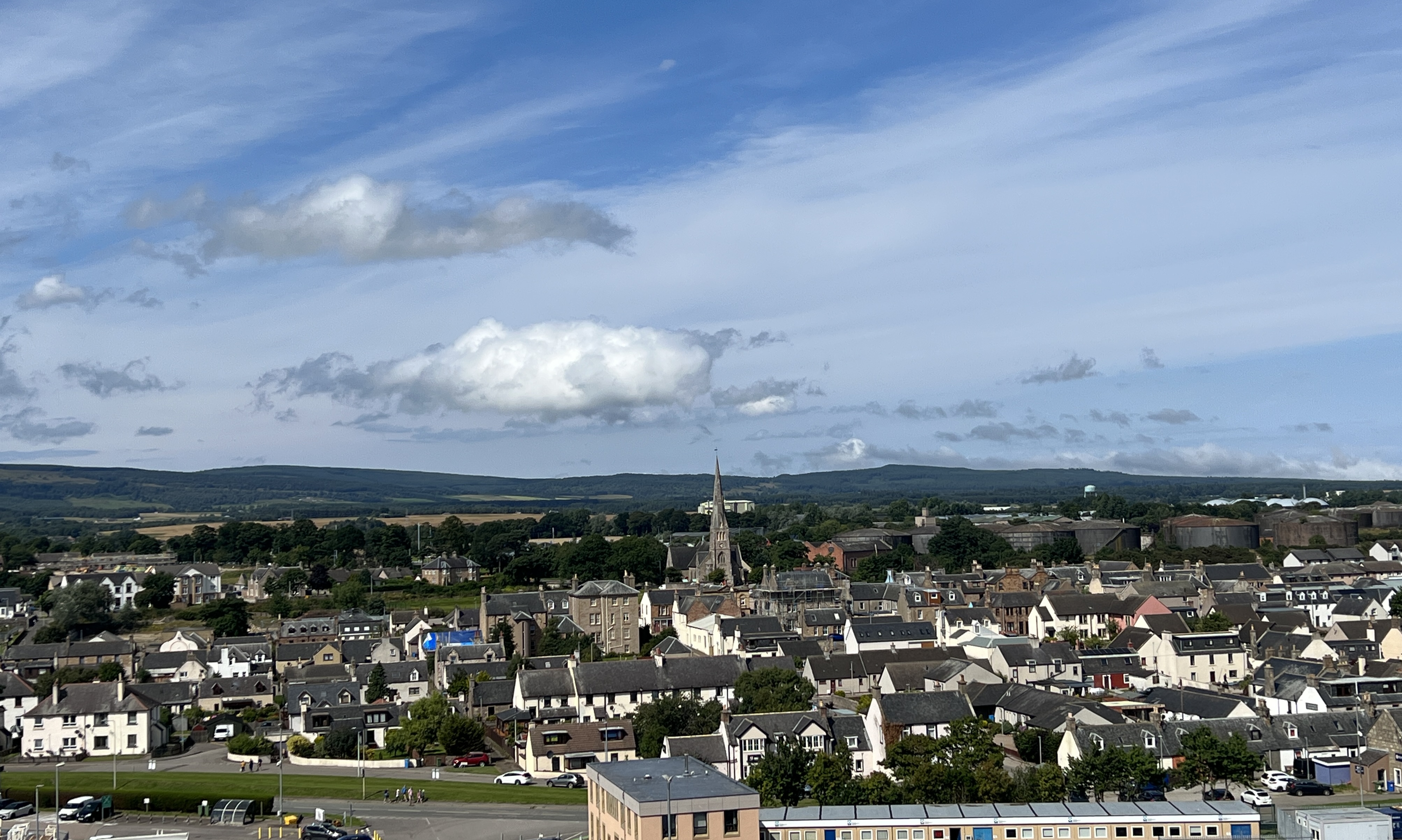
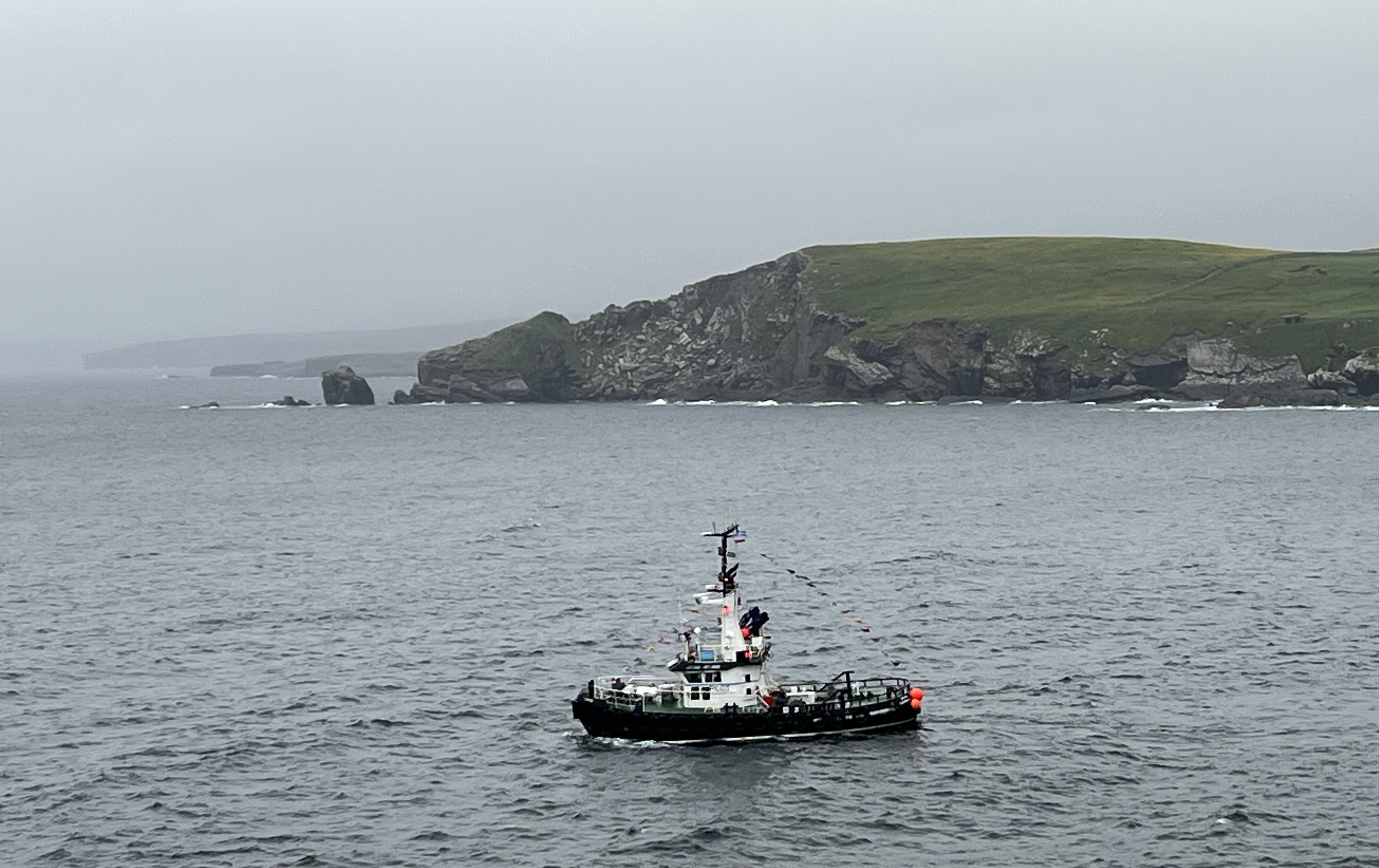
We have had a day at sea after leaving Dover and are now docked at Invergorden, about forty minutes from Inverness by the local train. Invergorden is an old port town and used to be a base for the Royal Navy’s fleet until the mid 1950s, the old oil tanks sit in a line on the hill above the town. North Sea oil came to the rescue for the town as well as cruise ship tourism. Inverness, the Scottish Highlands and Loch Ness are just down the road from the port.
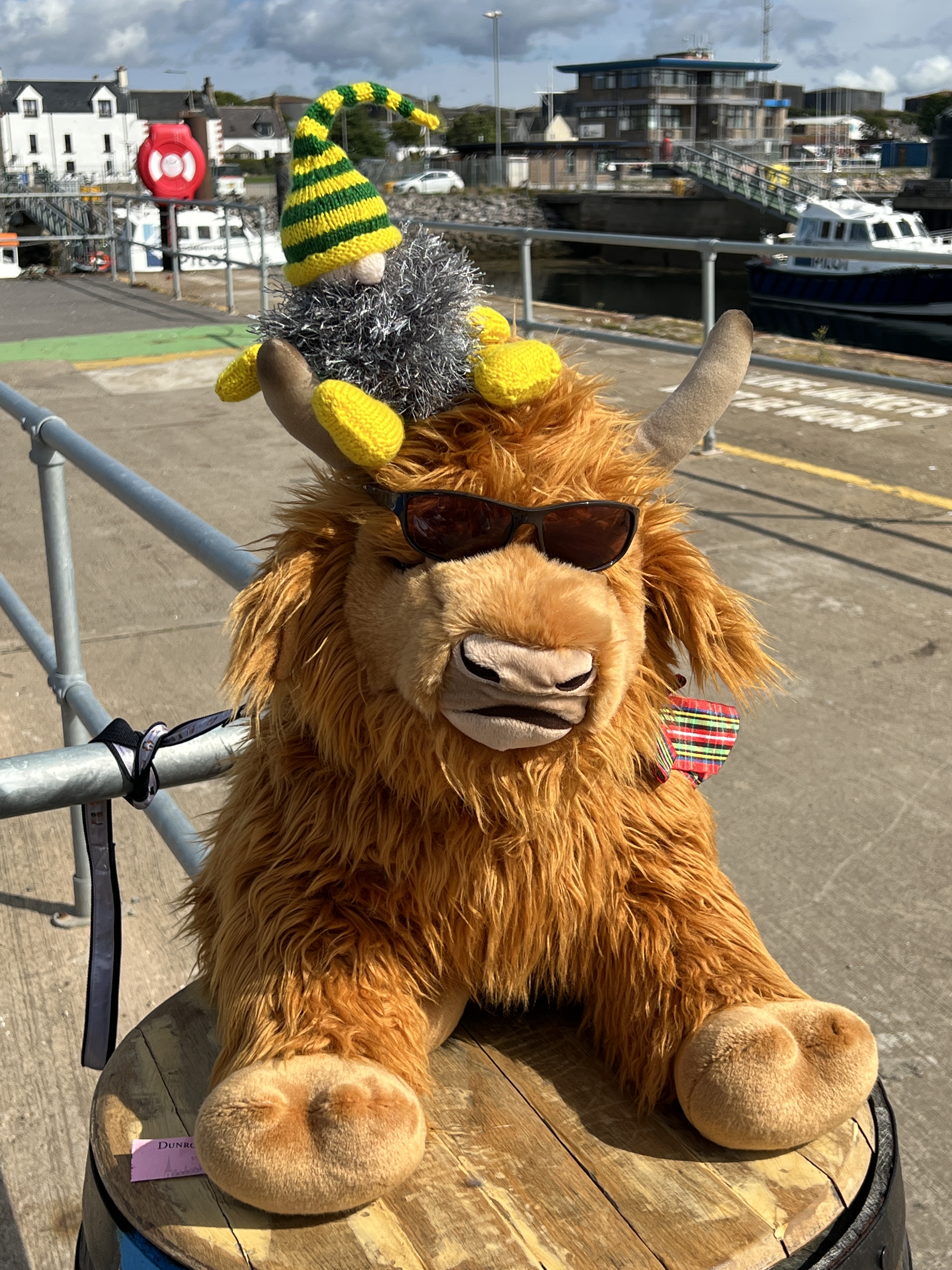
We decided to stay in Invergorden rather than going further afield. Slobro was a bit disappointed that he wouldn’t see Nessie and jealous that we had seen the loch creature when we last here. No need to see it twice. Slobro had to accept a cool Highland Cow encounter instead.
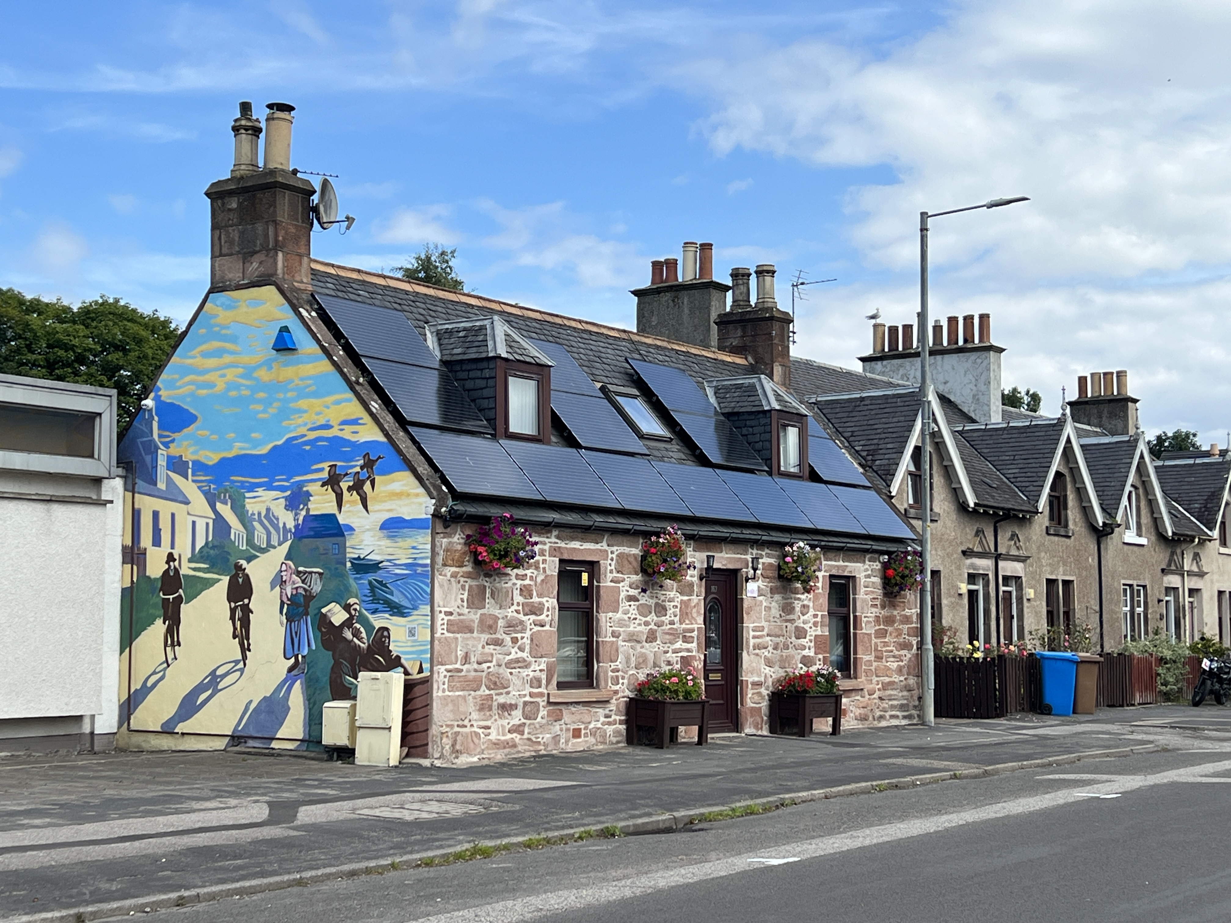
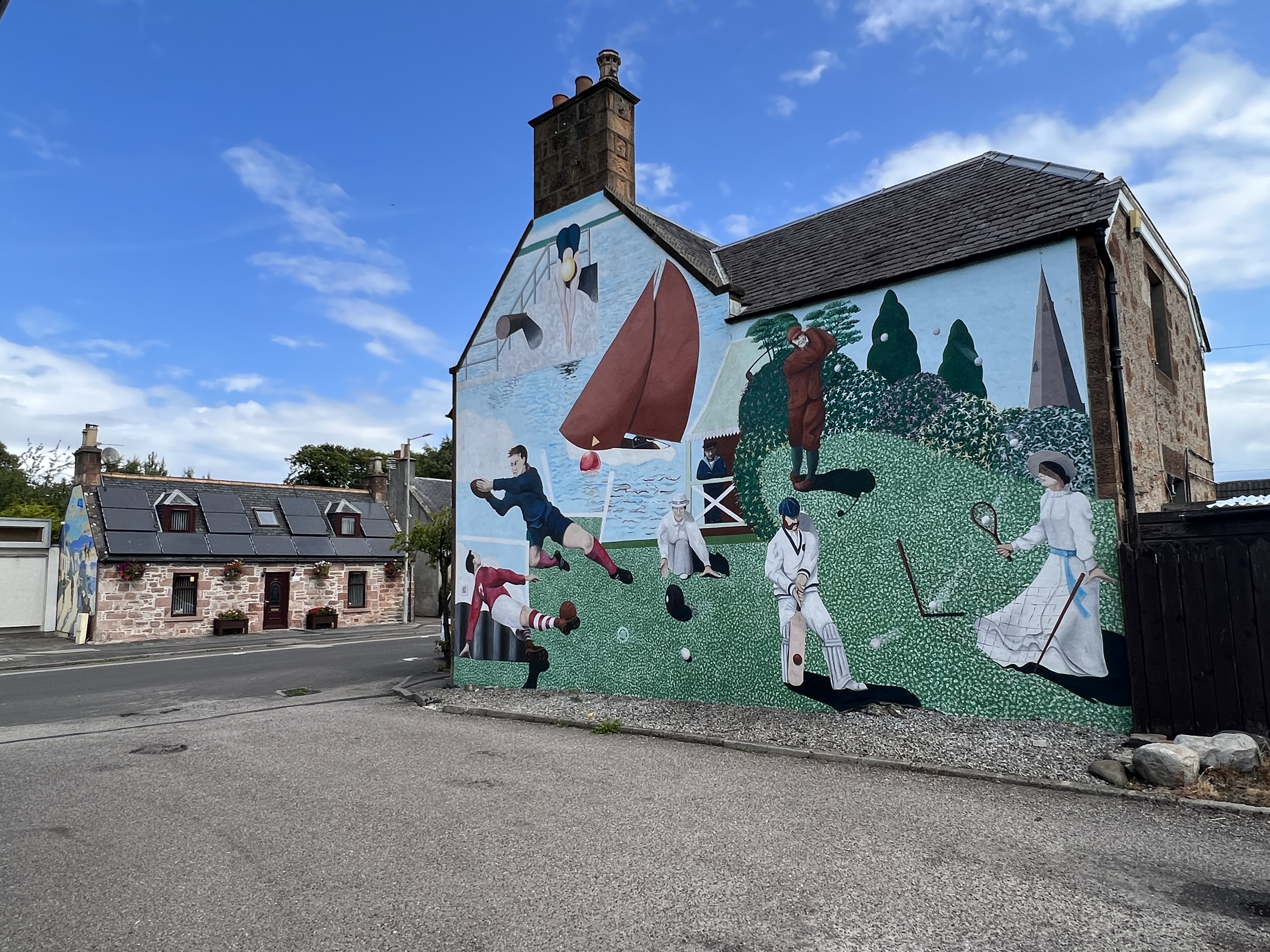
We again had a nice sunny day to wander around the town for a few hours looking at the murals recounting the past. Allthego and Homealone like murals. The only thing though is that they tend to dwell on the past glories of places. Is it ‘old times’ for ‘old memories’. Maybe it would be good to have futuristic murals as well?
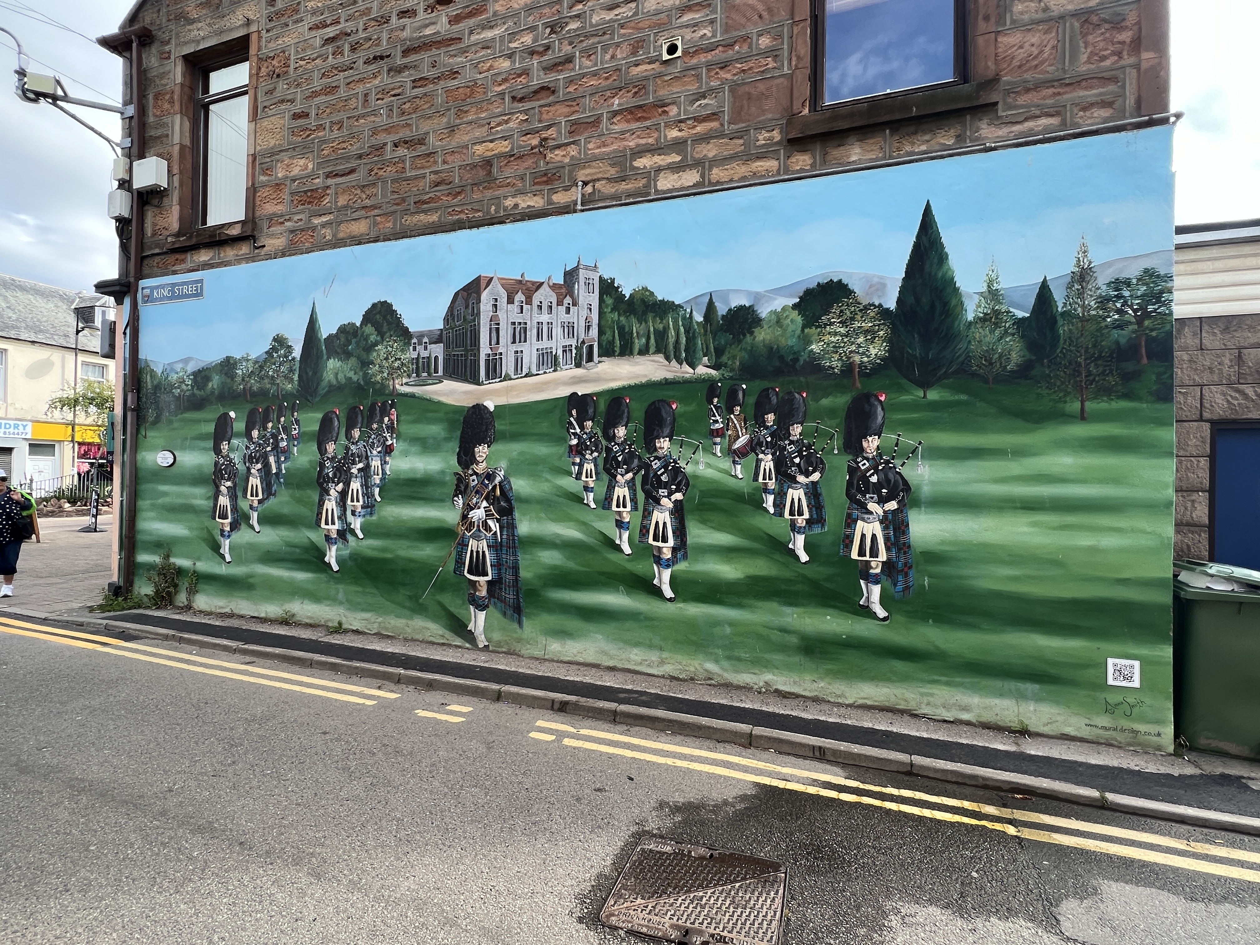
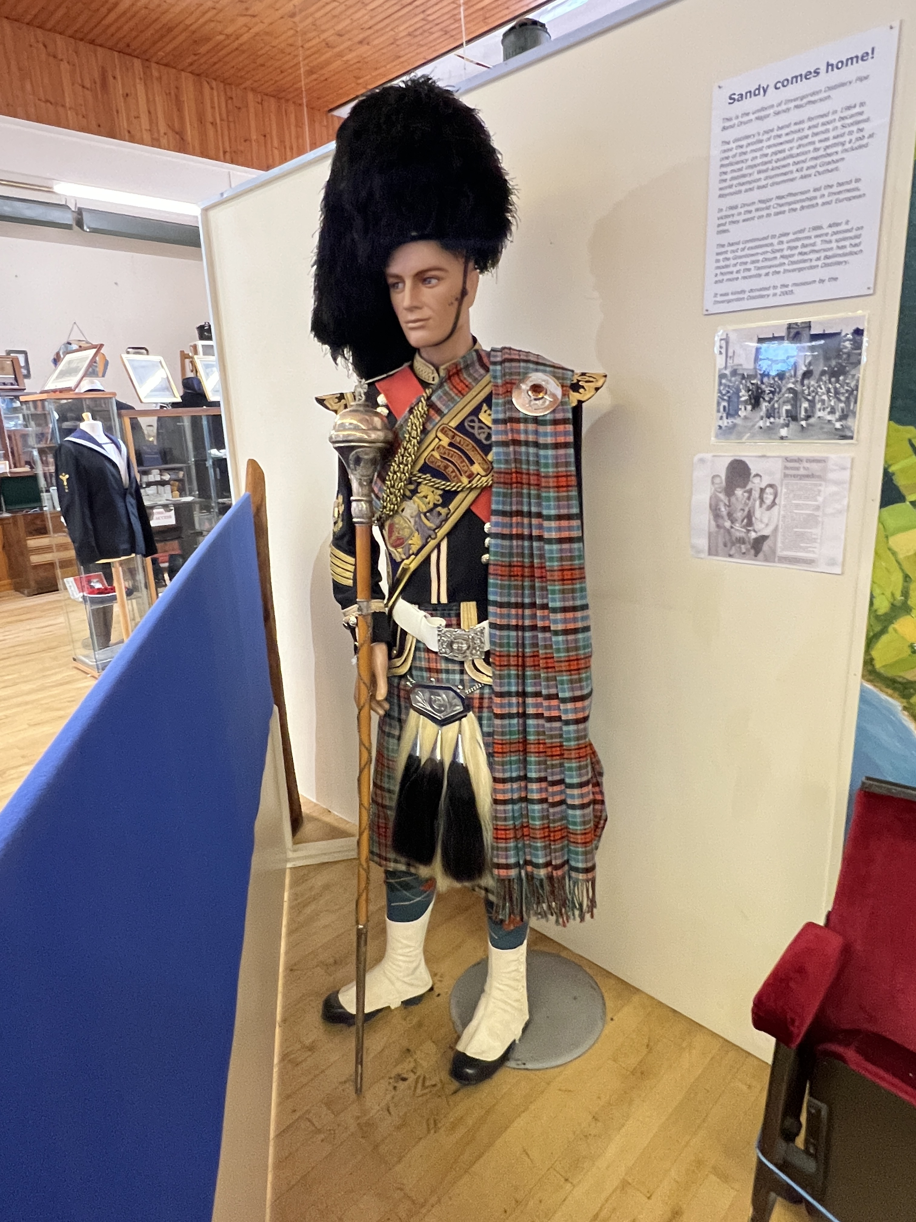
The local museum also had the usual array of things from the past. The local distillery’s former drum major uniform was rather good.
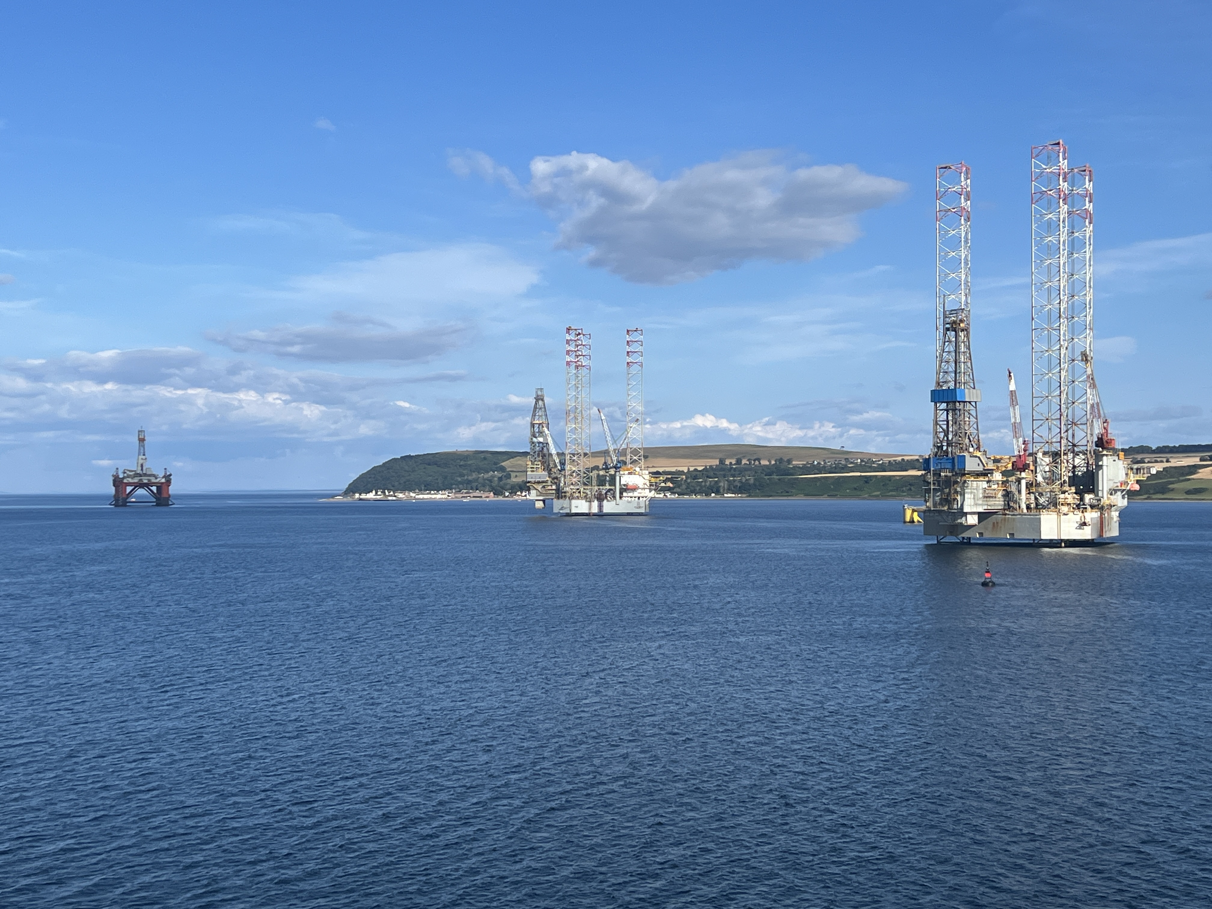
Back on board the ship we sailed away down the port past some oil rigs and out into the North Sea headed for the Shetlands and the port of Lerwick. Some good views of the town and highlands as we left.
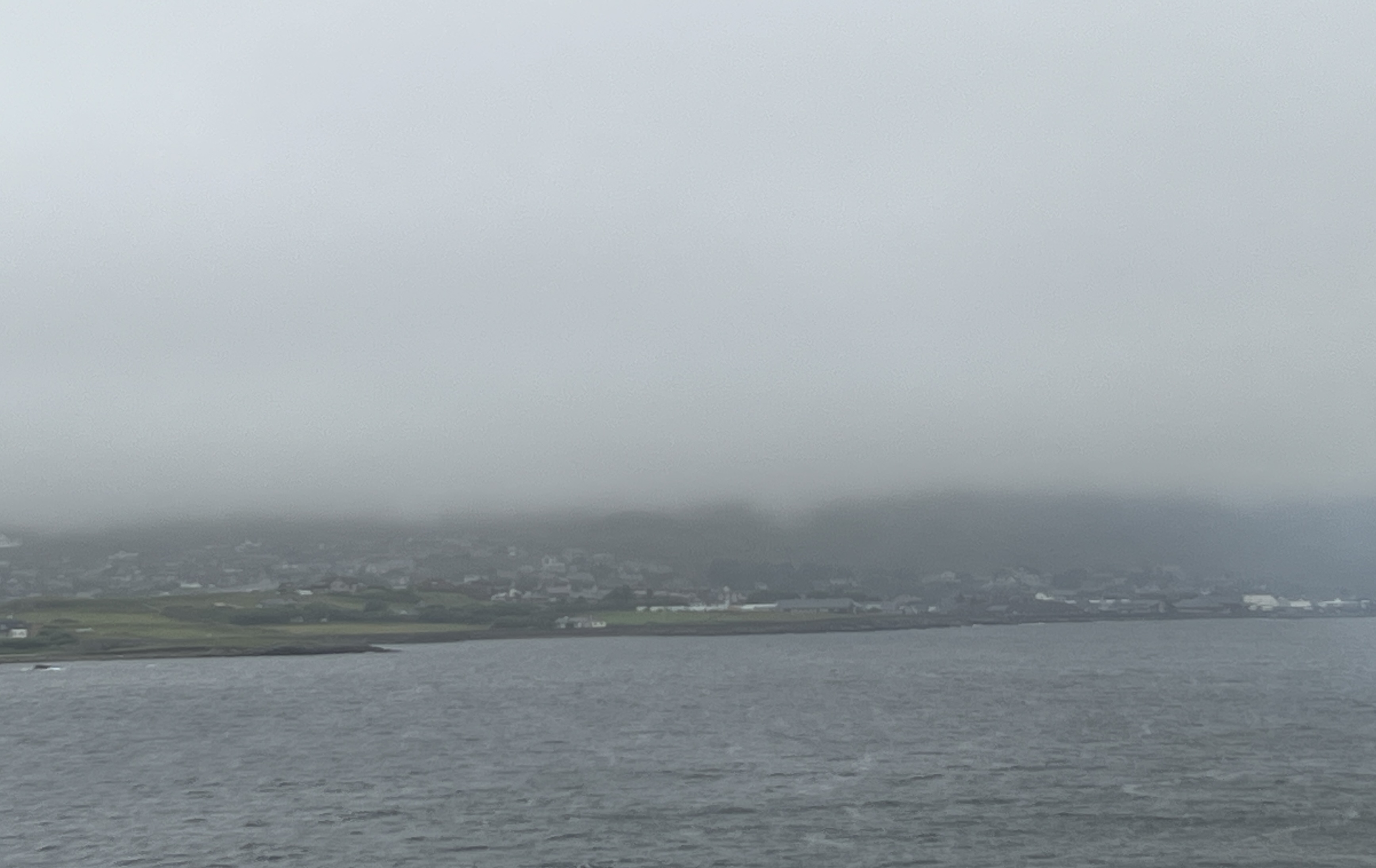
Overnight the weather turned rather foul, no rain but fog and some strong winds. Arrived off Lerwick but the ship was unable to get into the harbour, we were going to use shuttles to get to shore. Too dangerous, so unfortunately the Shetlands had to be abandoned and we departed for a day at sea and set off for Iceland.
We have been on the Shetlands before so it wasn’t a big blow, some onboard though were very disappointed but accepting of the decision. We have now started stage 3 of the journey, from Dover to New York.
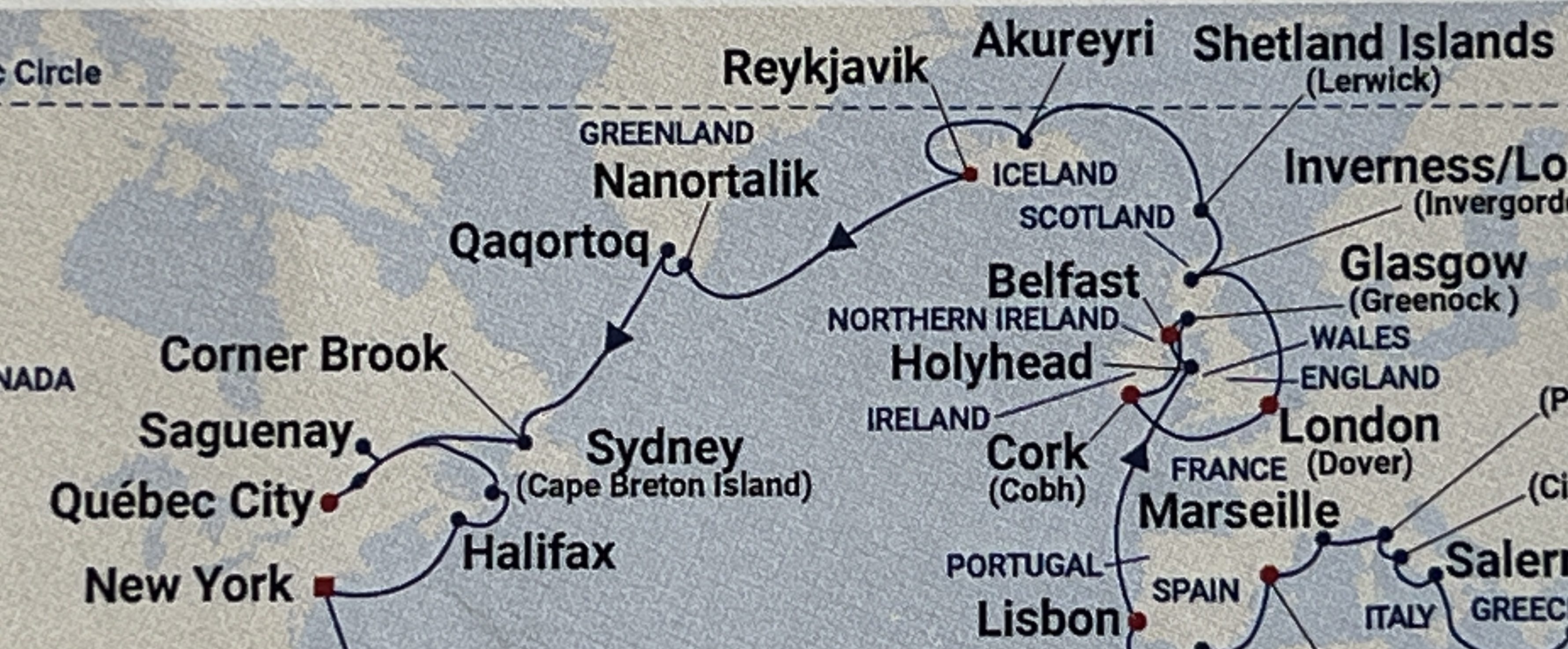
The course to Iceland was to take us around the east of the Shetland and then north west over the top of the Faroe Islands out into the deep North Sea.
