Monthly Archives: April 2024
In Search of the Murrumbidgee
We are now in Adaminaby at the Alpine Caravan Park for a couple of nights. It is on the edge of the small town. First thing done was to fill the fuel tank, 69 litres. Just made it, anlmost empty. The odd thing about Adaminaby was that there was no dump point in town for the onboard loo, now full. Closest one was 35 km away in Cooma! So it might have to wait another day or two.

Our objective here in Adaminaby was to seek out the Murrumbidgee as close to its source that we were able to access. In this search we have been frustrated by the National Parks people who have closed the northern section of Kosciusko NP to undertake a big feral animal cull, aimed mostly at wild horses, pigs and foxes. The horses, which number in their thousands, are very destructive of the fragile environment but are also much loved by some of the local horse brigade. The brumbies have that Man from Snowy River nostalgia.
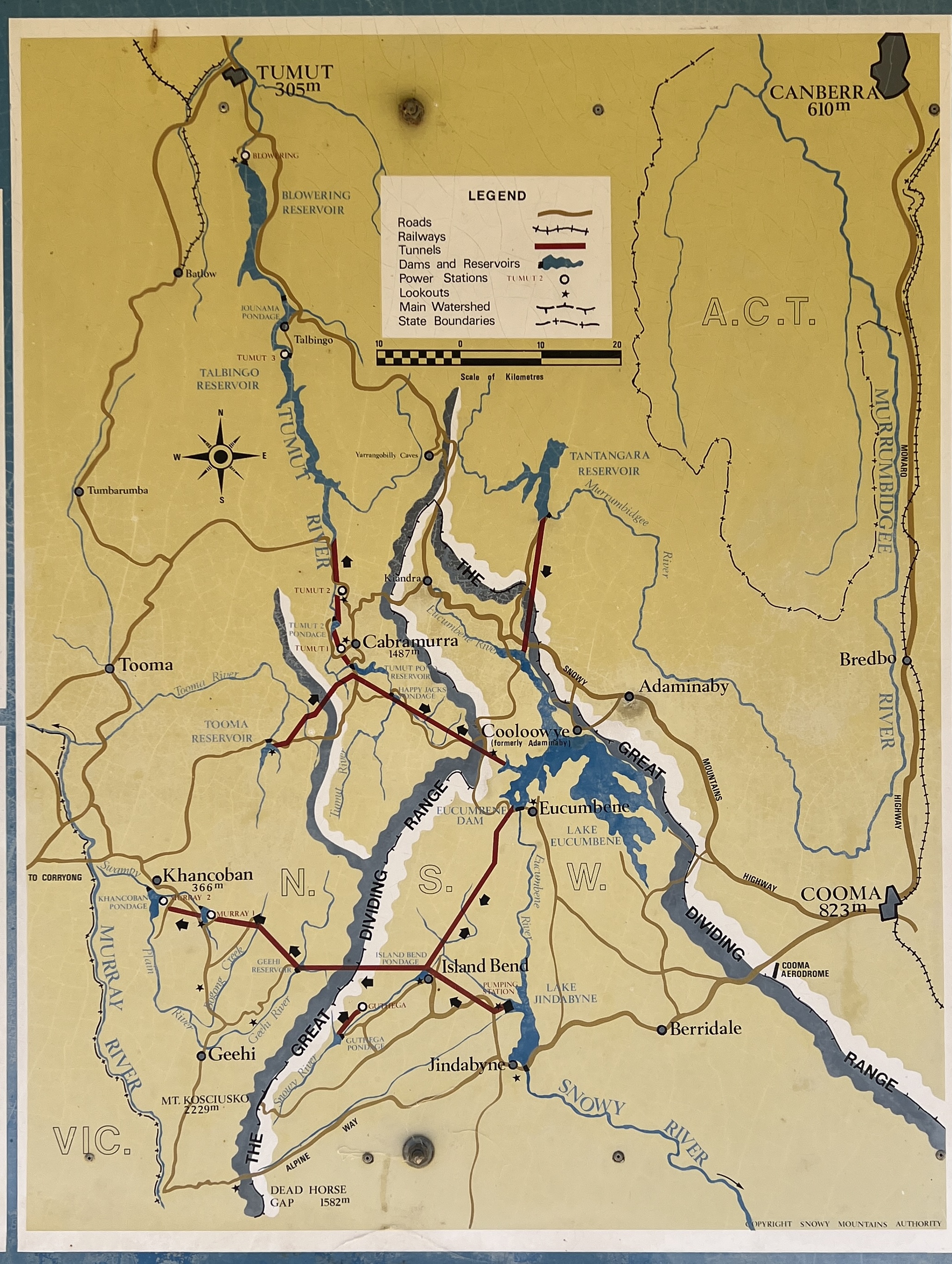
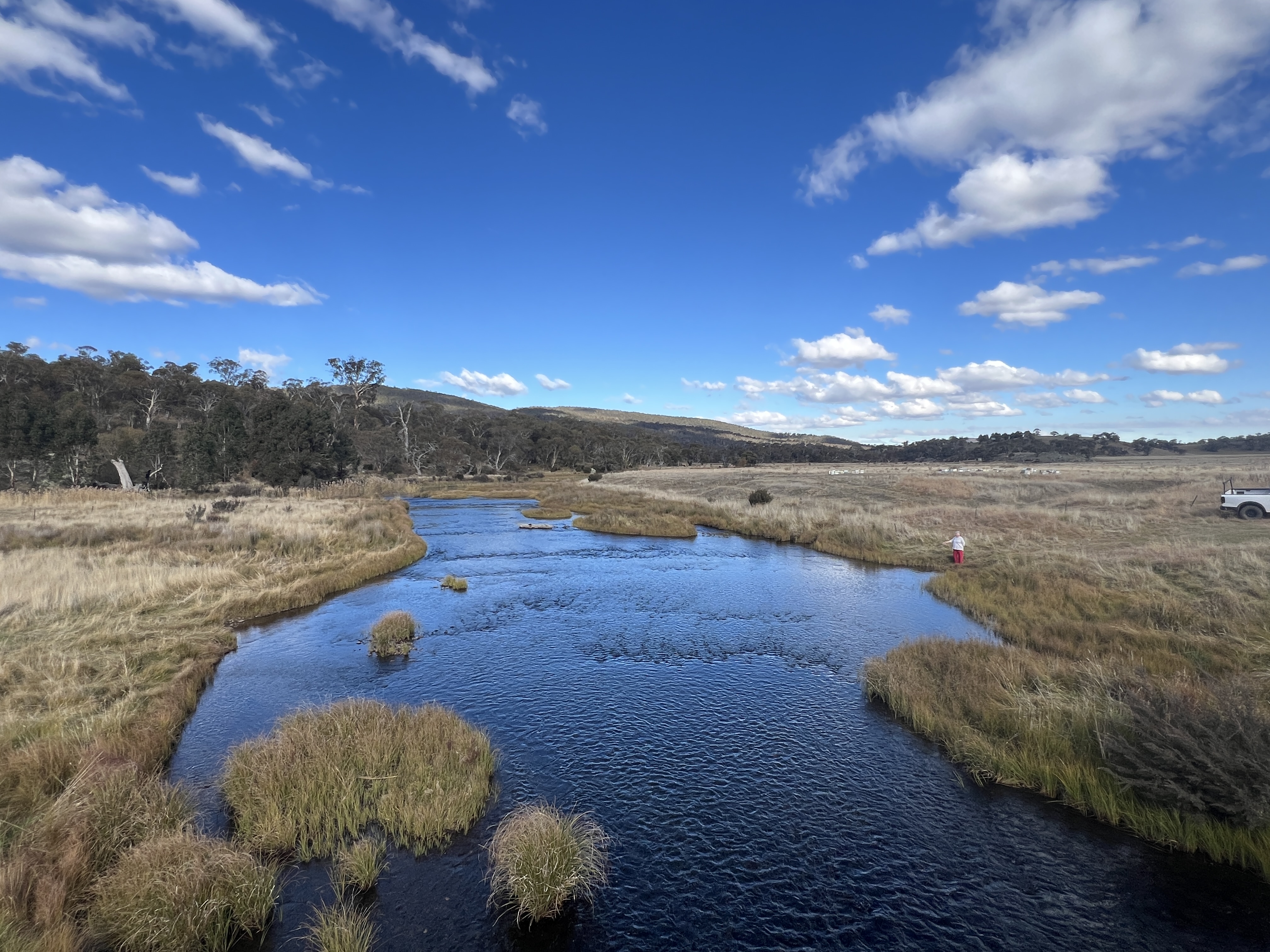
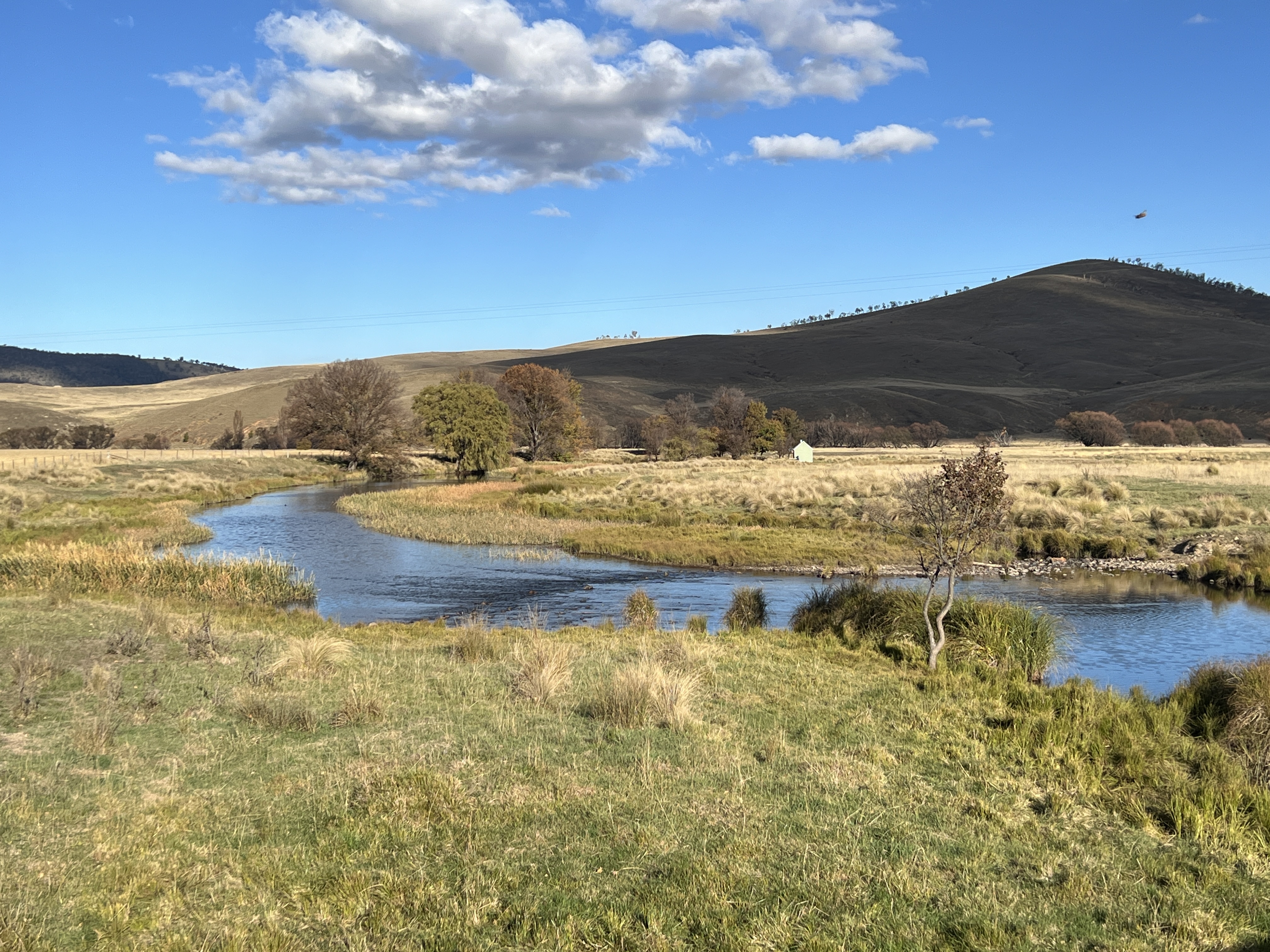
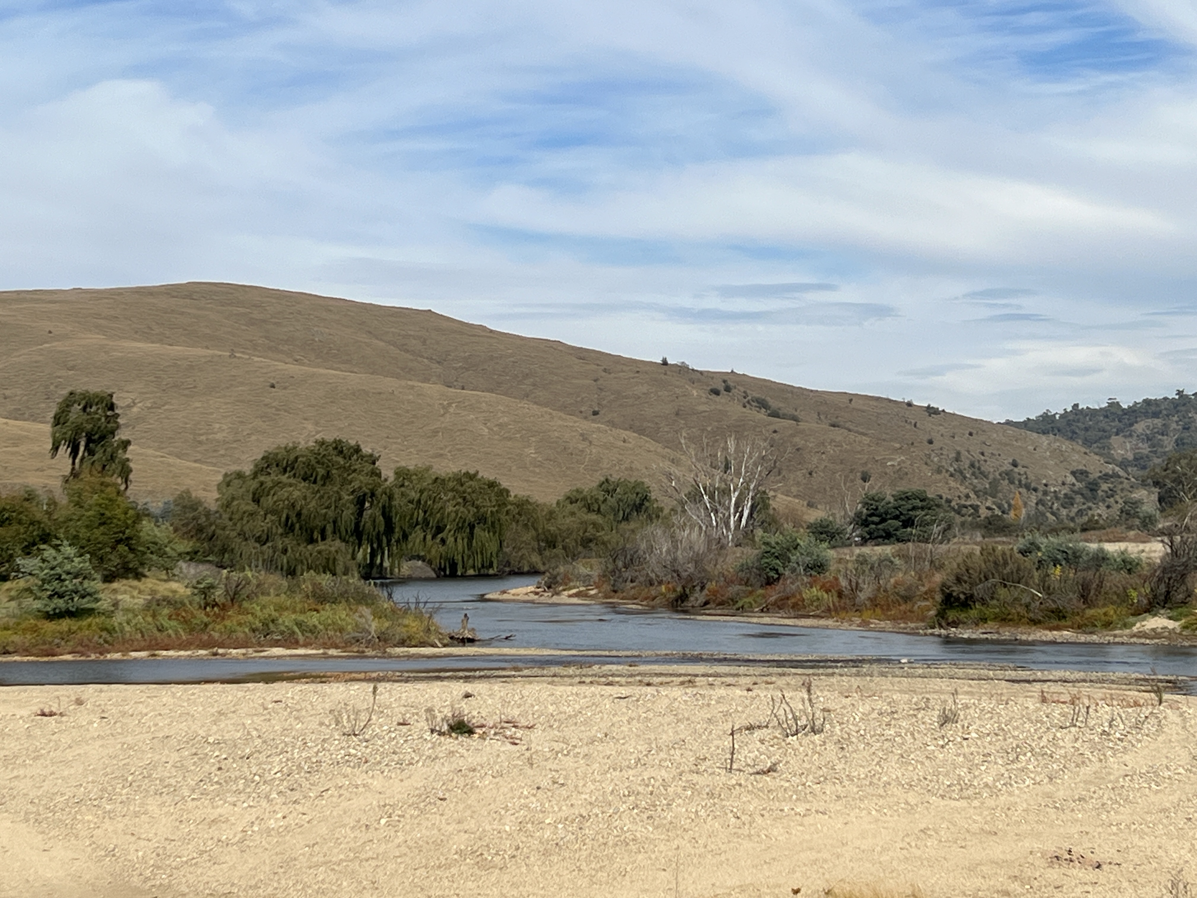
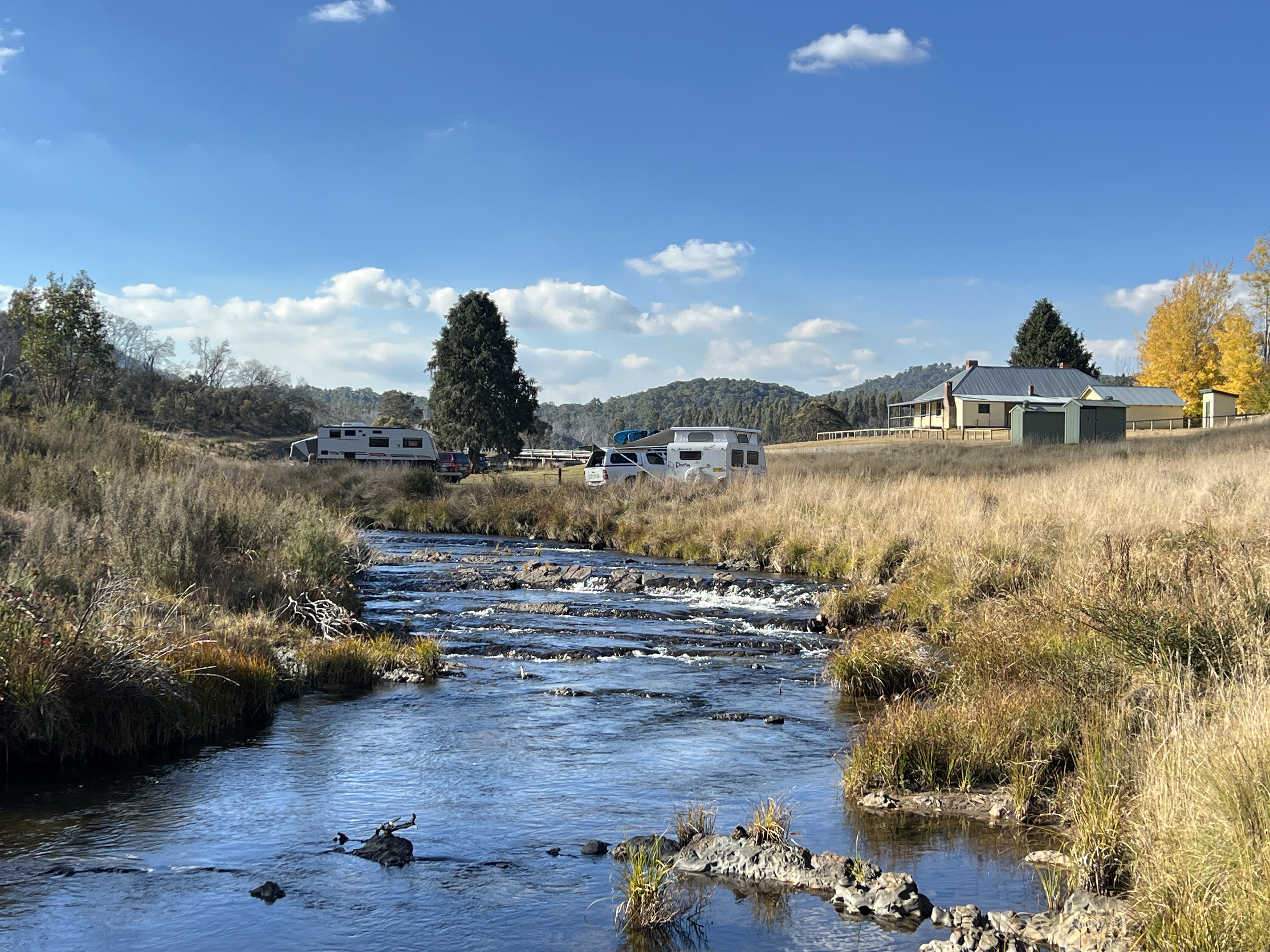
The Murrumbidgee is Australia’s second longest river and flows 1,488 km from its source about 50 km north of Kiandra to join the Murray River near Boundary Bend, not far from Swan Hill. The actual bog where the river starts is on the ground below Peppercorn Hill, accessible for keen walkers. We were going to camp at a spot not far from there and then drive a short distance to make our first sighting before the river flows into Tantangara Reservoir, a large proportion of this dam’s water is diverted into Lake Eucumbene. What comes out of the dam for the Murrumbidgee system is a fraction of what it was pre dam. But plenty is then added as the river flows south through inaccessible valleys and then farmland towards Cooma. It seems that the road from Adaminaby to Yaouk fits the bill and we head out for a drive of about 20km along gently undulating grazing country. We find the river crossing near a group of homesteads below Tantangara dam at Yaouk, an aboriginal word, not sure what it means. Pretty spot as the river bubbles away downstream.
The road loops through grazing land on its way back to Adaminaby, passing through the small settlement of Shannon’s Flat.
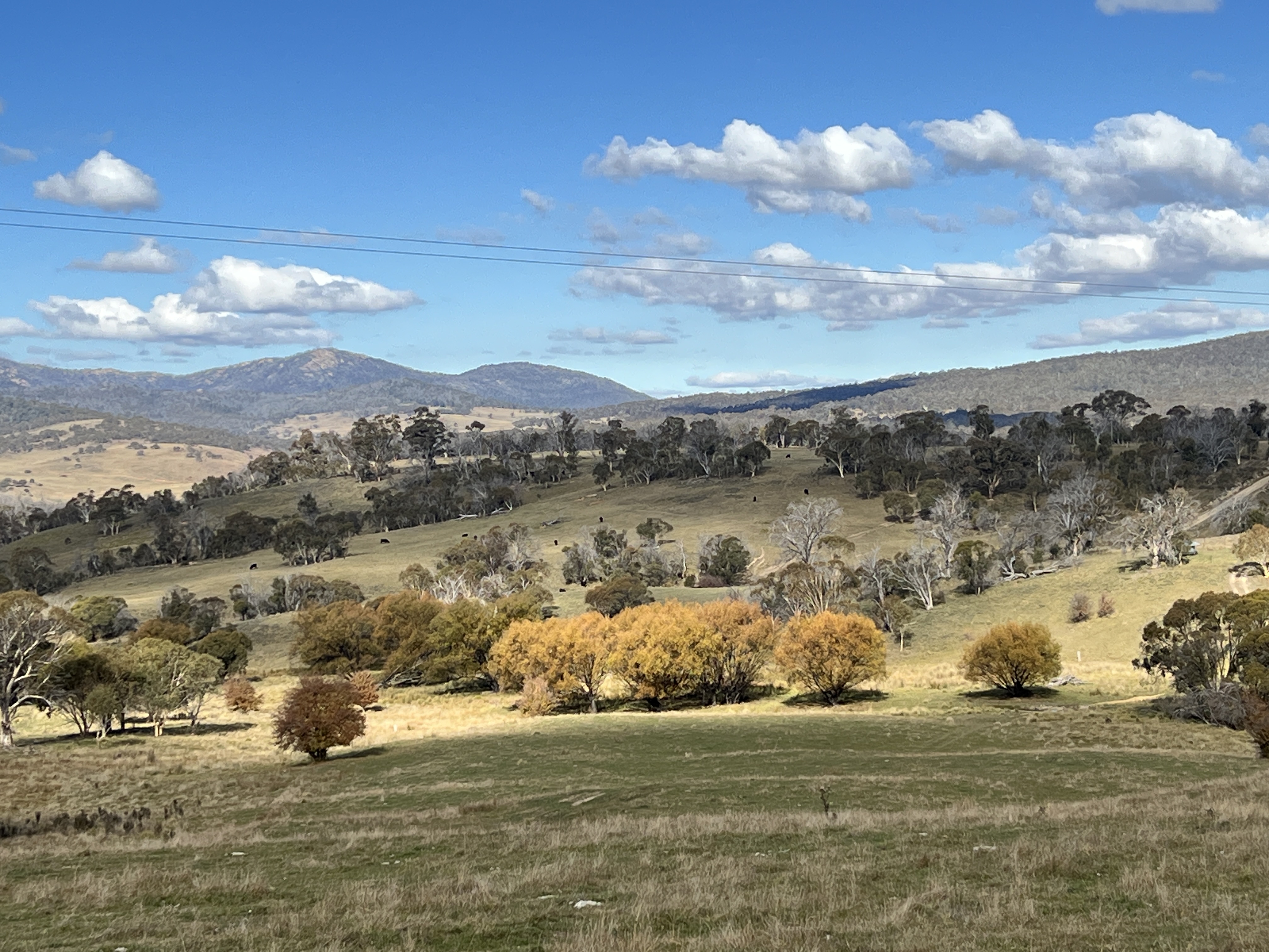
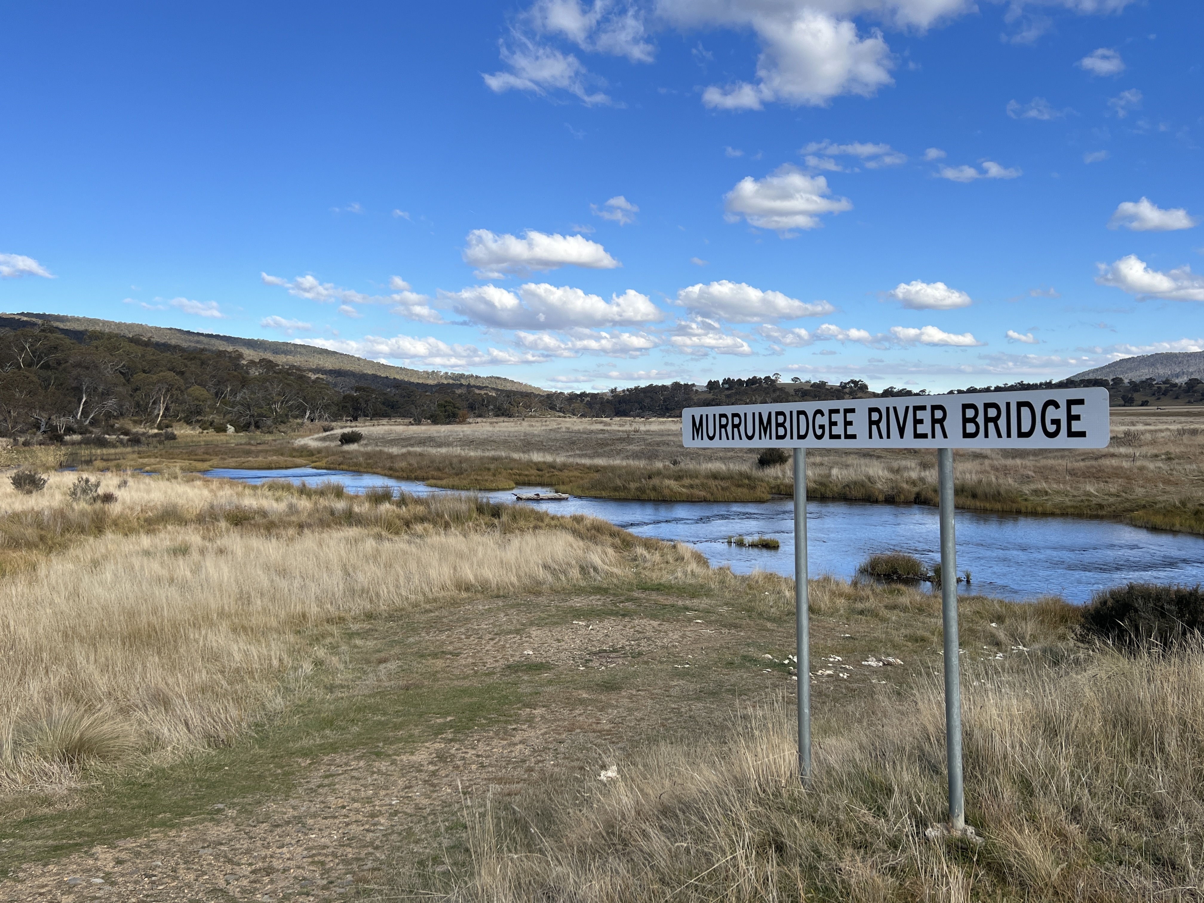
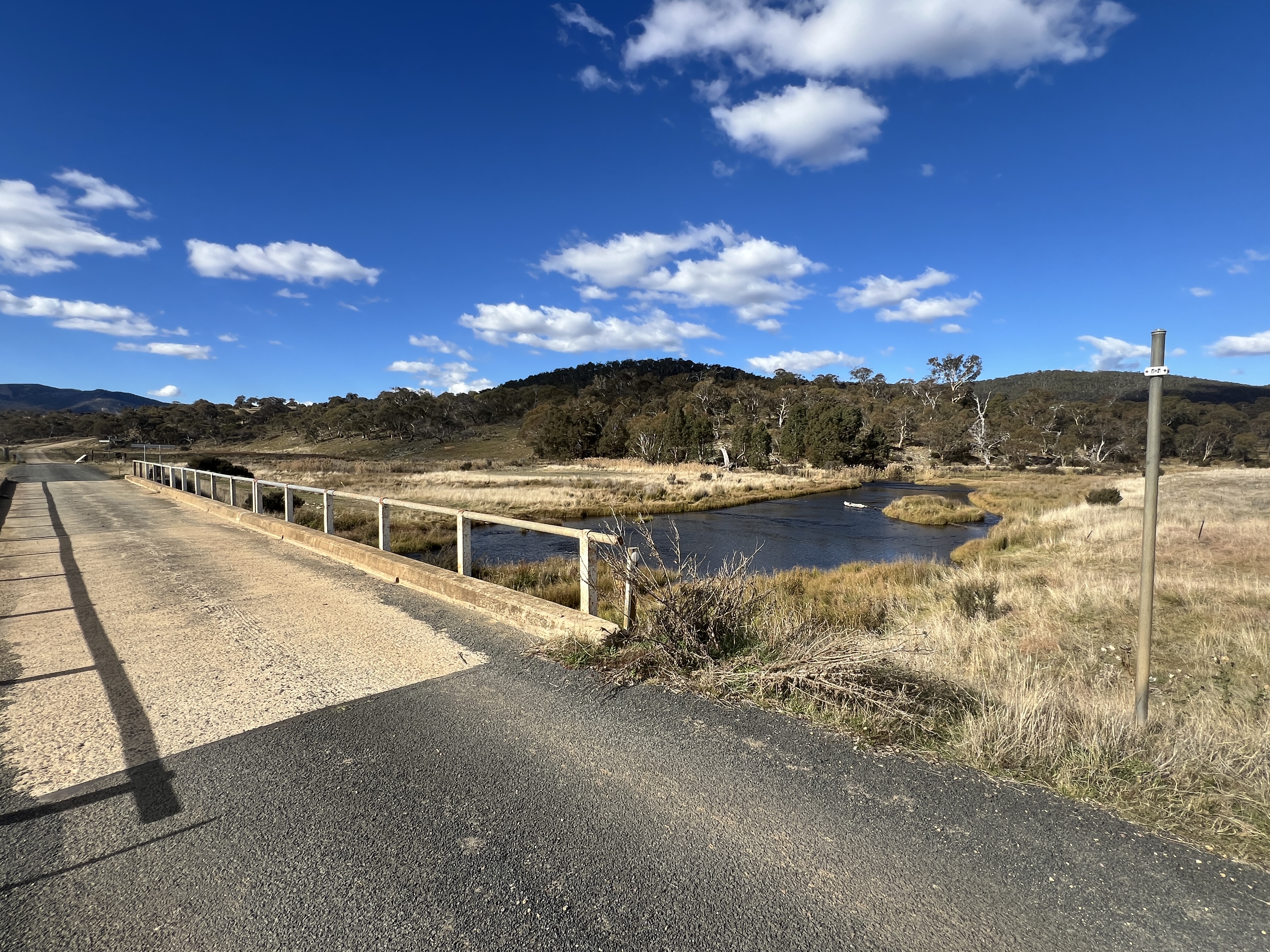
Great views of the countryside. Just outside Adaminaby on the other side of town we again cross the Murrumbidgee, another pretty spot, bubbling along its way.
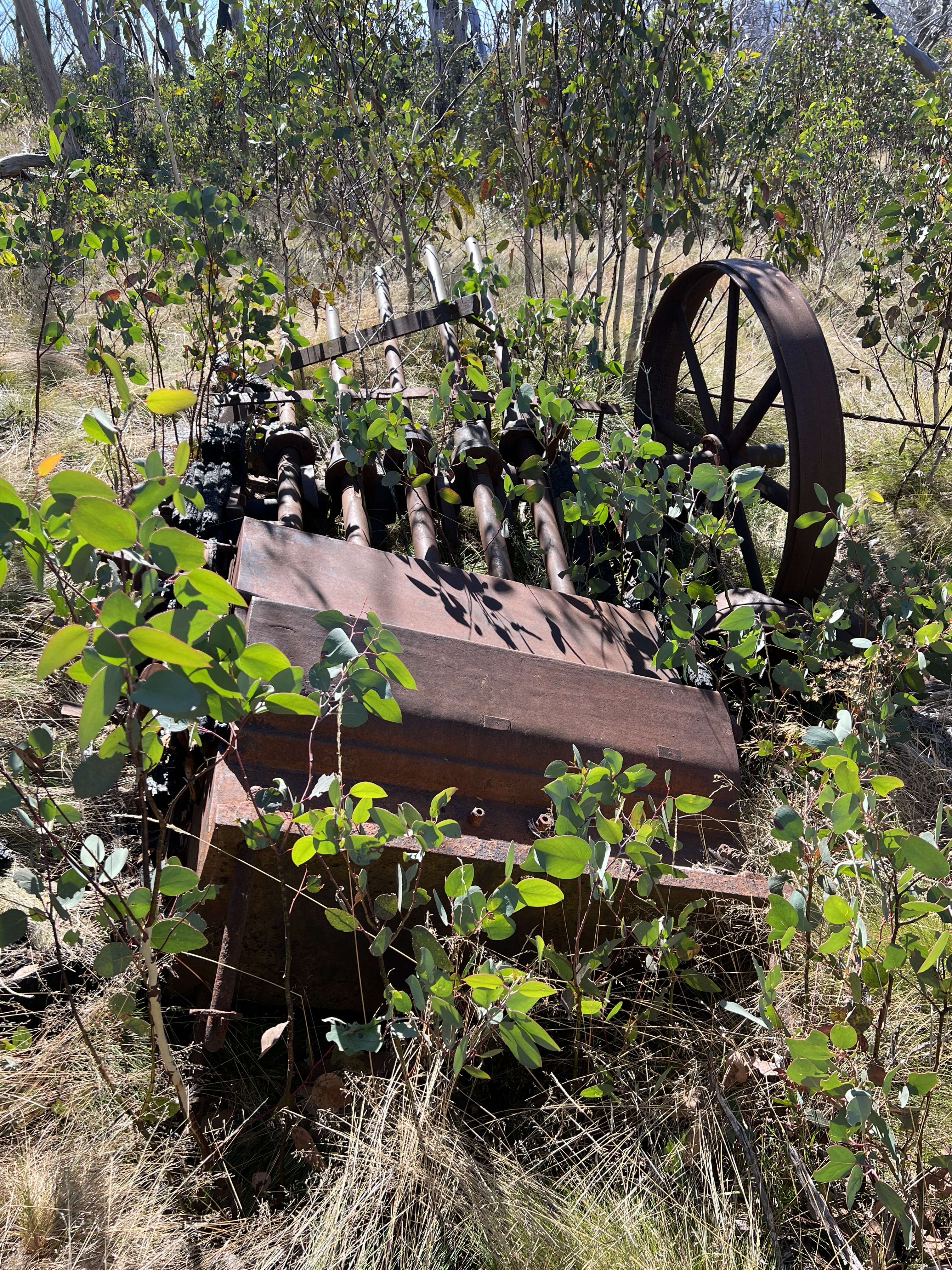
Adaminaby is also an ideal spot to stay to check out the old gold mining district of Kiandra. Not much of the old town is left today. It is the spot where skiing first started in Australia, 160 years or so ago. It fell by the wayside following the development of places like Thredbo and Perisher in the late 1950s and 60s. We strolled off on a 3 km loop walk to take in the alpine scenery.
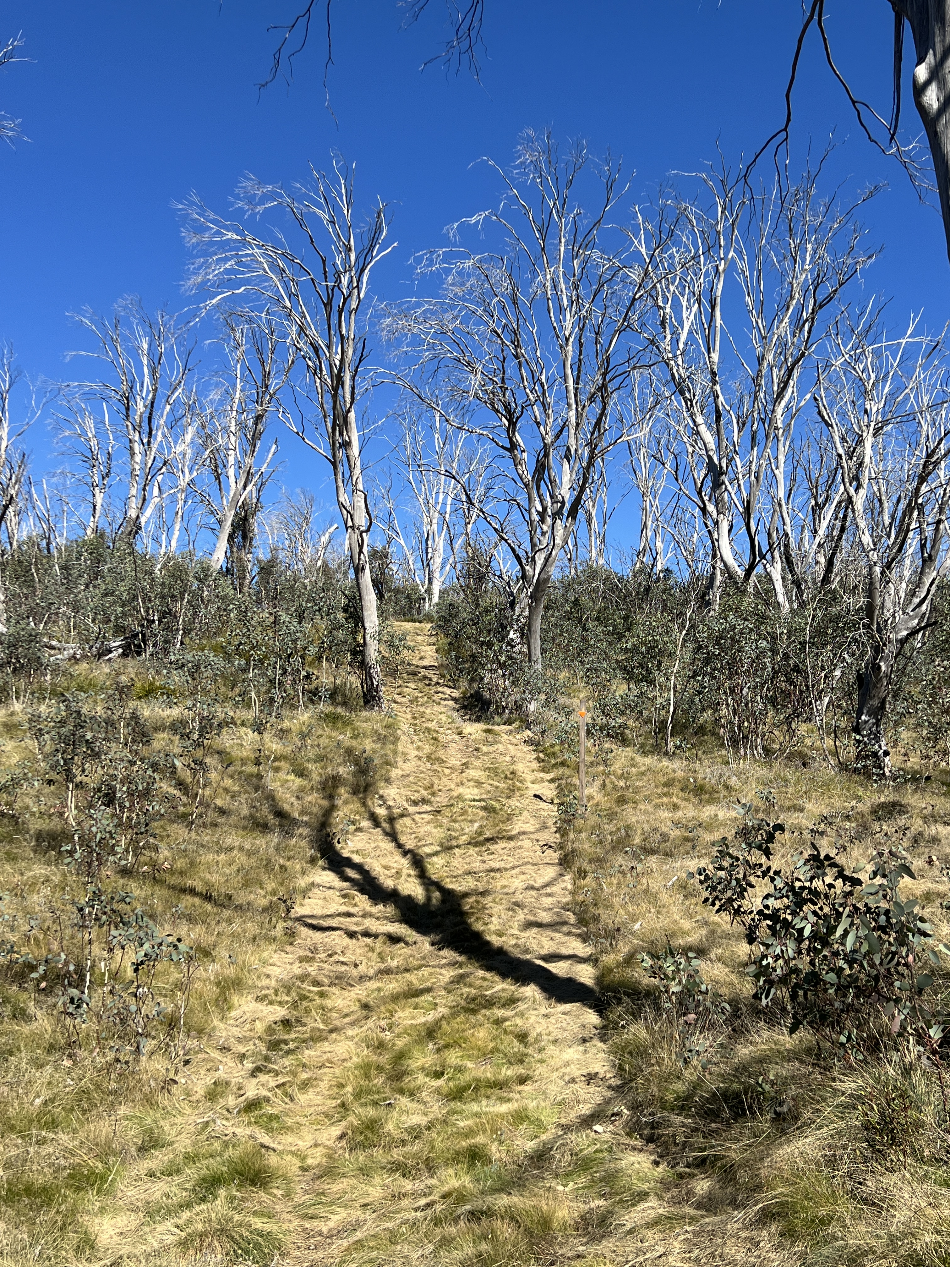
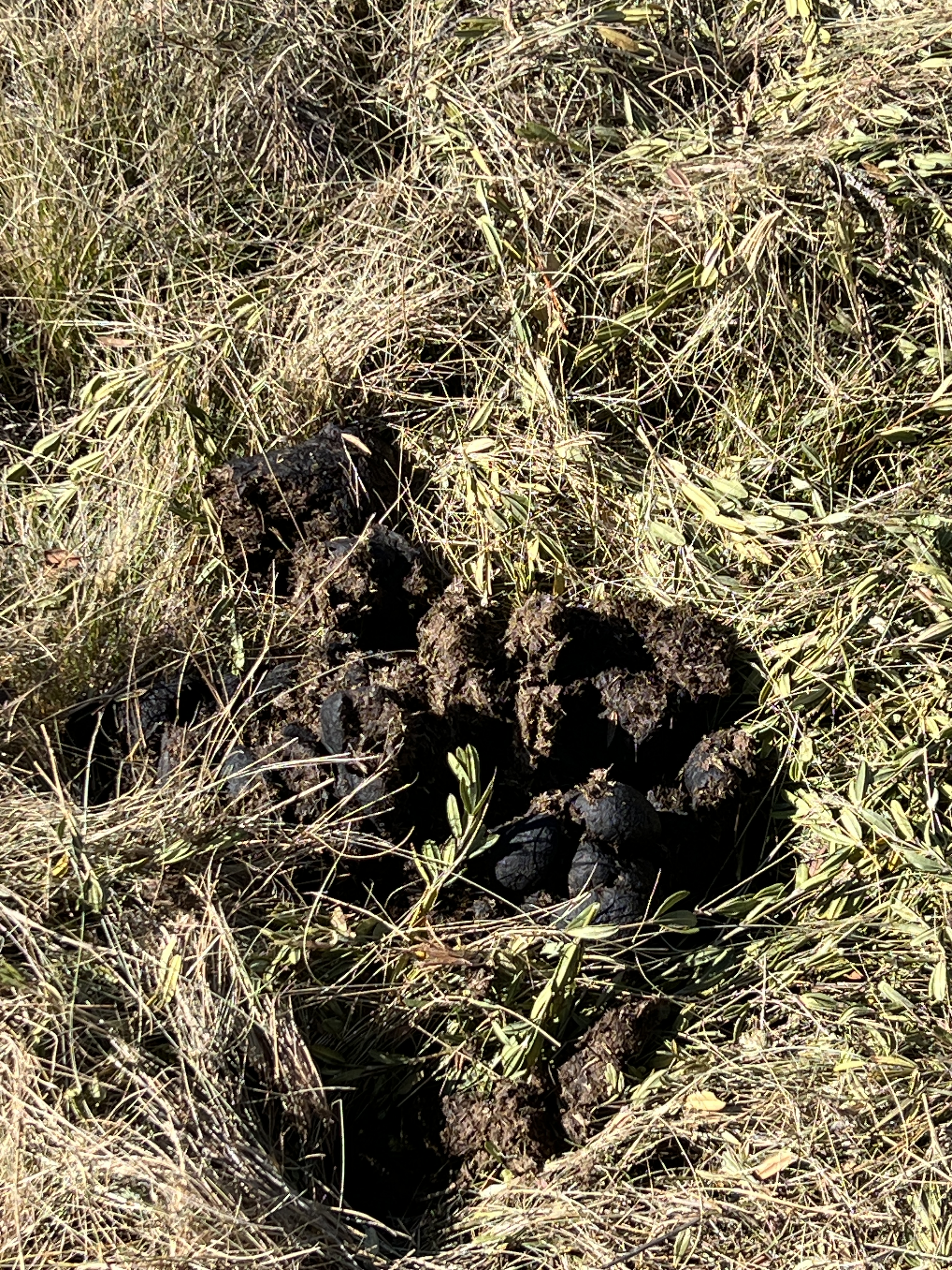
Little more demanding than we anticipated along a well manicured track, that doubles as a cross country ski route in winter. A few relics from the gold mining days were passed as well as a sighting of some brumbies and their plentiful tell tale calling cards left behind on the track.
The journey continues from Adaminaby further south to Cooma where we encounter the Murrumbidgee again about 15 km out of town. It is here that the river does a big U turn, cutting its course through a gap in the Clear Ranges, and heads back north towards Canberra.
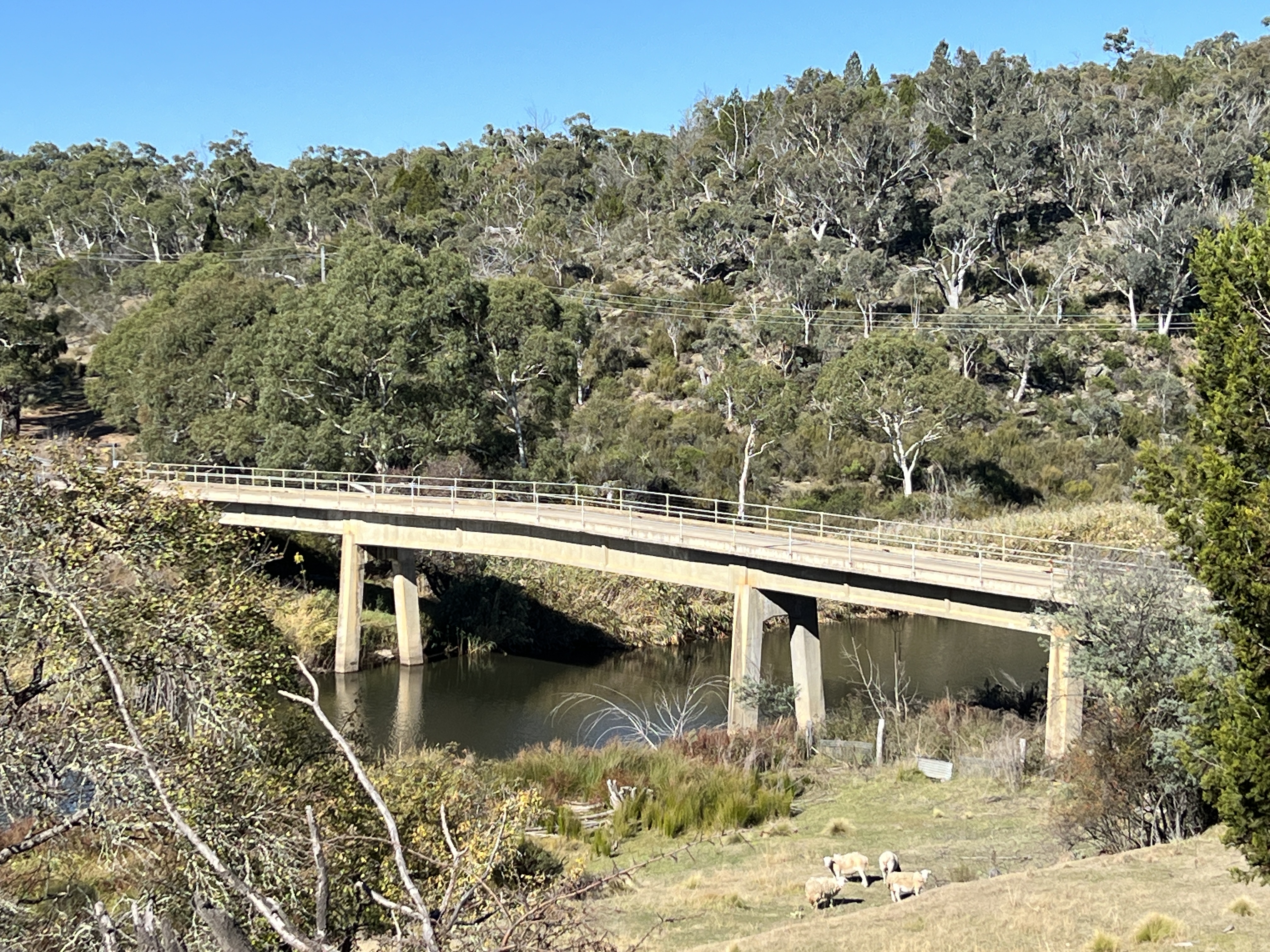
We join the Monaro Highway out of Cooma and head north. The road parallels the course of the river away to the west in the shadow of the Clear Ranges. It is largely inaccessible due to the surrounding grazing and farm land. We plan to stop the night in Bredbo, free camping behind the old Bredbo Inn. ‘Free camping’ is bit of a loose phrase in this case because there is the expectation that one dines in the pub. Which we did, rather good steak. Homealone, enjoyed a plate of flathead fillets. Chips of course too.
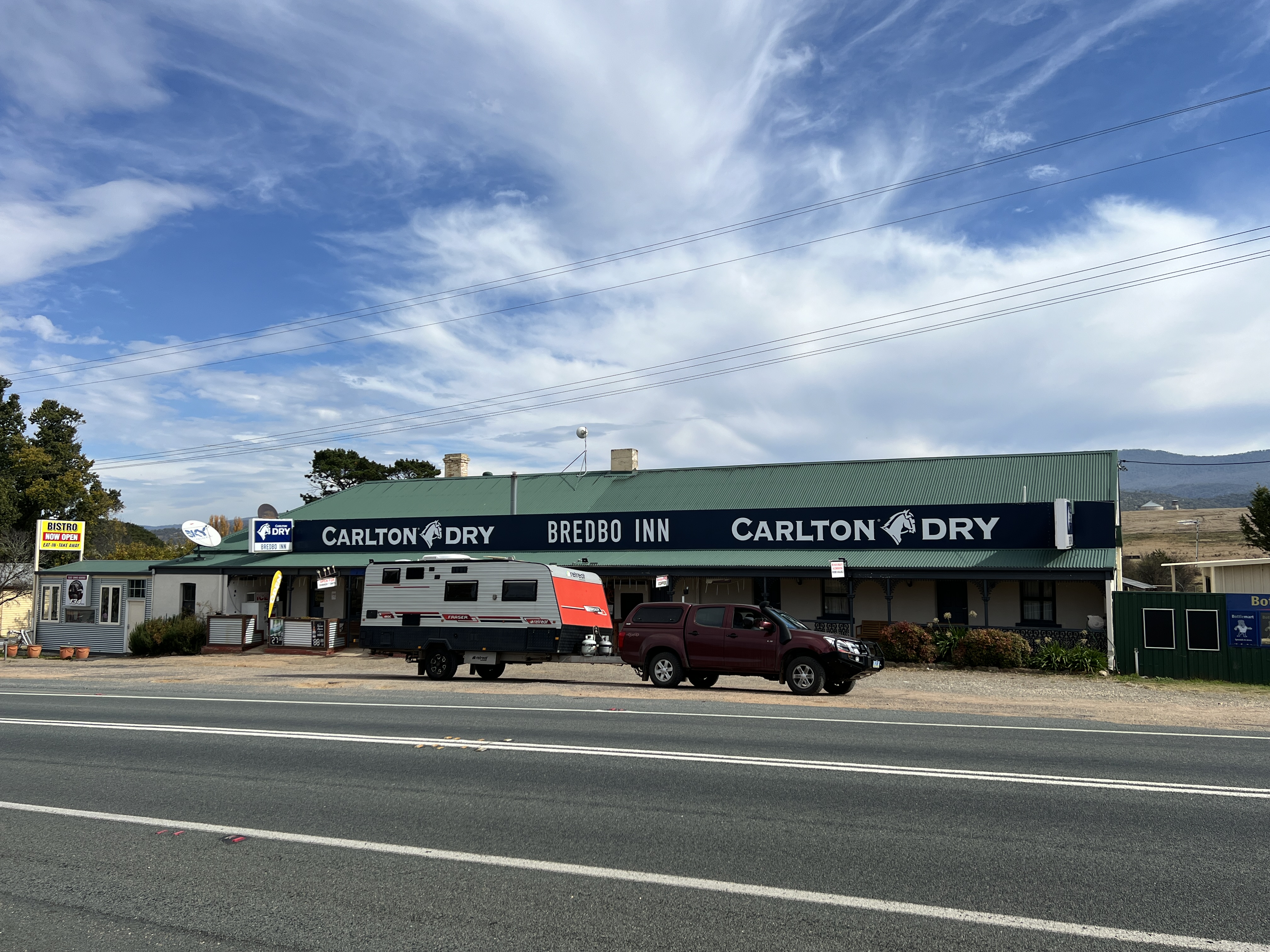
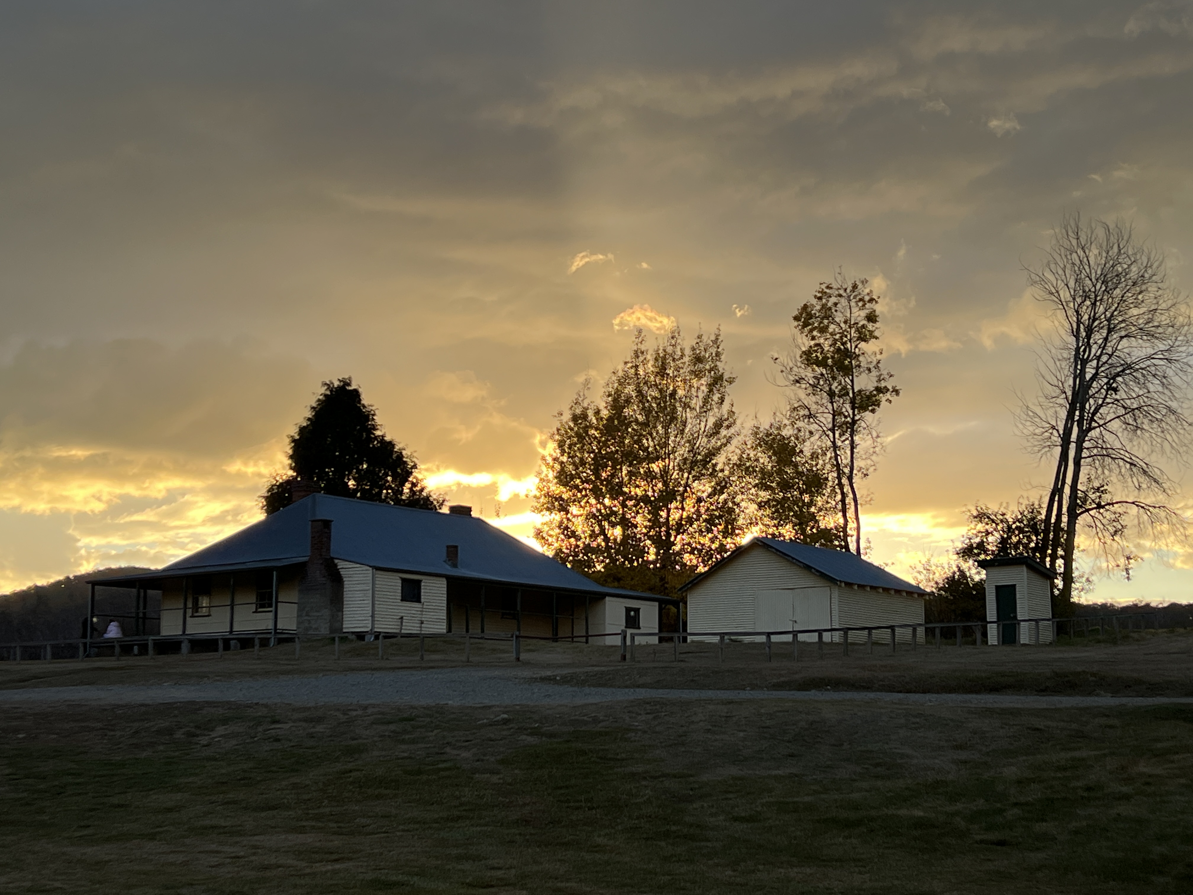
The Bredbo Inn was built in 1830s and has been operating ever since. There is much memorabilia on its walls. It is also claimed to have links to the Man from Snowy River story with Banjo Patterson reportedly a guest. The original Clancy of the Overflow may also have been an employee at the time. And as for the ‘Man’, a local identity may well be a candidate for the mantle, but who knows. Anyway this chap is said to have died in the Inn after falling from his horse crossing the bridge on a frosty morning. Something to talk about at the bar.
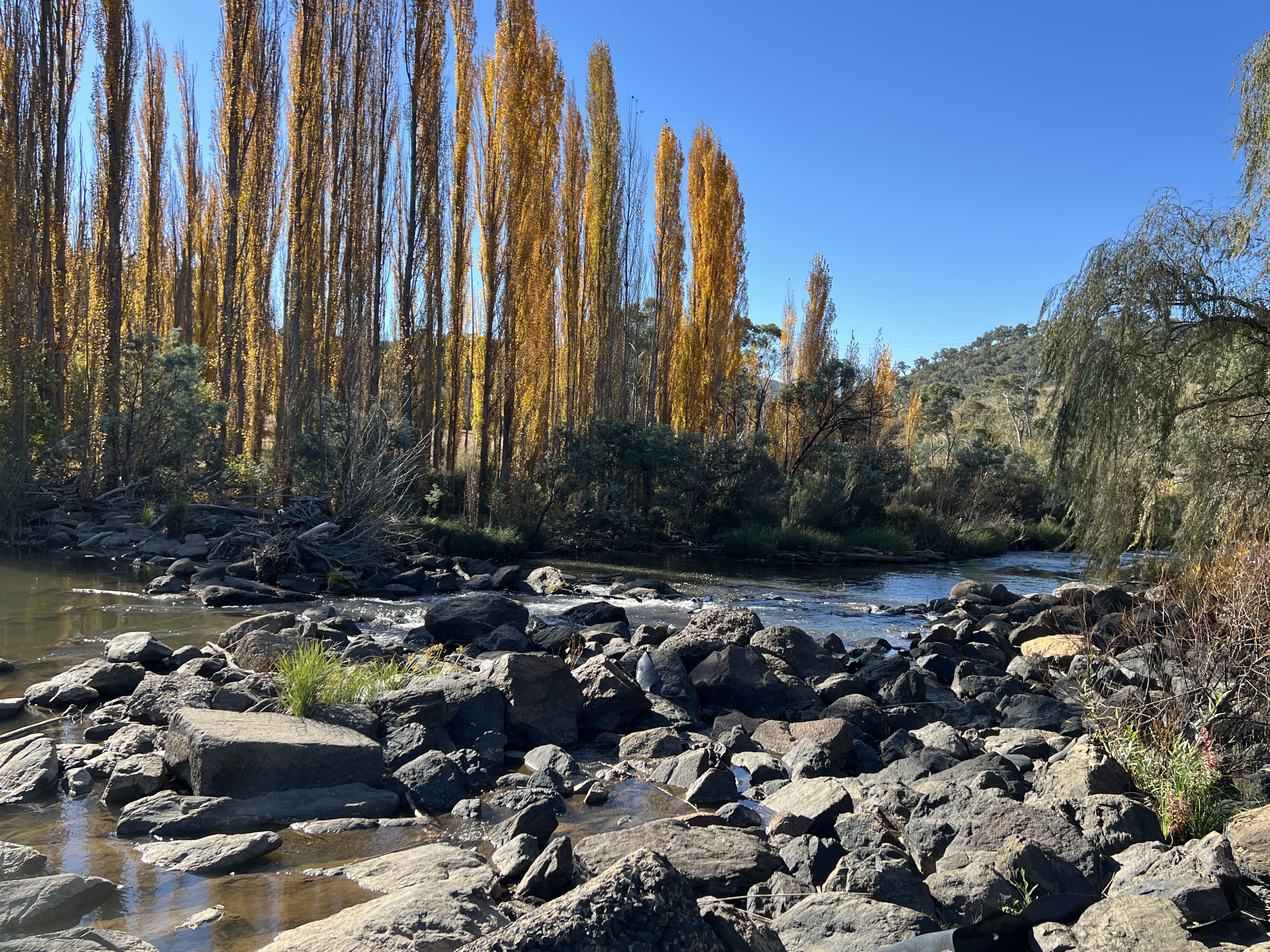
Nearby the Inn are two spots to see the river again. The prettier one is where it is joined by the Bredbo River.
Our next stop will be at the Namadgi NP for a couple of nights.
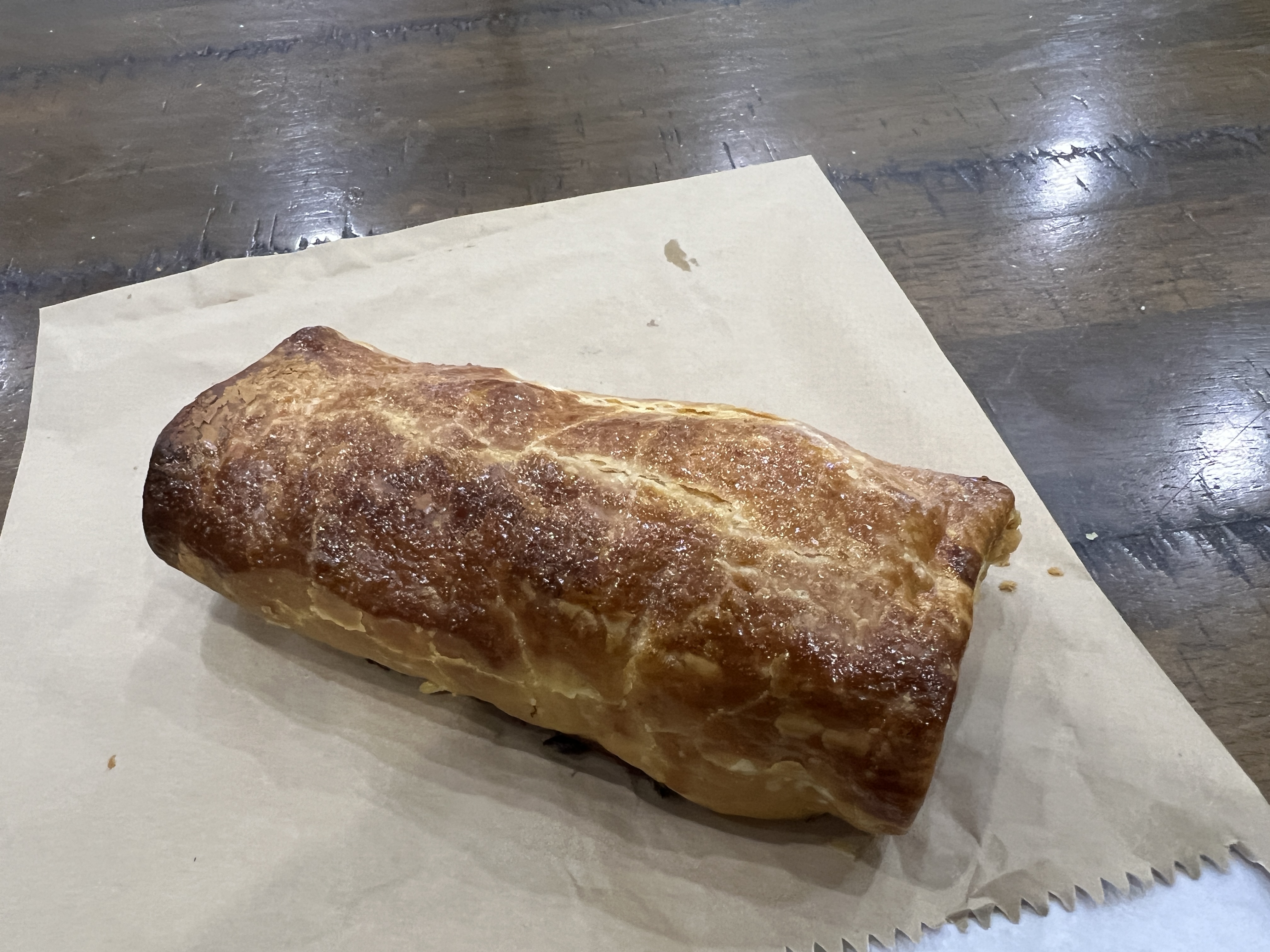
Before leaving Bredbo we indulged in the best sausage rolls so far at the Bredbo Bakery and picked up a couple of their famous frozen pies for a meal one night along the way.
Yarrangobilly Village
Despite planning a trip well there are times Allthego has found where you just get things wrong and you end up in a place that is not what you thought it was going to be like. In this post Yarrangobilly Village is shortened to YV to save the fingers. YV is a few kilometres from Yarrangobilly Caves, YC. Now, YC was our objective for this stop and we had planned a three night stopover here at YV to visit the caves and do a little exploring.
For some reason Allthego had thought YV was a caravan park with power, water a dump point and fuel. I suppose it was the word ‘village’ that put him on this track. Well there was a village here back in the 1860s, the surrounding countryside was grazed, timber, gold mined at Kiandra etc. But over the next hundred years fortunes rose and fell, population declined and in 1969 the Post Office closed and the area became a national park. YV also spread across the river flats on the other side of the road.
Today, nothing remains except one house (can be rented from National Parks?) built in 1898 (has had some renovation since) overlooking the camping area and Yarrangobilly River, YR. So, we were a little short on the facilities we had anticipated.
Despite the initial negative vibe YV is a great stop over point along the Snowy Mountains Highway, about midway between Tumut and Cooma.
After setting up the site beside YR Allthego thought he would test the Long Drop facility, the onboard loo was nearly full and had to be nursed, along with our water, for the next couple of days to allow those now common early morning in the dark visits. Walking up the hill Allthego noticed a lady emerge from the facility and thought to himself ‘now I know her’. Allthego sauntered across and had a closer look. And said ‘ I know you’, she looked quizzically and I continued ‘Debbie’. She took her sunnies off and also had a closer look, paused a bit and said ‘Russell’. My cousin Debbie! Haven’t seen her for some time.
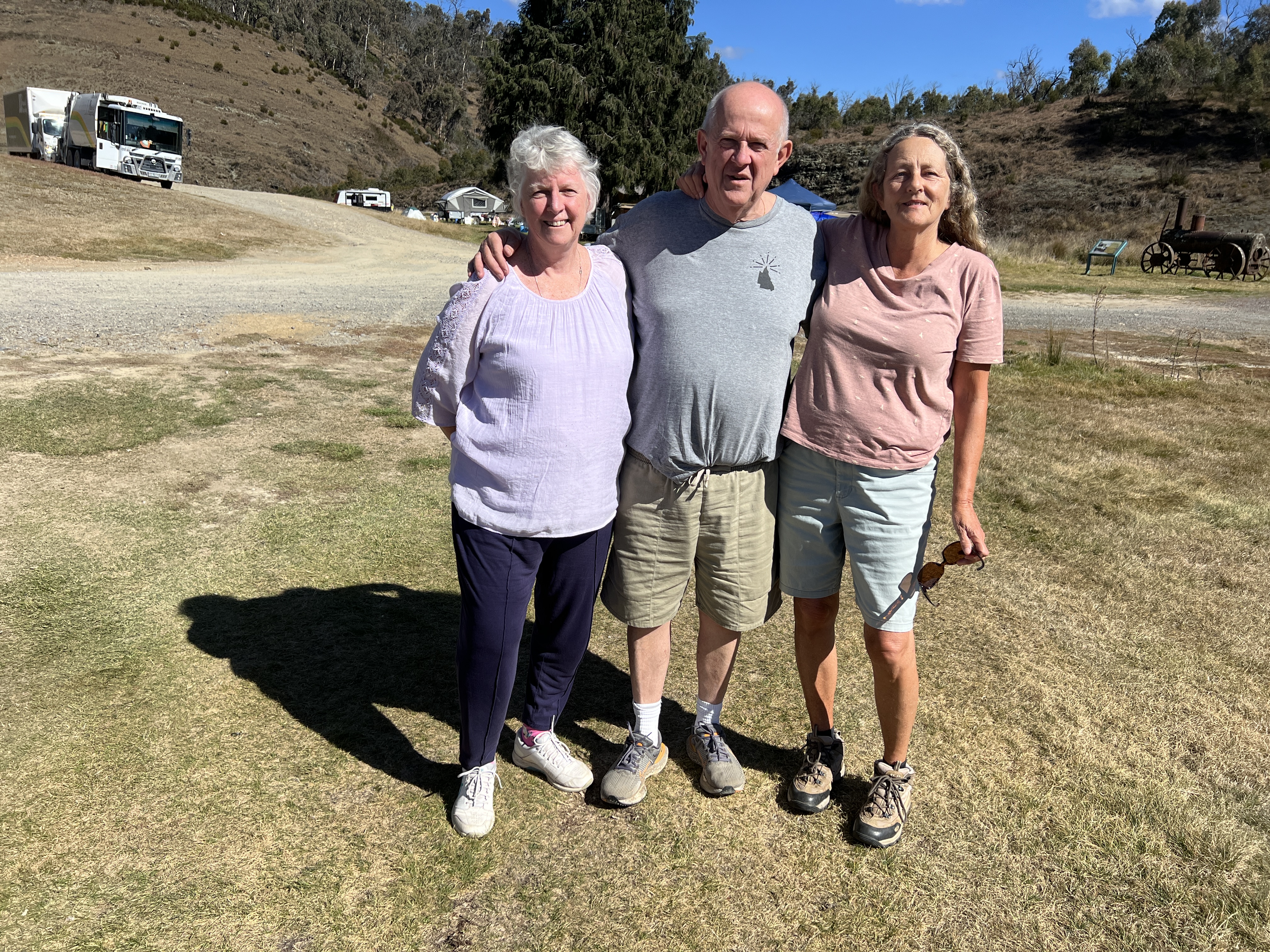
Her mother, my father’s sister, was 100 last September. She had just stopped by to use the loo and was on her way home to Dalgetty, on the Snowy River. We had a chat for a while before she and Ron, her husband, had to head off. One for the road!
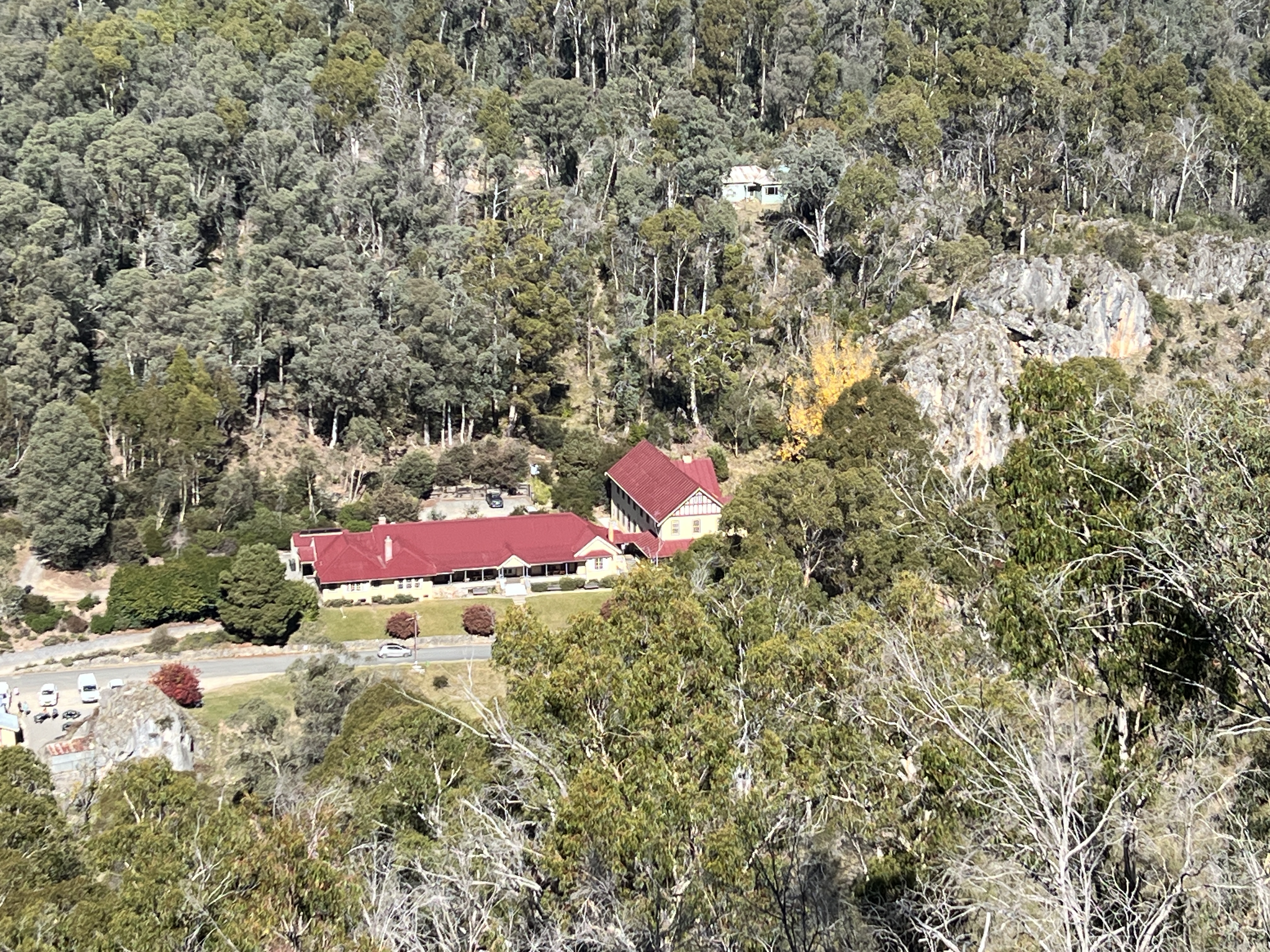
The turn off to YC is about a 7 km drive from YV, there is then a one way 6 km one lane road/track to the YC Visitor’s Centre. The track is narrow in places but quite well graded, can’t bring a van down to the bottom.
The caves were first discovered by Europeans in the mid 1800s and became over the years a tourist attraction. The National Park people have set up a system of mostly guided entrance only to the caves. A one way ring road makes a circuit of the popular spots.
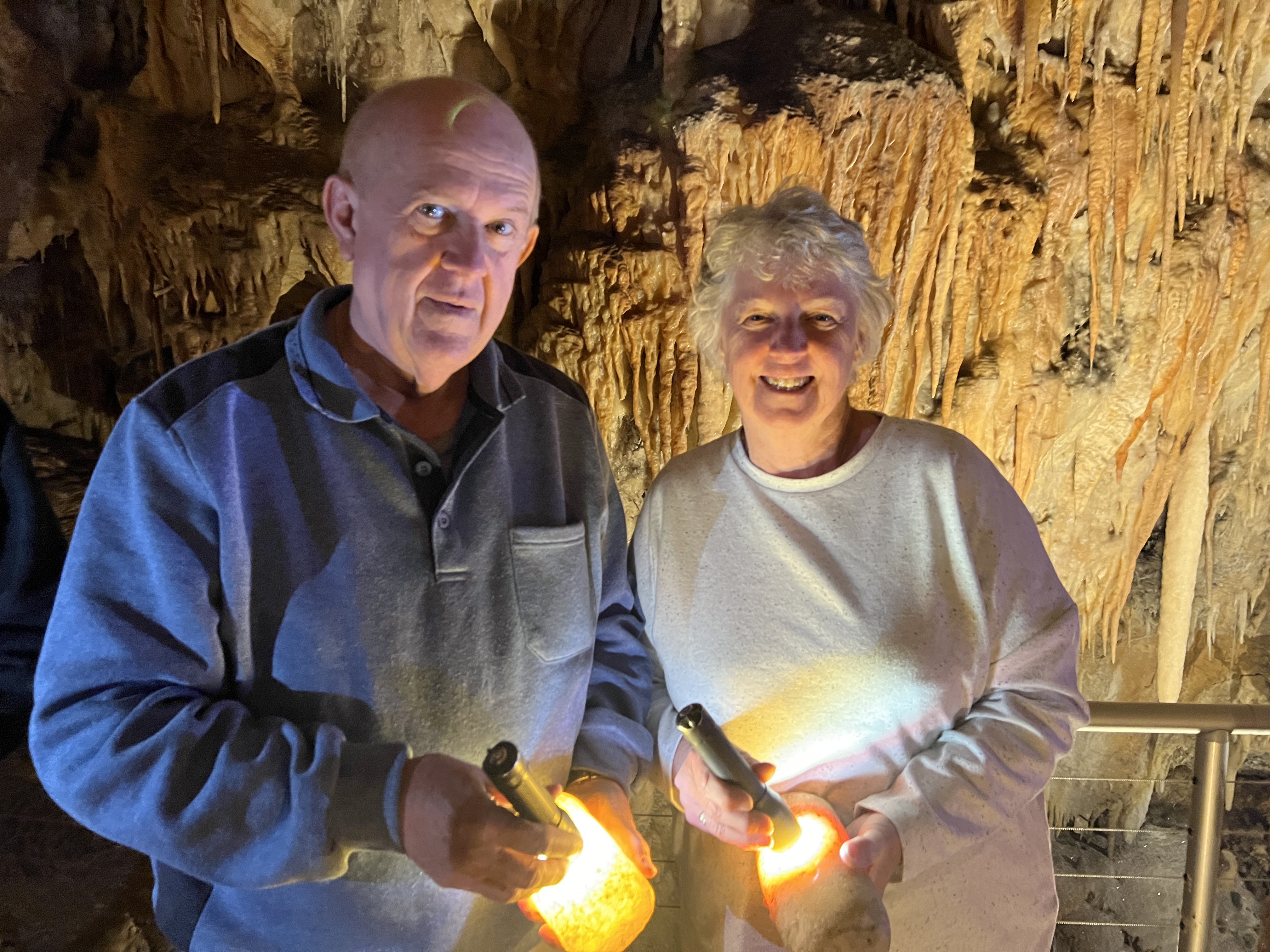
Numerous walks can take you to more remote spots and down into the gorge along the YR. We did a tour of Jillabenan (‘Dark Hole’) cave, which was only found by Europeans in 1910. It is very well preserved and presented, some amazing formations. Great tour.
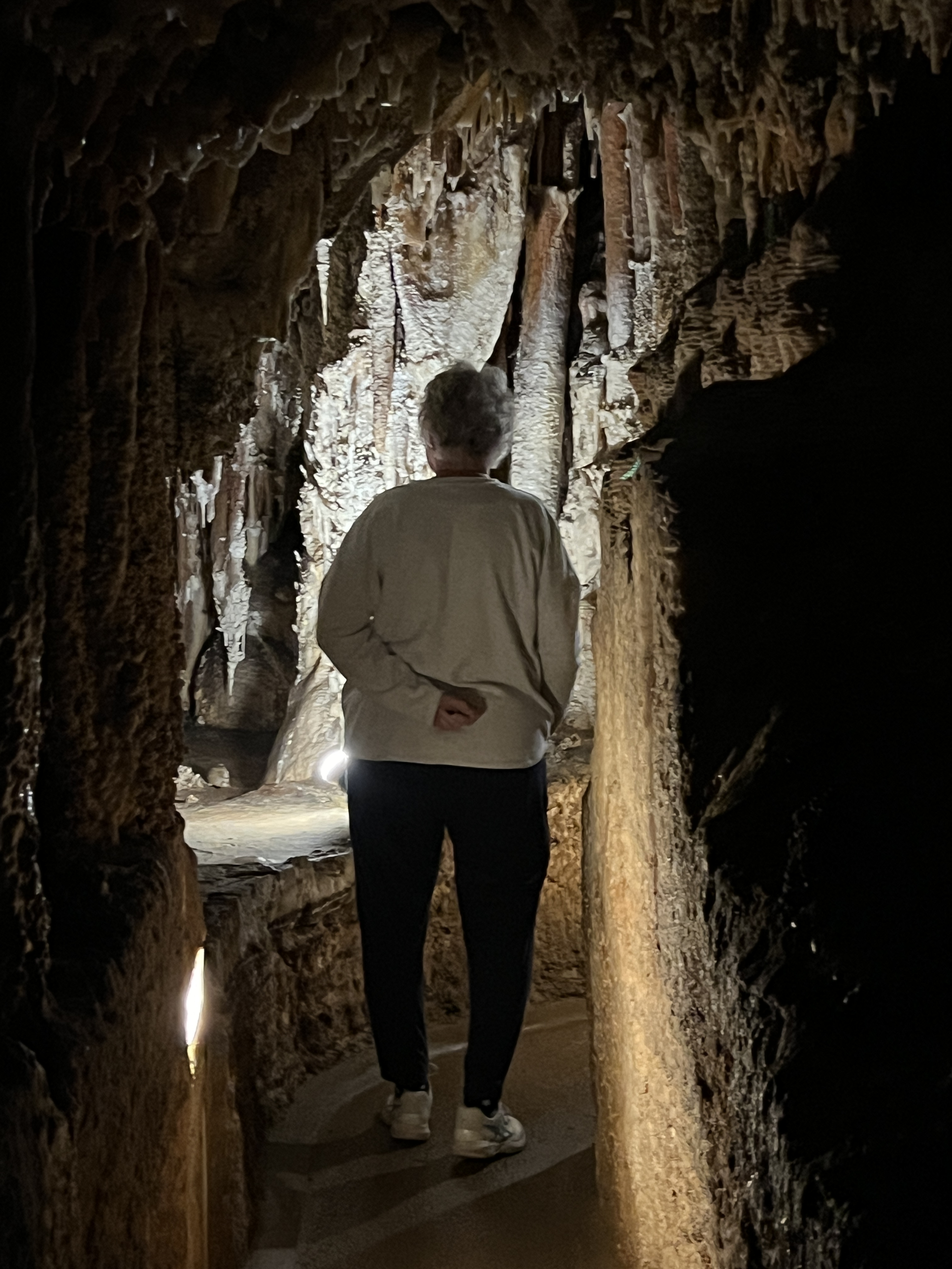
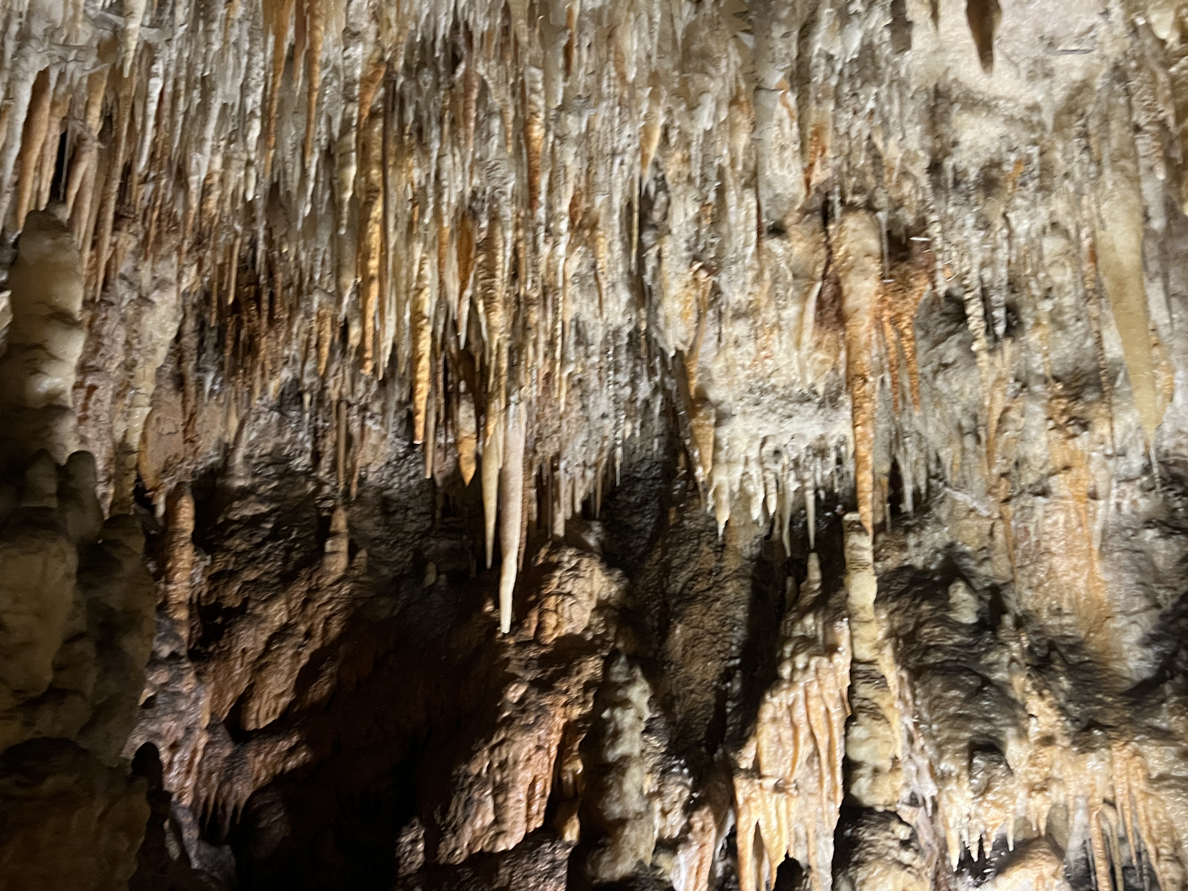
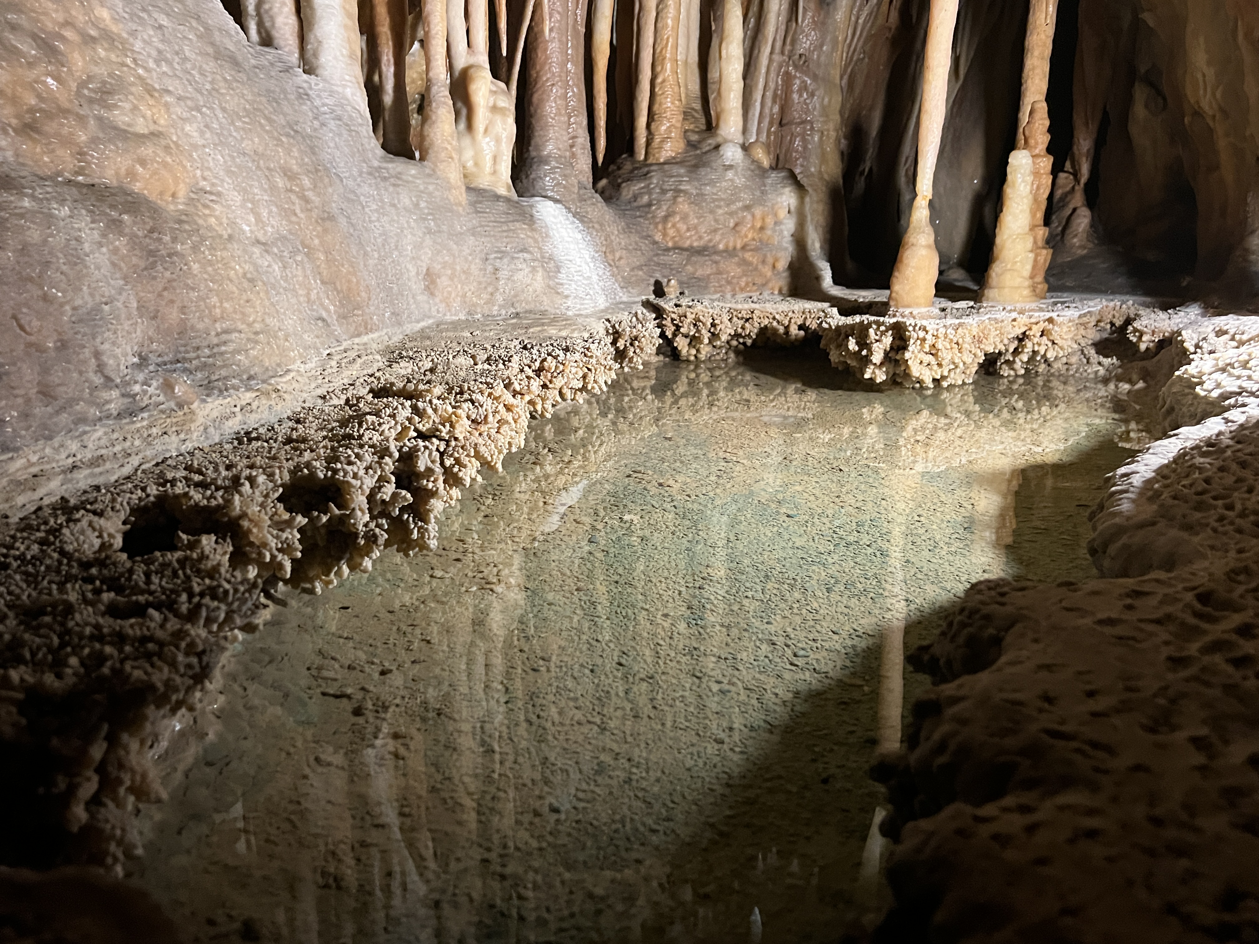
The cave is a ‘perched’ cave sitting high up the ridge above the present course of the river. It is thought to be 2-3 million years old, whereas the caves lower down near the river are only 100,000 years or so old.
Allthego took the rather steep 700 metre path down to the thermal pool beside the river.
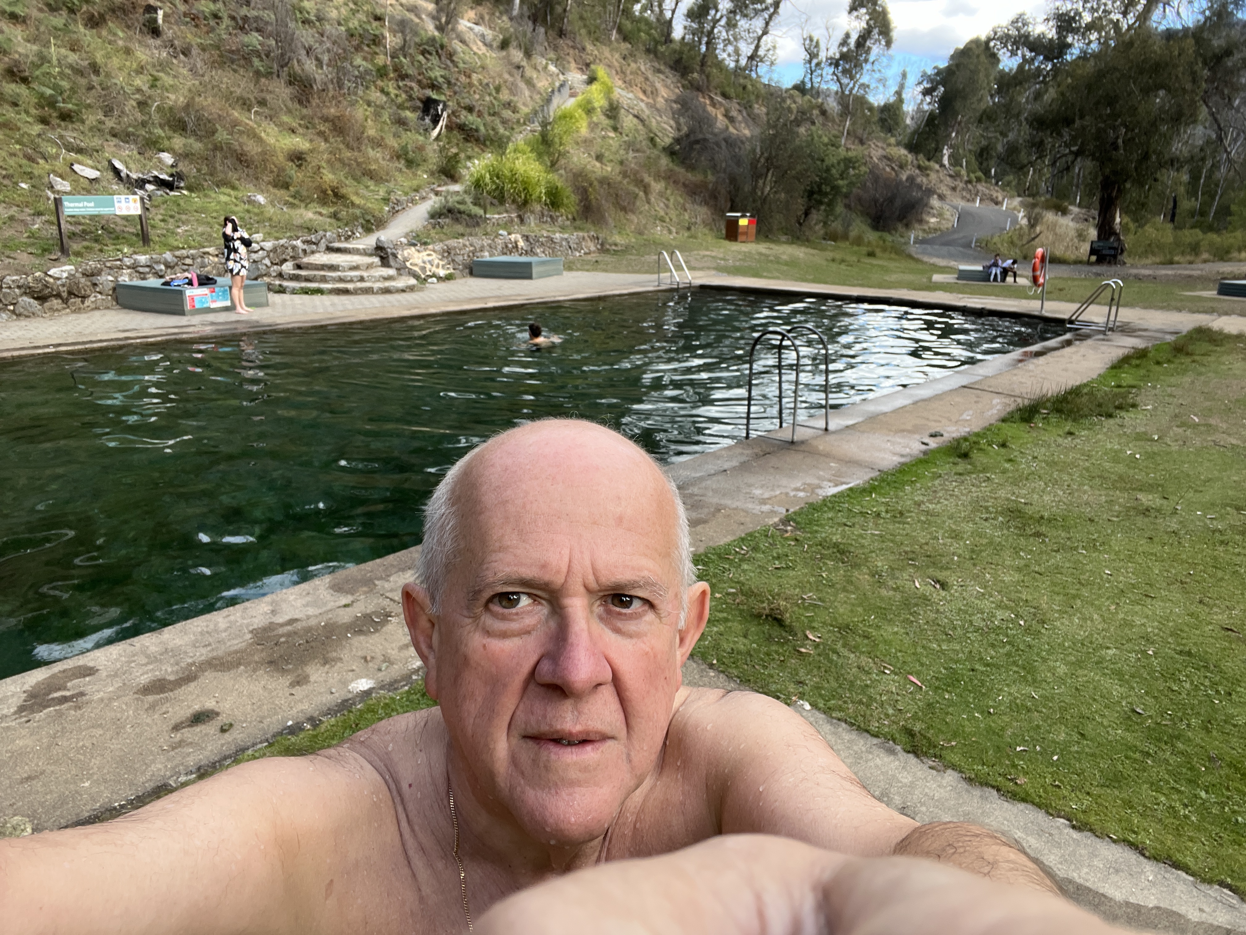

This pool is fed by an underground spring at the rate of 100,000 litres an hour, the water seeps in at the bottom of the pool and then flows out the top and down to the river. It is a pleasant 27 degrees and crystal clear. The walk back up the hill a little testing, but all ok! The road out of the gorge was also one way back to the top.
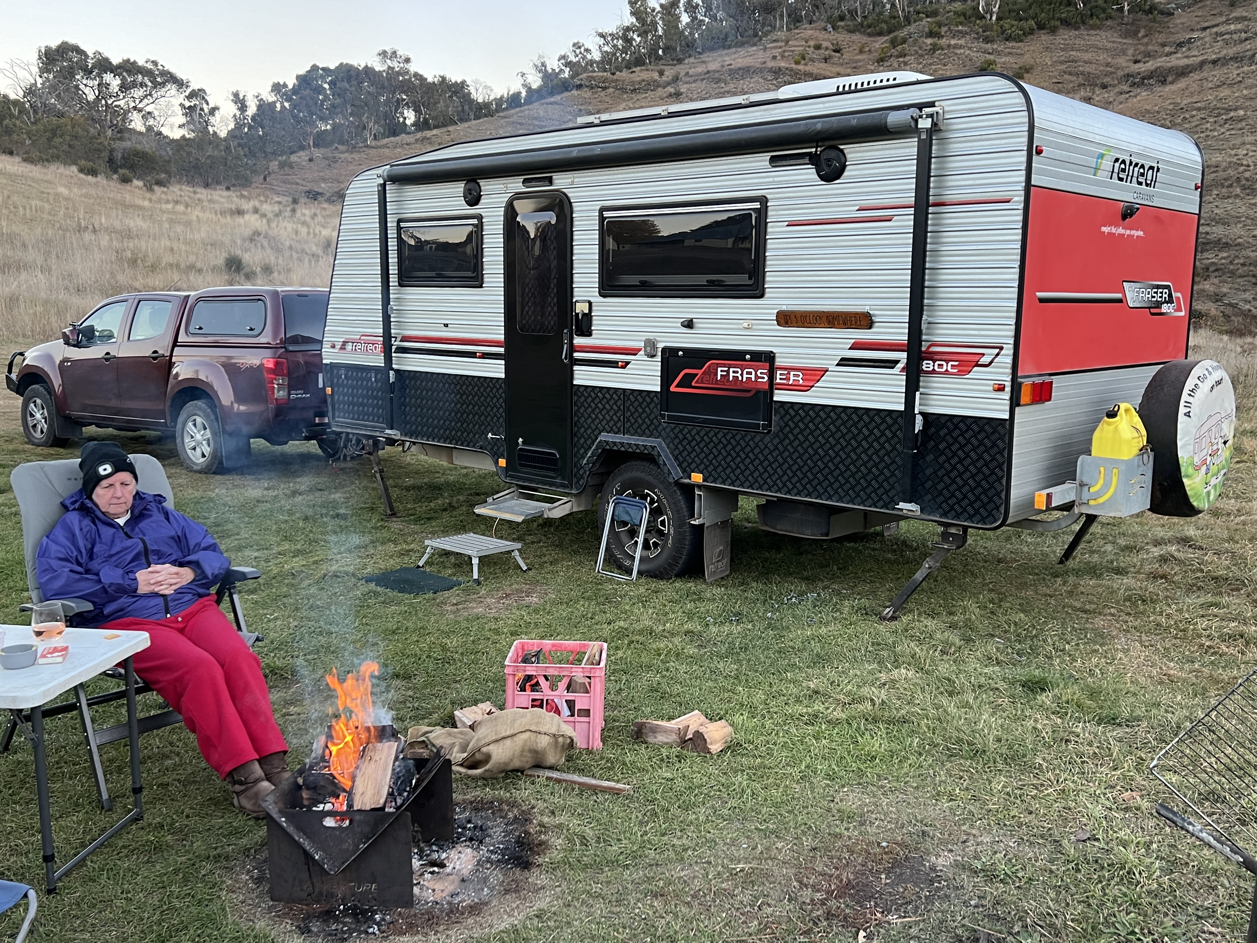
Back at the campsite we enjoyed a nightly fire to keep warm before bed, it hit -1 one morning. Bit chilly!
We now move on to Adaminaby and will need to manage the fuel which has got quite low, it is about 60km.
Made it to Tumut
We have made our way down from Inglewood (a contraction of ‘Ingol’ apparently for ‘cypress pine’ and ‘wood’ for the English ‘clump of trees’) to Tumut, after stopovers in Coonabarabran and Forbes. On the way to Coonabarabran we had a short stop beside the Newell Highway at Kiga Bore, a desolate spot amongst the rock and roadside dirt. The bore is surrounded by wattle trees and what is known as ‘sweet acacia’, a low growing very woody spiny shrub.

It’s the sort of place though that grows on you, some ducks swim around, maybe they use the partially submerged truck tyre as a resting spot. The water is a little grimy around the edges, maybe fertiliser run off from the surrounding cotton fields. But the scene makes a nice photo in the sunshine!
Coonabarabran is a favourite stop over for us, a great no frills campground that is never crowded and with plenty of room.

Moving on the next morning we pass through Dubbo, stopping for a roadside lunch. Between Dubbo and Parkes is Peak Hill which has a long gold mining heritage. We paused here for afternoon tea and took the opportunity to check out the old gold mining complex. Quite a sight looking down into the open pit, with it’s copper blue water lake in the bottom of the pit.

In Forbes we stayed beside the Lachlan River at the Apex Caravan Park, nice park location wise but a little squeezy. We will be back here at Forbes on our way home to Brisbane following the Lachlan River. The Lachlan is the major tributary of the Murrumbidgee, but more of that on the return trip. Homealone’s brother Stuart and wife Maree were coincidentally in Forbes staying with Maree’s father Bob and we had an evening roast lamb dinner with them. Very enjoyable indeed. Timing is everything they say!
The next morning it was off to Tumut via Grenfell and Young, the NSW cherry capital. Cherries were finished for the season but the autumn foliage was on full show around town.
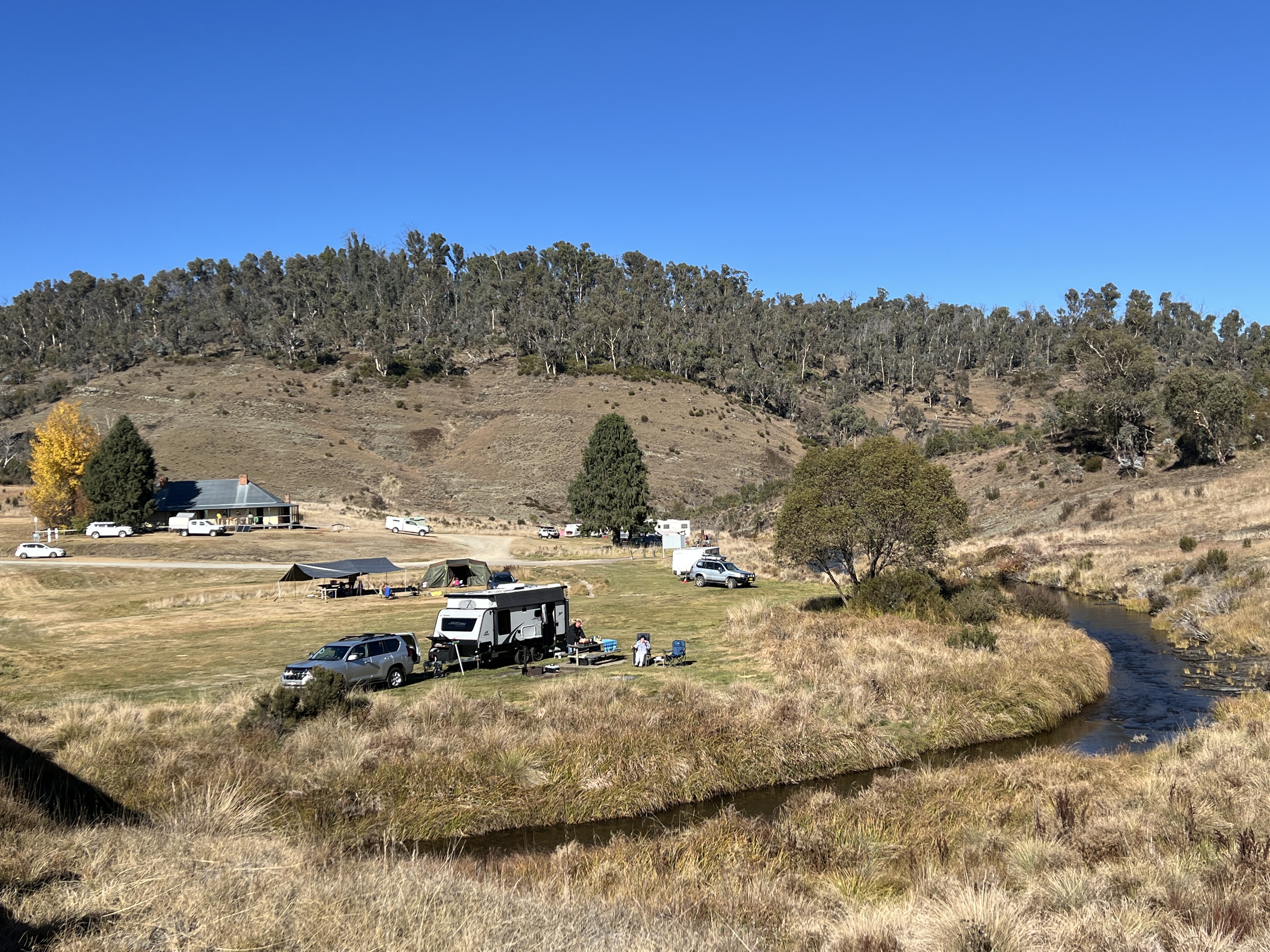
Tumut is a busy little town and we decided to head further south along the Snowy Mountains Highway to a free campsite beside the Tumut River.

The camp is a few kilometres below the Blowering Reservoir, and the river is a small trickle of what it once would have been. It is known as the mighty Tumut!


Great spot for the night before heading further south to the source of the Murrumbidgee.
Murrumbidgee Run
We are off to the Murrumbidgee River in southern NSW. The objective is to follow it from its source to its junction with the Murray River. The source of the river is in the Great Dividing Range to the north of Cooma and to the south of Canberra, also a bit to the west. More about this later in the journey, except to say that the river flows south of its source towards Cooma and then does a fish hook type turn and heads back towards Canberra. Near the nation’s capital it turns northwest towards Gundagai and then flows west past Wagga, Narrandera, Hay and Balranald before joining the Murray near a place called Boundary Bend.
We are now at Coonabarabran for the night, having made our way from Inglewood. These are our usual stopover points on the way south from Brisbane. It is generally a bit of a dash for us to get here and we don’t pay too much attention to the passing countryside. The Cunningham Highway, which leads out of Brisbane, meanders through the city’s hinterland before climbing the Range and passing through Cunningham’s Gap.


Bogabilla, south of Goondiwindi.The road then rolls along to Goondiwindi crossing the Western Downs, a Queensland food bowl. The road follows the railway west past rural hamlets, many relics of Cobb & Co days.


Our stopover in the old tobacco town of Inglewood is a favourite spot for us beside MacIntyre Brook. Olives have replaced tobacco here and we find the Lion’s Park ablution block now has a mural since our last visit.


Local butterflies, symbolising serenity and calmness, together with wind turbines adorn the block for our enjoyment.
Tomorrow, we head for Forbes for another one night stand.
