Category Archives: Warrumbungles 2022
Heading home
As planned we left our Sculptures in the Scrub campsite early the next morning. Although still cloudy and sunny at times cloud was starting to build and one sensed rain was inevitable. You could get stuck here for a while if it turned out to be heavy.
A small coaster bus had set off before us and up along the road we came across the nomads stuck in some deep loose sand. They had slid into it going around a steep curve, half way up their rear wheels. We helped dig them out and clear sand away so they could escape on those plastic traction ramp thingos. Invaluable escape tool!
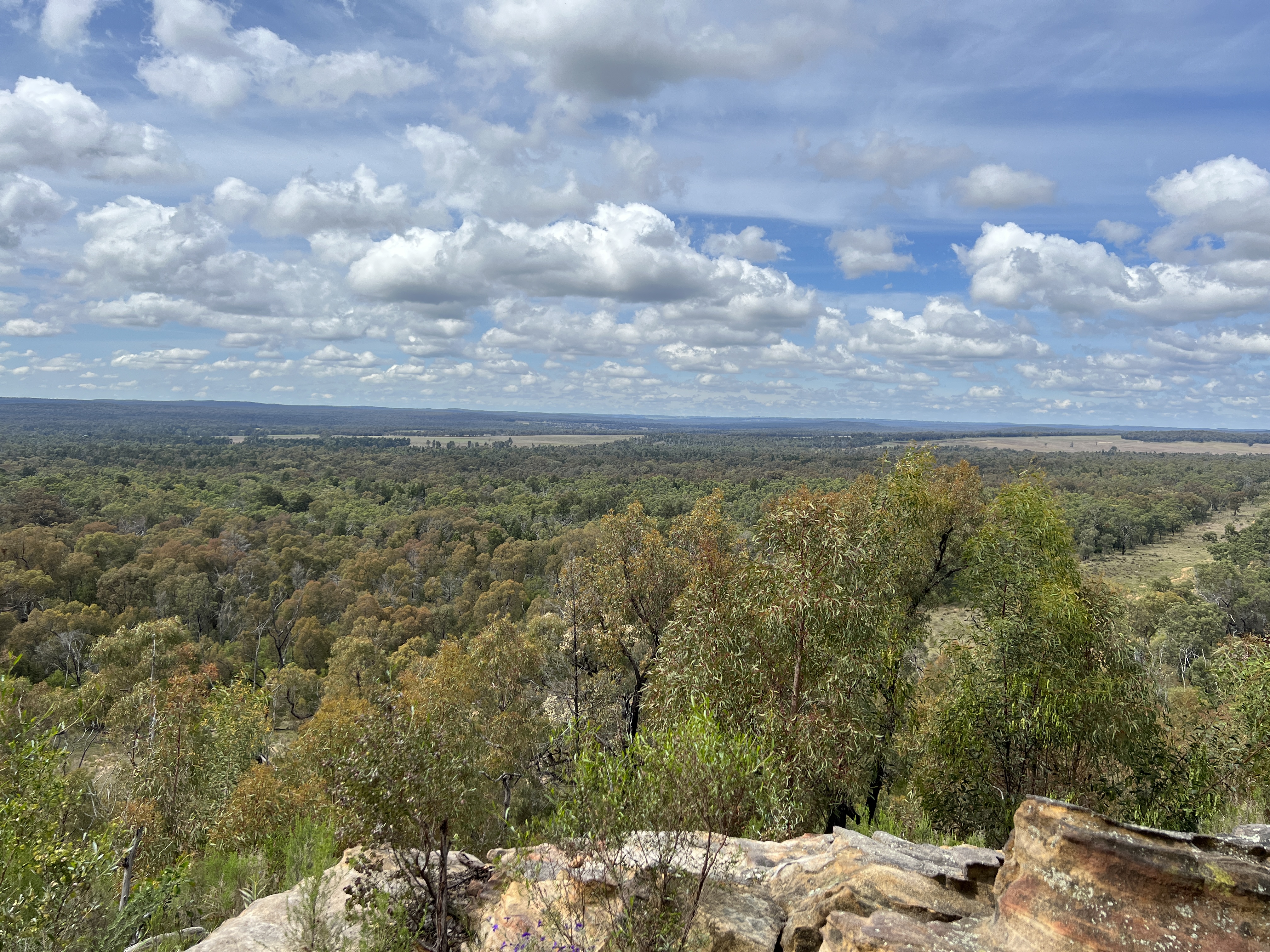
We eventually made it out to the Newell Highway. There was one remaining spot in the Pilliga that is well worth looking at on the way to Narrabri. Just a short track off the Highway to the Sandstone Caves site and a 1.6 km loop walk.
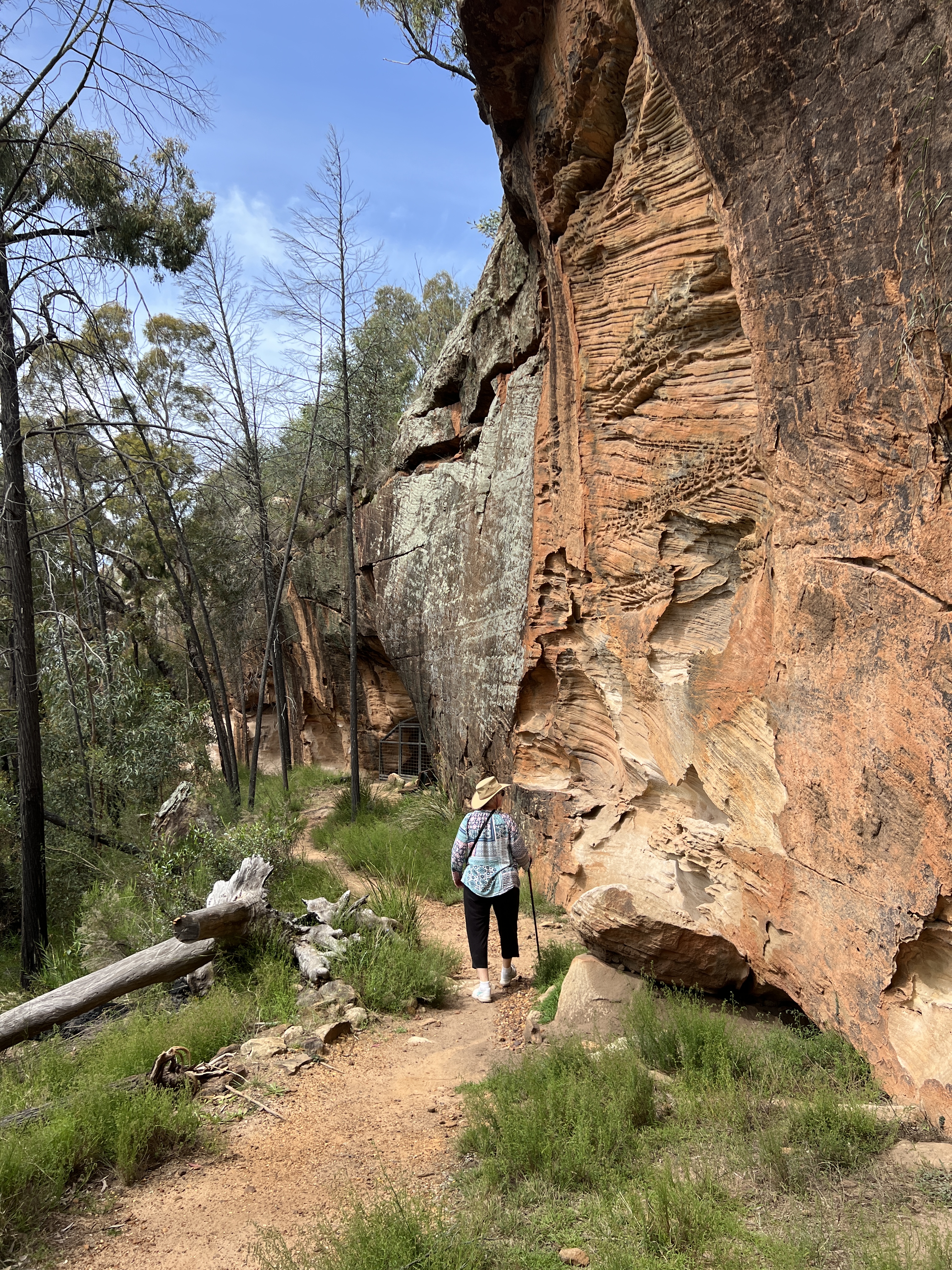
The walk takes one around a large outcrop of sandstone. Pilliga sandstone is very soft and the cliff face of the outcrop has been eroded and hollowed out by water and wind creating a series of caves and overhangs looking out over the Pilliga Forest.
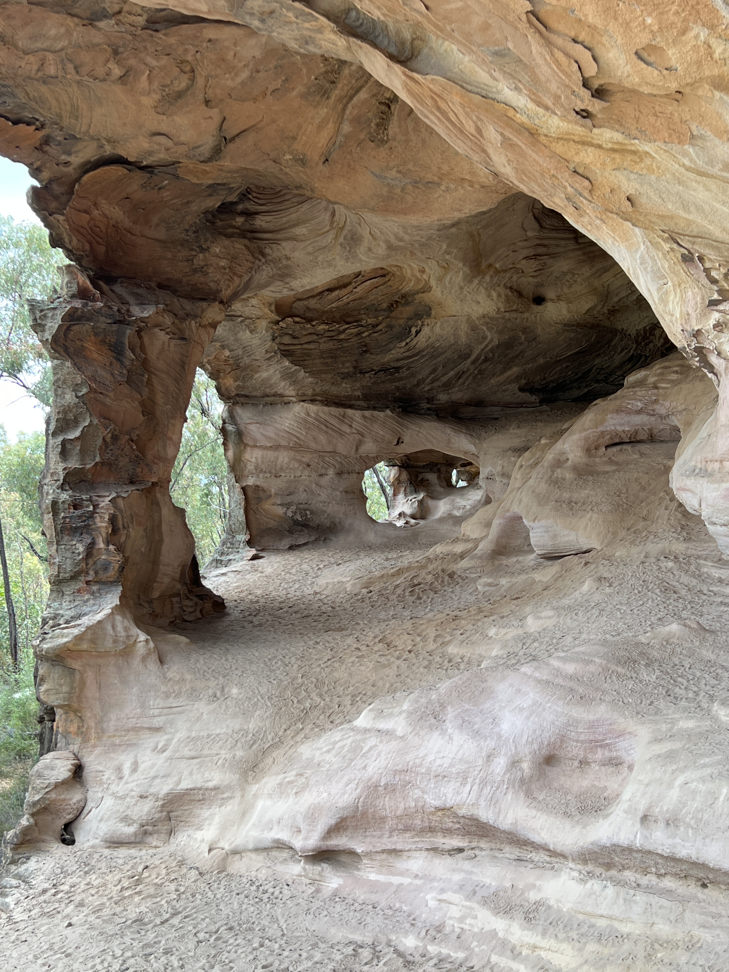
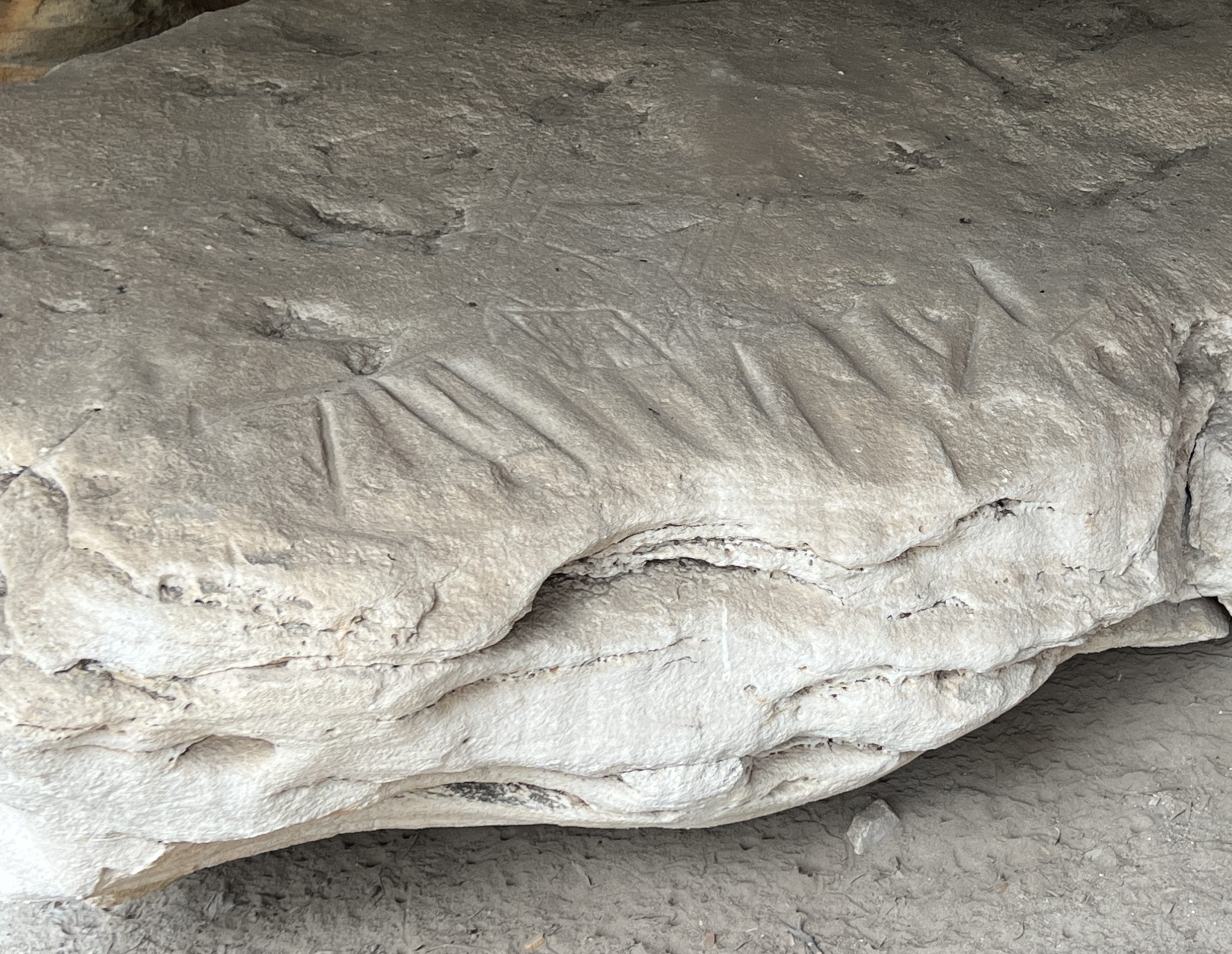
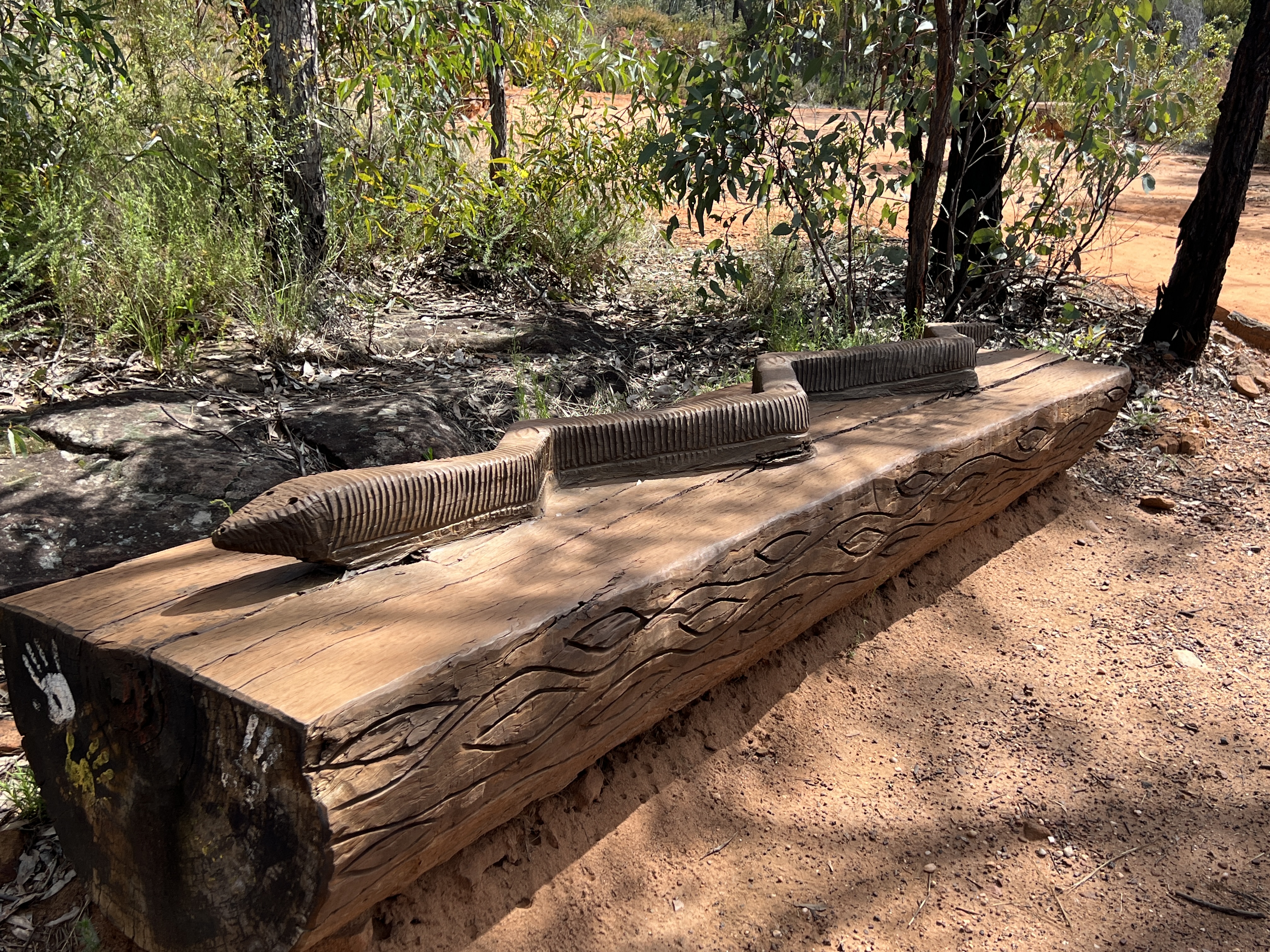
The area is a place of great cultural significance for the indigenous peoples, going back thousands of years. The caves would have provided extensive areas of shelter. There are several boulders showing grinding marks and also etchings of emu and kangaroo feet.
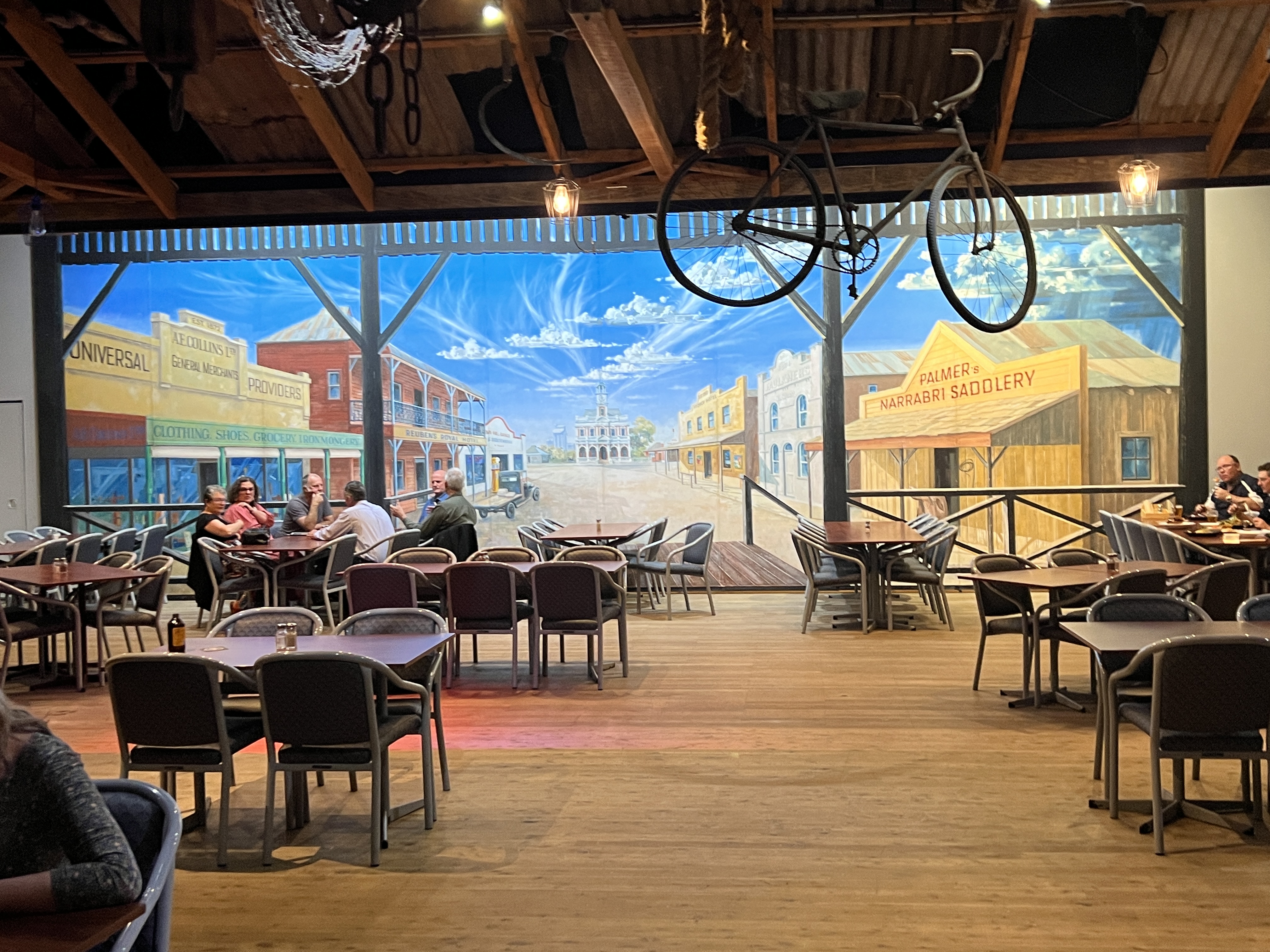
Back into the truck we headed for Narrabri for the night. Made it and set up just before the rains started. Had fish n chips for dinner at the nearby RSL. Their dining area is set up as an outback bar and grill, a rustic set up harking back to the 1800s with a back drop of a big mural of the town. Very different set up to the usual RSL dining areas! Can recommend it, fish n chips not bad either.
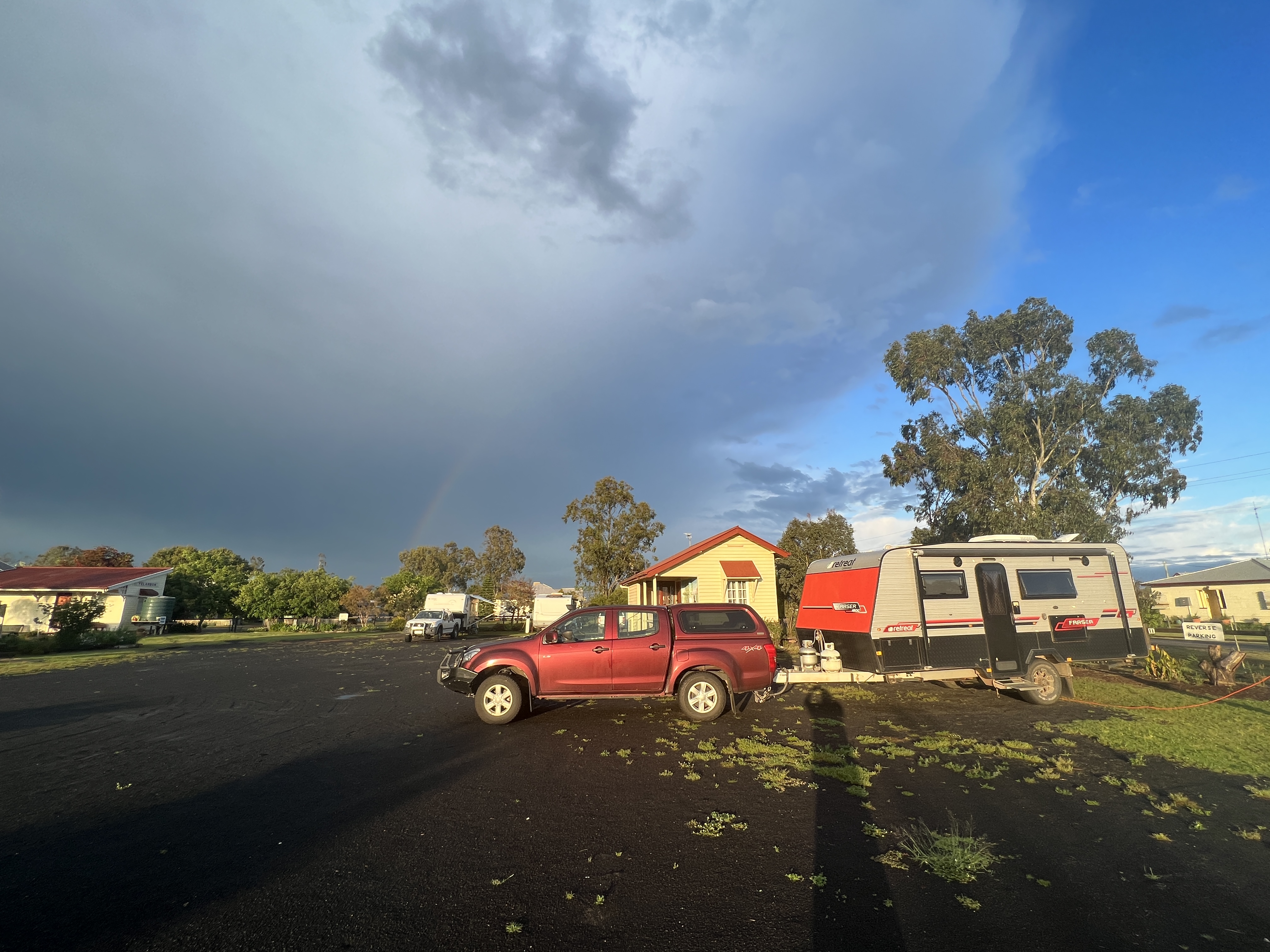
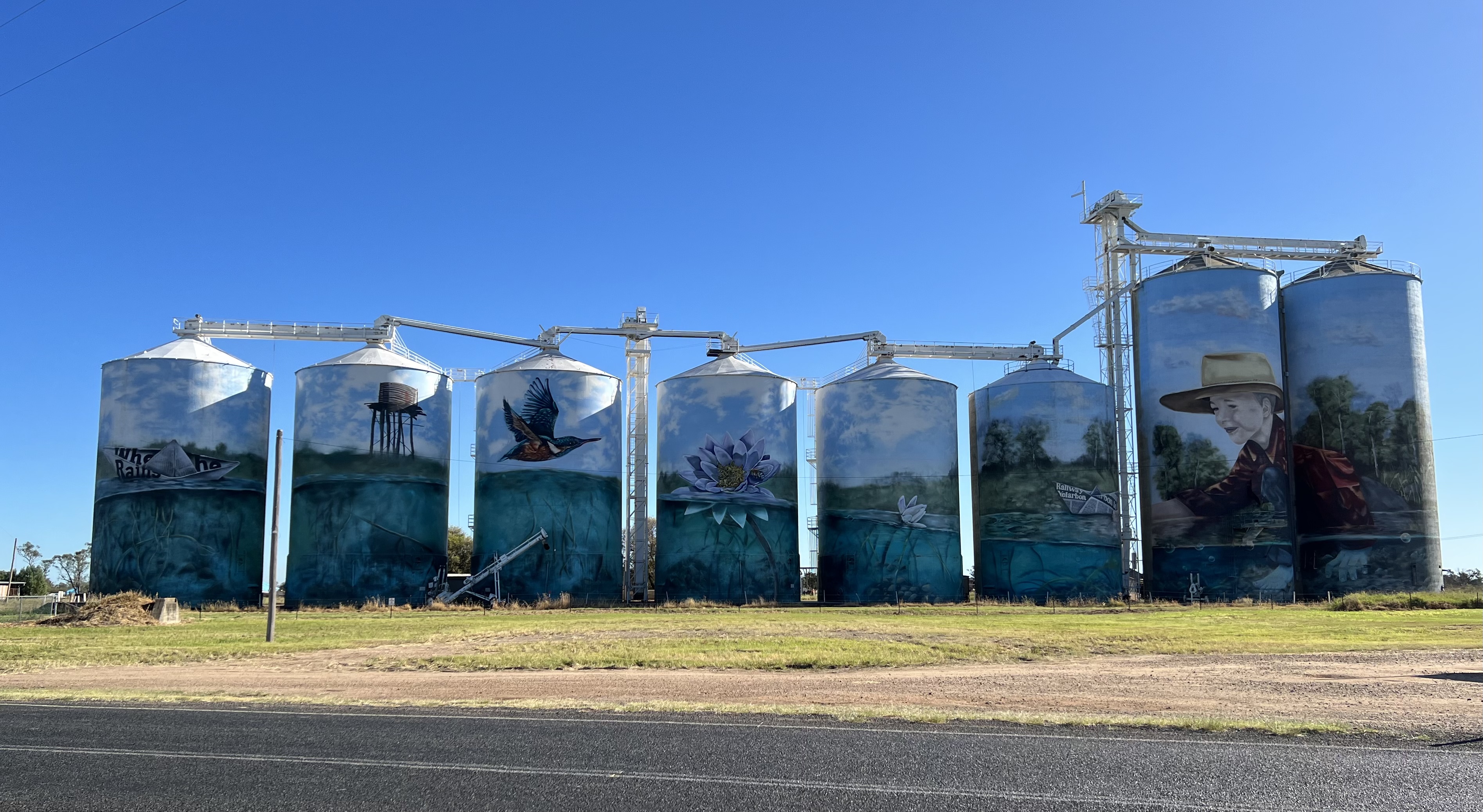
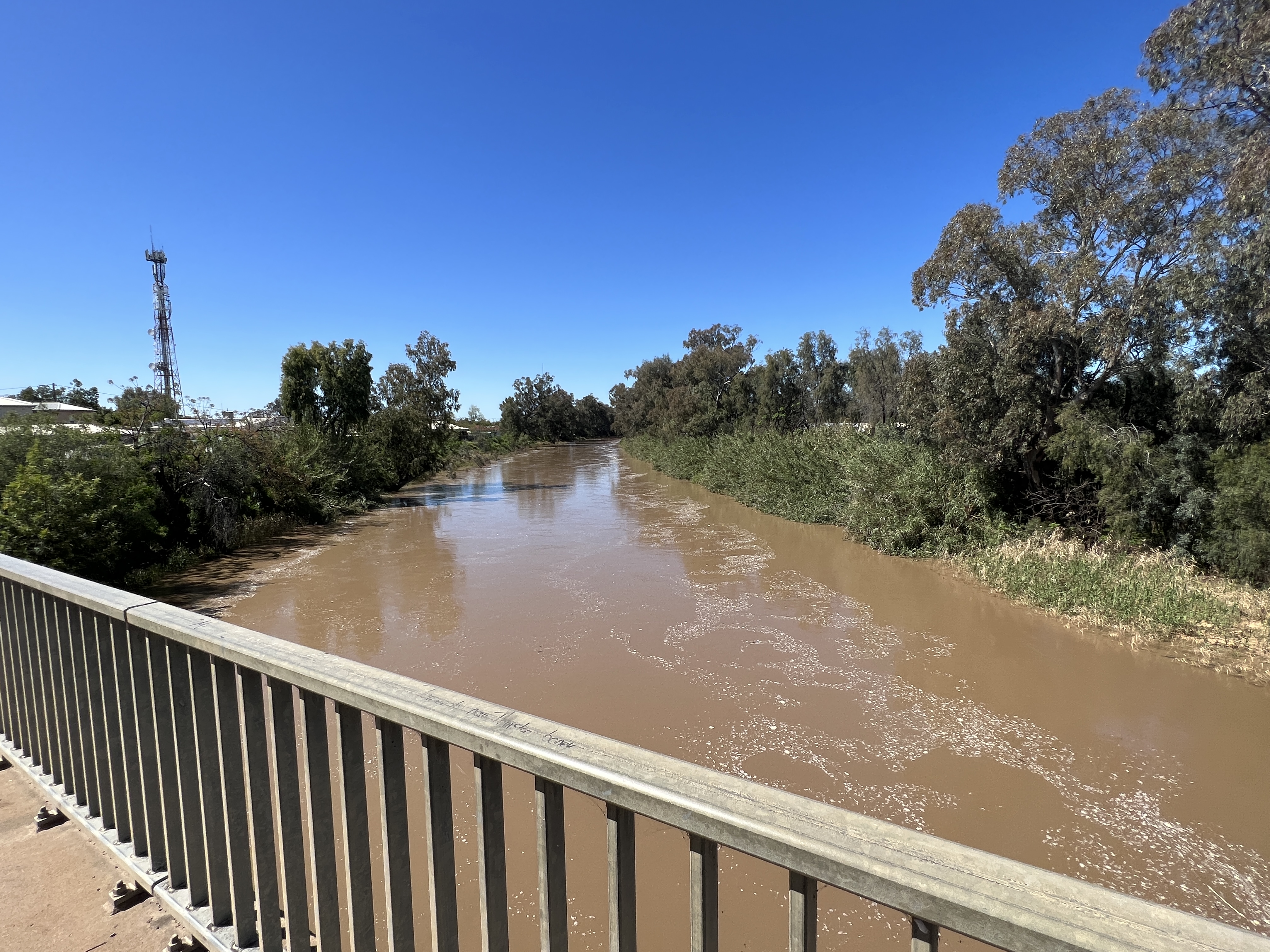
Morning came along with the rain and we headed for home. Rained all the way from Narrabri through Moree and Goondiwindi. Called it a day at the small village of Yelarbon, 300km from Brisbane, and set up for the night in their community campground. Yelarbon is noted for its silo mural.
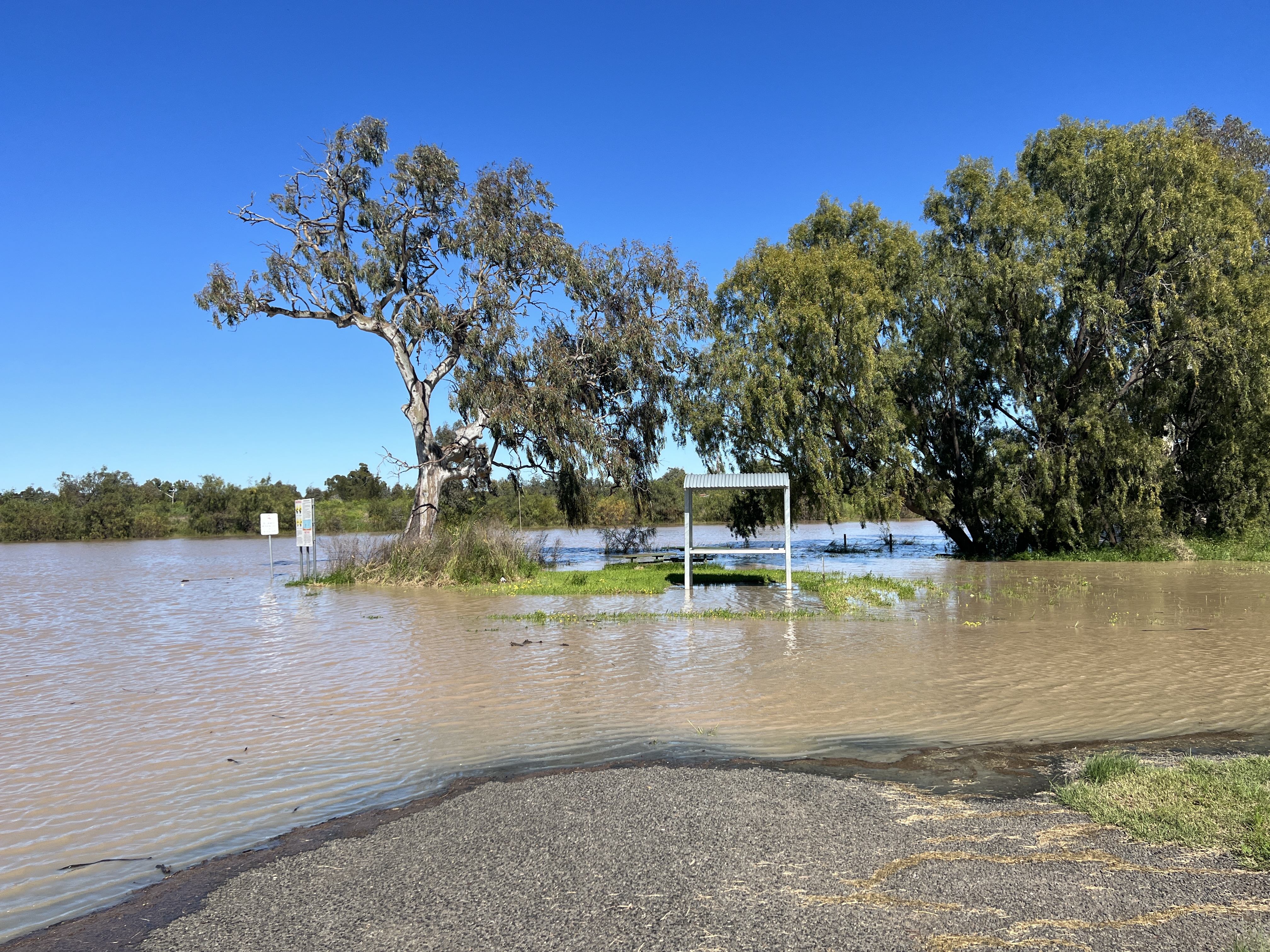
We are now home in Brisbane, an uneventful and largely rain free drive from Yelarbon. Plenty of water around, rivers and creeks flowing strongly.
Sculptures in the Scrub
We awoke to a nice clear sunny sky and Allthego felt the urgent need to head off on a walk. After breakfast of course!
As my readers will know this blog is a bit disjointed because it is generally written a few days after the events it describes. This is a necessity here in the Pilliga because there is no internet, it is social media ‘non existant’, as some might say. Sometimes, Allthego also gets the tenses wrong pretending to be still somewhere when we are 100km further on.
The point of this ramble is that we were aware that the weather might close in today with the threat of rain the next day. Rain in the Pilliga is not a great option if wanting to get out in a vehicle towing a van. So we have decided to cut short our stop and hopefully beat the rain out the next day.
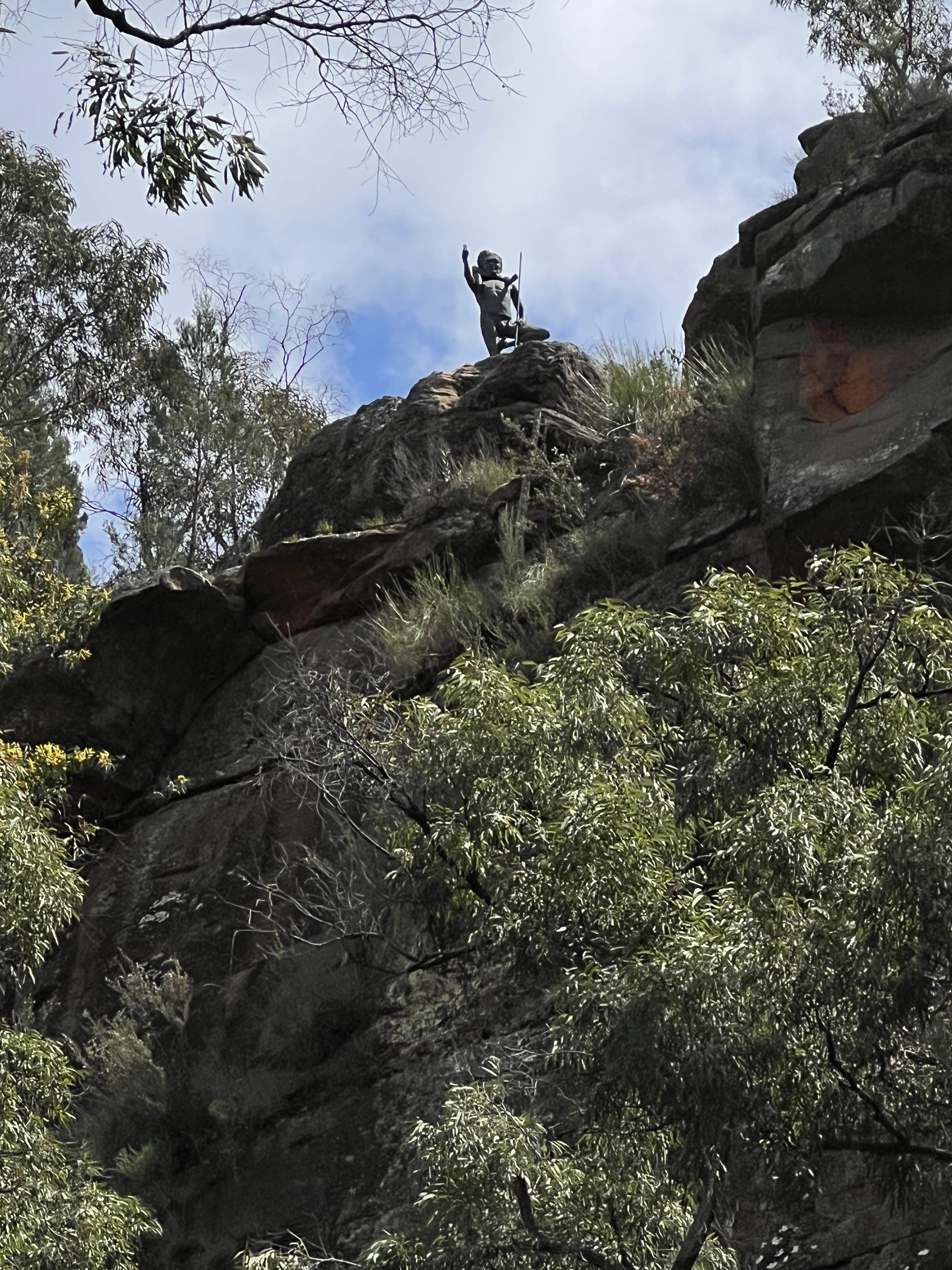
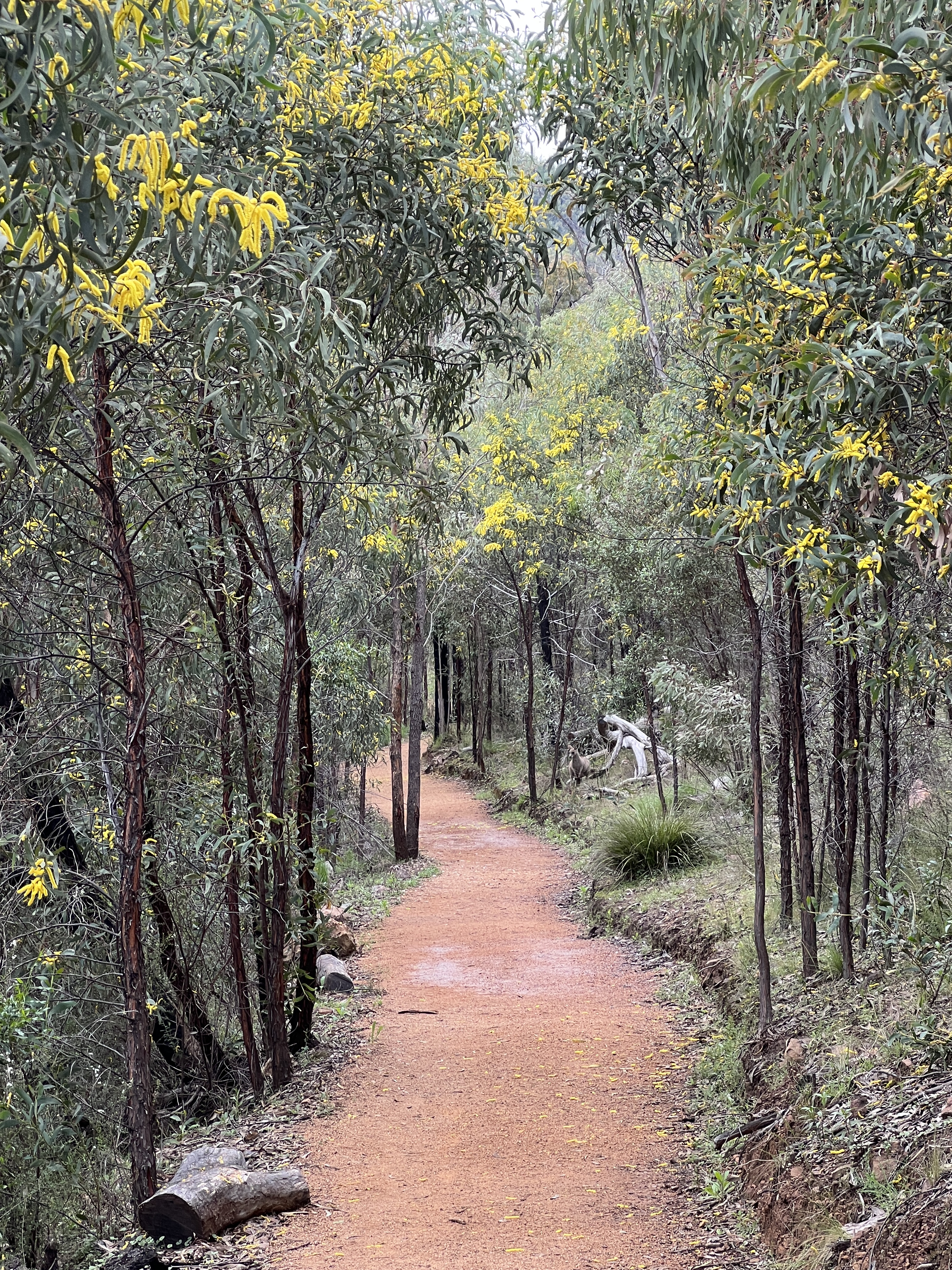
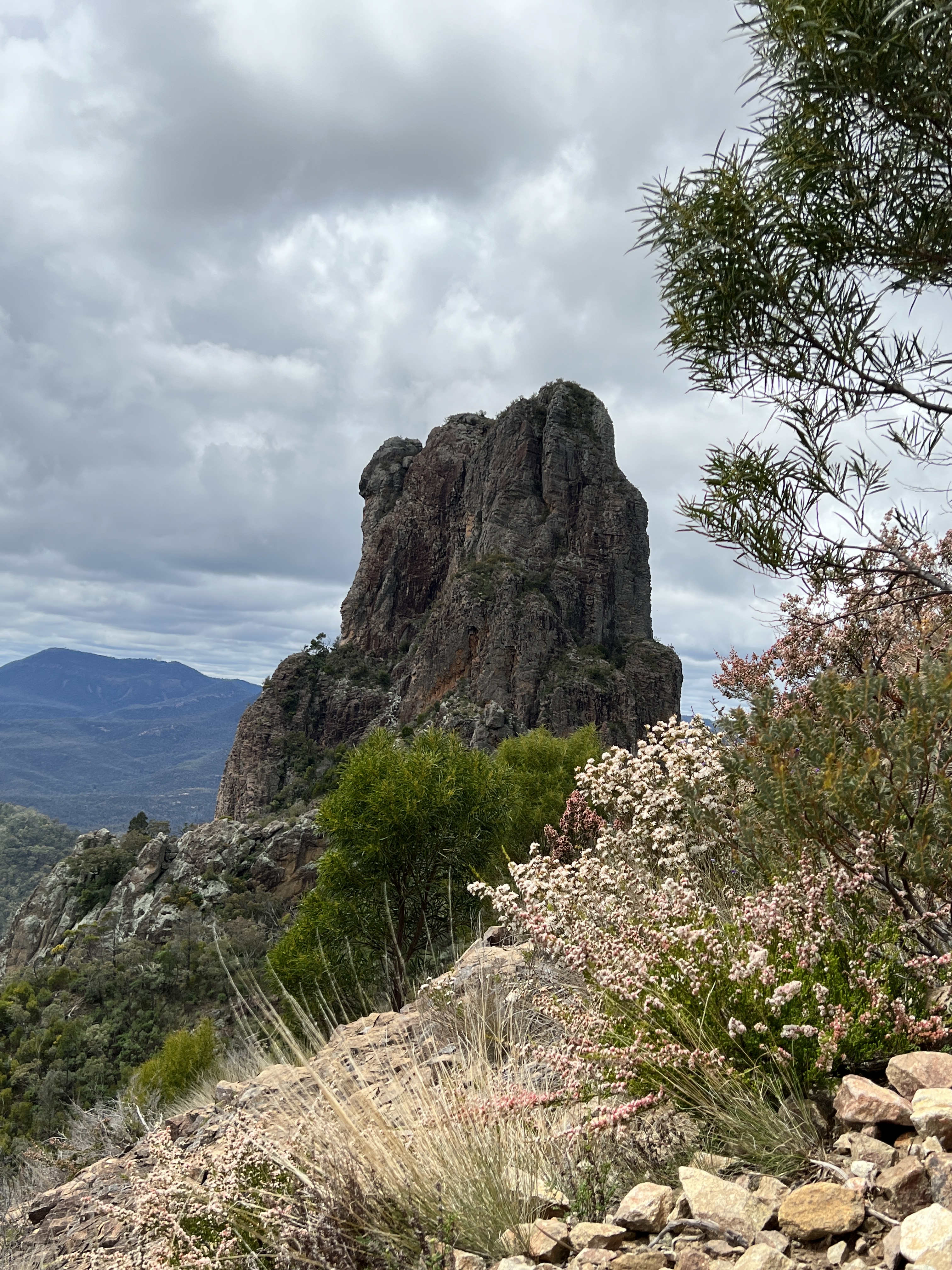
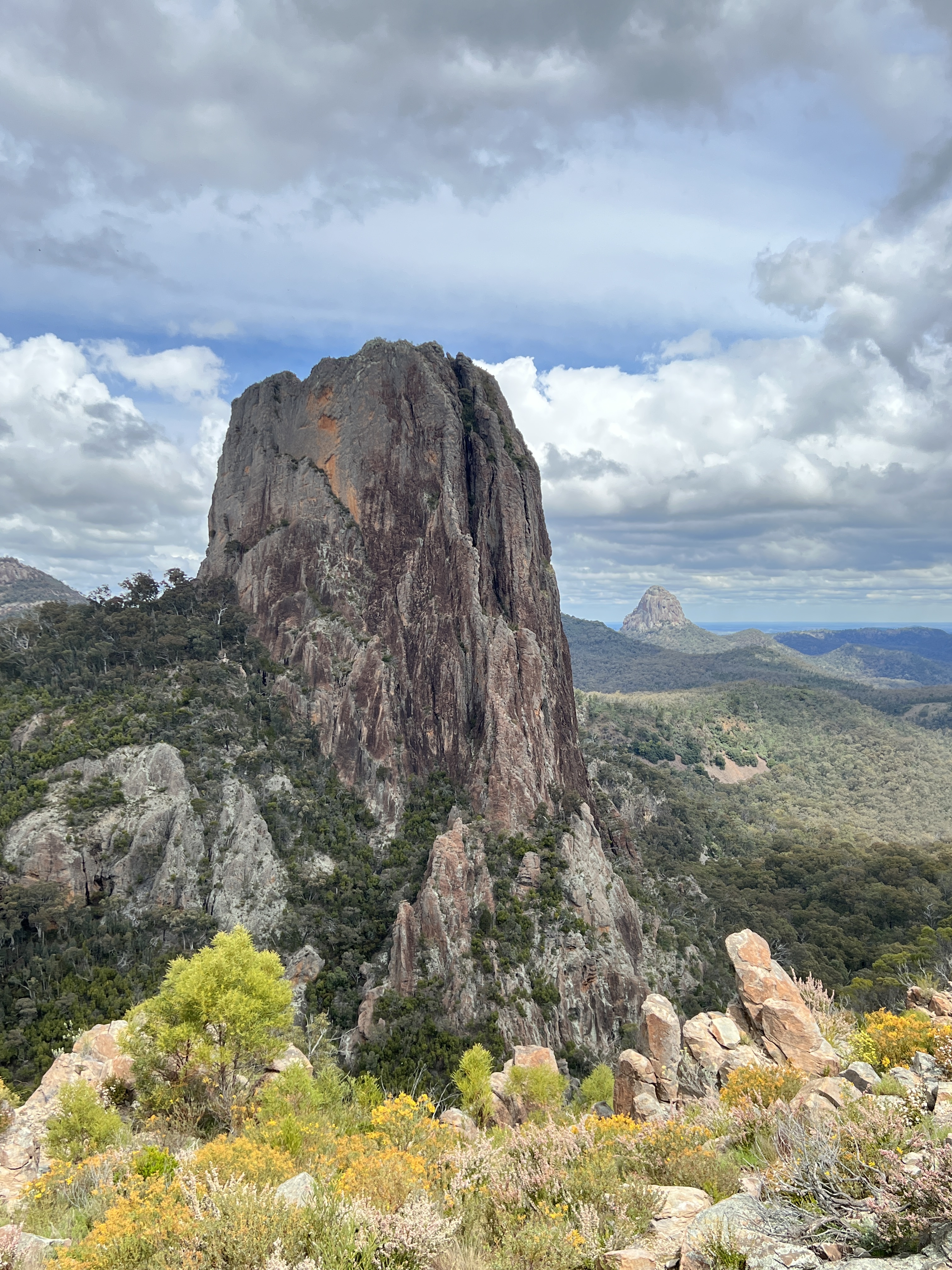
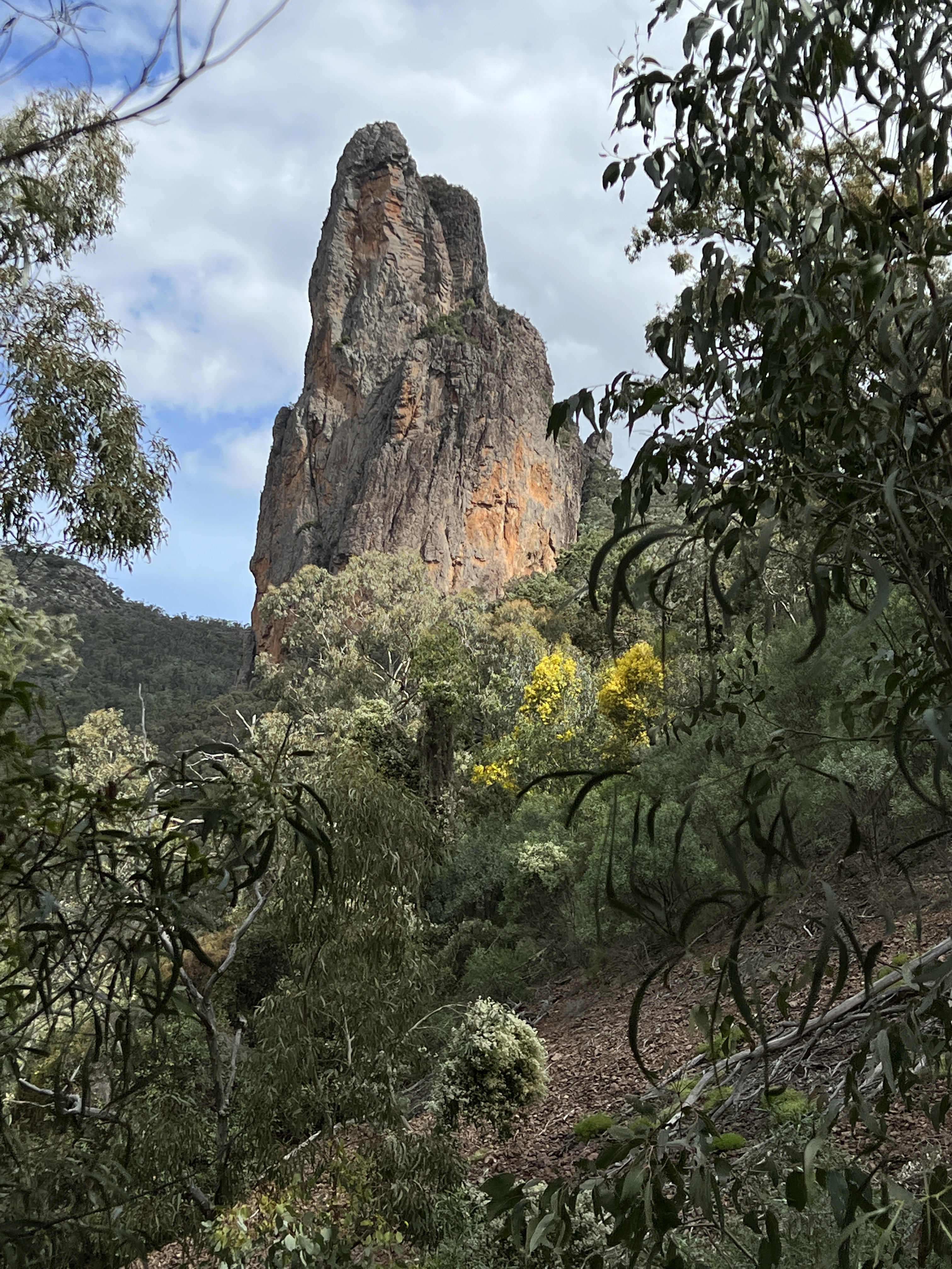
So we need to do the Sculptures in the Scrub walk sooner than later, 3.6km loop return. The walk is in two parts, the first takes us along the ridge line looking down into Dandry Gorge and the second is a stroll through the gorge beside the creek before ascending back to where we started.
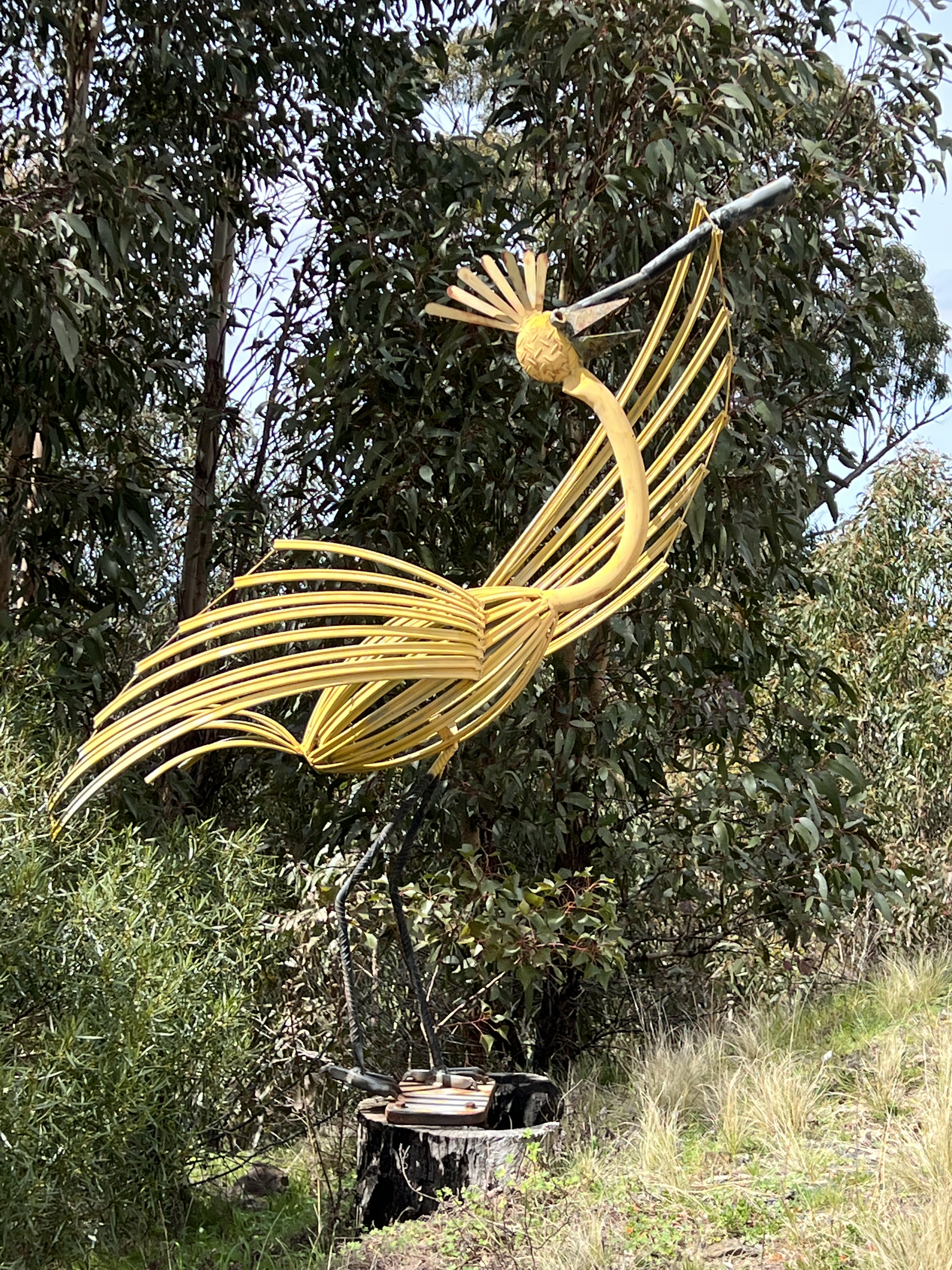
We did not find it a difficult walk. Along the ridge line section there are a number of sculpture installations connecting indigenous people with their ancestors.
First Lesson , a father with child on his shoulders is looking out over the gorge ‘showing him the world’. It is particularly evocative. A bit later, in the walk through the gorge we look up at this statue on the ridge line. Quite impressive.
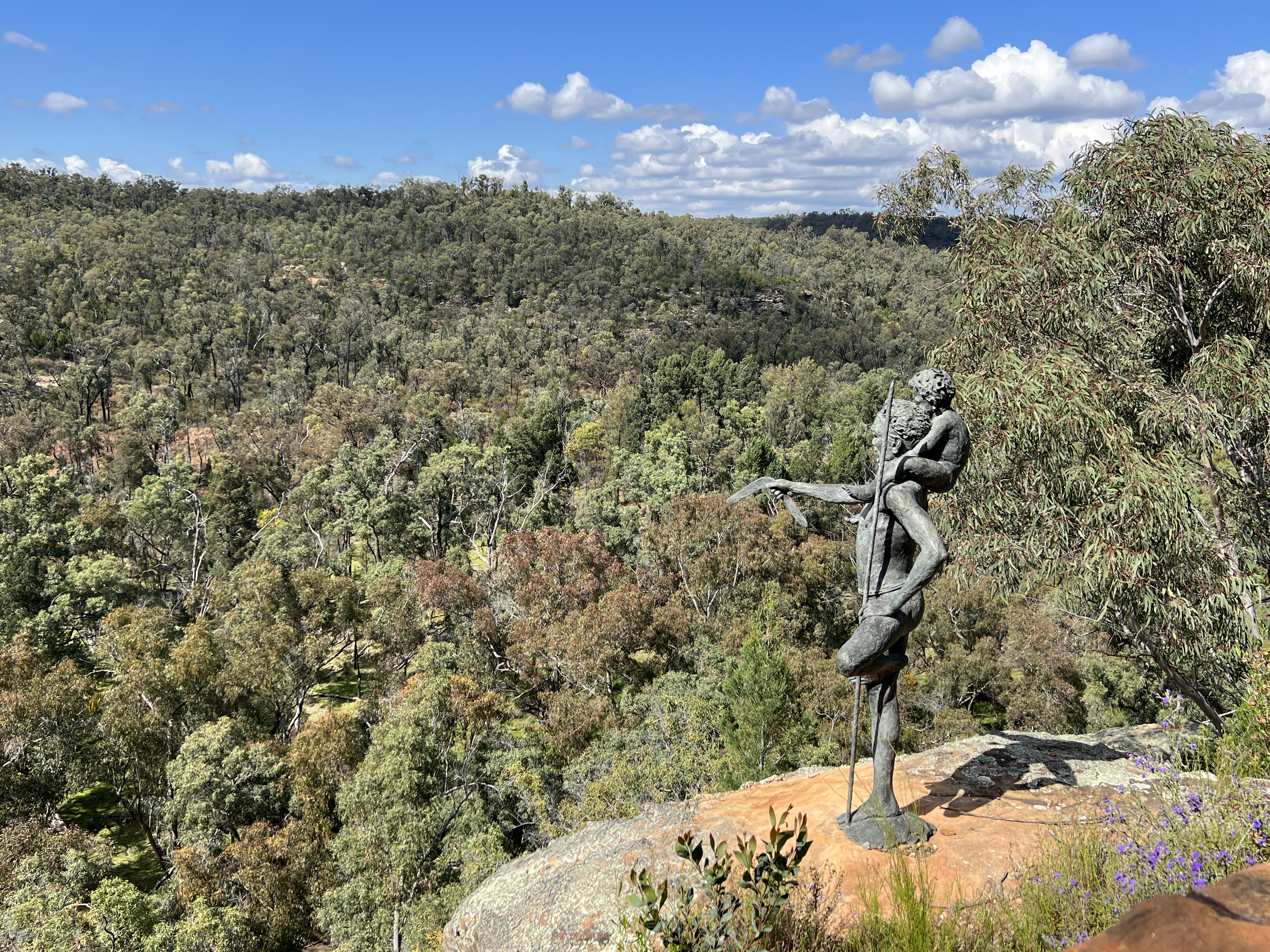
There are five installations all up connecting us with the indigenous past, and present for that matter.
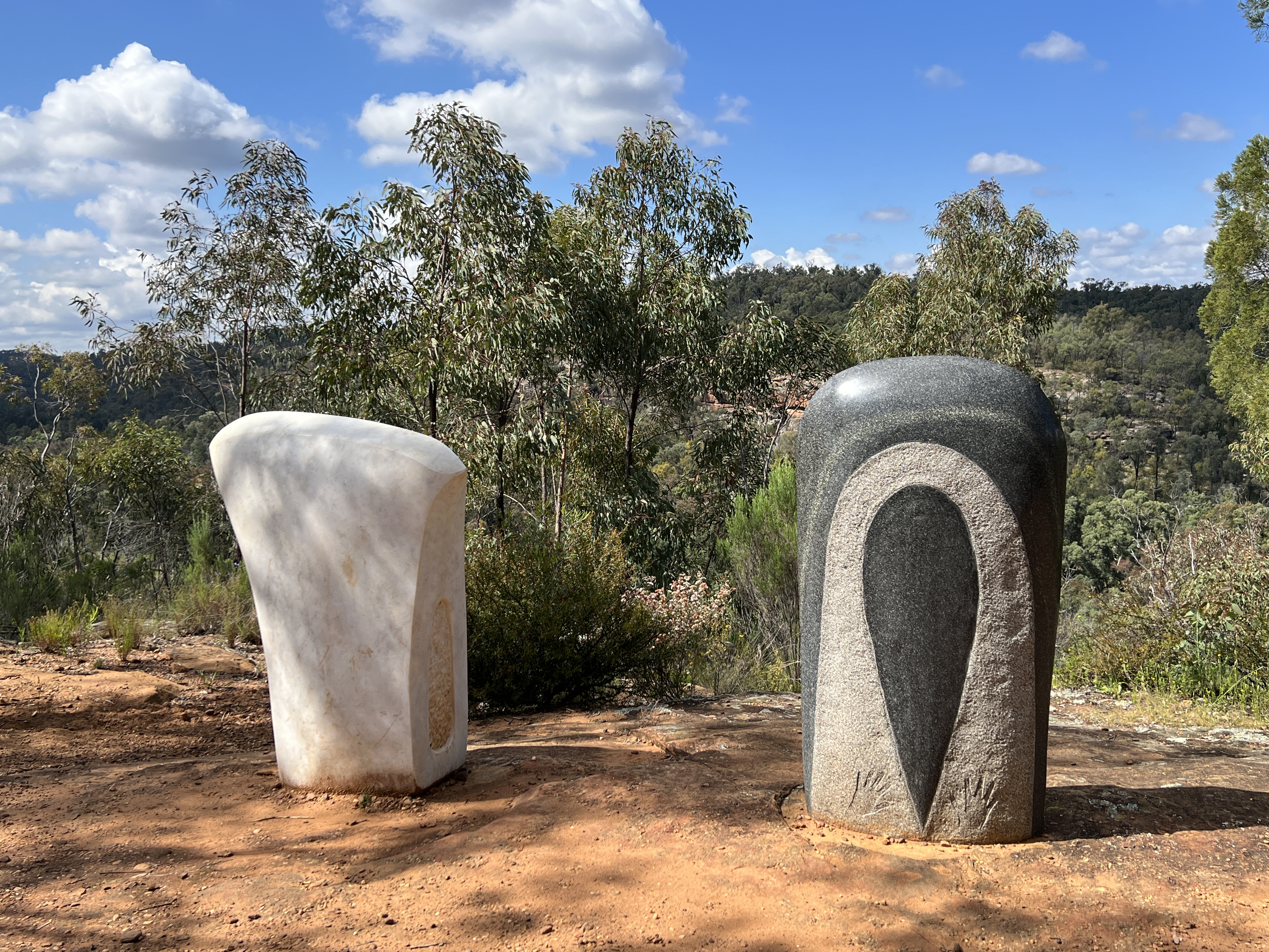
Two axe heads provide a contrast between the present and the past. The traditional stone axe head, at right in the photo above, stands beside a ‘modern’ late 19th century axe head. One links the past with the present, illustrating the indigenous experience with the traditional axe and the subsequent experience with the European axe as woodcutters.
There are other installations, the ever present Rainbow Serpent among them weaving its creative powers over the environment.
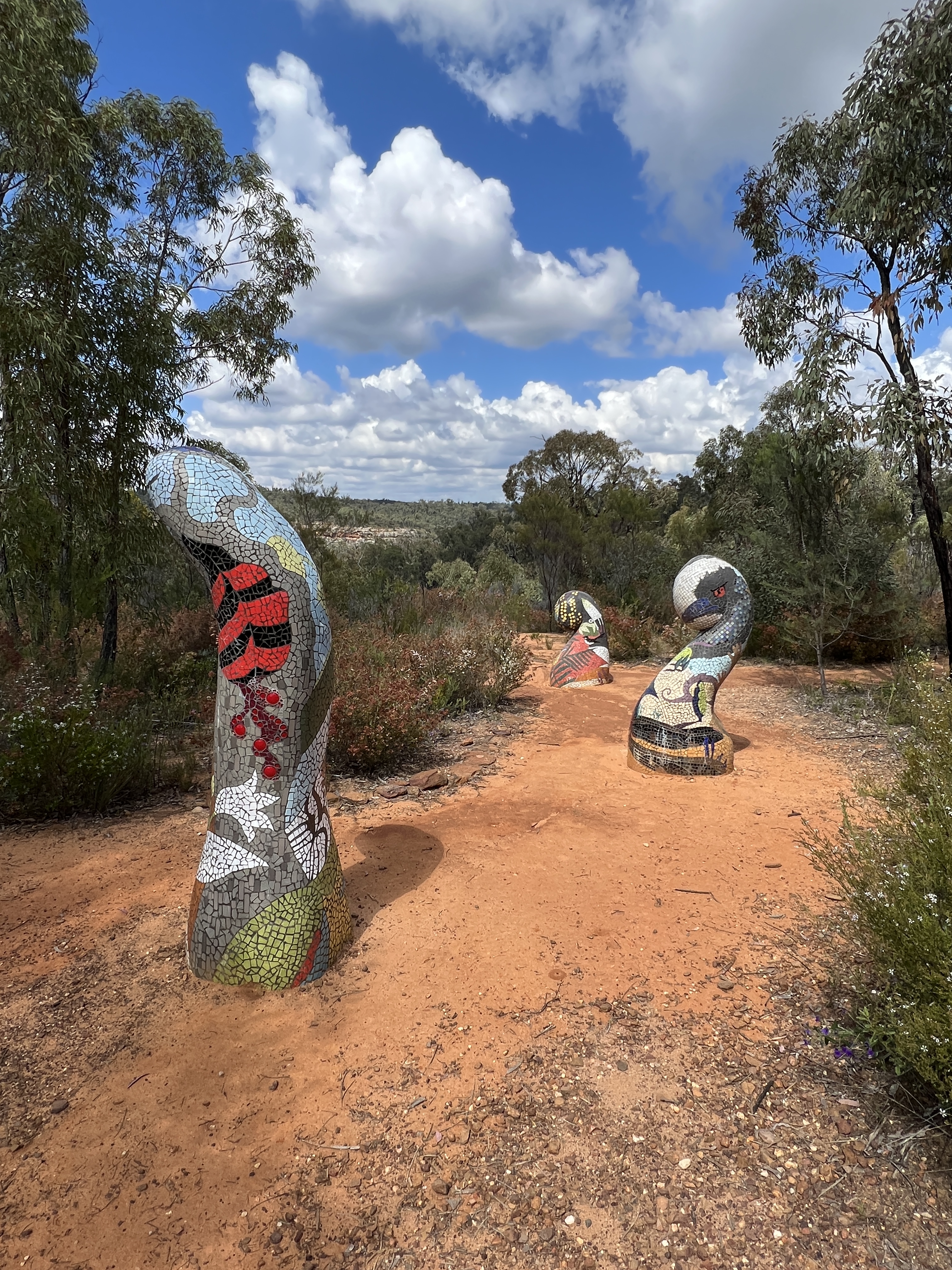
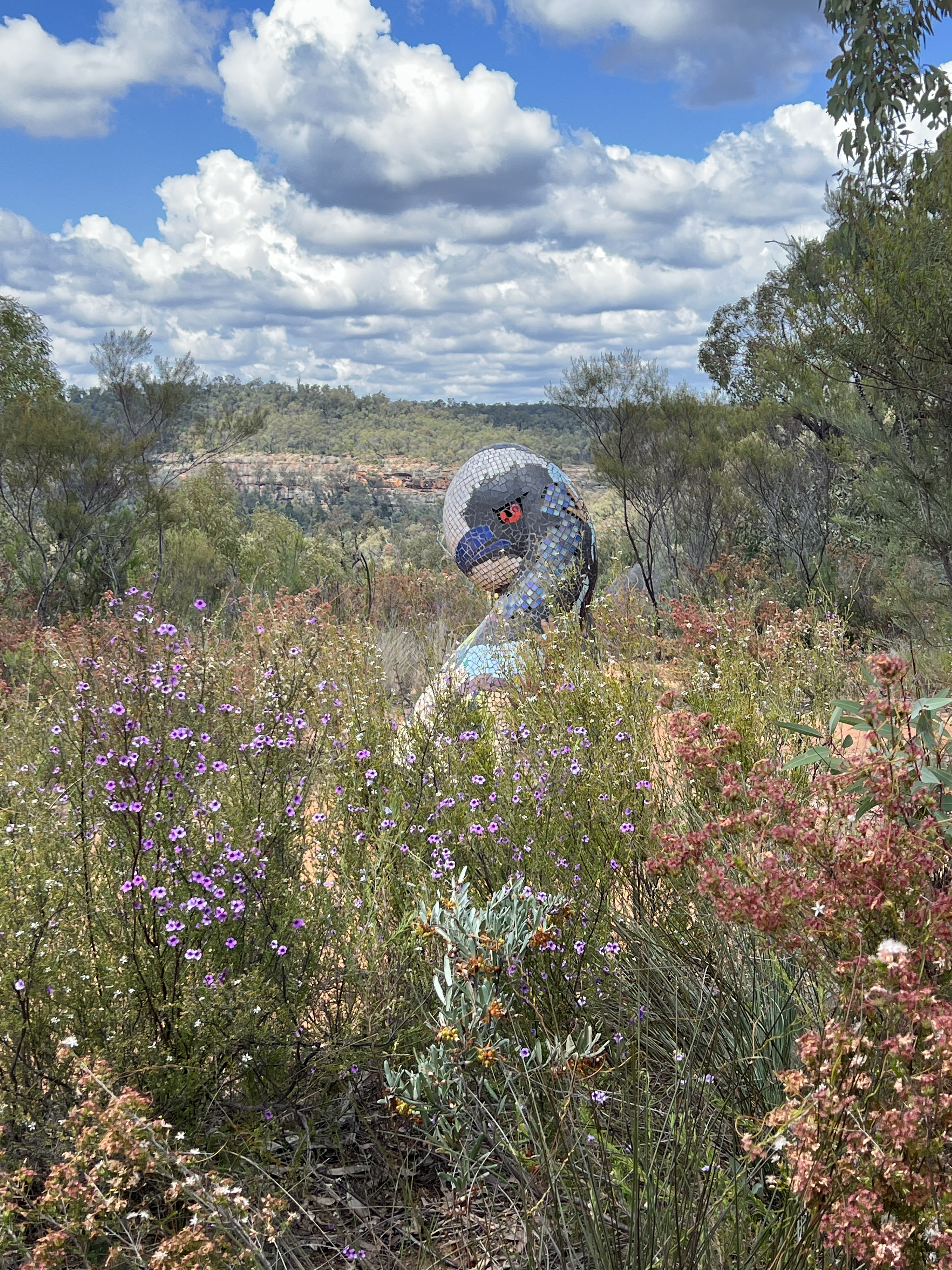
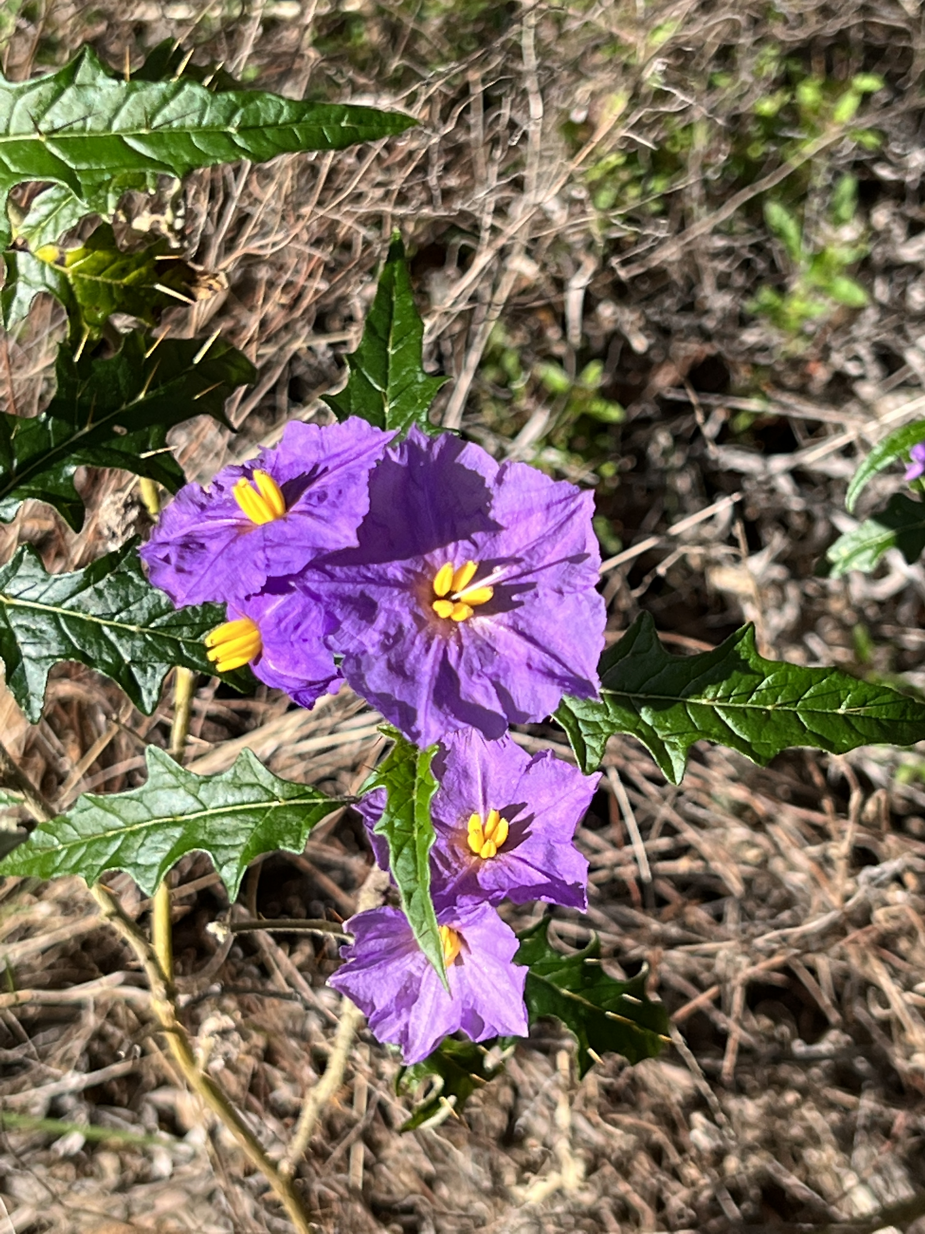
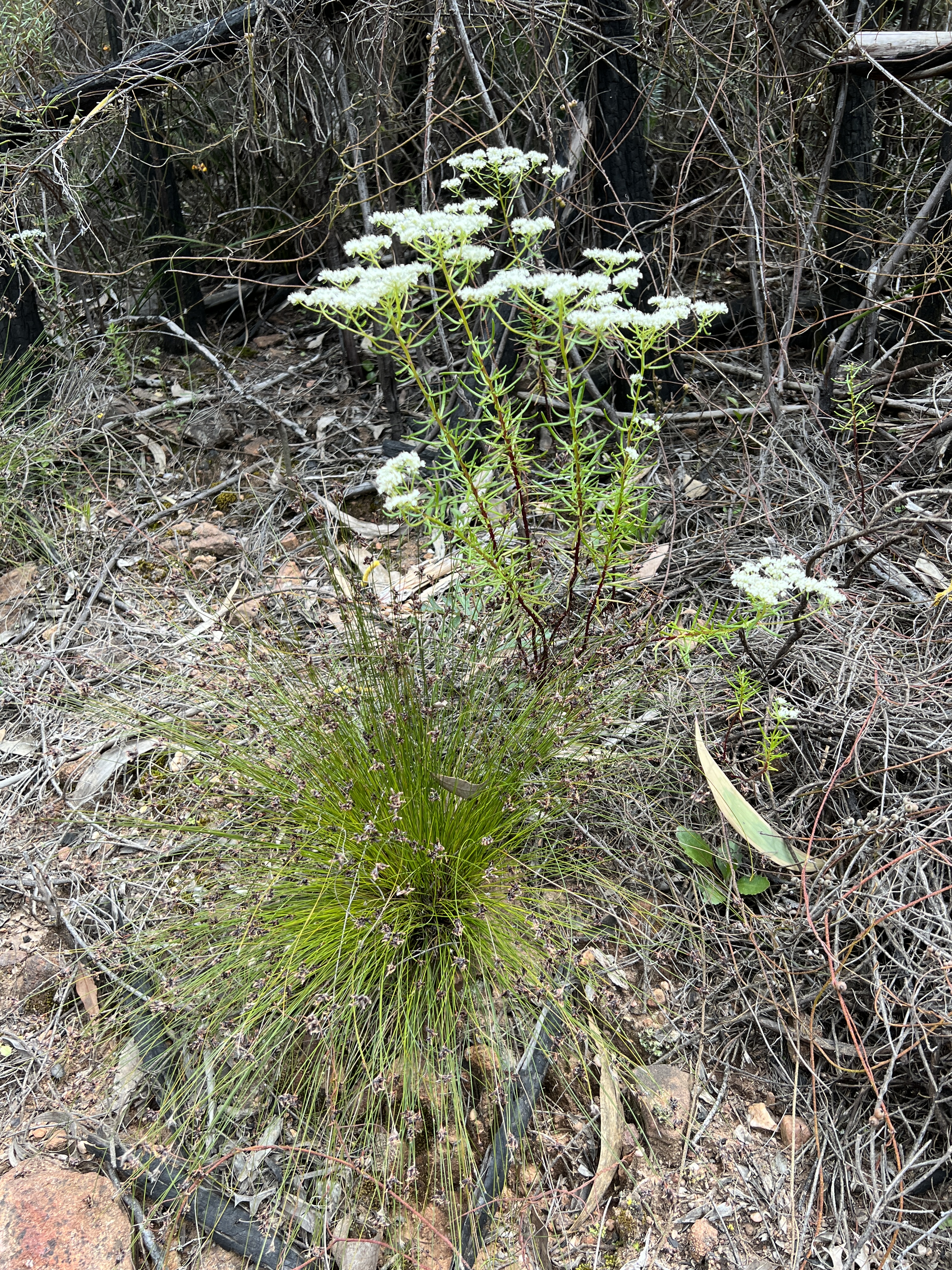
There are also 5 mosaic tiled figures, illustrating the indigenous connection with flora and fauna. Perhaps, showing the stages of life of a plant rising from the earth, opening like a flower and dying off. The wildflowers make an impressive garden for the statue.
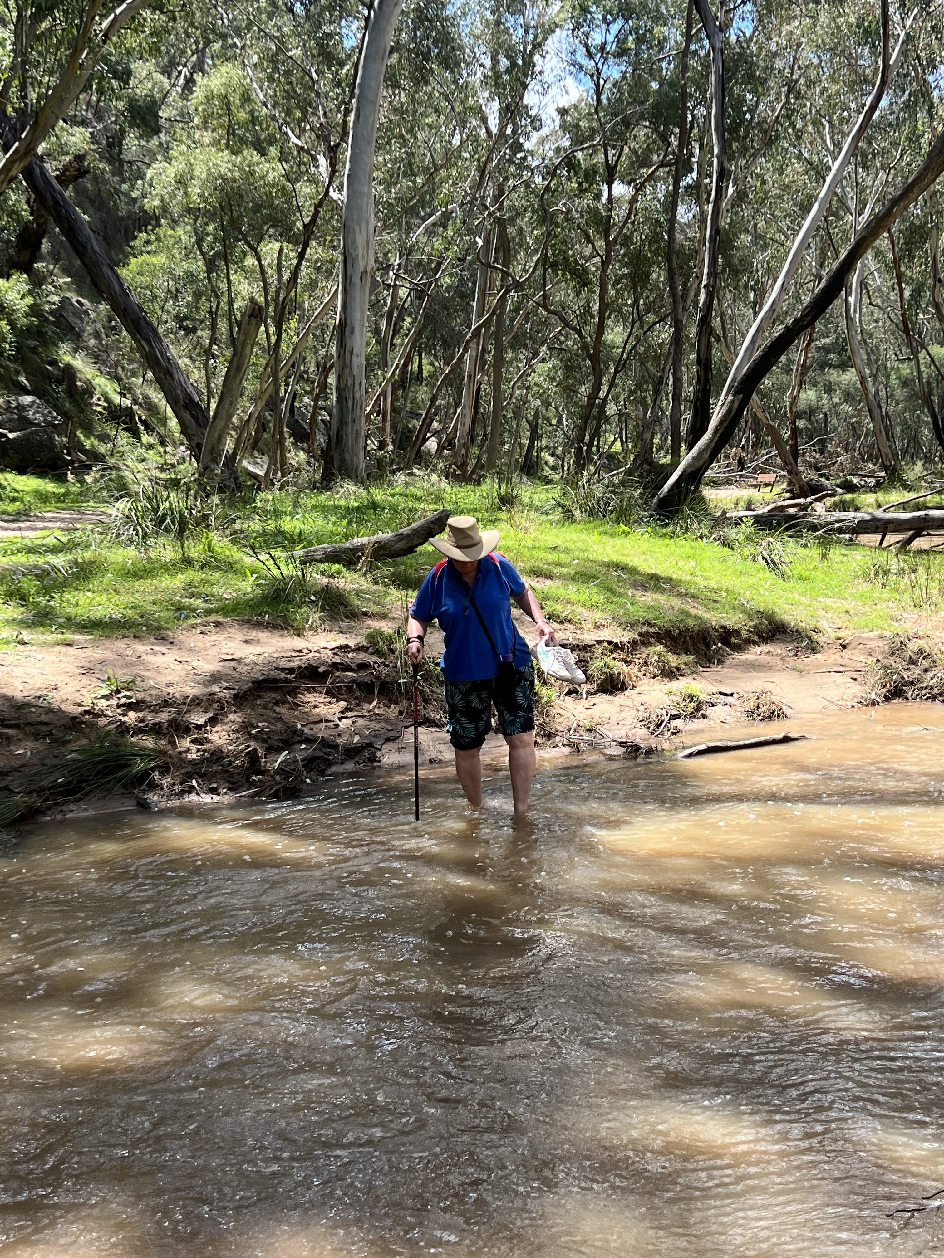
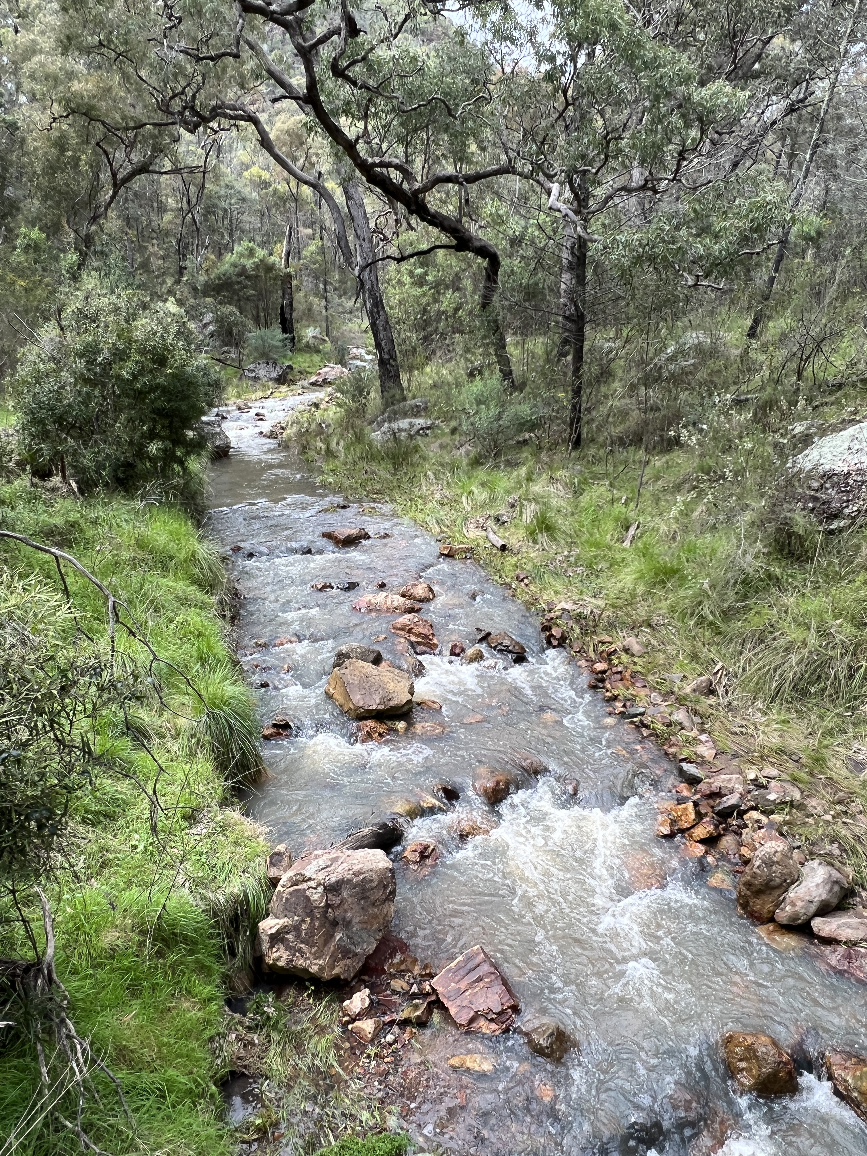
The walk slowly descends into the Dandry Gorge, and then follows the creek for a while. Very cool environment down in the gorge. After a while the track disappears into the creek. Homealone and Allthego need to remove shoes and wade through the creek, not as cold as we thought it might be!
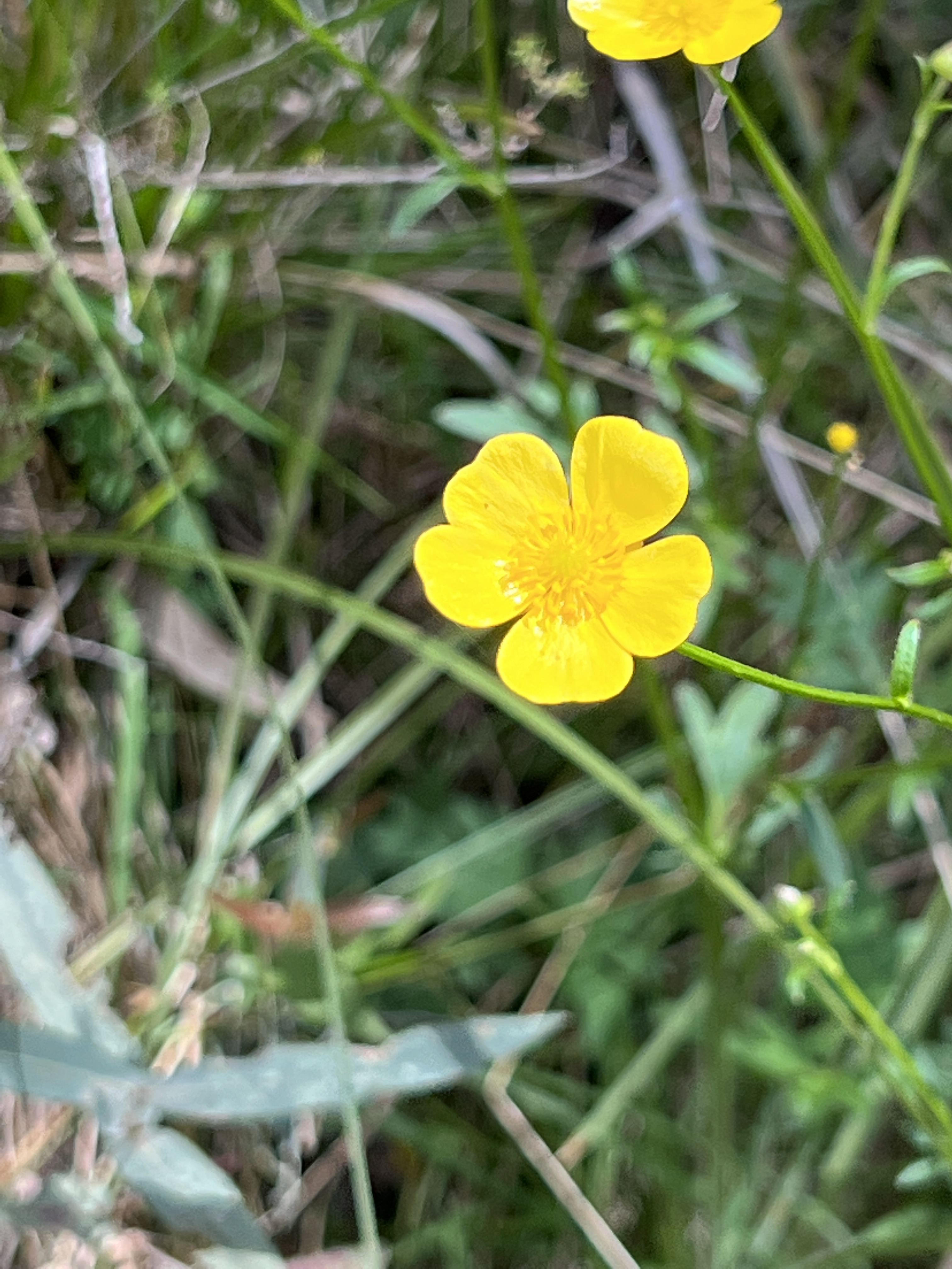
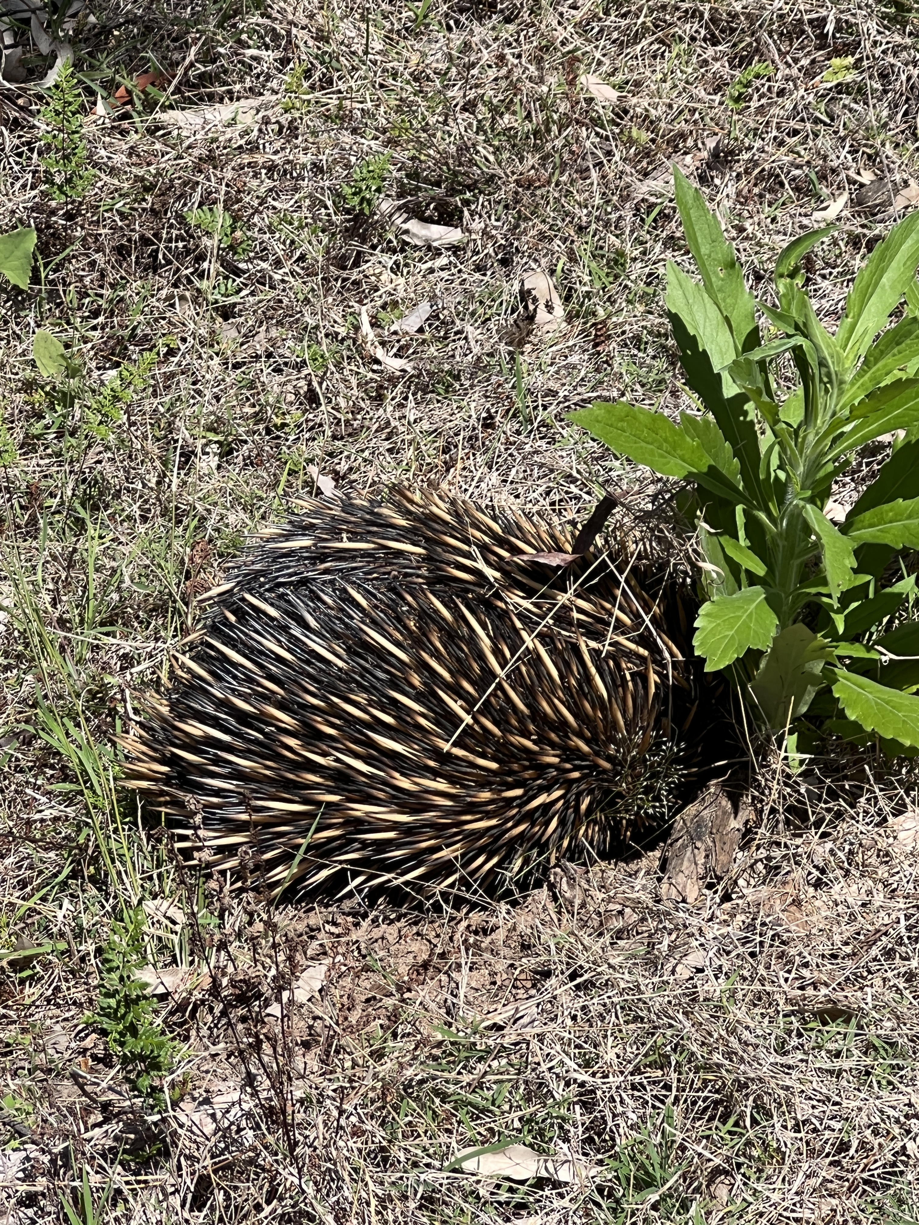
On the other side of the creek the track heads slowly up hill to the campground, more wildflowers and an echidna rooting around under a plant for something tasty.
Back at camp we have the afternoon in the dappled sunlight and a pizza for dinner beside the fire. Not an easy decision to move out in the morning and head for Narrabri!
Pilliga Forest
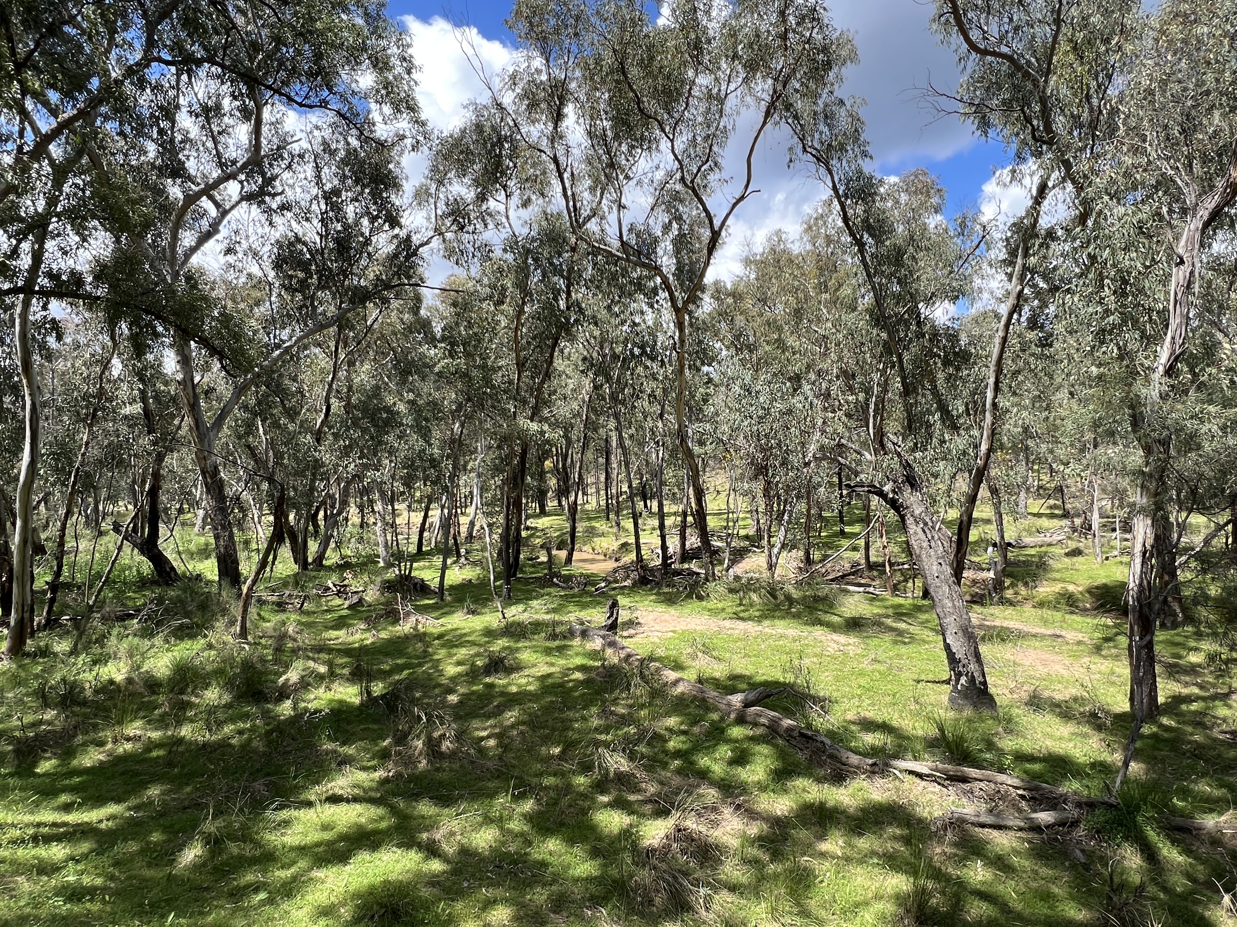
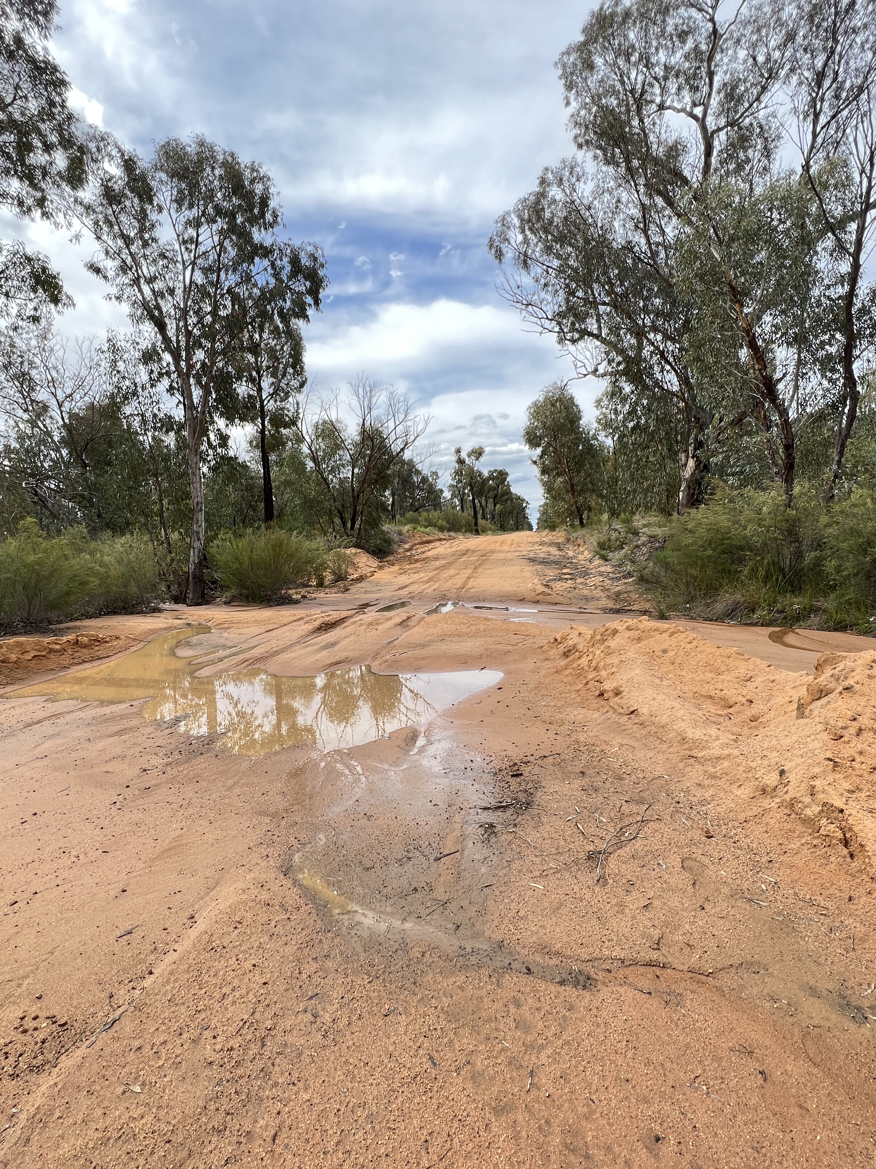
We have made it into more or less the centre of the southern section of the Scrub, as the locals call it. The Pilliga is the largest forest in NSW west of the Great Dividing Range, 500,000ha. More than half of it is NP or conservation zones. It is a great place for birds of all types and wildflowers in Spring. Most of the rest is managed by Forestry NSW for selective timber production. Coal seam gas and fracking is a controversial issue among the locals and drop in greenies from the big smokes.
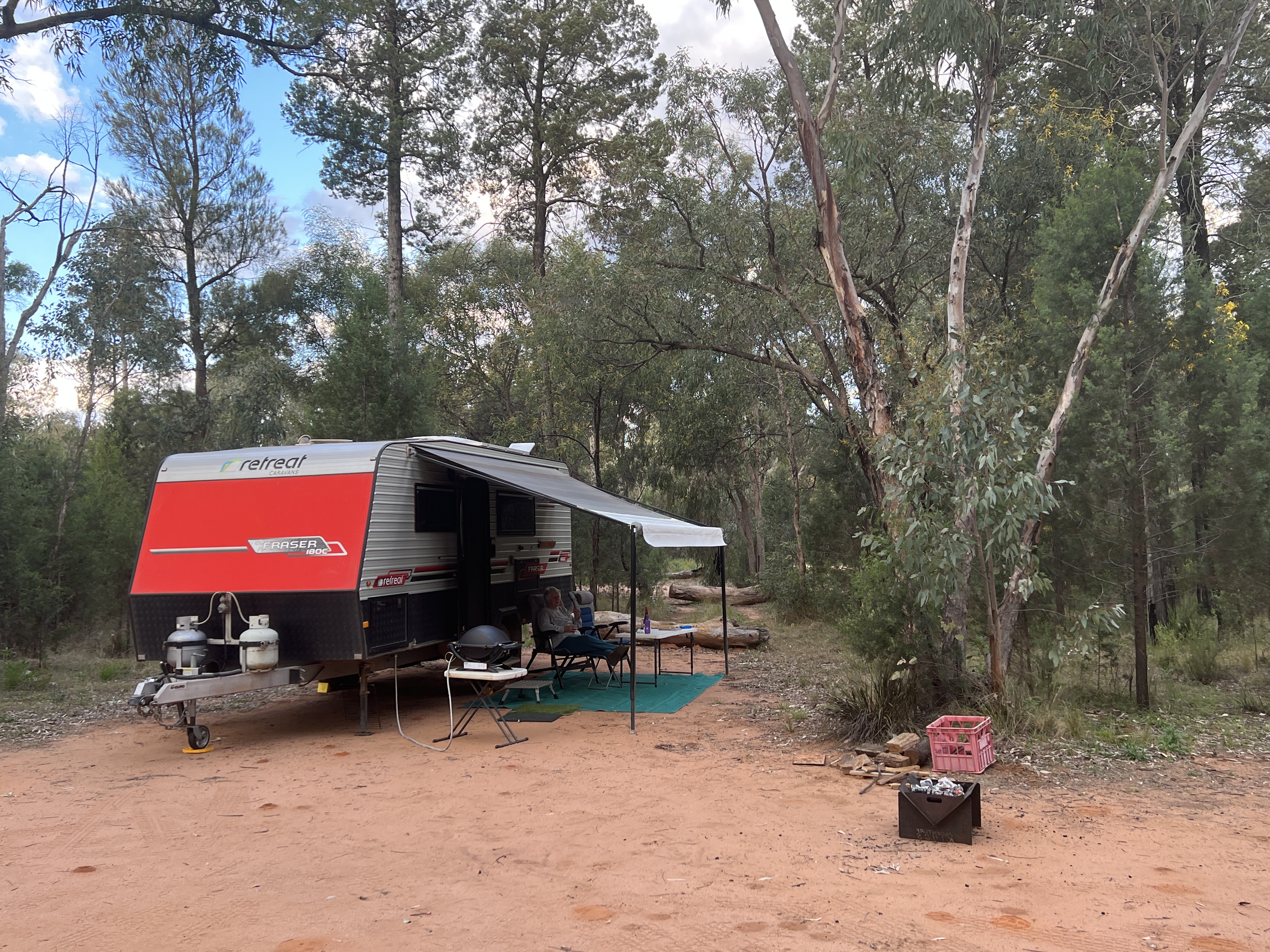
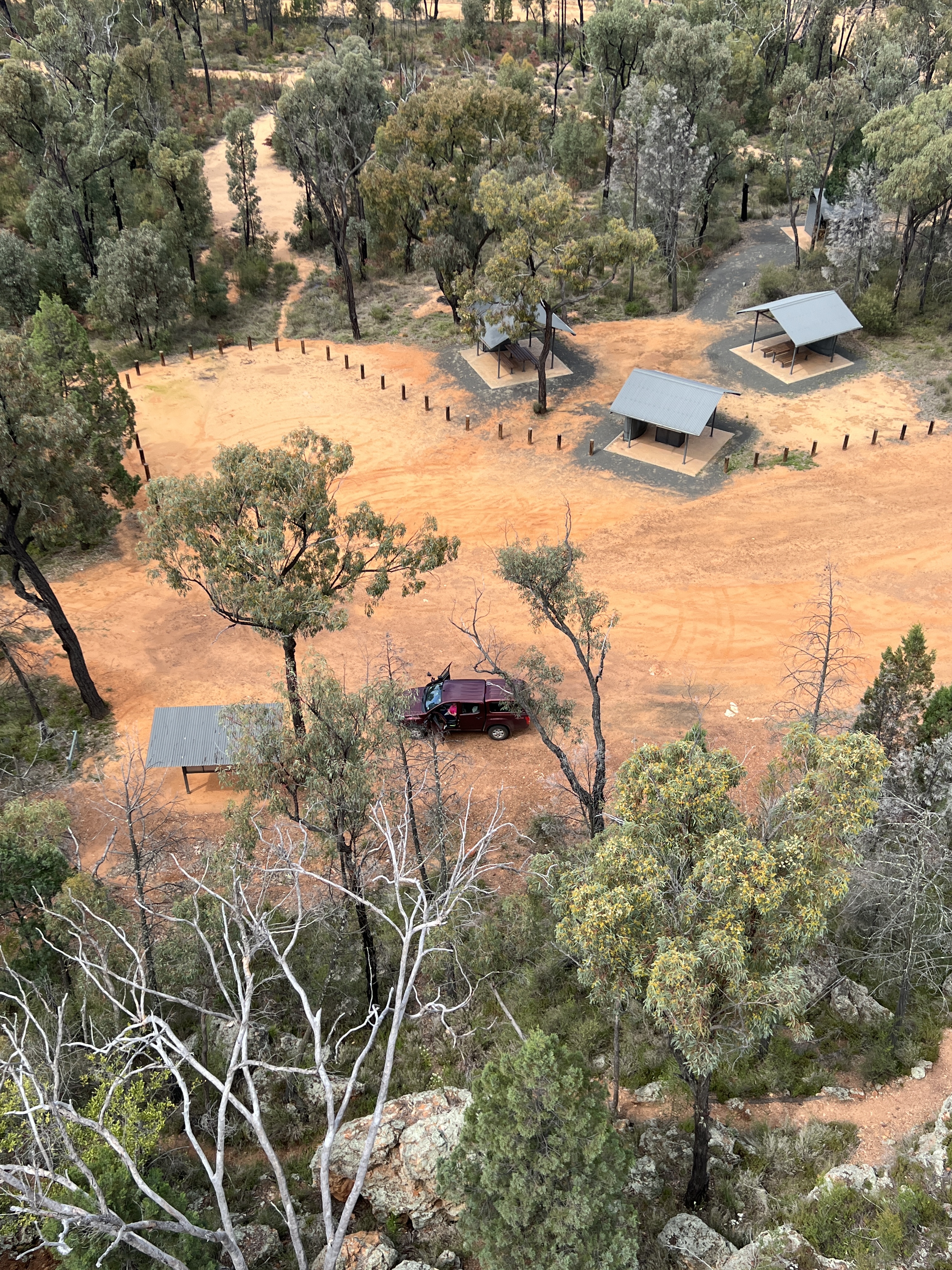
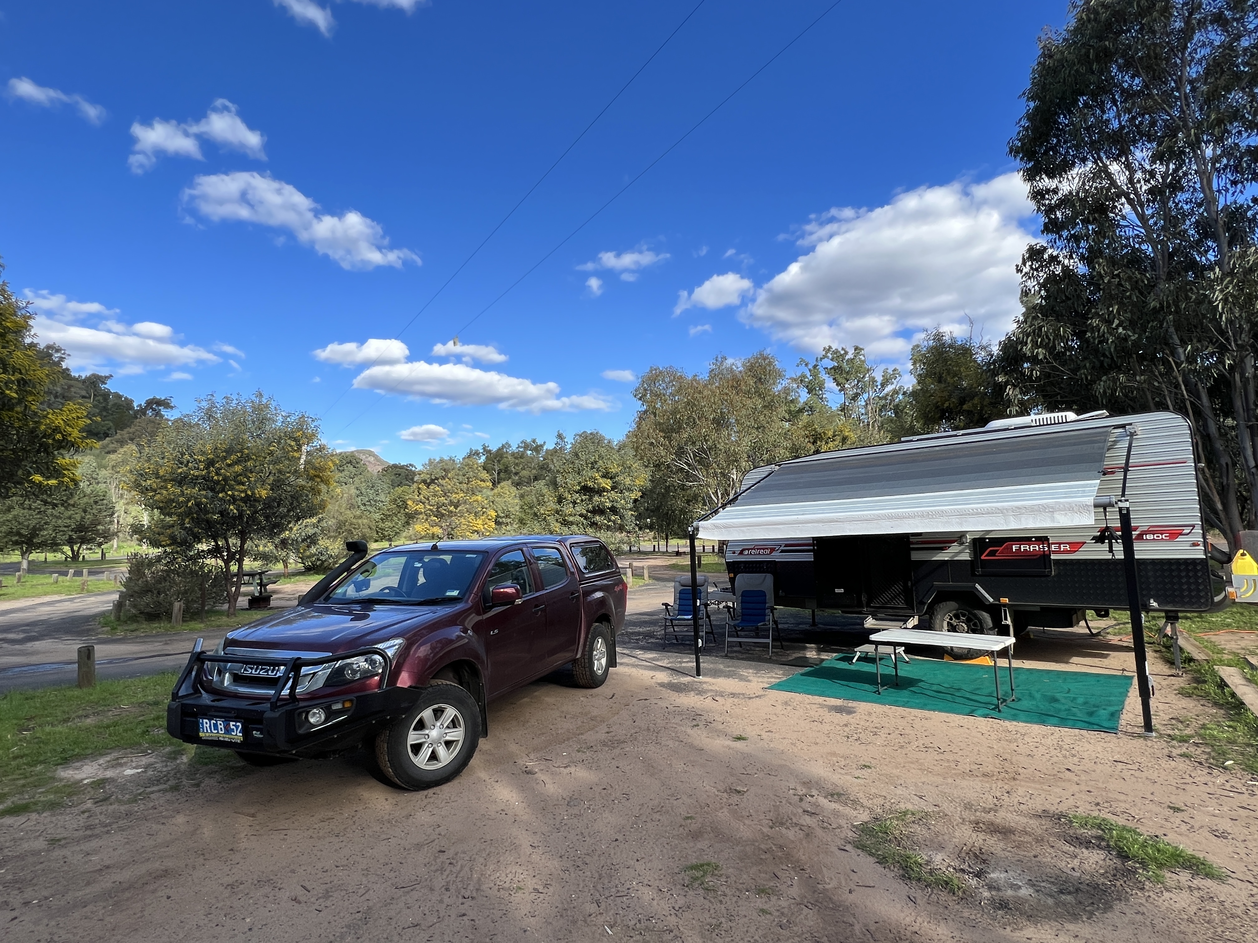
We have based ourselves at a place called Sculptures in the Scrub, but more of that later. No plug in power or water here so we are relying on renewables, the sun does look like shining for us.
The campsite is about 20km into the Forest off the Newell Hwy, in the east, and a similar distance in from Baradine, a small town on the western edge of the Forest. Baradine had its hey day in the timber cutting days of the late 19th century first half of the twentieth. The Forest was a big producer of sleepers for the railways.

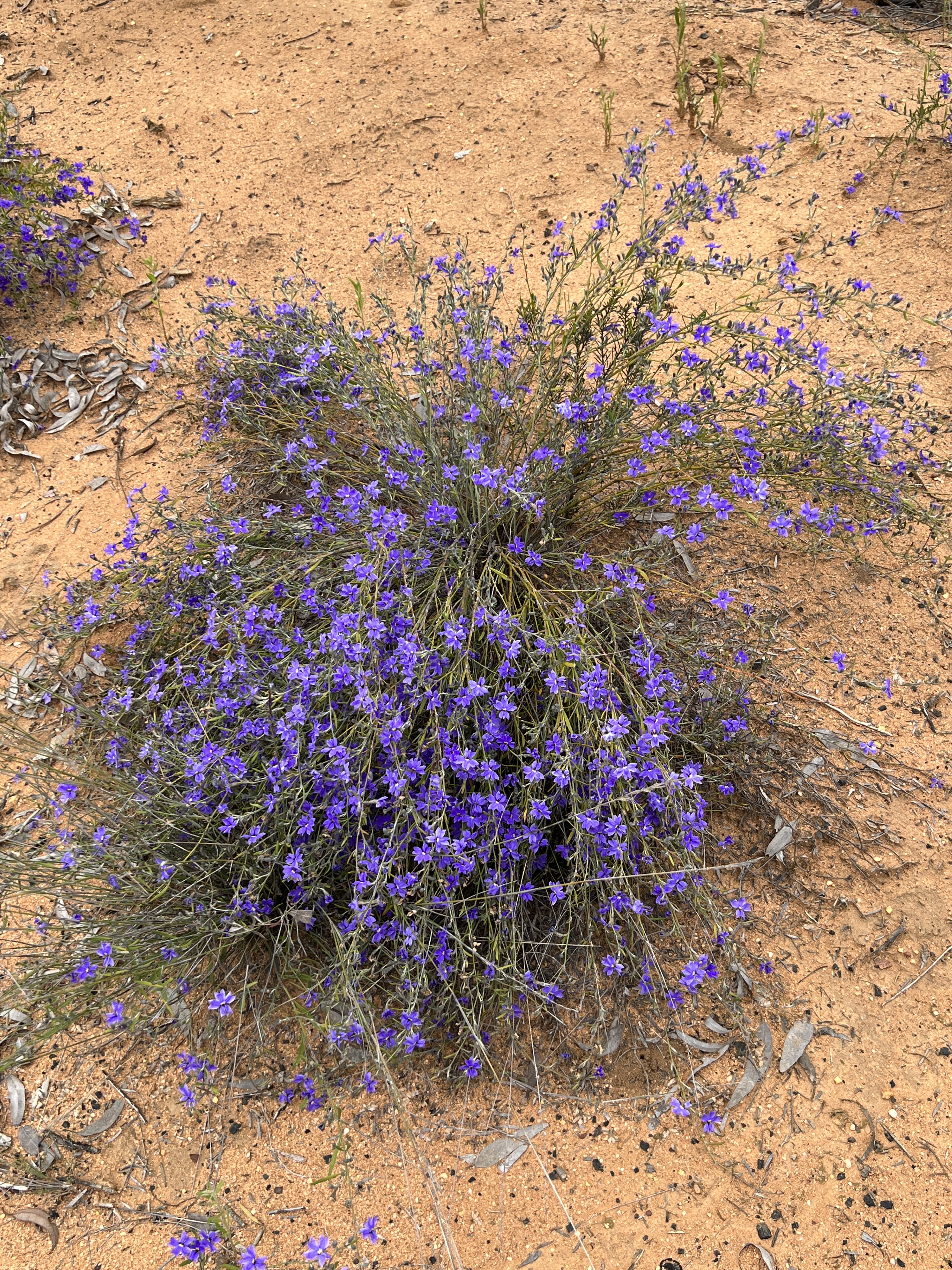
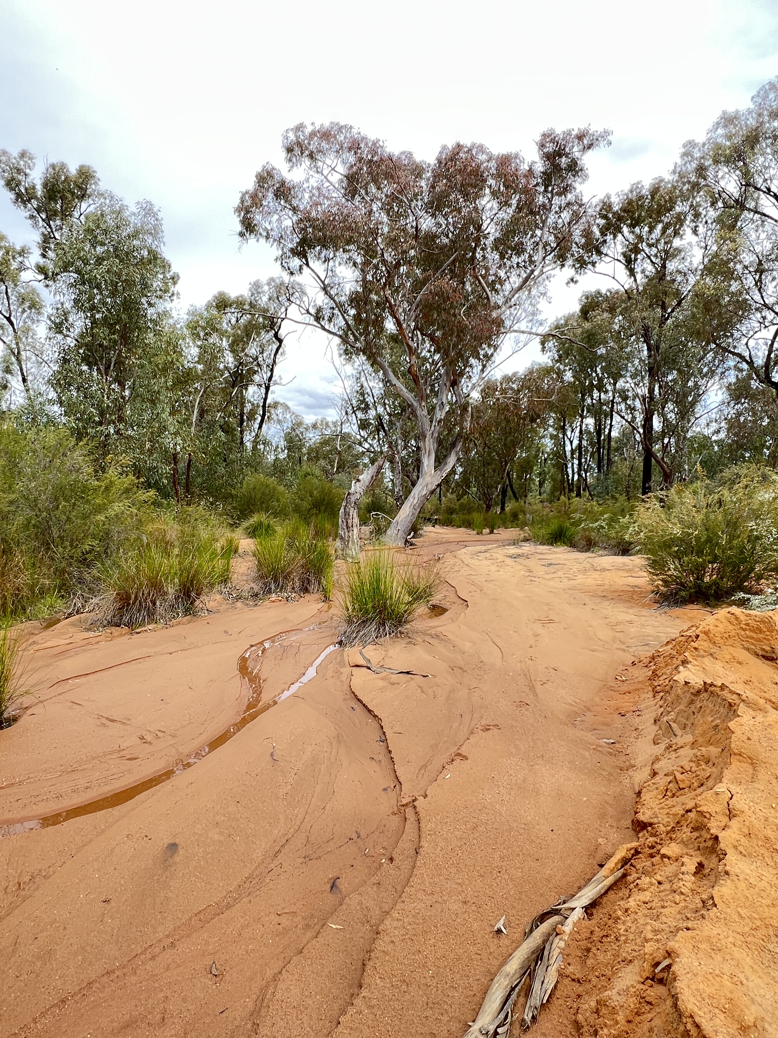
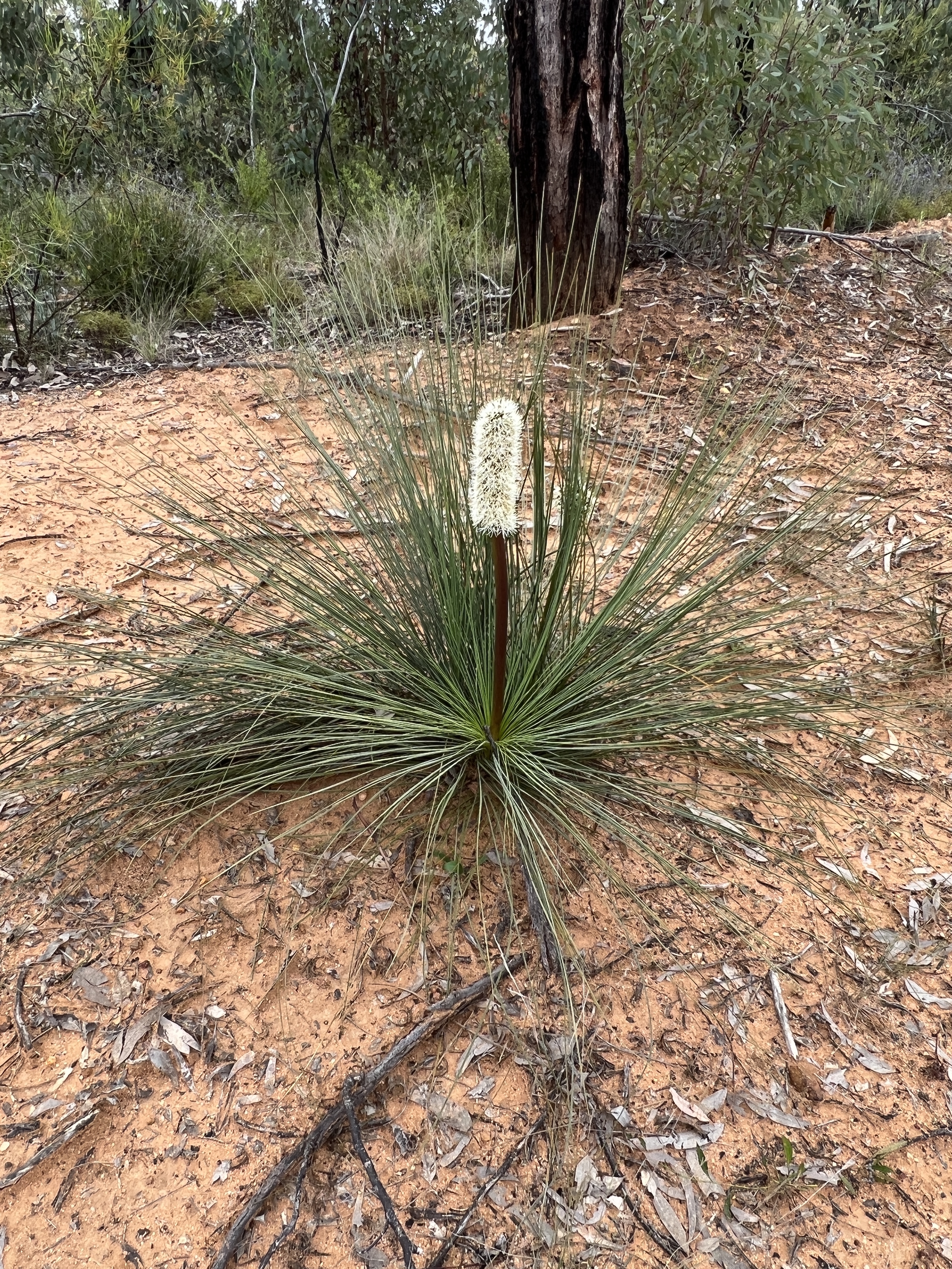
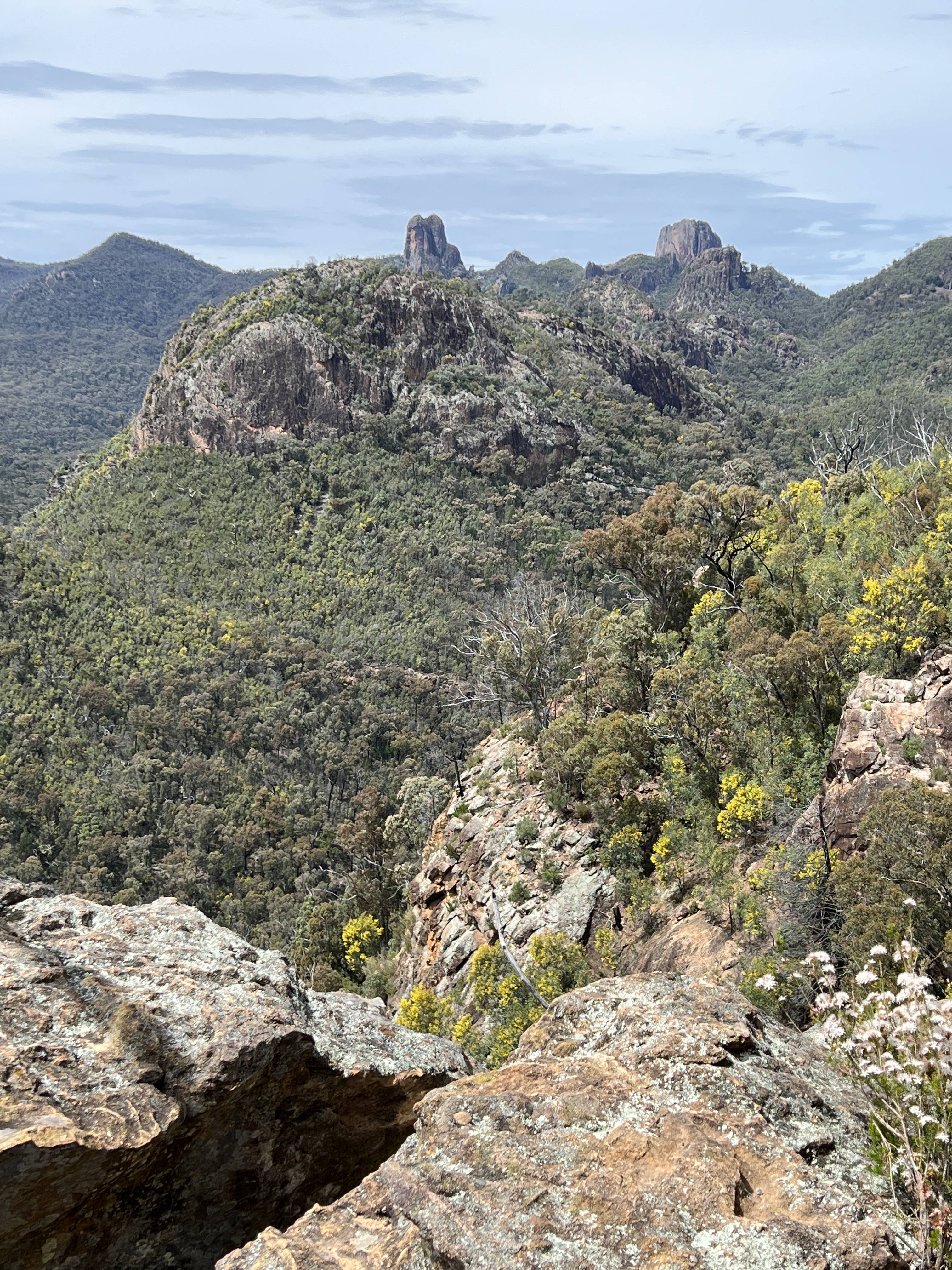
There are tracks all through the Forest and we chose one that takes us to the fire lookout tower, about 20 km to the north, a good gravel road but cut up a bit by the recent rains. A few creek beds with dribbles of water to go across along the way. Wildflowers out in profusion.
Homealone lingered in the car while Allthego made the climb aloft.
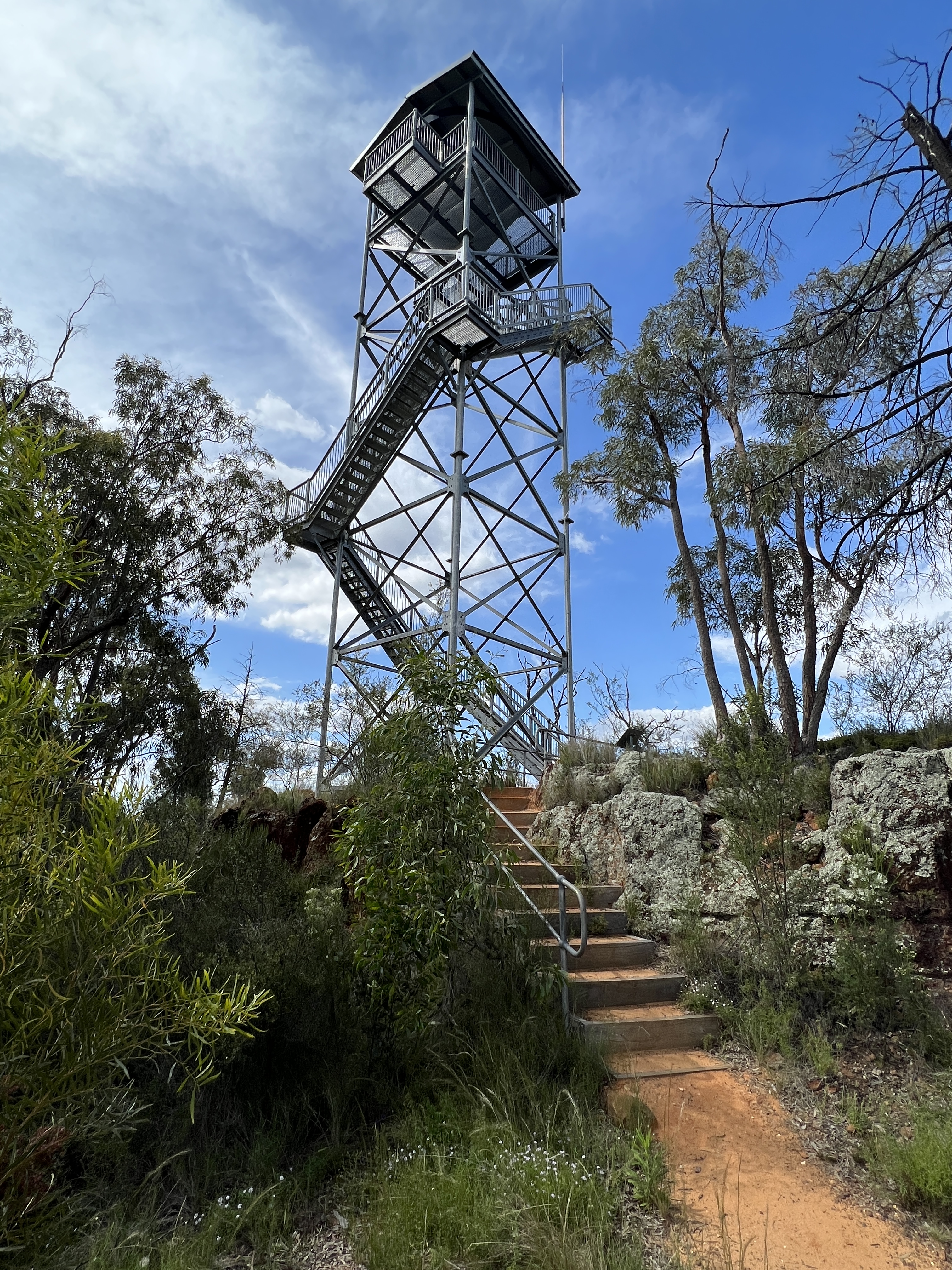
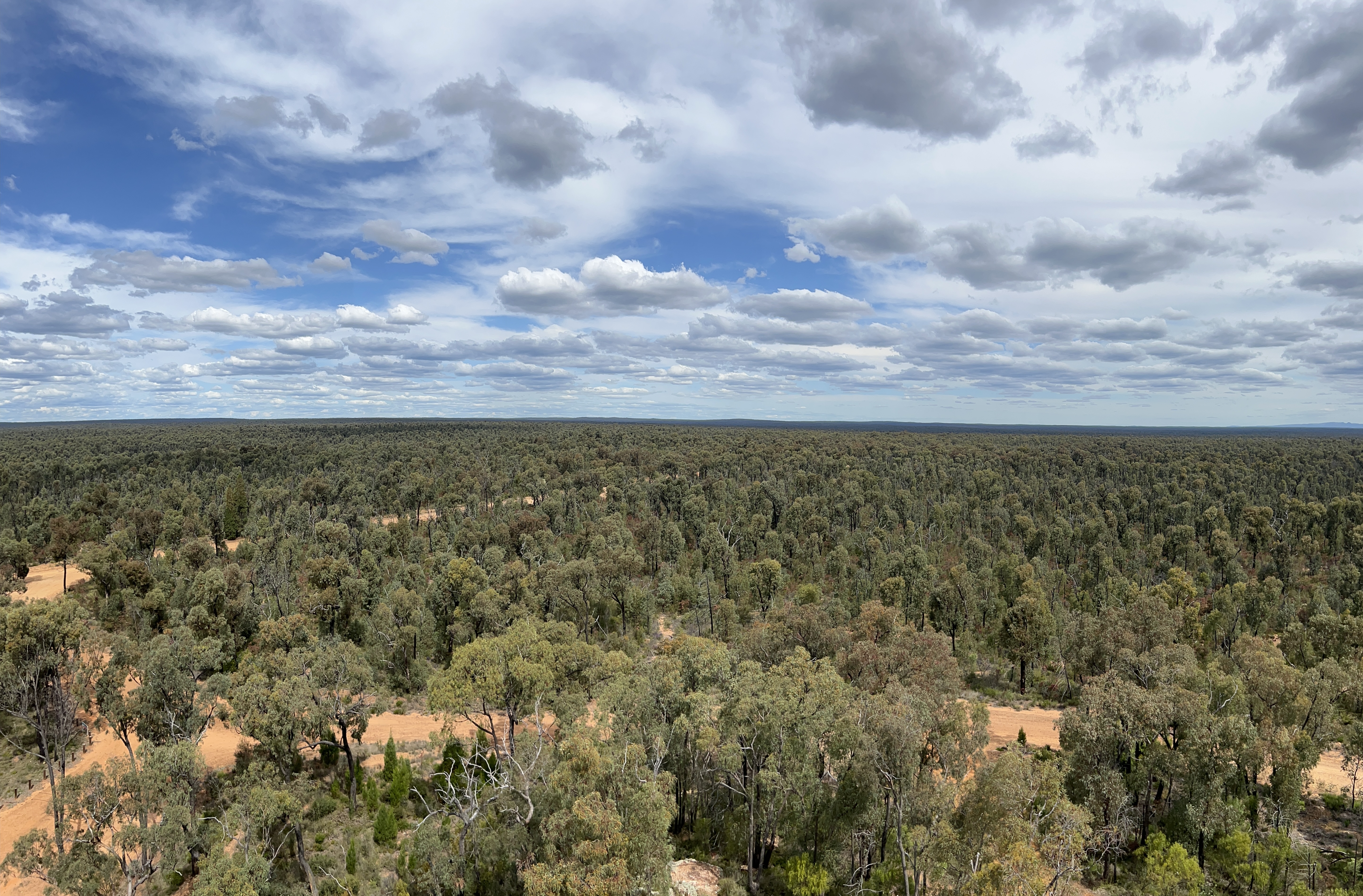
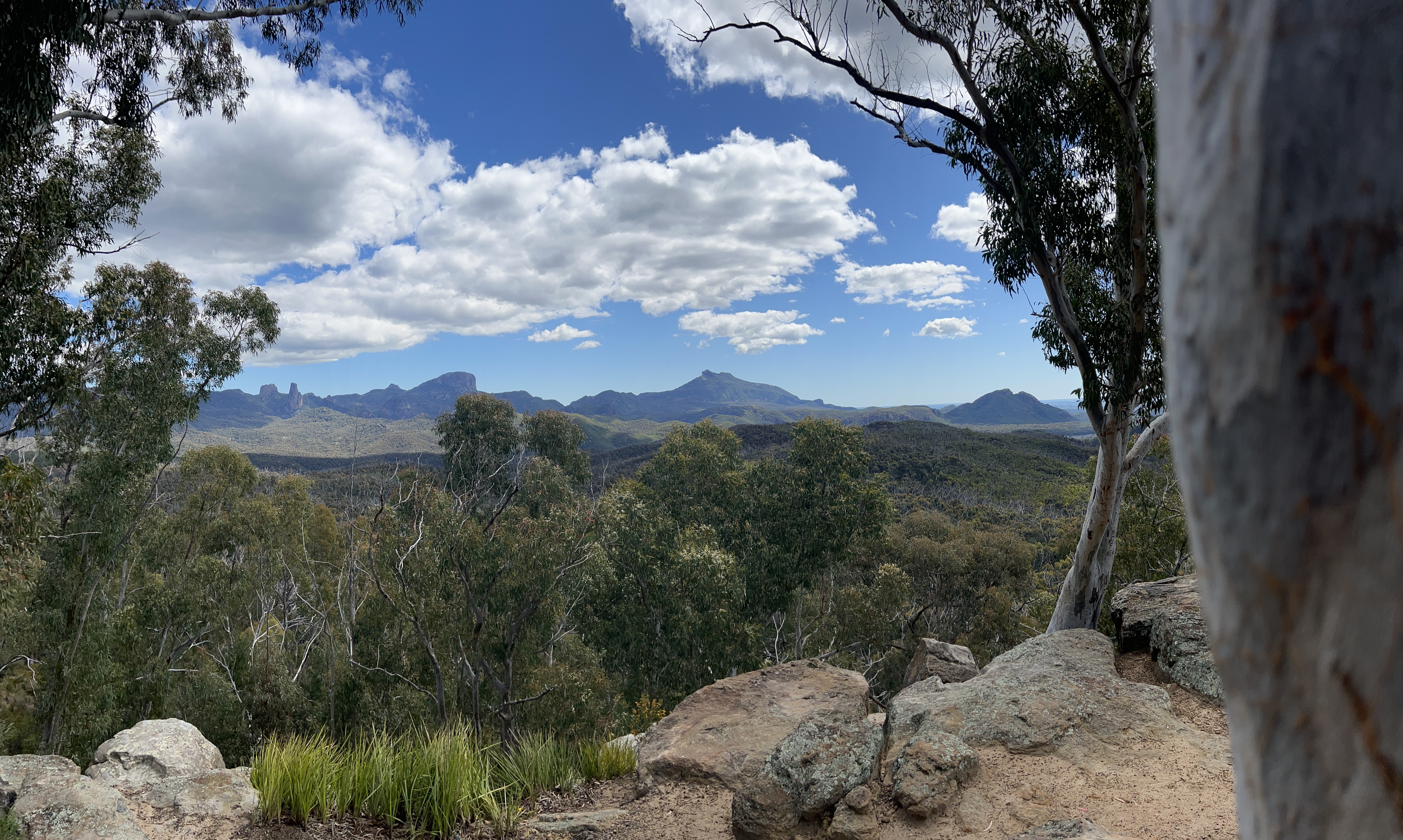
The view from the top of the tower is particularly spectacular, the Forest stretching away in all directions. The Warrumbungles could be seen on the horizon.
We made our way back to the campsite for dinner and bed.
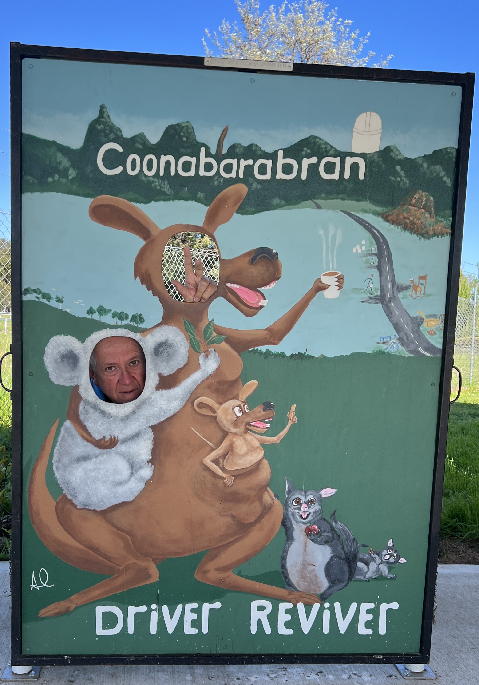
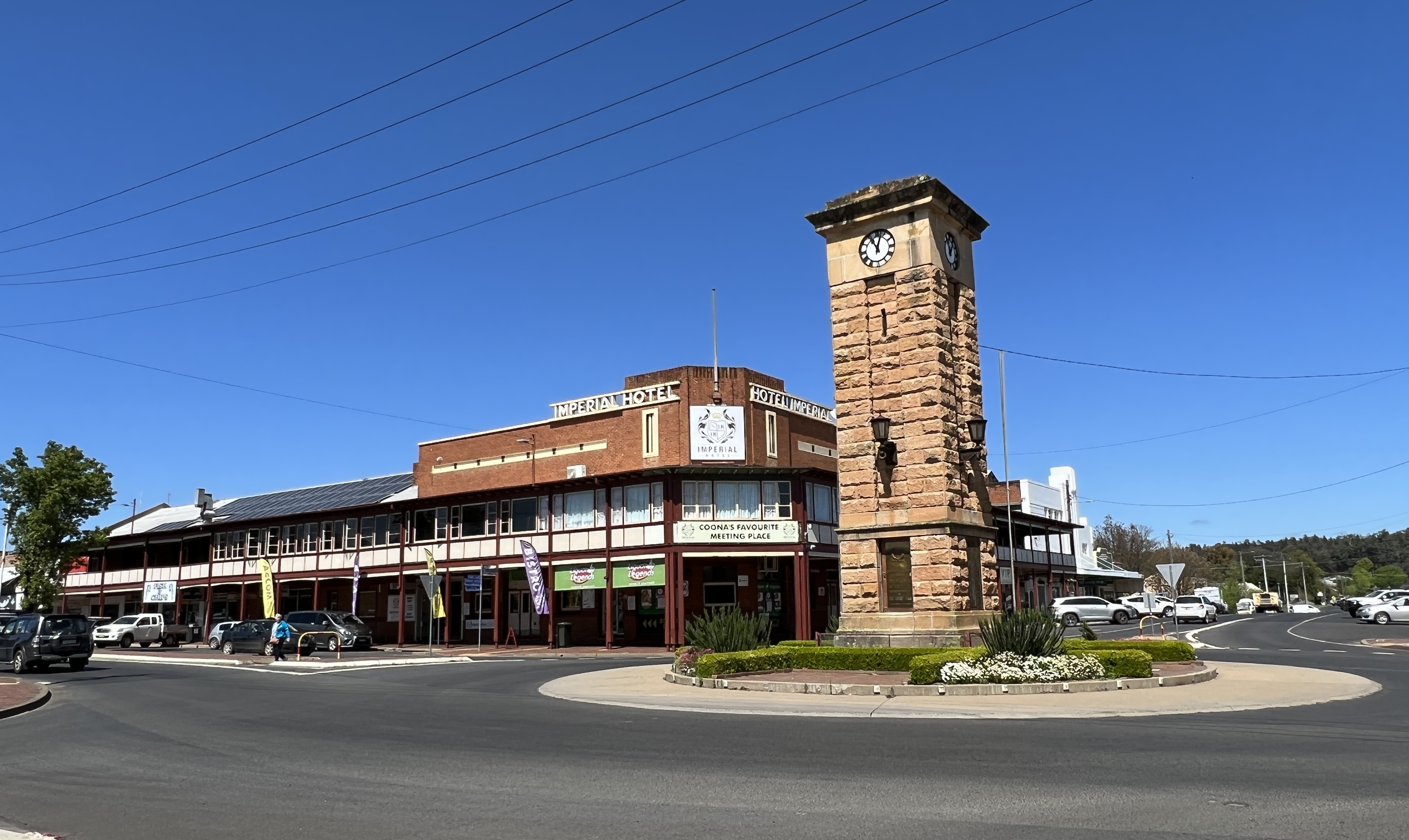
Coonabarabran
After leaving the Bungles we headed to Coonabarabran for a couple of nights to recover from the walking and before more walking in the remote Pilliga Forest.
We had booked an evening at one of the small private observatories, a short distance out of town. We were blessed with a clear cloudless night. Very cold though. Coonabarabran is a ‘night sky park’ and has all sorts of rules to stop light pollution. You can’t have sky lights in your house because of light escape. Anyway the stars were sparkling but the show was a bit disappointing, only two scopes and 24 people including a couple of screaming kids. We saw 6 objects (in an hour and a half) up there including some nebula, Jupiter and Saturn. Jupiter is very close now and it’s bands could be seen clearly, Saturn’s rings also clear. Good experience.
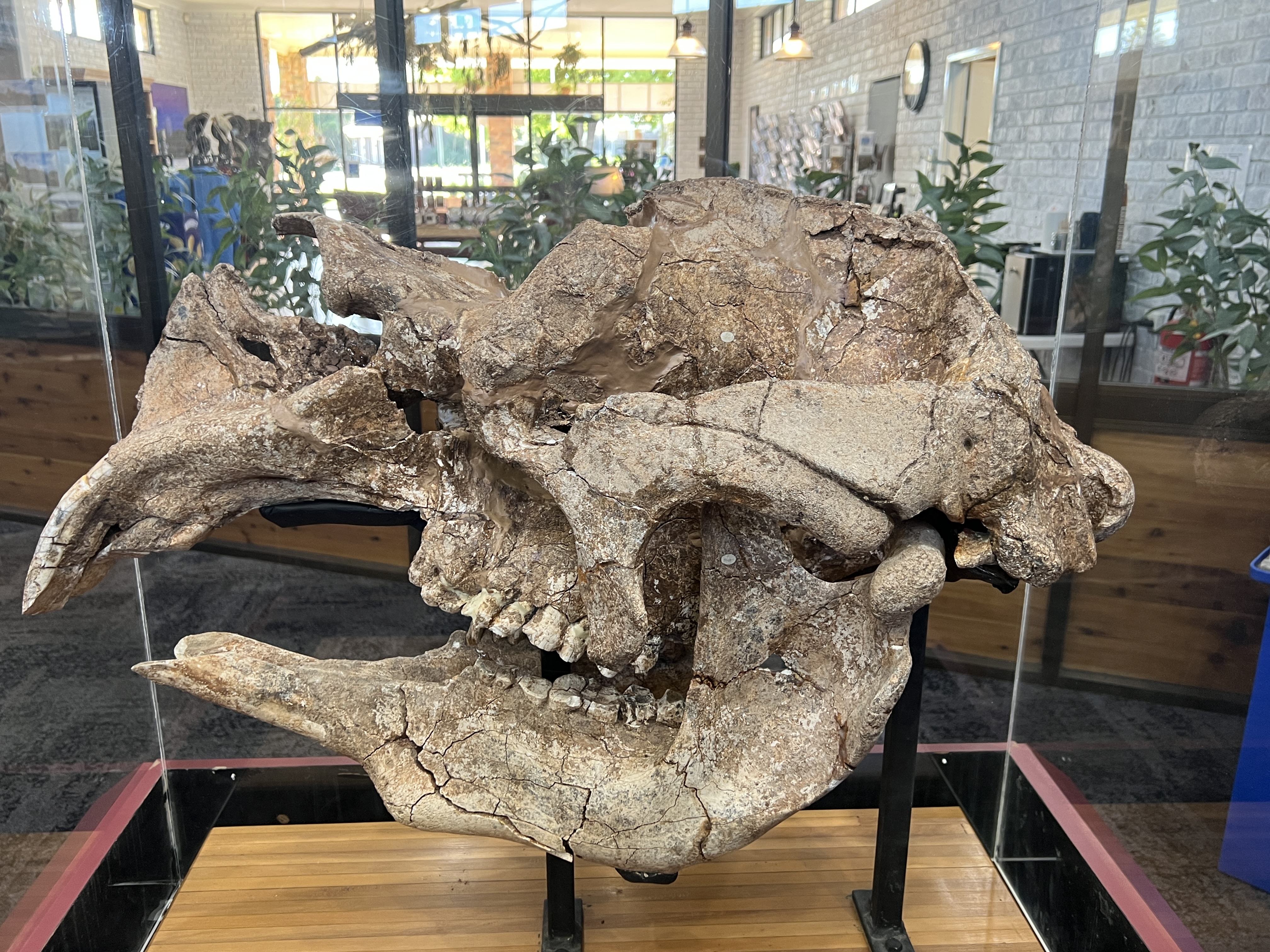
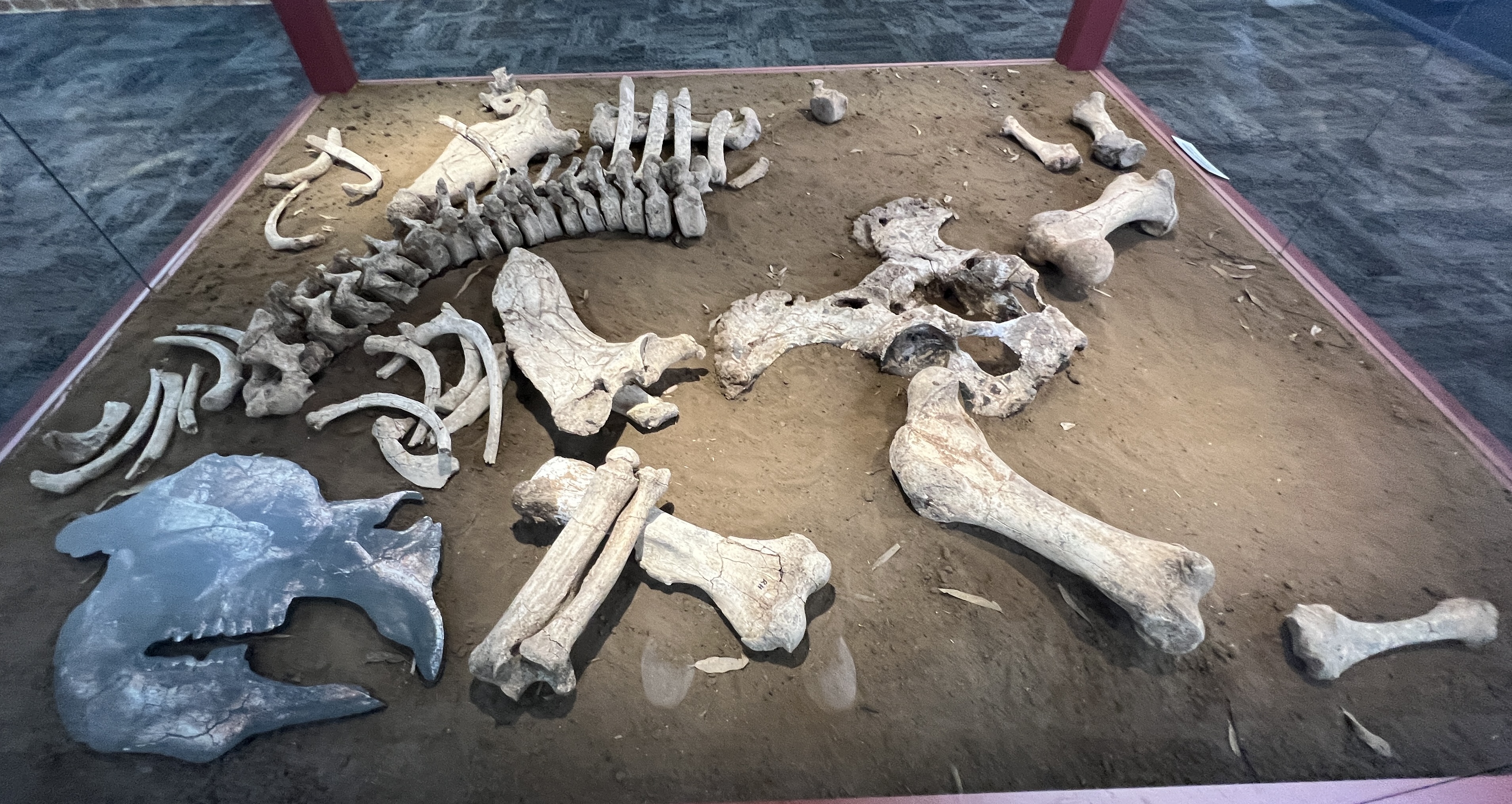
Back in town the Information Centre is a must see. They have the bones, including the skull, of a local Diprotodon. Very impressive display and information boards. Homealone has a stuffed Diprotodon back home, we got it out at Eromanga in western Queensland. Hers is much smaller than this Coonabarabran one and is only a bit bigger than a rabbit, we use it as a doorstop.
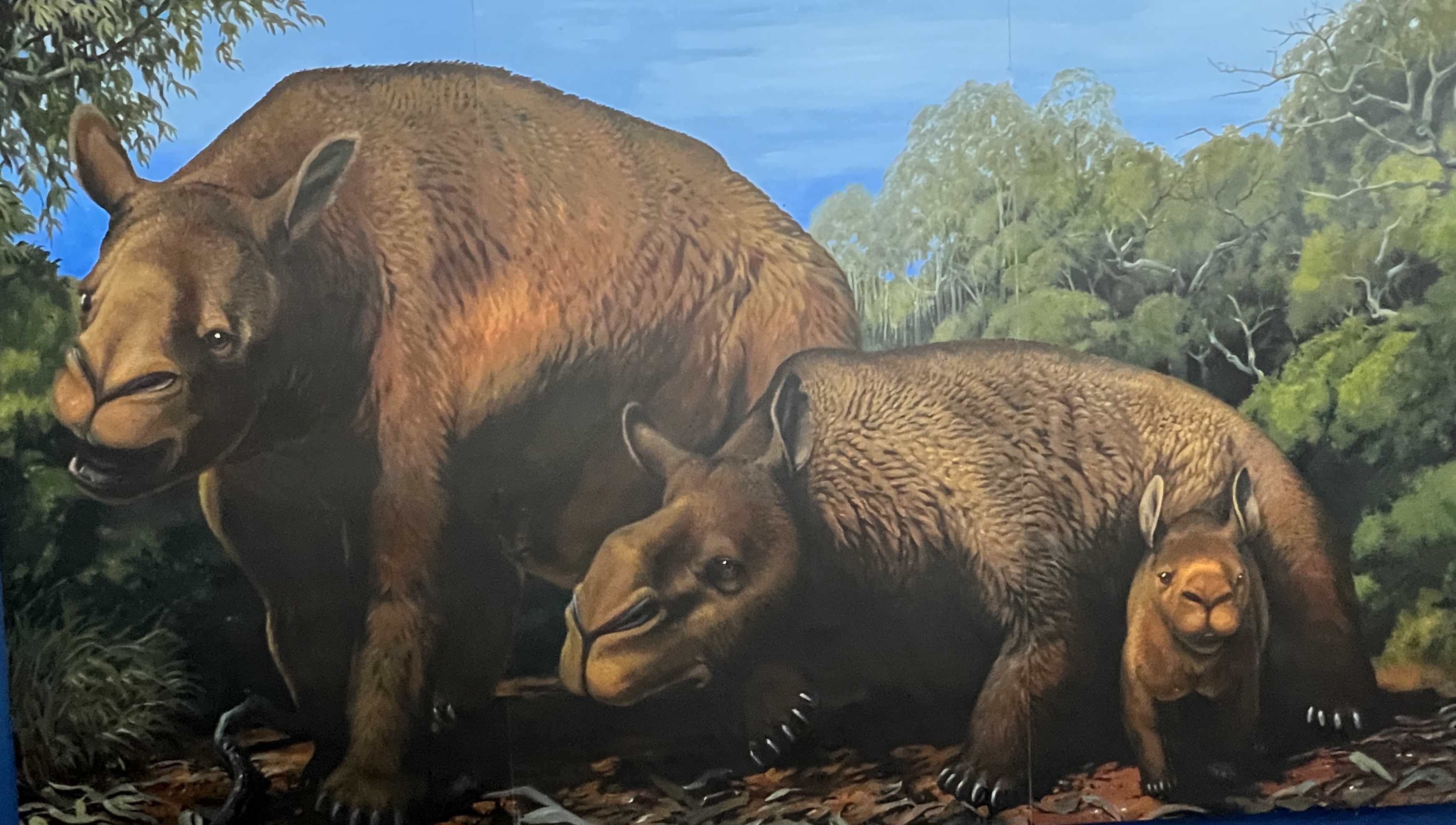
Obviously, different species.
It is now off for three nights to the Pilliga Forest or scrub as the locals call it.
Wurrumbungles again
We are half way through our stop in the Bungles. It is time for a day of rest, Allthego is feeling a tad stiff after the Breadknife walk. So it is into the car for a drive around the sights. Weather remains ok, cloudy and sunny no rain.
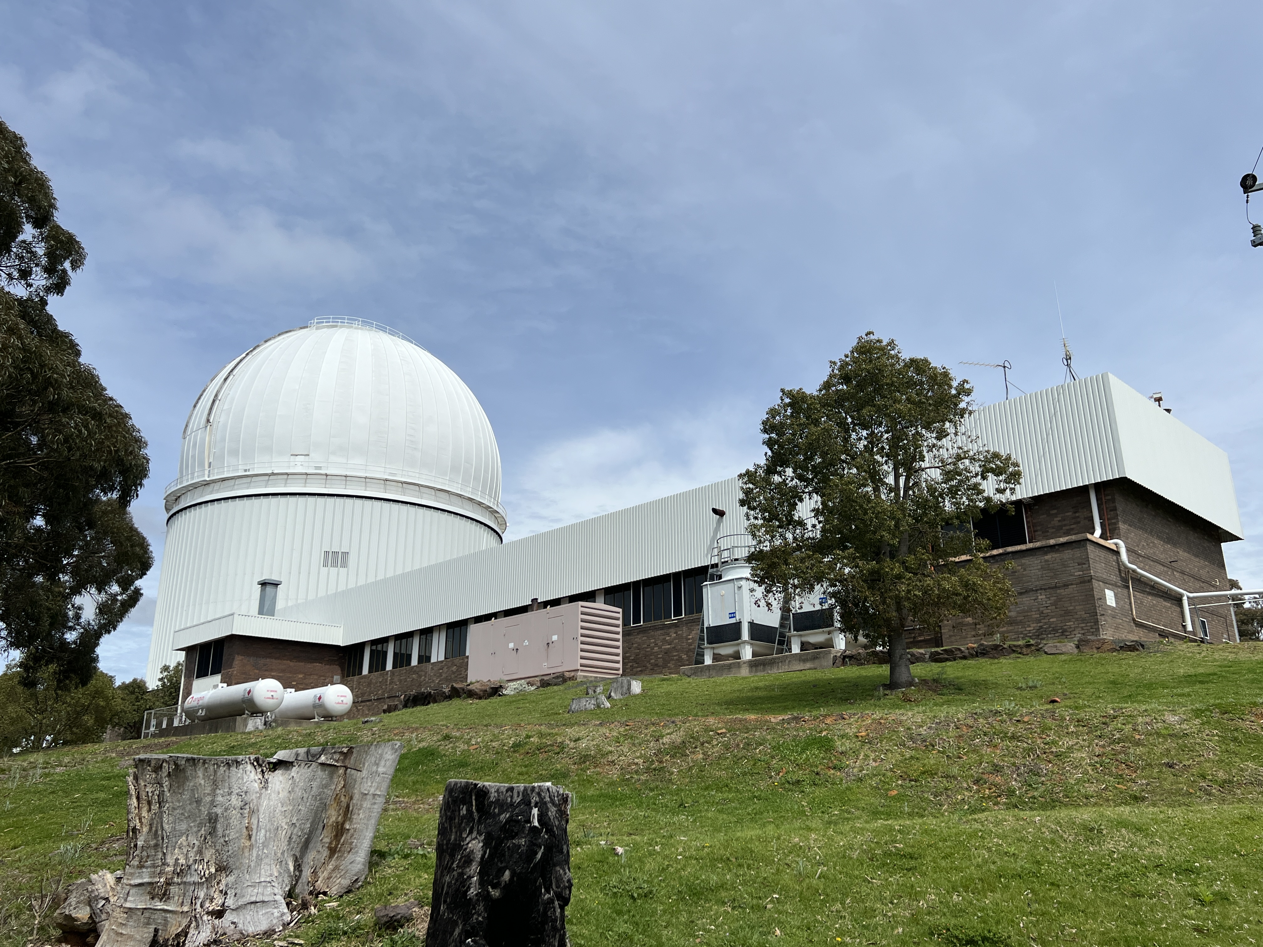
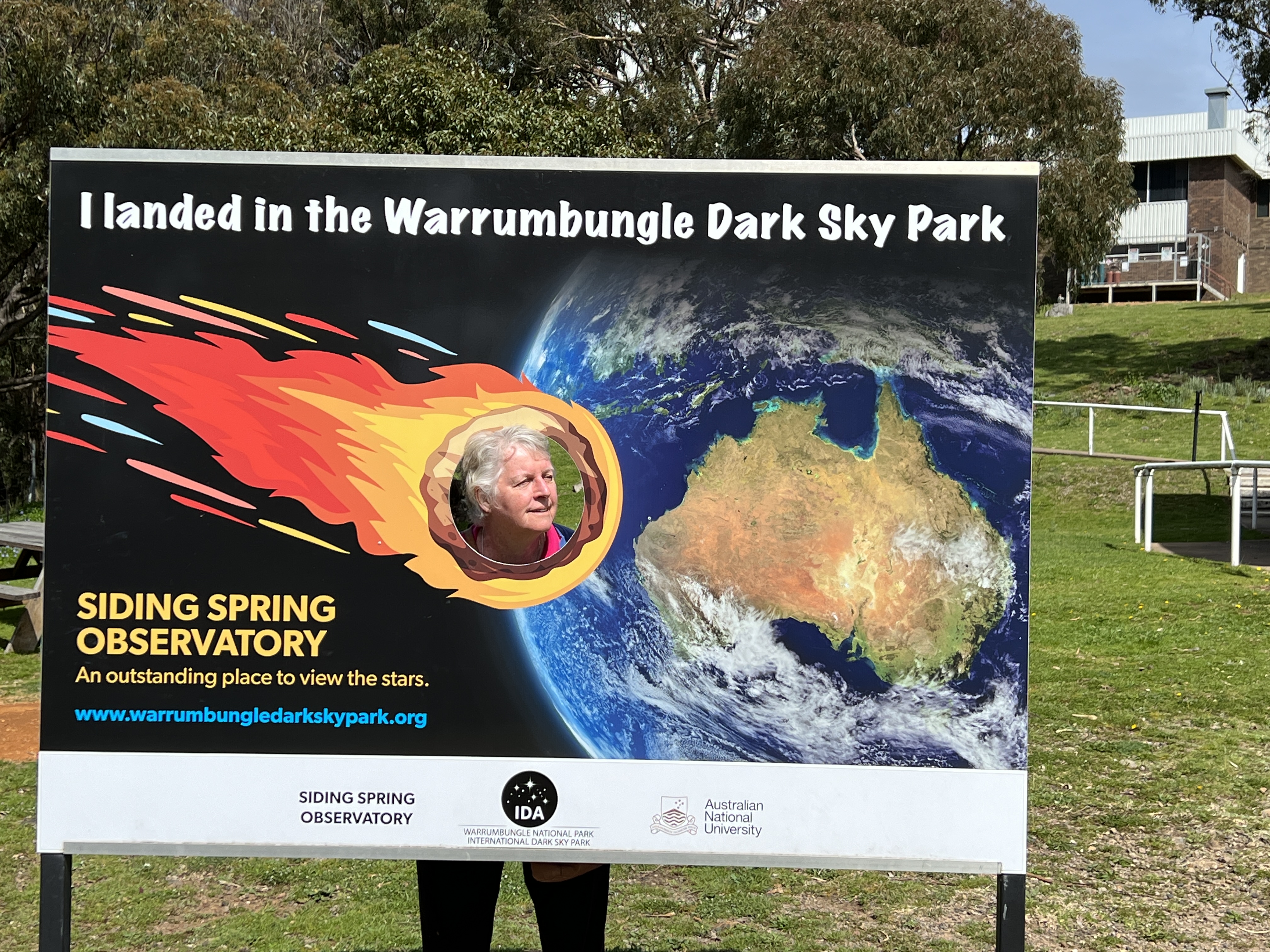
First port of call was the Siding Springs Observatory. The facility seemed deserted, we only saw one other couple having a look around. Big telescope here that looks out into space and all the stars. Good views too over the Bungles.
The visitors centre is rarely open but there is a small exhibition area on the 4th level of the dome where you can look in at the big telescope. There are other displays of distant star stuff that only Captain Kirk and his mob will have actually seen before the Star Wars people destroyed it all. A TV screen plays a short video of scenes of the night sky. Quite impressive.
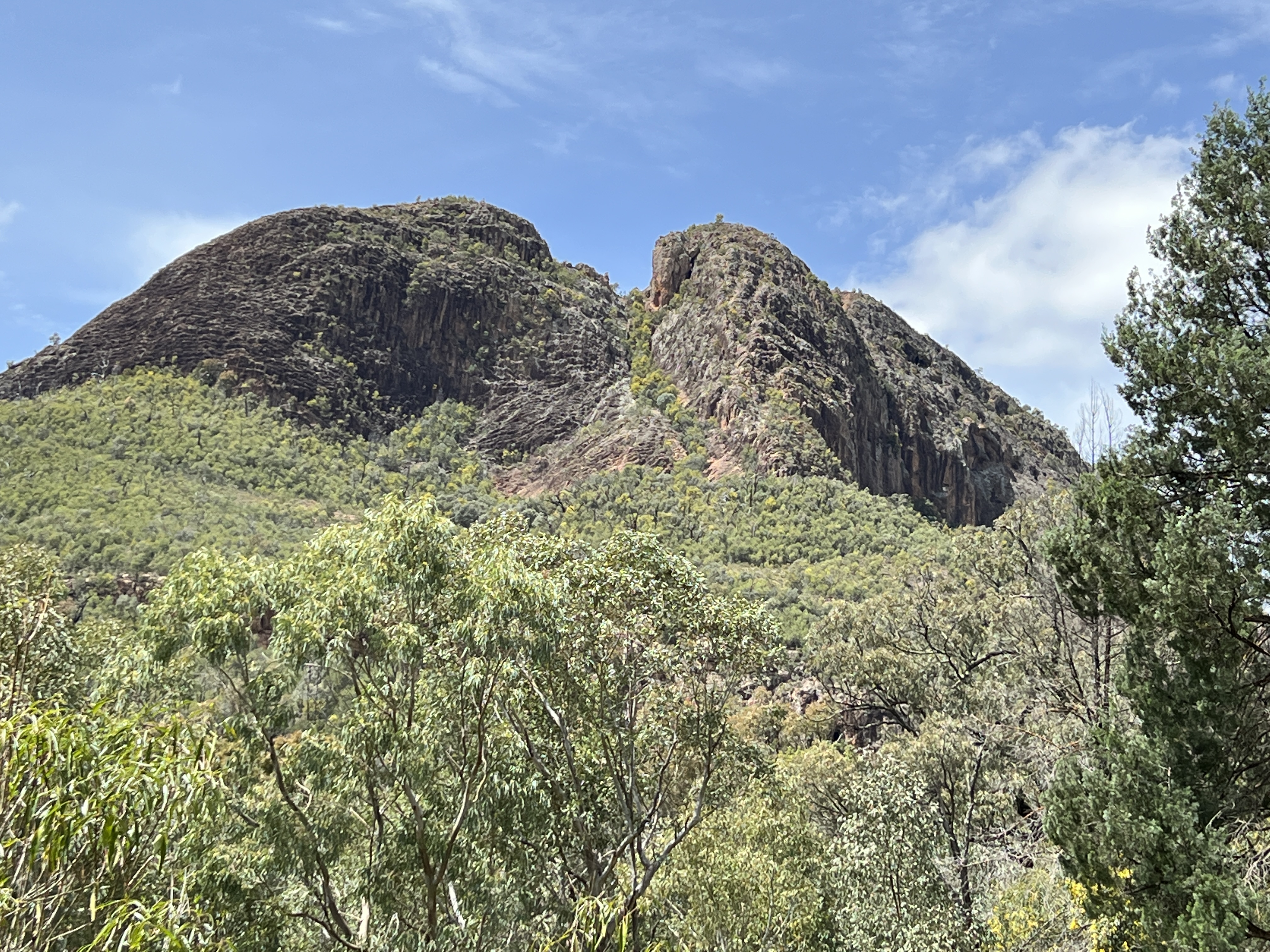
Back in the Park we had a look at a couple of the other camping grounds below the impressive Split Rock, an old volcanic vent through which very sticky lava flowed and piled up to form a small mountain.
Some fellow campers joined us by the fire that evening after dinner to tell stories of vanning adventures. These tall tales and true were helped along by a couple of glasses of red, there was no doubt embellishment of achievements by some. It went on past 10 pm and Allthego used more wood and red than he would have liked. But it was an enjoyable chat, vanners always like a chat!
The new day brought more nice weather and Allthego had loosened up enough to tackle the Fans Horizon walk (named after an earlier pioneer who liked the lookout at the top).
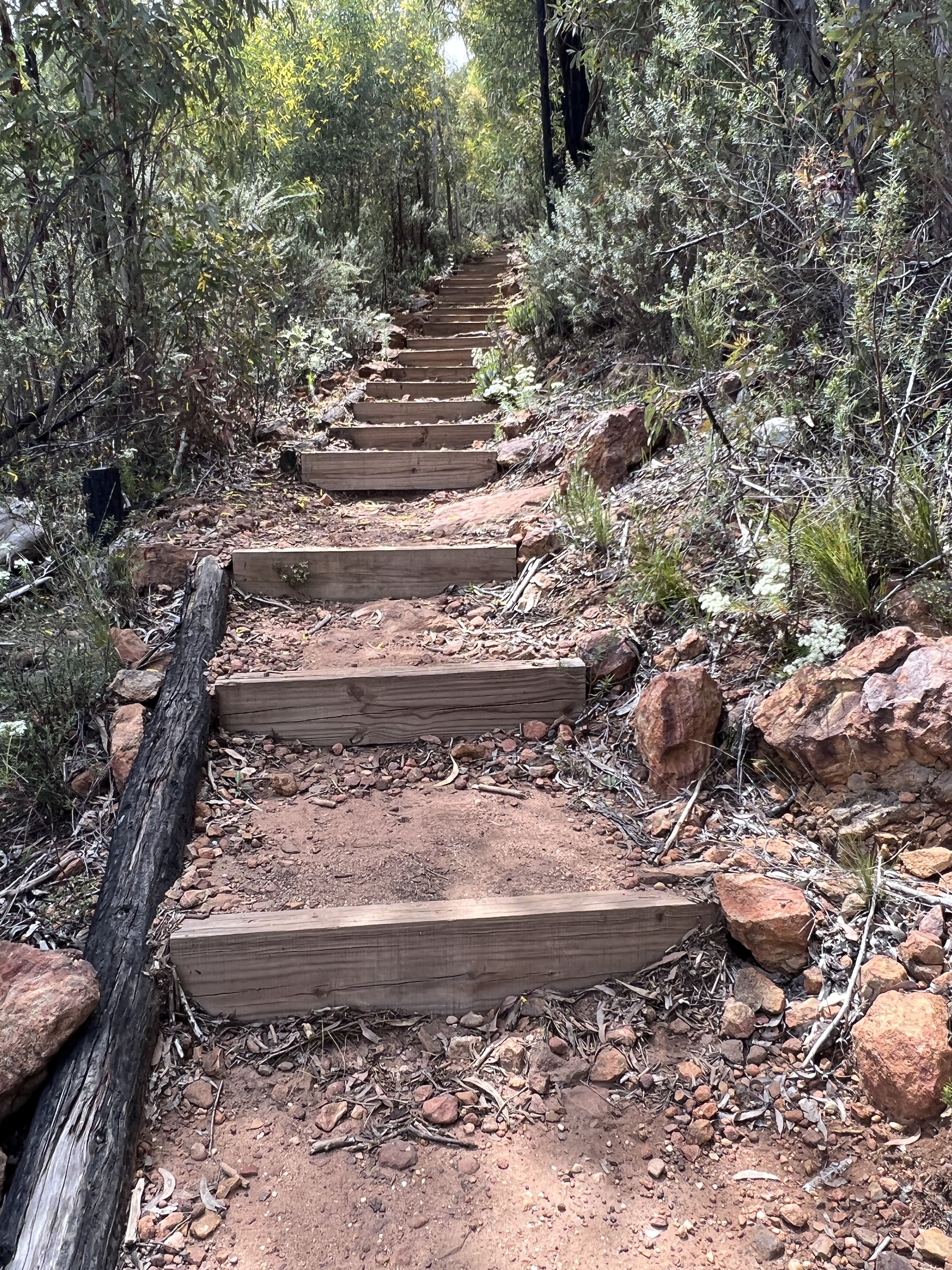
Now this is a relatively short walk, only 3.6 km return, but it is all uphill. The sign says ‘over a thousands steps’, now Allthego hoped this meant 500 steps up and the same 500 back down. But no, it soon became apparent that it was 1000 up and then 1000 down. A thousand steps in 1.8 km is a fair gradient and the heart certainly got beating on the way up.
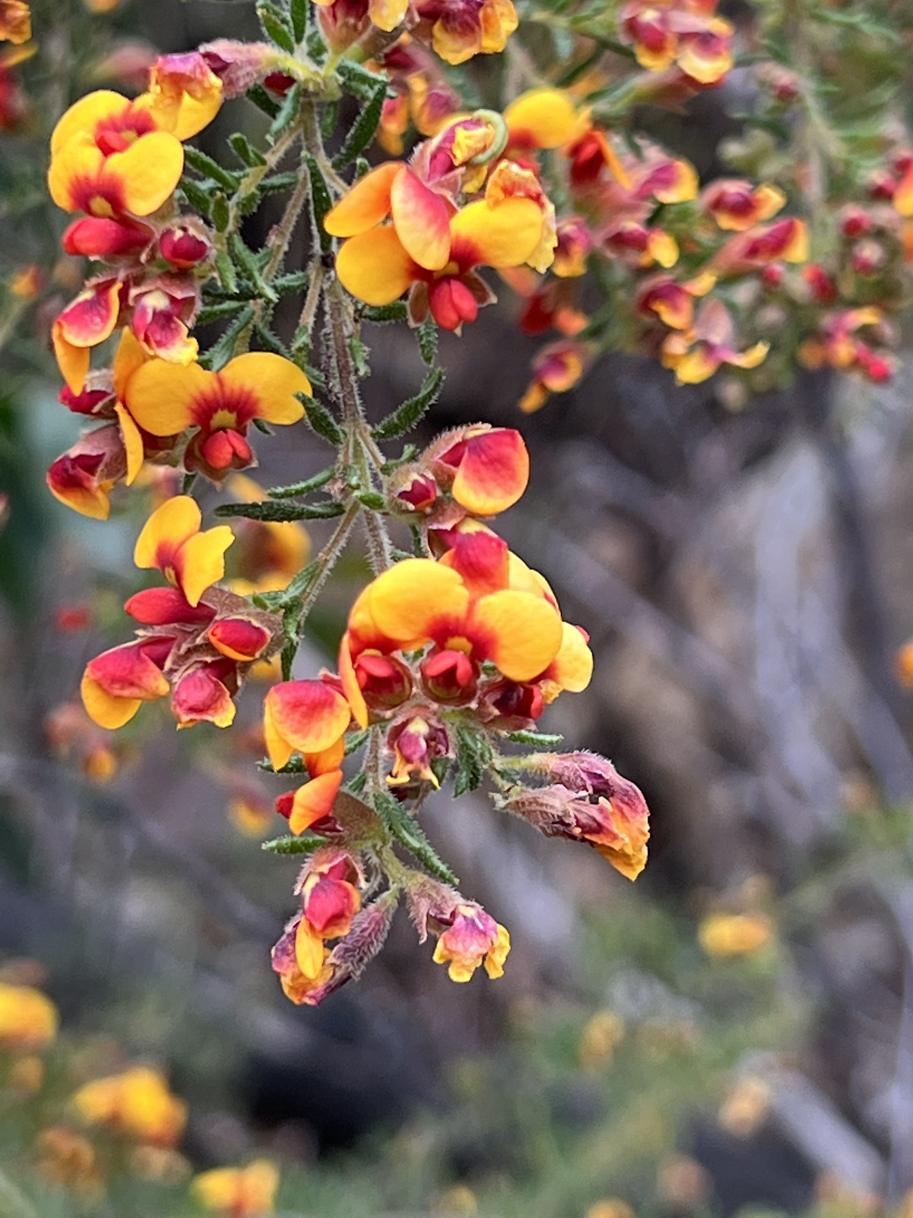
As with the High Tops walk the effort was rewarded with a great view of a different Bungles vista. The wildflowers were also out in all their splendour.
Back at camp Homealone was contending with a mini cyclone riping through the campground. It knocked our van awning down, no damage thankfully. Nearby campers had their standalone shade tent blown over and top taken out, their general site set up was a little worse for the wind as well. They had gone out for the day and returned after dark to have to deal with the mess. Seemed to cope ok.
There was to be no fire on our last evening, preserving some wood and red for another time. We took precautions to pack up outside as heavy rain was predicted for the morning and we wanted to make a dry get away. We had light on and off showers through the night, around 6am it started to bucket down for about an hour.
Allthego watched these two guys put on their morning Punch and Judy show after we had waited out the rain. A video,hope it works.
Next stop is Coonabarabran for a couple of nights.
Warrumbungles
We are now at the Warrumbungles National Park for four nights. The weather is clearing up for us and is promising three days of no rain, but cloudy skies with sunshine from time to time.
Leaving Coonamble we had to back track a little, on sealed roads, through Baradine, then Coonabarabran and finally the Bungles. We still had water over the road on this route, nothing dramatic, half wheel height at most and not flowing. Our original route was to take us to the Bungles on some gravel. However, the wet weather has closed all the gravel roads in the shire.
The National Park has also been closed, but opened in time for our arrival. It seems the water over the small causeway into the park had to drop before opening up. Timing is everything it seems.
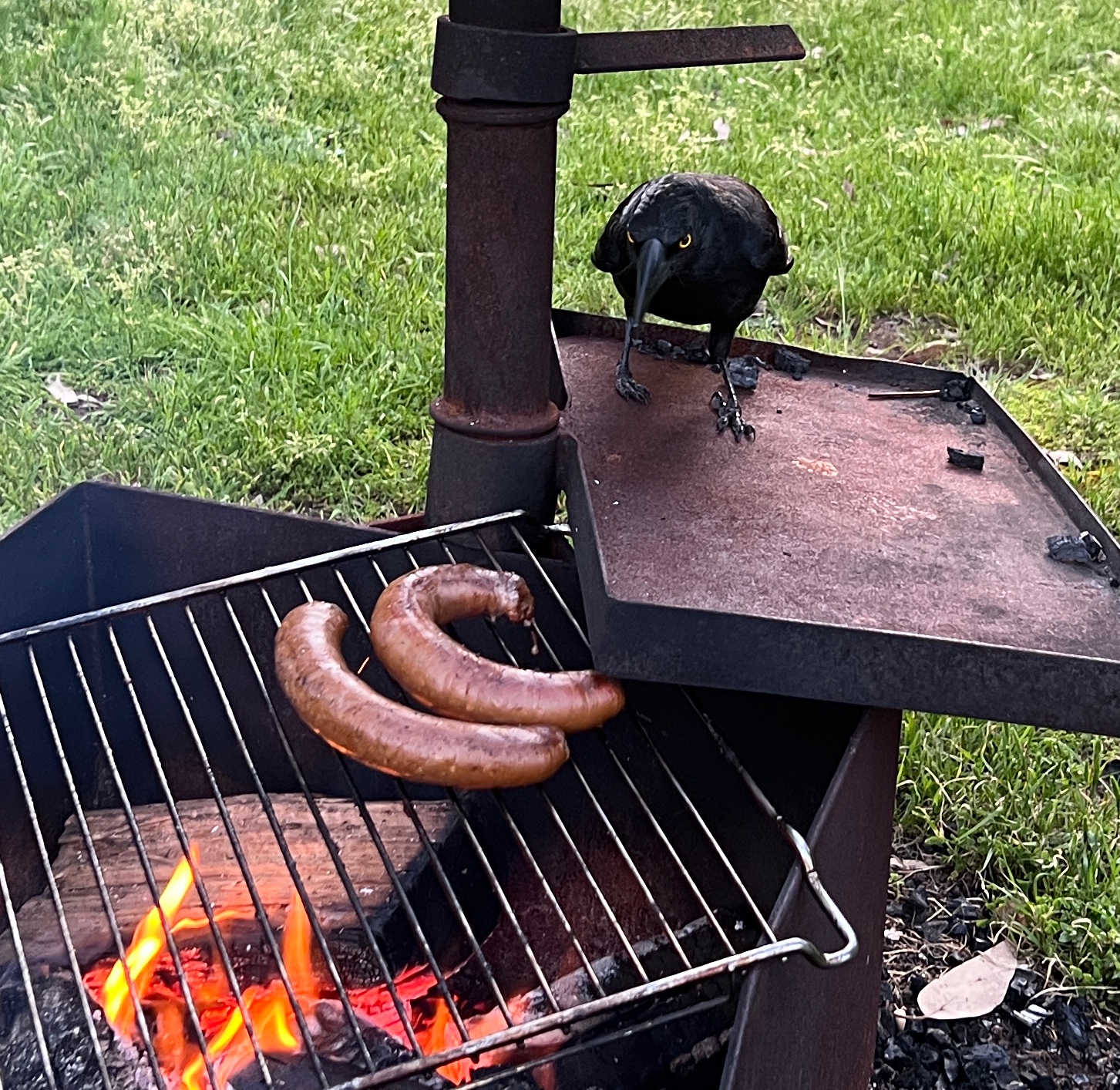
Had some snags on the BBQ for dinner, watched on by a cunning Currawong.
We have not been to the Bungles before, apart from driving through them a year or so after the big fire of 2013. The park has recovered significantly since then. Many species have made a come back and indeed some new ones, previously not identified, have appeared. Unlike the fire, this sort of news doesn’t make the 6 O’clock news.
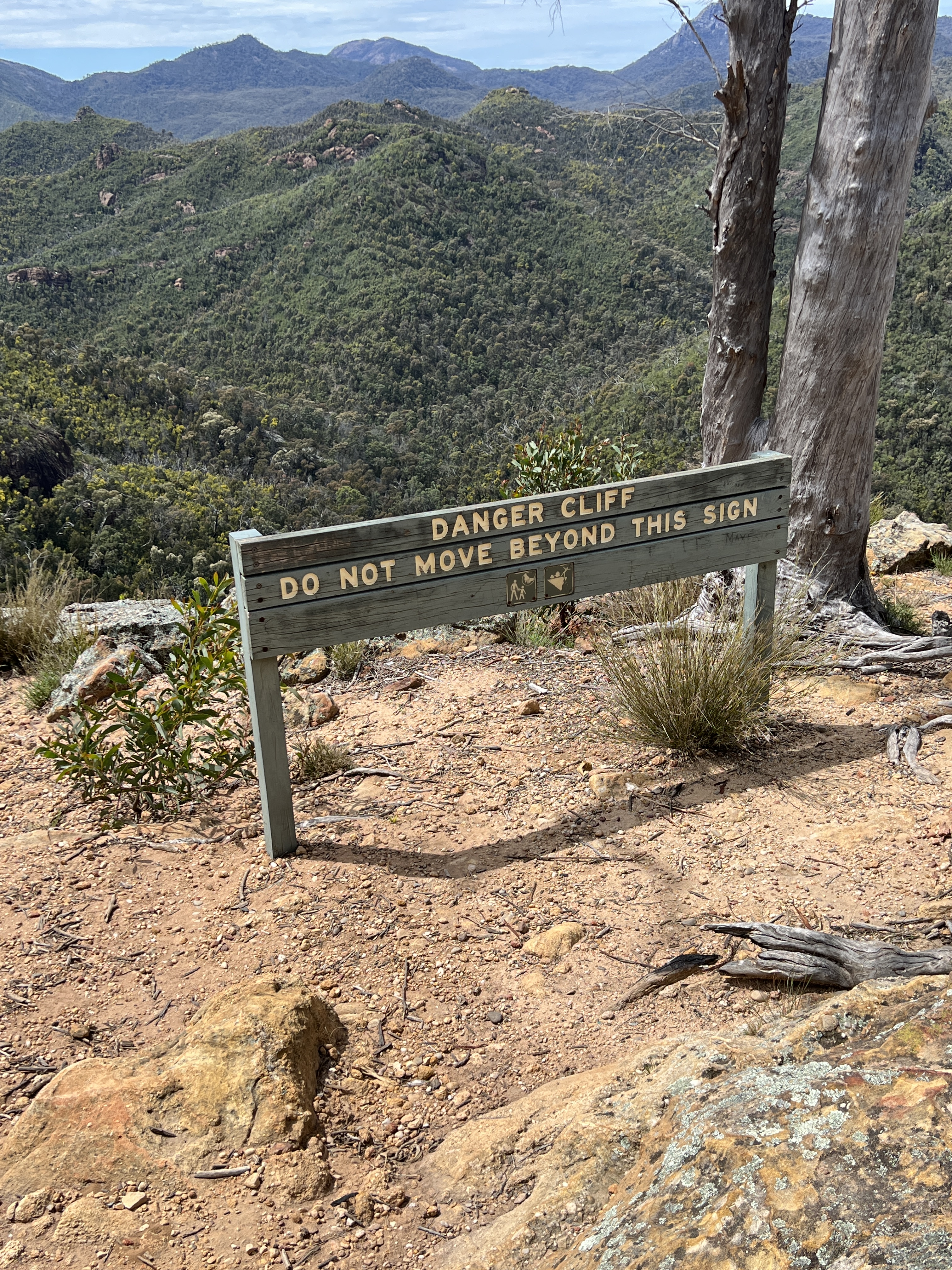
Allthego has a bucket list objective in the Bungles and that is to complete the Grand High Tops walk. Unfortunately, the complete circuit of 14.5 km is closed for maintenance of part of the track.
The 6km section that takes one to ‘the top’ with views of the Breadknife and other features is open, just have to go back the same way. It took Allthego just on 7 hours, Homealone remained at home.
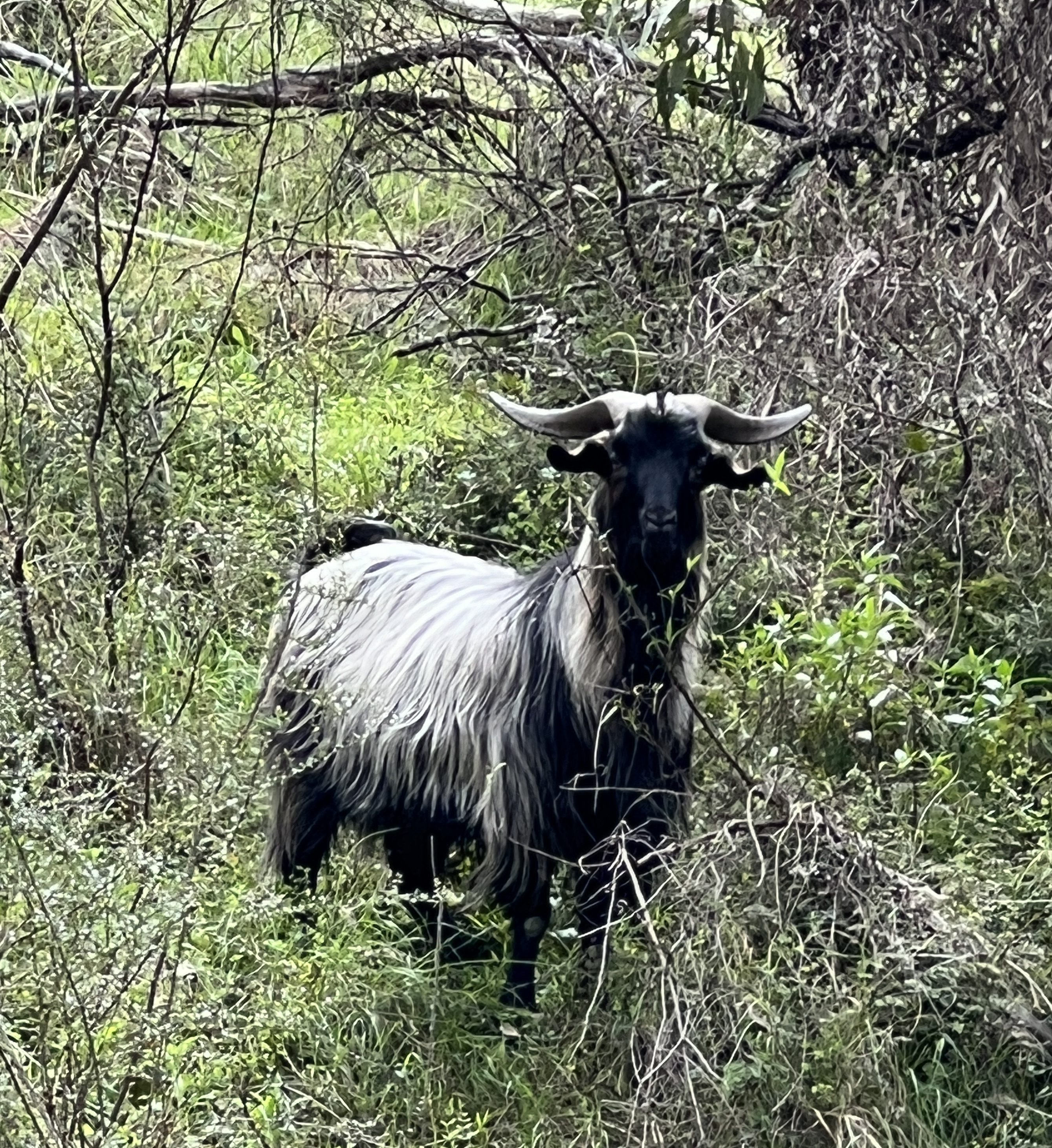
Allthego returned somewhat stiff and foot sore, but some amazing scenery compensated. Wildflowers were out in abundance, particularly the wattle. Unfortunately, there are some goats in the park that are difficult to eliminate.
The cloudy day made photos a bit moody, sun and blue sky can make things a bit chocolate boxy. Unable to use a drone here as well without permission and then only in one place, a little disappointing for drone people. Apparently, a reason is that eagles attack them and quite a number have been lost as a consequence. National Park bureaucracy perhaps another, drones probably frighten wildlife , except eagles of course.
The track follows a creek for a couple of kilometres before starting to rise, there is a long section of brick pavers making the onwards and ever upwards easier. Then the steel steps start. Ten or twelve flights of them, upwards of twenty steps a flight, Allthego lost count. Seemingly, near the top there are more steps but only 600 metres to go. In parts this was a bit of a scramble, but the top was eventually reached.
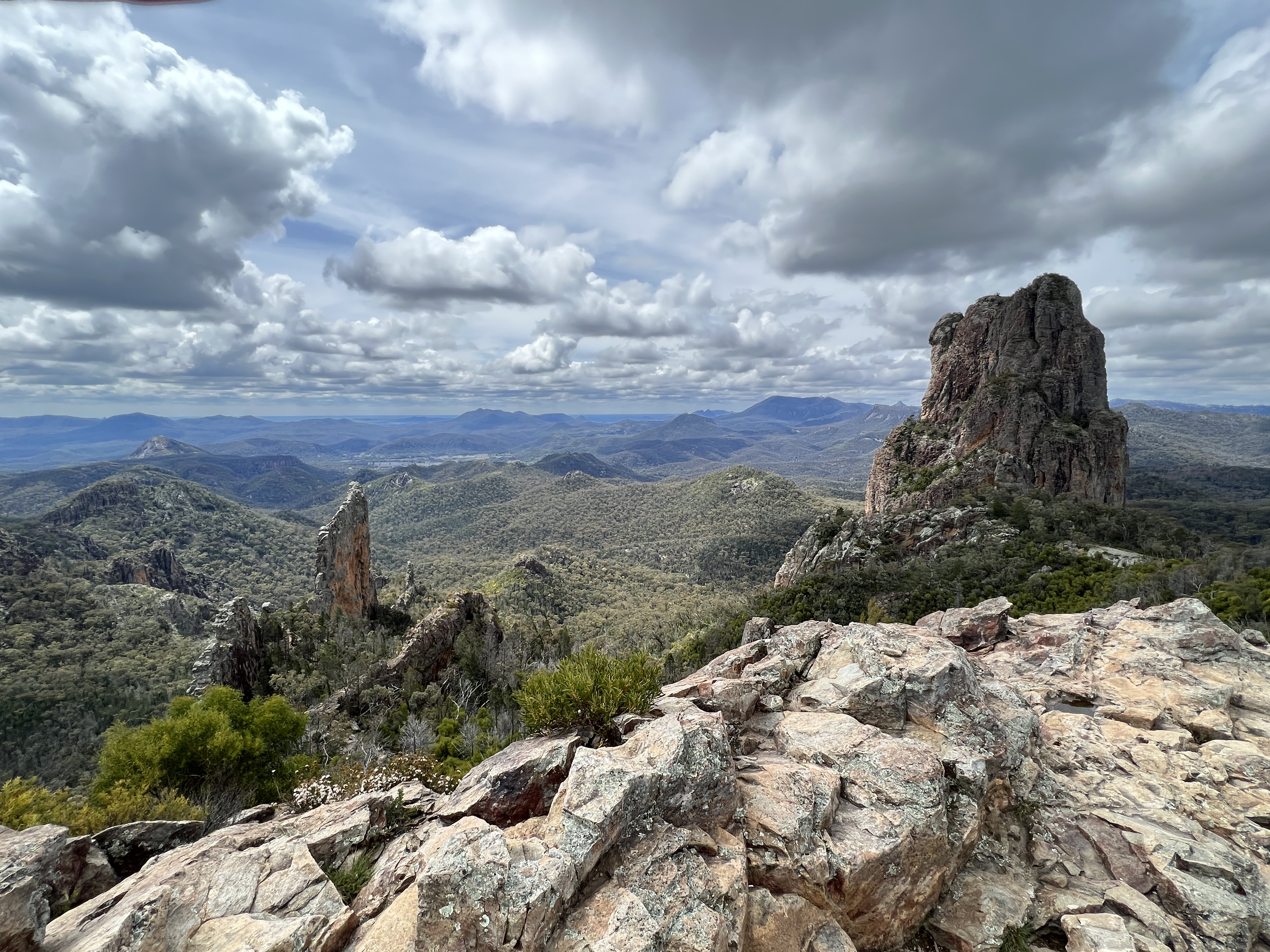
Like being on top of the world, gazing out over the remnants of the great old shield volcano that was active 13-18 million years ago. Awe inspiring!
The walk back down was a little easier on the heart rate, more pressure on the knees though! The sun came out with some patches of blue sky, gave a different perspective to the vegetation and landforms.
Upon return to camp it was straight into a hot shower to sooth the muscles and sore feet. An earlier than usual night too!
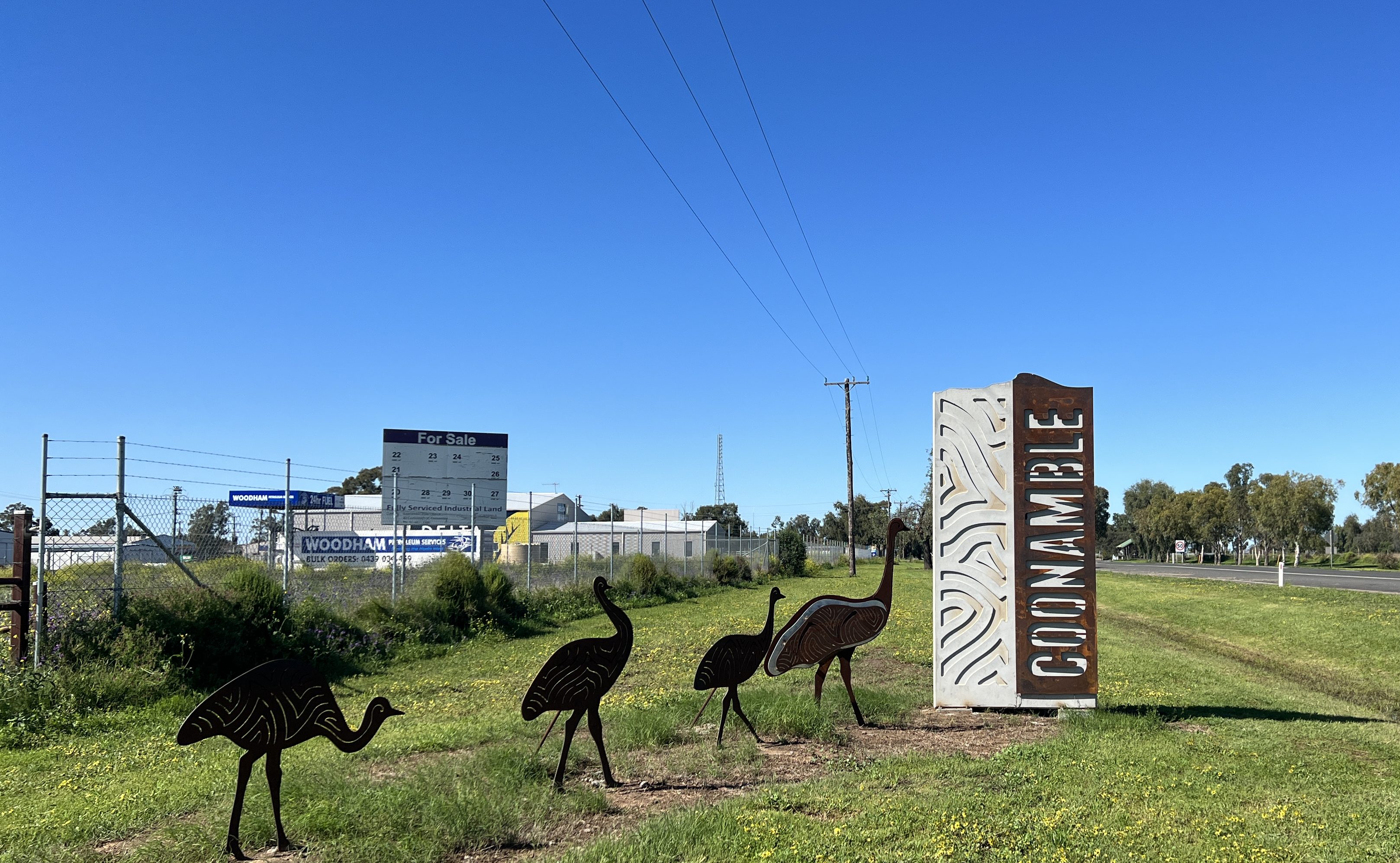
Coonamble
We are now at Coonamble after coming down from Lightning Ridge through Walgett. Between Walgett and Coonamble we encountered some water over the road in a few places, the deepest about half wheel height. Paddocks awash with water. Lake like in places.
Arrived at the camp for a late lunch after setting up. Put our feet up for the afternoon. Rain came down in buckets for about an hour at around 4pm, caravan park with great pools of water. We are on slightly higher ground so spared the puddles and mud.
The camp ground is beside the Castlereagh River, protected by a levee. The river is flowing at a great rate, well below the top of its banks so no worries flood wise for the town. The river is reported as actually the fasted flowing river in NSW. After rising in the Warrumbungles it flows more or less south and the west to Gilgandra before doing a loop ( looks like a fish hook) and then going north west to join the Macquarie River not far from that river’s junction with the Barwon River, which ends up in the Darling River near Bourke. For most of the time the Castlereagh is a dry sandy river bed and only flows after rains in the Warrumbungles area.
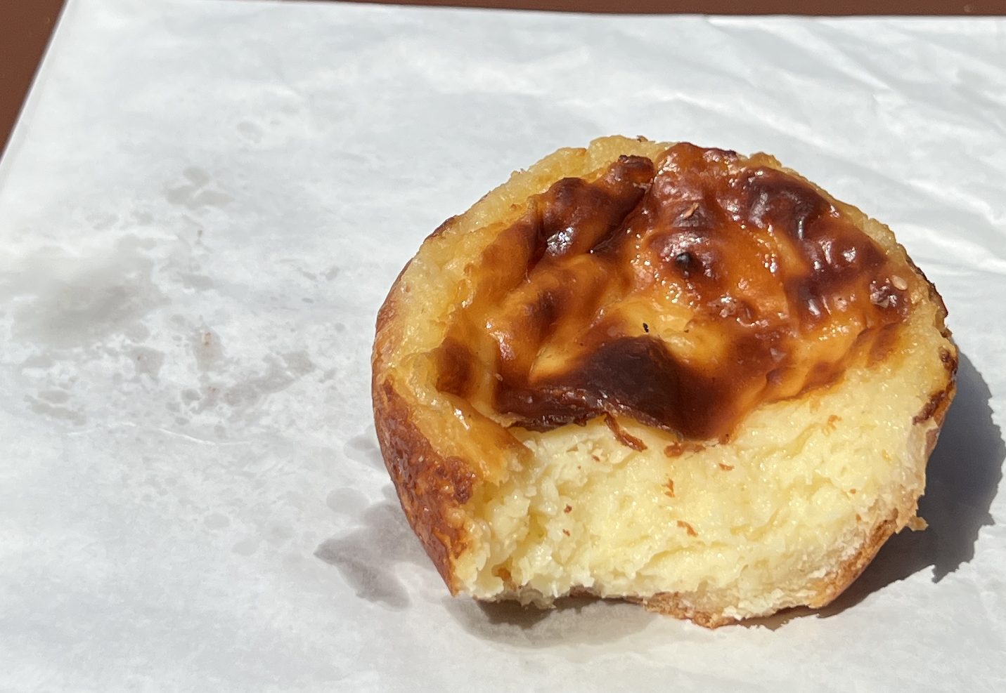
We waked the next morning to clear sunny blue skies, quite a pleasant contrast with the past few days of clouds and on and off rain. So we got out and about for a look around town. Being a Sunday it is very quiet, everything in the Main Street is shut apart from one cafe where we have morning tea. Low and behold they are selling Portuguese tarts. For my blog readers you may recall that these are a version of the famous custard tarts that we sampled along the Murray River a few months back. Allthego hasn’t tried them before so just had to have a go! They are warmed up a bit and are quite tasty, the pastry was a little flabby and not flaky…. not sure what it is meant to be, so will need to check.
A couple of the towns big old pubs along the main street appear to have recently closed their doors, there are threats of reopening apparently, but the cob webs are taking over.
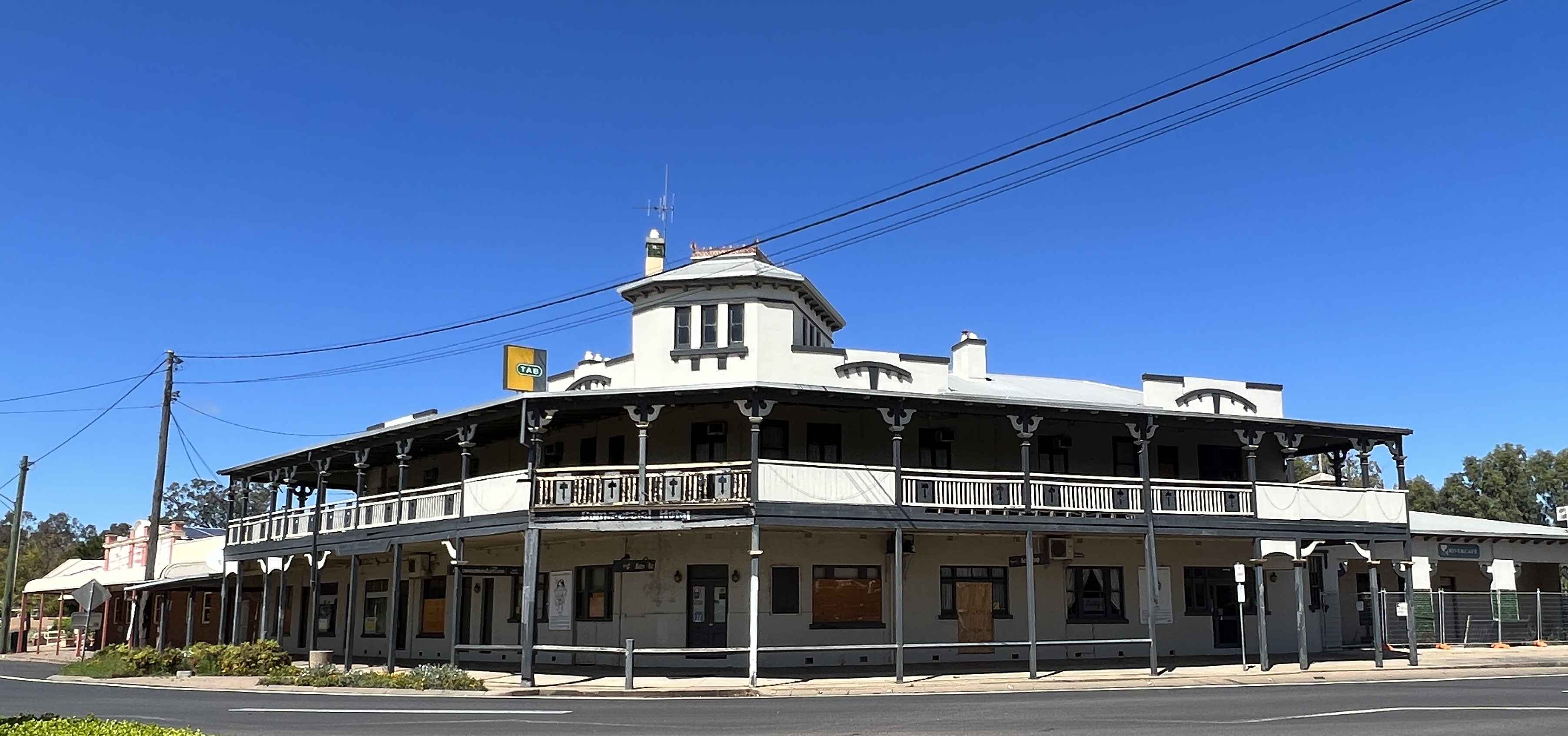
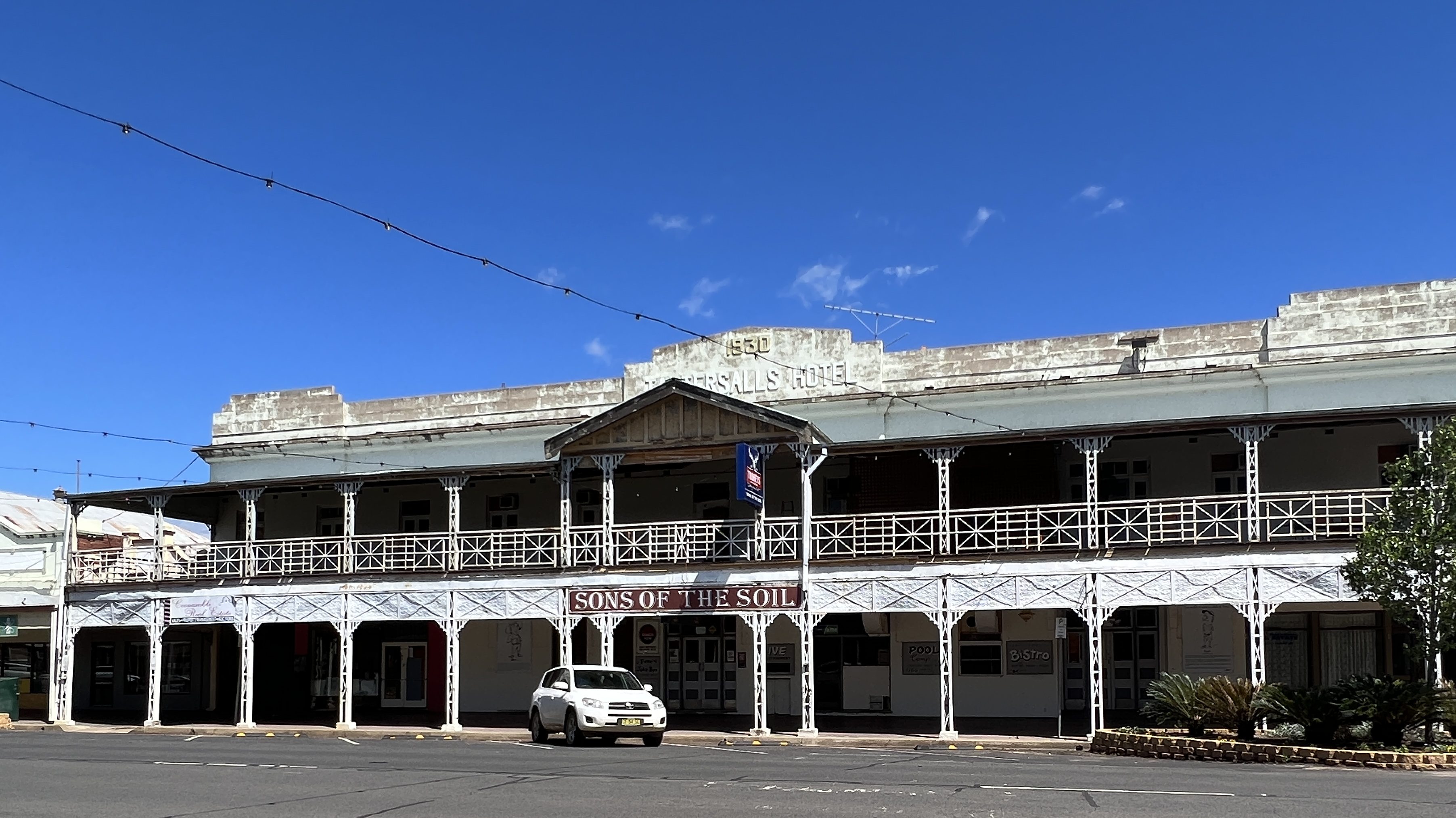
The ‘Sons of the Soil’ looking particularly derelict , one suspects it was a wild place in its hey day.
The Coonamble Cup race meeting was scheduled for Sunday afternoon. But the weather has caused its postponement to next Wednesday. Our afternoon at the races has been stymied! We had a sure fire tip as well from Homealone’s sister Sandra. We will have to check out what we missed out on later.
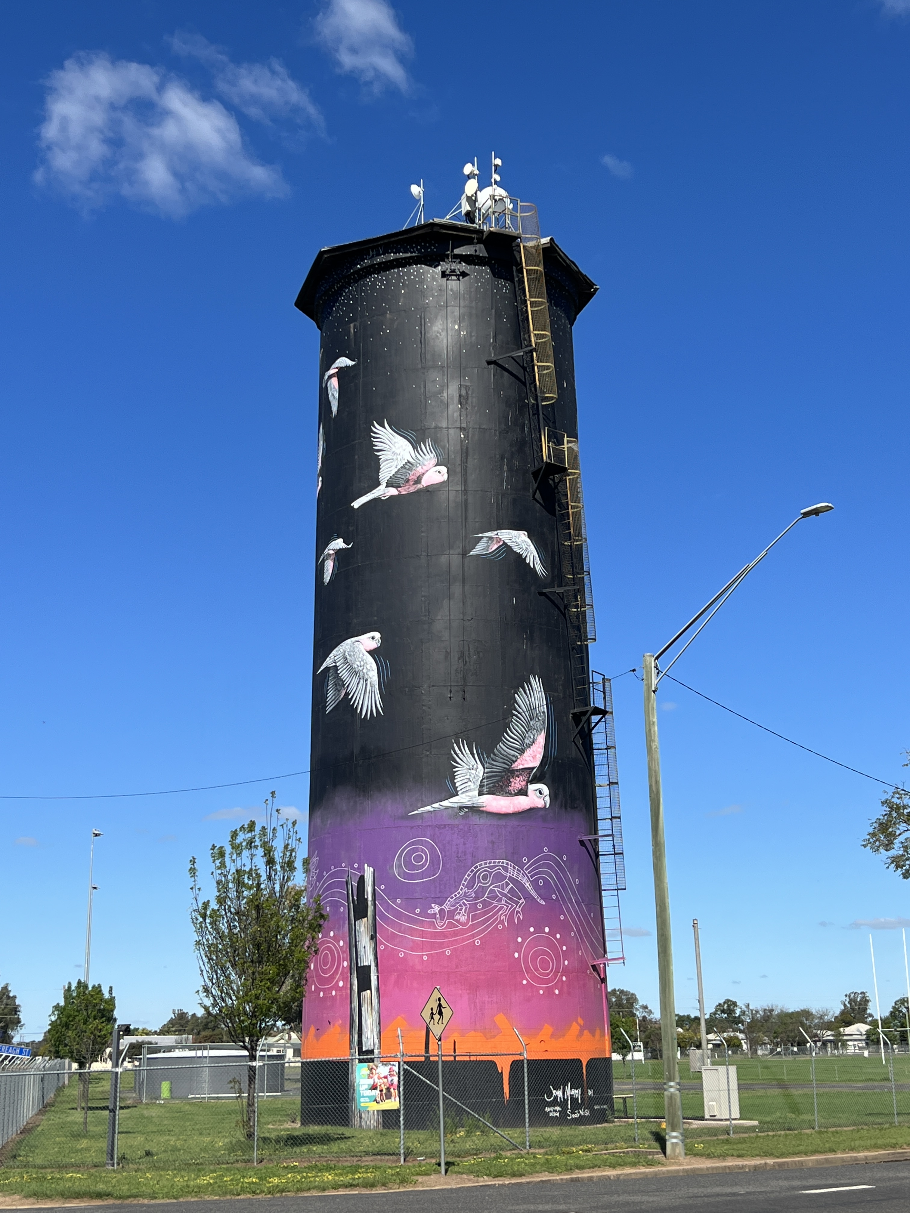
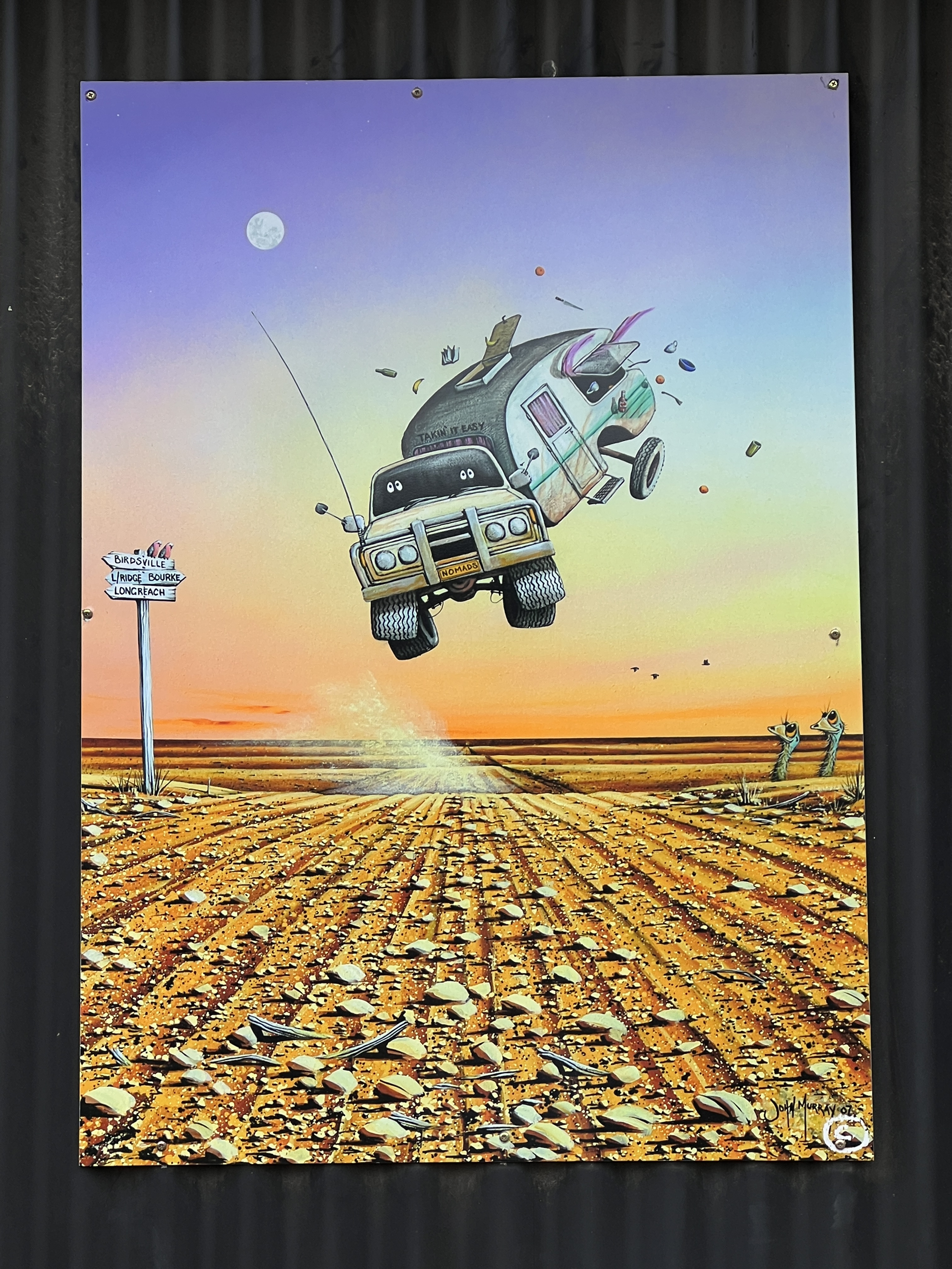
The town has a water tower and of course a mural has been painted on it, by the John Murray from Lightning Ridge. The base has an indigenous story line to add ‘country’ to the overall design. Quite impressive.
Back at the van we have a pleasant afternoon in the sunshine with the feet up reading a book and doing some craft of course.
Next stop is the Wurrumbungle National Park for some bush walking. The sunshine, with a bit of cloud, looks like holding for the next few days.
Lightning Ridge
We have based ourselves for three nights at the Outback Resort & Caravan Park which is on the main drag just before entering the town proper. Good big sites, albeit on red gravel but there is not a lot of green grass in these parts. The football field opposite is very lush and green, priorities.
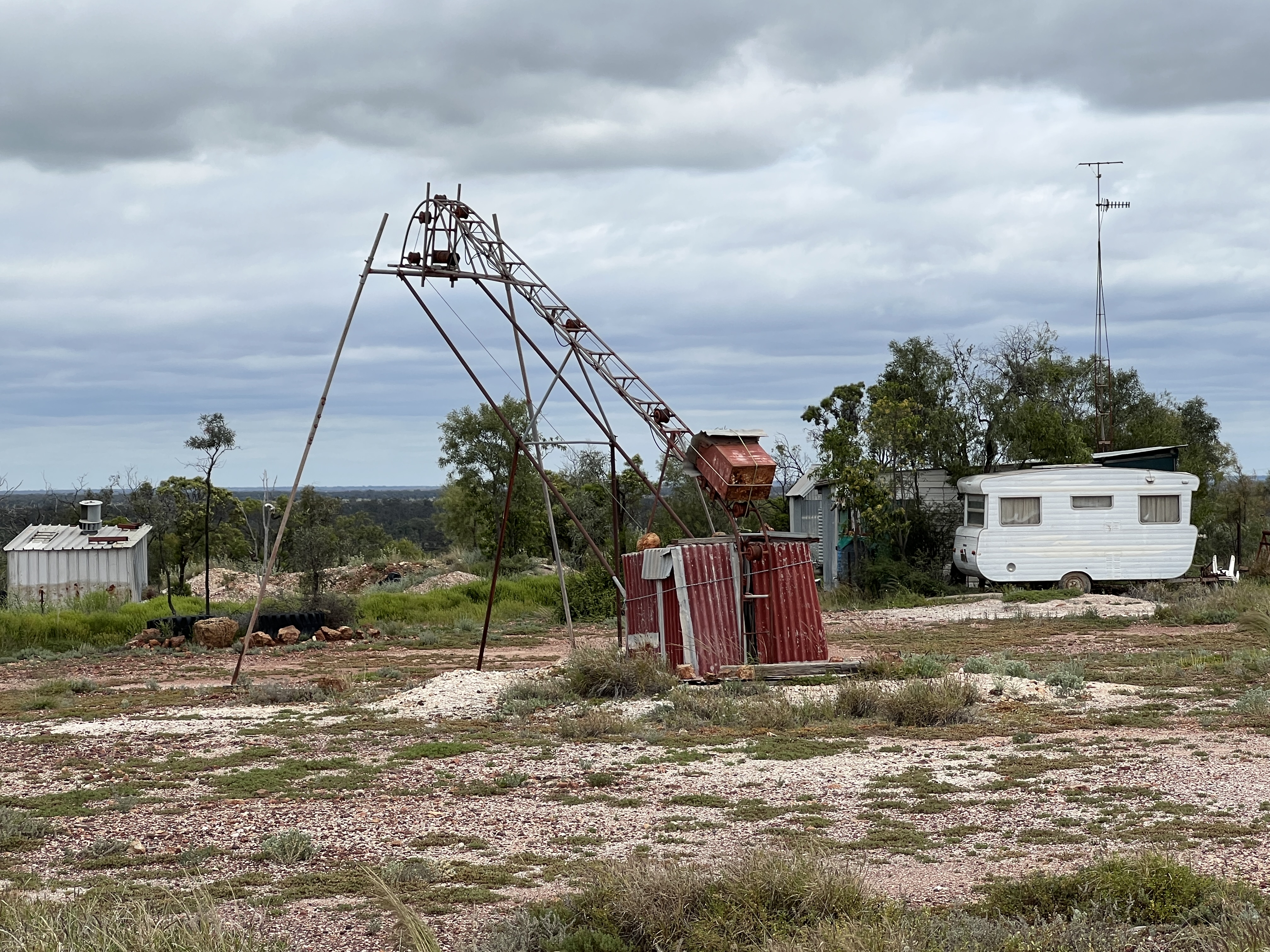
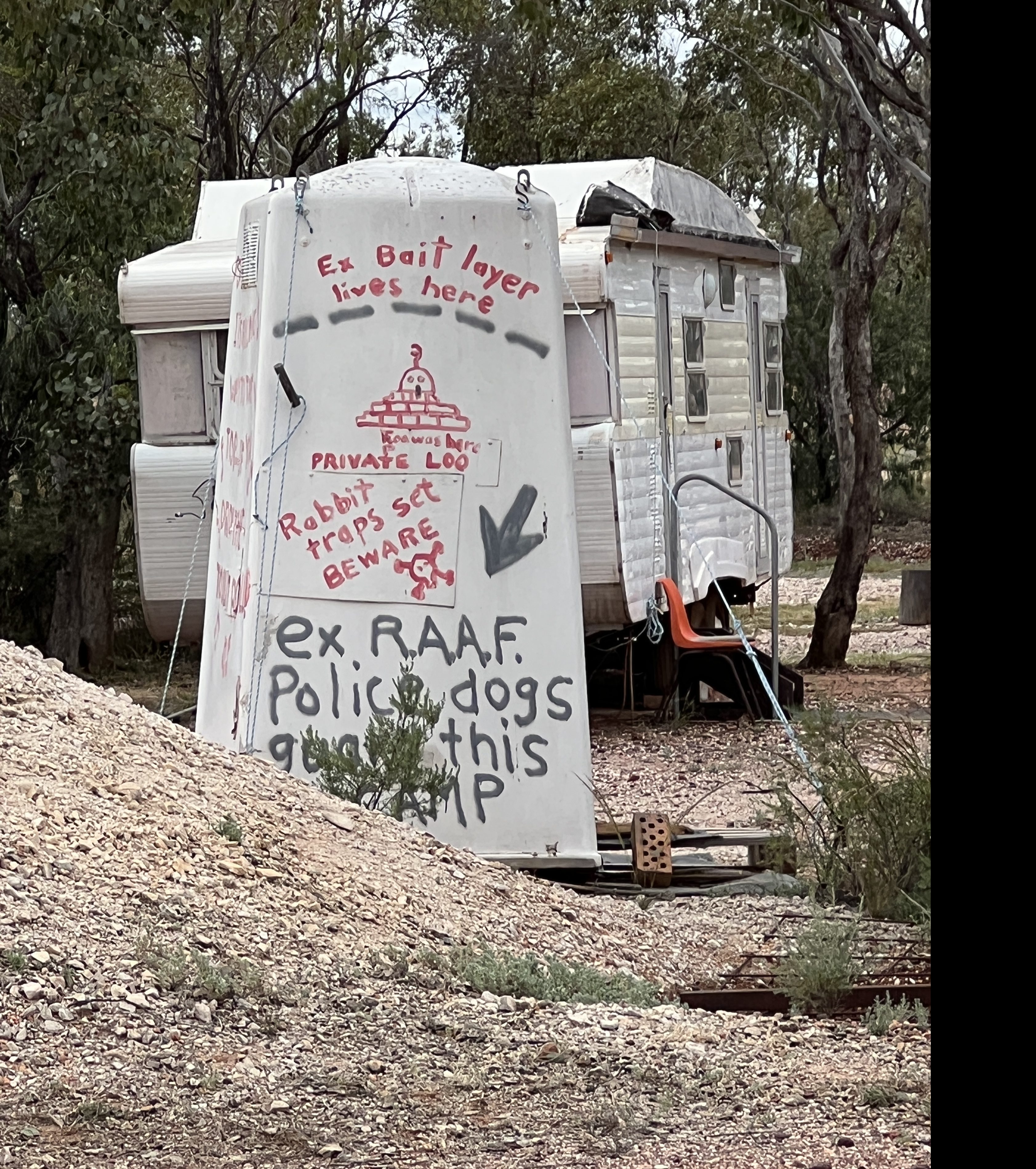
Lightning Ridge is a quirky place. The township is surrounded by opal mining activities, largely conducted by sole or family operators. Not something for large scale company outfits. The miners tend to live on their claim in what can best be described as shanty type accomodation. Old caravans and tin sheds, containers. Yesterdays ‘Tiny Houses’ that are currently the vogue among some! There are a few more substantial shacks made of local rock. Old equipment lies around rusting, old cars seem to have been left where they have stopped. Some of the miners come to their claims to mine during the winter months, gets very hot here in summer.
There are a number of self guided tours of the opal fields marked out with old car doors that are colour coded. We went off on the yellow door tour that took us along what is known as the 3 Mile field to the Lunatic Lookout. This area has been one of the richest mining areas in the town. From the lookout you gaze down into a big open cut hole, a huge area that has been mined out over 100 years of operations by all and sundry.
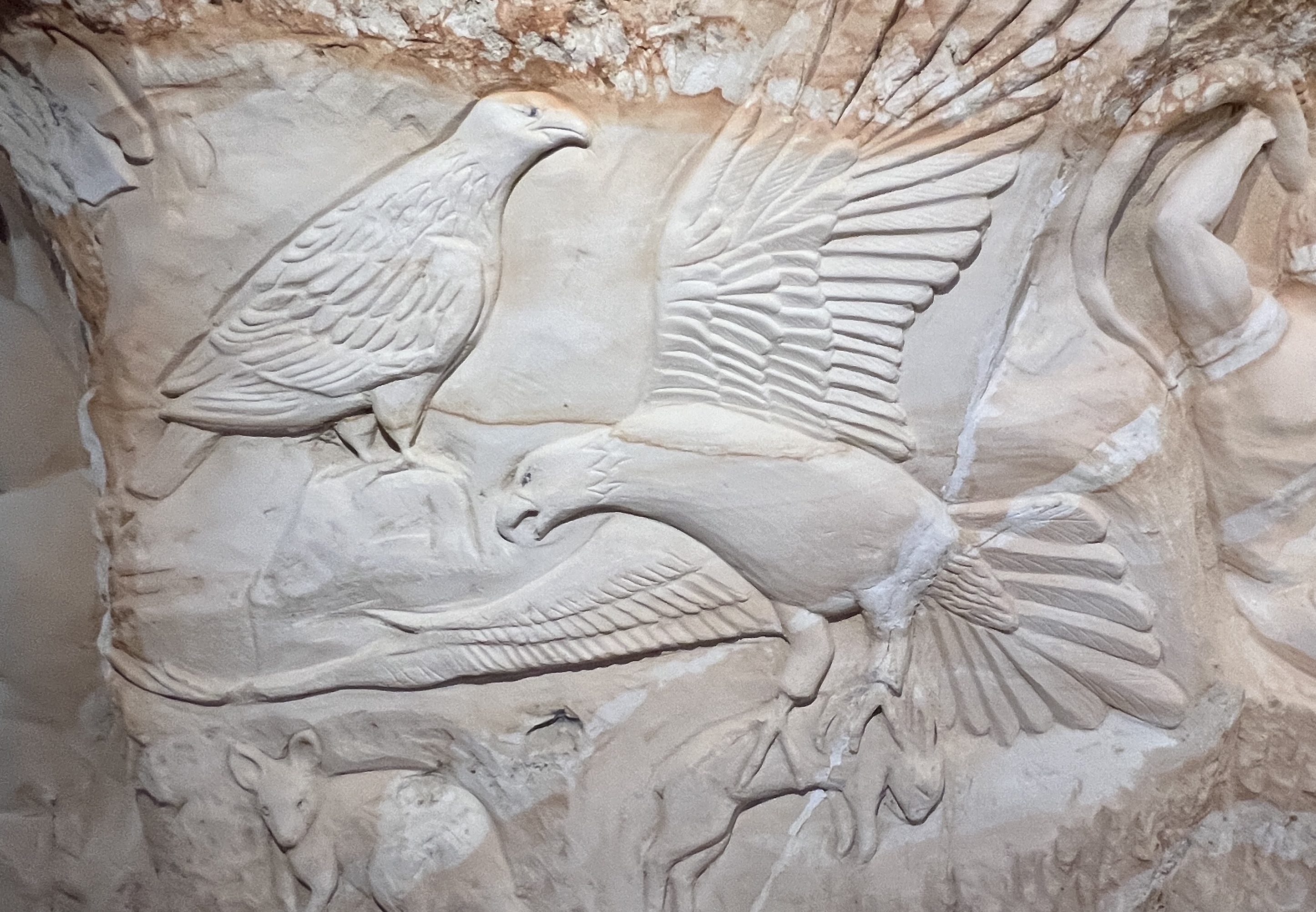
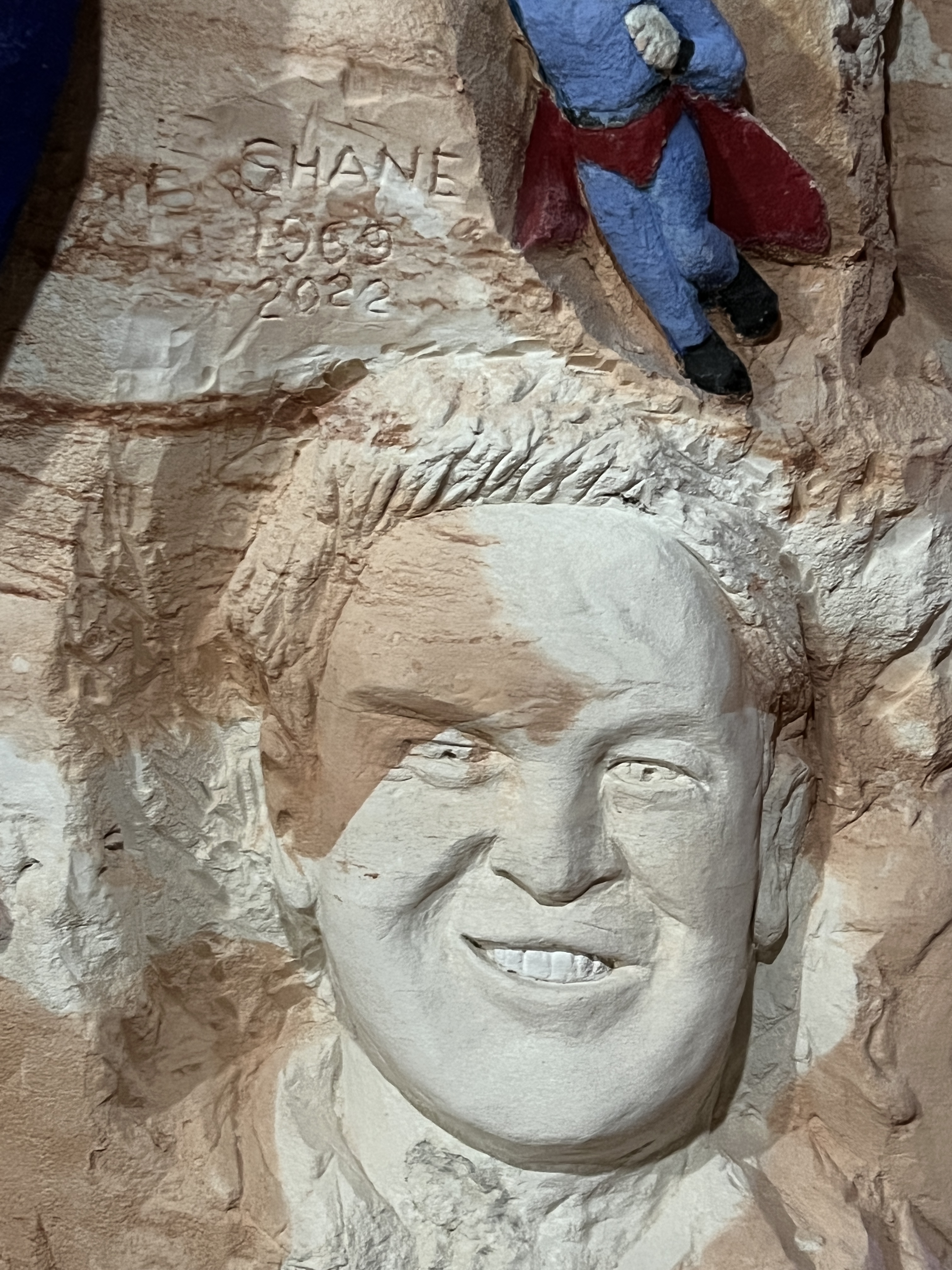
Not far from Lunatic Hill, there is a tour of an underground mine that we ventured on. It was not so much to see mining operations but rather hundreds of carvings down the mine by an old timer.
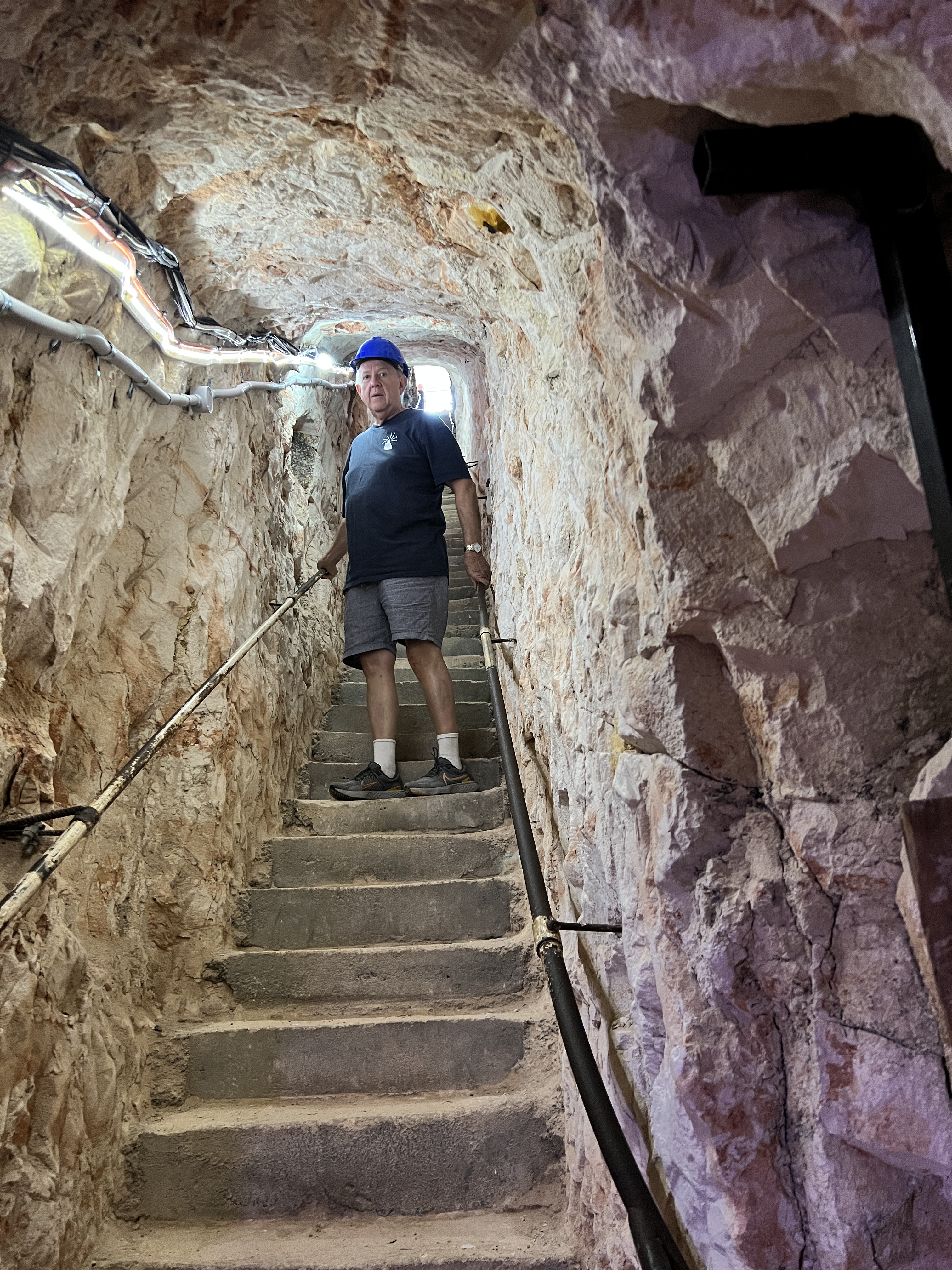
Simply amazing work! Here at Lightning Ridge opals are found in the soft rocks underlying a bed of also soft sandstones. The opal level is 20 metres plus down. So shafts are dug down to this level and then horizontal drives go out in search of the opal. The whole of the Ridge is a labyrinth of shafts and drives, honeycomb like. The old miner carver did his carvings in the upper sandstone level, not the opal level, and cut drives just to get more wall space for the carvings.
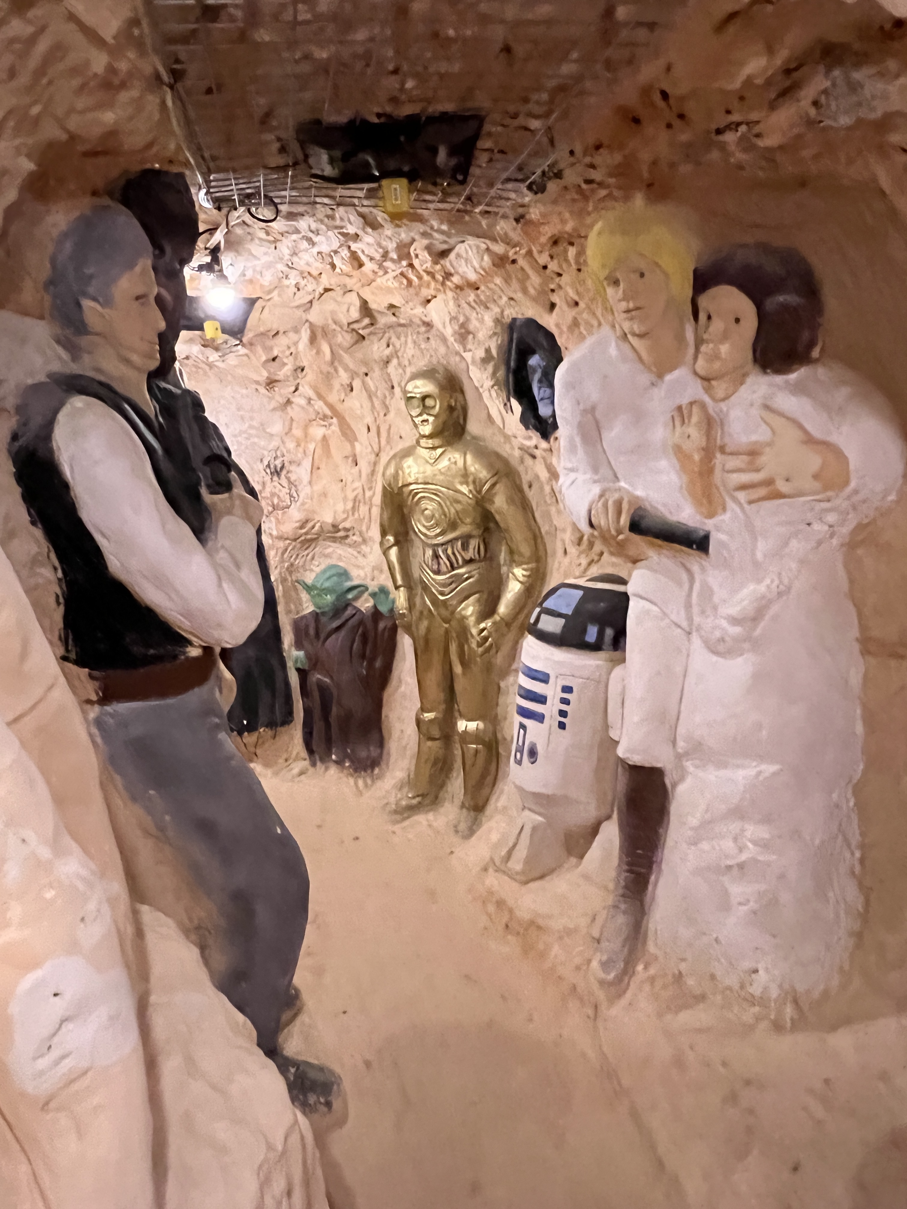
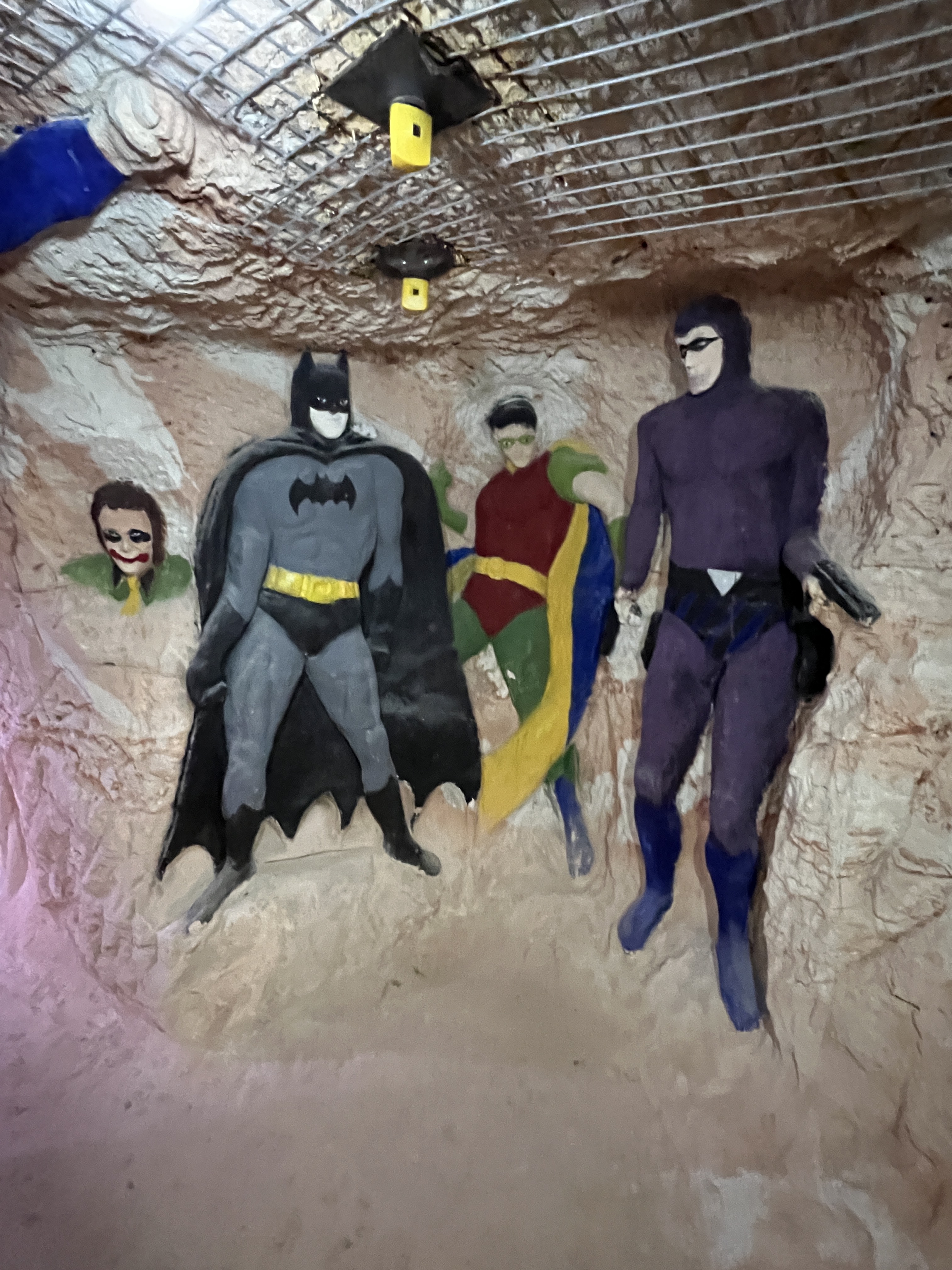
He did all this work after he retired at 66! He is now 80 plus and returns each year to add more, recently did one of Shane Warne.
Back in town we had a look around the street art, mostly done by the local John Murray. He has a gallery in town, specialises it seems on emus. Lots of other works that all tend to be of a humorous nature.

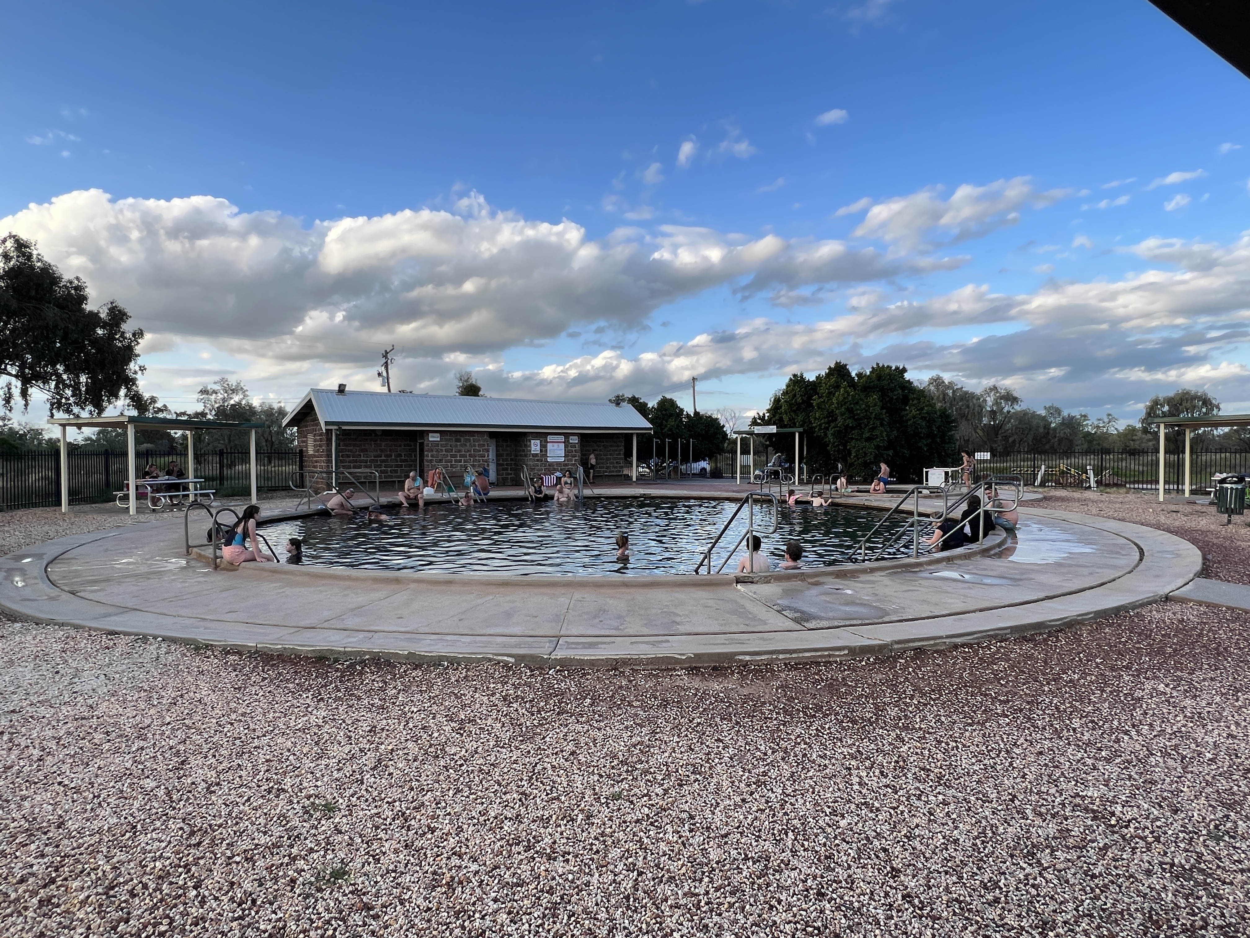
Allthego was tempted by the Artesian water baths and had a couple of dips in the 40’ pool, interspersed with a cold shower. Very therapeutic it is claimed and did loosen the limbs for a while. The pool is open 24/7. It was tempting to go back in the dark to have a look up at the night sky through the steam coming off the water. But the weather has not been favourable for star gazing, cloudy with scattered showers.
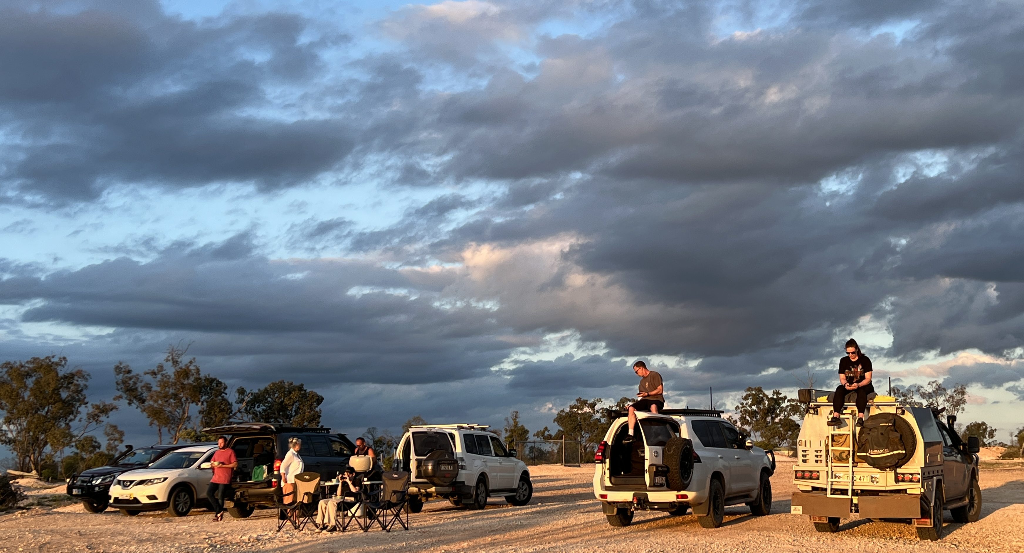
Allthego, after another plunge in the pool, charged off for a sunset shot over the opal fields. Alas, the sunset was a fizzer but there were lots of people there trying to get the shot. Allthego took a shot of them instead!
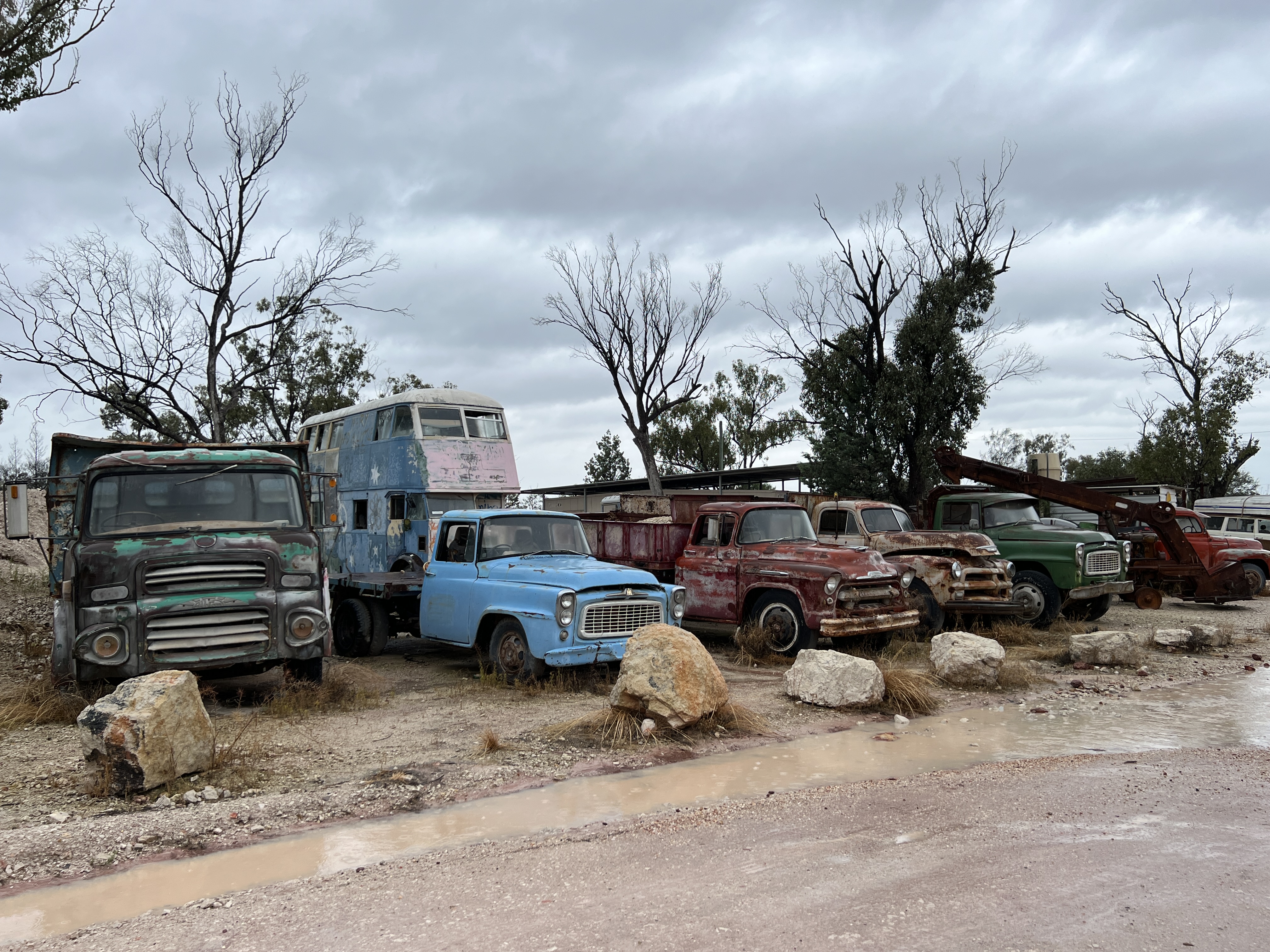
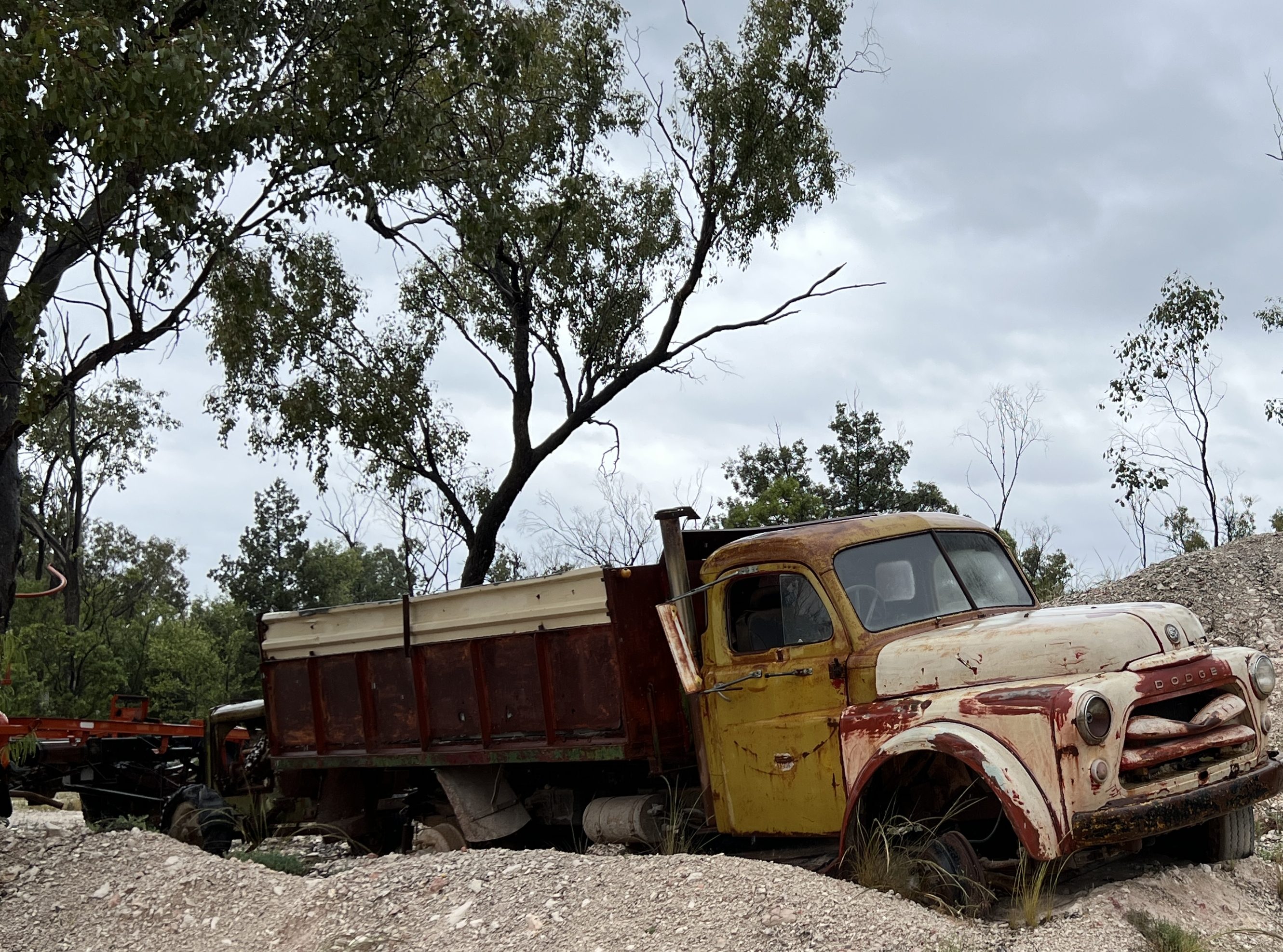
The following day we took off for Grawin, another opal field about 65 km from Lightning Ridge. Now if Lightning Ridge is quirky then the Grawin field, together with nearby Glengarry and Sheepyards, is positively like a clip from a Mad Max film. The area is quite remote and very basic. There are two rustic pubs out there, the Glengarry Hilton and the Sheepyard Inn. Rusty old equipment and abandoned trucks everywhere. Even the miners seem rusty.
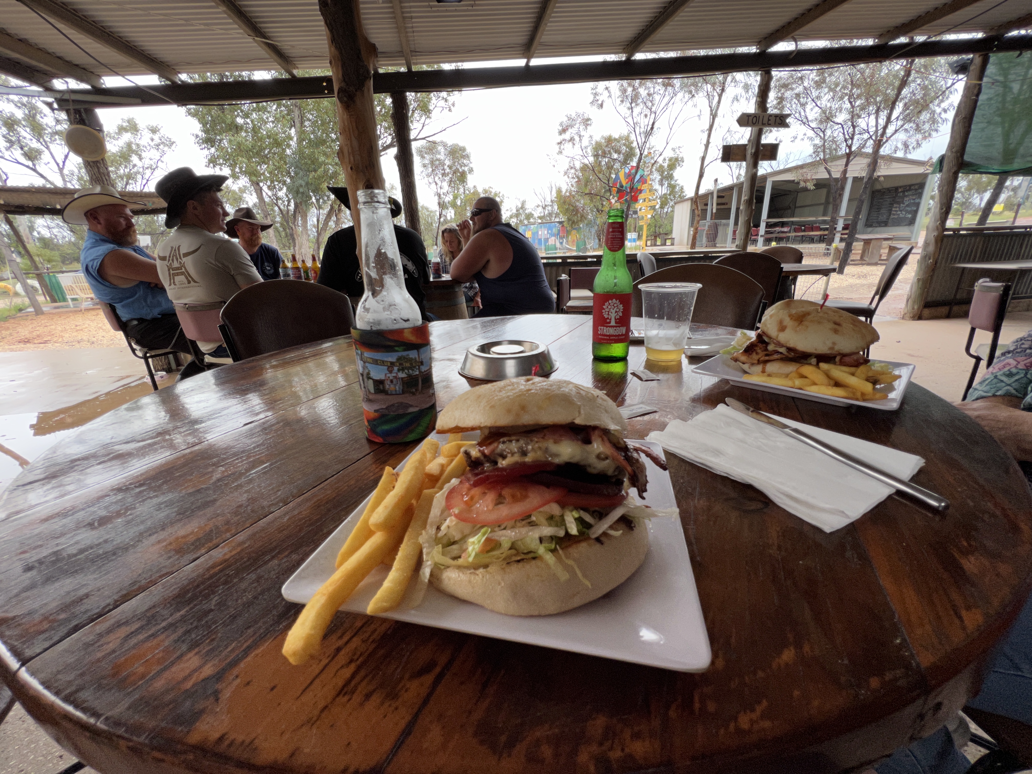
The highlight though was having a burger at the Club in the Scrub, a licensed premises and even had to sign in. A few local characters were in residence, a recently retired grandma miner held centre stage among a group of ‘drive in ‘ workers who were there for the day to do something. She was in her element, colourful language too! The burgers were good, everything on them, bacon, egg, beetroot even a slice of pineapple and as a consequence we had an omelette for dinner.

Back at the van we readied for the move on to Coonamble in the morning. Hitched up the truck and packed up as much as we could as heavy rain had been forecast for the morning. Not good to do these tasks in the rain!
Stanley farewelled us on the way to Coonamble.
On the way to Lightning Ridge
From Nindigully we made the short hop to Thallon, a big wheat and grazing area. Not a lot at Thallon these days. The main building is the Francis Hotel which is also the Post Office, Information Centre and the agent for a few other services.
The hotel also has two murals of the Northern Hairy Nosed Wombat on their water tanks. These icons are critically endangered but were once common around here.
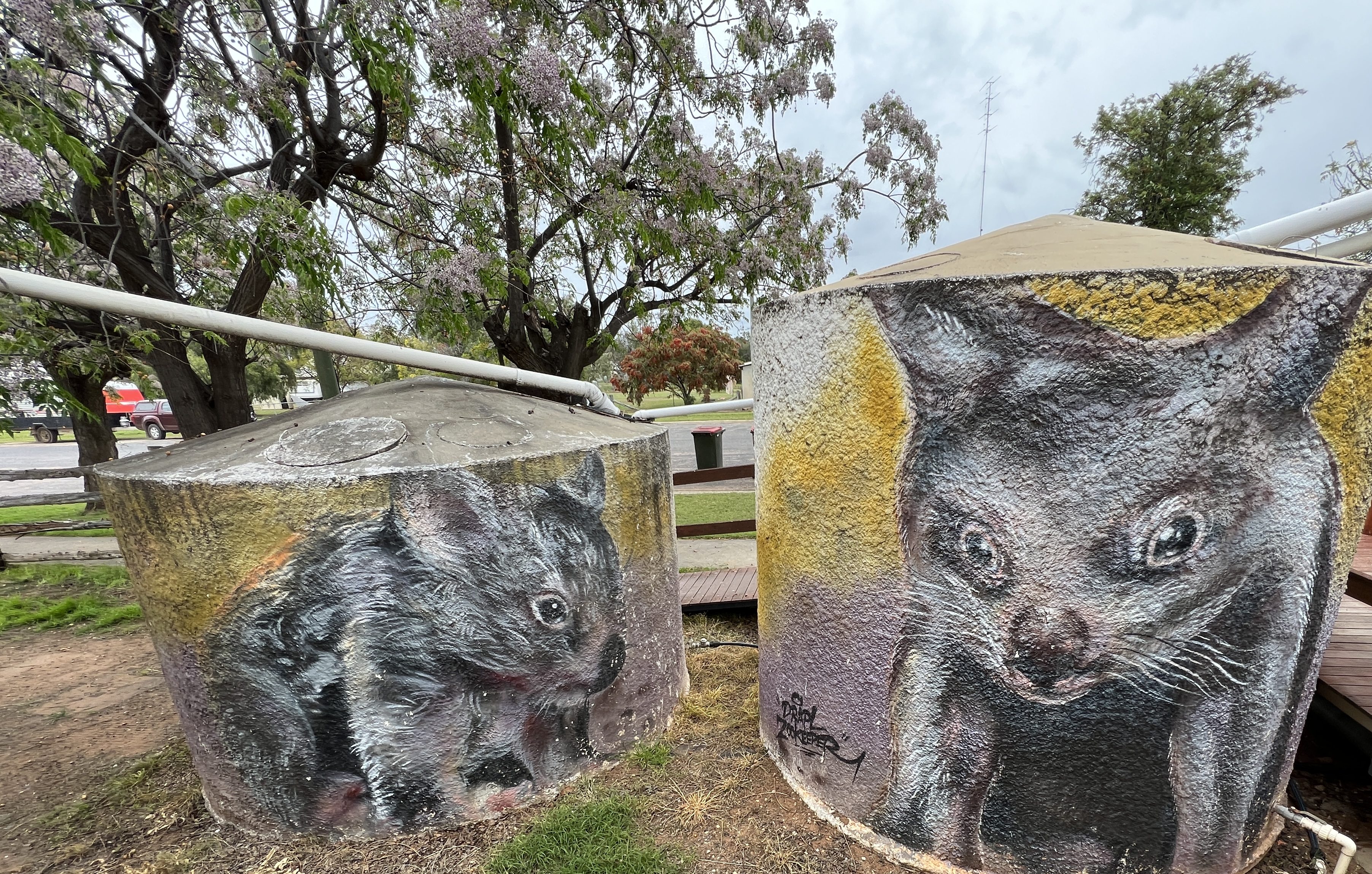
Now we are seeing a few murals on this trip, but we enjoy them nonetheless. I suppose they can get a bit tedious though! So here, just for a change is Thallon’s big thing…..a big hairy nosed wombat!
The big mural in Thallon is on the GrainCorp Silos. The mural is easily seen coming into town, dominating the skyline.It depicts the Moonie River, a sunset background with sheep grazing. Pretty spectacular.

Next town along the way and further west is Dirranbandi. Stopped here for morning tea and had a look around their attractions. These included a great cut out of horses of the Australian Light Horse brigade, which made the last cavalry charge at Beersheba towards the end of the First World War. The General that lead the charge later acquired a property at Dirranbandi and grazed here until he died in 1939. Our towns out west certainly search far and wide to pick up and promote historical slices for their tourist propaganda!
Further along was a lunch stop at Hebel, right on the border with NSW. Few live here, but there is an old historic hotel/motel and opposite a general store and caravan park. Homealone enjoyed the ‘home cooked pie’ whilst Allthego settled for the Border Burger.

From Hebel it is 65 km or so to Lightning Ridge down the Castlereagh Highway. All day we have been travelling in a light sporadic spitty drizzle, enough to hassle the windscreen wipers. So it is good to finally see the welcome to Lightning Ridge display of the Barrel of Dreams, I think that is what it is called!
Nindigully
Nindigully is 160km west of Goondiwindi beside the Moonie River, 50km south east of St George. This area in southwest Queensland is known as the Maranoa. It is pretty flat country with many creeks and rivers criss crossing the landscape. Plenty of agricultural pursuits here, wheat fields very green after the recent rains and the cotton fields in fallow pending planting out for the next crop.
We left Millmerran in fine sunny weather, Allthego had an early morning walk down to Back Creek which flanks the town and floods low lying areas in the town. It was running strongly under the road bridge.
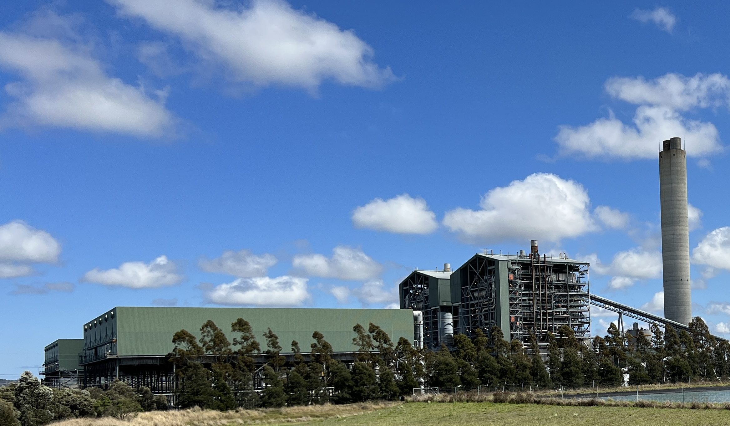
On the way to Goondiwindi we took a back road to check out the Millmerran Power Station. An impressive enterprise that provides 15% of Queensland’s power needs. There is an evil coal mine next door that supplies the fuel to produce the power. Water for the station comes from recycling Toowoomba’s sewage plant output via a 58 km pipeline from the plant. It is apparently quite an efficient and clean technology coal fired power station. Not sure what the future holds for it in the age of renewables.

Eventually , we get back onto the Gore Highway and reach Goondiwindi a little later than planned. This is normal for us though and we hasten west to the Pub, stopping for some tuna on crackers beside an old railway station at Toobeah (“two-beer”). There is one pub and a general store here, it would be a good spot to free camp for a night on another western trip in the future.
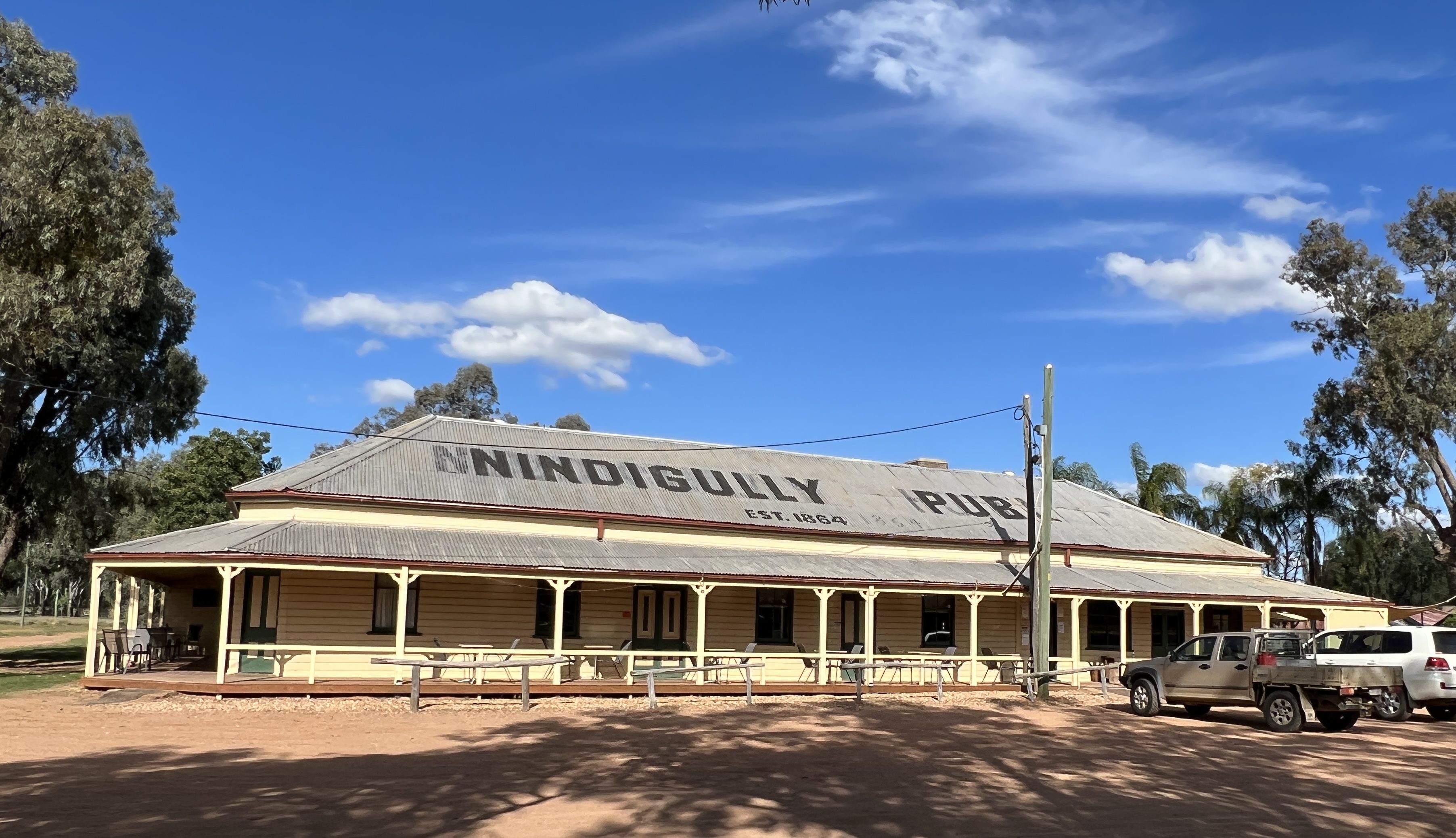
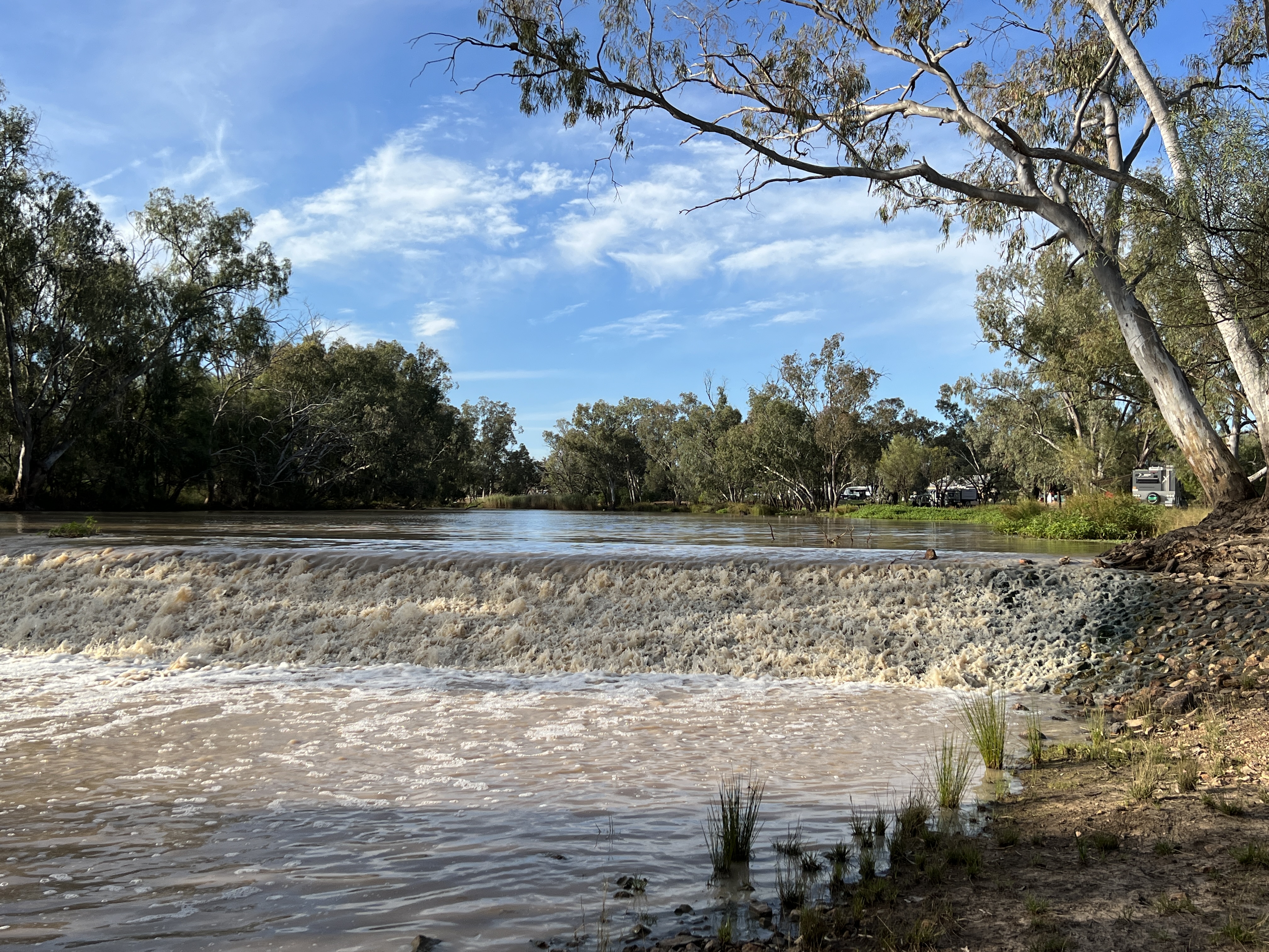
The pub at Nindigully is a Queensland icon. It was established in 1864 and is the longest continually licensed pub in the State. It sits perched above the Moonie River, free camping sites stretching out between the river and the pub. Several hundred people could camp here, particularly for the annual pig races. The river is full of water and cascading over the weir below the hotel.

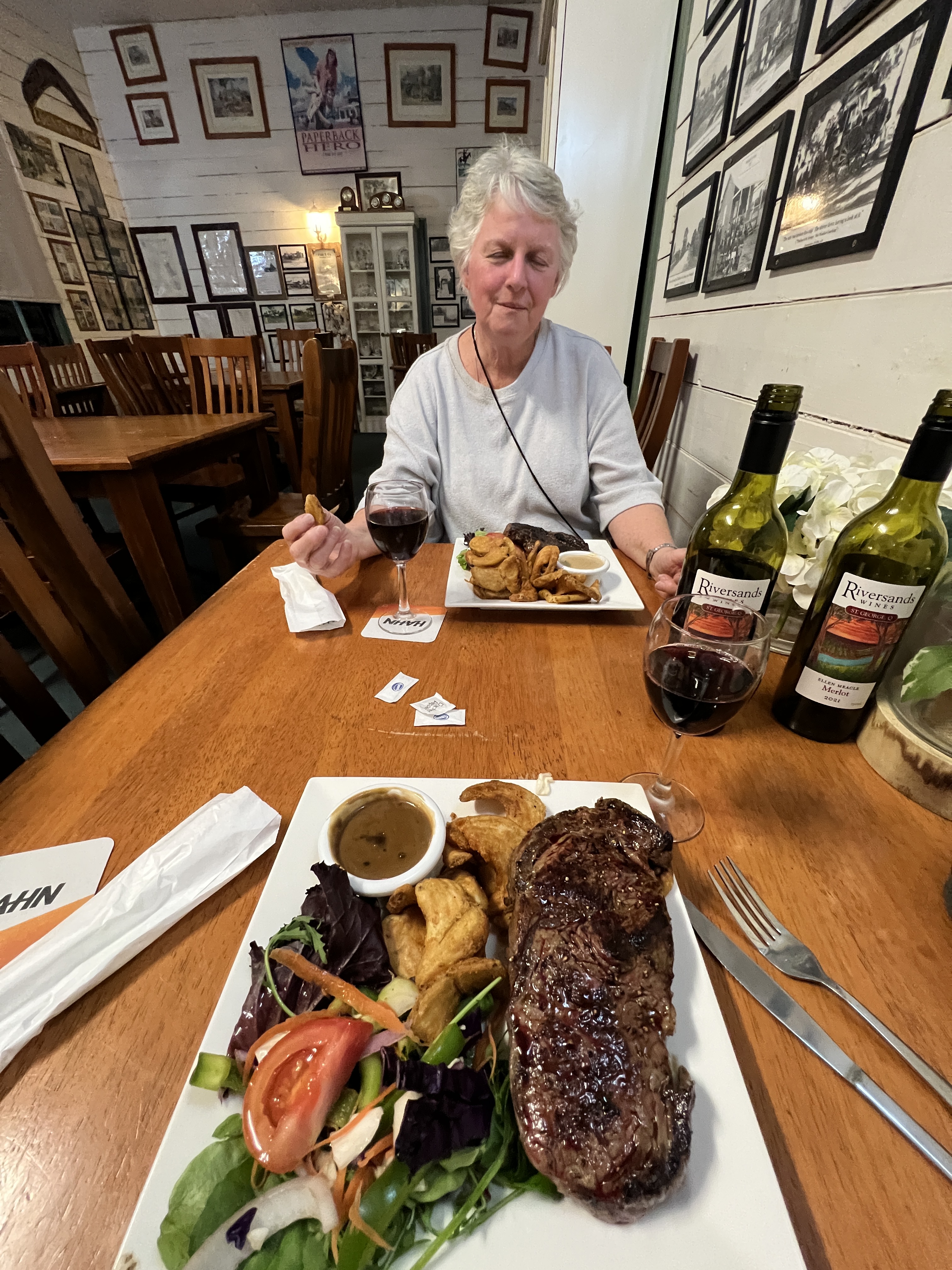
The pub is also known for its Road Train burger, 5.5 kg beef patty and all the trimmings plus chips. Only $100 but we did see it feed a table of 6 with left overs. Seemed like a meat loaf in a big bread roll. Another option is a 1.5 kg steak sandwich, more than enough for the two we saw dive into it.
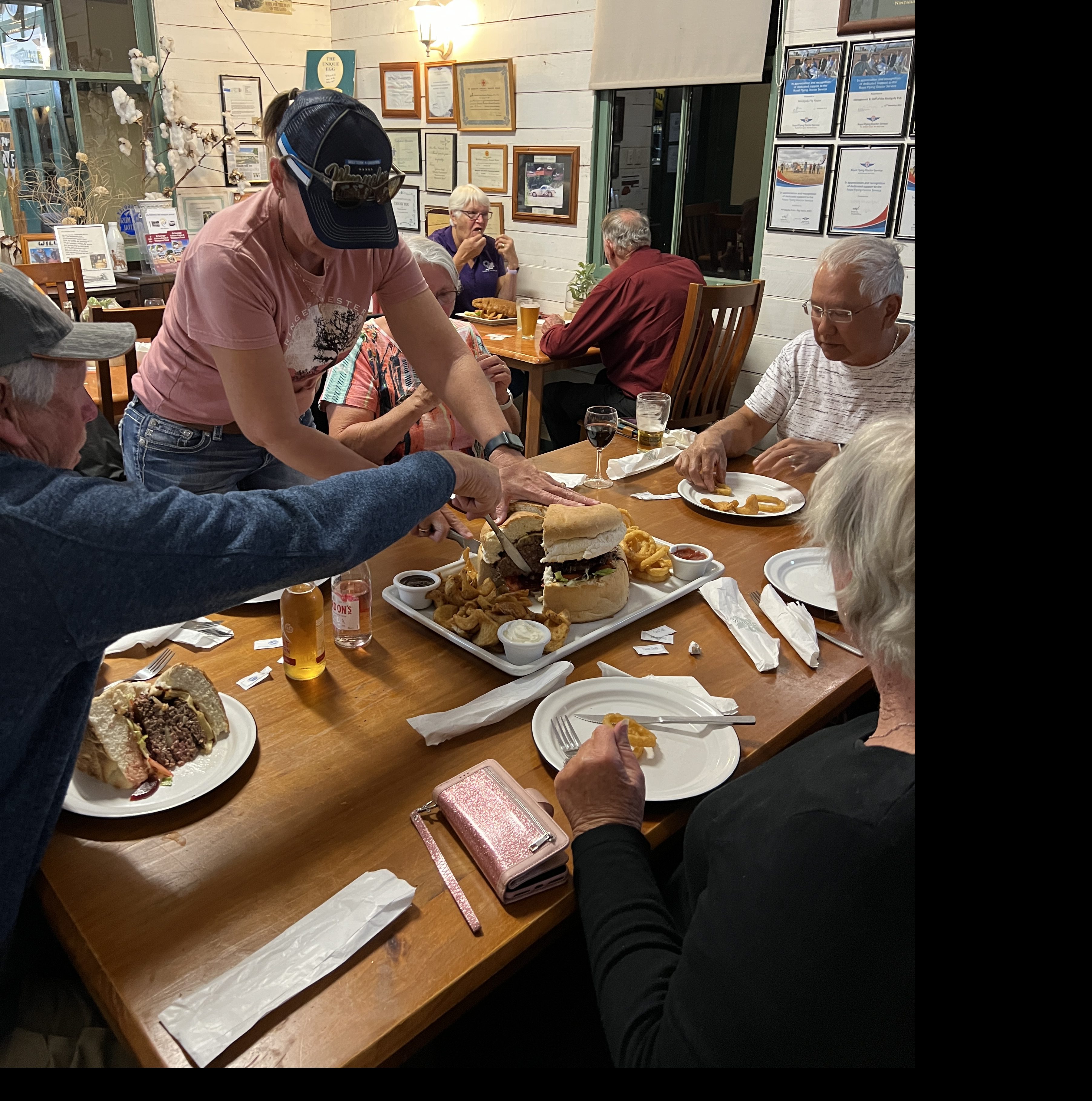
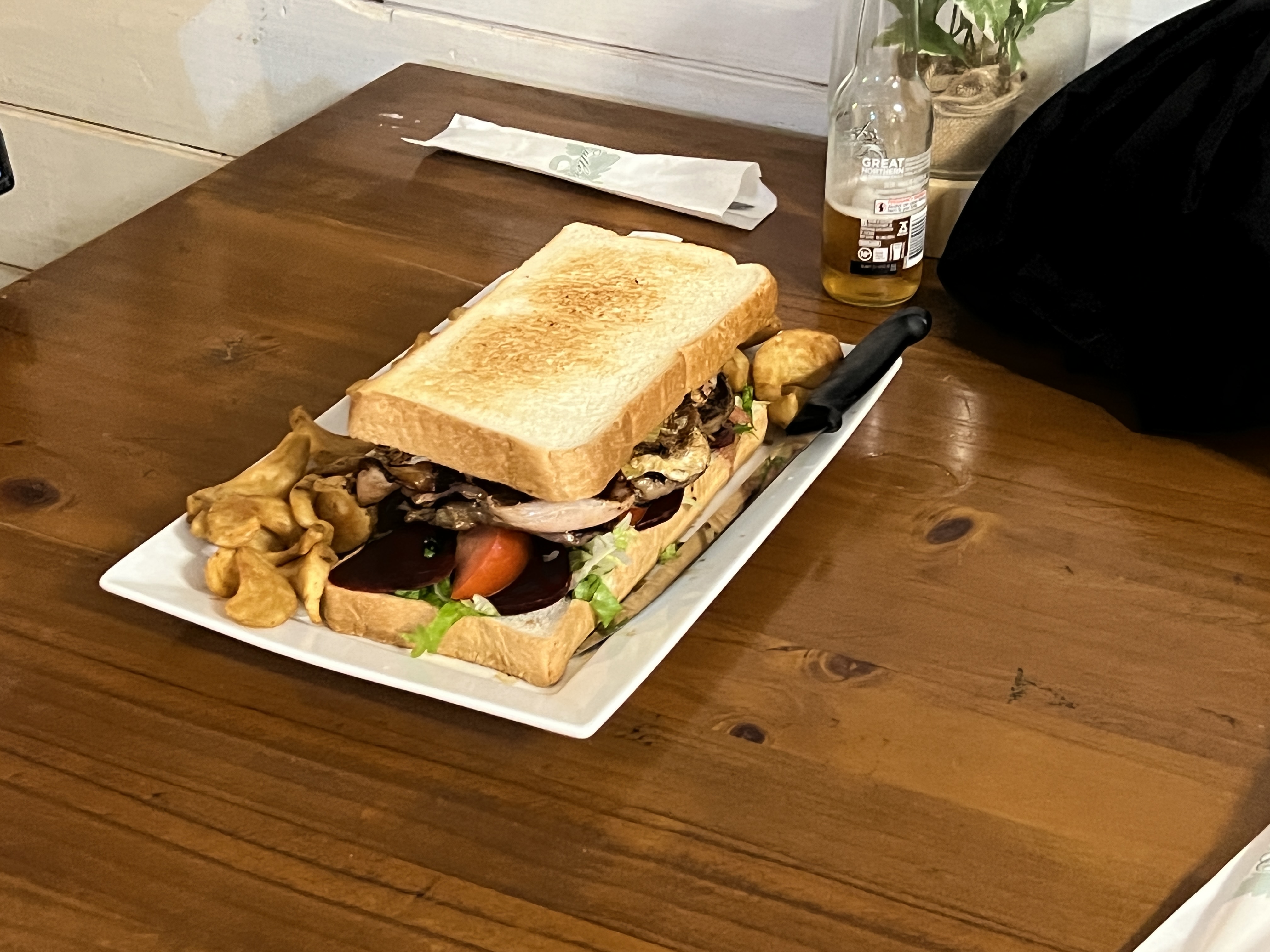
Homealone and Allthego avoided these and each settled for a more manageable rib steak. Service was unashamedly slow, it was about an hour and half before the food arrived! There was quite a crowd.
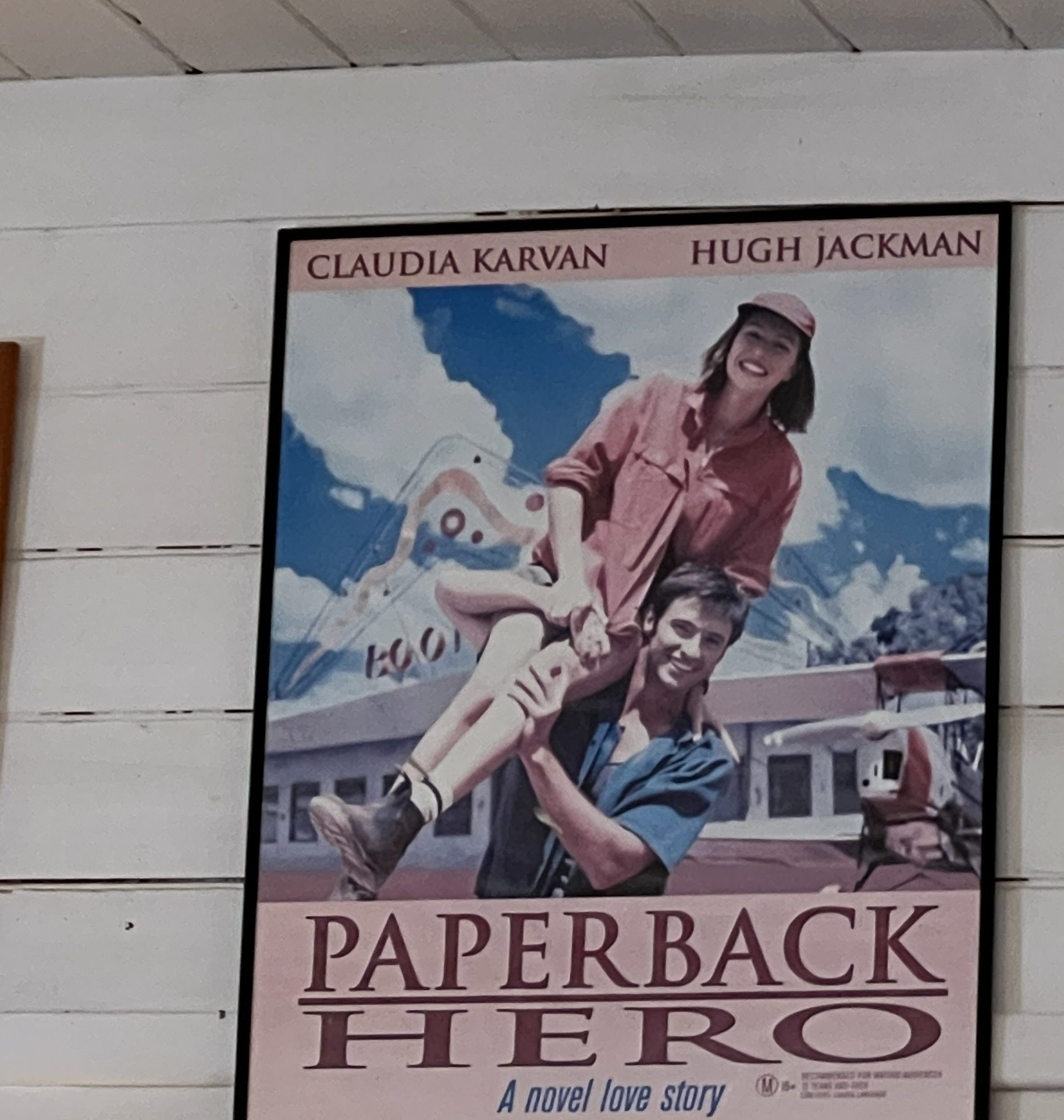
Nindigully’s other claim to fame is as the location for the 1999 film Paperback Hero, the big boomerangs from the film remain perched in the grounds. It was one of Hugh Jackman’s first film roles.

After the excitement at the Pub it was back to the van for a relatively early night and to prepare for moving on in the morning to Lightning Ridge. There was general concern around about approaching storms and whether the road further to the south will be open. We will see what happens in the morning!
On the way south, sort of.
After the Eels devastating loss in the 2022 GF Allthego and Homeslone are setting off on a short trip out west to Nindigully, then down to Lightning Ridge in NSW and back to Brisbane via the Wurrumbungles.
Allthego has consigned his Eels guernsey to the back of the cupboard and is hoping that they will get another shot at the Premiership inside the next ten years or so!
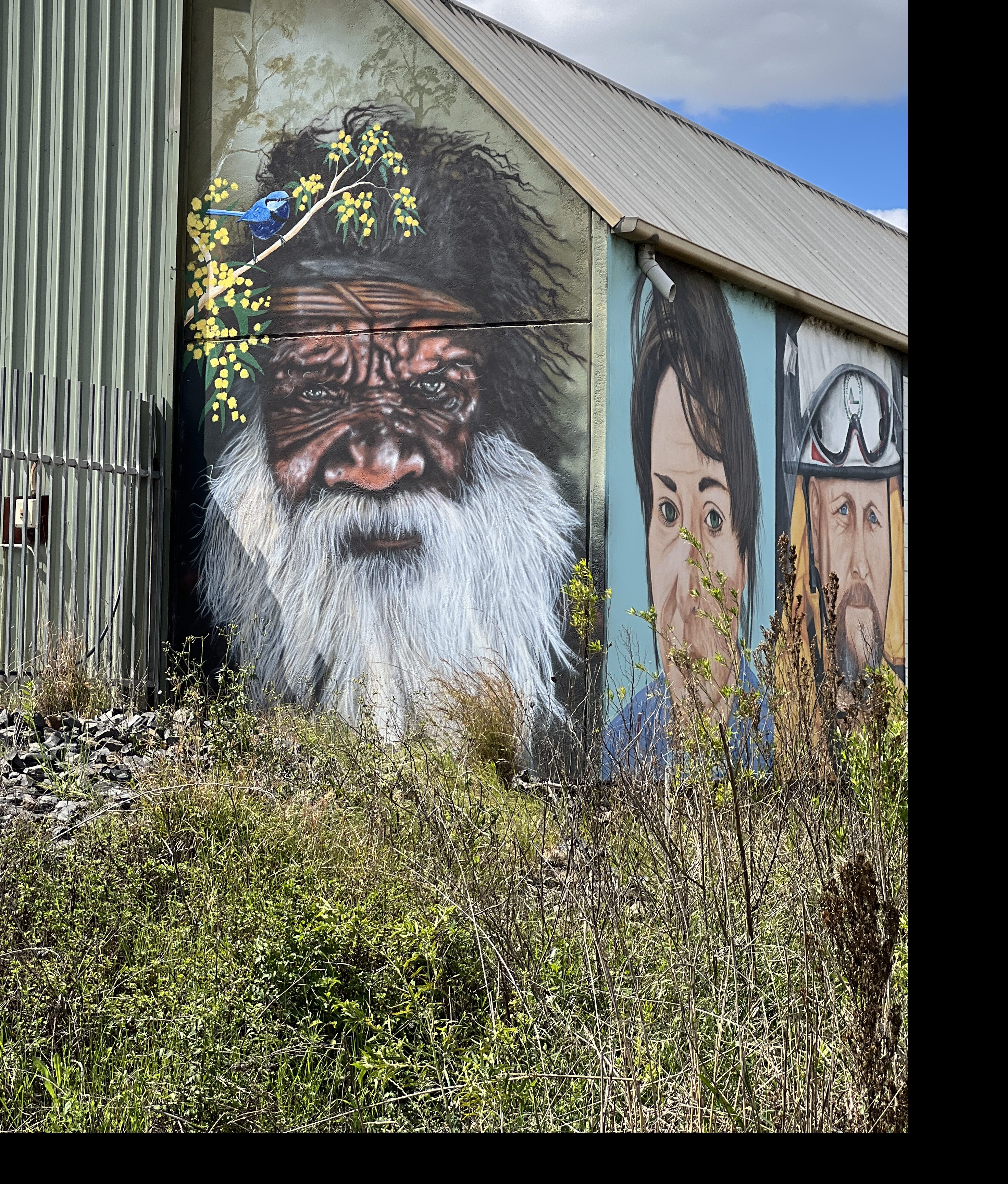
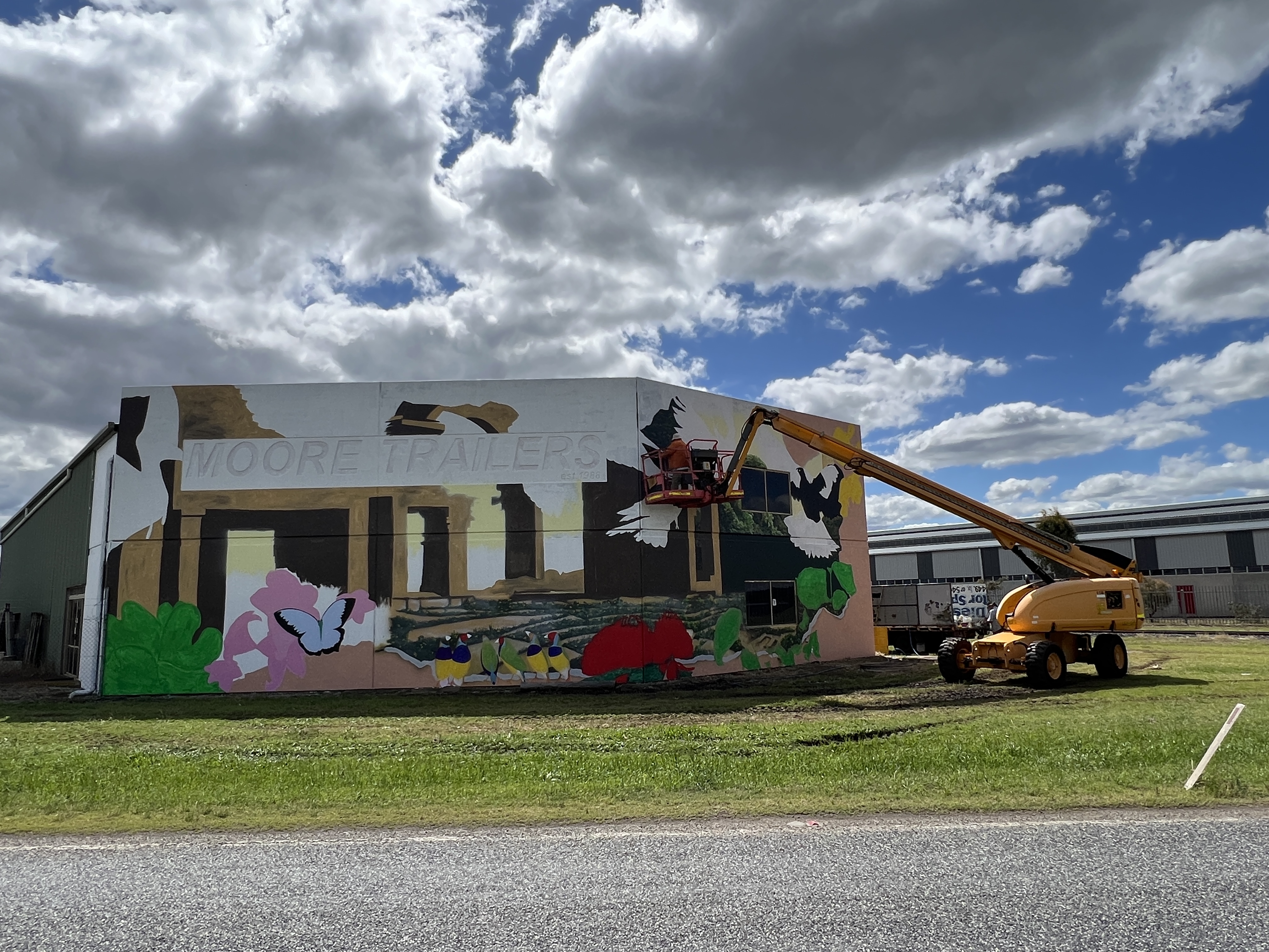
We have chosen a somewhat different route south this time, rather than going via Warwick to Goondiwindi we have headed out past Toowoomba on the Gore Highway. This takes us past Pittsworth and Millmerran on the way to Goondiwindi. Some great murals on the Moore transport terminals near Pittsworth, an elderly Indigenous mural the standout!
Murals galore in Millmerran, the water tank particularly good.

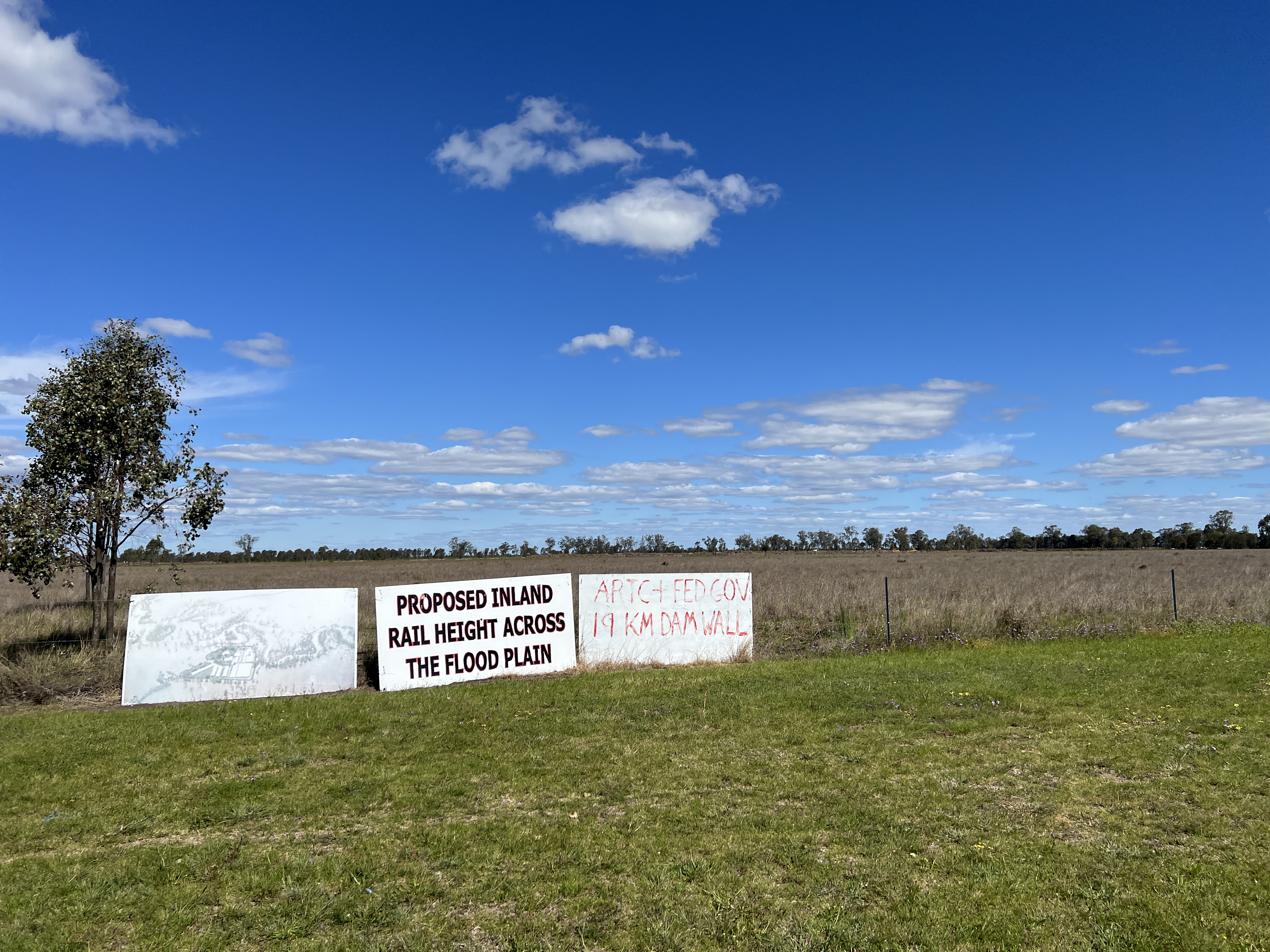
Bit of angst out this way about the Inland Rail project. This area of the Darling Downs is a floodplain of the Condamine River, a tributary of the Darling River. The line is in the course of early earthworks that cross about 19km of floodplain on banks several feet high. Billboards say a 19 km dam, some locals want it moved to someone else’s backyard. Doesn’t look likely!
One of the attractions out this way is a bi annual Camp Oven Cooking Festival, plus C&W music and other things country. Plenty of food it seems, demonstrations etc. This could be a future must do, next one is 2024.

We are holed up for the night in a free camp on the outskirts of Millmerran, seems to be a truck route. Head off tomorrow for Nindigully.
