Khancoban and where all the waters run.
Khancoban is an interesting little town beside Lake Khancoban, it is really one of the Snowy Scheme dams built about 60 years ago, say it quick and it doesn’t seem that long ago.
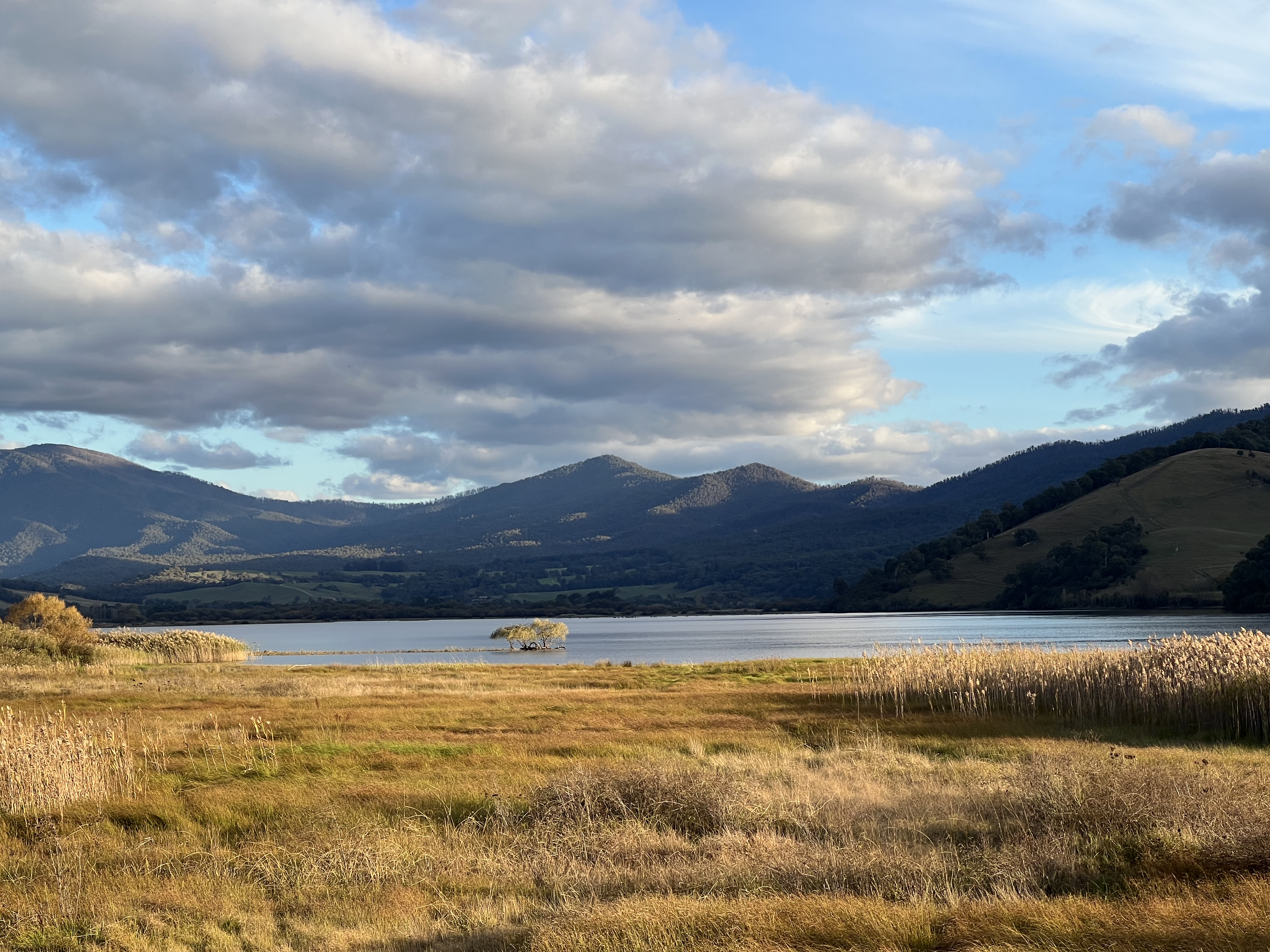
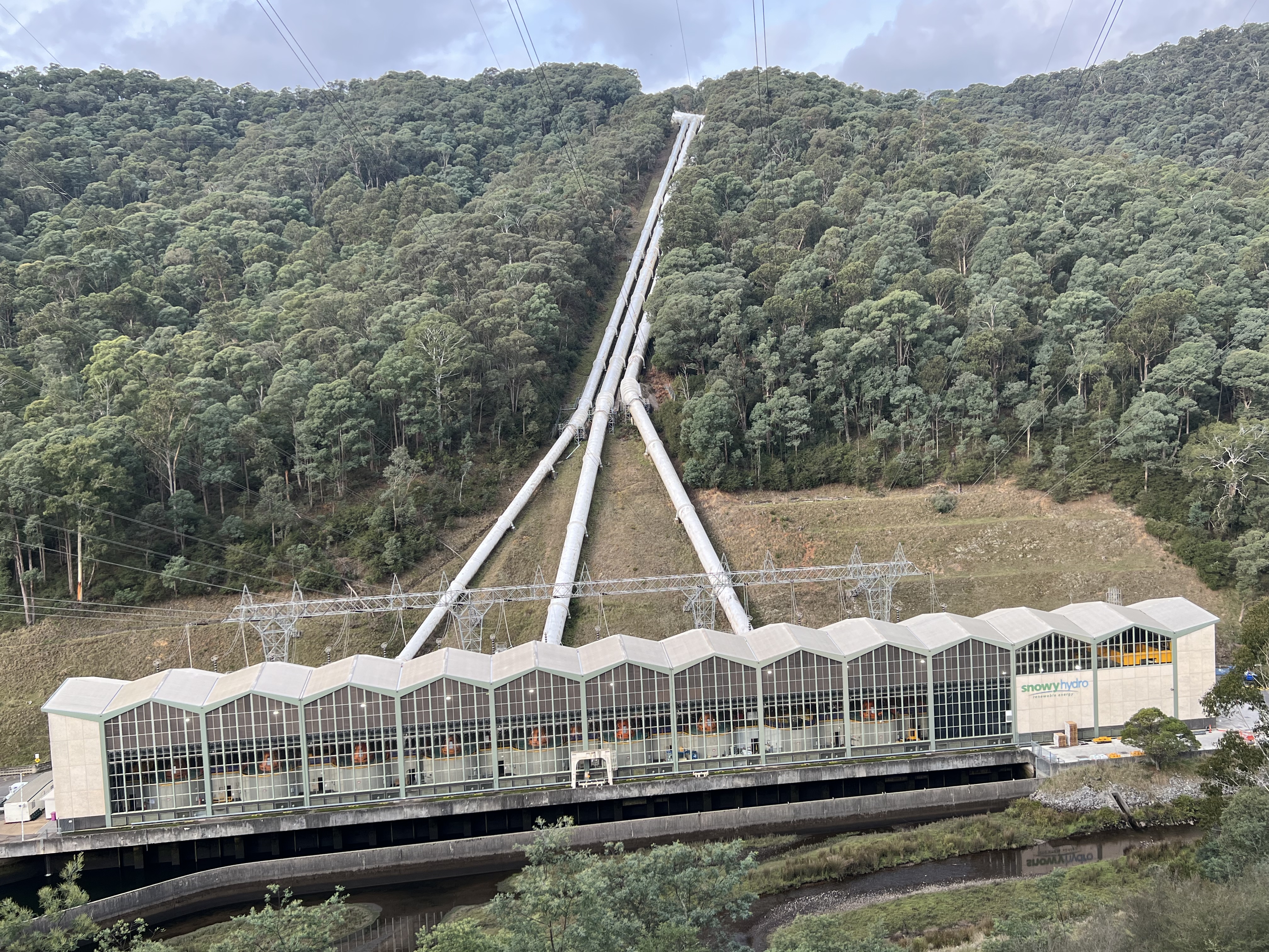
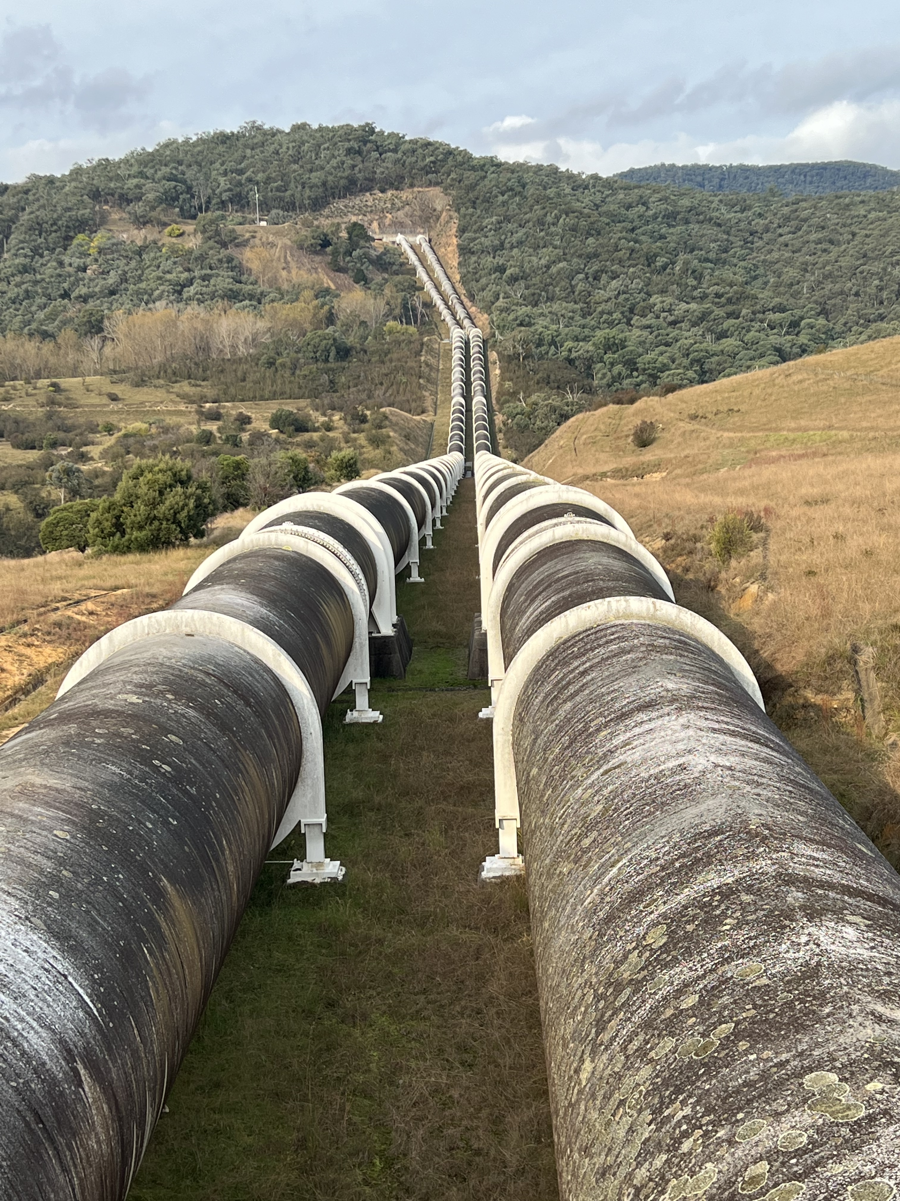
We are using Khancoban as a base to do some touring around the area before heading into the ‘high country’ up to Tom Groggin along the Alpine Way. Khancoban sits on the western flank of the Snowy Mountains and the waters that flow into the dam are headed for South Australia. The two main streams are the Geehi and Swampy Plains Rivers, these rivers are prominent features as you drive around, as well as the power stations and pipelines descending from high above.
Over on the eastern side of the range the Snowy River rises, the source of which (like the Swampy Plains River), is in the shadow of Mt Kosciuszko and it runs east and then south ultimately into Bass Strait. In recent years we have added a ‘z’ into Kosciuszko. To do with properly reflecting the name of the Polish patriot after which it was named, (I think this is the reason). Didn’t have a ‘z’ in it when I was at school, but I was never much of a speller back then anyway. The Snowy runs down and it’s waters are collected in the Jindabyne Dam. Here water is pumped through tunnels and ultimately ends up in Khancoban Lake, some is allowed to flow down the course of the Snowy River below the Jindabyne dam wall. There is great argument about these flows and the environmental impacts.
Allthego must apologise to his readers for this little treatise, it is very brief, omits much and probably suffers from the odd inaccuracy of detail. But who cares I an trying to give some context to where we are. Here is a little map to help put things in perspective.
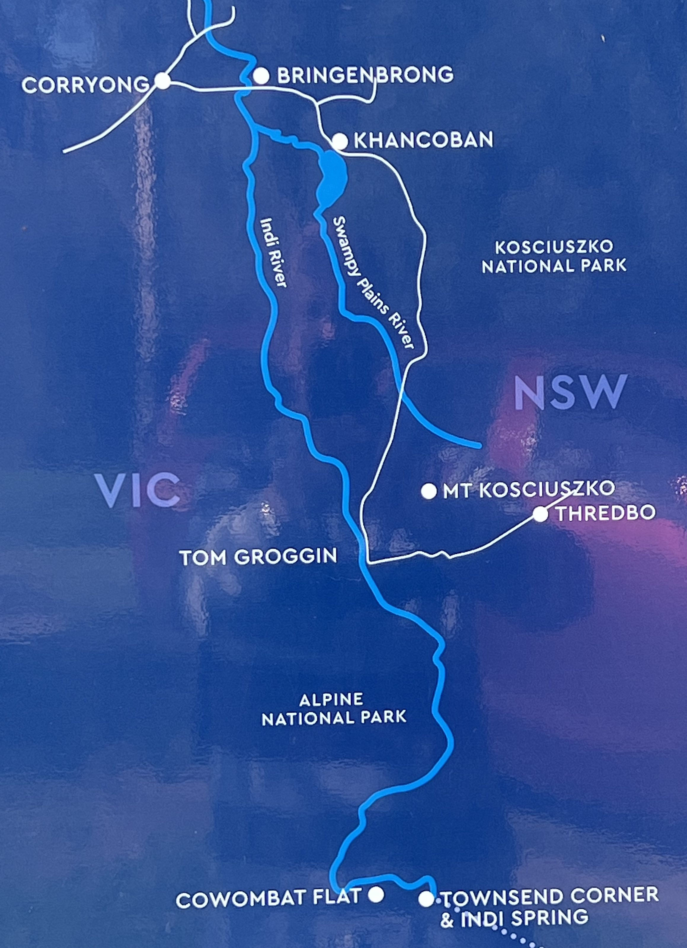
Back in Khancoban the Swampy Plains River flows out of the spillway of the dam and meanders along for awhile before joining the Murray River near Bringenbrong. The bridge over the Murray here is a starting point for many canoe etc type trips on the river. So the interesting thing about the Upper Murray is that it is a free flowing river and its waters were not harnessed by the Snowy Scheme.

The Murray, also known up here as the ‘Indi’, an indigenous name perhaps meaning ‘you’, rises on the western side of the range in quite remote country near a mountain named The Pilot, but more about this later from Tom Groggin.
On the morning that we were to head off to Tom Groggin we had the pleasure to farewell a young couple heading off on an adventure of a life time with two horses and two kids. The mum and dad weren’t riding the horses but the kids were riding the mum and dad! The horses seemed to be carrying everything else that was needed for this excursion, hope they had enough nappies.
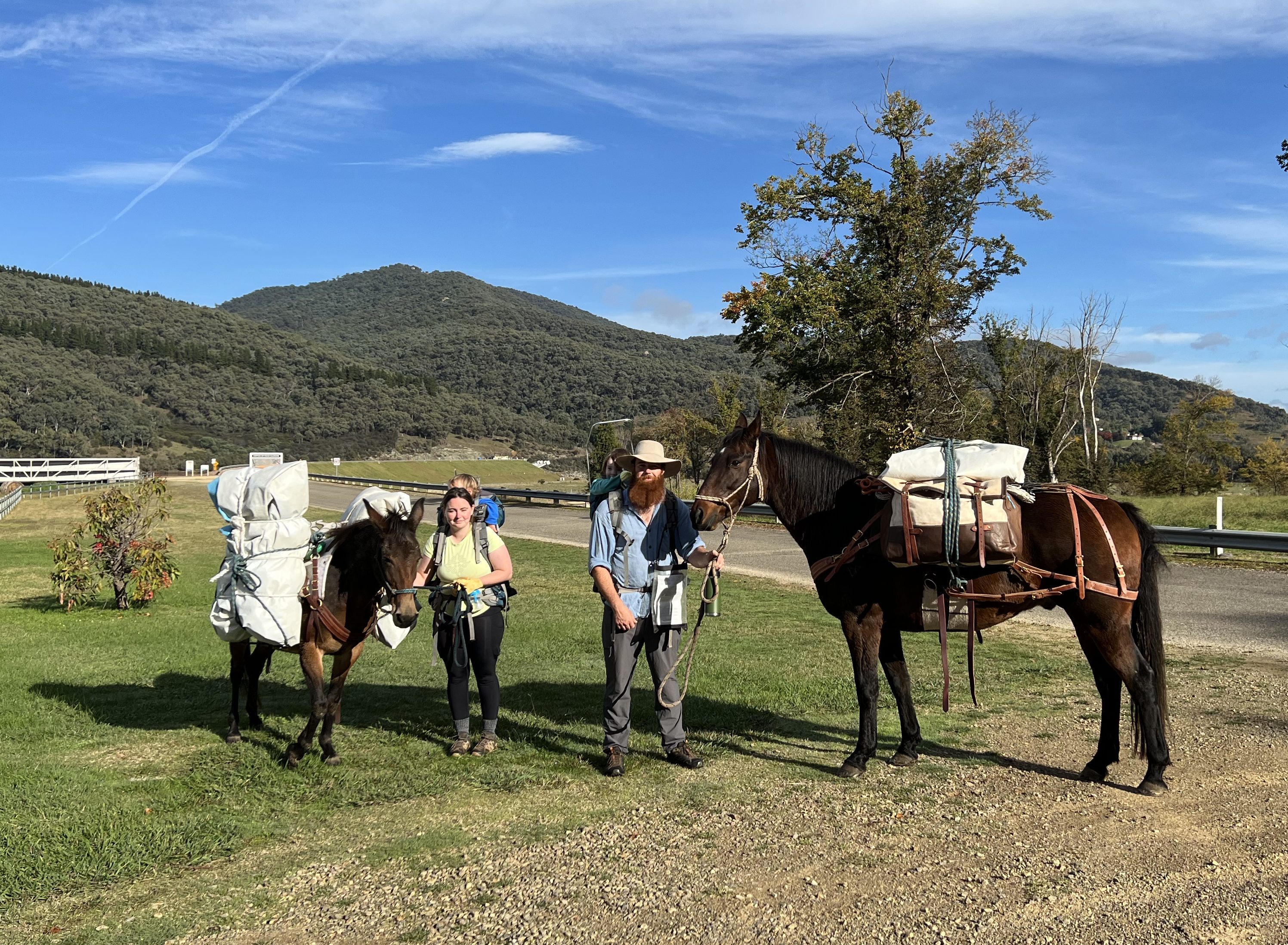
The family were setting off on a six week trek from Khancoban through the mountains and over the NSW western plains finishing in the Blue Mountains, west of Sydney. Well on that note that is definitely enough for the moment!
Posted on May 5, 2022, in Murray River times 2022. Bookmark the permalink. 2 Comments.

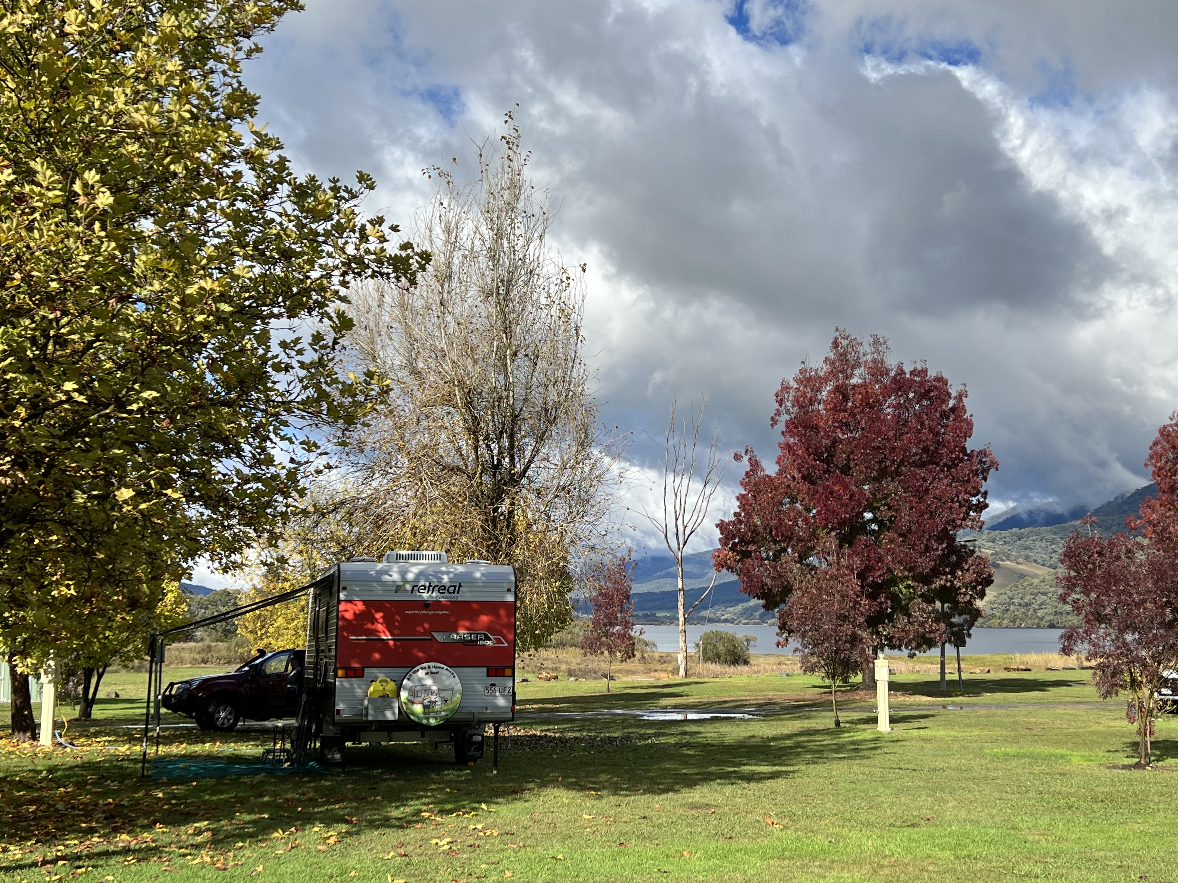
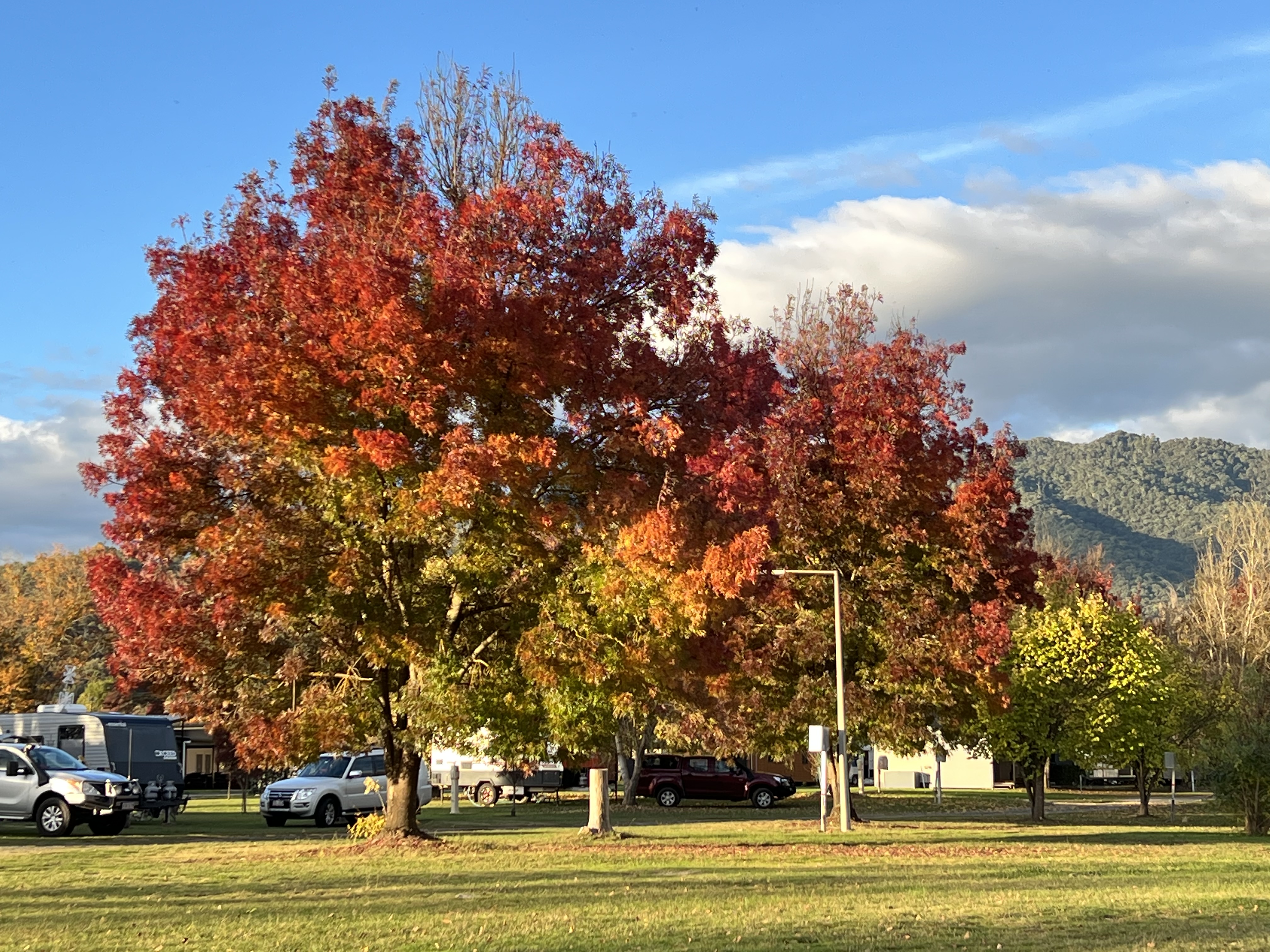
Hi there…. Is it better to write my comments this way or on the blog??? I remember doing a geography excursion to the Snowy River Scheme in 1968🥺 we stayed in the workers accommodation in Cabramurra and Cooma (on way back)…. It was really interesting to see such a huge job it was and the photos look much the same even now. The weather looks great still and the autumn colours are spectacular in the camping grounds. We had our first frost overnight so I’m guessing it’s very cold at night. I felt no adventurous envy for the family on their trek…. Could not imagine it being anything but arduous and miserable 🤷♀️ Looking forward to your next post and hope you are both keeping well😘
Cheryle
Sent from my iPhone
>
Yes it is fine to do it the way you do!