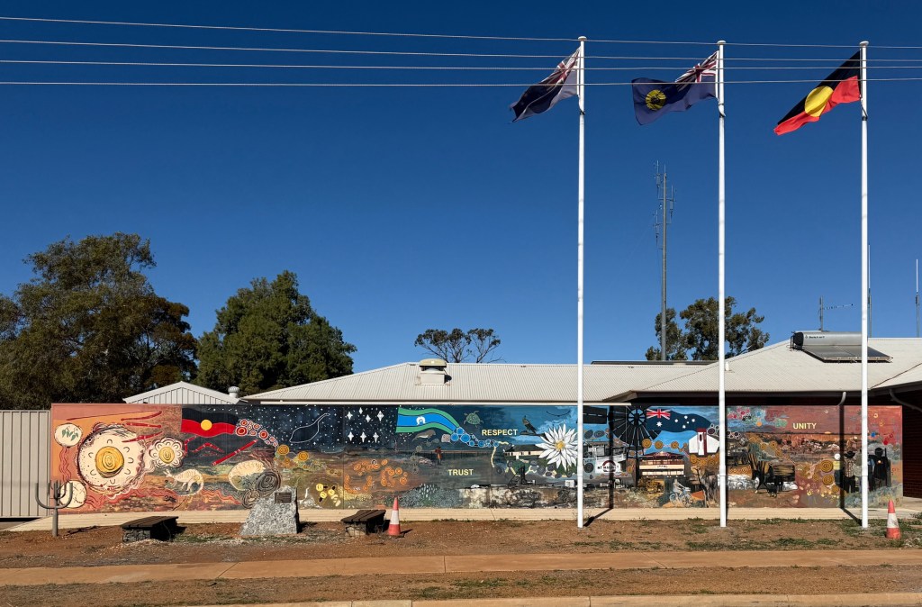
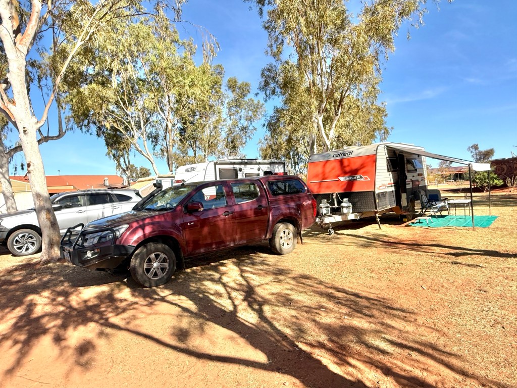
Arrived in Lisboa
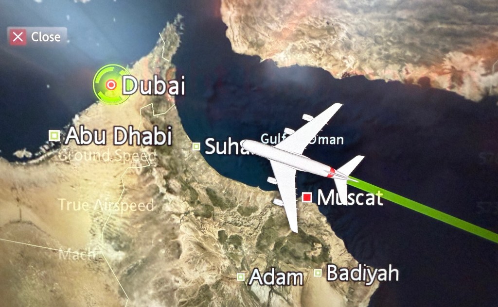
It was an uneventful, smooth and on time fourteen hour Emirates flight to Dubai. The stopover on the way to Lisboa. Lisbon is spelt Lisboa in Portuguese it seems. From here on we are going to stick to Lisbon. Slobro was a little upset at spending the time locked up in a bag in the overhead lockers, came up for air while waiting four hours in Dubai for the connecting flight to Lisbon.
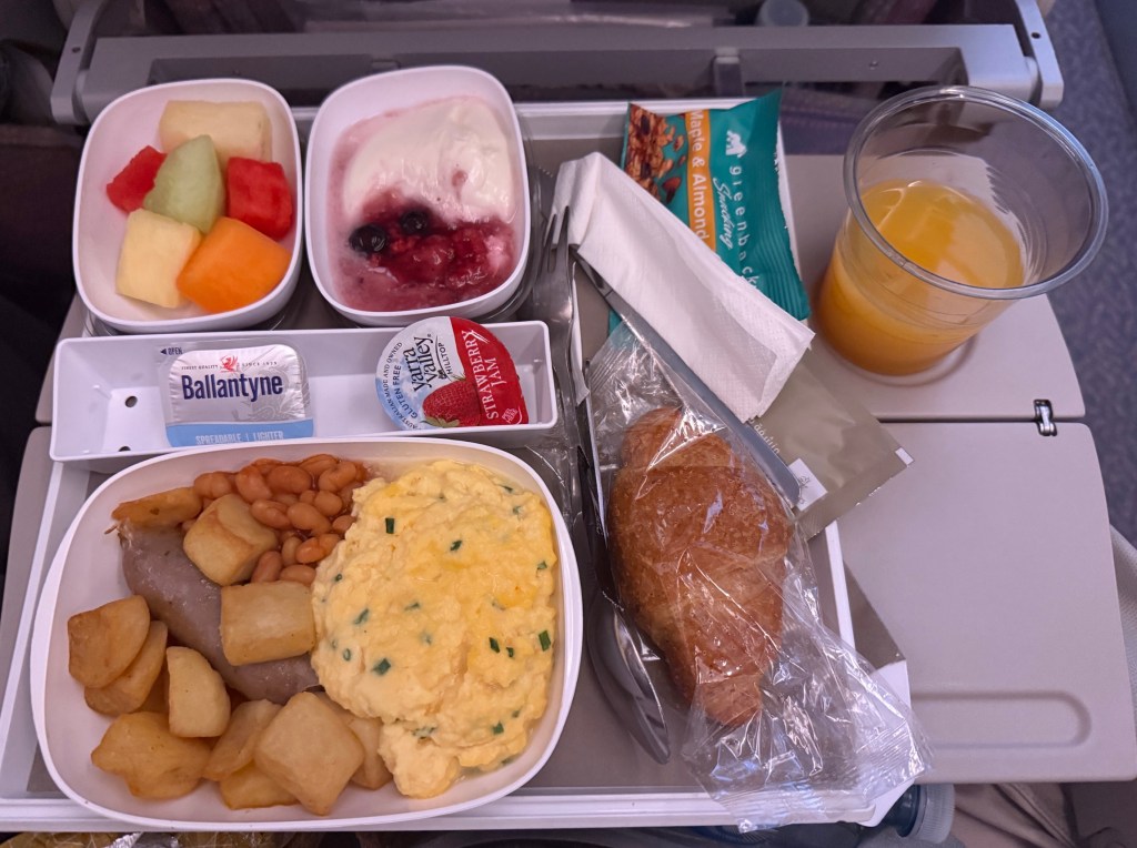
One thing about Emirates is the food in economy is pretty good as far as airline food goes, the soggy potato pieces with Allthego’s scrambled egg for breakfast notwithstanding. Homealone enjoyed the pancakes option.
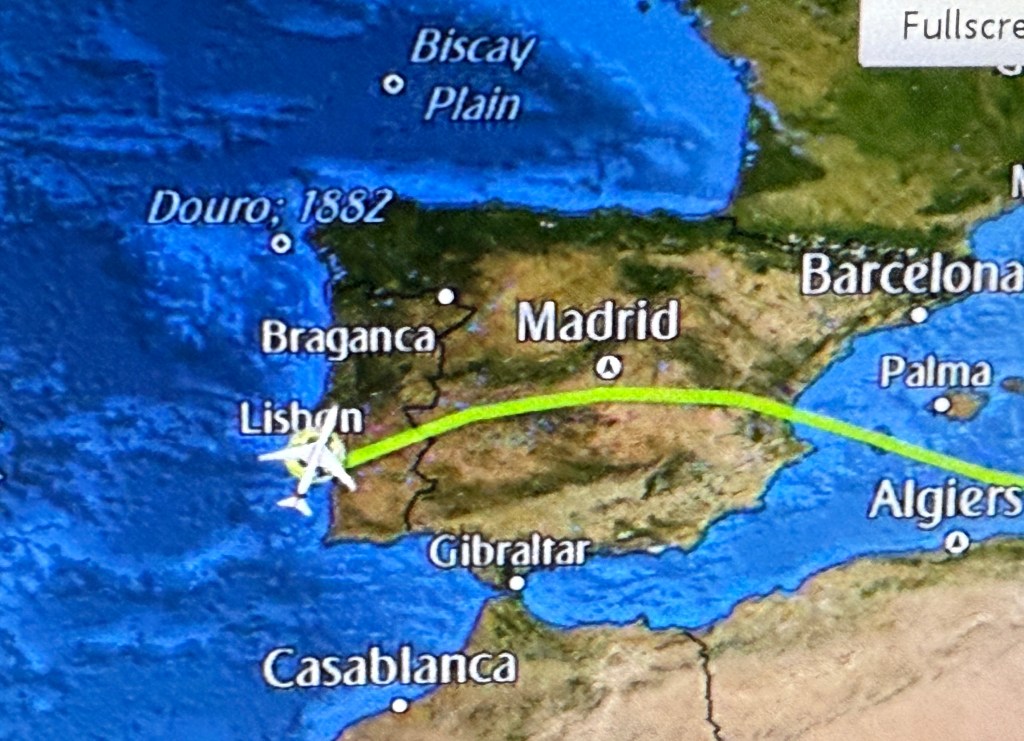
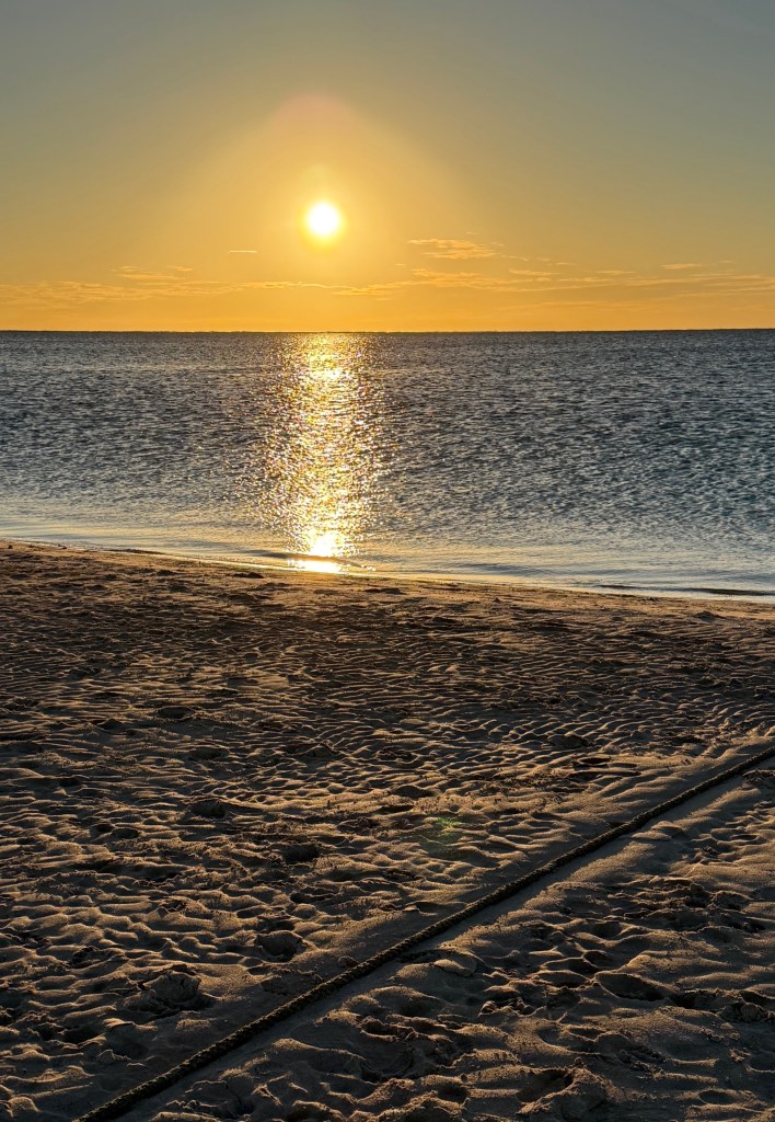
The eight hour flight onwards from Dubai was also smooth going all the way and we landed in Lisbon on time at 7.15pm, just as the sun was going down.
Both fairly tired! No need for dinner though as there had been a rather ‘late’ lunch on the plane.
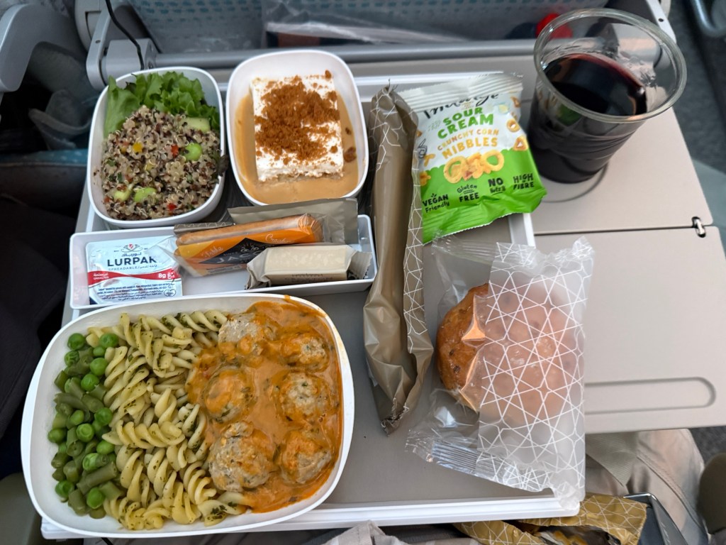
Rather tasty chicken meatballs in a herb cream sauce, Homealone had the excellent beef stroganoff option, with a few bits and pieces of other stuff to fill a hole.
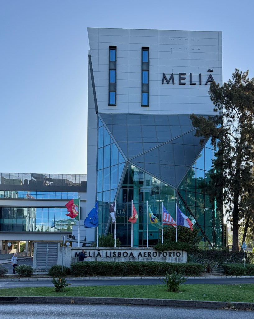
After a lengthy but smooth immigration experience we strolled unchallenged down the ‘nothing to declare’ line and then out of the airport down to the hotel, about 500 metres away.
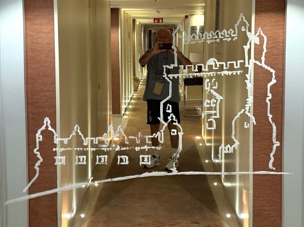
Interesting etchings on the mirror in the hallway outside our room. One of the famous Bellem Towers that sit beside the Tagus River, former guardian posts on the river for the old city.
Crashed for the night! In the morning breakfast called, included a fluffy beetroot roll with some Edam cheese, never had a beetroot roll.

Very colourful with the creamy yellow Edam atop!
After breakfast we caught the hotel’s shuttle bus back to the airport to pick up the APT transfer to the hotel where the Duoro River tour begins in a couple of days.
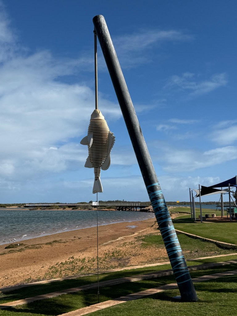
Off to taste a Gildas
We are going off to Portugal and Spain for another adventure. Apart from a day in Lisbon on a cruise we haven’t been to Portugal. Have had brief stops in Spain’s Barcelona and Malaga.
It’s going to be an interesting time on the Douro River in Portugal and later around the Canary Islands off the coast of Morocco.
The family farewelled us over some takeaway. Departure is an early morning flight at 2 am to Dubai and then on to Lisbon.
It has been a long day for Homealone getting all those last minute jobs done. Must always get late night or early morning flights in the future!
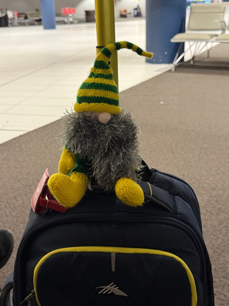
Slobro is joining us again on this journey. He looks quite pleased waiting for our call to board. He is looking forward to a Gildas!
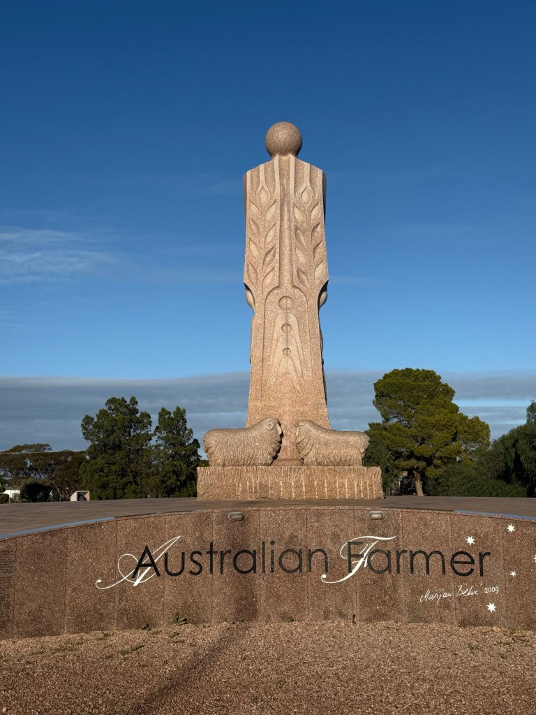
Don’t it make you wanna go home…..
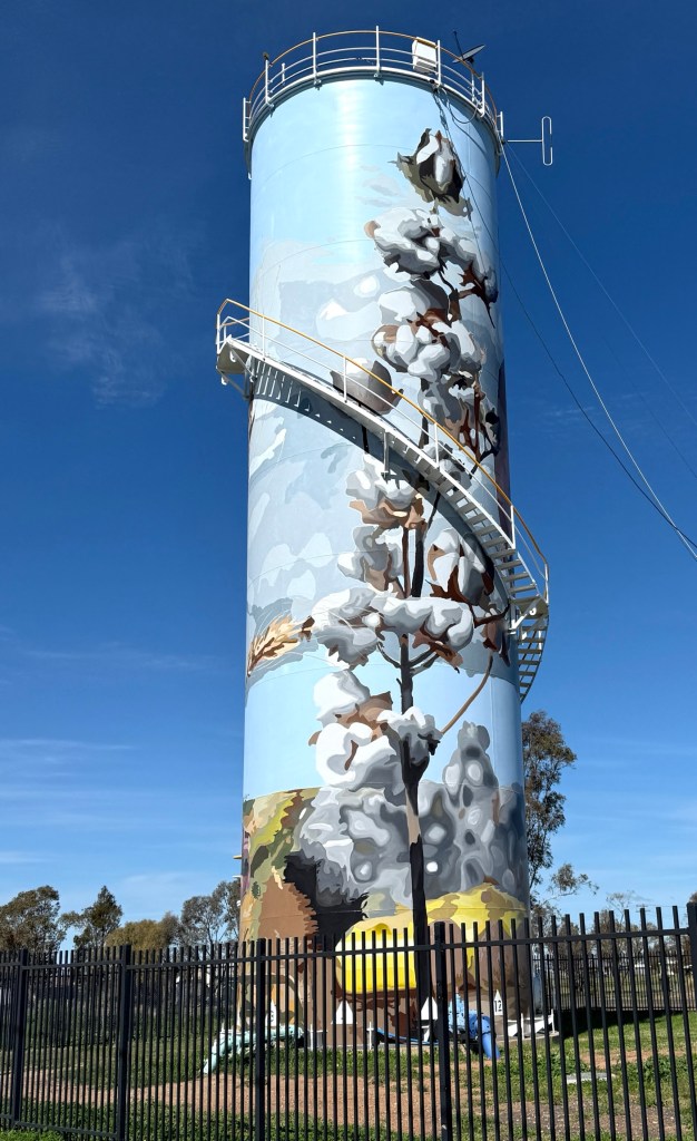
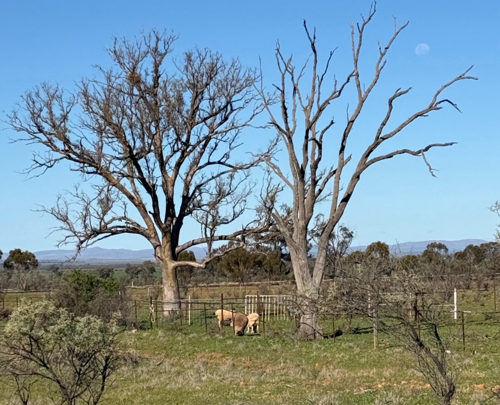
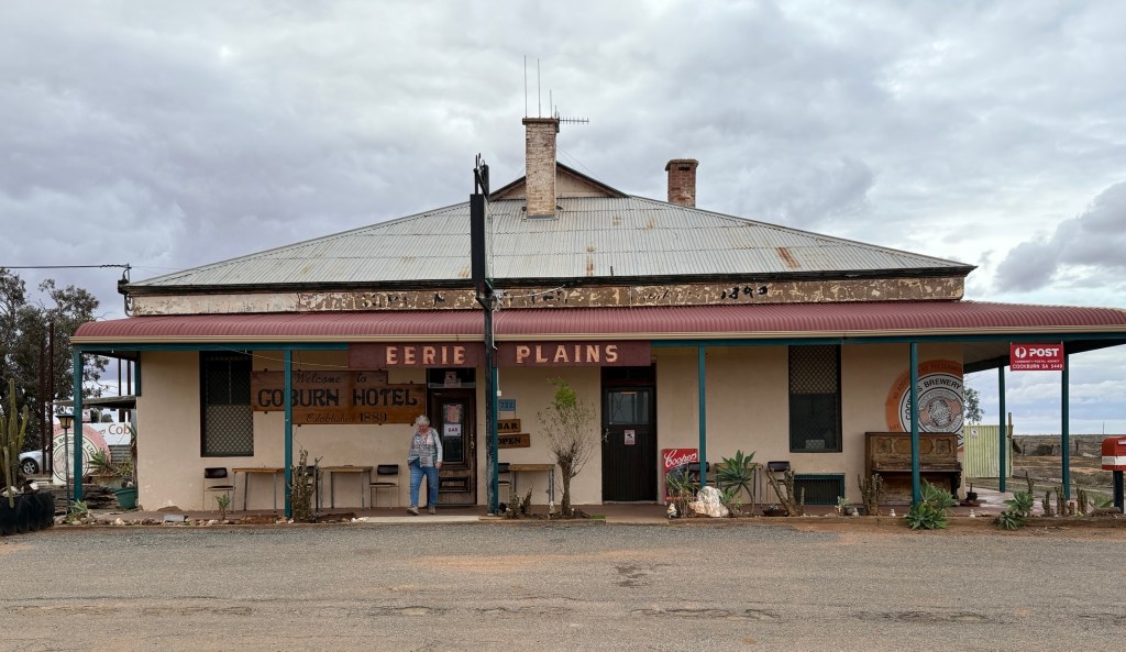
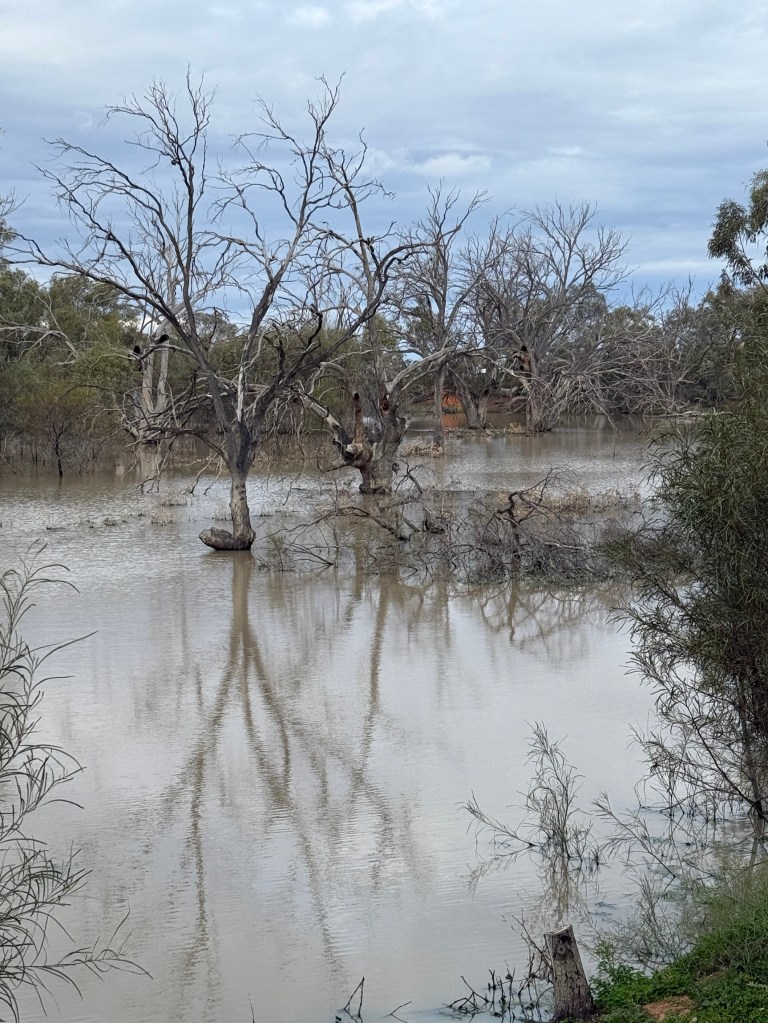
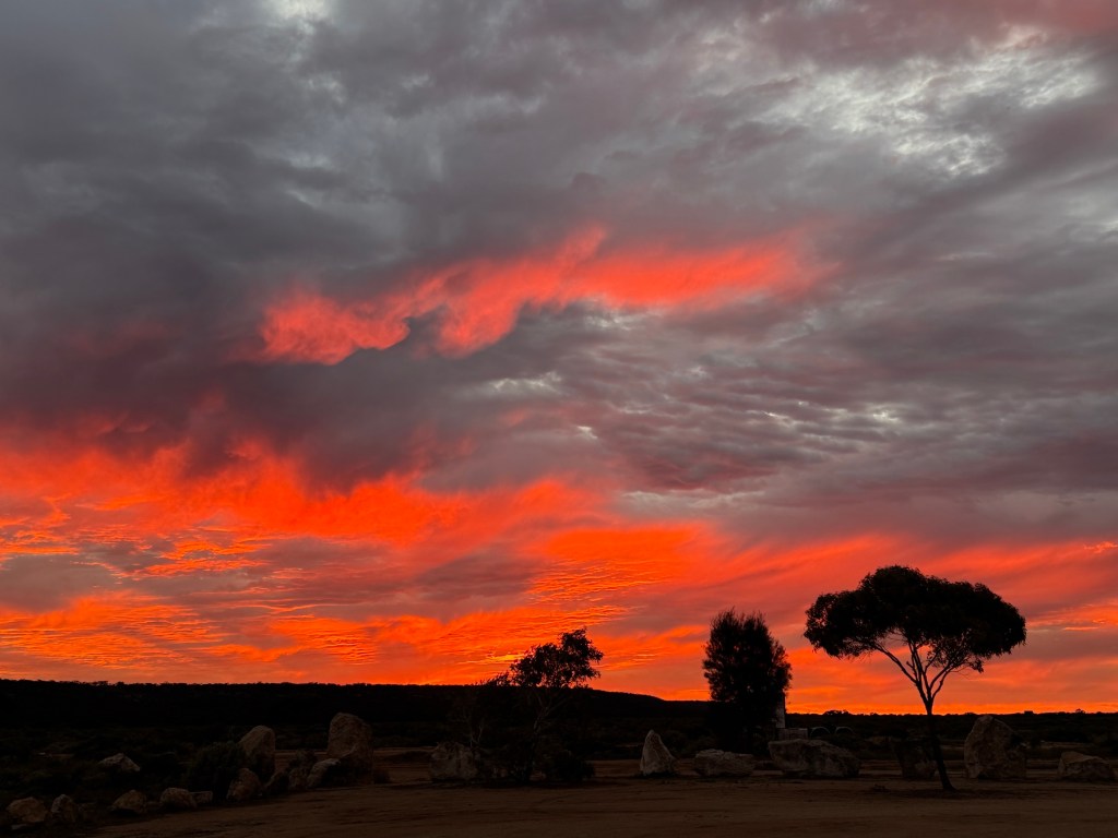
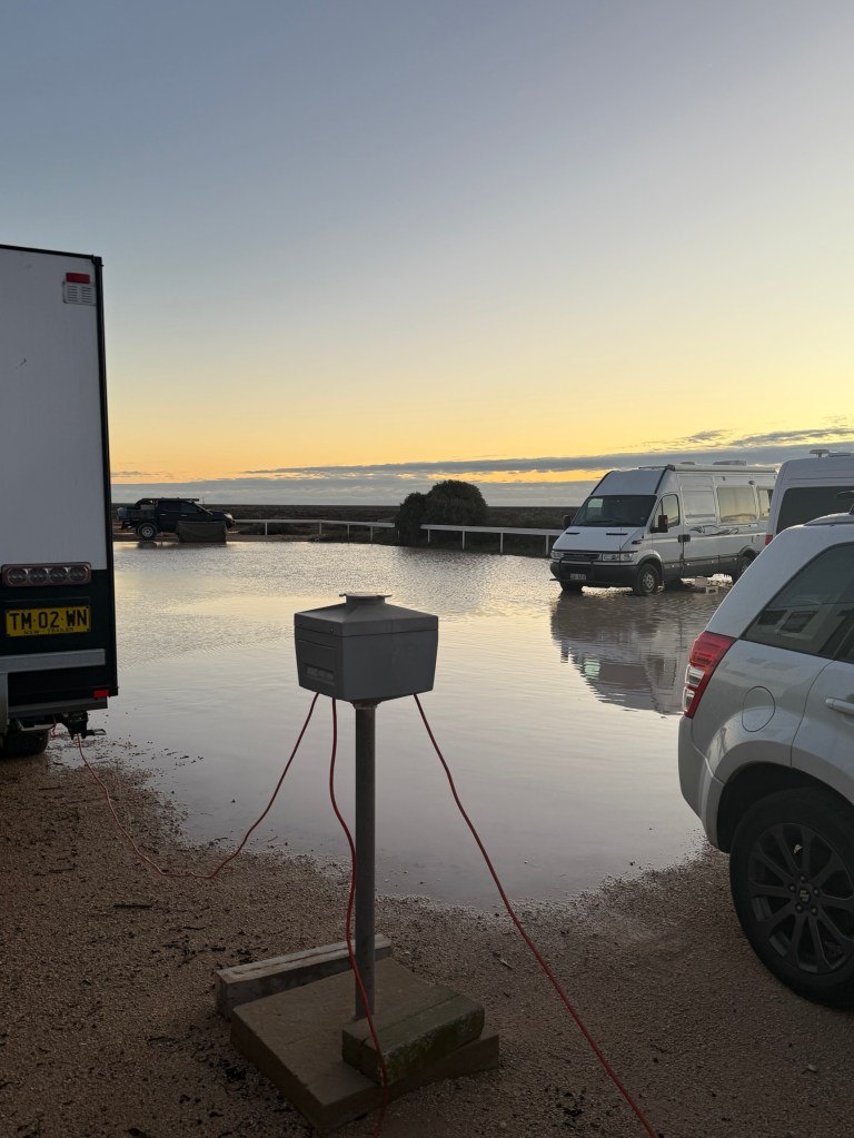
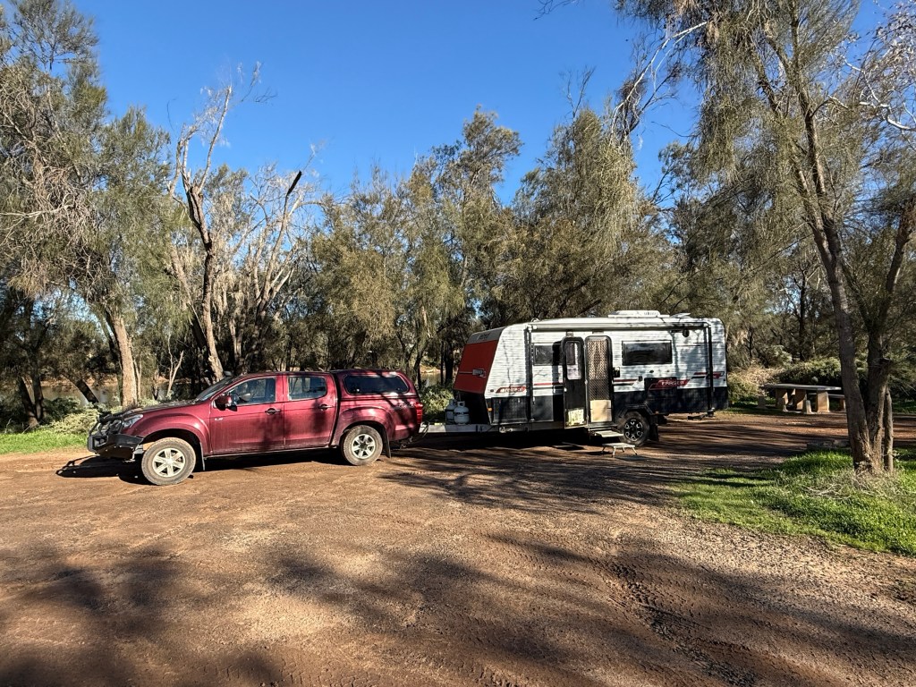
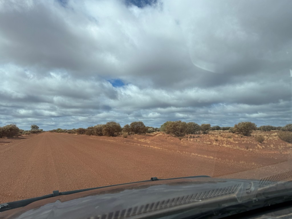
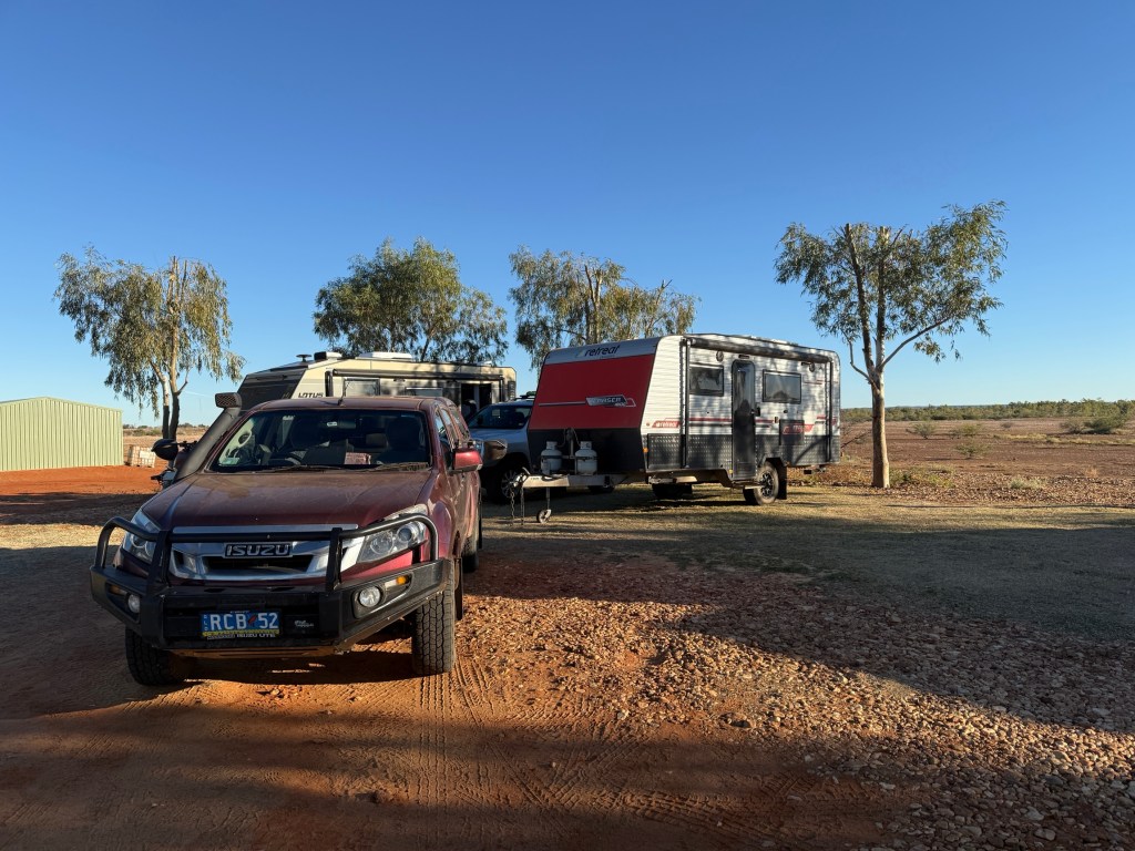
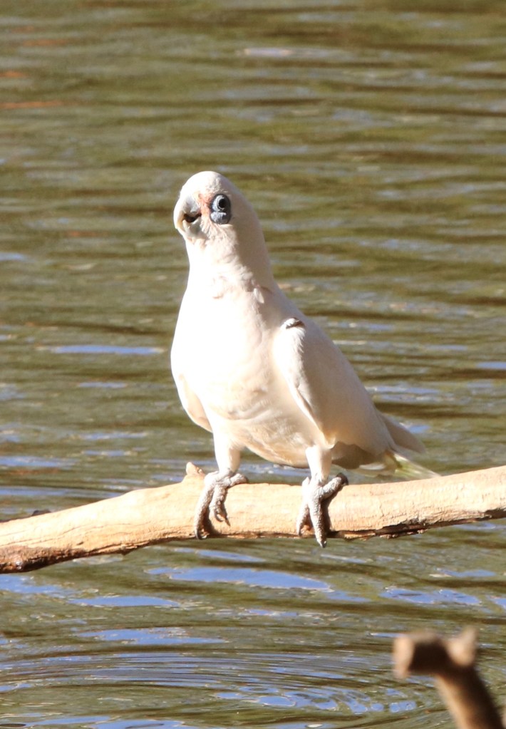
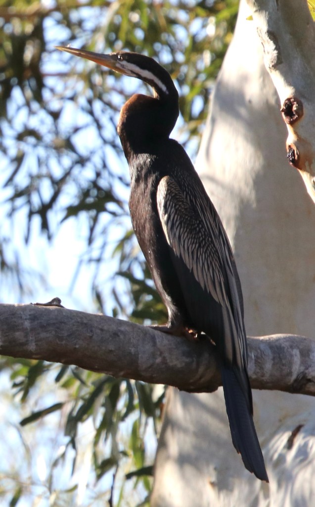
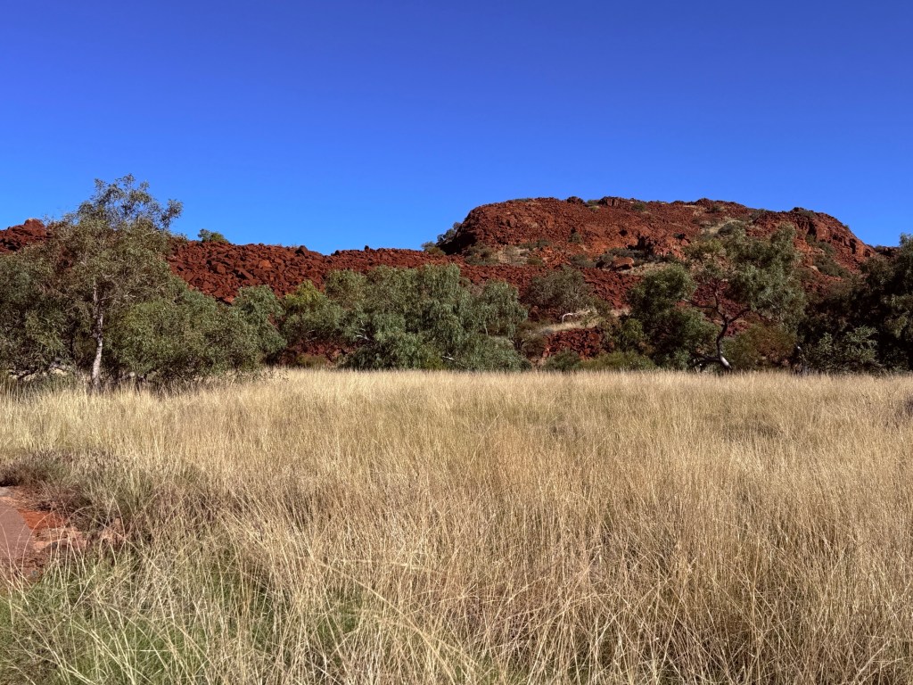
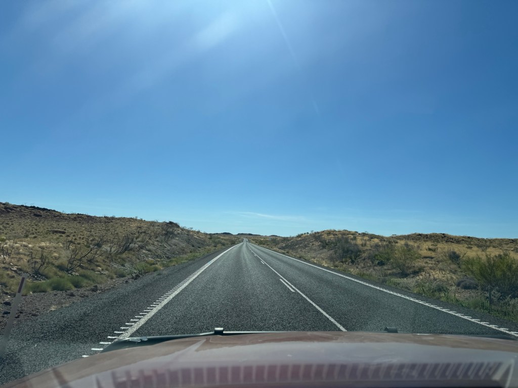
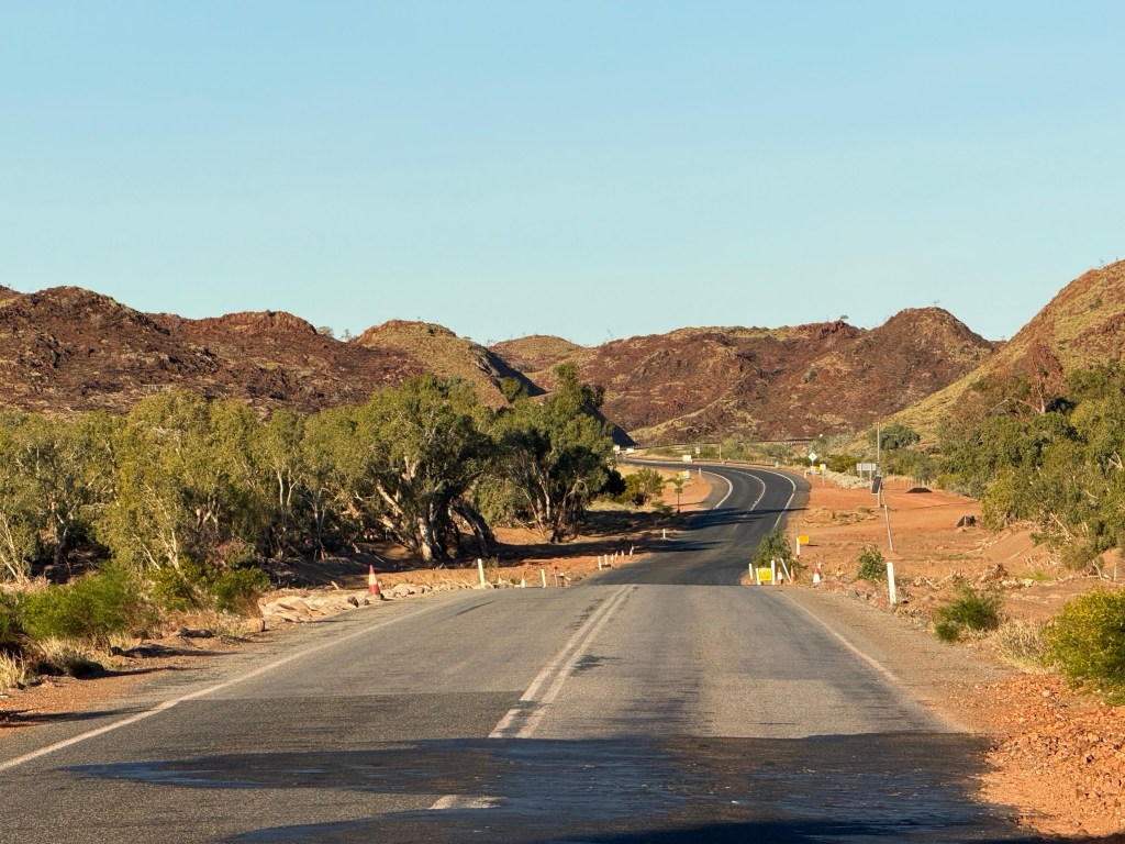
We only have a few more stops before getting back to Brisbane. It was a sunny morning as we left Warrawong on the Darling, getting back on the Barrier Hwy to Cobar for the night.
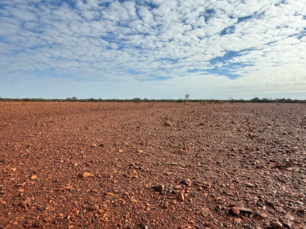
Since leaving Peterborough a few days ago we have been travelling along the Barrier Hwy. It is a quite depressing piece of roadway. Allthego thinks it should be renamed ‘The Slaughter Way’. Never have we seen so much roadkill.

Bodies litter the roadside in a never ending trail of destruction. Kangaroos of all sizes and states of dismemberment and decomposition. Crows feeding on fresh meat. There are emus and pig carcasses among the victims. Probably the odd fox or goat as well.
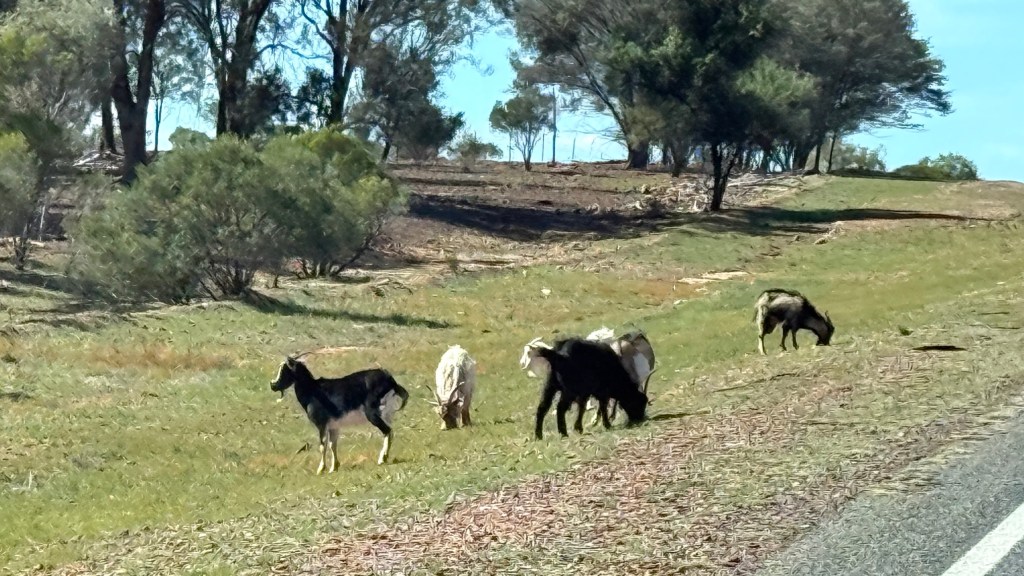
Goats are also present in amazing numbers along the roadside and in paddocks. They are now being farmed like sheep and cattle. There is a big international market for their meat. Small problem is that they are hard to keep in paddocks as they can get through traditional fences set for sheep and cattle. They are smarter than those beasts, so they duck through the fences and wander along the roadside.
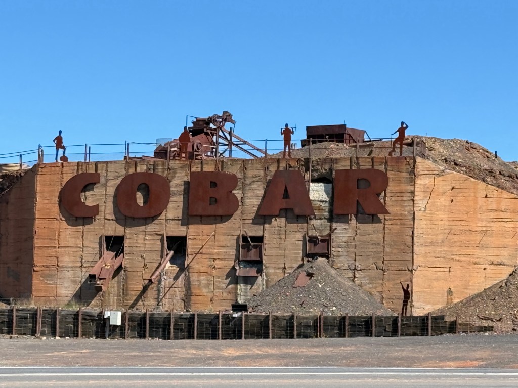
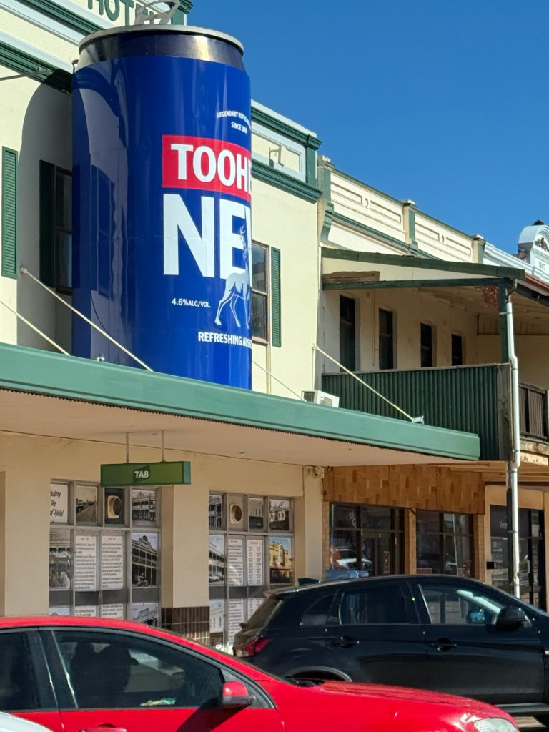
Cobar has its ‘big thing’ like most towns, this one is a 5 metre Tooheys beer can above a hotel on the main street.
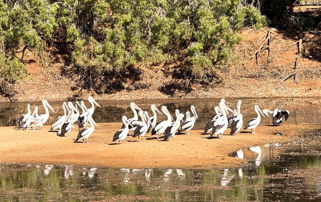
Leaving Cobar we continued along through Nyngan and Warren. Nyngan is on the Bogan River which flows north west ultimately ending up in the Darling River to the north of Burke.
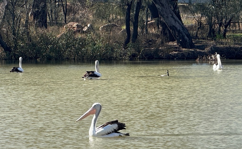

There was plenty of water in the river following some heavy rain in these parts a few days ago. Pelicans were out and about in numbers.
Moving along to Warren we enjoyed a meat pie from Uncle Clarries, even if they came from Dubbo, for lunch by the Macquarie River. Canned tuna and crackers were easy to pass up after a few days of tucking into them for lunch on the road. Sweet corn and mayo is probably our favourite tuna variety and is strongly recommended.
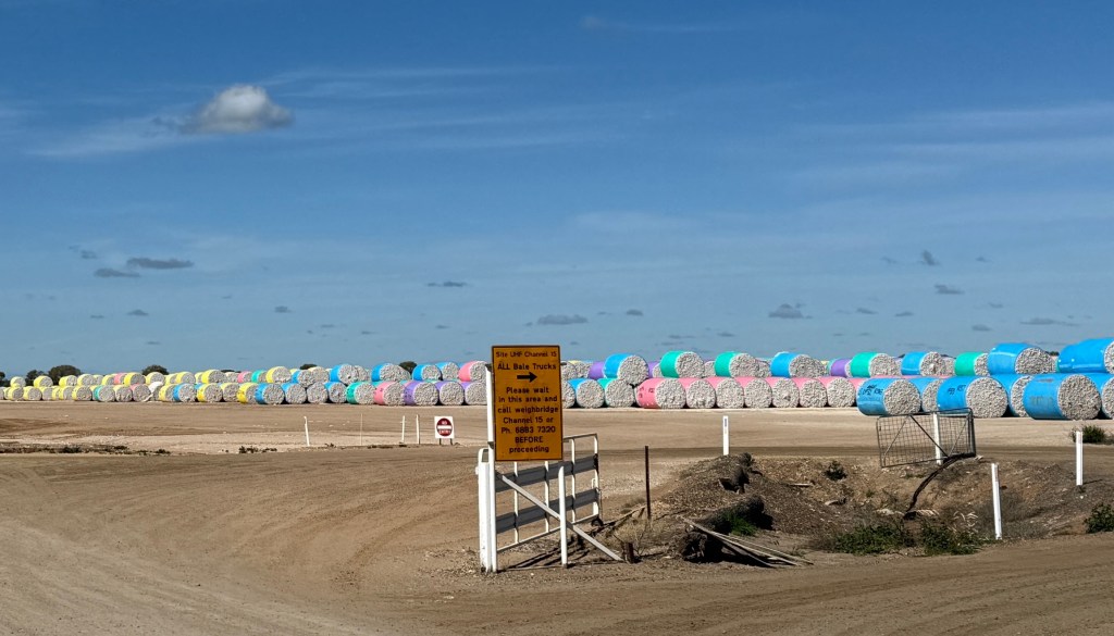
Cotton is big time in these parts and there must have been a recent harvesting of the winter crop. The paddocks are awash with bales of the stuff and the Warren Gin looks to be at full capacity.
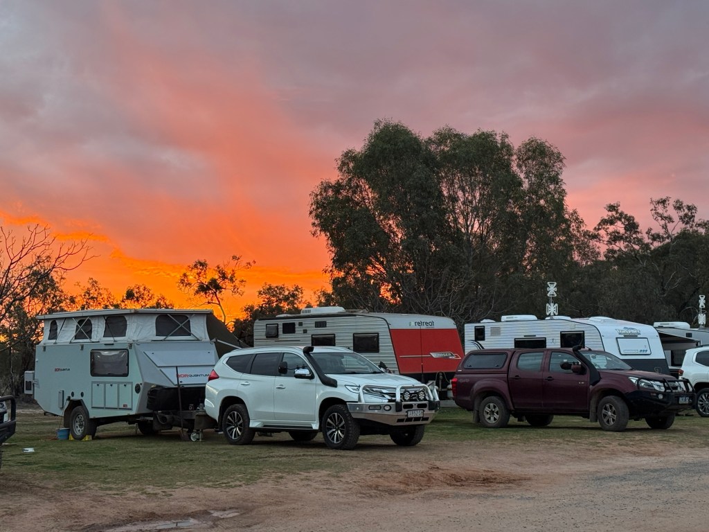
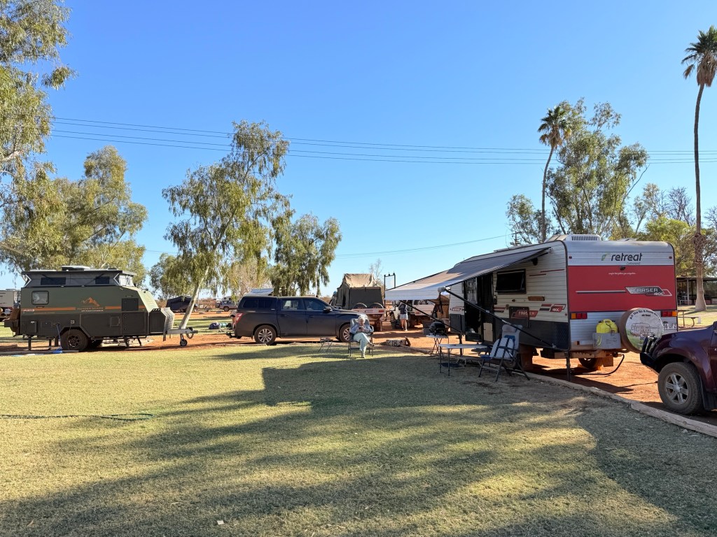
We stopped for the night at Gilgandra, having originally planned for a night at the free camp next to the Information Centre. This is an excellent spot. But it is cold and there is nothing like a bit of warmth on these late winter nights on the road. So we had a night in the caravan park with power to run the heater over night. Very toastee, particularly at 3 am in the morning.
North from Gilgandra the Newell Hwy has had some significant improvements since our last time on the journey up to Moree.
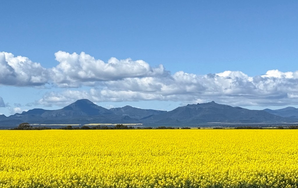
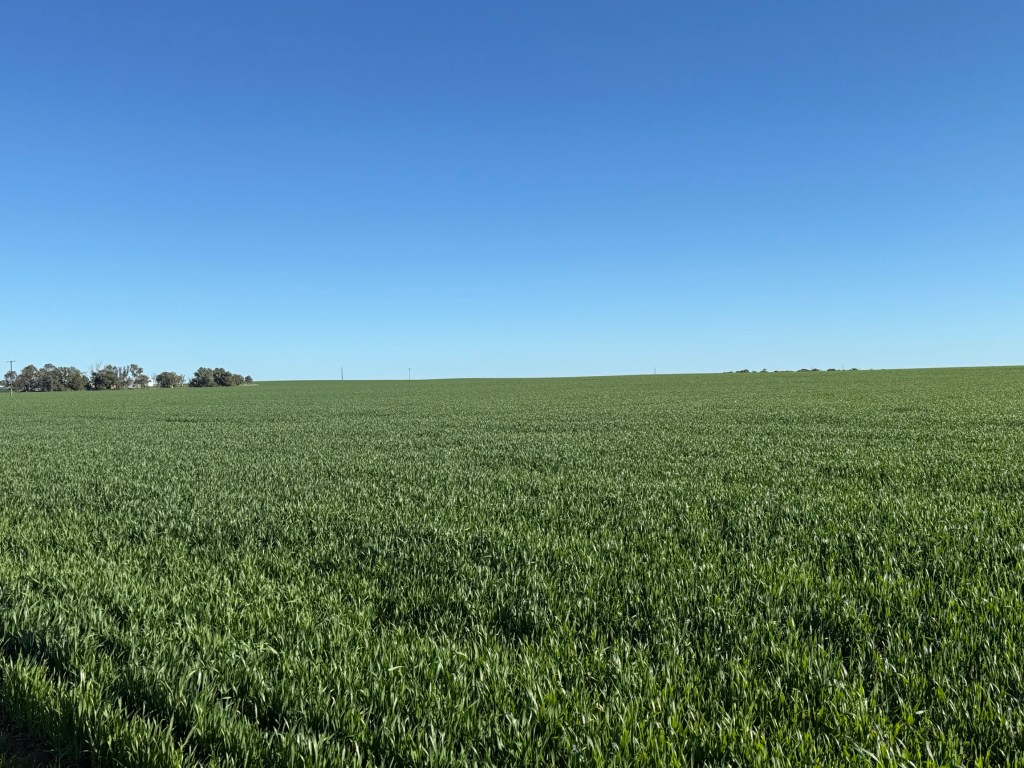
The paddocks are ablaze with the bright yellow Canola crop and the Mt Kaputar ranges in the background look great against the blue sky. The spring crop is presently a bright green contrast, yet to flower.
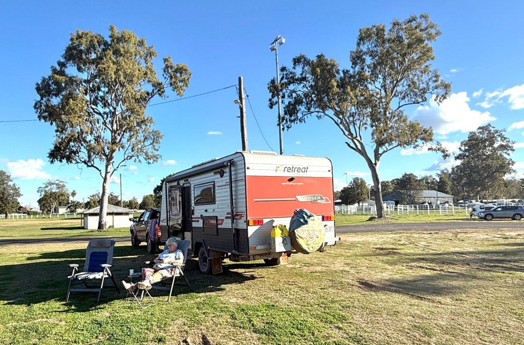
The Moree Showgrounds were too good to pass up for the night, big open sites. We have enjoyed the last couple of late afternoons being able to sit out in the sun. It is noticeably warmer as we have moved north towards Brisbane, though the heater continues to be welcome at night. We survived the night in the Showgrounds and made an early getaway for Goondiwindi and then Inglewood.

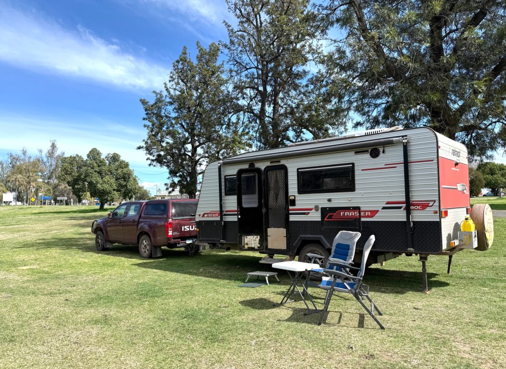
We are now sitting beside the van at Inglewood, about 220km to go tomorrow. This is a regular free camping stop for us, just a short walk to the bakery!
We will be back in Brisbane around lunchtime tomorrow.
It seems appropriate to finish off with a song from two country music icons. They are sadly no longer with us, but their music lives on in the Utube universe.
“All God’s children get weary when they roam…..don’t it make you wanna go home!”
Do we know the way?
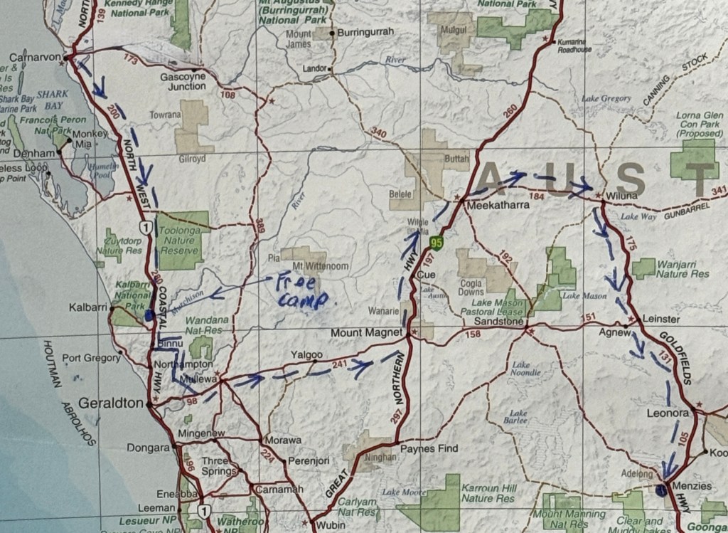
We are now on the last leg of the way home to Brisbane, not San Jose. But we need to get the maps out to find the way. At least in order to do it in 250-350km leaps.

Doing this means Allthego has had to throw out his prearranged stops from nearly four months ago. We are doing it off the cuff and stopping when fatigue sets in and a rest is required, or where it is just a nice spot to stop.
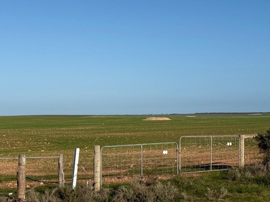
Our first stop after Penong was at Wudinna, a farming community along the Eyre Hwy at the top of the Eyre Peninsula. We stayed in the local Recreation Grounds camping sites. No grass and plenty of loose gravel but it was just an overnighter. There were a lot of young lambs in the paddocks along the way. Allthego saw the opportunity for a lamb chop, but Homealone was reluctant to acquire fresh lamb from the local butcher. We are running down the freezer. Maybe another time!
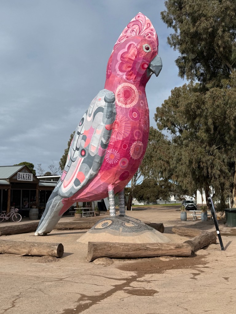
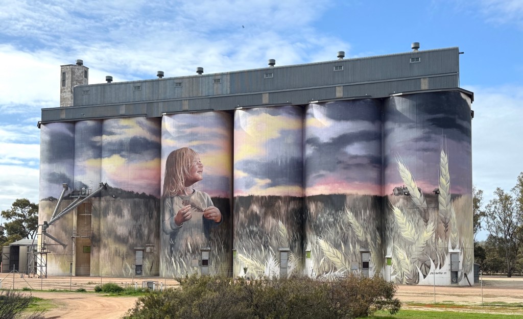
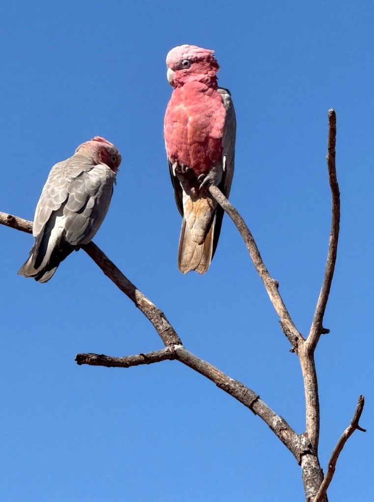
On the way to Port Augusta we passed through Kimba. This town claims to be half way across Australia and has a big galah out the front of a roadhouse. The galah has had a recent refresh and looks superb! There is nearby Silo art as well.
After passing through Port Augusta we crossed over the southern Flinders Ranges and camped for the night at Wilmington at the Stoney Creek Bush Camp.
Great spot with big sites overlooking nearby farming land. They had some local olive oil and honey available too for the van’s cellar.
From Wilmington we made our way east through Orroroo to Peterborough.
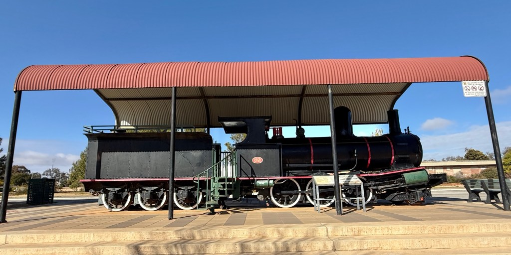
Peterborough was a big rail town in the days of steam and varying gauge widths. It was where many trains terminated because of gauge differences. There is a big rail museum there full of history and story telling from those days.
From Peterborough the Barrier Hwy took us towards the NSW/SA border at Cockburn. Along this section of highway the road tracks very close to the trans continental railway line, the Indian Pacific passes along it between Sydney and Perth. Unfortunately, we were a couple of hours out and missed it en route.
Cockburn has been a location setting for a number of movies (or parts of movies) over the years. ‘Wake in Fright’ (1971) perhaps the best known. There is a bit of memorabilia from the various film sets in the bar area.
Cockburn is a town of six, two run the hotel and another two the Border Diner (this used to be a hotel). What the other two do we wouldn’t have a clue! But we stayed the night in the modest caravan park with three other vans. The publican runs the park, power but no water. Us nomads eight all up outnumbered the residents! Four of us had dinner in the hotel and were the only customers. Choice of fish n chips, chicken schnitzel and steak schnitzel. Chips and salad, tartare sauce for all three. Not too bad indeed.
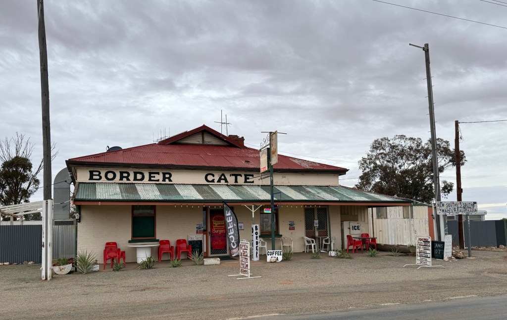
In the morning we tried the Border Diner for a bacon and egg brekkie, also ok. Thoroughly recommend this stop for something different.
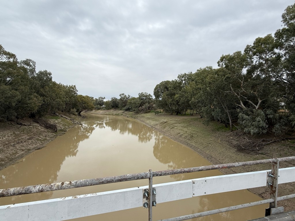
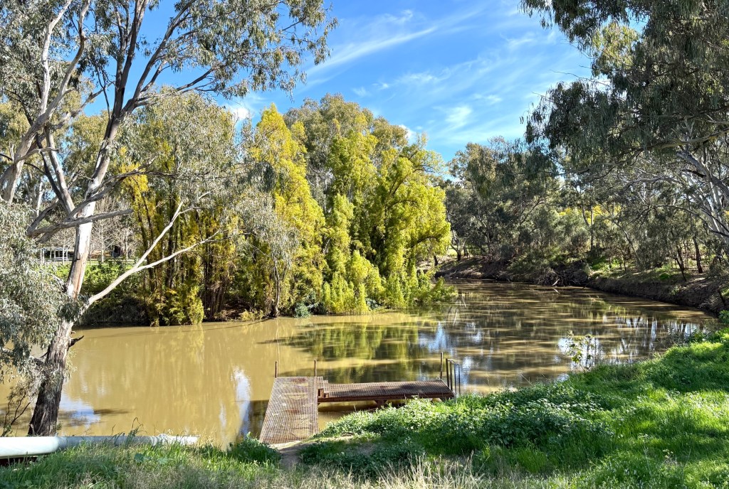
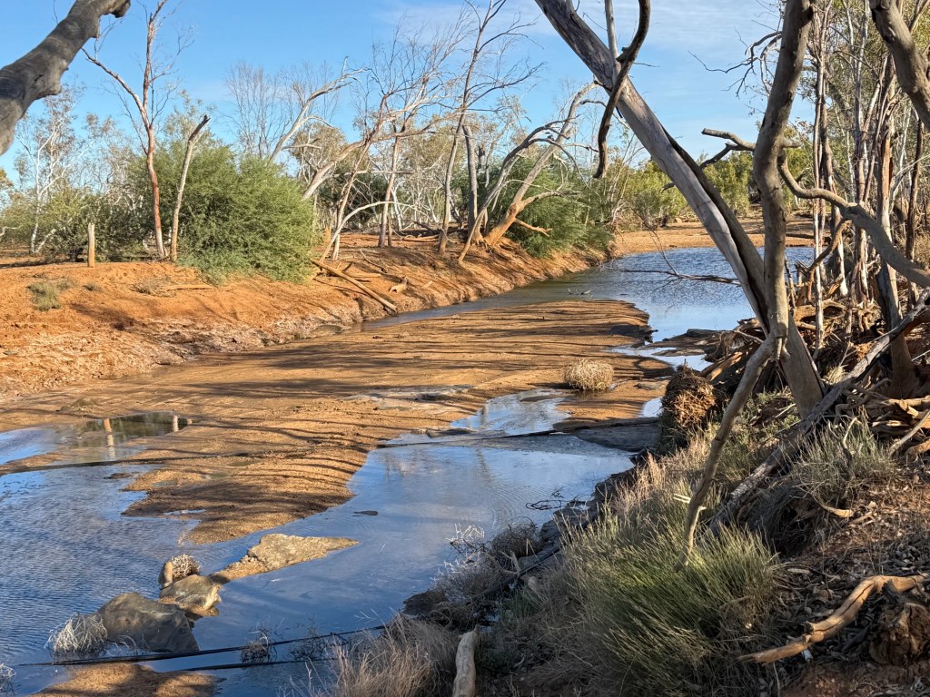
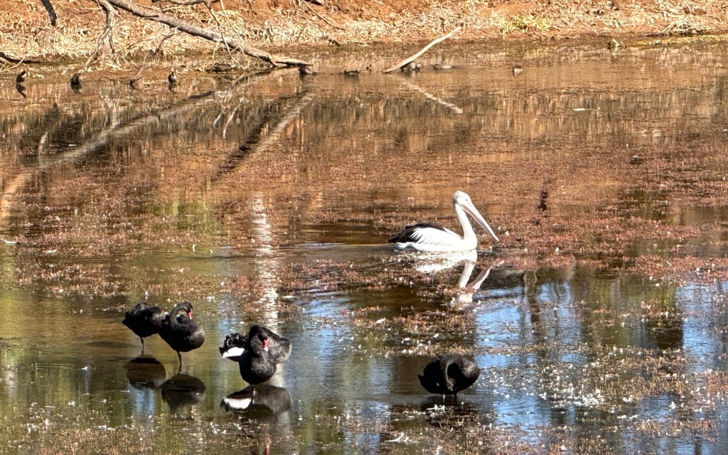
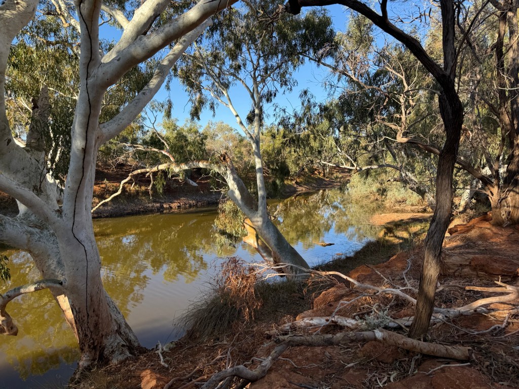
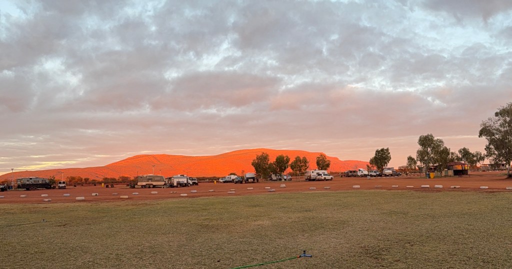
Moving along through Broken Hill we are now at ‘Warrawong on the Darling’. A van park beside a Darling River billabong, just outside Wilcannia.
The long and straight road.
We got to Norseman in good time from Menzies via Kalgoorlie, where we stocked up on a few groceries to get us home across the Nullarbor.
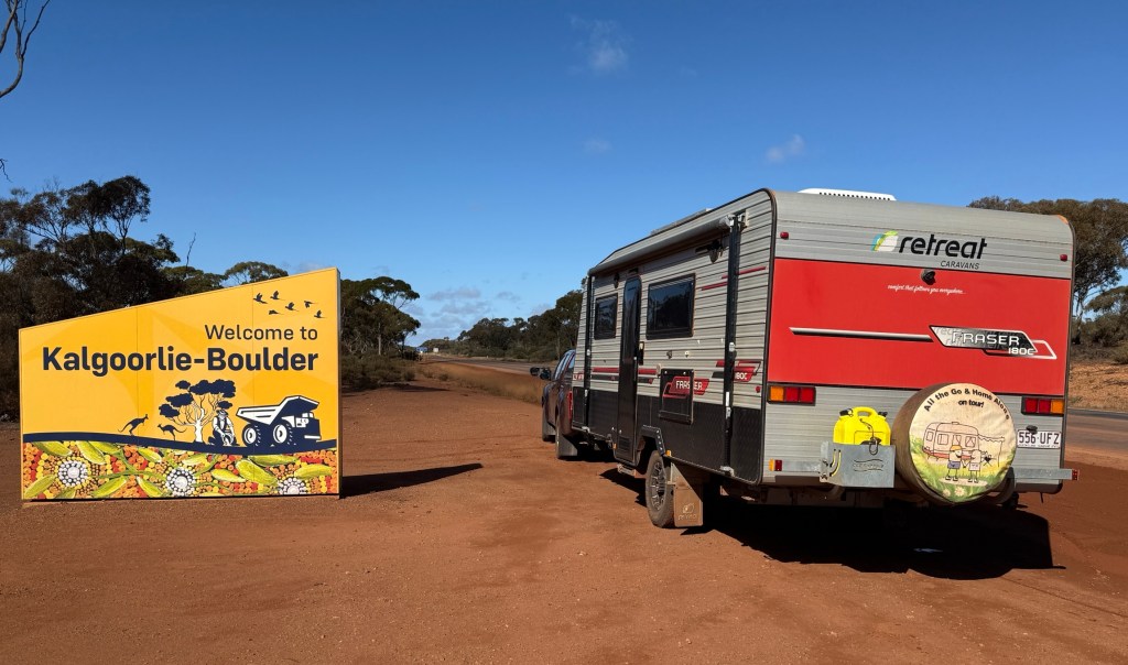
You can park in some funny spots sometimes by total accident, this time it was right outside Kalgoorlie’s house of ill repute in Hay Street.
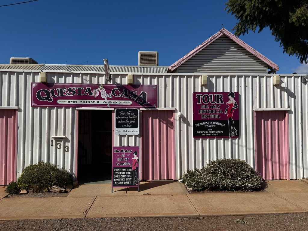
It has been there a long time, since the late 1800s and you can do a tour of the establishment to see what it is all about. We thought better of it and headed for Woolies instead.
Norseman is an interesting old town at the cross roads of WA’s connection point with eastern Australia. Roads come from the west and meet here to funnel onto the Eyre Hwy for the journey east across the Nullarbor.
We left Norseman early, wiping ice off the windscreen, and made about 320 km to another free camp at a spot named ‘Baxter’. Before reaching Baxter Allthego revisited a tee on the longest golf course in Australia.
The course stretches across the Nullarbor from Kalgoorlie to Ceduna. Eighteen holes of challenging tees, fairways and greens. They are located at various courses and roadhouses. This one is just out from Norseman and called ‘Golden Eagle’ after a 35kg gold nugget that was found nearby in 1931.
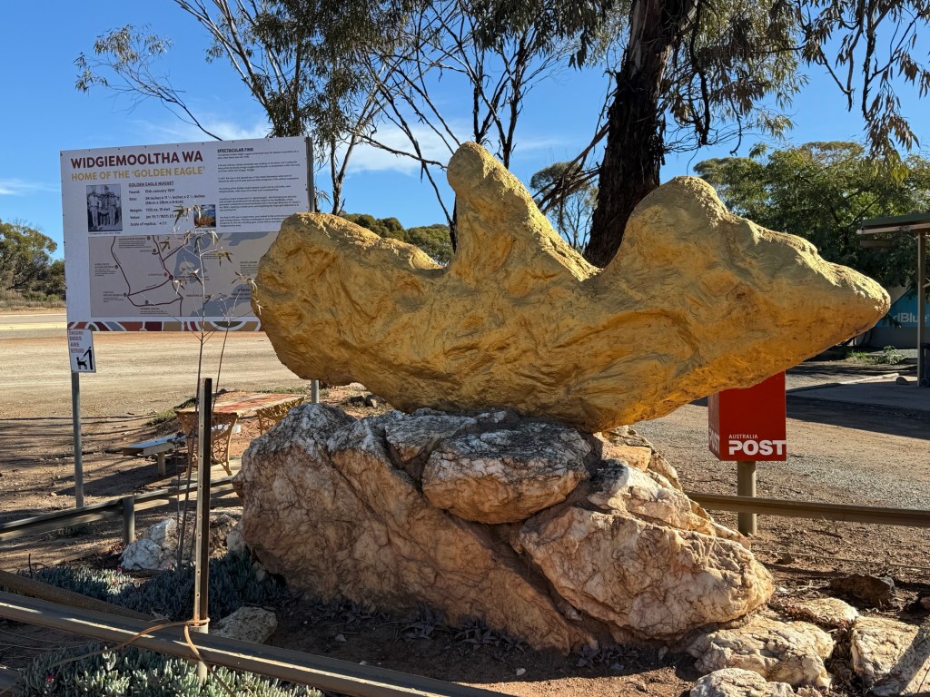
At current prices it would have been worth in excess of $6m. Allthego recommends the course to all travellers, his score a few years back, circa 150 plus.
Earlier we had lunch at the Balladonia roadhouse after getting some fuel. The roadhouse’s claim to fame is that parts of the US Space Station ‘Sky Lab’ came down here when it broke up over south west Australia in the 1970s.
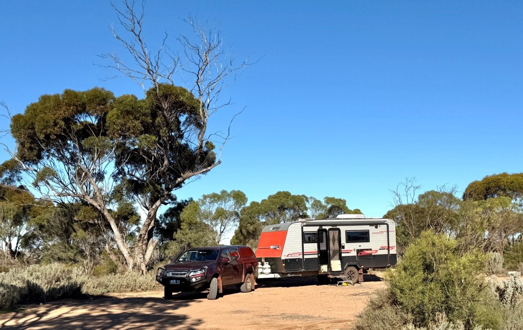
There are about ten other vans keeping us company for the night well back from the Eyre Hwy. Watched the Broncos put the cleaners through Souths!
Moving on our next night was at the Mundrabilla RH. A pleasant spot. The wind started to get up on the way there. Fortunately, from the north west at around 40km an hour up and down. So it was tempting to turn off the engine and put a sail up. It pushed us along quite nicely, a little bit of side wise buffeting but all ok!
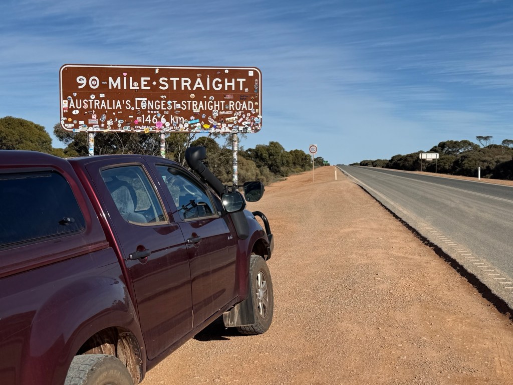
There is a road house at Caiguna, before Mundrabilla, where the longest stretch of straight road in Australia ends. It is 146kms long without any twist or turn, dead straight.
You sort of just point the vehicle straight ahead, it is tempting to put a knee on the wheel and do a blog entry to fill in time! But of course you wouldn’t do that.
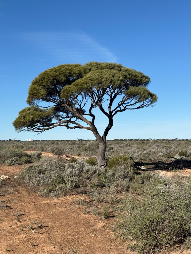
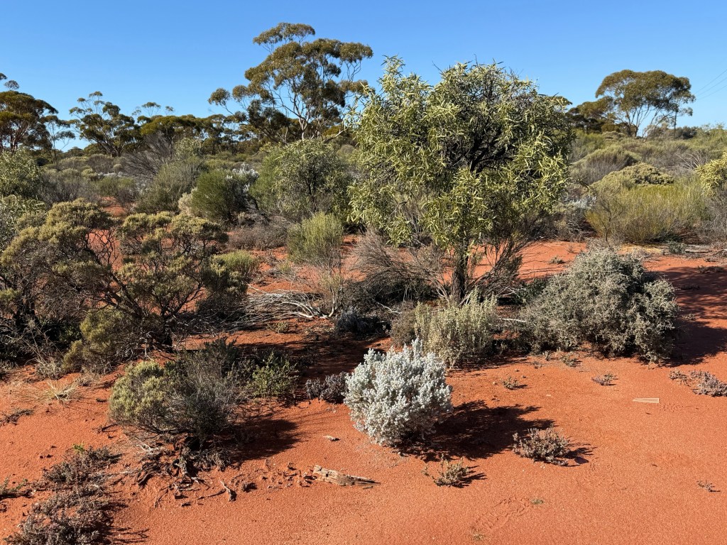
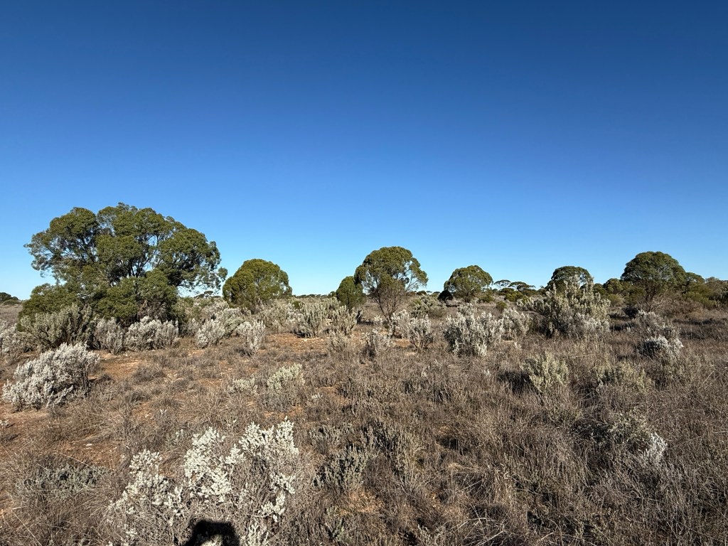
Trees are starting to really thin out too! Endless stumpy bush and grasses stretch out to the horizon.
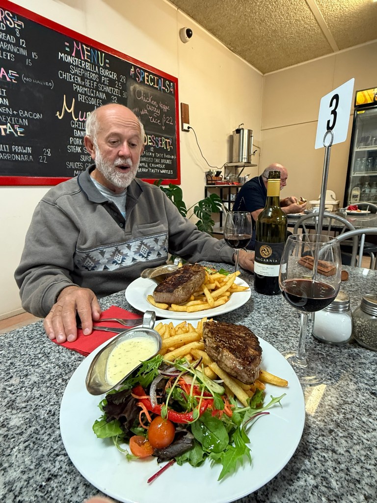
Mundrabilla saw another milestone reached with Allthego notching up 73 years on the road. We celebrated at the RH with a nice scotch filet and a Denmark WA red. All looking foreword to squeezing a few more road trips out of the truck and van.
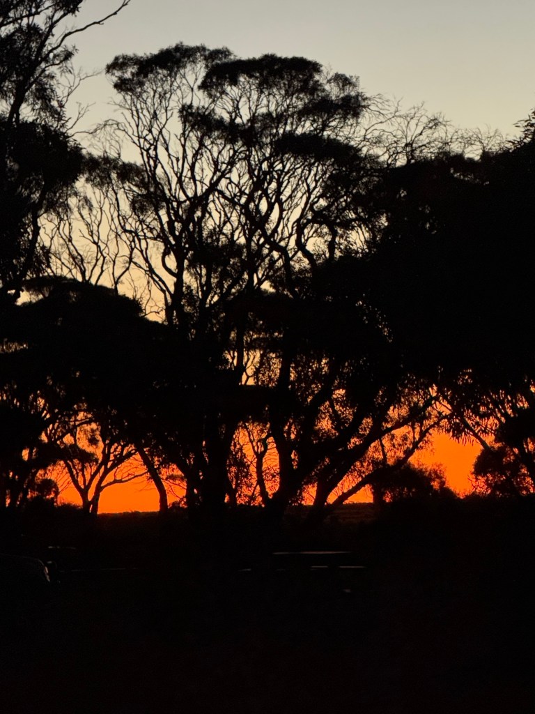
Got away in the morning to a very red morning sky, a shepherd’s warning. But it came to nothing until later that night!
Leaving Mundrabilla the road rises through the Eucla Pass, from the plains that run along the coastline, back to the top of the Nullarbor plateau.
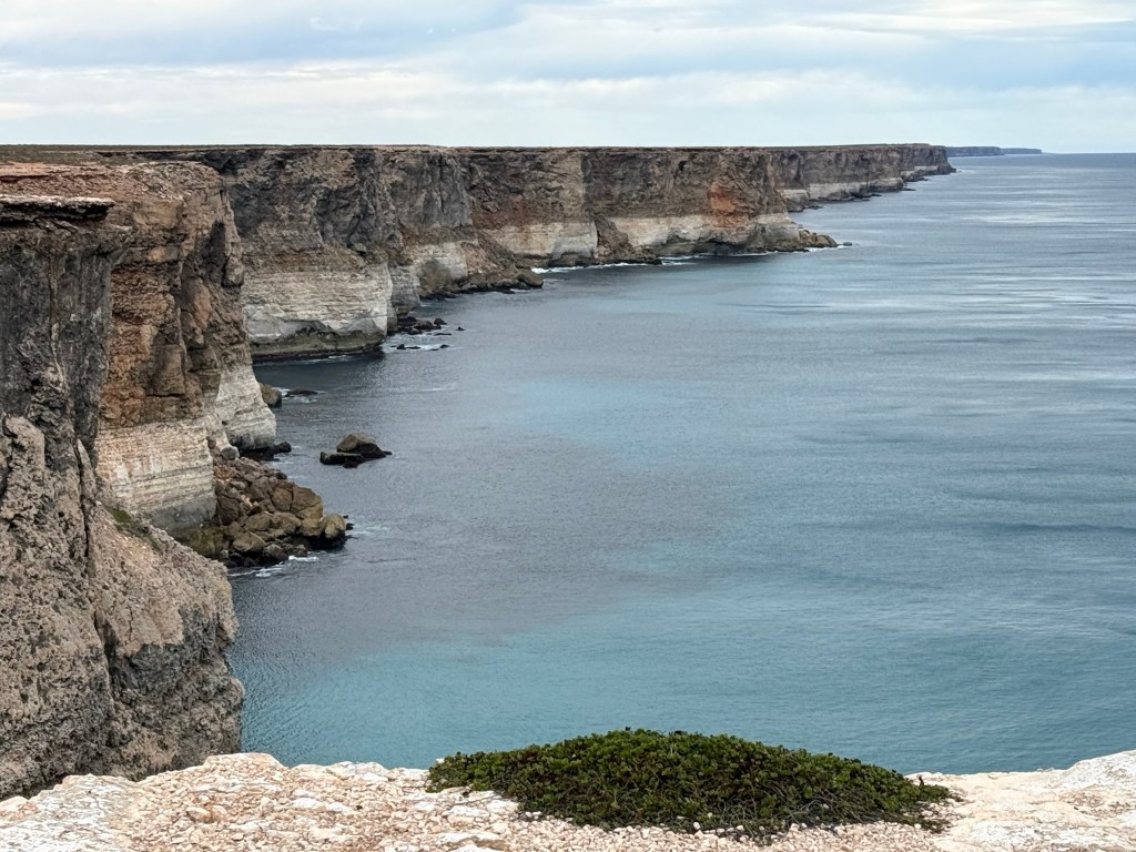
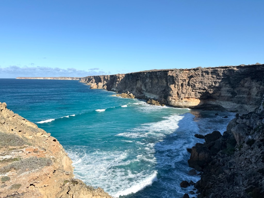
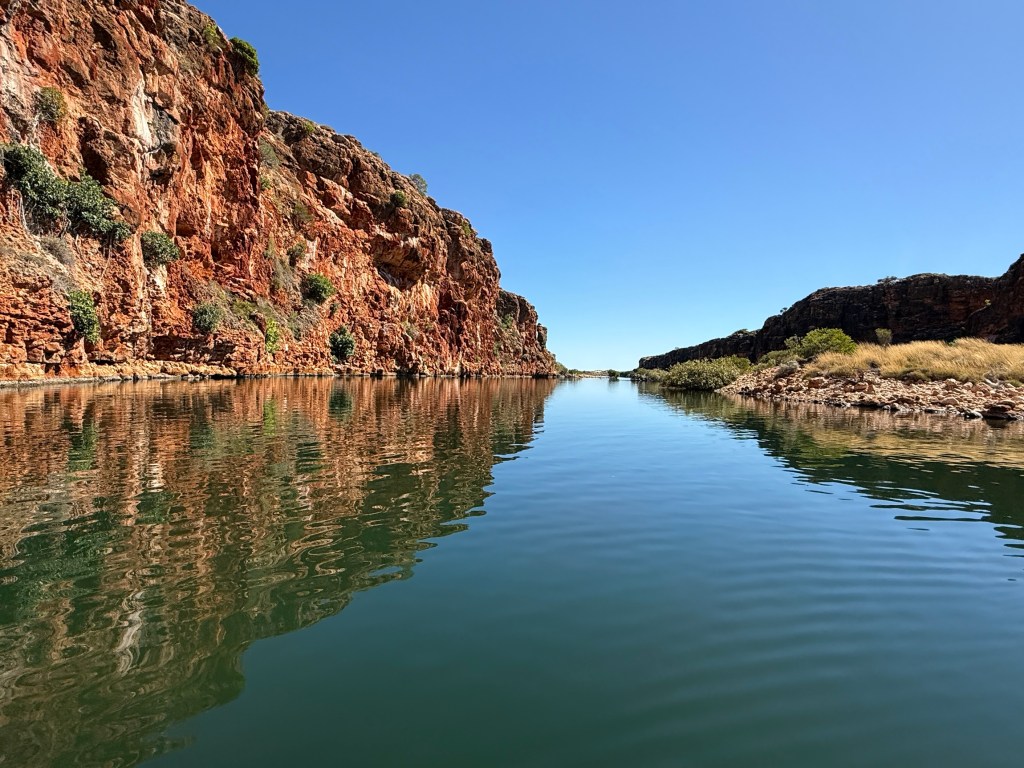
From here to our next stopover at the Nullarbor RH the road tracks close to the spectacular Bunda Cliffs.
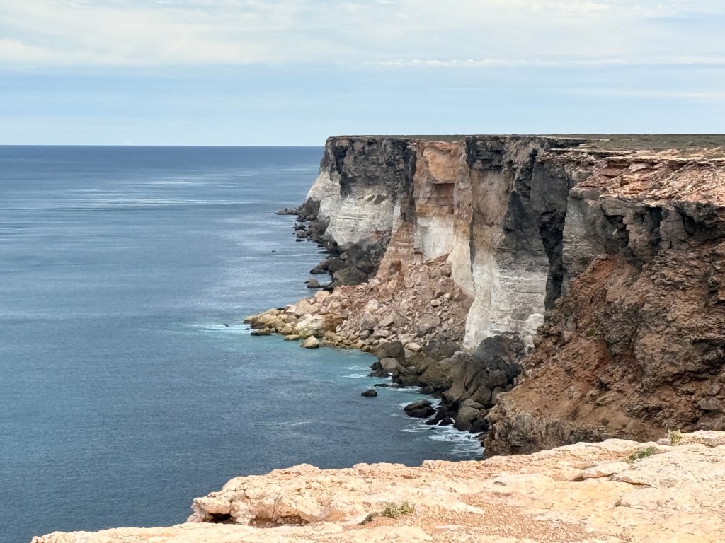
We have been across the Nullarbor on an earlier trip but these cliffs seem to be magnetic, you just have to have another look! And I think they look different depending on the weather, the time of day and even the viewers mood!
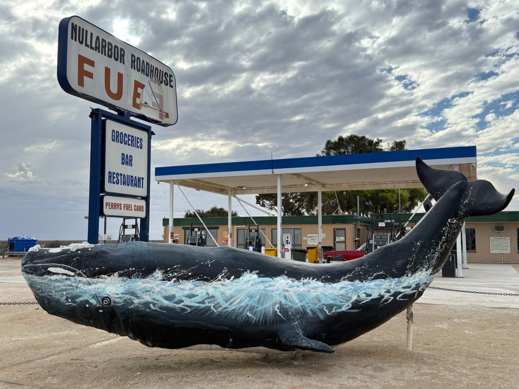
The Nullarbor RH is located near what is known as the ‘Head of the Bight’. The road house has been here for a long time and was one of the first on the Nullarbor. It also has the most expensive diesel we have come across on the entire journey, $2.98 a litre. Glad we are going with the wind!
The overnight stop here was so that we could check out the whales at the ‘Head of the Bight’ Whale Centre. This we did the next morning after weathering a pretty fierce overnight rain storm. It came down heavily in a few bursts, particularly early in the morning (like 4am).
We woke up to a partly flooded van parking area, our feet were not in the water unlike a few other nomads. Those shepherds were right about the red skies yesterday morning.
Fortunately, we were relatively dry and quickly made our way the 25 km or so down to the Whale Centre at the Head of the Bight. It was extremely windy and chilly but we had some great views of the whales from the lookouts. A number of ‘mother’ and ‘baby’ whales performing in the waters below.
Here are a couple of videos of ‘whale times’ at the Head of the Bight’.
We are now at Penong not far from Ceduna and settling in for the night, pitter patter of light rain on the roof. Heading across to near Port Augusta tomorrow.
The long and winding road.
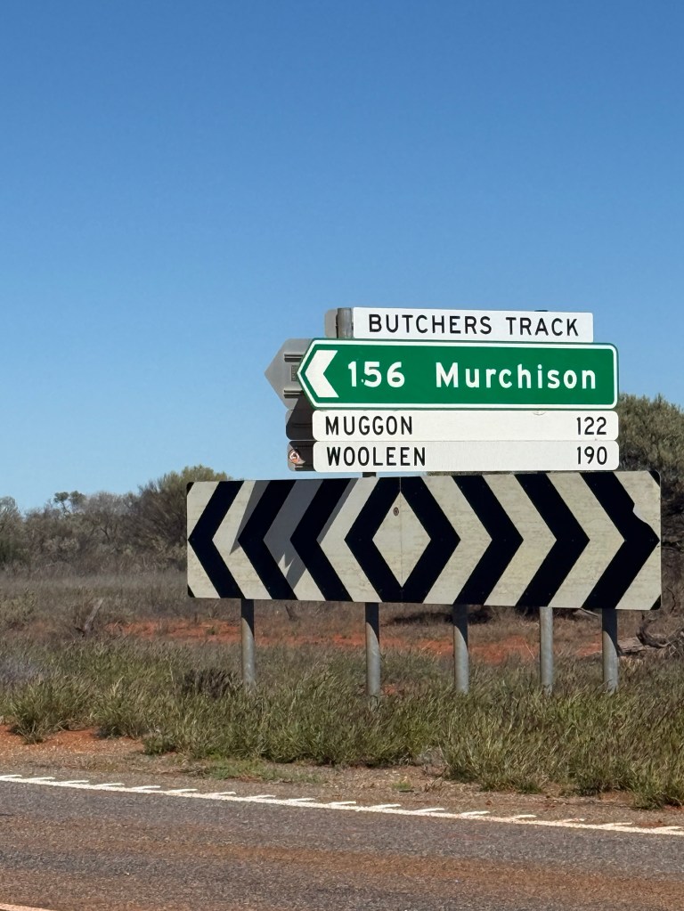
We left Carnarvon and moved further south towards Geraldton.
On the way we passed the turnoff along Butchers Track to Murchison. It brought back memories of our last WA trip when we travelled along this 156km of sandy outback road up, over and down sandhills on a well compacted gravel road. Looks a lot slipperier now after recent rain.
A little further along we set up at a well organised free camp beside the Murchison River in a bit of a hollow. Mistake!
A very cold night, below zero. We woke to an ice covered windscreen and some early morning mist over the river. The mist quickly cleared out as did we! But a good stopping place, might have been warmer away from the river bank, about half way to Mullewa and Yalgoo in the wildflower belt.
We took a back road to get to these places through the expansive winter wheat and Canola fields. They stretch as far as the eye can see. Look to be good crops coming in the Spring harvest.
This part of our route through Mullewa, Yalgoo and Mt Magnet is a road we have previously travelled during wild flower season, we are a little early for it this time round. There maybe some early bloomers to appreciate.
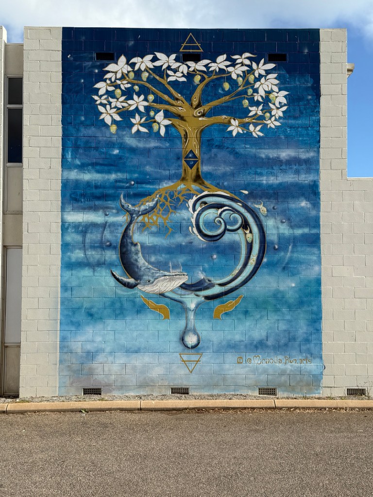
Not a lot seems to have changed in Mullewa since we were here nine years ago. There is a new ‘Reconciliation’ mural coming into the town. It reflects the ancient indigenous past through the period of European settlement to today’s efforts at reconciliation. Completed by members of the local indigenous group.
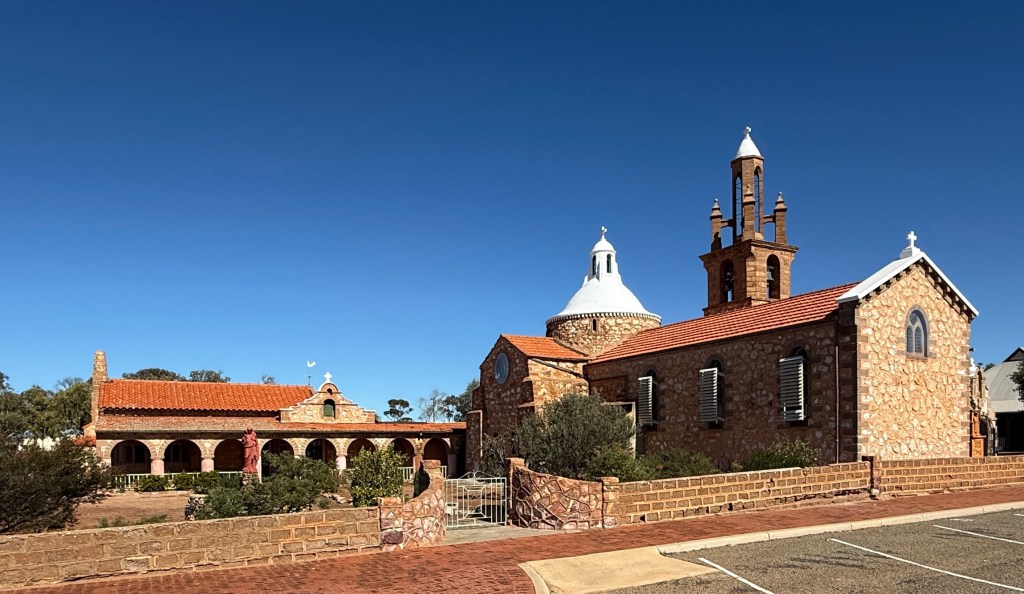
The impressive RC church designed by Monsignor John Hawes still has pride of place in the town. He was responsible for the design and construction between 1915 and 1939 of many of the RC churches in these mid west rural parts of WA.


Further along we stopped for the night at Yalgoo, an old gold mining town. The towns CP is relatively new or has had a big refurbishment. Very comfortable place for the night.
The next day we continued east to Mt Magnet before turning north along the Great Northern Hwy for Cue and later Meekatharra.
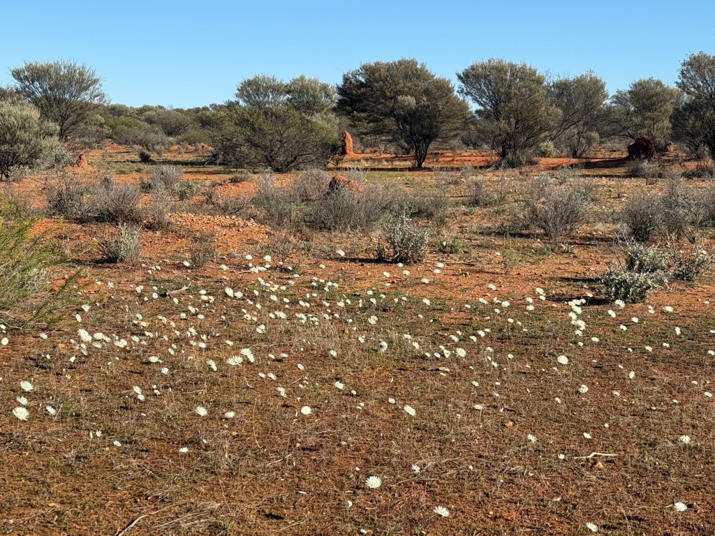
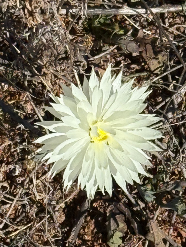
Before Mt Magnet we had our first wildflower sighting, some small patches of these ‘white balls’ beside the road. We haven’t seen any more since!
Mt Magnet also has one of those Reconciliation Murals, same sort of idea as in Mullewa, but beside the police station! Maybe too much detail in it for a blog pic. Looks good though!
The town of Cue is remembered as the ‘Queen of the Murchison‘ and in its hey day in the 19th century was a populous place with some magnificent sandstone buildings.
Still impressive today are the old government buildings which house the police station and some council activities.
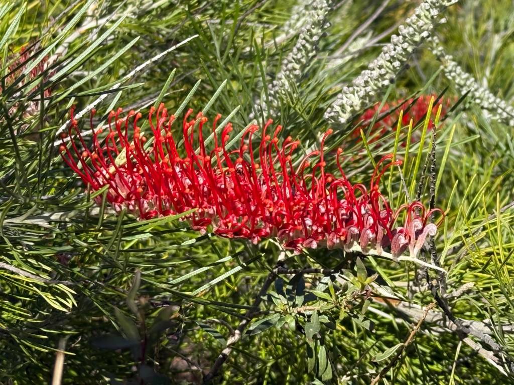
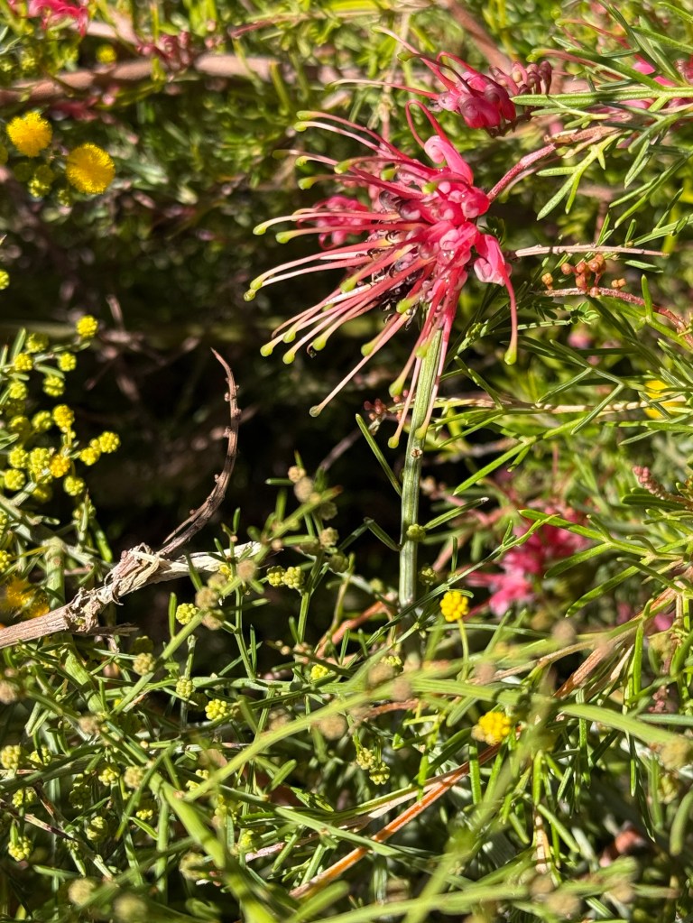
Some more flowers were found in the Cue park, this time some grevillea species and a yellow flower a bit like wattle (maybe it is!).
We have previously not been north of Cue so Meekatharra was to be a new experience. It is at the top of the north eastern gold fields. We spent one night here and were a little disappointed in the town. It was busy with present day enterprise being a business centre for the surrounding new mining activities.
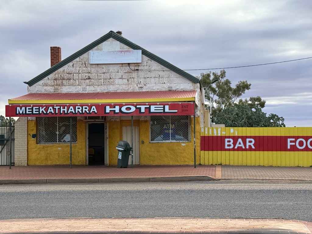
The town’s past seems to have passed! Peace Gorge (big free camping area) about 3km out of town and the lookout the main sights to take in.
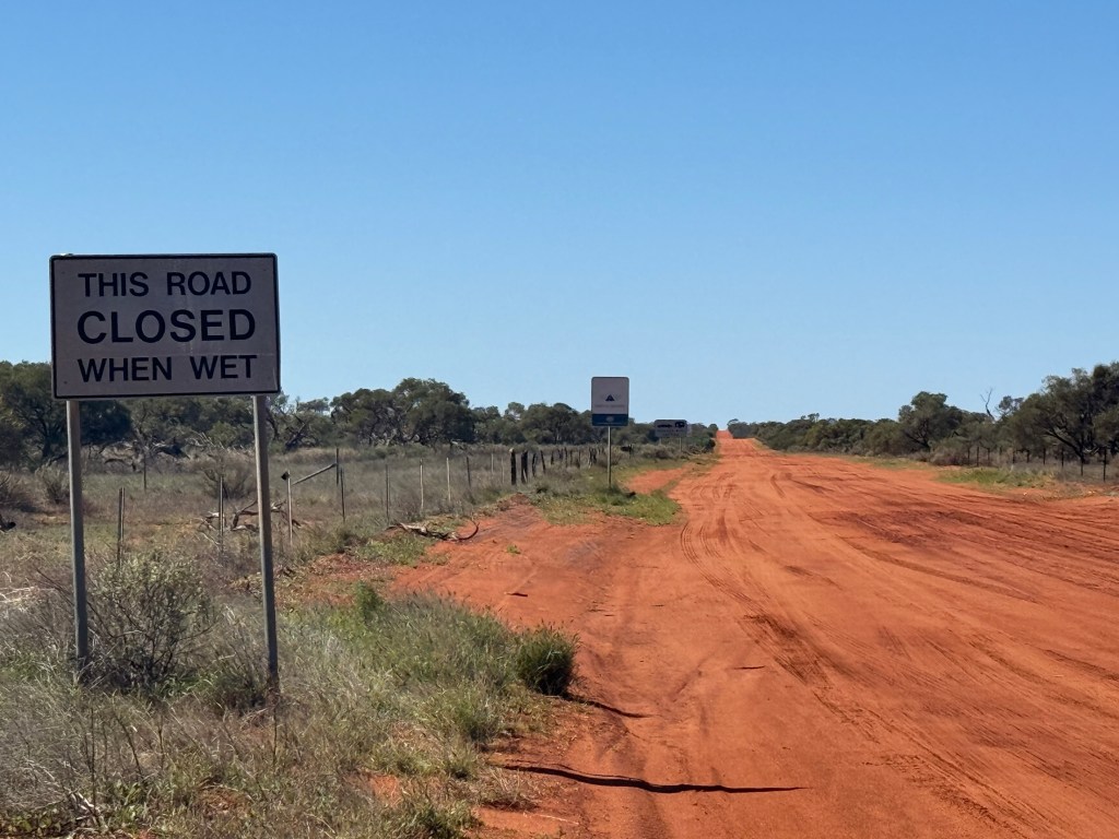
From Meekatharra we went east to Wiluna on the Goldfields Hwy. The road was about 170 kms of good gravel interspersed with sealed sections (about 35%). The sealed bits were on sections that would suffer from flood conditions in the surrounding creeks.
Wiluna is on the edge of ‘no where’ but once had over 10,000 people on the goldfields. Located on the edges of the Gibson and Great Victoria deserts. We stayed a night here in the Councils brand new CP. Excellent and probably the best yet facilities wise. The town has two small convenience stores, no hotel, a cafe that is occasionally open, a school, police of course, some indigenous art enterprises and the Information Centre. A bit to see!
Why come here? You could well ask. Allthego had three reasons for coming. The first two are to do with roads or tracks, to be more correct. Wiluna is the starting point or ending point depending on which way you are going of the Canning Stock Route and the Gunbarrel Hwy.
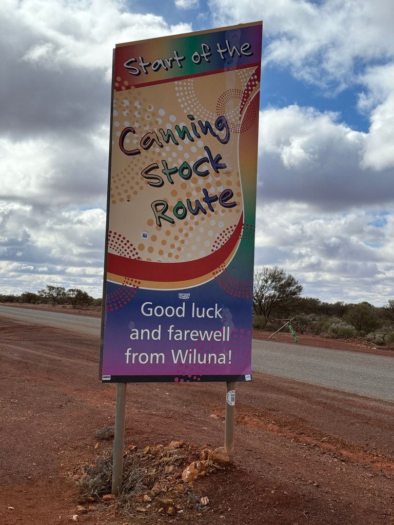
The stock route was developed in the 1906-11 period to move cattle from the Kimberleys, near Halls Creek, to southern markets. The last cattle drive was in 1959.
The Gunbarrel Hwy on the other hand was built as part of a road building project in Central Australia in the mid 1950s early 60s. It runs from Wiluna to Alice Springs. Len Beadell was the main contractor for the road projects and he endeavoured to build this track as ‘straight as a gun barrel’.
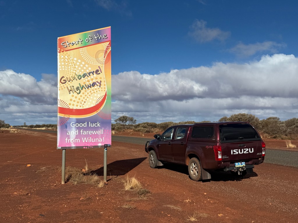
Today, both tracks are for the super 4WD enthusiast with numerous challenges. Allthego and Homealone are unlikely to take them on! But it is good to see them, at least their new sealed starting points!
On the outskirts of Wiluna there are memorial statues of two quite famous desert aboriginals. Warri and Yatungka. The story of their solitary life together in the Gibson Desert, living in tribal exile from the mid 1930s to 1977, made world wide headlines. They came in out of the desert to live in Wiluna following much searching by their tribal folk.
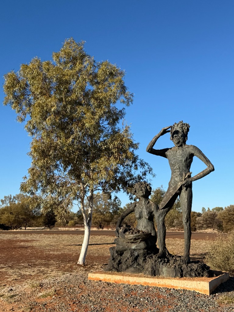
Sadly, the old couple both died just two years later within a few weeks of each other. They are believed to have been the last of the desert nomads leading a traditional lifestyle that had stretched back 40,000 years.
The statues are a fitting monument to them and their life. Something I don’t think I will forget!
We have now moved on from Wiluna down the Goldfields Hwy and are set up in the caravan park at Menzies about 130km north of Kalgoorlie.

We have been in this old gold mining town before, looks about the same except the last pub has closed due to building problems…..it is over 100 years old. Nevertheless, the publican operates for a few hours in the evening from a beer garden set up with food from a food truck parked in the garden. That is enterprise for you. The magnificent old stone Town Hall and clock still stands on the main street as a reminder of a more golden past.
We set off south in the morning for our next stopover at Norseman before hitting the Nullarbor. The blog is now in real time.
Carnarvon
Carnarvon is the most southern point along the coast that we have reached on this trip. It is located just to the north of Shark Bay where we made it to from the south in 2016, nine years ago! Seems like yesterday.
Carnarvon is also the geographical point along the coast where agriculture starts to replace cattle grazing as the main economic activity. To the north of the town along the dry Gascoyne River is quite a maze of plantations. Bananas, mangos, avocados and all sorts of vegetables are grown. There is a food trail which we drove around with a number of road side stalls and farm shops selling ‘overpriced cut priced’ produce. Got to make a buck. But the foodstuff is fresh and the preserves have interesting flavours and combinations. All tempting.
At the other end of town is the mouth of the Gascoyne River and the Indian Ocean, the dry bit stops and water flows to the sea. Must be very sea water influenced at this dry time of year.
It was a little breezy and chilly and there were not many people around. There are monuments to HMAS Sydney II and HSK Kormoran along the foreshore, the Australian and German ships that fought a sea battle off the coast here in WWII. All of the Sydney’s crew perished and many of the German ship’s crew managed to get ashore and ended up being detained in prisoner of war camps.
The remains of the two ships were found in 2008 in deep water off Dirk Hartog Island at Shark Bay. There is also a big monument in Geraldton commemorating the battle.
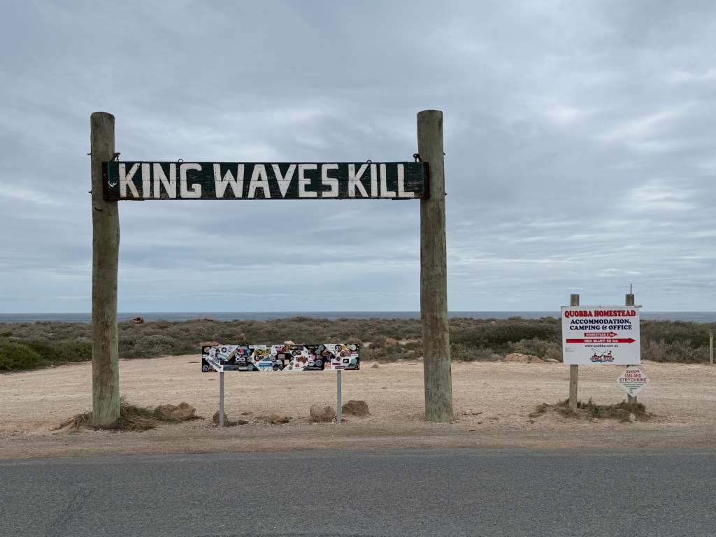
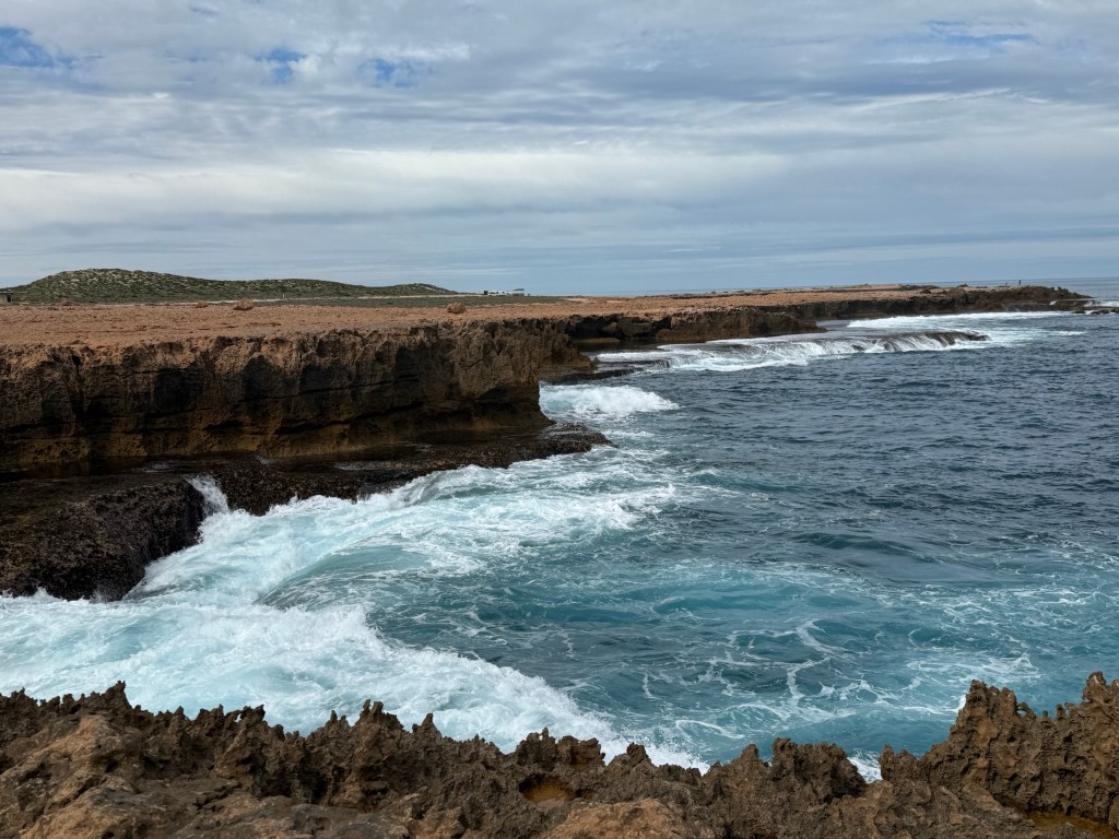
About 50km north of Carnarvon is Quobba Point. Famous for its rugged coastline and blowholes. We made a morning visit to catch the wave action.
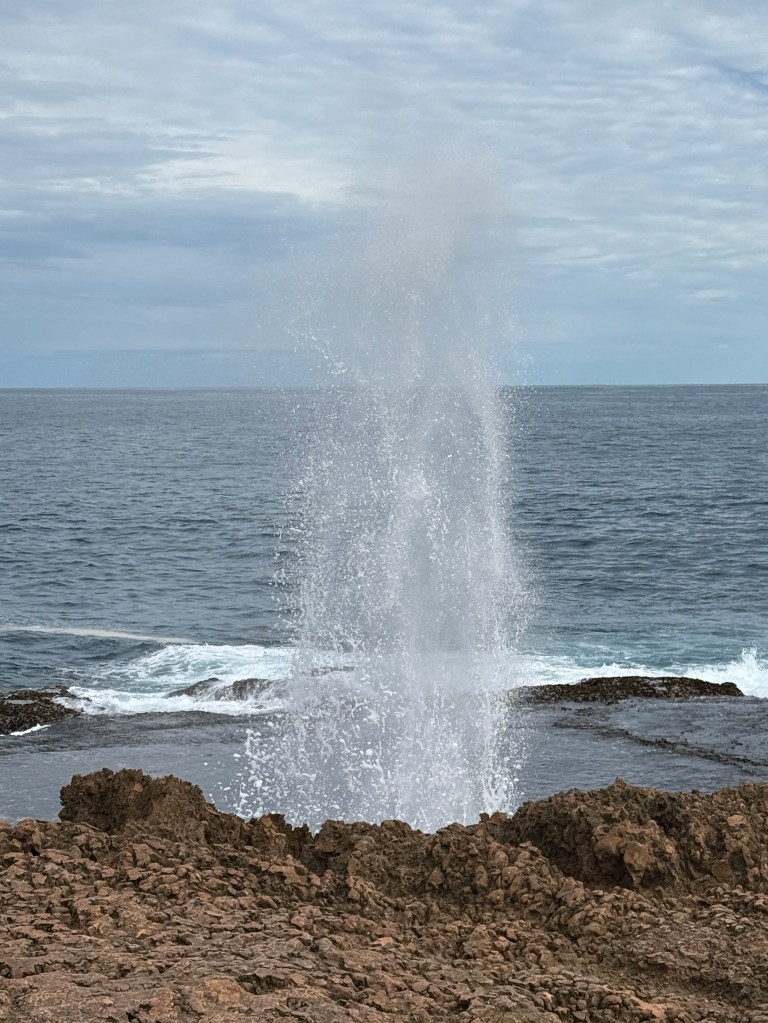
We were also rewarded with a number of whales passing close in putting on a spectacle for the onlookers, sound effects included.

Carnarvon used to have a tourist tram that re enacted the route of a freight train that ran from the town, across an island and then a kilometre out to sea on a jetty to load ships (in the 1800s/1900s). Due to cyclone damage and age it has been closed for safety reasons. Proposals are afoot to restore the jetty and the tram. Tourism people are very keen, it also links the historical part of Carnarvon at the jetty to the town. There used to be a large whaling station there and a lighthouse.
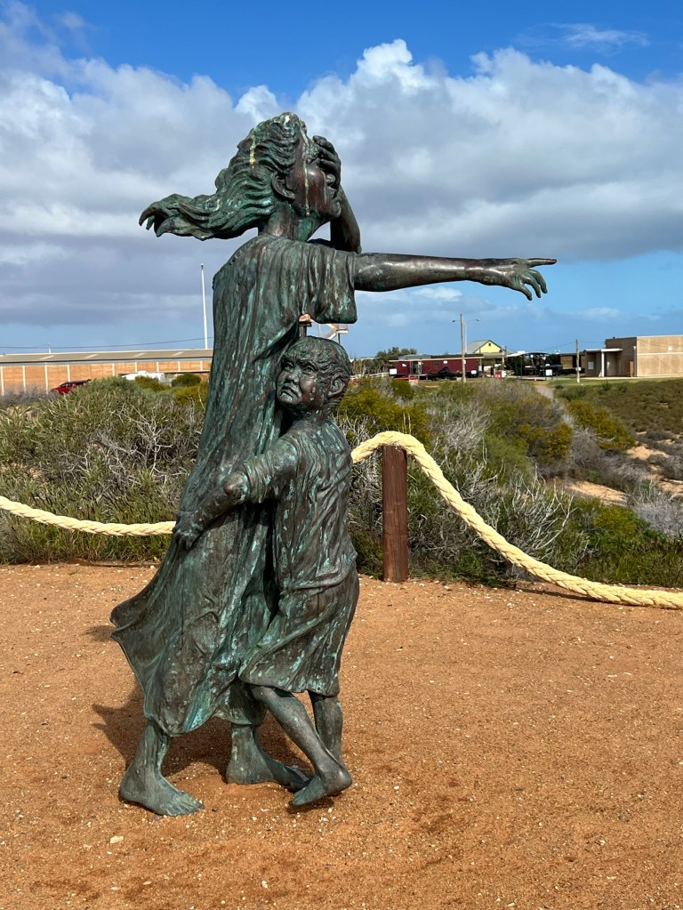
The area was also the spot where for about 12 years up to 1918 indigenous people from all around WA, suffering from diseases like leprosy, were transported to remote islands off Shark Bay. Many had never seen the sea before and died en route or on the islands.There is a bronze statue reflecting the separation from family and the pain of those being transported.
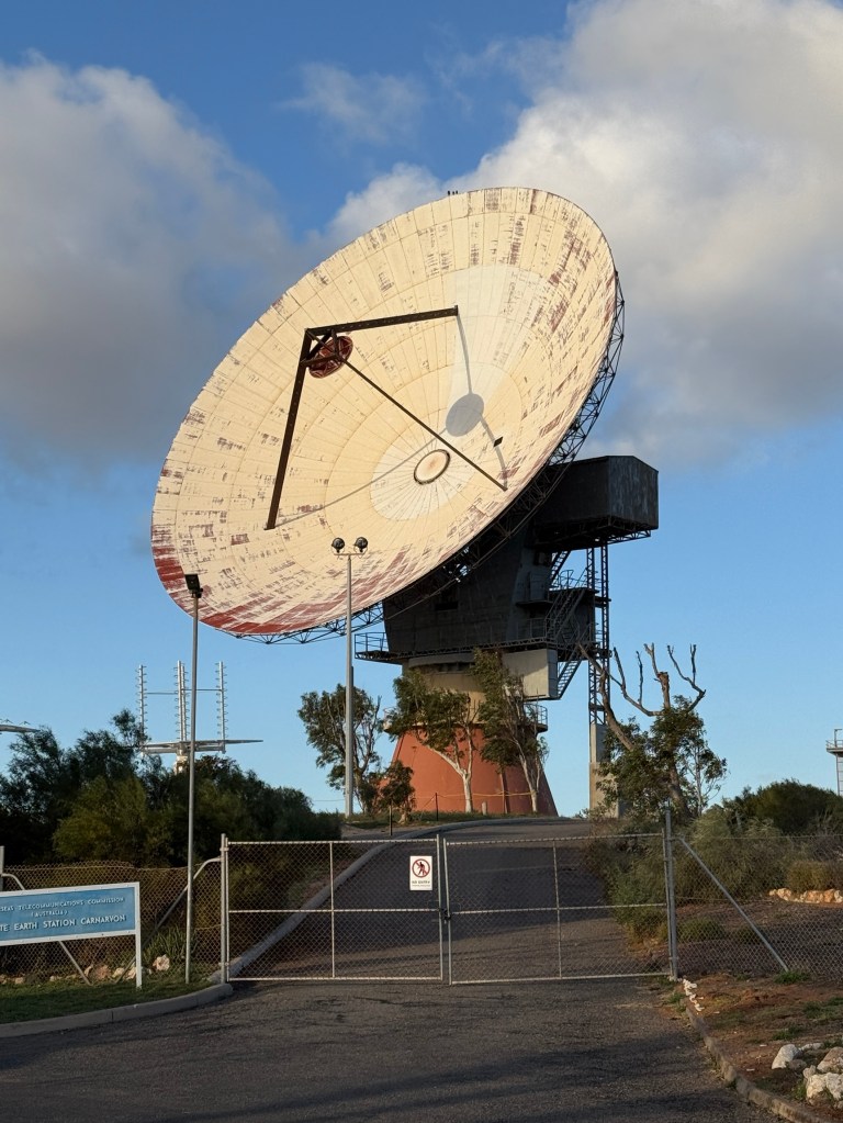
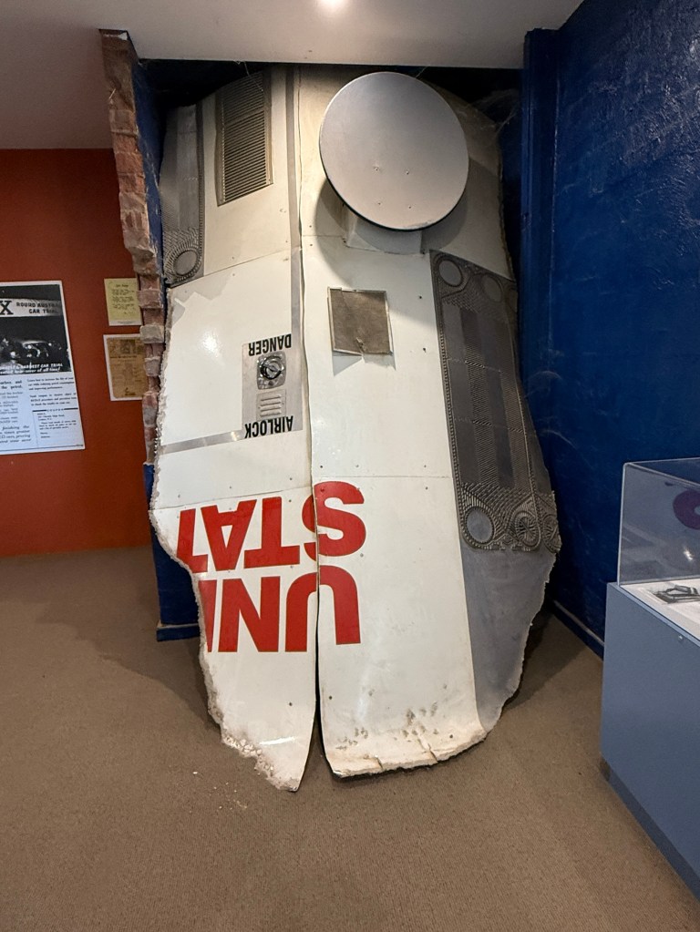
The town is also the site of a former satellite communications base for what is now Telstra. There is a big dish here and other memorabilia of space exploration and the role played by the equipment. It was used to track Apollo 11 on the first moon landing. Now all decommissioned but preserved in a museum.
From Carnarvon we begin the trek back to Brisbane, travelling down towards Geraldton and then turning east to Mullewa in wildflower country. We hope to see a few but are very early in the season.
Ningaloo
We have come to the Ningaloo coast to check out what all the fuss is about with whale sharks and the world famous reef.
The Ningaloo coral reef is a fringing reef that stretches from north of Exmouth down the coast to near Carnarvon, about 260km. It is never more than 12 kms off the coast and in many places comes close to the shoreline. You can look out from the beach and see waves breaking on the reef out to sea.
The reef is different from the Great Barrier Reef on the east coast. As its name suggests it is a barrier reef that is from about 16 to 160kms off the coast and stretches from Cape York down to near Bundaberg, about 2,300km. Both reefs are World Heritage Areas.
Exmouth is a curious place. It had its origins during WWII, when it served as a submarine base for the United States. Sorties were launched from here into South East Asia, including some Australian chaps in a small boat who blew up some Japanese ships in Singapore Harbour.
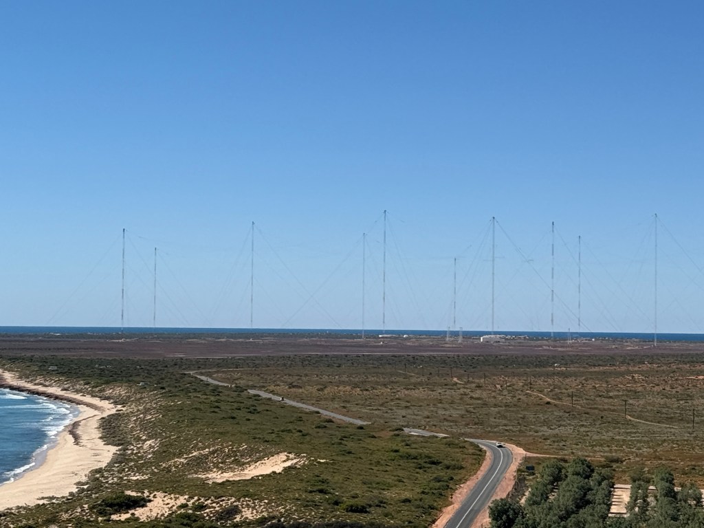
In the 1950s the Americans set up a naval communications base here that was pretty secretive. There are 13 big towers with wires hanging off them that communicate with American subs in the Pacific and Indian Oceans. It was so secretive that even the Australian PM was very vague as to what went on. Allthego remembers a bit of all this when he was at Uni, protests and the like by unions, students and professional rabble rousers etc. Sometime later Bob Hawke (or was it Gough Whitlam?) I think rationalised things and took over the place politely asking the Americans to go somewhere else. They are probably still there in some form keeping an eye on things. Any way when they left town we were told the population dropped to about 400 from 2,000.
They didn’t have a lot to do!

But then something generally comes along to pick up the pieces. This time it was a big blue thing with lots of white spots. Of course whale sharks had been here all along. They were ‘discovered’ along with the reef and all its sea life, and today we have a tourist mecca! The population has grown back to around 2,700 and is busy servicing the tourists and relieving them of their cash.

People come from all over the world to swim with these gentle plankton eating giants of normally about 4-8 metres in length. By the way they are not sharks but fish.
Allthego had hoped to get a chance for a swim, but School Holidays again got in the way. All booked out. The swim involves a day trip in a boat that is assisted by a whale shark spotter plane. The whale sharks cruise along near the surface and when spotted the boat finds it and all (two groups of 10) get in the water and snorkel along beside the creature, it moves slowly.
Allthego had one chance when a vacancy arose but while going through an inquisition as to his physical fitness, swimming ability etc the place was taken by someone else. In retrospect missing out may have been a bit lucky, keeping up with the all the twenty somethings and the shark might have been interesting!
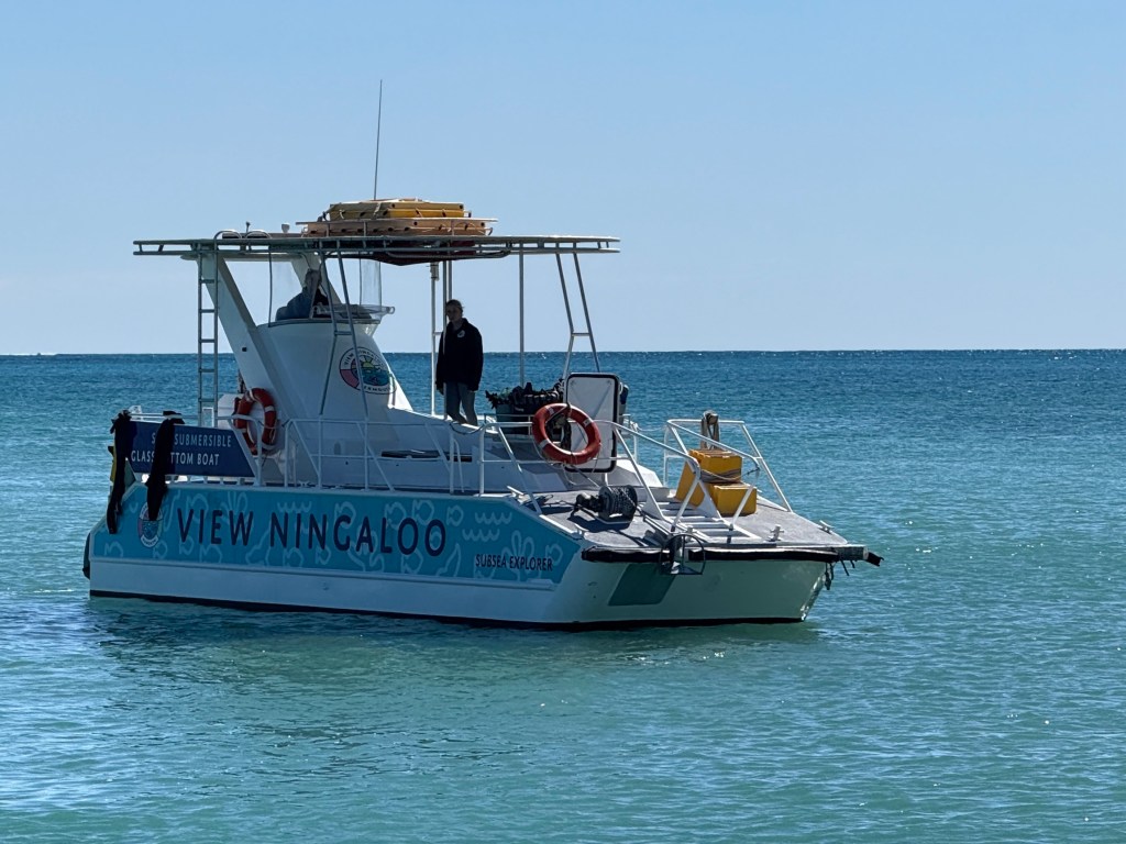
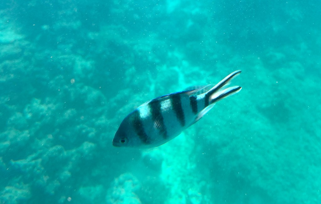
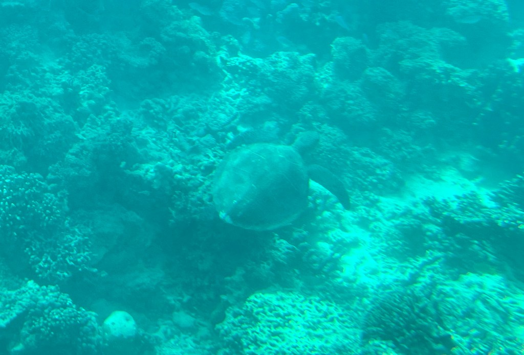
So we settled for something more sedate, a semi submersible boat that we sat in below the waterline and observed the reef and life below the surface. Numerous coloured fish of various sizes and several turtles among the coral structures swam past during the afternoon.
Allthego was able to get off for a snorkel around and managed to get back on the boat.
Our other excursion was a short boat cruise up Yardi Creek. The Creek is a short water course into the landscape behind the coast.
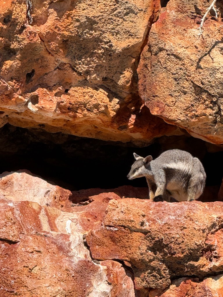
It’s a mini gorge with colourful cliffs and a large population of rock wallabies that somehow cling to the vertical rock faces while moving around into caves and crevices. Quite a few resident fish and birdlife as well. An enjoyable jaunt.
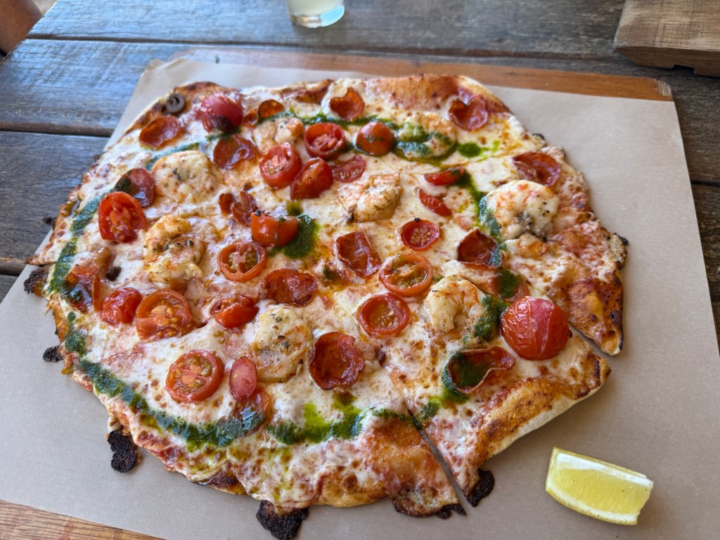
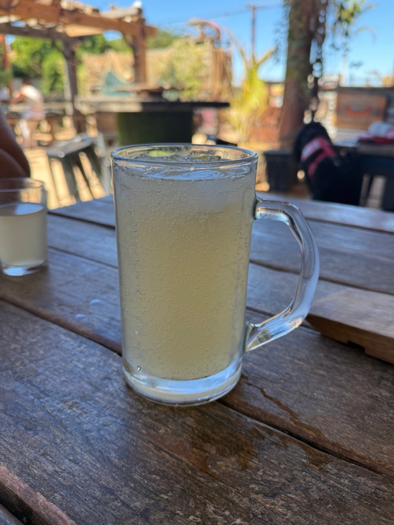
The town has two craft breweries and we tried one out for lunch. An Exmouth prawn pizza was washed down with a selection of their product including a tasty ginger beer, there is a 4 pack in the van cellar to take back to Brisbane.
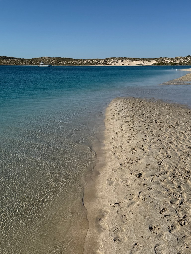
From Exmouth we moved 130km or so south to Coral Bay for a night on the way back down the coast to Carnarvon. Very crowded place. The reef comes right in close to the beach here for snorkelers to safely potter around in. Looks a good spot for youngsters compared to Exmouth.
We have now retraced our steps back to Carnarvon for a few nights before commencing the long haul back to Brisbane.
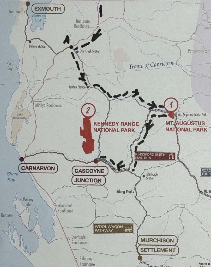
Going on a loop
On the way to Gascoyne Junction (GJ) we retraced part of the route we took to get to Mt Augustus before diverting down what is called Dairy Creek Rd. This took us all the way down to a T junction where we went right to GJ, on a sealed road.
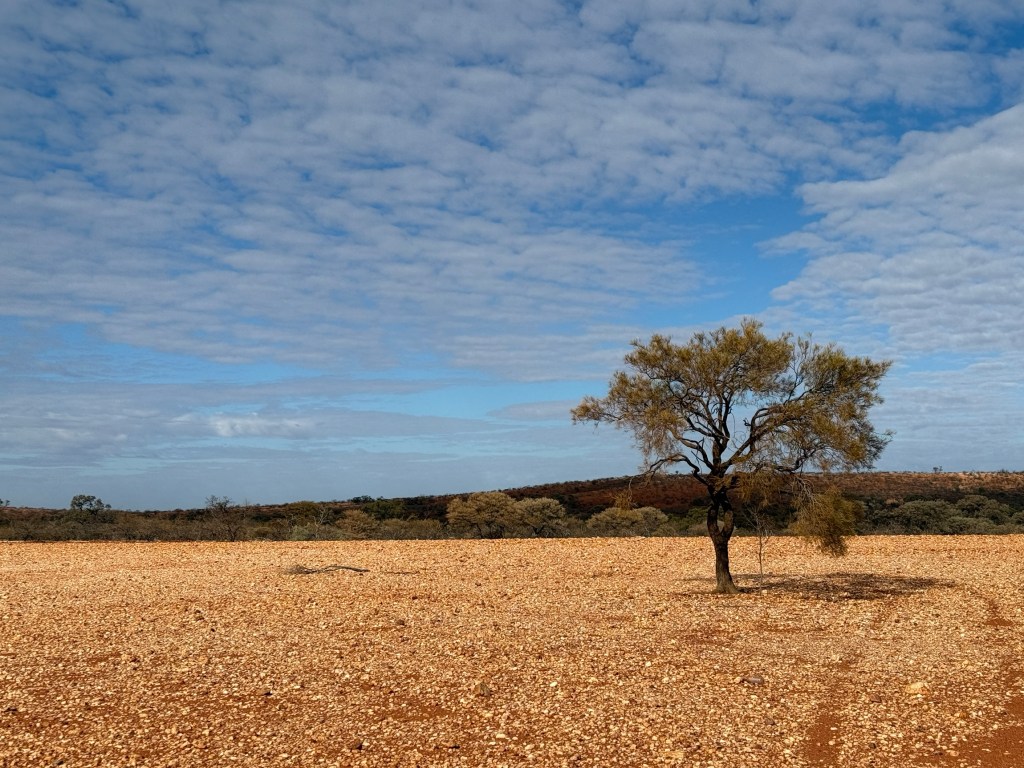
The scenery continued to be the gibber like plains with hardy shrubs. Trees lined the currently dry water courses. This country used to be sheep stations before WWII. Pastoralists had pushed too far north and in so doing ended up extensively over grazing the land, basically destroying it. After the war sheep eventually gave way to the more land friendly cattle industry which continues to this day as the pastures are slowly rejuvenated by the land owners.
GJ was our base for a few nights to ‘recover’ from the dust and a bit of touring around, including a visit to the Kennedy Ranges to the north. An interior van clean up was the order of the day for Homealone as well.
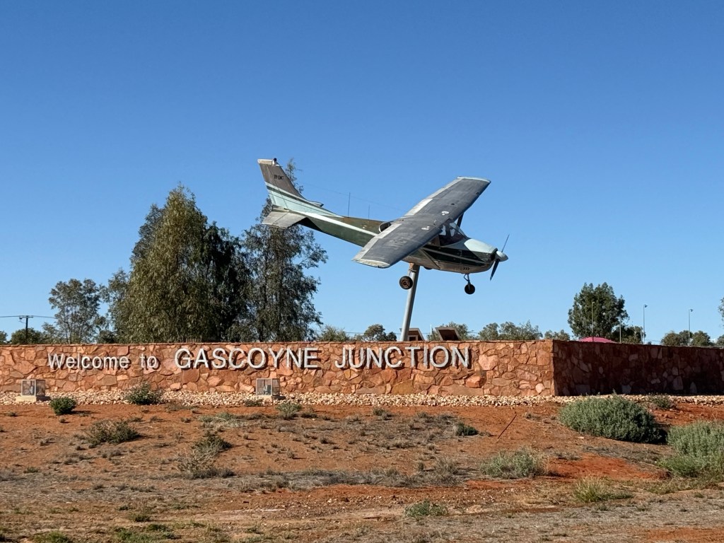
GJ is a small town of 150 or so people that serves as the administrative centre for the Upper Gascoyne Council. The town sits beside the Gascoyne River, it is called ‘Junction’ because the Lyons River joins the Gascoyne downstream from the town. The town actually looks ‘brand new’. It has a sparkling appearance.
In actual fact it is a ‘new’ town. The old GJ was destroyed in a flood in 2010 and has been rebuilt on slightly higher ground further back from the river. The van park is excellent and has the advantage of a tavern being adjacent.
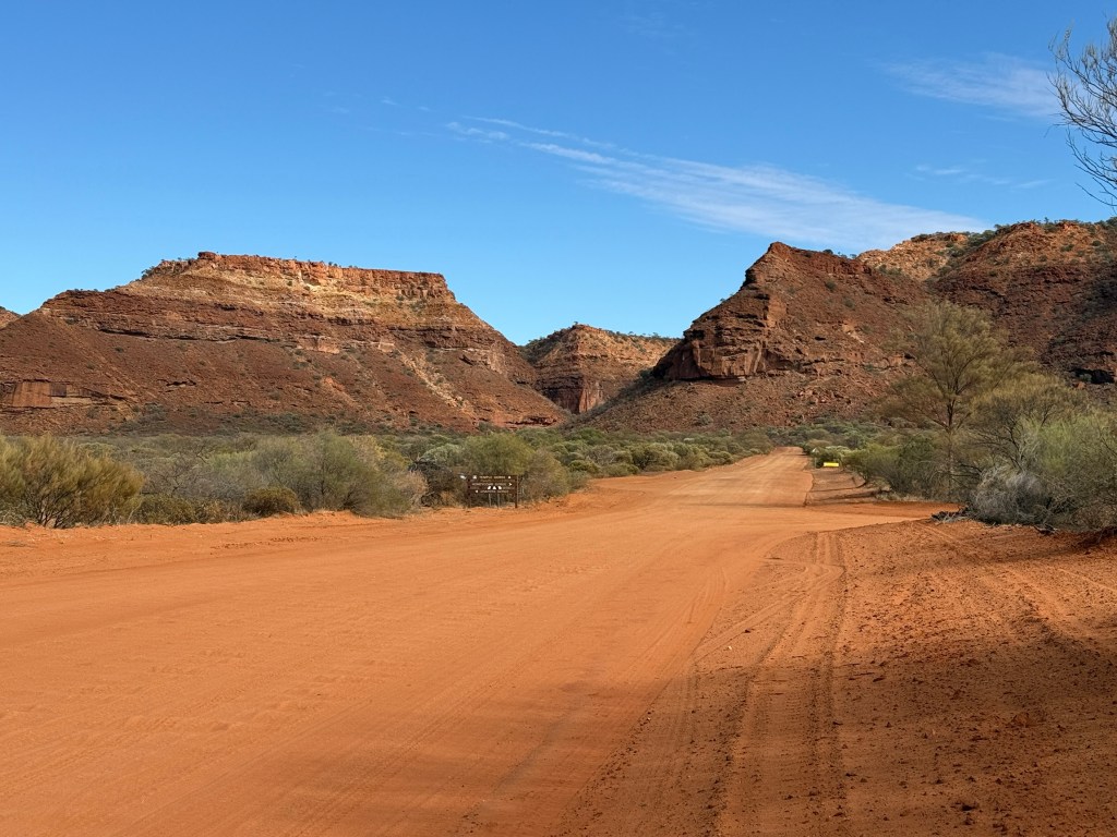
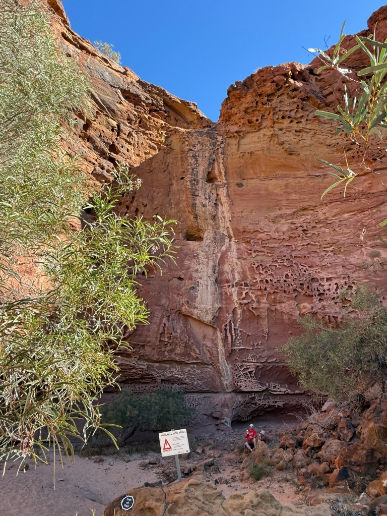
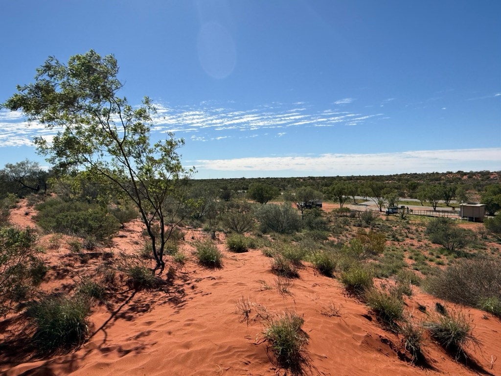
From GJ we did a day trip up to the Kennedy Ranges NP. The road up there was again pretty good gravel, no dramas. It was about 150km there and back. The Range sits up above the surrounding plain like a big Mesa.
The water run off has cut deep gorges along the escarpments. These are the sort of gorges you walk into and look up. Not the ones you walk down into and then look up. Much more benign!
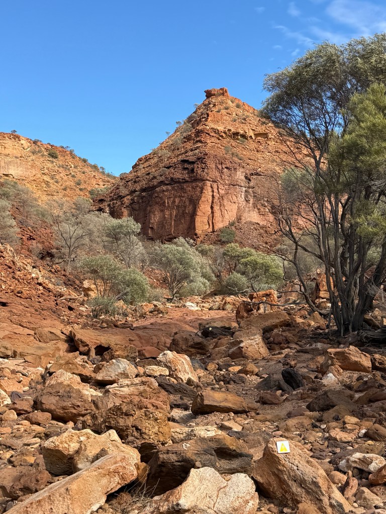
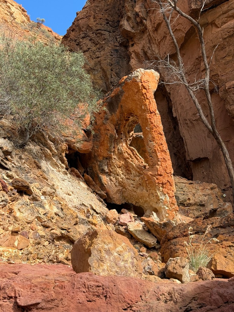
Allthego had a couple of short walks, one into Temple Gorge and the other Honeycomb Gorge. Both involved a bit of rock hopping along dry creek beds. Very pretty.
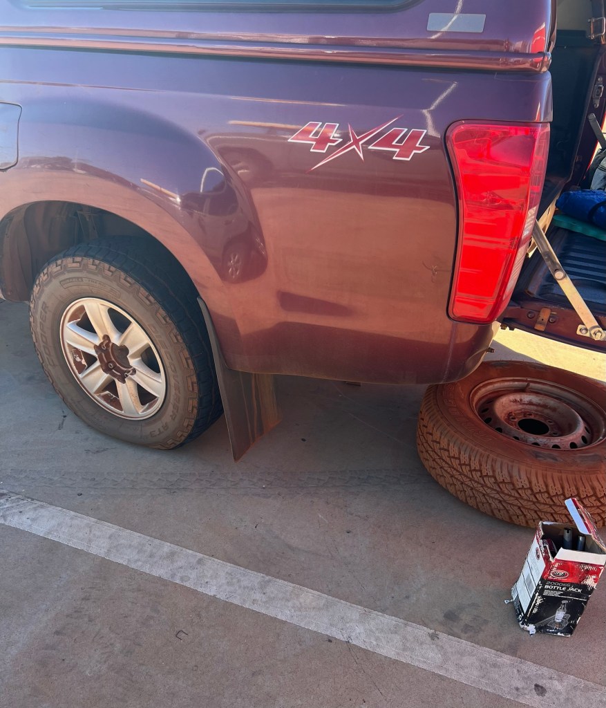
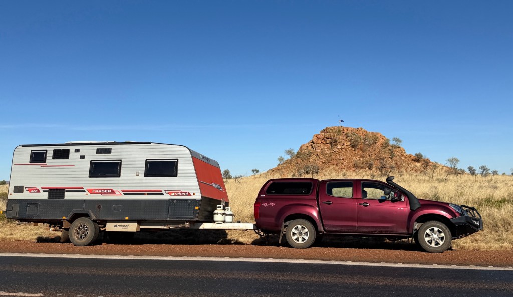
We had a minor drama as we left GJ to return to the coast. On the morning of departure a rear tyre on the truck was displaying a rather flat appearance. It was the old spare we had put on back in Karratha. It had a slow leak somewhere.
So, a change was required before we left. A young chap, looked about 55, gave us a hand and the job was done quite quickly. We later got a new tyre fitted as we passed through Carnarvon on the coast.
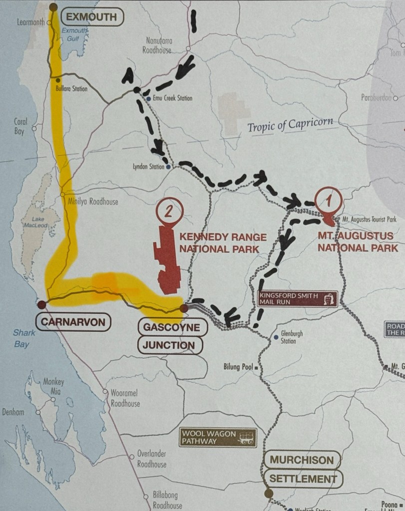
We did a loop and headed back north to Exmouth and Coral Bay on the Ningaloo coast. Hoping to swim with a whale shark. Have had to do this back tracking because of the WA school holiday camp ground book outs. We just couldn’t get a booking on the way south from Karratha and had to go out to Mt Augustus/GJ to fill in time.
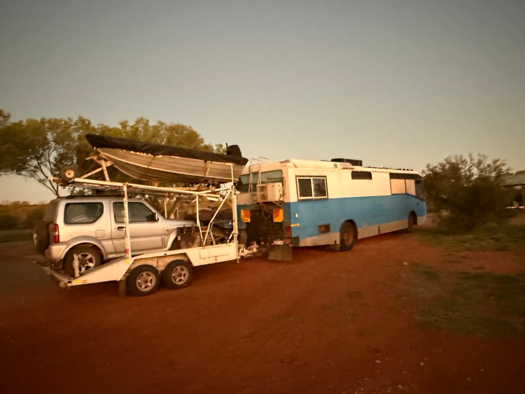
But we are now on our way and have stopped at a free camp for an overnighter about half way up the yellow line on the map.
The Upper Gascoyne
Mt Augustus is in the region known as the Upper Gascoyne, about a thousand kms north of Perth and about 400 km inland from the coast at Carnarvon. This is the area in which the Gascoyne River rises.
The Gascoyne is WAs longest river, for much of the year though it is dry and only runs after heavy rain. It is called the ‘upside down river’ as its water flow is below the thick sand beds. It flows into the sea at Carnarvon, we will see it there in a few days. The river has numerous tributaries that criss cross the landscape. One of these is the Lyons River, also generally dry, which we cross on the way to Mt Augustus. Its floodplain is to the north west of Mt Augustus.
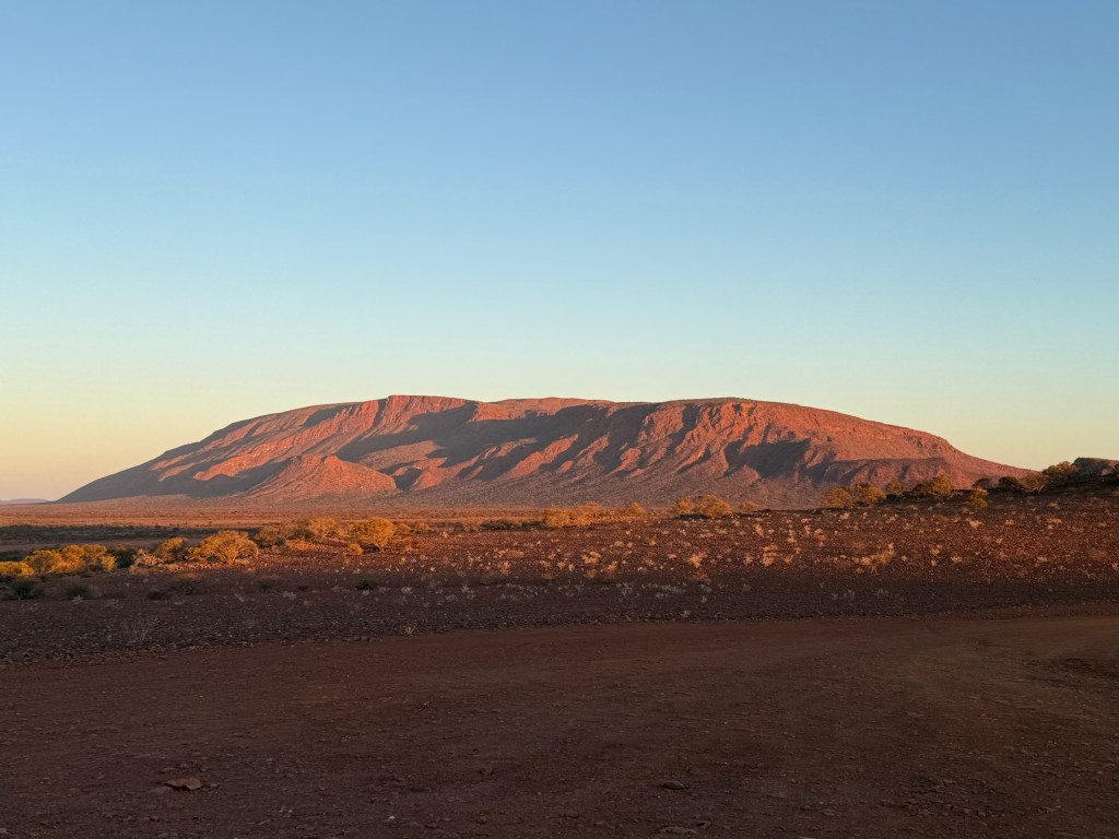
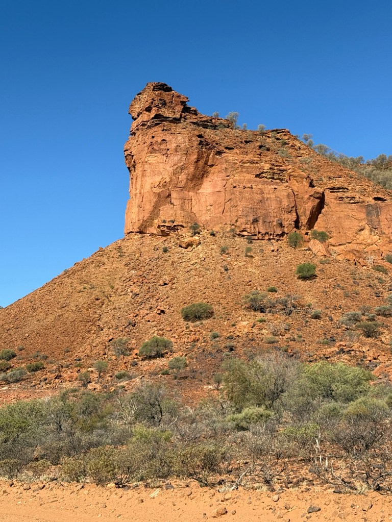
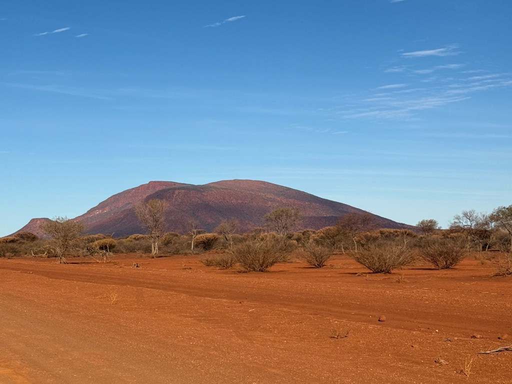
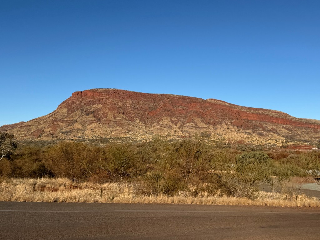
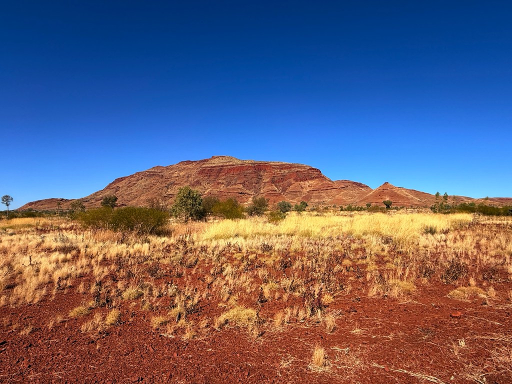
Mt Augustus is quite striking when it first appears on the horizon. It is big, in fact at about 860m above the plain it is about twice as high as Uluru and in area about 1.5 times bigger. It is 8 km long. It is also very old, much older than Uluru. The other noticeable difference is that it has lots of vegetation, unlike Uluru.
Uluru and Mt Augustus are both known as inselbergs, or single mountains rising above flat plains.
Uluru is Australia’s biggest ‘rock’ inselberg. It is a single rock ‘stranded’ in among the surrounding strata. Totally different to Mt Augustus. Mt Augustus is what is known as a monocline, it’s not a ‘rock’ like Uluru. It has an underlying granite base that was covered by millions of years of sandstone deposits. The whole structure was ultimately buckled and folded into an arch. The sandstone has been eroded away leaving today’s big ‘rock’, Mt Augustus. The granite is partly exposed in some places on the mountain, but the last ‘layers’ of sandstone are still there.
Sorry, to tire my readers with a bit of very rough geology. Allthego finds this stuff interesting, Homealone is not stimulated at all by it and sympathises with readers of the same ilk!
The local indigenous people have a traditional dreamtime approach to explaining Mt Augustus. They know the mountain as Burringurrah.
It is a short story about a boy, Burringurrah, under going initiation into manhood. He got stressed about this and ran away, so breaking the law. He was pursued and speared in the right leg as punishment. He fell to the ground and the spear broke leaving the stump in his leg. He was then severely beaten and died, lying on his belly with his left leg (circled in white below) bent up beside his body, right leg stretched out. Head circled in yellow. He turned to stone.
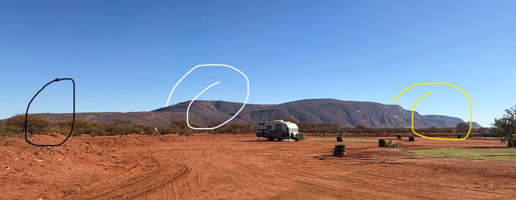
This is a photo of the mountain showing all this for you to see, a little imagination is required.
Now Allthego spent quite a bit of time trying to see all this, but got a bit lost in the detail. The photo has the spear stump circled (very small and hard to see) in black, it is now a lookout. Homealone, was less concerned in detecting this detail.
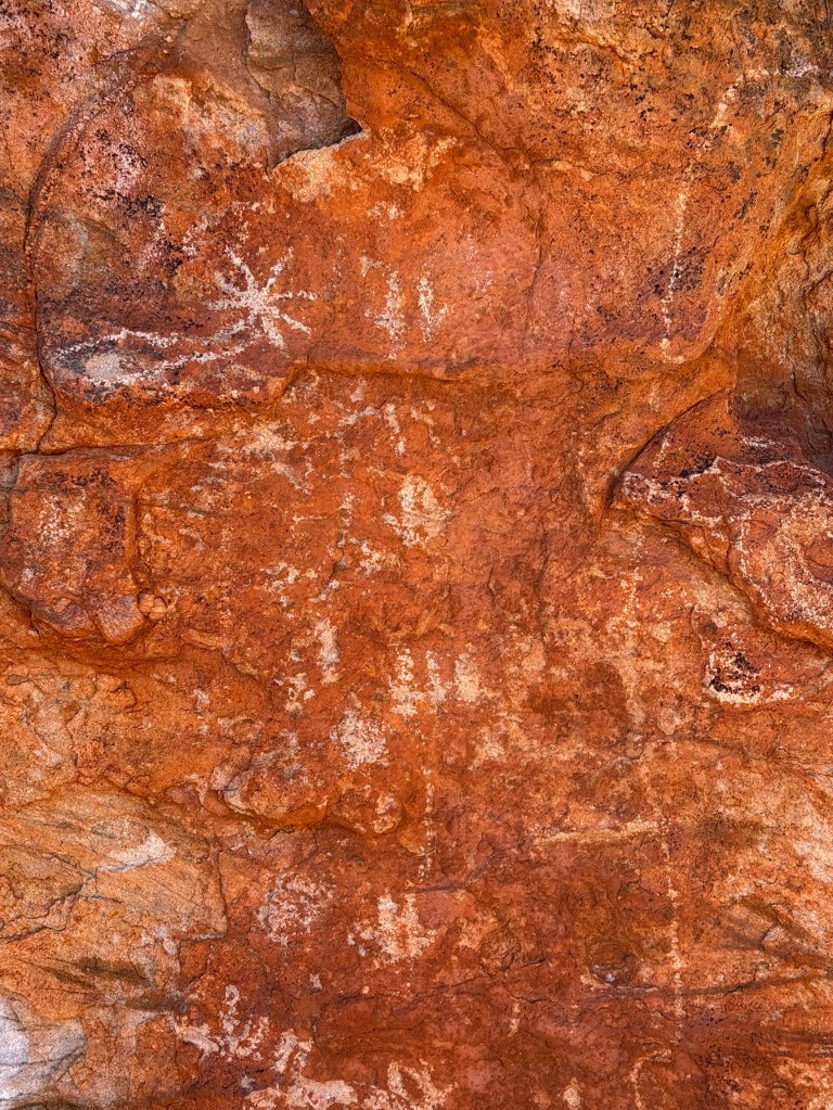
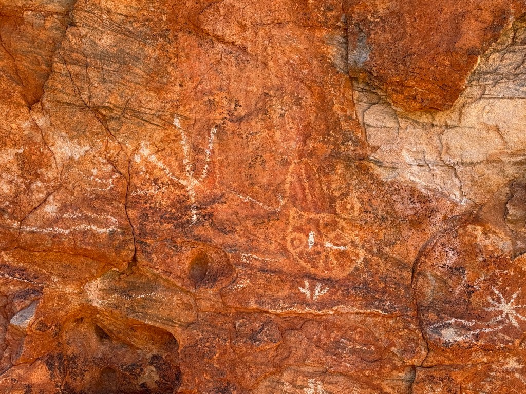
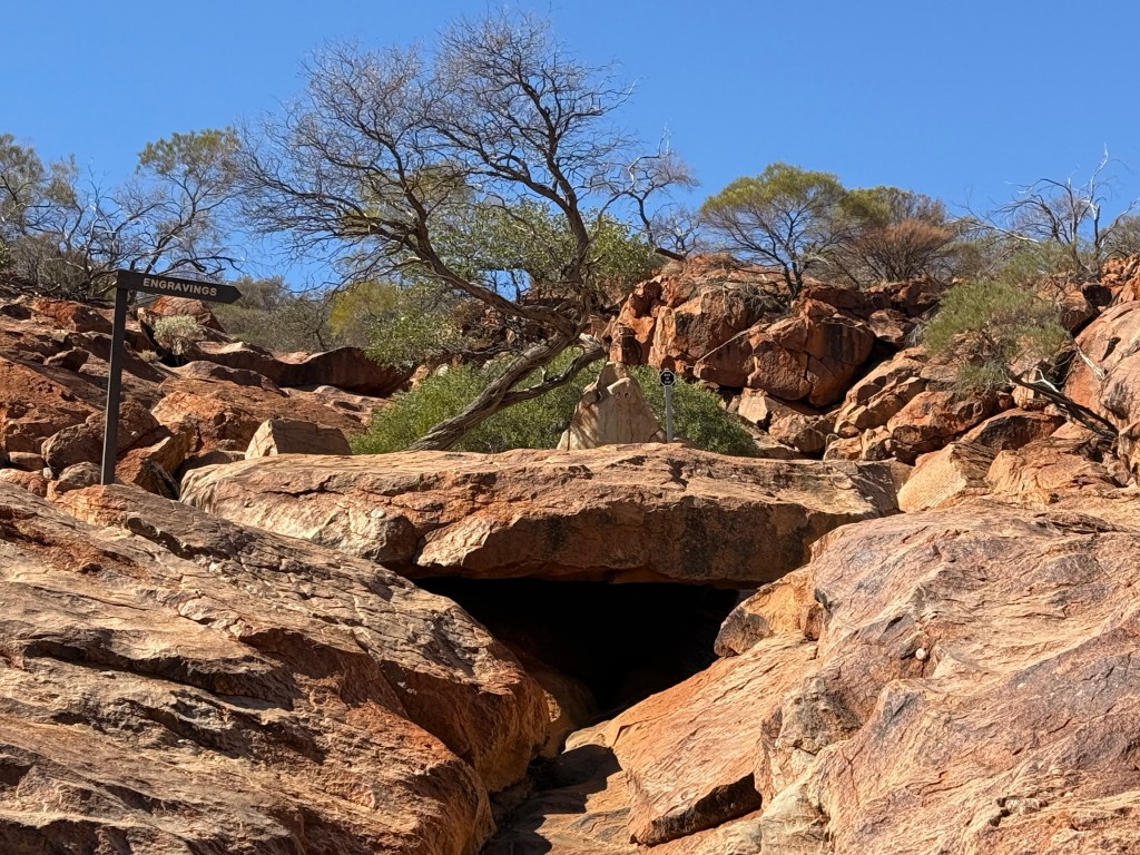
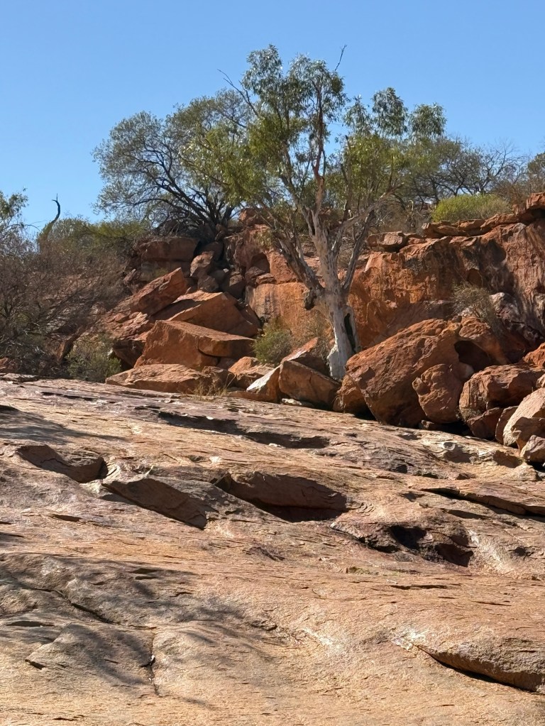
We did three short walks up the slopes of the mountain to check out some petroglyphs and generally take in the mountains presence. Allthego didn’t venture to the summit, a full days walk there and back and apparently strenuous in parts.

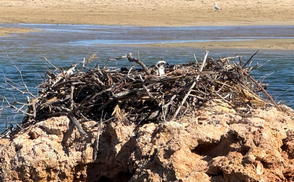
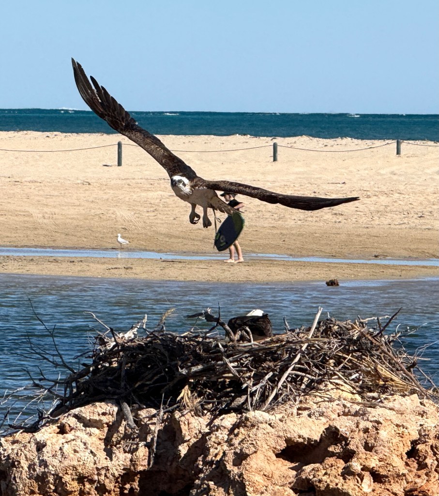
An interesting spot was the Cattle Pool, a deep waterhole on the otherwise dry Lyons River. Plenty of birdlife here, especially Corellas.
Mt Augustus is the sort of place where you can do a lot or little. Just sitting in the van park taking in the mountain is special. Its colours change as the sun moves across the sky.
We had four nights here before packing up and heading, another day along the dusty gravel roads, to the small town of Gascoyne Junction.
Could have been Dutch!
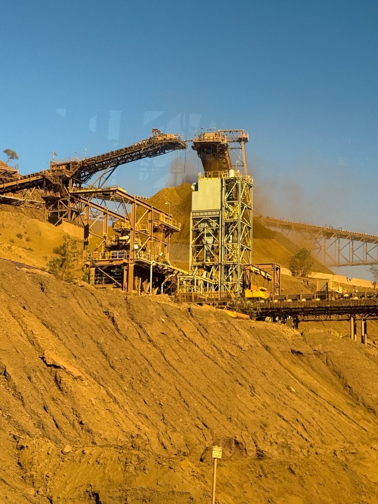
We had a day in Dampier and Karratha to check out the activities here. Having seen iron ore and salt ports in Port Hedland these were not to be our focus.
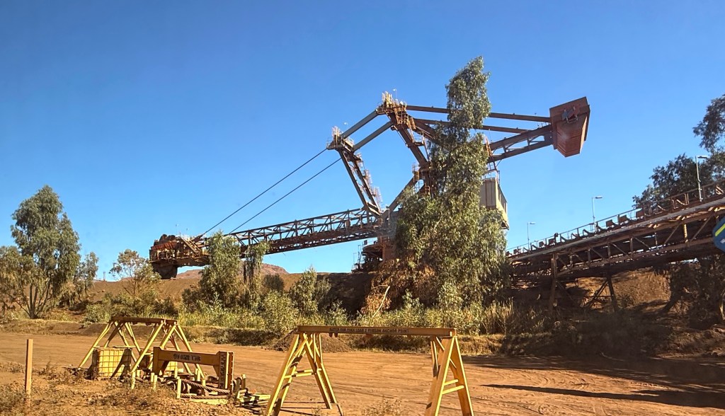
Of more interest was Red Dog and the aboriginal petroglyphs on the Burrup peninsula.
But first we needed to get the tyre fixed. Found a repair place in Karratha and it would be ready after 3pm which was good.
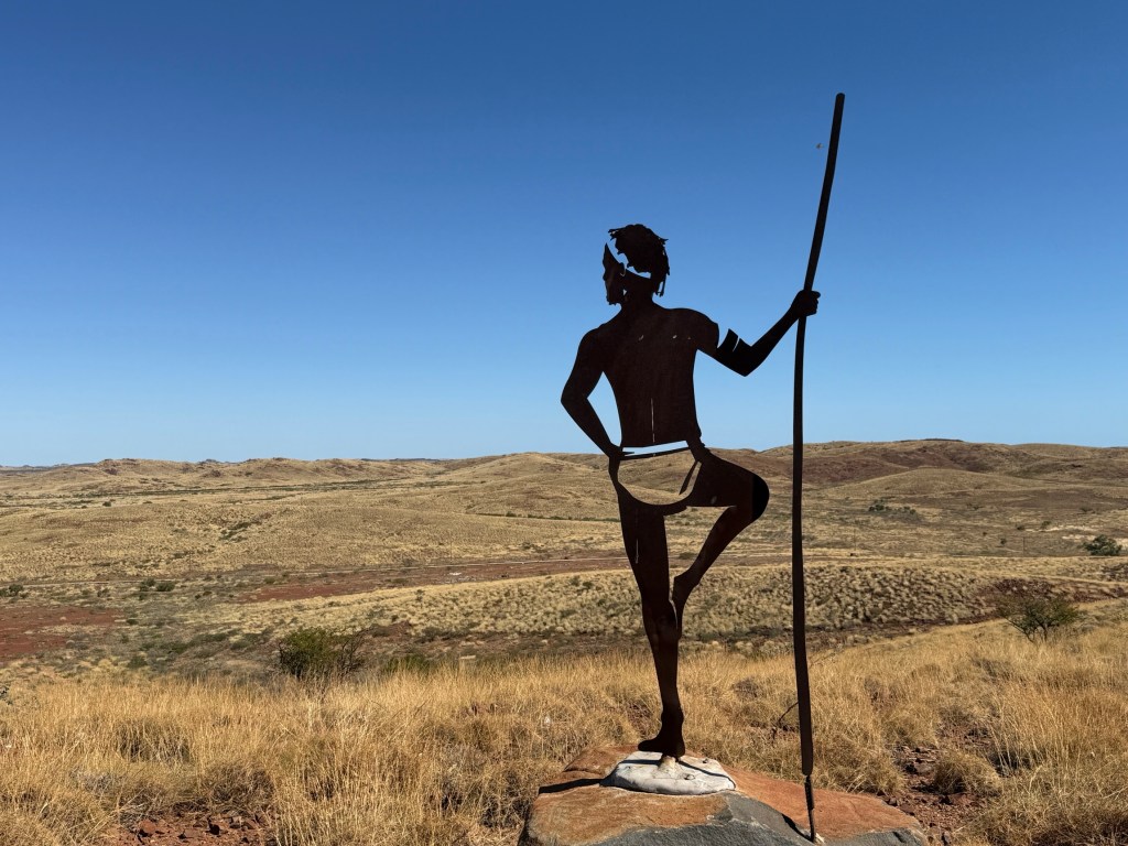
Before chasing down the Red Dog sites we made for Roebourne about 30km north and one of the early settlements in this region. It is inland a bit and has a lookout over the surrounding plains. On top are indigenous statues (7?) that look out over the particular area their clan occupied and called home. An impressive way of showing the hold of country.
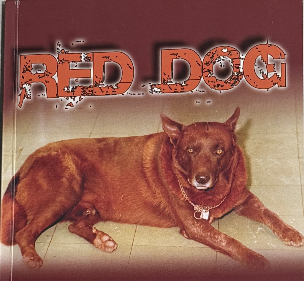
Red Dog was a movie star back in the late 2000s early 2010s (two or three movies?) and there have been several short books written about his exploits.
He was well known in the area around Dampier and Karratha during the 1970s. He now has a highway named for him, the Red Dog Hwy. We came along it from Tom Price. The road follows the general direction of Red Dog’s movements around the region. Loyally following people around and hitching rides to get to places. Lots of people knew him and he knew lots too.
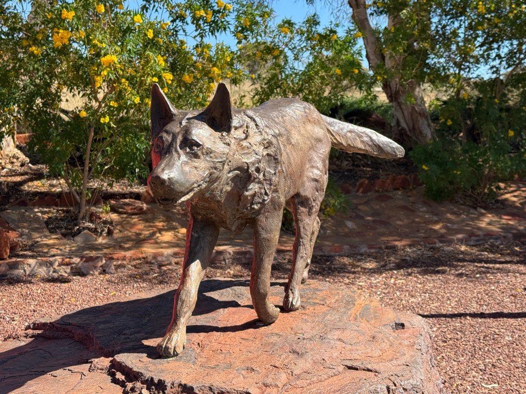
Dampier has a bronze ‘statue’ of him on its outskirts and various landmarks are noted as Red Dog haunts. Allthego and Homealone saw the first movie a while back but don’t remember the details and haven’t read the books. We picked up a small paperback to find out more sometime. Not sure how much longer this Red Dog stuff will last before it runs out of steam. Perhaps memories of Red Dog are fading with subsequent generations.
The other big activity up here is the Woodside gas plant on the Barrup peninsula. They bring natural gas ashore here from the North West Shelf gas fields and then process it for export. This is a big operation. The federal government recently extended Woodside’s rights to do all this for another 40 years, till 2070. This has agitated the greenies, anti gas groups and others, including the local indigenous groups, immensely.
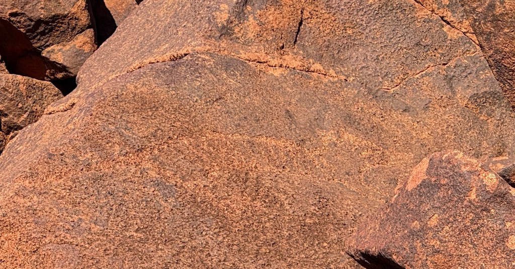
This is because, apart from the decarbonisation issue, nearby there are some big piles (not a geological term) of very old rocks with numerous indigenous petroglyphs on them. The concern is that all the industrial activity going on will ultimately destroy these images. It is claimed some are up to 40,000 years old. They are not rock paintings, like in other places we have been, but etchings in the rock faces. There are animals, images, implements and human forms represented on the faces of the rock.
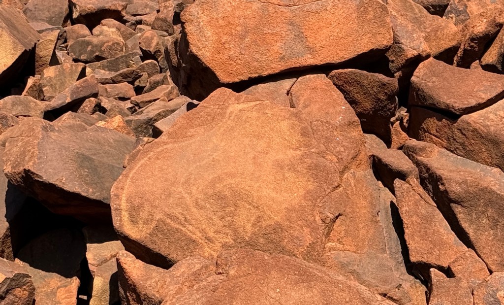
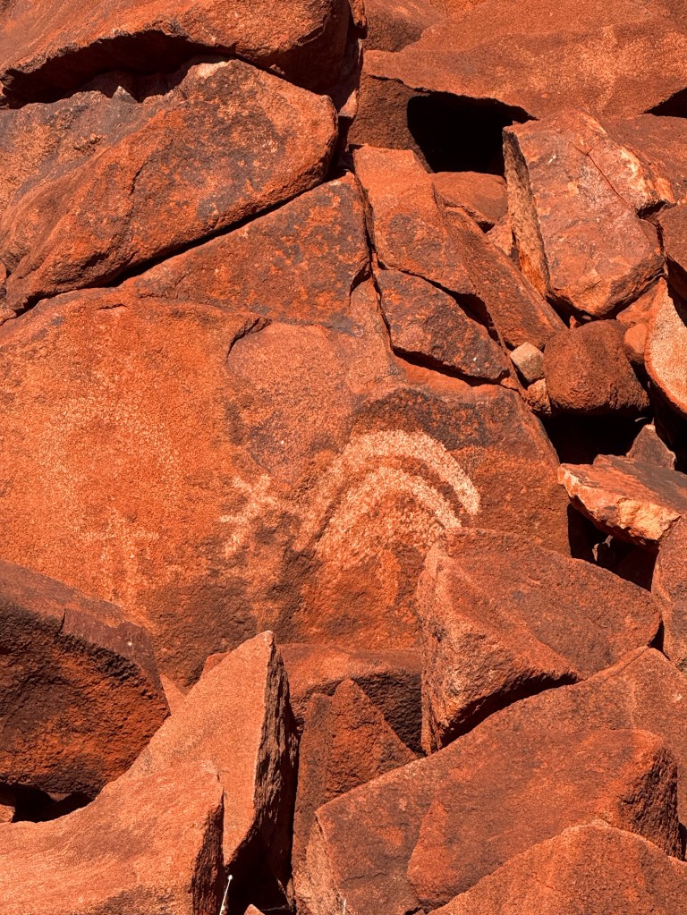
We had a wander around the site that is able to be accessed in the Murujuga NP. Some images are pretty clear, others you need the signage to assist identification and in other cases perhaps a good imagination to help! While we were here it seems the NP was made a World Heritage Site. It is interesting to ponder the human activity in this area over the last 40,000 years. Will the gas plant, the iron ore and salt ports, as well as a new fertiliser plant destroy it all? The industrialists say no. I suppose only time will tell.

We had come mid late afternoon as it was a good time to ‘clearly’ see the images on the rocks, however we had to get away back to town to pick up the tyre before the shop closed. All done!
Back at the van we settled in for another night on the Servo pad, all went well. We made a quick getaway south in the morning on the North West Coastal Hwy.
It was going to take us a couple of days driving to reach Mt Augustus, it is around 650km from Dampier inland to the southeast.
We had a one night stopover at a free camp about half way before turning off the main road to head east. A great sunset here.
The next morning the route took us along a series of mainly good gravel roads for 330km to Mt Augustus. Plenty of red dust to coat the van and contents. We arrived about 4.30pm all ok but with only about 5 litres of fuel left, plus our 20 litre safety gerry can!
By the way Dampier is named after William Dampier the English Navigator who sailed these parts in 1699. He came to check the coast out as the Dutch were sailing up the WA coast to get to the East Indies. A bit of European competition for the Great South Land? Could have been Dutch!
Back to the coast
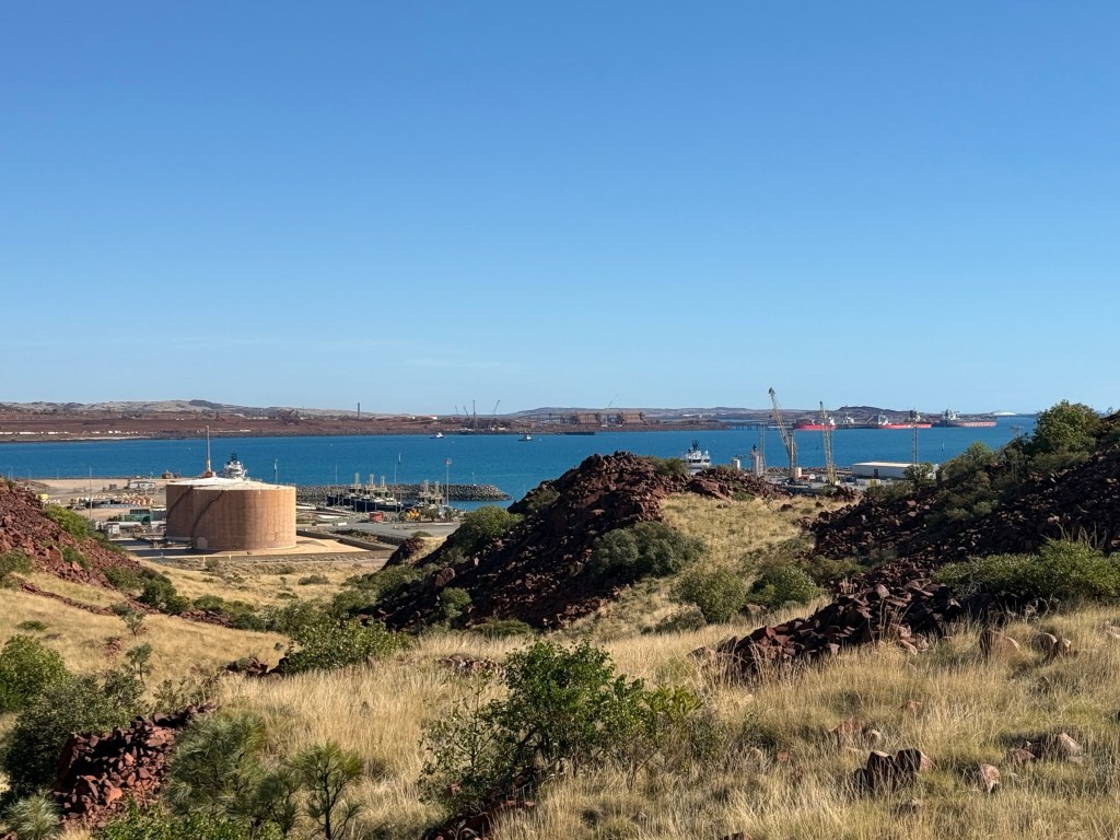
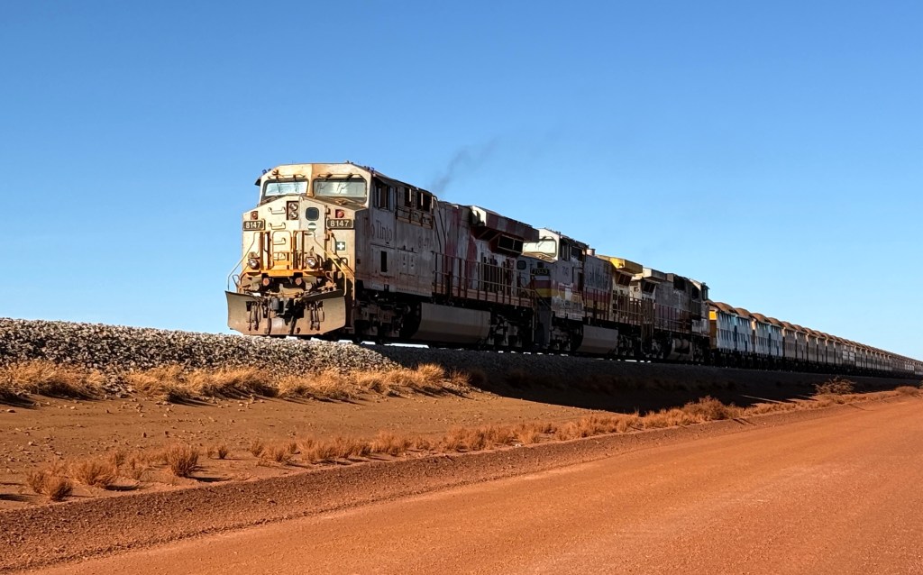
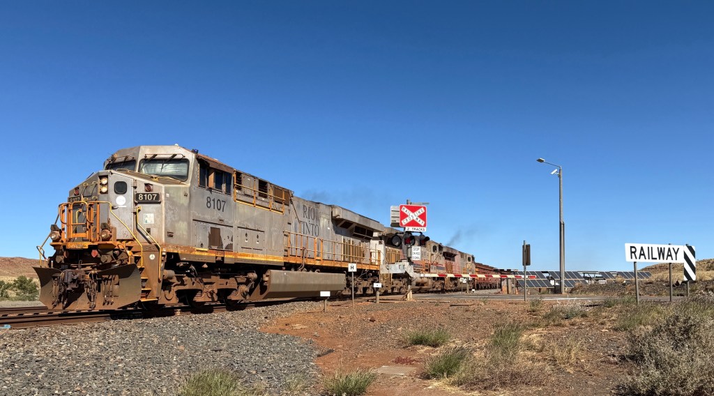
We are now heading back to the coastal towns of Dampier and Karratha, I think they call Karratha a city. In some ways these two places are similar to Port Hedland. They are iron ore ports for Rio Tinto like Port Hedland is for BHP. Rio also has another export salt production operation here, similar to that in Port Hedland. The similarity ends there though as Dampier and Karratha look to be lively places with more diversified activity. But more about that later.
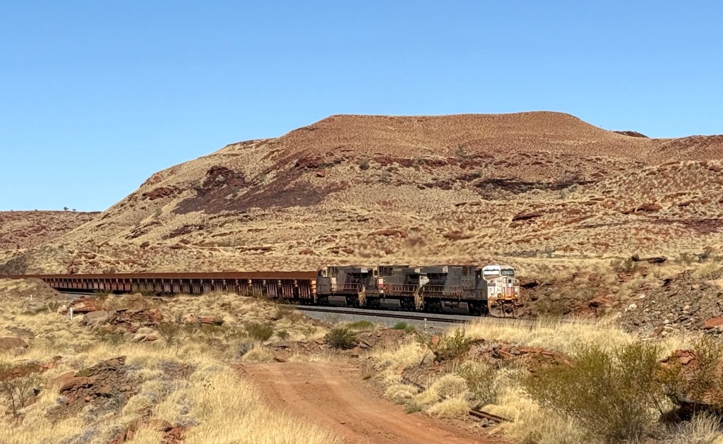
We have chosen to head for Karratha from Tom Price along the Rio Tinto private road beside the railway line. To do this you need a permit. Permits are not hard to get, you just have to sit through a 20 minute video on the dos and don’ts at the Visitor’s Centre. The video is a little dated we are told but the sentiments hold! It was one of those videos that sort of make it all sound a bit hard, risky etc.
The Visitor’s Centre people tell us that it is a better gravel road than the unsealed public one. So we decided to do it, as it turned out not a lot of others did!
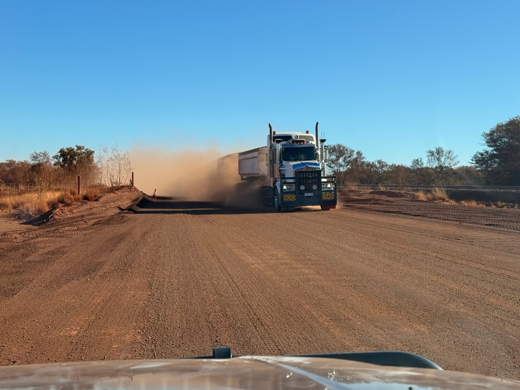
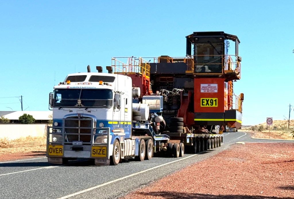
Some great scenery along the route and some train encounters as well.
We only saw a couple of other vans and that was near the end and they were coming the other way. Mostly railroad maintenance people out on the job used this road.
It was a pretty good road all the way to where it joined the Red Dog Hwy which then took us to the outskirts of Karratha. Our problem was that we didn’t have a booking for a van park. Same old reason school holidays.
A big 24 hour Servo appeared in front of us and Allthego thought maybe they would let us stay out the back on their big concrete pad.
There were a couple of other vans there. Yes the attendant said no worries mate. Free too! Ambience was marginal. So we set up there for our two nights in Karratha.
As we were doing this a fellow nomad next to us pointed out that the back tyre on the truck was partly deflated. Allthego looked and he too became deflated. A flat. A bolt through the tread and thus a slow leak. Lucky we made it to the Servo, no idea where this happened. The spare came out and a quick change was completed. Found a repair place to take the tyre to the next day.
As we settled in for the night we realised we were just down the road from a railroad crossing. All through the night there were loud long train toots at the crossing. Endless! Got used to it after a while.
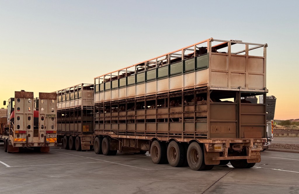
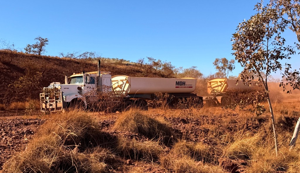
Through the evening a stream of big trucks also came to park near us as well, including two triple Bs with cattle on board. Thankfully, the cattle trucks eventually moved on to other places.
We have a day here to check out the Red Dog story and all the other action, the first stop in the morning will be the Visitors Centre.
Tom Price
Here we are at Tom Price. The van park is a few kilometres out of town in the shadow of Mt Nameless.
Plenty of people here but the sites are big and we have been super lucky to get a nice quiet spot adjacent to the men’s end of the facilities. The laundry is next door too, so Homealone was quite satisfied.
Unfortunately, a van came in a bit later and blocked our view of the passage of people in various states of urgency to and fro from those places. Seriously, the location was pretty good and we didn’t get disturbed at all, wind going the right way too perhaps!
The park was our base for seeing the western parts of Karijini. But first we booked a tour of Rio Tinto’s mine. The reason why the town was set up in the mid 1960s.
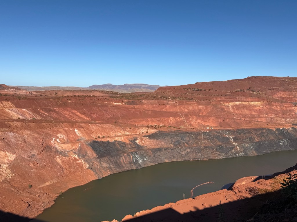
Went all around the site looking at the various stages of the mining and benefaction processes. Everything is big, including the hole in the ground.
The mine has been going for 60 odd years and our guide said plans were afoot to open a new mine area on the mountain that would see it going for many more to come.
Tom Price is the highest town in WA, 747m above sea level. This is why we found it distinctly chilly at 3 am in the morning.
Following the morning mine tour we headed off for Hamersley Gorge, this is a remote site some 70km from Tom Price, on the north western side of the park.
So it is a longish drive, albeit all sealed roads, to get there and back to see another gorge. Or as Homealone might say ABG. She is a little tired of gorges, doesn’t really like them anyway, having to get close to the edge and looking way down to the bottom. So she doesn’t do it at all. And for going on a dirt road to do it then ‘why’ is the question.
By the way ABG stands for ‘Another Bloody Gorge’ much like ABC stands for ‘Another Bloody Castle’ when you are touring around the UK or Europe.
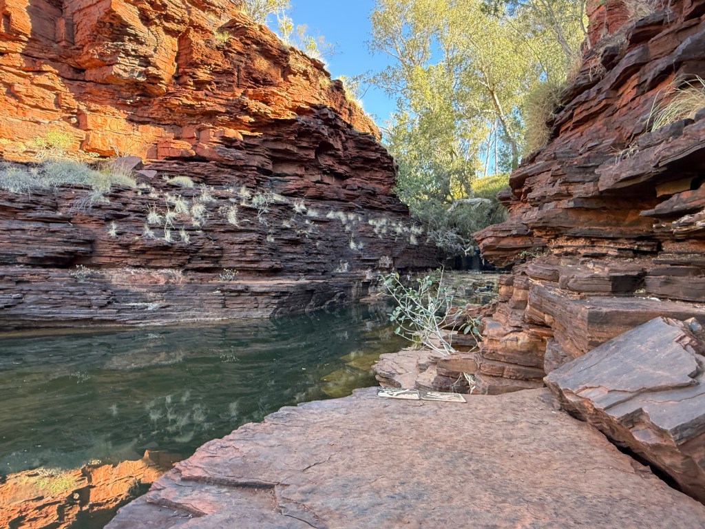
It is not a difficult descent into Hamersley Waterfall and Gorge. There are some amazing rock strata in the cliff walls and the gorge water hole is very picturesque. Well worth the drive there and back.
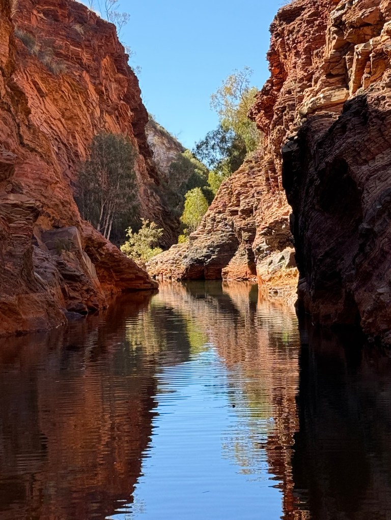
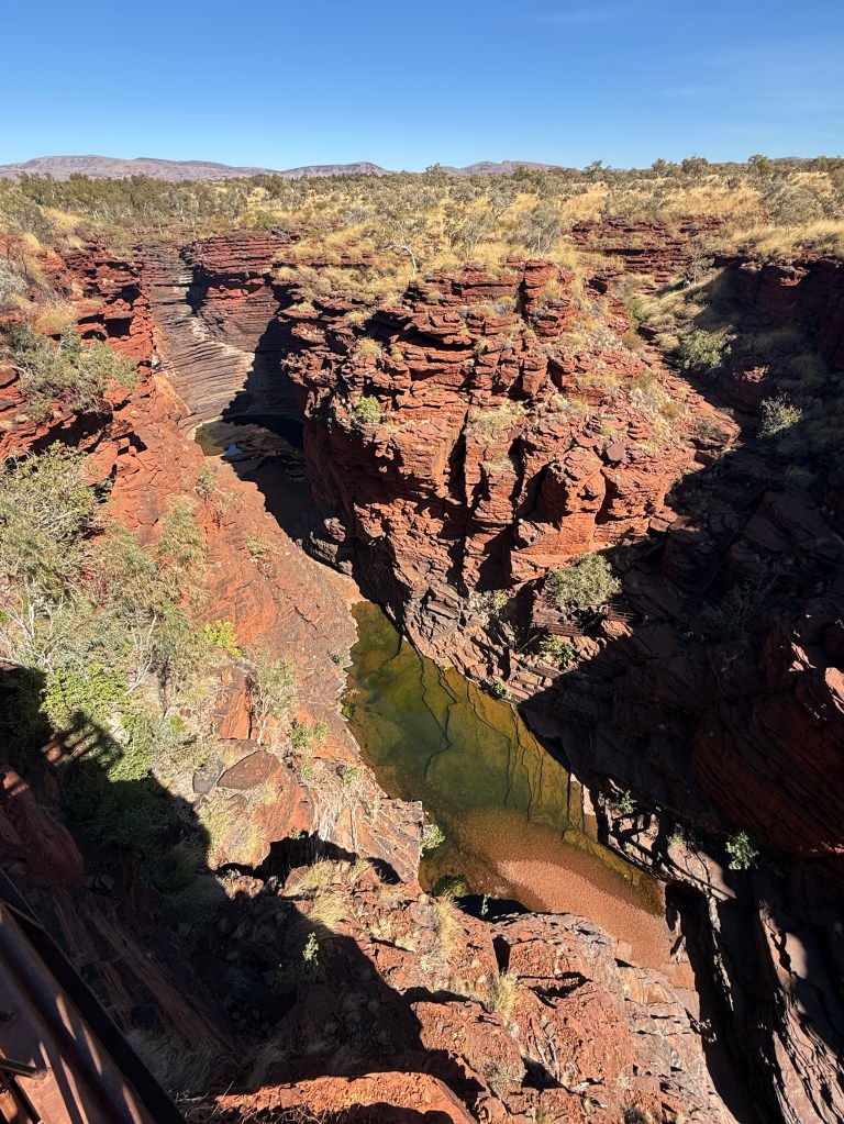
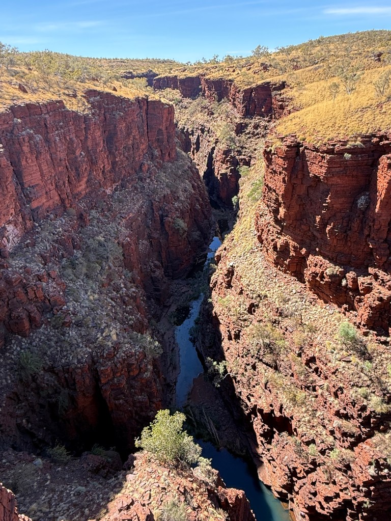
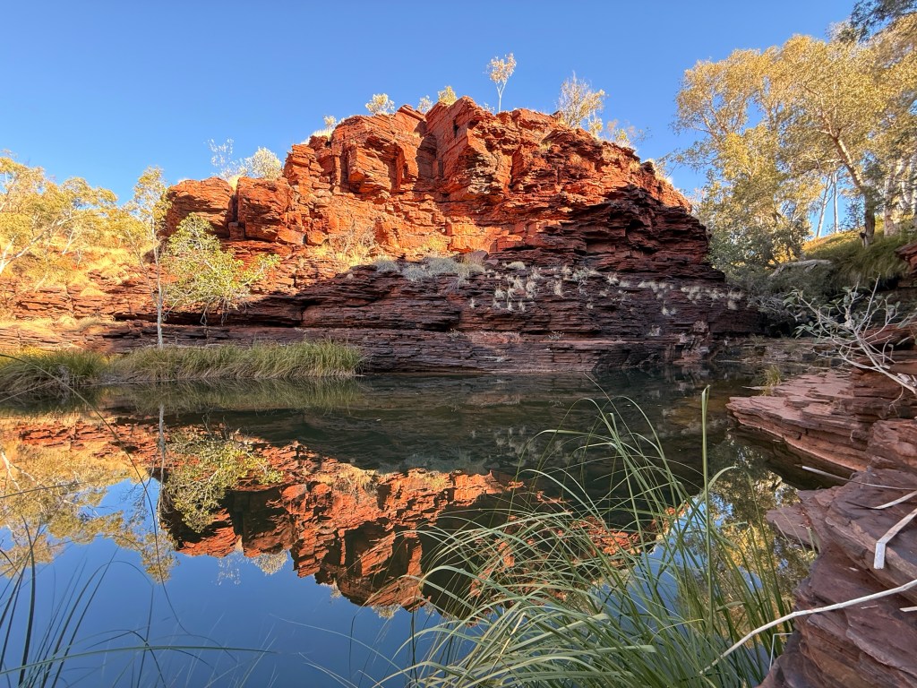
Our last day at Tom Price took us back to central Karijini for a look at some gorges there. Here are a few pics of the scenery at Joffre Gorge, Knox Gorge and the Oxer Lookout.
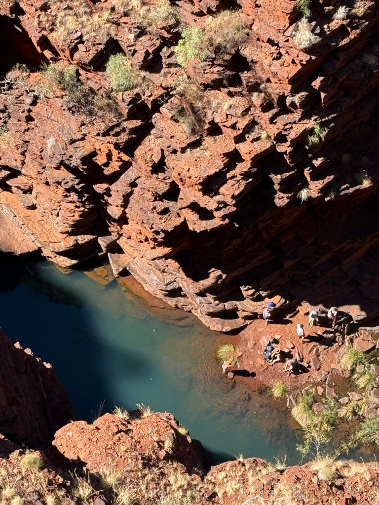
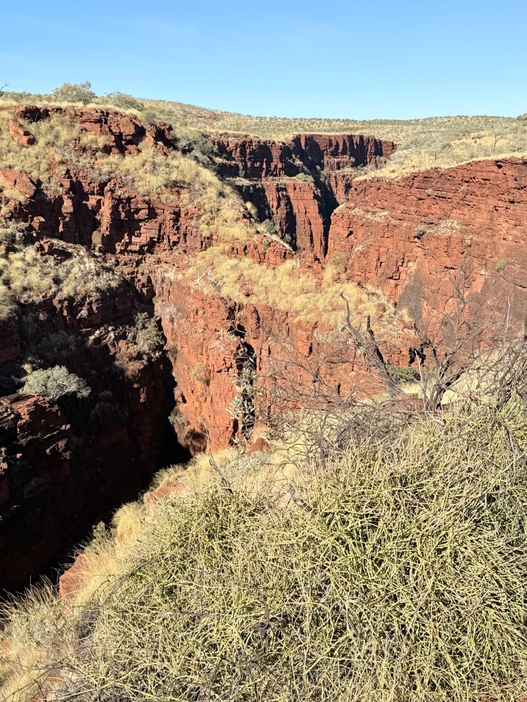
No long walks to do here, only short strolls to the lookout points. There are numerous longer walks down into these gorges, described as being difficult and also time consuming. Allthego passed on these, leaving them to the more nimble!
It was time to return to the coast and we headed north west the next morning to Karratha.
ABG says Homealone
We have said good bye to Port Hedland and made the longish 260km trek down to Karijini NP along the Great Northern Hwy. The plan had been to stay in the NP at the Dales Gorge Campground.

Allthego had booked the site months earlier, it is WA school holiday time and the park is totally booked out. So it was good to book so far in advance to secure a spot. The small issue was that he had booked it for the month before and now could now not get a site for the right dates, all booked out!

So we split our time with two nights at the Auski RH and three nights at Tom Price. Both are about 50-60km from the NP. Auski is at the eastern end and Tom Price at the western end of the Park. The Road House is a stopping place for all sorts of road trains. Many shapes and sizes call in and go past at all hours of the night. There is a constant hum for us to sleep through!
From Auski we travelled the road cutting through the Munjina Gorge to Karijini. Quite a steep climb and it slows the big road trains considerably, both ways. A great view of all this from the Albert Tognolini lookout.
The Park Visitor’s Centre was our first port of call. A very comprehensive display of the history of the region and the geography/geology of the gorge system.
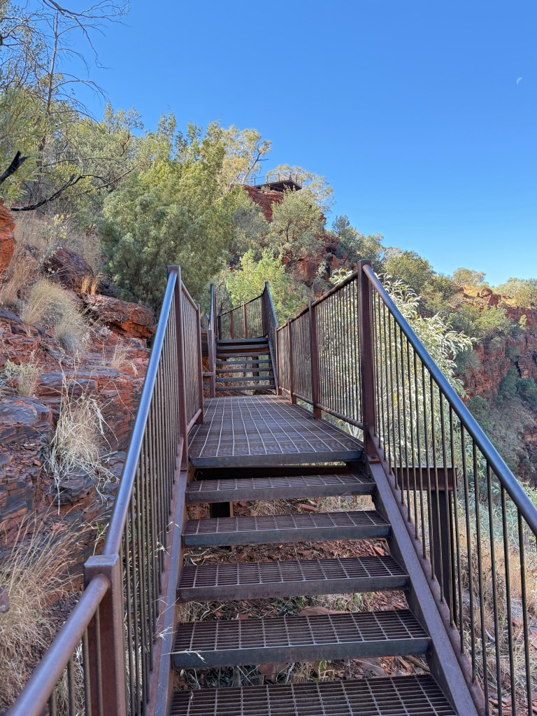
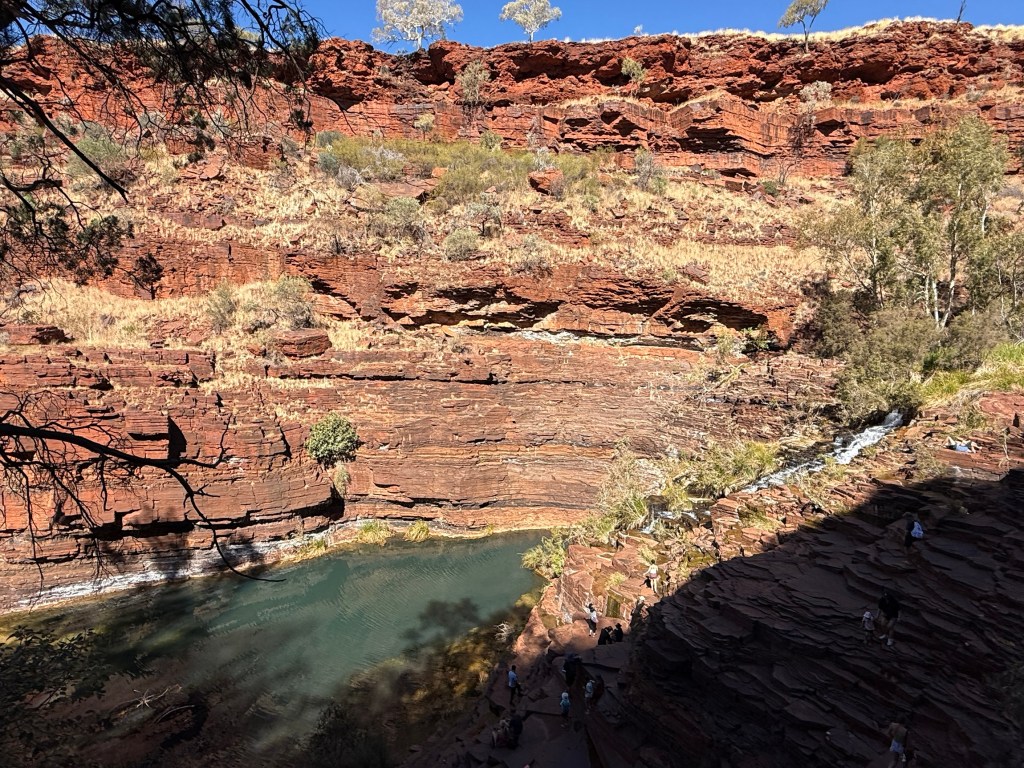
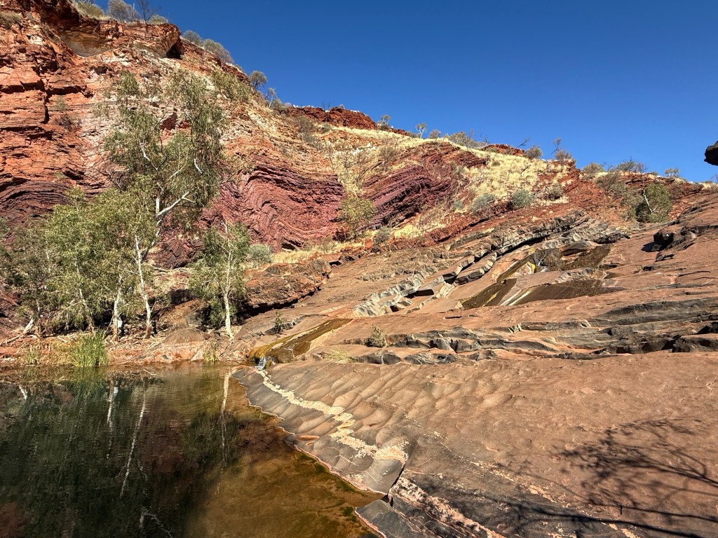
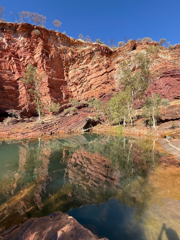
At Dales Gorge there is the Fortescue Falls and the pool at the bottom. A steel stair case takes one all the way to the bottom, some stops along the way to take in the view or have a breather, particularly on the way back up. A short walk further up the gorge is Fern Pool. Lots of people have a swim in this very deep and cold pool.
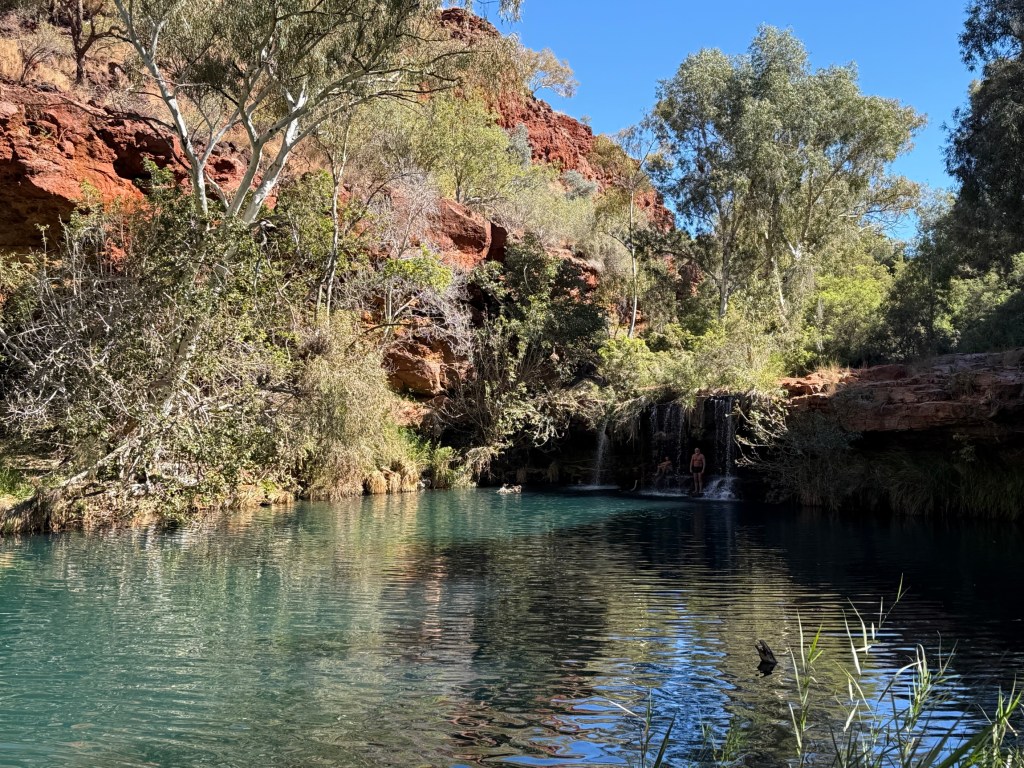
Several hundred metres to the start of the gorge is Circular Pool, beneath towering cliffs, from which water seeps into the pool.
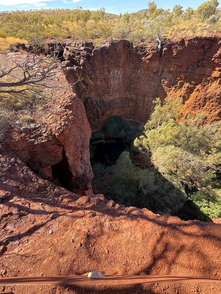
We then moved on several kilometres to Kalamina Gorge, this one was 6km in along a flood damaged heavily corrugated track. Homealone wondered why we were going. It was just ABG!
Allthego saw it as a challenge, and it was a relatively easy descent down to the bottom of the gorge and a pretty pool beneath a short waterfall. That was it for the day, we did have a picnic lunch somewhere!
Back at Auski we packed up the next morning and headed for Tom Price.
Marble Bar
We have had an interesting day out at Marble Bar.
Homealone though was a little sceptical that the 400km round trip for a hamburger at the old pub and seeing a bit of jasper was worth the journey.
We did leave a little late and just managed to get to the town half an hour or so before the Ironclad Hotel shut at 2pm.
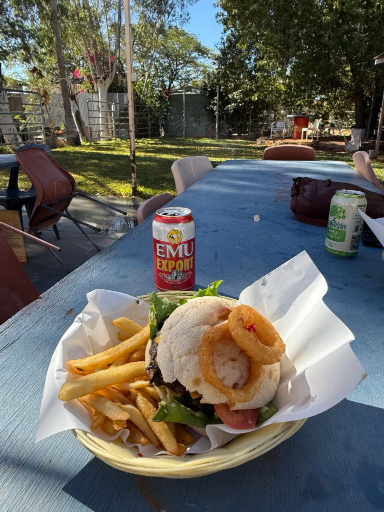
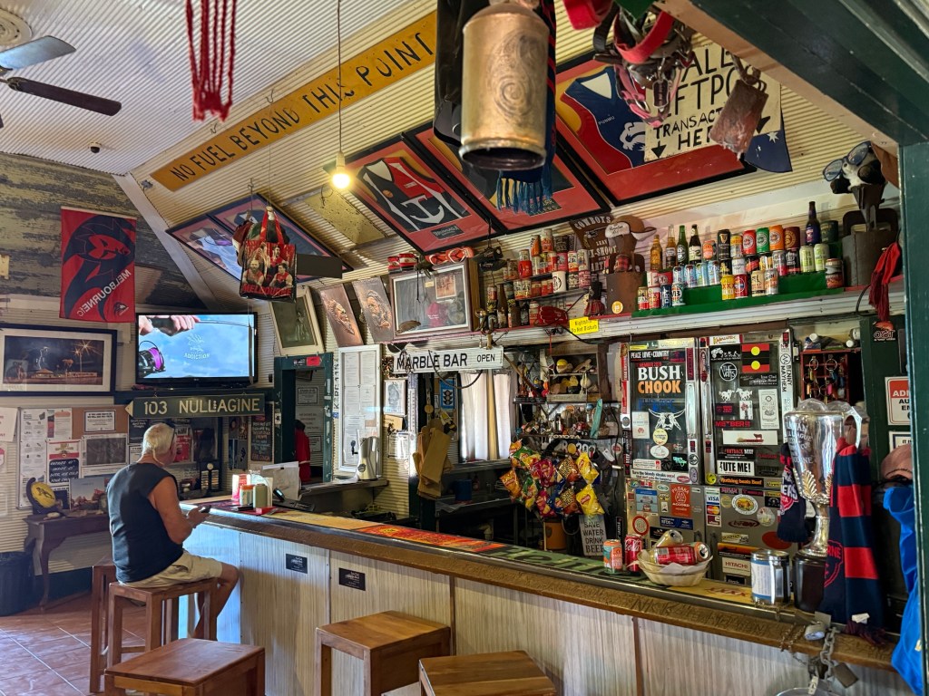
Allthego thought the burger was rather good, particularly in the ambience of the beer garden out the back. The iconic pub was established in 1892, one of the towns first permanent structures. Inside it doesn’t seem a lot has changed.
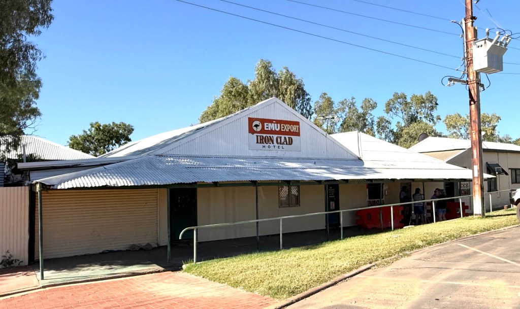
The town of Marble Bar has been around a long time. It was settled well before Dampier, Port Headland and other places up this way were established. It was gold finds in the late 1880s that originally brought Europeans to the region.
The town was called Marble Bar because the new arrivals thought a geological feature passing across a river bed was marble. In fact it was jasper an altogether different type of rock, but the town name stuck.
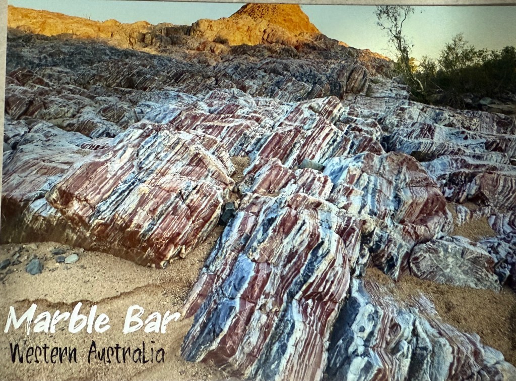
Tourists come here to check out the jasper field. This is a post card pic of the sight. Very colourful. Allthego is a bit puzzled by the pic and thinks it might be doctored a bit. He believes the colours don’t really show up like this unless the rock is wet. Could be wrong. Maybe a photographer was here just after rain. The location of the jasper had been recently cut off from the main track by floods that have removed a lot of sand between the rocks.
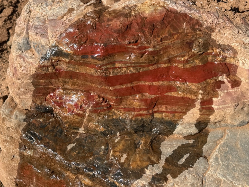
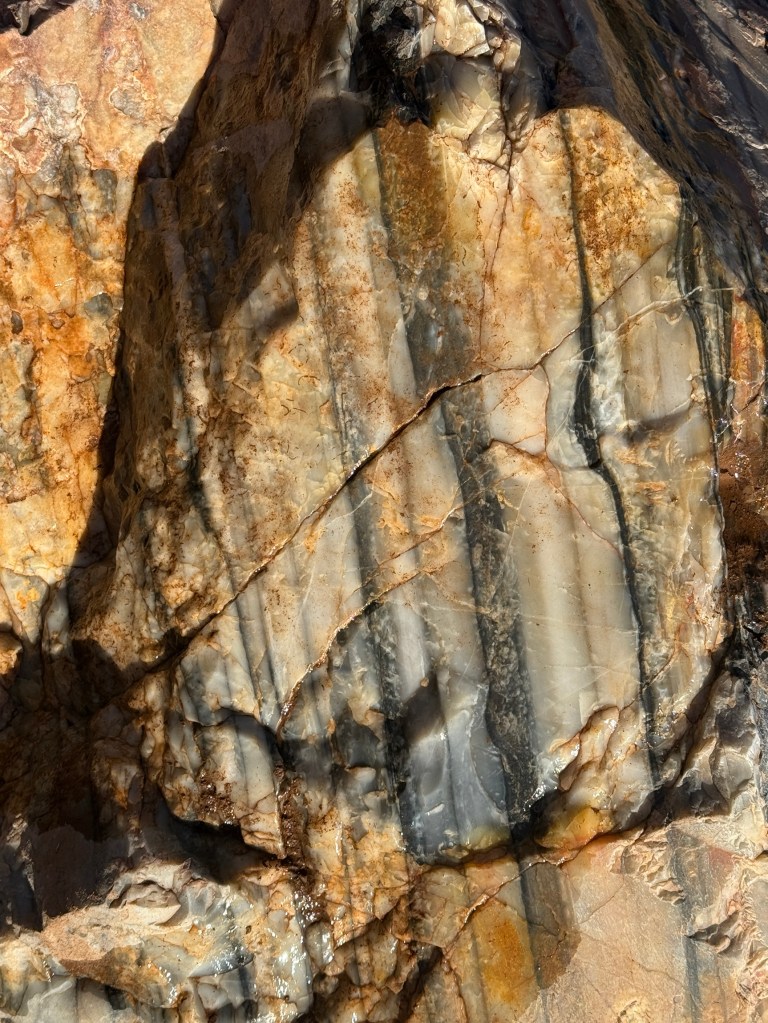
A bit of a maze to get through, and unfortunately we didn’t have the time to get to the postcard spot. Found a few slabs of it though and got a couple of pics, the water bottle came in handy to get the colours showing well.
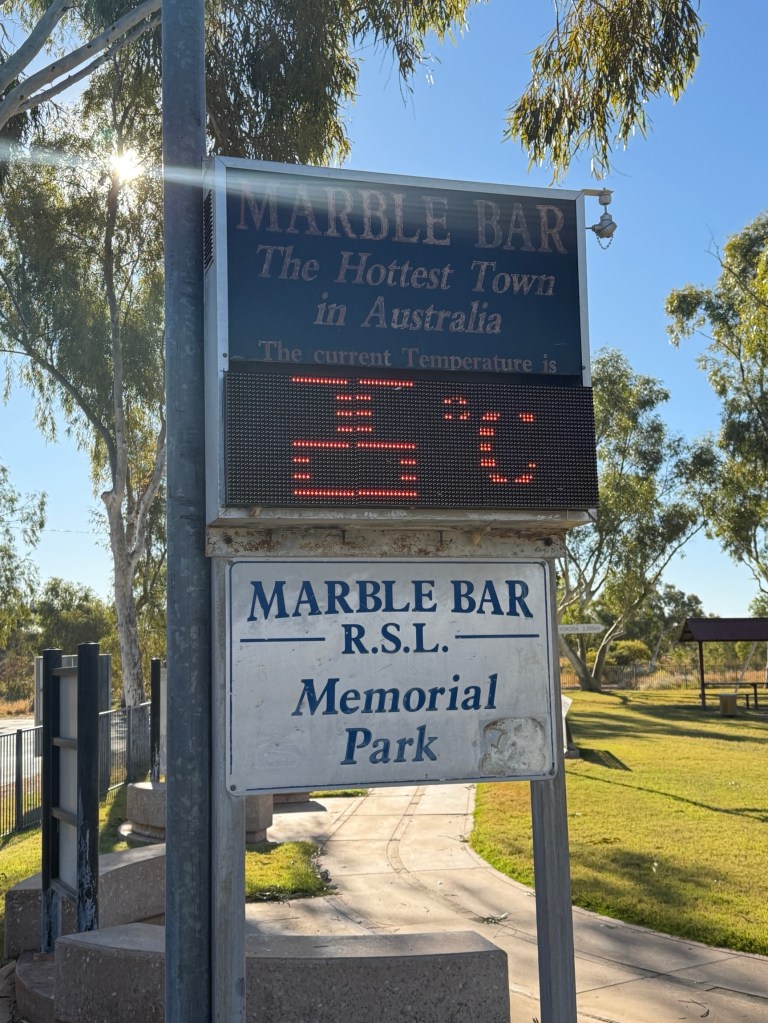
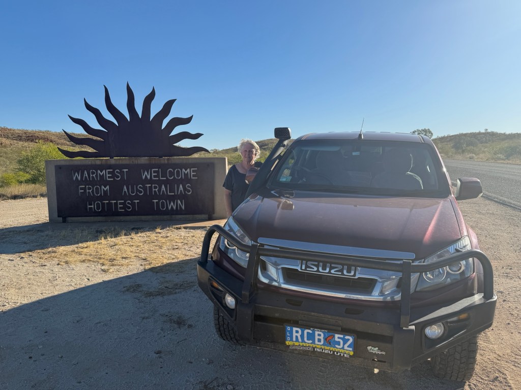
Marble Bar’s main claim to fame is that it is recorded in the Guinness Book of Records as ‘the hottest town in Australia’. For the 161 days leading up to 20 April 1924 the temperature did not drop below 37.8’C. That is a hundred year old record. The town continues to get regular mentions in TV weather reports for extreme temperatures.
We had a bit of time to look around the town at some of the historical buildings before setting tracks back to Port Hedland into the setting sun.

We left Port Hedland in the morning for some time at Karijini NP, inland and away to the south east.
