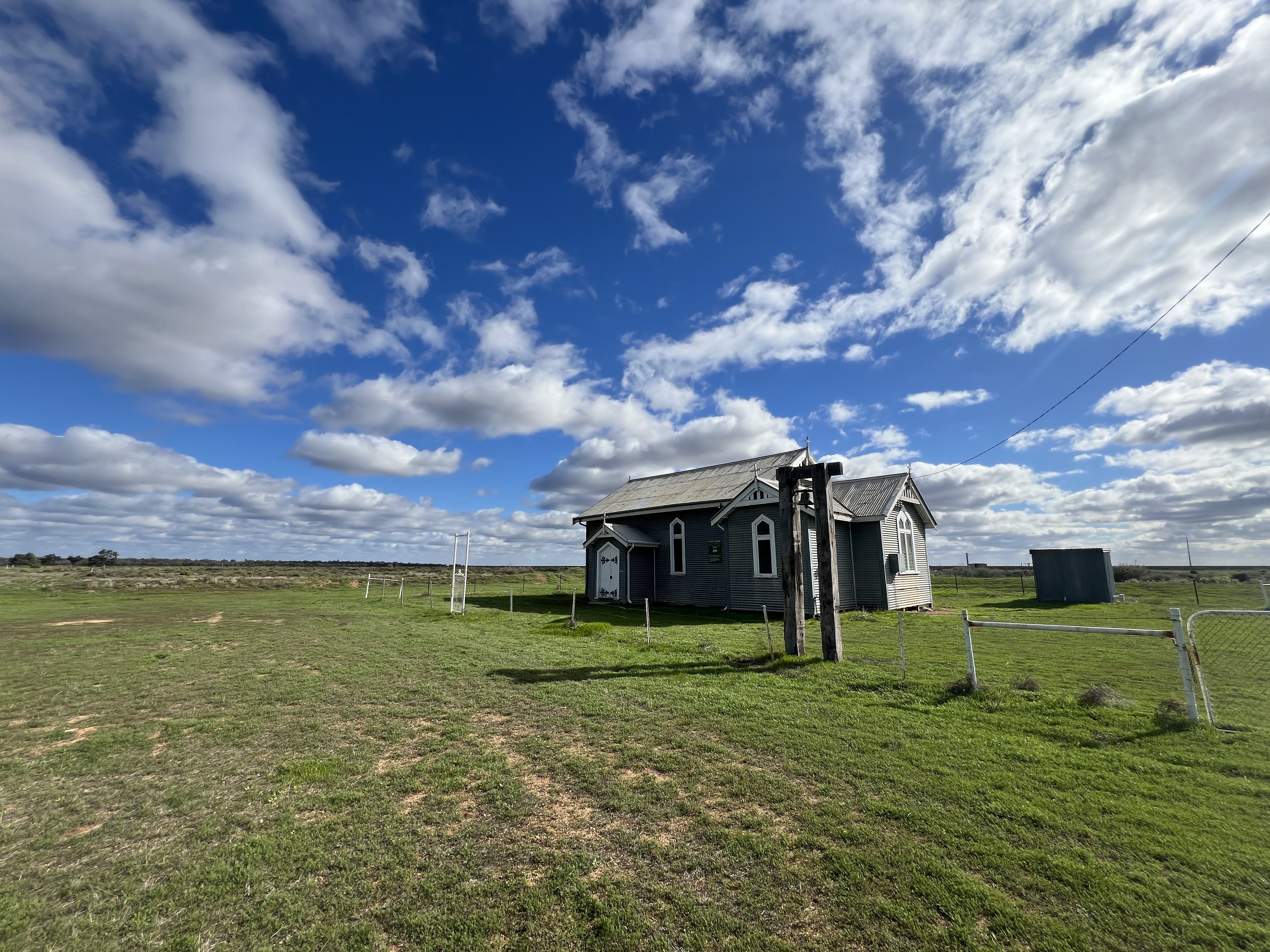
Palya Uluru
Allthego has been experiencing blog hassles. It seems software issues have mucked things up and he has had to resort to the Ap to post. We are a couple of days behind.
We were last here at the Rock back in 2017 and there doesn’t seem to have been much change in the shape of the Rock since then. I suppose this is not surprising.

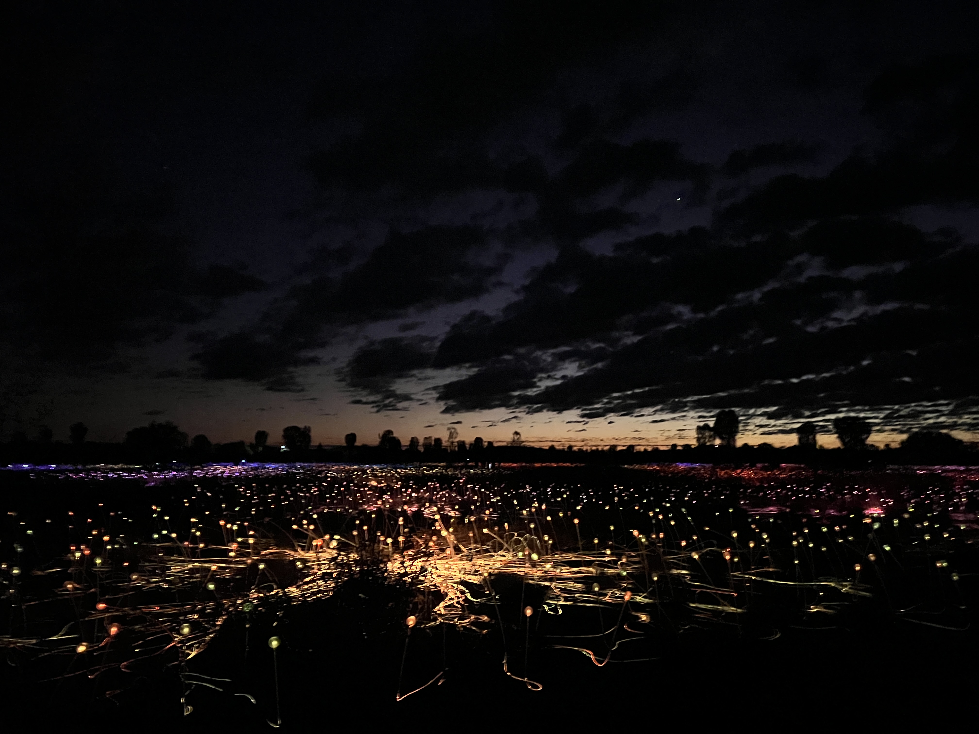
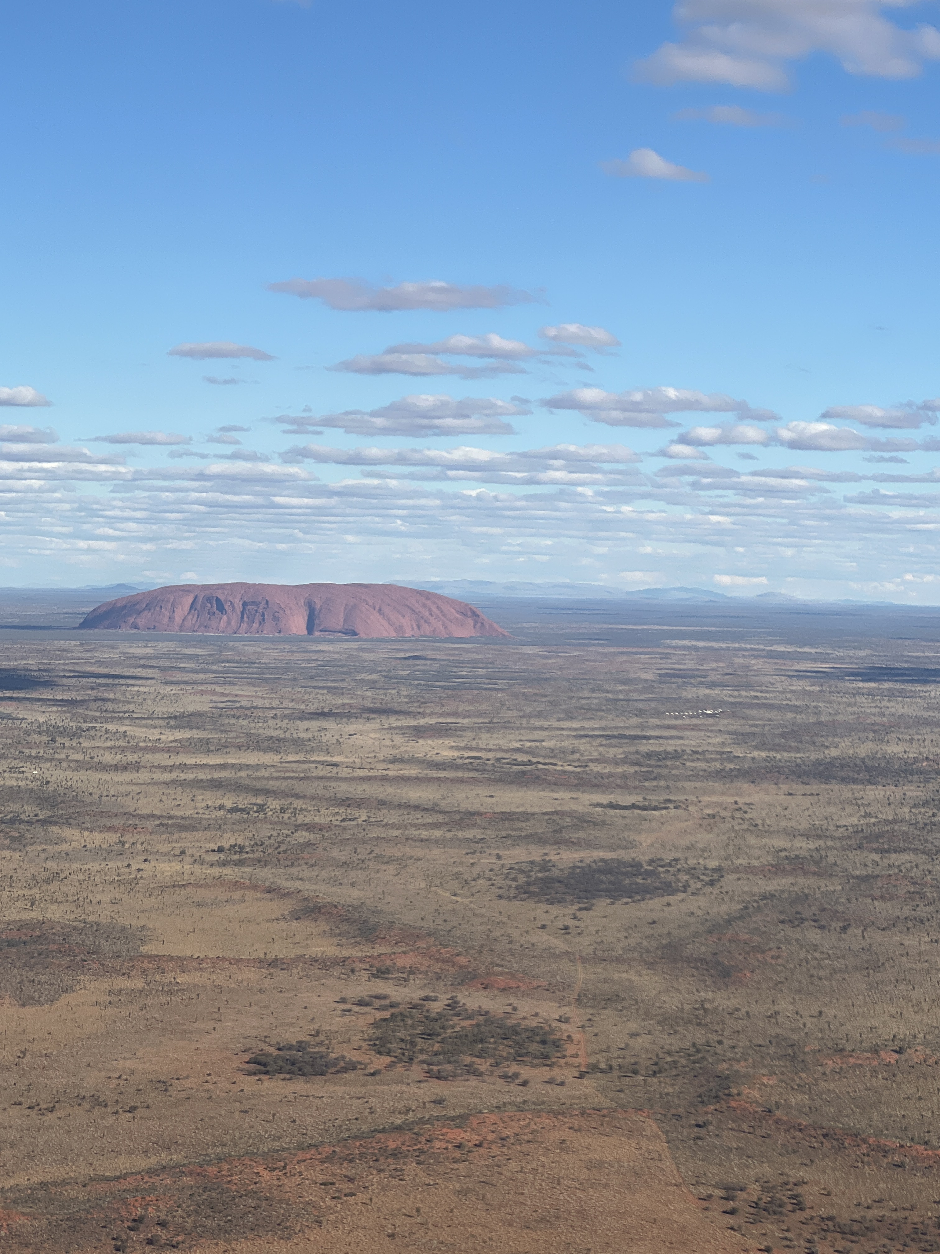
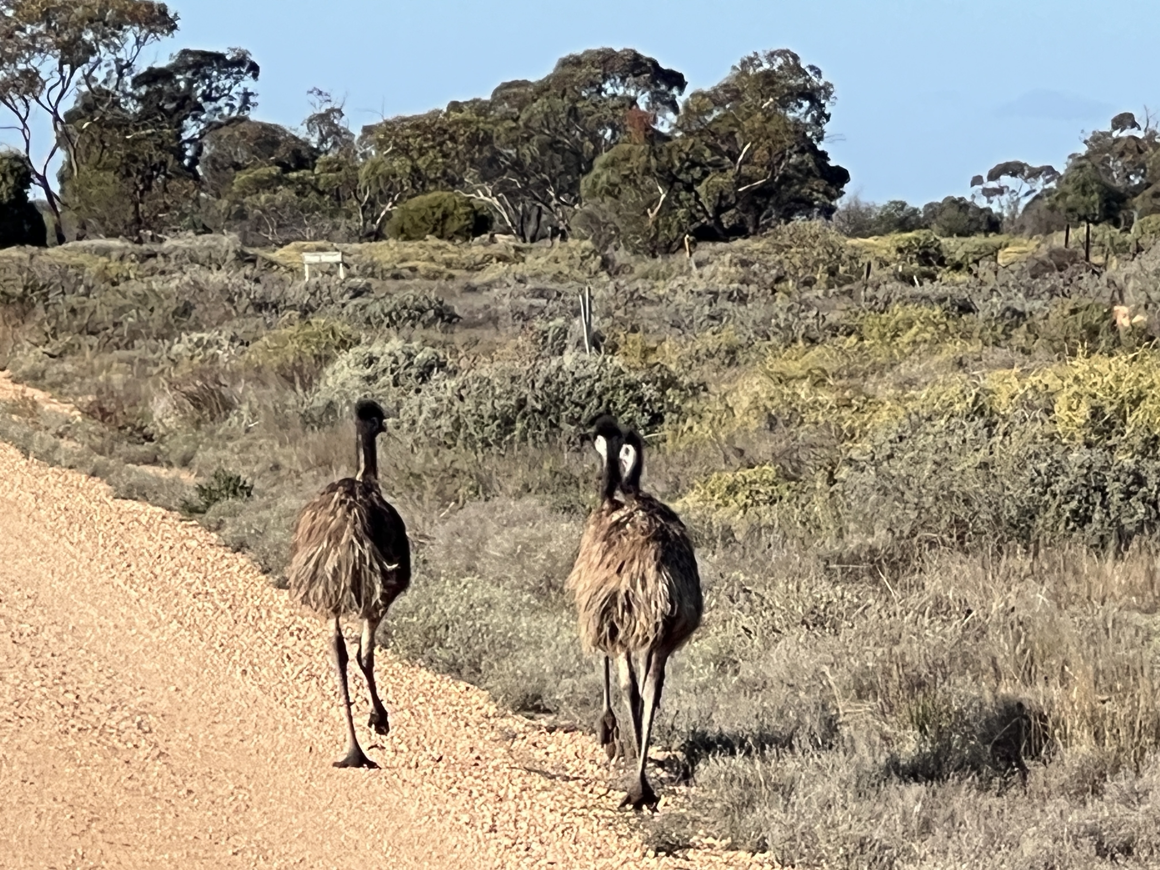
The next morning we faced an early 5 am start to do the Field of Light and Rock sunrise experience. In the early morning it is quite chilly, not far off zero. The sun rises circa 7.30am and we have 45 minutes or so wandering through the lights before heading back to the top of the sand dune to watch the sun rise and light up Uluru.
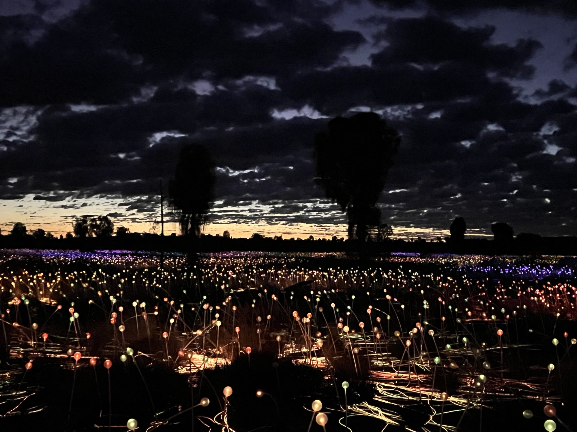
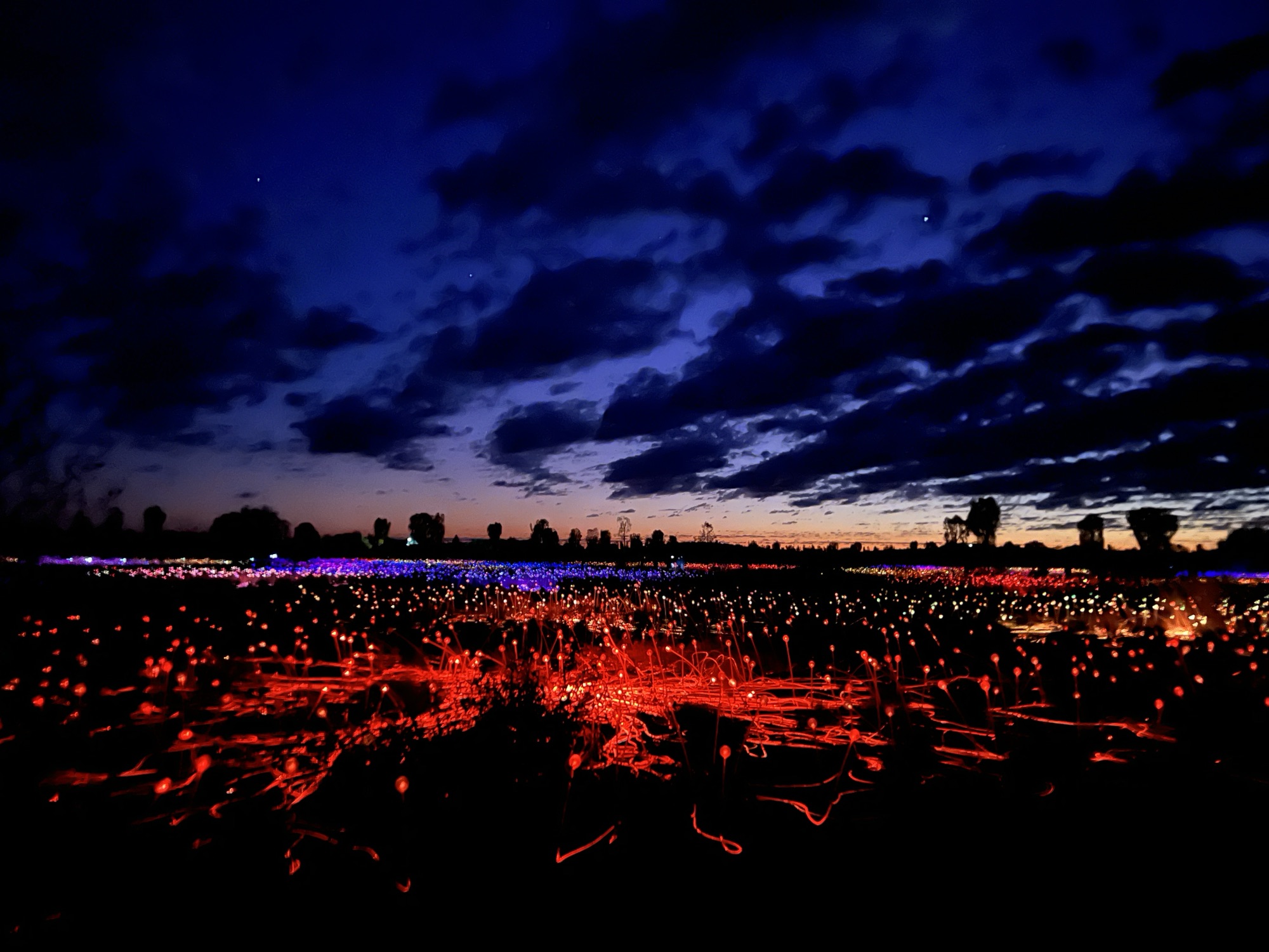
There are some 50,000 solar powered ball shaped like lights installed in a depression behind sands dunes. Down among the lights Uluru is obscured but up on the sand dune there is a great view across the plain.

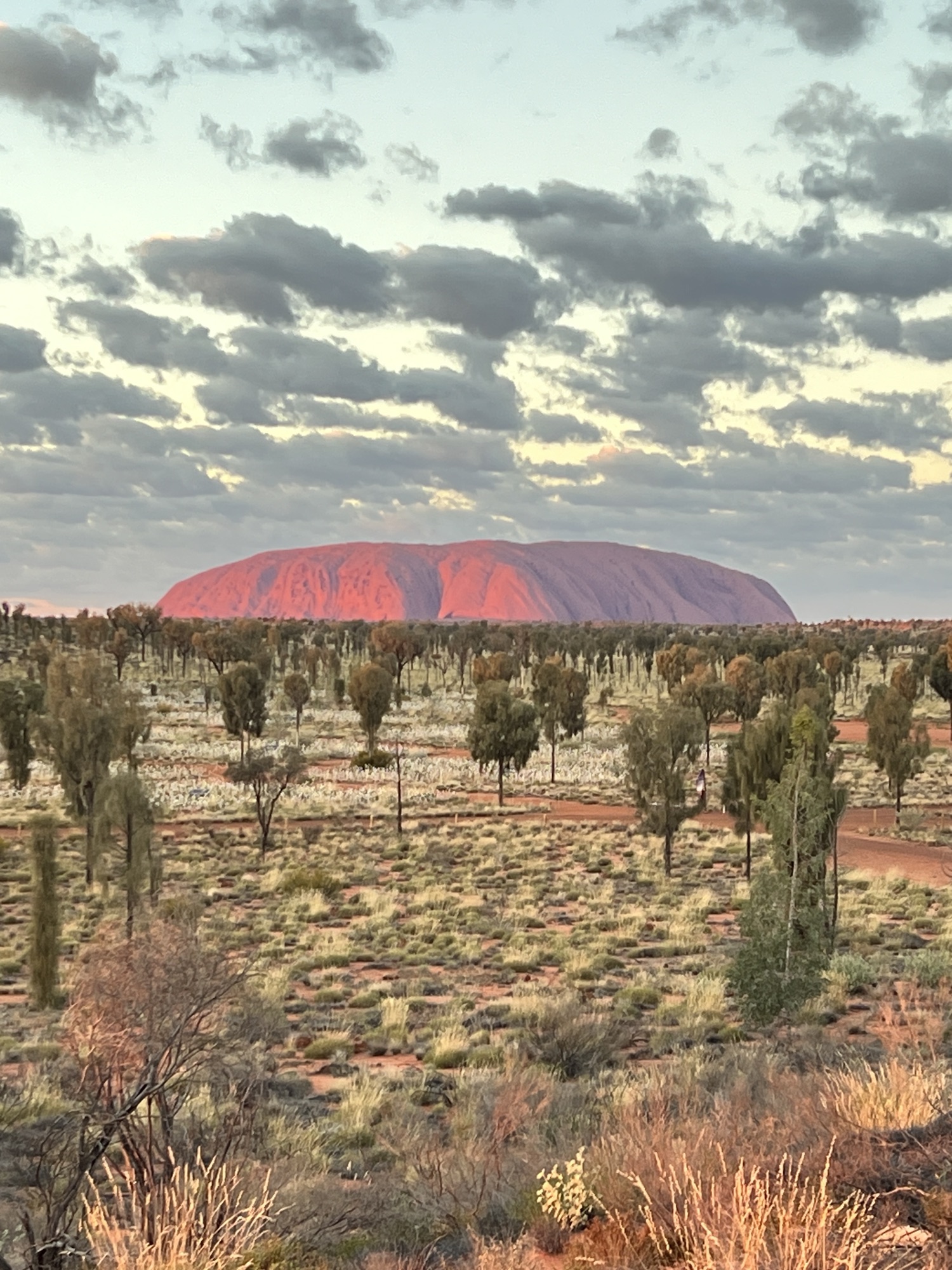
Away behind us Kata Tjuta also catches the sun’s early rays. It is a quite an amazing sight!

juta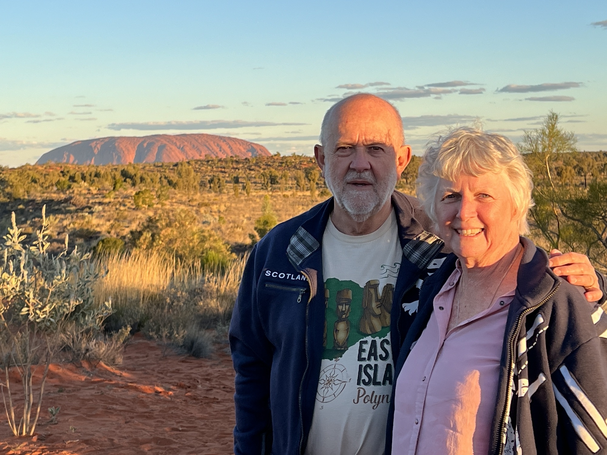
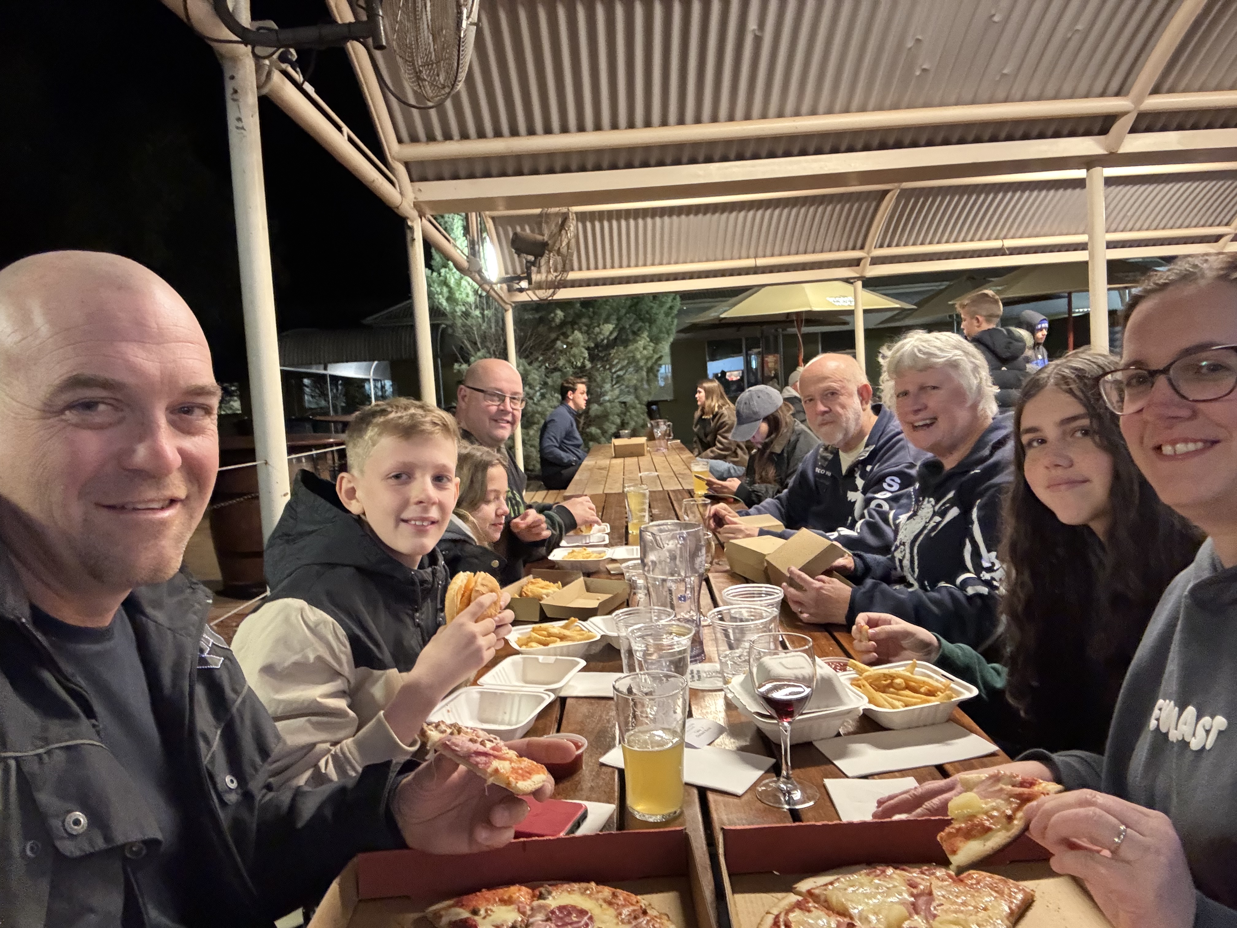
The coach gets us back to the village for a well earned breakfast around 8 am, providing fuel for the days activities. The next post will cover off on these.
By the way Palya, ‘Phal-yah’, means ‘Hello, Goodbye, Thank you, Welcome.’ If you think about it, it is a big word! Quite suscinct.
On the way to Uluru
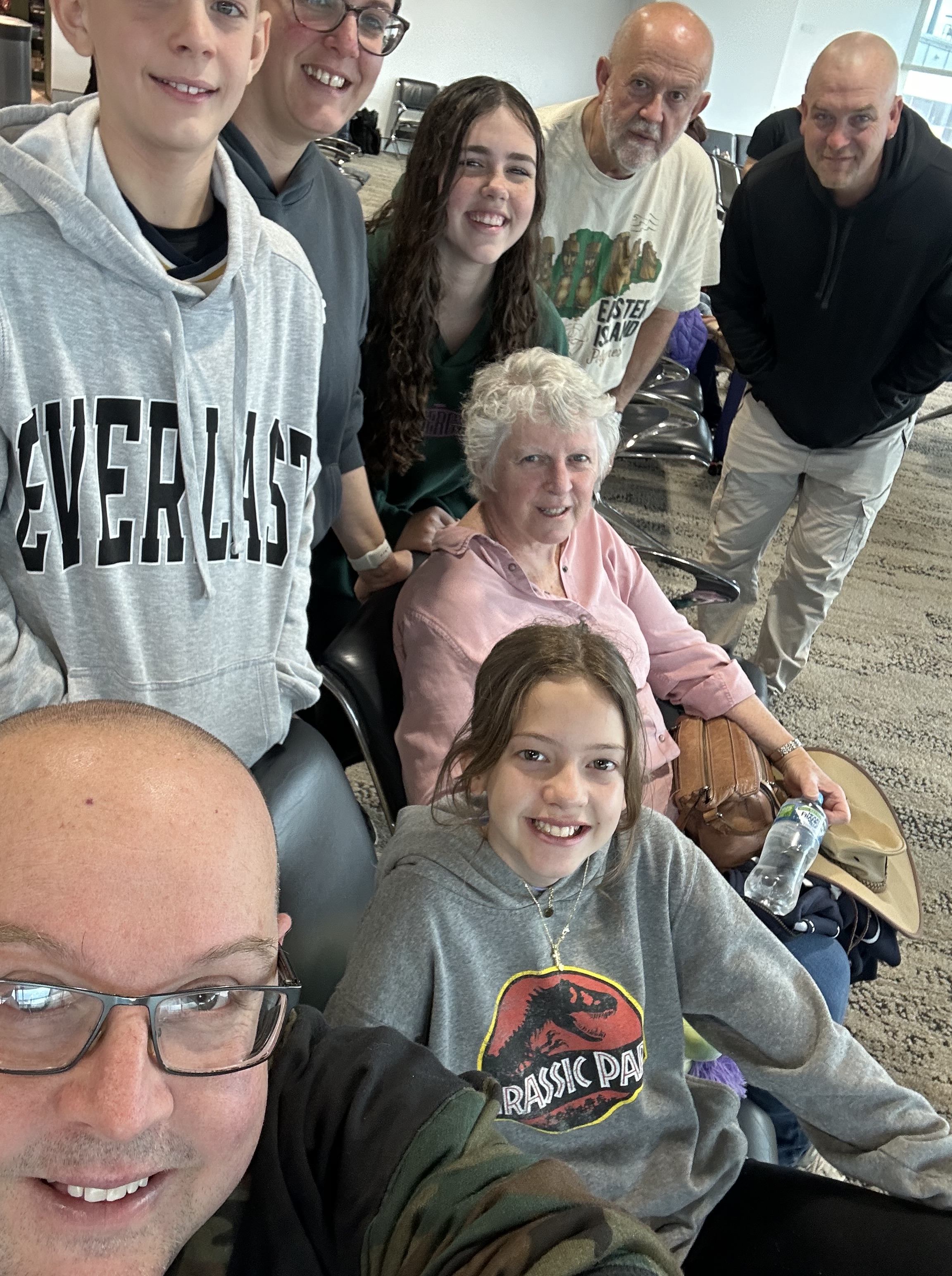
The family is off to Uluru for a hectic long weekend. We are all, apart from Gillian who is in Sydney and can’t escape, on board a Virgin flight headed for the iconic rock.
The senior Browns have been out here a couple of times before, one ages back and more recently we passed by on our way to Western Australia via the Outback Way through the centre of Aus.
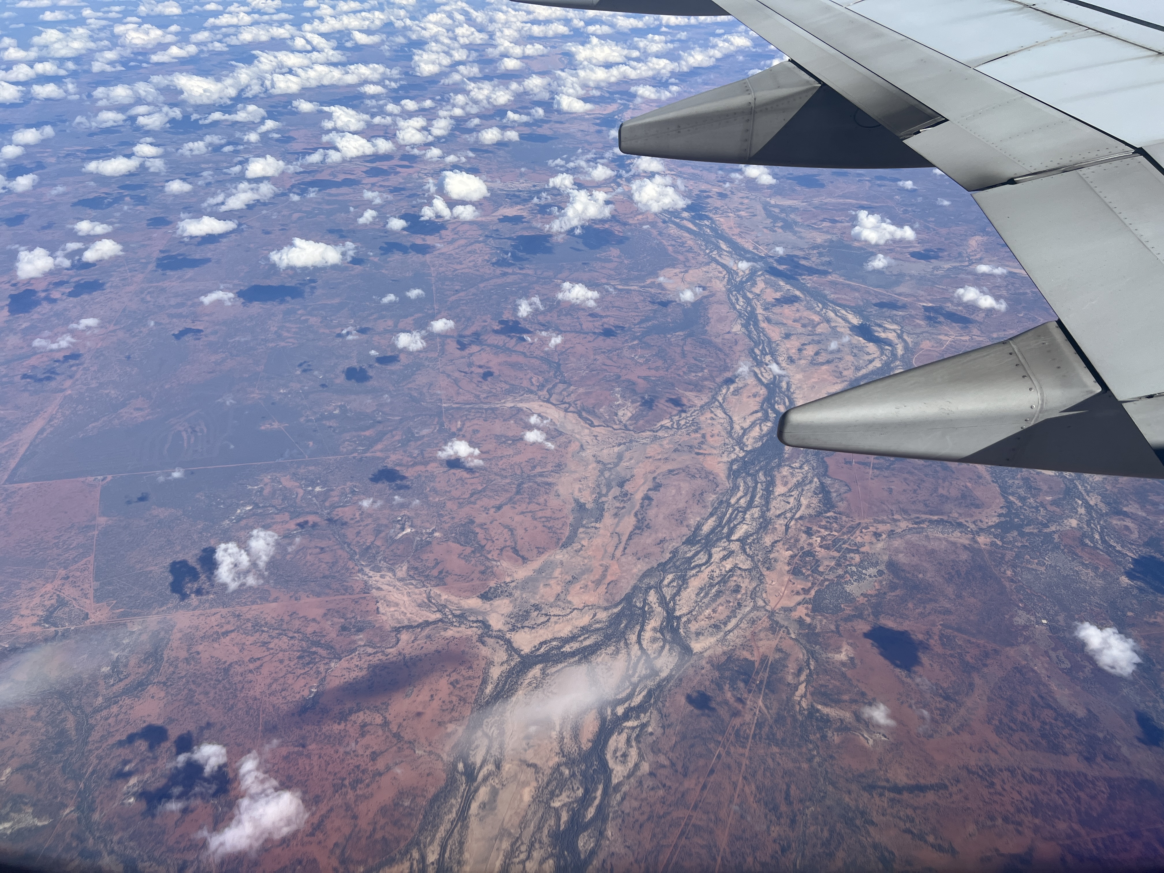
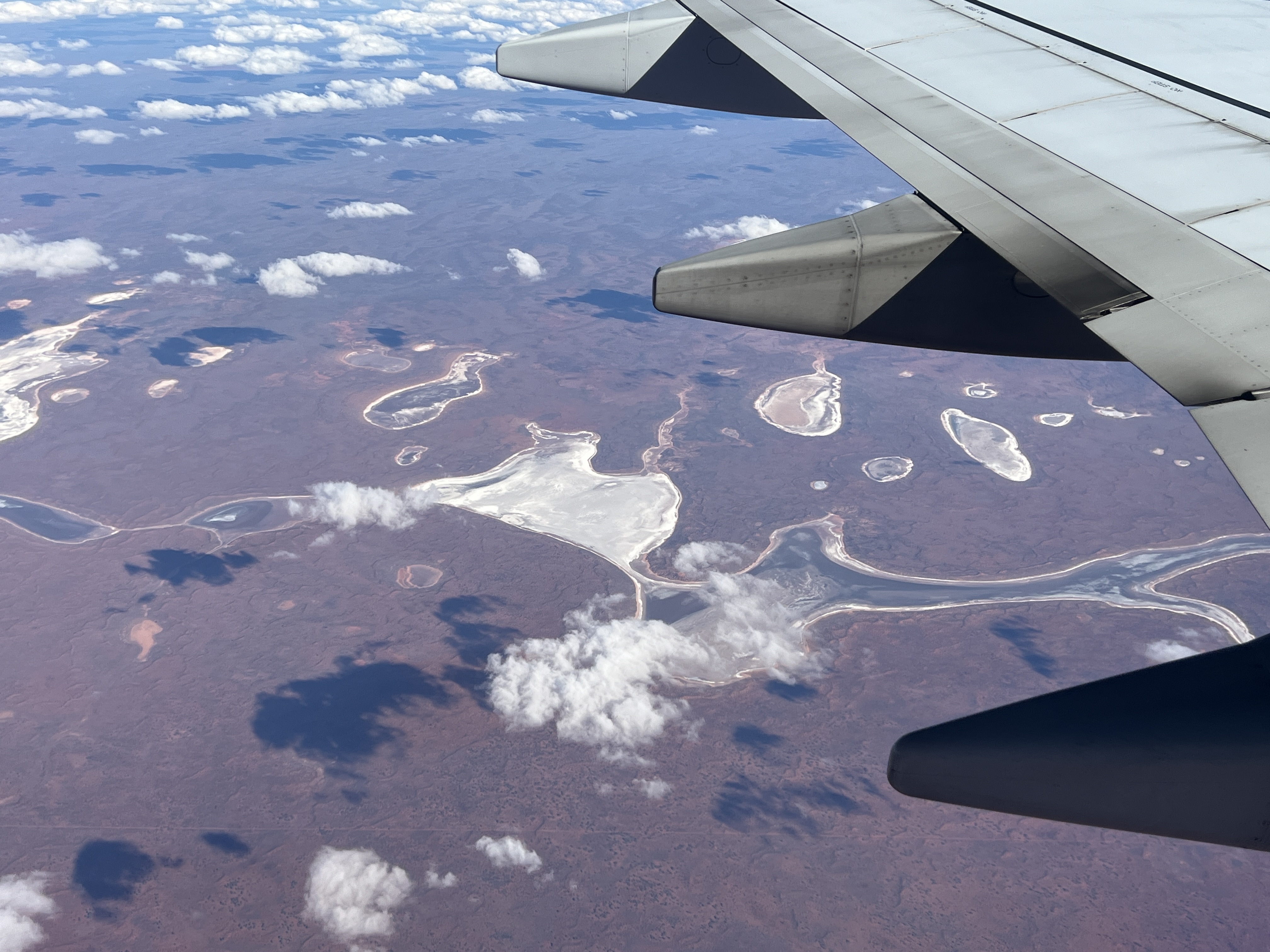
The flight out took a little over three hours, quite a smooth transit. Some clear views of the landscape below, including a great sighting of the Rock as we came into land at Ayres Rock Airport. A little odd it seems in that we now refer to the actual Rock as Uluru and not Ayres.
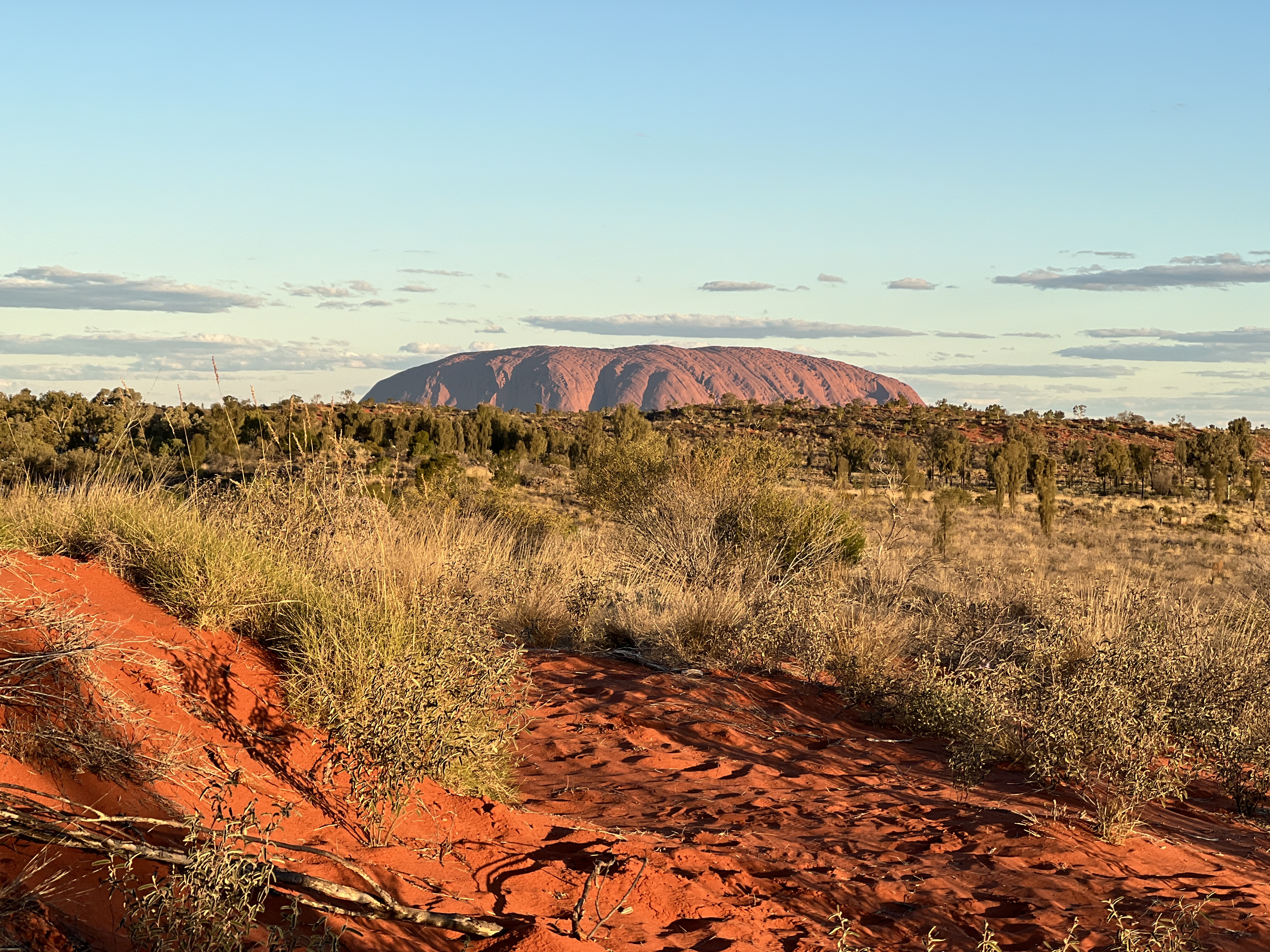
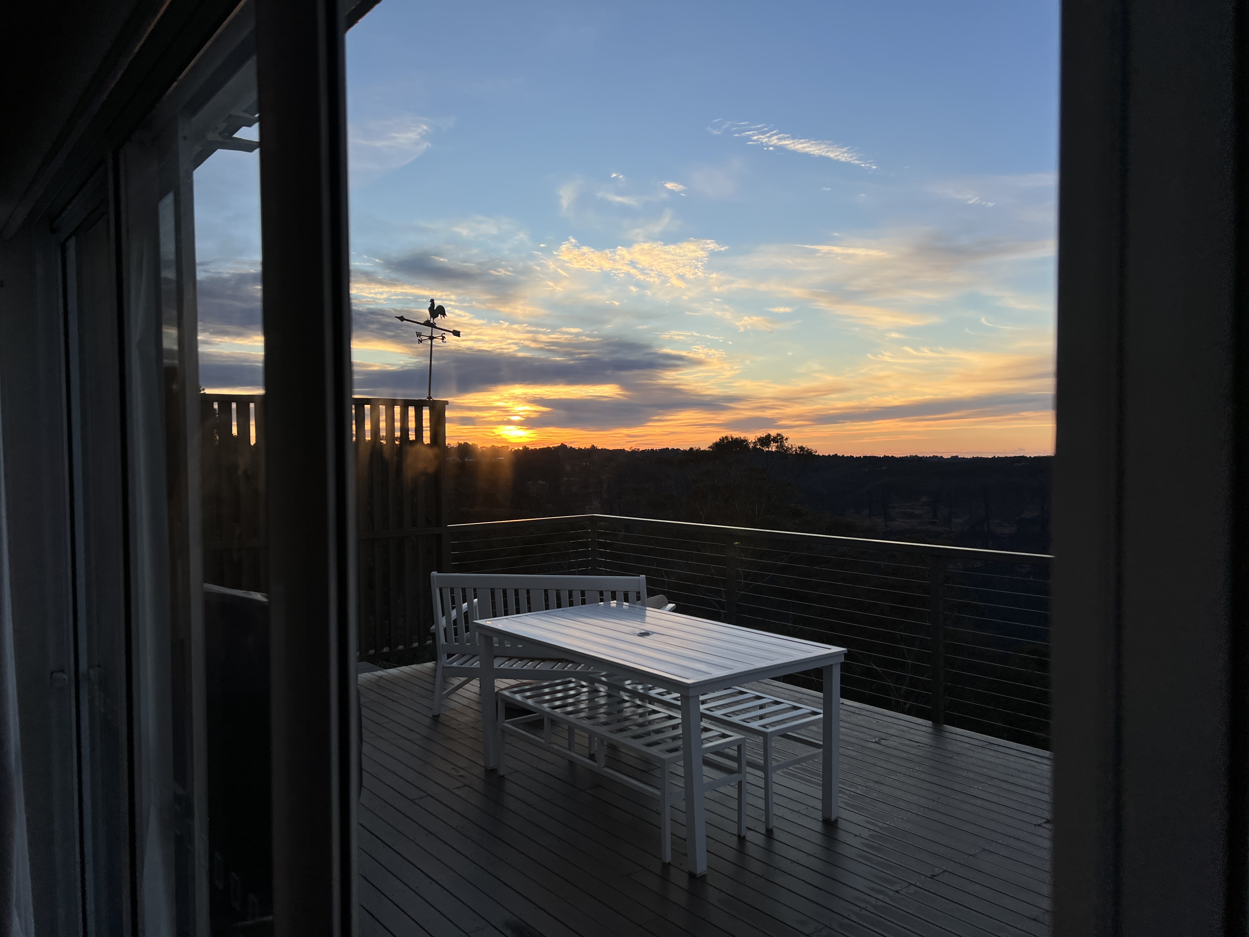
After settling into our lodgings we all set off on the short walk up onto a sandhill, the Imalung Lookout, to catch a sun set view of the Rock. The vegetation is all very green and quite a contrast with the red sand on which we walk. Quite an impressive view.
We returned to the lodgings for dinner and an early night, it is 5am start tomorrow to see the Field of Light and a Rock sunrise.
Back in Town
Before leaving Katoomba Allthego had a wander around the terraced garden of the Airbnb. It stretches down a steep slope to the track we had walked along, well hidden from view though.
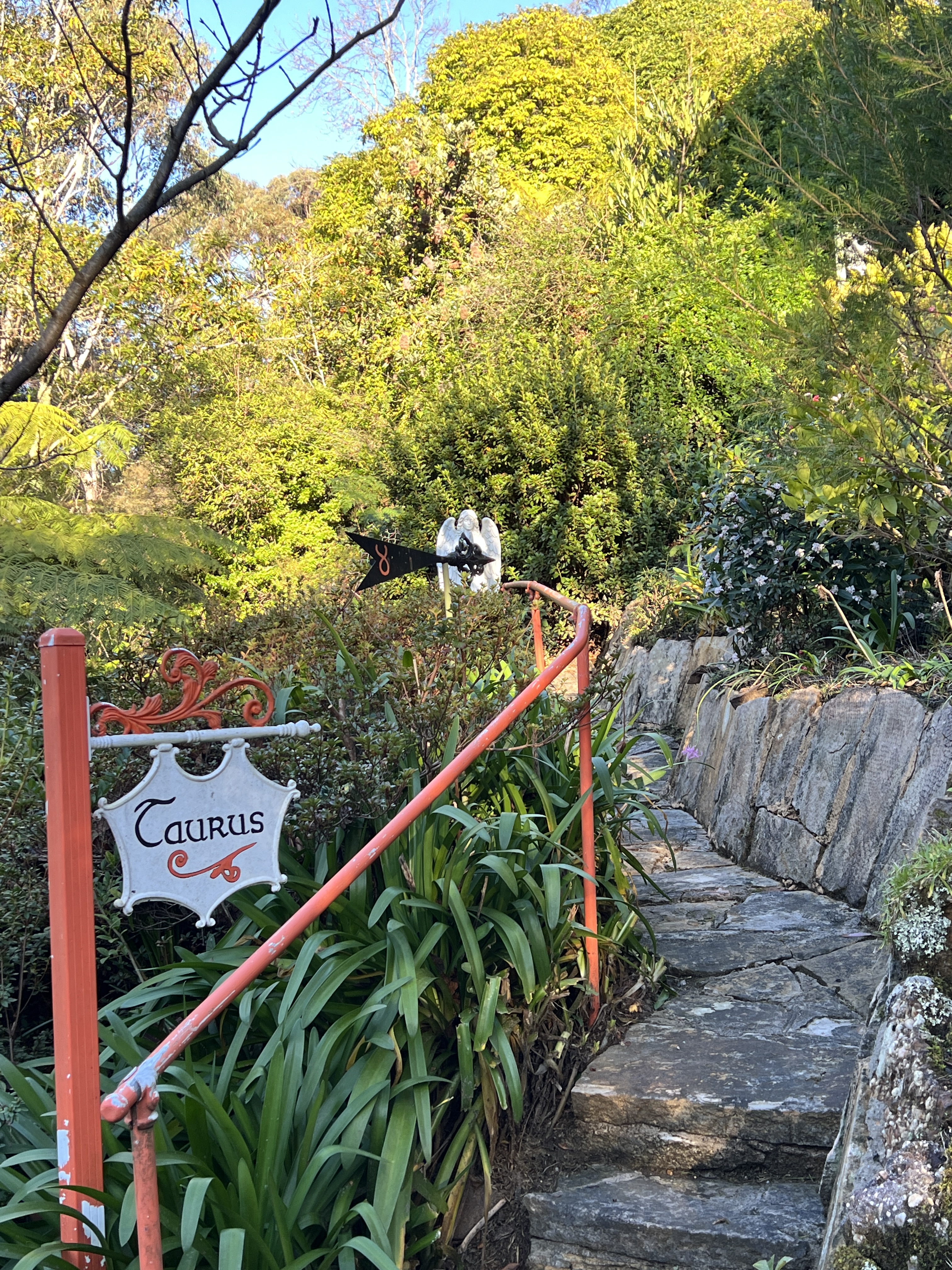
The house used to be owned by Richard Stirling and his wife. Some readers may recall this name, he was a popular astrologer in the 1960s and 70s. Had big columns in Women’s Weekly and was on the Tonight shows on TV…..Don Lane, Bert Newton. Made lots of predictions so he got some right occasionally.
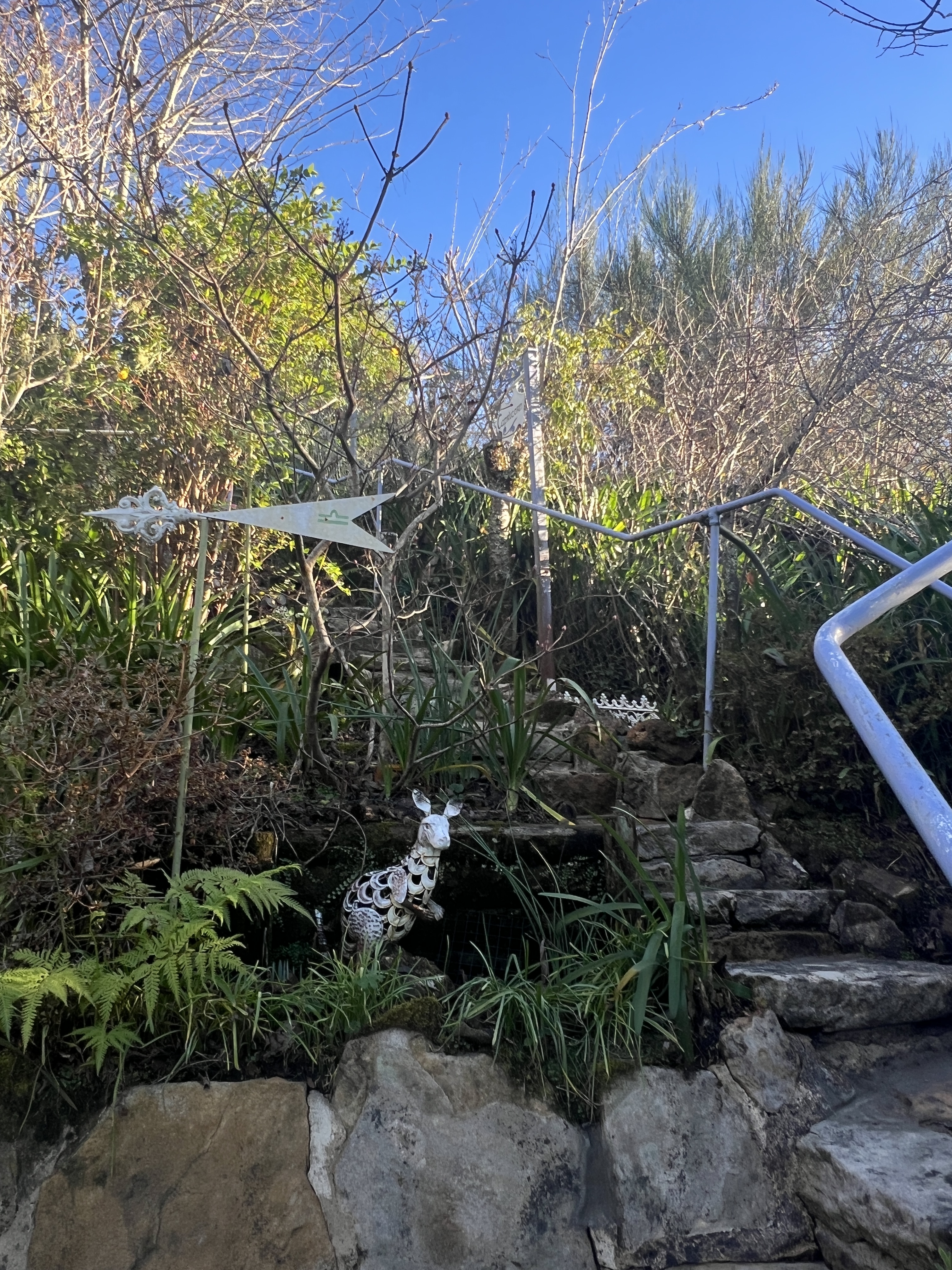
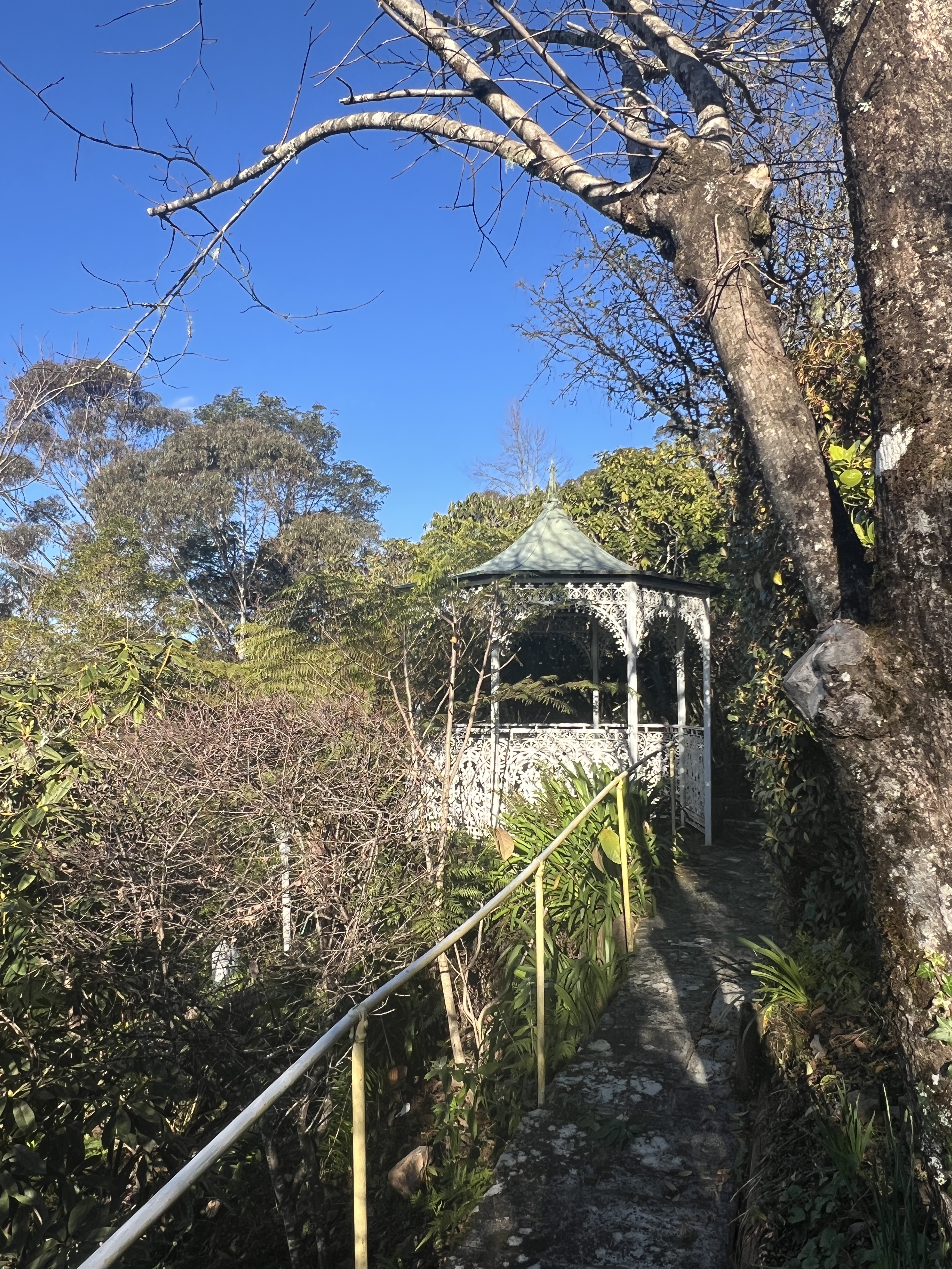
Anyway the garden is based around the star signs, narrow stairs and pathways weave their way up, down and across the slope. He used to have garden open days and people could wander around ‘soaking up the power’ of the stars so to speak. Stirling died about 10 years ago and the garden seems to need a bit of work, big job though.

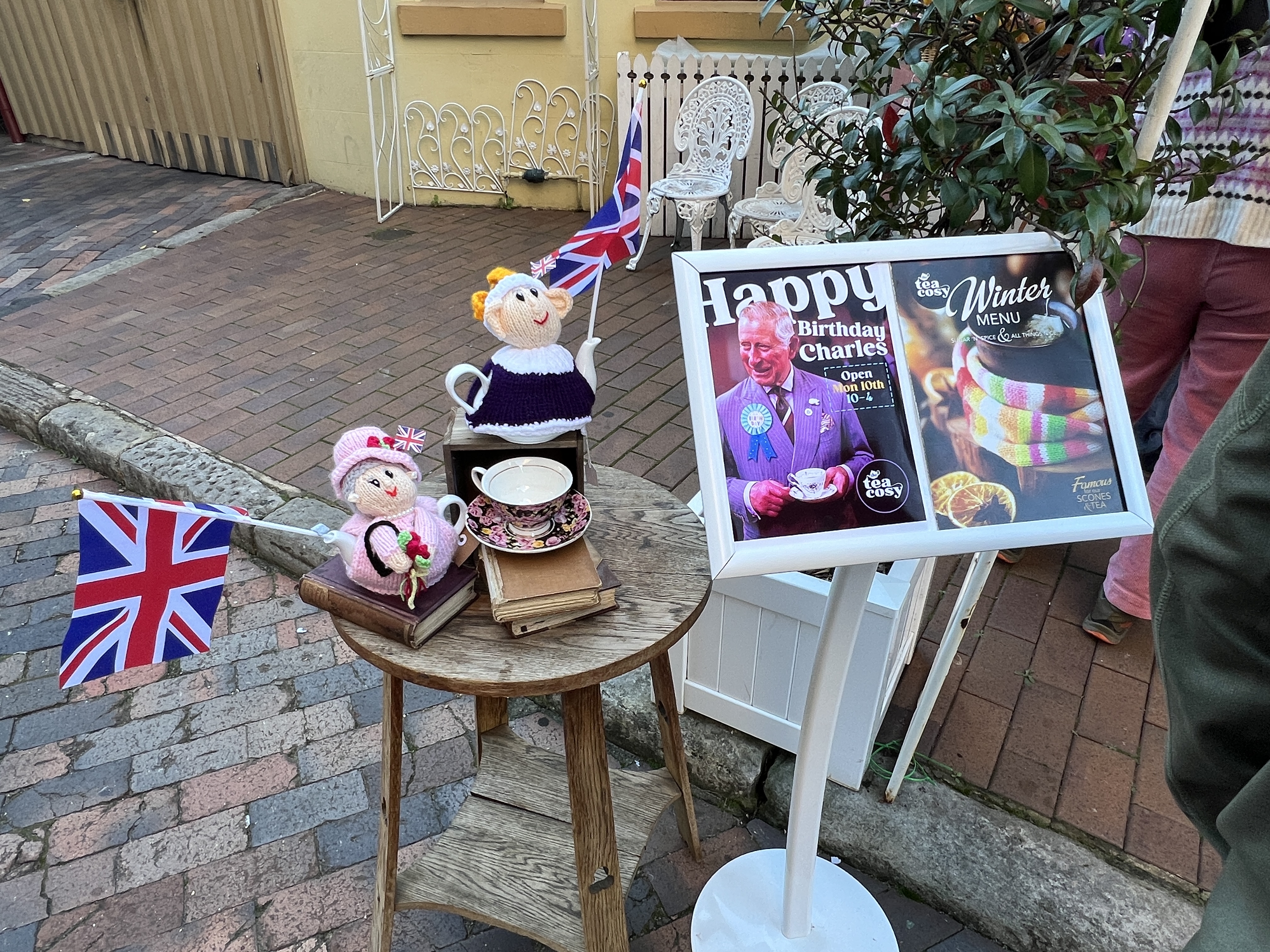
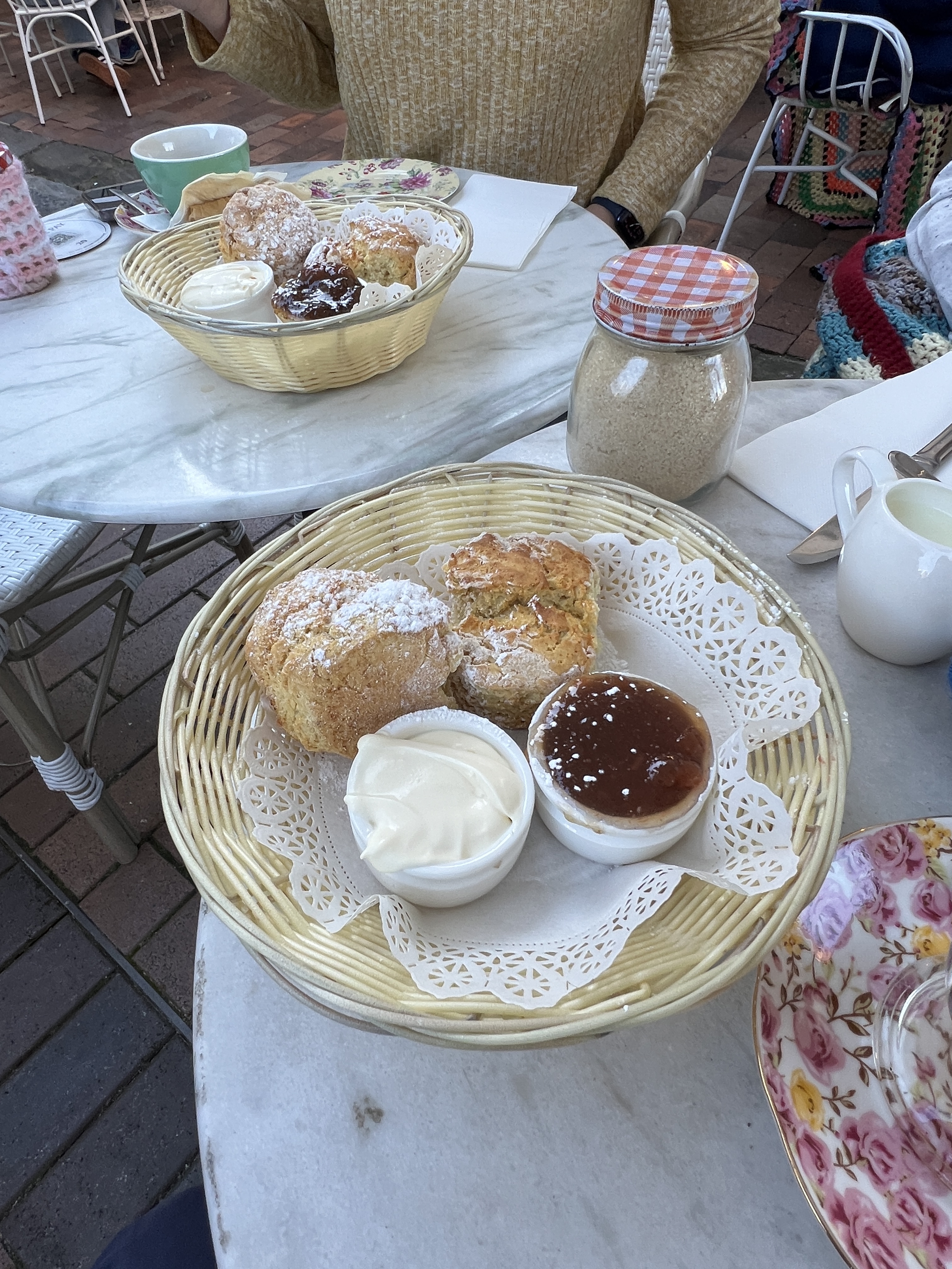
Leaving Katoomba we stopped for brunch at Conservation Hut overlooking the Jamison Valley, pretty busy but a good feed to last us on the way back to Sydney. Back in town we had a very late afternoon tea celebrating King Charles birthday up in the Rocks at Tea Cosy. Very nice fresh hot scones!
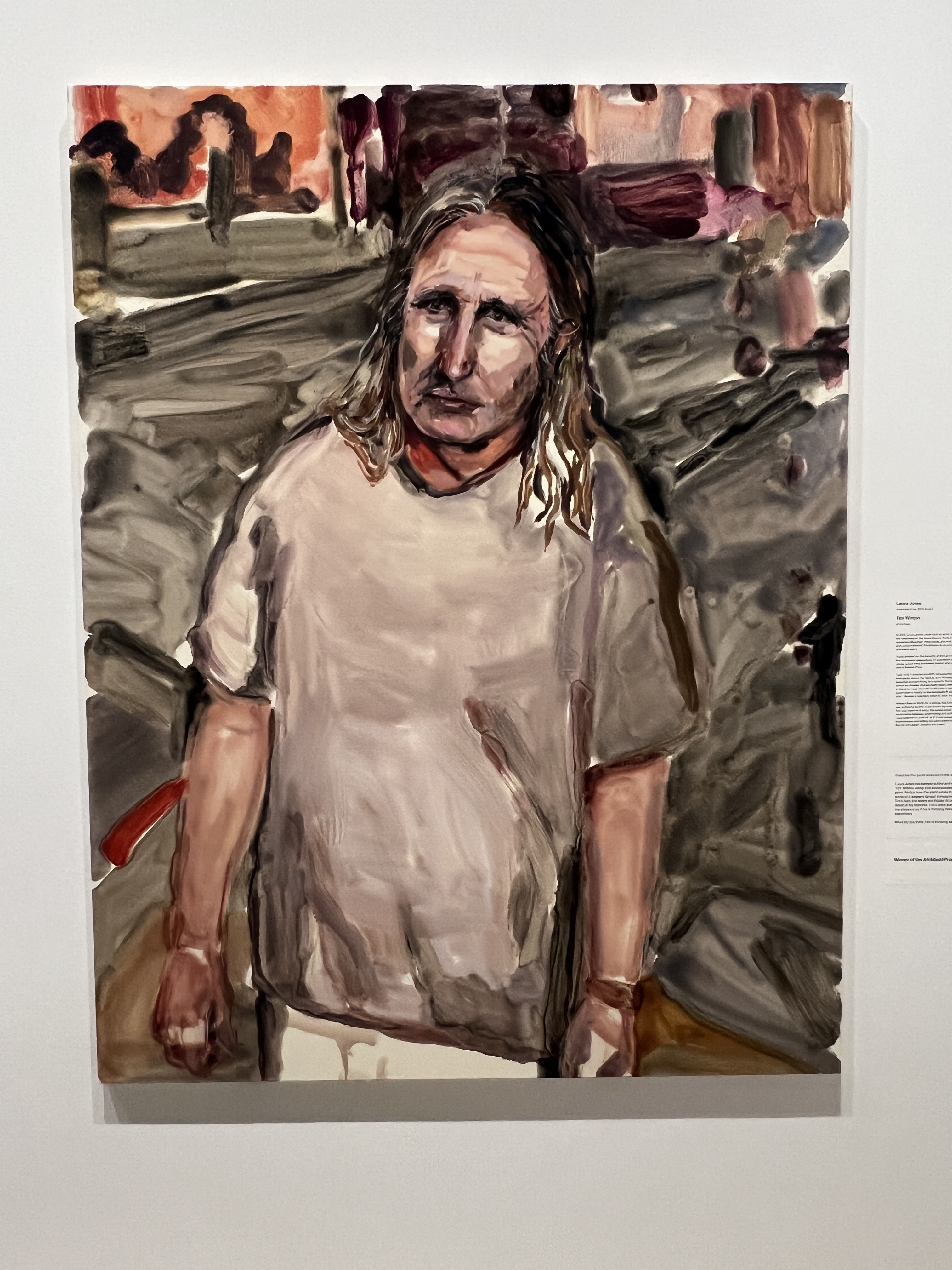
Our last day in town was spent indulging in some cultural activities. First up was a visit to the NSW Art Gallery to view the latest Archibald Prize finalists and the winner, a portrait of author Tim Winton, of ‘Cloud Street’ fame amongst others Allthego hasn’t read. Never did finish Cloud Street either, the TV series an easier route!
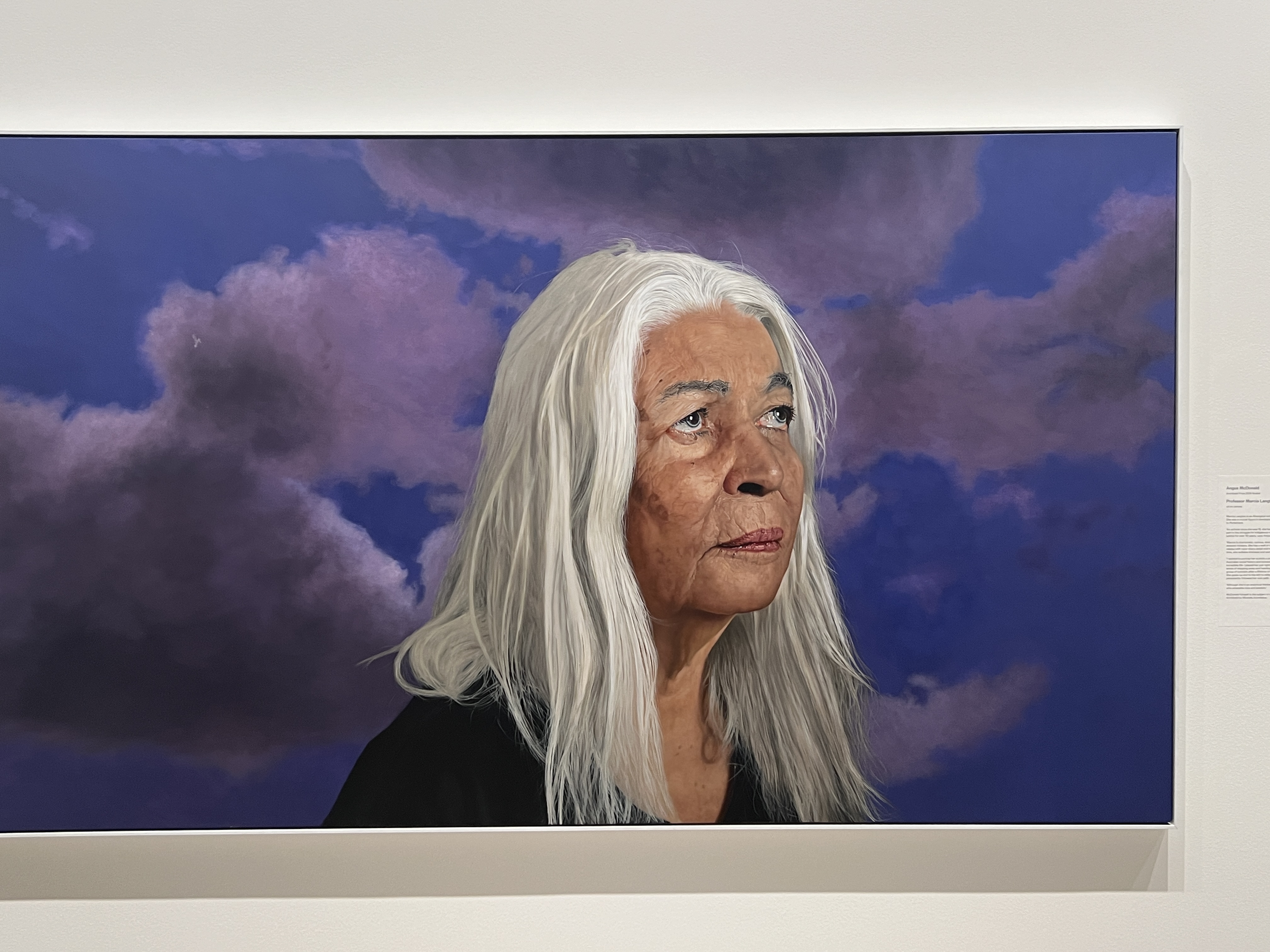
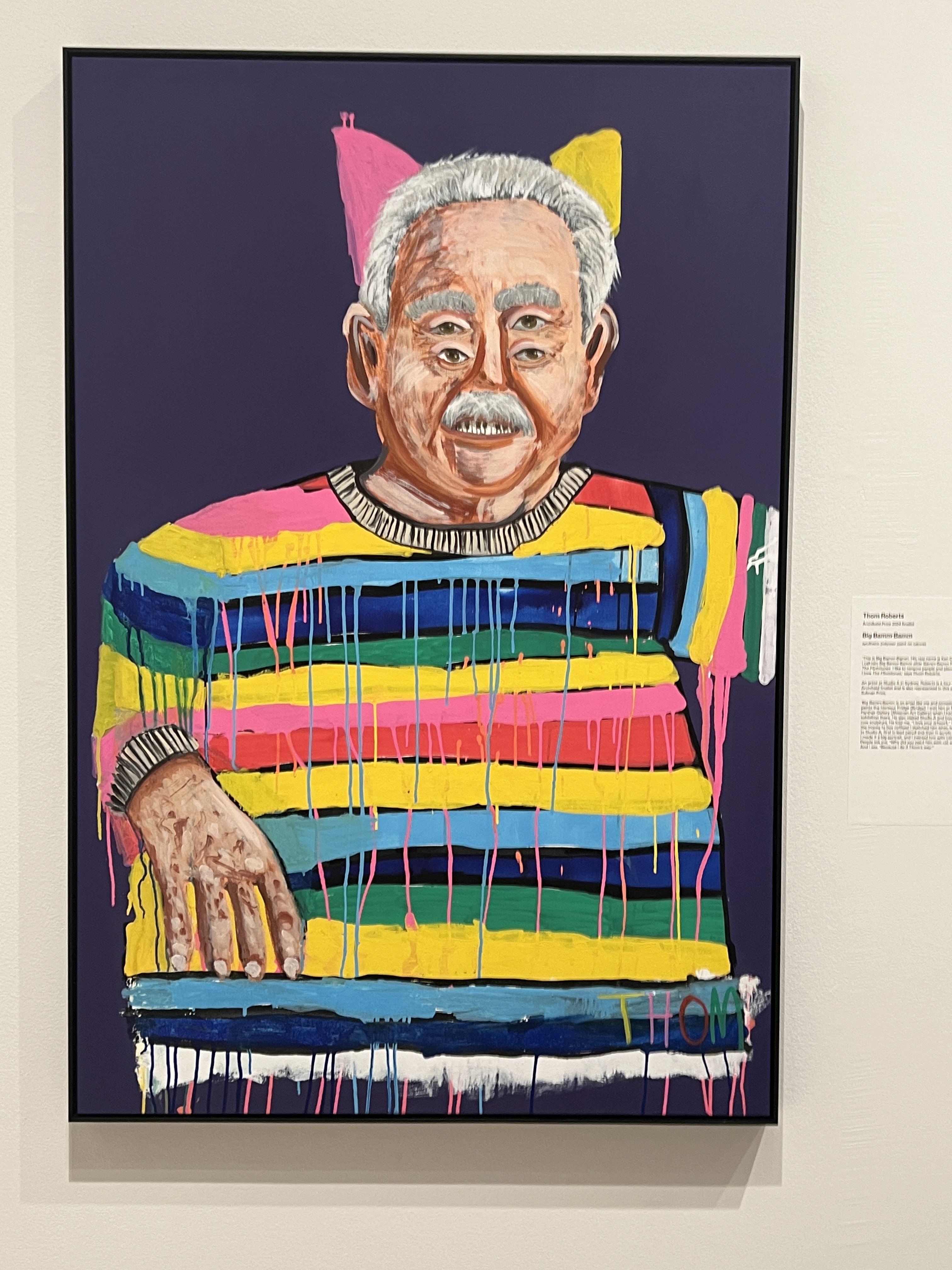
Quite an interesting visit to the Archibald, plenty of unusual works. We then returned to the Rocks and had lunch at the Orient Hotel, one of those old colonial days pubs along George Street down near the Quay. We were joined by Graham and Mary Bee who we had met on the World Cruise a year back.
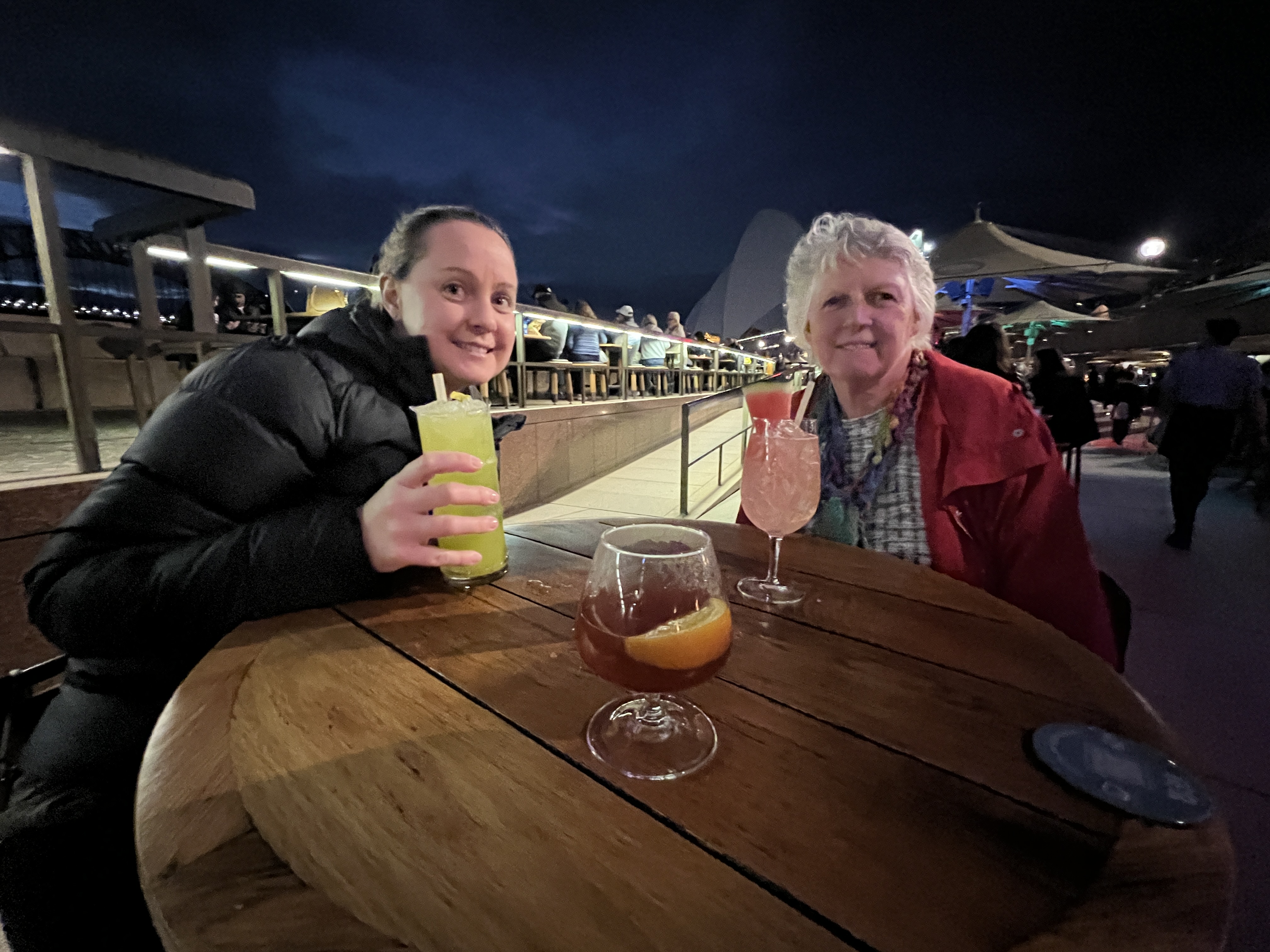
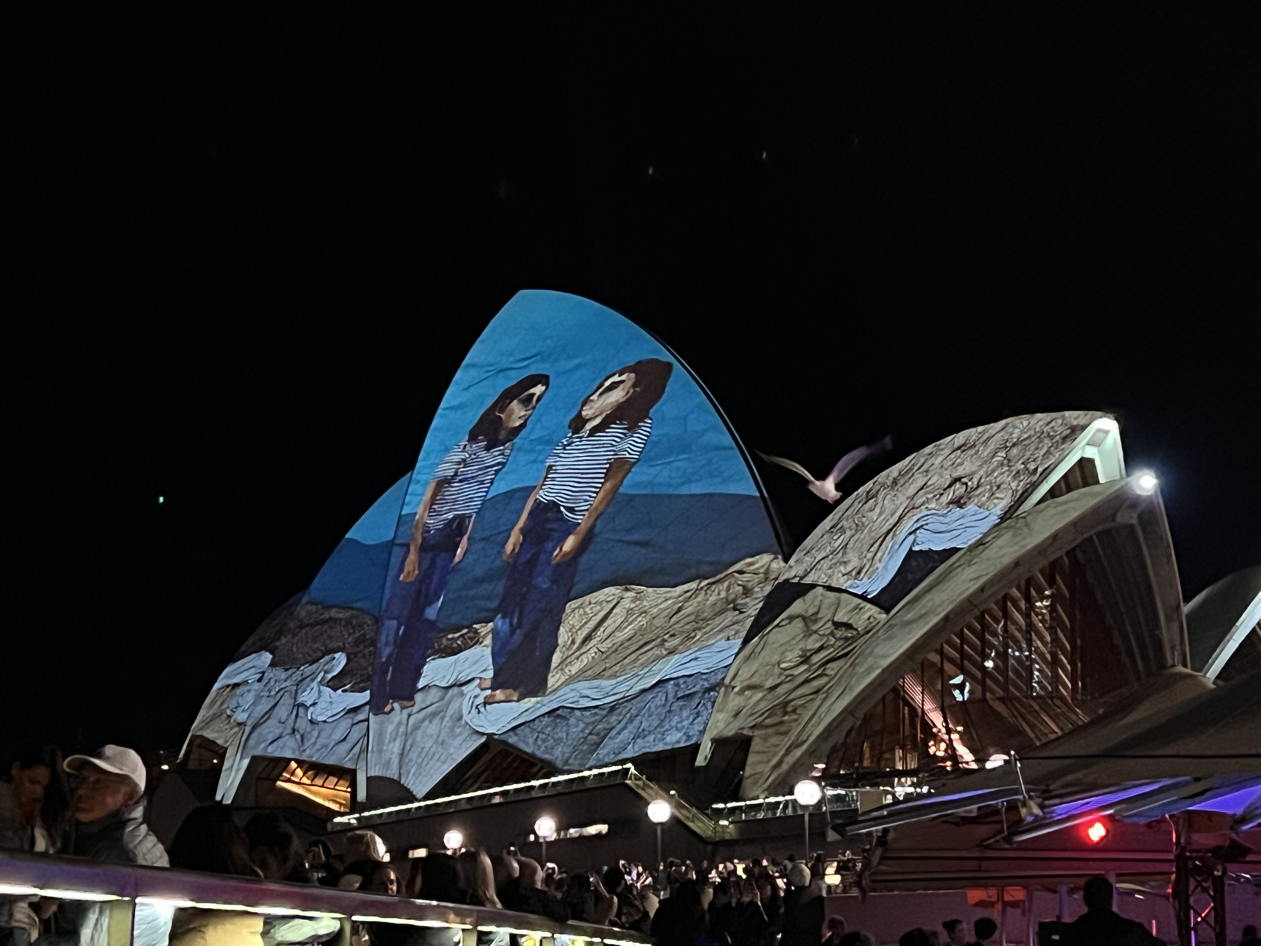
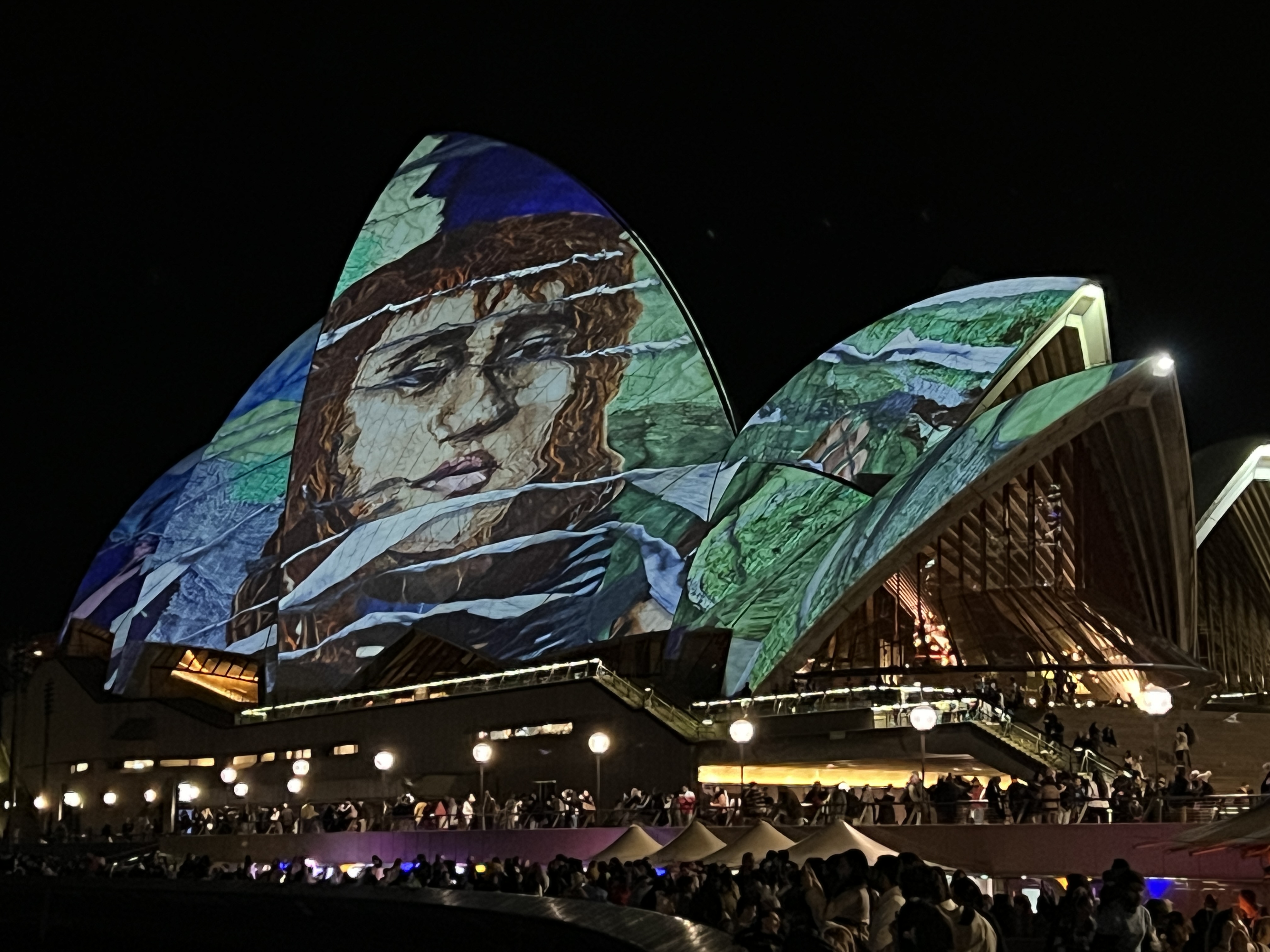
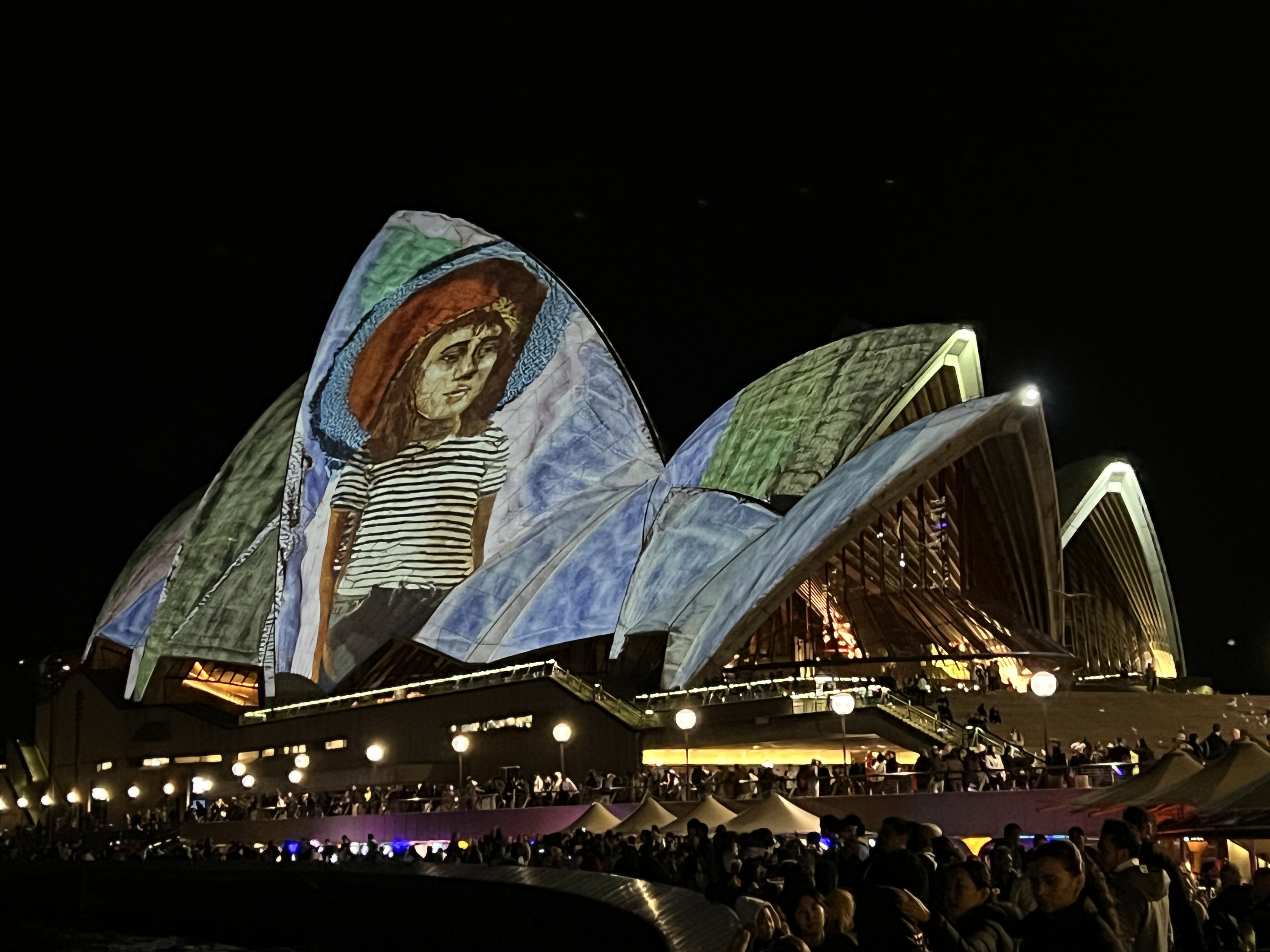
Following lunch we returned to Gillian’s unit for some quiet time before heading out pre dinner to view the Vivid light show on the Opera House and adjacent buildings. Pretty impressive work this light show tonight, ‘Faces of Change’.
Cultural experiences were now finished for the day and we returned to the unit for dinner and bed. Back home to Brisbane in the morning.
Day 2 of the great walk.
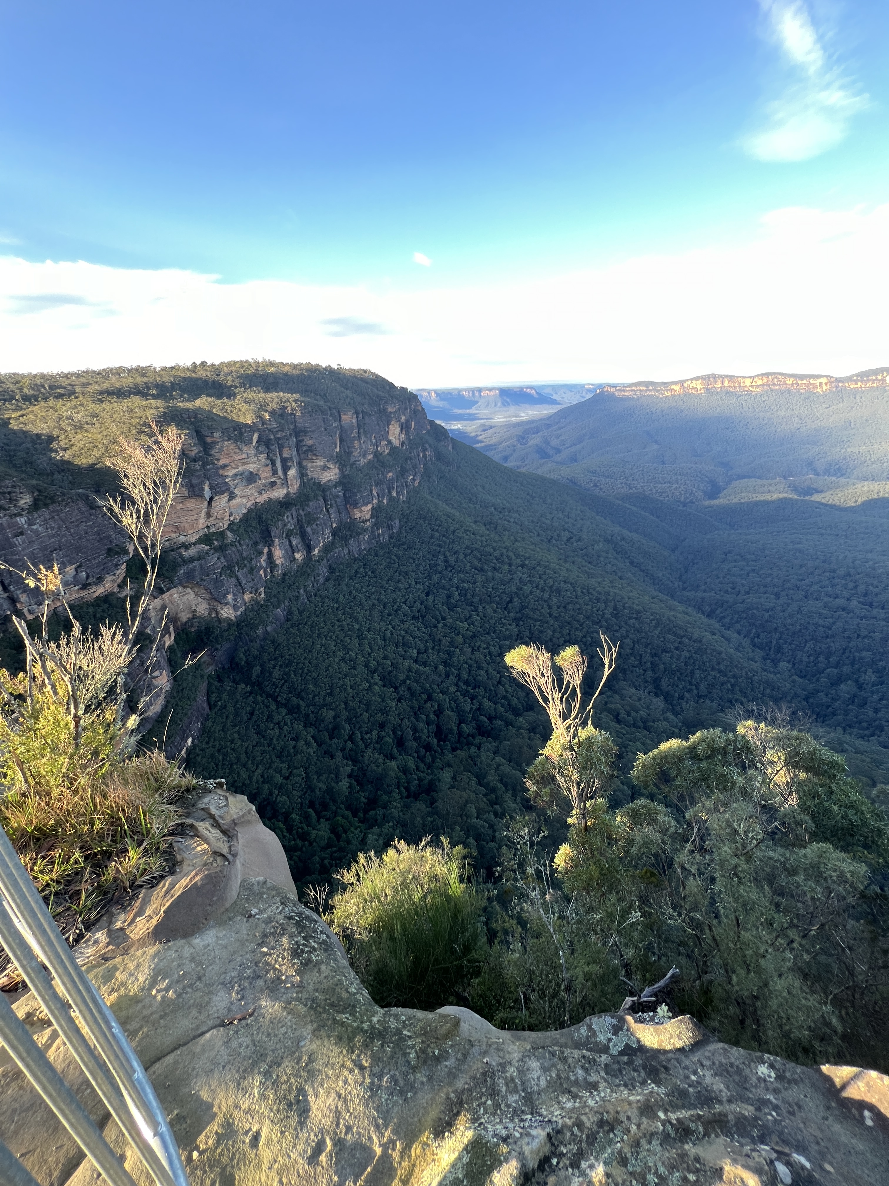
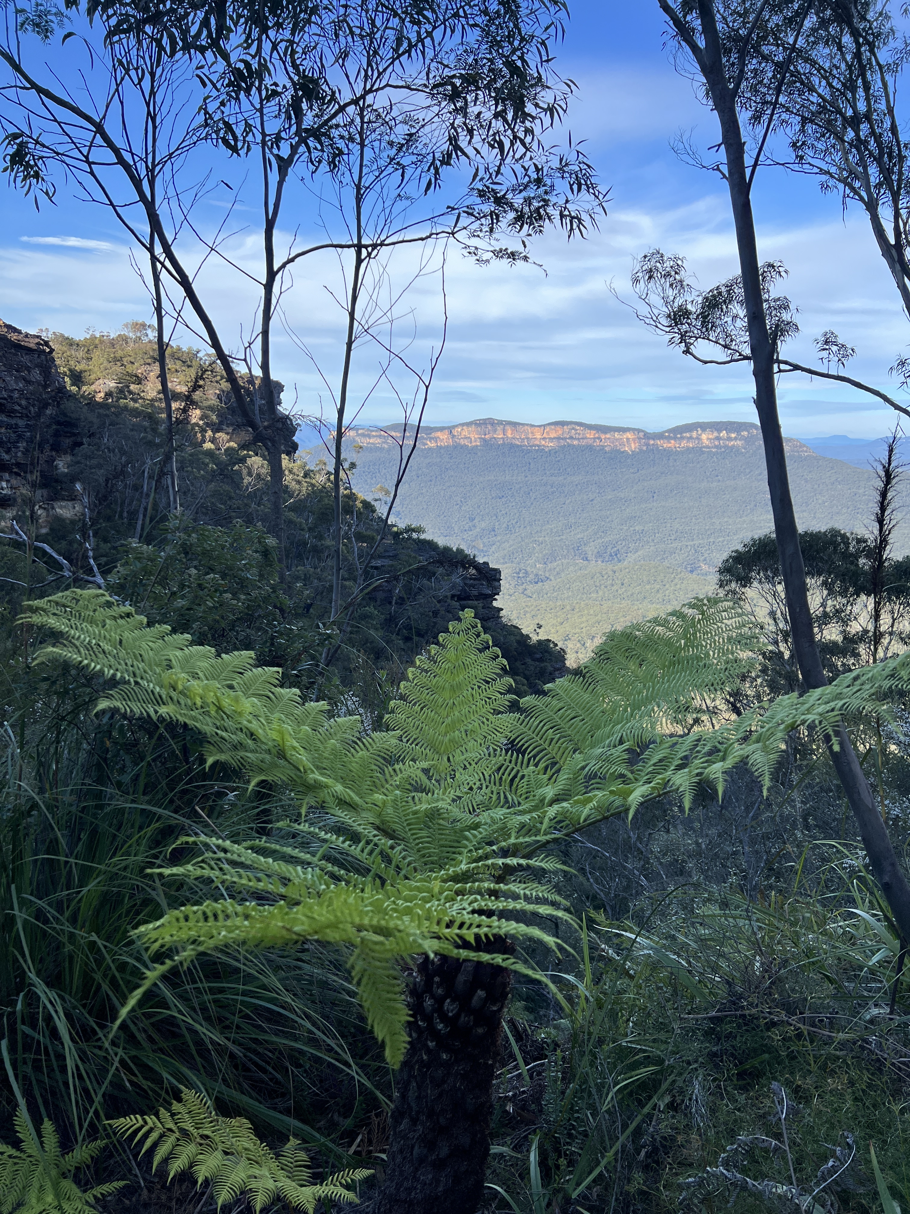
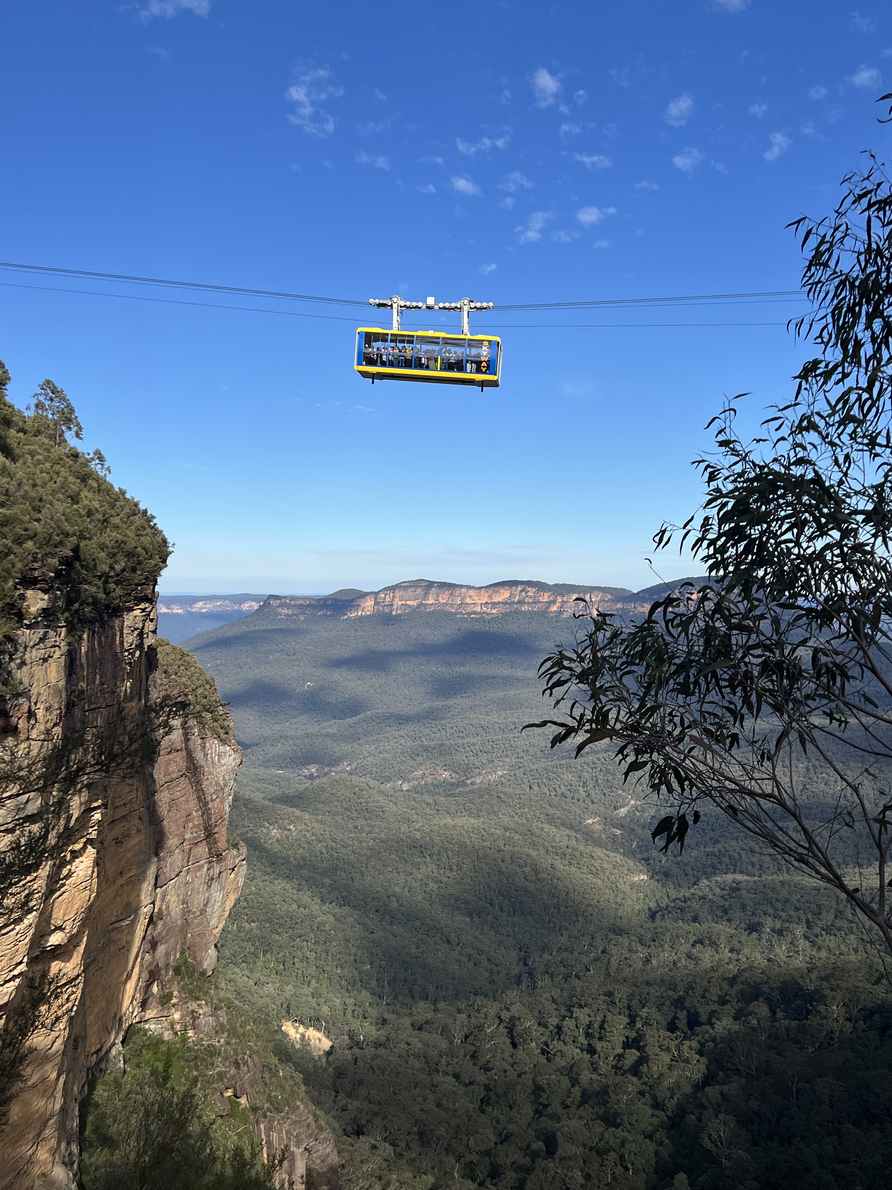
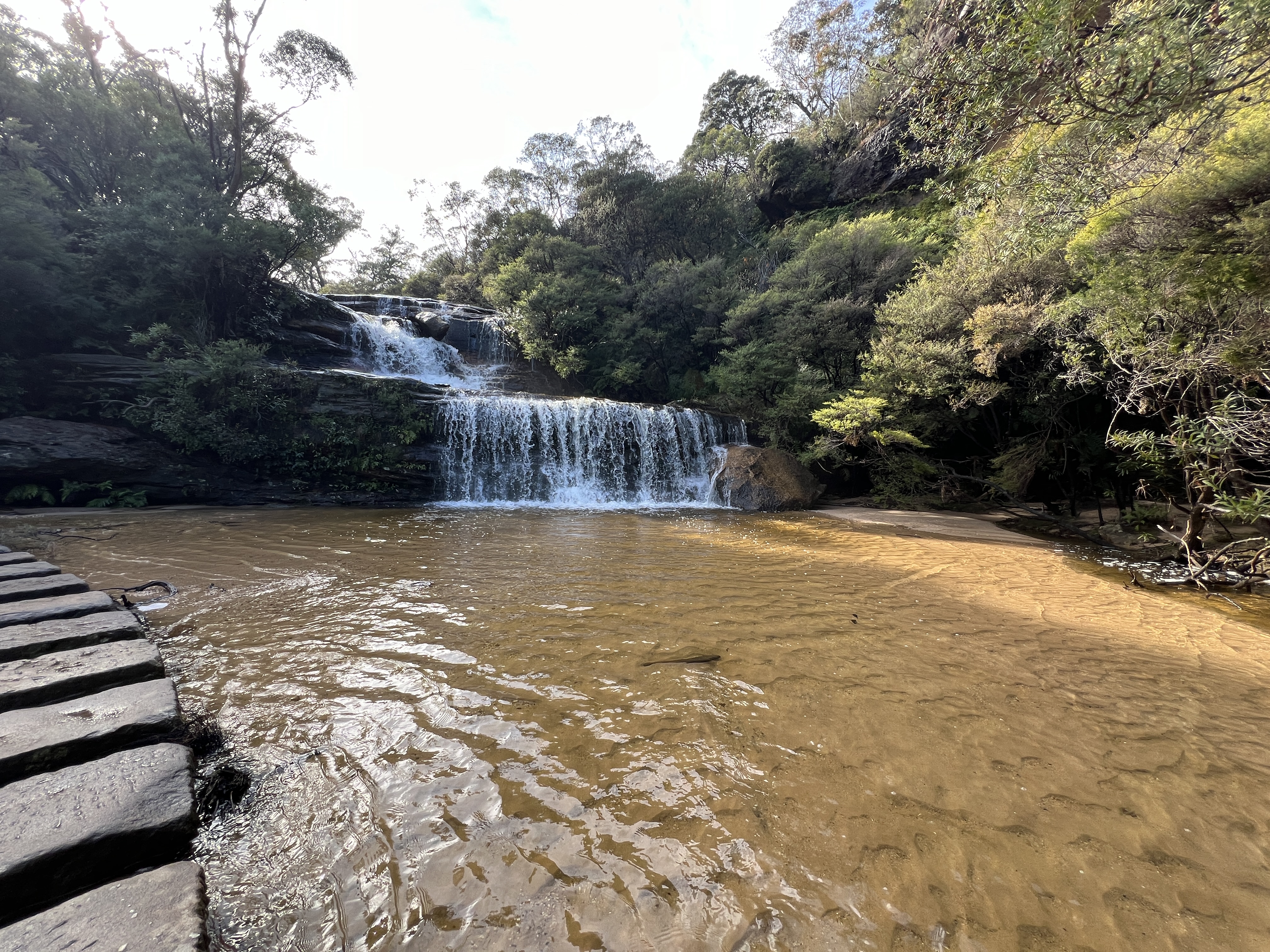
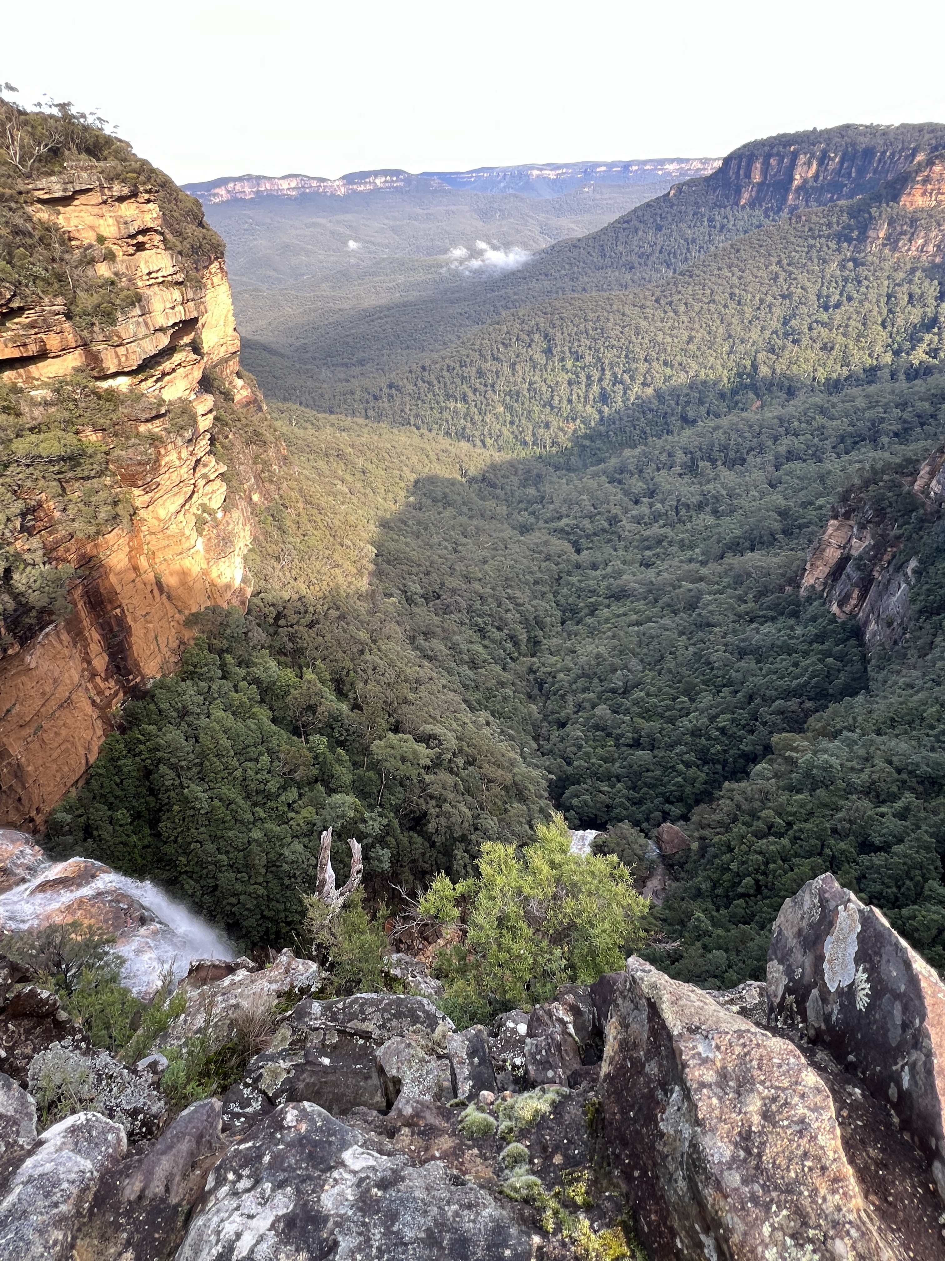
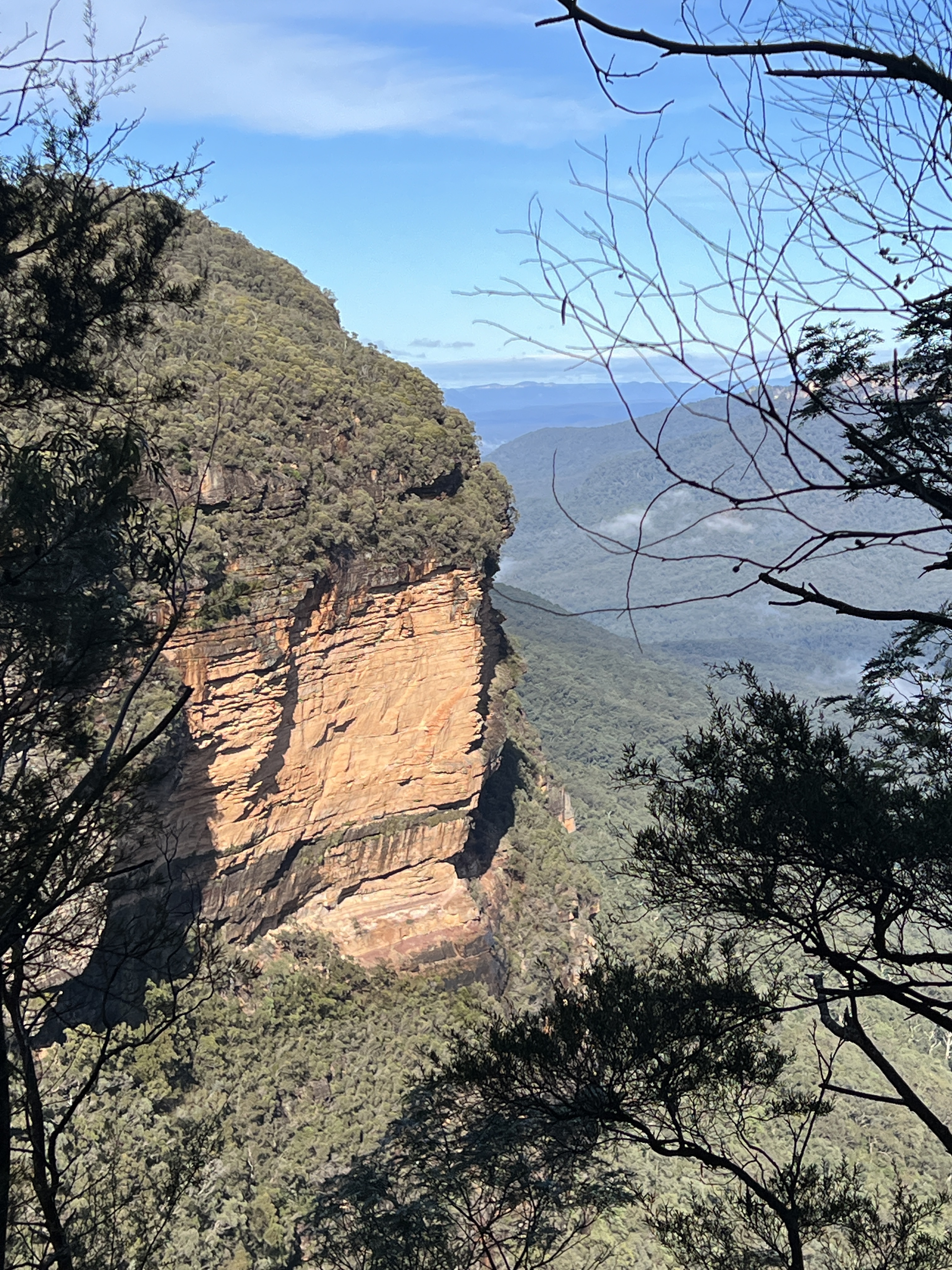
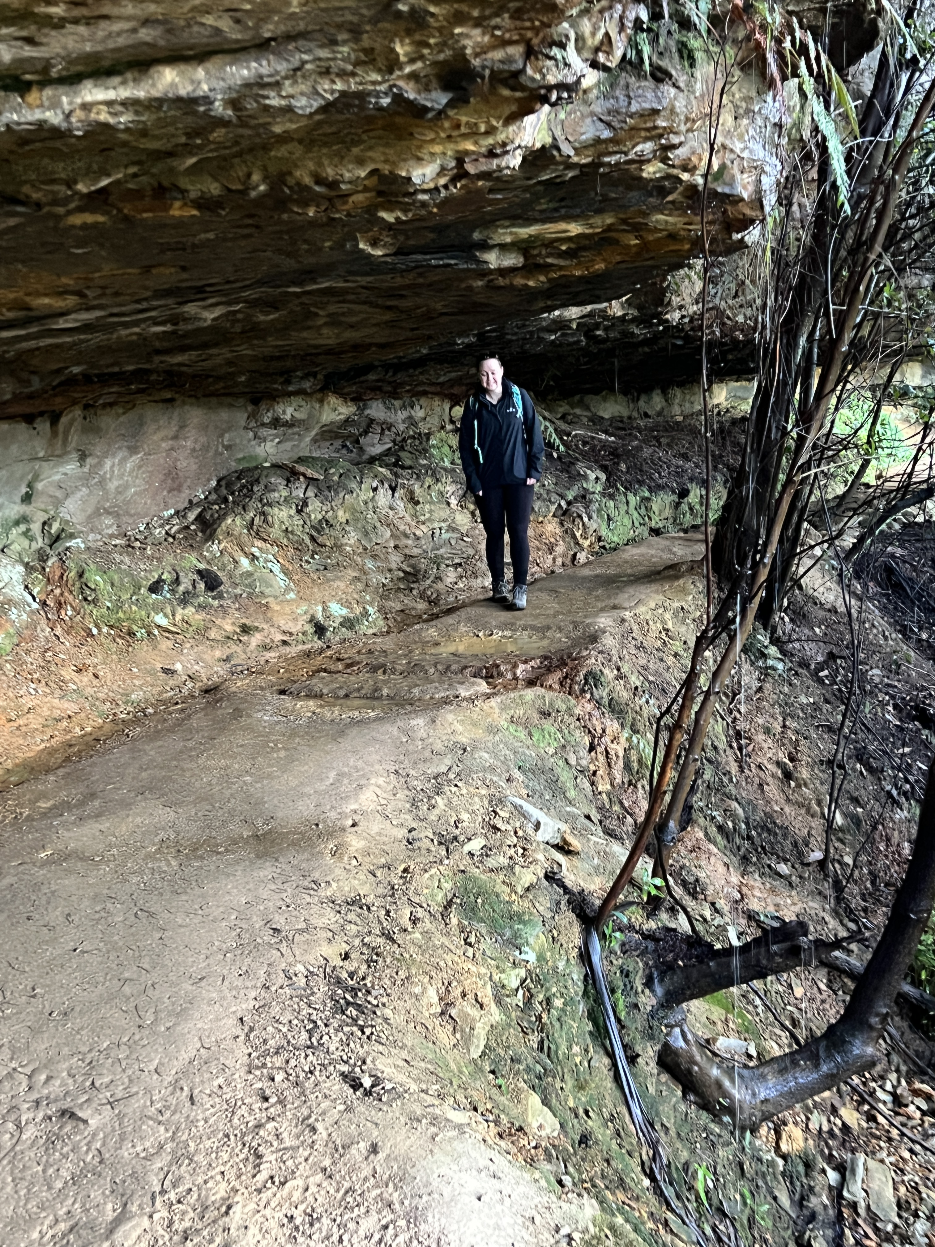
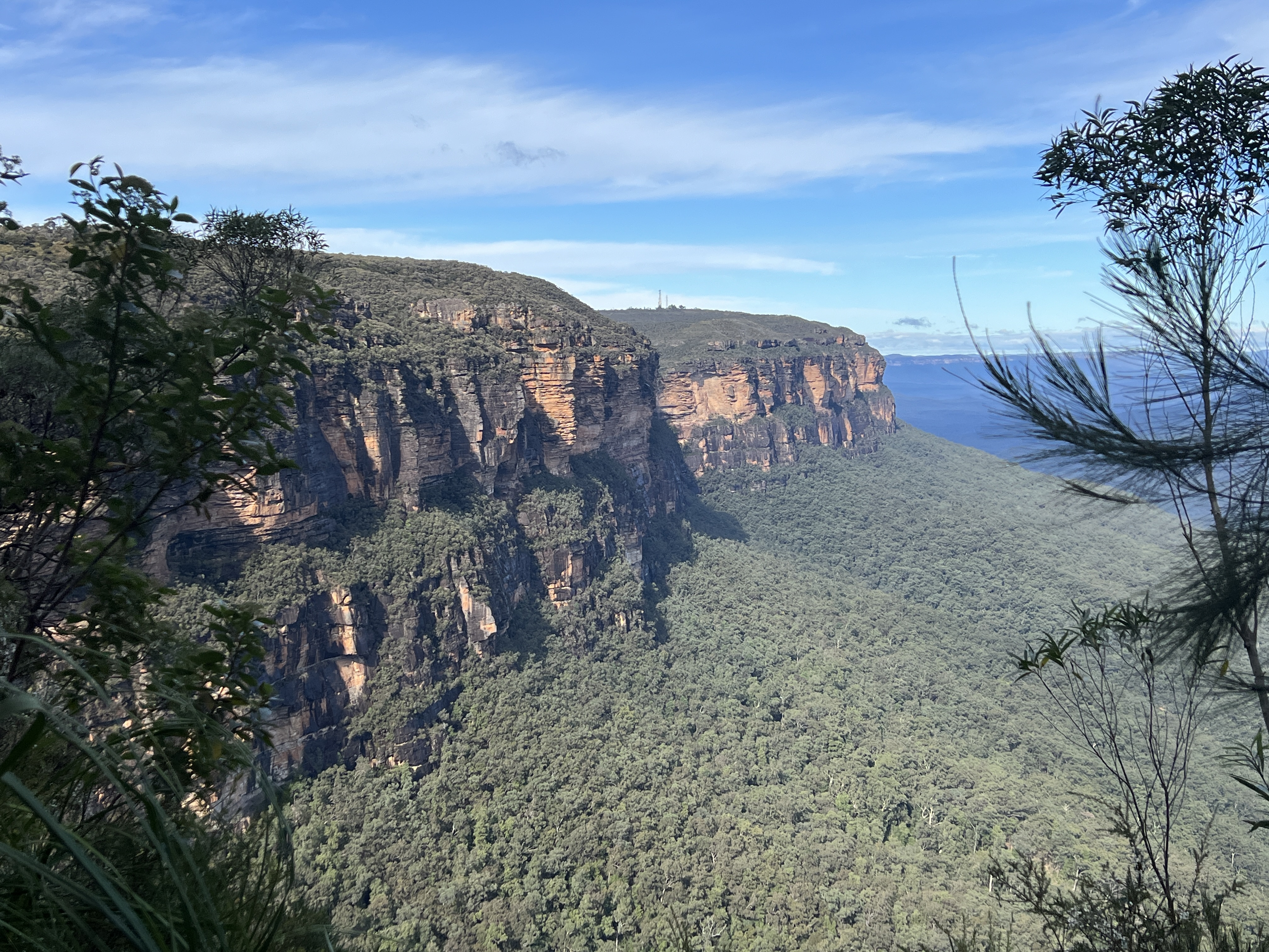
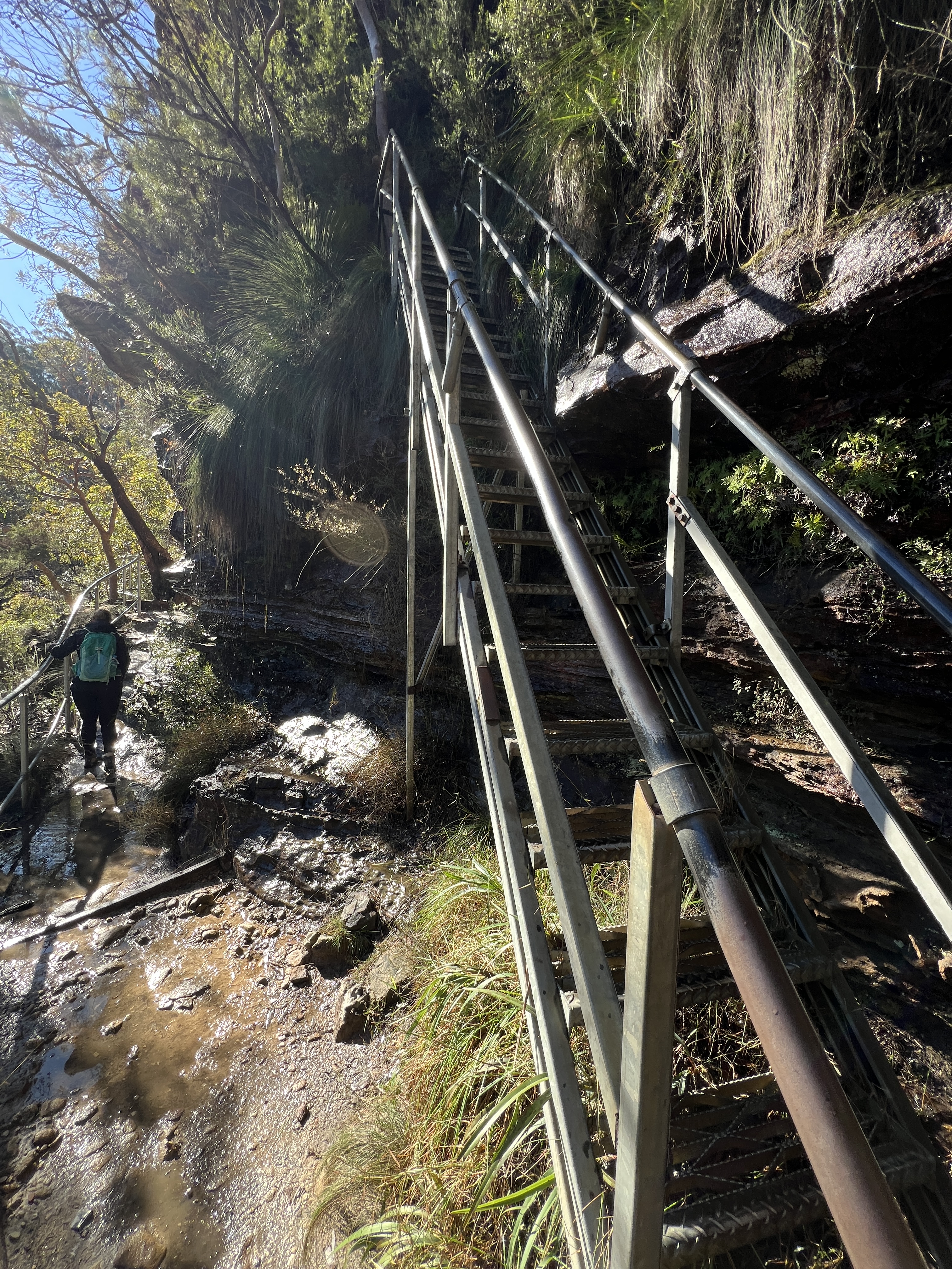
Our second day on the track took us from Gordon Falls, where we finished Day 1, to Scenic World at Katoomba. All up 8 km along tracks similar to Day 1. Scenic World is the spot where the touristy things take place. There is the Scenic Railway, a 52 degree incline as it plunges into the Jamison Valley. Also, the Scenic Cableway takes one down 545 metres into the valley. And the Scenic Skyway cable car travels 270 metres above the valley. All good adrenalin raising experiences.
The track takes us under the escarpment, up and down numerous steps. In the week before we arrived there had been a lot of rain in Sydney and the Mountains.
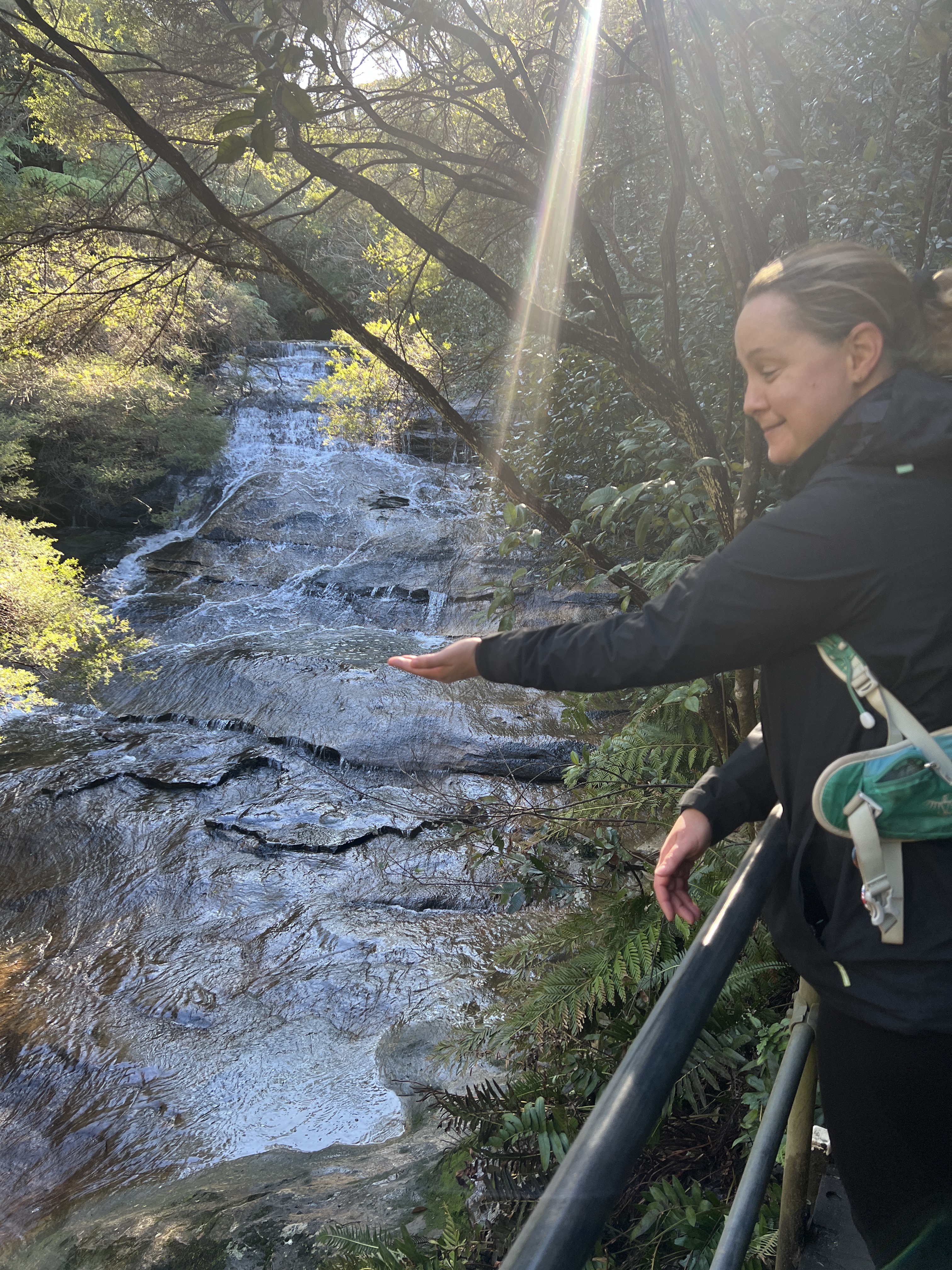
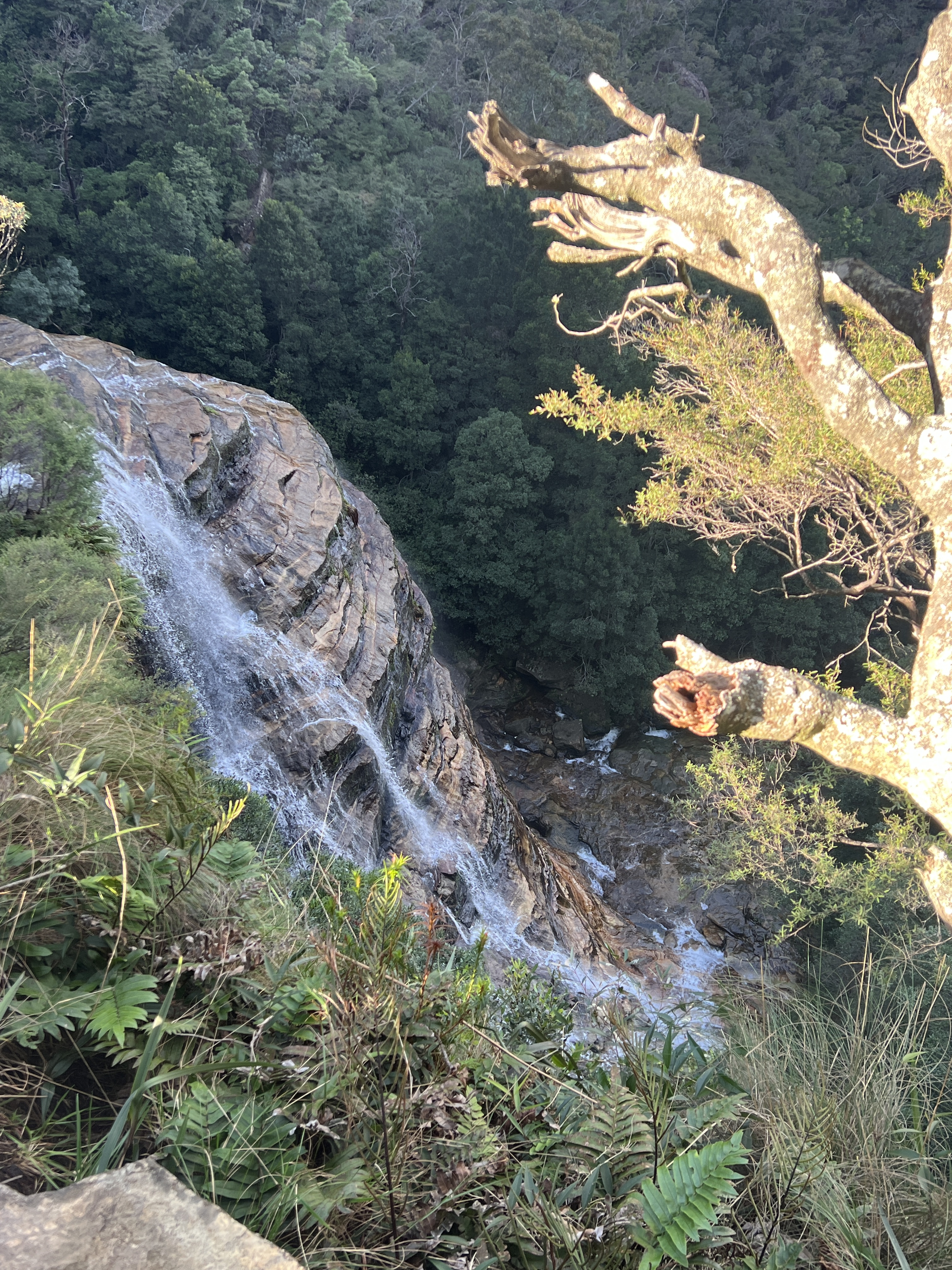
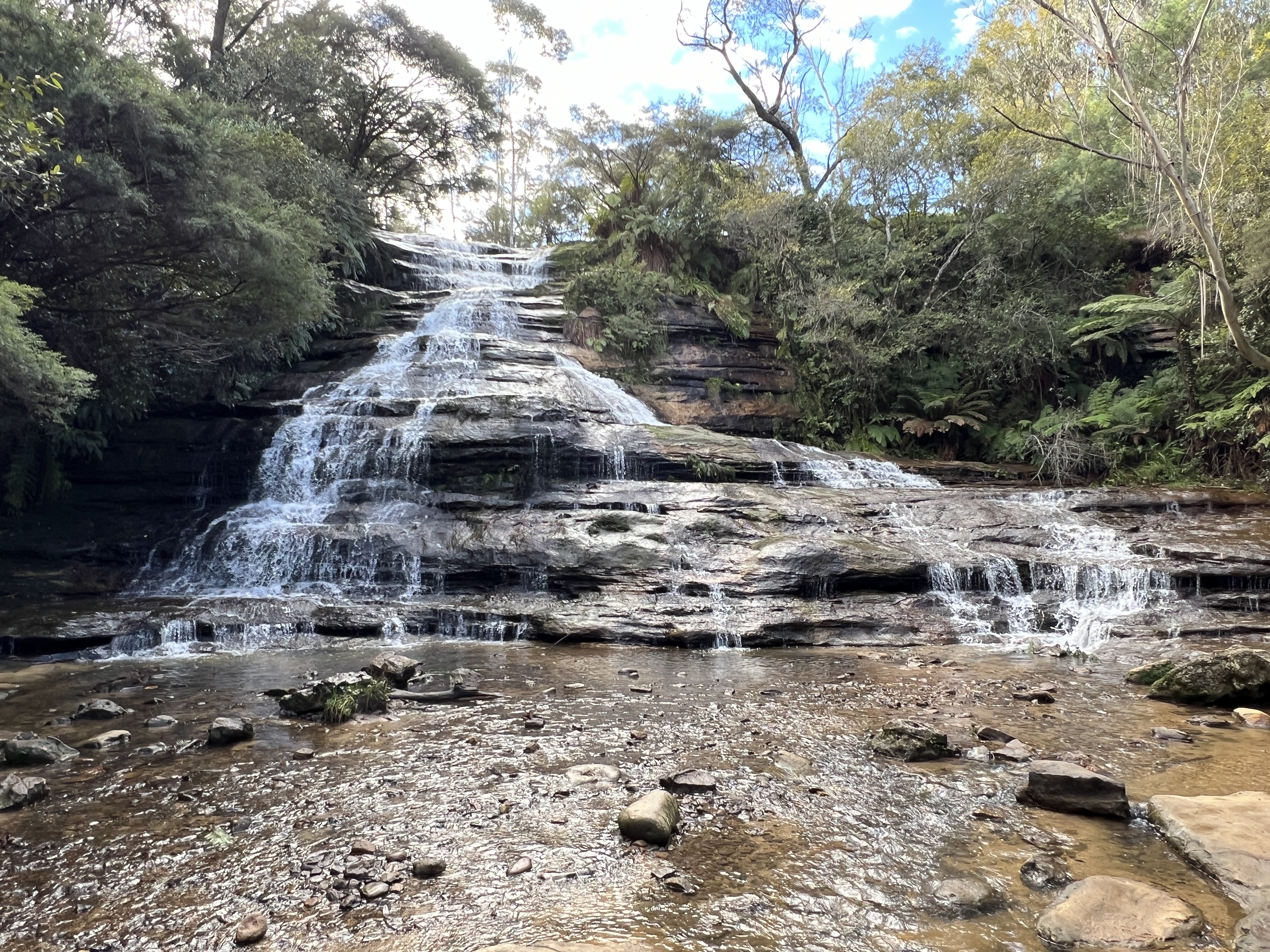
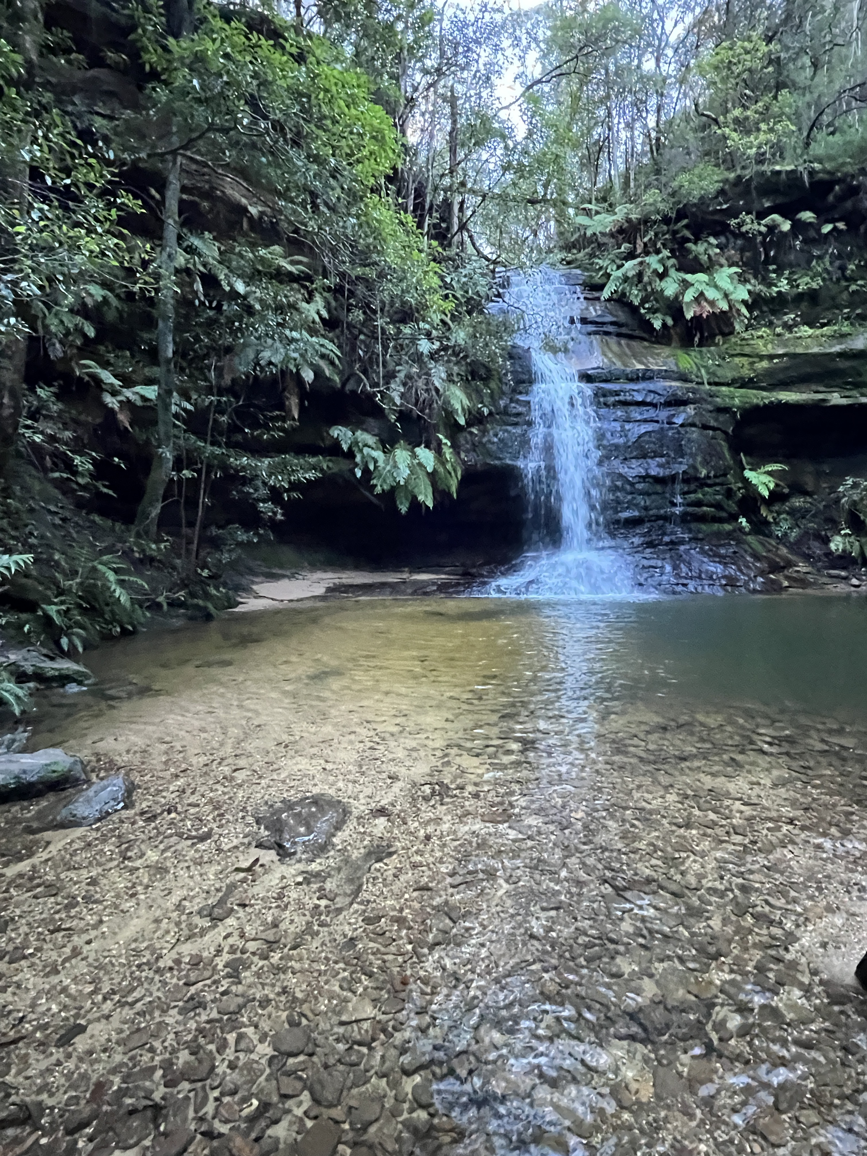
Warragamba Dam was spilling and the Nepean River quite high and over its banks as we drove up. The track was rather muddy and wet. Whilst this dampness didn’t worry us it was a bit of a drama for some fellow hikers. Many of these appeared to be from tours and doing small segments of the track. Lots of stylish white running/walking shoes being subjected to tough track work in mud and slush. We were thankful for our walking boots! The big plus was that all the water had creeks and waterfalls flowing strongly. Some great scenes.
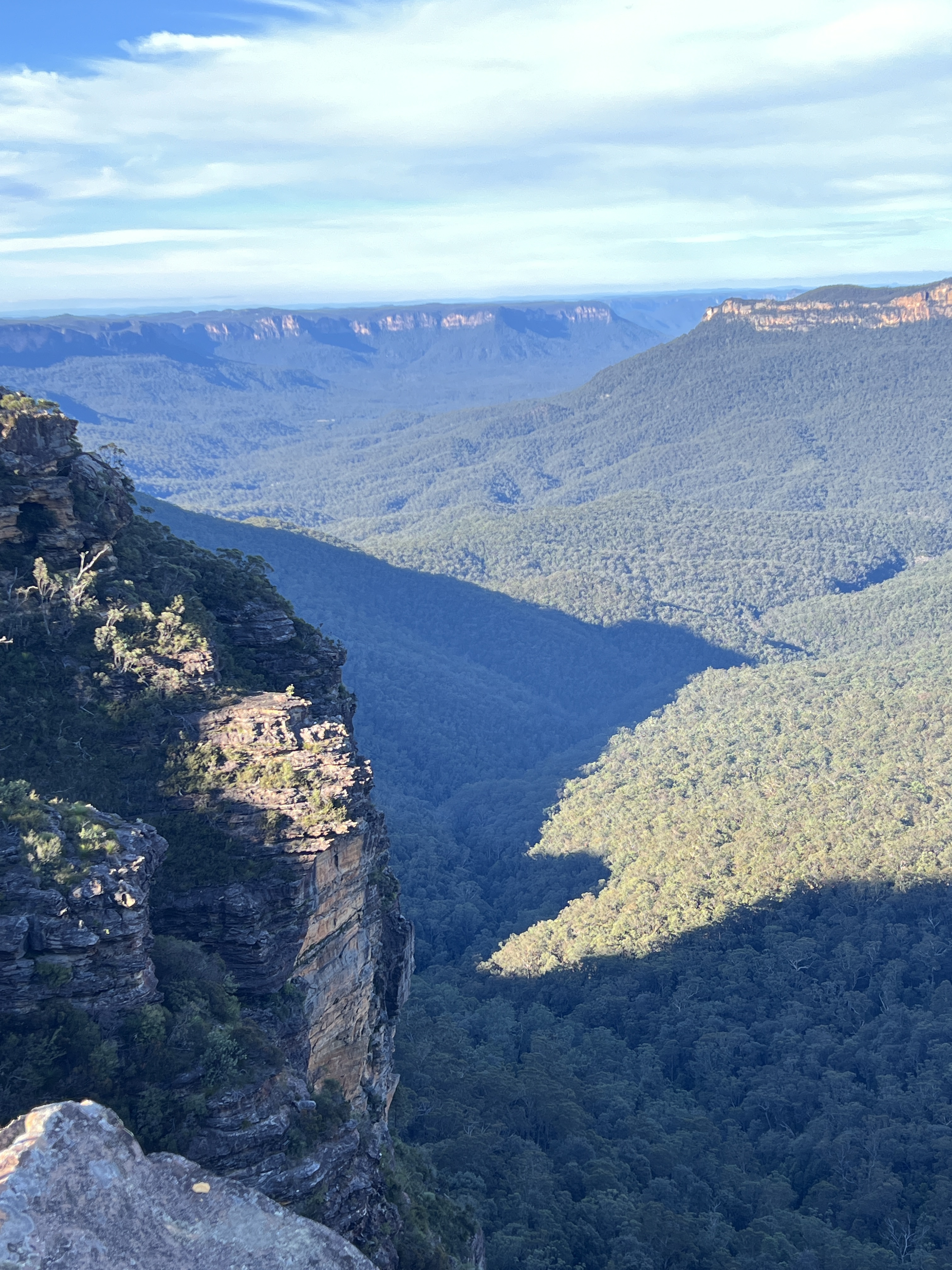
The Leura Cascades were putting on a great show, water pouring over its rocky course. Bridal Veil Falls also spectacular.
A little further along Honeymoon Point juts out into the valley. The rock ledge is a little undercut and hangs out over the valley below. It doesn’t stop people leaning over the edge, slightly unnerving place!
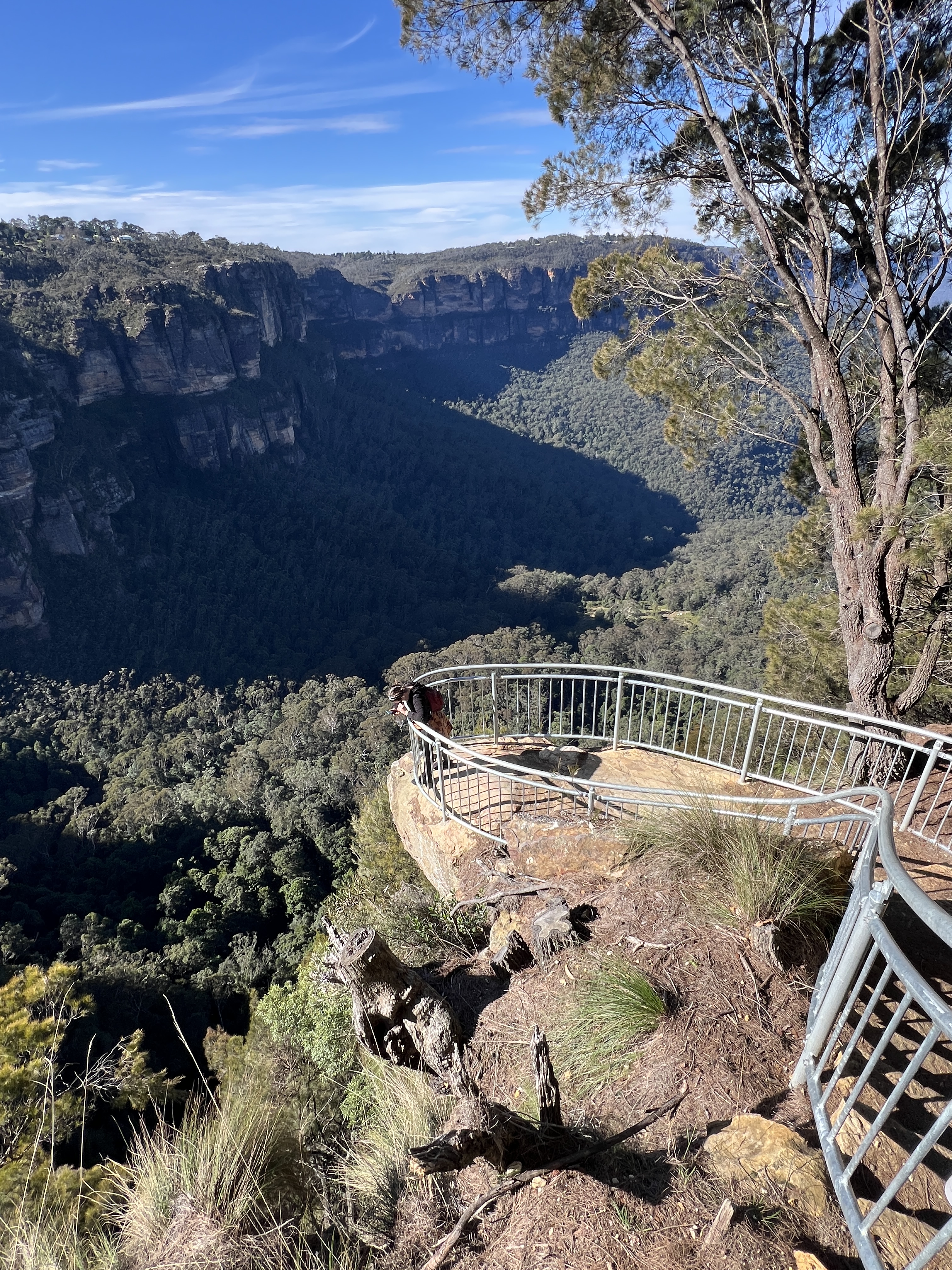
We soon arrive at the Three Sisters lookout at Echo Point. Great view of the Sisters. But we had now walked into tourist town! Tourists every where, many accents. Europeans and Asians from all parts. But, there were a lot of Indians, seemed disproportionate. To what I don’t know!
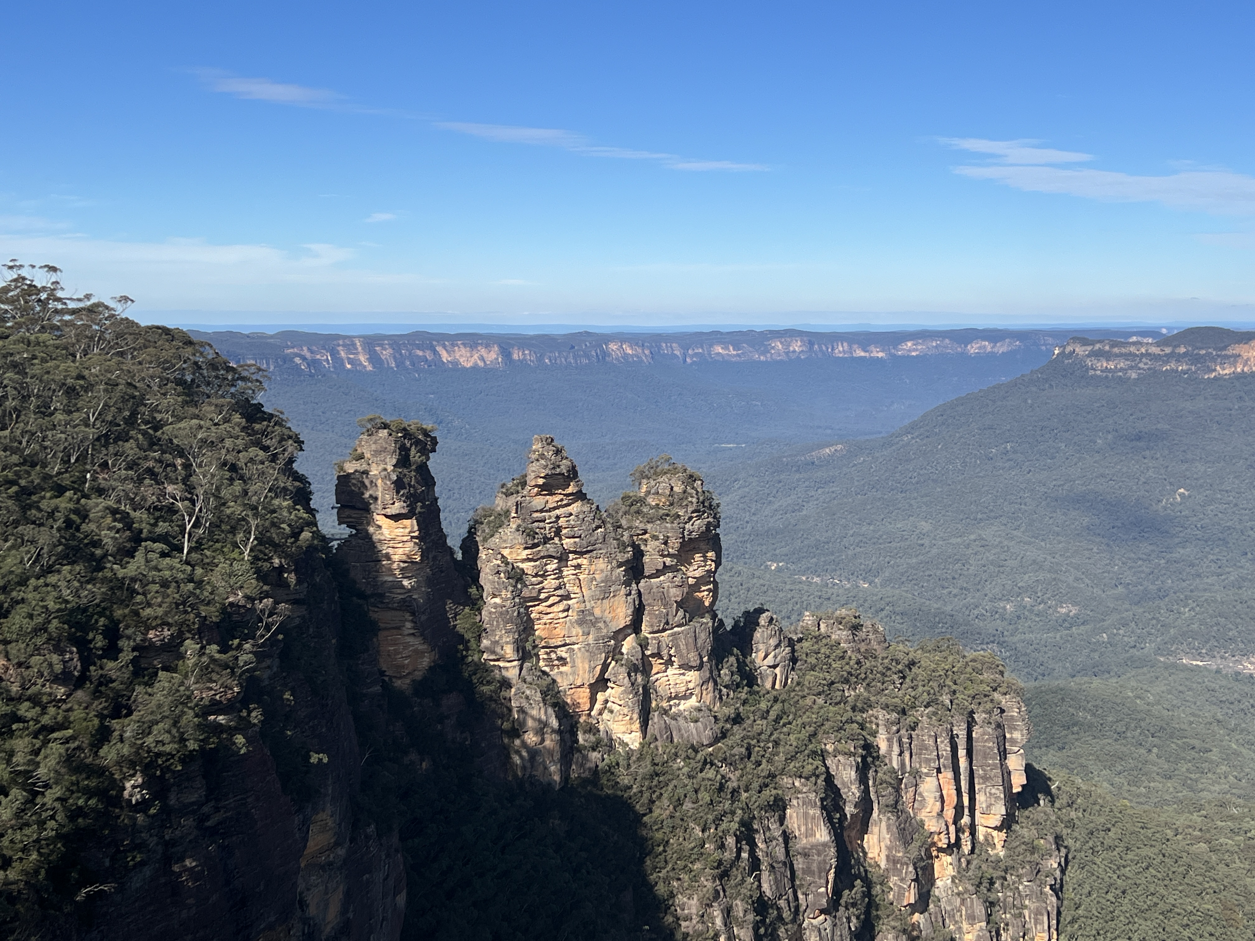
There must have been an Australia on sale in Mumbai. All seemed to be having a good time! Had to escape from the rate race so we headed off down the track to Scenic World on the last kilometre of the walk.
Made it eventually, it was very tempting to catch the Scenic Skyway across the valley to avoid the last few metres…..but no it was on to the end!
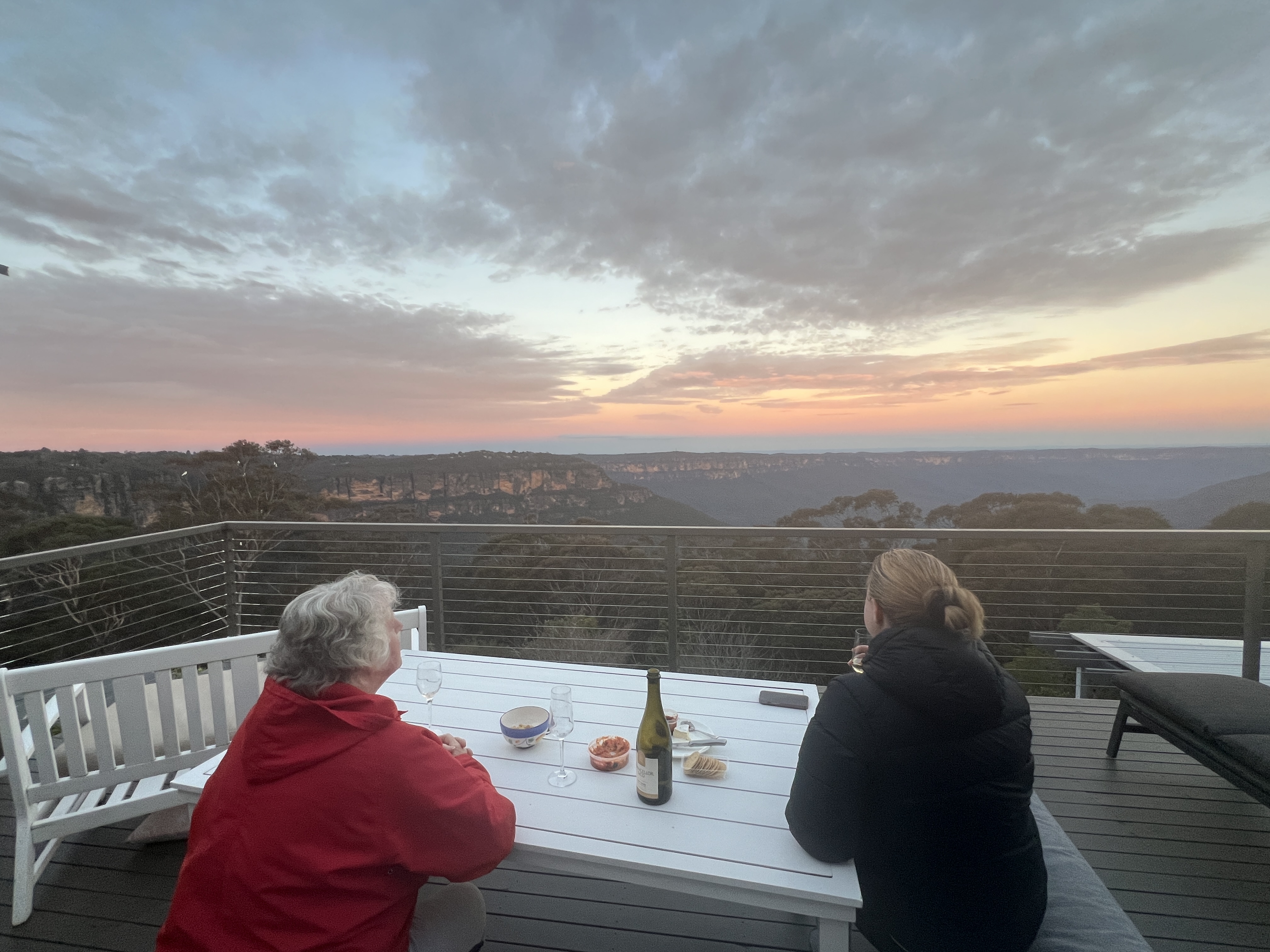
Great late afternoon relaxing on the deck back at the house, sharing tales of the walk with Homealone as the sun went down. She has had two great days sitting around relaxing and doing nothing!
Sydney for Blue Mountains walk in the wild
We have made a short trip to Sydney to visit daughter Gillian. She has been working down here since the start of the year for six months, returning to Brisbane in July. Free accommodation in the heart of the city, just back from Circular Quay is hard to knock back!
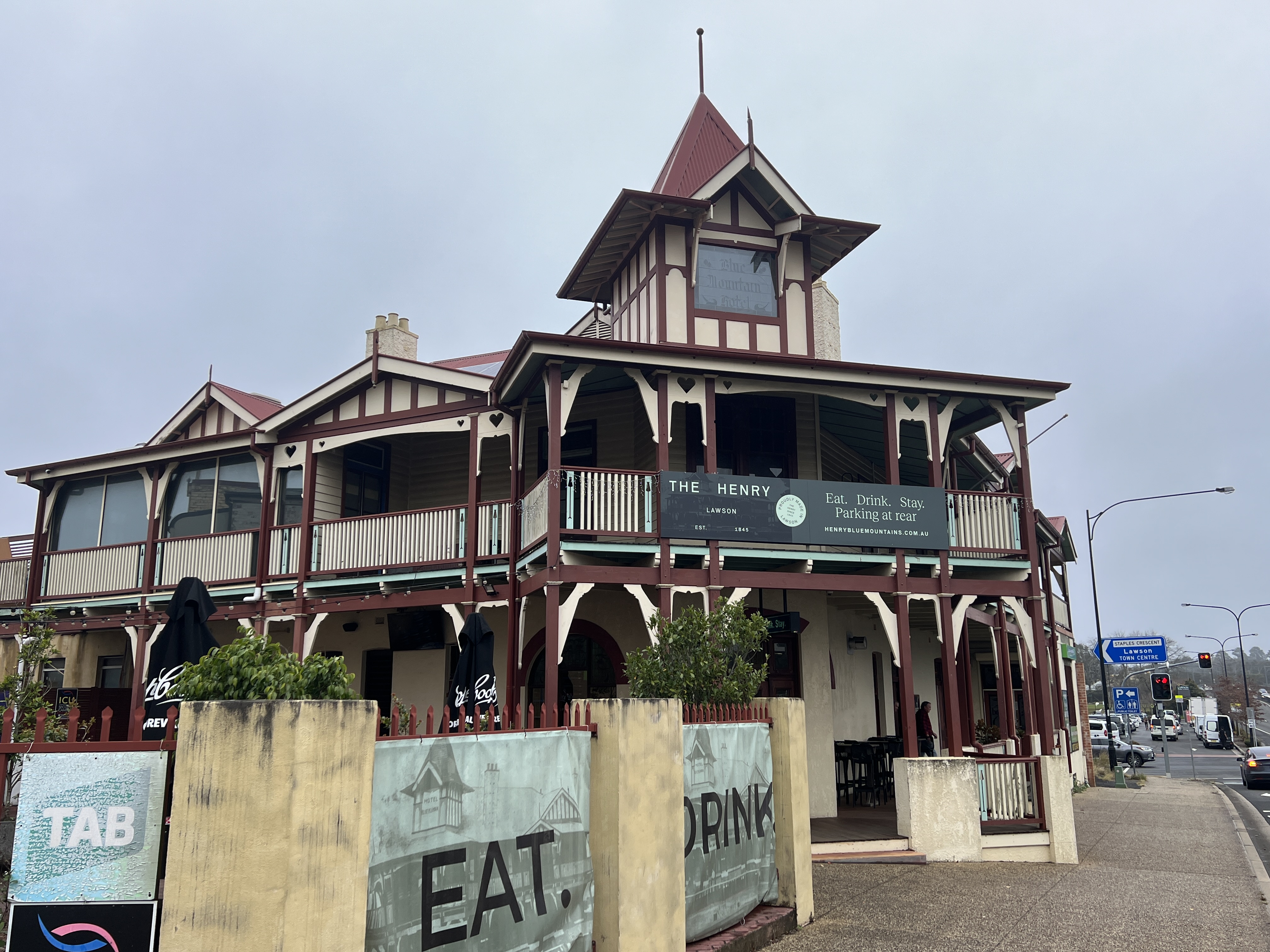
We are taking the opportunity while here to spend the June long weekend in the Blue Mountains. It is more than 35 years since Allthego was here and much has changed. Lots more people now live in these parts, escaping the rat race below. We have booked an AirBnB in Katoomba just around from the Three Sisters. Great spot overlooking the Jamison Valley.
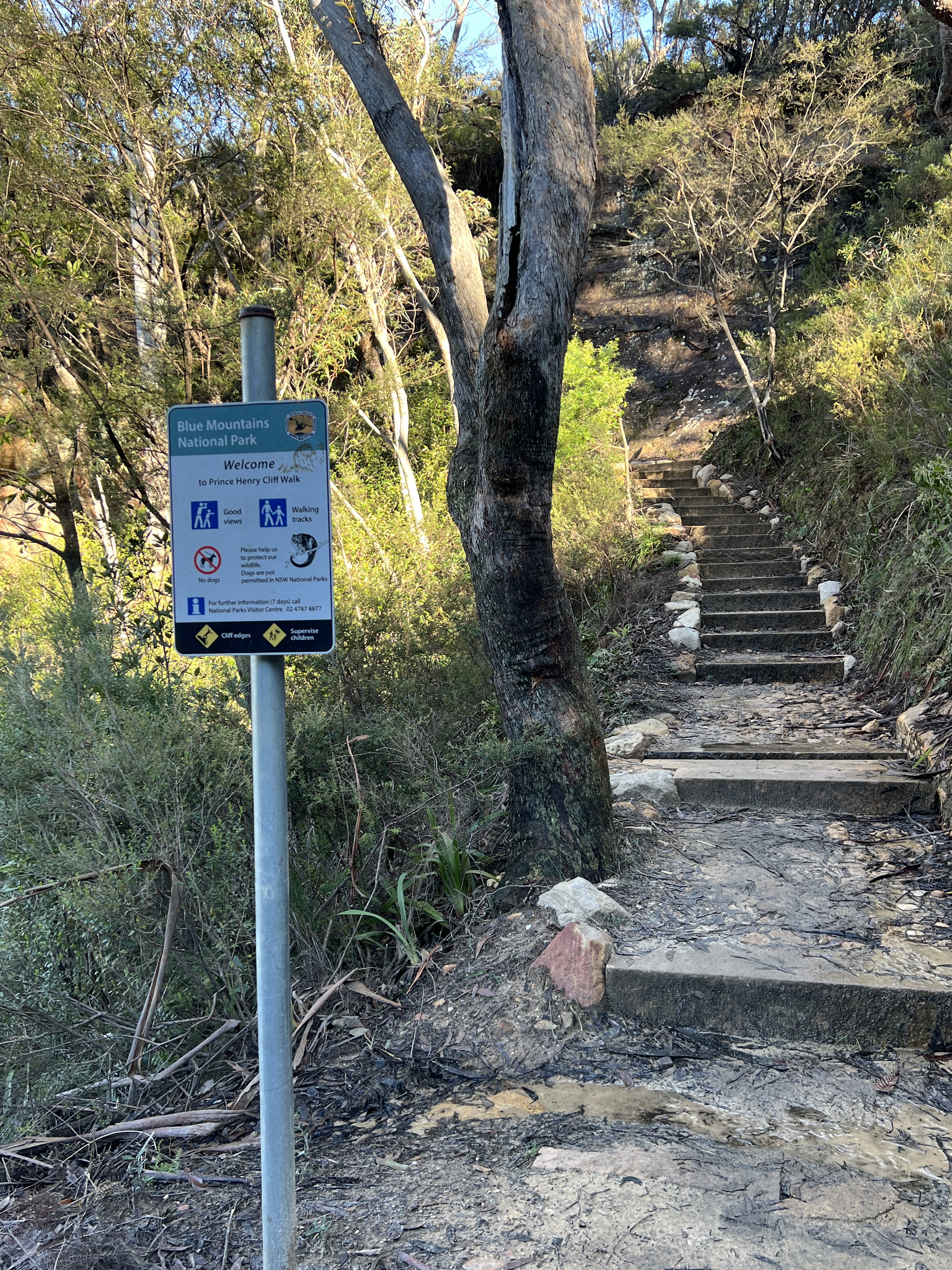
The purpose in coming up here was for Allthego and Gillian to do the ‘new’ Grand Cliff Top Walk. Homealone was going to do just that, lurk at the AirBnB for the day. The walk is over two days and links together a number of exisiting walks into one. It showcases the great iconic sights of the National Park. All up it is 19 km.
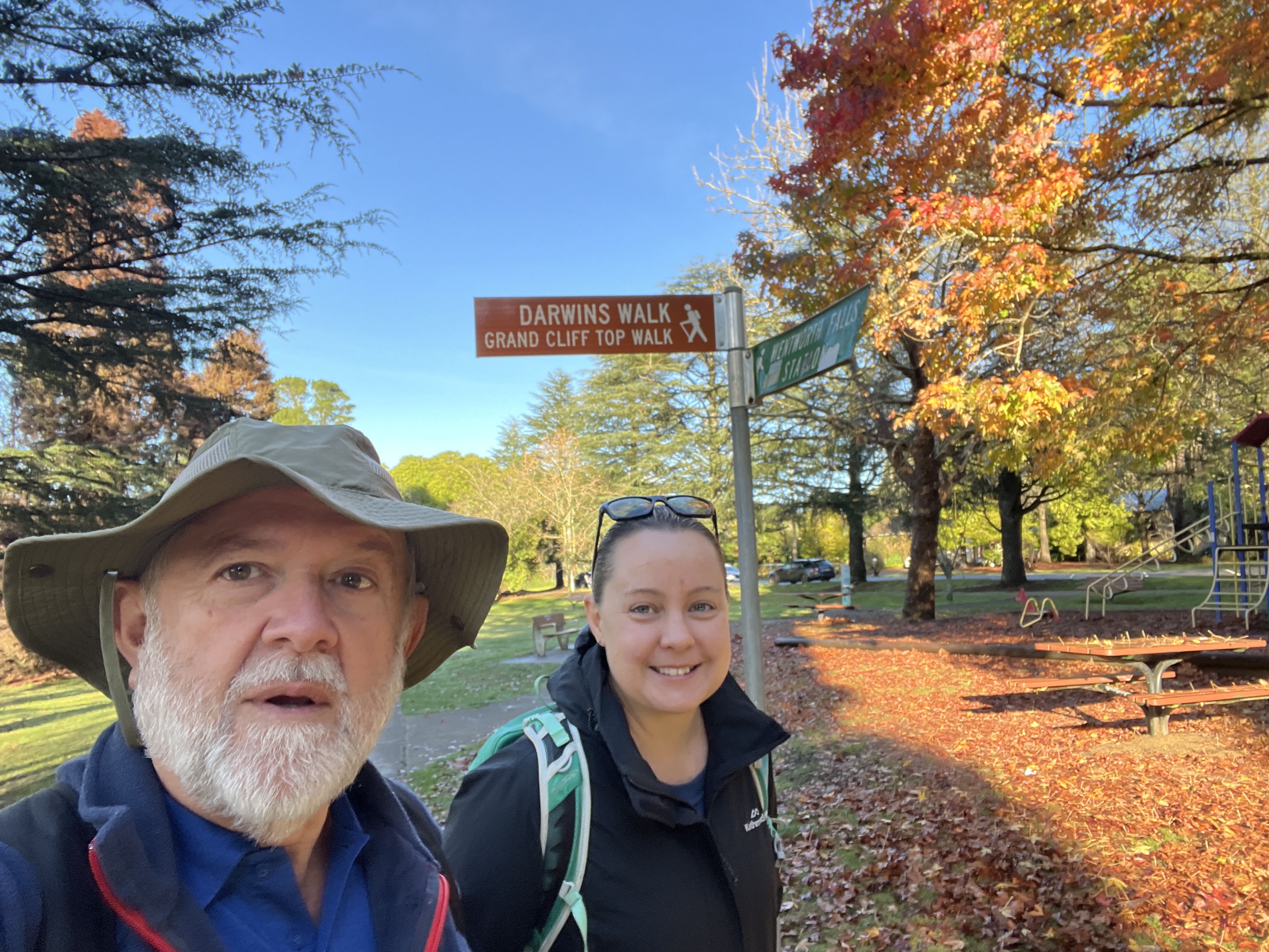
Day 1 starts in Wentworth Falls, not far off the Great Western Hwy, and goes for 11 kms to Gordon Falls on the outskirts of Leura.

We left around 9am and arrived at Gordon Falls around 4 pm, we had lunch along the way at Conservation Hut. A convenient half way house for weary travellers and loo seekers.
Allthego is not particularly speedy these days and is also known for stopping to take numerous photos. Our time of 7 hours for the first day was at the top end of the map’s walking time estimate.
Not bad considering our diversions to lookouts and photo taking. We returned to base a little weary after our day on the trail.
Day 2 awaits!
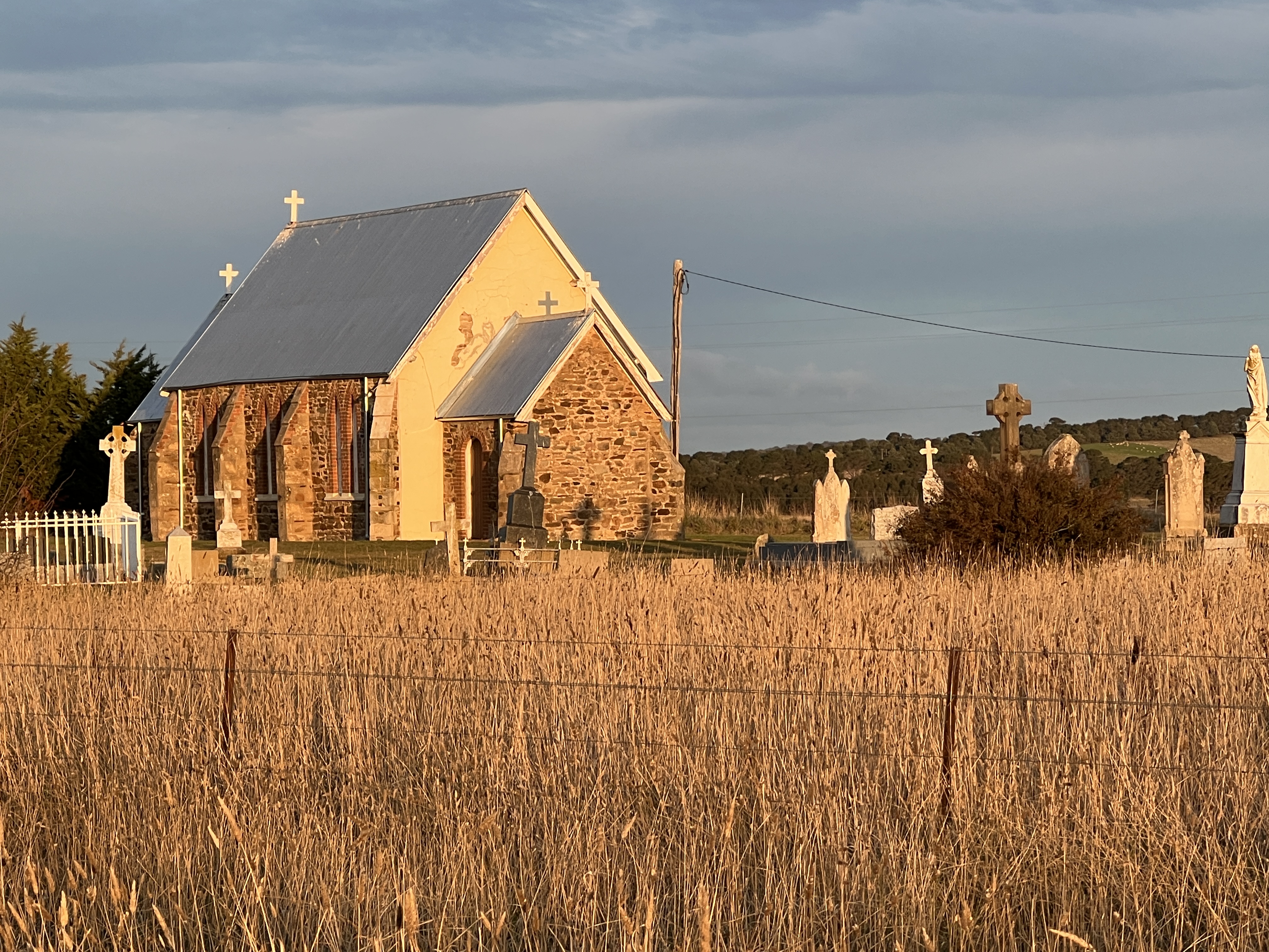
Cowra to the source
It’s generally cold in Cowra in May and it is no exception in our time here. Days are nice and sunny but bed socks are good at night. We have paused here for a couple of nights to do some washing.
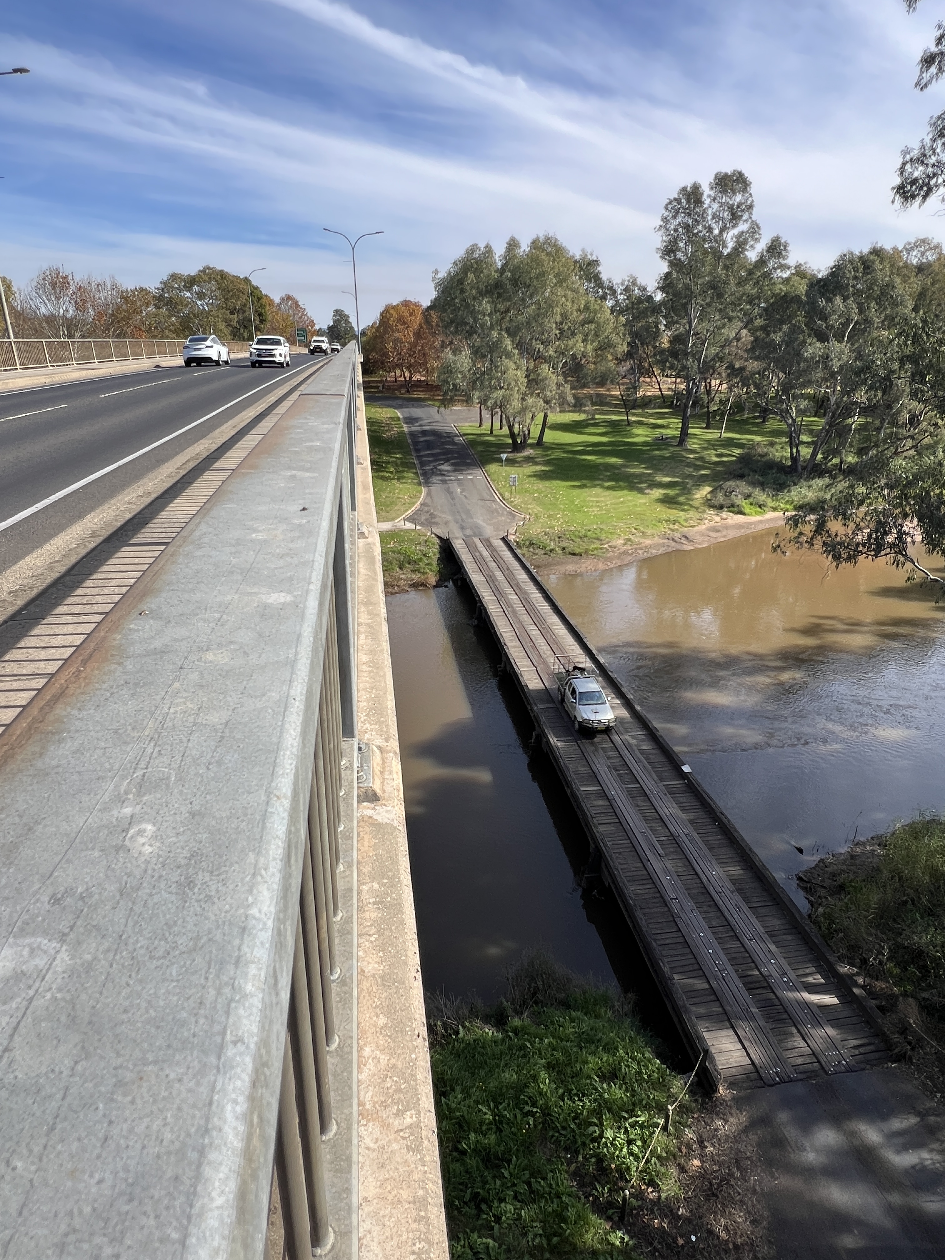
The van park is situated just down from the major high level bridge over the river. The old low level one lane bridge is down below, a few feet above the river. It must be a short cut to somewhere because it is in constant use.
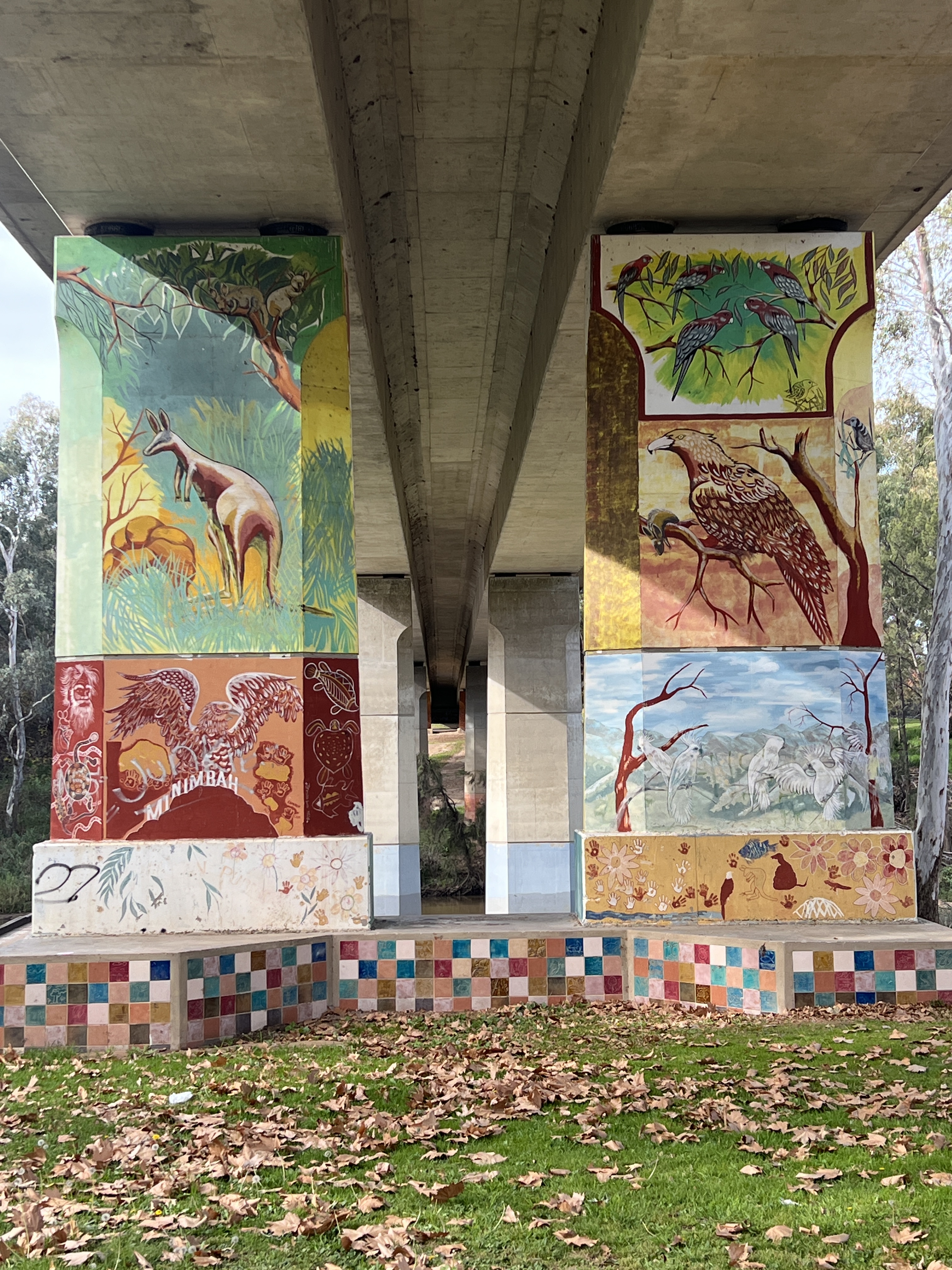
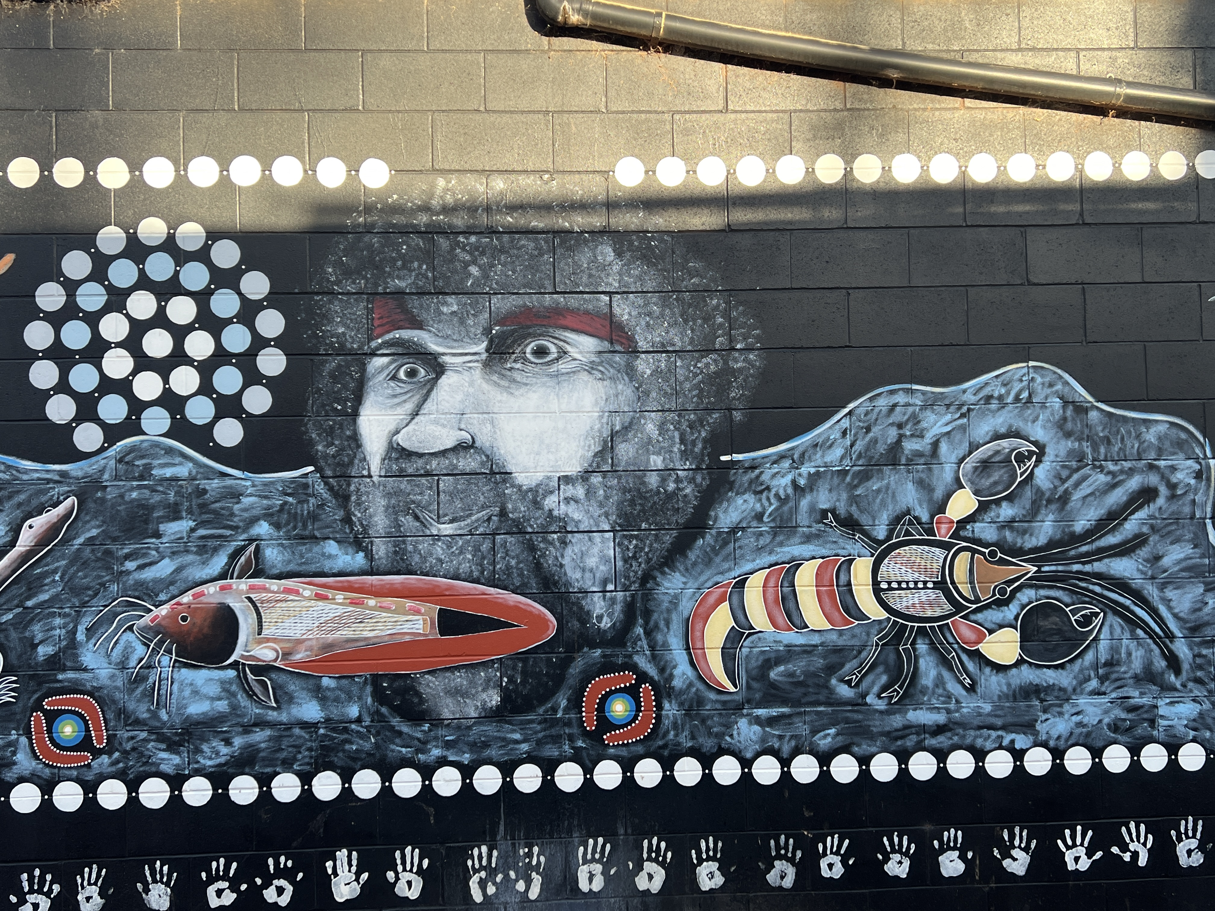
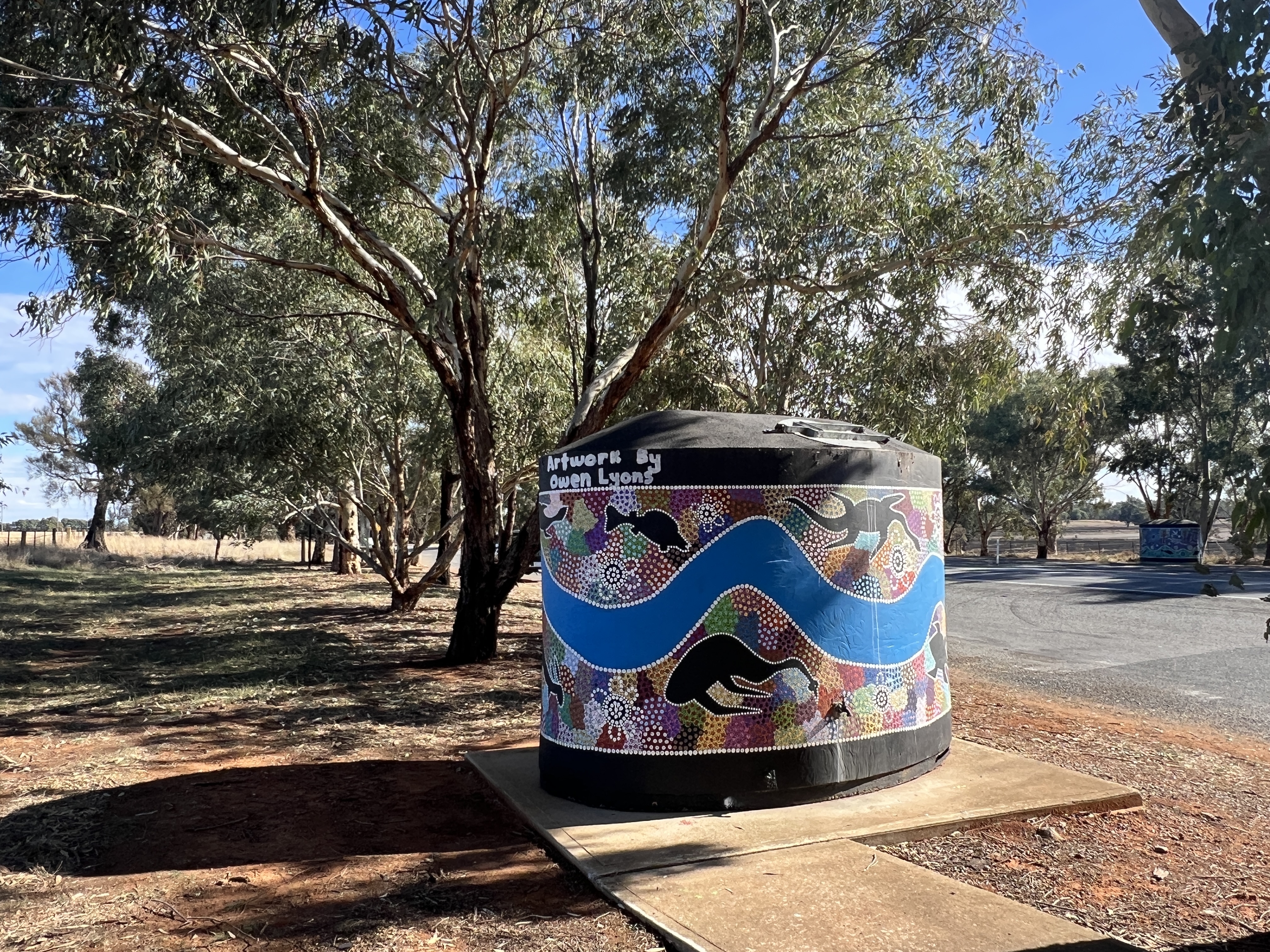
The piers of the high level bridge are covered with murals of an indigenous flavour. Quite impressive art works.
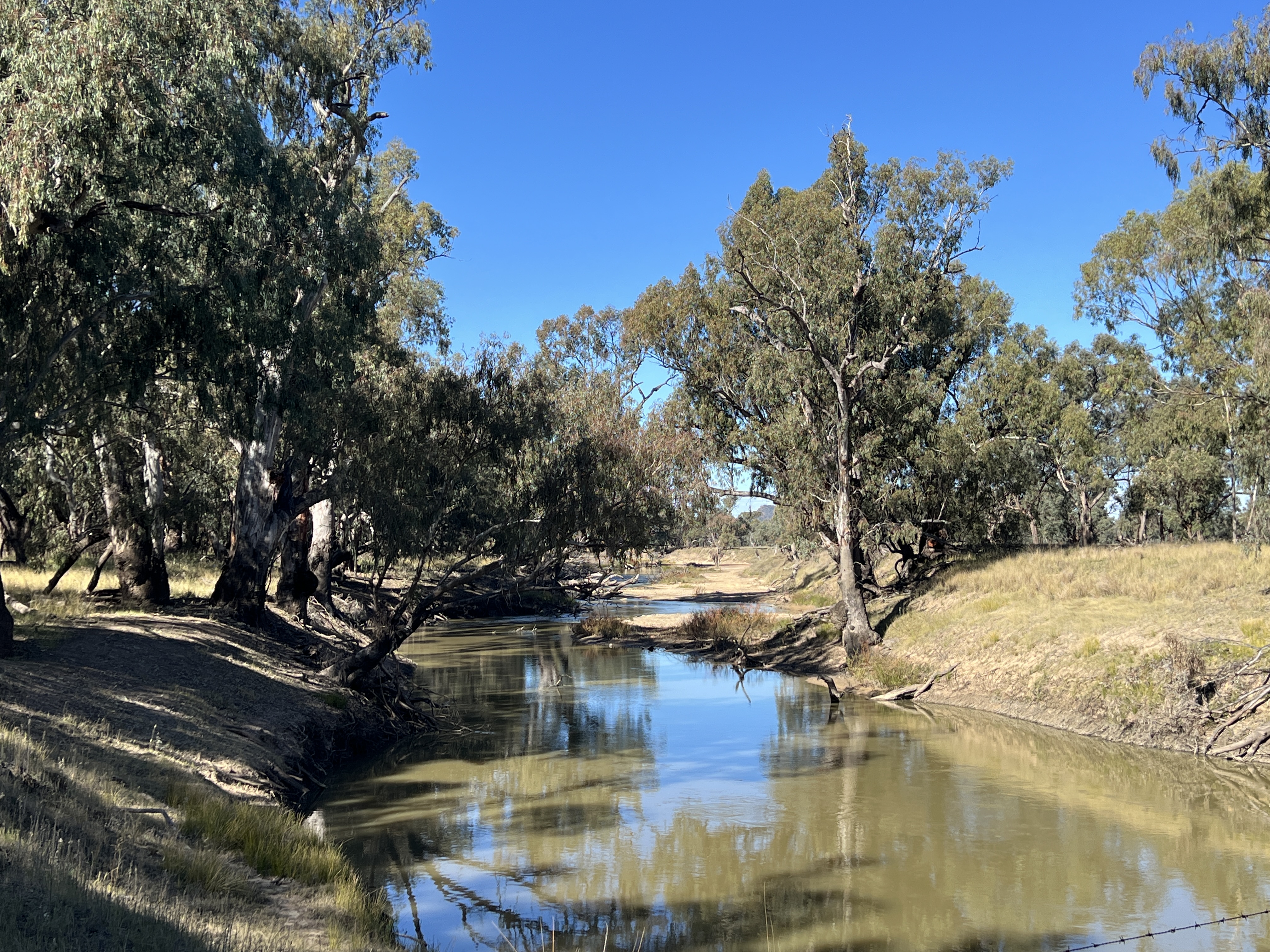
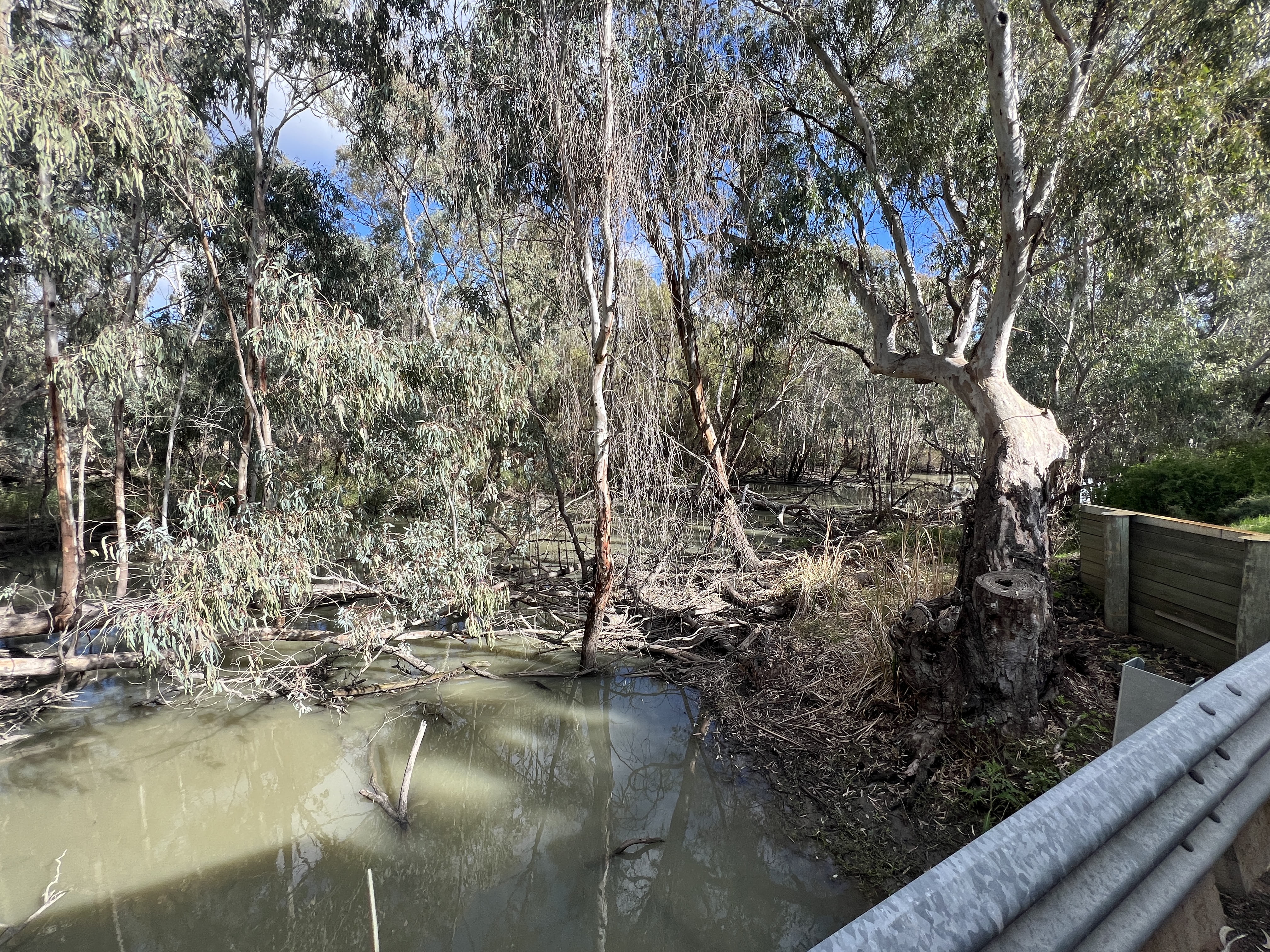
There are quite a things to do around these parts but Allthego and Homealone are really focussed on the Lachlan River. So we head off up to Wyangala Dam. This dam holds back the river’s waters and controls water supply to towns and irrigation along the way we have come over the past couple of days.
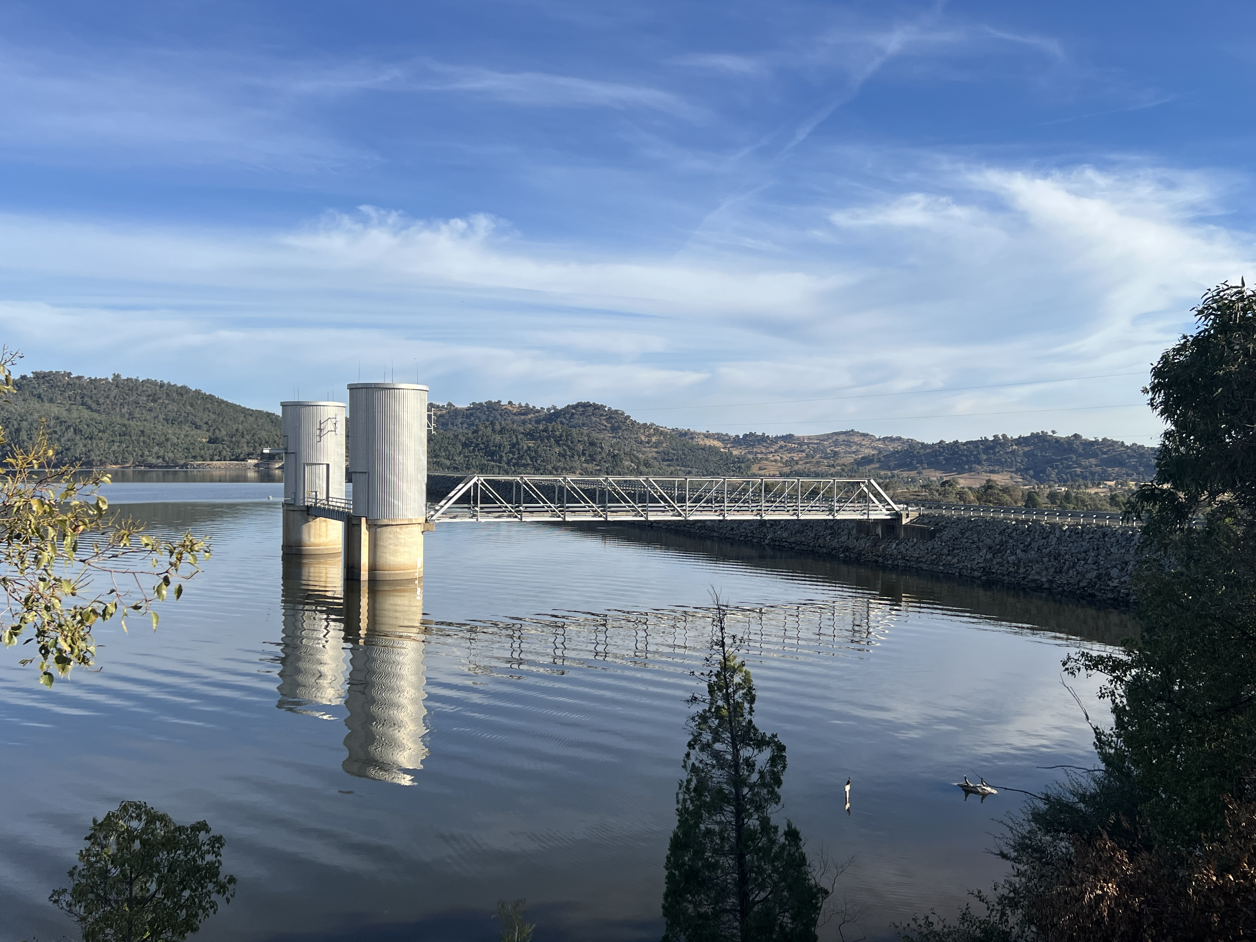
ala DamIt is a great drive through the countryside to get there, past a couple of river crossings.
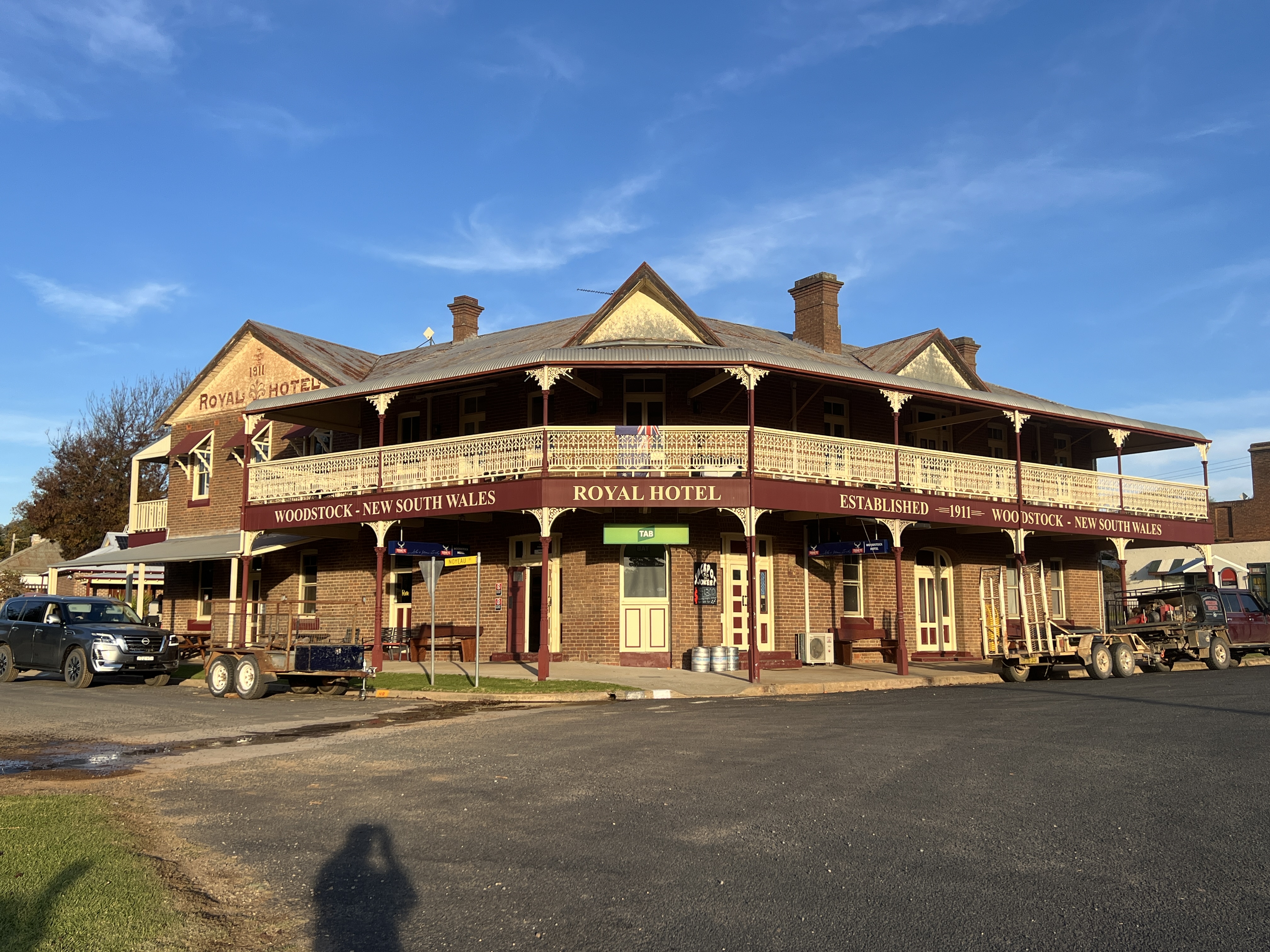
On the way back we do a loop road via Woodstock, an old railway town. The trains have long gone but there is a great old pub looking down the street, the railway station is a bit sad among the weeds and overgrown track.
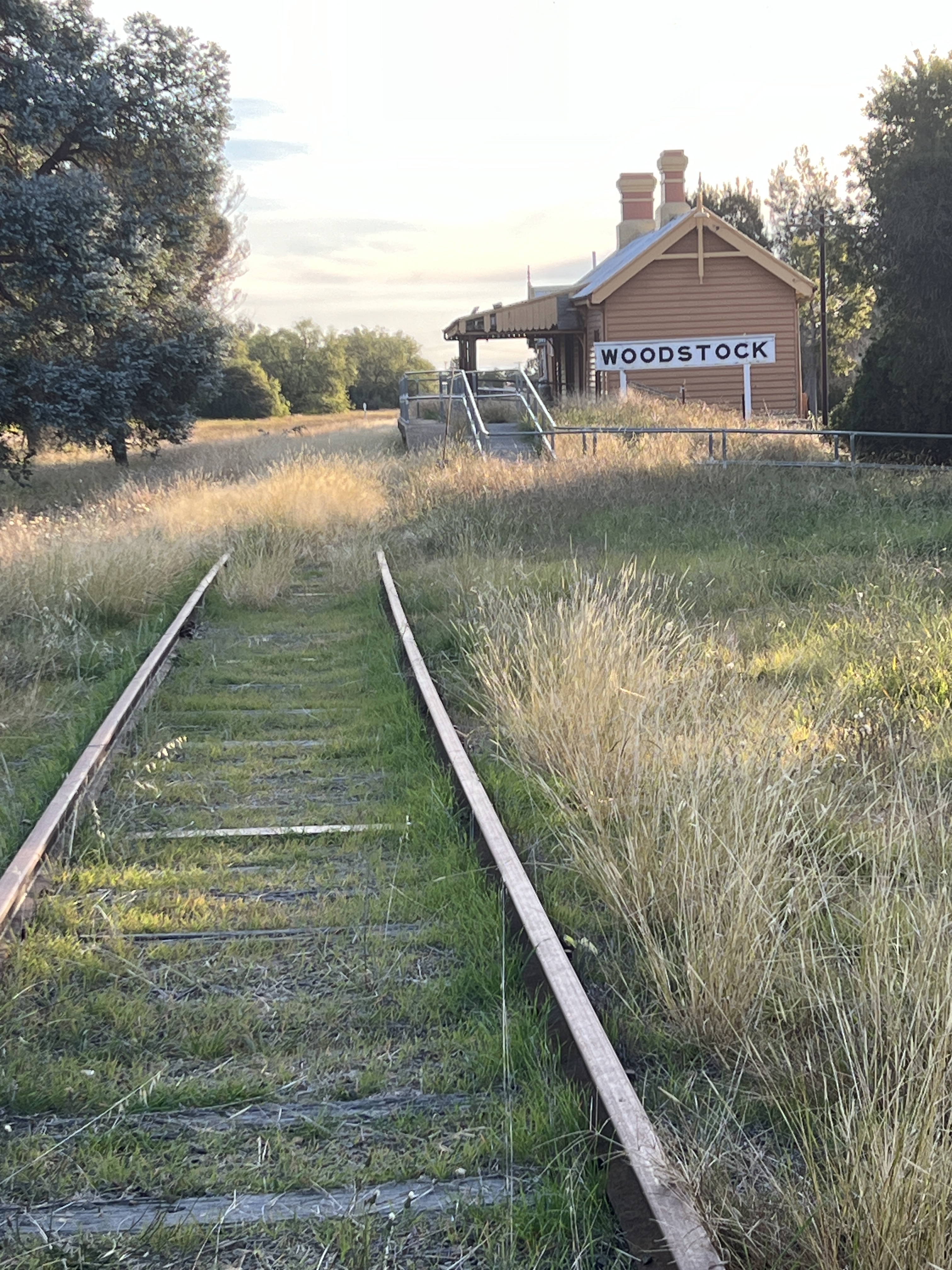
There was a big train prang here in 1919 when an out of control freight train with 40 carriages full of coal smashed into an embankment at the Woodstock train station. Very big mess of twisted carriages, there were no injuries.
The next step in this journey is to try to follow the river back upstream from the dam. This has proved to be difficult with the van in tow because the backroad has been flood damaged and was not recommended by the Cowra Information Centre people.
This means that we get to our next stopover at Gunning by way of the Hume Hwy and miss a section of the river. Gunning is a couple of km off the Hume and about 50km from Goulburn. The search starts.
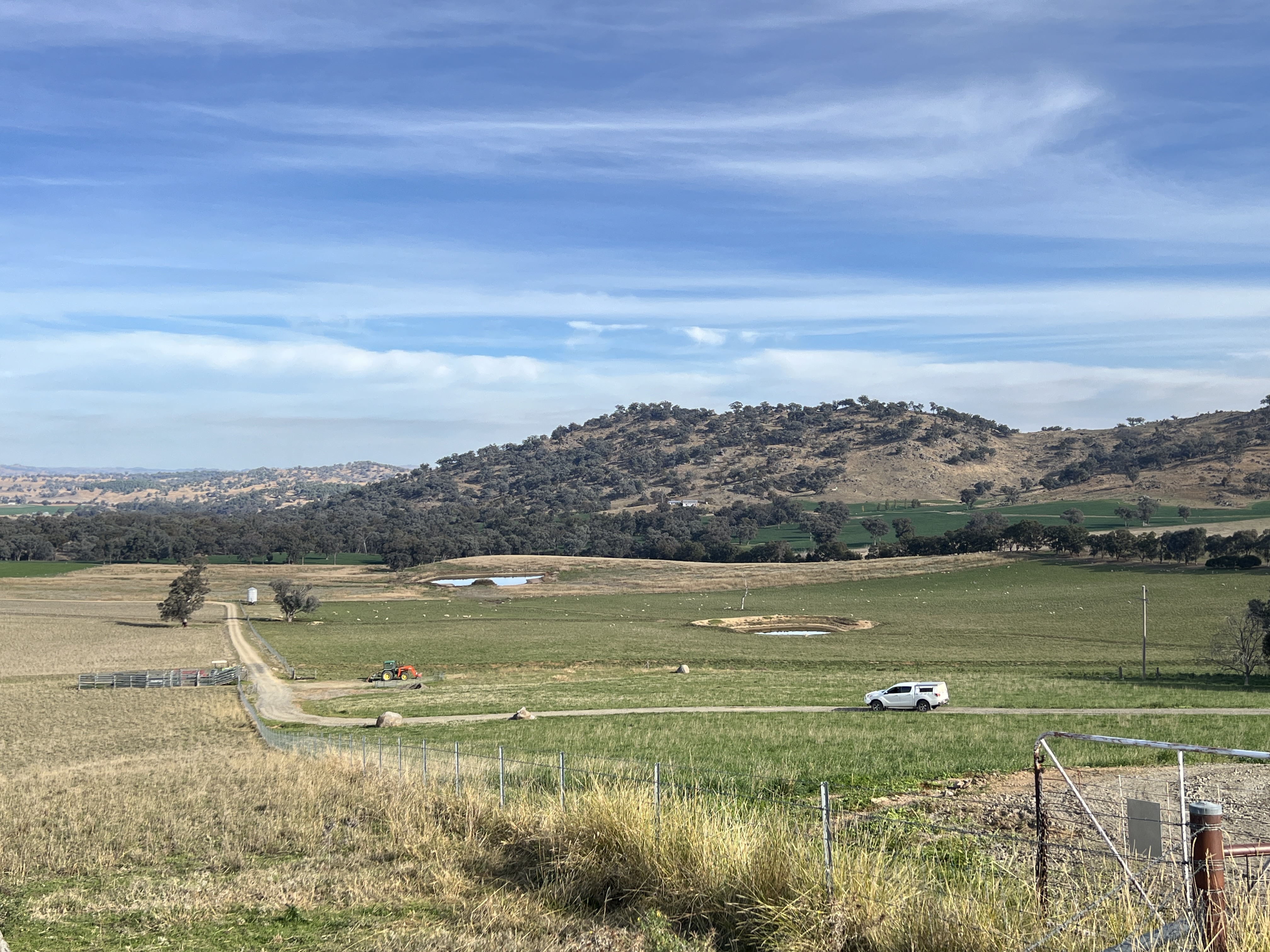
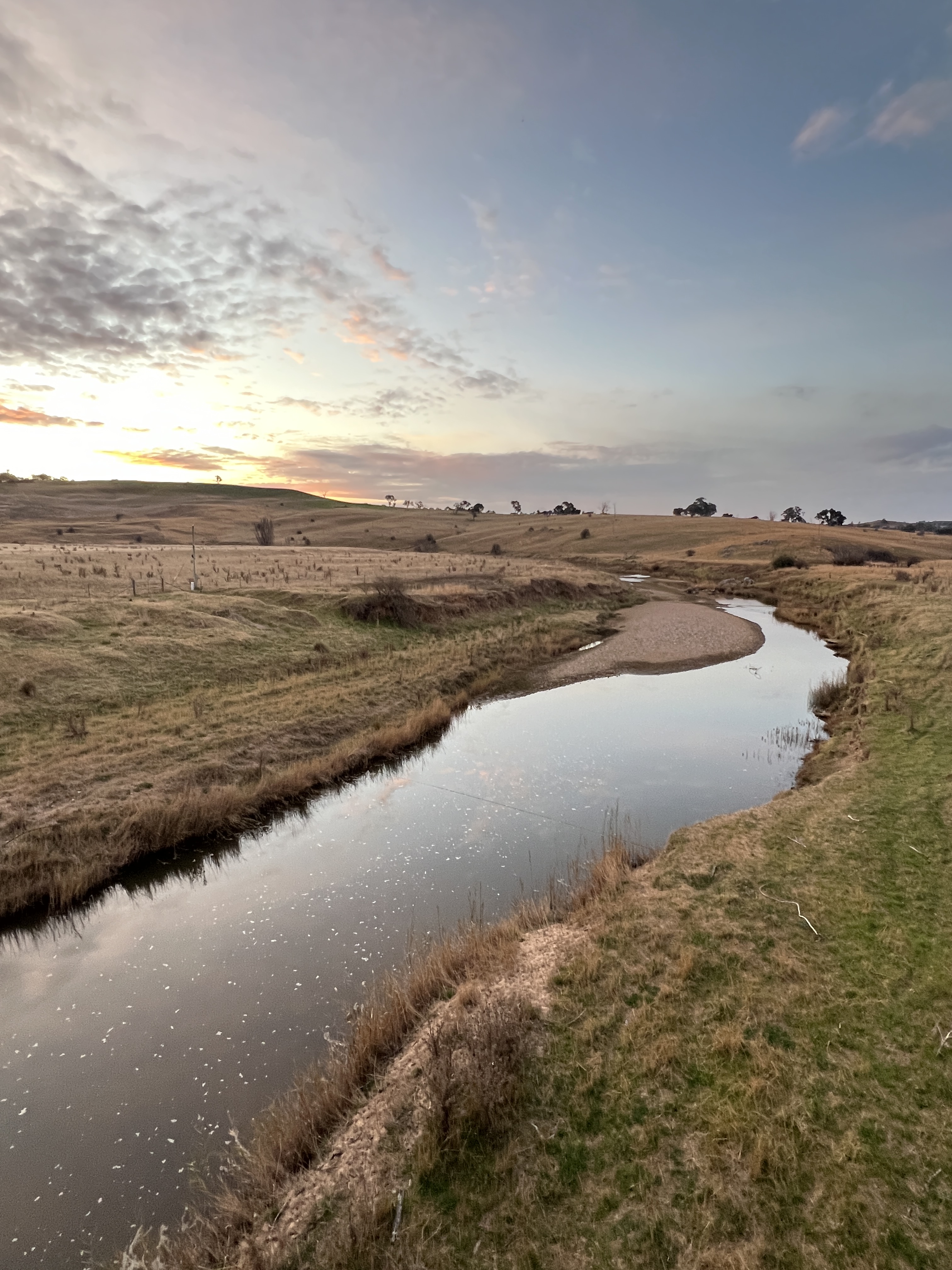
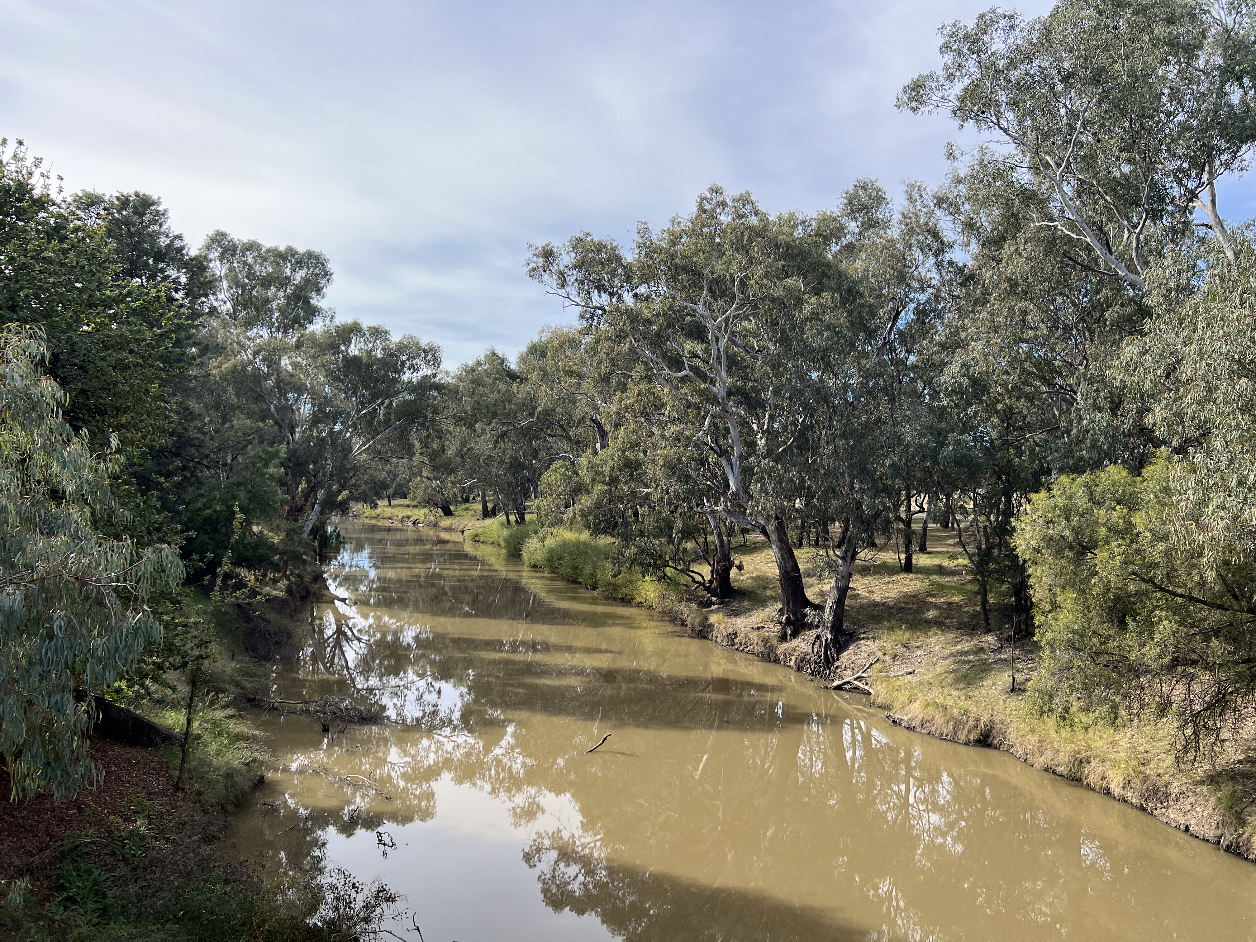
Our trusty river guidebook gets us to a hill not far from a blip on the map called Breadalbane, which claims to be the ‘headwaters of the Lachlan’.
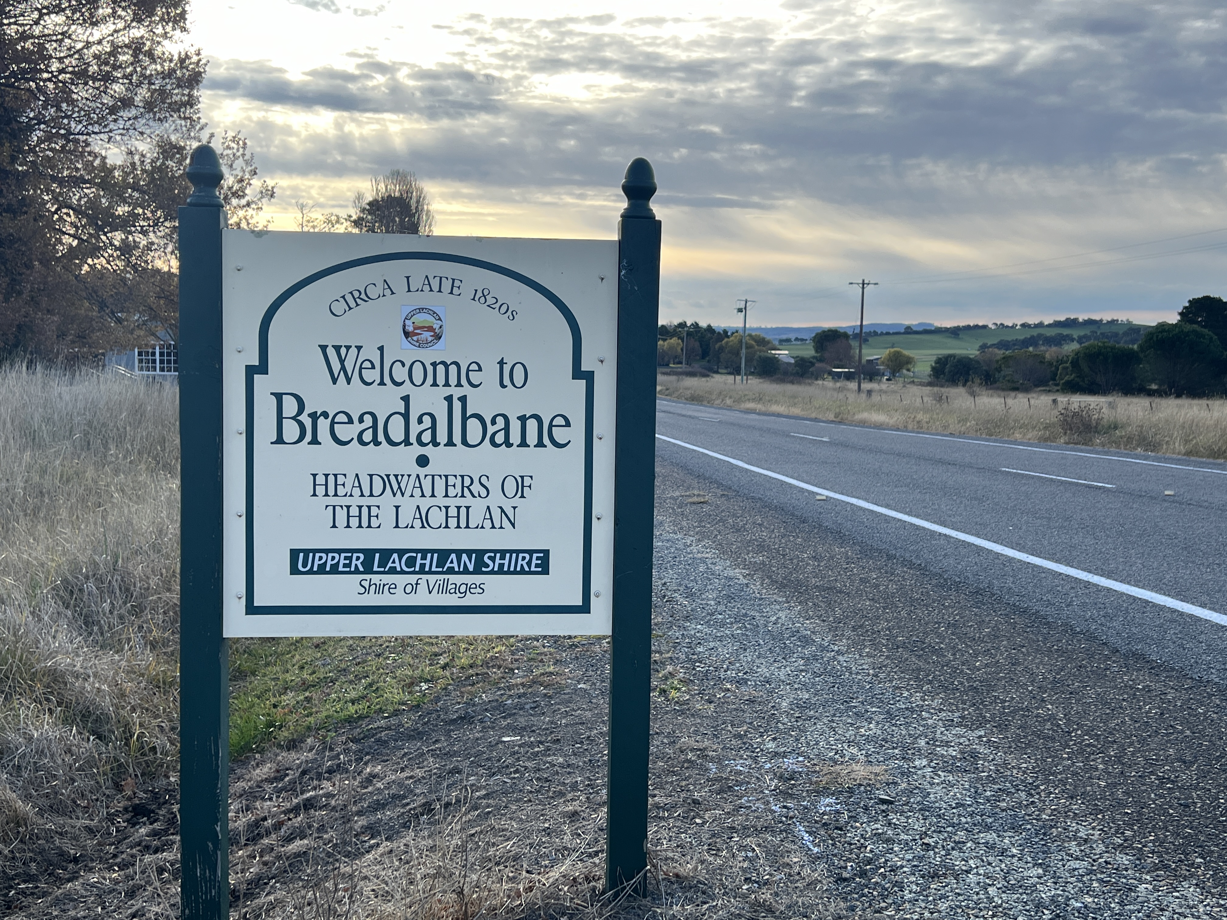
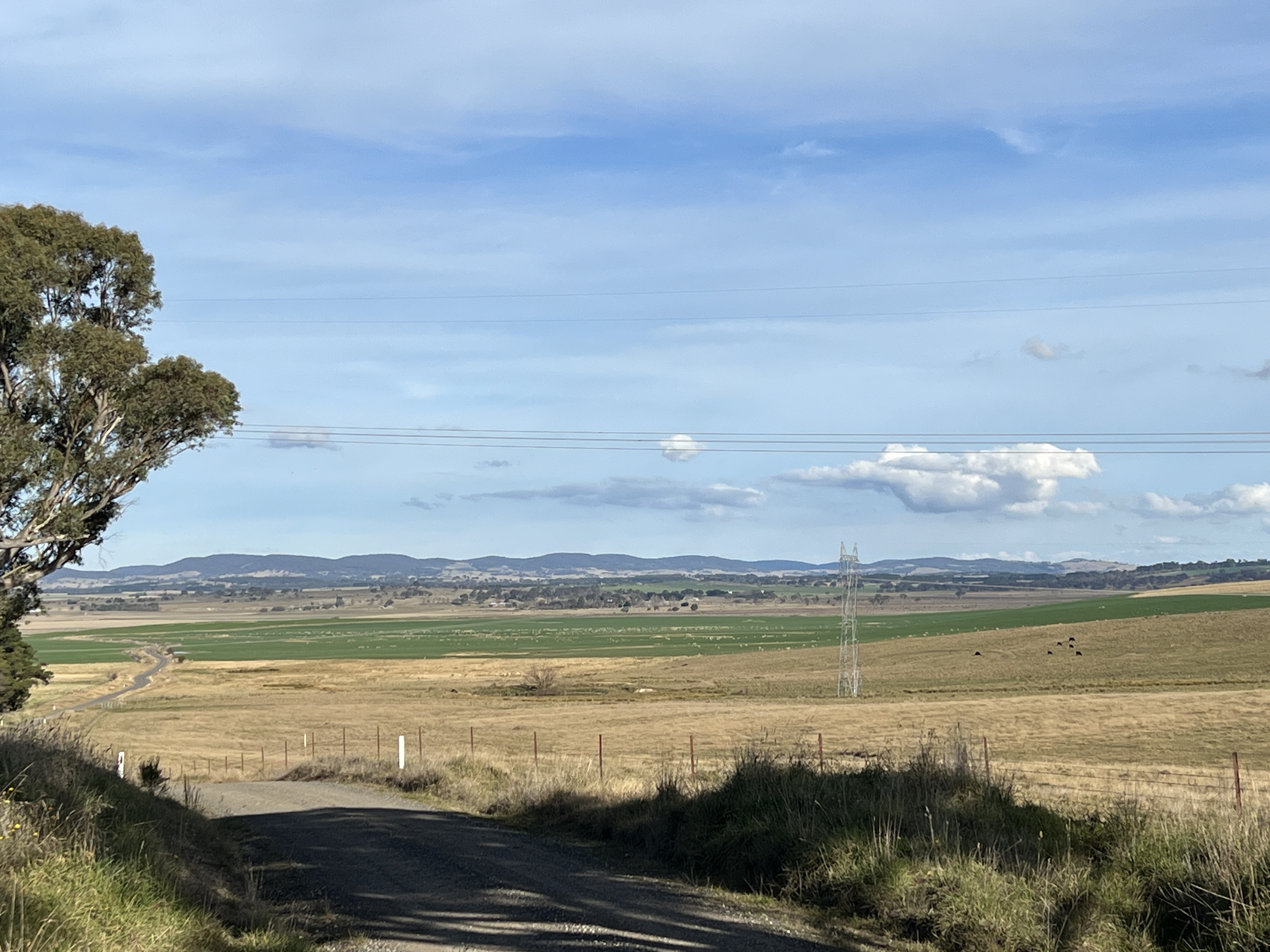
From the hill top there is view over a flattish valley with a patchwork of farmland. Some obviously green from irrigation. We take a closer look by driving on down the hill onto the plain. Sure enough we soon find ourself amongst some very marshy land, with little rivulets here and there, puddles of water among very soggy reeds and grasses.
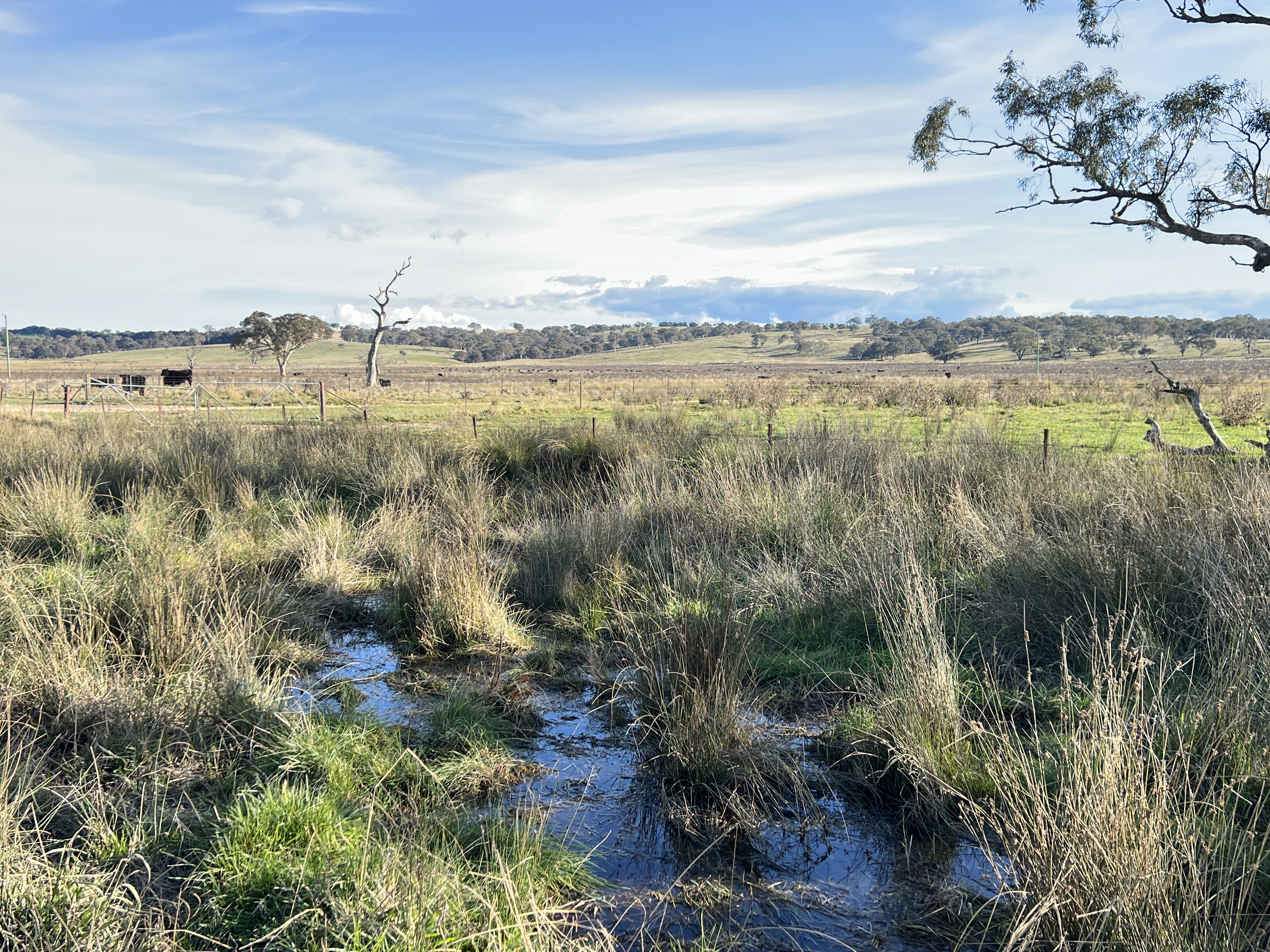
The source of the Lachlan is here where an aquifer surfaces and feeds the river.
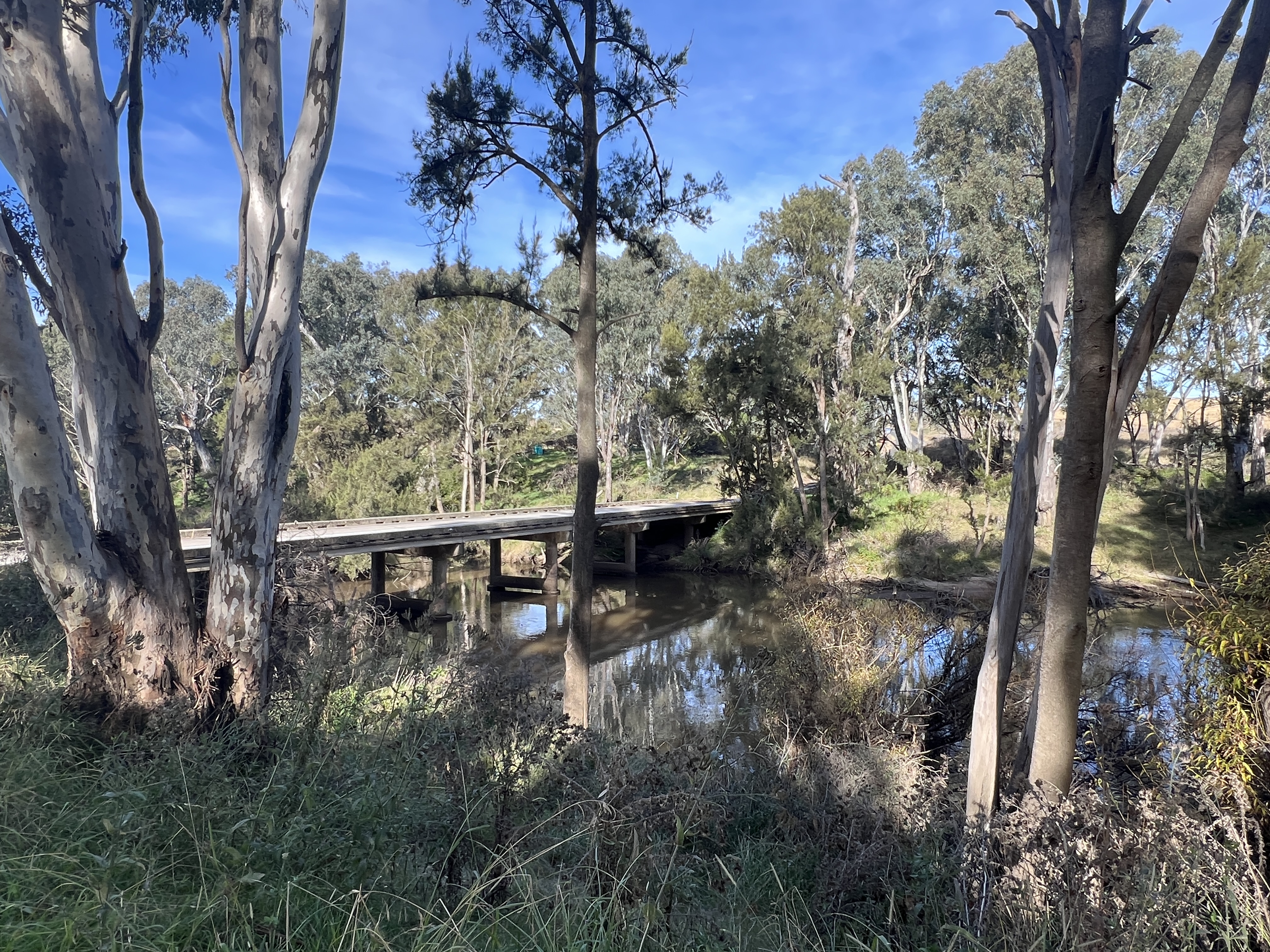
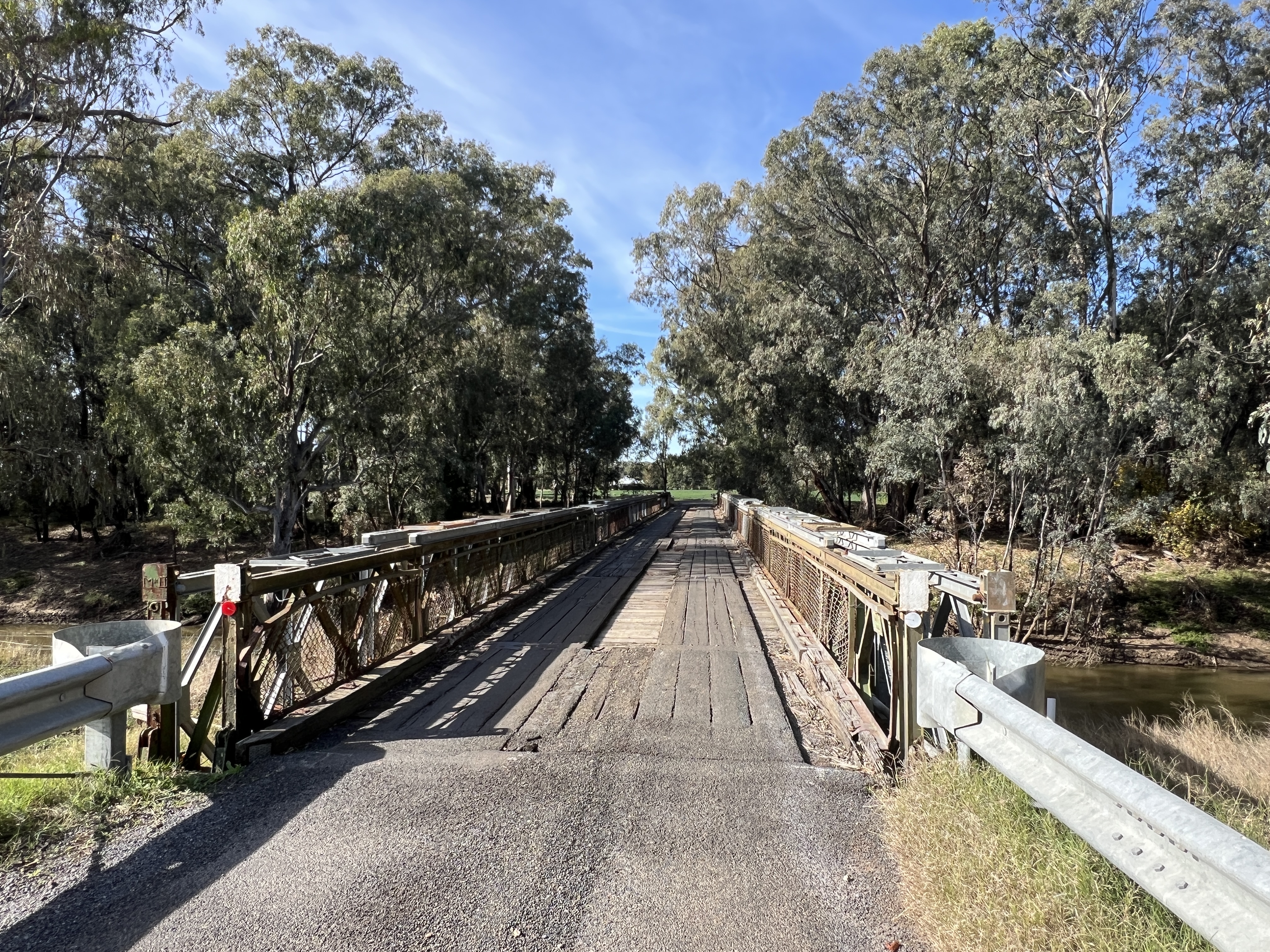
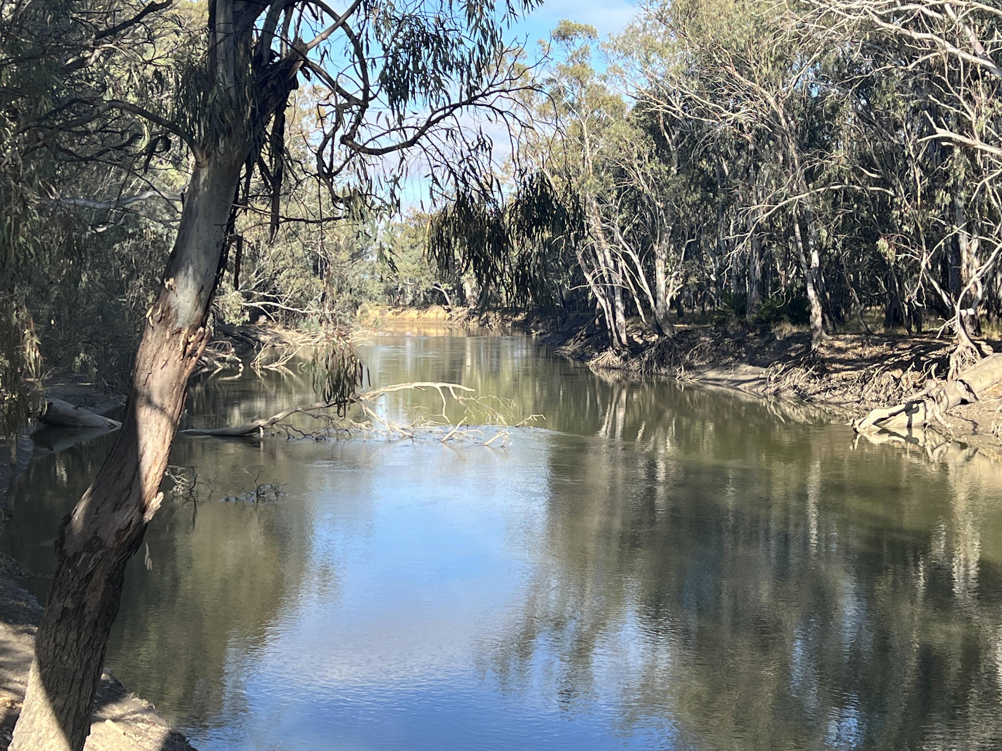
We backtrack to Breadalbane and then follow the guidebook to a few crossings of the river.
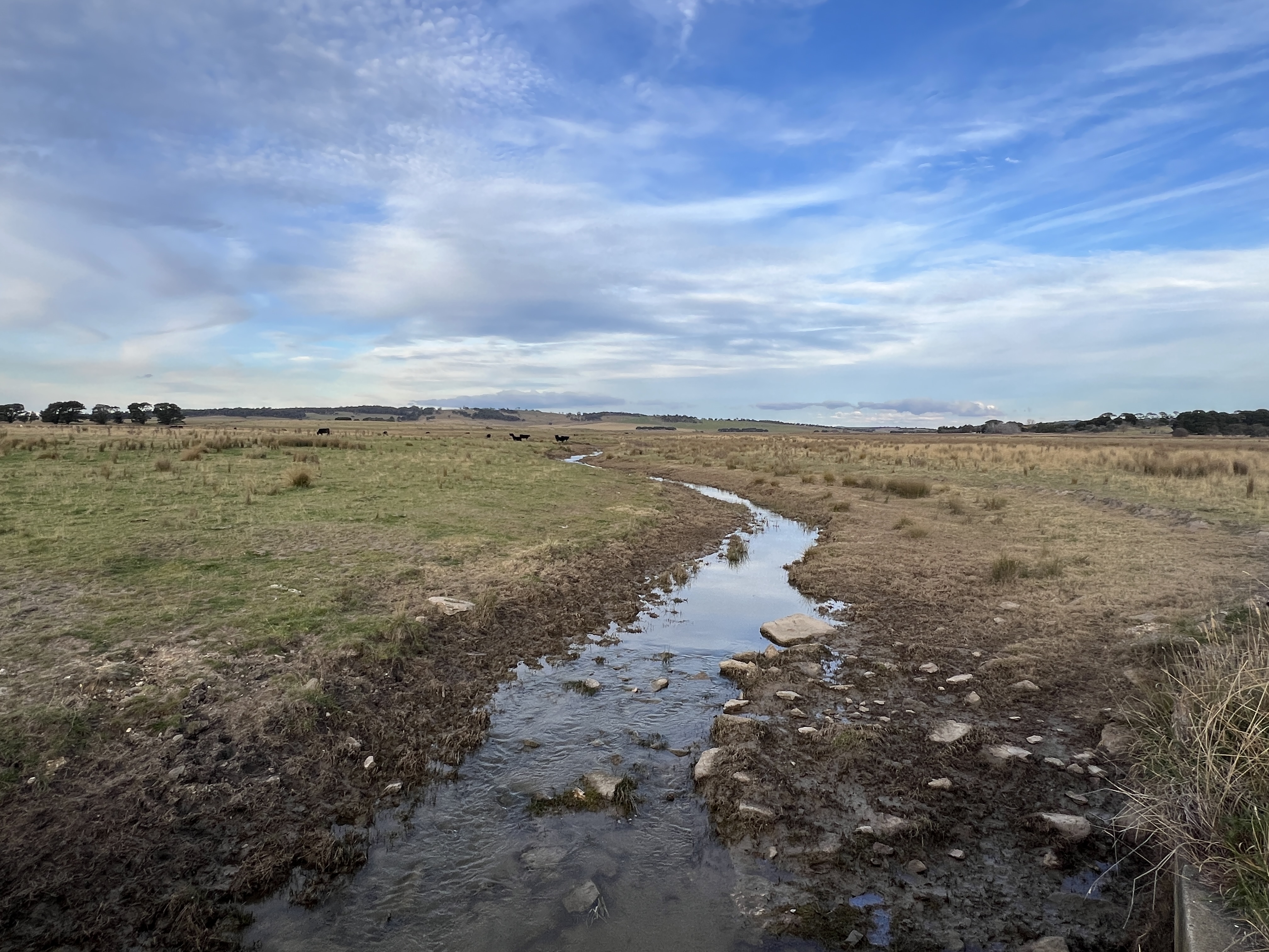
In its first few kms it is known as Hannans Creek, before taking the name Lachlan. As the sun sets we get a last look at the river proper from the first high level bridge crossing, Inglewood Bridge.
The river meanders off to Wyangala Dam and eventually Oxley about 1450 river kilometres away down near the Murrumbidgee.
Mission accomplished! Time to head for Brisbane.
A bit of culture
From Lake Cargelligo we continued down the Lachlan Valley Way to Condobolin, where we again meet the Lachlan River on its way to Forbes. The Lachlan River is what is known as a terminal river, it flows into a sort of limbo place. The Great Cumbung Swamp in the case of the Lachlan. Apart from during high flood years its waters do not join the Murrumbidge and consequently nor the Murray and the sea.

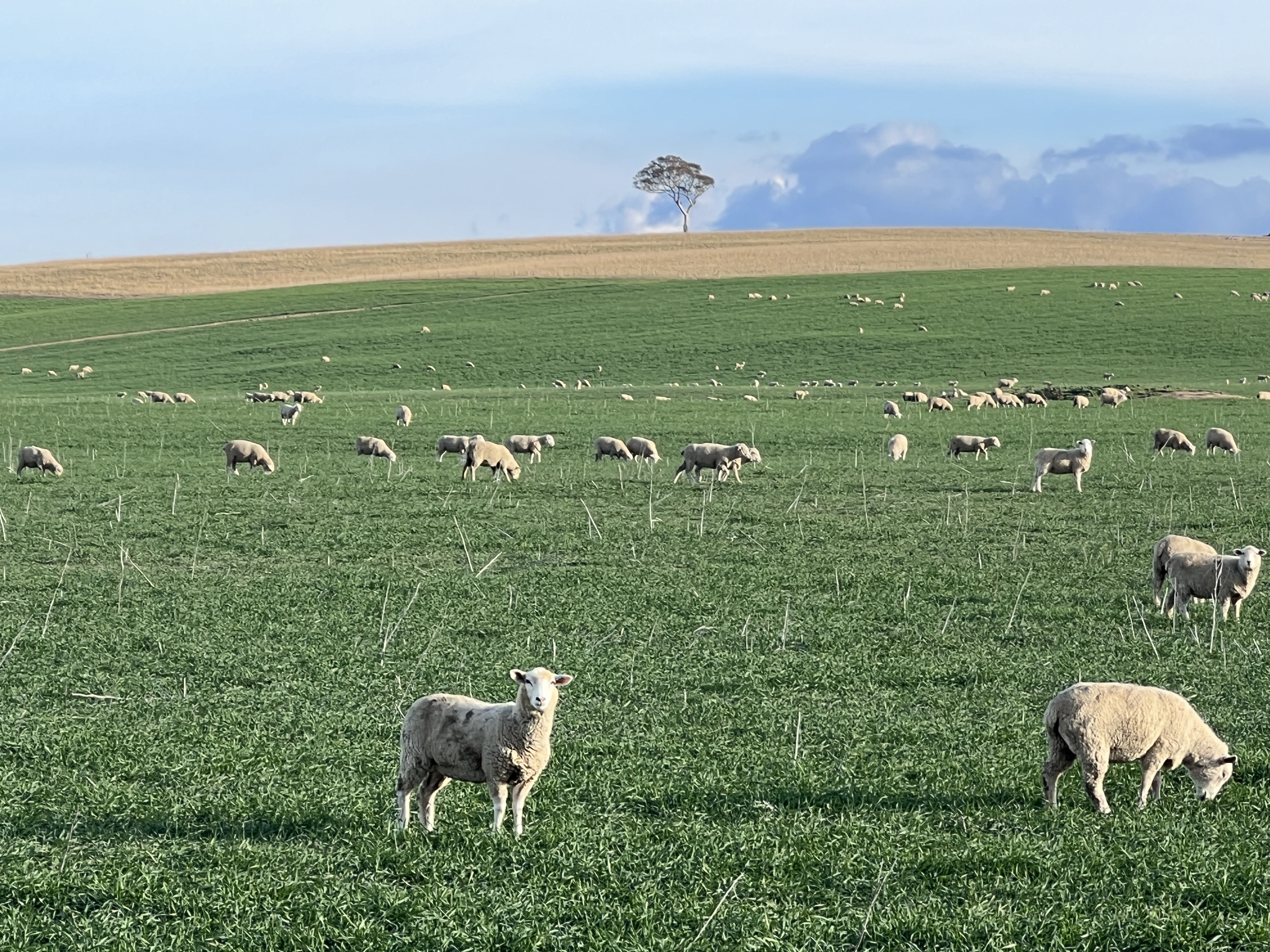
The road down to Condobolin passes by seemingly endless pastoral and farming properties. A few (must have been around 2000 of them) nice cows are being driven down a stock transfer route. It is all green and sheep are thick in the paddocks as well , it seems our farmers will be having a good season. Maybe lamb prices will drop in a month or two, wishful thinking?
A few years back a farming couple started to do up old Holden utes with some catchy sort of cartoony presentation. They were in the paddock beside the road, hence ‘Utes in the Paddock’. Often with a subtle message.
Today, they have been collected up and presented in a paddock beside the Condobolin Visitors Centre. Also added to by artistic types with new creations. Very entertaining for a nomad after a long drive from Lake Cargelligo!

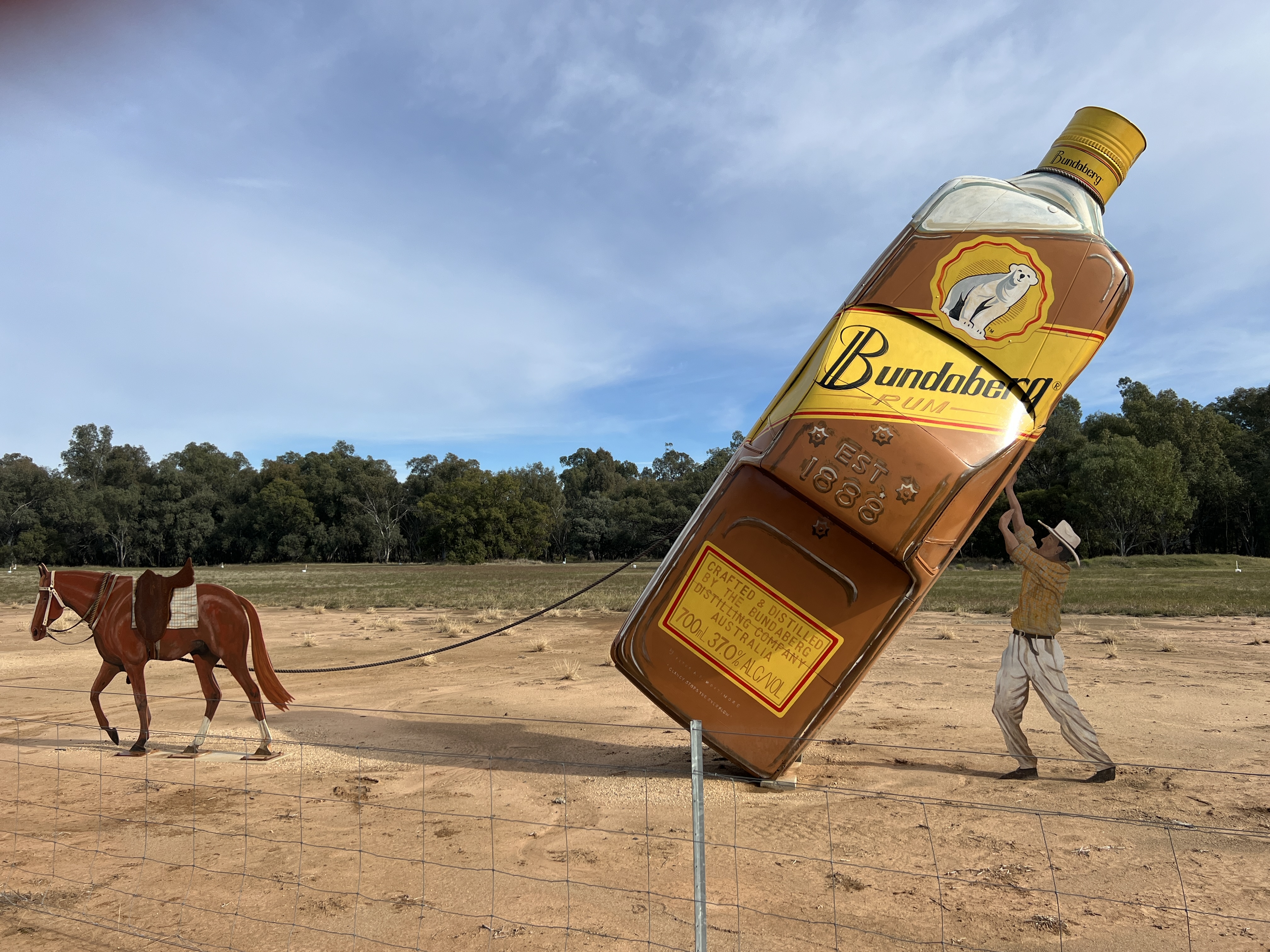

In moving on to Forbes down the Lachlan Valley Way we are greeted with a series of sculptures in the scrub. A little guide sheet locates them for us and there are well set up pulls off to get off the road and peruse these art works. Sometimes it is all a bit puzzling understanding sculpture, but the little info plaques help us understand the ‘inner meaning’ of this stuff.

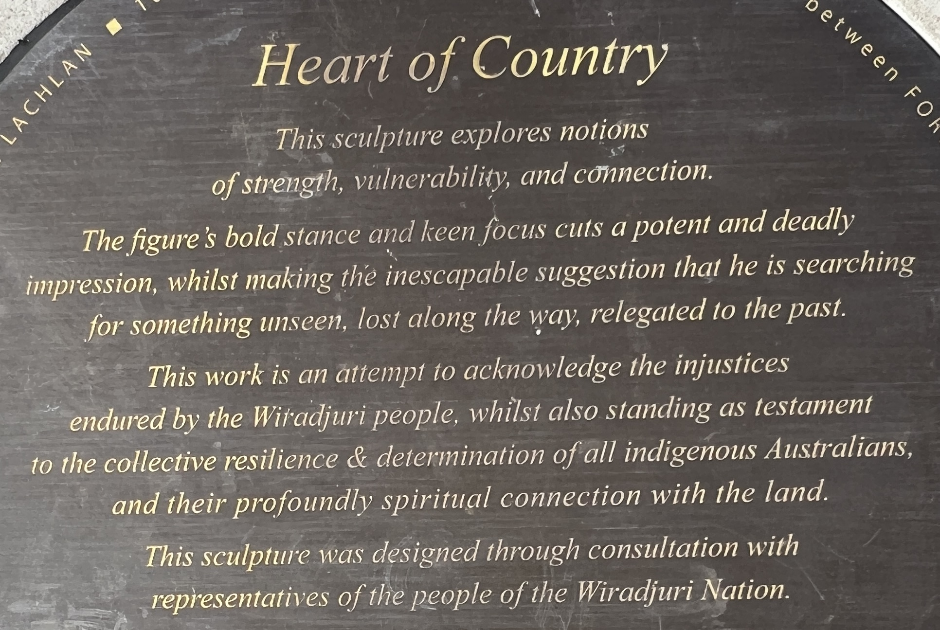
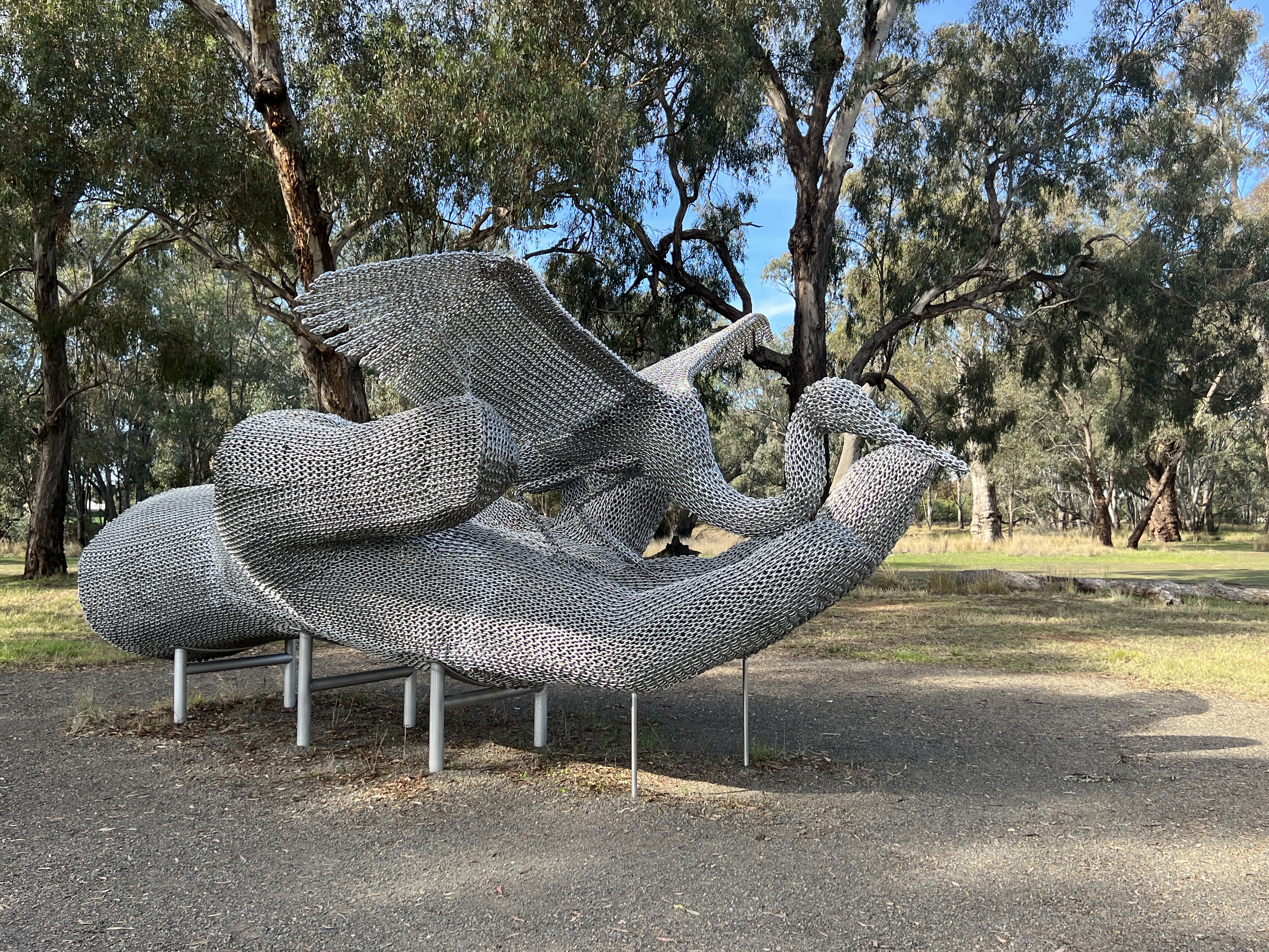
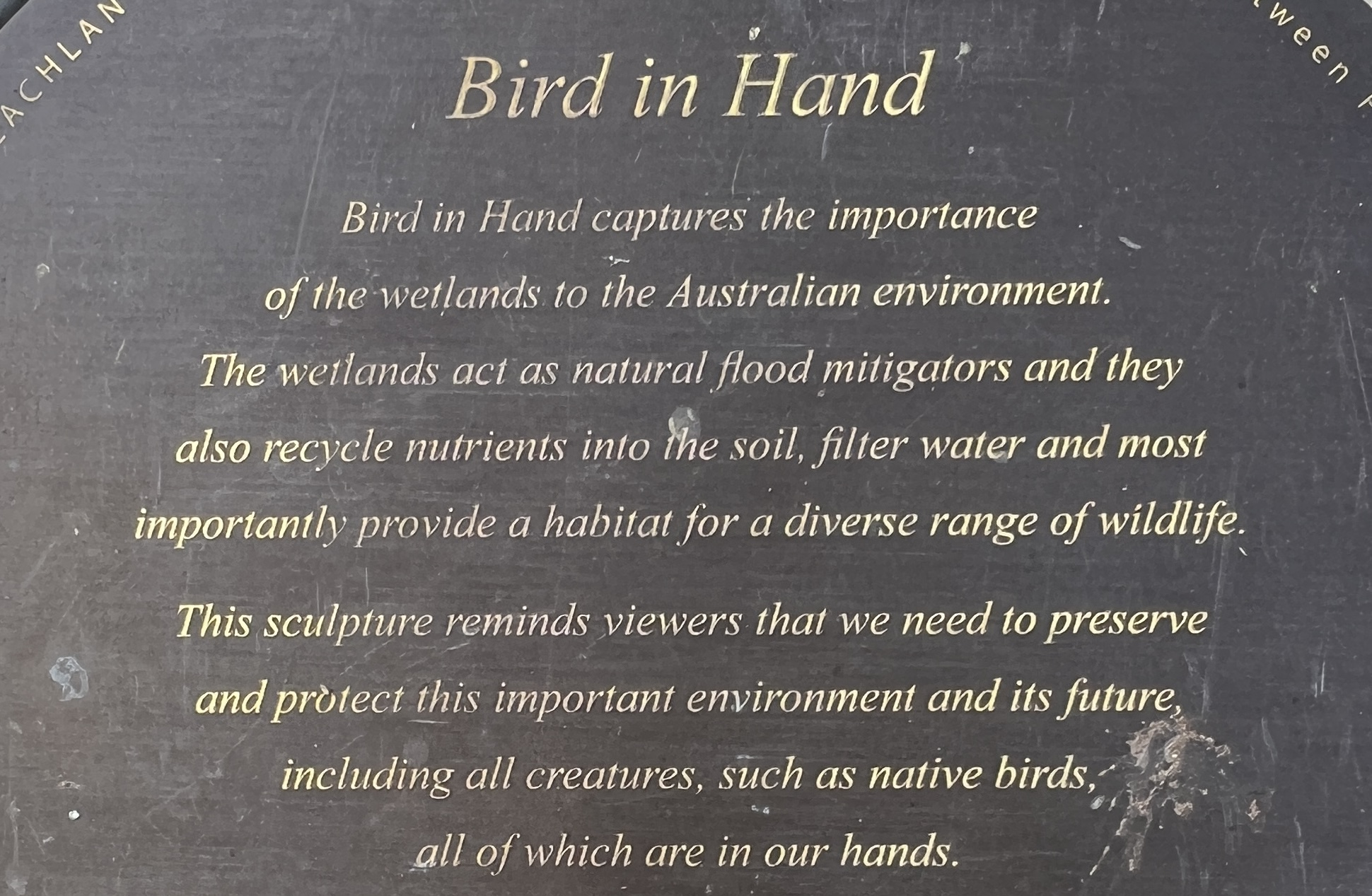
Do hope dear readers that you can pick up the meaning of all this artistic stuff from these info plaques.
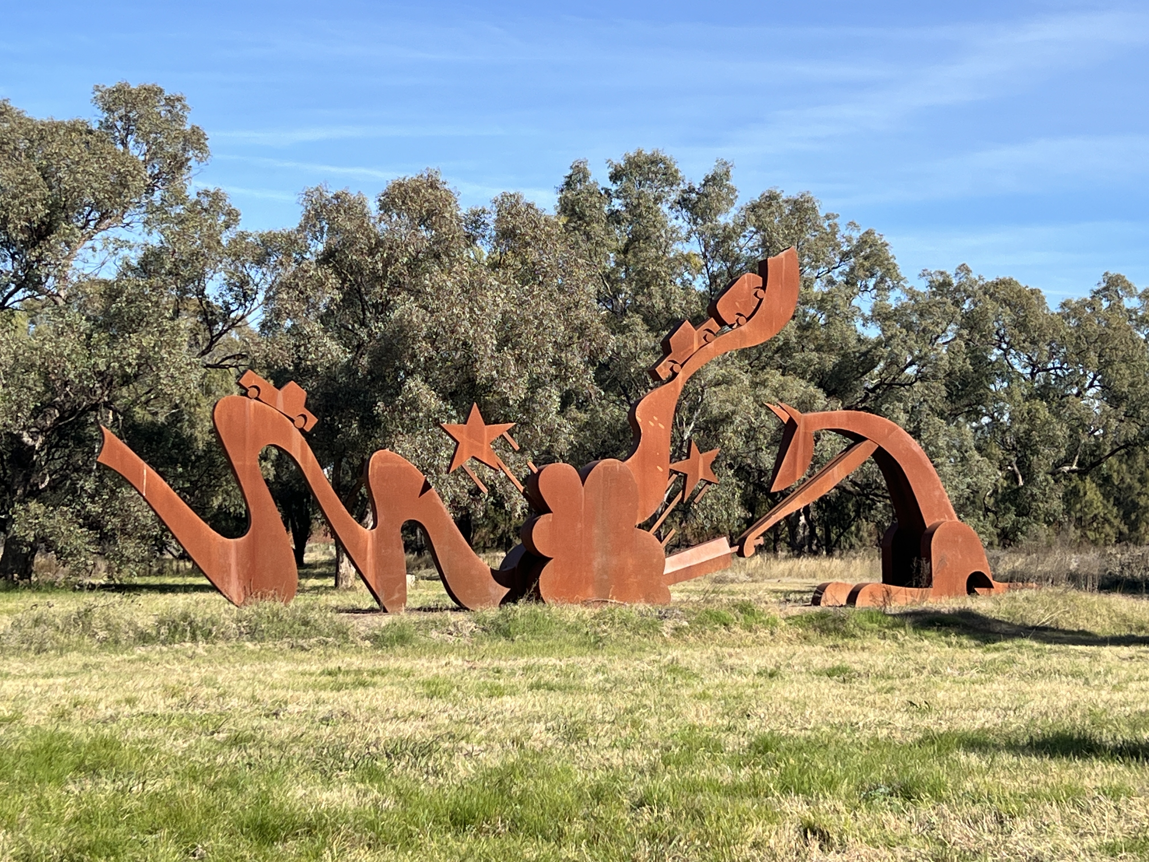
This one is rather good!
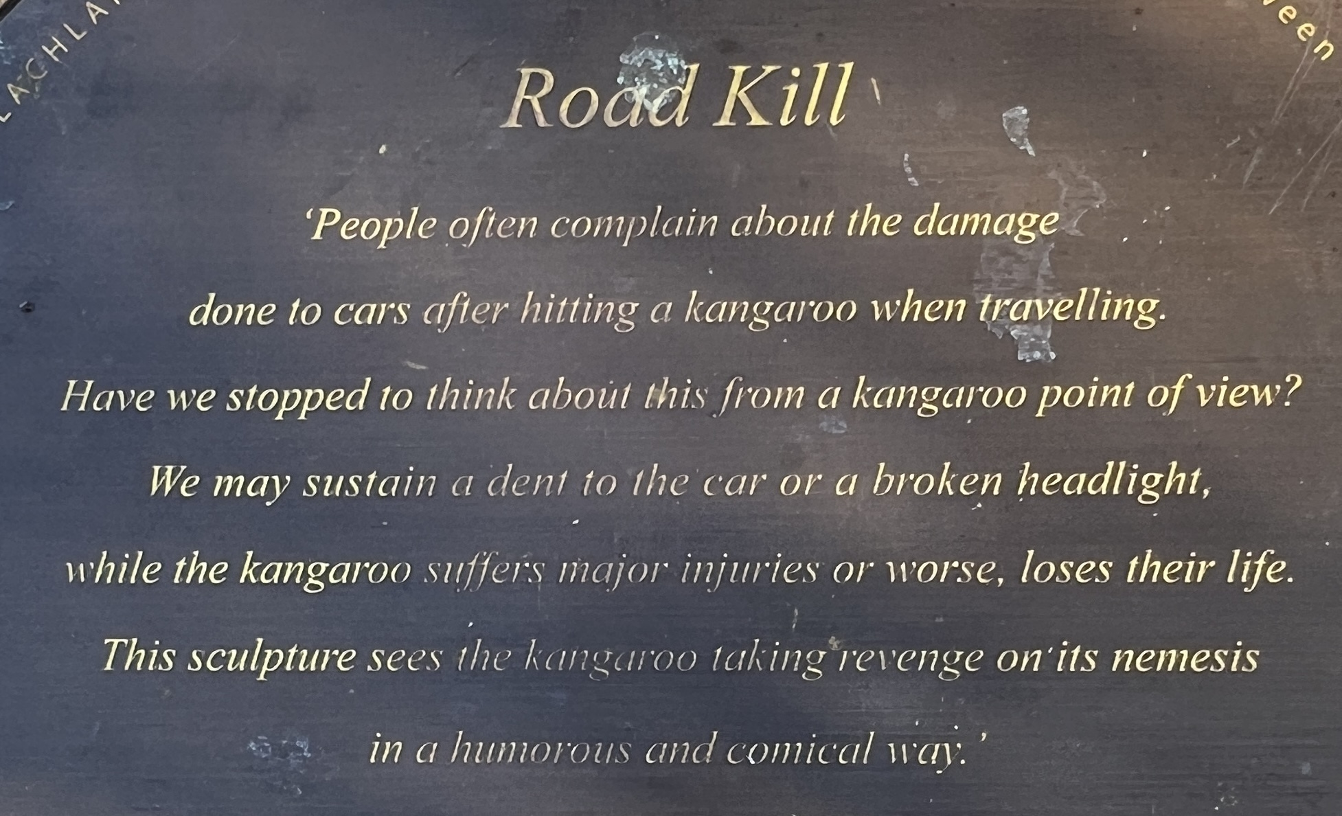
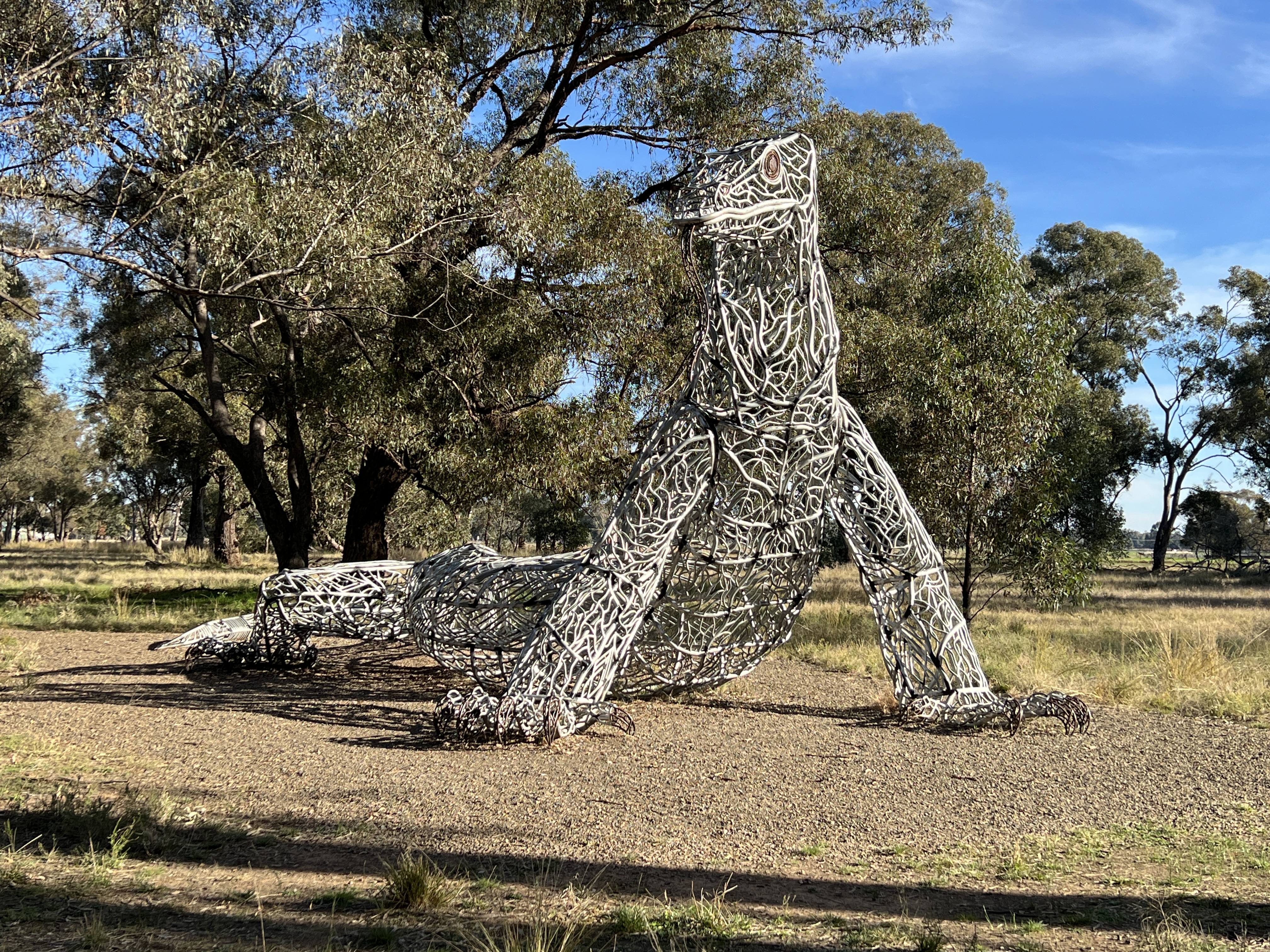

We found it an interesting distraction from taking pictures of the river and all the old bridges.
We then skipped on through Forbes, having our lunch beside Lake Forbes, a billabong type thing back from the river that has been enhanced and is now a great spot for a free camp.
But we have to keep moving in order to get to Cowra for the night and have a couple of days to pursue the source of the Lachlan.
Following the Lachlan
We left Hay on the Cobb Hwy which heads almost due north towards Ivanhoe in far west central NSW. The road traverses the great Hay Plain, past the spot where we had sat watching the sunset a few days back. We are headed for Booligal where the Lachlan is more like a river.
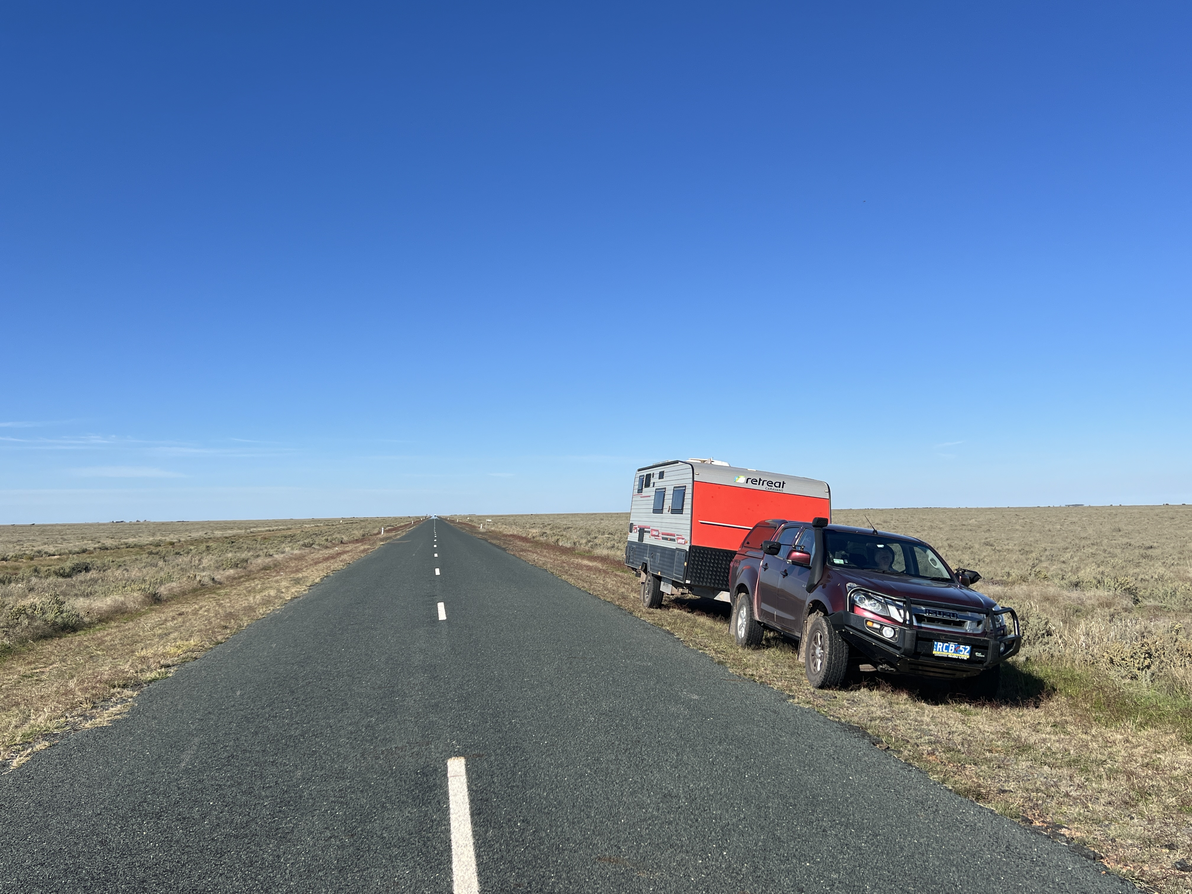
Along the way we stop off at the abandoned One Tree Hotel, built here back in 1862 as a Cobb & Co staging post and as a ‘watering’ hole for passers by. It was renovated a bit over the years but is now fenced off, warning visitors off the private property. CCTV camera warnings seem out of place out here!
At Booligal we left the Cobb Hwy to go across country following the Lachlan Valley Way to Hillston.
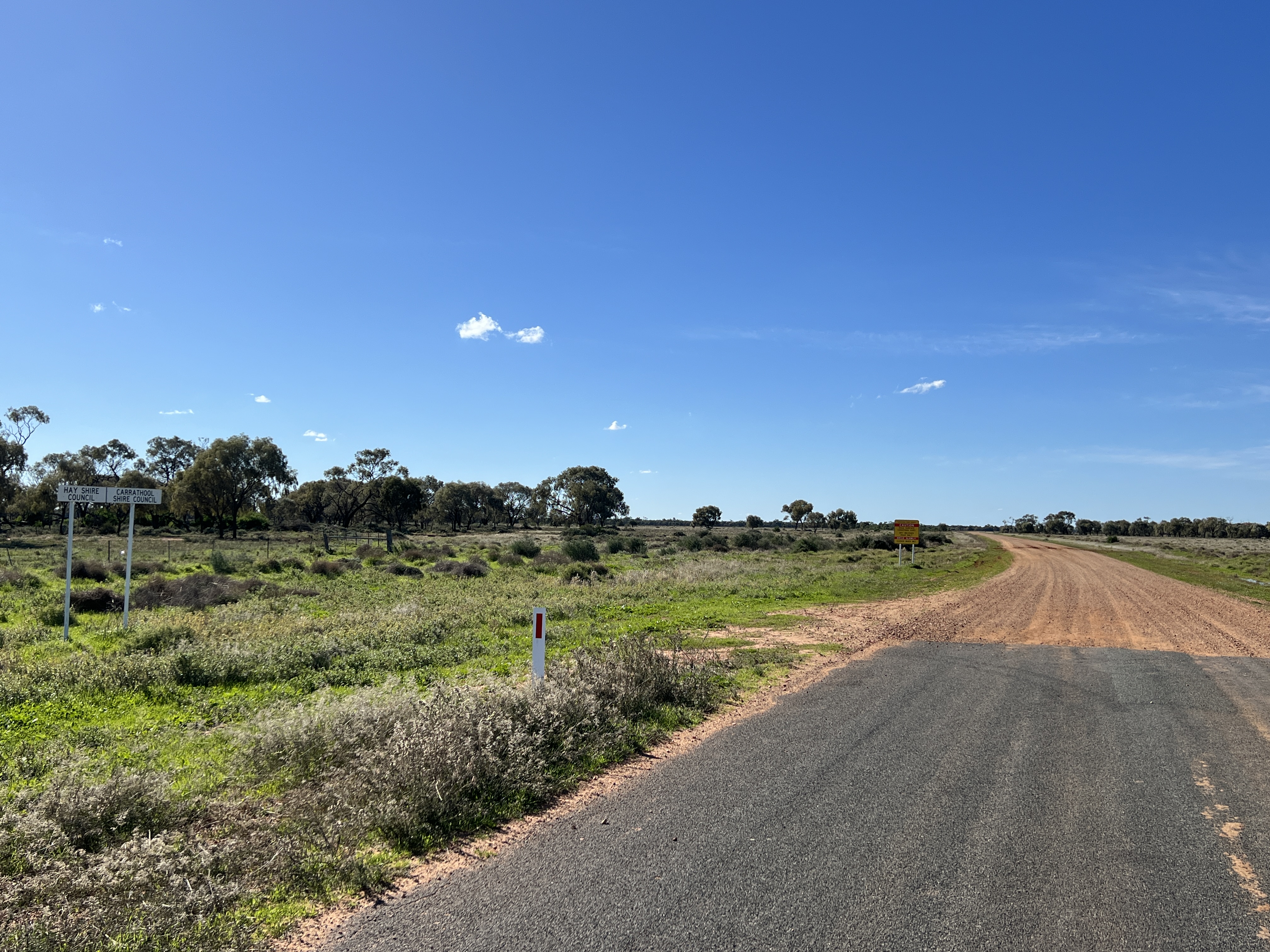
As soon as we left the Hay Shire the bitumen stopped and we were onto the gravel, the adjoining shire is sealing it slowly from their end. Maybe they will meet one day! Anyway it is a little flood damaged, not too bad but we still needed to be cautious of the conditions. The road is some distance back from the river. Properties line it preventing public access. Our map though showed a short side trip to see the river, along the Whealbah gravel road. So away we went past farmland with all sorts of crops; grains, beetroot and potatoes prominent as well as sheep and cattle. But not a soul to be seen, we had been passed by a ute going the other way before turning off on the side track.
After crossing the bridge and taking another picture of the river (one wonders why because they are starting to look a bit the same these river pictures!) some room was needed to turn around and go back to the main drag. Allthego is always cautious about doing this, particularly when things are a bit damp on the road verges. You don’t want to get caught in a boggy spot and get stuck. But guess what? Allthego went just that little bit wider than he should and ahhhhhh.
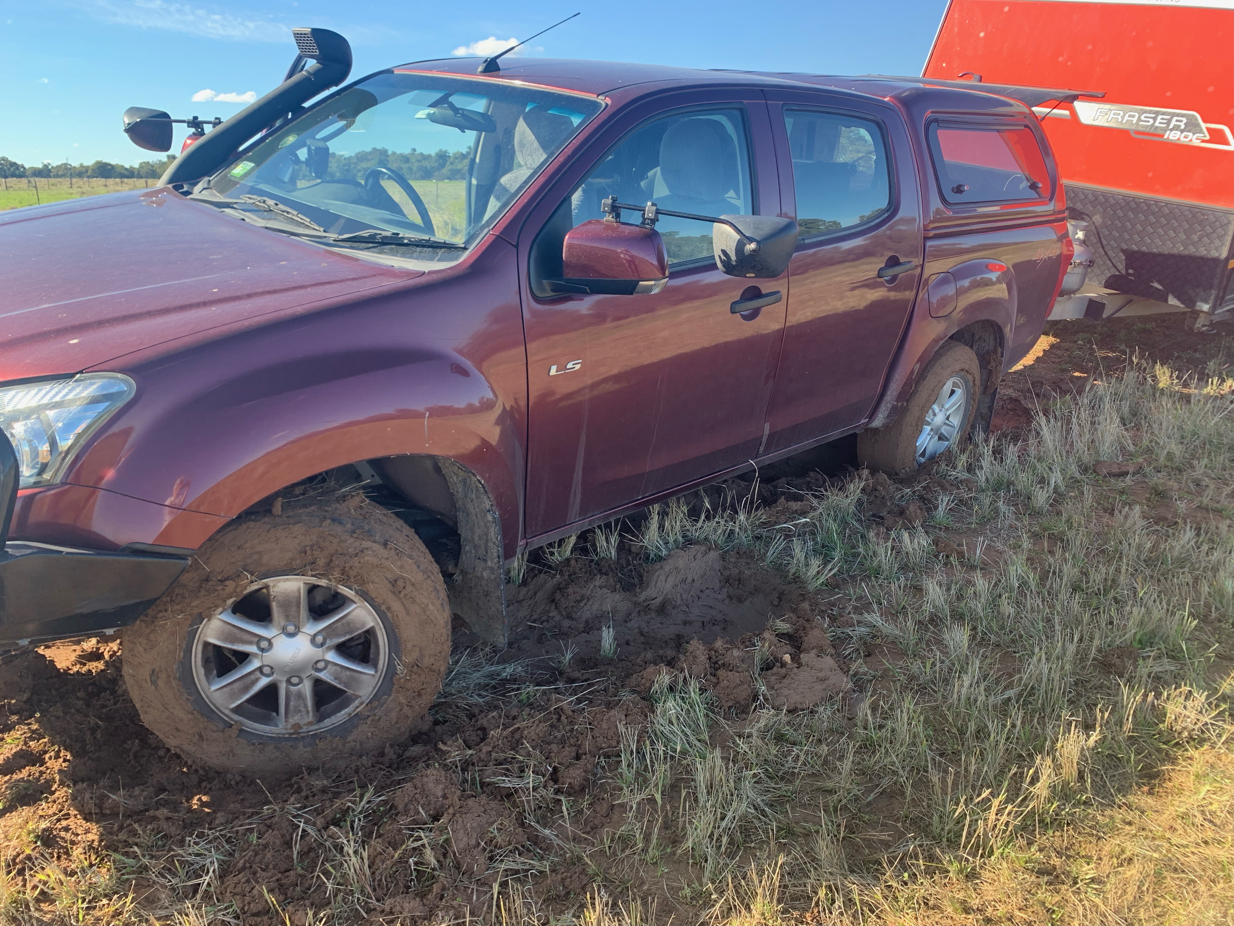
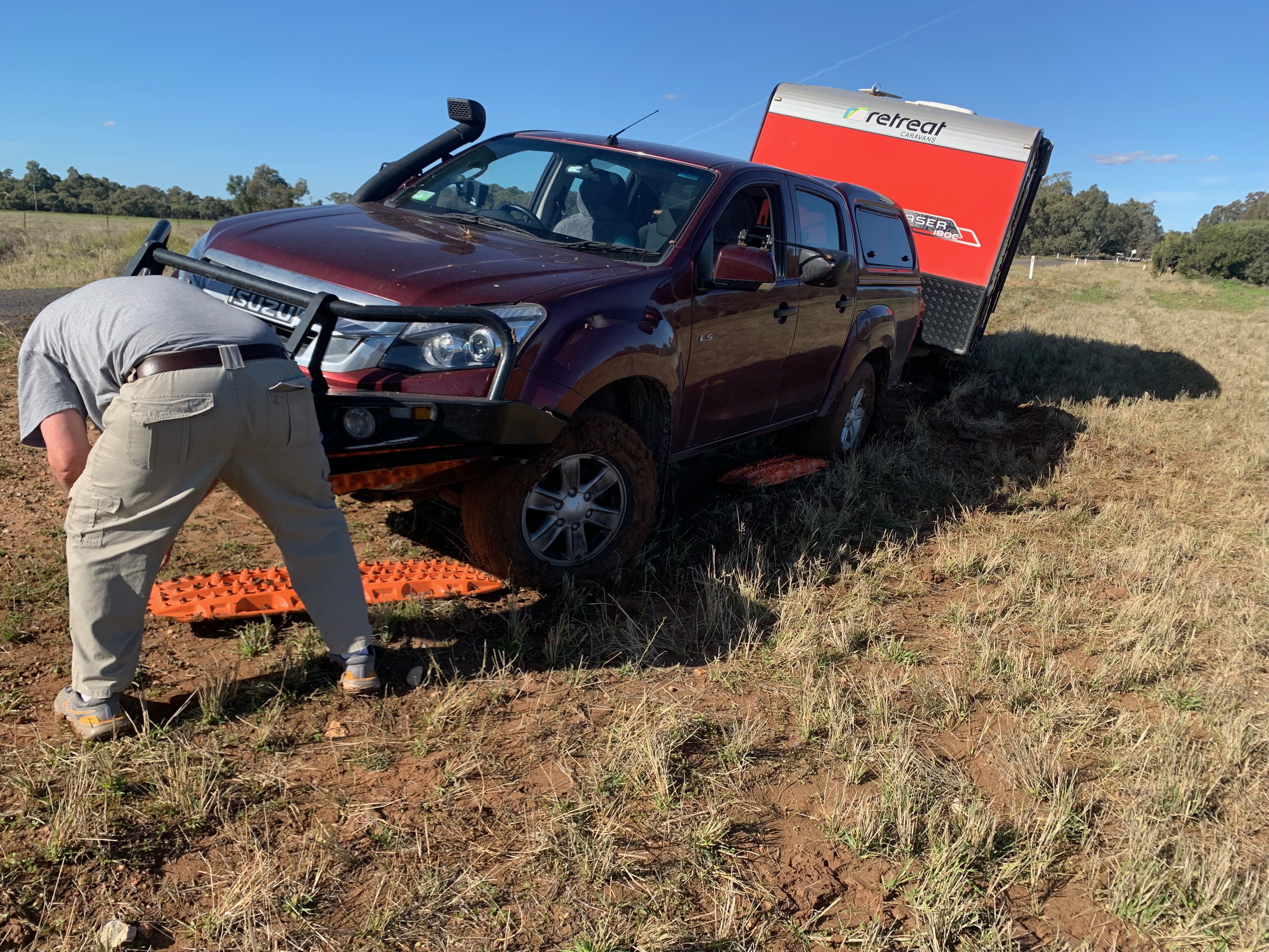
The mud was like soft red clay, really tacky and sticky. The van on the back wasn’t really helping either. When venturing out into these sorts of places you need to come prepared. So, out came the long handled shovel and max traxs. These were great and after about an hour of mucking around we were away ok on the way to Hillston, a bit lucky I suppose as it could have been worse.
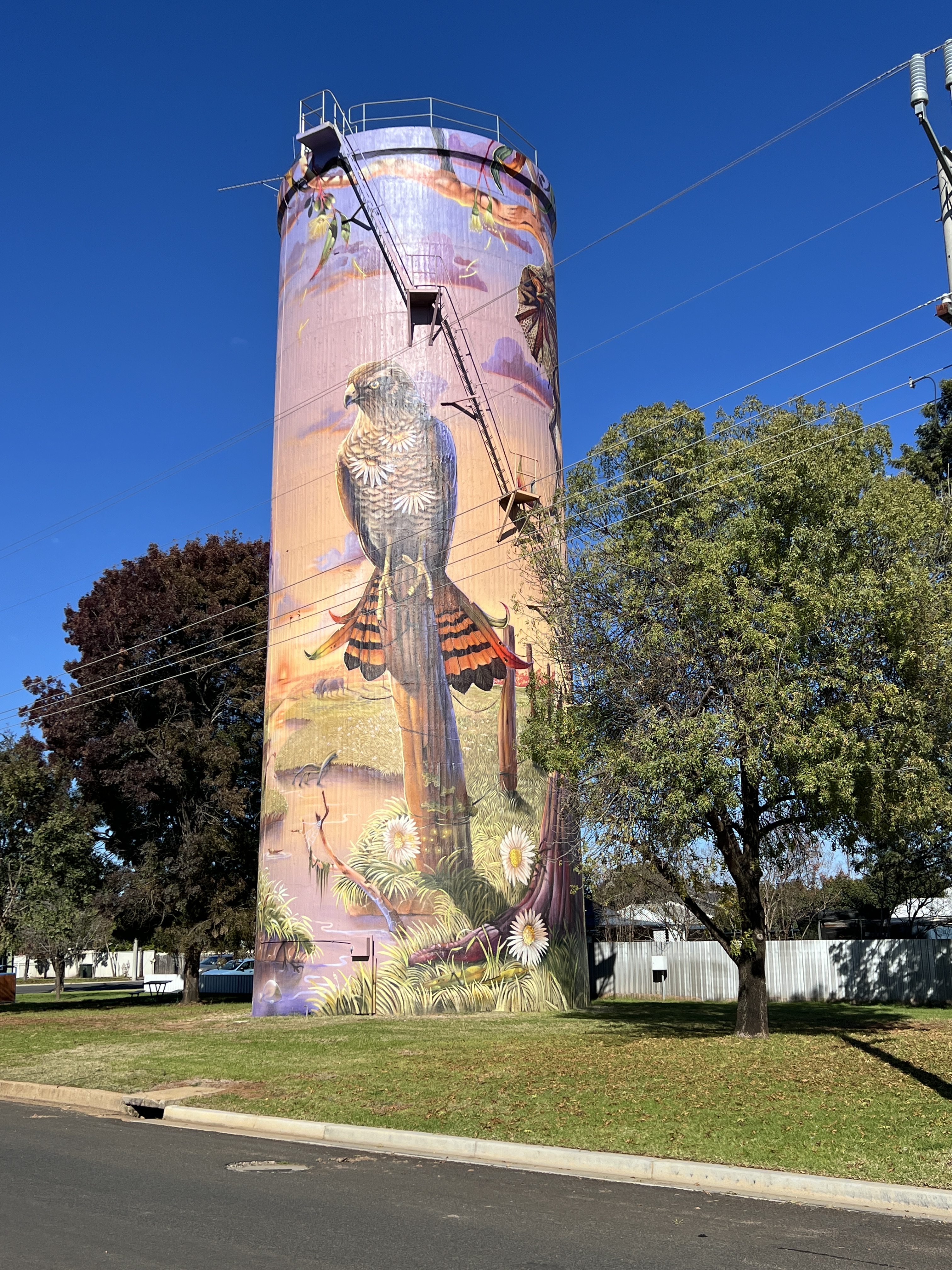
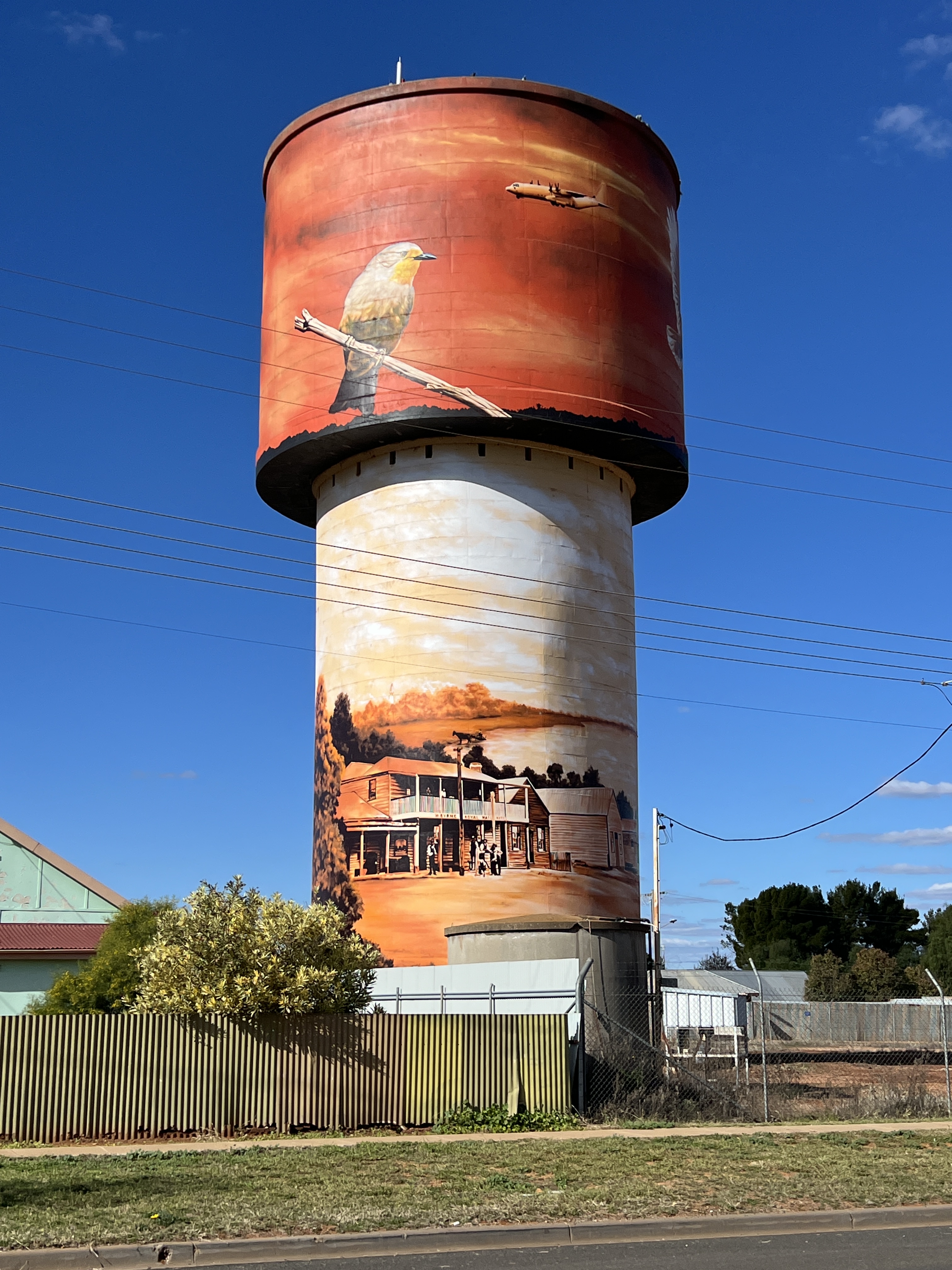
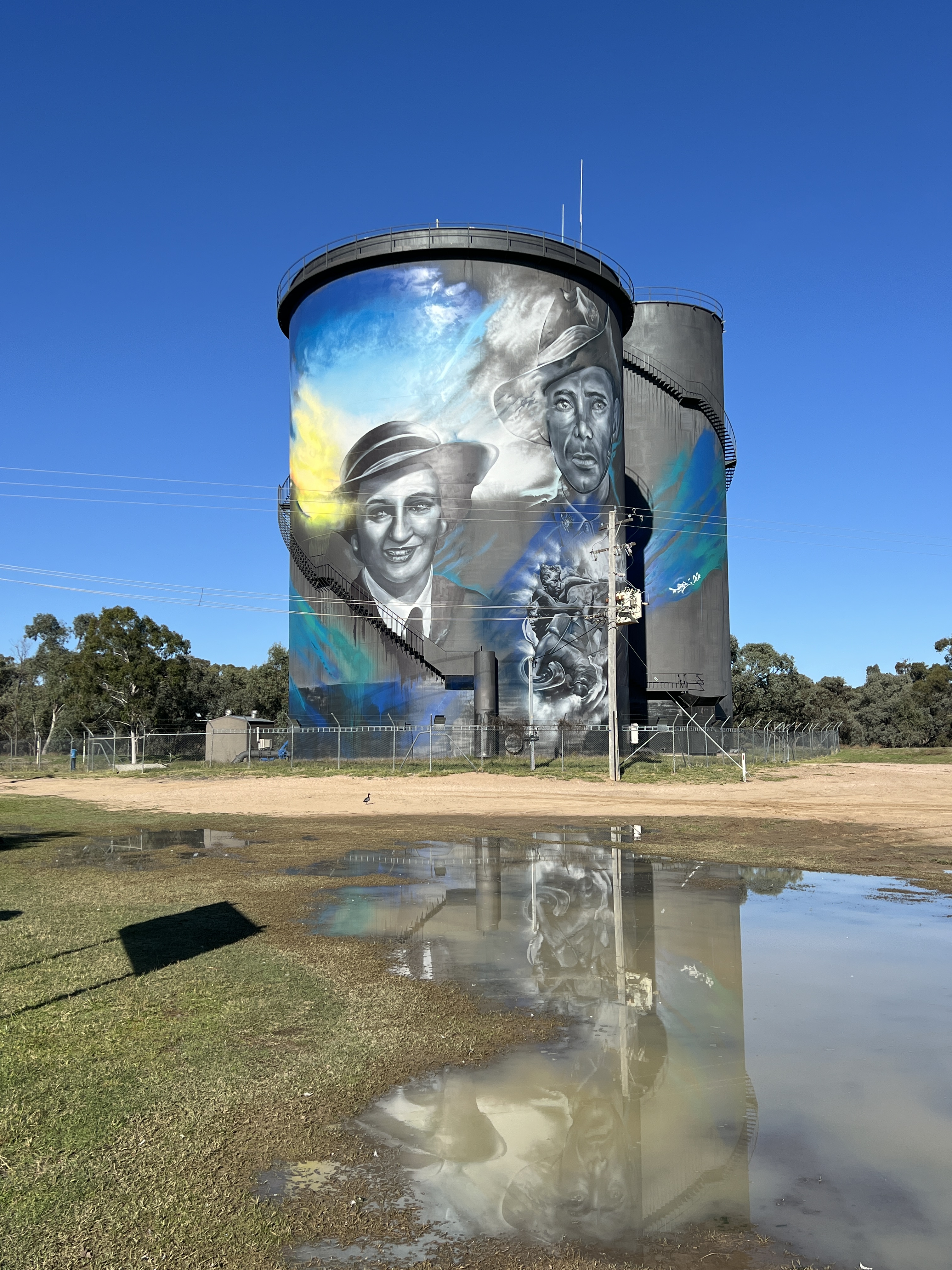
We stopped overnight at the van park in Hillston. The Lachlan does a big S bend here through the town and is quite wide with plenty of water. The town has only just had its water tower painted with a mural, quite a spectacular sight.
Next morning we continued along the Lachlan Valley Way to Lake Cargelligo.
The free camp here at Froggy Hollow overlooks the lake. The lake is fed by the Lachlan in times of flood. We have found it very full after the recent heavy rains. A fellow camper said that when they were here last here they had set up on ground about 30 metres out into the lake.
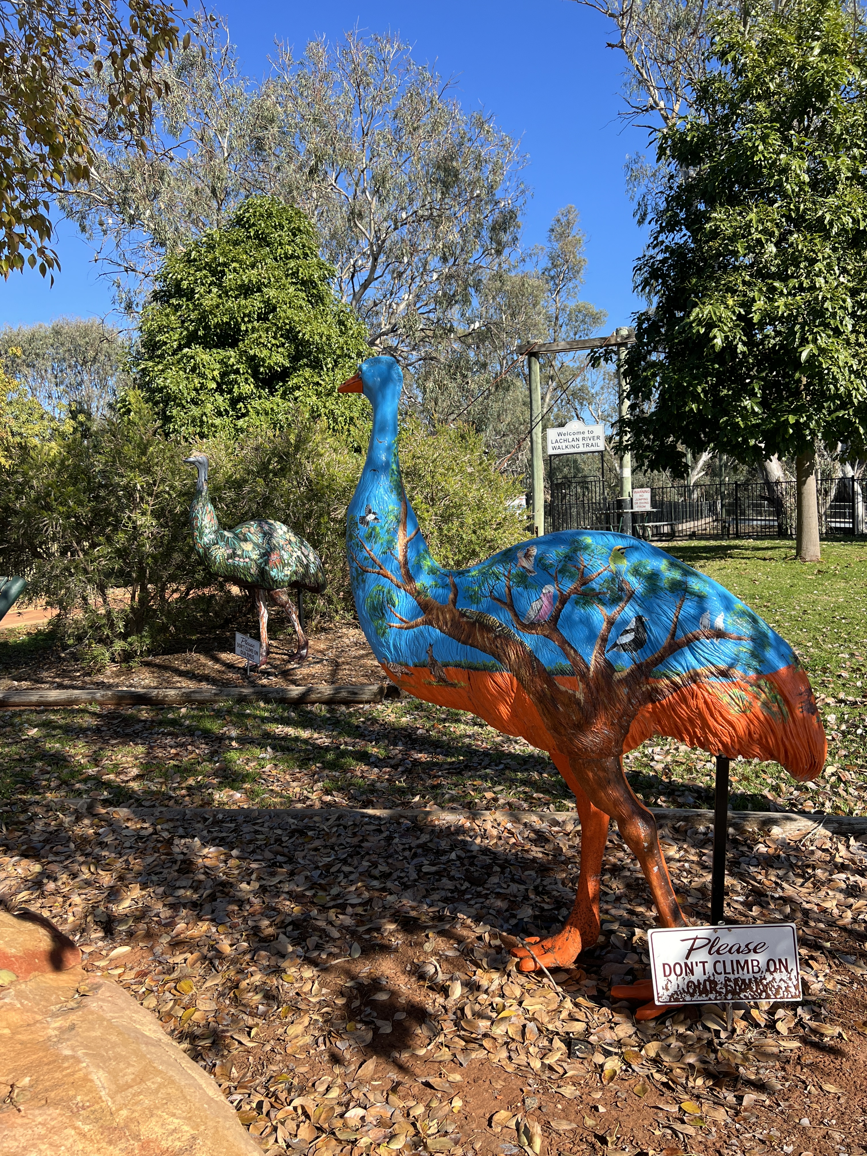
Like Hillston, the water tower here also has a mural and some other street art adorns buildings along the main street. We had a fire as the sun set, lamb chops sizzled away. Rather good!
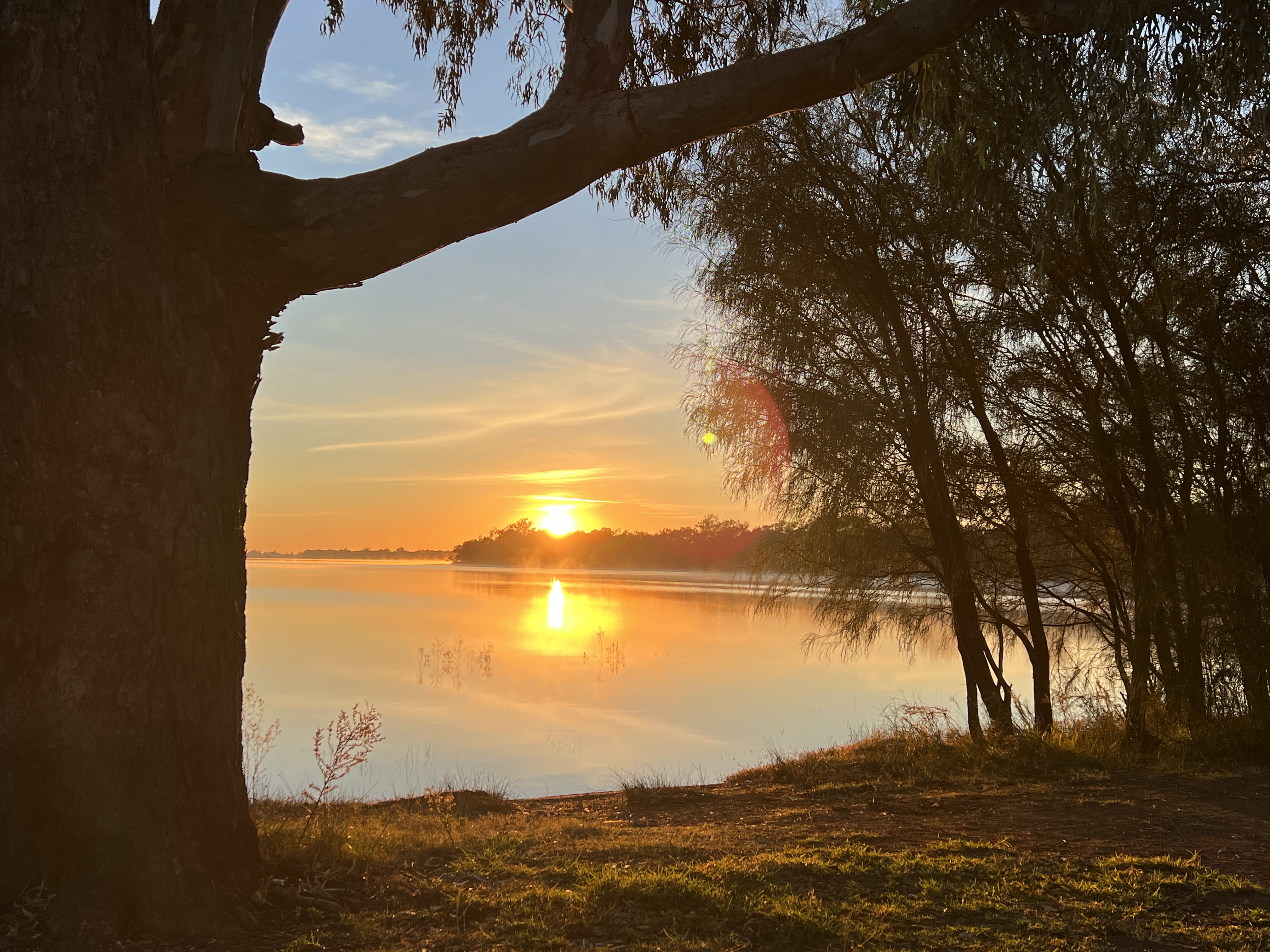
In the morning we were greeted by a magnificent sunrise over the lake.
Time to leave though for our next stopover at Cowra.
Back to Hay
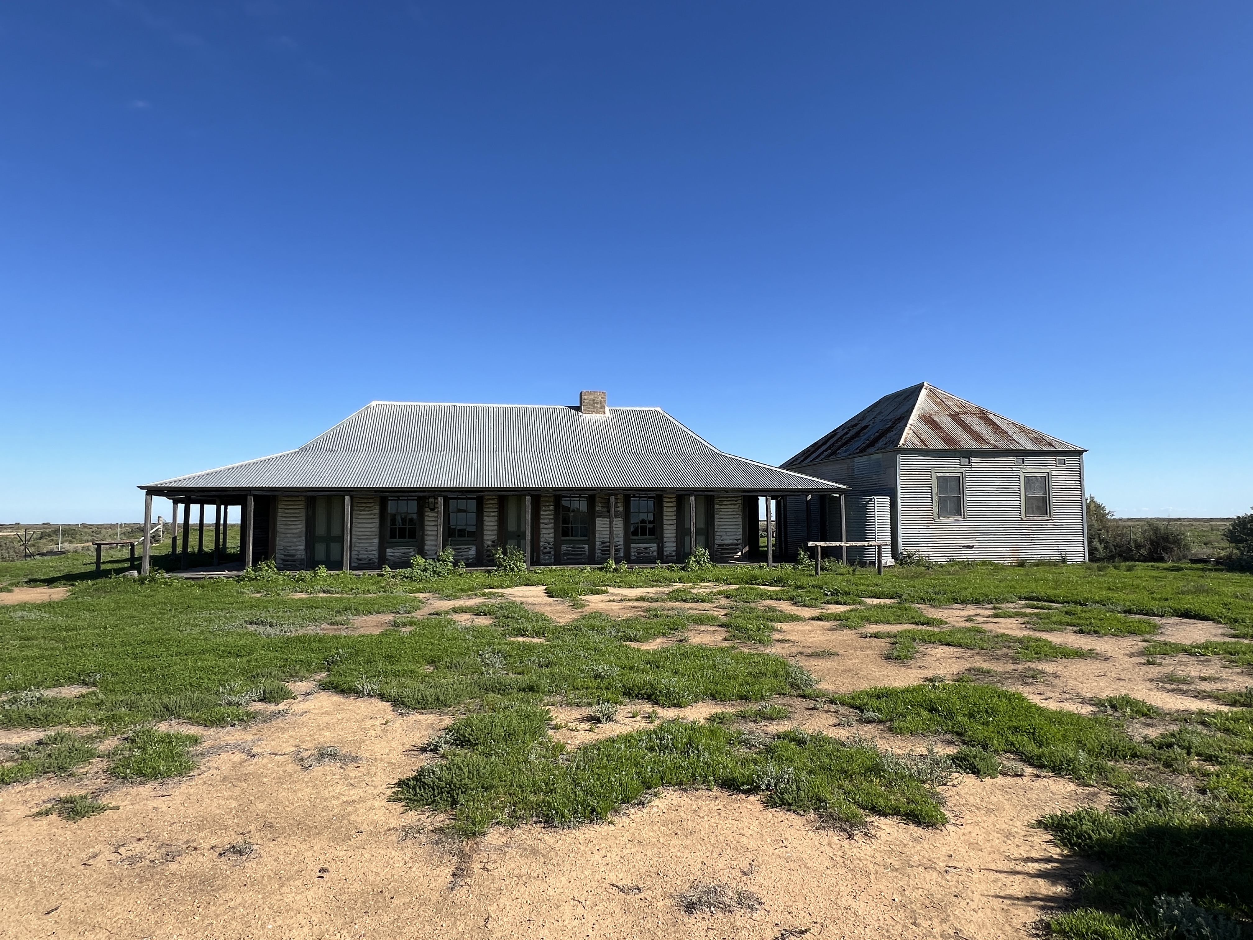
We are now starting to wind our way back home along the Lachlan River. However, before leaving Balranald we made a brief visit to Yanga NP. This is a former pastoral property that has something like a 160km frontage to the Murrumbidgee River. It was established in the 1840s and acquired by the government in 2005 to form a NP. The old homestead and woolshed are centre pieces for visitors.
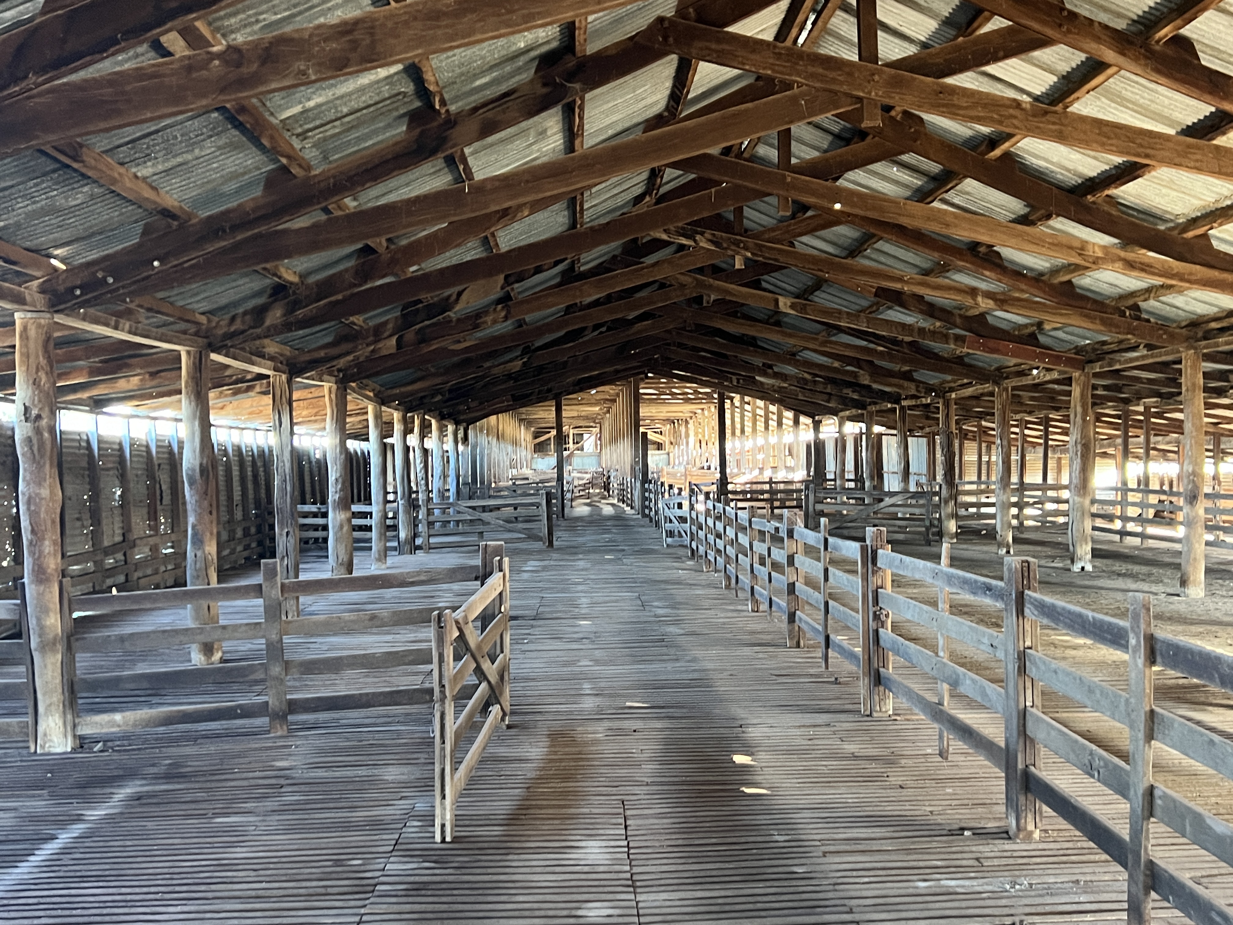
The homestead overlooks Yanga Lake and has been left in ‘as it was’ condition when National Parks acquired ownership. Frozen in time if you like. It is being maintained of course but not renovated, the same goes for the woolshed which could house 3000 sheep about to be shorn. It is a big shed. After 20 years it still has that sheep smell.
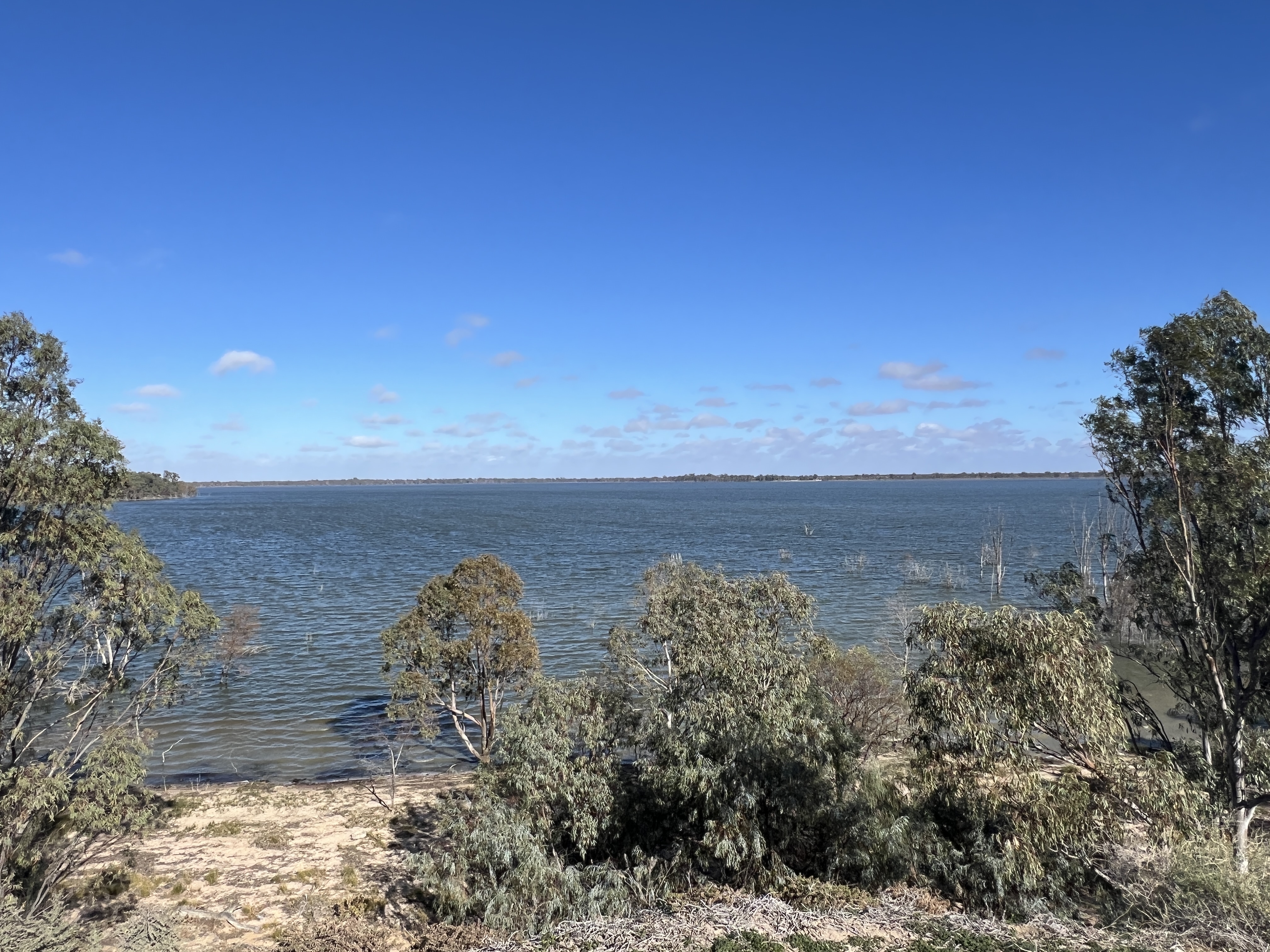
The lake is a little mysterious in that it fills, not only by surface run off, but by the ‘two way’ Yanga Creek. During flood times water runs out of the Murrumbidgee into the Lake. As things dry out the water runs back out of the Lake into the river, a weir has been built to keep water in the lake. It was very full when we there but it has been known to be almost empty. There was a water skiing club here once. It is an amazing sight in an otherwise ‘dry’ landscape.
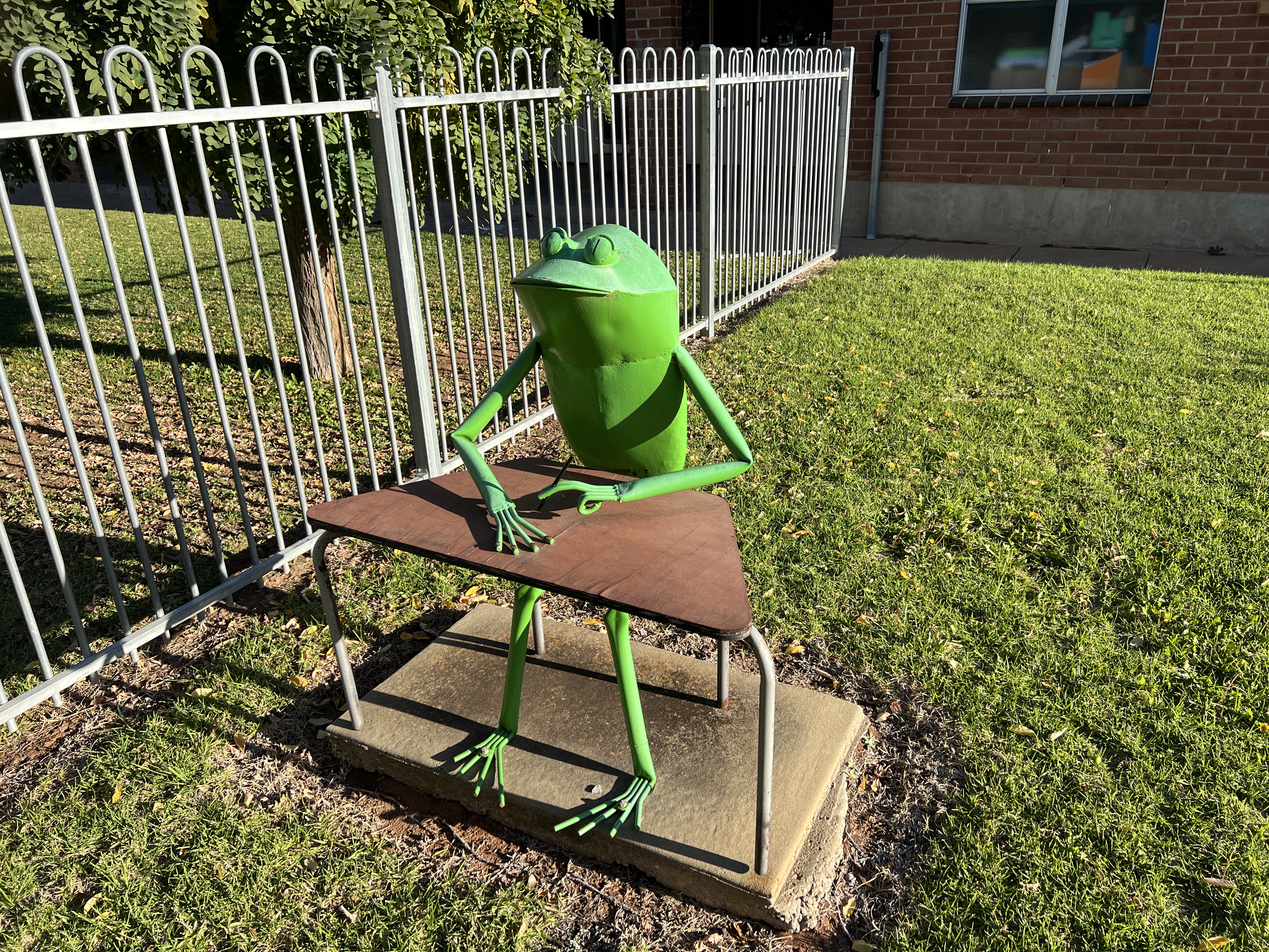
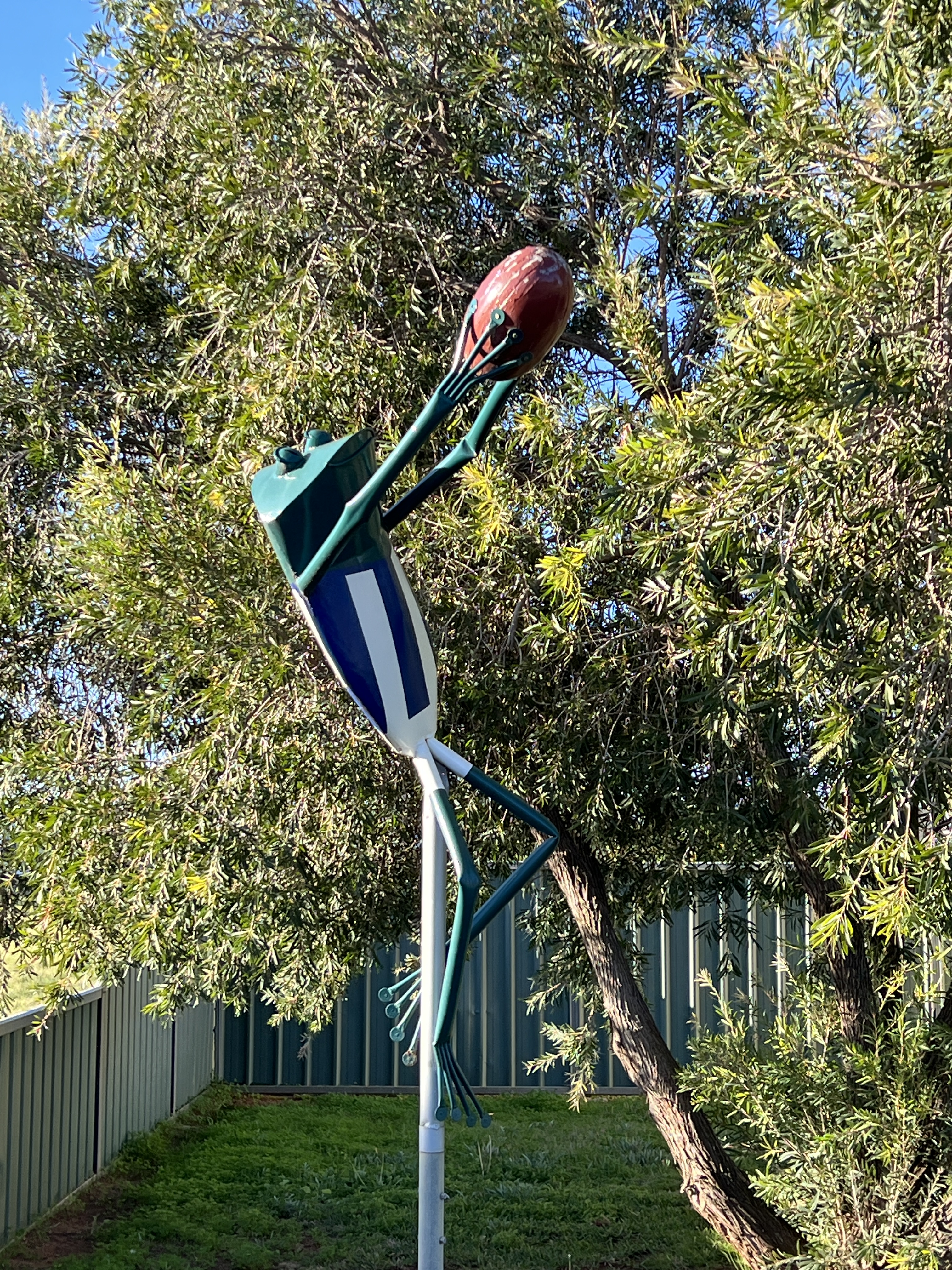
Balranald is also big on green frogs. The Southern Bell Frog, aka ‘Growling Grass Frog’, is endangered in these parts. So the good townsfolk have installed green frog cut outs around town as a touristy thing ..,, go and see how many you can find, so we did here are a couple.
It was back on the road after our brief stop passing by some expansive crop and pastoral land.
We are taking a loop road back to Hay. It goes through the town of Oxley, to the north west of Hay. Involves a bit of gravel road and skirts around the Great Cumbung Swamp.
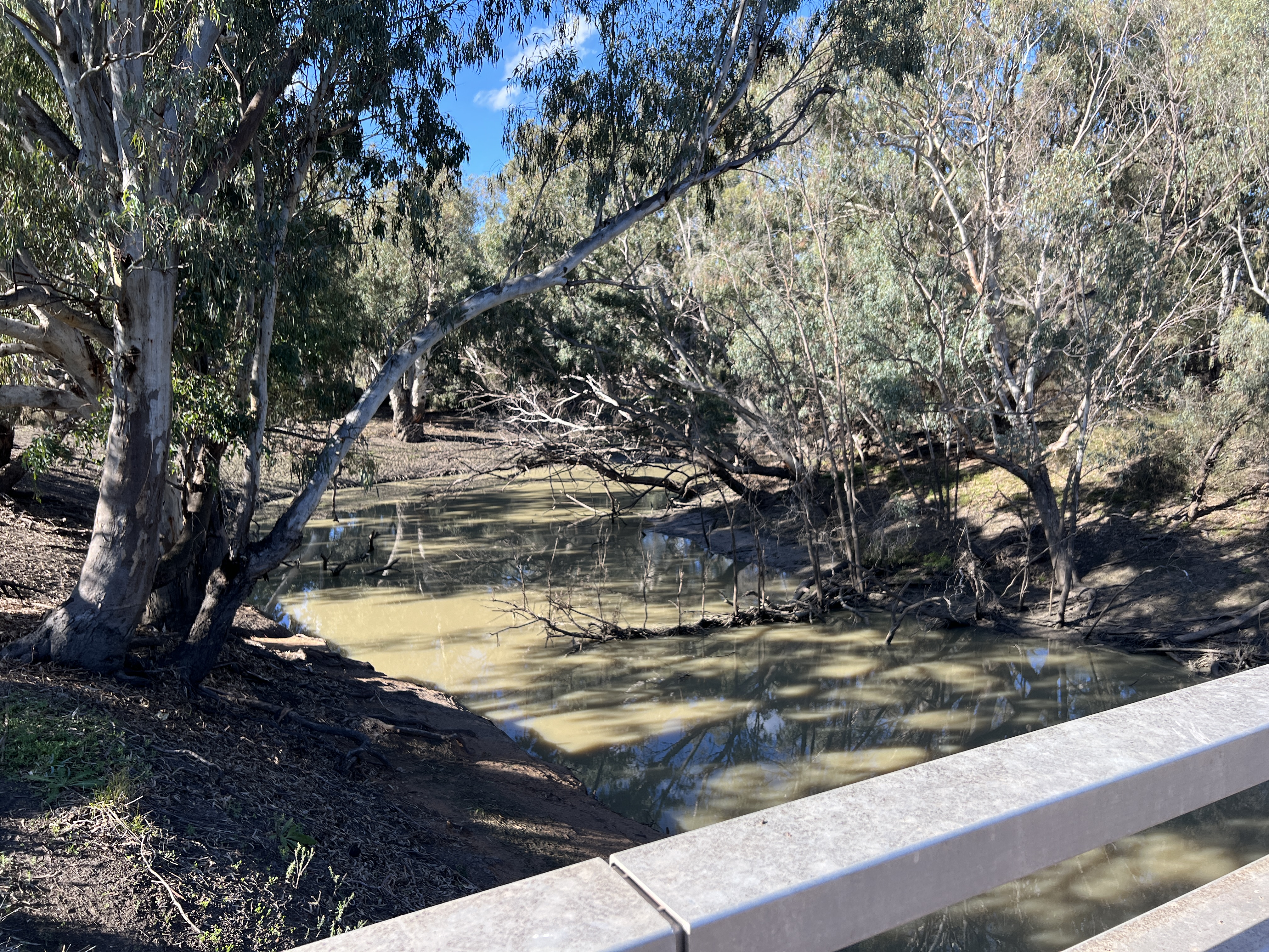
The swamp is what the Lachlan River drains into. It is only during flood that the Lachlan reaches the Murrumbidgee. The swamp is something like 35-50,000 acres and is a vast network of creeks and reed beds, depending on the flood water flows. Oxley is the place where you see the Lachlan disappear into the swamp, that is why we are going there. You can’t get much closer to it than this spot on a small bridge out in the middle of what city folk would call ‘nowhere, absolutely’!
The explorer Oxley was stymied by the boggy ground conditions in his explorations of the Lachlan river system back in 1817, near Lake Cargelligo (where will stay the night further on) which is 100km or so north east of Oxley.
After lingering awhile in Oxley we got back onto the loop road and made it back to the van park in Hay for the night.
As is generally the case the blog runs a few days behind real time, it is no different this time. Allthego aims to catch up!
Riddle of the Rivers
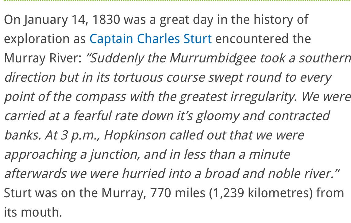
One of the big exploration issues in Sydney back in the mid late 1820s was where did the western flowing rivers go? Where did the Murray, Murrumbidgee, Lachlan , Macquarie end up. It was thought that a big inland sea was the plausible answer. So a bloke called Sturt set off to see if he could resolve the issue. He wandered around a bit following the course of the Macquarie and Murrumbidgee Rivers. Amongst all the stuff you would carry with you, helped by horses, was a whale boat in pieces to assemble when needed. From what a I can currently glean Sturt and his party launched the boat in the Murrumbidgee up stream from present day Balranald. And set forth to see where it would take them!
Any of my readers who are of a similar vintage will no doubt recall during their late primary school years drawing maps and plotting the course of NSW/QLD rivers and all the European explorers. This was around the early mid 1960s. We did it for weeks in social studies! Little mention of the Wiradjuri people and their place in this landscape, how times have changed in these parts.
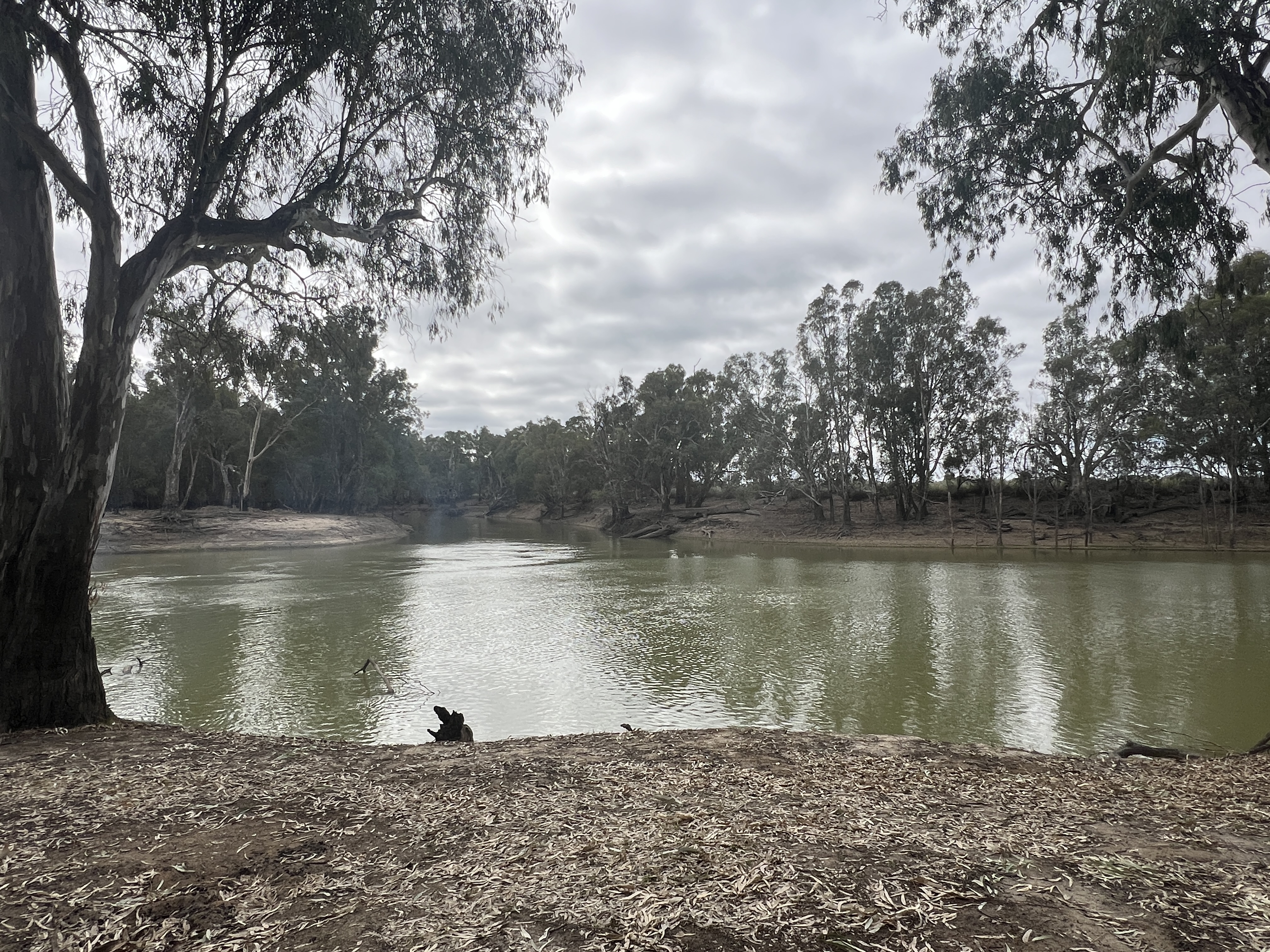
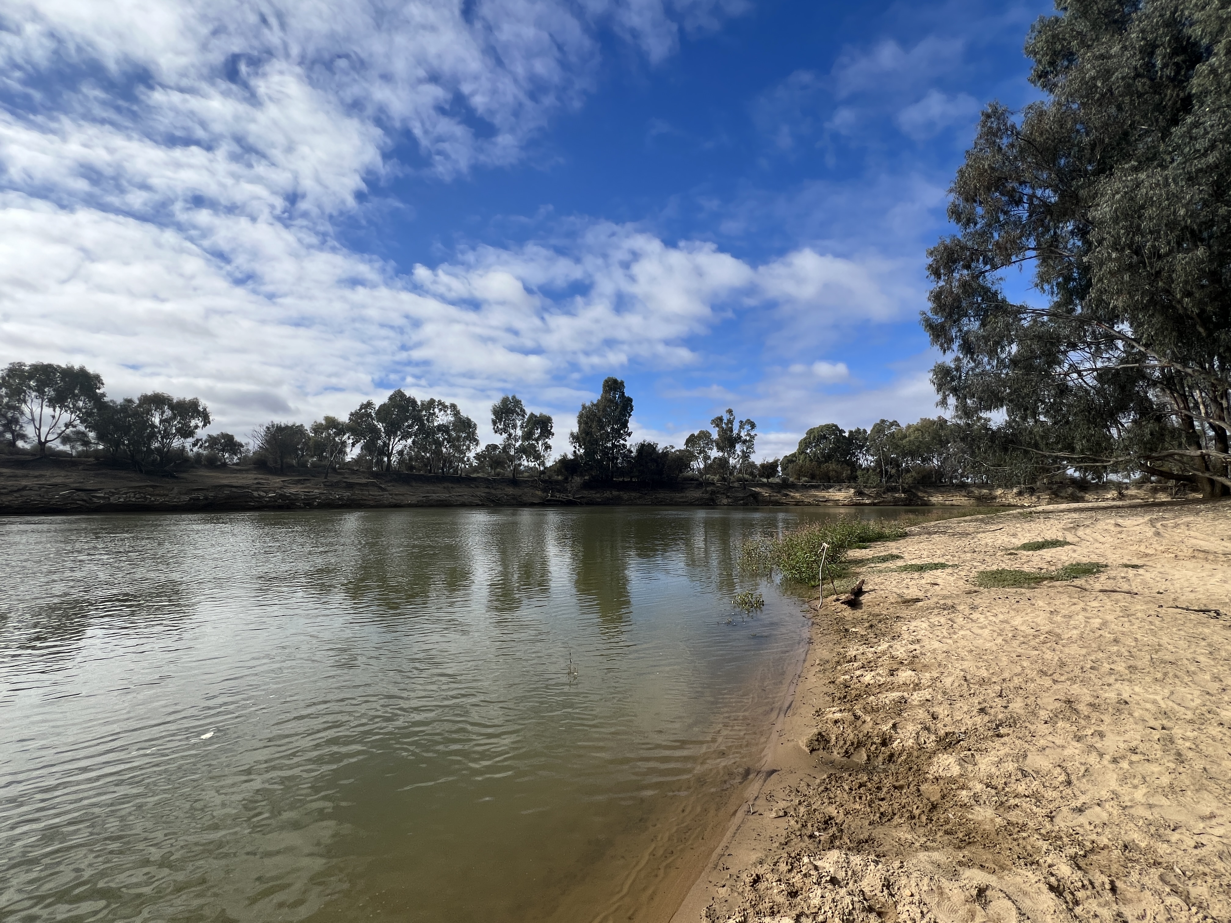
We are in the Balranald Van Park beside the Murrumbidgee. We were here a couple of years ago when the river was in flood, much higher up into the camp grounds.Like Sturt we are here to see where the Murrumbidgee goes. The problem is that river fronting properties prevent us from following the river further, we get a look at it at the Balranald weir but there is no closer accessible point.
The answer is to back track down the highway and go across the Murray River at Tooleybuc and travel down to Boundary Bend, a small town on the Murray River.

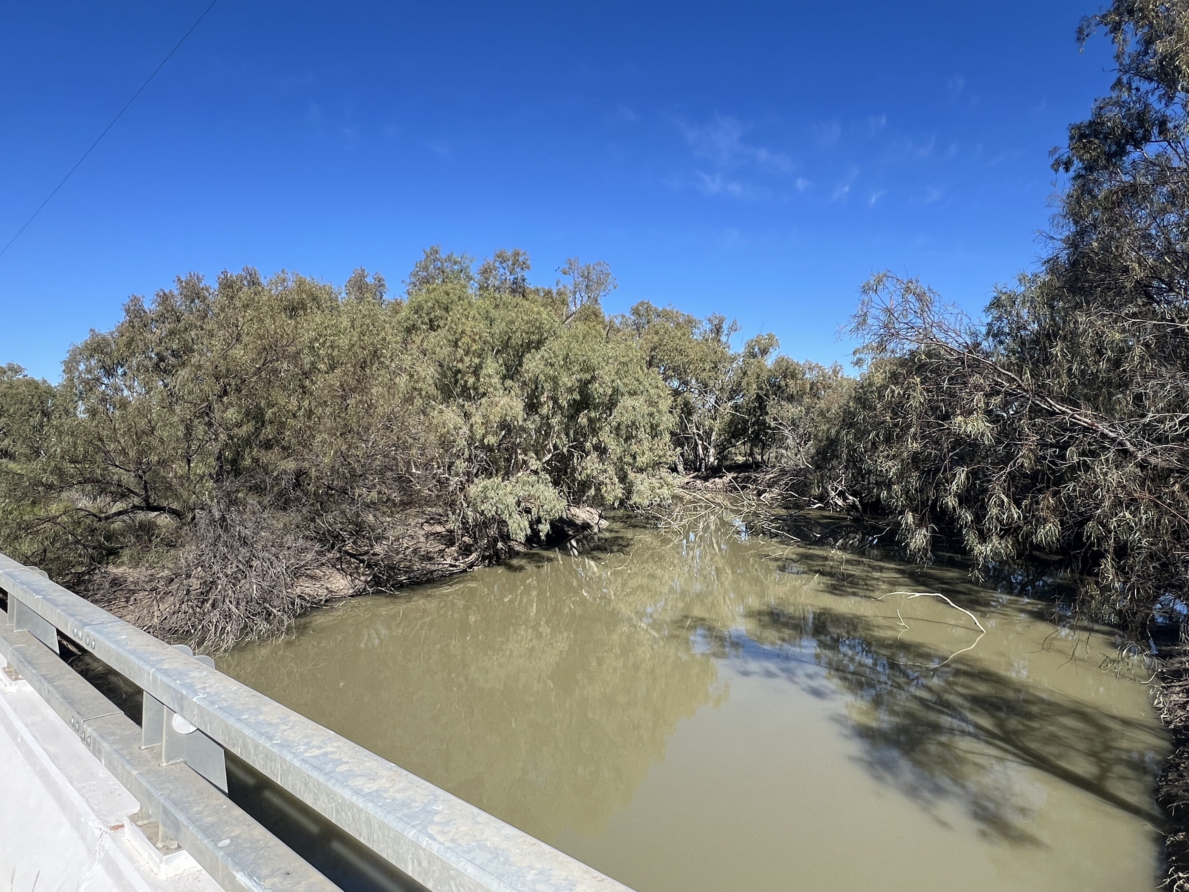
Just short of the town a track takes us off to the Murray/Murrumbidgee river junction. It is not far on reasonable dirt tracks to come to the junction of the rivers.

A bit of a scramble here and there makes it a fun drive. The river junction strikes one as a special spot in Australia. Our two longest rivers come together in a remote place.
Probably doesn’t look much different to when Sturt surged out of the Murrumbidgee into the Murray in his whale boat way back in 1830.
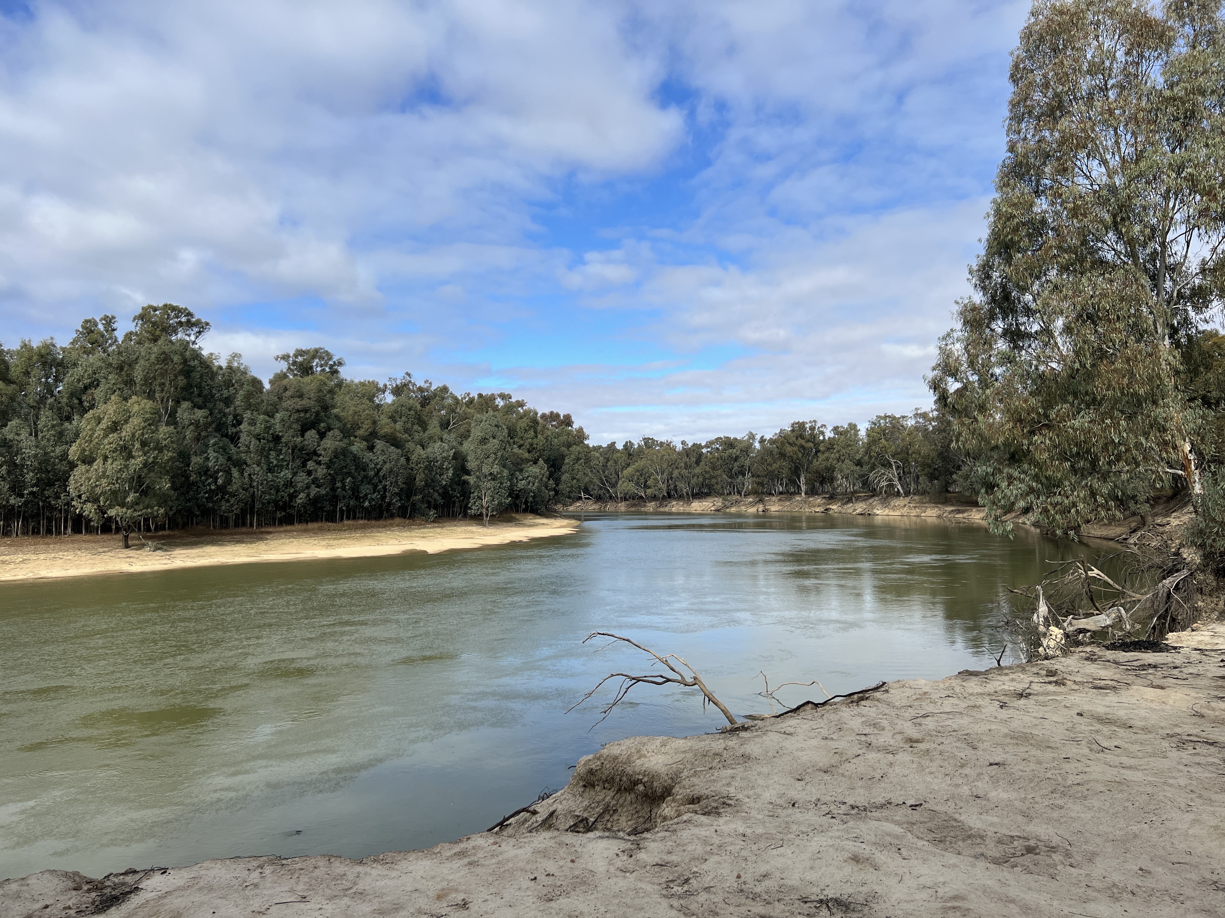
He went on to where the Murray flowed into the Southern Ocean in South Australia. And so solved the riddle of the rivers. The rivers all flowed west for sure but ended up in the Murray and then into the sea. The irony is that something like 60 (? check) million years before the rivers did flow into an inland sea, Sturt and the boys were just s bit late.
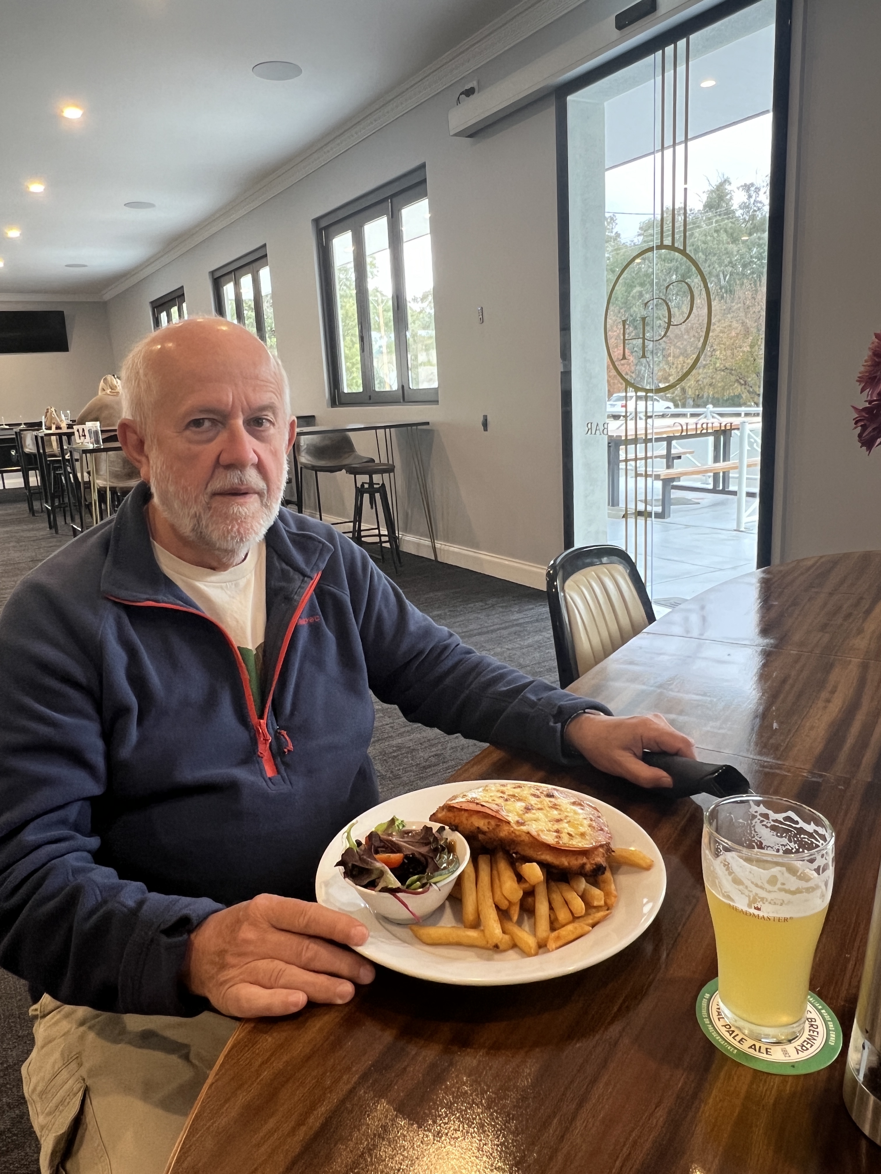
On our way back from the river junction we stopped at the Tooleybuc hotel for a late lunch, just made it. The hotel had won the best parmie award back in 2023 so Allthego had a go, not bad. Homealone checked out a steak sandwich, couldn’t quite get past the 200 g of steak and pile of chips on a big piece of sourdough. Allthego helped out by swapping some parmie for the steak.
So we have come to the end of this part of the journey and now turn back for home. For starters we are going to follow the Lachlan River upstream to its source behind Goulburn in the Southern Highlands of NSW.
Hay
We left Griffith after Allthego returned from a town visit to secure some Italian bits and pieces for the road ahead. Some excellent salami, mortadella and semi dried tomatoes would make an excellent sandwich on a baked bun. Also, he couldn’t resist a tub of Sicilian style green olives. Very moorish.
We made our way back down the Kidman Way crossing the Murrumbidgee at Darlington Point. Some nice murals and parkland are here beside the river.
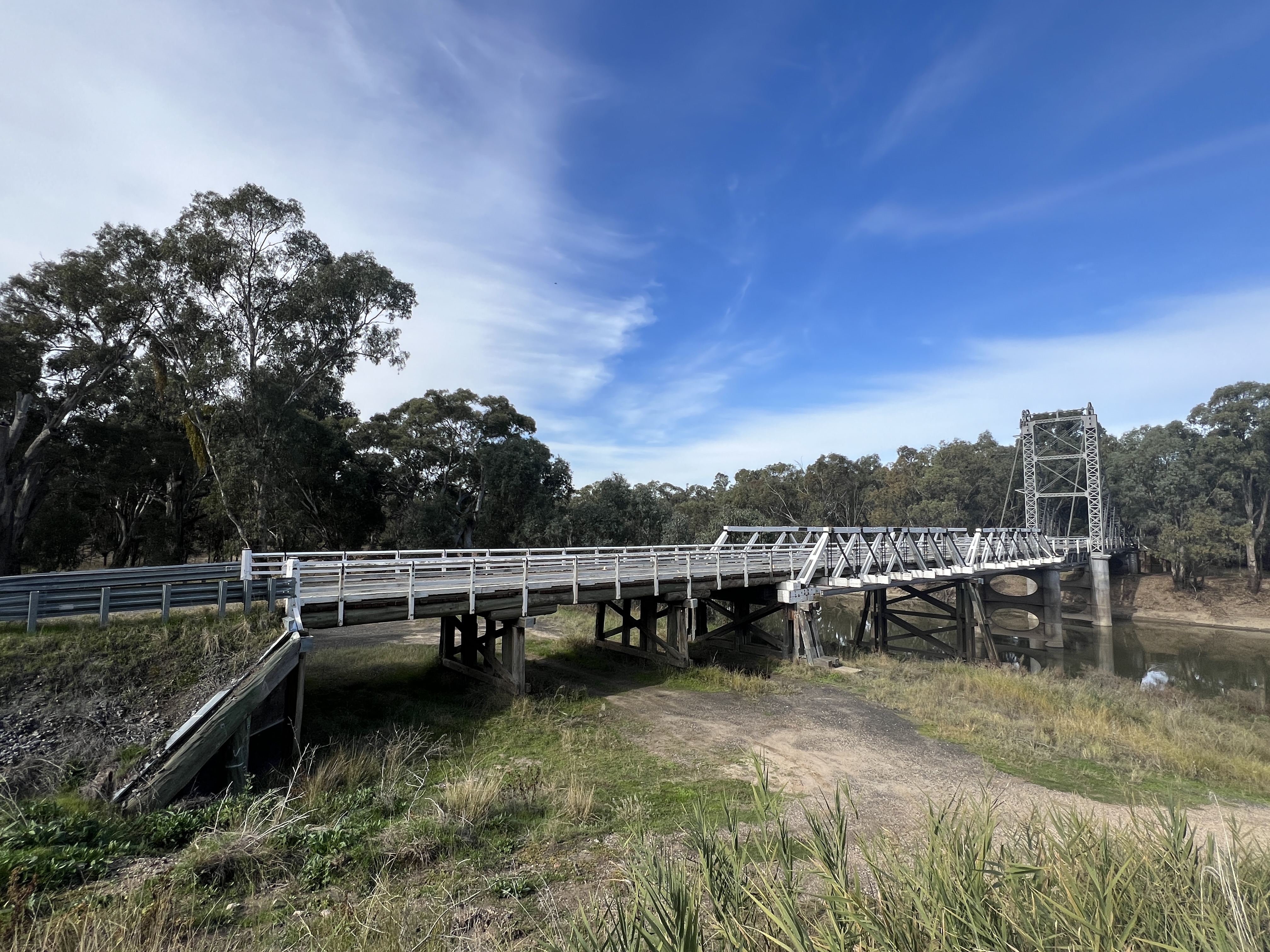
A little further along we crossed back over the river at Carrathool an old service town beside the abandoned railway line. The old 1924 lift bridge over the river is still intact alongside its recent replacement.

We have made it through to Hay and are set up at the Hay Caravan Park. We have been in this place before, easy going and big sites.

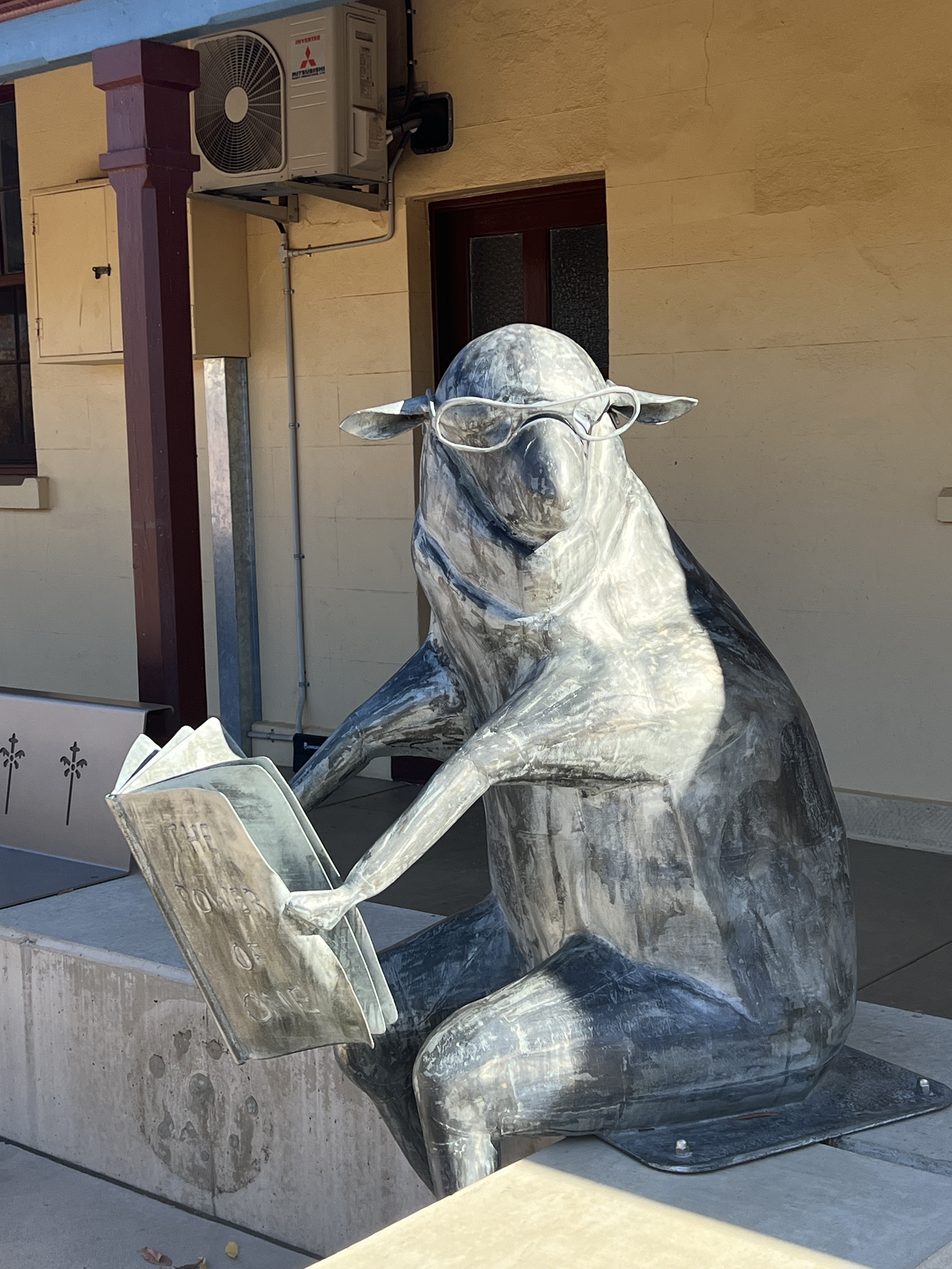
The Murrumbidgee at Hay seems to be at its widest. One could spend some time here poking around town. There are some really great sheep sculptures located outside the old post office, one sits and reads a novel.
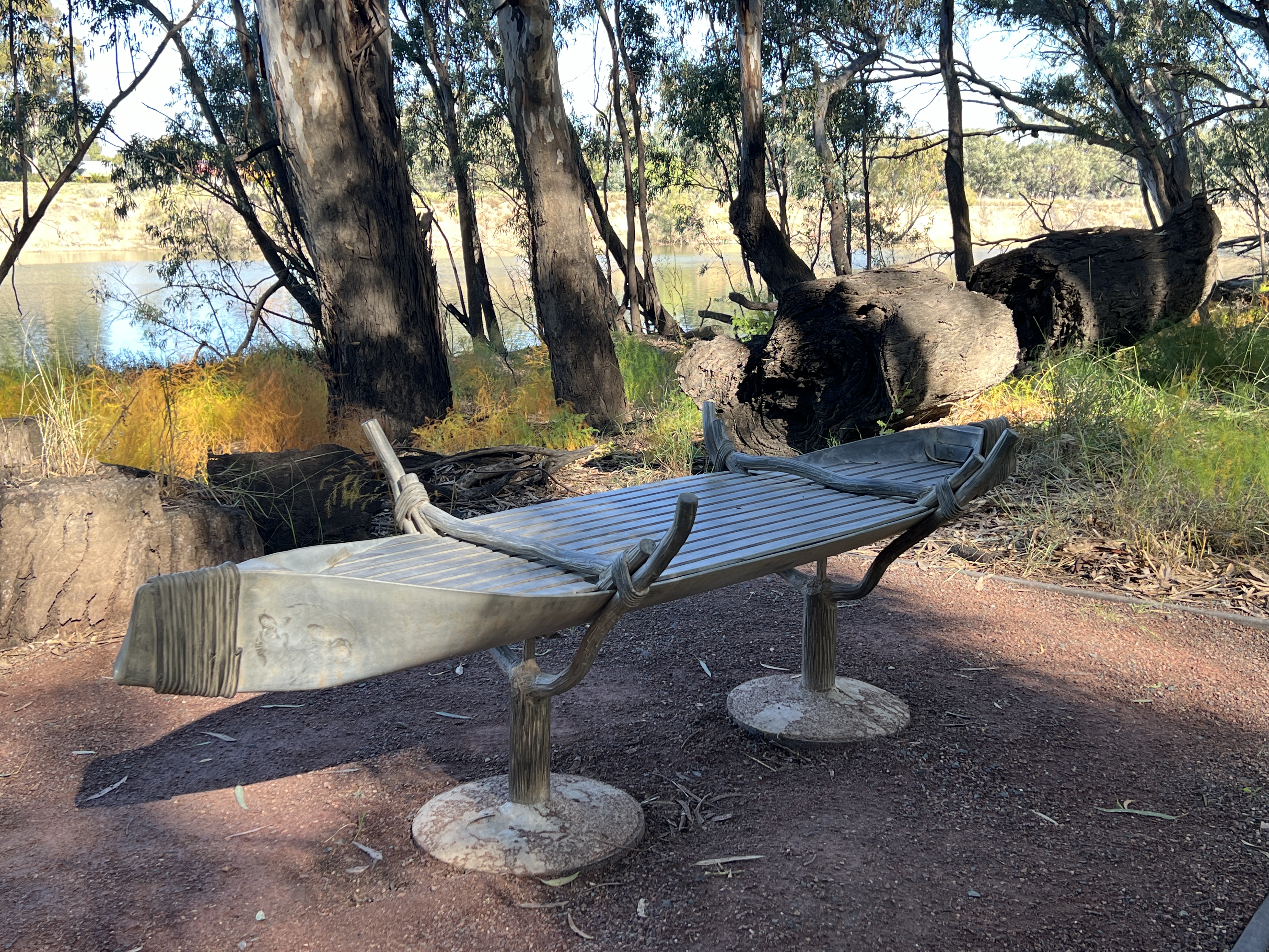
Down by the river we drove (some actually walk along the trail !) around a sculpture trail that highlights historical points of interest in the development of the town, including indigenous mattes of importance.

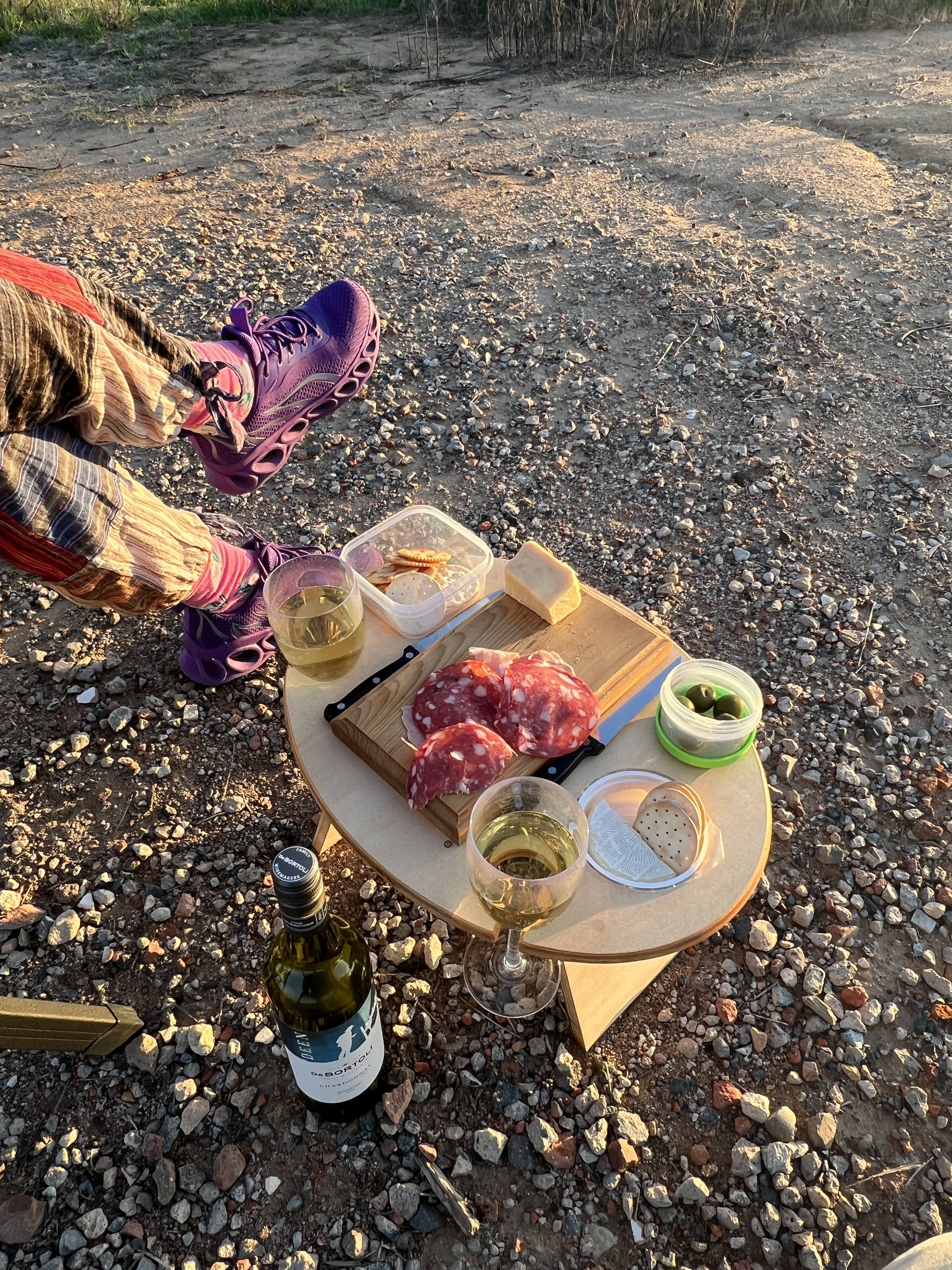
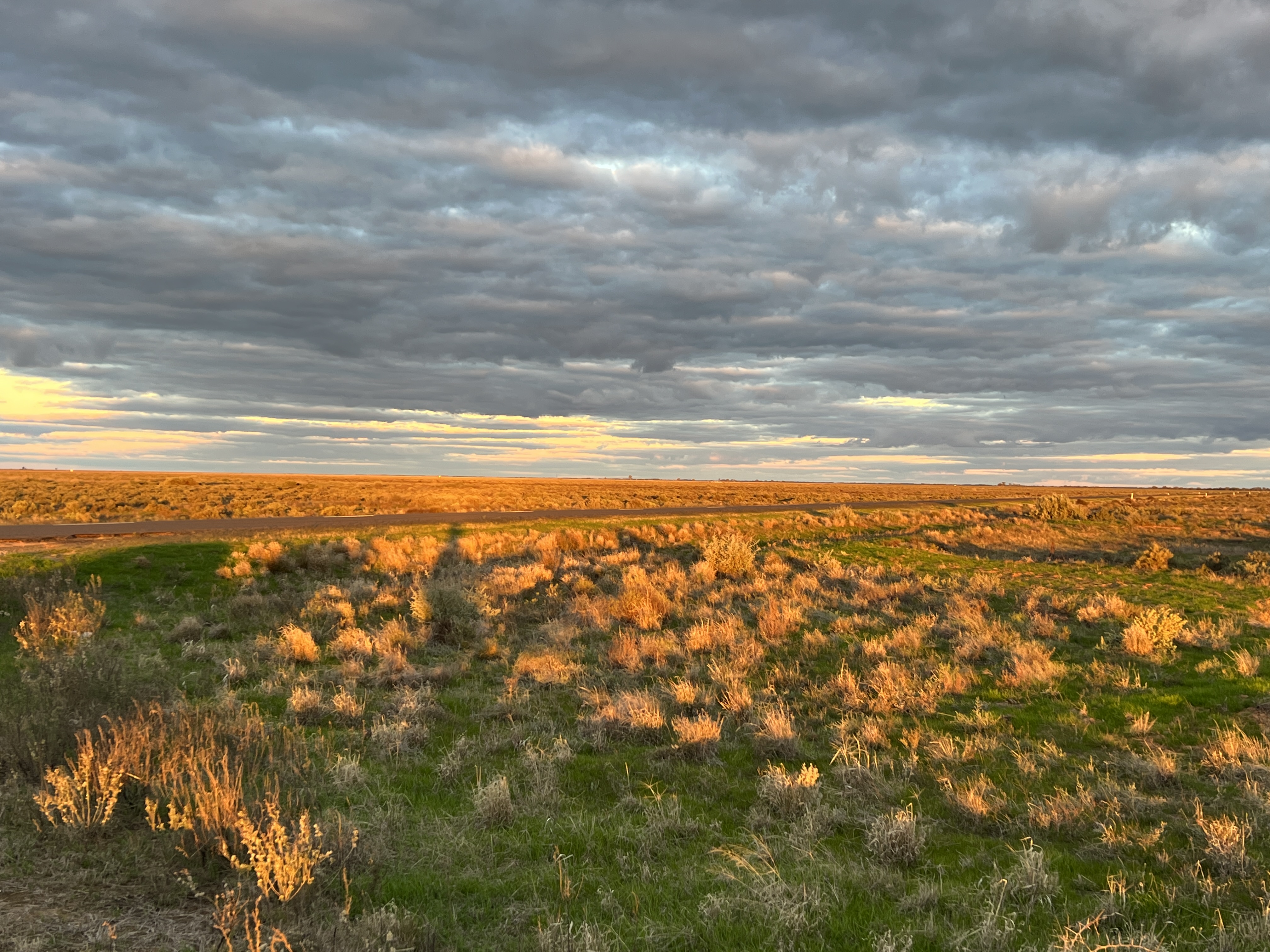
About 16km out of town there is a sunset viewing platform where one can sit and gaze across the Hay Plain as the sun drops into a paddock. We went out there and enjoyed a glass of white and some of the Italian nibbles we picked up in Griffith, the really nice salami complemented the cheese and olives.
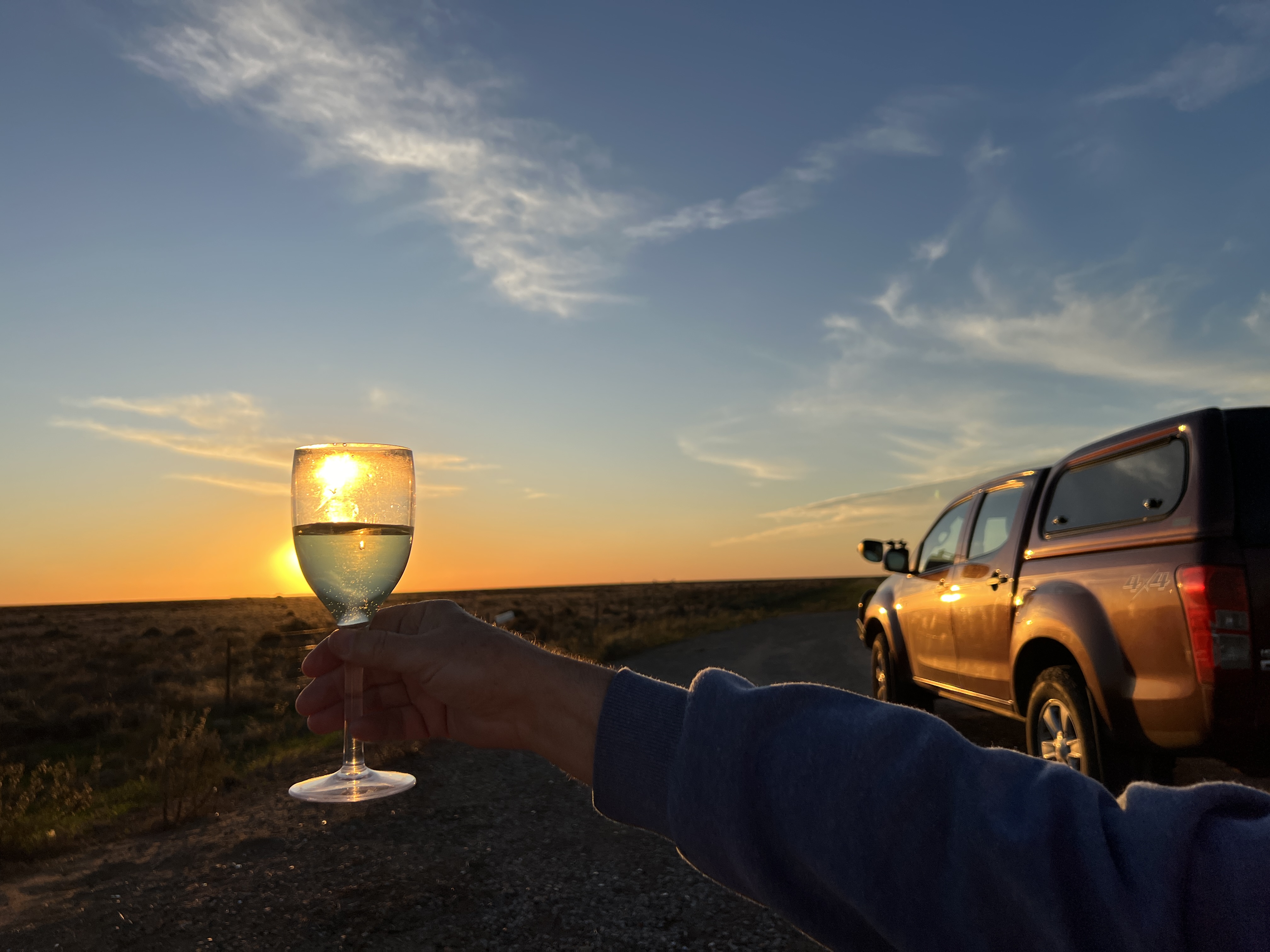
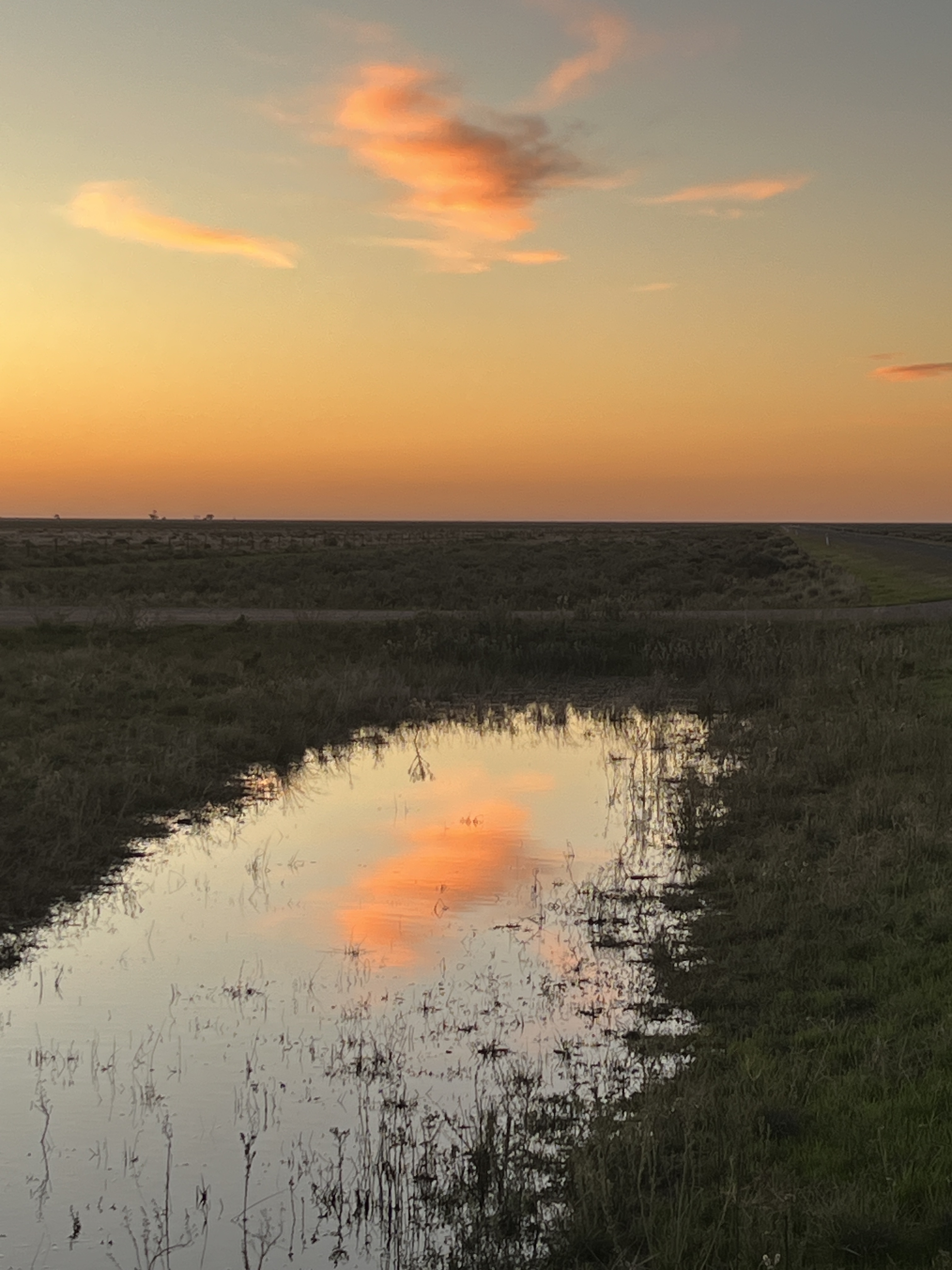
The sunset was not super spectacular, but there was a good reflection in a pool of water. Also, a great look over the plain with the sun streaming across it casting a golden hue over the paddocks of low scrub and grasses.
We are drawing close to the end of our journey down the River. Tomorrow will see us head for Balranald, from where we will seek the confluence of the Murrumbidgee and Murray Rivers. But more of this story next time!
Under the influence
We are in Griffith for four nights, it is about 45 km up the Irrigation Way from Leeton. We are glad we are here.
We are someway from the Murrumbidgee River, but the waterways of the MIA ensure that we are well and truly under its influence. Coming up from Leeton one can appreciate the phrase ‘one of the nations food bowls’.
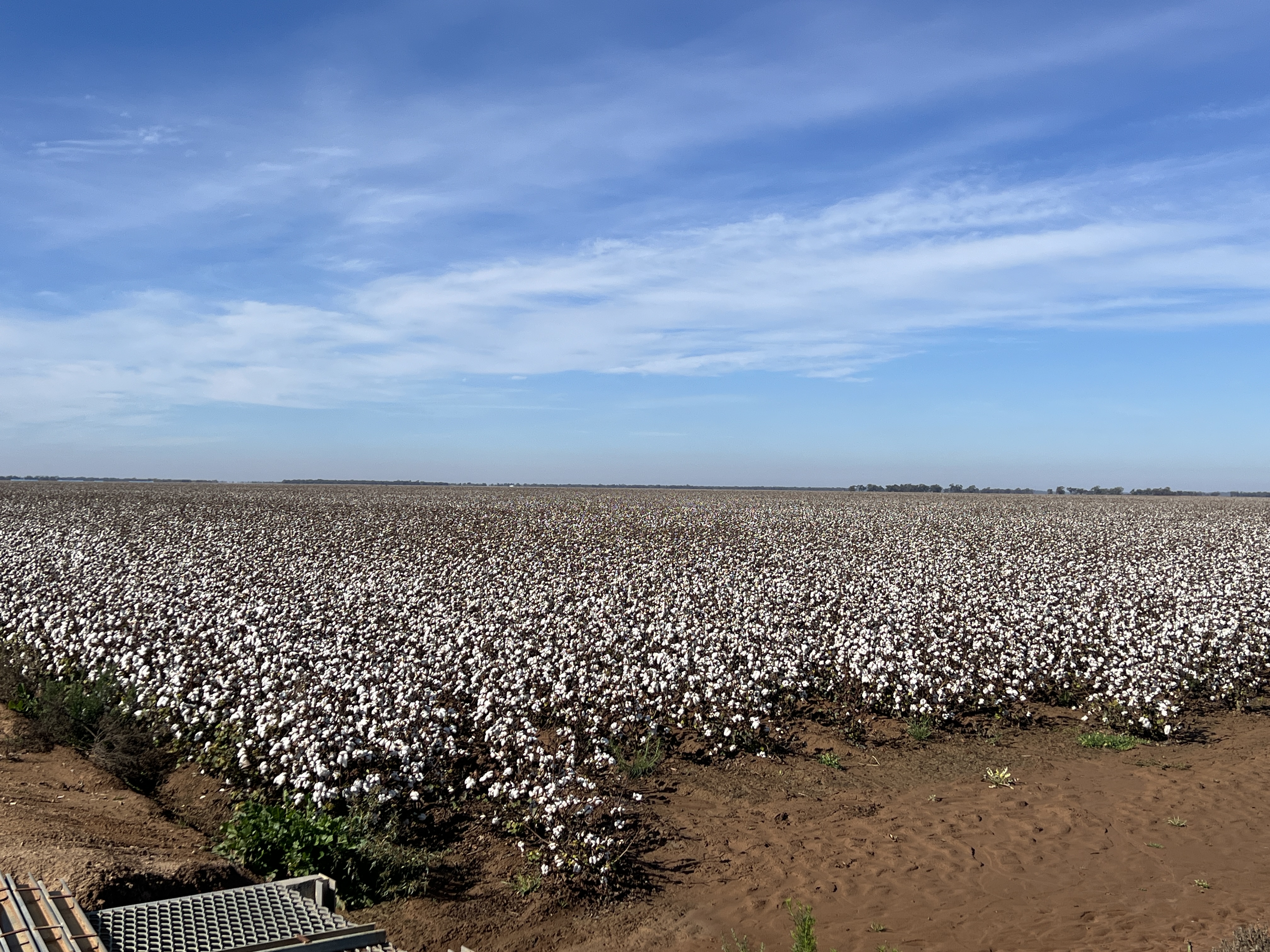
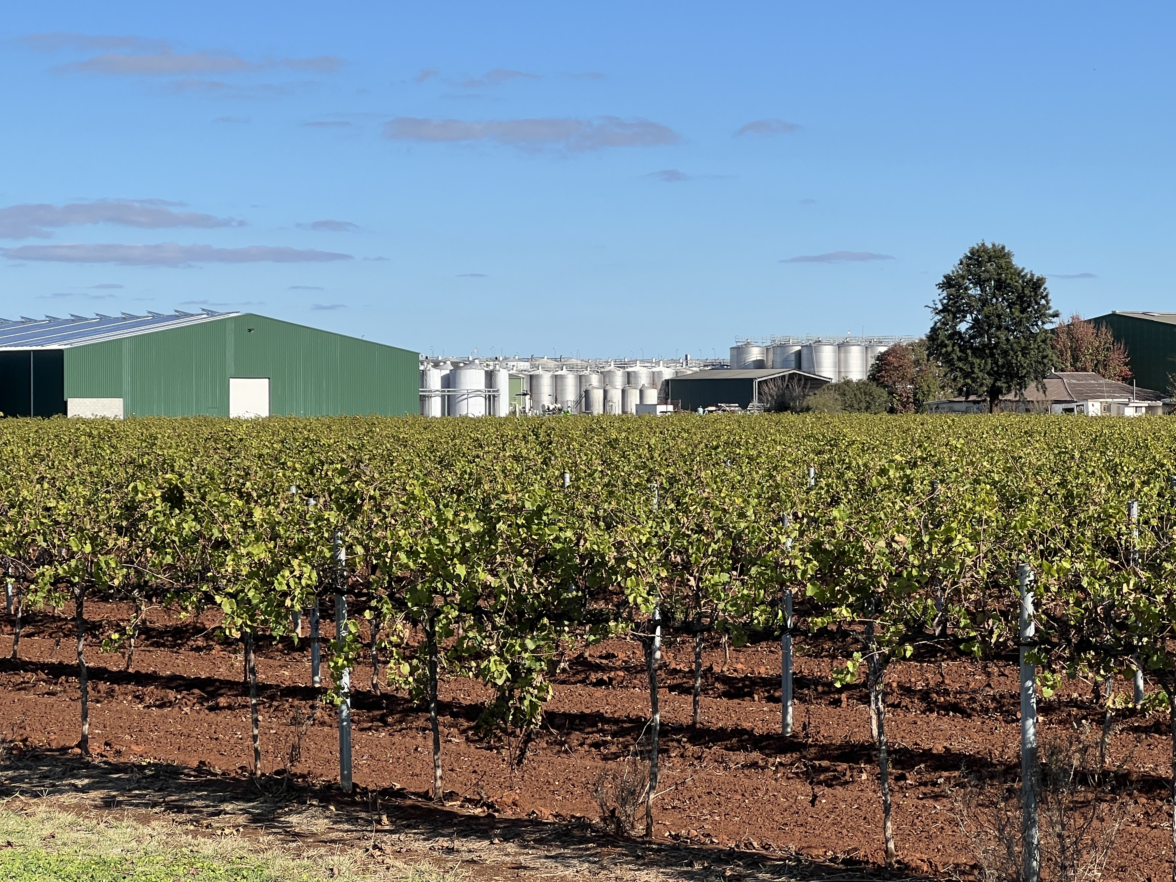
On one side of the road we will have cotton, the other rice, a little further along there will be orange trees in abundance and then grapes as far as the eye can see. There are also nut trees and prunes around these parts, the Riverina produces 90% of Australia’s prunes.
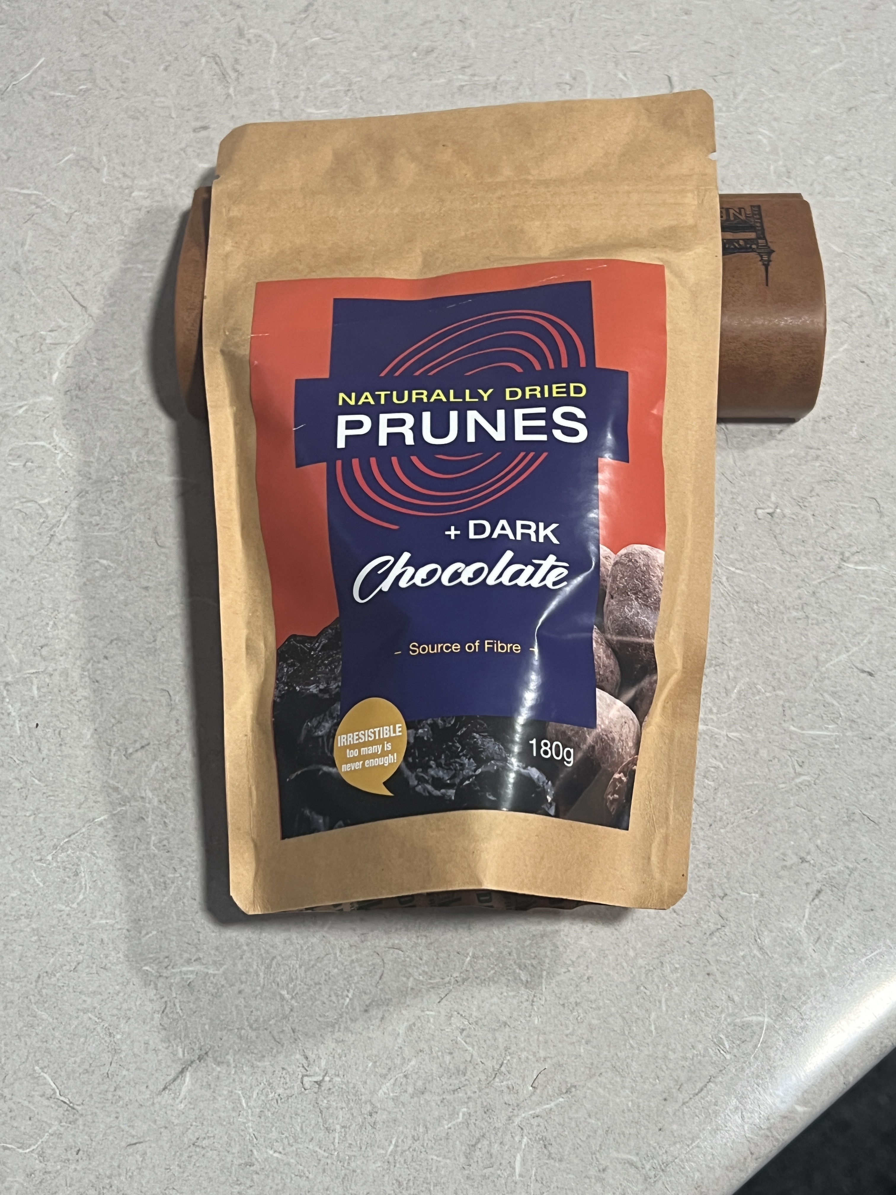
A special chocolate (dark and white varieties) coated prune has also been grafted onto a normal prune tree. Some of my readers will be aware that I am rather keen on aged prunes in port. These chocolate coated ones will be a great accompaniment. Wool is also big. The interesting thing is that all this leading edge agriculture stuff generates innovative manufacturing industry out here to service the farm needs.
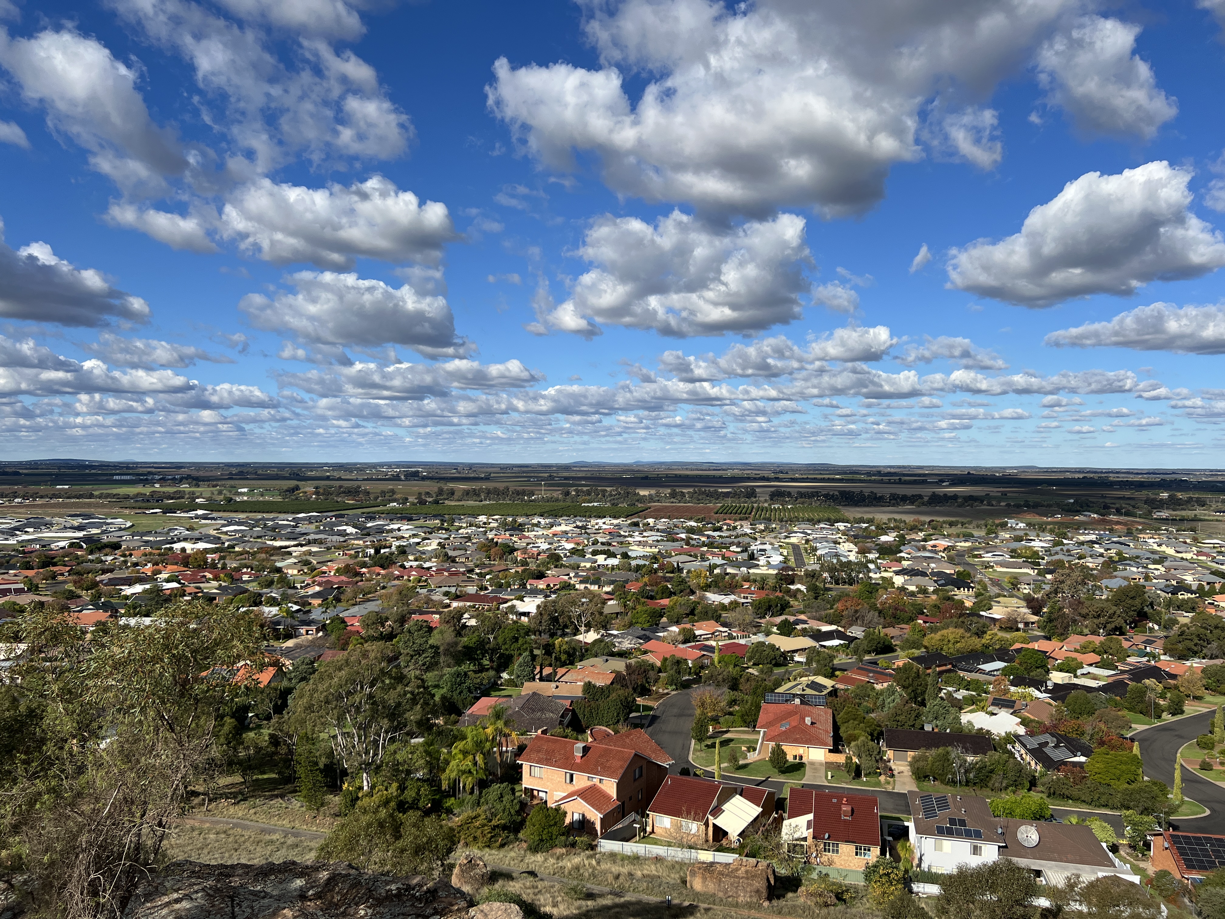
A great view over the city and farmland is had from Hermit’s Cave which sits in a ridge line on the edge of the city. When the hermit lived here for over 30 years, from the late 1920s to 1952, it would have been more isolated, suburbia now laps at the foot of the ridge. A short walk takes you around his cave complex, including a living area, a seperate ‘kitchen’, chapel and carefully constructed garden beds.
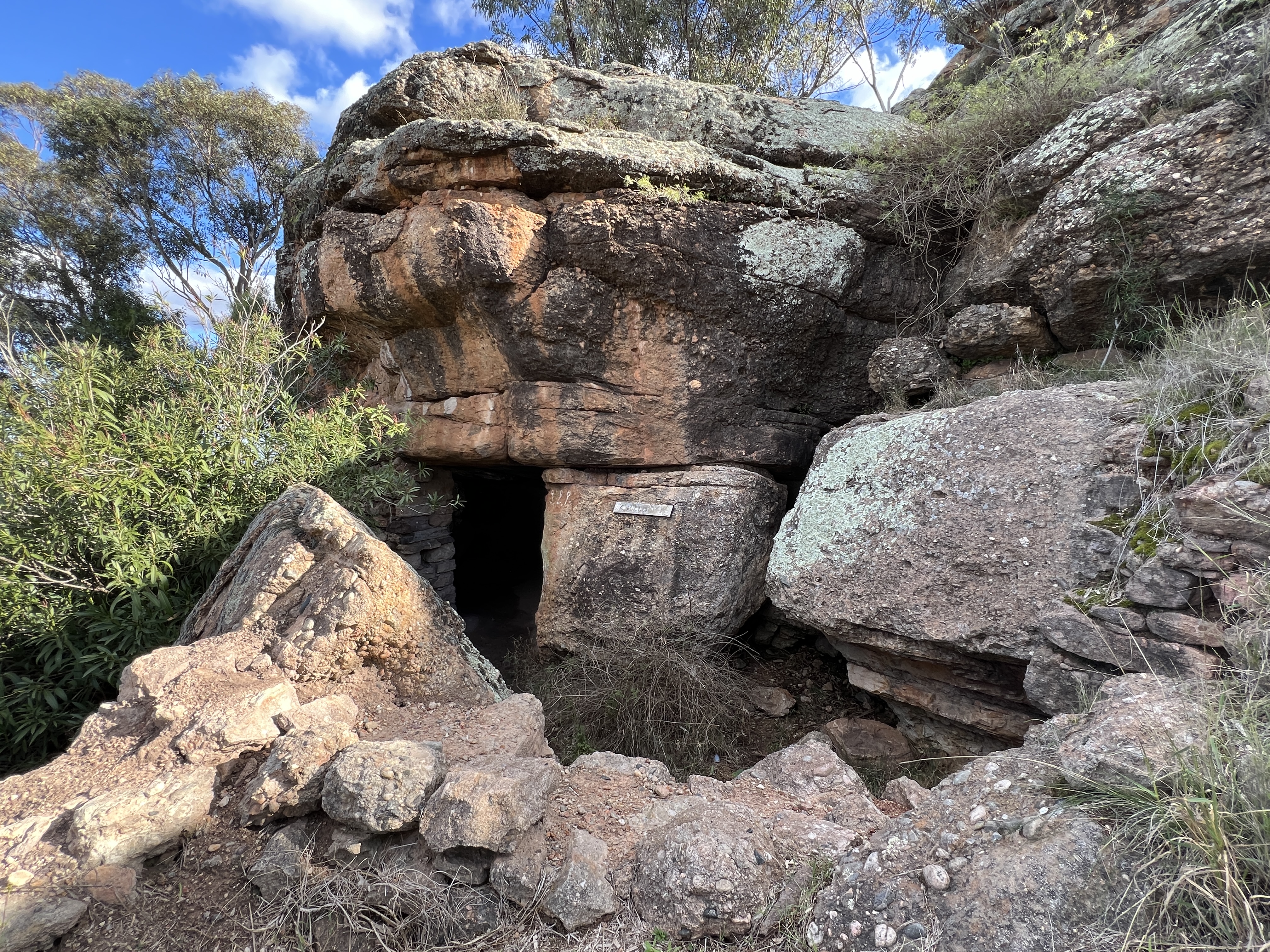
It is all a bit neglected now, needs some work done to revitalise the experience.
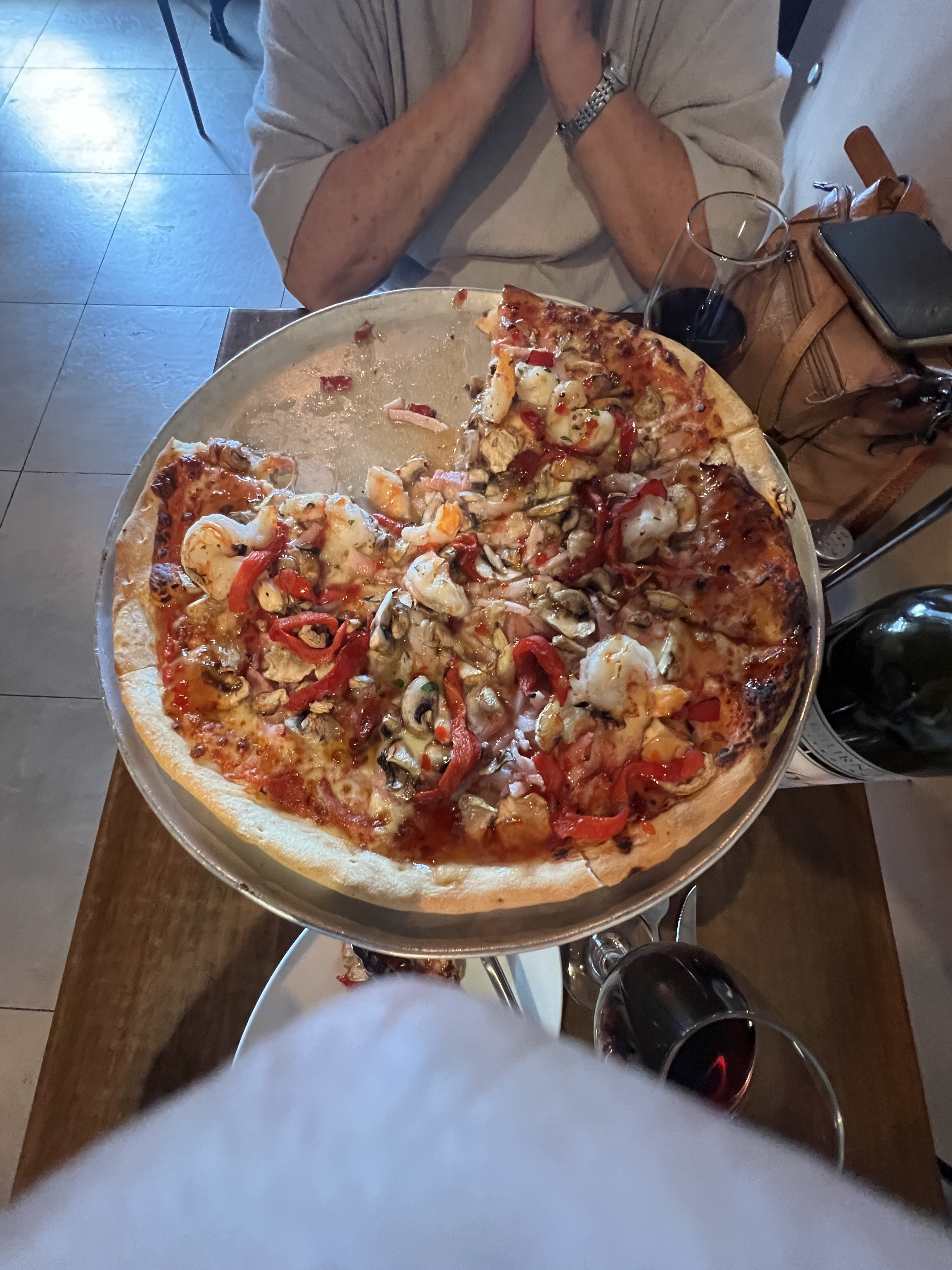
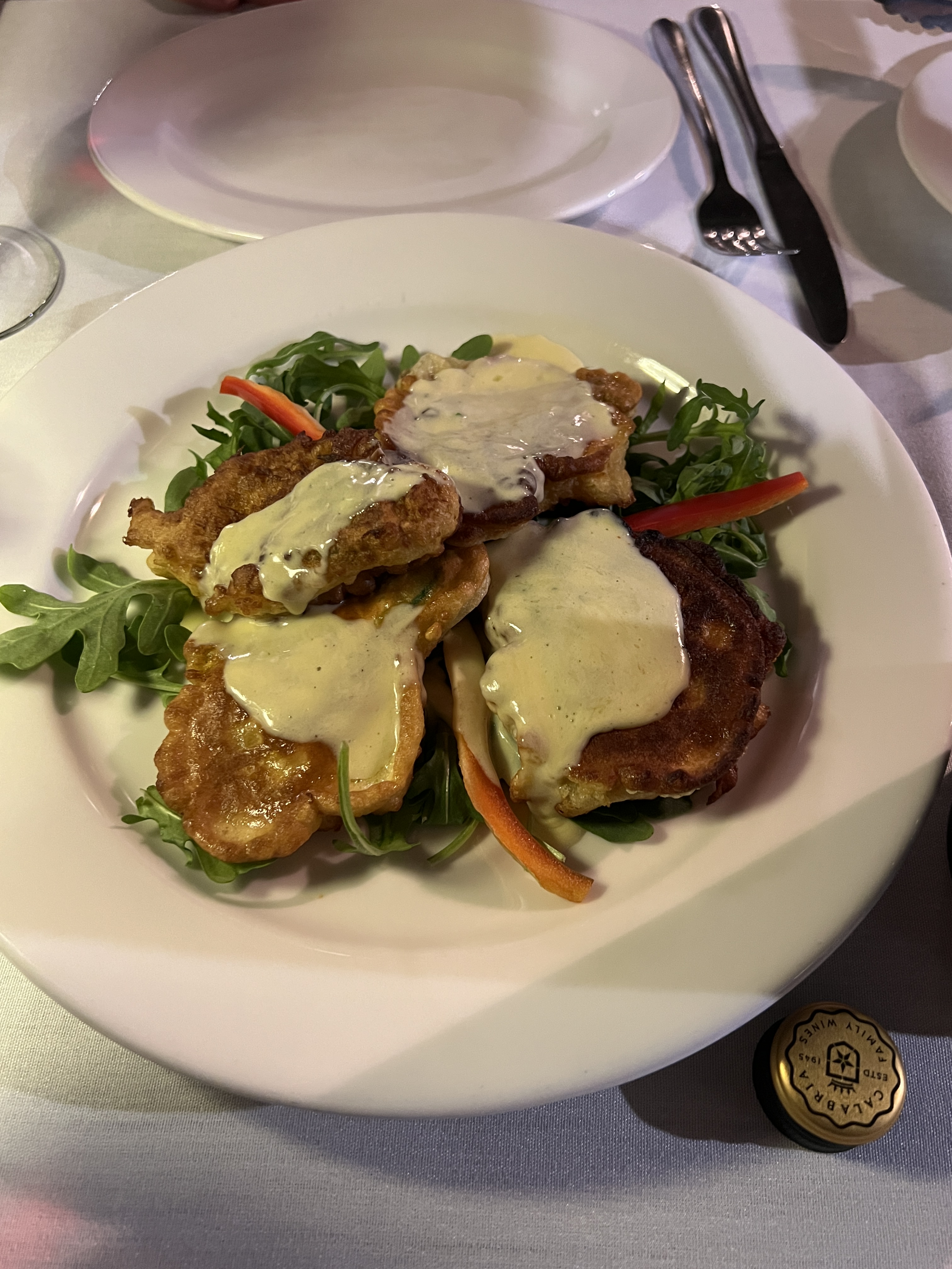
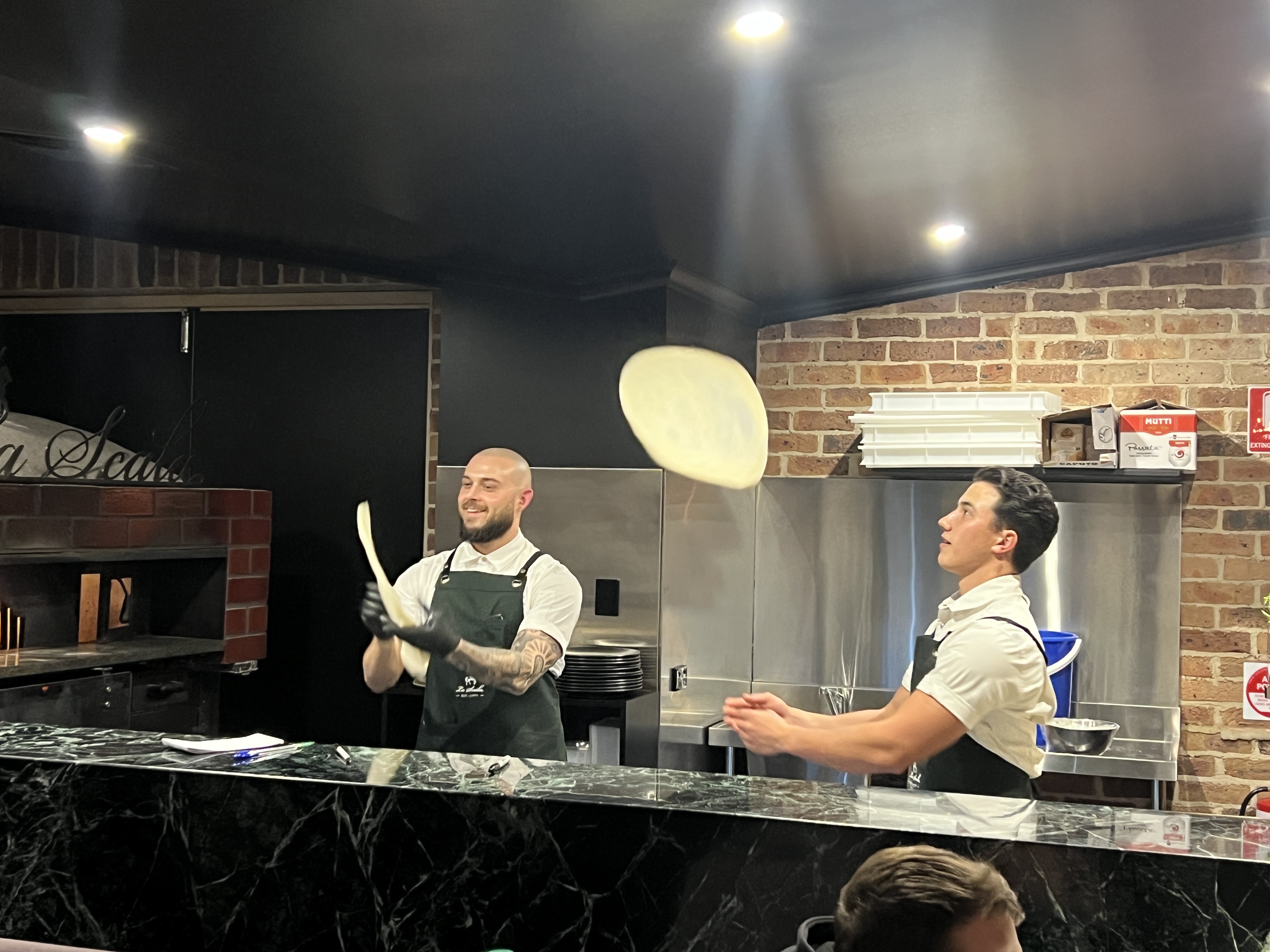
Griffith has deep Italian roots, but also new multicultural connections, particularly Indian. It is a foody place, just where you would want to come for a few days. We have enjoyed a couple of pizza meals and a more elaborate dinner at La Scala, the ricotta stuffed zucchini flowers were just great. As was the Scalopini al fungi and the Veal saltambucca.
As readers will know Allthego is a keen fisherman, or was. These days the fish are more easily caught at the fish shop, and you don’t have to pay for bait. Days of screwing around in the sand for pippies are gone I reckon.
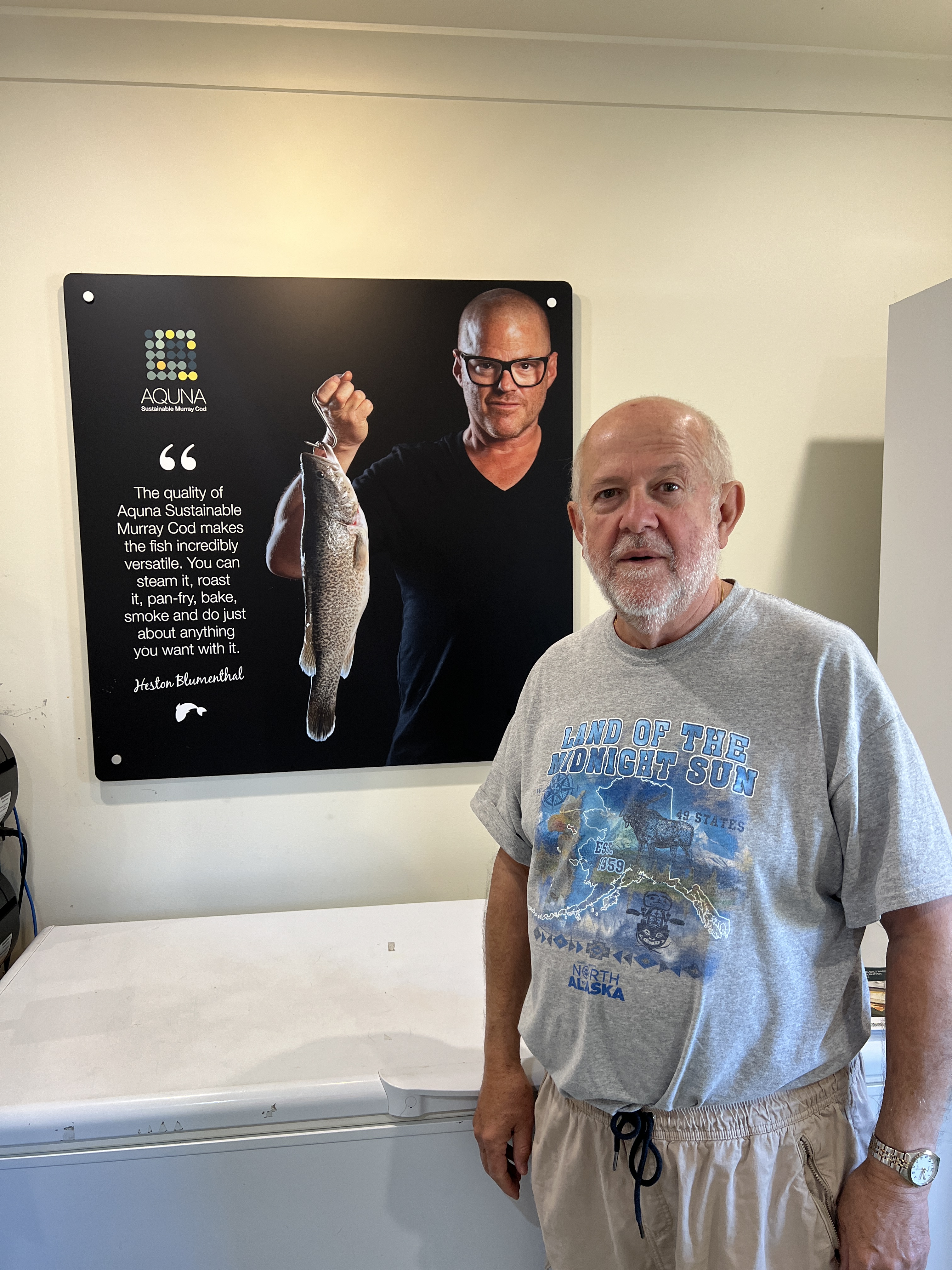
One of the innovative businesses in Griffith is AQUNA. Short for ‘sustainable Murray Cod’. We had a taste test of some smoked cod wings, very nice. The cod are fish farmed in ponds not far out of town. We later pulled into one of the facilities while travelling around.
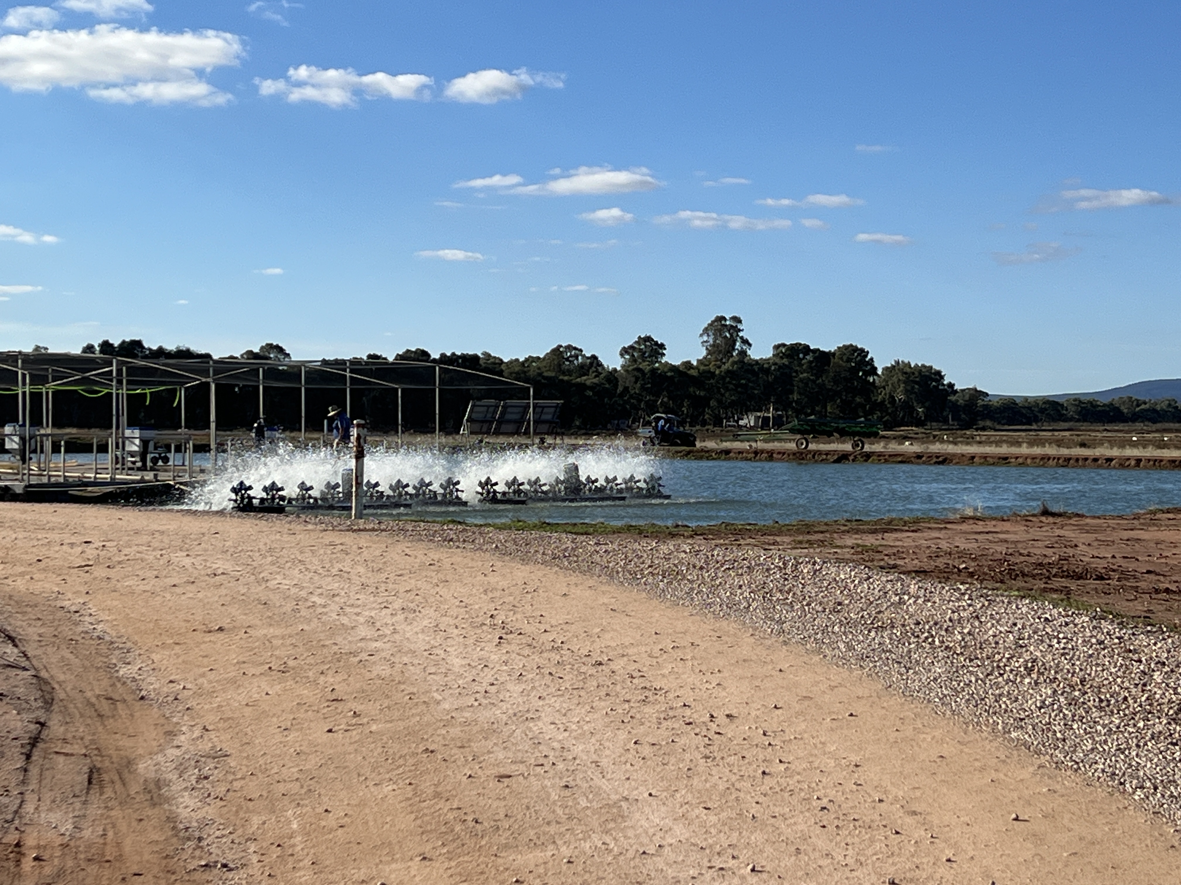
They have been doing this for 15 plus years, learning a lot along the way and now have a keen following of chefs. Allthego couldn’t resist a packet of frozen wings to try on our return to Brisbane.

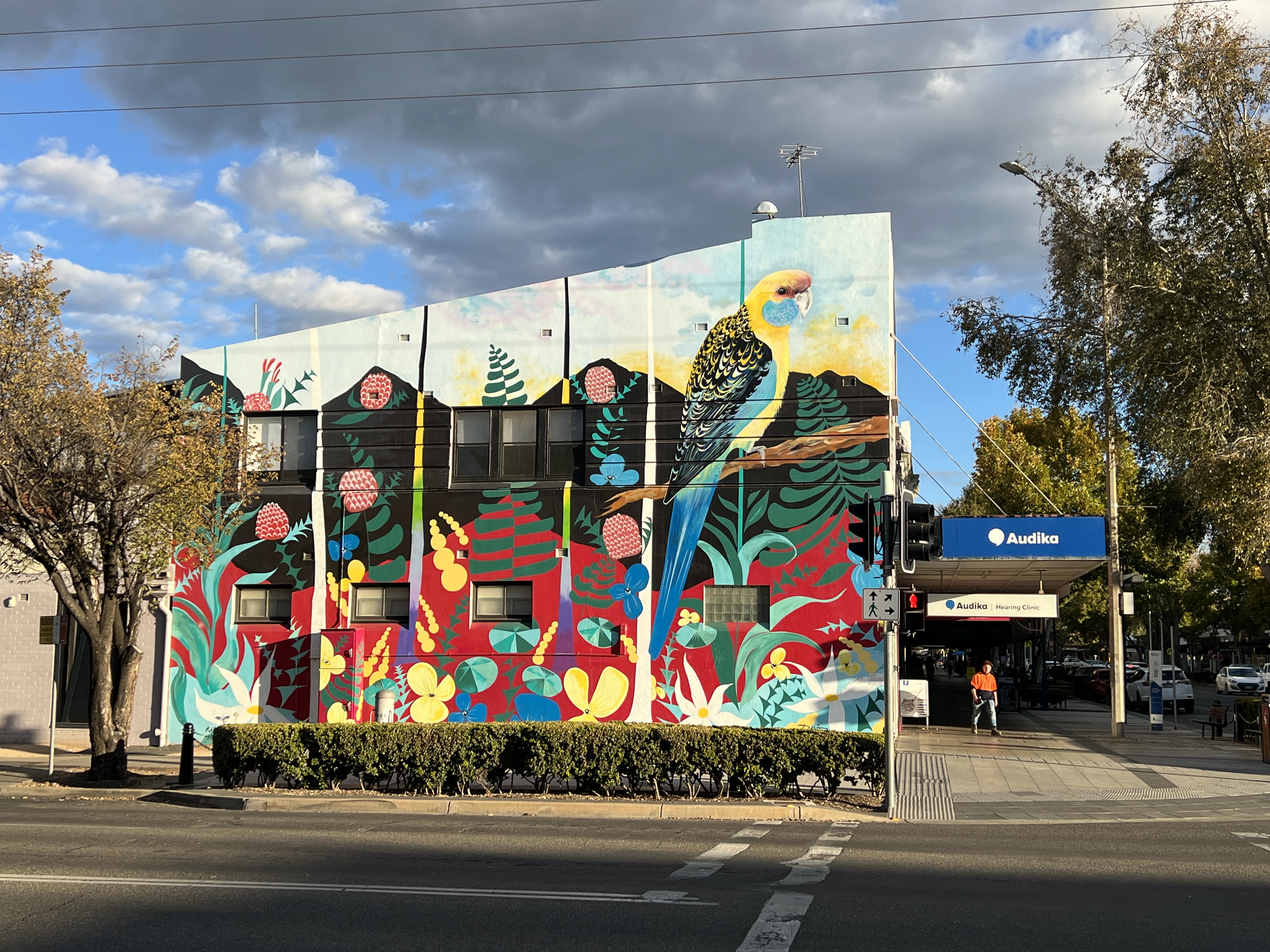
Griffith is a little arty too. The Main Street is called Banna Street and the lane way behind it is Banna Lane. They have a festival each year to advance the mural art in Banna Lane.
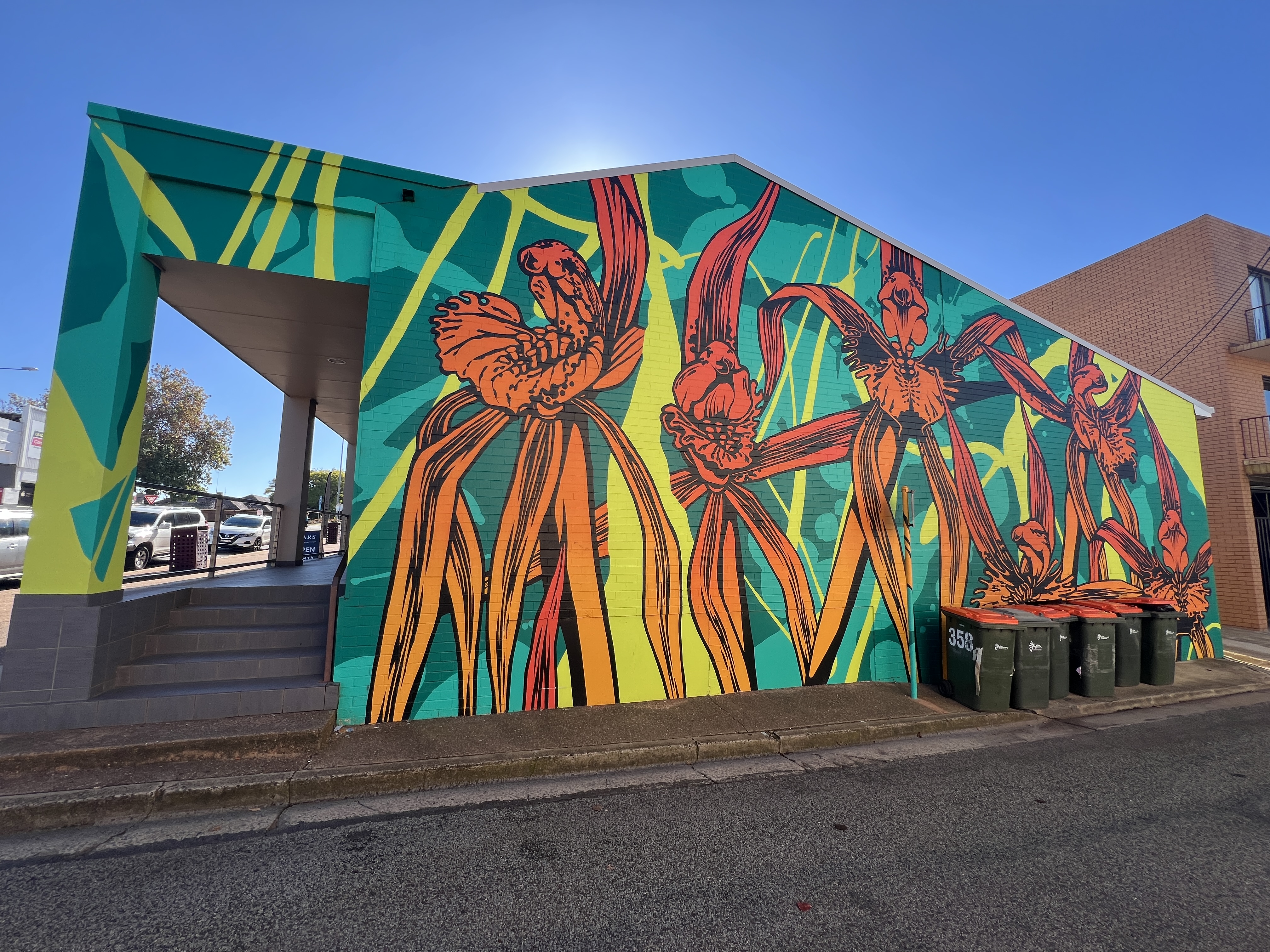
na Lane mural
Some interesting pieces on the walls, the one of oranges is reproduced on one of the city’s postcards. Quite impressive work, helped of course by the rubbish bin! Homealone says don’t worry it is street art.
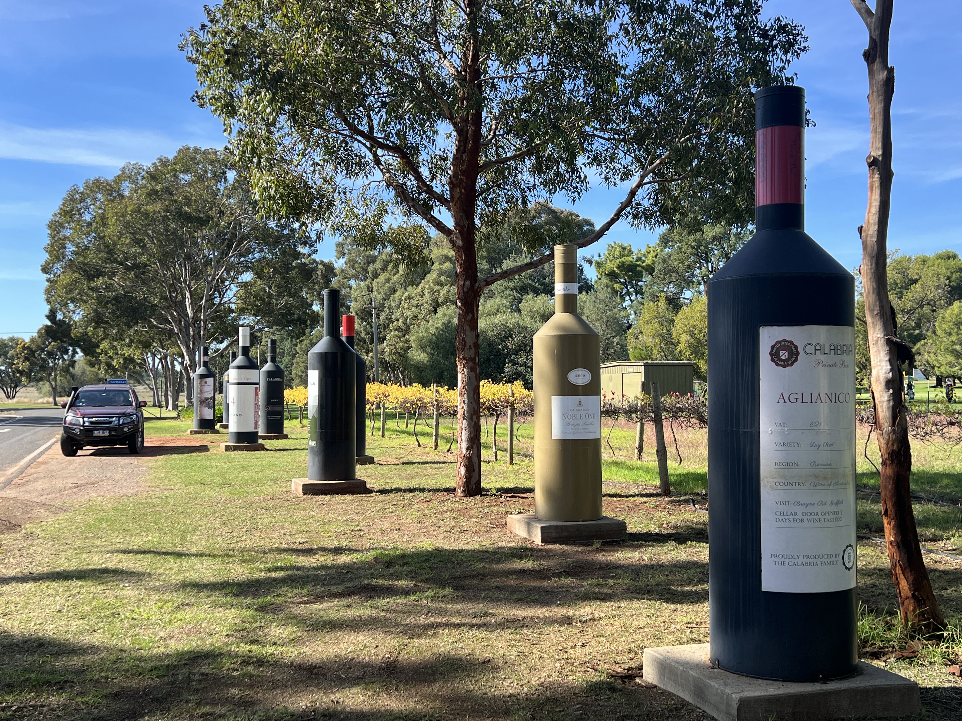
The vineyards have also called and we have tried out some selected ones, particularly tasting the Italian varietals. They are well suited to the region’s Mediterranean climate. Lovers of big shirazes are going to be disappointed here, most of the wines are lighter and seem to be designed as drink now experiences. We have acquired a few bottles to bring home, they are stored safely away in the van’s cellar.
On a final note Griffith has an annual Salami and food festival, runs for a week, and is a celebration of all things Italian. Sounds like a must to put on the visit list, there is also I believe a long lunch. Must look into this!
We are now due to pack up and move back to the Murrumbidgee River. Hey, we are headed for Hay!
Leeton
Leeton is a 25 km drive up the Irrigation Way from Narrandera, so it is not an arduous task to get there before lunch. Which we did. A record almost for the travelling duo. It took a little while to decide the van park, a lot of driving around comparing sites. Finally settled on one, just off the road through the town. We had thought of staying for 2 or 3 nights in Leeton but the weather was not great, chilly with heavy overcast skies. The van park was also a bit empty, hardly anyone there. Made you wonder why! There was a mob in residence down the back in several small tents under the cover of a big big tarp, they were relatively quiet. Bit of a sing along now and then but all ok.
Leeton is the rice capital of Australia and Sunrice has its headquarters here. The rice harvest has finished for the year and most of the fields have been ploughed in and are being readied for the planting of the next crop in a few months time. As well as the rice fields there are endless cotton fields. These are currently being picked, fluffy stuff all along the roadside!
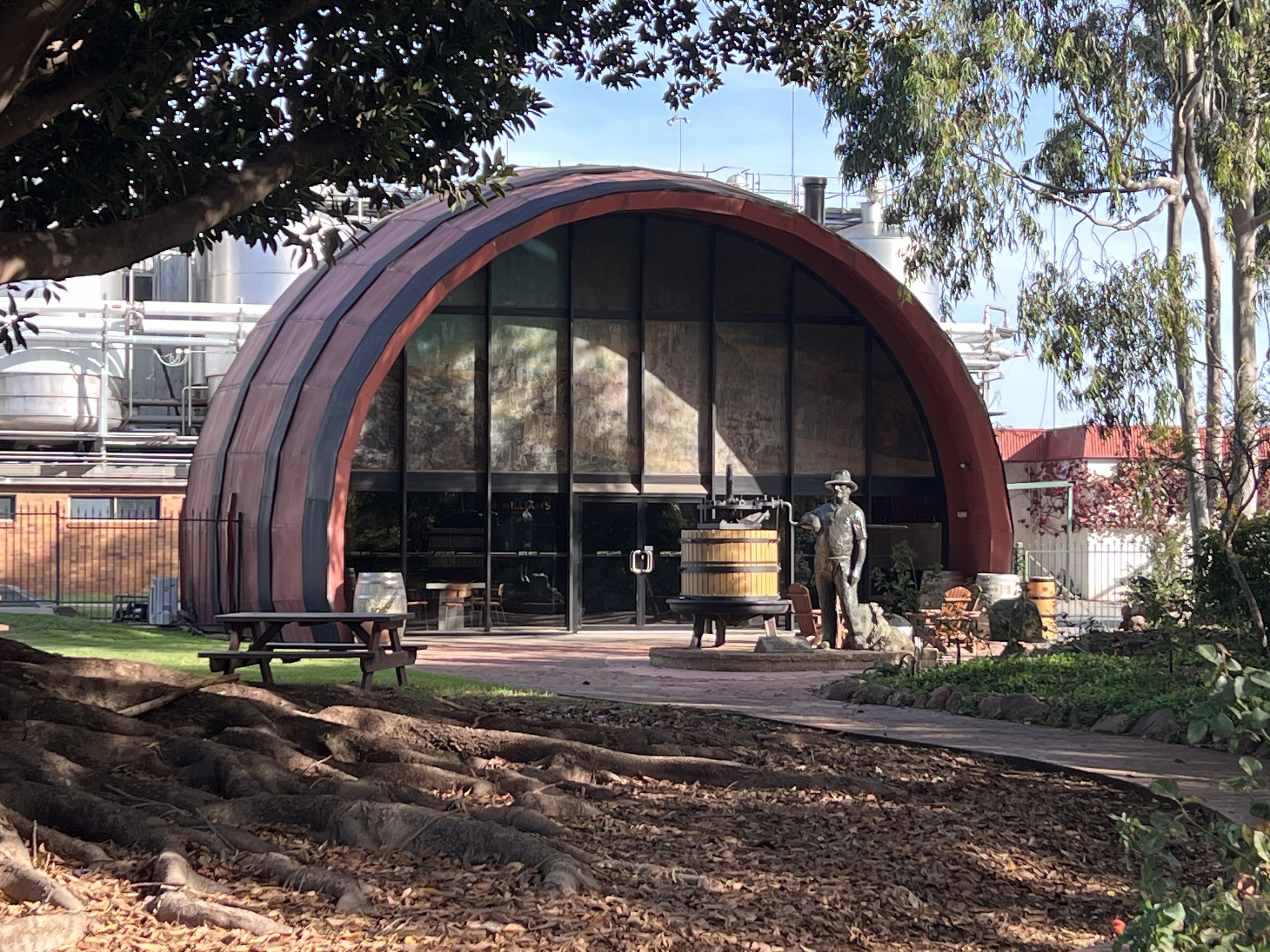
After settling in we set off on a drive around town and then out to the Whitton Malt House. A new establishment that showcases the malting process. This is the blending and mashing of grains for use in such things as whisky, beer and gin. The Malthouse has a big market here in Australia for their malt but also does some exports. The location is also a touristy set up with villas, eat at the in house cafe for breakfast, then lunch and dinner. Local produce, including Murray Cod.
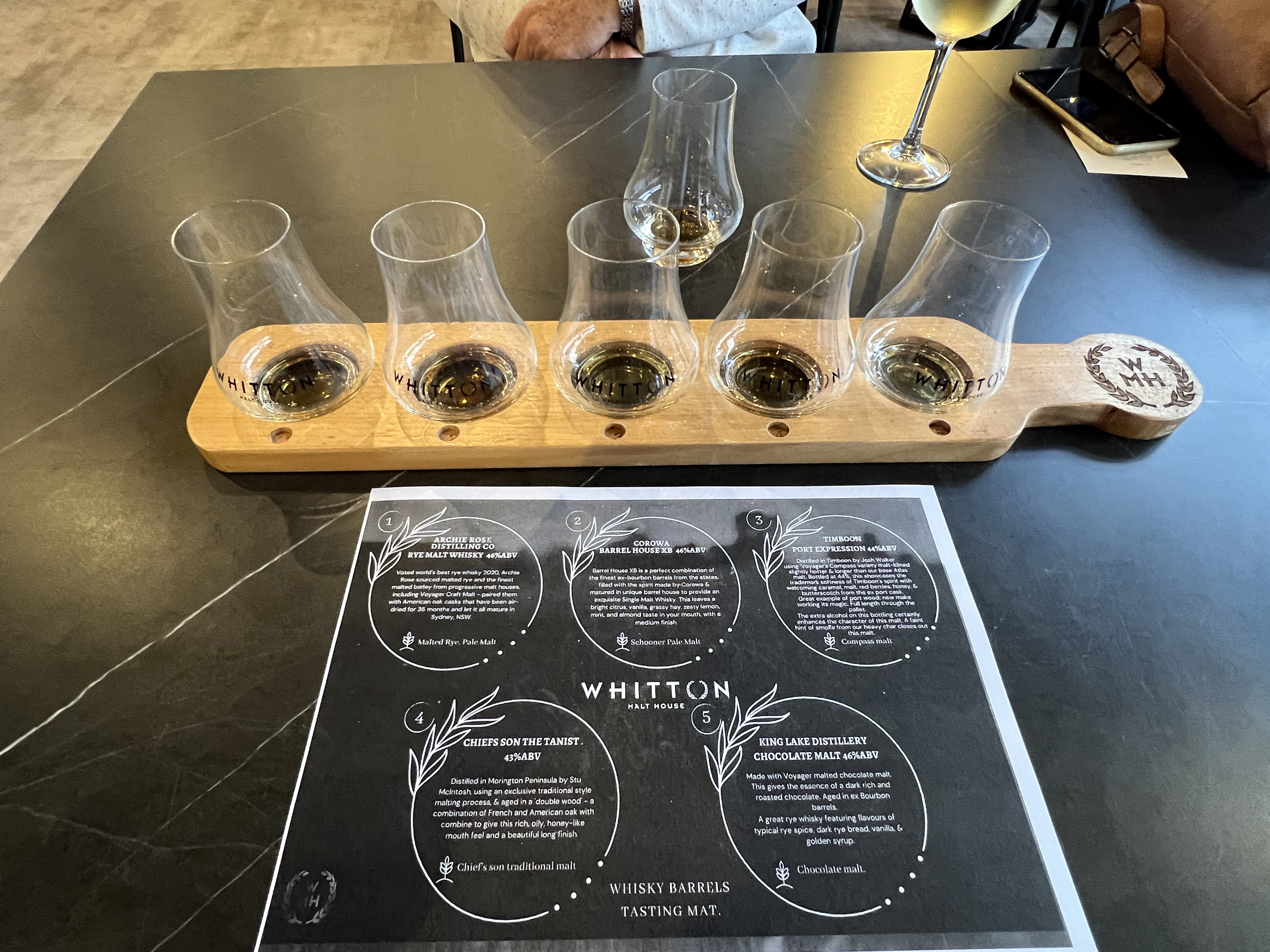
Allthego enjoyed a whisky flight, they don’t craft the whisky but showcase whiskies from around Aus that use their malt. Interesting stop.


Back then to Leeton via the Gogeldrie Weir, this one is a ‘new’ 1960ish weir, it diverts water to the south of the Murrumbidgee.
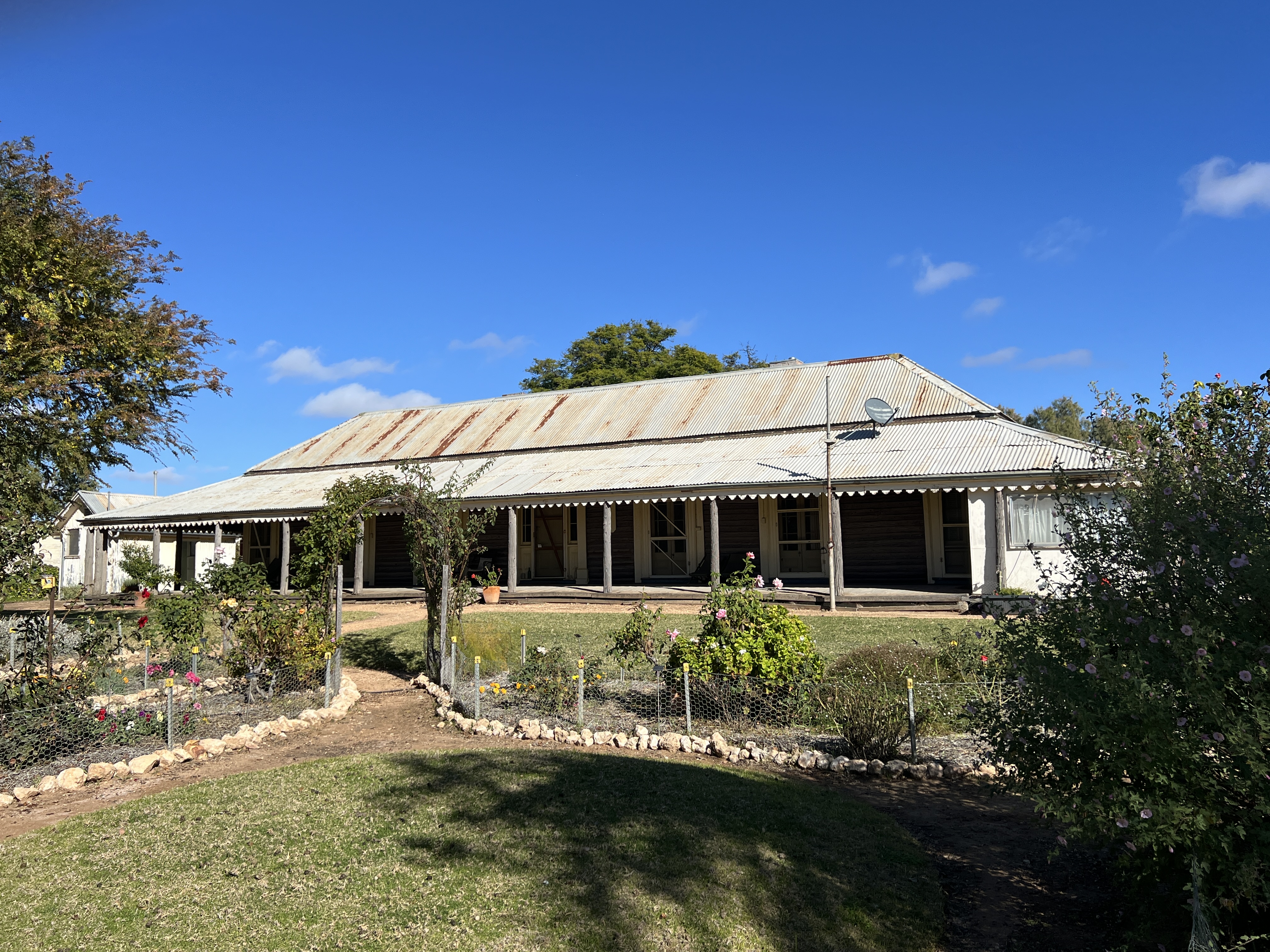
Leeton was home for a short period of time from 1916 to 1917 for Henry Lawson, he wrote some 30 or so poems during this period. It was to be the last creative period of his life, he moved back to Sydney where he died in 1922.
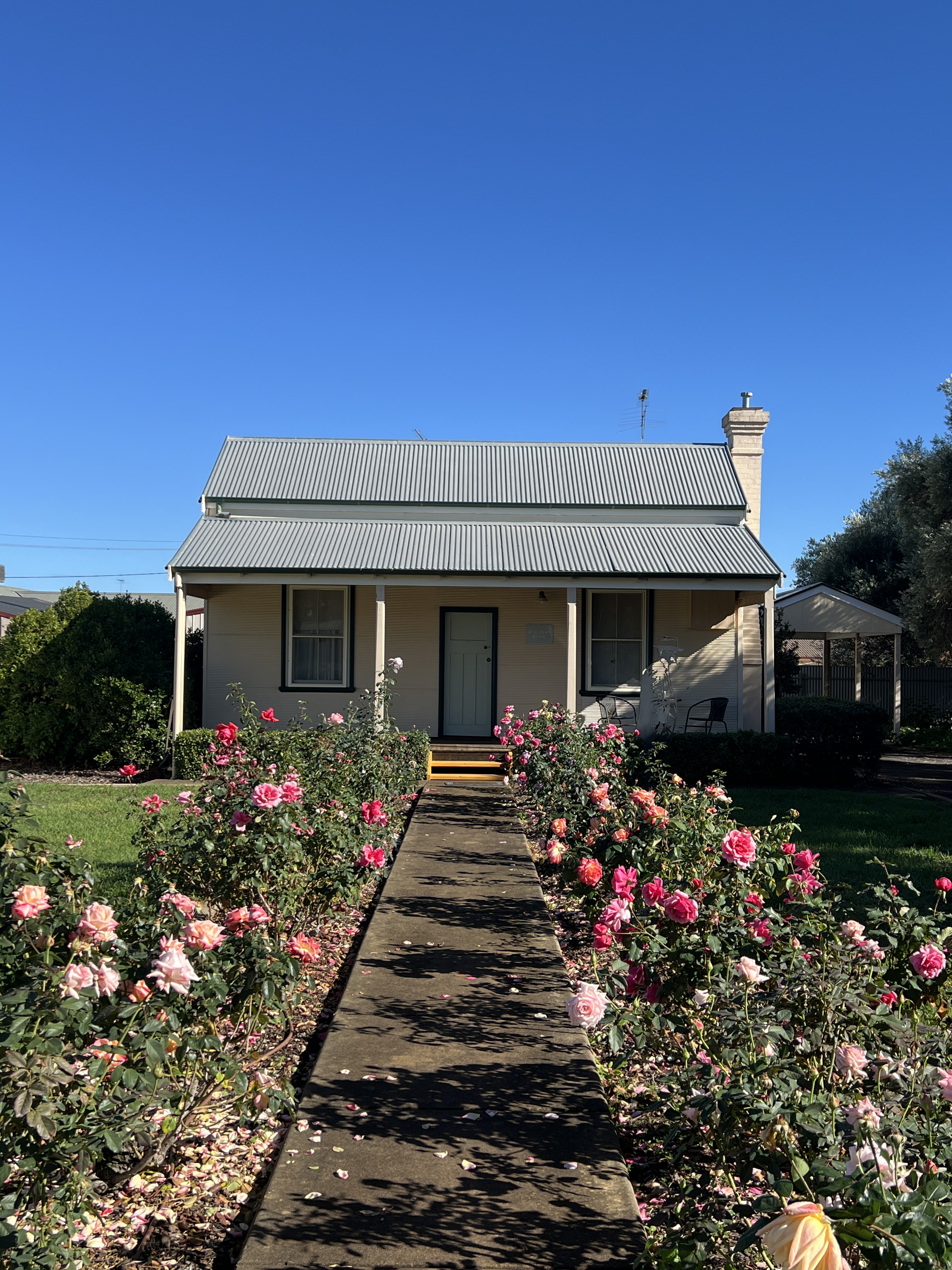
His cottage has been restored on a small block, a residual of the previous acreage on which it stood. It has also been modified somewhat from the original design.
South of Leeton is the small town of Yanco , famous for its Agricultural College. It was in this area that the ‘father’ of irrigation Sir Samuel McCaughey established his irrigated farm network in the 1880s and 90s. It was to be the forerunner of the MIA.
He built a mansion not far back from the Murrumbidgee that is now the Admin Block of the Yanco Agricultural College. A very impressive building set in beautiful surroundings.
We now head a little further north to Griffith.
Place of the lizard
We have moved onto Narrandera, having come along the Sturt Hwy from Wagga Wagga.
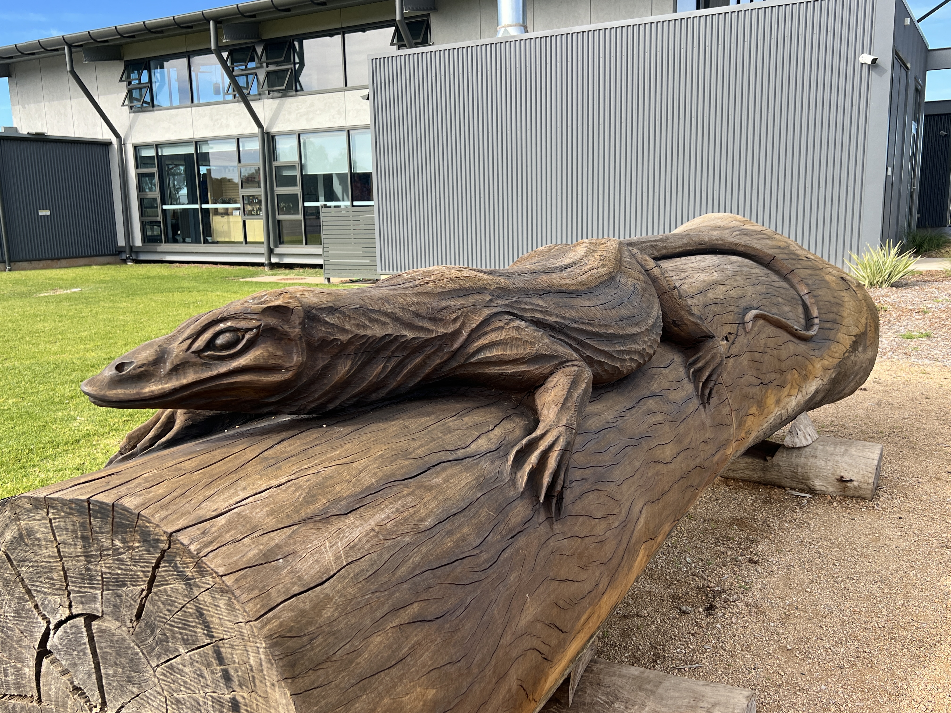
Narrandera is derived from a Wiradjuri word meaning ‘the place of the lizard (goanna)’. We didn’t see any. The town is also the gateway to the Murrumbidgee Irrigation Scheme (MIA).
We arrived in town and settled into the Lake Talbot Tourist Park which overlooks the lake. The weather has turned on us and the clear blue skies have gone, cloud and a fair bit of rain has fallen in the region. We seem to have dodged the down pours, just catching some light overnight showers.
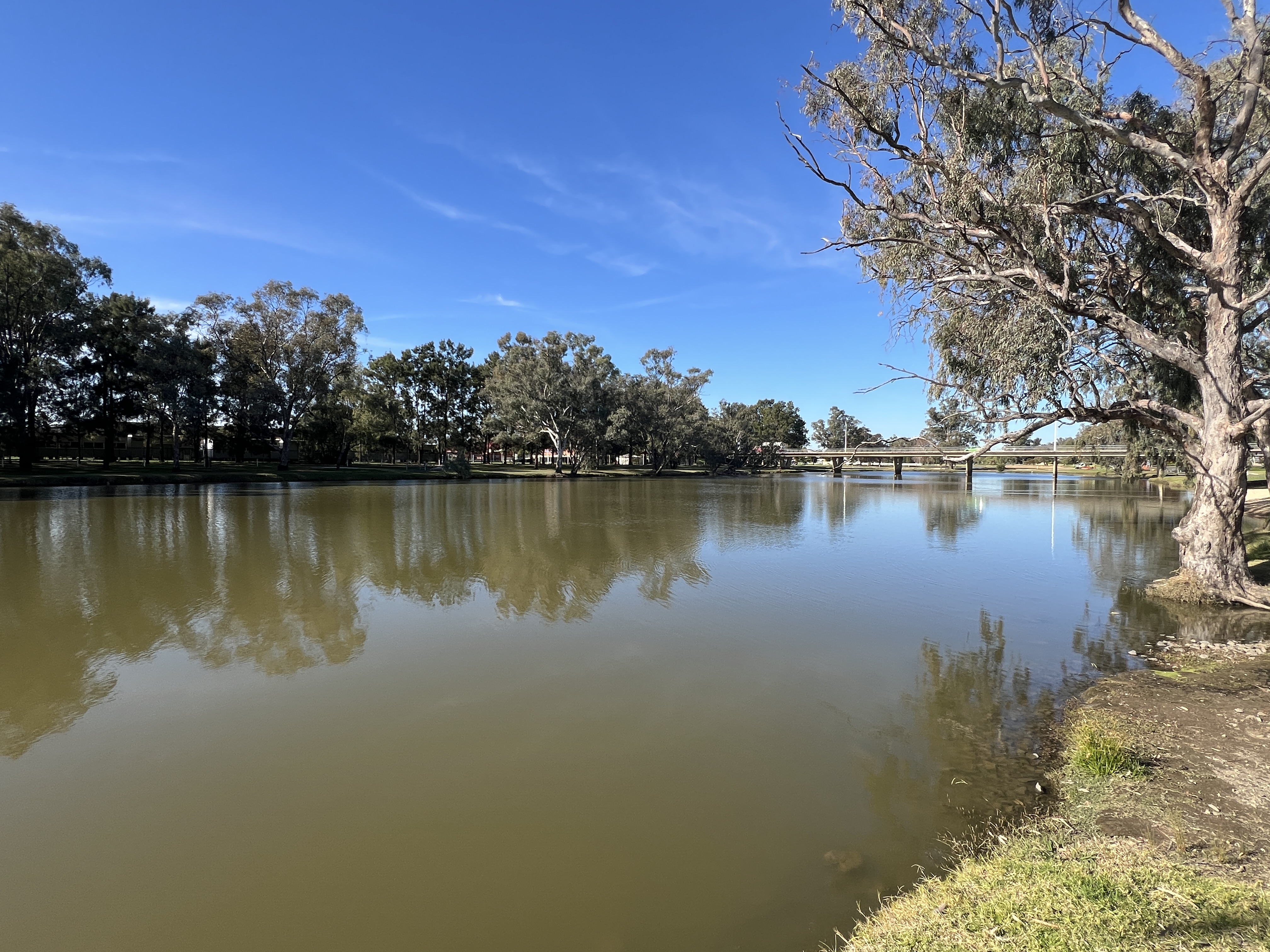
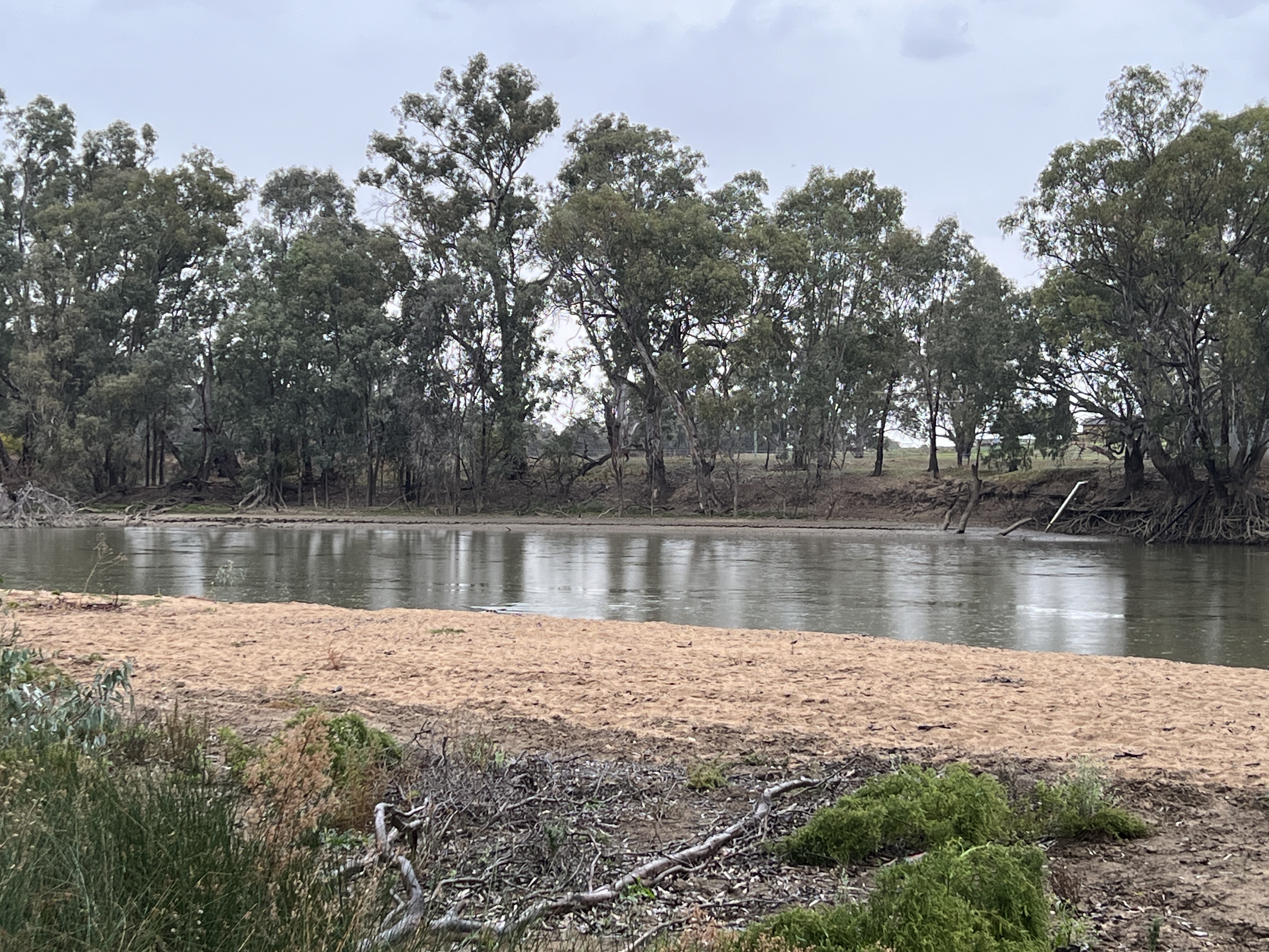
Narrandera is located on the Murrumbidgee, which flows around the edge of the town on its way to Hay, and the junction of the Sturt and Newell Hwys.
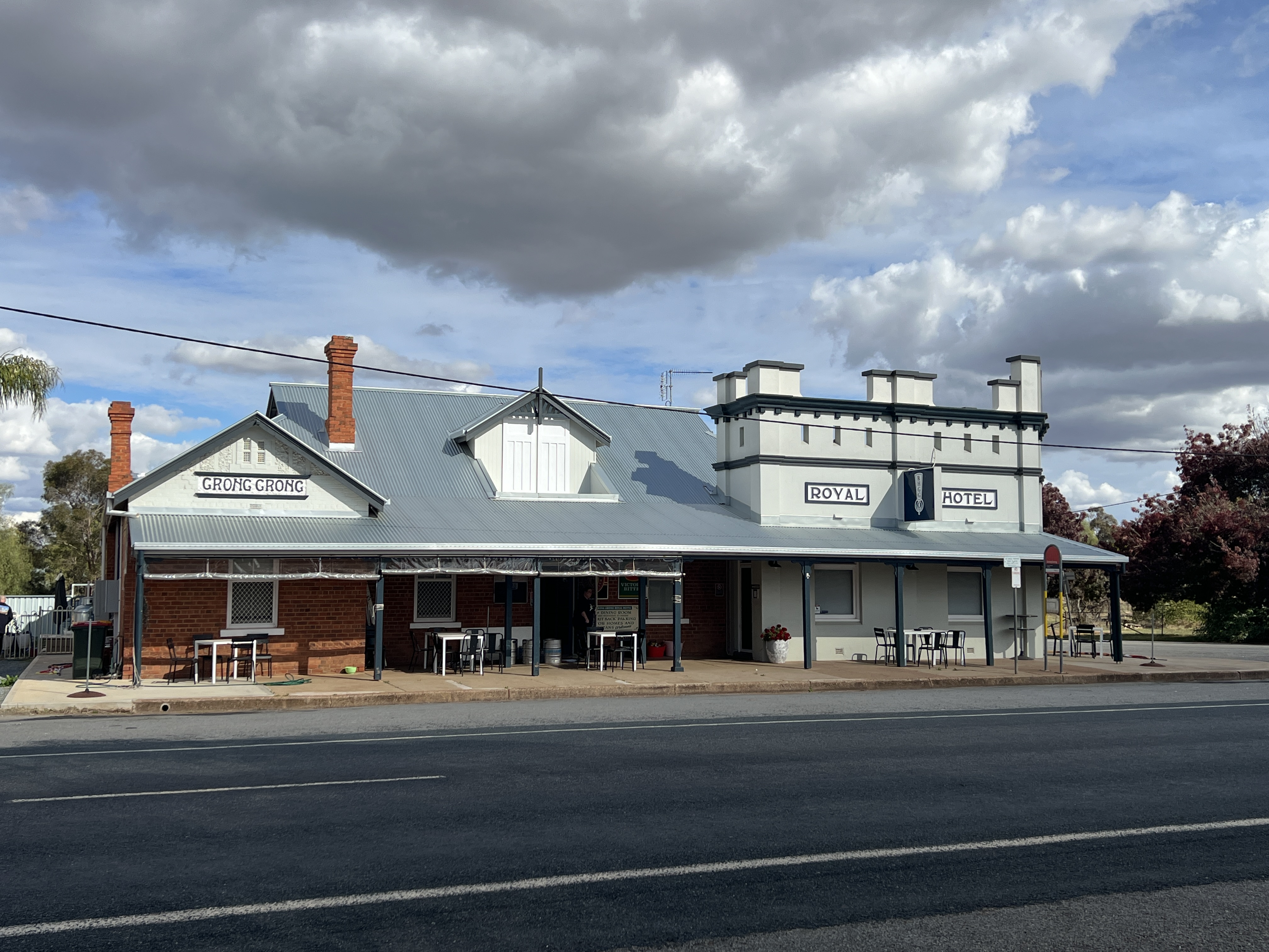
After settling in we set off to Grong Grong along the Newell Hwy (the road to Brisbane), about 20 kms. At Grong Grong there is we understand the Royal Hotel, an 1880s pub that has been saved by the locals and done up, nomads can free camp overnight out the back and have a great meal. We thought we would catch a counter meal for lunch. Alas it doesn’t open till 2pm and only does dinners, it did look a good place to stay though sometime in the future. There are 150 people in Grong Grong. We remained peckish.
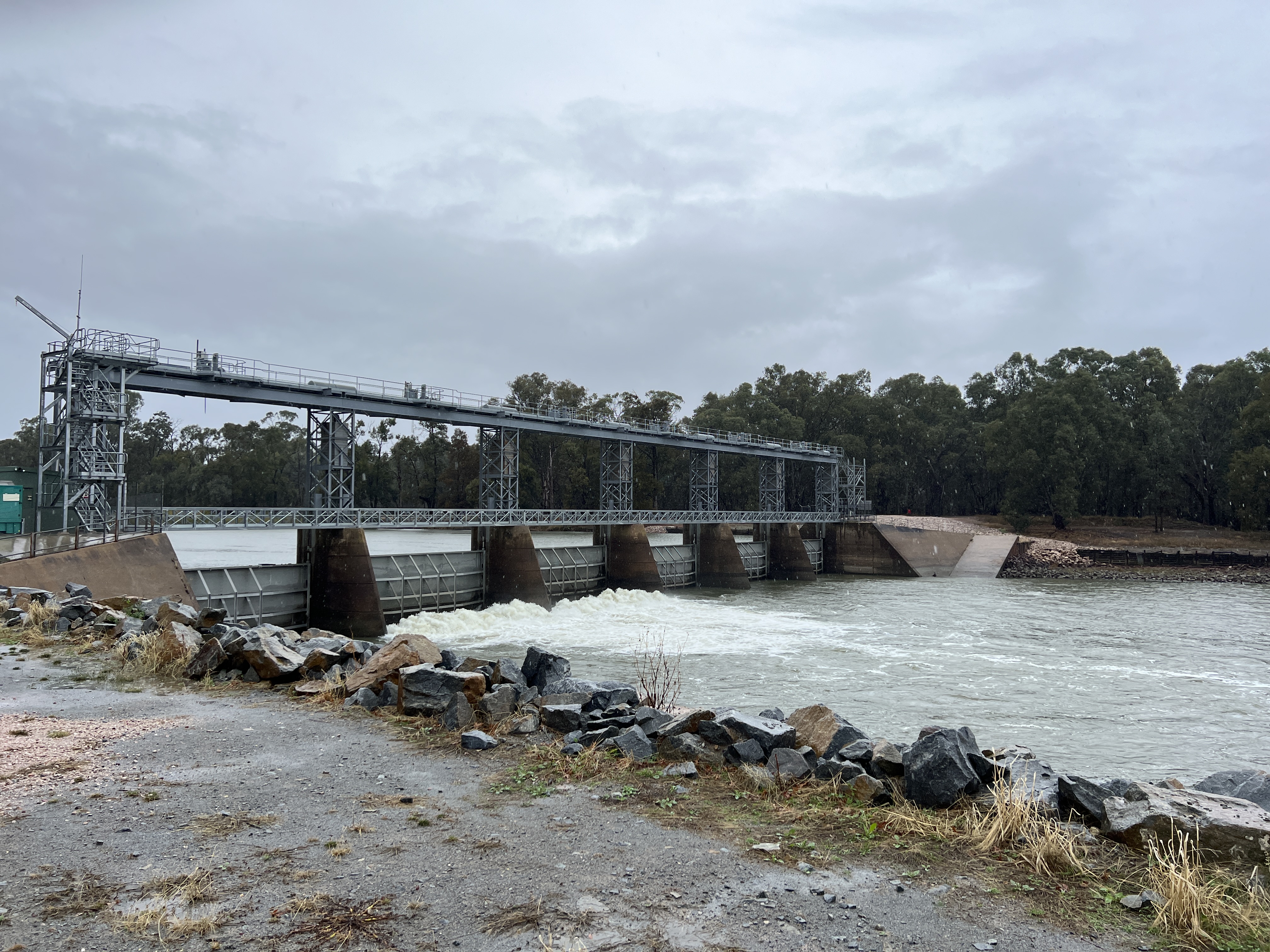
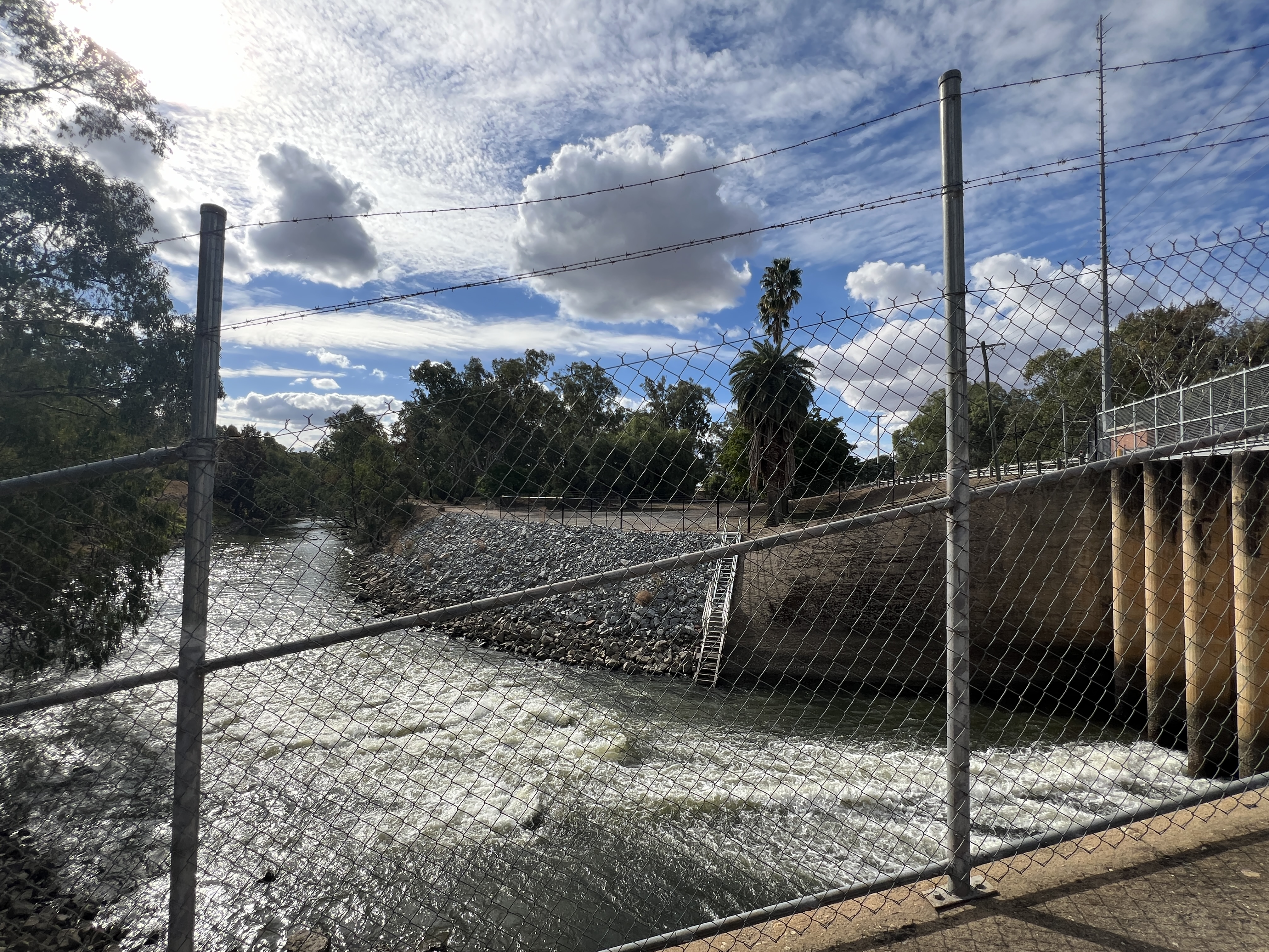
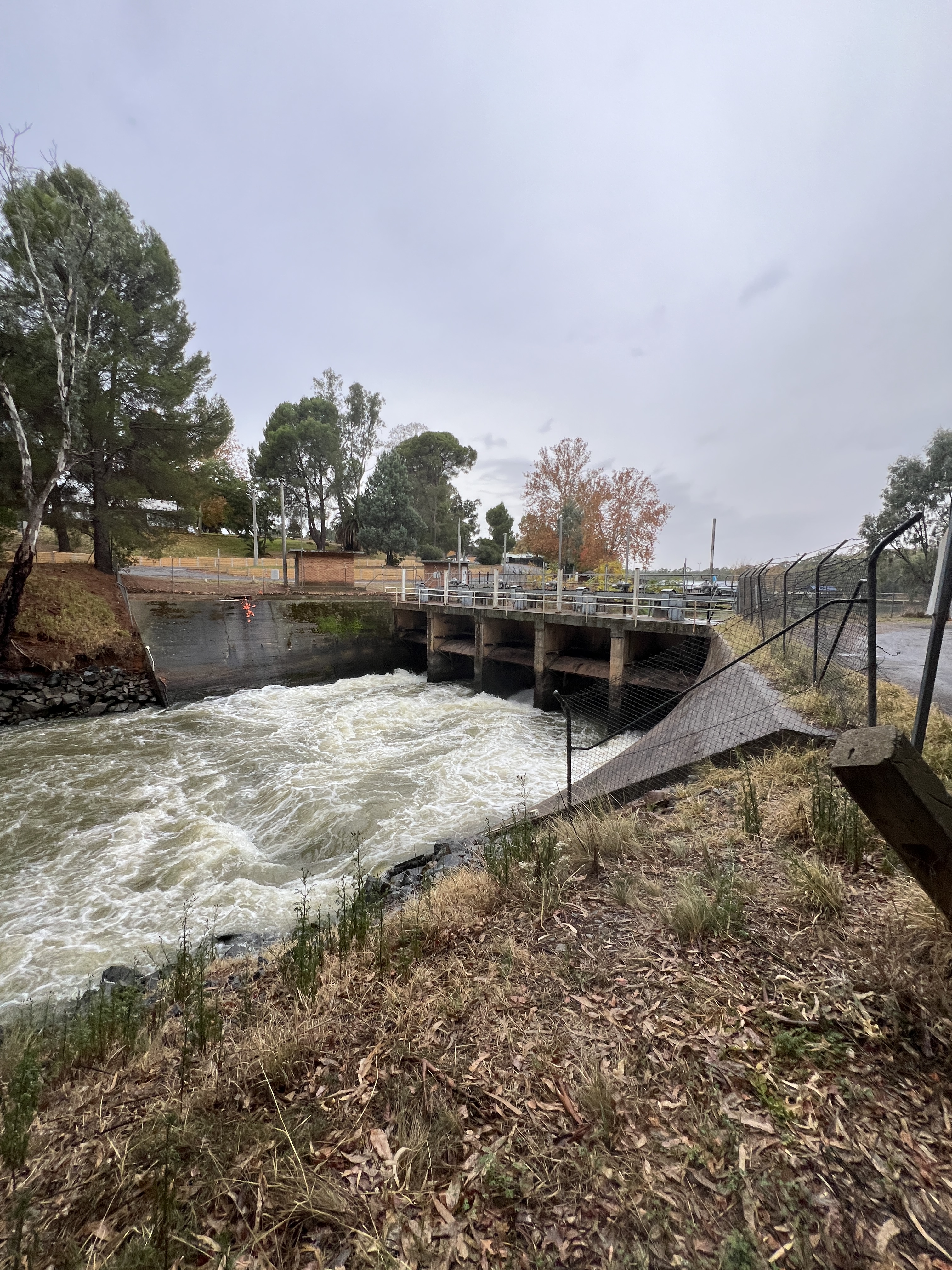
Grong Grong was also where we were going to take a side track down to Berembed Weir on the Murrumbidgee. The Berembed Weir is an important place in a journey down the river. A couple of kilometres down the road we came to a ‘road closed’ sign and had to back track and take an alternate route, the unsigned detour.
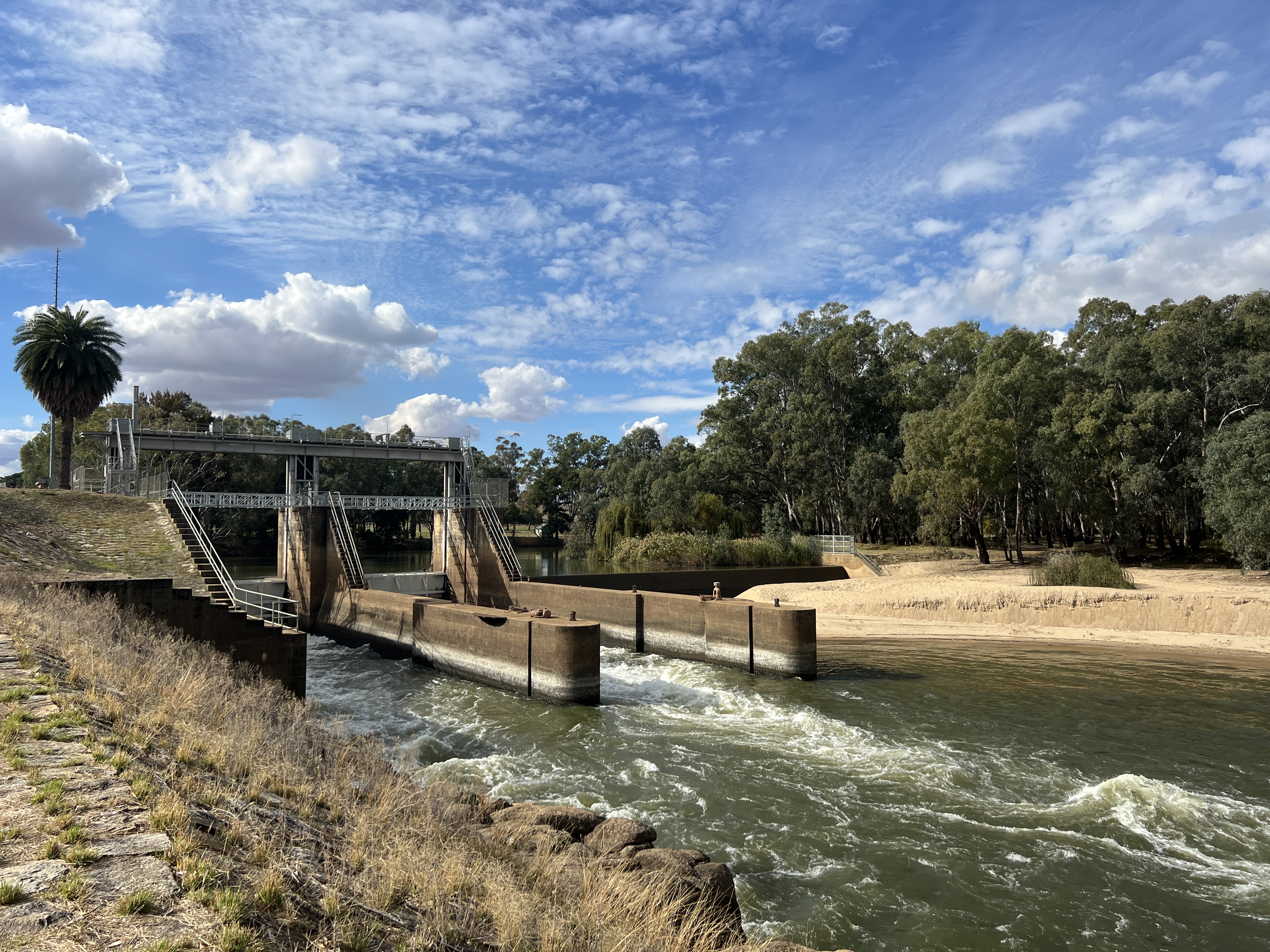
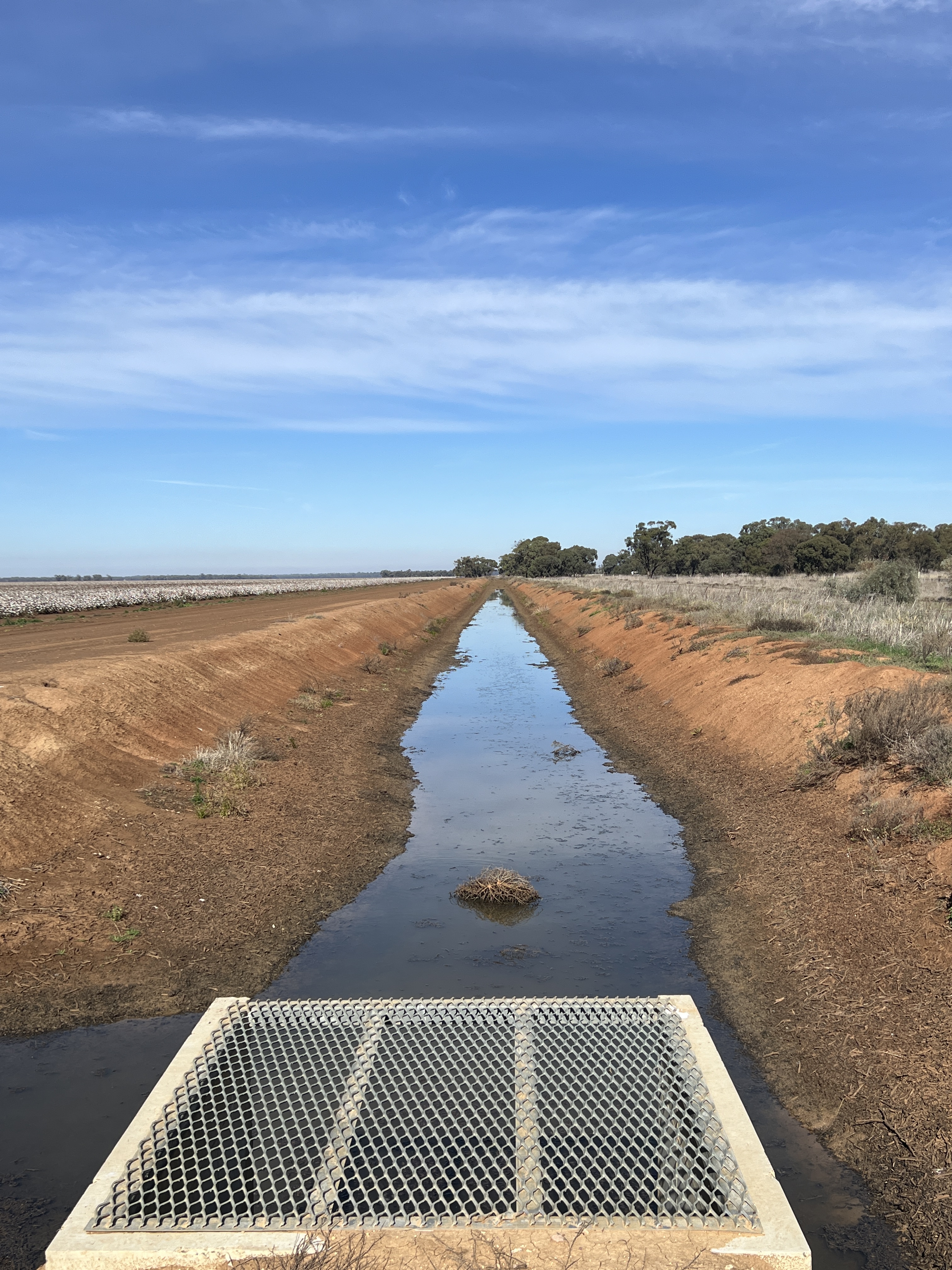
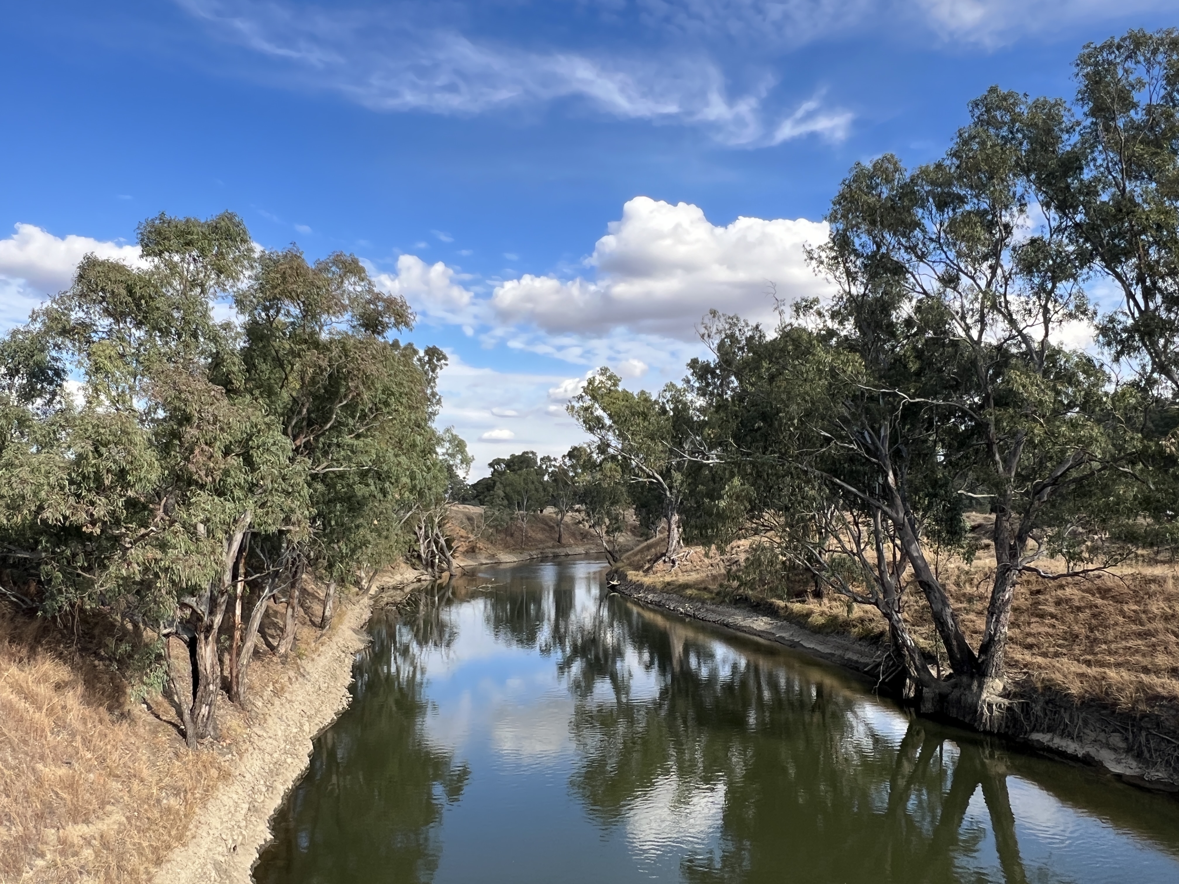
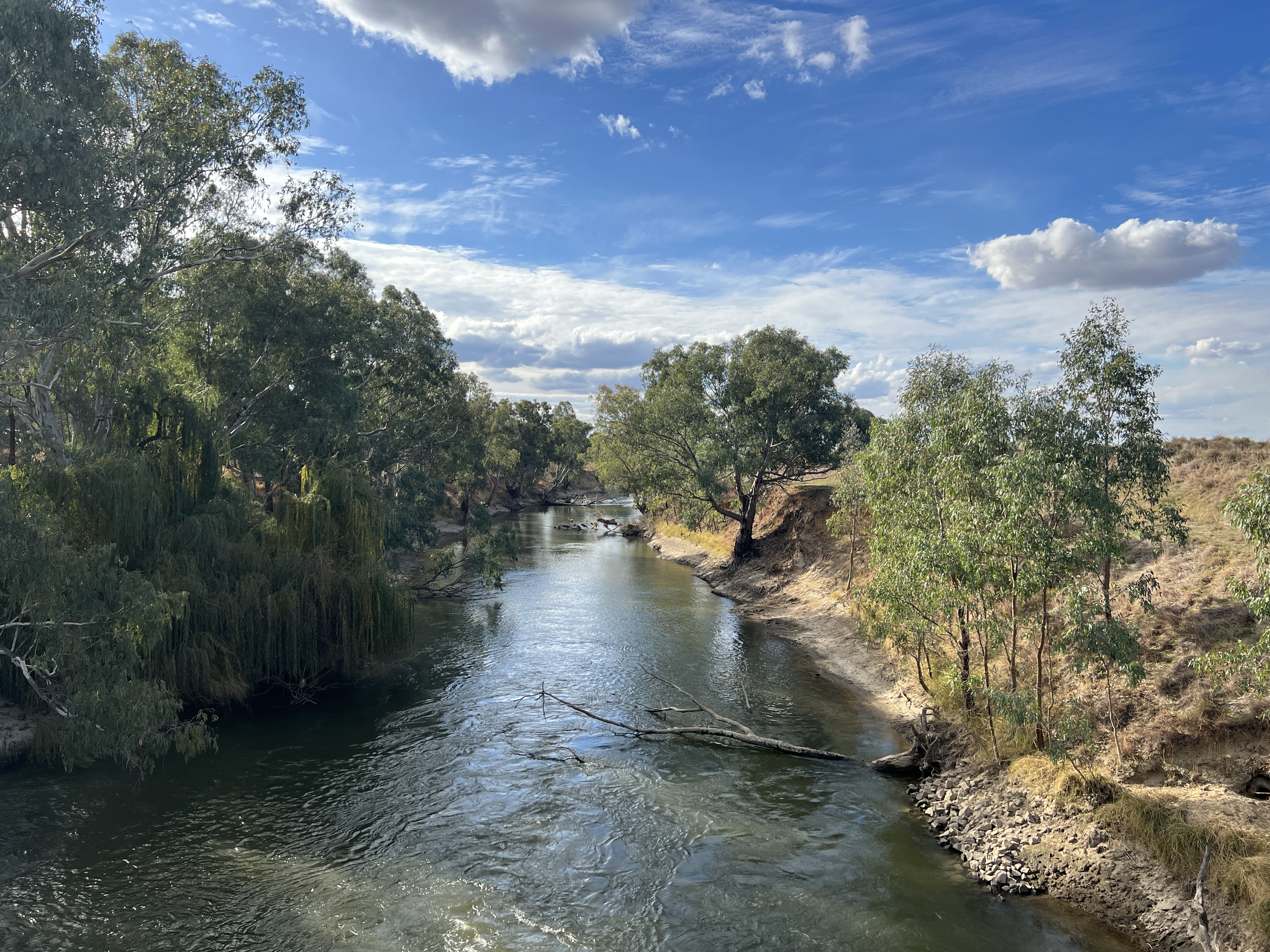
The weir is important because it is here that the MIA has its birth, the source of the water that gives life to Australia’s great food bowl. It was constructed between 1910 and 1917 in conjunction with the canal that took water from the Murrumbidgee, the water flows of which are controlled by Burrinjuck Dam. The weir creates a pool of water upstream and a regulator at right angles to the weir allows water to be funnelled down the canal which then runs into creek, in fact an old branch of the Murrumbidgee, that winds its way down to our Lake Talbot. We were fortunate to get some blue sky and sun while down at the weir.
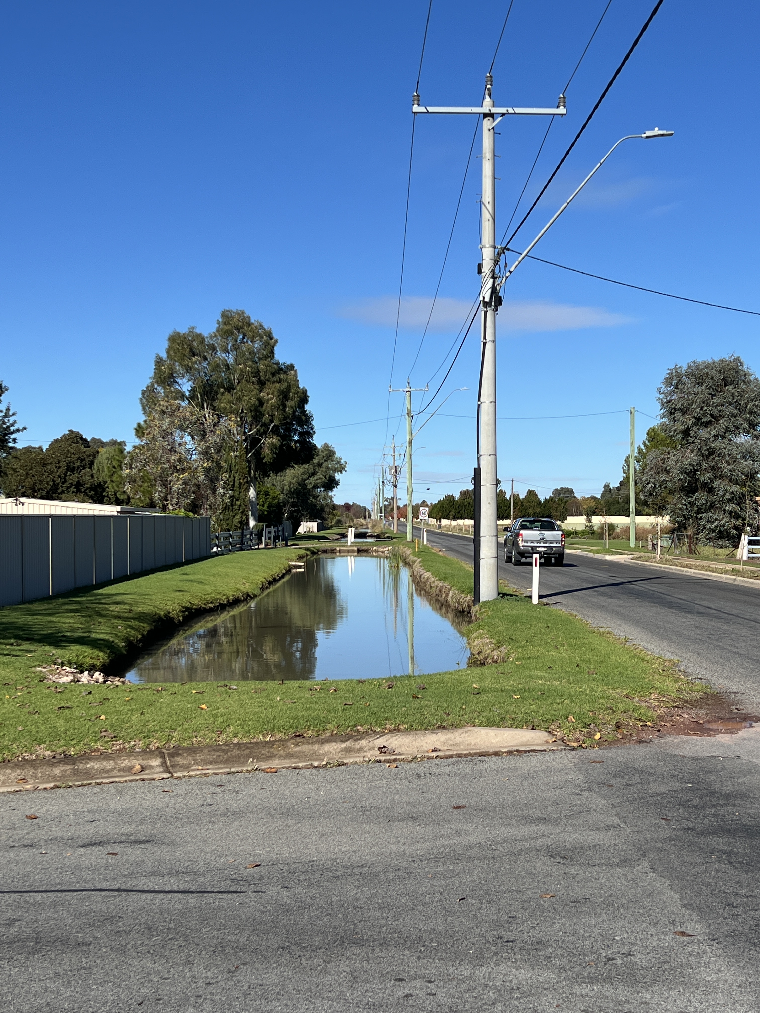
From Lake Talbot the canal takes over and carries the water north through Narrandera and on to Leeton (25km) and Griffith (another 45km). Quite an engineering feat for the times, particularly during WW1. Along the way there are various diversion points which take water into irrigation channels to the farmlands.
After this exploration we headed back to town, more than a little peckish, and indulged in a sausage roll from the local bakery.
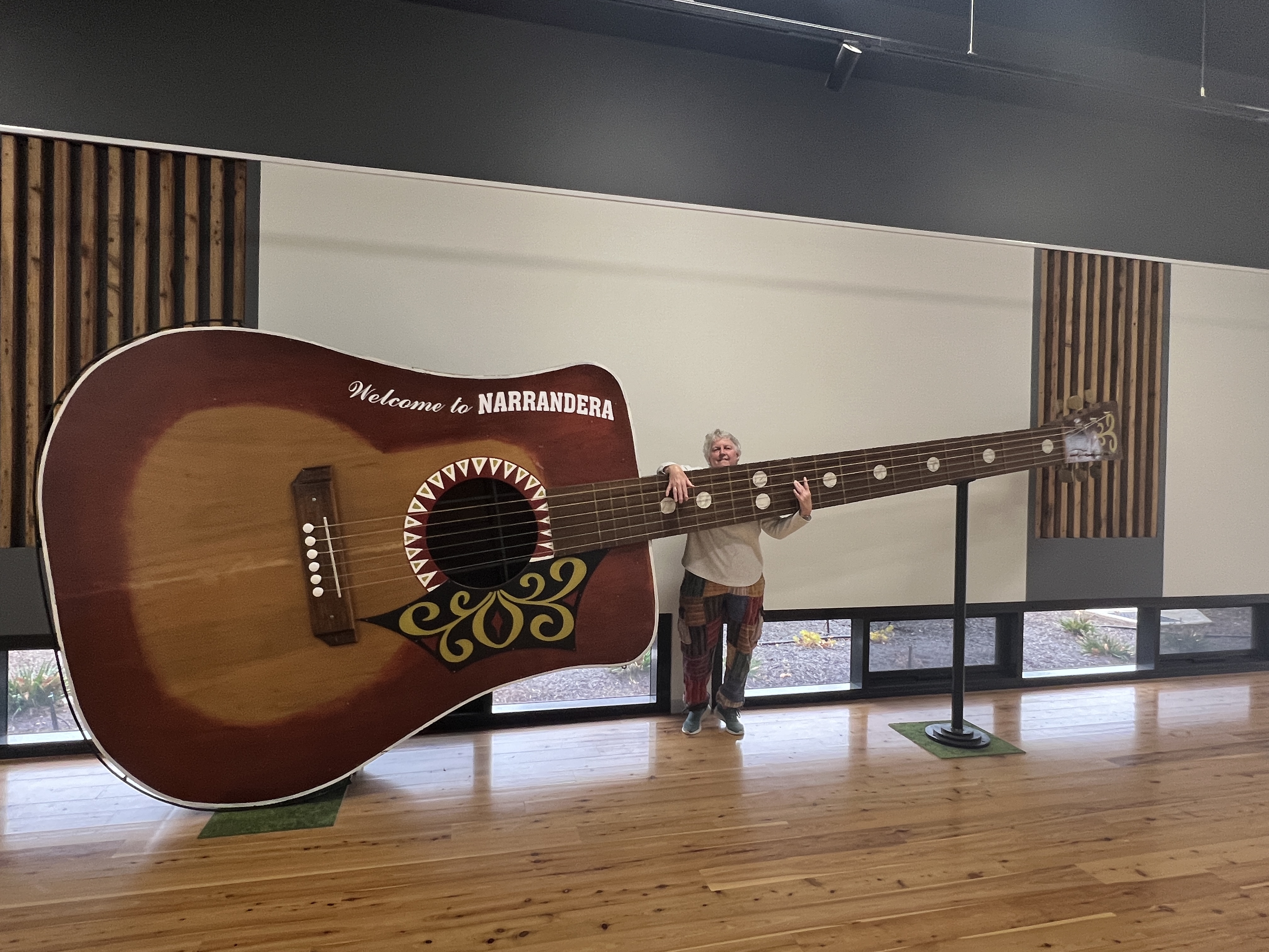
Next morning we had a short drive around to see some of the town. The Information Centre the usual place to start and it was here that we found the Big Guitar, some guy’s idea to promote the town from a few years back. Homealone thought it needed a tune up, the strings were a bit floppy.
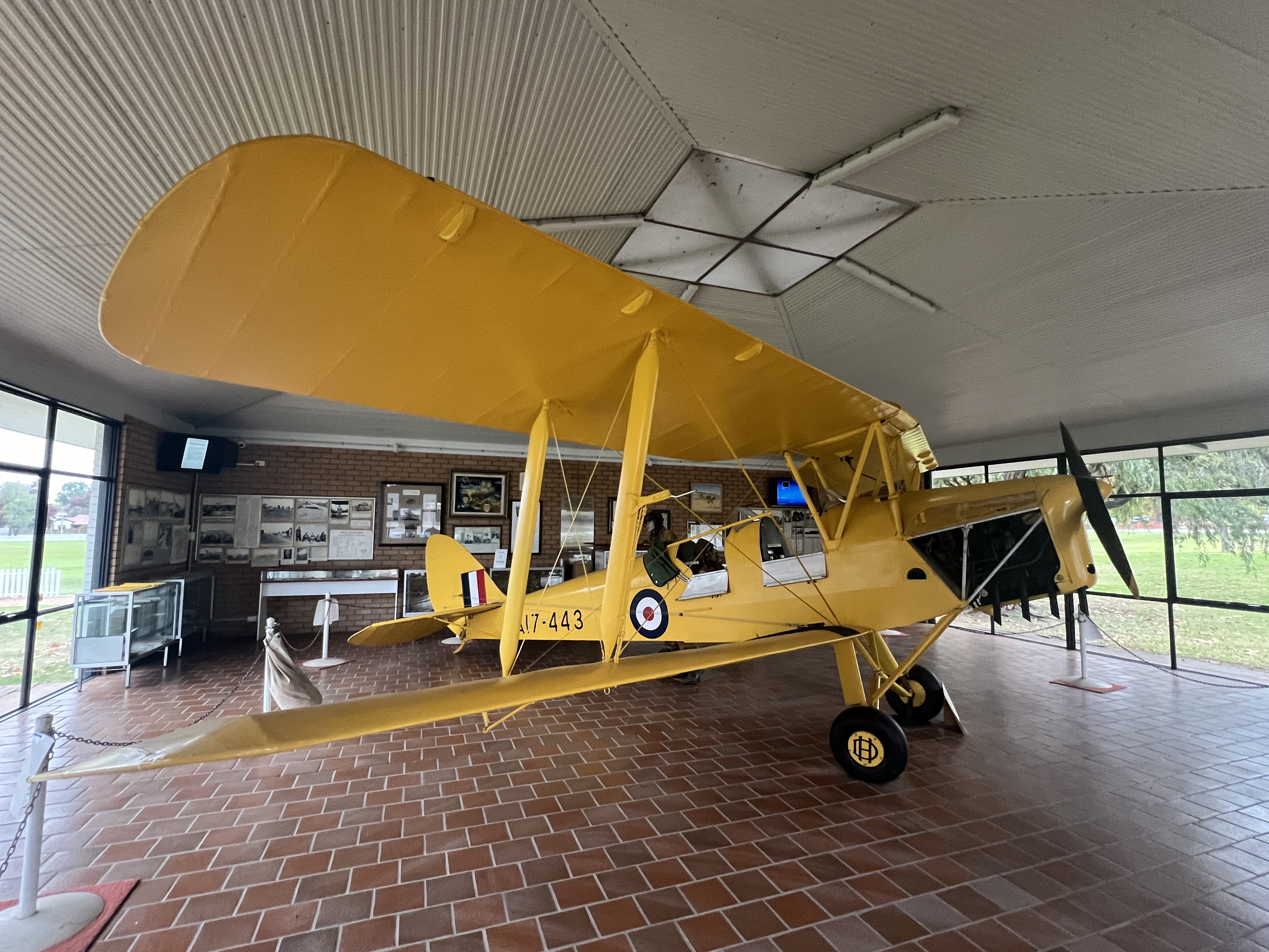
Next door was a tribute to the RAAF training base that was here in WW11, a sister to the one in Wagga. They used Tiger Moths to train the recruits and one is here on display.
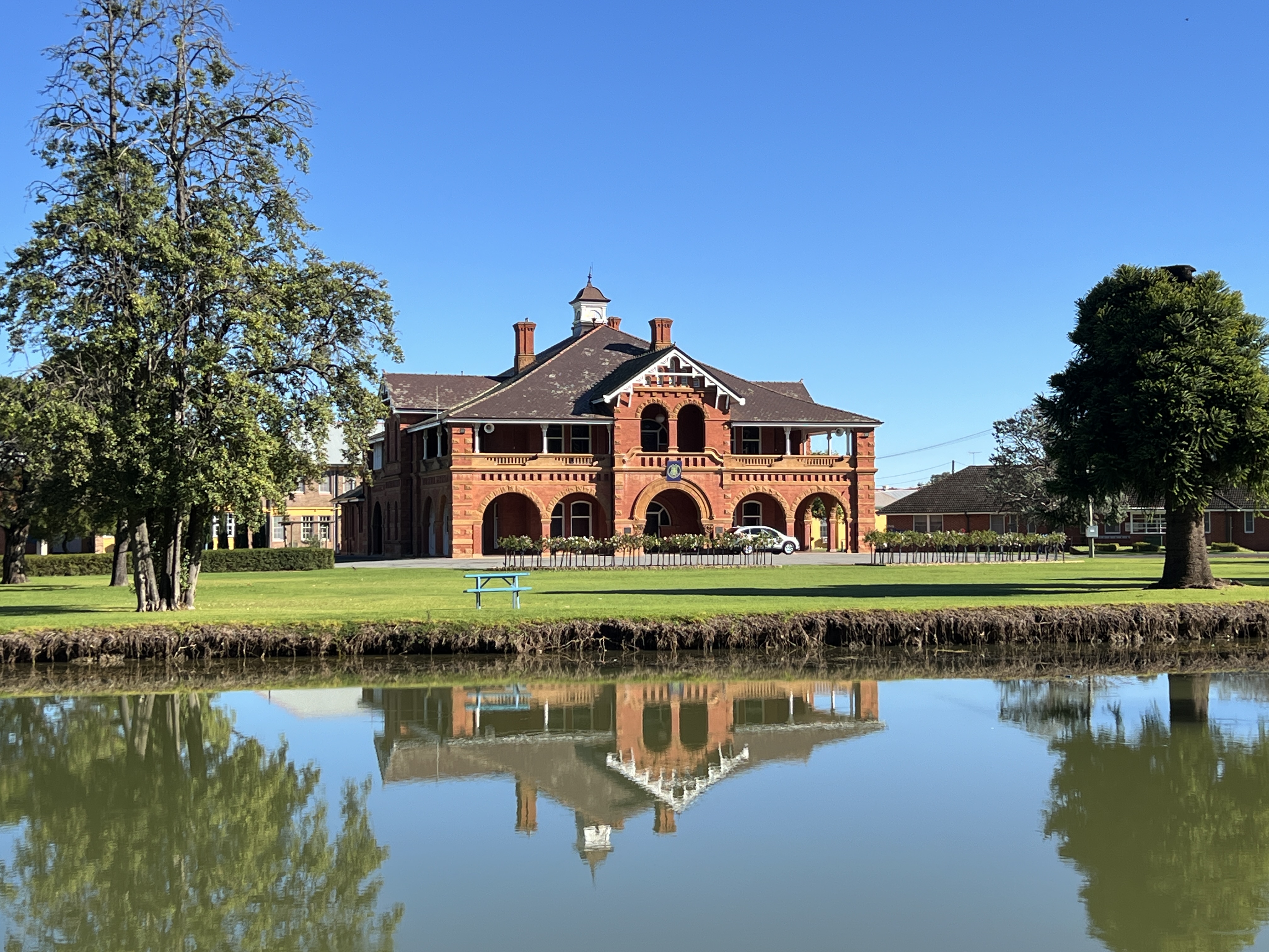
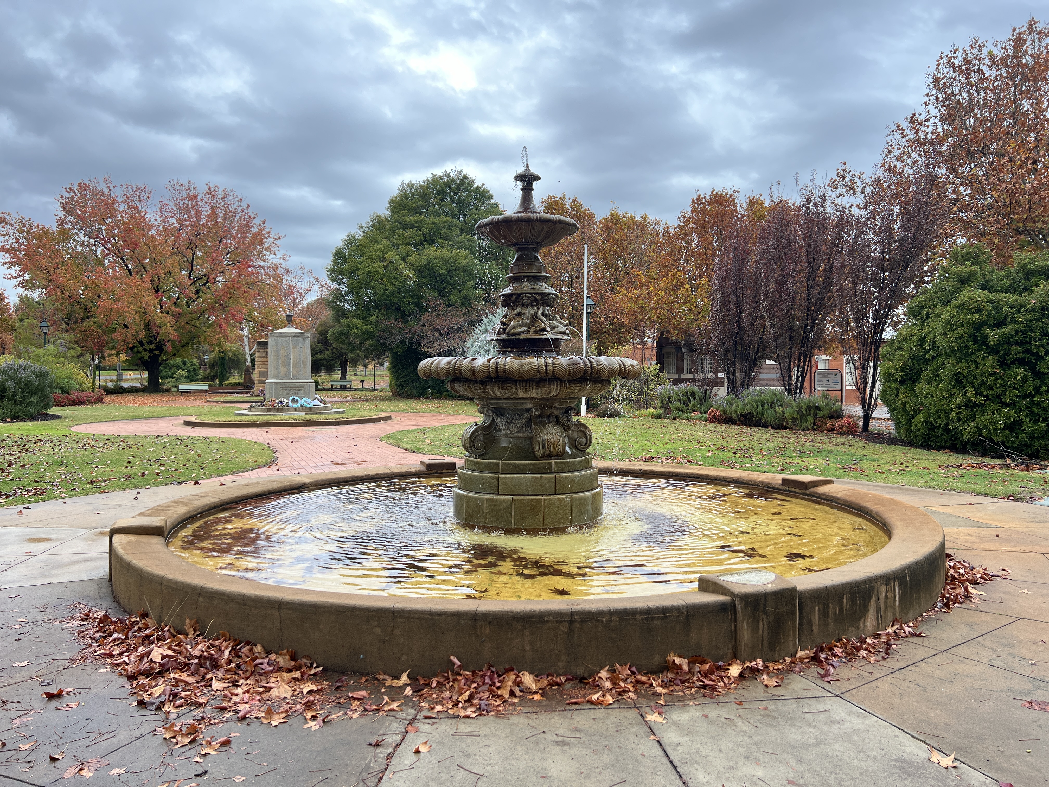
Like Wagga the town has a Royal Doulton fountain from the late 1800s, this one is special though. It seems there are only two in existence of this type, the other is in India somewhere.
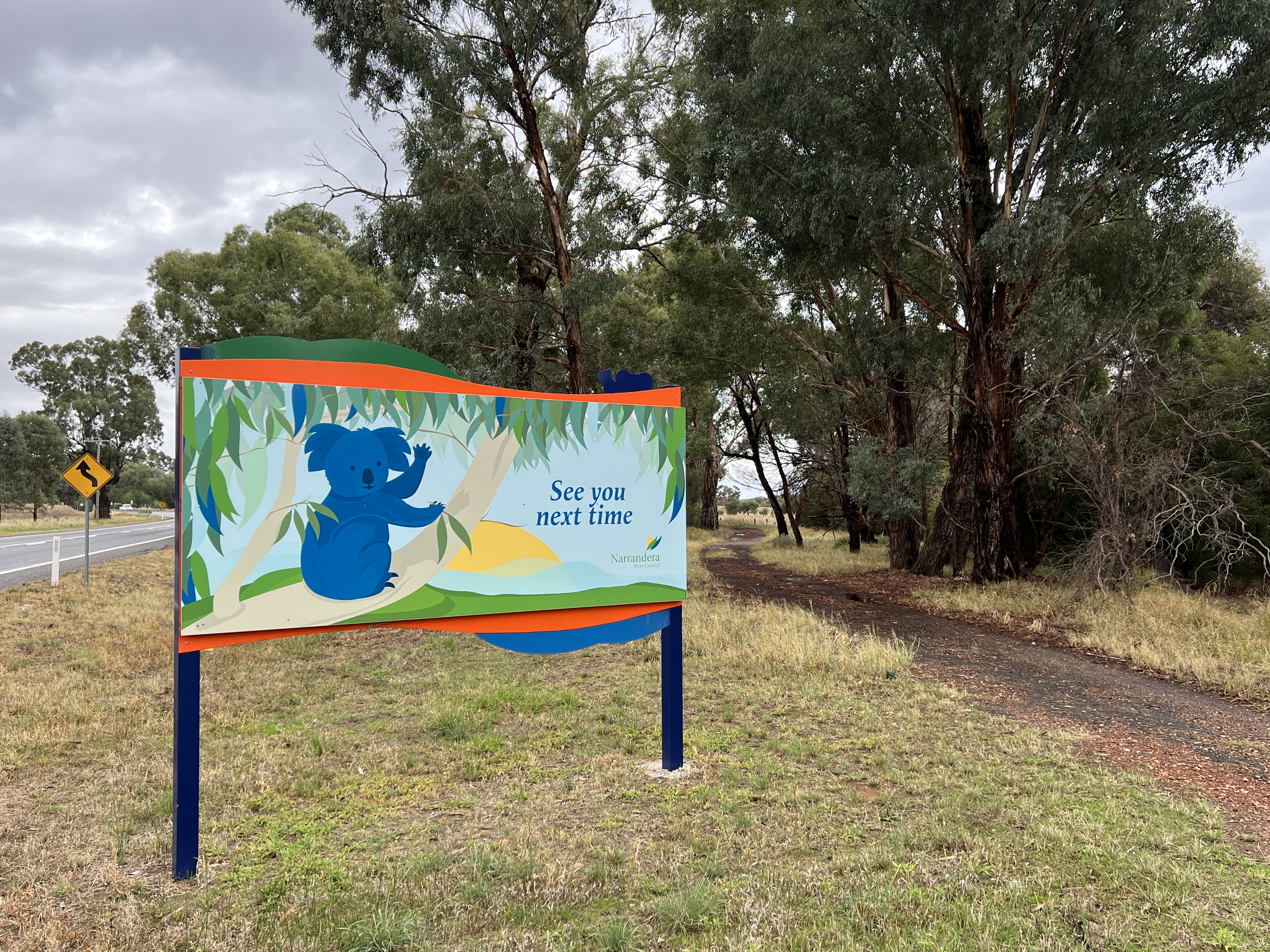
After a couple of nights here at Lake Talbot it was time to pack up and head off north along Irrigation Way to Leeton. This was all of 25 km, so we were not in a hurry to leave.
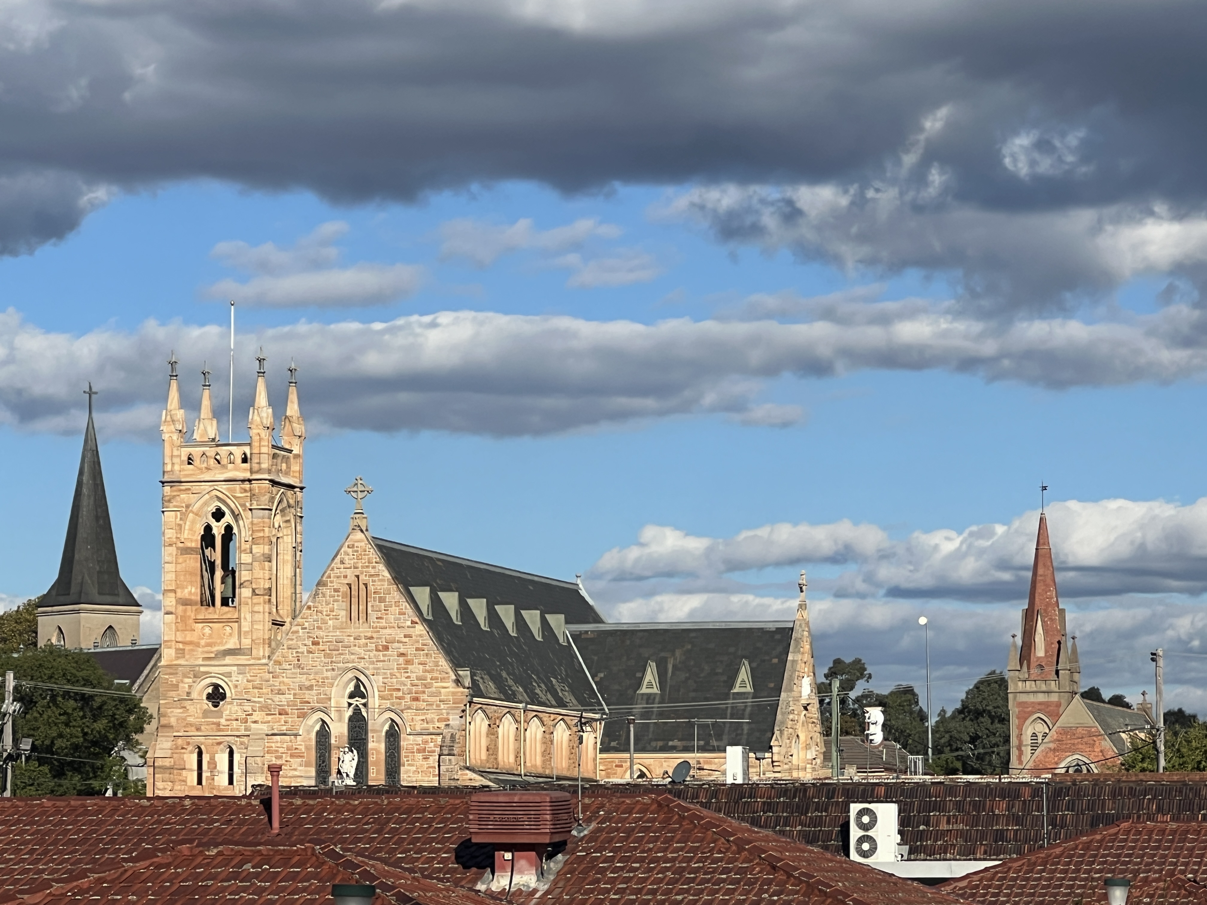
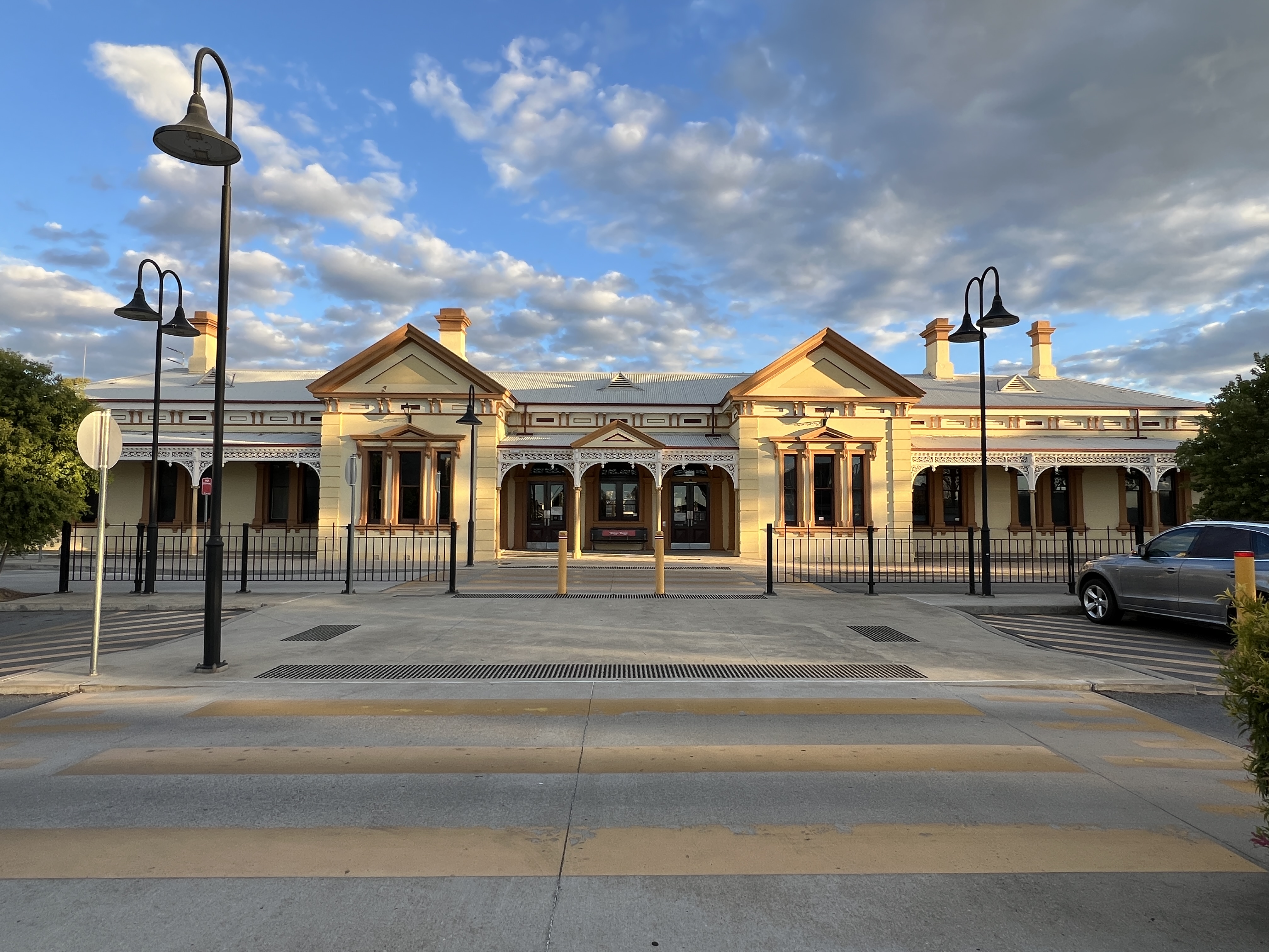
Wagger Wagger
There is much to see in Woggo Woggo and two days can’t do it justice. We have had a spin around town to catch some of the sights. A trip, five km, out to the RAAF training centre at Forrest Hills is a must.
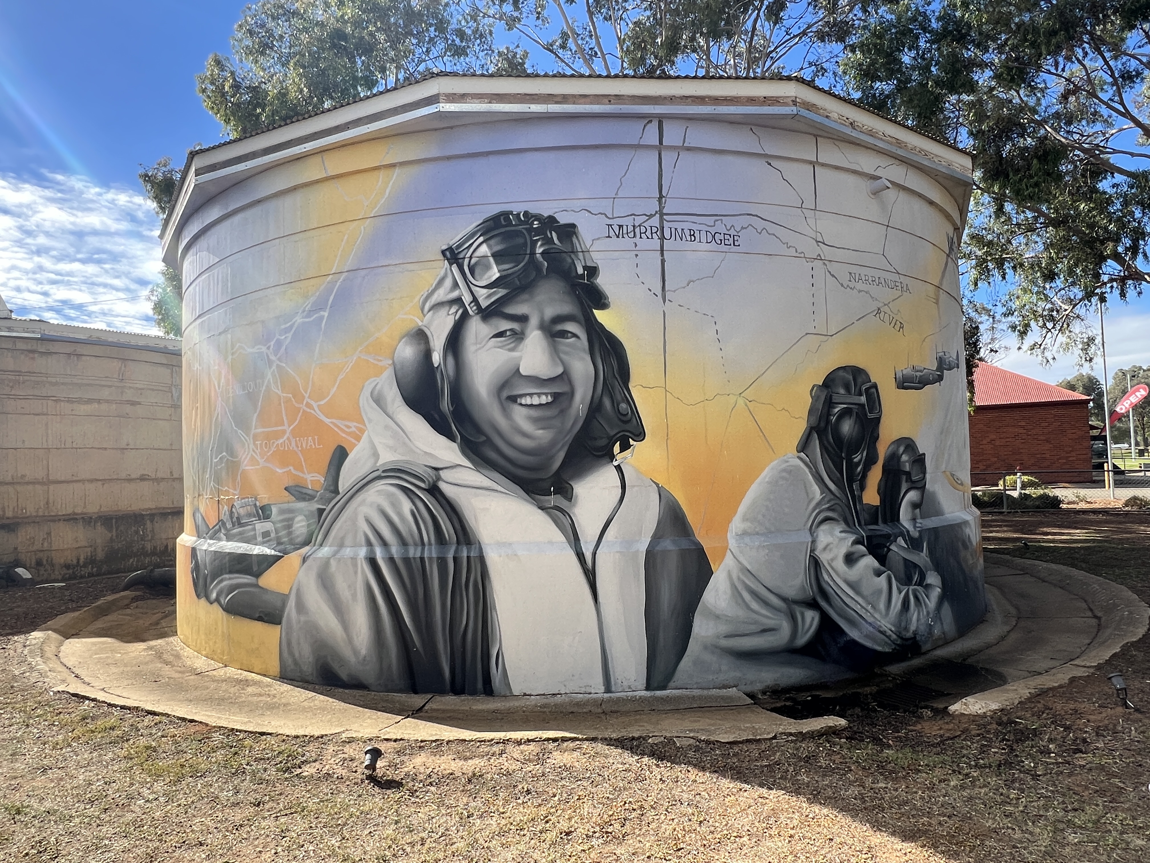
There is a great mural here on the water tank celebrating the role of pilot training centres for recruits during WWII, there were a number of these spread throughout rural Australia at the time. It was part of a scheme that Australia, Canada, New Zealand and the UK operated to ensure there was a common training platform for pilots among the allied air forces. Many were sent to the UK to fly with the RAF.
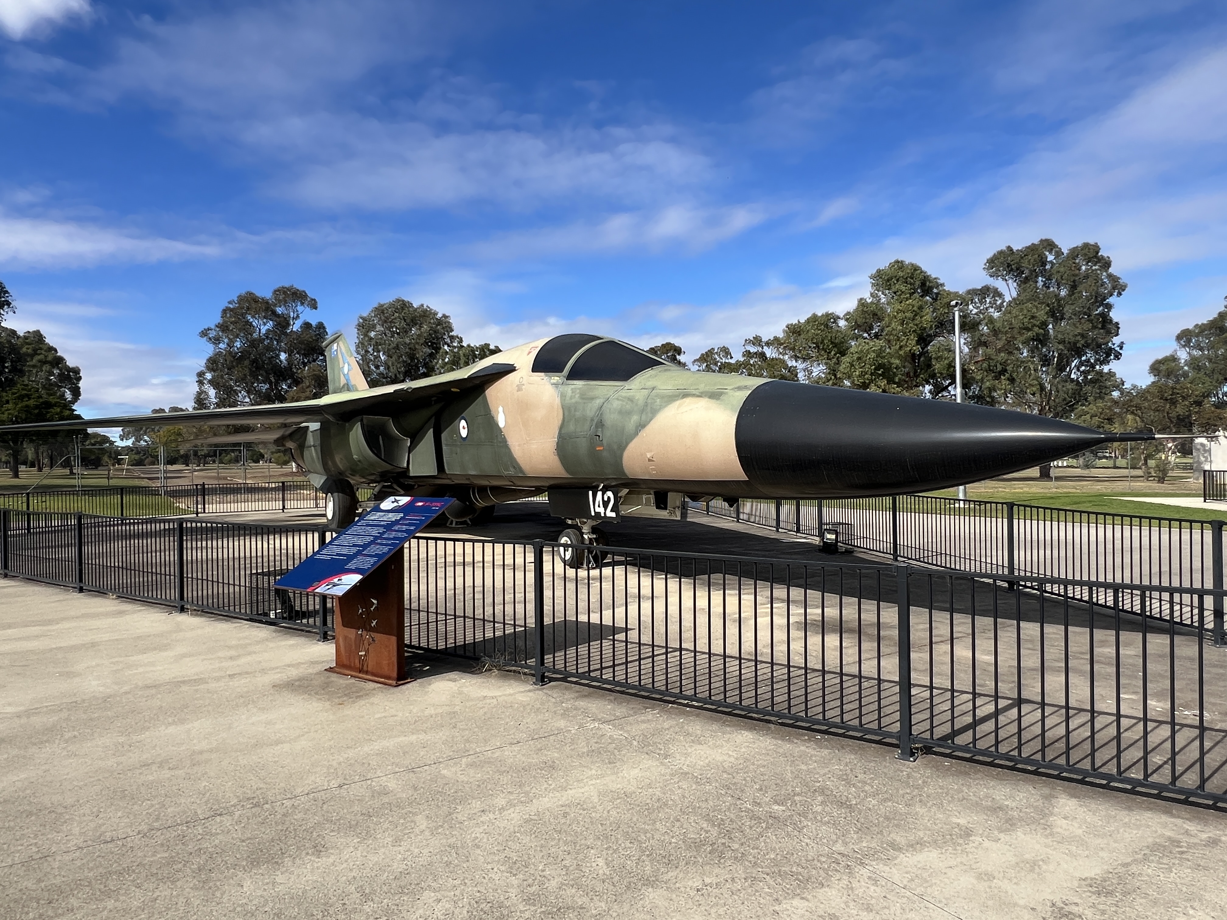
Also a number of fighter planes through the years are on display, including the F111.
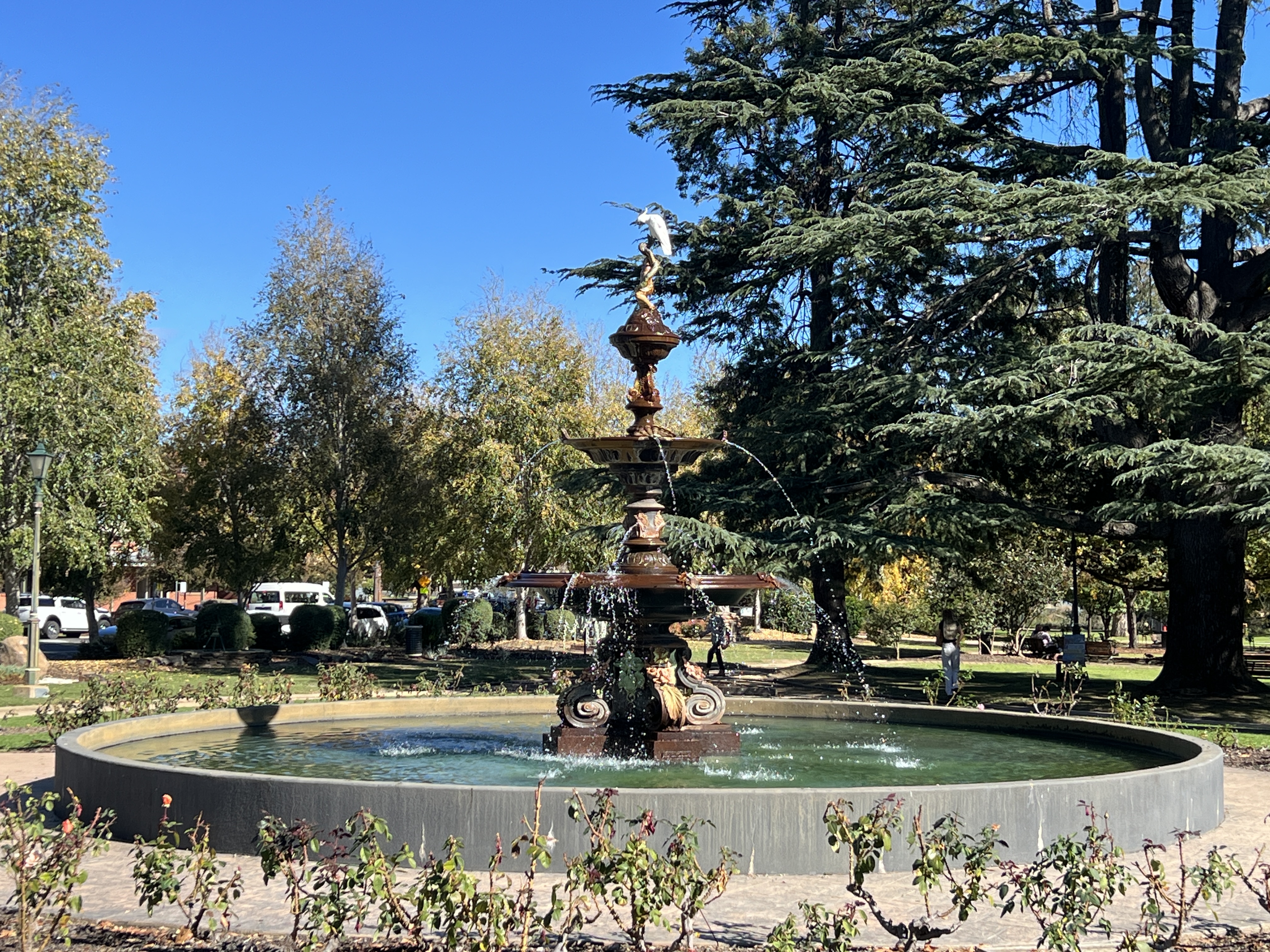
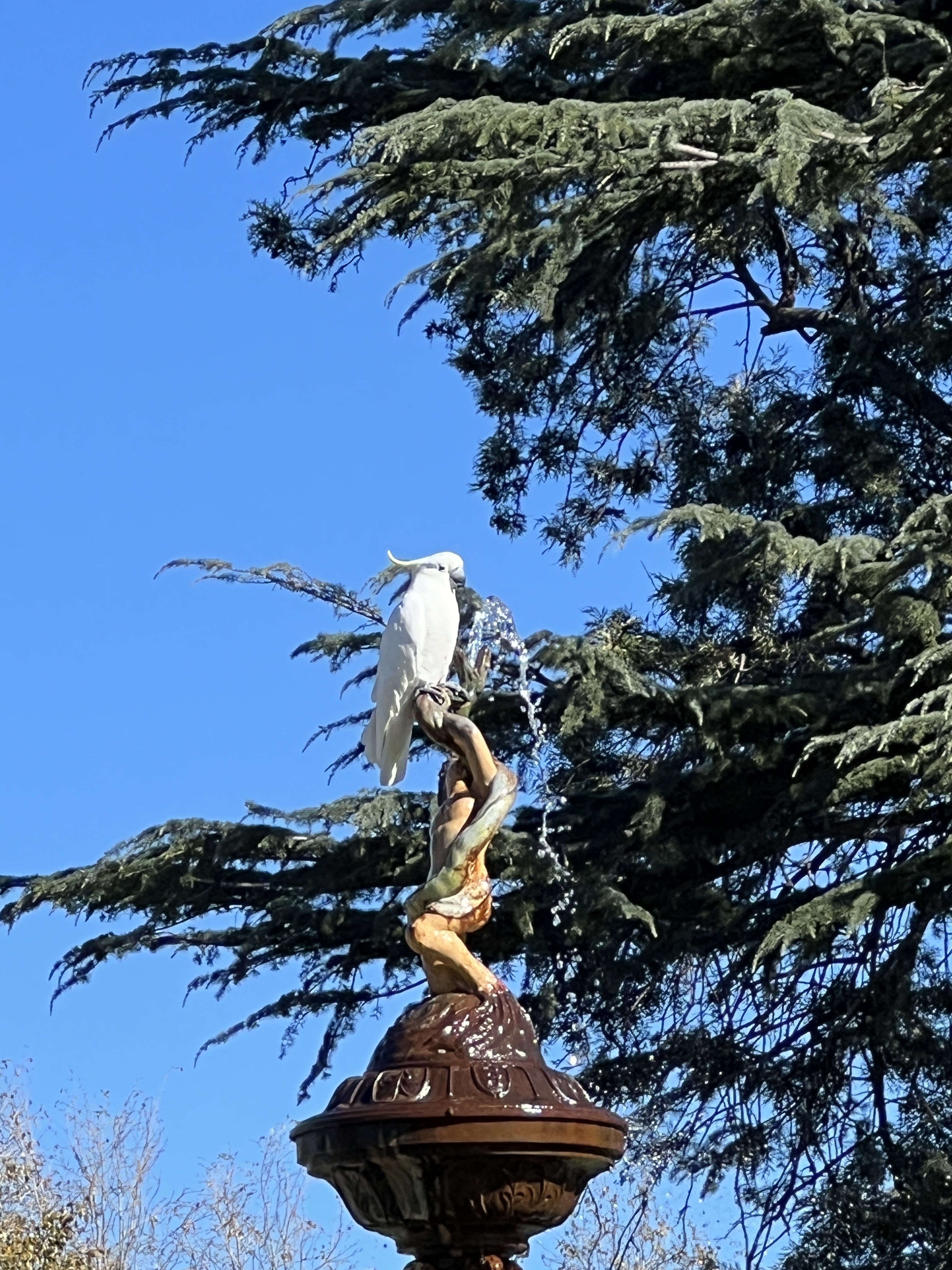
Back in town Victory Memorial Gardens houses an impressive 19th century fountain as a centrepiece near the war memorial. A cockatoo was enjoying a drink and wing wash on its top spout.
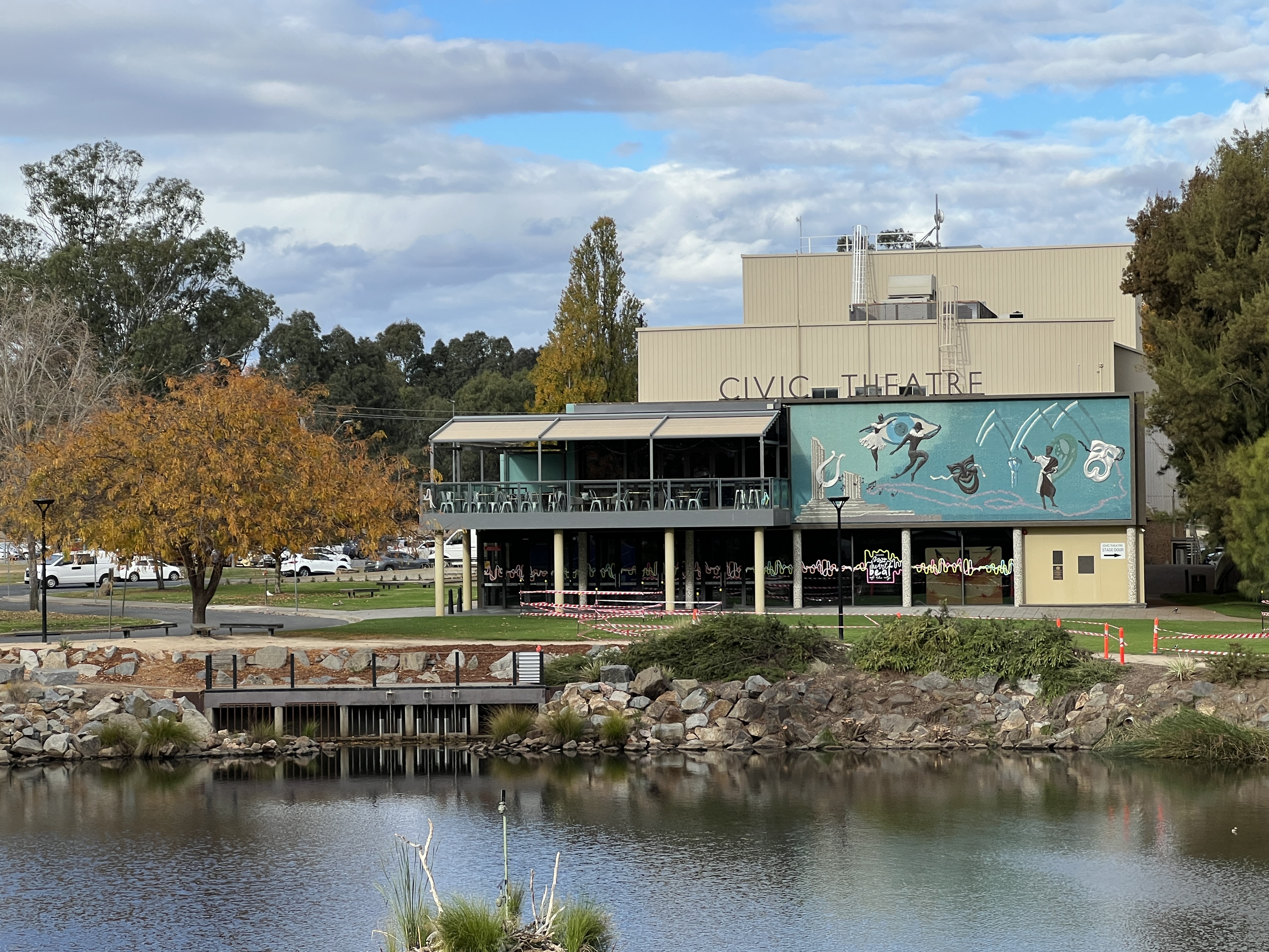
The Civic Centre and Art Gallery area has some nice murals and pleasant parkland around a lake. Along the main street there are numerous shops and eateries, it seems to be a prosperous town.
On a hot day Wagga Beach is very popular, an enormous sand bank on the edge of the Murrumbidgee overlooks a shallow section of clear water flowing over river sands. In 2020 the beach was ranked 9 out of the top 20 beaches in Australia. The first time an inland beach has been included, recognising the role this sort of environment plays for our people remote from the coastline.
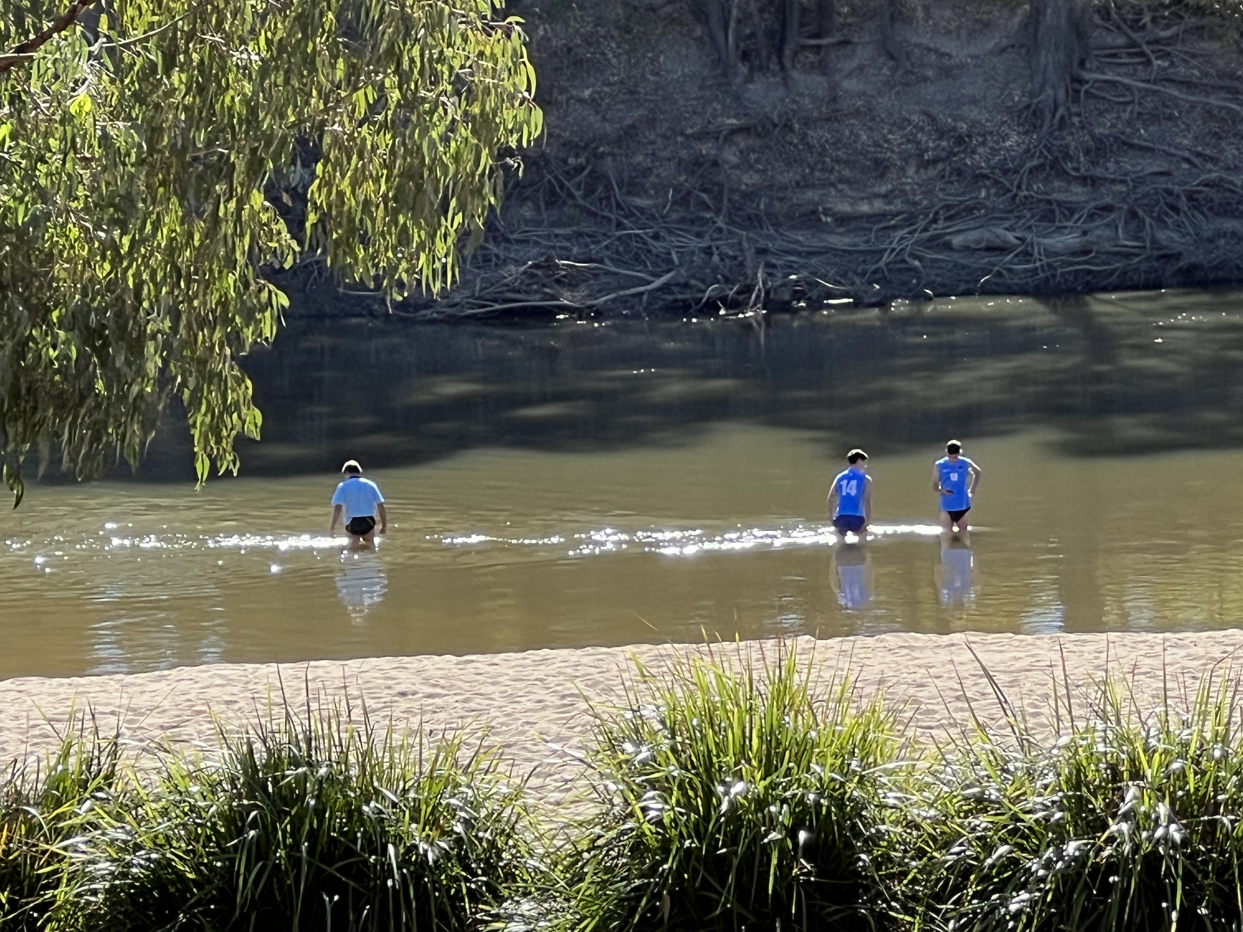
No one was having a dip, although some school boy teenager types were up to their thighs out in the middle doing something training wise it seemed, may have been rowers checking the river flow.
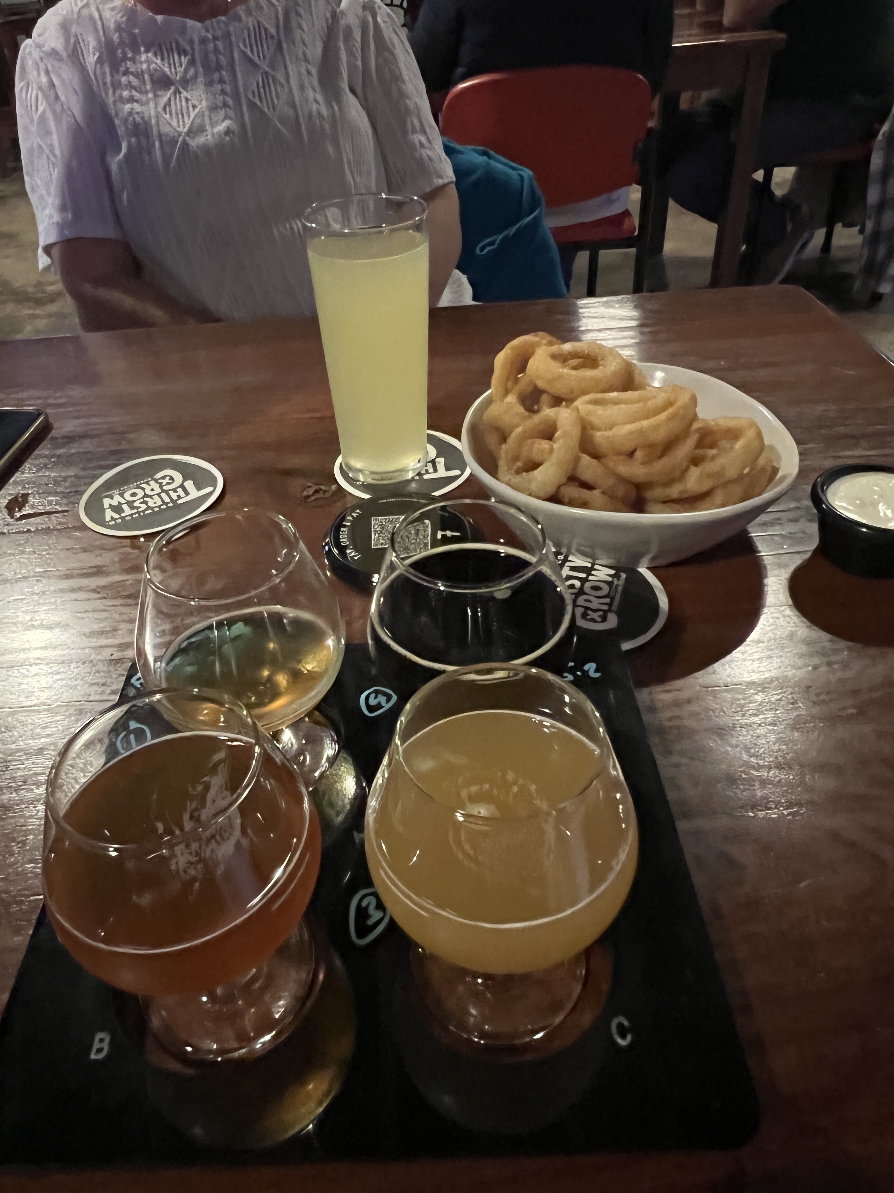
We finished off our stopover here by having a night out at a couple of recommended spots. First up was the Thirsty Crow for some pre dinner drinks. They are a craft brewery with the motto ‘murdering thirst’, Allthego tried a tasting flight, the stout was rather good. Homealone settled for a Cider from a Batlow brewer.
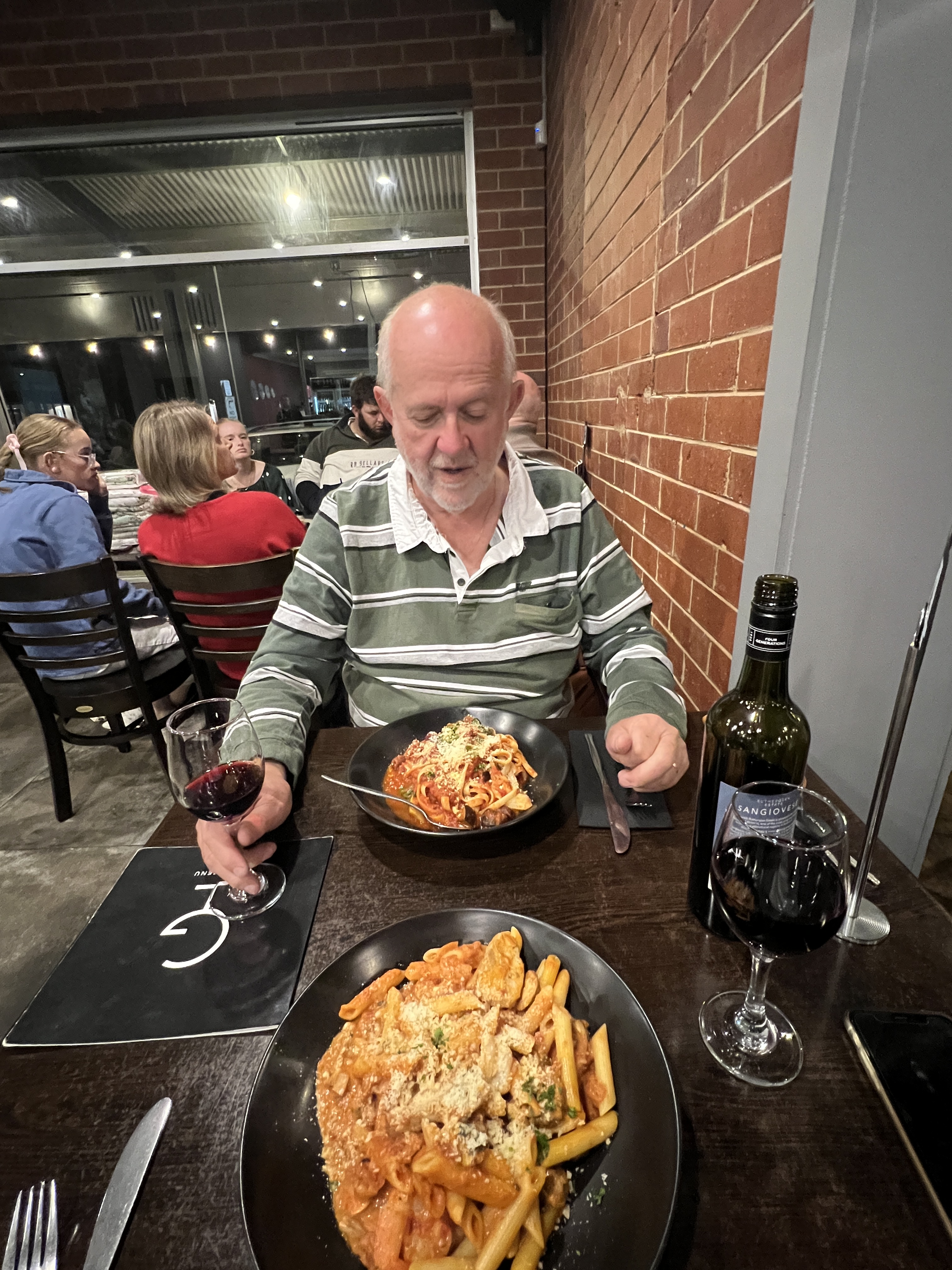
Following this we headed across the road to Giuseppe’s Restaurant & Bar. This is a Wagga Wagga icon we were told, authentic Italian. We had a couple of great pastas before heading back to the van.
In the morning we will head 100 or so km down the Sturt Hwy to Narrandera for a couple of nights stay.
