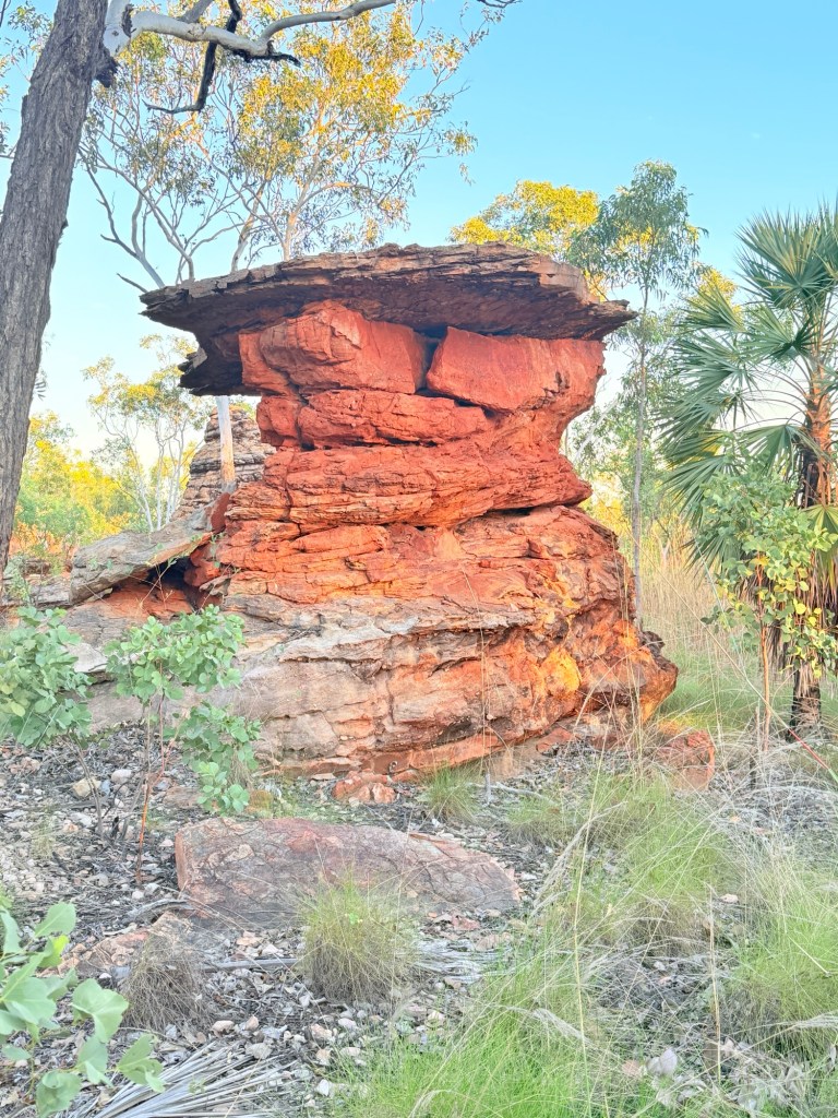
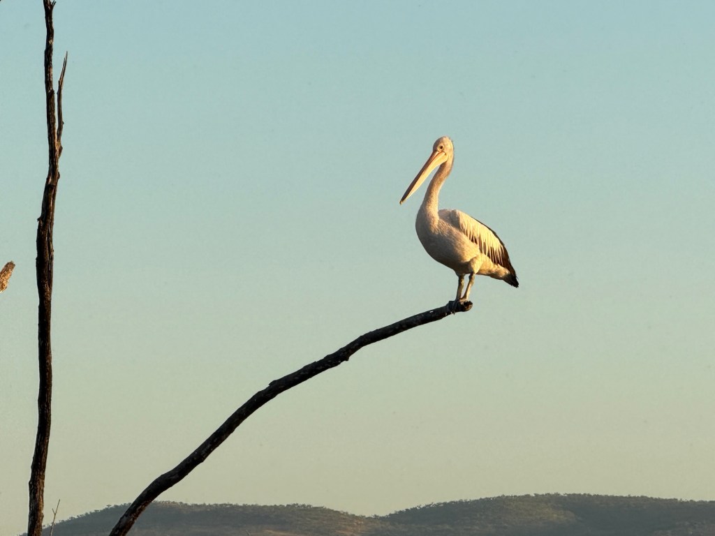
Mt Barnett
On leaving Mt E we retraced our steps back along the 30km access track off the Gibb River Road, having come along it in the dark a few days ago.

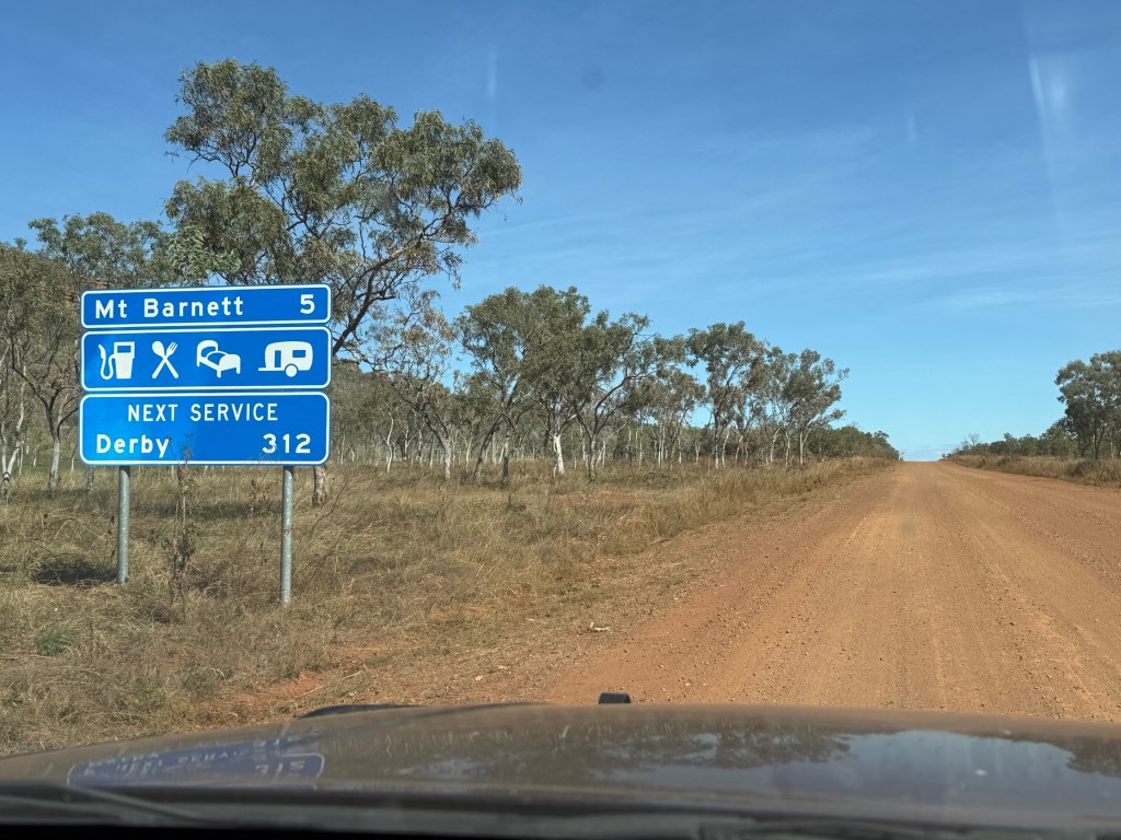
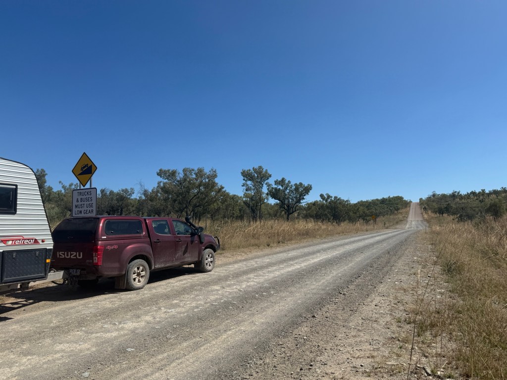
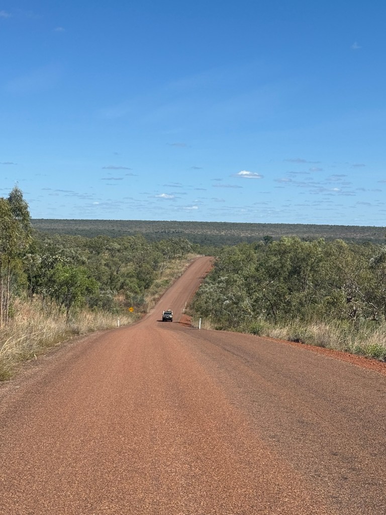
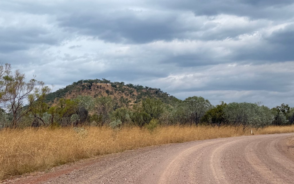
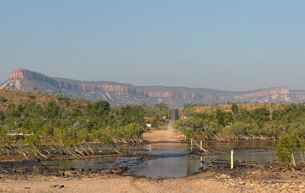
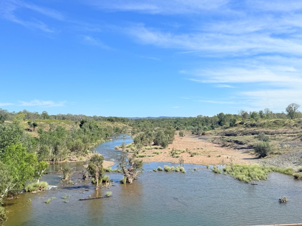
It was then another 29km west along the Gibb to the Mt Barnett Roadhouse. At Mt Barnett we have come 354km along the Gibb and have another 305km to go to where it ends outside Derby. So a bit over half way and reports are that we have done the toughest bit, whatever that means!
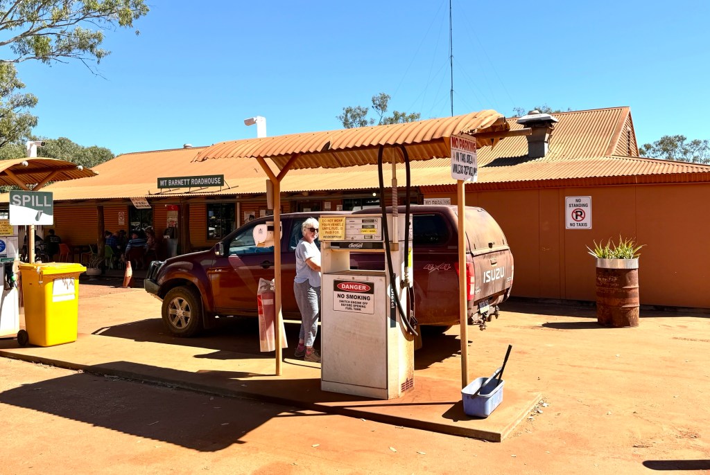
The Roadhouse is the only spot along the Gibb where you can pick up a few supplies of basic groceries including bread(frozen), milk, fruit and veg etc. Consequently, pricing is pretty vigorous.
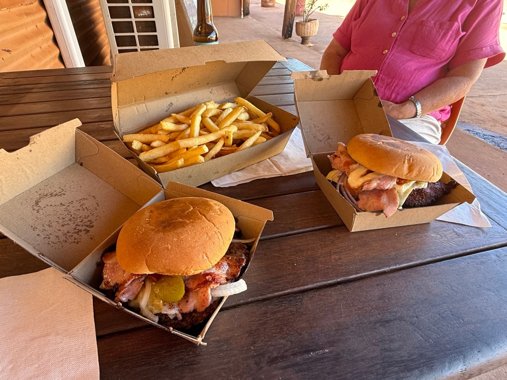
We had arrived at lunchtime and after paying our site fees for Manning Gorge indulged in the compulsory Mt Barnett burgers. Allthego enjoyed a cheeseburger and Homealone a peri peri chicken burger. Now, they didn’t come with chips! Extra $12 for a largish box. All up $58.
They do have something special for sale each morning, fresh sour dough. Baked on site and priced accordingly, $20.

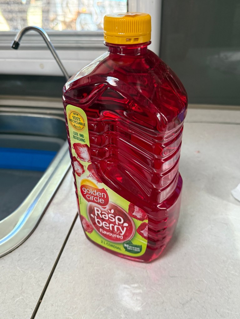
Now, Allthego remembers a saying that ‘man cannot live by bread alone, he must have red cordial as well’. Mt Barnett knows this too and their red cordial, to go with the sour dough, is $16 a bottle. We hadn’t had fresh bread for nearly two weeks, so we couldn’t resist the sour dough. Our supply of red cordial was running low and that was also a need to be satisfied!
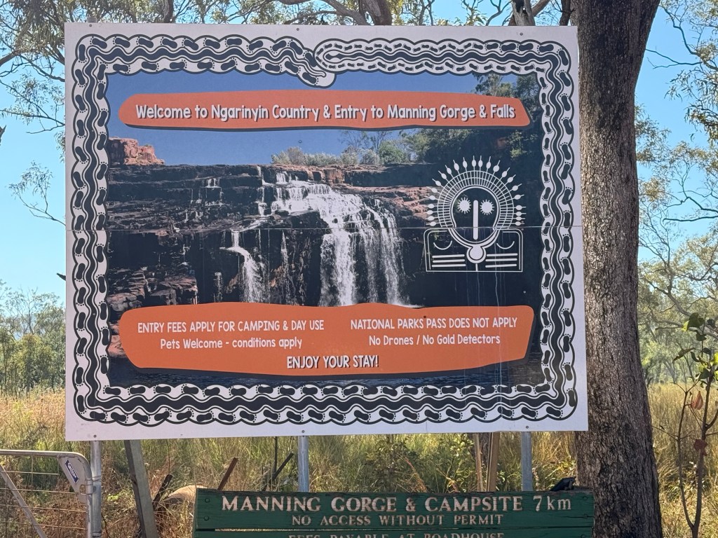
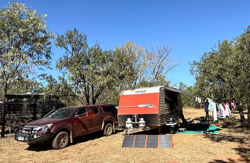
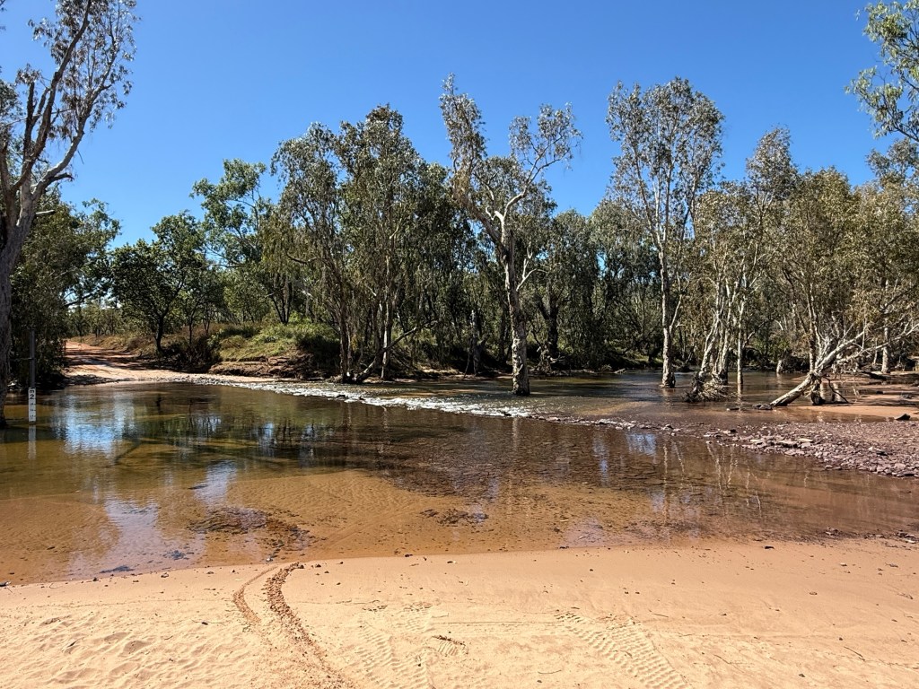
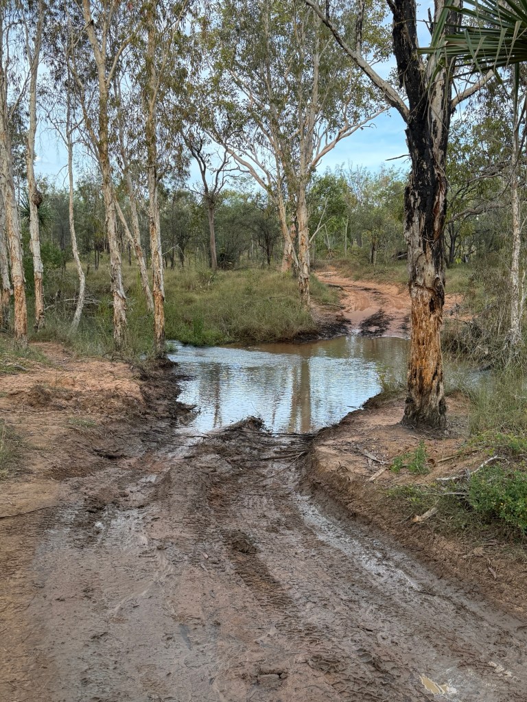
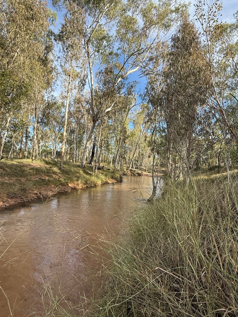
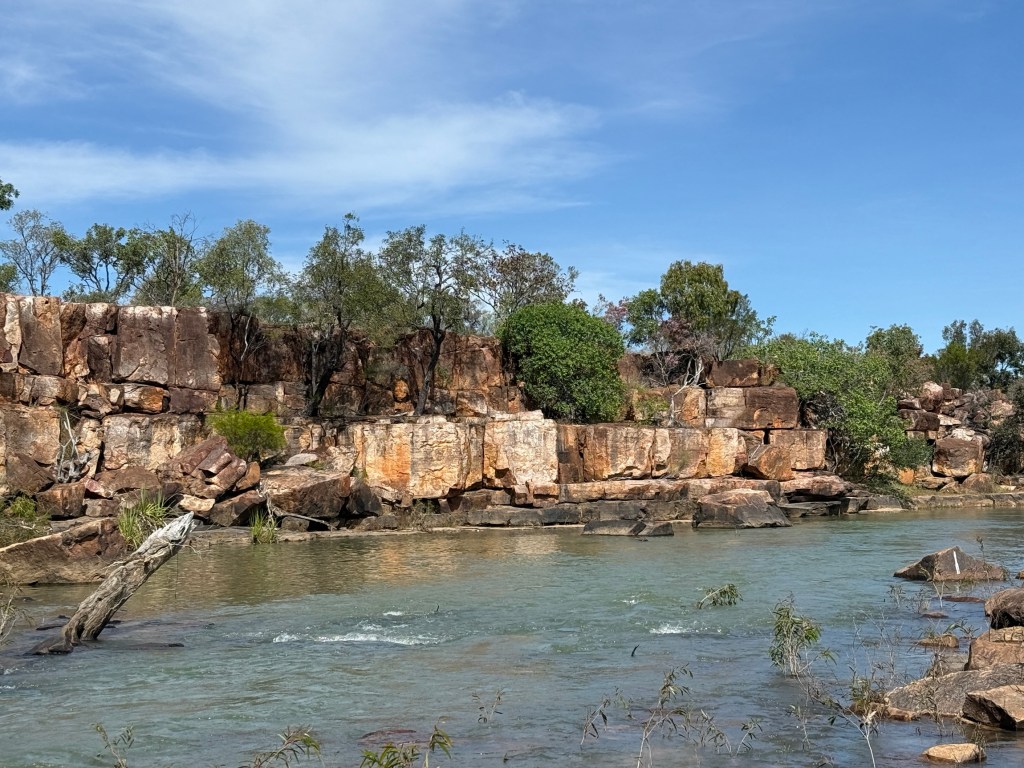
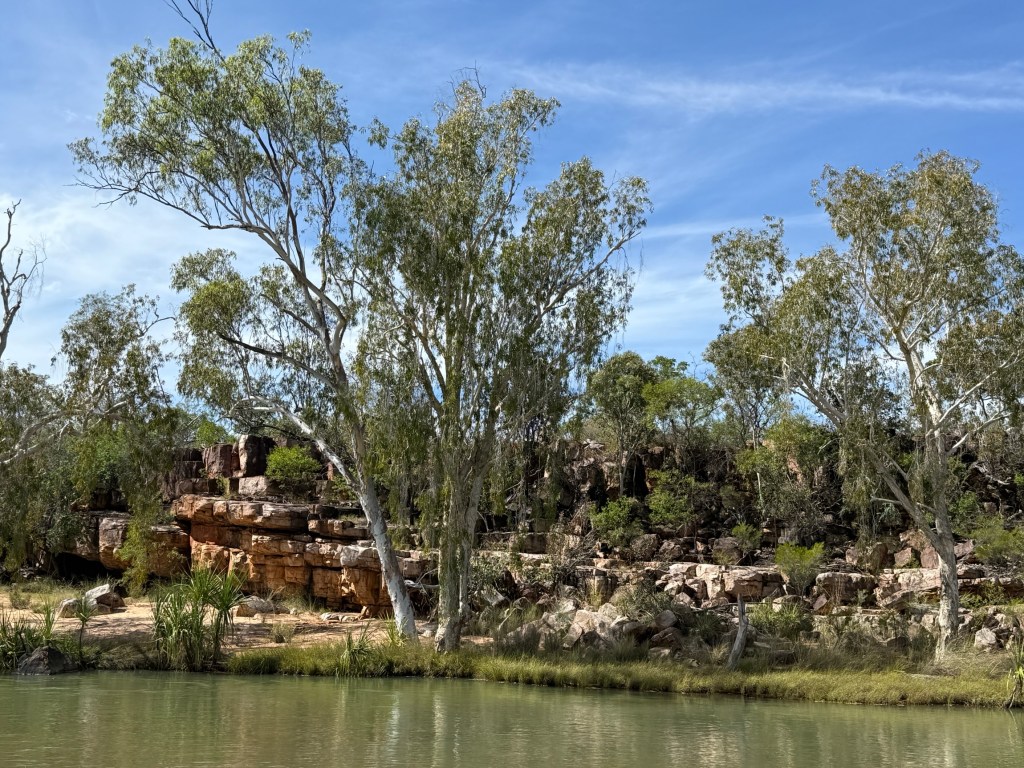
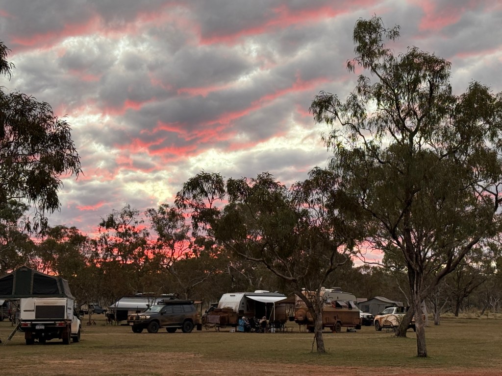
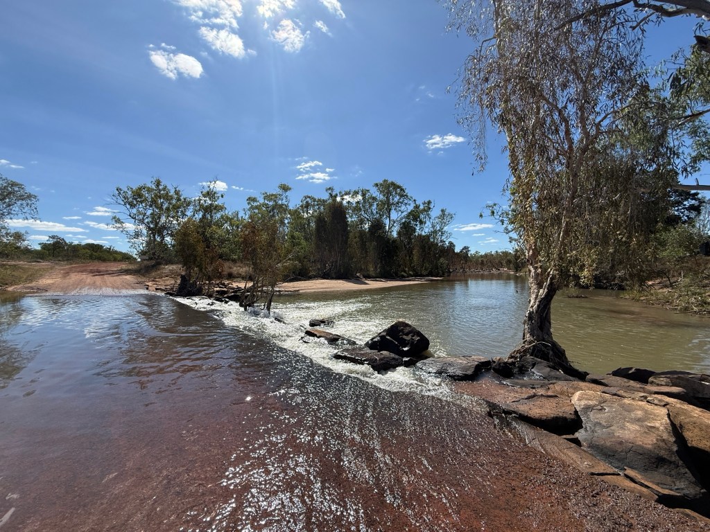
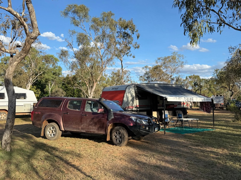
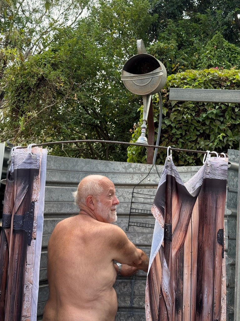
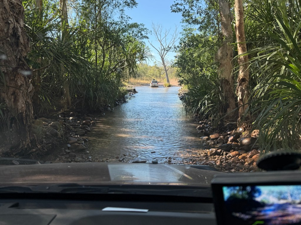
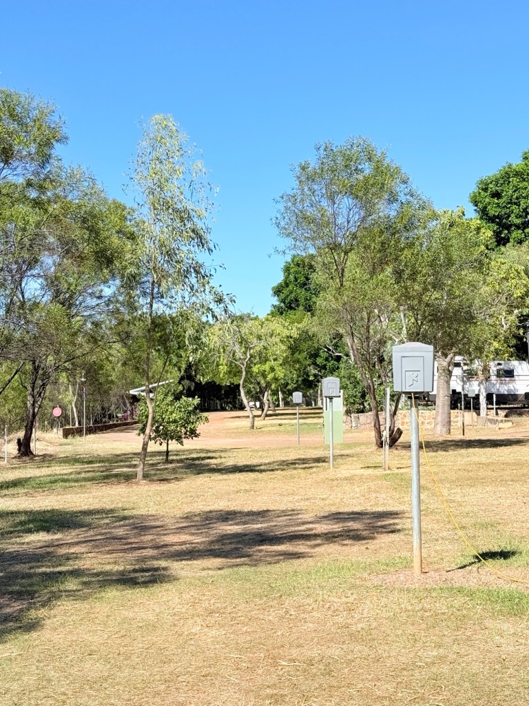
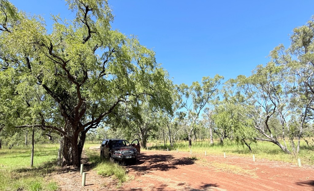
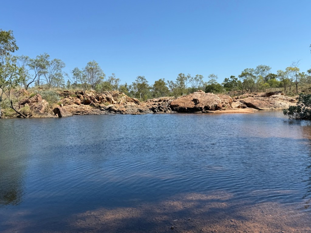
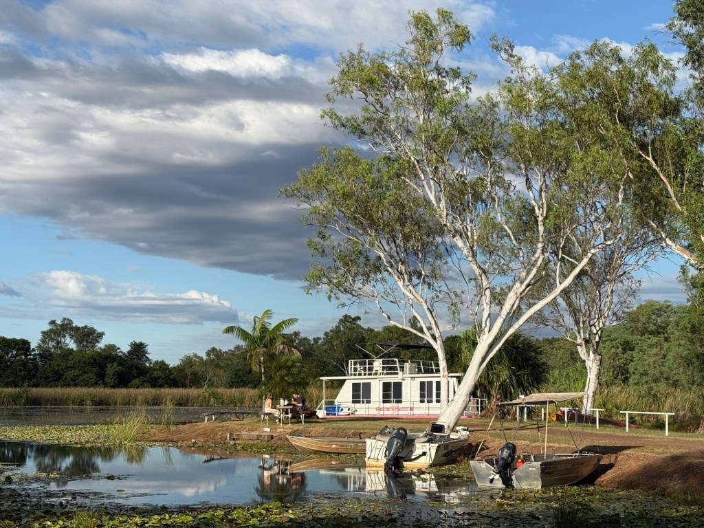
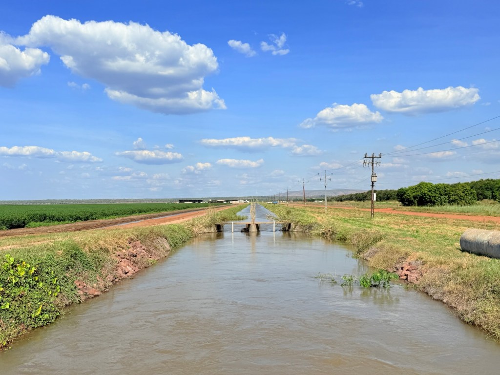
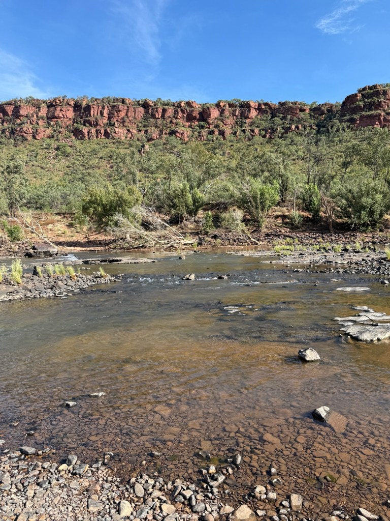
The 7km track down to the Manning Gorge campground starts alongside the Roadhouse. It was generally an easy drive along a well graded track for the first couple of kms, after that it got a bit rocky in places and there were a couple of low level water crossings. But all good! This was our base for four nights.
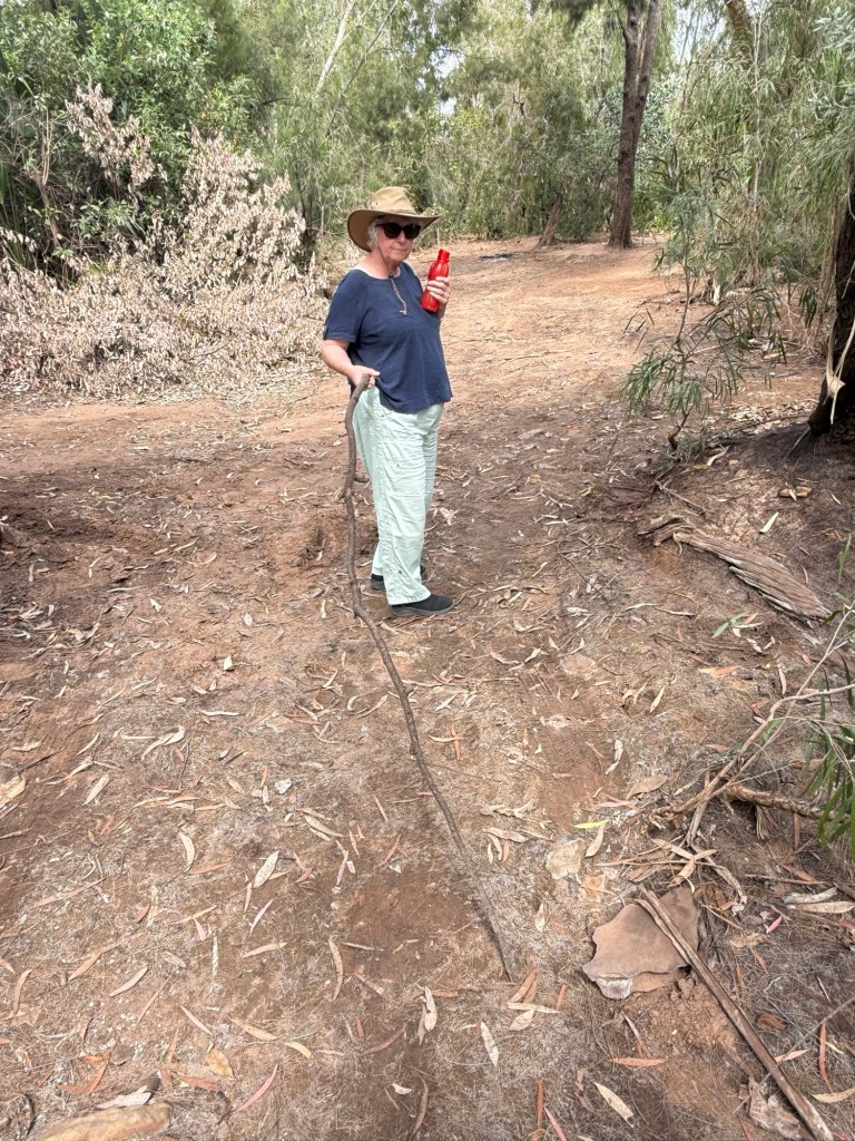
We now have to visit the repair man about a snake as we head off on 9 June for the next stop.
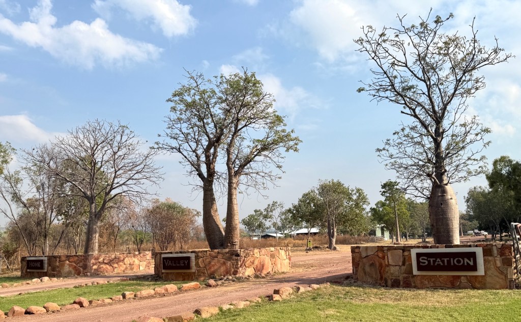
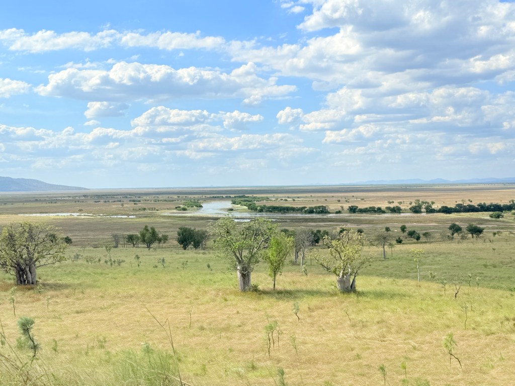
Mt Elizabeth Station
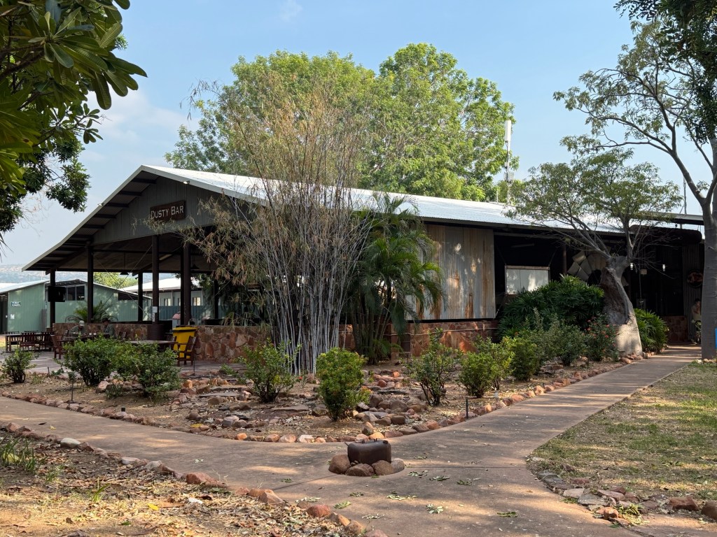
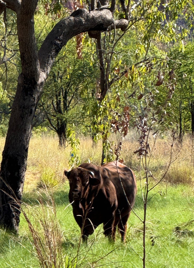
Mt E is a 500,000 acre 6,000 head working cattle station, with the tourism add on. Very big lightly wooded campground, no power or water to sites but great facilities. Recently added a new amenities block and unexpectedly they have a couple of washing machines and also sell diesel, $2.95 litre. Good spot to stay for a few nights.
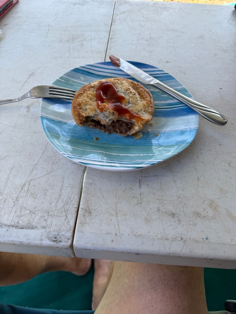
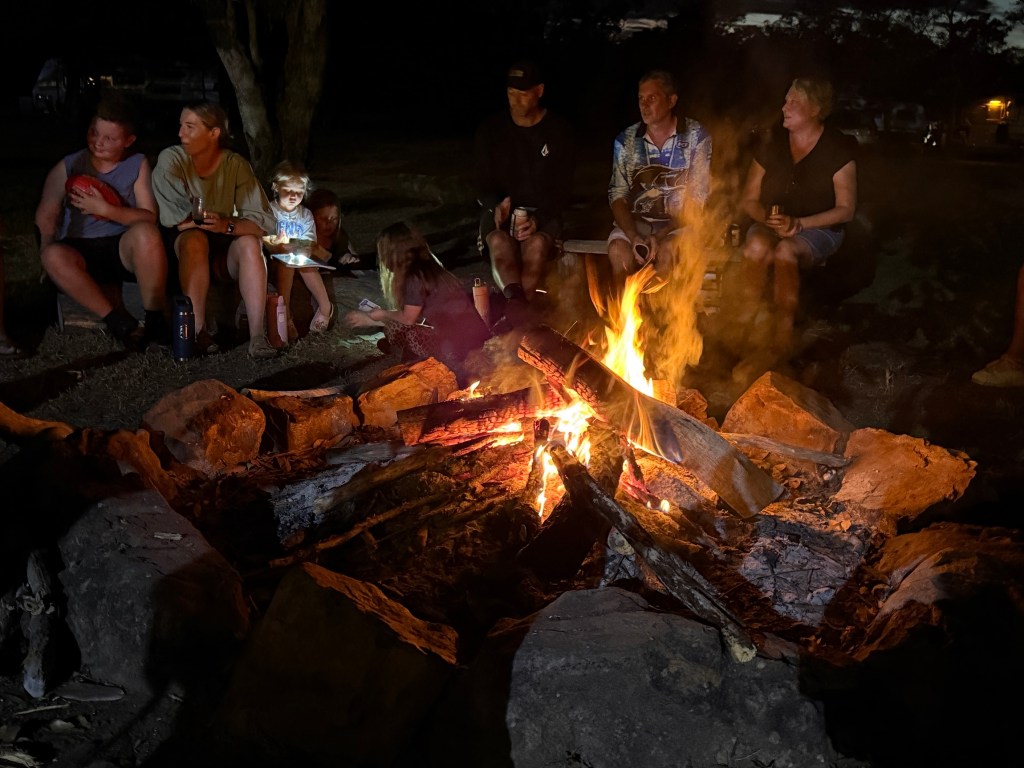
The other bonus is a cafe set up that does evening meals and warm station beef meat pies.
There is a nightly set menu featuring the Stations own beef. Preceded by some time around the communal fire pit. We indulged in a steak night, great pieces of beef filet cooked to perfection! Came with some salads, haven’t seen a piece of lettuce for going on two weeks! So really appreciated!
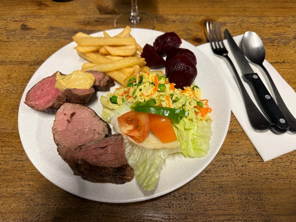
Finished with some pears poached in red wine, plus cream.
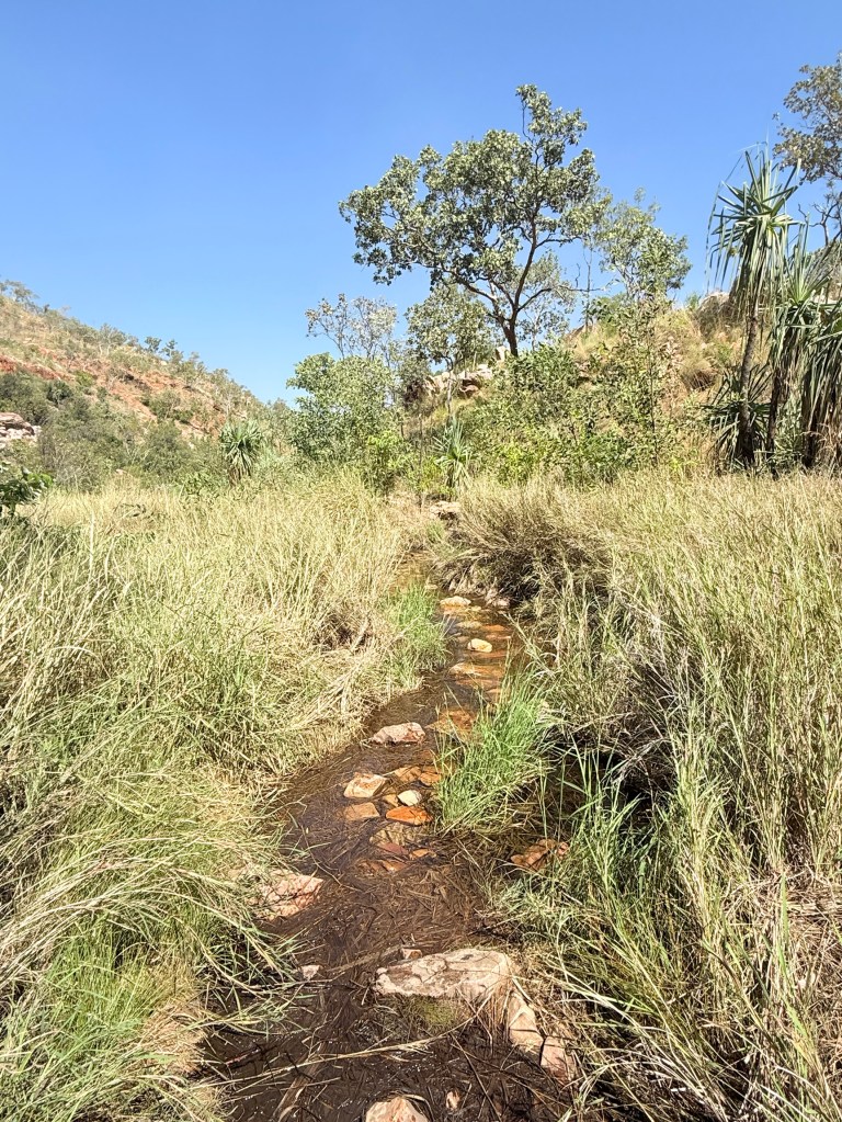
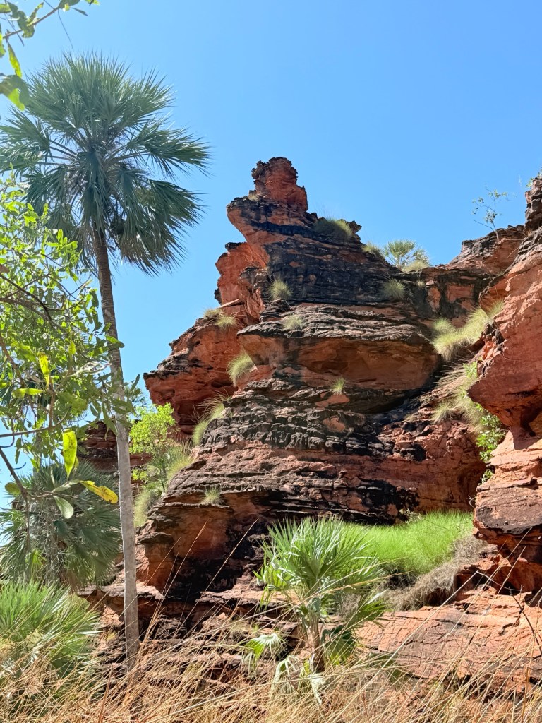
A bit of 4WD driving is the main go to thing here. To get to the gorges and swimming holes a bit of rough track driving is required.
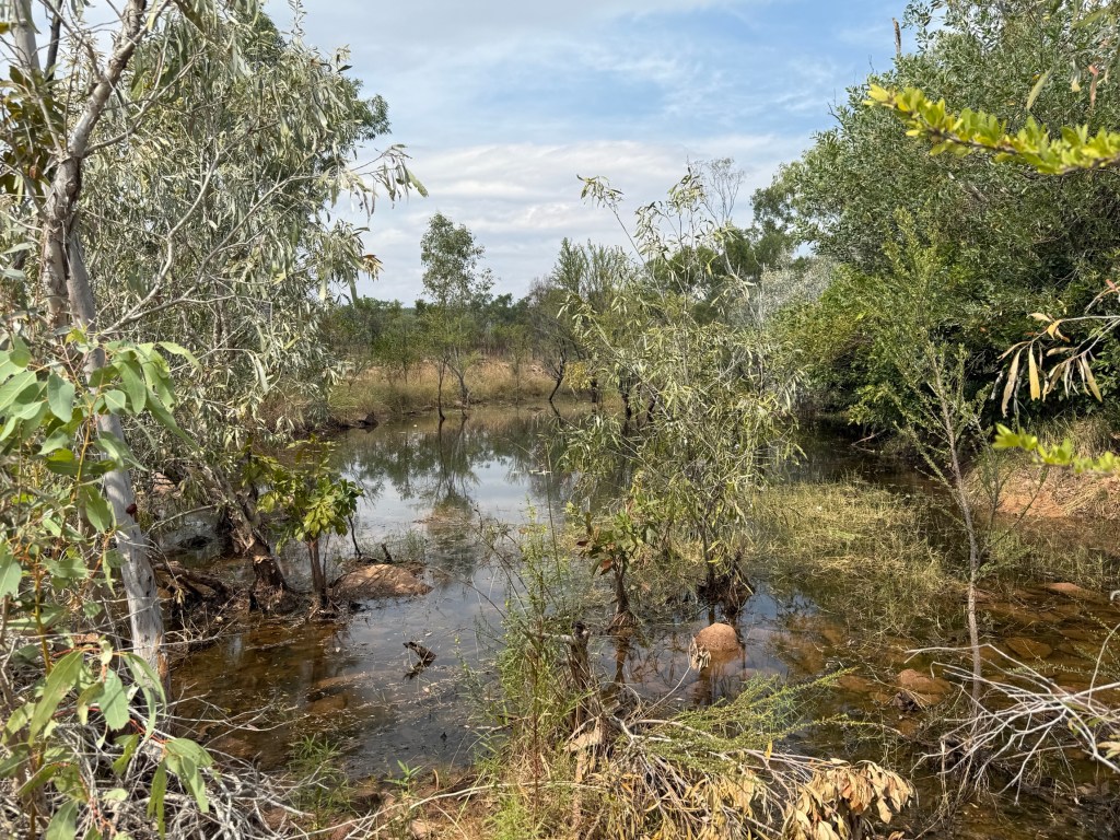
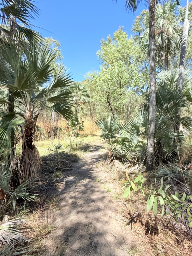
The track to the ‘Swimming Hole’ is not too bad, a little creek has to be crossed. Looks worse than what it is. Allthego followed a couple of more experienced characters and no problems at all.
Some great scenery and a pleasant plunge in the pool. There is also a short walk here through the woodland and back along the creek bank, some great old trees in this area.
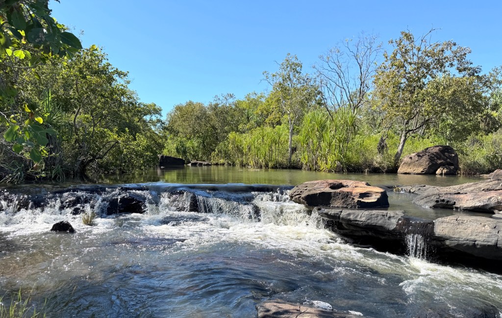
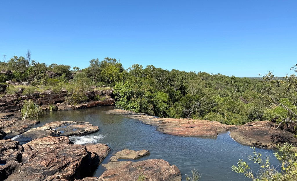
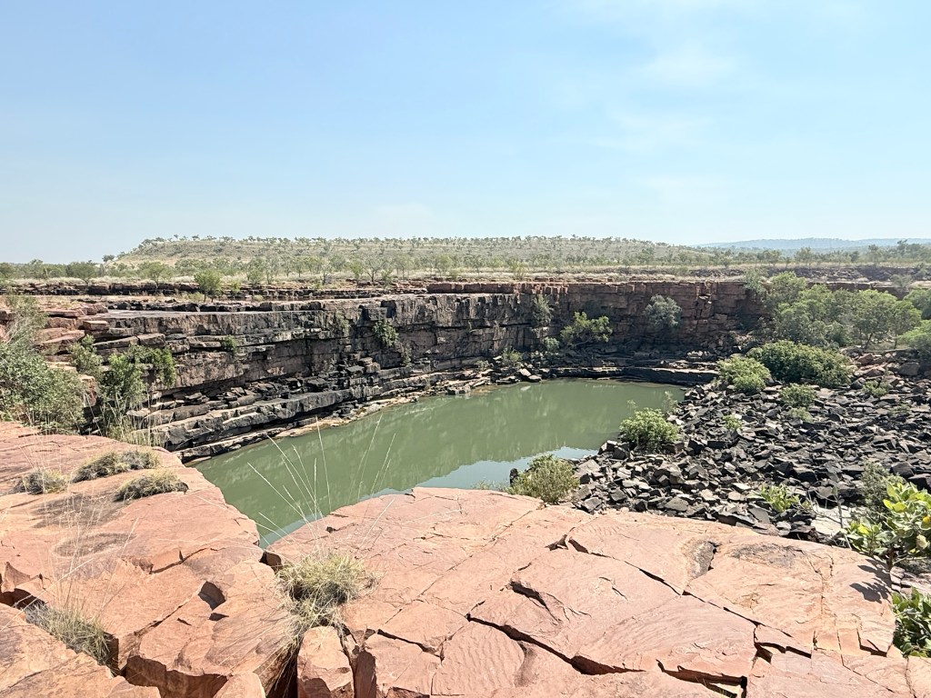
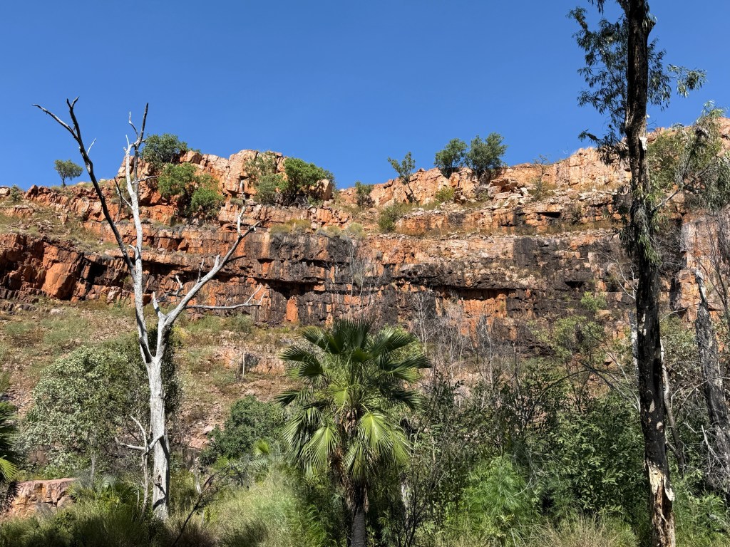
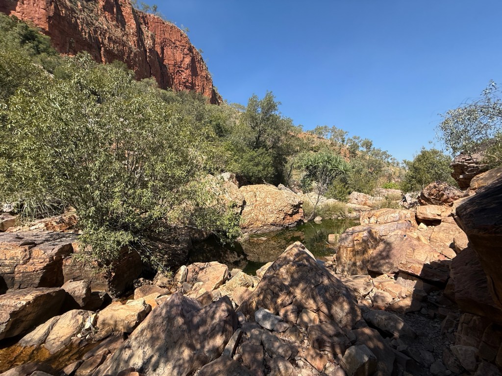
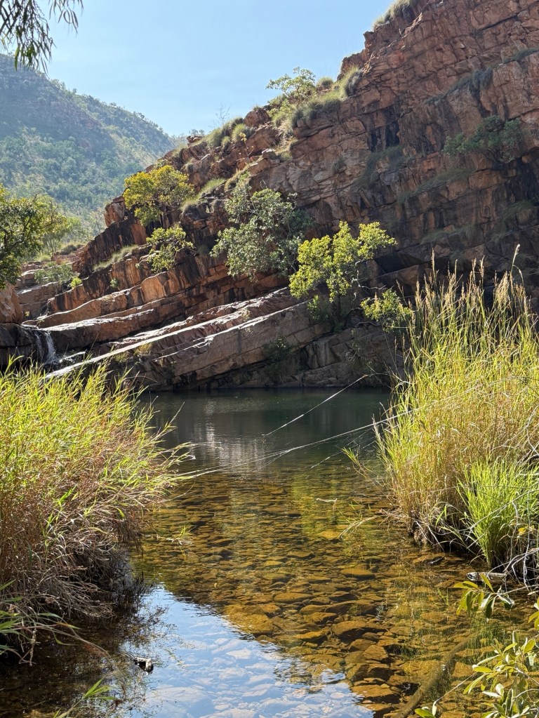
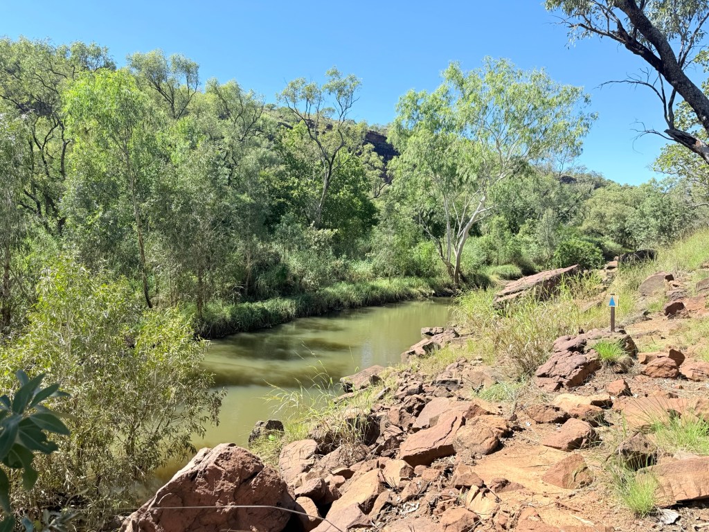
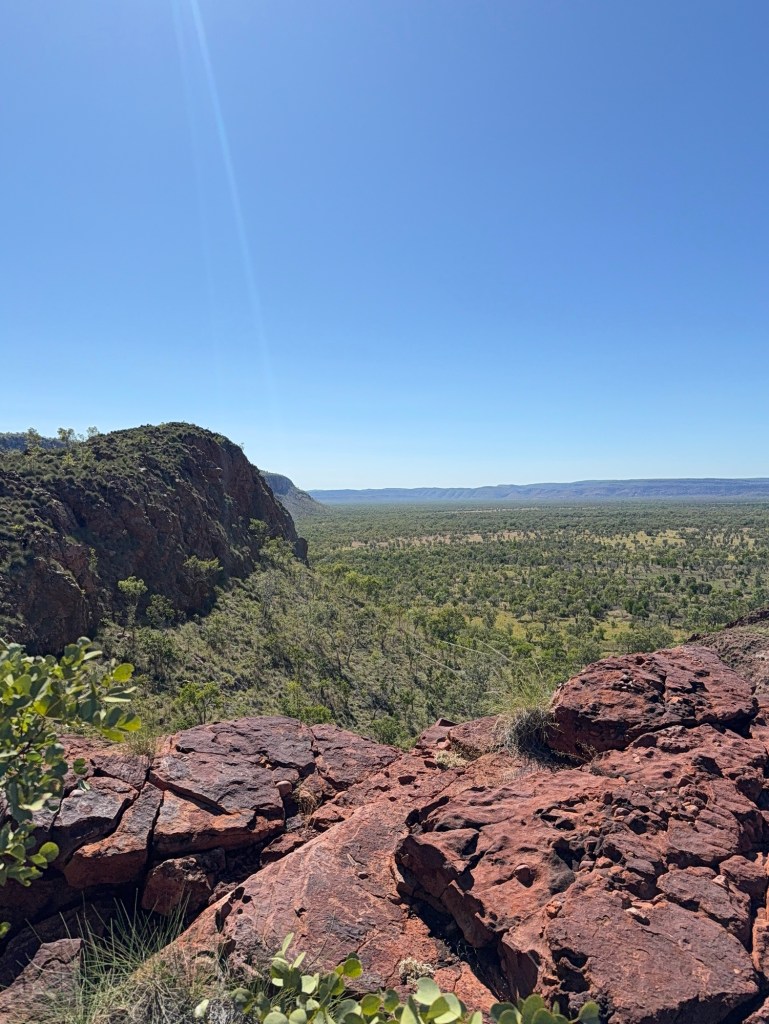
The track out to Warla gorge is a different story to the one to the Swimming Hole, 20 km in total the last 5 of which is rather rougher than some might like. One has to weave along some rock strewn rutted track, cross a bit of thickish mud and a water pool with a greasy bottom. Took it slow. Homealone somewhat unimpressed with the possibility of getting stranded. But a number of people on the track, so help would be at hand.
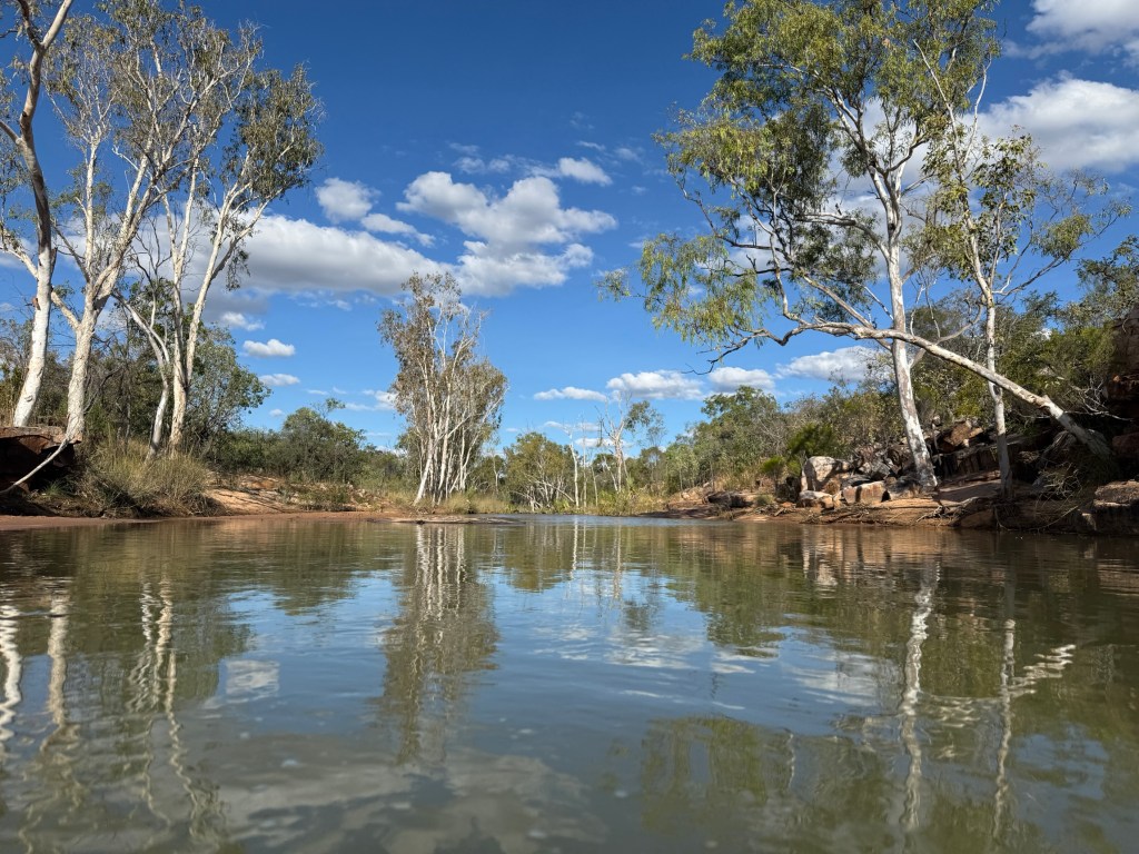
Allthego found the Warla gorge worth the effort. The river was flowing along waist high off a short low waterfall, a big sandy beach for all to sit on and watch the action.
The trip back to camp went ok, but the obstacles hadn’t disappeared!
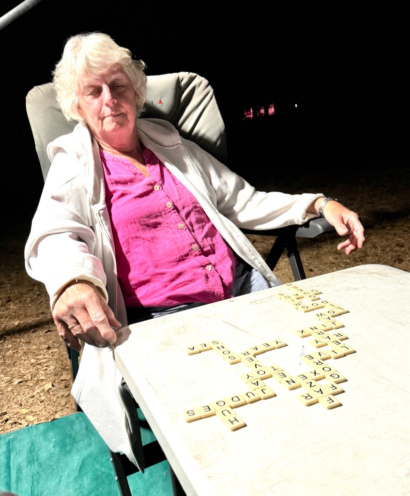
In the evenings we generally manage to get in one or two games of Bananagram, a scrabble variant where you play your own ‘scrabble’ patch. First to use all your letters wins, a few rules of course. Homealone is cleaning up most evenings, leaving Allthego in the wake. It must be all the Wordle that she plays these days.
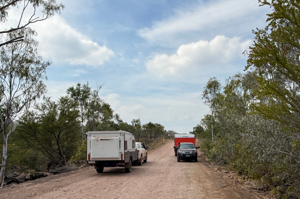
Time to move on to the next stop at Manning Gorge about 70km along the Gibb. On the way we need to stop at Mt Barnett for fuel and a pantry top up. There is also a spare rim and tyre to arrange!
Ellenbrae to Mt Elizabeth Station
It is about 190 km to Mt Elizabeth Station (Mt E) from Ellenbrae, this includes the 30km along the track off the Gibb to the Station.
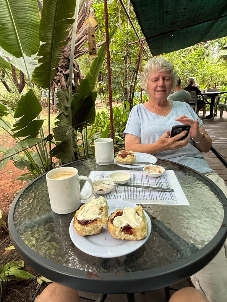
We decided to have a toastee and coffee, tea for Homealone, at the cafe before leaving. Also, picked up some take away scones for later on.

It had been a pleasant few days sitting around watching people and coming and going. All sorts of accommodation. Swags, camper trailers, small off road vans to very large combos with boats attached.
Hitting the road we found it quite good getting through to the Kalumburu Rd turnoff to Drysdale Station. This is the way we would have gone without the rain. Stopped here for lunch at the rest spot.
We later made the short detour down to the Gibb River where it crosses the Kalumburu Road. There were a few vans parked here at the free camp overlooking the river. Tempting to stay!
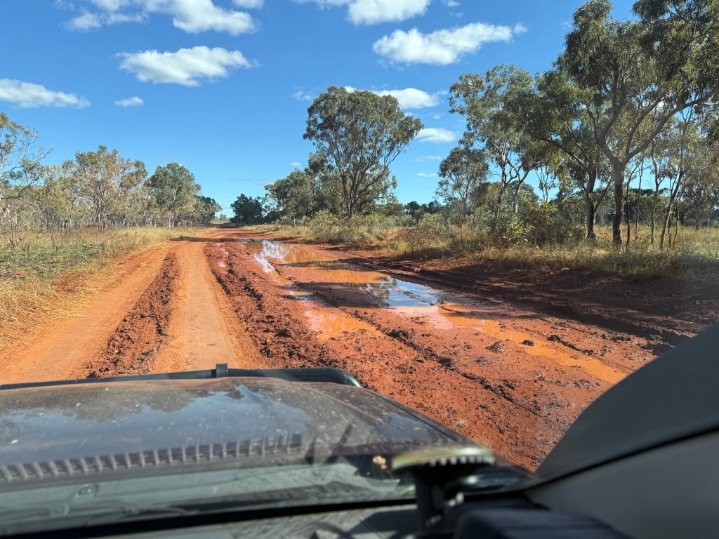
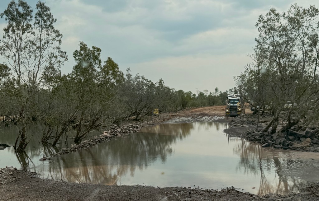
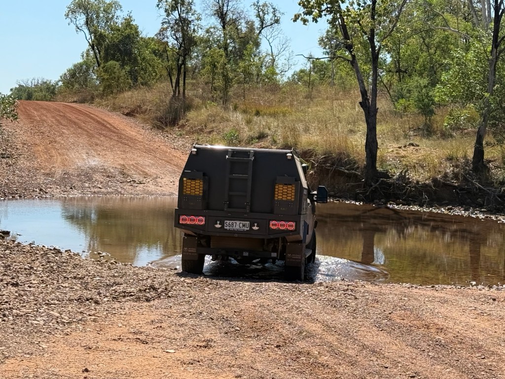
But onwards to Mt E. The road deteriorated somewhat from here on with a number of shallow creek or drainage crossings. Also, a few deeper corrugations and muddy wet patches that were drying out. Some wheel ruts in the drying mud showed just how much water had been on the road. Still rate it though at about 80%.
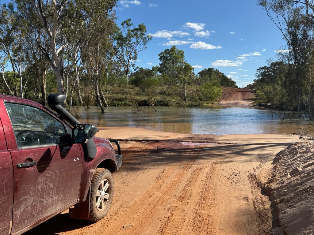
Navigated through the Hann River ok after passing a chap on a bicycle all by himself. A little further along some poor souls camper trailer was beside the road, axle broken and tyre trashed, loaded with gear. Probably there for good, cost a fortune to recover not to mention the repair costs.
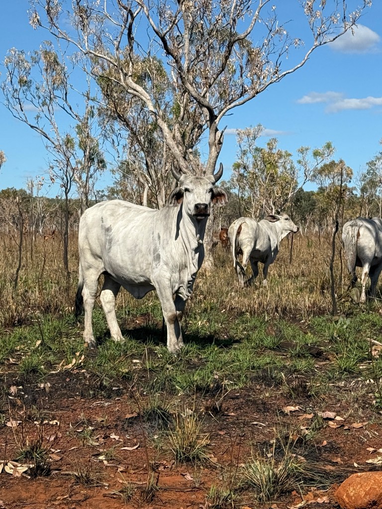
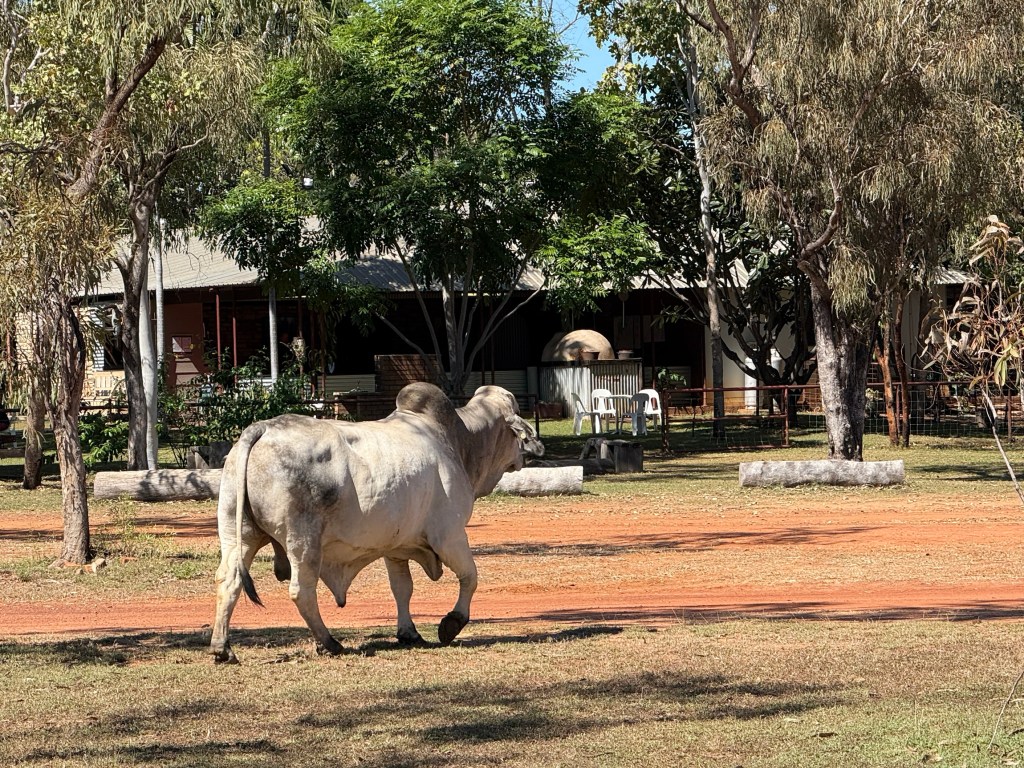
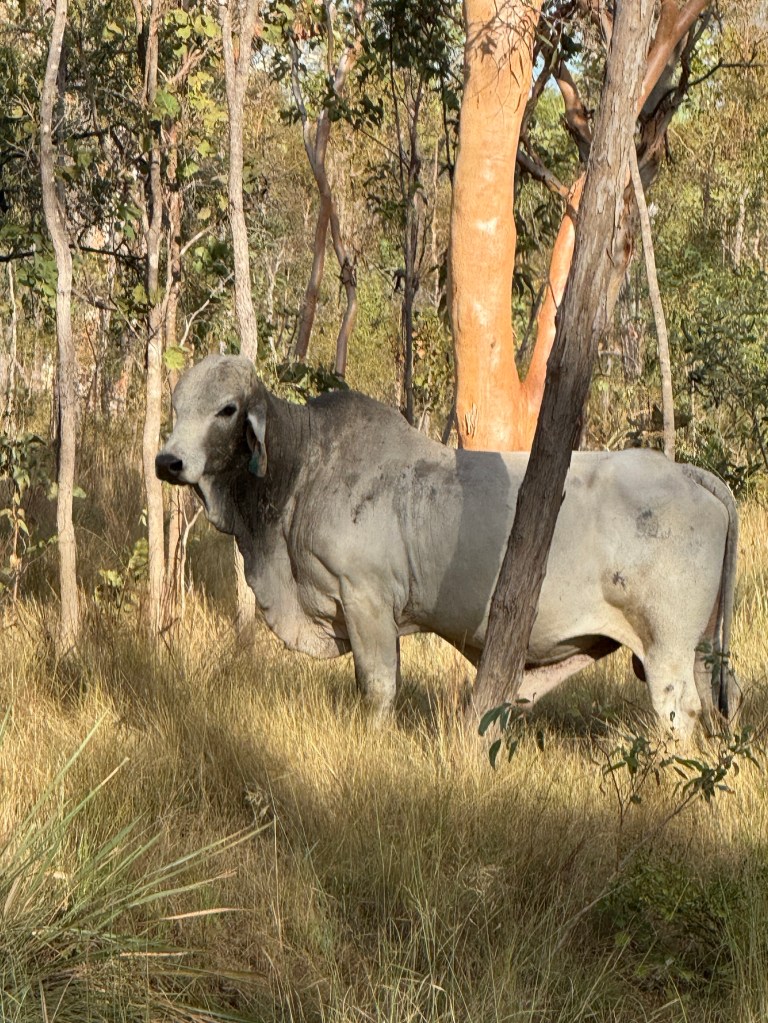
We are starting to see increasing numbers of cattle beside the road. Some impressive looking beasts.
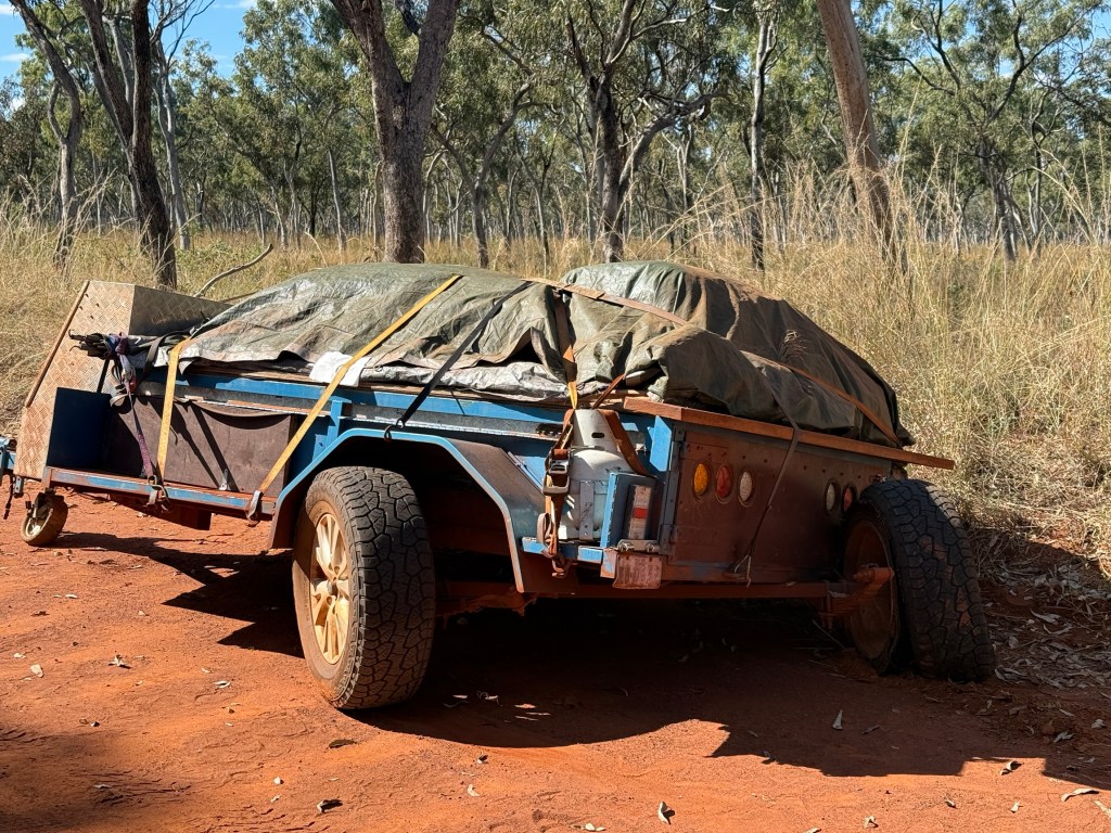
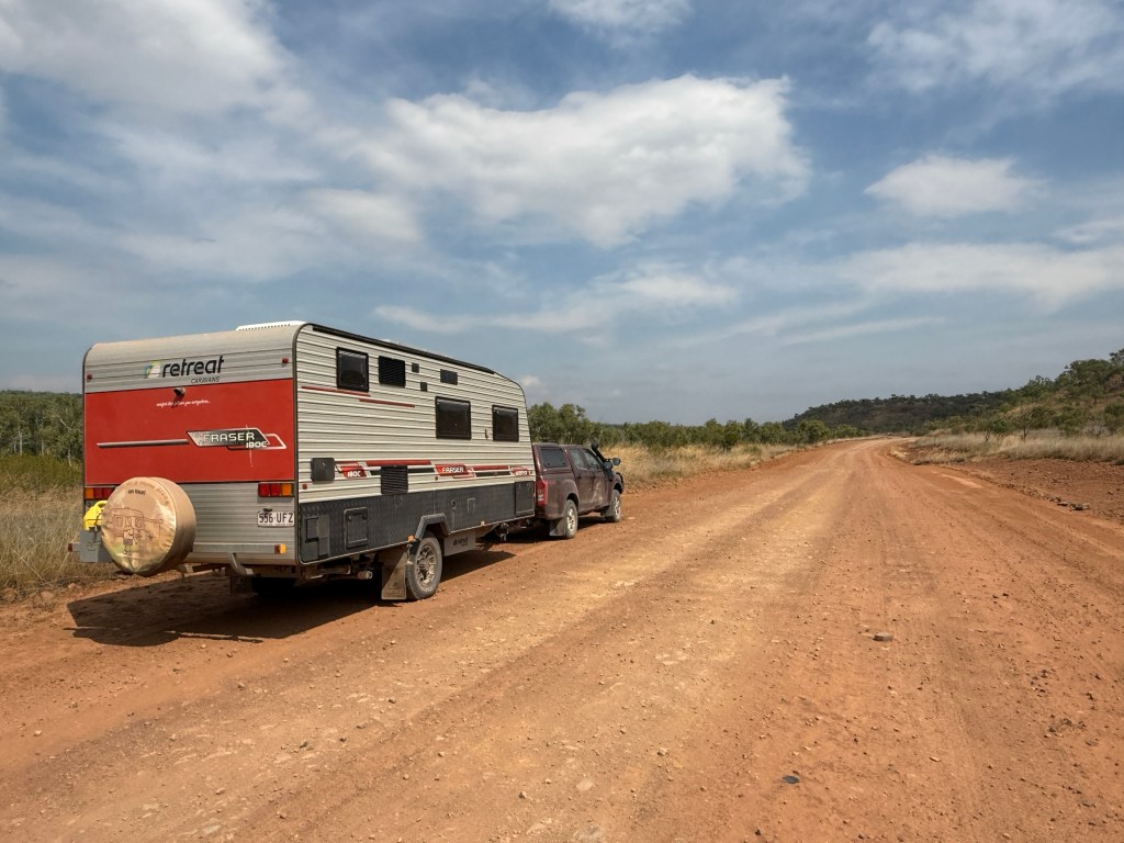
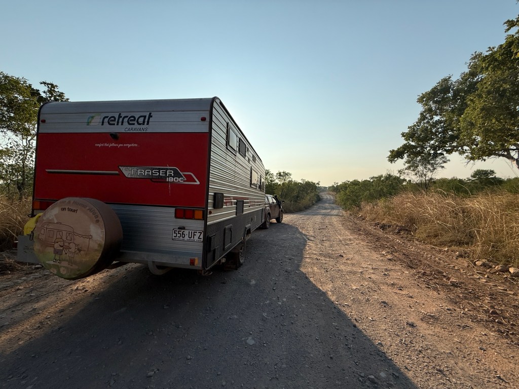
There is always room for an adventure on a road trip. We seem to have a share of them. What would it be like to go the whole length of the Gibb adventure free? We will never know because one of the very small almost road drainage type creeks across the road contained an unpleasant surprise. Allthego probably took it a little too quickly and whooshka a bad bump knocked a van tyre off the rim, we were on low tyre pressures as well which probably didn’t help in this case.
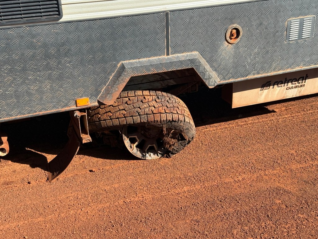
Fifty metres later we pulled up with the tyre hanging shredded from the rim, the rim with a piece broken off was of no further use!
To cut a long story short all was made good, thankfully we have two jacks which allowed us to get the spare on ok. Took a while though including cleaning the tyre remnants and steel wires off the hub. The parking and electric brake cables were undamaged.
The guy on the bike passed by and offered to help but he looked as though he needed more help than us. Other than for him, during the two and a half hours of getting it sorted out no one else came along the road.
We arrived at Mt E at about 7pm, having travelled the 30k up the access track in fading light and darkness. Settled in for the night after some noodles! Alls well that ends well, the first day of winter.
We woke to a nice sunny day a bit stiff in the hamstrings and shoulders.
Mitchell Falls
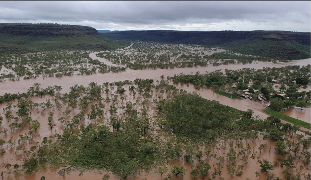
We have learned that the Gibb River Road past the Drysdale Station turn off has opened, plenty of water still around though. The Hann River crossing has about 60 cm of water. So the way ahead is looking good!
We have decided though to stay another three nights at Ellenbrae, as we are still unable to go up to Drysdale Station and then on to Mitchell Falls by the Kalumburu Road. We have had conversations with APT re the booked lodge accomodation at the Falls. They have actually cancelled bookings, including ours and a refund is on the way.
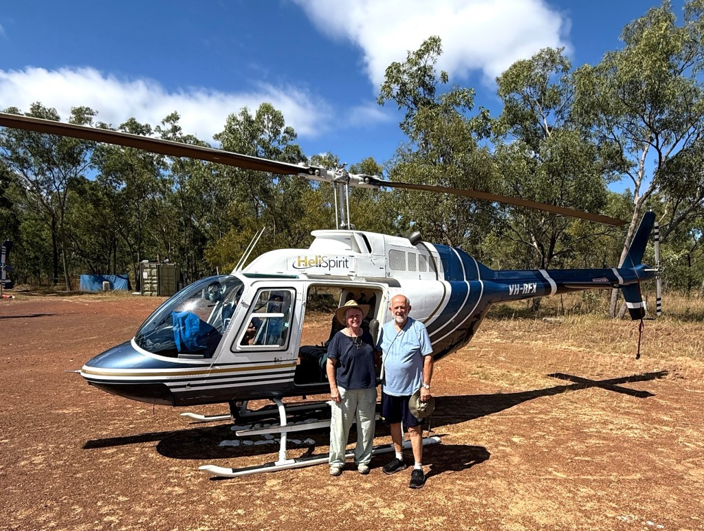
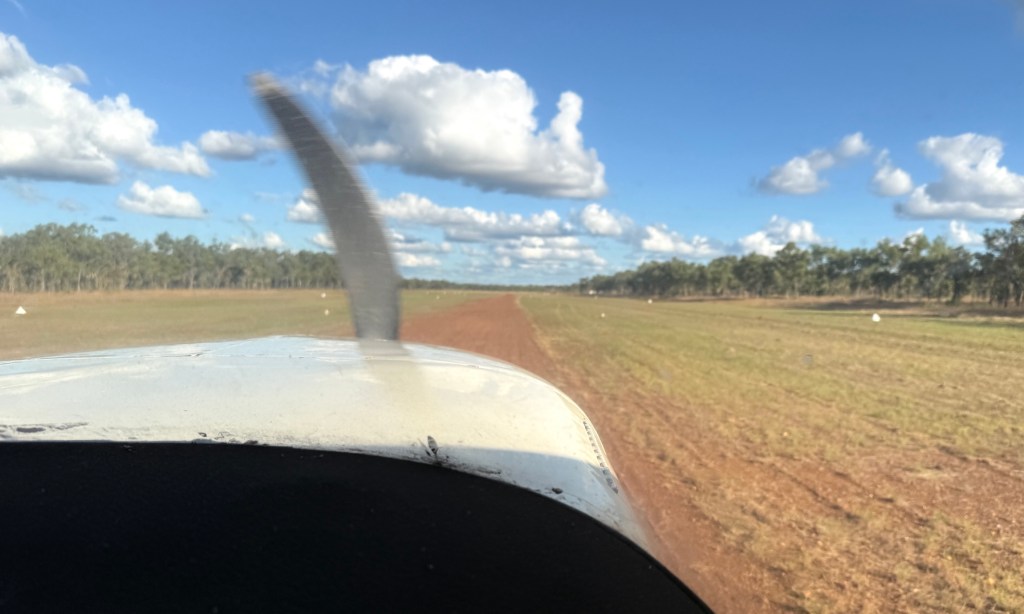
What to do though? The Mitchell Falls visit was one of the big ‘ticks’ for this trip so we have lashed out on a day trip by light plane from Ellenbrae.
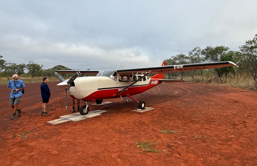
It was an early start. Pickup from the campground was at 6.40am. There were six of us on the Cessna plus the pilot. Allthego was upfront helping him with the navigation and other technical matters, including being told to keep his feet away from the floor pedals.
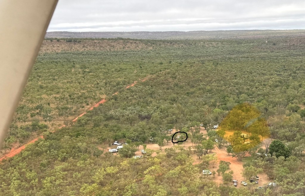
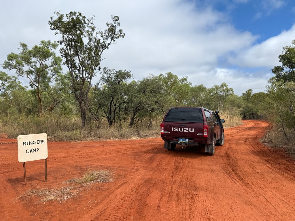
Takeoff from the Ellenbrae strip was a little after 7am. As we wheeled away we passed over the Ringers Camp site, van in view! It was a fairly low level flight, around 2000m, under some broken fluffy low cloud. Great views of the landscape and swollen rivers.
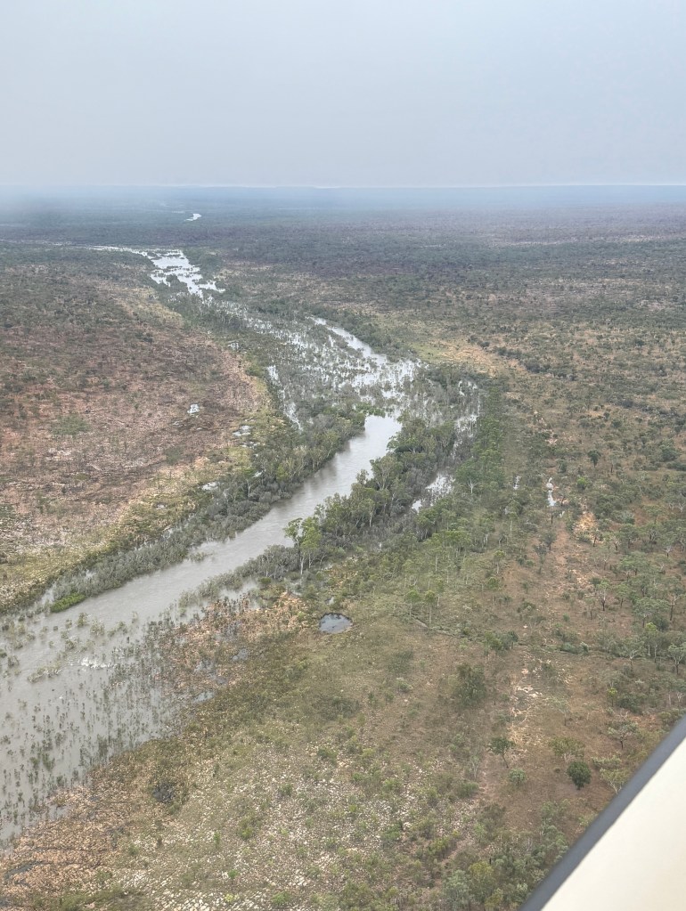
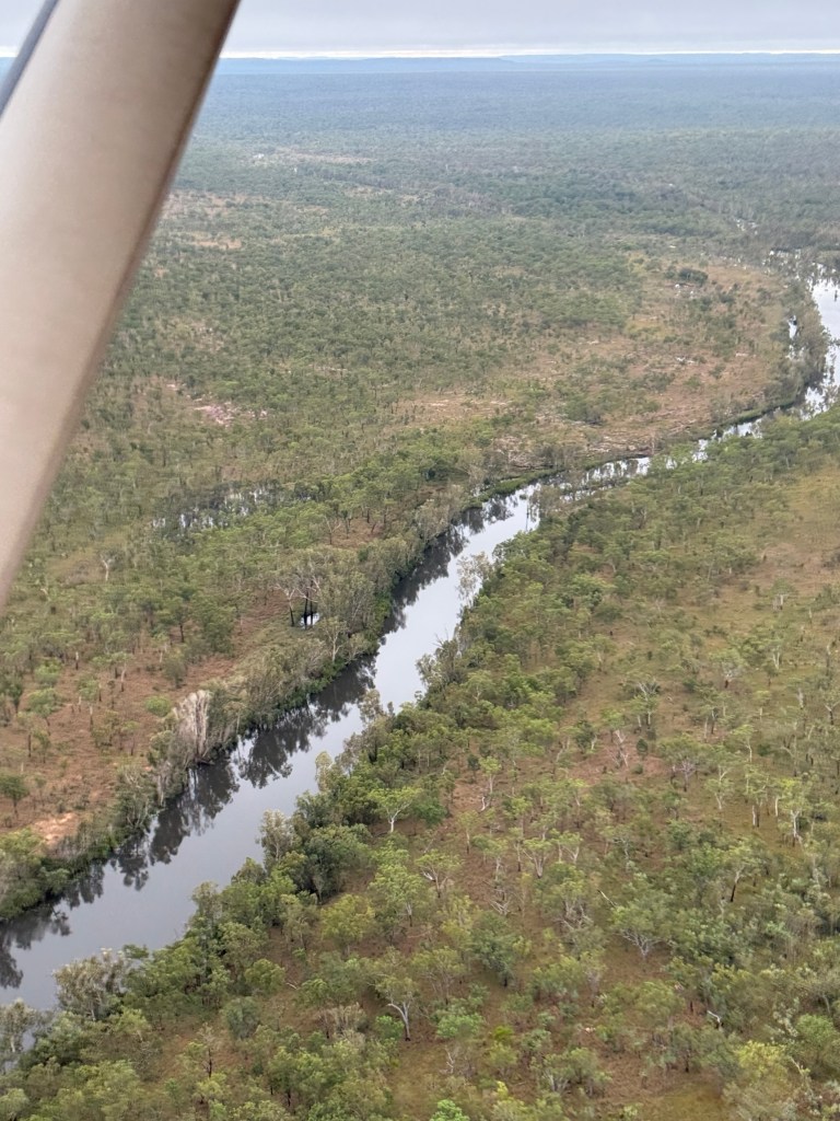
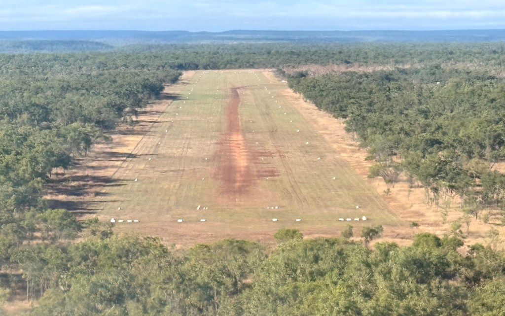
It took just on an hour to reach the Mitchell Falls plateau air strip. The strip was originally built by Rio Tinto when it was exploring for bauxite on the plateau. They did find lots but because of the remoteness it was uneconomic to mine. A good outcome for the country. And the airstrip is ok of course! A nice smooth landing on the gravel, some little bumps here and there of course to be expected.
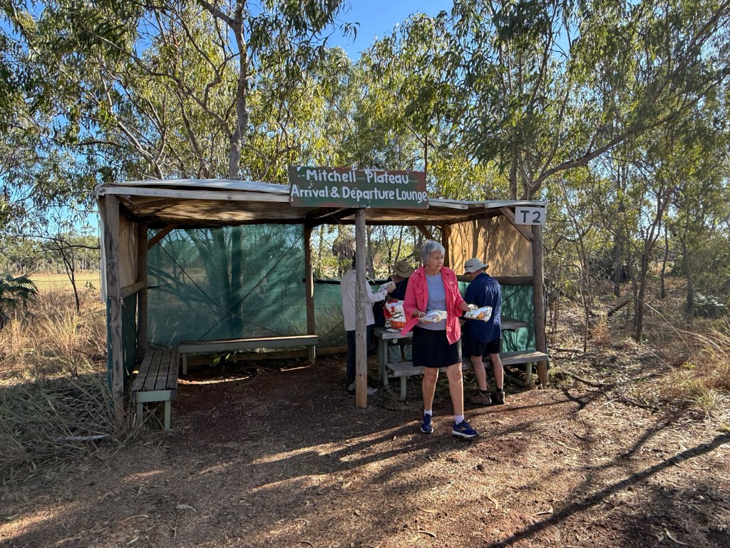
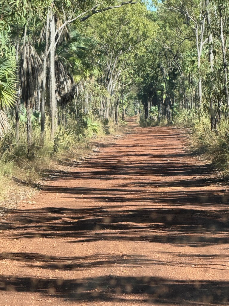
The air strip was half an hours 4WD, along an in places wet and muddy bush track, from the Mitchell Falls NP camp ground. This was our destination and where the next stage of the journey to the Falls would start.
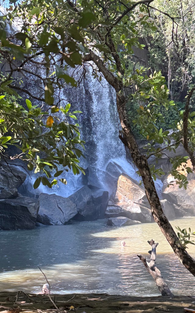
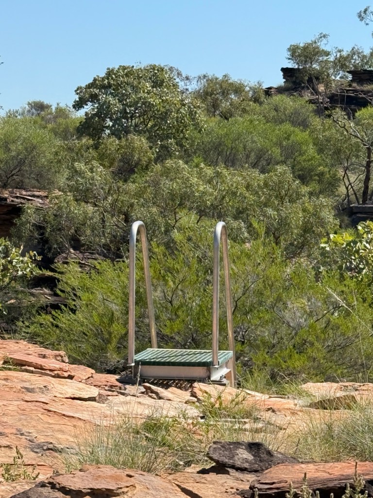
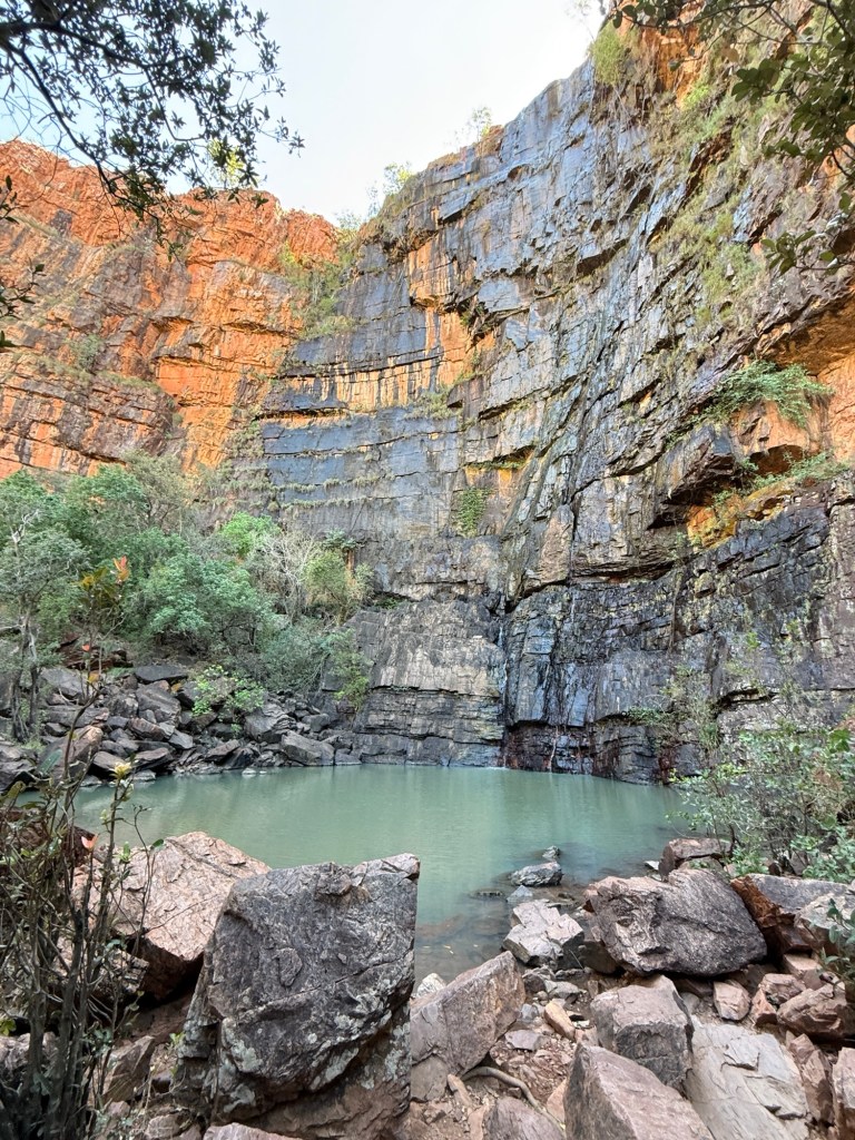
A ten minute Bell Helicopter jaunt down to a chopper pad beside the Mitchell River, 100 metres or so before the river plunges over the 4 level drop to the river far below.
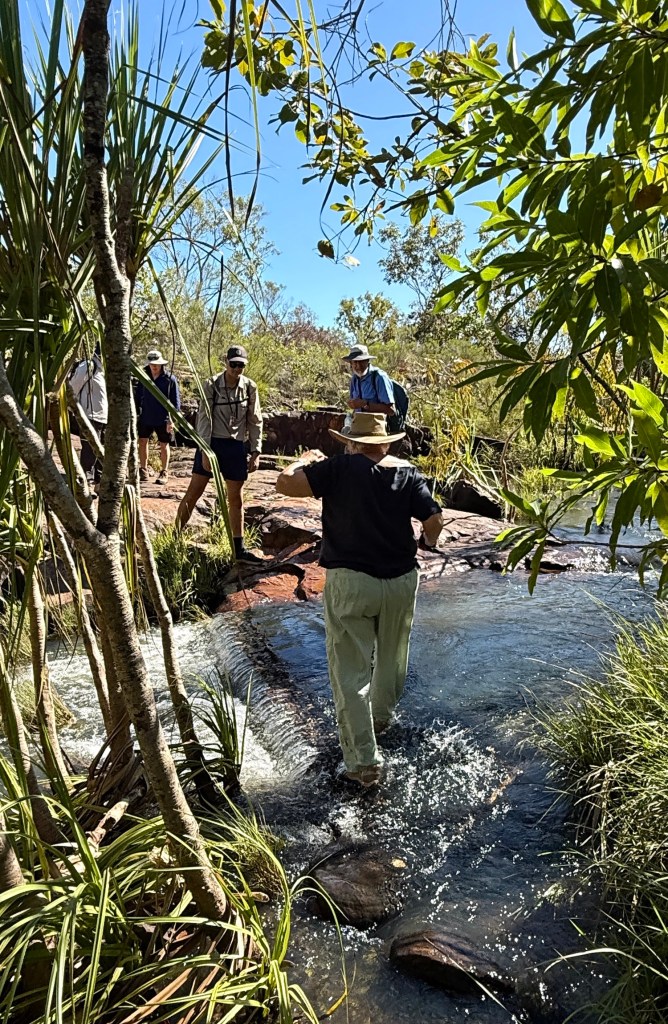
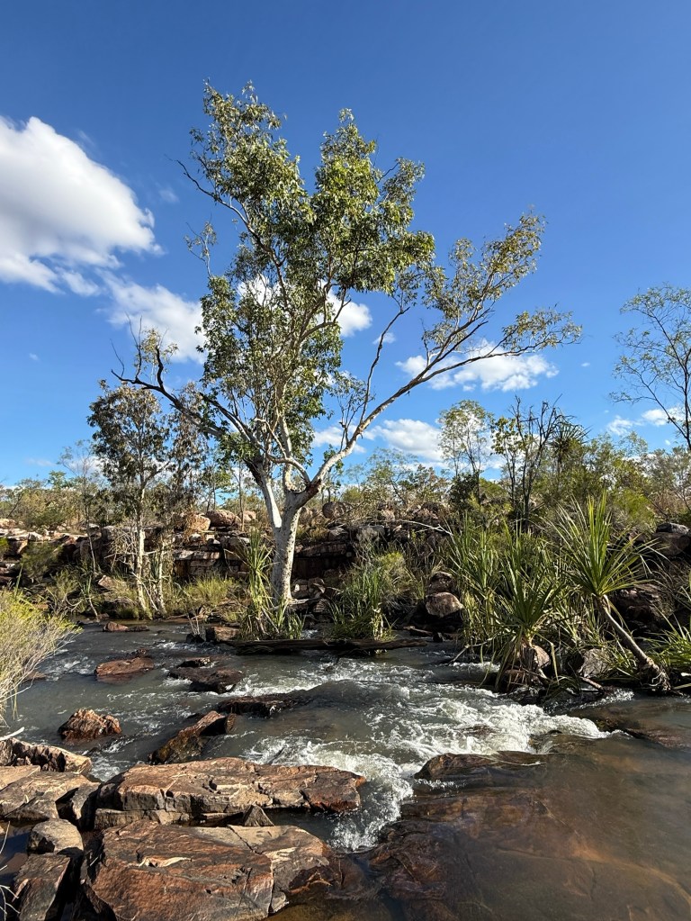
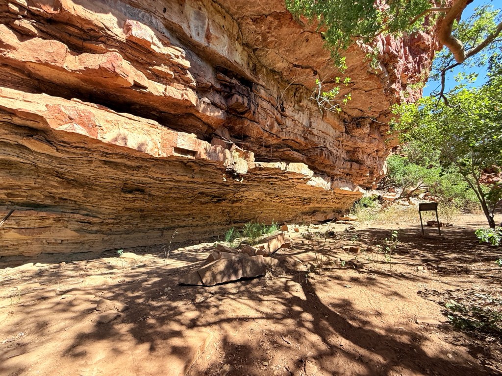
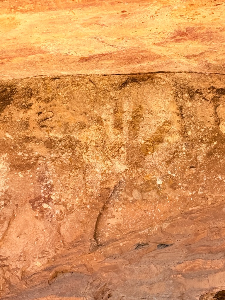
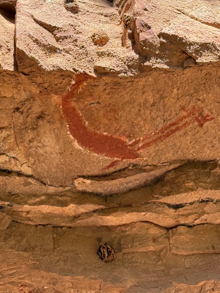
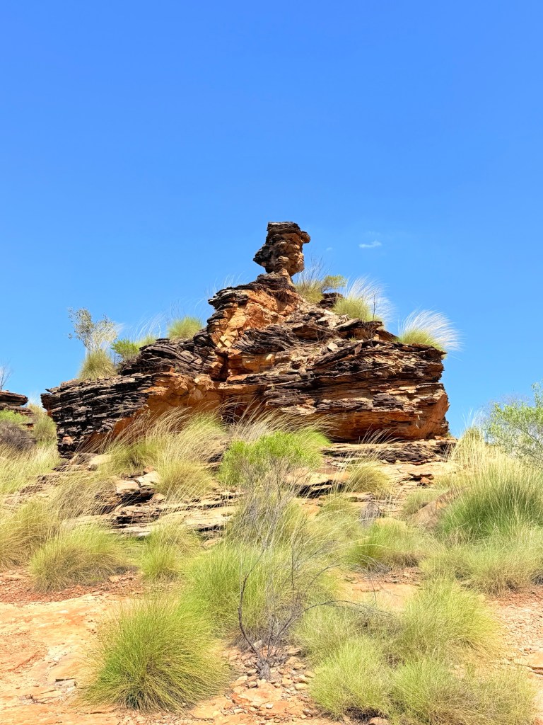
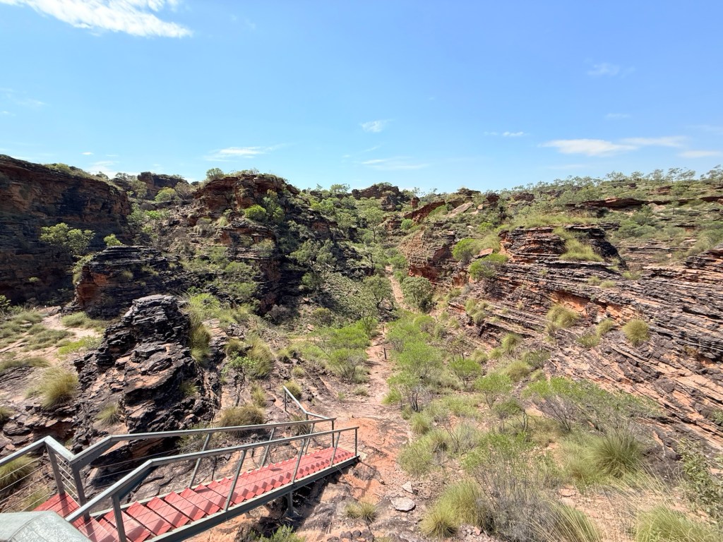
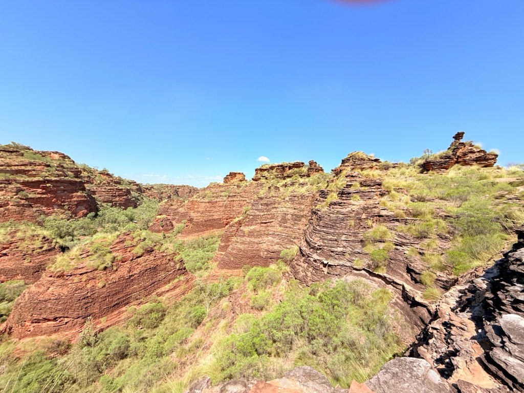
But before we got in the helicopter, it was 9am, we were off on a walk down to Little Mertens Falls. It is about 3km return and along the track that ultimately leads to the Mitchell Falls. It was to take just just 3 hours including time at the base of the falls for a swim and checking out the rock art.
The first part of the walk is reasonably easy going, including a bit of creek hopping and getting the feet wet before reaching the top of Little Mertens Falls. There is a Big Mertens Falls further along, but we don’t go that far.
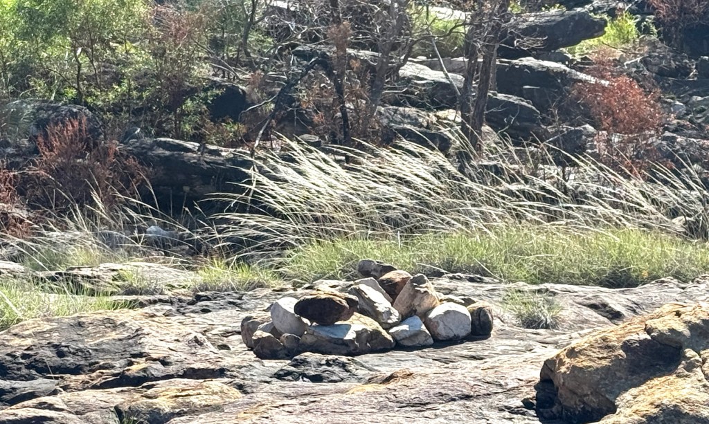
A little further we pass an Aboriginal burial area. We saw two neat piles of rocks on a broad sandstone area. Apparently, when near death an Aborigine would be laid here and covered with the rocks. According to the tradition the body fluids would seep through the rock into the deep pool at the bottom of Mitchell Falls. This is where the Rainbow Spirit creator lives. So the person returns to the ‘country’ from where they came.
Very similar to the Christian concept of “ashes to ashes, dust to dust” used in funeral services.
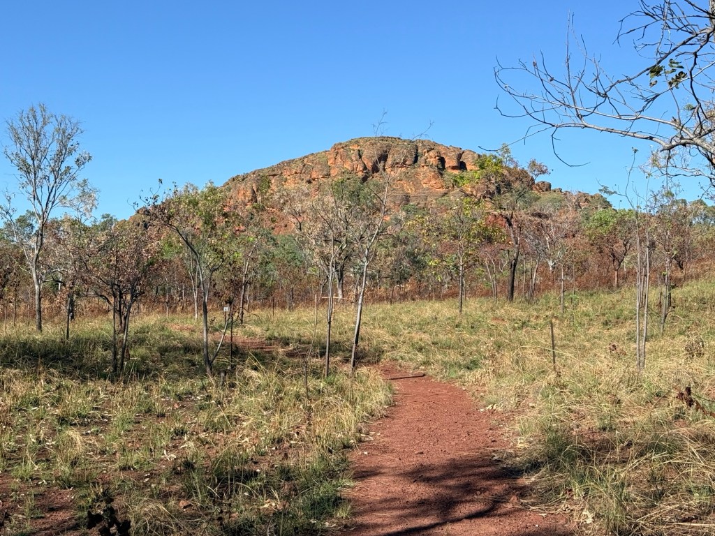
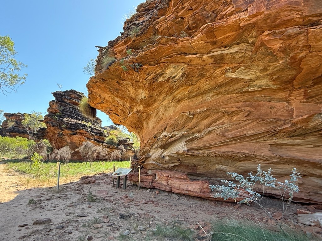
Behind the hill in the photo is a current day traditional burial area, not accessible without consent.
The descent on the track from the top of the Falls to the pool beneath is a little arduous, up and down a few rocks with trees to help out with the leverage to get up. The pilot, who also doubles as the guide, lends a welcome hand from time to time to the less nimble.

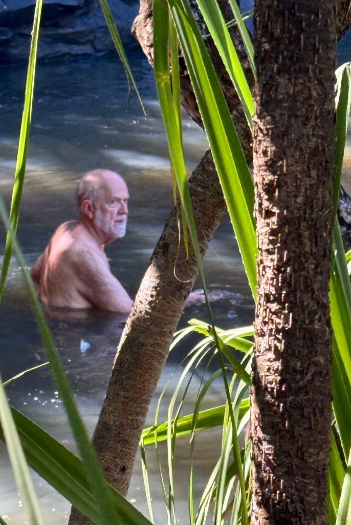
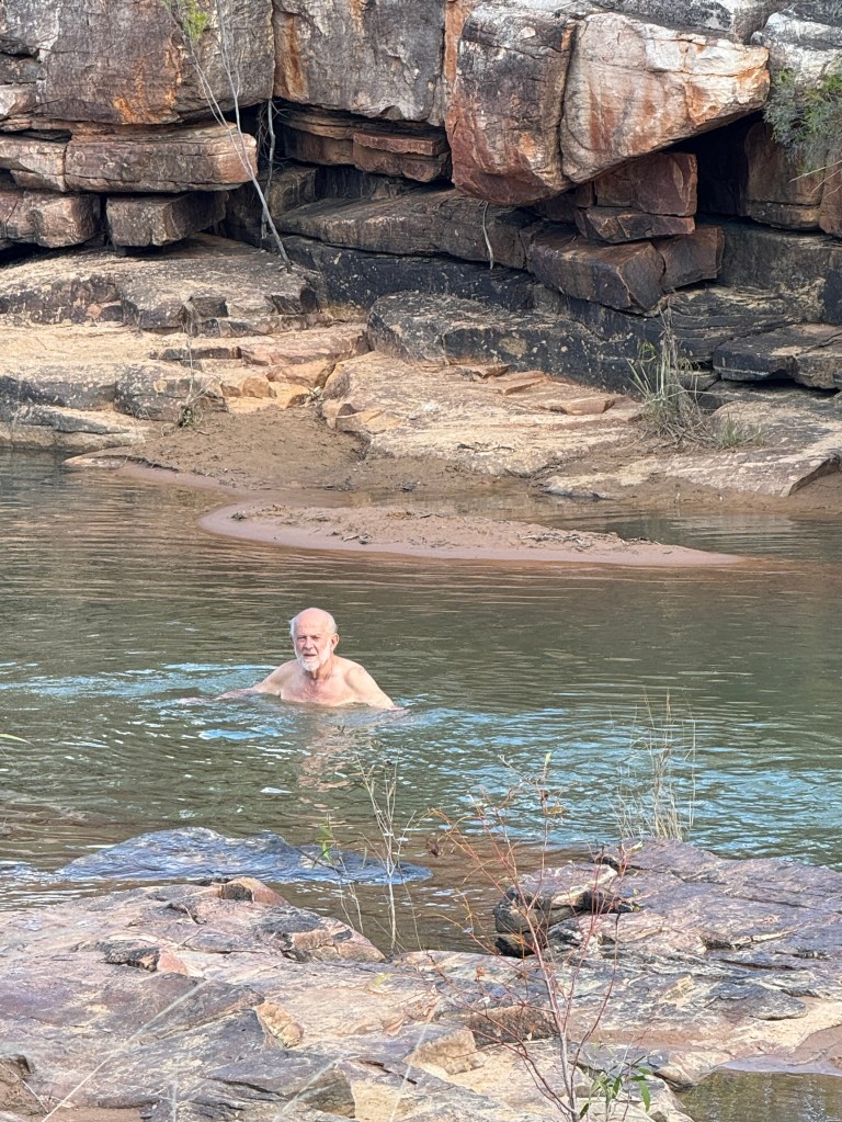
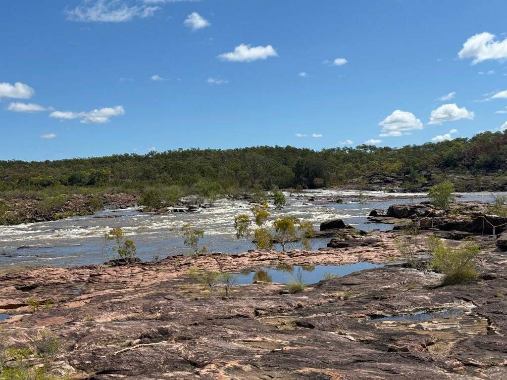
At the bottom the view of the water coming over the top into the pool is special. The swim is refreshing. There are no salty crocs in here, maybe freshies but none were seen.
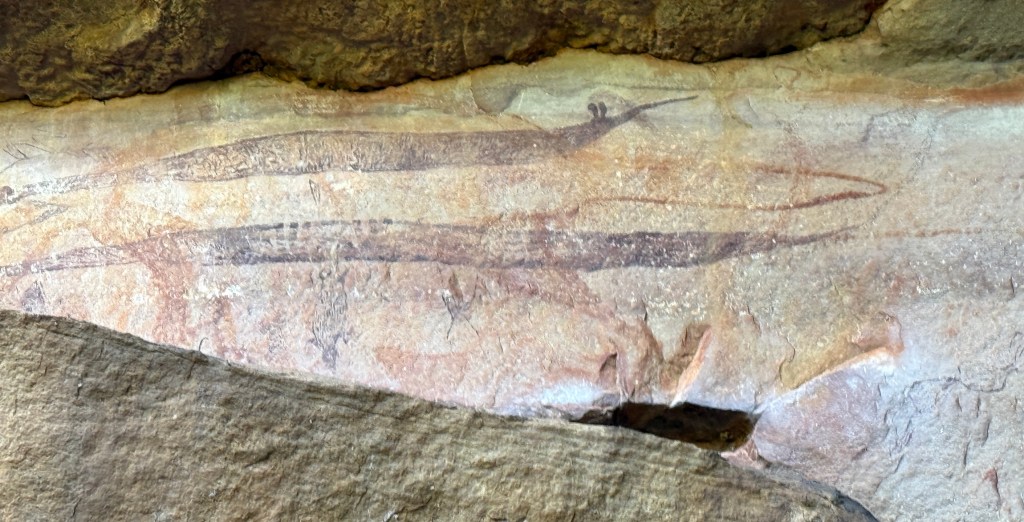
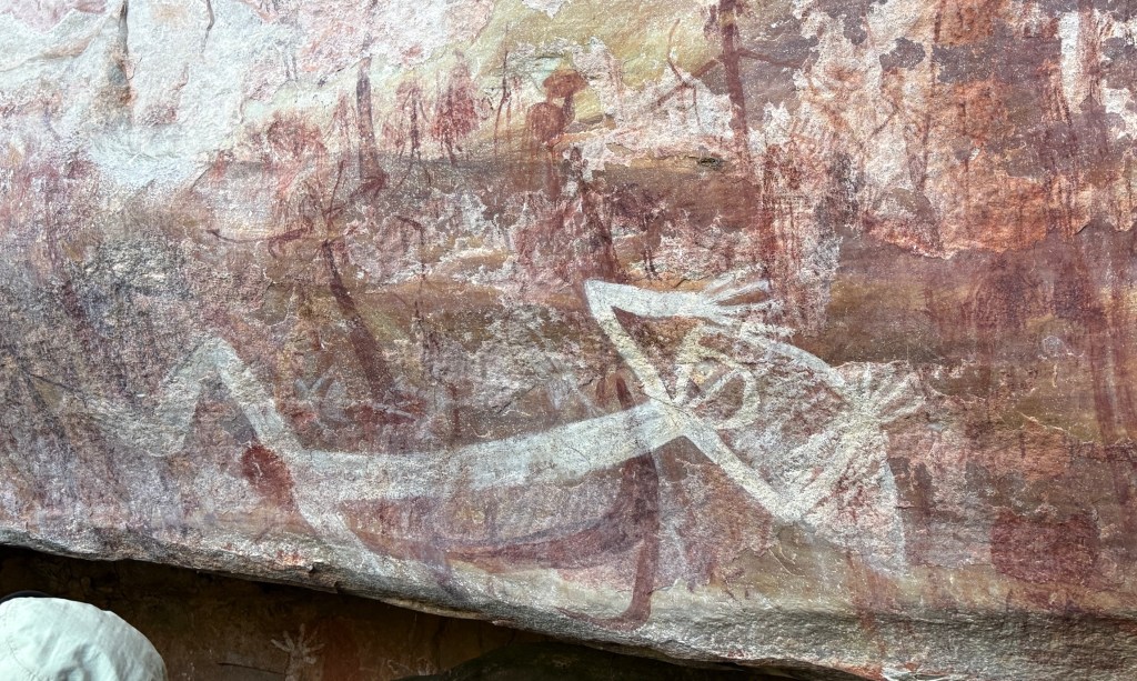
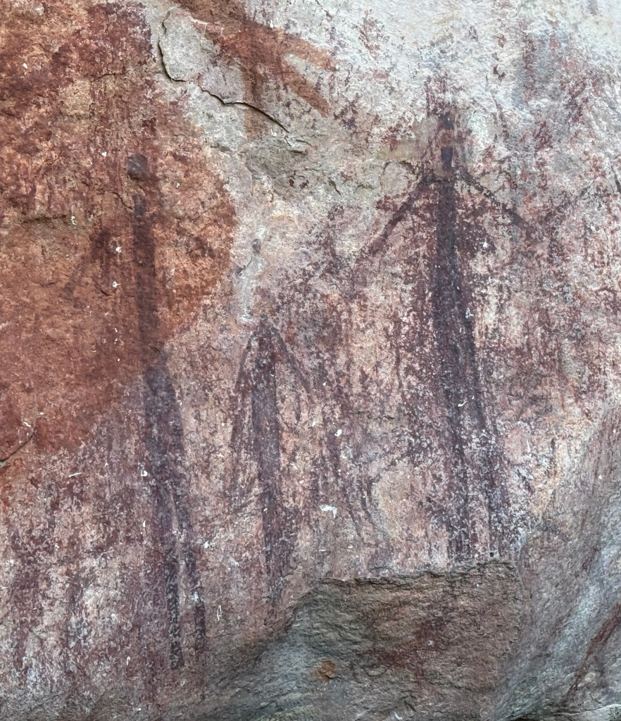
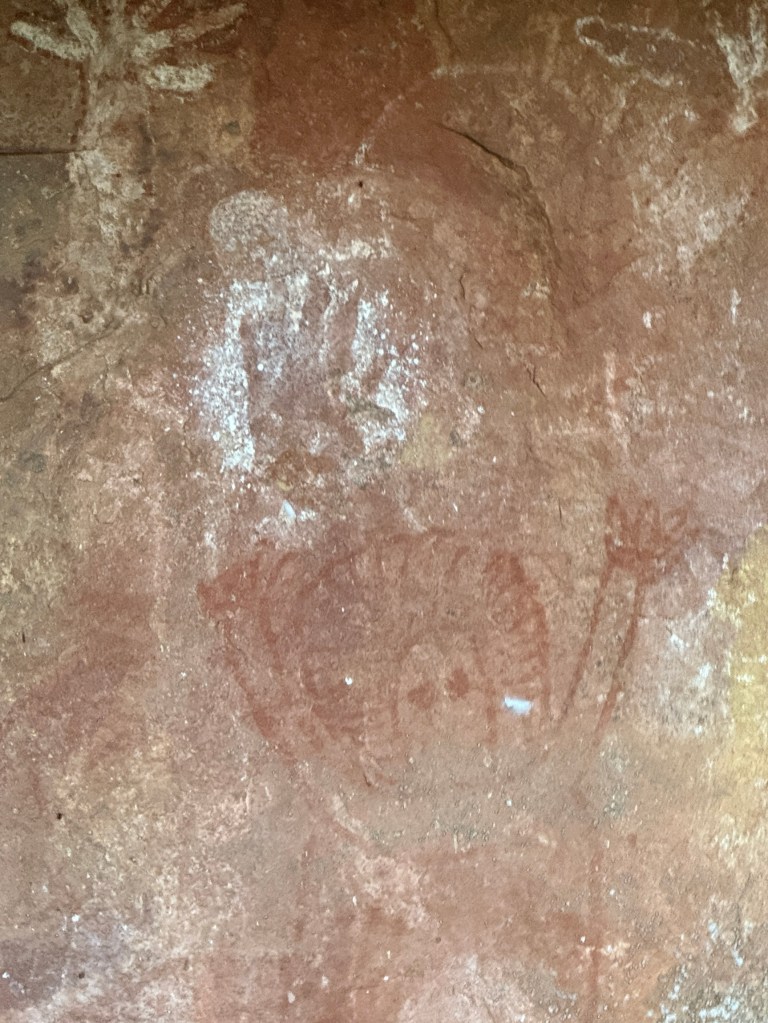
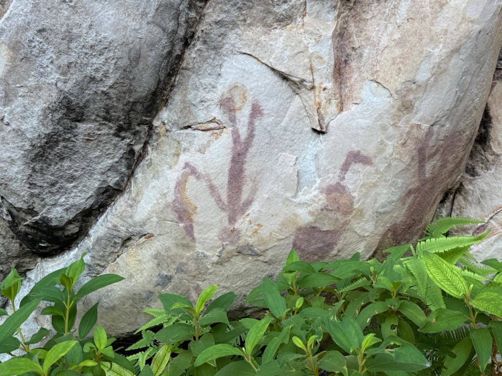
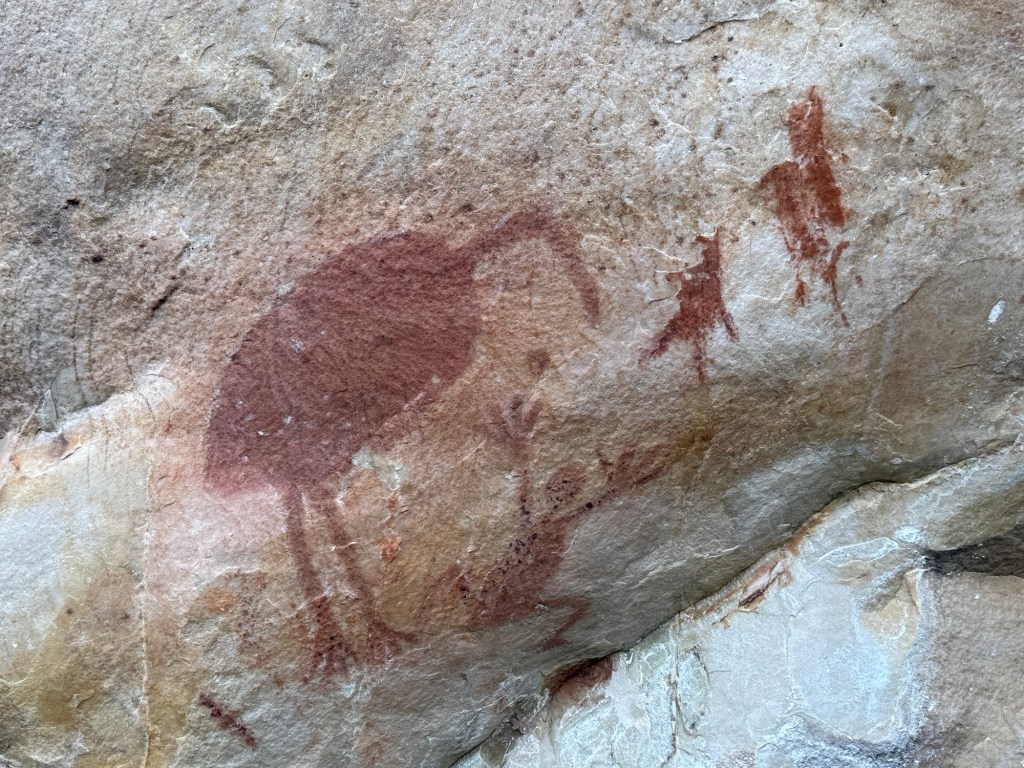
The area around the lower pool was a place that the indigenous people inhabited for thousands of years. Perhaps not continuously as they moved around in response to changing climate and weather patterns.
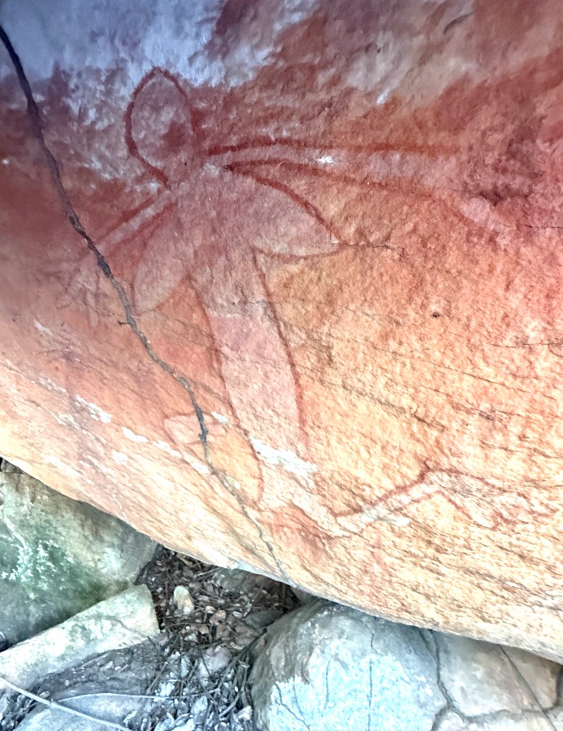
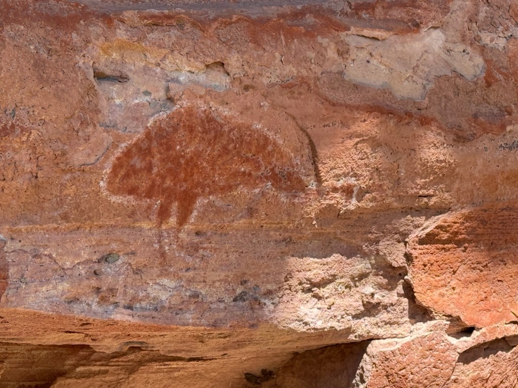
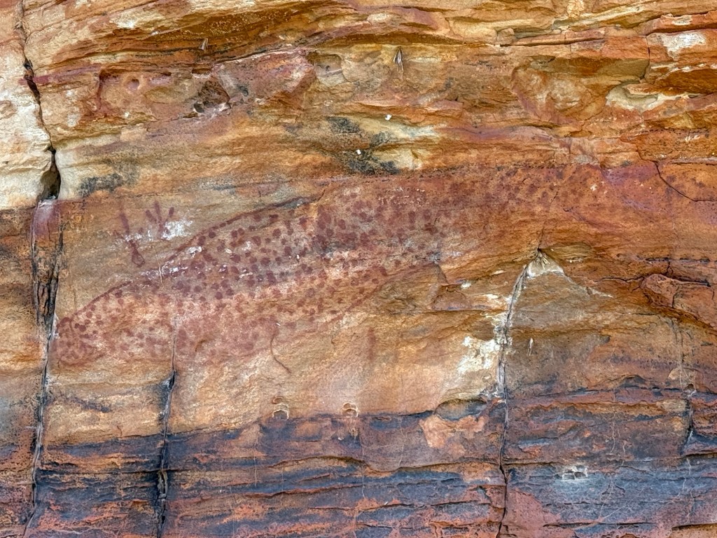
Our pilot/guide showed us around a number of sites near the pool with different ages and types of artwork, some of recent origin but others dated at thousands of years. A few examples in the photos below, I have annotated from my best recall (which might be sus) of the commentary.
We returned by the same route to the campground to get into the helicopter, it holds up to 5 including the pilot. So our group went in two trips. Homealone was very insistent on sitting in the front next to the pilot because it had a door. The seats behind had no doors but we were harnessed in securely.
It was a little unnerving when we did figure eights around the Falls so that everyone got a good view.
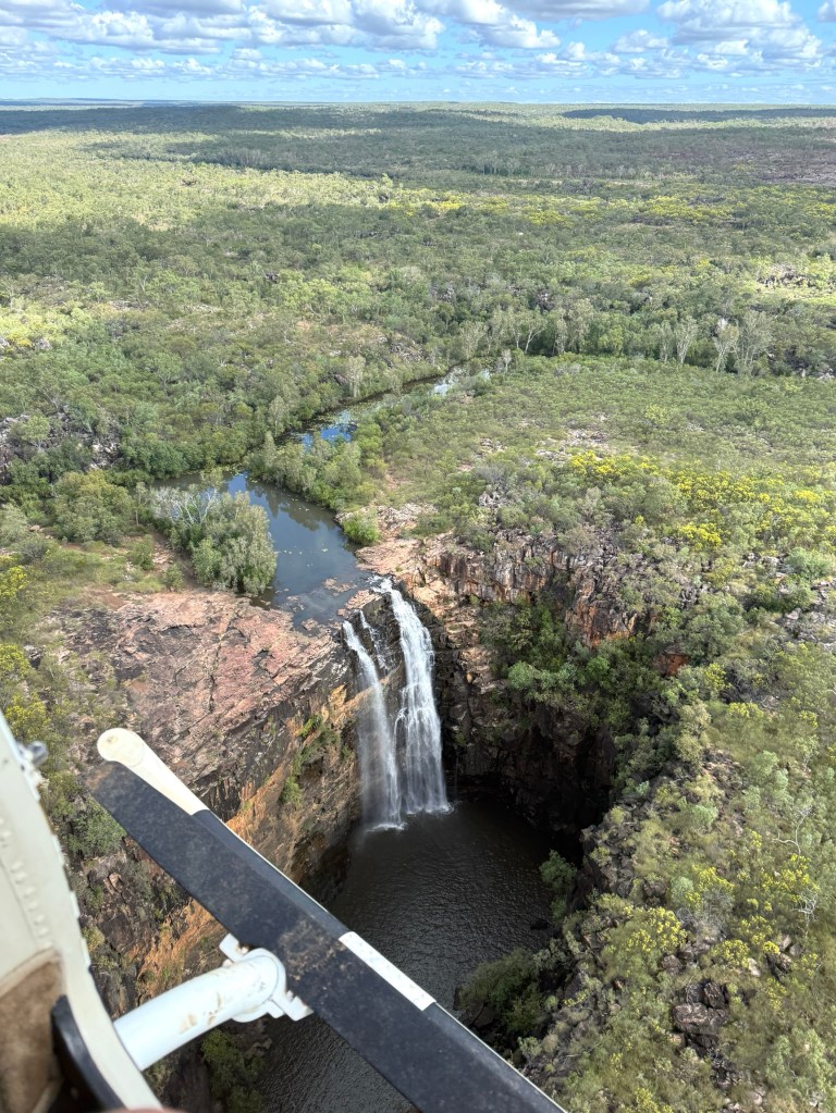
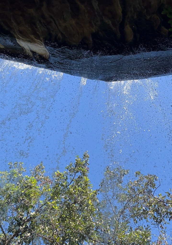
At the Falls we went off on a short walk out along the edge to get a full on frontal shot of the four waterfall levels. We were quite close to the cliff edges.
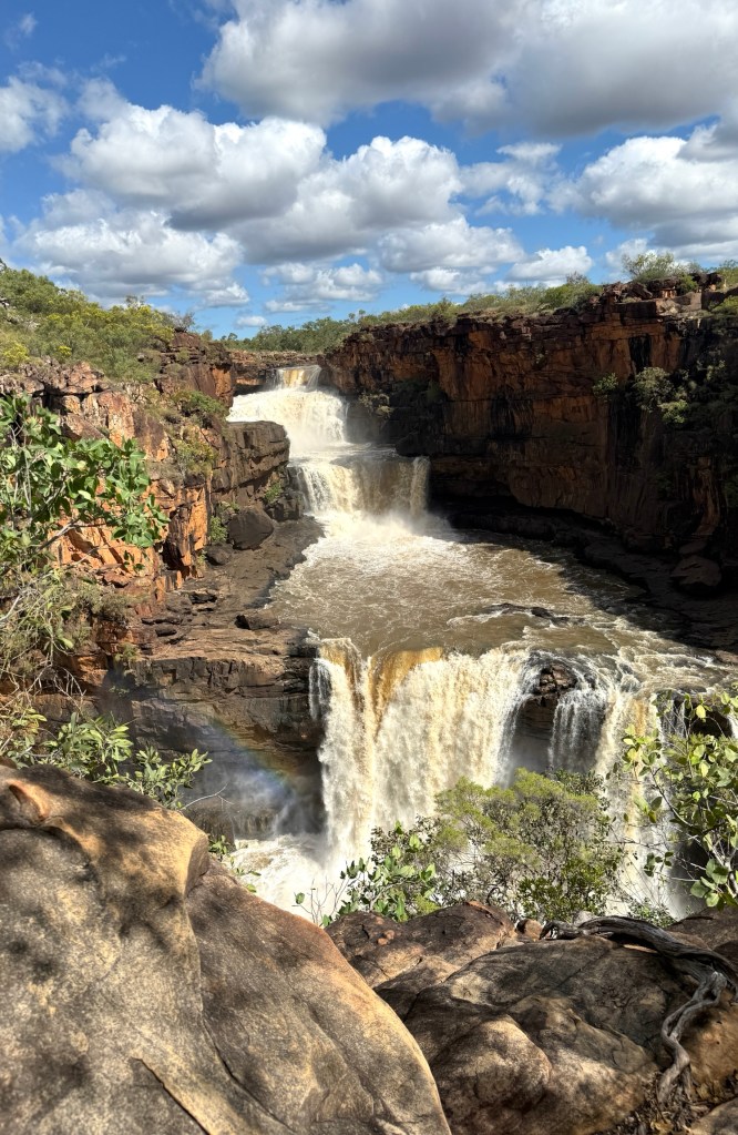
The Falls were really pumping, massive amounts of water pouring down to the river below on its journey to the sea. Nothing like the pretty postcard views or magazine pics one sees. Spectacular!
Our time was up, back in the helicopter for another figure eight around the Falls before returning to the campground. 4WD back to the airstrip and the plane flight to Ellenbrae. No dramas and a memorable day!
We now head off for Mt Elizabeth Station in the morning, 1 June the start of winter! We have the donnas out at night.
Home Valley Station to Ellenbrae
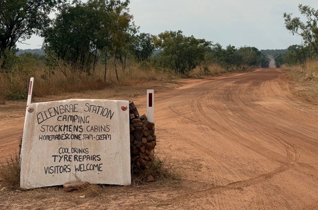
It is a little over 100km along the Gibb from Home Valley Station to Ellenbrae, then 5 km off the Gibb to the station. Ellenbrae is another cattle station that runs camping facilities on the side during the dry season. It is famous, or is it just well known (?), for its daily baked scones with jam and cream. Some 21,149 were baked in the 2024 season. Looking forward to one, or two…

Leaving Home Valley we are greeted by 10km of sealed road, followed by 10km of gravel and then another 10km of sealed road.
For the next 70km it reverts to fairly good gravel, some rough spots and corrugations. In a couple of places we get short stretches of sealed road over steep climbs. The road is not too bad, maybe early in the season and it will deteriorate in coming weeks.
Some 16km from Home Valley there is a pull over area and a short drive down a bush track to the 10 minute walk to the Bindoola Gorge. Quite a spectacular view of the bottom pool, although the falls are not flowing.
Further along is the currently dry crossing of the Bindoola creek with water pooled either side of the roadway. Pretty spot. The creek is a tributary of the Pentecost and joins it down near the river campground at Home Valley Station.
The main river crossing on the way to Ellenbrae is the Durack River, named after the famous Kimberley pastoral dynasty. Like the Pentecost there is generally some water to navigate. The free camp here is being disrupted by extensive roadworks either side of the crossing. Sealing this area will make the approach and escape from the river much easier one suspects. Not too deep, but a but a bit of mud makes for a slippery exit for us.
We arrived at Ellenbrae mid afternoon and had some cloud and sun as we set up in the campground.
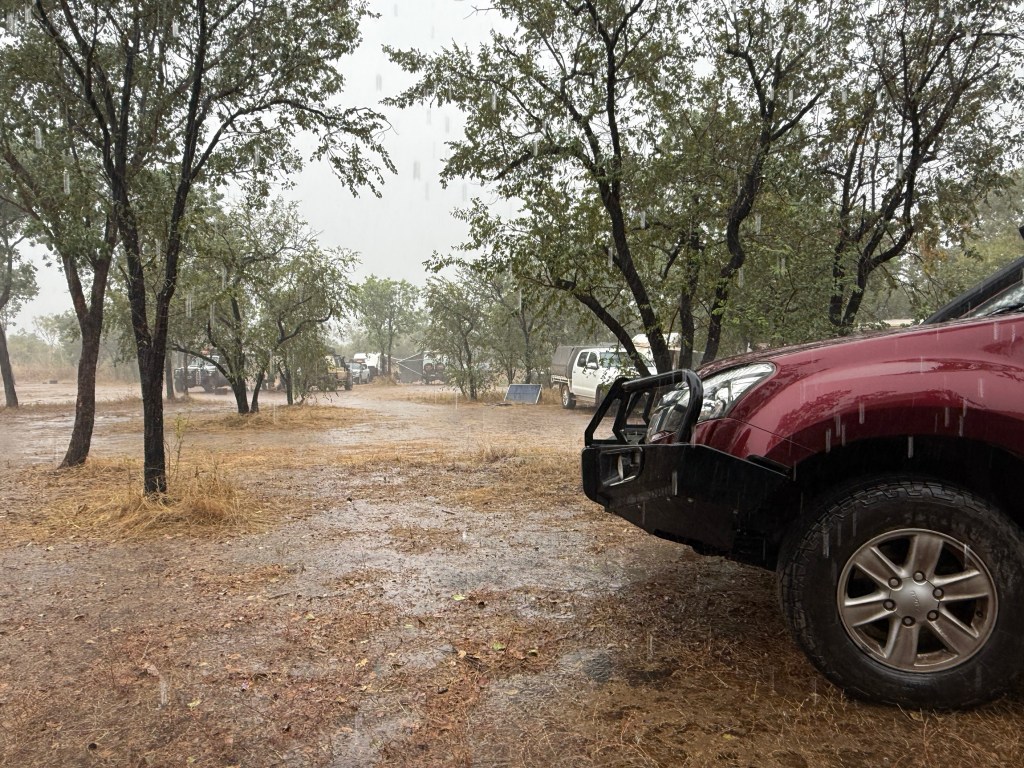
As the evening drew in clouds began building and light rain set in about 8pm. It got heavier as the night wore on. The weather bureau proved right and we sat under our awning the following day with steady drizzle and occasional down pours.
We decided to stay another day and dry out with the sunny conditions predicted. During the night all was good, no more rain. In the morning it was cloudy with patchy sun, but cleared up in the afternoon…blue sky at last to dry roads out!
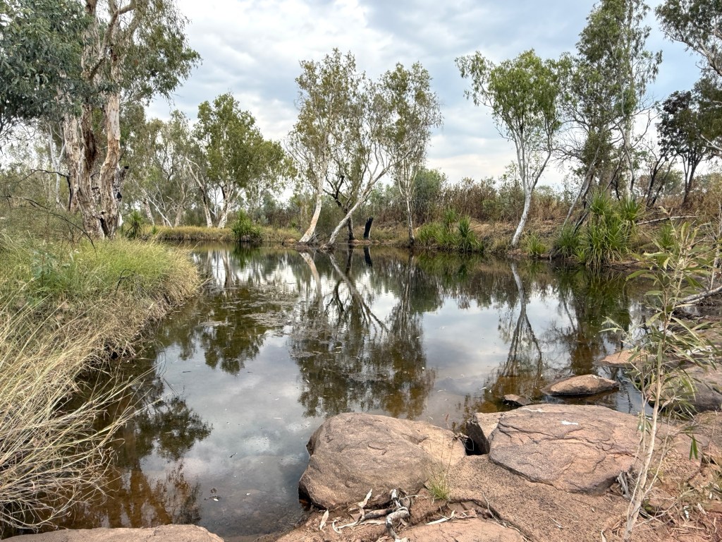
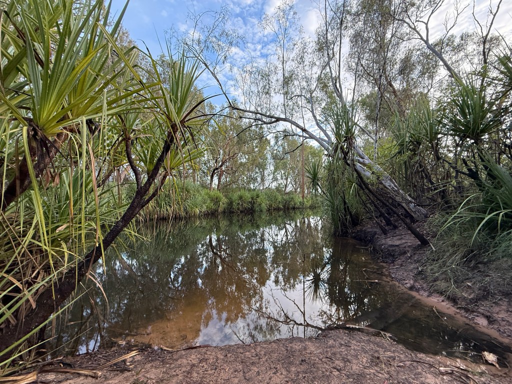
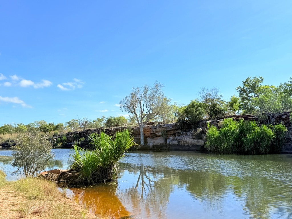
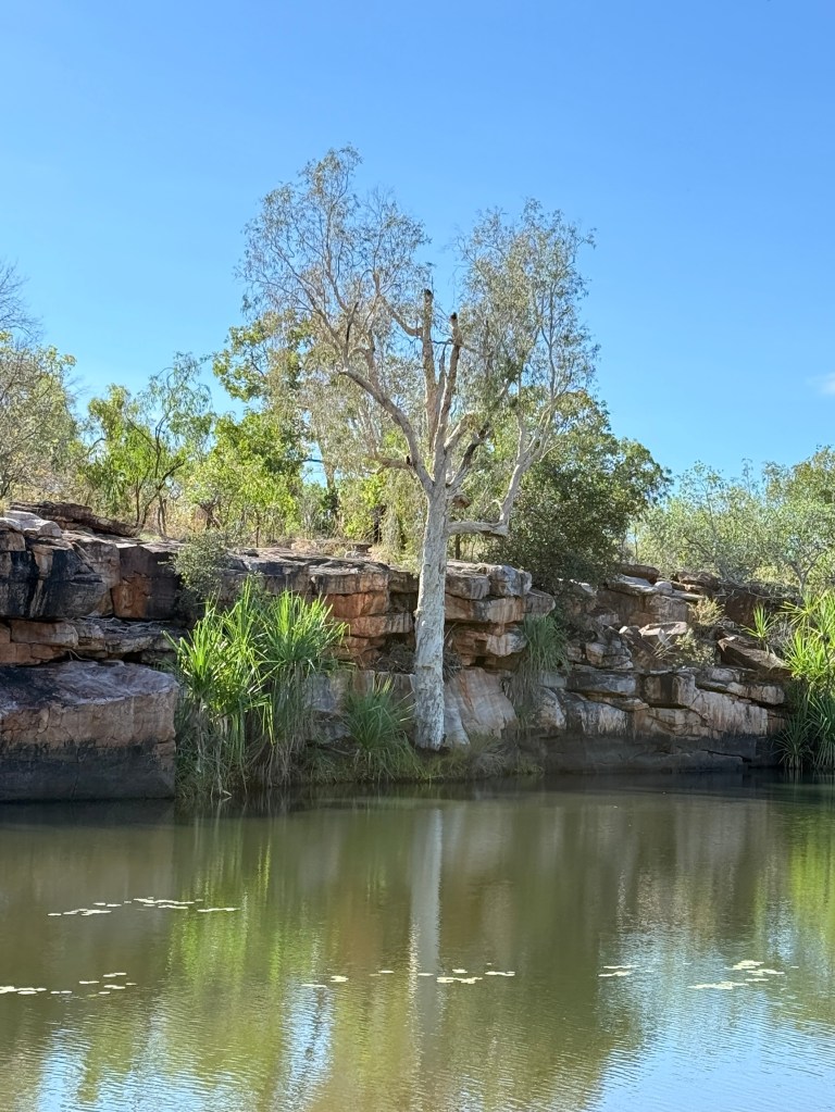
Allthego went off on a short drive and had a swim at Sandy Gorge, a very nice quiet spot and true to name had some sandy banks and clear warm waters at least to waist deep.
The road reports are not good! The Gibb River Road is closed at the turnoff to Drysdale River Station, the Gibb River and further along the Drysdale River are flooded preventing access. This prevents us from driving up (without the van) to the Mitchell Falls by the 170km rough track to stay in the APT lodge for a couple of nights. Maybe a blessing anyway?
We are also unable to proceed further along the Gibb River Road as there is a flooded stretch too and that way is closed as well. The Hann River is reported at about 1.6m deep. We can do about 60cm ok. We can only go back!
So we are sitting pretty at Ellenbrae for a few days to see what happens road wise.
Hitting the dirt
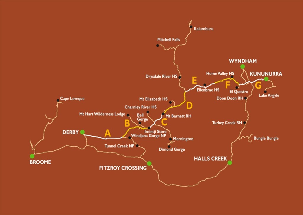
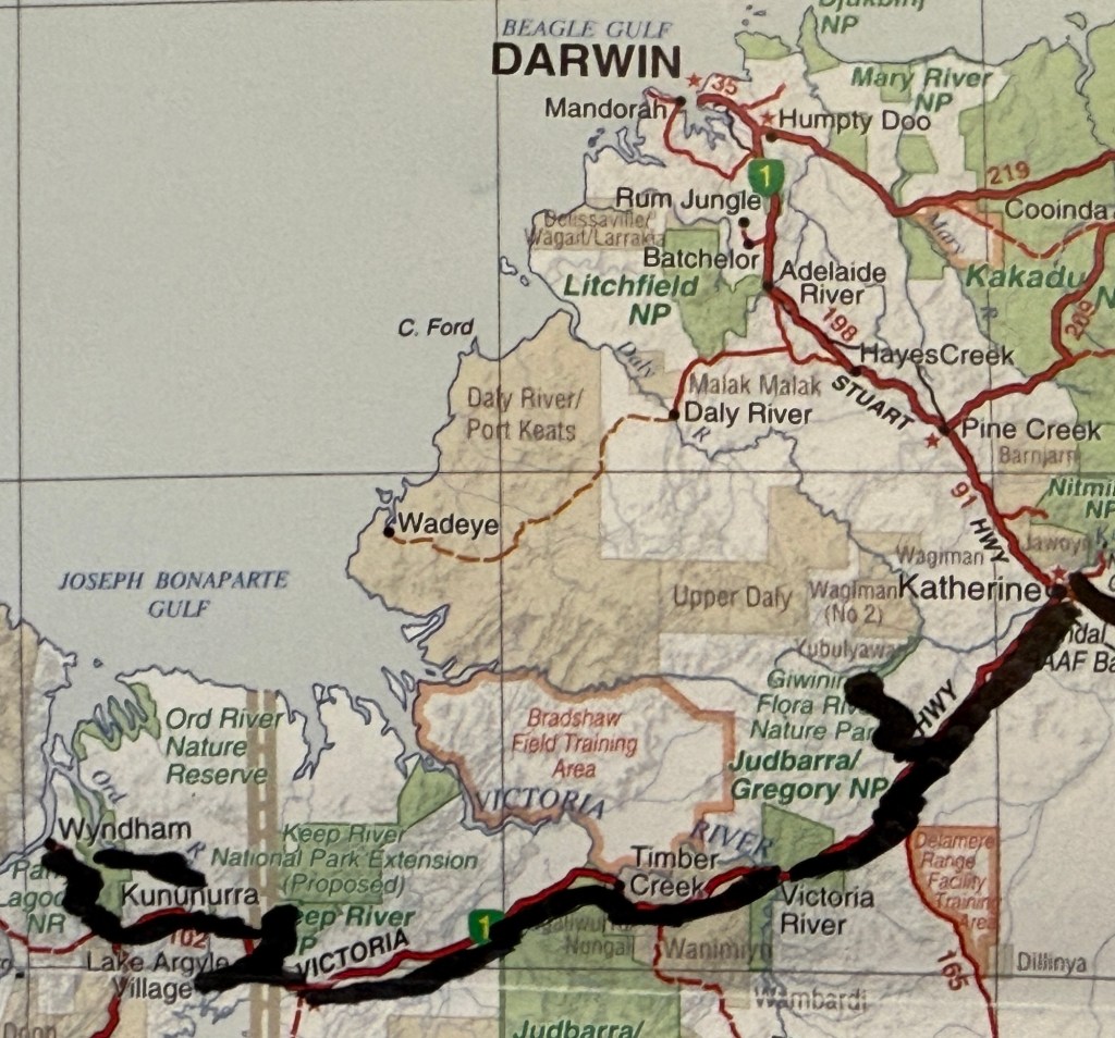
Here is another map showing the way ahead for the next couple of weeks on the Gibb.
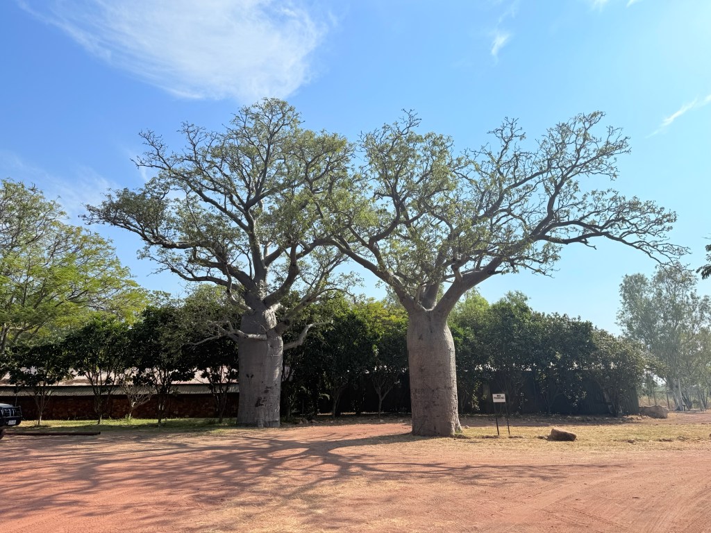
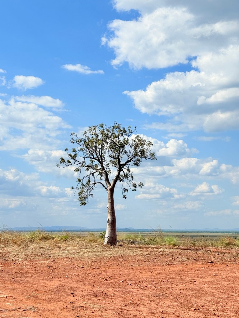
Your travellers have been quite taken by the boabs that dot the landscape in the Kimberleys. They are not related to the bottle trees of Queensland. El Questro has an artist in residence who is also taken with them.
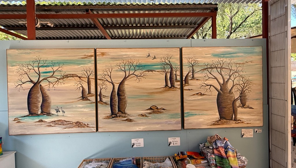
Some great pieces of work and clothing items display them. Very tempting!
On leaving El Questro we did a bit of backtracking towards Kununurra to pay a visit to Emma Gorge, another section of the El Questro property. The resort features in most spreads about El Questro, it is a bit upmarket… no camping. But you can still get in and have a look around and eat the expensive hot chips.
The gorge is considered one of the gems of the Kimberleys. We went there for Allthego to do the Gorge walk, and hopefully make it to the end. Whilst it is a ‘short’ walk, promoted at 3.2 km, 2 hours return, it does go up and over creek stones and boulders for much of the distance.
It was a bit taxing for an old bloke and Allthego only made it to the second pool, big boulders providing a final challenge that time did not allow.


Some great views though of the creek and side walls. Made it back to the car park to rejoin Homealone for some of the hot chips and deep drinks of Fanta and water at the cafe.
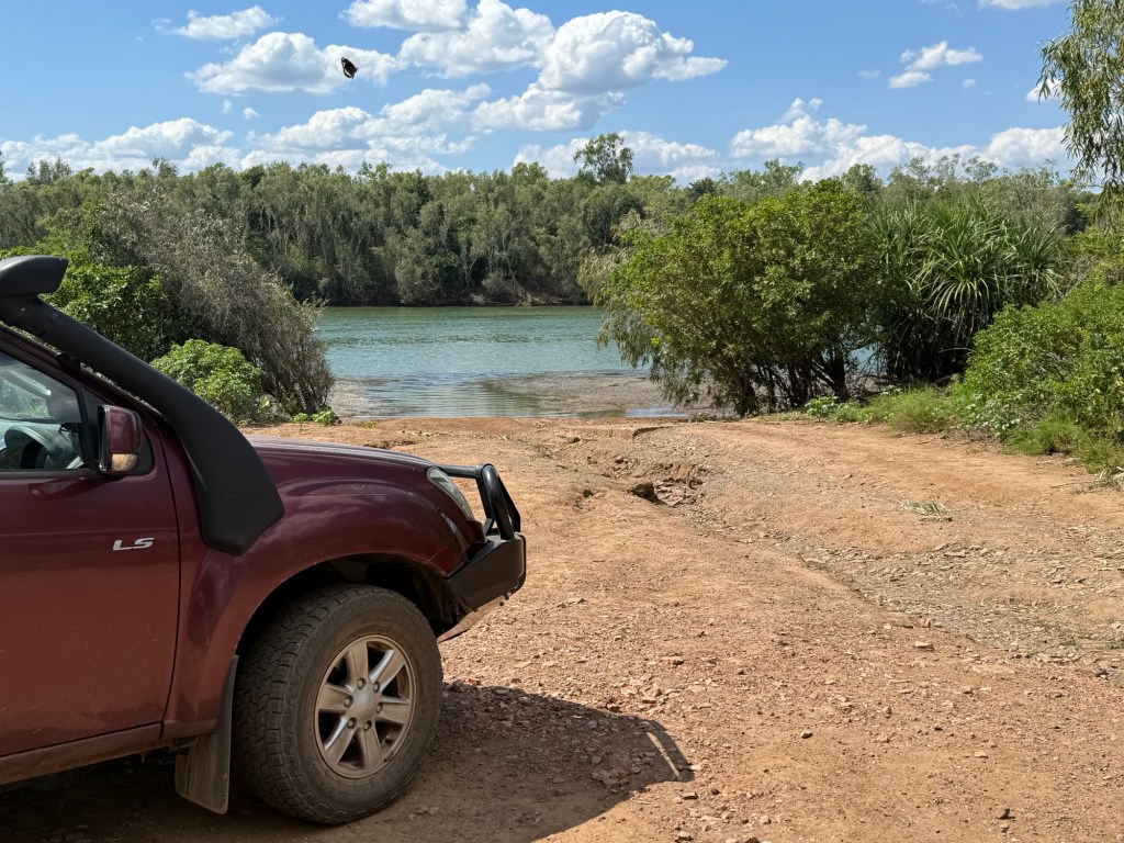
After the snack the road was calling and time was marching on. The Pentecost River crossing is about 35 km on sealed road from Emma Gorge. The previous dry run had been a good introduction to the crossing, which is about 60 metres wide but quite shallow for much of the way. Just a bumpy bumpy experience.
Homealone, managed to get this video of the affair for posterity. From inside the truck though; she was reluctant to sit on the bonnet for the crossing. Once over it is compulsory to pull over and get out to look back over the river at the backdrop of the Cockburn range glowing red in the late afternoon sun.
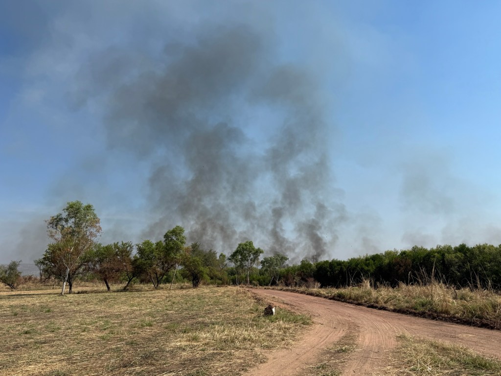
We were there around 3pm and the view was hampered somewhat by the smoke and haze from all the controlled burns taking place. So we were unable to get that coffee table photo.
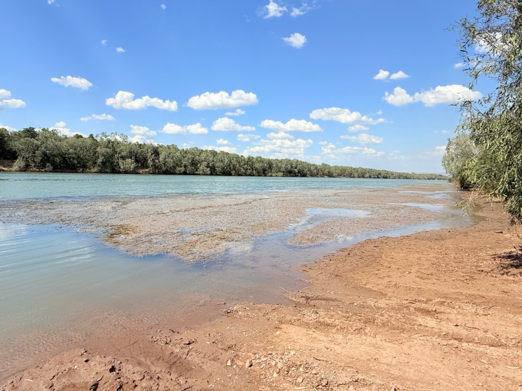
Our next stop for a couple of nights was Home Valley Station. Located about 10km along the Gibb from the Pentecost crossing, the property fronts the River on one of its boundaries. It is quite wide and deep here, clearly showing the tidal influences.
We had planned to stay down here, it is about 15 minutes from the main complex and facilities. Changed our minds, bit more to see and do back at the main area. Including the pool! Quite hot and humid.
The threat of an unseasonal patch of upcoming rain is playing a bit of havoc with our plans. A side trip up the Mitchell Plateau to see the Mitchell Falls is now doubtful, the track is still closed from the wet anyway. The starting point for this is also on the other side of a river crossing and we do not want to get caught there if the rains do come. Fuel has thus become a problem.

To be on the safe side we returned to El Questro to top up the tank and did that Pentecost River crossing again both ways. Readers are lucky we didn’t do more videos!

So, we are now all ok to head for Ellenbrae, 100km further along where we will sit out the rain if necessary. Internet now becomes problematic and we will probably be off the air for several days.
El Questro
Our last day at El Questro has proven to be busy.
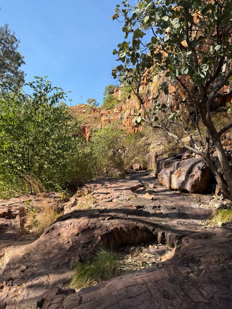
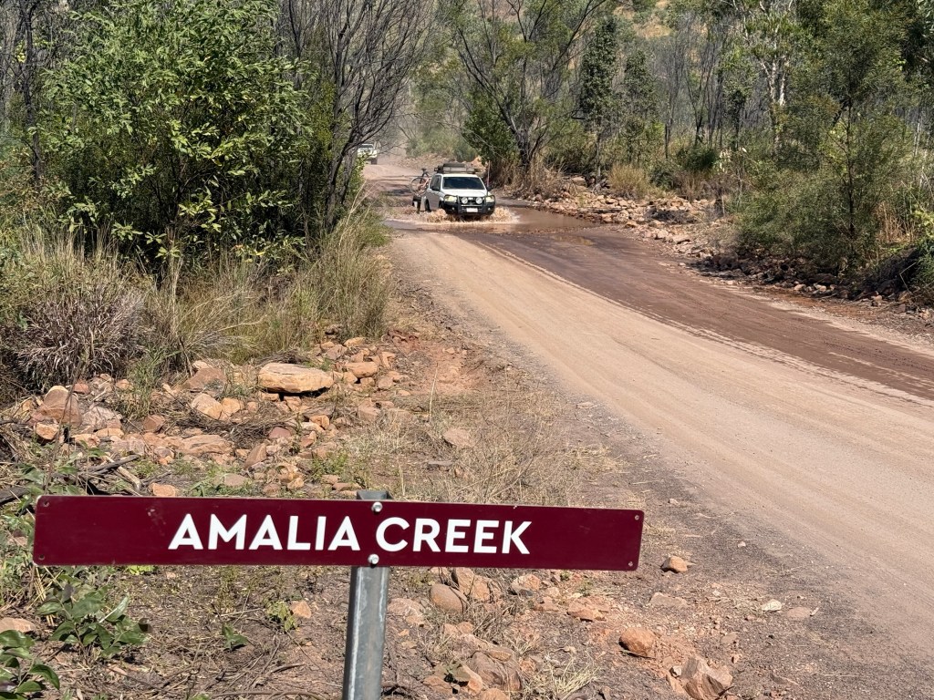
An early start saw us attempt the Amalia Gorge walk, there is a great swimming hole beneath a big early wet season waterfall. While not a long walk it follows a rocky dry creek bed with a couple of creek crossings where the water pools up in the dry.
Homealone pulled out 20 or so minutes into the walk and returned to base. Allthego continued.
The walk got a little more difficult at the Ochre Pool, a deep pool a little over half way to the end. To go further though one had to negotiate a narrow ledge with the help of a chain.
Allthego decided to go no further, but did manage some snaps of the pool and cliffs here. On the way back the sun had moved more overhead and lit up the very red cliff lines beside the creek. Would have been good to have got to the end, but better safe than sorry!
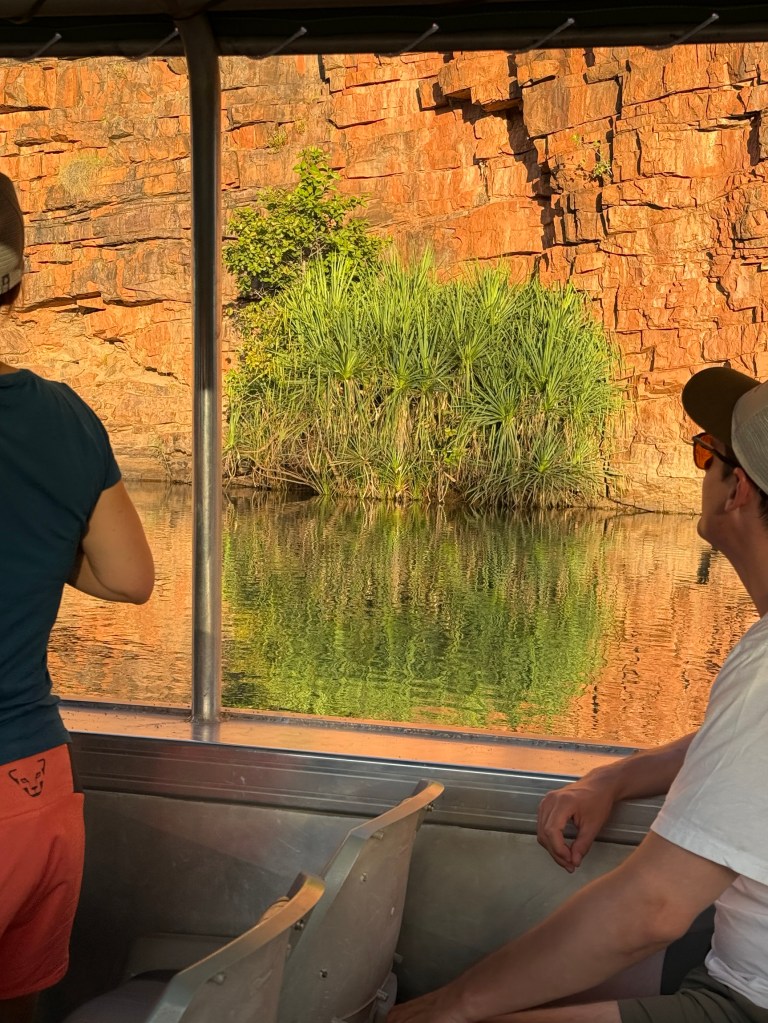
Back at the campground for lunch before joining an afternoon cruise on a deep water gorge segment of the Chamberlain River, a tributary of the Pentecost River.

The trip was narrated by a young indigenous guide, Buster. He did a really good job of describing the features of the river environment, vegetation snd animal. Helped us pick out the small rock wallabies that cling to the gorge walls hopping around in out of the small caves.
A bit of fish feeding too. We were the ‘victims’ of the Archer fish, ‘spitting’ a stream of water at us as small food pellets were held up and then dropped overboard. Some other fish also seen including cat fish and a big barramundi.
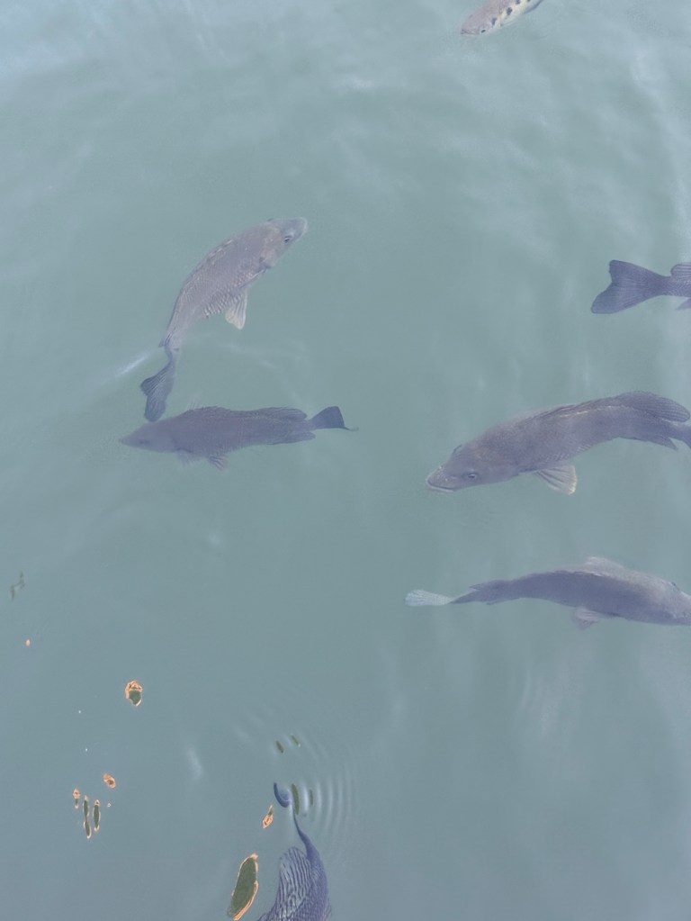
Cat fish are a tasty feed in these parts and have been given a more ‘palatable’ name, the Silver Cobbler. Buster commented that the price had also changed, gone up considerably with the new name!
A couple of days before we had gone down without the van to check out the Pentecost River crossing. Allthego did a ‘dry run’ test back and forth across, while Homealone took a video for the record! Here it is.
It was now time to move on from El Questro and make the fabled crossing of the Pentecost River with the van on the back and continue along the Gibb to our next stop at Home Valley Station.
The Gibb
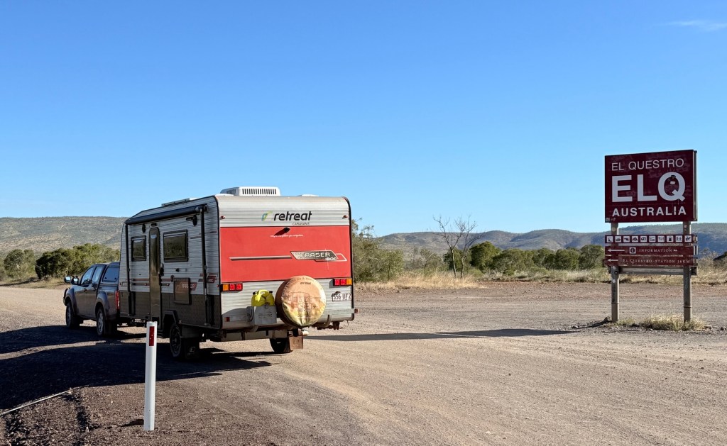
We have now made it to El Questro, our first stopover along the Gibb River Rd. Before arriving we had stopped off in Kununurra to stock up on supplies for the next two or three weeks. Supplies along the Gibb are a bit sparse and prices reflect the remote locations.
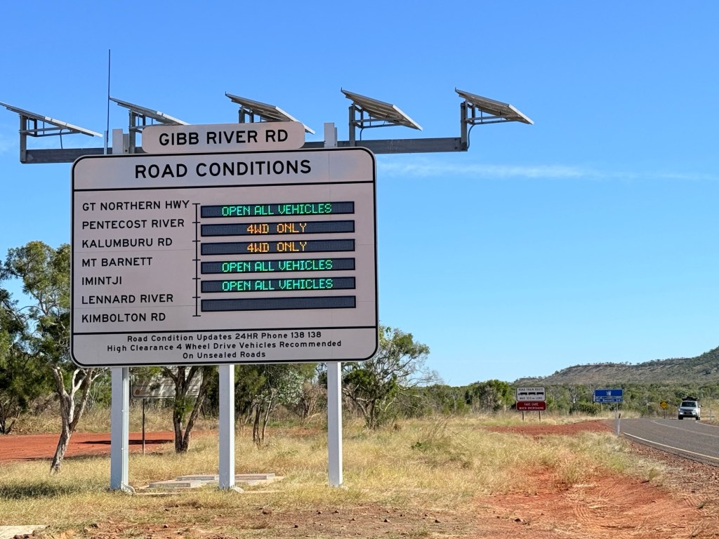
We stopped off at the start of the Gibb, which branches off the Great Northern Hwy, to check up on the road conditions ahead on the big sign.
The road to the El Questro turnoff is all sealed and a great drive through the landscape. There is a further 25km of sealed road to the Pentecost River crossing before the gravel starts in earnest. We will be tackling that section in a few days.
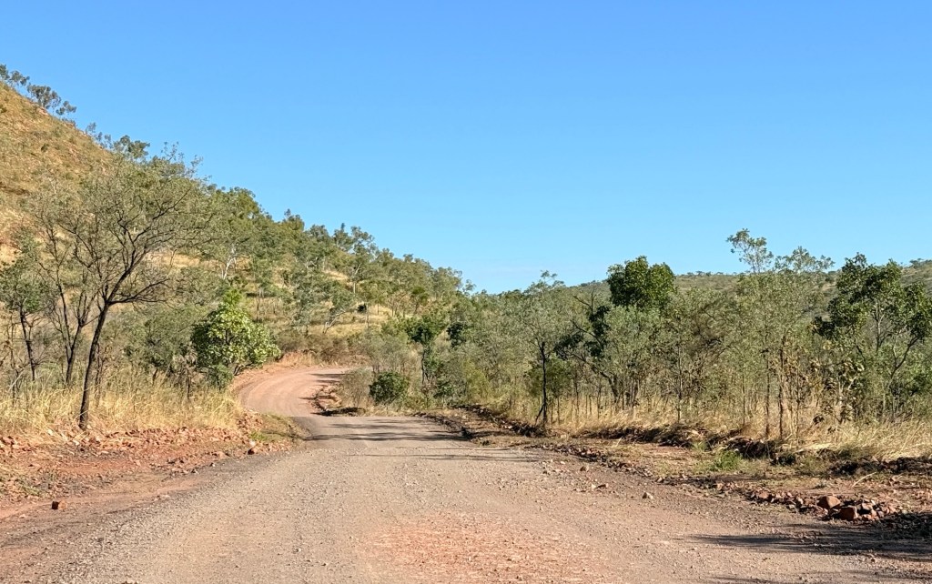
From the turnoff it is 16km along a good gravel road to the campground. The private road is graded regularly during the season. Smooth as a baby’s bottom as some would say!
Only three creek crossings of any significance and the levels all under 40cm. The first two were really big puddles of water. No dramas, a few splashes of water on the caravan indoor step.
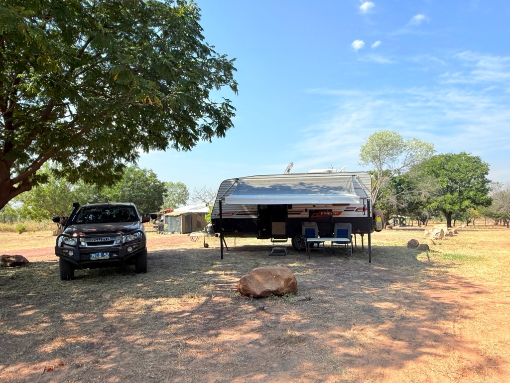
We have got a good campsite at El Questro under some leafy trees providing some good shade, it continues to be in the low 30s during the day. No big branches.
There are a few gorge walks here with the opportunity of a swim in salti croc free pools, some freshies though maybe around to at least keep an eye out for and not agitate.
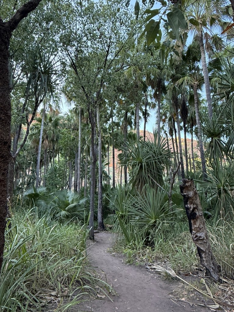
We are going to start with the easy one first, 600m return, to the Zebedee Springs. This is a stroll through the bush to a stoney creek that continuously flows rather warm water, 28-32 degrees thereabouts, from an aquifer deep within very old sandstones.
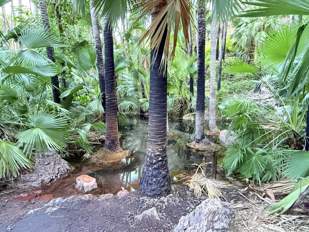
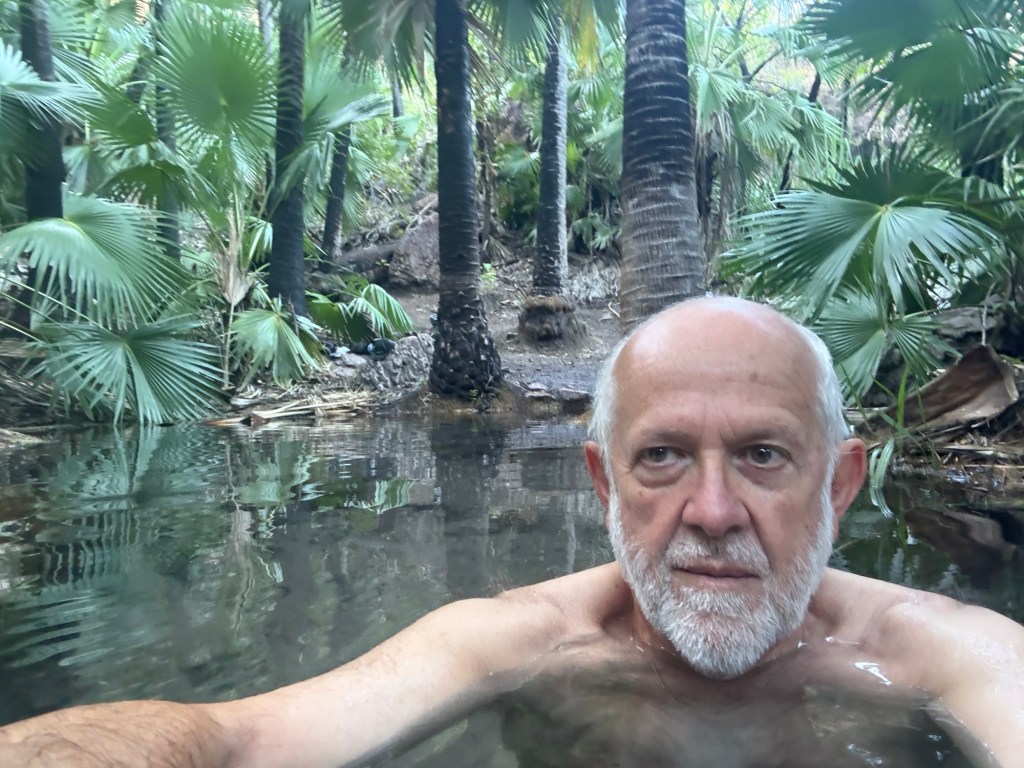
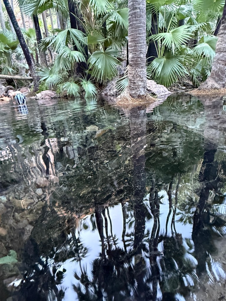
Here one can lounge all year round in the sandy bottomed pools between little waterfalls and tall palm trees. It might though get a bit vigorous in the wet.Very pleasant spot. Fortunately, we got there early around 7.30am and beat the crowds. Management closes access to the Spring at mid day. An effort to control numbers in the fragile environment.
Below is a slomo video of the creek it goes for a minute, patience required!
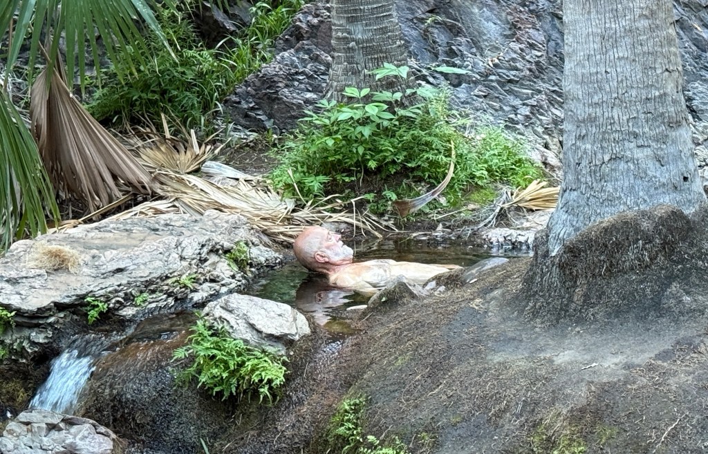
A small white crab like creature , an isopod, has recently been found to live in this creek. It is the only place in the world to date where this isopod has been found. Allthego kept his eye out for one as he lolled around in the waters, instead some big tadpoles were sighted.
Back in camp we had a lazy late morning and afternoon in the shade, with a belated democracy sausage for lunch. Until next time!
Lake Argyle
Lake Argyle campground is providing some comfort and few flies after the experience at Keep River. It is early in the season and there is plenty of room. Some bugs still chase the lights at night. There isn’t much at the Lake, just the campground and a lake cruise boat operator (hires canoes and dinghies too). A helicopter operates out of the camp too for jaunts around the Lake and the Bungle Bungles.
Our campsite is out on the edge overlooking a valley that runs down to the Lake. Windy at night. No Lake views. Some vans are also parked down there under the trees.
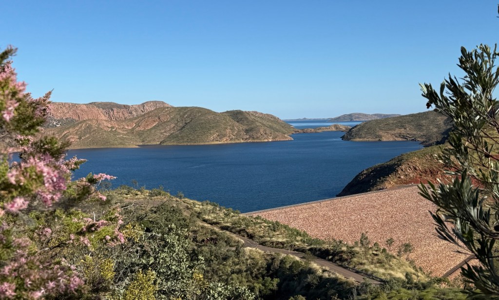
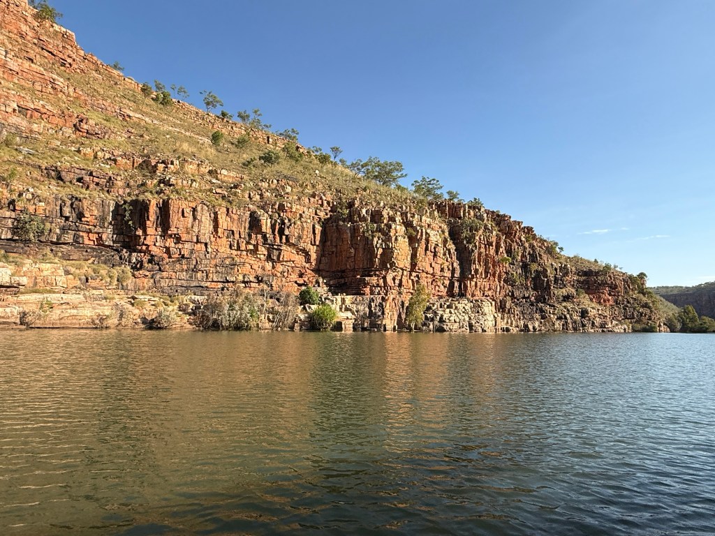
There is a big dam here as well that holds back the waters of the second largest man made lake in Australia (the largest is the Lake Pedder/Lake Gordon complex in Tasmania), some thing like 21 (?) Sydney Harbours when full. It is basically full now after a very big wet season in 2024 and a modest one in 2025.
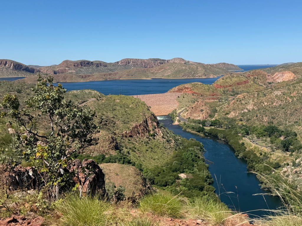
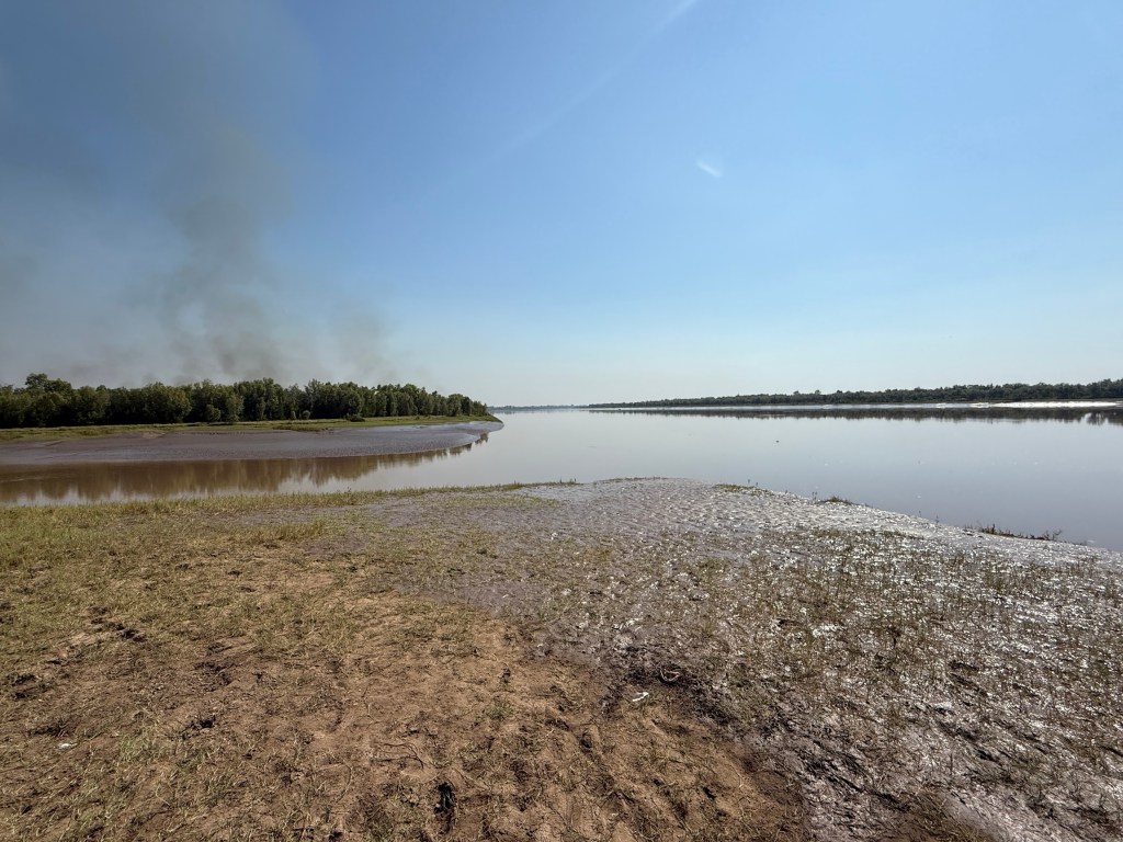
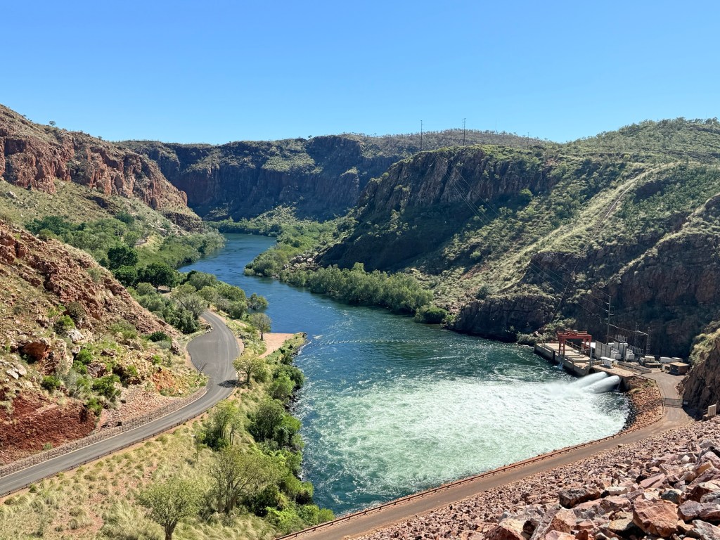
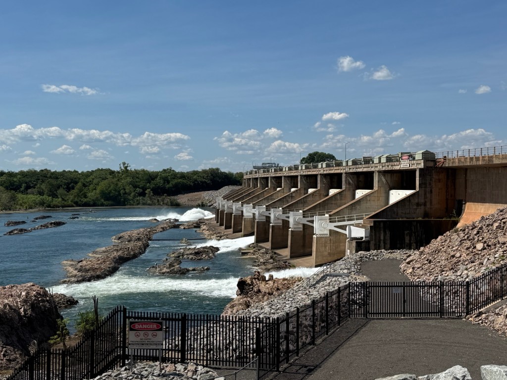
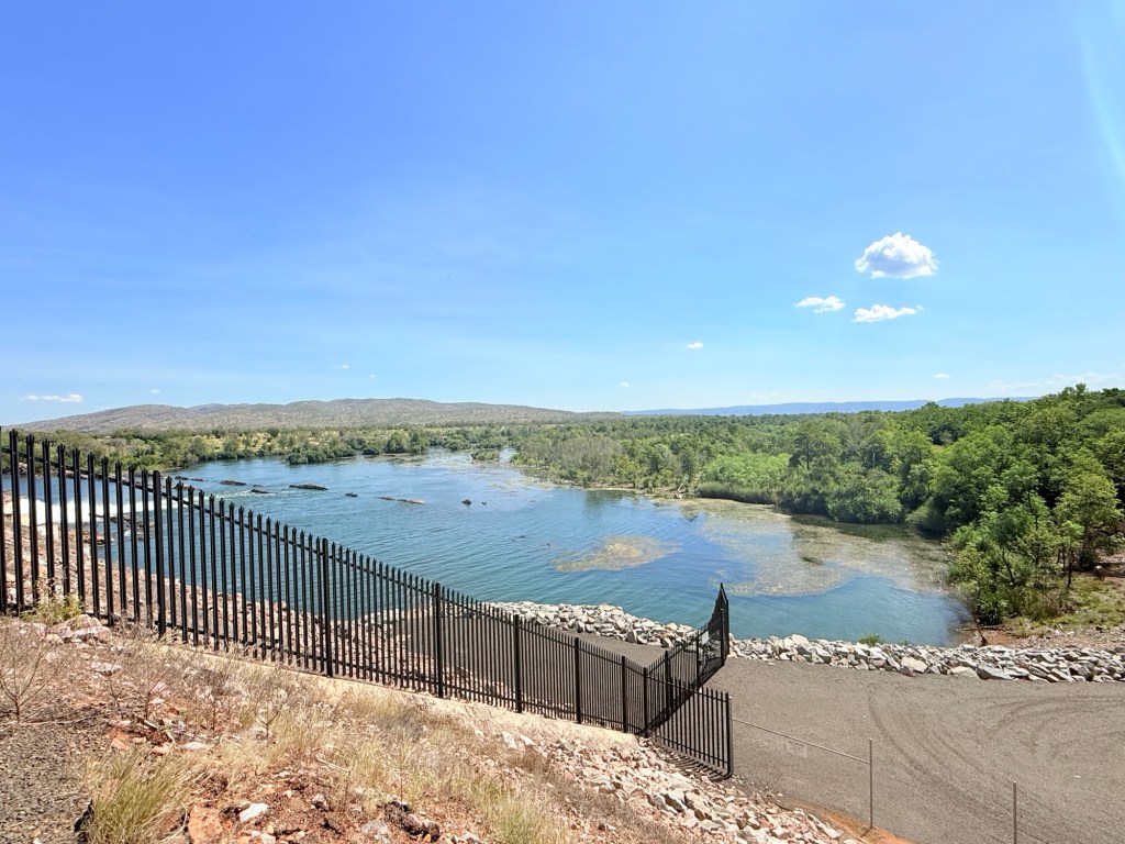
There are some great view points over the dam and lake; blue skies and deep blue water split by the red earth. Below the dam the Ord flows 55km down to Kununurra where the Diversion Dam holds back Lake Kununurra.
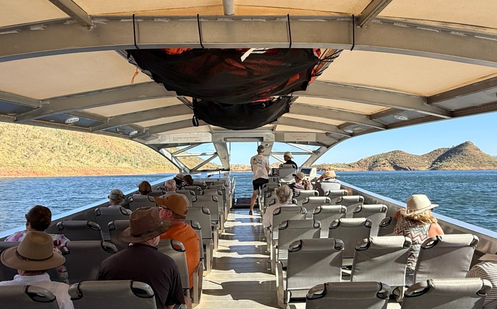
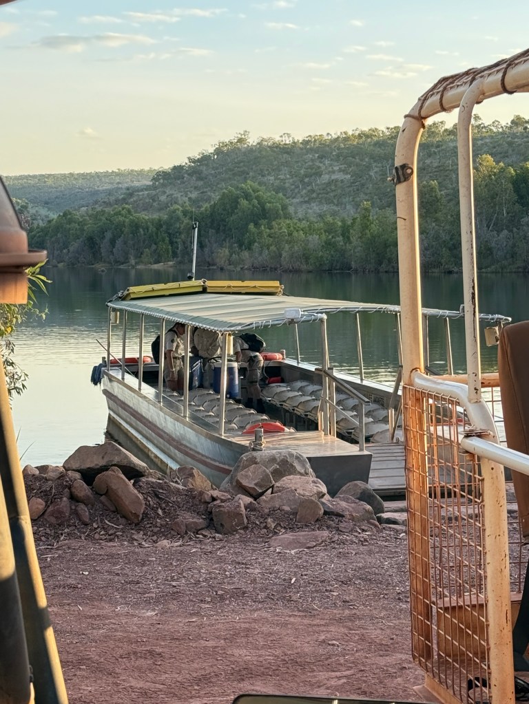
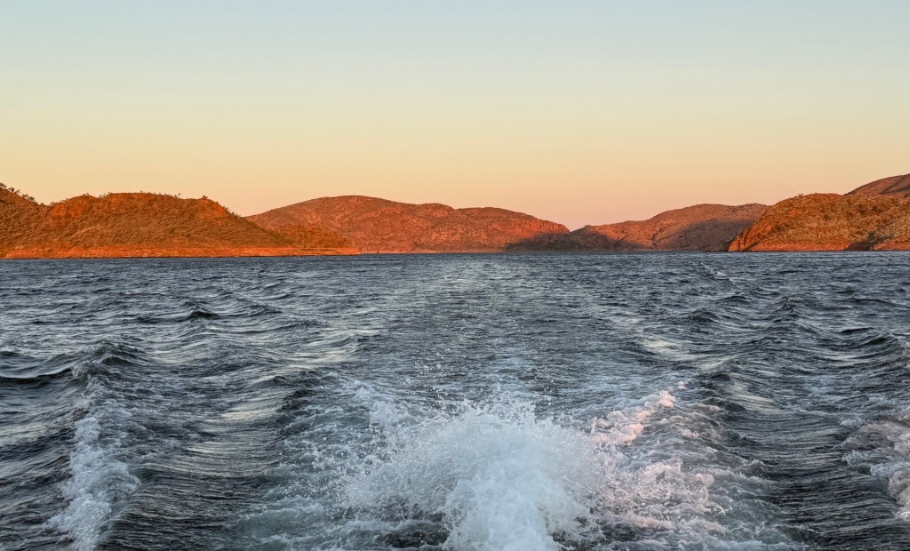
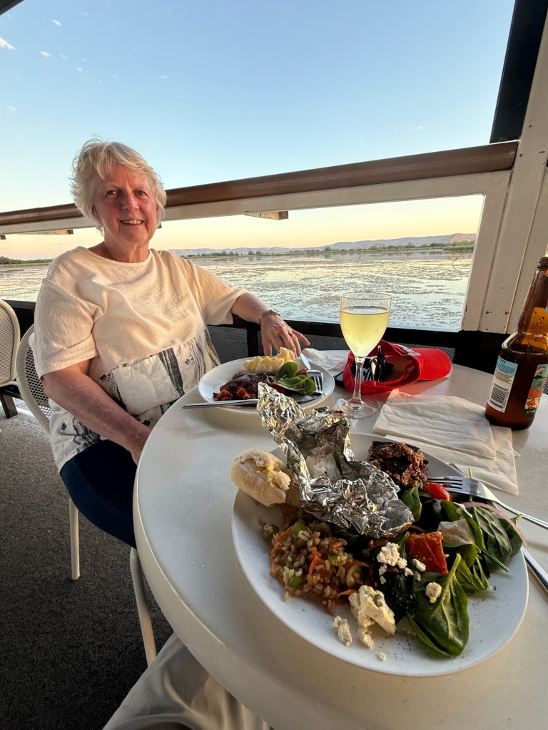
Getting out on the water here is a must do thing to get an appreciation of the sheer size of the waterways. So we enjoyed an afternoon/sunset cruise from the boat ramp near the dam wall. Only 12 of us onboard so there was plenty of room to move around and the nibbles went a long way. Not to mention the soft drinks.
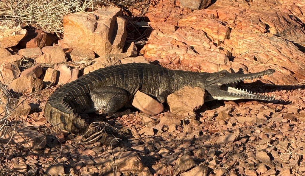
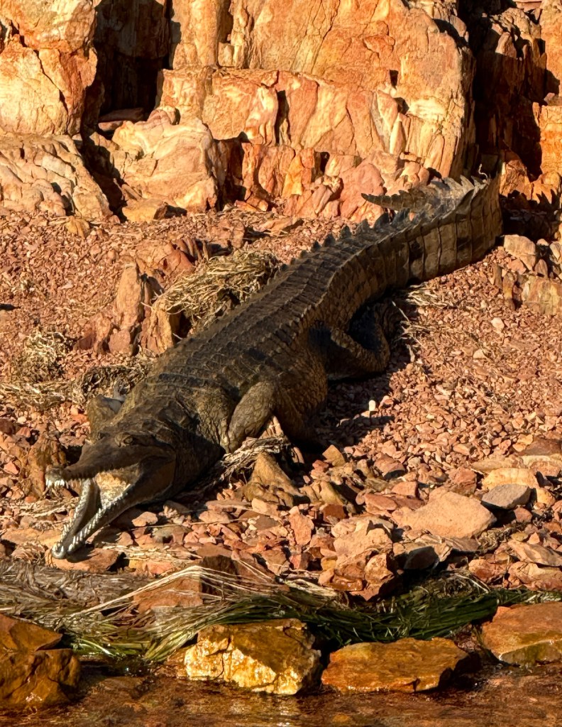
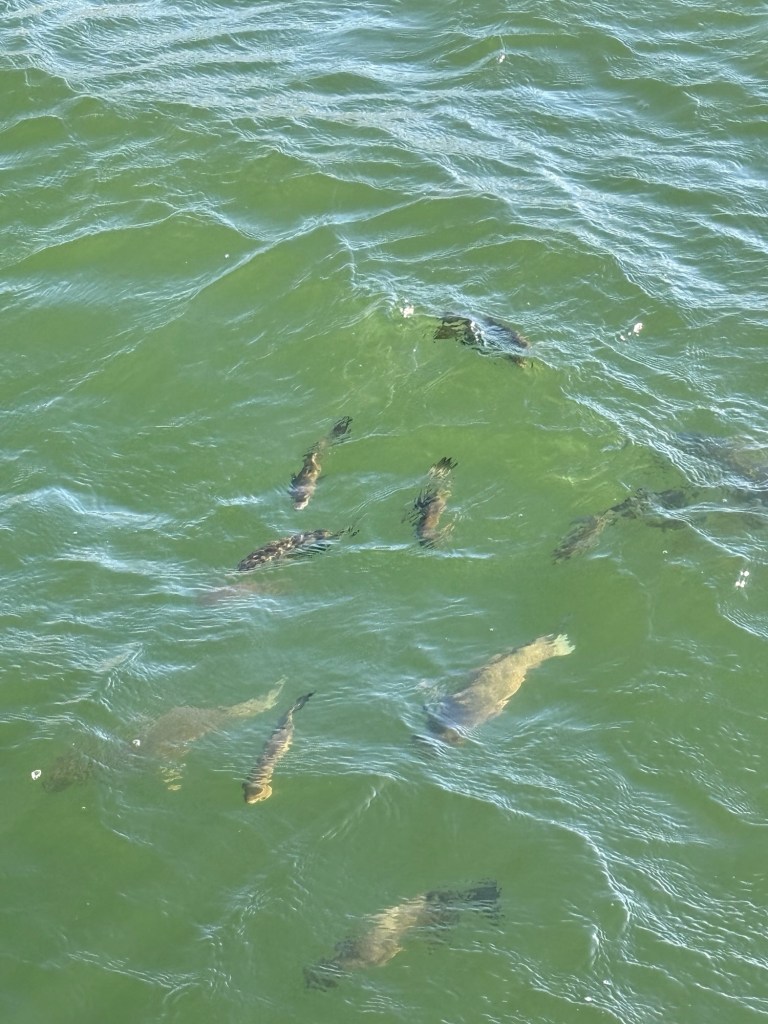
Spotted a few crocs on the bank, just the ‘harmless’ ones, and also tossed some dry biscuits to fish of all sizes that rose to the surface for their reward. Some of these are harvested and appear on the van park’s cafe dinner menu. We later tried some for dinner, rather good.
We later stopped at buoy for half an hour or so to enjoy a swim and partake of the nibbles.
Apparently, there are 35,000 freshwater crocs in the Lake. Not sure who counted them. These are the harmless ones, but they can give you a nip if you aggravate them. The captain was pretty sure there were no salties in the Lake, but of course couldn’t be certain. It would be a big climb up the dam wall for them. In any case the company hadn’t lost anyone to a croc as far as he knew.

Comforting, so Allthego ‘dived’ in. The water was a warm 27 degrees. Homealone, was reluctant and focussed on getting a good pic of the husband just in case.

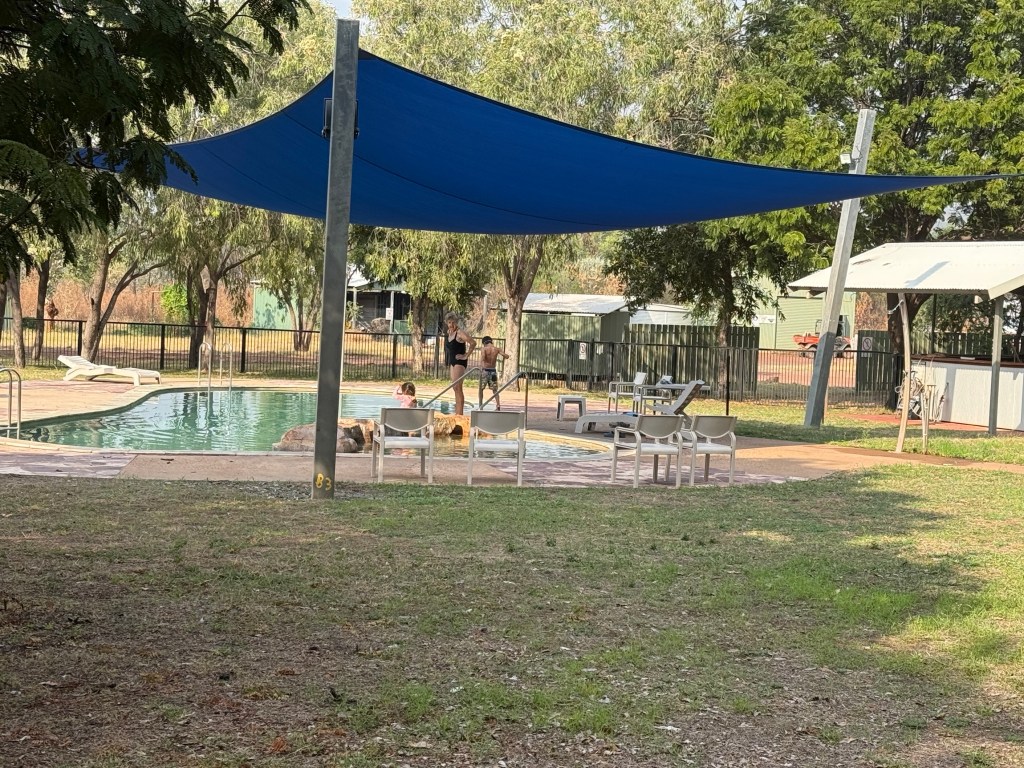
The temperature of the Lake water contrasted with the famous infinity pool. Not many guests were indulging in a plunge, just laying around in the sun looking beautiful.
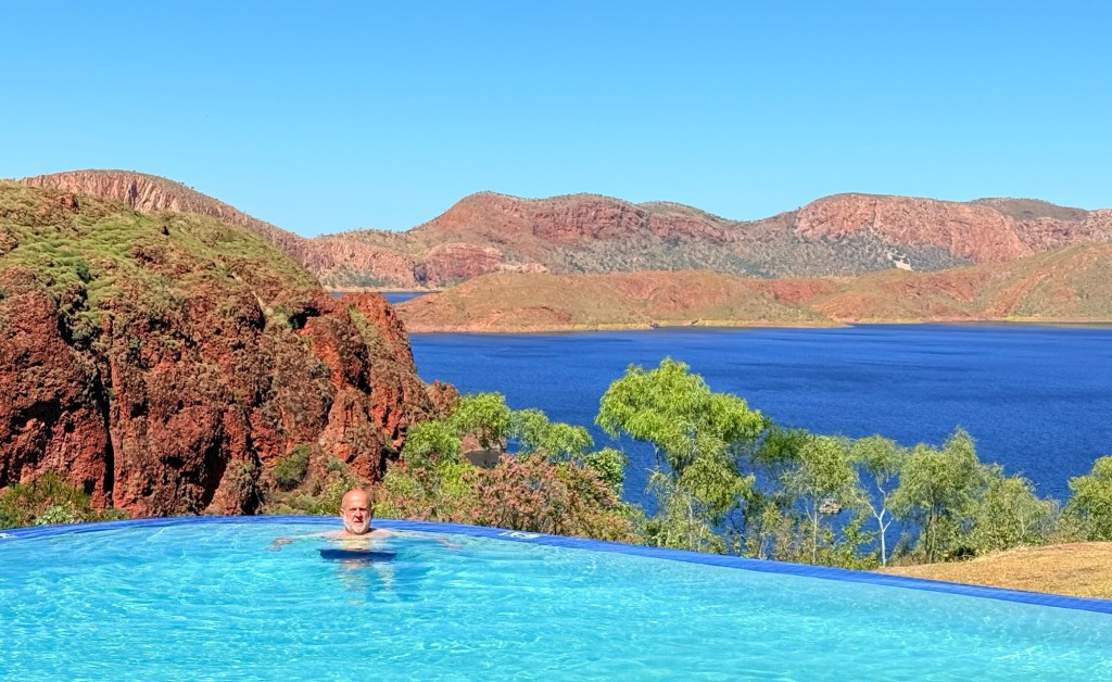
Not so Allthego, in he went. It was super cold indeed to start off with and didn’t seem to change much as it usually does when one gets ‘used to it’. Enervating!
In finishing it would be proper to note that in an earlier post covering the trip up to Whyndam I mentioned that live cattle exports are being phased out. In fact it is live sheep exports that are finishing up. Another glitch too, the export frozen meat business finished in the mid 1980s not pre WW11.
We now move on to El Questro at the start of the notorious Gibb River Rd. This is the pointy end of the trip through the Kimberlys. Will the road be as grim as proclaimed?
Walking the rocks
The walks here in Keep River are located in three places. Allthego is going to wander around them while Homealone patiently waits at the start keeping track of the elapsed time.
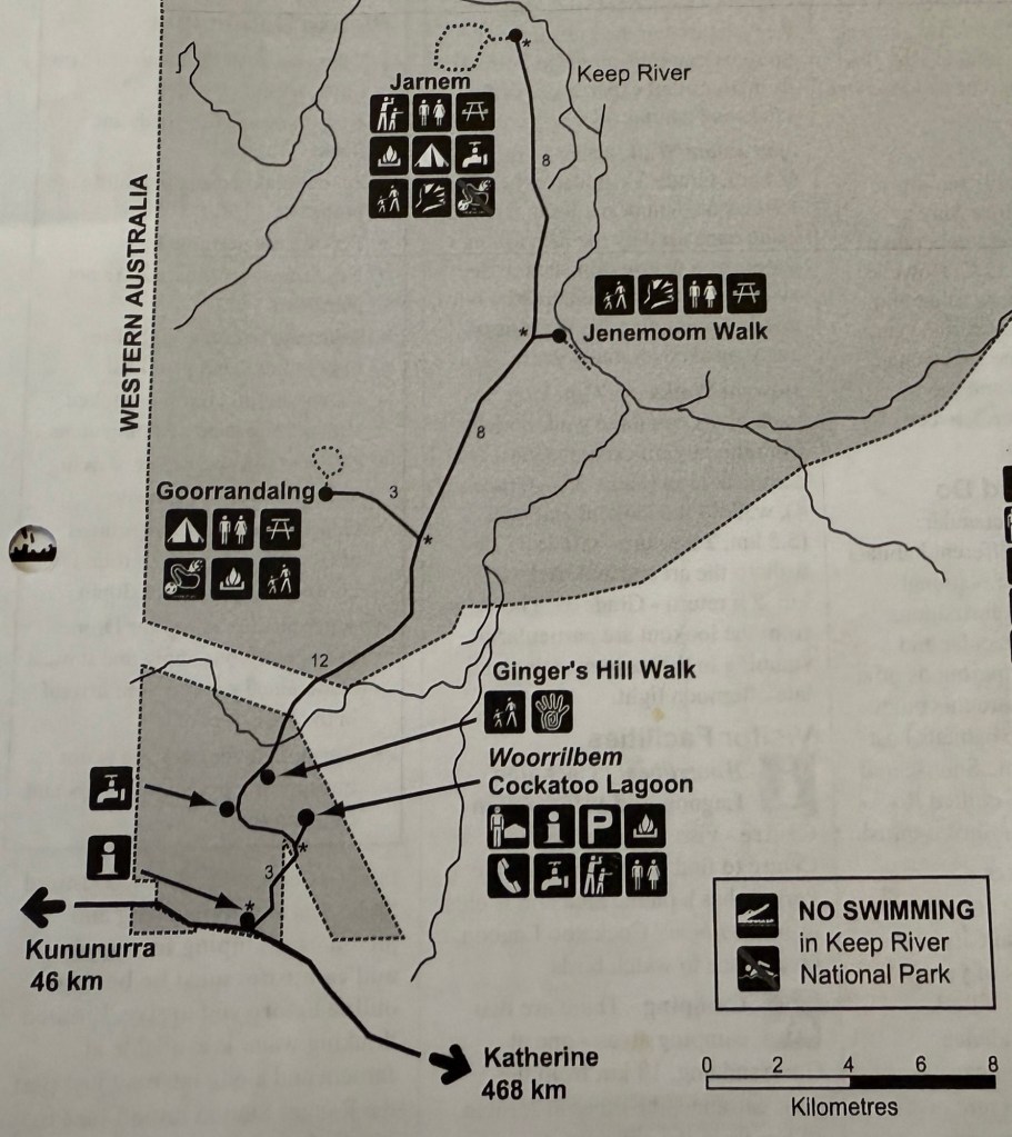
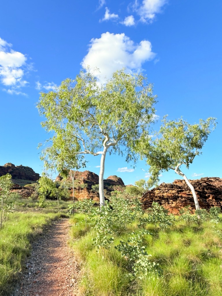
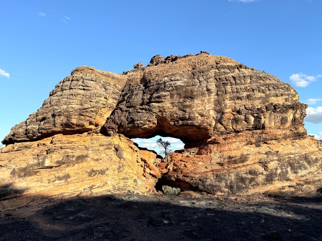
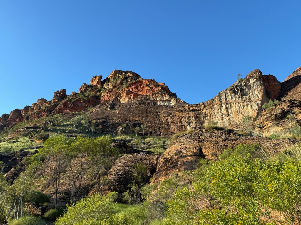
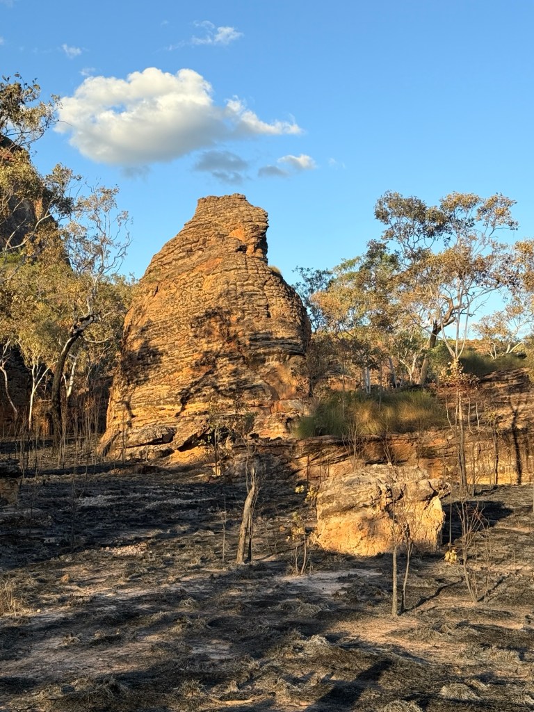
Here are a few of the photos from the experience on these walks spread over the three days.
The first is a loop walk that runs from our campground, Goorrandalng Walk (only 2km return).
The second is Jenemoom Walk (3km return) located about 10km away on the track to the second campground, known as Jarnem Campground.

The last walk is a 6.5 km loop walk from the Jarnem Campground, another 8km along the road from the start of the Jenmoom Walk.


Well, Allthego survived the great walks, the great bull and we sort of beat the flys. It was now back on the road to WA and some time recovering in the sun at Lake Argyle.
Apart from on the first day leaving Brisbane we have had no rain, daytime temps have been in the low 30s with little or no humidity. It’s the ‘dry’ season!
Keep River NP
The little map below follows the route from Katherine across the WA border to Kununurra.
We now leave Kununurra and backtrack just over the border into the NT, where Keep River NP is located (bottom left on the map). We have technically lost that hour and a half we gained the other day. We have decided though to keep our watches on WA time, so as not to confuse the sun. Phones automatically switched to NT time.
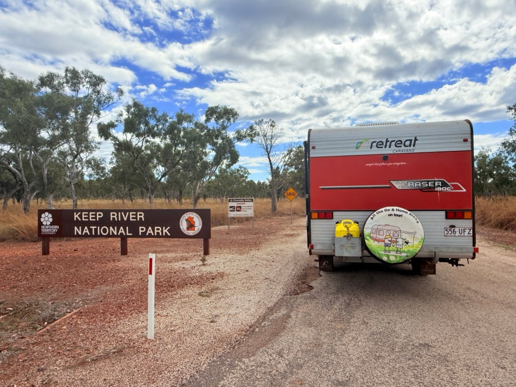
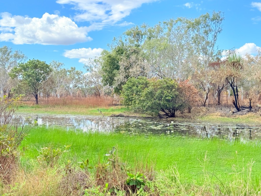
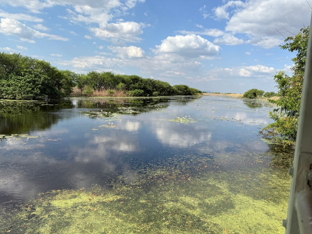
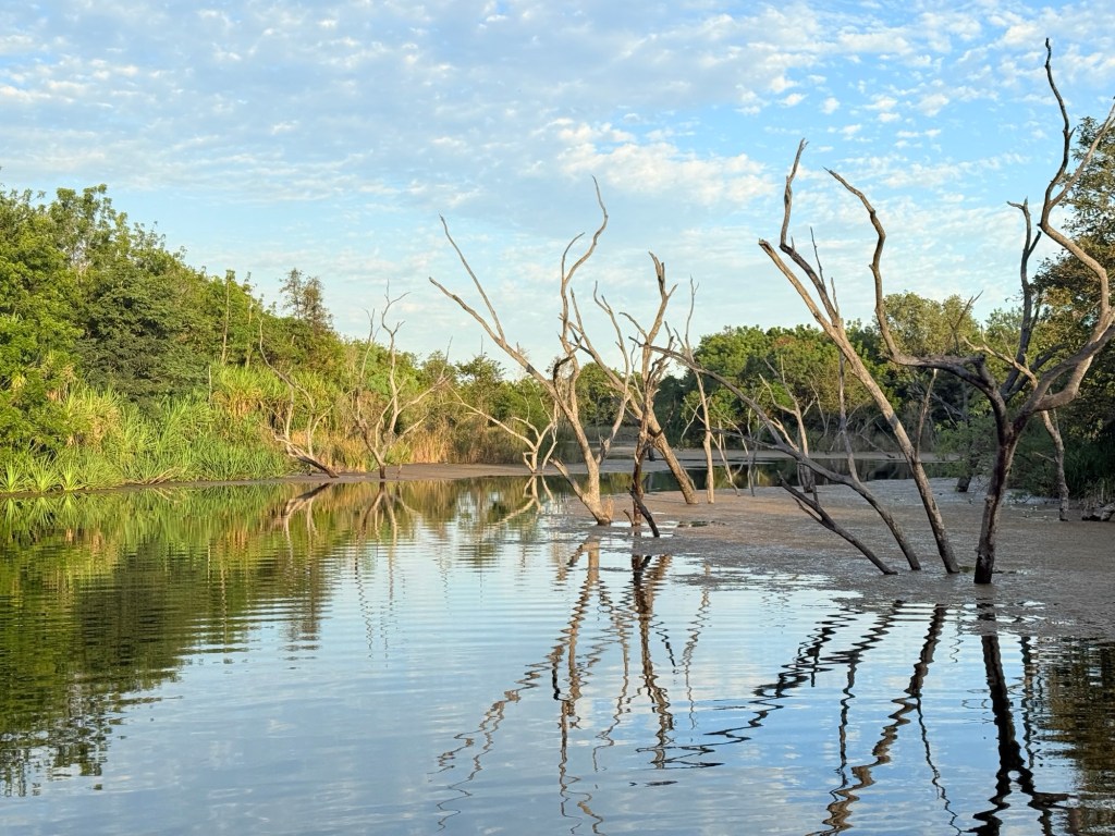
The NP camp ground is about 18km off the highway down a good gravel road. We first called by the Ranger Station to check out Cockatoo Lagoon and any fresh park information.
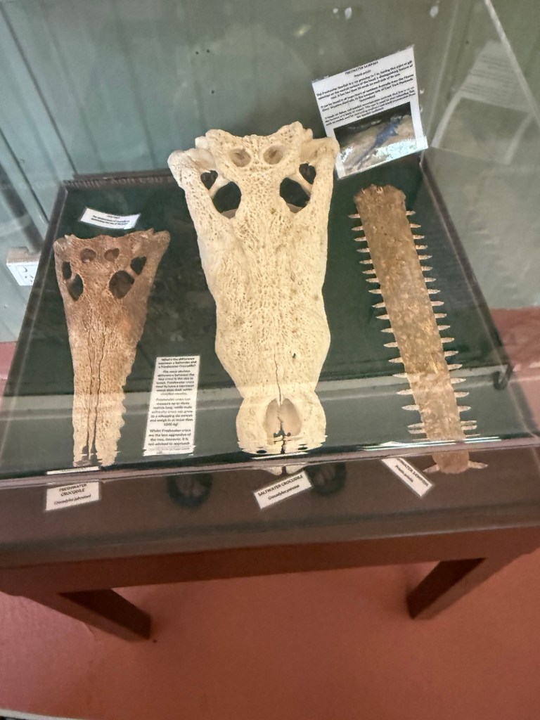
There was an interesting exhibit showing the skulls of three predators in the waters of the Keep River. We must keep our eye out for them.
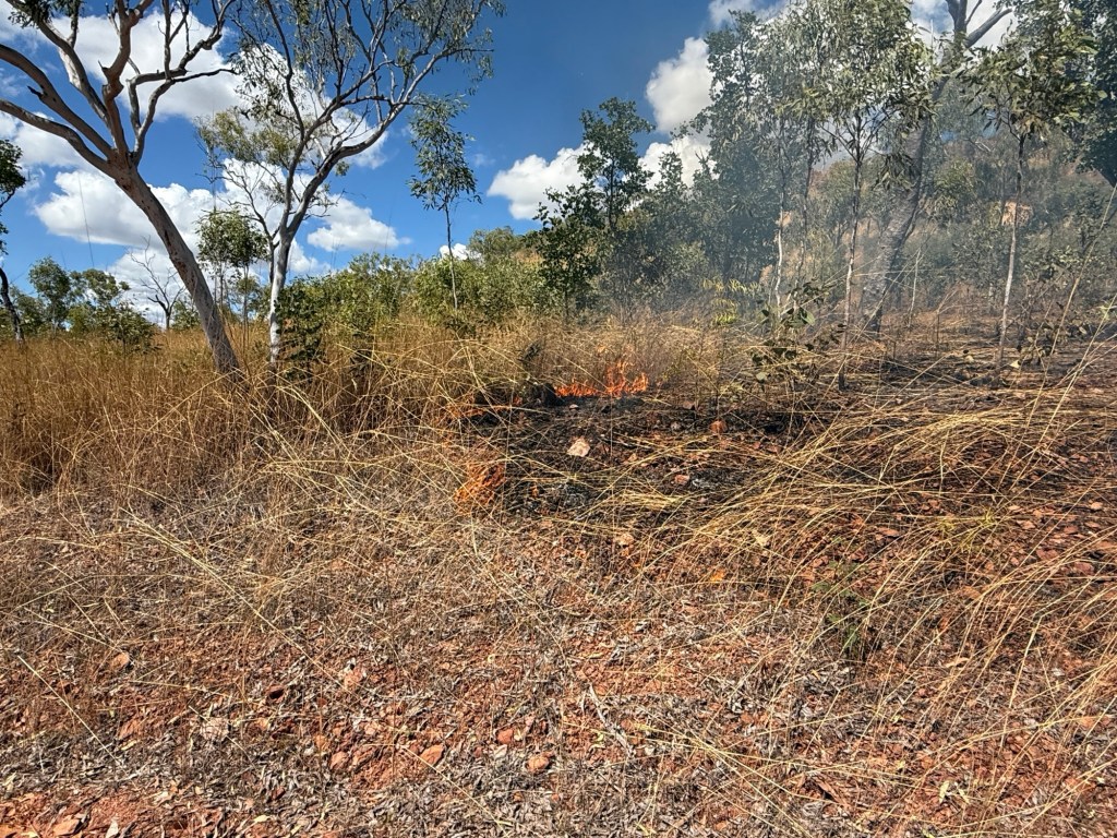
There has been quite a bit of low impact bush and grass burning going on in the park, campgrounds though are safe. Flocks of hawks circle above the burnt and burning areas hoping to pick up an escaping animal snack. Such is life!
Fire though is always a concern, but it is fascinating how it flicks through the grass and small shrubs just taking off the dry stuff. After the next rains everything springs back to life.
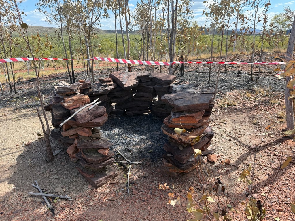
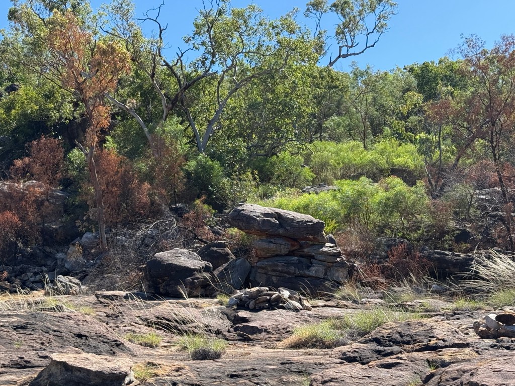
Moving along we stopped at the short Ginger Hill walk. Atop the hill is a small circular stone structure built by indigenous people (not sure how long ago, looked recent but maybe a reconstruction). Apparently, these structures are relatively common in these parts. You find out what it is for when you get to the top of the hill. The people would start a small fire in the rock circle, cover the top with branches, twigs etc and then sit inside and wait. Now, these people were certainly observant like Allthego!
Remember those hawks circling above the fire looking for getaways?Well, said hawks would also circle above this rock structure. They were attracted by the smoke, and when the character inside stuck a furry lure up on a stick and waved it around the hawk would land on the branches and twigs trying to catch the ‘animal’ for tucker!
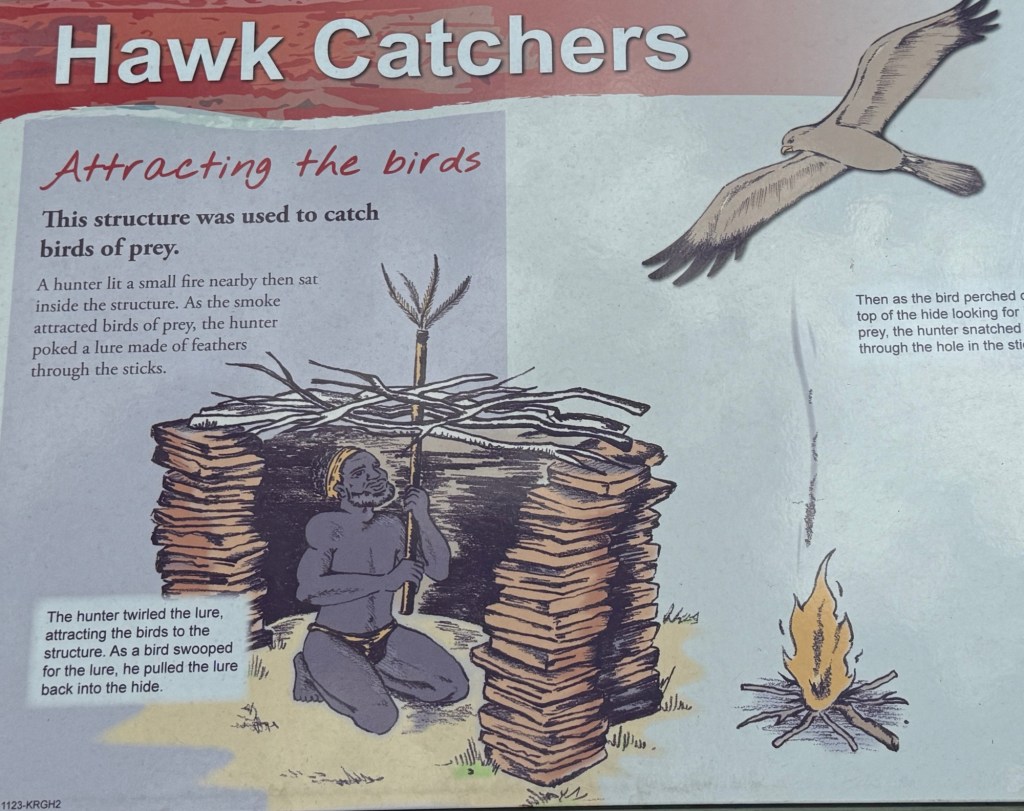
Instead, ‘wooshka’ our first nations person would grab the hawk somehow for their tucker! I wonder whether this would work on brush turkeys back home?
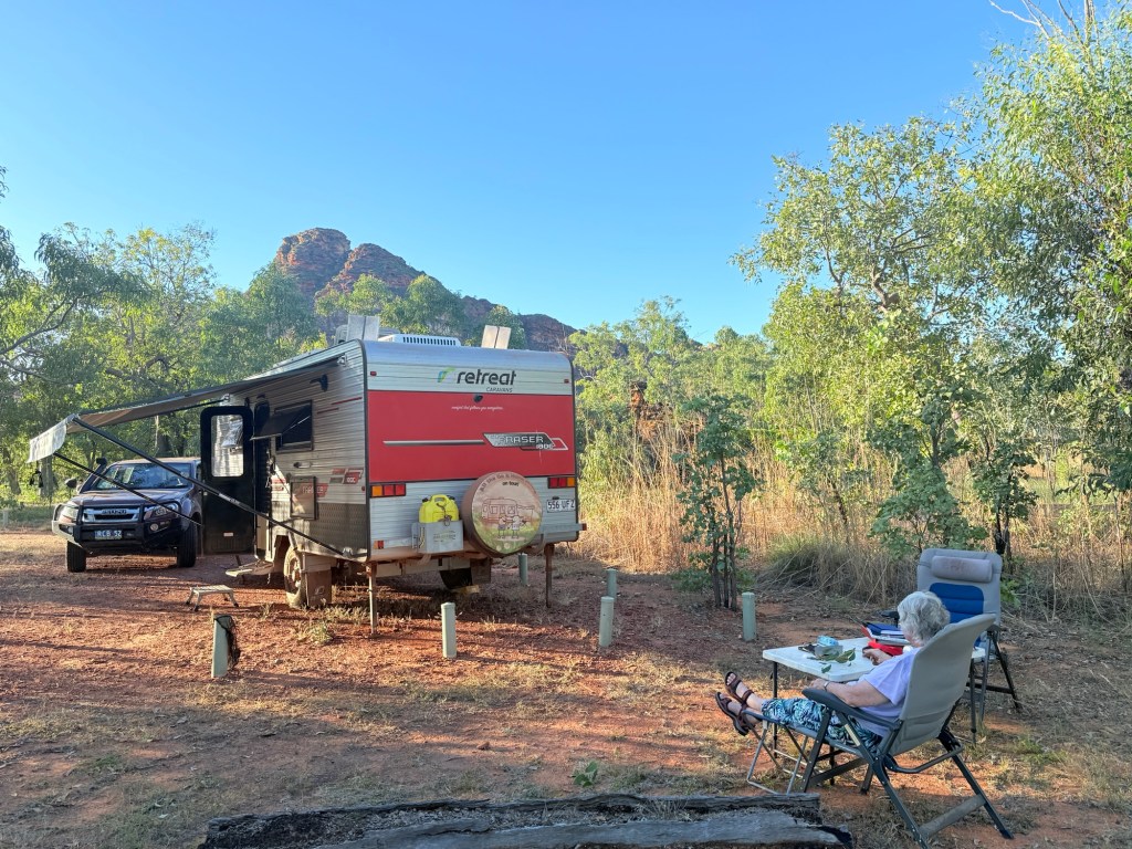
After this excursion we meandered along to the campsite and got into our pre-booked site for the next three nights. No one else was here. But there were lots and lots of flies to keep us company. We had arrived lunchtime WA time. As it turned out this was the worse the flys were to be and things improved (only a little) over the next couple of days. No power, water or internet. Off the grid living! Another van showed up on our last day, as well as one day tripper.
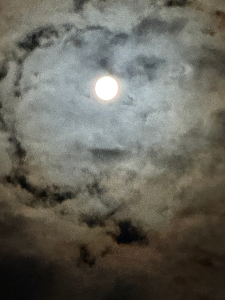
It was a very quiet time, nights were super quiet, and we had a full moon with a very starry milky way above.
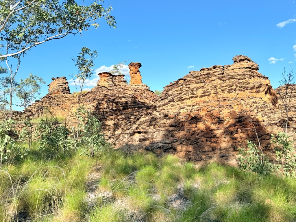
We are here to do some walking and see some rocks. It is claimed the park is the NT best kept secret. It is considered to be a mini Bungle Bungles. We shall see over the next couple of days.
Last day at Kununurra
Our last day at Kununurra was taken up with some housekeeping and a food stock up before heading out to Keep River NP, a remote place with no Telstra, internet or power. For some reason they have Optus, no use to us!
Before hitting the shops though Allthego went out to Mirima NP, just on the outskirts of town. Homealone stayed behind at the van. Mirima is a mini Bungle Bungles type environment with a couple of great walks among the domes. Be warned though we are getting to that part of the trip where there are lots of rocks to see over the next little while. Allthego has got less interested in regional town museums but does like rocks!
One of the walks visits some Indigenous rock art overhangs. It was an interesting wander for a couple of hours.
A great lookout too after a climb up some steps to the top of a dome structure.
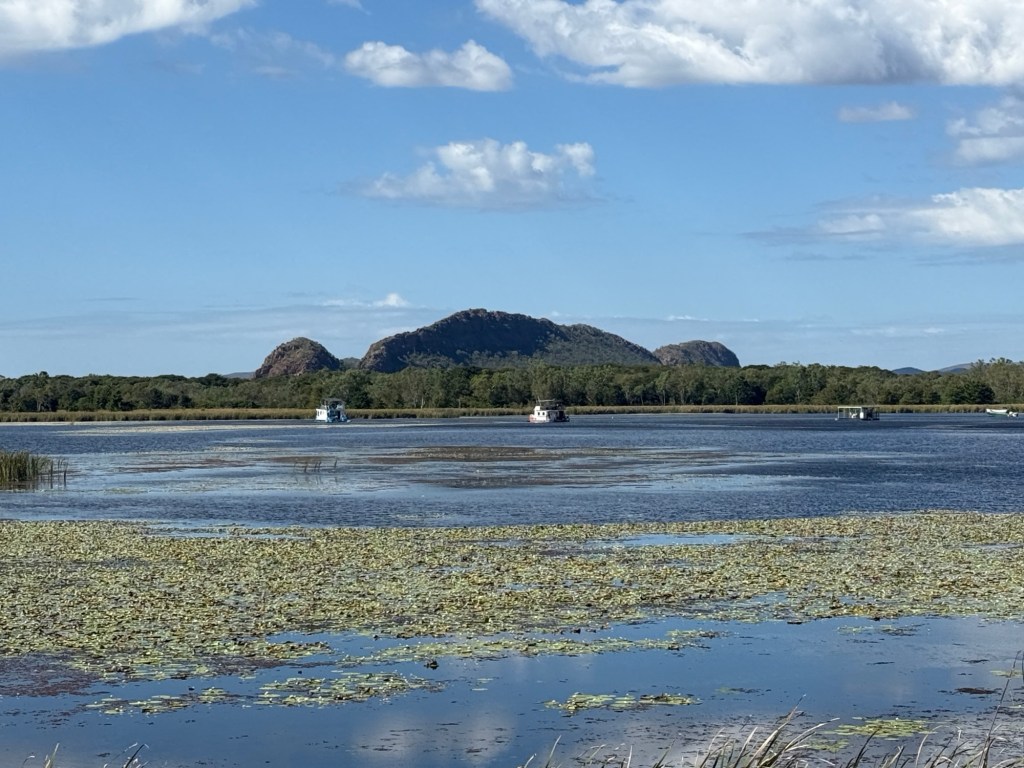
On the way back to the van park there was another view of the Sleeping Buddha across the lagoon. It always looks impressive no matter the angle!
After the shopping expedition we pulled into the Visitor Information Centre to get Allthego’s ‘Did the Gibb’ swim shorts. The lady in the Centre still sold the shorts even though he told them we had not yet done the Gibb. Didn’t worry her, money was all that mattered!
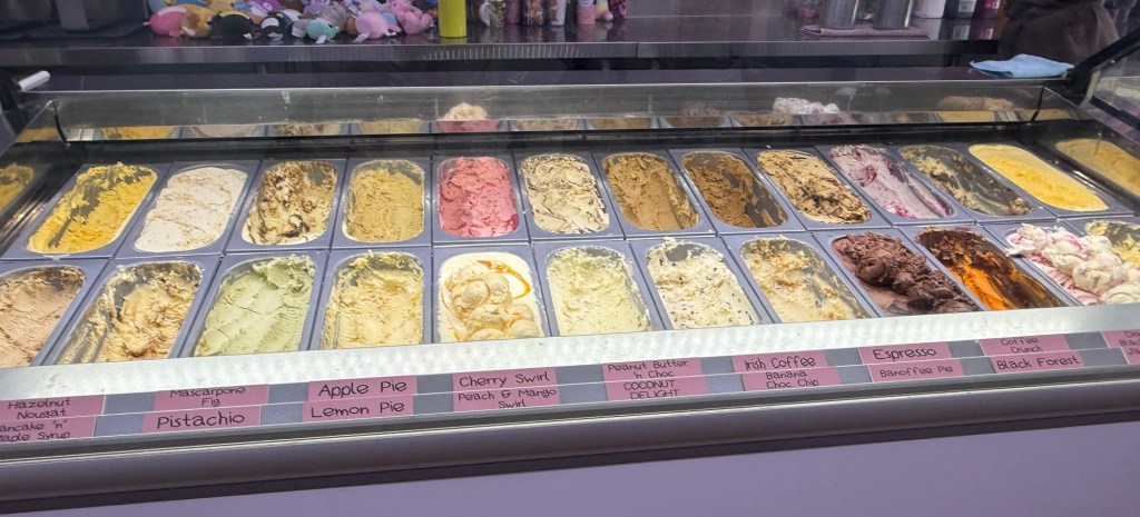
Some ice cream followed at the towns famous ice creamery. Vast array of ice cream and sorbets.
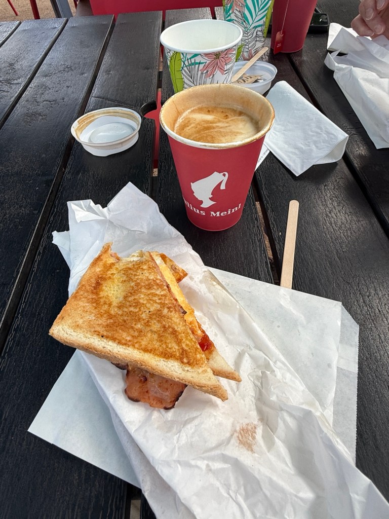
Back at the van park we got set for an early start the next morning but we got caught at the van park cafe for a coffee (tea) and toastee for breakfast.
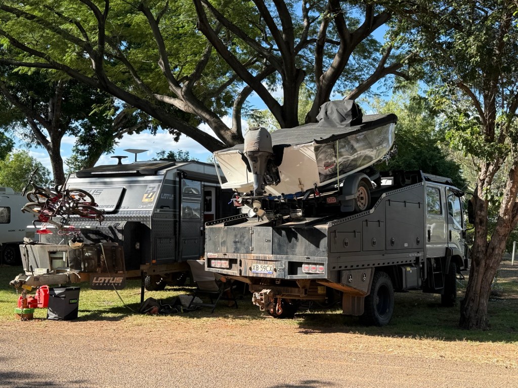
Also had a gaze at a rather over the top vehicle set up. Keen campers one suspects and keen on a bit of fishing.
It was a great spot by the Lagoon but we had to leave for Keep River NP and more rocks.
Wandering to Whyndam
Kununurra is an ideal place from which to base a side trip to Whyndam. The back road, which I mentioned last time, is actually the route of the original track to the coast from Kununurra. The Ivanhoe Crossing was built to facilitate the route across the Ord River. Ivanhoe is the locale not the river.
But we can’t take it because too much water is still flowing across. So we have to travel further west from Kununurra crossing the main bridges and take a side track on the west side of the Ord which meets up with the old road (fingers crossed). Sounds easy and the 4WD track was quite good.
We passed by the Valentine Springs, fancy name for a waterhole fed by a couple small waterfalls. Here we encountered the first of something like twelve shallow creek crossings on the journey to Whyndam. All through them without hic ups.
After rejoining the old road we tracked along relatively close to the Ord, catching a glimpse from time to time. We pulled into a couple of other Indigenous sites along the way, Middle Spring and Black Rock Falls, down some rough side tracks. Black Rock Falls was the most impressive.
Back on the main track, known as Parry Creek Road, we took a break at the Mambi Island Boat Ramp on the Ord. Croc warning signs abound.
This would be a challenging little ramp for the inexperienced, the river bank is very eroded and the little patch of concrete is now in the wrong place. But I suspect only experienced boaters venture to these parts. The Ord is impressively wide here as it meanders towards the Cambridge Gulf.
We took a hard left here away from the River back towards the Great Northern Hwy, the ‘new’ sealed road to Whyndam which is the way most nomads go.
Another side track takes us up Telegraph Hill where the remains of the old telegraph station and its staff lived many moons ago, pre and during WW1, before it was moved to Whyndam. It is here we have our first encounter with an AAT Kings tour bus with thirty or so souls aboard. Mostly Aussies, Kiwis a couple of Canadians and four Americans (as we later found out). Some great views from this hill overlooking the Ord flood plain and the large Marlgu Billabong, which we were all making for to see the pond and associated wildlife. The bus beat us there for their 15 minute gaze and photo stop.
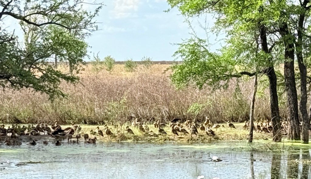
Great spot, we pulled up as they were getting ready to go, had a brief chat with the driver. They were headed for Perth from Darwin, 21 Days. We said hoo roo as they headed off and we stayed on for a longer look, lots of ducks in the shade. No crocs sighted.
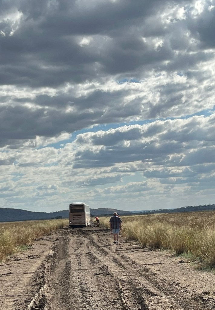
On the track again we set off eager to get to Whyndam as time was getting on and we hadn’t had lunch.
We were now down on the flood plain getting along nicely when around a corner and with the track straightening out there it was! The bus up to its belly almost, in the bog. It was about 2pm. Allthego pulled up gingerly and undertook an inspection, plenty of action going on scrapping mud away by hand and putting levelling wedges behind the driving wheels.
Numerous attempts were made to back out, just made it worse. Seems the bus carried little recovery gear. The driver a little inexperienced too, just powering ahead into the mud. Now Allthego is not getting too cute here, he too has dipped the toes into black soil mud but got out relatively easily. A big bus is a different proposition. At least our spade was useful in a hopeless situation. Our Max Traxs ineffectual. The bus was stuck big time!
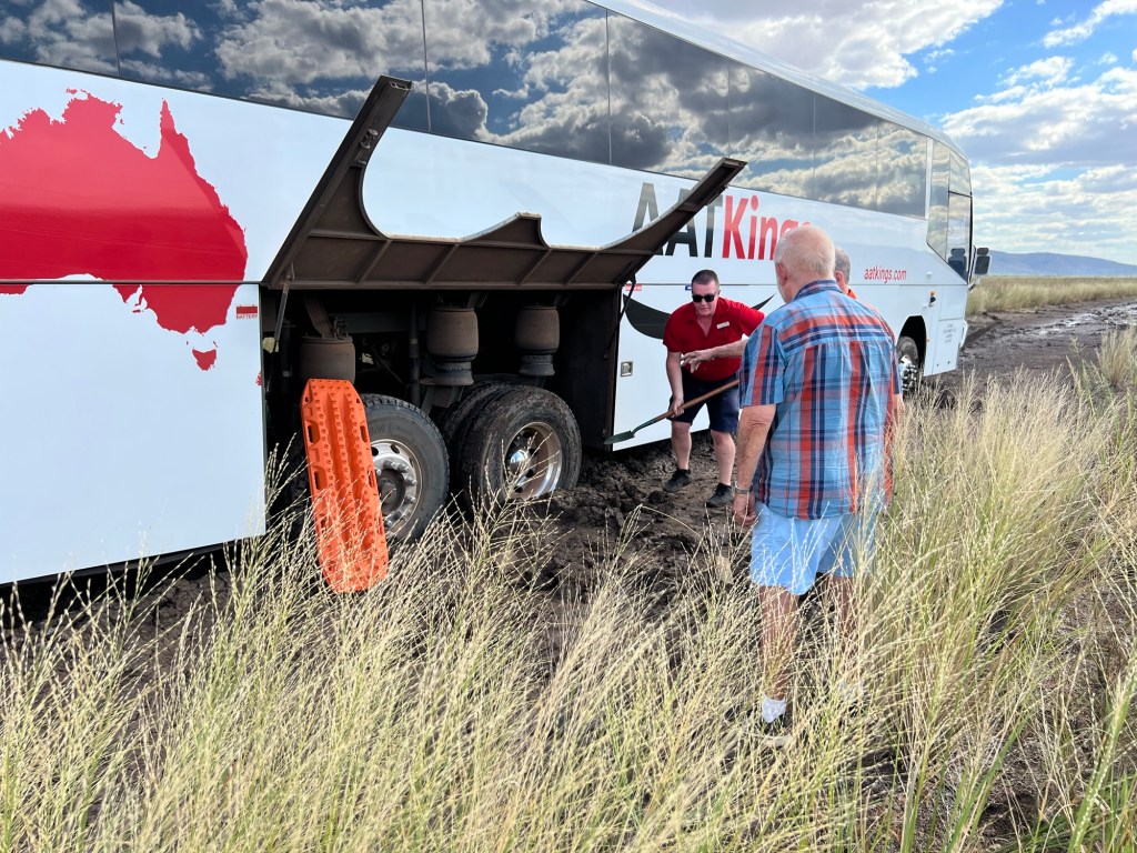
The bus driver was able to make a call for a back up bus and also a tow truck. It was now 3.30pm (it gets dark around 5pm). Some of the 30 were getting anxious, but were calm. We turned around and backtracked to try to intercept the tow truck and get it to the right place. Never saw the tow truck but we did see the back up bus speeding to the rescue! So, I suppose the people got out ok but the driver might have had a long night minding the bus in the bog! We will never know, but AAT gave us a nice bottle of red for our spade use and company!
We didn’t get to Whyndam that day and had to do it all again the next day. Taking the ‘new’ road.
Whyndam is a town in decline and with the countdown to the end of live cattle exports one wonders what will happen. Curiously, after WW1 and pre WWII the town operated a frozen meat works that exported beef to the UK. It closed down and the infrastructure was removed. Could it return?
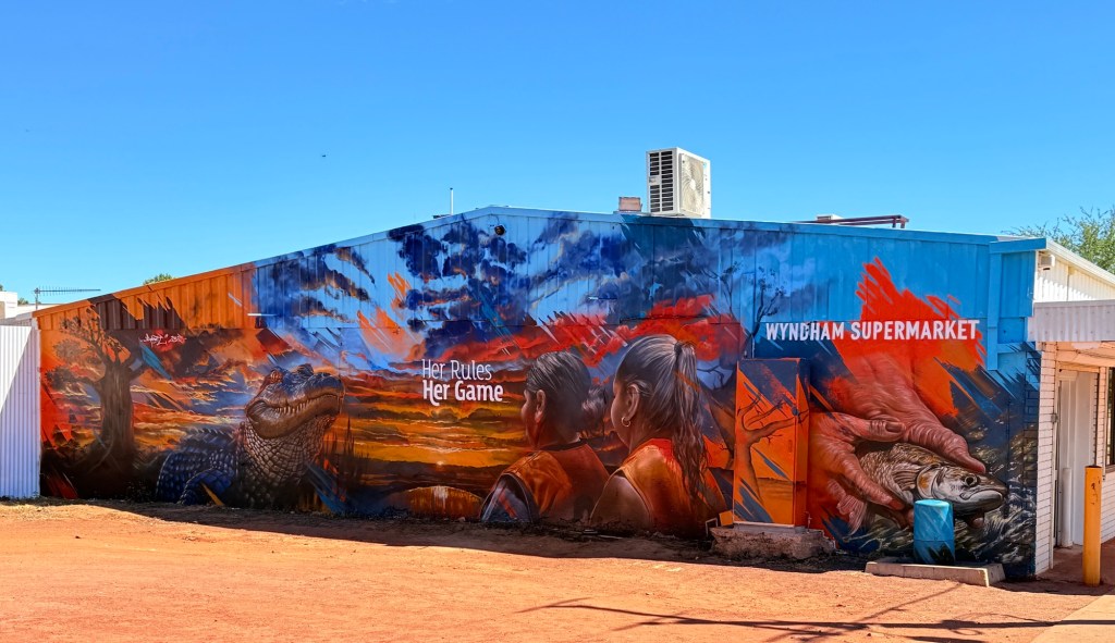
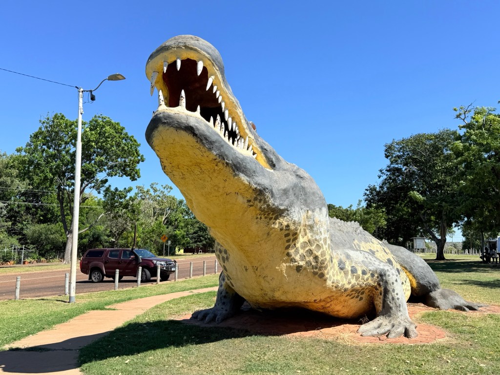
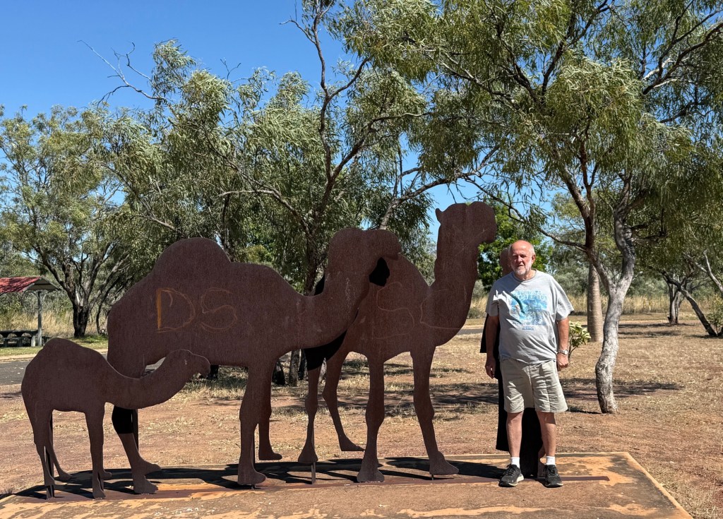
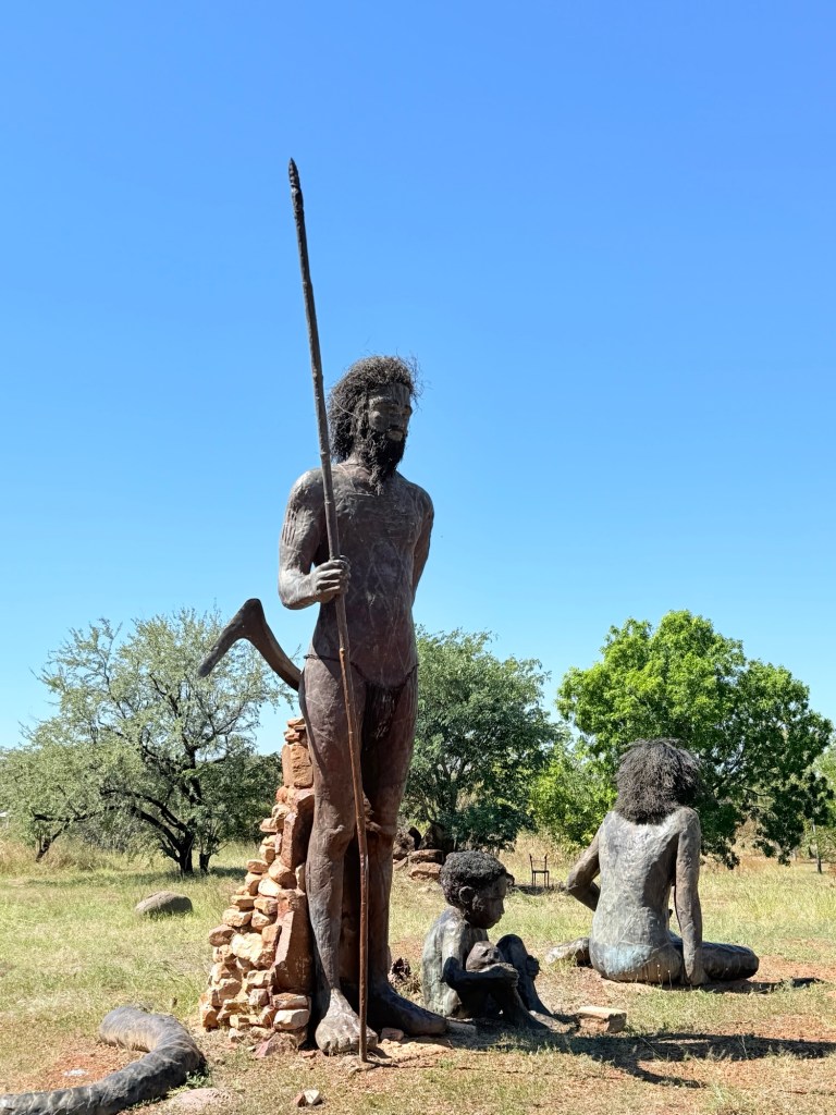
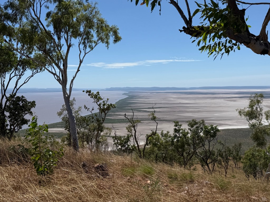
There are a couple of memorable touristy things in town; the big croc, the indigenous statues and the great view over the Cambridge Gulf. There is the ever present museum too, if you are into those.
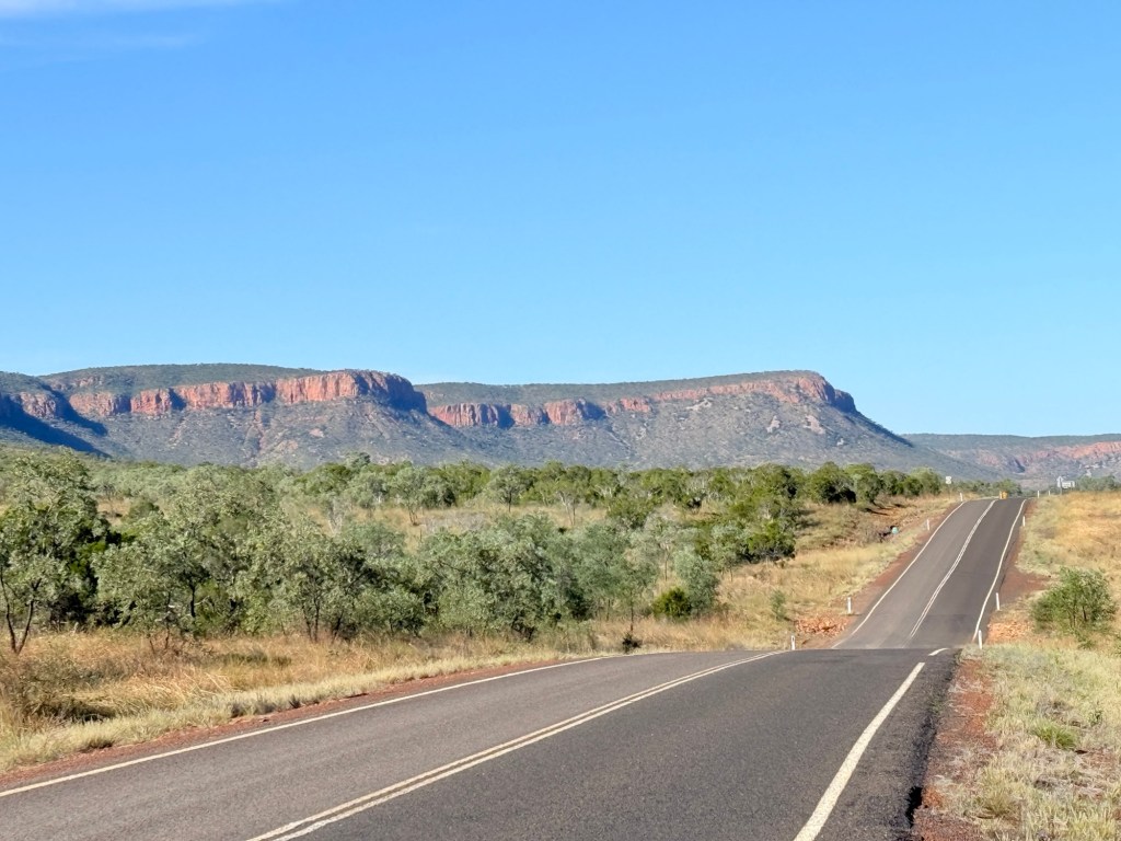
We headed back to Kununurra and along the way checked out the Gibb River Rd road conditions billboard where it branched off the highway for El Questro, our first stop along the Gibb in a week or so. Looked good!
How to gain an hour and a half
Cross from the NT into WA and arrive in Kununurra!
We are here in Kununurra for five nights. Plan to get around a bit if we can drag ourself away from the view from our breakfast table at the van park.
Kununurra is quite a large town with around 7,000 residents that swells to upwards of 14,000 in the busy dry season. There are several large van parks and other hotel/motel and resort style accommodations. Plenty to do in four days.
The big thing near town is the Diversion Dam that holds back the upper Ord River to form Lake Kununurra. The upper Ord is actually the water that is let out of Lake Argyle, about 55km upstream.
Lake Kununurra is this backed up river, not particularly wide behind the Diversion Dam but with a number of lagoons off to the sides. Our van park is on Lily Lagoon, the van is perched on the bank just back from the crocs (haven’t seen any).
The Dam is called ‘Diversion’ because an irrigation canal diverts water from the lake into the agricultural lands that thrive in the region.
The canal gravity feeds various channels into the farmland and from which water allocations are taken by the farmer.
Plenty of stuff grows here: cotton is big, sandalwood is in decline but there are mangoes, various melon types and grains.
Behind this farmland is an old gravel road that runs about 100km from Kununurra, for most part along the lower Ord, to Wyndham on the coast. We are going to drive this road while we are here. Homealone wonders why, but Allthego suggests that because it is there we need to do it! Not though for a day or two.
The main way of getting on this back road is across another iconic Kununurra site. The Ivanhoe Crossing, about 10km from town.
Currently, it is closed as there is too much water spilling across it. Crocs either side. Hopefully, it will be open before we leave so that we can make a crossing!
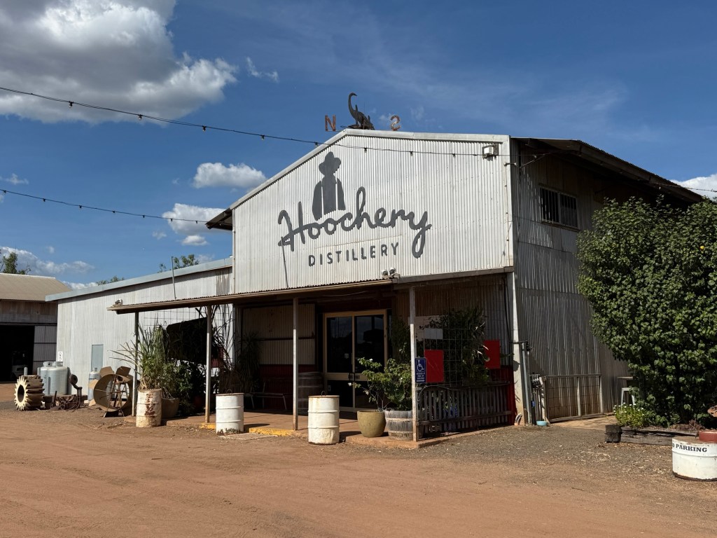
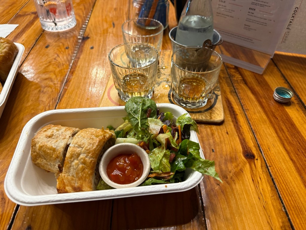
Not far from the Ivanhoe Crossing is the Hoochery, the local distillery. It produces a range of spirits and mixers from mostly local grown ingredients. Rum being the main one. There is a whiskey made from local sorghum in the American rye style. Being lunchtime we pulled in for a light snack and also had a taste or two. All rather good!
We celebrated Mother’s Day on the Lake on the first Sunset cruise of the season, only eleven aboard so there was plenty of room to move around. Homealone likes being on the water! The boat meandered out of Lily Lagoon onto the Lake proper and putted upstream for awhile for a different view of the Sleeping Buddha, the head of which looks like that of an elephant.
It was then down a narrow channel into Packsaddle Lagoon for a bbq (steak and barra) dinner as the sun went down. We left to head back to the marina in semi darkness with a large flock (?) of fruit bats flying around the Lake behind the Diversion Dam.
Next, we are off on a day trip to Wyndham. It will prove to be quite an adventure with an unexpected twist!
Victoria River Country
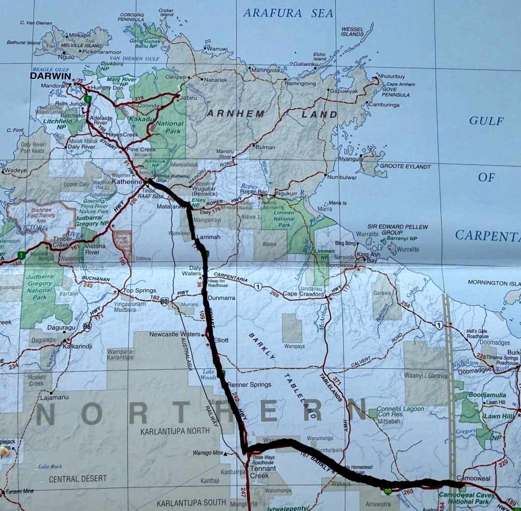
Here is map showing our journey from Camooweal along the Barkly Hwy and then up the Stuart Hwy to Katherine.
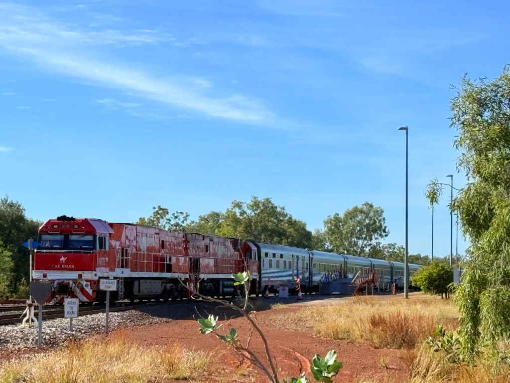
Travelling southwest from Katherine along the Victoria Hwy to Kununurra is one of Australia’s great road journeys. It traverses the flood plain of WA longest river, at least single name river ‘Victoria’. It is some 350 km long from its source somewhere behind the town of Timber Creek to the Bonaparte Gulf (just within the NT border). Outside Katherine the Ghan was making its way north to Darwin, couldn’t resist a picture stop.
The road ahead is fairly flat with some up snd down bits, a typical wet tropical savannah landscape.
About 100km from Kununurra we diverted from the hwy on a gravel road to the Flora River NP. Travel guides had promised some great river scenery to justify the 90 km there and back of gravel and dust.
The river has a couple of tufa rock waterfalls across it a short walk from the camp site which is a couple of hundred metres (croc safe) back from the river. Tufa is a soft porous limestone rock often impregnated with partially decomposed vegetation. The view though was hampered by river bank vegetation so a bit disappointing!
A chain saw would be useful to improve the scene! We wandered around a bit in the scrub trying to get a good view, being careful of crocs.
Returning to the hwy we had a stopover at the Victoria River Roadhouse for the night. The Roadhouse is high above the River now but back in Jan 2024 the river and its floodwaters lapped at its doorstep and swept the road bridge away.
An enormous amount of water spread across the landscape. An enormous diesel price too for these parts $2.35.
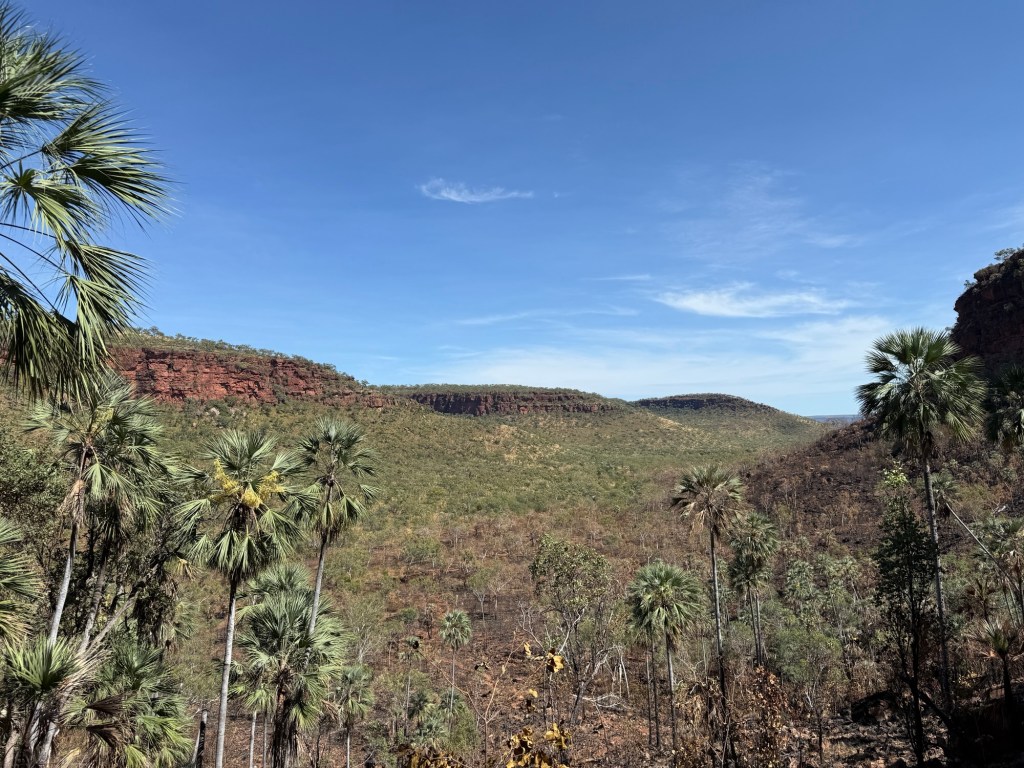
From the Roadhouse we did a bit of exploring , tripping down to the 1800s Old Victoria River Crossing and then out for Allthego to do a ‘ short walk’ at the Joes Creek day use area. It is a short 1.7 km (90 min) up a steep slope, along the base of the escarpment, then a scramble down to Joes Creek and the walk back to the carpark. Some great views of the valley from the escarpment and sightings of aboriginal art galleries on its walls.
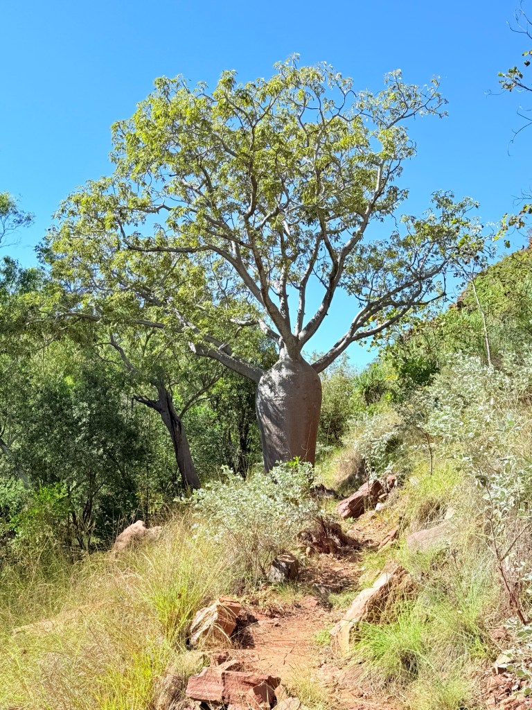
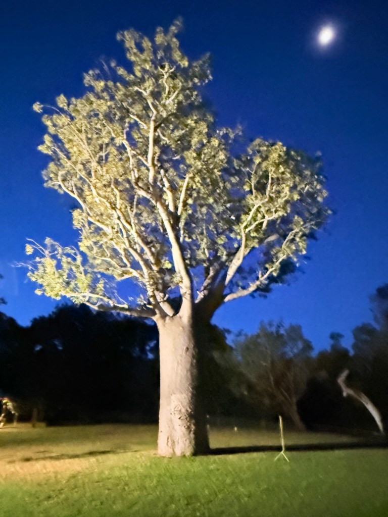
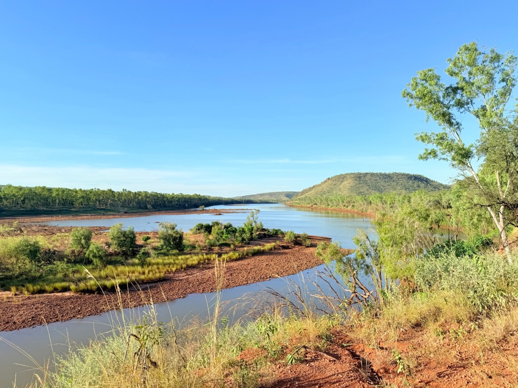
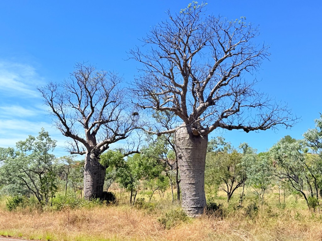
A further 90km along the hwy we stopped for the night at Timber Creek. The Timber Creek area has an abundance of boab trees. All shapes and sizes. The van park has a very big one in its grounds, impressive sight.
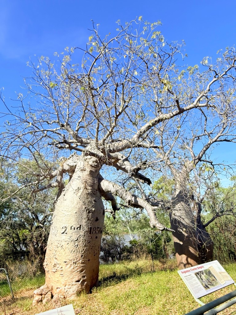
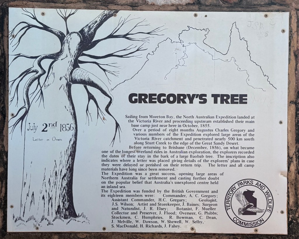
The Victoria River dominants the landscape here as well. One of the attractions, about 5 km off the hwy down a dirt track, is an old boab tree beside the river bearing the carved date 2 July 1856. It is known as Gregory’s Tree and is the spot where he camped while exploring these parts.
Moving on from Timber Creek we made our way away from the Victoria River towards Kununurra, through more boab country and into Ord River country.
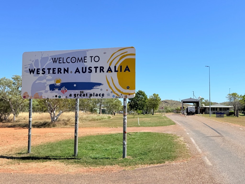
We have made it into WA about 50 km to Kununurra. Dutifully surrendered two peeled potatoes and a handful of lettuce leaves at the border. Onto Kununurra!
