The end
Well, we are now all home having got off the Luminosa at about 8.30 this morning.
Yesterday was much of the same. Lots of onboard partying and mayhem in the swimming pools and hot tubs. Dangerous places to be!
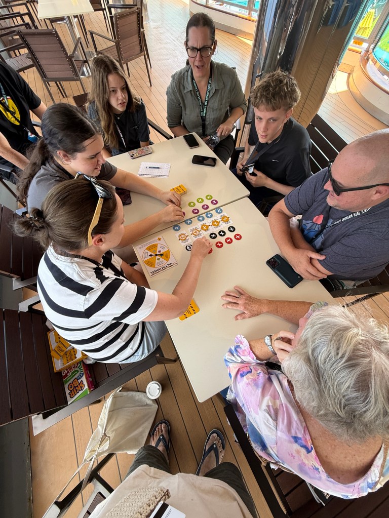
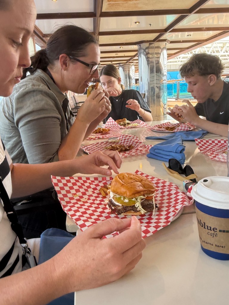
The family again gathered for card games and luncheon looking over the pool.
Trivia followed in the afternoon. Kicked off with a Harry Potter theme. Fairly intense, the caller had trouble with some pronunciations which was a cause of frustration for some players others just gave up.
A quiet evening was had by all and preparations were made for the mornings departure. The younger set had an early dinner and were then amused at the early ‘pg’ comedy show. The two olds checked out the restaurant again before heading for bed.
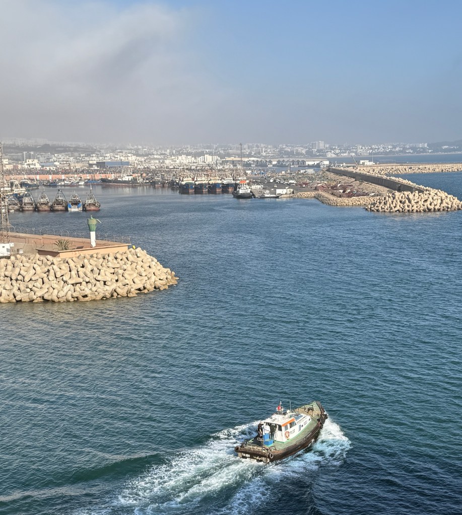
Woke a little earlier for breakfast before disembarking. The ship was sitting in the middle of the river about to do a 360 to dock at the terminal, interesting manoeuvre.
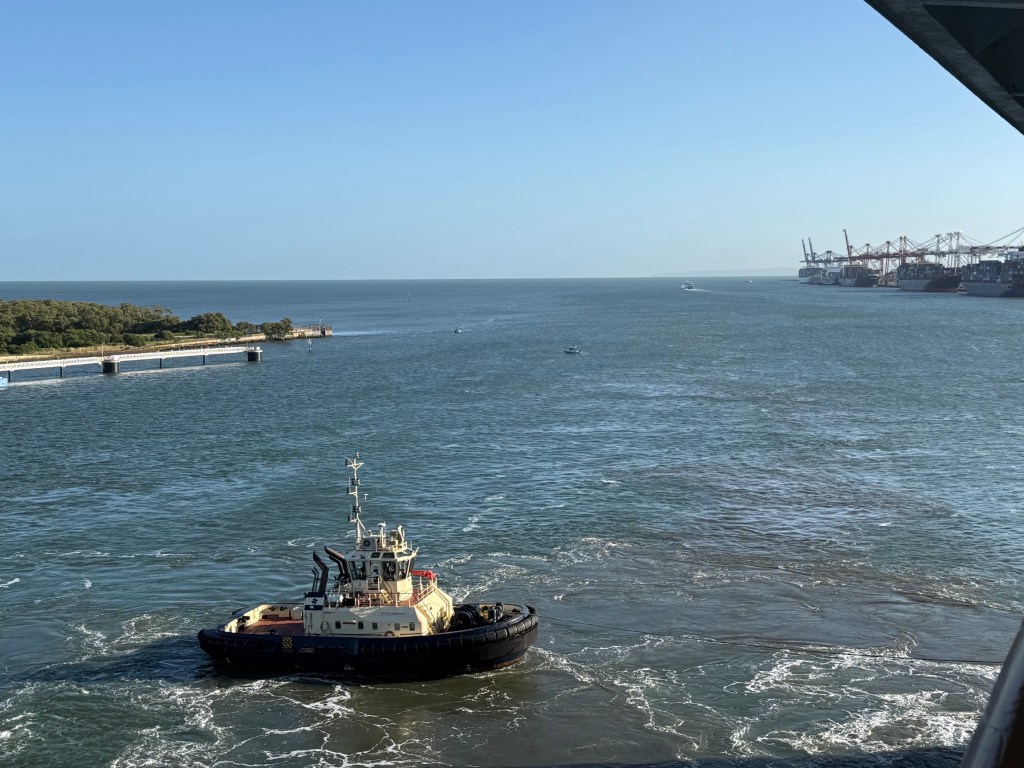
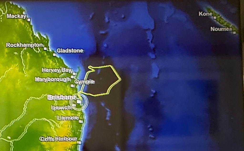
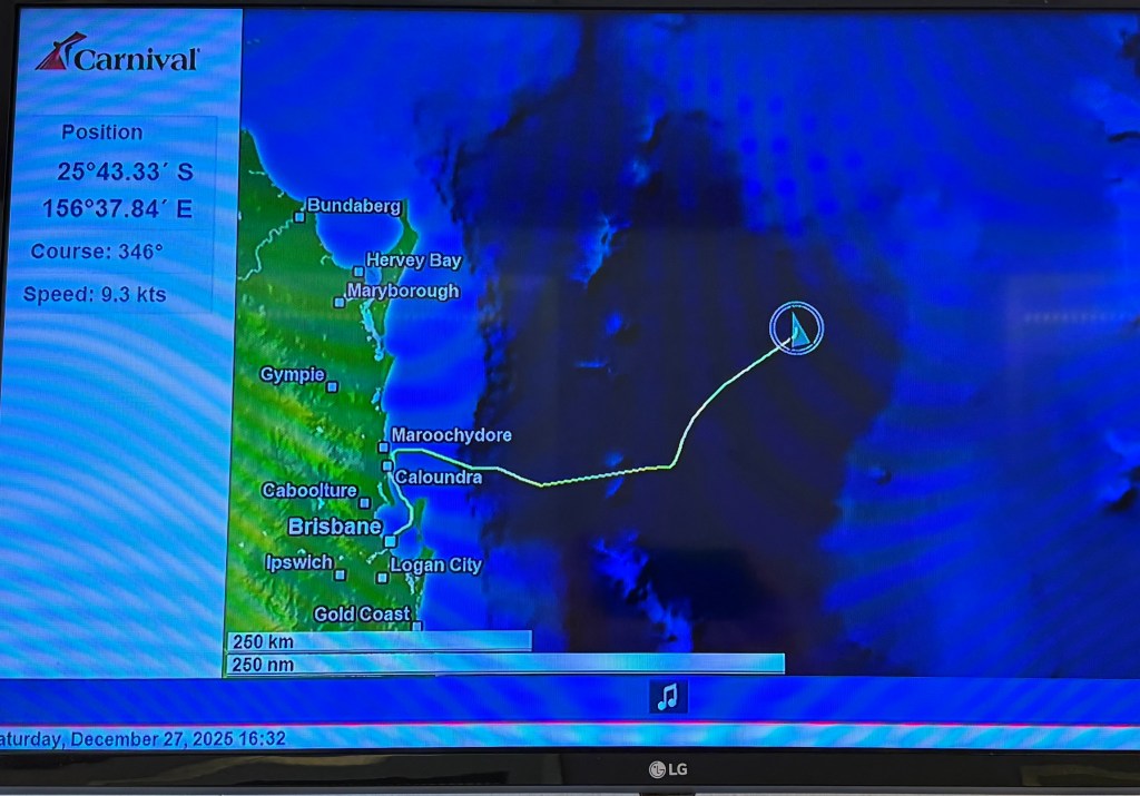
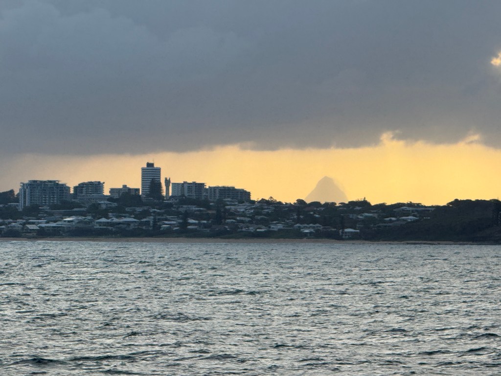
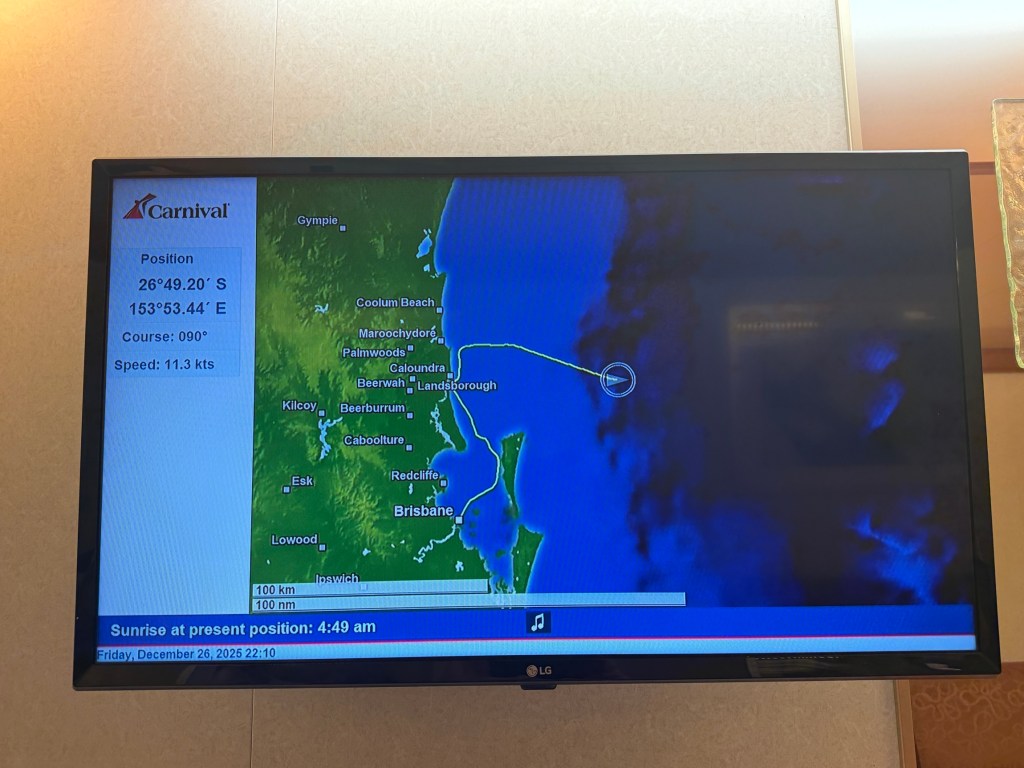
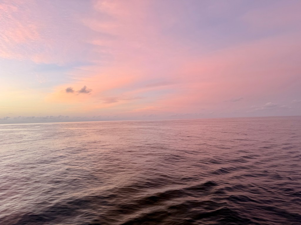
The cruise aboard the Luminosa had been entertaining, a party boat indeed! Below is a final map of the course taken over the three days, wandering around off the Sunshine coast.
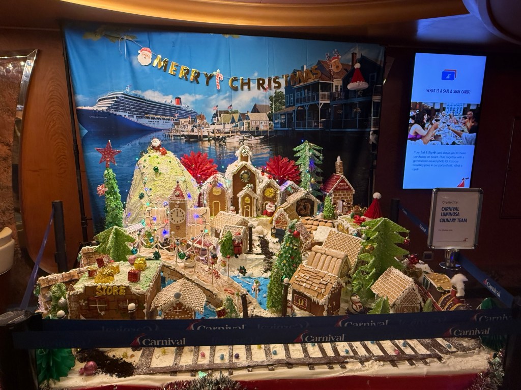
Big night
70 not out. It’s about half what the English needed to win the fourth test in Melbourne and they did. Here is a video of the winning run. We witnessed it in one of the gathering areas aboard the ship.
While the cricket was coming to a close we were in the midst of a karaoke carnival. Some of the performers put on a good performance, others were questionable talents but at least had a go. Make up your mind about it from this short clip.
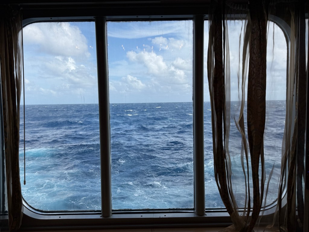
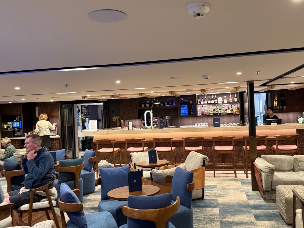
We were a reasonable distance offshore in the afternoon and the seas were a little more choppy with a little ship roll and the horizon up and down. But all good! The ship’s name is Luminosa. Allthego was a bit puzzled about its meaning. Apparently it is derived from latin and is of Spanish origin meaning ‘full of light”. And this is true as it is a fairly airy ship with plenty of windows and open space.
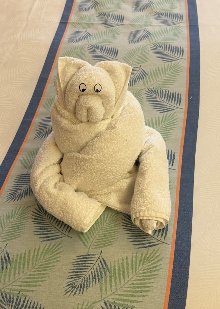
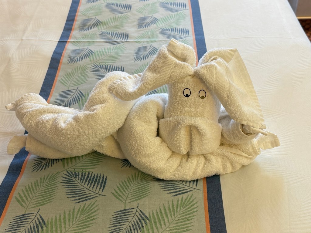
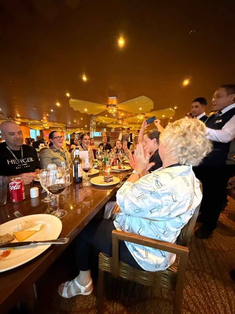
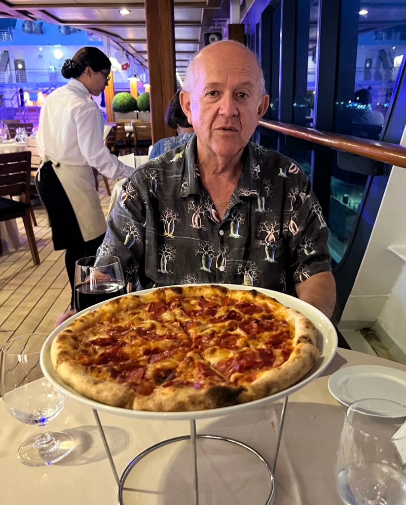
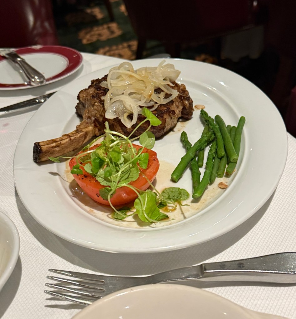
Ahead of the birthday celebratory dinner we returned to our room to change and were met with an animal creation by our room steward, quite a clever one!
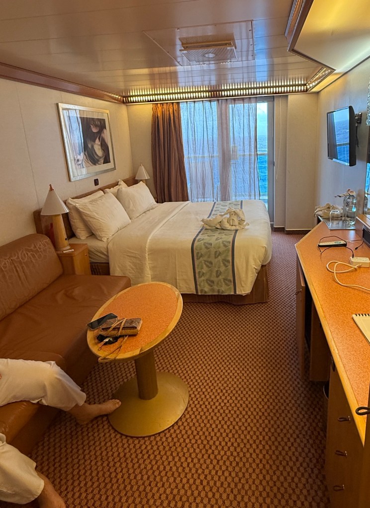
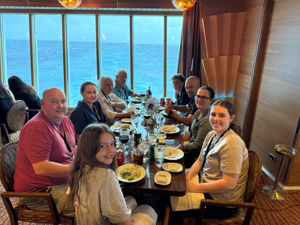
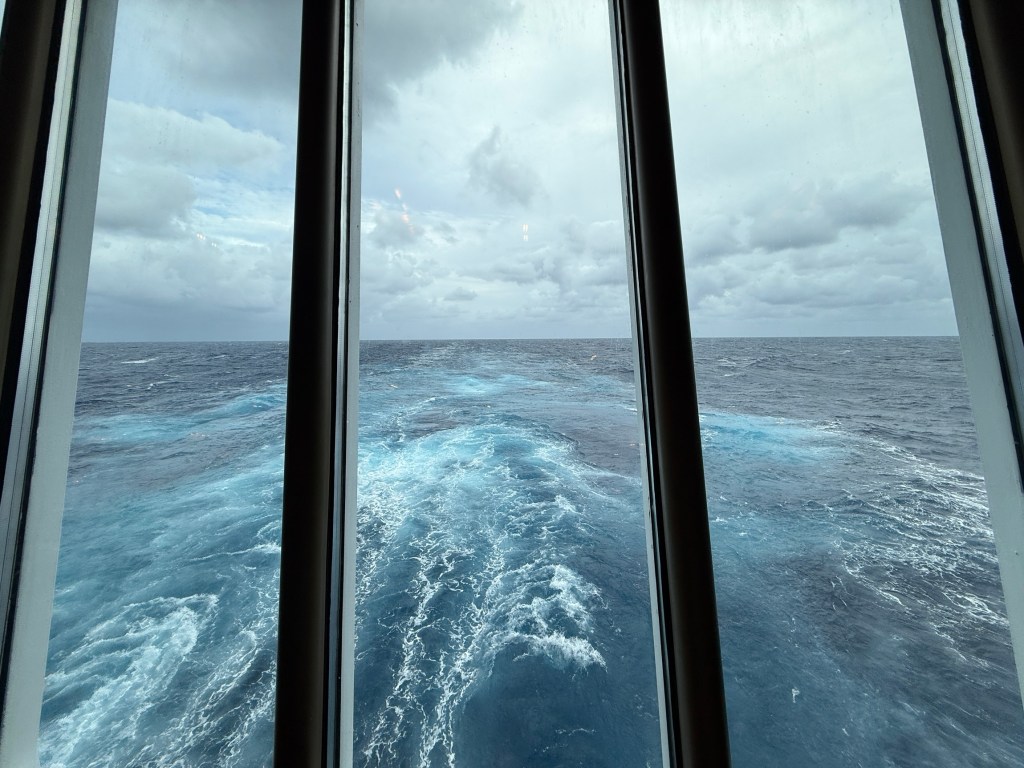
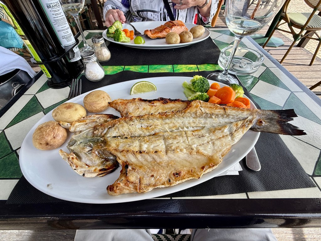
In order to get a table for nine in the restaurant we had to make an early booking, 5pm. A tad early for some of us, but there was quite a big line up to get past. We were right at the stern of the ship, looking out on the wake as we cruised along.
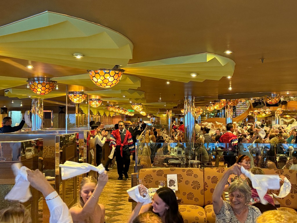
The dinner went well and all enjoyed the banter and the antics of the wait staff, most of whom were from the Phillipines, putting on a little cultural musical performance.
Dinner finished about 6.30 and some went off to early night entertainment and the big screen movie out on the deck. But for some it was to be an early night!
Going to no where
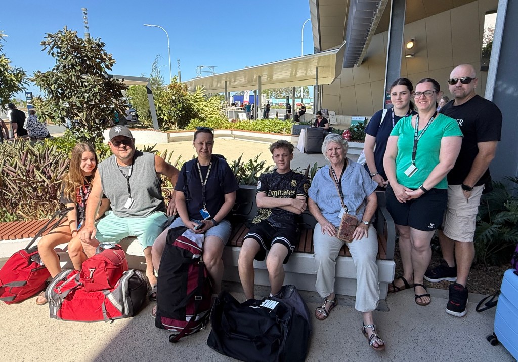
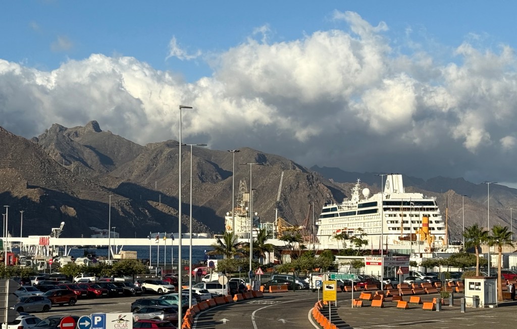
Well here we are off on a short cruise to no where. It is a delayed family celebration for Leanne’s big 70. Mitch and Piper are out from the USA for Christmas and the rest of us held off until now to celebrate the big event.
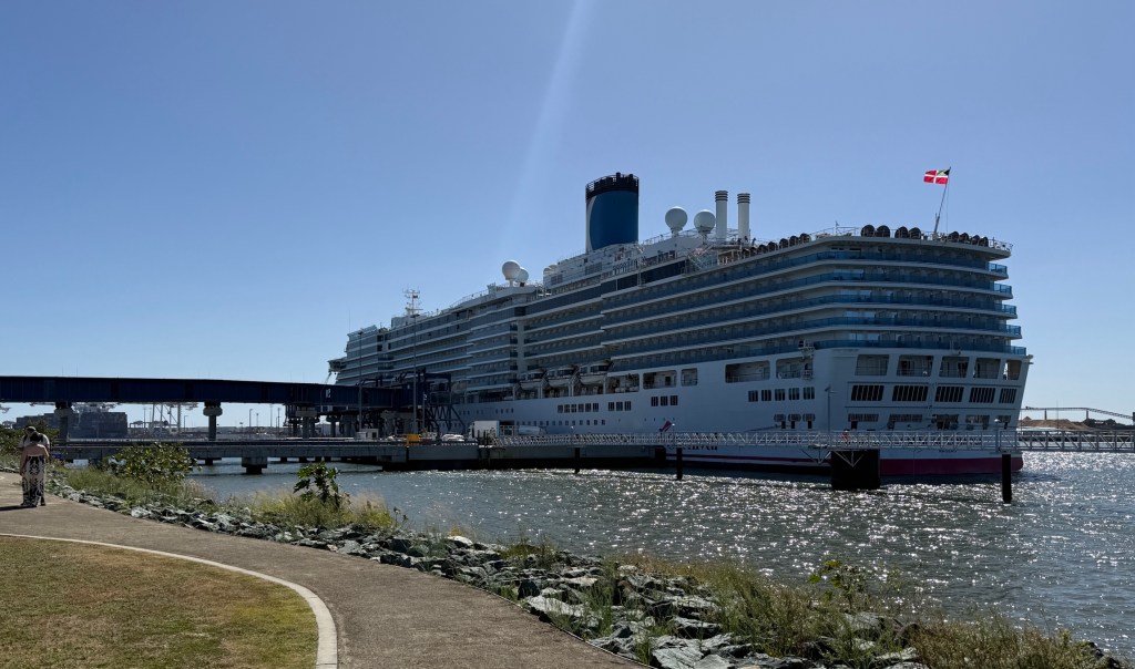
We are on a Carnival cruise, leaving Boxing Day, aboard the Luminosa out of Brisbane for three nights, wandering around the ocean and returning to Brisbane. No port stops so we can’t get left behind.
The ship seems to be at capacity people wise being 2,260. Lots of small kids and families aboard. Lots of noise and partying.
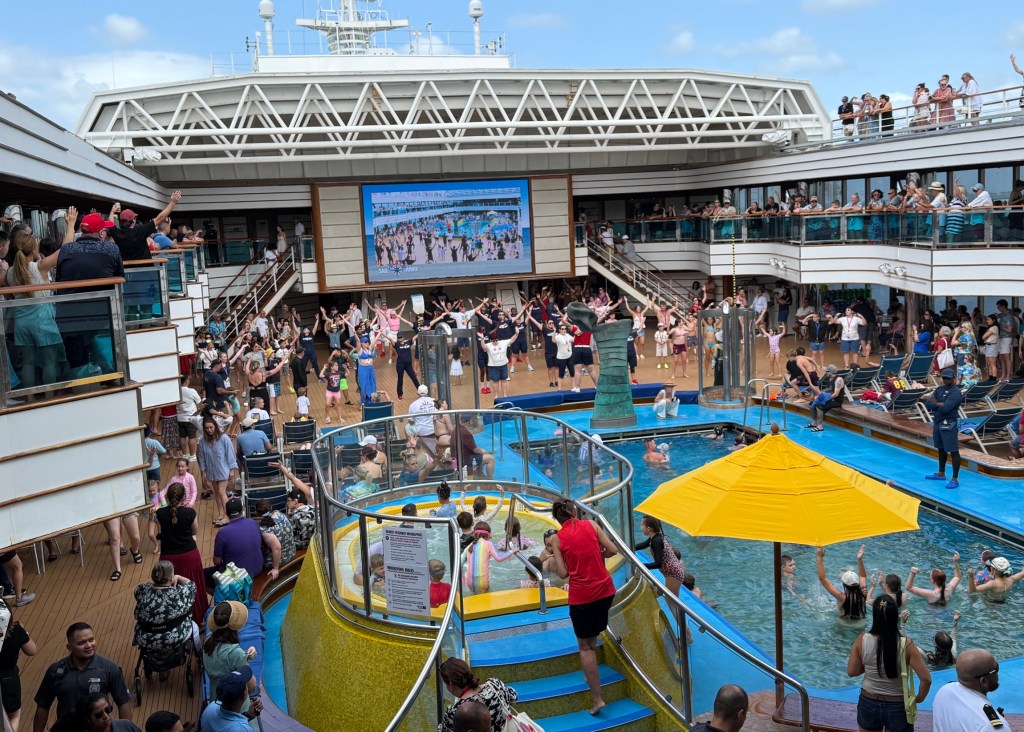
The Sail Away party out of the Brisbane River was packed with plenty of noise, dancing etc on the deck. The pool and hot tubs well patronised with all ages. Maybe best to avoid these as the cruise goes on!
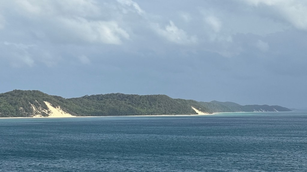
The course so far has taken us up the Brisbane Channel close past Moreton Island and the Sunshine Coast coastline before heading out to sea north of Caloundra, how far out we do not know.
Plenty going on around the ship, the nine of us have tried hard at a few games of trivia. So far no winnings.
Tonight we will be having a celebratory family dinner in the restaurant, have to start at 5pm in order to get a table for nine. We will see how that goes!
Until the next post.

Portimao and home
On Sea Day morning we woke to a crimson sun rise over the North Atlantic Ocean. It was a mill pond and remained like it all day. Calm cruising to Portimao on the Algarve coastline, the southern most region of Portugal.
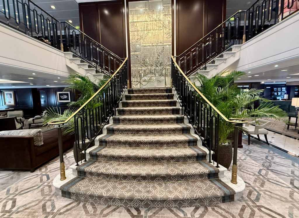
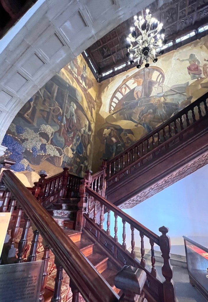
The Nautica is a small ship and doesn’t have a big atrium into which the floors above look, always a prominent feature in bigger ships. The staircase off reception to the floor above though is quietly elegant.
We were late risers again and had a quiet morning aboard. The Wave Grill called at lunchtime.
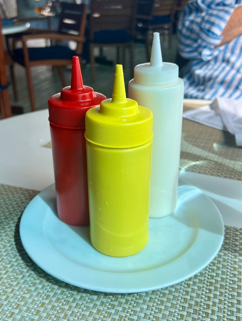
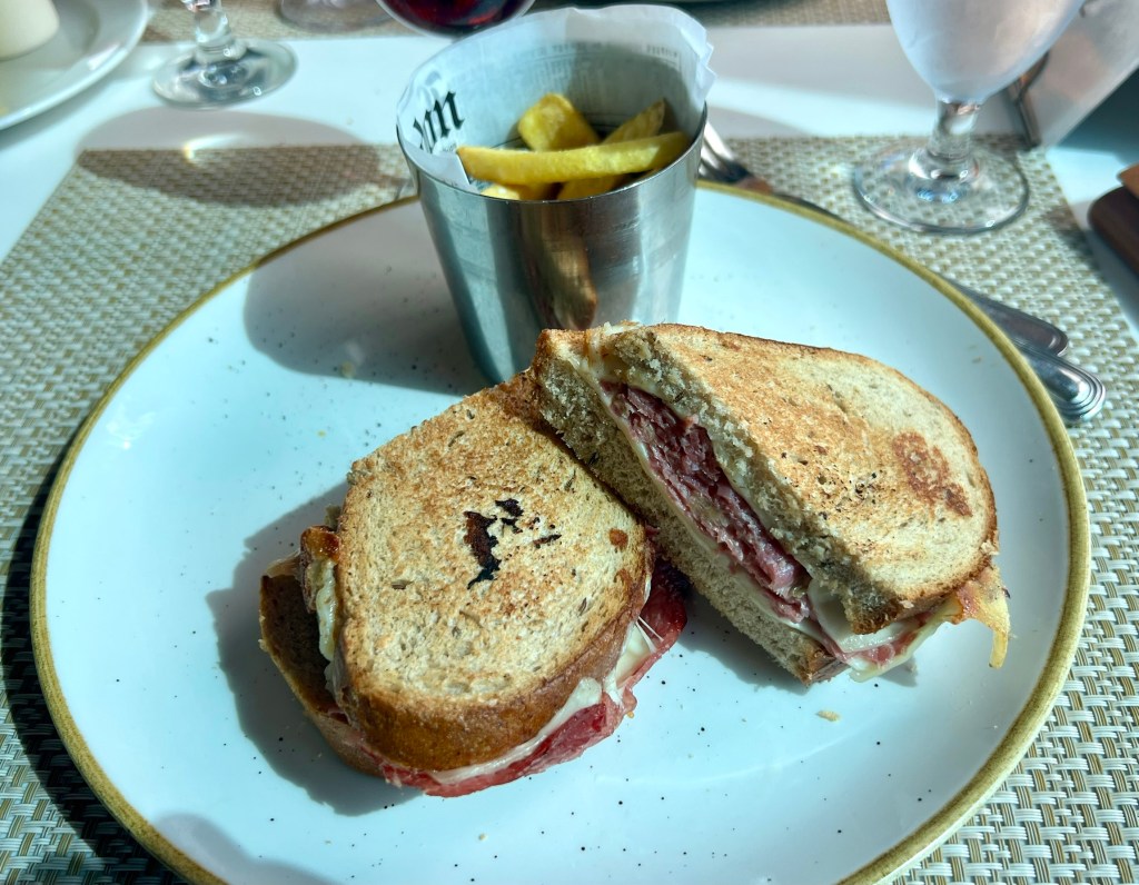
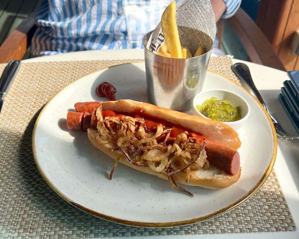
Nice range of offerings. Sauce accompaniment was appropriately colour coded to assist the Americans on board in decision making. Offerings were heavily orientated to our American travellers tastes, they represented probably 80% of those onboard. So a Reuben sandwich and a hotdog were the go for lunch this time.
Into the afternoon the sea remained calm with a very low swell and some sea mist. We did not hear any stories of sea sickness on this trip, the night time crossing to the Canaries from Morocco had been a little rocky rolly but nothing to be excited about.

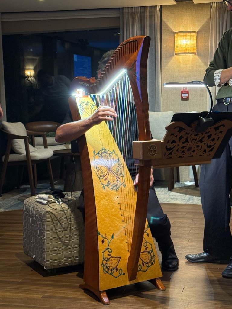
After dinner the show band and singers entertained with a selection of classic sixties and seventies hits from some of the big acts of the time.
Allthego thought Chicago’s ‘If you leave me now’ was done well! Video below is a short cut from it.
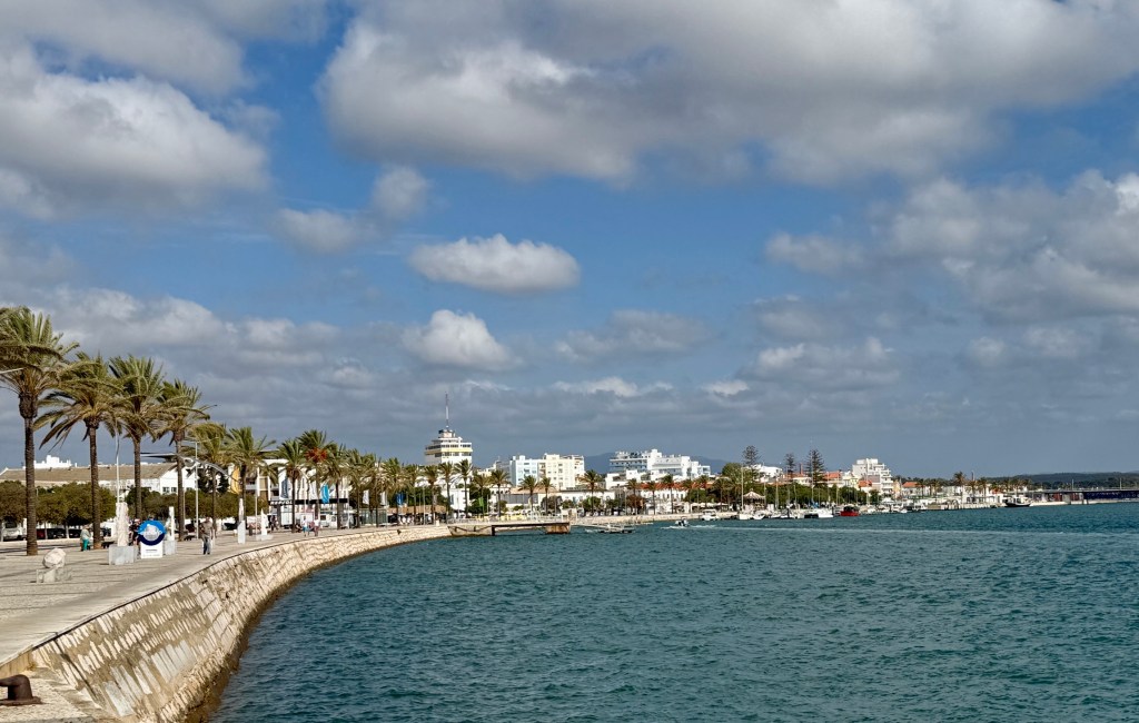
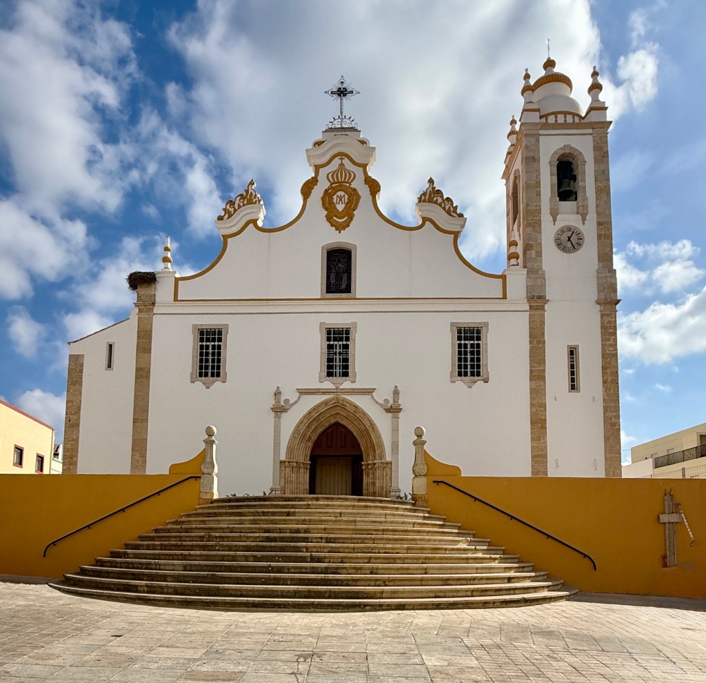
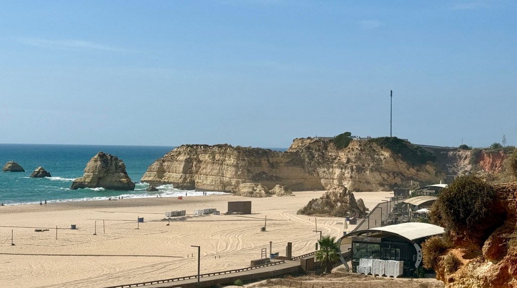
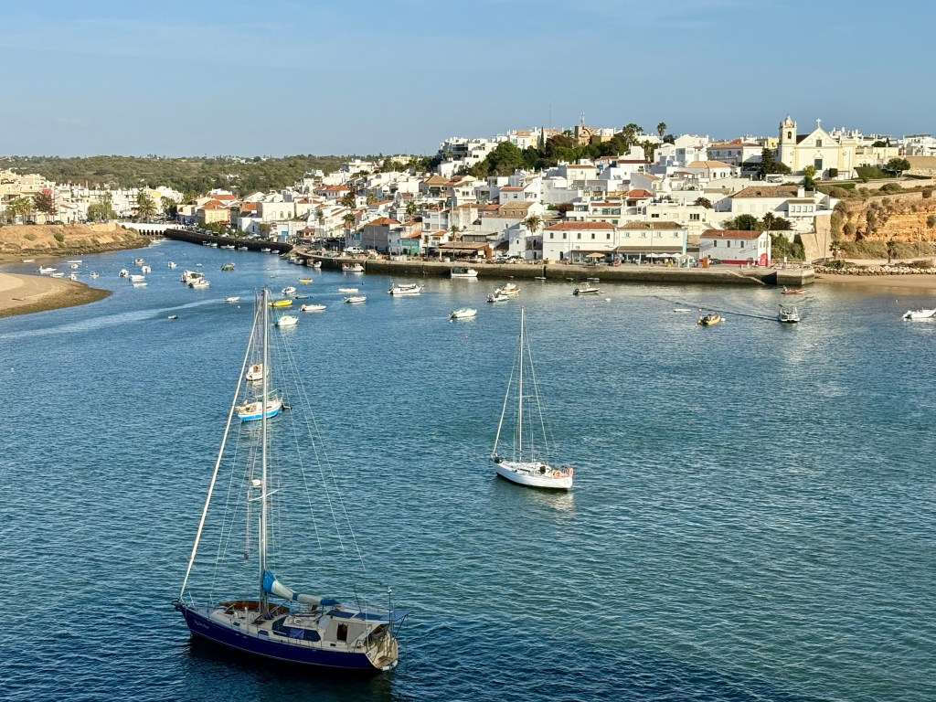
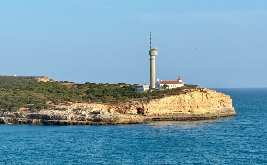
Portimao is situated about 2 or 3 km up the mouth of the Rio Arade. The river empties into the Atlantic Ocean at the southern end of Praia Da Rocha, one of the Algarve’s widest beaches. The beach and Old Town are short bus drives from where the ship berthed.

The waterfront at Portimao faces across the river towards a big marina. Much of the historical town was destroyed in the big 1755 earthquake and Tsunami (seems a common problem in this part of the world). Because of this many of the buildings are relatively new and you have to venture off into parts of the former old town to see life in the narrow streets and squares.
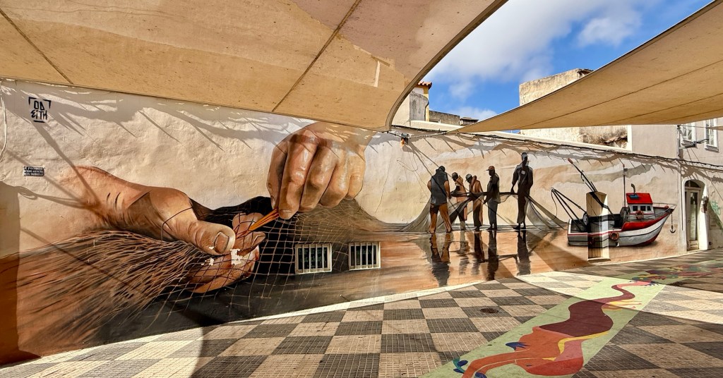
The mural below highlighted the importance of the fishing industry to Portimao.
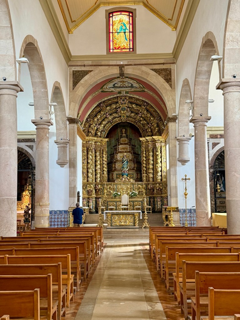
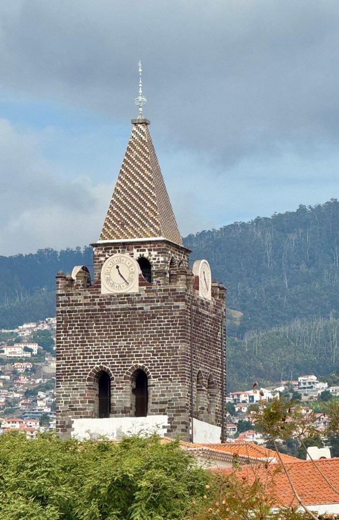
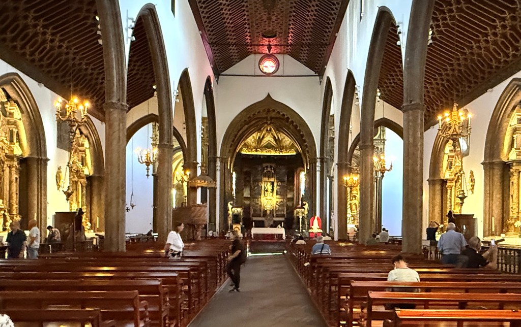
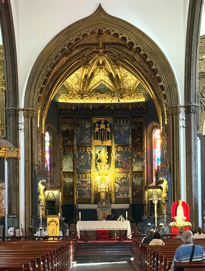
Igreja Matriz de Portimao is the city’s major church. Originally built in the 15th century it was extensively damaged in the 1755 earthquake and was subsequently restored. The late gothic wooden doorway is a major feature from the original building.

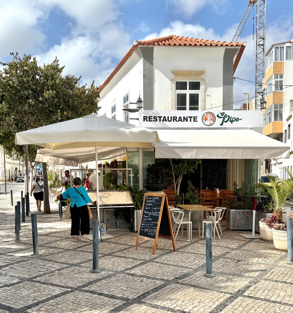
After having our wander around town we caught the shuttle out to the beachside area to see if we could find a good fish lunch, not just a sardine shop!
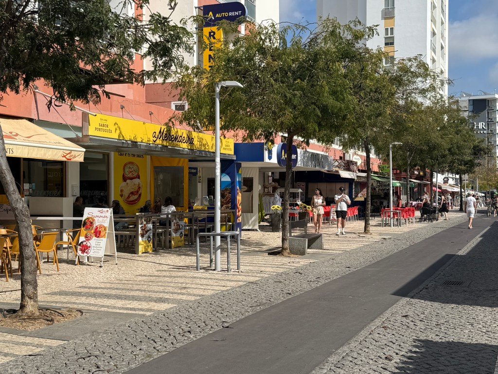
This main street above the beach is a very touristy locale, tourist traps everywhere. It would buzz at night time.
We found Cafe del Mar overlooking the beach. It was a real fish cafe and had some great simple seafood offerings. Not just sardines!

We strolled back down the ‘glitter strip’ in order to catch the shuttle back to the ship. A major task for the evening was packing up everything prior to dinner and getting ready to depart when we reached Lisbon in the morning.
We departed Portimao in bright sunshine, down the river to the Atlantic for the overnight sail to Lisbon.
The overnight sail to Lisbon was uneventful, the packing up was too!
We came up the Targus River to Lisbon during the early hours of the morning and unfortunately saw little. A leisurely breakfast was had before we were whisked away in a bus to the airport for the flight home to Australia, via Dubai. It all seemed to end so quick!
Arrived back home after 24 hours or so at midnight Brisbane time, a bit weary. But we had enjoyed the trip!
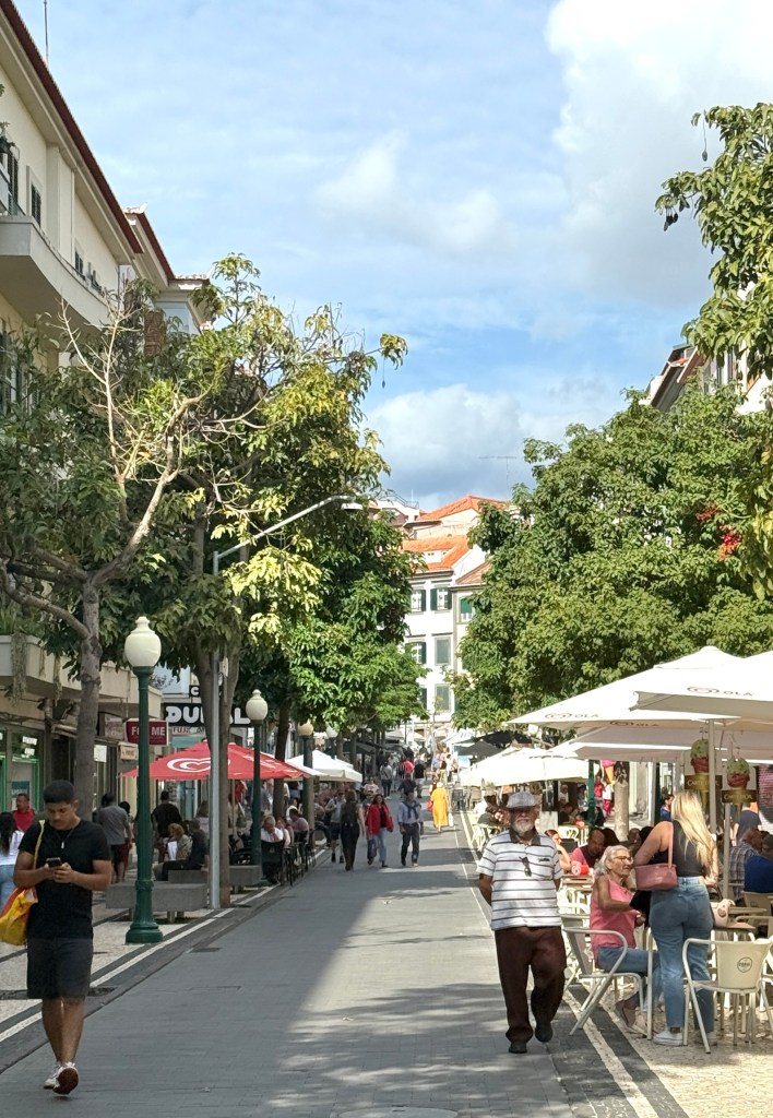
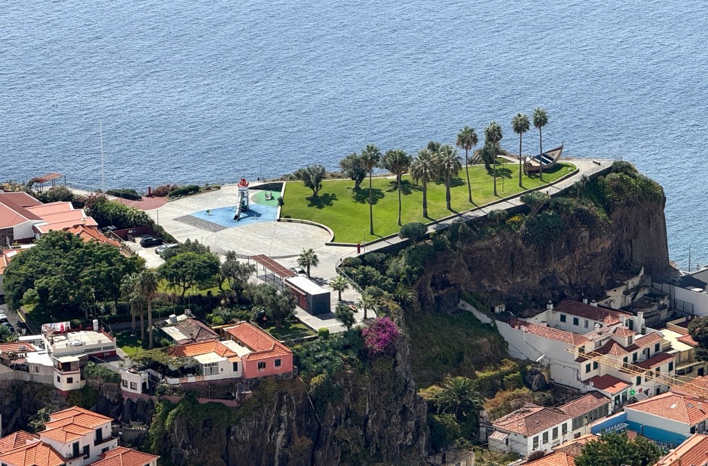
Madeira
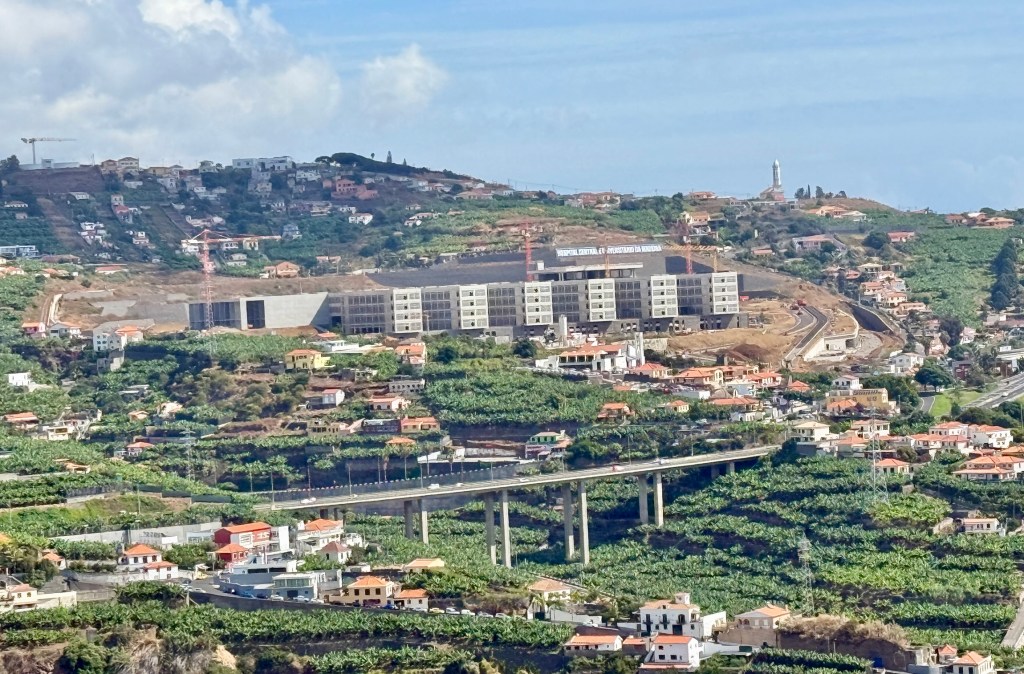
The city of Funchal was founded in the early 1400s on the island of Madeira by the Portuguese. Madeira is about 1000km south west of Portimão on the mainland, our last port before Lisbon. Like the Canaries, Madeira is of volcanic origin. It was also another favoured stop over point for travellers to the Americas, India and Asia in the days of sail and slow travel.
It was a leisurely rise on the morning of arrival as our shore excursion was not until the afternoon. A welcome experience after the previous busy days ashore.
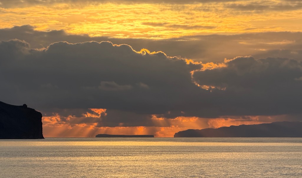
Earlier we had wakened to a brilliant sunrise over the ocean and islands off Madeira.
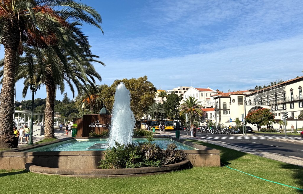
After a late breakfast we went ashore for a short look around the town before lunch back onboard.
Funchal is a market town, unfortunately time was a bit short and we didn’t have a look at the vendors in the big complex.

There is a big tile mural on its walls harking back to different times in the town. Quite impressive.
Nearby street vendors have an array of fruit and vegetables to tempt passers by. Plenty of fish eateries and some have species available other than sardines. Sardines are very popular in these parts.
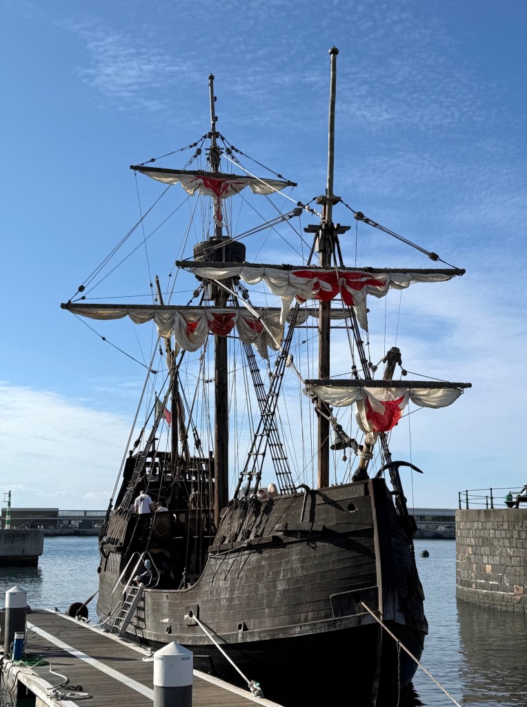
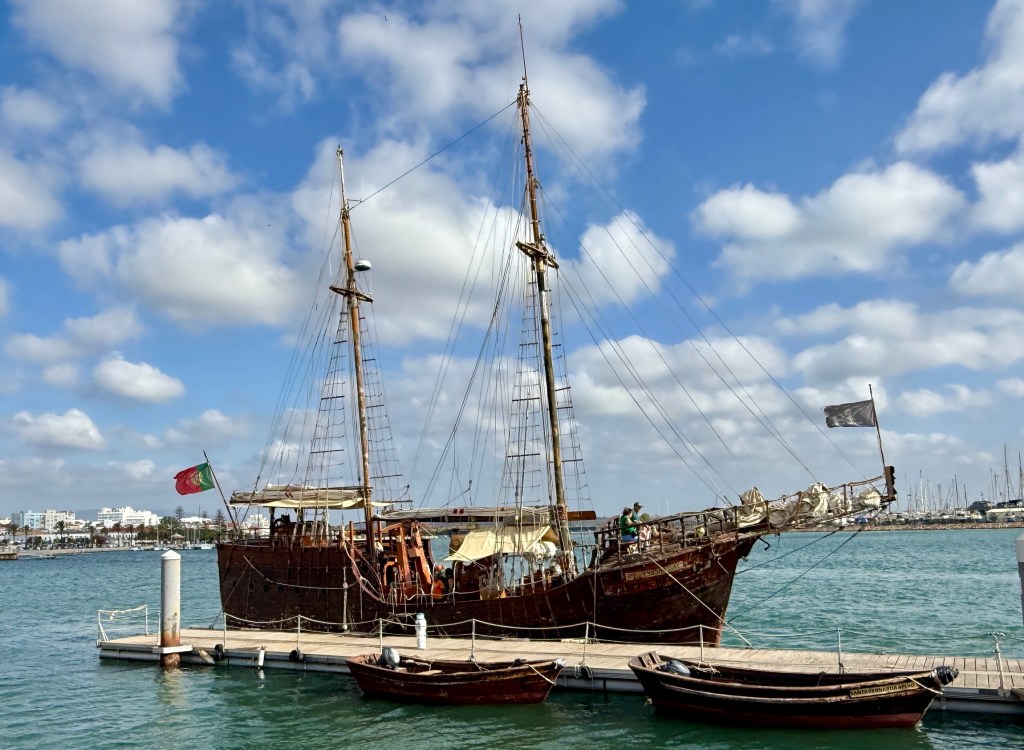
Heading back to the Nautica one is reminded of the old days. A ‘replica’ of Columbus’s Santa Maria sits at the wharf. The ship was built in Madeira in 1997. There are a number of replicas in other places. The problem is no one knows the details of the original Santa Maia and replicas are all different sizes etc. This one is a party boat for three hour, twice a day, tourist trips on the Funchal bay, it does some more serious sailing at other times.
After lunch our excursion took us to a number of lookouts to gain an appreciation of the local landscapes, both natural and man made.
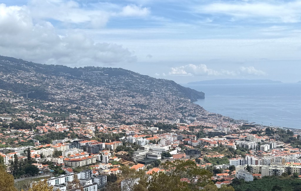
At the first, Pico Barcelos, we looked out over the hinterland of the city, mostly an urban landscape from the mountains to the sea.
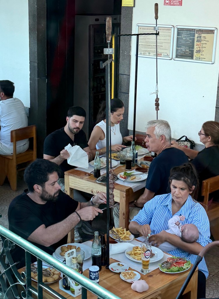
On the way to the next view point we passed by some restaurants, almost on the roadway. Managed to get a pic of a couple devouring an Espetadas. These are a local culinary delight on Madeira. Grilled meat skewers, generally beef but you could have pork, chicken etc. They are a do it yourself BBQ over a fire (a special highly scented local wood) pit, you then hang them at your table and pull the meat off with a piece of bread. The wash it down with some cheap wine or beer over a long lunch.
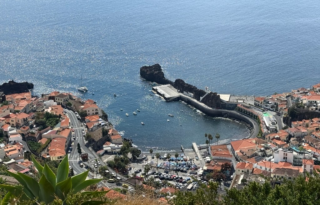
The next view point was at Camara de Lobos, on the coast. From there we looked back out over rural areas, and below the old port area with its small fishing fleet.
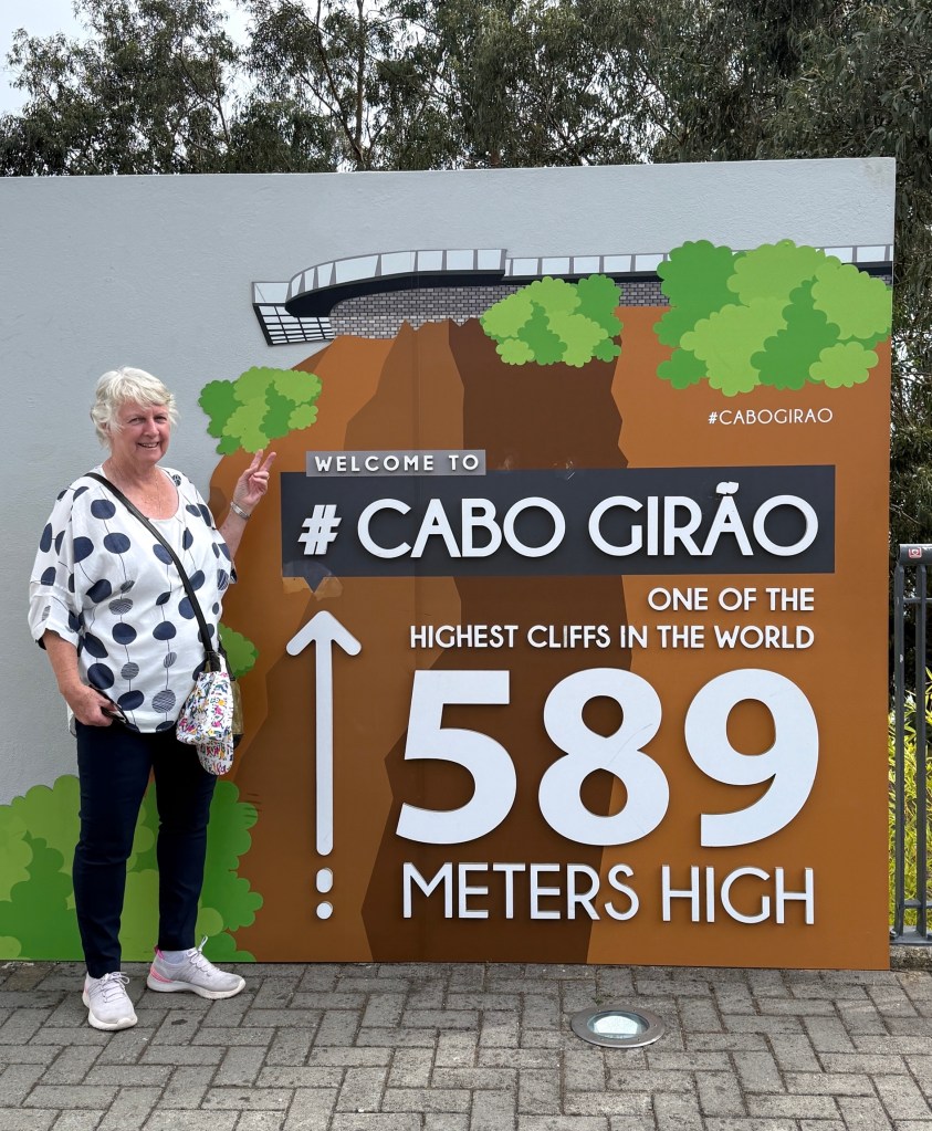
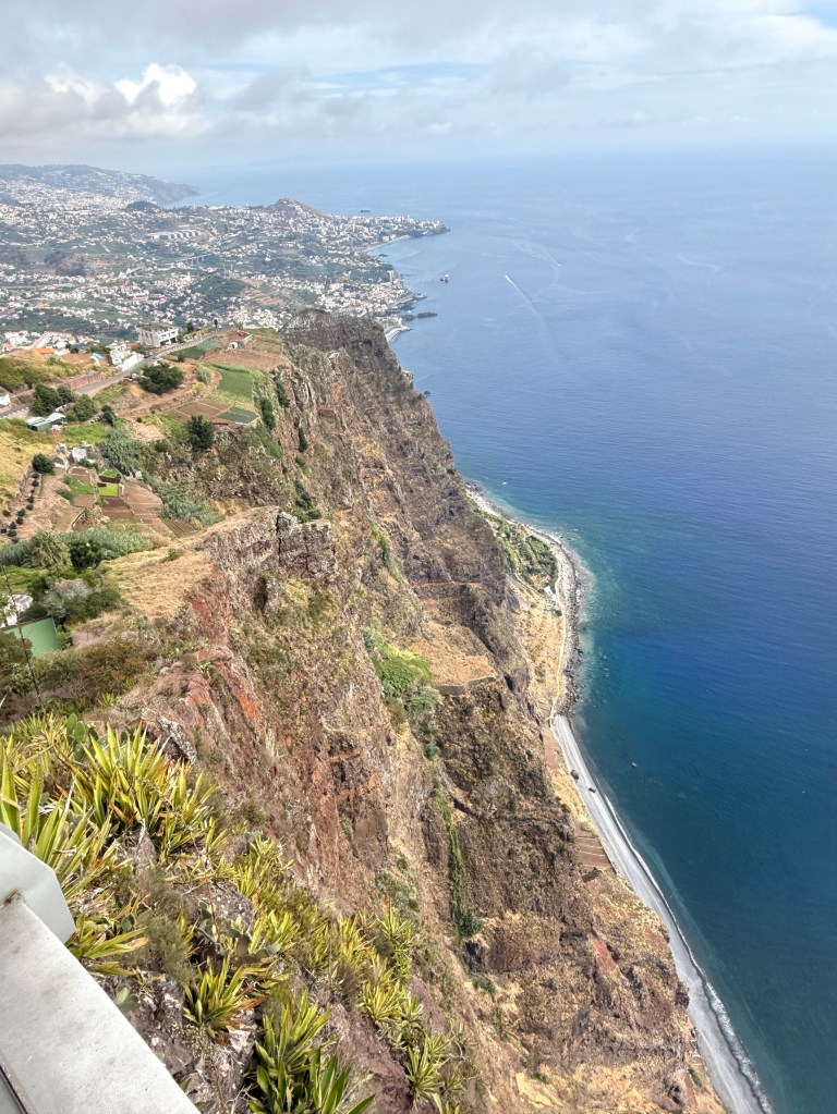
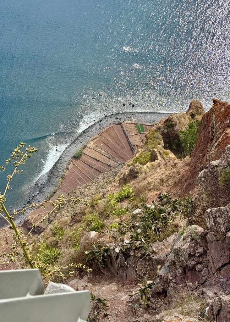
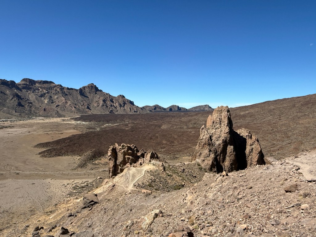
It is said many times that the best is left till last. This was proved to be true at our stop at Cabo Girao. The highest sea cliffs in Europe and possibly the world! The Bunda Cliffs on the Great Australian Bight are chicken feed compared to these ones.
Homealone didn’t venture to the lookout let alone go out on the glass bottomed platform to get a good look down to the sea shore below.
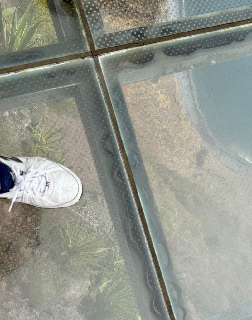
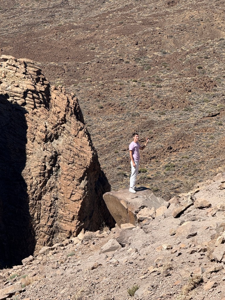
Allthego crossed the glass to the other side, but didn’t dally on the way too much. Got some pics and moved on when a couple of clowns started to jump up and down a bit!
Back at the ship we set off for Portimão at 6pm as planned, getting a great view of the islands off the coast, the sun was low in the sky. Bit of a contrast with the view we had at sun rise.
Later that night we enjoyed dinner in the Pollo Grill sitting looking out the back of the ship towards Madeira with the wake glistening in the moonlight. The food was good too!

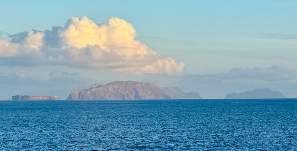
Santa Cruz De La Palma
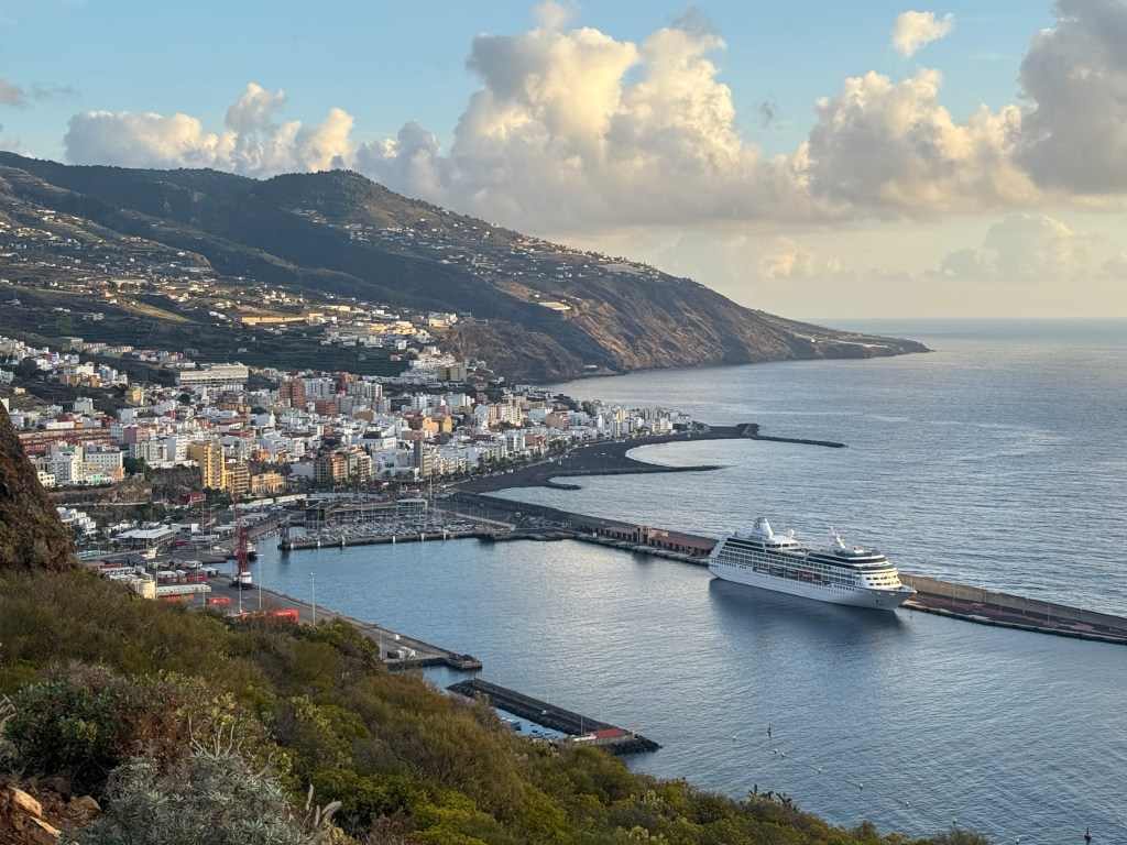
It was smooth sailing overnight to La Palma where we tied up at the port with the city behind. The town is known as Santa Cruz De La Palma. Santa Cruz De Tenerife is similarly named. Whats the ‘Santa Cruz’? It is Spanish for ‘Holy Cross’ and a throw back to when these places were established towards the end of the 15th century. The conquering Spanish forces carried wooden crosses with them as symbols of their religious authority given by the Pope. The Pope had gifted the islands to Spain, not sure what his authority to do this was, but he did it anyway and the Spanish accepted. They still had to conquer the locals which they eventually did across the Canaries. What is claimed to be one of the original crosses is held as a relic in one of the churches on Gran Canaria.
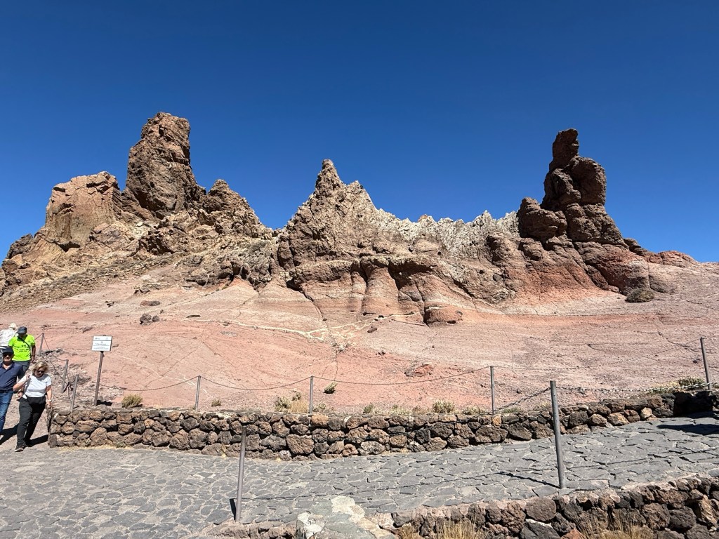
Our excursion on La Palma was to the south of the island to see more volcanic landscapes. The map below shows where we went.
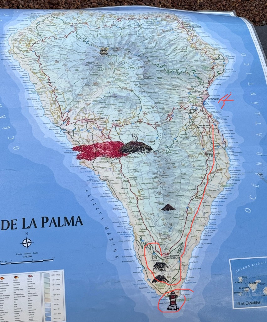
La Palma is an interesting island. At 3m years it is one of the youngest islands geologically in the Canaries and is on the western edge of the group. It was an important stopover point for ships going to the Americas in the 16th and 17th centuries. On the other hand Lanzarote (our first port of call) is on the north eastern edge, is 15-20m years old. The southern half of the island is also much younger and is more volcanically active than the northern half.
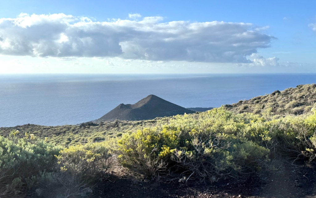

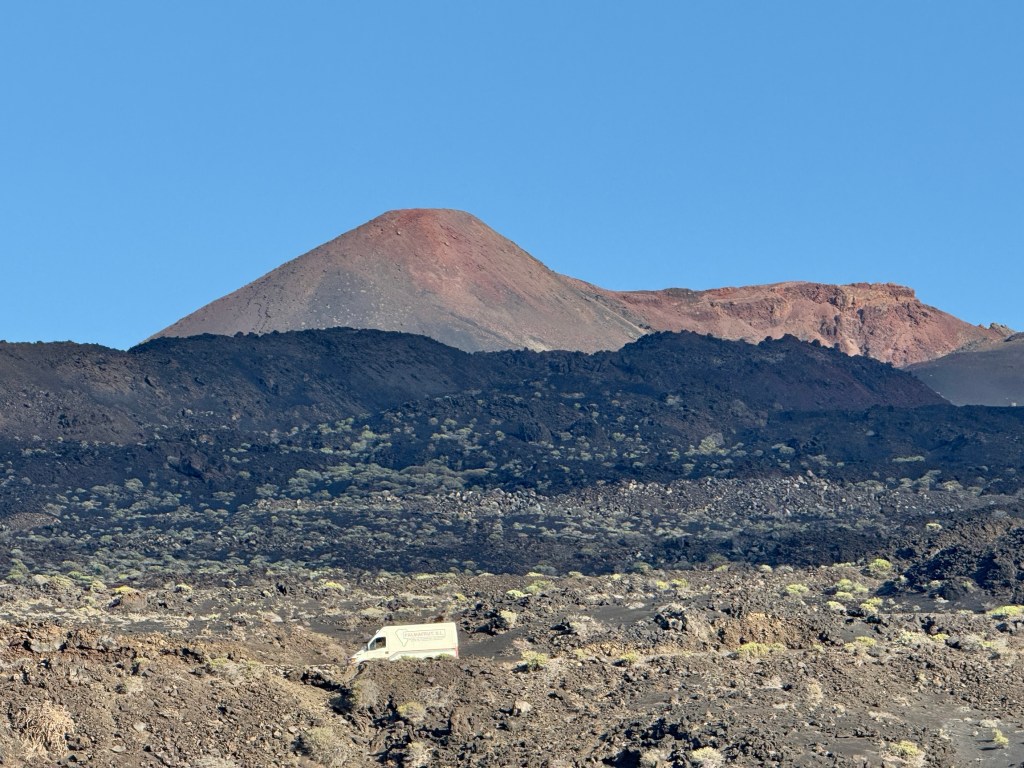
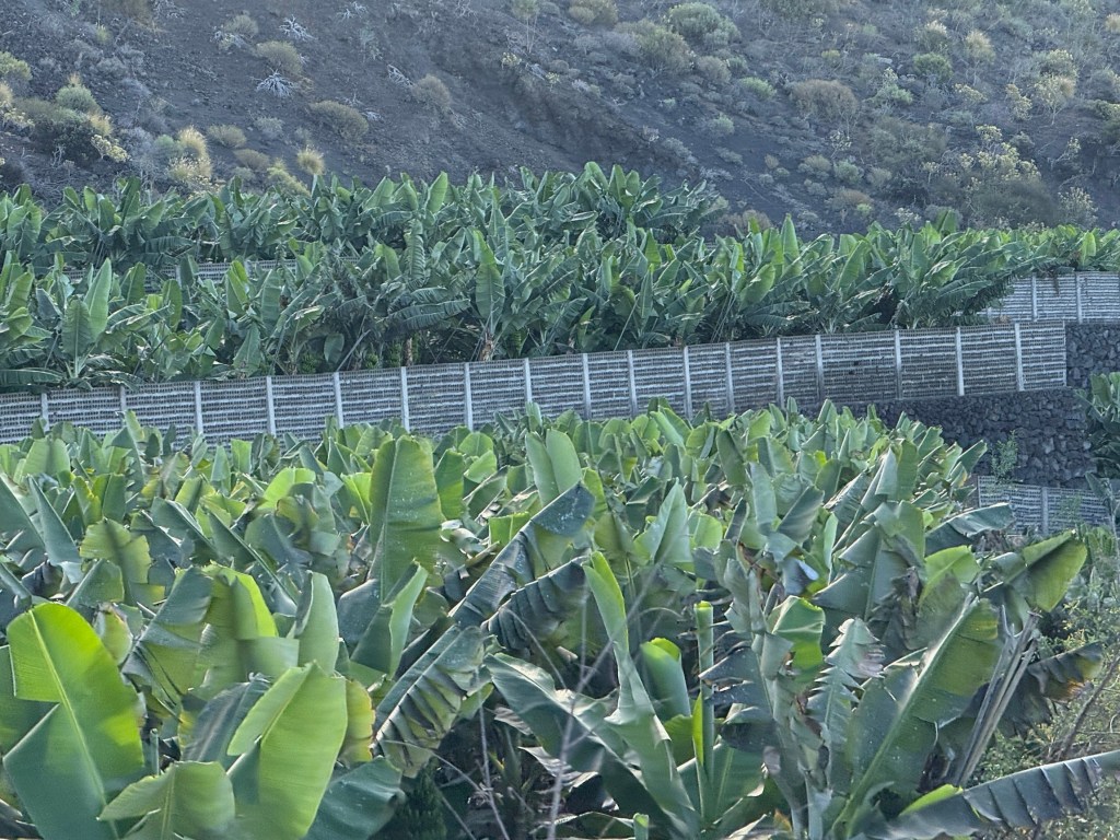
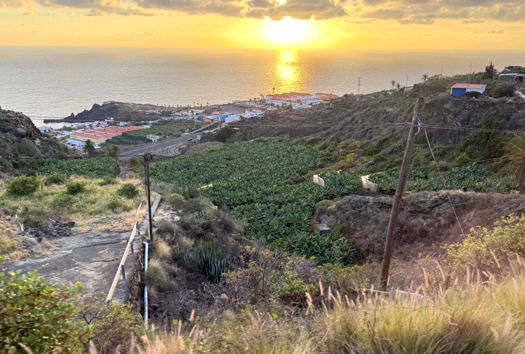
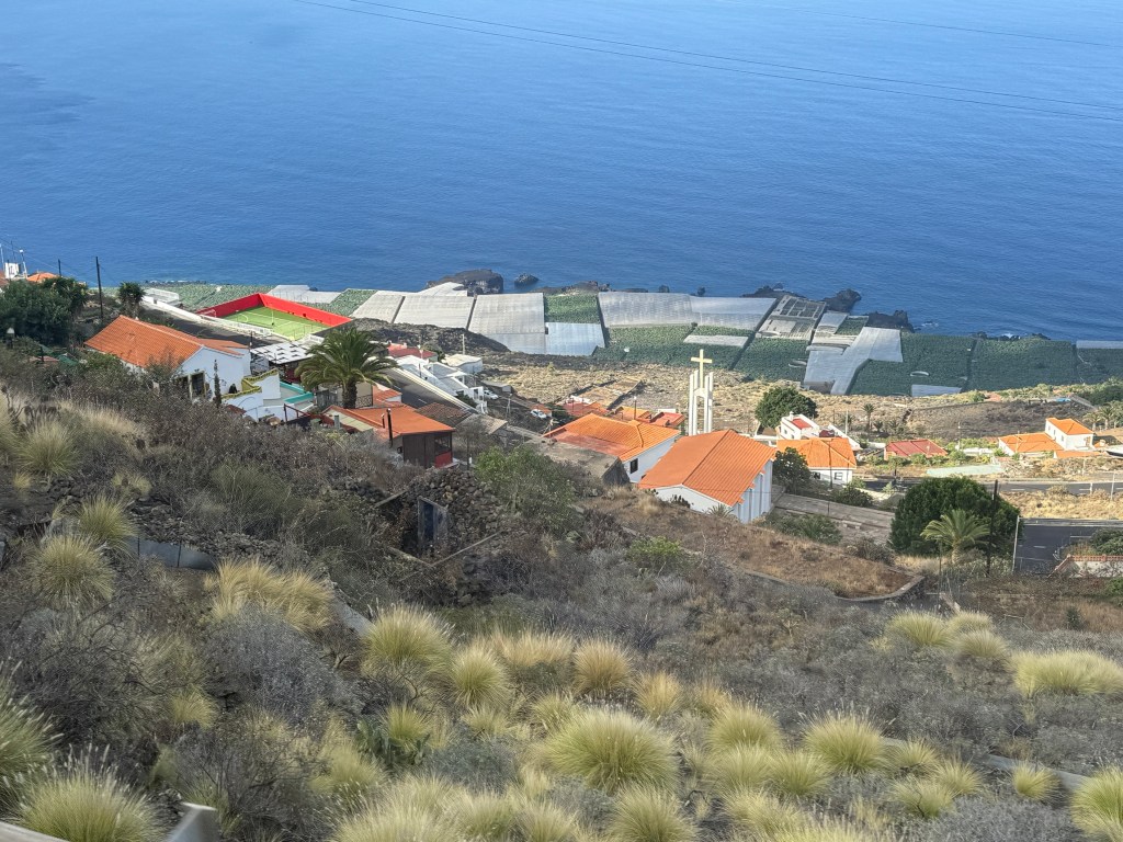
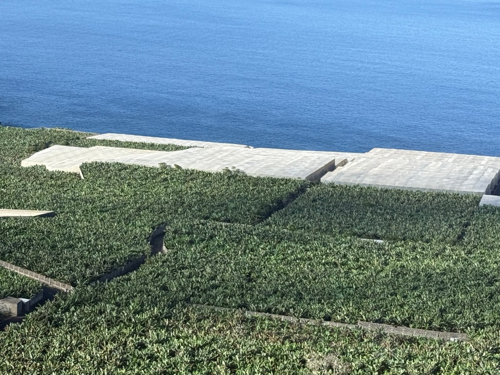
Bananas are a major crop for the island and dominate the flat areas of land around the coastline caused by lava flows from San Antonio extending the land area into the then sea.
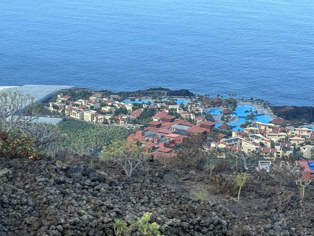
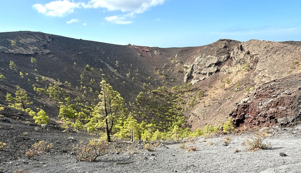
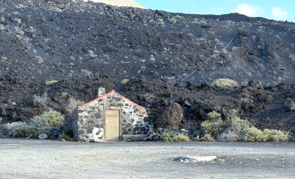
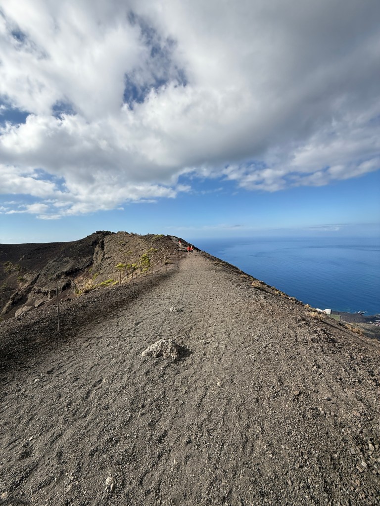
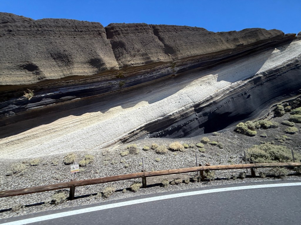
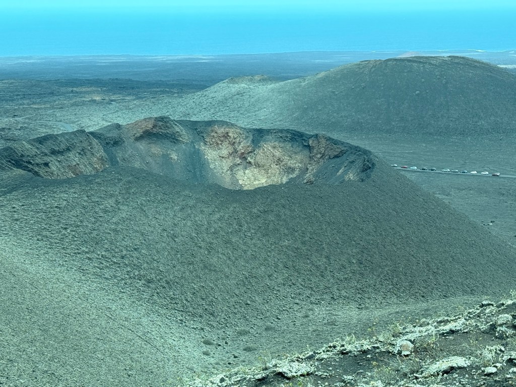
San Antonio last erupted in 1677-78, with lava flows from cracks and vents around the base of the old volcano. It would have been an extraordinary sight. It was a fairly steep drive getting up to the crater but the road wasn’t particularly narrow. Some great views down the slopes to the sea.
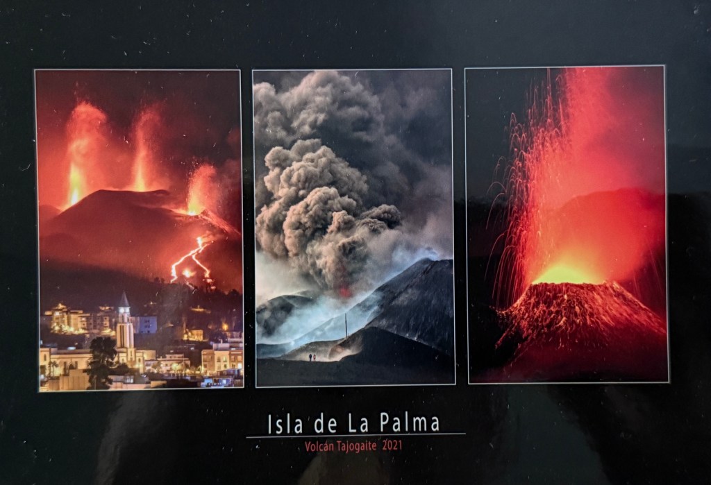
This is a postcard pic of the most recent eruption on La Palma over an 85 day period in 2021. It was fairly destructive with over 3000 properties destroyed. The Tajogaite eruption is shown as a red blob made by the guide on the map above.
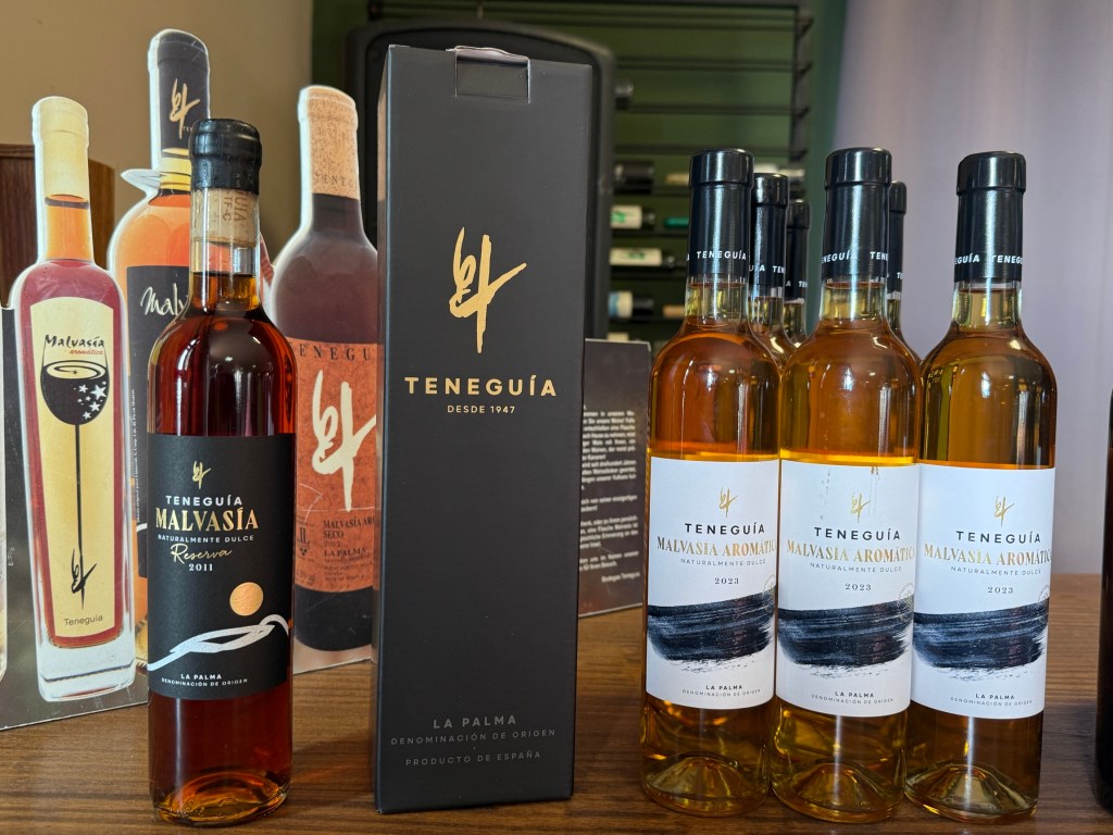
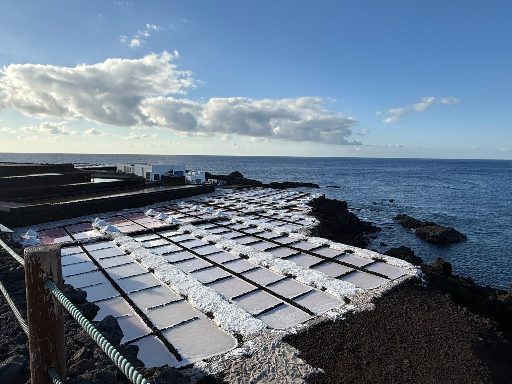
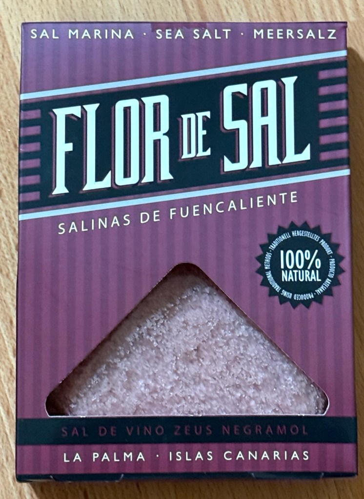
On the way back to the ship we called into a winery to taste some of the famous local drop made from Malvasia grapes, it ranges from being dry through to a desert style depending upon the way it is made. We found the sweeter style rather good and acquired a small bottle, it will go well with the Christmas pudding. If it lasts that long! The grapes are grown higher up the slopes than the bananas, between them are a range of other vegetable and fruit crops.
Back in the port we had a stroll through the old town looking for a local spot for a quick lunch.
We settled on a small establishment for lunch, facing but set back from the waterfront. Four tapas pieces, a local beer and some quaffing wine to put it all away. Very tasty.


Back on board we had a light dinner of pizza at the Waves Grill & Pizzeria.
This was our last evening in the Canaries and we later sailed north for the city of Funchal on Madeira.
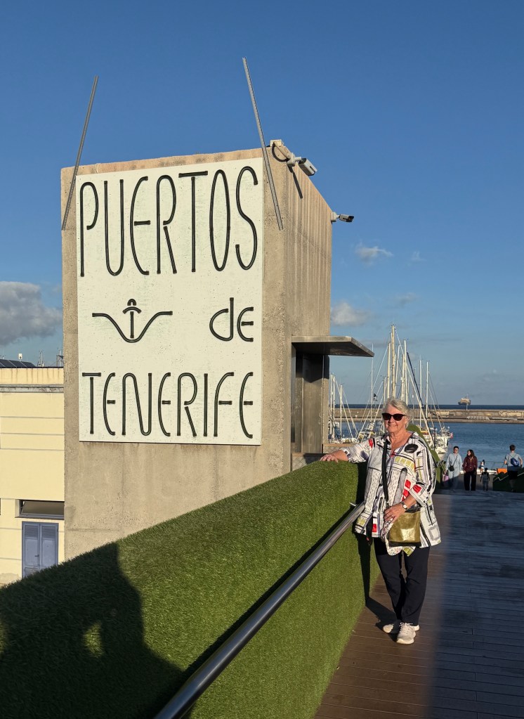
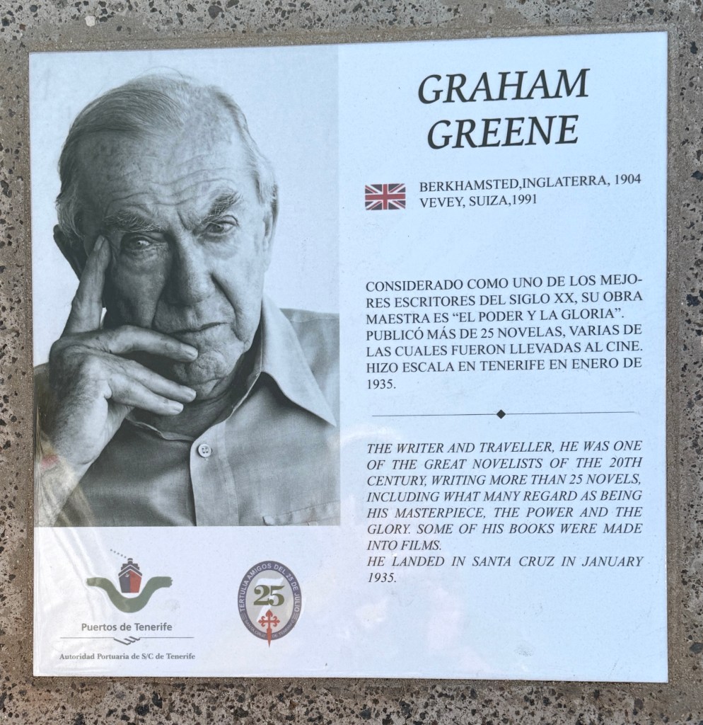
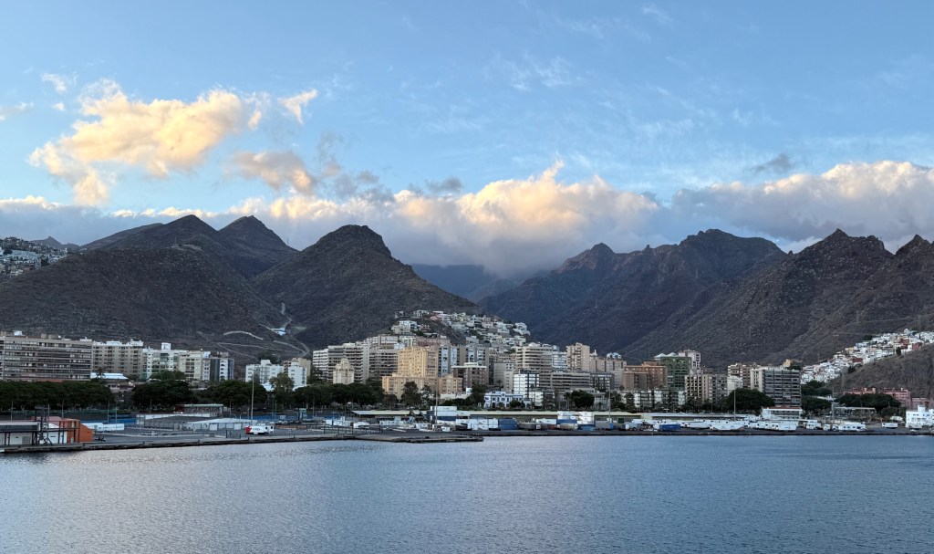
Santa Cruz de Tenerife
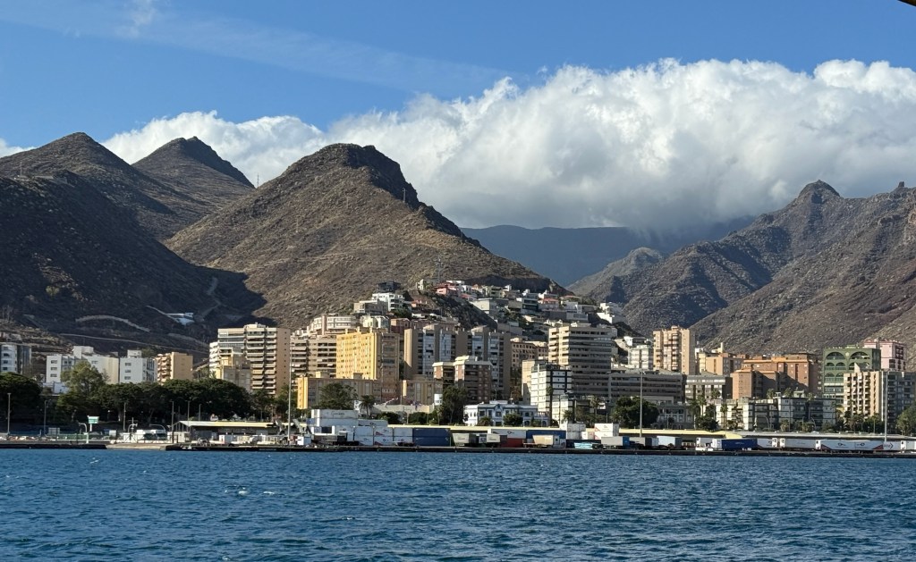
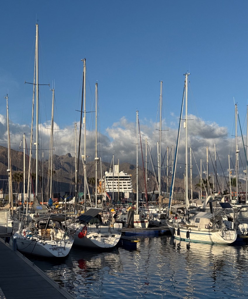
The city of Santa Cruz de Tenerife is on the north east tip of Tenerife. It is probably the most well known of the Canary Islands. A great landscape as the Nautica sails into the port, fluffy billowing clouds topping the mountains above the town.

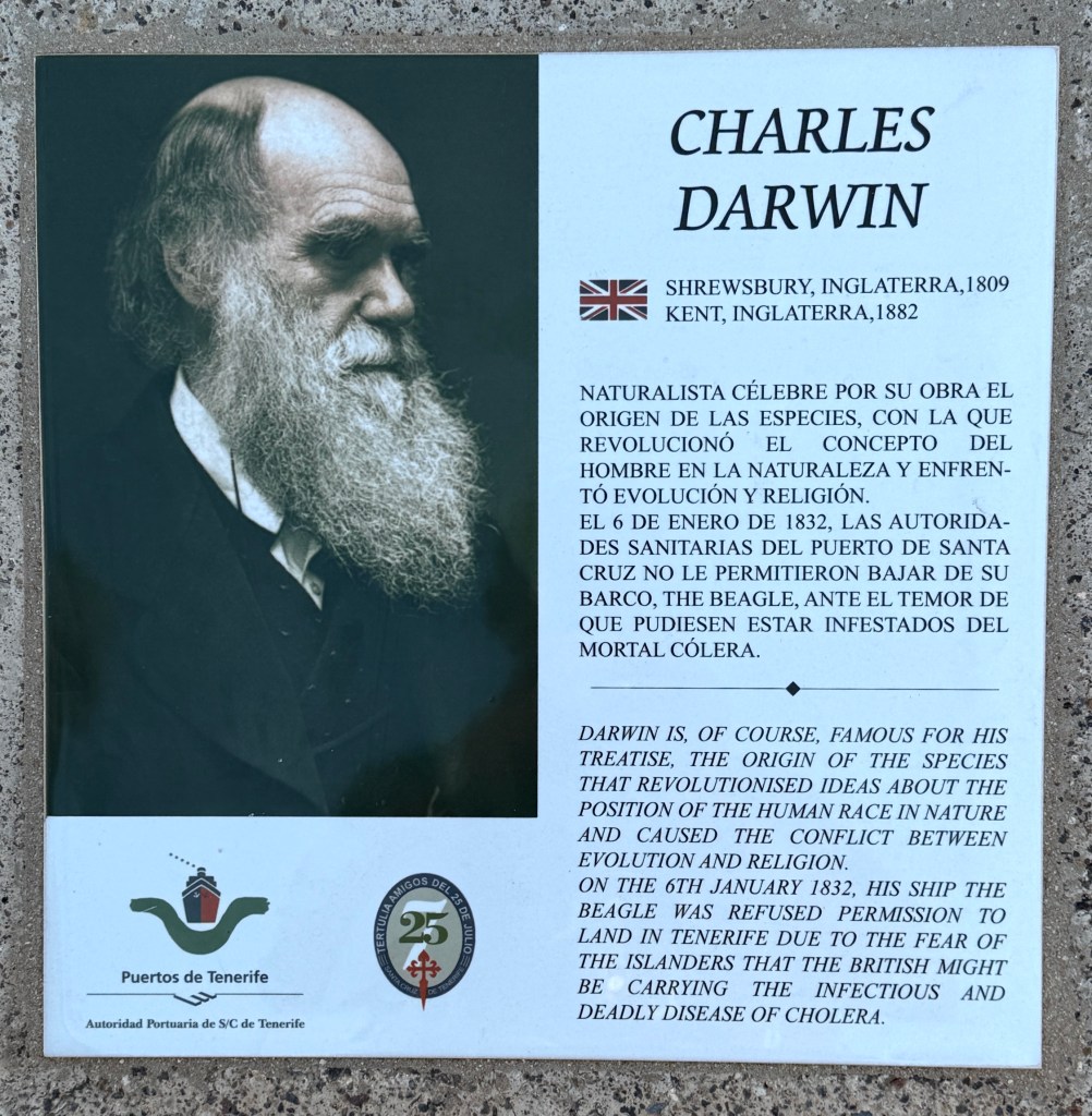
The walkway from the port into the city has a long line of plaques documenting those who have visited the island since it was founded in the late 15th century. They came from all walks of life: European explorers, scientists, pirates, royalty of all ranks, novelists, poets and politicians. Some just passing through on their way to other places and some to rest and recover in the sub tropical climate. Tenerife is on the cross roads between Europe, the Americas and the route to Asia. It was a convenient stop over point for replenishing ship’s stores on the long sea voyages. An ideal holiday spot today!
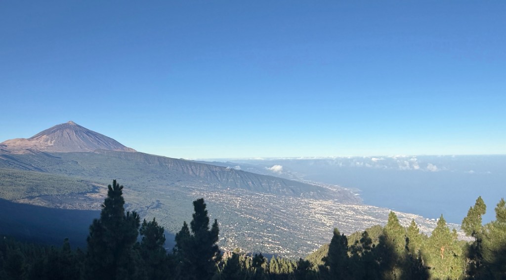
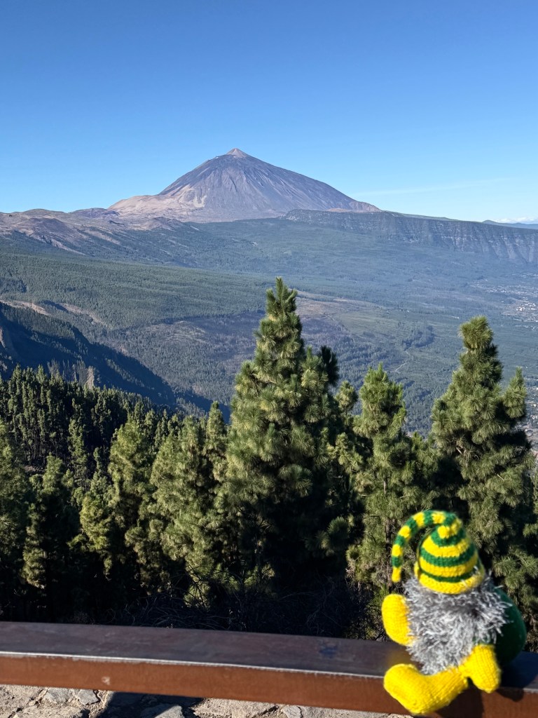
Our excursion on the island took us to the Tiede National Park. Like all the islands Tenerife is of volcanic origin. Tiede dominates the skyline. It is Spains largest mountain at 3718m and the world’s third highest active volcano at 7500m above the Atlantic sea floor. The two volcanoes in Hawaii are higher.
There was a bit of drama at our first view point stop when the bus wouldn’t take off even though the motor was going. Had to wait an hour at the view point for another bus, nothing much to do except look at the view! Some were concerned we might miss lunch. There were no facilities and some became twitchy for a loo stop. Some gentlemen seemed to wander off among the trees. Luckily, it was a volcanic area and they found some lavatrees.
Tenerife began forming about 12m years ago on the ocean floor with three islands ultimately emerging close together. Then 3m years ago Tiede had a major volcanic event that fused the three islands together to form the present day structure.
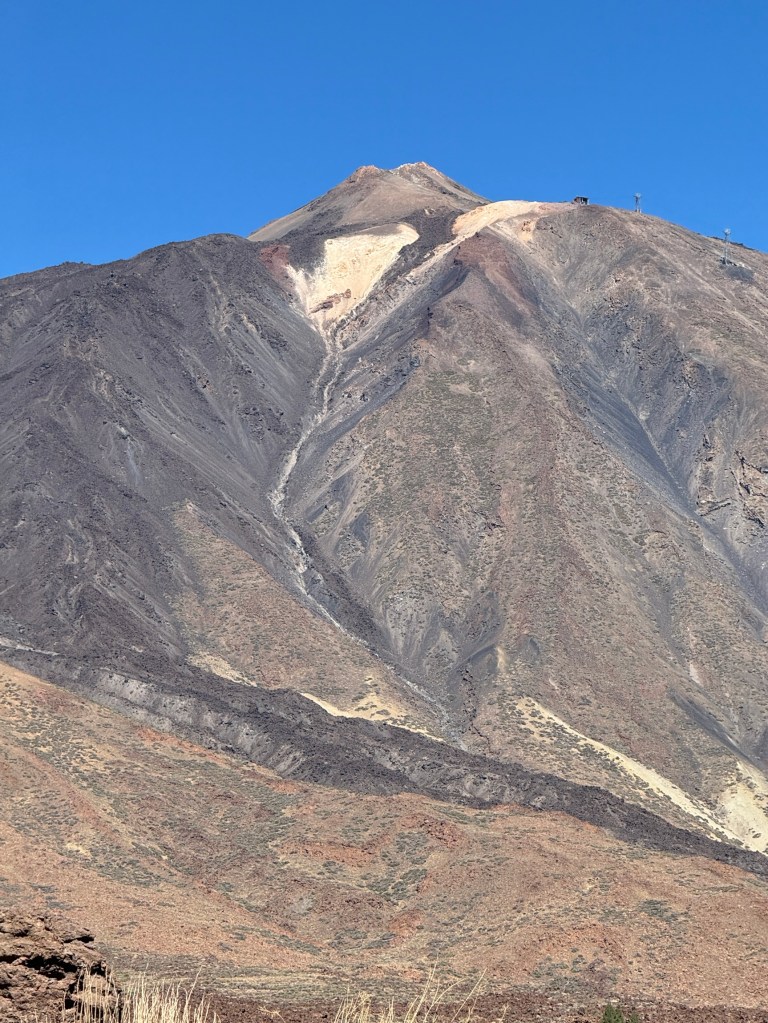
Sometime after that there was a massive collapse of another much bigger volcano leaving a crater like structure with surrounding walls several kilometres across. Mt Tiede is part of this environment. What I have said here is pretty simplified I suspect, going from memory of the guides comments and a little bit of Wikipedia!
Anyway, our bus crossed this crater past numerous lava flows and valleys. The road was rather narrow with buses barely being able to pass each other and perched overlooking some rather steep drop offs when they did. Homealone didn’t see a lot of the scenery.
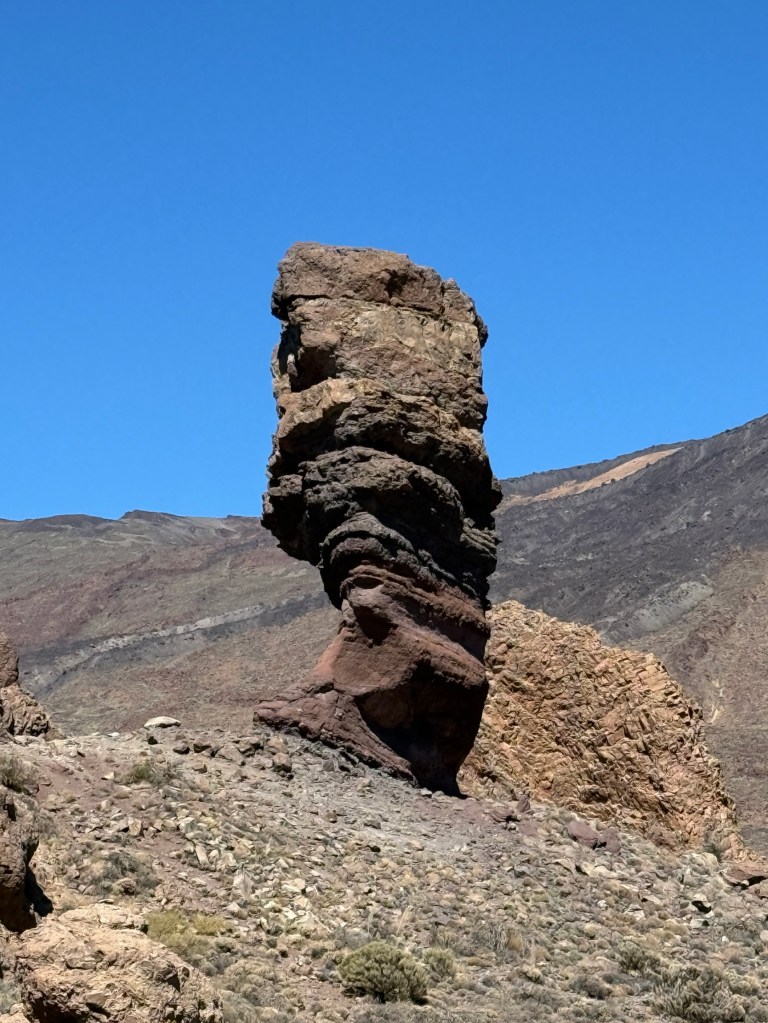
We ended up at another view point surrounded by remnant volcanic structures of all shapes and sizes. Interesting spot!
On the way back the guide played a recording of a piece of music played on a traditional timple, a five string plucked instrument looking a bit like a ukulele. It is background music on this video as we passed through the crater.
We had a very entertaining day on the bus excursion and wandering around the port area of Tenerife.
There is a lot to do in Tenerife, one could easily go back for a longer stay!
We sailed away in the gathering dusk for our last stop in the Canaries, Santa Cruz De La Palma.
Grand Canaria
Our next port of call was Las Palmas de Gran Canaria. We were surprised at its size, 406,000 people. It is one of Spains largest cities and was founded in 1478 during the Spanish colonisation period.
I have had an interesting question about how the islands got the name ‘Canary’. Luckily, on our tour of part of the island of Grand Canaria the guide explained the background to the name. It is derived from the Latin word ‘Canariae Insulae’ which means ‘Islands of the Dogs’, attributed to Romans visiting the islands in the early first half of the first century. Now, the tricky thing here is that they were referring to ‘Sea Dogs’, what we call seals. So it is odd that the Coat of Arms of the Canaries has dogs on it rather than seals.
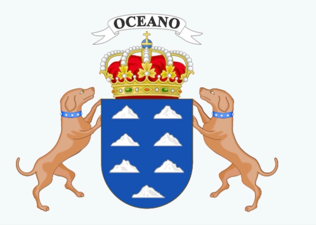
Dogs didn’t appear on the Canaries it seems until after the Spanish conquest at the end of the 15th century. There is a dispute about this of course as to who is right. It seems the better view is that the Romans were referring to seals not dogs, as we know them. But the Coat of Arms still has dogs! There are also a few less accepted ideas about this but what does it matter to us? The main issue is that the Islands are not named after the endemic bird species of the islands. The canary species on the islands is named after the islands not the other way round!

Ok, enough of this stuff. The tour took us on a cultural experience in the countryside. No volcanoes!
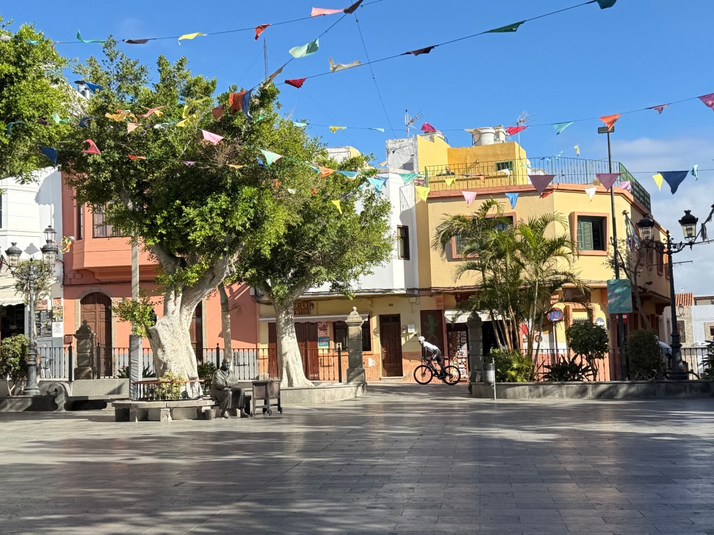
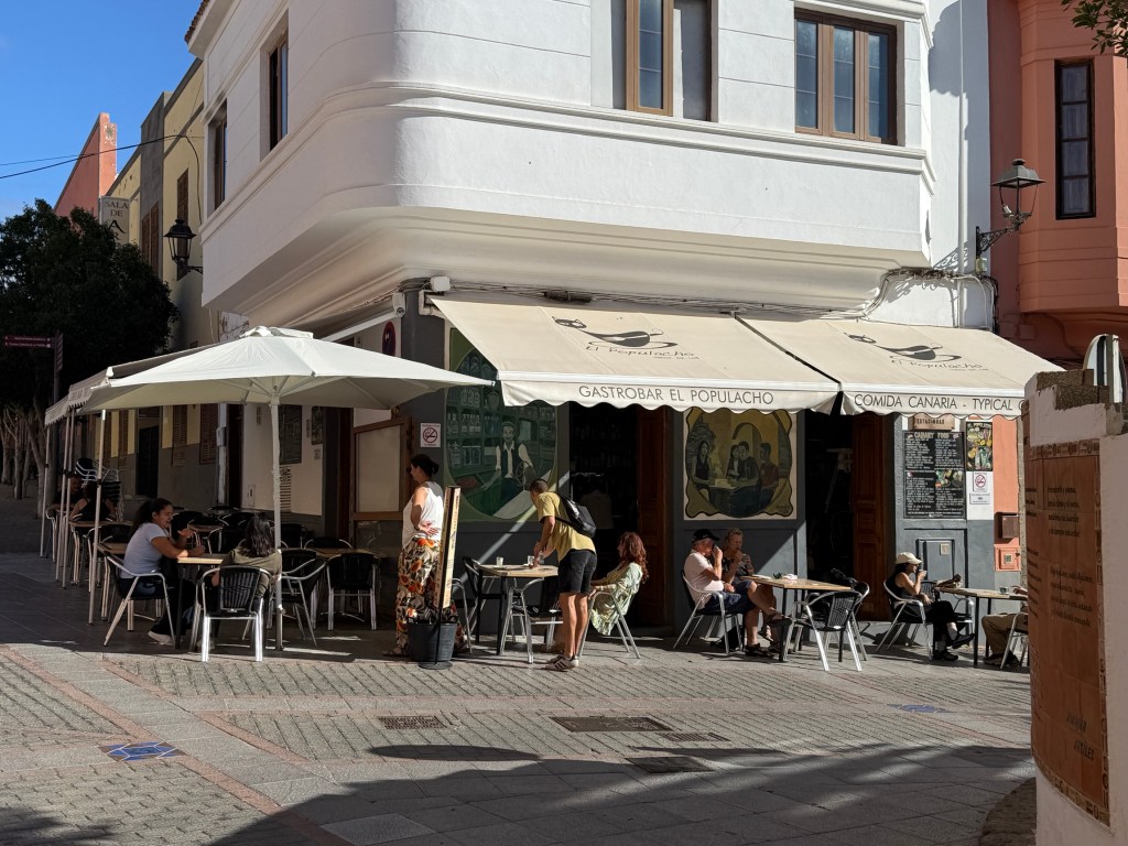
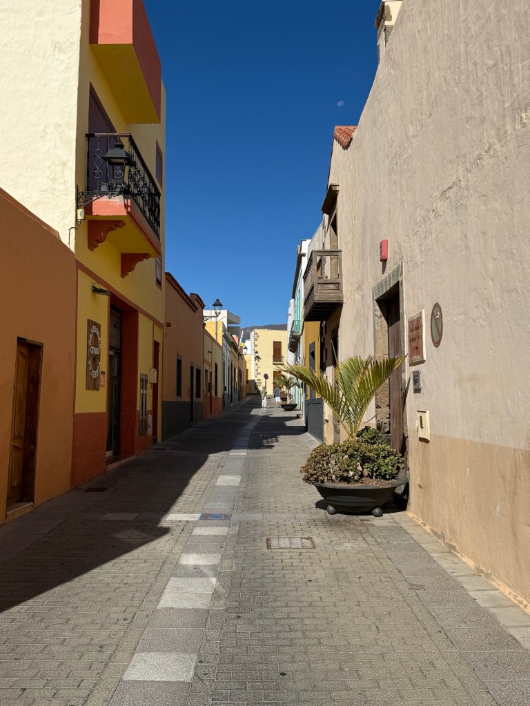
We had a walk around the streets of Aguimes a traditional village in the hills overlooking the Las Palmas port. Here are some pics from this colourful town.
Moving on from the town we headed up country along some pretty tight roads, not for the faint hearted.
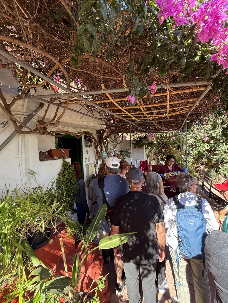
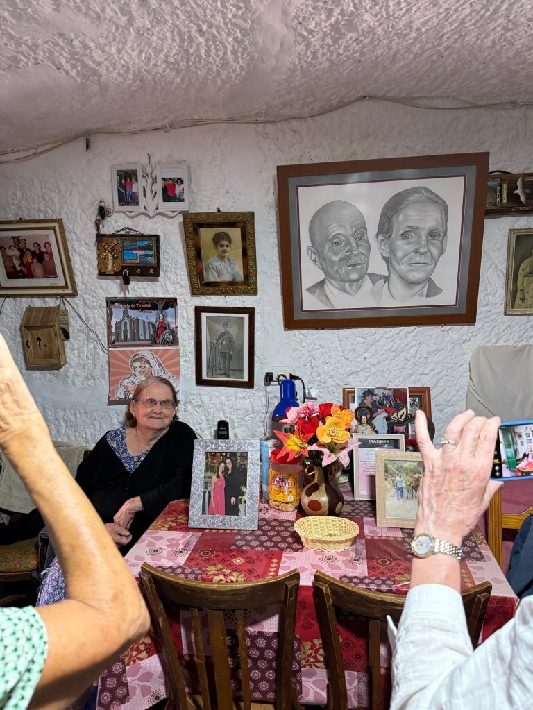
We were going to Guayadeque. This is an area on the Island that is a throw back to traditional lifestyles from times before the Spanish conquests.
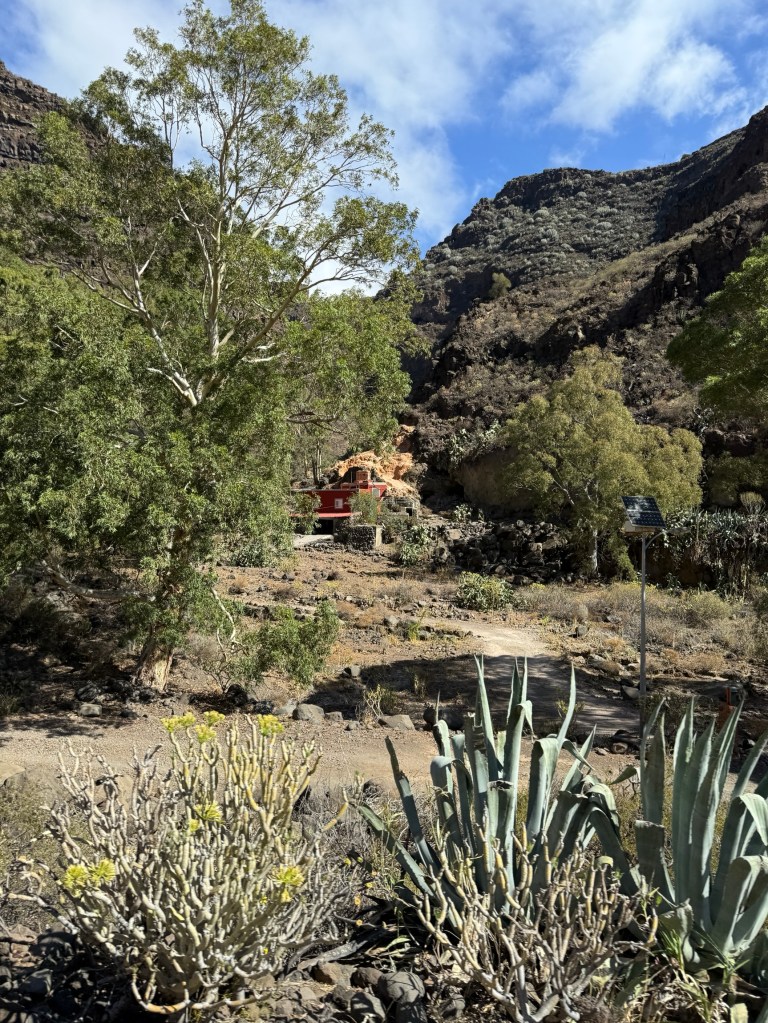
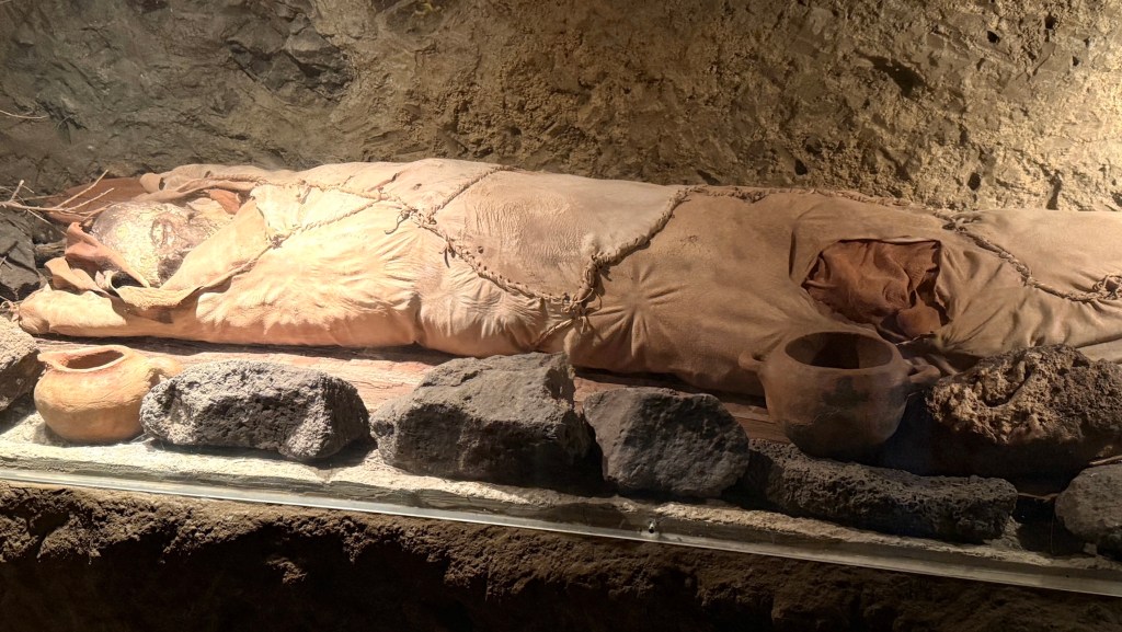
The indigenous people of the Canaries are thought to have arrived from North Africa up to one to two thousand year BC. They occupied the islands in the up country area of ravines running down to the coast from the interior high country. They were cave dwellers and this lifestyle continued into the 1970s before modernisation overtook them.
Their lifestyle has been well documented from archaeological work. One interesting practice was the mummification of the dead. Unlike the Egyptians the dead’s internal organs were not removed, the bodies were left to ‘dry out’ in the burial caves. Many examples of this have been found in the hill sides.
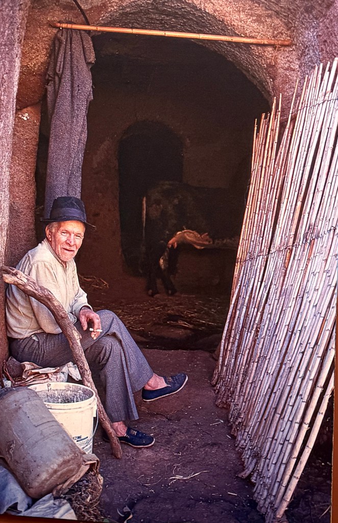
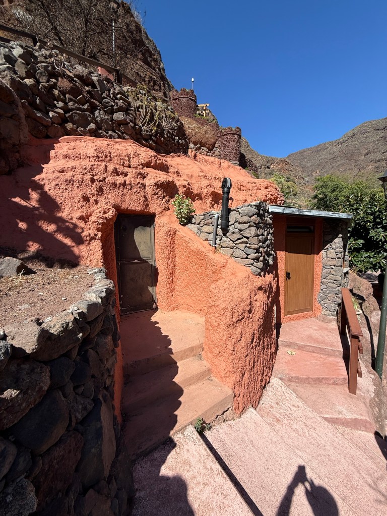
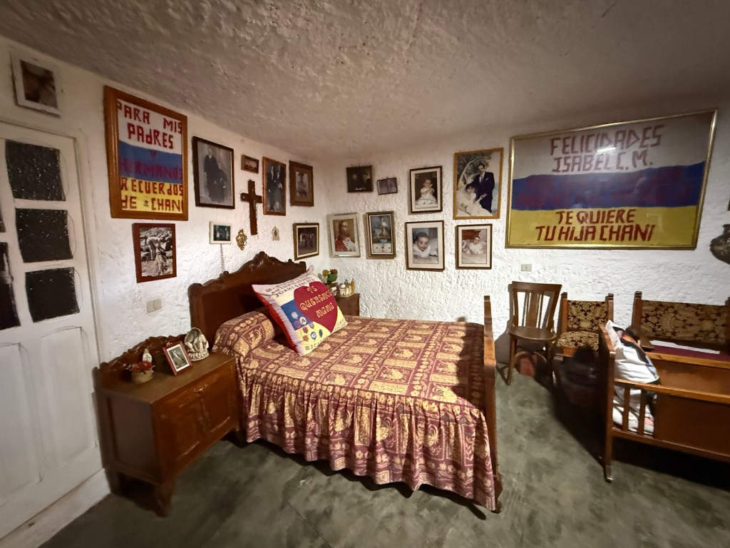
People still live in caves today but they are a little fancier than back in the 70s, light and power for instance! Satellite dishes too for the internet and TV!
We had the opportunity of looking through a cave house. An old lady watched us as we looked around. She had lived in the house for 64 years, with a bit of updating from time to time.
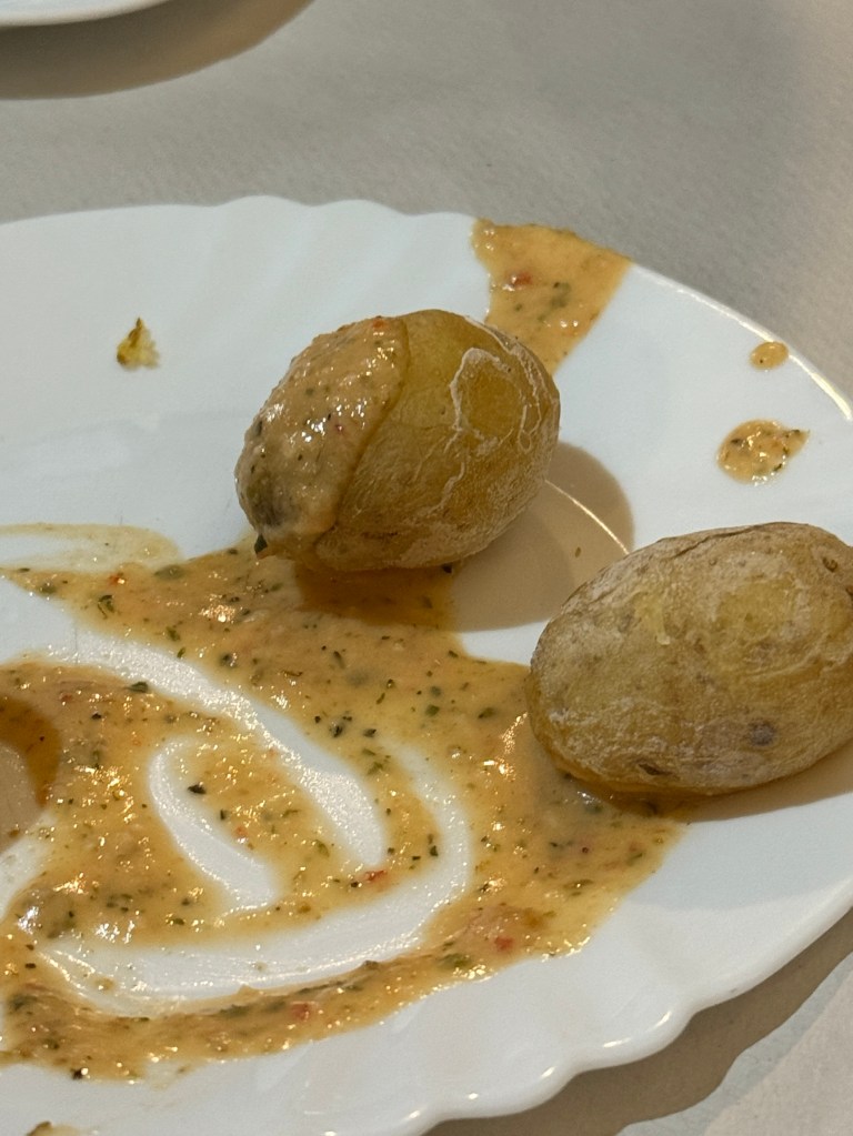
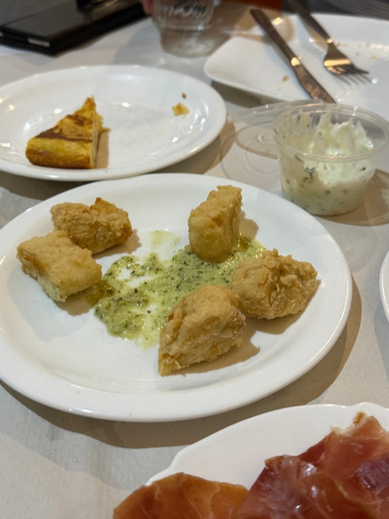
After our look see we had some traditional tapas for lunch. Two pieces stood out, some battered fish pieces (with a sauce) and ‘wrinkled’ potatoes also with a sauce. Both were excellent! Allthego has the recipes to inflict on visitors.
The lunch marked the end of the tour and we returned to the ship for a feet up afternoon. The next port of call was Tenerife. But Allthego and Homealone are returning to Australia in the morning. The adventure will continue then with a chronicle of the last few days of the cruise.
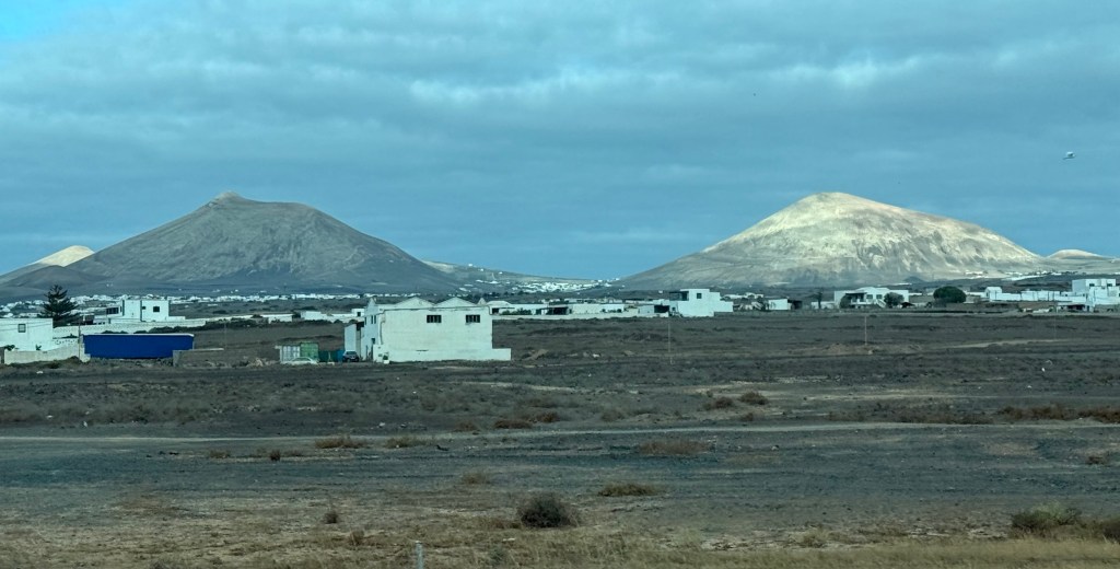
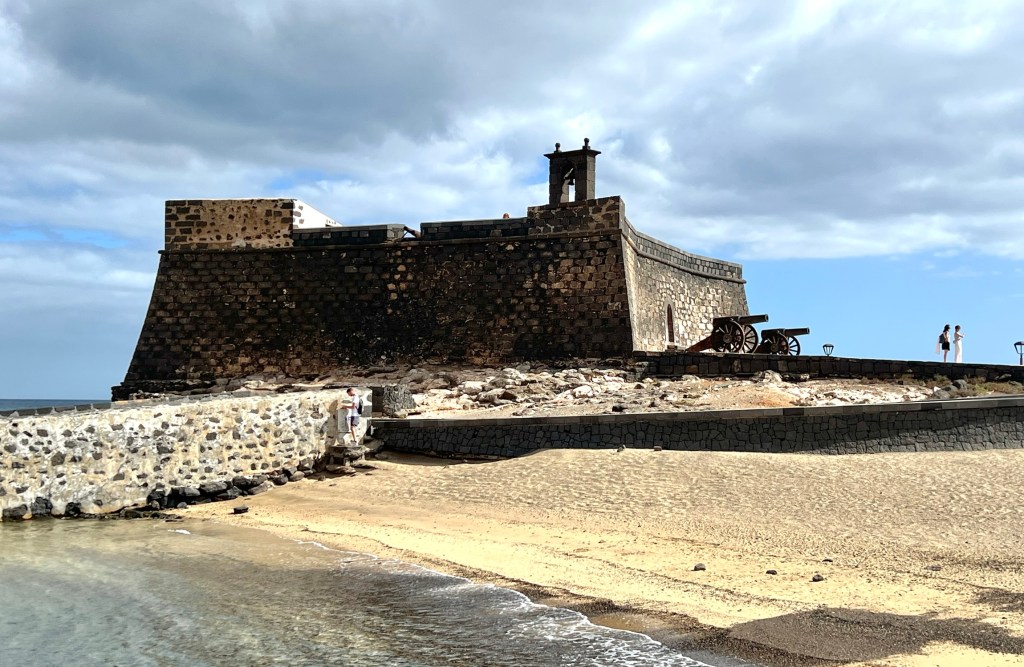
Lanzarote the first stop in the Canaries.
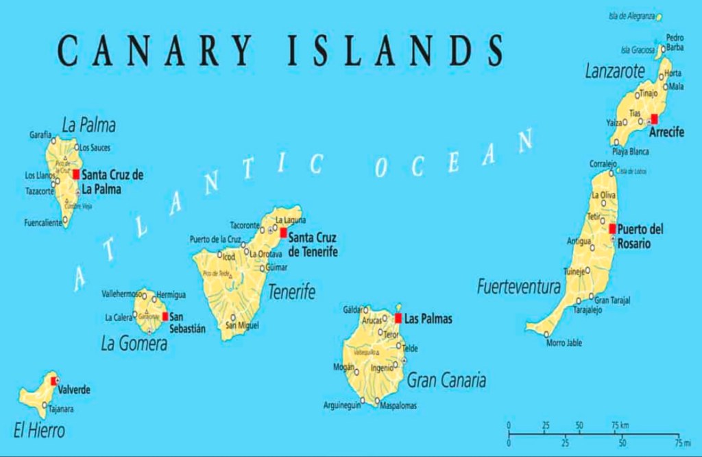
After leaving Morocco we headed west across the Atlantic for our first port of call in the Canaries at Arrecife on Lanzarote. The Canaries are comprised of eight main islands and are about 100km off the African coast on 28 to 30 latitude, just north of the Tropic of Cancer. There is a population of 2.3m scattered across the group, Tenerife and Gran Canaria each having about 40% of the total. The islands are all volcanic in origin and comparatively young in geological time. All bear evidence of recent volcanic activity.
The islands came under Spanish control in the late 1400s. They were strategically placed on the early trade routes to the Americas, India and the East Indies. The First Fleet provisioned here on its way to Australia in the 1770s. Enough history.
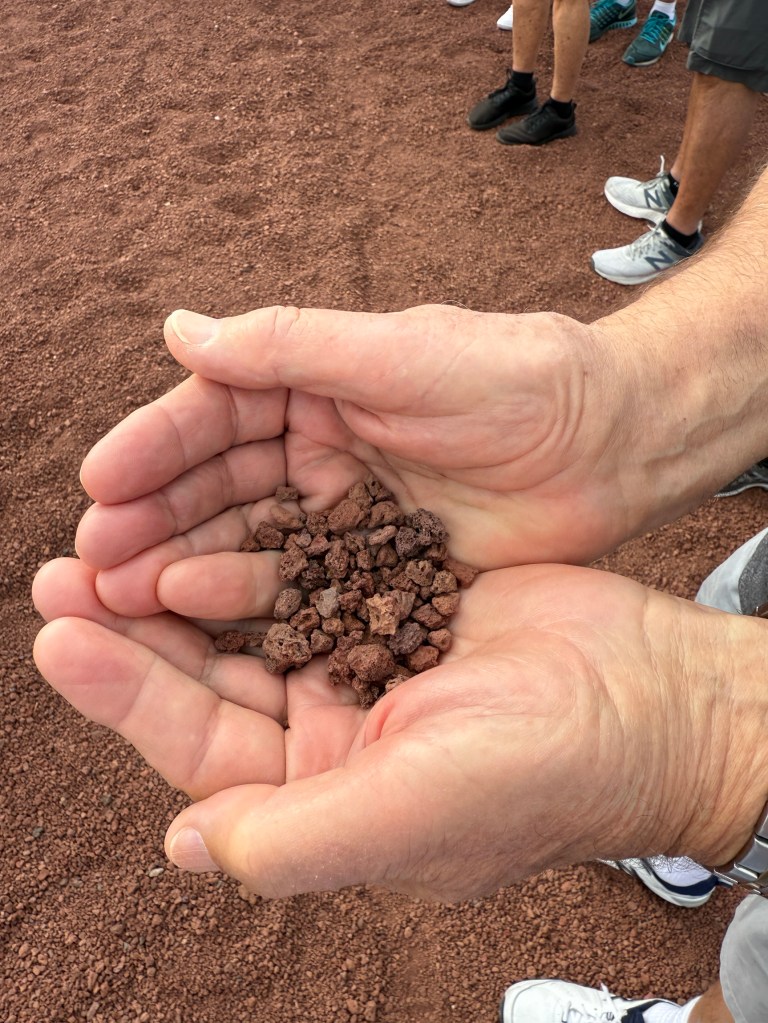
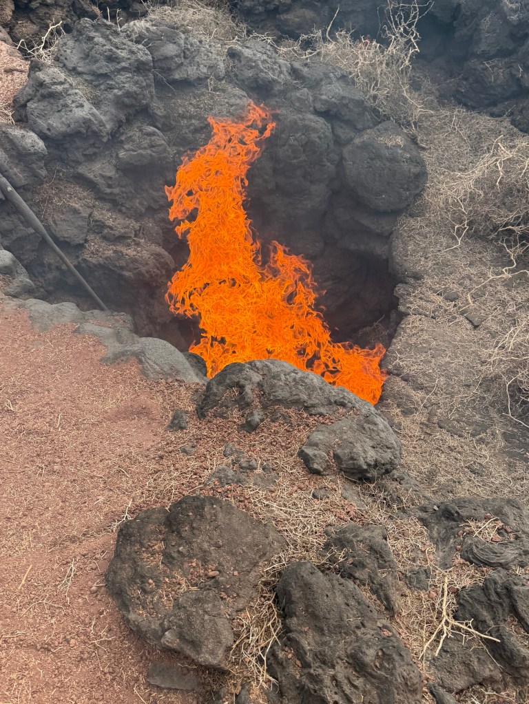
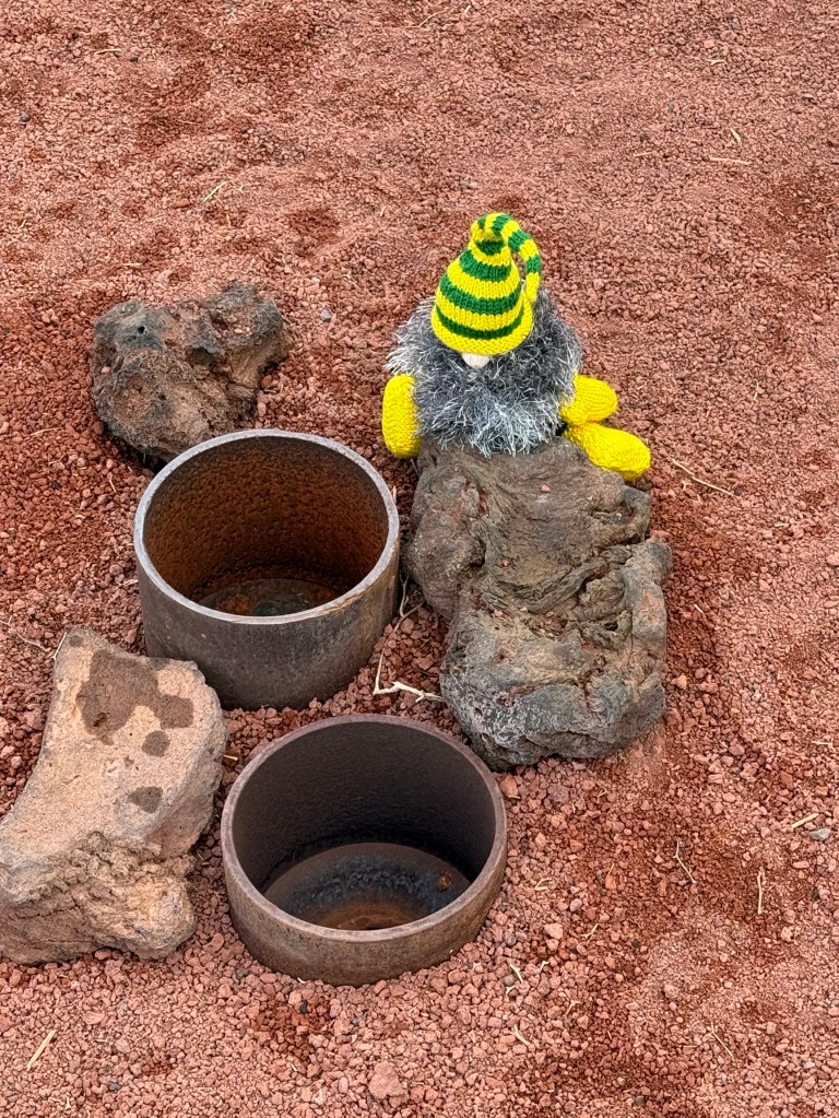
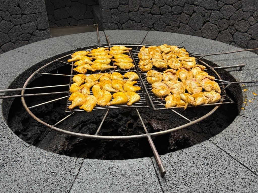
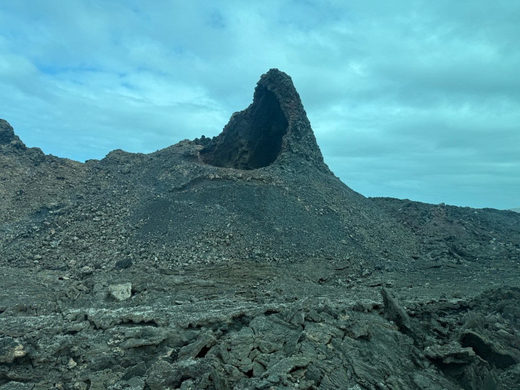
Arriving at Arrecife we set off on a tour of the Timanfaya NP an area of transformative volcanic activity in the period 1730 -1736, but also in 1824. Volcanic activity continues today with temperatures of 100-600 celsius at a depth of 40 m in the core.
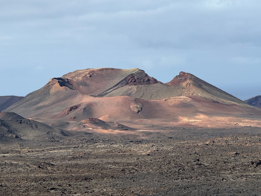
We had some interesting experiences with the hot rocks at the lookout, about 500m above sea level.
We then went on a short drive through the park past the main features. There is little vegetation, mostly lichen starting to colonise the lava fields. It was quite a spectacular introduction to the Canaries.
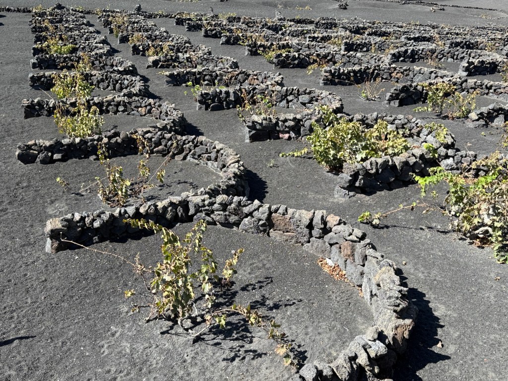
On the way back to the ship we stopped by a local vineyard planted on the black volcanic soils. Nothing like traditional trellised vineyards. The rocks are a windbreak for the ground hugging vines. There is no irrigation. The wine we tasted was not to our liking, seemed very flinty and short on fruit flavour. But obviously popular with some.
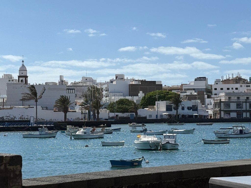
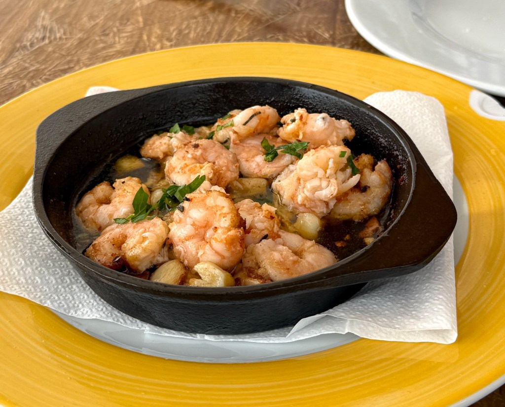
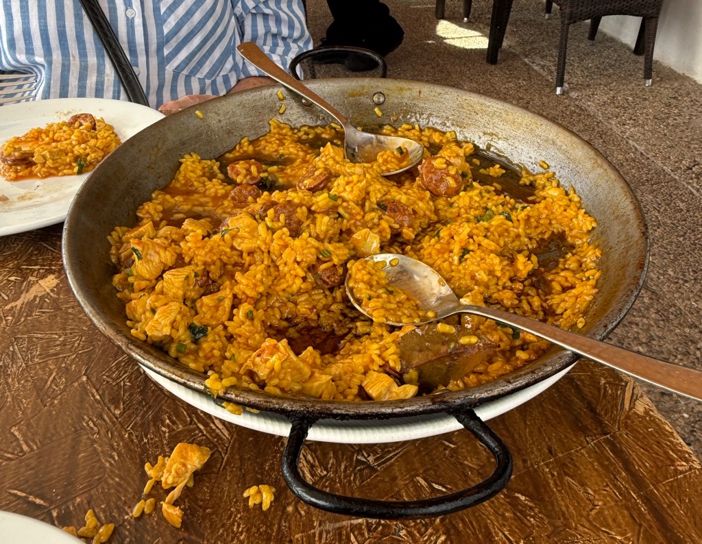
We returned to the ship and ventured into town for lunch at a restaurant beside the central lagoon. An enjoyable spot in the bright sunshine to share some garlic prawns and a chicken/chorizo paella. Very nice and no shortage of food!

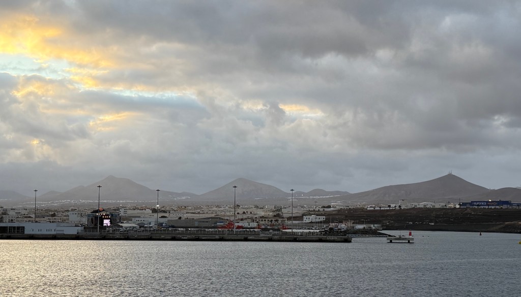
Next stop was Las Palmas on Gran Canaria.
Off to Malaga and we might get to Morocco!
Our time in Madrid ended the morning after the bull fight experience. No bad dreams during the night of being gored by a bull. We made our way by taxi down to the Madrid regional rail station to catch the 10.35am to Malaga. Malaga is almost due south of Madrid on the Mediterranean coast, about 420km by train. It took a little under three hours on the fast train, stopping several times. We hit speeds of in excess of 220kmh on sections of the track, not super fast but quick enough.

The Watts also left us on their Globus bus trip loop around the eastern side of Spain and will return to Madrid for their flight back to Australia.
We had a night in Malaga ahead of our Oceania cruise to the Canary Islands, with a stop in Morocco on the way down the African coast.

We took the opportunity in Malaga to see a traditional Flamenco show, never been to one before. It was held in a small restaurant all set up for the occasion, a partially lit club like atmosphere prevailed with onlookers seated around a small stage.
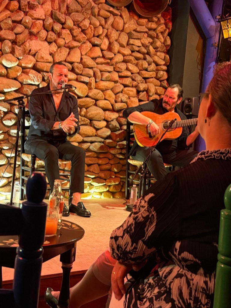
There was a chap plucking a guitar of some sort, lots of strings. He seemed to be pretty good at it and convinced us to buy his CD after the show.
There was then another chap who sang along with the guitar, the songs didn’t seem to be all in Spanish, maybe there was some North African in there somewhere.
Anyway, he wasn’t too bad. Then there were two girls, perhaps better described as young mature women who did the dancing to the music and singing. Sometimes together and at other times by themselves.
One of them had a pained expression on her face for most of the time, the other smiled and grinned a bit during her performances. Homealone thought that the different facial expressions might be due to the nature of the story being portrayed in the dance routines. It was an interesting performance and something new for us. It was then off for a late snack at a nearby restaurant and then bed.
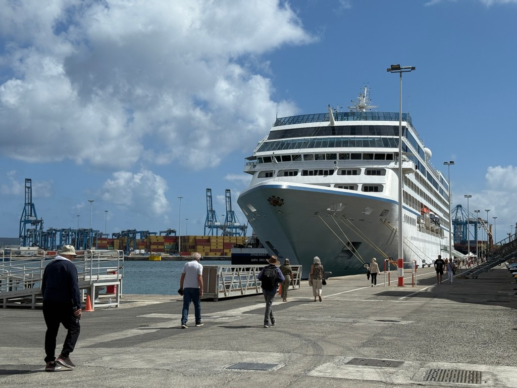
The following day we had a bit of a lie in and recuperation from all the activity before heading to the dock to board the Nautica, a relatively small ship with 684 guests and 400 crew. The ship sailed away at 7pm on schedule bound for Agadir on the Atlantic coast in Morocco.

That evening we had dinner in the Pollo Grill, a first night celebration. Homealone had the very tasty veal chop.
The next day was spent at sea, the weather was overcast but pleasantly warm. Seas were calm. Day of rest ahead of arriving in Agadir in the morning.
When ashore in Agadir we were whisked away by an energetic guide who kept telling us to return to Agadir, ‘we need you tourists’. He was a bit of a comedian. Occasionally funny.
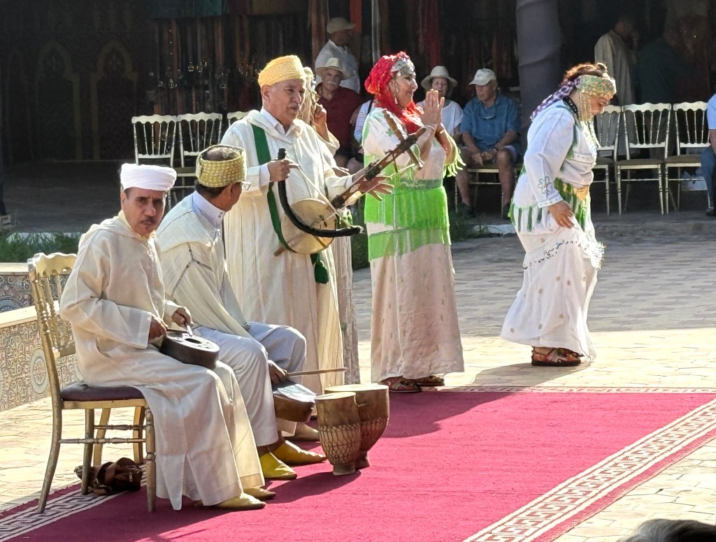
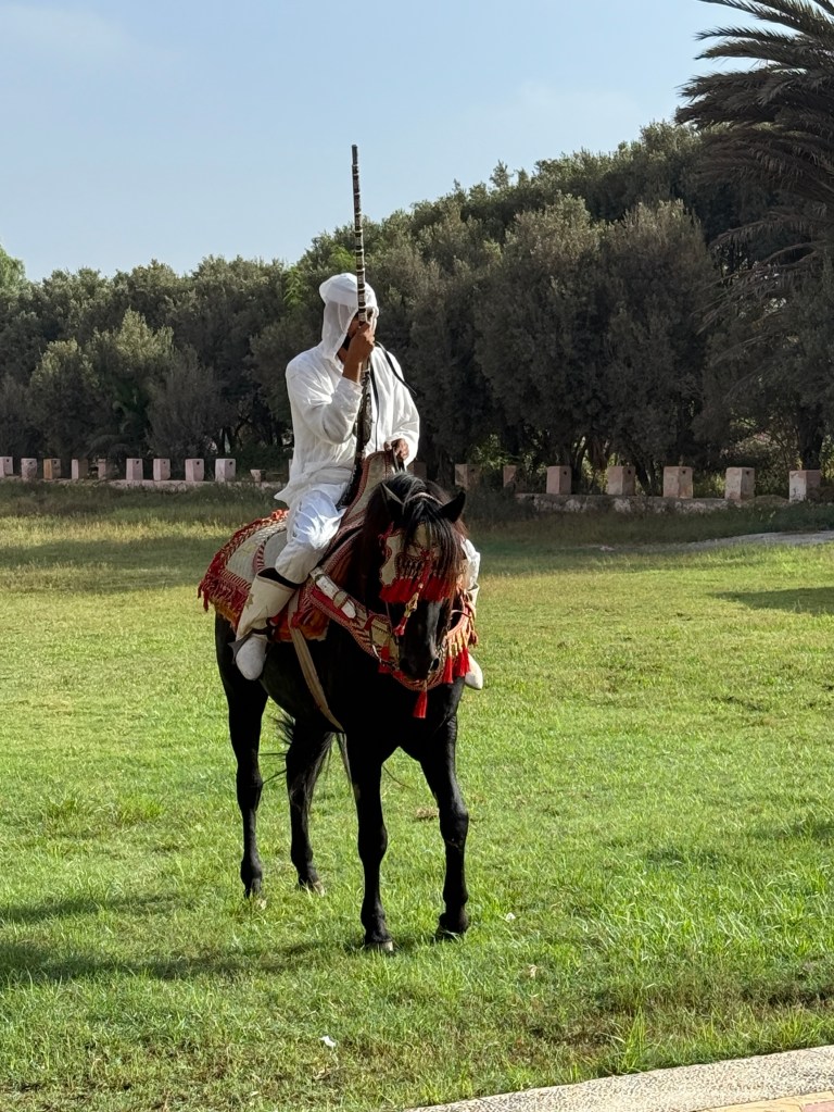
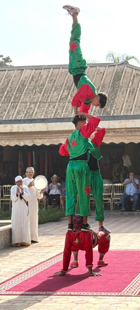
First stop was at an entertainment type establishment for a Fantasia show. A ‘Fantasia’ show is a bit like a circus and is a collection of folk acts displaying local culture. There were some musicians and dancers.
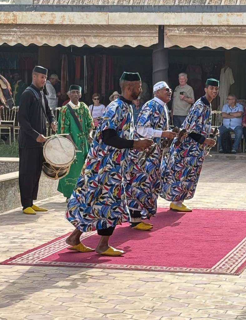
The odd animal is involved as well. So we had some threatening men, in traditional garb, on horseback charging us with rifles and lances.
An acrobat troupe then joined in the action, rather good.
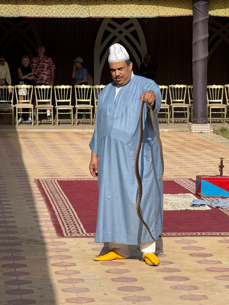
The coup de gras though was the snake charmer who came on at the end with his box of tricks that concealed various snakes, including a cobra. He suitably controlled the snakes showing them around the audience.
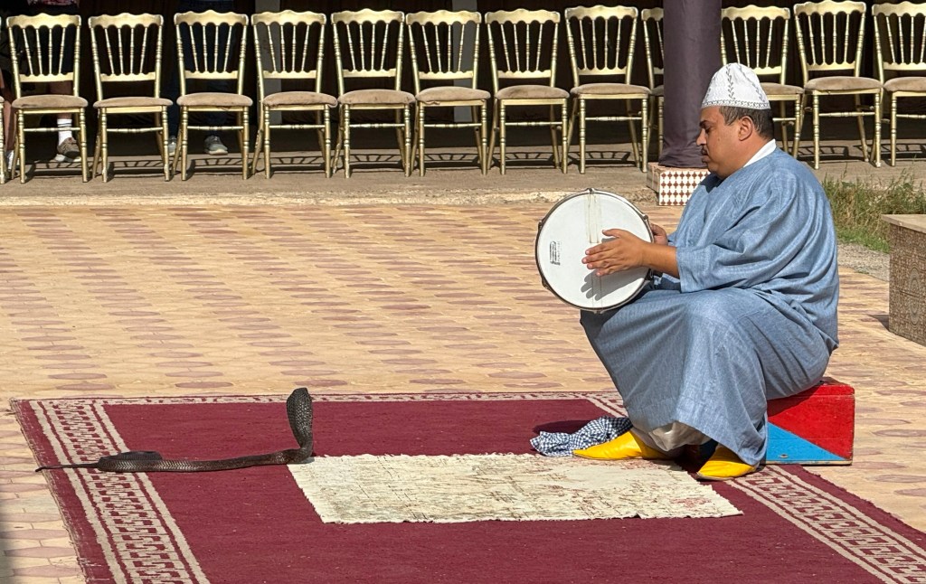
The cobra though was a bit stubborn and wouldn’t fully rise up to the flute like instrument he was playing, despite also being prodded with a tambourine.
After the Fantasia it was back in the bus for a visit to the city’s big Souk El Had. Souks are interesting places to wander through. The only downside being the constant harassment to buy.
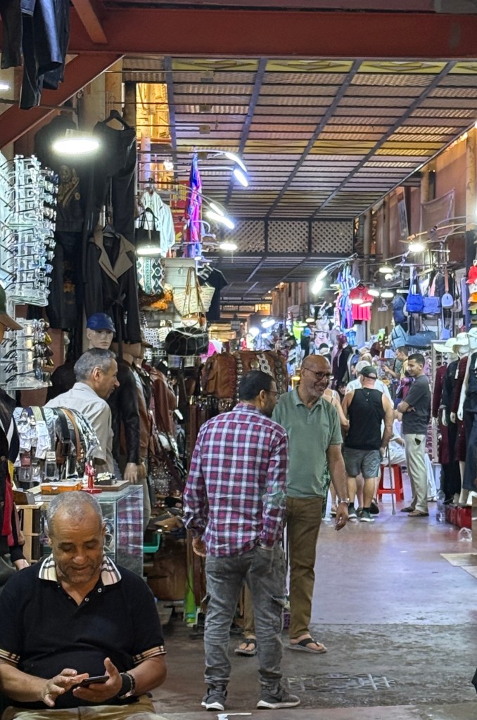
We ended up in the haberdashery, homewares, shoes and electrics area none of which we wanted. I think the vendors sensed this and basically left us alone to wander into the spot where there were baskets full of biscuits and dates.
Slobro just loves dates. This was more interesting with the great presentations on display.

We left the Souk empty handed apart from a postcard and got back on the bus destined for the Kasbah, a 16th century historic fort, high on a hill overlooking the city and harbour.
It was largely destroyed in a big earthquake in 1960, like most of Agadir, but has since been rebuilt/restored.

The great views from up here were restricted by sea cloud that had rolled in, but the spot is still impressive.
We now set sail for the Canary Islands and are going to have a busy few days with five port stops over the next five days.
Bull Fight Night
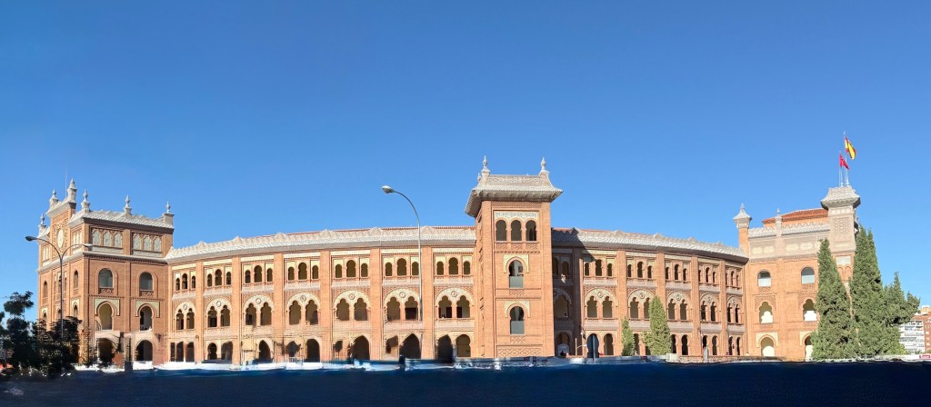
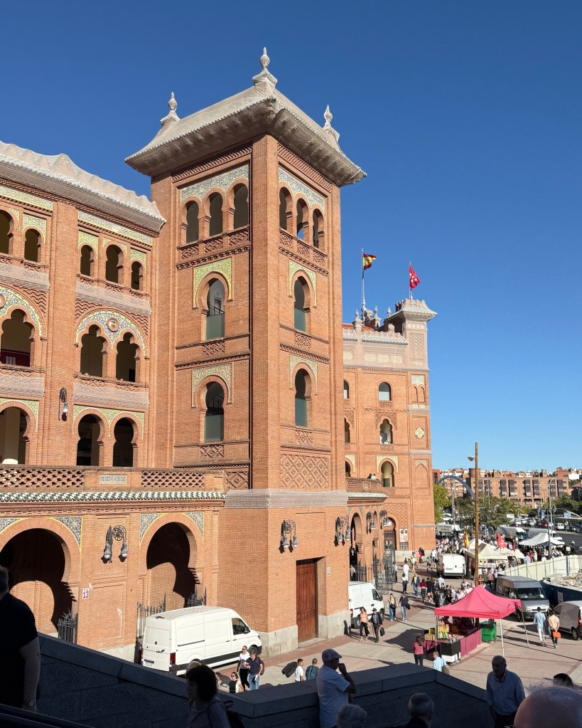
Allthego and Tony went off to see a bull fight in the Madrid Bull Ring, Plaza de Toros de Las Ventas. It was built in 1931 and has a capacity of 23,800 spectators. It is the second largest operating bull ring in the world, behind one in Venezuela. The ladies declined the opportunity to watch this cultural spectacle.
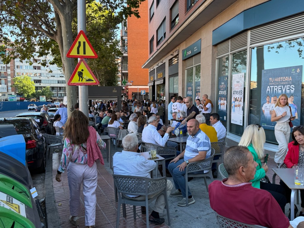
The event started at 6 pm. It seems that, just like at a football match,the crowd gathers slowly outside the Ring in cafes and bars ahead of the game. We thought it was a full house and guessed something like 30-35,000 were there when things got underway. Allthego later researched the capacity at 23,800, so we were a little out.
The crowd was of all age groups from young to old, male and female. They all appeared keen.
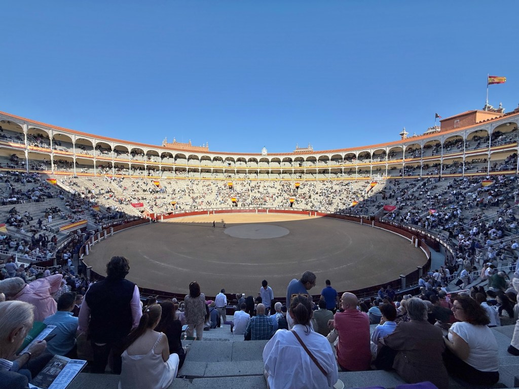
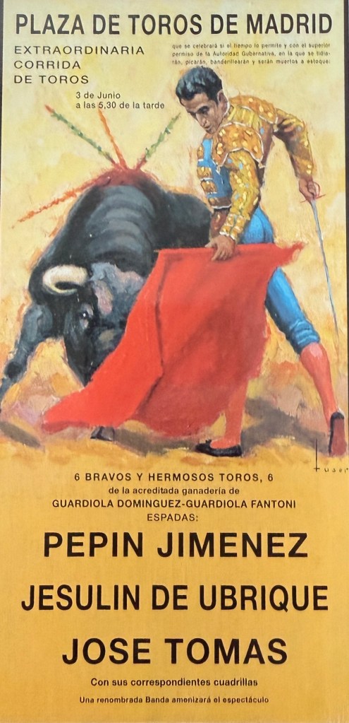
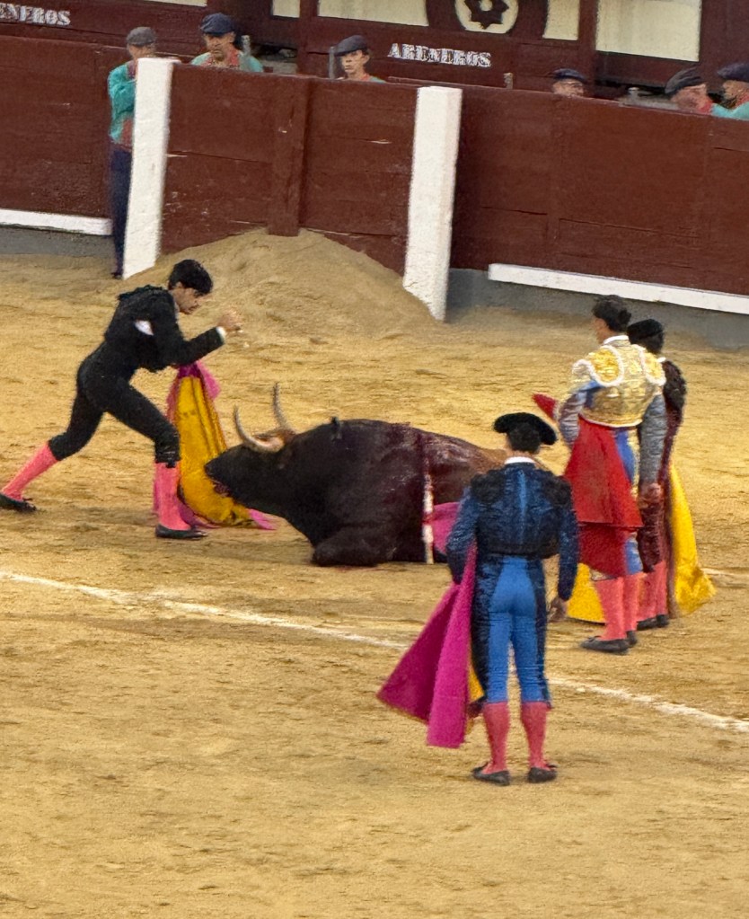
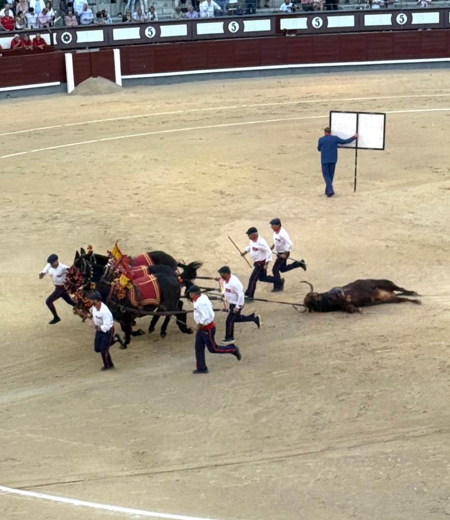
Above is a typical night. There are three matadors and six bulls to be fought, two bulls for each matador. Each contest is of 20-25 minutes duration. The objective is to kill the bull in accordance with strict protocols of process, the bull doesn’t have any protocols and seems to just want to gore the matador.
There is a parade of all the participants around the ring before the first contest. Not the bull of course!
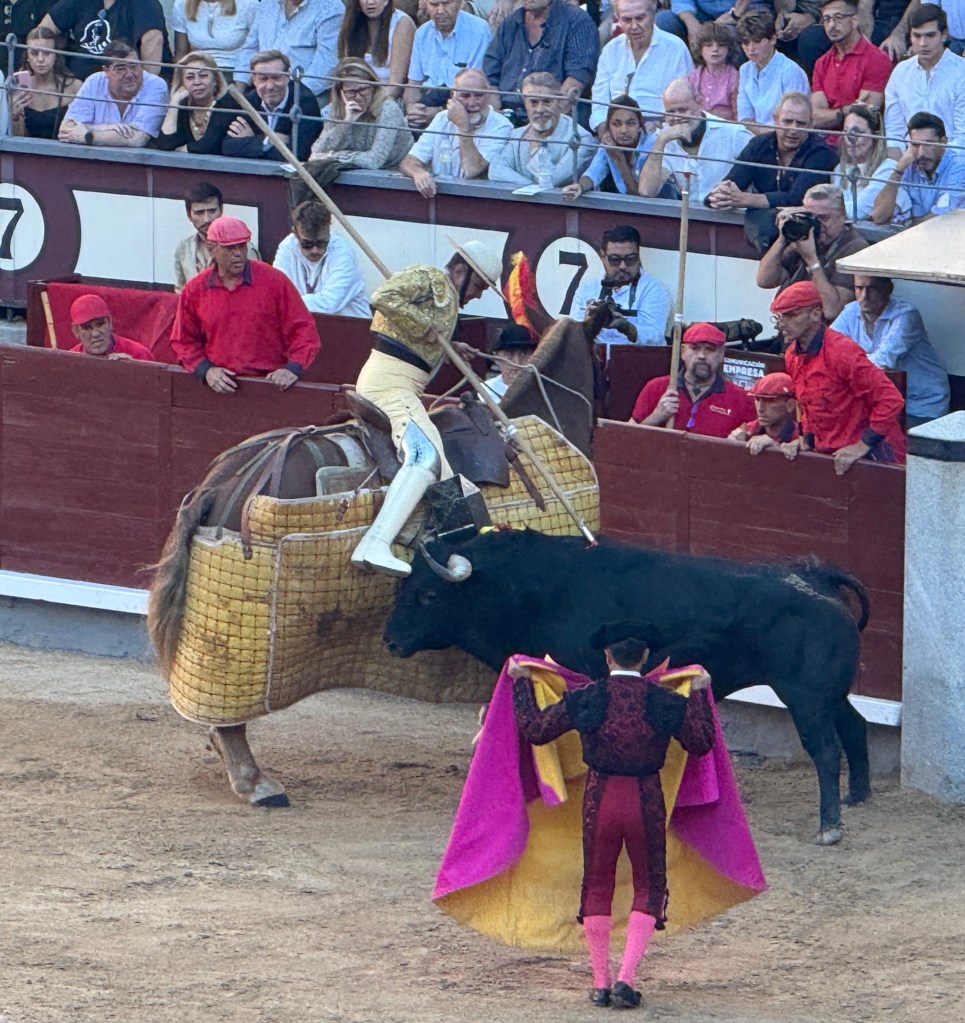
At the start, the bull is enticed to various parts of the ring by banderilleros, to tire the bull a bit but also so that the matador can assess the bulls strengths and weaknesses. The picadors, on horseback then join the action and spear the bull in the neck area a few times. The bull tries to gore the horse. They leave the action after a few minutes of work on the bull.

The banderilleros then rejoin the action and attempt to insert up to six to eight barbed darts in the bulls neck area.
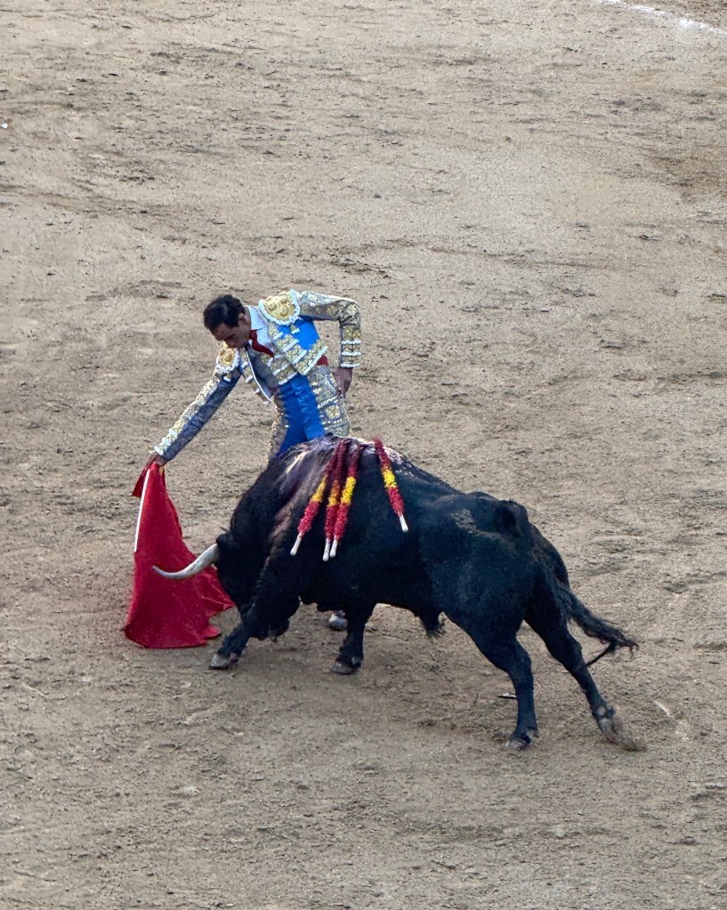
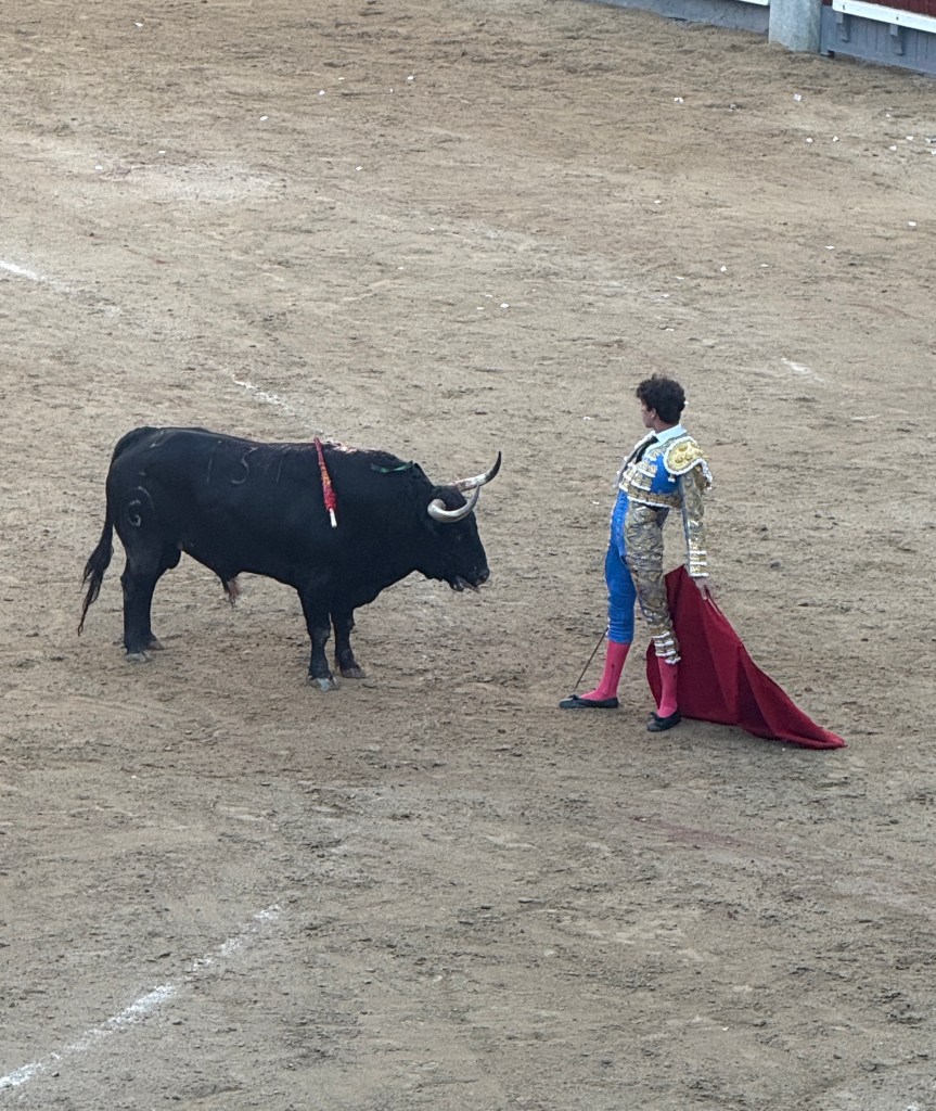
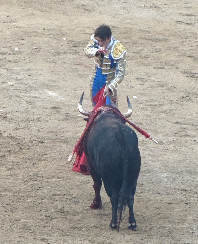
The matador then takes over and engages with the bull in passes of the cape. Again wearing the bleeding bull down and positioning it for the final thrust of the sword the matador displays his skill in mastering the bull, it is quite theatrical at times. The bull continues to attempt to gore the matador.
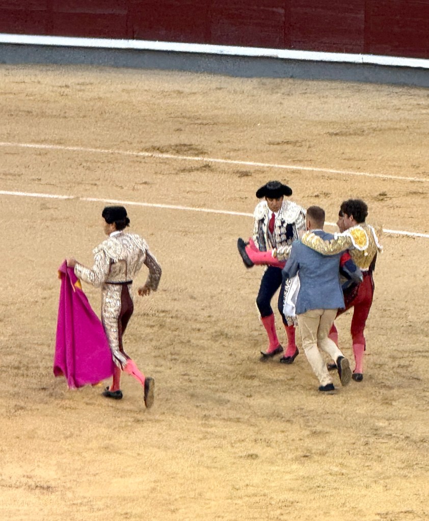
We were quite surprised when in one of the contests we watched a bull did actually gore one of the matadors, appeared to be in the thigh. He got carried off to cheers from the crowd, one of the other matadors took over.
Well, what can I say about it all. Interesting to go and see what it is all about. Wouldn’t go again. The theatre of it all brought back memories of scenes from those Roman Empire movies of action in the Colosseum, gladiators and wild animals with the crowds cheering and crying out for more blood!
Looking forward to something more sedate!
Madrid
We were in Madrid for four nights, arriving late in the afternoon from Salamanca. The next day had a scheduled city tour in the morning with an add on tour afterwards through the Royal Palace. Before bed we slipped around behind the hotel with the Watts for a light dinner. And yes we found Gildas on the menu! That famous Spanish tapas. Just had to try one! Olives with rather salty anchovies and some pickled green chilli peppers all on a stick.
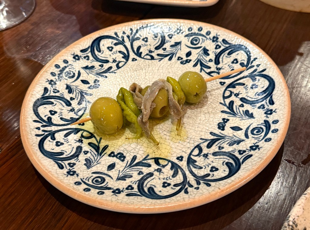
Allthego wouldn’t rave about them, not unpleasant and probably an acquired taste. Wouldn’t queue up for them either. But served on a nice plate!
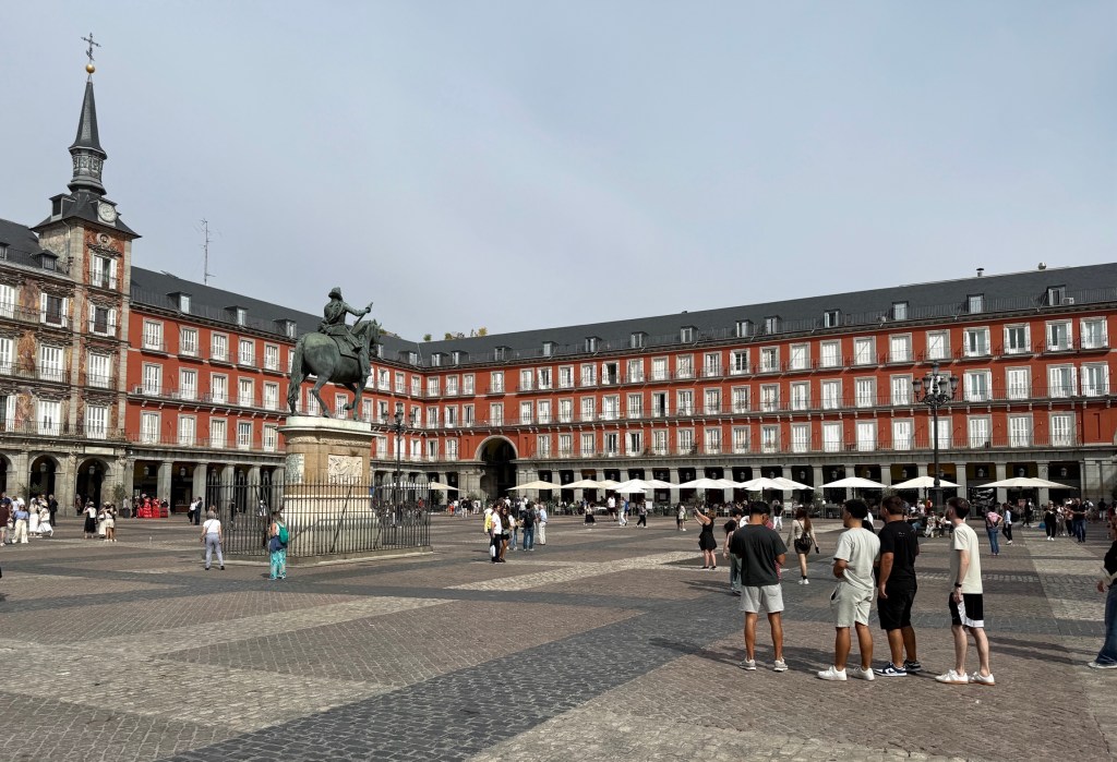
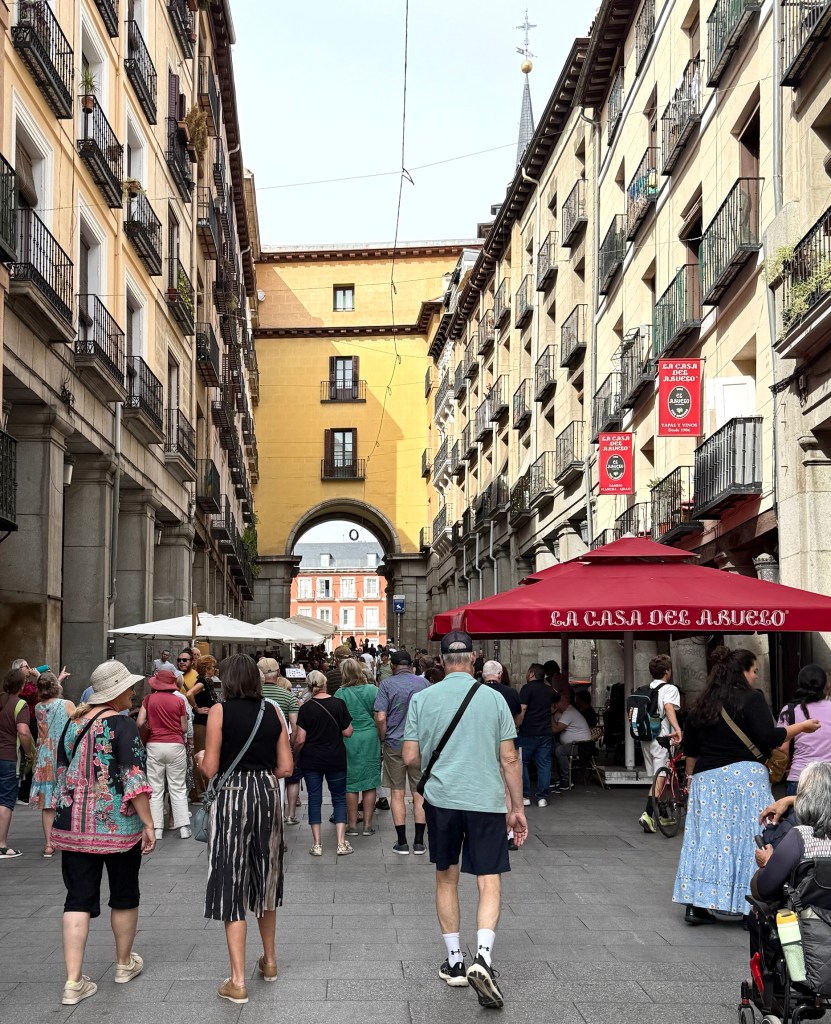
The hotel where we are staying is towards the northern end of Madrid’s central wide avenue that twists its way a few kilometres south down to the big regional railway station. In between there are numerous statues, squares and classic buildings to try to take in. Unfortunately, Allthego got on the wrong side of the bus and missed a few shots of these impressive landmarks. Among them was a square dedicated to Christopher Columbus and the American discoveries. We didn’t have the time (or perhaps enthusiasm) to go back another day and redo the excursion at a slower pace on foot. We alighted from the bus near the city’s main square and street walked to the Royal Palace.


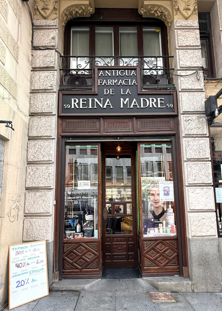
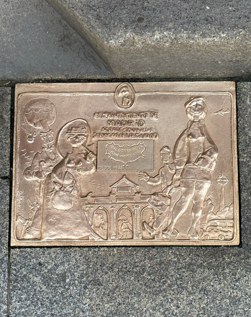
These plaques are on the footpath outside shops that have been there for a hundred plus years. This one has been polished up, many need a good scrub. It is for the pharmacy above that has been in this spot since 1578. No doubt dispenses different meds today!
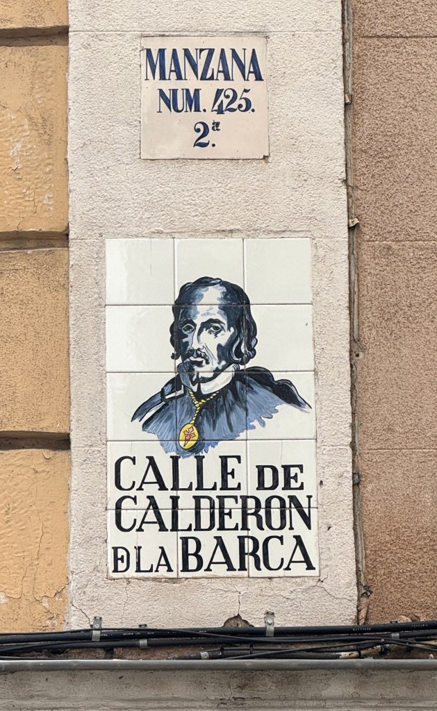
The streets (Calle) in Madrid all have these sort of plaques attached to them. This chap was a famous poet and dramatist from the 17th century. He was the equivalent of England’s Shakespeare.

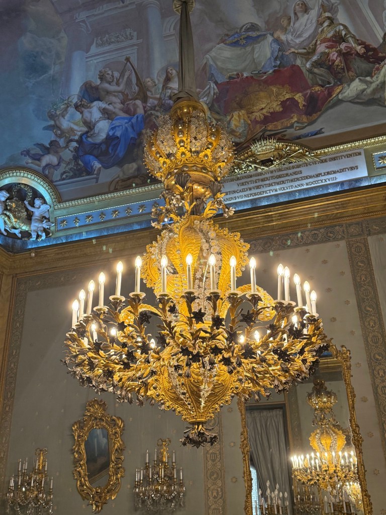
The Royal Palace was built over the period 1738 to 1755. It replaced a much older set of buildings that were destroyed by fire. It has been added to and modified over the ensuing years. It is considered to be the largest functioning royal palace in Europe.
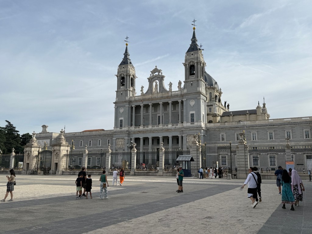
The Cathedral is at the other end of the plaza from the Royal Palace. It is of relatively recent origin having been completed in 1993 after 110 years of construction (yes it was started in 1883). It was built in a style sympathetic to that of the Palace.
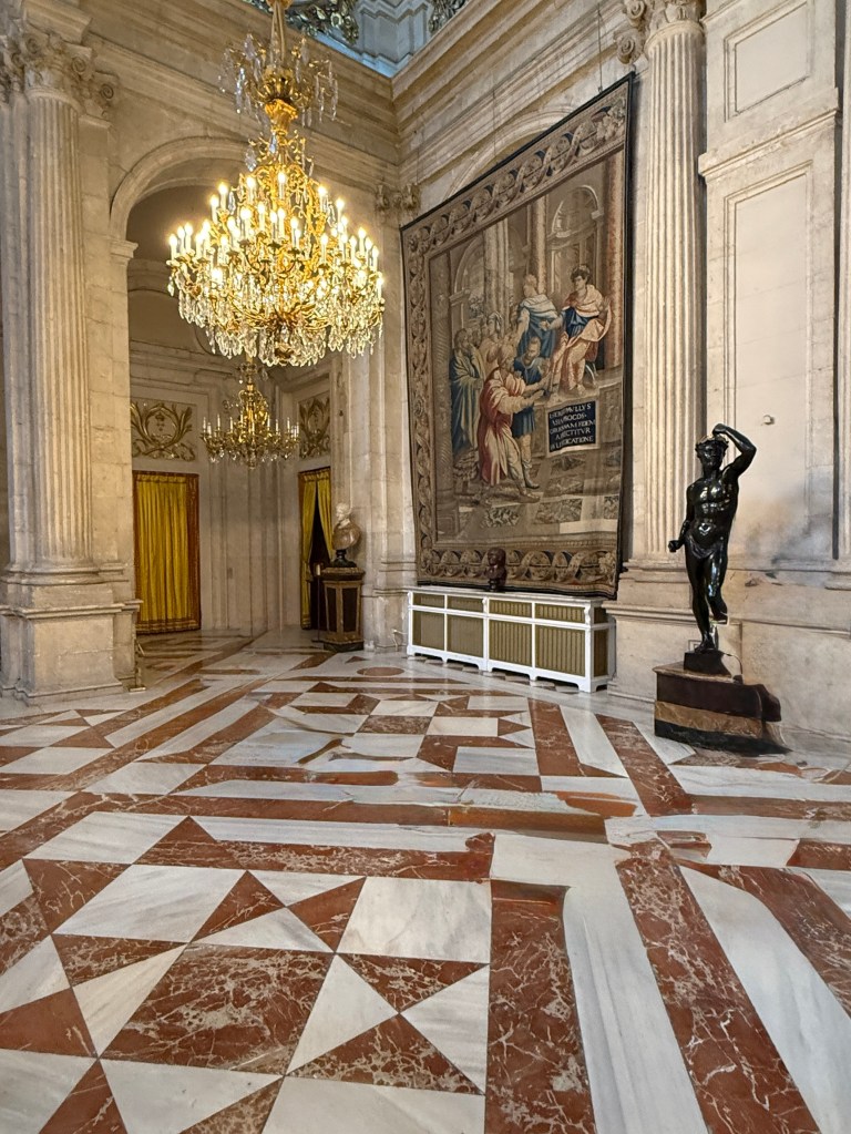

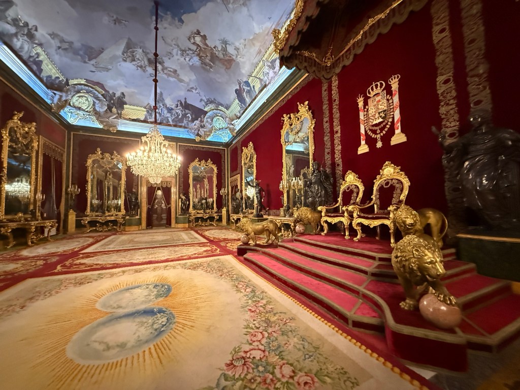
The Spanish Royal family no longer live in the Palace but state functions, ceremonial events and duties are performed in its rooms. They also do not own the Palace or for that matter other castles or royal trappings which are now owned by the State.
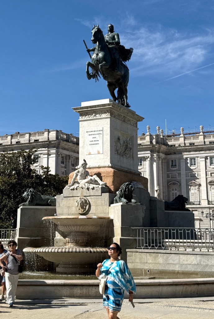
Speaking of monuments. The statue below is a technological structural breakthrough. It is the first cast metal statue of a horse standing only on its hind legs. Previous efforts fell over. How was it done? The back of the horse is solid whereas the front and head of the horse is hollow. All the weight is at the back! Not sure which genius thought of that solution.
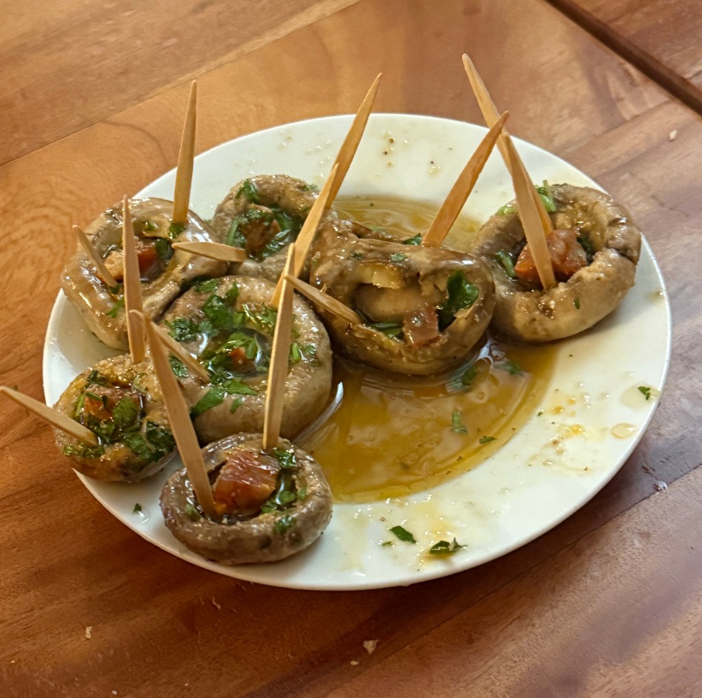
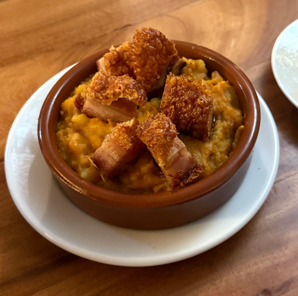
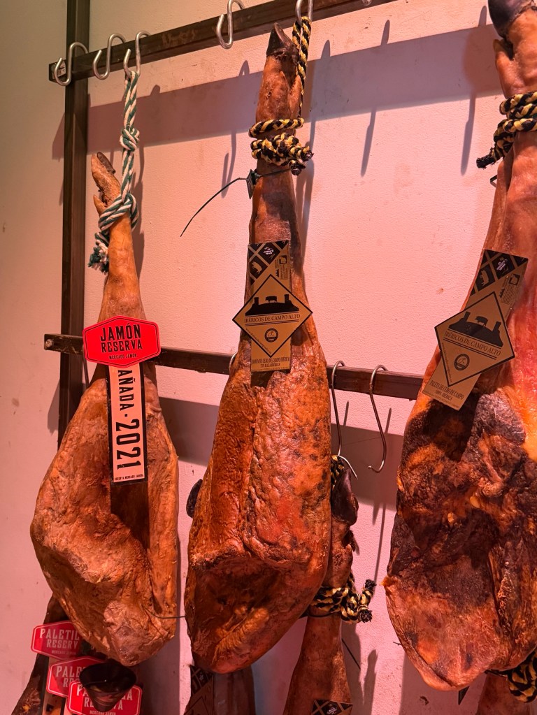
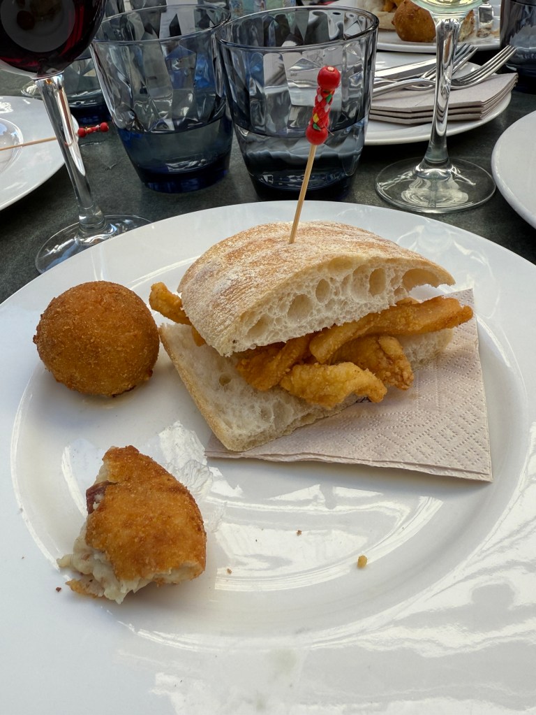
The following day we had a wander around the ‘old town’ area of Madrid on a ‘culinary tour’. A far bit of walking required to get to three restaurants for our tastings. The courses are below. Eating all the Jamon (dried ham) was challenging, the mushrooms were great. Still don’t understand why you put some nice calamari in a dry bread roll!
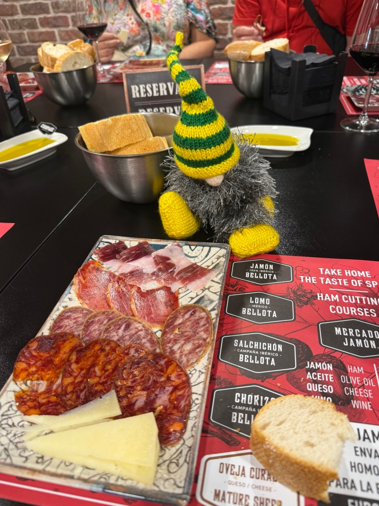
But it was all a good experience with the bonus of some guiding around the old town area.
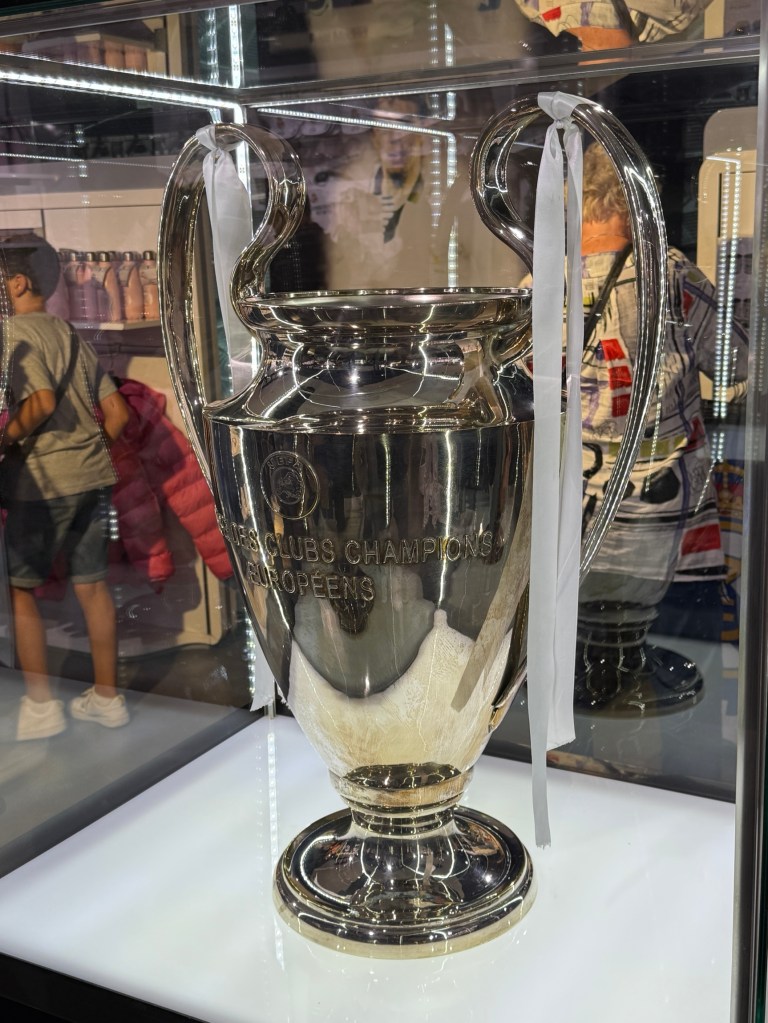
Our last task for the day was to find the Real Madrid genuine shop for a look see. And we did! Interesting look around all the merchandise. Also on display was their genuine Europeans Champion Trophy. Was not for sale.
Found our way back to the hotel on the bus back up the grand avenue. One day left in Madrid and we will see what that brings!
To Salamanca and Madrid

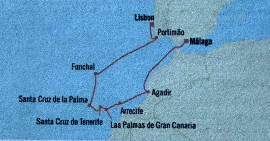
This is an update of our map, it shows the end of the cruise at Vega de Terron. Then the scrappy red lines I have drawn south a short distance to Salamanca and across to Madrid is the route we followed. Allthego must work out how to do this properly in the future.
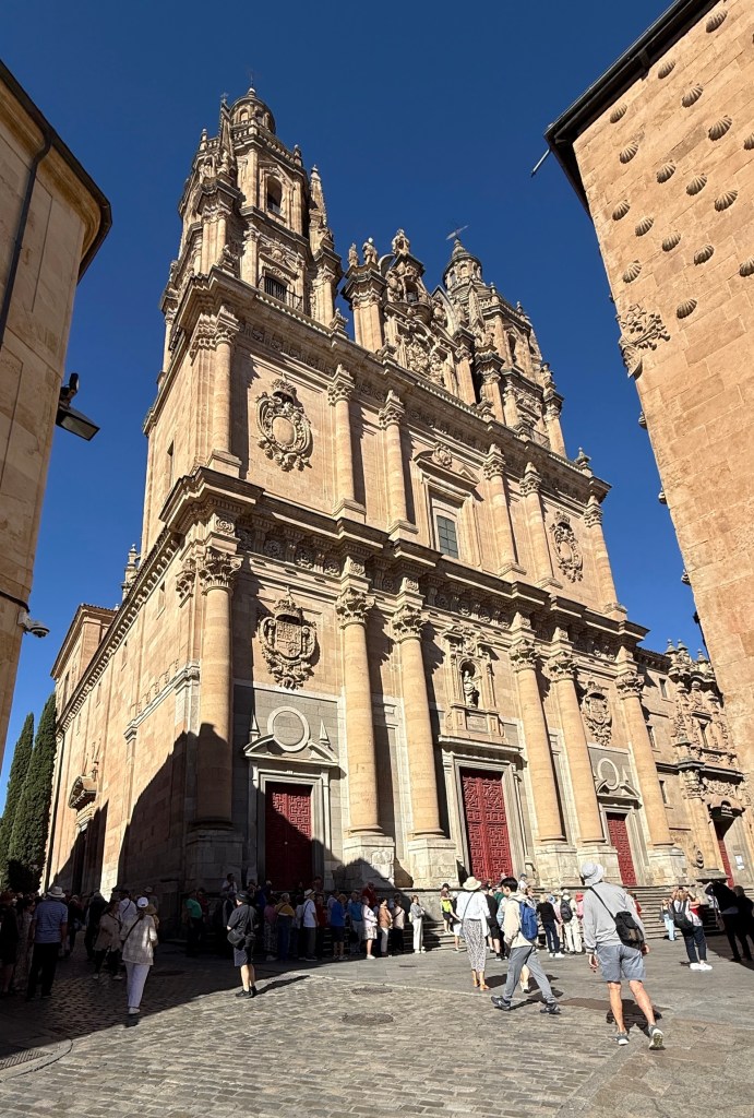
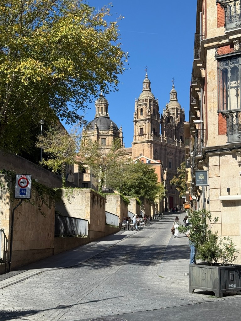
After disembarking from the Estrela we boarded our coach and took off for Madrid. We had a stop after two hours at Salamanca. This is the famous old University town. The college of learning was granted university status in 1254 and is believed to be one of the oldest universities in Europe.

It had taken us two hours to get to Salamanca, including one of those endless bathroom stops some seem to need and enjoy. Anyway we had two hours at Salamanca that included a speedy walking tour of the main sites.
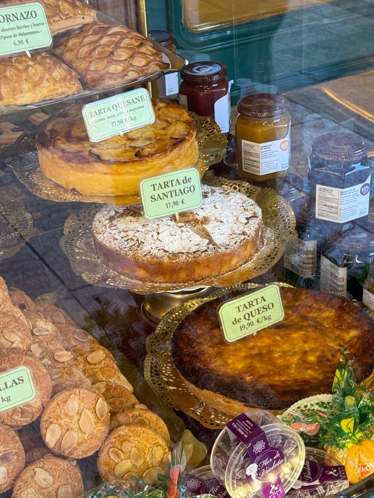
After the walking tour we had to get lunch for ourselves, so Allthego had a particular interest in looking in food vendor windows.
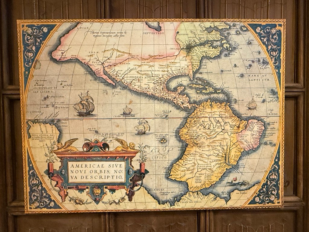
In early times the University was focussed on canon as well as civil law, but later expanded into the sciences, geography, astronomy etc. Christopher Columbus lectured here on his travels to the Americas.
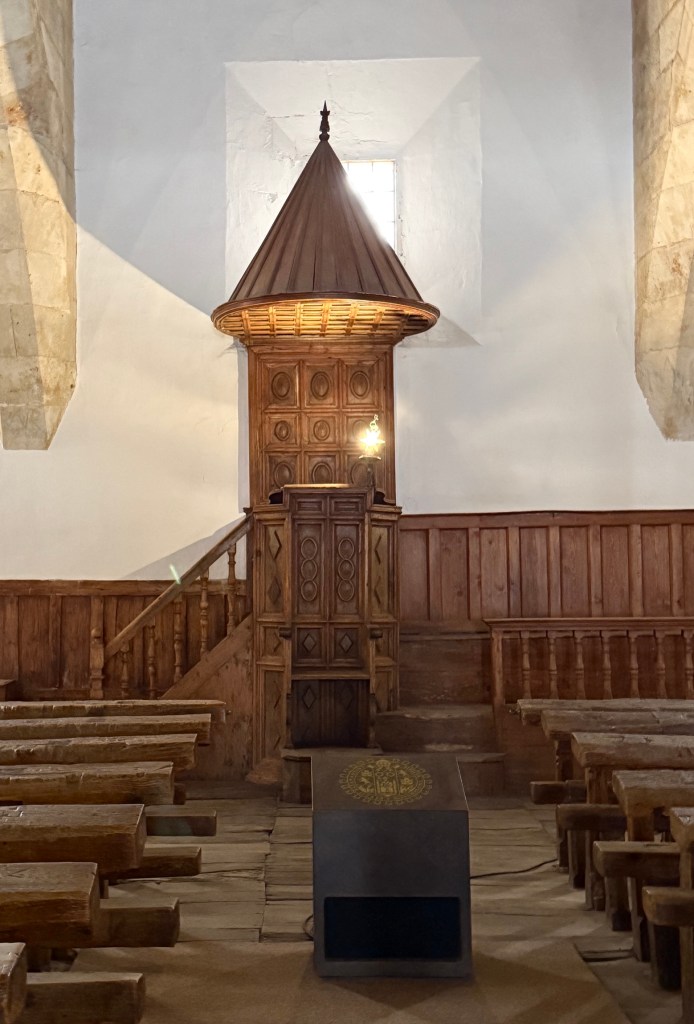
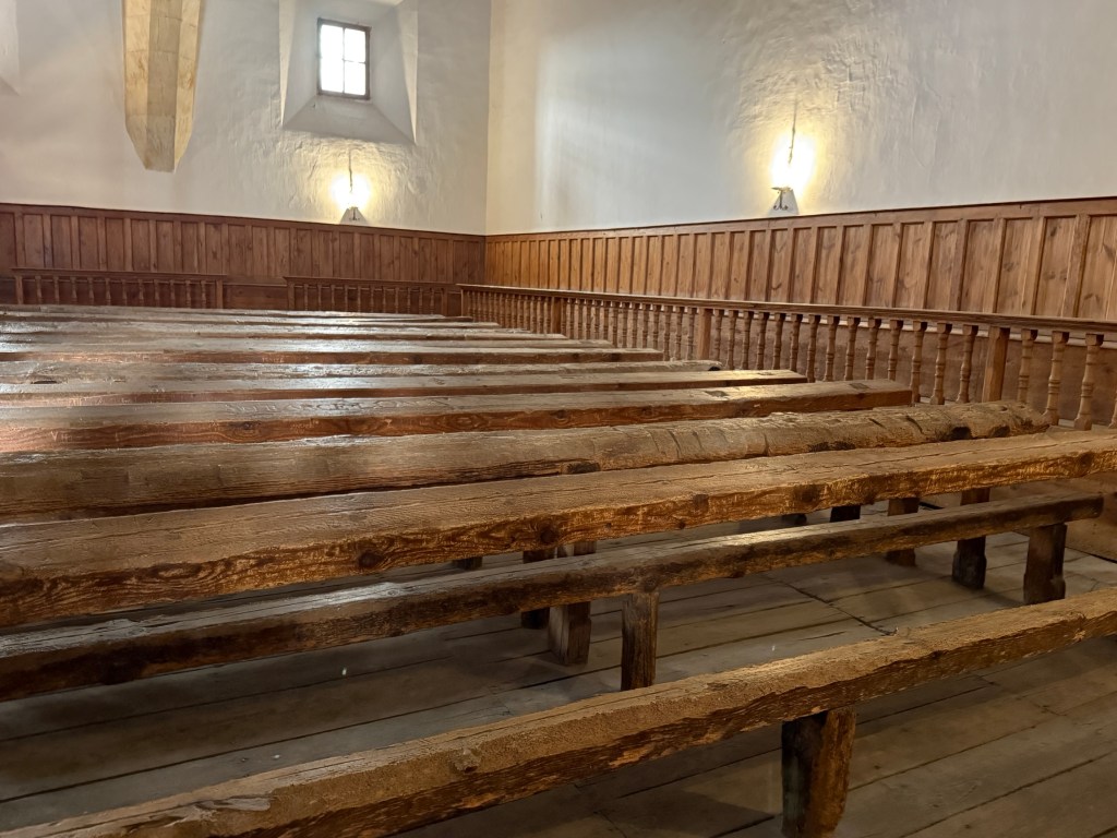
In medieval times there were no printed books and hand written ones were scarce. So each day there were book readings to the assembled students in this room.
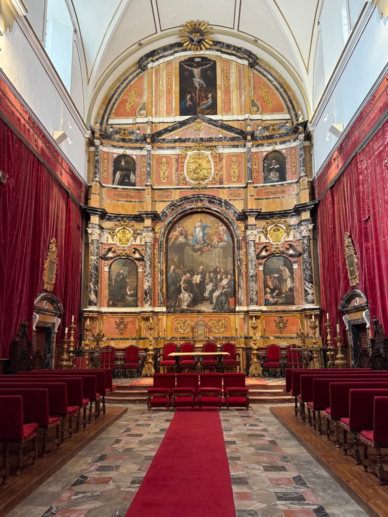
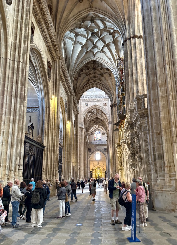
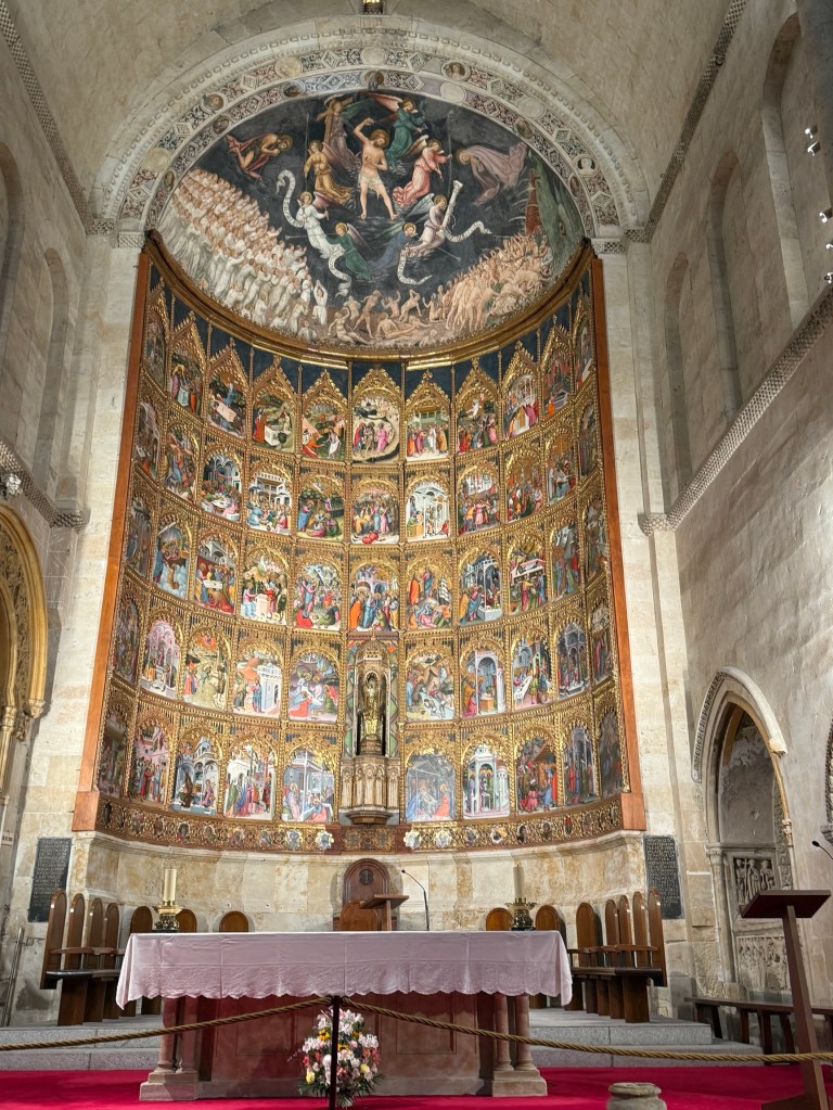
After the University we moved onto having a look at the enormous ‘New’ cathedral. It is built alongside the old cathedral. The two are linked by a passage way. The ‘New’ cathedral was built between 1533 and 1733 and was meant to replace the old cathedral which was considered too small. The old cathedral still functions, so it is all quite a large combined complex.
Next stop was the Shell House. A former family mansion built from 1493-1517. It is now a public library.
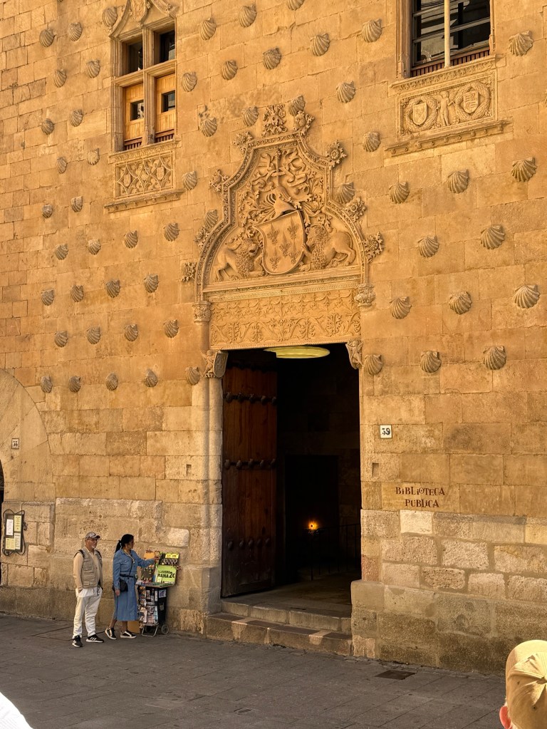
The facade of the building is covered with casts of scallop shells, arranged so that as the sun sets diagonal shadows are thrown across the wall. The ‘shell’ is a symbol of the Catholic ‘Order of Santiago’ and also of pilgrims who do the ‘walk of St James’, or the Camino de Santiago. There are some legends about the shells. One being that there is a gold coin under each shell.
The Roman bridge crossing the River Tormes was built from around 27CE. This section, which leads away from the city, is original whereas further along there has been restoration work. Up until the early 1970s it was used as a roadway, now a pedestrian pathway.
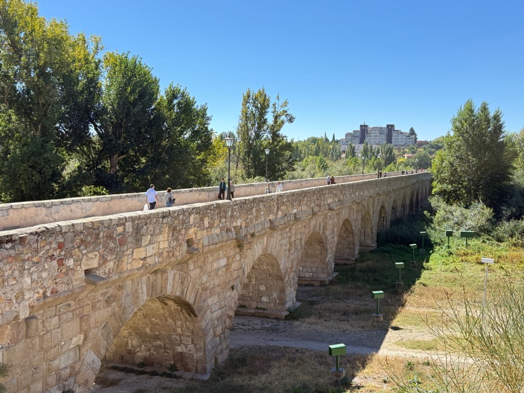
Our wandering off down to the river to see the Roman Bridge put a bit of pressure on the two hours we had. We got a little disorientated getting back to the big Square despite following the scallop shells on the footpaths. Made it eventually and gobbled down a Jamon (thin dried ham) and cheese croissant for lunch while we waited to rejoin the coach for Madrid.
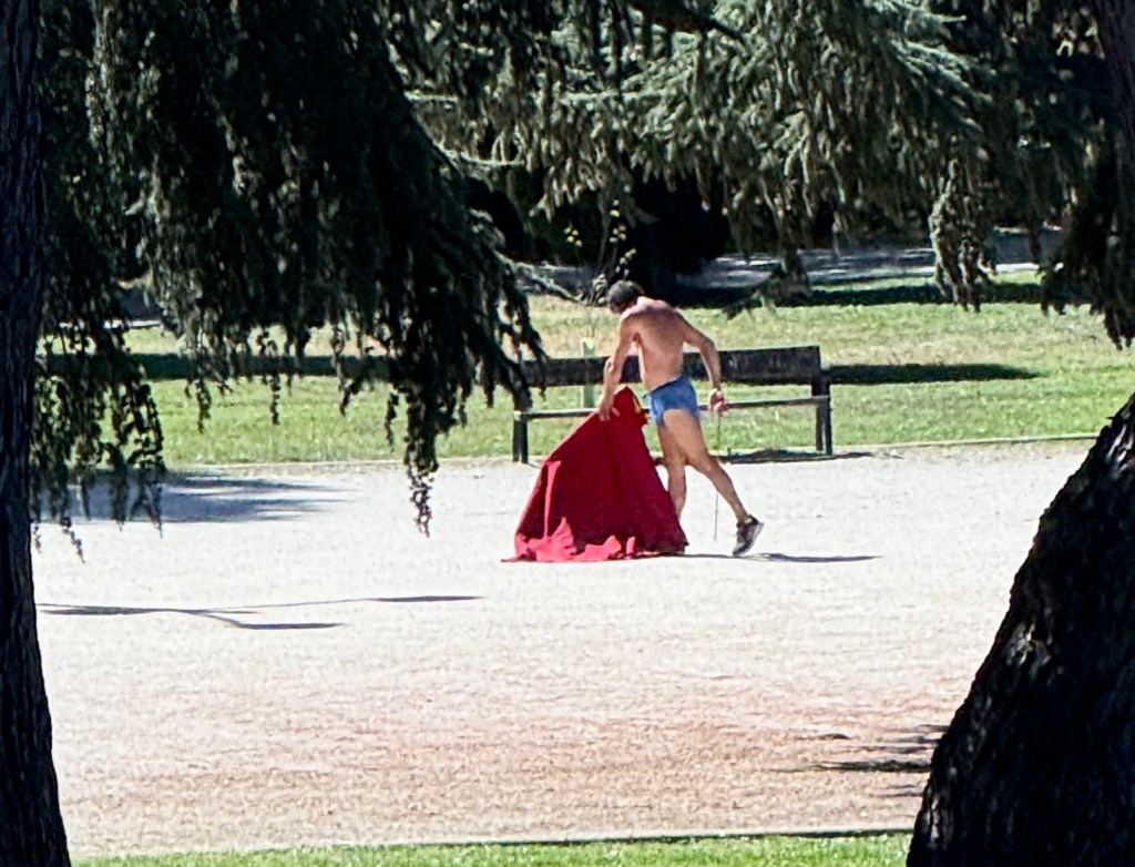
On the way out of the city we passed a park in which a matador was displaying his style. Perhaps training for the next bull fight?
It took us another three uneventful hours to reach Madrid where we settled into our hotel around 4pm.
If old towns could talk.
It is not all just river, grapes and wine on this trip. The towns along the way have their own treasures from history to showcase the river cruiser. They have stories to tell about past struggles and glories.
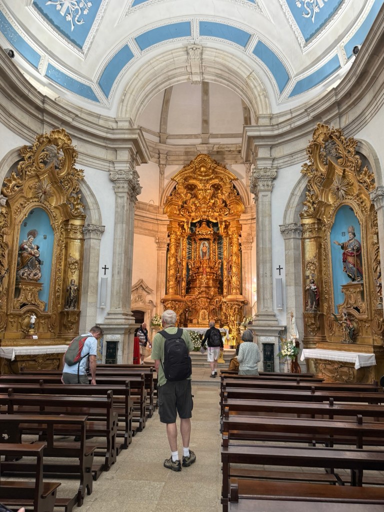
Many of these treasures are old churches that are generally the dominant building in the town. There is a rich Roman Catholic tradition in Spain. All the churches we have seen have been highly decorated. Some of the interiors have seen better days, upkeep and maintenance of these mostly gothic structures is becoming a problem.
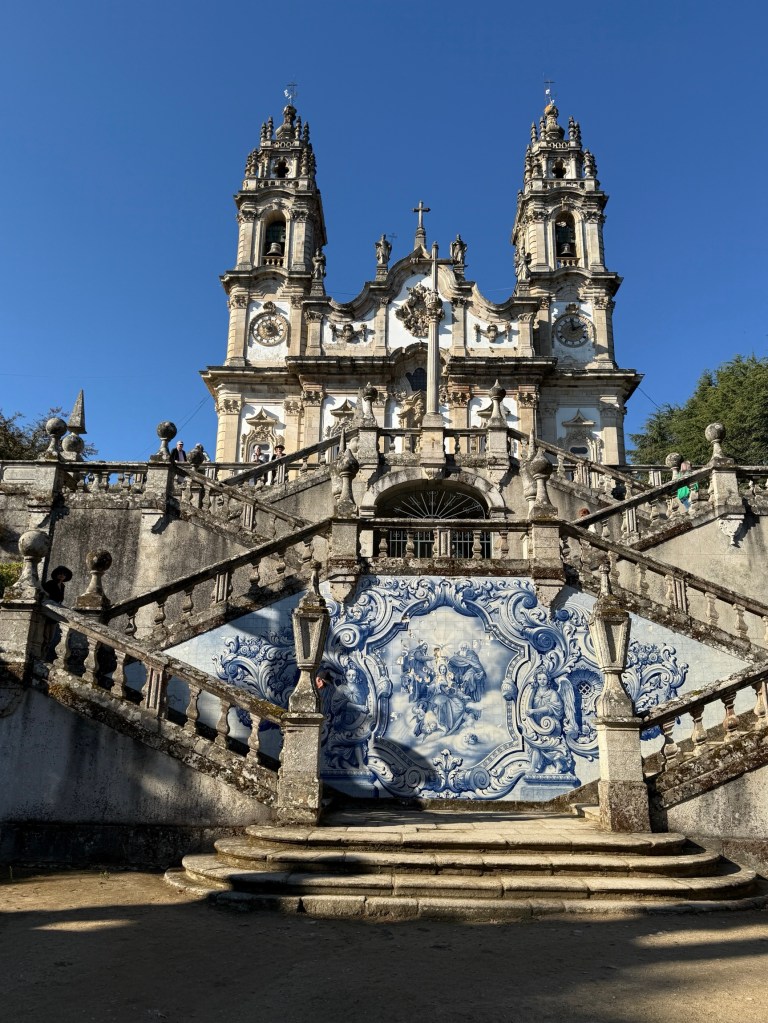
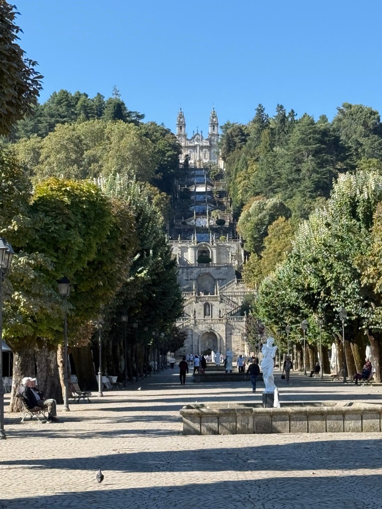
We went off on a side trip from Regua to the town of Lamego to see this famous old church and shrine. It is known as ‘our Lady of Remedies’
The fountain is on a platform below the church. The fountain is believed to have healing powers for those who drink of it, maybe a splash is ok these days. Allthego tried a quick gulp and splash. Didn’t seem to cure his ills. Then again it is sometimes said that it is faith that is important for it to work and that it takes time, not simply that the water or whatever has mysterious powers.
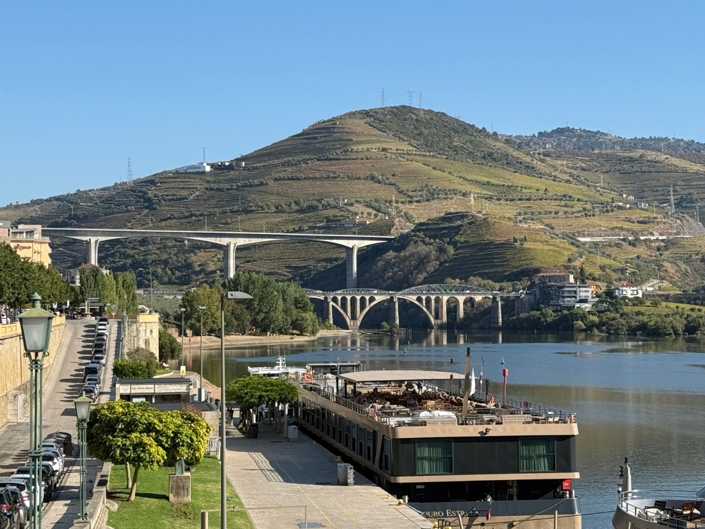

We later stopped for two nights in the town of Pinhao, this town is apparently in one of the Douro’s sweet spots for grapes and wines.
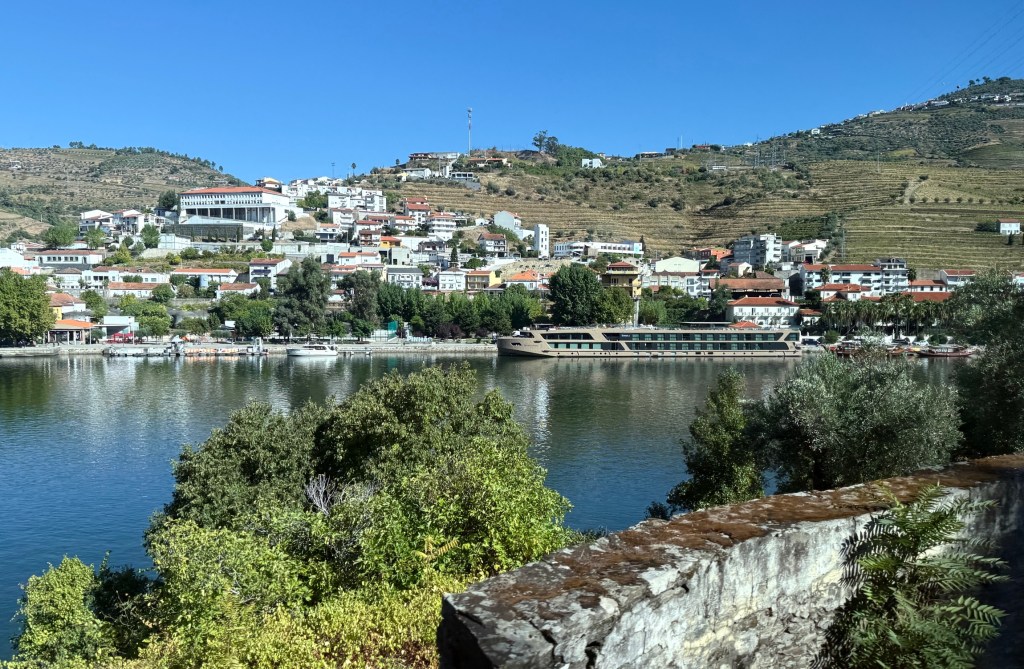
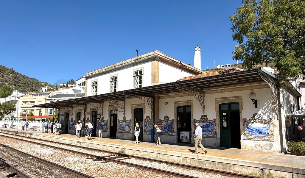
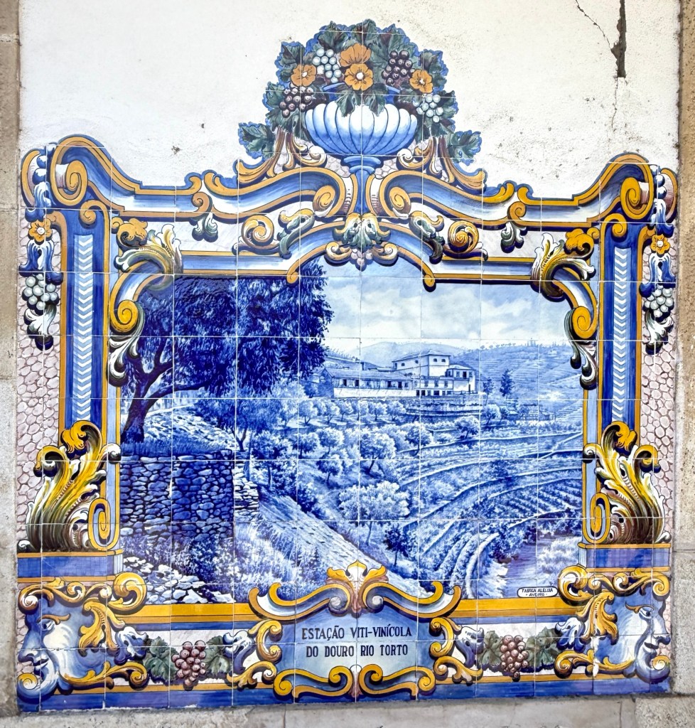
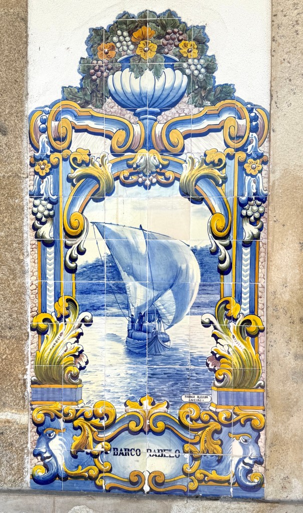
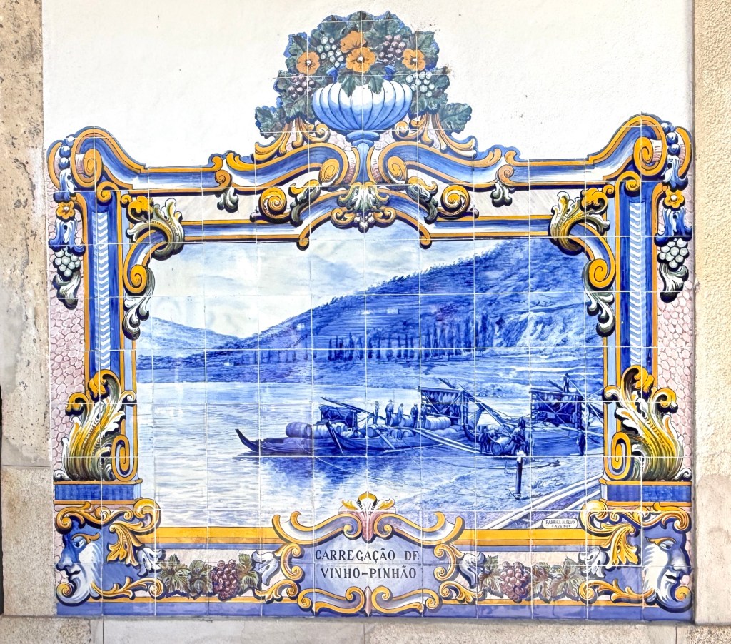
Pinhao is famous for its old railway station. The railway came along the Douro Valley in the late 1800s, reaching Pinhao in 1880, when this station was built. Around the walls of the station are blue tiled murals of life from those late 1800s through the first half of the twentieth century before the damming of the river.
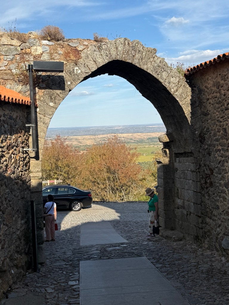
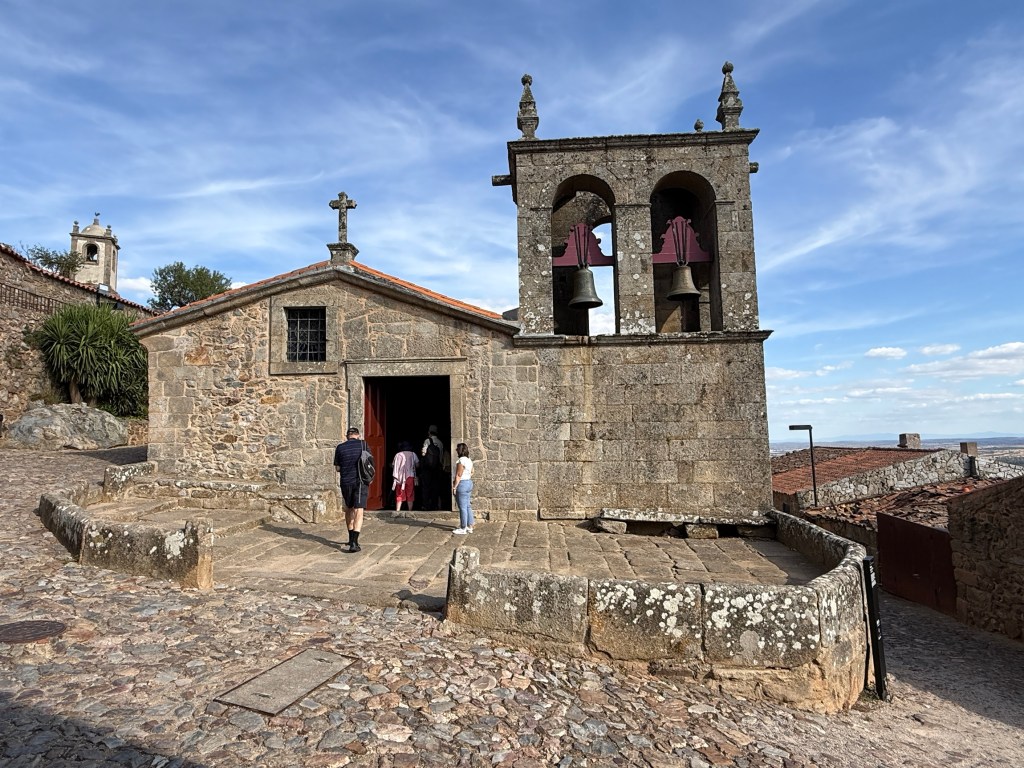
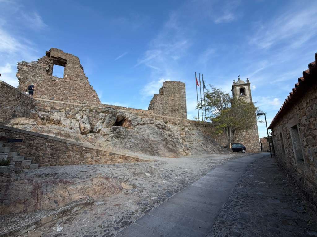
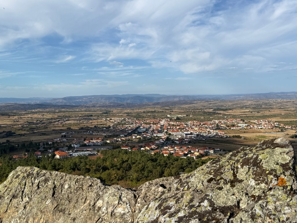
Our last excursion away from the river was to Castelo Rodrigo, a hill top medieval village. There are great views over the plains and into Spain from the remnants of the palace atop the hill.
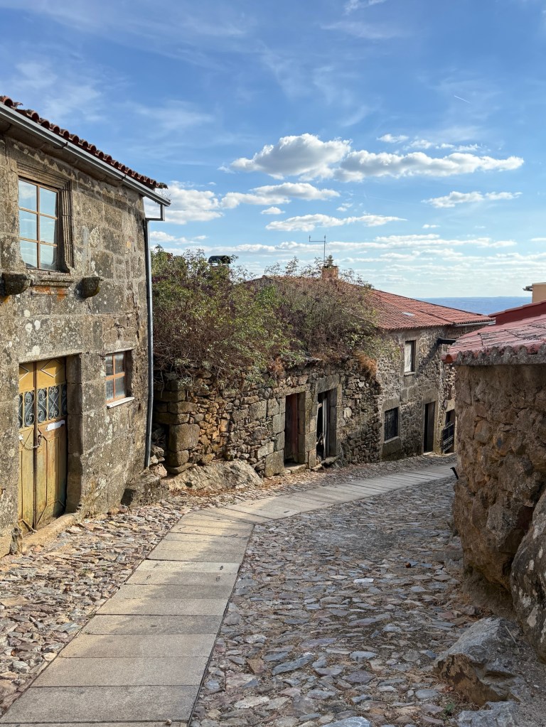
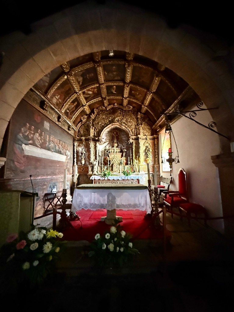
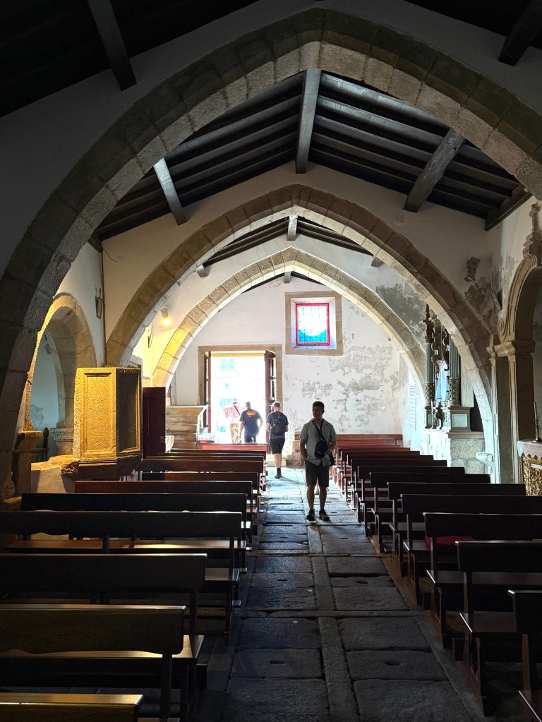
The old medieval church is a mixture of architectural styles over several hundred years. Quite a history of occupation.
Back on the river we had our last night aboard moored at Vega de Terron. In the morning we left on coaches for Madrid, with a lunch stop over at Salamanca. It has been a great trip so far!
