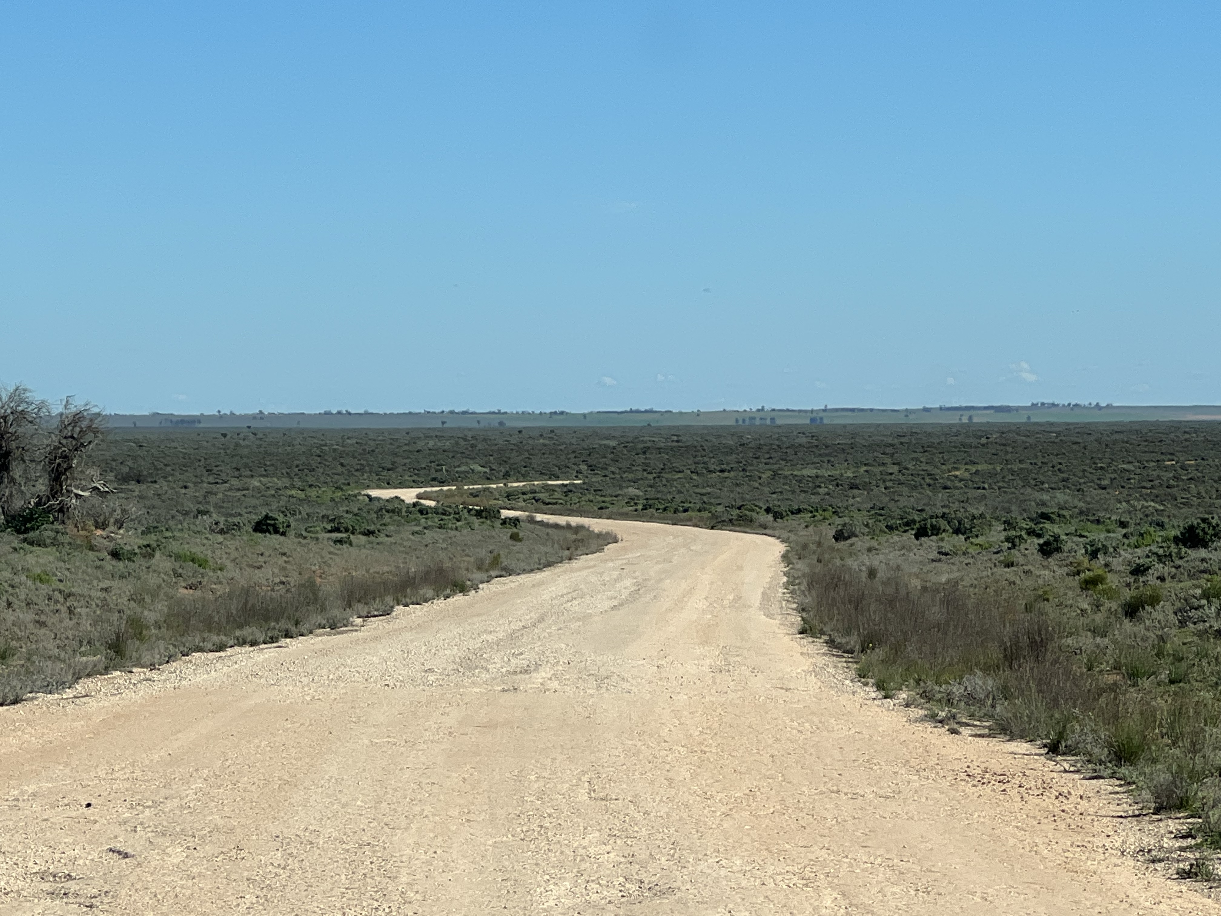
On the way south, sort of.
After the Eels devastating loss in the 2022 GF Allthego and Homeslone are setting off on a short trip out west to Nindigully, then down to Lightning Ridge in NSW and back to Brisbane via the Wurrumbungles.
Allthego has consigned his Eels guernsey to the back of the cupboard and is hoping that they will get another shot at the Premiership inside the next ten years or so!
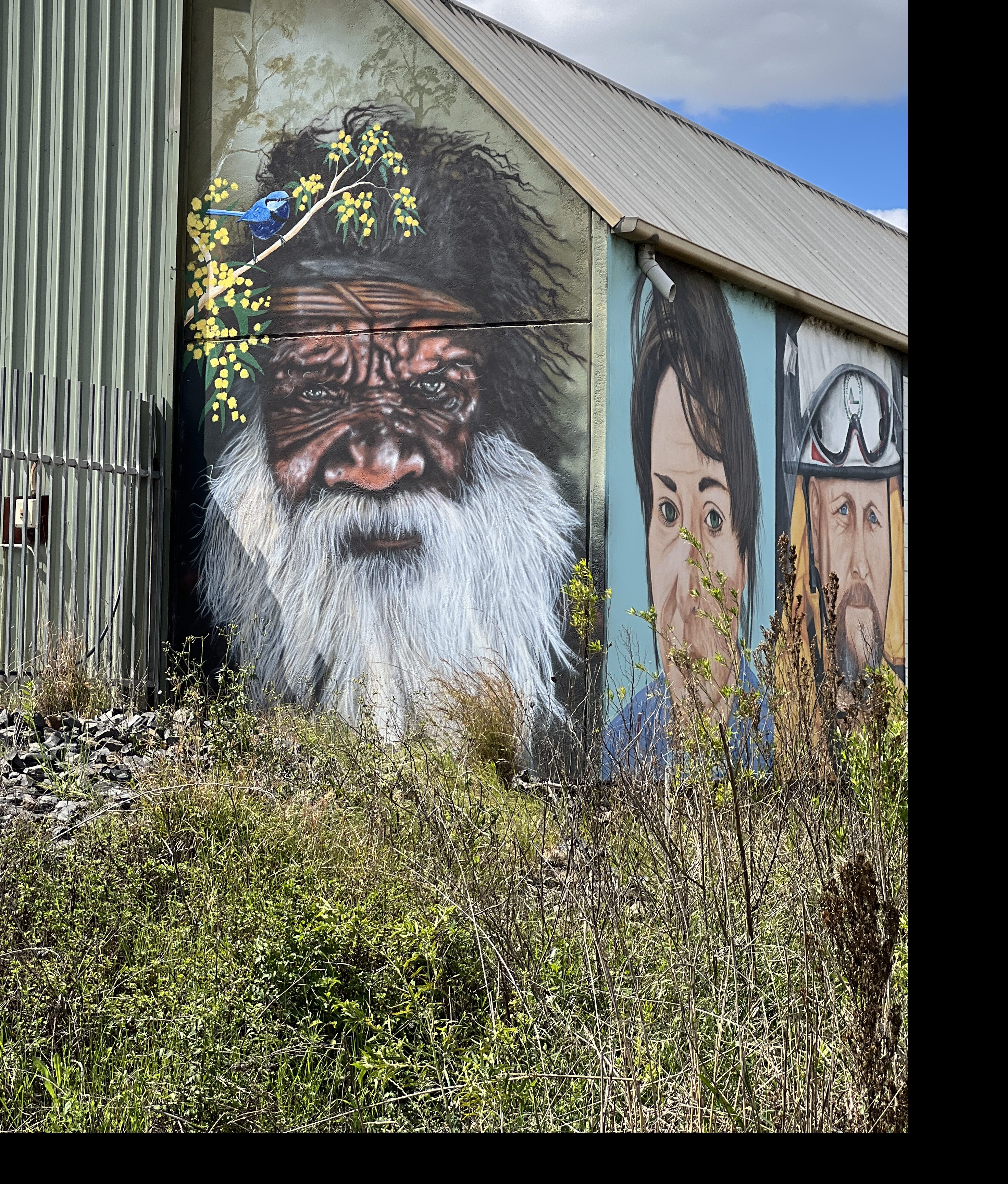
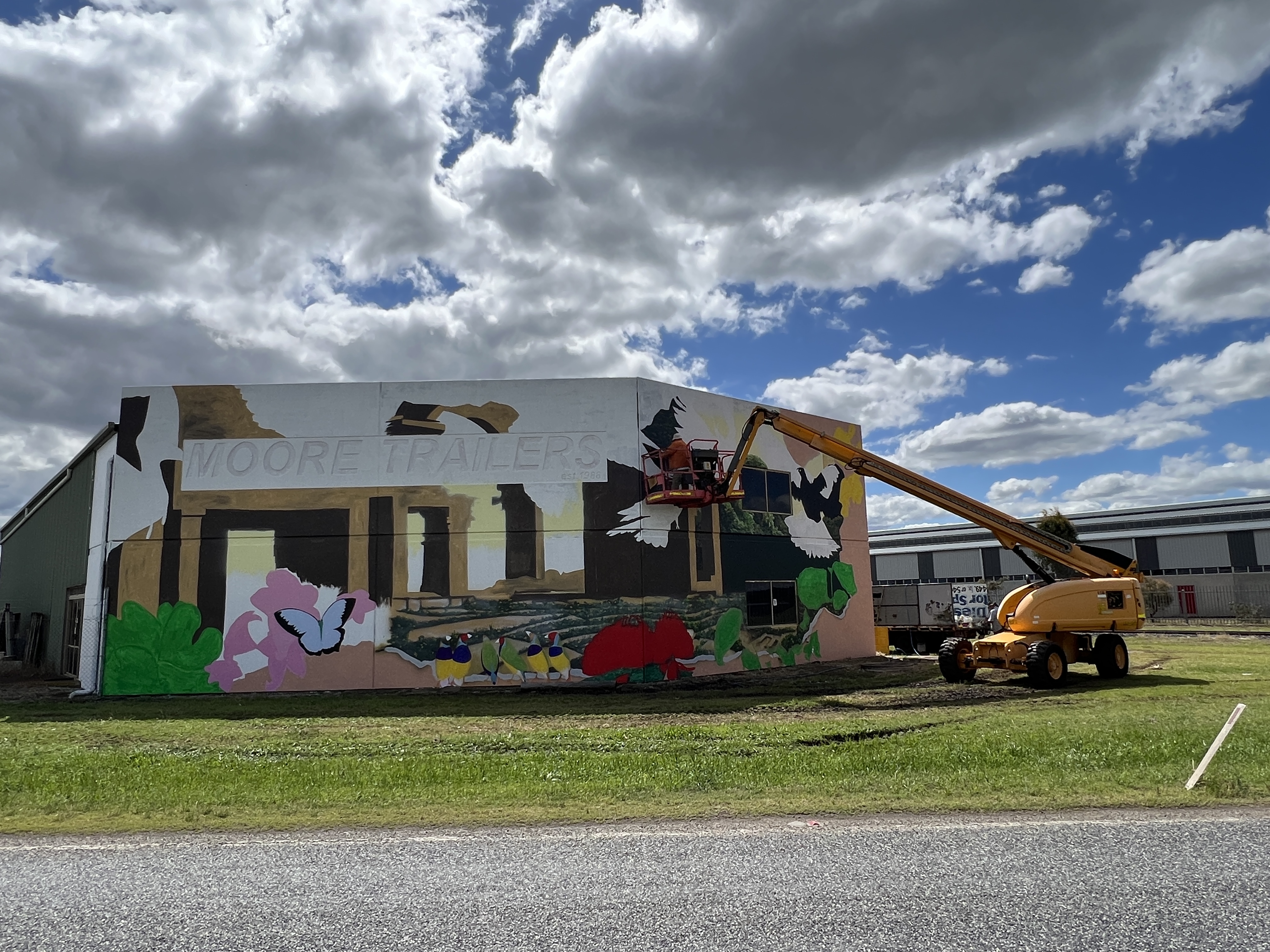
We have chosen a somewhat different route south this time, rather than going via Warwick to Goondiwindi we have headed out past Toowoomba on the Gore Highway. This takes us past Pittsworth and Millmerran on the way to Goondiwindi. Some great murals on the Moore transport terminals near Pittsworth, an elderly Indigenous mural the standout!
Murals galore in Millmerran, the water tank particularly good.

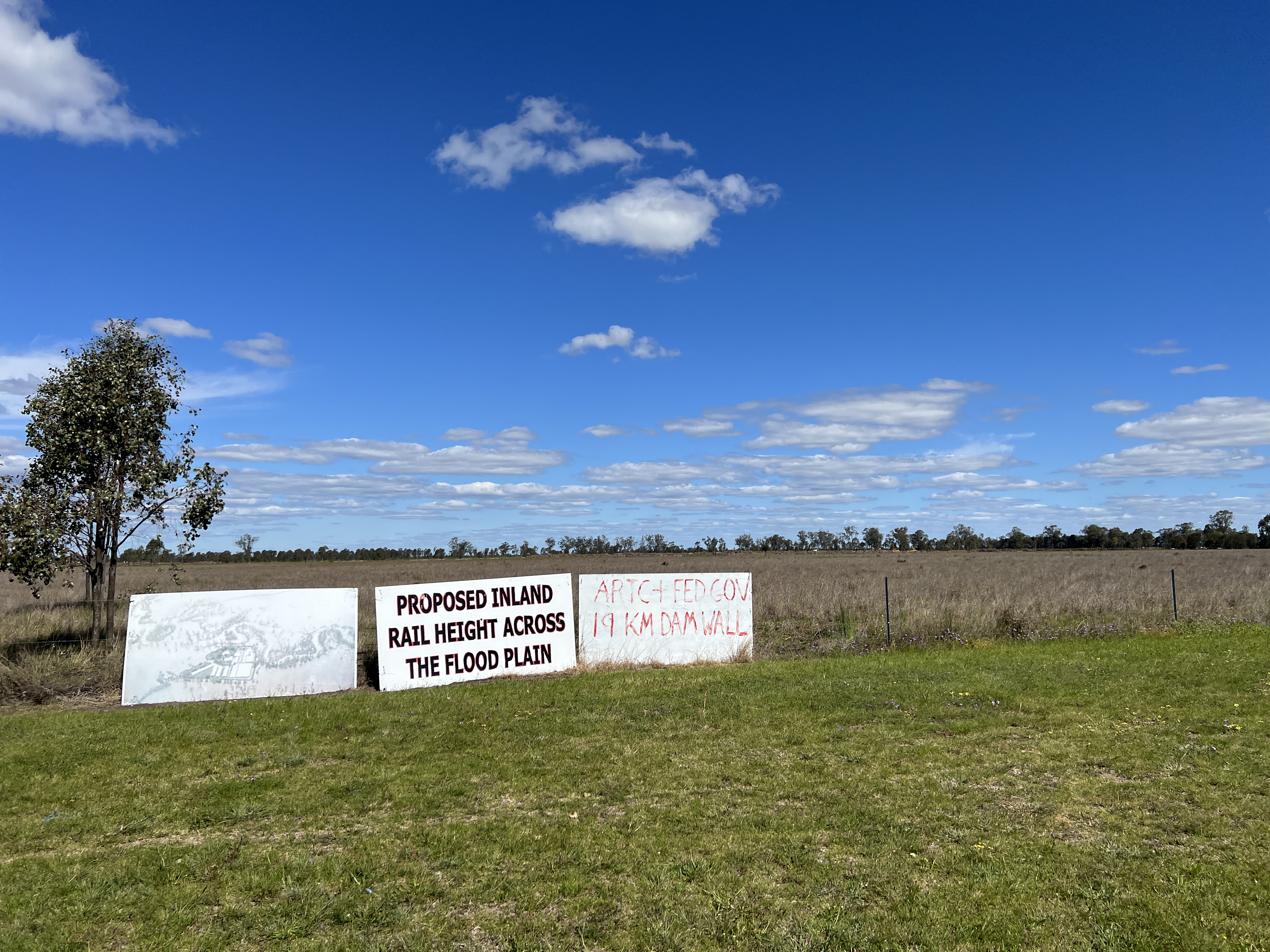
Bit of angst out this way about the Inland Rail project. This area of the Darling Downs is a floodplain of the Condamine River, a tributary of the Darling River. The line is in the course of early earthworks that cross about 19km of floodplain on banks several feet high. Billboards say a 19 km dam, some locals want it moved to someone else’s backyard. Doesn’t look likely!
One of the attractions out this way is a bi annual Camp Oven Cooking Festival, plus C&W music and other things country. Plenty of food it seems, demonstrations etc. This could be a future must do, next one is 2024.

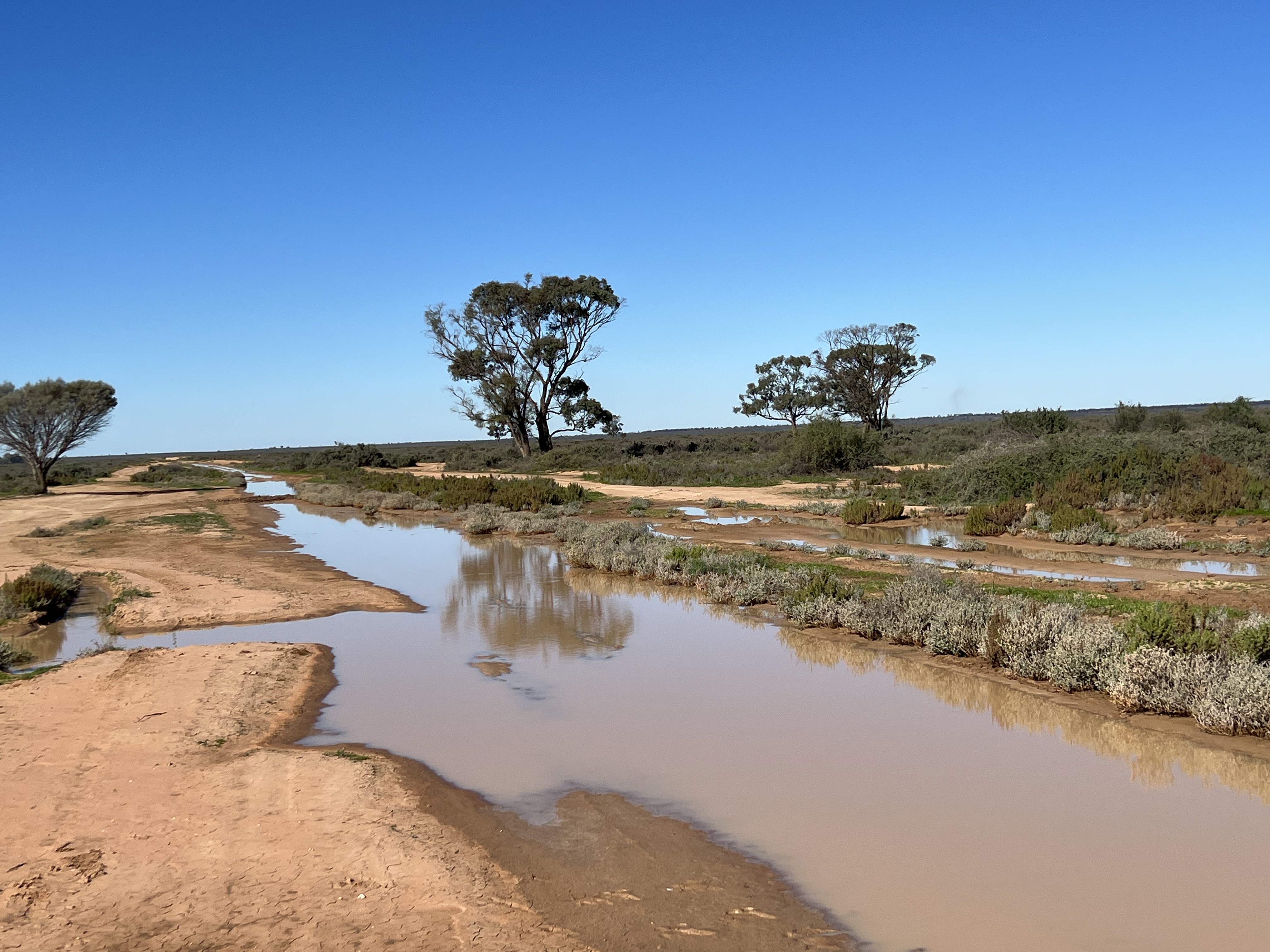
We are holed up for the night in a free camp on the outskirts of Millmerran, seems to be a truck route. Head off tomorrow for Nindigully.
Red Rock, last stop
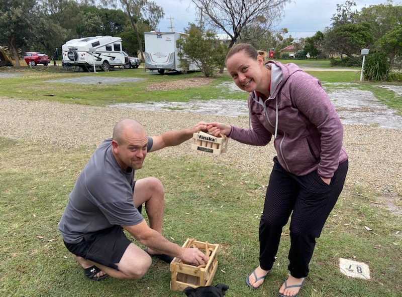
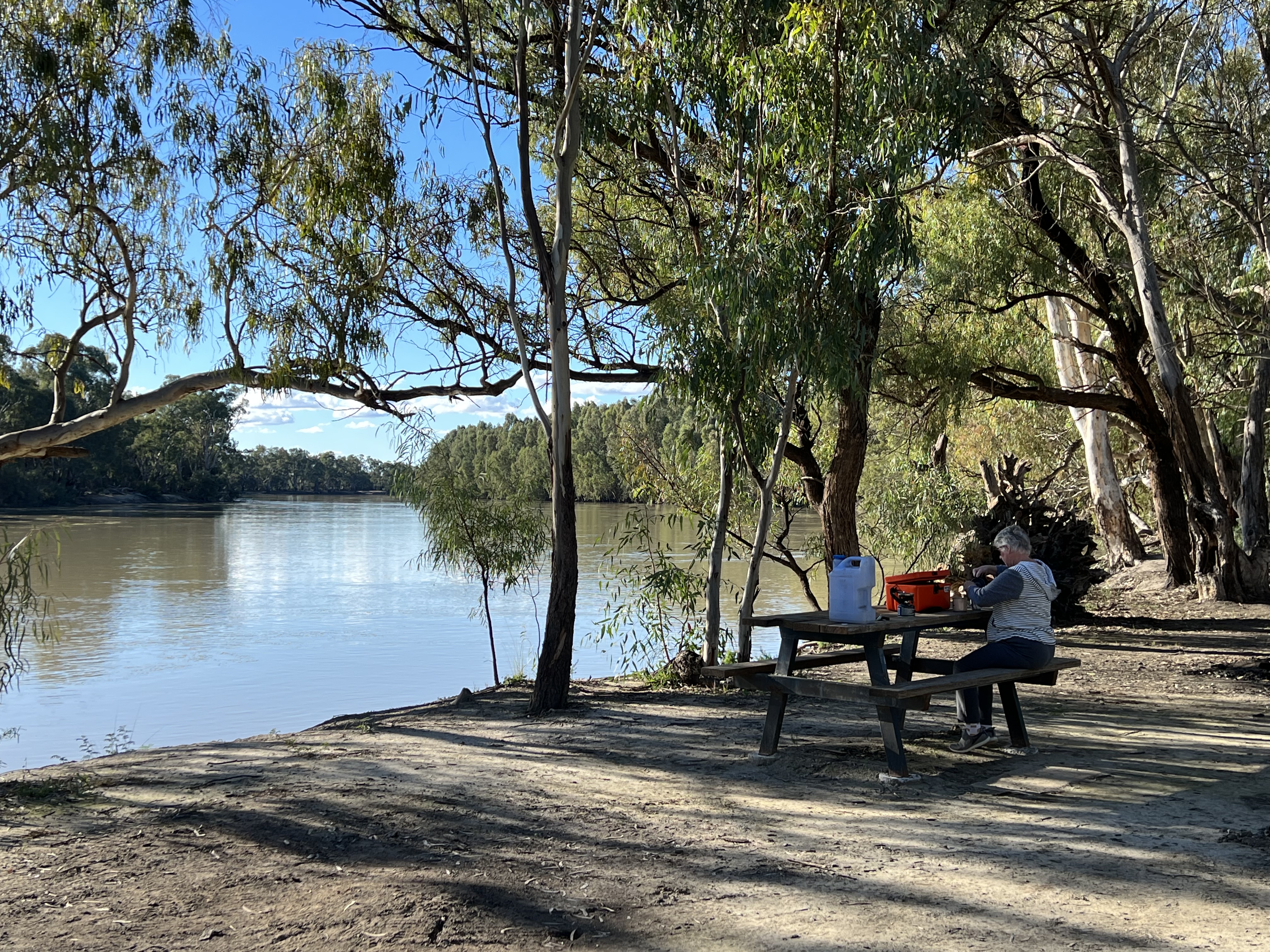
Homealone and Allthego are lying back at the moment after a hectic couple of days camping here at Red Rock with the family. Gillian and the McCononchies had made there way down from Brisbane as a surprise for Mitchell and Piper. He has not seen his sisters and the family for nearly three years. He was a little suspicious because of message flows that were intercepted before he could see them. It has been a pleasant couple of days roaming around the park and the inaugural Finska playoff. Won by Shane, deservedly, with honorable mentions for the oldies who put in good performances.
Prior to Red Rock we had moved on from Cootamundra and spent a couple of nights in Queanbeyan with Homealone’s siblings and families, not seen for nearly three years. Mitchell, several years more! Great reunion and chat over lunch and dinners.
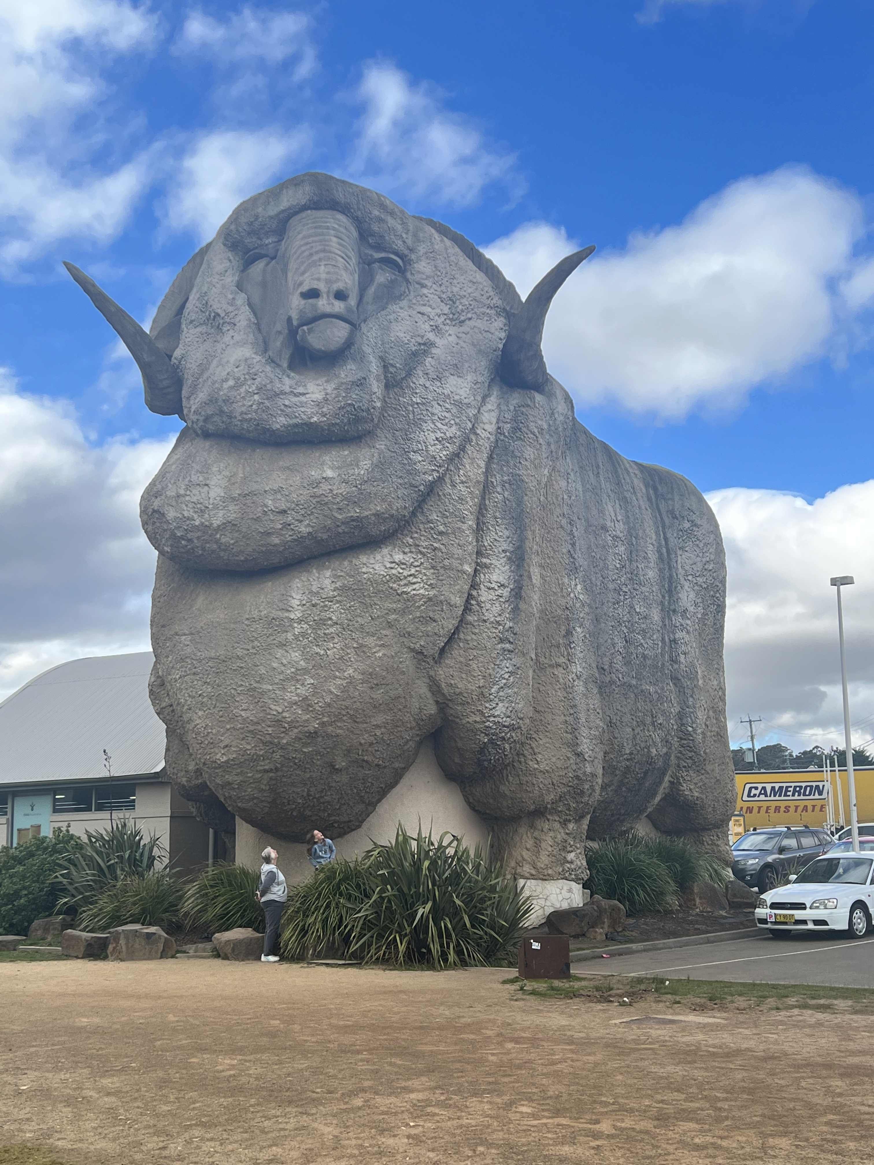
It was then on to Sydney for two nights staying out Camden way. The Big Ram a must see along the way in Goulburn. Caught the second State of Origin game on the TV in Mitchell and Piper’s cabin. Qld going down in a bit of a blood bath, less said the better. There is always the decider!
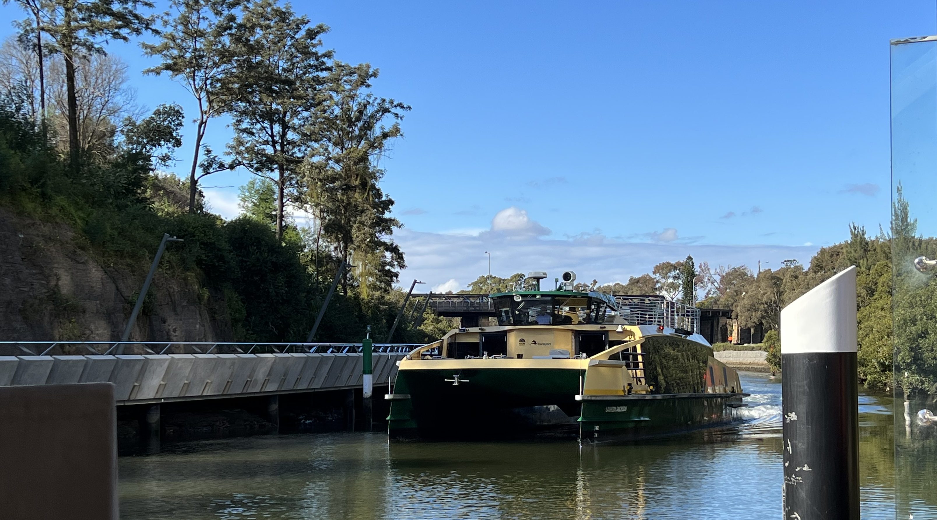
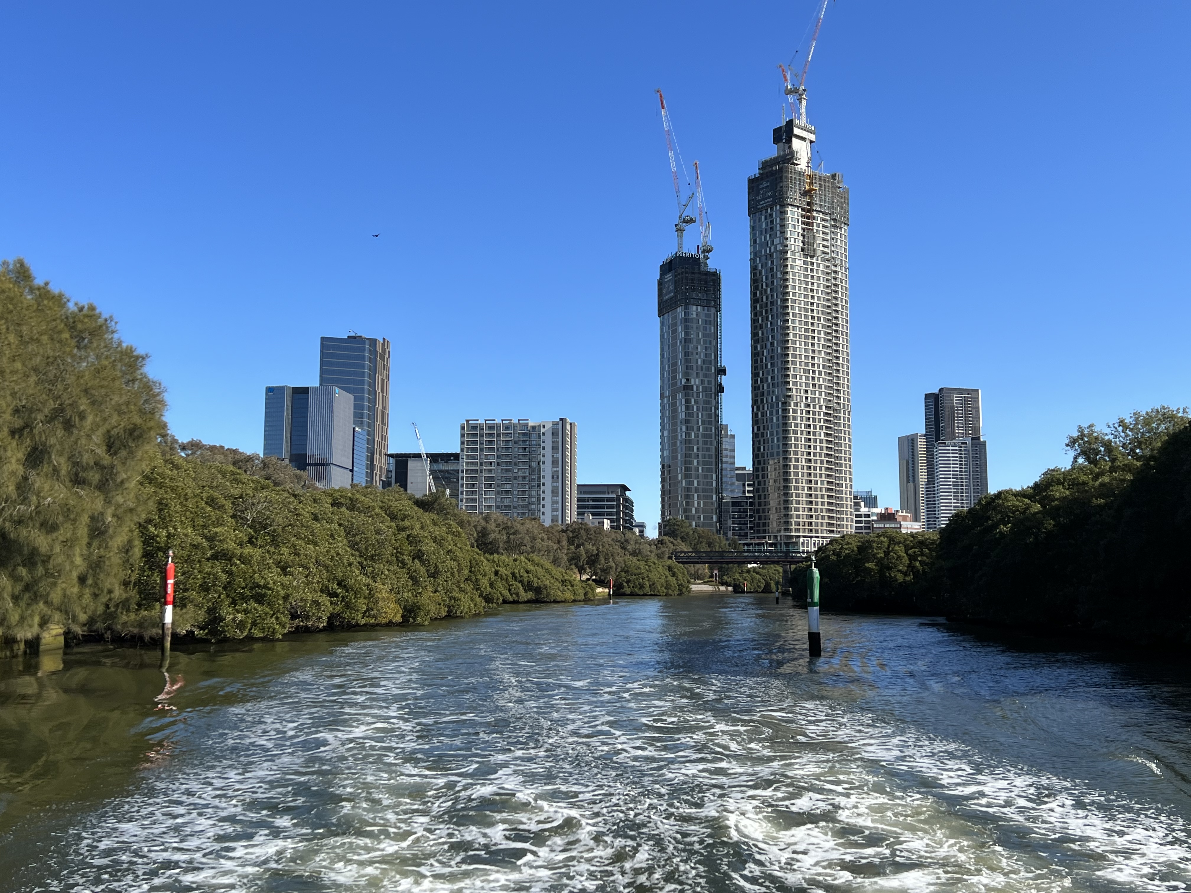
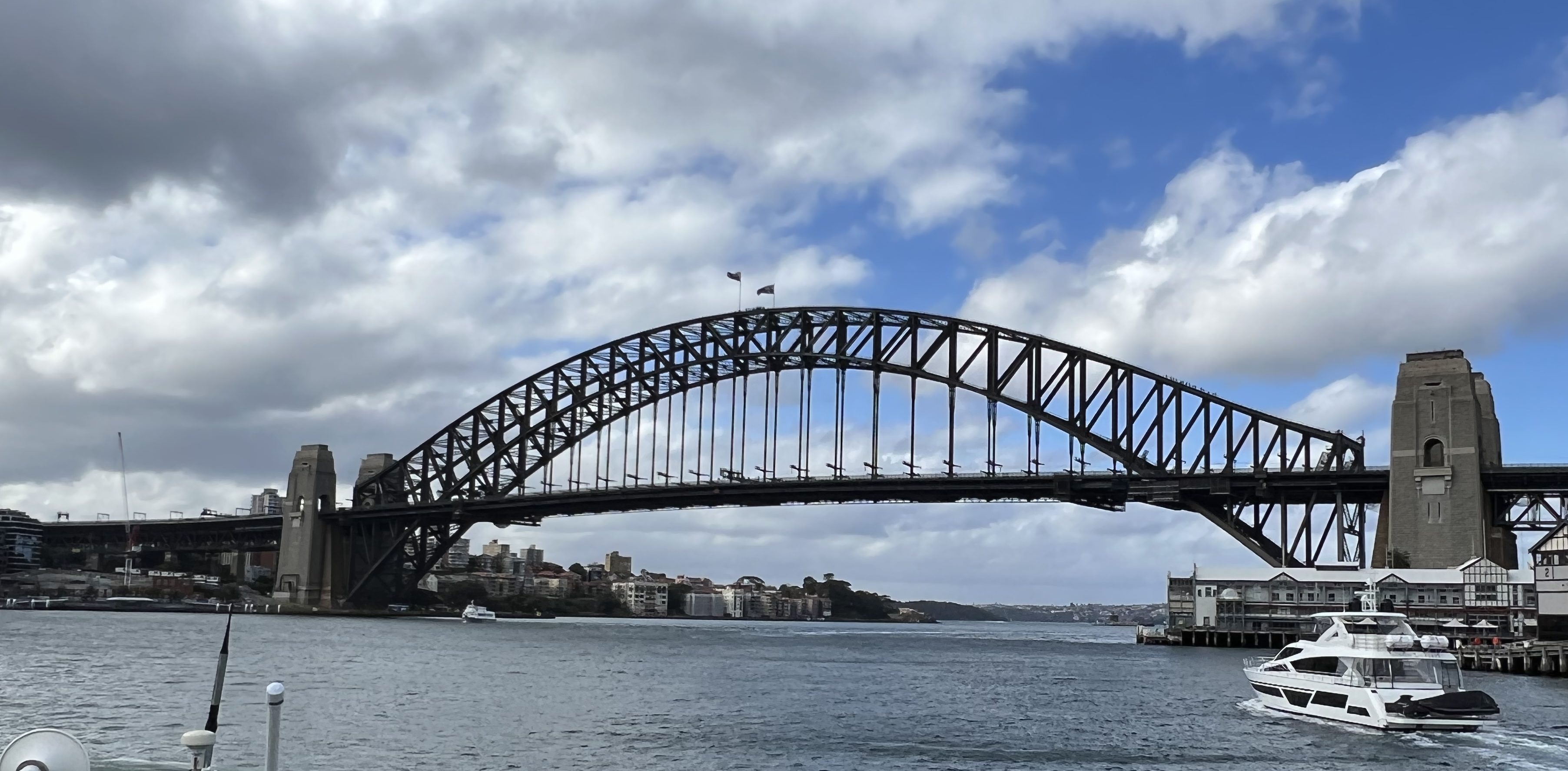
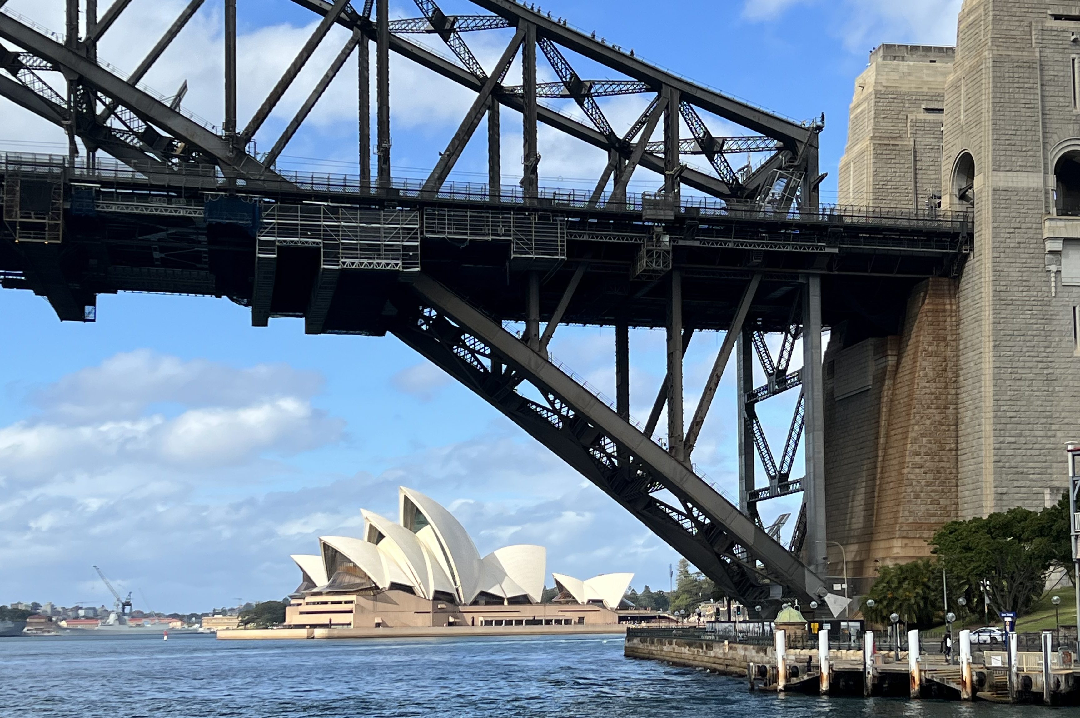
Purpose in staying in Sydney was to go into Circular Quay. Piper wanted to see the Harbour Bridge and the Opera House. So we drove to Parramatta to catch the ferry down the Parramatta River to the city. Parramatta is Allthego’s old home town. He lived in Westmead, adjacent to Parramatta, as a child and went to high school at Parramatta High. A bit later in life he worked in Parramatta for a couple of years before the family moved to Queensalnd in 1984. So, Allthego is an Eels supporter from wayback! But Parramatta has changed, the city somewhat unrecognizable in all the development that has gone on. We found our way around to the ferry terminal ok though. These ferries didn’t exist in Allthego’s day. The Parramatta River back then, particularly the section down stream to Silverwater was an ecological disaster. Extremely polluted by riverside factories, including a since closed oil refinery. The river now seems much cleaner, mangroves thriving and water birds on the banks. We are still warned though not to eat the fish if you are fishing and lucky enough to catch one!
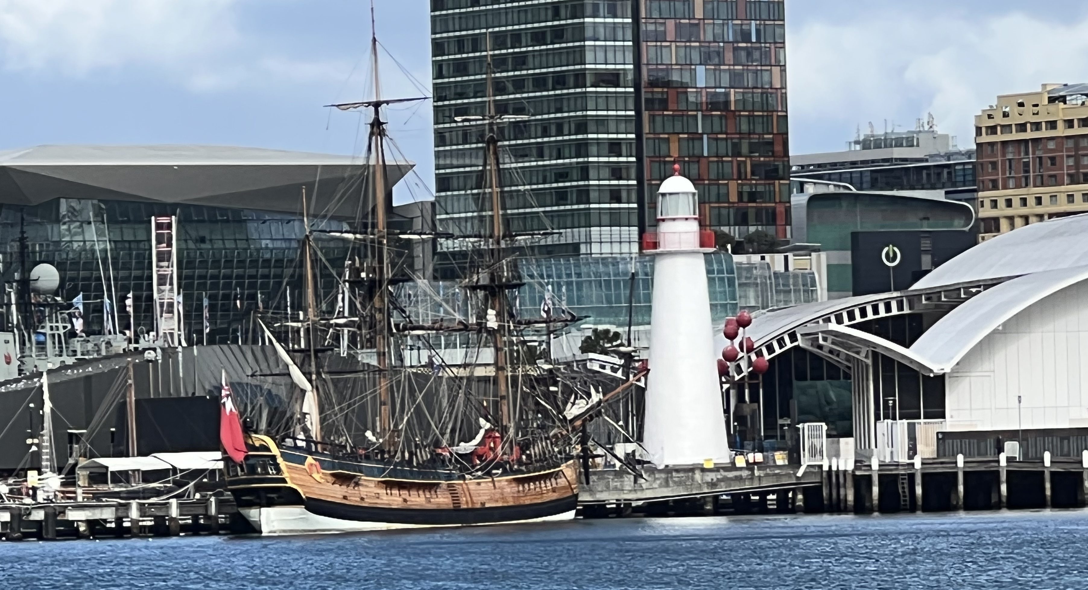
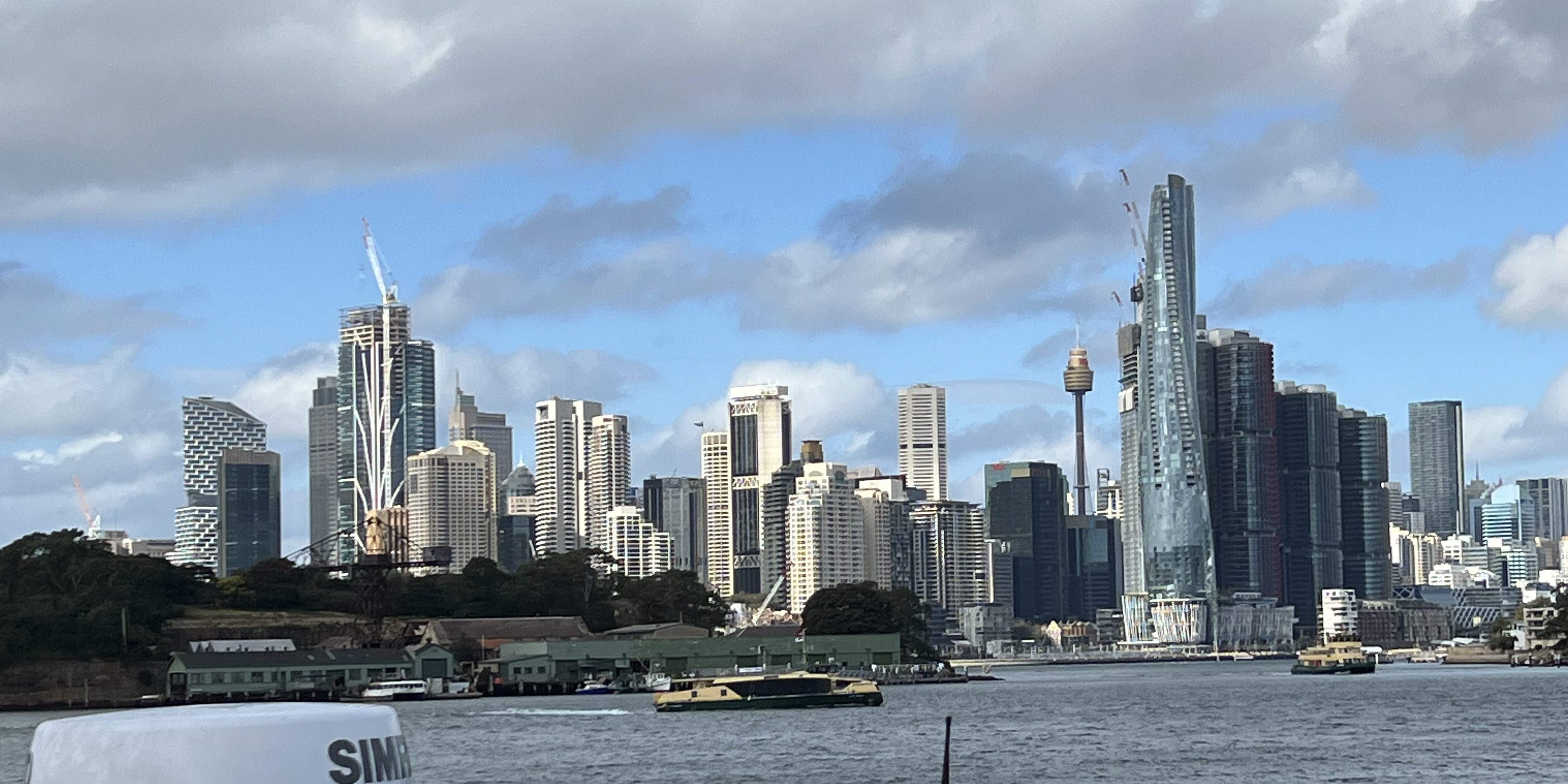
Great views from the ferry as it makes it’s way down stream past Cockatoo Island, under the Harbour Bridge into Circular Quay, with the Opera House in full view. A P & O Cruise ship is docked at the Quay. A great way to see the city! It takes an hour and half for the journey. After a bit of a look around, including cartwheels on the Opera House forecourt we have lunch and then head back to Parramatta by train. Not nearly as relaxing as the ferry! A long day.
Next stop on the way home is Wingham, another Homealone relo stop for the night with the Guttersons. More catching up chat with family, Mitchell hasn’t seem them for many years. A great night reminicing. Elise, one of his cousins back down in Queanbeyan has just delivered up this day a new family member, Archer James. Congratulations!

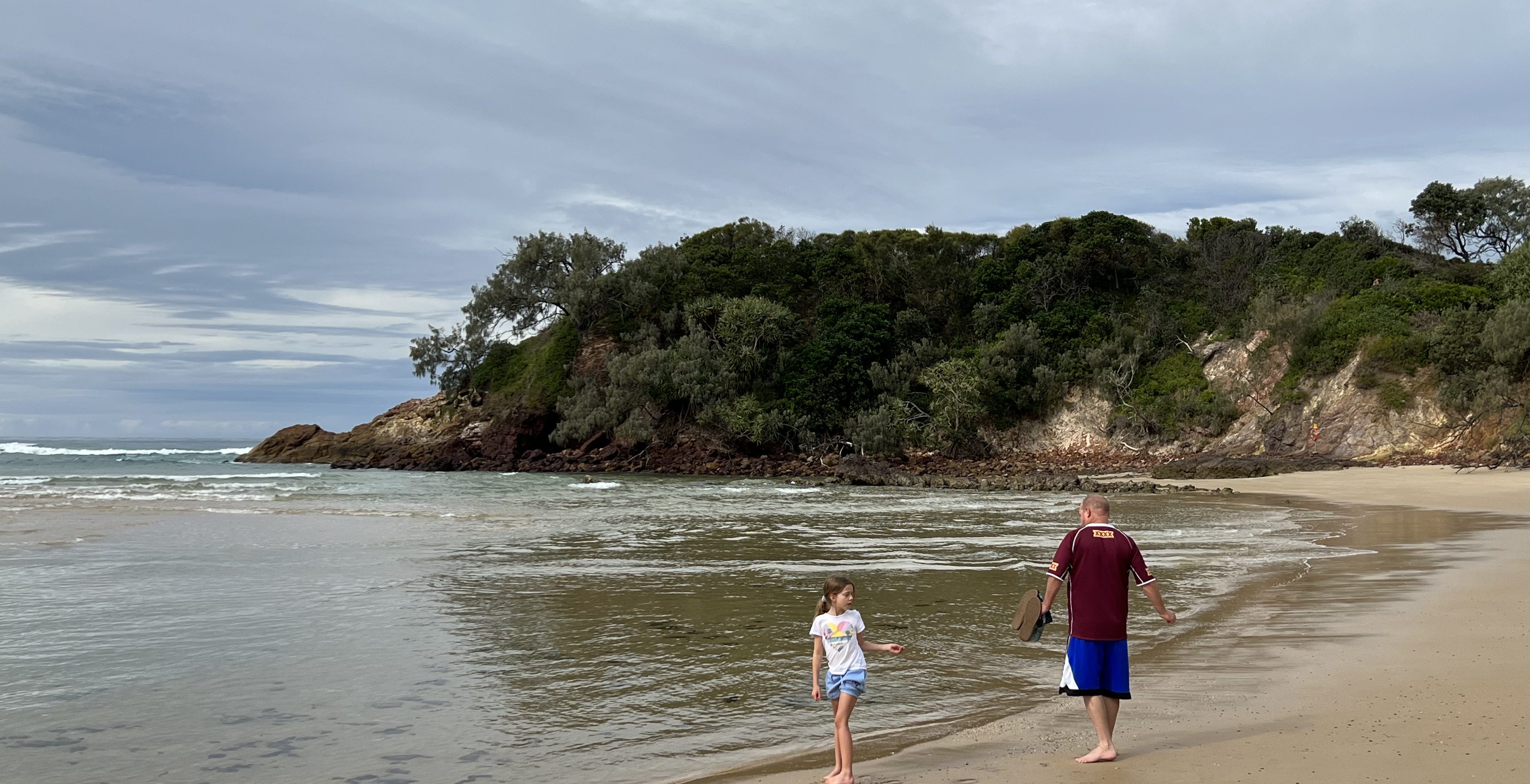
So here we are at Red Rock just north of Coffs Harbour. The gang have all gone back to Brisbane, a day early. Jordan has caught a couple of smallish bream in the river and is well pleased, although needing to release them. There is the threat of some pretty crook weather coming overnight. We have stayed behind to face the temptest and return home in a more leisurely manner in the morning. We have been away now for a little over 10 weeks and Allthego is looking forward to getting back and mowing the lawn.
Bradman calls
The road now leads us onwards towards Hay for the night, along the Murrumbidgee. We have not spent a lot time in this particular part of NSW. It is a region nomads seem to ‘pass through’ on their way either north or south. On reflection it is a pity because the environment is quite special. The famous Hay plain is really the bottom of the ancient sea that covered this area many moons ago. Now the irrigated farmlands of the Murrumbidgee are part of Australia’s great food and fibre bowl. Cotton is being ‘picked’ as we pass along. The roadside is scattered with tufts of the white stuff and cotton trucks fly past loaded to the brim. It seems to have been a good season. Sheep are everywhere, packed into green paddocks up to their knees in grass!

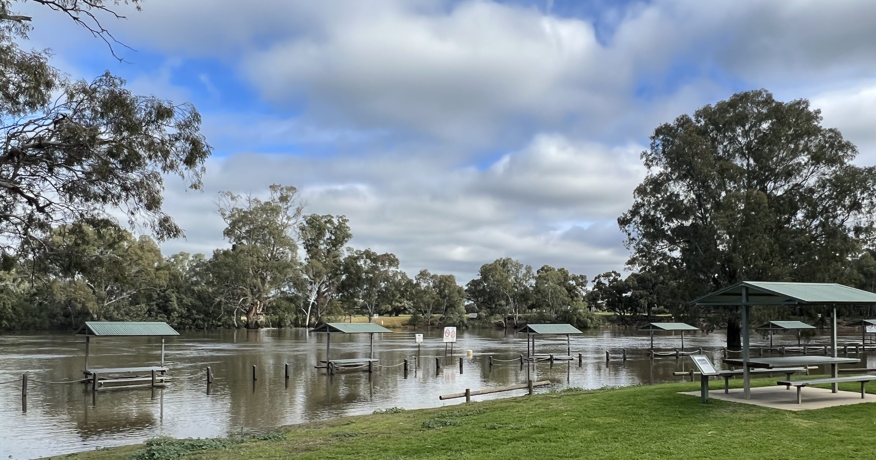
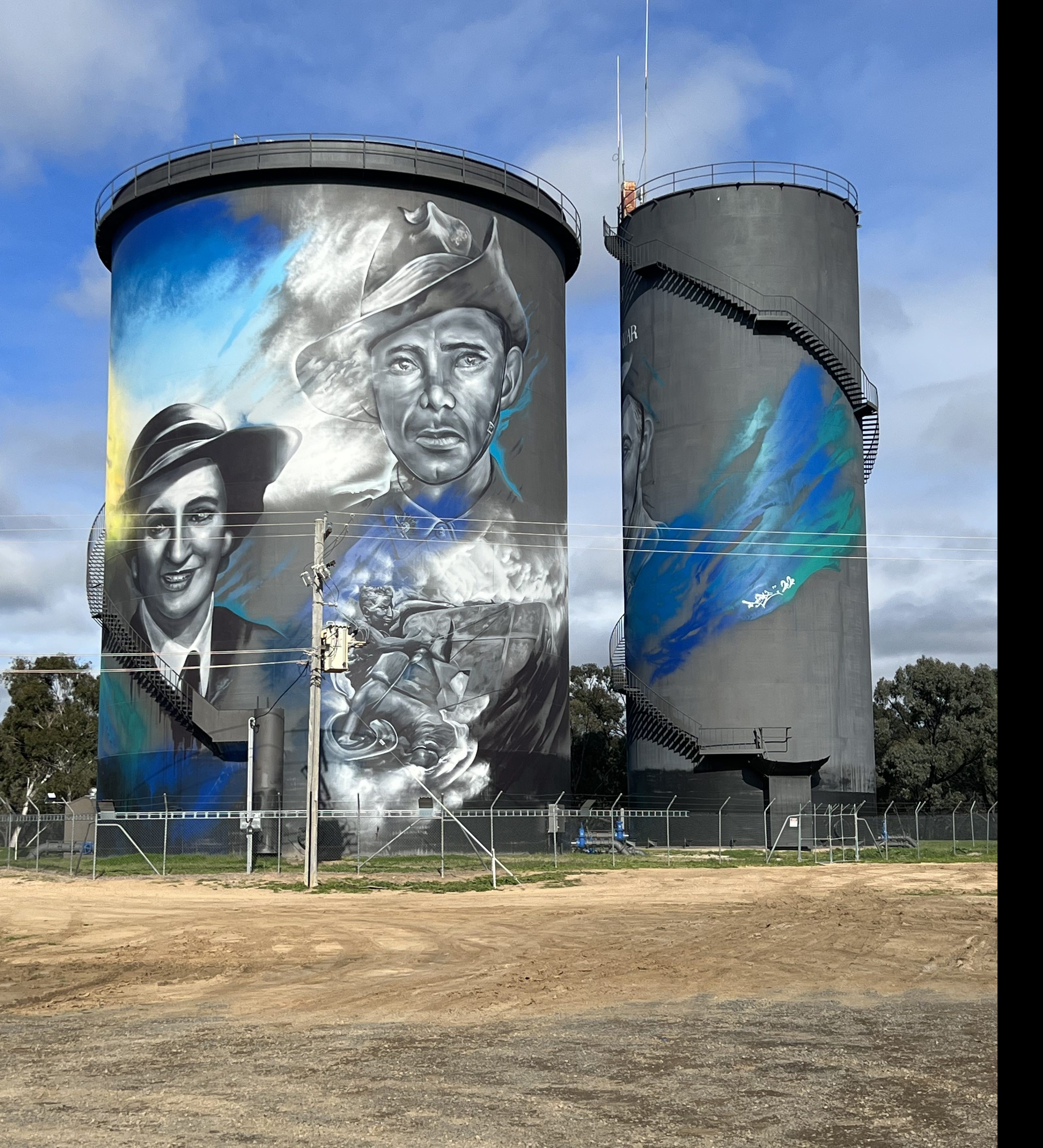
In Hay we stay at a pleasant little van park for the night. Beforehand we had caught some of the latest silo art, celebrating the roles of local WW11 veterans in large as life portraits. A bit different to seeing another Murray Cod! Down at Sandy Point the Murrumbidgee is submerging the shelter sheds along its grassy banks. We have camped here for a night on a previous trip, bit wet now and there are not many vans in residence!

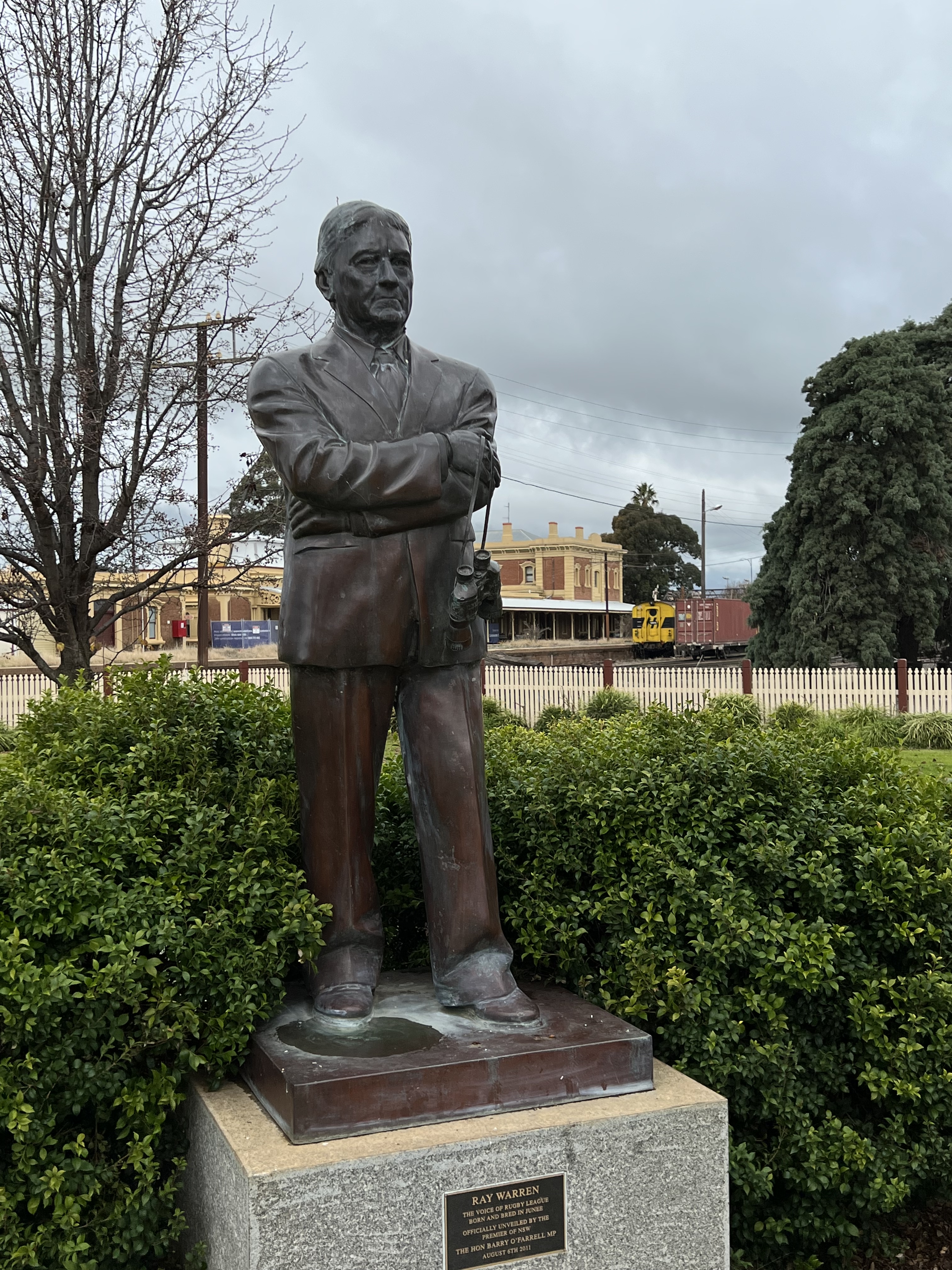
Next morning we hit the road for Cootamundra, another longish drive passing through Junee. Now, I am sure dear readers that you would all know why one would want to divert a bit off a more direct path and travel through Junee? It is certainly the home town of Laurie Daly, famous NRL player. But it is also the hometown of Ray Warren, NRL broadcaster, horse race and Olympic swimming caller for absolutley ages. He has recently retired and I think is nearly 80? One either loves ‘Rabs’ or not, but he is certainly an icon. There is a bronze statue of him just off the the main street in Junee, unfortunately some pidgeons appear to have come past recently and left their mark. We stop for the required photograph.
Into Cootamundra eventually after driving through more magnificient countryside. It is cold and has been wet in Cootamundra. At Hay Mitchell and Piper started living it up in cabins instead of pulling out the tent for these one night stands. Unfortunately, there is only one caravan park in Cootamundra and their cabins were all booked out. The tent was thought about but Allthego weakened and lashed out for a motel for them after hearing that some puddles of water in the campground had frozen over the night before. On seeing the motel it crossed Homealone’s mind that we should all stay in it for the night! But, no the olds headed back to the van and the campground for the night.
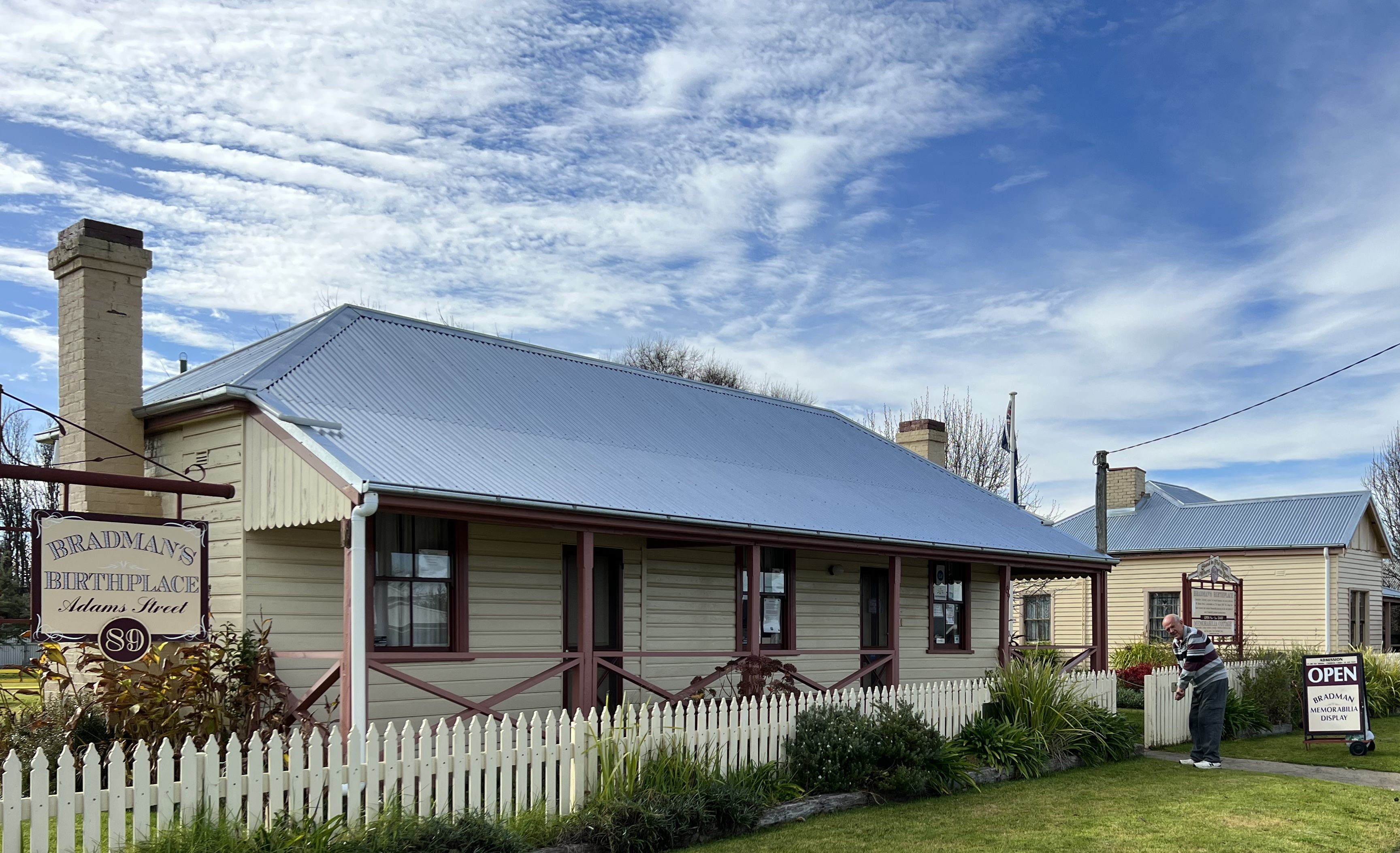
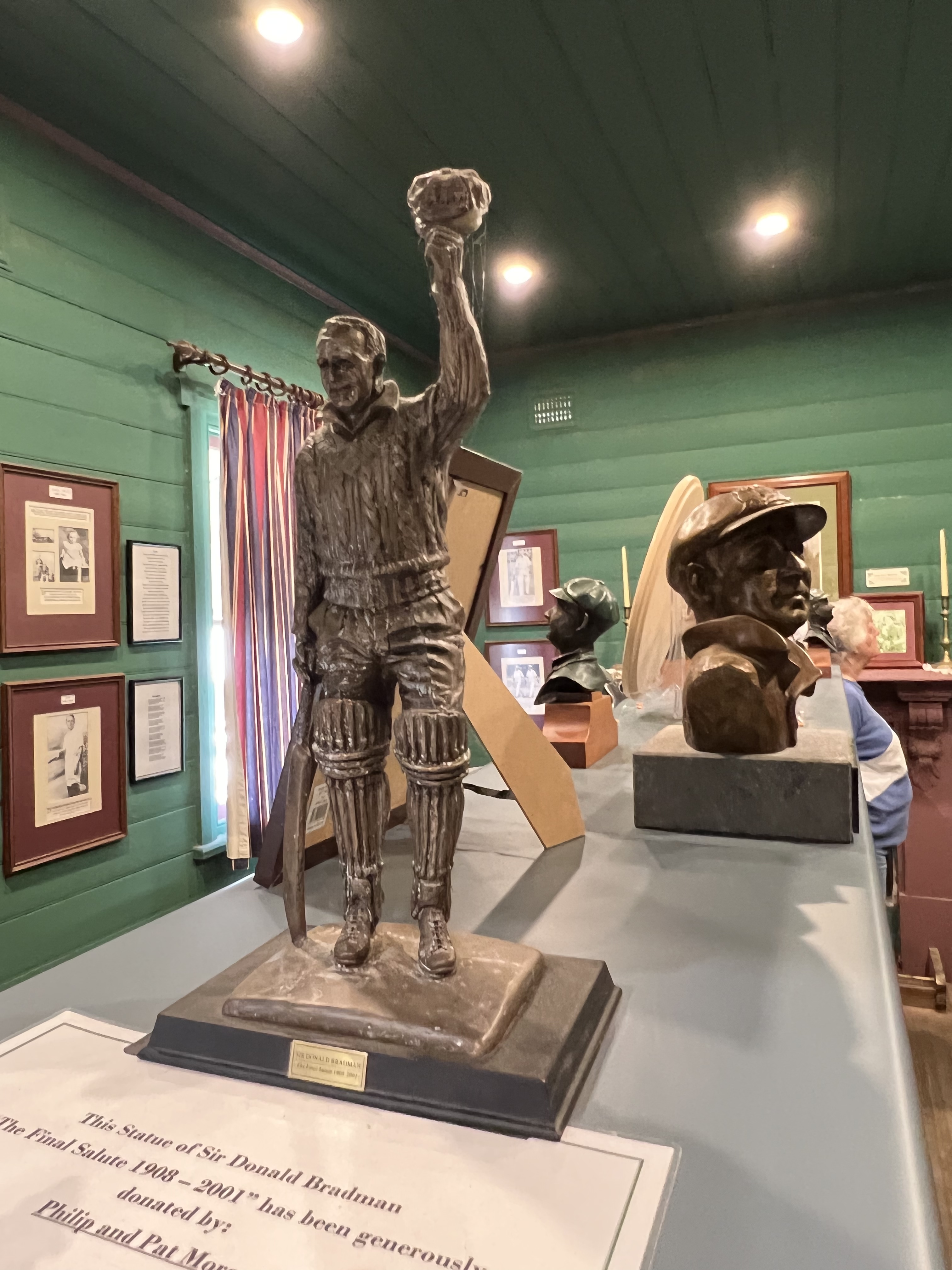
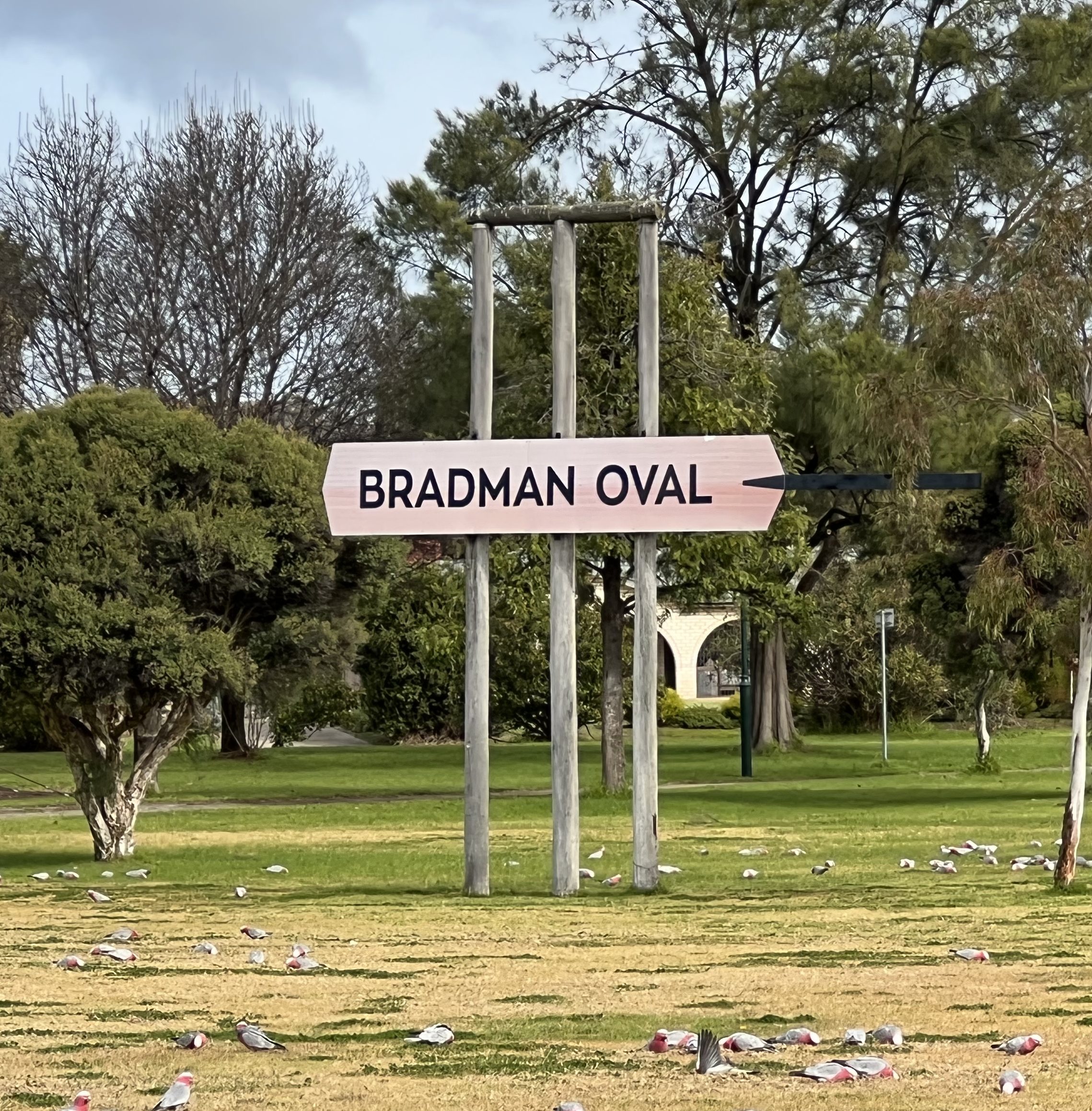
Cootamundra is the birth place of Sir Donald Bradman, without question Australia’s greatest cricketer. Most people have heard of him even if they dont know of his accomplisments in any detail. I think one of our old Prime Ministers wanted to have a question in the Australian citizenship test about him. His birthplace (in 1908) was actually an early small maternity hospital. We were able to stand in the small room in which he was born surrounded by oodles of memorabillia of the great sportsman. Down the road a bit is Bradman Oval, a somewhat understated place except for the giant stumps near the boundary line.

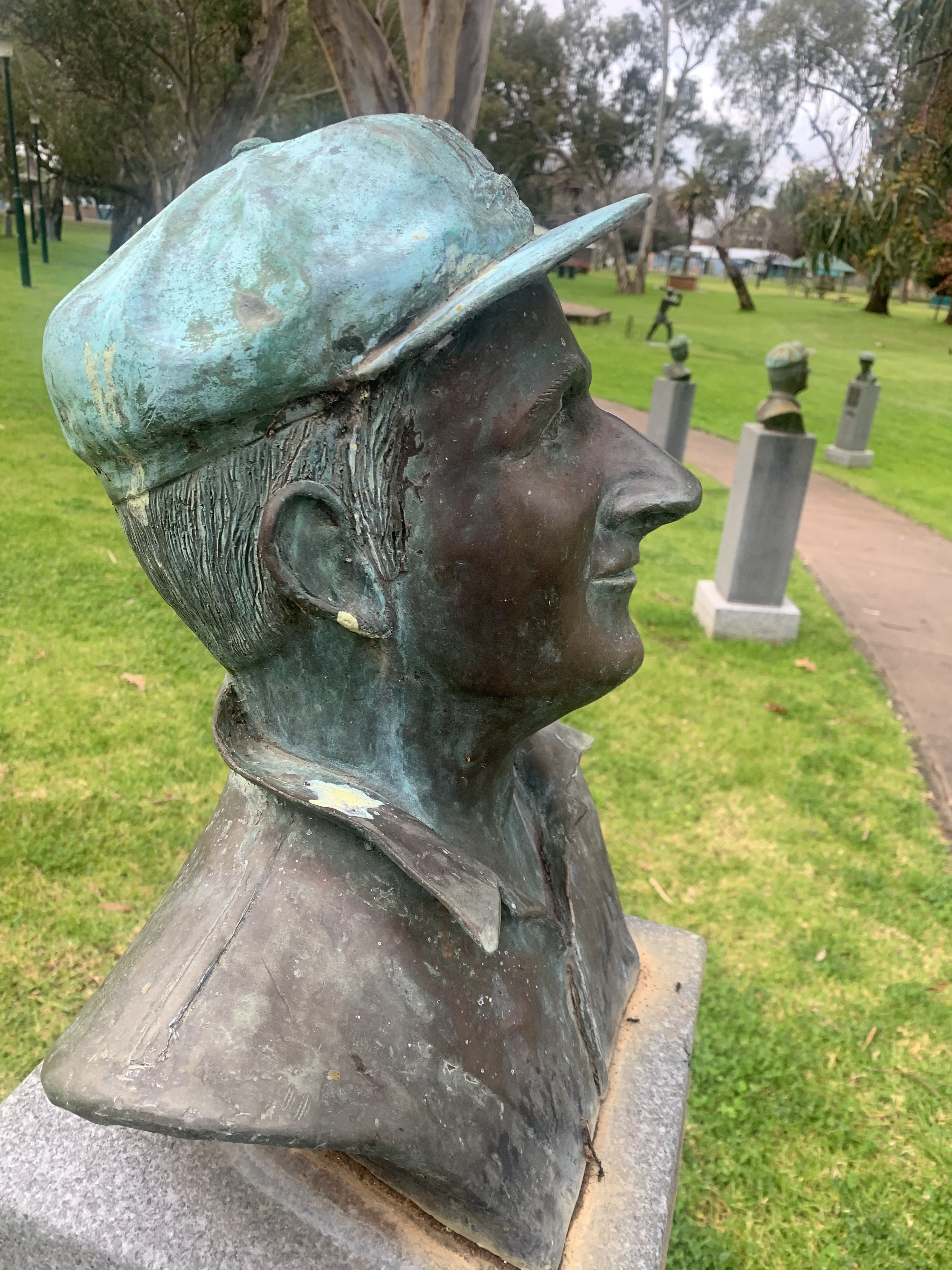

Cootamundra has another cricket must see, the ‘Captains Walk’. Bronze busts of each of the men who were captains of the Australian cricket team, referred to sometimes as Australia’s second most important job after that of the Prime Minister. It starts with the Captain of the Indigenous team that went to England in 1868 and everyone of them since. A great walk down memory lane, Allthego remembers most of them from the early 1920s on (not that he saw them all play of course!), names and records from history.
Now to Queanbeyan, through the Yass Valley, and the Hayes/Bernard mob, Homealone’s sibling relos!
On the way back
We have moved on from Goolwa having completed our journey along the Murray, the new objective was to get to Windsor Gardens a suburb of north eastern Adelaide, via the McClaren Vale wine region. Not a long drive from Goolwa. We were going there to pick up Mitchell and Piper who had flown in from the US and were joining us on the trip back home to Brisbane via Queanbeyan, a few relos there to catch up with after about three years of COVID hassles.
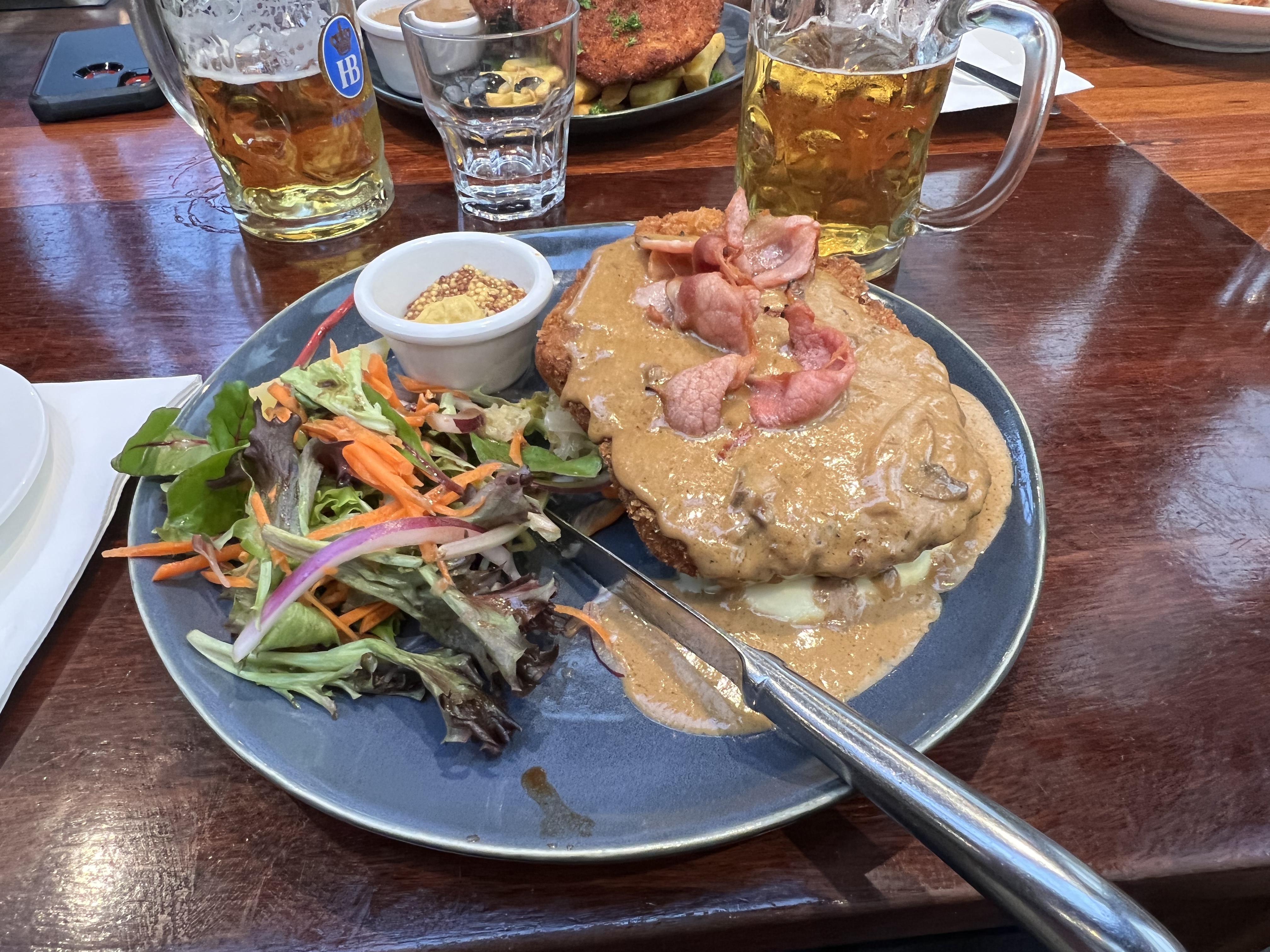
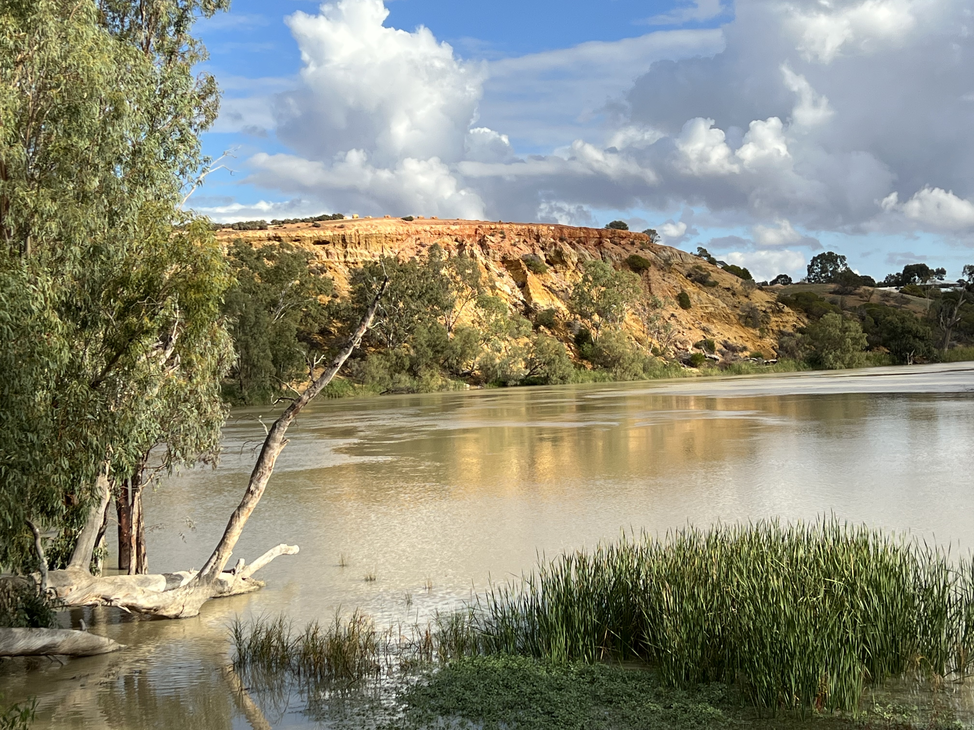
After settling in from the US flight we headed off the next day to Hahndorf in the Adelaide Hills for some German fare. Allthego quite likes Hahndorf, in particular the pork schnitzels. Back to Windsor Gardens for the return trip to Brisbane. We then retraced the Murray back through Murray Bridge (saw that Bunyip again), Mannum, Walkers Flat and Big Bend at Swan Reach. Paused briefly at Waikerie to catch the Silo Art before landing in Renmark for a couple of nights. Long days drive, all the River views were as good as they were a few weeks earlier!

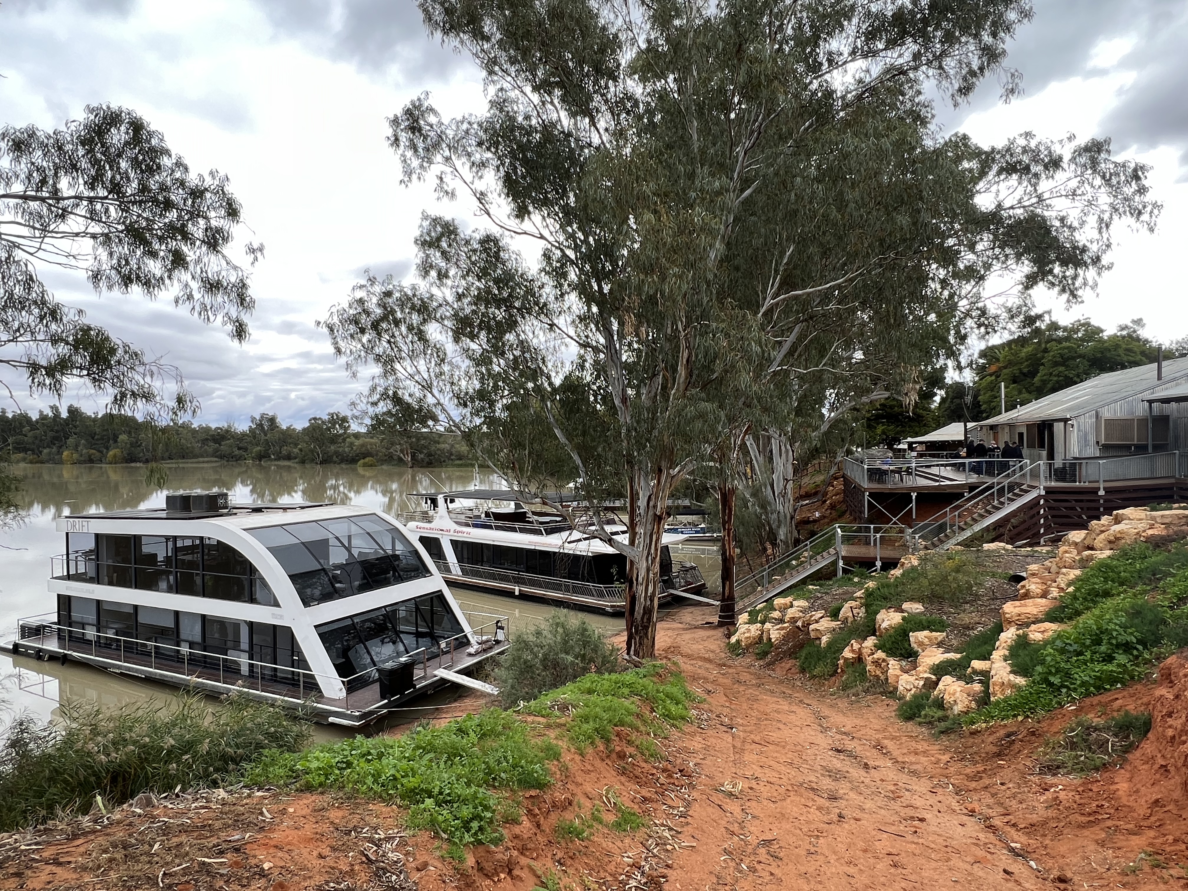
Renmark saw us check out some food options around town including the Woolshed Brewery, a bit further afield, in an old shearing shed beside the River. Houseboats can tie up here and stay overnight. A great spot!
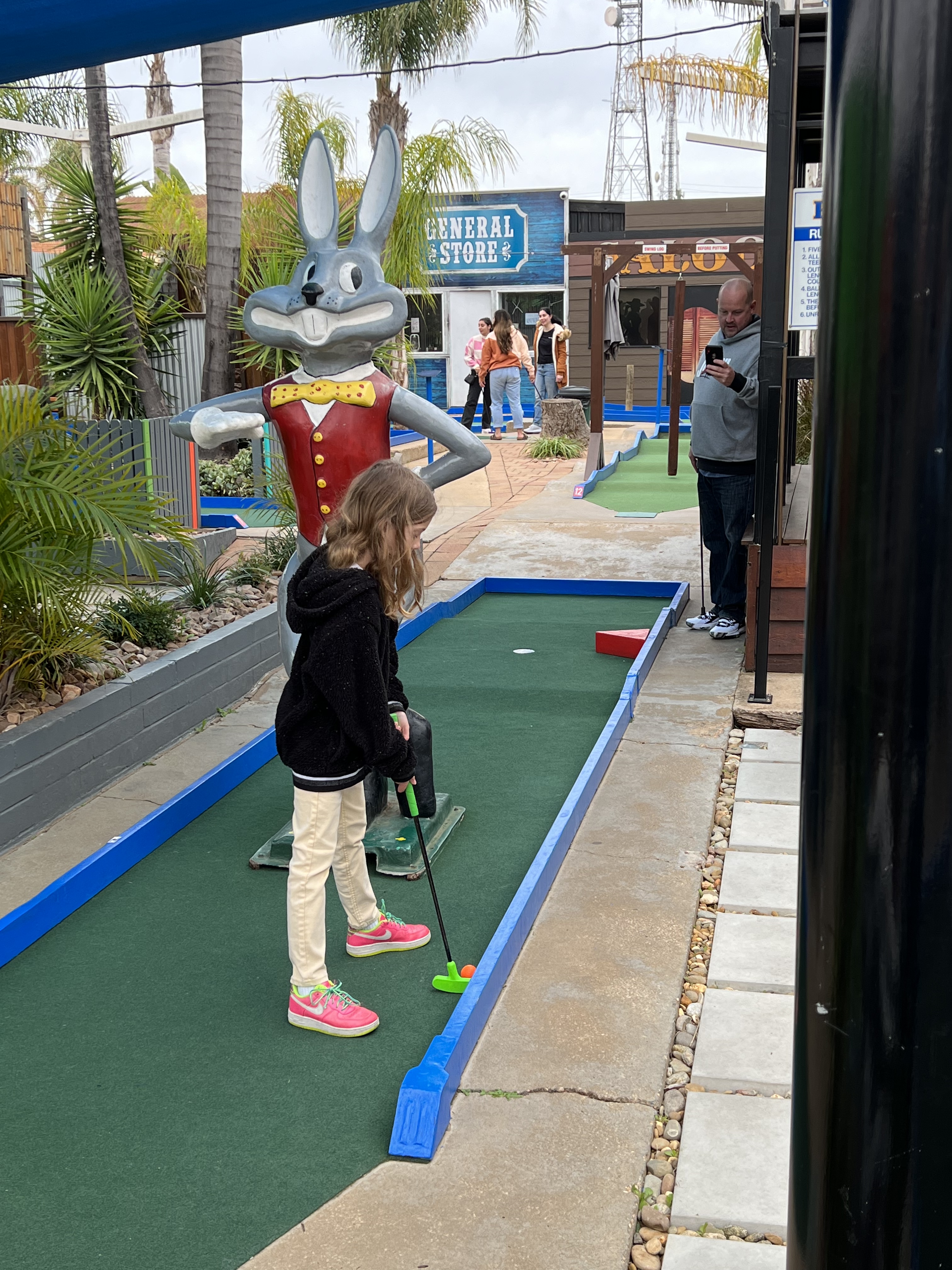
Mildura calls though a little further along the road and we had three nights there, not doing much apart from some putt putt golf and catching the new release movie Jurrasic World Dominon, the latest instalment in the dinosaur saga starring the mob from the first one. Allthego thought it was a bit so so story line wise, a few subtle gags and throw backs to the first movie, it did have one on edge a couple of times when the beasts were allthego. Also one must say some very good fish n chips at the Mildura Rowing Club cafe.
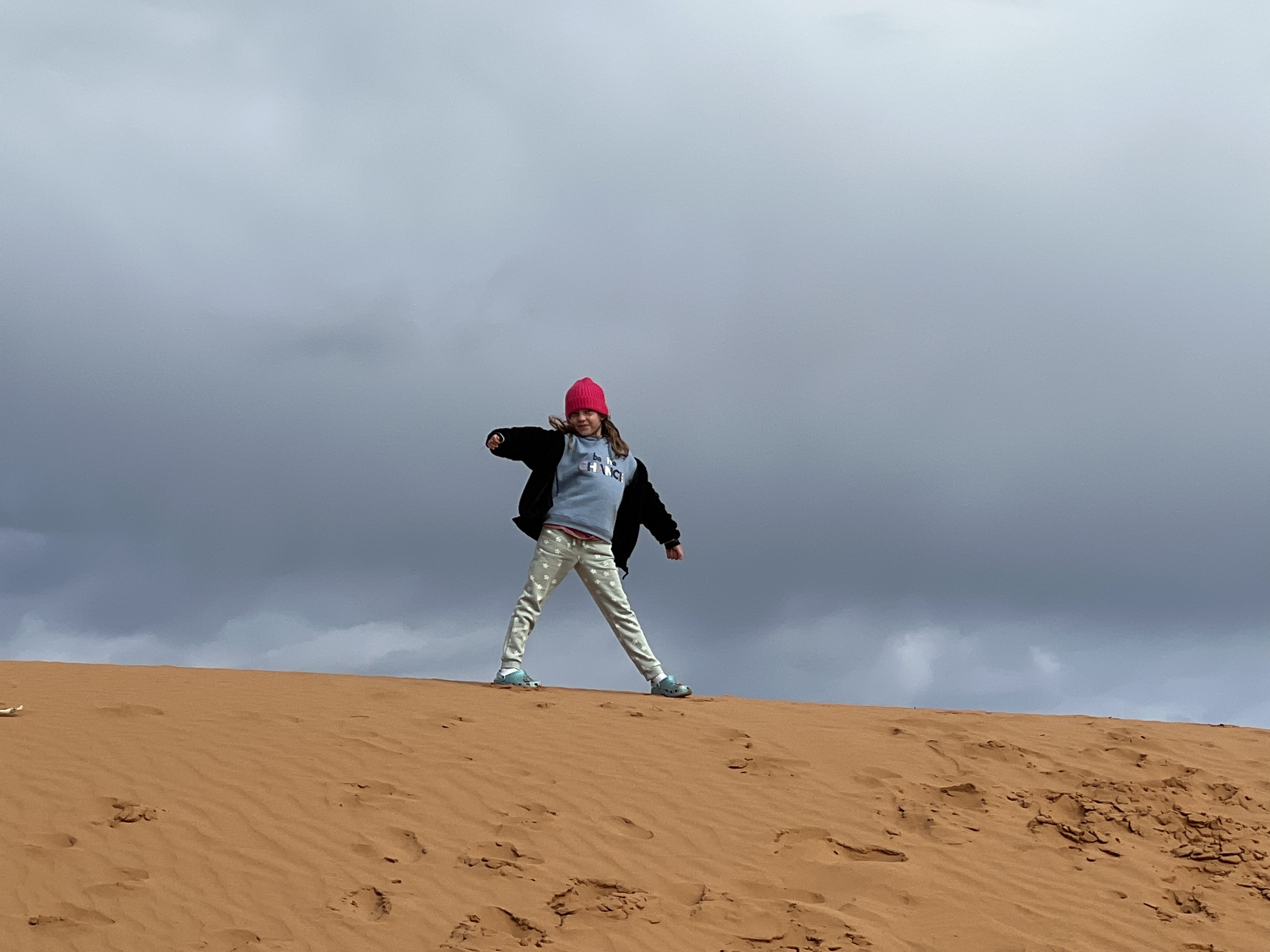
We took off back up the River for the morning to Wentworth and the junction of the Murray with the Darling River. The Darling is absolutely flush with water pouring into the Murray and collectively cascading over the weir just below the junction. The brown Darling water mixing with the bluer Murray, a great sight. The Perry sandhills were nearby and we went out for a climb up and wander around the ancient landscape. Piper greatly enjoyed the experience, particularly rolling down the steep sandhills.
Allthego has been remiss in not filing a final report on the custard tarts. Our last tart was from Strathalbyn on the way to Goolwa, very disappointing example of the art. Pastry was half full! Allthego’s conclusion about custard tarts is that it was a waste of time and effort reviewing them. They were pretty much all the same! Need to think of something else for next time, maybe chocolate eclairs!
We are now at Balranald beside the Murrumbidgee River, a tributary of the Murray. It is in flood and the Park manager has told us it is on the rise. A nice sunny day on the road but it is chilly as the sun sets. Allthego’s beef stew by the fire! I suspect we will survive the night as we continue east in the morning to Hay.
Goolwa
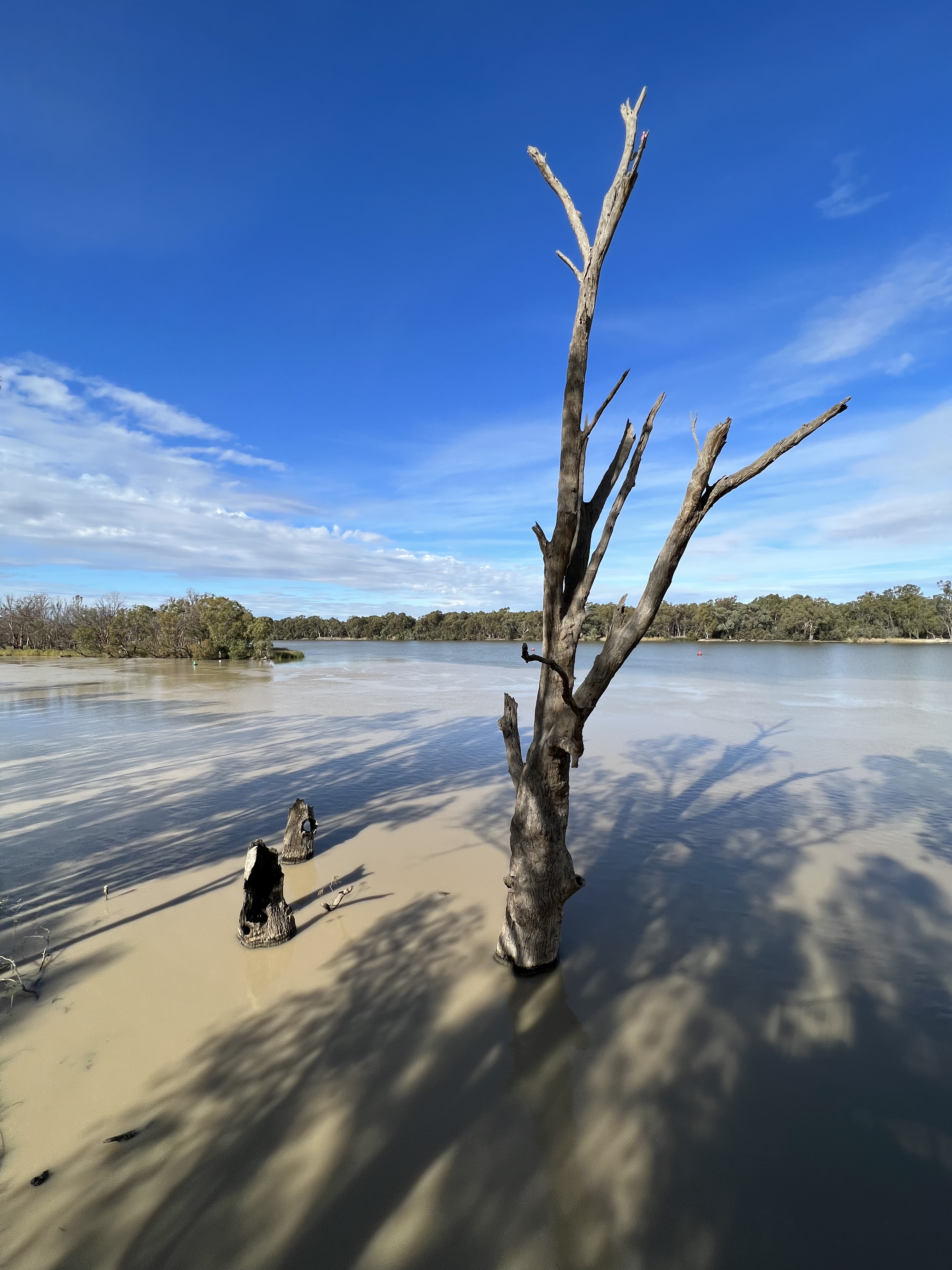
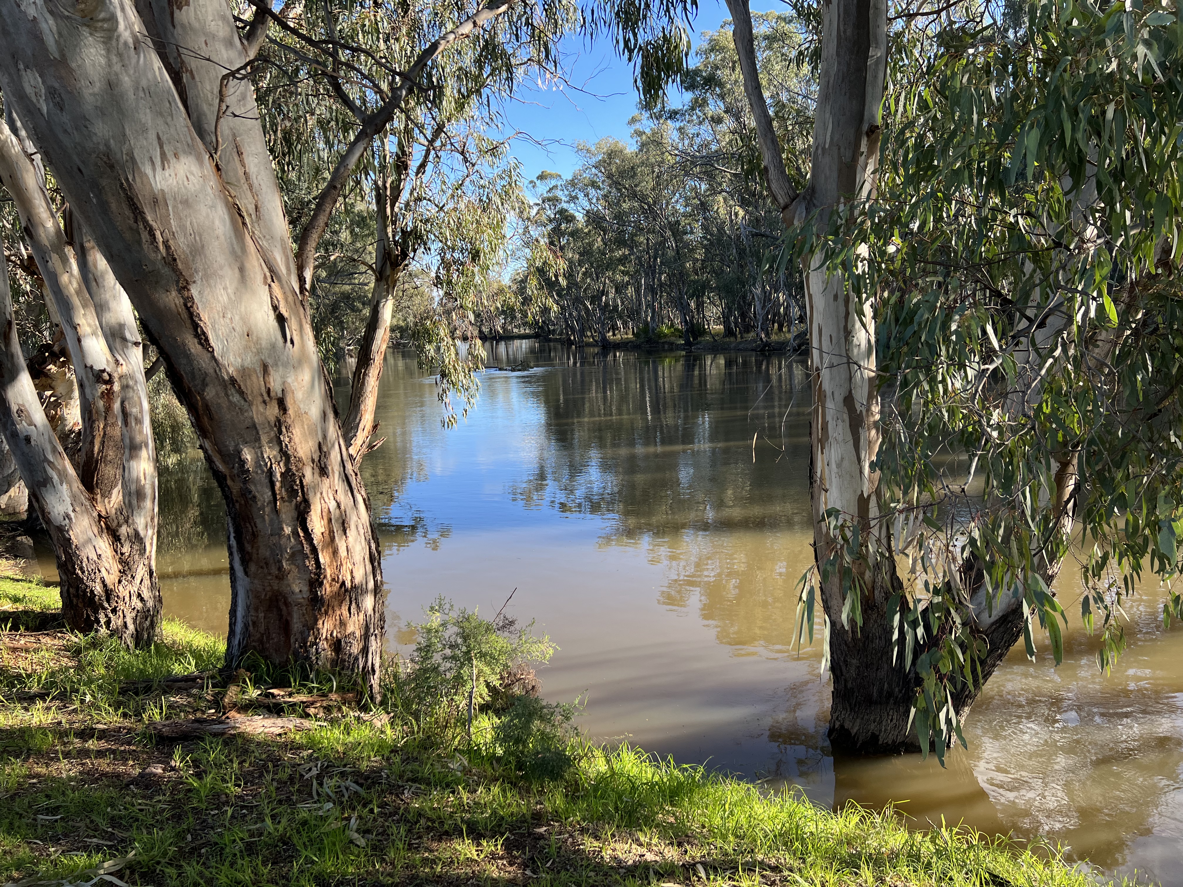
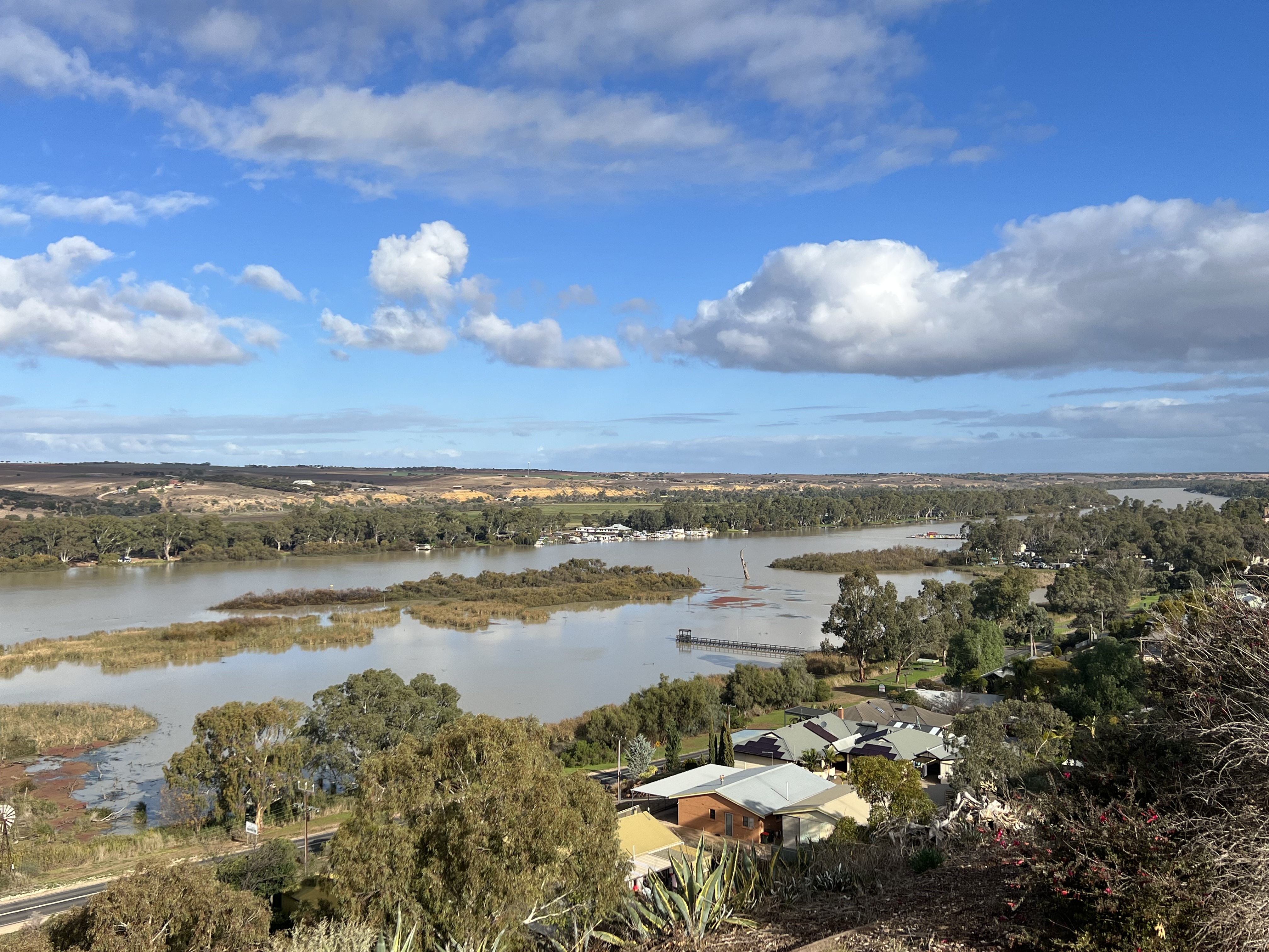
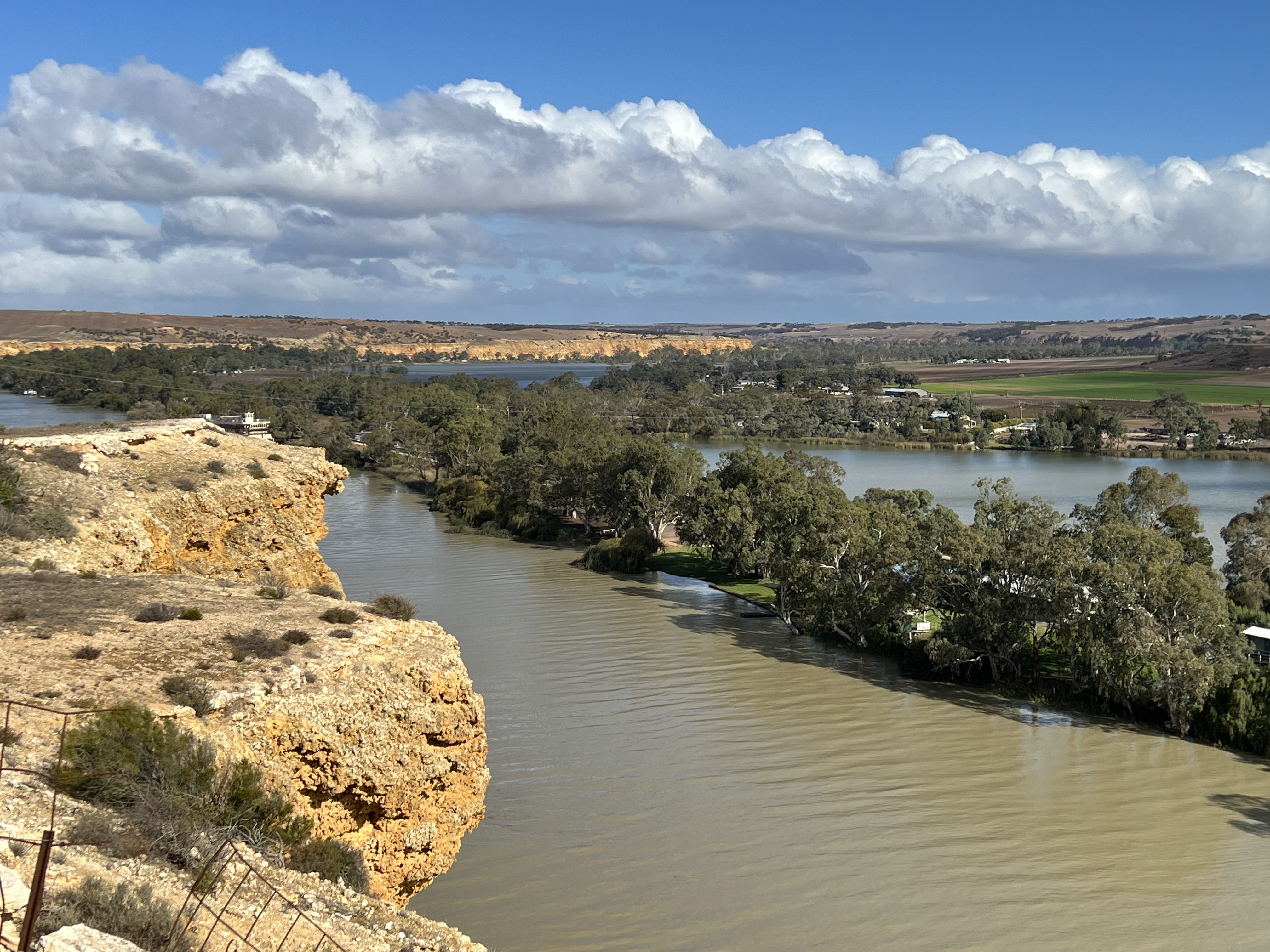
Allthego has had some time to reflect on a map of the journey from the headwaters of the Murray to where we now are, Goolwa. In a simple over view the River flows more or less north from Tom Groggin in the Snowy Mountains before looping around and heading west towards Albury and on to Echuca. From there it is north west up to Mildura and Wentworth, where it is joined by the Darling River whose source lies far to the north in Queensland. At Wentworth the River starts to track west towards Renmark and Waikerie, well to the north of Adelaide. The River then kicks up a bit to Morgan and then abruptly turns south for about 300 km to the sea at Goolwa. Why has it suddenly done this abrupt plunge south? Has it run out of energy, no longer seeking the arid interior and decides instead to take the easy route south down to the sea? A theory is that about 50 m years ago the rise of the Lofty Ranges to the east of present day Adelaide changed the course of the Murray which at that time flowed into Spencers Gulf, well to the north of Adelaide. Seems an interesting concept that explains the abrupt shift in its course.
At Weliington the River disappeared into Lake Alexandrina, this is a big lake by any stretch of the imagination. When it is full a reliable measurement seems to suggets that it is around 650 sq kilometres, only a few metres deep at the deepest points. In dry seasons it shrinks, during the millenium drought it became very sluggish and the mouth of the river threatened to close, only dredging kept it open. The system of barrages between islands keeps the Lake fresh and the Coorong salty.

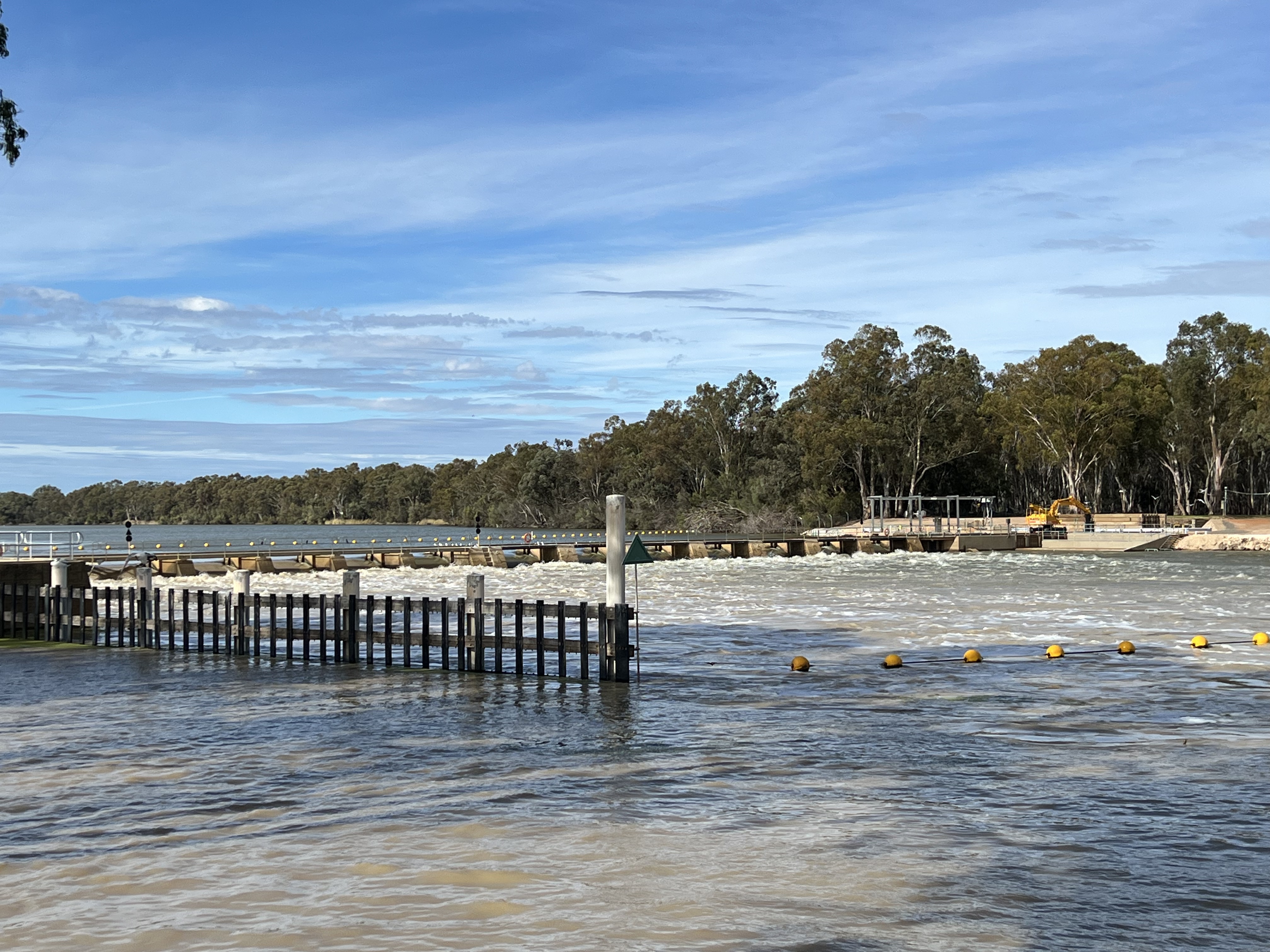
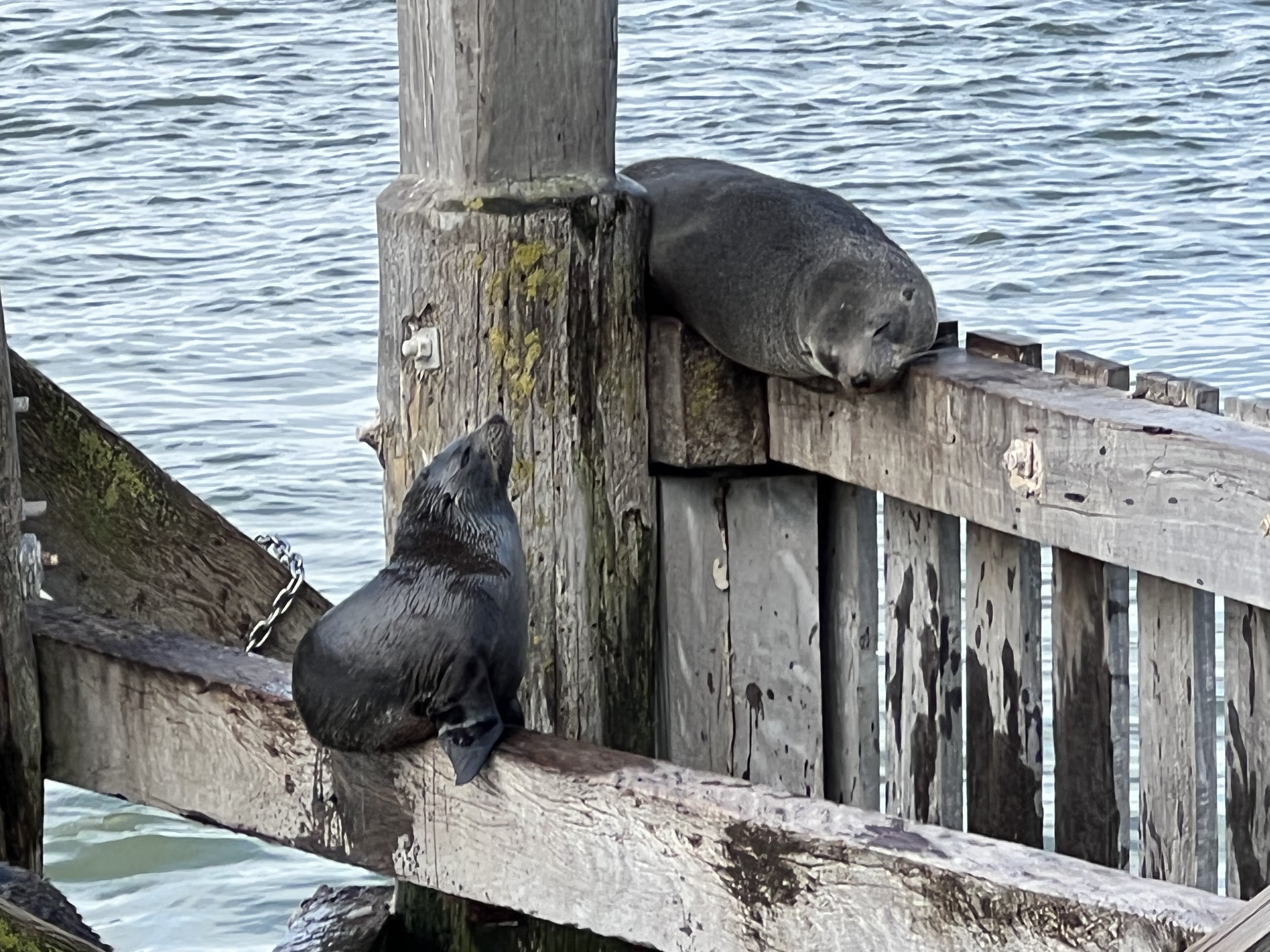
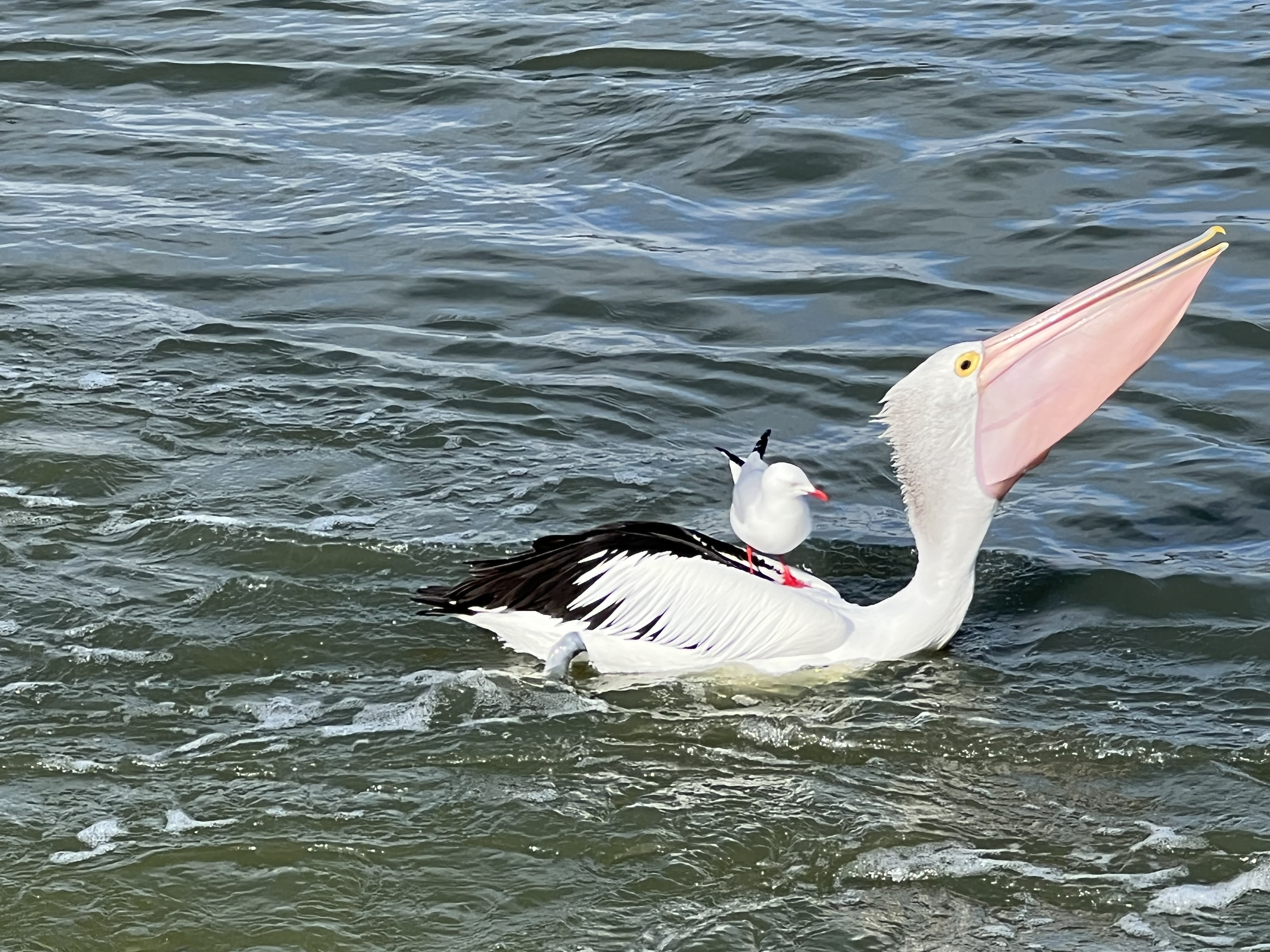
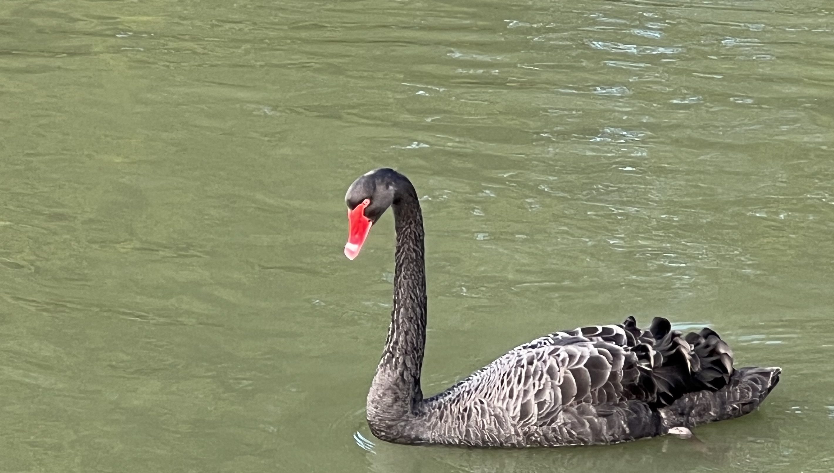
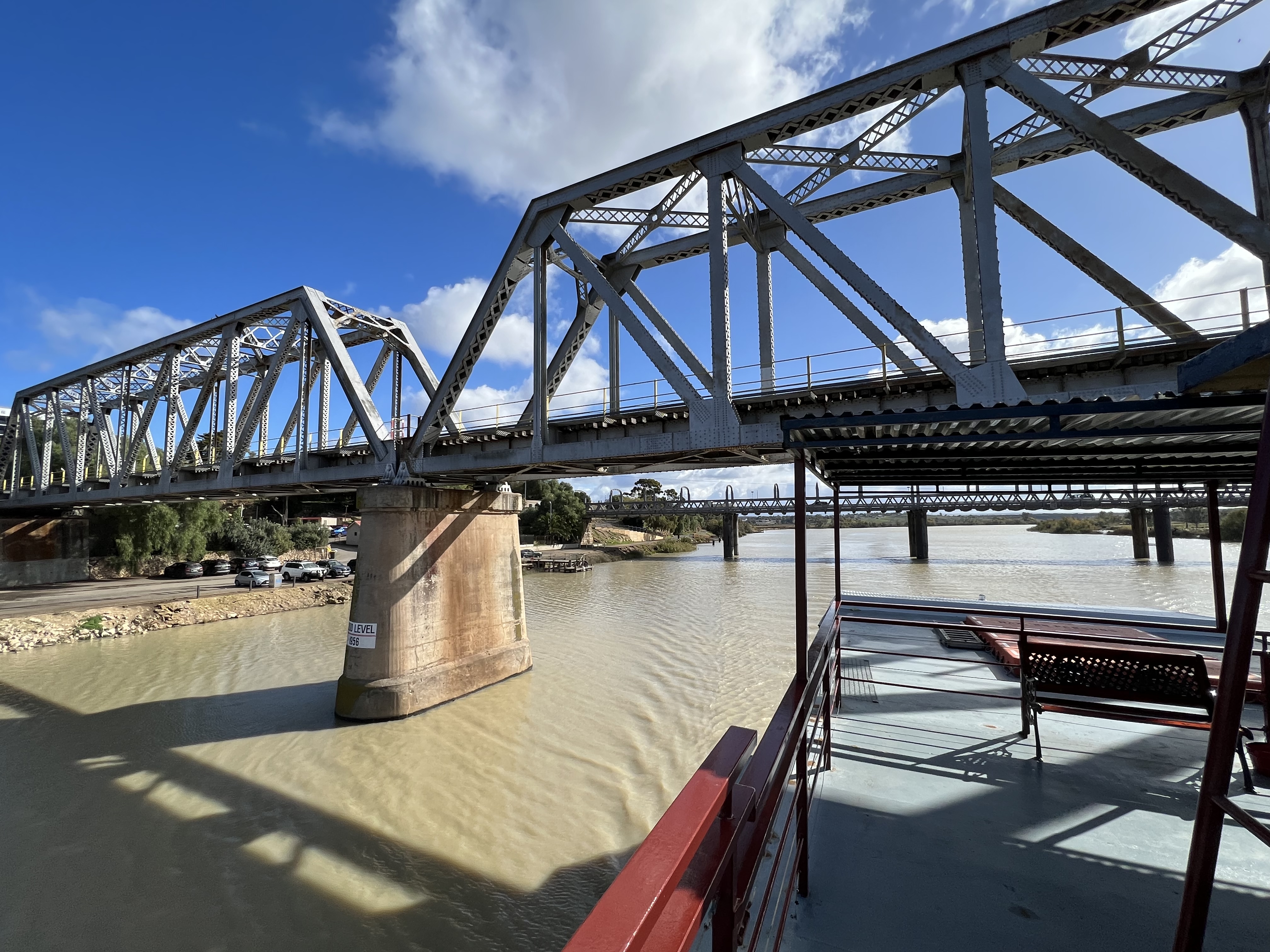
The inland port of Goolwa lies several hundred metres up stream from the barrage known as the Goolwa Barrage, there is a small lock on it. We set off on a short cruise aboard the Spirit of the Coorong to the Murray mouth, descending from the Lake through the lock into the Coorong. The barrage was releasing absolutely oddles of fresh water into the Coorong. Pelicans and sea gulls were having a great time feeding on small fish as they came over the sluices, the boat captain suggesting they were mostly carp. Black swans are all about, these birds are apparantly a good indicator of the health of the River. It seems to be good at the moment!


The water in the Lake and Coorong is quite brown from the floodwaters, not clear blue here! Similarly down at the mouth the water is very discoloured. About 70% of the Murray’s discharge into the Lake flows past Goolwa and along the channel and out through the Murray mouth. The other 30 % flows through another channel and one of the other barrages.
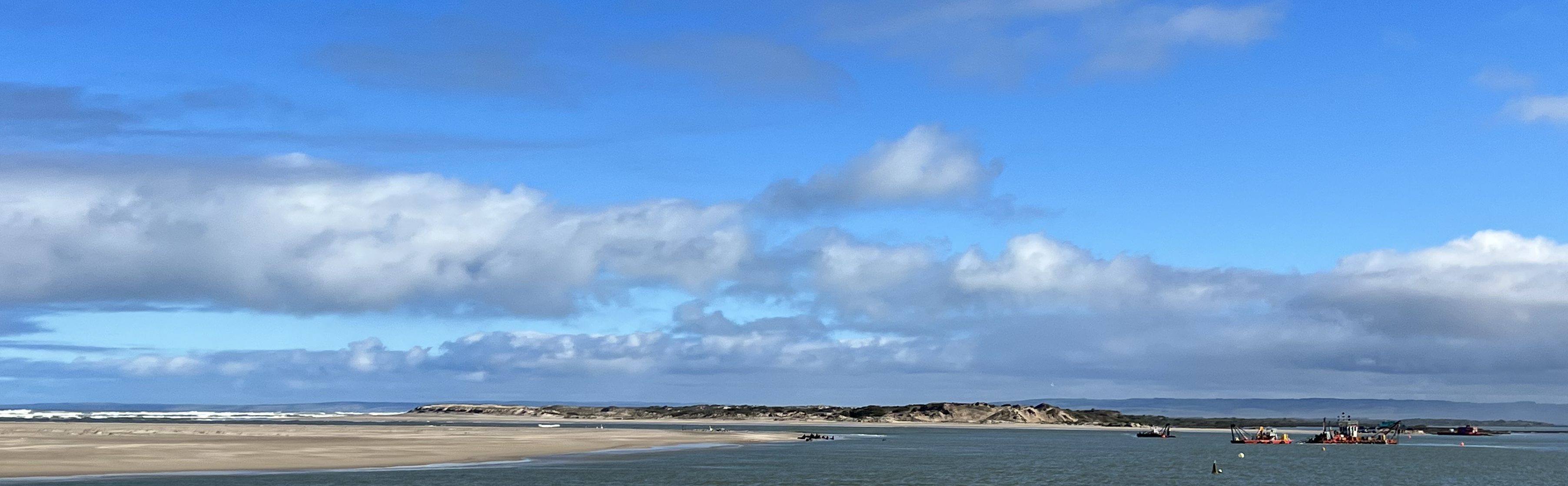
Now aboard the boat and after nearly seven weeks following the great River from near its source in the Snowy Mountains it is a bit of a thrill seeing the water surging through the wave breaks and over the bar into the Southern Ocean!

Goolwa is a very pleasant lakeside town, some nice old buildings and view points of the Lake. The bridge to Hindmarsh Island a prominent landmark. The bridge was once a major point of confrontation with our indigenous peoples, its construction, replacing a ferry, was a major impositionon on an area of the island that was reserved for ‘secret women’s business’. One has to cross over onto Hindmarsh Island to get to the river mouth. Things seem to have calmed down now and Hindmarsh Island is having a building boom with a big canal estate and numerous other developments taking place. Prior to the Bridge Allthego suspects it was a sleepy old place, protected by the inefficiencies and transport delays of the ferry operation.
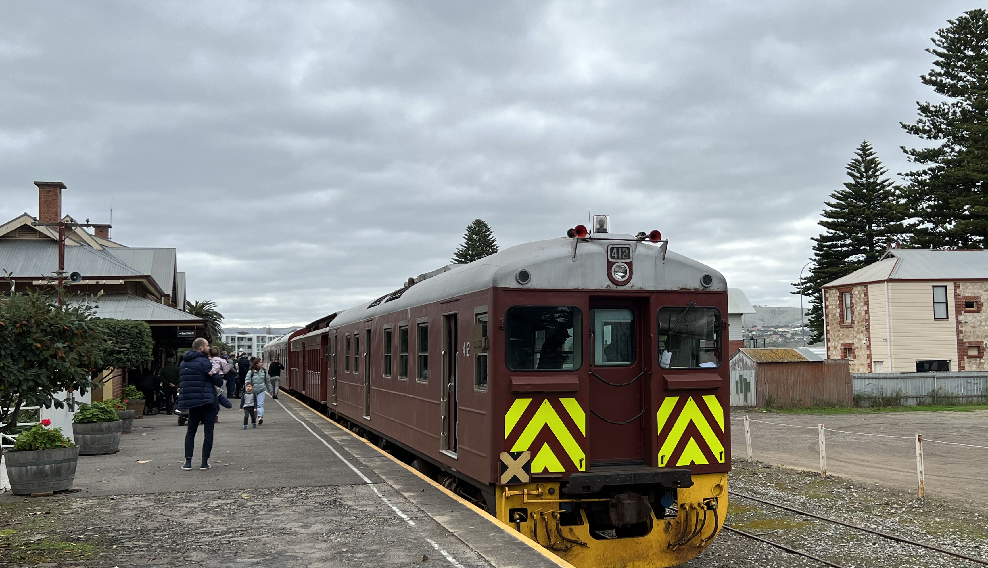

Our last day at Goolwa was spent on the Cockle Train, a heritage tourist railway that rattles down to Victor Harbor taking about half an hour. Whilst the paddle steamers where quite effective in managing the river trade, the Murray mouth was a difficult and dangerous passage to navigate and get product to market. Goolwa was never able to become a sea port. The solution was to construct down to Victor Harbor Australia’s first railway, where a sea port was established on Encounter Bay. The tourist railway basically follows the route of this old railway line, at times running through sandhills along the beach. Interesting journey, rattling along in an old restored ‘Red Hen’ rail car. We enjoyed the few hours we had in Victor, mostly spent in a very good pizza place!
By the way, the ‘Harbor’ in Victor Harbor is spelt without the ‘u’. There are a few other place names in SA also missing the ‘u’. This is due to spelling errors made by an early Surveyor General of South Australia. Victor Harbour Railway Station though is correctly spelt with a ‘u’. Isn’t that fascinating!
Back in Goolwa we packed up and headed for a van park on the fringe of Adelaide in the shadow of the Adelaide Hills. Our time along the Murray is at an end, but a new adventure is to begin. MItchell and Piper have flown into Adelaide from the US and are joining us for the journey back to Brisbane. We are stopping at a few spots along the River to show them some highlights before dropping in on on some relatives further east on the way home.
The Blog has caught up with real time! It will now go a little quite with perhaps a couple of updates before we get back to Brisbane, and some warmer weather we hope, in about two weeks time!
A wee drop
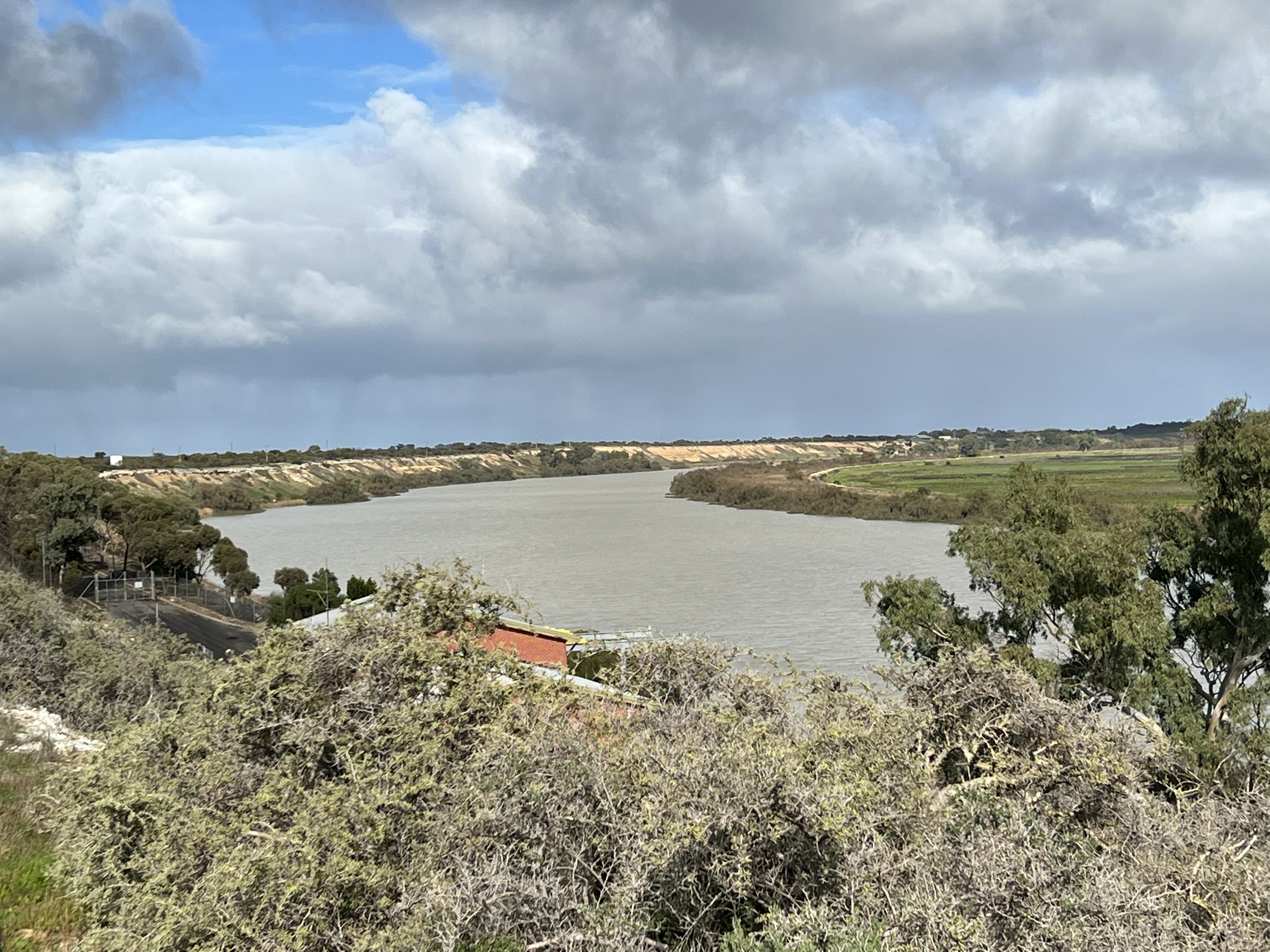
We are at Wellington having come down from Murray Bridge via Tailem Bend. Murray Bridge and Tailem Bend were both big paddle wheeler and later railway towns back when that was the main transport options in the mid late nineteenth, first half of the twentieth century. Ultimately road took over, maybe rail will comeback who knows these days. A big rail trip still operates though, ‘The Overlander’ from Adelaide to Melbourne via Murray Bridge, twice a week both ways. Takes a day in both directions. Not much else seems to happen though at the historic railway station.

It was not then far to Wellington, we had to cross another ferry over the Murray from East Wellington to Wellington, the Heron There is not much on either side and our caravan park is somewhat basic, but then who needs slippery dips , jumpng pillows, water parks etc. Just water! Our water was from the Murray, untreated. So, it was a bit muddy and instead we drank some bottled water we had brought with us as a reserve option. Wise thing to do.
Wellington though is where we want to be because it is nearby here that the Murray flows into Lake Alexandrina. Gota get a picture of course! Easier said than done though because the Lake is edged by pastoral stations and it is hard to get access down to the Lake. We eventually stumble on one though. It is a track to a little sandy beach used by windsufers. We send up the drone to try to get some pictures of the outflow. Too far away though and a bit disappointing, good picture though of us beside the Lake.

We do though ultimately find a spot much closer to the outflow out past a horse breeding/training establishment, bit of a muddy road. The drone again doesn’t take the right photo! Allthego is beginning to think he might need some drone photography training. It is very over exposed. But readers can get the drift I hope with the captions that try to explain where we are. Good for our diary record as well!


Not far away from us is the Langhorne Creek wine region. Allthego has never paid much attention to wines from around here. Metala is a well known producer. Bleasdale though is the interesting one, some of its commercial wines are seen in shops in Queensland. We had a tasting of some nice wines, the guy helping was from the sixth generation of the Potts family, dating from the 1850s when they planted the first vines.
We also take a side trip down to the top of the Coorong waterway. The Coorong NP is the great stretch of waterway running between the Murray Lakes and the sand peninsular holding back the Southern Ocean. The Coorong is salty, Lake Alexandrina and Lake Albert are fresh water, fueled by the Murray spilling into them. The ‘salt’ and ‘fresh’ are controlled by a series of barrages (sort of long weirs), built in the 1940s (?) linking islands across the Murray estuary, stopping the sea and salt working up the River and mucking up the upstream irrigation and water supply systems. There are a couple of small locks on the barrages allowing small vessels to move betwen the Coorong and the Lakes. Sounds easy, but this is but one of the issues in the ‘future of the Murray’ debate which we will not go into here. The Coorong looks a great place to stay in warmer weather!
Wellington doesn’t seem to be promoted as a particularly important place in a journey down the Murray. We both have a view though that this is really where the River loses it’s presence and essence as a flowing stream of water. It just sort of gets lost into a great bath tub, the contents of which rise and fall with the seasons and the needs of humanity along its 2500 km course. We do though look forward to Goolwa for a few days and see where the sea swallows the great River’s waters.
Murray Bridge
This is the last substantial town before we reach the lakes into which the Murray flows. It is only 32 km on from Mannum so another short drive and early into the camp site. We are also only 75 km from Adelaide via the M1 and around 25,000 people live in the area. First appearances indicate a town seeking to be a destination in the face of numerous nearby alternatives, particularly the wine regions of the Fleurieu Peninsular such as Mclaren Vale and Langhorne Creek, and a little further south the natural beauties of the Coorong waterways.
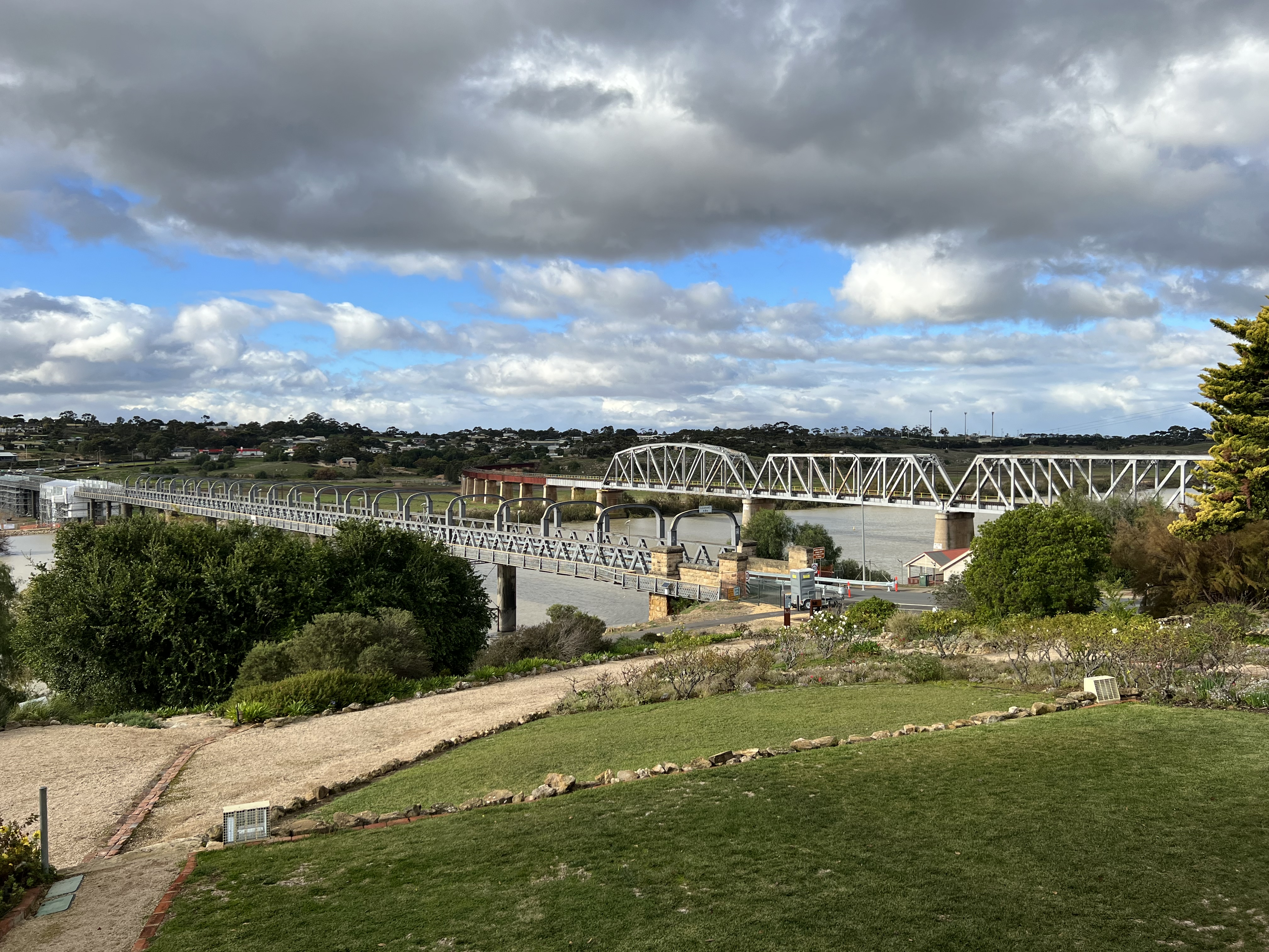
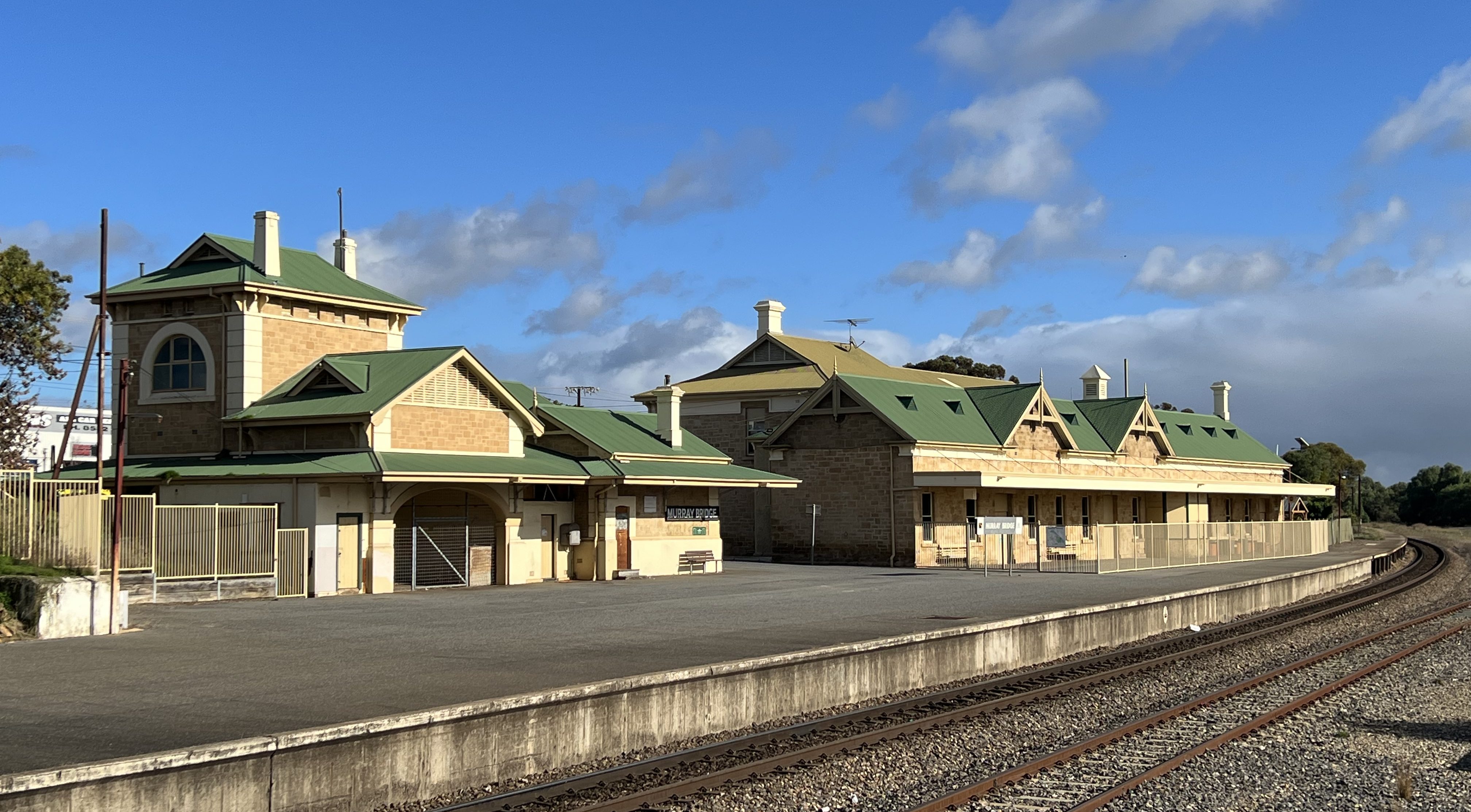
Murray Bridge draws its name from being the location of the first the bridge across the Murray River. Completed in 1879 the Bridge crosses the River and flood plain in a broad arc and is a great sight. The bridge originally carried a rail line but this was relocated to the dedicated rail bridge alongside. Today there is some extensive work being done on the Bridge to keep it in action into the future. There is a great view of the bridges from the Roundhouse, perched on a hill overlooking them. The engineer who built the first road/rail bridge lived in the Roundhouse while it was being constructed, keeping an eye on progress no doubt from the verandah.
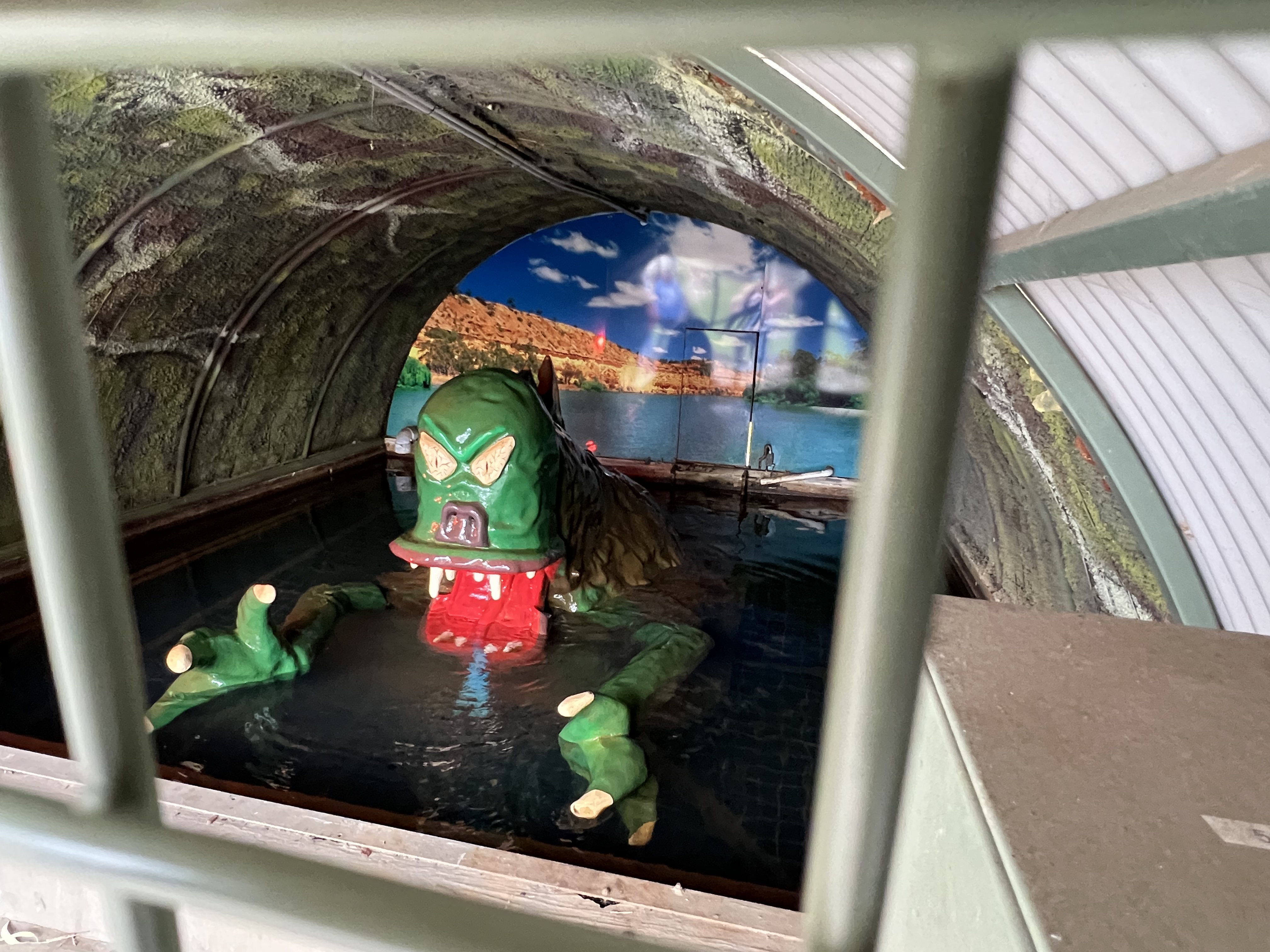
There is a pleasant park along the riverfront and it is here that we find an iconic Murray Bridge attraction. A Bunyip cave is located beside the River, it has been here for over 50 years. The resident Bunyip is most active and makes appearances for onlookers at five miniute intervals, flashing lights and a lot of screeching emanate from the cave as the Bunyip rises from the depths of its billabong. Most impressive! One onlooker says to Allthego that the Bunyip looks more like an alien. Allthego agrees and says that it looks nothing like a real bunyip. The onlooker was a little puzzled, Allthego just grinned a bit and returned to the truck.
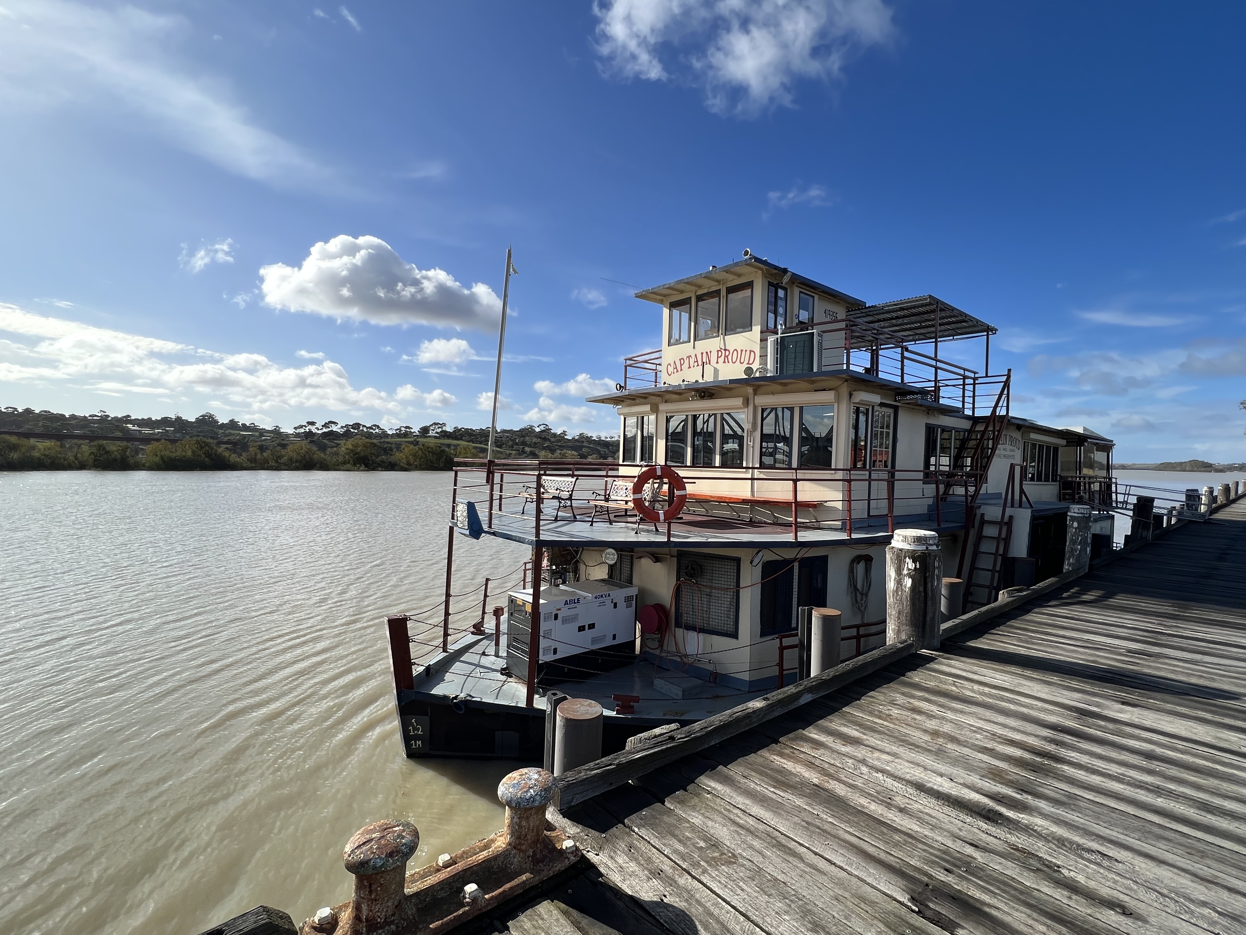
An entertaining option in Murray Bridge is to take a lunch cruise on the Captain Proud, a restored paddlewheeler no longer under steam. We went upstream and then downstream for three hours and enjoyed lunch on board and views from the upper deck. A young Belgian couple were our table companions during lunch. They were in Australia for three weeks, visiting a friend in Adelaide who was then taking them up to Darwin and Kakadu, via Uluru before flying home from Darwin. They were not aware of the Bunyip in the nearby cave and Allthego suggested it was a must see for them. Not being familar with Bunyips they were a little sceptical, but ultimately said they would go and have a look. Allthego is astounded that we do not promote these icons of the billabong more strongly as tourist must sees. A bit like the Murray Cod, Allthego thinks we should have more replicas of Bunyips on the banks of our big River.
For some variety scenery wise we decided to head out one day into the countryside for the small village of Mypolonga. We had a brochure about a small business there housed in an old stone church. They act as a sort of market place for small producer’s products, as well as their own range of dehydrated meals in a bag. The meals are the vegetable components and you need to add your own meats where appropriate. There is also a range of soups and things like potato bakes etc. They specialise in processing rejected produce such as miss shaped carrots, potaoes and the like, from the neighbouring farms. Sixteen tonnes of it in the last year. Other products available included various honies, olive oils, fruit juices and chocolate dipped sliced dried oranges and lemons. All very tempting stuff as you sit waithing for your lunch, couldn’t resist some chilli honey to drizzle on a pizza or baked potatoes. We had some of their lamb koffta wraps for lunch before heading back to the van.
Back in Murray Bridge we tidied up for the move down the River to Wellington. Wellington is our penultimate stop along the Murray as it is nearby this small town that it flows into Lake Alexandrina and makes its way ‘submerged in its channel’ beneath the Lake on past Goolwa to the Coorong and then out into the Southern Ocean.
It is getting close
As we leave Walker Flat and head to Mannum for three nights one is struck by how much urbanisation is closing in the distance between the towns. It is only 32 road km to Mannum and about 150 river km to the mouth at Goolwa! Lucky we are not trying to charge up the batteries along the way. So it was a very leisurely 10.30am or so departure from Walker Flat. We had a look around the banks of the River and the limestone cliffs up close, plenty of sea shell fossils clearly visible in the rocks. Homealone pleased that we managed to get a nice sample to bring home for the display shelf at Bedwell Place.
The short distance to Mannum means we are there early and are able to get choice of camp spots. We end up on the end of a block of sites with a good view of the River and happenings on the bank with the ducks, pelicans, a black swan, a spoonbill and numerous swamp hens in residence. Flocks of cockatoos and corellas fly in as the sun sets making a racket.
Mannum is an old town and was one of the places of early settlement on the lower Murray, there was a strong German and Lutheran heritage among the early settlers. The town has been able to retain many of the early limestone buildings along the main street, now repurposed from their original use. We had lunch one day at the Mannum Club over looking the River, it has a strong nineteenth century German background. There is a display case of the club’s historical materials including minutes of a board meeting around 1914 which debated the status of club members with German nationality in the context of WW1. The committee voted to kick them all out of the Club, an interesting historical snippet for current day observation!
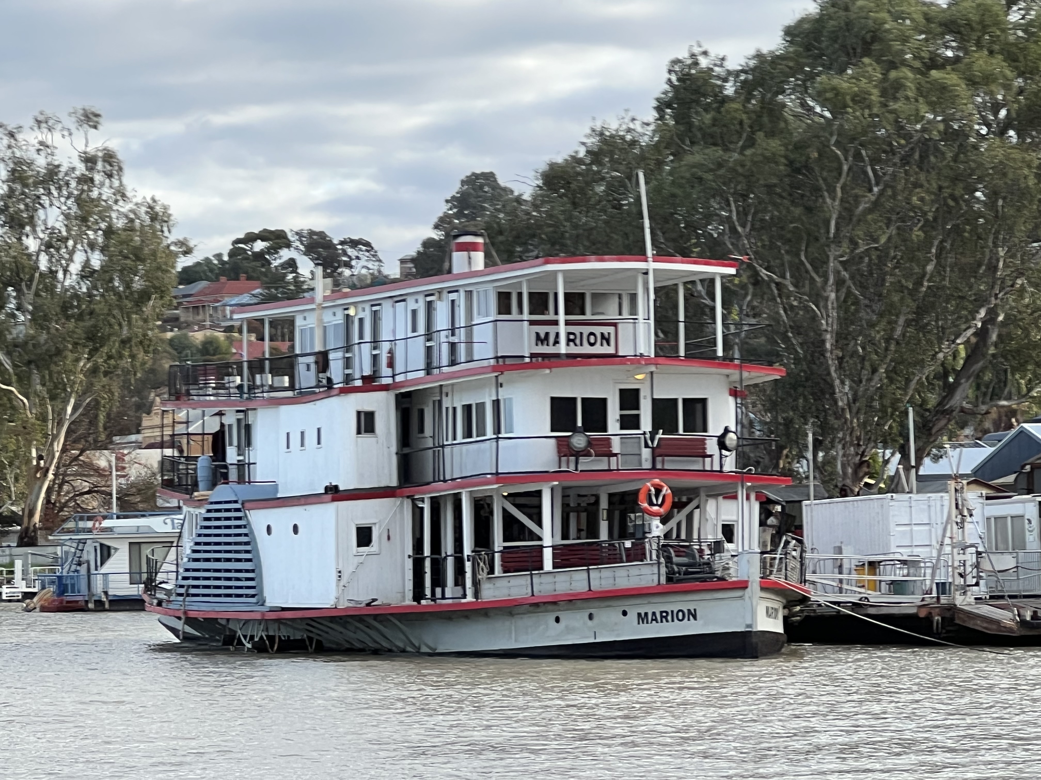
The town is a busy thorough fare for traffic accross the river with two ferries side by side, the Pelican and the Black Swan. We cross over a couple of times, just for fun of course! The PS Marion is pride of place in the town. This is a real blood and guts boat for travellers to take up the river on 3 night voyages, in much the same accommodation as those a hundred years ago. Small two bunk cabins and bathroom facilities shared out on the side of the boat. There is a lounge area and a dining room setup with plenty of deck space, one is up quite high looking down on the River from the top deck, where the wheelhouse is. Allthego thinks it would be a great trip up to Big Bend and beyond. Homeaone thinks the Murray Princess would be more salubrious and suitable.
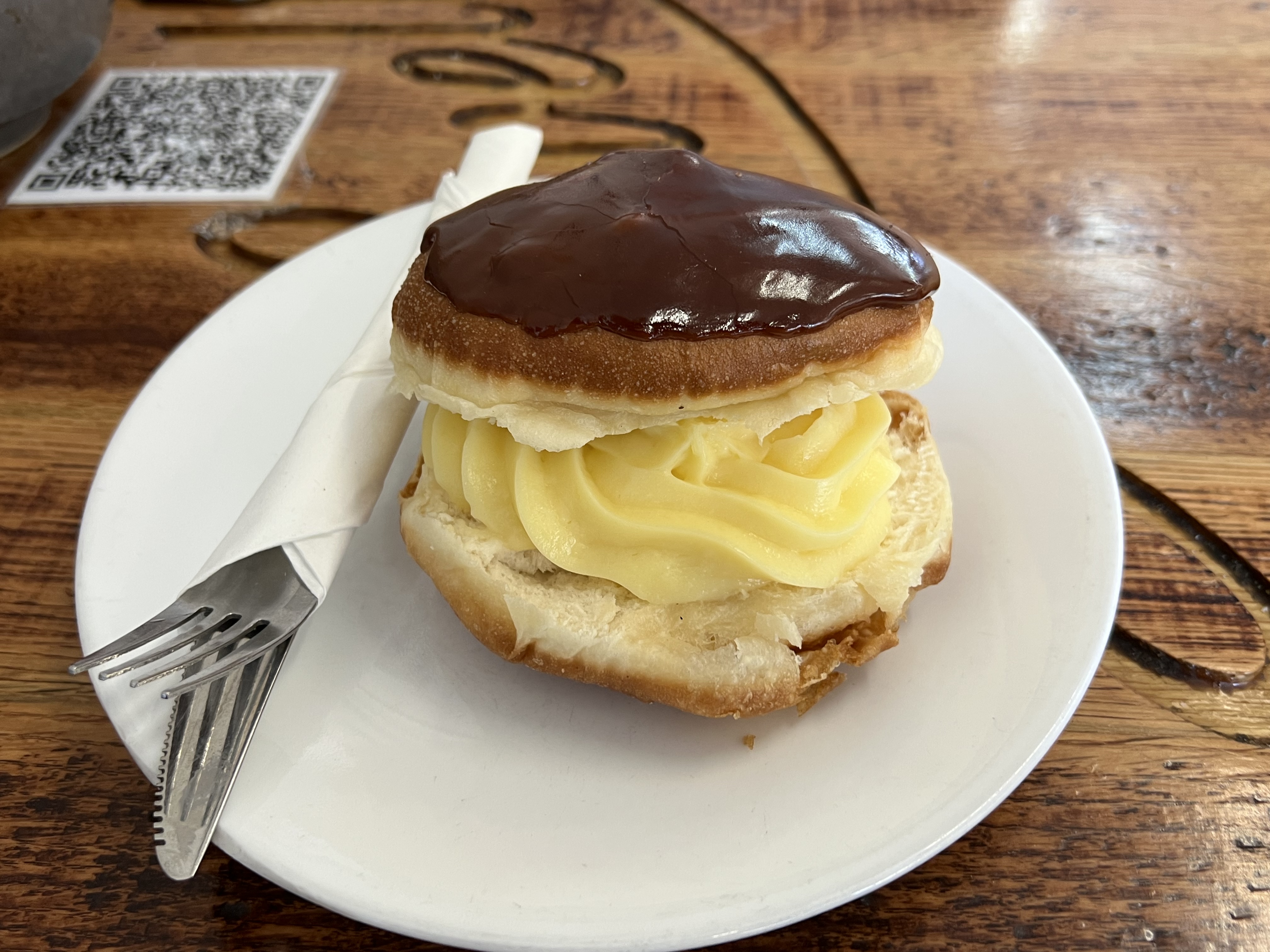
The custartd tart tasteoff continues in Mannum. Considerable disappointment though as the tart from Waikerie and the Mannum tart just don’t stack up. Both exhibit the problem identified earlier, the casing is not cooked, meaning the base is soggy and not very appealing. Fortunately, Allthego spotted a berliner in Mannum and couldn’t resist. Maybe we will test run berliners on the next trip? This custard filled German style donut was great. There are no holes in German donuts, this is an advantage because the custard doesn’t fall through the hole and instead oozes out the side mixing with the chocolate icing on top! Mmm!
Allthego wandered uptown on the last day for a haircut at the local barber, or perhaps it was the hairdresser. His locks, eyebrows, ears etc were getting a little untidy after nearly seven weeks and needed attention. Also a couple of post cards to get off.
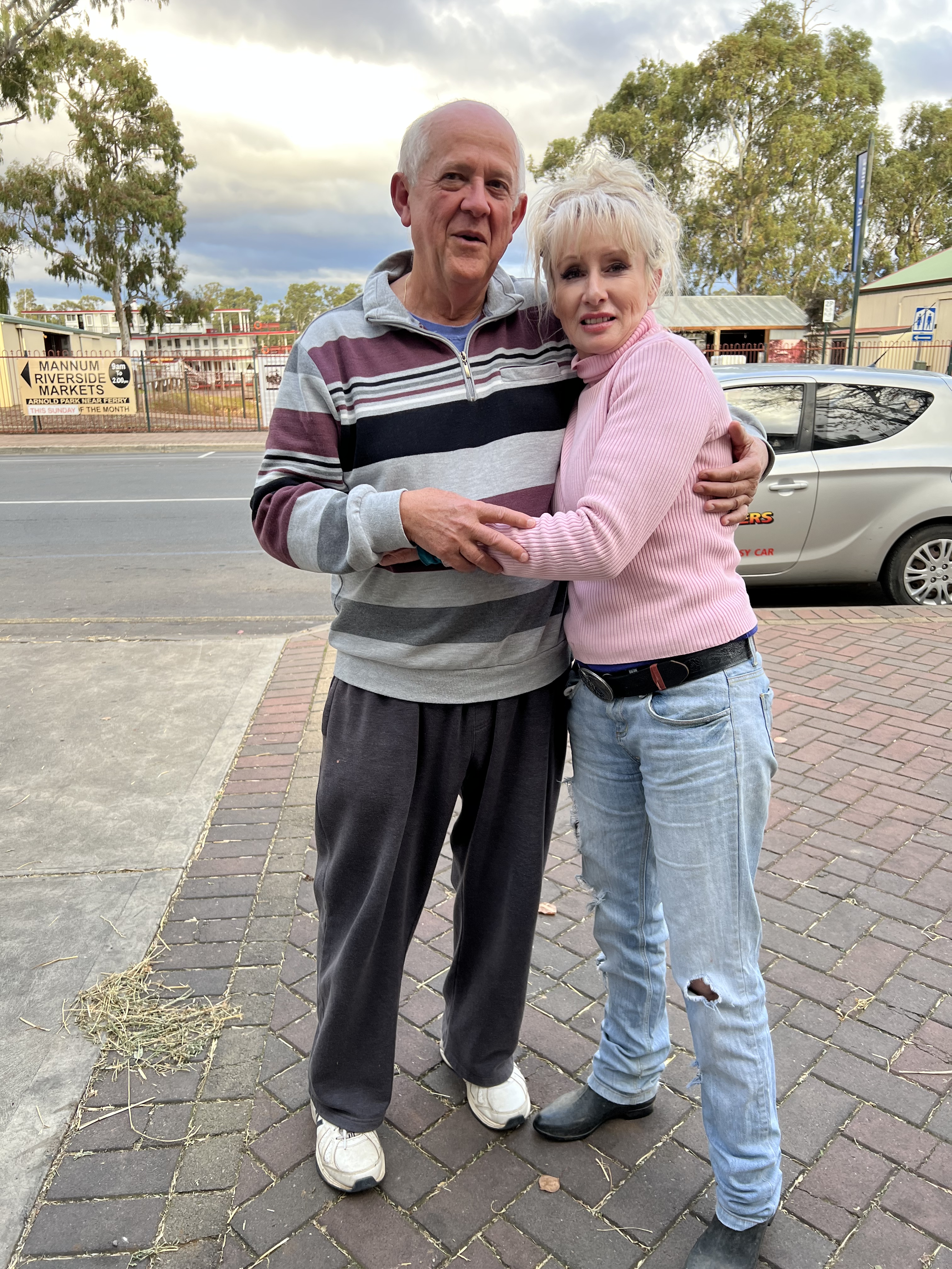
Lo and behold Dolly Parton was in town outside the shed where farmers come and buy stuff; seeds, chemicals, fertilzers, tools etc. She wasn’t singing but rather having an animated discussion with an old bloke, so Allthgo thought he would calm things down a bit and get a photo with the lady, by the way the old bloke was her father it seems. So it wasn’t really Dolly, just a sort of look- a- like!
PS Marion was steaming off on it’s trip up the Murray, great sight with steam and smoke from the stack as it chugged along from the morring past our camp site.
Next stop is Murray Bridge.
Big Bend
We have moved on from Waikerie and are making our way down the Elbow’s arm towards Mannum. For much of the way the road tracks close to the River giving great views of the River cliffs. These are the ones you see on TV and in magazines. The most dramatic is at Swan Reach where the Murray goes around a Big Bend, up against dramatic limestone cliffs. There is a great lookout that allows a panoramic view of the Bend. The panorama option on the camera slightly distorts the middle of the Bend but it is pretty true representation of this iconic place.
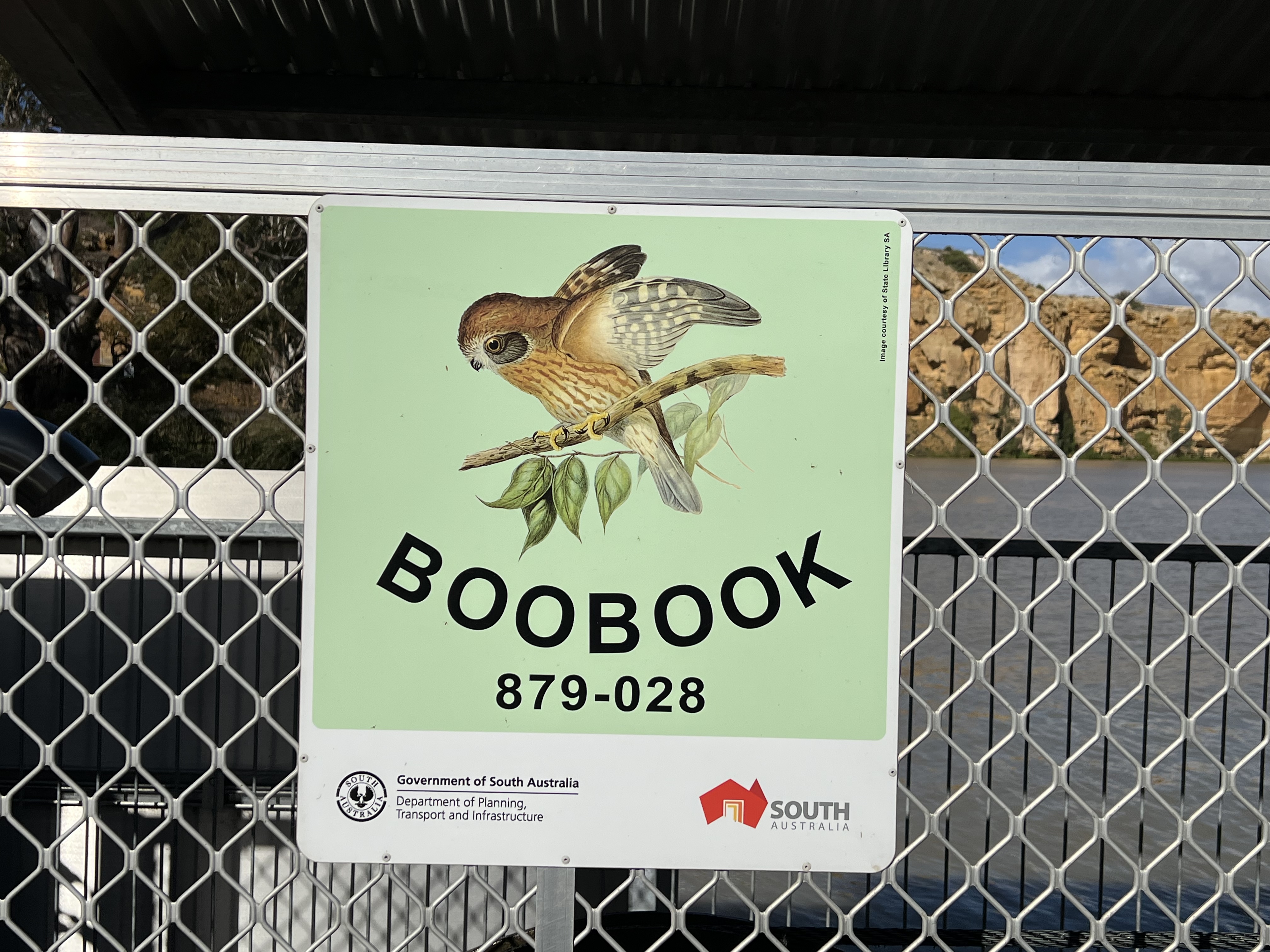
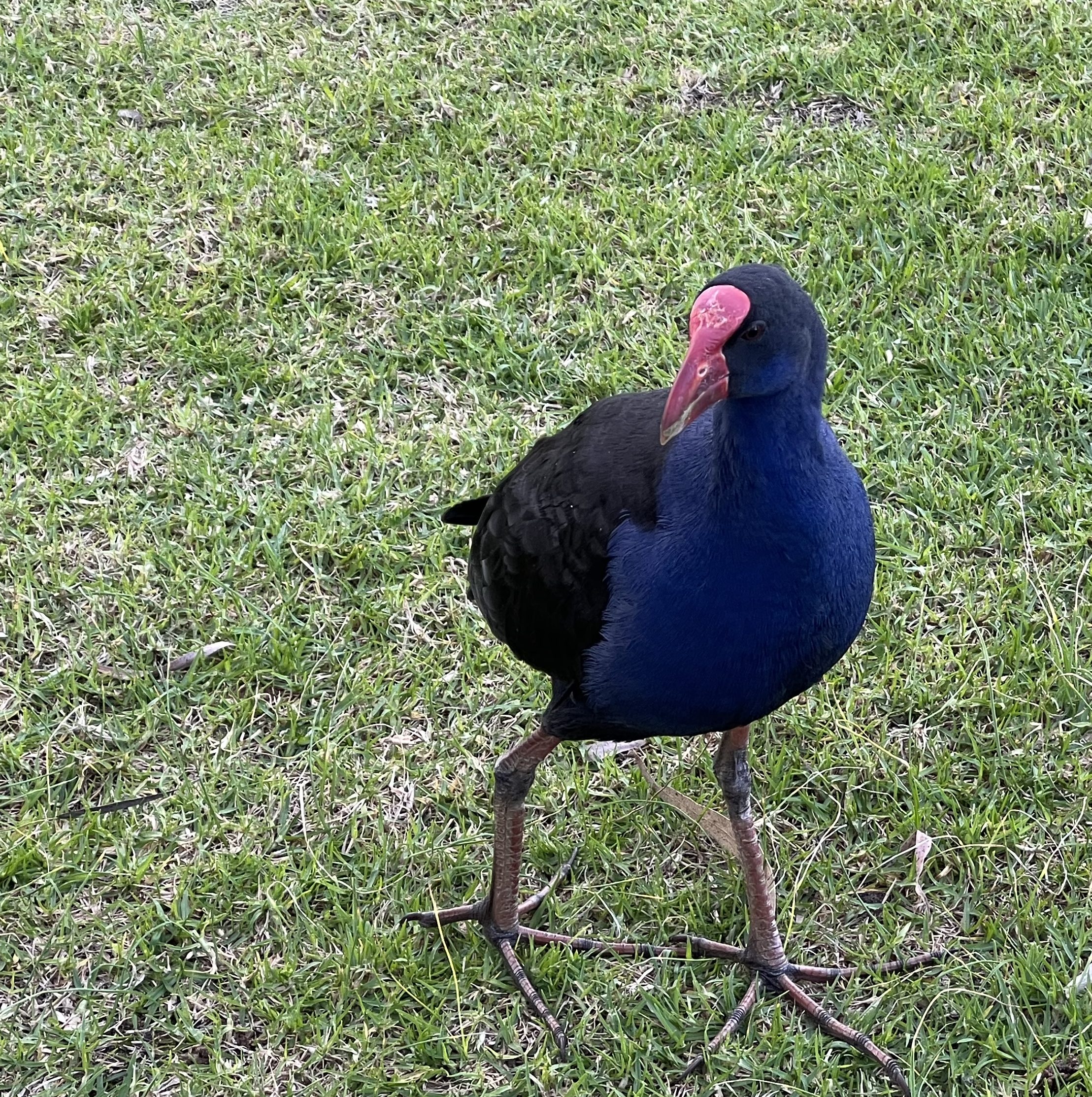
Further along we decide to have a free camp night at Walkers Flat, this was a spur of the moment decision. Walkers Flat is on the other side of the River and we cross over on the Boobook ferry with a great view of the cliffs from the ferry. After driving around a bit we settle on a spot beside the River at a boat ramp, the area is known as Swamp Hen after the wide spread and fairly common water bird.
The weather has not been that good for the last couple of days, windy with squally rain showers off and on. We do get the sun from time to time though and get big patches of blue sky to contrast with the clouds. The wind adds a chill factor as well, it gets down to 5 or 6 degrees overnight. Chilly in the van for us Queenslanders. Wind and threat of rain discourages a fire, so we huddle in the van rugged up. Our heating doesn’t work without mains power.
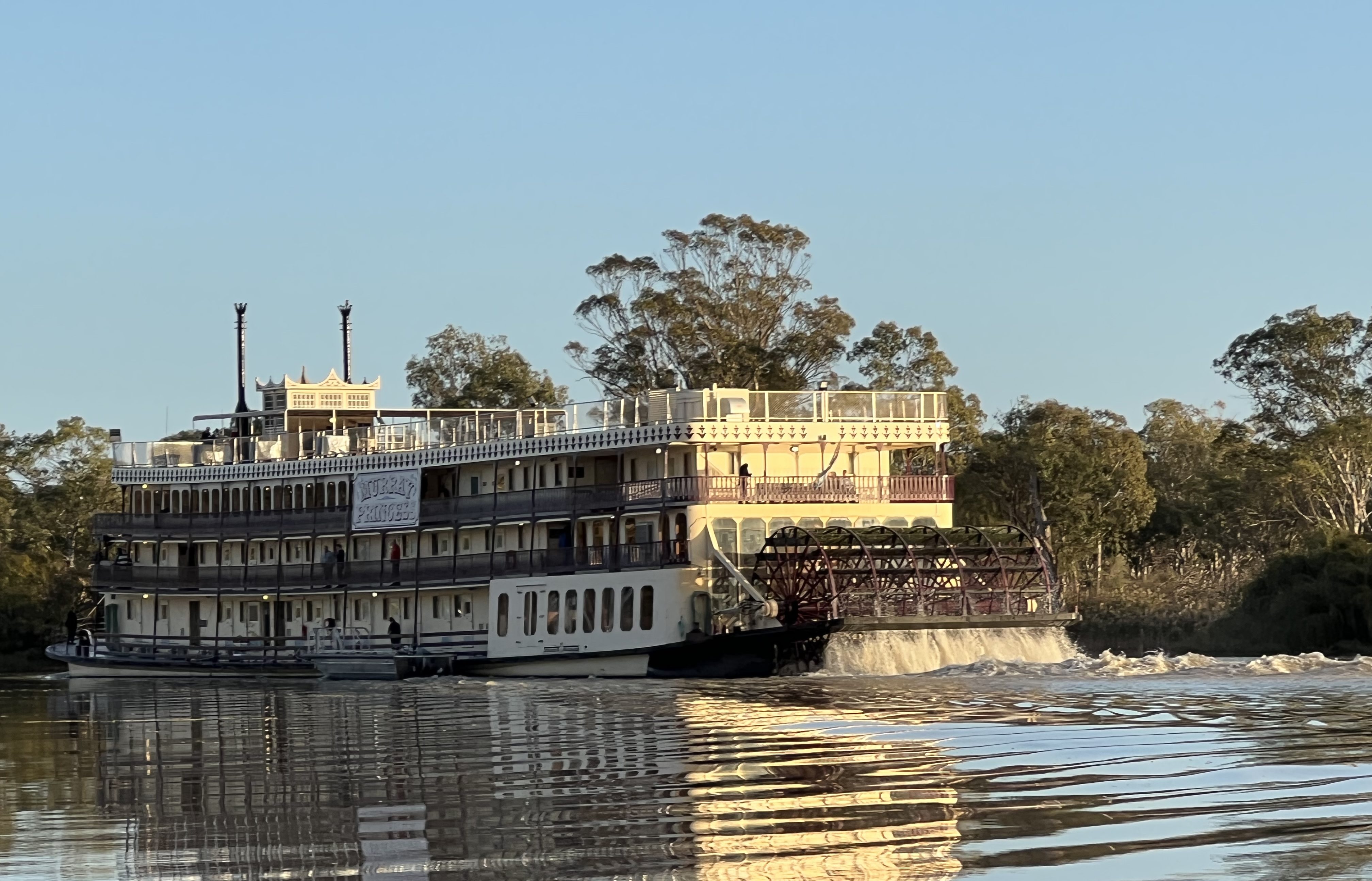
But we survive and are awakened by horn blasts as the Murray Princess paddles past. Allthego braves the early morning air and charges out for a photo. The things one does for a photo. The Murray Princess is the biggest paddle wheeler on the Murray and does cruises for several days and nights from Goolwa up as far as Banrock Station and back. It is also different to other paddle wheelers on the Murray because of the rear paddles, the other boats we have seen have paddles on each side. Side paddlers are more manouverable as one side can be set to go forwards and the other side backwards aiding turning in the confined spaces on the River. A great way to see the River! Maybe one day!
Later in the morning we head back across the River on the Boobook and up the quite steep road to the top of the cliffs and set off on the short 32 km drive down to Mannum for our next stopover, passing by another great view down the cliff line and across the River to expansive billabongs and farmlands.
Around the Elbow
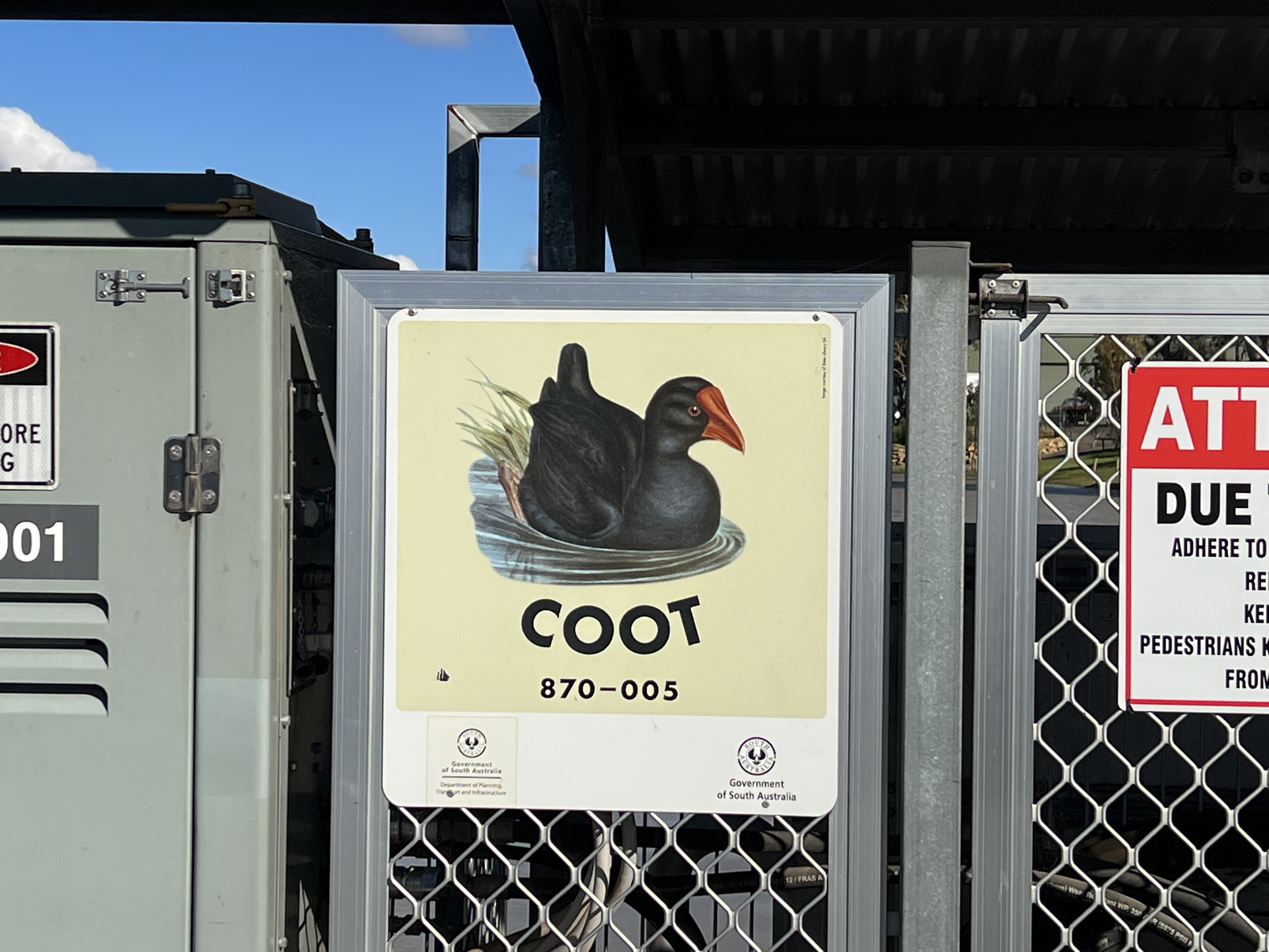
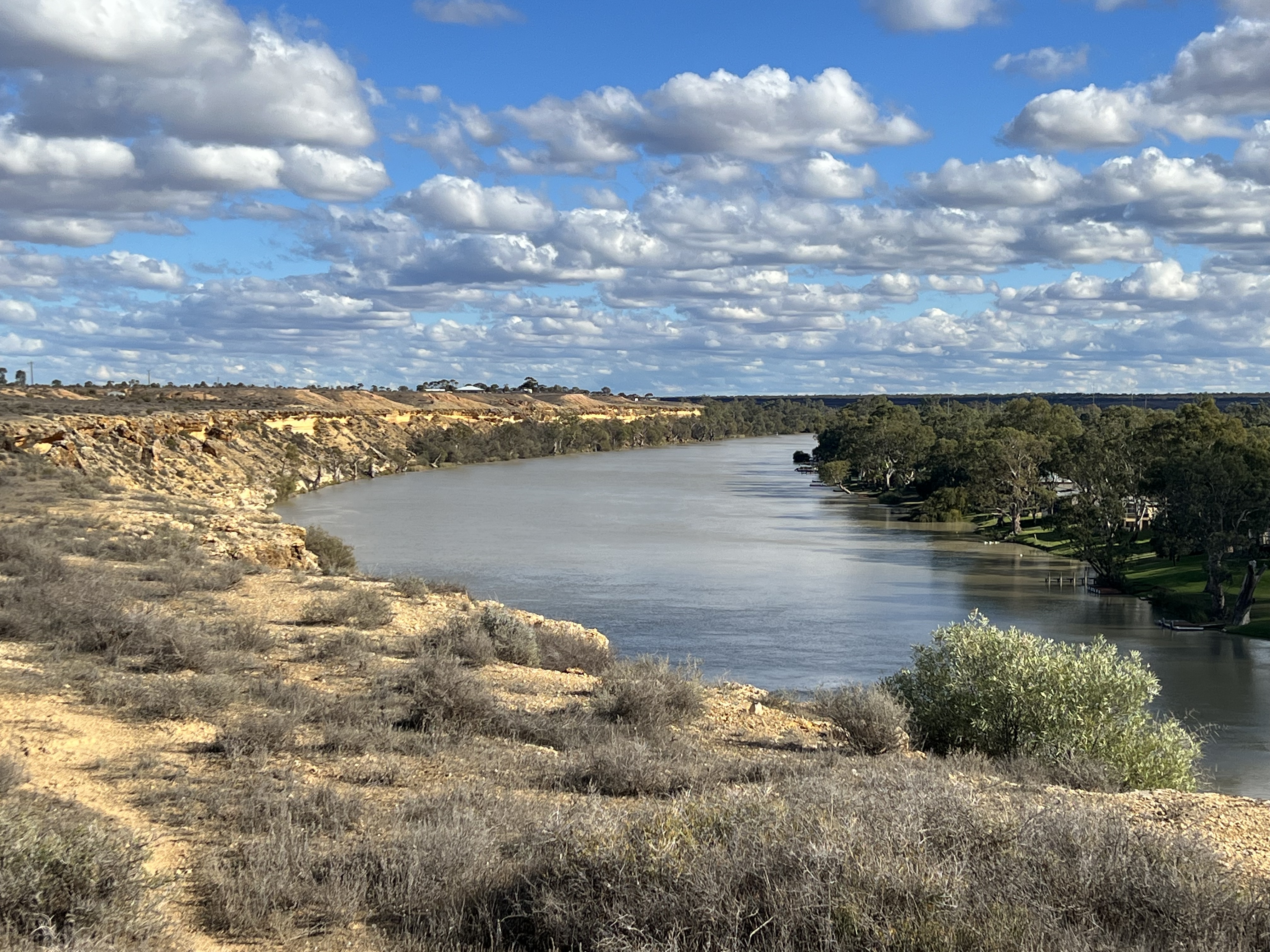
We have been off on a day trip from Waikerie further along the River to Morgan, looping down to Blanchtown and then completing the loop back to Waikerie. Morgan is on the other side of the River and we make our first ferry crossing of the journey on the ‘Coot’. There are twelve ferry crossings on the River in South Australia and each is named after a river bird. This old port town is where the River turns its back on heading further to the west and instead does an elbow turn almost directly south, it is another 315 km down river to the mouth at Goolwa.

In the late 1870s Morgan was one of the busiest ports on the River. A large wharf had been built and the train line from Adelaide terminated nearby. It handled much of the freight from and to the regions east along the Murray and also up the Darling River. Wool was the most important. Six trains a day left Morgan for Port Adelaide. As road transport improved in the mid 1900s river and rail transport declined and the railway to Morgan finally closed in 1969.
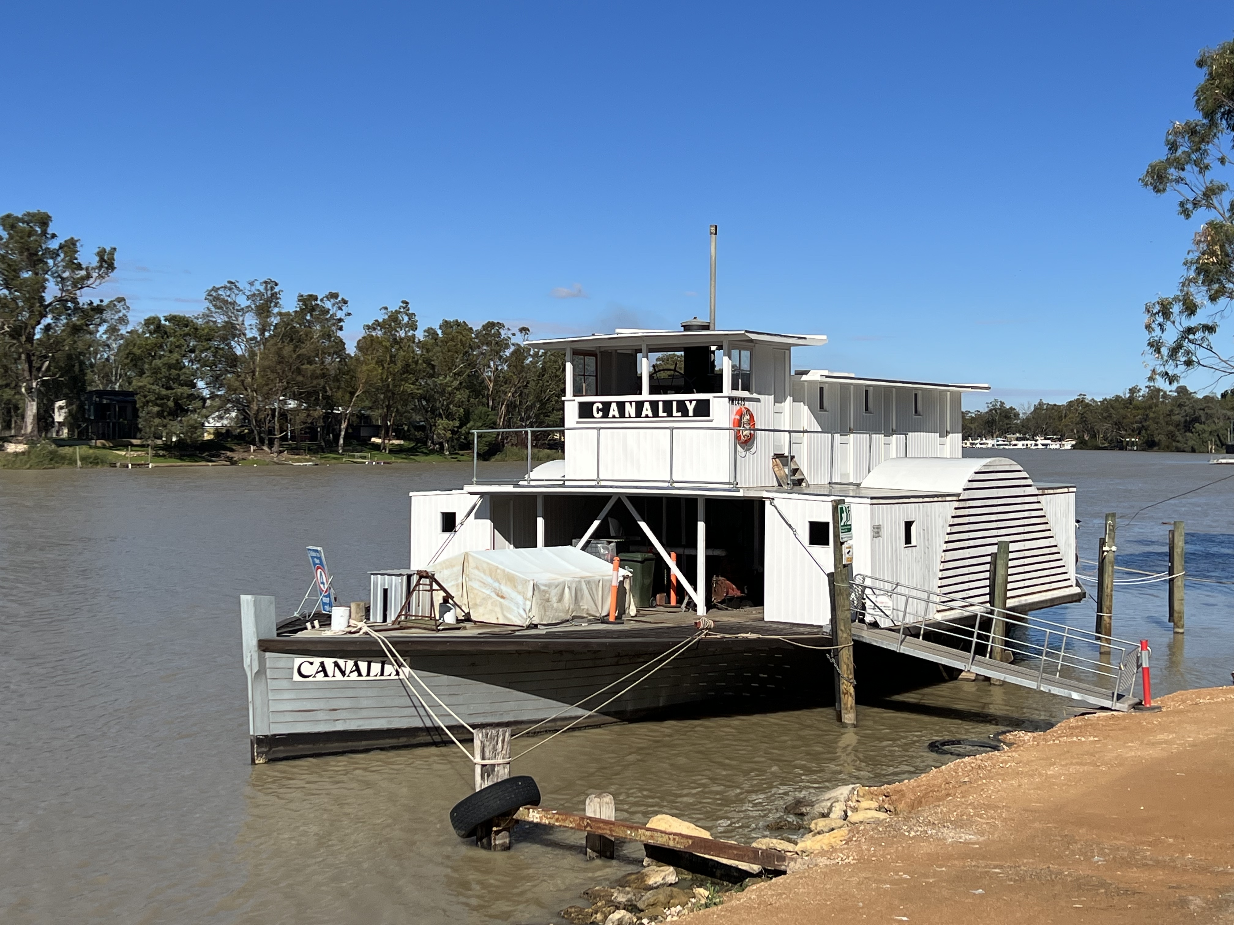
PS Canally is the local paddle wheeler attraction. It is tied up near the wharf having undergone restoration over the last three or four years. Originally built in 1907 it has had a working history for over 50 years all along the Murray and up the Murrumbidgee River carrying wool and dried fruits. PS Canally acted as a work boat during the construction of the weirs and locks and then as a barge carrying firewood for the railways in the 1940s and 50s. It sank on its moorings at Boundary Bend in the late 1950s, where we were a couple of weeks or so back. There it lay until 1998 when it was raised more or less as a hulk. Twenty five years on and through a couple of owners it is now based at Morgan. Owned by the Council it has been rebuilt to its former identity and glory, some work still needs to be done to get it steaming again and a crew is currently undergoing training. Quite a history and one similar to many of the restored paddle boats on the River. Hopefully, back in action soon!

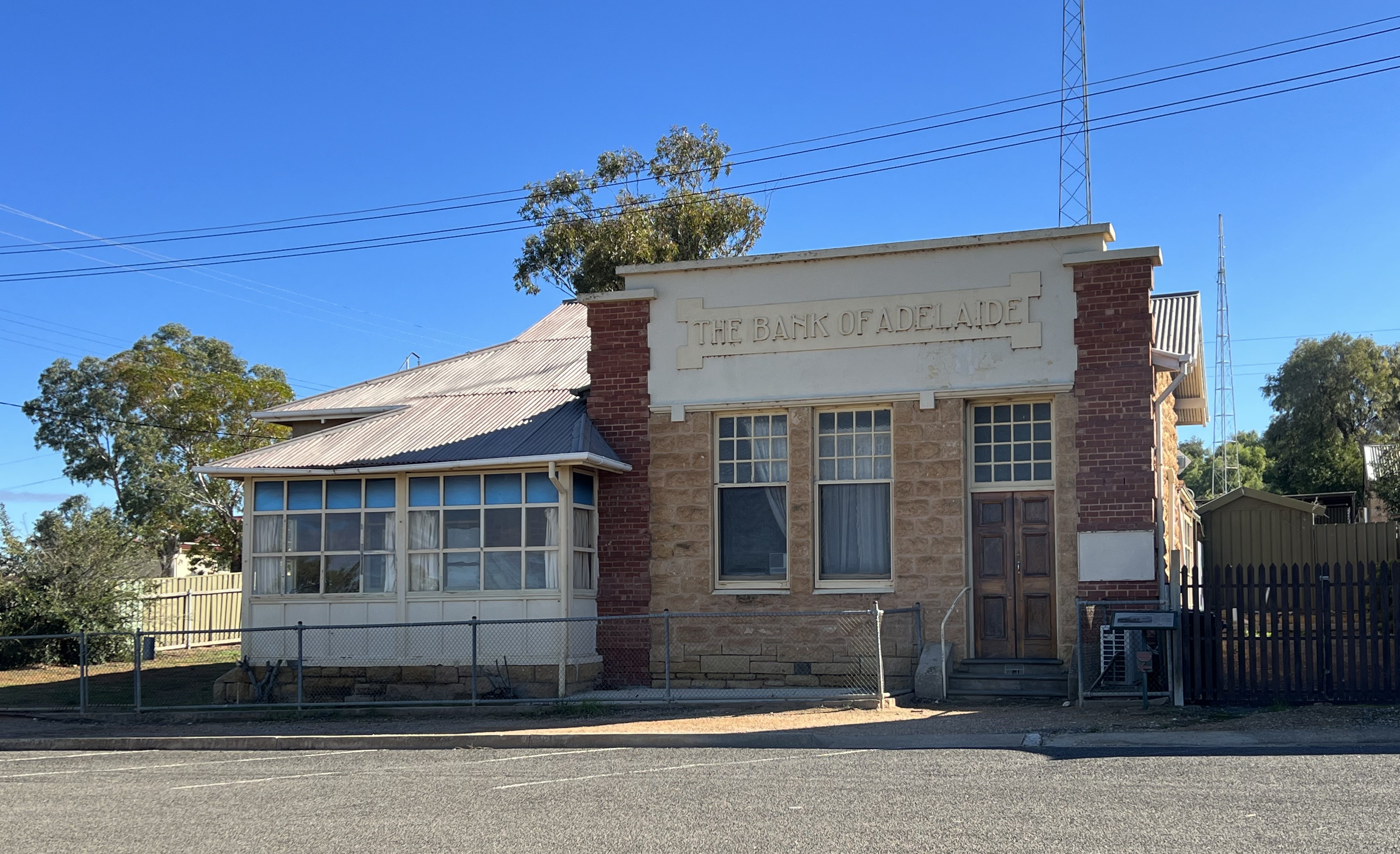
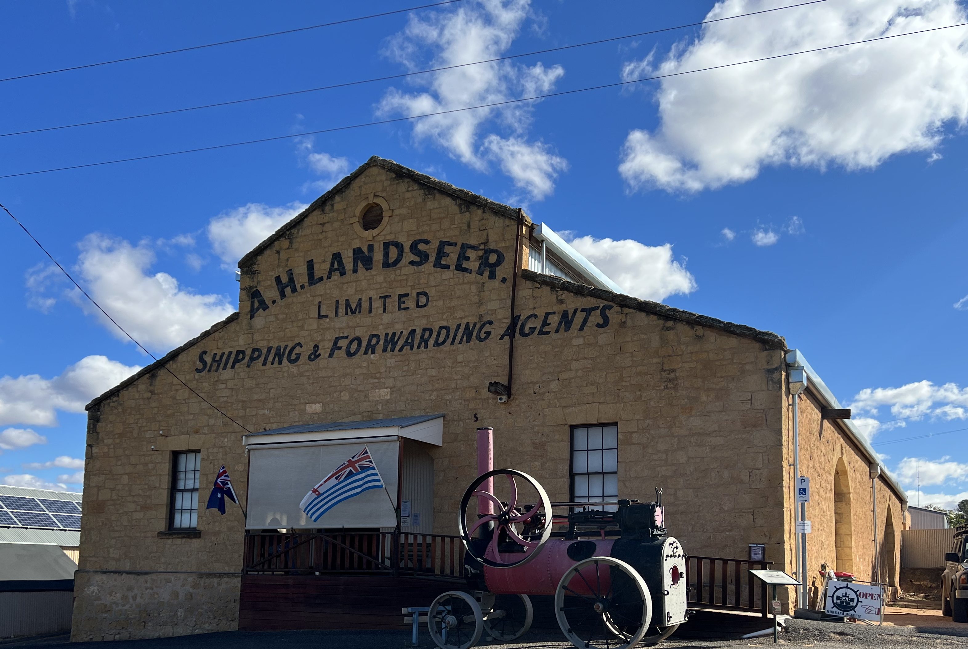
A number of historical buildings remain in the town, including two hotels and the long closed Bank of Adelaide branch and manager’s house. A Museum is housed in the 1878 Landseer building, a local shipping agency back then. The town is now a service centre for the orchards and other agricultural pursuits of the region as well as a tourist mecca. Along the river bank numerous houseboats are tethered, we went off on a short drive and found a hire business where a monster houseboat was under construction. MV Allthegobro would be a good name for it, we think these cater for up to eight people in four ensuited bedrooms and all the other deck space, eating areas etc. Many have hot tubs to sit back in and take in the views along the River.

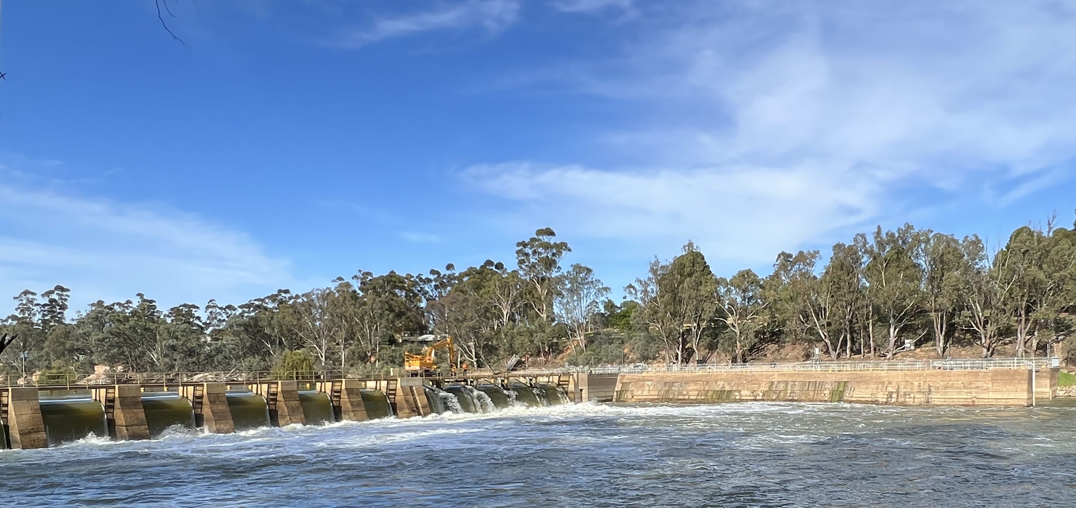
We cross back to the main road aboard the Coot and head 40 km south to Blanchtown. The road tracks along beside the River for most of the way with some great views. Blanchtown is a significant mile post on the journey down the River because it is here that Lock 1 is found, the water level is a little more than three metres above sea level, 274 km from the River mouth. Today 21 thousand mega litres of water are flowing over the weir, in order to maintain the level of the weir pond. Built in 1922 it was the first of 26 locks that were planned to be built on the Murray between Blanchtown and Albury, ultimately 13 were built.
Locks 1-11 from Blanchtown to Wentworth, Lock 15 at Euston and Lock 26 at Torrumbarry. The lock at Euston was the last one built in 1937. The Murray was naturally navigable from its mouth to Blanchtown and the locks extended this through to Mildura for a total of 970 km, the third longest navigable river in the world. Over the years the locks have been modernised with steel gates and hydraulic mechanisms, but still rely on historical principles for their operation.
Nine locks had also been planned to be built on the Murrumbidgee River, none eventuated. Something like forty locks had also been planned for the Darling River all the way up to Walgett, only one was built and that was at Burke in 1897 and it was concreted up in 1941. The great variability and seasonality of these river’s flows coupled with the decline in river trade, in the face of railways and motor transport and the Great Depression rendered them uneconomic.
Allthego has always been fascinated about the economic history of canals and locks, but enough for now!
We are back in Waikerie enjoying another River sunset!
Waikerie
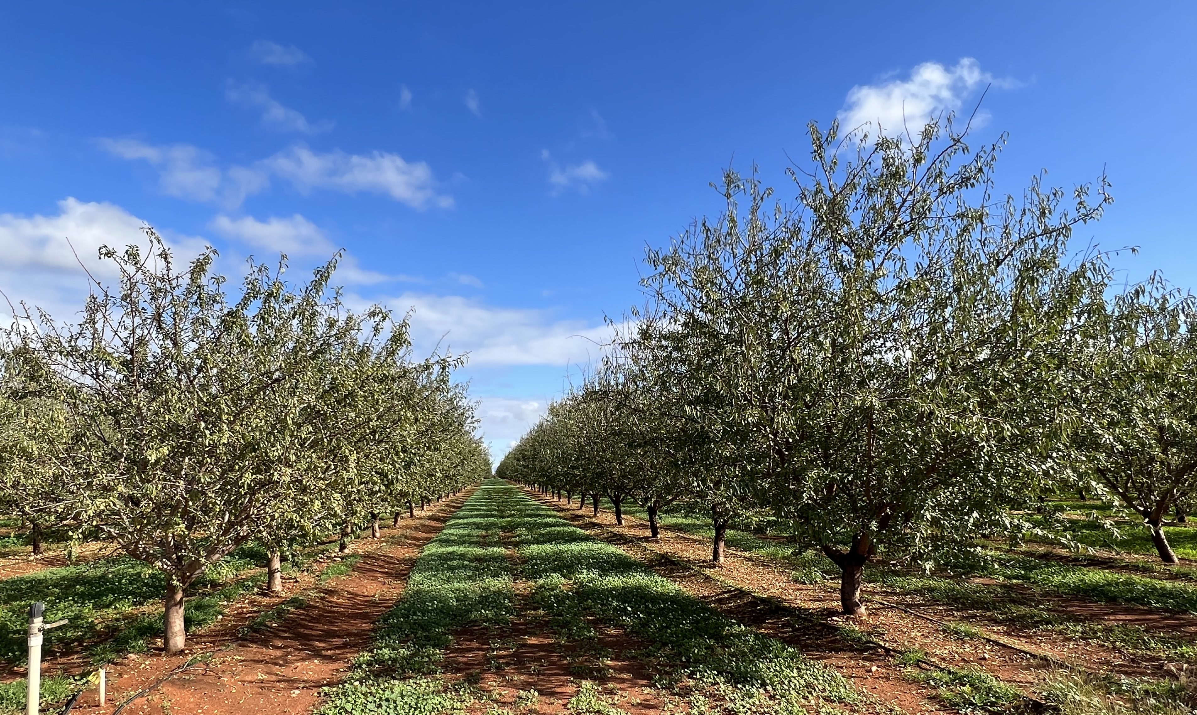
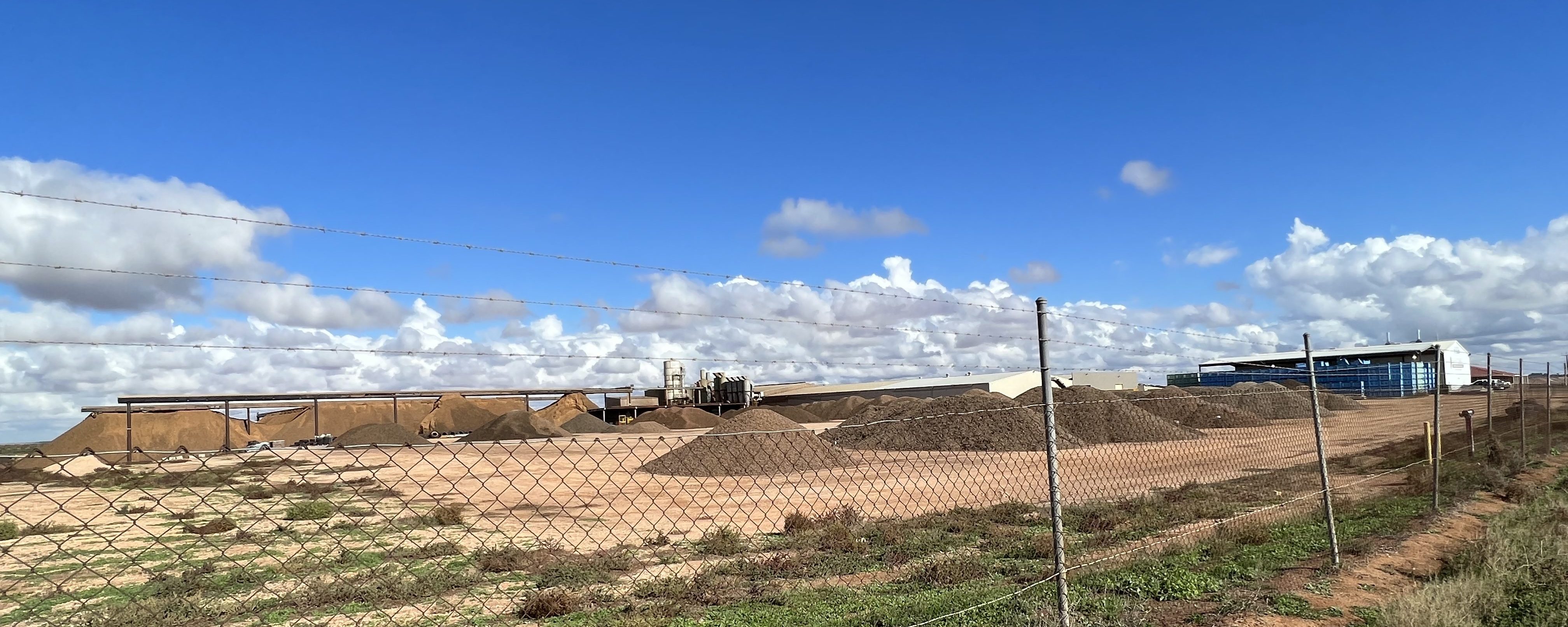
We are now at Waikerie, citrus trees in particular dominate the agricultural landscape. They look in good shape too. The trip up from Renmark has also taken us past almond plantings stretching as far as the eye can see. It is a big industry. We briefly stopped at an Almond processing plant and found large mounds of what must be millions of empty almond shells waiting to have something done with them in the surrounding yards of the plant.
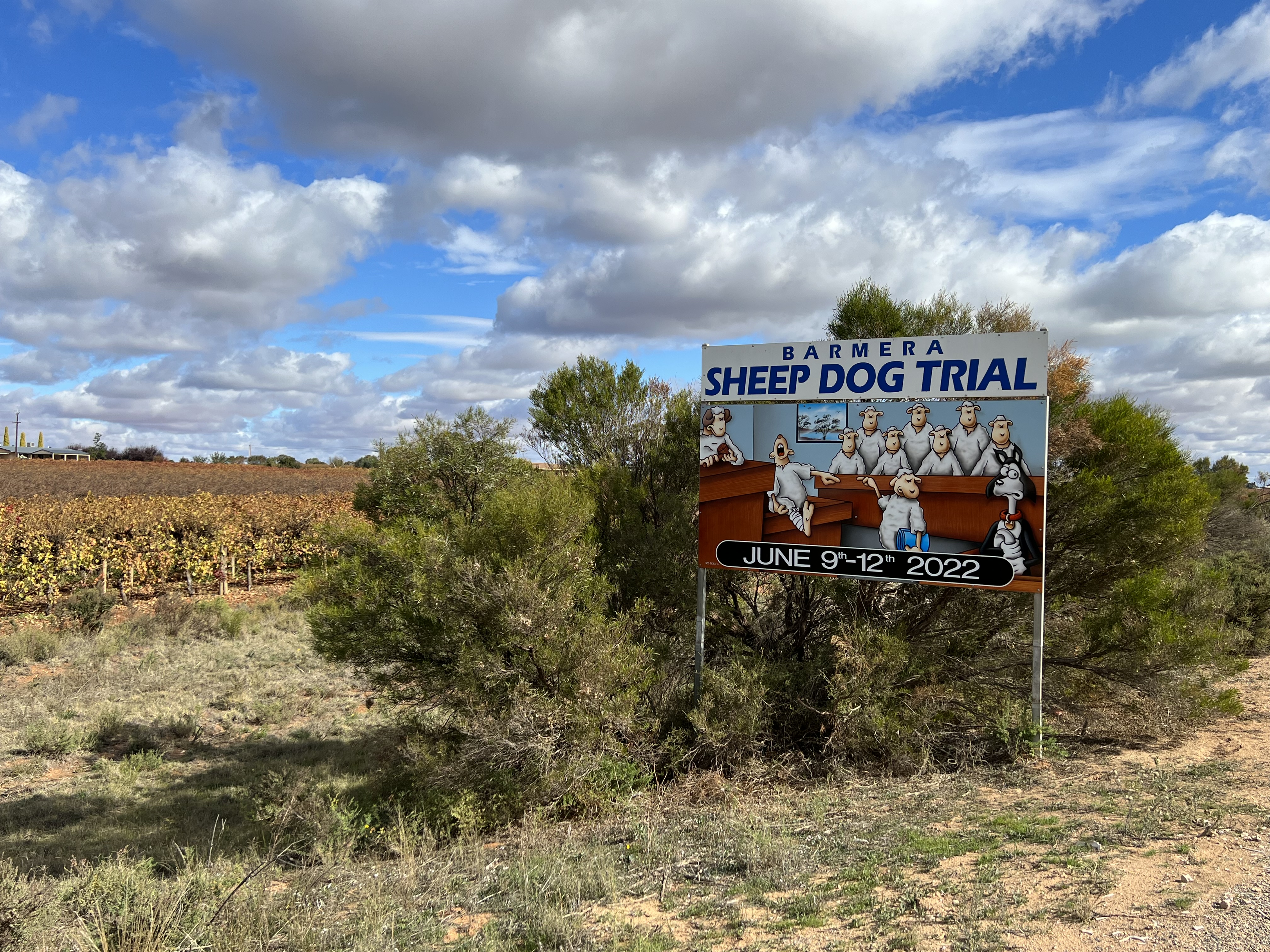
Barmera is another town along the route on the shores of Lake Bonney. Sheep are big around here and sheep dog trials are being held over the upcoming June long week end, Allthego would not like to have been defending the dogs in this court.
A little further along we turned off to have lunch at Banrock Station. Known for Riverland wines but also for the huge amount of reclaimation and recovery work done on the wetlands of this former pastoral property. Great views form the deck. This is a place worth spending more time at to look around and appreciate the diversity of the landscape and wildlife returning to the habitats.

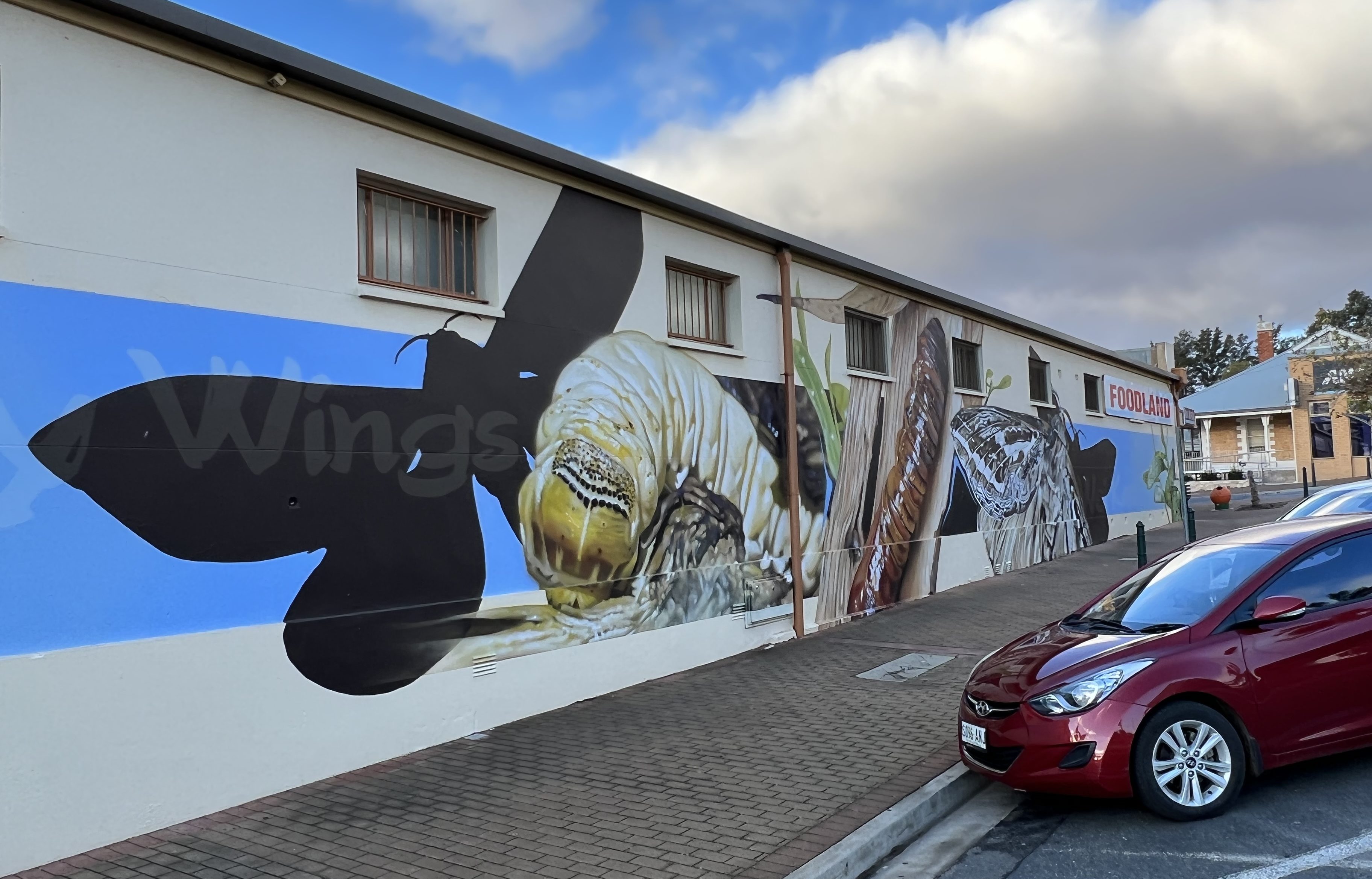
‘Waikerie’ is derived from the indigenous word for the Rain Moth, an insect prevalent in these parts it seems. A mural on the local Foodland store depicts the life cycle of the moth. Allthego gets a bit frustrated with these murals that are at street level and surrounded by cars, rubbish bins and various signs! Homealone though says that this is what it is all about ‘street art’, put up with the distractions and appreciate the art! How true and a wise comment!
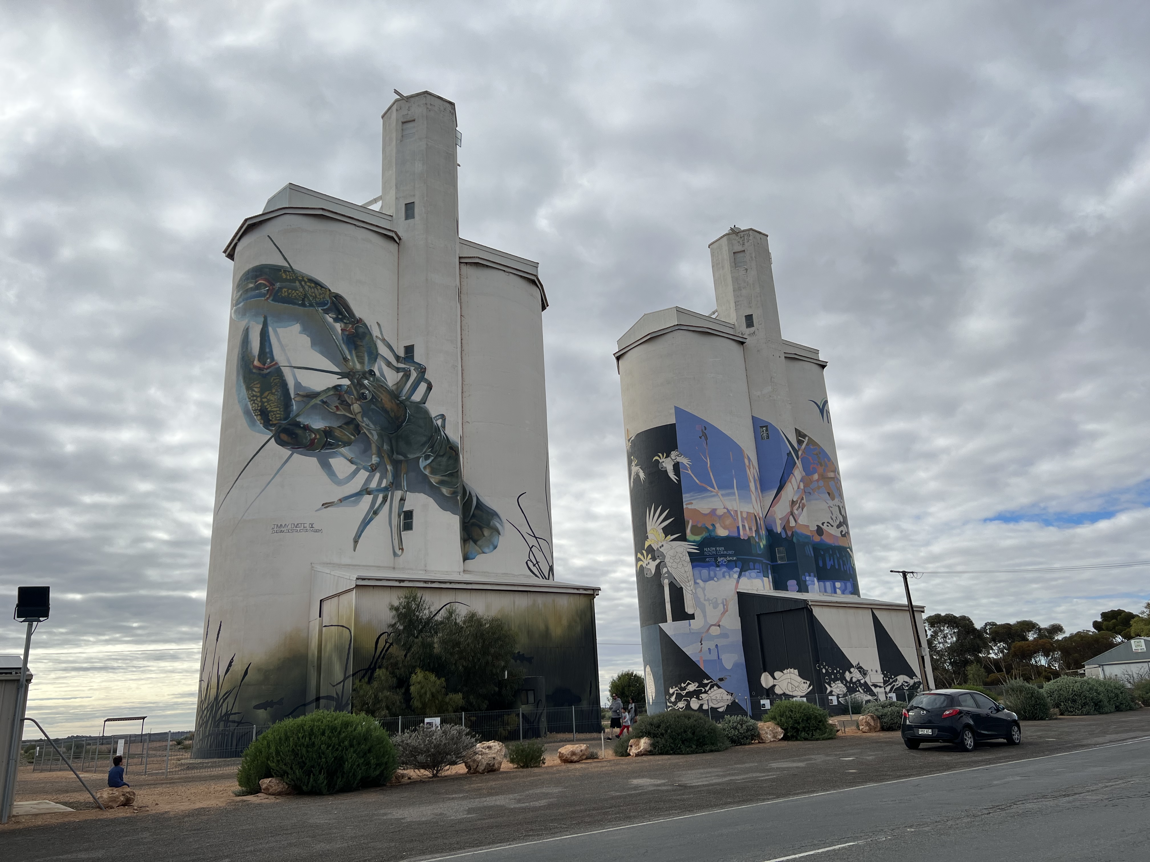
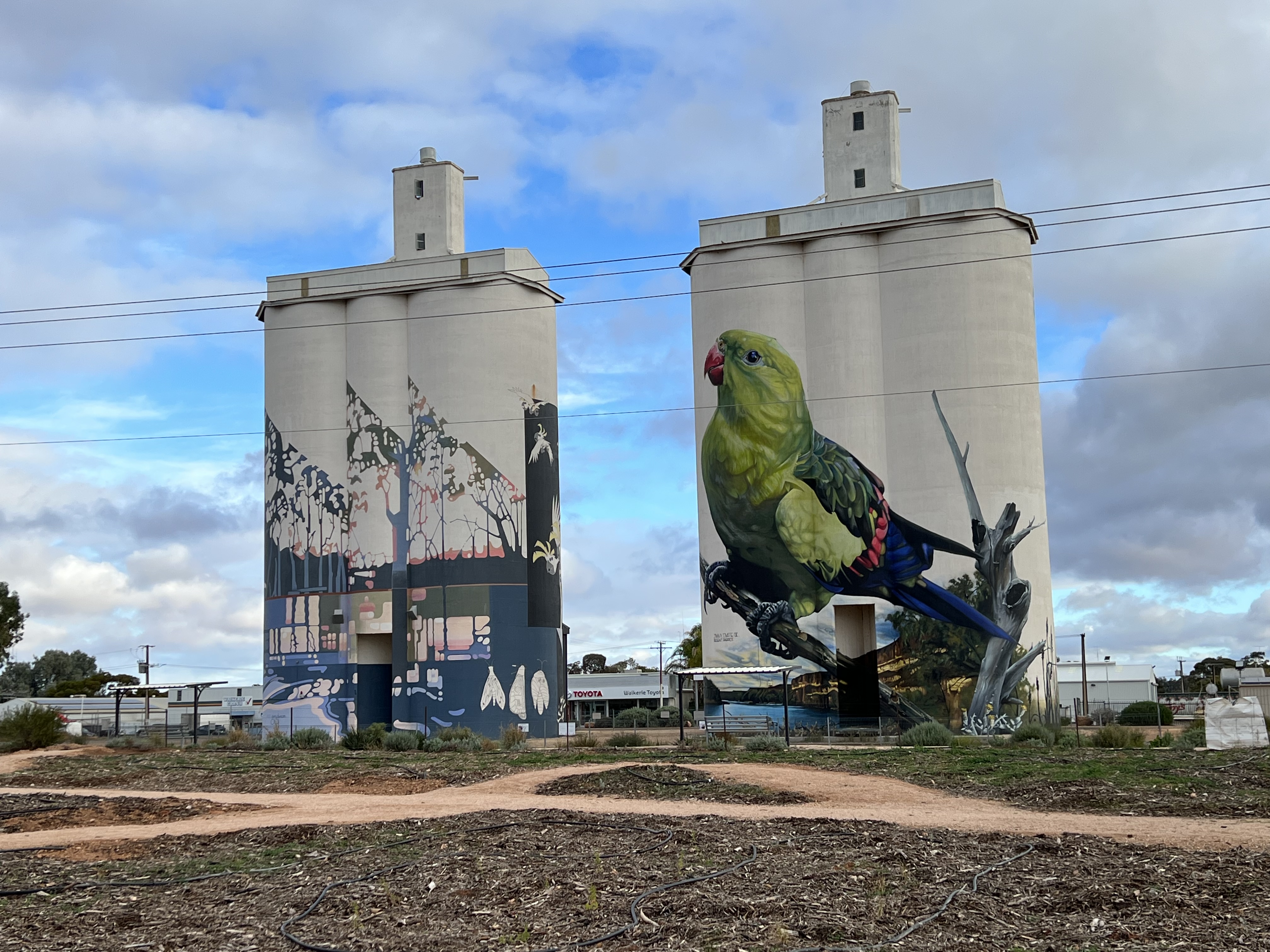
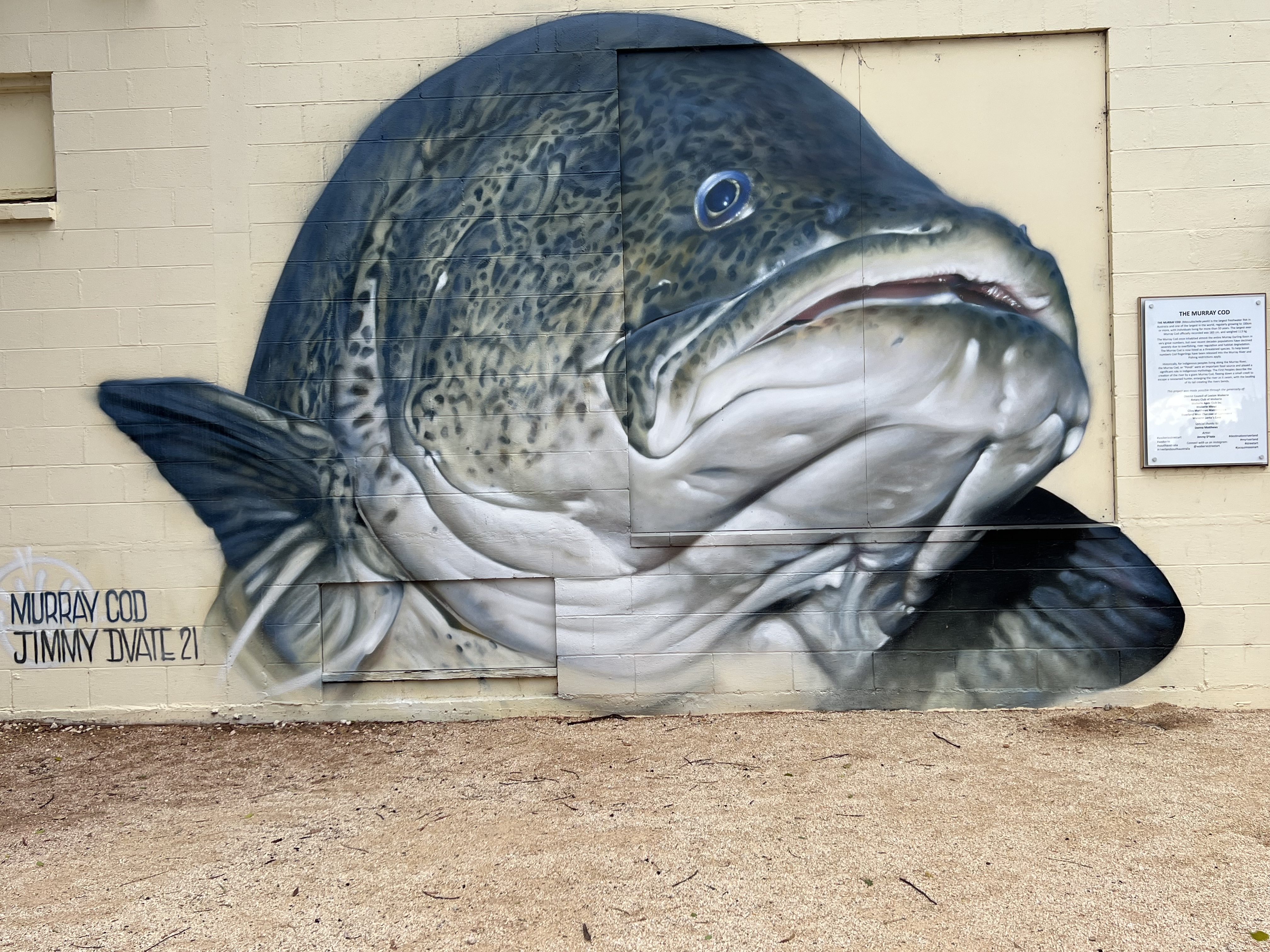
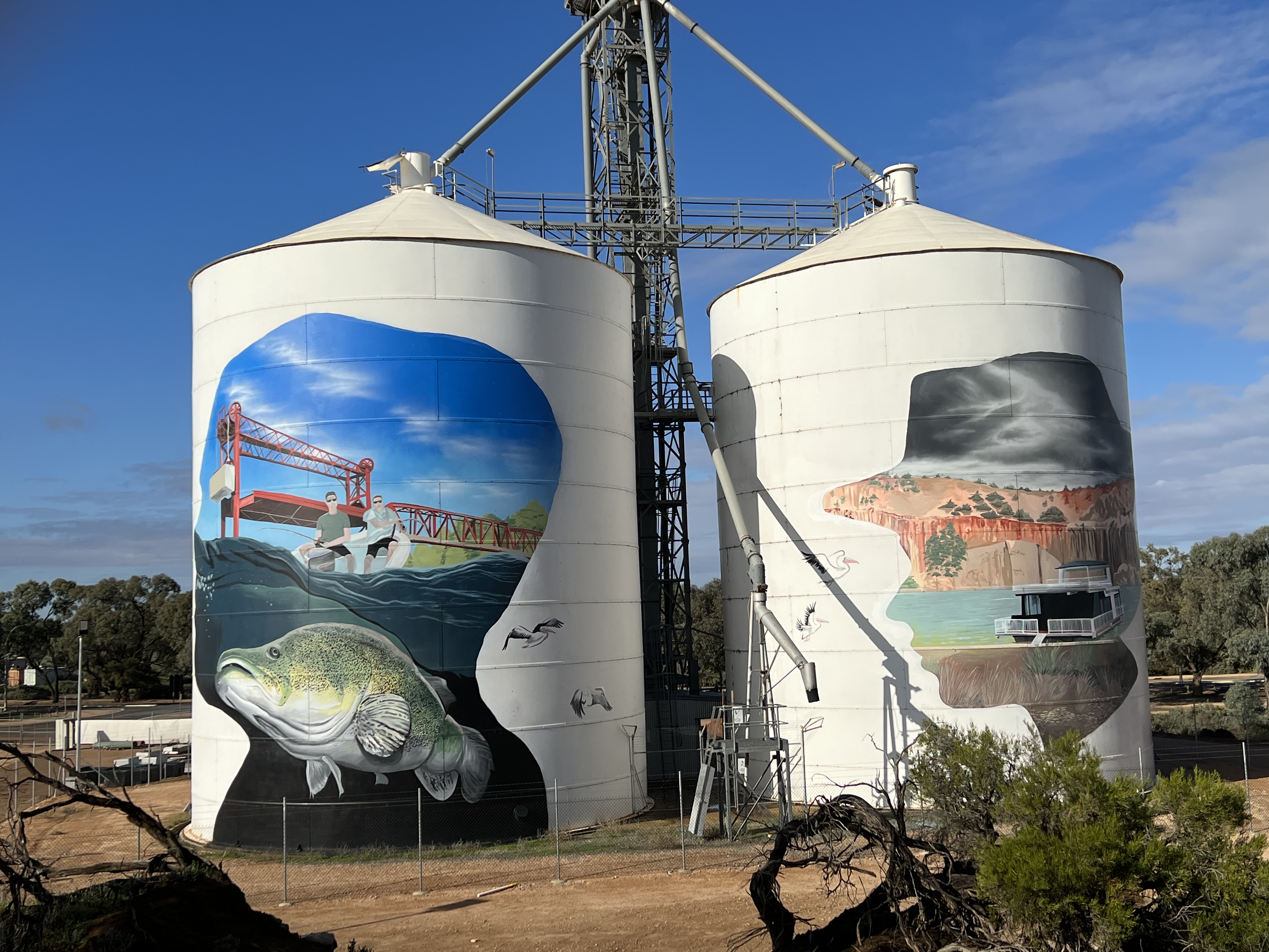
Waikerie is very much focussed on citrus, silo art works and the Murray Cod, as well as the Murray Crayfish. Some very good silo and street art are the town’s main attractions. The Murray also winds its way through the town with cliffs on one side and flood plain on the other, littered with billabongs and creeks.
The Big 4 Caravan park we are in is a little disappointing, no river view for vans. These are reserved for the huts that are lined up in rows and seemingly destined to take over the park. This is an ongoing trend in Big 4 and other corporately run van park groups, some of them are taking on the appearance of close settlements (being gentle here, gulags might be a rougher term). Wouldn’t stay here again.

The weather has turned a little on us, some sporadic rain and it is chilly to say the least. But the sun comes out amongst the clouds and we head off on a loop day trip to Morgan, where the River takes an abrupt turn south after heading north west for some time, and then down to Blanchtown and back to Waikerie. More about this trek next time.
Off to Renmark
We are now off to Renmark up the Sturt Highway 138 km, the River in not in sight on this stretch, and across the border in South Australia. We pick up half an hour too! The road is a contrast, long stretches of fallow lands being prepared for the winter grain crops. Just goes on forever. The ploughed paddocks are a deep orange colour, some turning green with what we are not sure. We are staying in the Riverbend Campground which is just over the Paringa Bridge, the only remaining bridge in Australia with an operating central lift of the roadway to let boats through. This happens daily at 9.30am and 2.30 pm, if there are any boats waiting. In the two days we were there it didn’t lift, maybe on the return trip east it will happen!
Renmark is close to Berri and Loxton and we went off on a day trip on this triangular route, along the way we stopped into the Riverland Wine Centre. This establishment is a front for a number of small Riverland Vineyards, although the ‘Centre’ seems to be operated by a private mob who buy the wines in and then flog them off to visitors. Allthego cottoned onto to this because they charged for a tasting paddle but didn’t give a credit if you bought something, the normal practice at cellar doors. An interesting place though that has a pizza oven for tasters to linger longer over. Which we didn’t but maybe will when we return along this way!
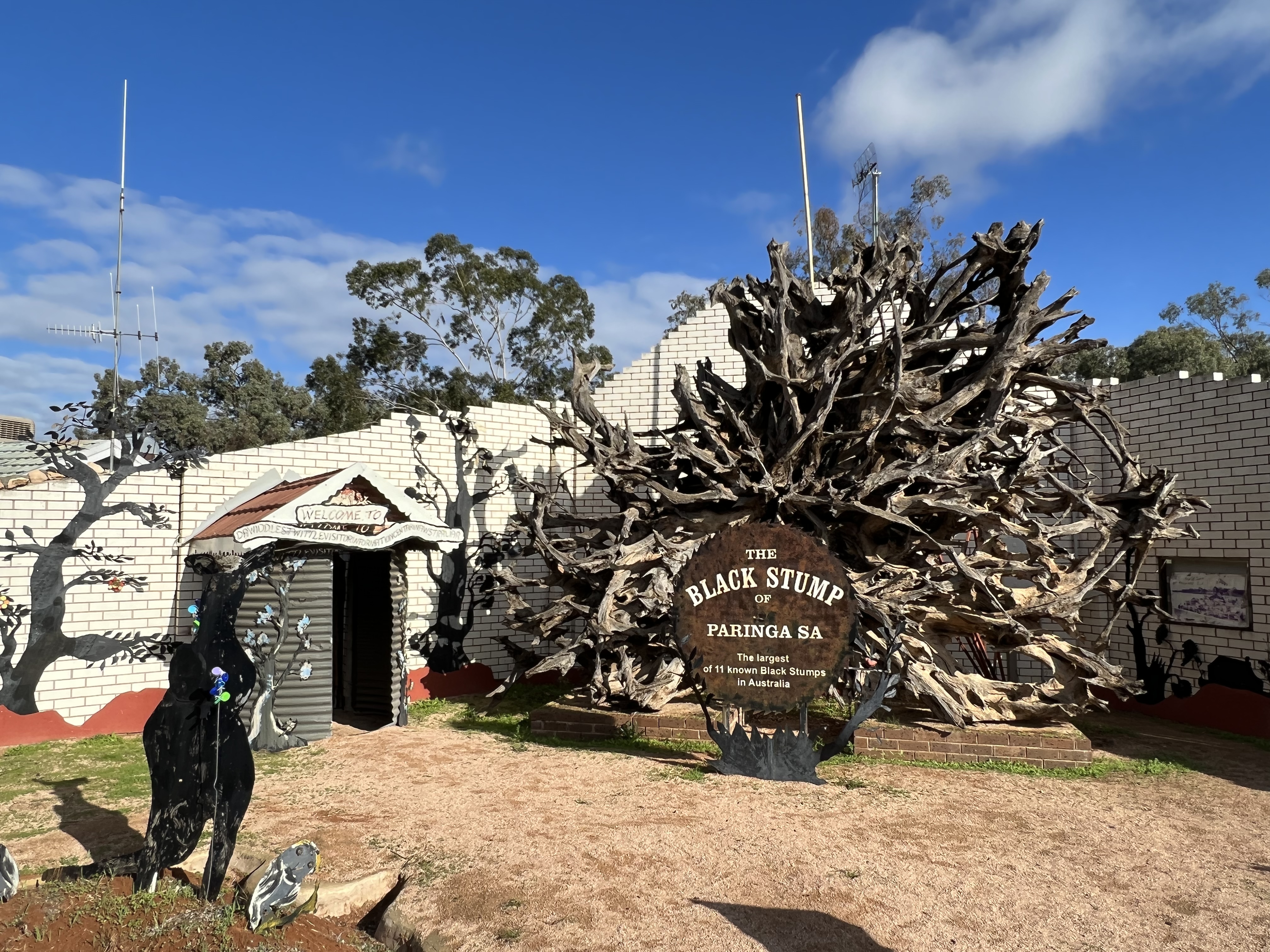
Earier we called into Lock 5 at Paringa. The locks are all looking the same but the nearby Black Stump didn’t. Apparantly, our biggest of eleven black stumps around the country. It was big. In front of a house that had some metal cut out Murray Cod replicas for sale. Allthego couldn’t resist one of these craftwork icons and picked a good one up for a bargain price. The marble eye is a bit wobbly but can be fixed later. Will look good down by the pool at Bedwell Place.
Near the Black Stump is the Silo Artwork on the town’s disused grain silo complex. Looks tremendous, particularly the Murray Cod. These Murray Cod are just getting to Allthego and Homealone. Cod everywhere and big Cod too! An example of old infrastructure providing a town with marketing opportunities.
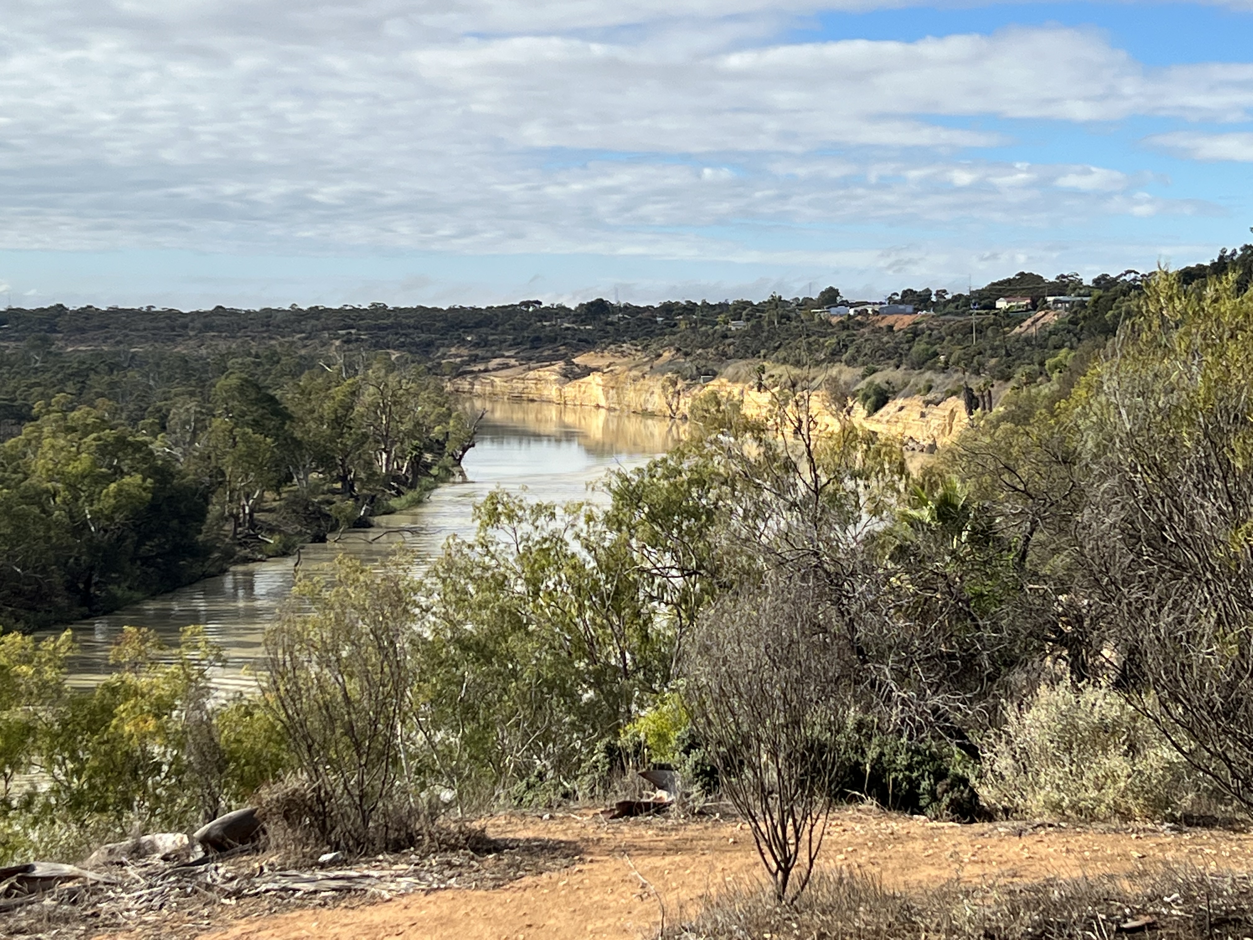
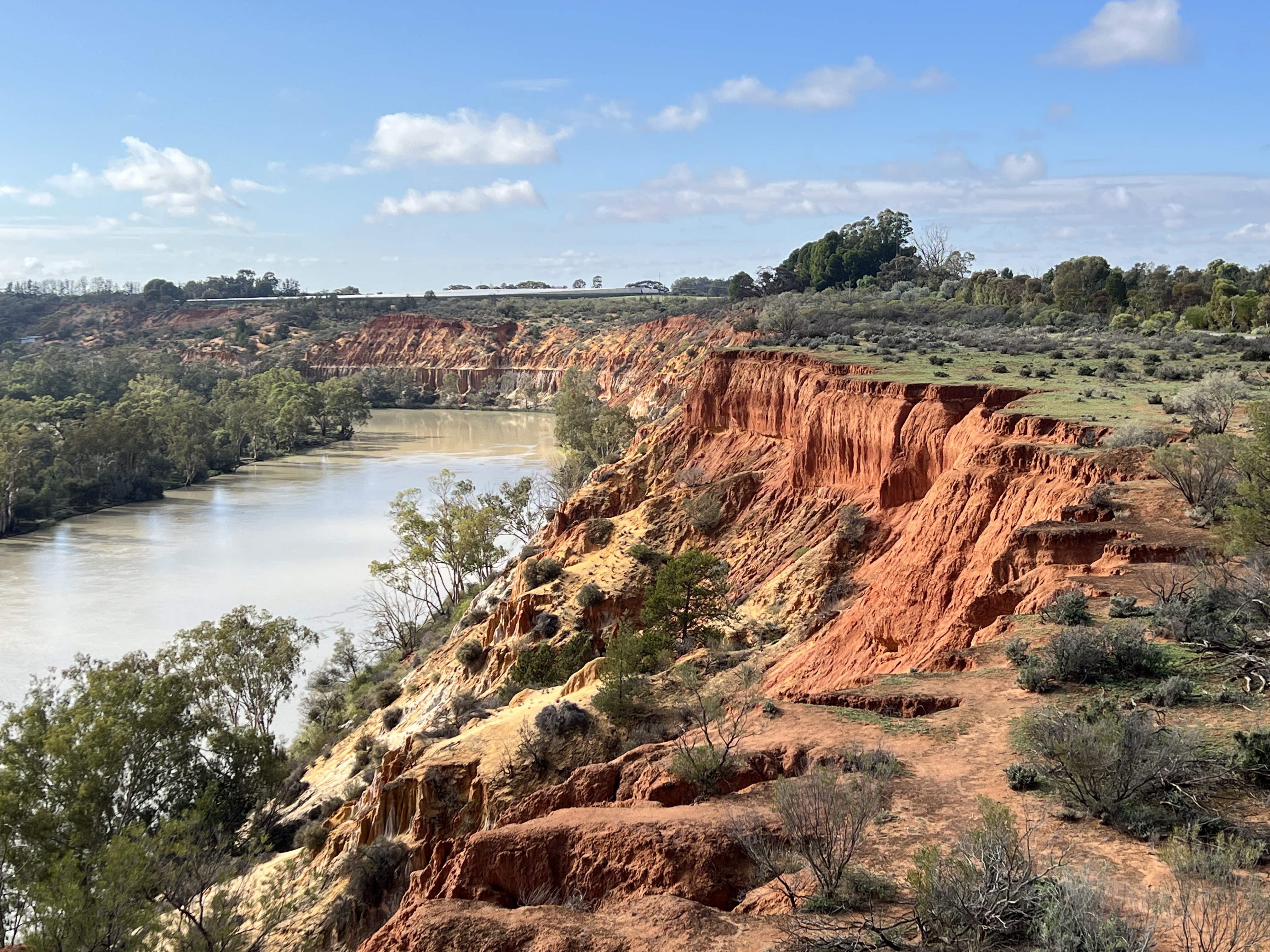
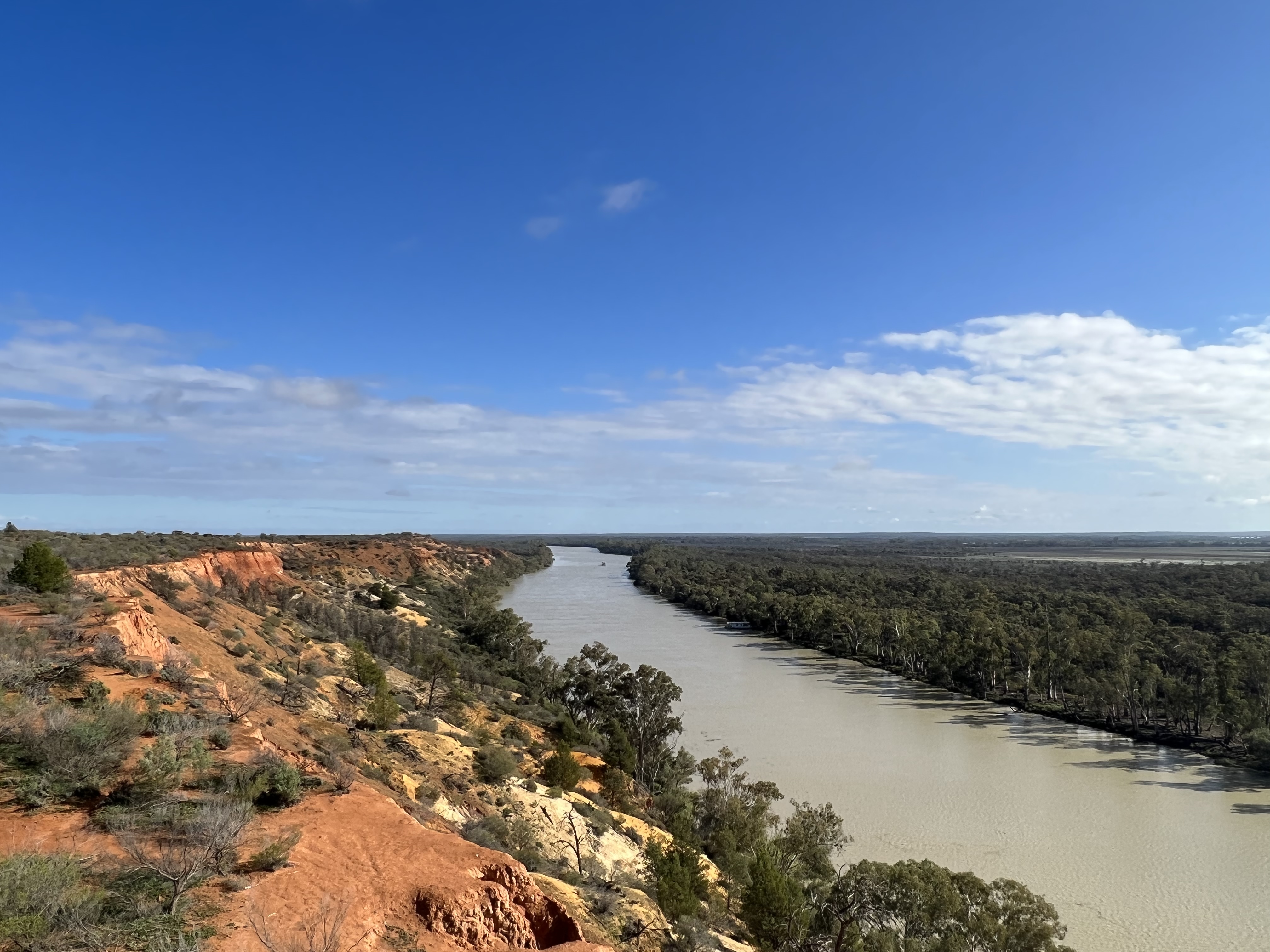
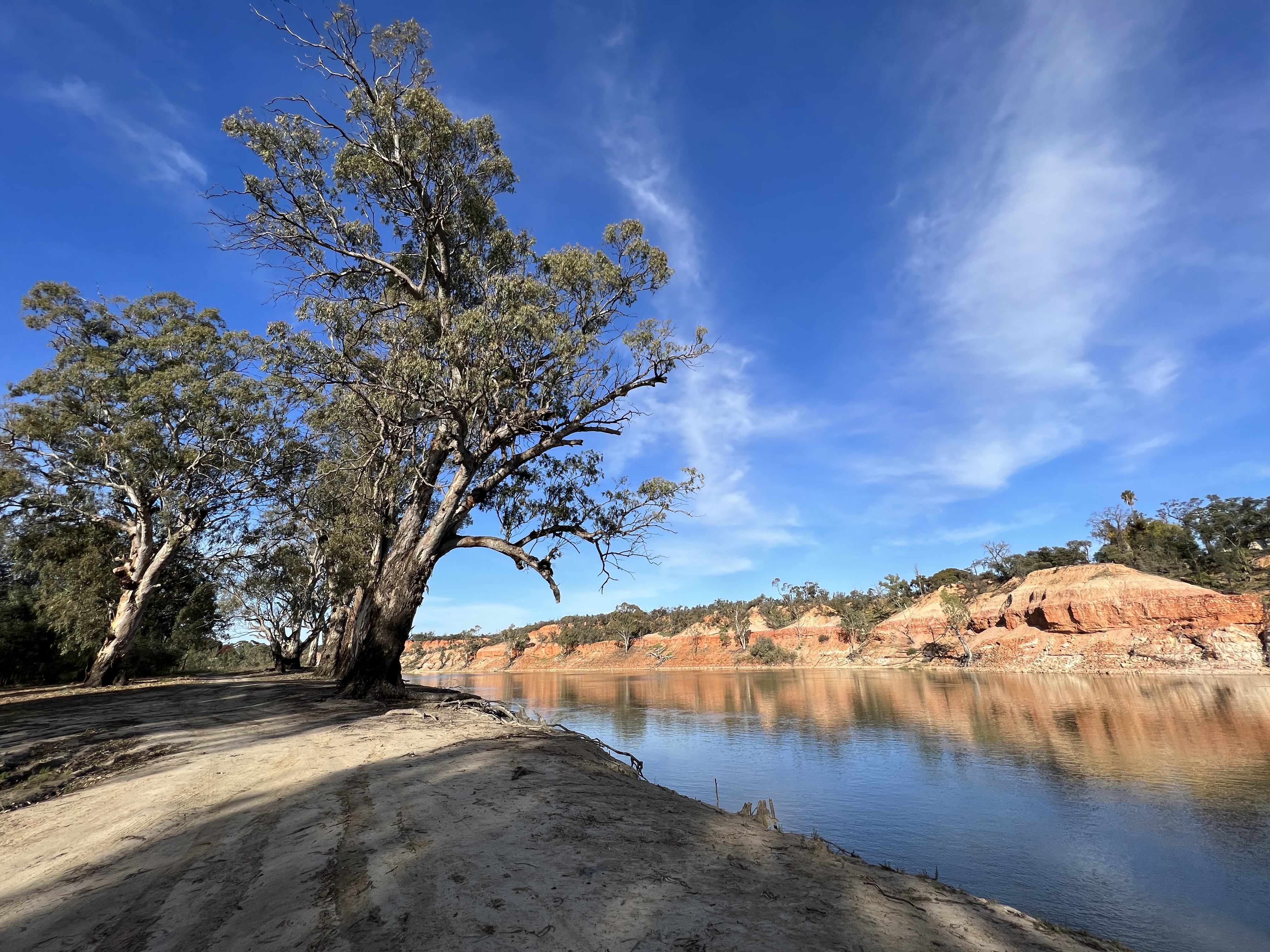
Further out of town the Headcliffs Cliff lookout provides some spectacular views of the Murray as it cuts into its limestone cliff faces.
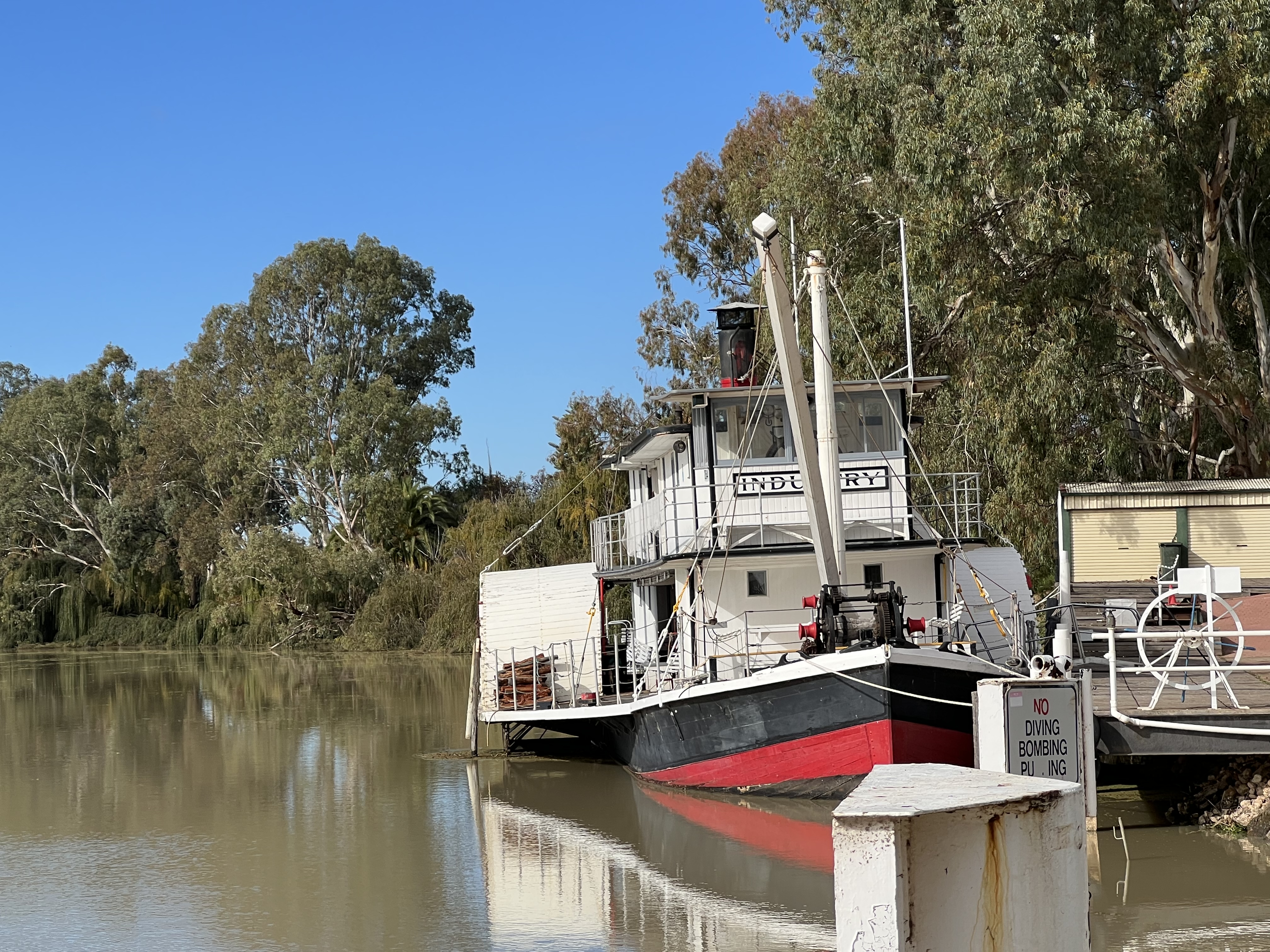
All the river towns have had their restored paddle steamers, albeit paddle vessels. Renmark is no different, it actually has a restored working paddle steamer, a PS! The PS Industry commissioned in 1911. It goes out for a run every couple of weeks or or so and we have missed it on this trip. Maybe next time on our way back east!
Renmark is also a ‘Greek’ town, Mildura was the ‘Italian town’. Or so it seems, there are some Greek places here and not as many pizza joints. We had lunch out at Mallee Estates Vineyard, where Eleni’s cafe provides some Greek fare to tempt the tastebuds. Elini is the matriach of this Greek family that has been here since the end of WW11, she came to Australia as a young teenager. Brought the family recipes with her. It is a tasty lunch washed down with some Mallee Estates Tempranillo. Goes with the food. We take some back for the van’s cellar.
Back at the van though it is hard to go past a lamb roast cooked in the Webber with some roast vegetables on a chilly evening. Can’t beat home cooking on the road!
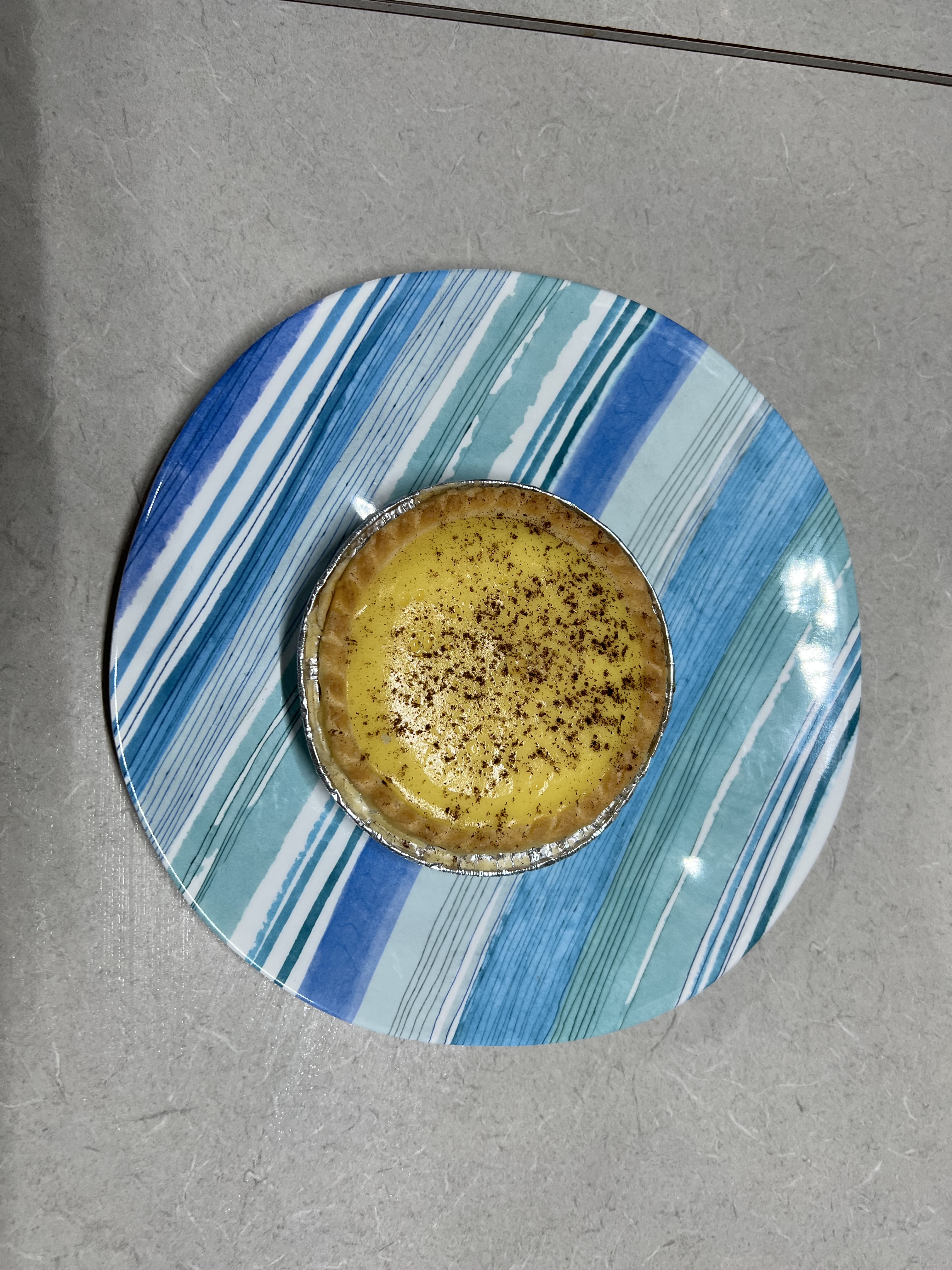
There has also been another episode back at the van in the great custard tart taste off. We brought up from Mildura a tart to check off against a Renmark tart. These tarts are tending to look the same from place to place but some are tasting a bit different, the Renmark tart here is a winner, fullsome, nice rich custard and a crunchy base.
Our next destination along the Murray is planned to be Waikerie.
Mildura
The Sturt Hwy from Robinvale to Mildura turns away from the River for much of the 88 km journey. It passes through Mallee scrubland and there is little agricultural activity until the outskirts of Mildura when grapes, citrus, olives and almonds return in abundance.
We are in Mildura for four days, there is much to see and also time for some feet up enjoying the town cum rural city. MIldura is the heart of the Murray’s irrigation heritage dating back to the 1880s when the Chaffey brothers arrived from America to develop the scheme. There is a Chaffey trail brochure that leads you around pin pointing many of the important sites, too much detail to dwell on here. There is a strong Italian and Greek influence in the region, including numerous pizza shops (there are around 50,000 people in greater Mildura and so the need for all the pizza shops). We did have dinner out at The Provence, an Italian restaurant with a good reputation and recommended by the restaurant we went to back a few days ago in Swan Hill. It was a nice meal. Allthego was very pleased with his braised goat and potatoes in a spicy tomato sauce. Homealone, a little disappointed with her choice of a sliced Italian sausage with kale in a creamy sauce pasta.
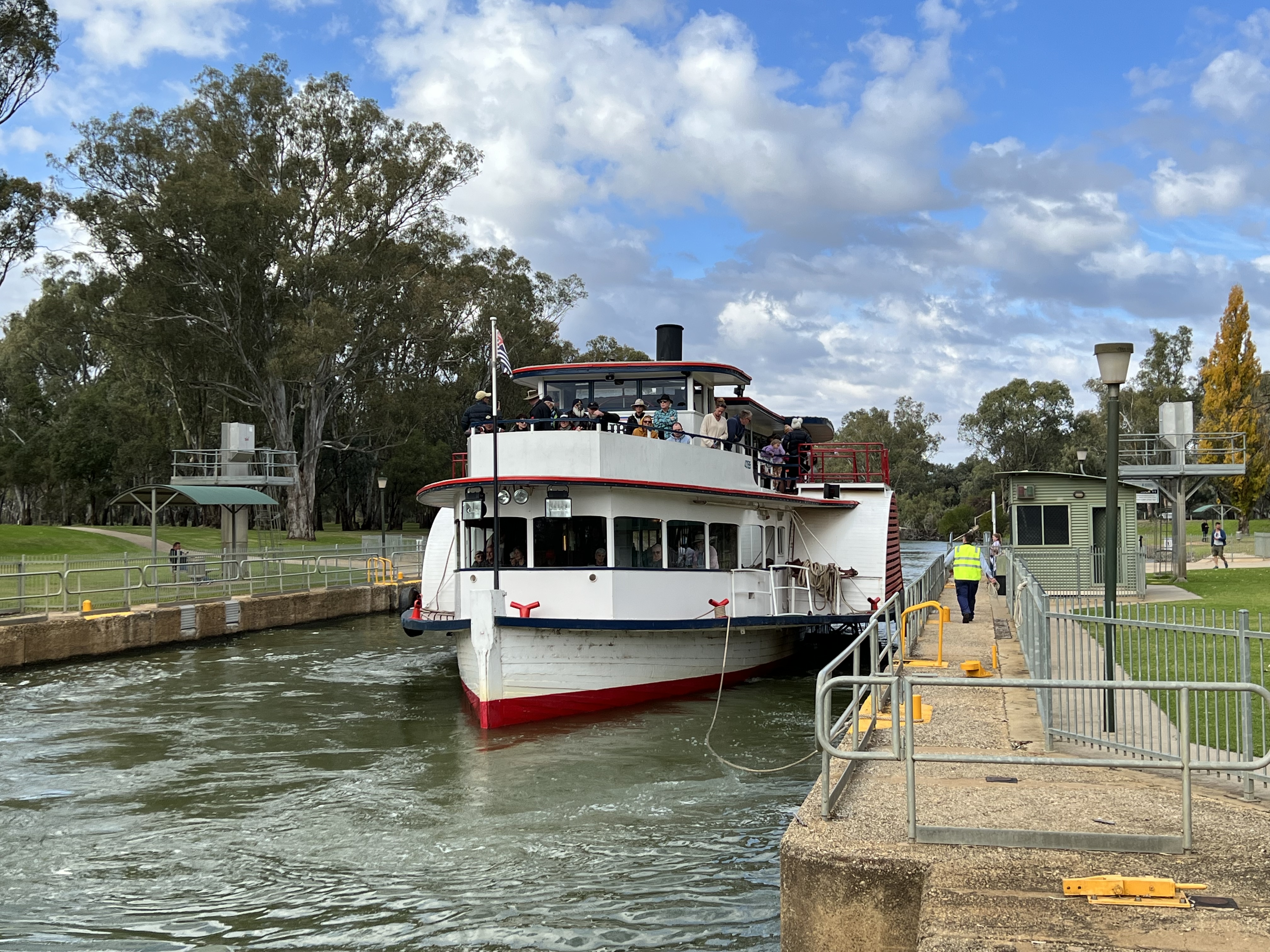
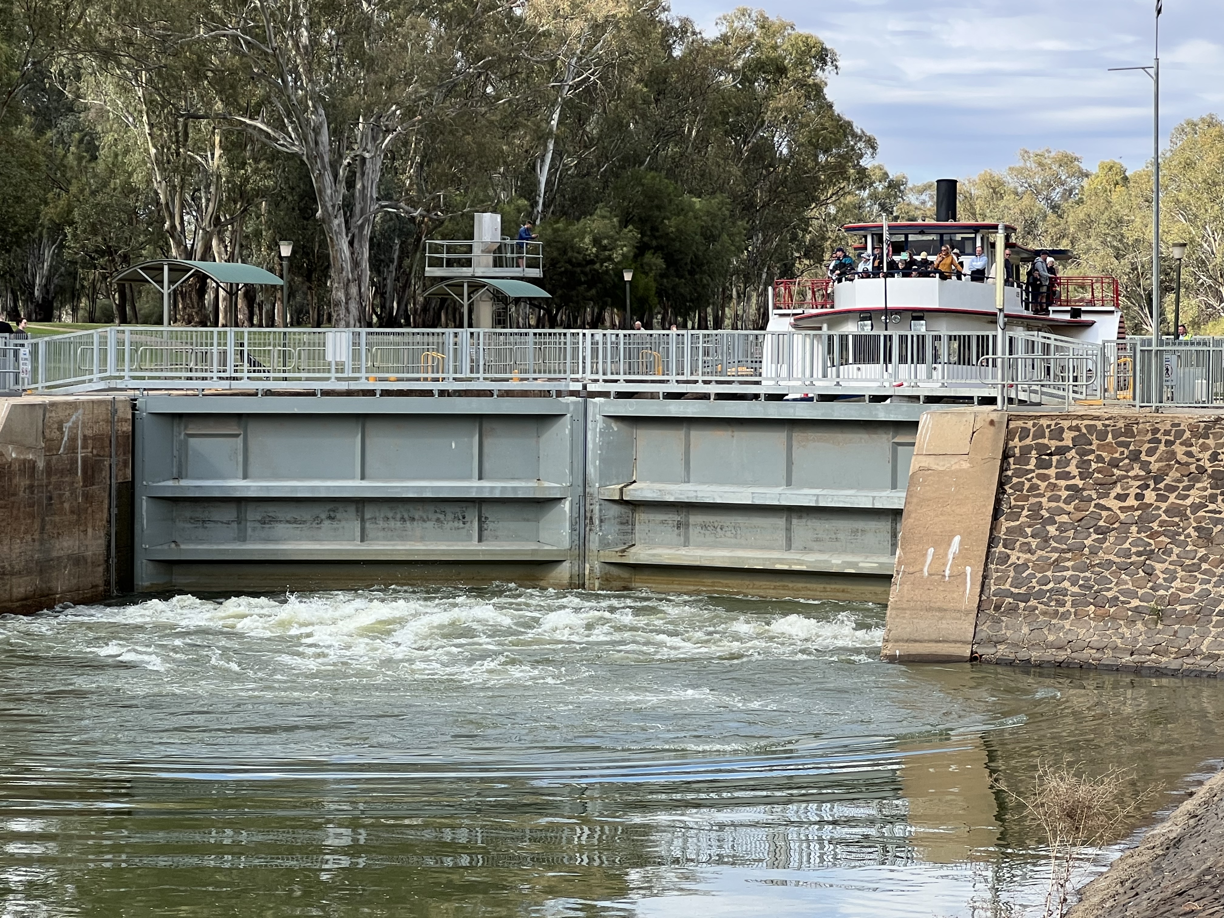
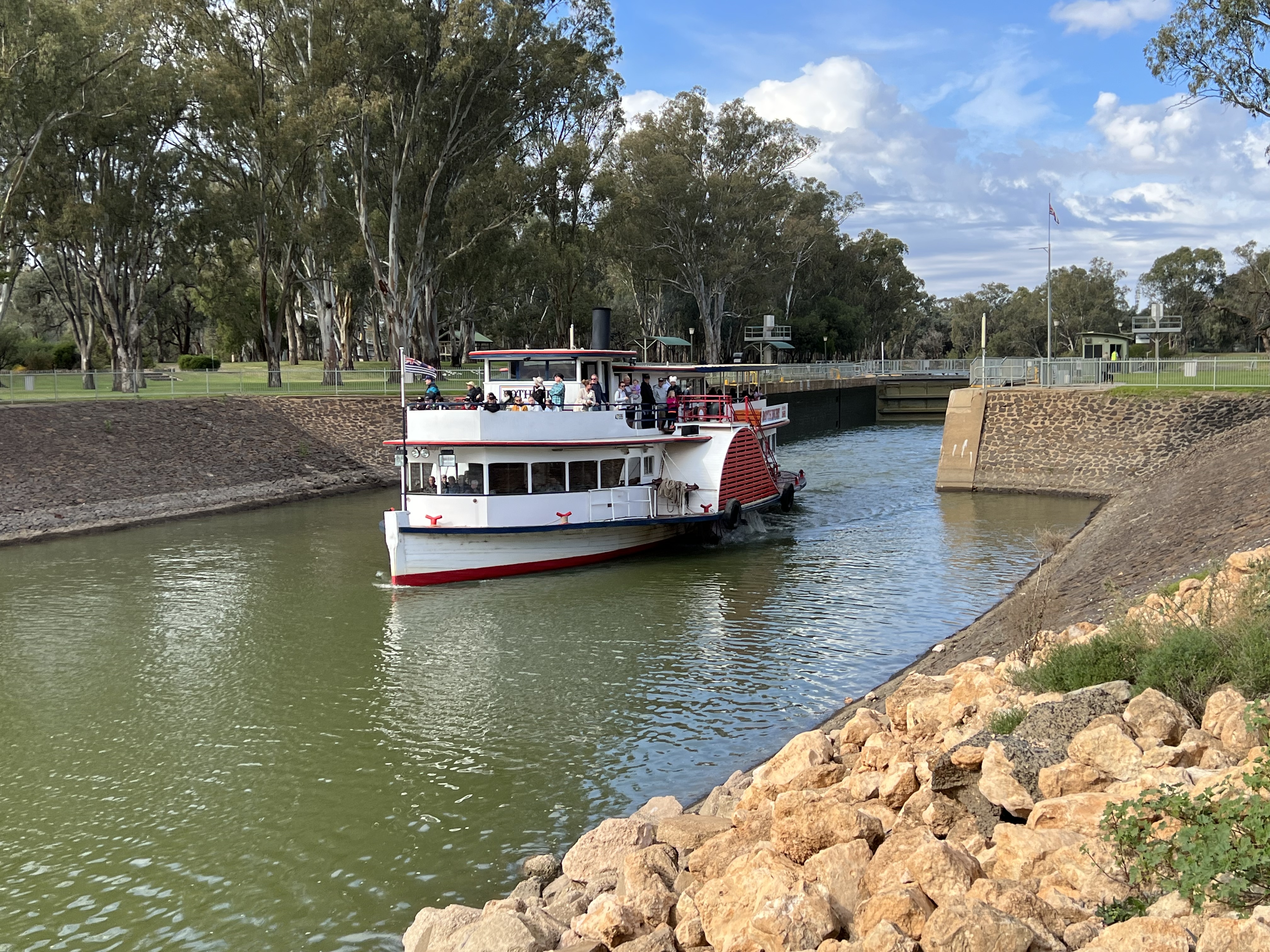
We had two special experiences in Mildura. The first being a cruise down the Murray aboard PV Rothbury, navigating Lock 11 beside the weir and then returning after cruising for awhile down the River, a very pleasant afternoon. Now Allthego and Homealone have been through a few locks in other parts of the world, throwing ropes and keeping boats in trim so it was pleasing to have someone else do these tasks this time! Also special because these locks on the Murray are the only working river locks in Australia. The way locks work seems to fascinate people and there is much chatter onboard, some more accurate than other, as to how it all works.
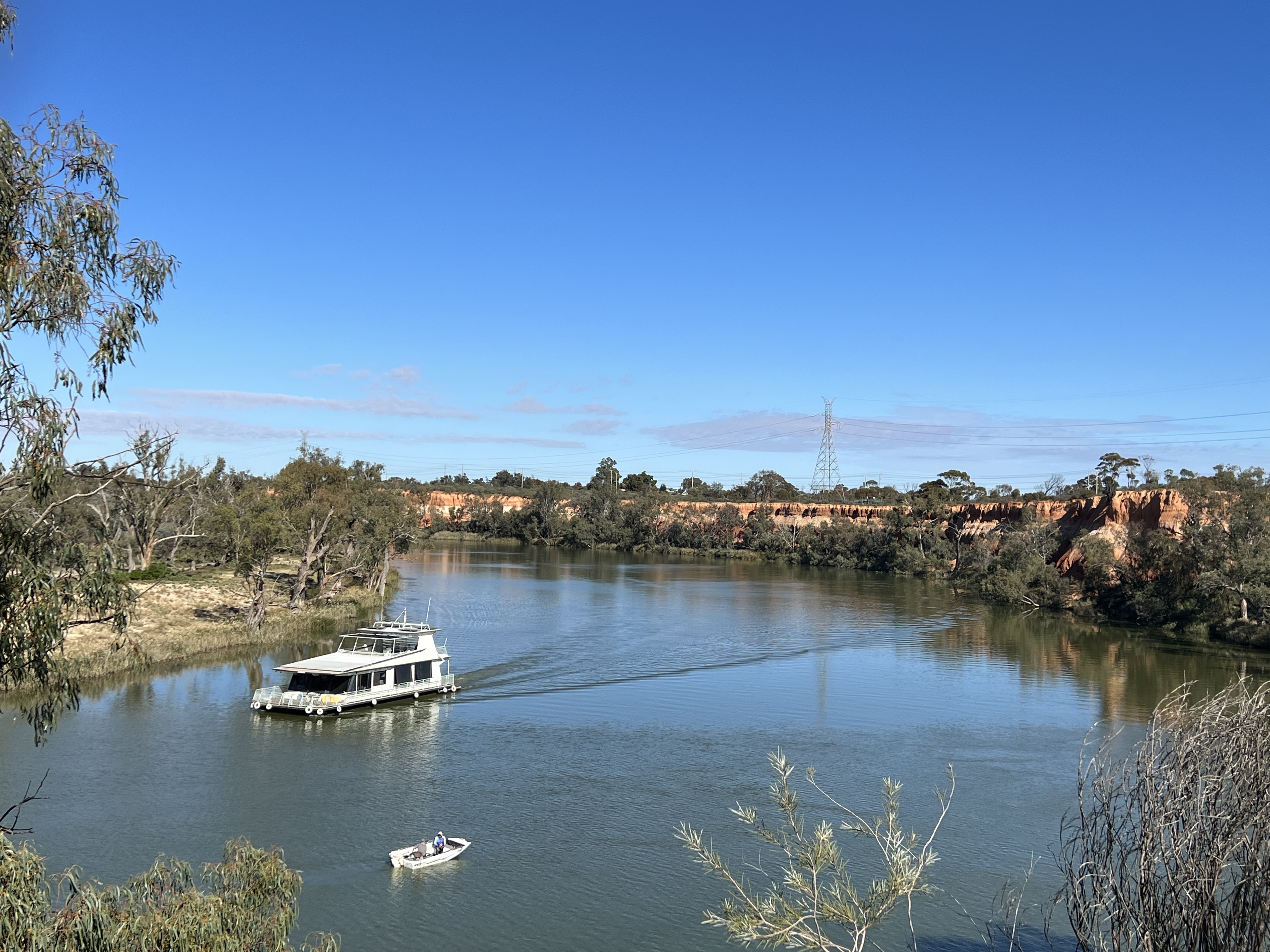
The second experience was getting our first glimpse of one of the spectacular river cliff lines that dot the landscape between here and the River”s mouth. It was out at Red Cliffs, a small town a few km outside of Mildura, where there are also a number of vineyards. Zilzie is one that we see in bottle shops in Queensland. A houseboat was cruising around the bend in the River making for an interesting vista.
We are staying at Buronga, opposite Mildura on the other side of the River, in NSW at a riverside campsite. Rather good spot and a great vantage point for sunsets along the river.
Our next port of call on this trip is Renmark. However, the Sturt Highway takes us away fom the River on a very direct route through the Mallee country. Prior to leaving Brisbane Allthego had scoured the maps and found what appeared to be an intersting alternative that followed the River on its twists and turns. The road is known as the Old Mail Road or the Old Coach Road and links Wentworth (just up the road from Mildura) with Renmark. The road passes by a number of the locks on the Murray, albeit off on side tracks to the River.
So we included this in the journey and headed off for a day trip up the Old Coach Road but back to Mildura on the Sturt Highway. All about a 300 km round trip, 160 on the Old Mail Road. Well the first half was on a pretty good gravel road and we got in to see Lock 9, (looks pretty much like the other locks and weirs we have seen) unfortunately further on Lock 8 is accessed from the other side of the River. After this point the road became a bit of a track dodging water across the road and muddy sections by diverting into the paddocks and then working back to the track. Slowed our advance somewhat. Also a little testing on the nerves.
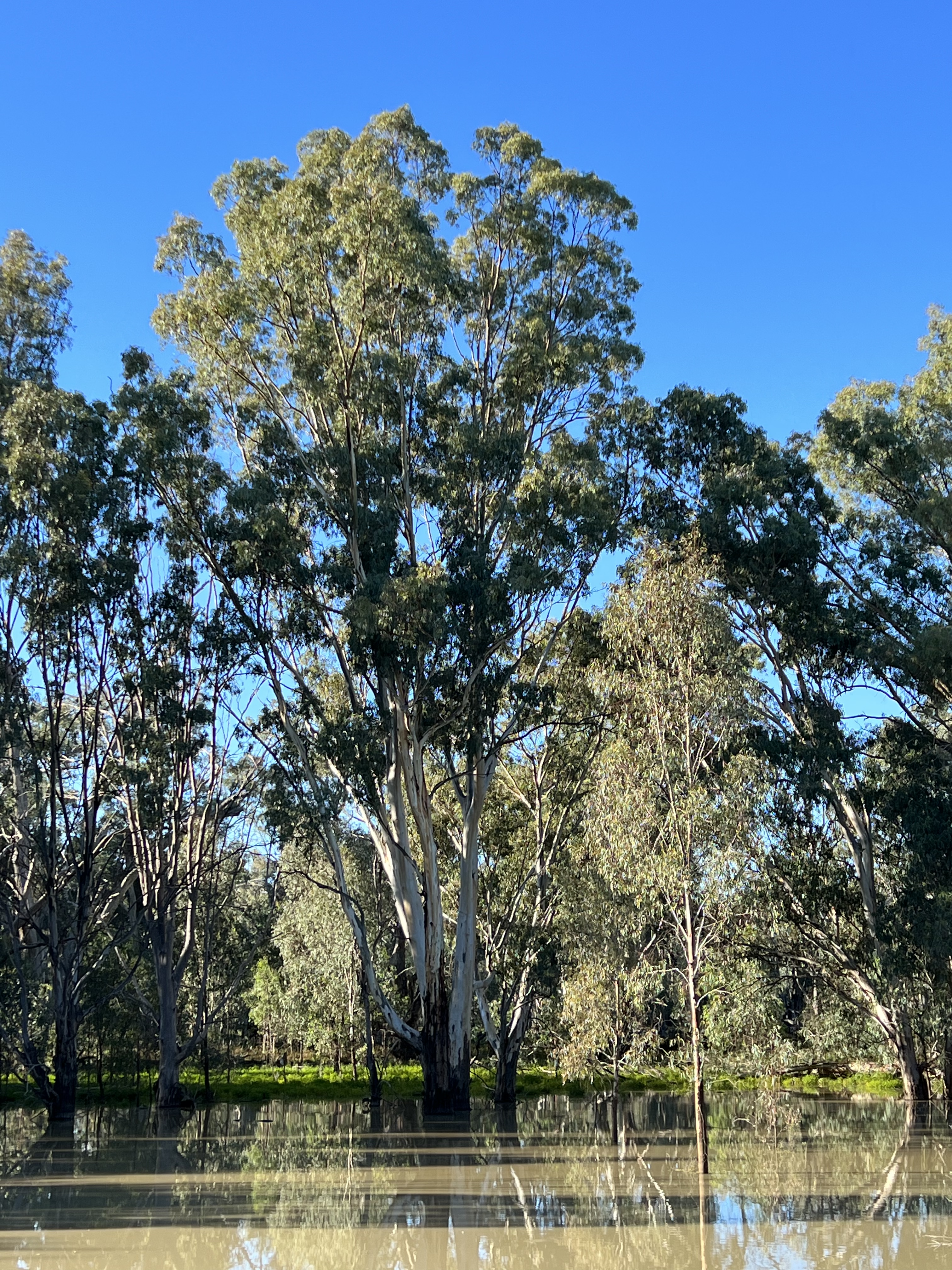
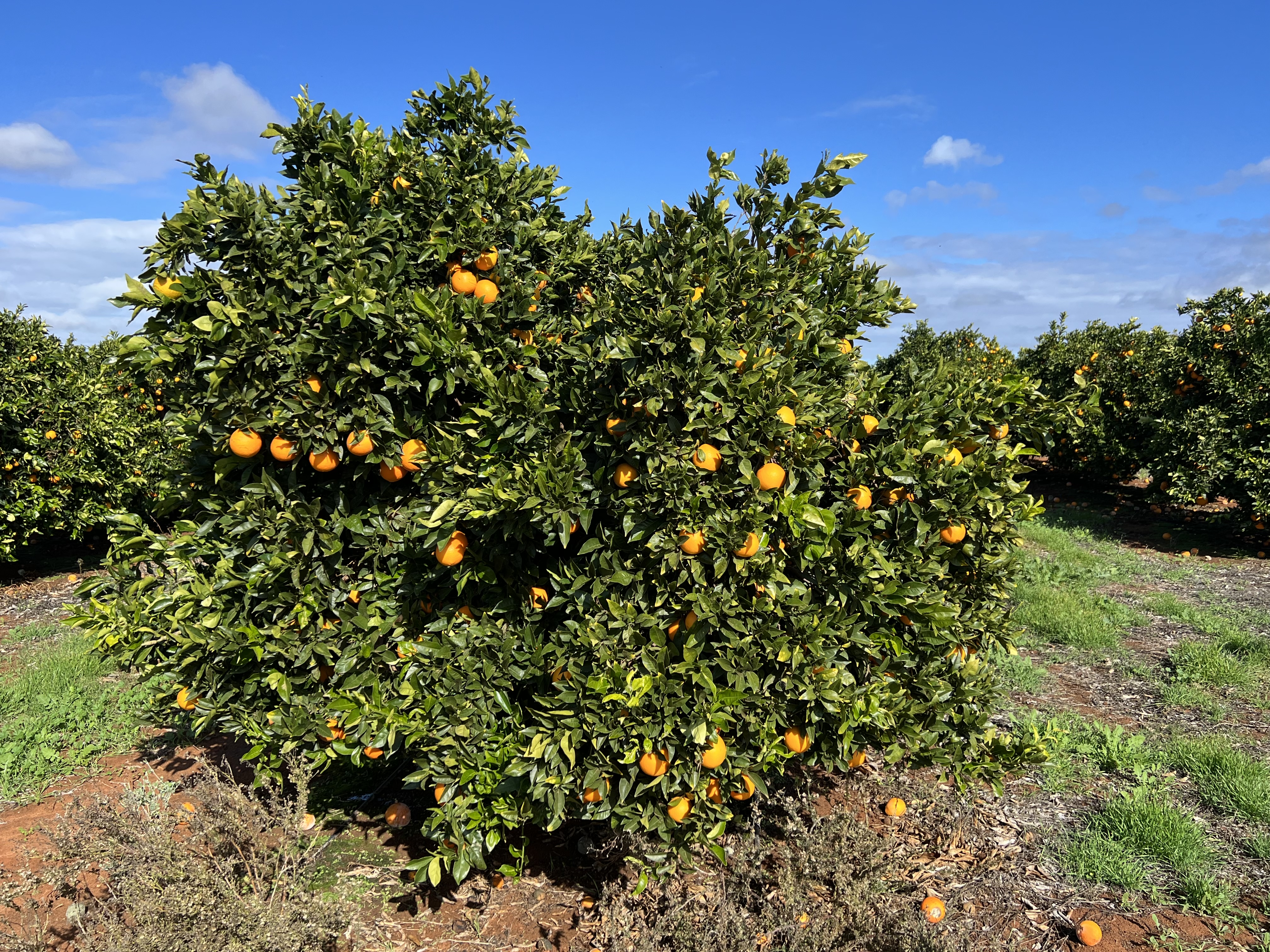
Lock 7 was a bit of a disaster, a long drive along a dirt track to find the gate in locked! We diverted off to the side and found a good spot beside the River to have lunch. The River here was quite high and had flooded into the wetlands, trees were well under water, their roots getting a good drink. A pretty spot. We are about 750 km (as the River flows) from the its mouth over in South Australia, yet only 27 metres above sea level. We skipped Lock 6 on the approach to Renmark (where Lock 5 is) and headed back to MIldura. A long day getting back about 7pm. Not sure that this side trip can be recommended, but if you like a bit of a dash along gravel and mud through pretty non descript flood plain country then why not! Diversions to the River are rewarding and as we came into the outskirts of Renmark the fruit trees emerged, hectares and hectares of oranges , lemons, manderins etc.
So back in Mildura for our last night we went and had dinner at the Italian place mentioned earlier where Allthego had the braised goat. But before that we went for a short time to the icon of Mildura, the Mildura Club.
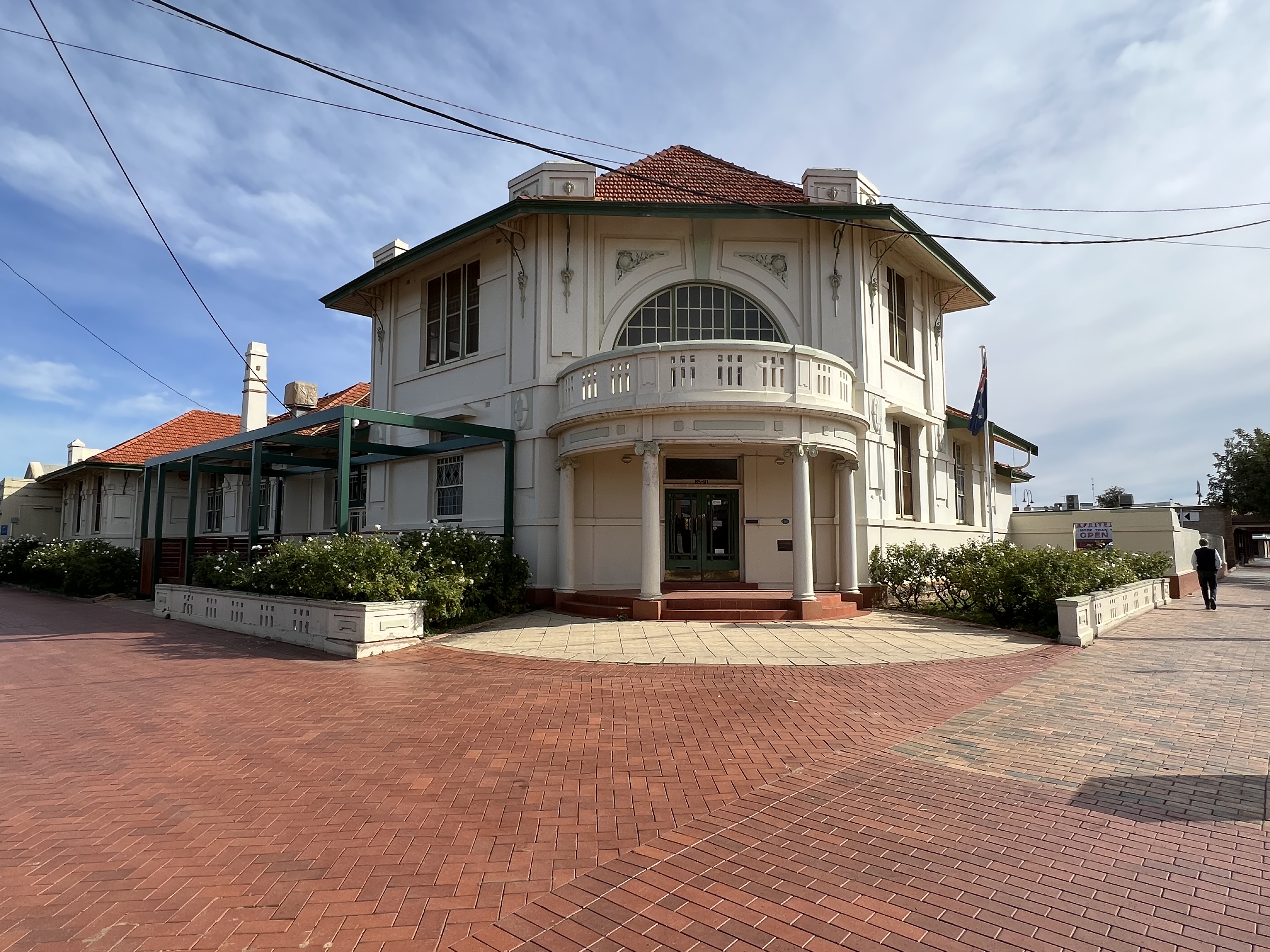
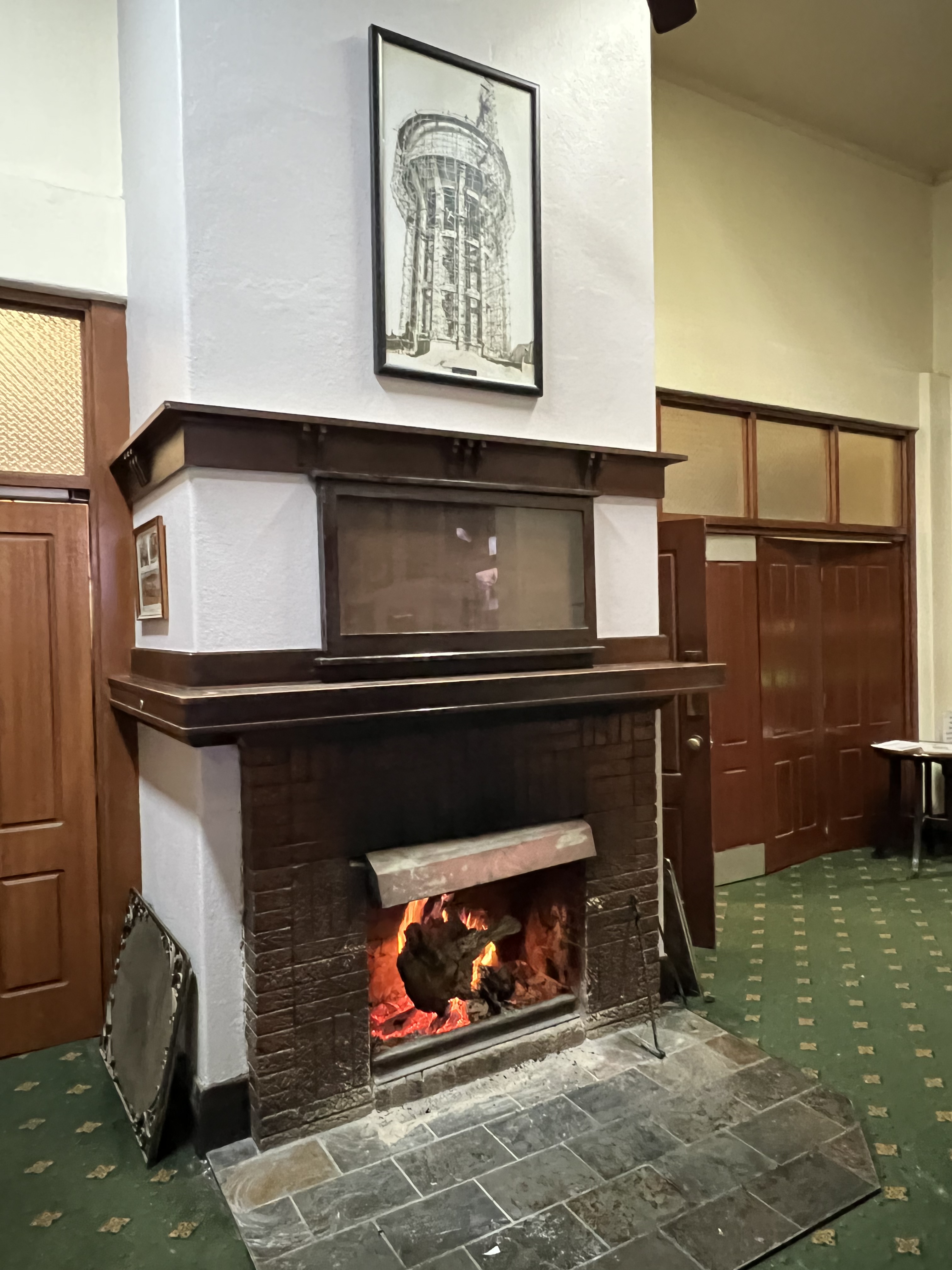
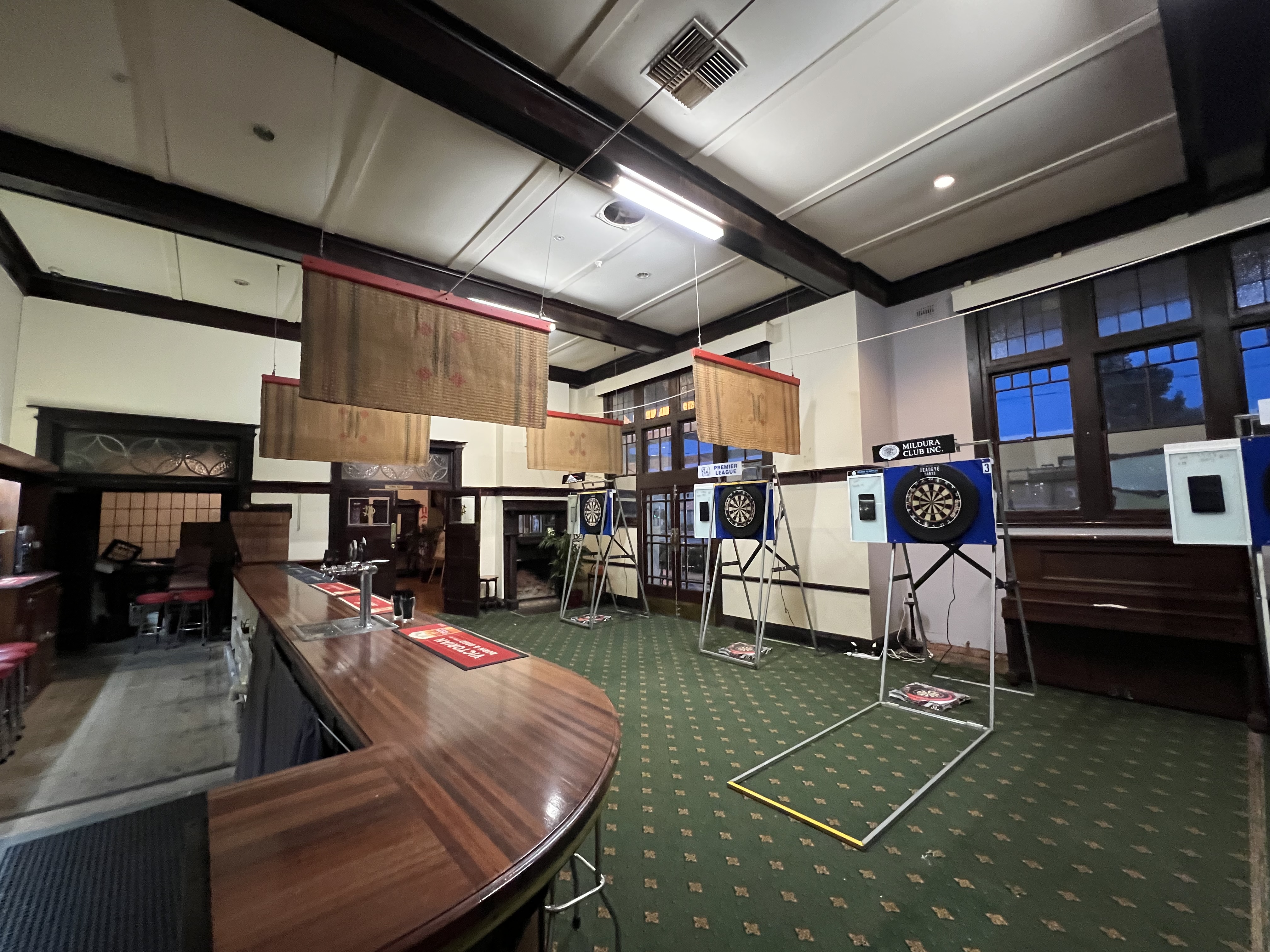
The Club originated as a colonial gentlemen’s club dating back into the late 1800s, although the Club’s current premises are early 20th C. A classic place, old bar area, fire places ablaze and darts about to be played. We had a chat with a Commitee member, the Club has about 350 members but only 40 or so really active ones. They are trying to revitalise the Club with some renovations, it has a squash court built in 1933, Australia’s first it is thought. It smells and feels like an old club too! What a great old institution for Mildura to have!
We are now off to South Australia and Renmark, considered to be the start of the Riverland region. It is where the Murray broadens, slows and meanders on its march to the sea.
Robinvale
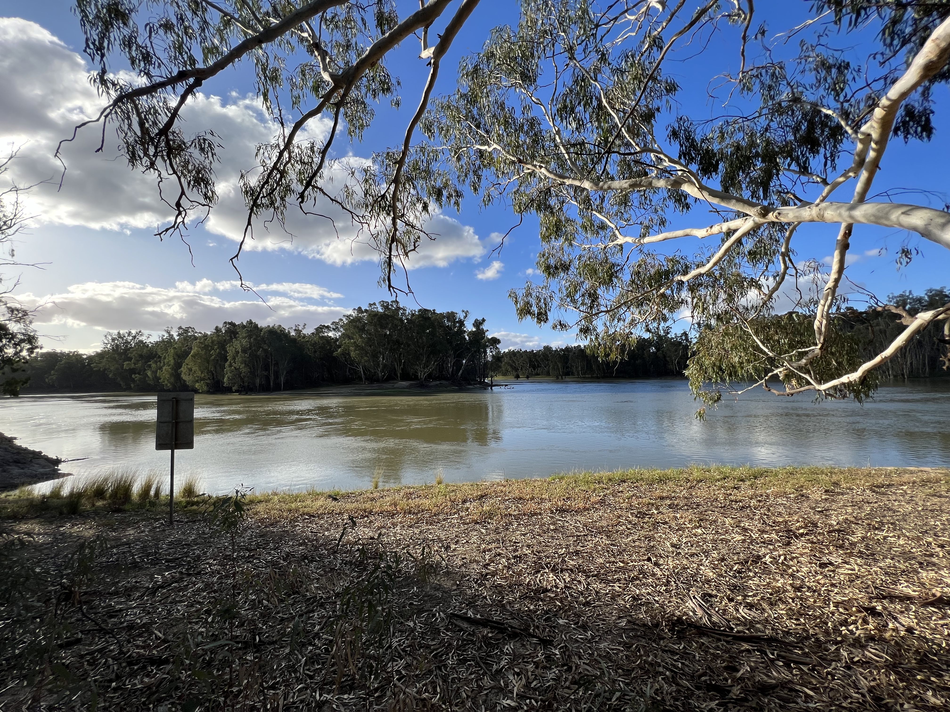
We have now moved on to Robinvale, about 130 km along the road from Swan Hill. The road closely follows the course of the river for much of the way. The landscape is dominated by irrigated farmland of all sorts, but mostly grapes, olives and citrus trees with increasing acres of olives and almonds as we approached Robinvale. Some sheep as well. We stopped beside the river bank at Nyah for some morning tea, an attractive free camp area here at the sporting field complex.
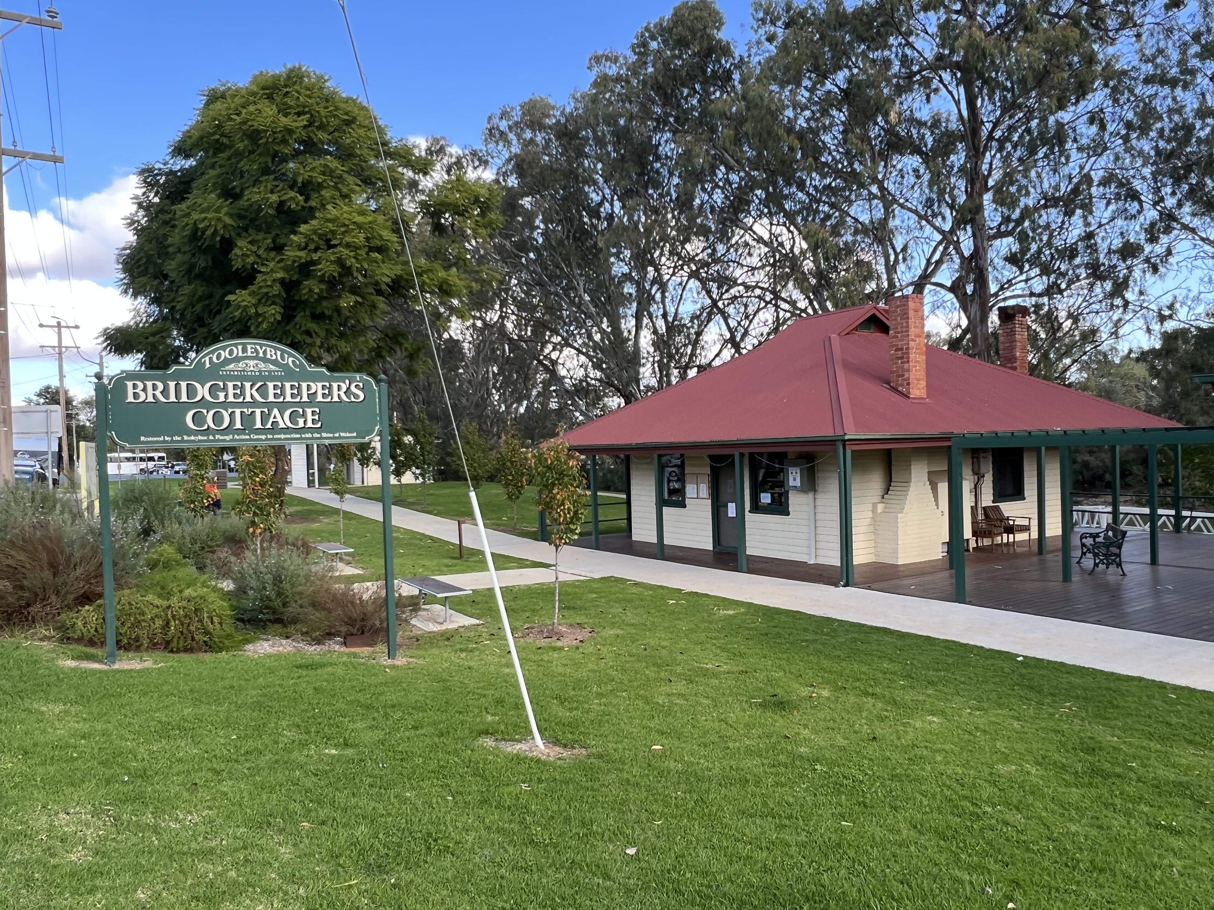
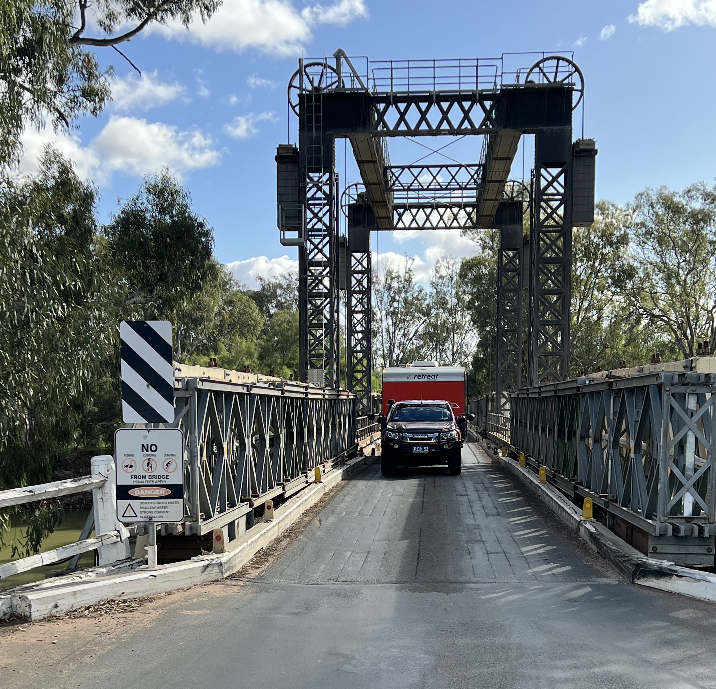
A little further along a short detour across a single lane bridge over the river took us to Tooleybuc. A small town with a landscaped riverbank area and restored Bridgekeeper’s cottage. We managed to get a shot of the van doing the bridge crossing inbetween a steady stream of heavy vehicles taking a shortcut to Balranald and one of the inland routes through western NSW up to Queensland.
A little further along we came to Boundary Bend, a town where there is a big bend in the river and a great photo opportunity. I suspect that is how Boundary Bend got its name. Olives are big in this area, with a local production centre for oil products.
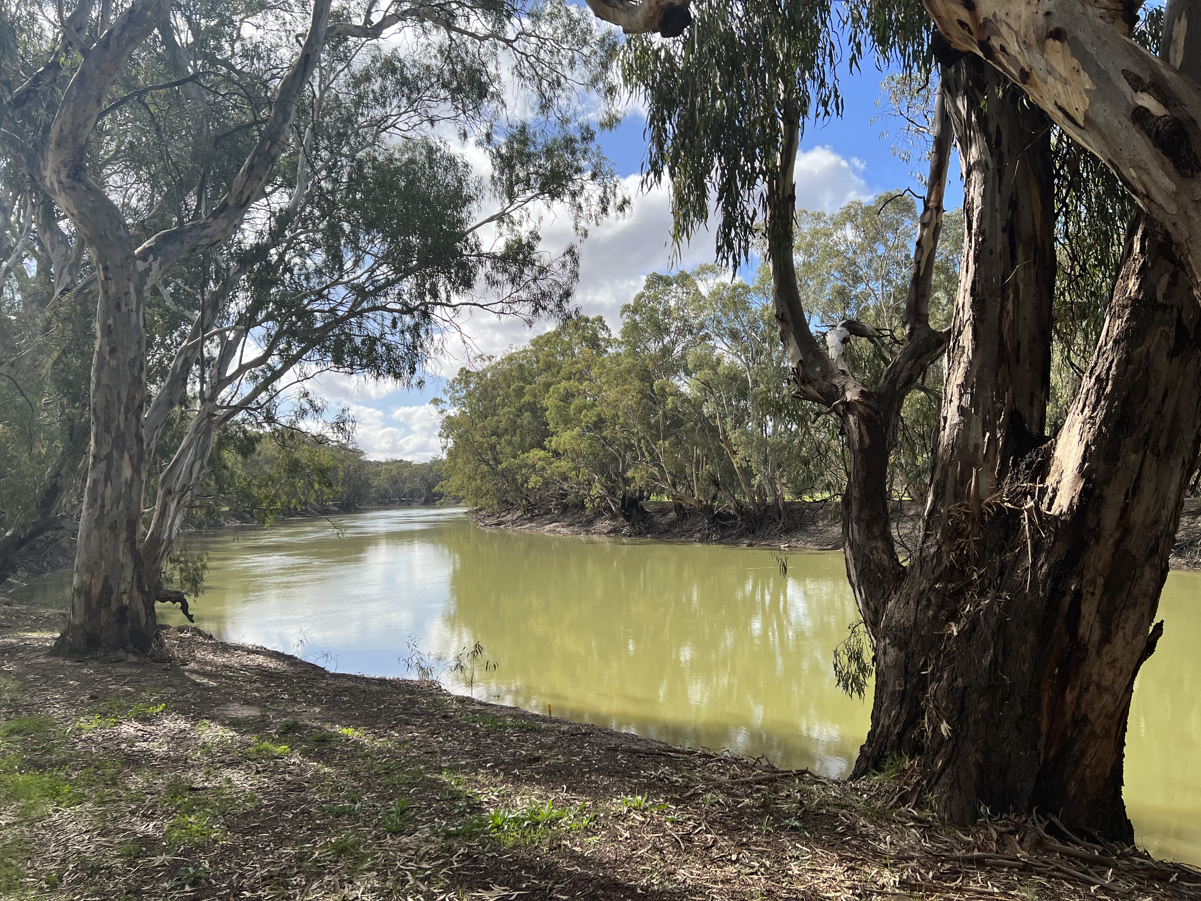
Not far out of Boundary Bend, and about 50 km from Robinvale, there is a turnoff down a gravel track to the junction of the Murrumbidgee River and the Murray. It was tempting to follow this track but with the van in tow and the track getting a little ragged we abandoned the venture, deciding that there might be another opportunity in the future to see this significant geographical site.
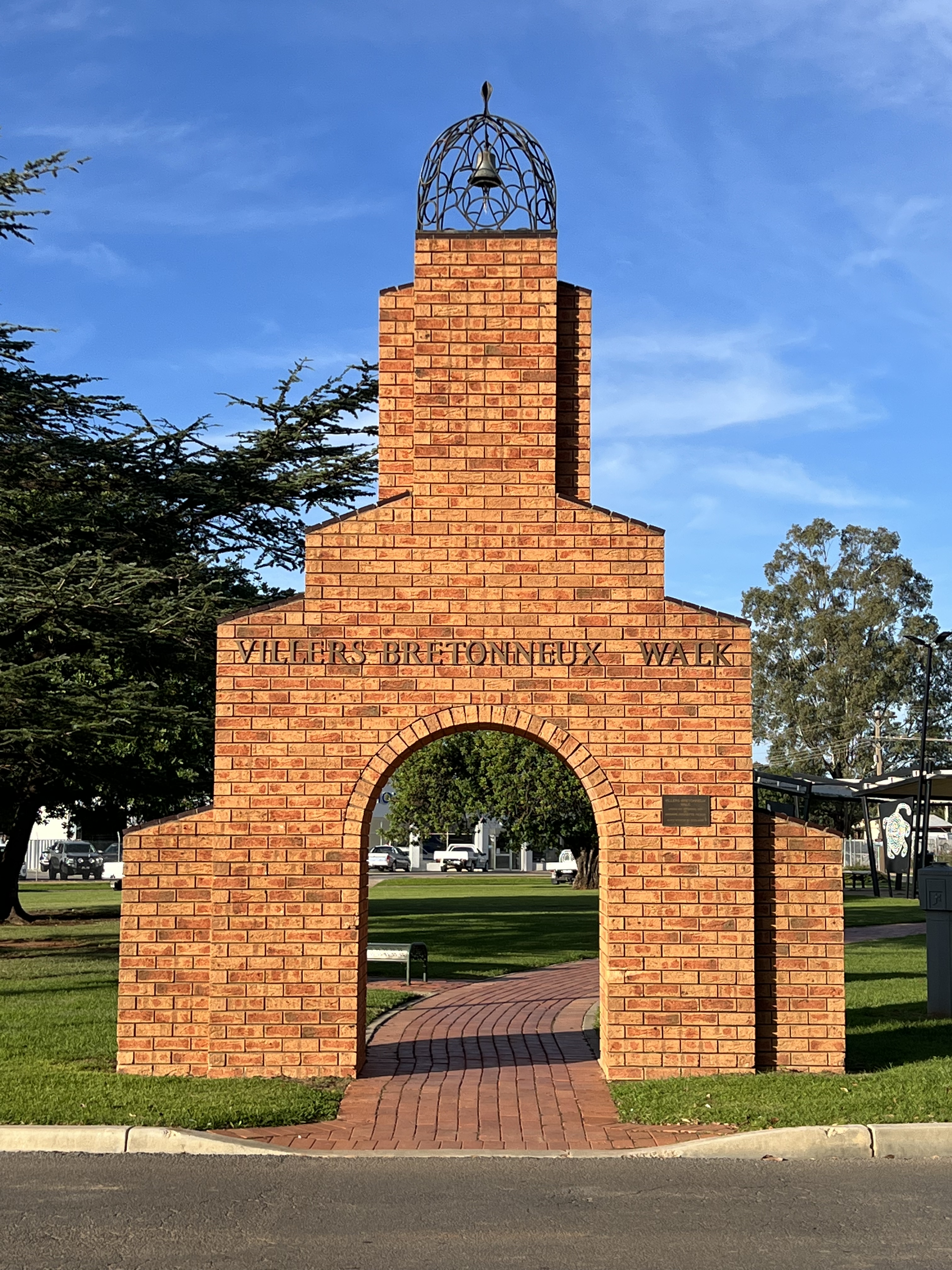
So it was back to the main drag and the run into Robinvale past more grapes, olives, almonds and citrus trees. We have planned two nights here at Robinvale beside the river. Not doing too much either. Not that there is a lot to see anyway. The town is much smaller than Swan Hill. It does though have a claim on fame in being a sister town to Villers Bretoneux, a bell from V-B sits atop a brick archway into a garden area. The name Robinvale is derived from a local resident, Robin Cuttle, who was shot down near V-B in WW1. ‘Robinvale’, farewell Robin.
On the other side of the river is the town of Euston which is home to a weir and Lock 15 on the river. The weir and lock is also accessable from Robinvale. But the Euston side gives some great views of the river cliffs downstream. The river is flowing quite strongly, plenty of water is coming over the weir and stirring up the river below.
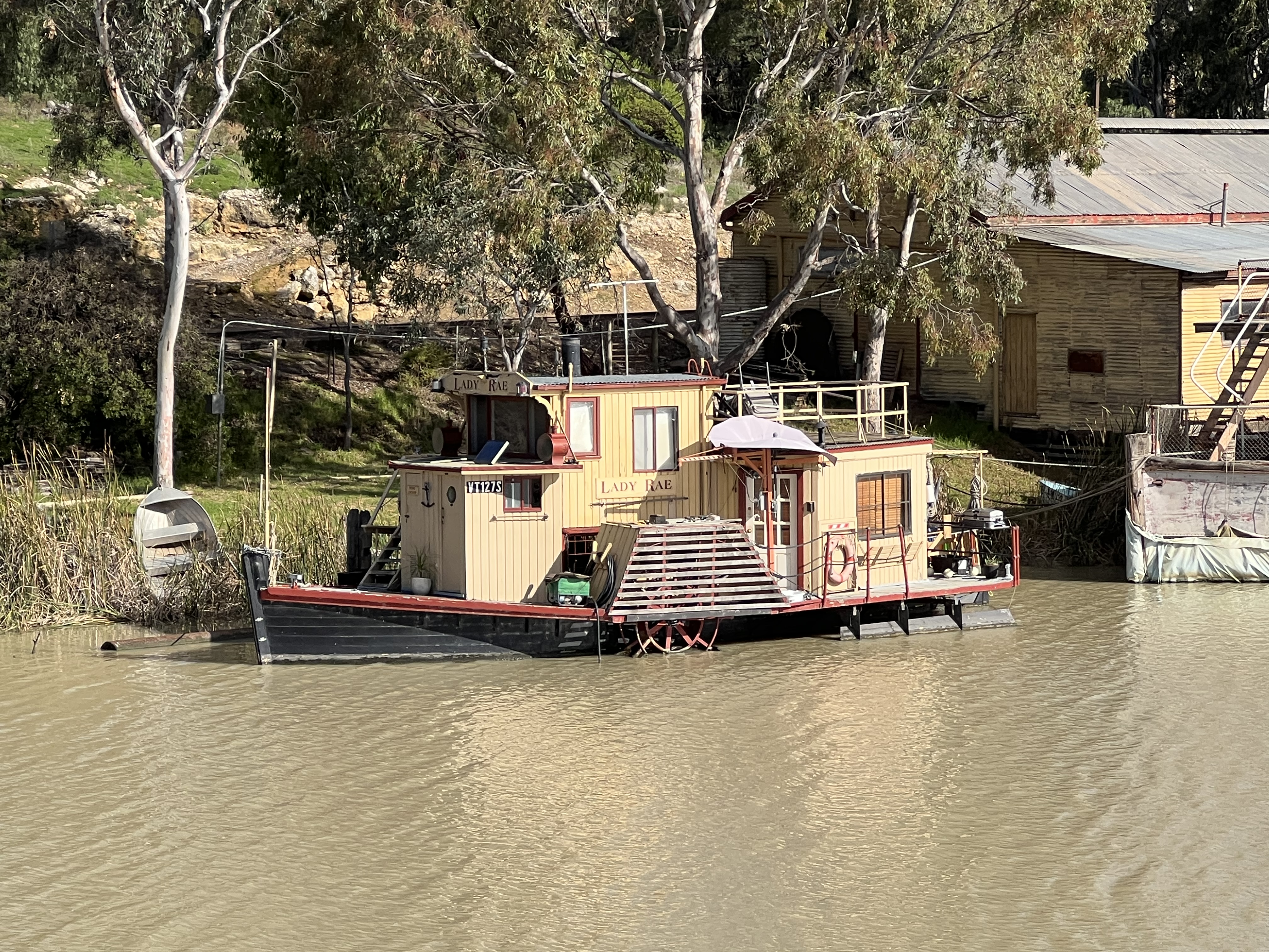
Back at the campground we settled in for an afternoon by the river watching the sun set and later a fire to warm the bones. It is rather chilly after the sun goes down. ‘Oddity’ appeared on the river, slowly moving along the river towards the bridge before turning back and mooring up in front of us. A couple of grey nomads were on board.
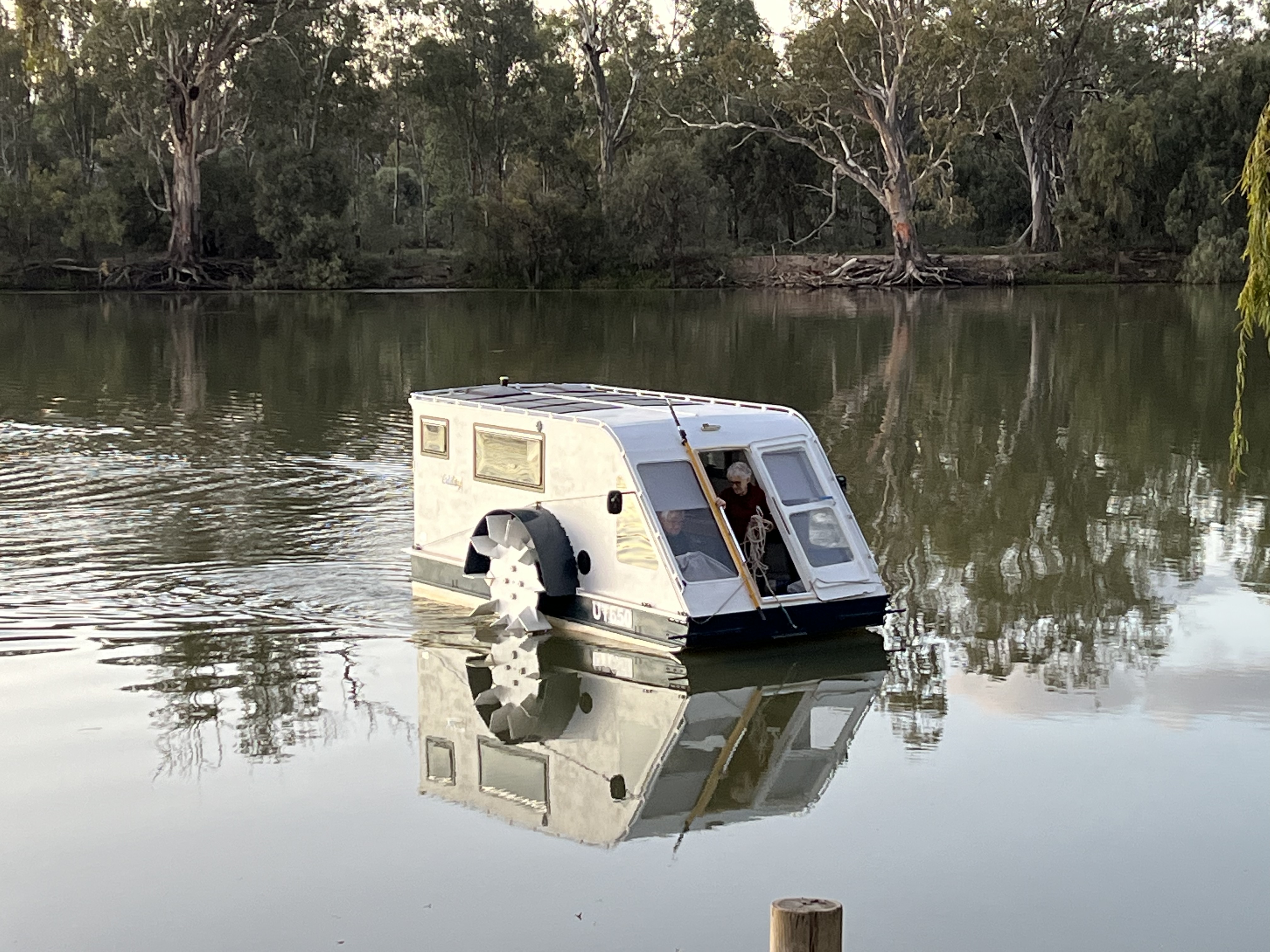
‘Oddity’ is run by a washing machine motor and is solar powered, a small outboard is available for emergency needs. A home build job and not much bigger than a small caravan. It is transported around on the back of a truck when not in the water. The occupants are travelling along the river and are in no hurry to get anywhere. It left the next morning on its journey along the river. Maybe we will see it further along in our travels.
Next stop, Mildura for a few days.
Swan Hill
Before we left Cohuna Allthego had the bright idea of doing a bit of a drive on Gunbower Island, it seemed a good idea to go for a drive on Australia’s largest inland island. We had a map of sorts but it became somewhat confusing as the physical features of the Island we were passing by did not seem to match their locations on the map or the way we were going. It became apparant after a while that we were semi lost and going round in circles a bit. We eventually found our way back to the main road, not on the Island, and ultimately back to our camp at Cohuna.
Frustrating, time consuming and unproductive. We had seen much of the farming activity that takes place there, but nothing of the River or forests. It turns out that the Island is much bigger than one might think from looking at a map and not reading the scale properly! The lady at Information said the Island was a destination in itself, full of hiking, canoing and wildlife watching activities etc. A week could be absorbed for those so inclined. We hitched up the van and headed off for Swan Hill.
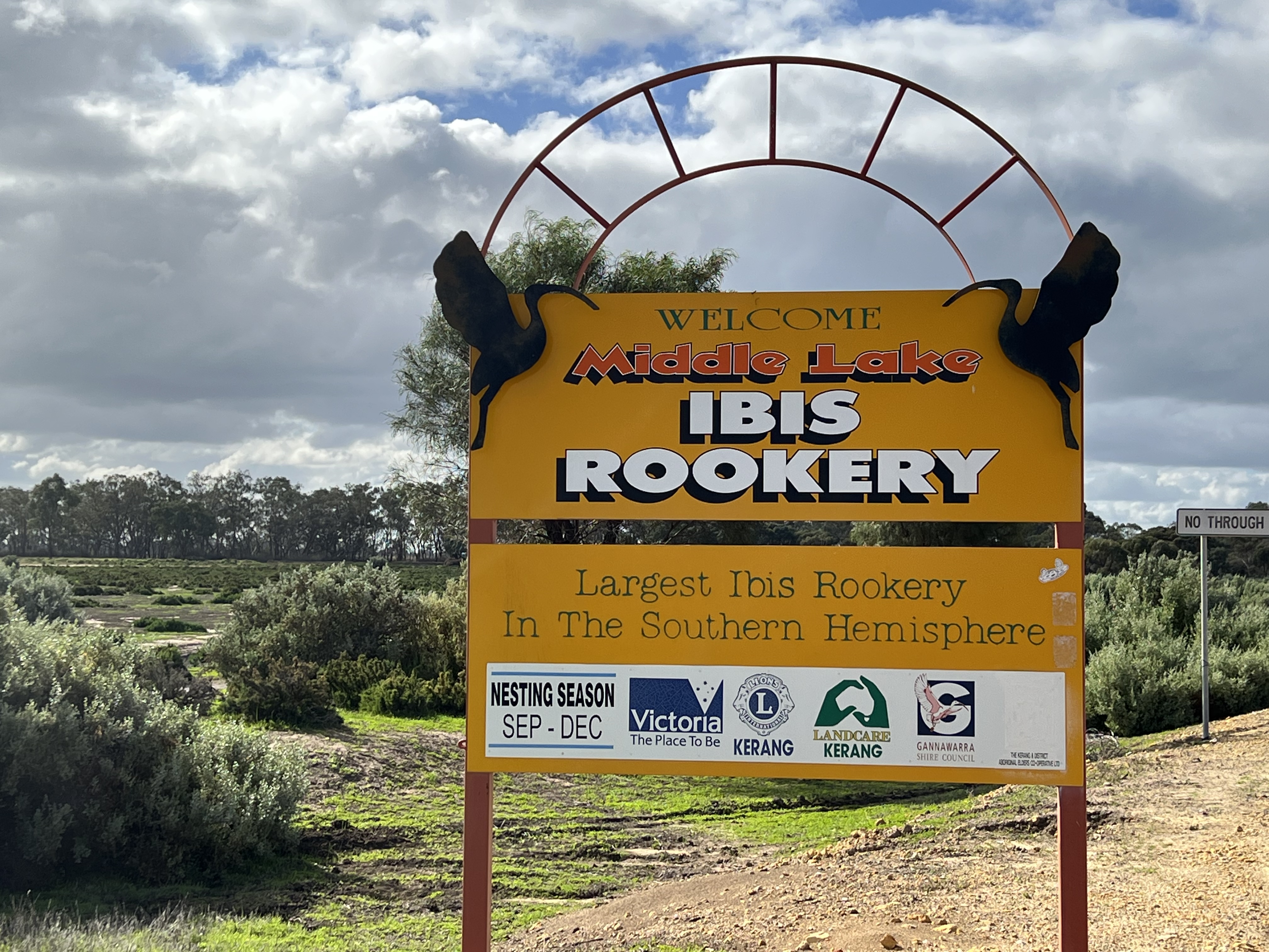
Along the way we discovered an interesting spot that is the world’s largest Ibis hatchery, the Bin Bird as we call them in Queensland. It was not the hatching season and the birds were in other places. This particular section of the road passes by a number wet lands and lakes where there are small settlements catering to fishing and boating people.
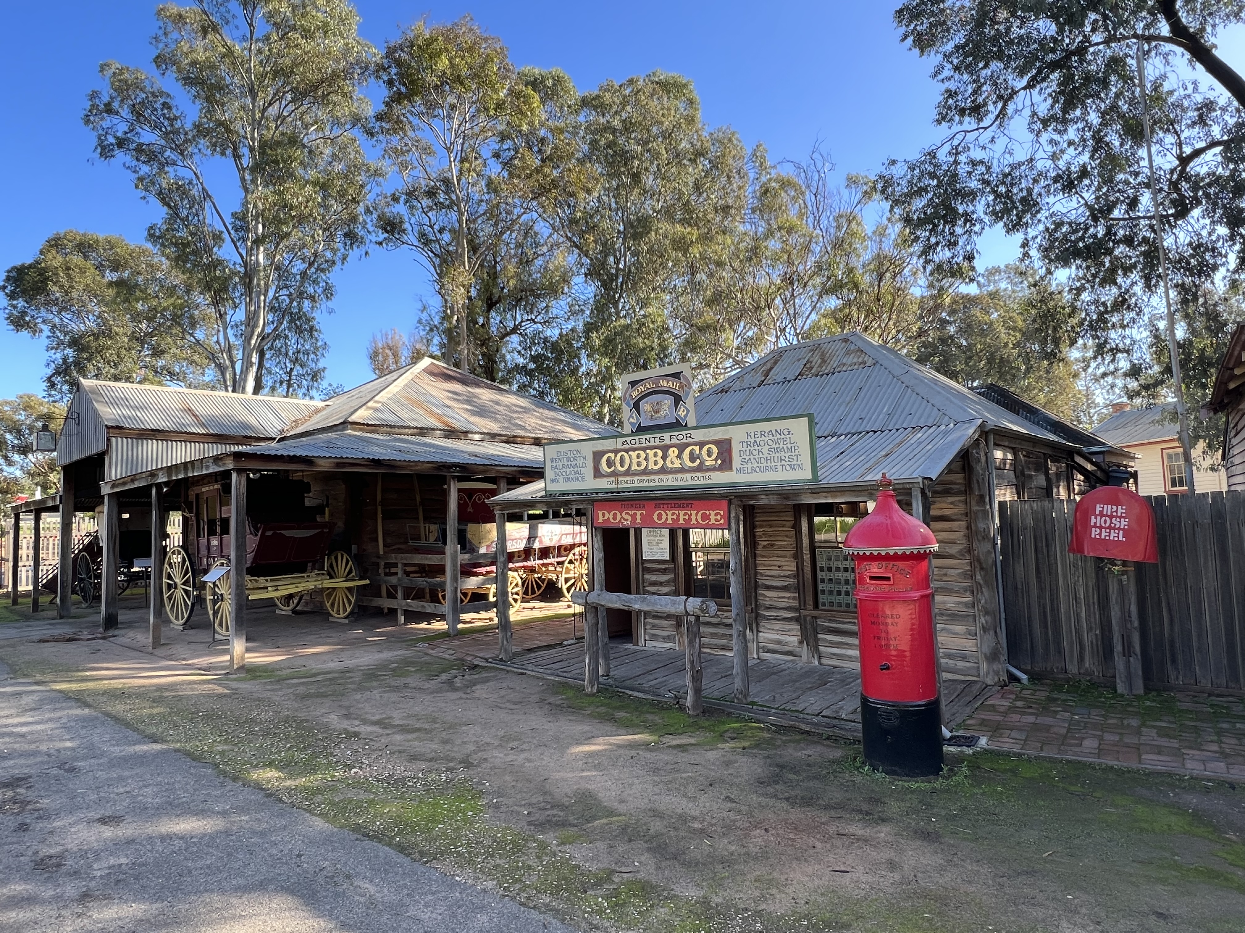
In Swan Hill we are at the Big 4 campground which is more or less adjacent to the Pioneer Settlement. It is on the banks of the Murray where an anna branch, known as the Little Murray, rejoins the main stream. A very pleasant spot. Various boats going up and down the river from the wharf. Allthego found the Pioneer Settlement quite an interesting area to wander around.
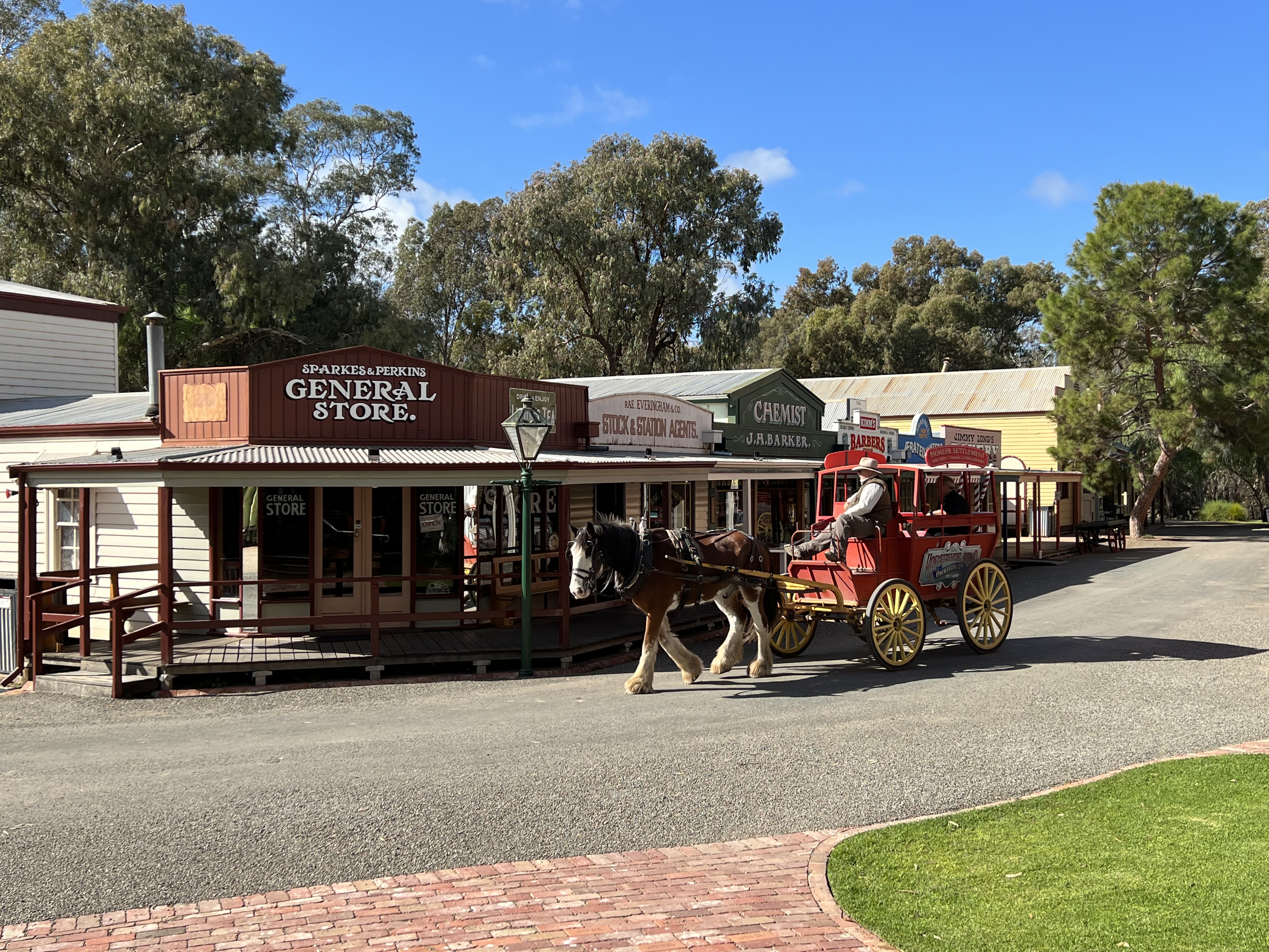
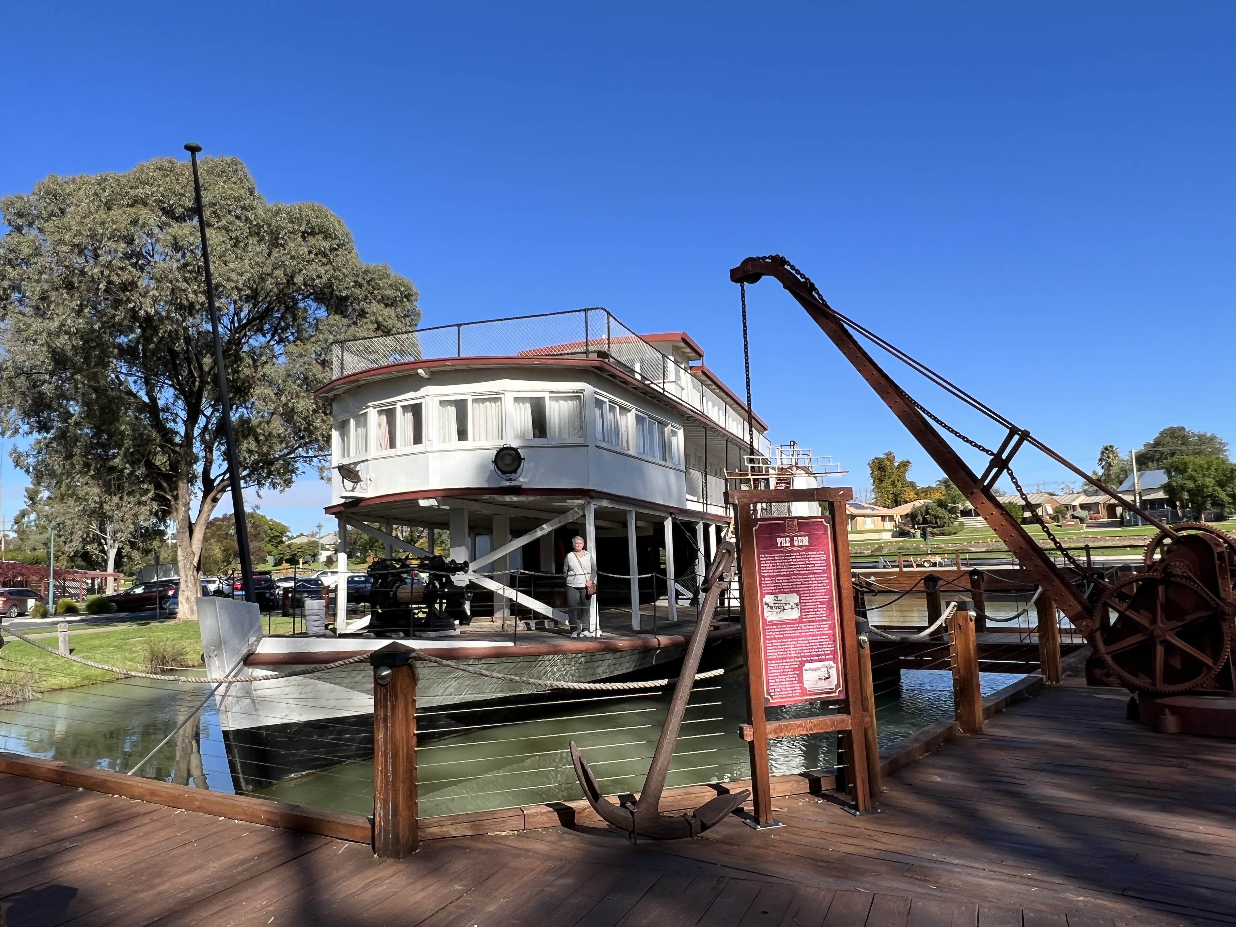
He is normally suspicious of these theme park places and displays of times past. Many are just great collections of old stuff that are repeated from town to town across the country. This place is different, quite organised and not overdone with explanatory notice boards about things one might be looking at. Good ride in a coach behind a Clydesdale. The old 1876 PS Gem floating in a pond shows just how big these old paddle steamers were.
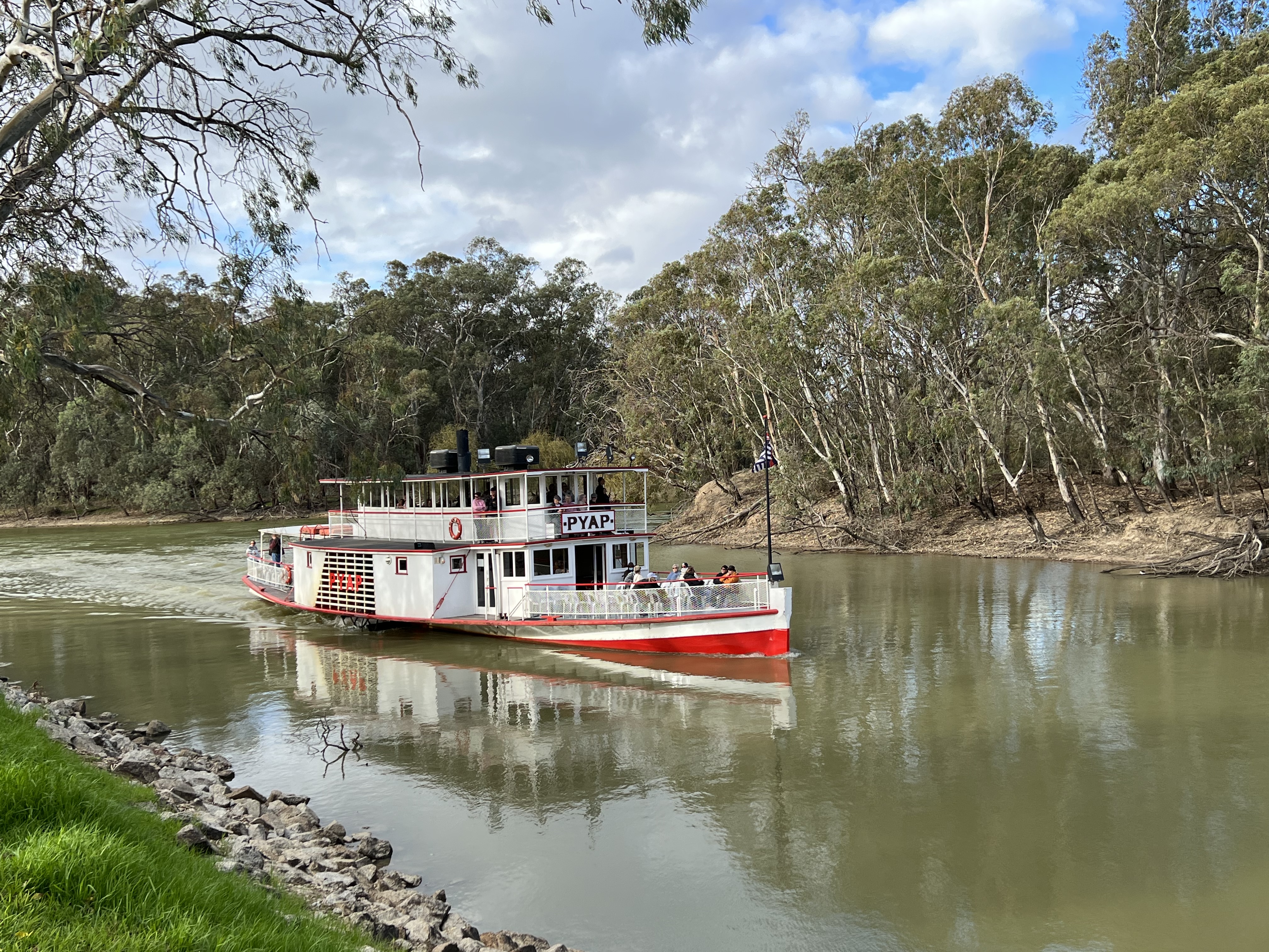
The Pioneer Settlement is also the spot where one can board the PV PYAP for a one hour cruise up and back to the wharf. PV (Paddle Vessel) is distingwished from a PS (Paddle Steamer). The PYAP was originally built in 1896 as a barge but was converted in 1897 to a paddle steamer (PS). In 1970 the steam engine was replaced by a diesel engine and she became a PV! Draws less than a metre of water and worked as floating general store for riverside communities. Howzat! Just thought you might like to know that, as well as some information about the flag that is flying on the boat.
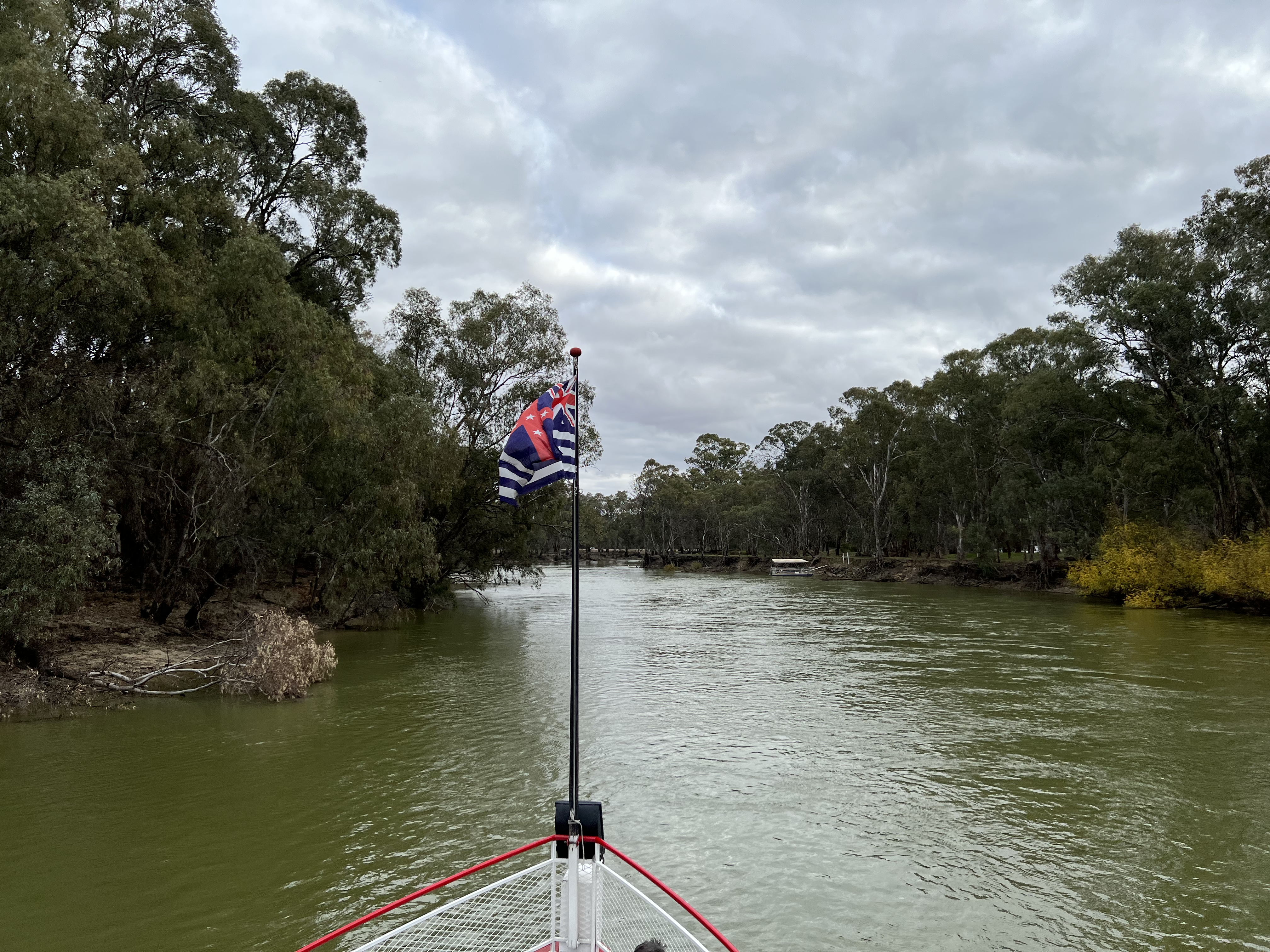
The flag is known as the Upper Murray Flag. It is one of the oldest Australian flags having been designed in 1853, a year before the Eureka Flag. Prior to Federation the Australian colonies flew the Union Jack. The Union Jack is represented on the Murray River flag in the left corner. The red cross to the right has five stars, representing the then colonies. The dark blue horizontal stripes represent the Murray and the three main rivers that flow into it-the Darling, the Murrumbidgee and the Lachlan (which first joins the Murrumbidgee). When used in the Lower Murray River (mostly in S.A.) the stripes on the flag are a pale blue, reflecting the lighter coloured waters compared to the darker waters of the Upper Murray in Victoria/NSW, where the darker blue stripes prevail. At Swan Hill we are still in the Upper Murray. It is the only flag in the world named in honour of a river. Allthego will have examples of the flag(s) on display at Bedwell Place, Homealone will not be greatly enthused about this so they may not be up for long.
In the evening there is a laser light show using a sprayed water screen out of the river. It is a time series on the River from it’s geological and indigenous past through to the days of European settlement and then onwards to the present day. Quite impressive, goes for half an hour. We then headed off to Quo Vadis, a recommended Italian restaurant in town. This was really good Italian food, we can highly recommend it if you are in this part of the world, had a local red to go with it too. Andrew Peace 2015 Shiraz, very nice soft red. More about this vineyard later.
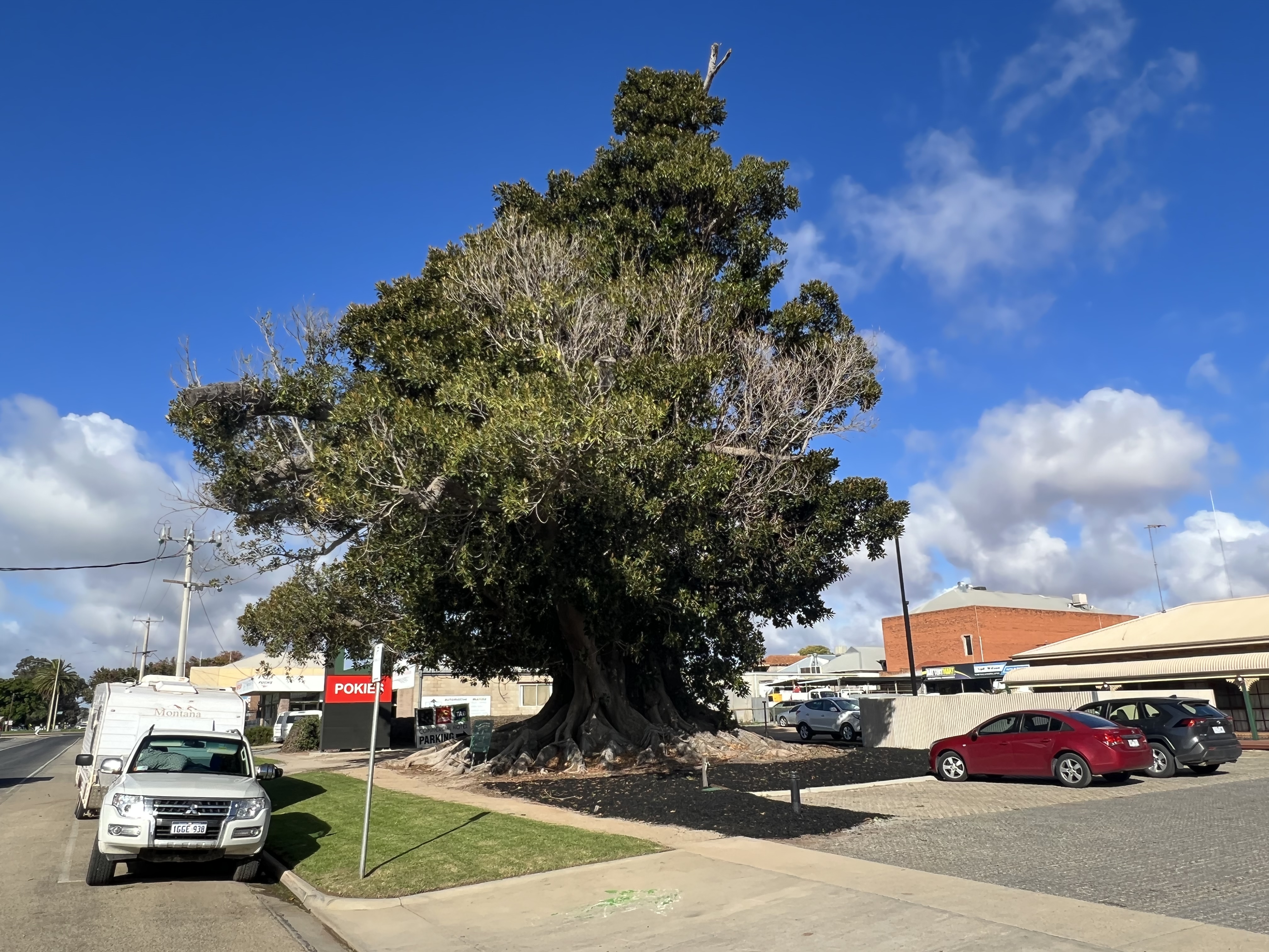
Swan Hill is also famous for Burke & Wills, what places arn’t when you criss cross these chaps route on their south to north crossing of the continent. B & W used Swan Hill as a staging post to get their personnel and supplies finalised for the trek north. They had also stopped earlier at the Ibis breeding place we had pulled into on our way up to Swan Hill from Cohuna. The locals planted a Moreton Bay Fig to celebrate the expeditions departure in 1860. It is still at the spot today, an enormous tree that has had to be been heavily pruned.
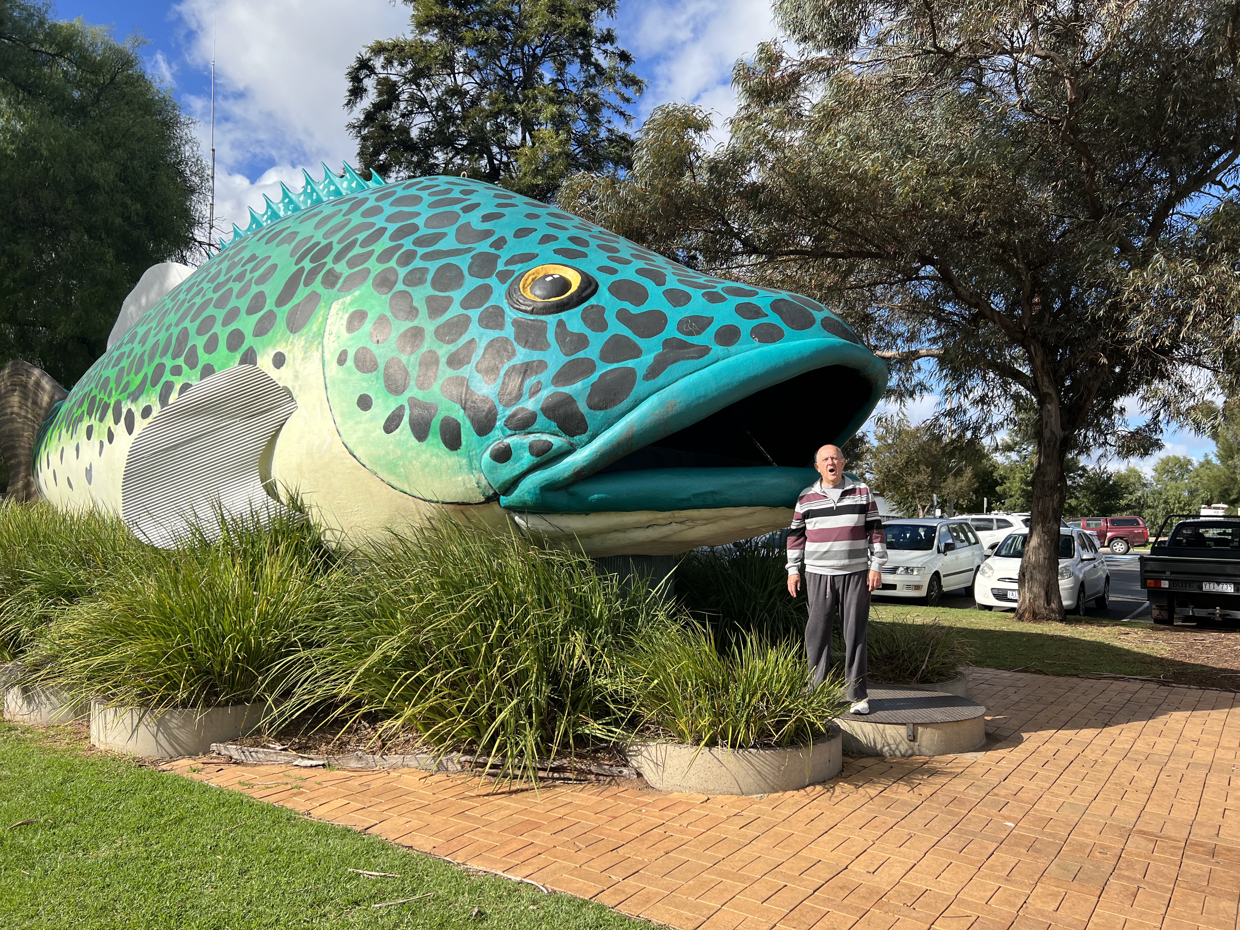
The must see in town is the giant Murray Cod, 15 m long and 5 m wide. Readers may recall the giant Murray Cod at Tocumwal in a previous blog. Tocumwal residents believe their Cod is the real thing and that the Swan Hill Cod is really a Murray Trout. Well, who is Allthego to argue?
We now head onwards down the River to Robinvale.
