Category Archives: Western Australia 2025
The Gibb
We have now made it to El Questro, our first stopover along the Gibb River Rd. Before arriving we had stopped off in Kununurra to stock up on supplies for the next two or three weeks. Supplies along the Gibb are a bit sparse and prices reflect the remote locations.
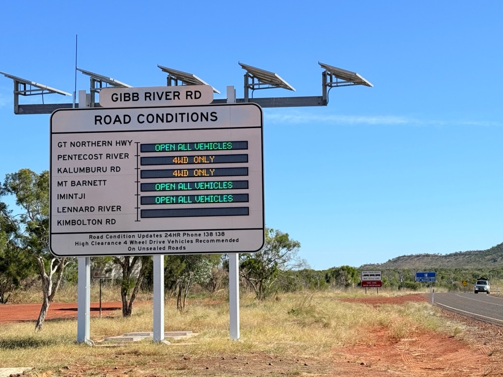
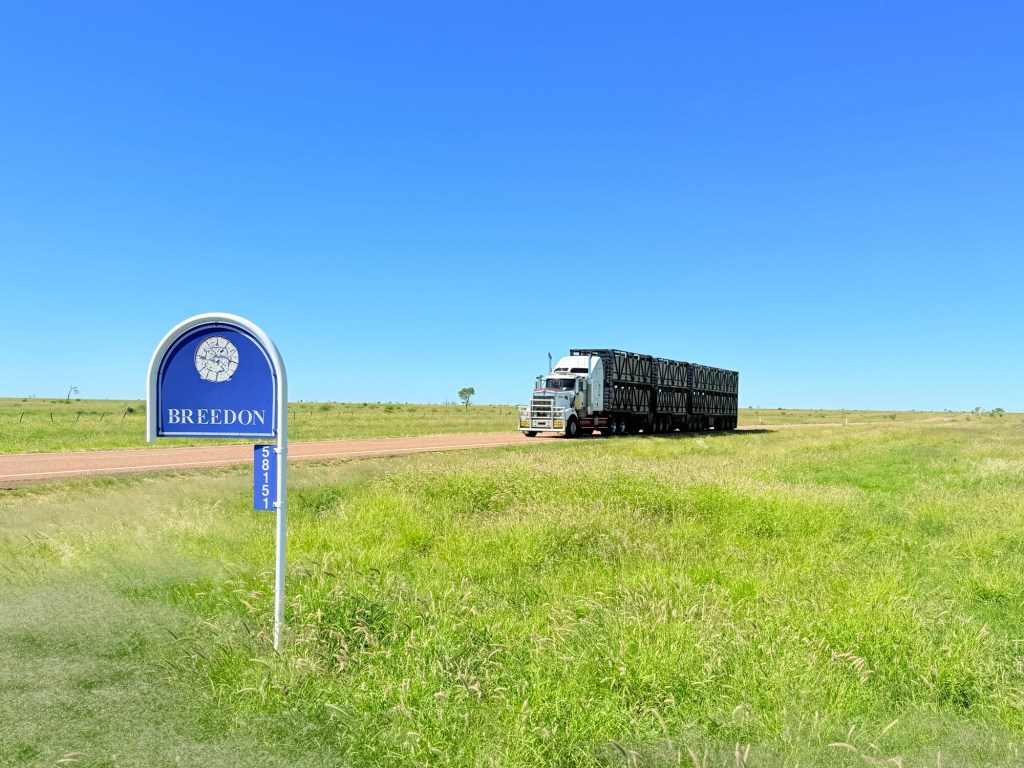
We stopped off at the start of the Gibb, which branches off the Great Northern Hwy, to check up on the road conditions ahead on the big sign.
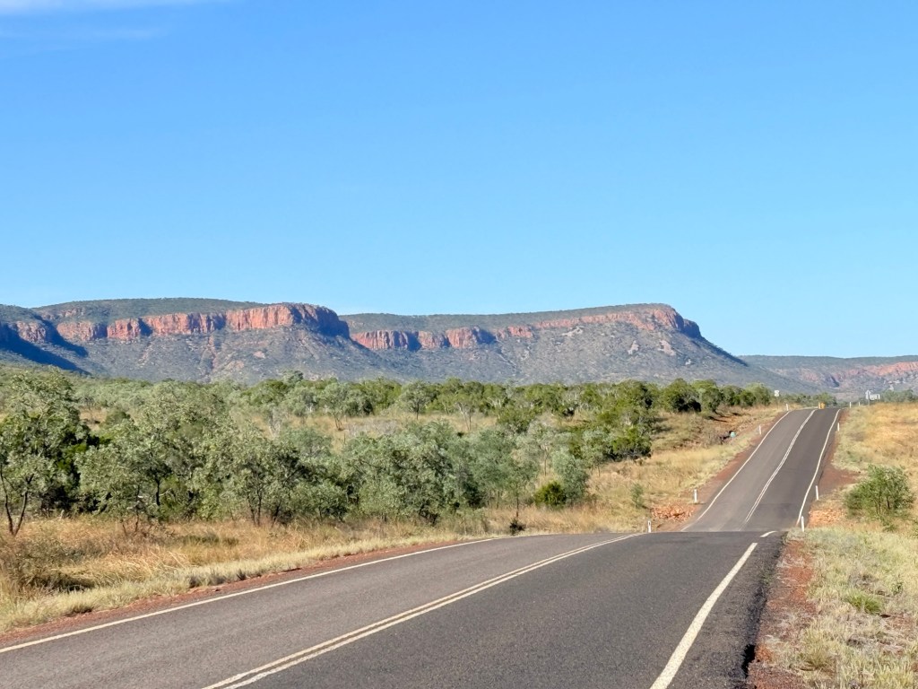
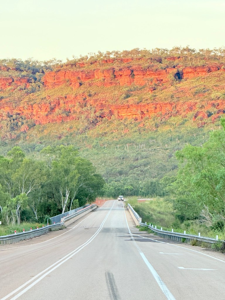
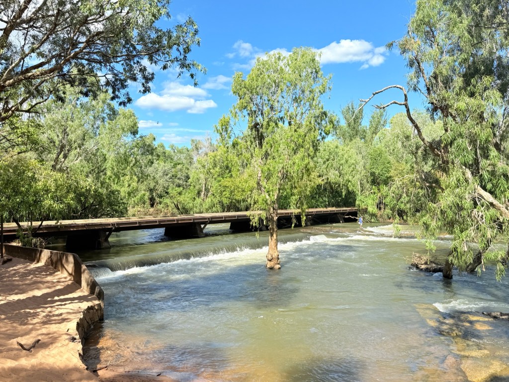
The road to the El Questro turnoff is all sealed and a great drive through the landscape. There is a further 25km of sealed road to the Pentecost River crossing before the gravel starts in earnest. We will be tackling that section in a few days.
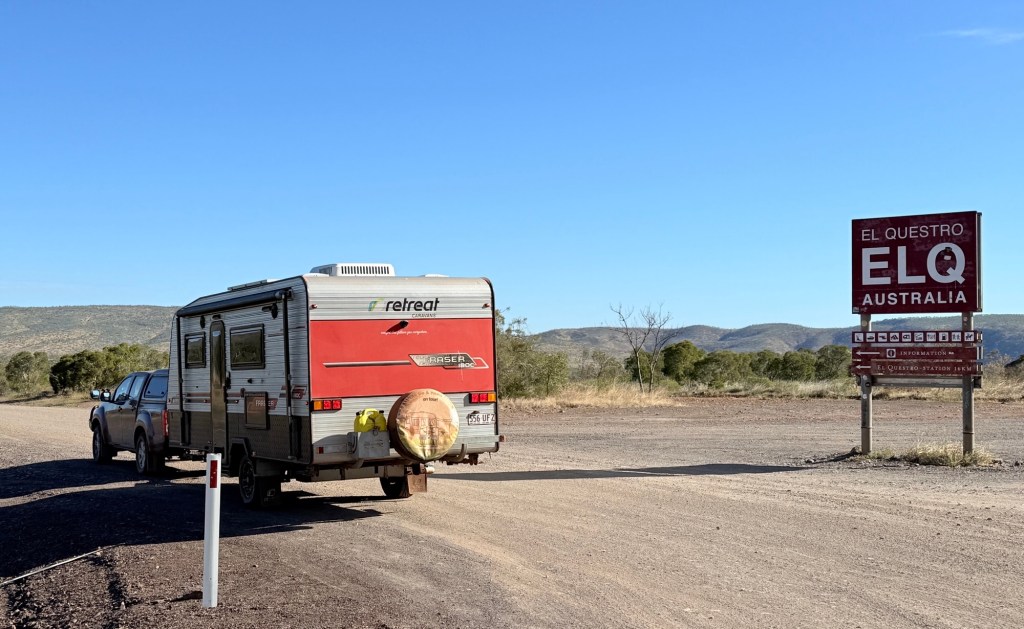
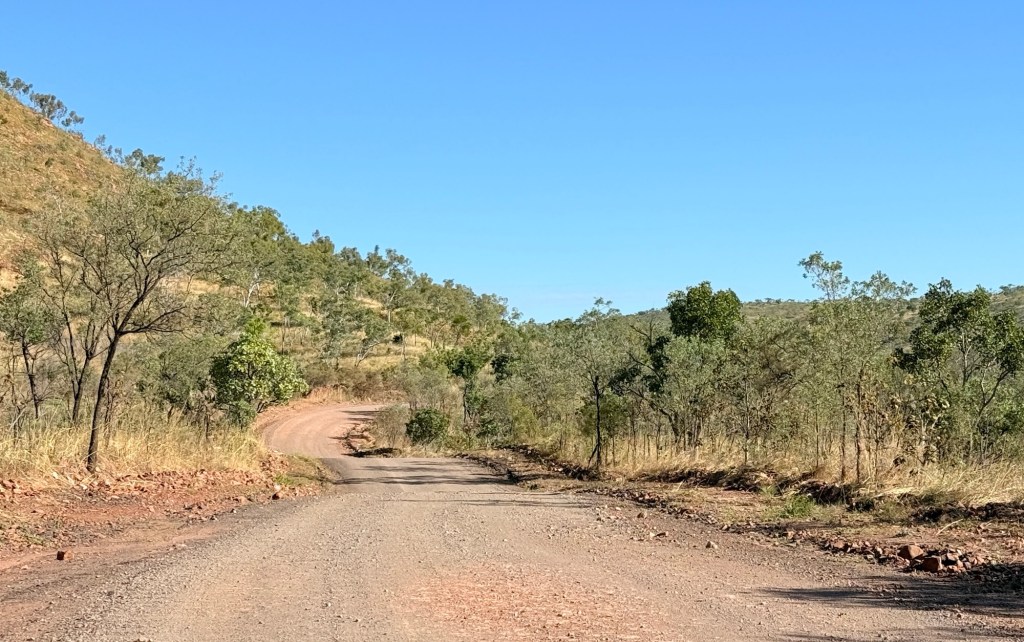
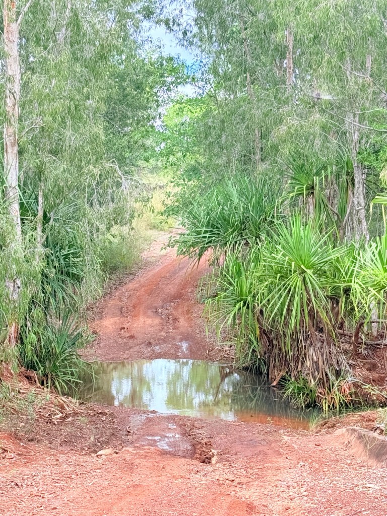
From the turnoff it is 16km along a good gravel road to the campground. The private road is graded regularly during the season. Smooth as a baby’s bottom as some would say!
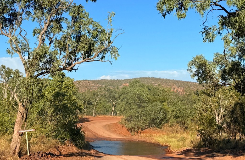
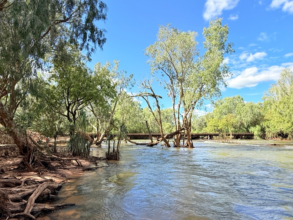
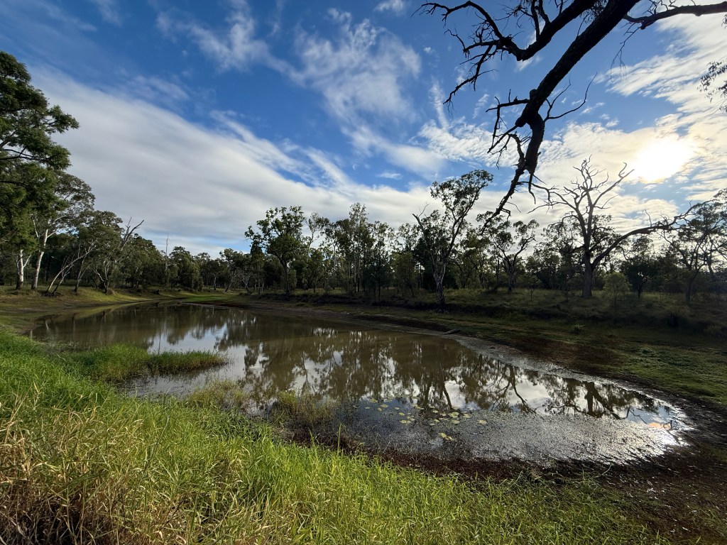
Only three creek crossings of any significance and the levels all under 40cm. The first two were really big puddles of water. No dramas, a few splashes of water on the caravan indoor step.
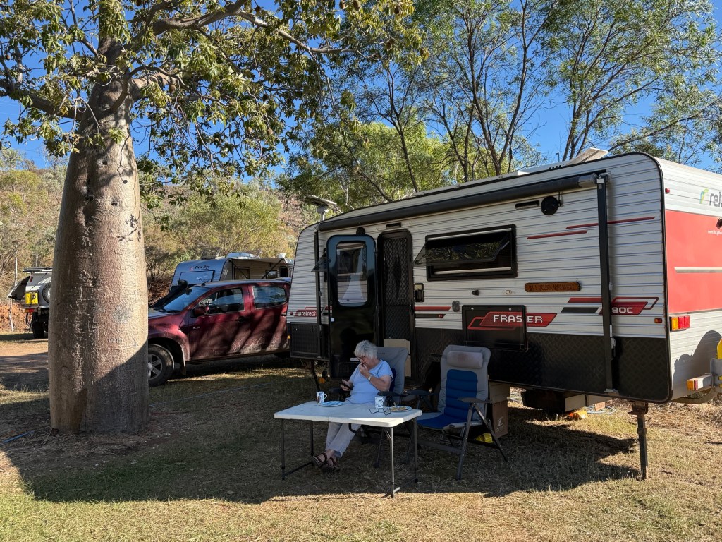
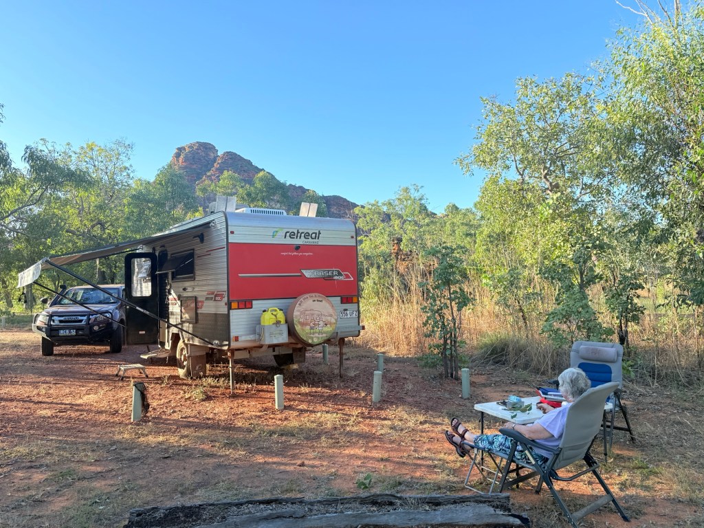
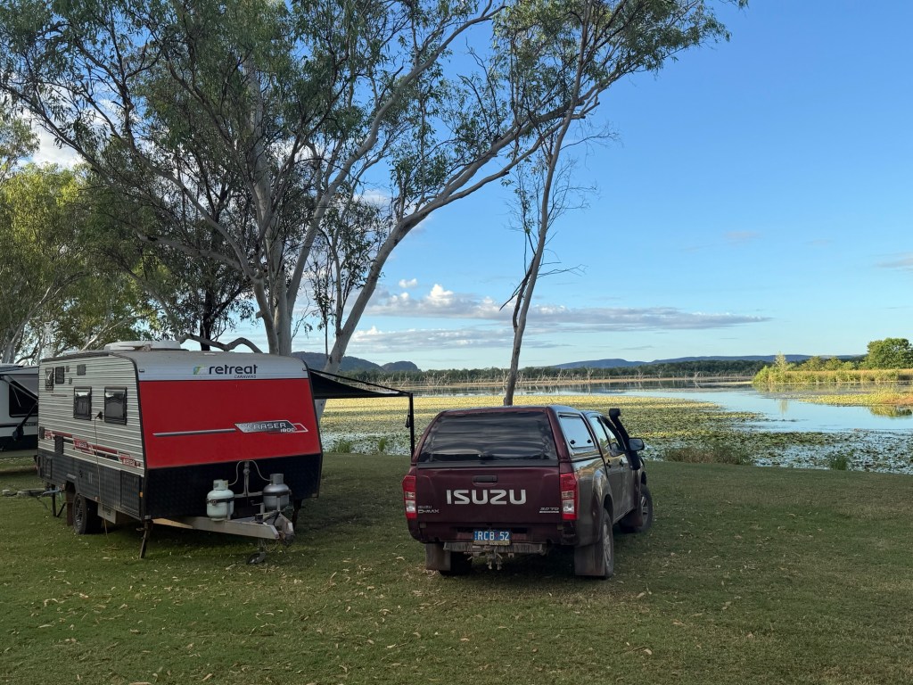
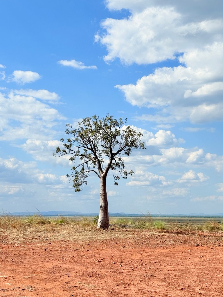
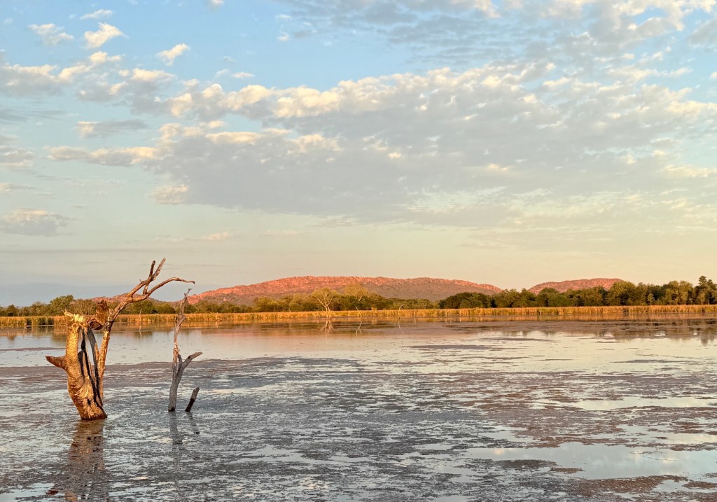
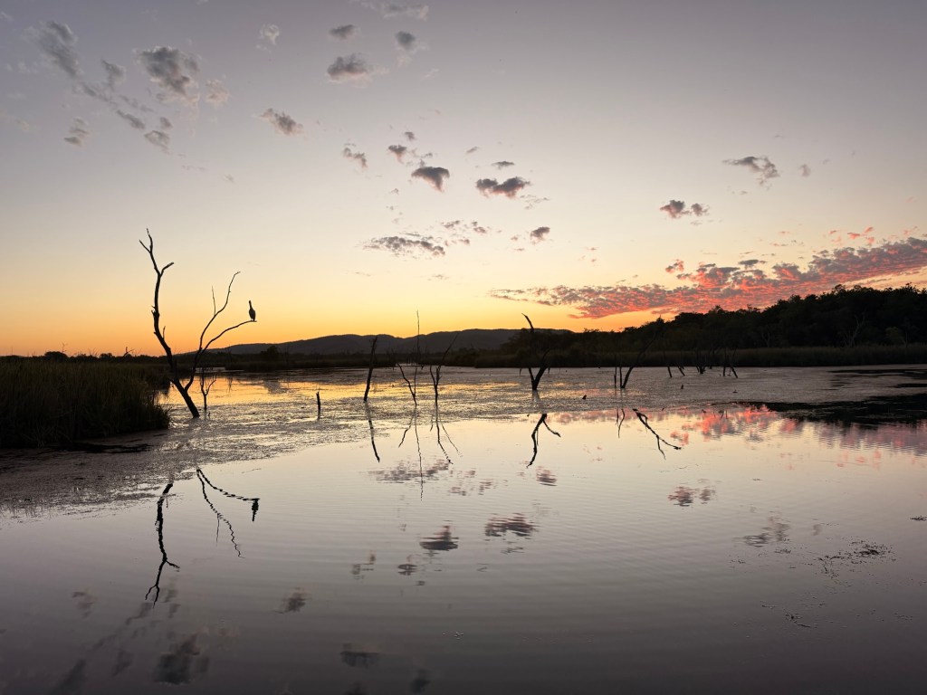
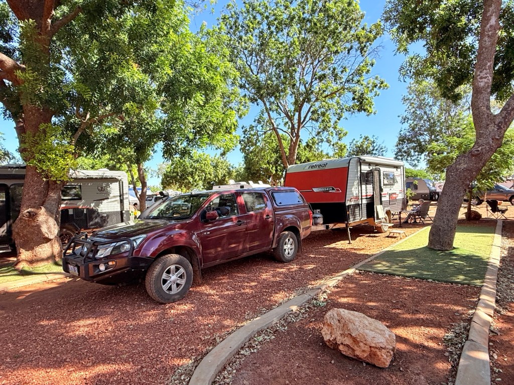
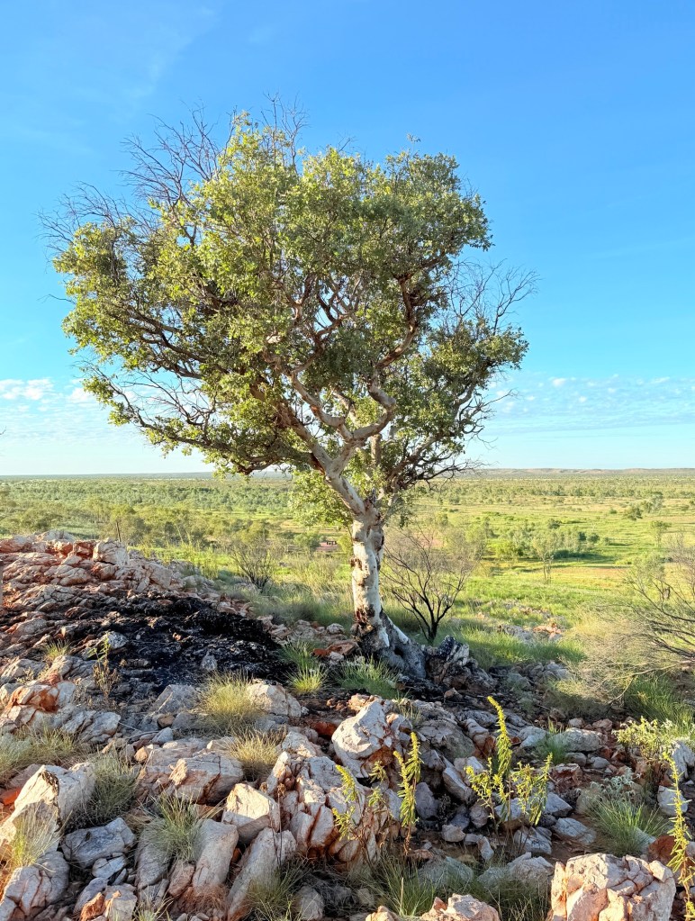
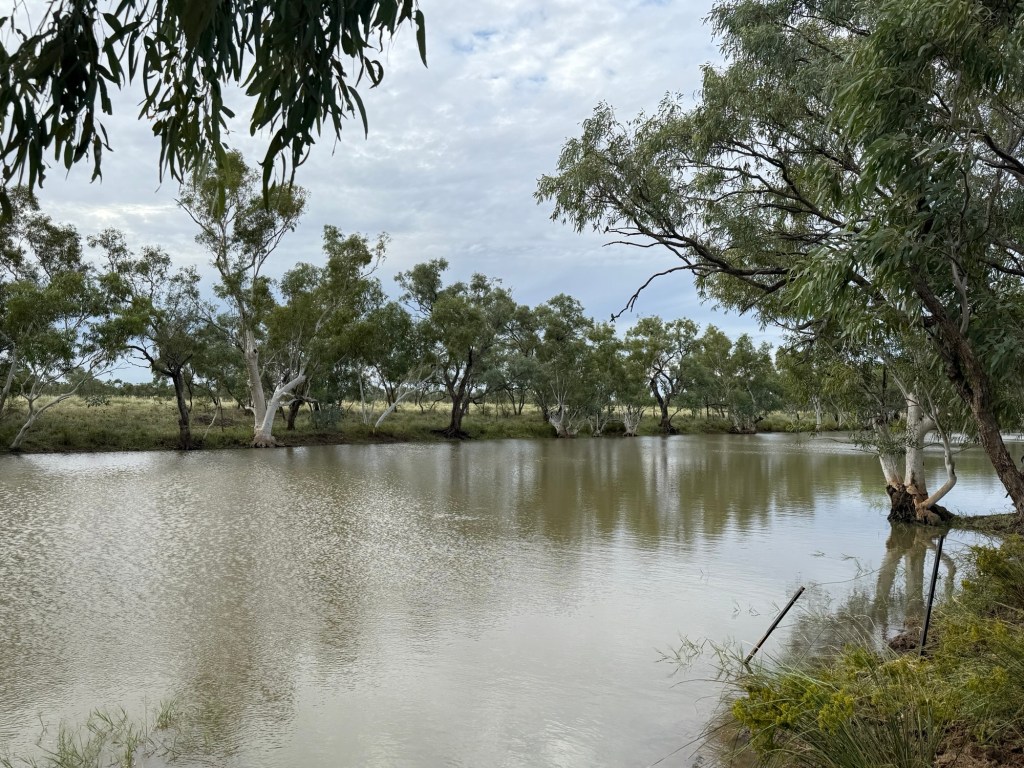
We have got a good campsite at El Questro under some leafy trees providing some good shade, it continues to be in the low 30s during the day. No big branches.
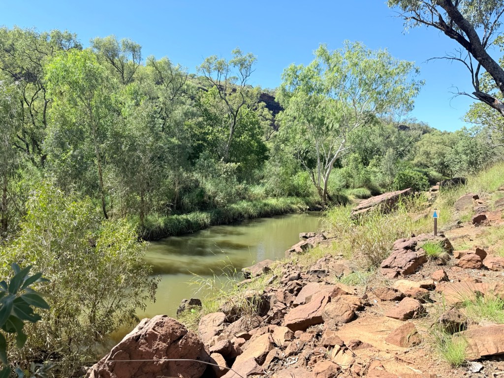
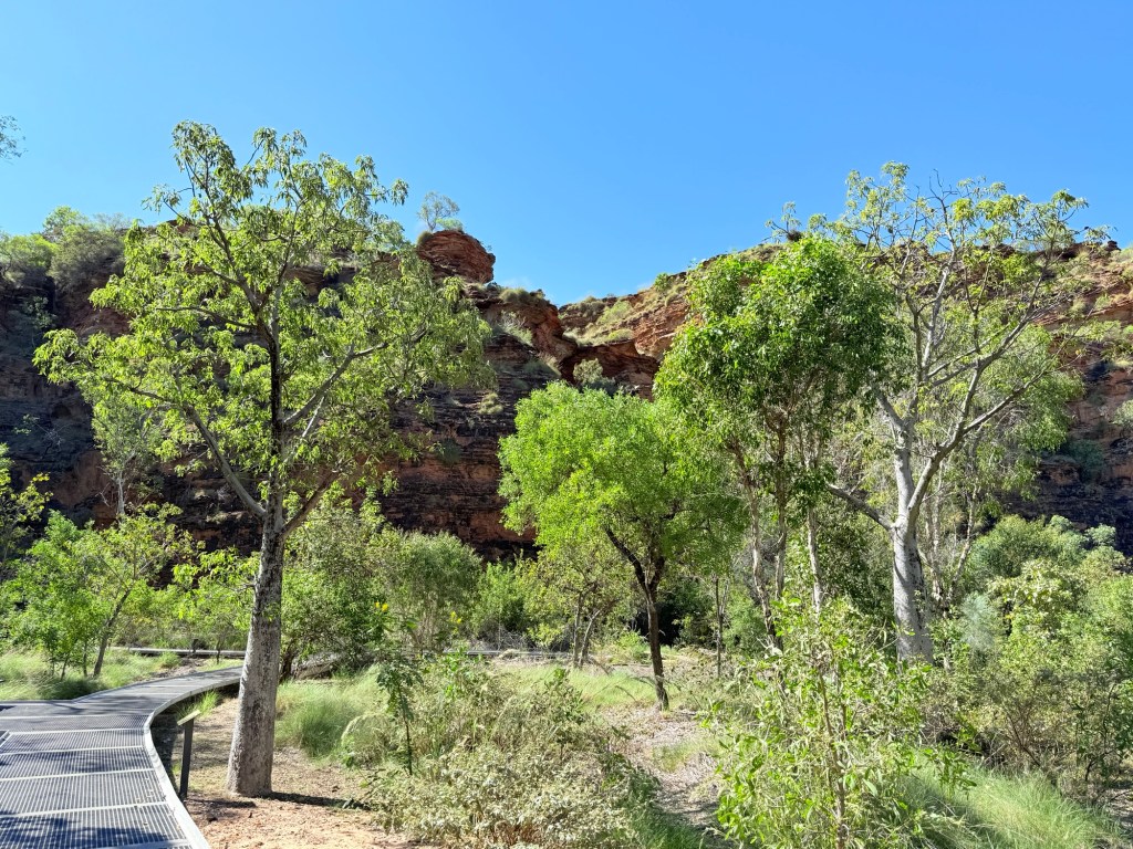
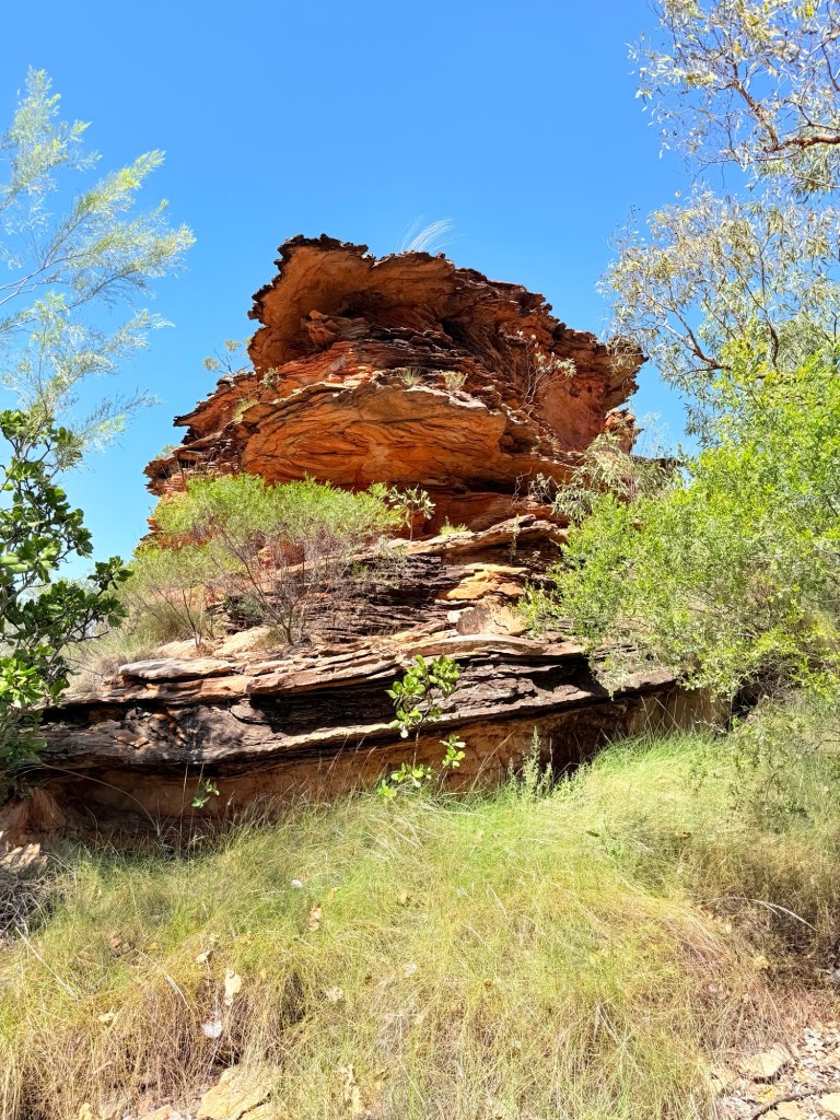
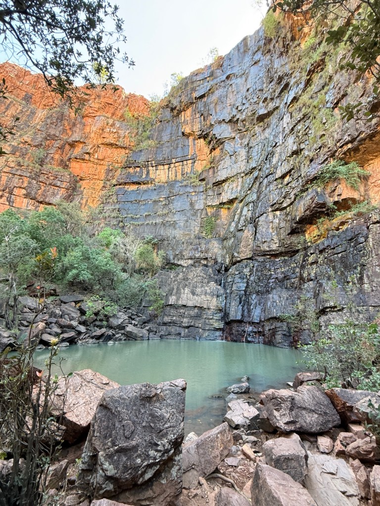
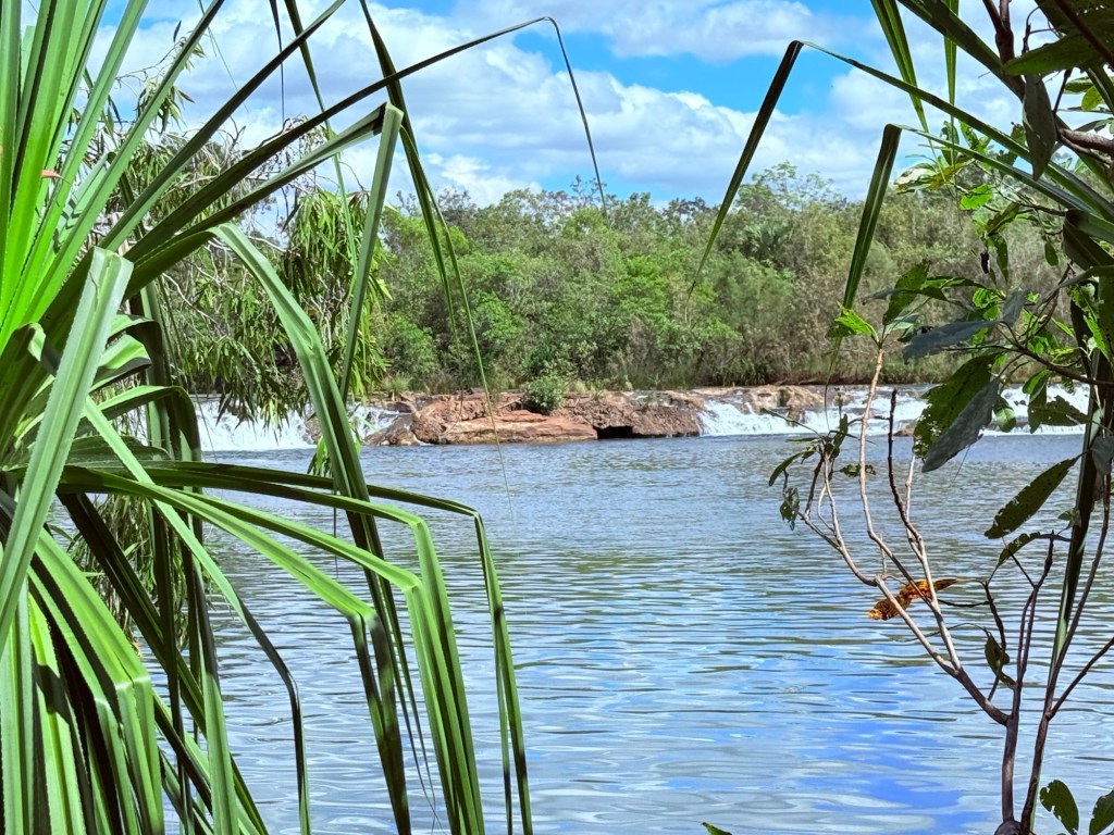
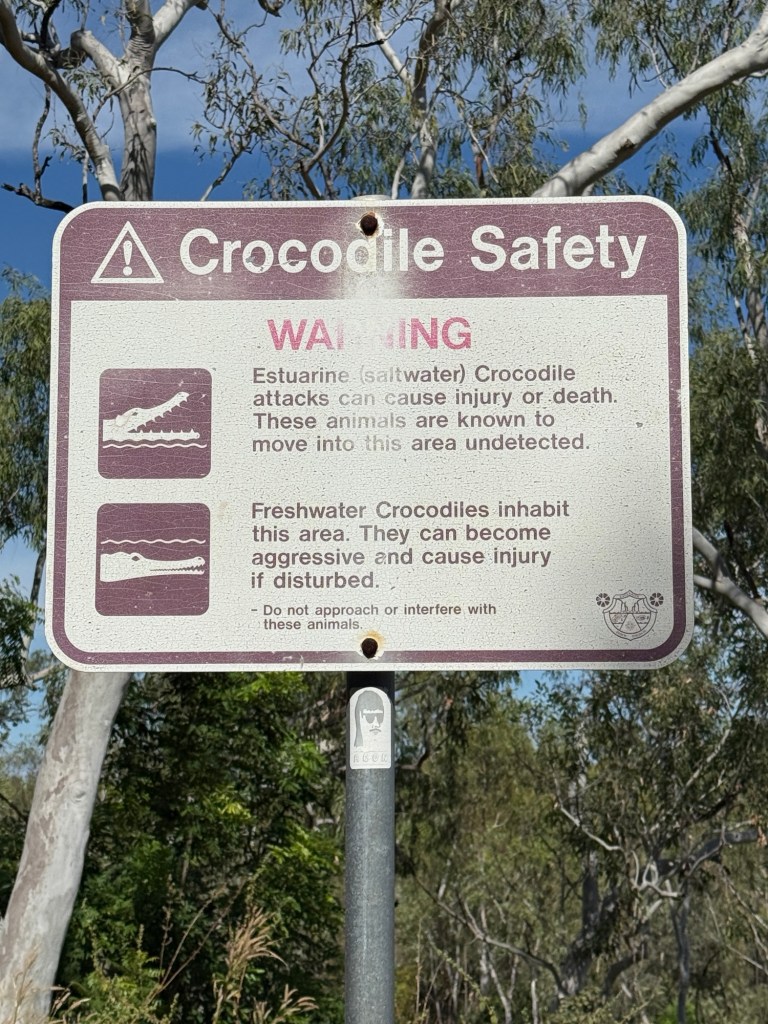
There are a few gorge walks here with the opportunity of a swim in salti croc free pools, some freshies though maybe around to at least keep an eye out for and not agitate.
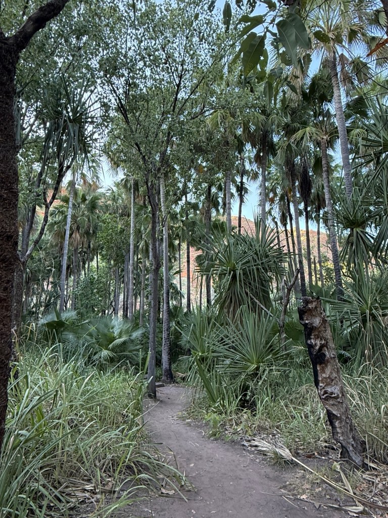
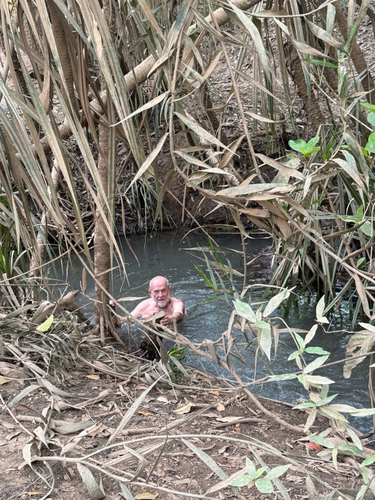
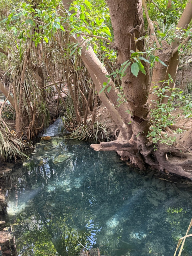
We are going to start with the easy one first, 600m return, to the Zebedee Springs. This is a stroll through the bush to a stoney creek that continuously flows rather warm water, 28-32 degrees thereabouts, from an aquifer deep within very old sandstones.
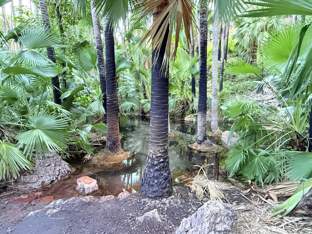
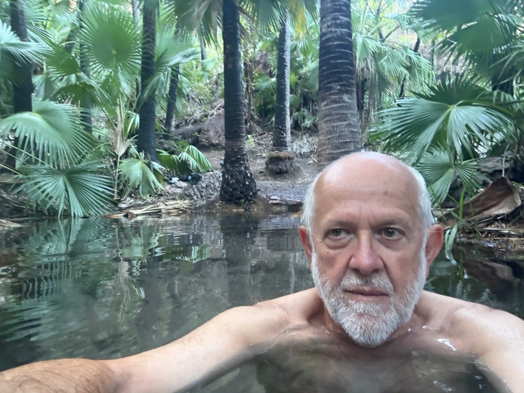
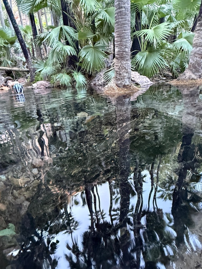
Here one can lounge all year round in the sandy bottomed pools between little waterfalls and tall palm trees. It might though get a bit vigorous in the wet.Very pleasant spot. Fortunately, we got there early around 7.30am and beat the crowds. Management closes access to the Spring at mid day. An effort to control numbers in the fragile environment.
Below is a slomo video of the creek it goes for a minute, patience required!
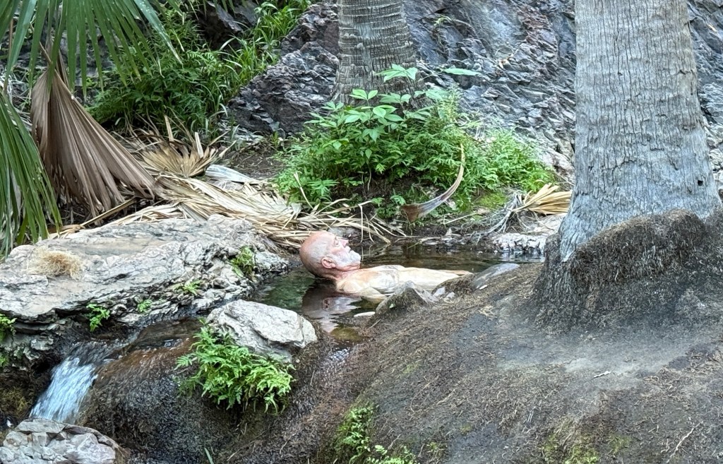
A small white crab like creature , an isopod, has recently been found to live in this creek. It is the only place in the world to date where this isopod has been found. Allthego kept his eye out for one as he lolled around in the waters, instead some big tadpoles were sighted.
Back in camp we had a lazy late morning and afternoon in the shade, with a belated democracy sausage for lunch. Until next time!
Lake Argyle
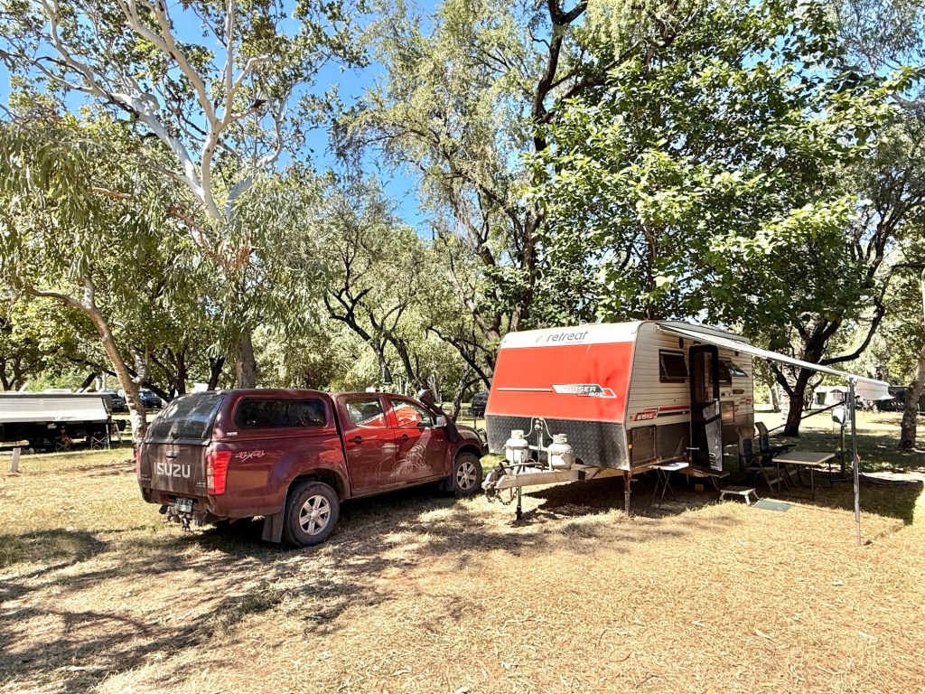
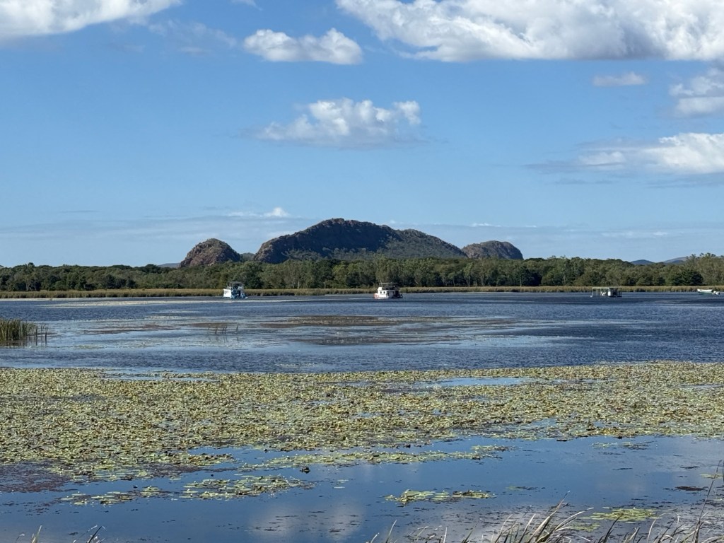
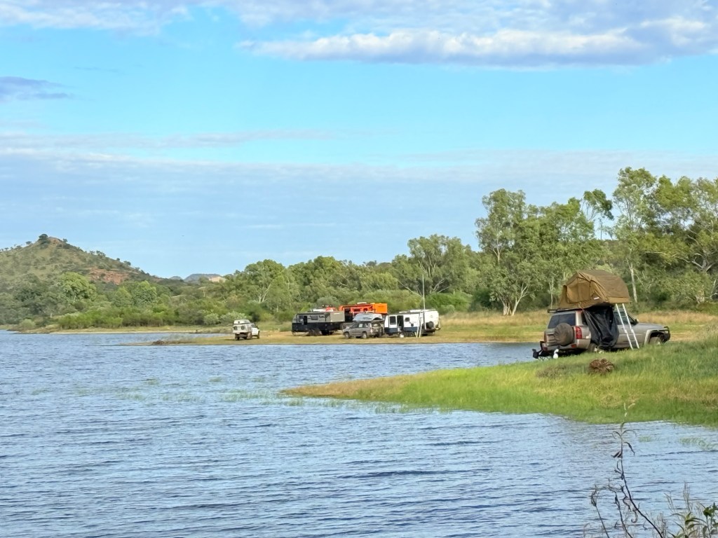
Lake Argyle campground is providing some comfort and few flies after the experience at Keep River. It is early in the season and there is plenty of room. Some bugs still chase the lights at night. There isn’t much at the Lake, just the campground and a lake cruise boat operator (hires canoes and dinghies too). A helicopter operates out of the camp too for jaunts around the Lake and the Bungle Bungles.
Our campsite is out on the edge overlooking a valley that runs down to the Lake. Windy at night. No Lake views. Some vans are also parked down there under the trees.
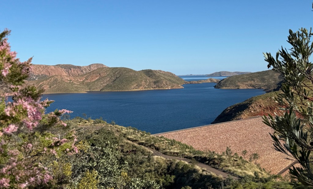
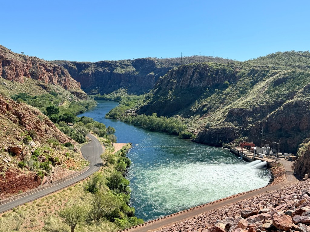
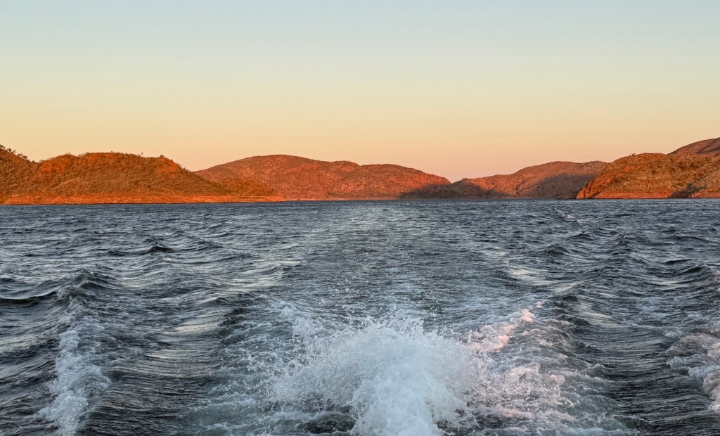
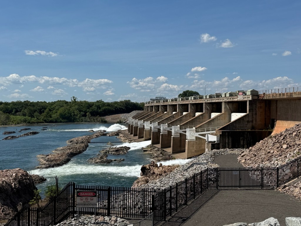
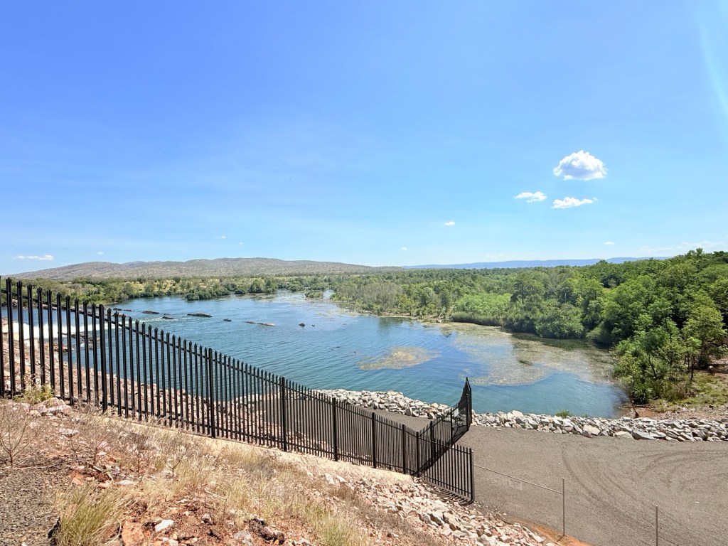
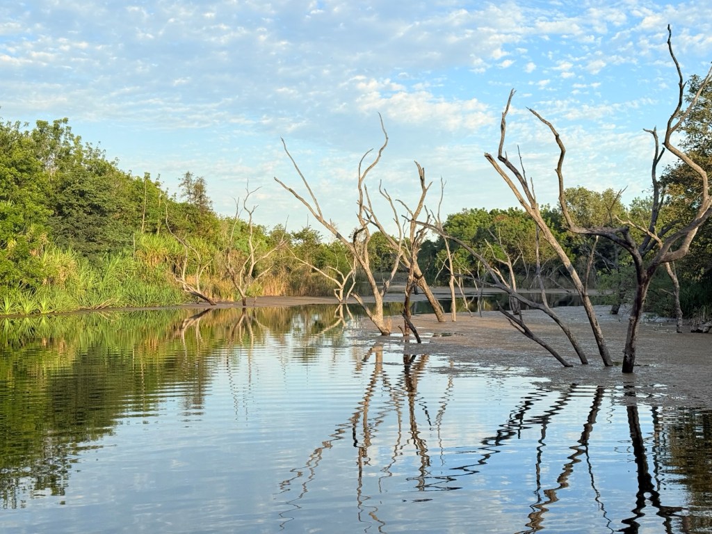
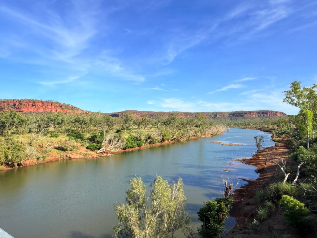
There is a big dam here as well that holds back the waters of the second largest man made lake in Australia (the largest is the Lake Pedder/Lake Gordon complex in Tasmania), some thing like 21 (?) Sydney Harbours when full. It is basically full now after a very big wet season in 2024 and a modest one in 2025.
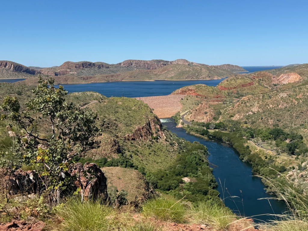
There are some great view points over the dam and lake; blue skies and deep blue water split by the red earth. Below the dam the Ord flows 55km down to Kununurra where the Diversion Dam holds back Lake Kununurra.
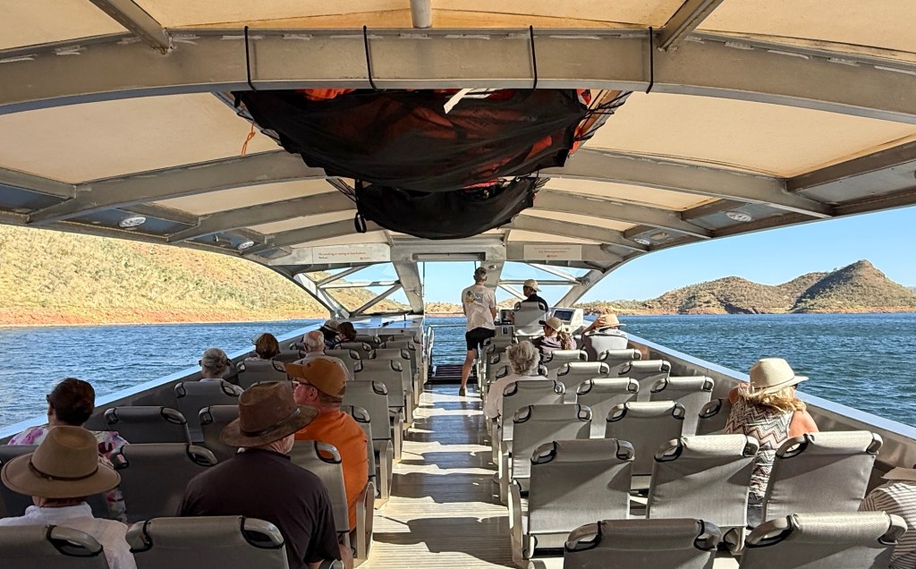
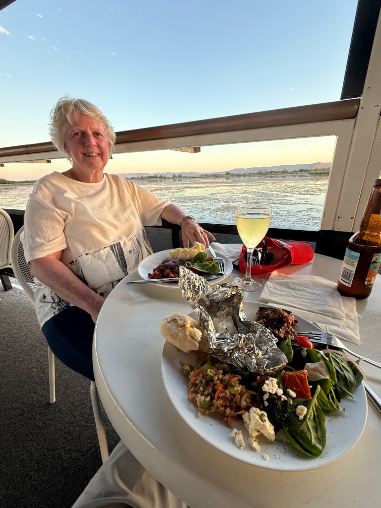
Getting out on the water here is a must do thing to get an appreciation of the sheer size of the waterways. So we enjoyed an afternoon/sunset cruise from the boat ramp near the dam wall. Only 12 of us onboard so there was plenty of room to move around and the nibbles went a long way. Not to mention the soft drinks.
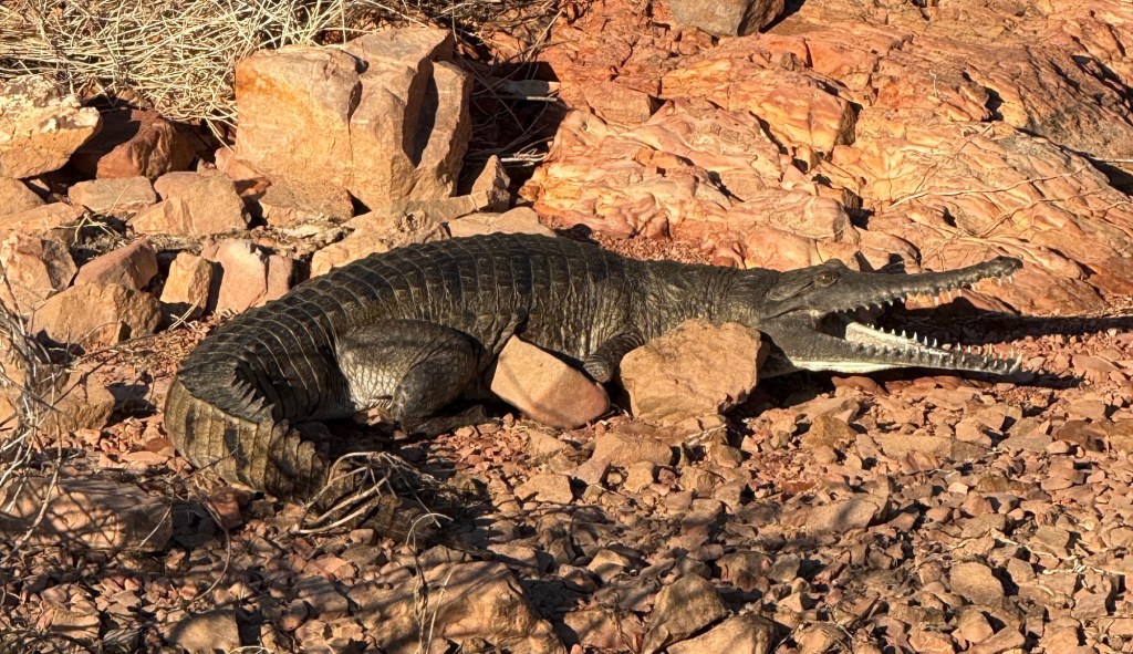
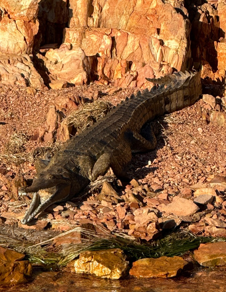
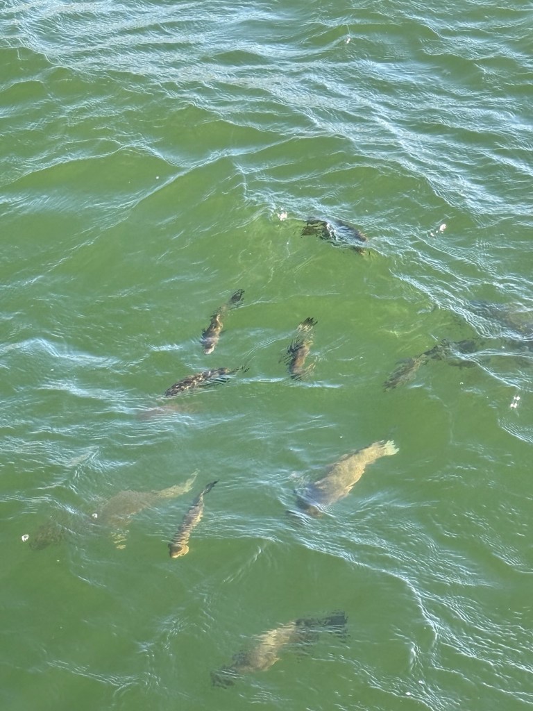
Spotted a few crocs on the bank, just the ‘harmless’ ones, and also tossed some dry biscuits to fish of all sizes that rose to the surface for their reward. Some of these are harvested and appear on the van park’s cafe dinner menu. We later tried some for dinner, rather good.
We later stopped at buoy for half an hour or so to enjoy a swim and partake of the nibbles.
Apparently, there are 35,000 freshwater crocs in the Lake. Not sure who counted them. These are the harmless ones, but they can give you a nip if you aggravate them. The captain was pretty sure there were no salties in the Lake, but of course couldn’t be certain. It would be a big climb up the dam wall for them. In any case the company hadn’t lost anyone to a croc as far as he knew.

Comforting, so Allthego ‘dived’ in. The water was a warm 27 degrees. Homealone, was reluctant and focussed on getting a good pic of the husband just in case.

The temperature of the Lake water contrasted with the famous infinity pool. Not many guests were indulging in a plunge, just laying around in the sun looking beautiful.
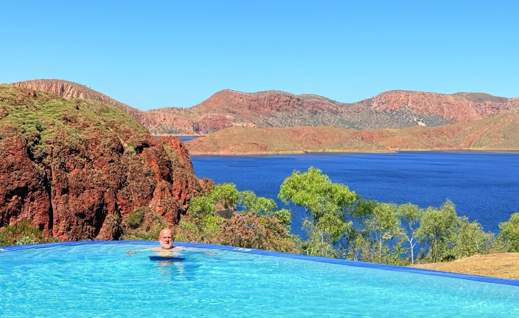
Not so Allthego, in he went. It was super cold indeed to start off with and didn’t seem to change much as it usually does when one gets ‘used to it’. Enervating!
In finishing it would be proper to note that in an earlier post covering the trip up to Whyndam I mentioned that live cattle exports are being phased out. In fact it is live sheep exports that are finishing up. Another glitch too, the export frozen meat business finished in the mid 1980s not pre WW11.
We now move on to El Questro at the start of the notorious Gibb River Rd. This is the pointy end of the trip through the Kimberlys. Will the road be as grim as proclaimed?
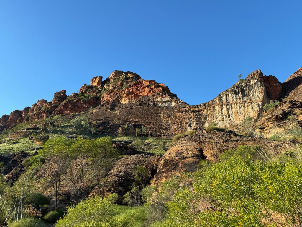
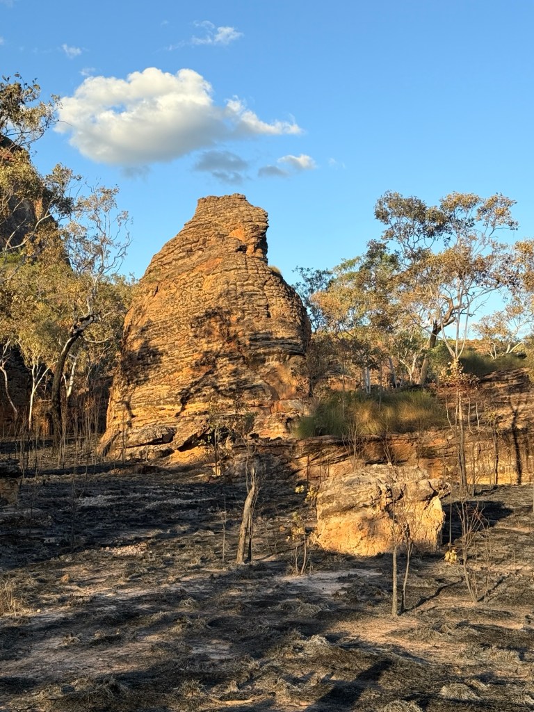
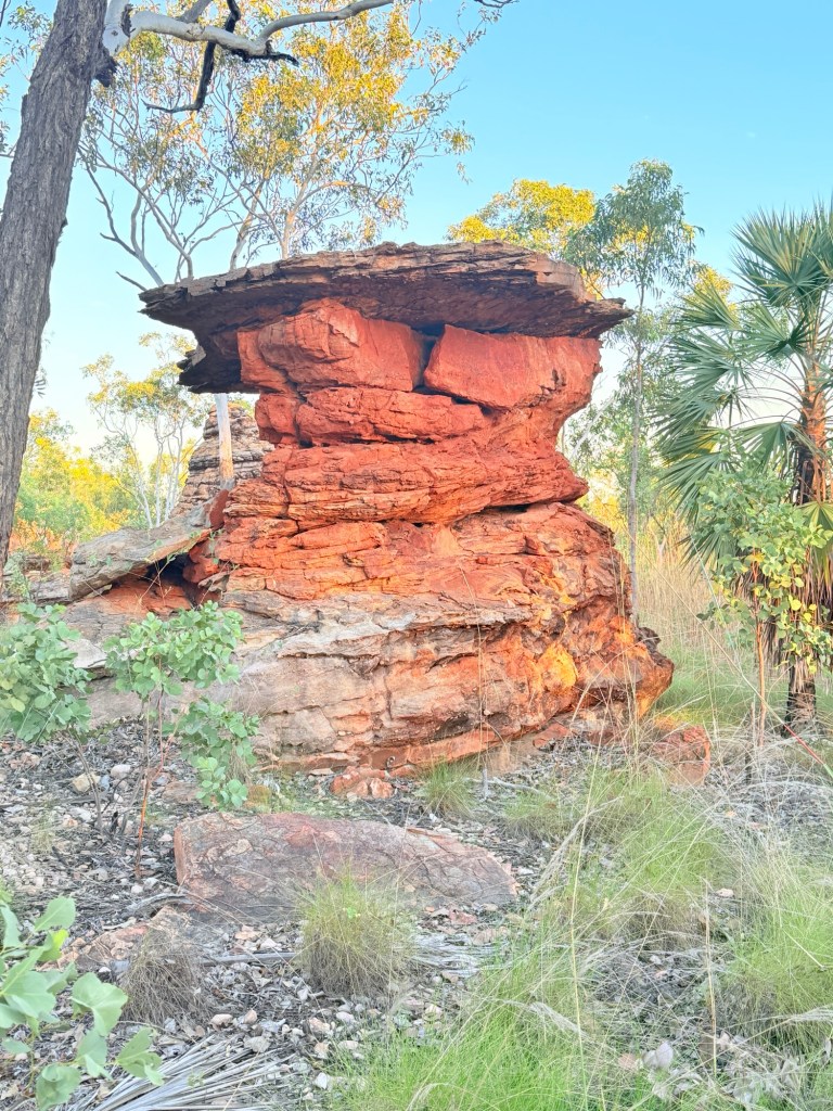
Walking the rocks
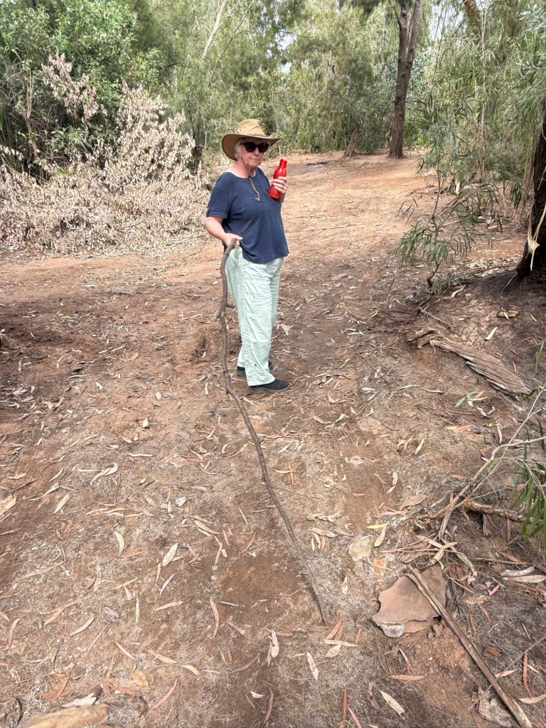
The walks here in Keep River are located in three places. Allthego is going to wander around them while Homealone patiently waits at the start keeping track of the elapsed time.
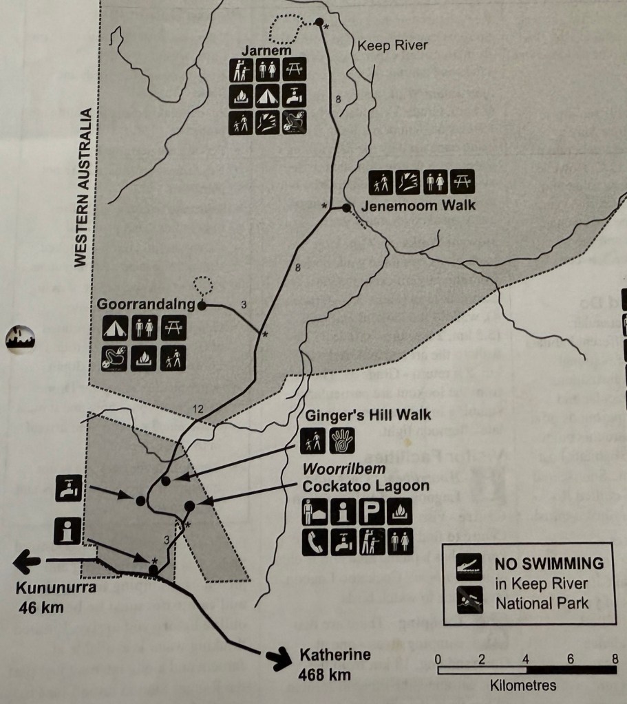
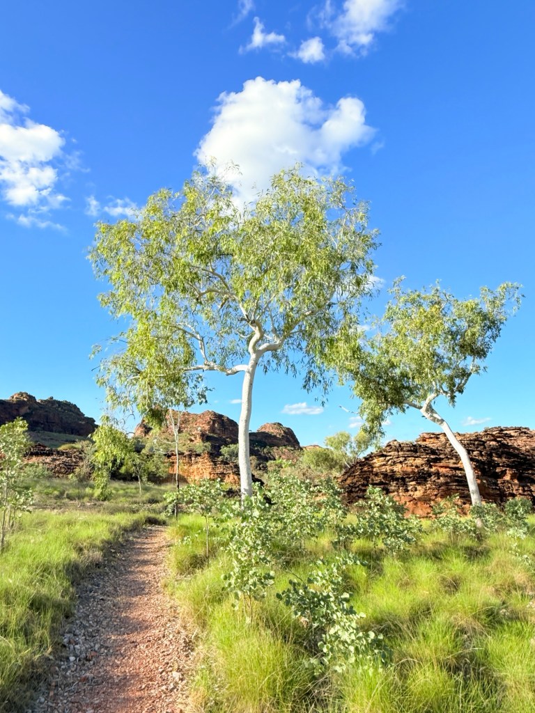
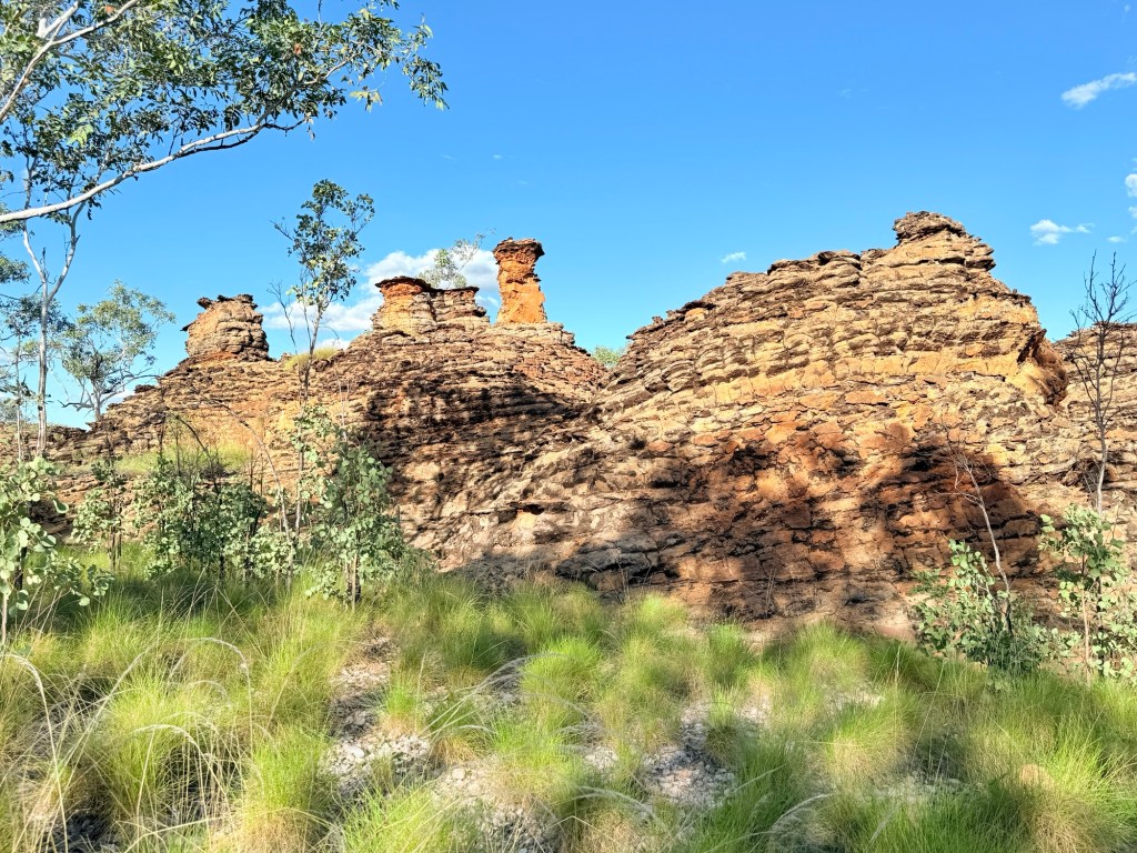
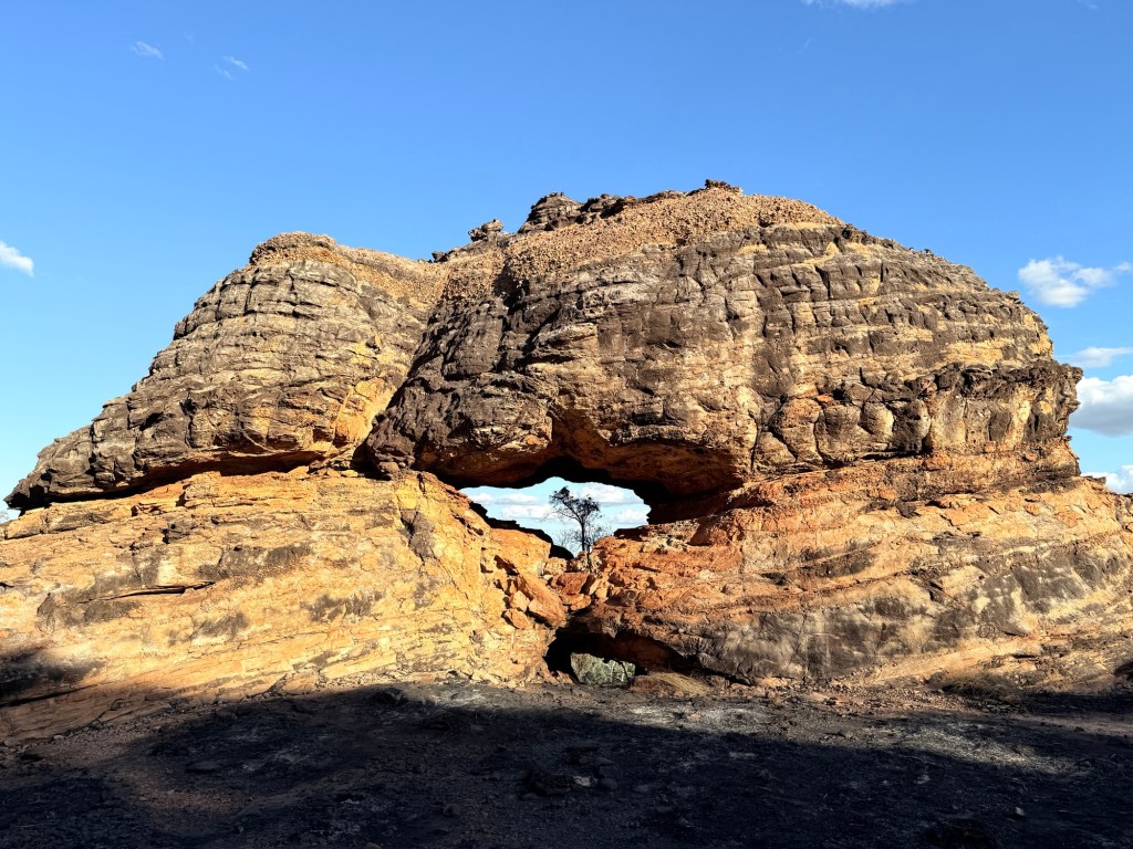
Here are a few of the photos from the experience on these walks spread over the three days.
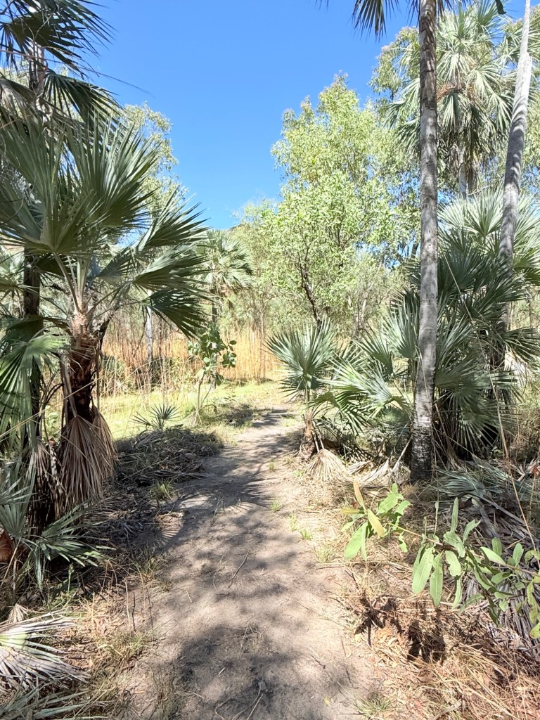
The first is a loop walk that runs from our campground, Goorrandalng Walk (only 2km return).
The second is Jenemoom Walk (3km return) located about 10km away on the track to the second campground, known as Jarnem Campground.

The last walk is a 6.5 km loop walk from the Jarnem Campground, another 8km along the road from the start of the Jenmoom Walk.


Well, Allthego survived the great walks, the great bull and we sort of beat the flys. It was now back on the road to WA and some time recovering in the sun at Lake Argyle.
Apart from on the first day leaving Brisbane we have had no rain, daytime temps have been in the low 30s with little or no humidity. It’s the ‘dry’ season!
Keep River NP
The little map below follows the route from Katherine across the WA border to Kununurra.
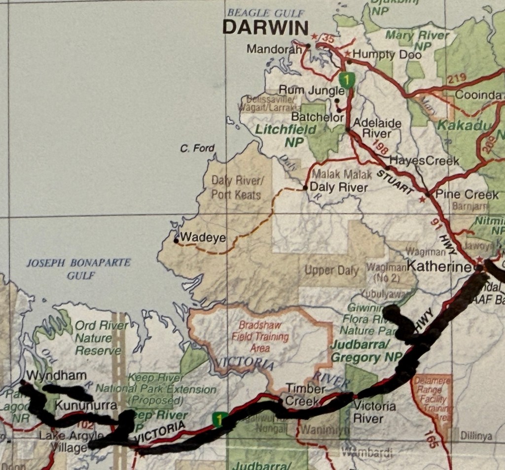
We now leave Kununurra and backtrack just over the border into the NT, where Keep River NP is located (bottom left on the map). We have technically lost that hour and a half we gained the other day. We have decided though to keep our watches on WA time, so as not to confuse the sun. Phones automatically switched to NT time.
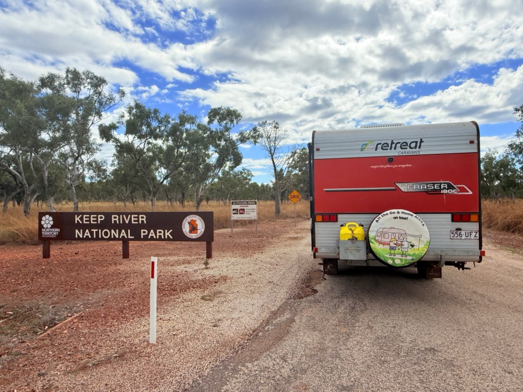
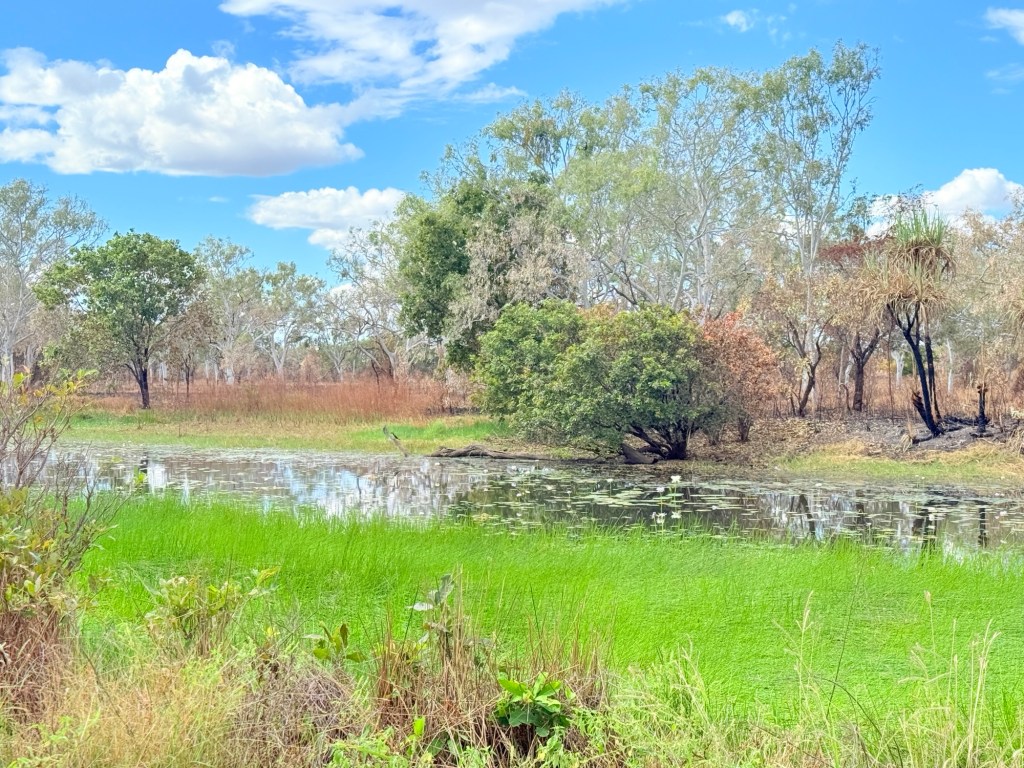
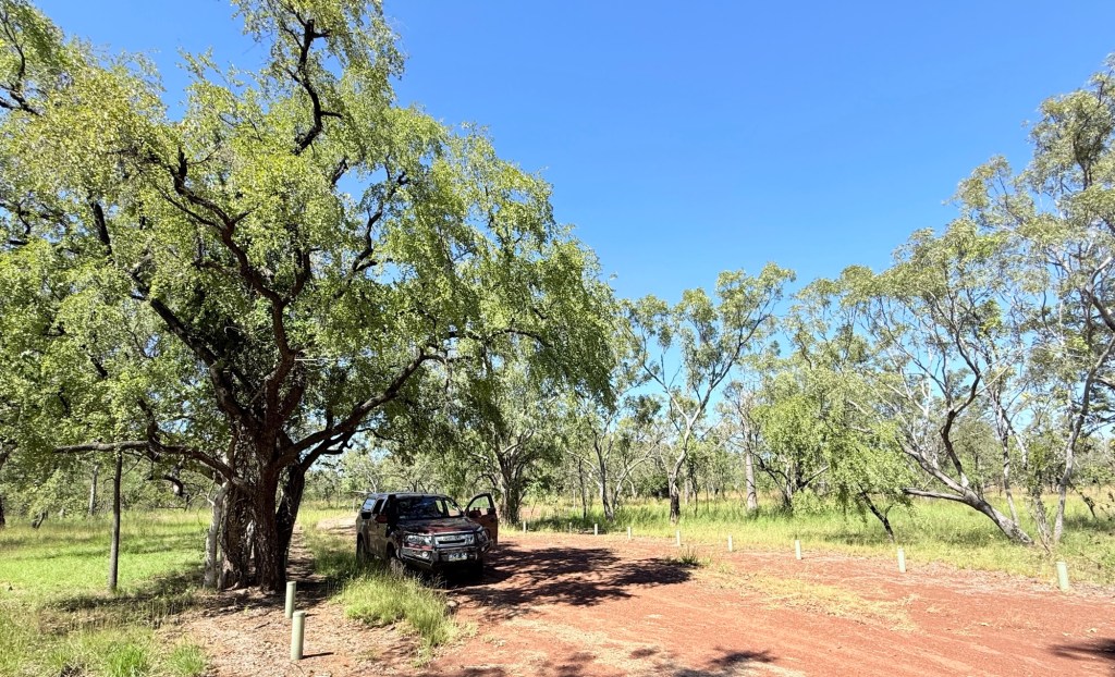
The NP camp ground is about 18km off the highway down a good gravel road. We first called by the Ranger Station to check out Cockatoo Lagoon and any fresh park information.
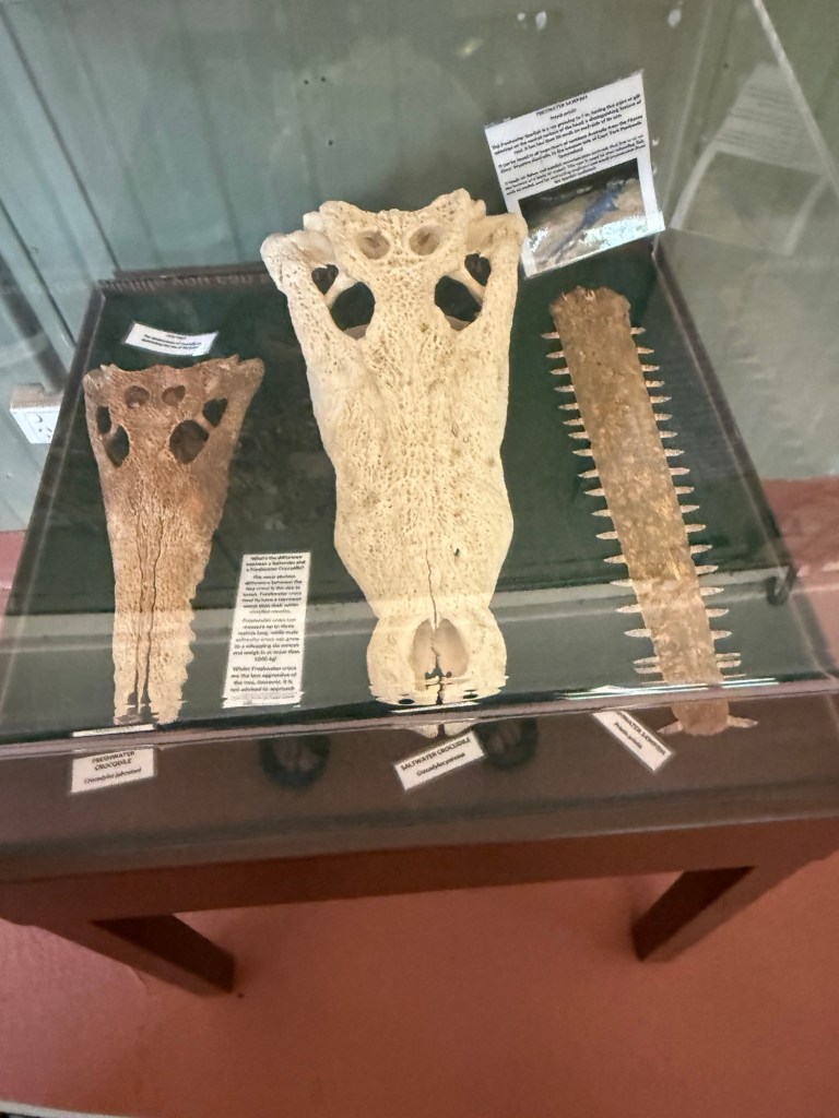
There was an interesting exhibit showing the skulls of three predators in the waters of the Keep River. We must keep our eye out for them.
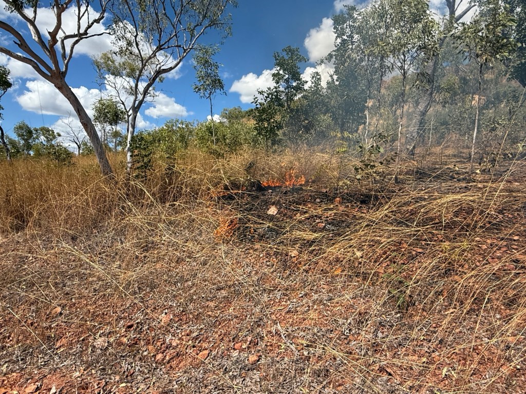
There has been quite a bit of low impact bush and grass burning going on in the park, campgrounds though are safe. Flocks of hawks circle above the burnt and burning areas hoping to pick up an escaping animal snack. Such is life!
Fire though is always a concern, but it is fascinating how it flicks through the grass and small shrubs just taking off the dry stuff. After the next rains everything springs back to life.
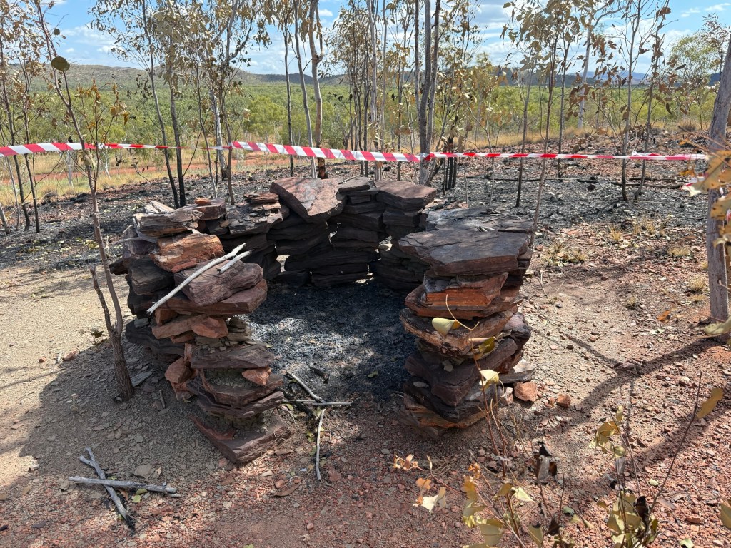
Moving along we stopped at the short Ginger Hill walk. Atop the hill is a small circular stone structure built by indigenous people (not sure how long ago, looked recent but maybe a reconstruction). Apparently, these structures are relatively common in these parts. You find out what it is for when you get to the top of the hill. The people would start a small fire in the rock circle, cover the top with branches, twigs etc and then sit inside and wait. Now, these people were certainly observant like Allthego!
Remember those hawks circling above the fire looking for getaways?Well, said hawks would also circle above this rock structure. They were attracted by the smoke, and when the character inside stuck a furry lure up on a stick and waved it around the hawk would land on the branches and twigs trying to catch the ‘animal’ for tucker!
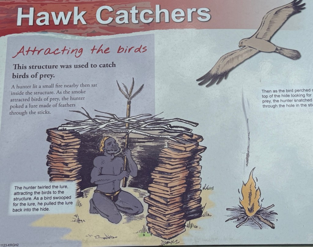
Instead, ‘wooshka’ our first nations person would grab the hawk somehow for their tucker! I wonder whether this would work on brush turkeys back home?
After this excursion we meandered along to the campsite and got into our pre-booked site for the next three nights. No one else was here. But there were lots and lots of flies to keep us company. We had arrived lunchtime WA time. As it turned out this was the worse the flys were to be and things improved (only a little) over the next couple of days. No power, water or internet. Off the grid living! Another van showed up on our last day, as well as one day tripper.
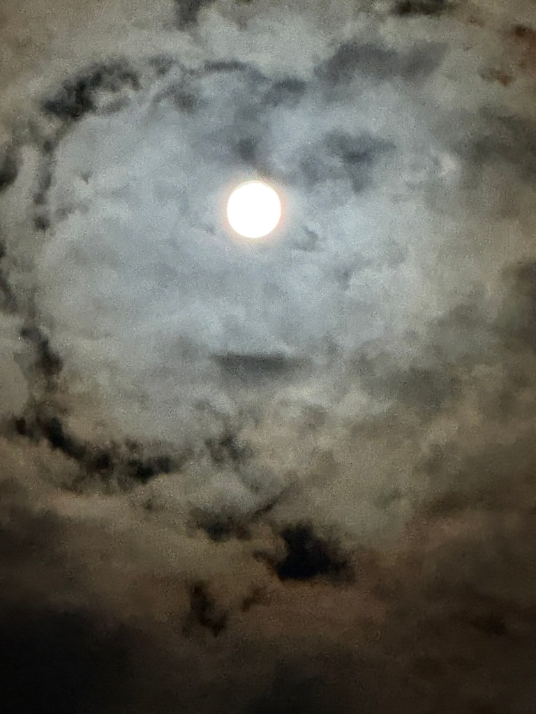
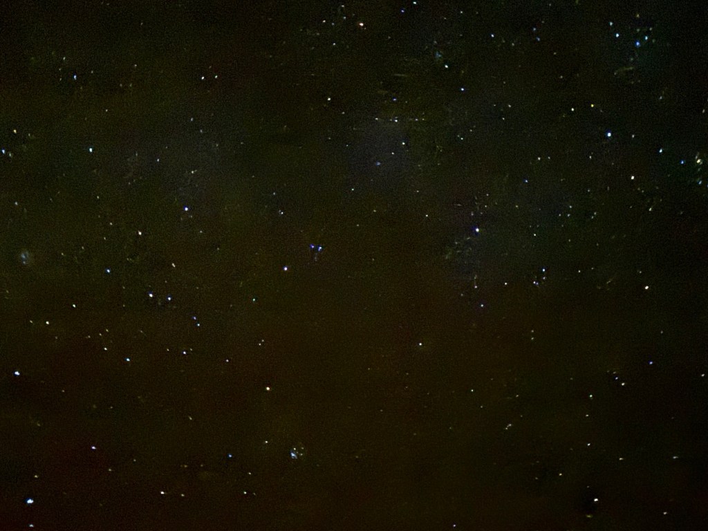
It was a very quiet time, nights were super quiet, and we had a full moon with a very starry milky way above.
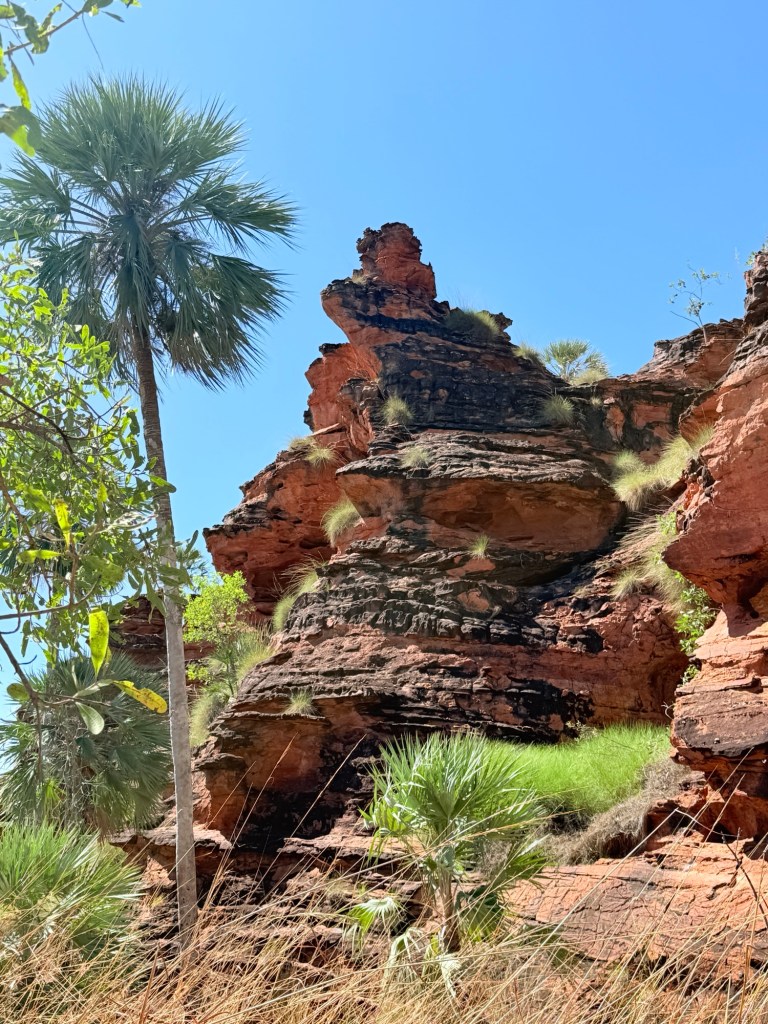
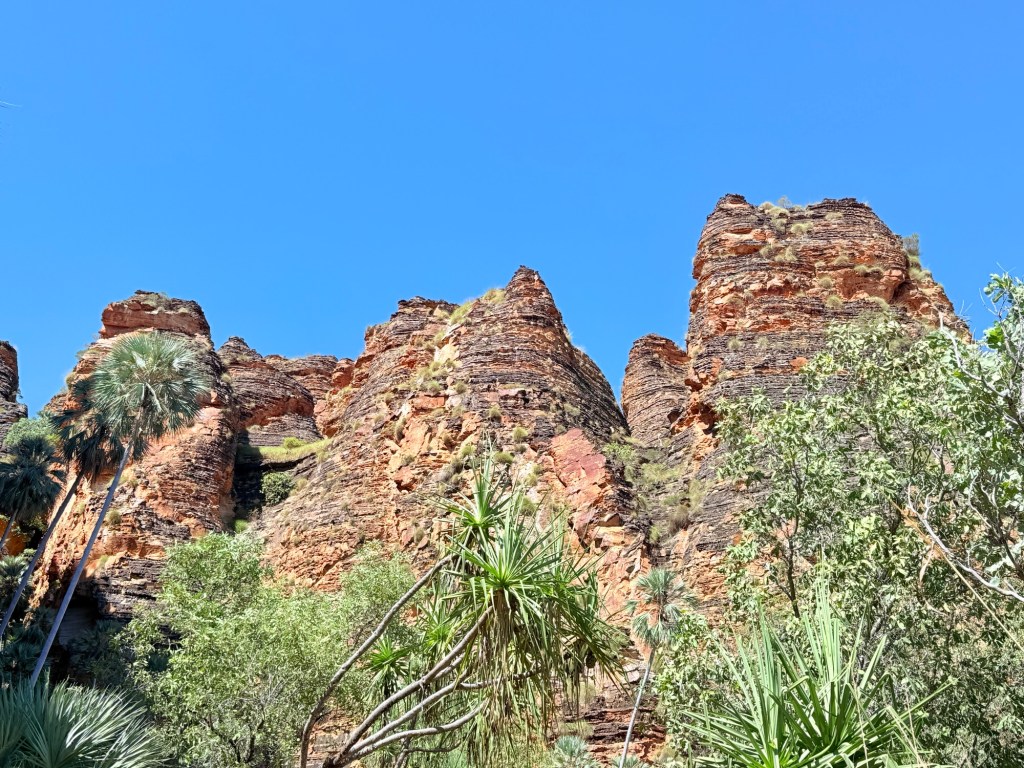
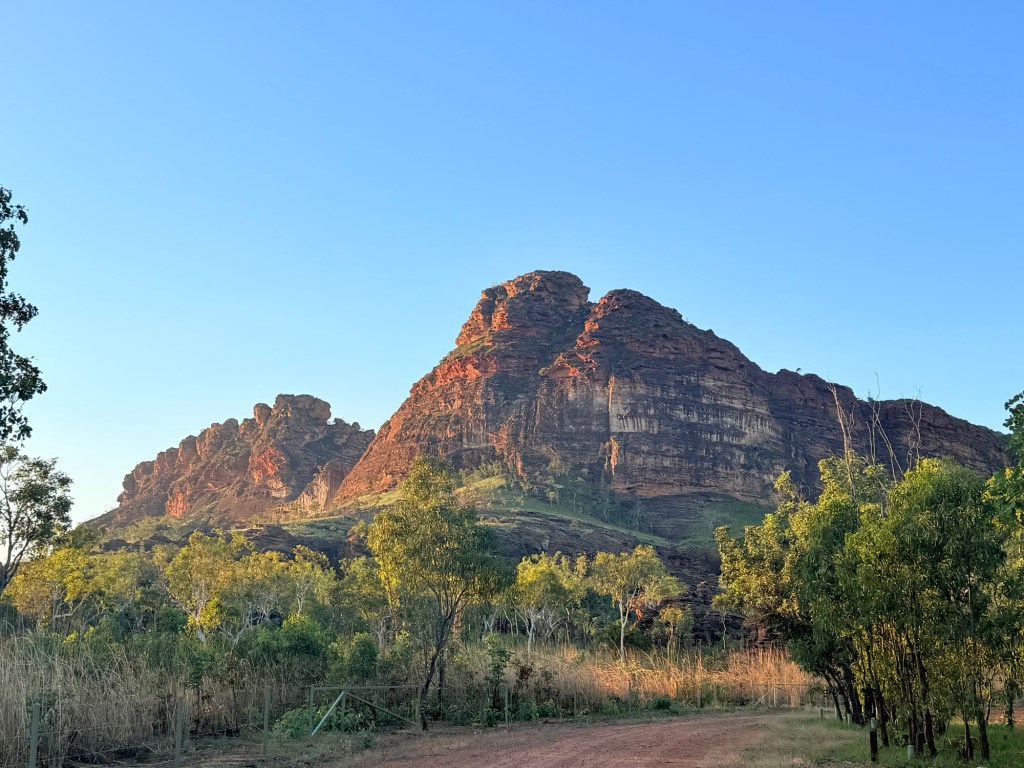
We are here to do some walking and see some rocks. It is claimed the park is the NT best kept secret. It is considered to be a mini Bungle Bungles. We shall see over the next couple of days.
Last day at Kununurra
Our last day at Kununurra was taken up with some housekeeping and a food stock up before heading out to Keep River NP, a remote place with no Telstra, internet or power. For some reason they have Optus, no use to us!
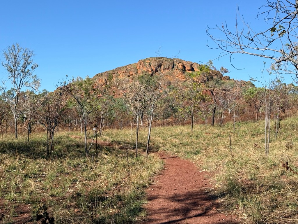
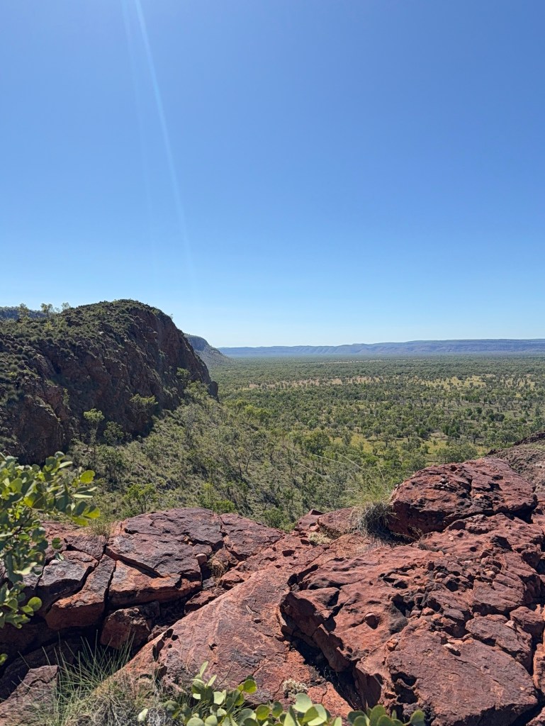
Before hitting the shops though Allthego went out to Mirima NP, just on the outskirts of town. Homealone stayed behind at the van. Mirima is a mini Bungle Bungles type environment with a couple of great walks among the domes. Be warned though we are getting to that part of the trip where there are lots of rocks to see over the next little while. Allthego has got less interested in regional town museums but does like rocks!
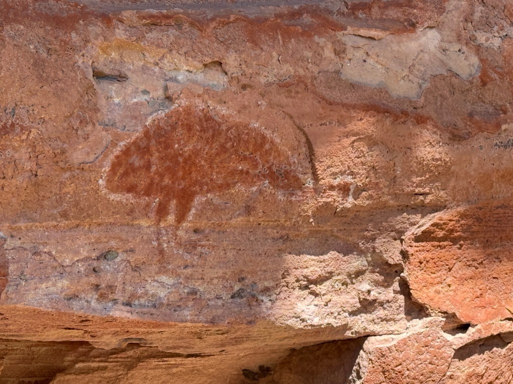
One of the walks visits some Indigenous rock art overhangs. It was an interesting wander for a couple of hours.
A great lookout too after a climb up some steps to the top of a dome structure.
On the way back to the van park there was another view of the Sleeping Buddha across the lagoon. It always looks impressive no matter the angle!
After the shopping expedition we pulled into the Visitor Information Centre to get Allthego’s ‘Did the Gibb’ swim shorts. The lady in the Centre still sold the shorts even though he told them we had not yet done the Gibb. Didn’t worry her, money was all that mattered!
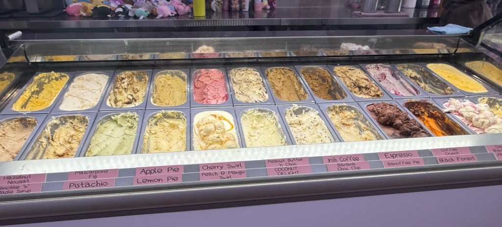
Some ice cream followed at the towns famous ice creamery. Vast array of ice cream and sorbets.
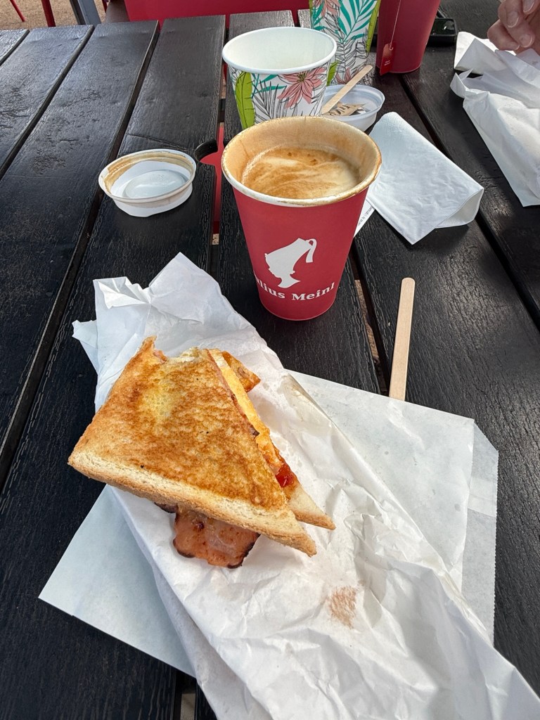
Back at the van park we got set for an early start the next morning but we got caught at the van park cafe for a coffee (tea) and toastee for breakfast.
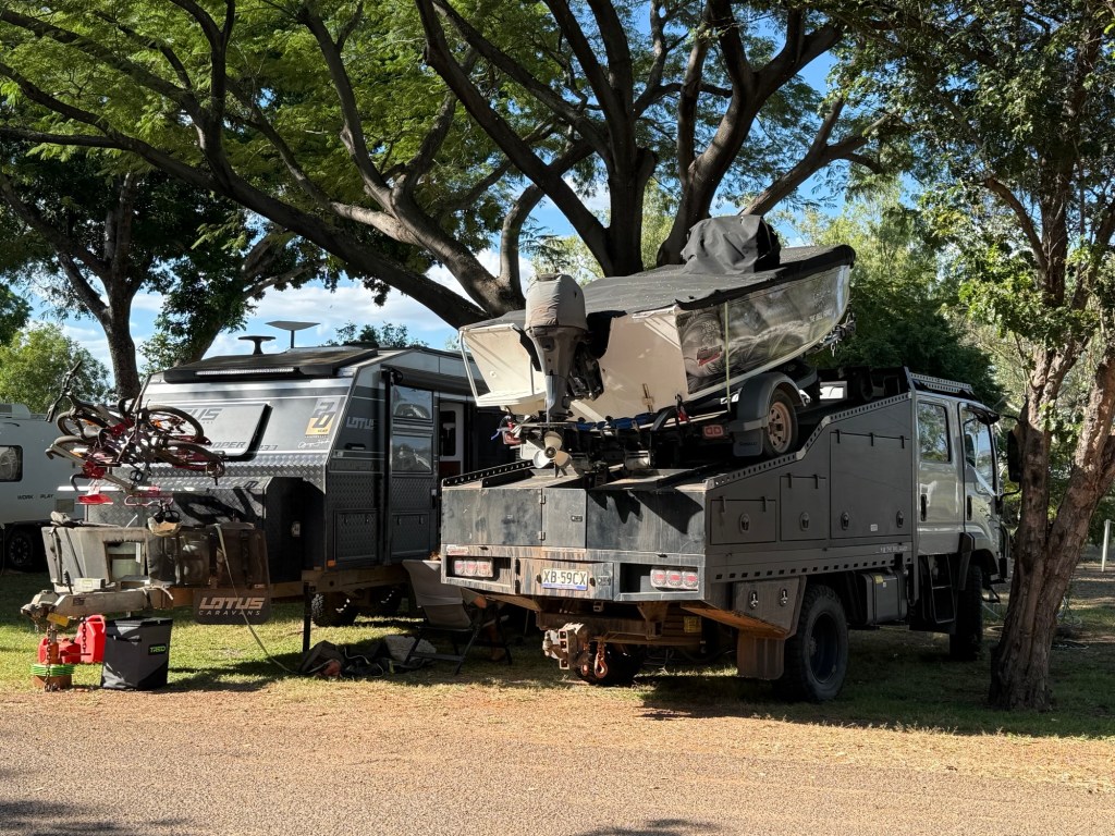
Also had a gaze at a rather over the top vehicle set up. Keen campers one suspects and keen on a bit of fishing.
It was a great spot by the Lagoon but we had to leave for Keep River NP and more rocks.
Wandering to Whyndam
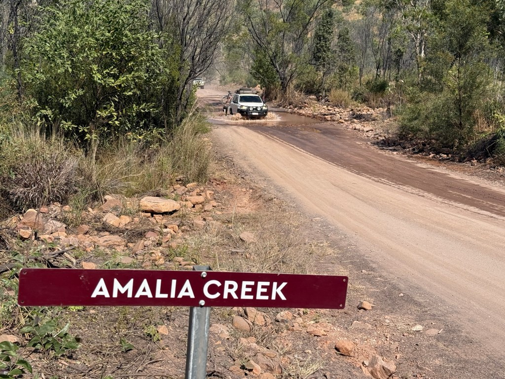
Kununurra is an ideal place from which to base a side trip to Whyndam. The back road, which I mentioned last time, is actually the route of the original track to the coast from Kununurra. The Ivanhoe Crossing was built to facilitate the route across the Ord River. Ivanhoe is the locale not the river.
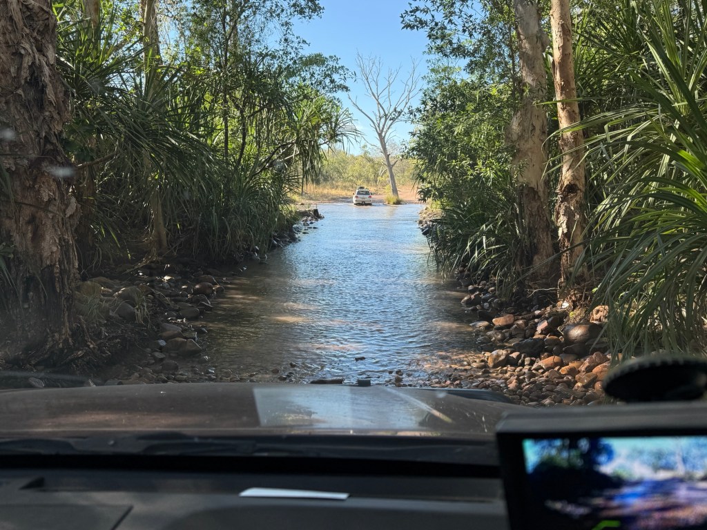
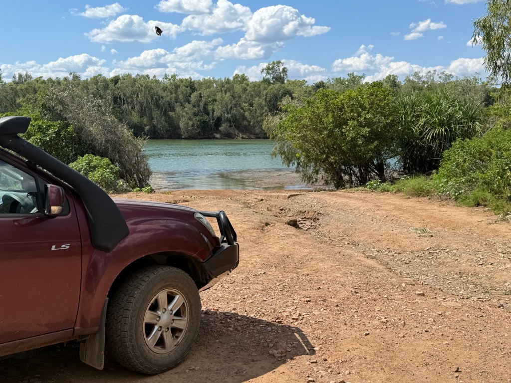
But we can’t take it because too much water is still flowing across. So we have to travel further west from Kununurra crossing the main bridges and take a side track on the west side of the Ord which meets up with the old road (fingers crossed). Sounds easy and the 4WD track was quite good.
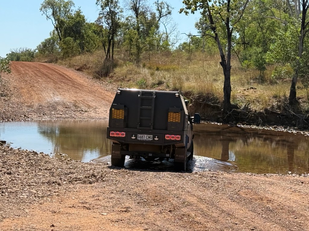
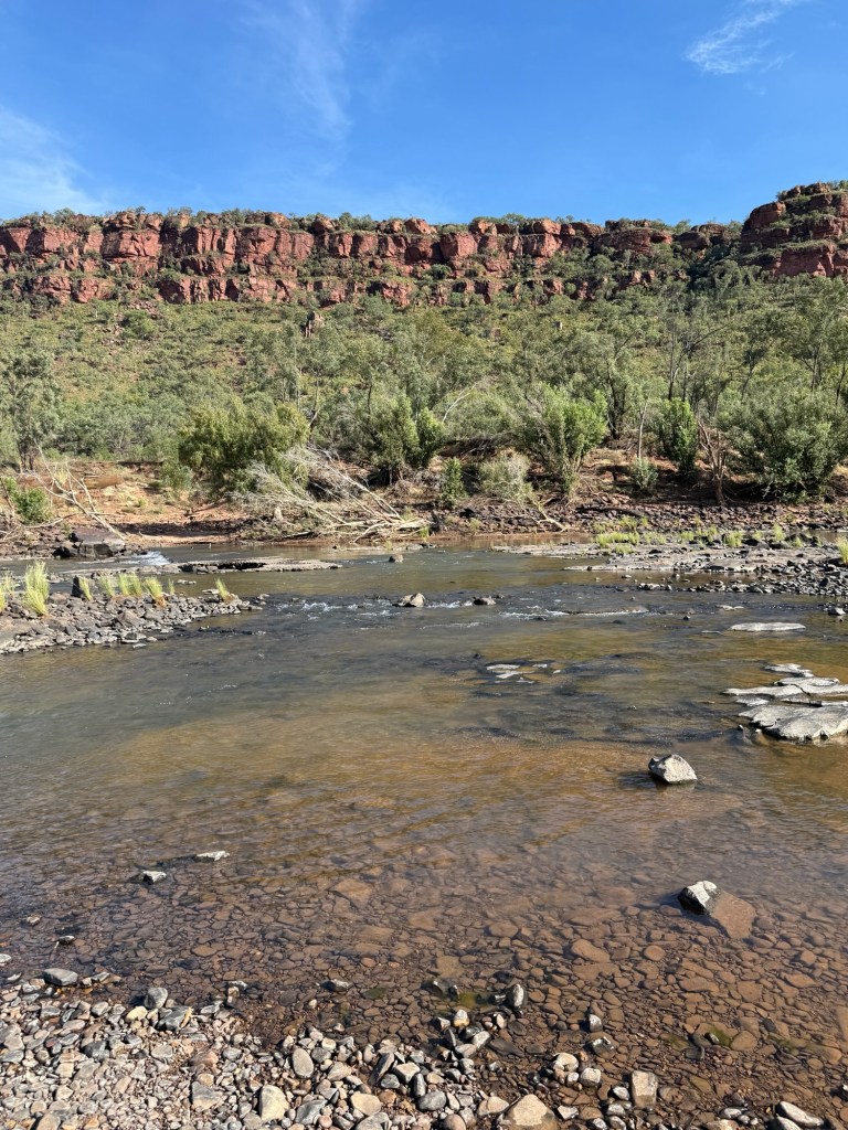
We passed by the Valentine Springs, fancy name for a waterhole fed by a couple small waterfalls. Here we encountered the first of something like twelve shallow creek crossings on the journey to Whyndam. All through them without hic ups.
After rejoining the old road we tracked along relatively close to the Ord, catching a glimpse from time to time. We pulled into a couple of other Indigenous sites along the way, Middle Spring and Black Rock Falls, down some rough side tracks. Black Rock Falls was the most impressive.
Back on the main track, known as Parry Creek Road, we took a break at the Mambi Island Boat Ramp on the Ord. Croc warning signs abound.
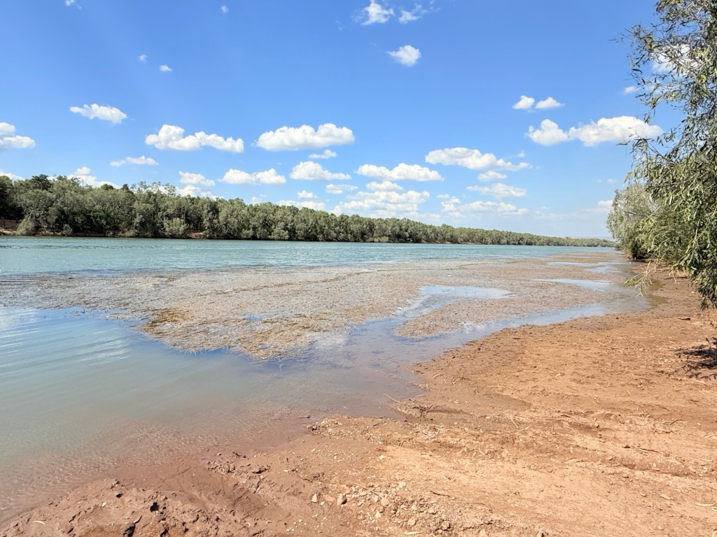
This would be a challenging little ramp for the inexperienced, the river bank is very eroded and the little patch of concrete is now in the wrong place. But I suspect only experienced boaters venture to these parts. The Ord is impressively wide here as it meanders towards the Cambridge Gulf.
We took a hard left here away from the River back towards the Great Northern Hwy, the ‘new’ sealed road to Whyndam which is the way most nomads go.
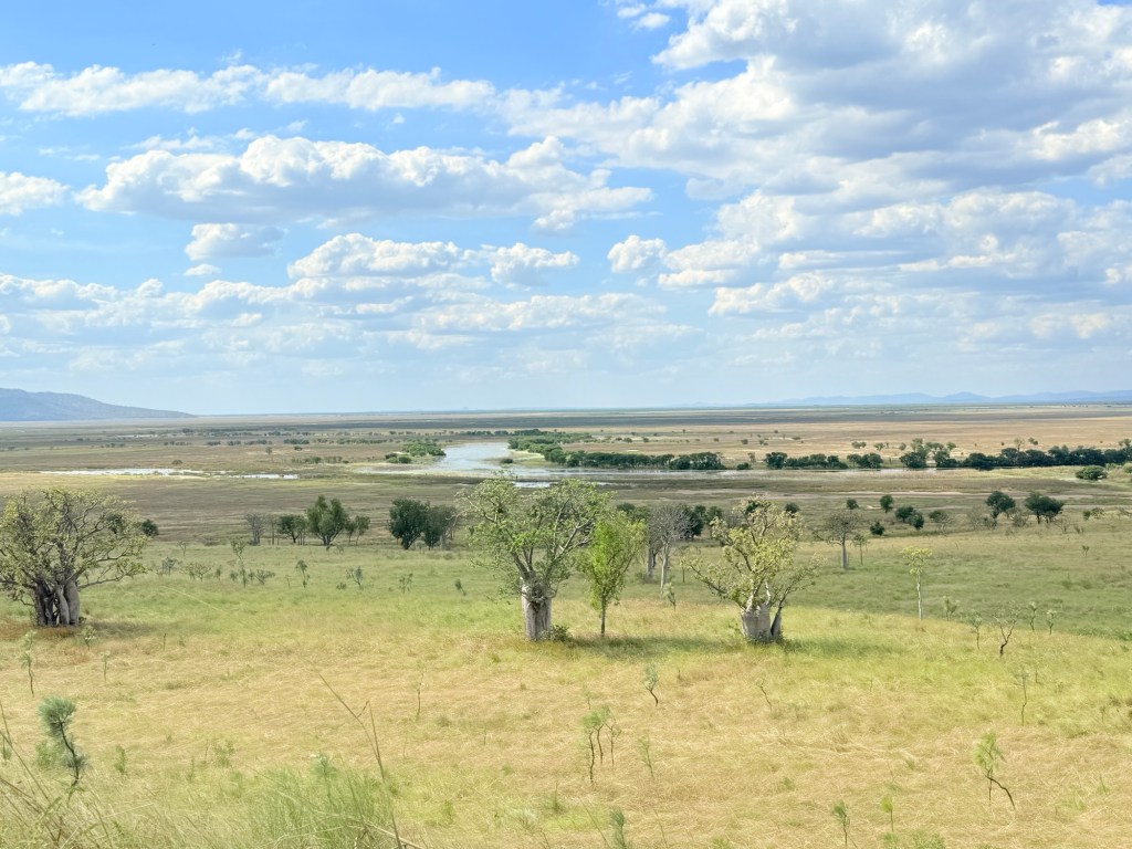
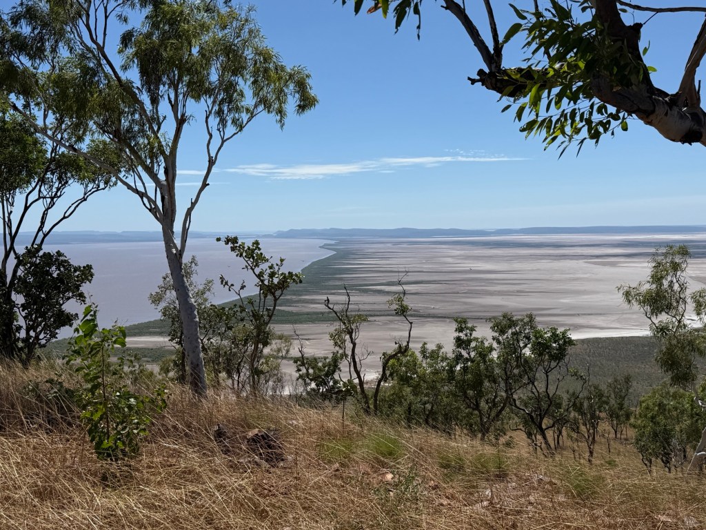
Another side track takes us up Telegraph Hill where the remains of the old telegraph station and its staff lived many moons ago, pre and during WW1, before it was moved to Whyndam. It is here we have our first encounter with an AAT Kings tour bus with thirty or so souls aboard. Mostly Aussies, Kiwis a couple of Canadians and four Americans (as we later found out). Some great views from this hill overlooking the Ord flood plain and the large Marlgu Billabong, which we were all making for to see the pond and associated wildlife. The bus beat us there for their 15 minute gaze and photo stop.
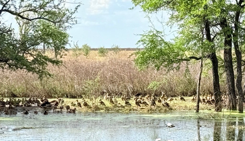
Great spot, we pulled up as they were getting ready to go, had a brief chat with the driver. They were headed for Perth from Darwin, 21 Days. We said hoo roo as they headed off and we stayed on for a longer look, lots of ducks in the shade. No crocs sighted.
On the track again we set off eager to get to Whyndam as time was getting on and we hadn’t had lunch.
We were now down on the flood plain getting along nicely when around a corner and with the track straightening out there it was! The bus up to its belly almost, in the bog. It was about 2pm. Allthego pulled up gingerly and undertook an inspection, plenty of action going on scrapping mud away by hand and putting levelling wedges behind the driving wheels.
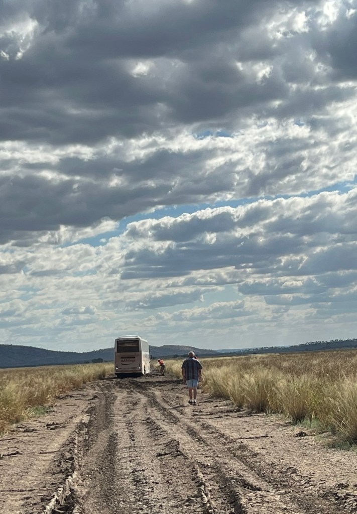
Numerous attempts were made to back out, just made it worse. Seems the bus carried little recovery gear. The driver a little inexperienced too, just powering ahead into the mud. Now Allthego is not getting too cute here, he too has dipped the toes into black soil mud but got out relatively easily. A big bus is a different proposition. At least our spade was useful in a hopeless situation. Our Max Traxs ineffectual. The bus was stuck big time!
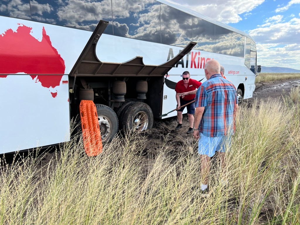
The bus driver was able to make a call for a back up bus and also a tow truck. It was now 3.30pm (it gets dark around 5pm). Some of the 30 were getting anxious, but were calm. We turned around and backtracked to try to intercept the tow truck and get it to the right place. Never saw the tow truck but we did see the back up bus speeding to the rescue! So, I suppose the people got out ok but the driver might have had a long night minding the bus in the bog! We will never know, but AAT gave us a nice bottle of red for our spade use and company!
We didn’t get to Whyndam that day and had to do it all again the next day. Taking the ‘new’ road.
Whyndam is a town in decline and with the countdown to the end of live cattle exports one wonders what will happen. Curiously, after WW1 and pre WWII the town operated a frozen meat works that exported beef to the UK. It closed down and the infrastructure was removed. Could it return?
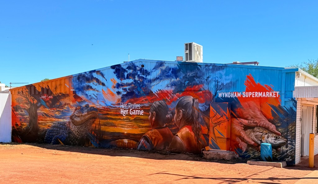
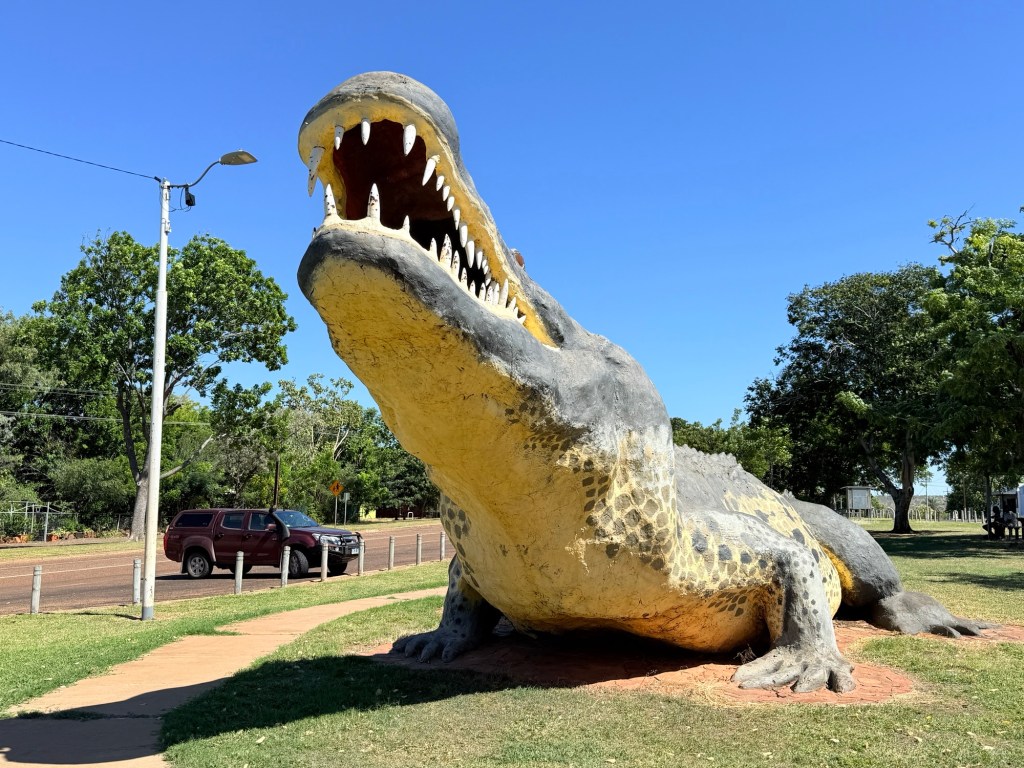
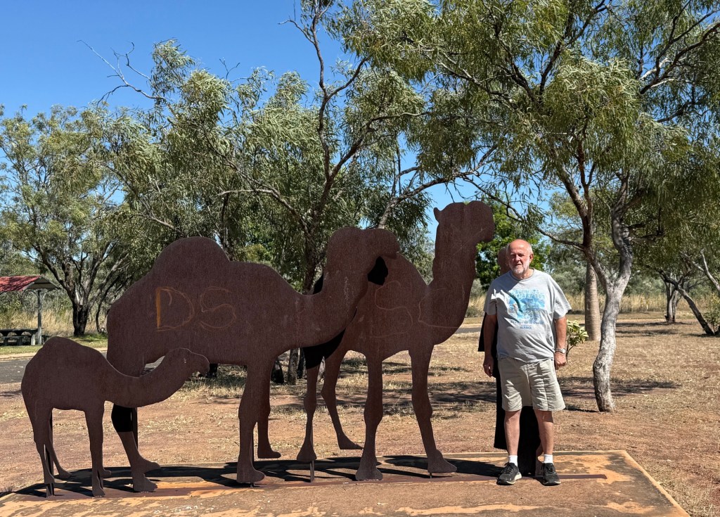
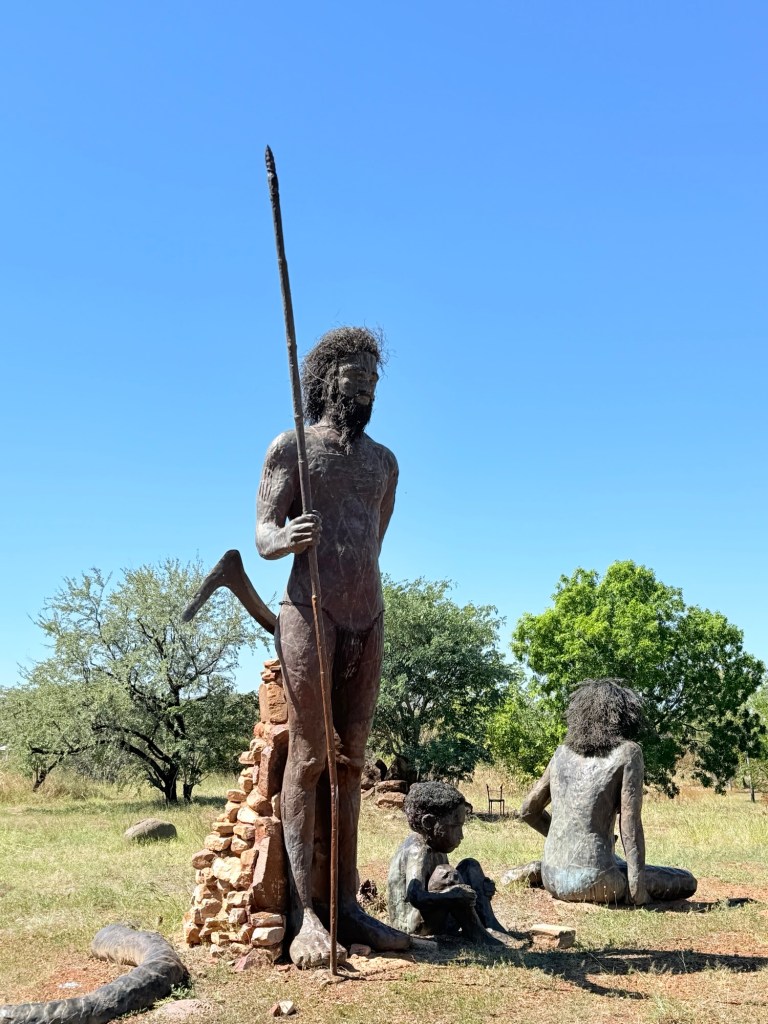
There are a couple of memorable touristy things in town; the big croc, the indigenous statues and the great view over the Cambridge Gulf. There is the ever present museum too, if you are into those.
We headed back to Kununurra and along the way checked out the Gibb River Rd road conditions billboard where it branched off the highway for El Questro, our first stop along the Gibb in a week or so. Looked good!
How to gain an hour and a half
Cross from the NT into WA and arrive in Kununurra!
We are here in Kununurra for five nights. Plan to get around a bit if we can drag ourself away from the view from our breakfast table at the van park.
Kununurra is quite a large town with around 7,000 residents that swells to upwards of 14,000 in the busy dry season. There are several large van parks and other hotel/motel and resort style accommodations. Plenty to do in four days.
The big thing near town is the Diversion Dam that holds back the upper Ord River to form Lake Kununurra. The upper Ord is actually the water that is let out of Lake Argyle, about 55km upstream.
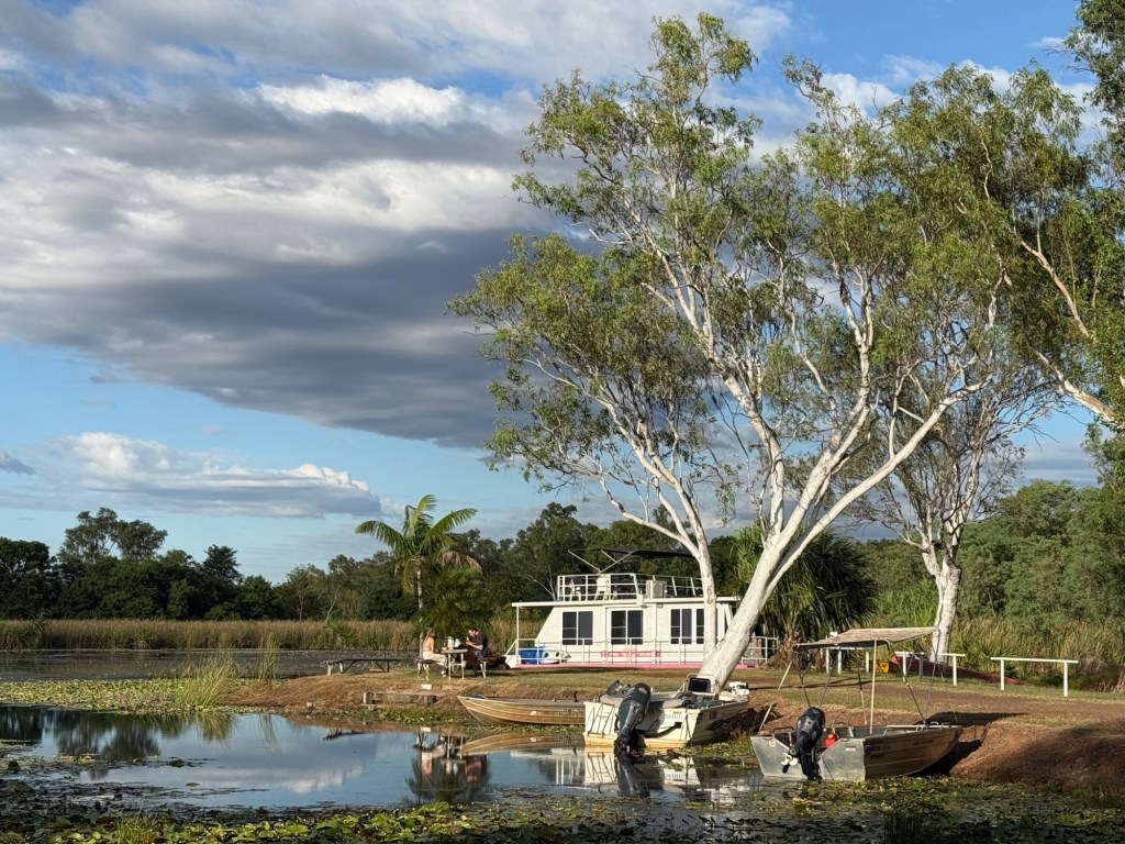
Lake Kununurra is this backed up river, not particularly wide behind the Diversion Dam but with a number of lagoons off to the sides. Our van park is on Lily Lagoon, the van is perched on the bank just back from the crocs (haven’t seen any).
The Dam is called ‘Diversion’ because an irrigation canal diverts water from the lake into the agricultural lands that thrive in the region.
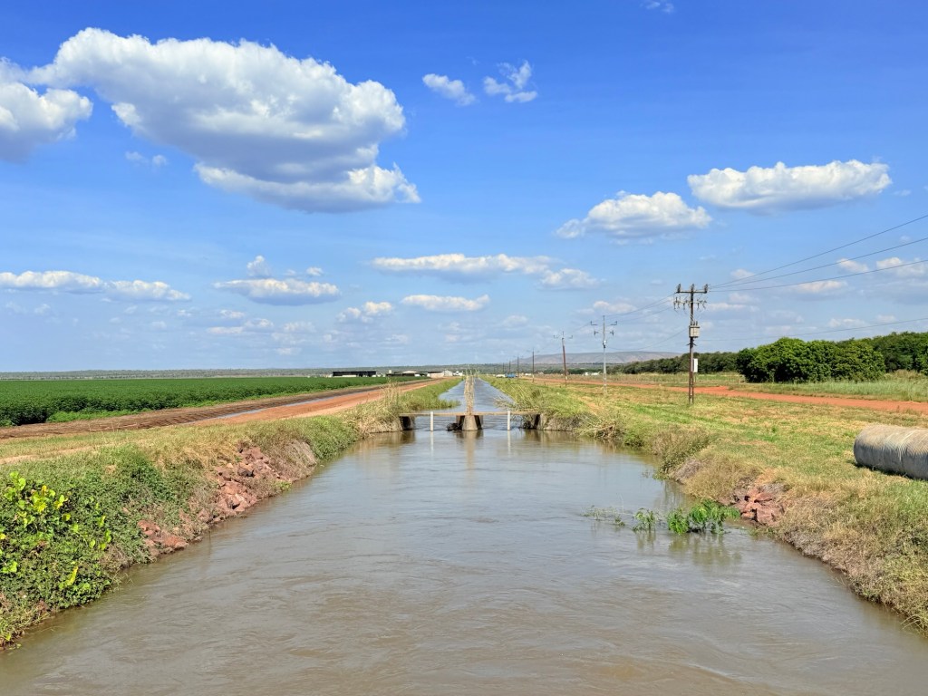
The canal gravity feeds various channels into the farmland and from which water allocations are taken by the farmer.
Plenty of stuff grows here: cotton is big, sandalwood is in decline but there are mangoes, various melon types and grains.
Behind this farmland is an old gravel road that runs about 100km from Kununurra, for most part along the lower Ord, to Wyndham on the coast. We are going to drive this road while we are here. Homealone wonders why, but Allthego suggests that because it is there we need to do it! Not though for a day or two.
The main way of getting on this back road is across another iconic Kununurra site. The Ivanhoe Crossing, about 10km from town.
Currently, it is closed as there is too much water spilling across it. Crocs either side. Hopefully, it will be open before we leave so that we can make a crossing!
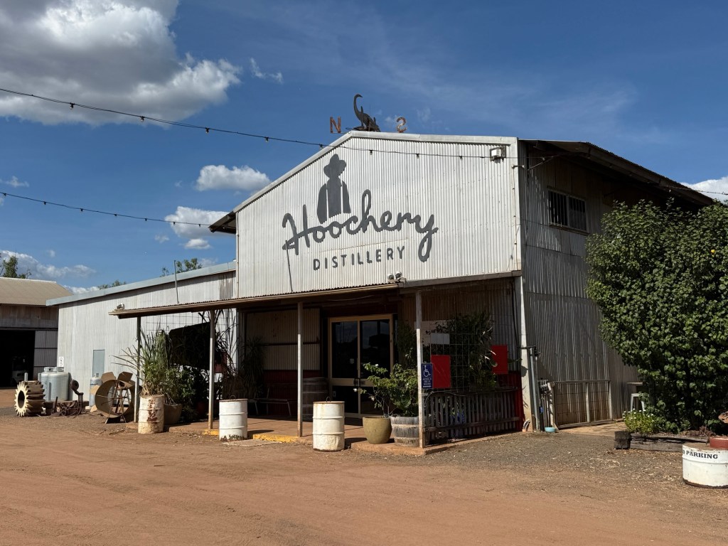
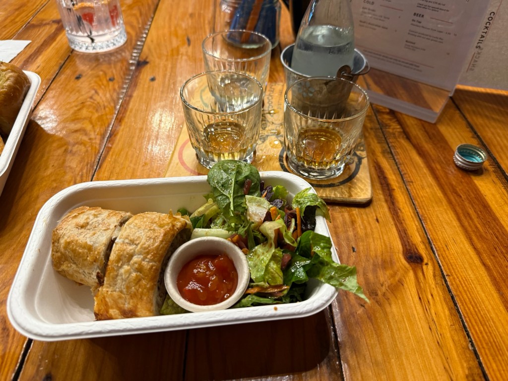
Not far from the Ivanhoe Crossing is the Hoochery, the local distillery. It produces a range of spirits and mixers from mostly local grown ingredients. Rum being the main one. There is a whiskey made from local sorghum in the American rye style. Being lunchtime we pulled in for a light snack and also had a taste or two. All rather good!
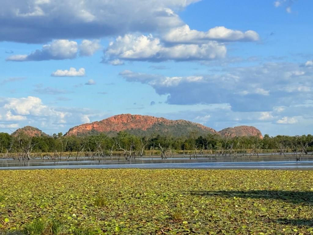
We celebrated Mother’s Day on the Lake on the first Sunset cruise of the season, only eleven aboard so there was plenty of room to move around. Homealone likes being on the water! The boat meandered out of Lily Lagoon onto the Lake proper and putted upstream for awhile for a different view of the Sleeping Buddha, the head of which looks like that of an elephant.
It was then down a narrow channel into Packsaddle Lagoon for a bbq (steak and barra) dinner as the sun went down. We left to head back to the marina in semi darkness with a large flock (?) of fruit bats flying around the Lake behind the Diversion Dam.
Next, we are off on a day trip to Wyndham. It will prove to be quite an adventure with an unexpected twist!
Victoria River Country
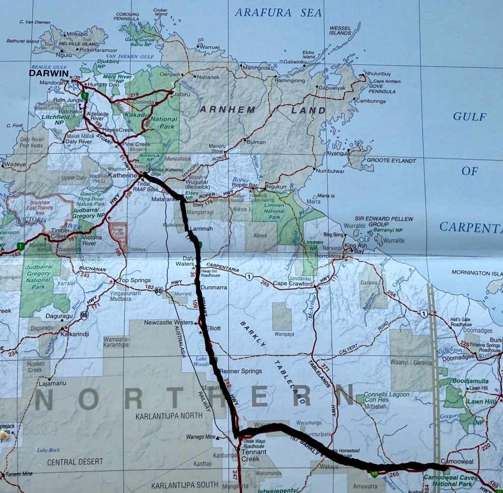
Here is map showing our journey from Camooweal along the Barkly Hwy and then up the Stuart Hwy to Katherine.
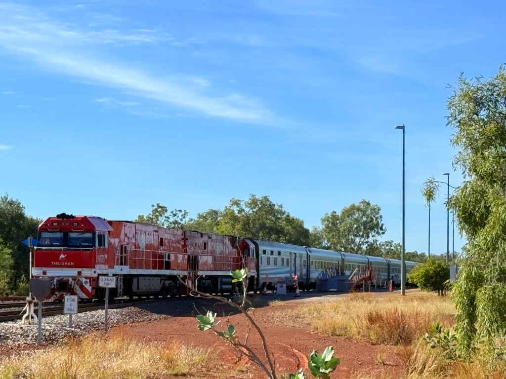
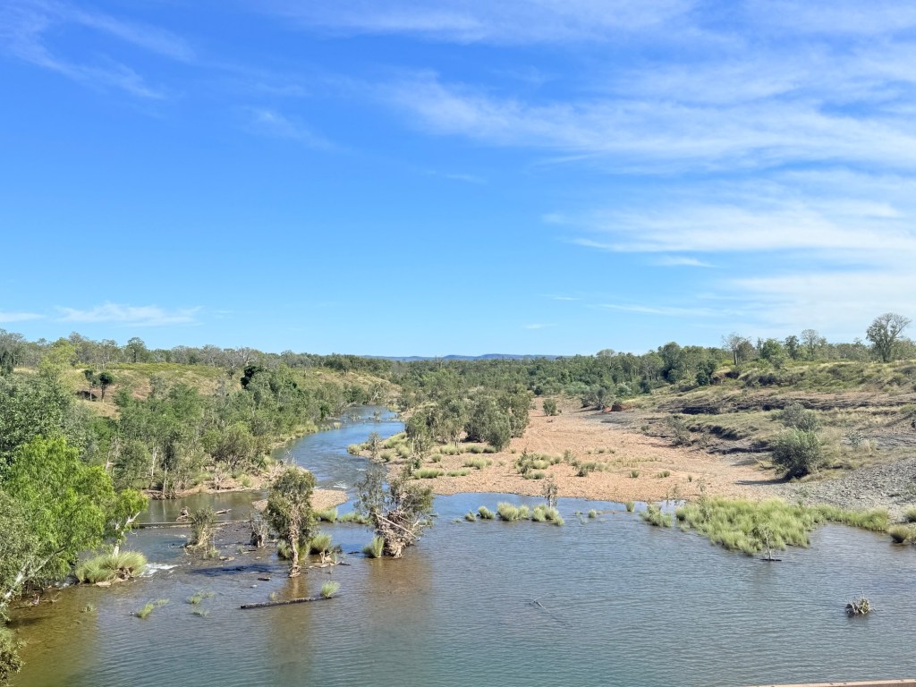
Travelling southwest from Katherine along the Victoria Hwy to Kununurra is one of Australia’s great road journeys. It traverses the flood plain of WA longest river, at least single name river ‘Victoria’. It is some 350 km long from its source somewhere behind the town of Timber Creek to the Bonaparte Gulf (just within the NT border). Outside Katherine the Ghan was making its way north to Darwin, couldn’t resist a picture stop.
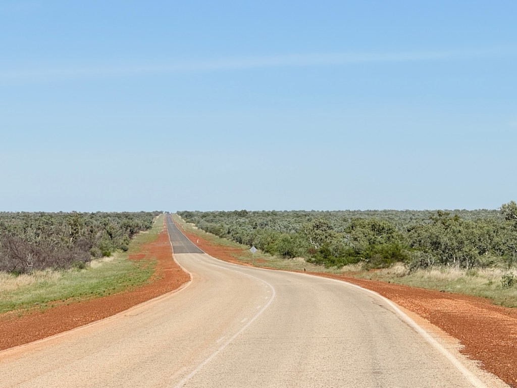
The road ahead is fairly flat with some up snd down bits, a typical wet tropical savannah landscape.
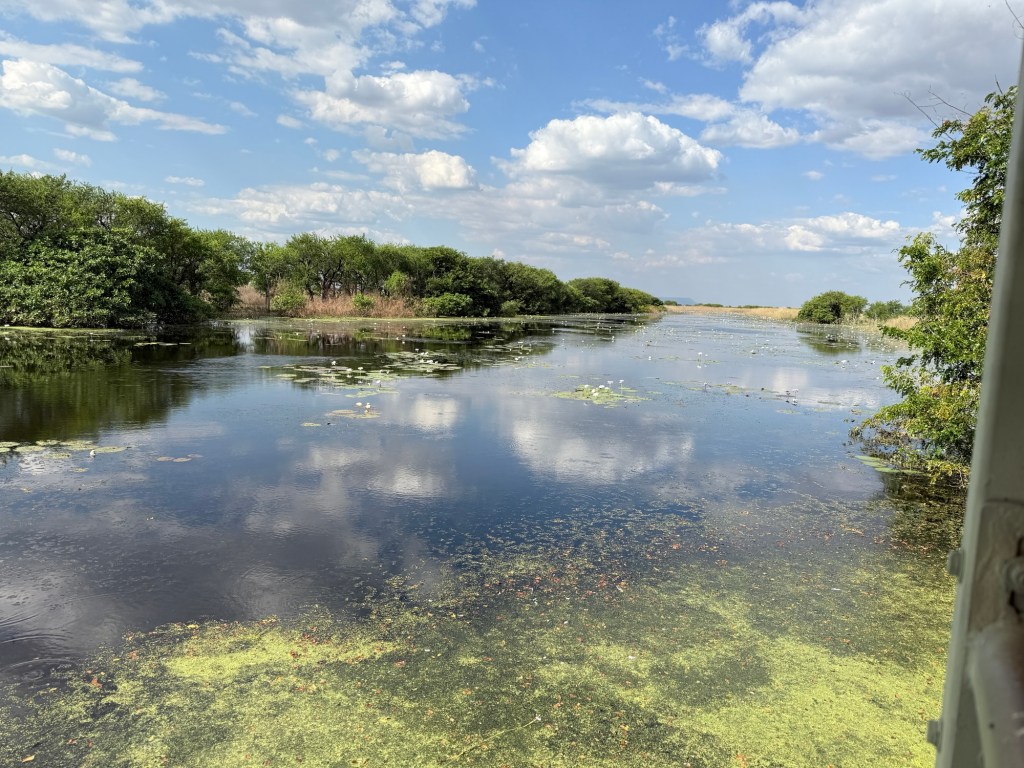
About 100km from Kununurra we diverted from the hwy on a gravel road to the Flora River NP. Travel guides had promised some great river scenery to justify the 90 km there and back of gravel and dust.
The river has a couple of tufa rock waterfalls across it a short walk from the camp site which is a couple of hundred metres (croc safe) back from the river. Tufa is a soft porous limestone rock often impregnated with partially decomposed vegetation. The view though was hampered by river bank vegetation so a bit disappointing!
A chain saw would be useful to improve the scene! We wandered around a bit in the scrub trying to get a good view, being careful of crocs.
Returning to the hwy we had a stopover at the Victoria River Roadhouse for the night. The Roadhouse is high above the River now but back in Jan 2024 the river and its floodwaters lapped at its doorstep and swept the road bridge away.
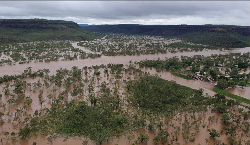
An enormous amount of water spread across the landscape. An enormous diesel price too for these parts $2.35.
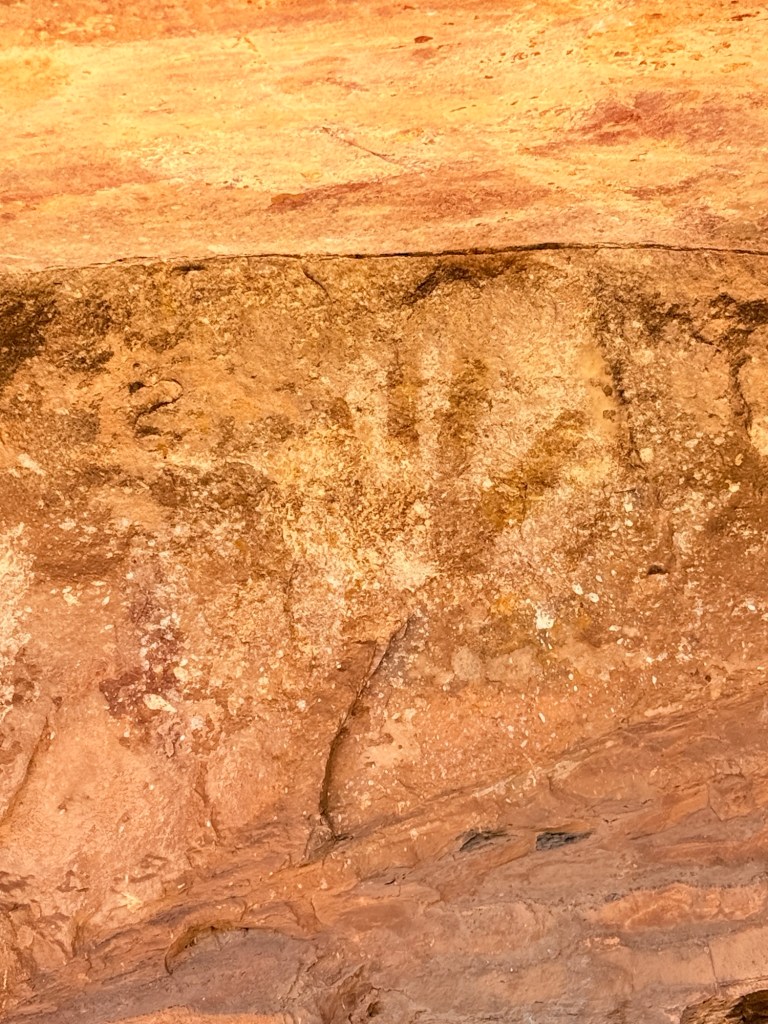
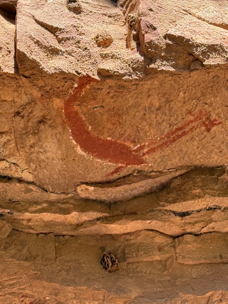
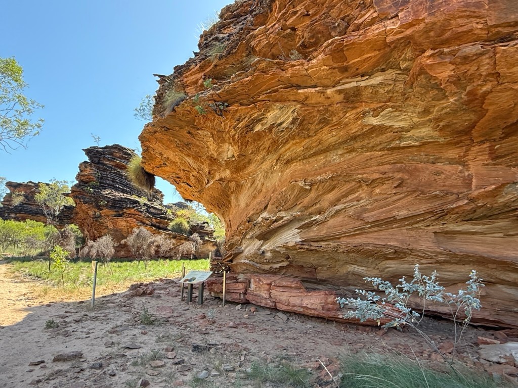
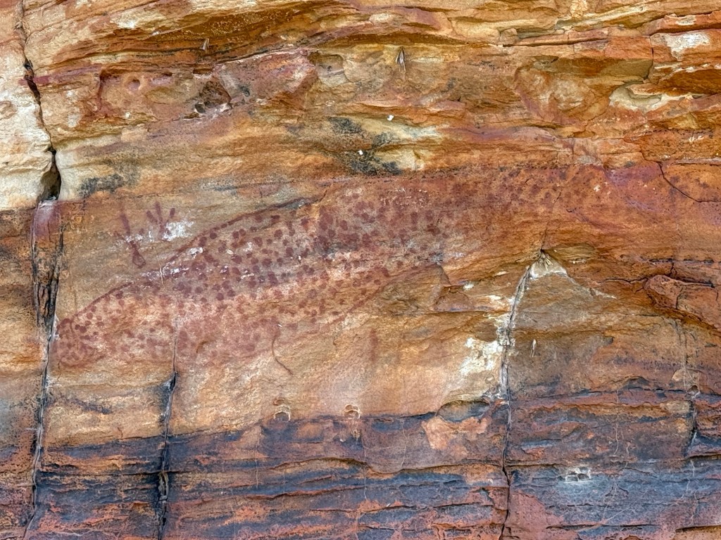
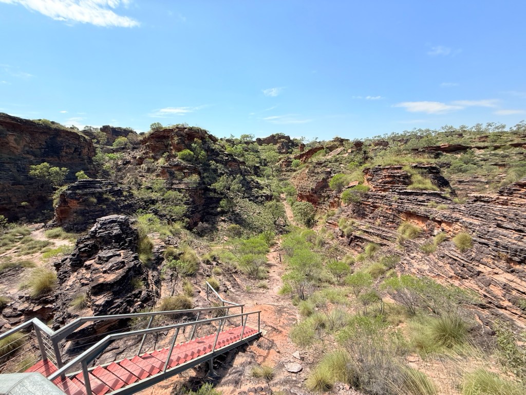
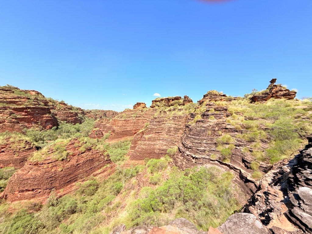
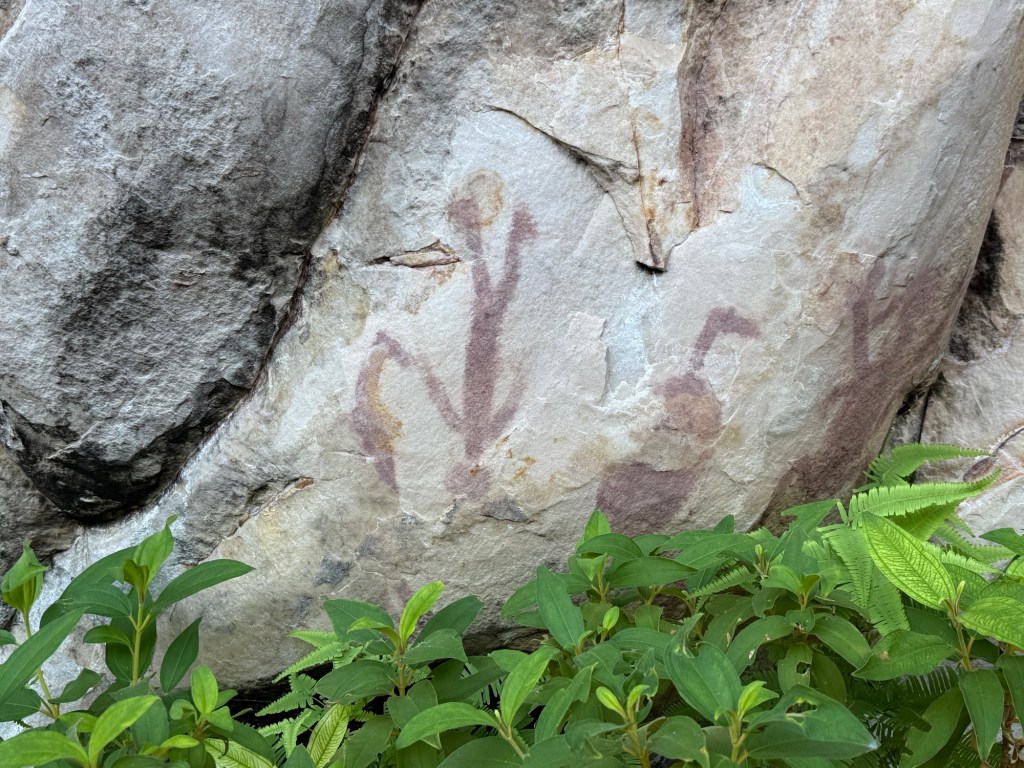
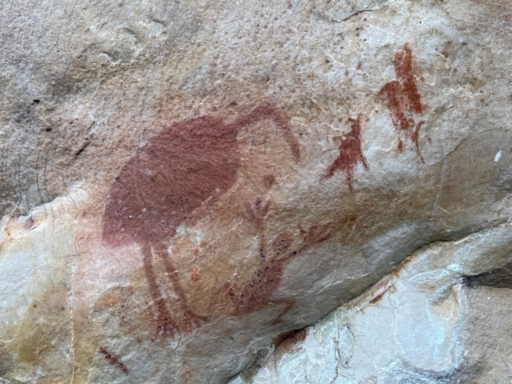
From the Roadhouse we did a bit of exploring , tripping down to the 1800s Old Victoria River Crossing and then out for Allthego to do a ‘ short walk’ at the Joes Creek day use area. It is a short 1.7 km (90 min) up a steep slope, along the base of the escarpment, then a scramble down to Joes Creek and the walk back to the carpark. Some great views of the valley from the escarpment and sightings of aboriginal art galleries on its walls.
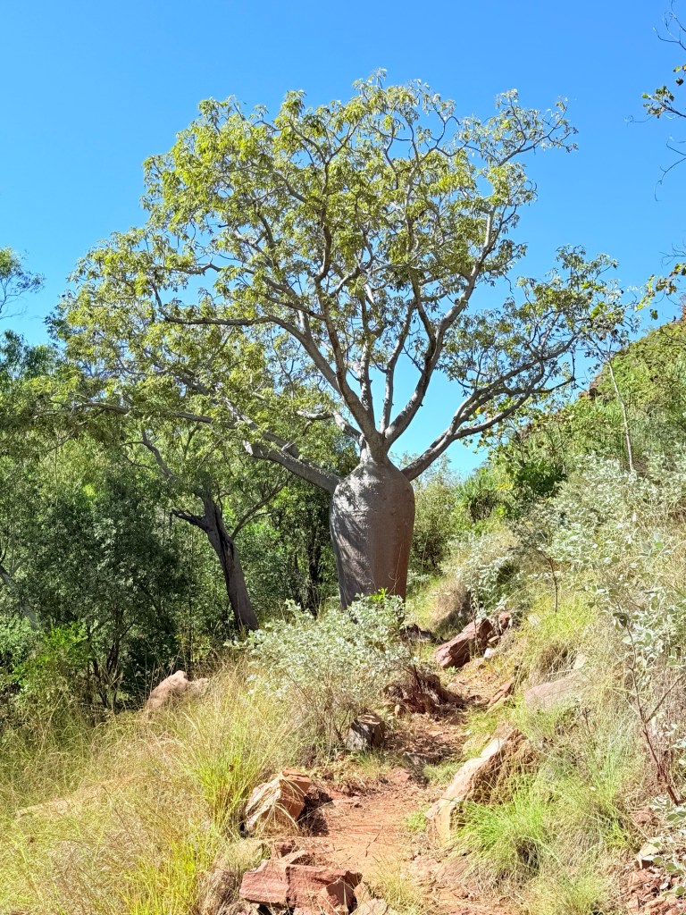
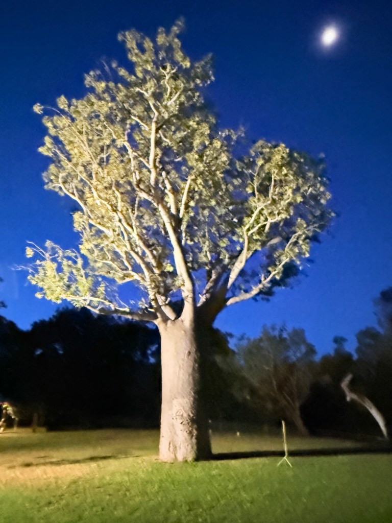
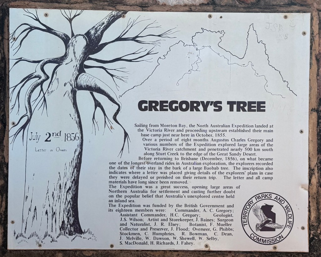
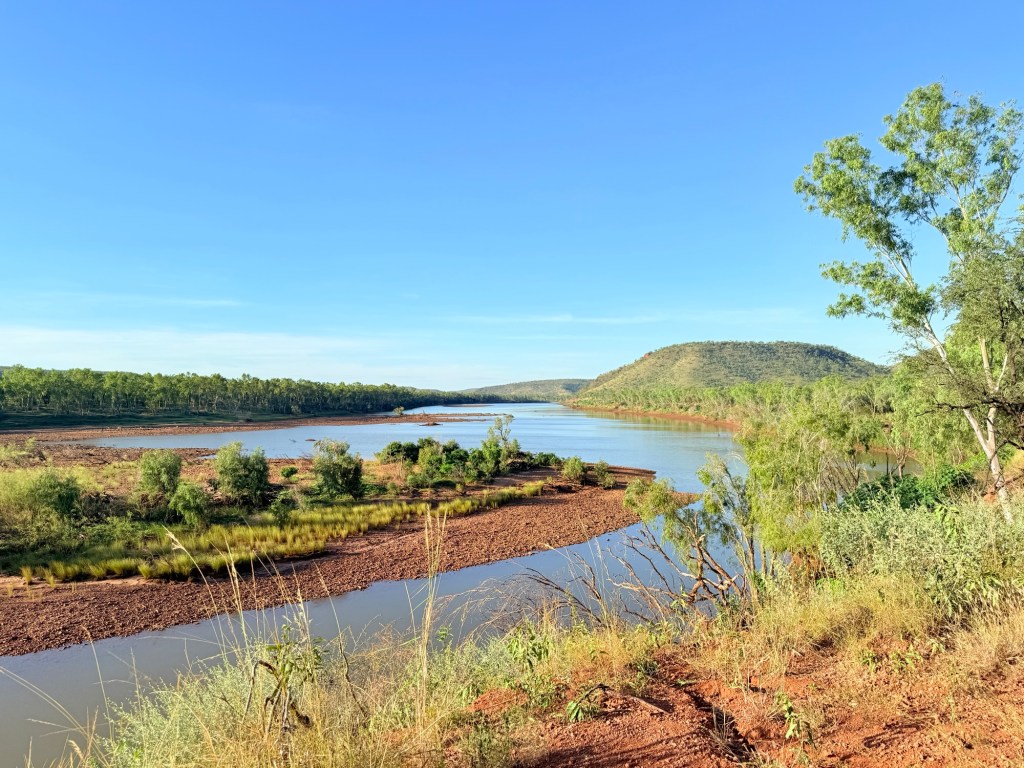
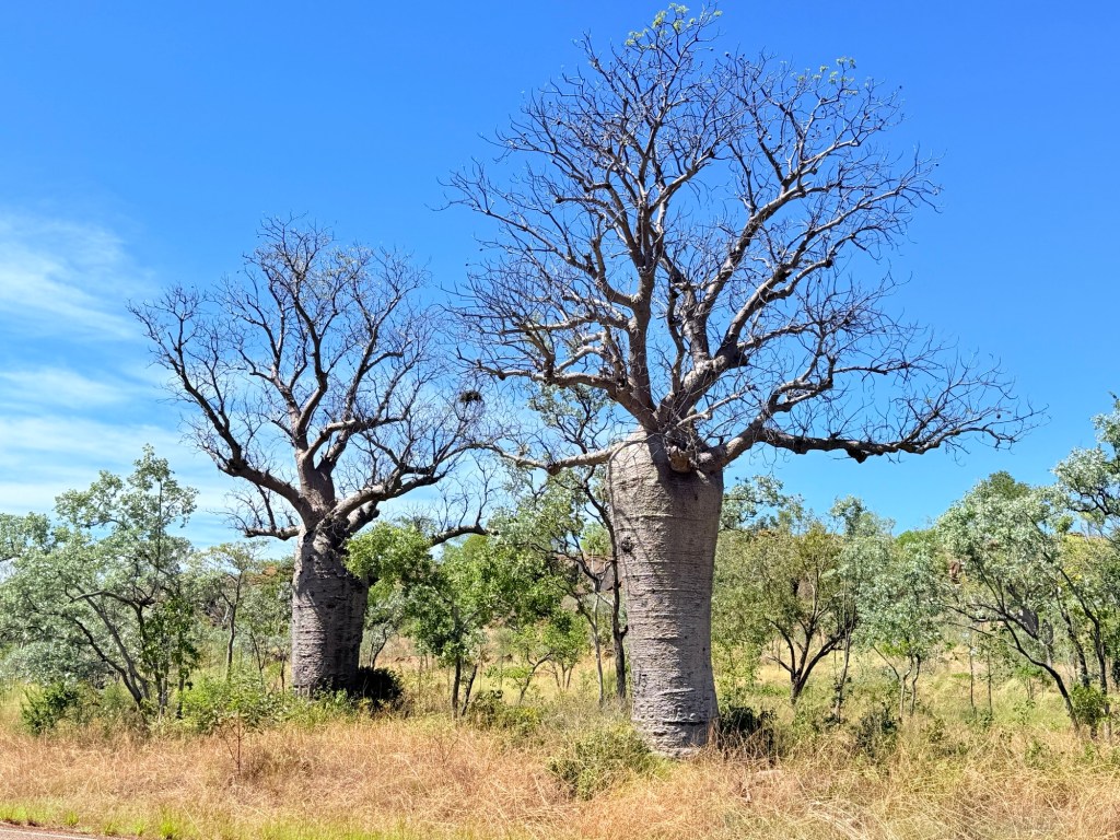
A further 90km along the hwy we stopped for the night at Timber Creek. The Timber Creek area has an abundance of boab trees. All shapes and sizes. The van park has a very big one in its grounds, impressive sight.
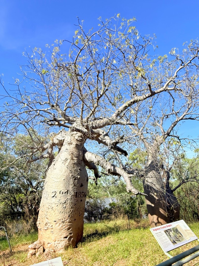
The Victoria River dominants the landscape here as well. One of the attractions, about 5 km off the hwy down a dirt track, is an old boab tree beside the river bearing the carved date 2 July 1856. It is known as Gregory’s Tree and is the spot where he camped while exploring these parts.
Moving on from Timber Creek we made our way away from the Victoria River towards Kununurra, through more boab country and into Ord River country.
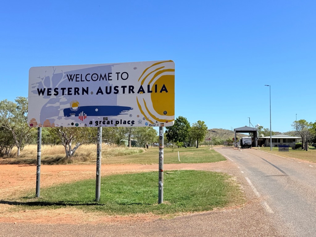
We have made it into WA about 50 km to Kununurra. Dutifully surrendered two peeled potatoes and a handful of lettuce leaves at the border. Onto Kununurra!
Kununurra bound
Daly Waters Pub to Katherine was the final stretch of our time on the Stuart Hwy. At Katherine we turned to the west on the Victoria Hwy and stopped for a couple of nights at the Riverside Campground not far from the Katherine Hot Springs.
Coming up the Stuart from Daly Waters we called into Laramah, an old army town from WWII days. Apart from a war museum and a few locals, the old pub and caravan park is all that is left.

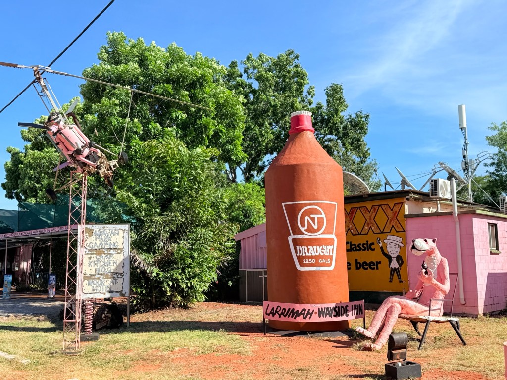
More recently, Laramah has come into prominence because of the mysterious disappearance of ‘Paddy’ (one of I think 12 locals at the time) a few years back and a TV show documenting the surrounding events.
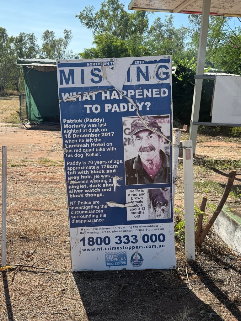
The disappearance has never been solved, all sorts of bizarre scenarios have been canvassed.
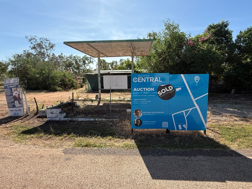
Anyway, ‘Paddy’s’ run down house has recently been sold as a wonderful development site.
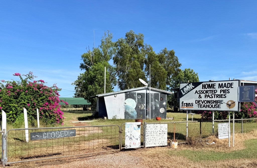
More importantly, Fran’s roadside cafe is closed, I think she has gone to a nursing home, and her marvellous pies and tarts are no more. Apparently she denied strongly that Paddy might have been in one of the pies.We partook several years ago on a trip to Kakadu. She will be missed!
After a brief stop at Mataranka for some supplies we made quick time to Katherine and the campground.
Katherine is on the river of the same name and is some 30 km south from the famous gorge. We have visited there before but this time our main focus is south west to Kununurra.
Below our campsite are the Katherine Hot Springs. 350 metres away. They are quite undeveloped thankfully. The spring rises from a smallish ‘hole’ in the bank and flows into a deep pool and then along a creek into a pool lower down. Ultimately the creek joins the Katherine River. Croc warning signs are up everywhere, but it looked clear to me, so in I went.

Very refreshing, Homealone decided to take some ‘snaps’ and a couple of short videos of the action before we headed back to camp.
And here are a couple of short videos of the action.
There are two other spots along the Katherine River at either end of the town giving great views and providing pleasant picnic spots. Notwithstanding Crocodile warning signs everywhere!

One is at Knotts Crossing the site of the first Katherine settlement. At the other end of town is the Low Level Bridge crossing parklands, great spot beside the river.
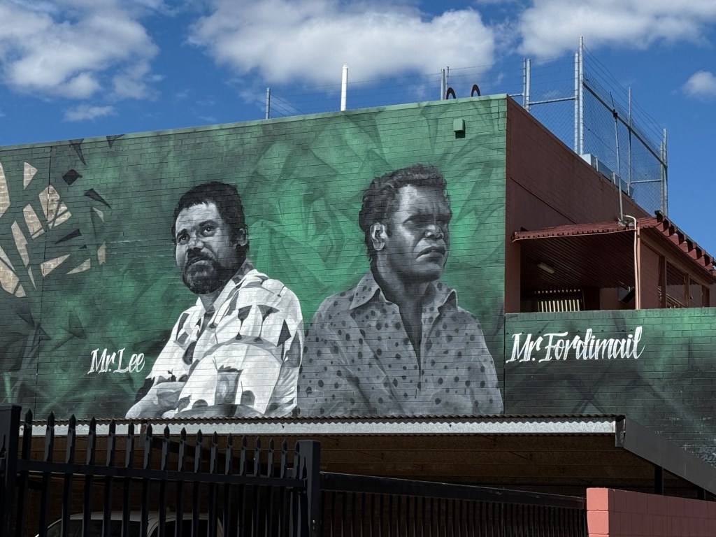
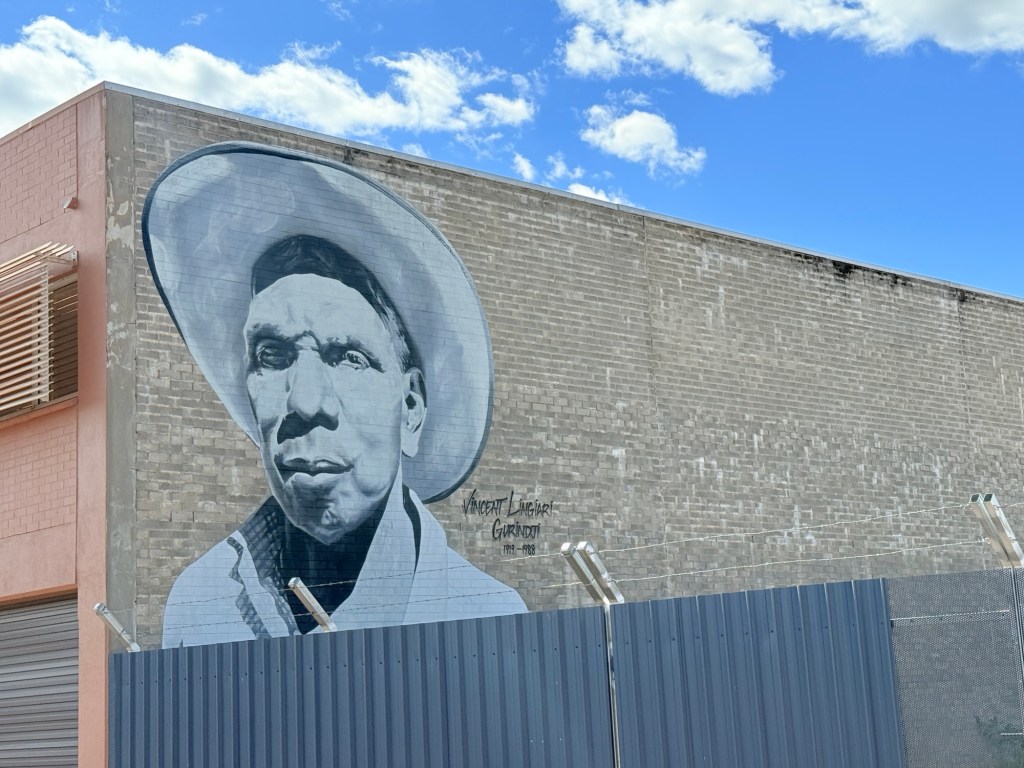
Around the Katherine business area are a number of mural portraits of influential indigenous leaders. Some great stories.

It has been quite hot and humid here in Katherine, particularly at night. We have succumbed to air con in the van! Off west tomorrow towards Kununurra, but a couple of stops before getting there!
North on the Stuart Highway.
We had a good takeoff from the van park in Camooweal. Quite a few vans in but still plenty of room. Maybe we have gotten away early from Brisbane and beaten the rush of nomads north.
Arrived at Barkly Homestead, about 270km west from Camooweal at 12.30 or so, benefiting from the half hour time gain. Very flat country getting across the Barkly Tablelands, quite green grasslands and the creeks with plenty of water. Stopped for morning tea about 50 km out of the Homestead, felt like a long way from nowhere, plenty of flies out and about. Hopefully they will disappear as we get further into winter.
The Barkly Homestead is an oasis along the highway and a great place to stop for the night. Well laid out grounds and facilities, some artwork to go with it too! We have had a relaxing afternoon in the shade, flicking flies away.
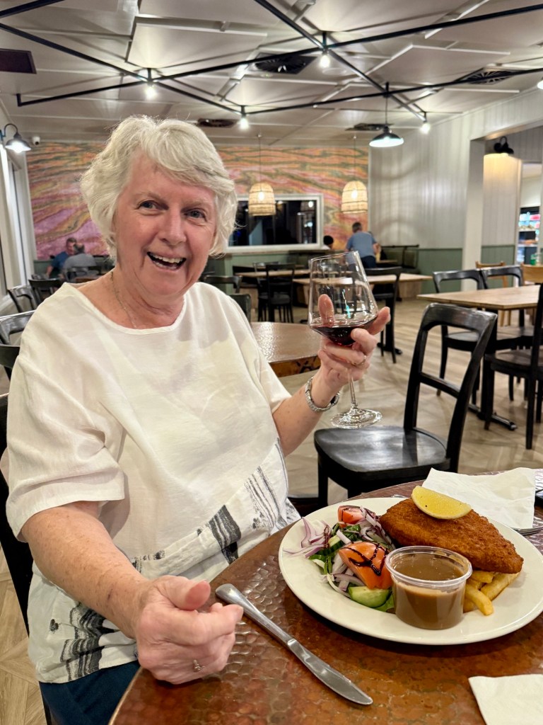
In the evening we had a bite to eat in the Roadhouse cafe. Quite an extensive menu for the most remote Roadhouse in Australia. Allthego settled on a parmie and Homealone a straight schnitzel. Not huge meals but not small either, excellent!
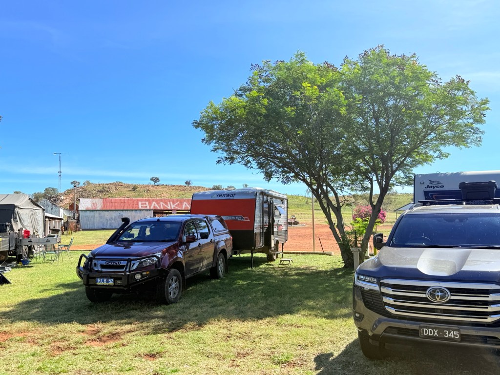
Hitting the road again at around 9am in the morning our next stop was at Banka Banka (BB). BB is on the Stuart Hwy about 60km north of where the Barkly Hwy terminates, 160 km on from the Homestead. It is a long stretch of uninspiring country! Tennant Creek is to the south of the junction.
Heading for BB on the Stuart we had a first time experience of every caravaner’s nightmare. A tyre blowout.
Not ours!
We passed some tyre remnants on the road and up around the next bend was the truck and van in the ditch, upright. It must have only happened minutes before. We stopped and checked the guy out, he was an old bloke, looked about 70-75 (mmmmm). All ok, but the van was on its wheel rim dug into the gravel up to its suspension. Not a pretty sight. We took his details and upon arrival at BB rang his roadside assistance people who declined to assist, saying it was an insurance job. Nice. Thankfully, the BB people assisted and drove down to get him going taking several jacks for the job. All worked out ok in the end.
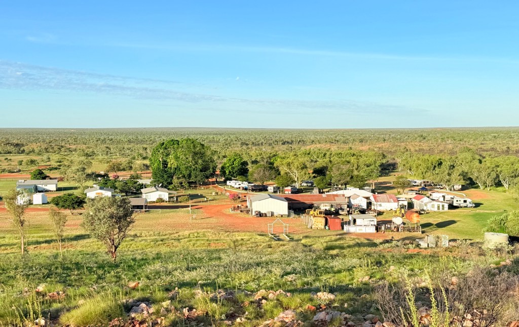
BB is an indigenous cattle station that also provides camping facilities for about 40 vans. Very comfortable spot. We settled in for the afternoon. Late in the day Allthego climbed the nearby hill for a look over the landscape. Great view of the campground and surrounding countryside.
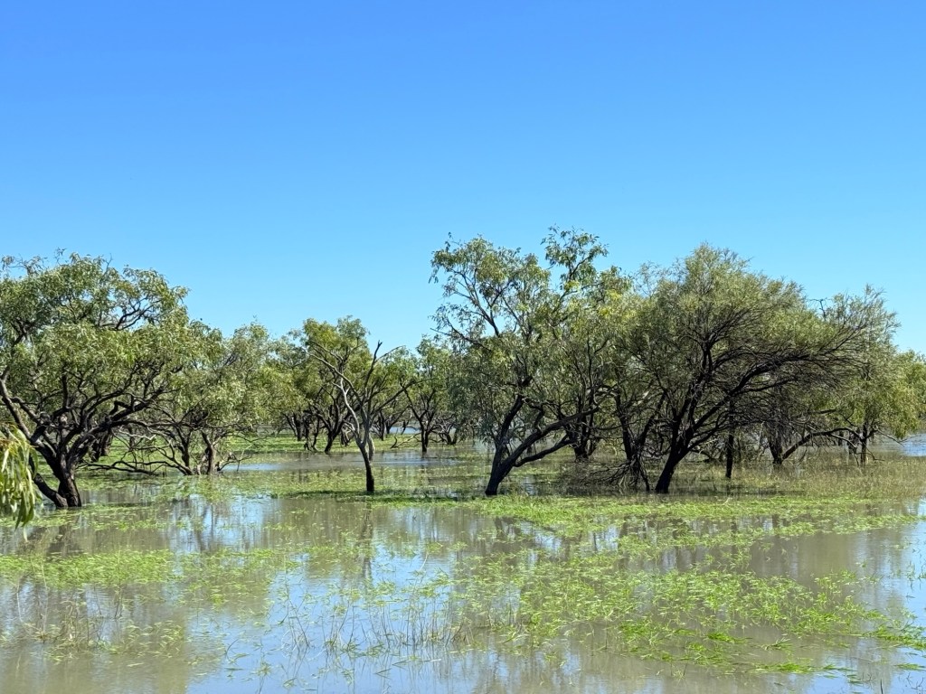
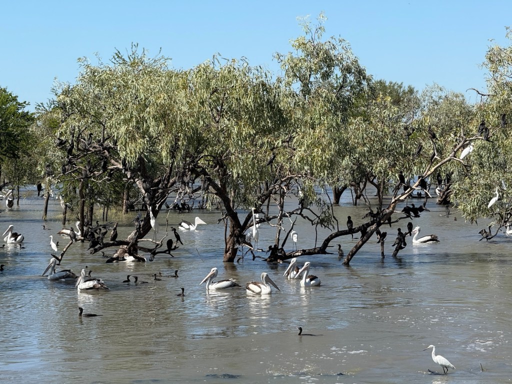
Moving on from BB the trip up the Stuart to the Daly Waters Pub was uneventful compared to the previous days tyre blow out. We stopped for a while at Newcastle Waters, a bit of a ghost town after being a drovers meeting point in the 1800 and early 1900s. The ‘waters’ were brimful and teeming with bird life, pelicans, cormorants, herons, ducks and others.
At the pub we got our site and made a bit of a meal in positioning the van between the trees. Almost collecting them at times. Bit of guidance from a neighbour helped and all was good! Daly Waters is in the middle of nowhere, several hundred kilometres south of Darwin and several hundred north of Tennant Creek. It is about 5 km off the highway and so out of the way. A significant airport was built here pre the Second World War and it was a staging point for early Sydney to London flights. Its remnants remain today for exploration.
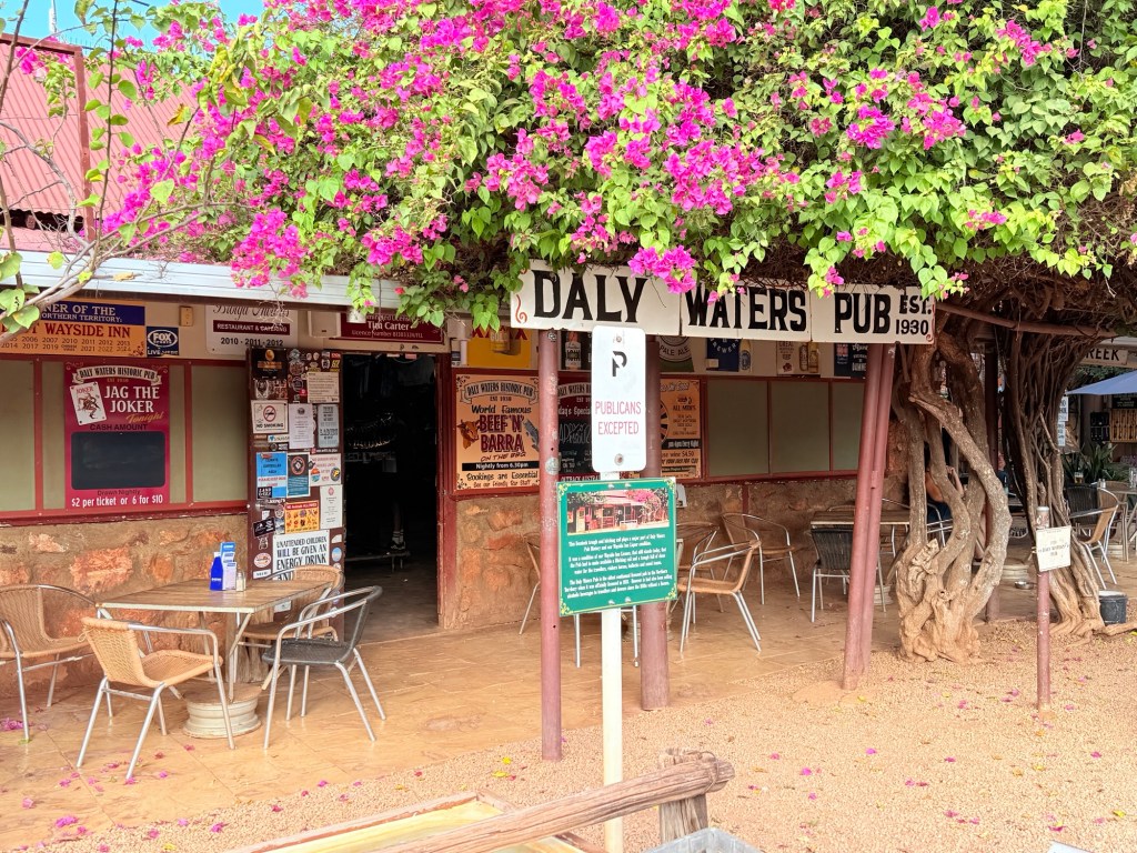
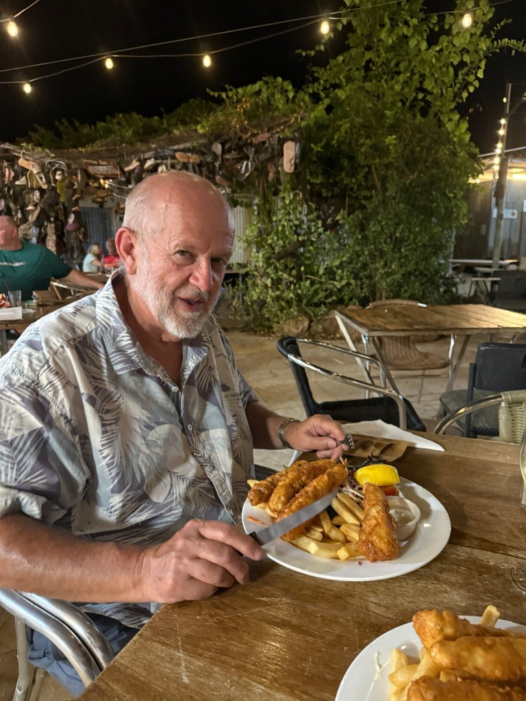
Pleasant afternoon in the shade beside the van relaxing. The pub is famous for its barra meals and dinner didn’t disappoint.
Head off now for Katherine in the morning.
How to gain half an hour
By crossing the border from Queensland into the Northern Territory a little to the west of Camooweal…….
Here is a map of the journey so far, Brisbane to Camooweal. This route is a little over 2,000 km.
We left Winton at 8am, quite early for us. It was a long drive up the last section of the Landsborough Highway to Cloncurry. The road took us past Kynuna and McKinlay, home to the Walkabout Hotel of Crocodile Dundee fame.
In Cloncurry we made a brief stop to take in the sights from the local lookout which also has a new mural (at least for us). Quite impressive artwork reflective of the indigenous connections with the land.
Corella Dam was to be our free camp spot for the night, about 60km on from Cloncurry. The dam was the water supply for the now deserted Mary Kathleen township, the site of the former uranium mine.
Whilst Corella was a good place for a stopover, the bugs were out in force. As well as a few flies.
It seems all the wet weather and residual dampness we have had has brought forth a breeding frenzy in these parts. Lengthy grasses also contribute. Russell was attacked by the little blighters, like a seaside midge onslaught.
Good to get on the road to Mt Isa and Camooweal the next morning.
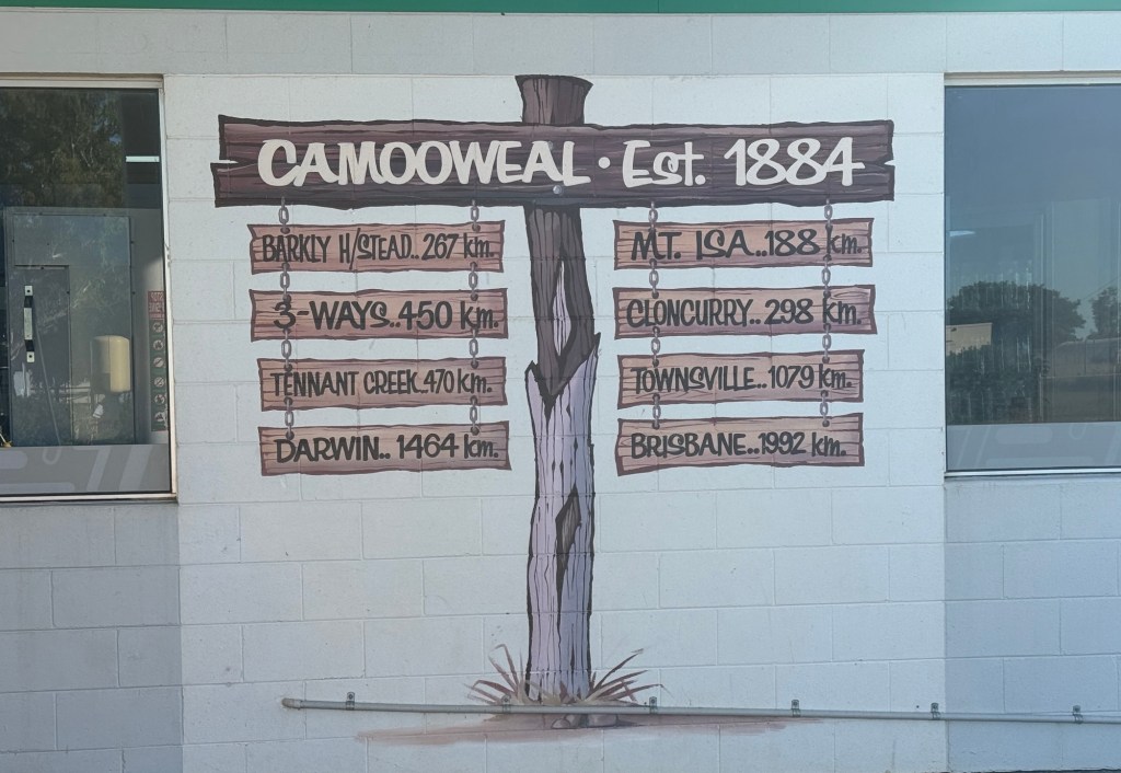
Camooweal seems to be really battling at the moment, the post office/mini supermarket closed at the end of March. Apart from the hotel and service station no other commerce is here. One wonders how the residents will get their supplies, long drives to Mt Isa and maybe the servo will step up with daily needs like milk, bread etc. The pub might hope for the locals to live on beer alone.
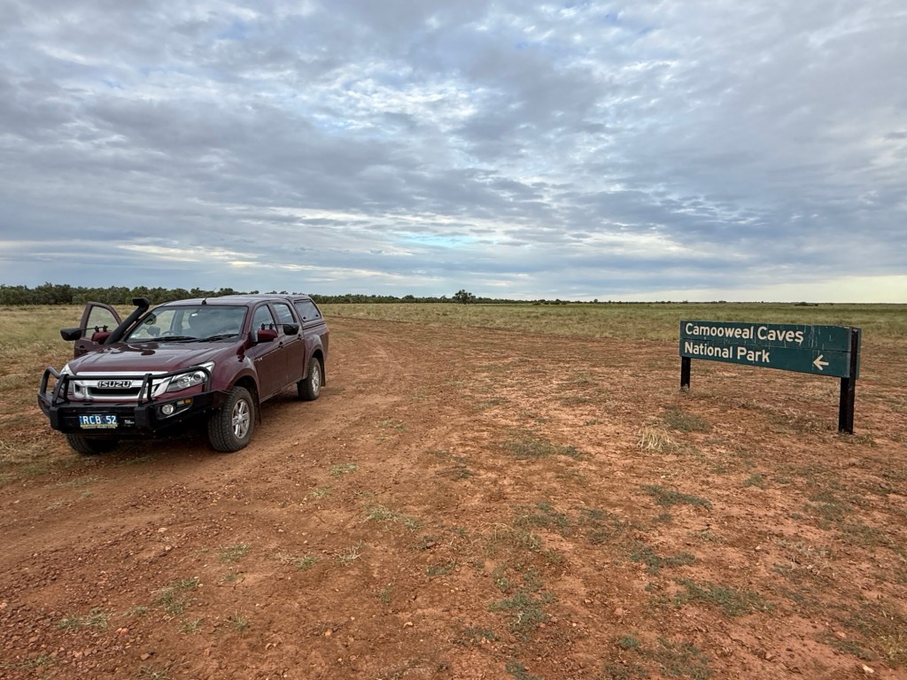
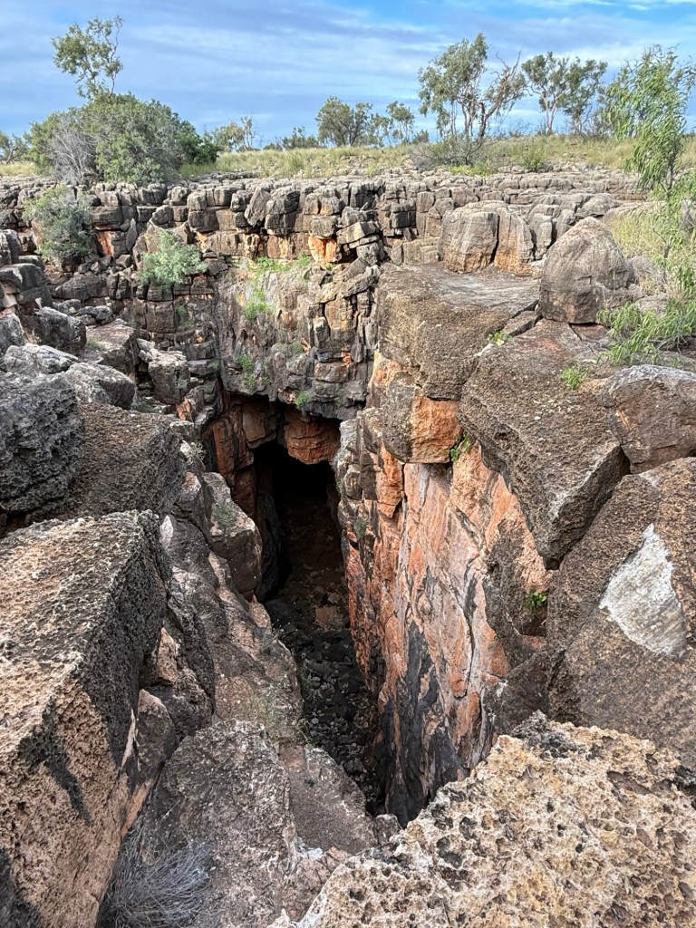
The Camooweal caves are one of the attractions.It is a dusty 16 km drive to the National Park site. An interesting deep hole in the ground and a pleasant billabong are at the end of the road. We made it back to the van park late in the afternoon after a short look see.
We leave in the morning on the next stage of the trip. Crossing into the NT , gaining that half hour. We intend to have the night at the Barkly Homestead Roadhouse, midway across the Barkly Hwy, before heading up the Stuart Hwy to Katherine over the following three days.
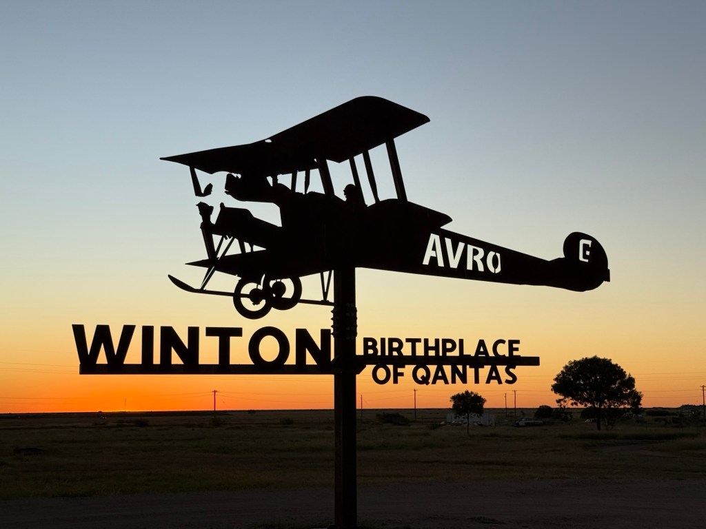
Winton
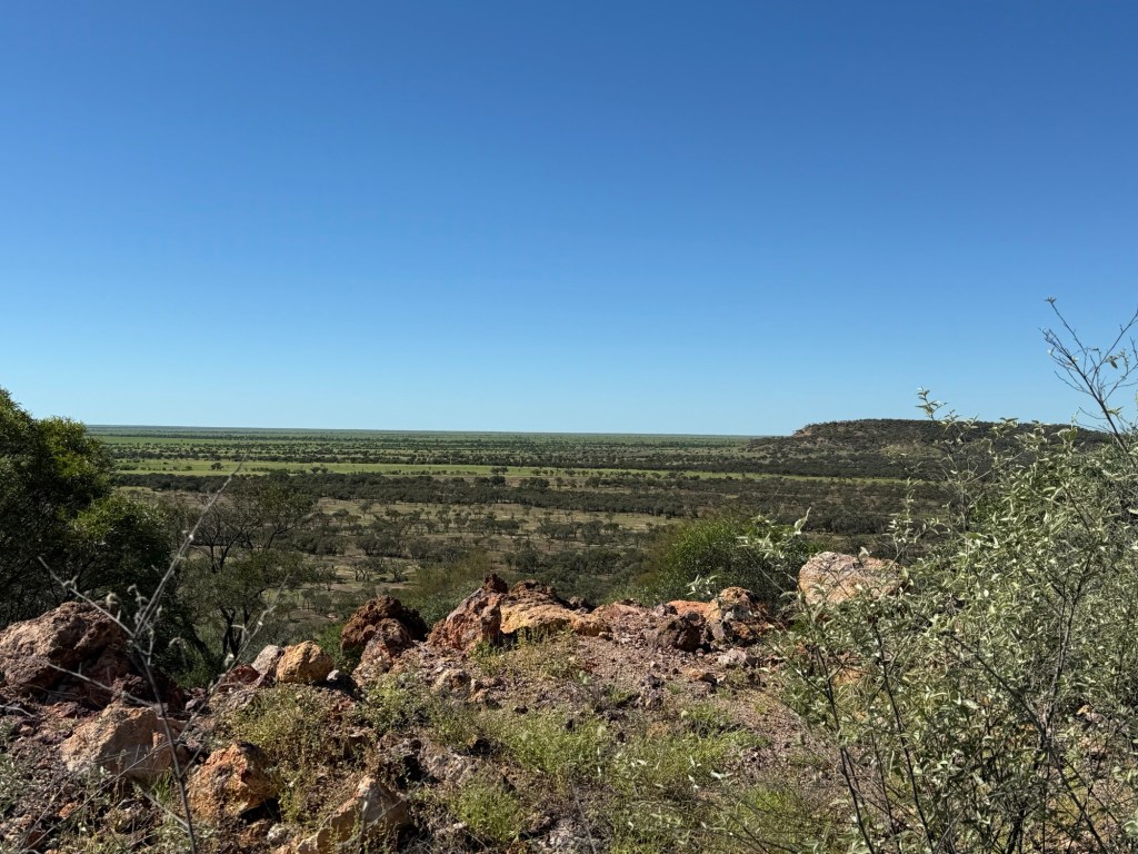
We have now been at Winton for two nights after the drive from Barcaldine and Longreach. The countryside is amazing. So green after all the rain.
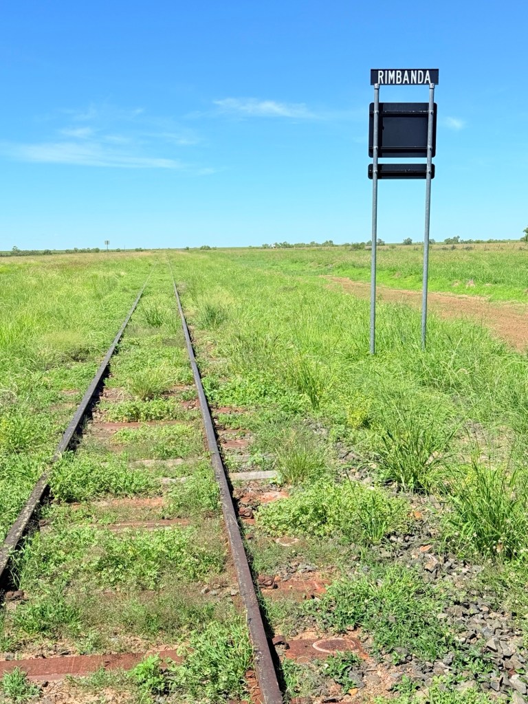
The road to Winton for the most part follows the old train line from Longreach to Winton. I think the line is now only used for freight.
Winton continues to amaze with its energy to do stuff. Some great attractions here and things to do and see in the outback. We have been here before, but it was nearly 13 years ago. Doesn’t seem like it was that long ago. Back then we charged around seeing all the stuff to be seen. This time we have been a bit more focussed.
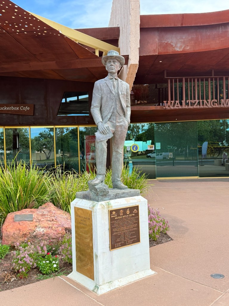
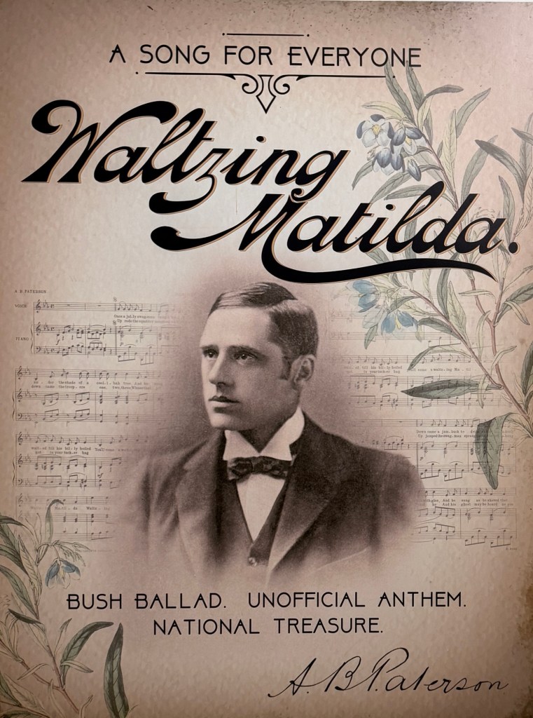
The Waltzing Matilda Centre had burnt down and new one constructed. Must say it is pretty good for a two hour look see, very focussed on seeing the Winton region and its ‘treasures’ through the lens of Banjo Patterson’s ‘Waltzing Matilda’. Very 2025 tech too in the displays.
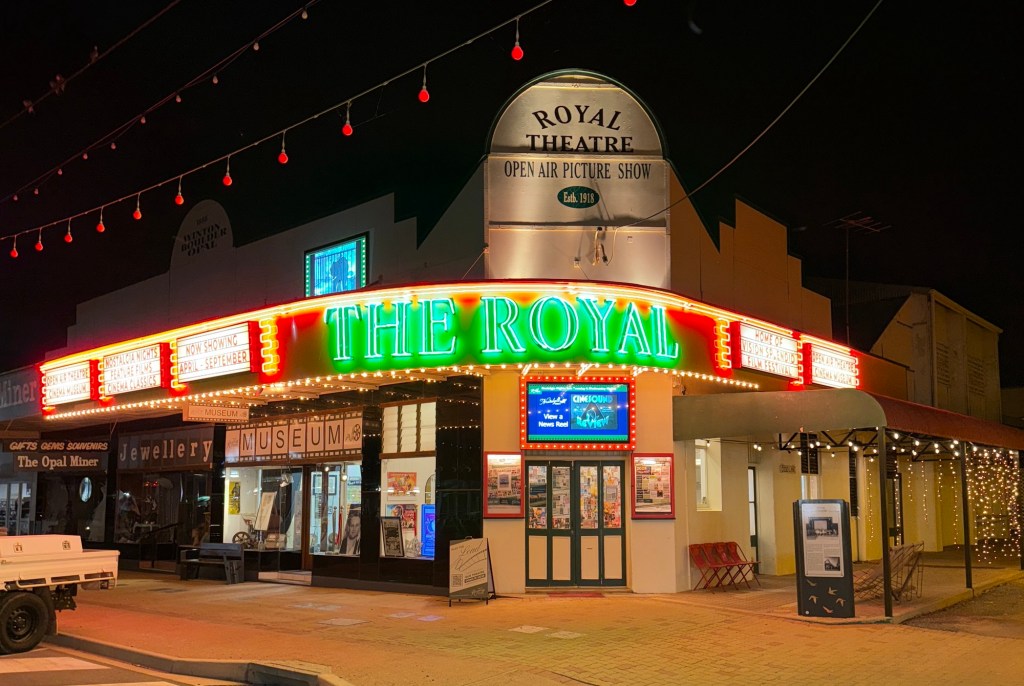
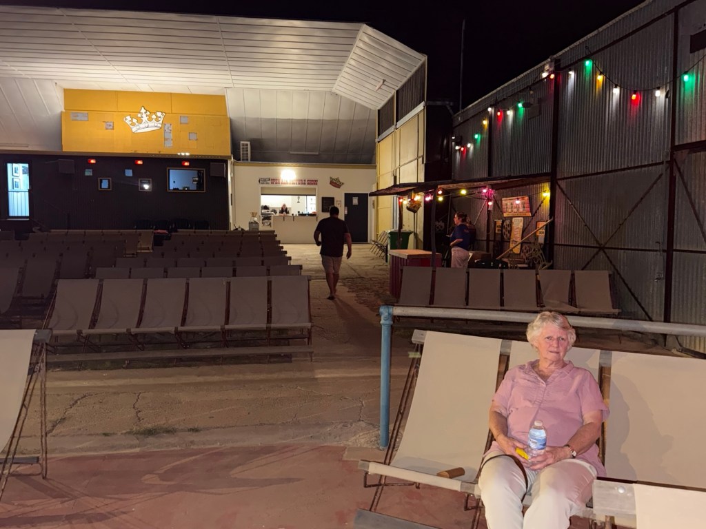
That evening we experienced the charms of the Royal Theatre, a volunteer run open air picture theatre, deck chairs and all! We saw a 1935 John Wayne classic (his 33rd movie), ‘Cold Vengeance’ aka ‘Dawn Rider’. Entertaining 58 minute Western gun fighting, horse riding and fist fighting movie, very 1930s movie making! The Royal operates 5 (or is it 4!) nights a week during the winter touring season with all sorts of old classics and present day attractions.
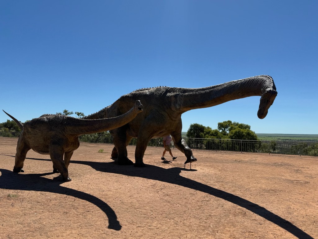
Spent most of day two at the Australian Age of Dinosaurs Museum about 20km out of town. Since our visit way back when the Museum and its environs have come a long way. The eleven kilometre road in has been sealed and new buildings constructed.
A dinosaur trackway all 52 metres of it is under one roof, a major resource effort. The story behind getting this display from its original creek bed location on a cattle property to the Museum is extraordinary. Great determination and of course some Government grant support helps.
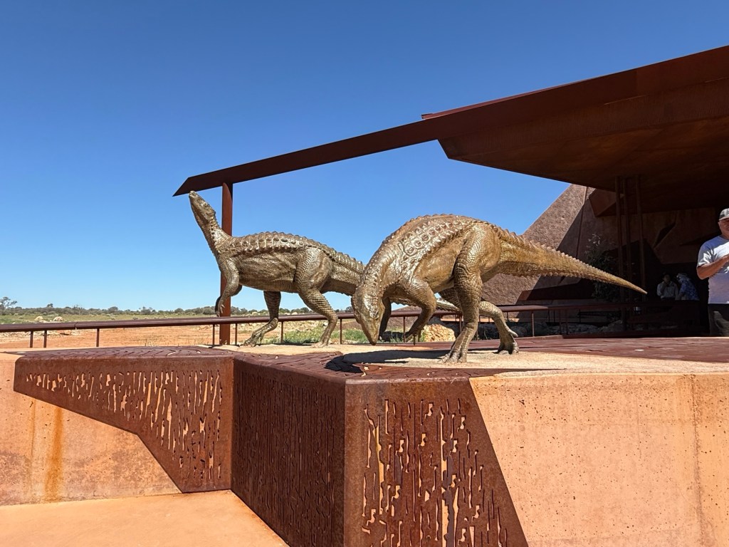
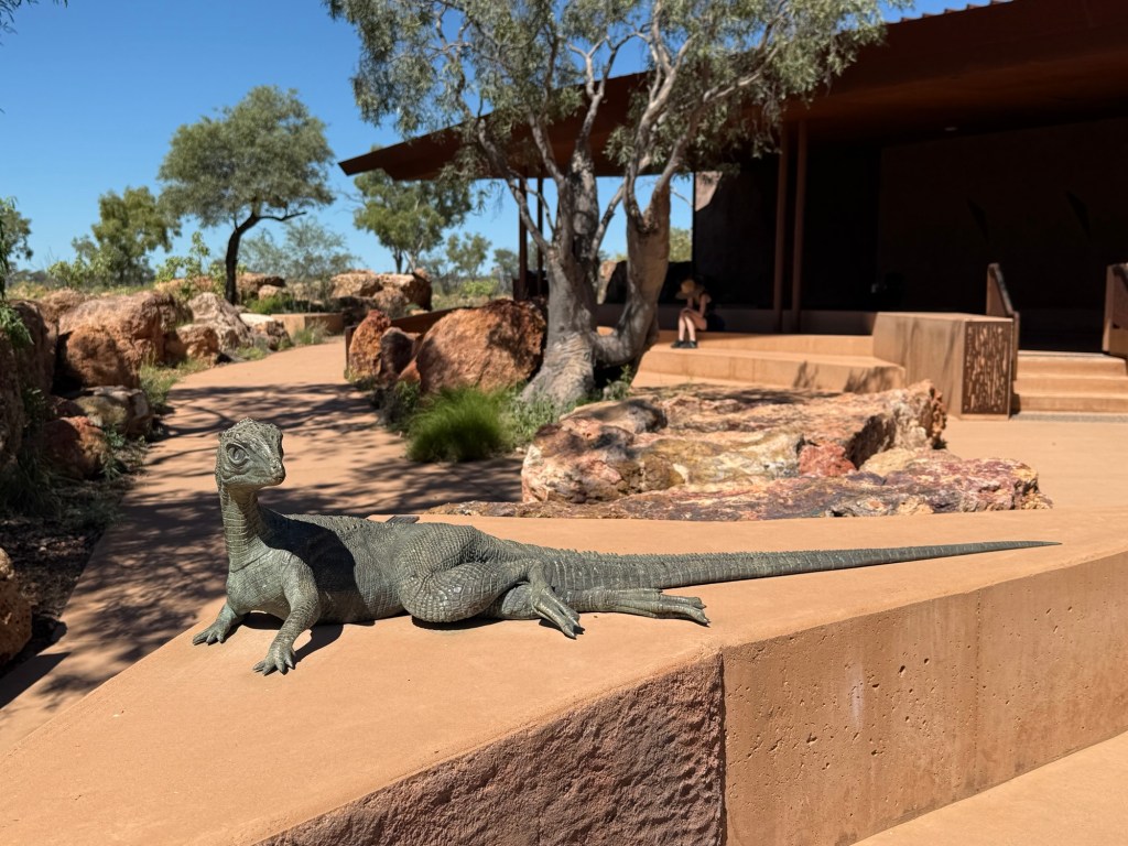
Dinosaur Canyon has a number of displays of the animals ‘out in the wild’, bronze statues of course. Truly impressive place to visit and tour around.
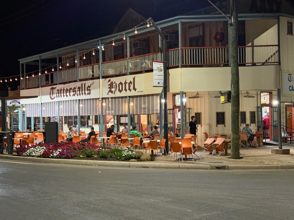
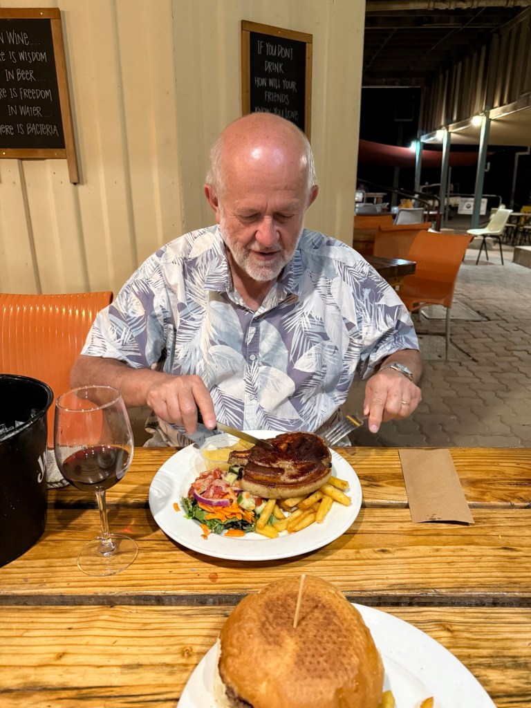
Back in town we enjoyed dinner at the Tatts Hotel, good feed.
We next head for a free camp, a bit west of Cloncurry, hopefully will be there mid late afternoon for a rest!
Heading north west
We are on a trip to the north west of Western Australia. The Kimberleys. The Gibb River Rd beckons.
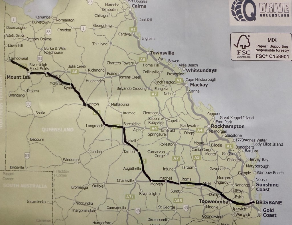
It is going to take a little while in the van, some three and a half months for the journey there and back home. We are first covering some well worn ground heading north west from Brisbane through Roma, Barcaldine, Longreach and Winton.
As with all our road trips there is an early playing of Willie Nelson’s ‘On the road again’. Homealone, is not a huge fan and it took till Dalby before it blasted out of the music box!
First stop after leaving home, some two hours after the planned time, was at Judds Lagoon, a free camp about 60 km from Roma. A nice little spot off the main drag, very quiet with only three others there.
Next morning was Anzac Day. Judds Lagoon is near Yuleba, its main claim to fame is as a staging post for Cobb & Co back in the 1800s. Not a lot happens in these parts these days. The locals today are very focussed on Anzac Day, everything’s (and thats not much) is shut. This presented our first little travelling drama. The need for a diesel top up at the local service station. We had 60km to go to get to Roma, but the range guidance on the speedo was 70km. Rather tight. Problem was the servo didn’t open till 2pm, Anzac Day activities! Allthego set off nursing the truck and van along the road to Roma. Thankfully, we made it there and topped up with 74.6 litres, capacity is 76 litres. 1.4 litres to spare, which accounts for the difference between 60km to Roma and 70 km range. Judgement!
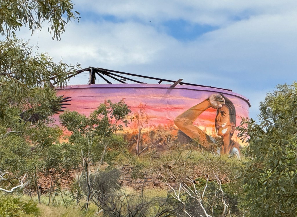
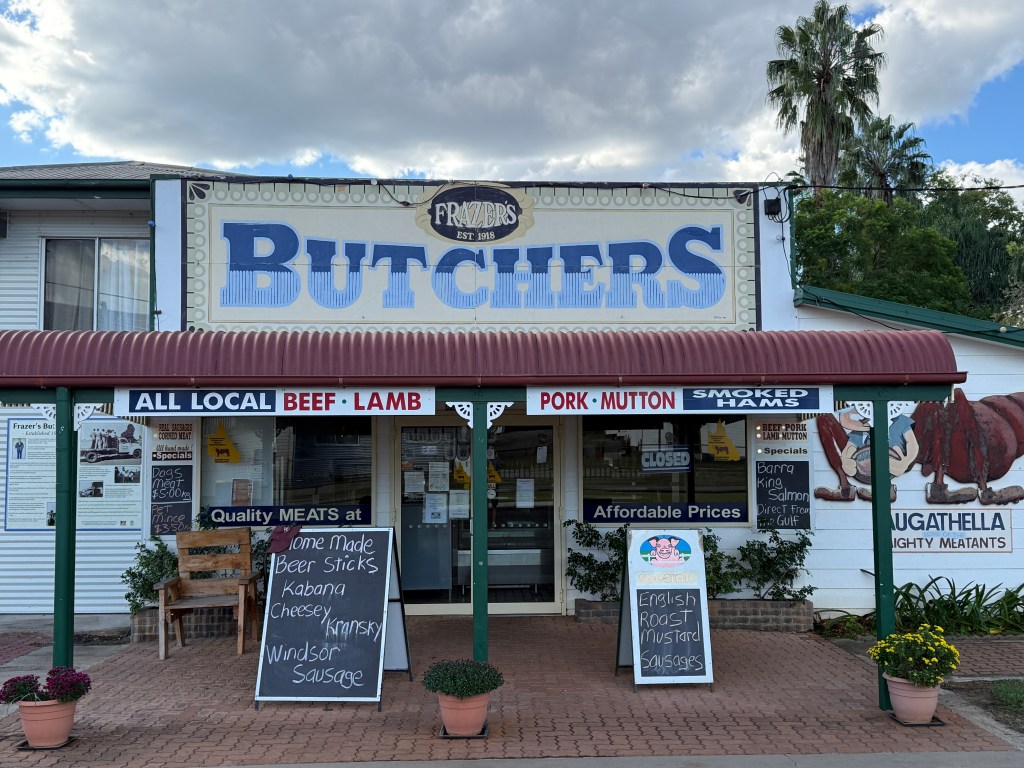
From Roma we made our way through Mitchell and Morven for a night stop over at the Augathella free camp, actually $10. Good facilities here and a number of vans were lined up along the river front. Augathella’s main attraction in the past has been its giant meat ant and a few murals.
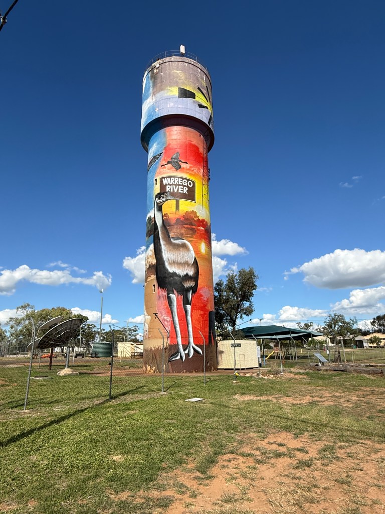
It now has a freshly painted water tower, quite impressive design. We also stocked up on some country killed beef at the old butcher shop. Been in the same family for five generations and is supplied by the family’s local property. The butcher is also the local killer and meat inspector so they have it all tied up nicely.

On the road again we headed for Barcaldine with a short stop at Tambo for morning tea followed by lunch the other side of Blackall.
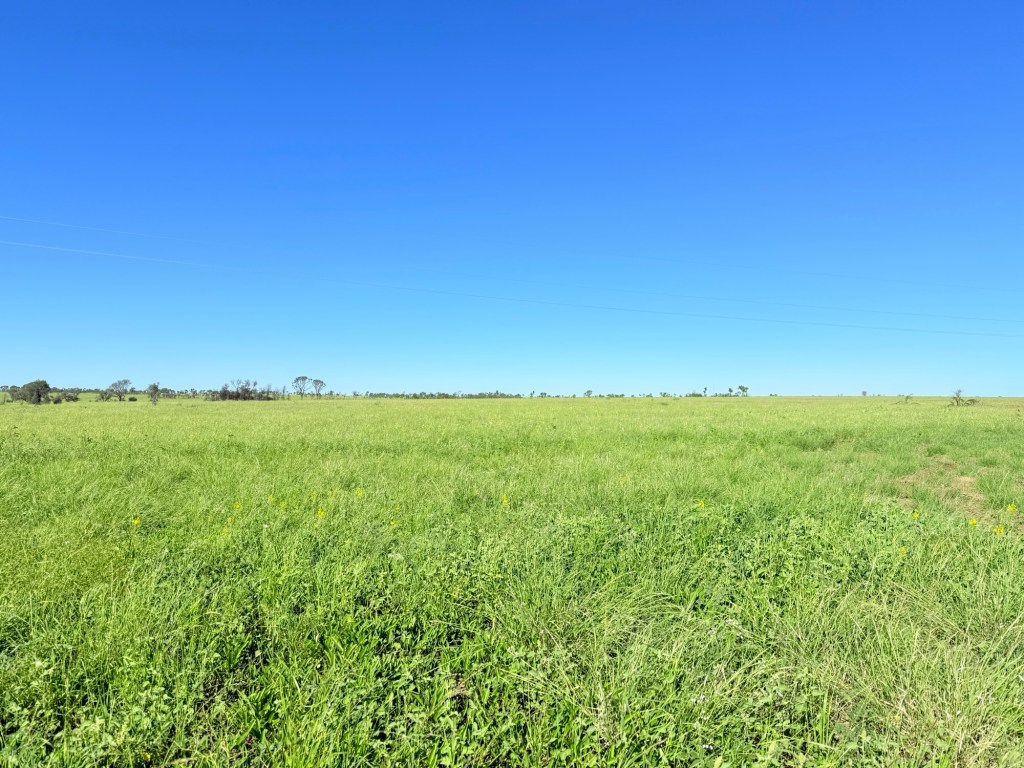
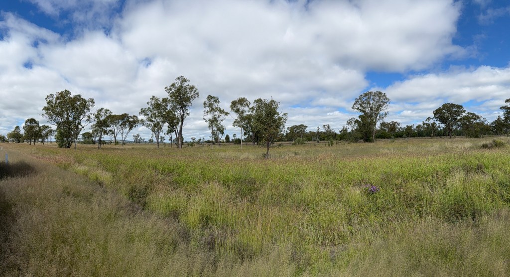
Grasslands are very green and the cattle are up to their thighs in it munching away. Should be a good winter season for the graziers.
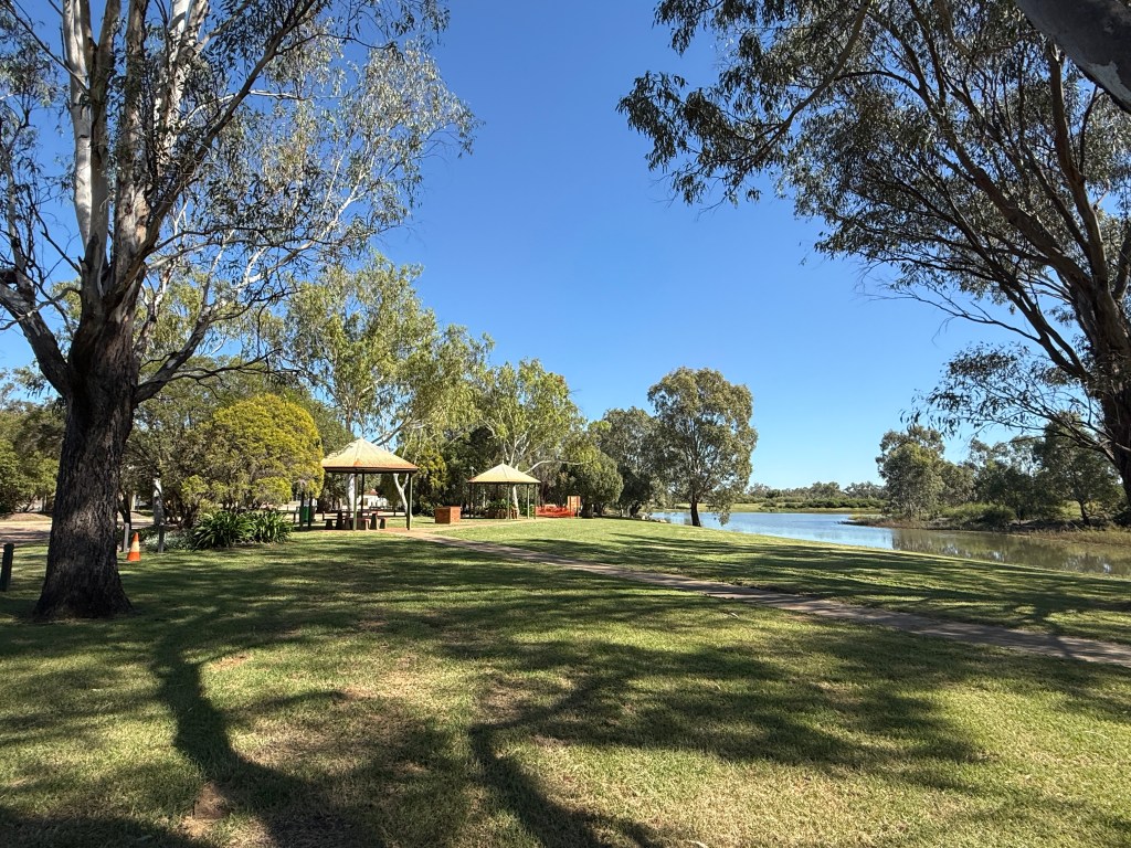
Not much has changed in Barcaldine, one of the local motels has set up a small van park with seven grassy drive through powered sites. Only two of us in for the night. Seems to be new for this season, great spot and a block back from the main street.
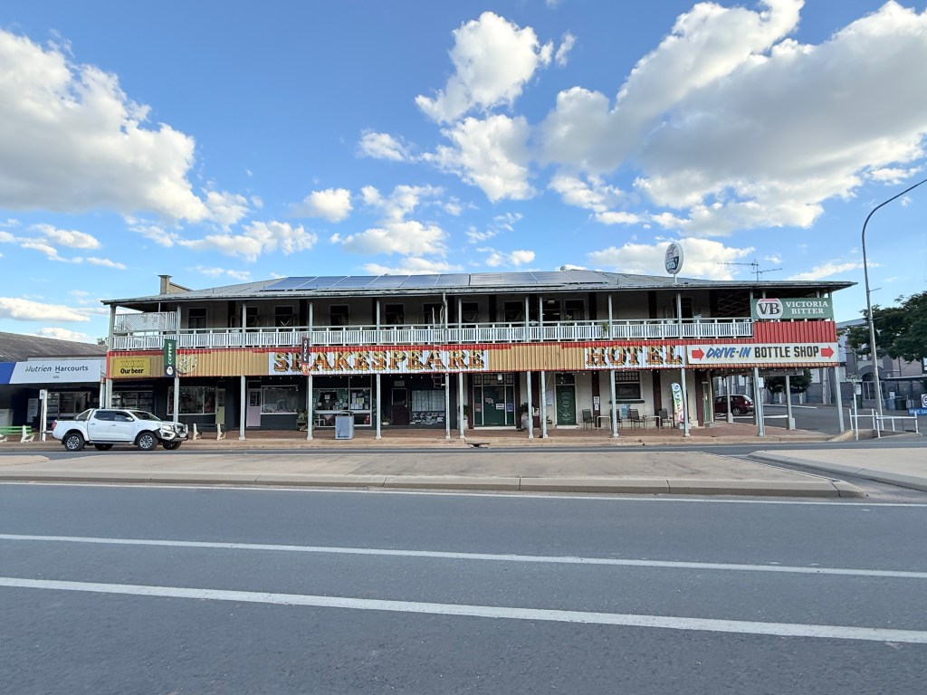
The old Shakespeare Hotel has been done up and reopened. We had dinner there celebrating the Bards recent 528th birthday. Bit empty, seemed to be only two of us there for the night. The owner told us times were tough. The locals don’t go out much any more, the football was on tonight as well. Very dependant on tourists and she was eagerly awaiting the winter travellers.

We had dinner on the upstairs balcony overlooking the Tree of Knowledge, the structure made from old timbers supplied by an old colleague some years back.
We are now setting off for Winton with a bright sunny blue sky. Must stop at the petrol station for a top up!
