We arrived in Quebec City in good time, the weather not so good on arrival but the skies cleared as the day played out. We are in port until 10pm. We had an all day excursion around the old town and then went further afield into the countryside arriving back in plenty of time to go back for an evening in the streets.
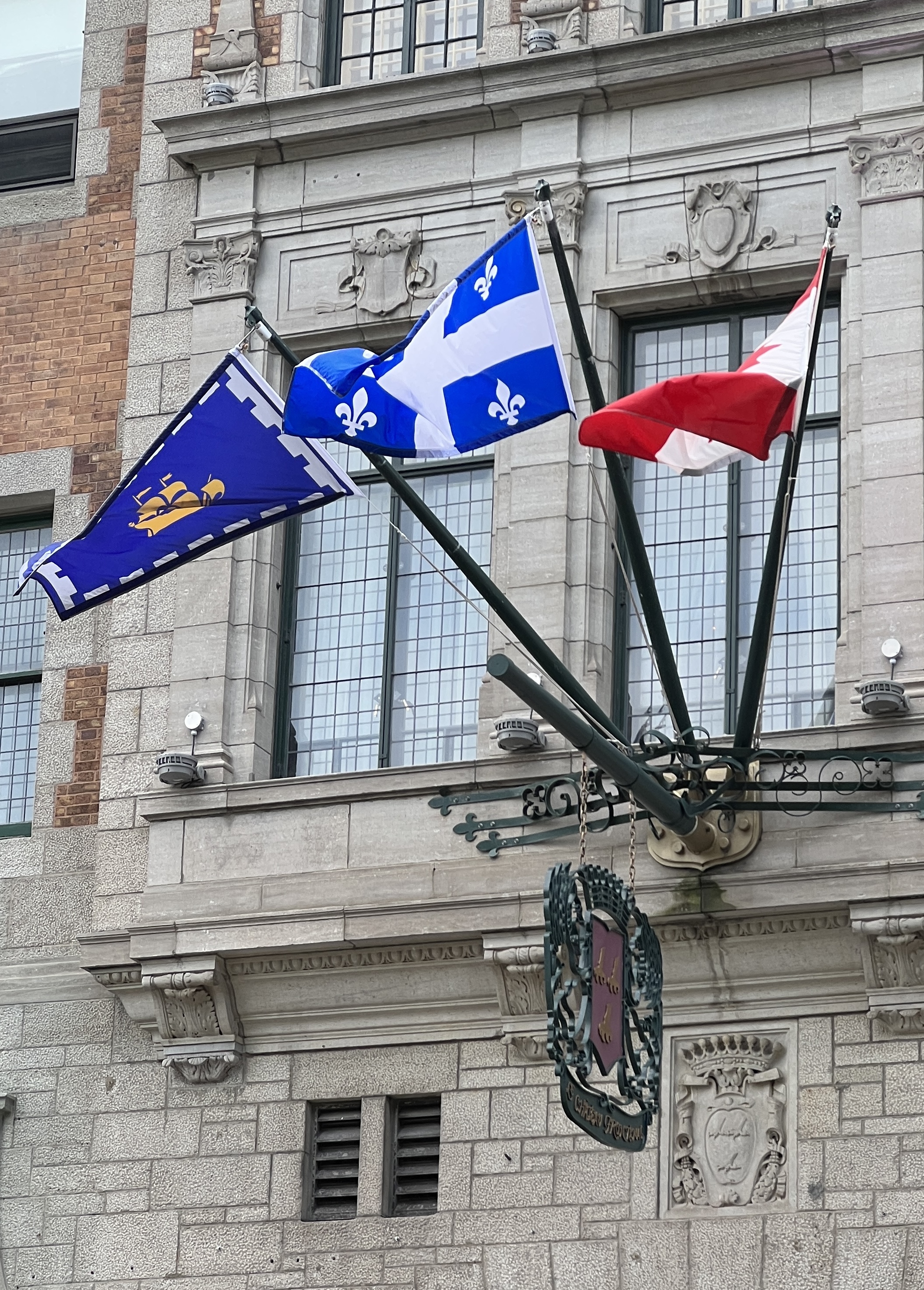
Canadian, Quebec Province and the Quebec City flags.
Our guide, looked to be 70ish, was the usual mine of information delivered with a strong gravelly French accent and accompanying nonchalant shoulder shrug as if his English didn’t quite do the job! Not the greatest of guides we have had, thought we were mostly Americans too with a couple of Kiwis thrown in.
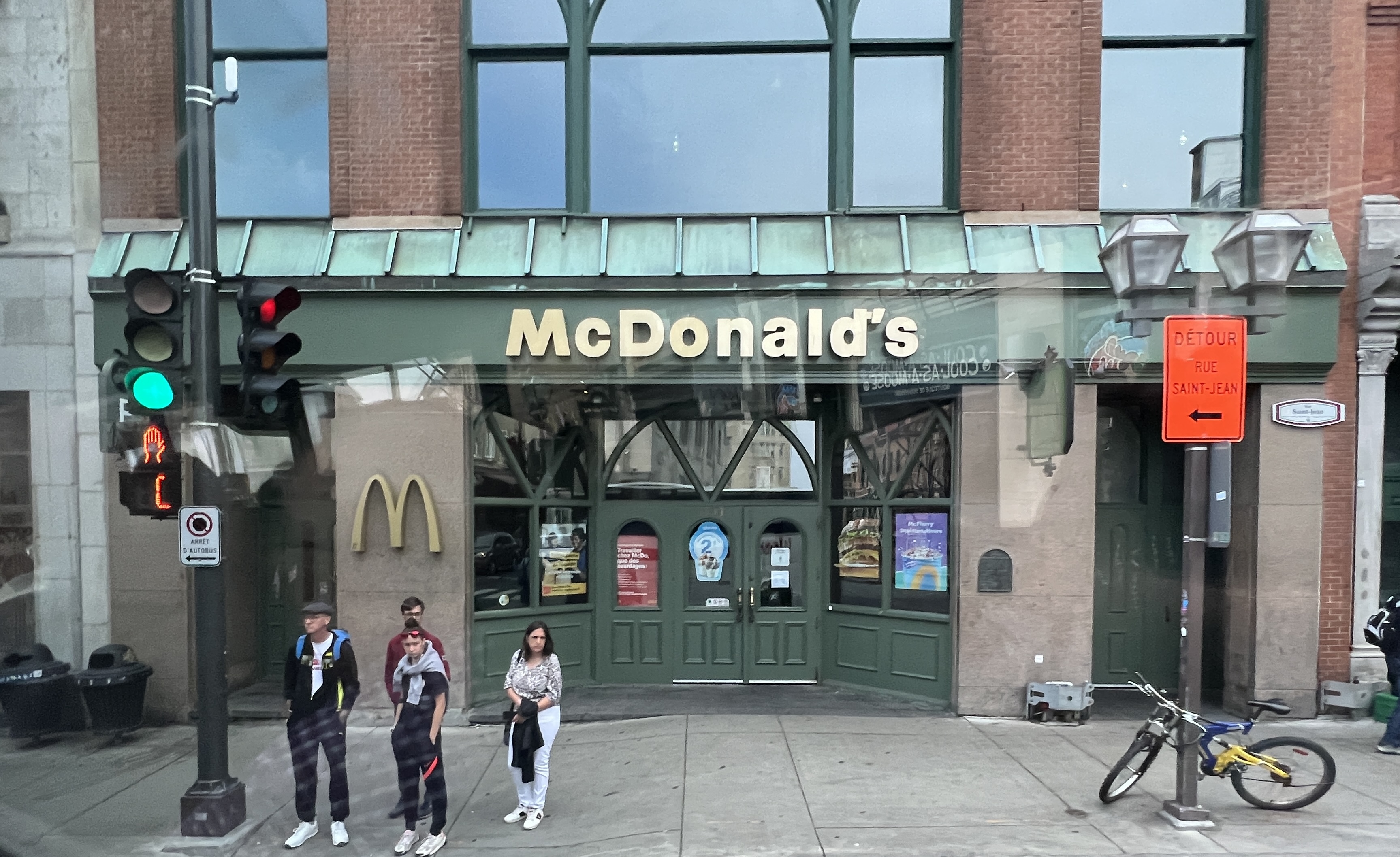
Lower old town, outside the city walls.Maccas is not allowed to use the Golden Arches or colour red in these parts because of heritage laws.
He gave us a bit of history about the old town before we had some time to look around. The French established Quebec City in 1608 and hung onto it for the next 155 years when it was ceded in 1763 to England, at the end of the wars mentioned in the last post. Still a very French place though, 95% of the locals speak French in the home as a first language, 3% English and 2% other lingos.
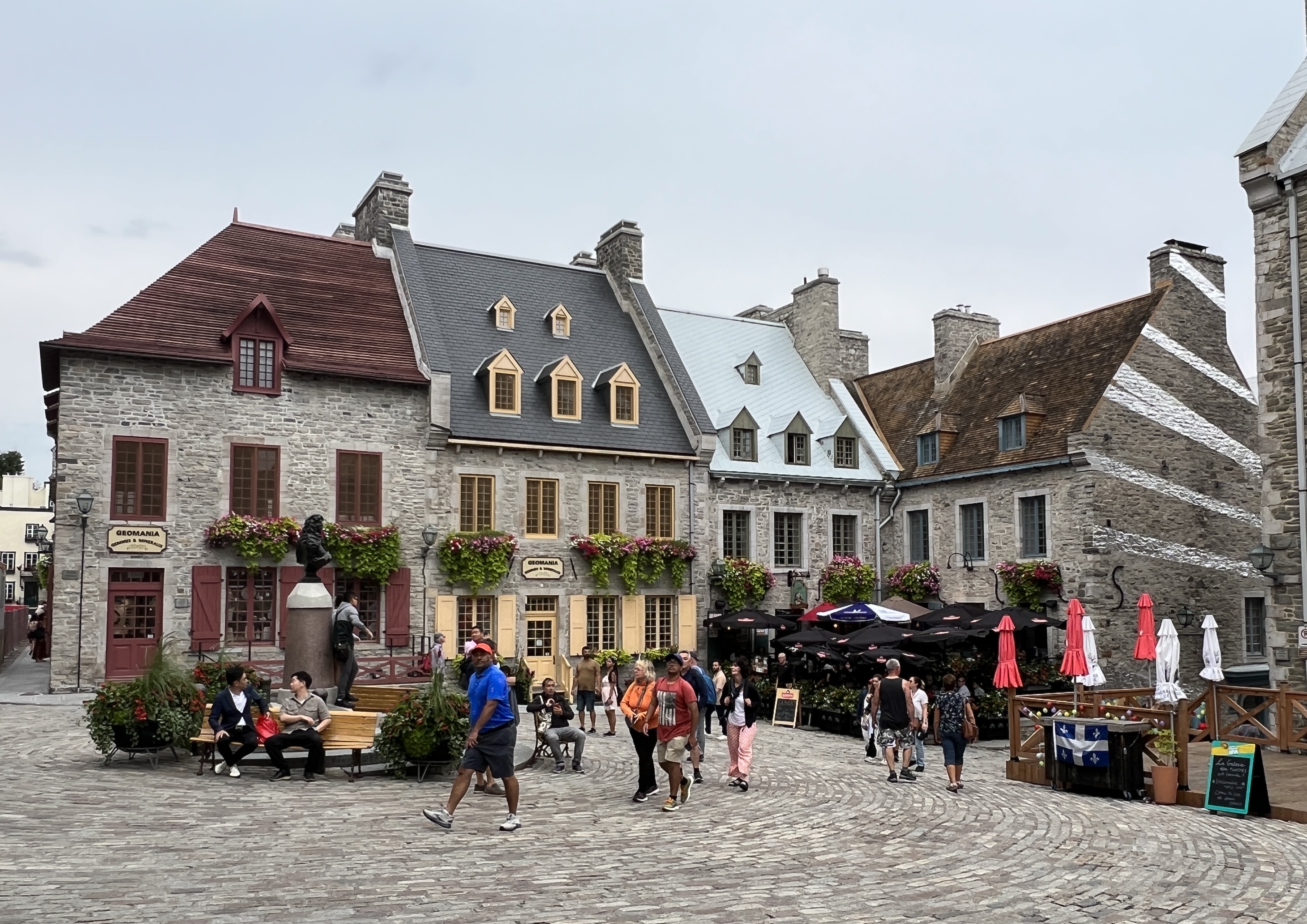
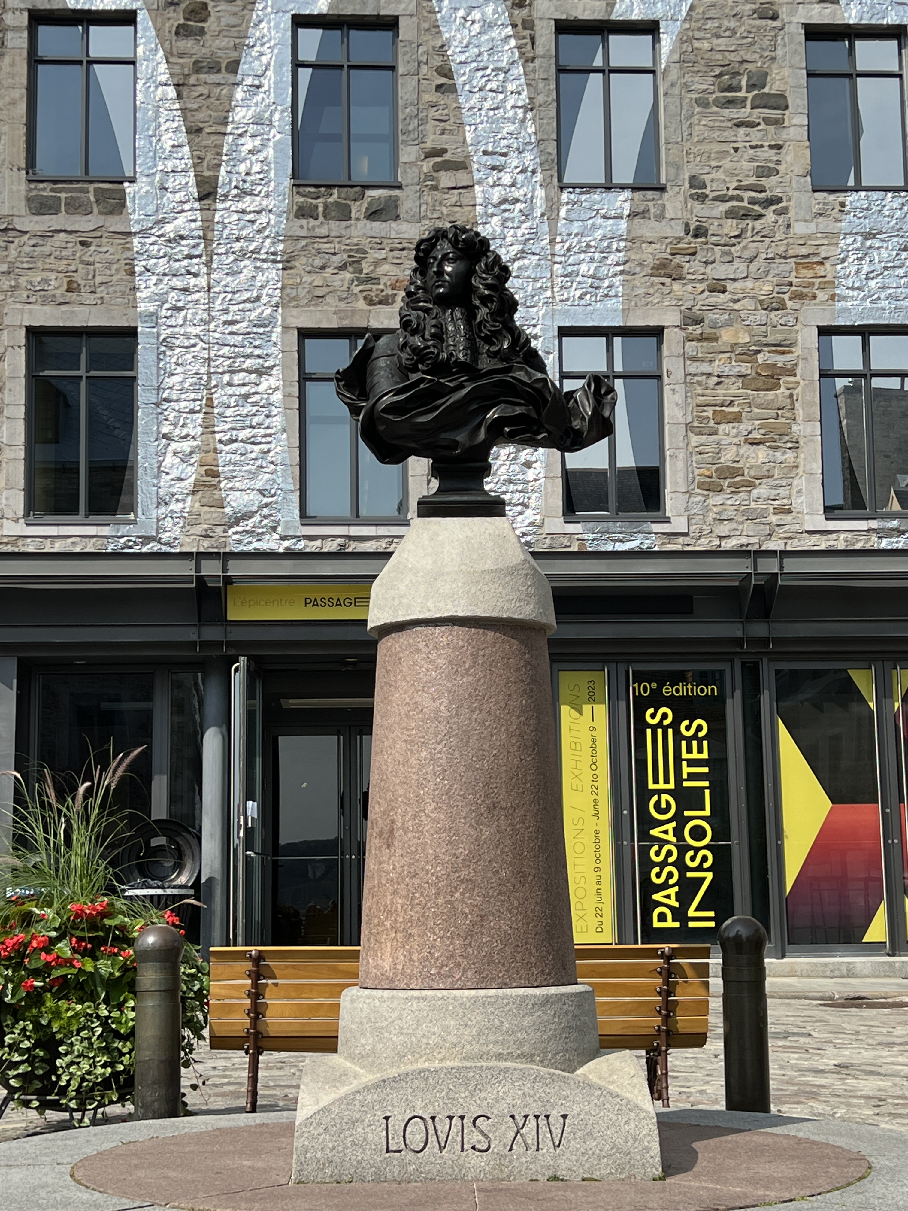
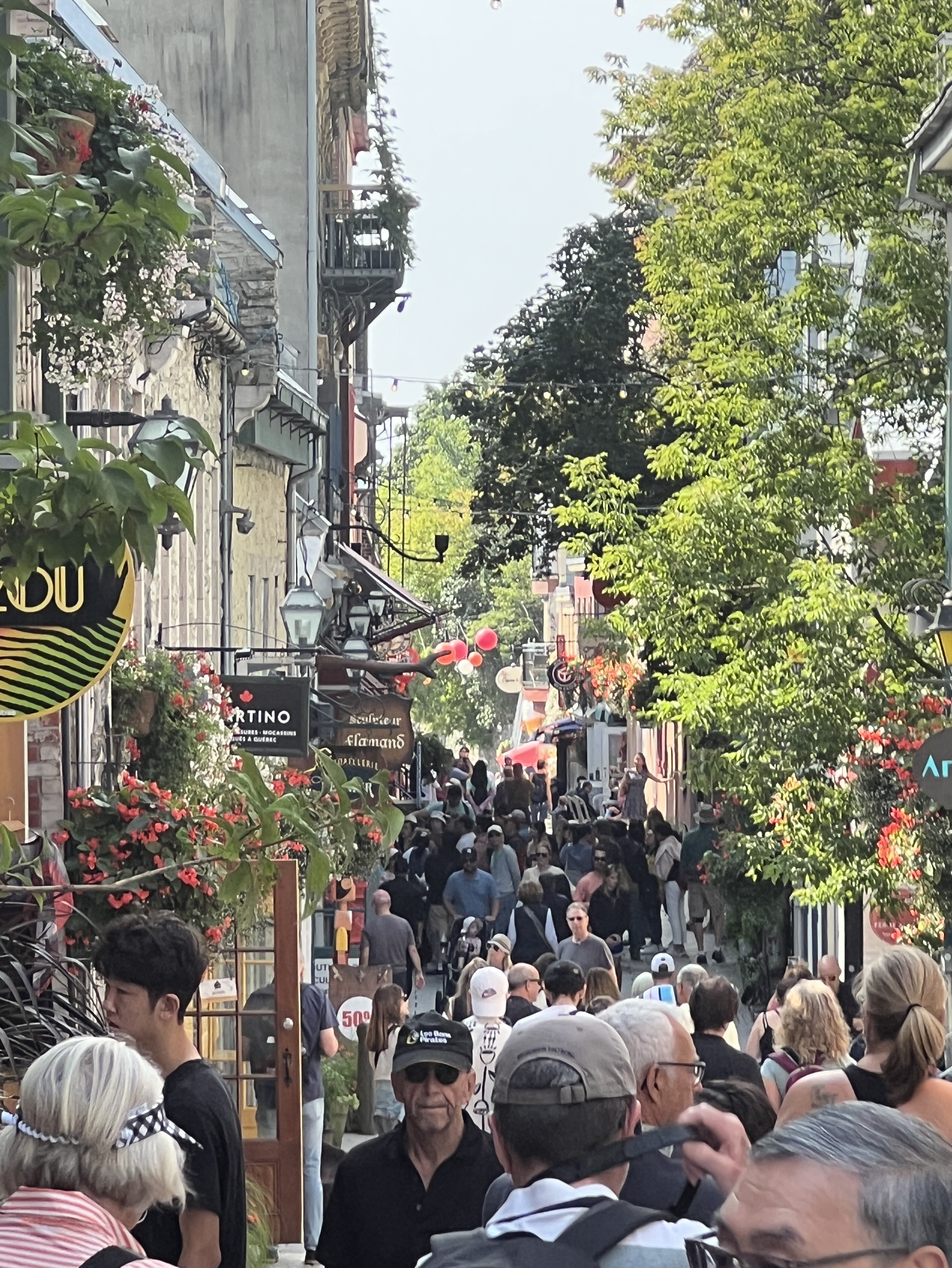
Place Royale.Place Royale, Louis XIV the sun king.Quebec’s oldest street in the old town, bit of a squeeze walking down here.
The old town area, the Place Royale, is still surrounded by the city walls and parapets overlooking the St Lawrence River. The old town was originally wooden buildings within a wooden fort, but after a number of fires and wooden rebuilds over the years wood gave way to stone around the 1670s. The whole fortified area is known as La Citadelle.
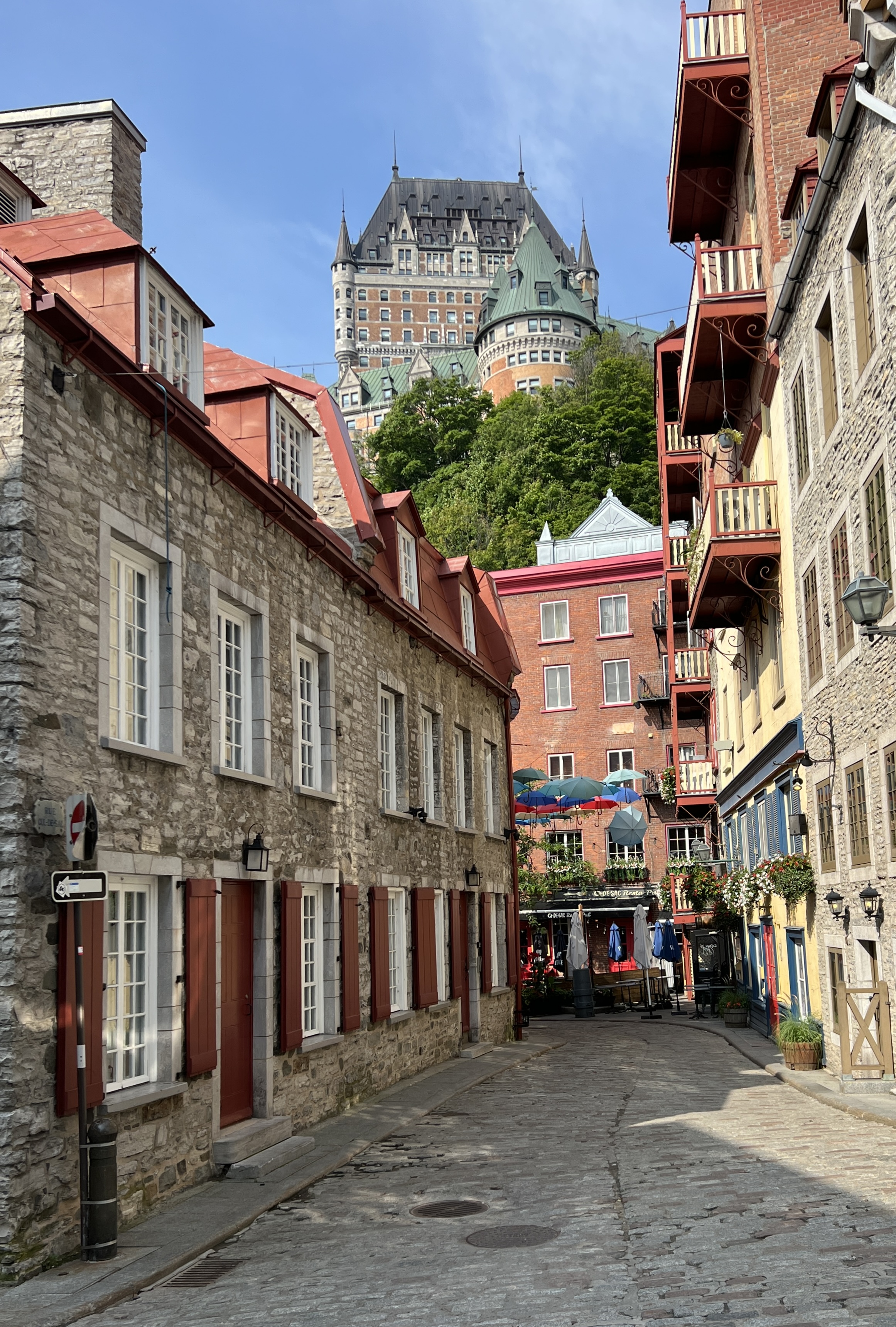
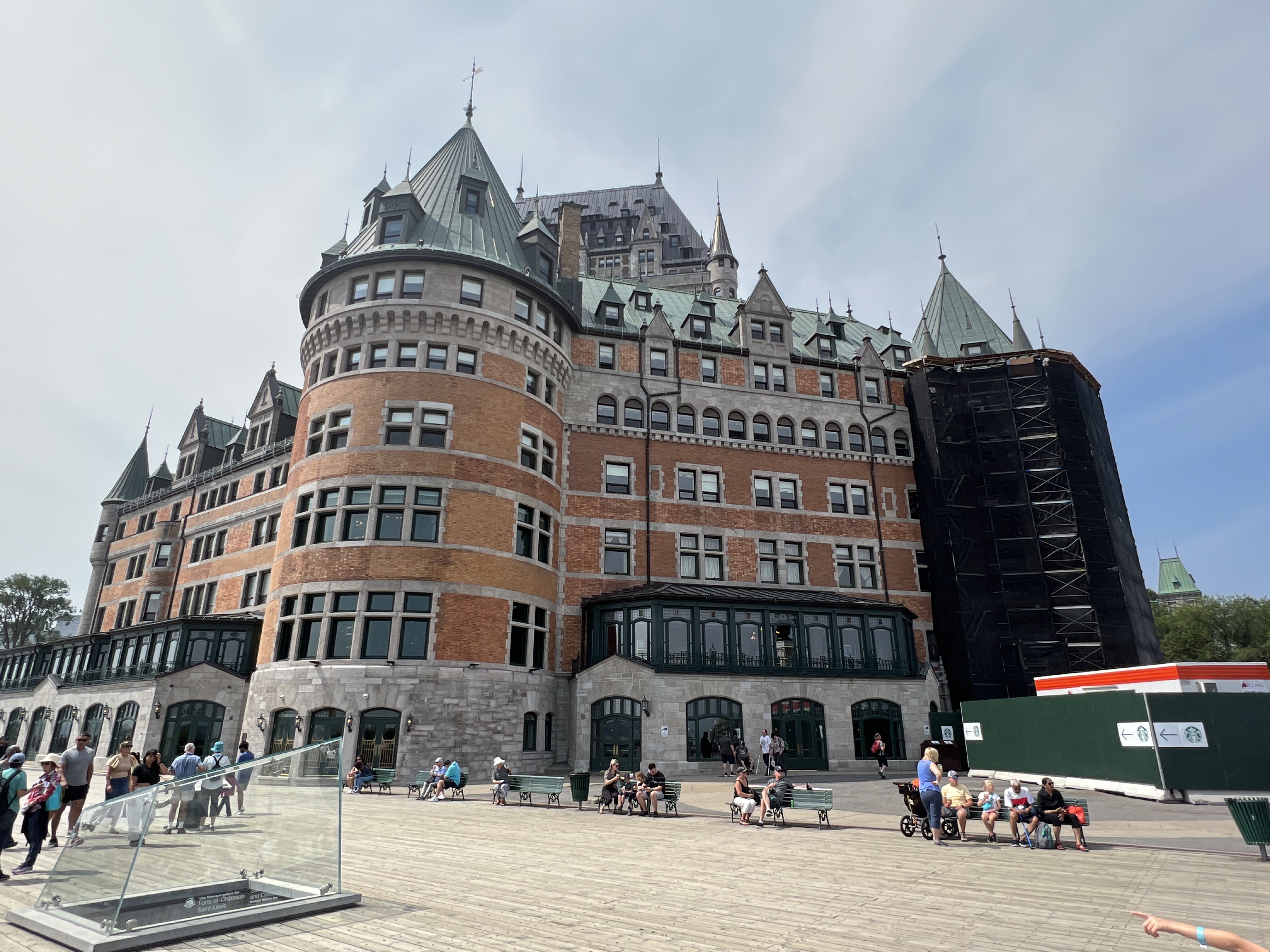
Le Chateau Frontenac.The Chateau foyer.
There is a great view from the top across and down the St Lawrence River, ‘spoilt’ today by a thick haze. We have a look inside the foyer of the famous landmark hotel Le Chateau Frontenac. Nice spot to stay!
A museum is in this old fort structure opposite Le Chateau Frontenac, looking over the St Lawrence River.
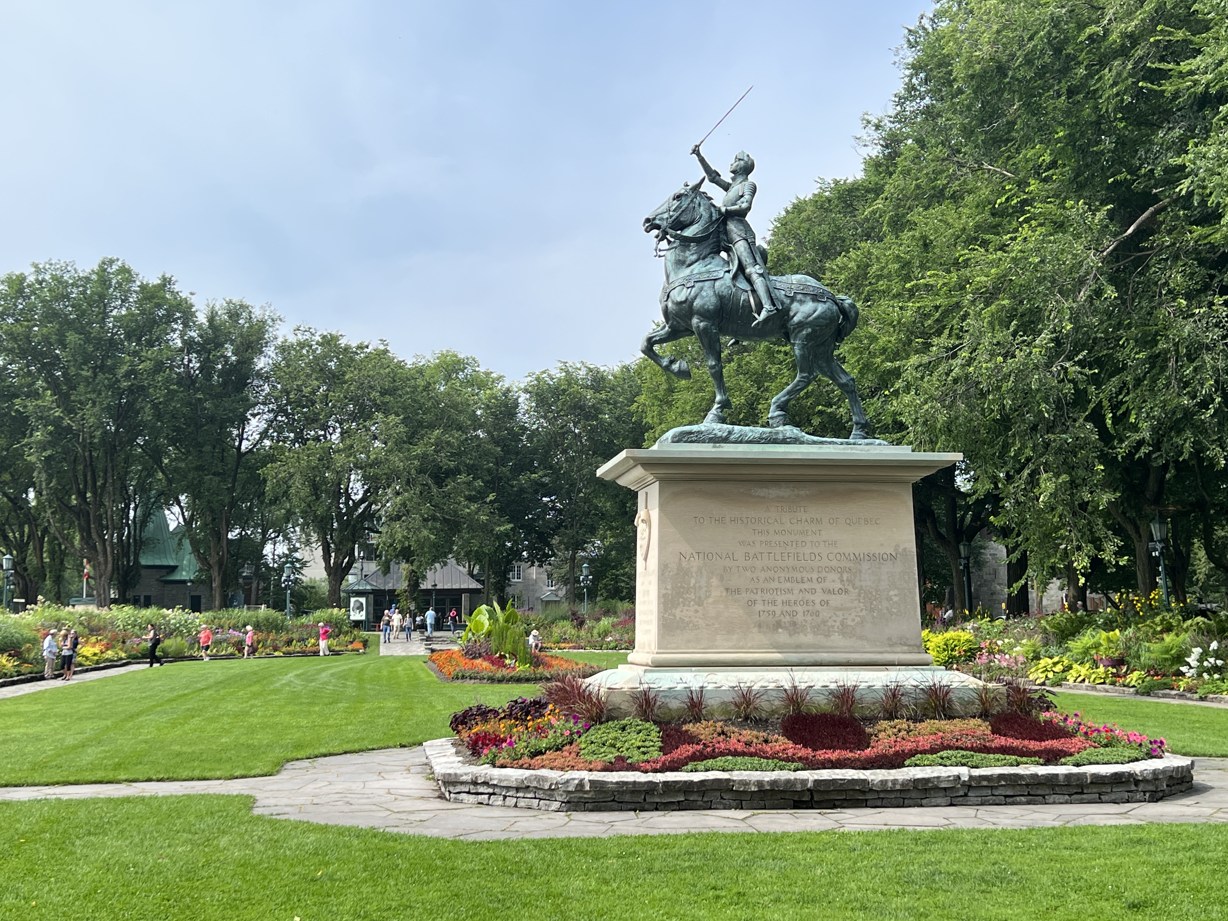
Back on the bus it was a drive by the ‘Plains of Abraham’, the now grassy parklands where the Battle of Quebec was fought, for a photo stop. This whole area is surrounded by cannon after canon lining the roadway. Tucked away on the side is a statue of Joan of Arc in a beautiful garden setting.
Joan of Arc statue Gardens at the Plains of Abraham, Battlefields Park.
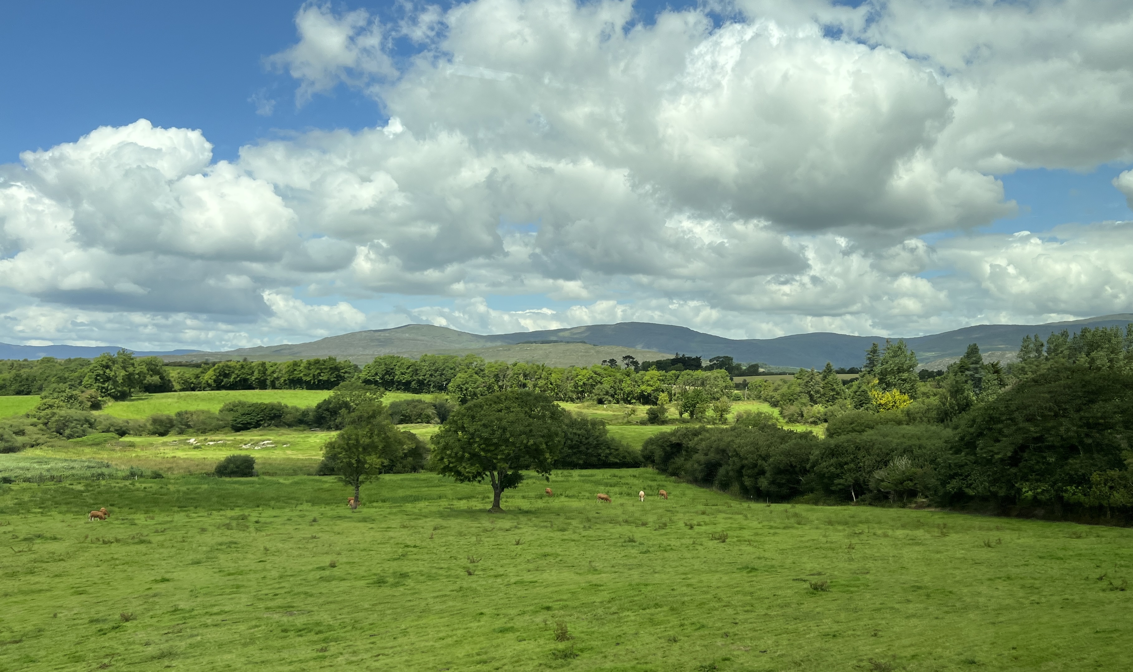
It was then out of town and into the countryside for a look at the rural activities in the region. Mostly grain and vegetable crops. Beside us in the port is a huge complex of silos, not a great look. Quebec acts as a major export terminal for the large grain production areas in central Canada and the top end of the USA.
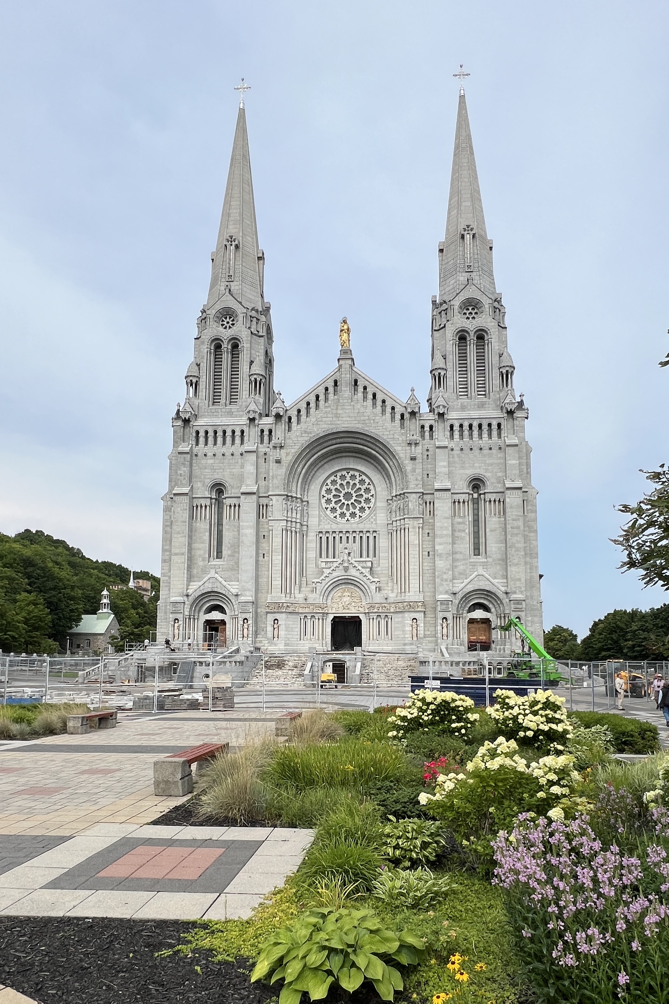
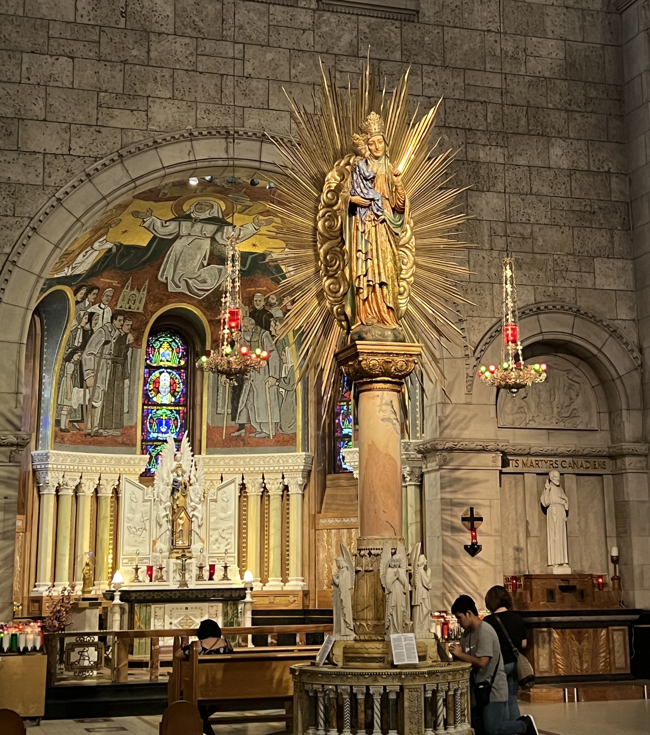
Sainte-Anne-de-Beaupre Basilica.
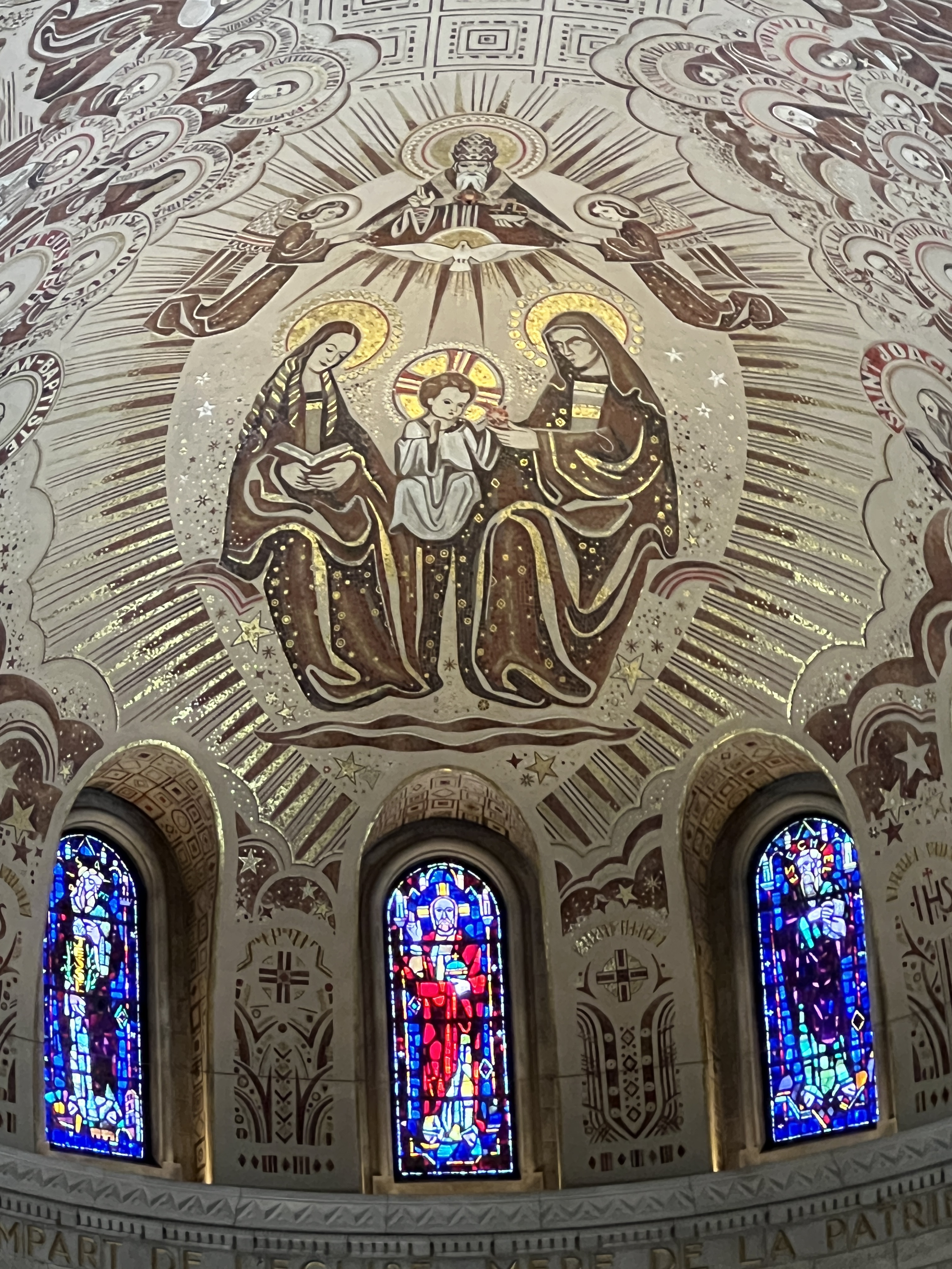
After the rural romp we stopped in at the Roman Catholic Basílica Sainte-Anne-de Beaupre. This was something else I might say. In our travels up in Iceland/Greenland we had got used to Lutheran austerity. Well, this was at the other extreme. What an ornate structure. A couple of pictures say it all.
Interior of the Bascilica.One of the shrines.
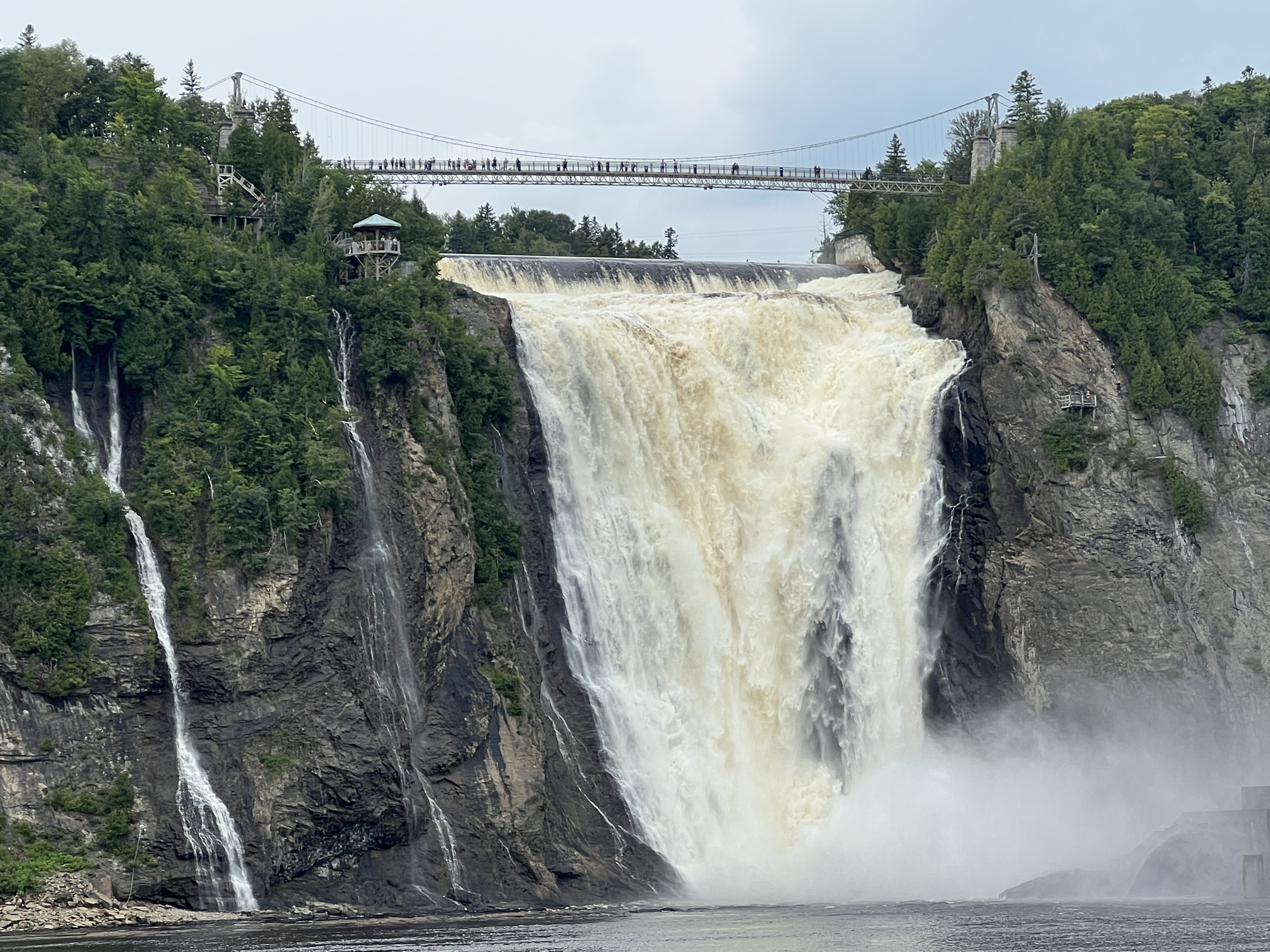
After the Bascilica the nearby falls were the next stop. These are 30m or so higher than Niagara and there was a huge amount of water coming over them from all the recent rain.
Montmorency Falls.
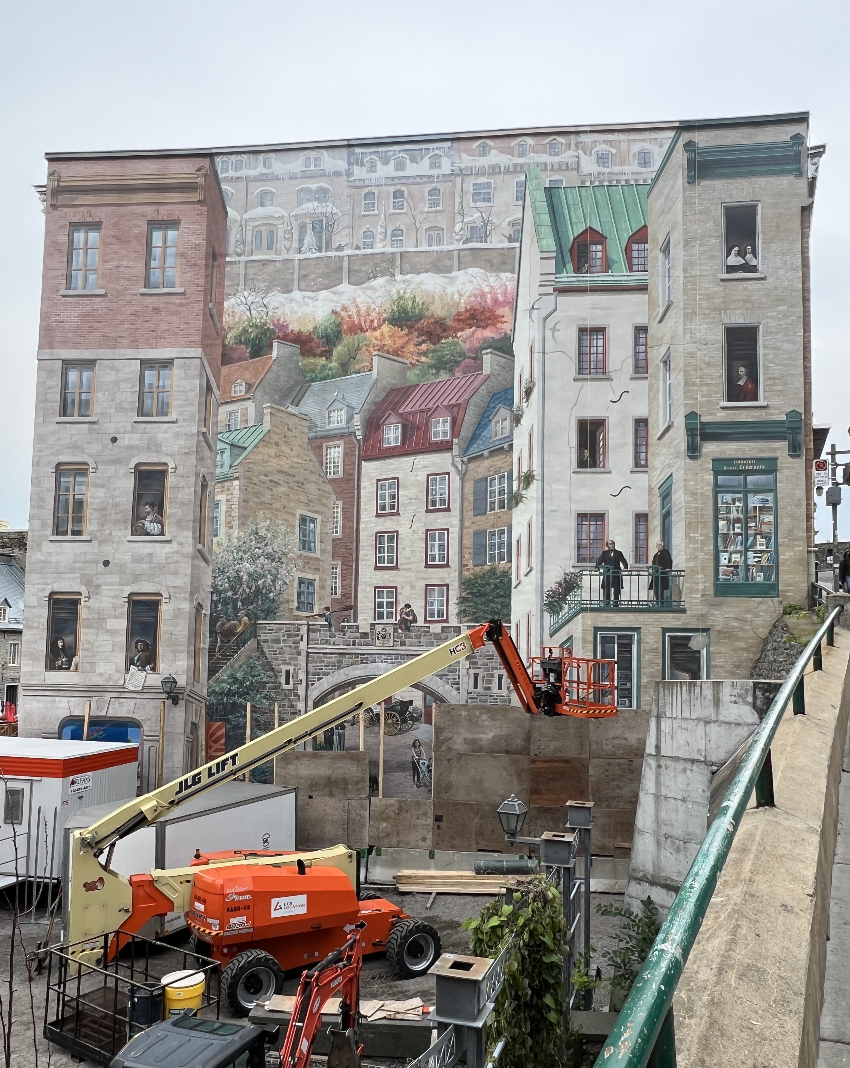
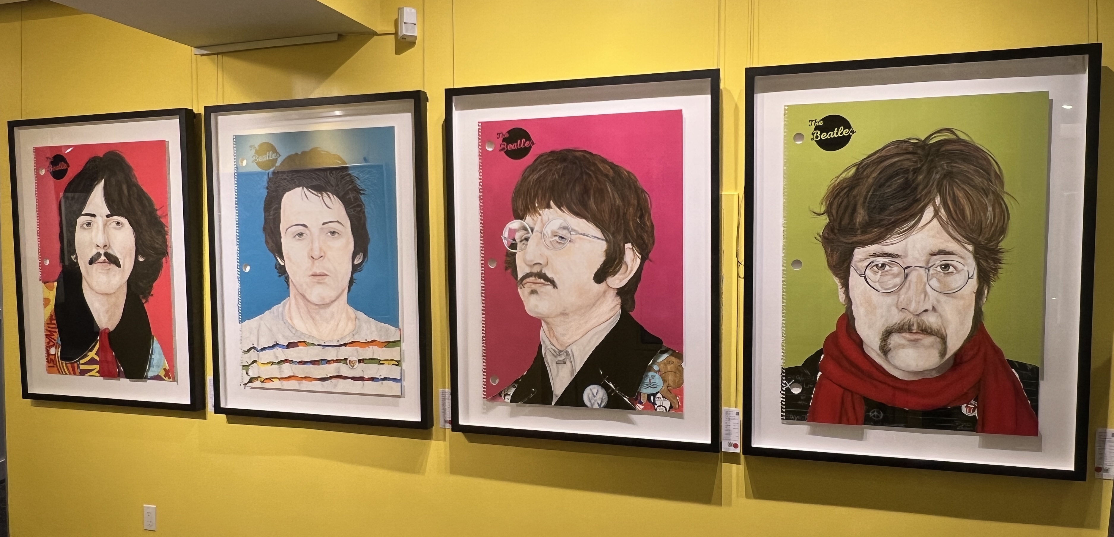
It was then back to the city and some early evening time in the old town. We had a short stop for a light refreshment in a bar and a look see in some of the numerous art galleries and souvenir shops. It was all very reminiscent of Paris.
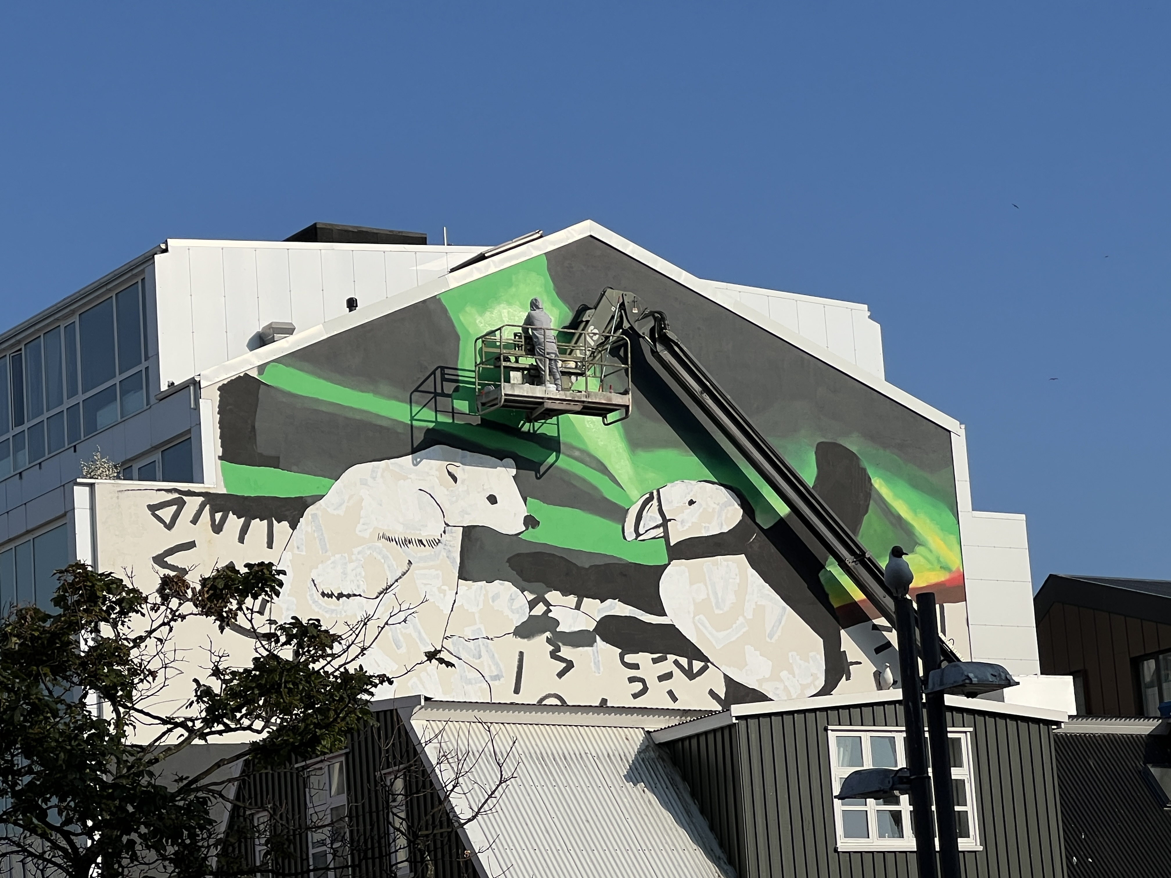
Full scale mural on a building wall, the artist uses the machine below to access the wall, amazing perspectives.Fab 4 in an art gallery.
We thought Quebec was one of those spots you could easily return to again and have more time to explore. Around 8 pm the smell of rain was in the air and a light drizzle started on the walk back to the ship. A bit of lightning flashed around as we made it back in time.
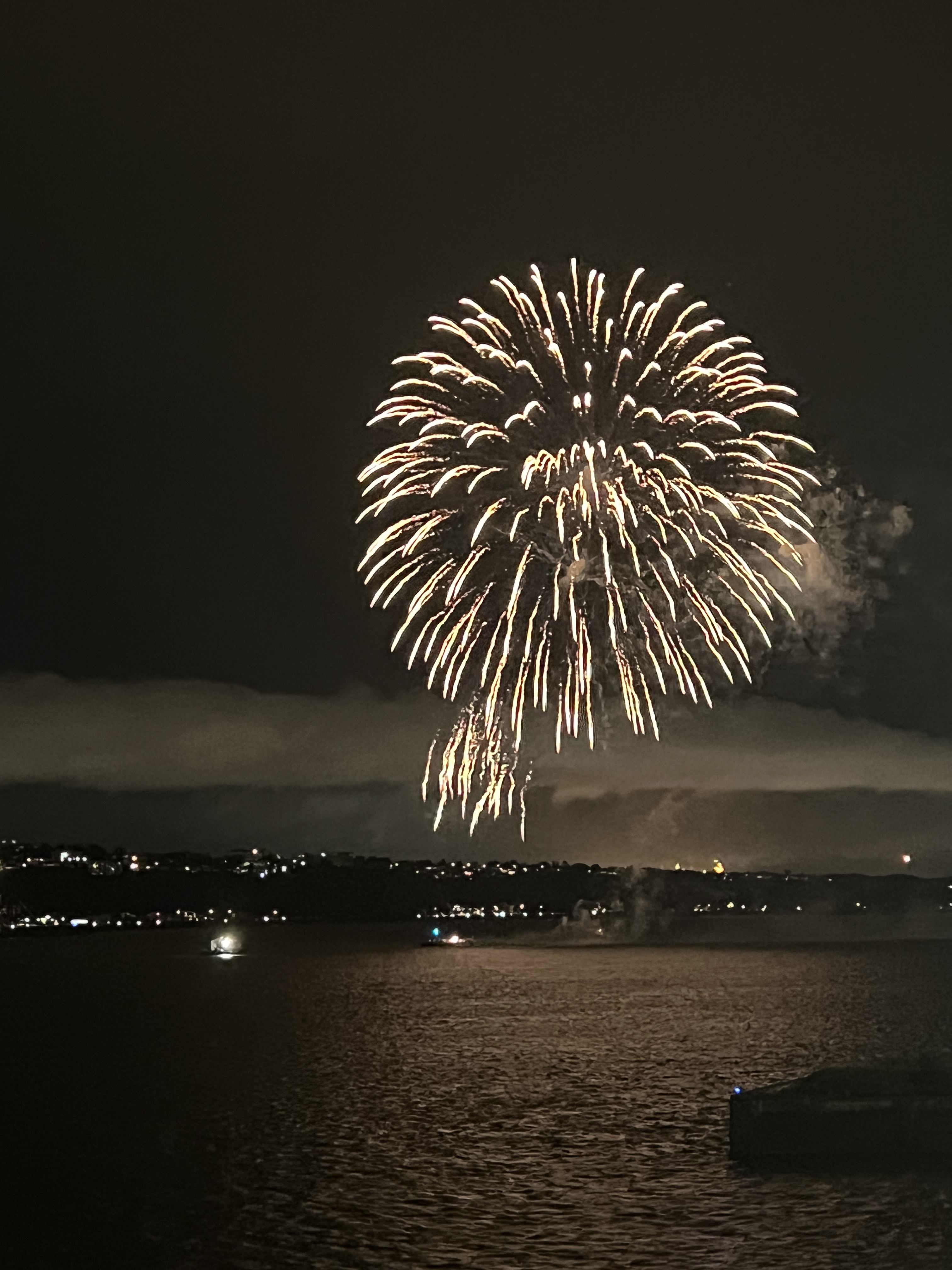
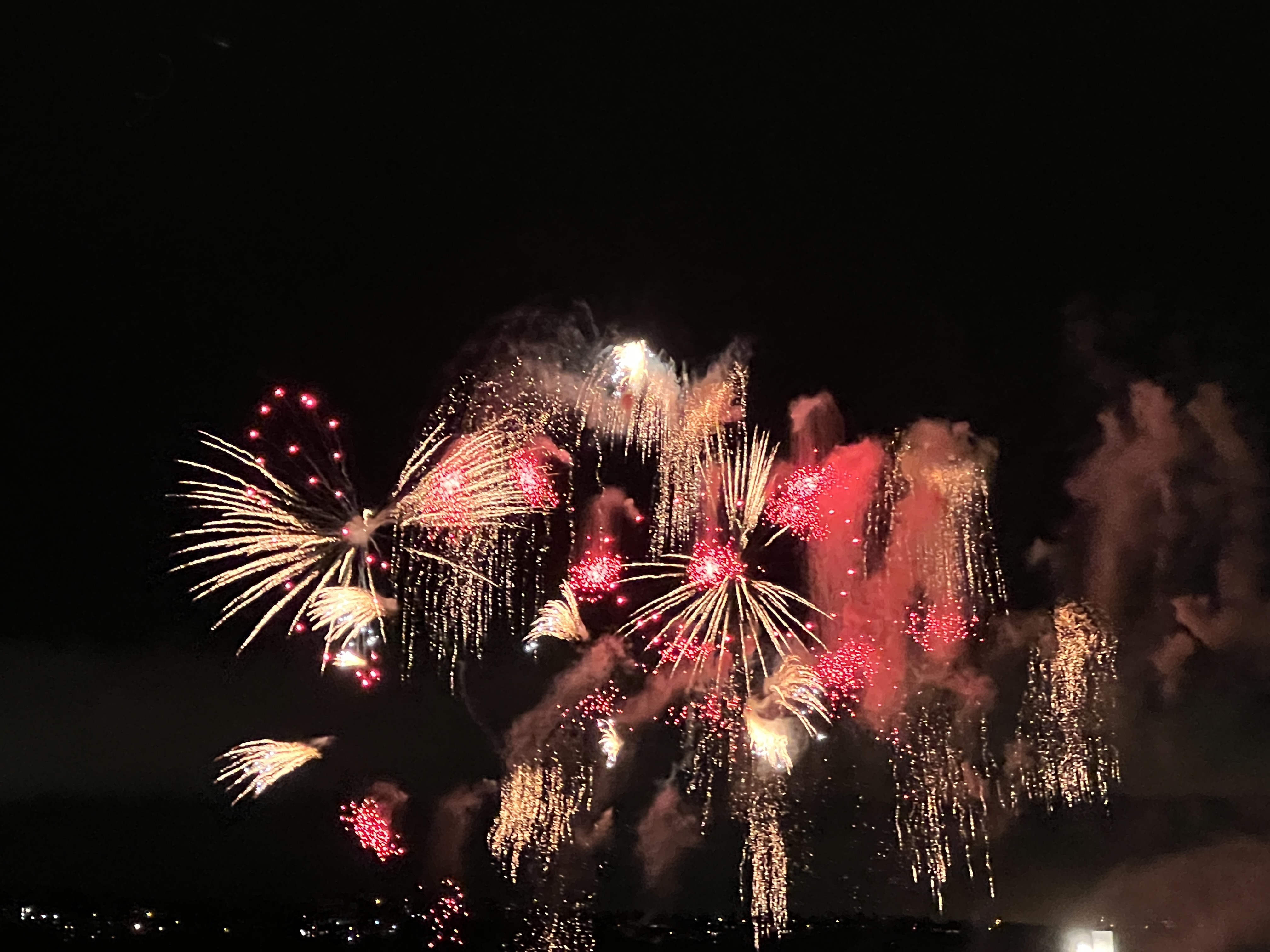
There was no serious rain though and we watched a spectacular fireworks display as the ship sailed away back down the St Lawrence River for the next stop at Saguenay.
According to schedule we arrived at Corner Brook on New Foundland. We had come into the Gulf down the wide channel separating Newfoundland from Labrador, on the mainland. Over the next few days the cruise course takes us further down the Gulf and into the St. Lawrence River to Quebec. We then retrace our path back out into the Atlantic and head south west to New York stopping at a few places along the way.
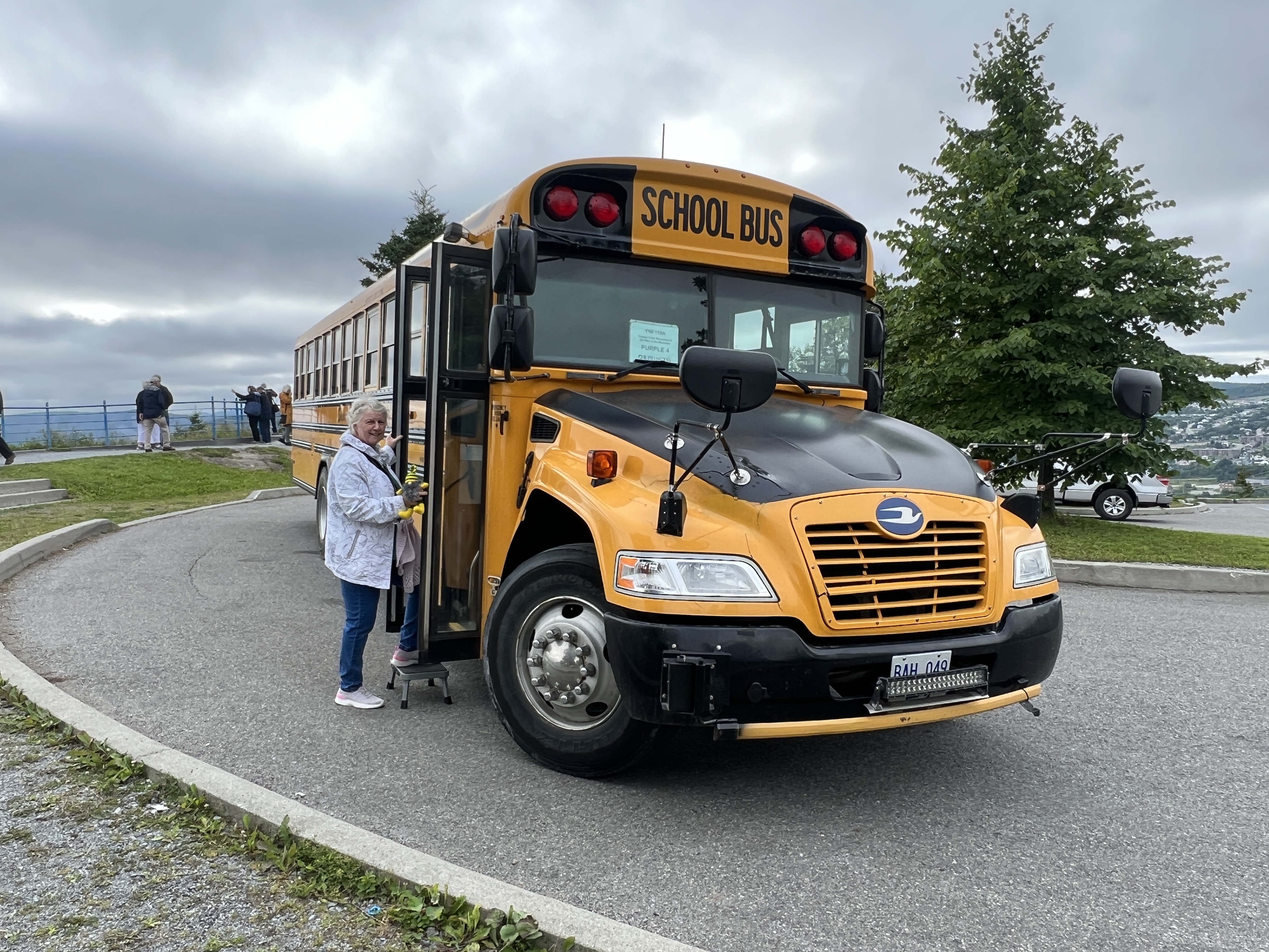
Allthego and Homealone don’t know much about this part of the world and have never been here before. Slobro has no idea. It will be a learning experience. So it is quite appropriate for our tour in Corner Brook to be on a local school bus. This style of vehicle is all over North America.
You learn something everyday.
One of the first things we learn is that Newfoundland and Labrador only became part of Canada in 1949 and there was a contingent of Newfoundlanders at Gallipoli in WW1. A referendum was held offering two options, stay independent or join Canada. 51% went with Canada. An earlier referendum had the USA as another option, none got a majority.
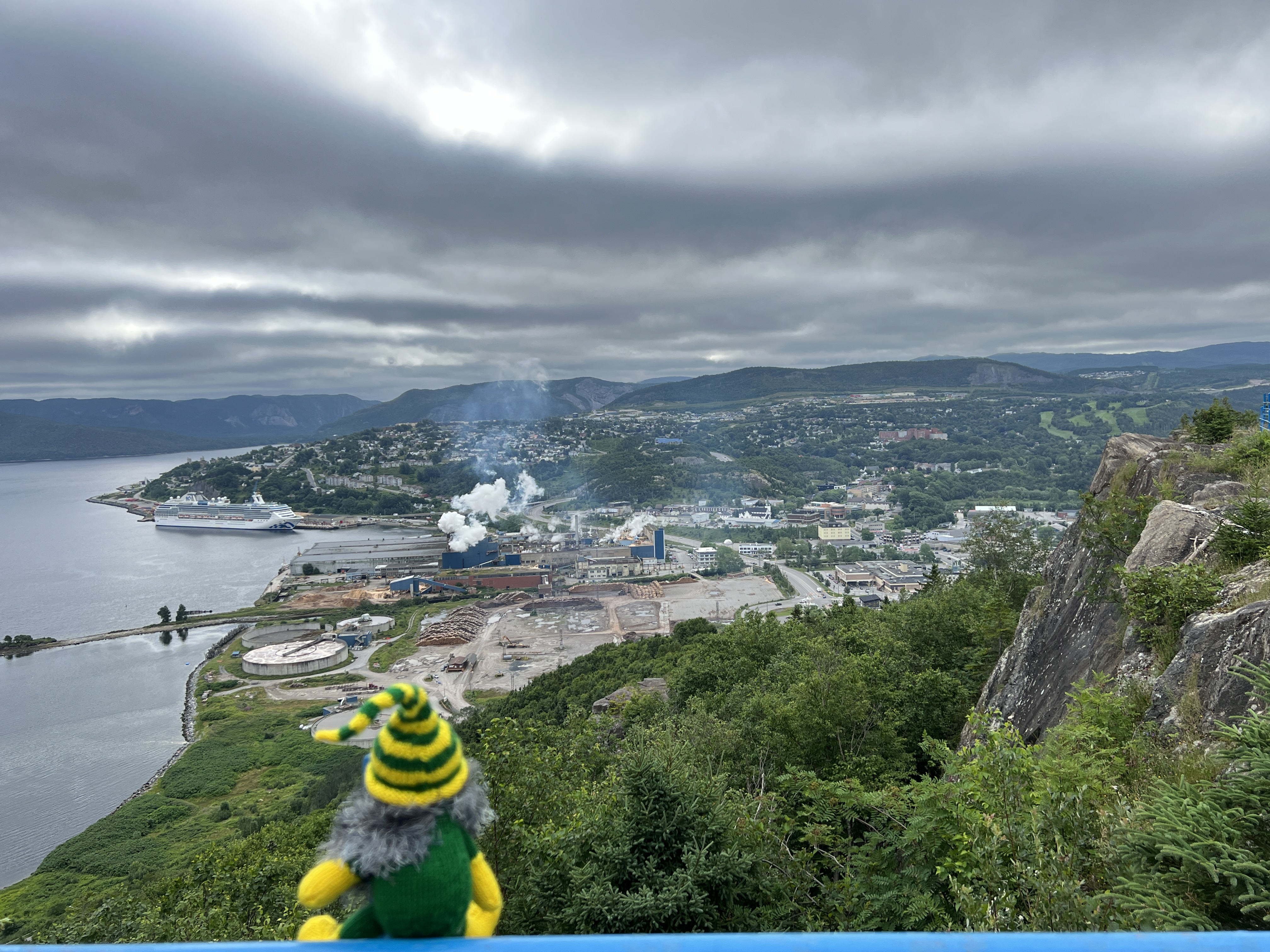
Slobro having a good look from the Capt Cook lookout.
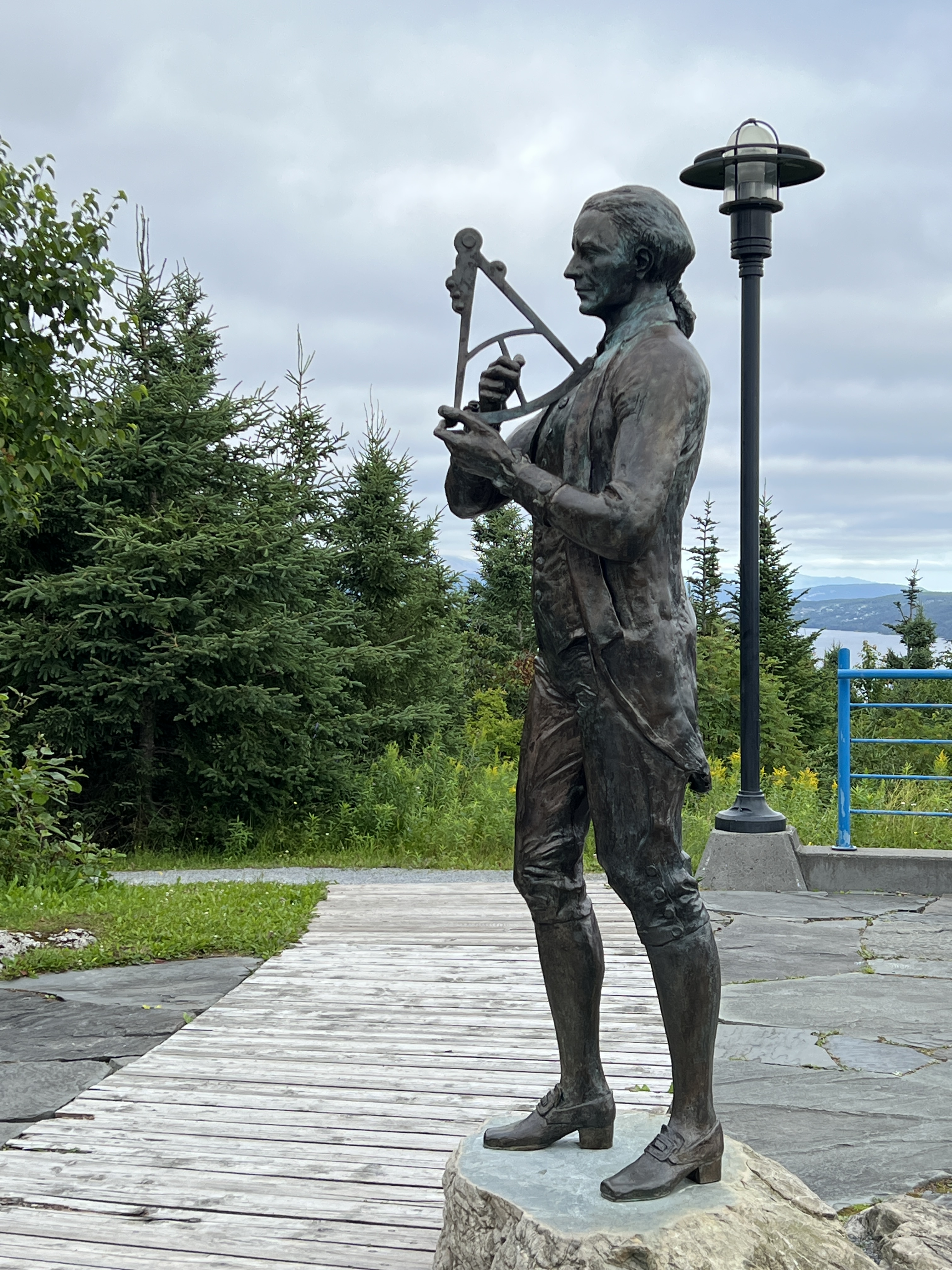
Our tour took us to the Capt. Cook memorial lookout, great views down on the town. Corner Brook has a strong connection with Captain Cook, he was based around here during the late 1750s and first half of the 1760s. This was the time of the squabble between the English and the French about the control of what is now eastern Canada.
Cook memorial.
The English controlled the seaboard areas from Labrador south to the American colonies and the French the interior region, the present day Provence of Quebec. Without dwelling on this much more the English finally kicked the French out at the Battle of Quebec. Cook was involved in a lot of map drawing of the St Lawrence River, so accurate that they are basically still in use today. The French were always peeved about the loss of New France and it is one of the reasons why they backed the American colonies against the English, with money and men, in the War of Independence some ten years later.
From the lookout the pulp and paper mill is shown to dominate the town’s landscape. It has been here just on a hundred years and is the major employer. For much of its time it was an ecological disaster, a toxic plume extended out into the harbour. Salmon stopped coming and entering the Humber River to spawn. Today, it is a model of ecological success, the plume has gone and the salmon are back.
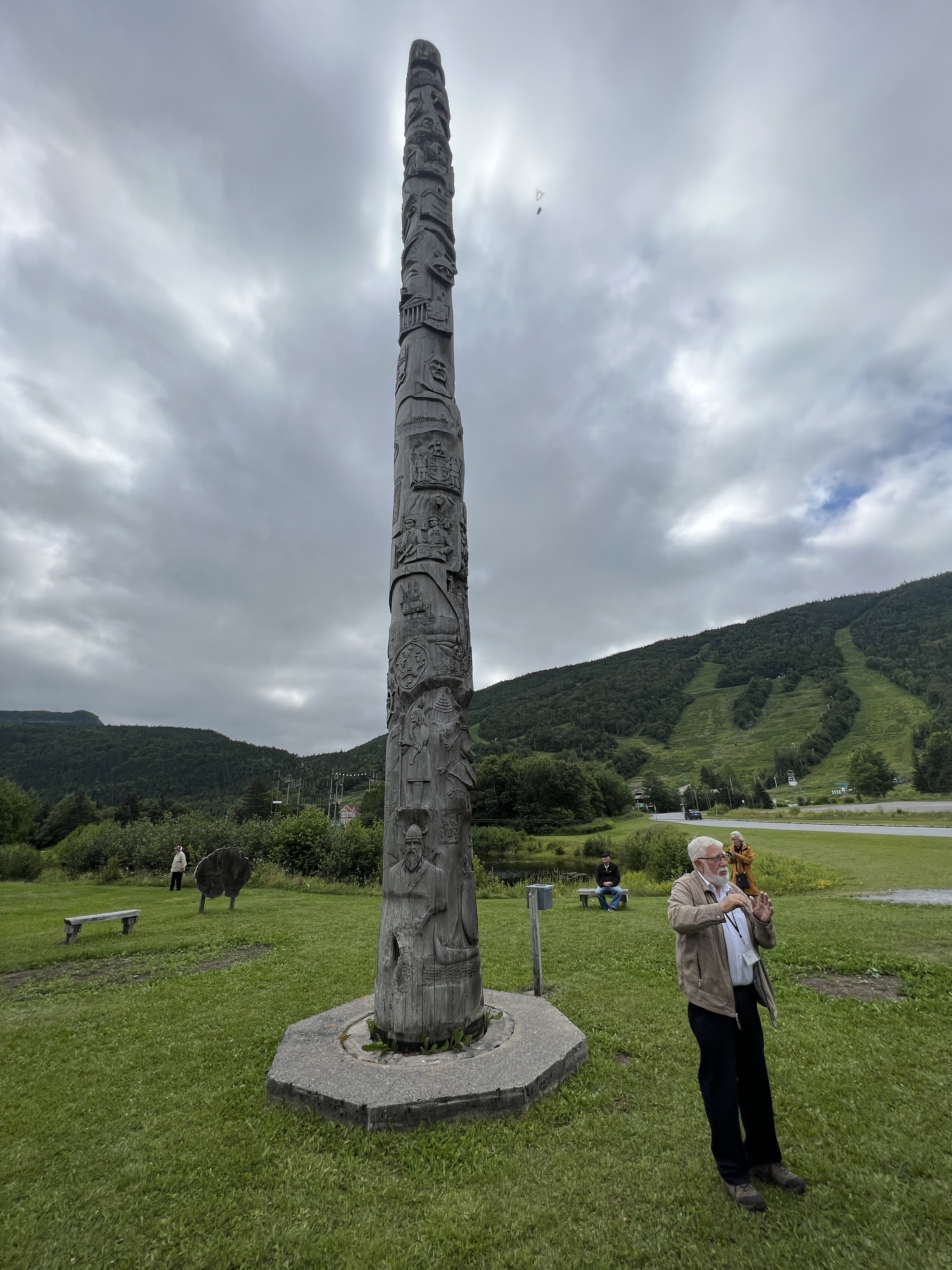
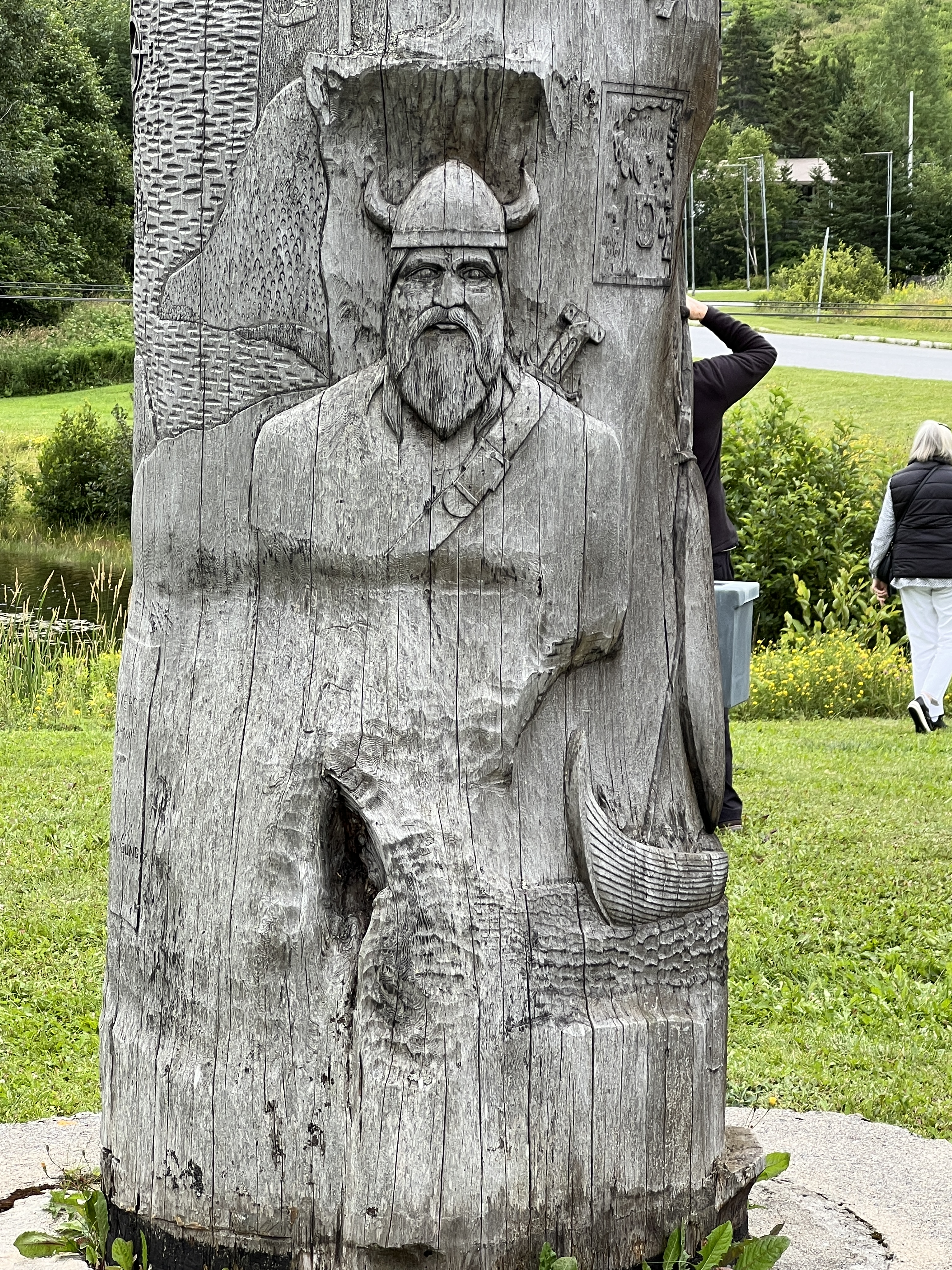
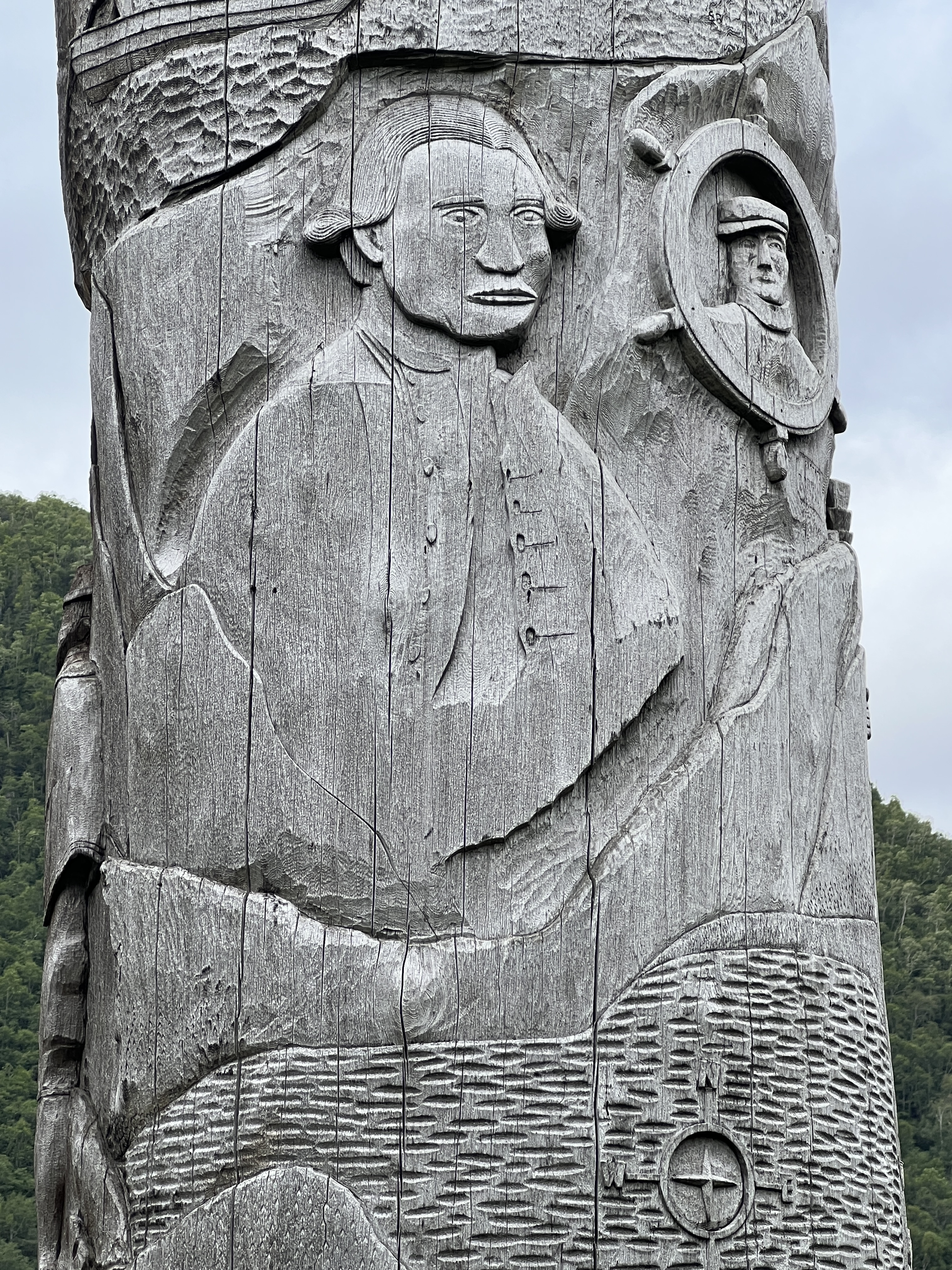
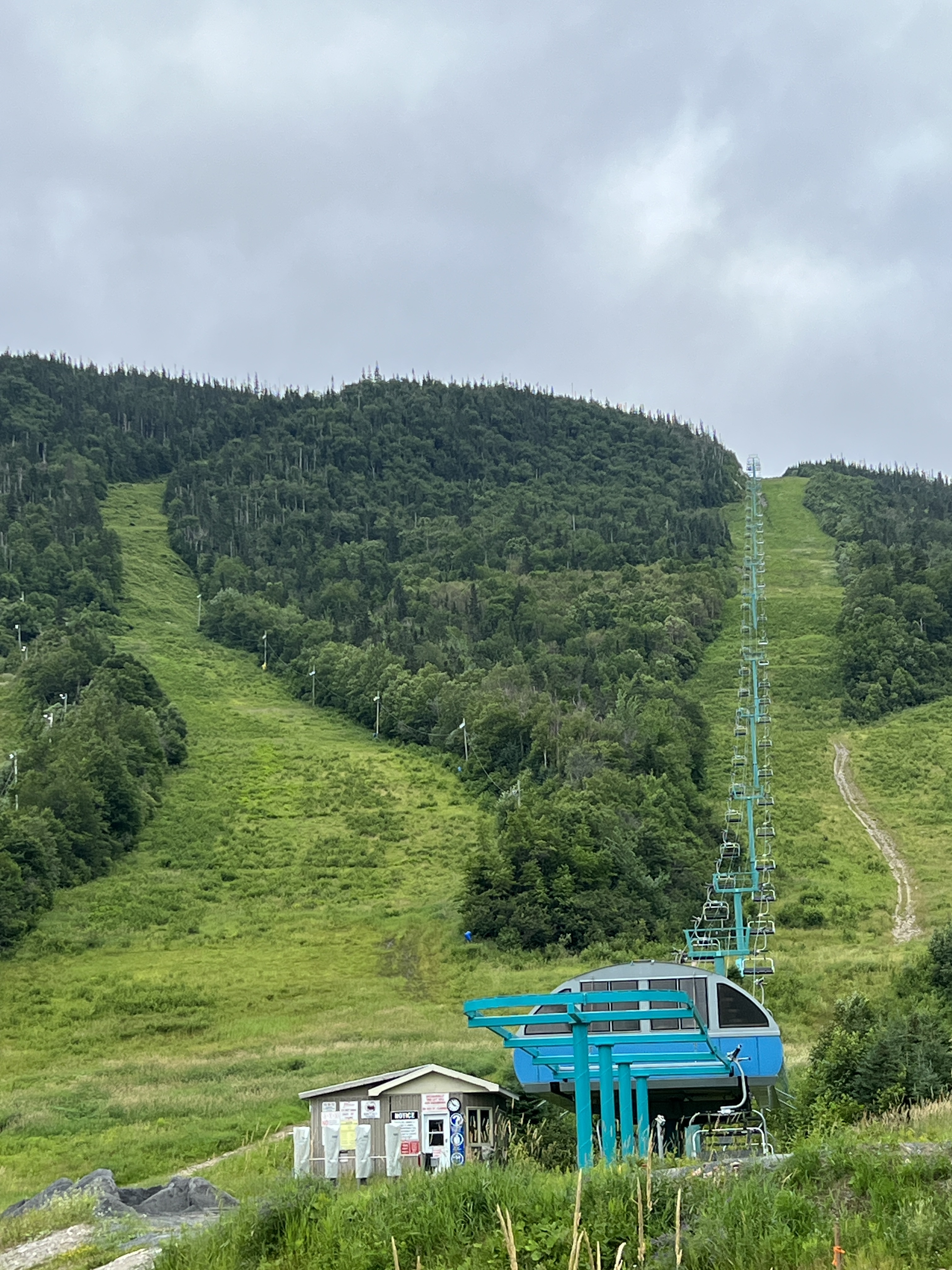
Heritage pole. It is about 18 metres tall and is carved from a 350 year old cedar tree from British Colombia. There are 60 scenes from the area’s history.Vikings were early settlers.Capt. Cook features prominently on the pole.Marble Mountain Ski Resort.
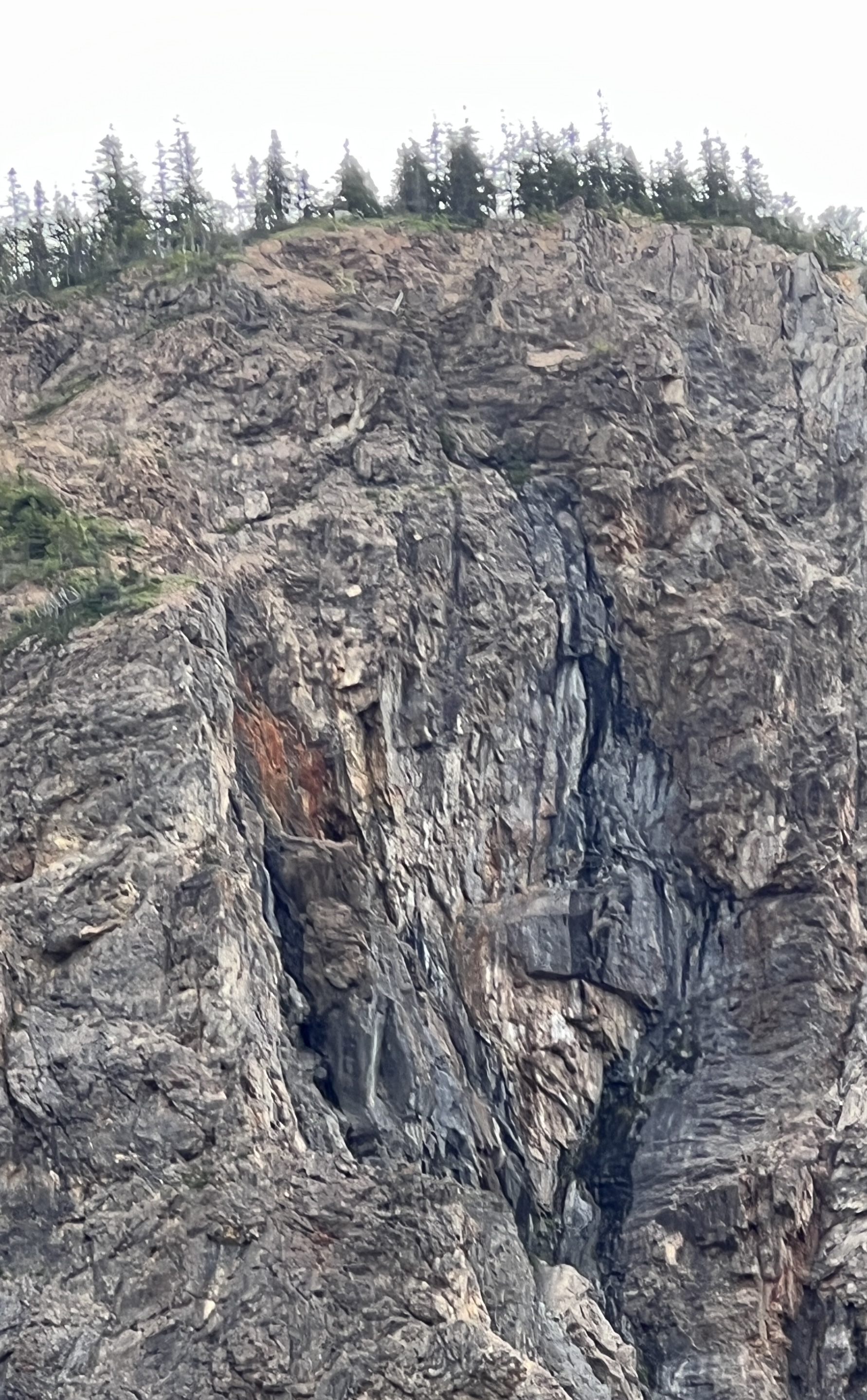
We are then back to town passing by the Heritage Pole, ski fields and the Man in the Mountain (he is watching out for raiders of pirate gold supposed to be buried on the island in the river below). Slobro struggles to see the image!
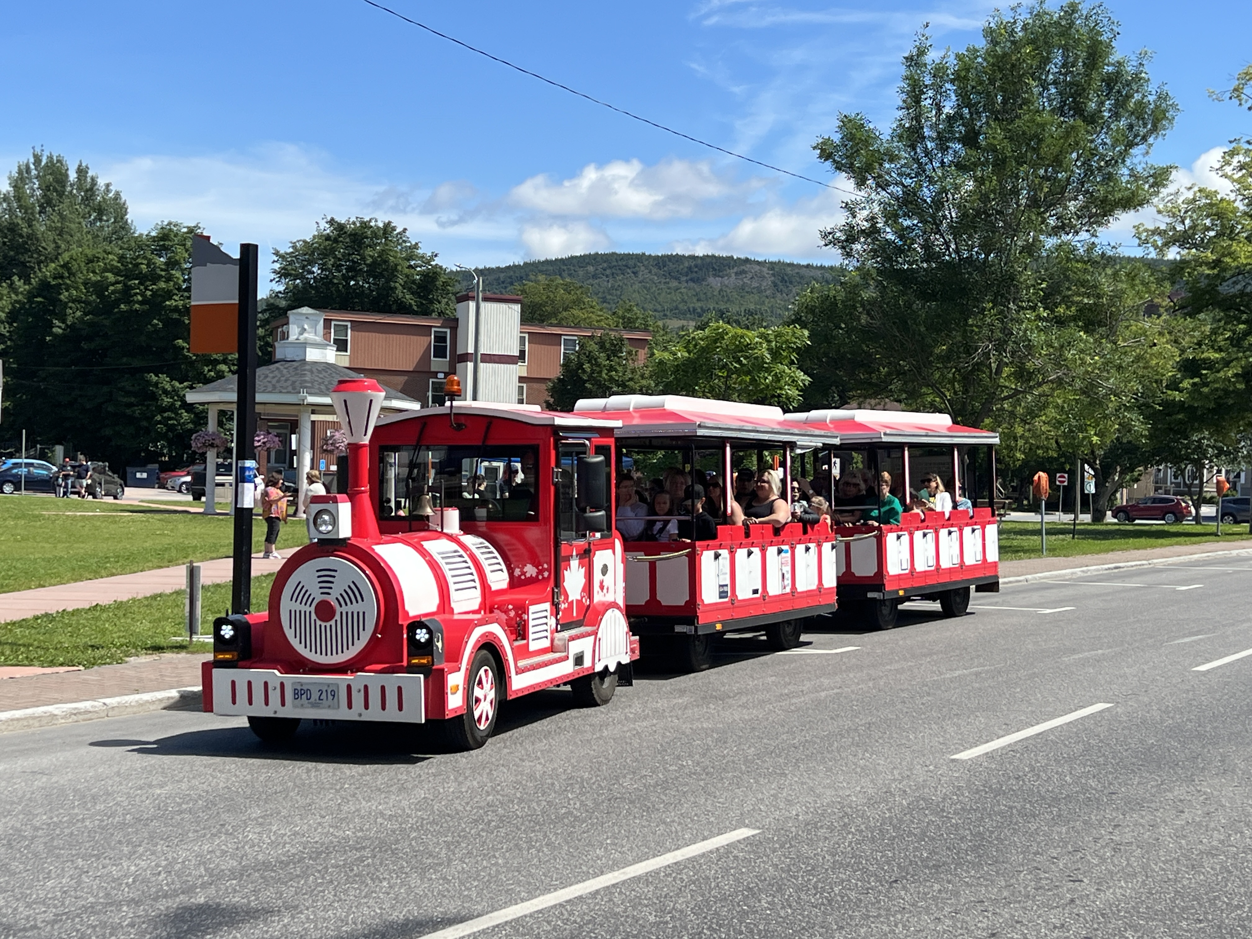
Old Man in the Mountain, towards bottom right.A Little Train runs around Corner Brook.Cathedral of St. John the Evangelist, 1934.
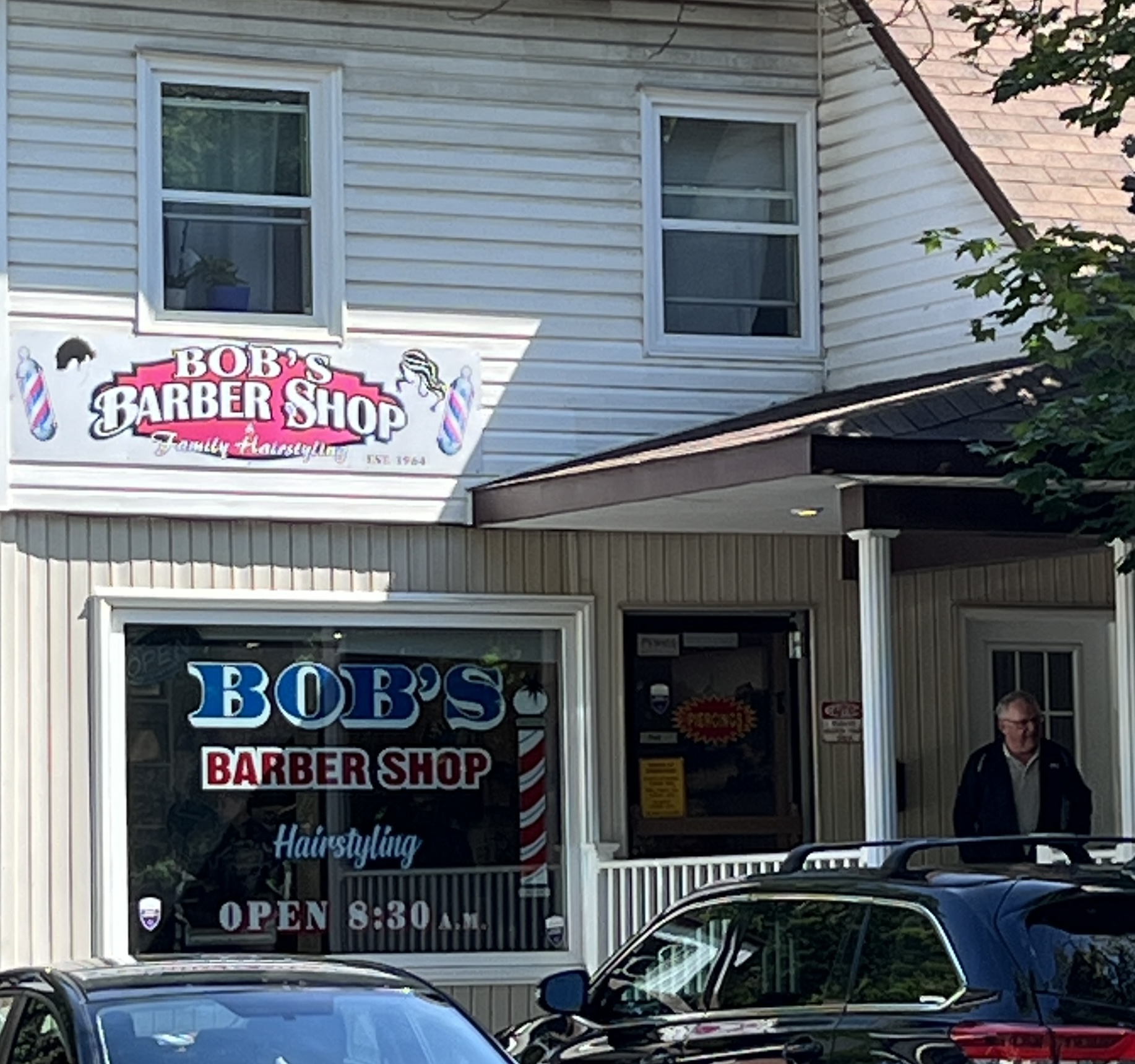
In town we have a wander around the streets and enjoy lunch at a micro brewery. Allthego was starting to look a little scrappy hair wise so dropped into a local barber for a 3 blade trim up.
This was looking scary as the barber, a young lady of modest size, with bright orange hair and wall to wall tats did the job. Allthego checked the top of his head for any engravings, none. So all ok, and should make it back to Brisbane before needing another trim.
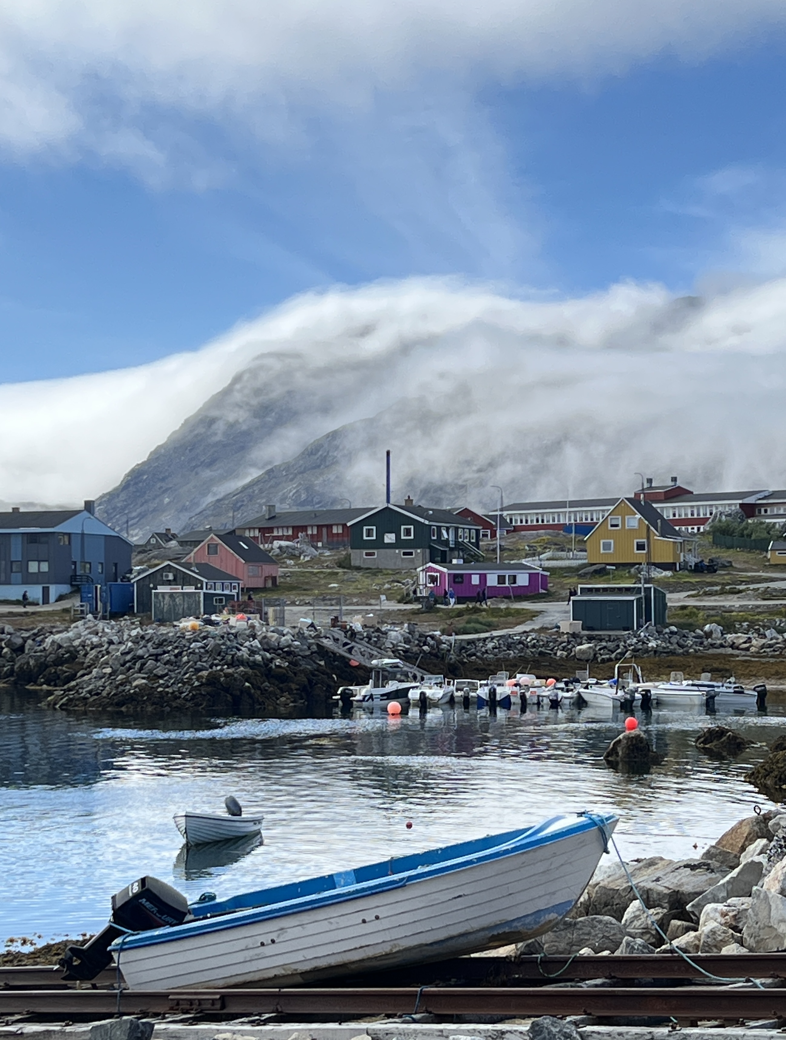
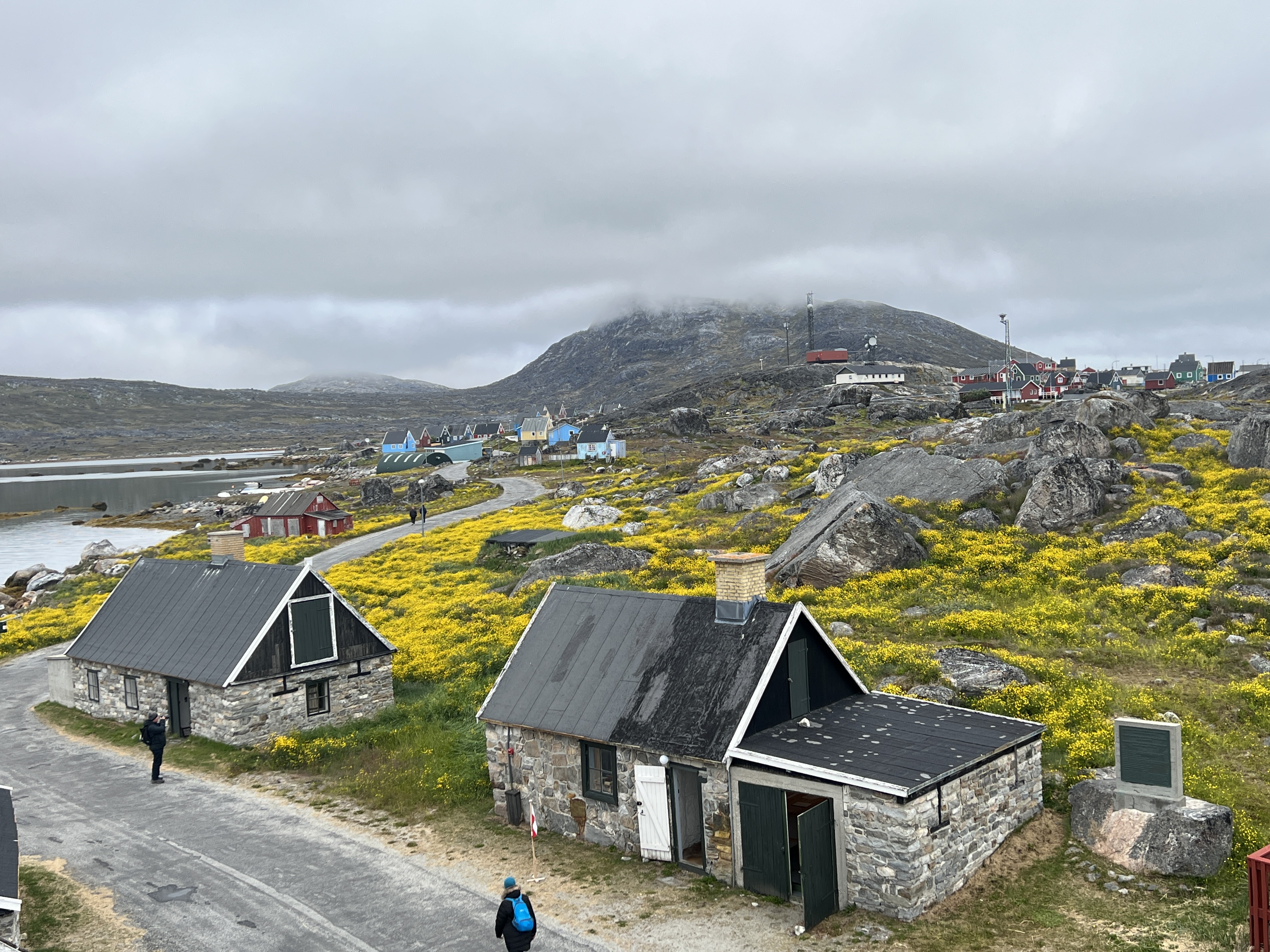
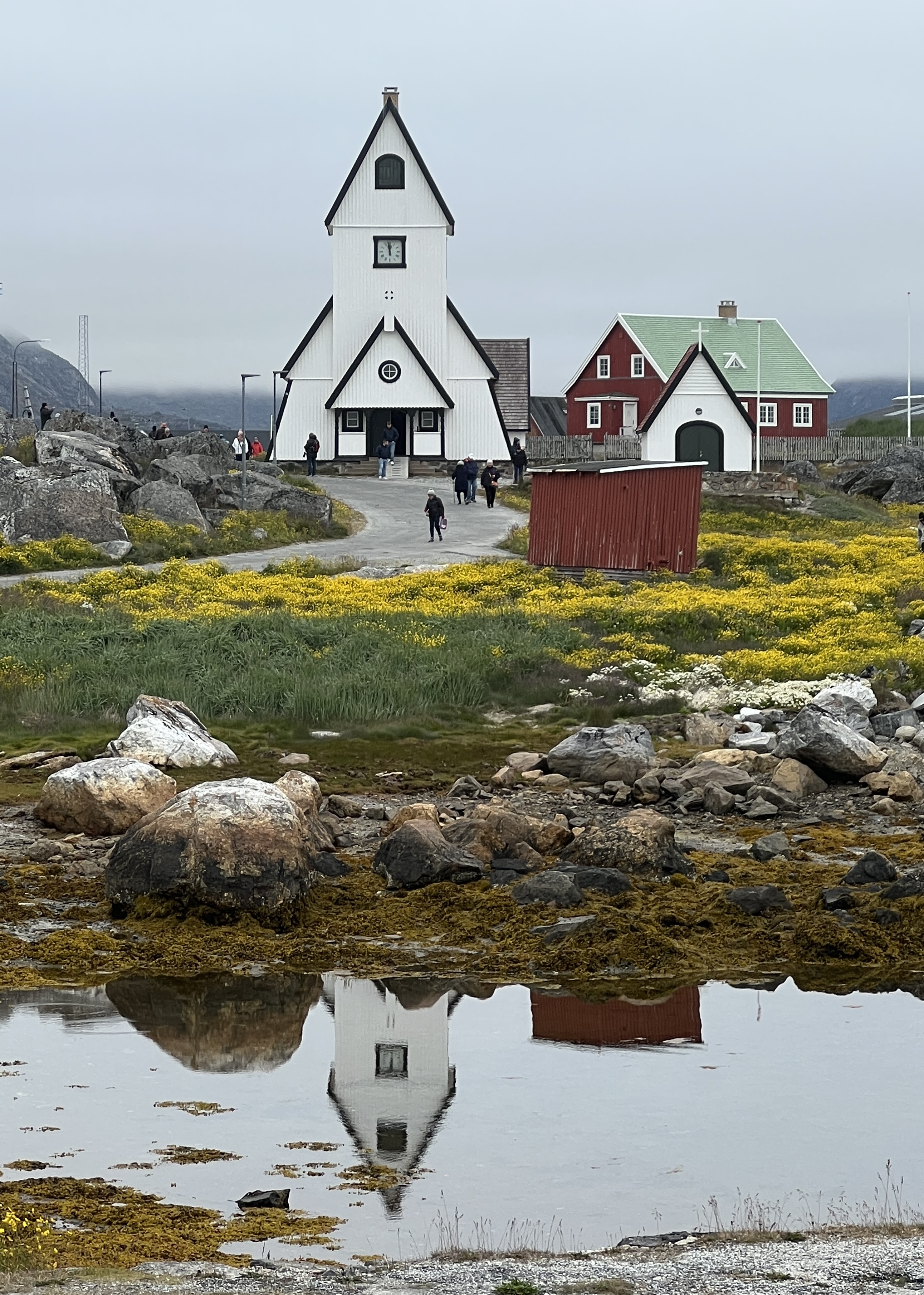
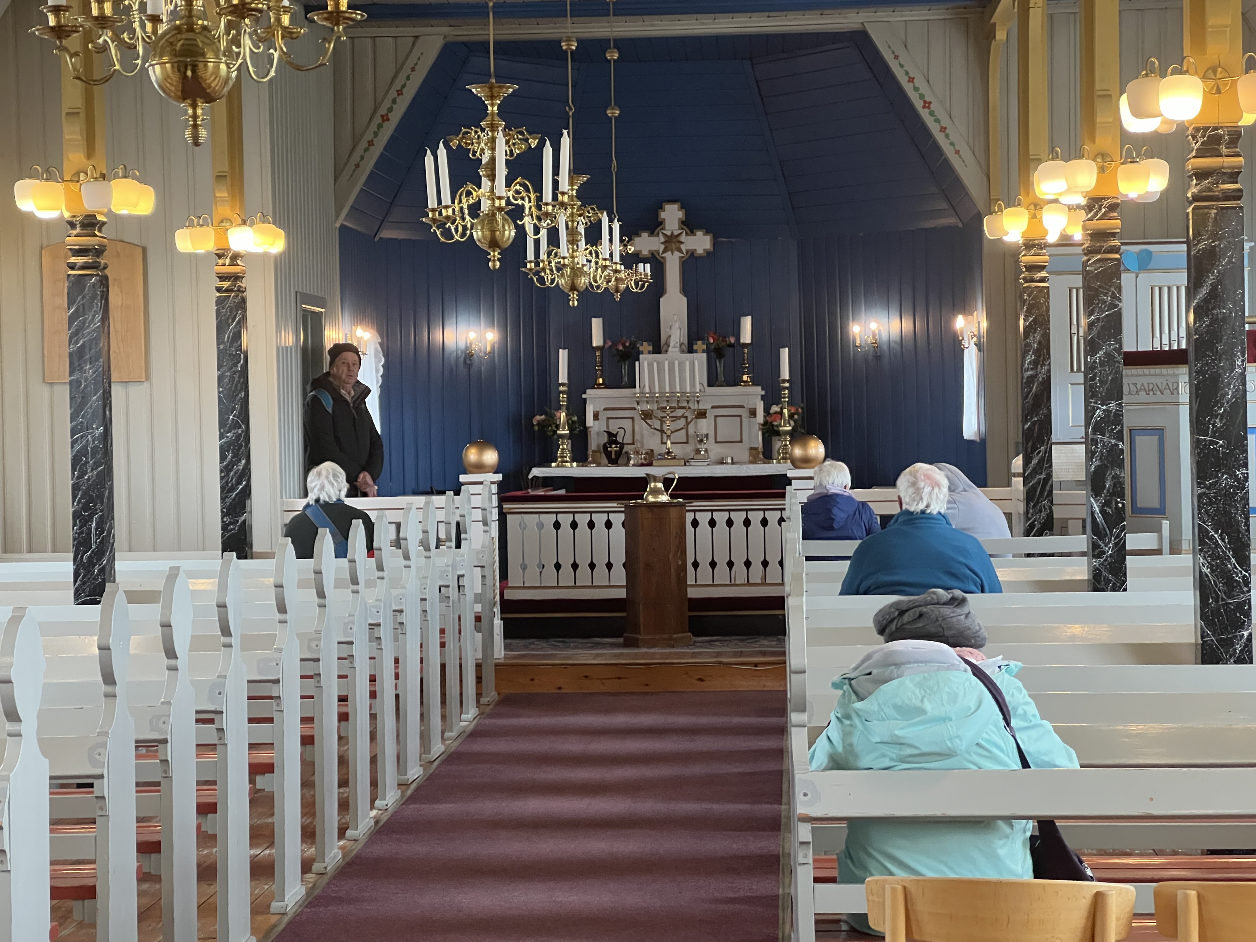
‘Cack-gore-dork’ is the way you say the name of our last stop on the southern tip of Greenland. It was a relatively short stop as we were a bit sluggish in getting up and ashore in the water shuttle.
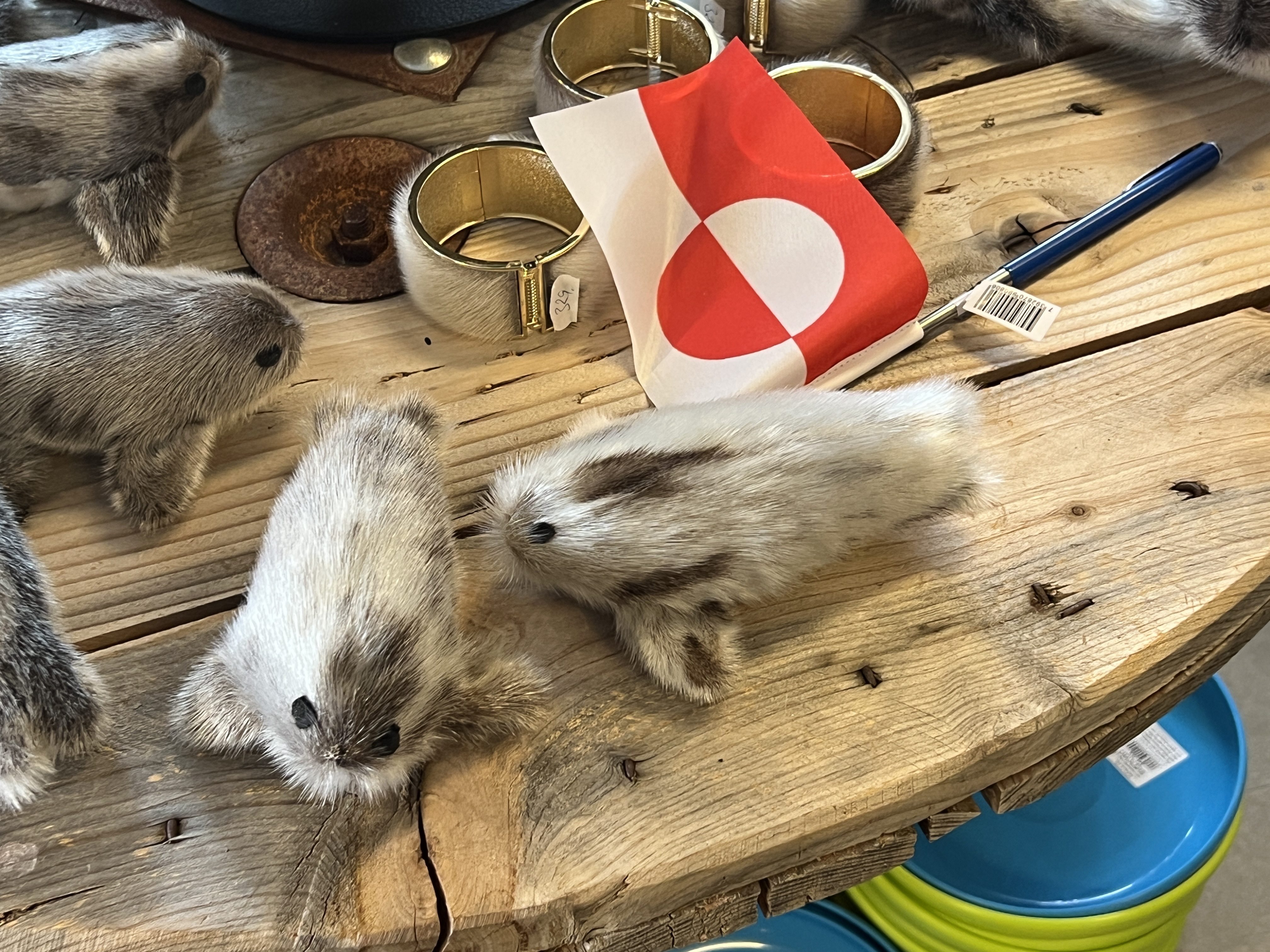
We had a guided town walk organised for 11.30am and had half an hour before for a quick look around the souvenir shop. Really liked the little fluffy stuffed seals made from genuine seal skin and hair, but at around $A50 we passed and found a less genuine fluffy stuffed polar bear for the cabinet instead.
Genuine seal skin.
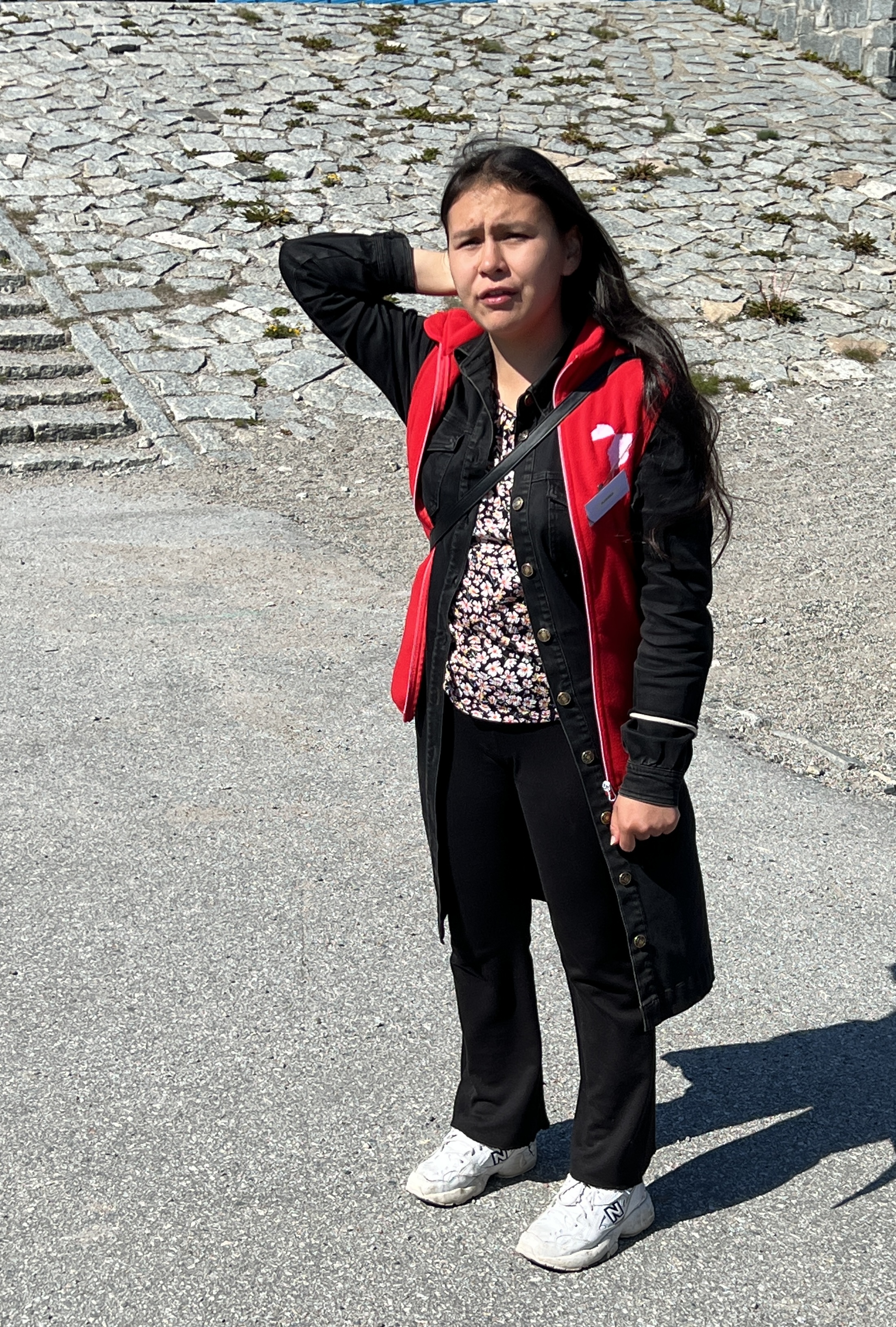
Our guide for the day was an interesting local young lady who lead us around the town, there was a moderate amount of up and down hills road walking for an hour and half. We had a few pauses along the way to hear about life in this part of the world, a chat about society rather than landmarks.
Our guide
As we learnt she was nearly 18 and eagerly awaiting getting her driver’s license. I am not quite sure why as there are no roads out of Qaqortoq. Most families have small motor boats to get to other places along the coastline. Or, use the helicopter which we saw coming and going several times.
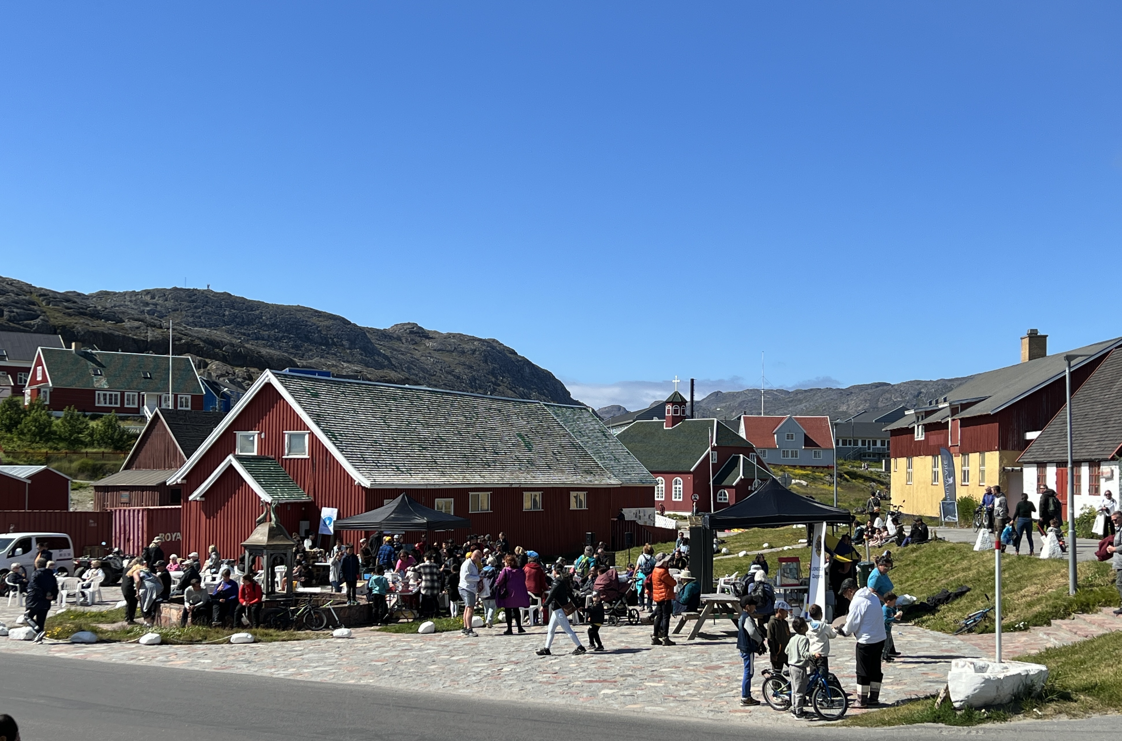
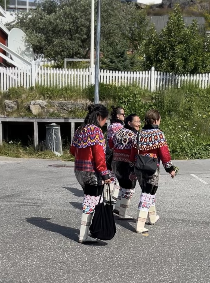
Town square.Traditional dress, there had been a wedding.
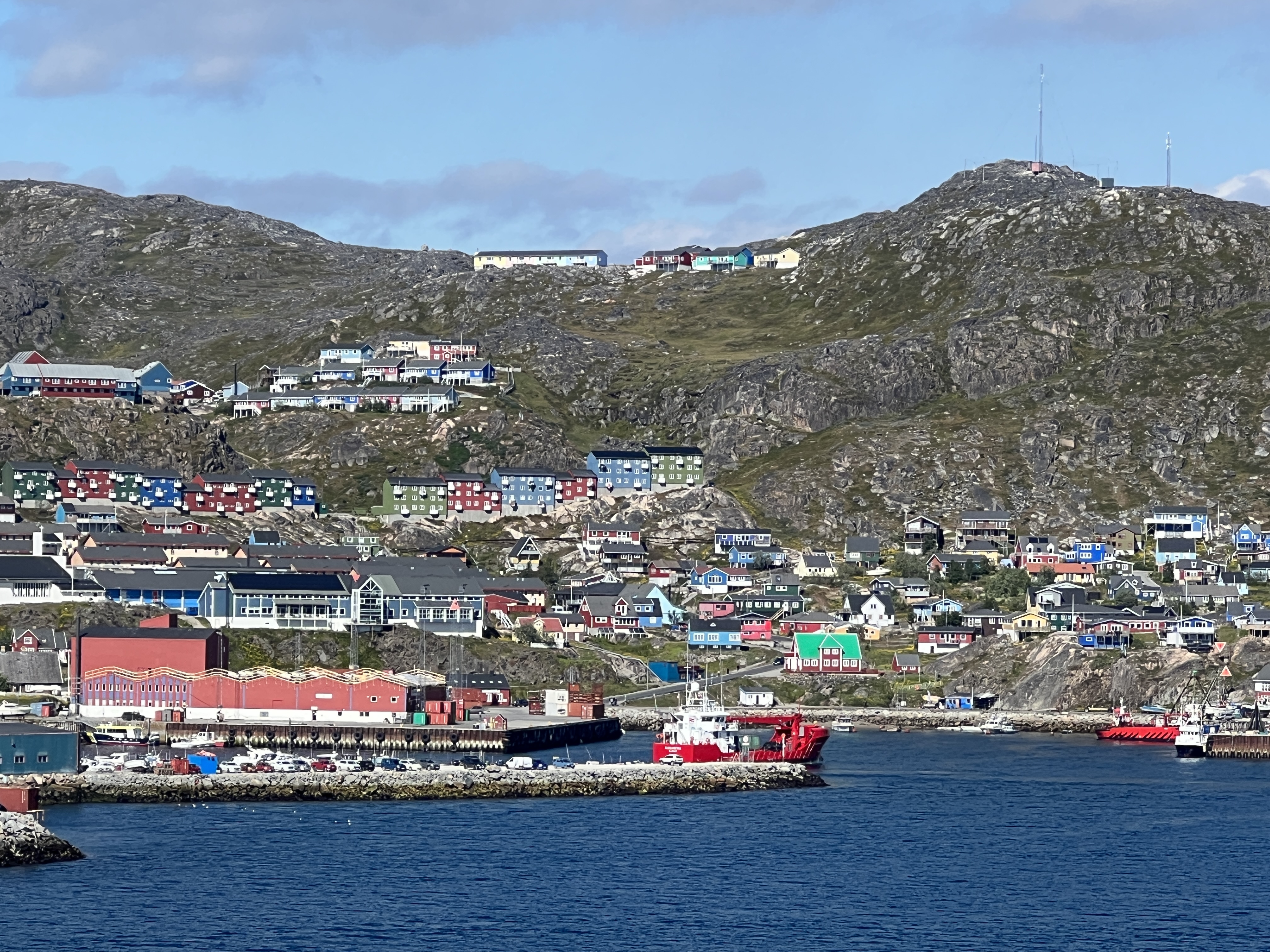
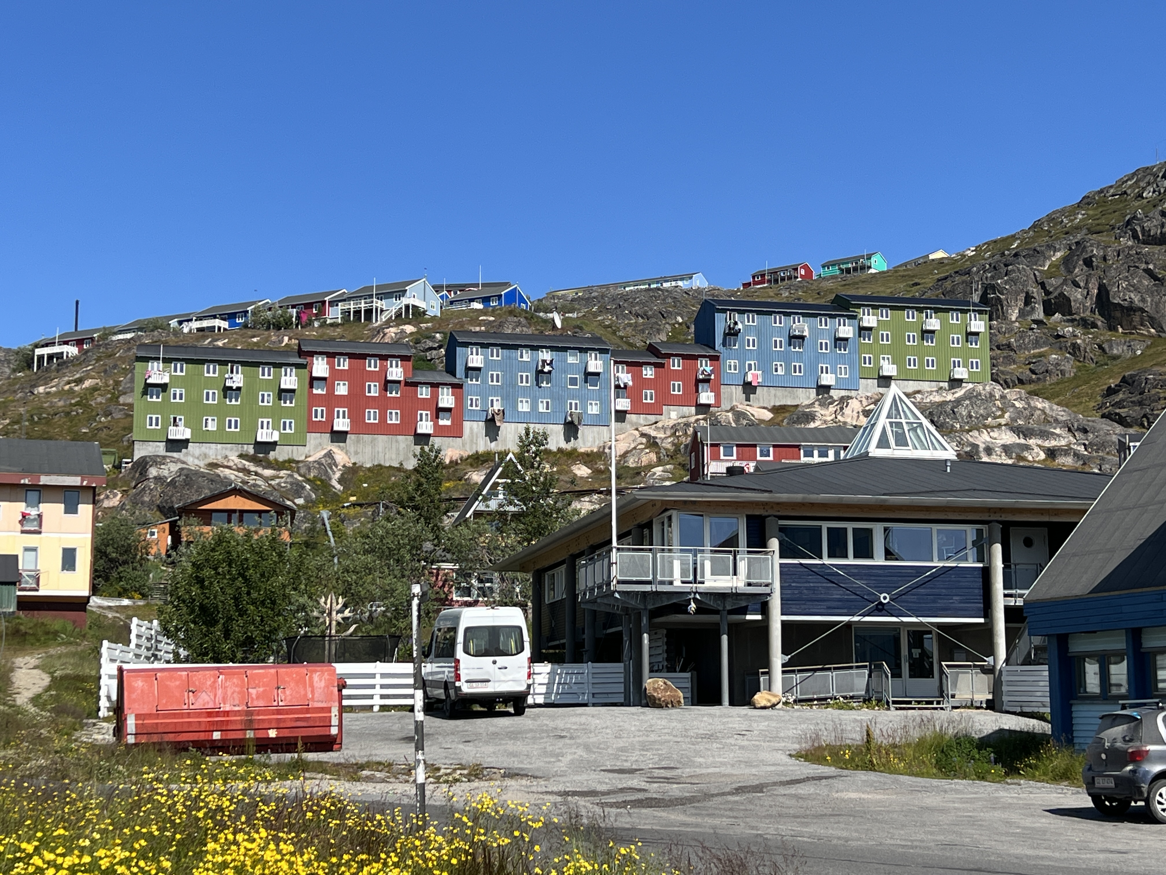
Qaqortoq is Greenland’s fourth largest town, about 3,000 people. Greenland is part of the Kingdom of Denmark, although mostly self governing, with a population of only 65,000. We hear about the role of the small town square as a social gathering area, the education system, the health system, water reticulation and sewerage. She tells us that by the time kids finish primary school at age 16 they will normally be speaking three languages. Greenlandic being the Inuit native tongue in the home, Danish in school (most of their teachers come over from Denmark) and they learn English in class. She can speak French as well, having spent two years in France on some sort of ‘gap’ period after primary school before high school, which is three years. She doesn’t seem to have completed that yet, not compulsory.
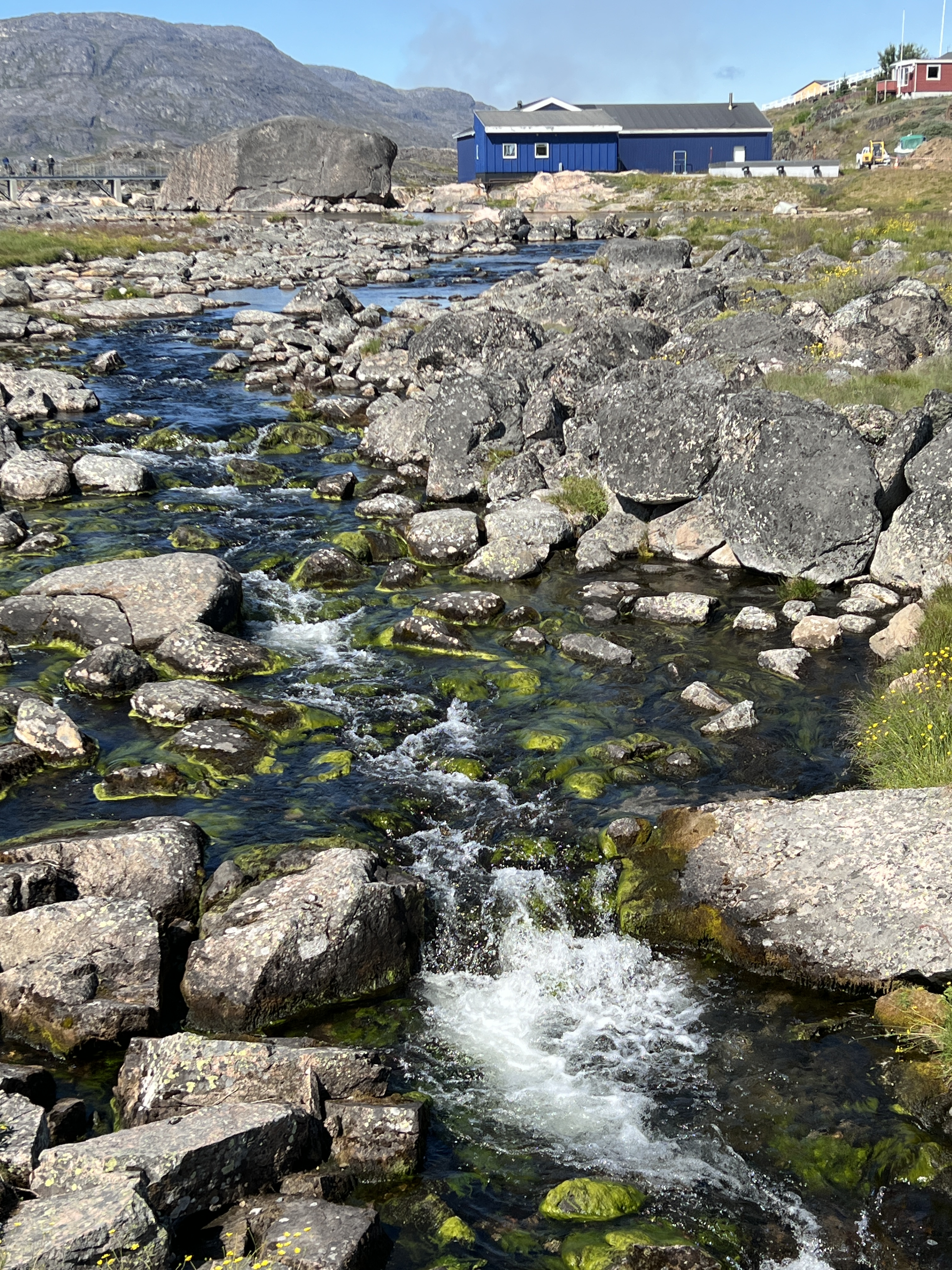
Town water comes from further up this creek, sanitised and filtered in the blue building.
She does like seal and whale meat. Smoked whale meat is served with onions and potatoes. A soup of boiled seal meat, rice and onions is the National dish. A bit foreign to us I suppose but they traditionally live from the fruits of the sea, there are not many ‘fruits’ on the land here, except for farmed sheep and reindeer.
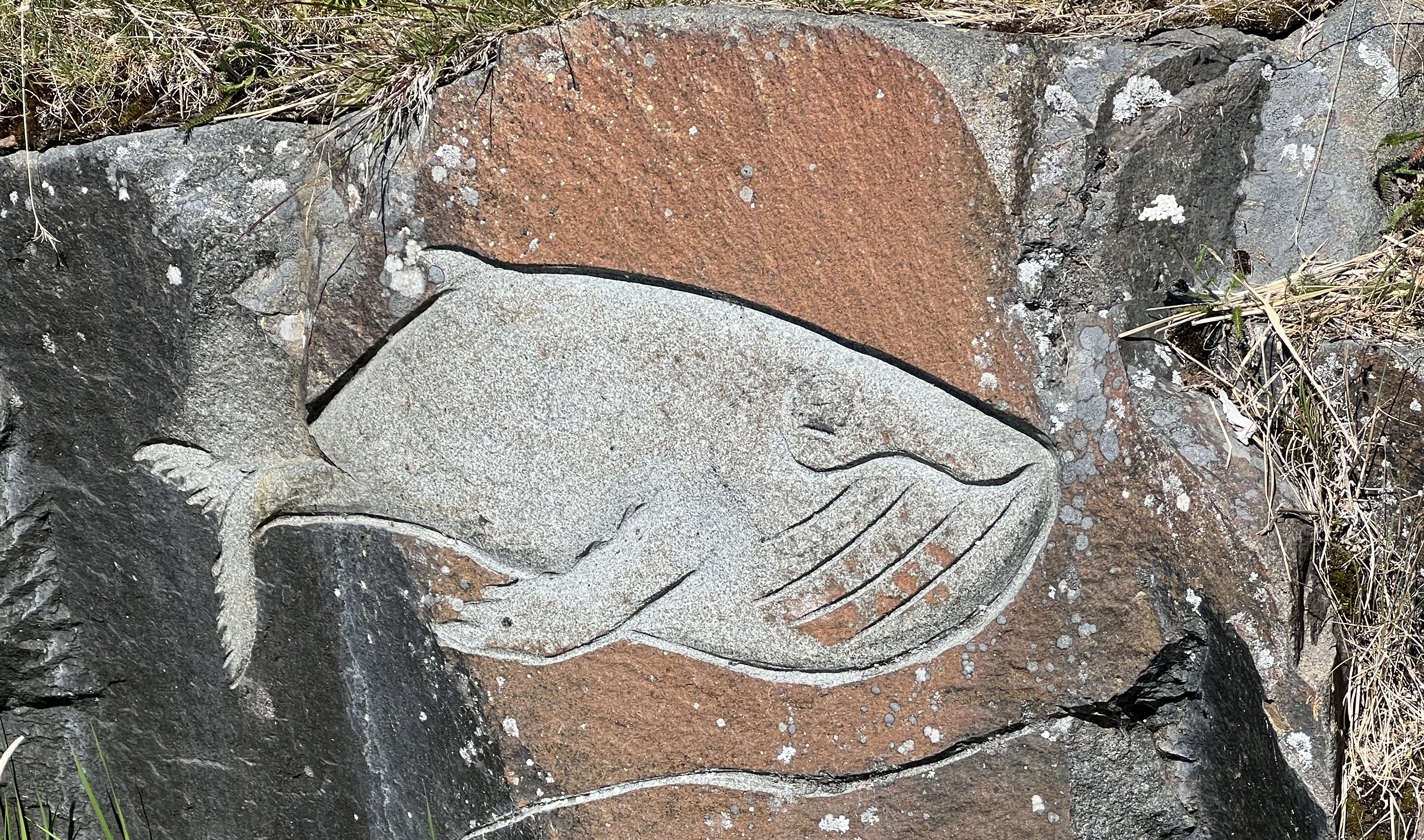
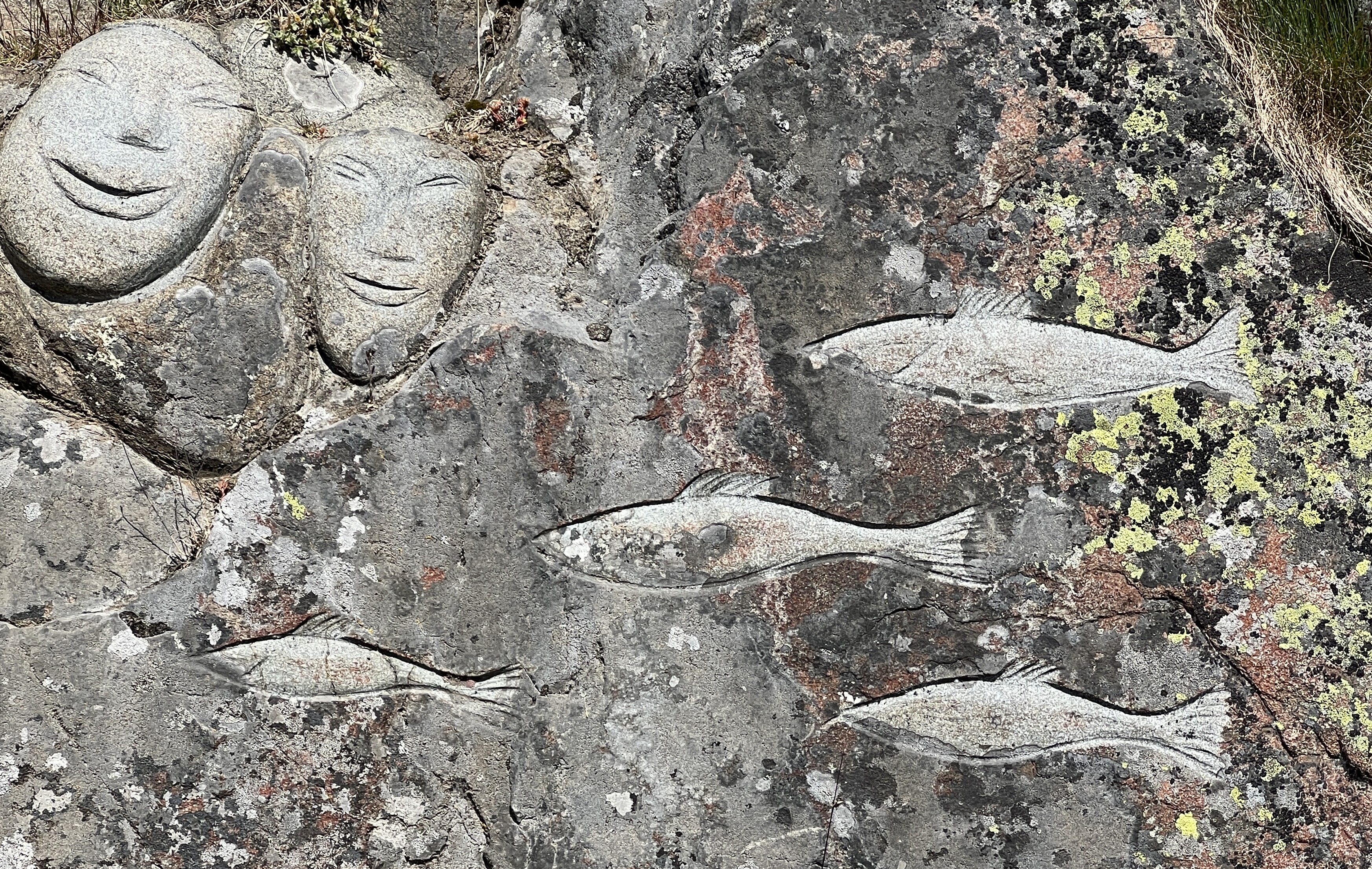
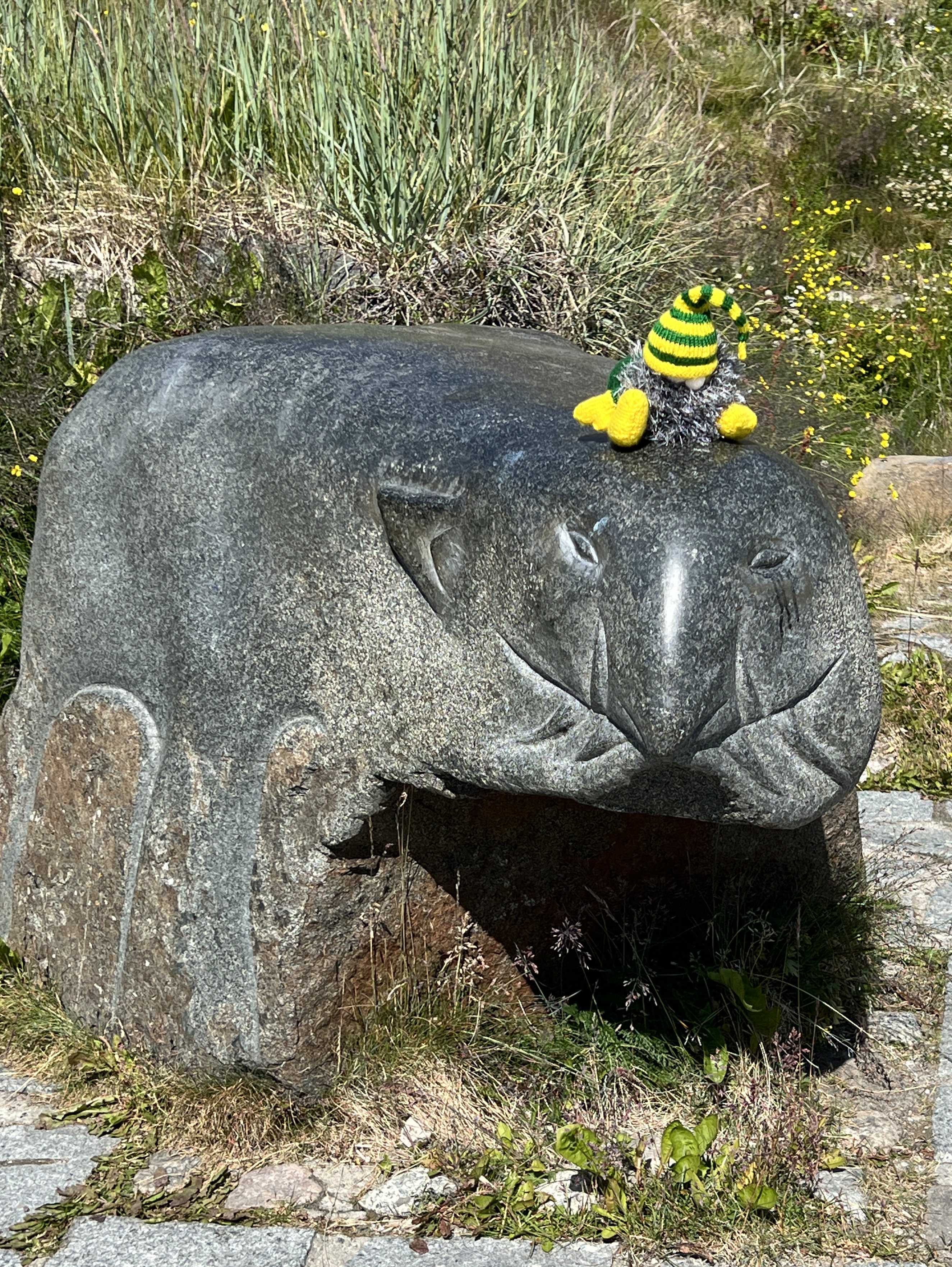
The last stop on the walk is at the town’s ‘murals’, carvings in the rocks around town. The ones we see celebrate whales, seals and fish. Slobro is excited in trying to wrangle a stone polar bear with a head lock, unsuccessful.
Slobro on show.
After the tour we poked our noses into the souvenir shop and picked up some nick nacks, including a pack of Greenlandic salt laced with some local herbs. Looks ok! It was then back to the ship on the water shuttle for some R & R before the sail away.
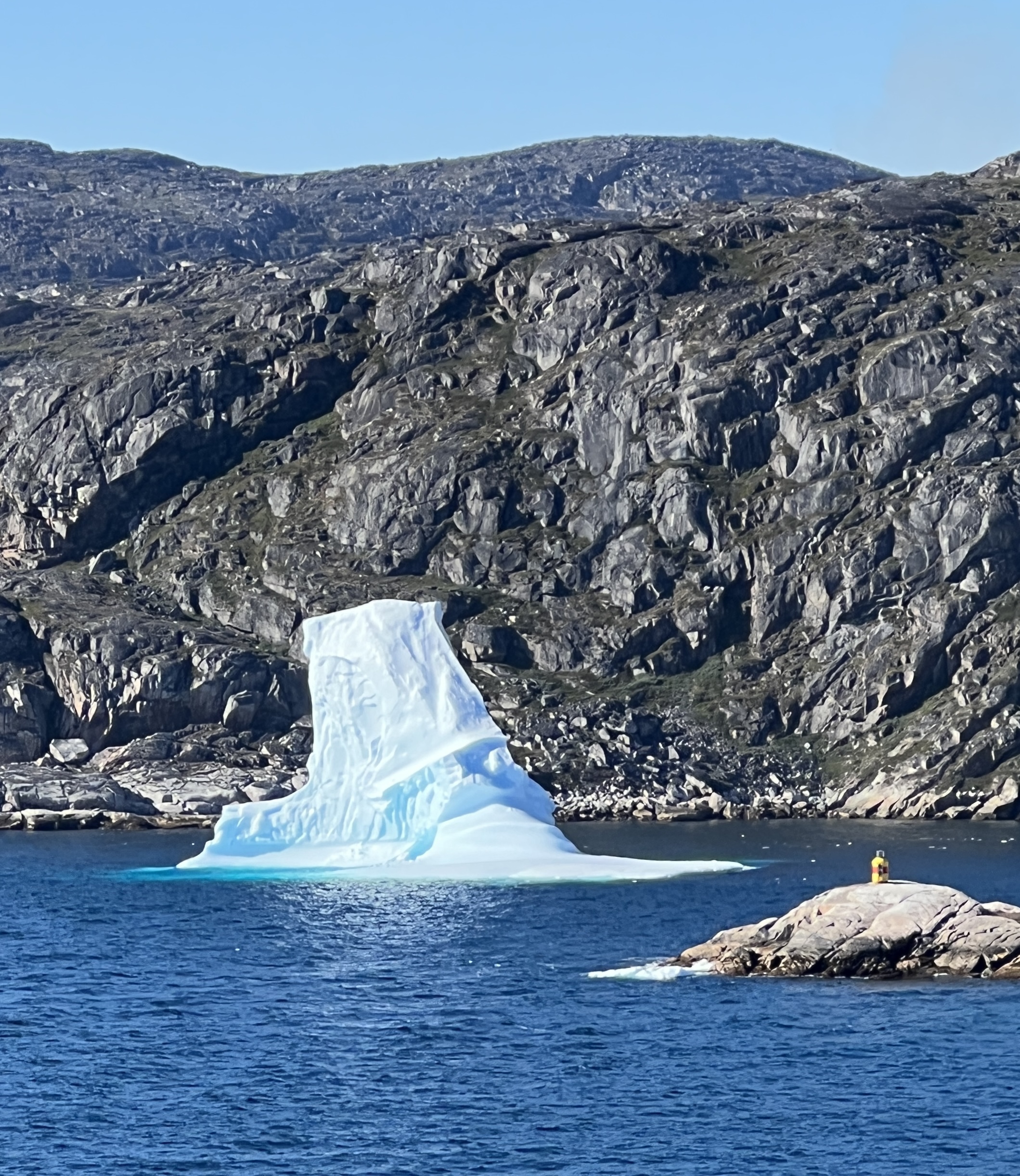
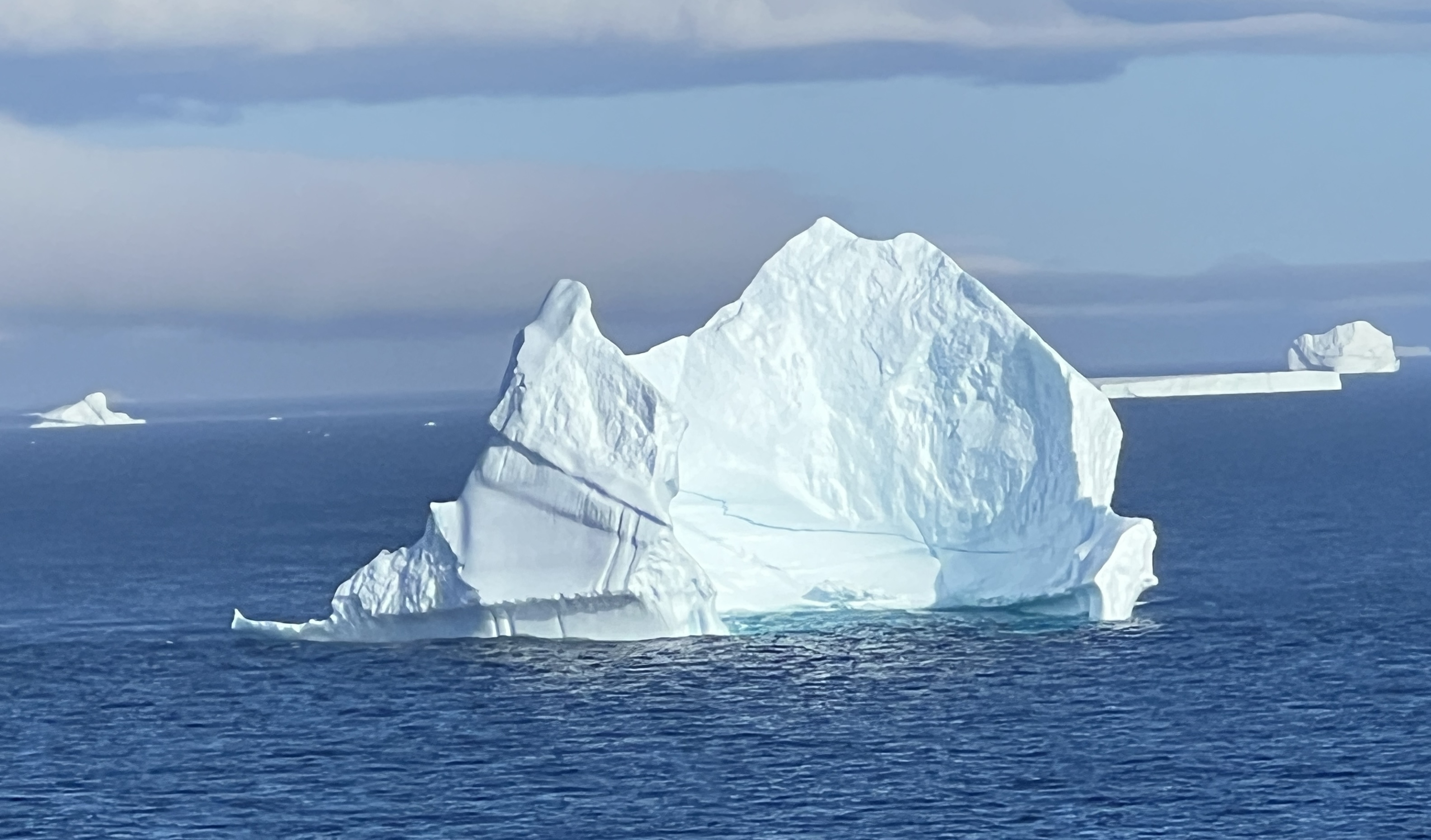
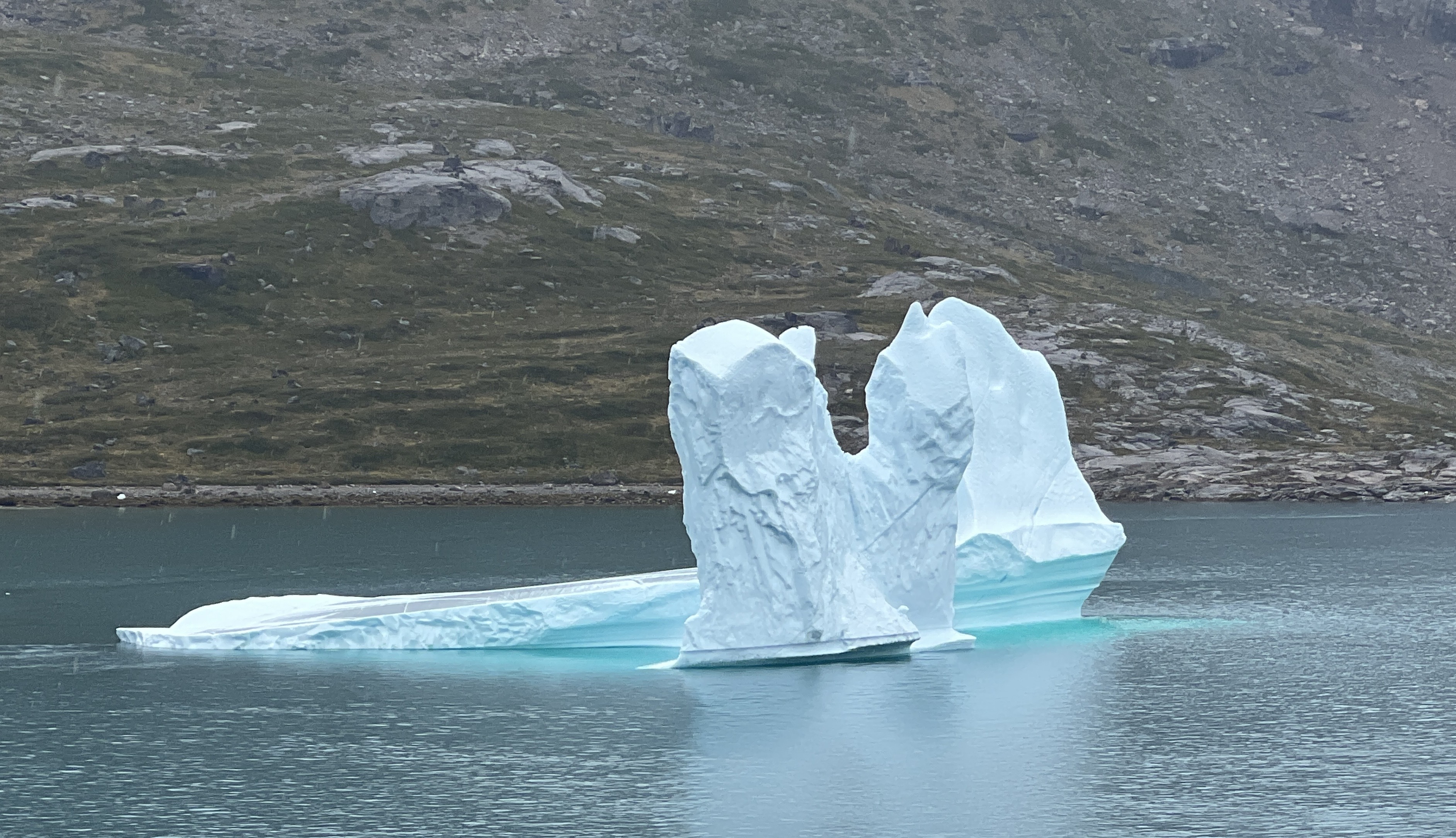
We left the harbour headed for Canada, Newfoundland is the first stop. It was to be our last sighting of icebergs . Sun blazing over a deep blue sea. Things would be warming up soon!
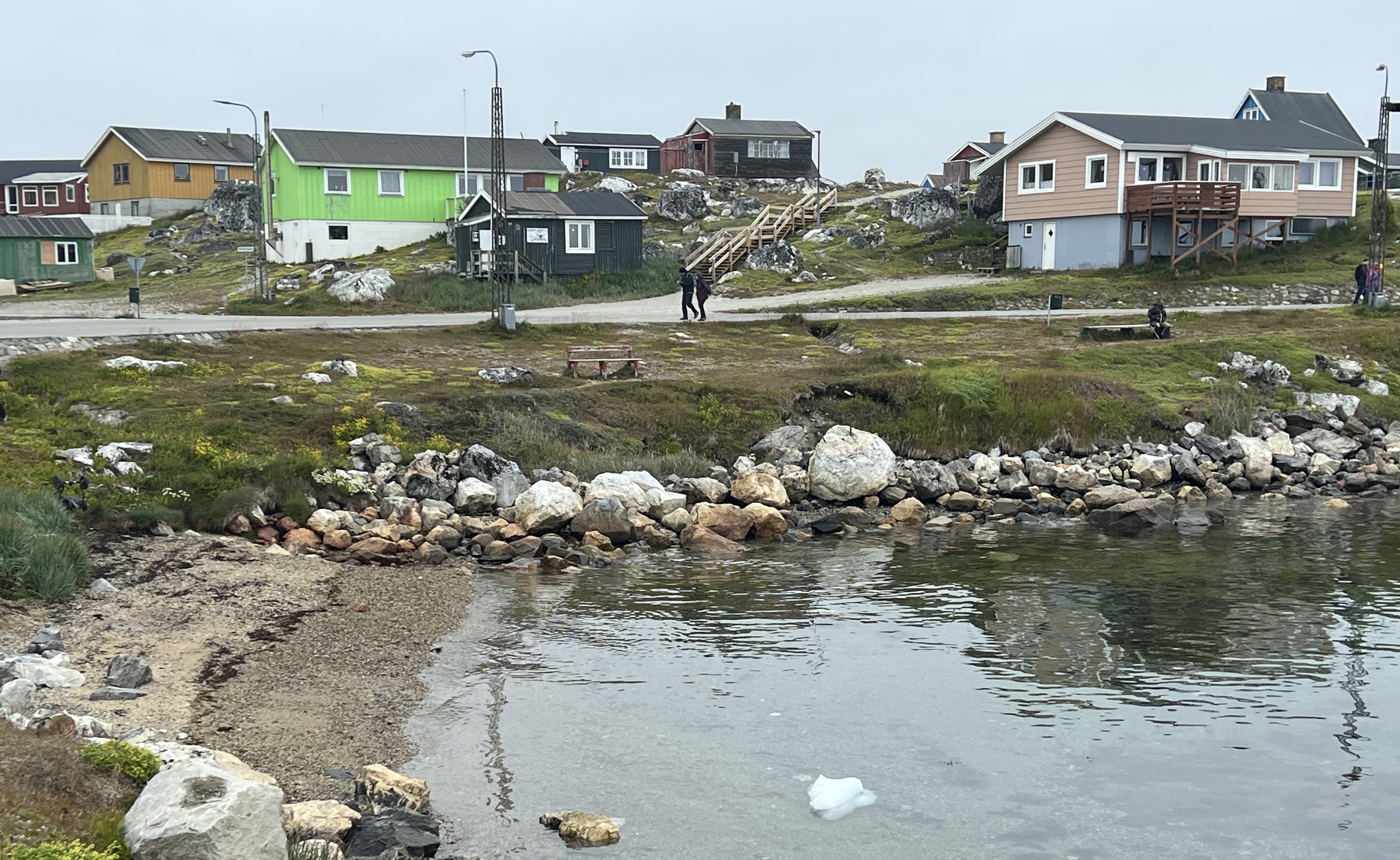
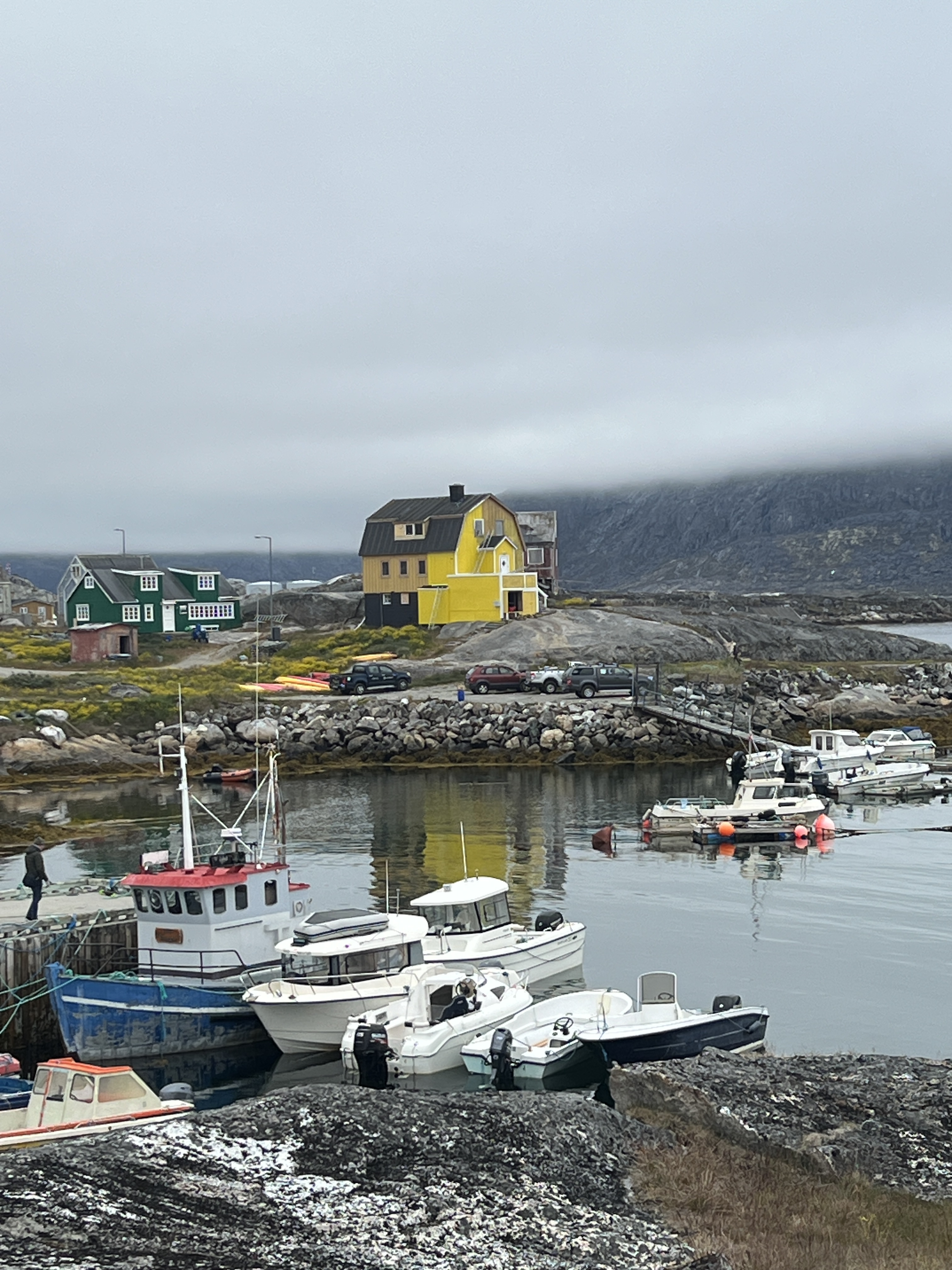
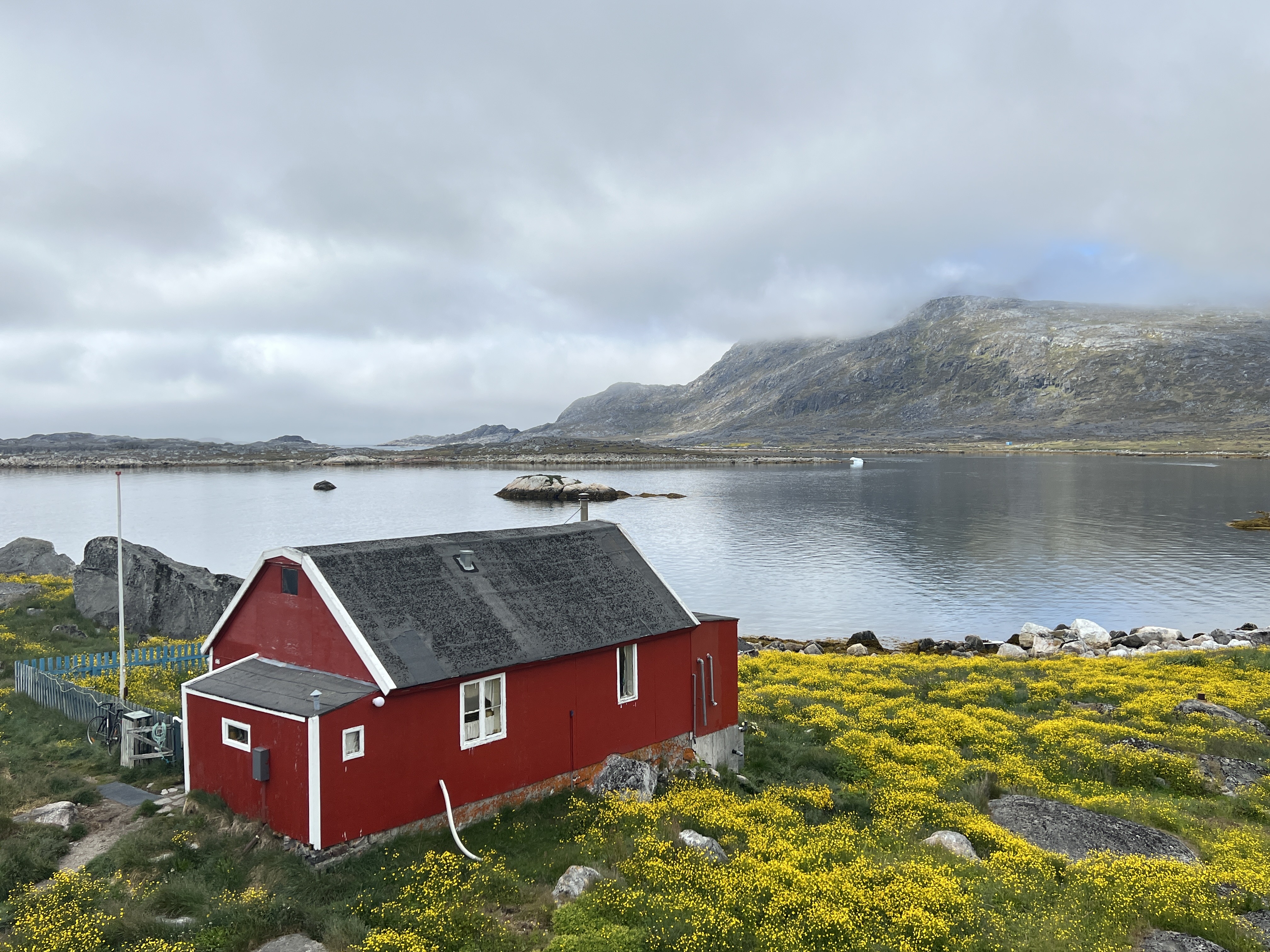
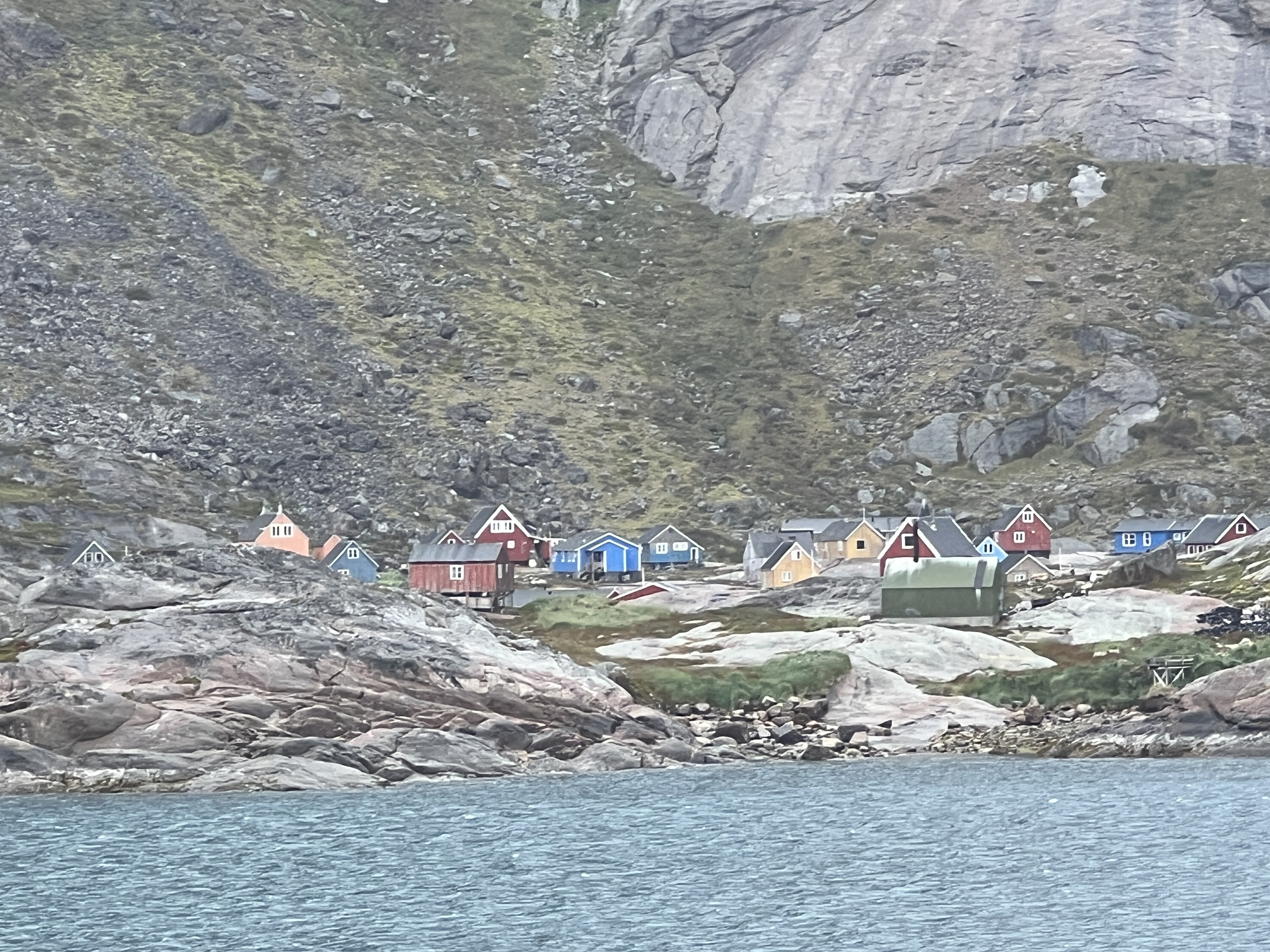
We had a full day in Nanortalik, Greenland’s most southerly town, and went ashore on a water shuttle. No guided tour, just a wander around by ourselves. More substantial bergie bits were floating around offshore the town.
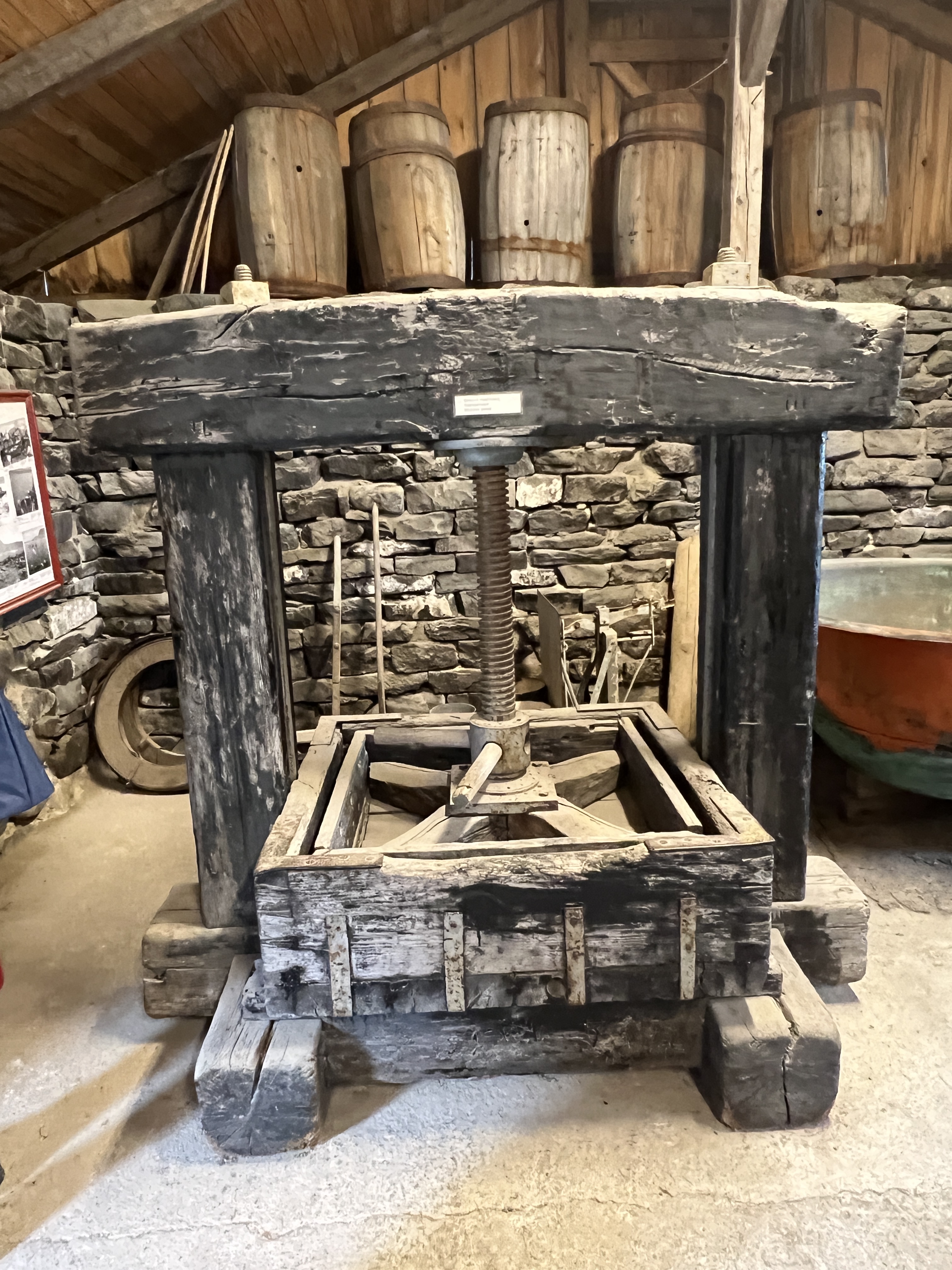
The town is spread out a bit from the small wharf where the shuttles dock. Not a lot of tourist infrastructure around, apart from an open air museum. The buildings appear to be old houses that have been repurposed to house memorabilia. Although the building in which the seal processing techniques from the old days are explained, along with the traditional equipment, appears to be the spot where it all happened.
Some of the open air museum buildings.Seal blubber press.
Problem is that most of the signage is in Danish, so a little hard to work out what it all is and does.
Old Lutheran Church
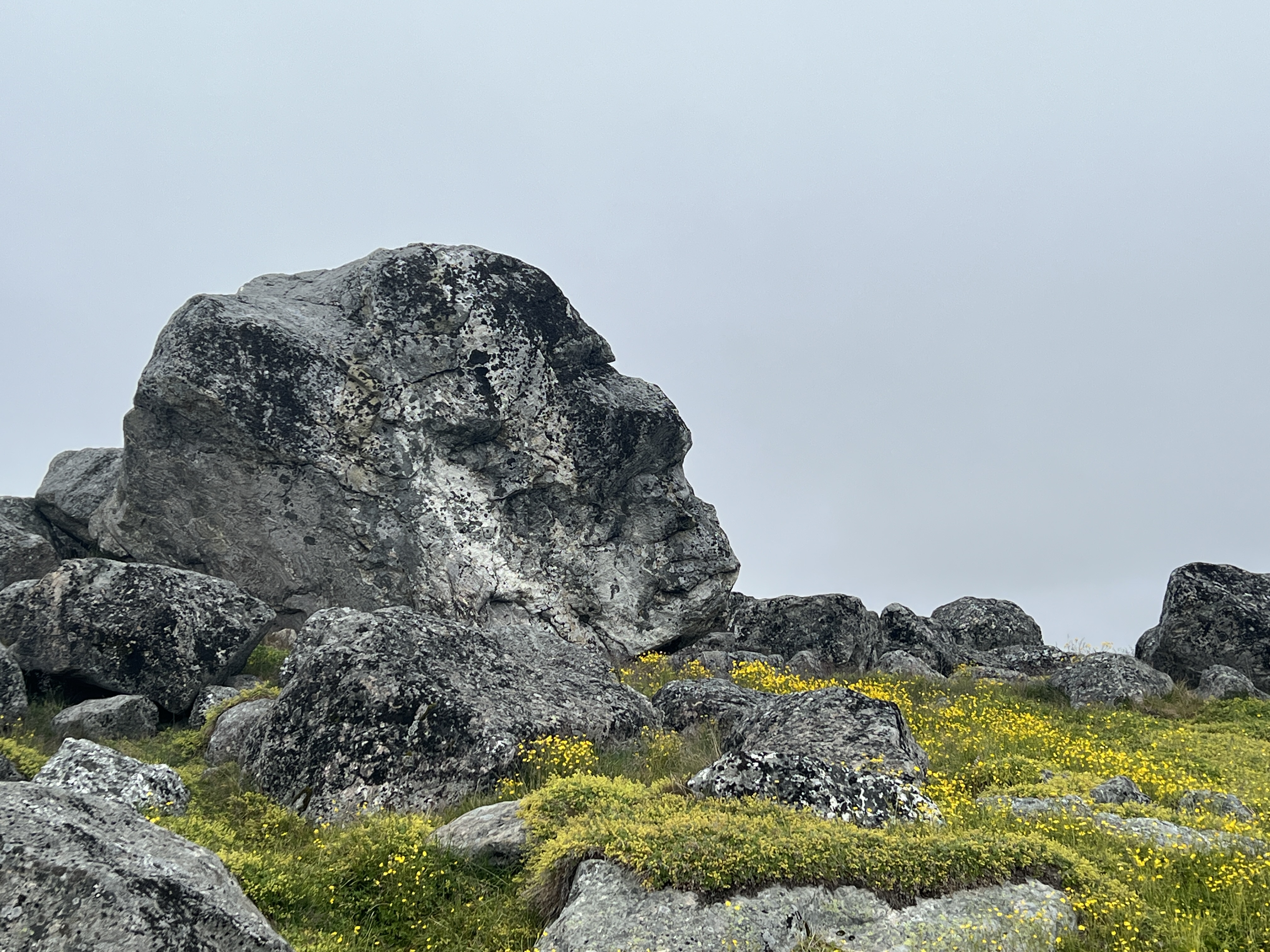
The old Lutheran church dominates the town’s streetscape. An impressive interior. The houses are fairly basic but very colourful and make for interesting photos against the surrounding ground vegetation, rocks and skyline. Buttercups are out and blooming. The face in the rock looks skywards.
The man in stone.
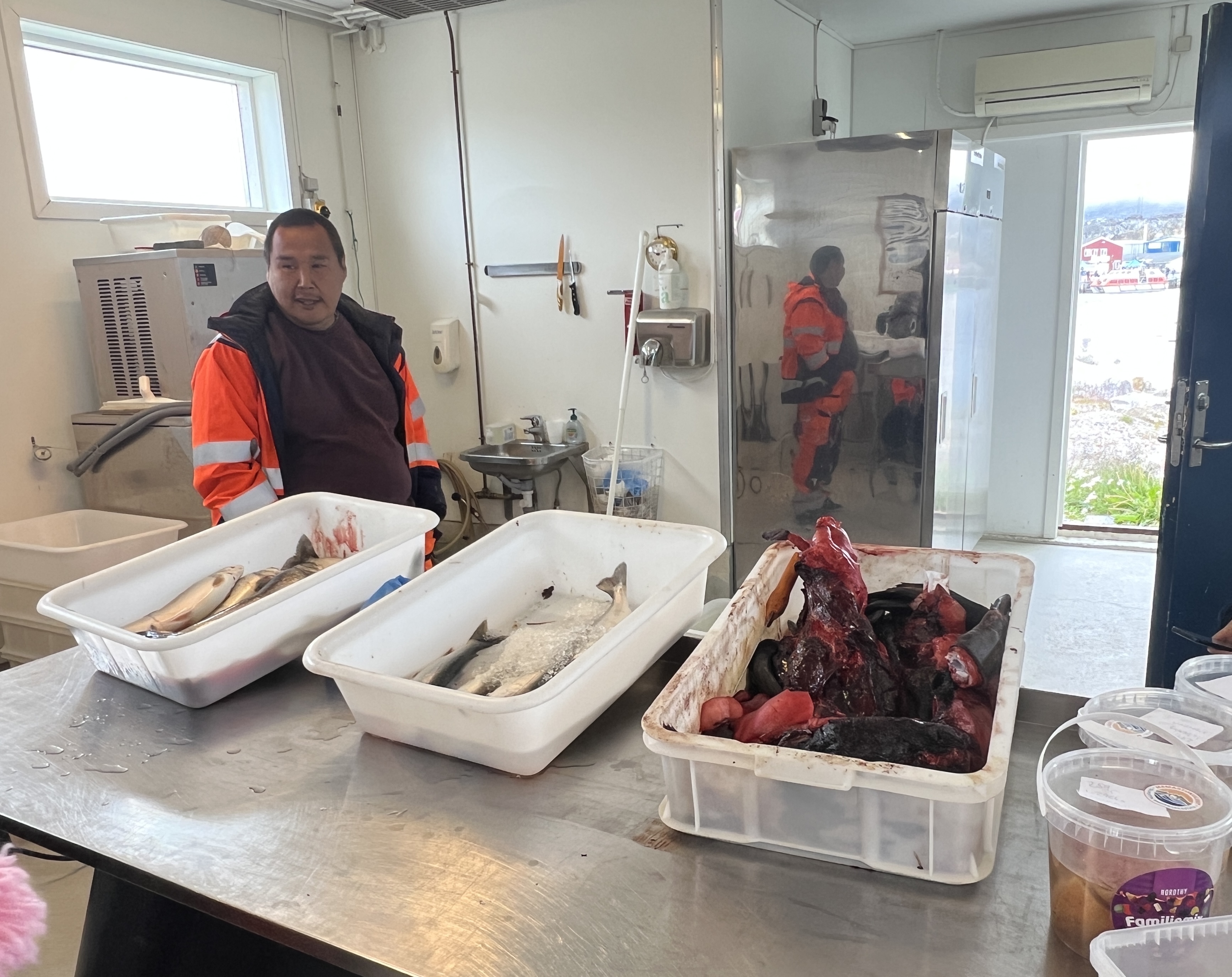
The fish market is also interesting for its offerings of fish and seal meat. The later is a bit off putting, sort of a twisted pile of seemingly bloodied raw stuff! Blubber I suppose. Homealone didn’t want to stay long here and the fish guy wanted $US1 to take a photo!
Fish market, seal meat at right.
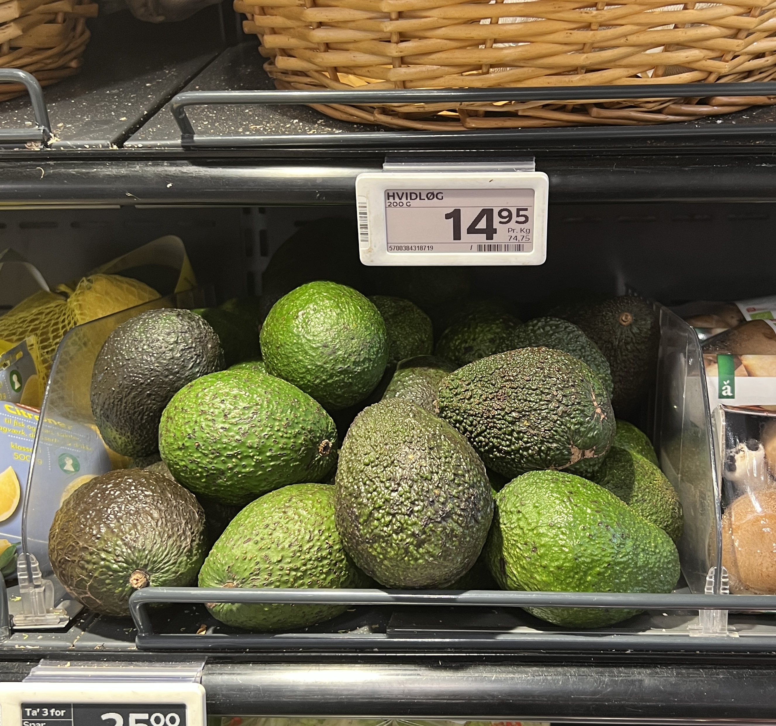
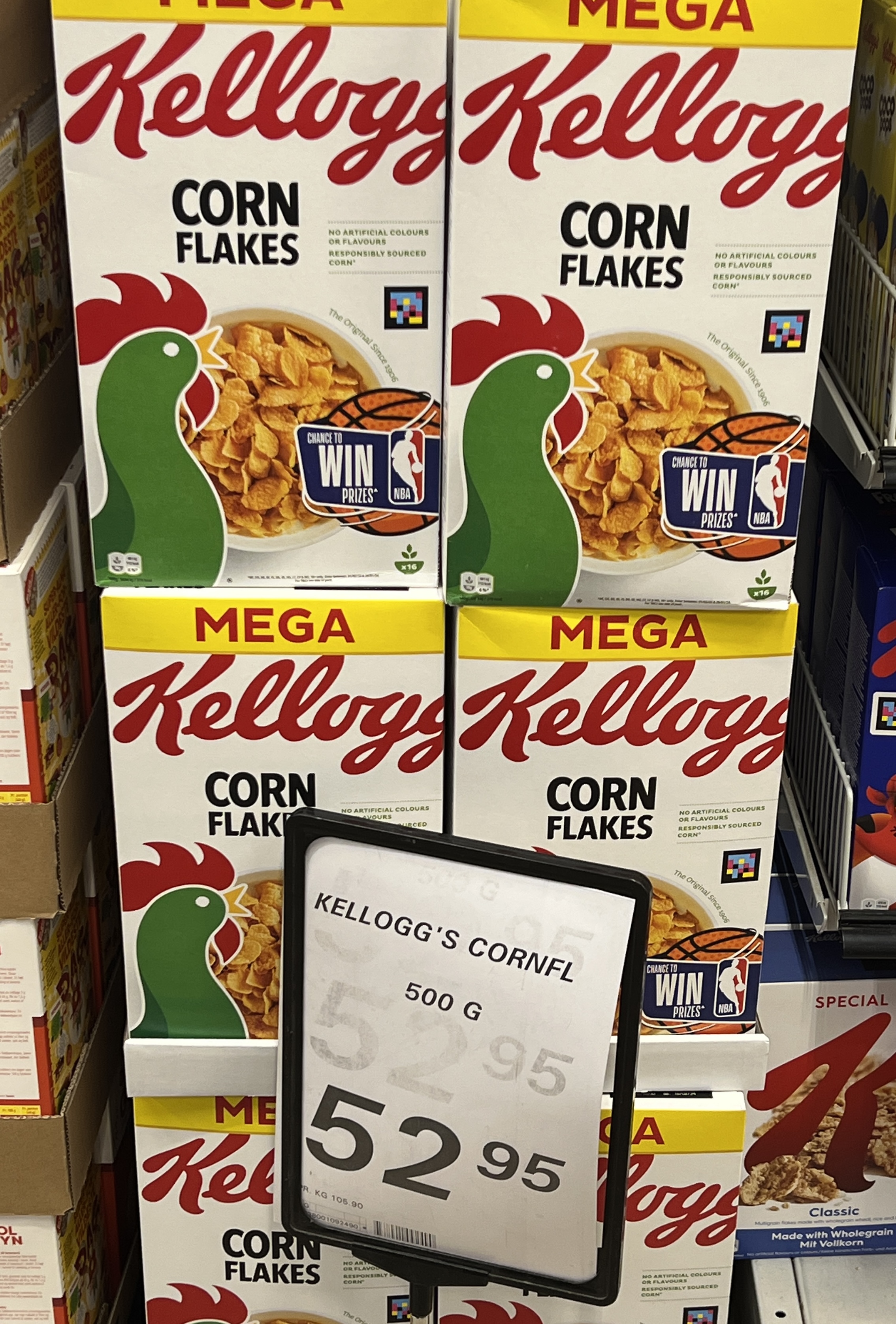
We headed off to check out the supermarket to see what the locals could get. Everything here is brought in by ship, no local production. Some interesting prices.
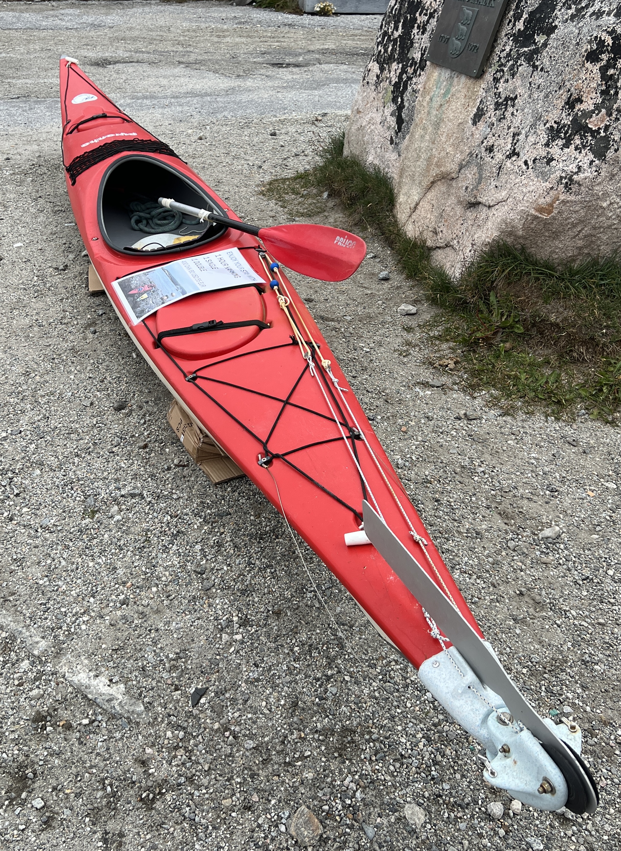
Small avocados $A3.50 and a 500g pack of cornflakes $A12.30. T shirts in the lone souvenir shop circa $A50. The local incomes on average don’t match that back in Aus! Down on the waterfront a kayak is offered for rent, 1 hour $A91. Slobro had been interested, but his pocket money had run out!
We had a plate of Greenland nachos for a late lunch snack at Cafe 43, before catching a shuttle back to the ship.
Tide out, this growler was a handy resting spot.
The weather for our day in Nanortalik had been excellent and as we sailed off the sun was glistening on the bergie bits. It had been cool, around 5/6 C, so beanie weather!
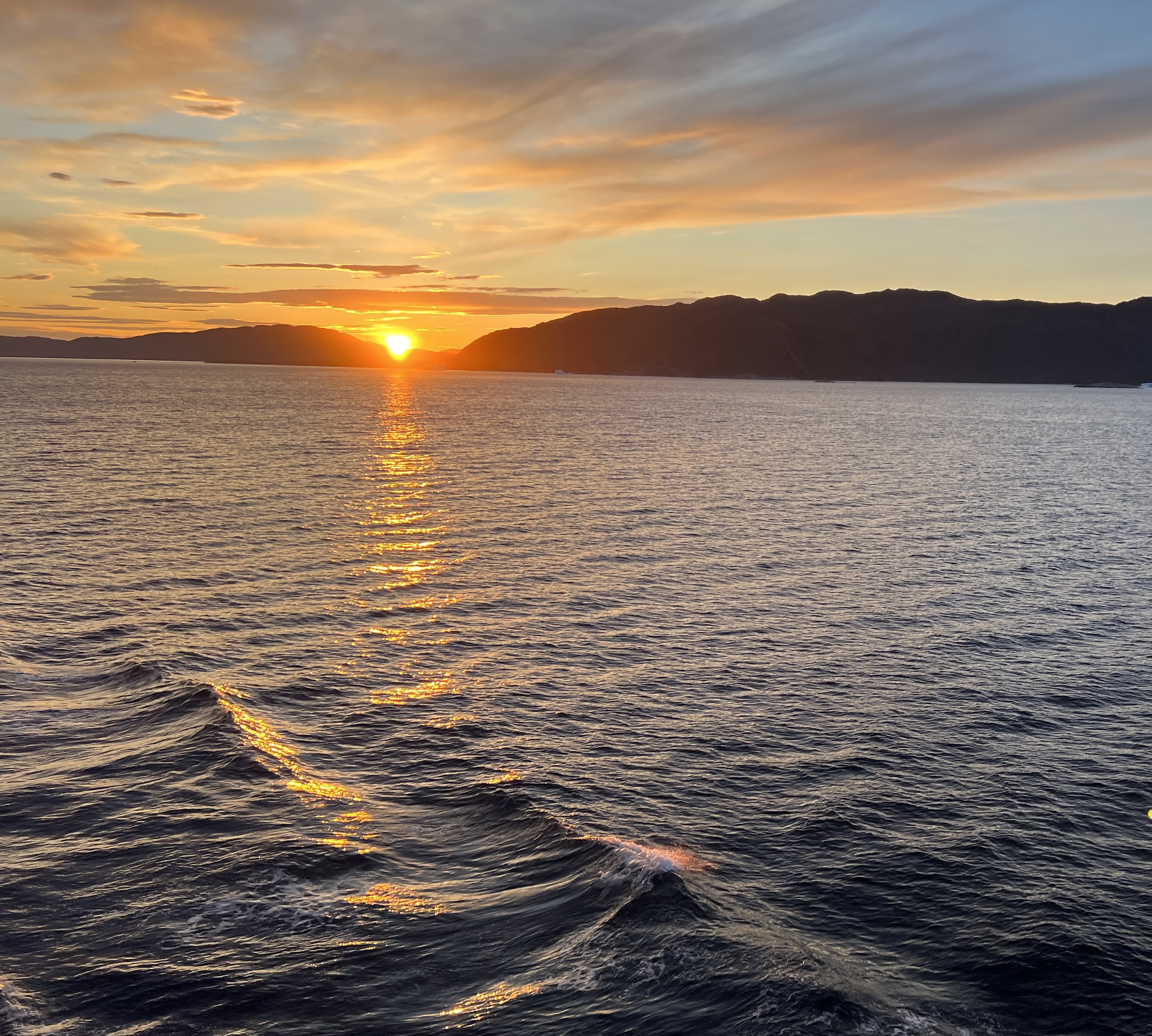
Sunset 9.18pm 4 August near Qoqortoq.
It was an interesting day looking around the town and observing a culture and environment very different to our own.
The Captain was making a quick run to our next stop at Qaqortoq, about 100 km away, hoping to make it before dark, about 11pm. So avoiding navigating among the growing number of larger icebergs and possibly fog during the dark.
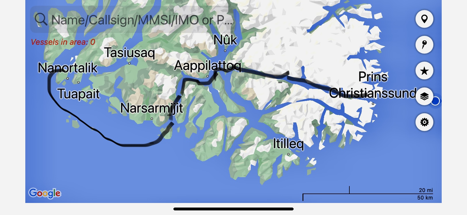
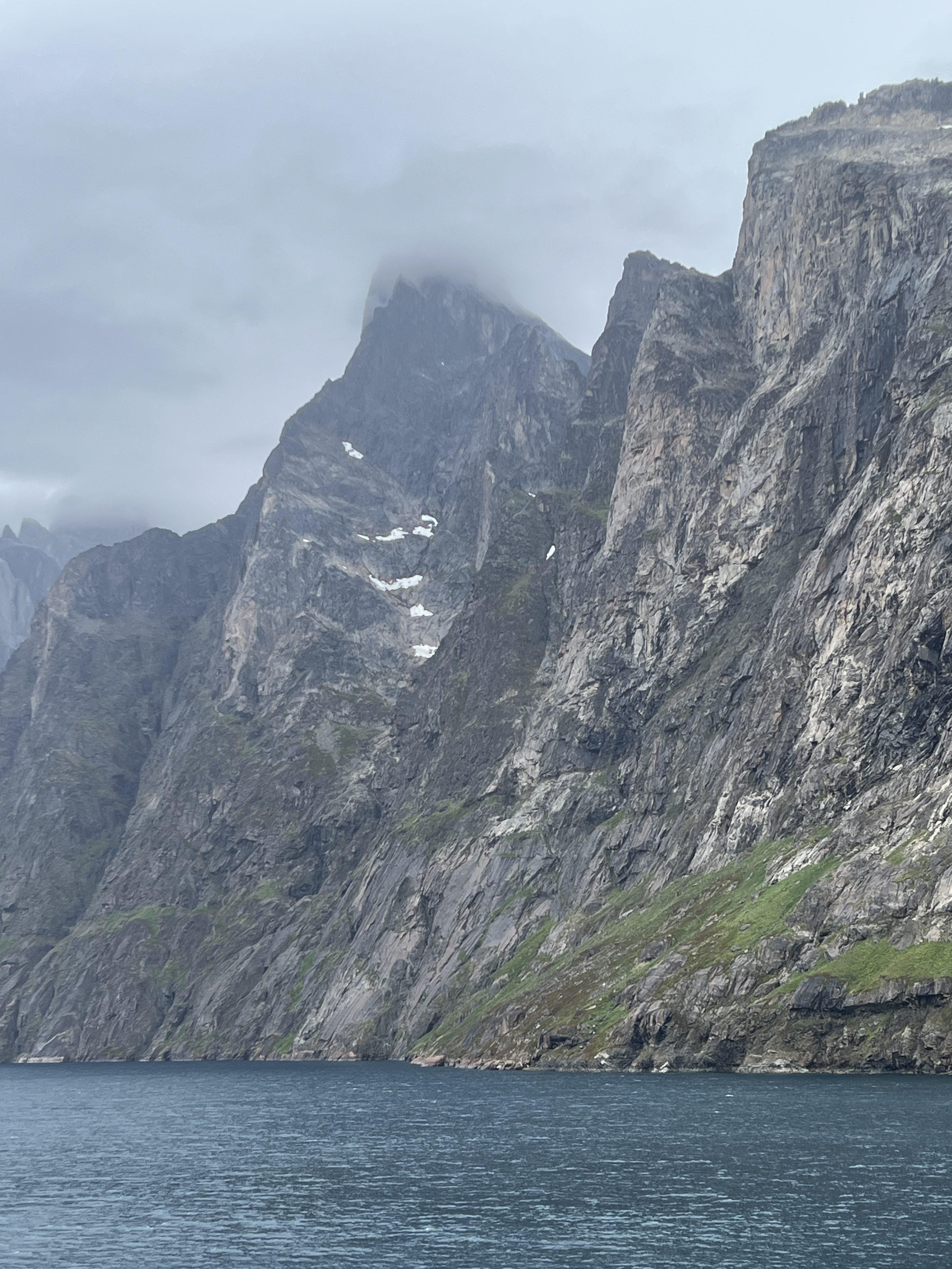
We have had a little surprise on our way to Greenland. The Captain has decided to divert our course and we are going to enter Prins Christianssund at the tip of Greenland.
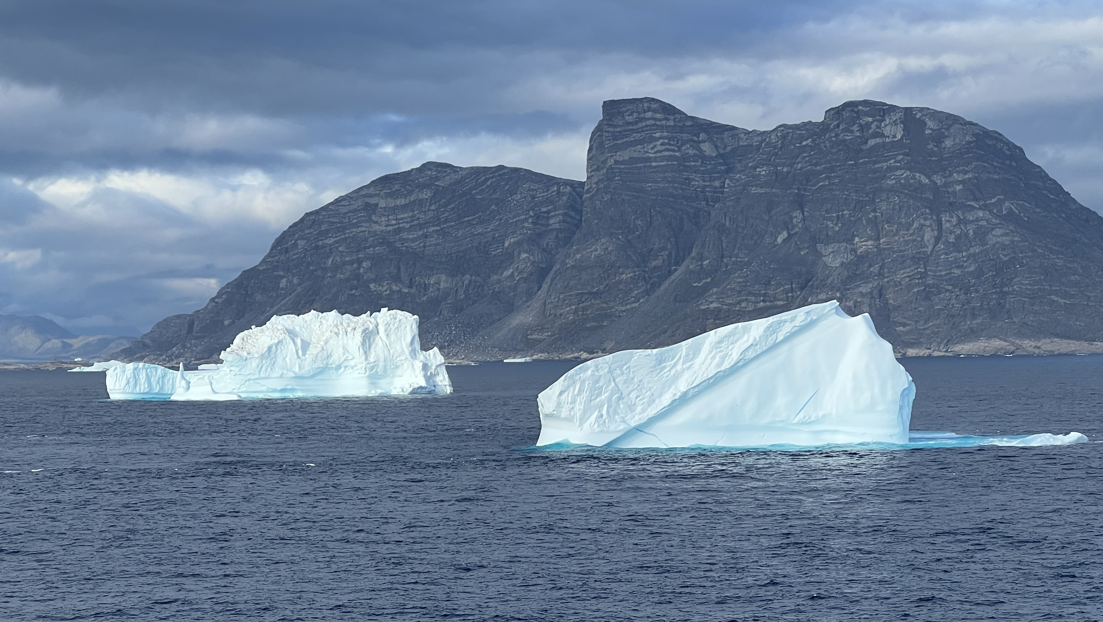
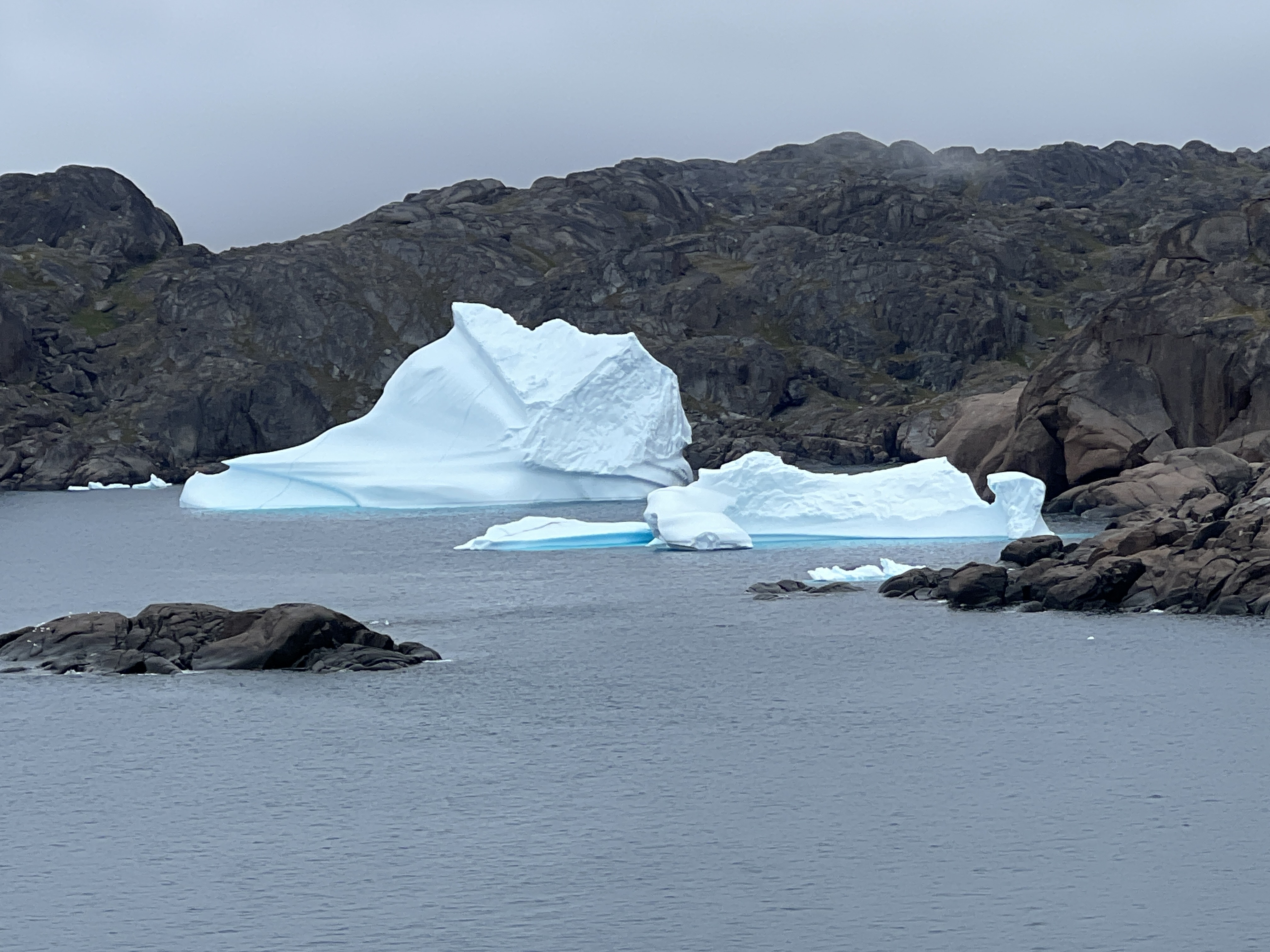
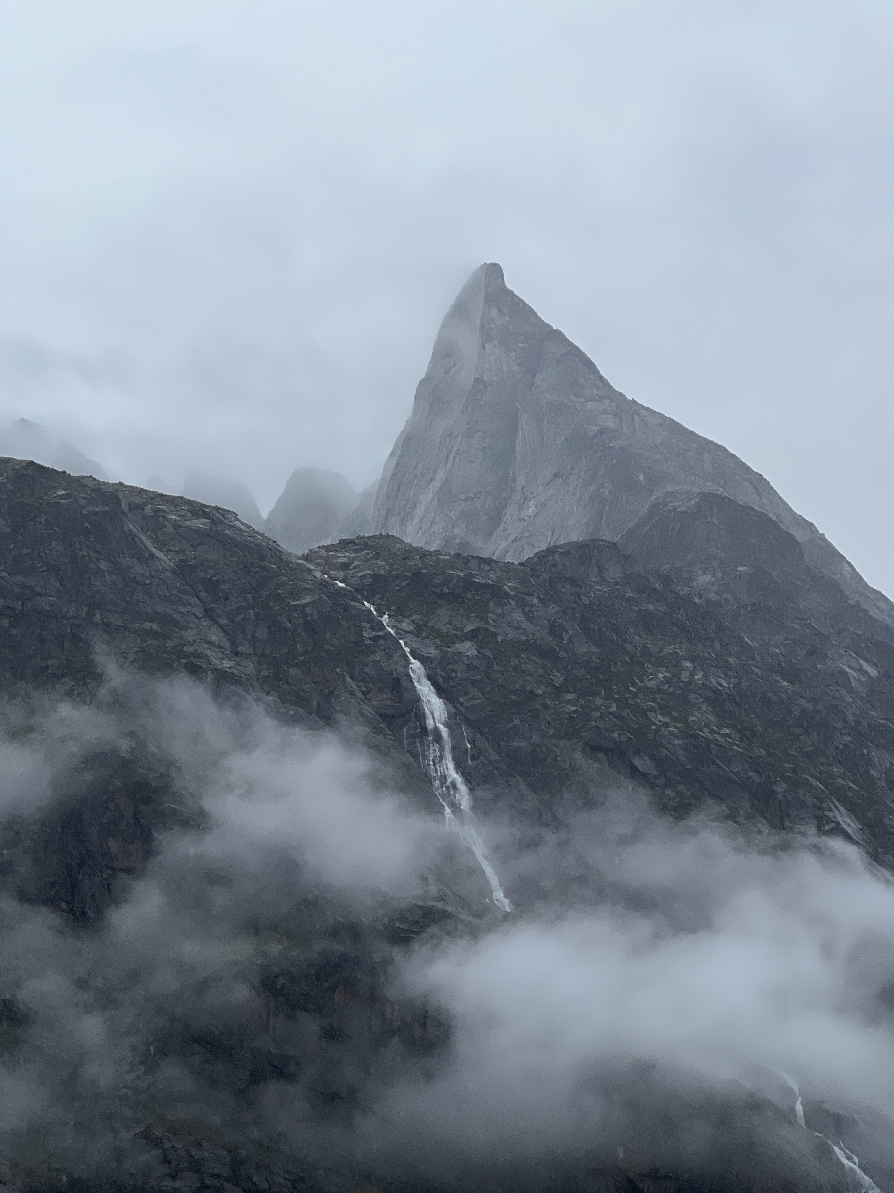
Coming into the channel we see our first bergie bits and growlers. This 100 km channel is awe inspiring.
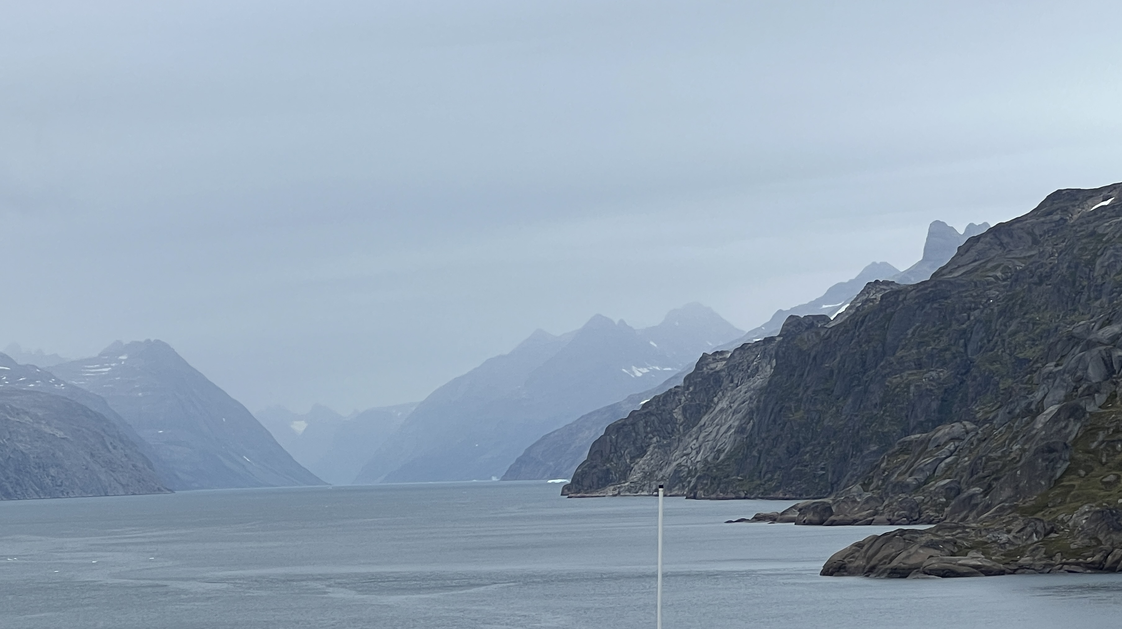
The channel was an ancient glacier cutting sheer walls in a valley that has now been submerged. Higher up the walls are the U shaped valleys of long gone tributary glaciers.
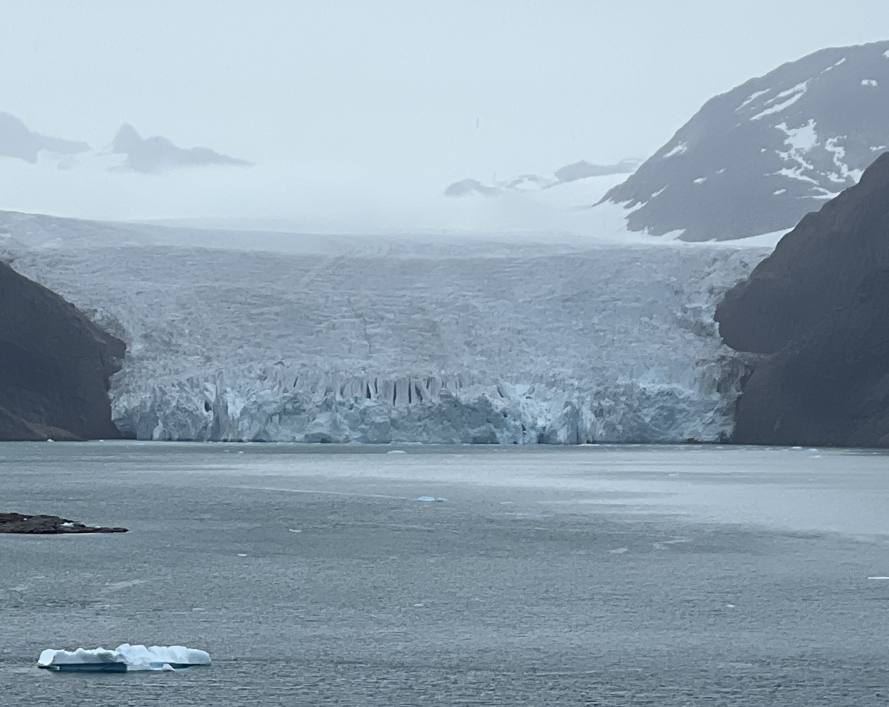
We pass by a number of present day glaciers that feed off the Greenland Ice Sheet that covers most of the country.
The weather is overcast, mist and cloud floating around creates an eerie atmosphere. Bergie bits and growlers float around in the channel.
There is one small village on the edge of the channel, seemingly in the middle of nowhere.
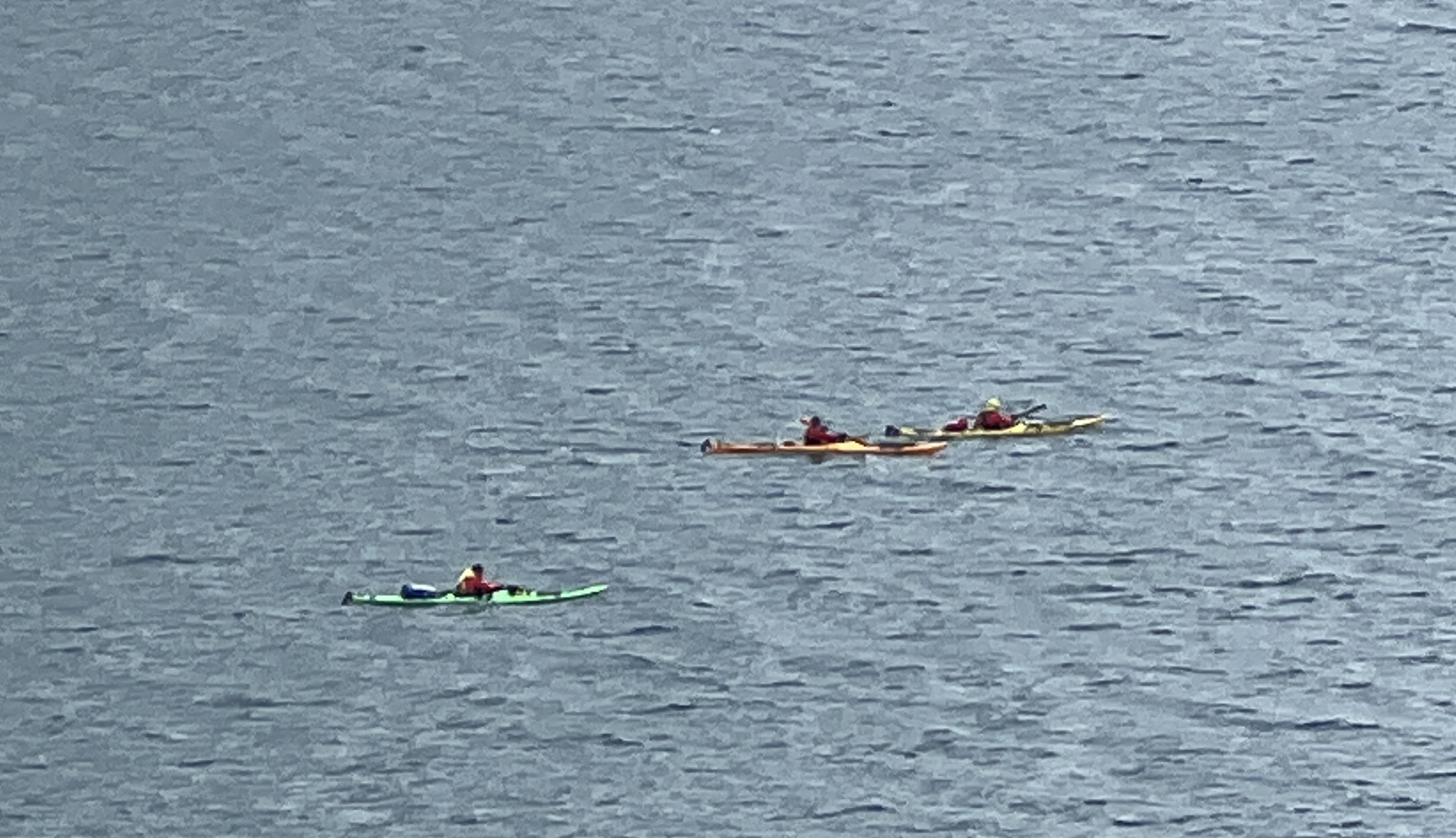
Three kayakers paddle by! The channel narrows considerably and finally joins fjords and the ship twists and turns through these making its way to the open sea.
Our first stop in Greenland is to be the small village of Nanortalik, on an island of the same name. About 1300 people live there. It has taken all day to navigate along the channel and fjords and we will reach Nanortalik in the morning.
During the two days at sea on the way to Iceland the weather has greatly improved and we have blue skies and a brightly shining sun. Akureyri, on the north coast is the first of two stops in the Land of Fire and Ice, or Ice and Fire, depending on what you read! The sail here has taken us, during the early hours of the morning, briefly over the Arctic Circle. Slobro looked overboard but couldn’t see it, unlike when we crossed the equator and there was a bump he said. It is not getting dark in these parts until around midnight and the light comes at about 3.30am. Akureyri sits at the end of the 37 mile long Eyjafjorour, Icelands longest fjord. We have a full day ashore here on a tour out into the countryside.
The town itself is quite small and the town highlights section of the drive is quite short, there is a colourful central shopping area and the impressive double towered church overlooking the harbour area.
The drive out into the countryside is awe inspiring, we were blessed with the one day in ten average ‘sun out’ day in summer and it got up to 19C. Green fields and rolling hills rise steeply from the fjord. The green keeps going when we get up onto the largely treeless long ago glaciated plateau.
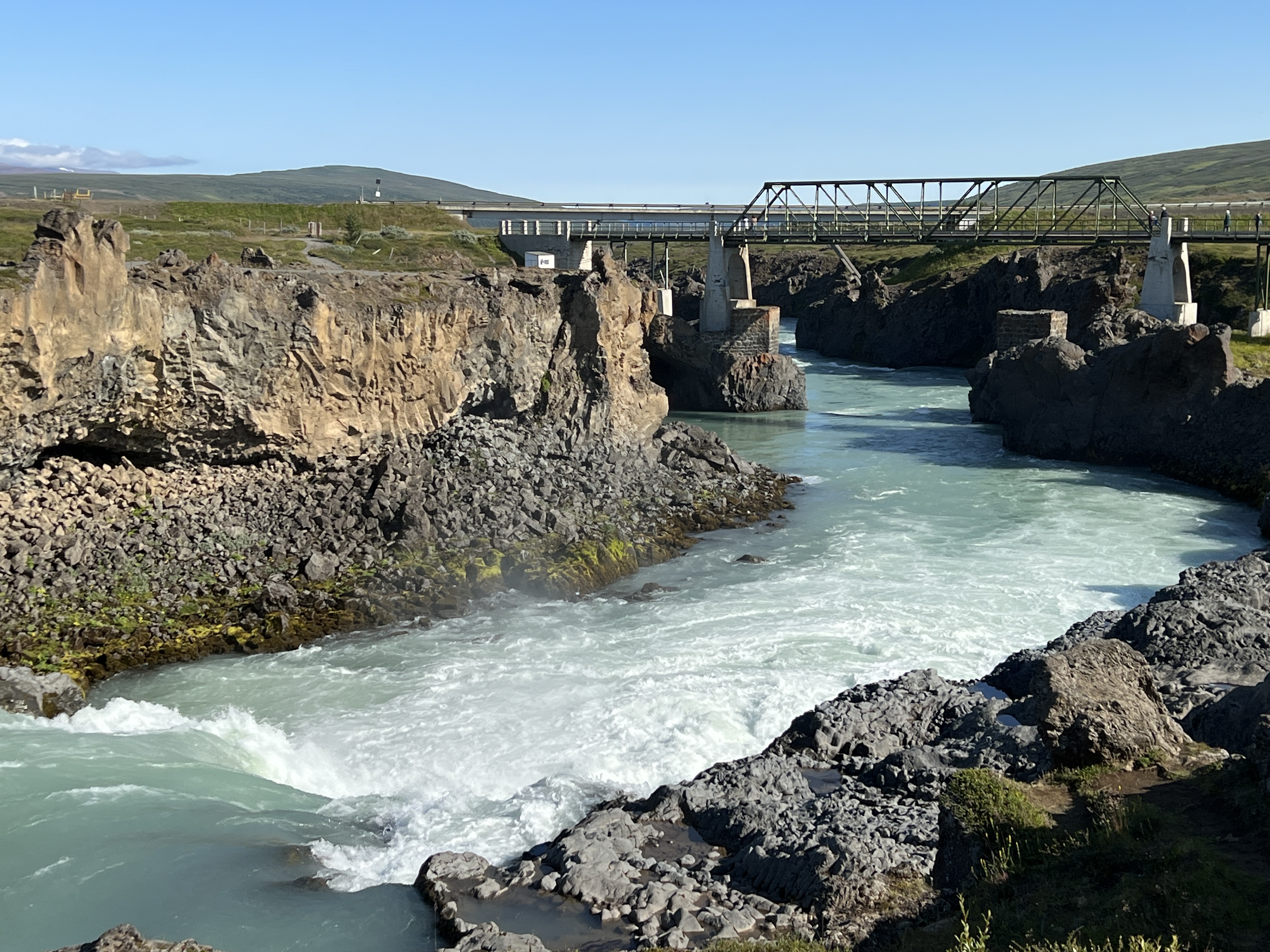
Godafoss Waterfall.Bridge downstream from the waterfall.
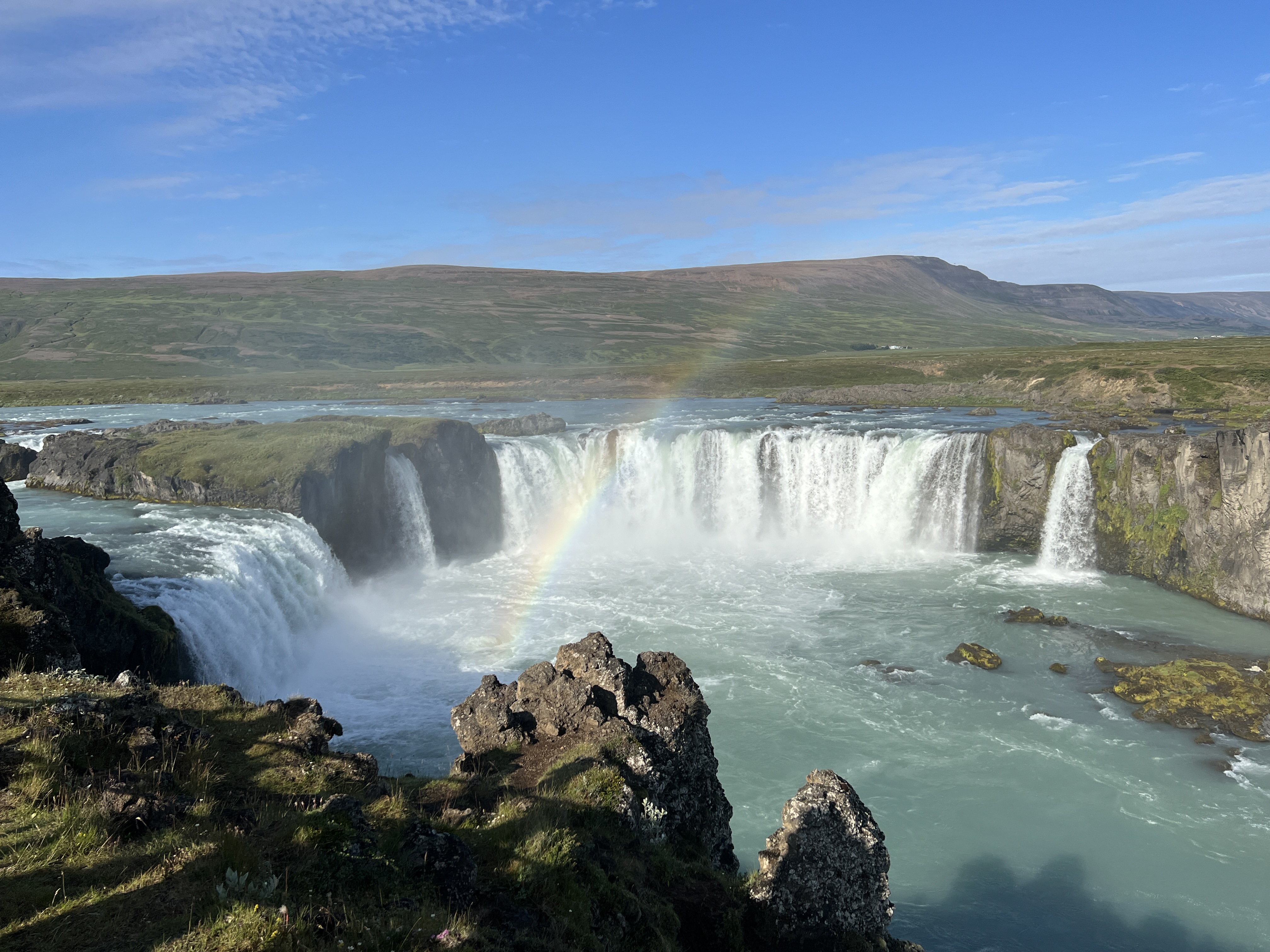
Our first stop is at Godafoss Waterfall, the ‘Waterfall of the Gods’. So named because, according to Icelandic sagas, the then king after converting to Christianity through his statues of the Norse gods into the waterfall. Pretty impressive landscape! I may need correction, but Iceland only has a 10% permanent ice cover, there is plenty of snow though in winter. Greenland on the other hand has an 80% cover. This gives rise to the suggestion that Iceland should be called Greenland and Greenland should be called Iceland.
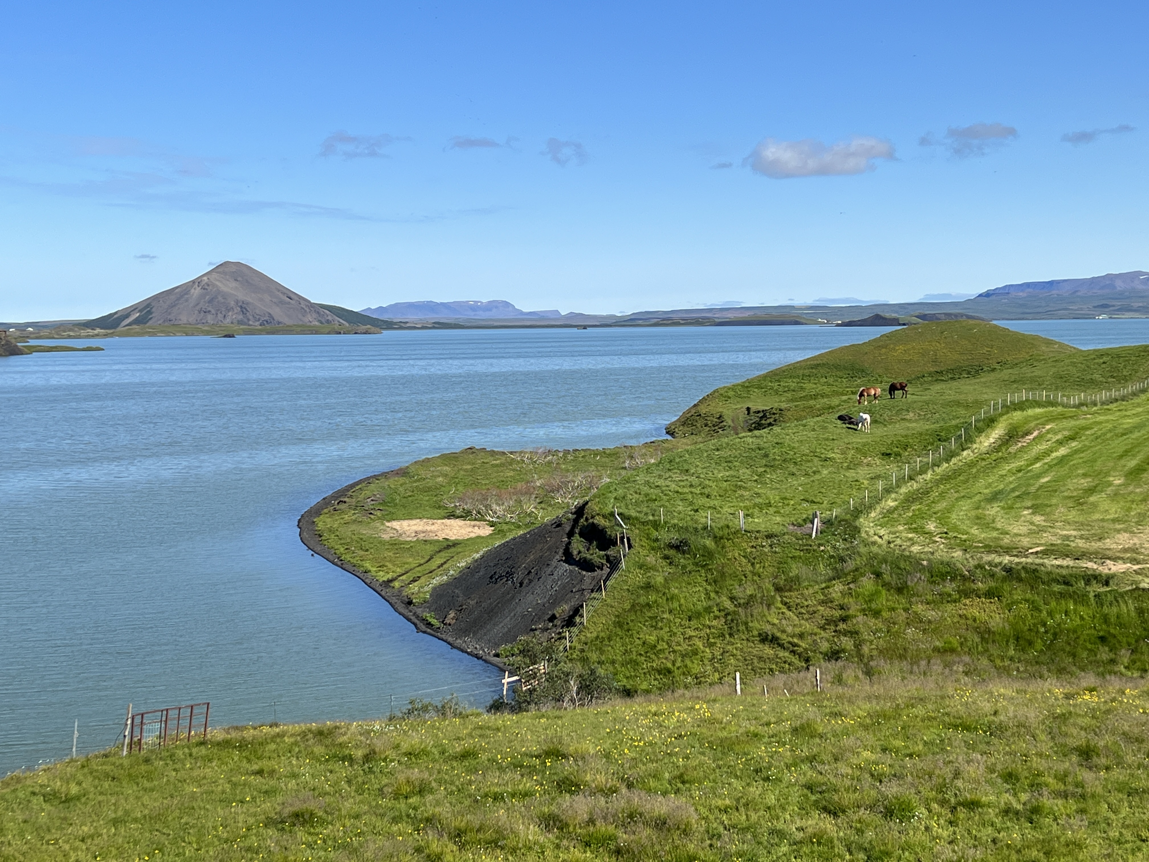
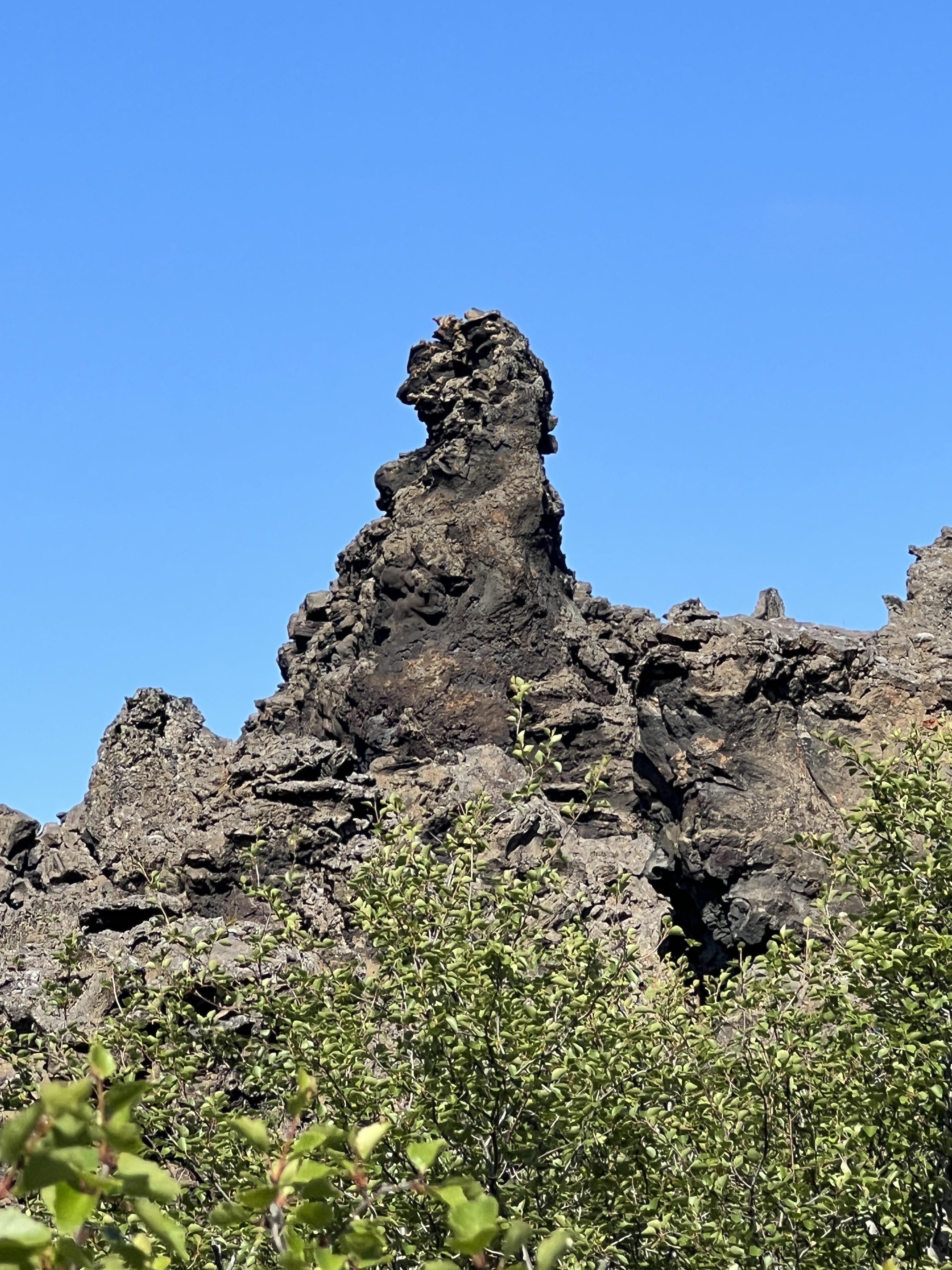
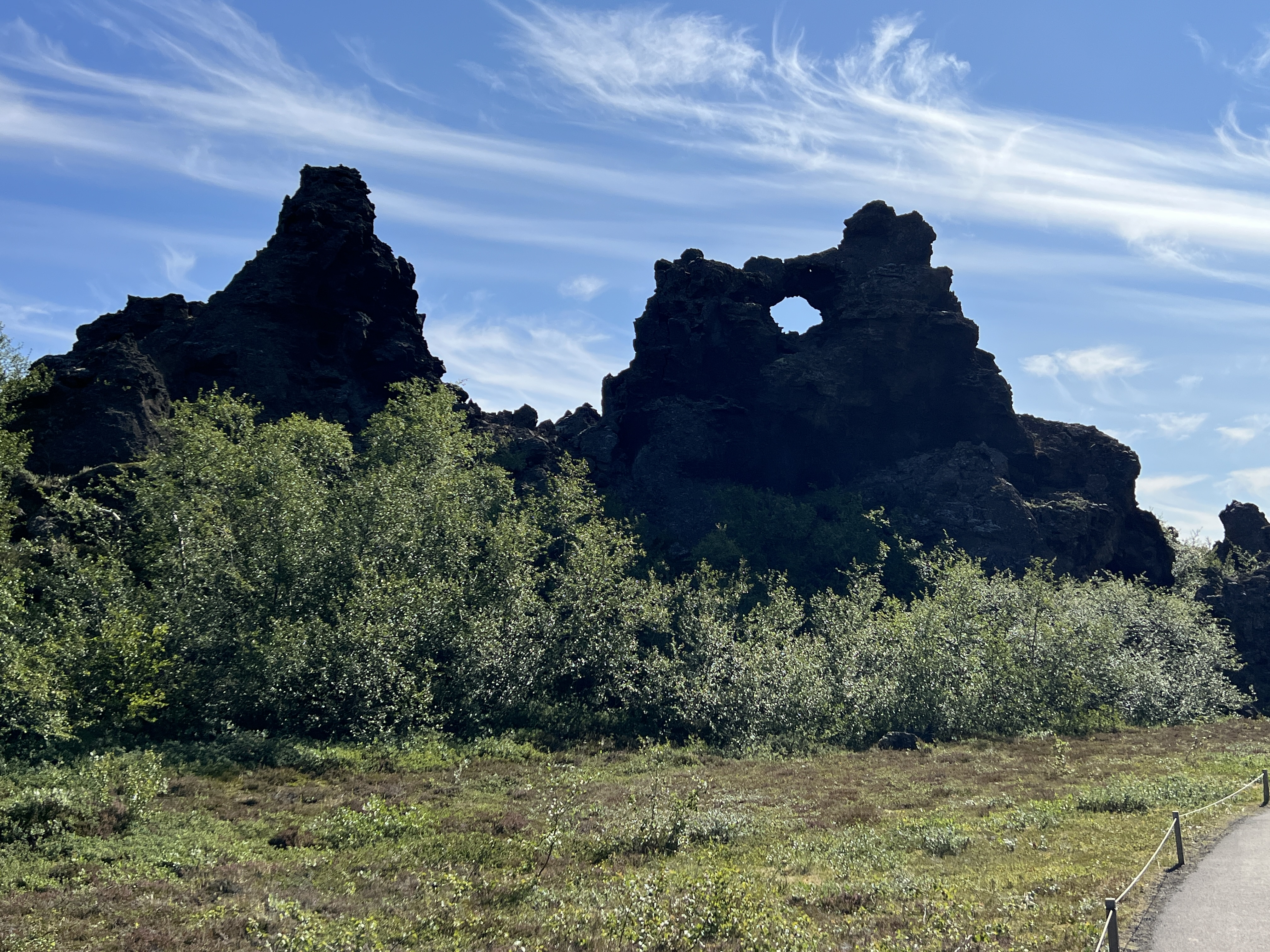
Lake Myvatin.
Next stop is to view Lake Myvatin, situated in the centre of a geologically active area and at the heart of a major lava flow several thousand years ago. We have several stops in these parts to look at different aspects of the volcanic activity. A walk around the lava field among remnant eroded rock formations, quite eerie in places. Then on to a ‘small’ crater field, the circular depressions caused by ‘pops’ in the lava flow now covered with grasses. Great views of the lake from here.
Remnant lava field near Lake Myvatin.Some more remnants forming amazing sights along the walk.
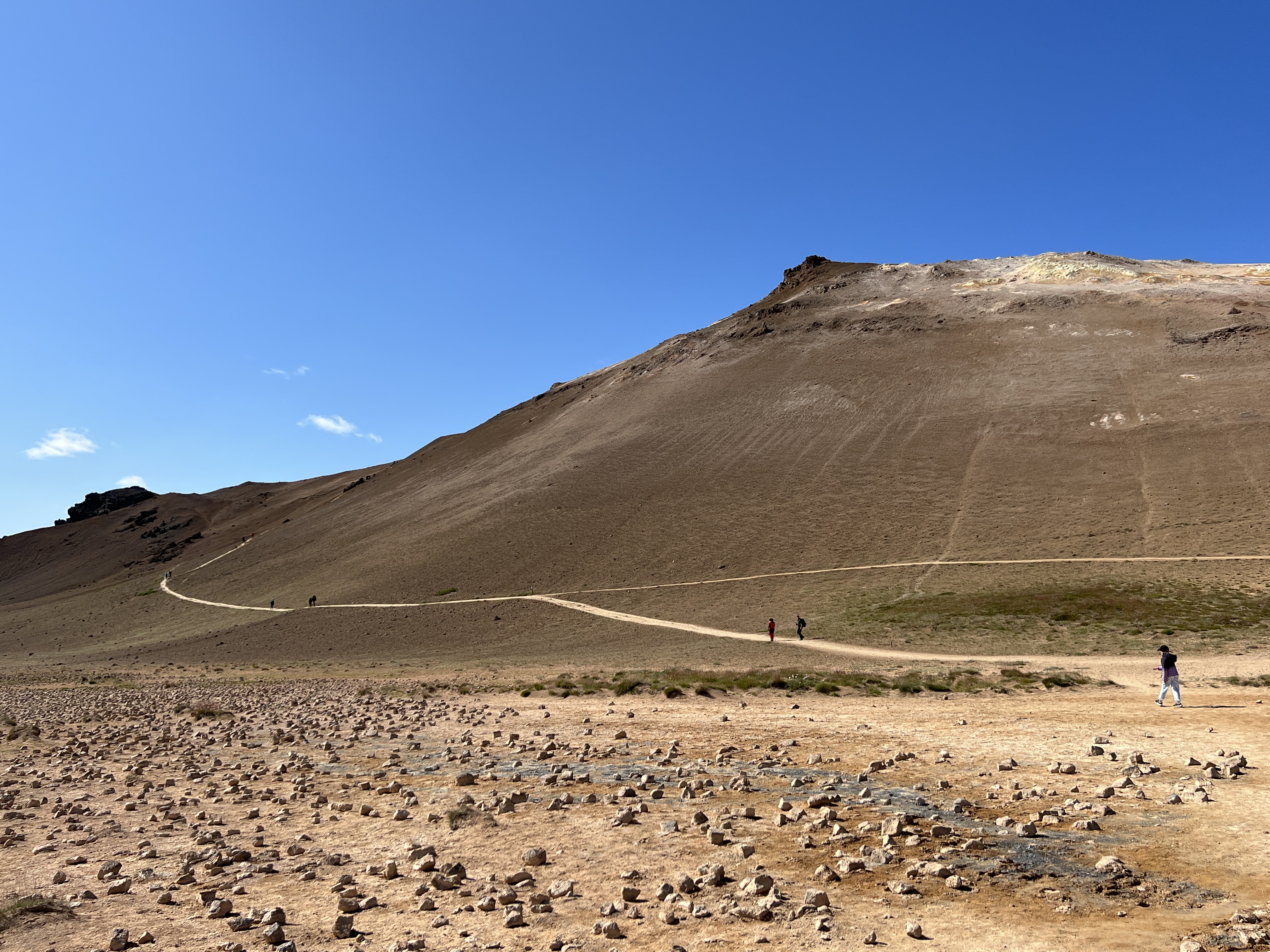
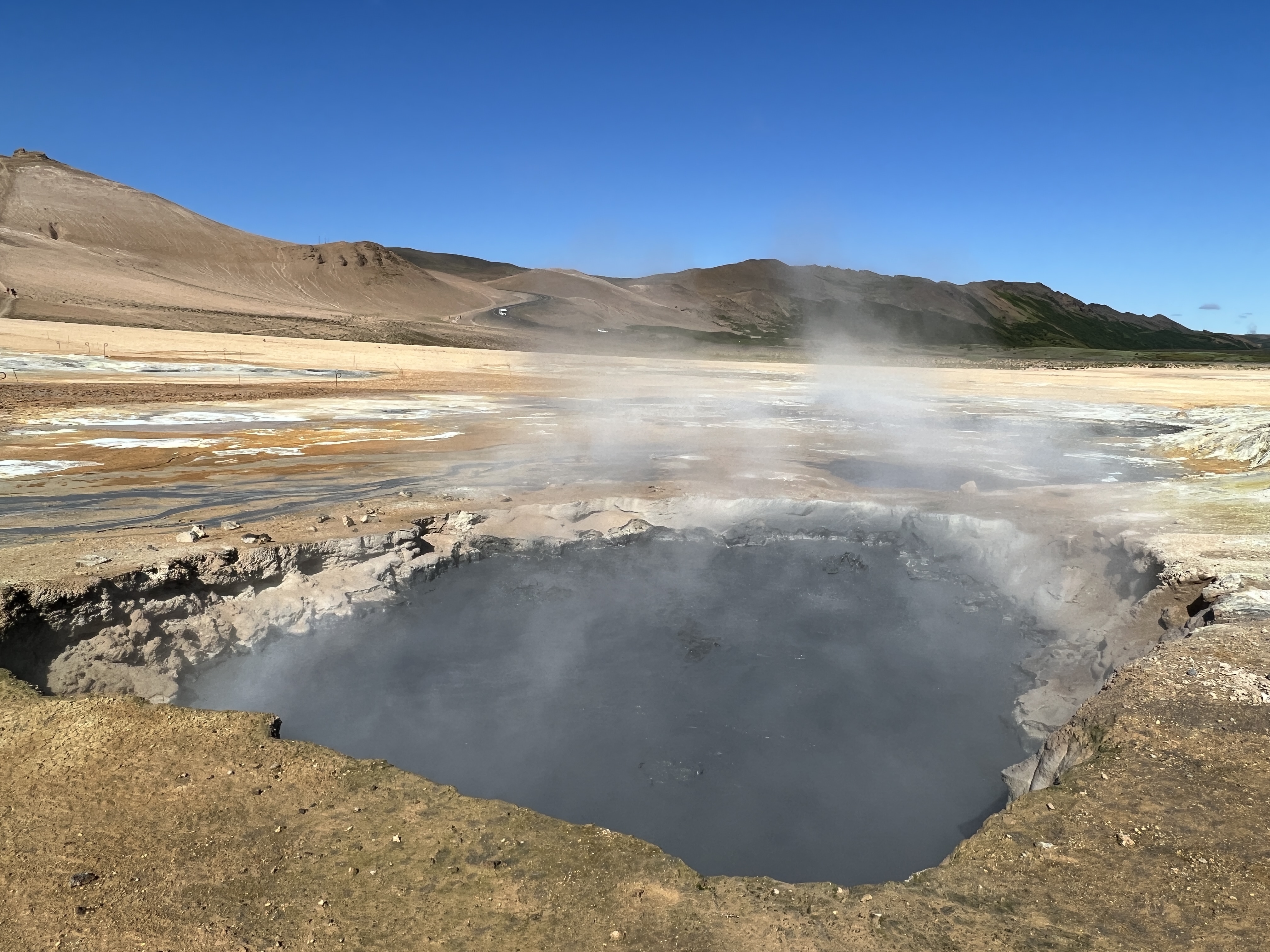
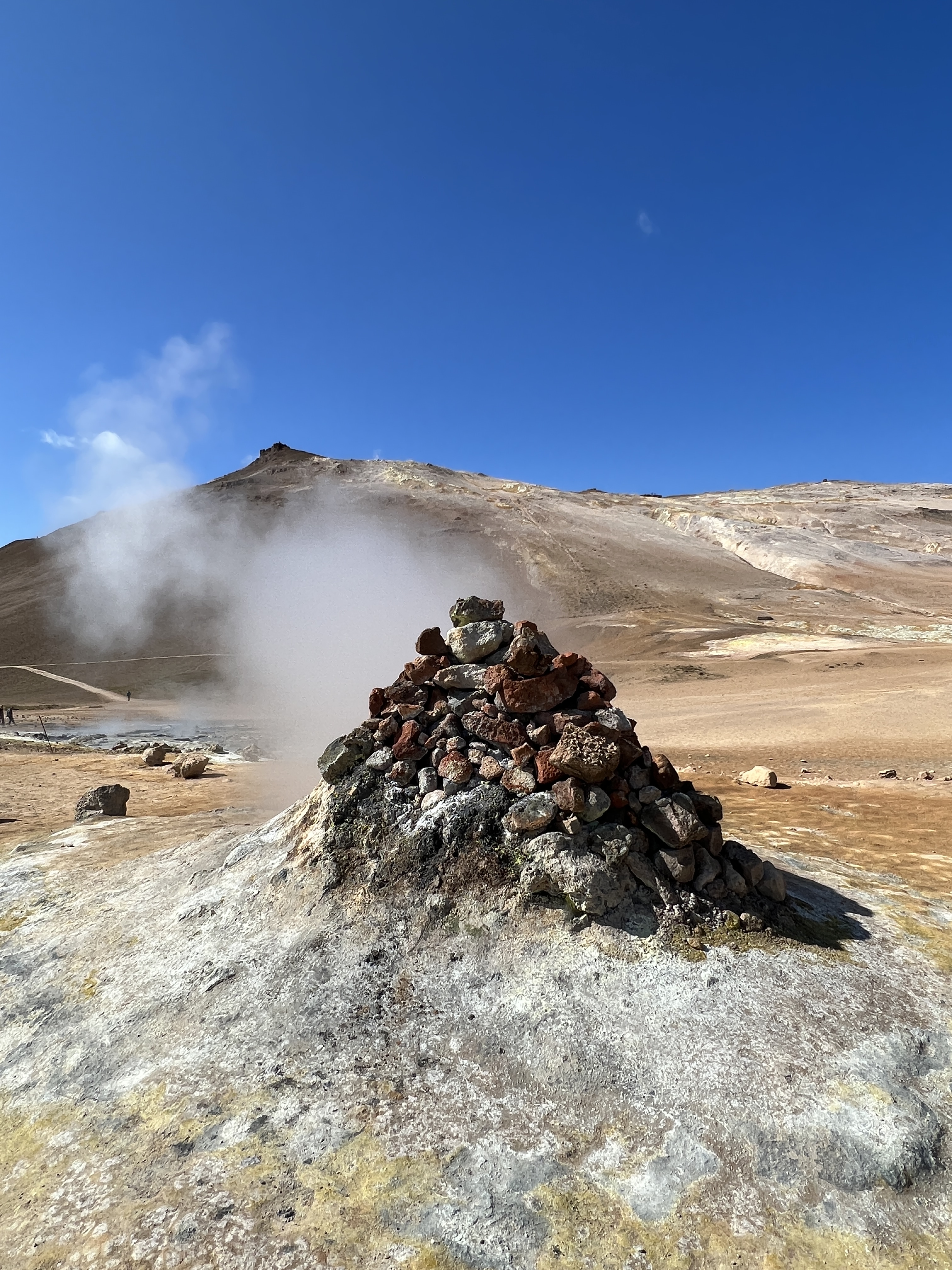
Iceland is nicely located over the point where the North American and European tectonic plates are grinding against each other. As a consequence earthquakes and volcanic are not uncommon. Hence land of ‘Fire and Ice’. On the way to our next stop at a hot springs sight we pass by an exposed fissure in the rocks showing where the two tectonic plates are pushing up against each other, at a rate of 2cm a year according to the guide.
Walking track to the top, overlooking hot springs area and probably the lake from the top. No time for us to do !Mud holeA steam escape.
The hot springs sit at the base of a tree ridge line where they bubble and hiss away, strong sulphur odours waft around the site.
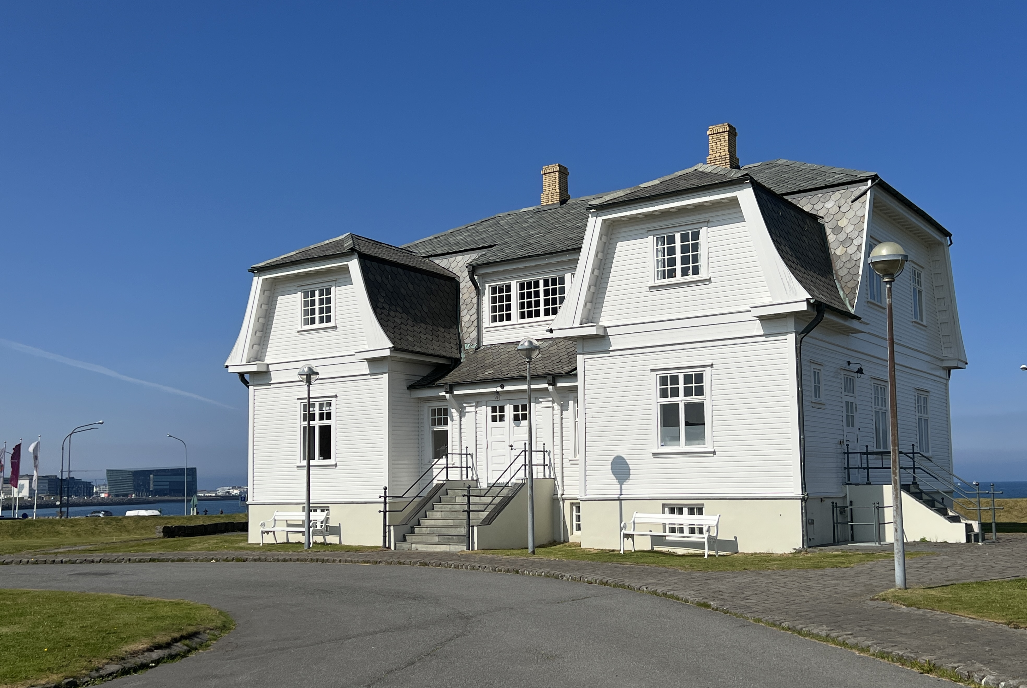
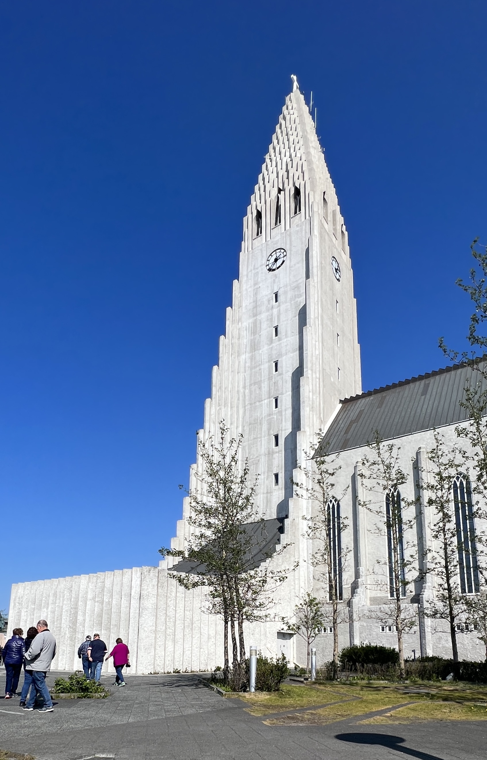
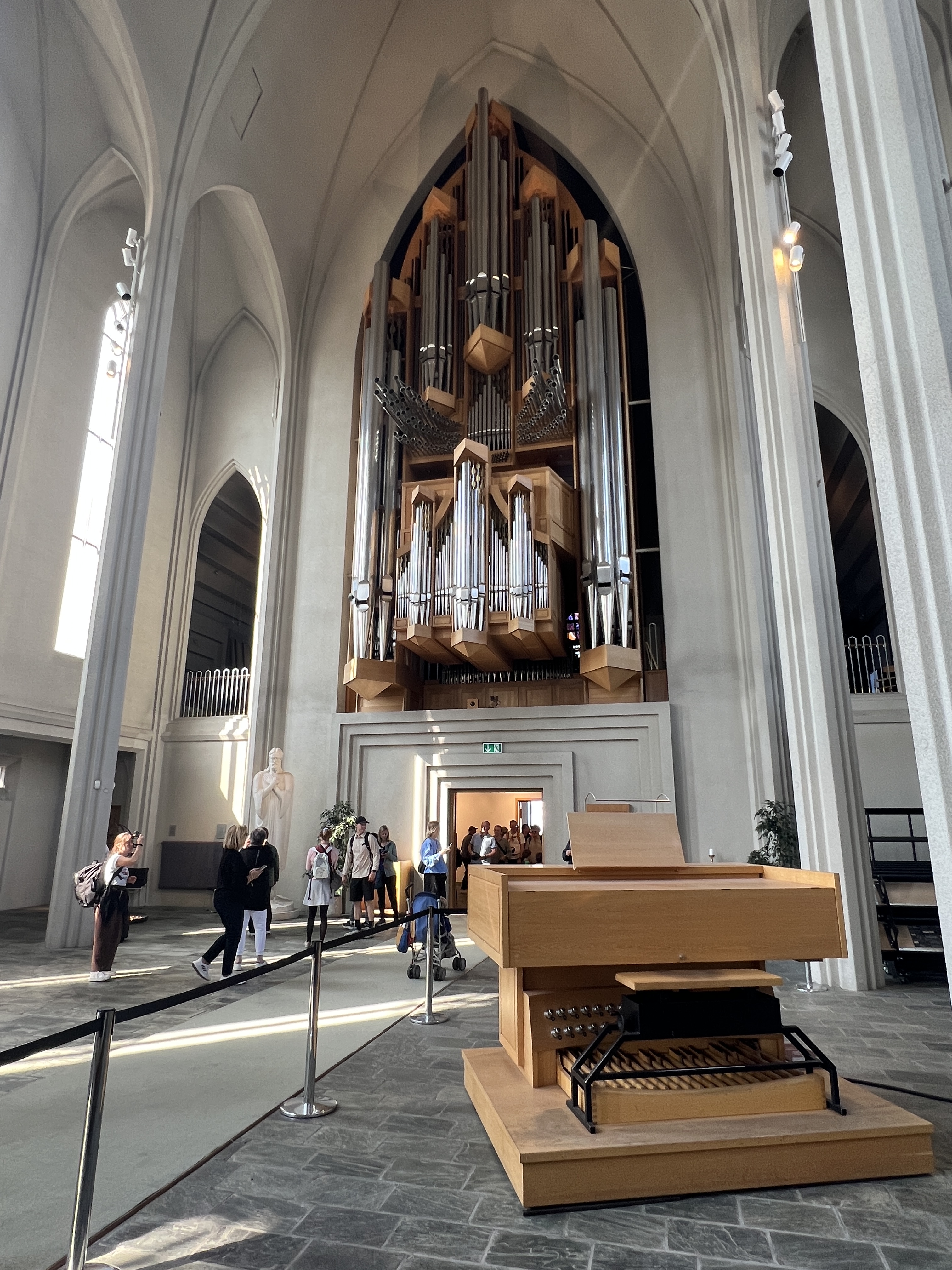
The drive back to the ship takes us the same way we came. Few alternative routes in the country. Overnight we cruised around the island to the southern side and docked at Reykjavik at 12 noon, but didn’t leave till 11pm. We decided here on a city tour around the town. Stopped for a photo of the old house where Reagan and Gorbachev met to end the Cold War and the on to the skyline dominating Lutheran Church. Apart from the organ, the inside was quite austere and in line with Lutheran traditions.
Hofdi House where arms control talks took place in 1986.Lutheran Church.Massive pipe organ.
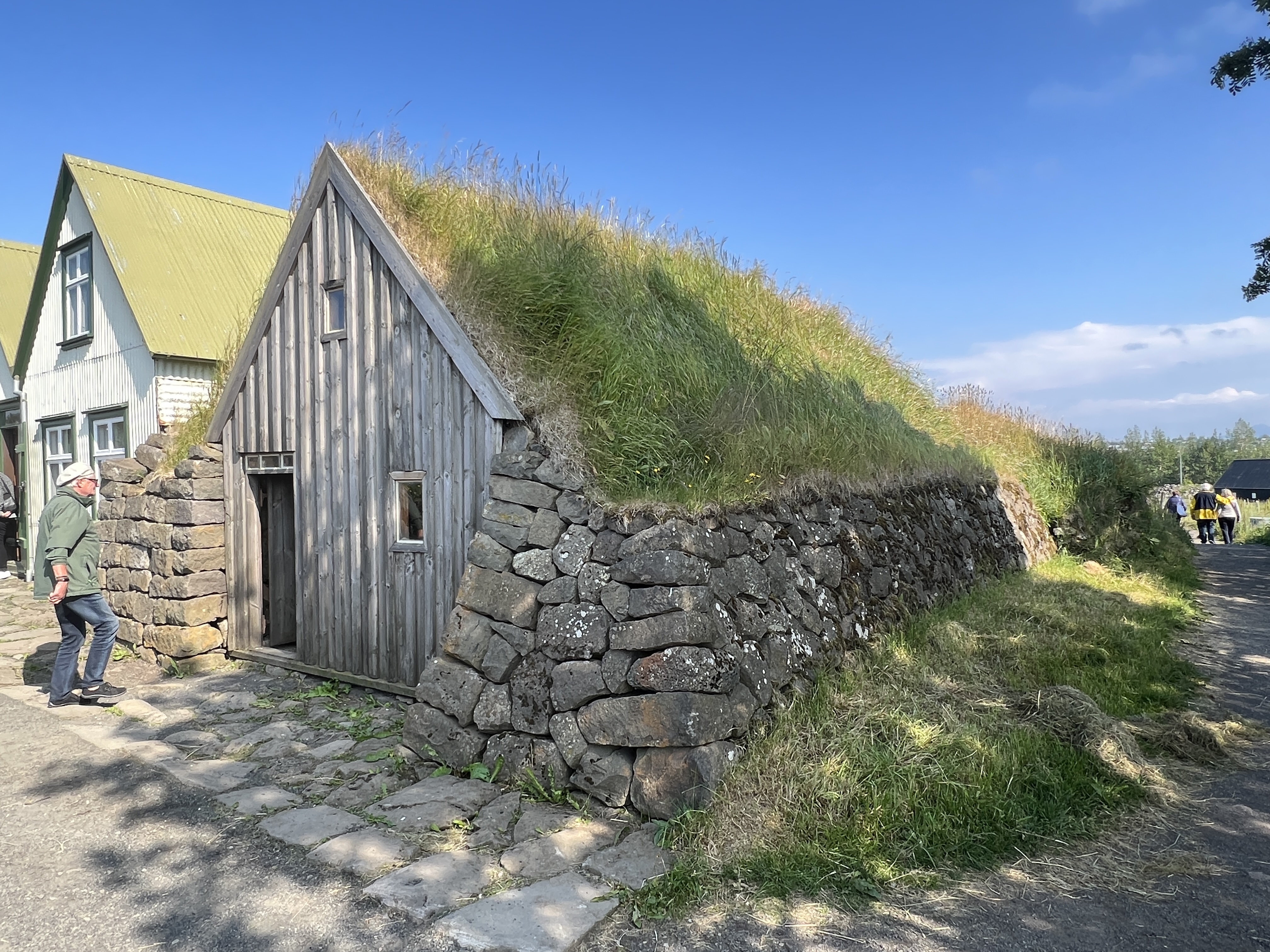
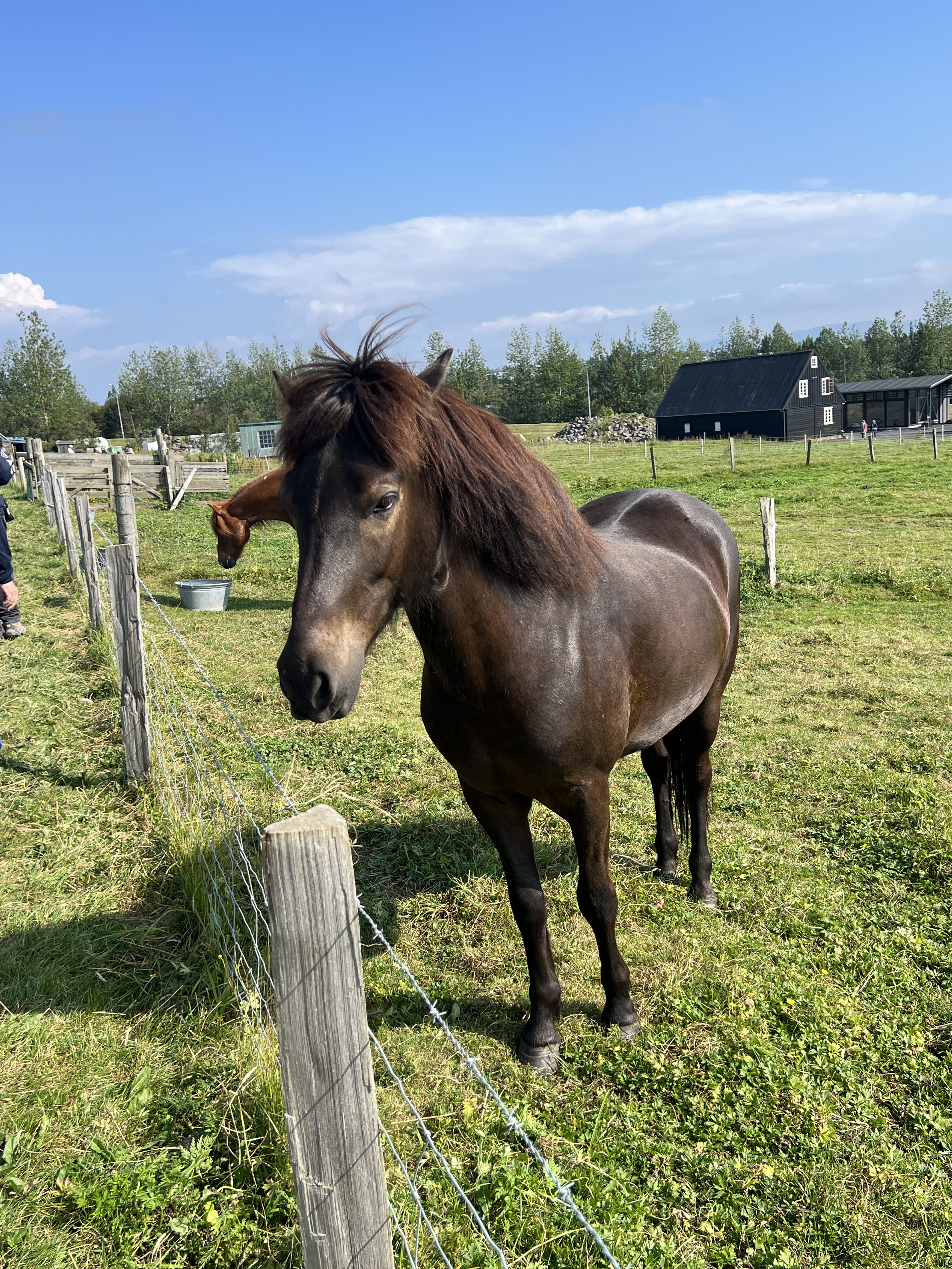
Then onto an open air museum where traditional Icelandic buildings have been moved for preservation in the face of the city’s expansion. It is the site of an historic farm area, with original turf river structures still in place. Interesting stop. The Icelandic horses very friendly!
Traditional building style.Icelandic horse.
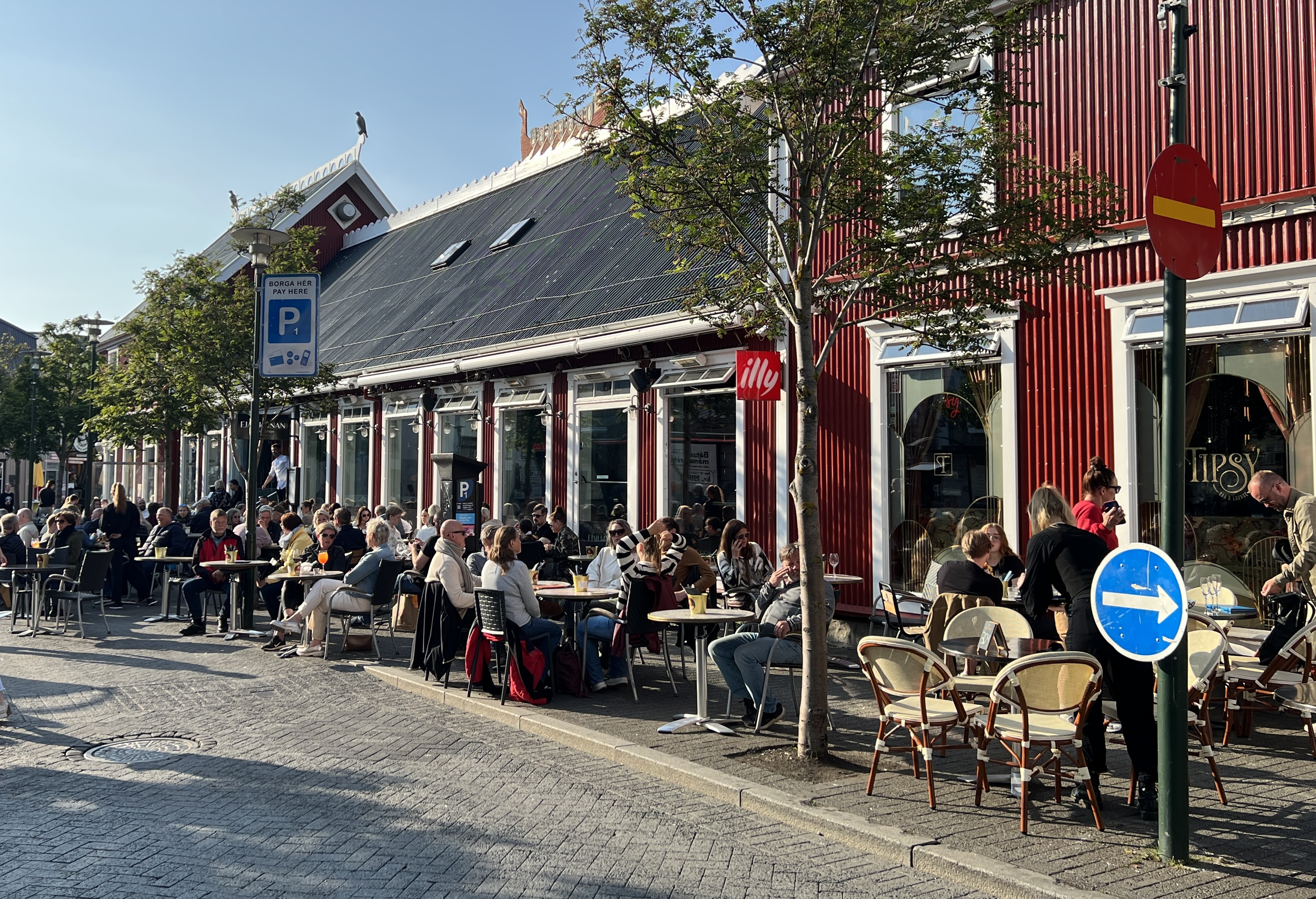
After a short time back on the ship we took the shuttle back into town for a wander and some dinner. There are quite a few tourists about due to three cruise ships bring in port.
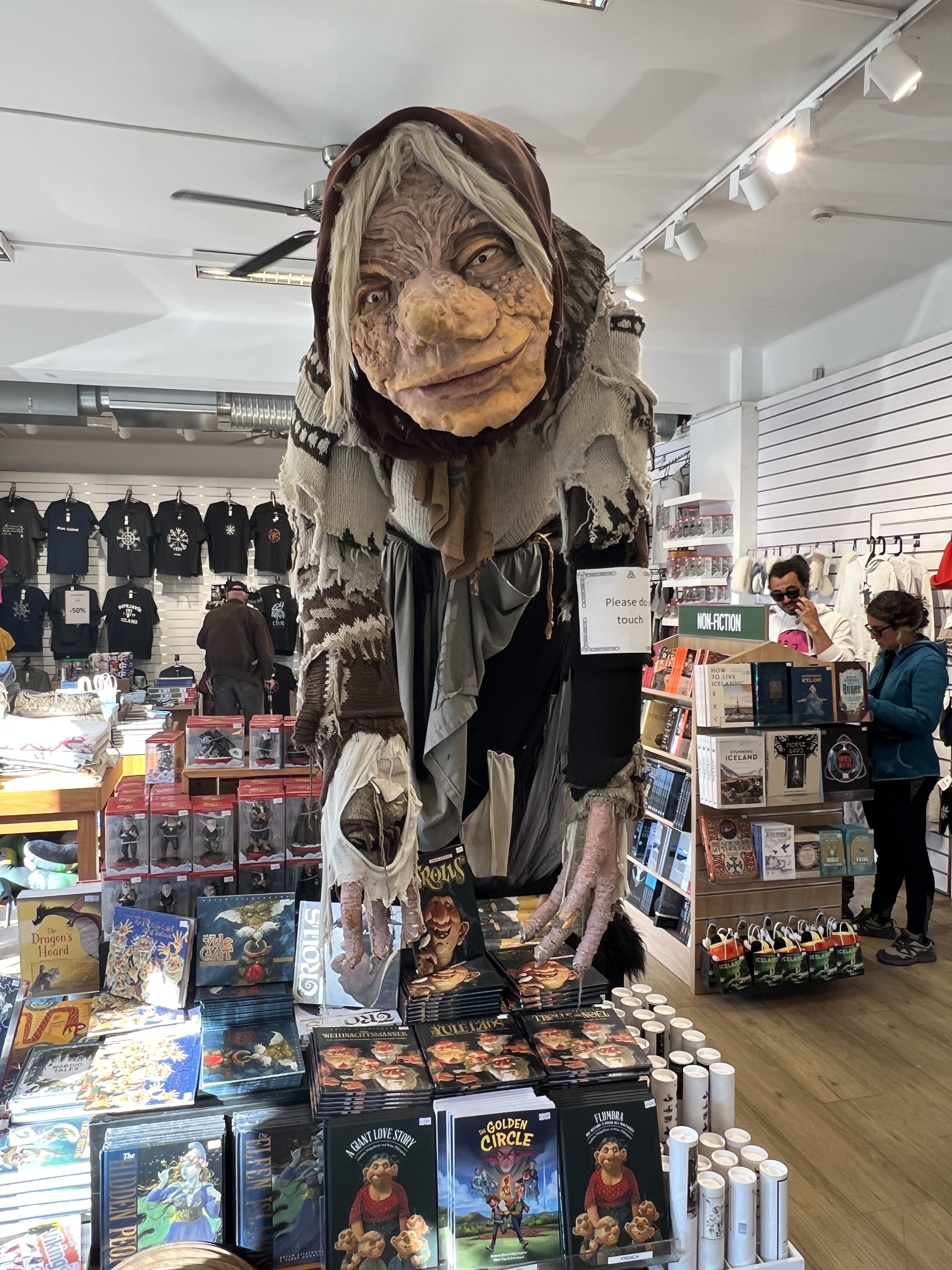
Reykjavik street.Rather large troll kept an eye out in this shop.Polar bear and puffin mural underway in Reykjavik.
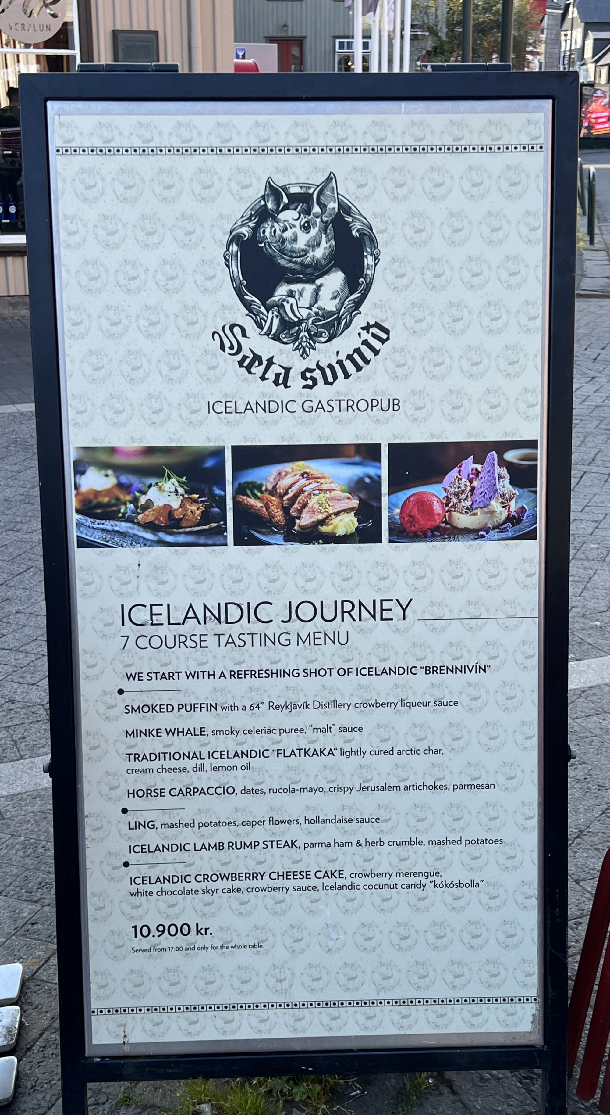
Souvenir shops selling the usual array of stuff, trolls are an ever present temptation for the shelf back home. Resisted. One particular restaurant was a great temptation for those wanting a traditional tasting plate of Icelandic tit bits.
Great menu, a taste of everything Icelandic!
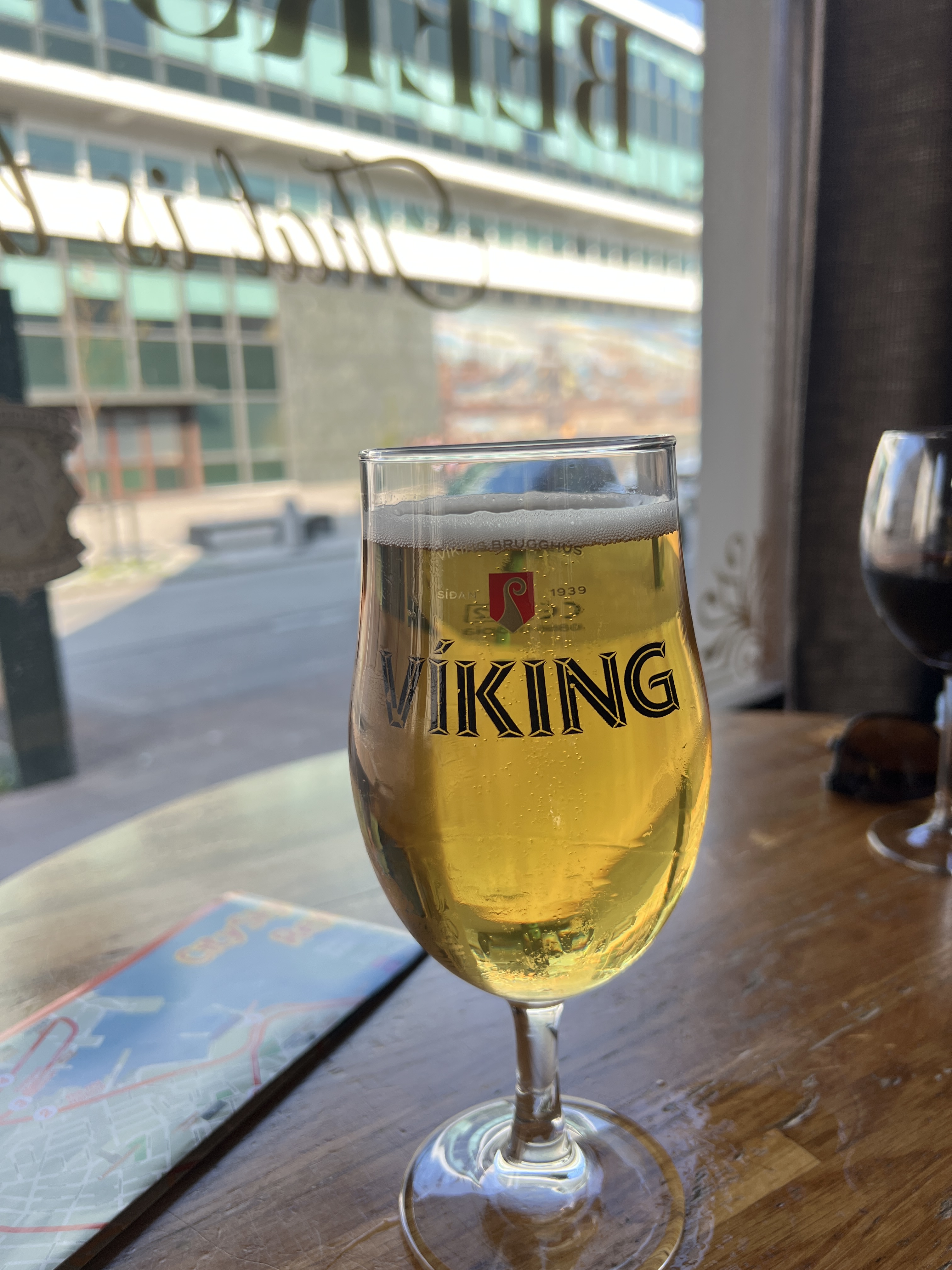
Homealone was not particularly keen, the menu shows how to use what is available. Contrasts with back home where we have crocodile, camel, kangaroo, goanna etc ! So we settle for the dependable old fish n chips, with a local Viking ale.
Cheers! Got to make sure this doesn’t break or go missing in transit back home!
Allthego was able to negotiate with the waitress to acquire a Viking ale glass to join the others in the cupboard back home.
After dinner and farewells to those Nordic heroes, Eric the Red and Leif Eriksson , it was back to the ship around 8pm to settle in for the night. We are off now for two sea days bound for Greenland.
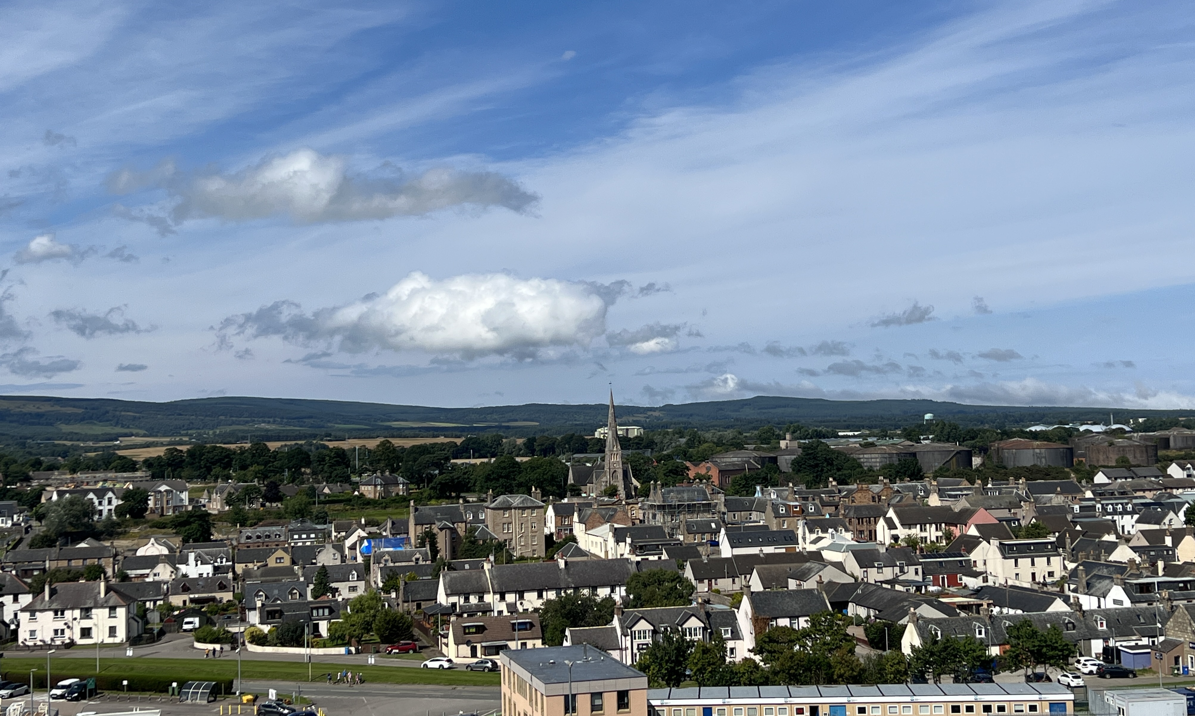
We have had a day at sea after leaving Dover and are now docked at Invergorden, about forty minutes from Inverness by the local train. Invergorden is an old port town and used to be a base for the Royal Navy’s fleet until the mid 1950s, the old oil tanks sit in a line on the hill above the town. North Sea oil came to the rescue for the town as well as cruise ship tourism. Inverness, the Scottish Highlands and Loch Ness are just down the road from the port.
Invergorden, with the line of disused oil tanks on the hill behind the town at right.
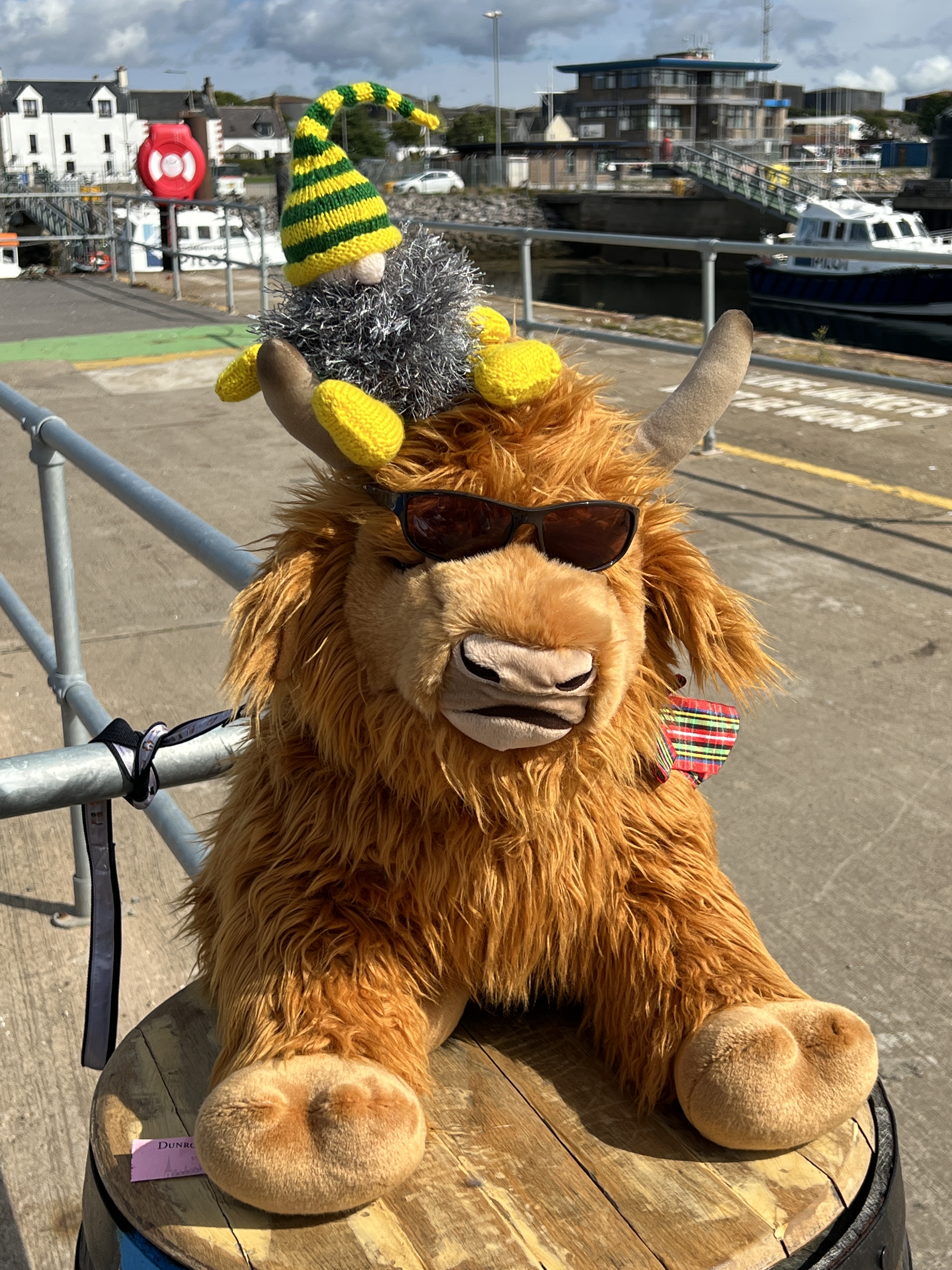
We decided to stay in Invergorden rather than going further afield. Slobro was a bit disappointed that he wouldn’t see Nessie and jealous that we had seen the loch creature when we last here. No need to see it twice. Slobro had to accept a cool Highland Cow encounter instead.
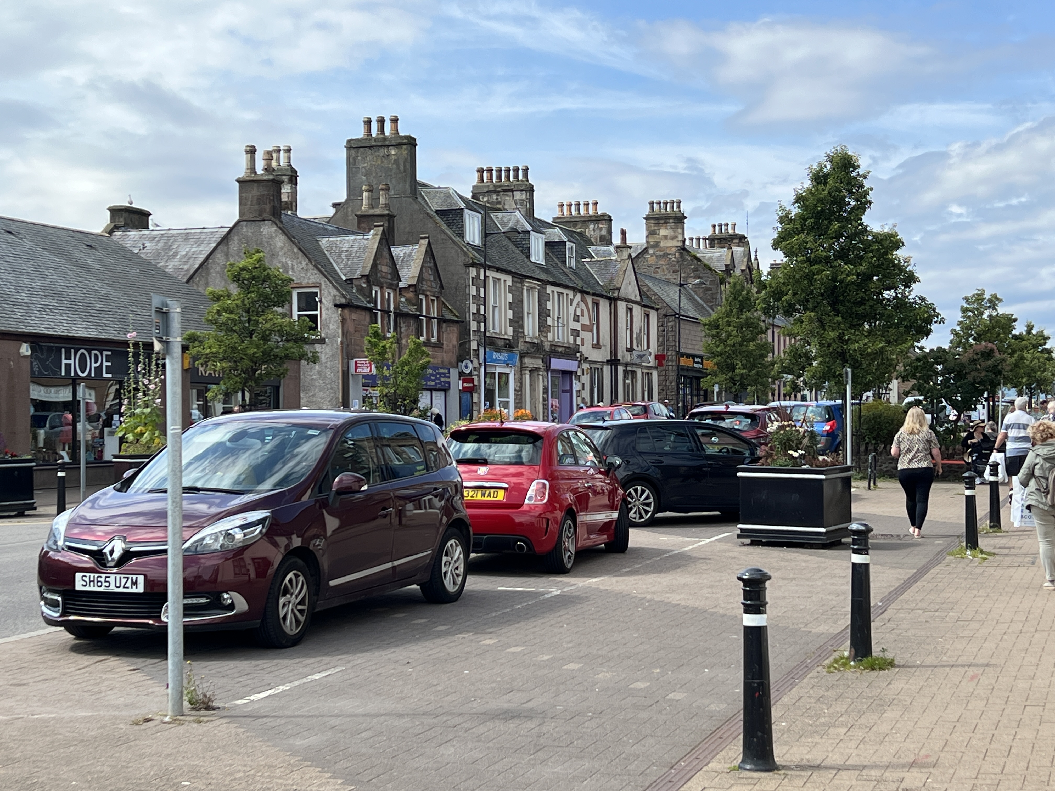
Slobro liked this cool Highland Cow at the cruise terminal.High Street Invergorden.
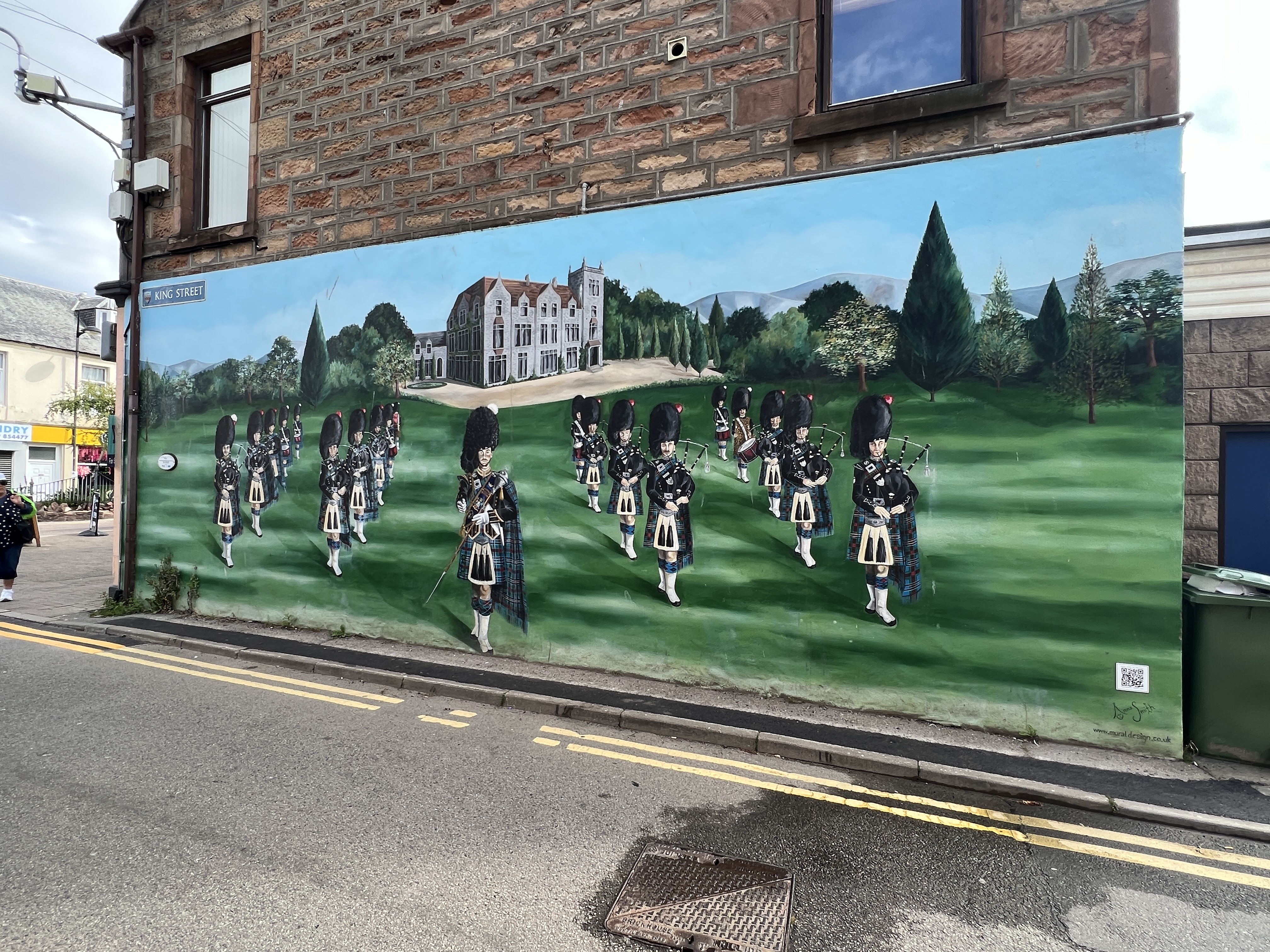
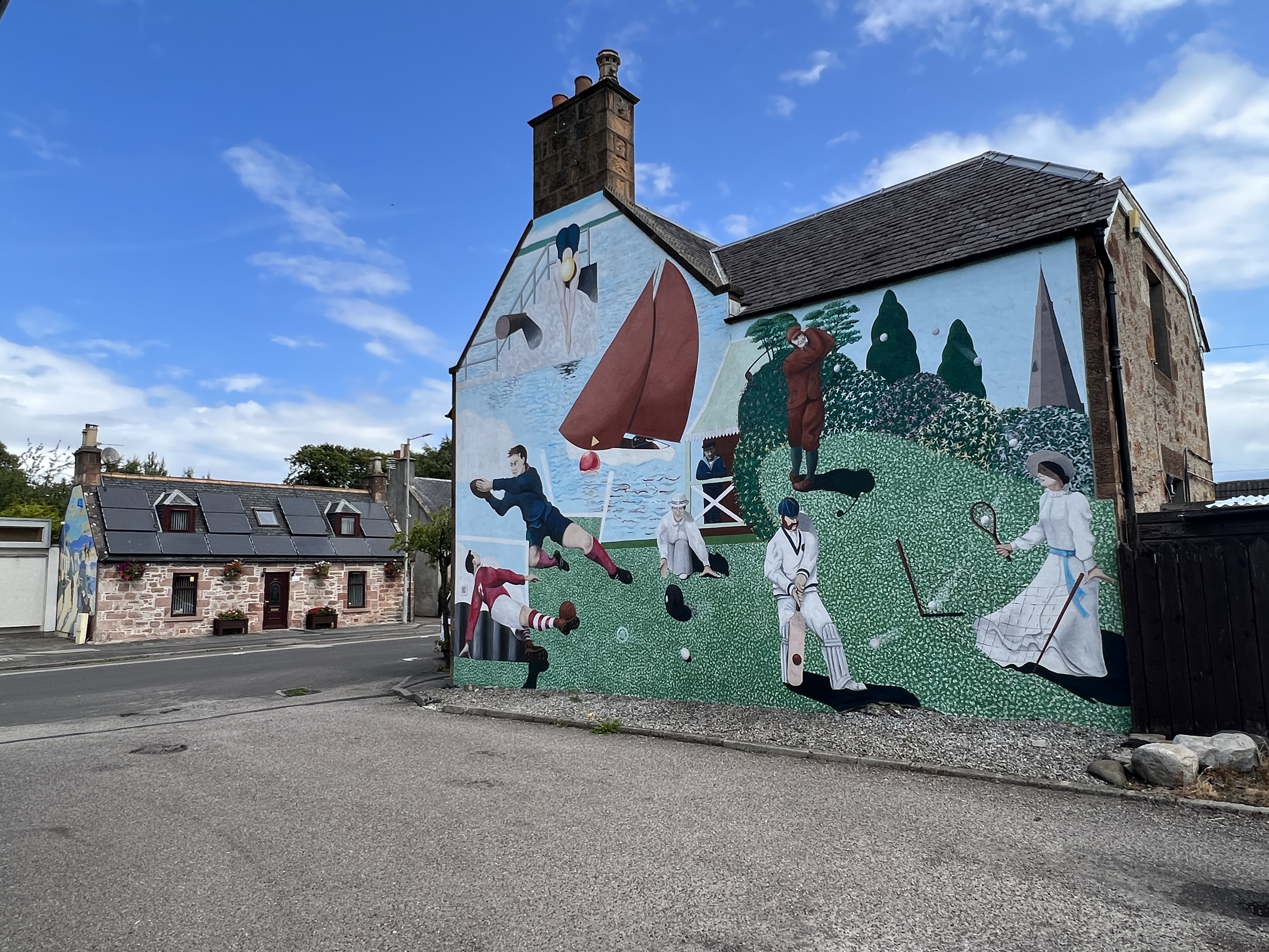
We again had a nice sunny day to wander around the town for a few hours looking at the murals recounting the past. Allthego and Homealone like murals. The only thing though is that they tend to dwell on the past glories of places. Is it ‘old times’ for ‘old memories’. Maybe it would be good to have futuristic murals as well?
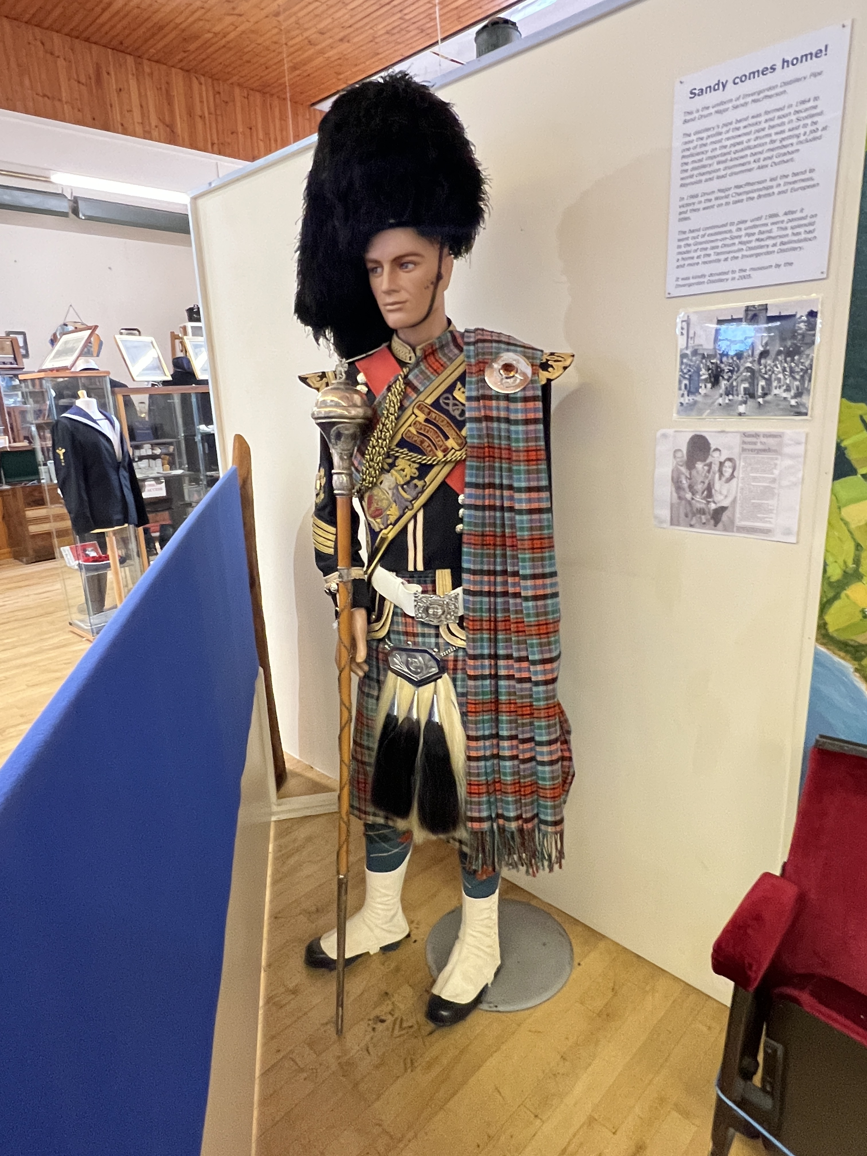
The local museum also had the usual array of things from the past. The local distillery’s former drum major uniform was rather good.
Invergorden Distillery Pipe Band Drum Major Sandy McPherson, the band was sadly disbanded in 1986.
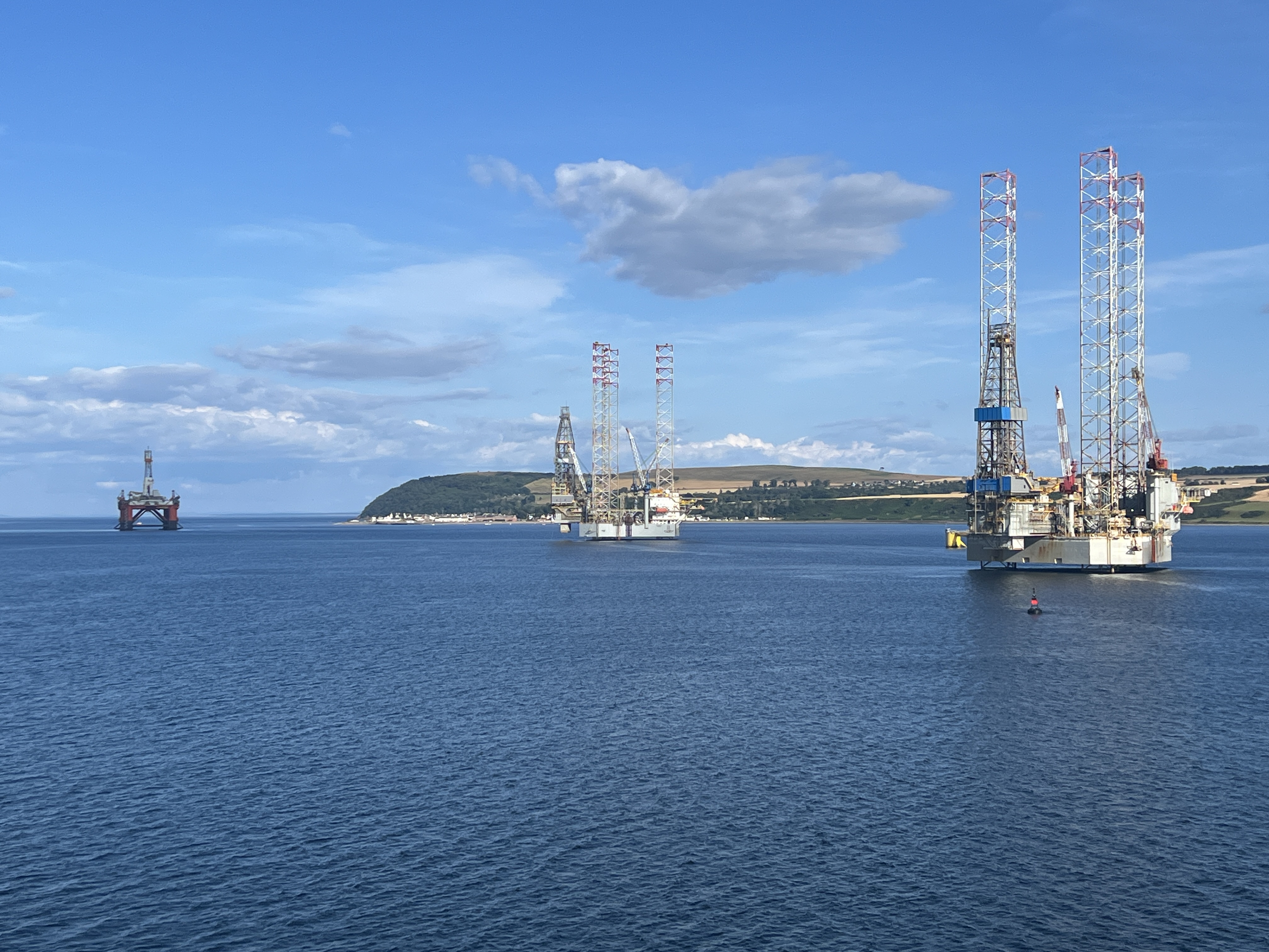
Back on board the ship we sailed away down the port past some oil rigs and out into the North Sea headed for the Shetlands and the port of Lerwick. Some good views of the town and highlands as we left.
Drilling rigs we think ‘parked’ in the harbour.
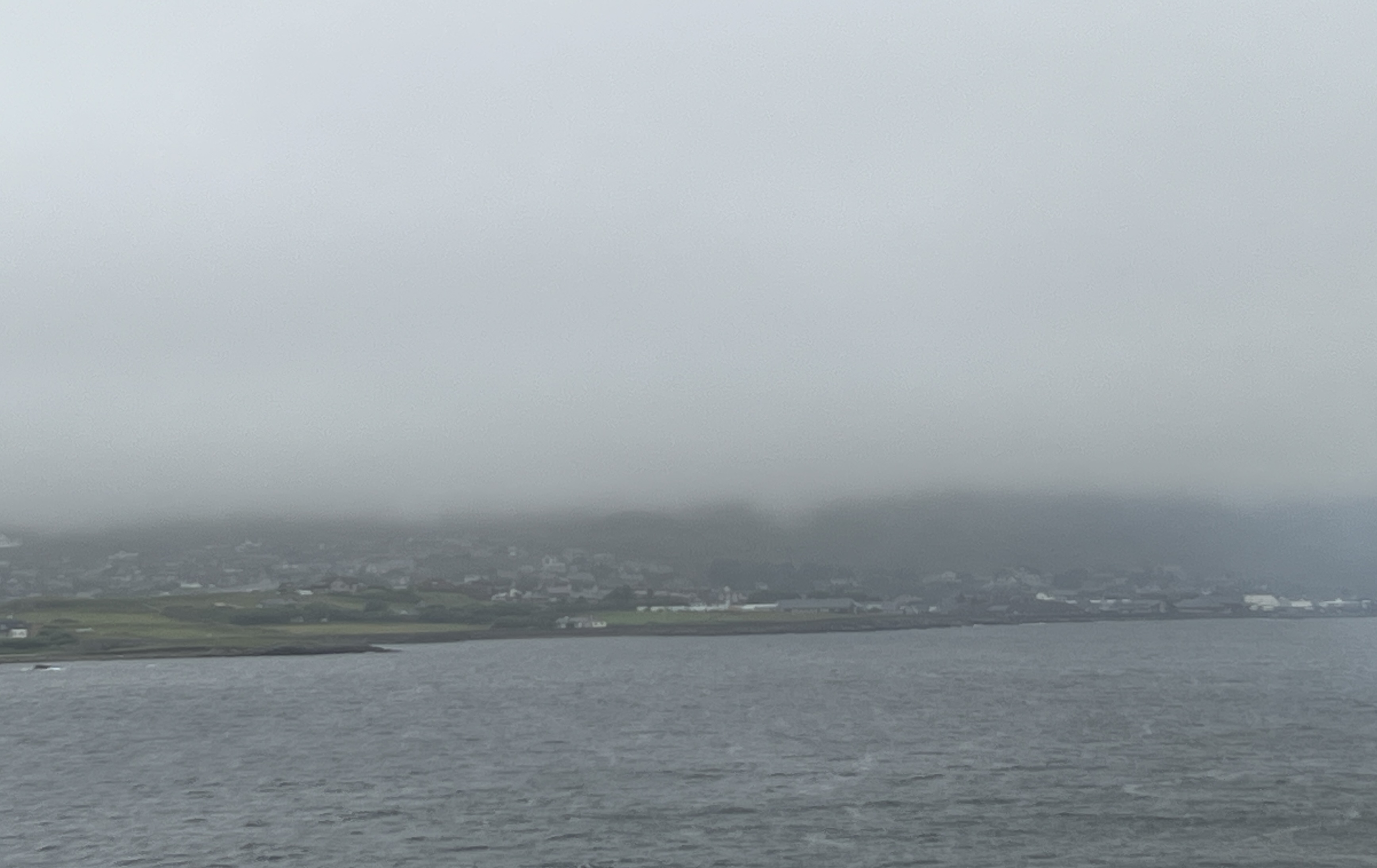
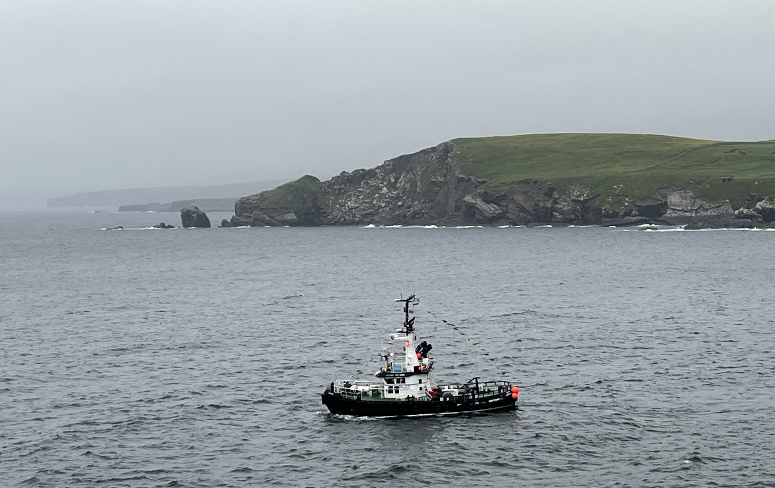
Overnight the weather turned rather foul, no rain but fog and some strong winds. Arrived off Lerwick but the ship was unable to get into the harbour, we were going to use shuttles to get to shore. Too dangerous, so unfortunately the Shetlands had to be abandoned and we departed for a day at sea and set off for Iceland.
Lerwick through the fog
We have been on the Shetlands before so it wasn’t a big blow, some onboard though were very disappointed but accepting of the decision. We have now started stage 3 of the journey, from Dover to New York.
The course to Iceland was to take us around the east of the Shetland and then north west over the top of the Faroe Islands out into the deep North Sea.
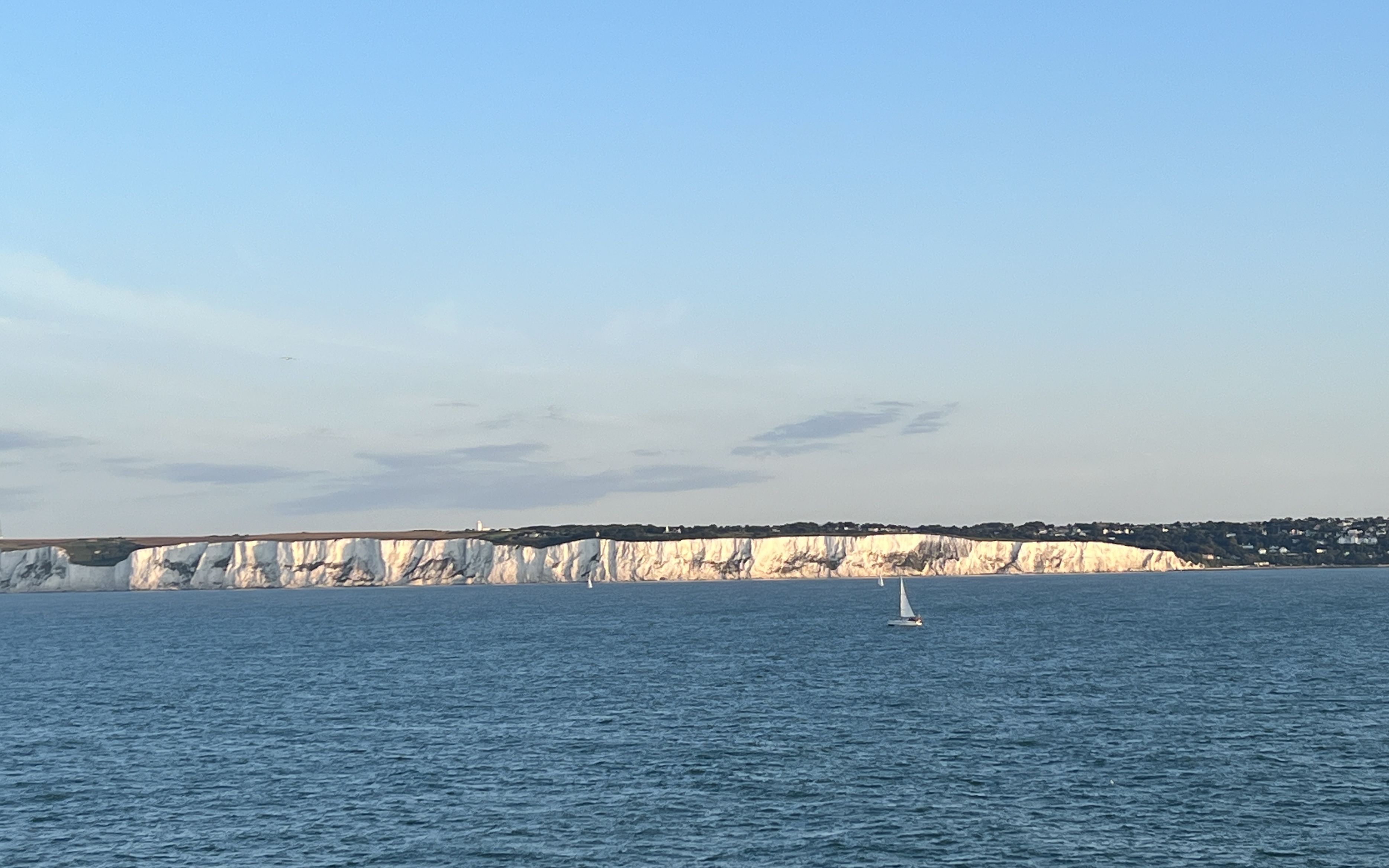
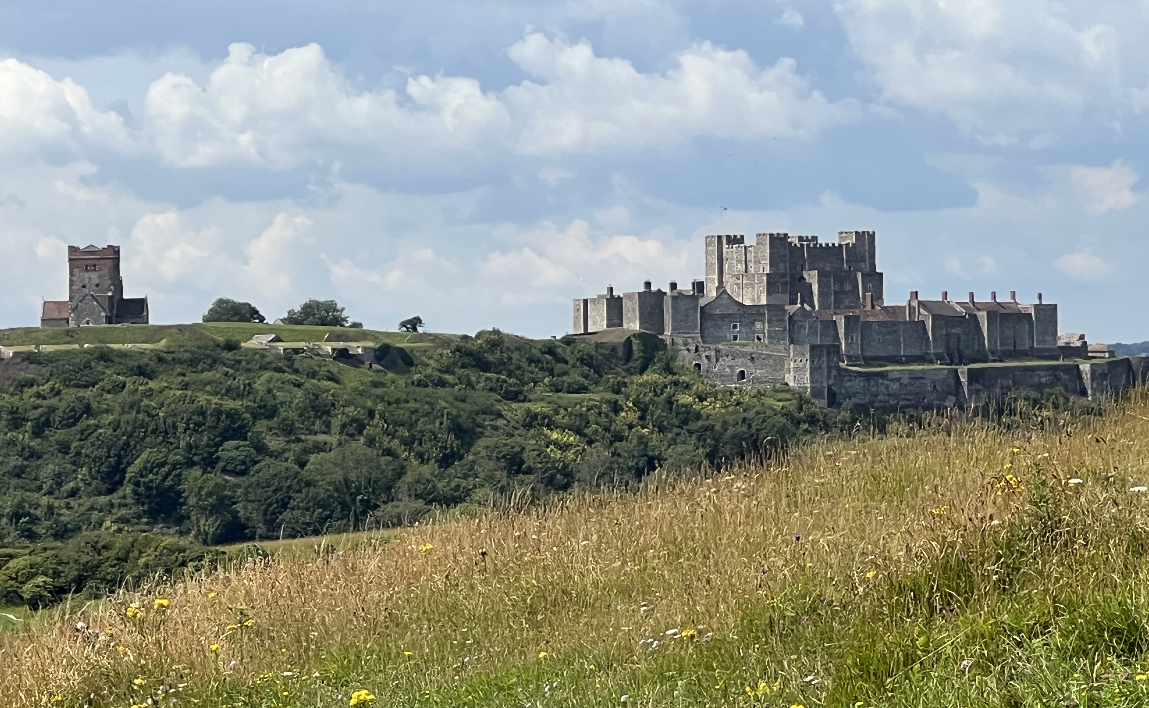
Dover is referred to as the ‘Lock & Key’ of England. The town is the gateway to the Continent and is strategically located to guard the English Channel from invasion efforts by others. Historically, the French and Spanish. It was also the place from which the English Kings launched their numerous forays on the Continent. Dover Castle was built here by Henry II in the 1180s.
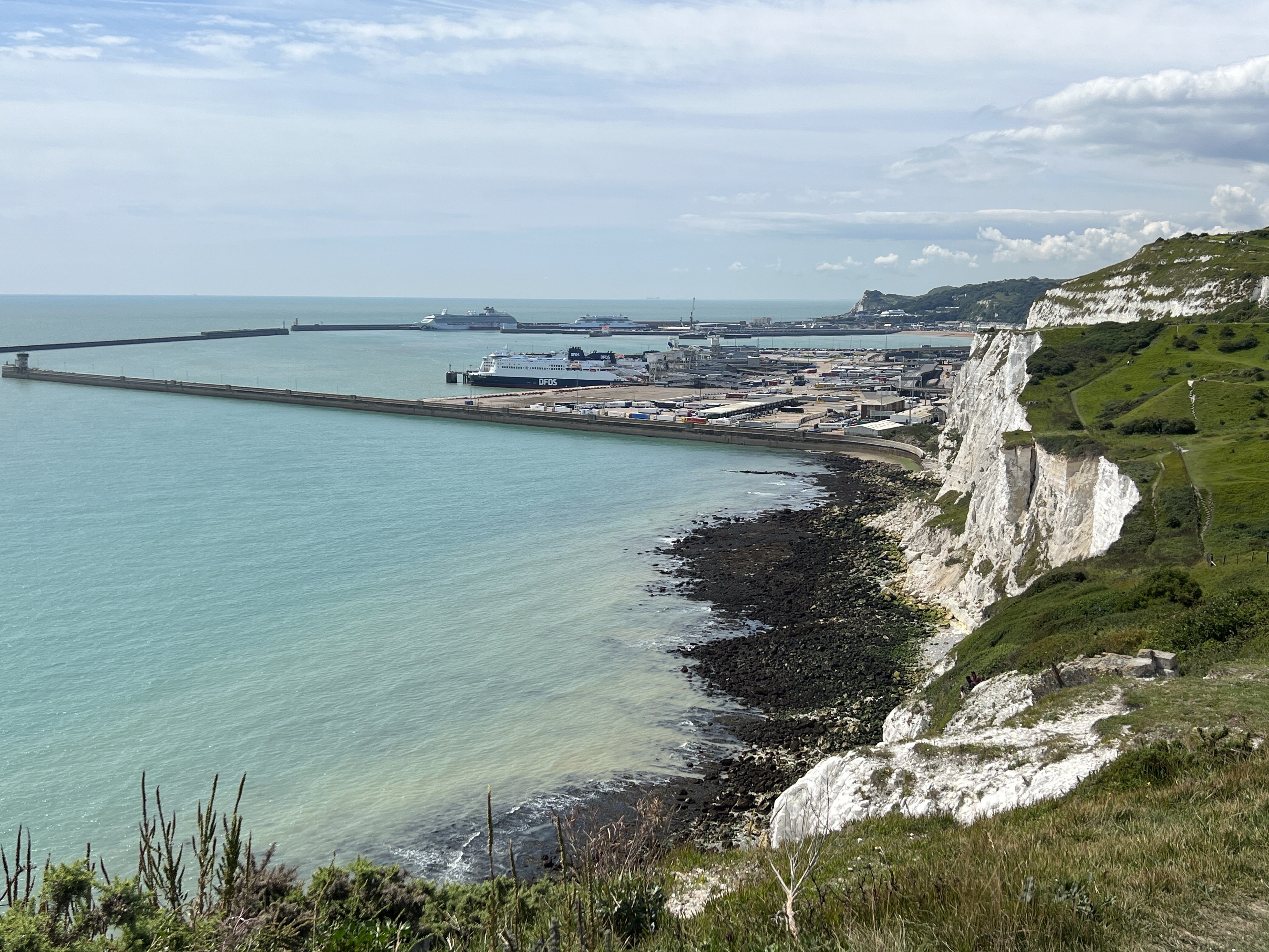
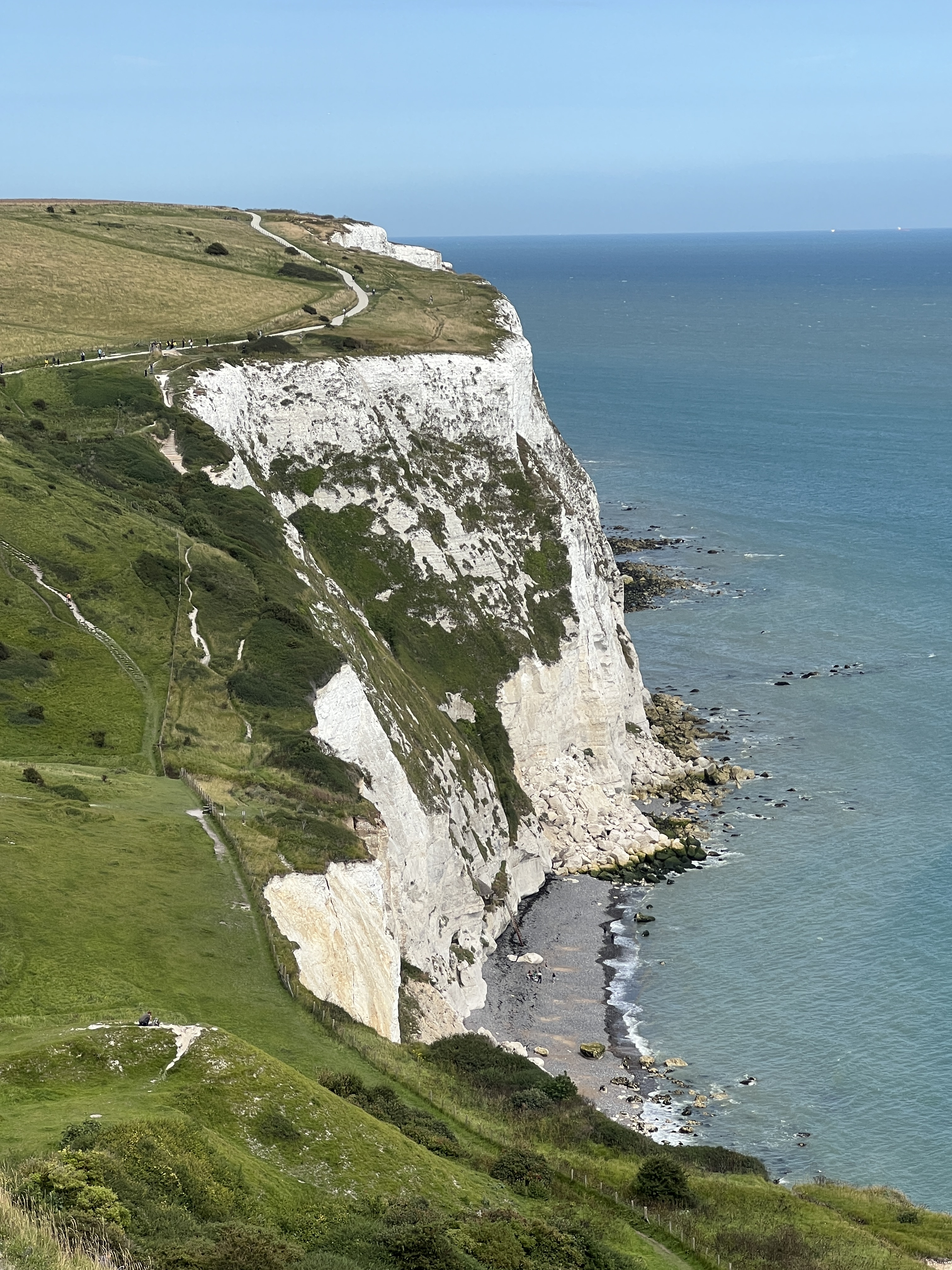
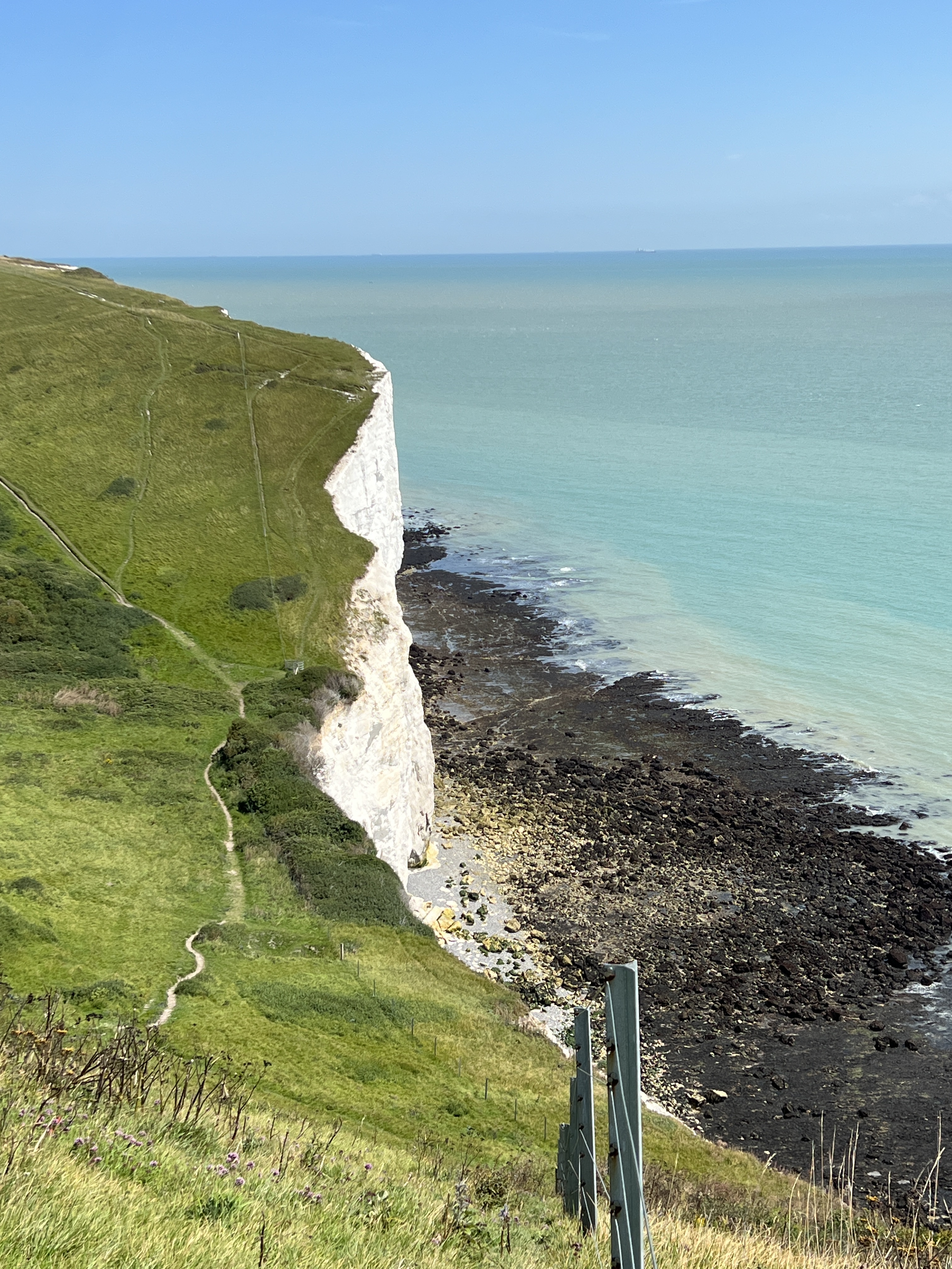
White CliffsThe lighthouse from the sea.
After coming around Lands End we had made our way up the English coast and came into Dover Port with the sun at our backs gleaming on the White Cliffs. Some small sailing vessels were out early in the Channel. Ferries were making their way in and out of the port.
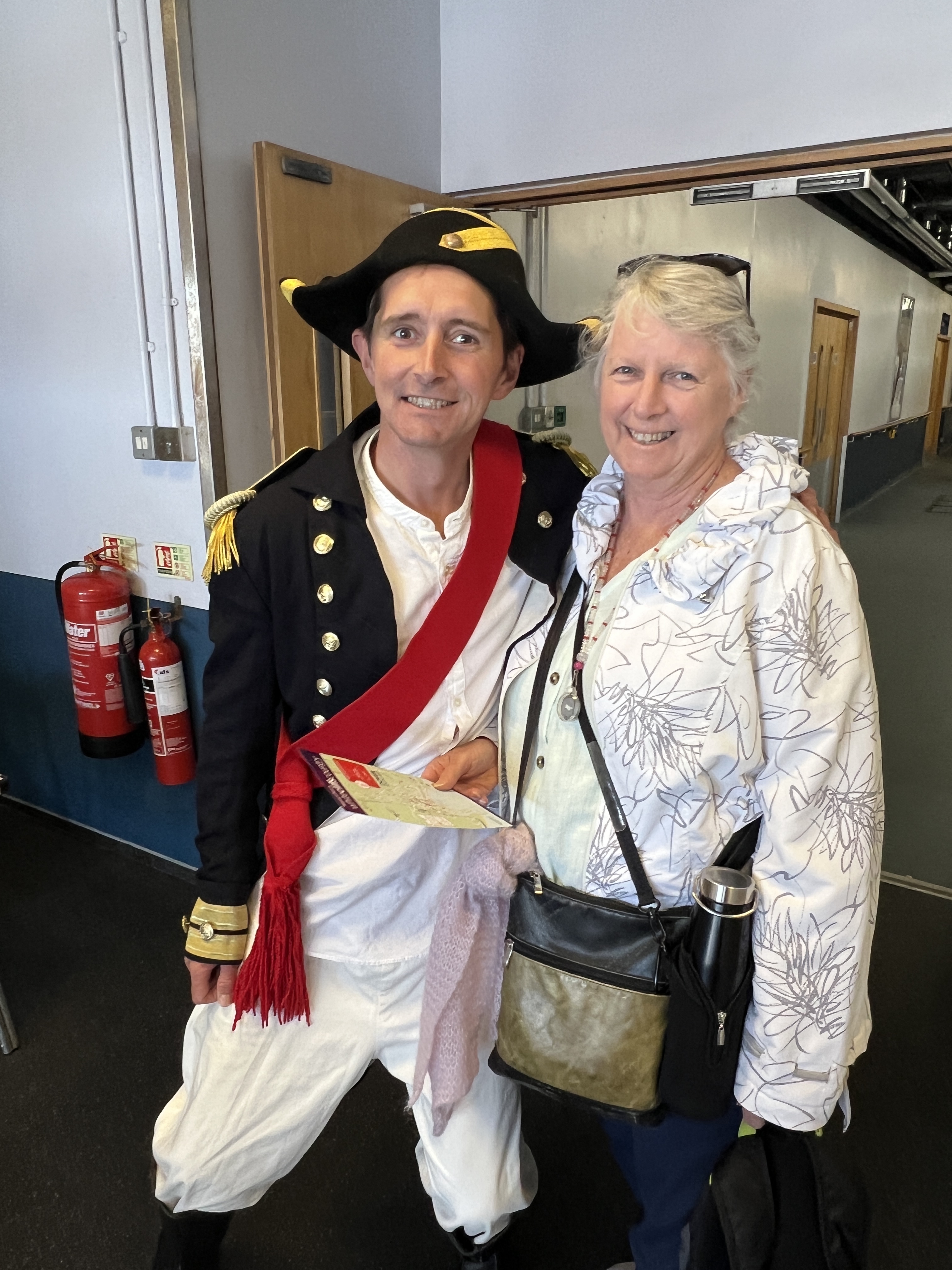
Homealone always likes a man in uniform, including a port greeter!Dover Castle
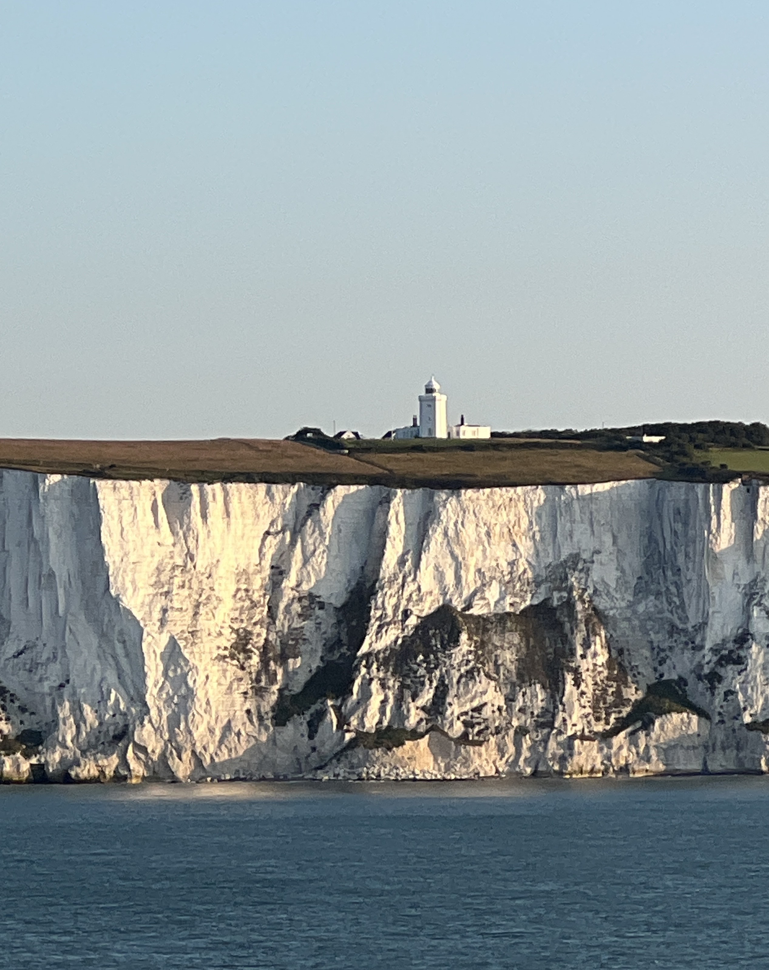
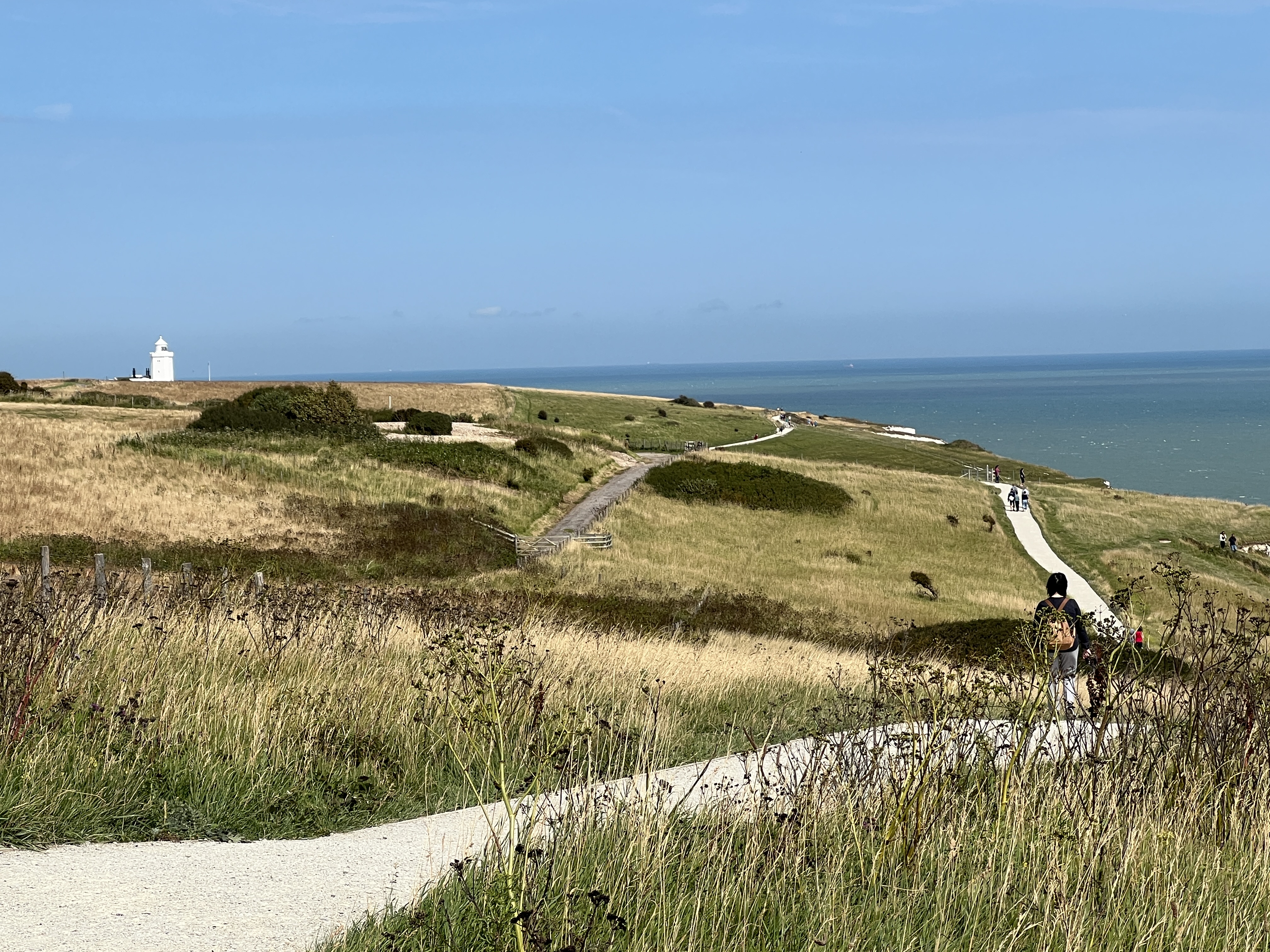
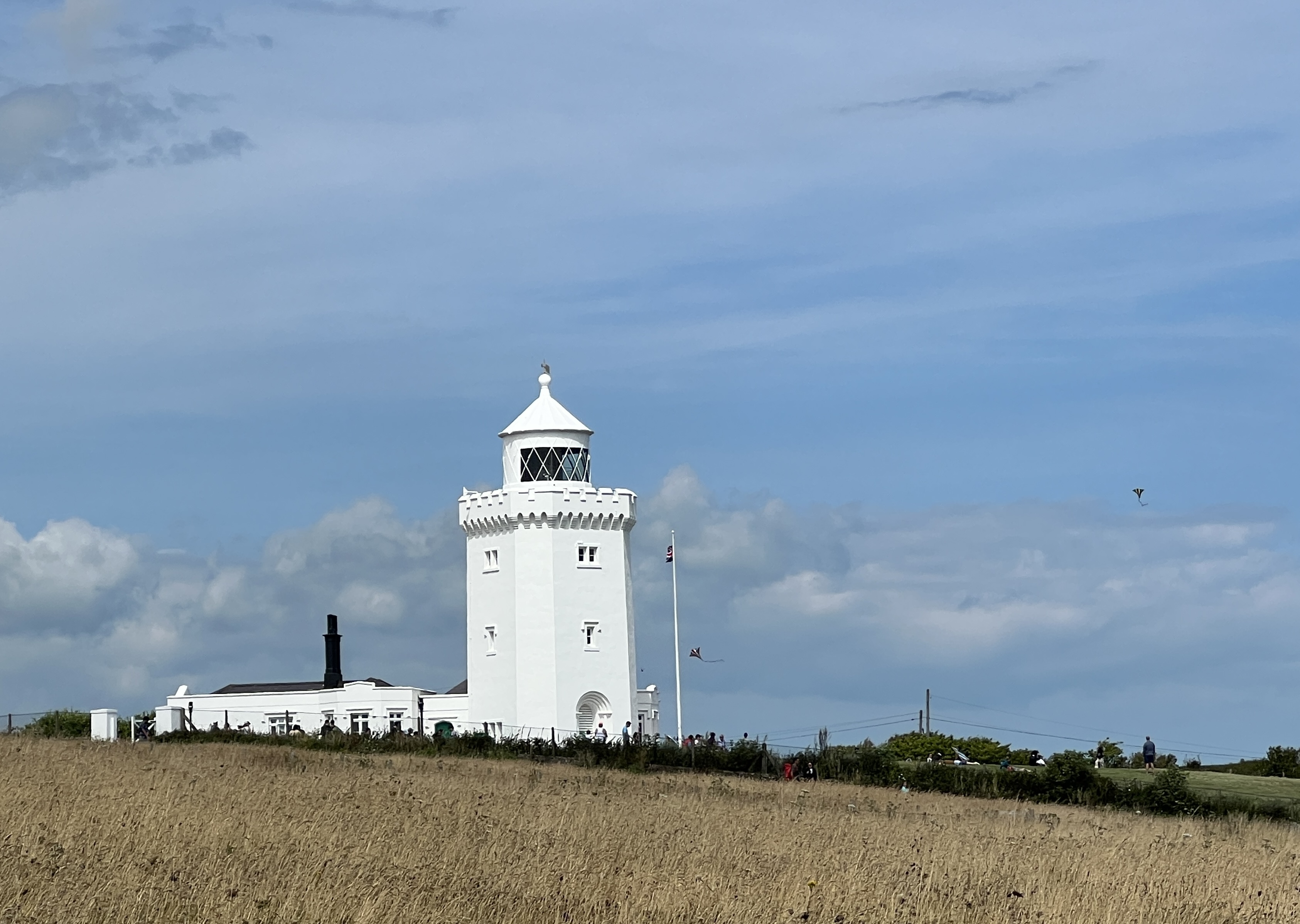
Many of our fellow travellers were making the trip to London for the day. We had decided to stay in Dover and tackle the White Cliffs walk out to the South Foreland Lighthouse. This disused 19th century icon sits gazing out across the Channel, popular spot with picnic tables, cafe in the lighthouse and National Trust outlet. There is a good view of the lighthouse coming into port.
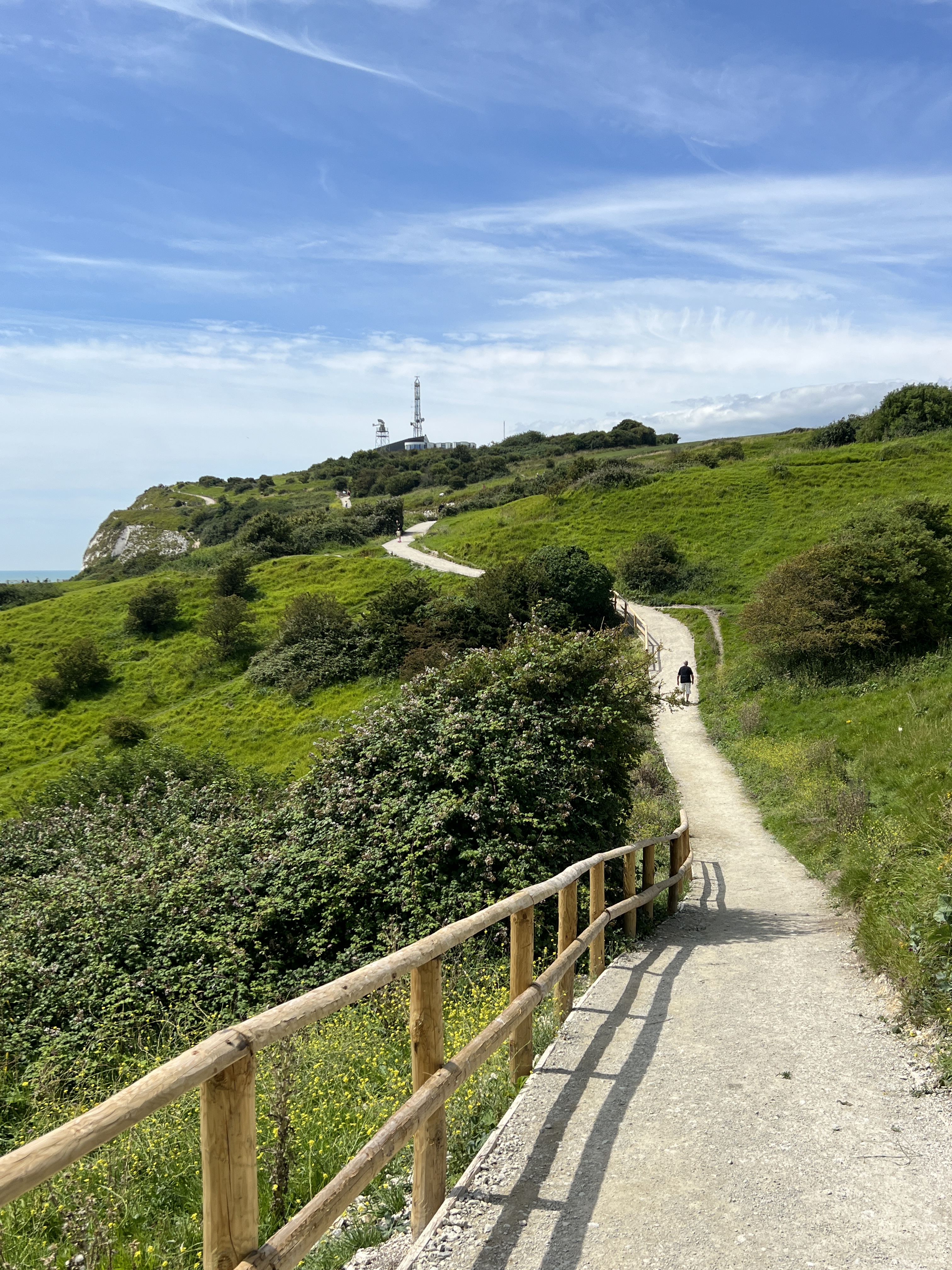
After getting off the ship we made our way into town by the shuttle bus service and then by taxi up the hill to the start of the walk. It is about a 10 km return walk to the lighthouse, the guide sheet says 50 minutes there and back.
The track is moderately flat in some places but does cross undulating country with a couple of stepped steepish sections. There is an old track much closer to the cliff line which we first started on, Homealone found this a bit uncomfortable so we reverted to the main pathway.
Looking back at Dover Port
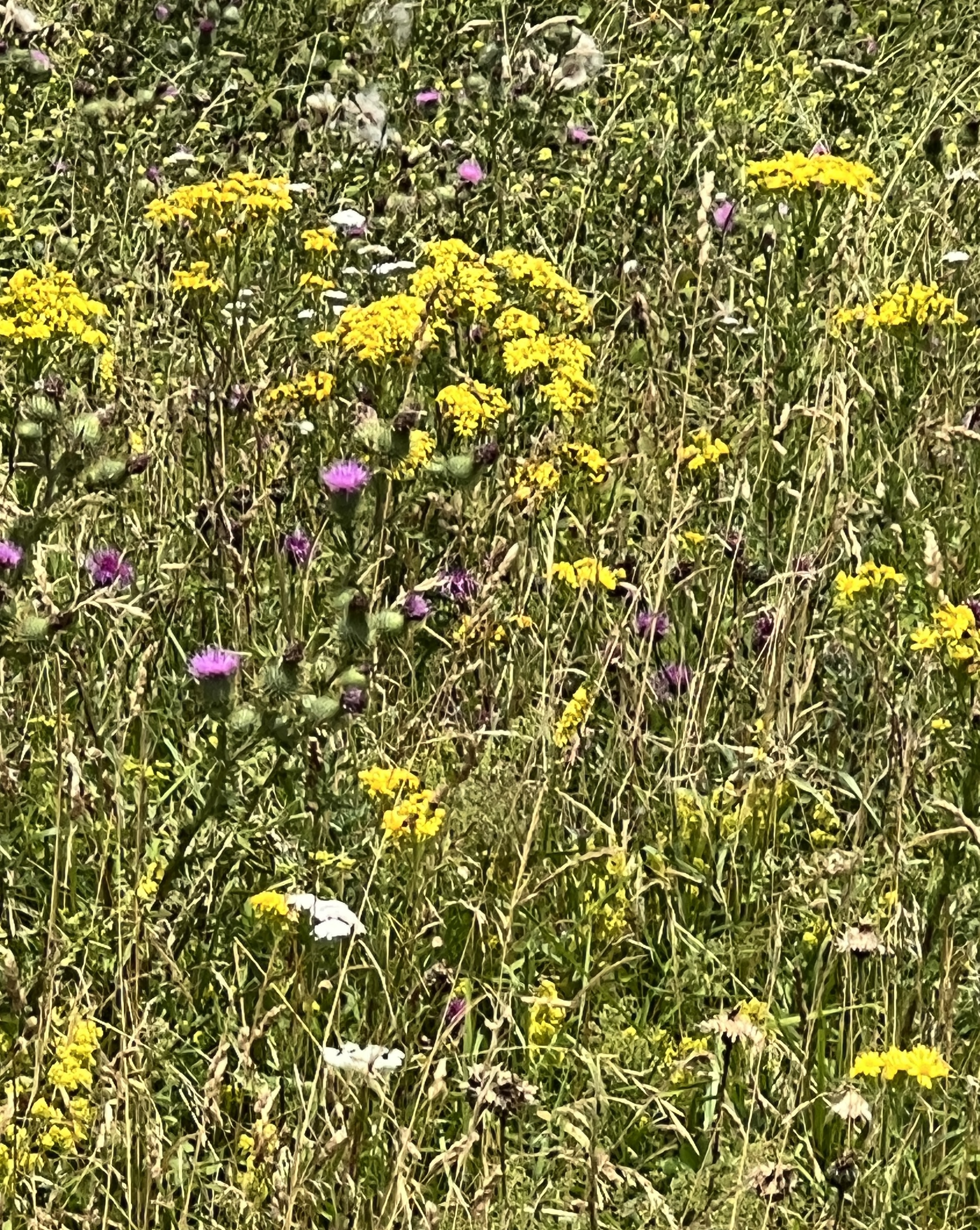
The track passes over former pasture areas which have been rehabilitated by the National Trust. The grassland now supports a great display of wildflowers, some weeds no doubt in the mix as well.
We also get great views of the cliff line. The French and Belgium coastlines are though a smudge on the horizon.
We had some sandwiches for lunch at the lighthouse cafe and put our feet up at a picnic table before starting back. The 50 minute walk took us a bit over 3 hours, counting the lunch stop of course!
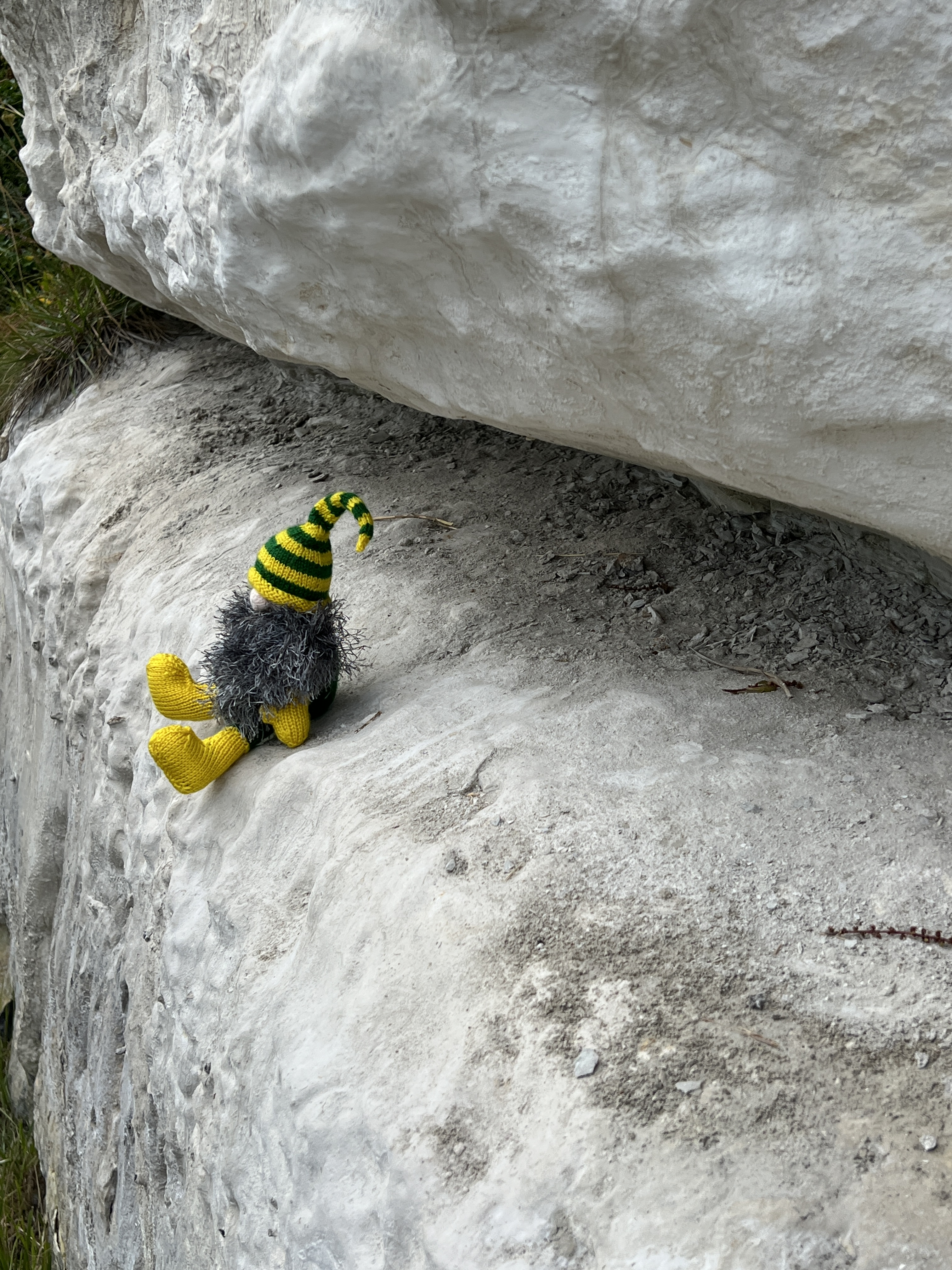
The way back.Slobro on a chalk cliff face.The way back to town.
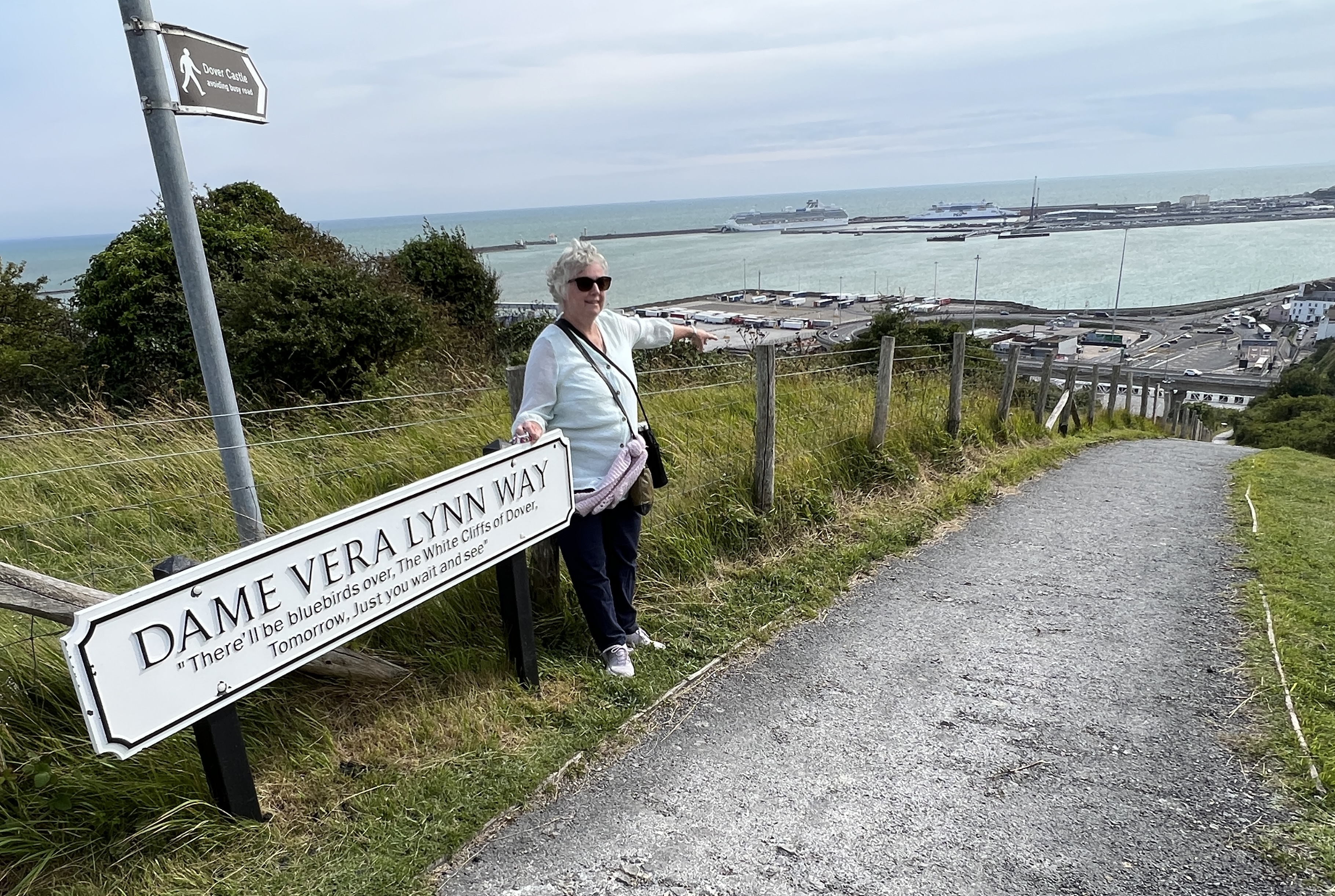
We headed back down to the town via the Dame Vera Lynn pathway, glad we didn’t walk up it! Many readers will have heard of her WWII patriotic song, The White Cliffs of Dover. It’s about Blue Birds returning to and flying over the White Cliffs, symbolising the return of peace after the end of the war.
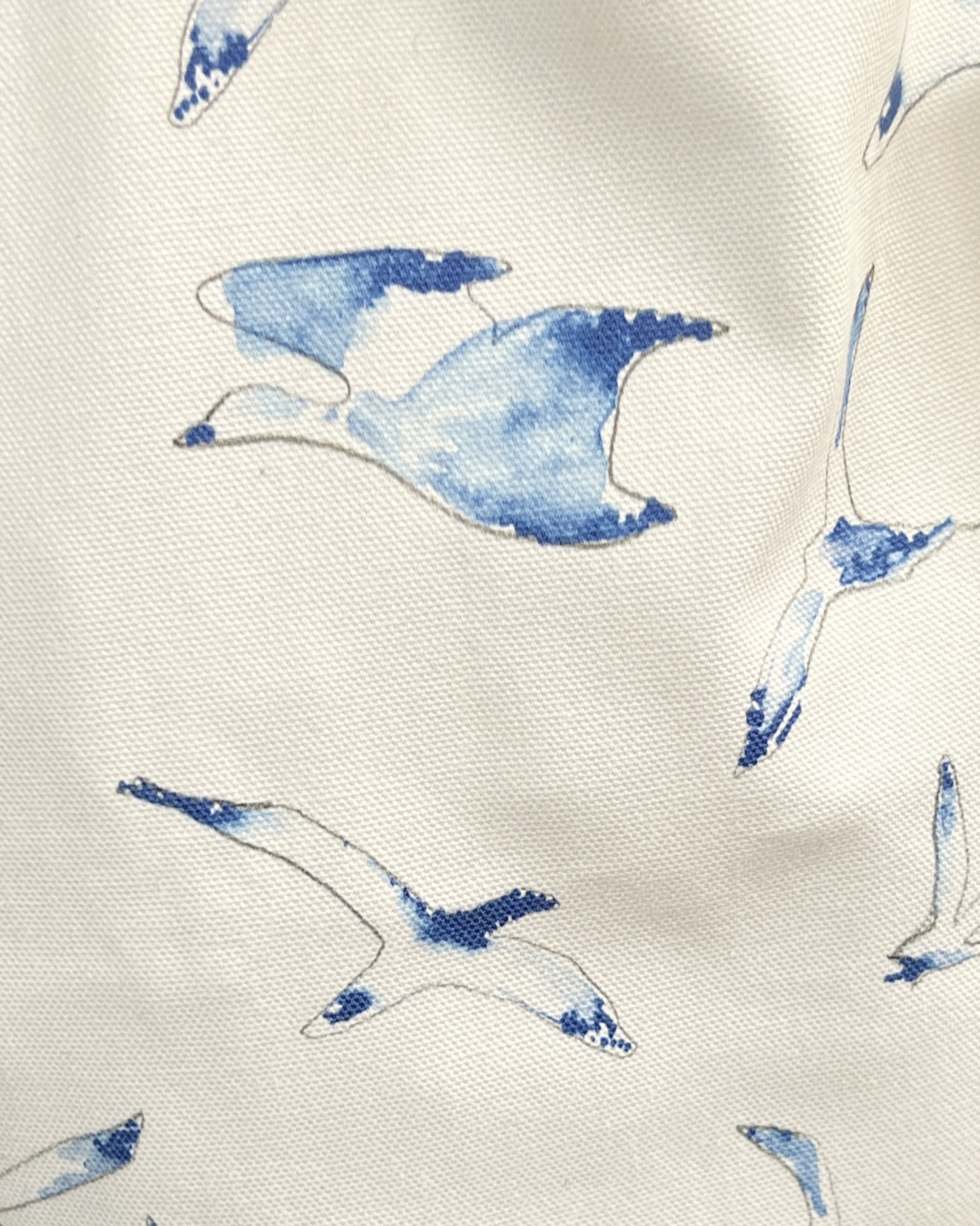
Blue Birds or Barn Swallows?
Allthego finds it a pleasant tune, but didn’t know it was written by two Americans who had never been to Dover! The writers also blundered by using Blue Birds which don’t inhabit England. Barn Swallows do and they have some blue on their wings. But Barn Swallows just doesn’t have the same ring to it! The National Trust also make a bit from it with their Blue Bird coffee mugs and tote bags, we couldn’t find any CDs of the good Dame’s rendition. Just have to get it on Utube.
Finally made it back to town after a stroll along the waterfront. Had some fish n chips for an early tea at the Elephant & Hind, overlooking Market Square, before taxing back to the ship.
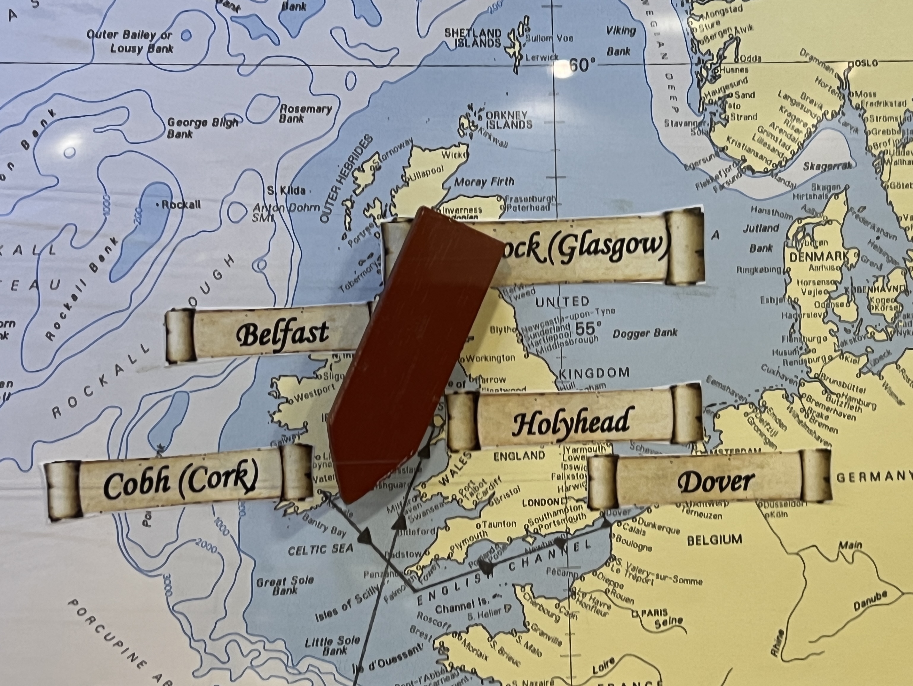
Dover is the end of the second leg of the cruise and we know head north up the Channel.
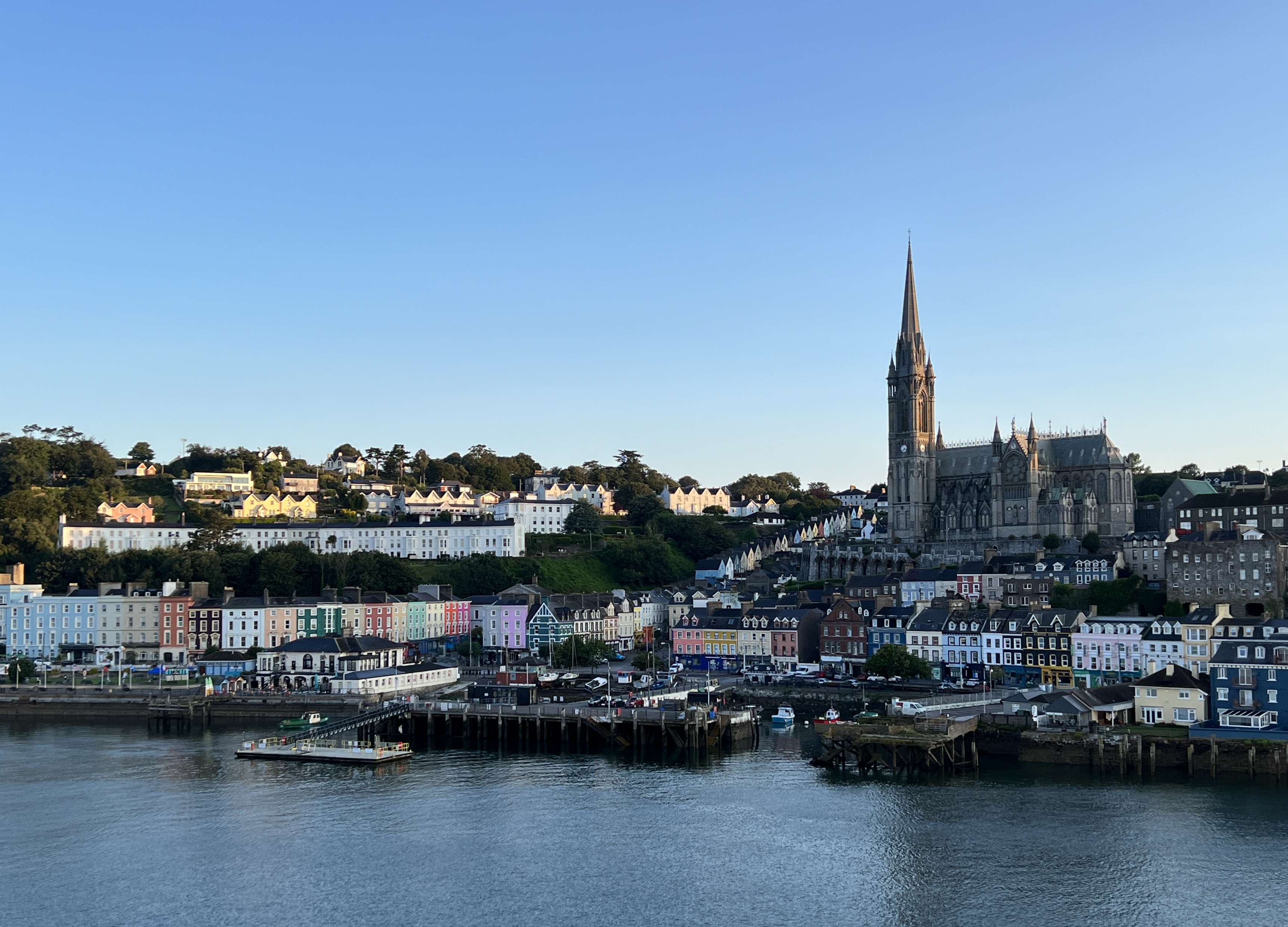
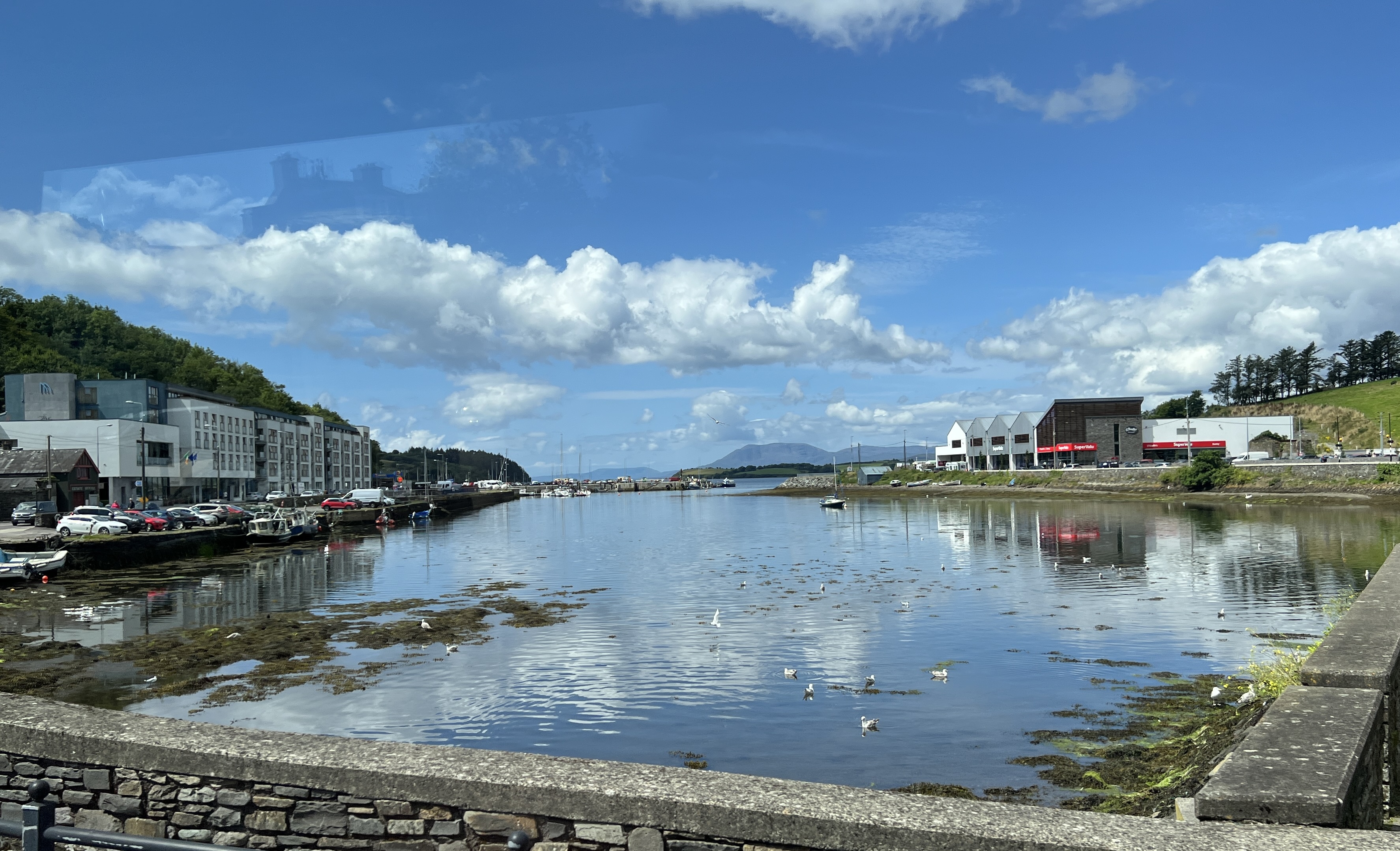
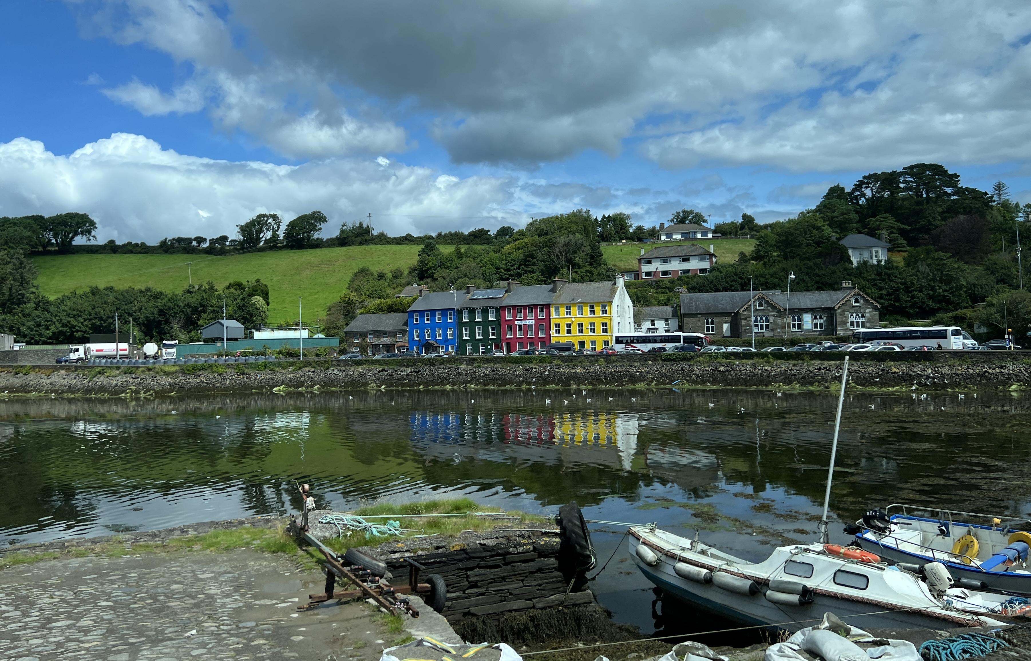
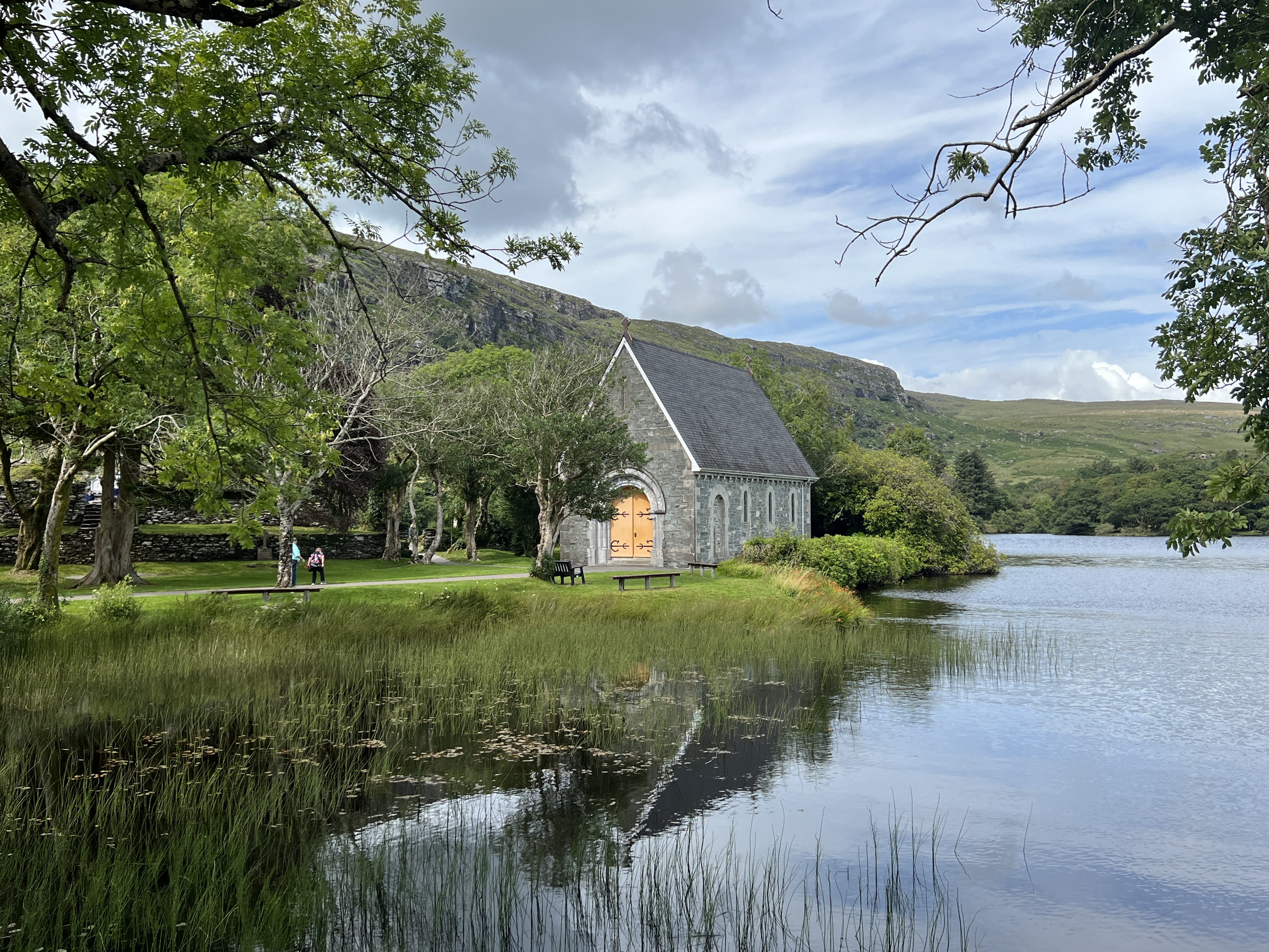
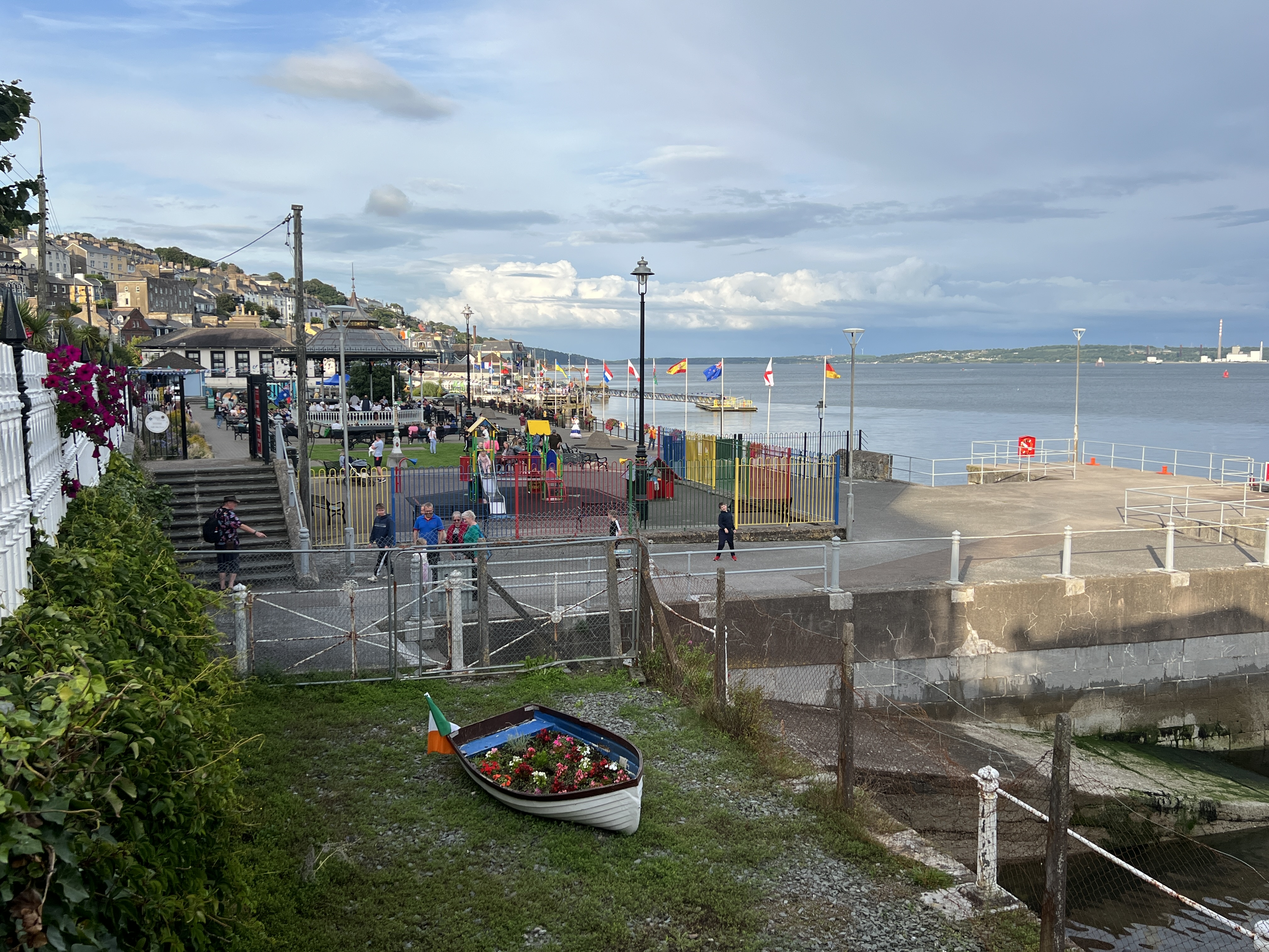
But it hasn’t always been that way here in Cobh, the port for Cork. We have come to the end of our jig around the Irish Sea at Cobh in Ireland.
Jig around the Irish SeaEarly morning view of Cobh waterfront.
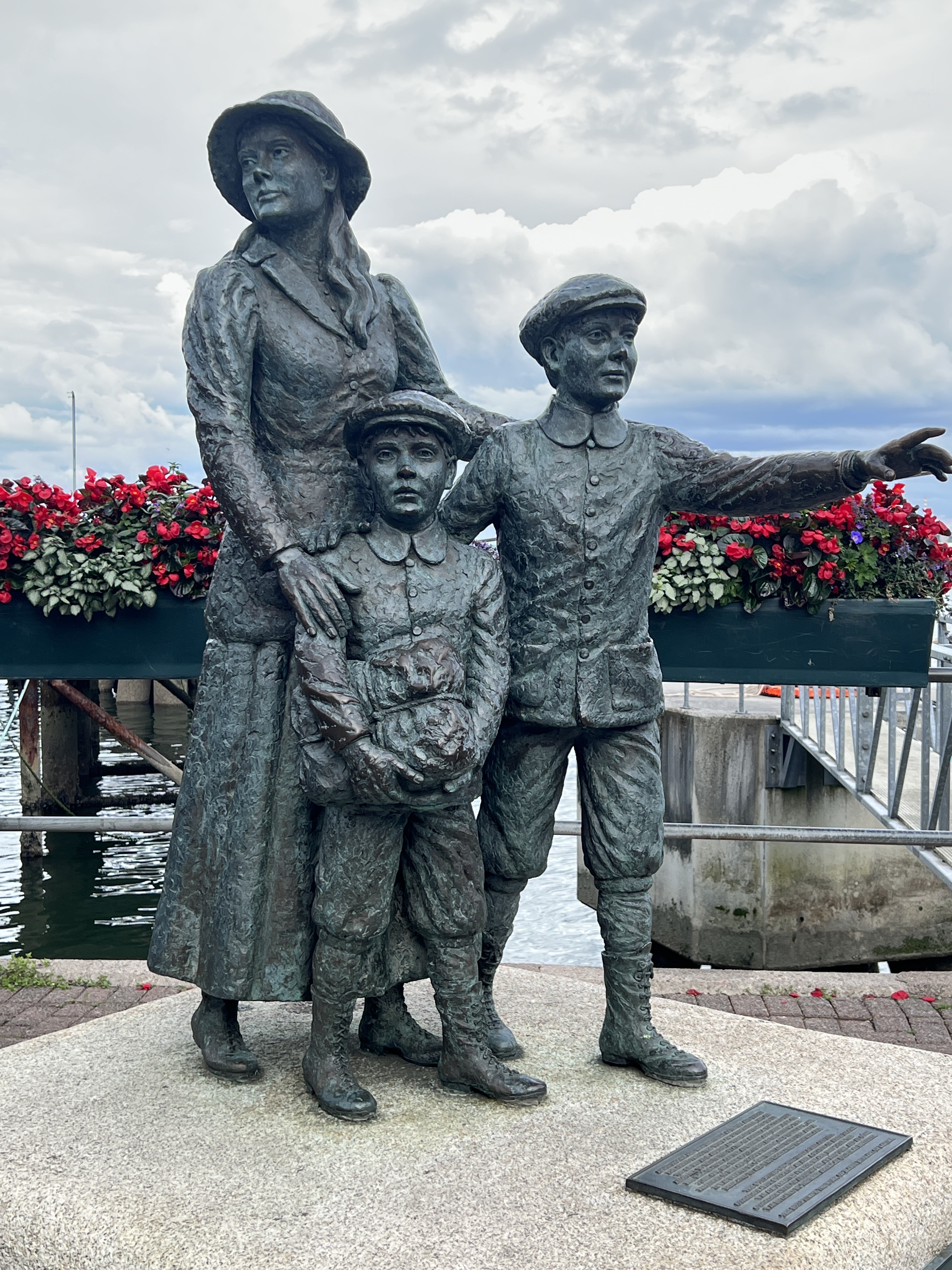
For much of the nineteenth century the Irish were under oppressive colonial rule by the English. Forty thousand Irish convicts left Ireland through the port here at Cobh bound for the penal colonies in Australia. During the potato famine and its long aftermath several million Irish left for the US and Australia as free but very impoverished migrants.
Annie Moore and her two brothers leaving Cobh in 1891 for New York. Their parents were already there, she was seventeen. Hers is quite a life story to Google!
Today things seem much happier in Cobh, although our guide on our side trip into the west Cork countryside is pretty intense about the English!
The side trip took us down the green coastal countryside to Bantry Bay and then in a loop back to Cobh.
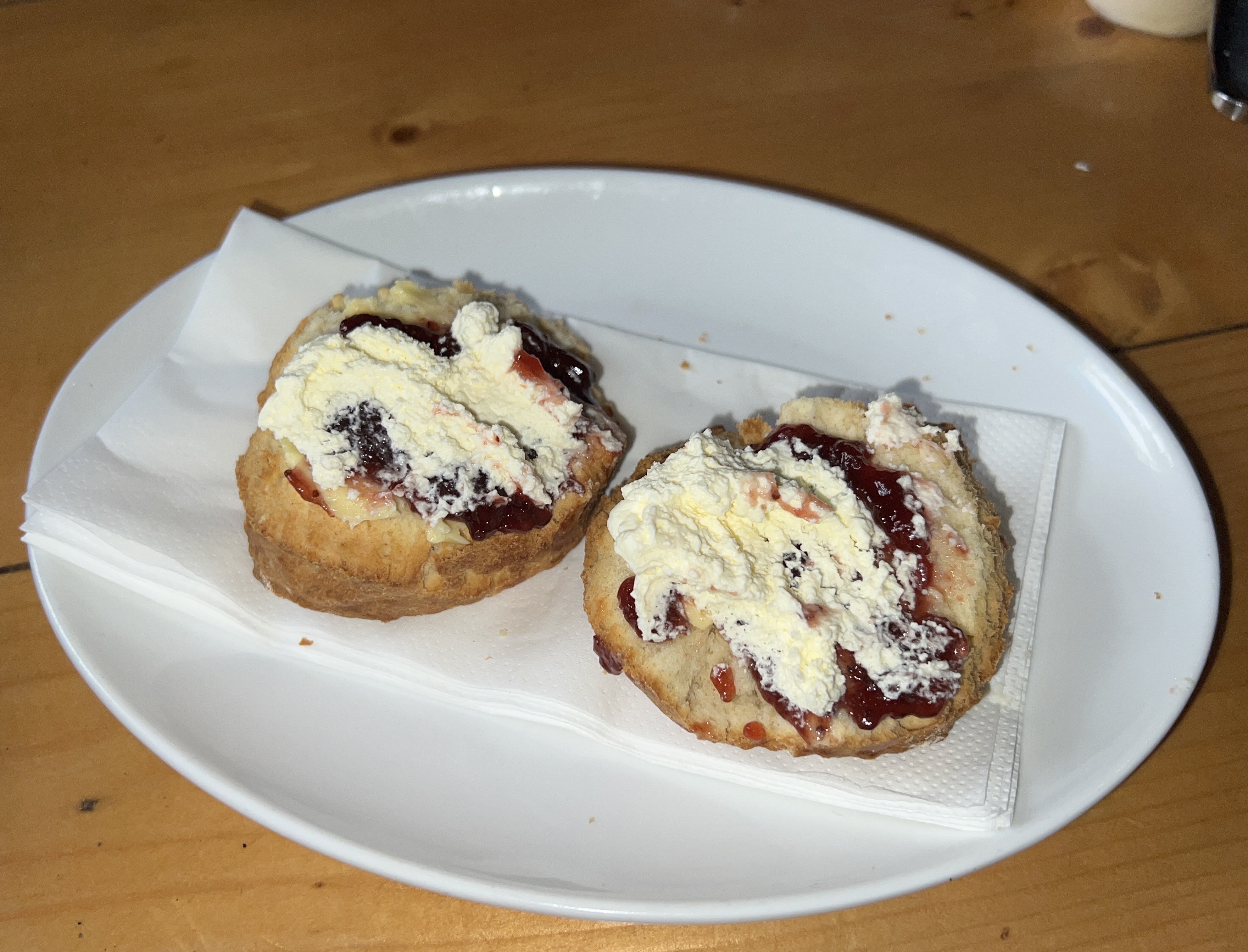
ClonakiltyScones with clotted cream at Casey’s.
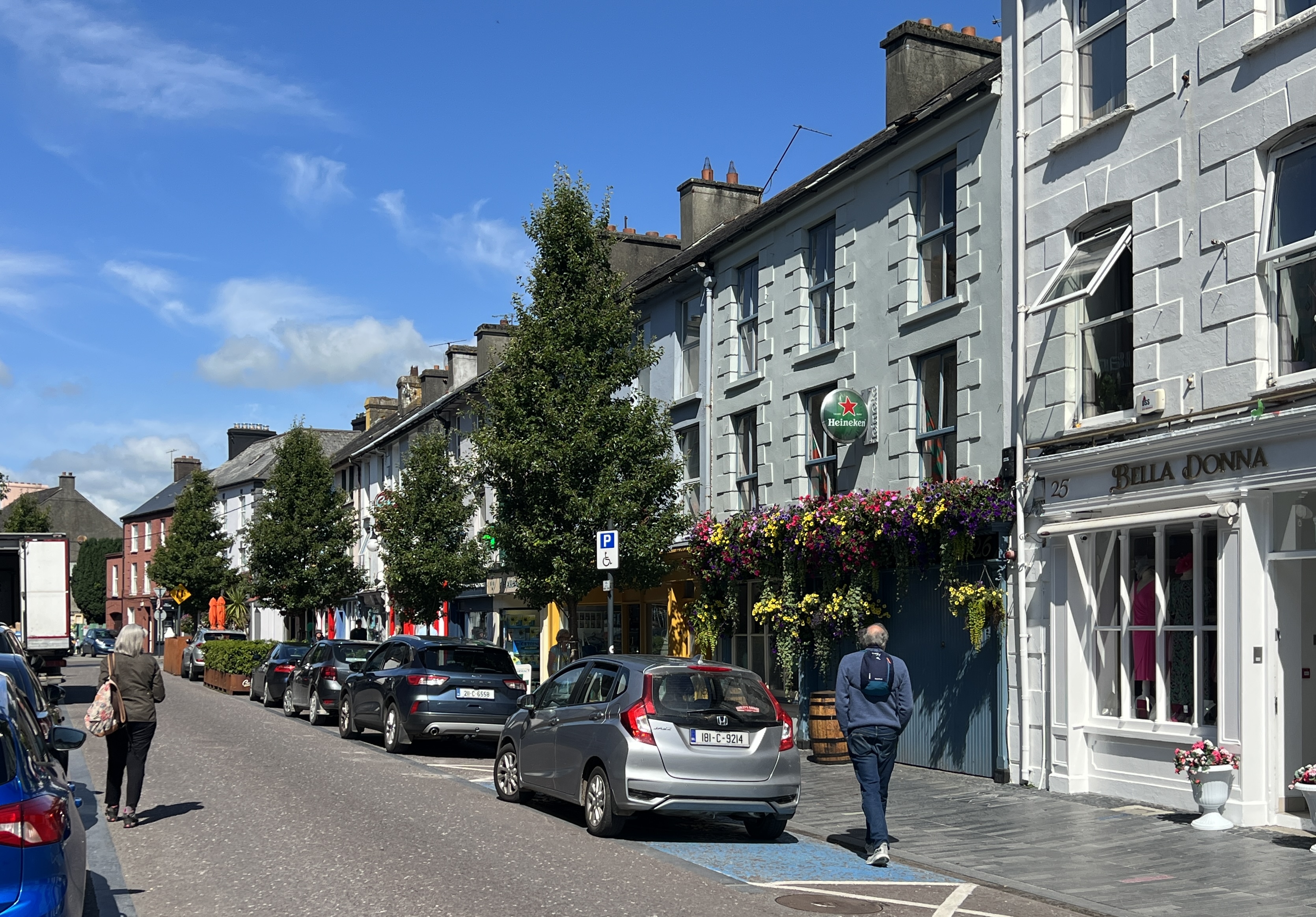
We passed through a number of picture perfect villages with names that sort of roll around in your mouth and refuse to come out.
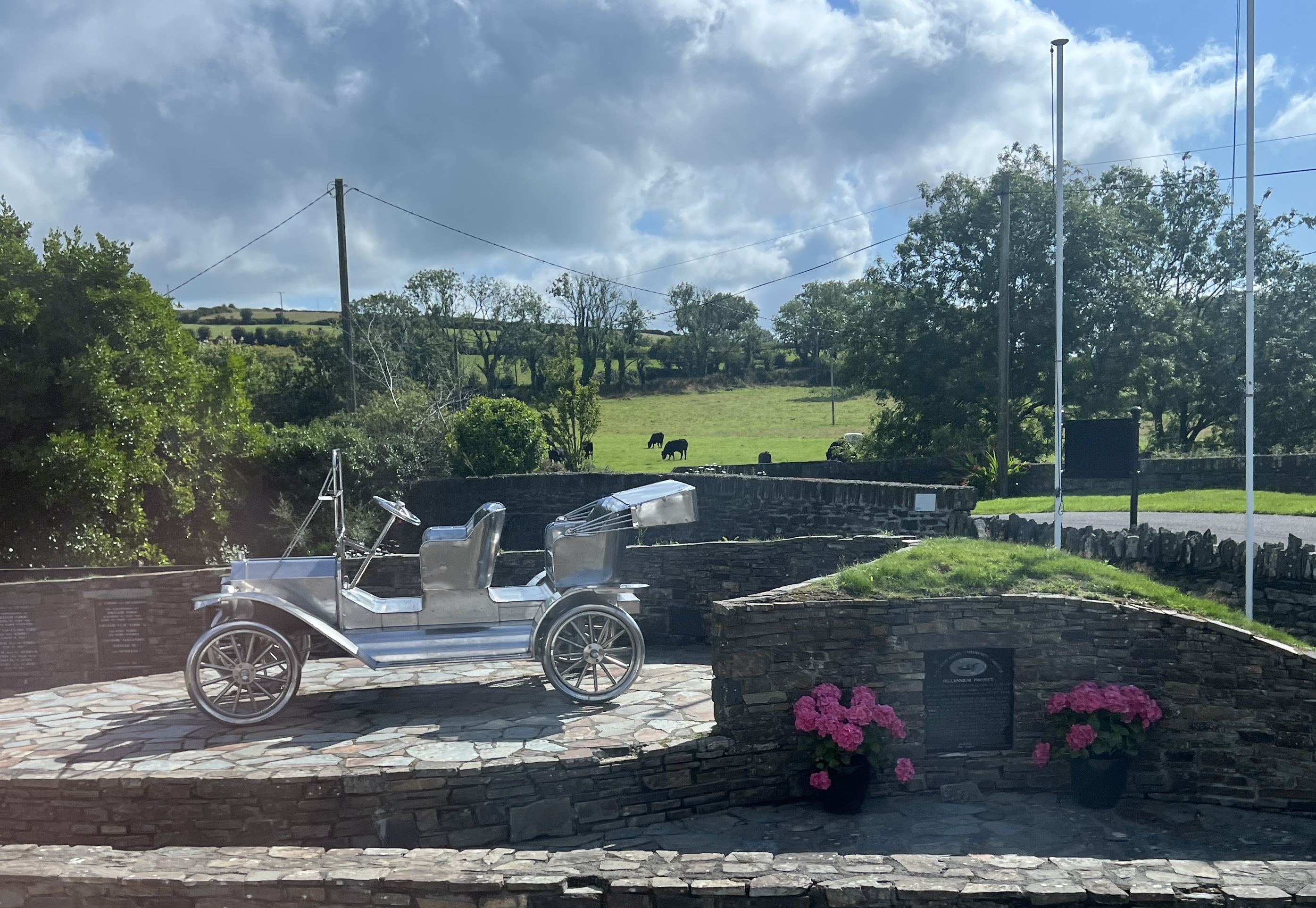
Model T Ford memorial at Ballinascarthy. Henry Ford was a local before migrating to the US.No room for the grass.
It is not all beer and skittles though in these parts. The guide’s story telling reveals that these parts are suffering issues in common with other parts of the world: Rural depopulation, inflation, interest rate rises, lack of workers in hospitality, housing prices and so on. Sounded like the Courier Mail!
How green is this.Bantry BayBantry Bay
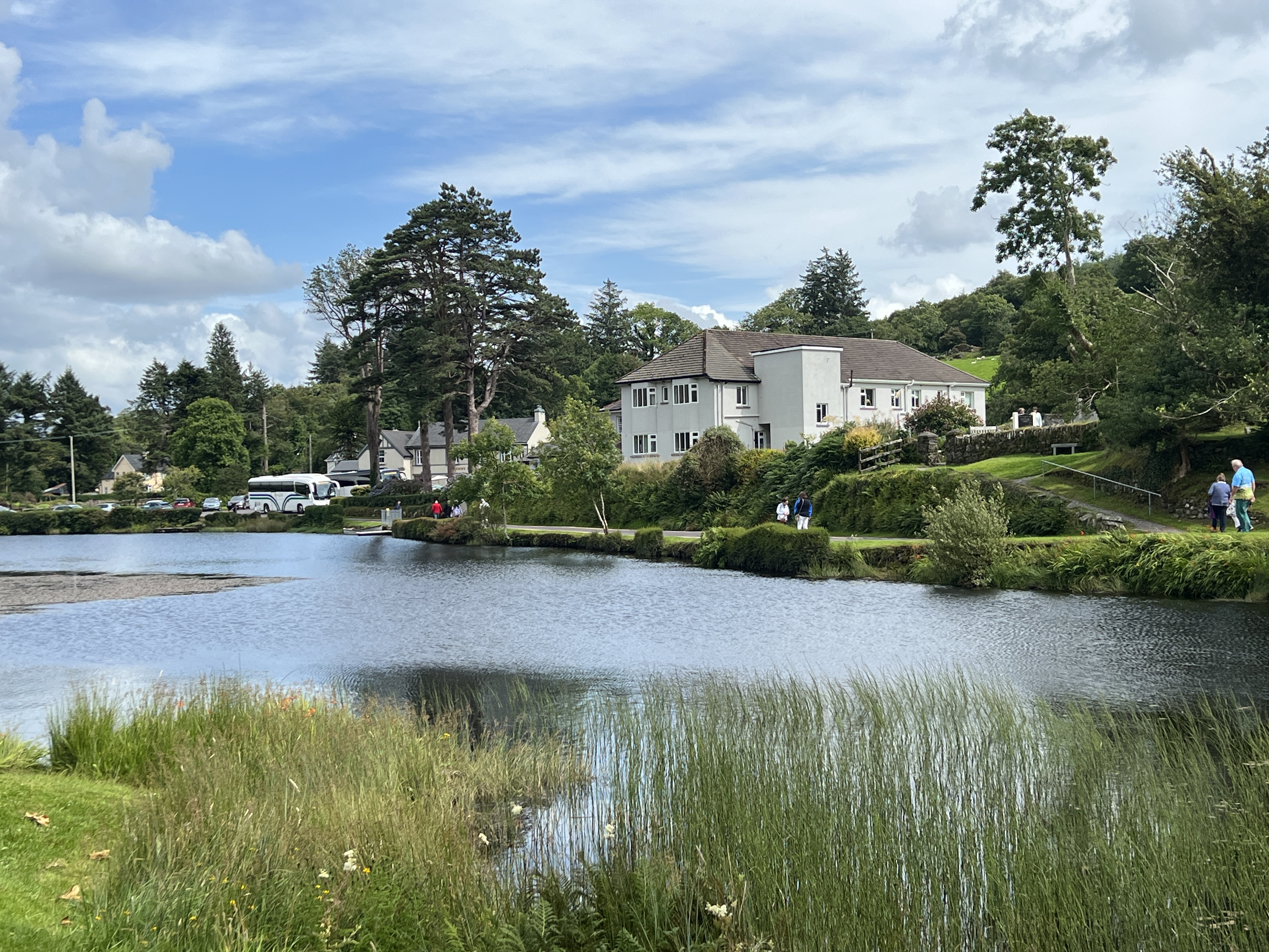
Of the several spots we stopped at along the way the highlight was the last, I suppose that is why it was last! Gougane Barra was an absolutely beautiful locale.
Gougane Barra Hotel
Here below the Shehy Mountains is the source of the River Lee that later flows through central Cork and then into the harbour at Cobh.
This church is on the site where St Finn Barre founded a monastery in the 7th century.
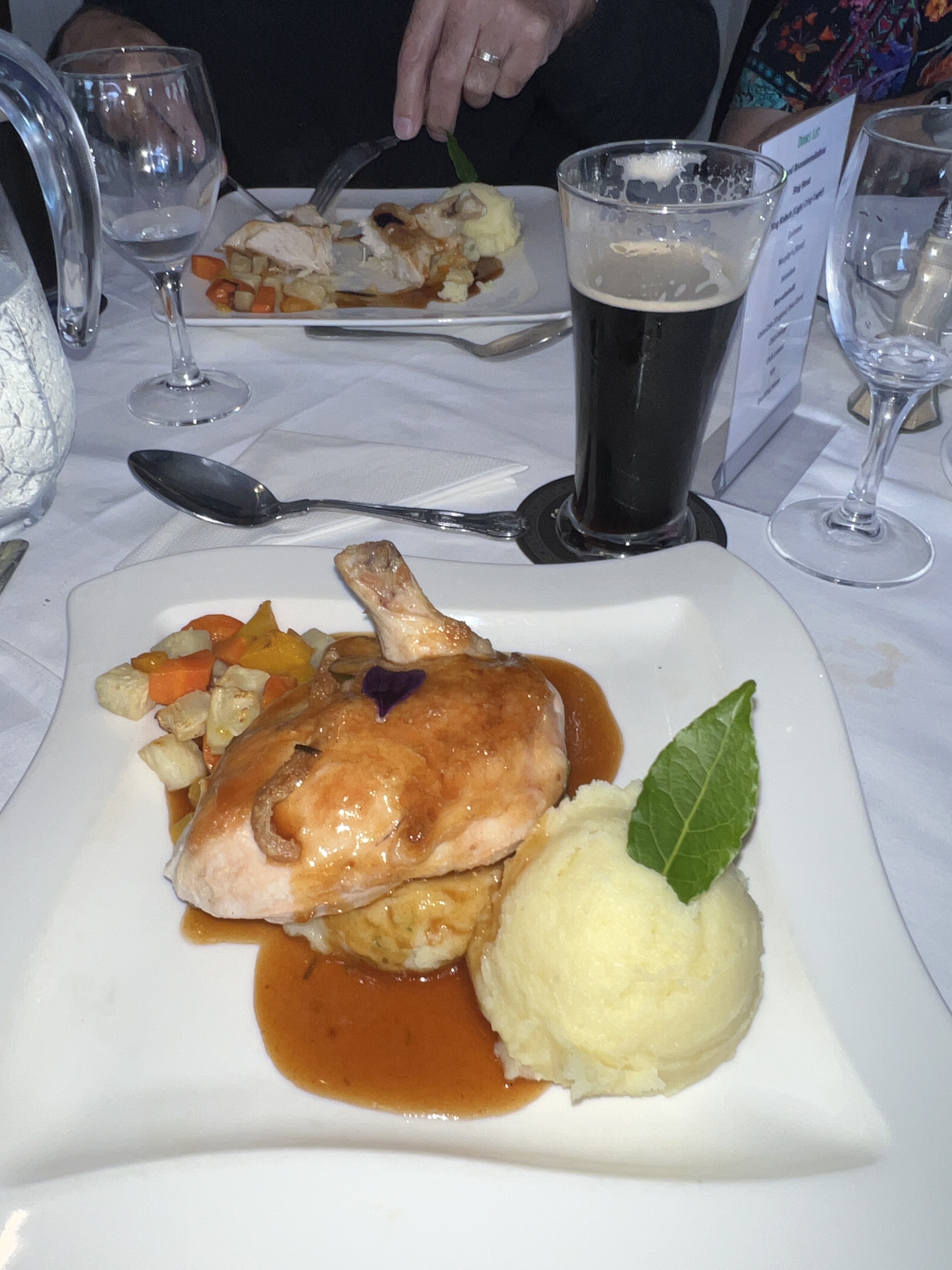
One can see why St Finn Barre chose this as the spot for a monastery in the seventh century. The group had a late lunch in the Gougane Barra hotel. A sixth generation establishment, would be great spot to stay a few days. Lunch was all cooked up using local or nearby sourced produce, including the Stag stout! Simply great and we had to get their little cook book, ‘Cooking with Katy’ for future reference.
Roast chicken lunch at the Gougane Barra Hotel.
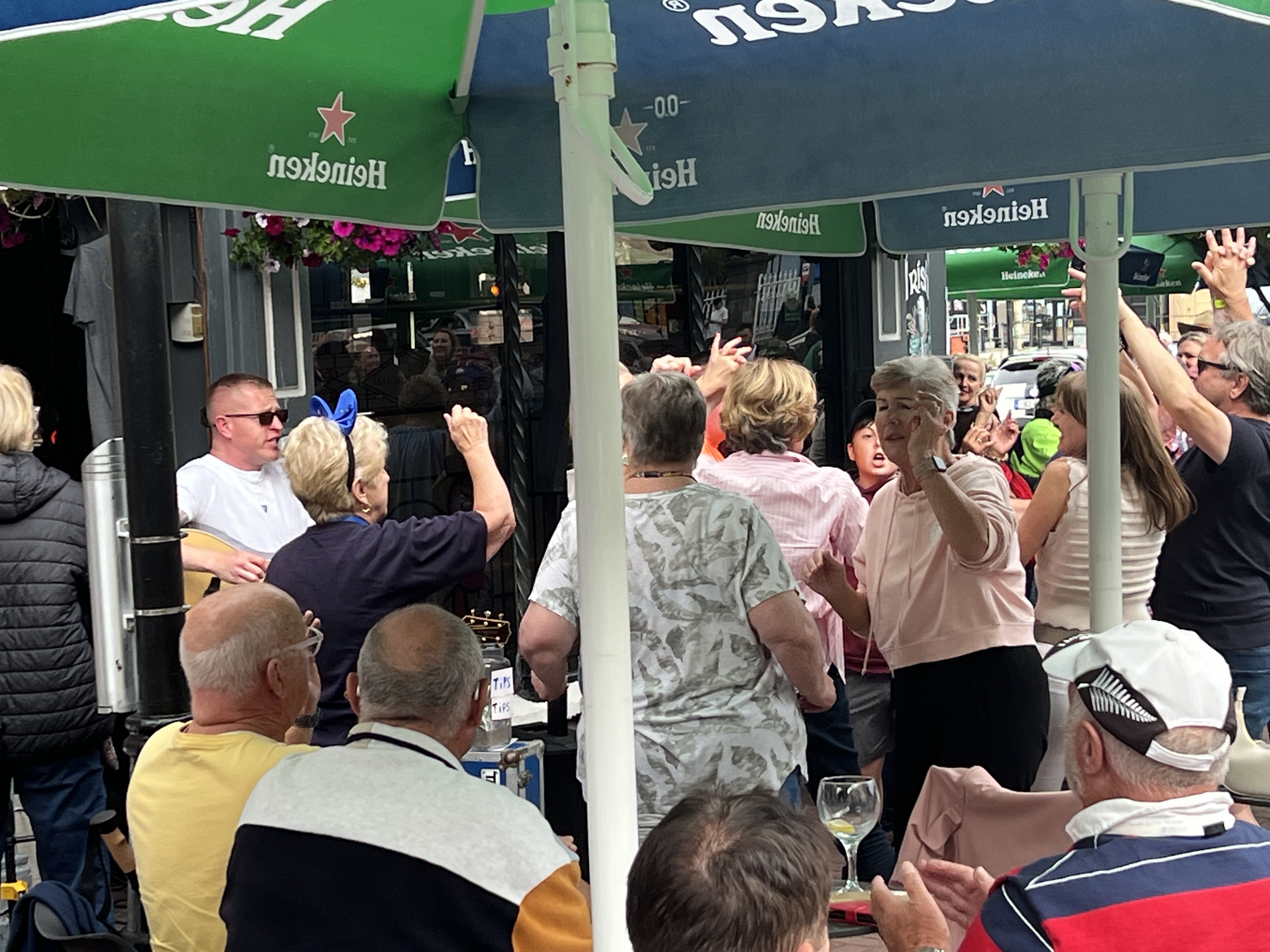
Back in Cobh the town was celebrating Australia Day, apparently an annual event. But Allthego was a bit suspicious that it may be a marketing ploy and ‘Australia ‘ Day happens whenever a ship is in with a lot of Aussies! Anyway flags were out and a band was playing Waltzing Matilda, though we didn’t hear Bound for Botany Bay!
Partying along with a busker at a Cobh pub.Australia Day celebrations in the JF Kennedy Park on the Cobh waterfront.
We now leave these parts and have a sea day ahead as Lands End is passed and the White Cliffs of Dover beckon. Got to get out the Dame Vera Lynn song book!
Greenoch, the port for Glasgow, is near the mouth of the River Clyde estuary. Greenoch is an old port town and during the 1800/1900s was a hive of shipping activity acting as the import/export hub for the industrial city of Glasgow. Today it is a lot quieter.
Piped ashore in Greenoch
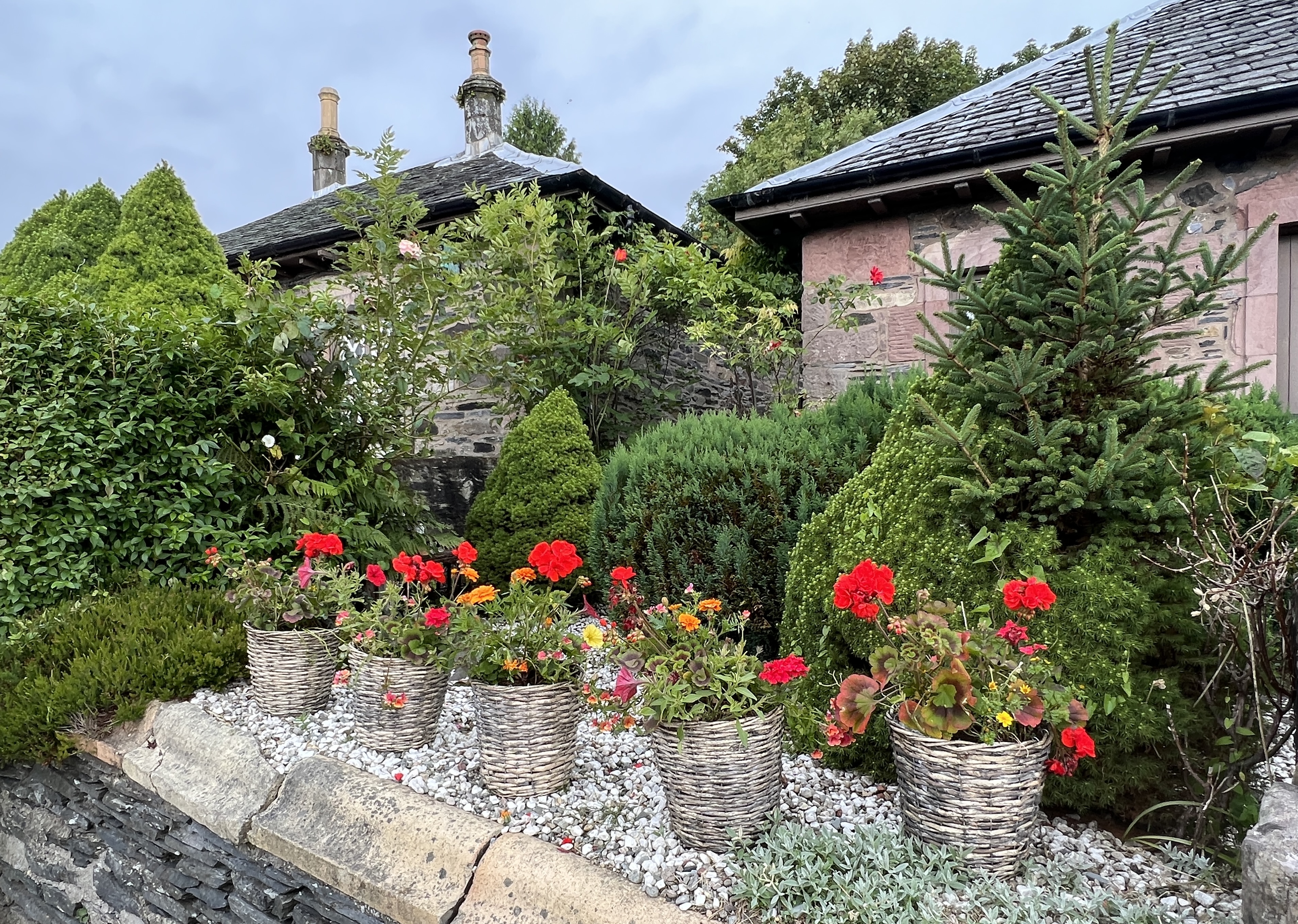
We have been to Glasgow city in the past and so have decided to head out into the nearby coastal Highlands and the sea lochs that are scattered along the coast.
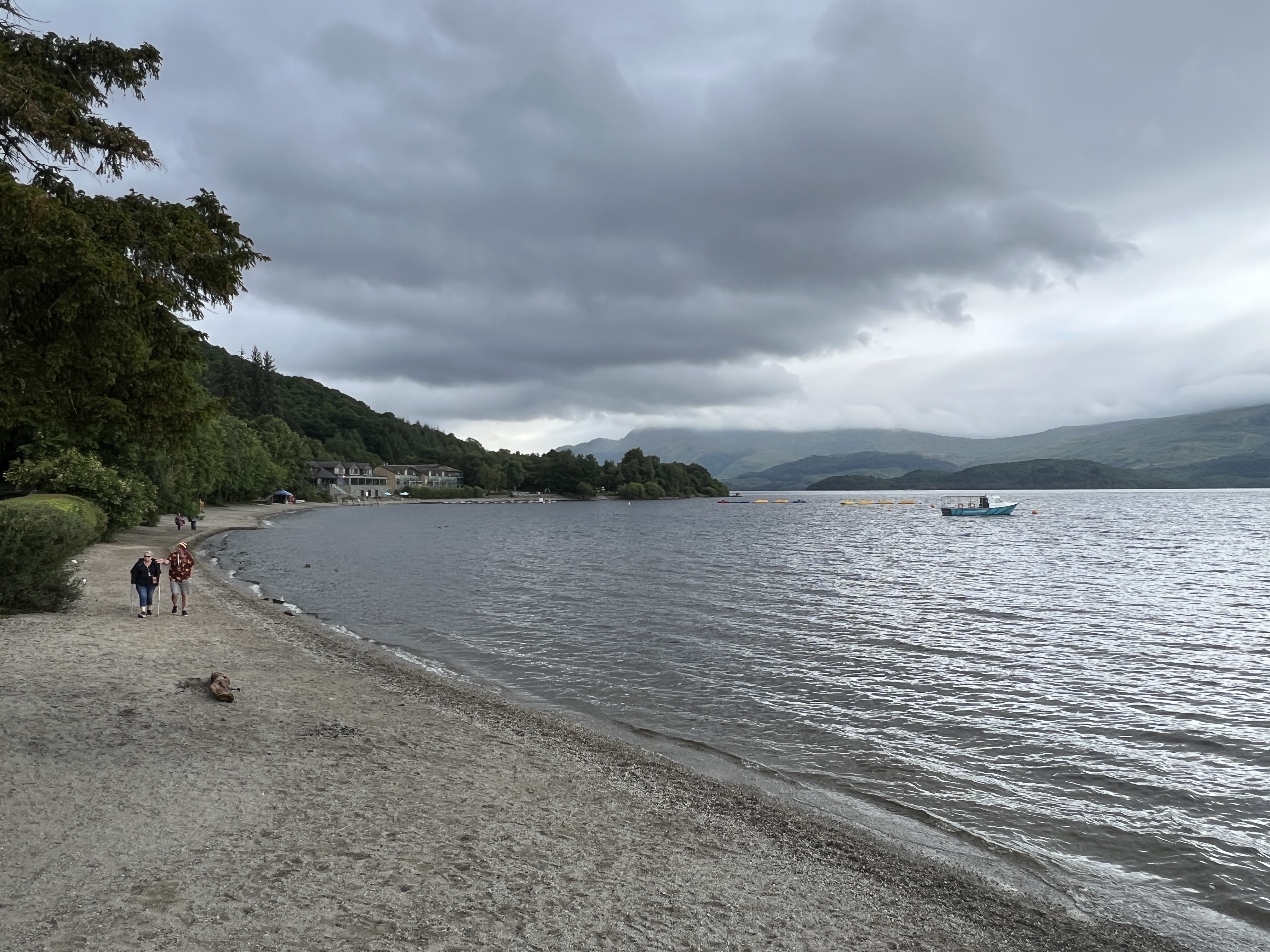
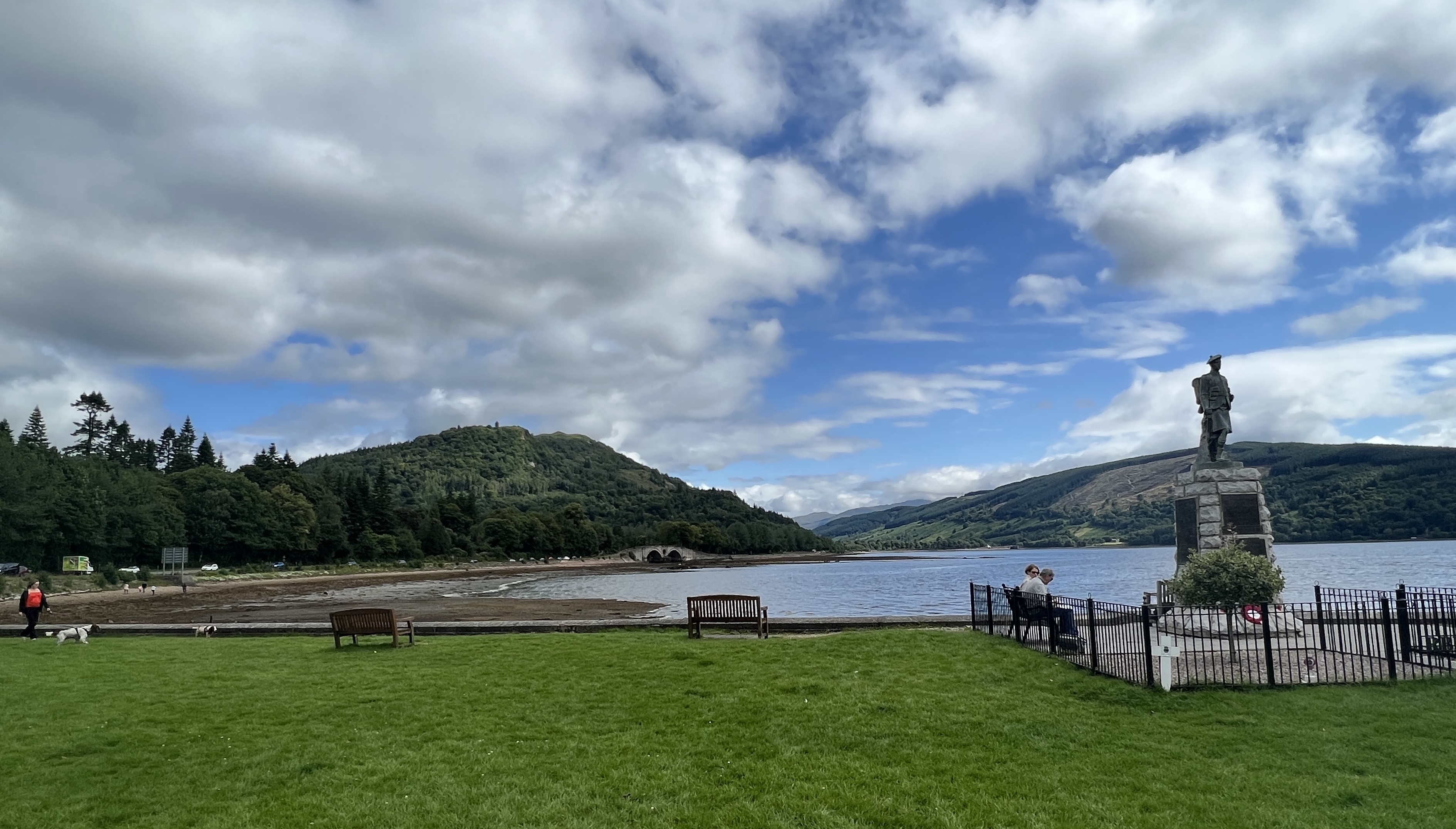
Loch Lomond
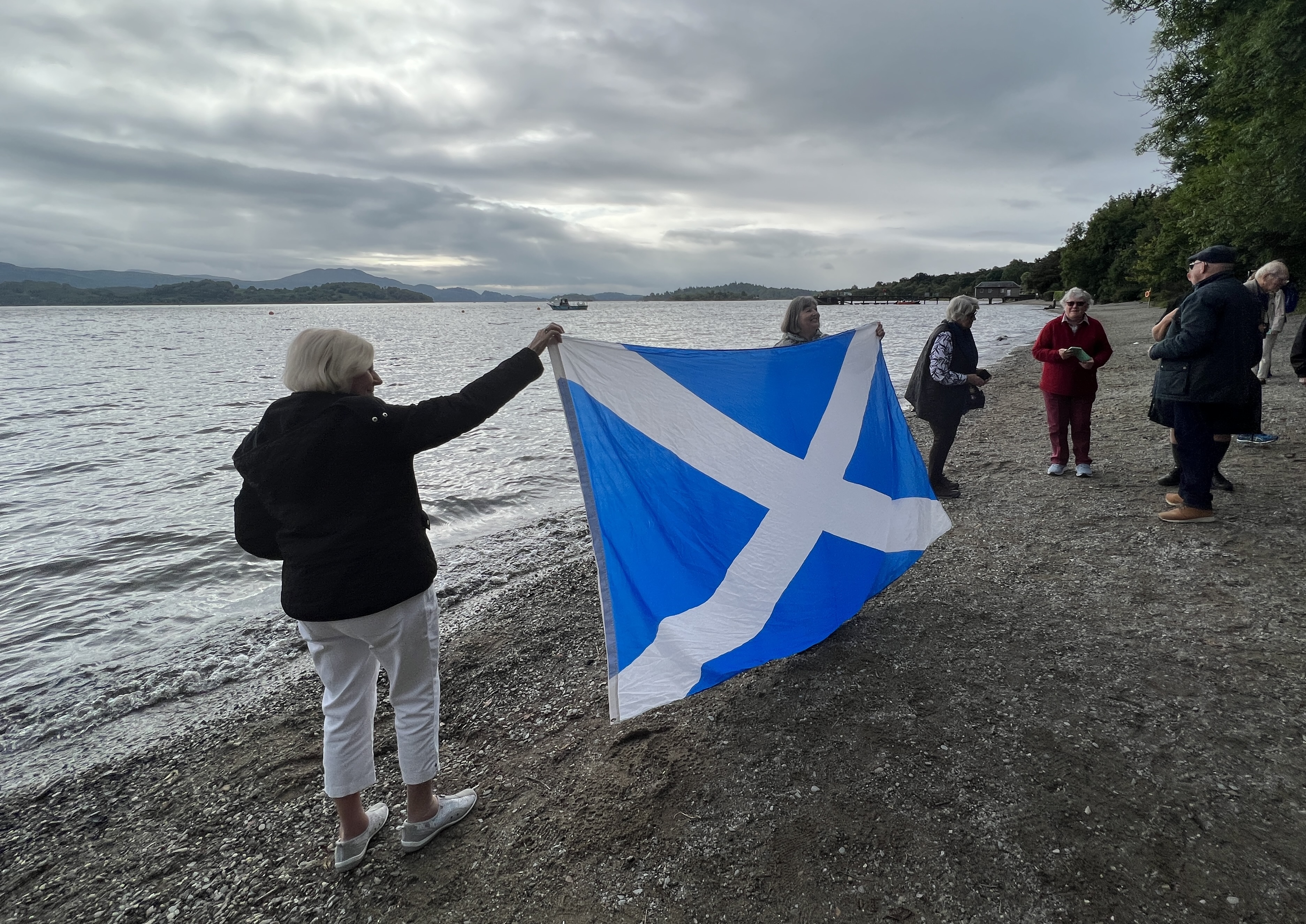
The first stop was at Loch Lomond, in the small village of Luss. It was early, just before 9am and none of the handful of shops were open. The Loch is Scotland’s largest fresh water loch by surface area. The overcast sky made for a sombre atmosphere as we raised the Scottish flag at the water’s edge.
Loch Lomond flag raising.
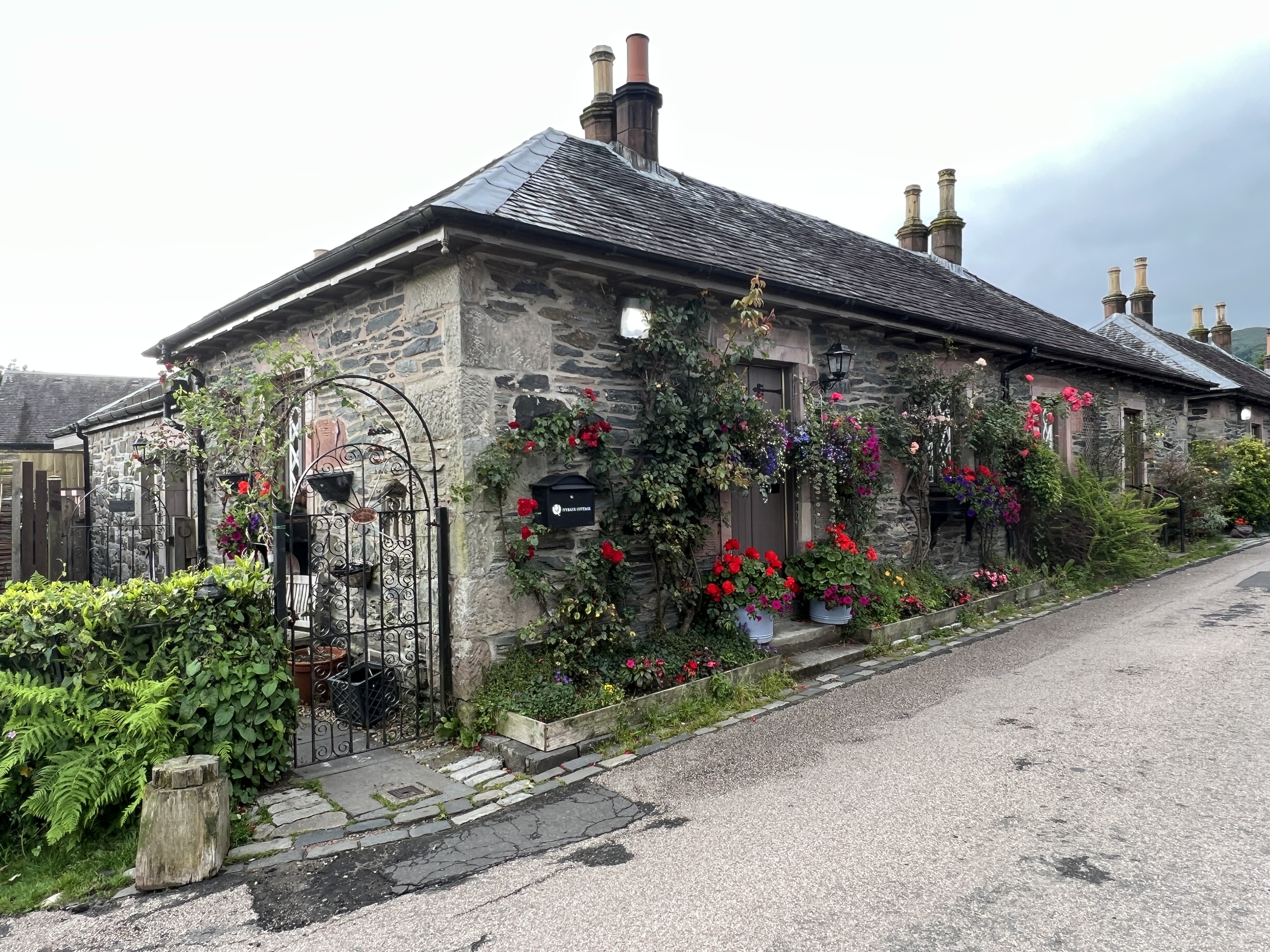
LussLuss
Our enthusiastic kilt wearing guide is a German chap, an honorary Scotsman having migrated to the UK thirty years ago. He leads us on a short walk around the village and waterside trails.
Elusive trout or perch in a creek at Luss.
Luss would make a good base for a few days to explore this part of the Highlands!
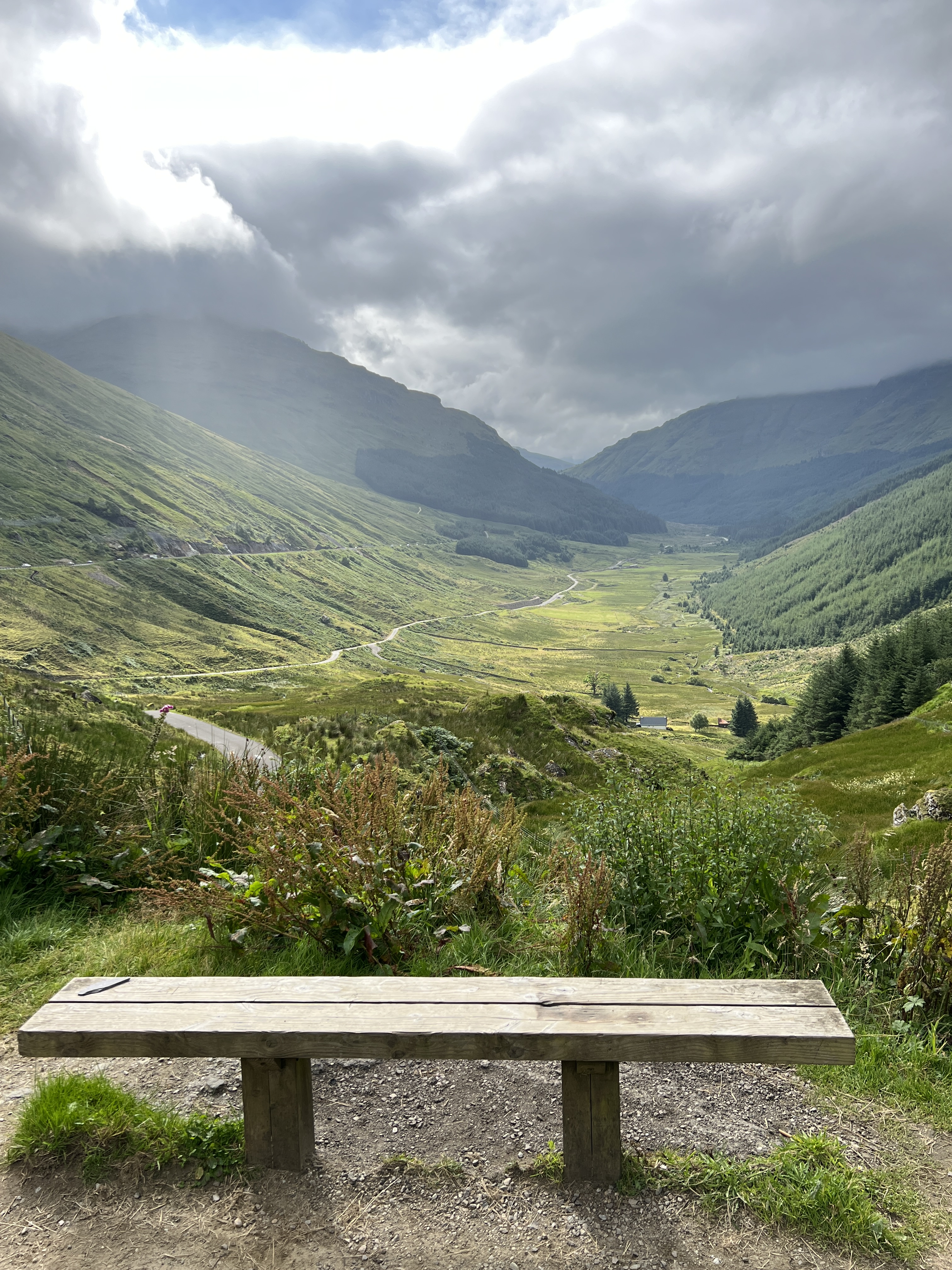
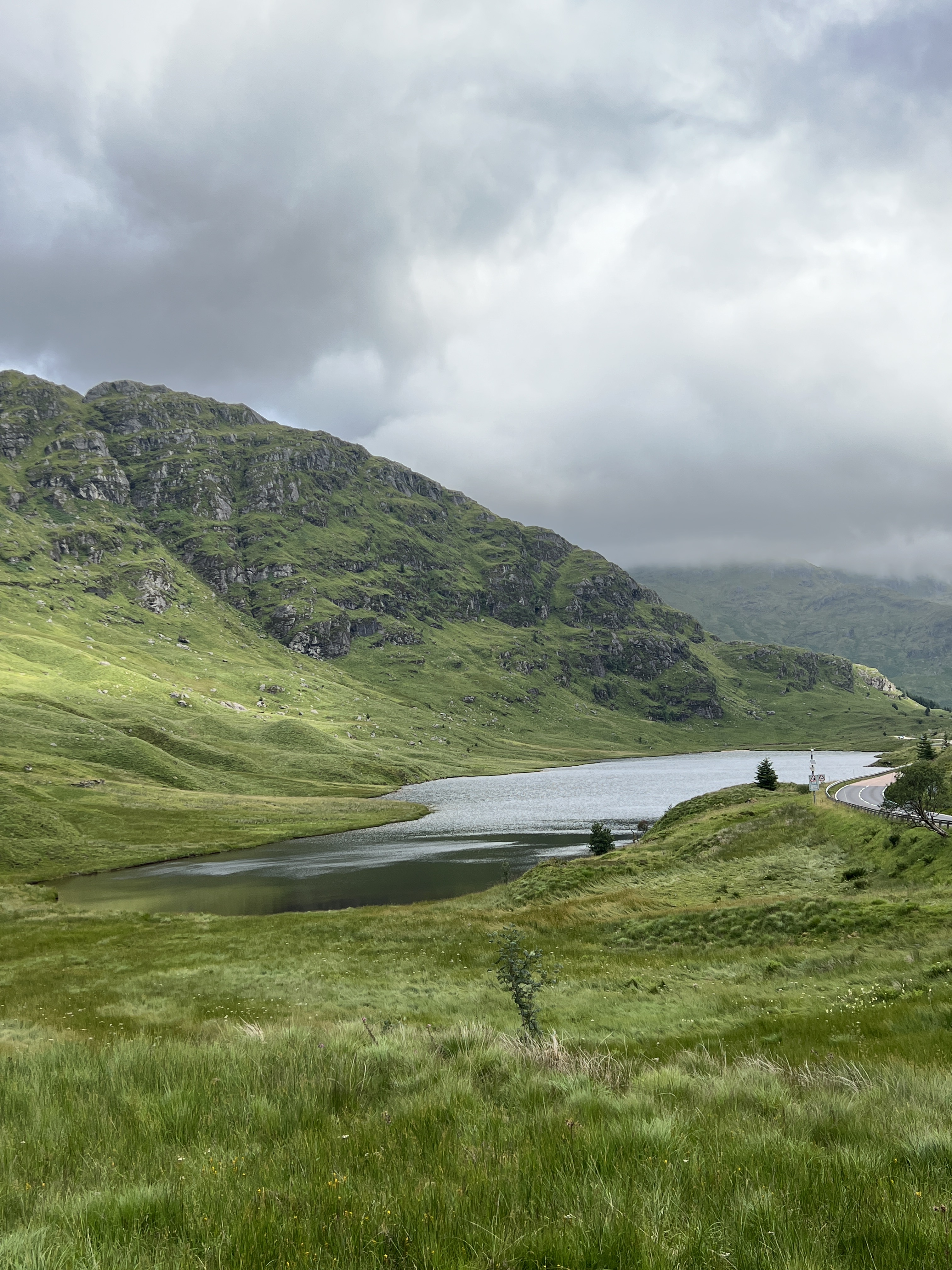
We then headed off into the Highlands on the way to Inveraray, situated on a sea loch down the other side. We stopped along the way for a view down the glen we had travelled up and the tarn that was nestled beneath a mountain on the way towards Inveraray.
View down the glen.Tarn near Argyle Forest park.
We stopped in Inveraray for a look around the town and to have lunch together in a small restaurant up a lane way.
War memorial Inveraray loch.An old warhorse on the loch at Inveraray.
The town was quite compact and clearly geared to the tourist. A big old hotel looks out over the loch, nice spot to stay for a couple of days!
Inveraray lunch location, great steak n ale pie and berry crumble.Slobro was keen to drop in here for a look.
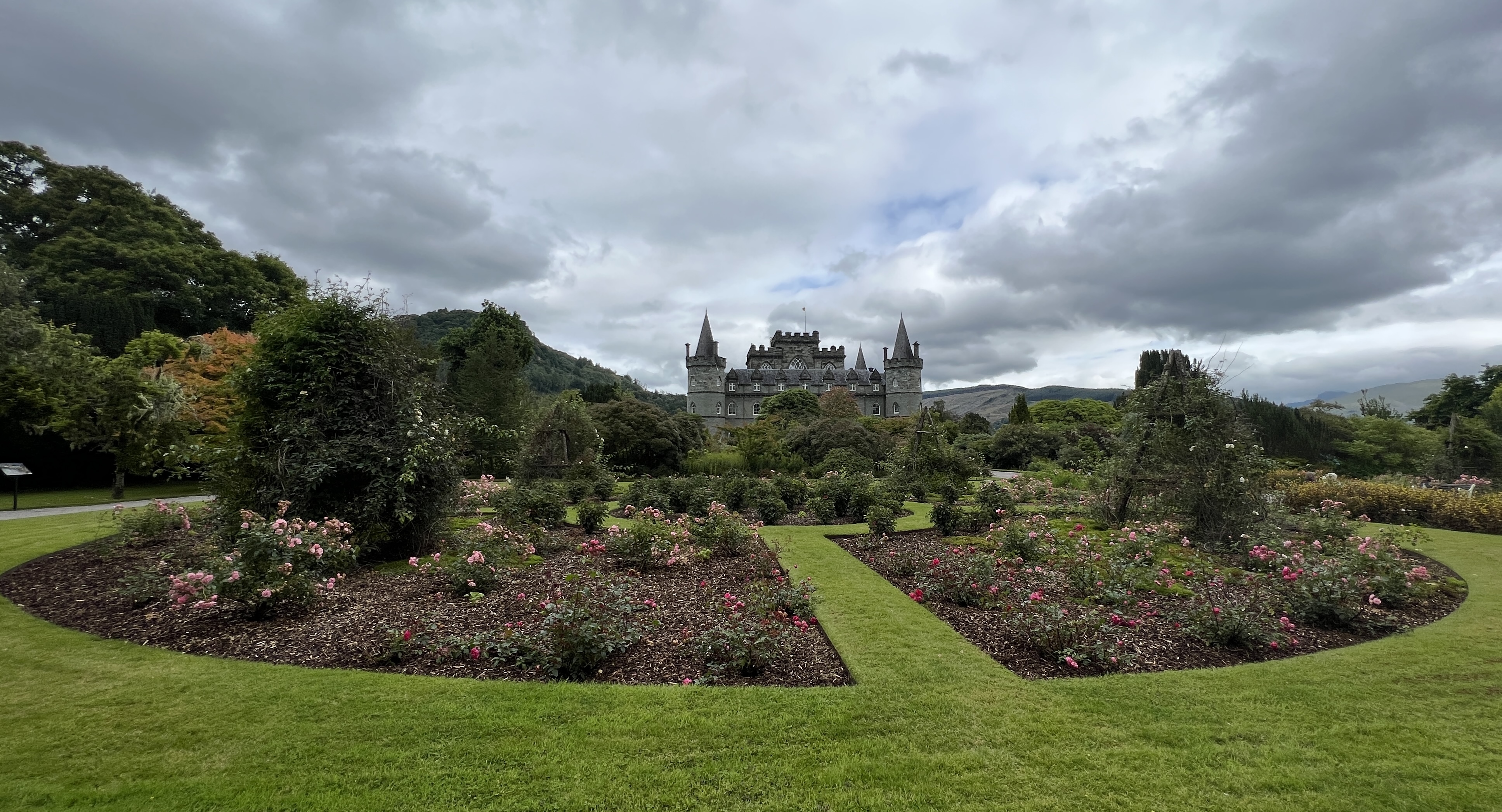
It was then on for a tour of Inveraray Castle, the local digs of the 13th Duke of Argyle. He is also the top dog of Clan Campbell and is the keeper of the clan quaich. Together with his wife and three kids they live from time to time in a private section of the castle.
Inveraray Castle
The public rooms are all decked out with period furniture and numerous paintings of the line of dukes and others. The armoury room quite impressive with its display of weapons. The Campbells were a very politically important clan in Scotland. They were careful to be on the right side of any conflicts and were handsomely rewarded with land and titles by kings for their input!
Dining room at Inveraray Castle.Garden view from Inveraray Castle.
There was time to wander around the Castle’s gardens before heading back to Greenoch. We returned a different way along the coast and around a series of headlands and sea lochs, great views. Caught a ferry across the Clyde to reach the ship at the dock.
There is now a day at sea ahead of us as we work our way back down the Irish Sea to Cork in Ireland.
Overnight we have moved up to Belfast. The day is little dreary, a bit of light drizzle. As the day moved on it cleared a little for the sun to come through at times. As down in Holyhead it is much cooler up here in Belfast 13 C, and almost winter like. A cool breeze too, how different to back in the Mediterranean!
We have a short tour planned for today that visits the Game of Thrones studio housed in former linen mills at Banbridge. Many of the outdoor scenes in the TV series were shot around Belfast and the surrounding countryside.
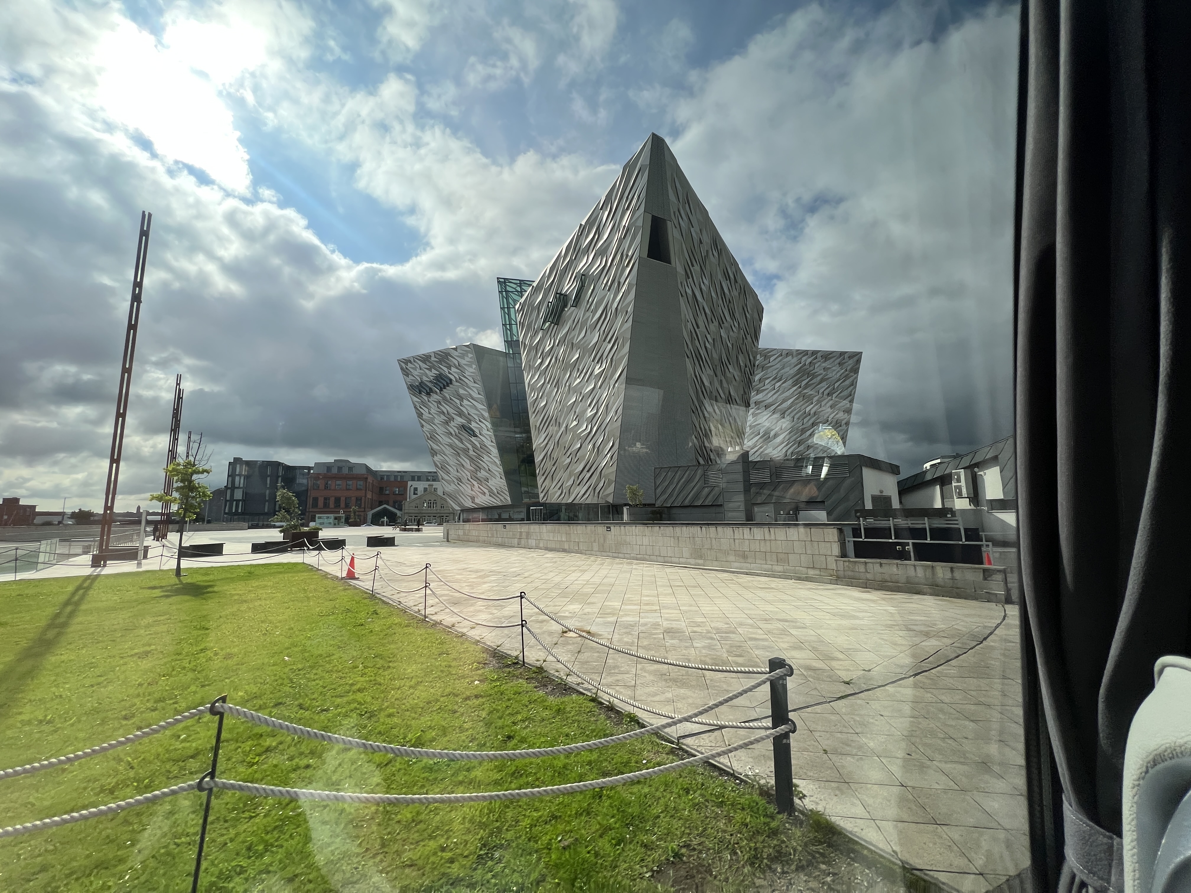
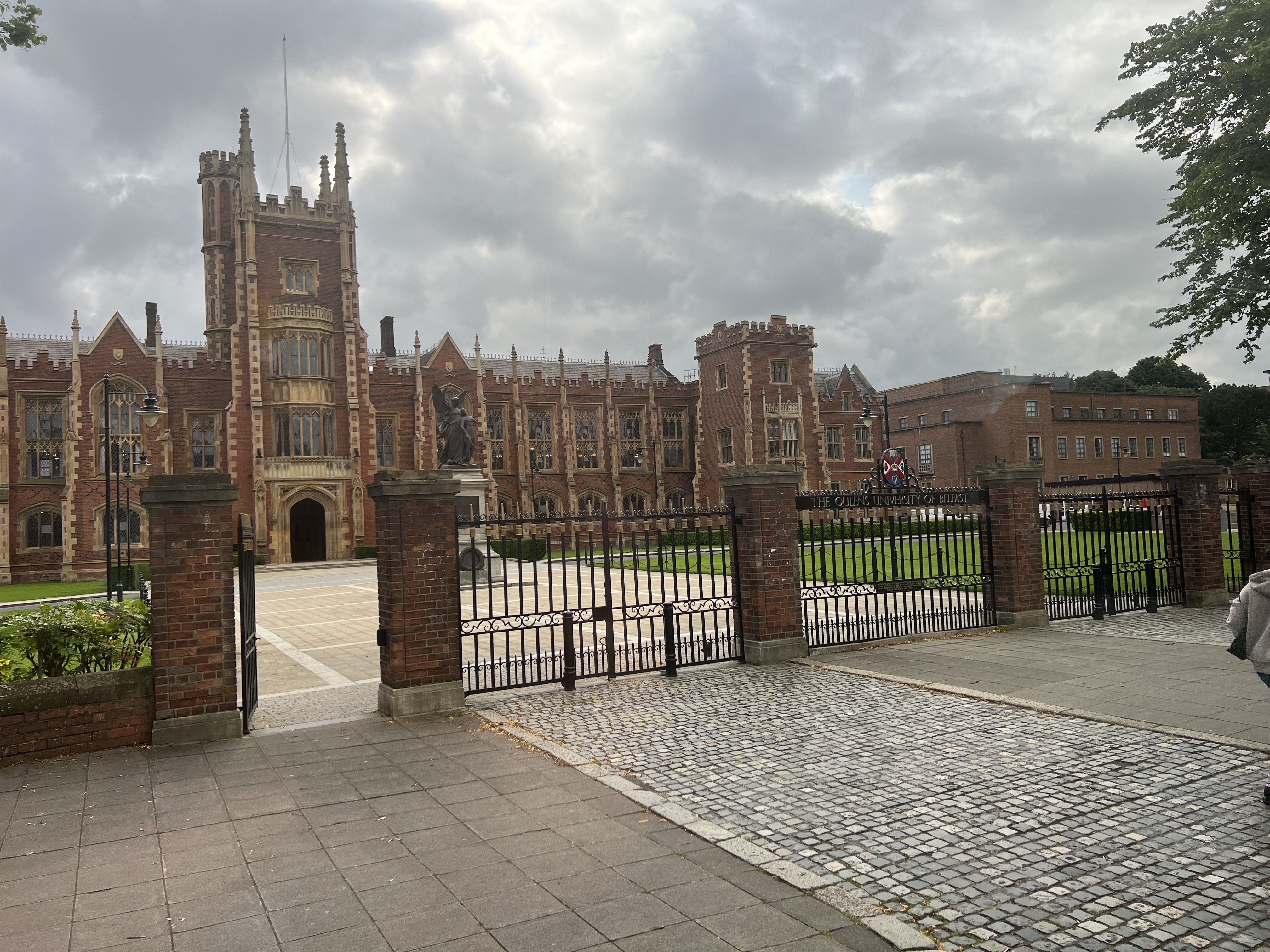
Titanic experience, the brow of the ship points toward the camera.Queens University
But first we have a spin around the city taking in some of the main sights. We had been to Belfast back in 2007, quite a few changes in the intervening years. Including a big new Titanic Centre and the old hotel we stayed in back then has changed its name from Days Inn to Holiday Inn. Still looked the same!
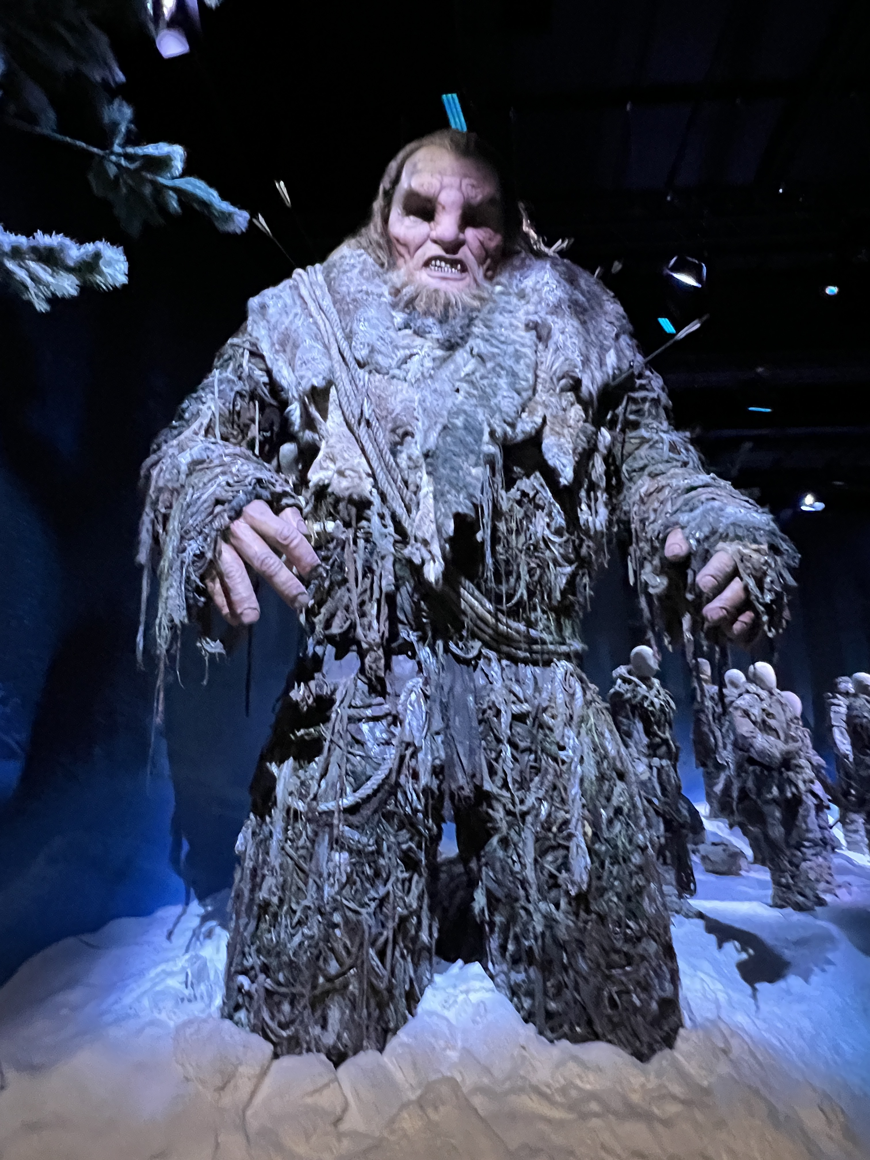
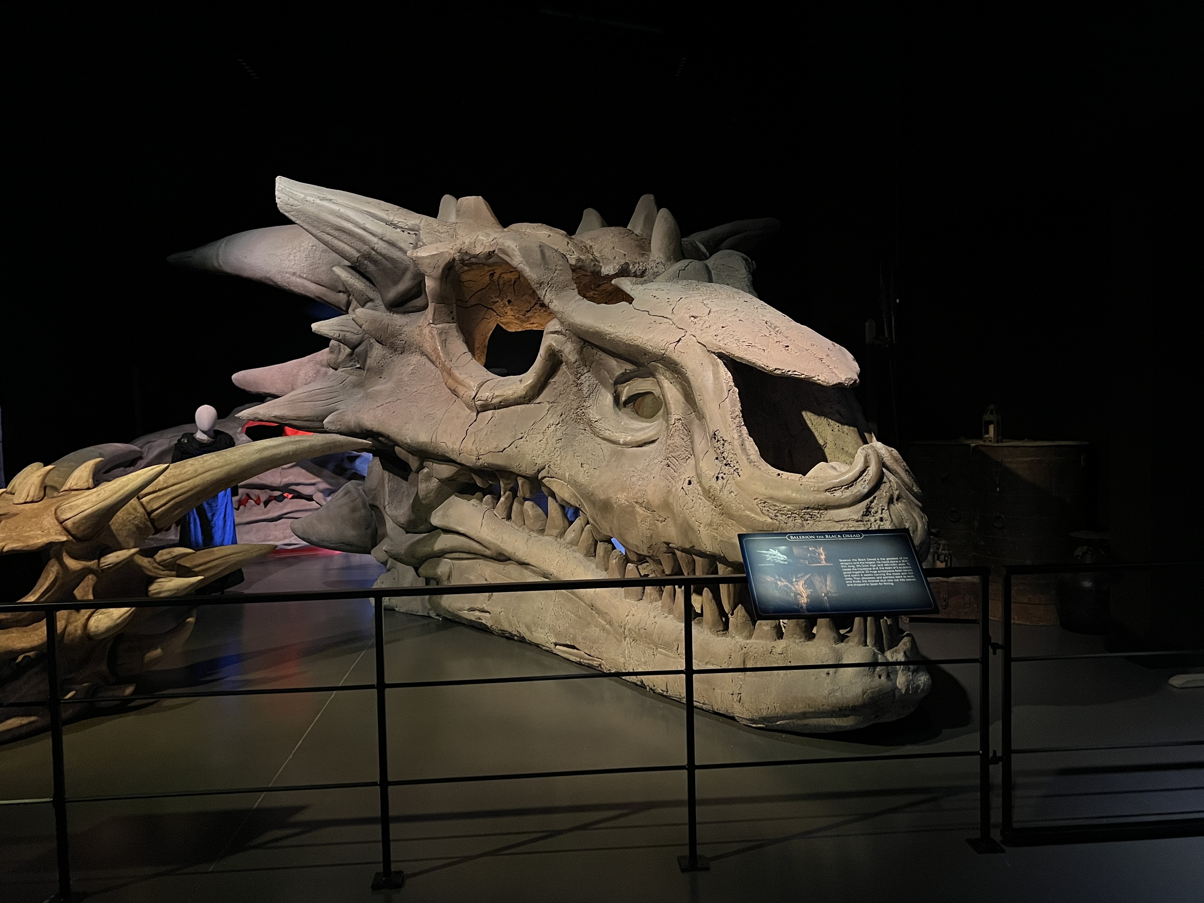
The Night King and Master of the Army of the Dead!Wun wun
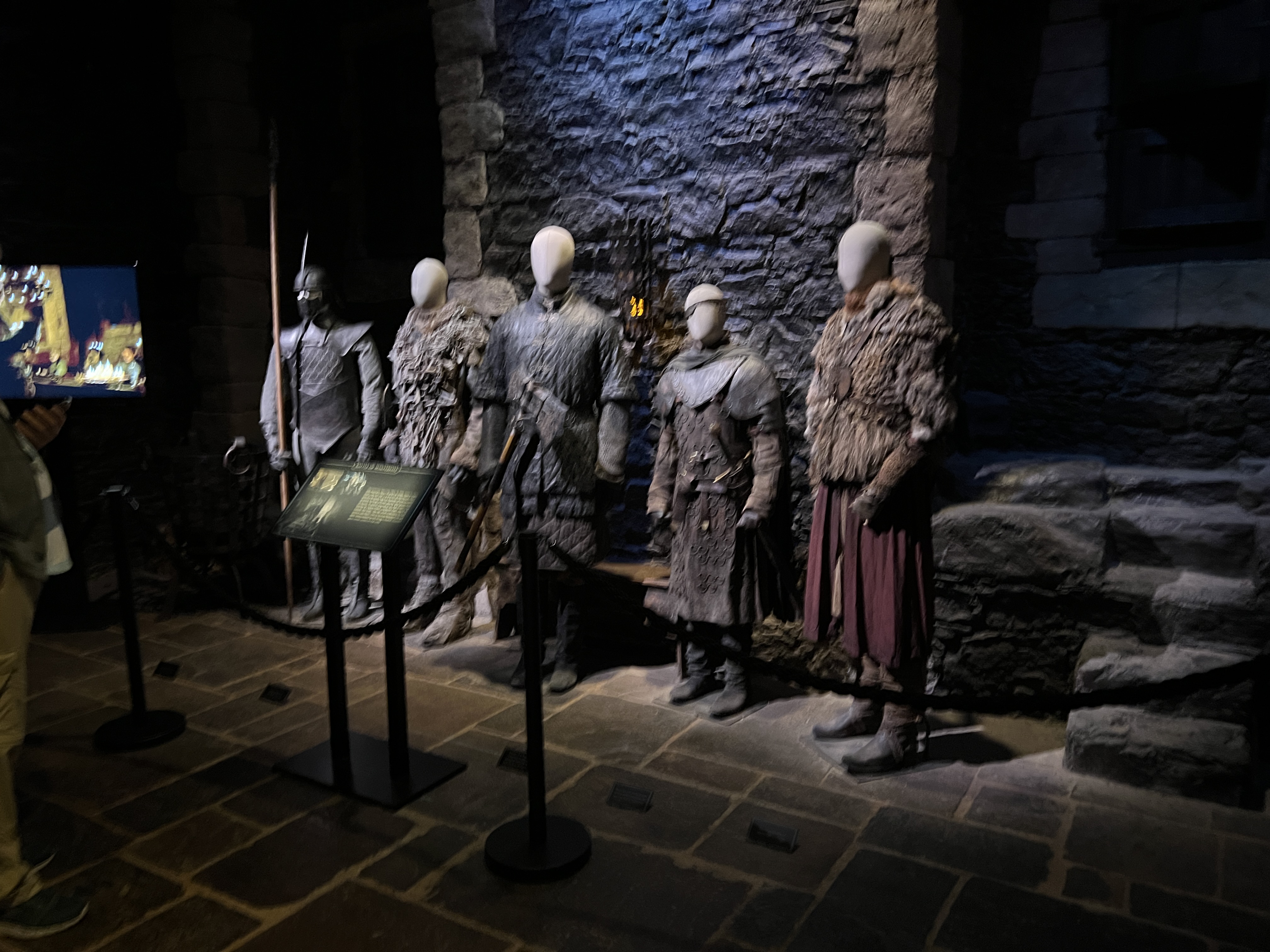
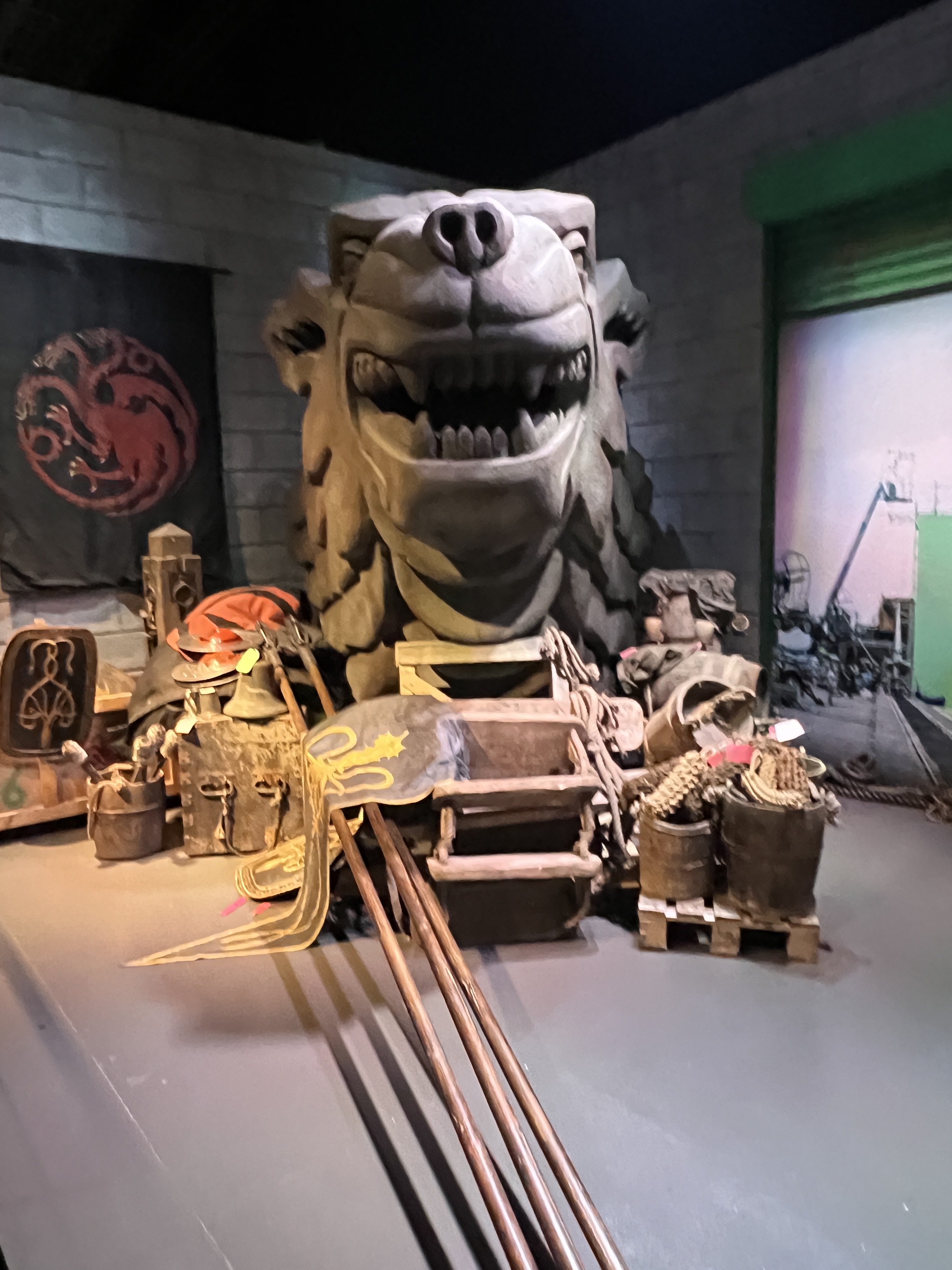
Allthego is a bit of a Game of Thrones tragic, one has to look through some of the more violent and unsavoury scenes. The studios were an eye opener to modern TV production.
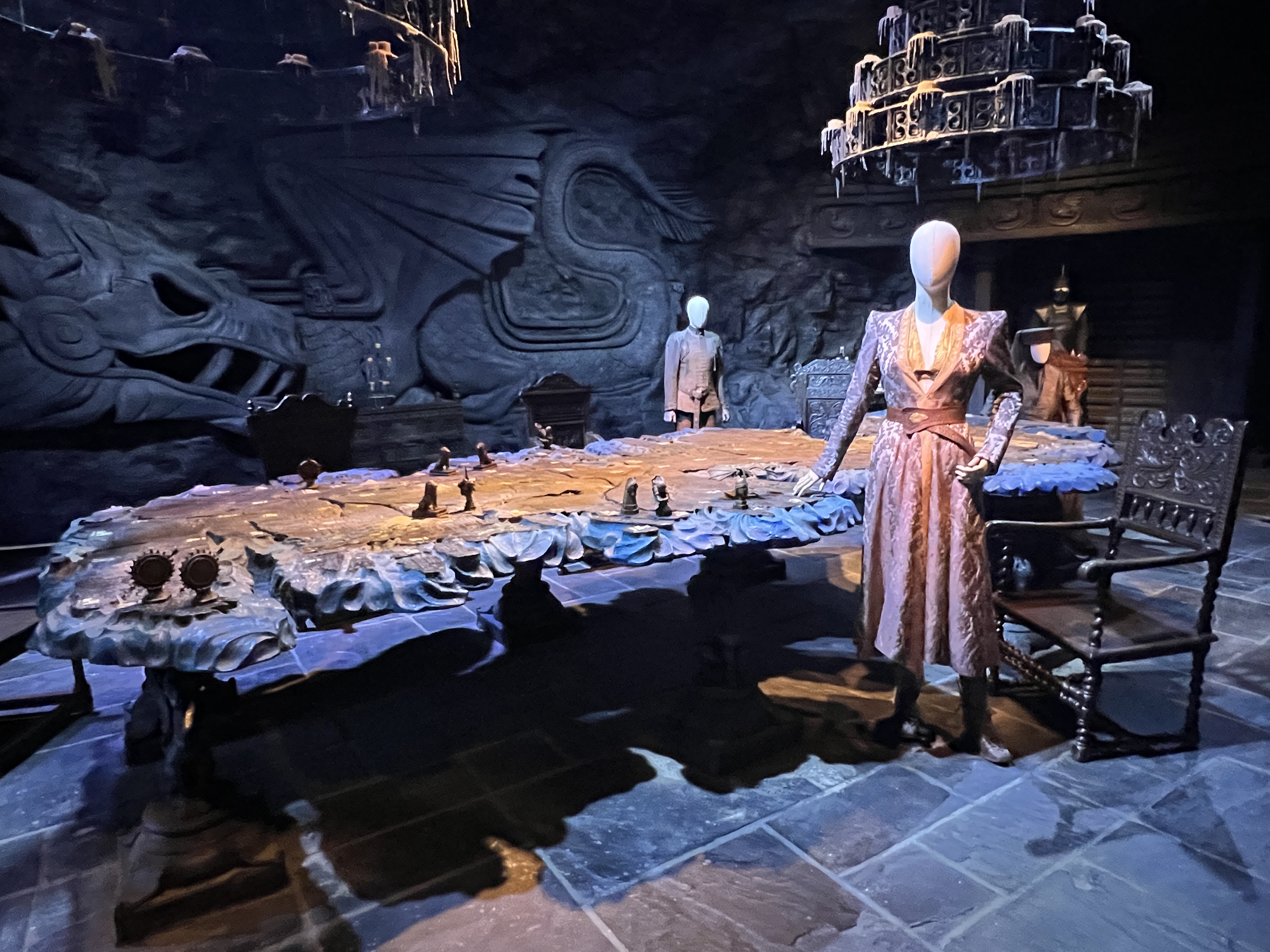
Plotting in the Map Room
The tour takes you through major scenes and themes of the TV series, interspersed with costumes and props. One of these themes is ‘Winter is Coming’.
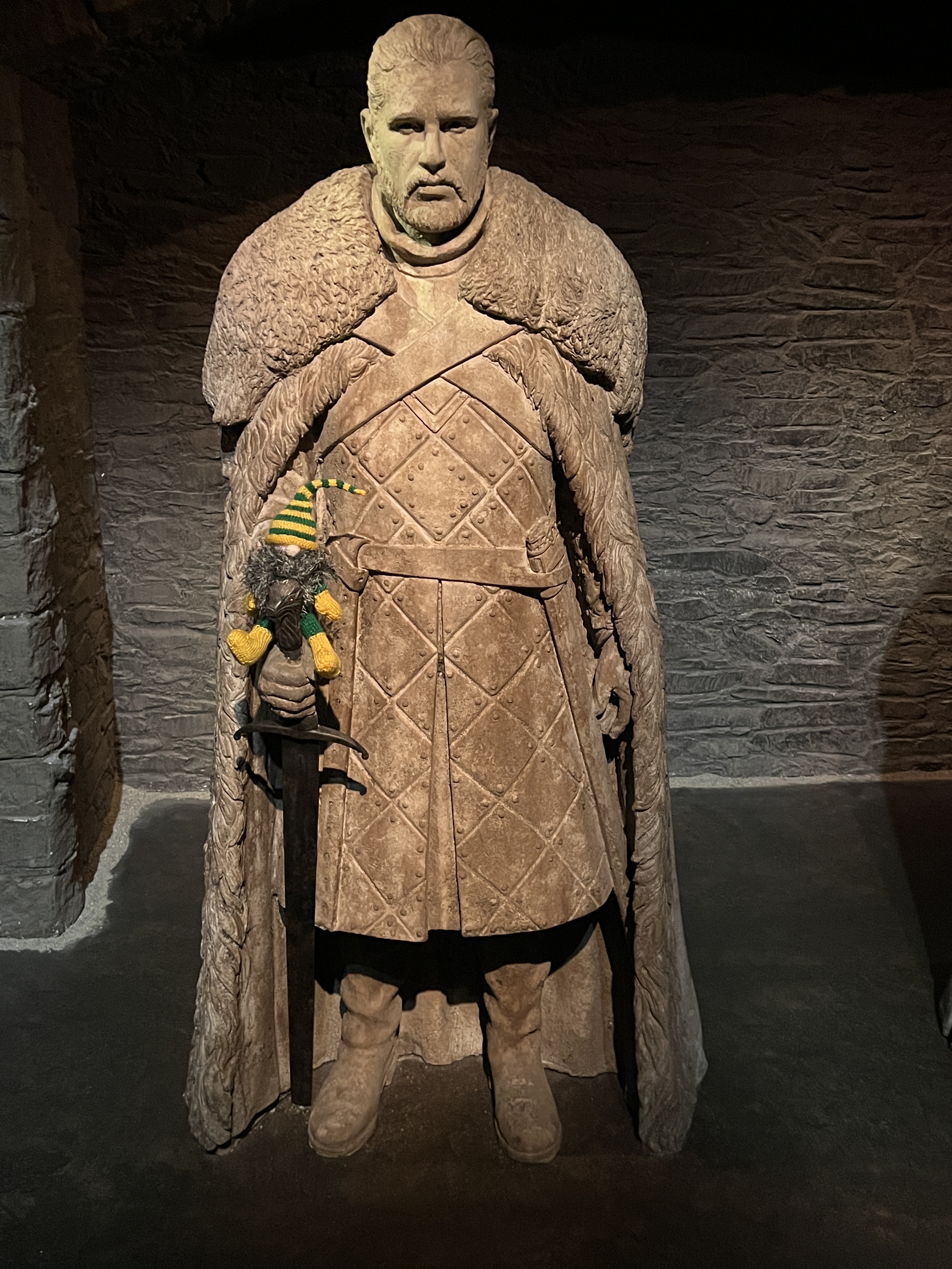
Jon Snow and Slobro
The Night King who is Master of the Living Dead has a mission to bring ‘winter’ from the deep cold north to the south. The south spend most of the series fighting themselves and only at the end seek some sort of common unity to defeat the Living Dead, the White Walkers. Enough of GOT!
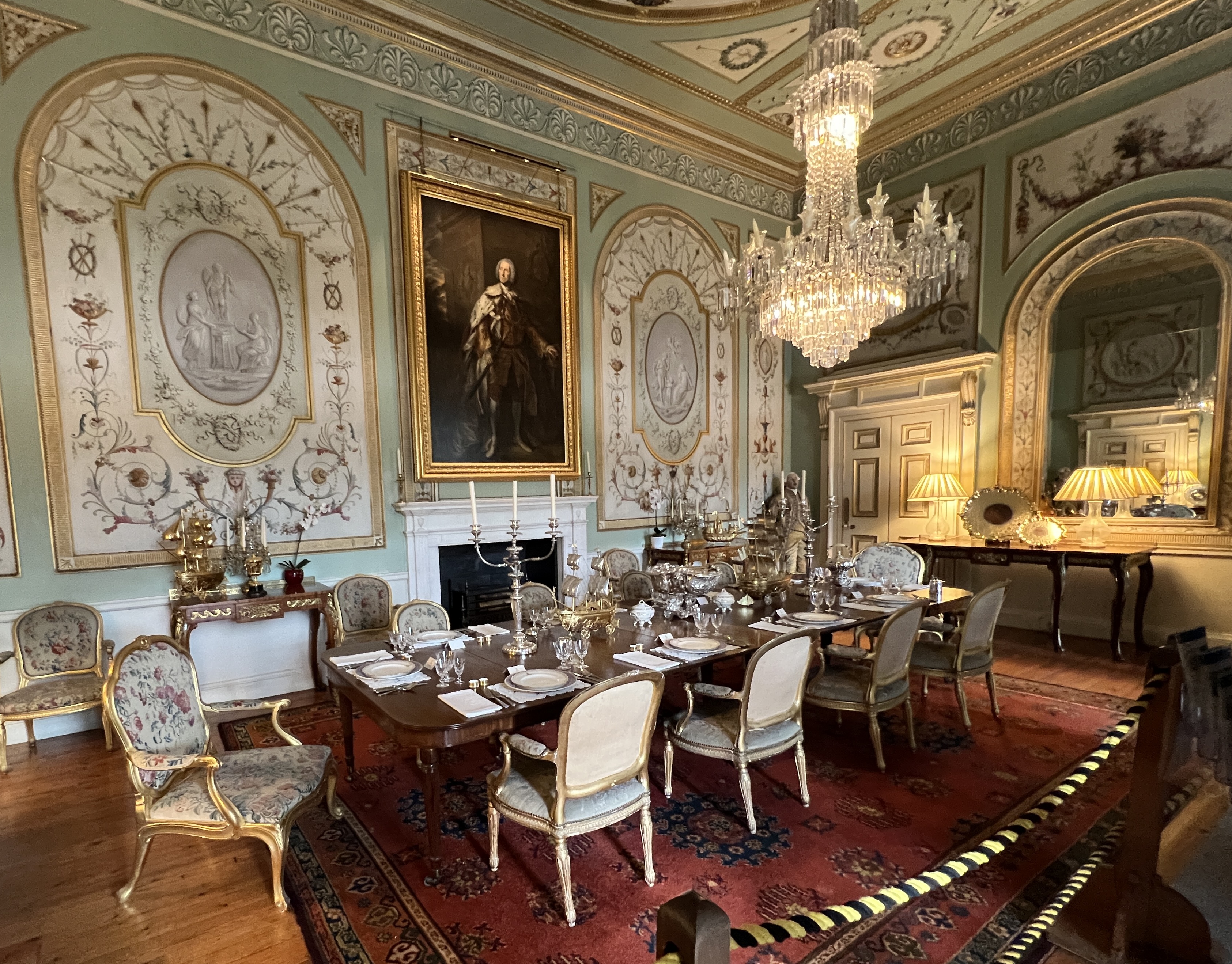
The Crown’s ornate interiors and metal pressed ceiling.
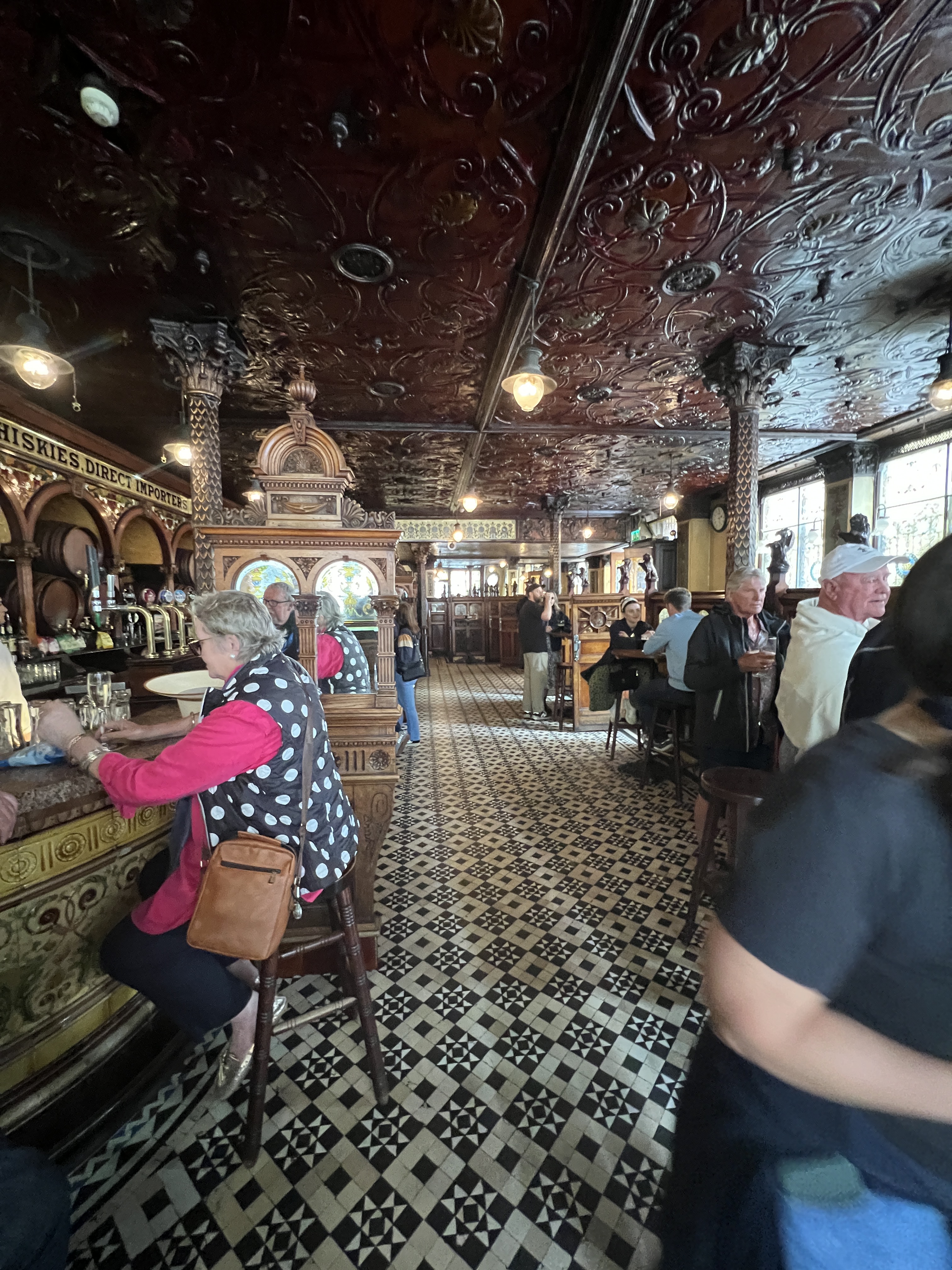
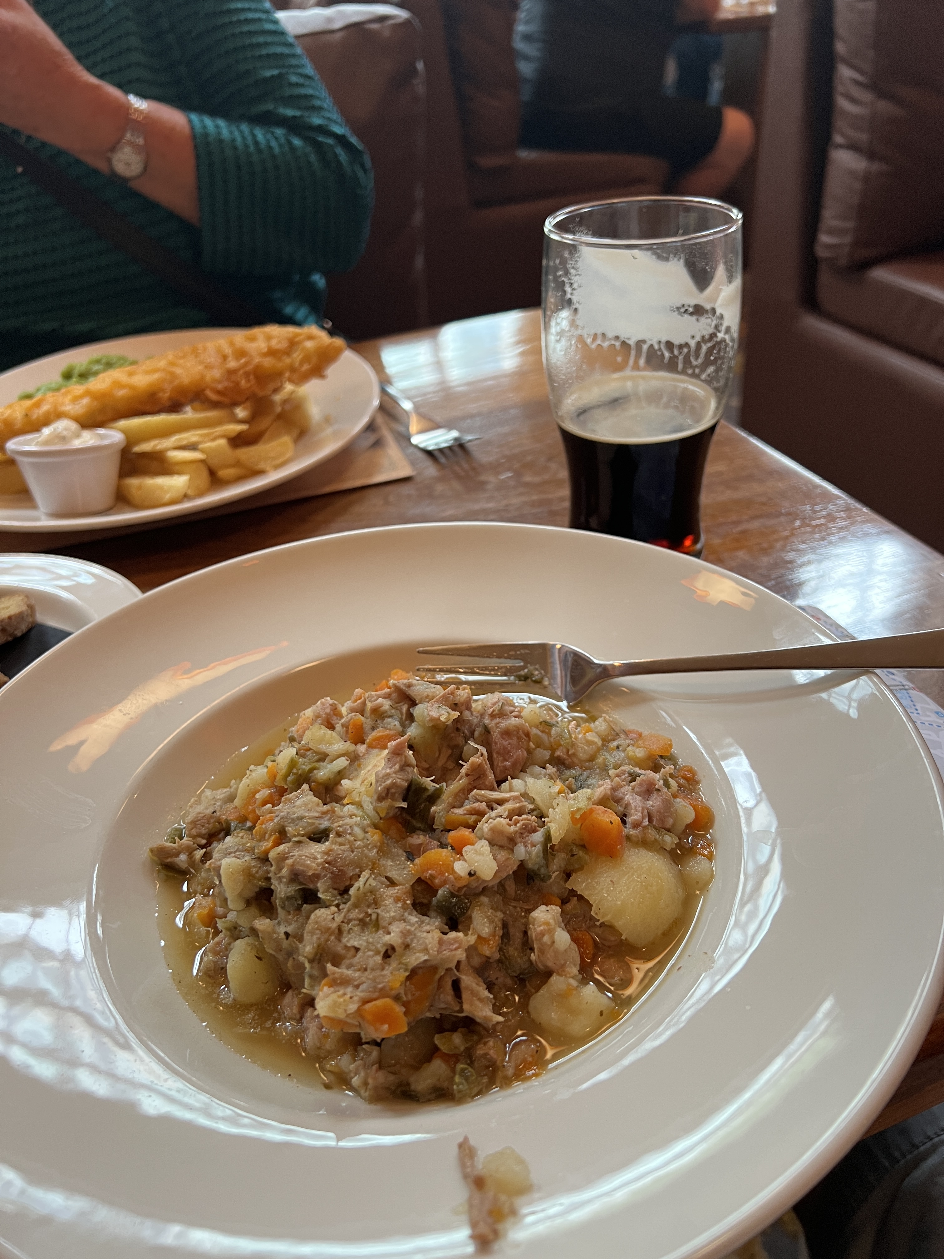
We returned the ship and then returned to the city centre for a late lunch and wander. Found the old pub The Crown, but it was packed so headed next door to Robinsons another old establishment that had been recommended for a feed. Weren’t disappointed with the Fish n Chips and Irish stew.
Irish stew for lunch at Robinsons another iconic Belfast pub.
The weather closed in again and we had some light rain on the way back to the ship.
Next stop is at Greenock, mouth of the River Clyde, Glasgow’s port.
Having left Lisbon we made good pace up the Portuguese and Spanish coasts on two sea days before making landfall at Holyhead on the Welsh coast. The Bay of Biscay was a mill pond, belying it’s reputation for a stormy crossing.
Holyhead is a true old port town, being the ferry transport hub to Ireland. Looks a bit drab. Dublin lies almost directly opposite across the sea.
It is here we start the jig around the Irish Sea. Over the next seven days we are dropping into Wales, Northern Ireland, Scotland, Ireland and then back around Lands End to Dover in England.
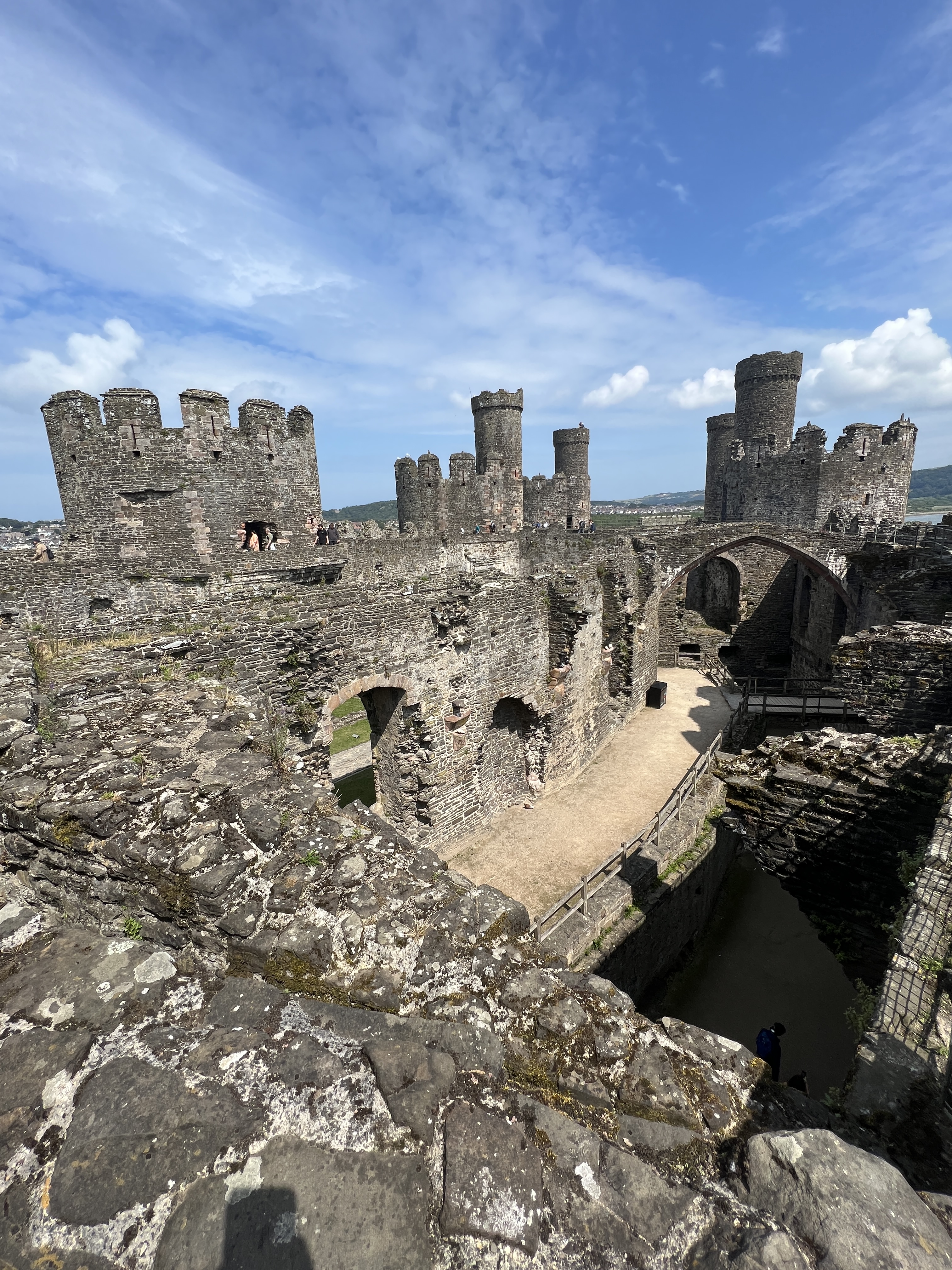
But first it is Wales. We have been around this part of the UK before exploring the Welsh coast and the Snowdonia Mountains. However, back then we avoided seeing any of Edward 1 string of castles he had built following his conquest of Wales in the 13th century. We had already had our fill of castles elsewhere!
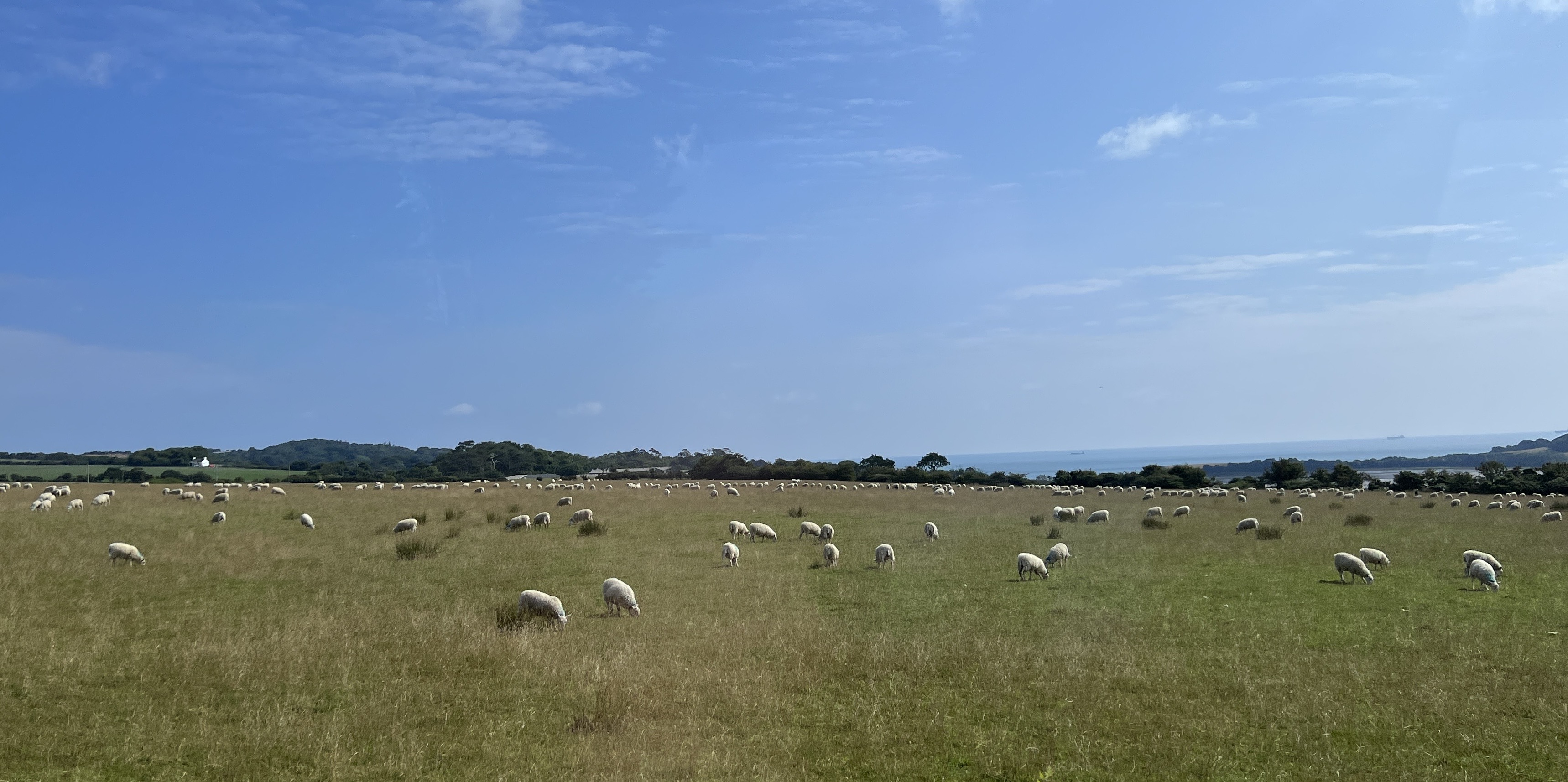
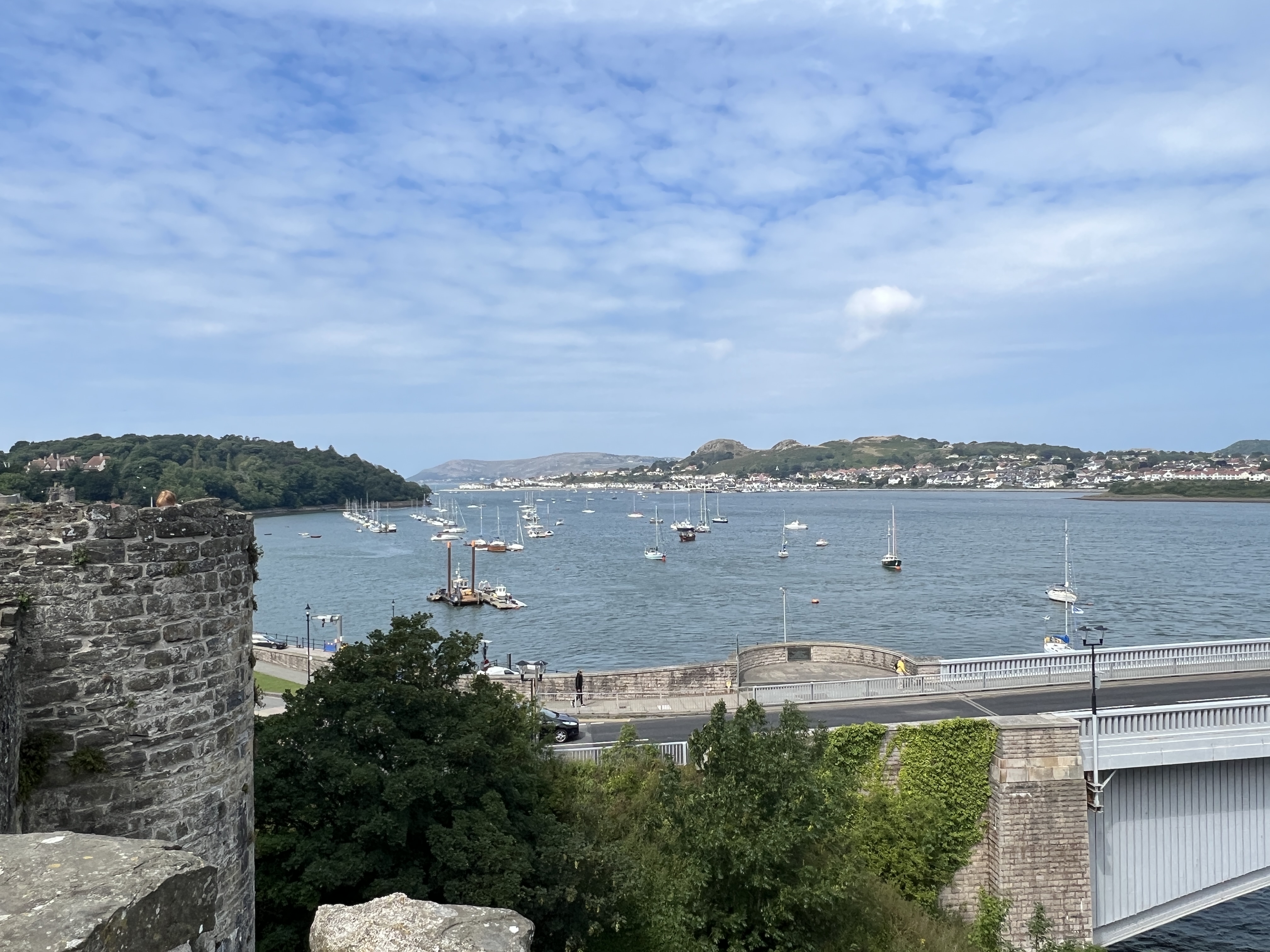
Conwy (‘Conway’) Castle was the tour choice. Holyhead is on the large island of Anglesey, separated from the Welsh mainland by the Menai Straits. Anglesey is mostly an agricultural area, sheep, cattle and grains.
Sheep everywhere on Anglesey!
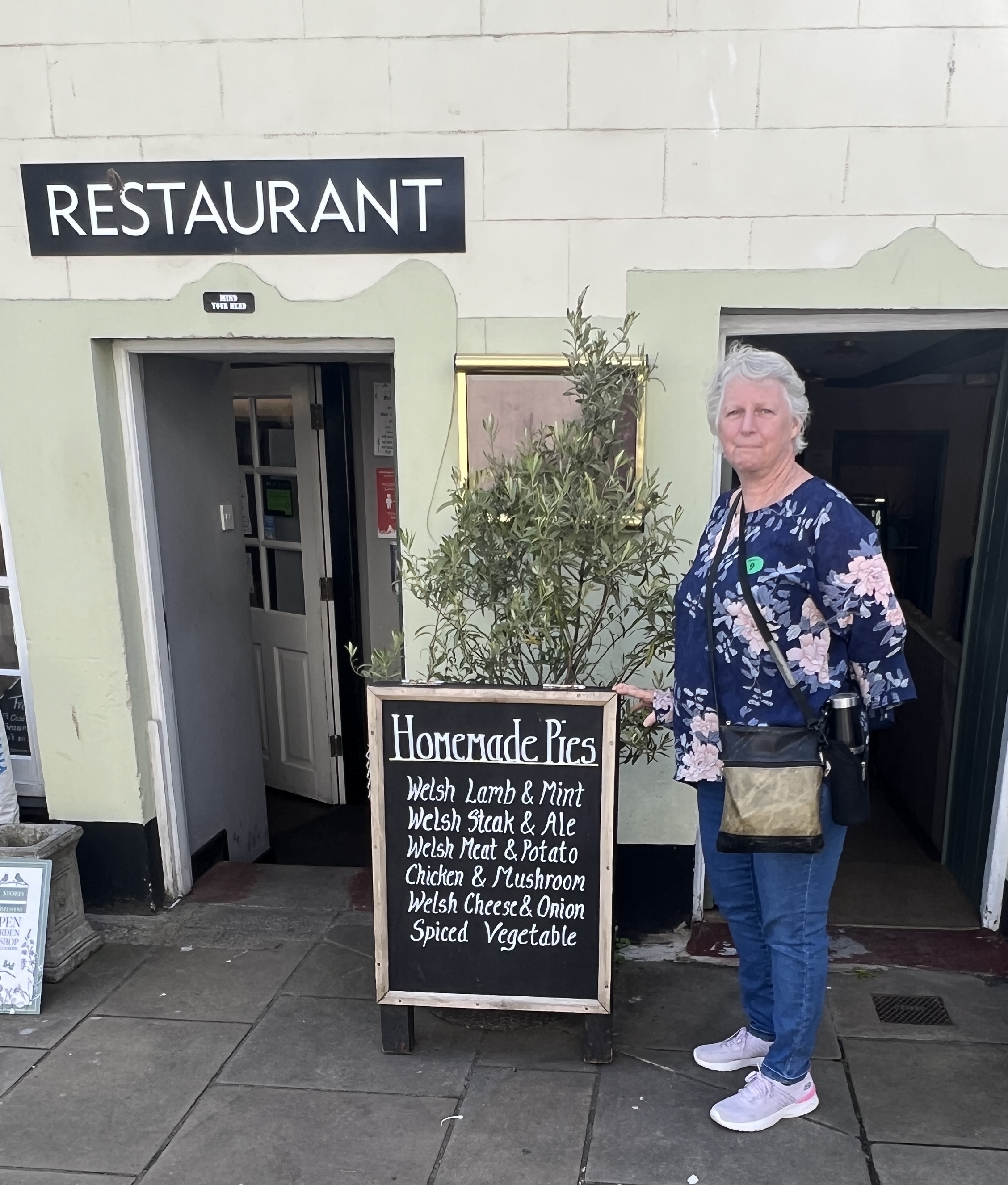
We stopped for an early lunch on the island at Beaumaris and to also see Edward 1 incomplete, but well preserved moated castle beside the Menai Strait. Had some local pies here, as always rather good with a nice crunchy pastry.
Beaumaris castleLunch!
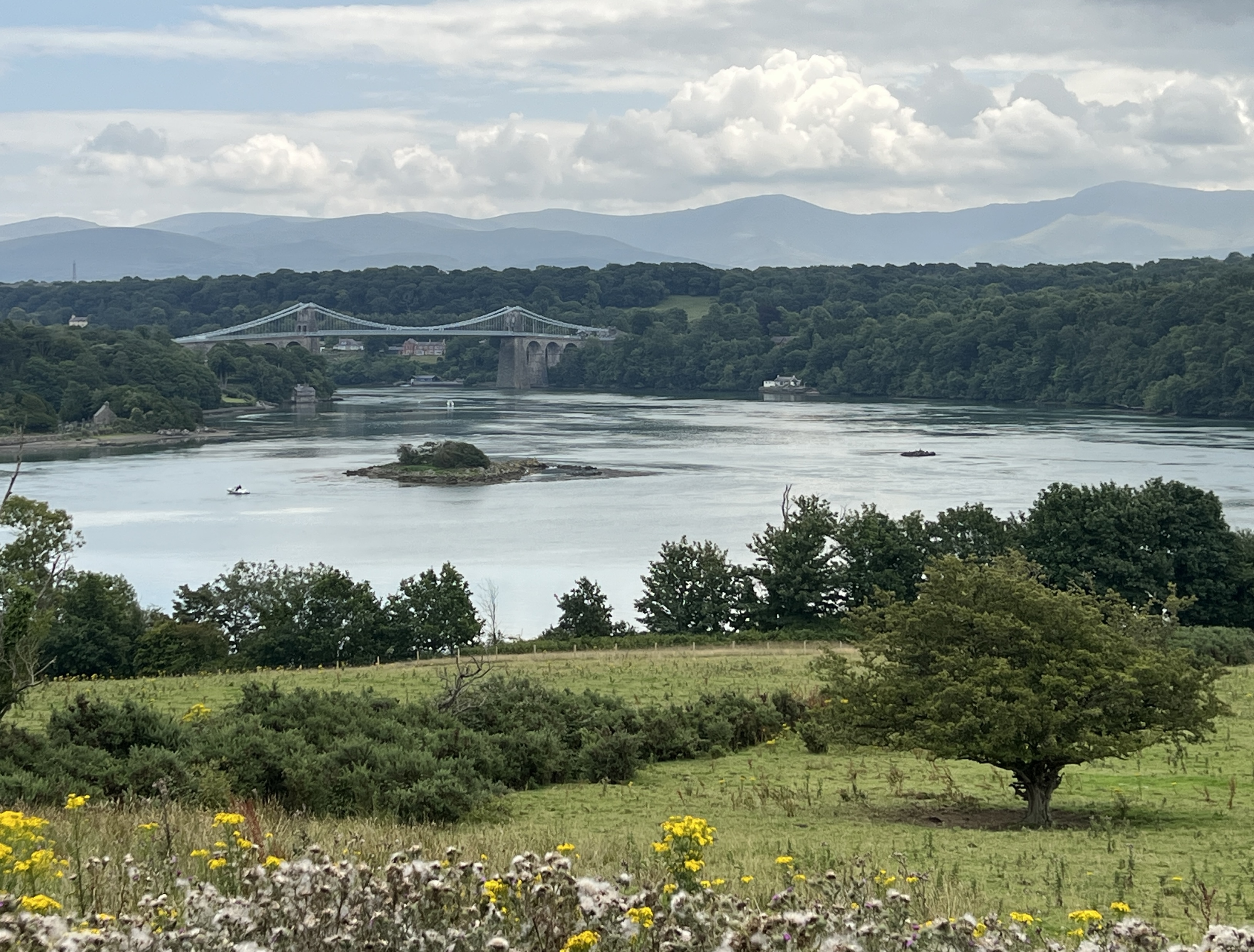
The Menai Strait is a challenging crossing by water due to different tide times at either end creating strong eddies and whirlpools. Our bus crosses over it on a suspension bridge built in 1826 by Thomas Telford, the famous inventive engineer of the times.
Telford’s 1826 suspension bridge over the Menai Straits.
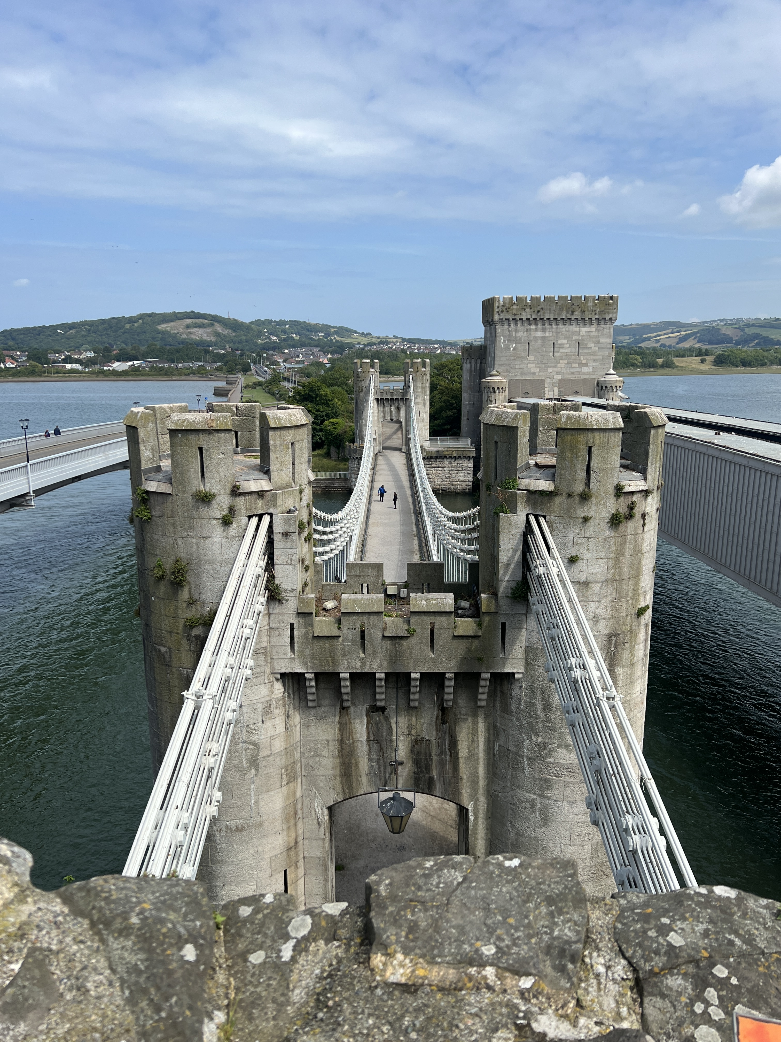
It was then onto Conwy for the tour through the castle that is perched on a ridge line right beside the Conwy River. Great spot for a defensive position. We were late getting there because of a big traffic snarl on the motorway. Sheep were loose on the roadway and some had got into a tunnel causing the problem.
Bridges across the Conwy River into Conwy.
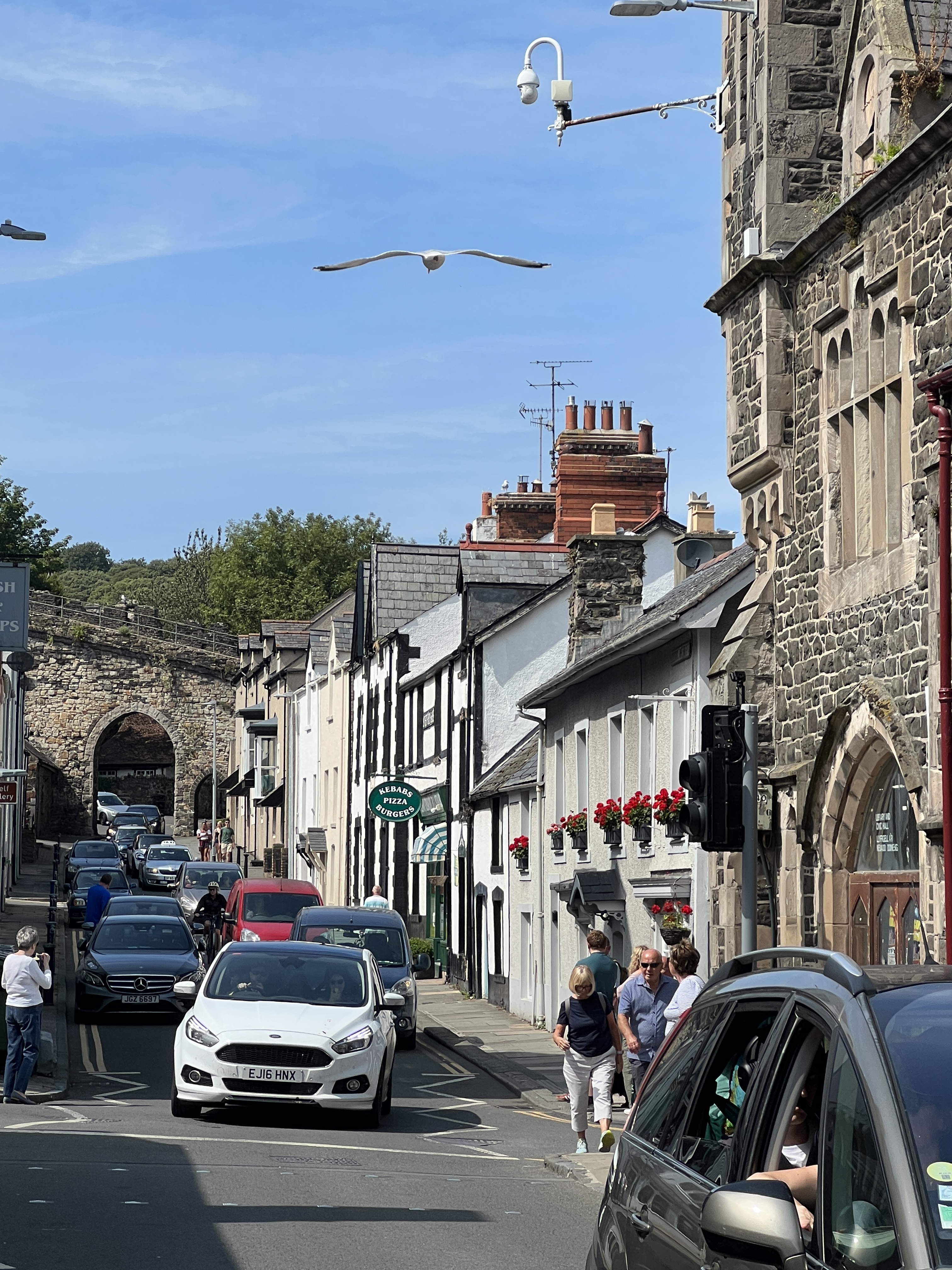
The Conwy Castle is also linked to the walls that encircle the town. Edward as part of the Welsh colonisation planted an English settlement beside the castle. They needed the wall to keep the Welsh out, who weren’t impressed by the invasion.
Town walls encircle the town.Conwy River from the castle walls.
Allthego climbed up the stairs to the top of the Castle walls, great views of the castle construction and the town. Homealone stayed below to look after Slobro who didn’t like the look of the steps up.
Conwy Castle walls.The main street with one of the city gates.
We were then back on the bus for the return to ship, the sheep had been cleared from the road and tunnel, and to move on overnight to Belfast.
Sailing out into the Atlantic we are now on the way up the Spanish and Portuguese coasts. The sea is making a moderate swell of about two metres and there is a strong wind. It is significantly cooler than it was back in the Mediterranean, about 18 C, little humidity. The arrival time in Lisbon is later than normal and we start making our way up the Tagus River around 10am.
Coming into port under the 25th April bridg
It is a great sail up the river, narrowing as we move further up stream and pass under the ‘25th April’ bridge. It is so named because it was on that day in 1974 that there was a ‘peaceful’ revolution against the long time dictator, Salazar, and the establishment of the current democratic parliamentary system.
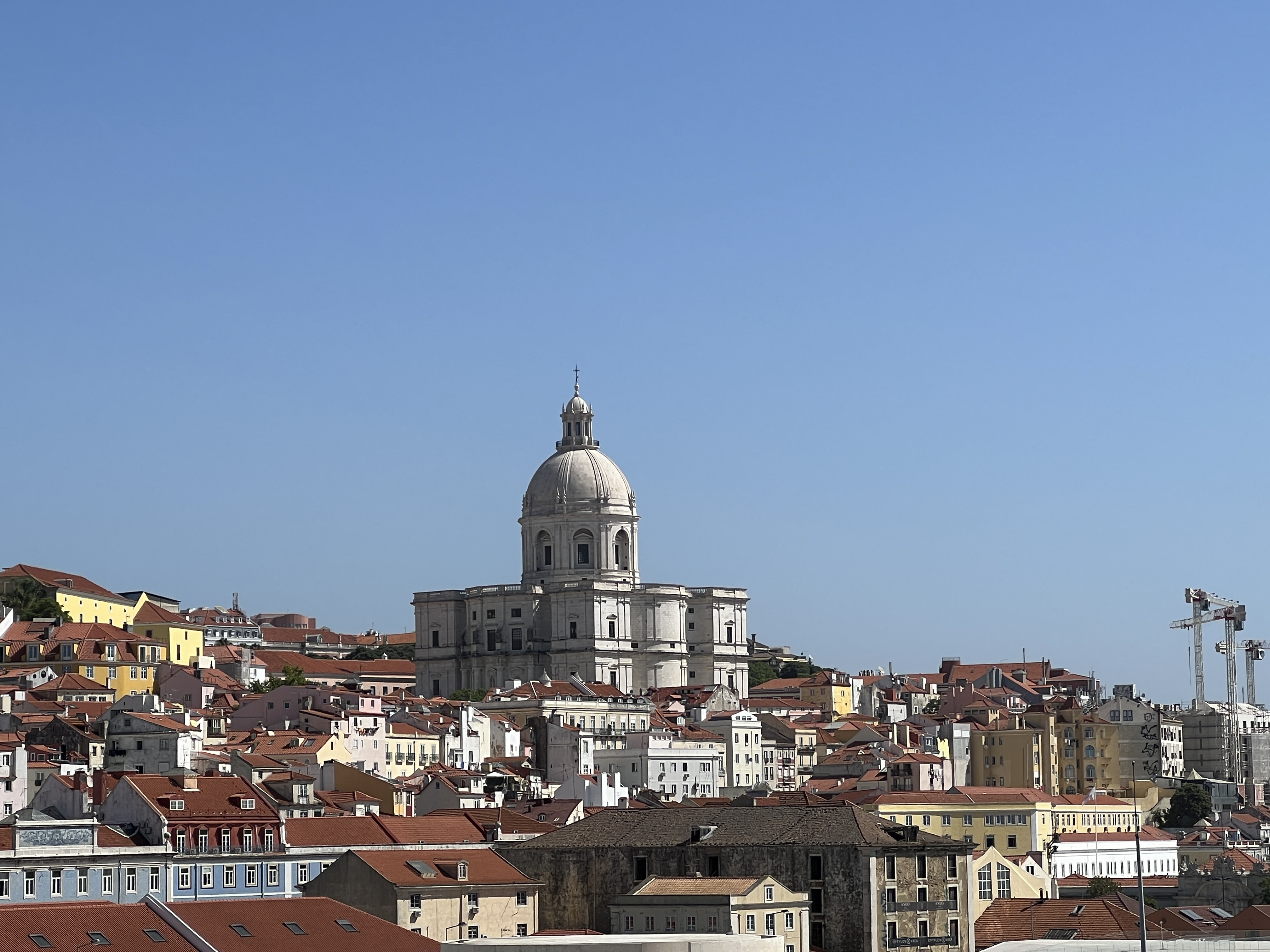
Originally the Church of Santa Engracia, this is now the National Pantheon where prominent Portuguese are buried. It is one of the buildings that dominants the view from the ship.
After going through the docking process we were able to get ashore for a couple of hours and have a look around what is known as the Commercial Square, with the old Palace and Arch dominating the view. Plenty of tourist activity here, restaurants etc. The Pope is due in town in about three weeks and there is a lot of cleaning up and barricades being erected. There will be a big crowd here in the Square.
The main Square beside the Tagus, La Praça de Comércio.
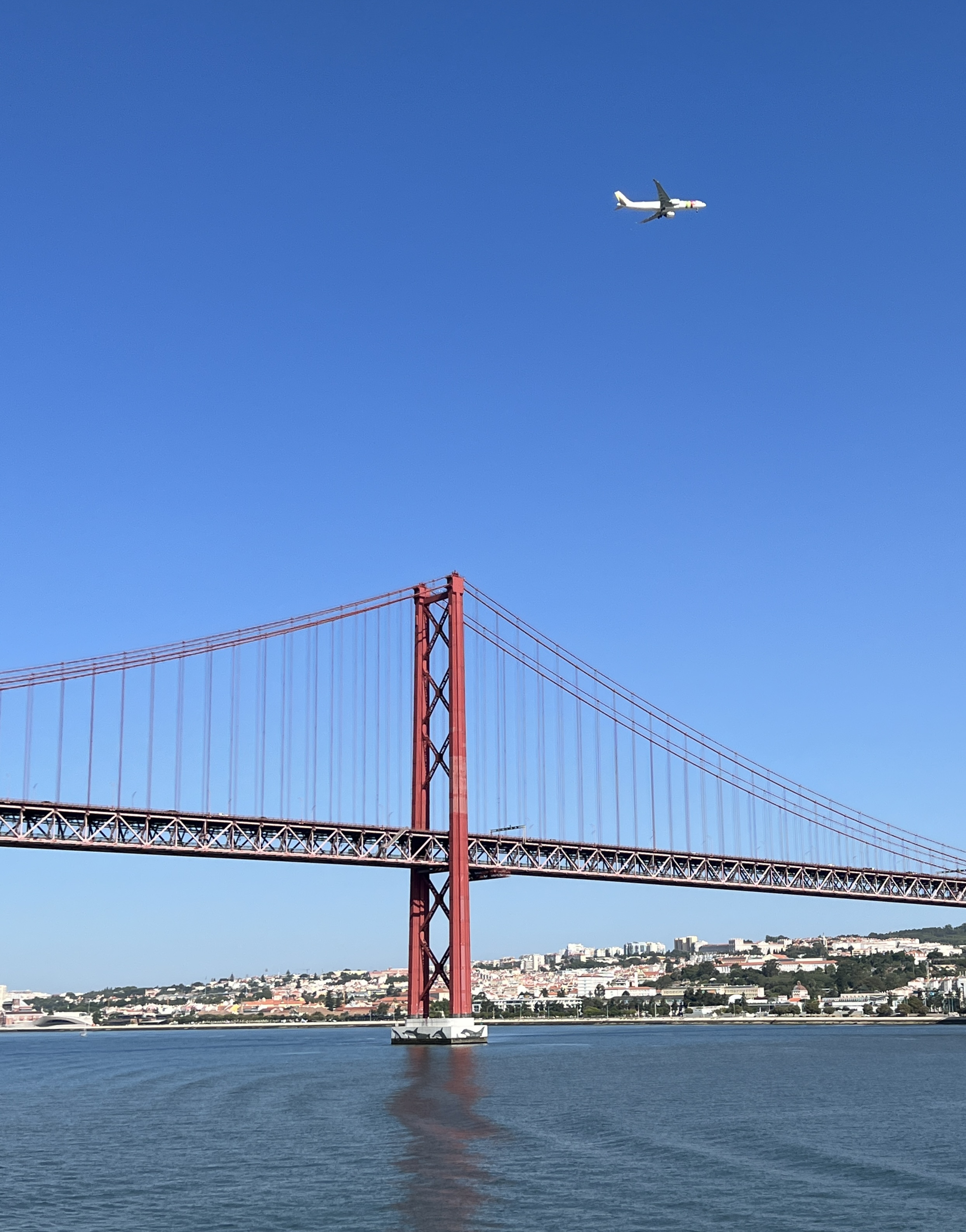
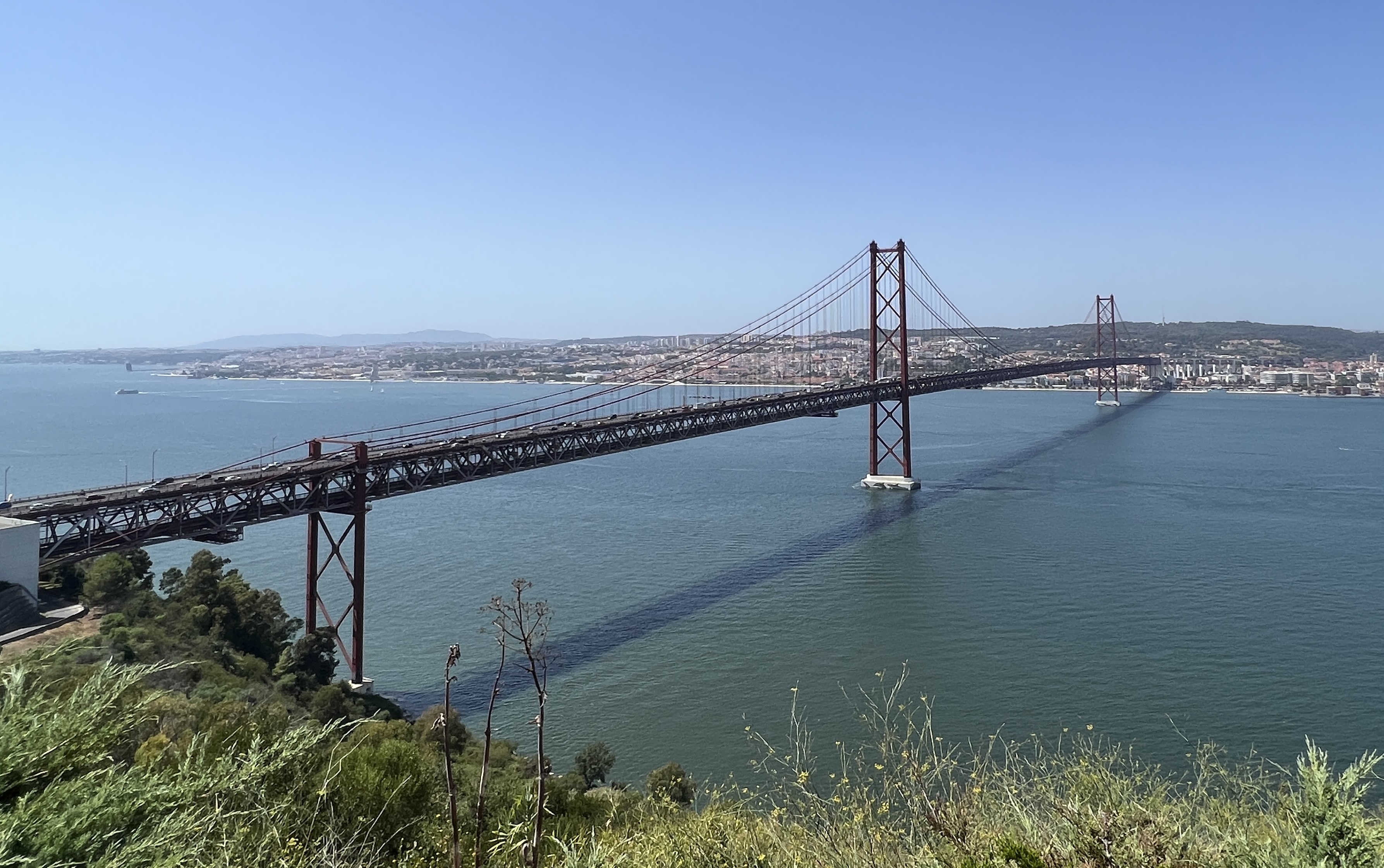
We returned to the ship for lunch before our tour in the afternoon to see some of the major sights. The tour took us to the other side of the Tagus River across the 25th April bridge. It is built in the style of San Francisco’s Golden Gate bridge but has two decks, one for the railway and the other road traffic.
25th April bridge across the Tagus River.
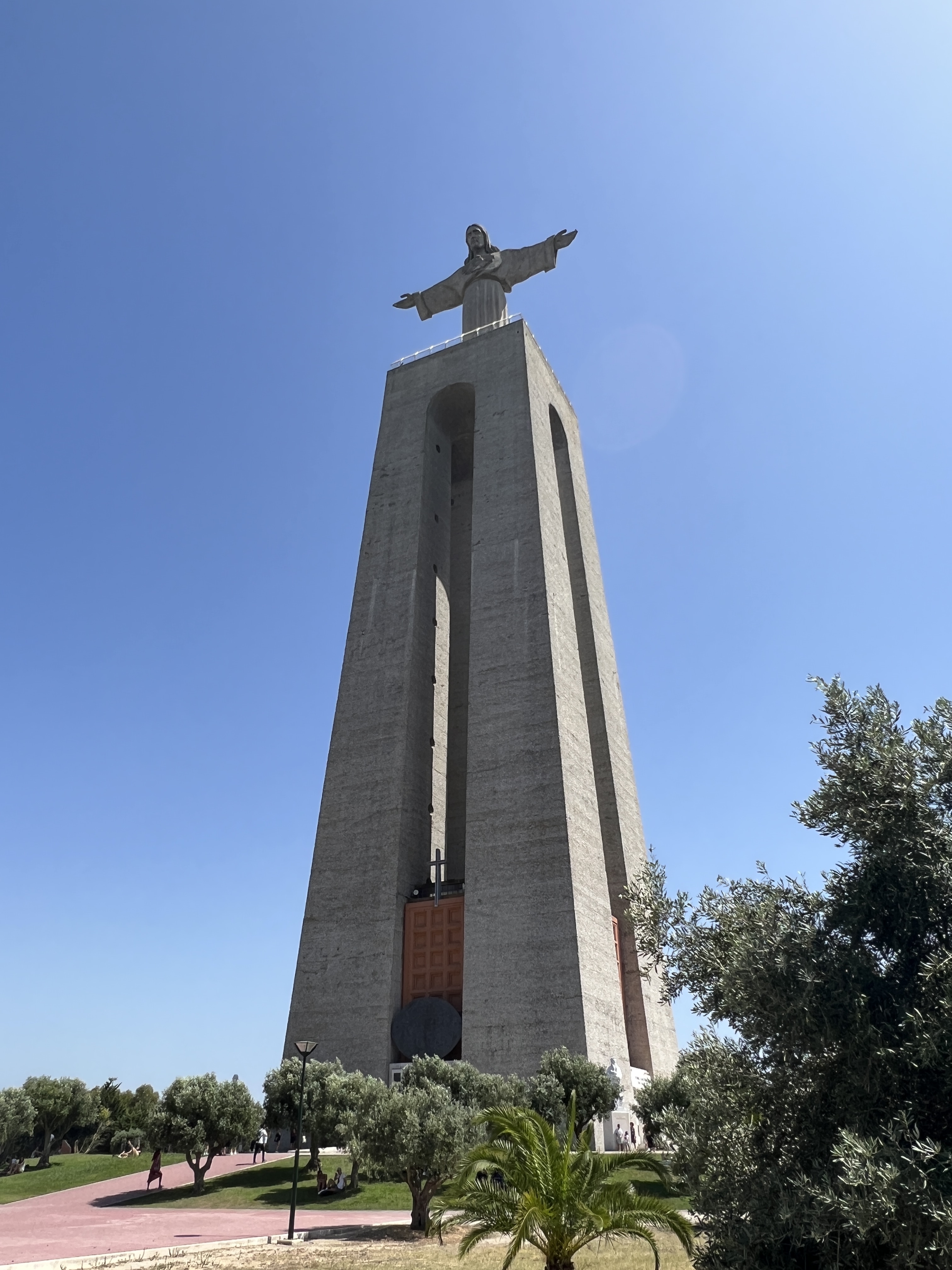
Looking down on the city from the other side is the Christ statue, a big but I think smaller version of the one in Rio. Still impressive. Great view from here of the city and the 25th April bridge.
The Christ statue overlooking the Tagus River.
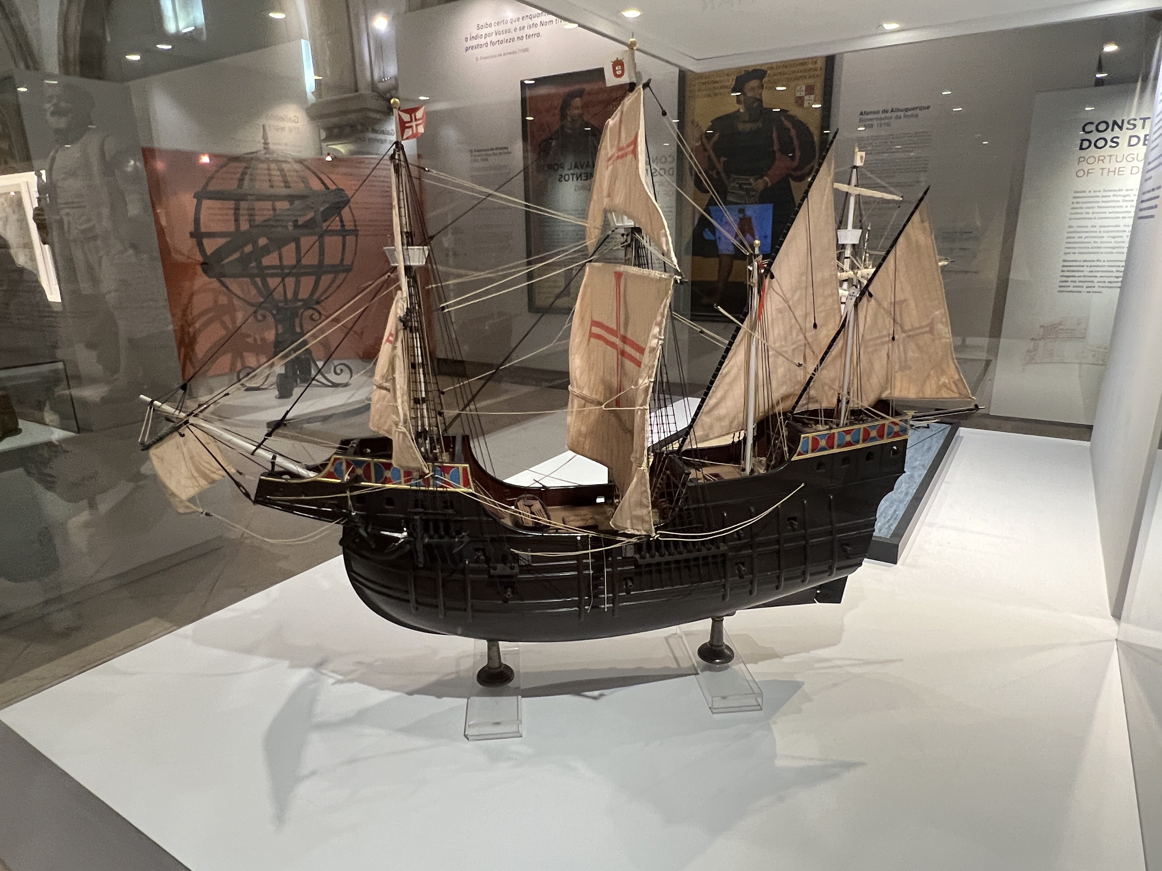
Back on the other side we headed for the Maritime Museum housed in the Jerónimos Monastery. The guide goes through this fairly quickly, but it is a great overview of the contents documenting Portugal’s maritime history of the 15th to 17th centuries.
Entry to the 16th century Jerónimos Monastery, a major landmark. Vasco da Gama, the famous explorer is buried here.
Our guide was a fairly enthusiastic promoter of Portugal’s leading place, ahead of the Spanish and Dutch, as the earliest European navigators, map makers etc. He sited some recent studies suggesting they made it to Australia ahead of the Dutch.
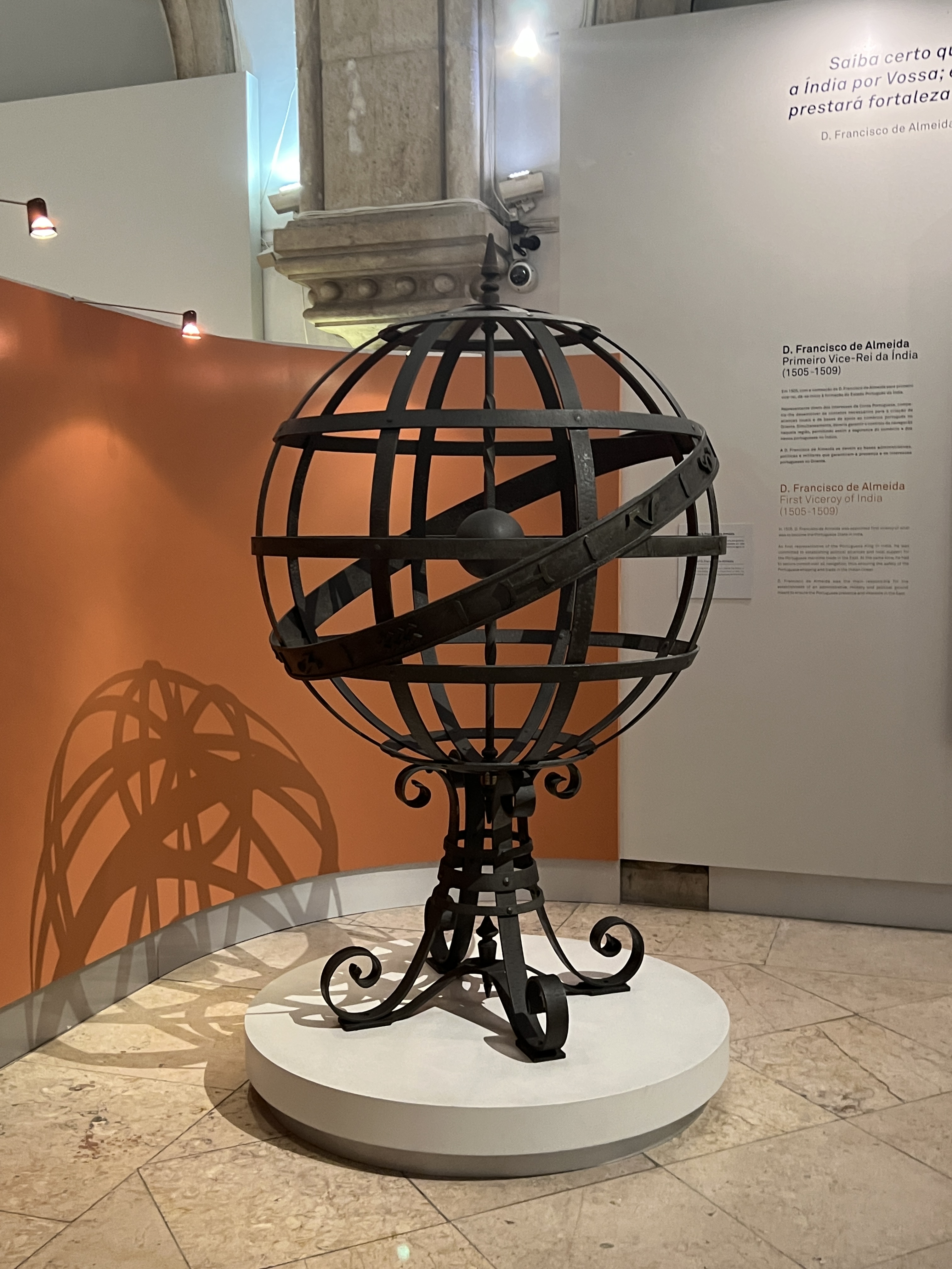
Model of early square rigged ship.Astrolabe, used among other things to determine latitude, the forerunner of the sextant which could also determine longitude, onboard ships at sea.
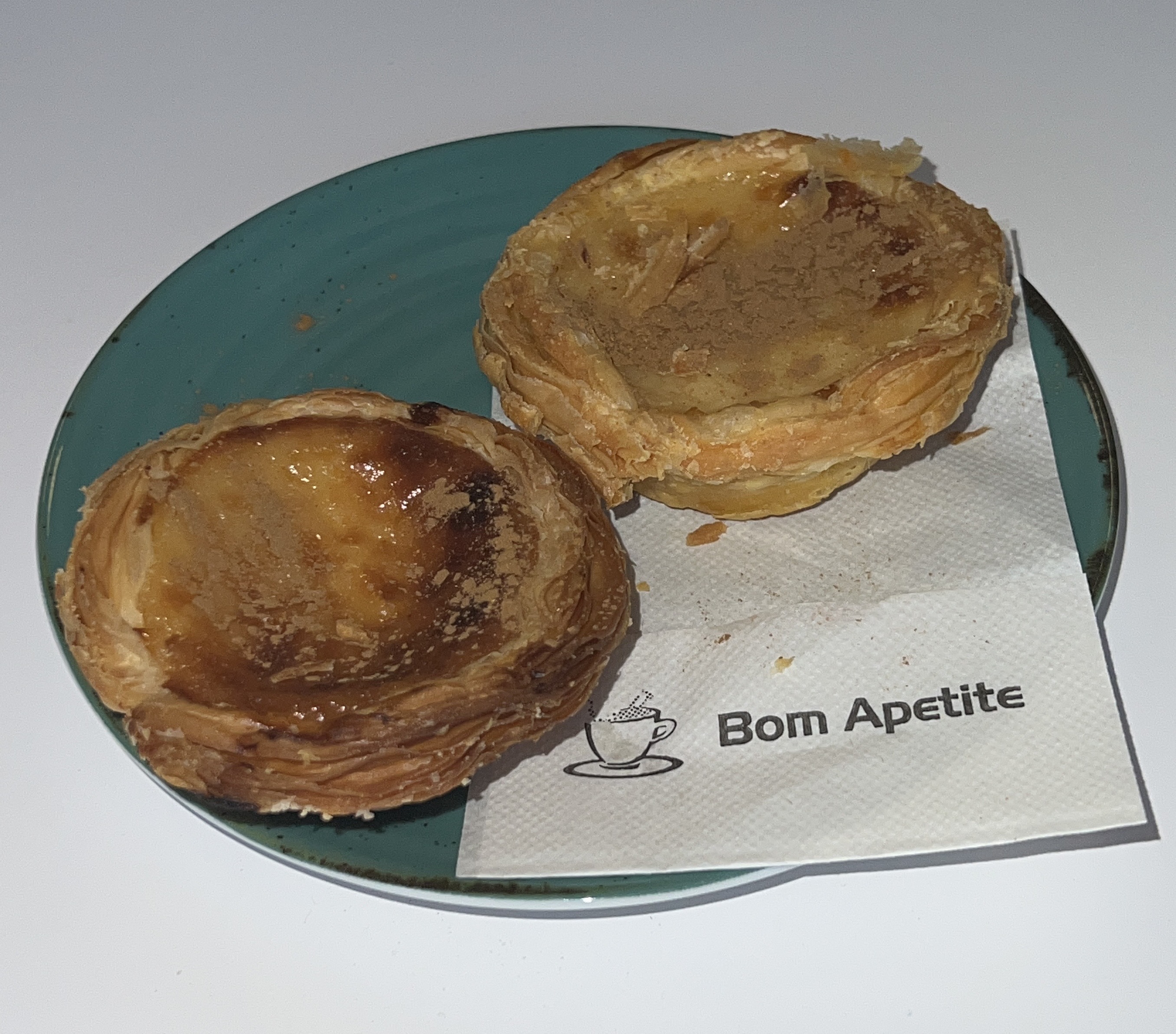
We had a light snack in the Museum cafe, a genuine Portuguese Tart. This is their answer to the vanilla slice! The tart had a crispy pastry shell and commendable contents. A worthy challenger!
Portuguese tarts.
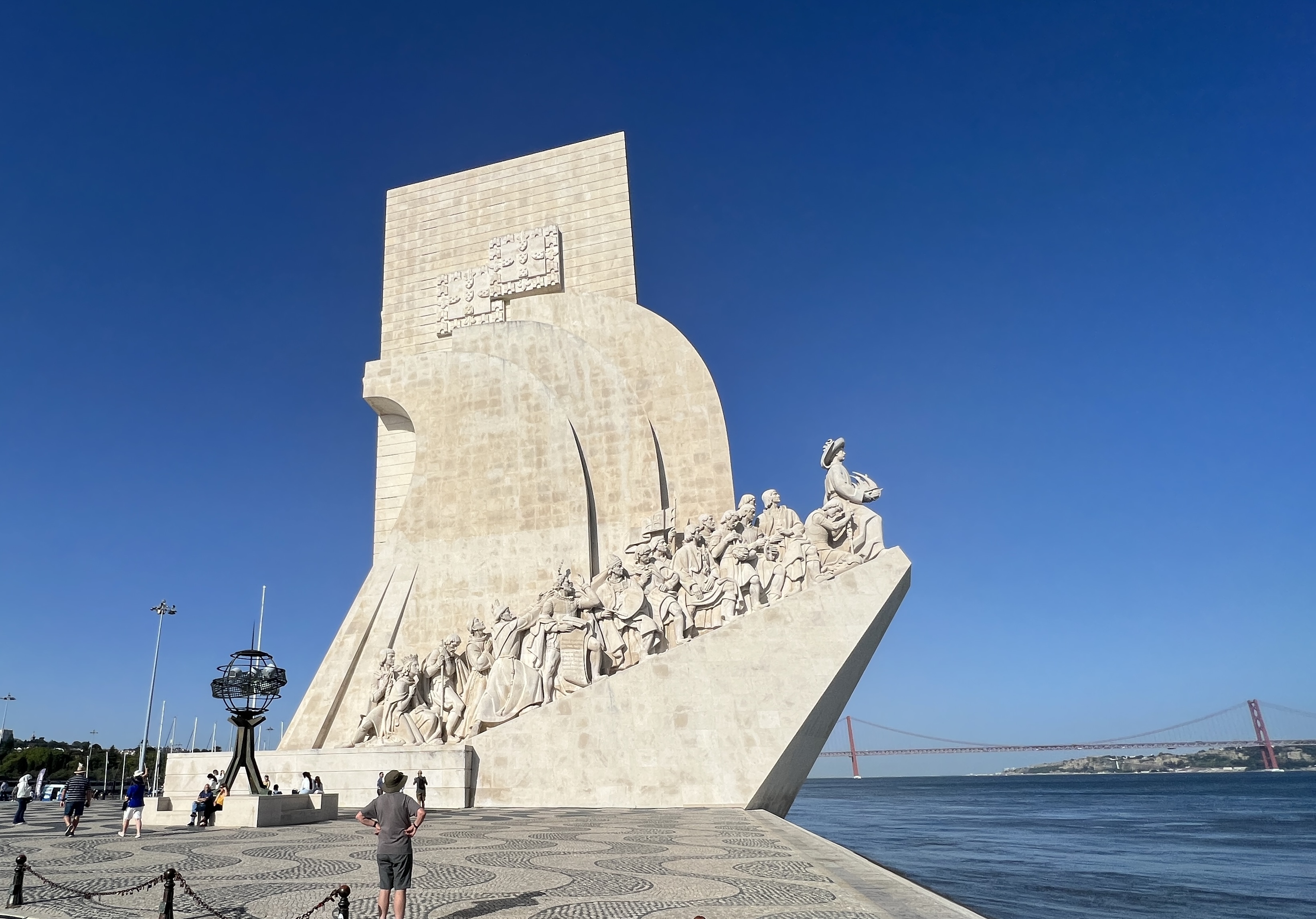
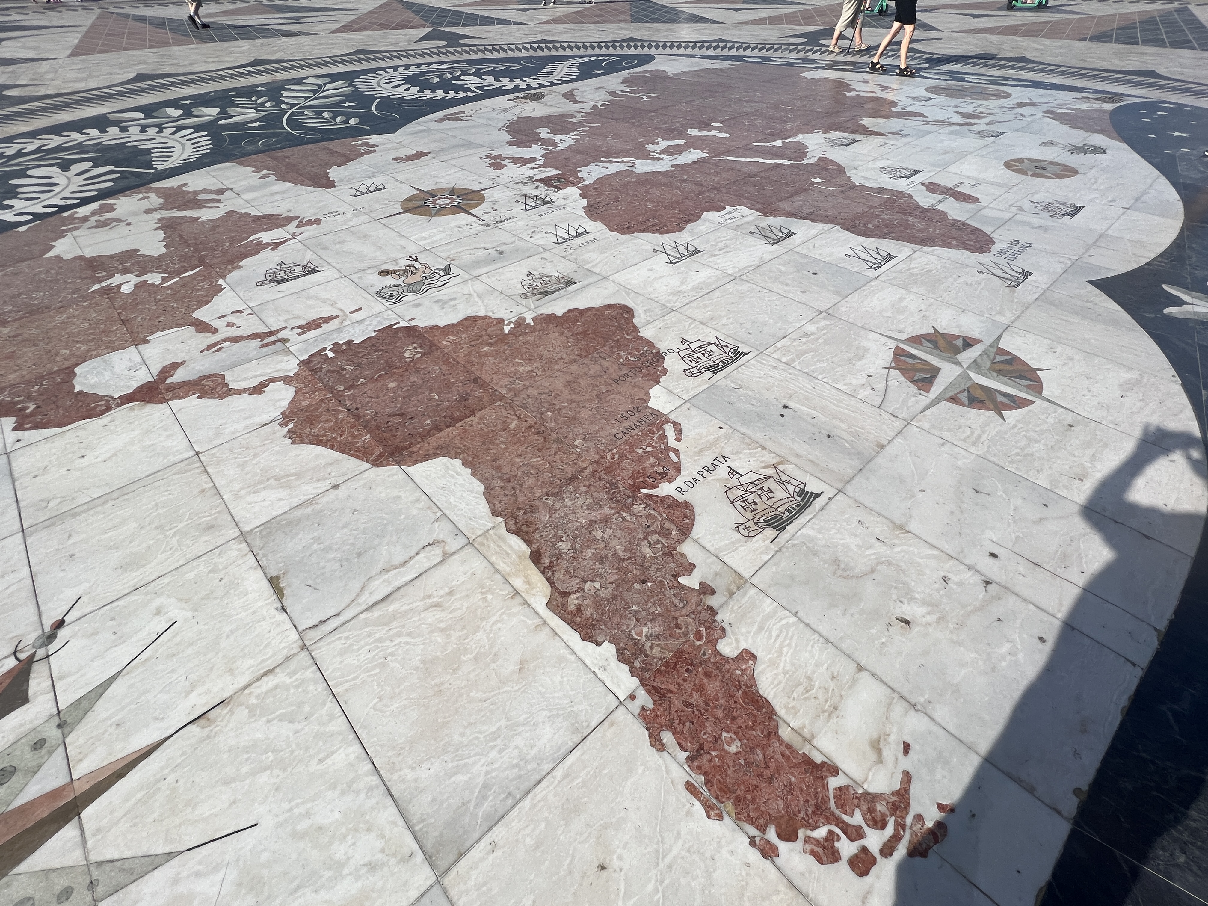
Across the road on the banks of the Tagus is the impressive Monument to the Discoveries and plaza map.
Monument to the Discoveries, looks down the Tagus River out to sea where the great Portuguese seafarers ventured.Map of the known world showing the voyages of Portuguese explorers imbedded in the plaza near the Monument to the Discoveries. Quite impressive display.
Further down the river is the last remaining 16th century fort, the Belém tower. This area was the starting point for many of the exploration voyages.
Belém tower. There were 3 of these across the Tagus River. One on each bank and this one out in the river, but now beside the bank due to land reclaimation. The other two towers long gone.
Back on board the ship the sail away at around 10 pm under the 25th April bridge in the twilight was memorable. Great views of the buildings and lights coming on as we headed off north into the Atlantic.
Tangier is situated on the north west tip of Africa, in Morocco just across the Strait of Gibraltar from Spain but poking out into the Atlantic. Sailing out later in the day we could see the Rock of Gibraltar back down the Strait. Unfortunately, it was a bit hazy and murky and not a clear view of the coast.
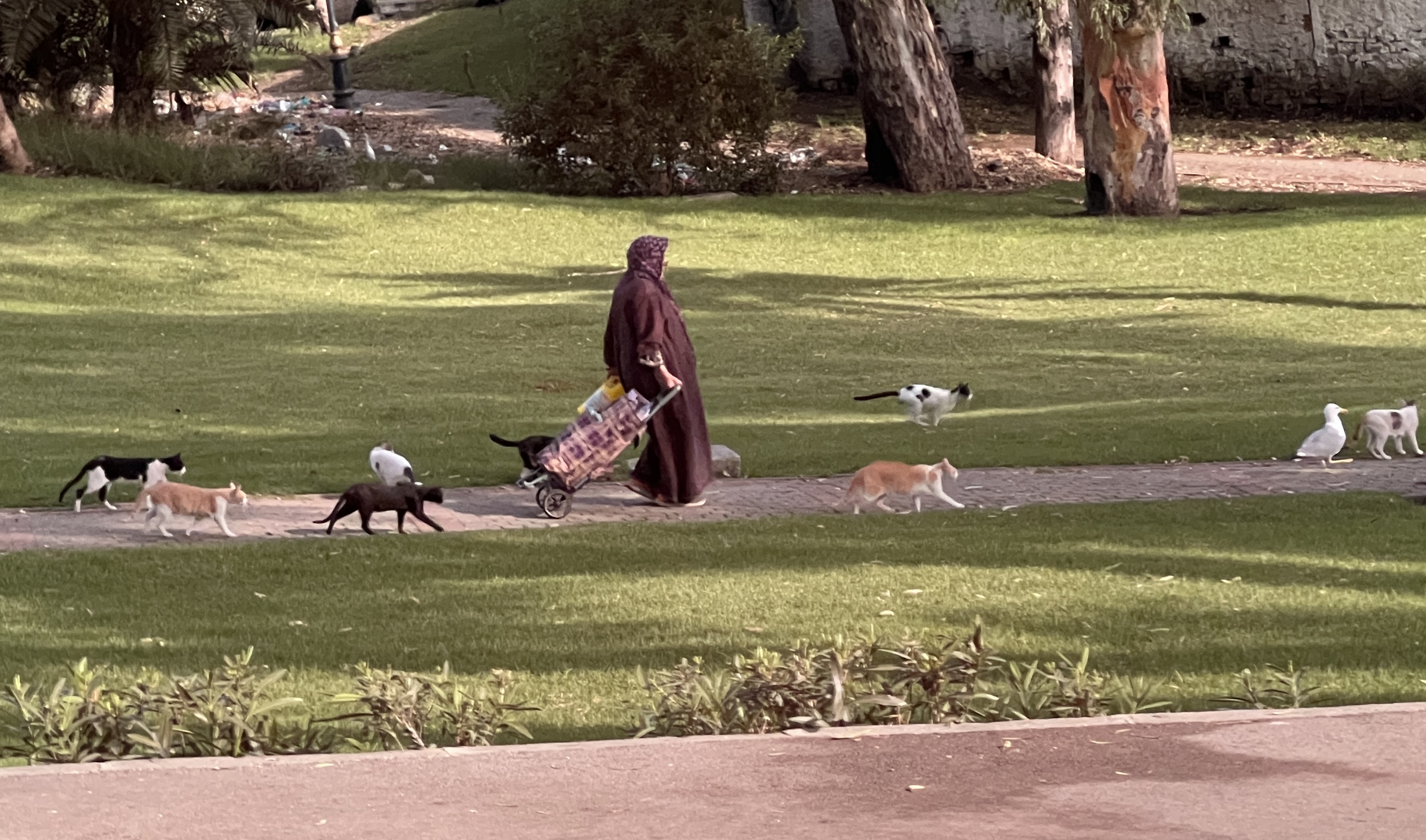
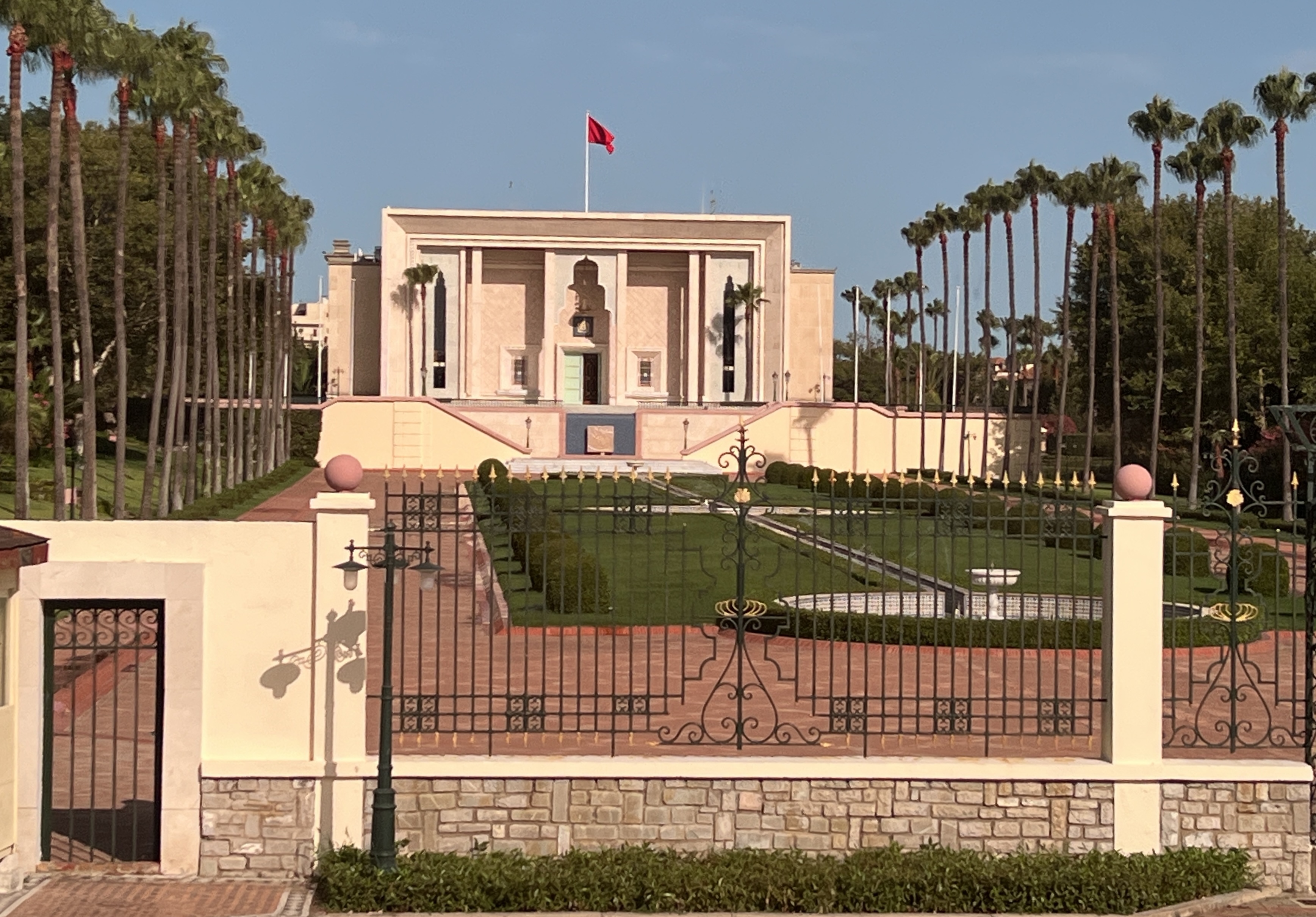
Cats are everywhere, this woman feeds them so we are told and later see.The King’s Palace.
Our tour here took us first to the top of hills surrounding the port, this is the ‘modern’ Tangier and reflects the great interest Europe and the US had in the city. Positioned where it is makes it a strategic point for entry into the Mediterranean Sea. The Romans were also here long before recognising the same advantage. The area on top of the hills is sort of segmented into various quarters; the English, the Dutch, the French, the American etc. Quite a few, each trying to exercise influence over the locals.
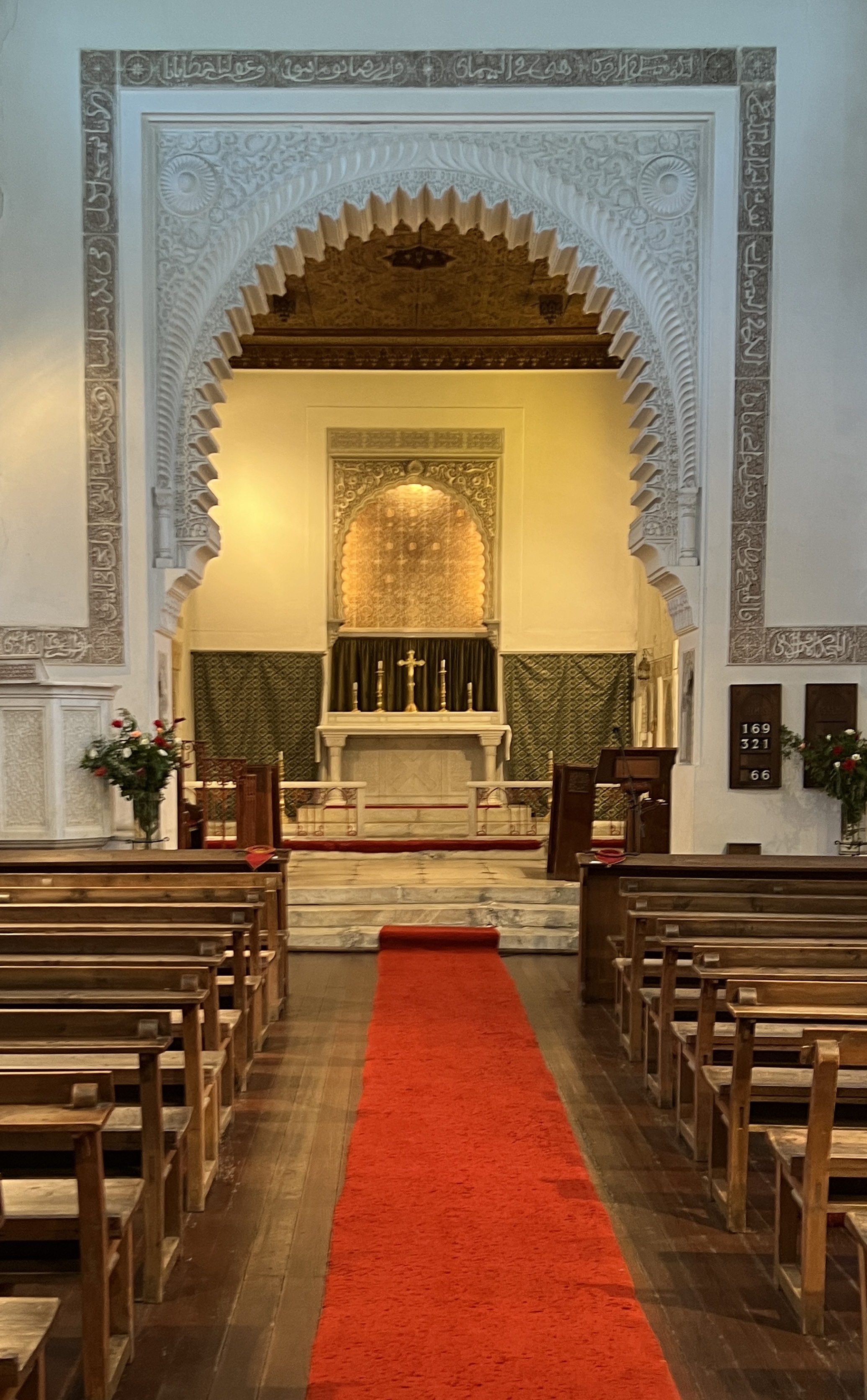
The English Anglican Church, quite austere compared to others we have seen of late! Note the Moorish ‘key hole’ and mosaics into the sanctuary.
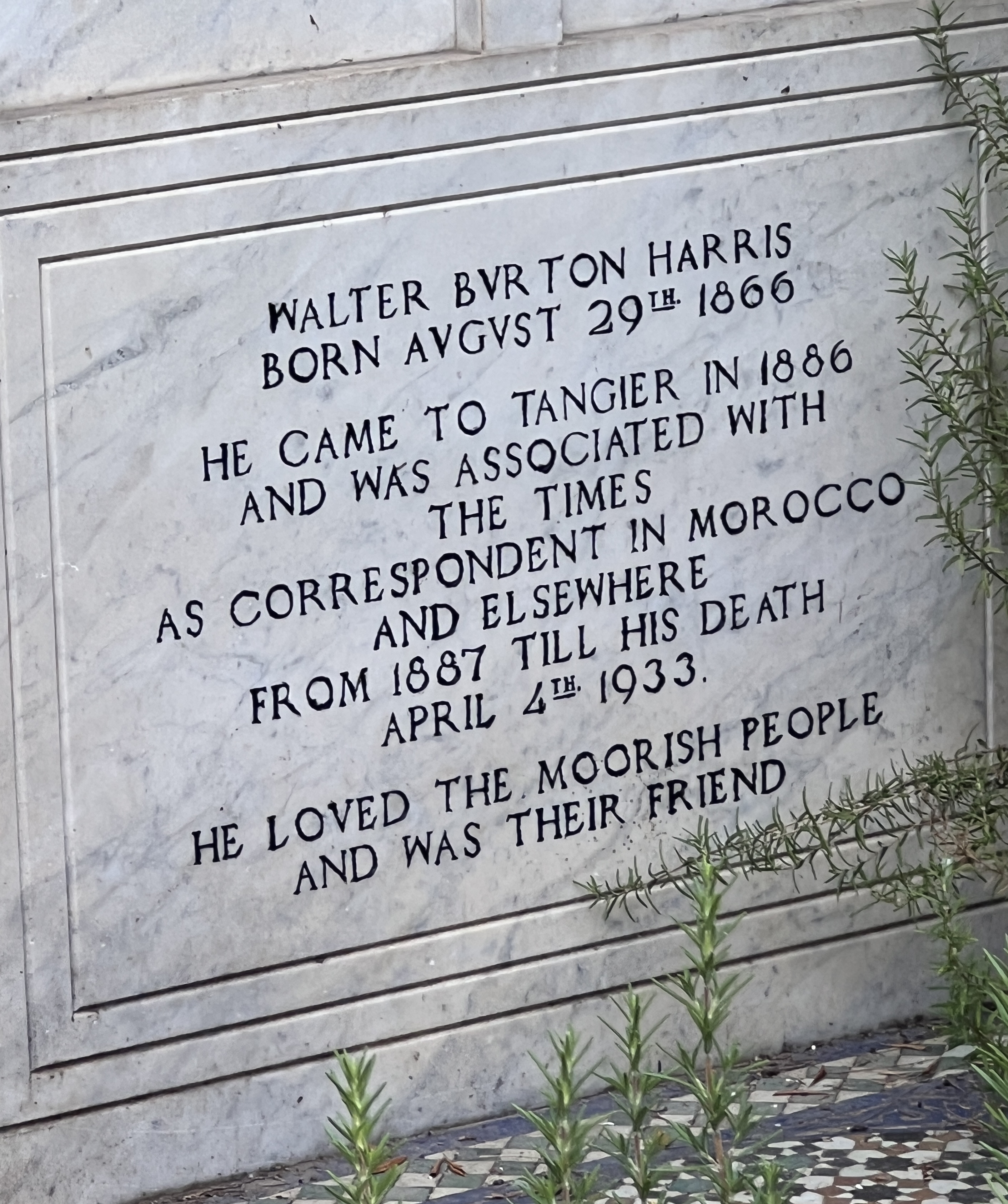
There is an English Anglican Church, in a garden setting that was constructed with ‘help’ from Queen Victoria. It is built a bit like a mosque. Numerous graves of English residents amongst the garden. One is of a chap who was a great friend of the locals, but is now thought to have been a British spy (according to the guide). A bit James Bondish.
Friend or spy?
Tangier was also a playground for the European and American elites in the last half of the 1800s and into the 1900s. Winston Churchill frequented Tangier as well as Marrakesh. Our guide said Churchill was so frequent here, as well as in most other parts of the world, that he left his initials behind ‘WC’. Well.
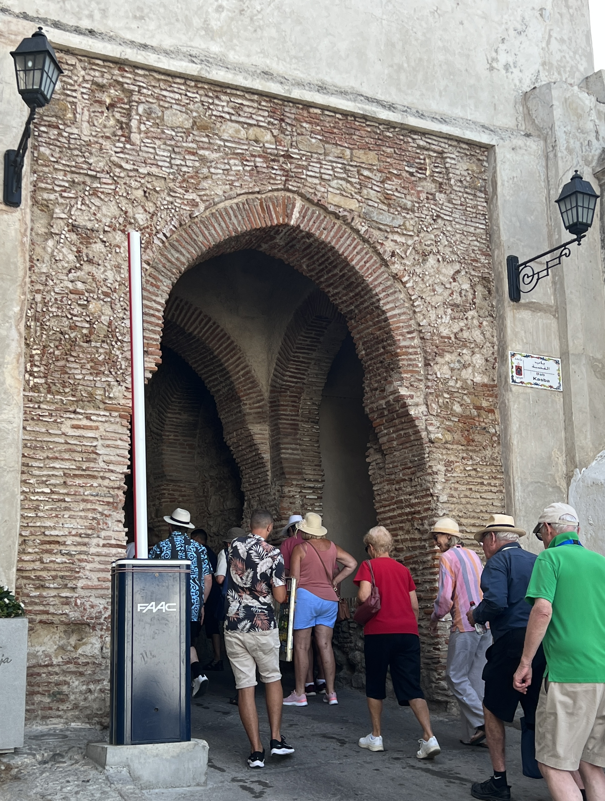
Our Gate into the Kasbah.Kasbah street.
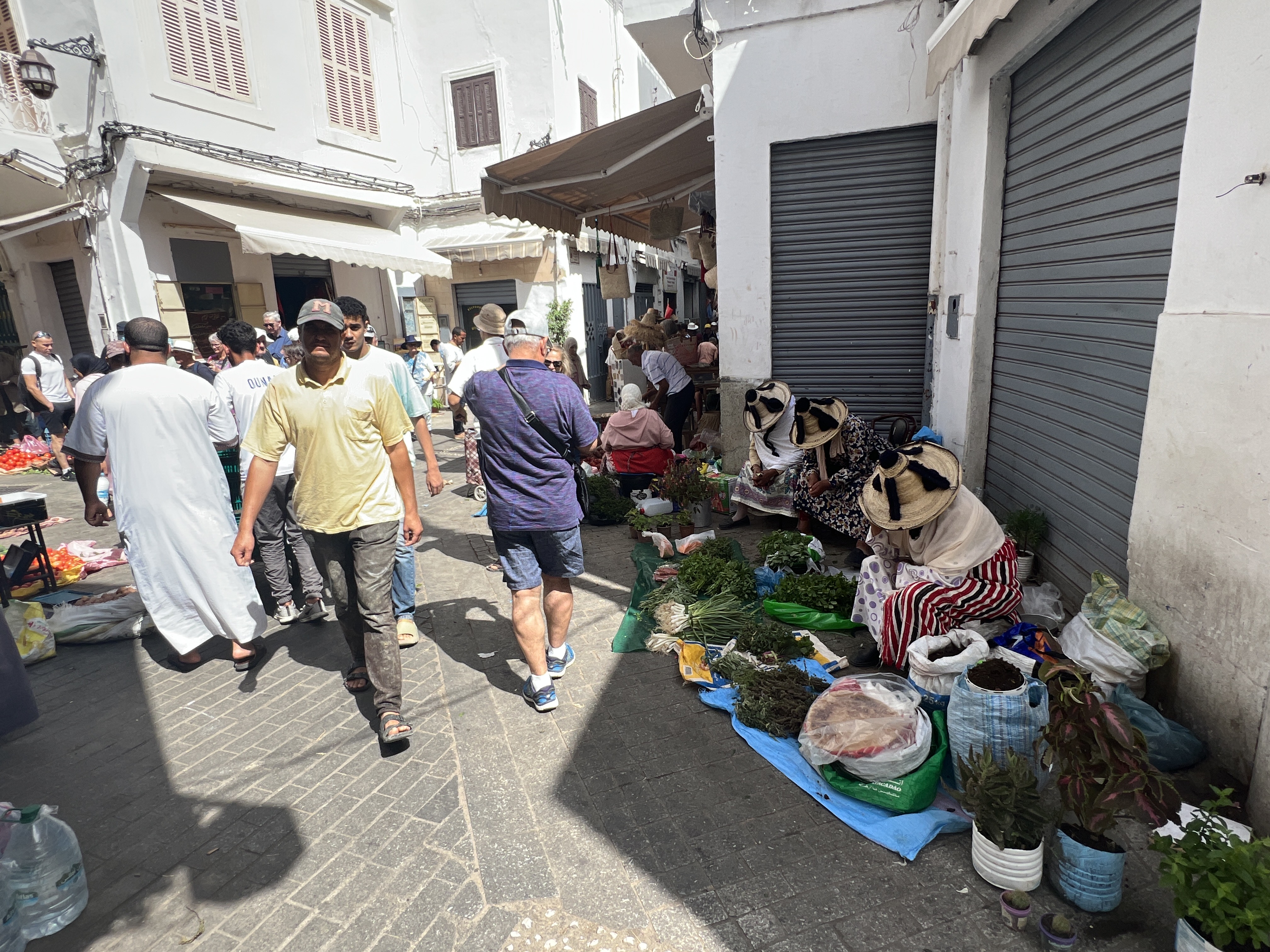
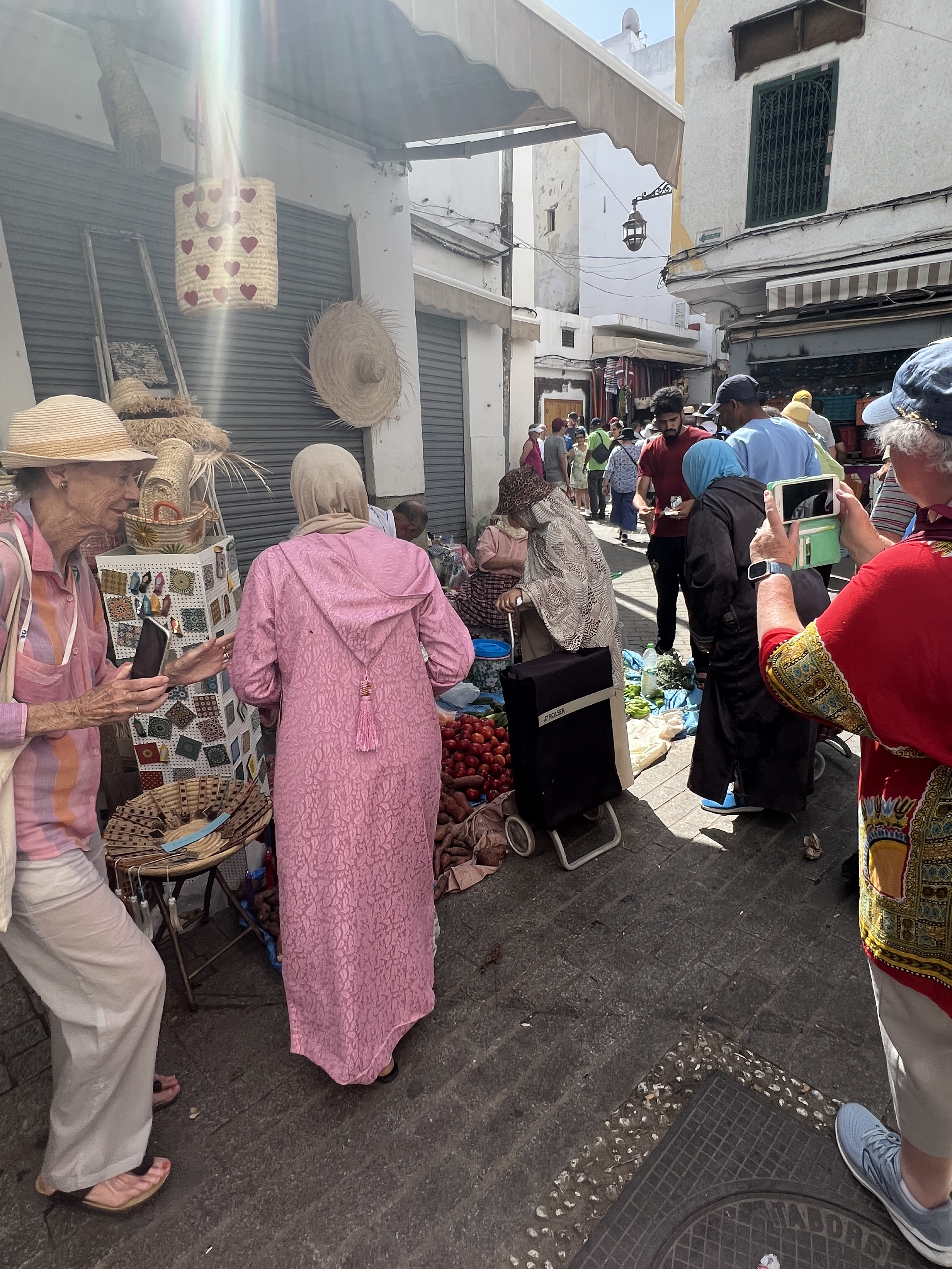
Our tour took us down through a gate in the walls into the Kasbah. The guide was full of interesting tit bits. The Kasbah was not the ‘market’ type place depicted in movies but the residential and administrative area for the local elites, the rif raf was kept out. They resided in the old town, or Medina, where the markets were located.
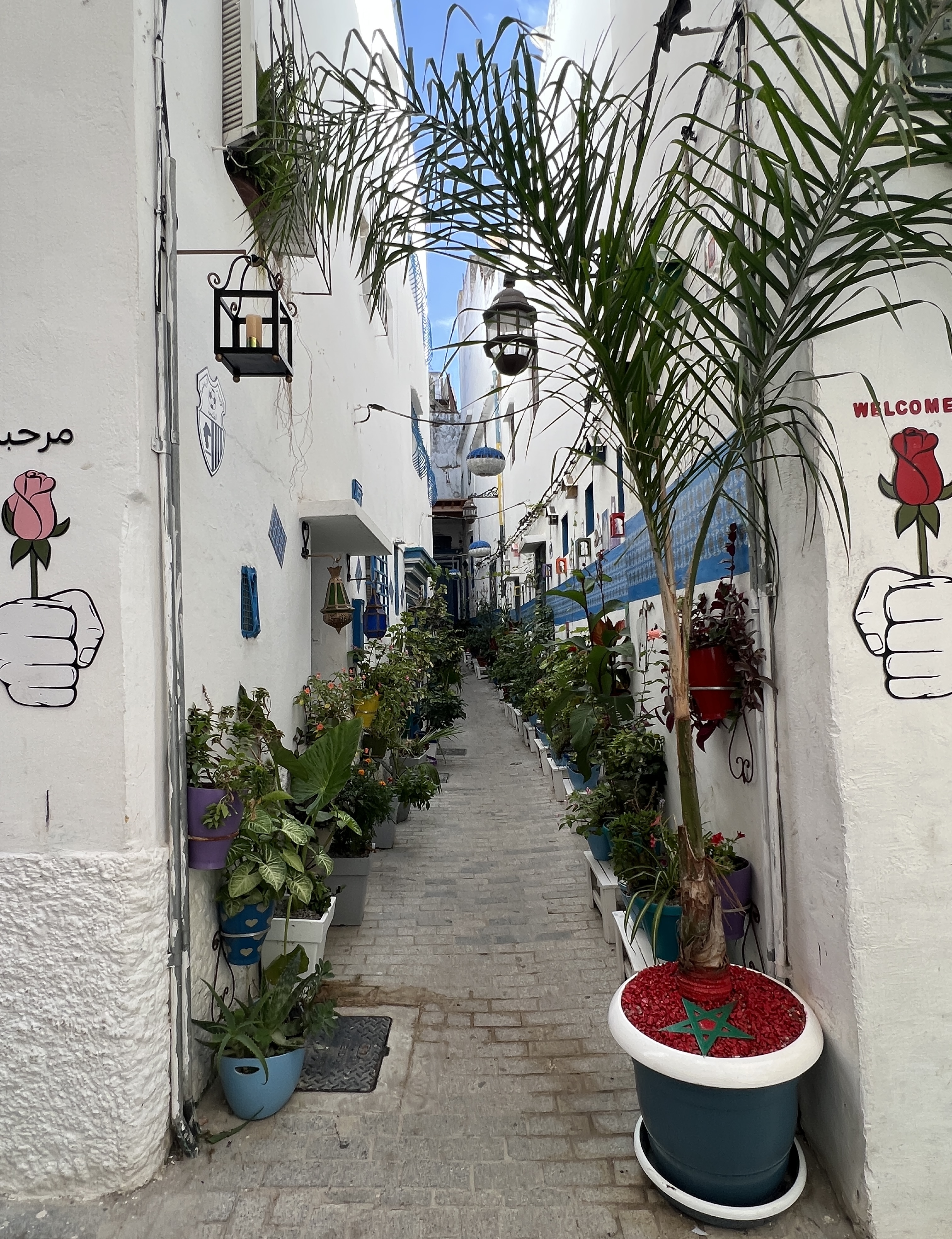
Another street, note the structural supports! The guide said the white washed houses were generally owned by foreigners for rent or AirBNB’s. Unwashed ones were locals, who cared more for the inside.
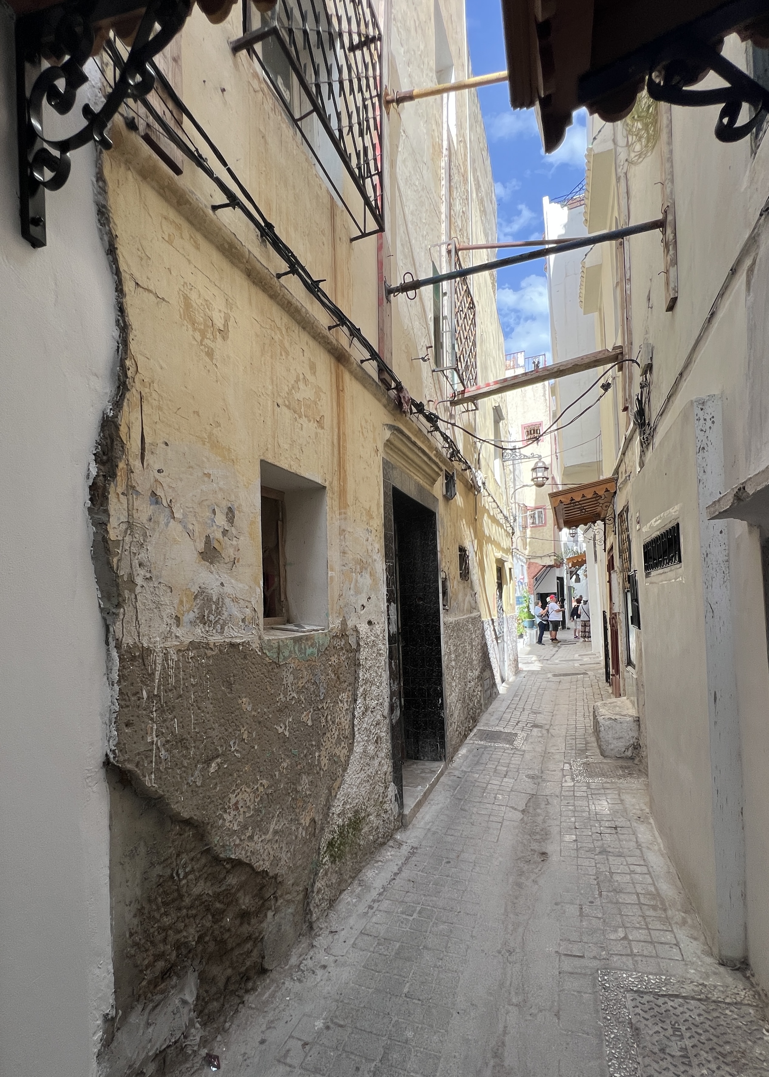
So, we strolled down through the maze of narrow alleys. Many white washed walls, colour blue dominates, and flower boxes, a mosque here and there.
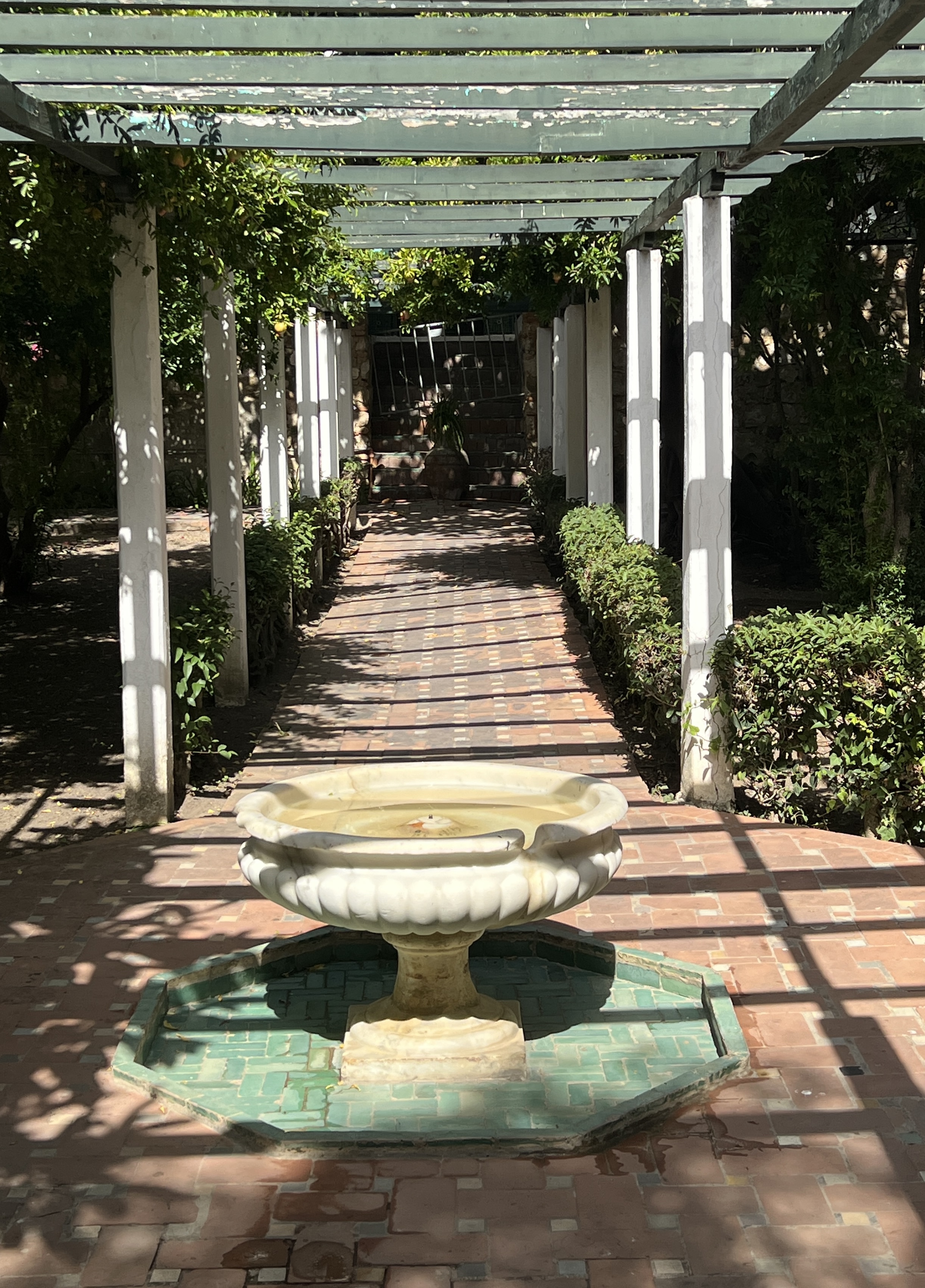
Garden inside the museum complex View from the Kasbah walls before going into the Old Town, or Medina.Gate out of the Kasbah into the Medina.
Leaving the Kasbah and entering the Medina was where the fun and games started. Retail harassment on a grand scale. Hard to escape, but Allthego and Homealone were stoic. No pieces were acquired to adorn mantelpieces or walls!
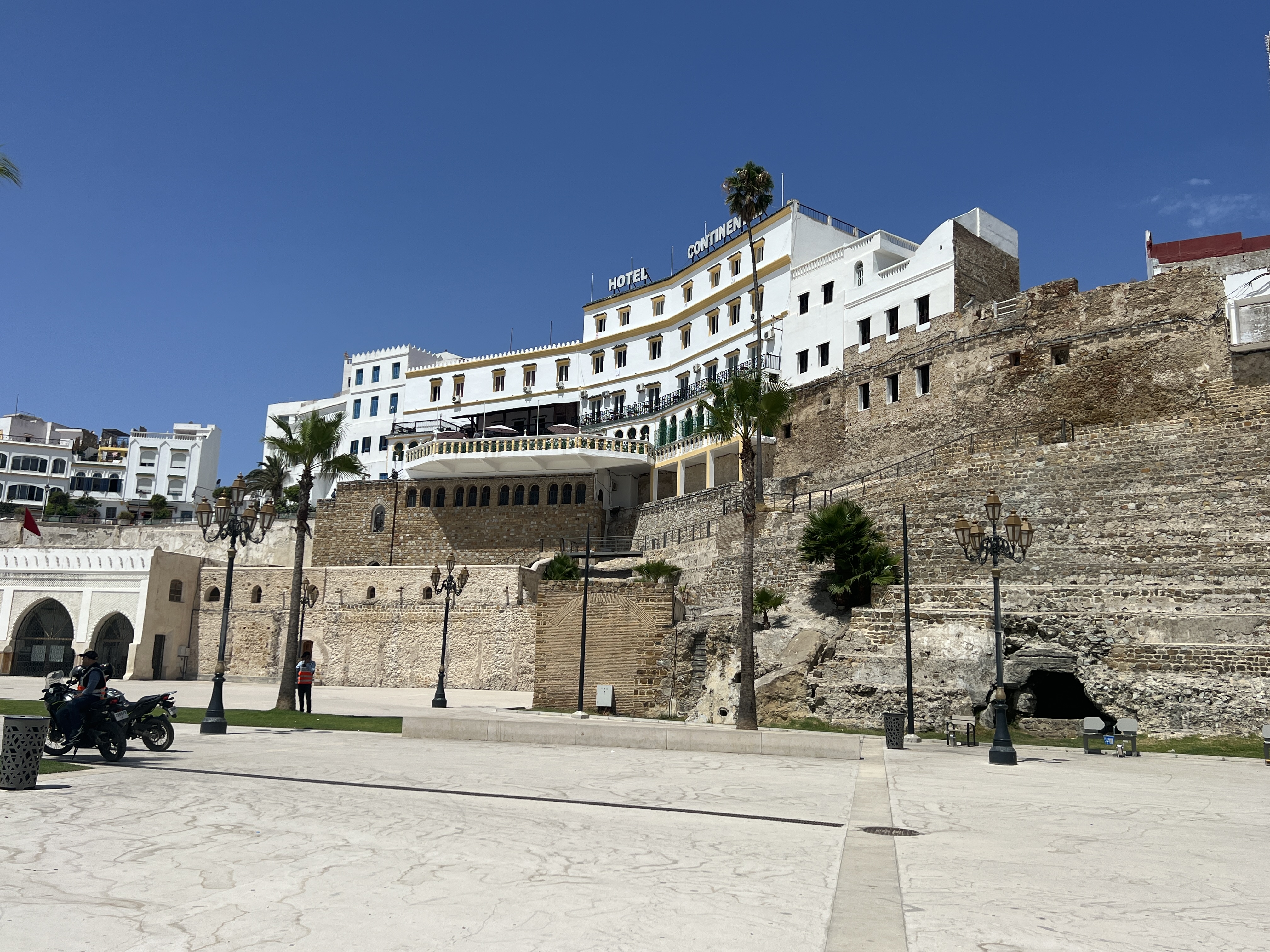
The trading starts. Three traditional Berber women at right, selling their vegetable produce. Heads bowed to avoid camera (I think) although we were told we could take photos.Traders along the way Hotel Continental overlooks the port from the city walls.Slobro at rest.
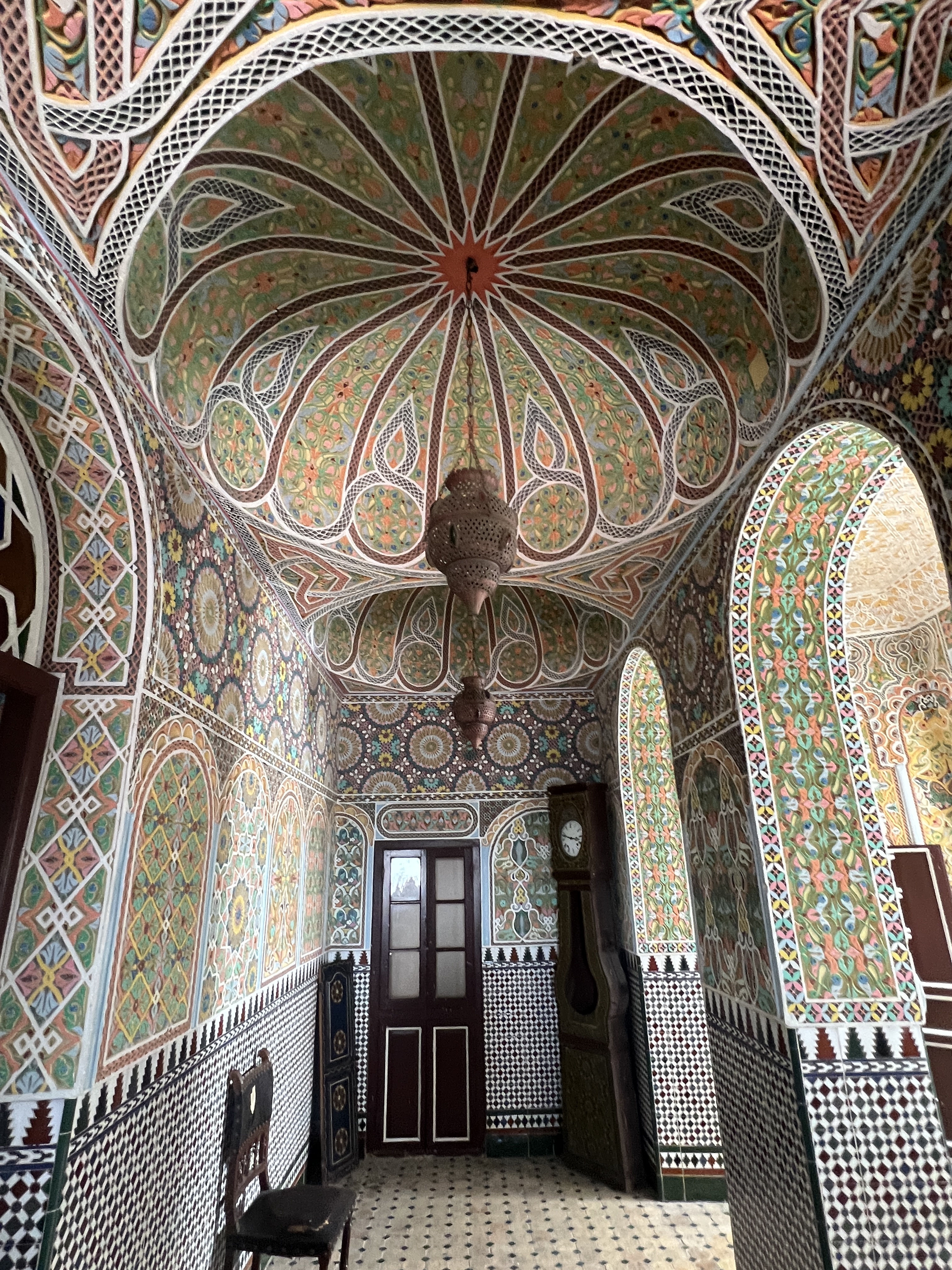
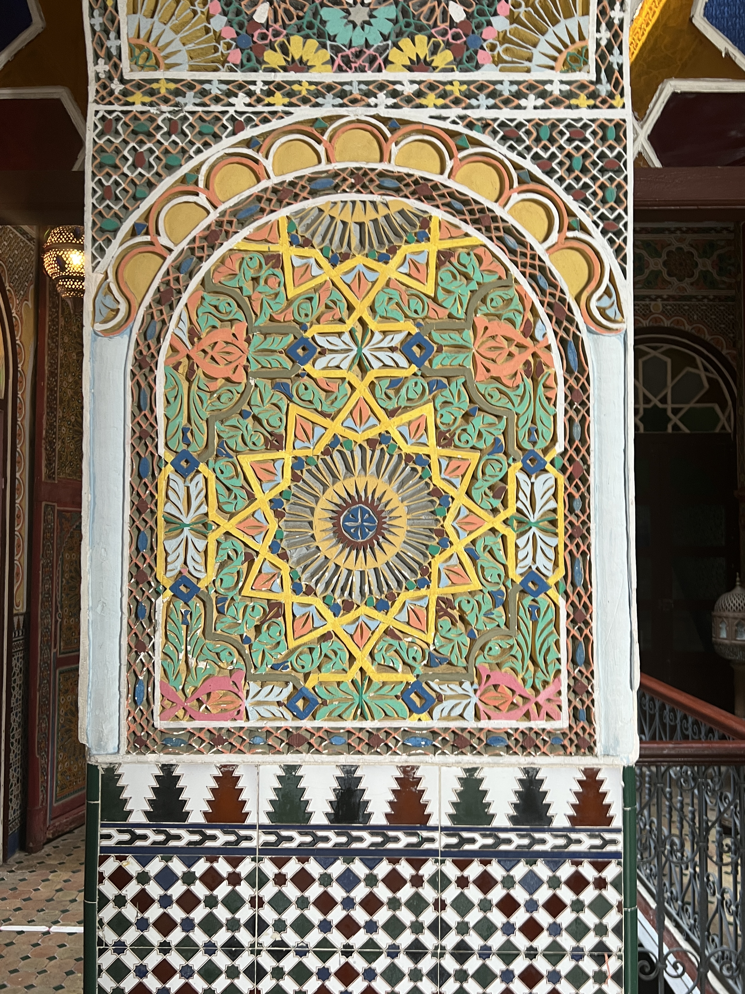
At the end we were relieved to pause in the Hotel Continental overlooking the port, taking in the views and the amazing mosaics in the hotel’s side rooms and hall ways. Quite amazing work.
Mosaics in the HotelIntricate mosaics adorn the walls.
Back to the ship for a well earned period of recuperation, there was no urge to return ashore. Great experience in this port. The Blog continues to be in Blog time we are now about a week behind what is real time, cruising down the Irish Sea having been in the Scottish highlands out of Glasgow a day ago.
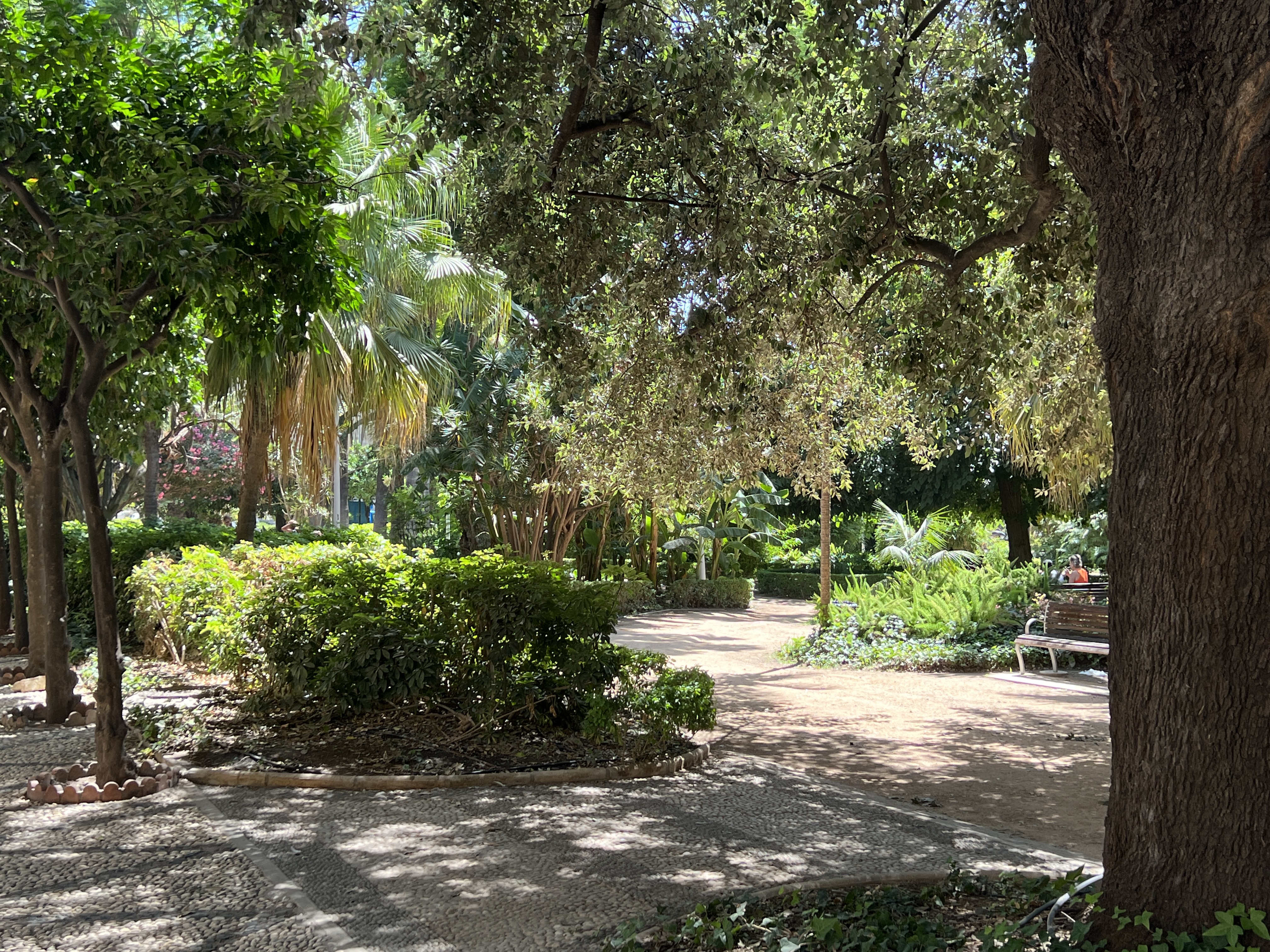
We have had a welcome day at sea after a busy period of being in six ports. Time to reset and prepare for another three ports in the coming days. Leaving Barcelona the ship kept fairly close to the Spanish coast and we had some far views of coastal mountain ranges shrouded in haze from our cabin. The sea remains quite calm, although the wind is getting up and it continues to be quite warm out on the deck. We have some time to catch up on trivia and craft activities.
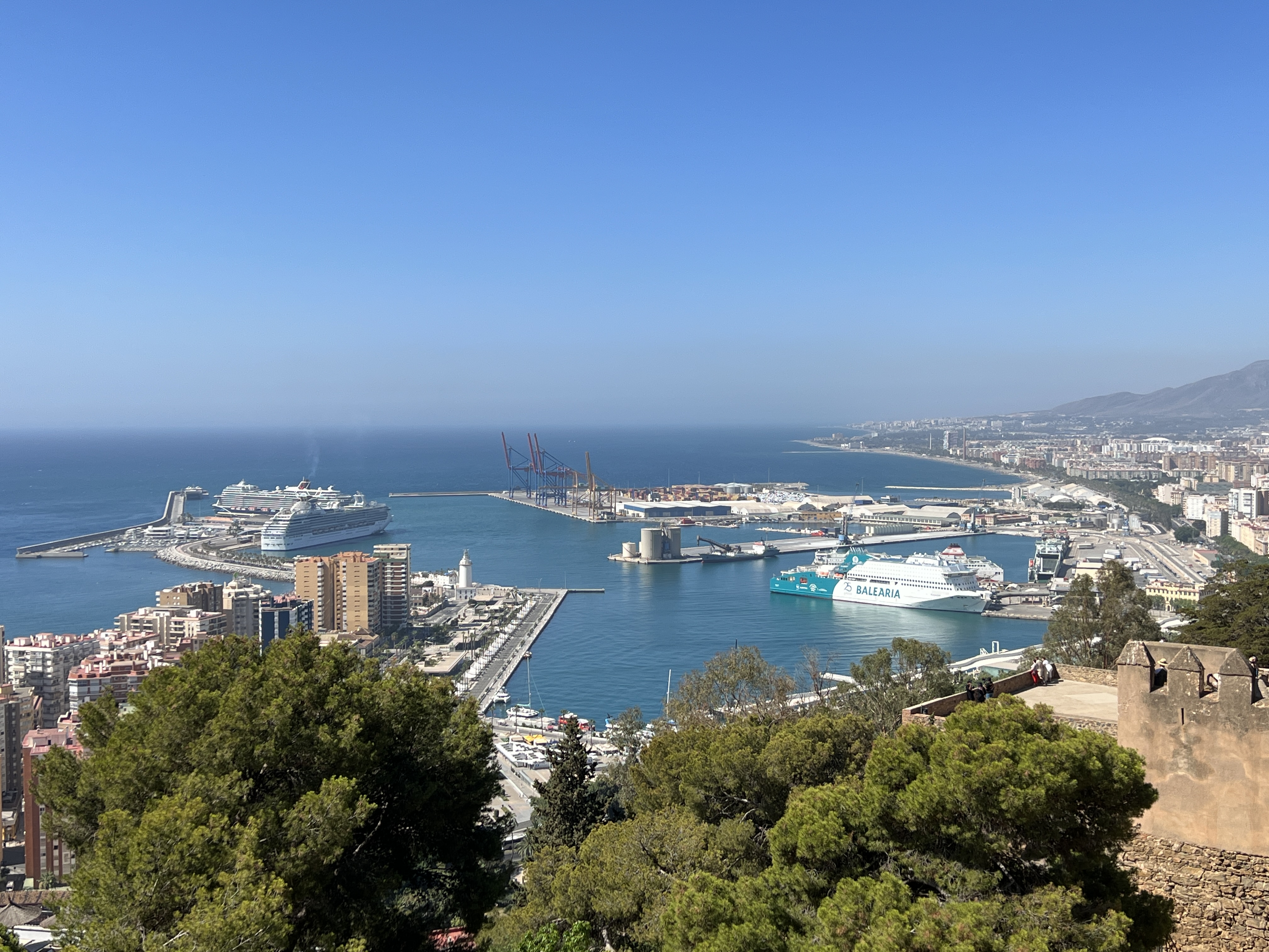
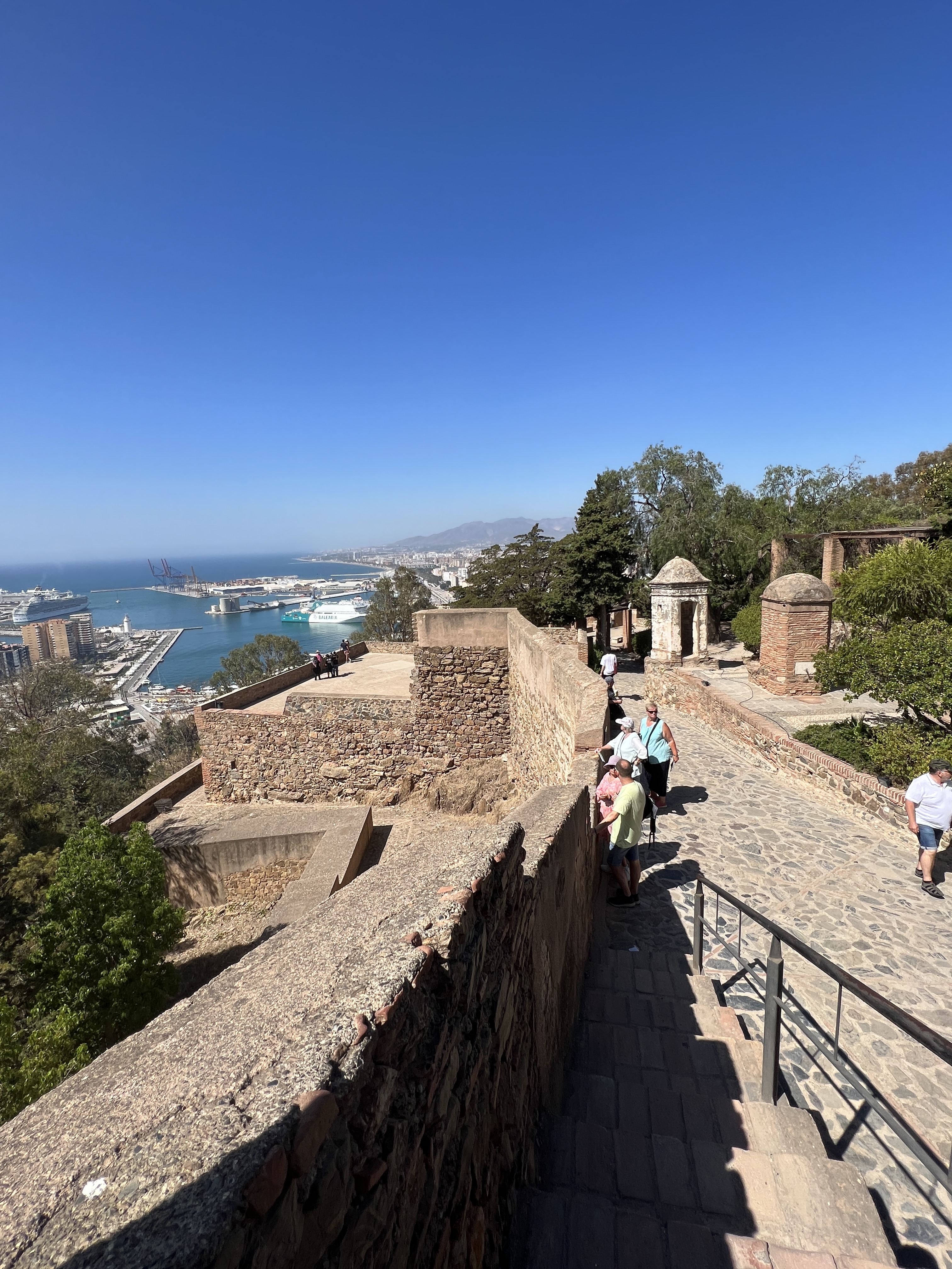
Looking down on the port from Gibralfaro
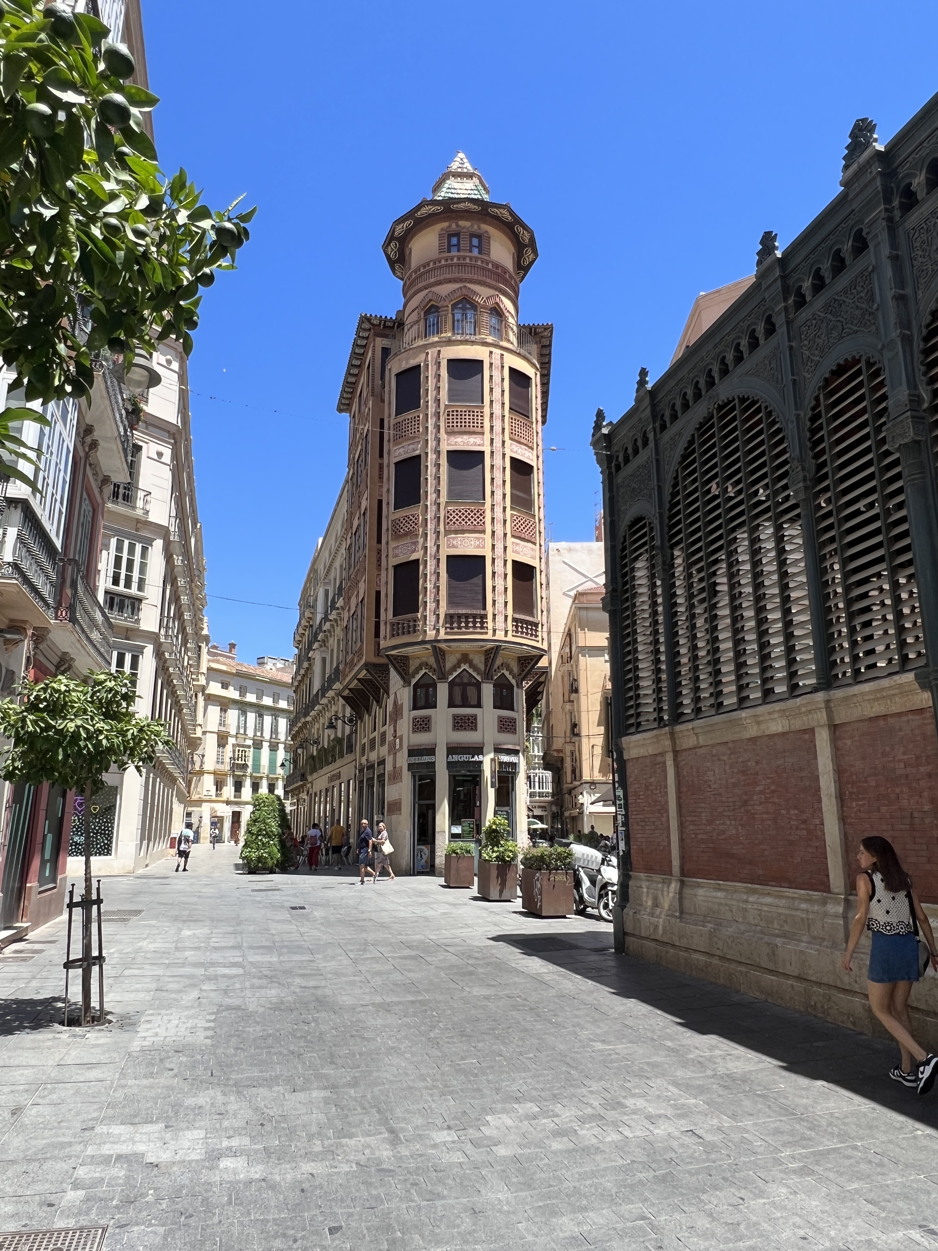
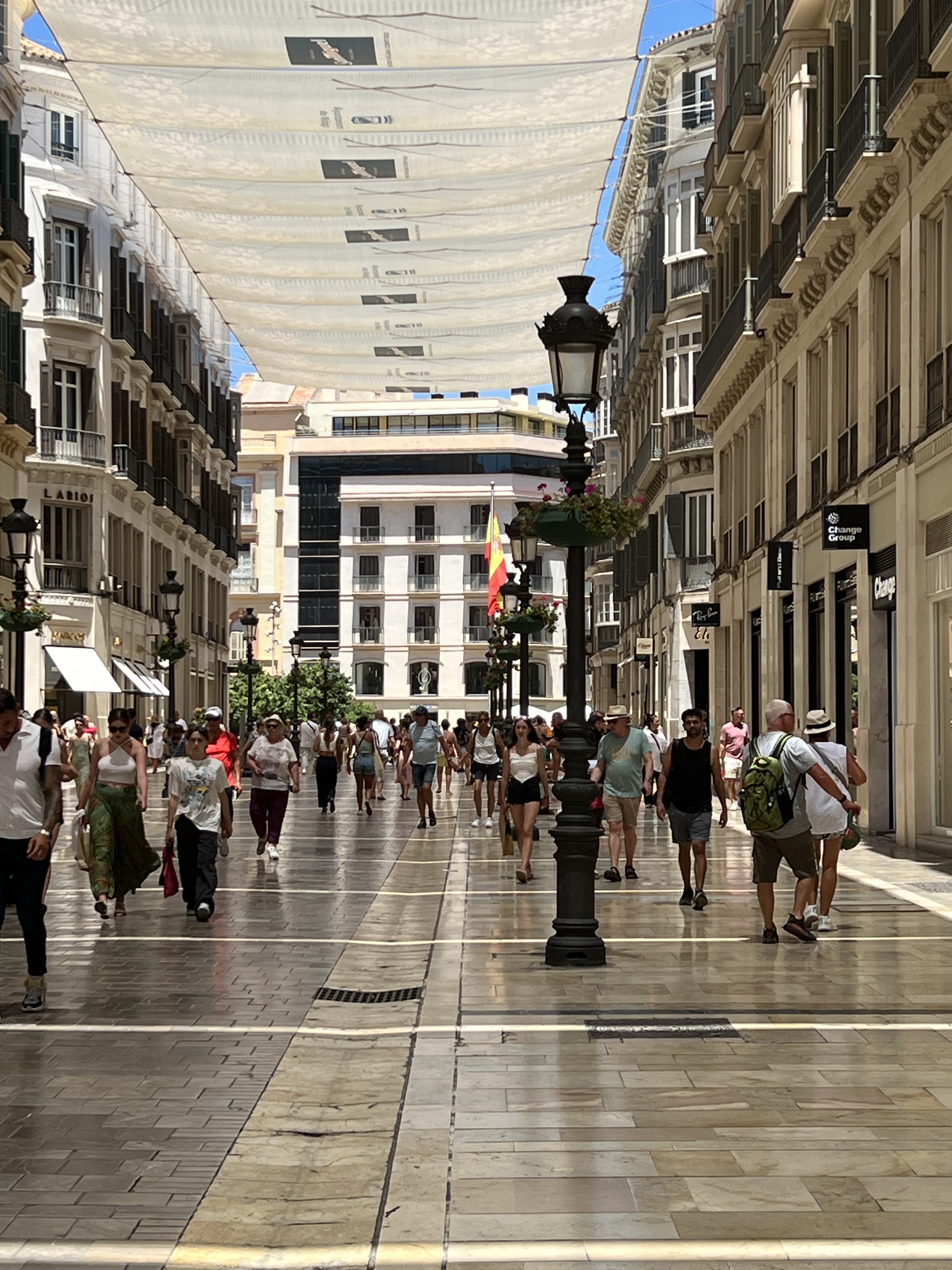
Malaga is a town with a long and varied history. It was founded by the Phoenicians in 770 BC, the Romans arrived 500 years later followed by a Moorish invasion in the 700s. The Spanish states ultimately united and kicked the Moors out around 1500. All this activity resulted in a great diversity of architecture and cultural life. Today, Malaga is part of the Spanish Sunshine Coast or the Costa del Sol. Many of the shore tours take people away from the town into the countryside to Granada and down the coastline. We have decided to do our own thing and use the Big Red Bus as a means of getting around the sights.
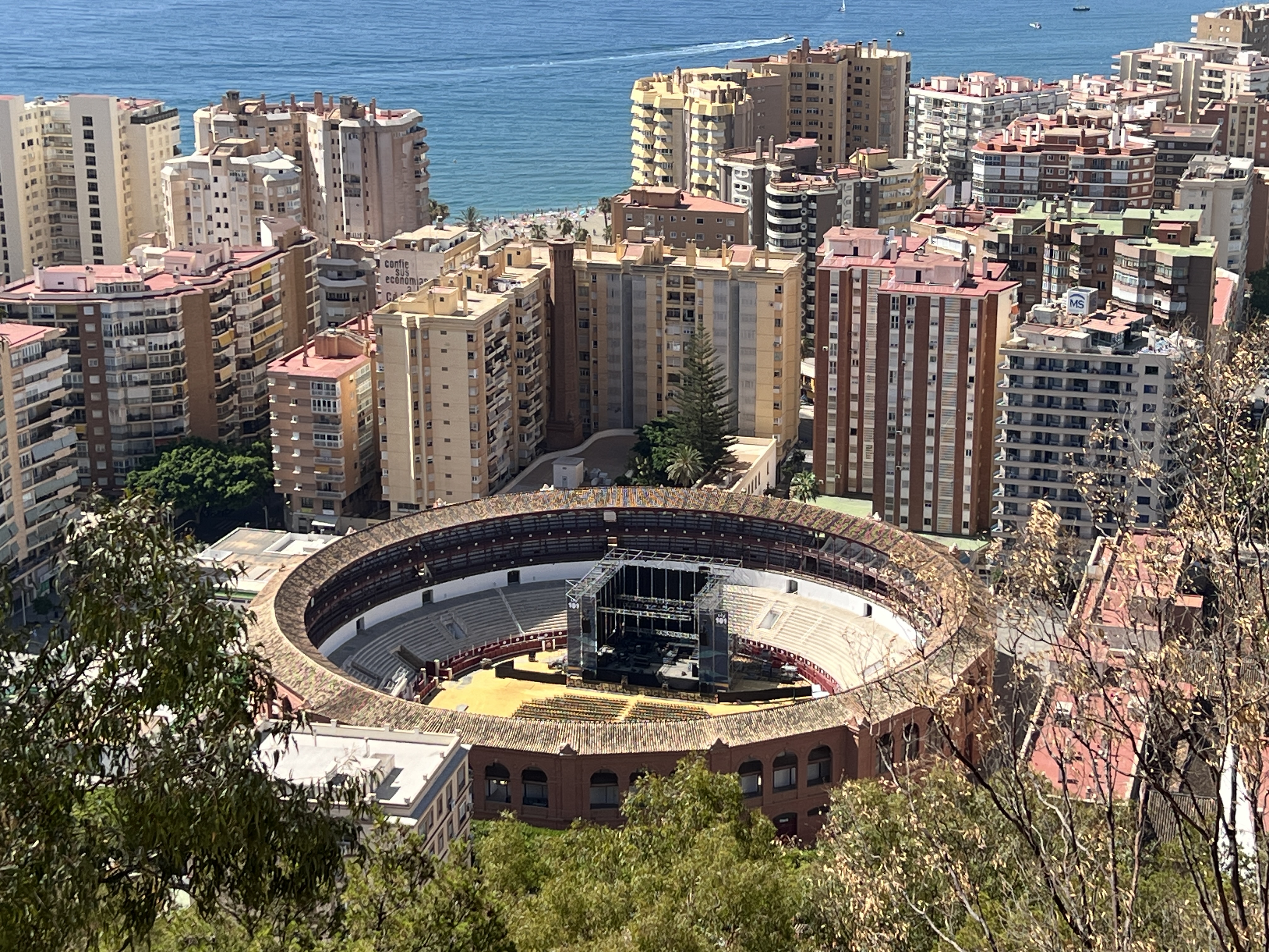
A view from the ramparts of GibralfaroLooking down in the Malaga bull ring, they do fight them here! But set up for a concert.
Our first stop was at the 14th century Moorish fortress, Castillo de Gibralfaro. The fortress sits high on a hill overlooking the town, great views from its ramparts in all directions. Further down the hill the bus stopped near Alcazaba a moorish fort and palace built in the 8th century.
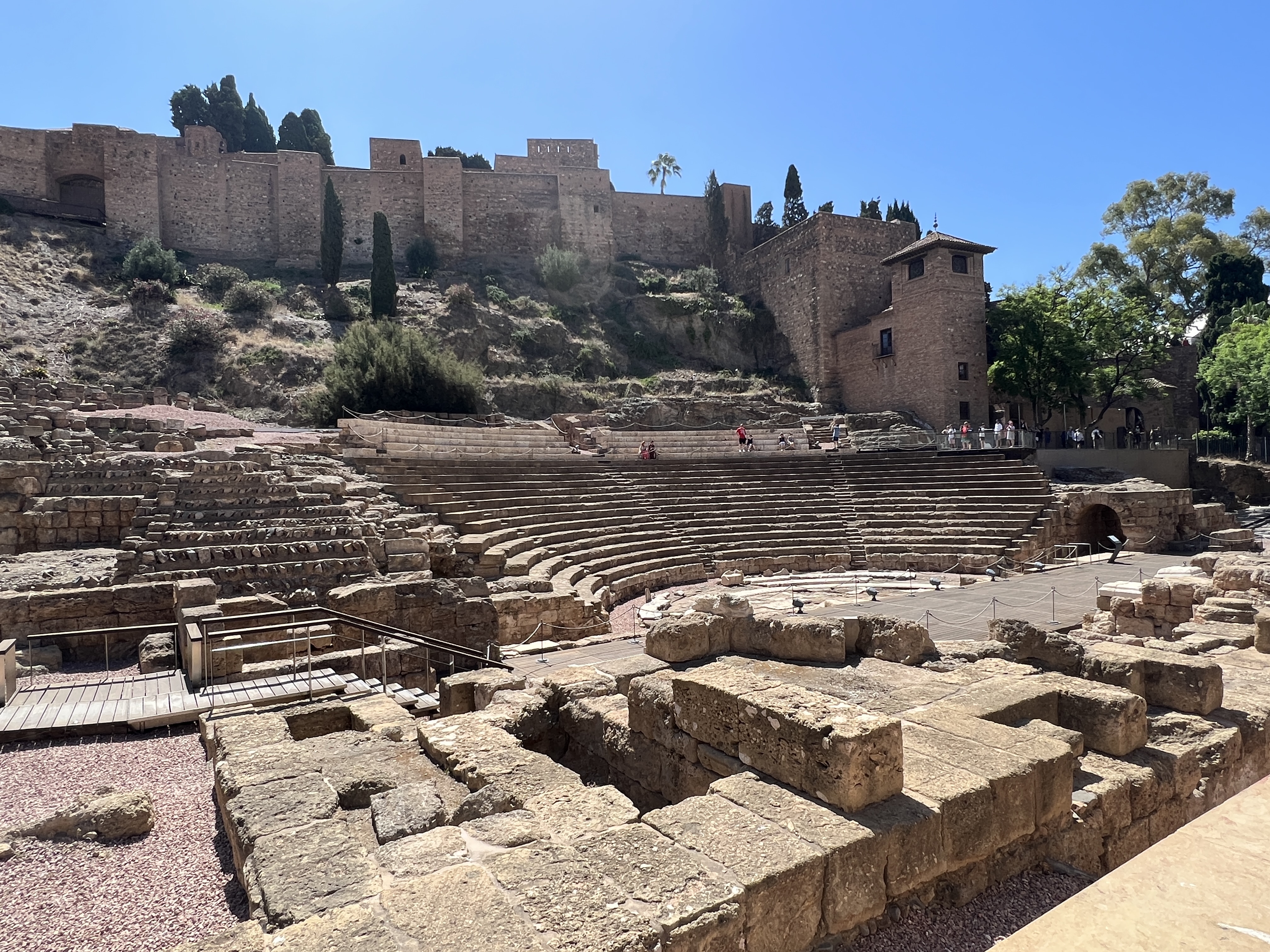
Alcazaba on the hill and the Roman theatre.Park along the waterfront area.
This place also has great views and sits above a much earlier Roman theatre that has been excavated from under hundreds of years of dirt and rubble.
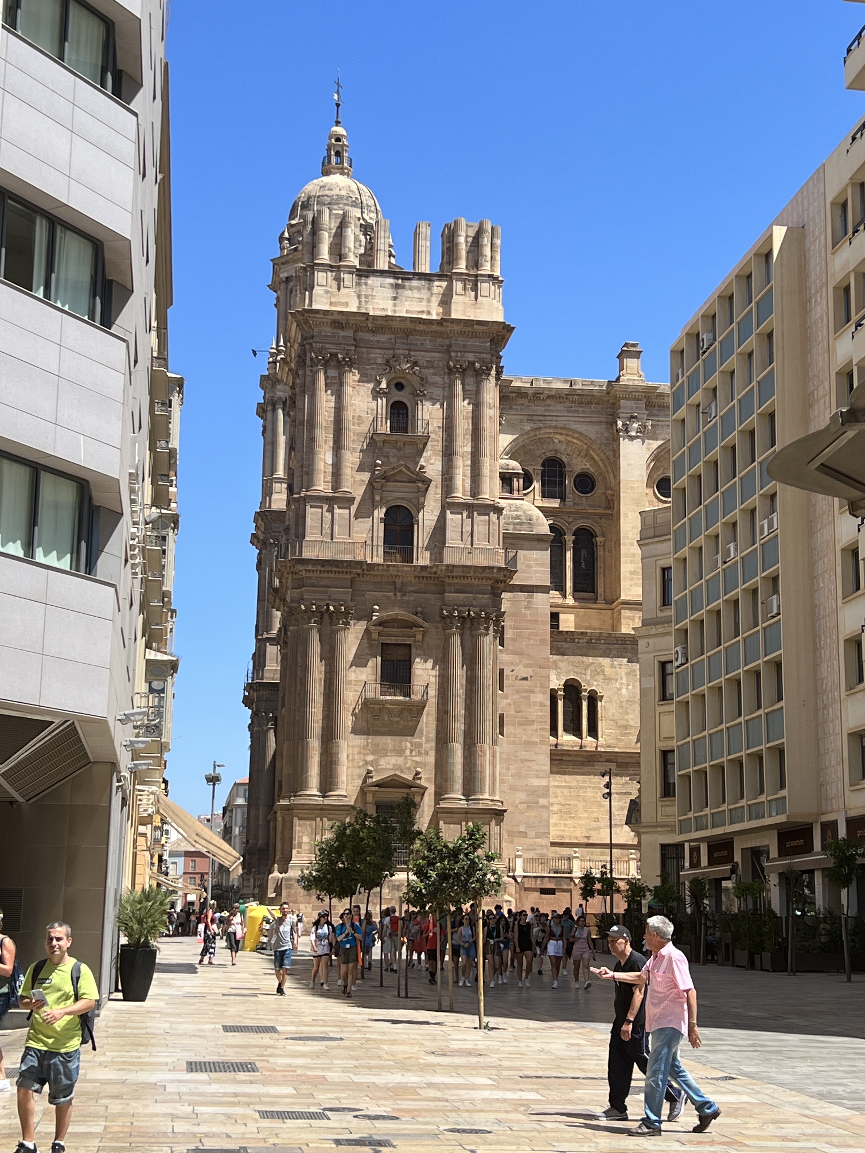
StreetscapeMalaga Cathedral with the incomplete tower in the foreground.
Close by is the 16th century Cathedral of Malaga. The cathedral was designed with two towers, the second though has never been completed due to a lack of funds. It looks a little odd standing over a square now filled with open air restaurants and bars.
On the lookout for the restaurant.
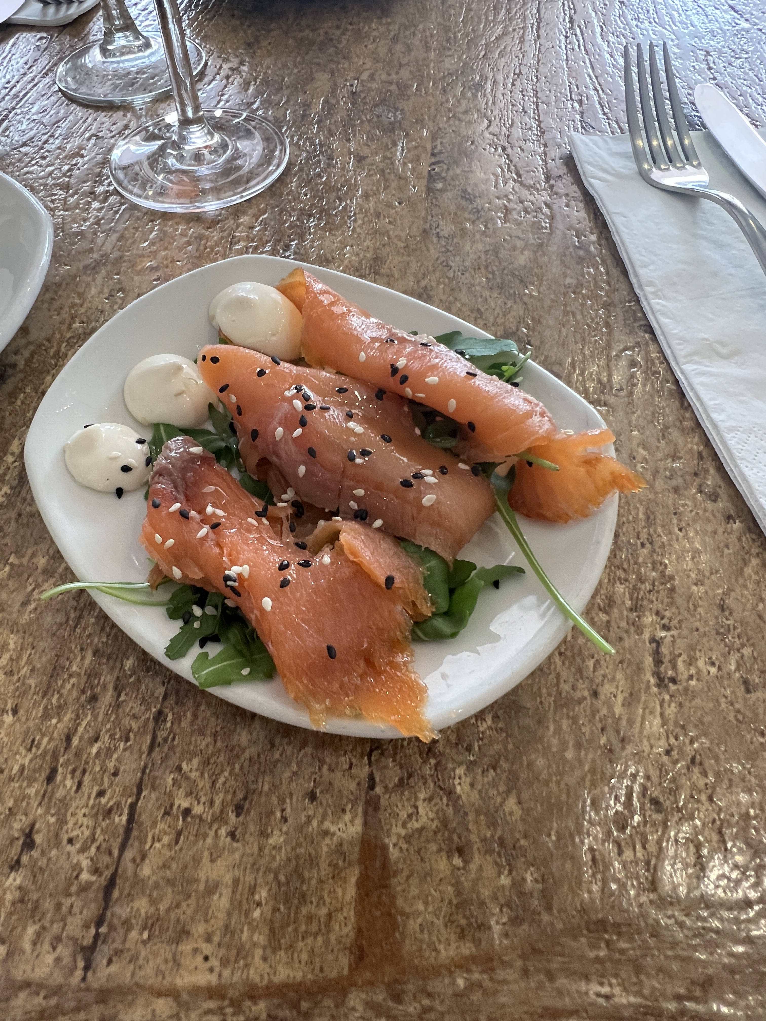
We had been tipped off about a good tapas bar for lunch, but not its exact location. So we wandered around a bit trying to locate it. Giving up we settled for a nice looking place called ‘illari’ where we tried a selection of tapas pieces.
Salmon tapas
Our first genuine Spanish tapas experience! Quite good. As we left we looked up and a few yards down the street was the place that had been recommended, a bit bigger and noisier. Maybe it was lucky we missed it!
Checking the numbers after a days trading?
Great mural as a backdrop!
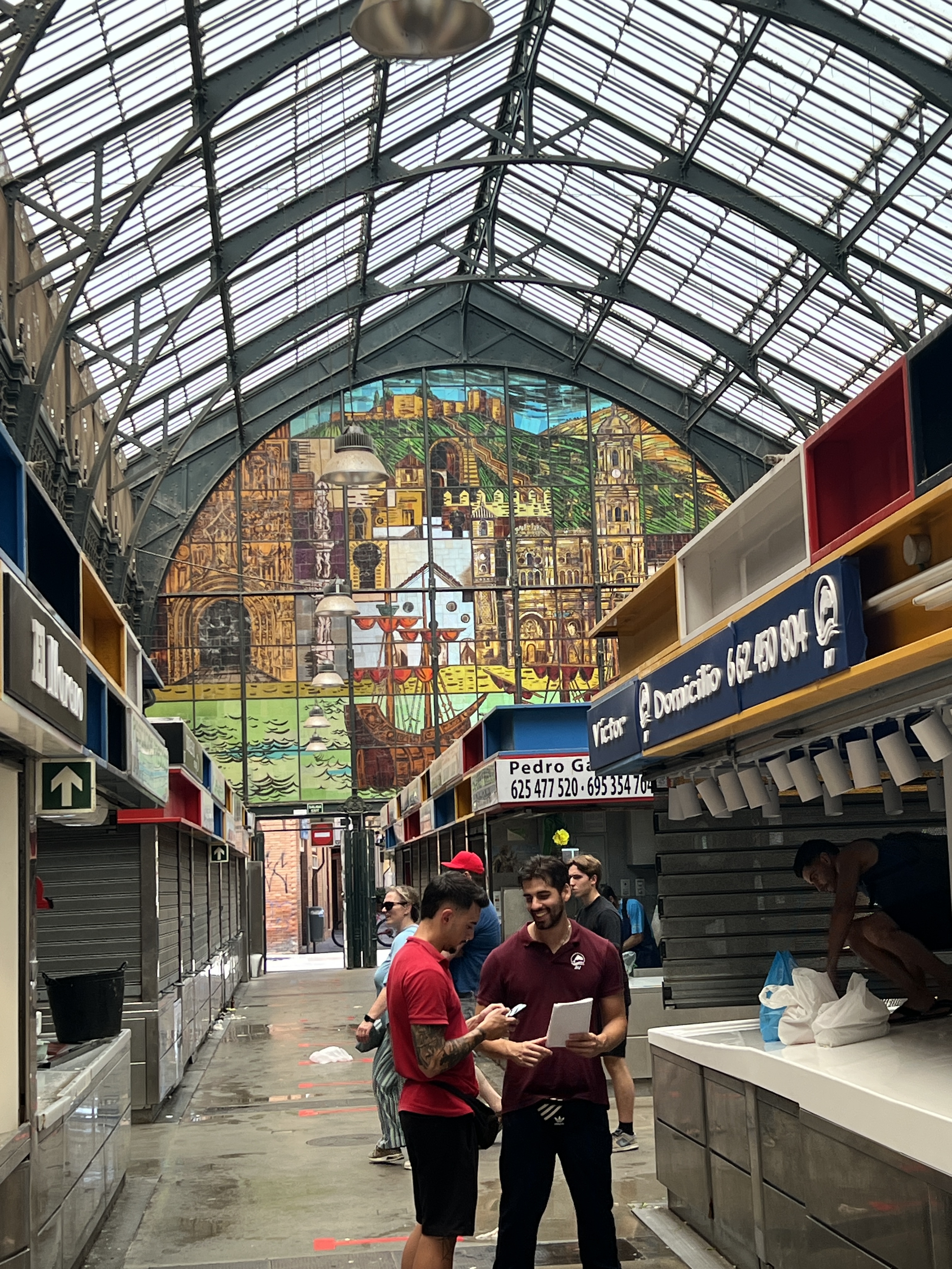
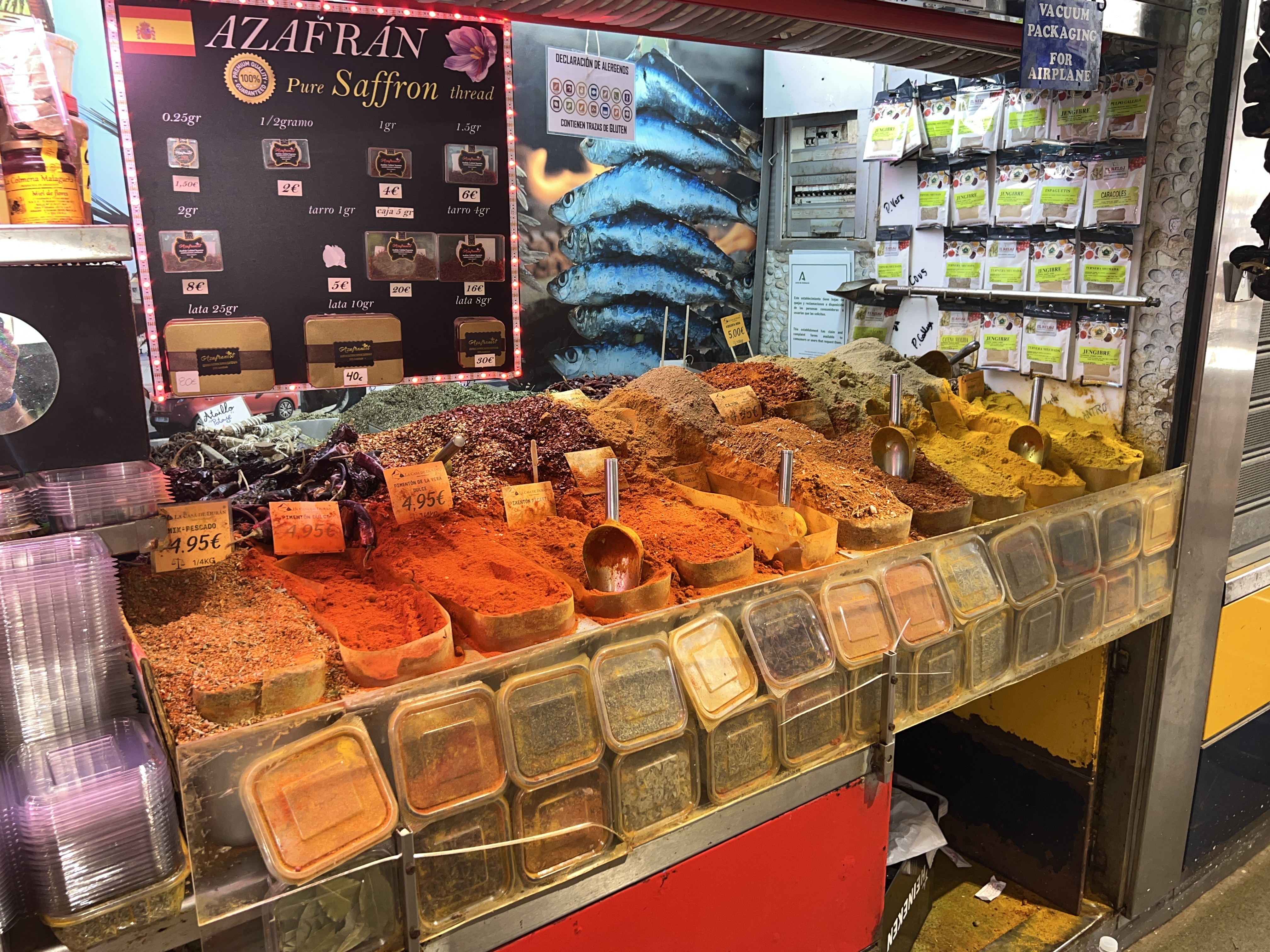
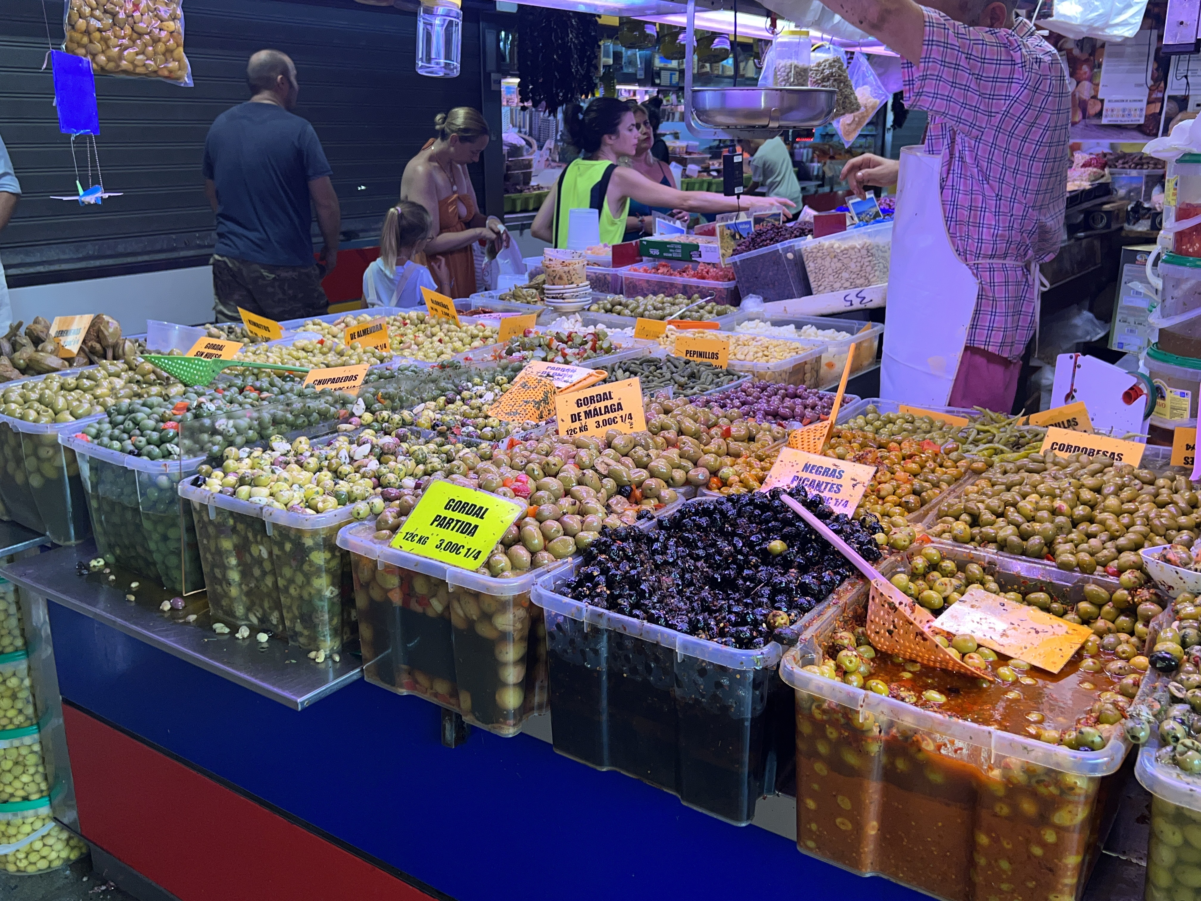
We then set off to find the local market. There was a bit of back and forth in this also. Found it eventually, it was late in the afternoon and some of the stalls were closing down. As usual for these Mediterranean markets there were great displays of fruit snd vegetables. Also spices, olives, pasta and nuts.
Spice rack, amazing aromaCan’t see Coles putting up an olive selection like this at Mt Ommaney!
It was time now to rejoin the bus and complete the circuit before returning to the ship for dinner. During the night we would sail to Tangier in Morocco, passing through the Strait of Gibraltar.