Category Archives: Around the World
Back in Brisbane
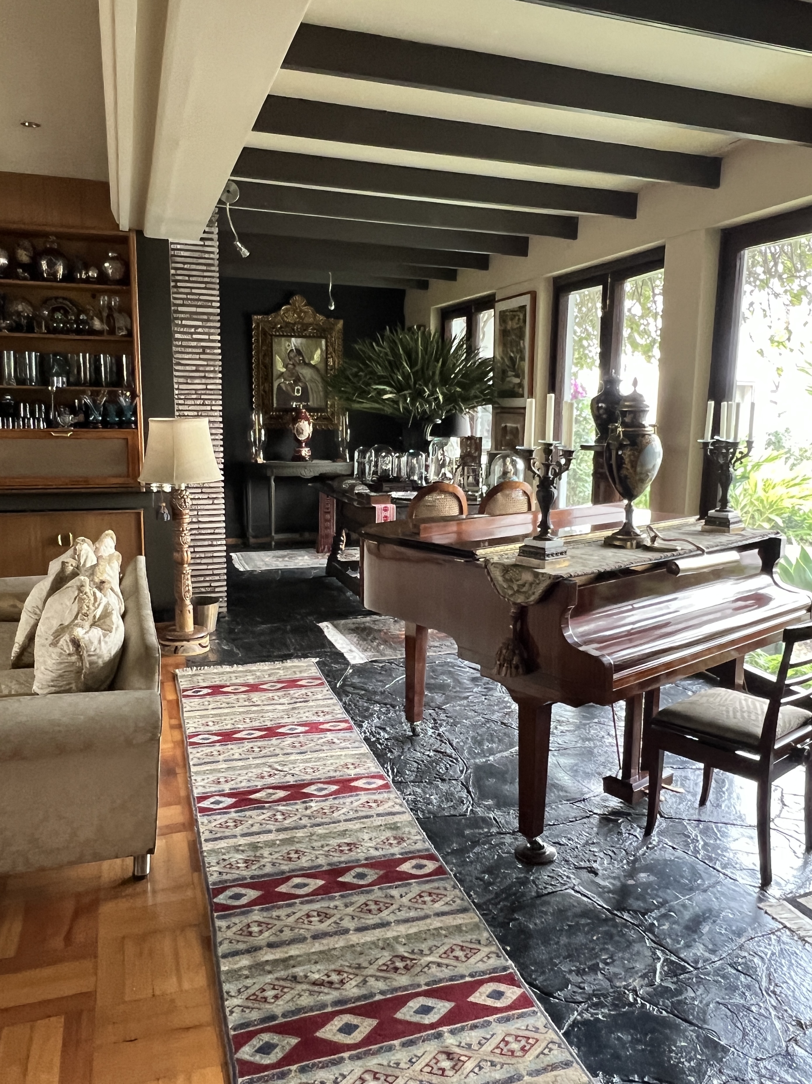
We have arrived back home in Brisbane and have been perusing the held mail pile that has been delivered. Slobro is puzzled about all the post cards we have received from some people signing as ‘R & L’ travelling overseas.
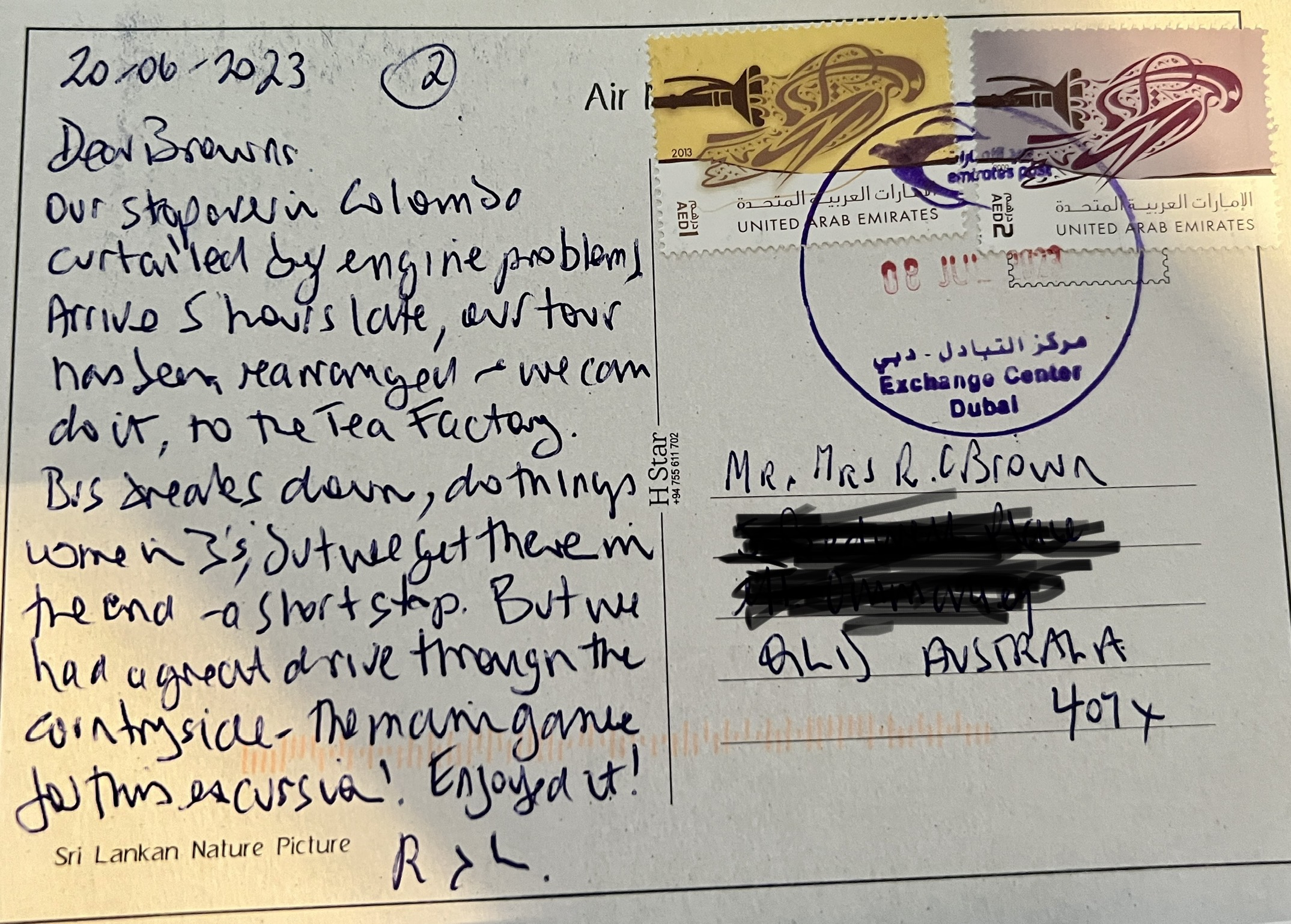
“They have been to the very same places we have just been to”, isn’t that strange? Allthego suggested it was just an odd coincidence. Slobro has now been put in a cupboard until next time.
On the sail across the ‘ditch’ from New Zealand we experienced the heaviest seas of the whole cruise. Some 4 to 5 metre swells and strong winds, the ship was getting along at 21 knots for most of the time. A bit of harmless rocking and rolling with the occasional ‘bump’ as the ship nosed into a wave.
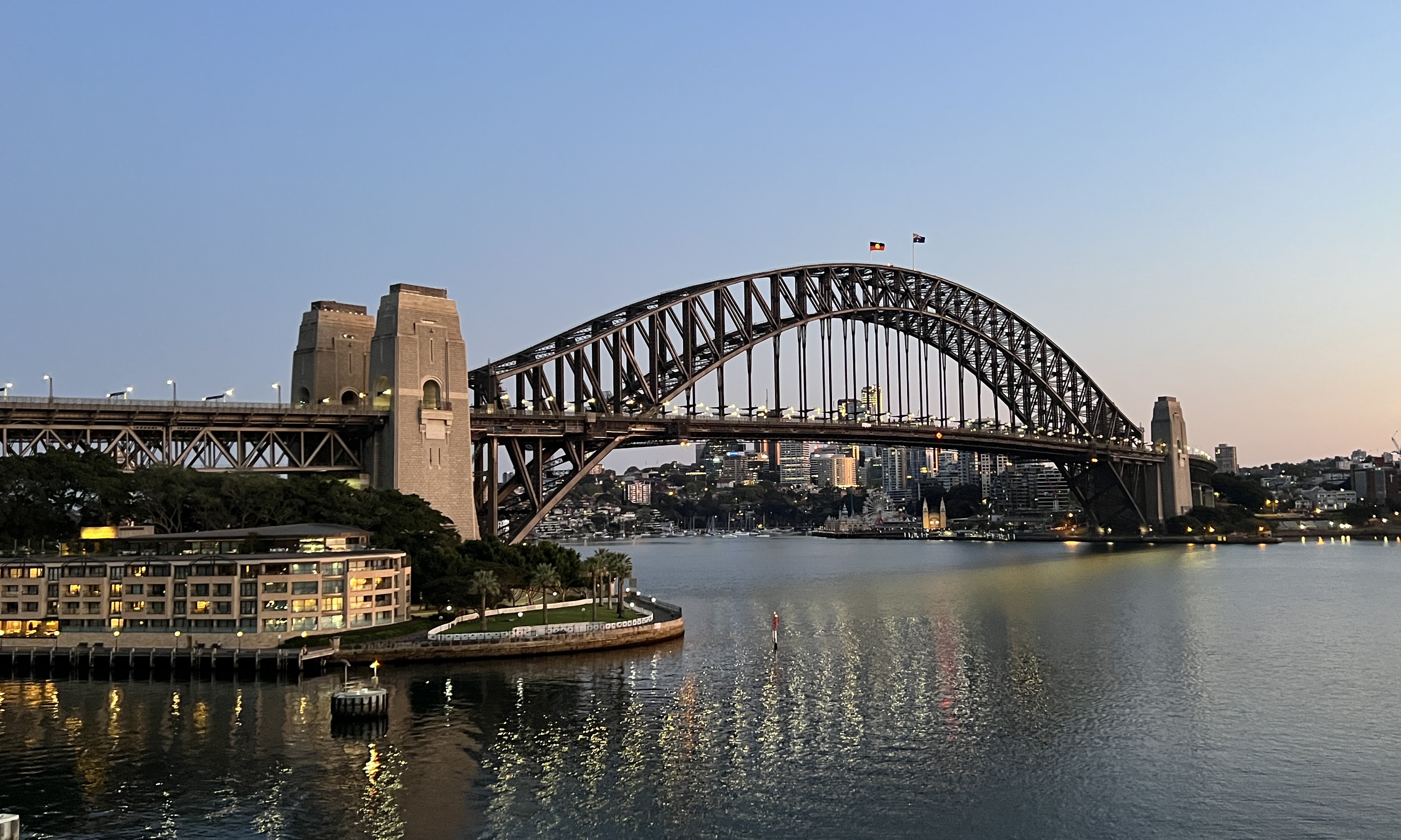
We had planned to rise early for the sail through the Sydney Harbour Heads, timed for about 5 am. Slobro rose early around 4 am, but rolled over and didn’t wake us till after 5.30. We were coming into Circular Quay, next to the Bridge and opposite the Opera House. Great spot but we had missed the sail in!
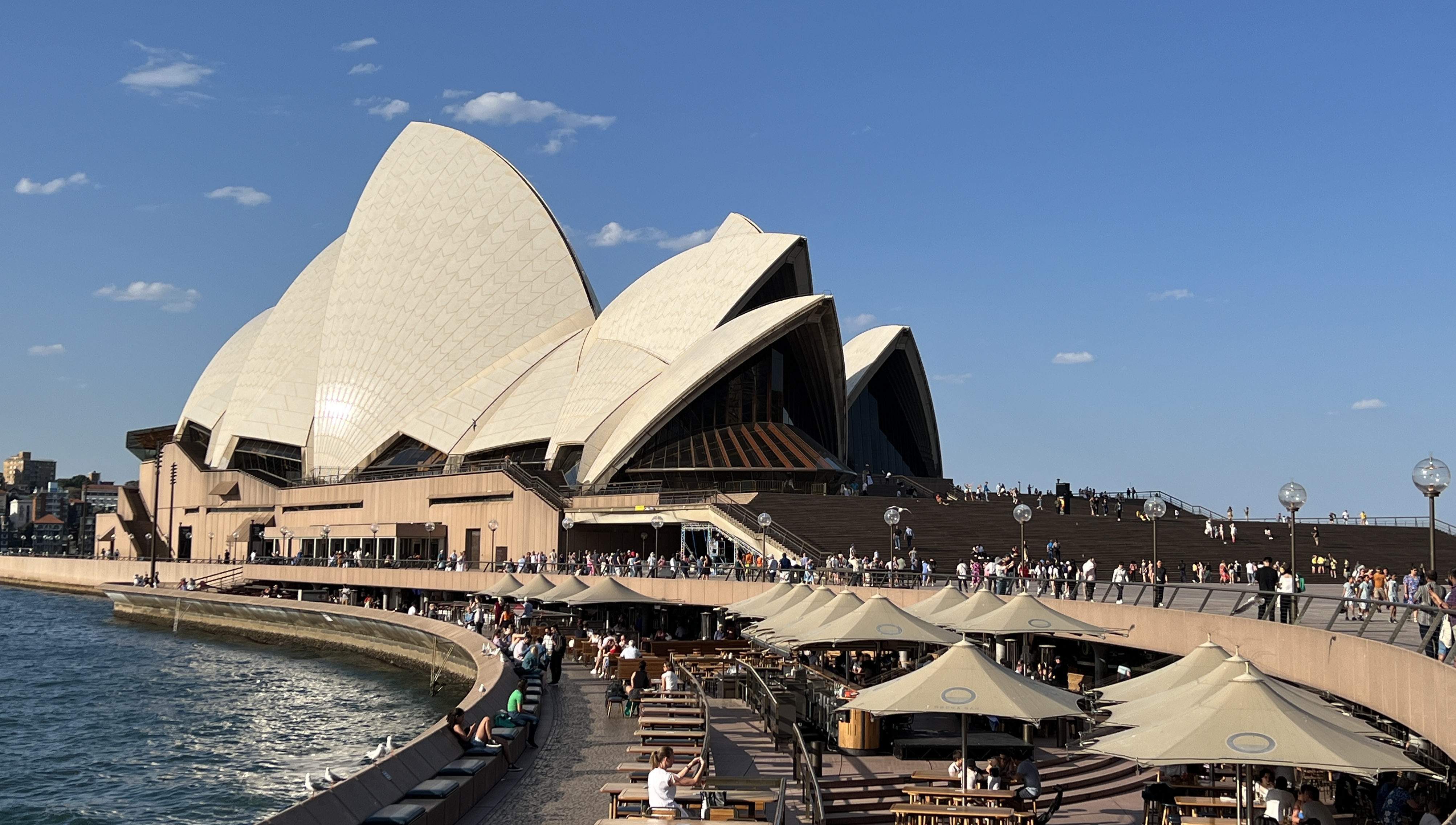
We had 1200 or so fellow passengers getting off the ship here, to be replaced by a similar number joining us for the ongoing cruise after Brisbane. We had planned an easy morning aboard the ship before walking around to the Opera House to see the current run of Miss Saigon. The rules in Aus are similar to what we experienced in New York, everybody off the ship to go through immigration and then you can get back on! Duly done we returned to the ship for a light lunch before heading to the show.

‘Miss Saigon’ was a block buster a really spectacular spectacle of stage, light and sound. Singing pretty good too! Allthego liked the holographic helicopter scenes when the evacuations were being done from Saigon at the ‘end’ of the war. The theatre was filled with the throbbing of engines and blades. Amazing work!
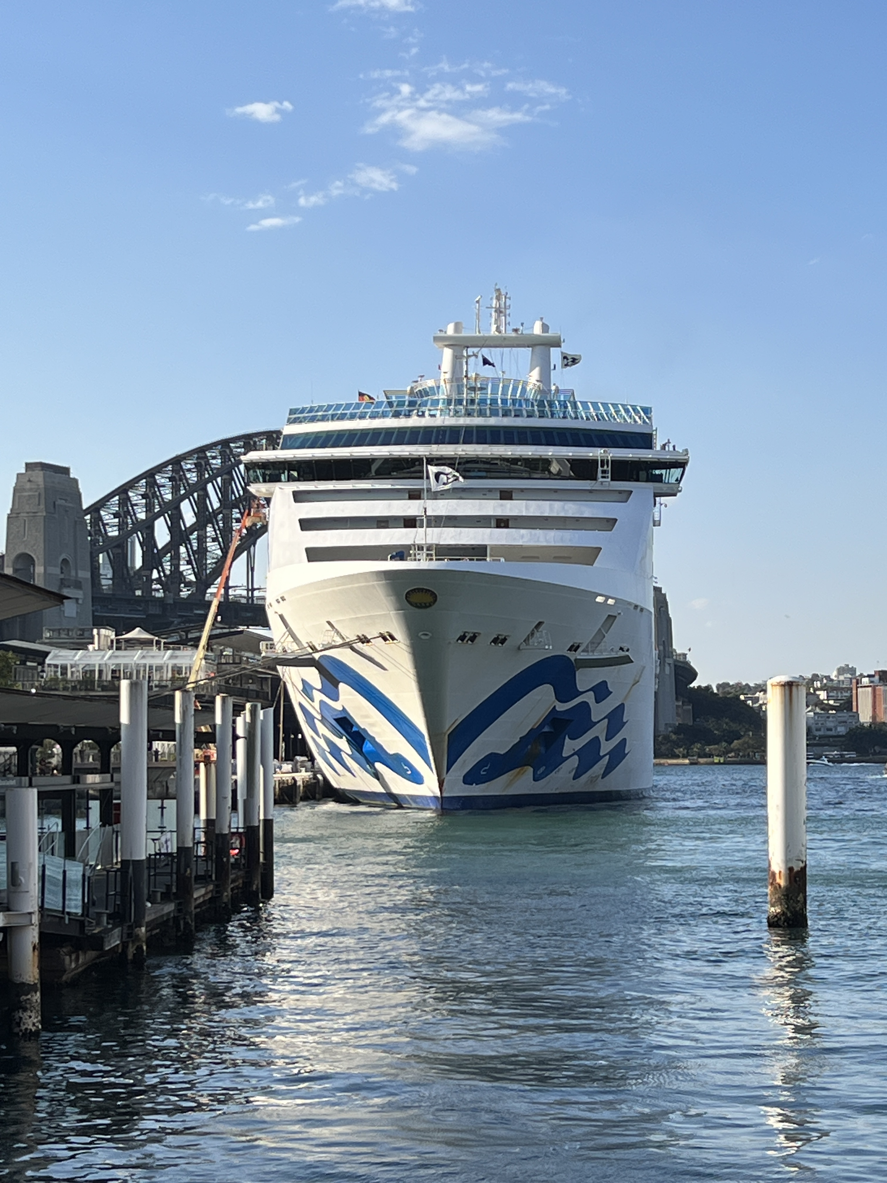
Back on board the ship we sailed away around 7 pm as the city lights were coming on. Truly one of the great harbours of the world! Disappeared into the blackness as we passed through the Heads and turned north for Brisbane.
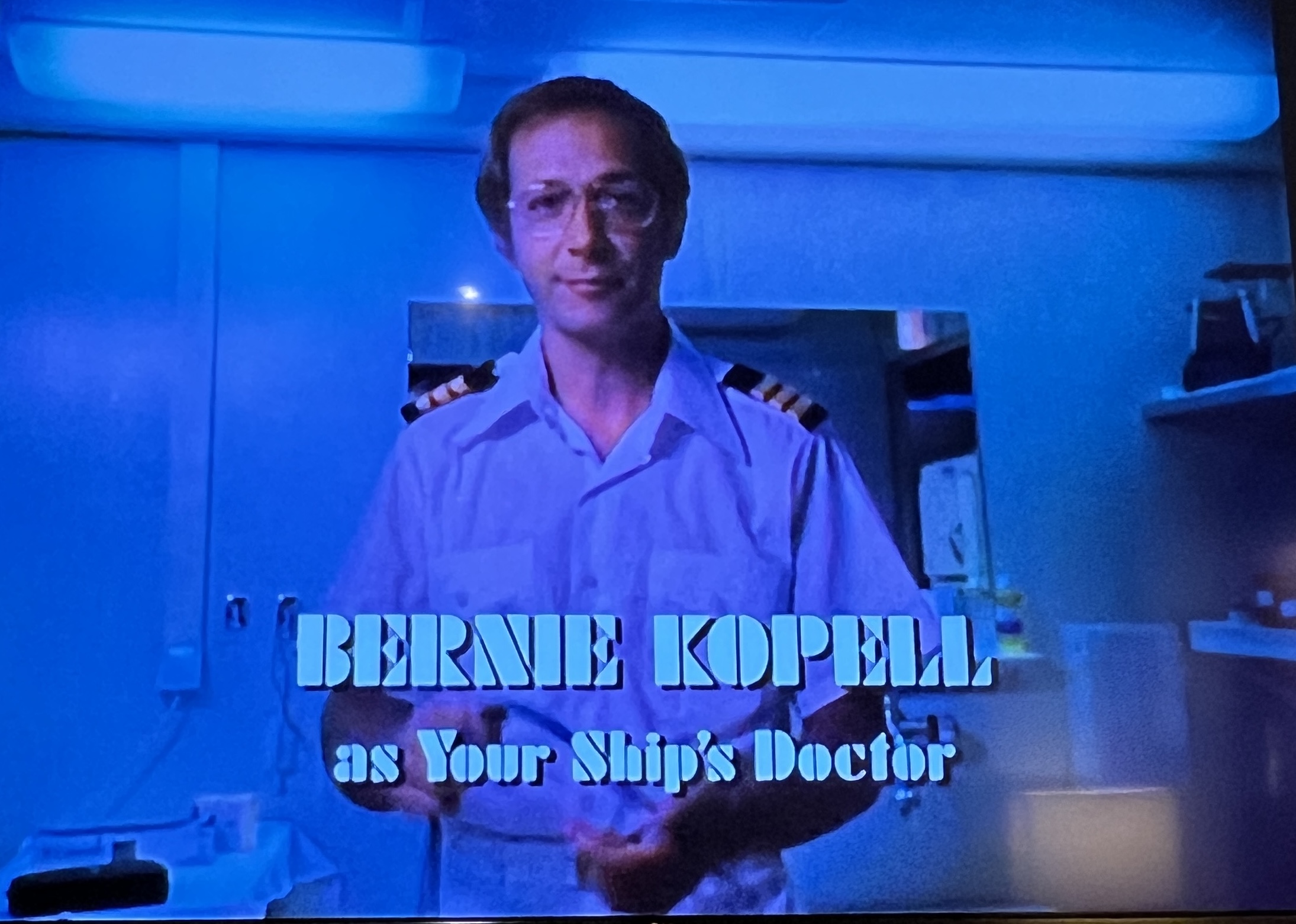
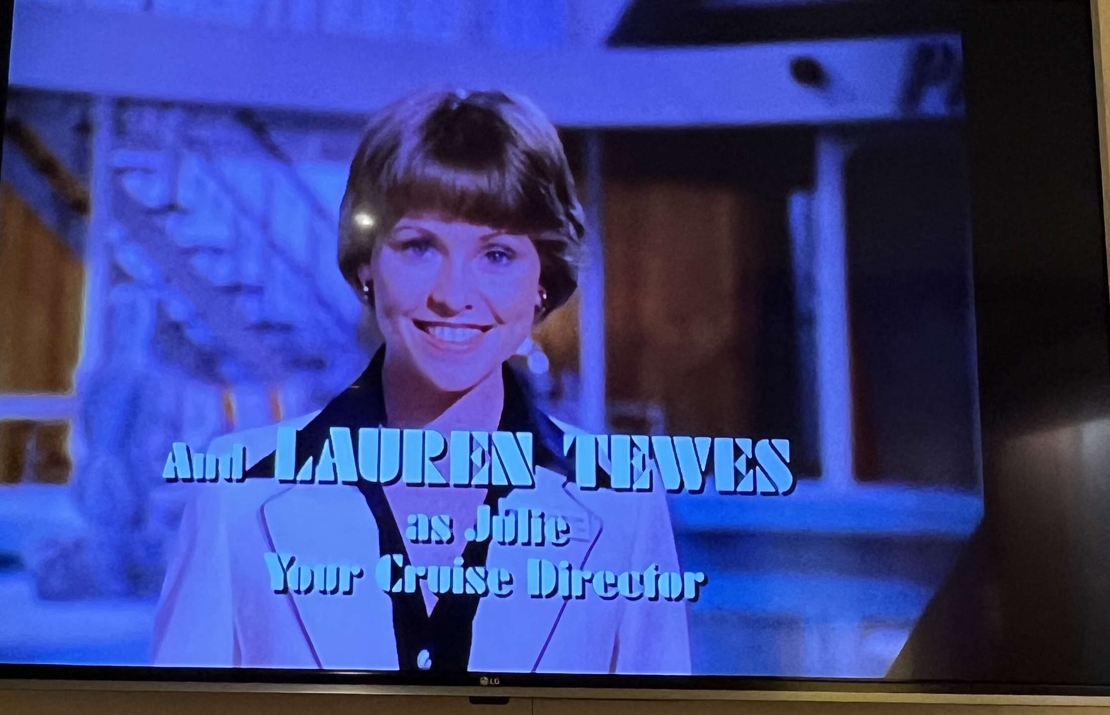
On the last night before Brisbane we managed to get in another episode of ‘The Love Boat’. Dear readers will recall this classic show from way back dealing with life and love aboard the Pacific Princess. What characters and plots, days before political correctness. We managed to see about 24 episodes. Allthego has refreshed his joke repertoire with some classics. Just has to remember the punch lines!
We have been blessed to have seen much on this cruise. Snapshots of places we will probably not get to again. A few bucket list places; Iceland and Greenland, Easter Island, the Suez and Panama Canals. Along the way we also saw places where the ‘other half’ live and work. ‘Other half’ though is more like 70%. We live in a fortunate part of the world and should do a lot more for our own perhaps 15%.
‘It’s good to be back home’, that’s a John Denver song Homealone recalls.
Land of the long white cloud.
We have left Tahiti for Auckland. On the last leg home! But it will take 6 sea days to get there. Allthego finds these long periods of sea days a little wearing. I think I have previously said that one can sit in the lounges, shut your eyes and not know you are moving. Time stands still until you realise it is lunch time. Still, I have read 4 books on this cruise. Haven’t done that for a long time! Homealone focussed on craft to while away the time. A daily game of trivia tests the memory.
On the second day out from Tahiti we have a change of course due to a passenger medical emergency. The poor woman has to be offloaded at the earliest opportunity and we head for Rarotonga in the Cook Islands. We will still make Auckland on schedule.
The sea conditions off Rarotonga are far from ideal with a heavy swell and a brisk wind. To add to the drama one of the ship’s dining room staff has had a bad fall and needs to be stretchered off as well. Normally, you get in a tender at sea level (Deck 4) but because of the difficult seas the tender is loaded with the patients and medical staff at Deck 7, which is about 8 metres above the waterline. The tender is then lowered to the water and heads off as soon as possible bobbing around in the swell.
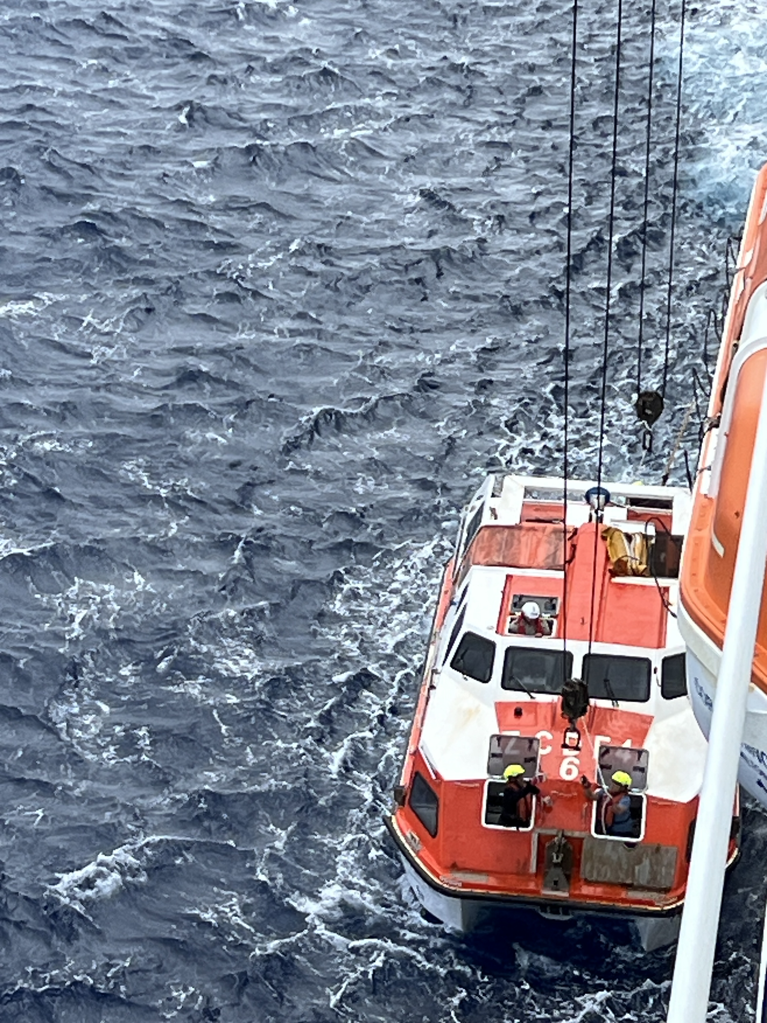
The whole process was done very professionally, no hiccups. We later hear that the operation was successful and the staff member was OK.
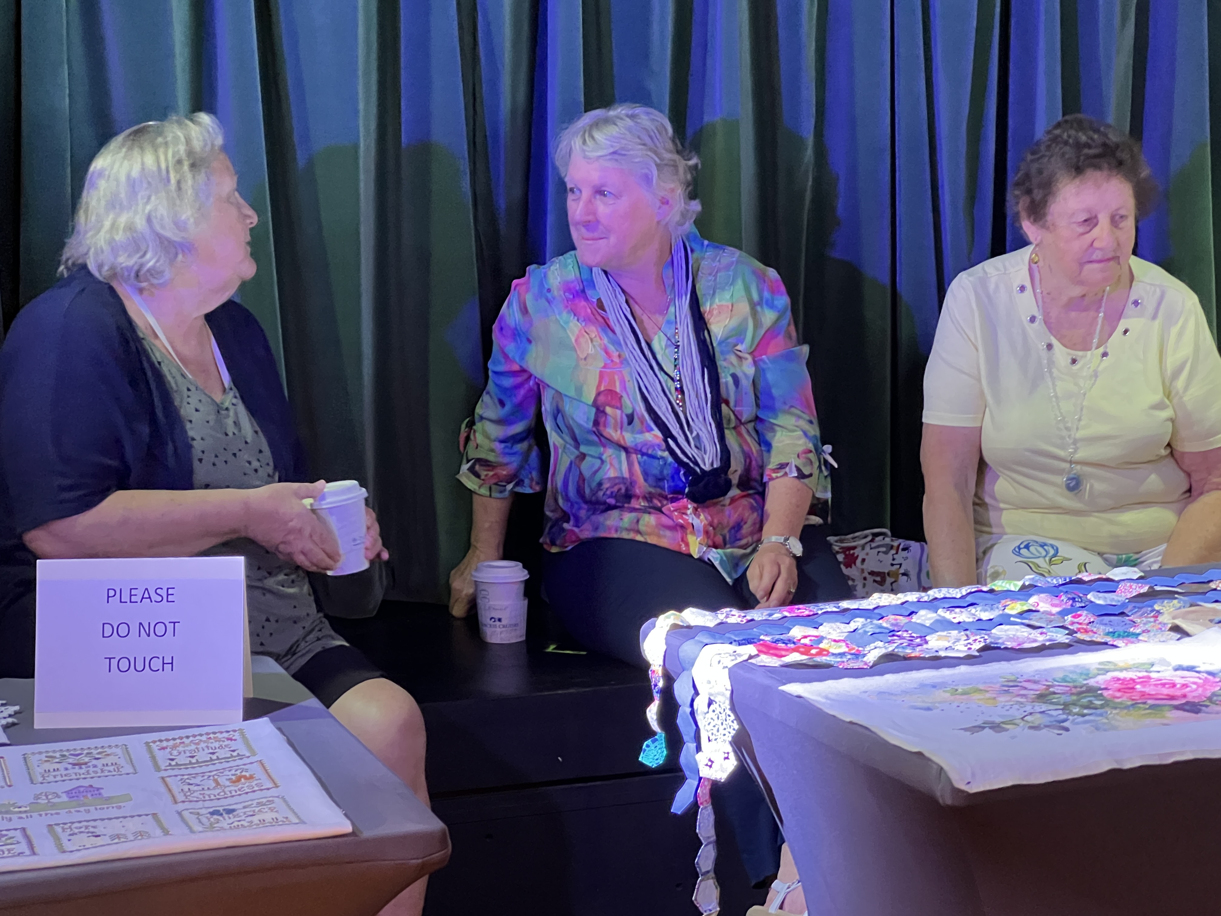
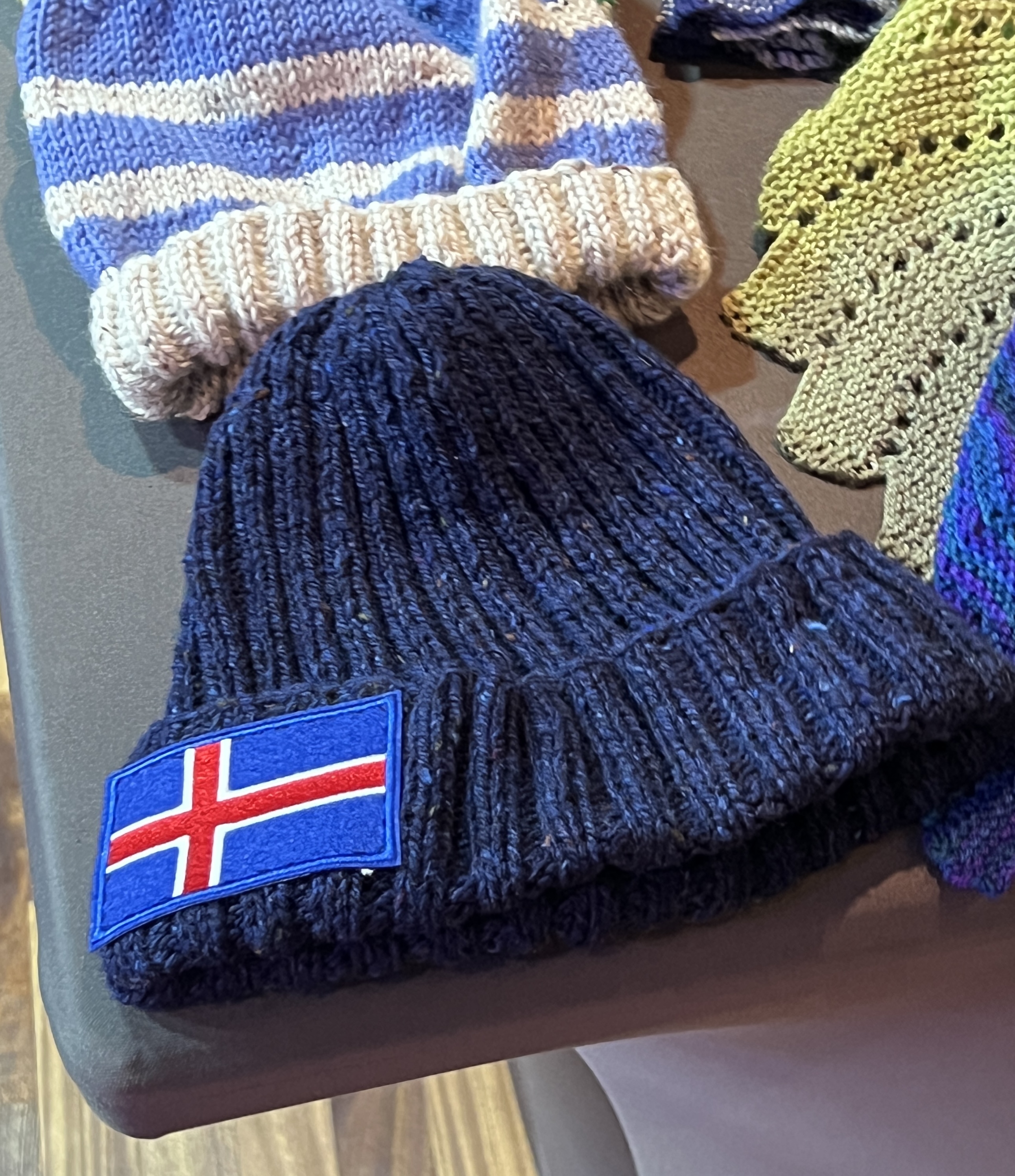
The cruise ends in Auckland for most of the Kiwis on board so the ‘Knitters and Natters’ put on a display of their work during the cruise. Quite impressive, Homealone participates with her Physi rug, Allthego’s Iceland beanie and some other bits and pieces. Someone wanted to buy the Physi rug (which is to be a prize for our local Physical Culture Club) but got knocked back.
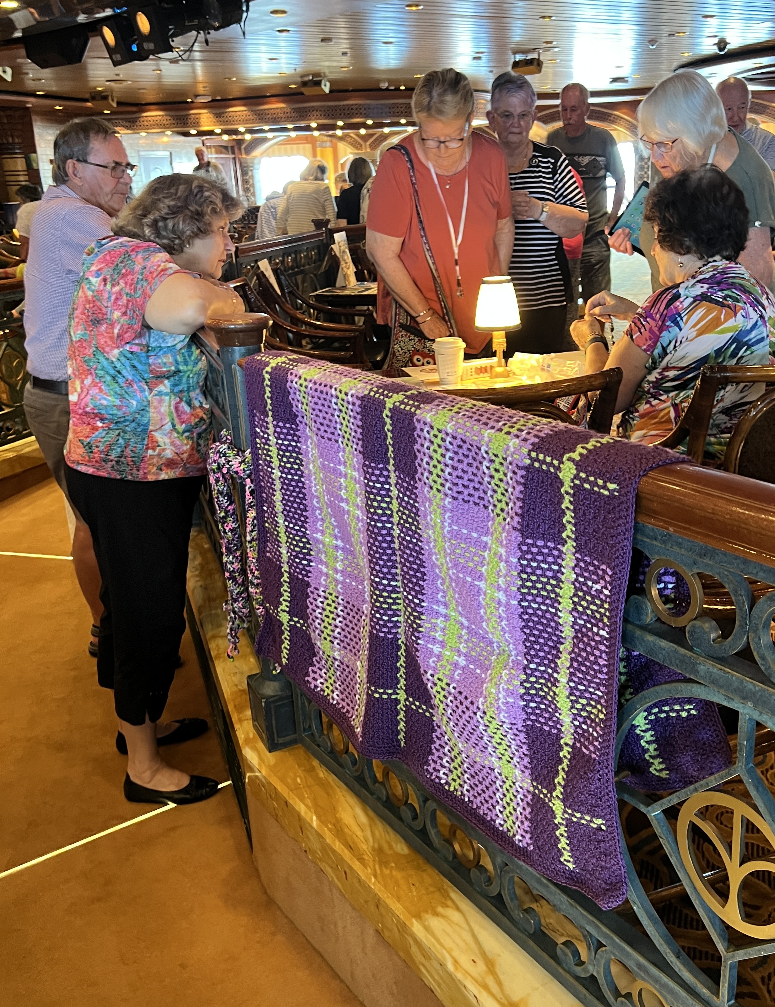
Passengers can wander around and observe all the Knitters nattering and also check out the work.
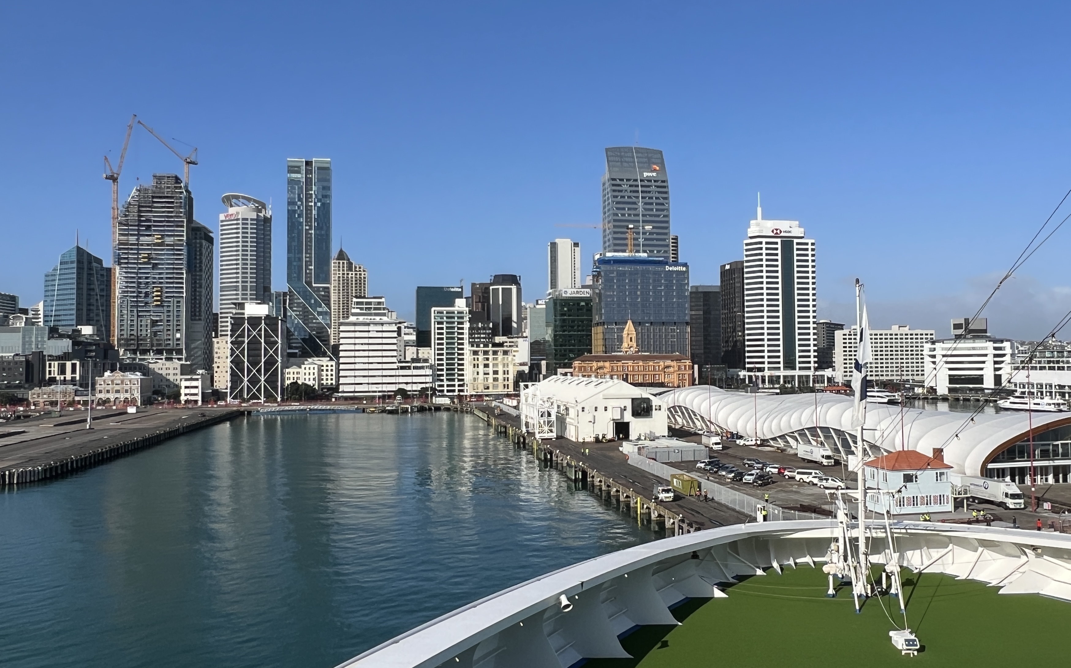
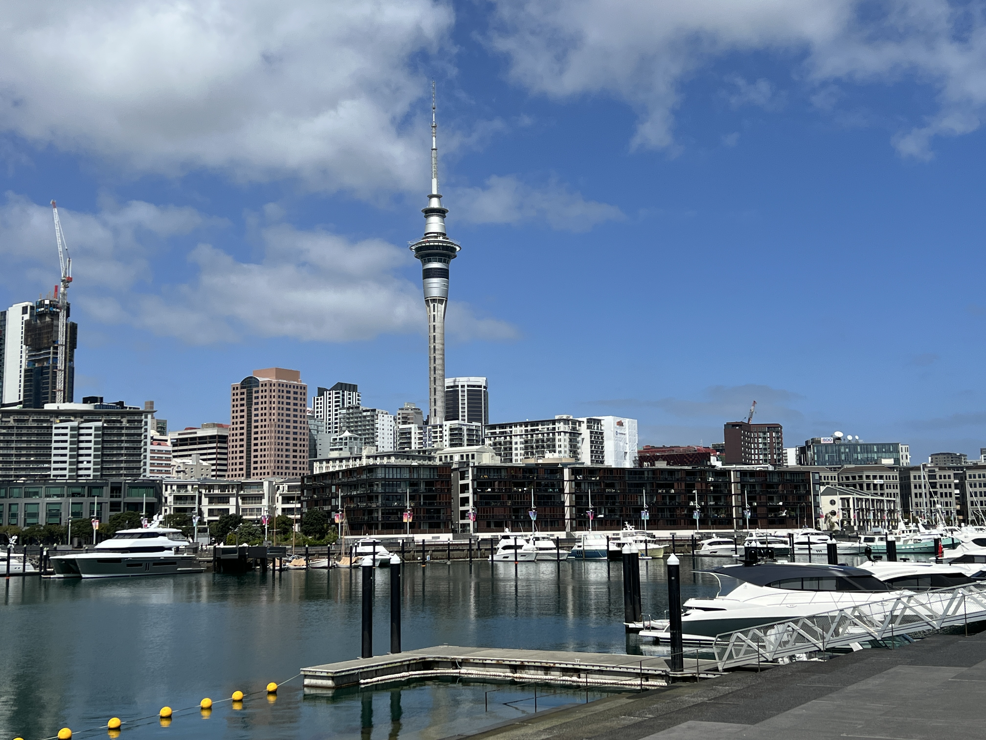
The six days at sea came to an end as we sailed into Auckland Harbour and docked at Queens Wharf right amongst all the action on the waterfront.
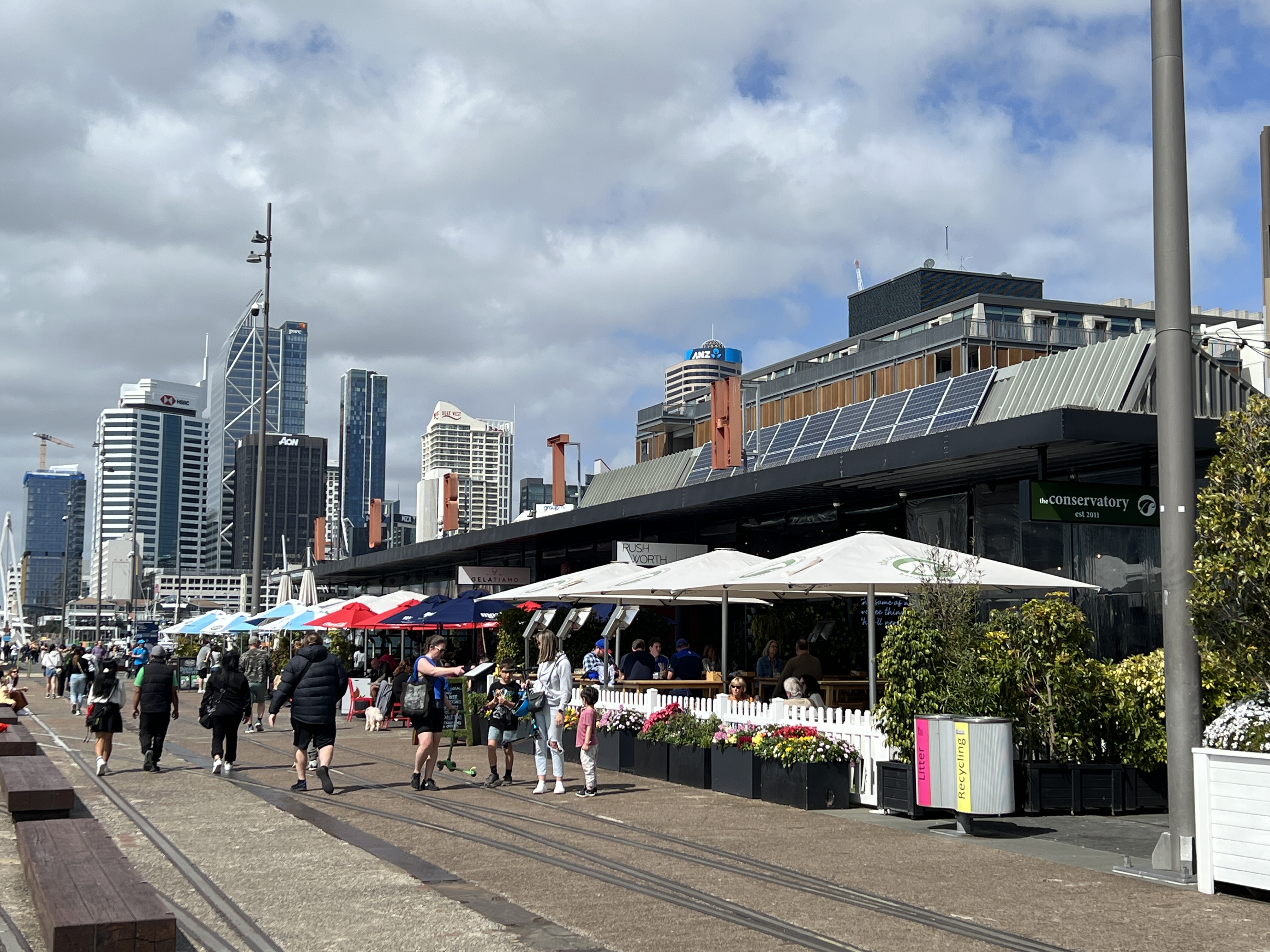
We had planned for a quiet morning having a look around and lunch before Allthego completing the Harbour Bridge climb in the afternoon.
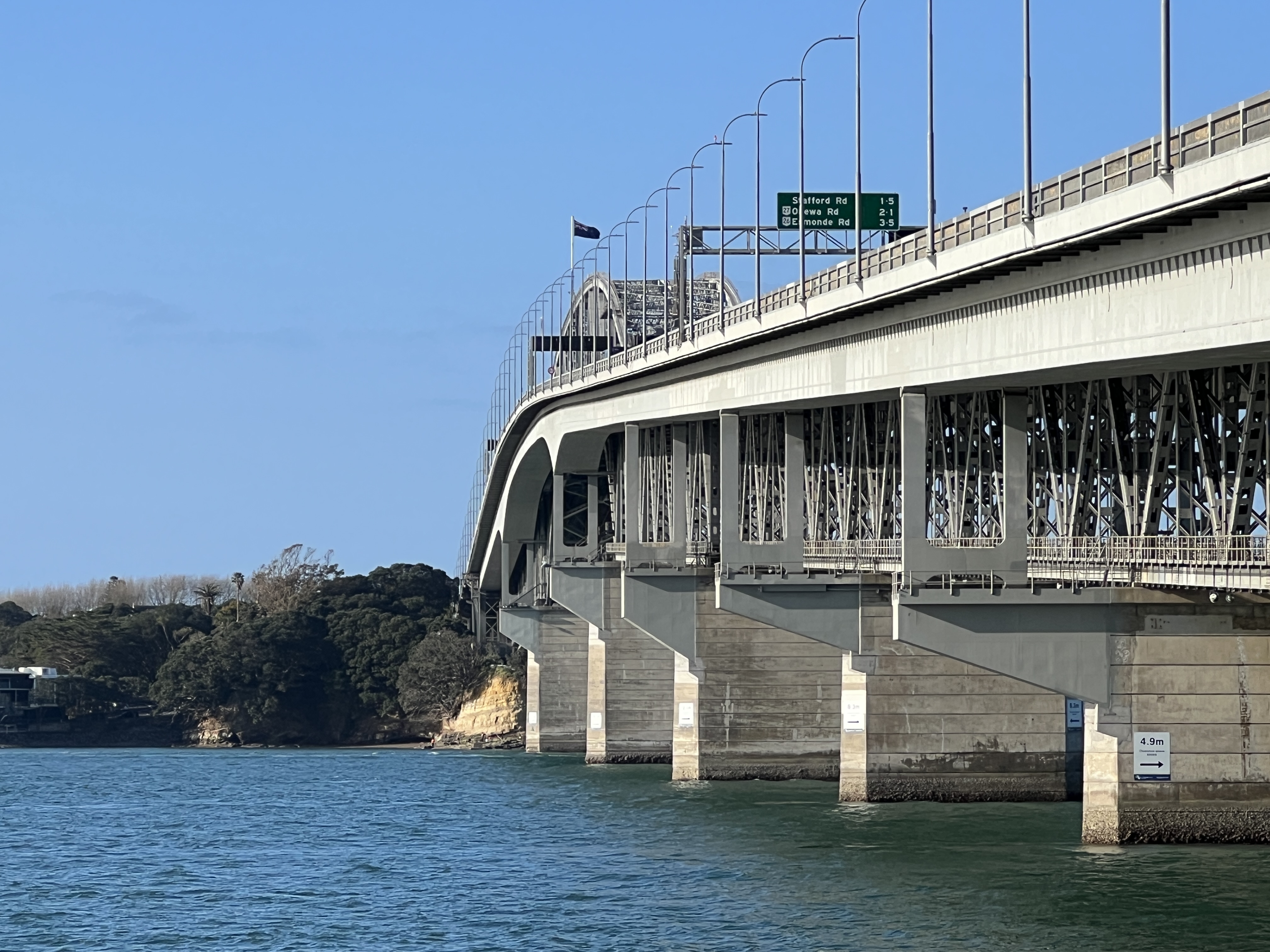
The climb was very interesting with great views of the city skyline and harbour. Some commentary about the politics of its construction was provided. The Bridge was completed in 1959 and was the last major bridge to be constructed in the world with the old girders, welding and rivets techniques. Three workers died during its construction. Safety equipment was negligible back then, two plunged into the harbour falling off the girders. The other was unaccounted for and it is thought he fell into the concrete being poured for one of the pylons.
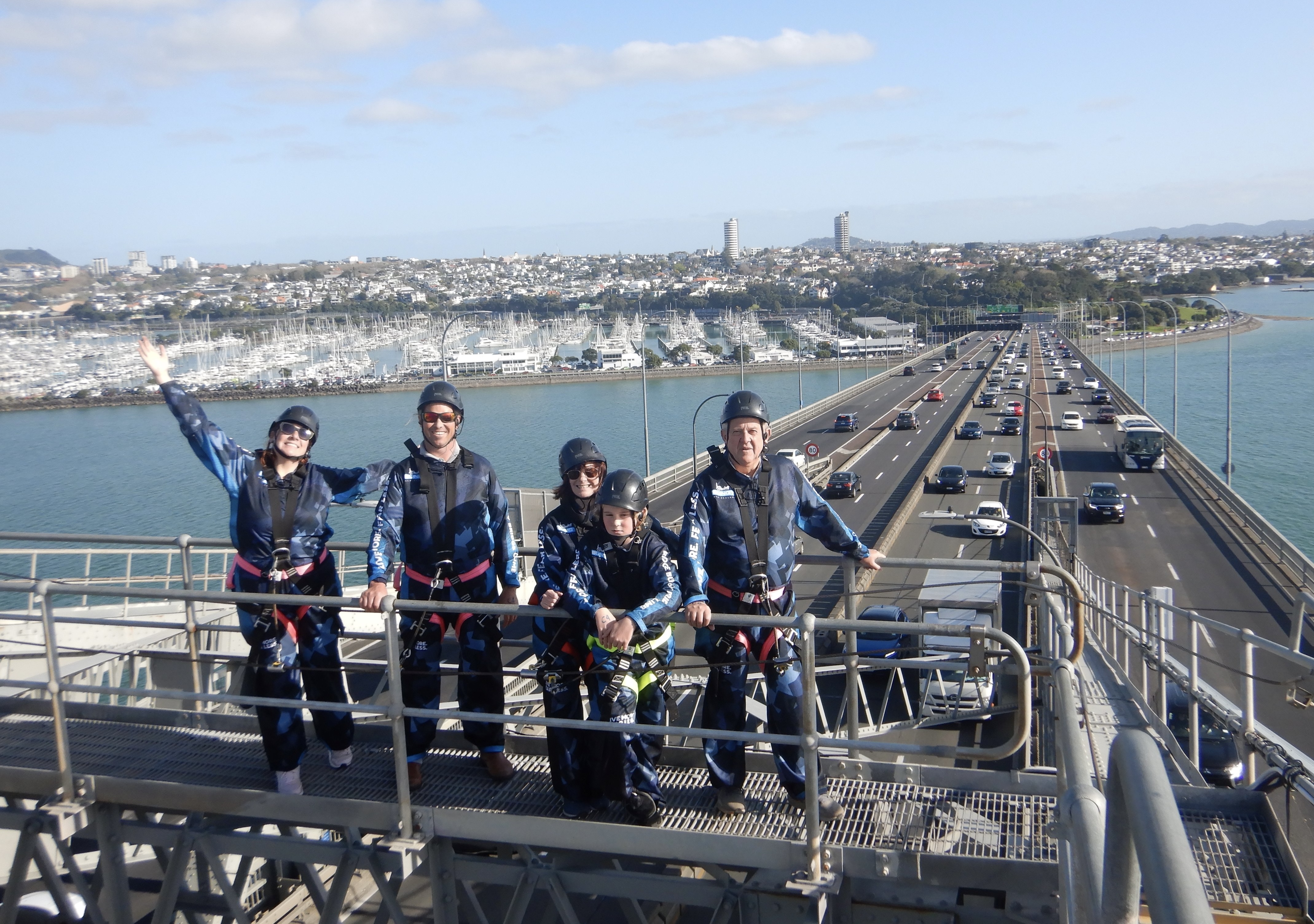
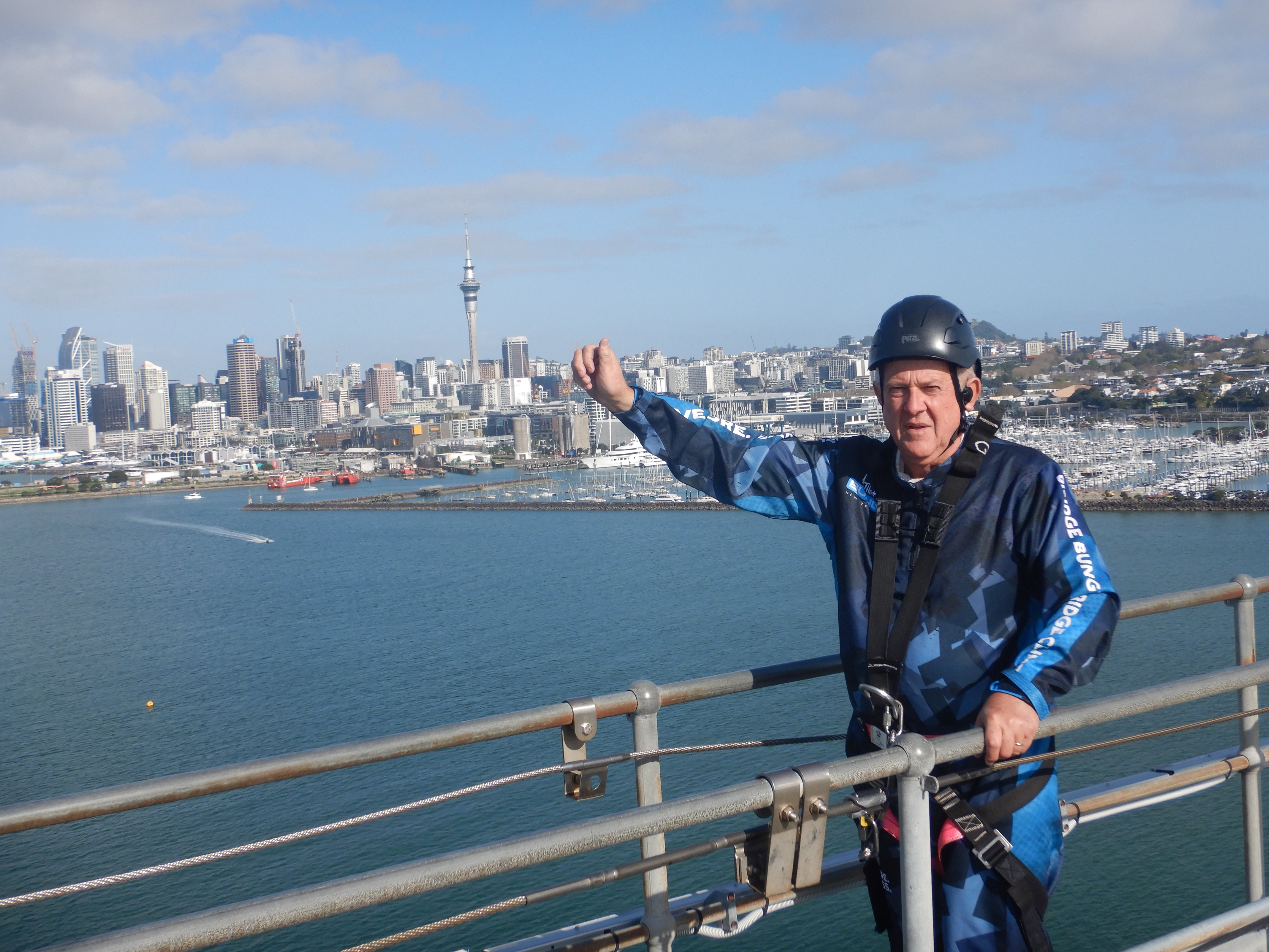
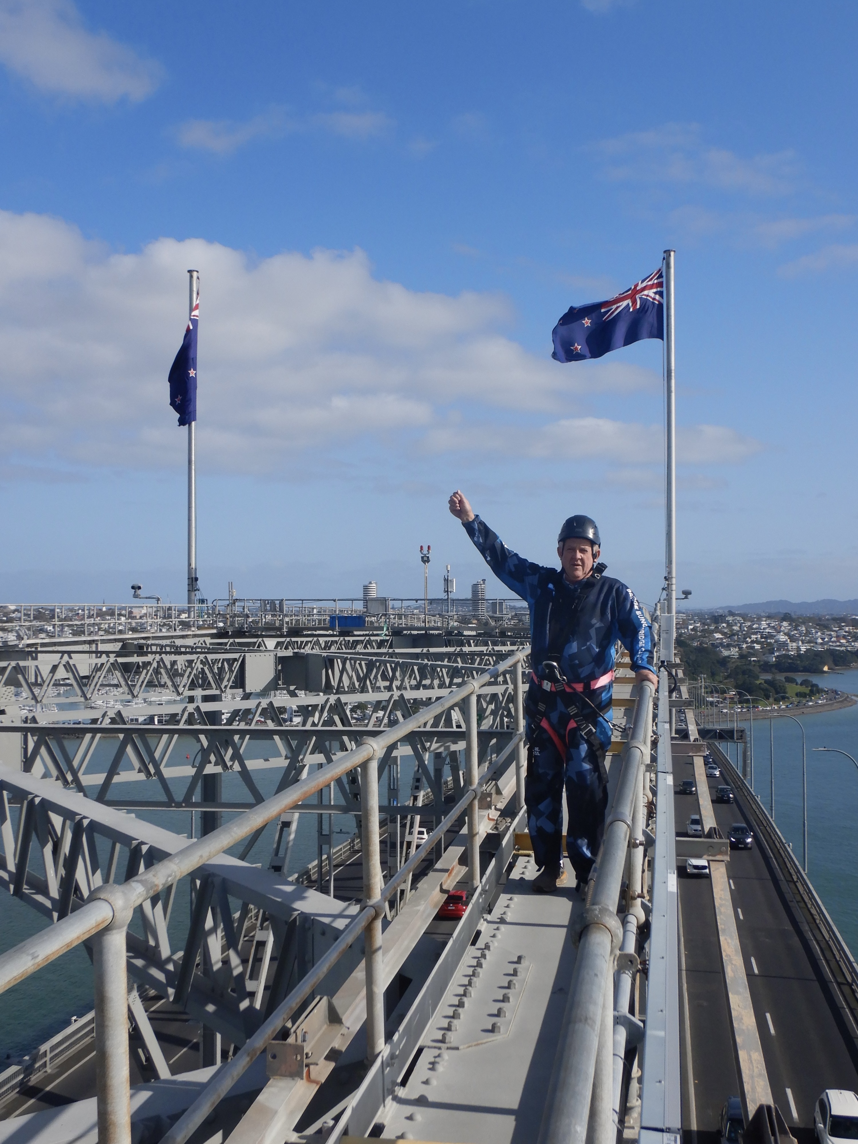
The climb took about two and a half hours all up. Not super demanding but a little stiffness of limbs set in later that night.
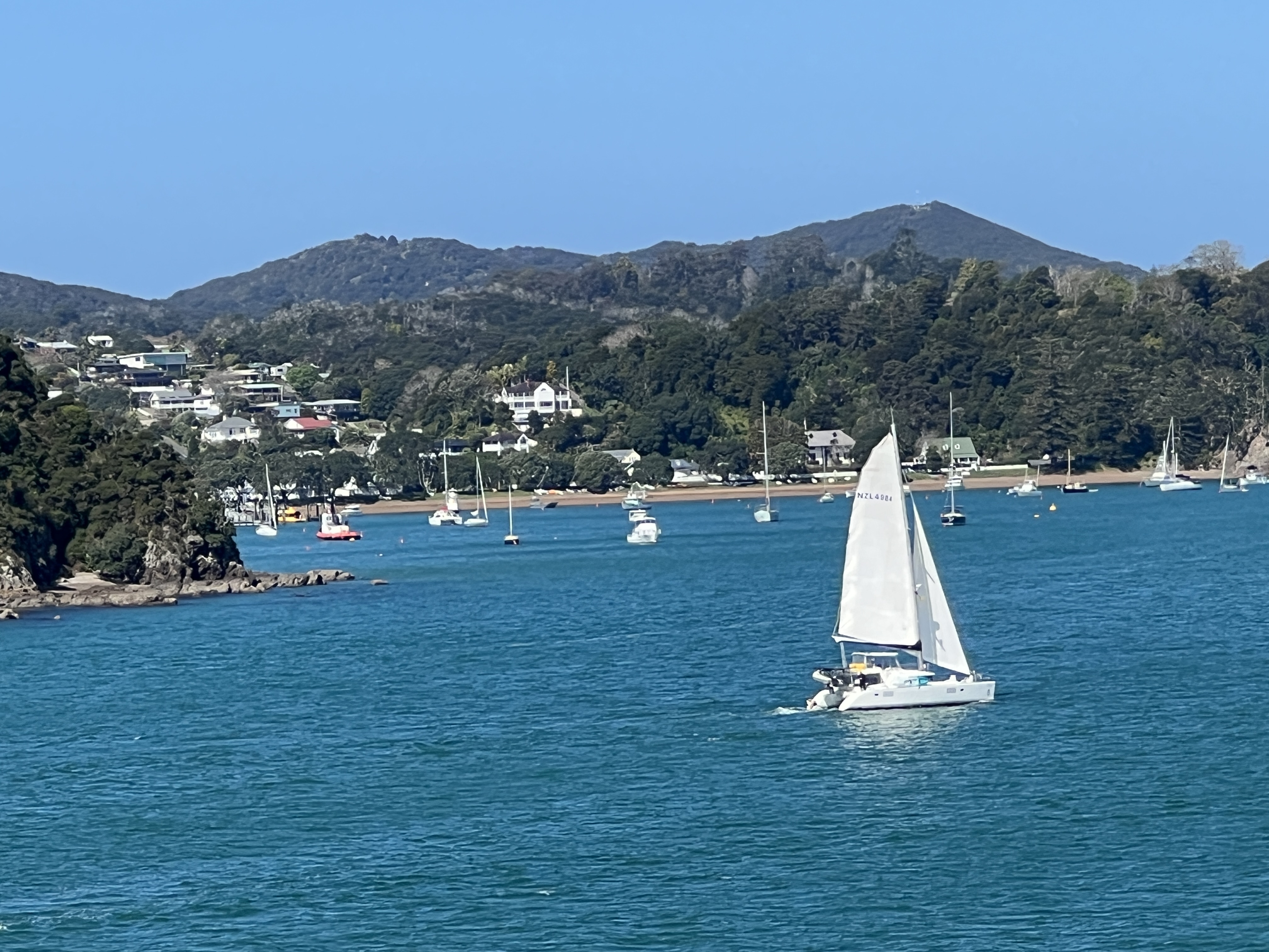
We sailed north that night for the Bay of Islands. Another easy day planned here no tours just a wander around Paihai, the town where we are taken ashore in tenders. Much calmer compared to Rarotonga!
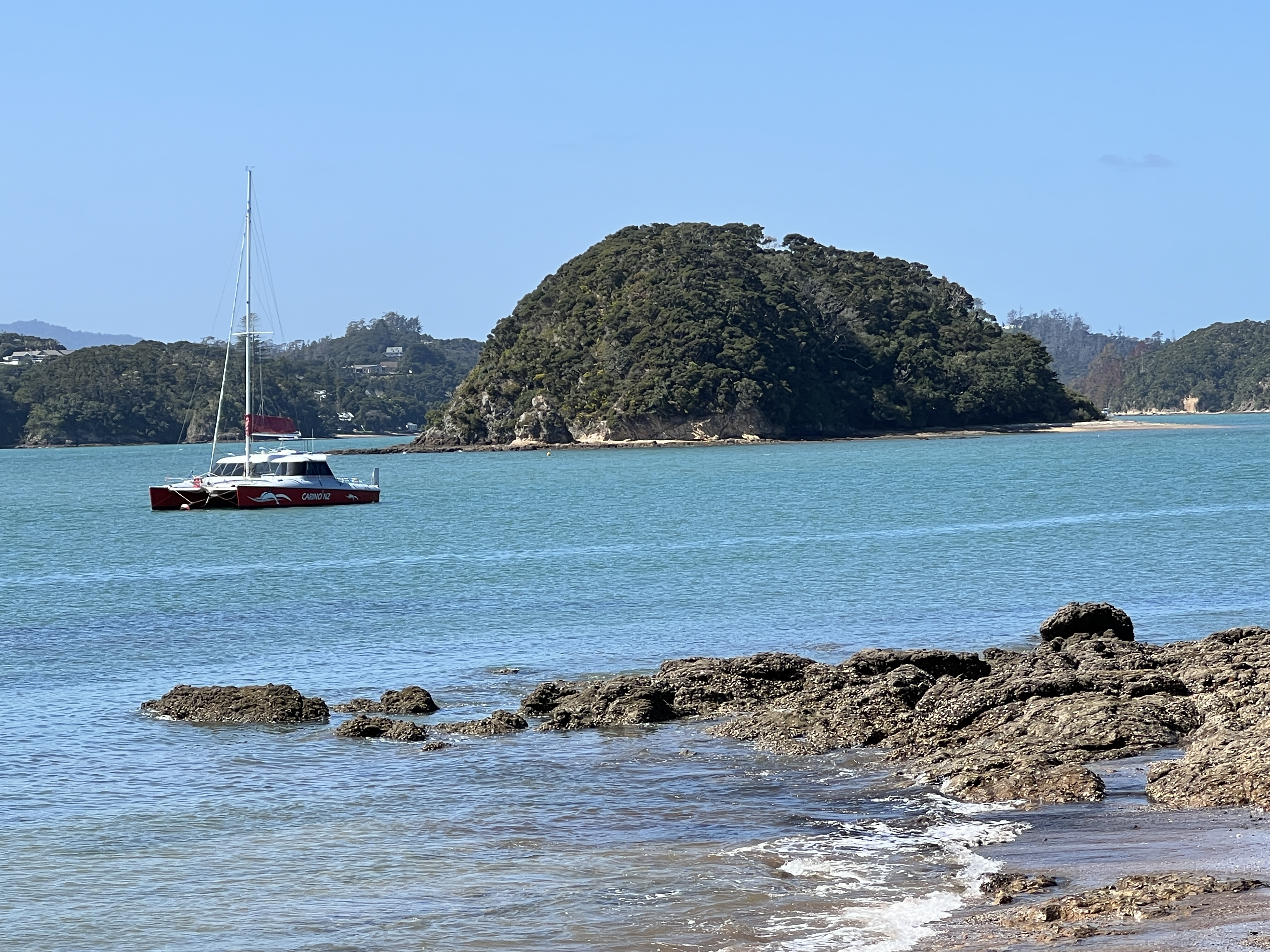
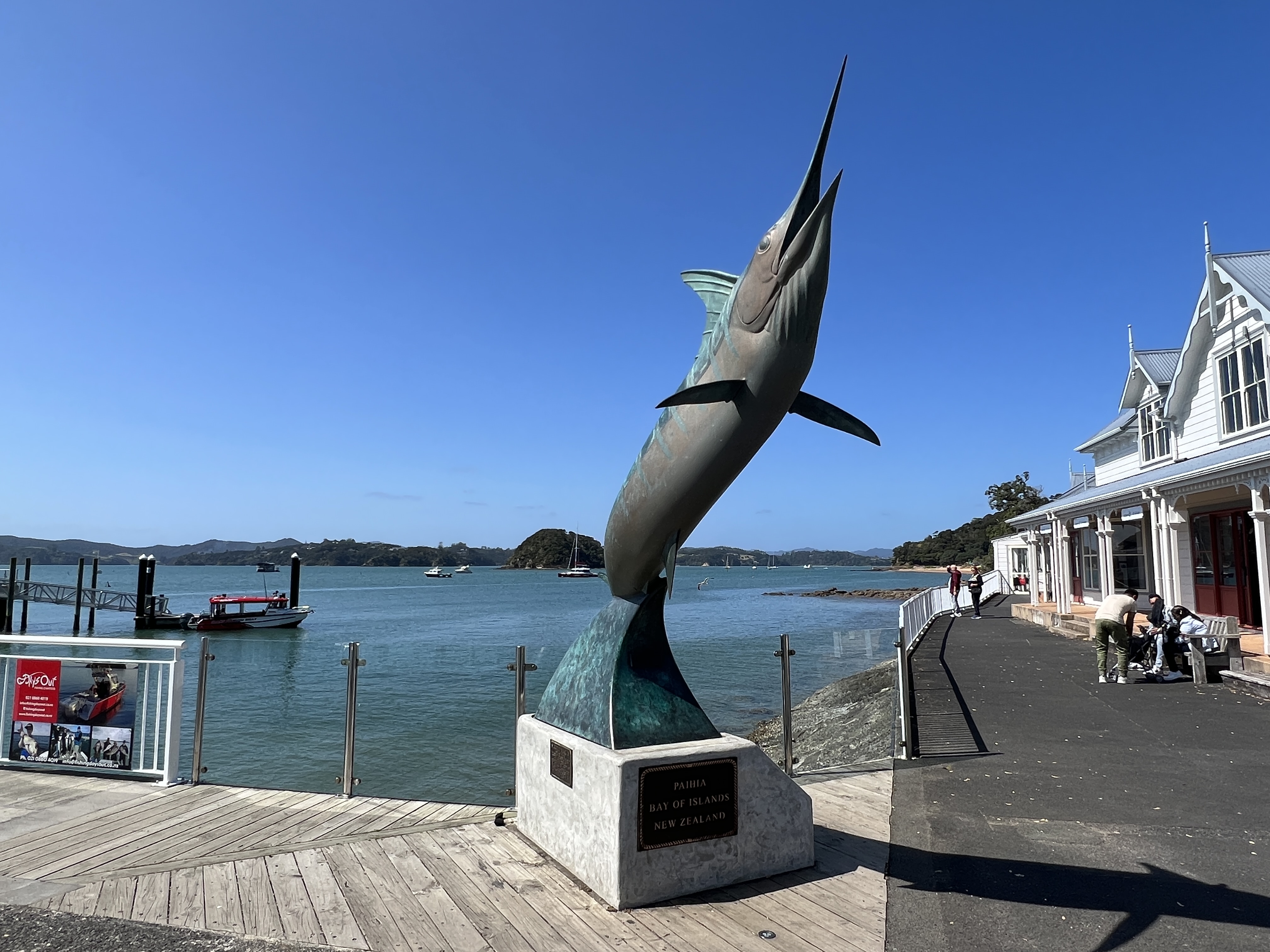
The Bay of Islands is a wonderful place, blue sea dotted with small islands and sandy beaches. Made famous in the 1920s for Marlin fishing by Zane Gray! For those who remember the old TV show ‘Pic a Box’ I think the hosts Bob and Dolly Dyer also fished here? We were also here a few years ago on a cruise with Homealone’s siblings and partners, but we didn’t go Marlin fishing.
The place doesn’t seem to have changed much! We had lunch at the Zane Gray restaurant, best fish n chips yet!
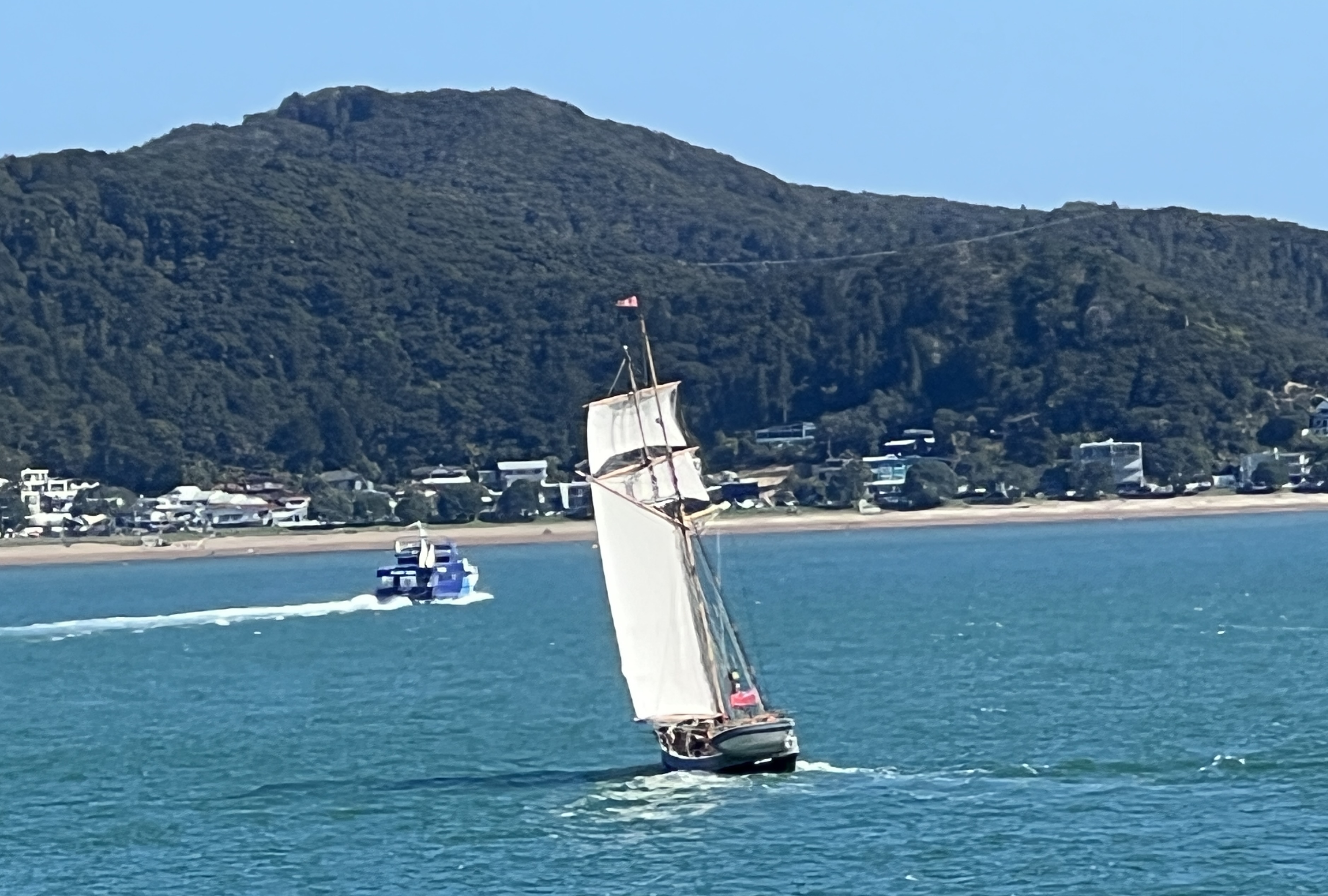
We upped anchor mid afternoon in brilliant sunshine and set off to round the northern tip of the North Island bound for Old Sydney Town.
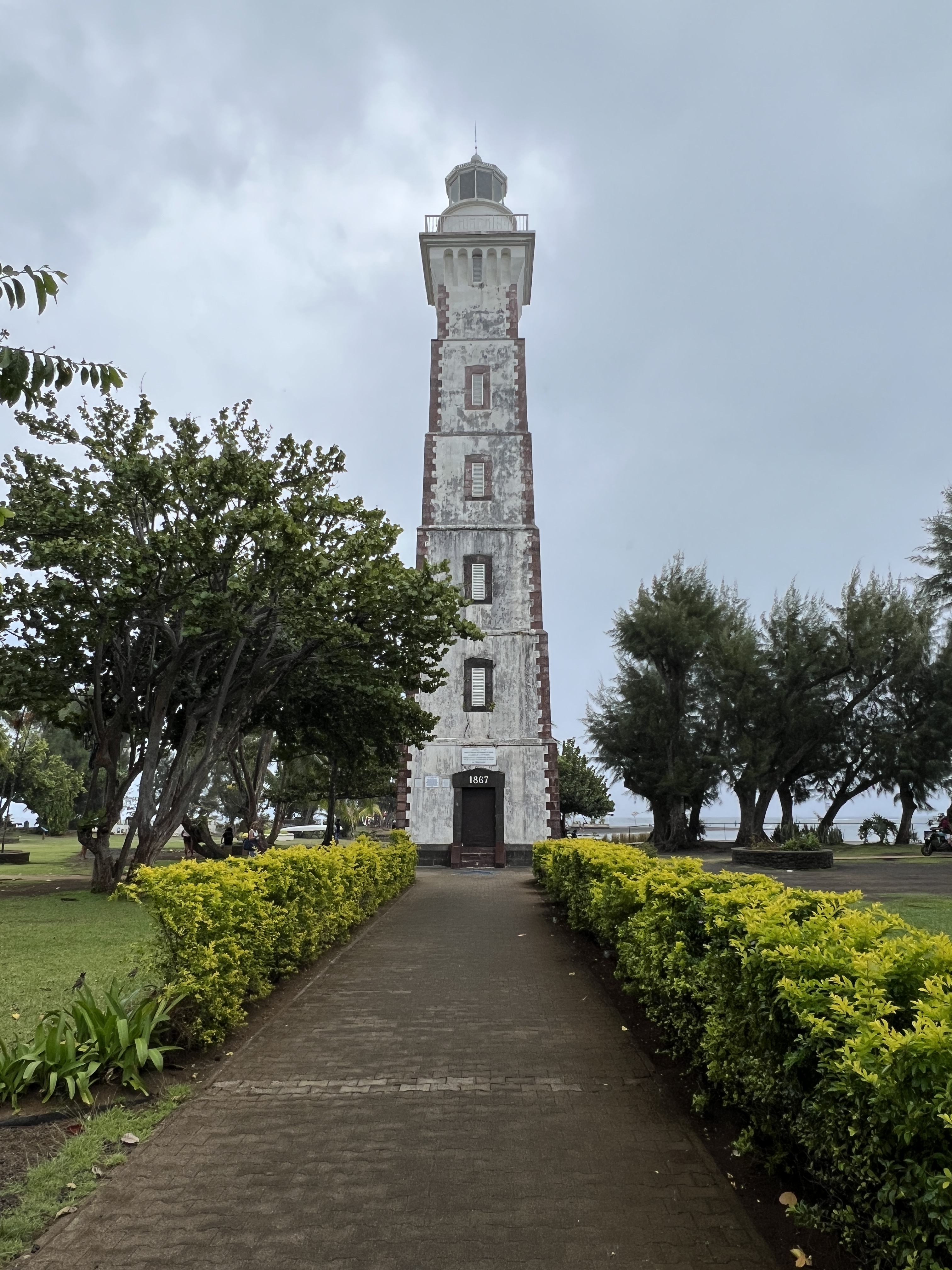
Tahiti
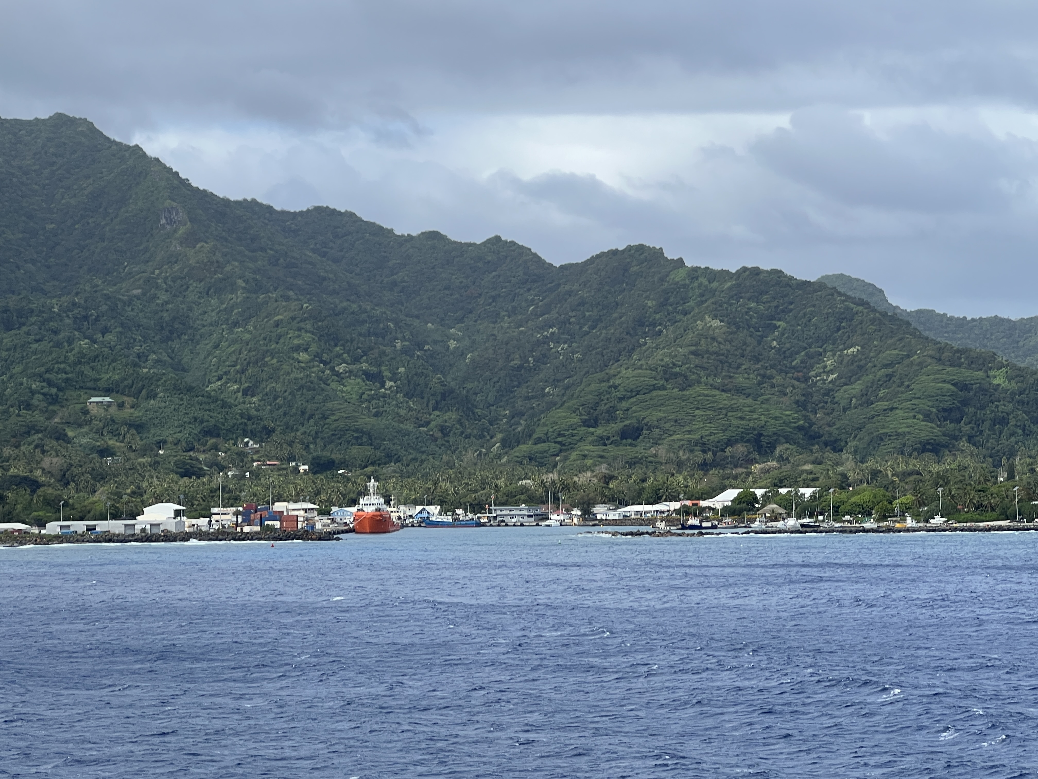
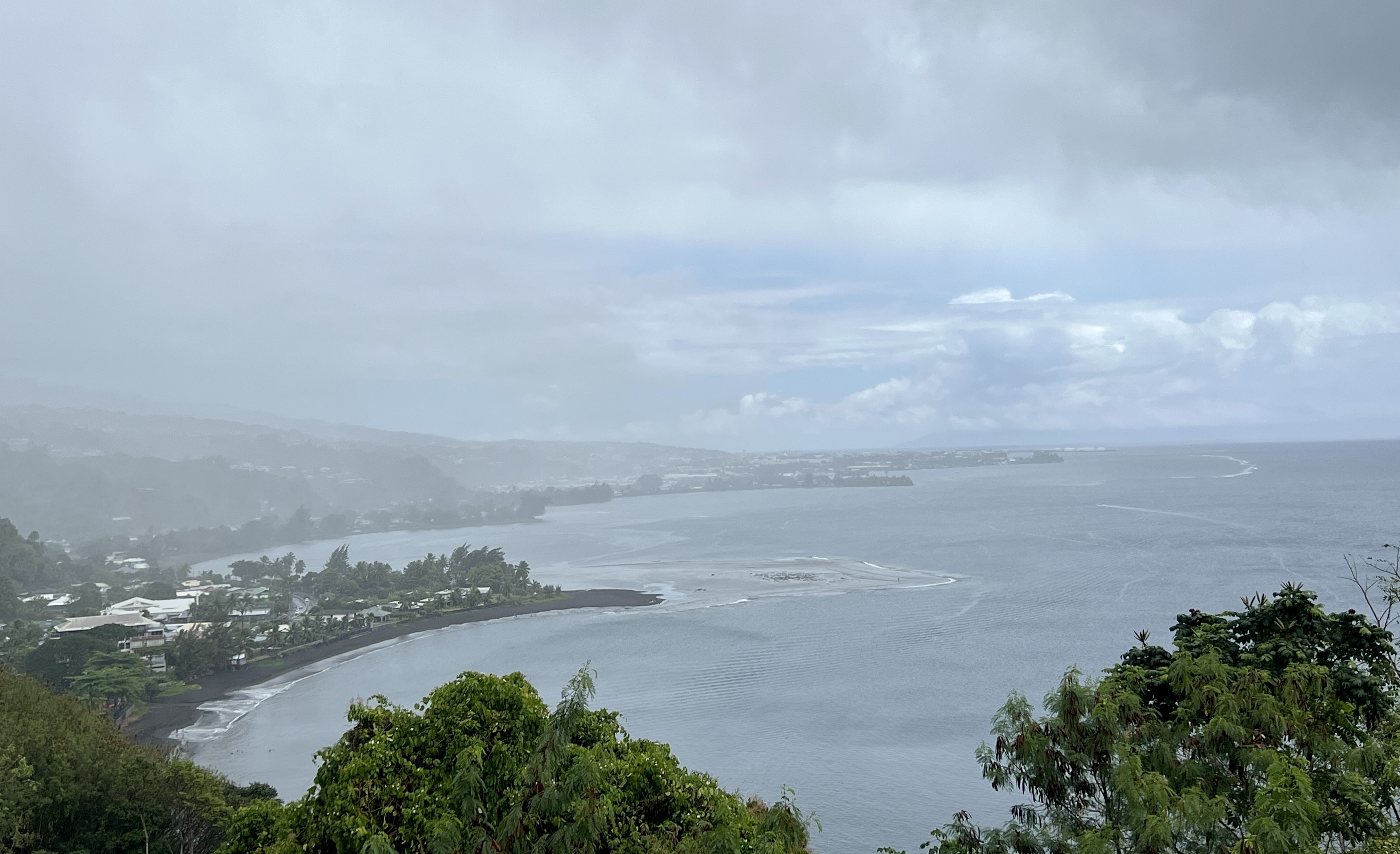
Tahiti is sought of in the middle of nowhere, sitting more or less midway between South America and Australia. We arrived here in promising weather, notwithstanding the threat of rain in the ship’s weather forecast. The Coral Princess docked up pretty much opposite the main street of Papeete, the capital, running along the waterfront. No need for shuttles, either water or buses. Apart from the local Polynesian language, French is the main lingo here. Seems out of place so far from France! Maybe the locals think it is, but most of them voted to stay with good old France in a not so recent referendum.
There is some blue sky and a light breeze as we set off on our ‘circle the island’ tour, the plan is to be back for a late lunch on the ship.
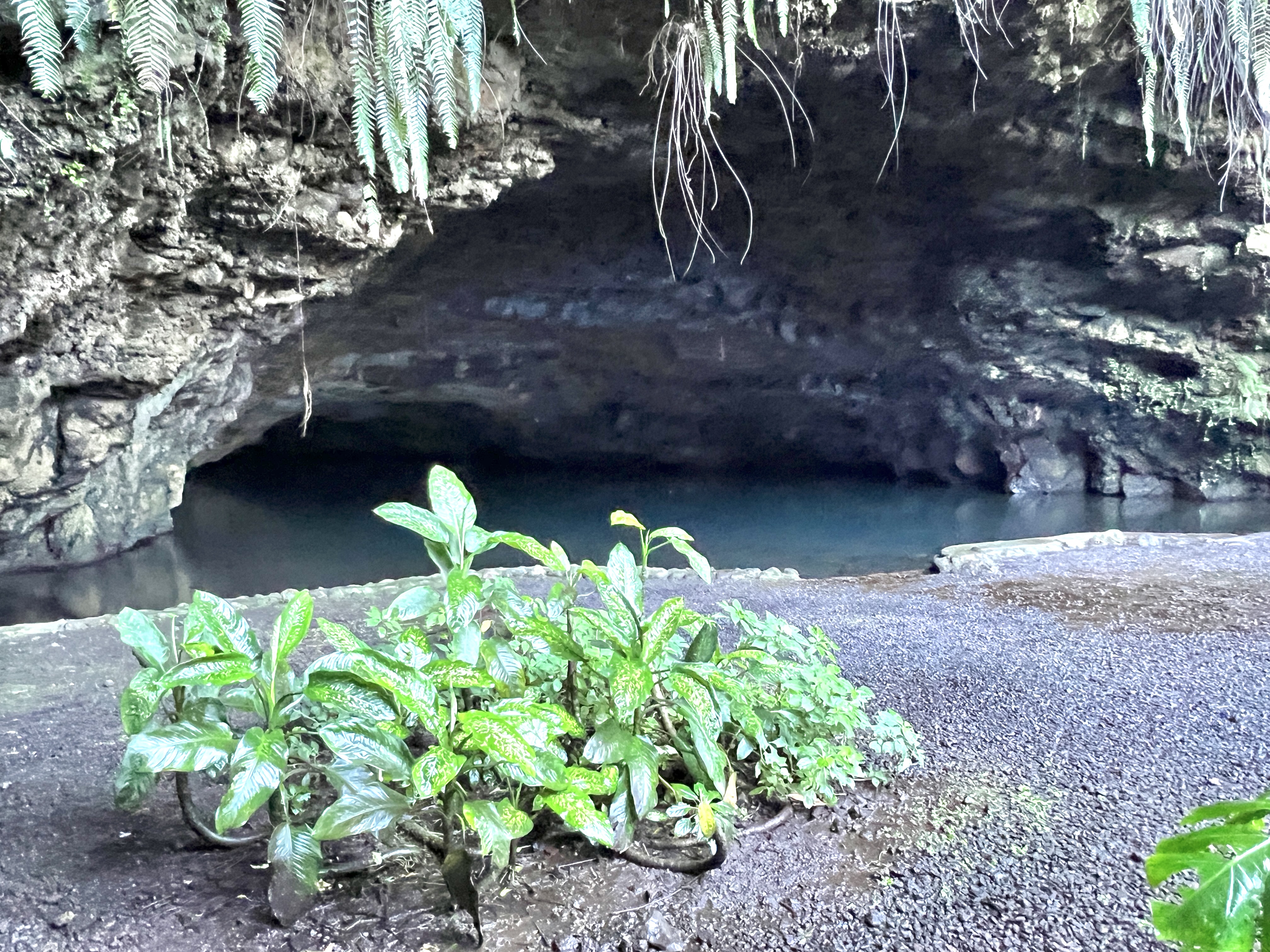
The trip is an interesting journey along the coast taking in some of the sights. There is a Grotto beside the road, the water disappears into the back of the cave.
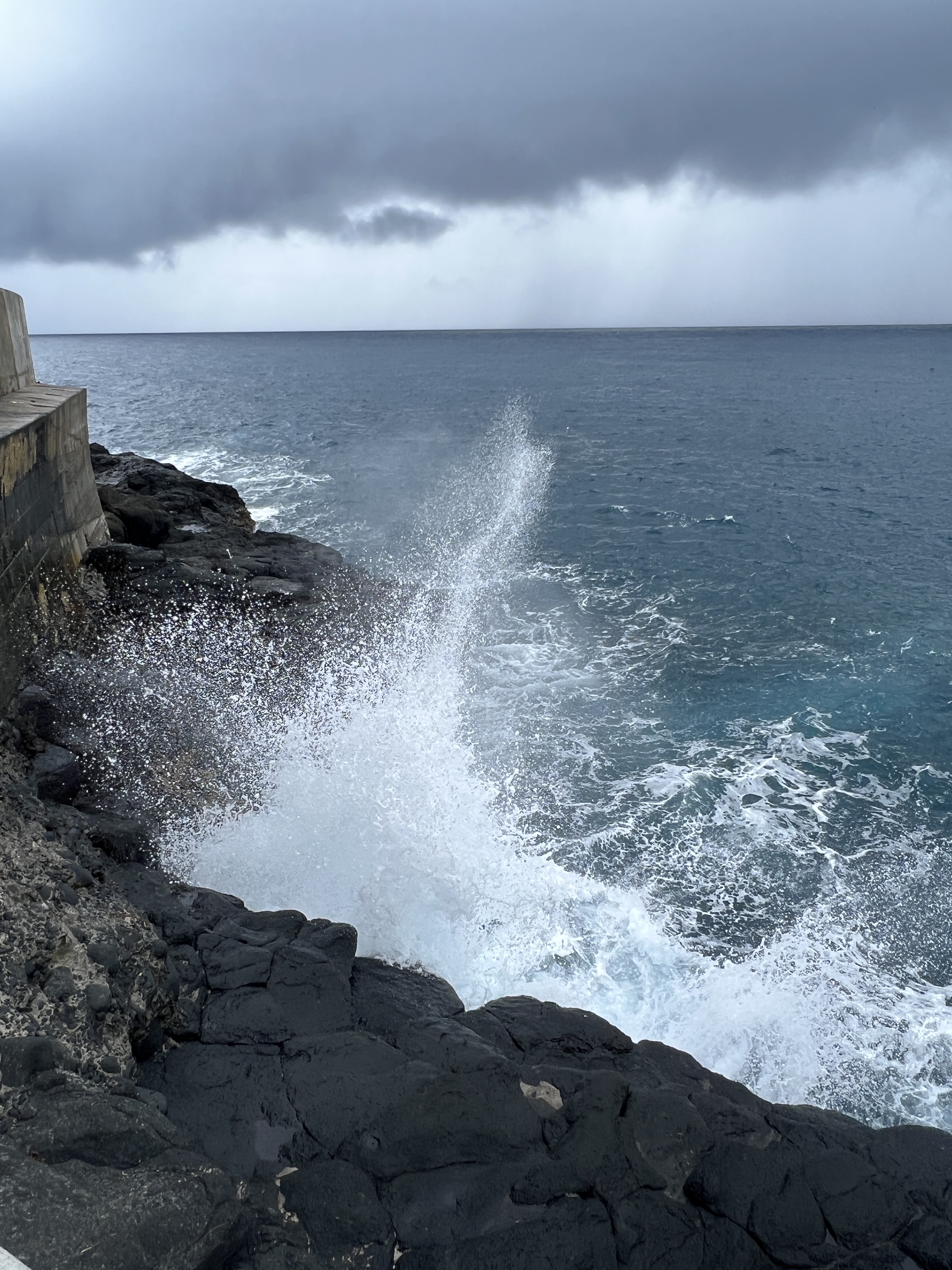
The Grotto is set among some attractive gardens and waterfalls, displaying native vegetation. We have stops further along at the Arahoho blowhole. The sea swell though is coming from the wrong angle today and so the blowhole is a bit quiet.
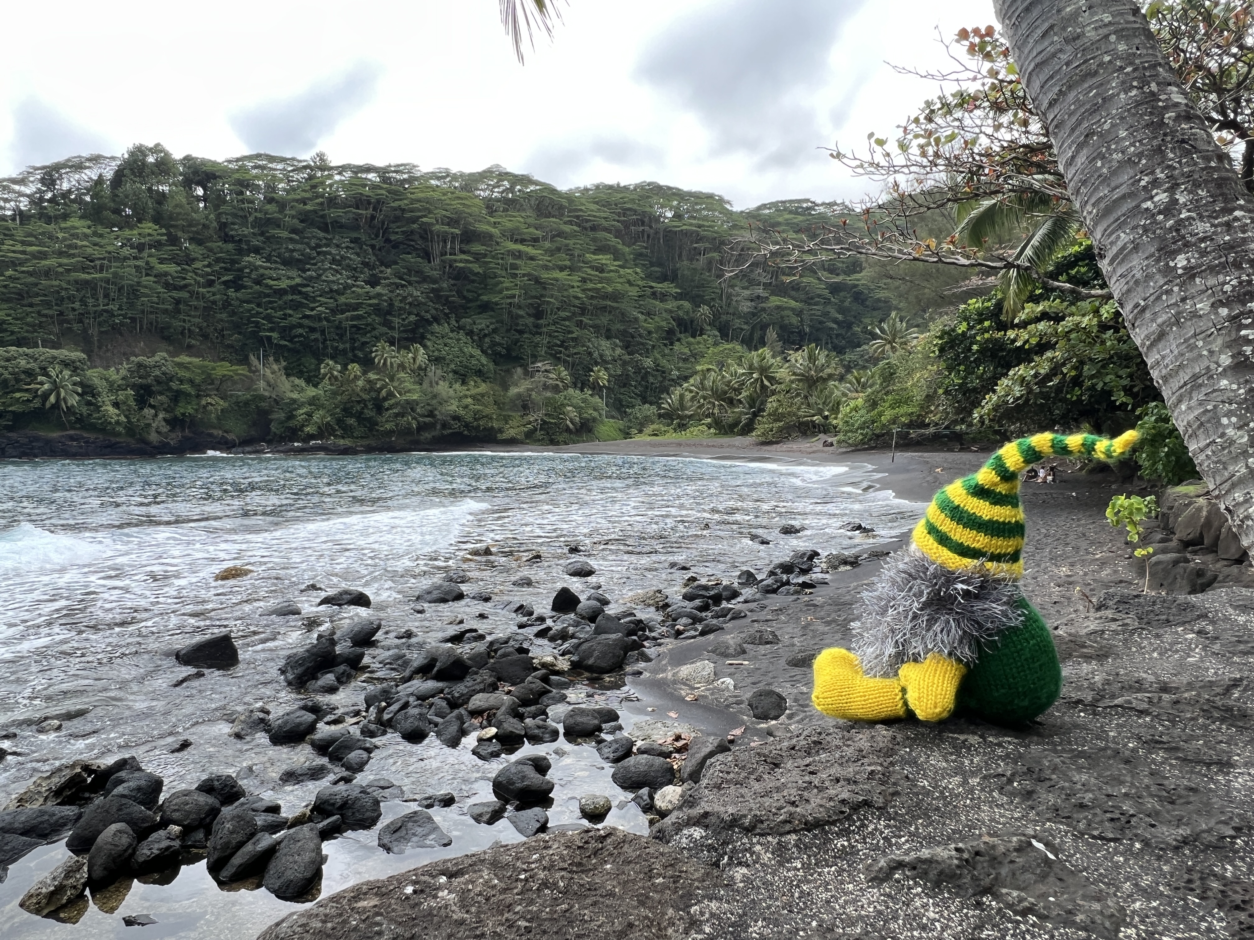
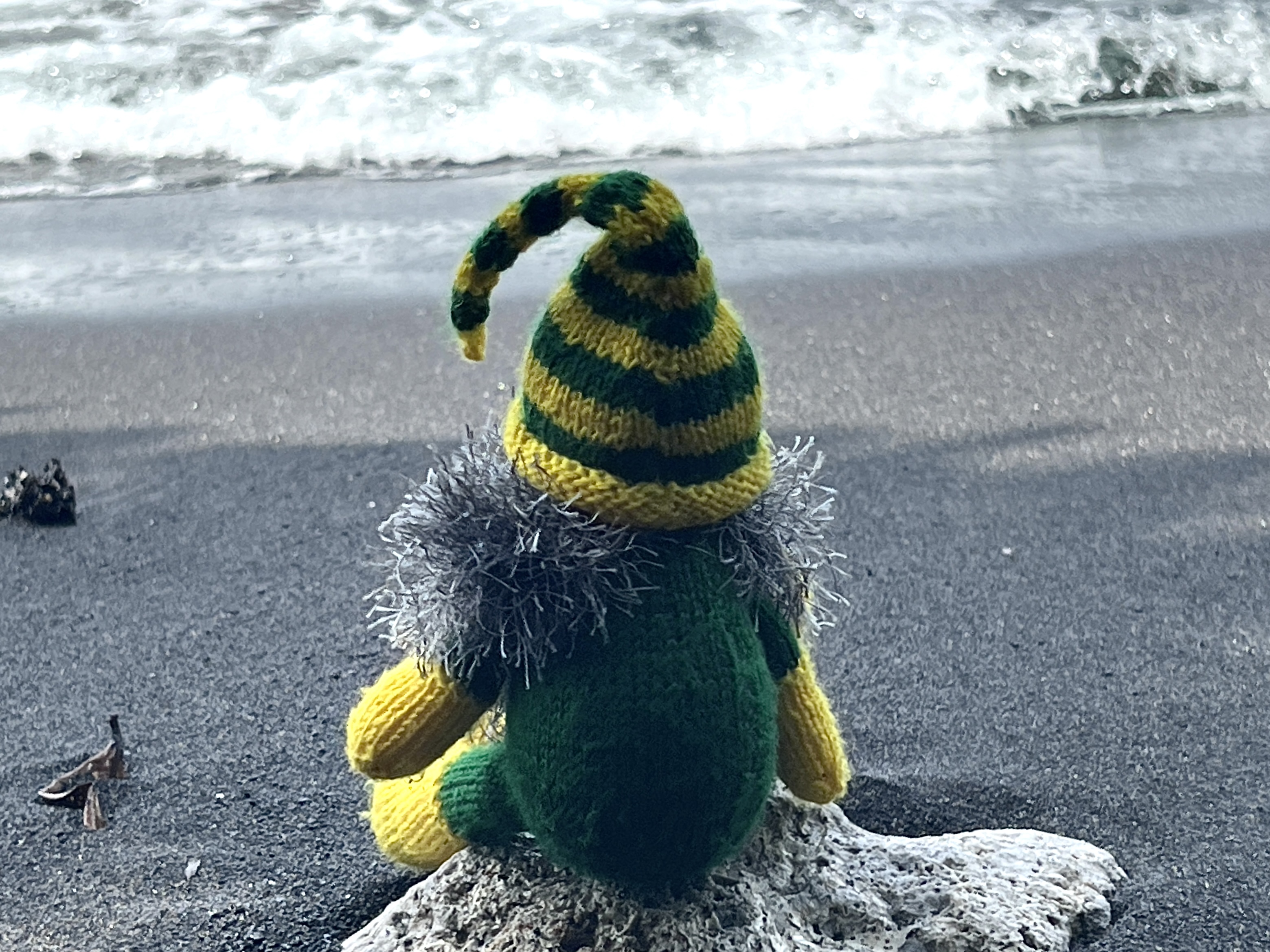
Slobro enjoys the nearby black sand beach and tempts fate sitting on a rock as a wave rolls up the beach.
By this time we are starting to get some rain sprinkles, but the rain holds off for our stop at Venus Point. This where Cook went to witness and record the transit of Venus across the Sun in 1769 and then later went on to sail up the east coast of Australia.
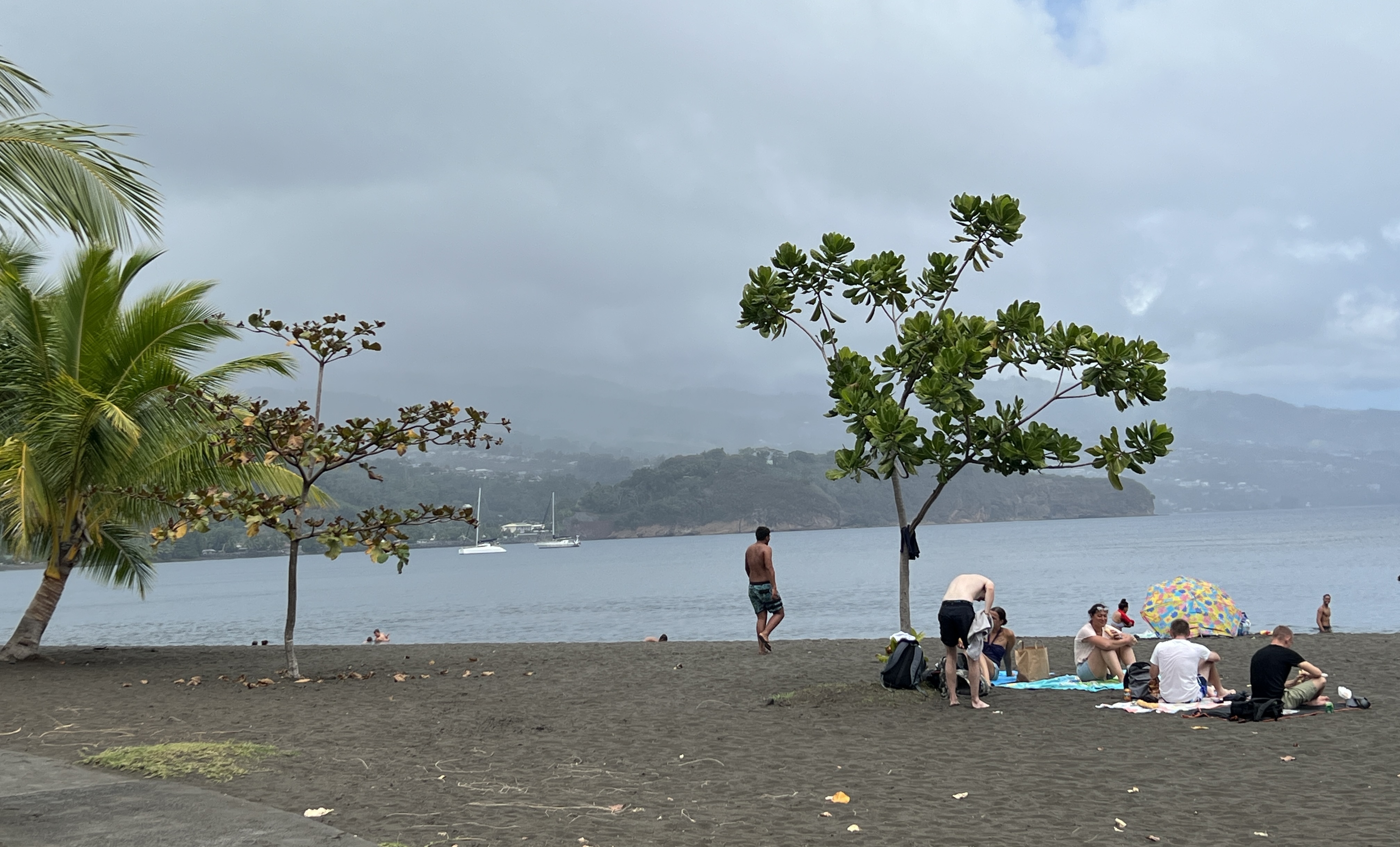
Today the location is a popular spot for the locals to enjoy the parkland and black sand beach. The Mutiny on the Bounty is also remembered here with an obelisk. As we continue around the Island the rain starts in earnest and the spectacular view from One Tree Hill over Matavai Bay is shrouded in cloud. Cook used a red flowered tree on the top of the hill as a navigation aide.
We made it back to the dock on time and after a quick lunch we returned ashore for a wander around Papeete. Being a Saturday most of the shops, including the Market, had closed at 1pm. We were still able to buy a stamp in a general type store for the usual postcard back to Australia. The shop had a small box with a sign promising to post our mail for us.
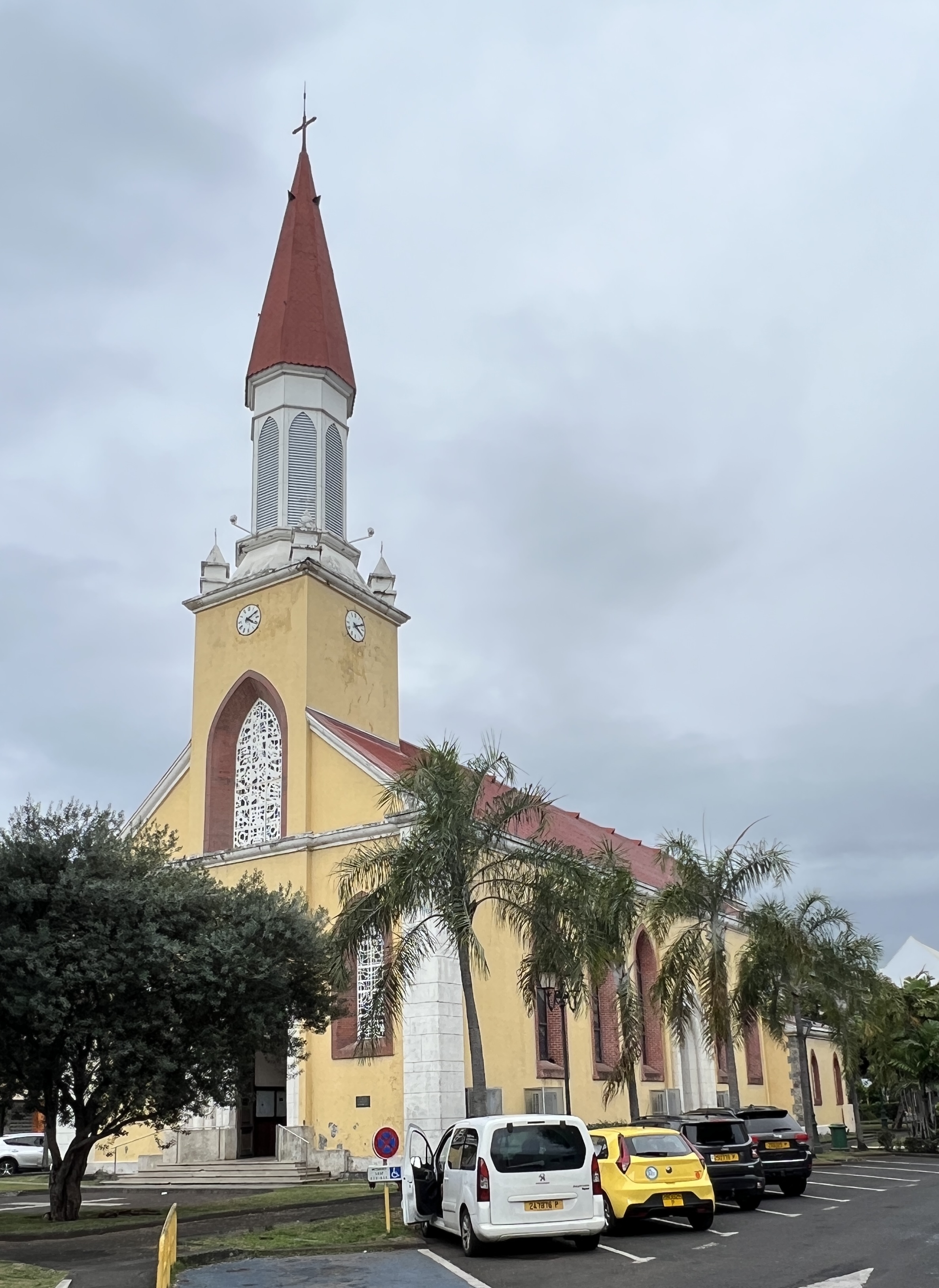
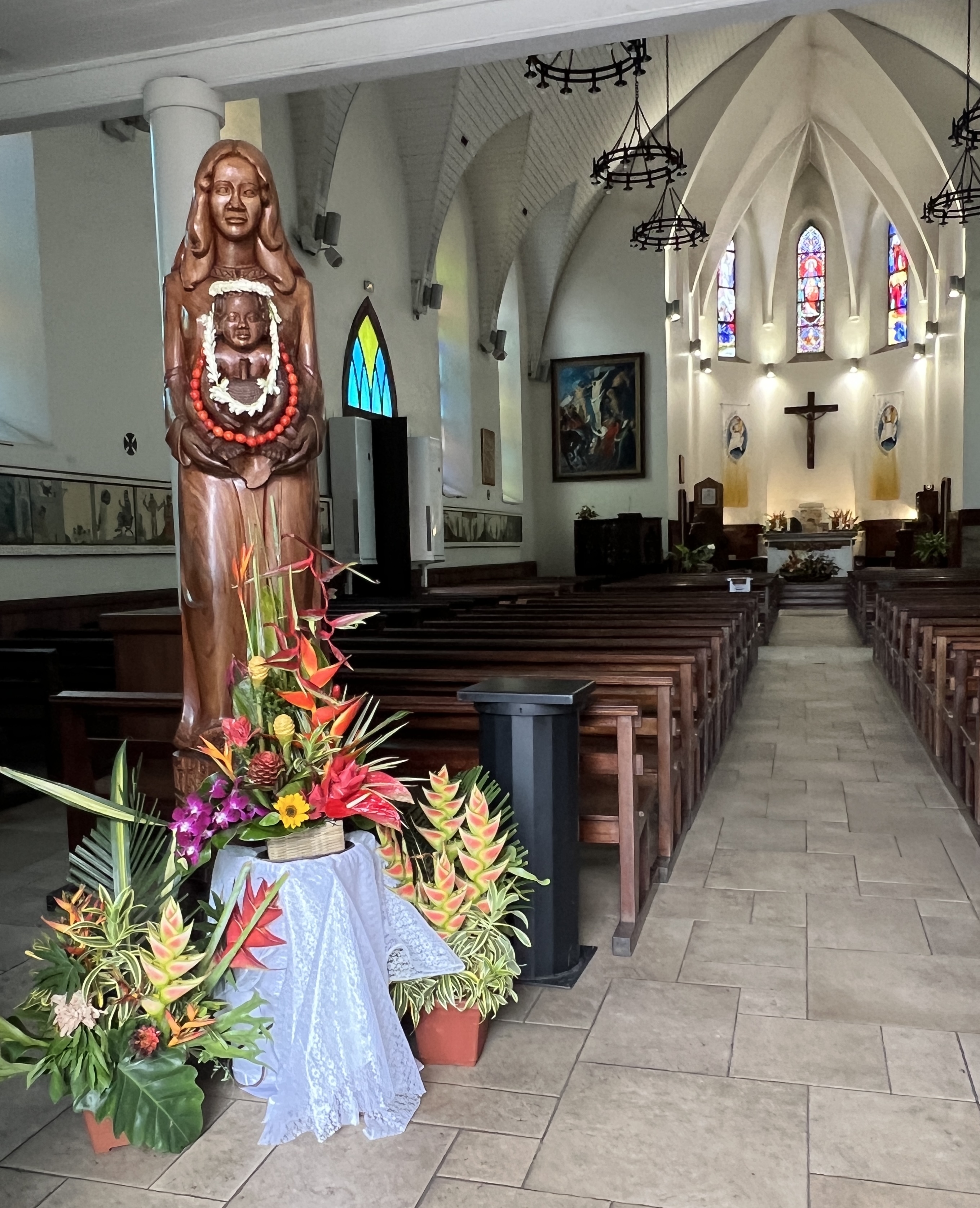
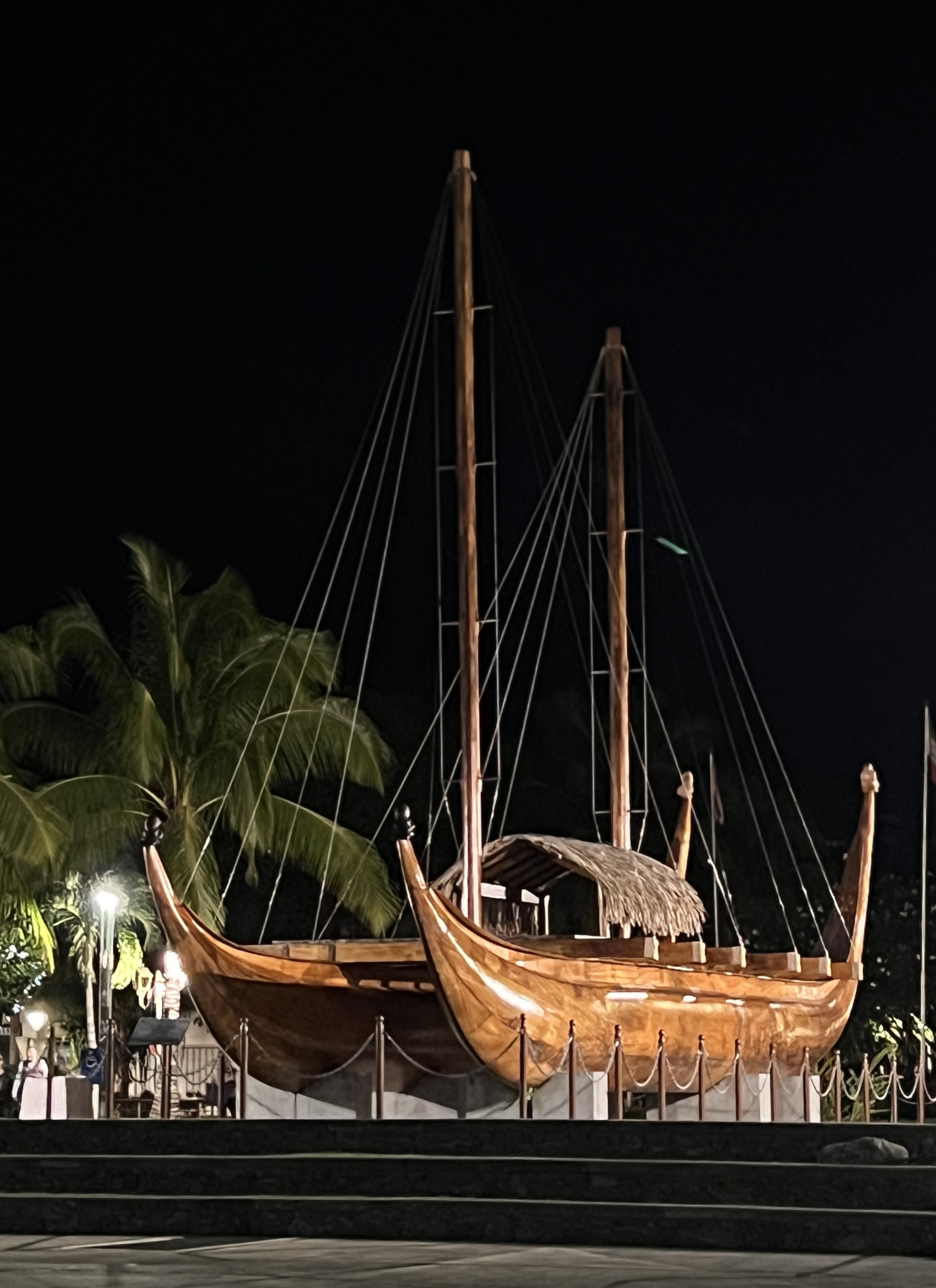
We had a quick look inside the Papeete Cathedral, very different to the European ones we have seen. Back on the waterfront there was the big replica sea going canoe pointing out to sea.
Time for an early dinner snack, so we enjoyed some tapas selections at a bar jutting out into the harbour. Great views as the sun set over Moorea island just offshore.
It seemed to us that we had just scratched the surface of Tahiti, let alone the other islands that make up French Polynesia. Might be worth another visit!
We now head for New Zealand and four days at sea before reaching Auckland. We have to cross the International Date Line on this sector and Slobro is pondering what this means. Hopefully, it will all be clear soon!
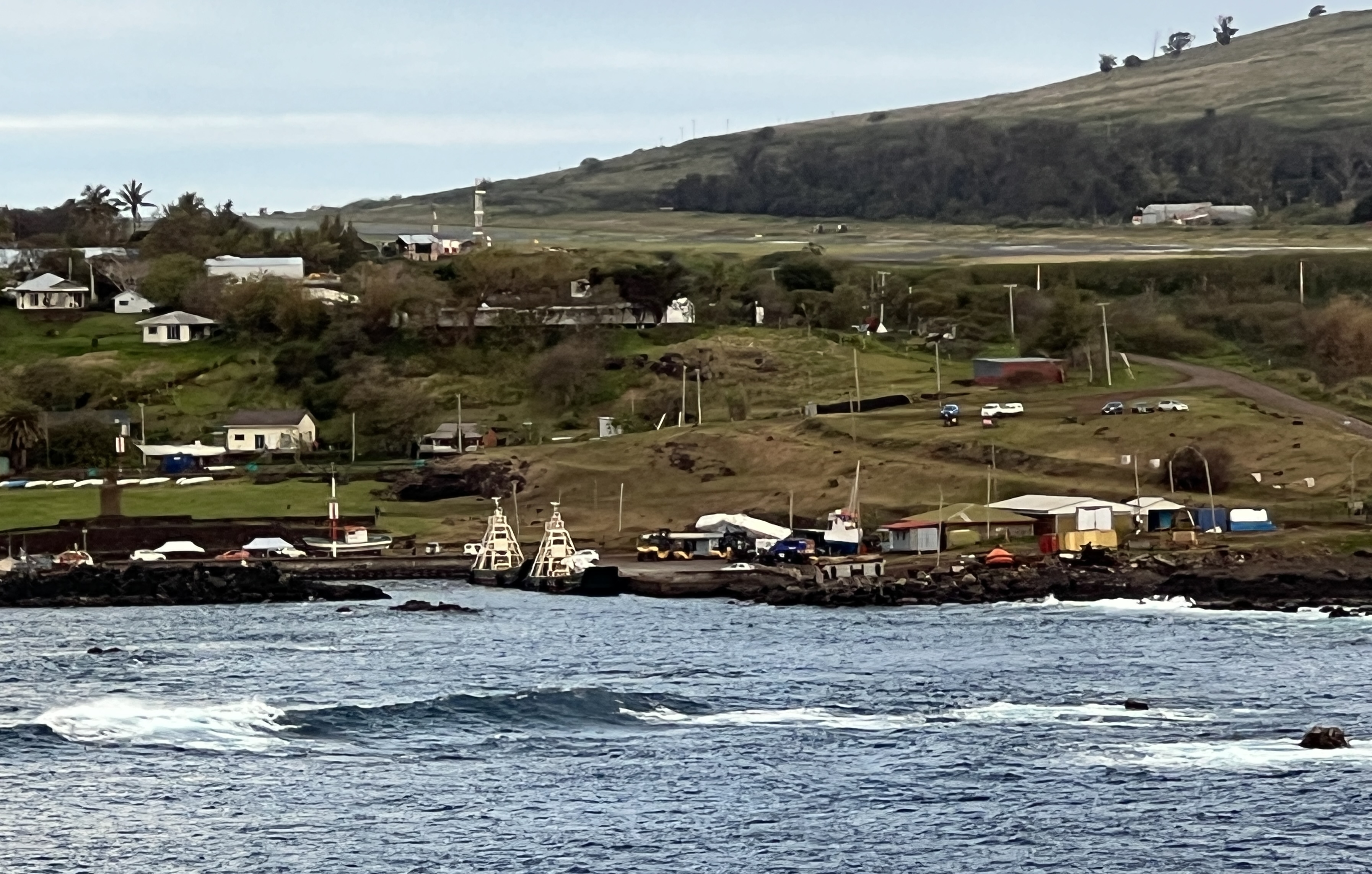
Pitcairn Island
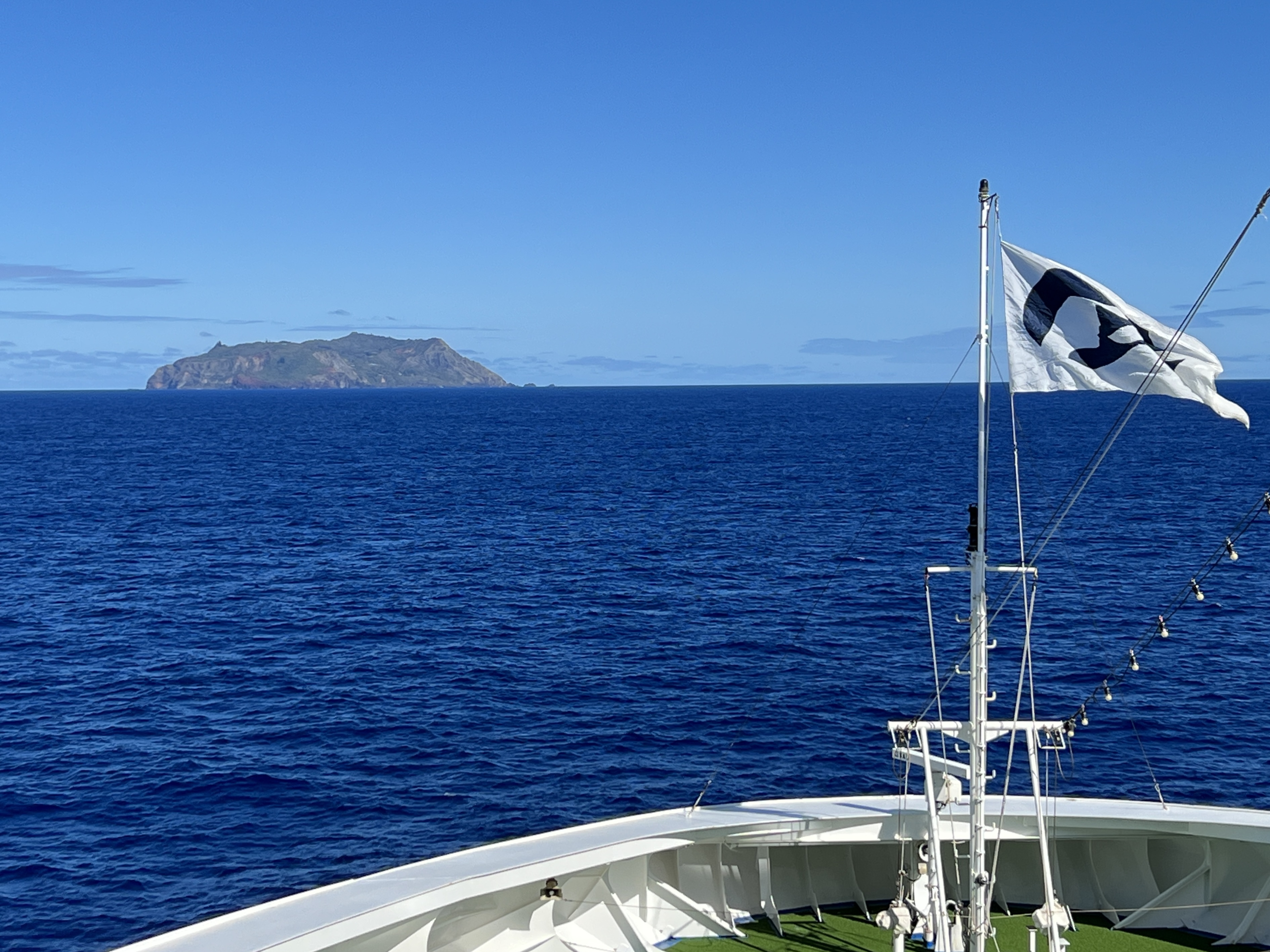
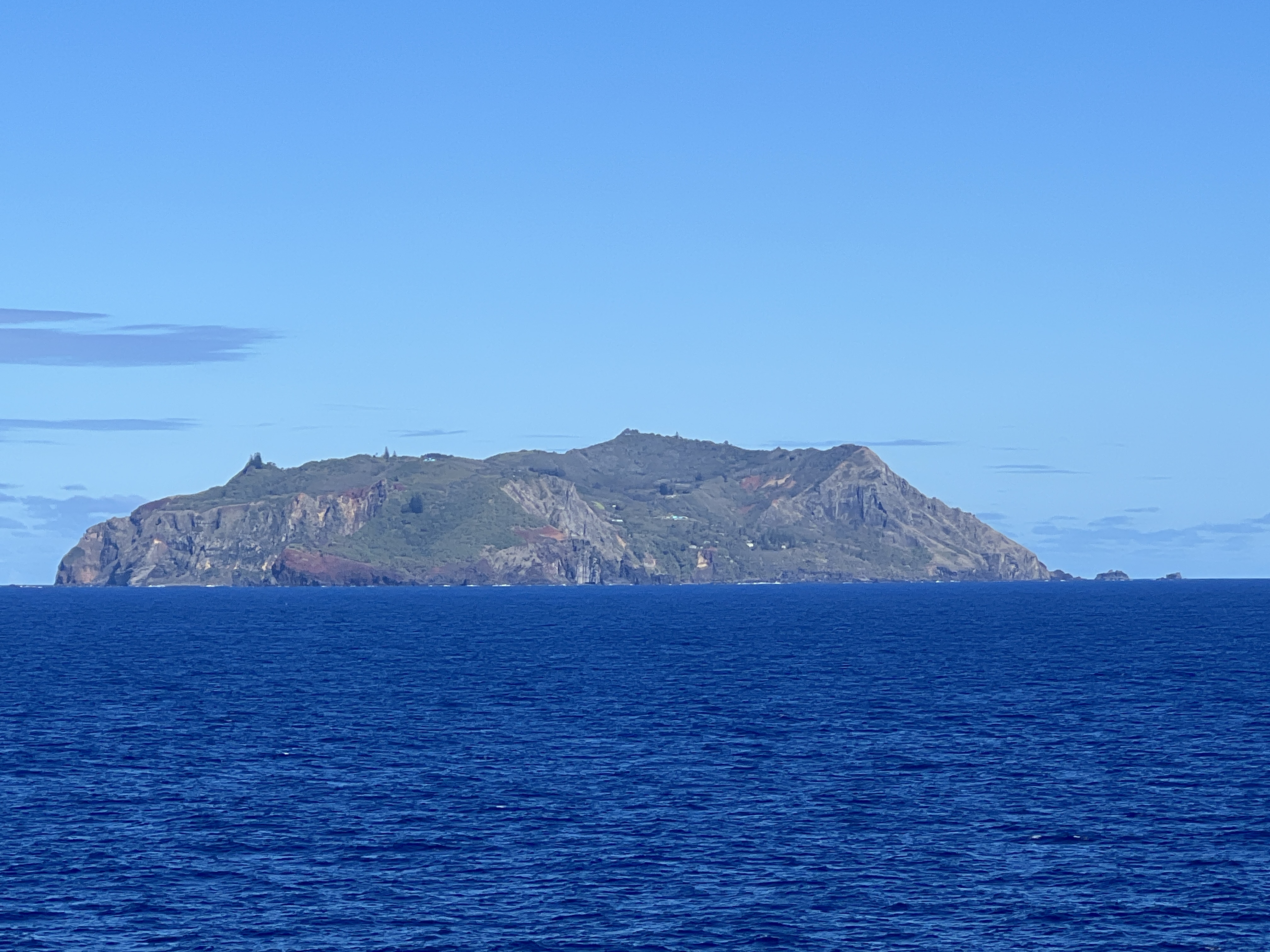
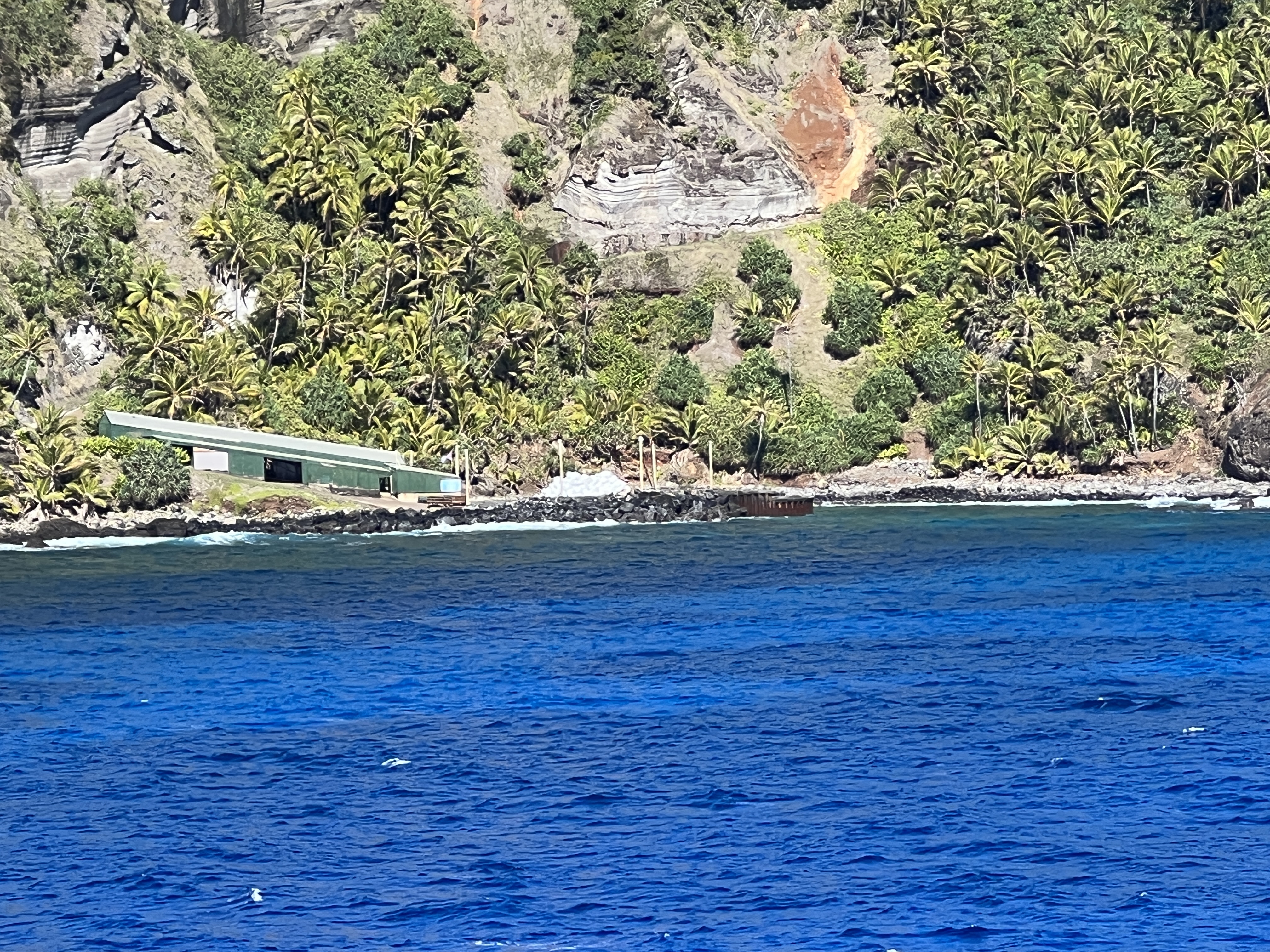
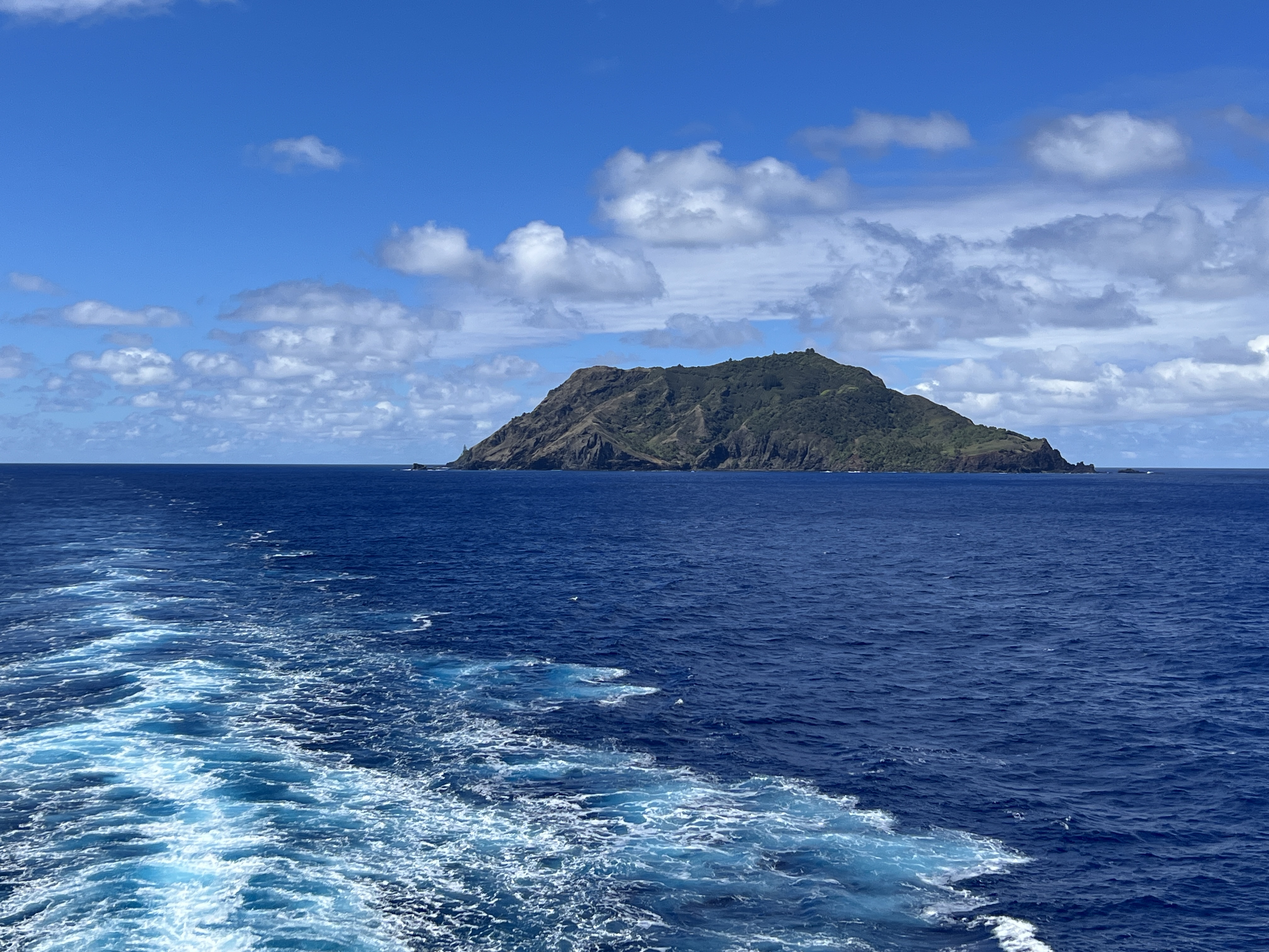
Pitcairn Island is our next ‘place of interest’ on the cruise. We did not go ashore here but cruised up to Bounty Bay and lingered there for awhile to take photos of this iconic spot.
There are I believe at the last count 49 people living on the island, many of whom are descendent from the Bounty Mutineers who had settled there. The current mayor though is a recent arrival from the UK.
We have on board a fellow cruiser who is related to one of the residents. The ship arranged a call to the island so the two could speak, some of the conversation was broadcast over the ship’s PA system. Interesting chat, particularly the strange variant of English spoken which is a blend of Polynesian and 18th century English.
We have been ‘blessed’ by some onboard lectures about Captain Bligh and the Mutiny, including his epic row to present day Indonesia from around Tahiti somewhere. Long way in a little boat with 18 companions. It seems that those movies with Clarke Cable, Marlon Brando and Mel Gibson played with the truth a bit and overly demonised Bligh.
We spent about an hour and half offshore the island, including a sail around it for a full view of the landscape. Quite an impressive hideaway and a spot to get away from it all, but there no retirement villages.
Back in our cabin we found Slobro in quite a lather. He was examining the map and was quite distressed as he had observed that we were now quite close to the edge of the world and the places we had visited over the last couple of stops were not even on the map.
Convinced him that we would reach New Zealand OK and that he needed to look backwards in order to see that we were going forwards because the earth wasn’t flat like he had thought. Just can’t wait to explain the International Date Line to him in the near future.
We are now headed for Tahiti, with three days at sea. It is a big ocean indeed.
Rapa Nui
Rapa Nui is the indigenous name for Easter Island, the remotest populated island in the world. It is a volcanic island which rises 3000 metres above the sea floor, the area of its base on the sea floor is 50 times bigger than the area on the surface. It is about 2300 miles from Chile’s coast and 2500 miles east of Tahiti.
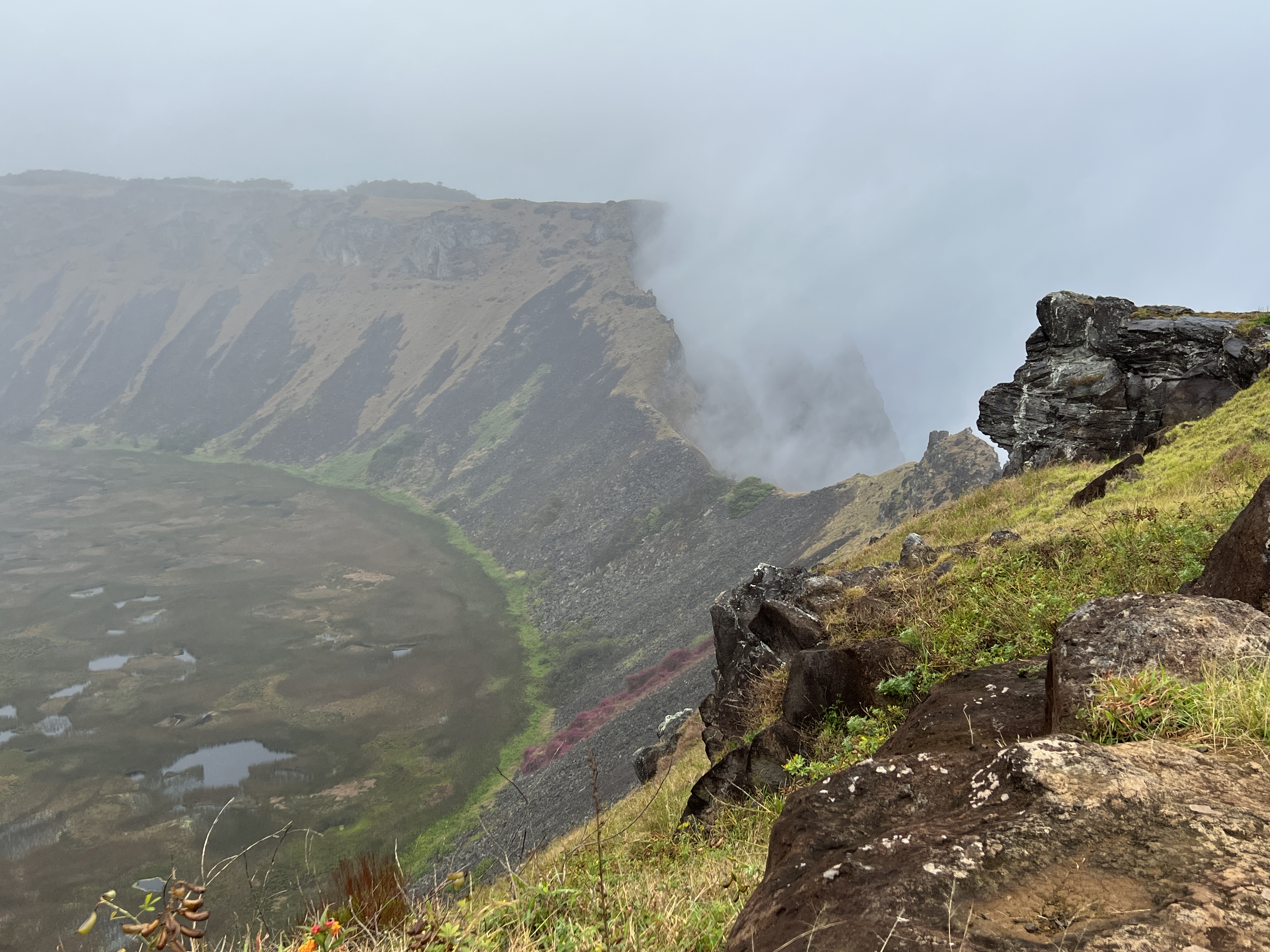
It is a triangular shape with three dormant volcanoes of various ages at each corner. The land mass between the volcanoes was slowly formed following eruptions from the numerous cones, mounds and vents within the triangle. It is quite a dramatic landscape.
It is a bit of pot luck as to whether we were going to be able to get ashore. The ship has to anchor offshore and there is frequently a swell that prevents tenders from getting ashore. We are in luck though and whilst there is a bit of a swell it is just short of the size that would prevent us getting off. People though who are ‘unstable’ on their feet are discouraged from the attempt and some are just stopped by the crew. The tender boat does jump around a bit beside the pontoon making it a little concerning for Slobro.
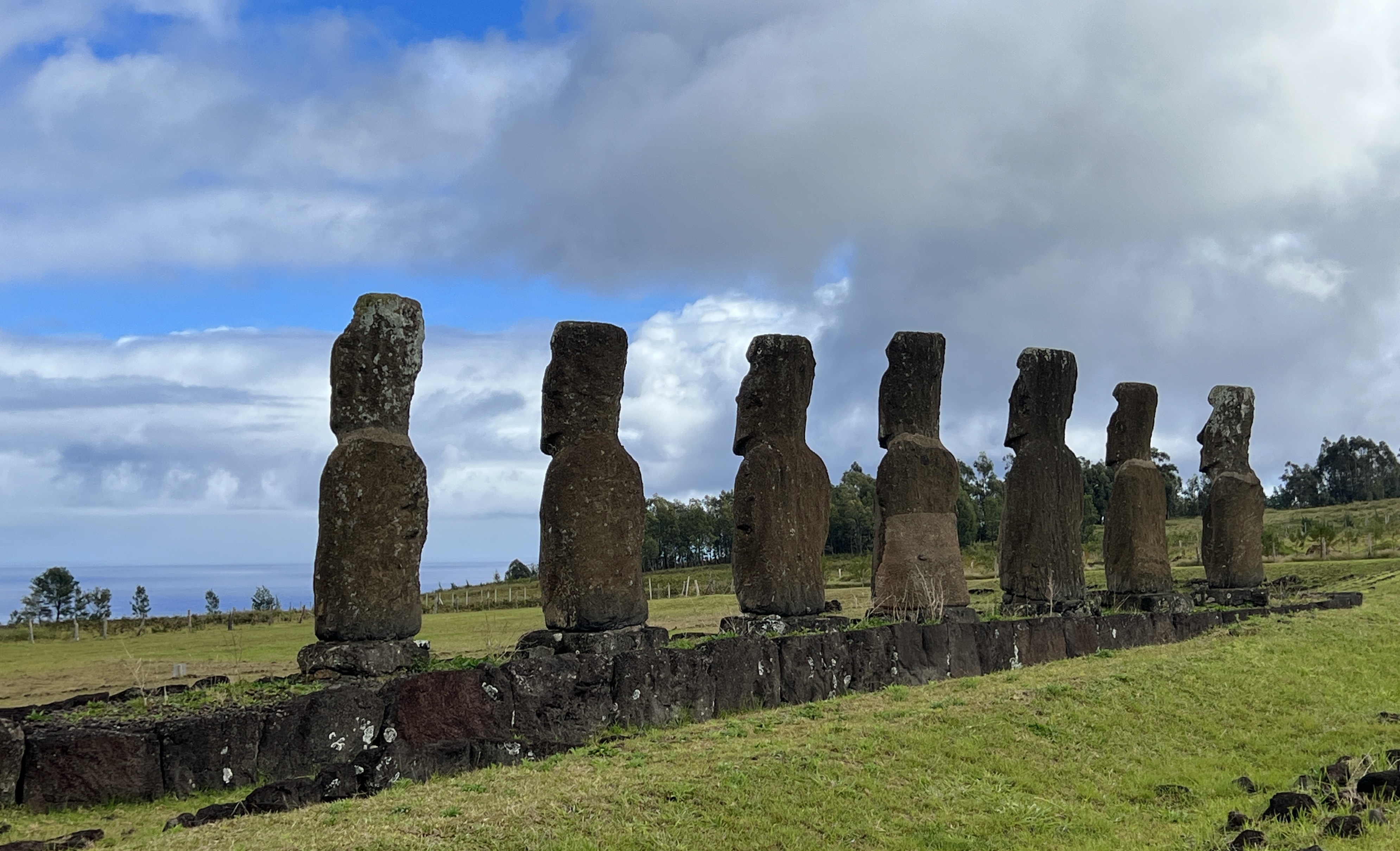
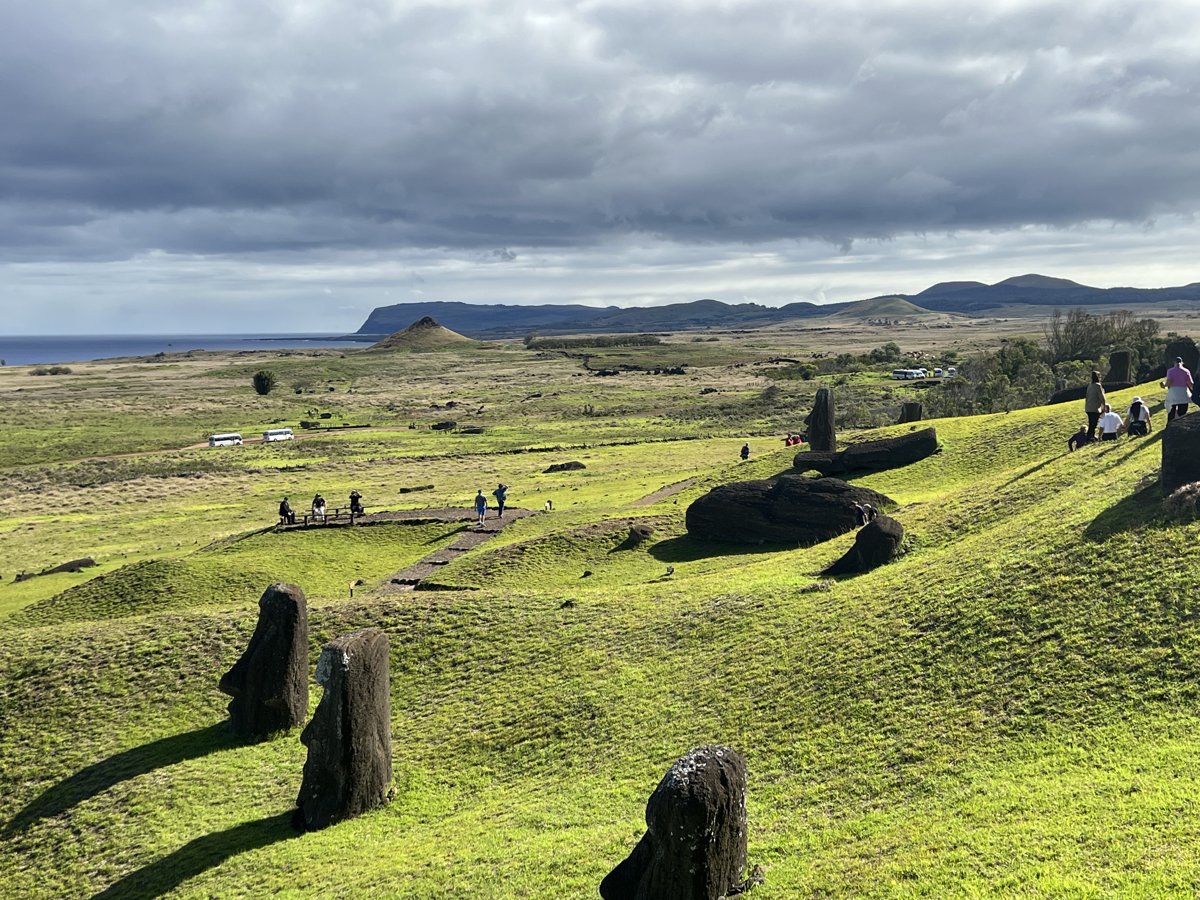
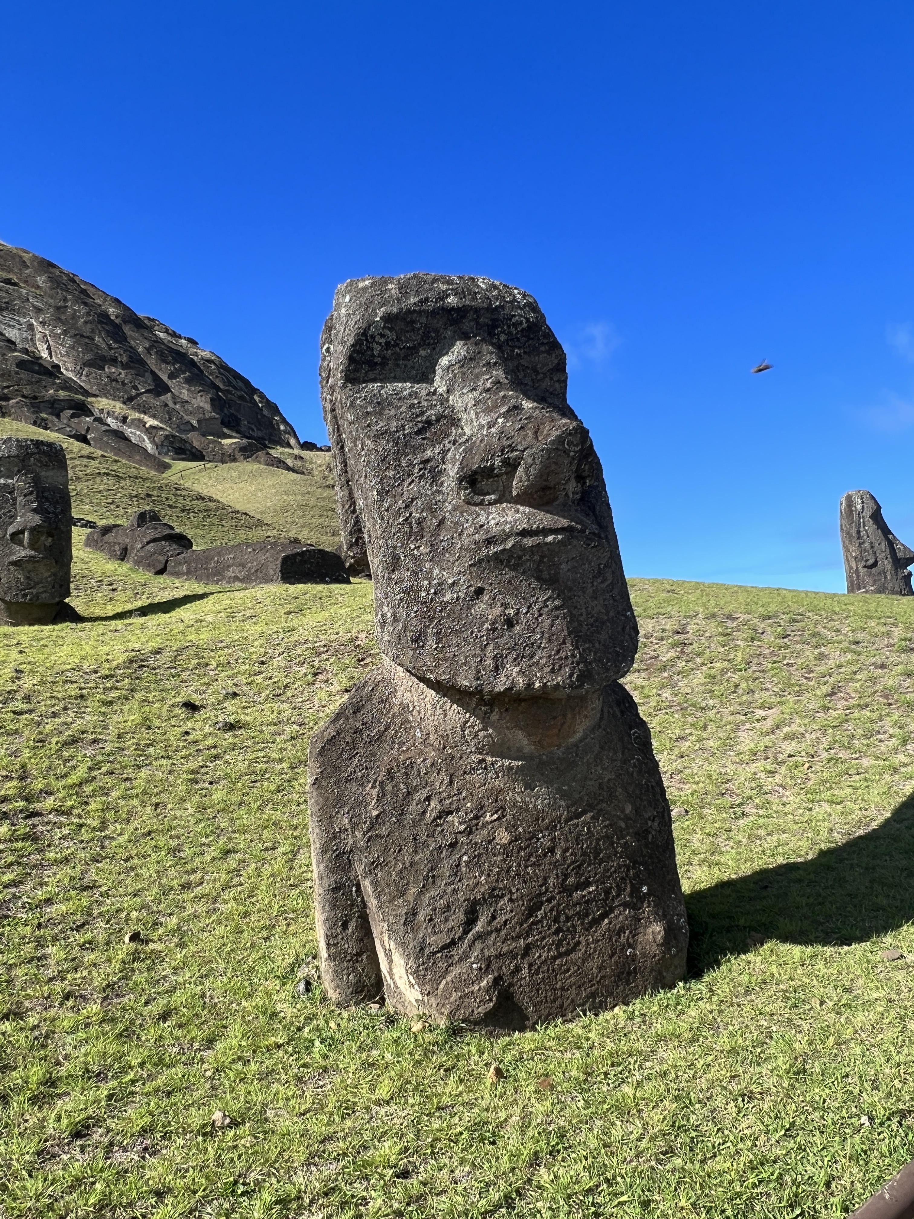
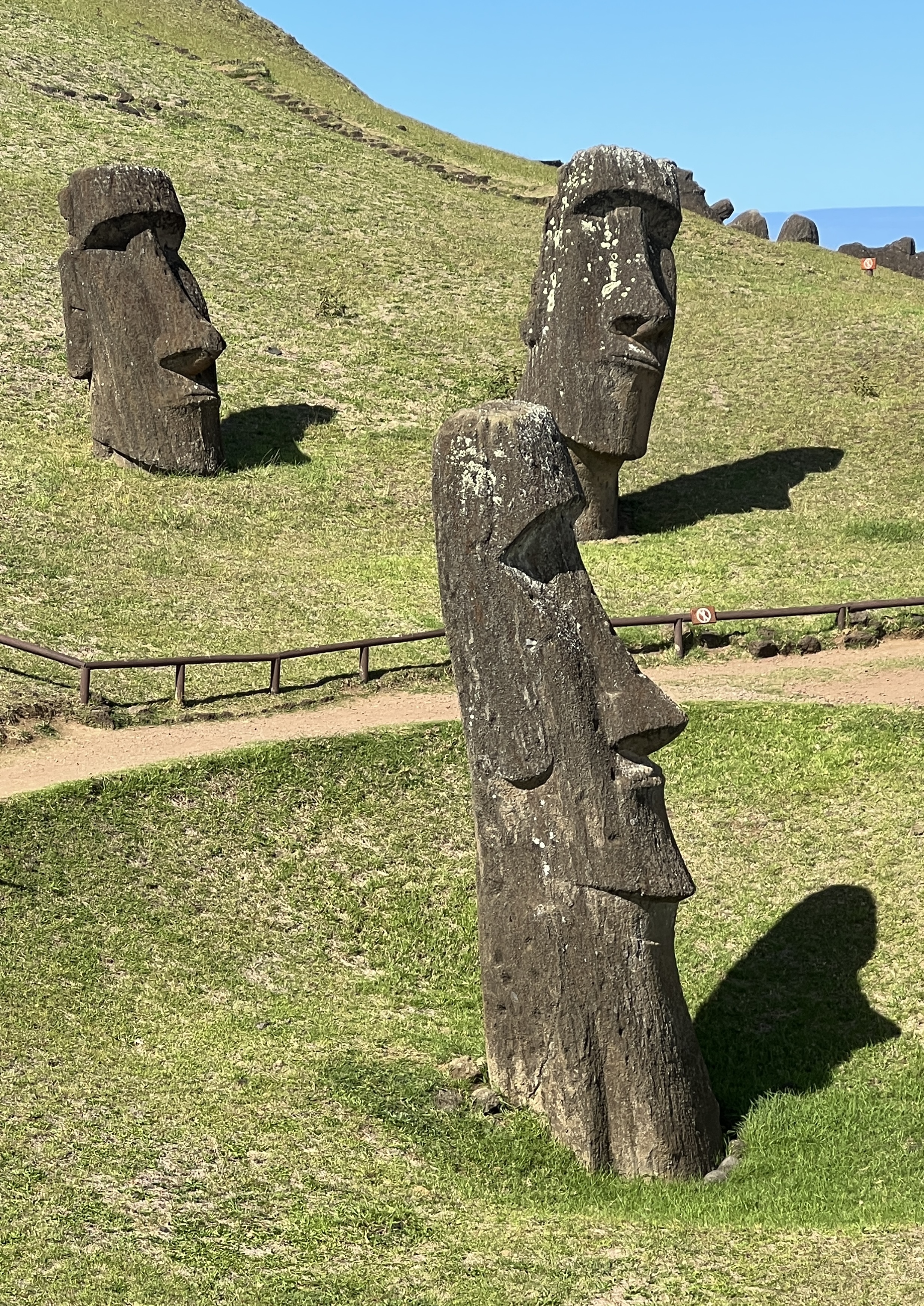
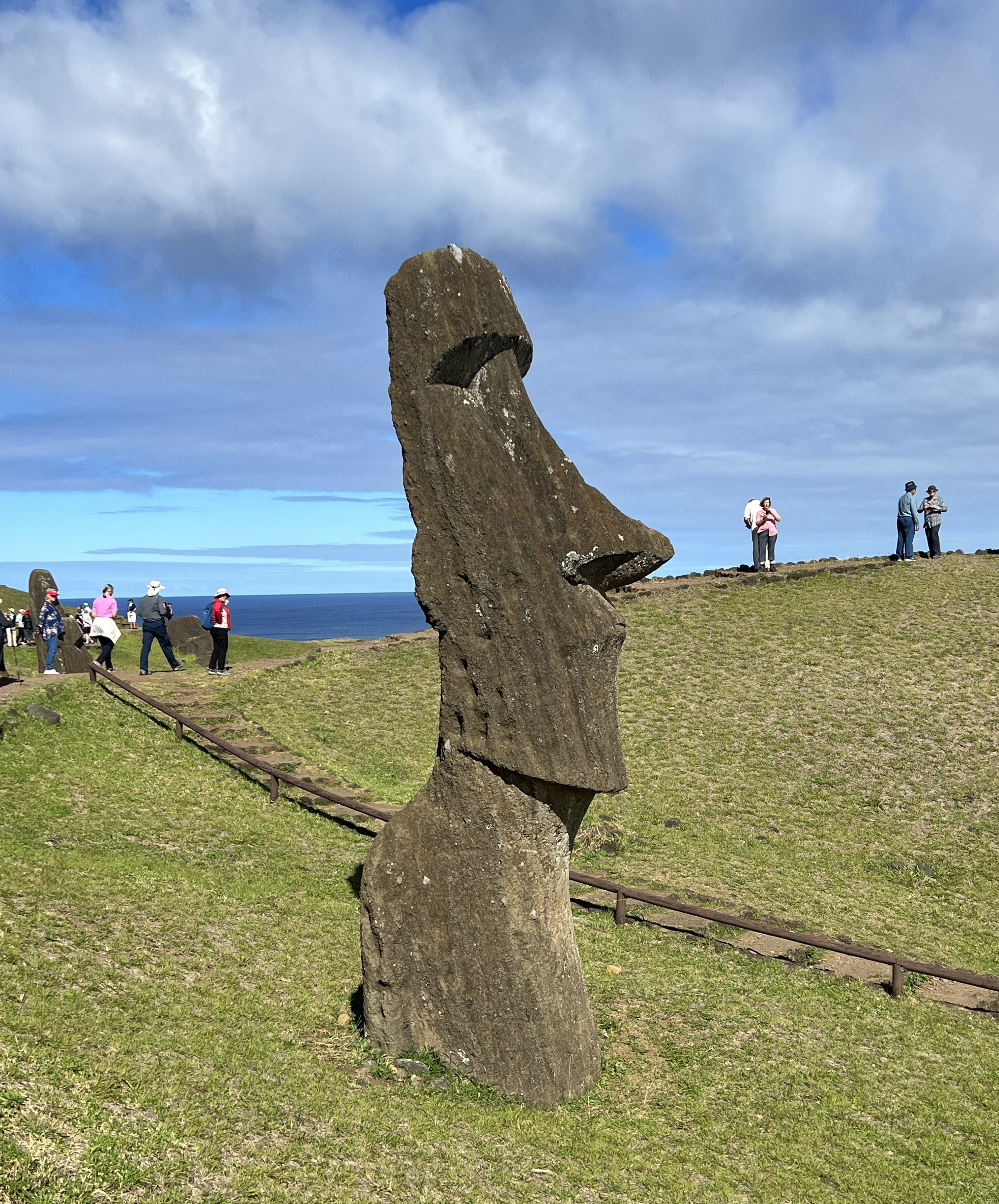
We have stopped here to have a look at the famous massive stone carvings known as Moai (statues). They are quite fascinating and one wonders why and how they were made in the first place. Let alone how they were transported from the quarry where they were carved to where they were erected. Up to 18 kilometres by a society that had no mechanical aids. Then why were they all knocked over, in the main ‘face first’?
The answers to these questions we were told are far from fully understood. It is believed that the island was settled by Polynesians from other parts of the Pacific around 800-1200 AD. The Moai are thought to be representations of these people’s deified ancestors. They were erected on flat rock platforms where the ancestors were buried.
Apart from one case the Moai all face inland and away from the sea and the people tended to gather in a village in front of the statues, as if the statues are looking over them. In one case seven statues look out over the ocean, it is thought these statues (the seven explorers) are looking towards where they have come from across the sea. Who knows!
The misty rainy weather we experienced in the morning gave way to sun and blue sky in the afternoon. So we have seen the Island in both moods.
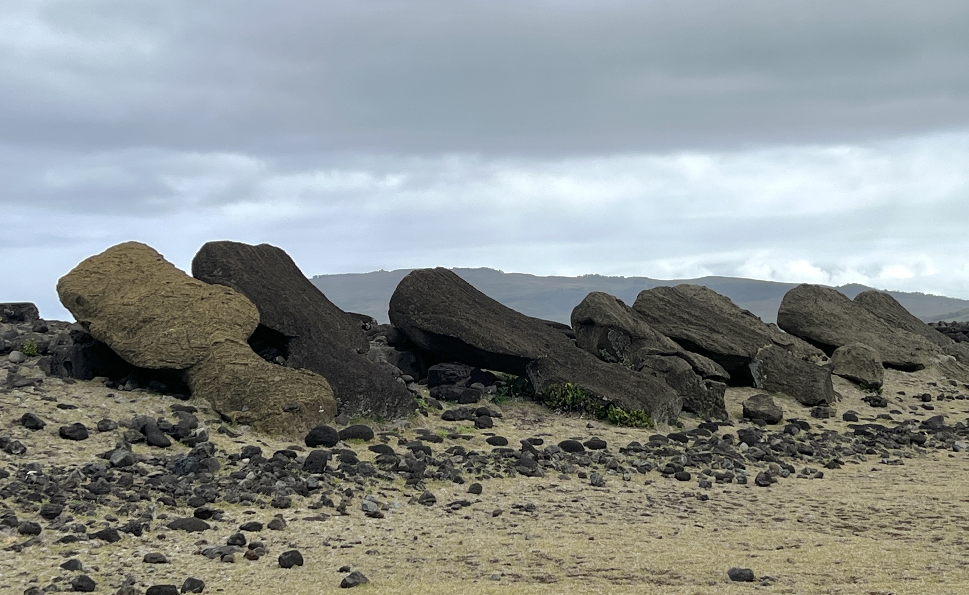
Then around 1500-1850 the carving stopped and the Moai were all knocked down, perhaps part of some change in society structure or beliefs.
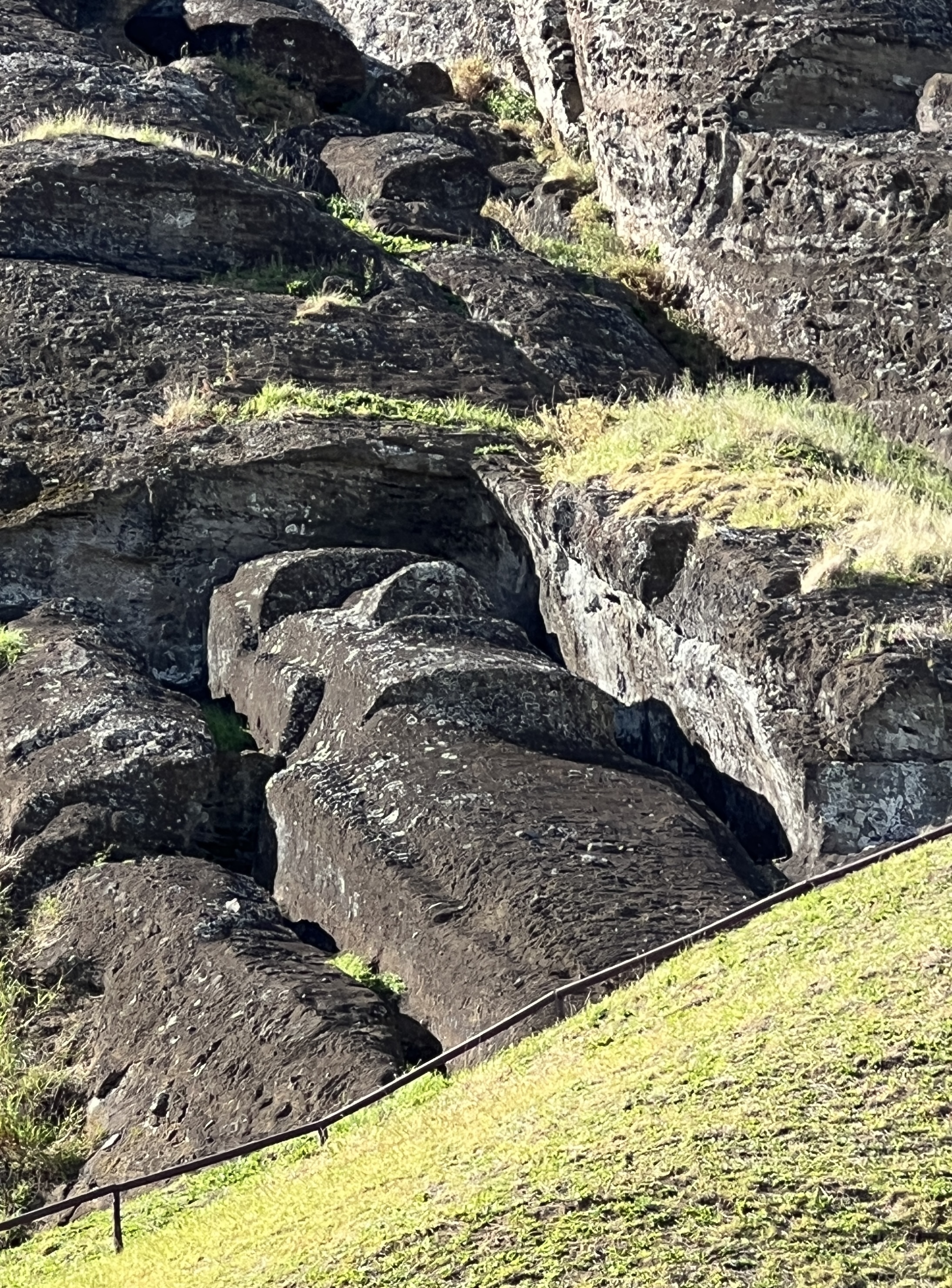
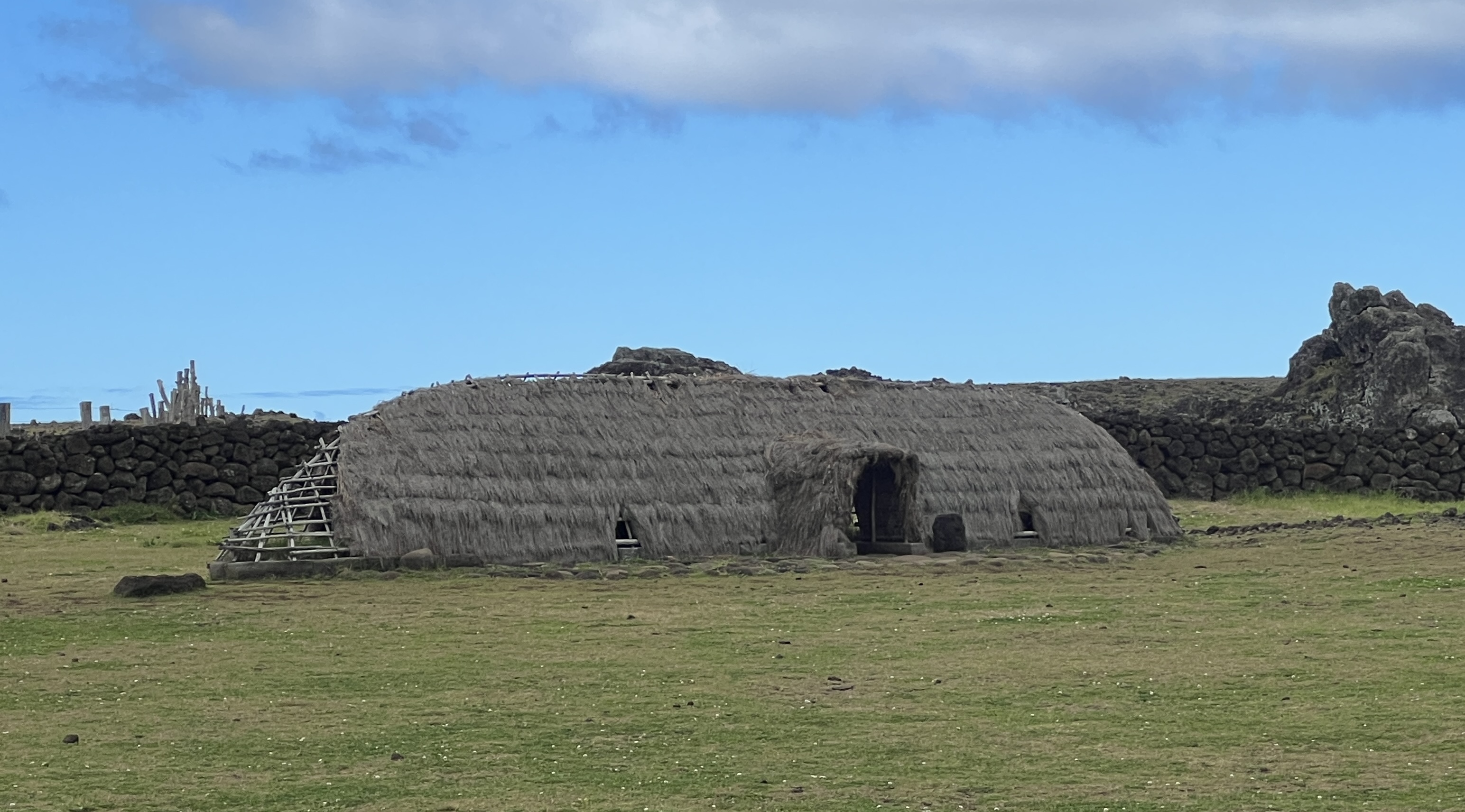
On our walk around the ‘quarry’ area we saw numerous partly finished Moai, including one where the statue was partly carved and still in place in the rock bed. It is all a bit complicated to explain, but once the carving was partially complete and the statue ‘released’ from the bed rock it was slid somehow down the hill into a hole so that it could be stood up.
The workers would then complete the finer details before then transporting it somehow to the prescribed destination. We saw many of the statues still in the holes on the side of quarry, the carving aborted, staring out across the landscape. Some were also partially buried with the holes having filled with debris and earth over the years.
There have been many theories as to how they were moved. From being rolled along on logs to the current favourite of being ‘walked’ much like we ‘walk’ fridges around houses today. Ropes were tied to the Moai’s head and it was then rocked to move it along. There was a team on either side to do this and another at the back to stabilise the movement. This theory follows the traditional belief of the people that the Moai walked themselves through spiritual power.
Archaeologists have reerected about 50 of the Moai, there are about 850 remaining in their knocked over positions.
All quite fascinating.
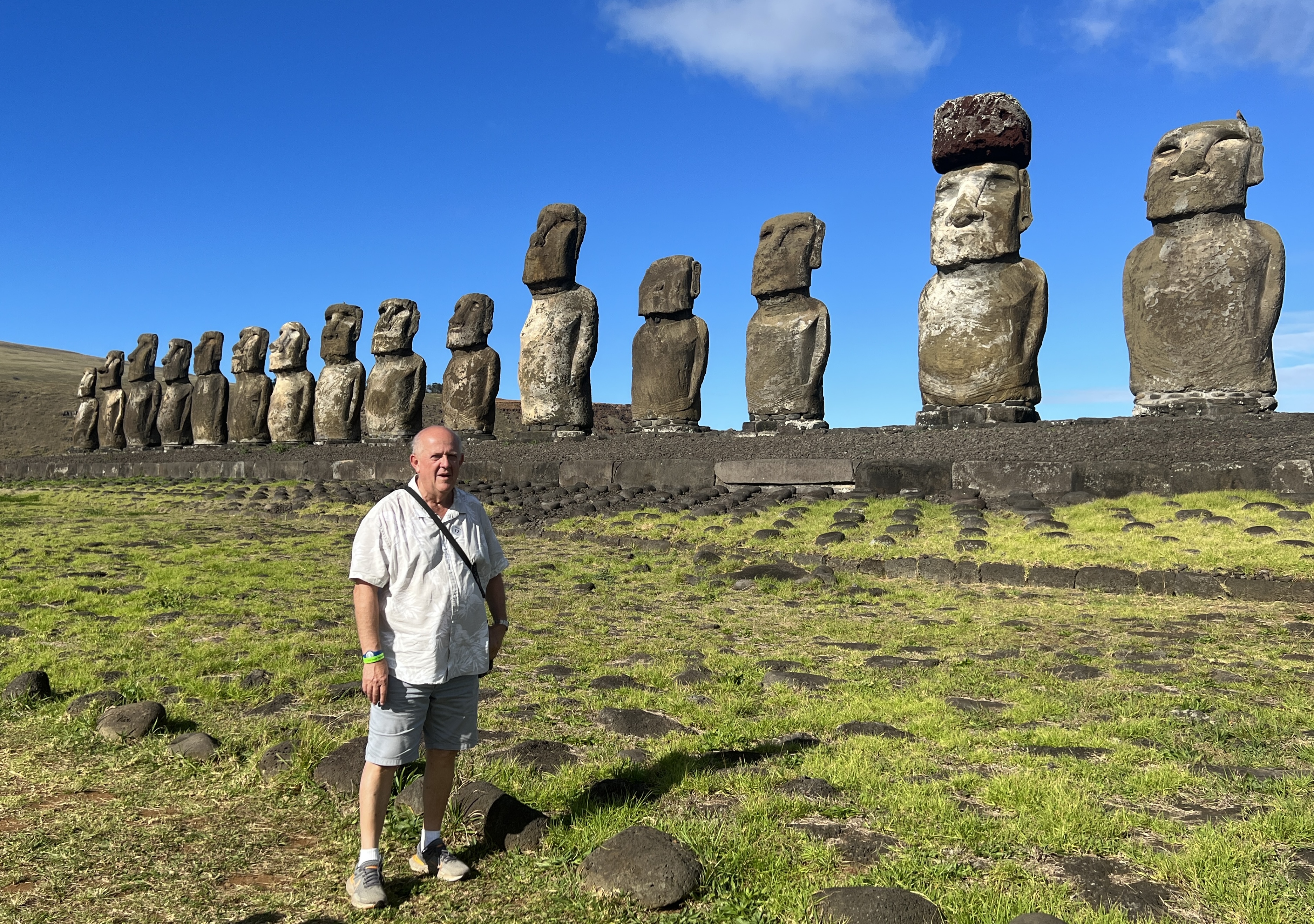
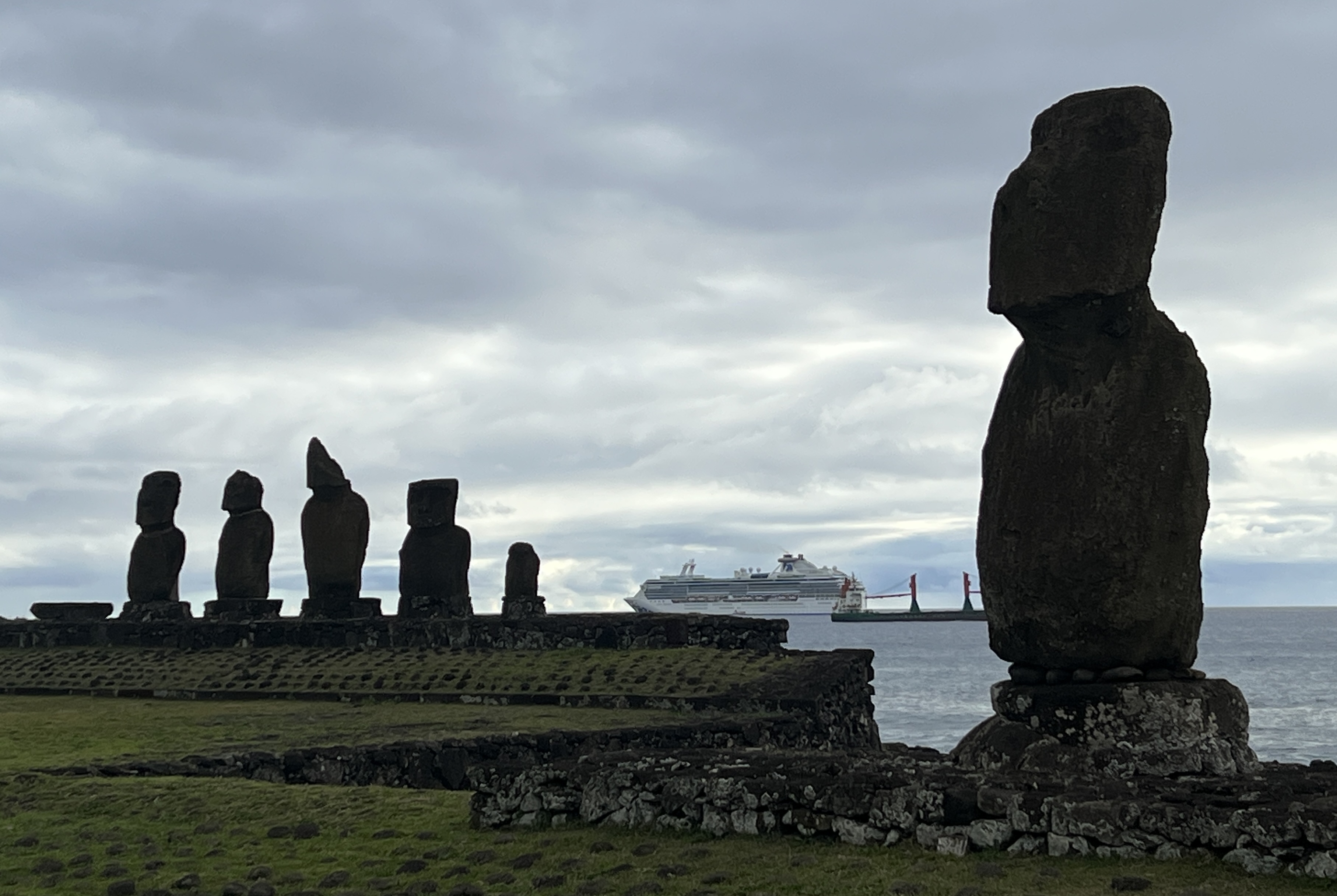
The last group of Moai we see are the famous 15 that we often see in tourist magazines. They sit beside the sea where they have been reerected. Quite a spectacular sight!
Our tour was a bit late back to the pier and we got back onboard about 7.30pm. We are setting a course for Pitcairn Island, it will take a couple of days to get there and already Mutiny on the Bounty tales are being told.
Sand and Sea
Overnight from Lima we moved further south to Paracas, south of Pisco. Pisco was devastated by an earthquake in 2007 and has not really recovered since. Pisco is where the Pisco drink originated. It is a type of brandy distilled from grape juice, but a clear liquid unlike the golden colour of traditional brandy. It was in Lima that the Pisco Sour was first served in the early 1920s.
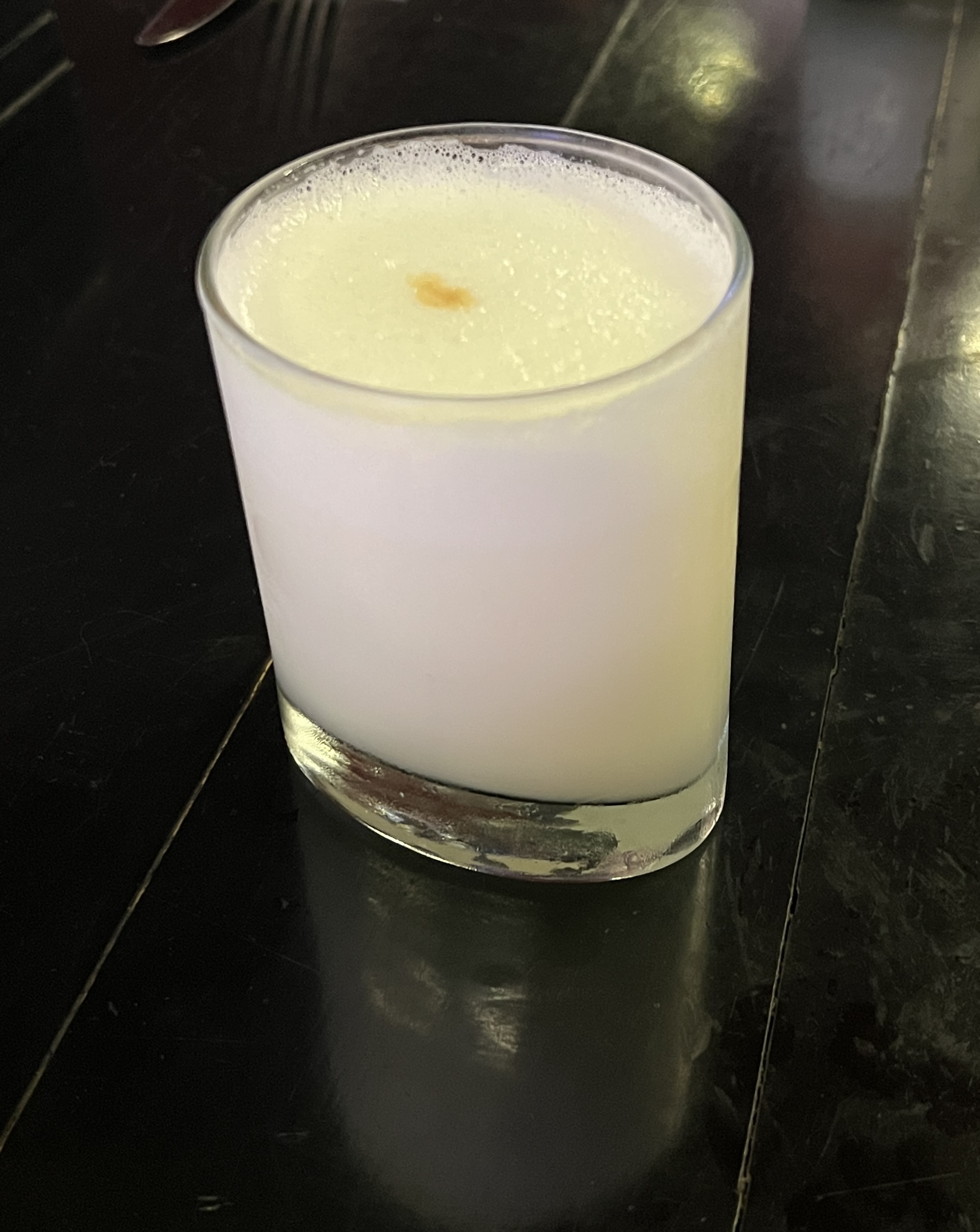
We have acquired a small bottle of Pisco to inflict on visitors back home. The Pisco Sour is a mix of Pisco, lemon juice, egg white, sugar syrup, ice and bitters. Refreshing!
Paracas is more remote than Pisco and is located on the Paracas Peninsular, near the Port of San Martin where we tie up, and a little north of the border with Chile. It is a stepping off point to view some Inca ruins and where a number of our fellow passengers return to the ship after a couple of days overnighting to Machu Picchu.
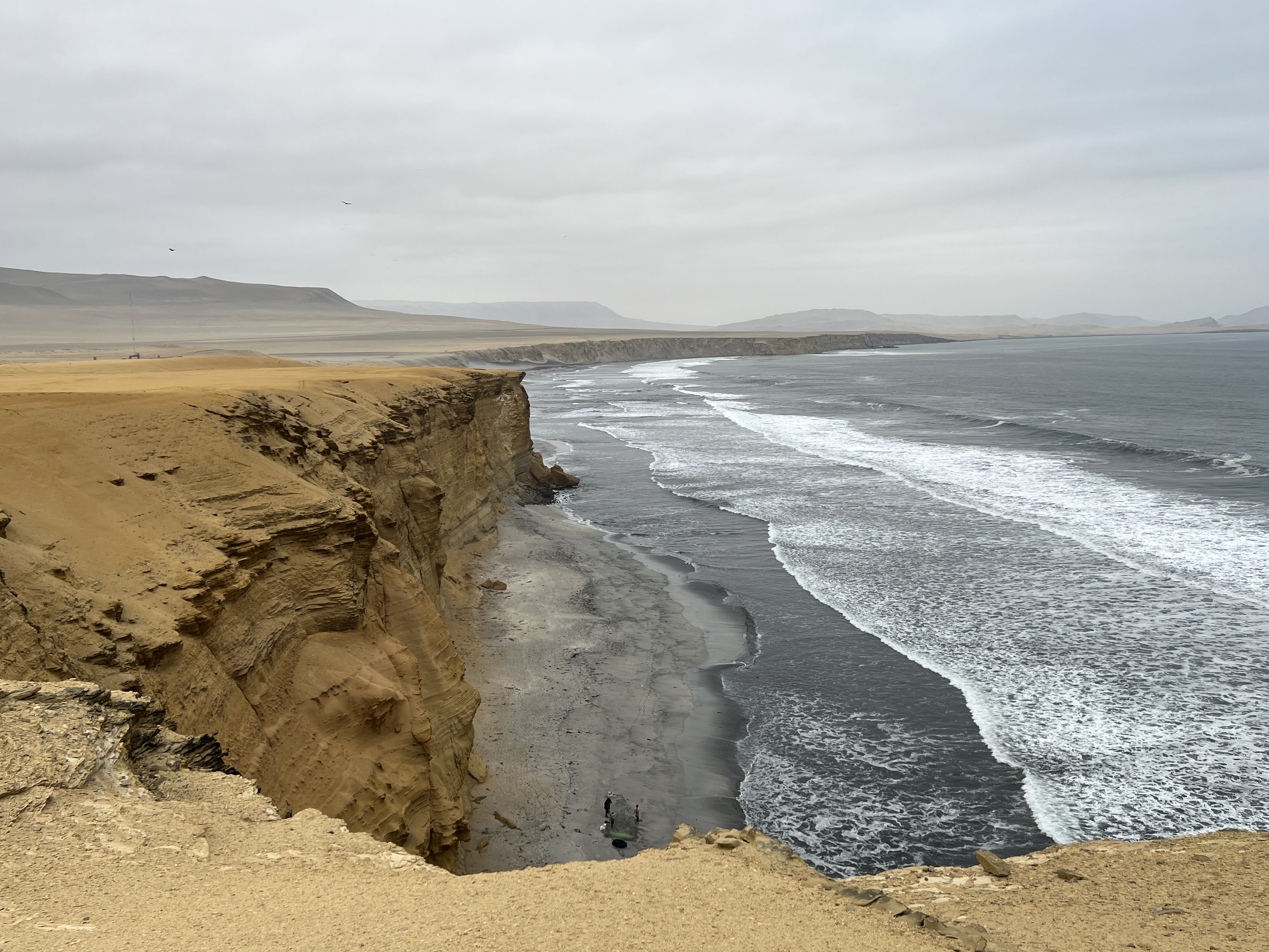
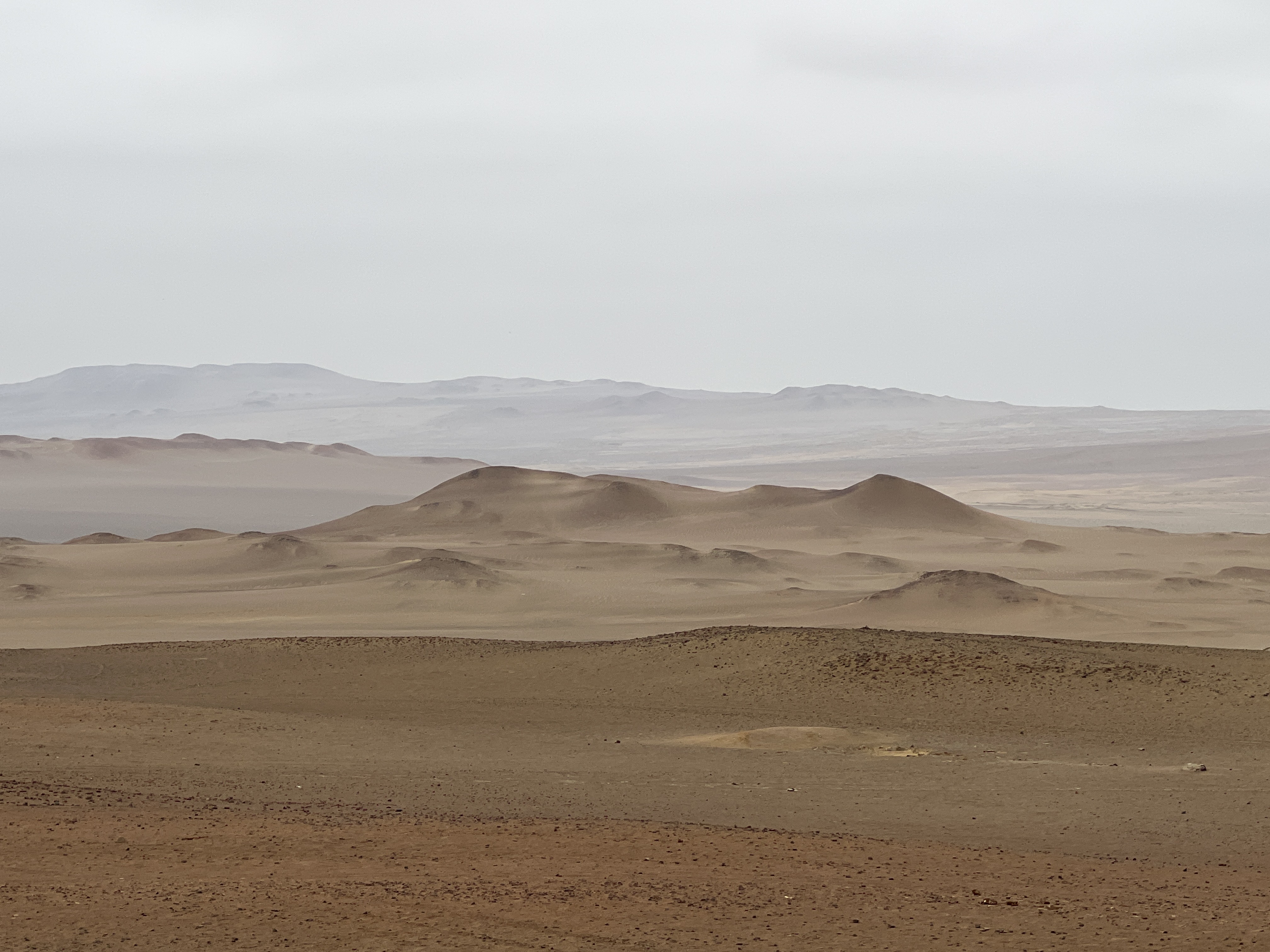
We have chosen to get out of ‘suburbia’ and visit the Paracas National Park for the morning. This area is the northern extremity of the Atacama Desert, which is predominantly in coastal Chile. It is the driest place on earth and receives little rain and is devoid of vegetation.
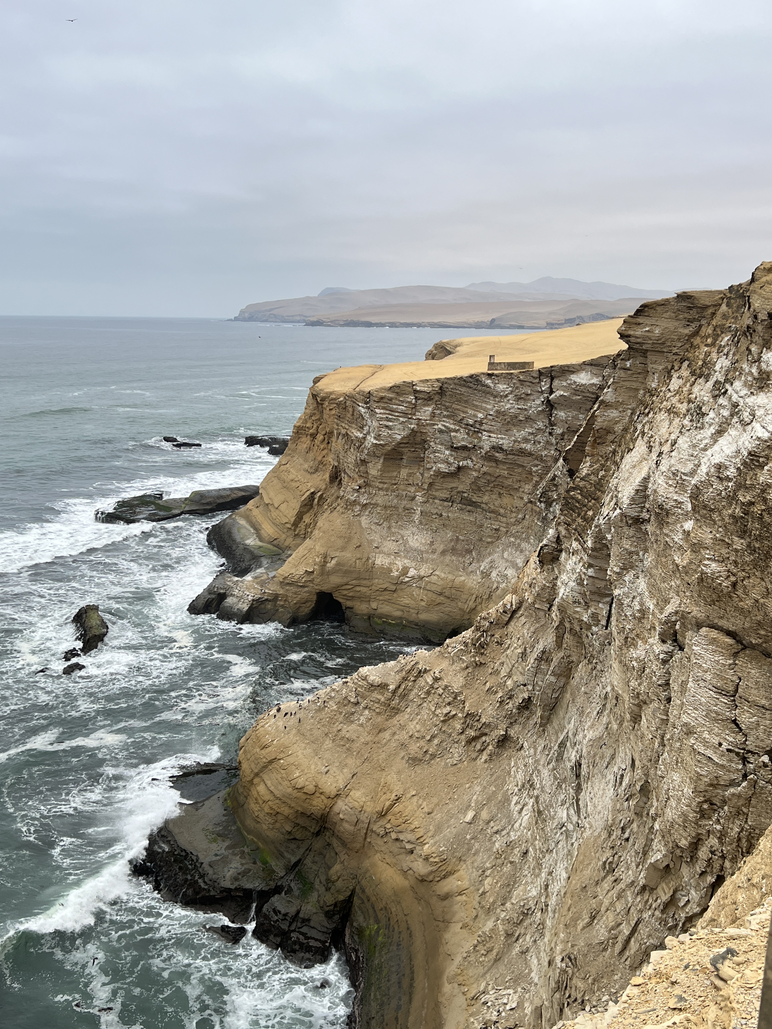
The desert runs right down to the sea. The part we visited seemed to have little sand covering and was mostly a rocky platform being eroded back from the sea. I suspect sand was being blown inland by the wind.
There are some great views of the coastline here that was greatly effected by the earthquake.
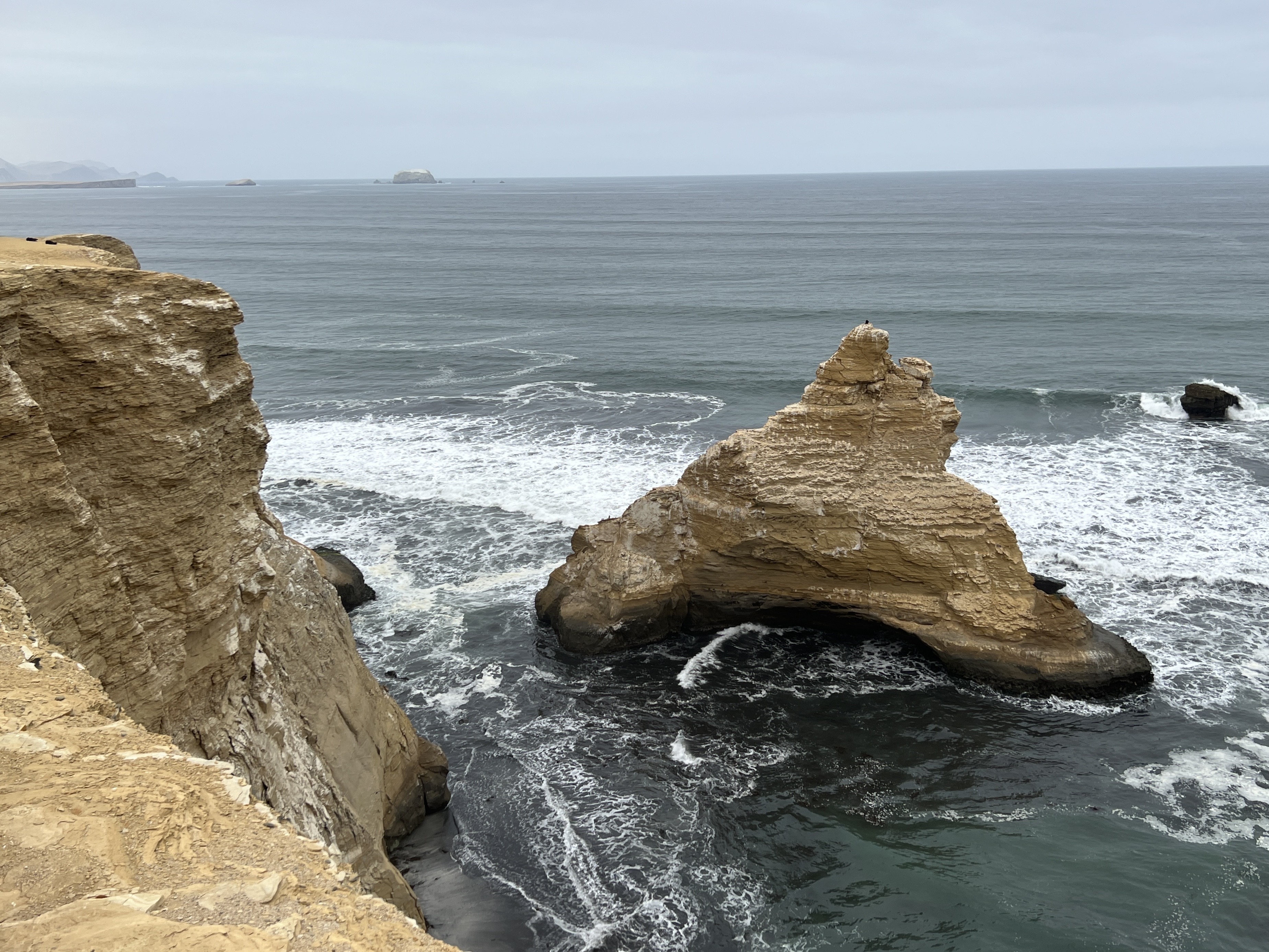
The rock formation known as the ‘Cathedral’ used to be connected to the mainland but was separated by the earthquake action. The desert stretches away behind the coastline in a series of rolling hills.
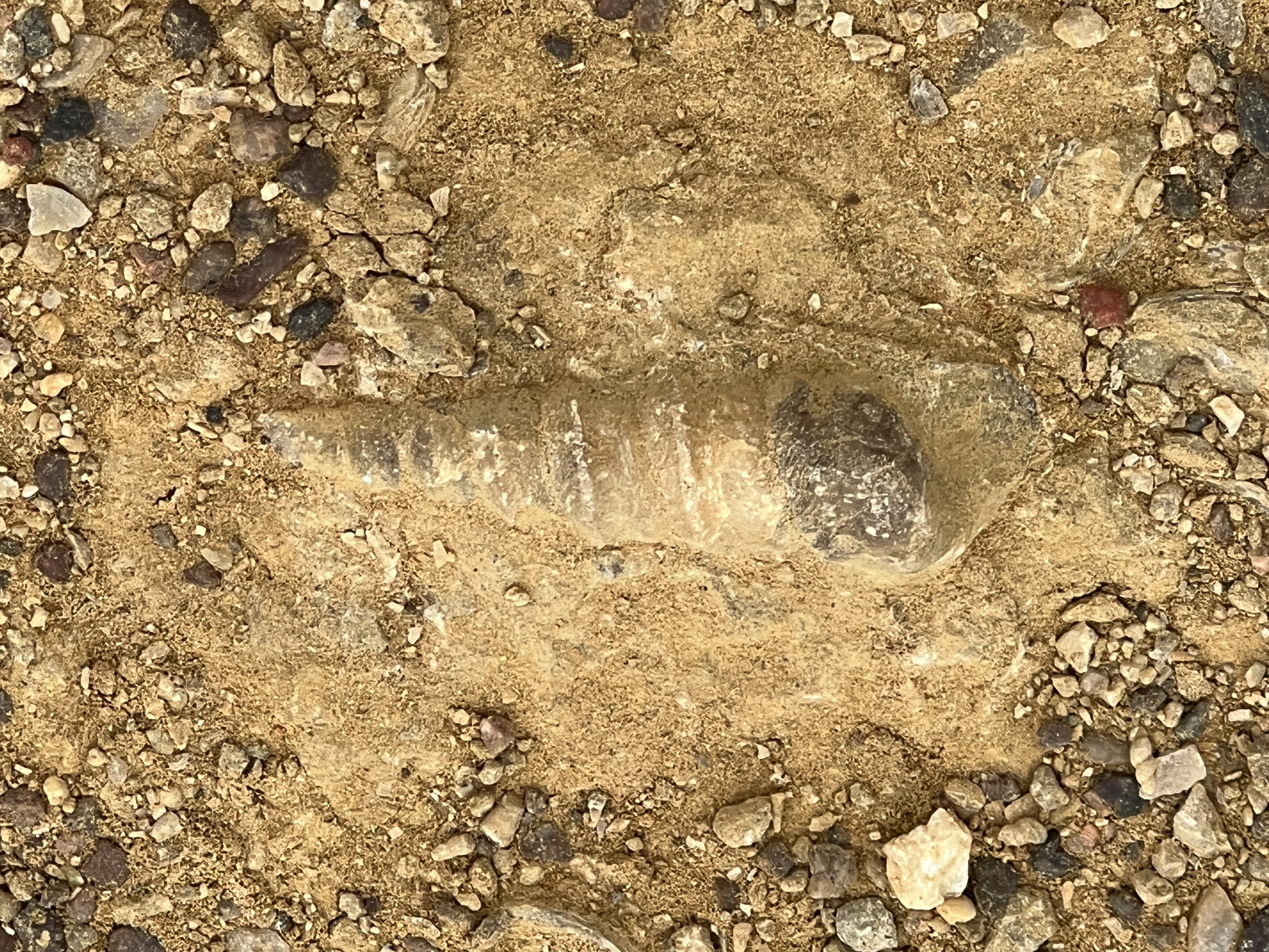
In one particular area there is an exposed rock surface containing hundreds of fossils of conical sea shells, attesting to its former sea bed location.
The ‘donkey belly sky’ of Lima was prevailing here as well. Towards the end of our tour, around midday, the sun started to creep out and we had some pale blue skies for the drive back into Paracas. The rules of these tours mean that you have to return to ship after the tour and not get off in other places on the way back. It is a bit of a pain because it means retracing your steps, absorbing time. On this occasion it was like 20 minutes back to the ship and then 20 minutes back to the Paracas township for a late lunch.
Lunch was ‘fish n chips’ Paracas style, flaky pieces of fish deep fried with yucca chips and some dips. And a Pisco cocktail (not Sour). The yucca chips were a bit marginal, fibrous and pasty, I think they are ‘cassava’ by the more local name ‘yucca’. A very nice ambience though among the locals in one of the restaurants along the waterfront.
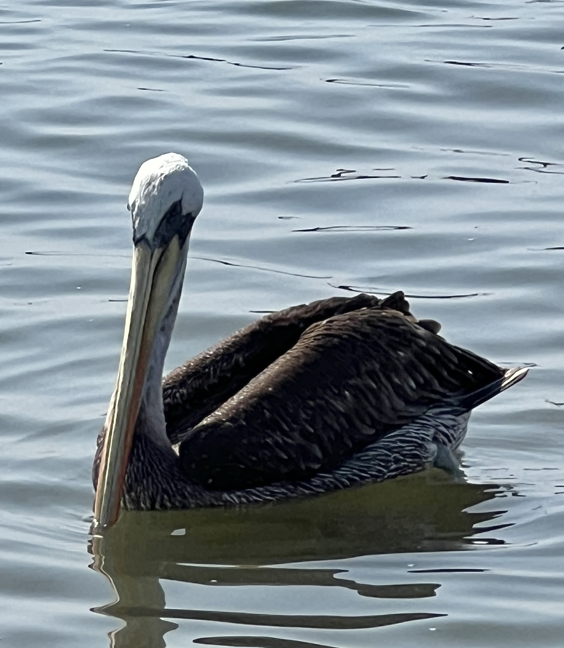
A pelican, very different beak colouring to Aussie pelicans, cruised the beachfront. It was difficult to visualise a 5 metre Tsunami , following the 2007 earthquake, ripping through and destroying this town.
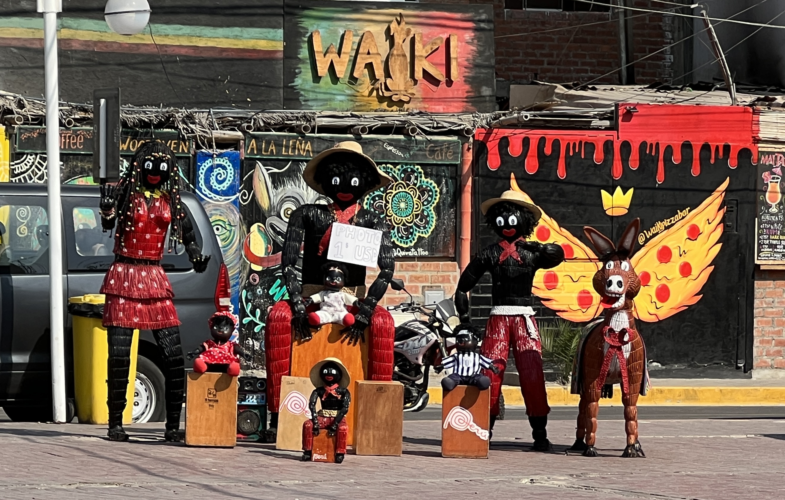
Slobro enjoyed a photo-op with all his mates at a tourist shop. A group of gollywogs were looking out for photos at a dollar each! Wouldn’t get away with this political incorrectness back in old Aus.
After lunch and a look around for the Post Office, which didn’t exist , we returned to the ship. It was odd to learn that Ecuador and Peru are devoid of mail services for the local populations. They don’t use them. There are post offices, but they are in city centres and it is difficult to buy stamps let alone find somewhere to post the item. Allthego’s rare postcards for Ecuador and Peru will have to await another landfall, maybe Tahiti in a weeks time?
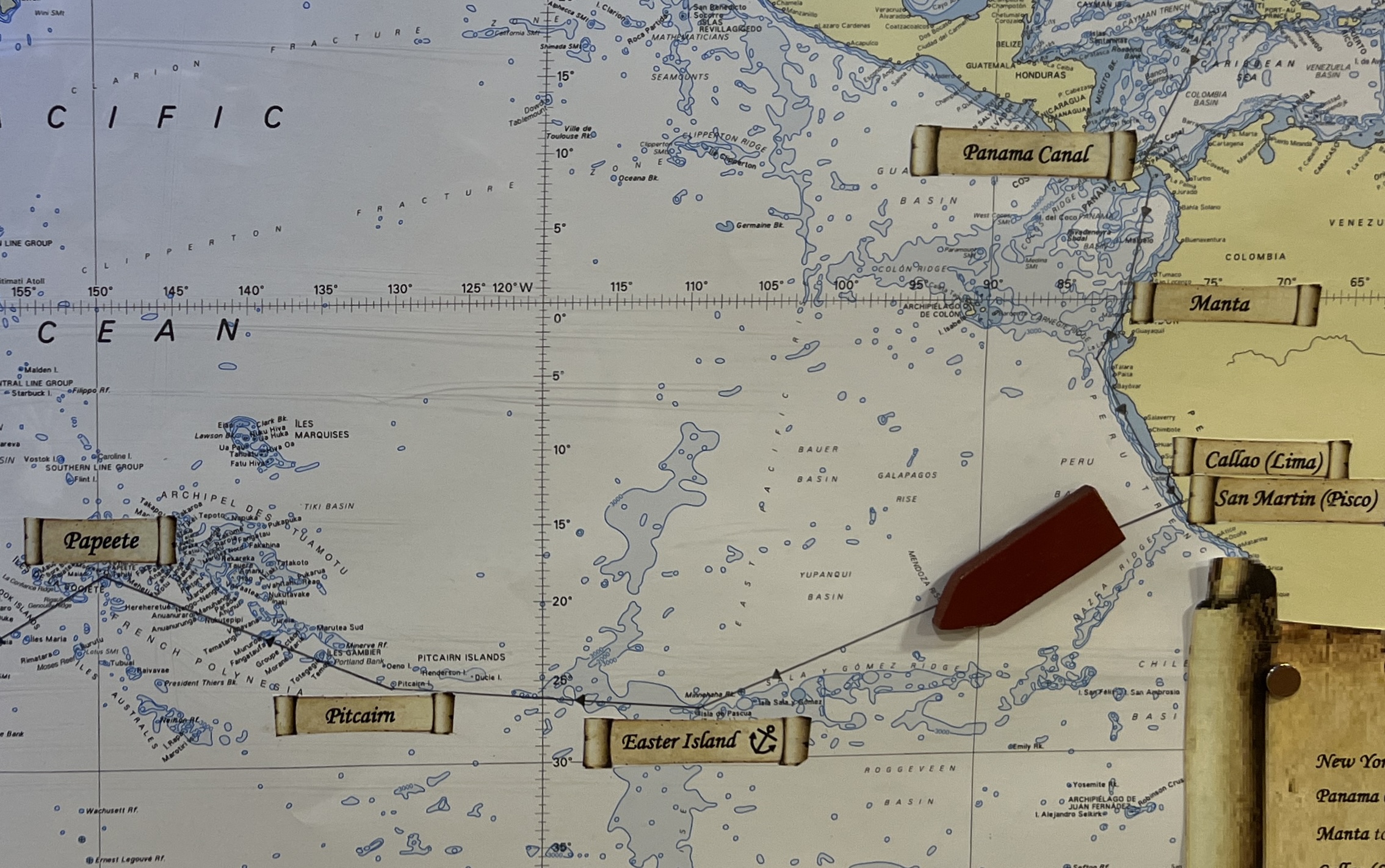
We are now finally turning west and heading out across the Pacific Ocean to Easter Island and will be home around 22 September.
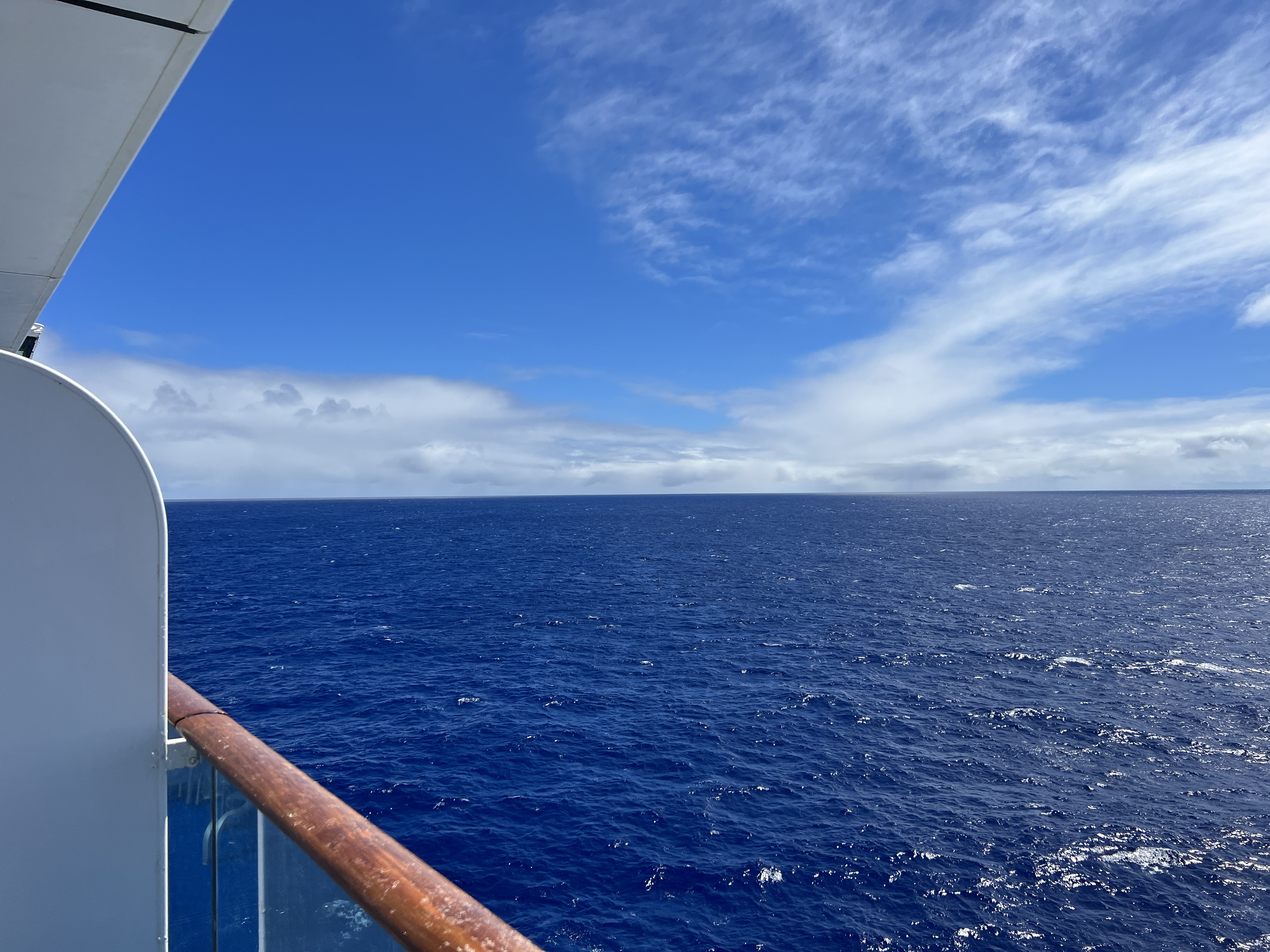
Captain Kirk flew the ‘final frontier’ and the deep blue Pacific is certainly that for us !
Lima on foot
Our second day in Lima was dedicated to a two hour guided walk around central Lima. Central Lima is basically the old historical Spanish colonial district. Peru gained independence from Spain in the early 1820s.
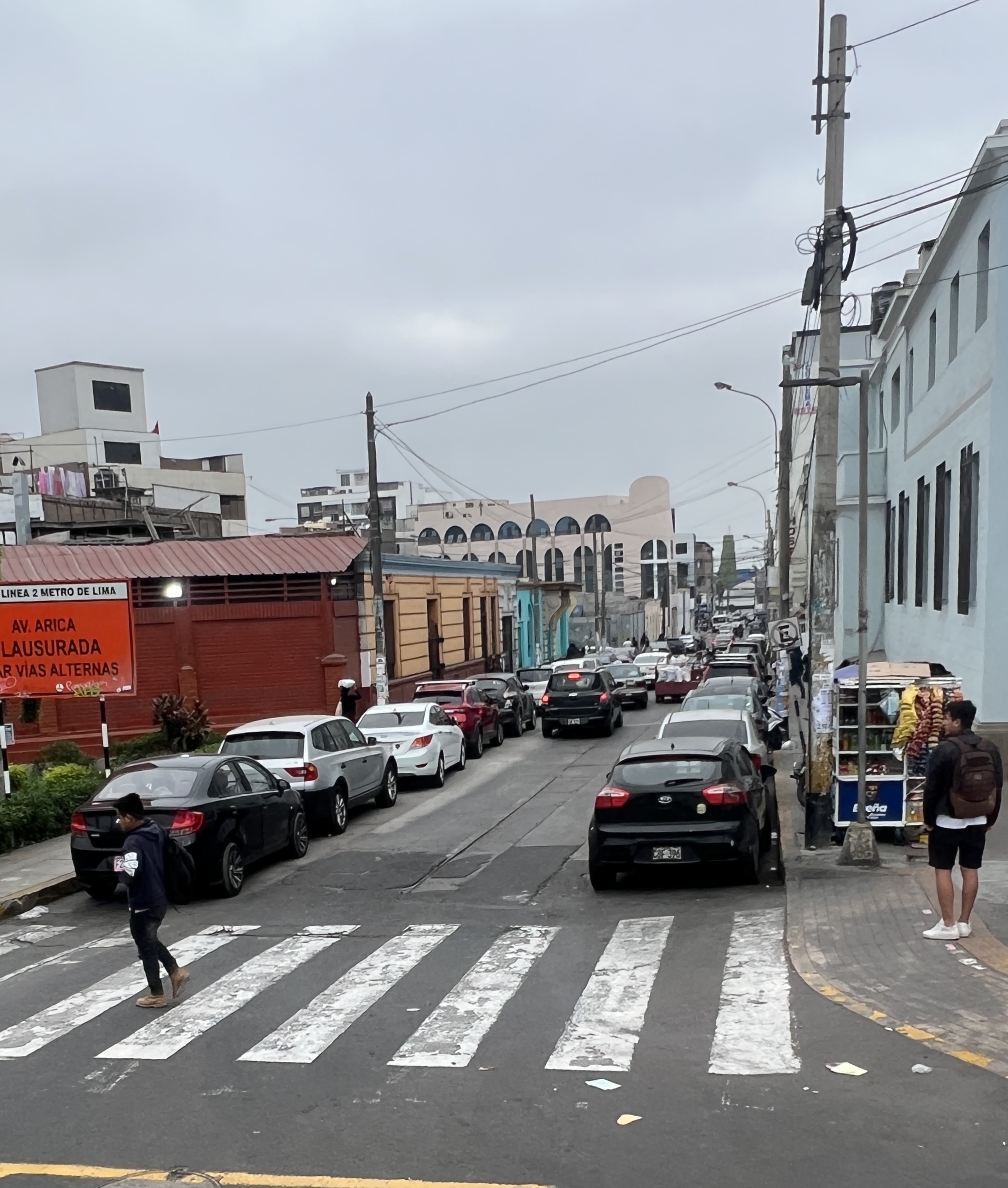
The bus took the same route as before, along some narrow crowded streets, taking about 50 minutes to reach the drop off spot from where the walk started. It was a fairly leisurely walk on flat surfaces, bit of dodging around the masses going about their business on a work day.


These are a couple of photos of mid 1700s Spanish style houses, well preserved. Brightly coloured houses are a long historical response to Lima’s climate. For about eight months of the year, April to November, the sky is very grey. It looks like it is going to rain but it stays dry. The guide referred to it as ‘Donkey belly sky’. Caused by the Andes rain shadow over the coastal strip and currents running up the coastal waters. We were fortunate in the sun coming out around midday for awhile and some pale blue sky. Otherwise things look a bit drab!
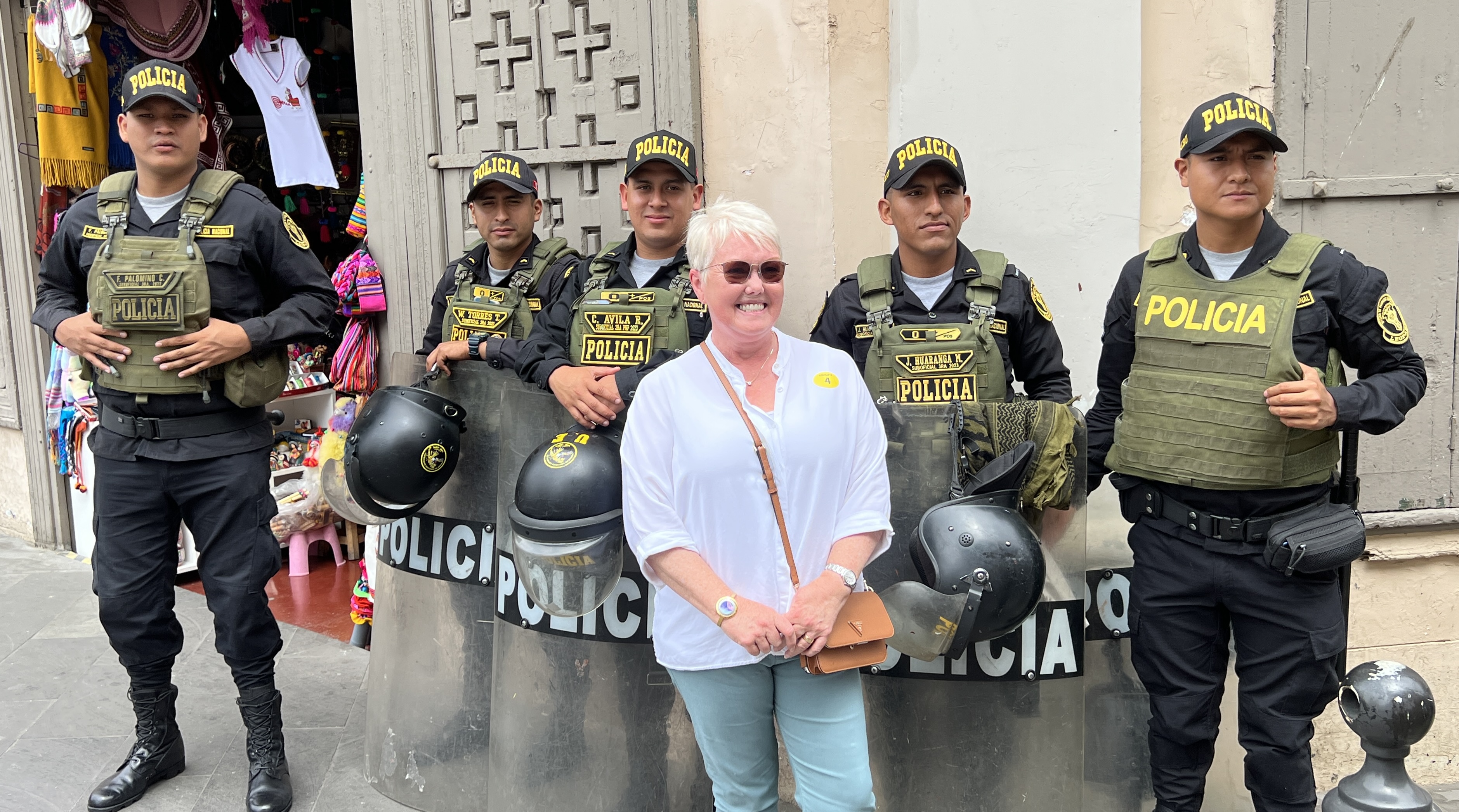
The police are very obvious in these parts. Don’t mind their picture being taken though! But not many smiles. We have noted that when our bus leaves the port security gates a police motor cycle will follow us for several kilometres through the old port area. We were also advised that it was unwise to wander around there.
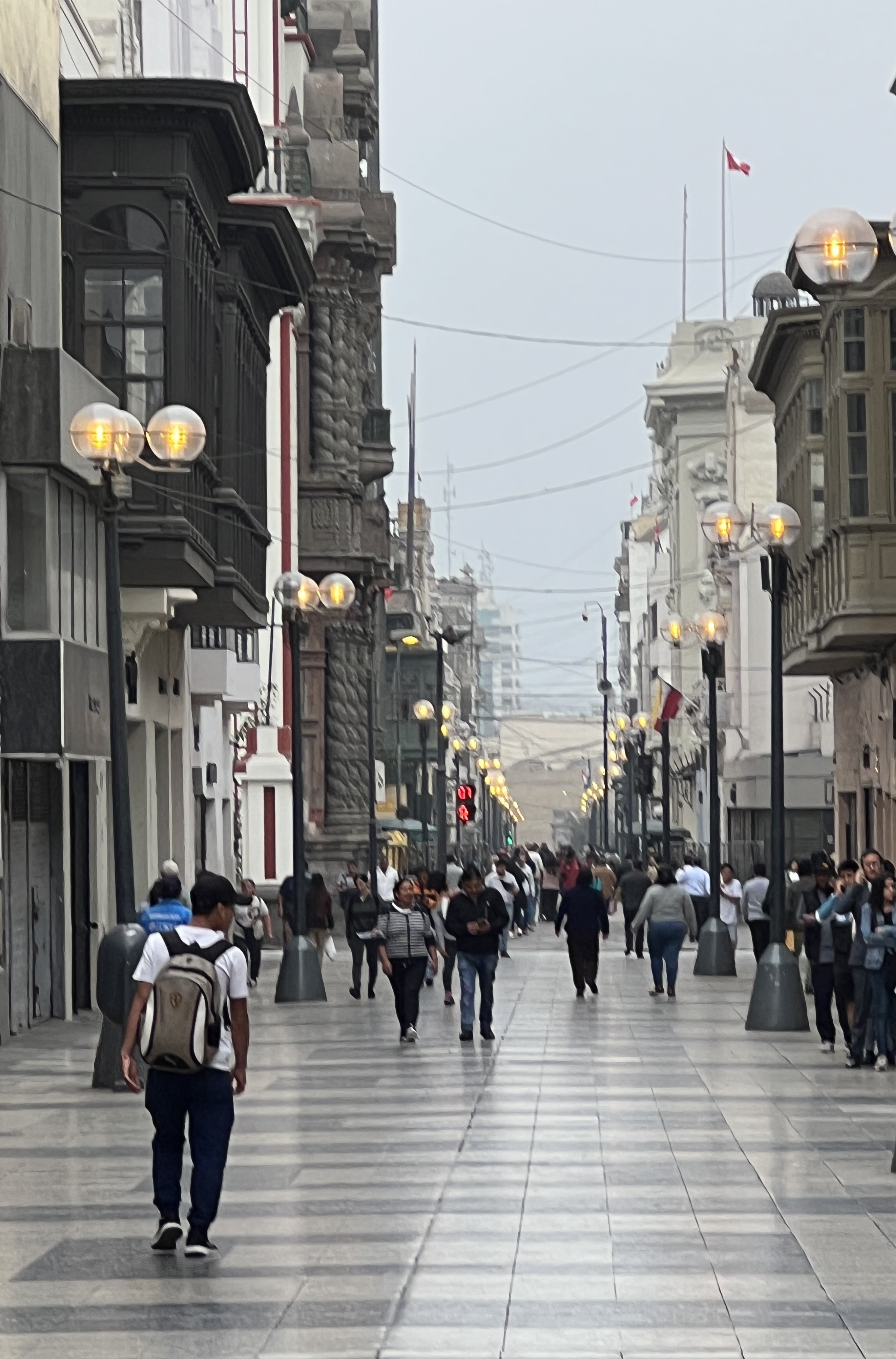
Lima is modelled very much like European cities of the same era, the Spaniards wanted it to feel and look like ‘home’. So the streets in the city centre are laid out in large grid patterns, stretching away into the distance. Authorities are also trying to get rid of cars from the centre so many of the streets are pedestrian only.
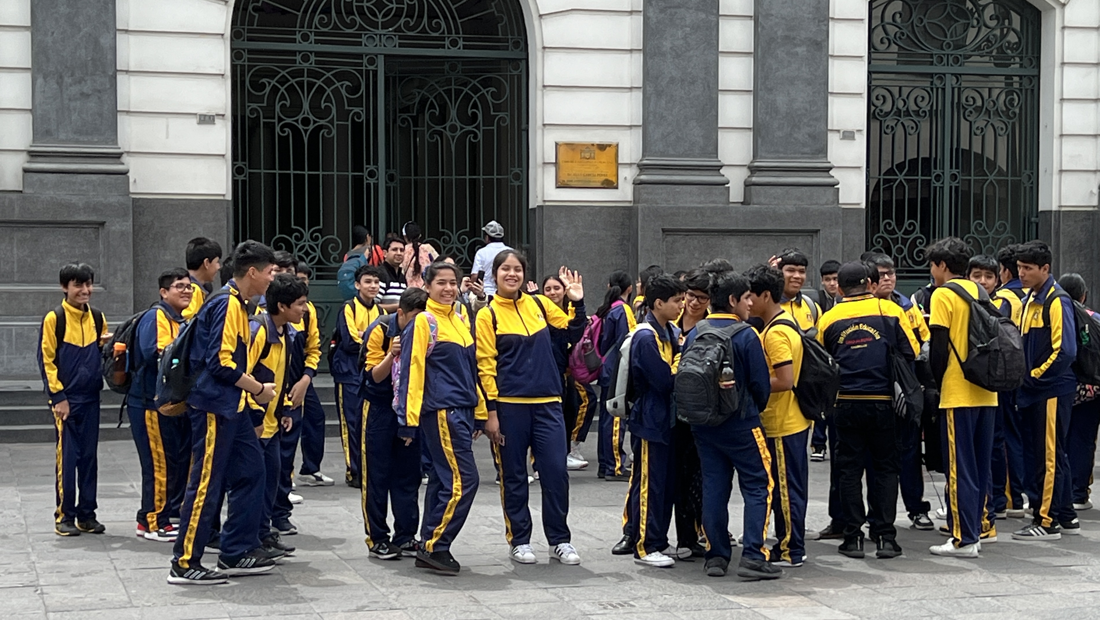
School children were also out and about in numbers and they are very inquisitive about ‘white skinned people’, where we come from etc. They also don’t mind a wave and photo!
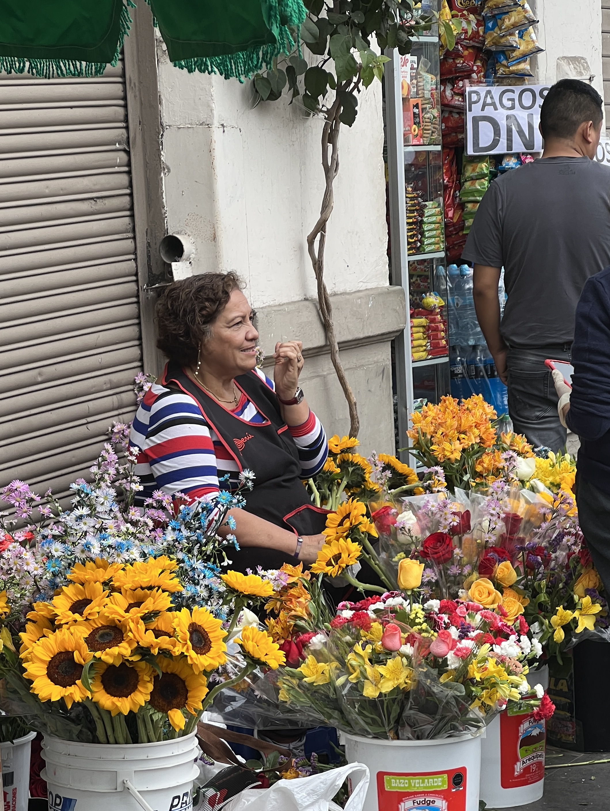
By chance we are in Lima on the 28th of the month and witness a long tradition. St Jude’s day, every month on the 28th people line up for blocks to get into the big Franciscan church to pay their respects, bring flowers and make pledges to St Jude. Flower sellers do a great trade it seems.
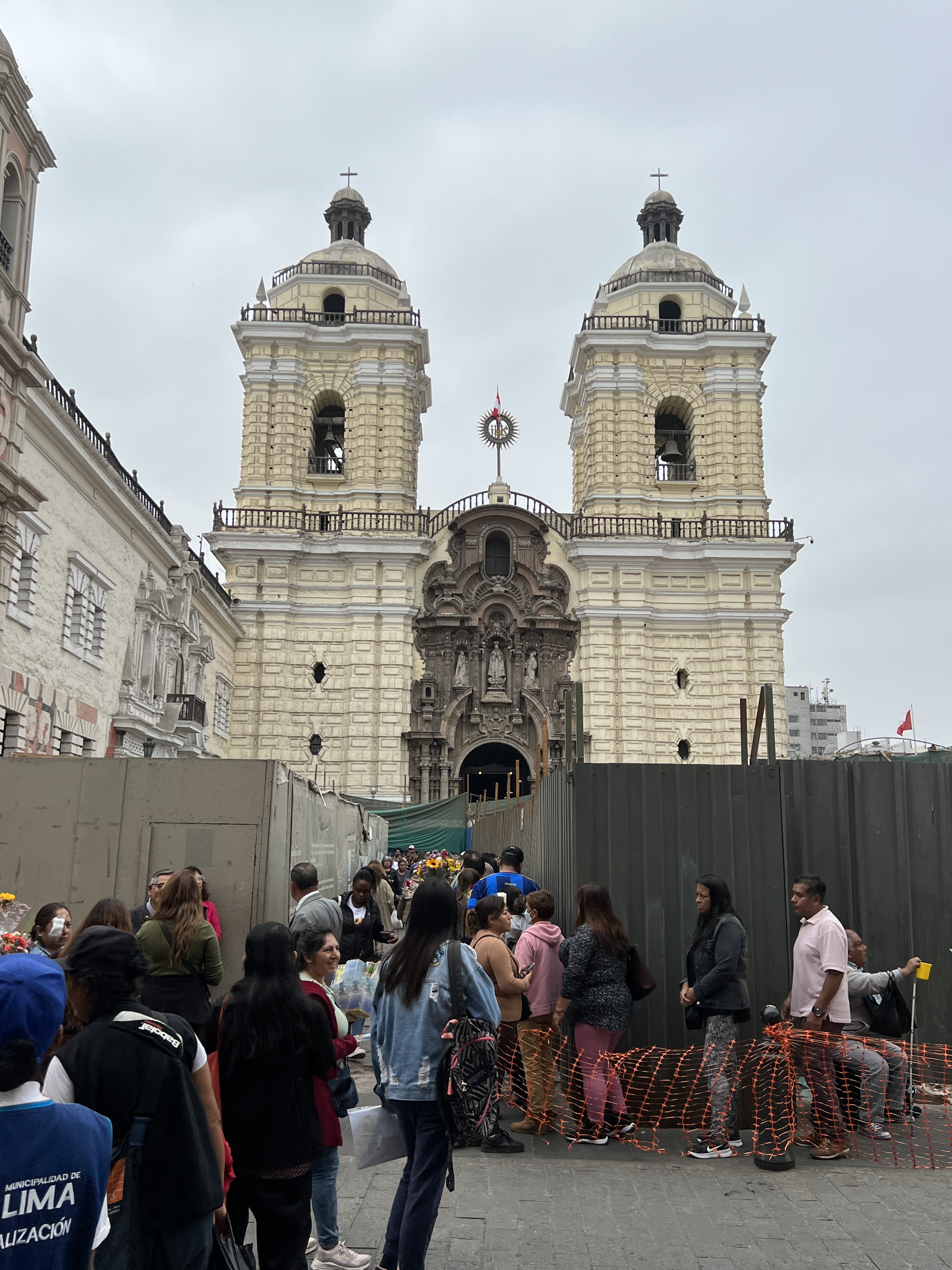
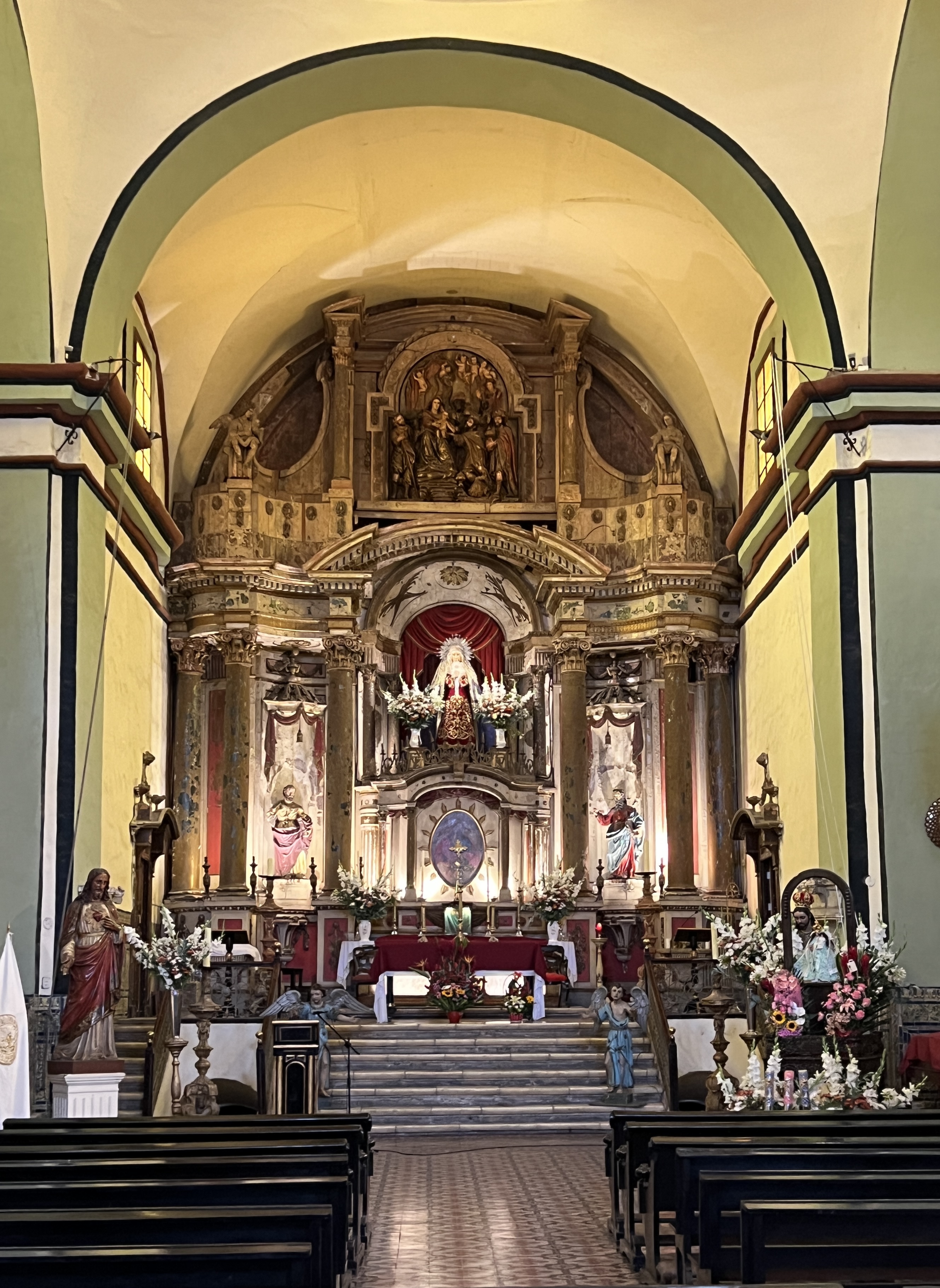
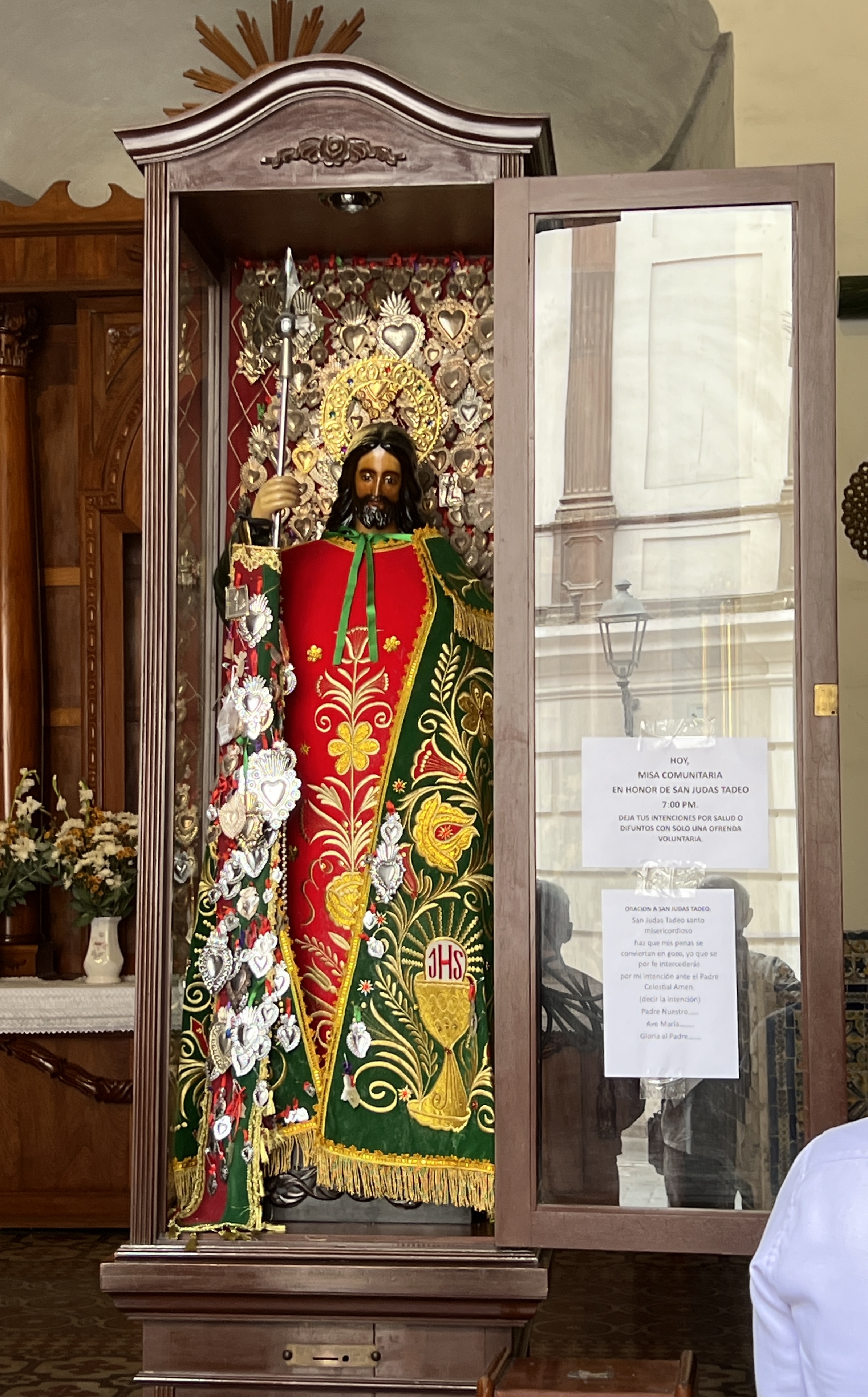
The complex dates from the 16th century and the catacombs beneath it are said to contain upwards of 75,000 bodies. Although, I saw another estimate of 25,000. Still a lot!
Homealone had an interesting conversation with a local about Australian coins, he had a few in a collection including one with a platypus. Asked whether we had one with the new King yet, hoping to get one I suppose! Very friendly chap.
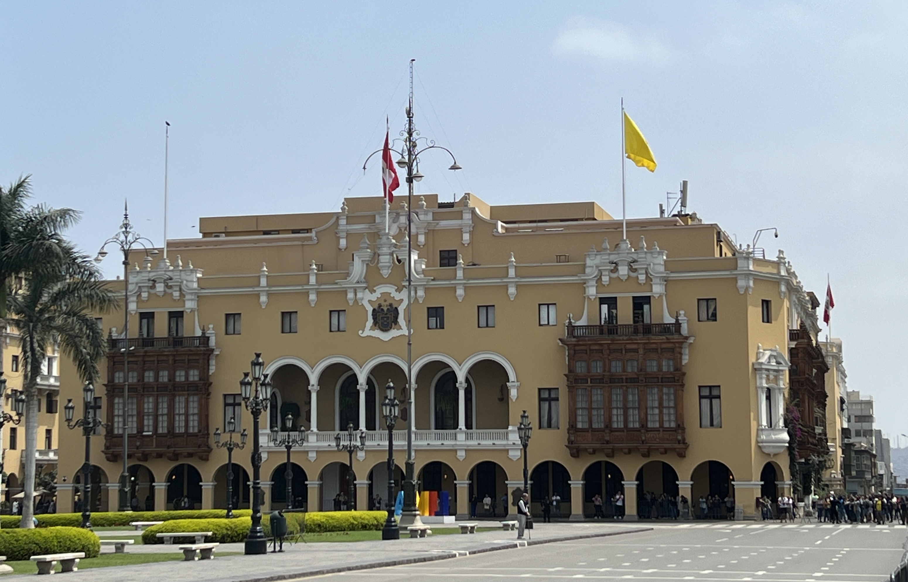
Our walk ended up in the large central square surrounded by large colonial buildings and the Presidential Palace. As mentioned earlier the sun came out when we reached the Square, considerably brightening everything up.
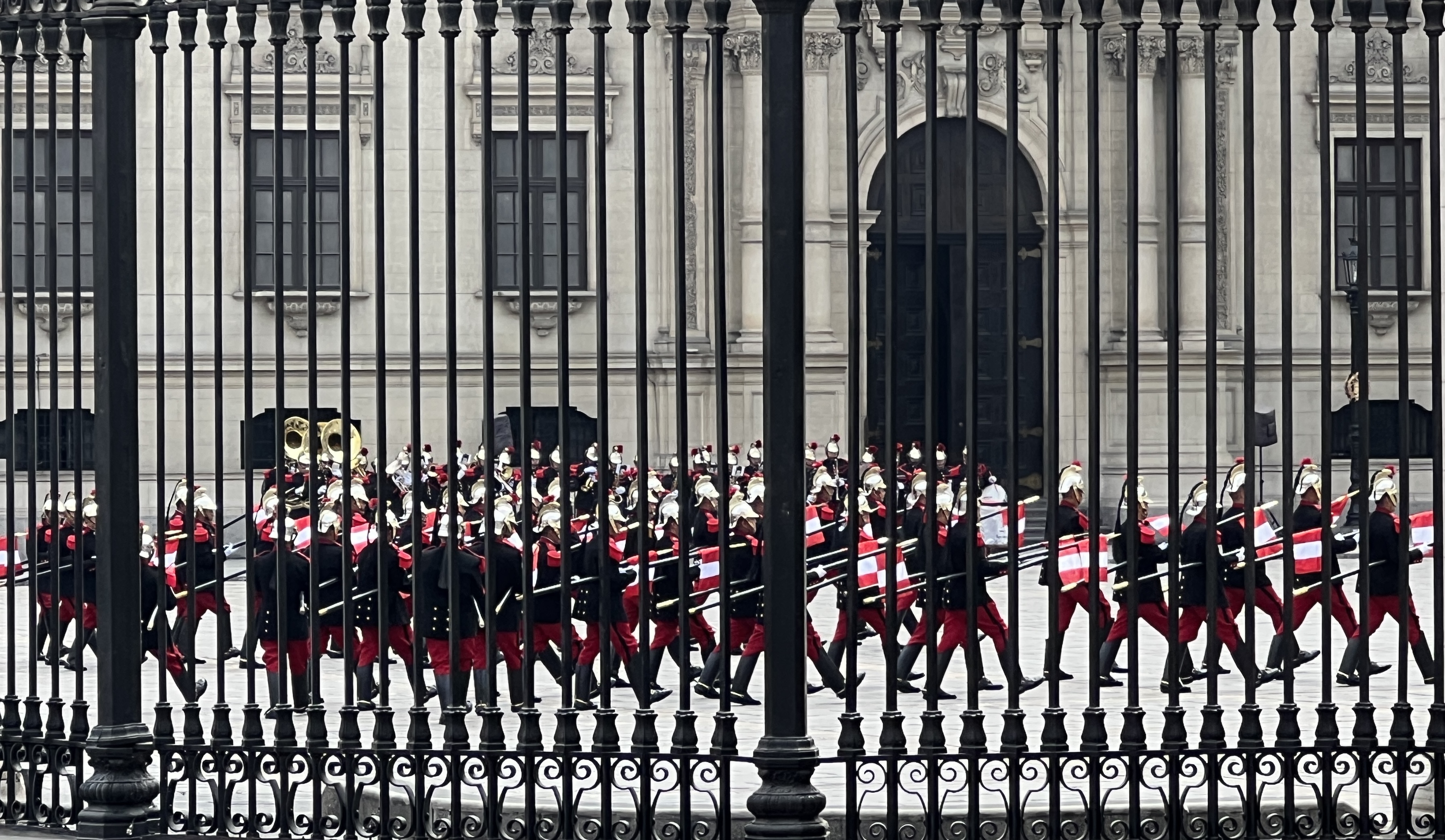
The guide had timed things well as the daily changing of the guard ceremony was in full swing. It was difficult to get up close as the Square had been closed off by police due to a largish demonstration taking place nearby. But we did get a reasonable view through the iron fence work.
This walk had been one of our best excursions on the trip. The guide was really good and easily understood.
We headed back to the ship for a late lunch and to put the feet up ahead of a late sail away. We are headed further down the Peruvian coast to the area around Pisco.
House hunting
We have two days at sea on the way south to Lima in Peru. The port of entry is at Callao, it is a big industrial port and about an hour from there into the centre of Lima. Lima is a large city of some 13 million people.
Homealone thought it was a good idea to have a look around Lima’s housing situation, there could be some bargains available to downsize into.
So, we go off on a tour to check out some houses and learn something of the economics of the place. It quickly becomes apparent that there are big contrasts in living conditions, like many cities in less developed countries. The road into the city is through the old port area and then some very run down former industrial areas. Housing is very basic in these parts. There is no rail and everybody is on the road getting to and from work, for many it is up to two hours each way on the clogged roads. A metro is under construction. The workforce has little time for R&R, it is a 48 hours, 6 days a week effort for all. If by chance your employer only does 5 days, it is still 48 hours. Average wages are about $US400 a month, living costs for a family of 4 $US1000 a month. So there are multiple bread winners in households in order to have enough to get by on. Pensions and social security are basically non existent. Retired parents live with their working age children. Our guide tells us there are some though on up to $US15,000 a month, a good number in between. It makes for wide living standards. Some 2 million people do not have tap water to their homes! We ponder these figures and can’t but help think how fortunate most are back in old Aus. Puts all the dramas about ‘cost of living’ back there into perspective.
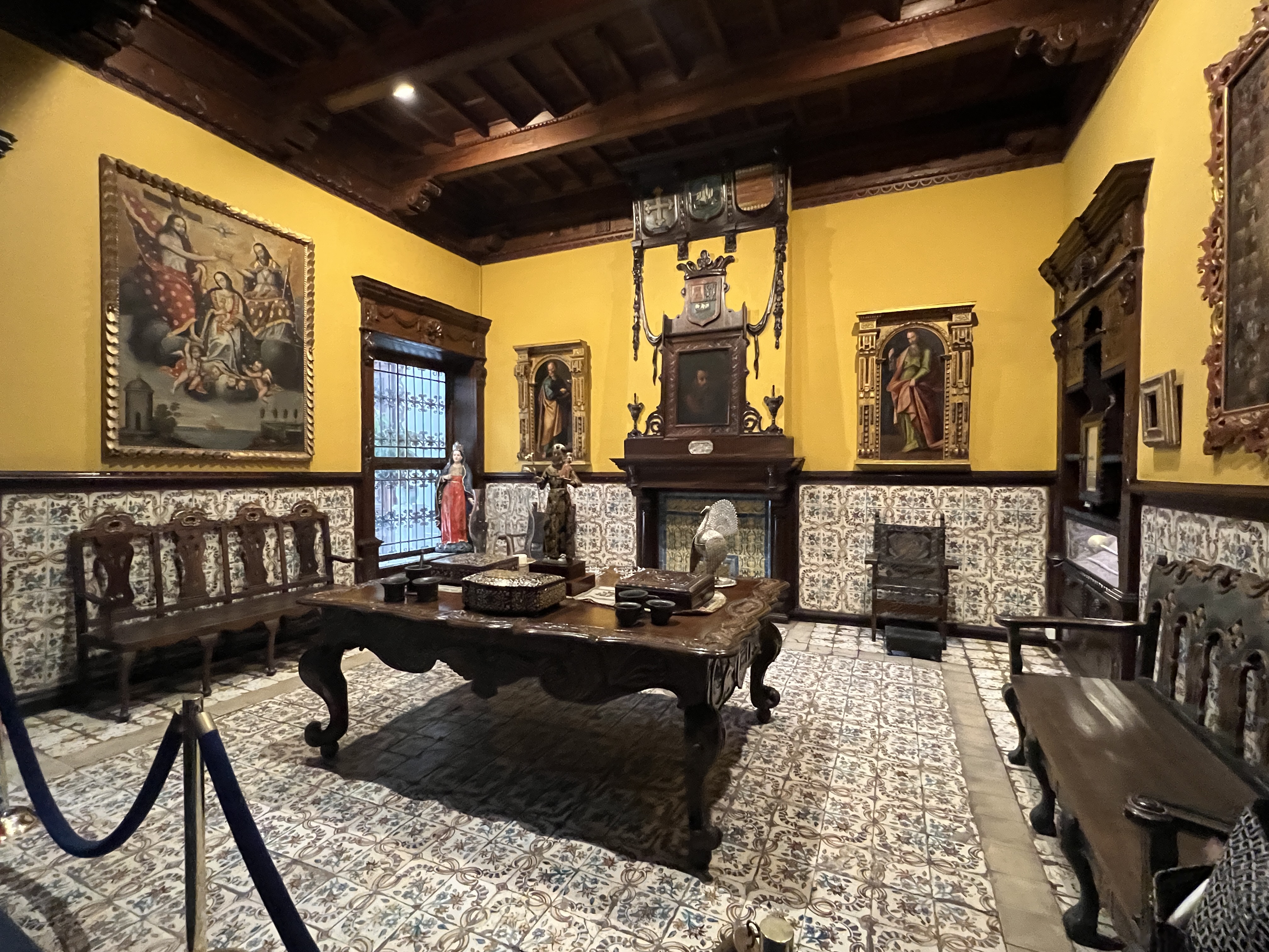
The first house we are taken to doesn’t seem to be an option. The same mob have been in Casa Aliaga since 1535. Home to 18 generations of descendants from the early Spanish colonial days. Very comfortable.
The second home was Casa Garcia Alvarado, built in 1912 and remodelled in 1932. It is a sprawling home of interconnected rooms showing how Peruvian elites lived between the wars. There was an expansive outdoor area for entertaining 100 plus of your closest friends on those special occasions!


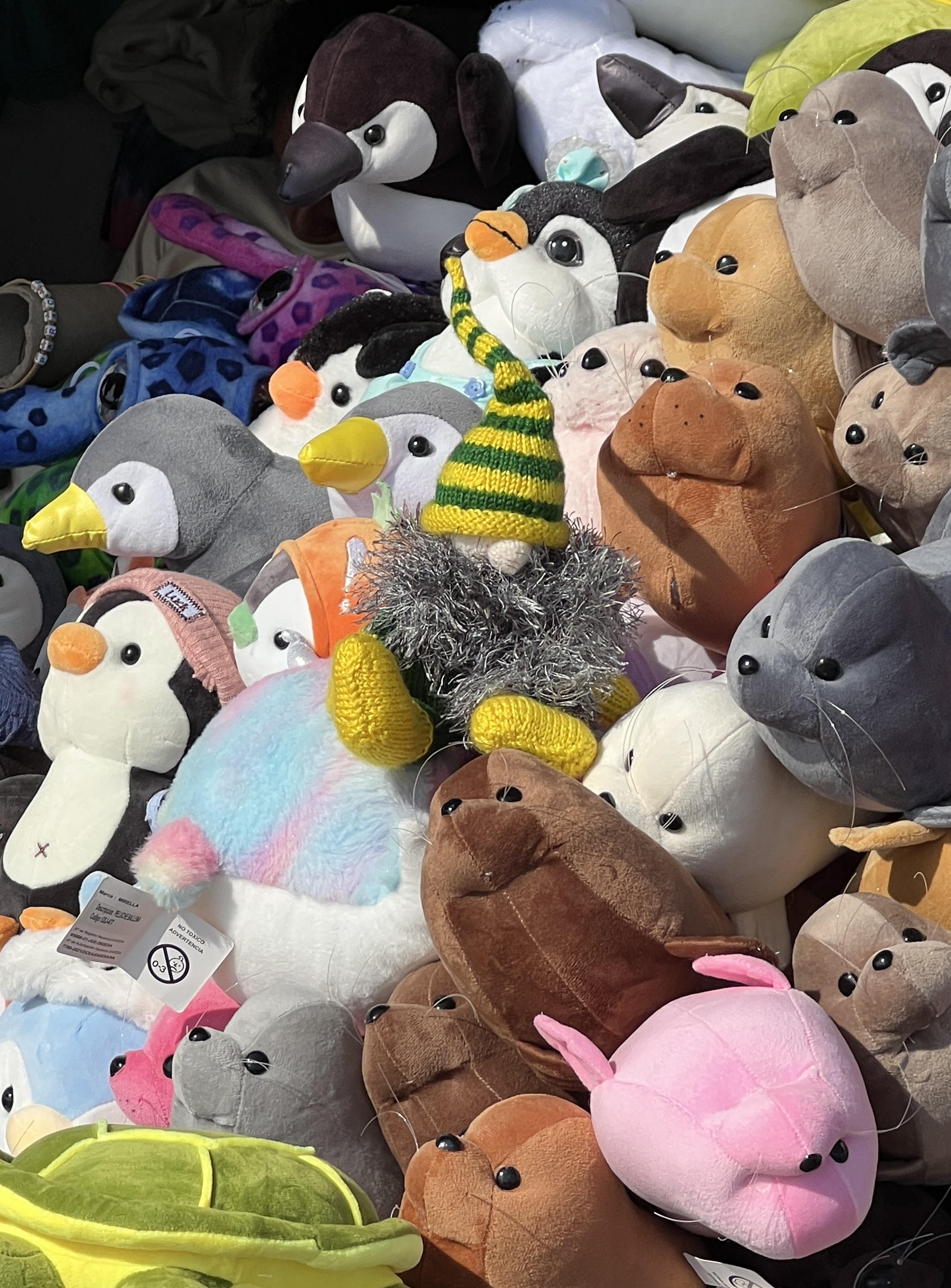
The final stop was at Casa Luna, a contemporary double story house in a well to do area. We didn’t really get to see the living areas of this house, apart from a look into a sitting room. We were actually spell bound by the tour of the upper level. Hundreds of nativity scenes from all round the world were on display, together with a few other nick knacks. The owners are fanatics of nativity scenes, what a display. Some might say over the top! How would you keep the dust down? Makes Homealone’s cabinet of stuffed animals look spartan! We made a relatively quick exit from here and headed back to the ship.
Back at the ship we had a light lunch before rejoining a shuttle bus to take us to Miraflores, also an hour away but out on the coast.
This is a well to do area and a popular destination. It is a shopping and eating destination, the main area is tucked into the edge of the cliffs overlooking the Pacific Ocean. Think of about two Westfield Shopping Centres side by side.
Row after row of shop and eateries. The usual range of fast food food courts, but also some cafe/restaurants with great views over the ocean. We both enjoy having meals out in foreign parts to get an appreciation of the foods and flavours of the destination. Good for people watching as well. What turns the locals on!
In the complex we discovered a supermarket and dropped in to replenish our stock of on board peanuts. Having done this Allthego was distracted by a stand with bottles of Pisco, all in Spanish of course with a wide range of price points. Pisco is a spirit type drink made from grapes and is used for the famous local drink Pisco Sour. Maybe he looked a bit perplexed and this engendered some help from a young local couple about which Pisco to get, advice taken. They also offered eatery recommendations, real Peruvian food. So we took the recommendation up and enjoyed some local food with a fellow traveller from the ship.
Got back to the ship with our fellow traveller about 10 pm after a lengthy interrogation by security at the port gate. We weren’t in the usual big bus, but a four seater that catered for disability people. Our fellow traveller was a lady on a motor scooter. A bit of a drama as Slobro needed to get to a loo and all the sitting around was placing a lot of pressure on his stamina in that respect. Thankfully, we finally got back on board and reflected on the house hunting experience. Glad we hadn’t been able to put a deposit down!
Another day in Lima to come!
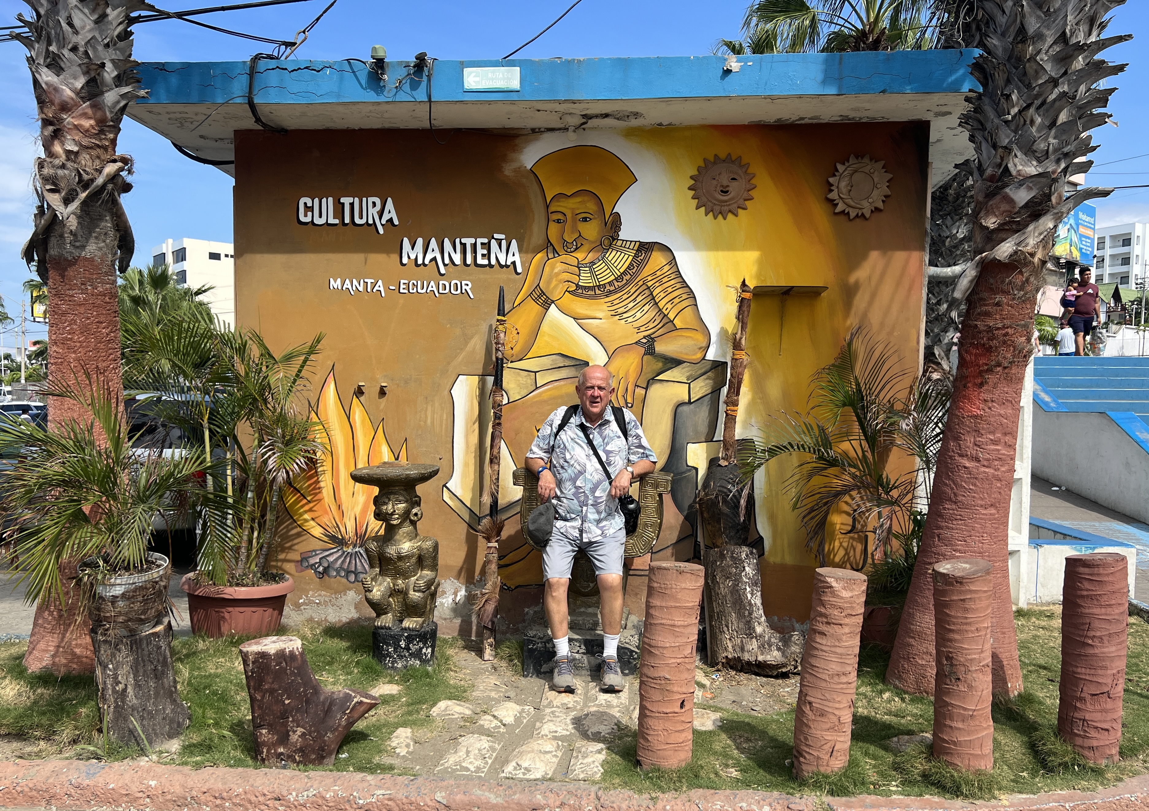
Manta
After leaving the Canal the journey takes us down to Ecuador and the port town of Manta.
Ecuador is famous for the Panama hat, it originated there and not in Panama. They are one of the country’s largest exports. Got the name ‘Panama’ apparently at the time the Panama Canal was being constructed, Europeans wore them there for sun protection. US President Roosevelt wore one and the craze took off.
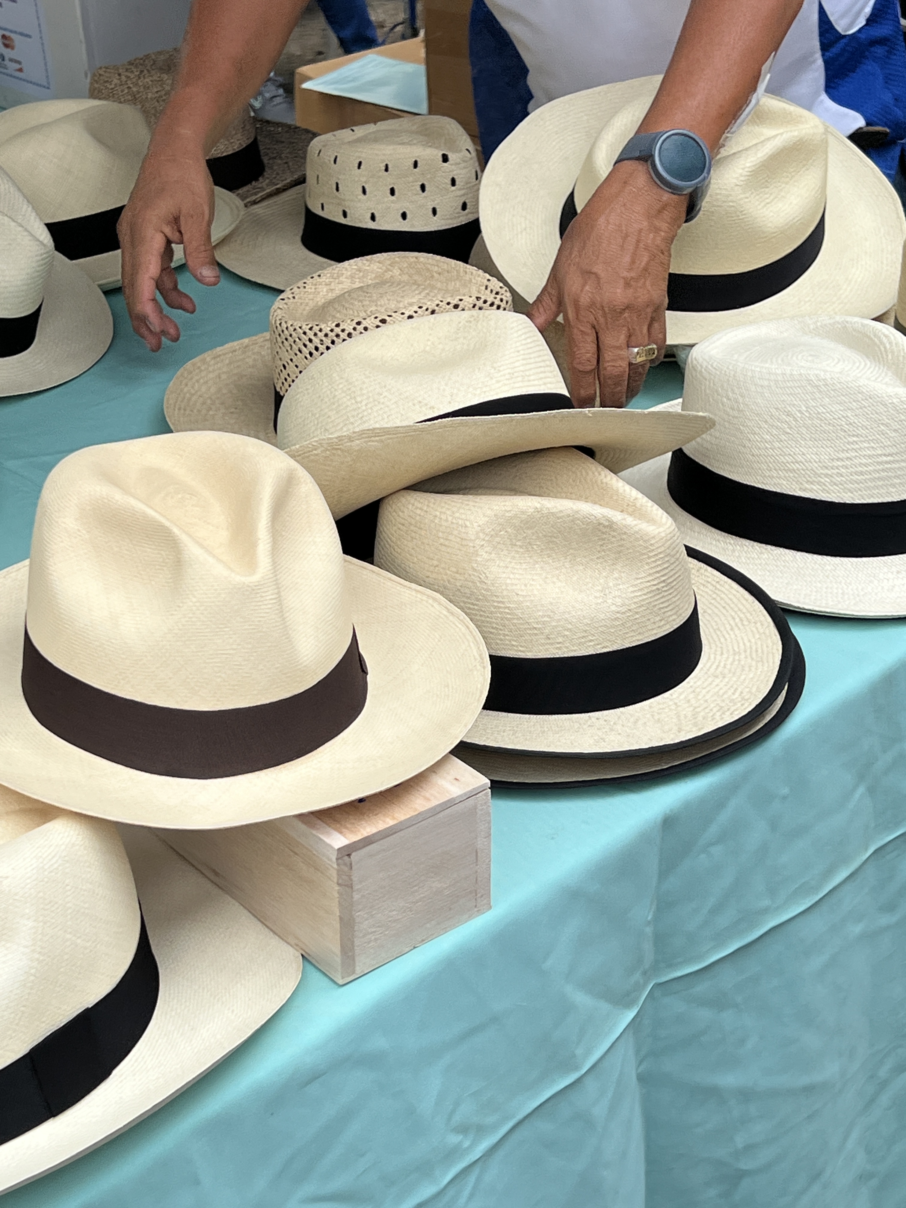
In our tour we visited a place where ‘all things Panama hats’ was revealed. Claimed that all genuine hats are hand made in Ecuador. The process was explained. Quite a back breaking job for the women who make them.
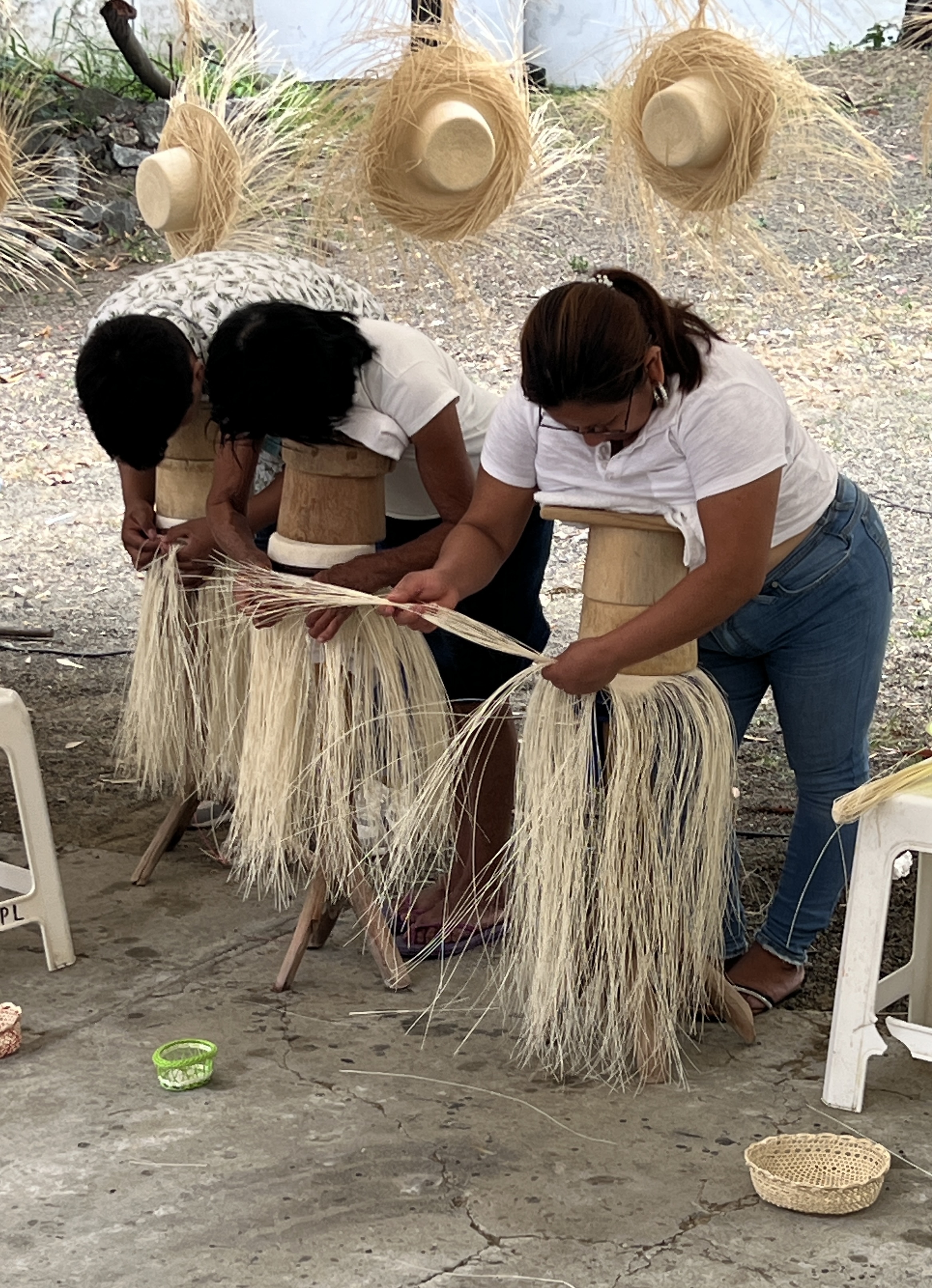
It takes a day to make a basic hat, they start at around $US50-60 prior to striking a deal. More elaborate hats, made using very fine lengths of palm fronds, can take up to three months to make and go for in excess of $US500-600. These ones are very smooth and less textured than the basic ones.
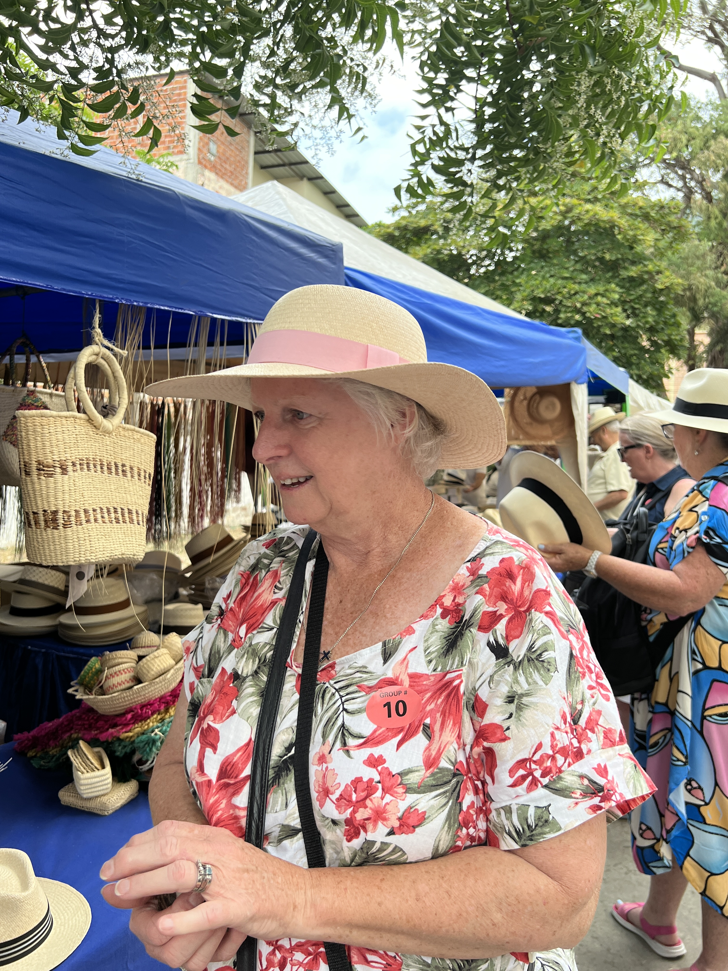
There are hats everywhere, so there must be quite a workforce working to get all these hats made if the making times claimed are correct. There are no machines that make them. The Chinese have had a go at mechanisation, but have failed. Much to the pleasure of the guide!
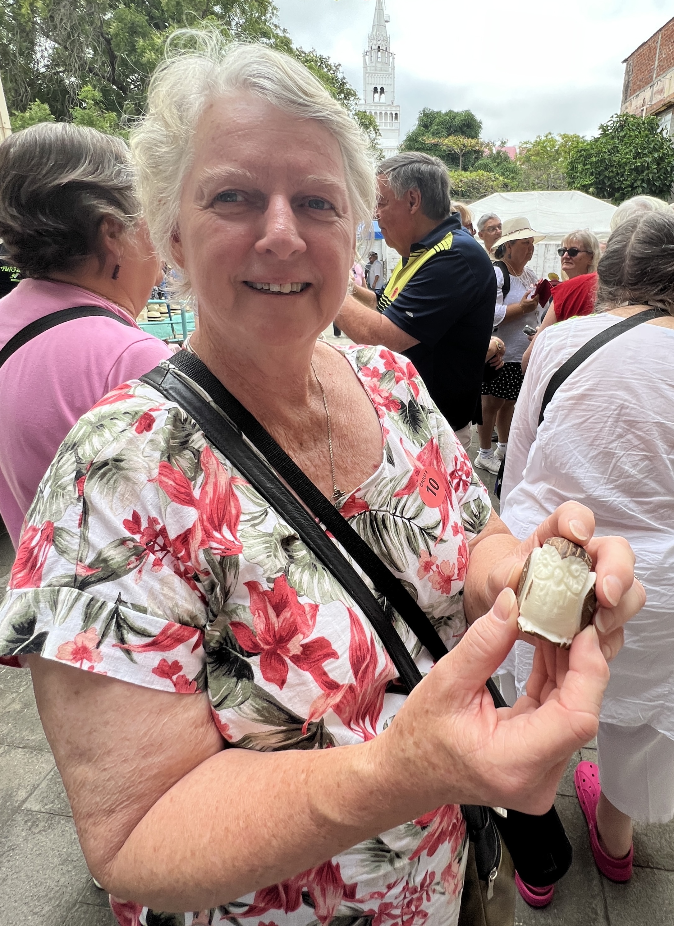
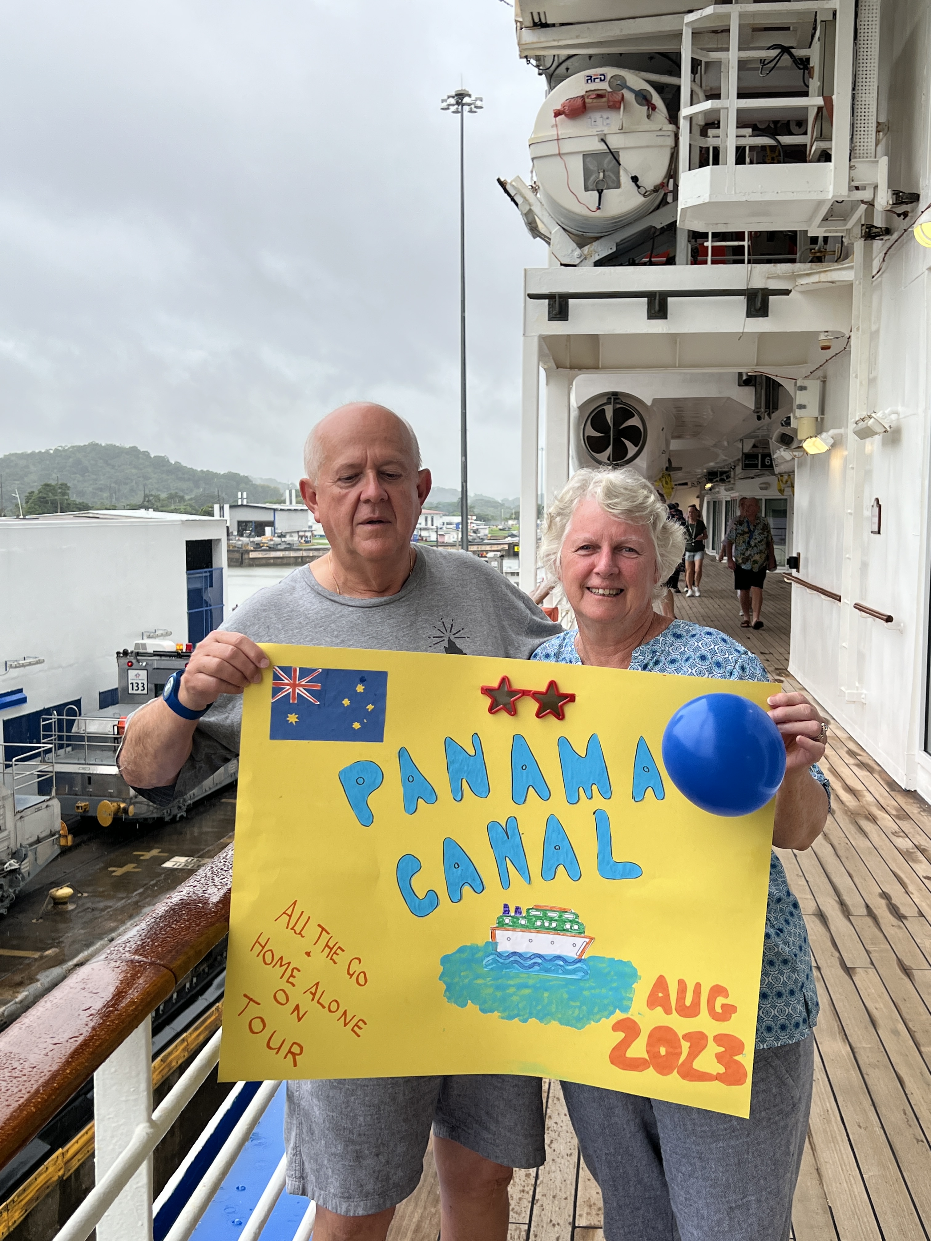
There was also an explanation of the use of the nut from the Tagua palm, ‘vegetable ivory’. All sorts of things are made from this hard white coloured nut; buttons, jewellery, carvings etc. The chap who demonstrated a carving had the onlookers guess what he was going to produce after making some initial cuts. Homealone, being crafty, immediately proclaimed ‘an owl’ and yes it was to be an owl. Upon completion she was presented with the finished item for ‘guessing’ correctly. Well, Slobro was peeved at this. He had been seething over the last couple of days at not being included in the poster photo on the Canal and for that matter not being allowed to get a Panama hat. Also some narky comments that the blog about the Canal had been too technical. In a real grumpy mood and had to be put in the back pack.
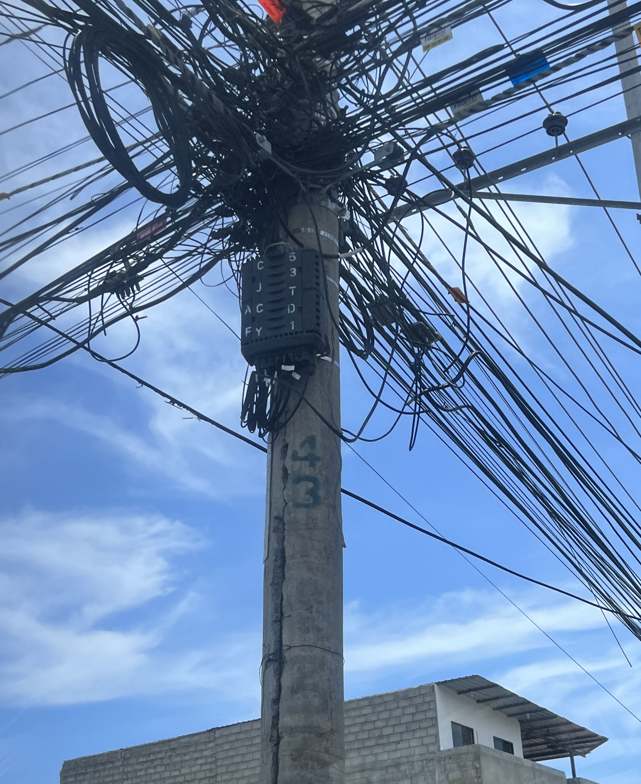
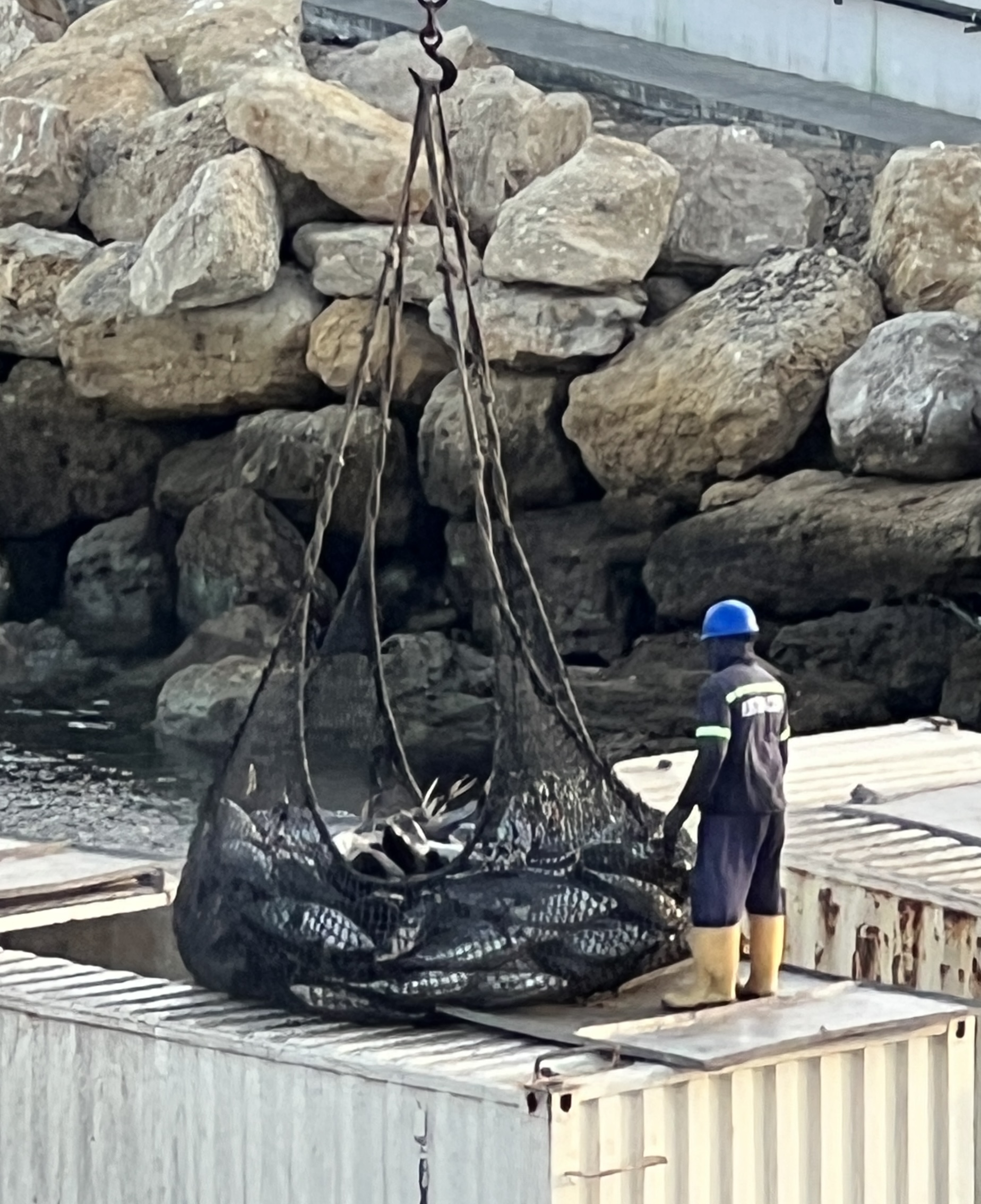
After a drive around town, the electrical installations are an amazing sight, and a short stop at a museum it was back to the ship and the afternoon ashore for lunch and a look around the water front. Ecuador is the worlds largest exporter (but not producer) of bananas, also big in shrimp.
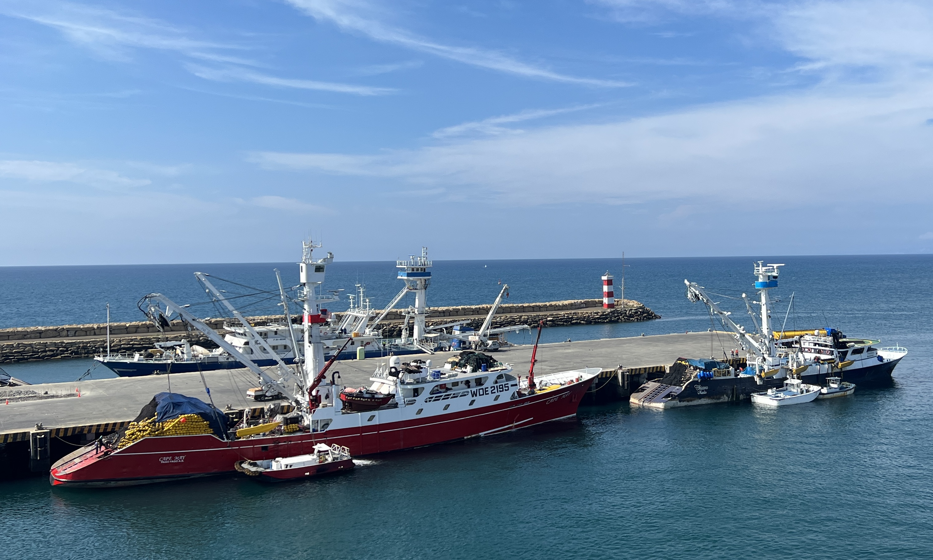
Manta is also known for its large tuna boat fleet and canning capacity. It claims to have the worlds largest tuna operation. Boats everywhere, we witnessed fish being unloaded into trucks from our ship’s deck. Industrial scale of operation.
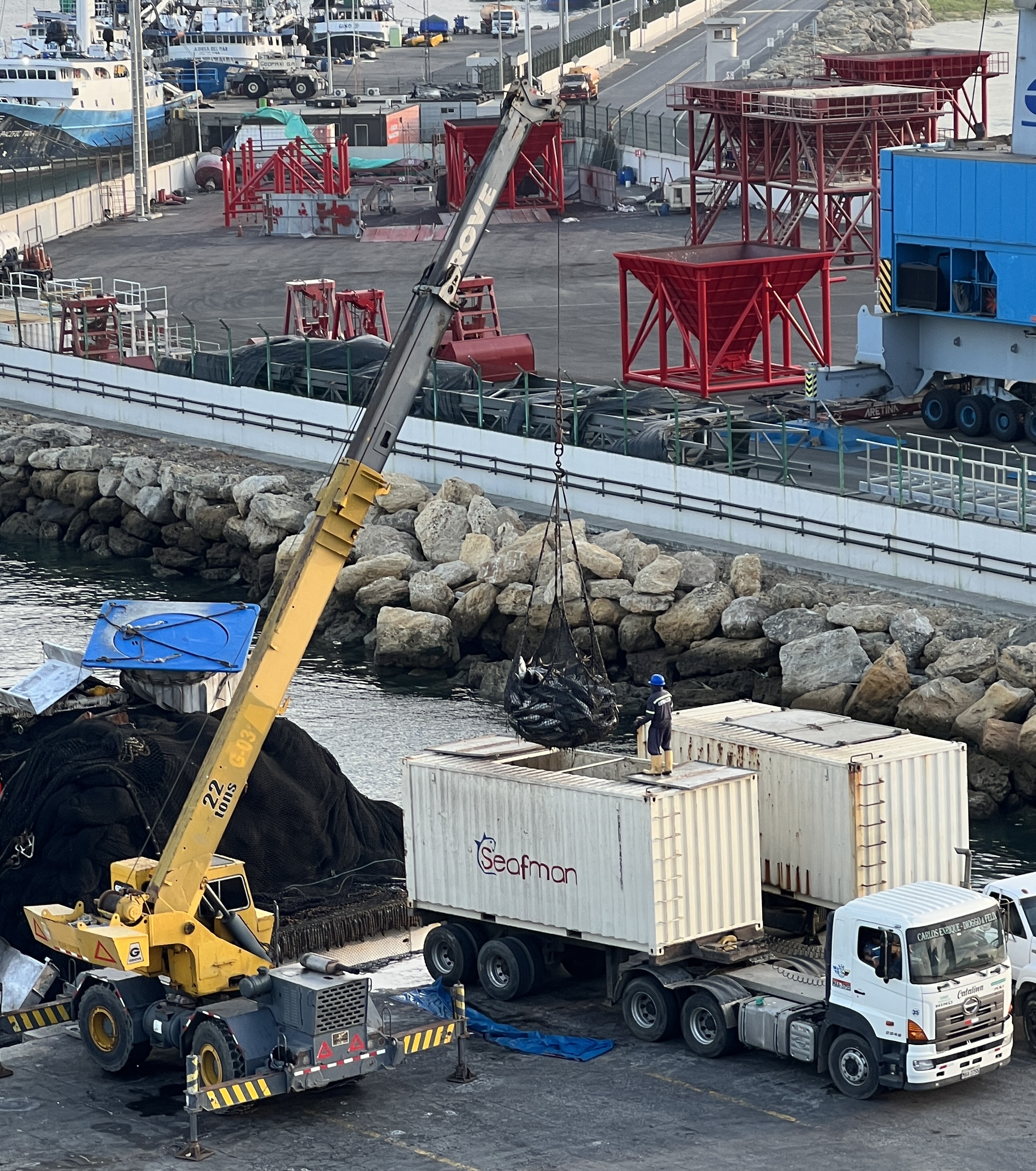
On the waterfront there were rows of artisan souvenir shops and restaurants, all specialising in seafood. We randomly picked one out and enjoyed lunch. Allthego went for a deep fried whole fish and Homealone prawn and fish with a coconut cream sauce.
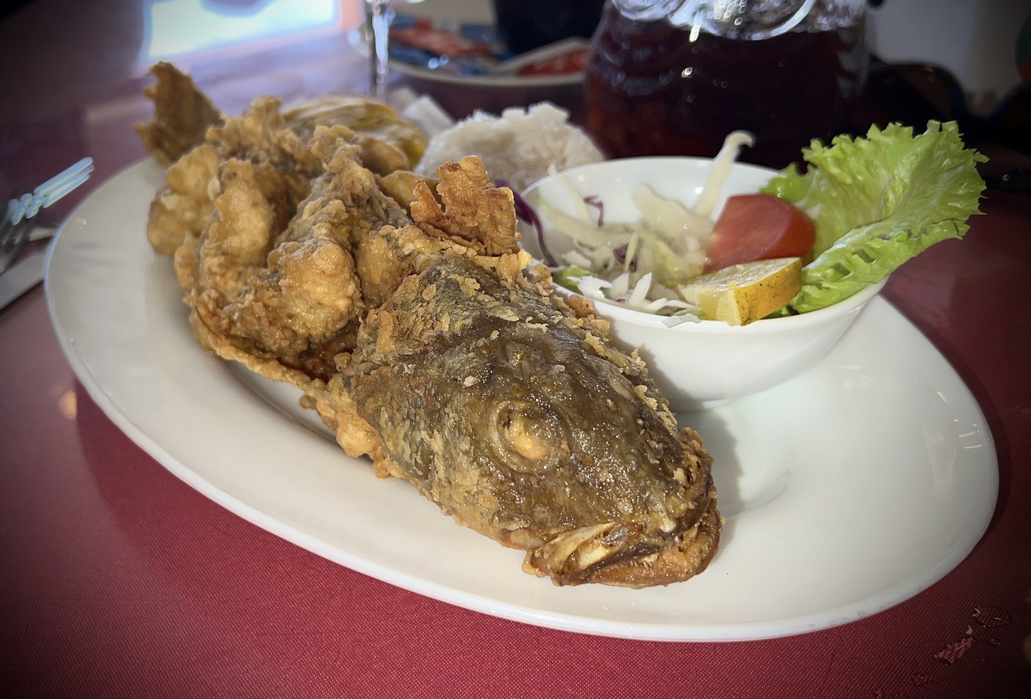
Both were spiced up and very tasty. Some Sangria washed it down. The beachfront was a quite wide expanse of sand, beach goers huddled under rows of shelters along the high water mark. It would get very crowded in summer.
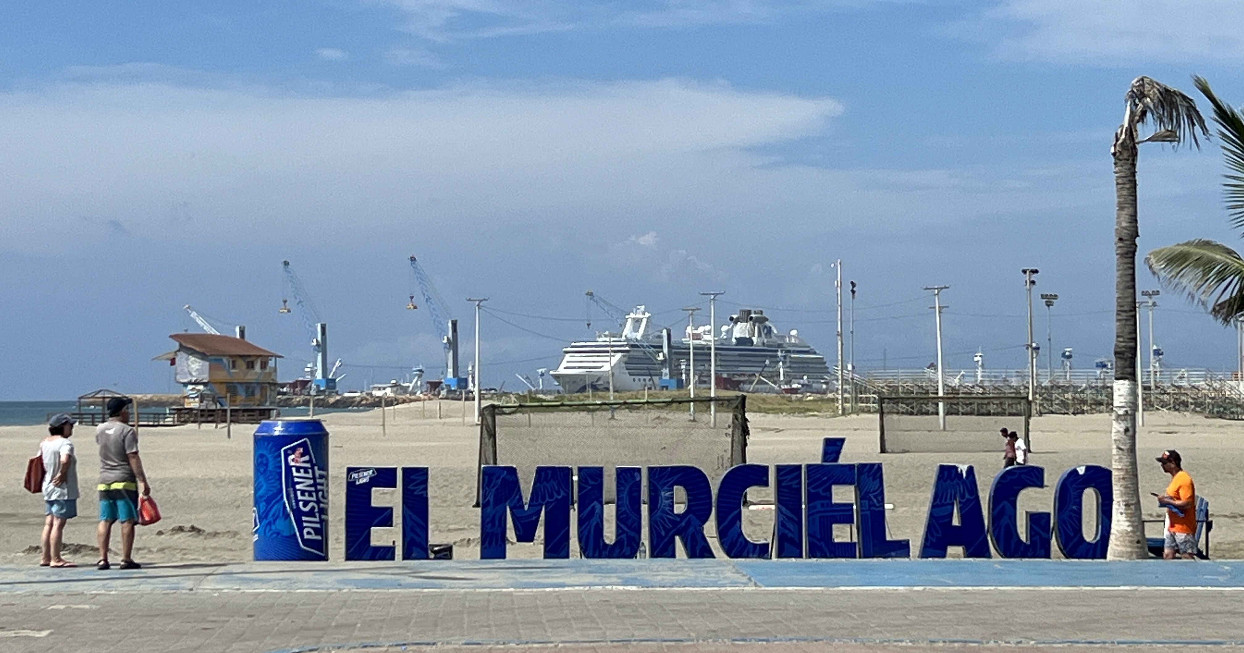

We had an excellent stop over here in Manta, the sun had come out in the afternoon and it made for a pleasant sail away as we headed out to sea bound for Lima.
Panama Canal
The four days cruising down to the start of the Panama Canal were uneventful. Shipboard life much the same, days punctuated by regular journeys to food locations interspersed with craft, reading, trivia and dozing off occasionally during onboard talks. Some garments appear to have shrunk a little in the ship’s clothes dryers.
The weather noticeably warmed up and became more humid as we passed between Cuba and Haiti into the Caribbean Sea. We caught a glimpse of the tail end of Jamaica a little further on. After that there was no land sightings until we anchored for a time off the breakwater near the entrance to the canal. A bit of rough sea accompanied us on this last section, the ship rocked and rolled a little in the swell. No dramas.
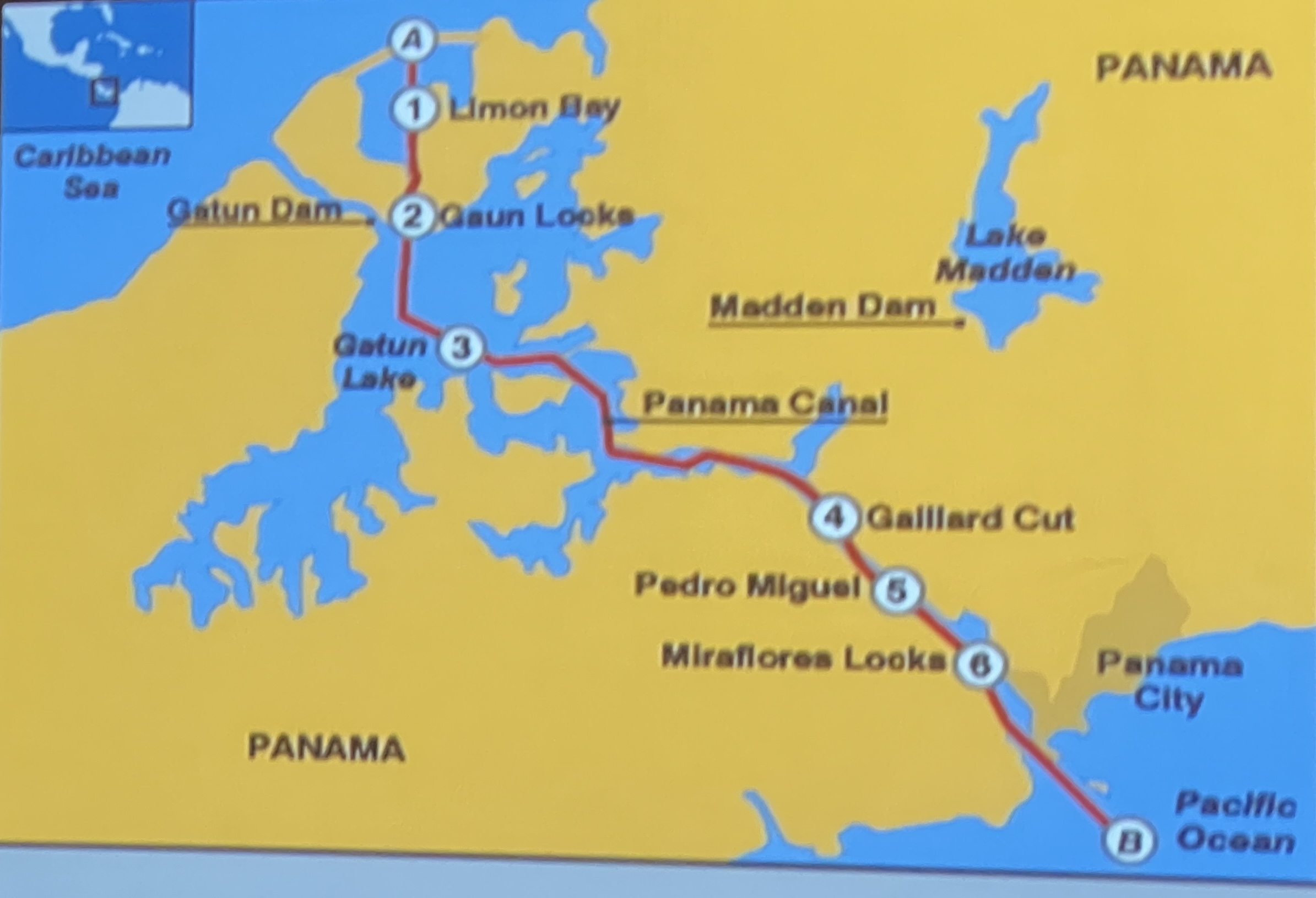
The following is a map of the canal and the numbers are key points in the journey.
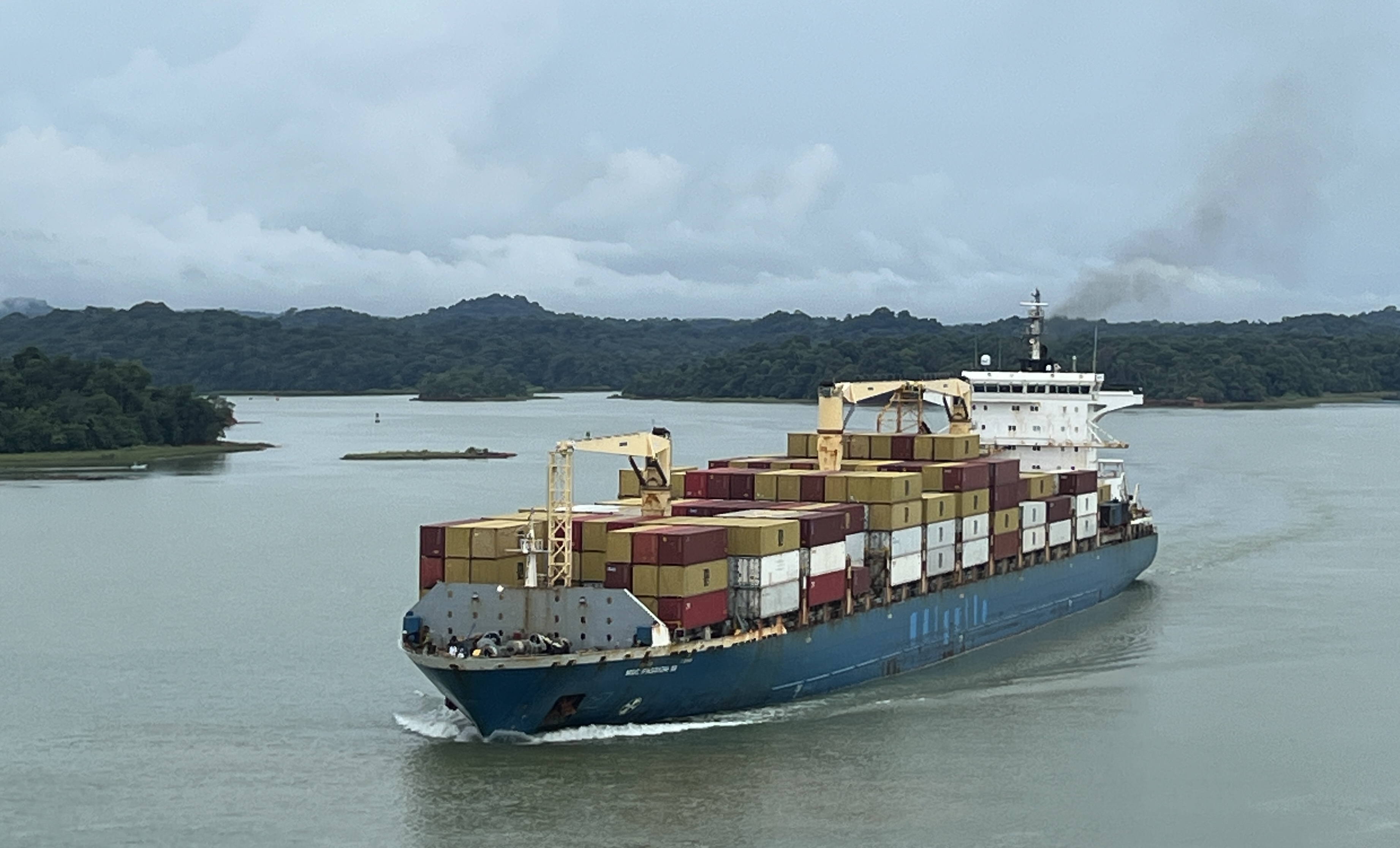
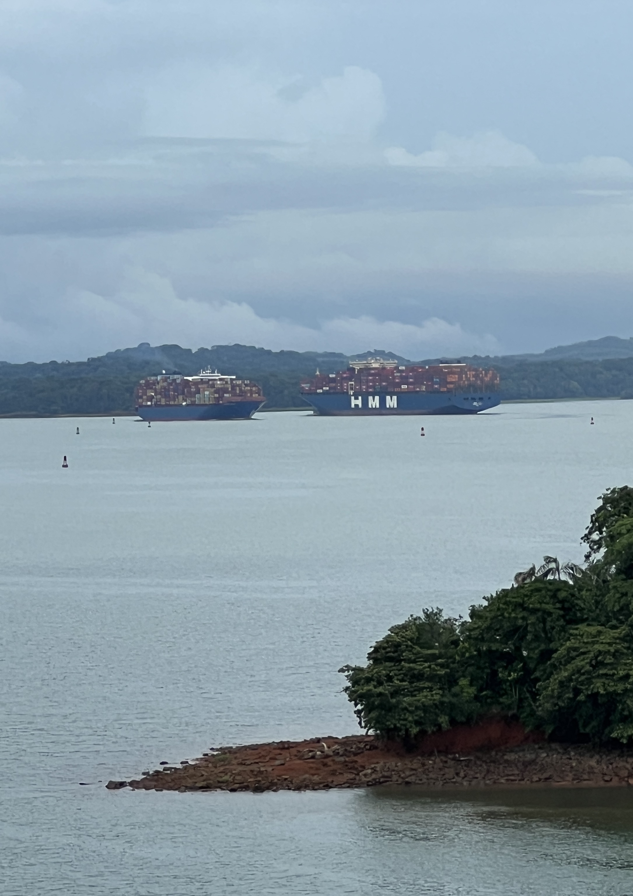
Outside the breakwater there was a great line up of ships. The canal authority has recently reduced the number of ship transits and limited the size of cargoes, due to low water levels following a couple of years of low rainfall. Have read somewhere that there have been well over a hundred ships held up, but I think this is the total at both ends of the canal. Ships can book slots in order to make a transit, this is what cruise ships do and so get preference over other ships that don’t book. I think booking costs more money for the transit, but I could be wrong there.
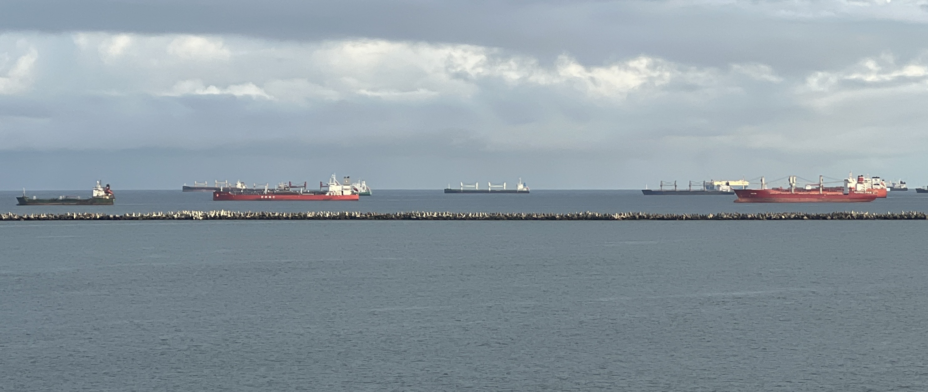
We arrived outside the breakwater around 5.30am and anchored there until 6.30 or so when the canal pilots boarded the ship and we set off into the inner harbour to form up into a convoy with a number of other ships. There were plenty of ships in this inner harbour waiting as well. The Canal operates 24 hours a day, every day. We had a guy on the bridge who gave a commentary as we went along. He said that there were to be about 17 ships in our convoy, that’s in a 24 hour transit. Probably a similar number coming the other way.
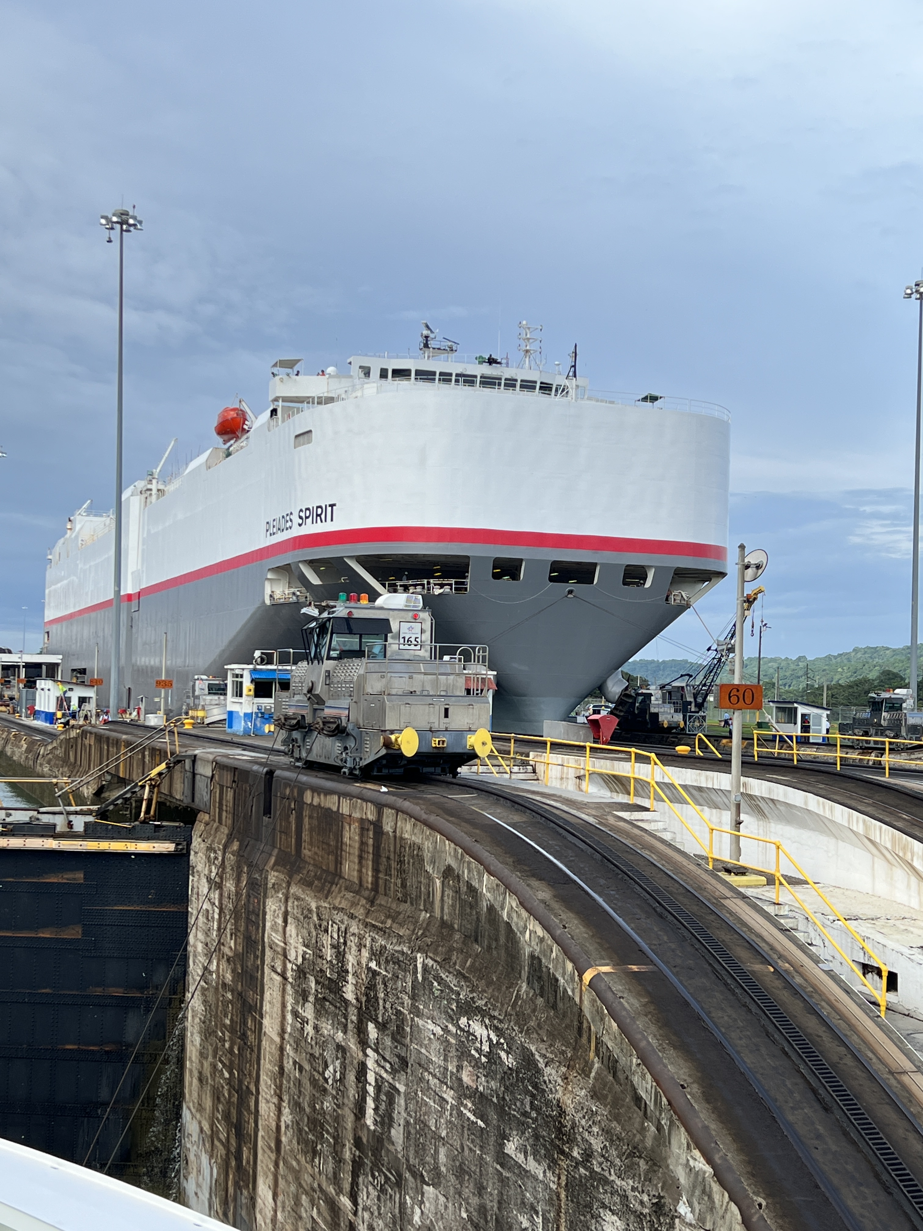
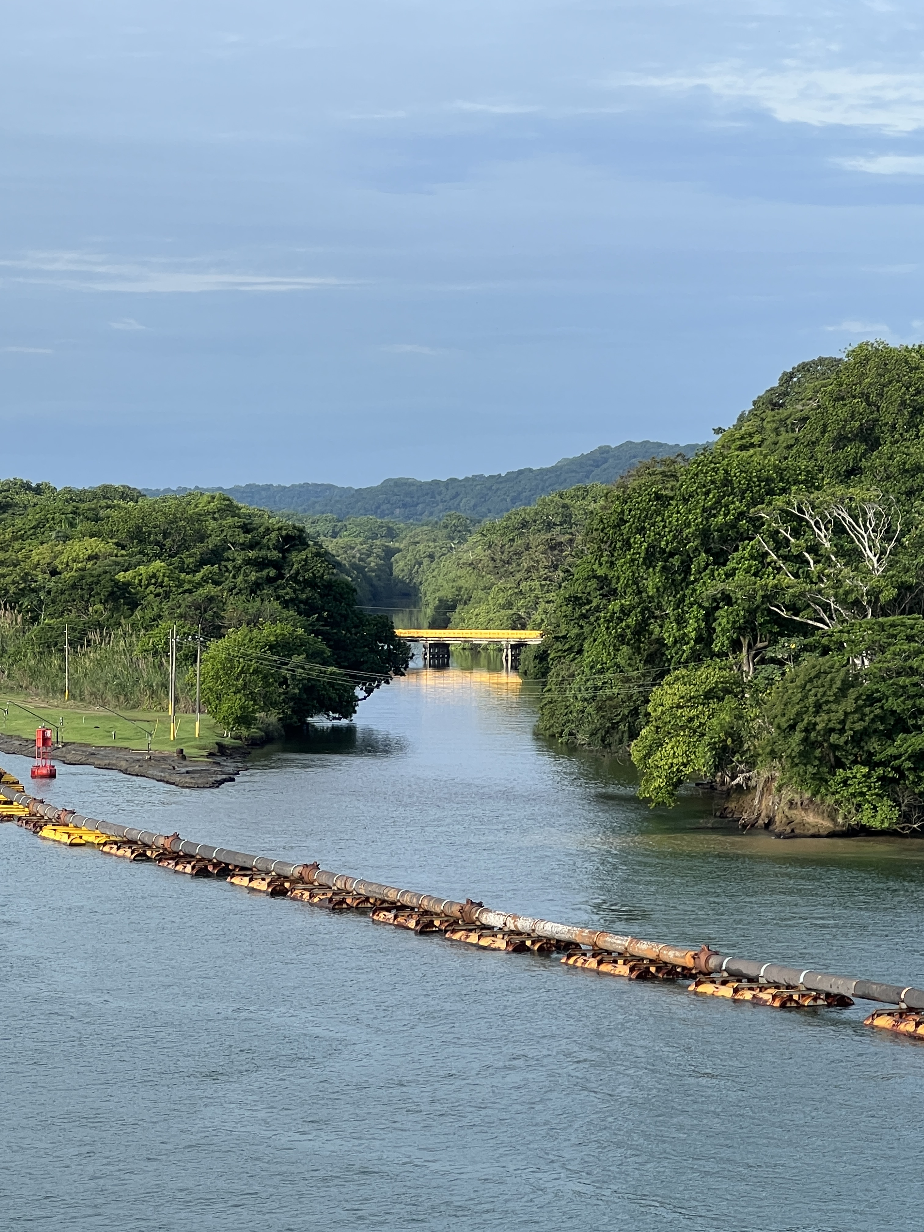
Our transit was being made through the Canal’s old original lock system that was opened in 1913. A newer set of locks have opened alongside the old ones that can carry bigger ships, longer and wider. The Coral Princess was built to the size of the old locks, newer Princess ships have to use the new locks. The chambers in the old locks are 1000 ft long and 110 ft wide, our ship is 954 ft long and 105 ft wide. It just fits in, a couple of feet either side to the lock wall. Stainless steel ‘mules’ are attached by cables to the ship to hold it steady in the locks. No tossing of ropes in this set up! The ‘mules’ run up and down beside the ship on cog rail lines.
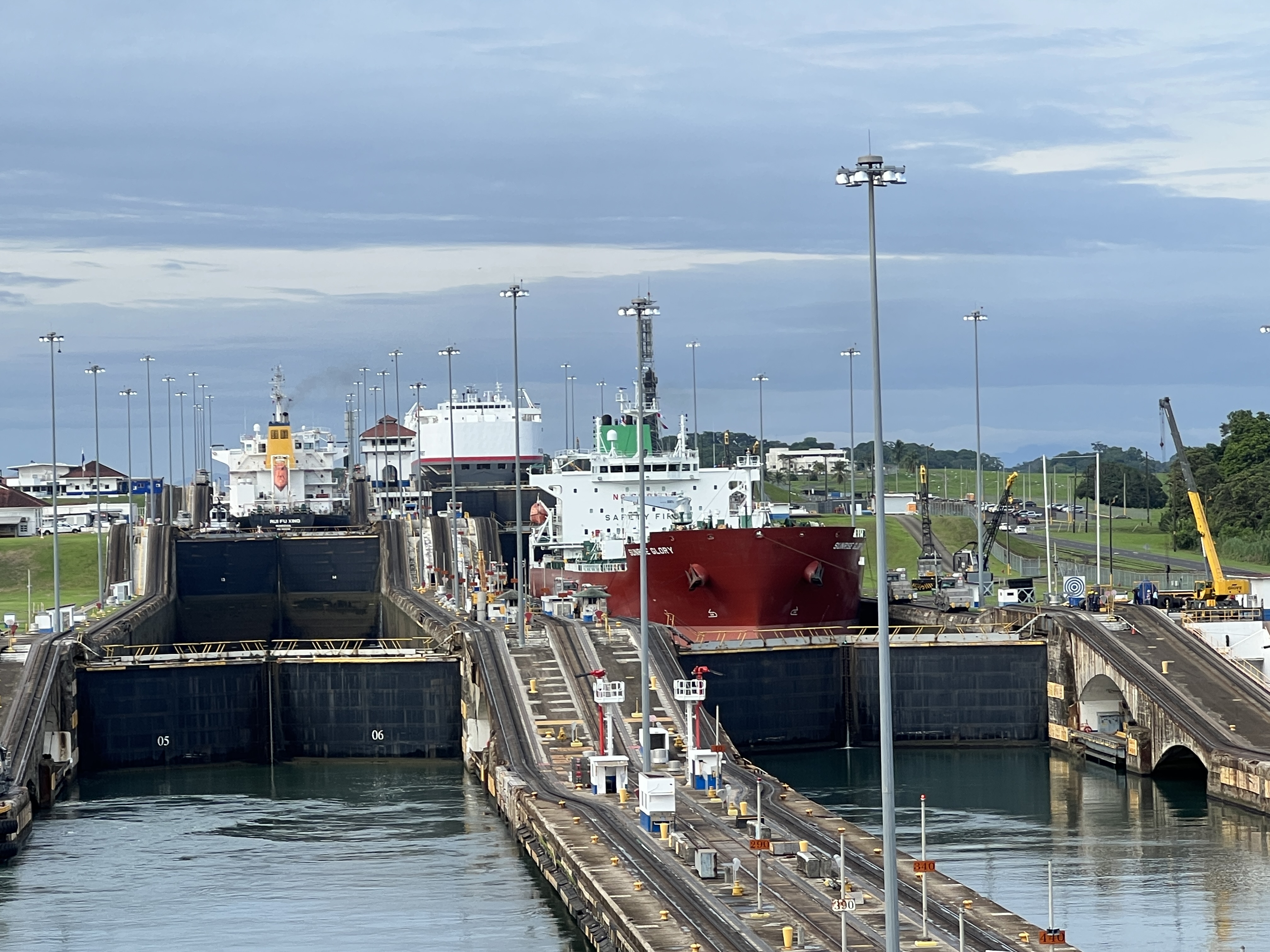
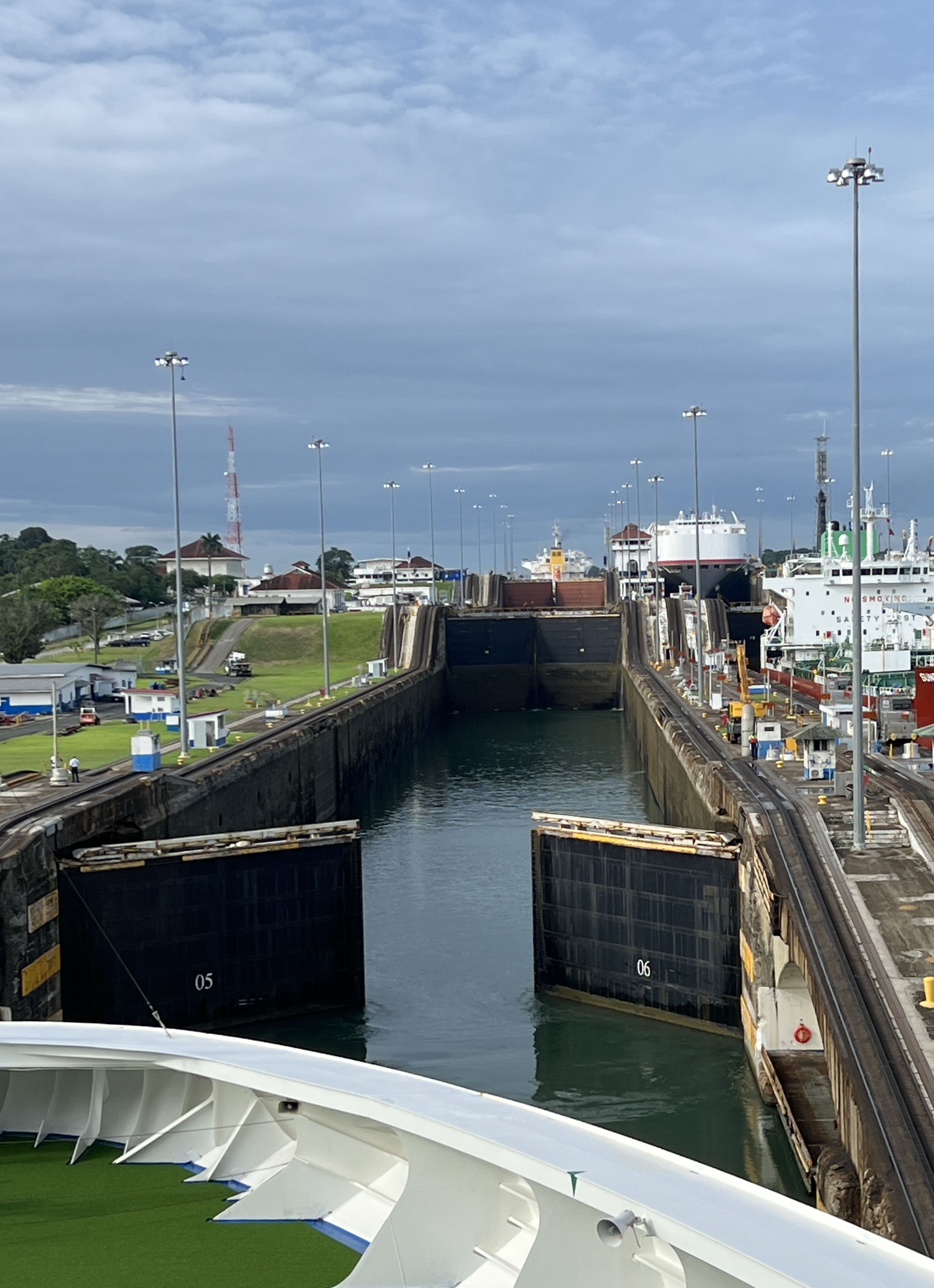
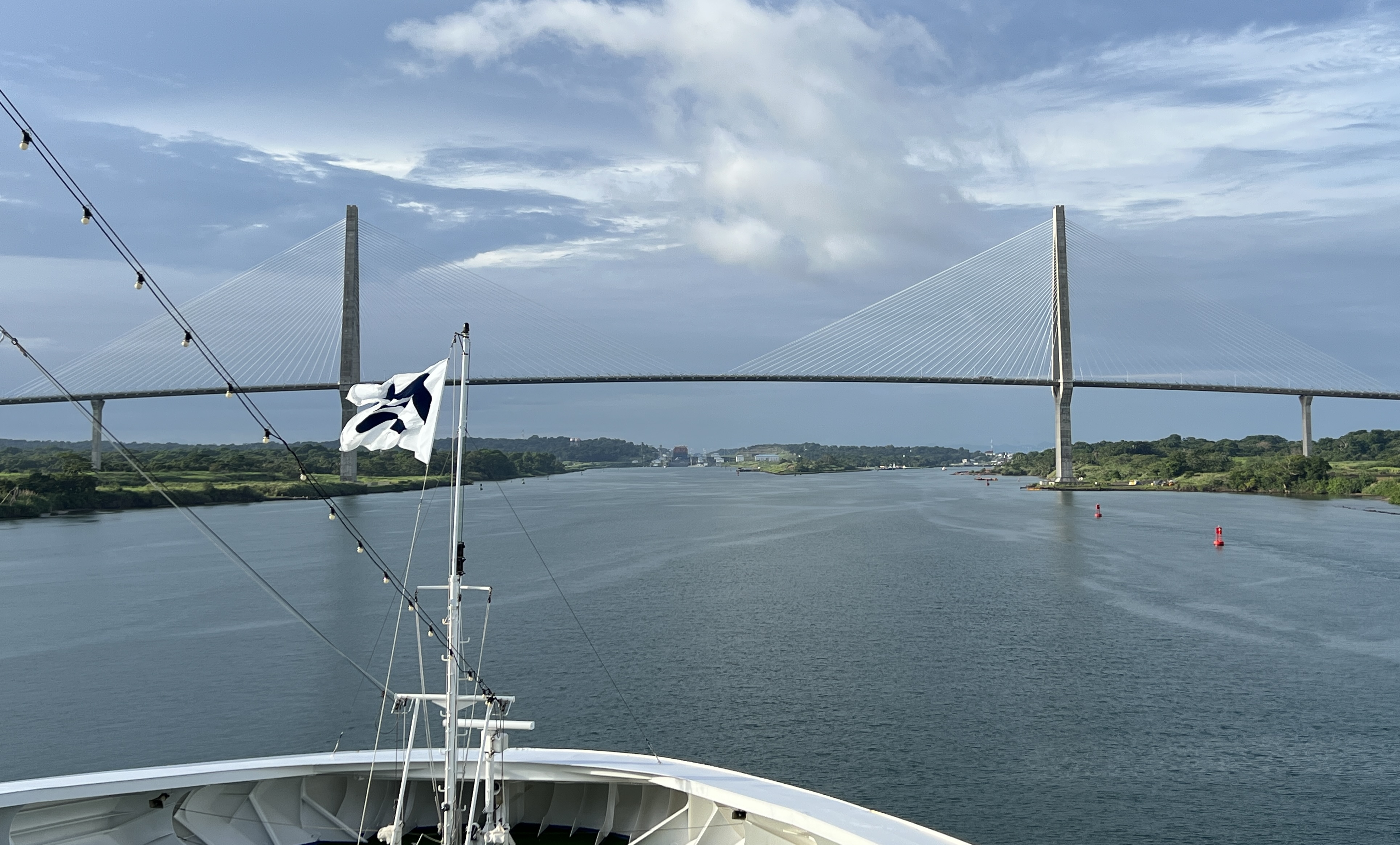
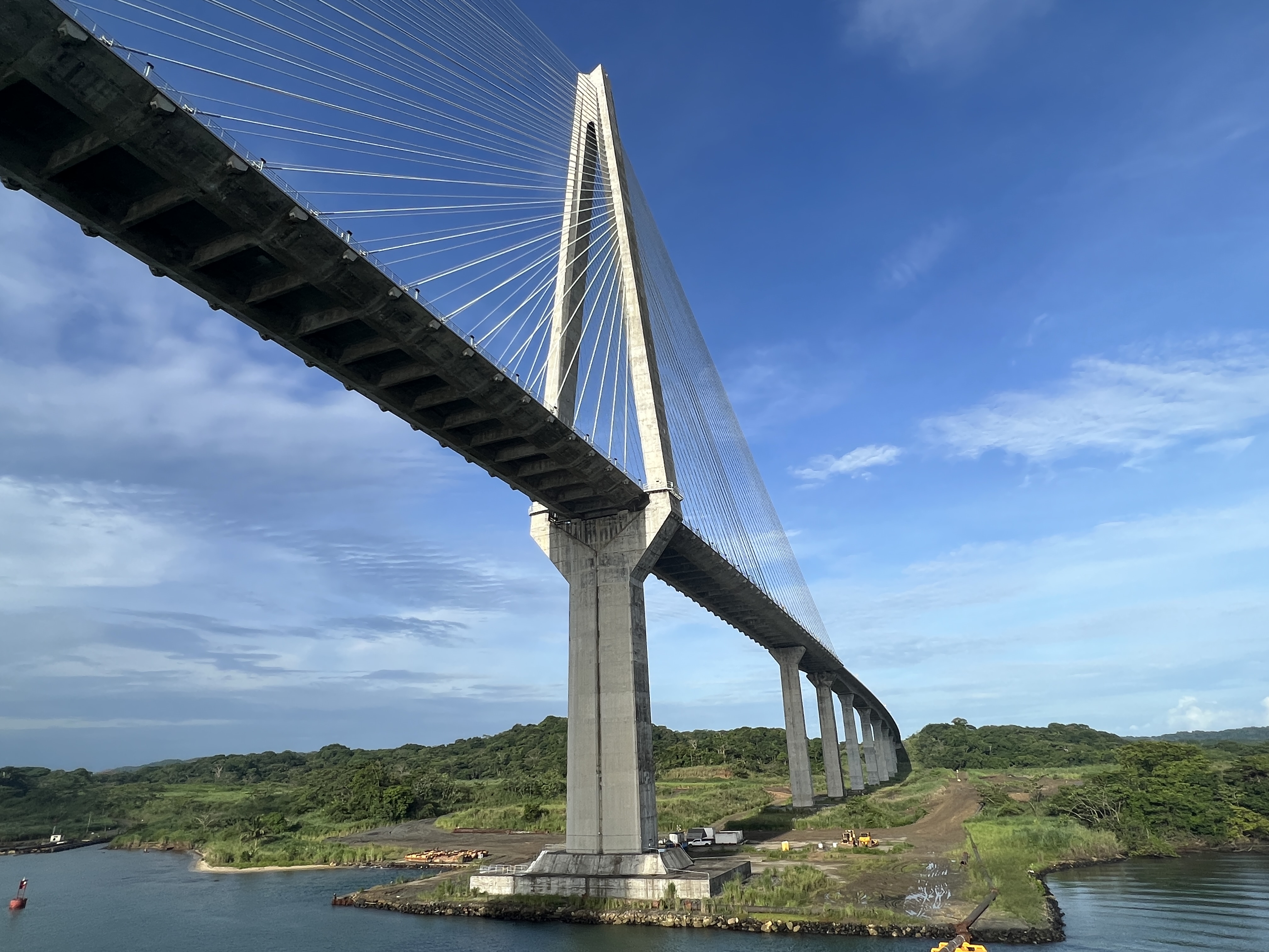
The ship ‘crawled’ along slowly through the Limon Harbour and under the recent Millennium Bridge to make our slot for the transit at 8 am for entry into the lower chamber of the three Gatun locks. These locks raise the ship up 85 ft to Lake Gatun where the Canal starts. The Lake is fresh water, salt sea water is kept out when fresh water is let out of the upper lock to fill the second chamber we enter.
Ships coming the other way descend in the locks beside us.
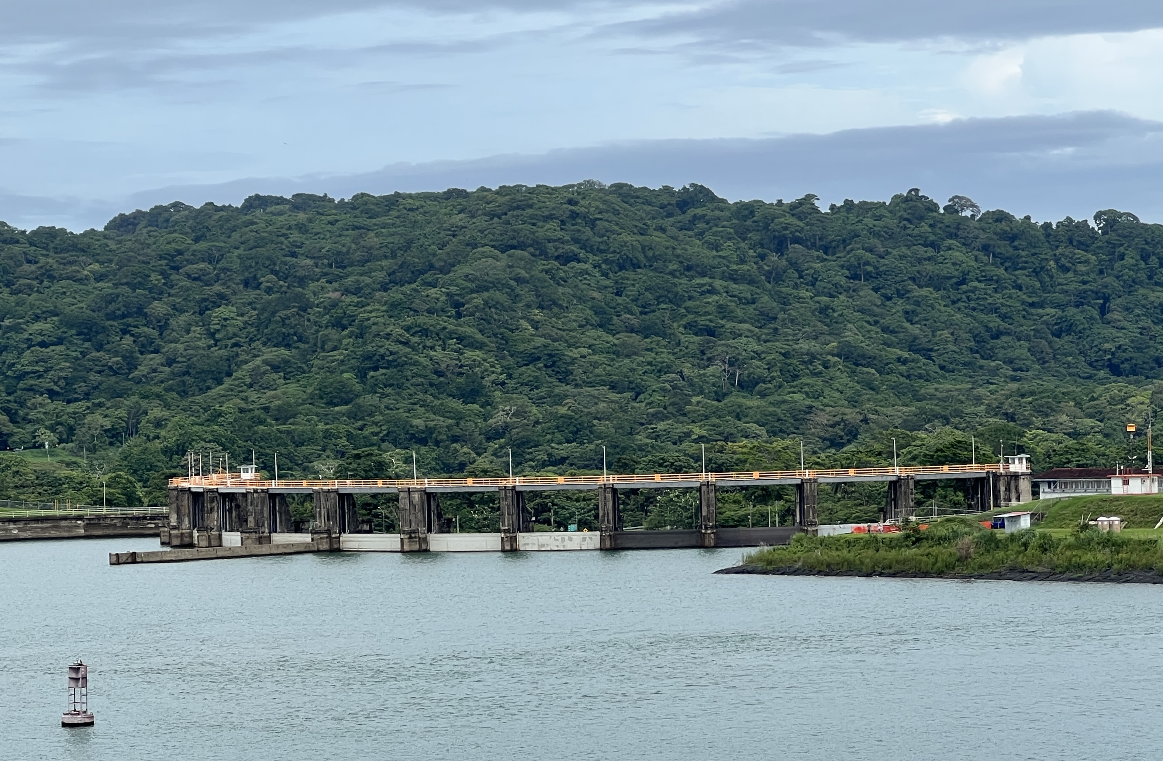
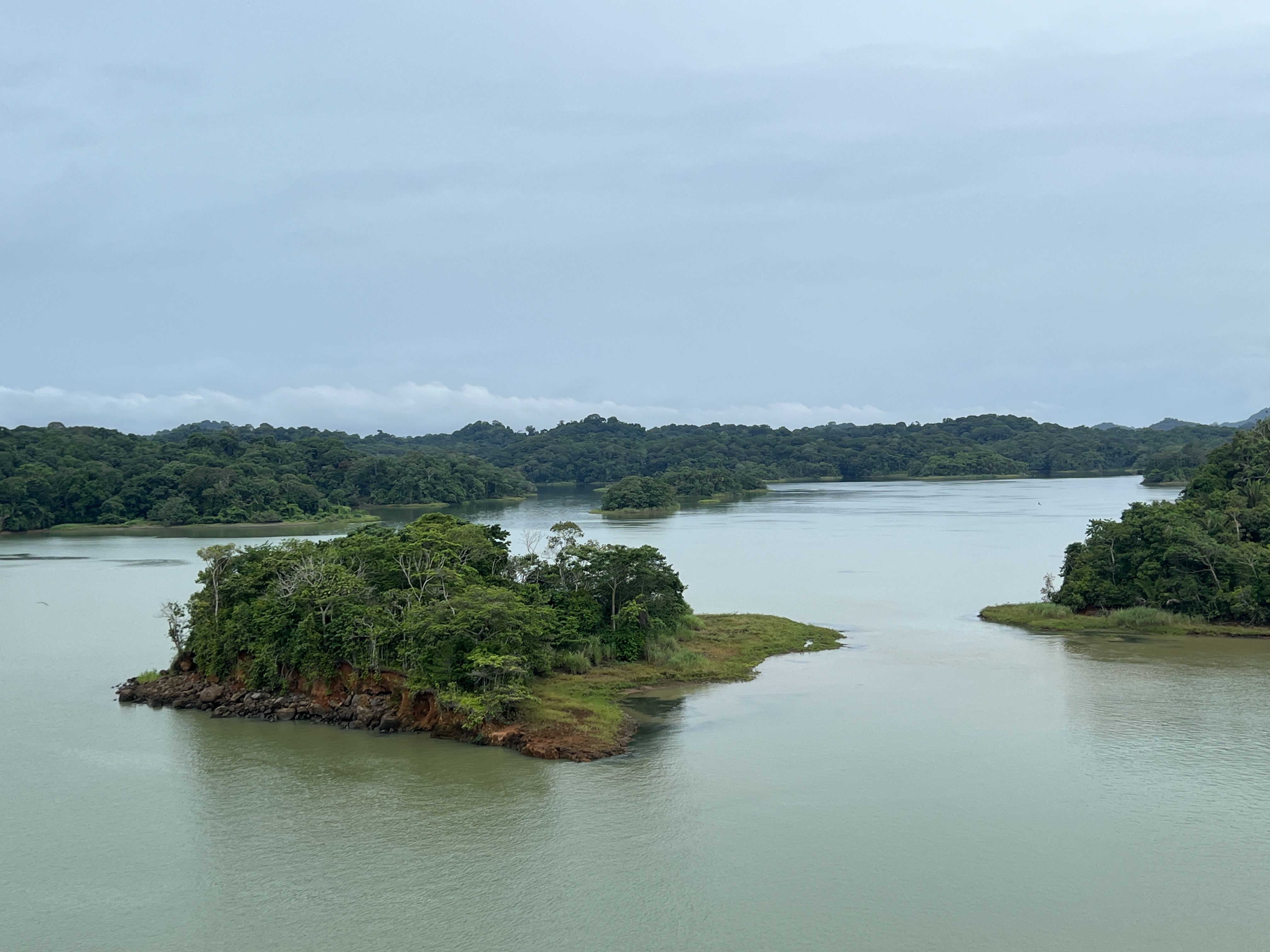
The Canal is actually a narrow channel that twists and turns through the lake. The Lake was formed by damming the Chagres River and its depth varies from 45-85 ft. The channel varies in width from 500-1000 ft. There are numerous islands and nooks and crannies in the shoreline that are actually the tops of the mountain range that was cut through as the Canal was built.
The French started construction of the Canal in 1881, the team was led by de Lesseps who had constructed the Suez Canal in 1869. The French concept was to construct a sea level canal, like the Suez.
This attempt was a massive failure, 22 thousand workers died from yellow fever, typhoid and malaria. The financial costs were enormous and cutting down into the mountain range proved beyond them. The effort was abandoned and the project put on care and maintenance until the Americans took over in 1902. They changed the plan to locks and the lake system we have today.
The project was opened in 1913.
It took us nearly 2 hours to go up the Gatun locks and the rest of the day to cross the Lake and descend the 30 ft Pedro Miguel lock to the small Miraflores Lake.
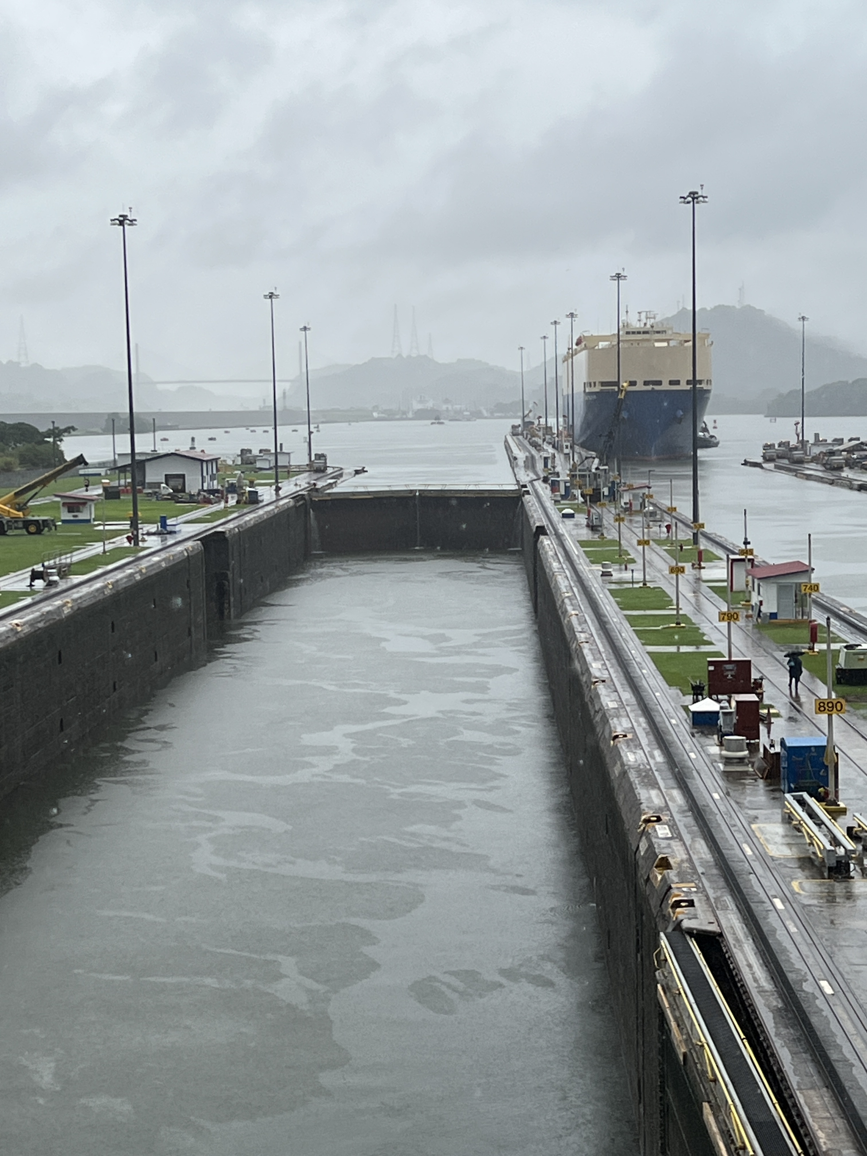
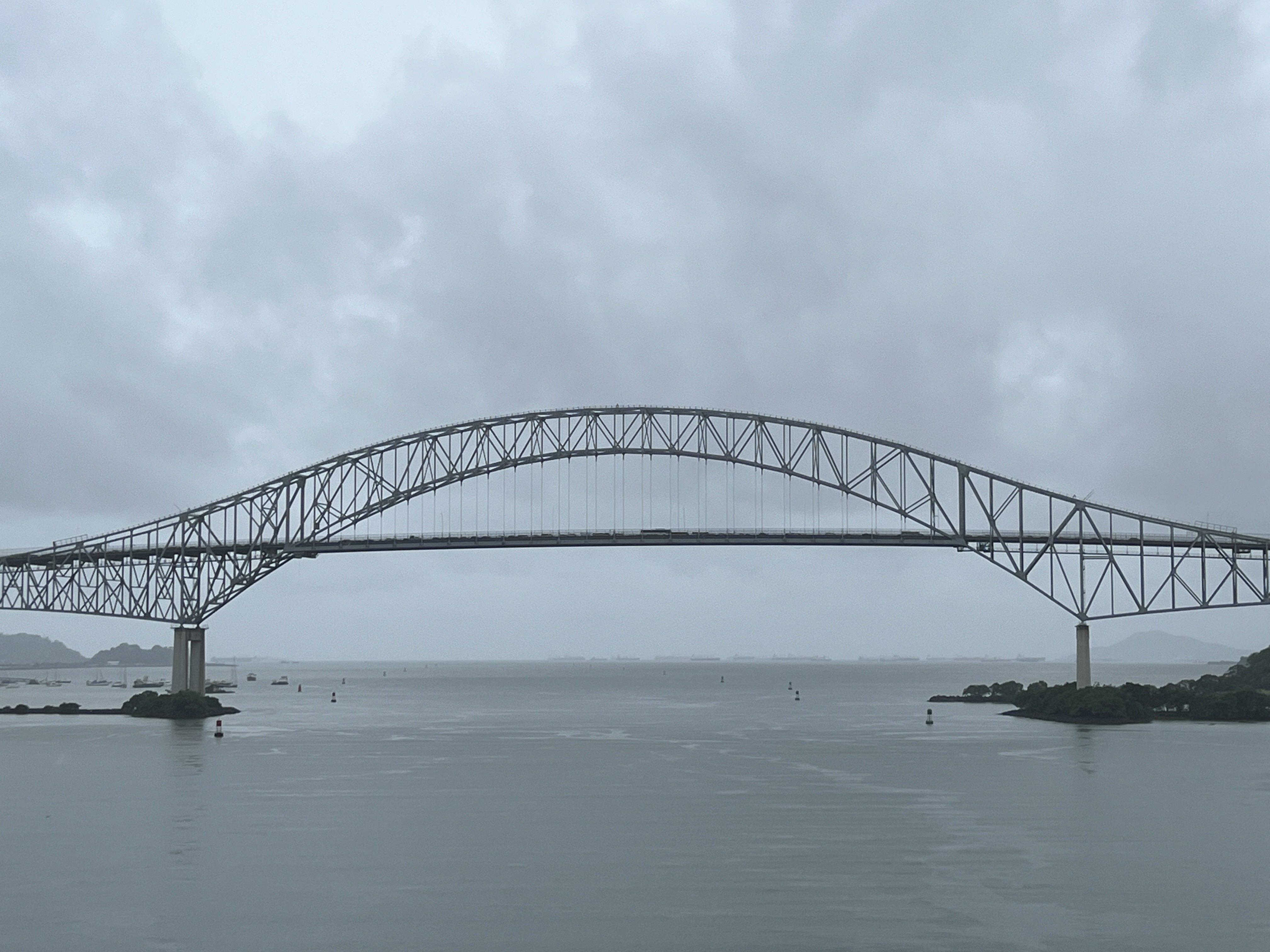
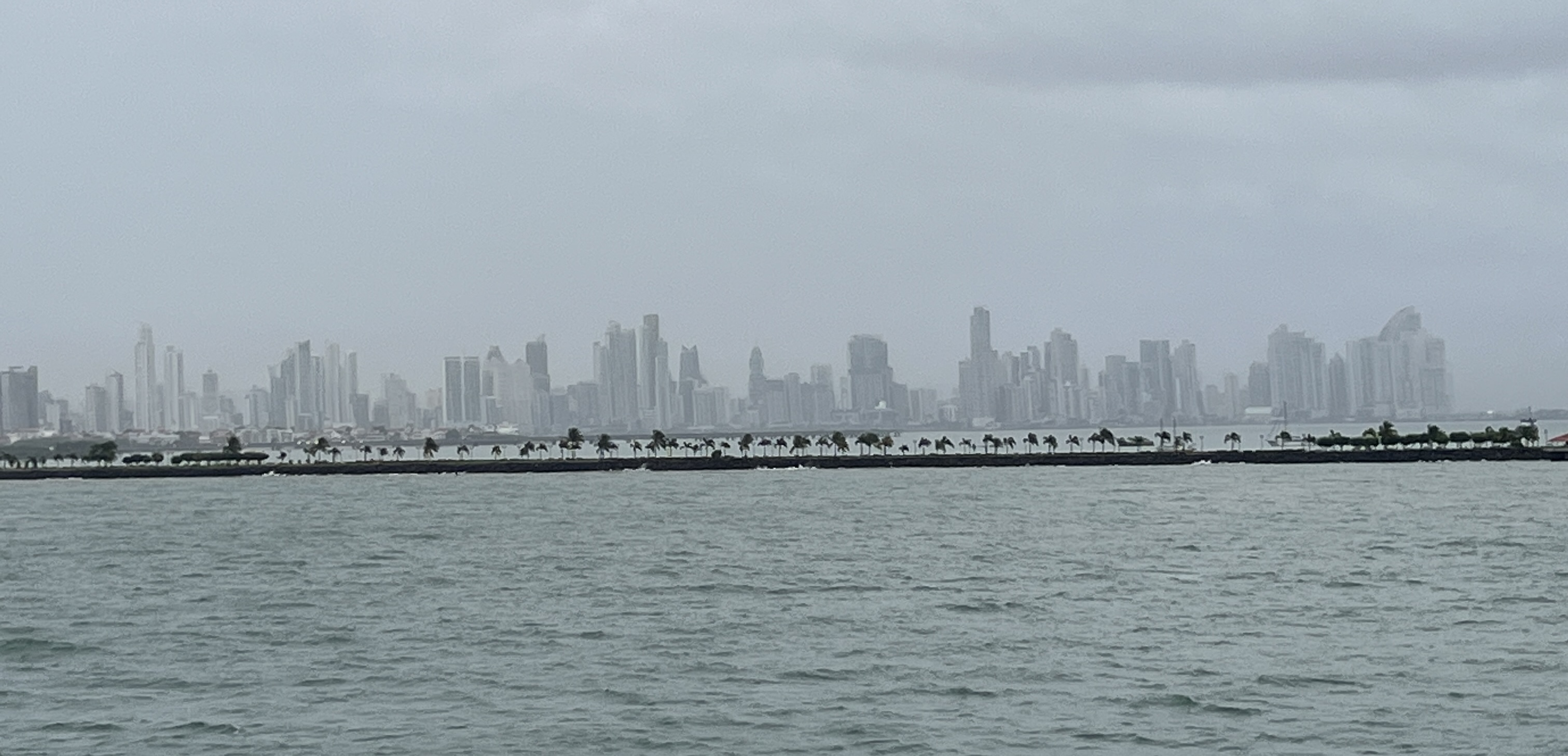
It was then down 55 ft in the two locks at Miraflores before passing under the Bridge of the Americas and into the Pacific Ocean, near Panama City.
The Canal is amazing engineering accomplishment and a great journey by cruise ship.
New York farewell
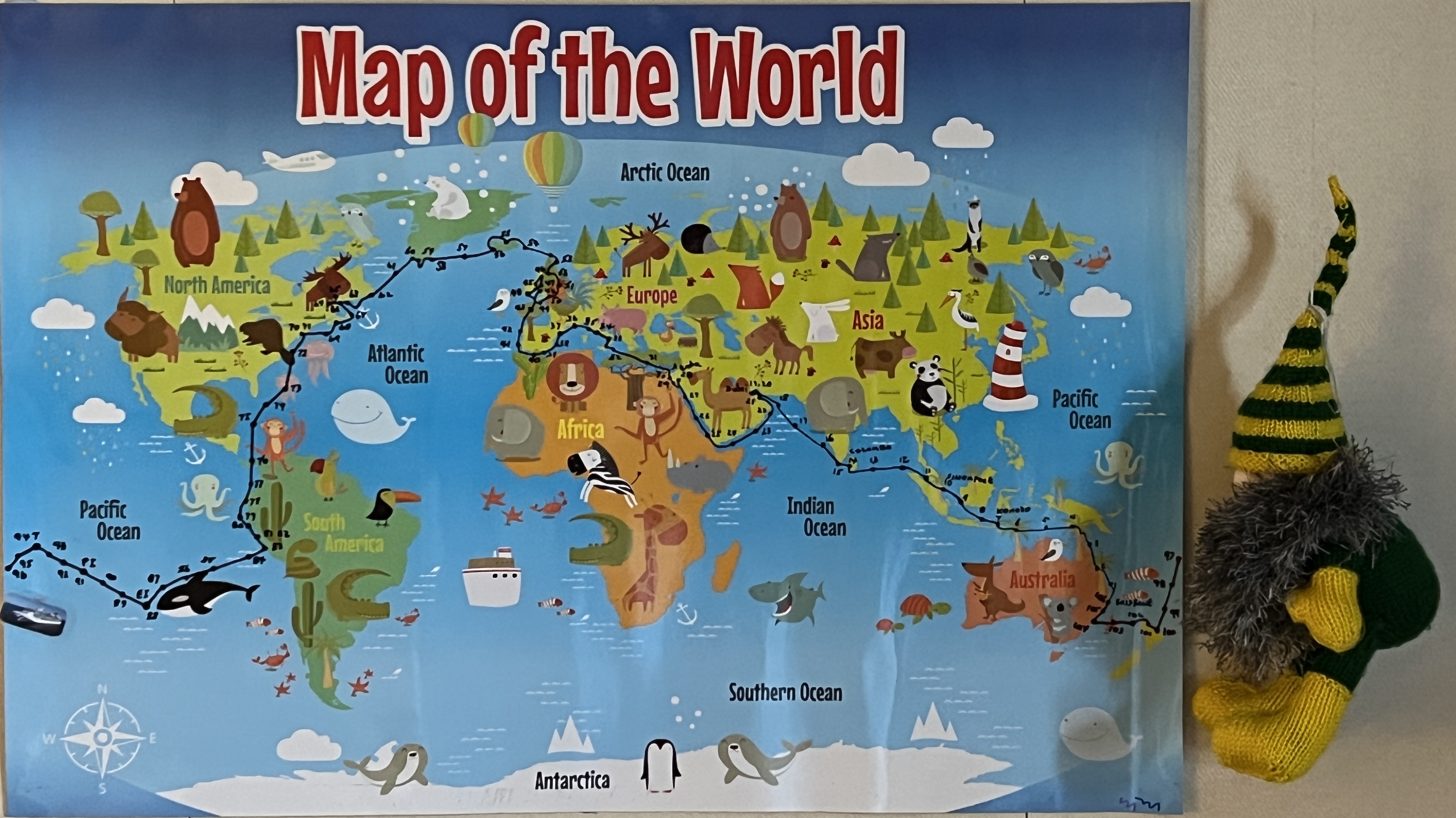
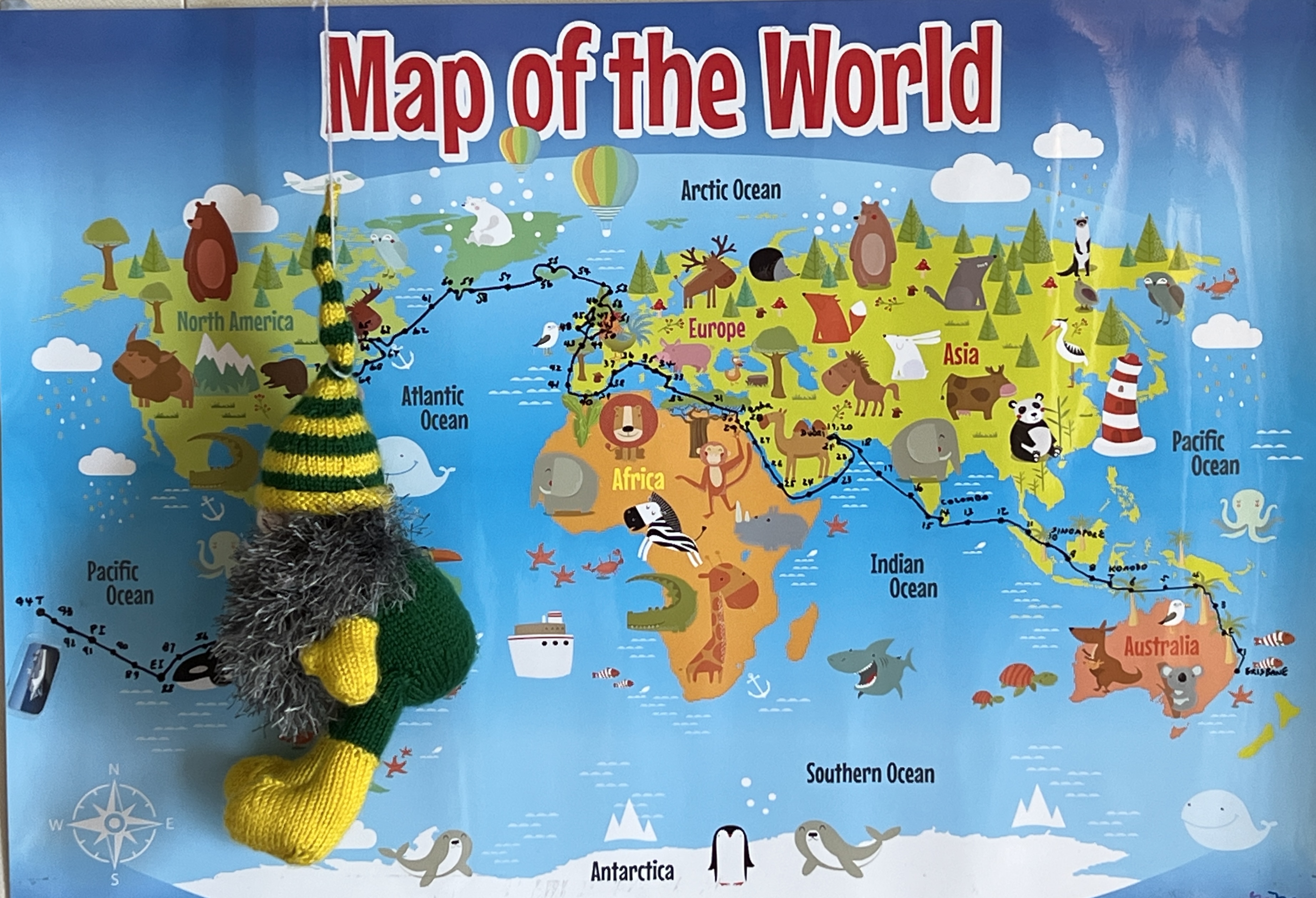
Slobro was very keen to put up on the blog the map of the world he has on the wall of our cabin. Every morning he has carefully put a dot on where we are and joined it with a line and a number, being days away. The dot is a bit approximate as it is only an average map and a few bits of the world are missing. He is quite proud of it and is wondering which wall to put it up on back home. Homealone is sure there will be plenty of advice offered in that regard.

It was a cloudy sail off down the Hudson River past lower Manhattan out into New York Harbour.
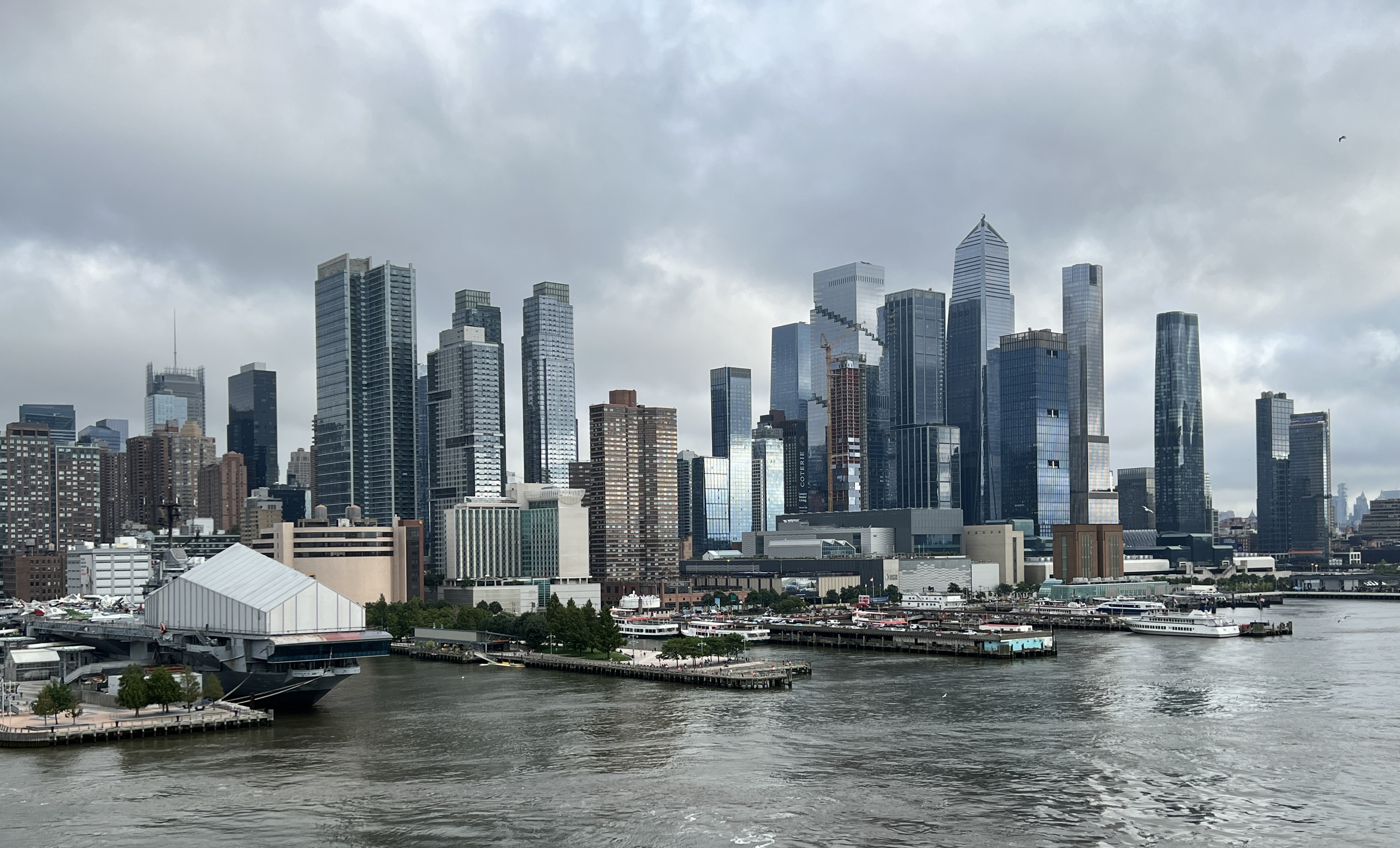
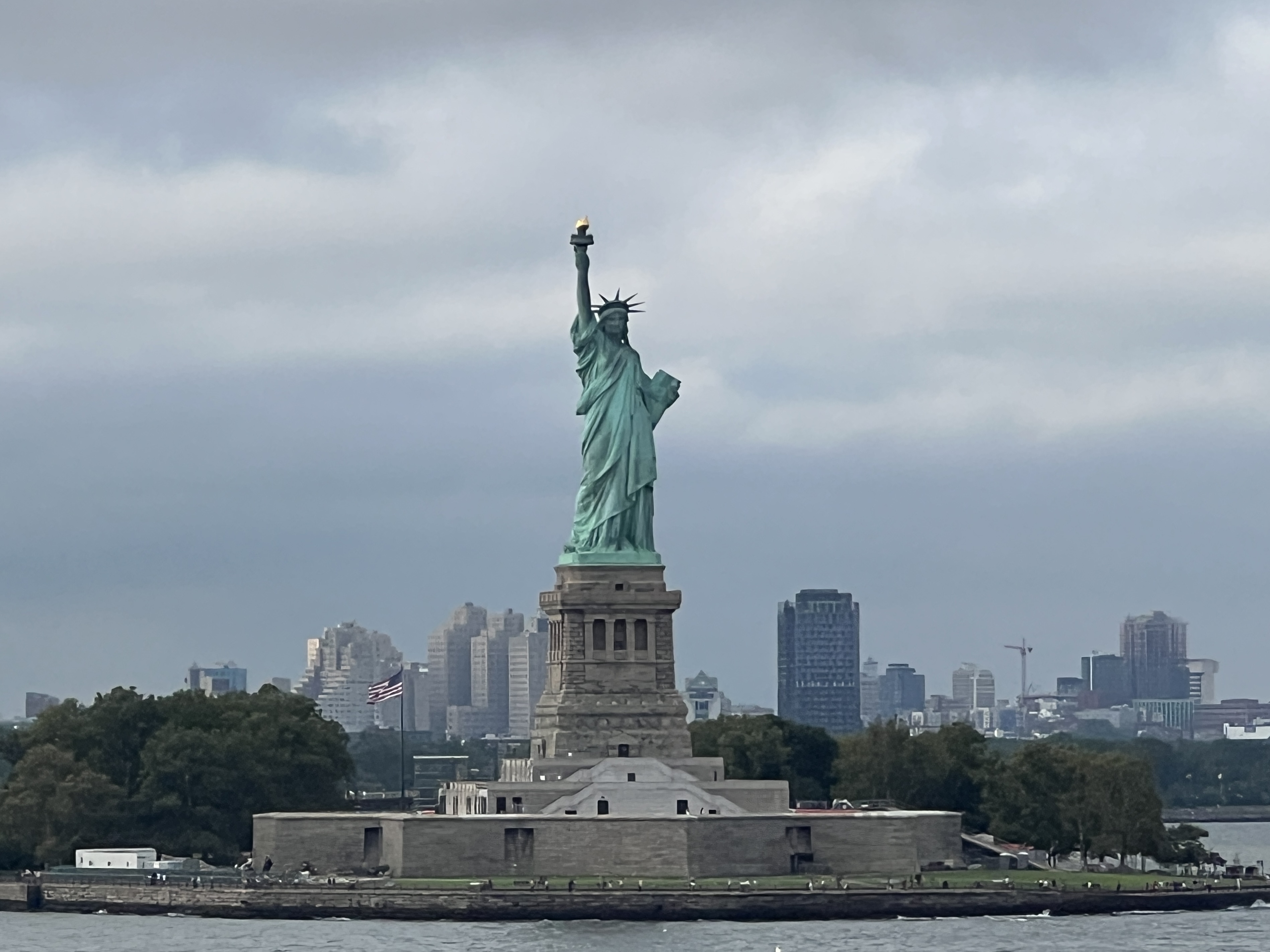
Many were on deck to wave to the iconic Statue of Liberty. It doesn’t take long to then sail up past Staten Island and under the Verrazzano-Narrows Bridge into the Atlantic Ocean. It’s a double decker road bridge, 7 lanes on top and 6 underneath, maybe the other way around.
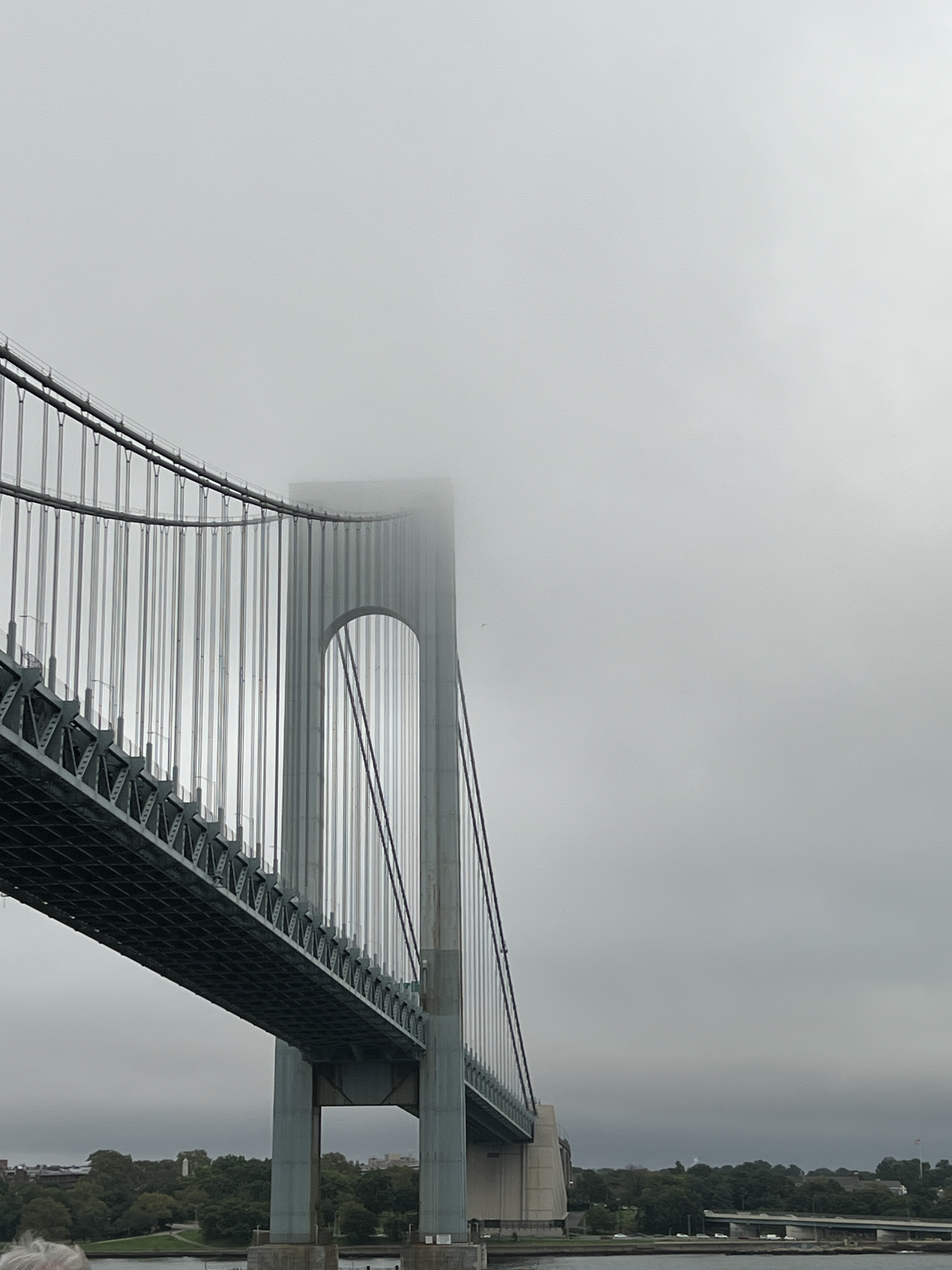
Verrazzano was an Italian navigator, serving under France, and in 1524 was the first European to enter the Harbour. The bridge is a little eerie in the evening mist and cloud.
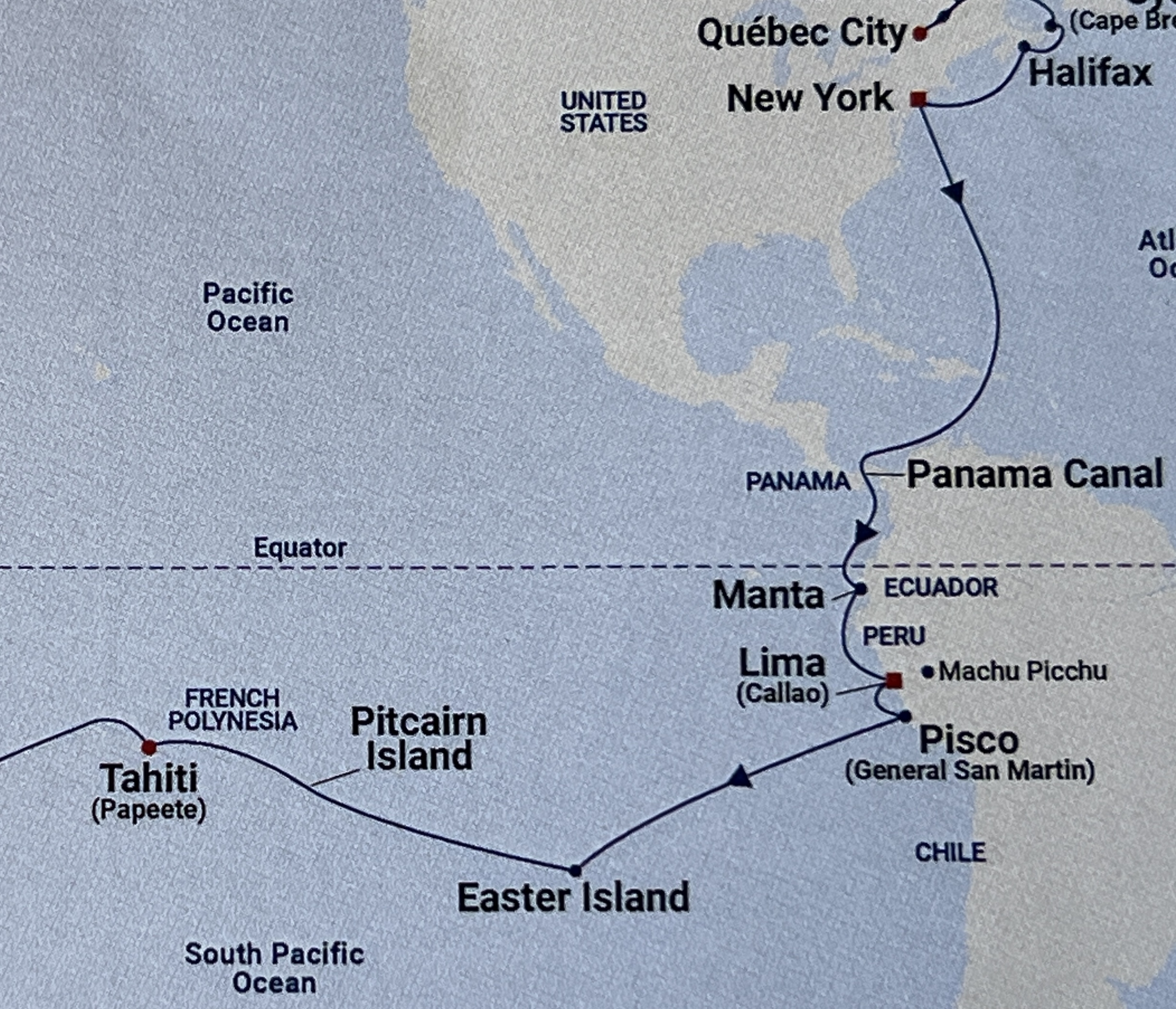
New York was the end of Stage 3 of the cruise which had started back in Dover. The final stage back home to Brisbane first takes us down the east coast of America then through the Caribbean Sea, passing between Cuba and Haiti, before reaching the Panama Canal and into the Pacific. The course through the Caribbean in the map above is not the way we went, the loop is too far east. It takes four days at sea to reach the Canal and the next blog report covering the crossing to the Pacific.
‘Coming to America’
One of Neil Diamond’s memorable songs, well at least for some, is ‘Coming to America’. It is a celebration of all those immigrants arriving on it’s shores seeking a better life. Allthego recalls the Annie Moore statue we saw earlier in this trip at Cobh in Ireland. Annie was the first immigrant to pass through the Ellis Island Immigration Centre when it opened on 1 January 1892.
We passed by Ellis Island on our way through NY harbour to the pier on the Hudson River in Midtown Manhattan. We are not here as immigrants but as tourists and have arrived in totally different personal circumstances compared to Annie Moore. I wonder what she would think of the place today compared to 1892?
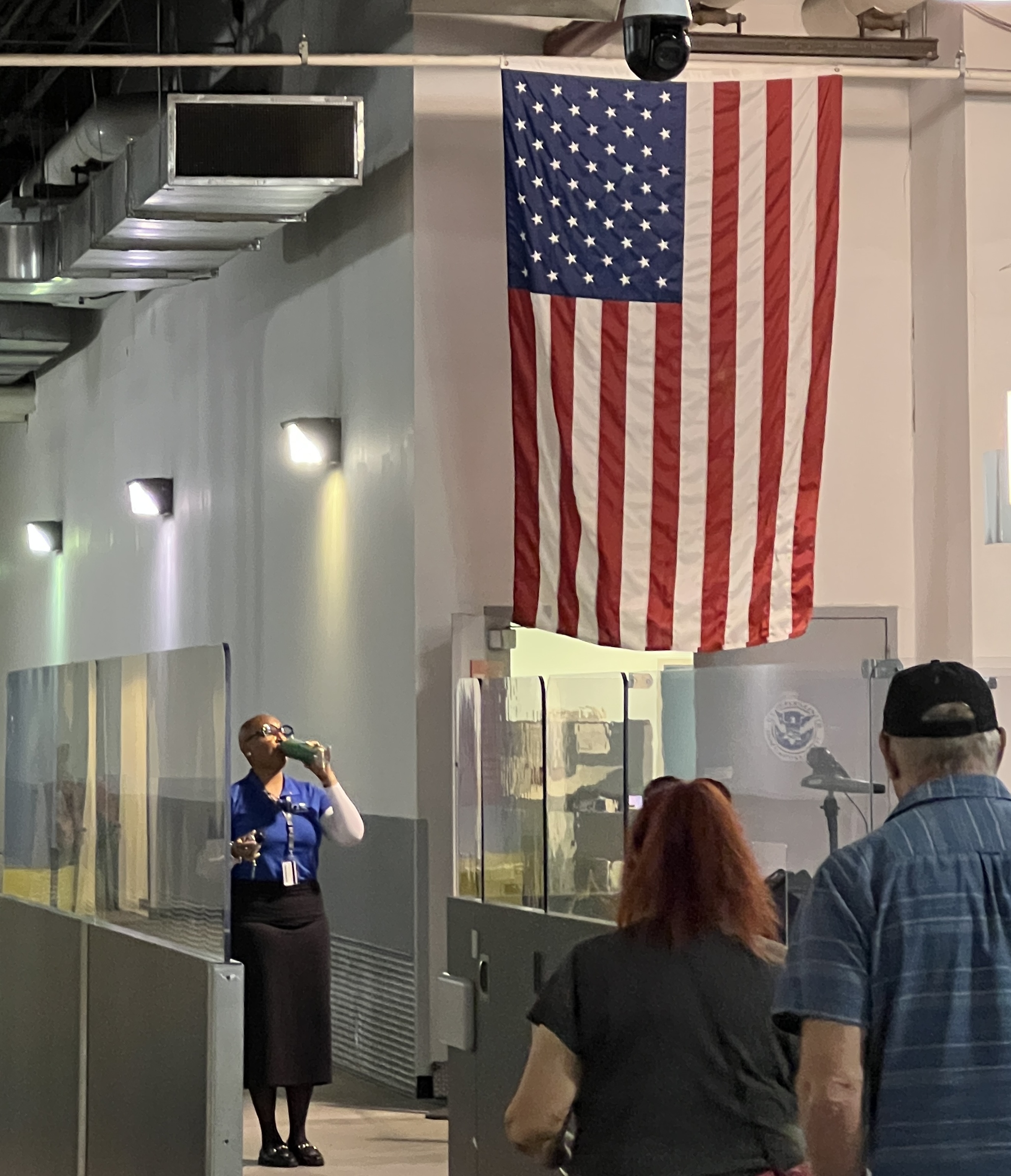
In true American style the system requires everyone, including the crew, to get off the ship and pass through immigration before they will let anyone get back on. The exodus starts around 7.30-8 am and will not be finished till 2 pm. So unless one is prepared and organised to head off straight away it is a long sit in the terminal! Maybe one should just hang around on the ship and be the last to get off and first to get back on!
We were organised though. Having visited the Big Apple before and been around most of the iconic sights we had decided to be low key. So before leaving home tickets had been booked for the Neil Diamond Musical ‘Beautiful Noise’ matinee at 2 pm.
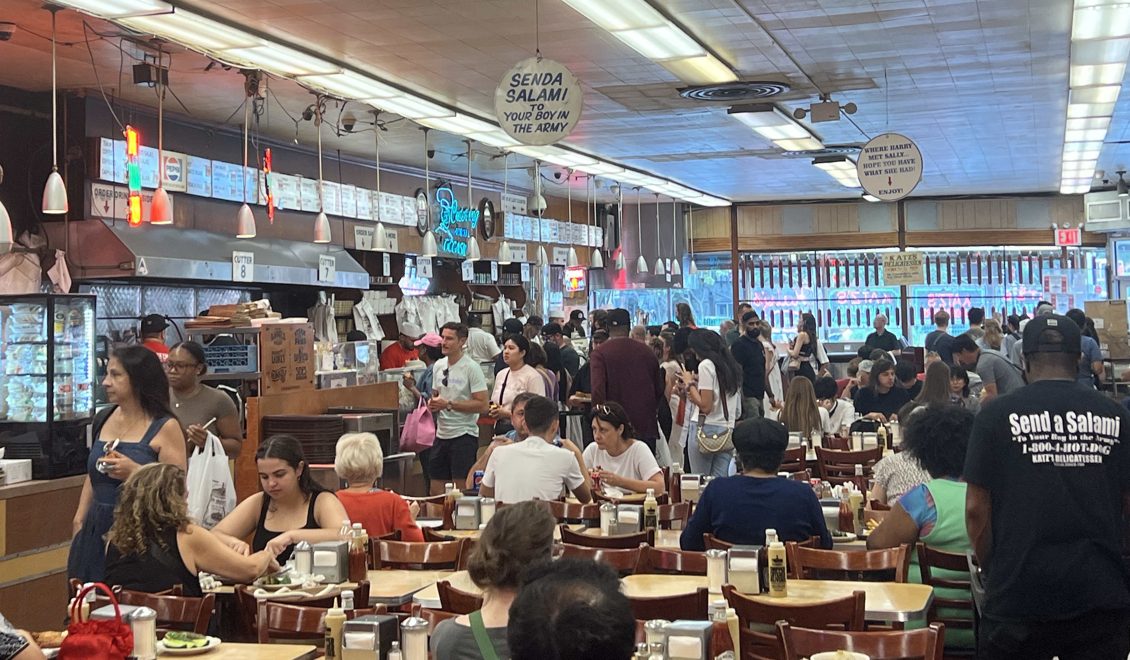
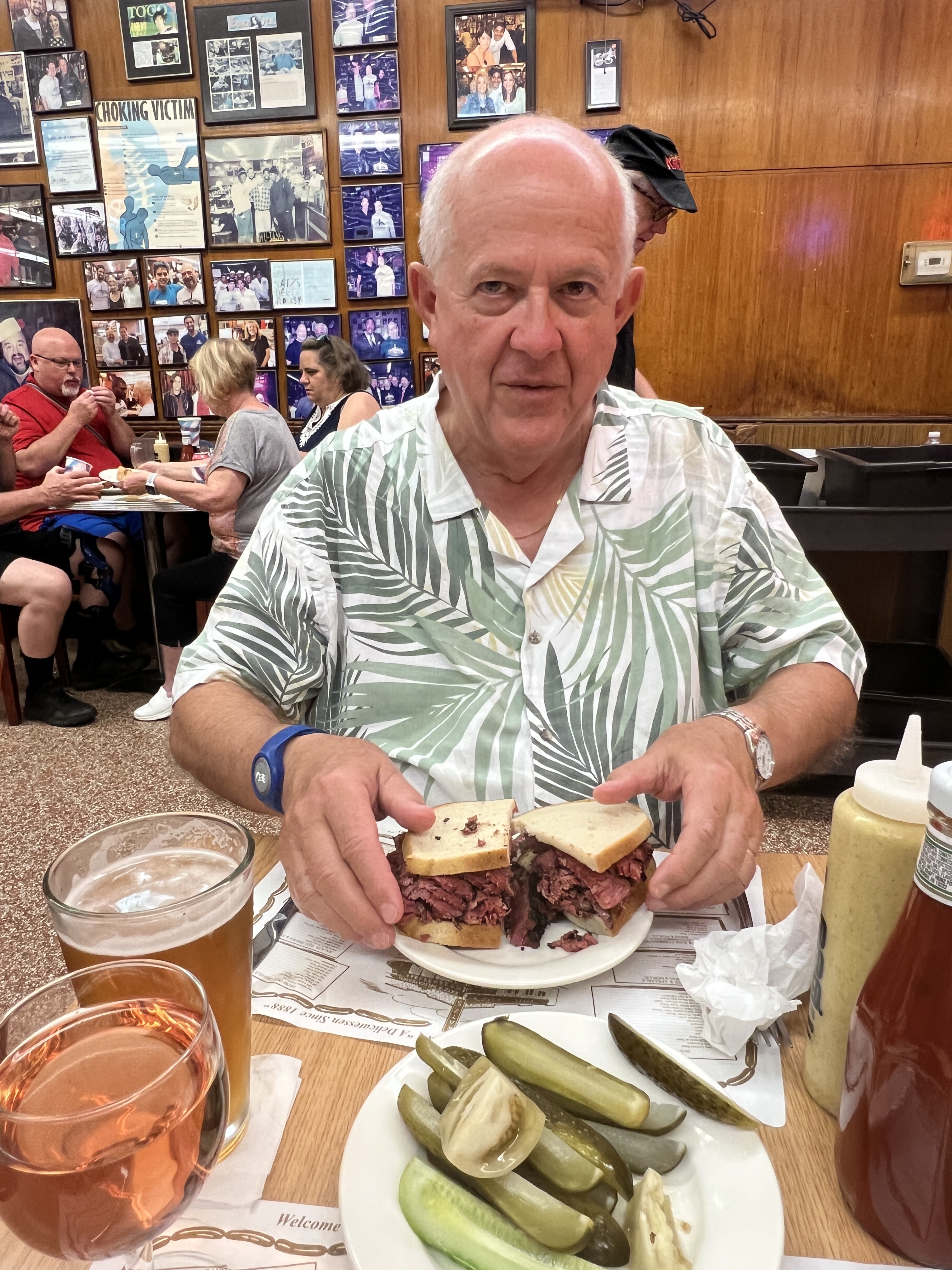
Before the show we took the subway down to Lower Manhattan and then cabbed it east across town to Katz Deli, on the Lower East Side. This Deli is where the famous scene in the ‘Harry met Sally’ movie was shot. Didn’t see any modern day Sallys in action. Allthego though did have one of the pastrami sandwiches, excellent. Homealone’s corn beef one was disappointing, it was a bit tough. Had to taxi back up town to get to the Broadhurst Theatre, just near Times Square, on time for the show.
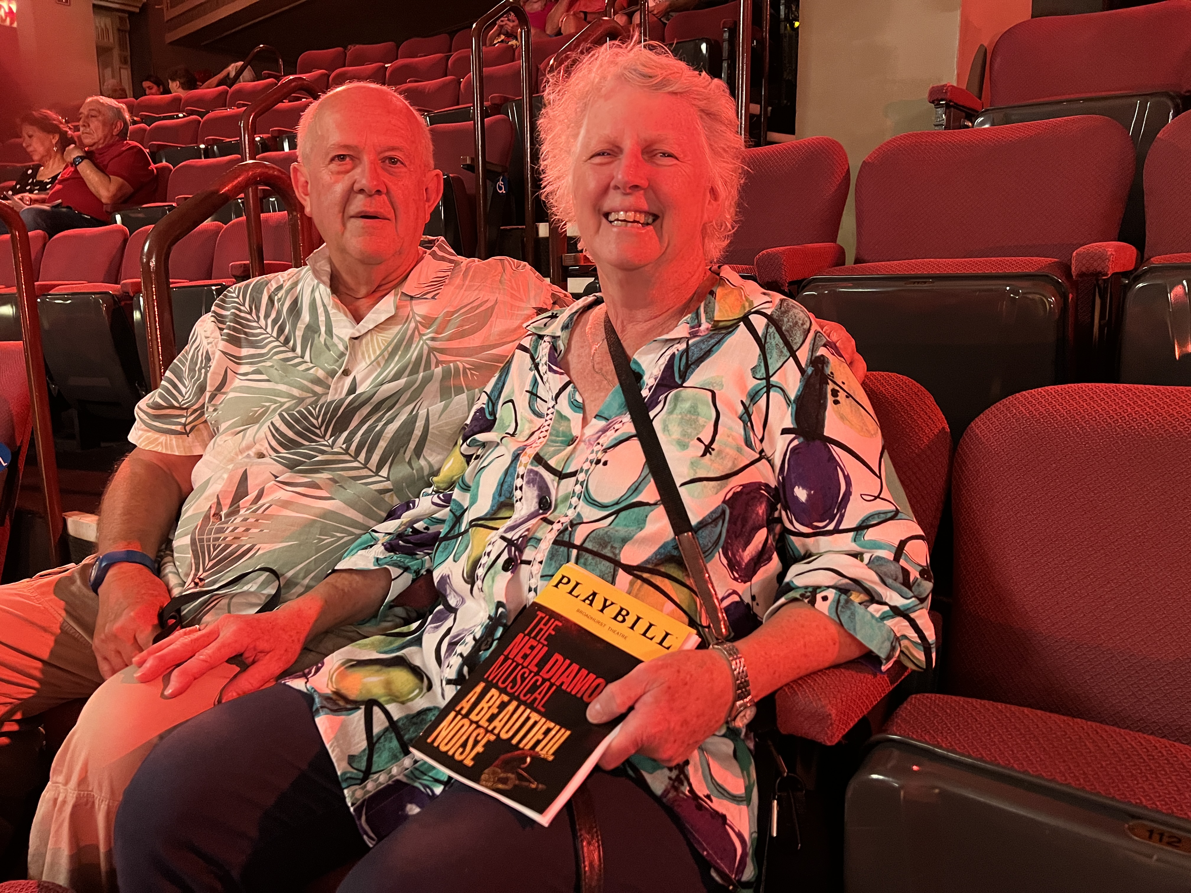
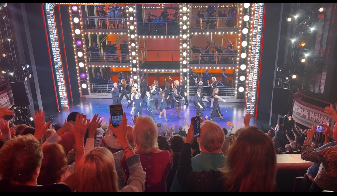
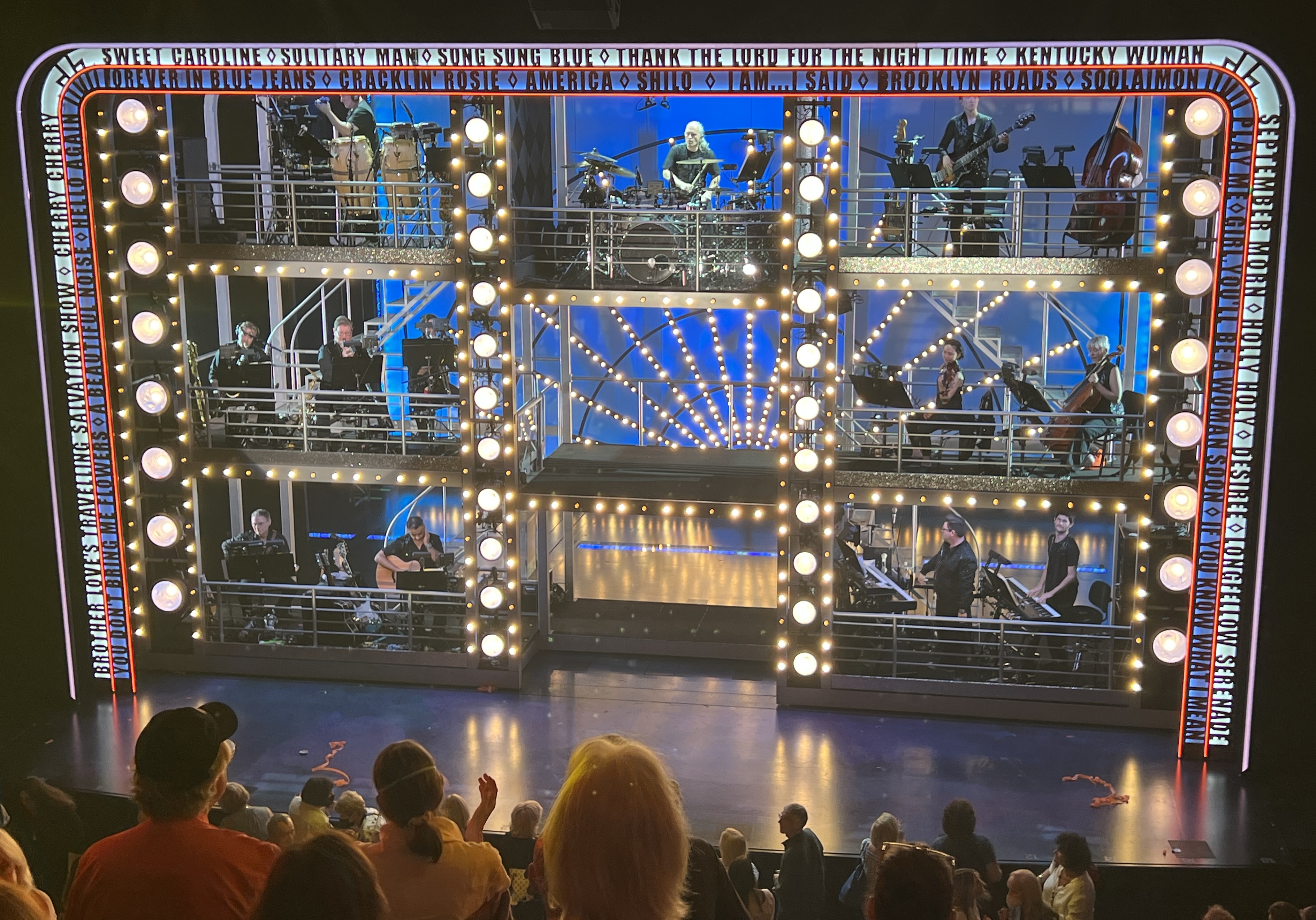
‘Beautiful Noise’ is a musical recap of Neil Diamond’s life in the context of visits to his therapist, after his dementia diagnosis. There is a ‘Neil -Then’ (does most of the singing ) and a ‘Neil-Now’ (who talks to the therapist). Interesting way of doing it and highlighted that many of his songs were markers of ‘highs’ or ‘lows’ in his life. Anyway the sell out audience of Diamond tragics lapped it all up and the ‘Sweet Caroline’ finale had everyone on their feet waving their arms and shouting out ‘too good, too good’. It was!
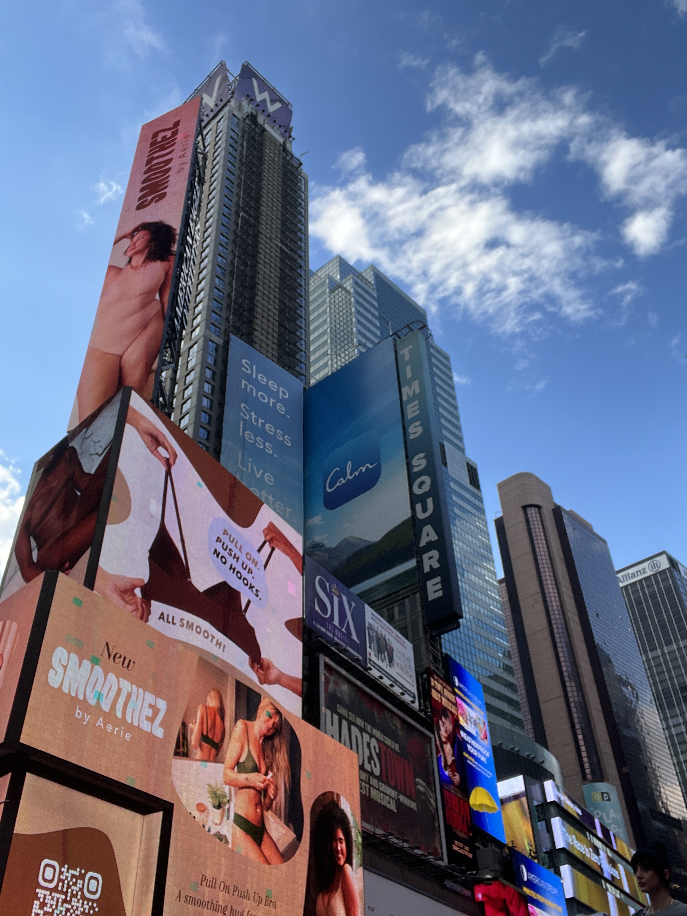
After the show we had an hour to kill people watching around Times Square. There are some strange characters around these parts. Gorillas, Spider Man, Mickey and Minnie Mouse as well as a few young ladies in minimalist attire. All looking for their photos to be taken, for a fee of course.
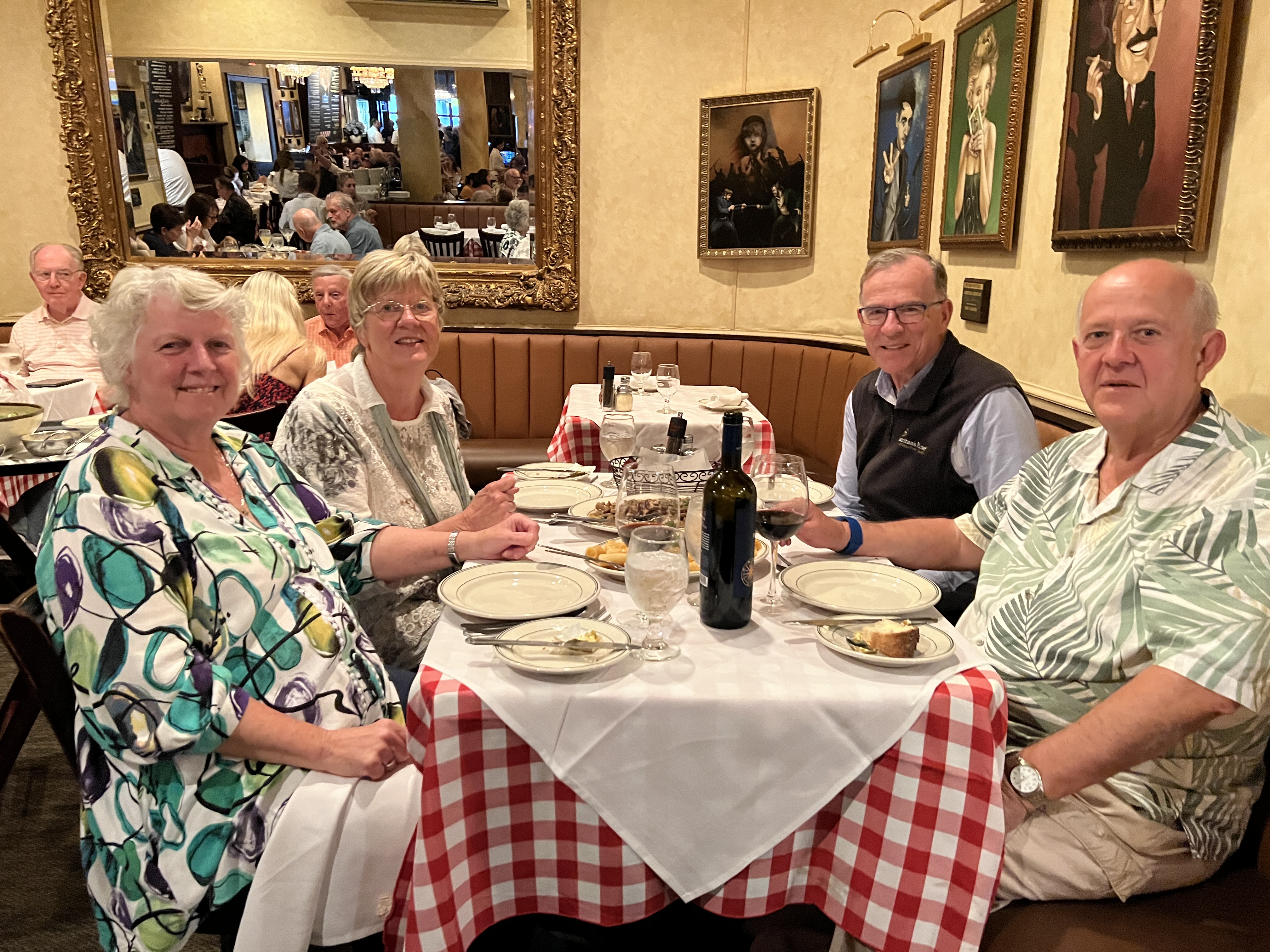
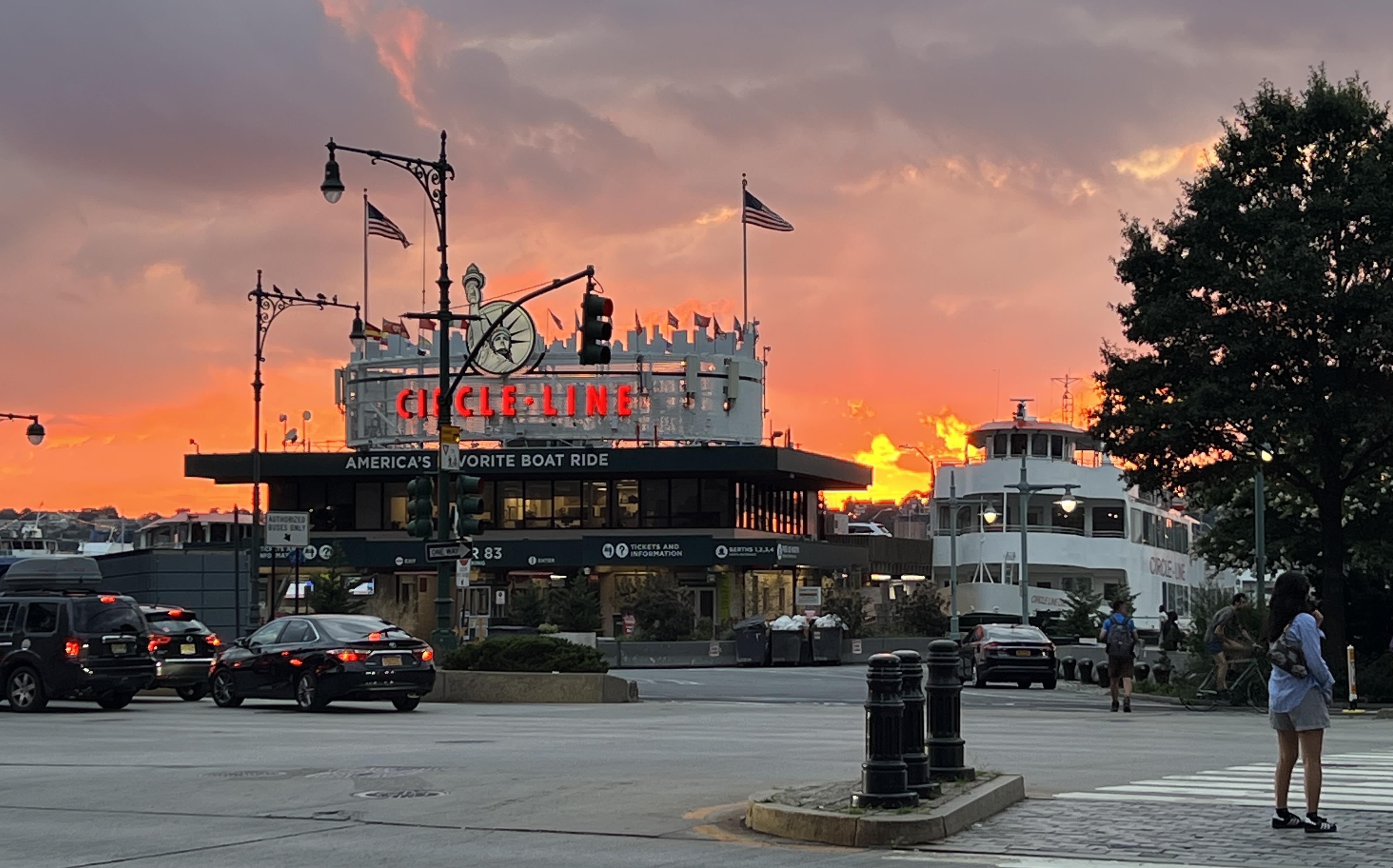
We had dinner with the Berrys at Tony’s Di Napoli, Italian family restaurant. Been there before with the Imlays. A great feed was had, only two dishes and they were enough to feed six. Full of people enjoying the food and noise! Walked back to the ship and was met by a great sunset over the Hudson River.
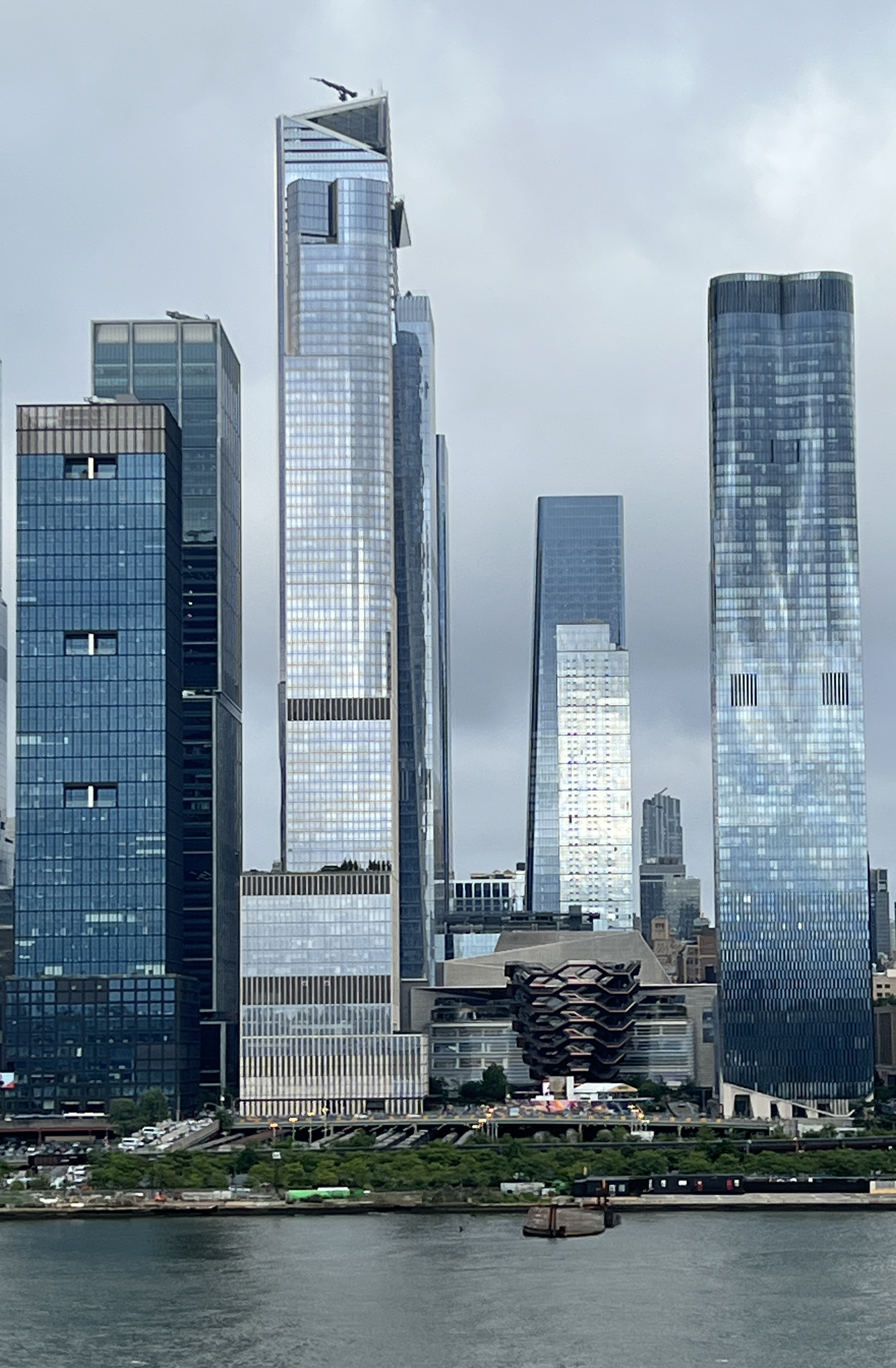
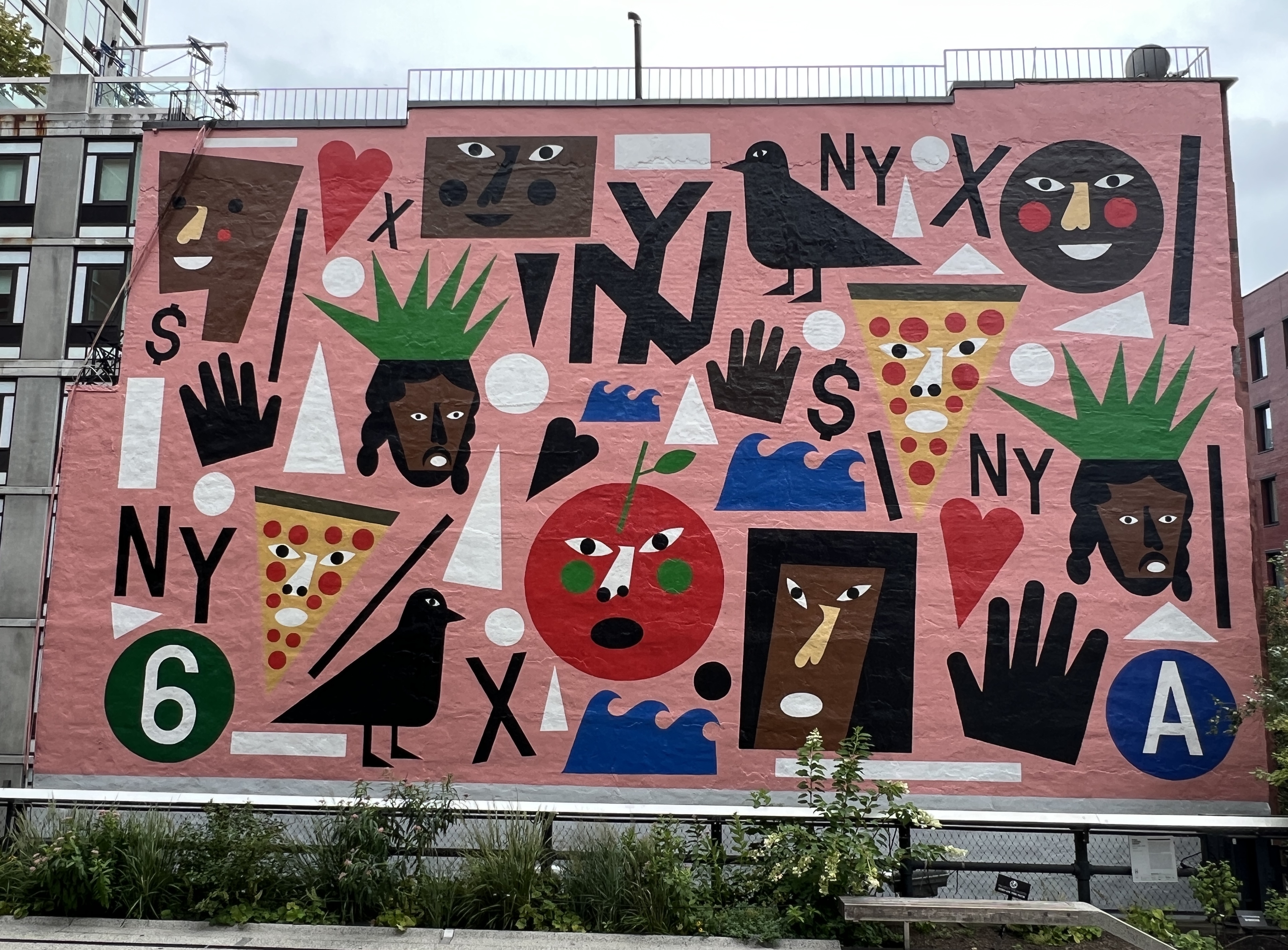
Next day our plans were a bit loose and centred around walking the length of the High Line. The High Line is a contemporary urban park built on a relic of industry.
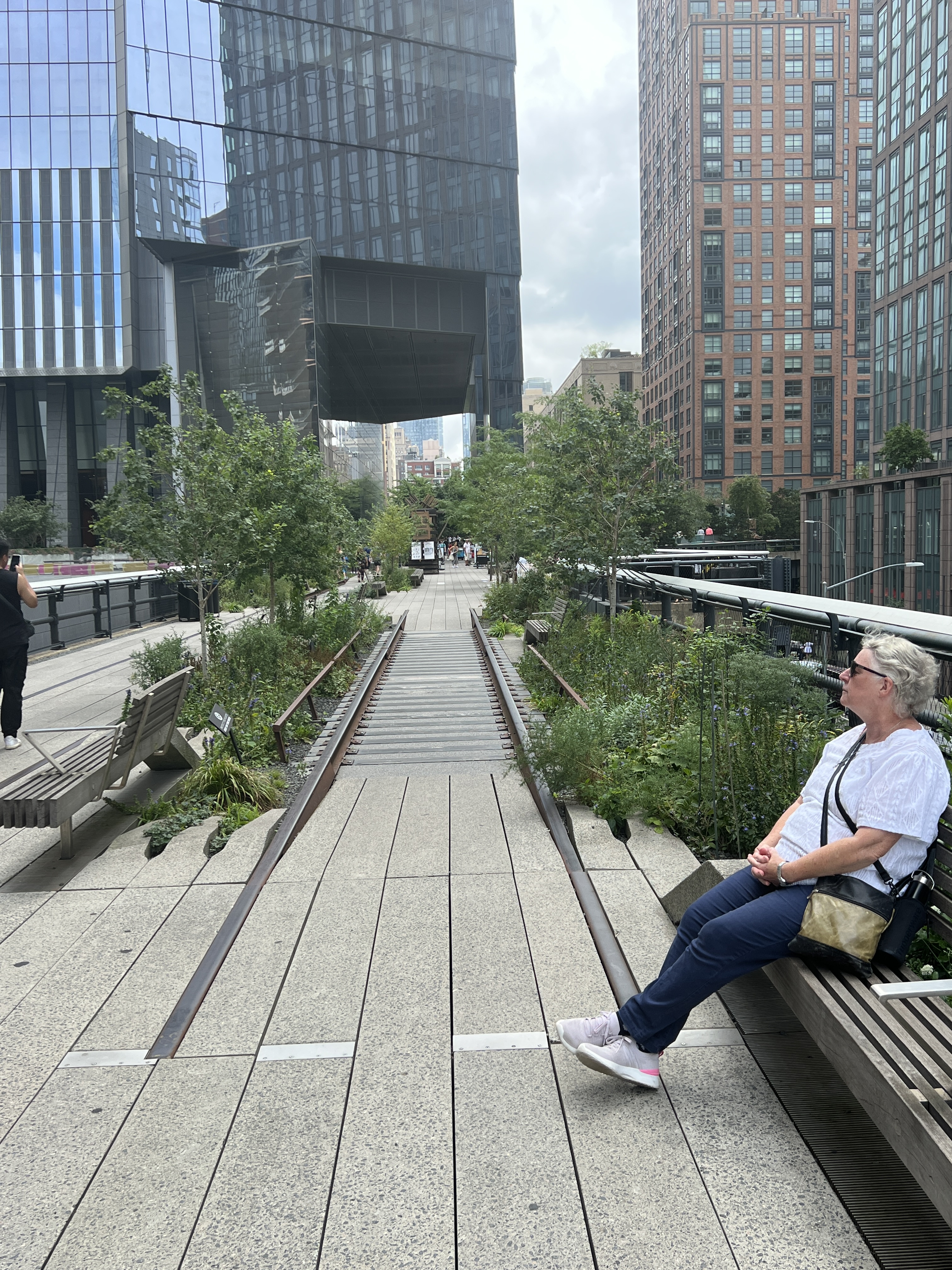
Originally opened in 1934 the rail line ran up the lower west side of Manhattan delivering millions of tons of meat, dairy and produce to the local market as well as the wharves for export. The line was later lifted above street level to ease congestion in the city. In the early 1980s the line fell into disuse and became overgrown with vegetation. It was threatened with demolition but was ‘saved’ in the early 2000s with plans to rehabilitate it as parkland and open space. The first stage opened in 2009 and the last is due to be completed in 2024.
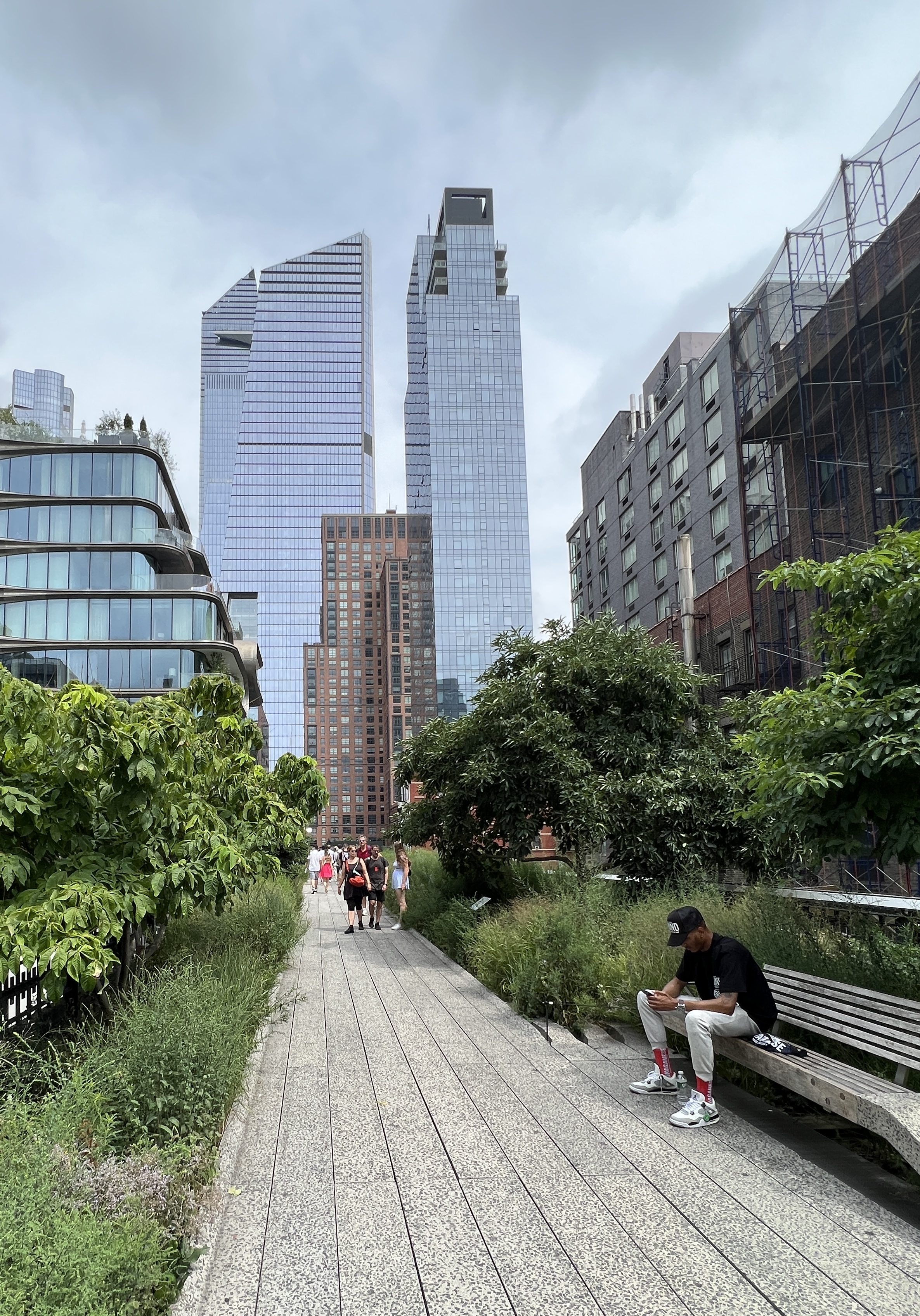
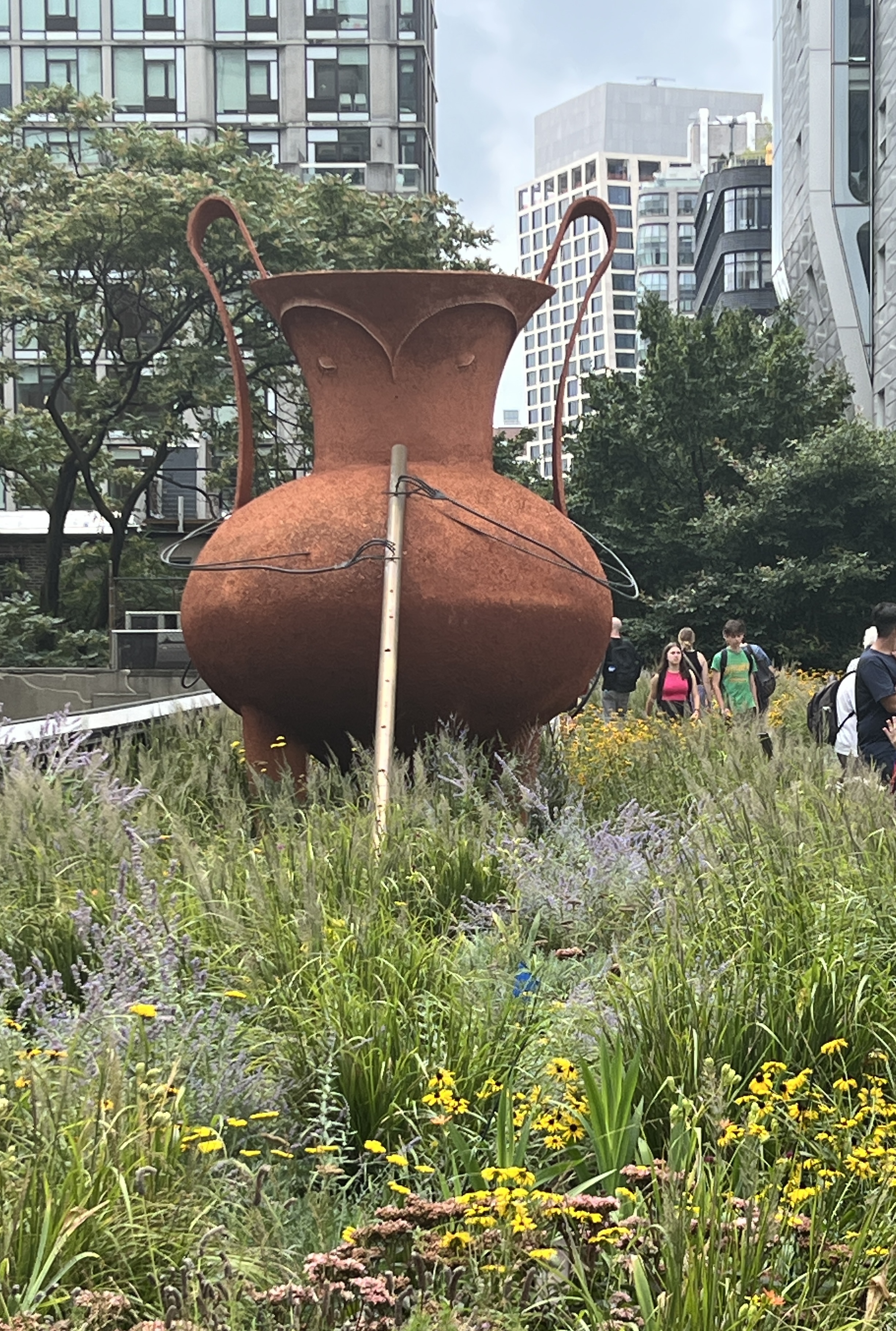
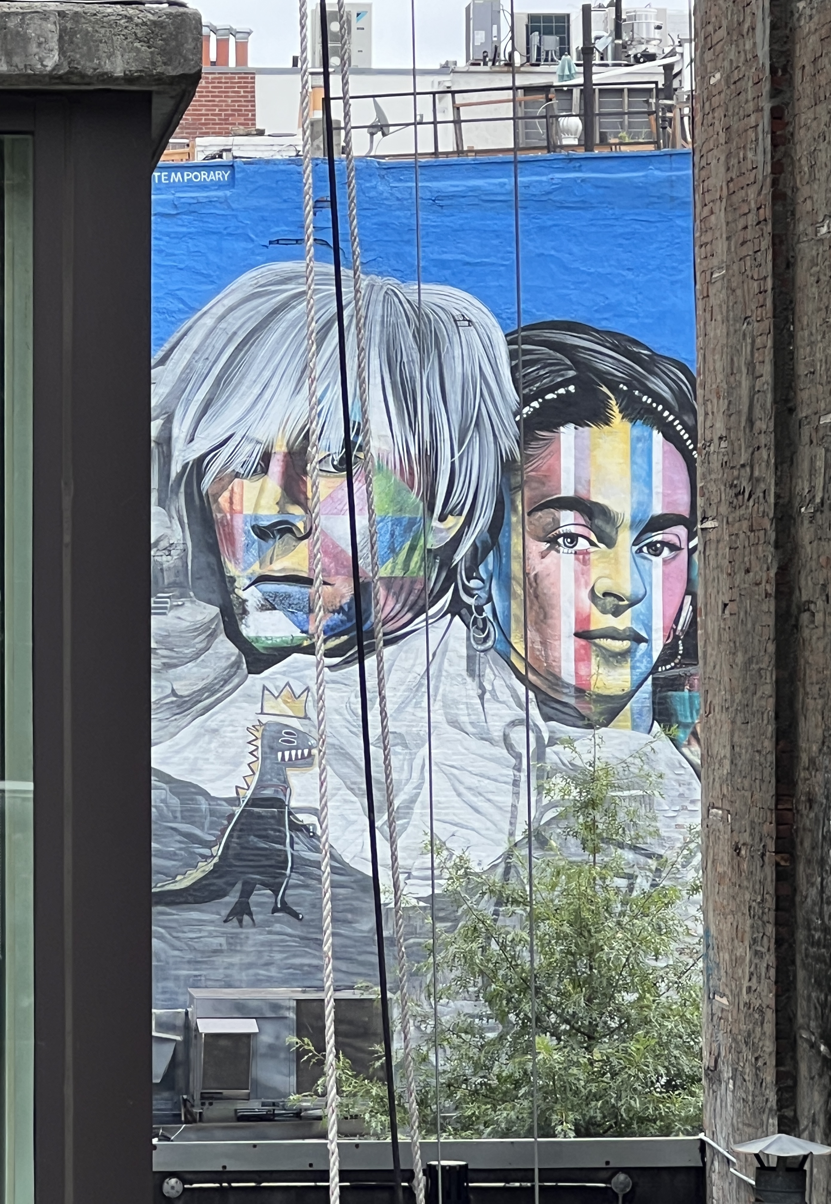
At various points there are elevators and stairs to get up to it from street level. We went down it from north to south. The rail lines were left in place with pathways and gardens constructed around them. There are a number of art installations and murals along the way.
At the end it drops down to the Chelsea Markets, full of eateries and stores in a big old warehouse complex. Looked a great spot for a feed but was very crowded so we enjoyed some pizza slices at Artichoke Basil Pizza before catching a cab back to the ship. It was a great walk and a good use of the old line, it is owned by a not for profit organisation and funded by donations. Some very deep pockets kicked it off and keep it going. Government not involved it seems.
We sailed away out of the harbour at around 5pm with some great views, but more of that next time.
Halifax
Halifax is our next stop in Nova Scotia, it is the largest city on this part of the east coast and one of the largest natural harbours in the world. It is also a gateway to the countryside and rugged coastline pock marked by small coastal villages.
Between 1924 and 1978 nearly a million immigrants to Canada came through this port. It is also the city from which rescue operations for Titanic survivors was coordinated.
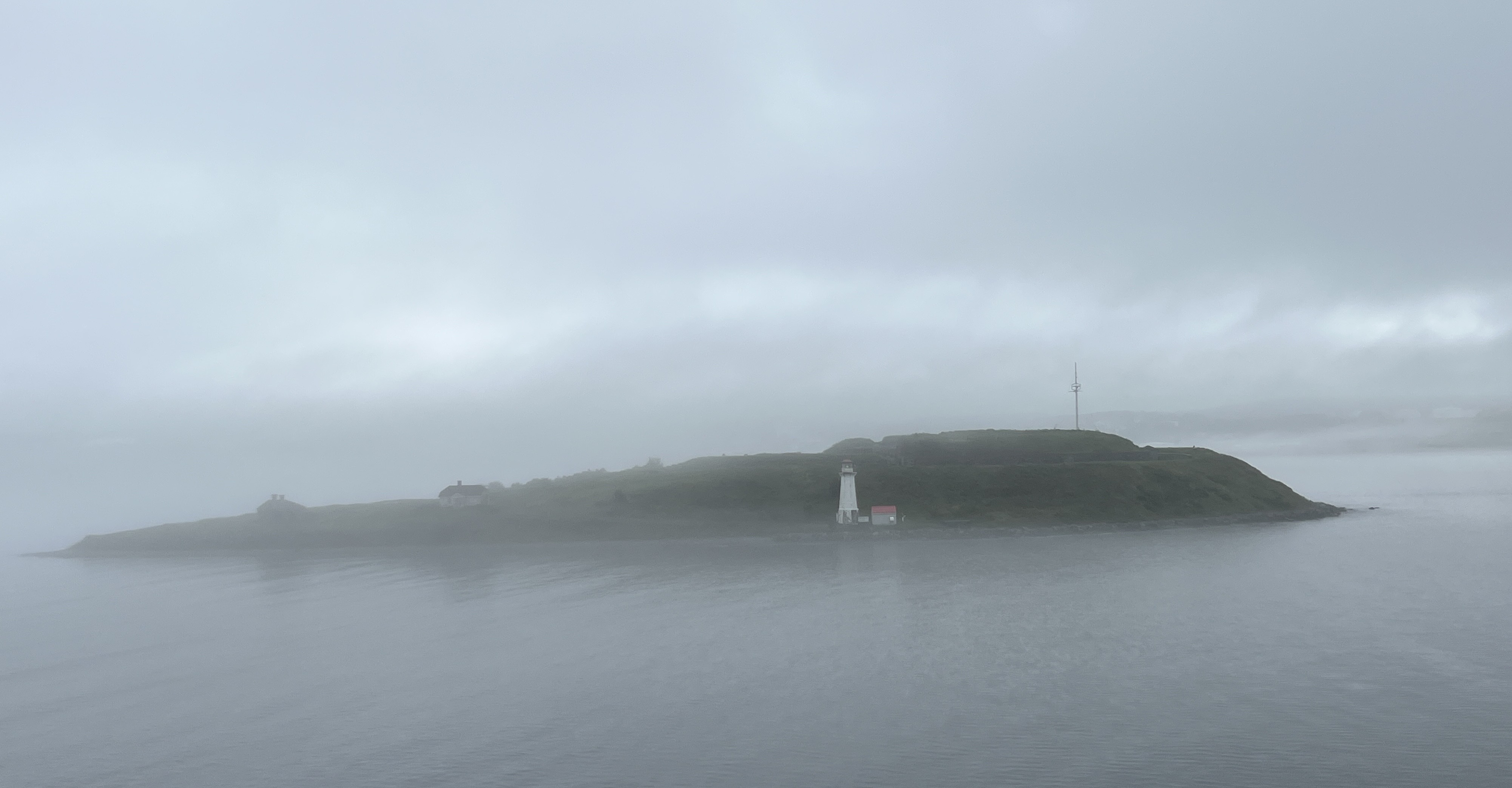
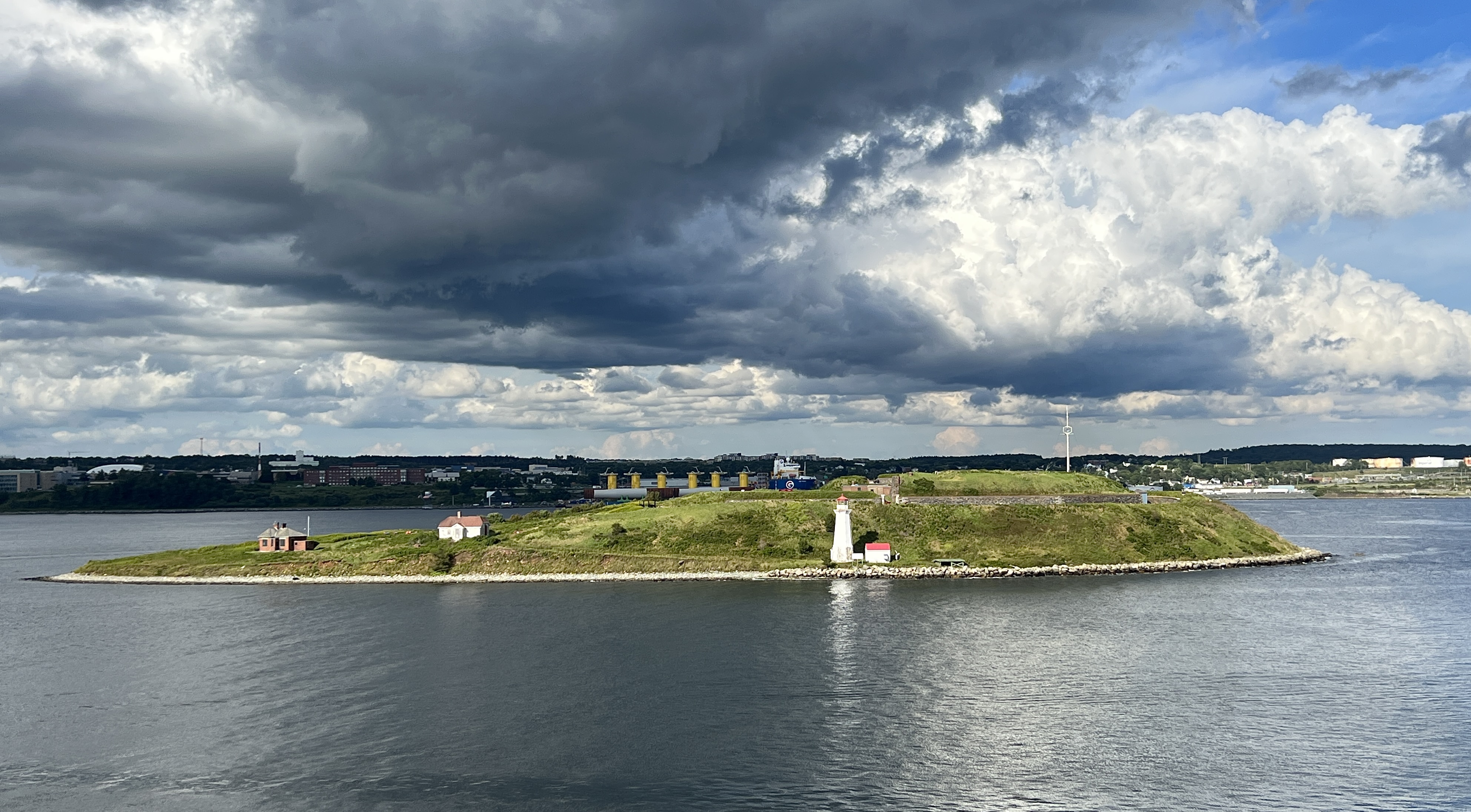
Our arrival in port was accompanied by a thick fog that slowly lifted revealing Georges Island close alongside. Later in the day after the fog had cleared and the sun was retreating a totally different view of the Island was had.
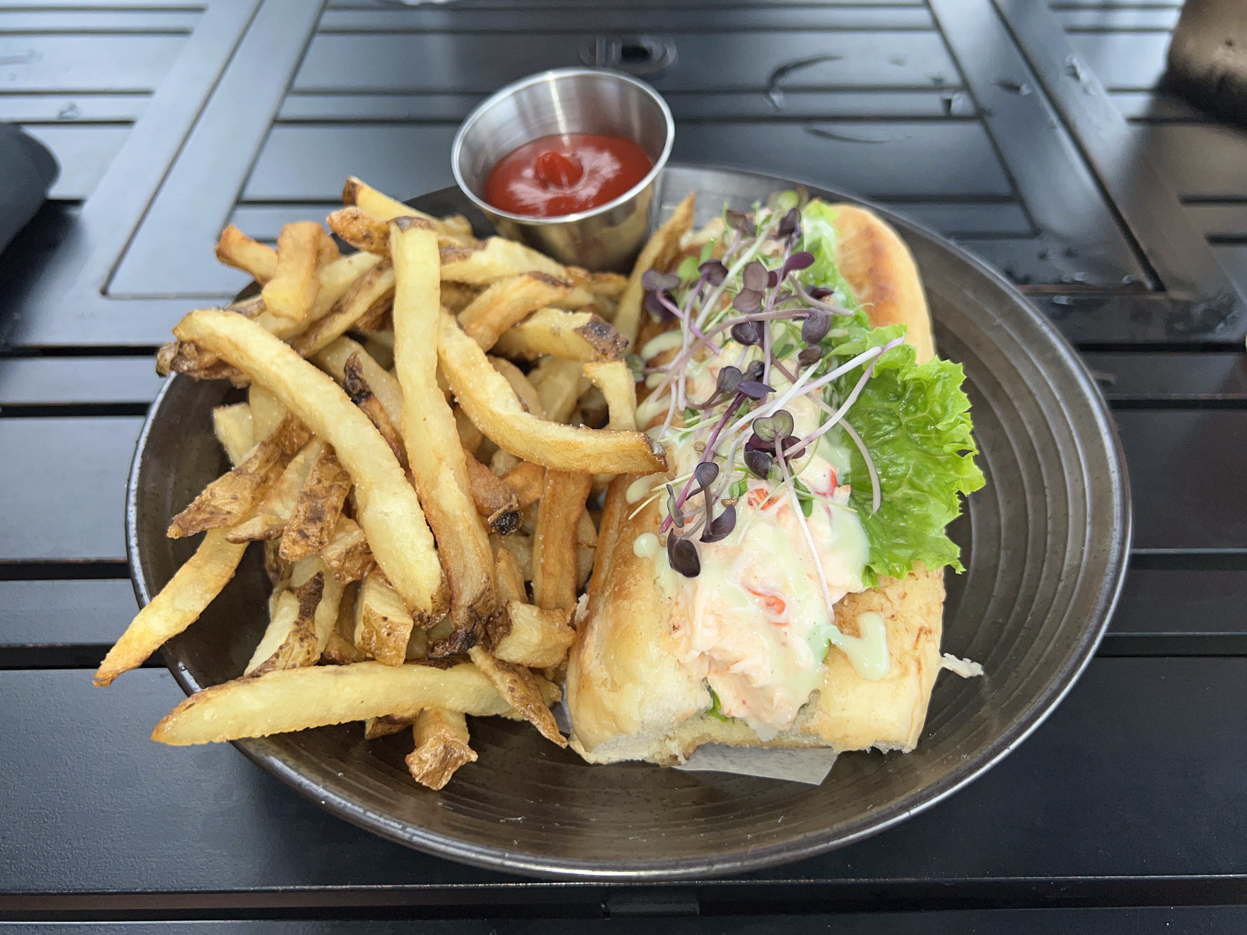
We spent time ashore in the morning looking around the waterfront and seeking out a lobster roll for lunch. We found one too!
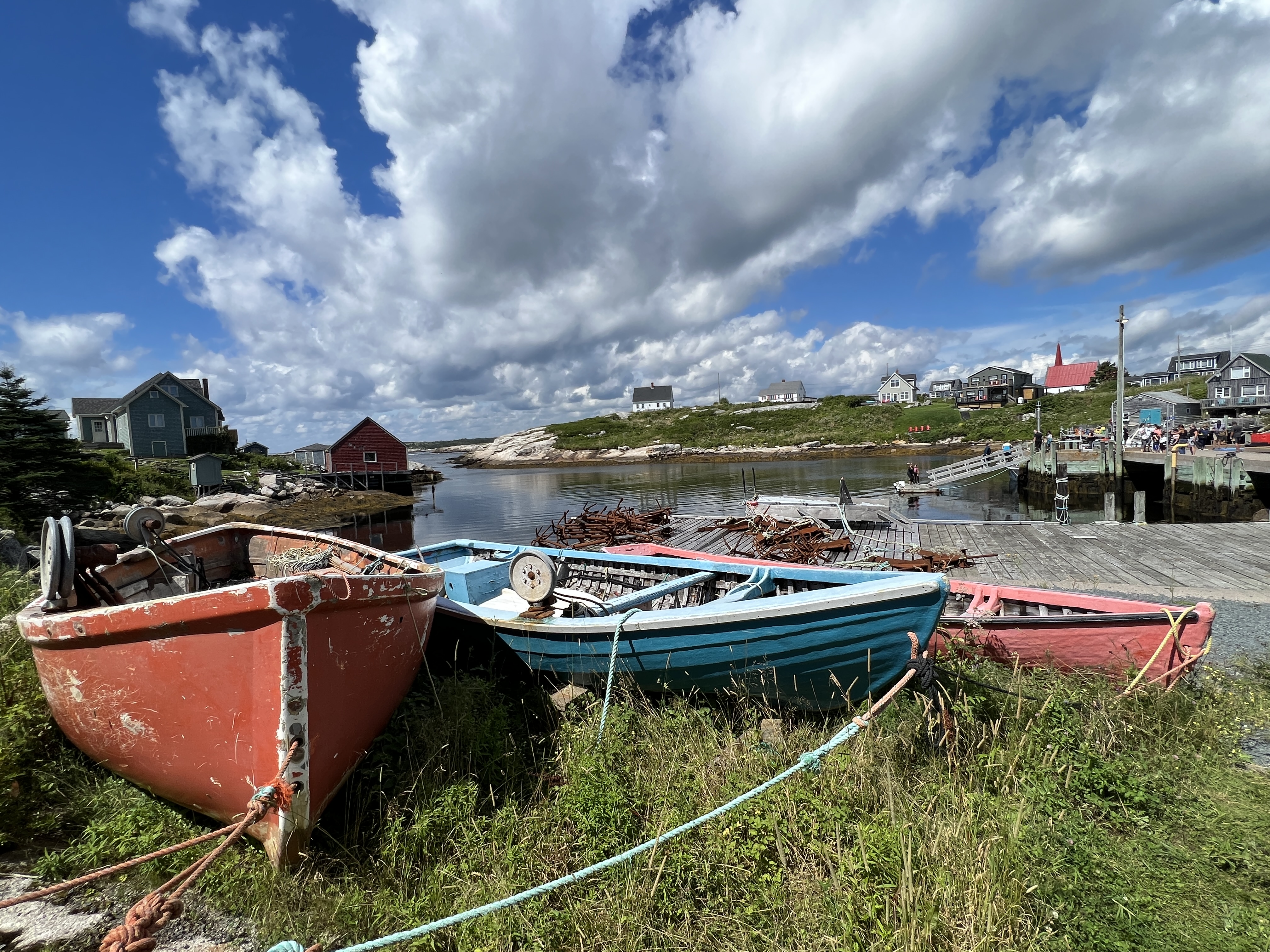
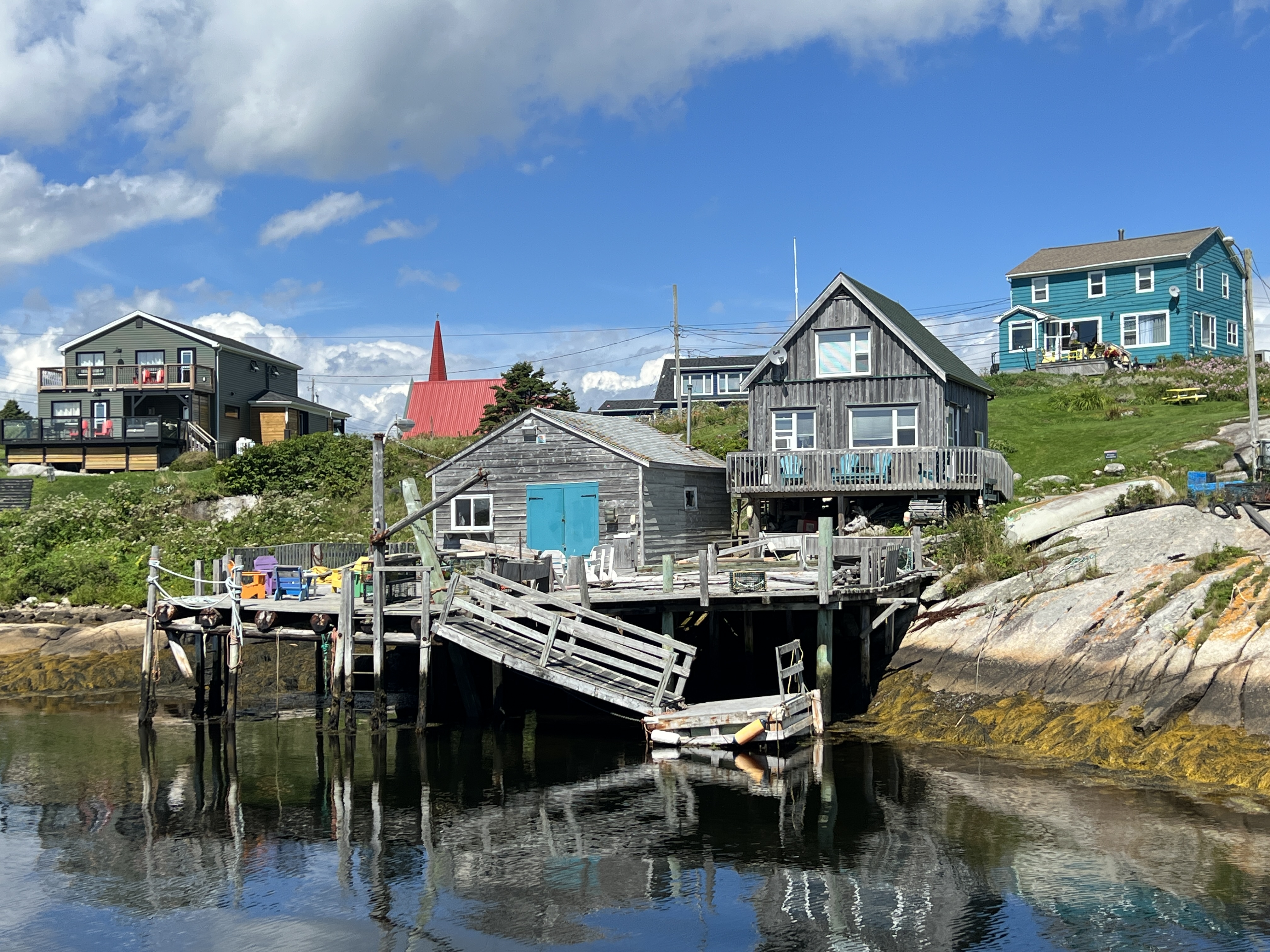
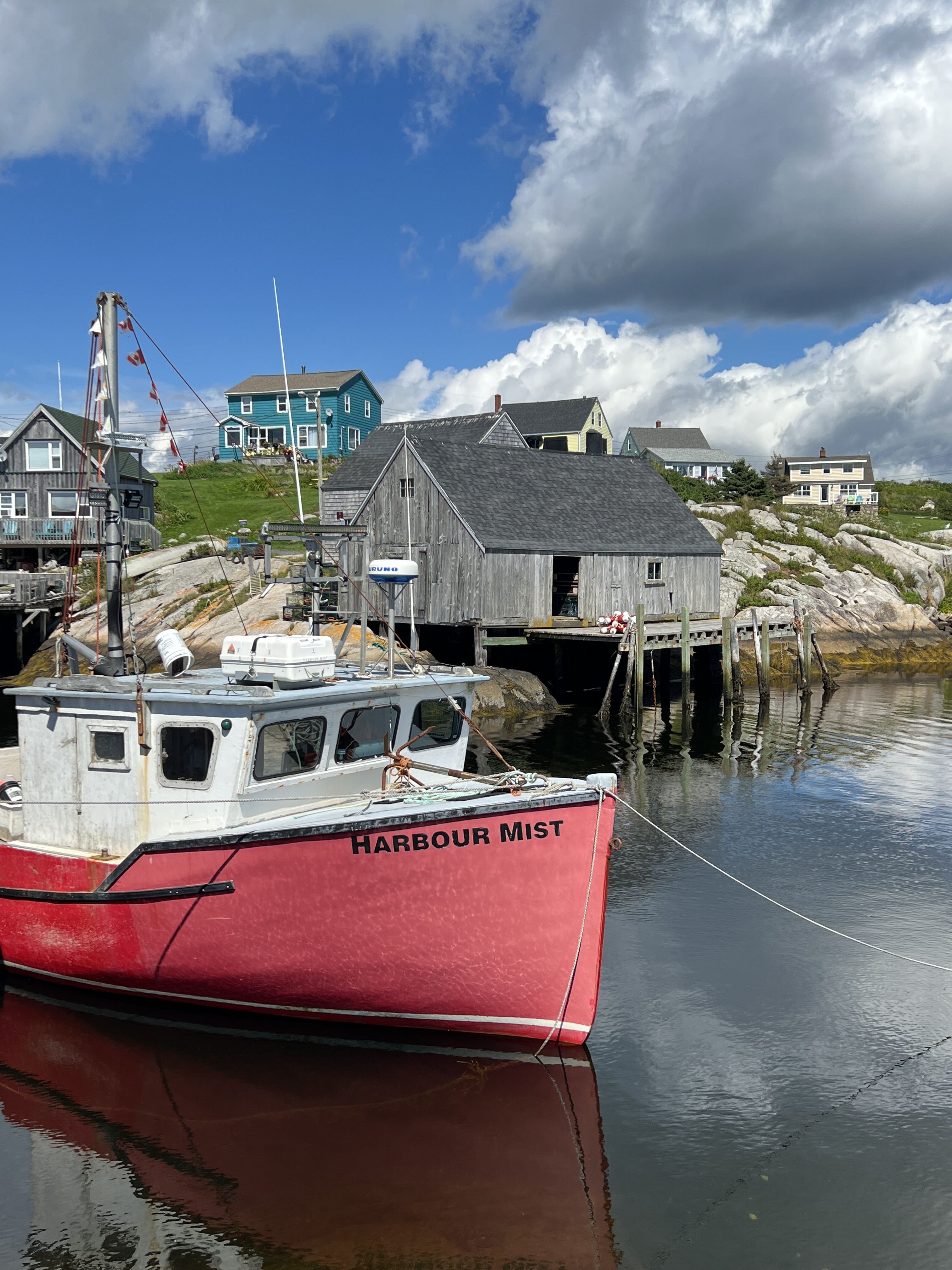
In the afternoon we had arranged a shore tour down to Peggy’s Cove at the end of St Margarets Bay. This is the home of the much photographed lighthouse and fishing village.
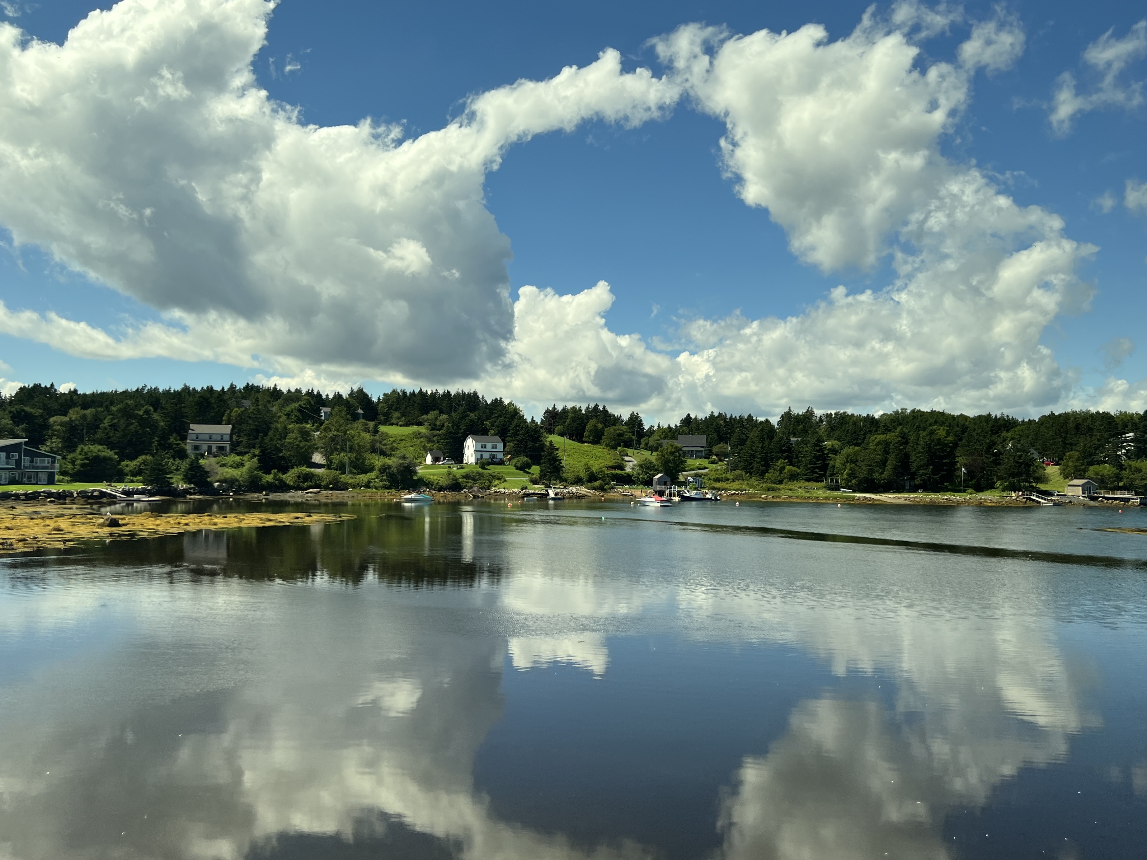
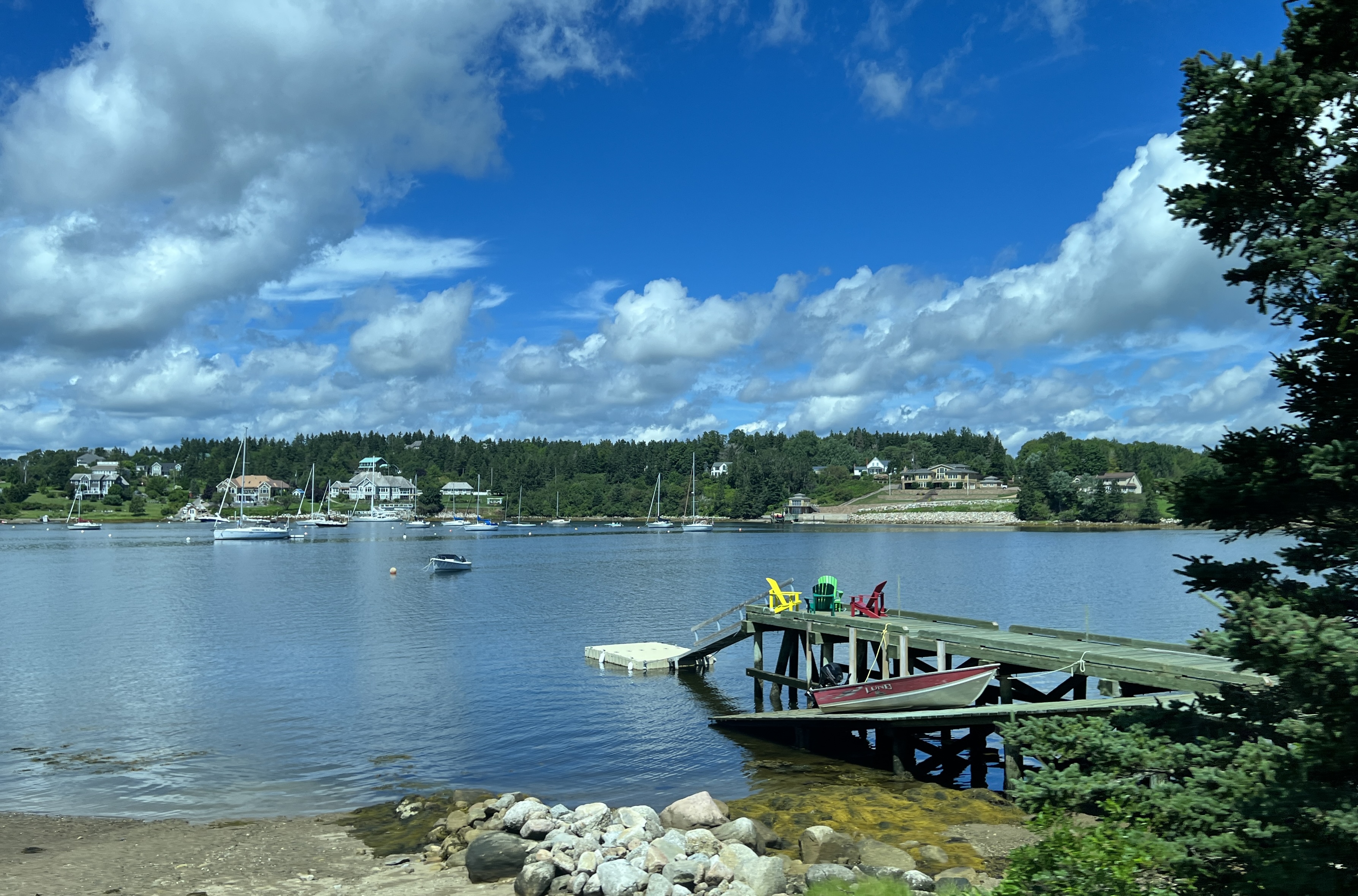
We passed by some wonderful countryside and coastline around the bay. It was a bit of a bun fight at the Cove with a few buses arriving and hoards of tourists scrambling on the rocks and lounging around the lighthouse. Have to be here at sun up to get a people less pic!
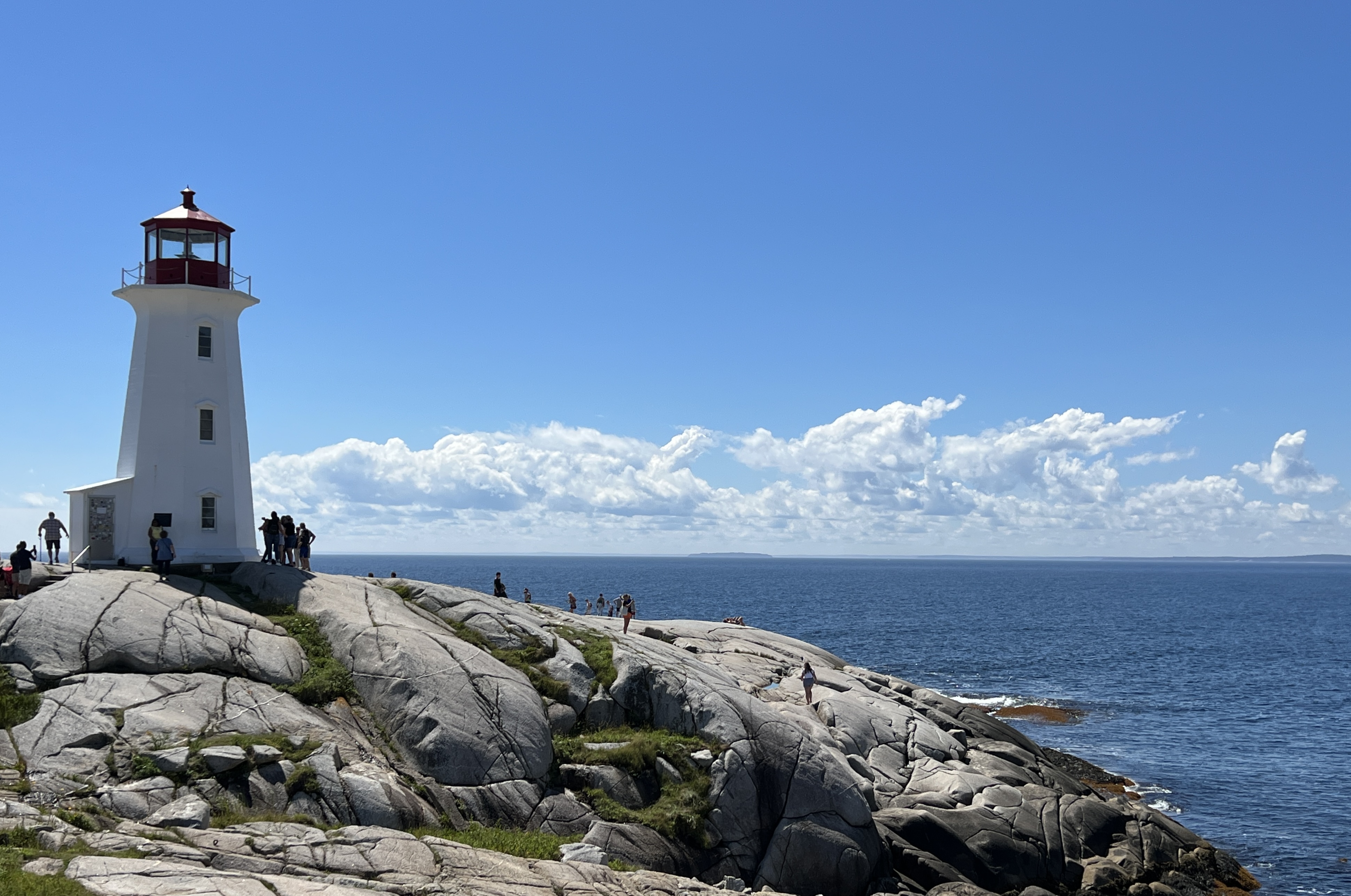
The village and harbour is definitely photogenic and we had some great weather for it.
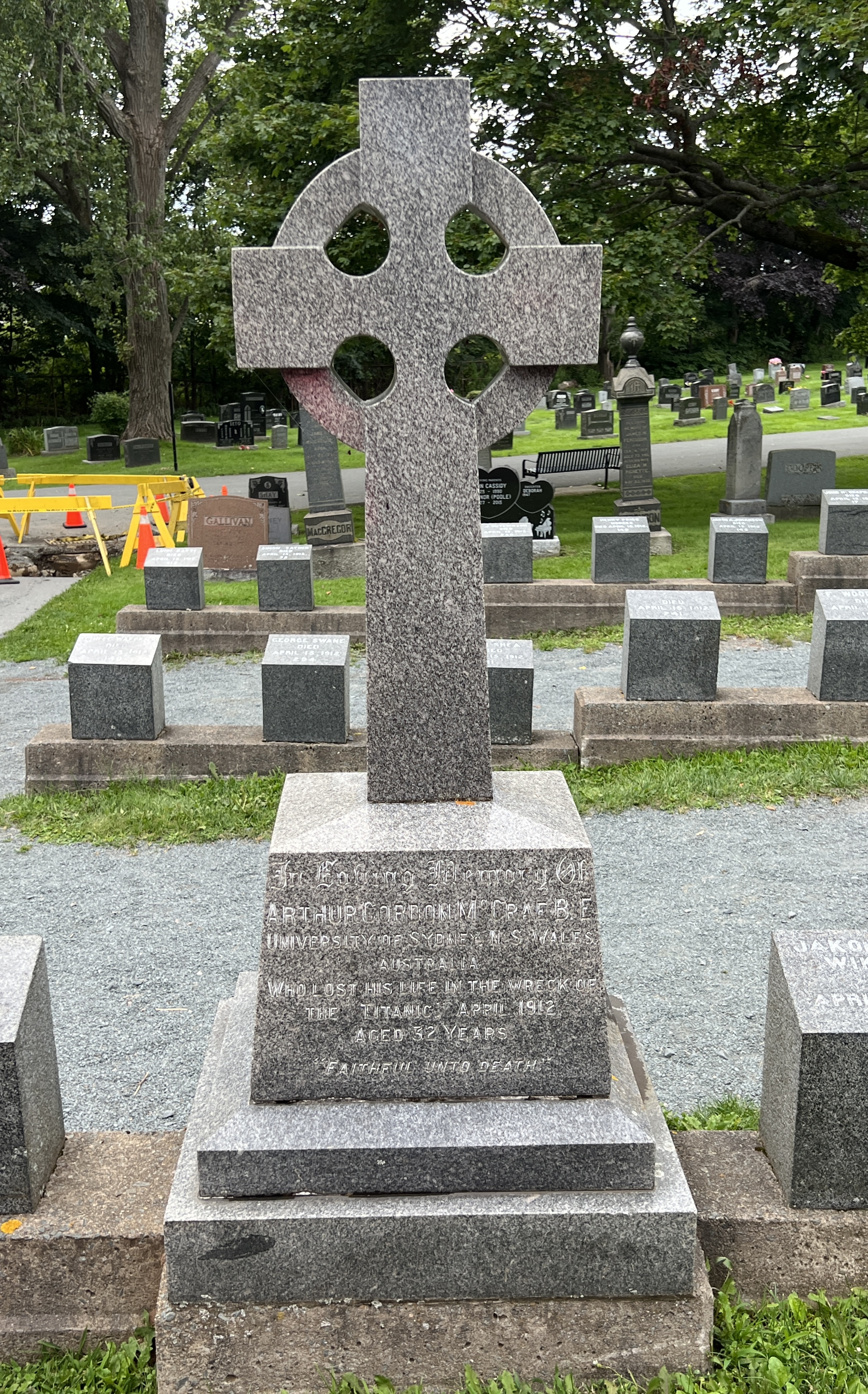
We returned to Halifax but along the way pulled into the Fairview Lawn Cemetery to have a look at the graves of 120 or so victims of the Titanic sinking in 1912. The graves are arranged in three rows in the form of the bow of a ship, pointing out into the Atlantic to where the ship had sunk.
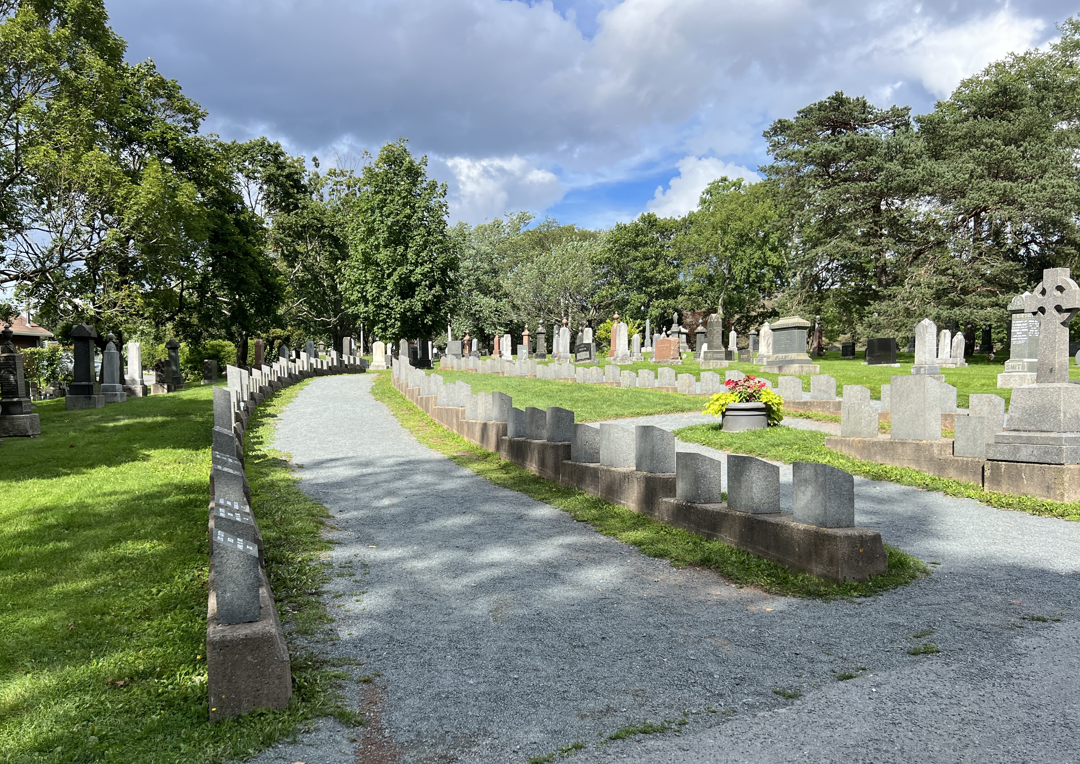
The grave area and headstones had been arranged by the White Star Line, the Titanic’s owners. The headstones were very minimalist. Simply showing a name, a number and the date. The number was allocated when a body was recovered, the name came later after identification. Not always easy for the second class and steerage class passengers.
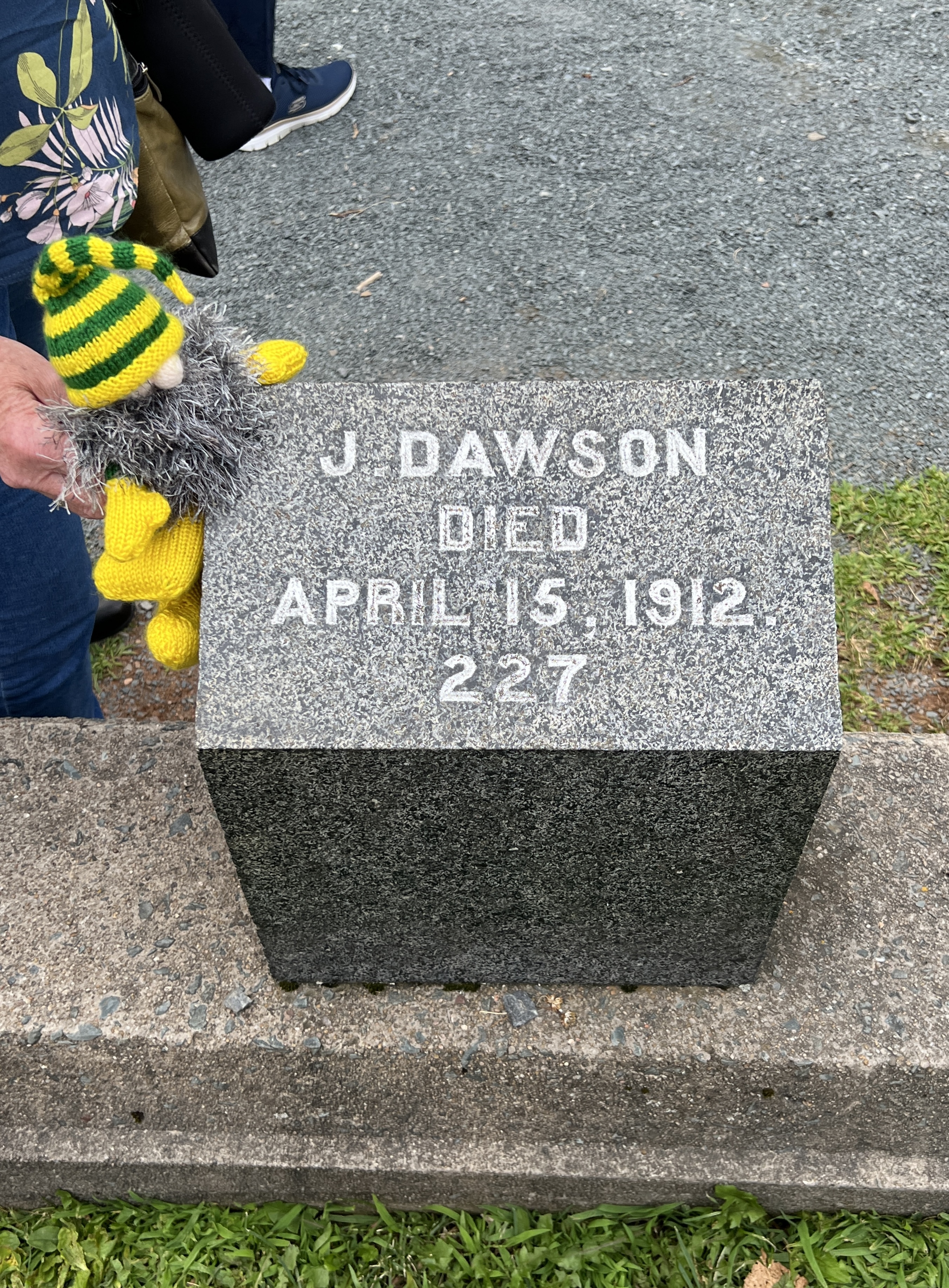
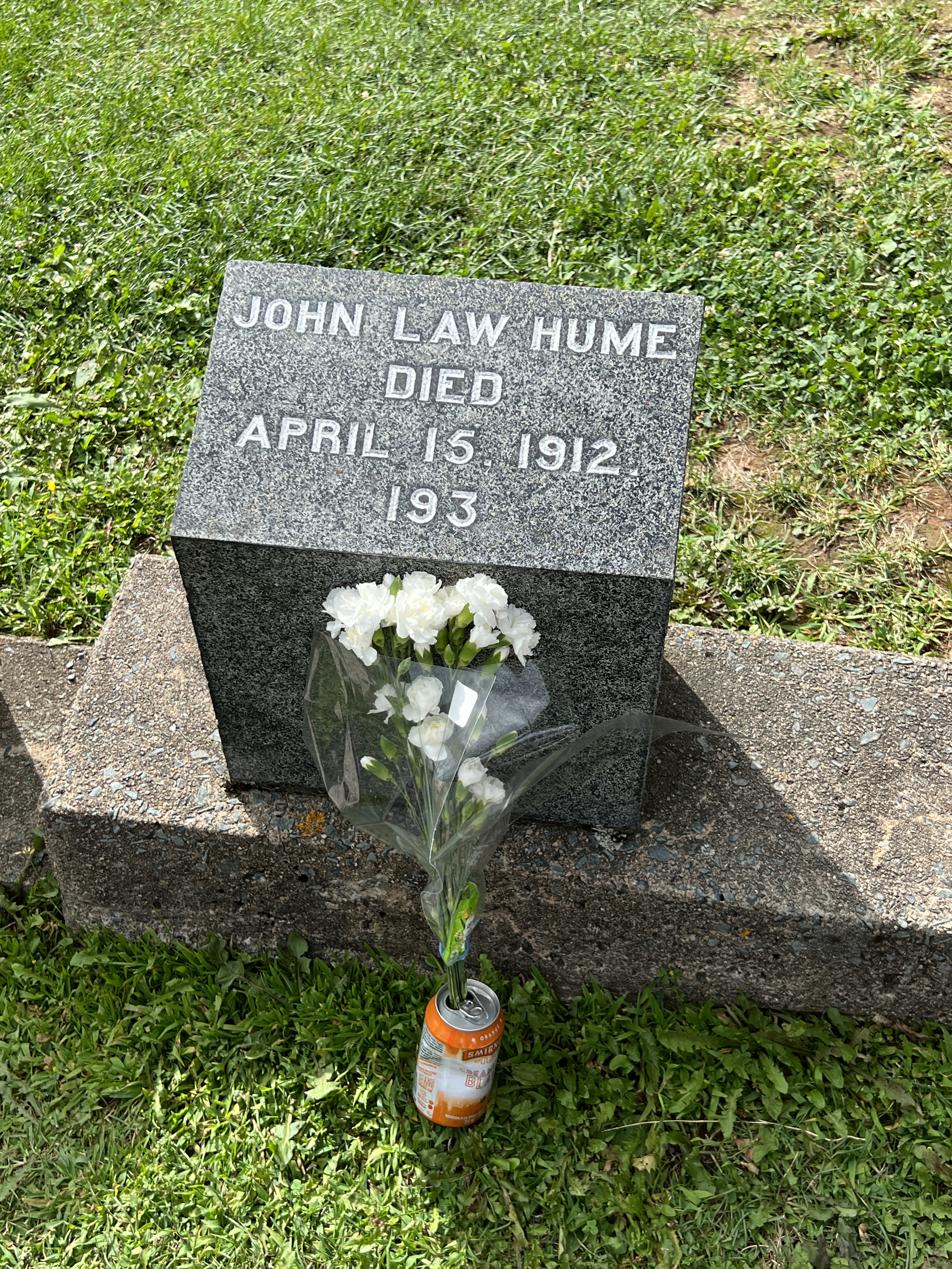
Some bodies were repatriated back to their families, if they could afford the cost. Other families embellished the headstones, or replaced them with more elaborate ones.
The job of identification was not always easy and there are a number of graves without names. Our guide was a little emotional when he recounted some of the stories lying at and under our feet.
Back on board the ship just in time for departure. We have a day at sea before arriving in the Big Apple.
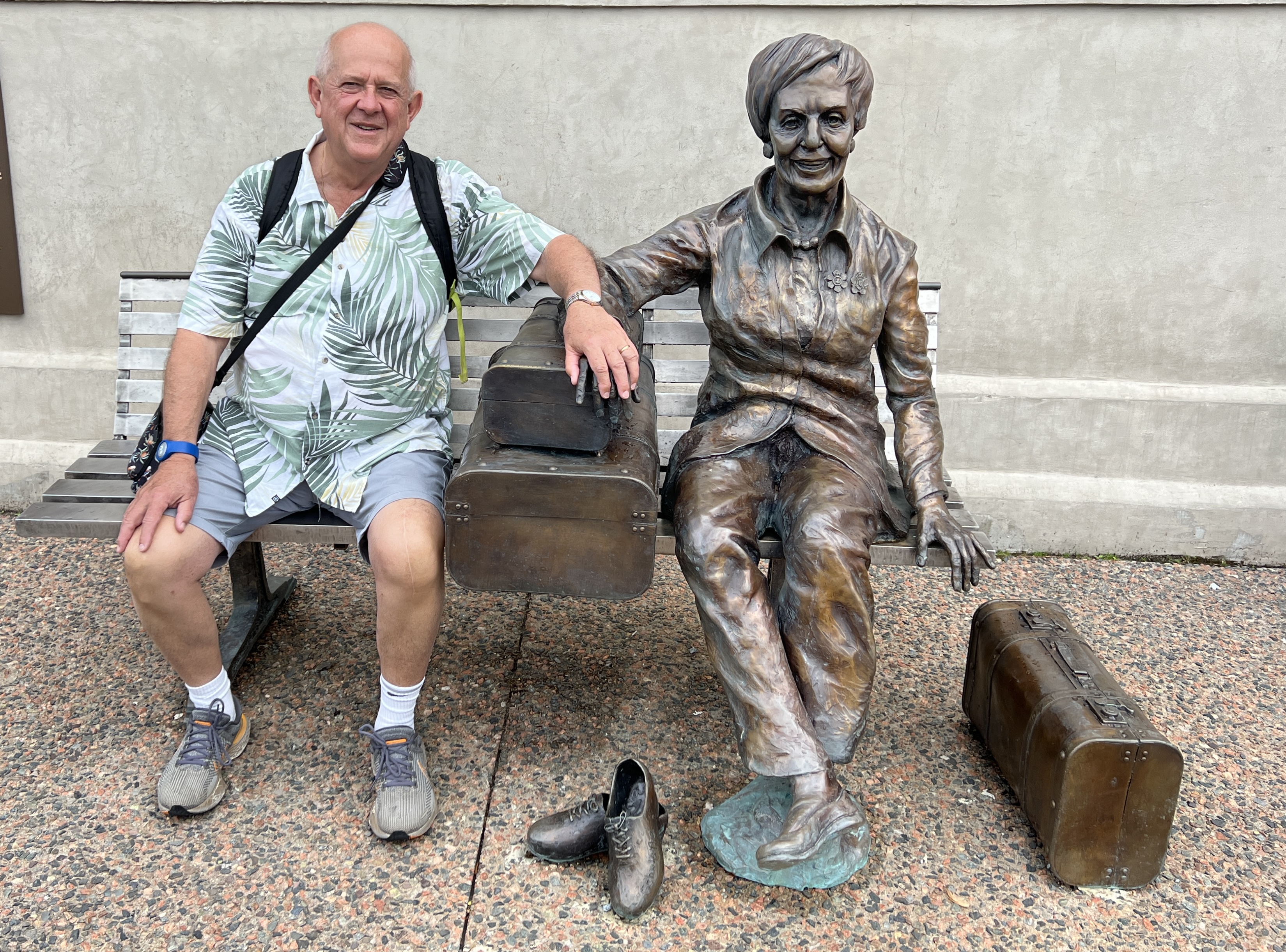
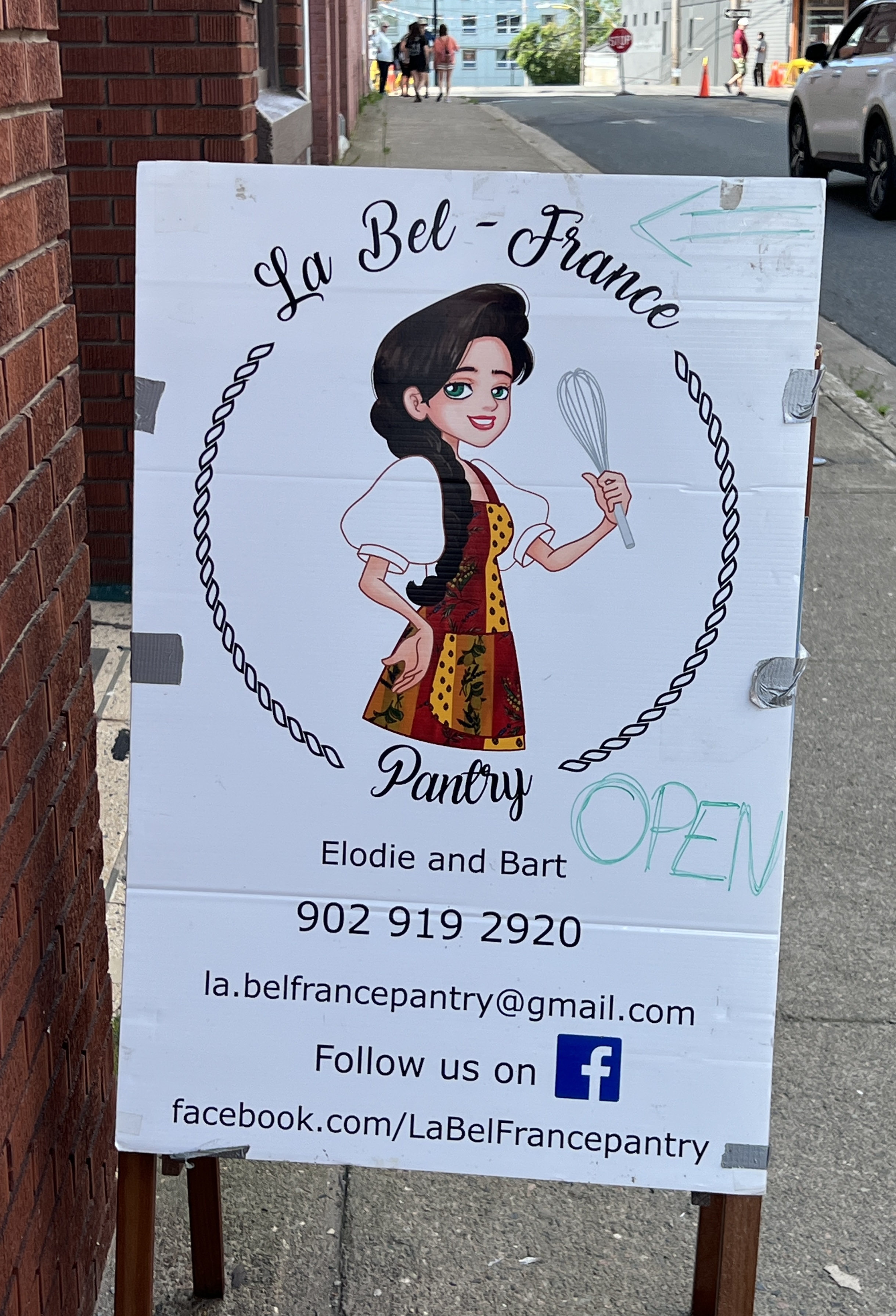
Sydney
We are in Sydney on Cape Breton Island, part of the Provence of Nova Scotia. Slobro was rather confused having woken up thinking we would soon be back in Brisbane. He was soon put right.
We had decided against a shore tour here, instead a wander around the town, some people watching and a local lunch somewhere.
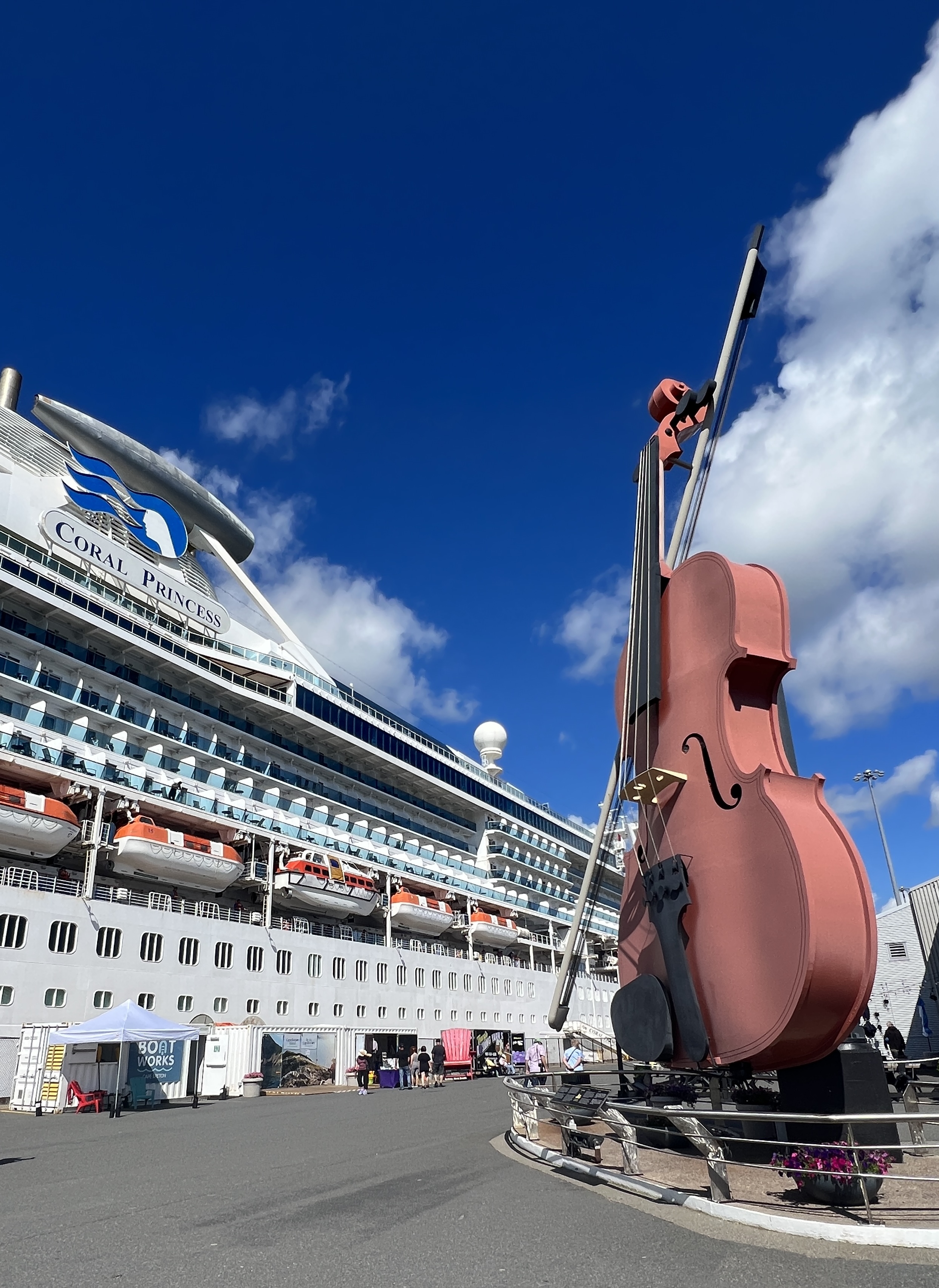
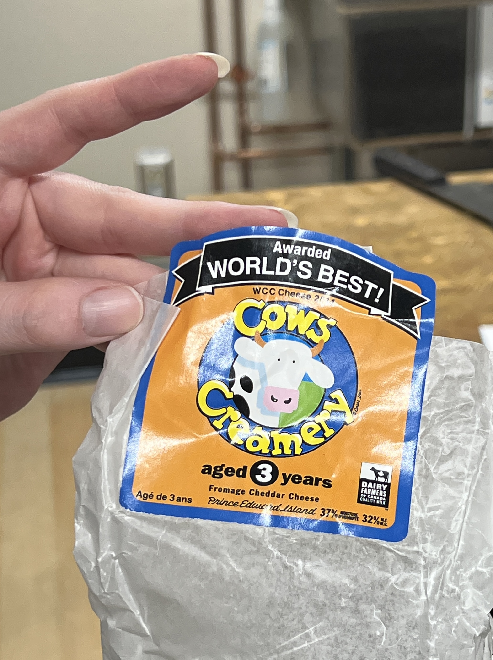
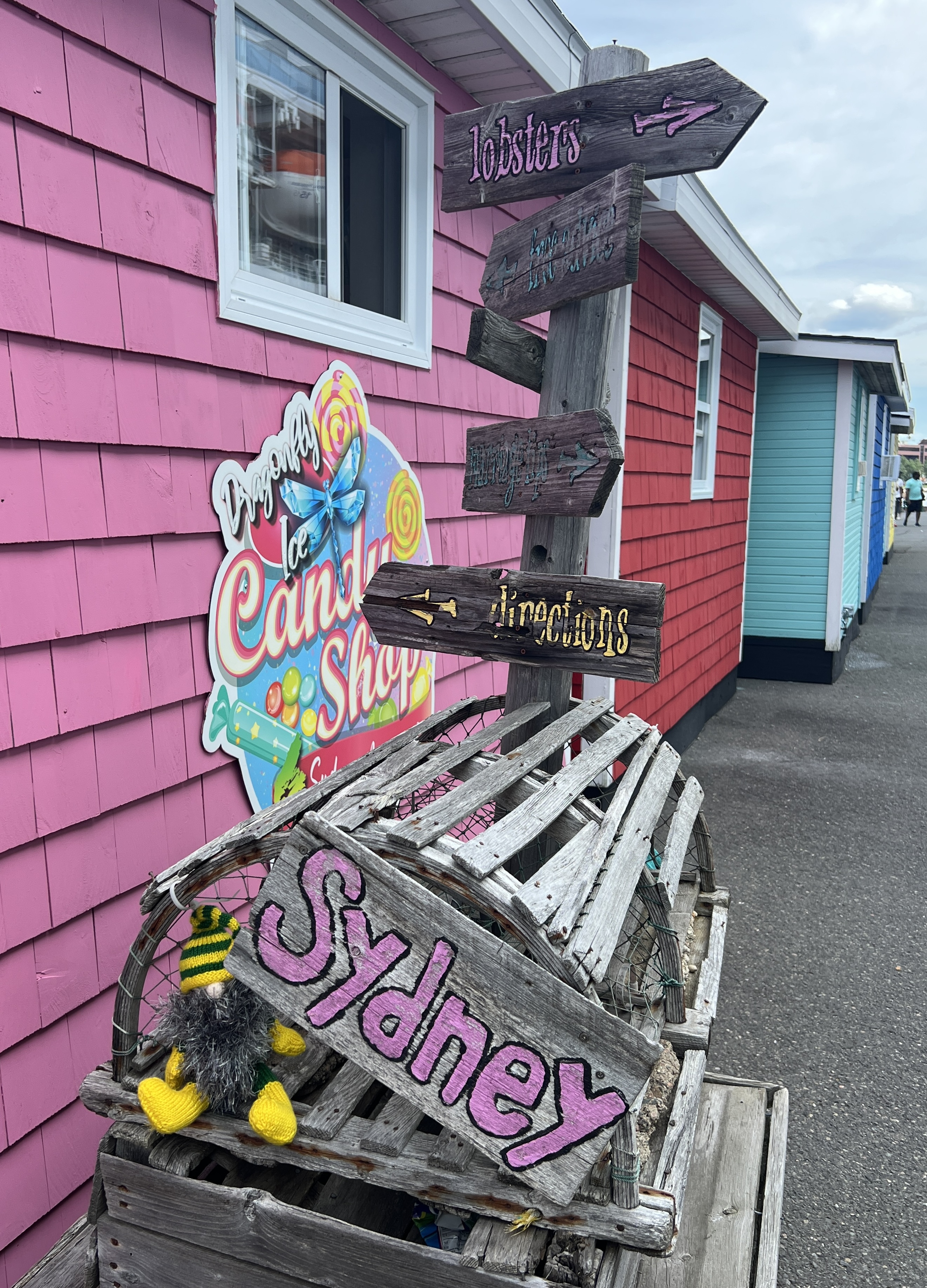
The town is well organised for tourists. There is great array of craft and souvenir places right on the dock when you get off. As we later found out you can’t get back on the ship unless you walk through them. Trap to extract that last dollar, Allthego succumbed and got some local cheddar cheese to take back on board for pre dinner snacks.
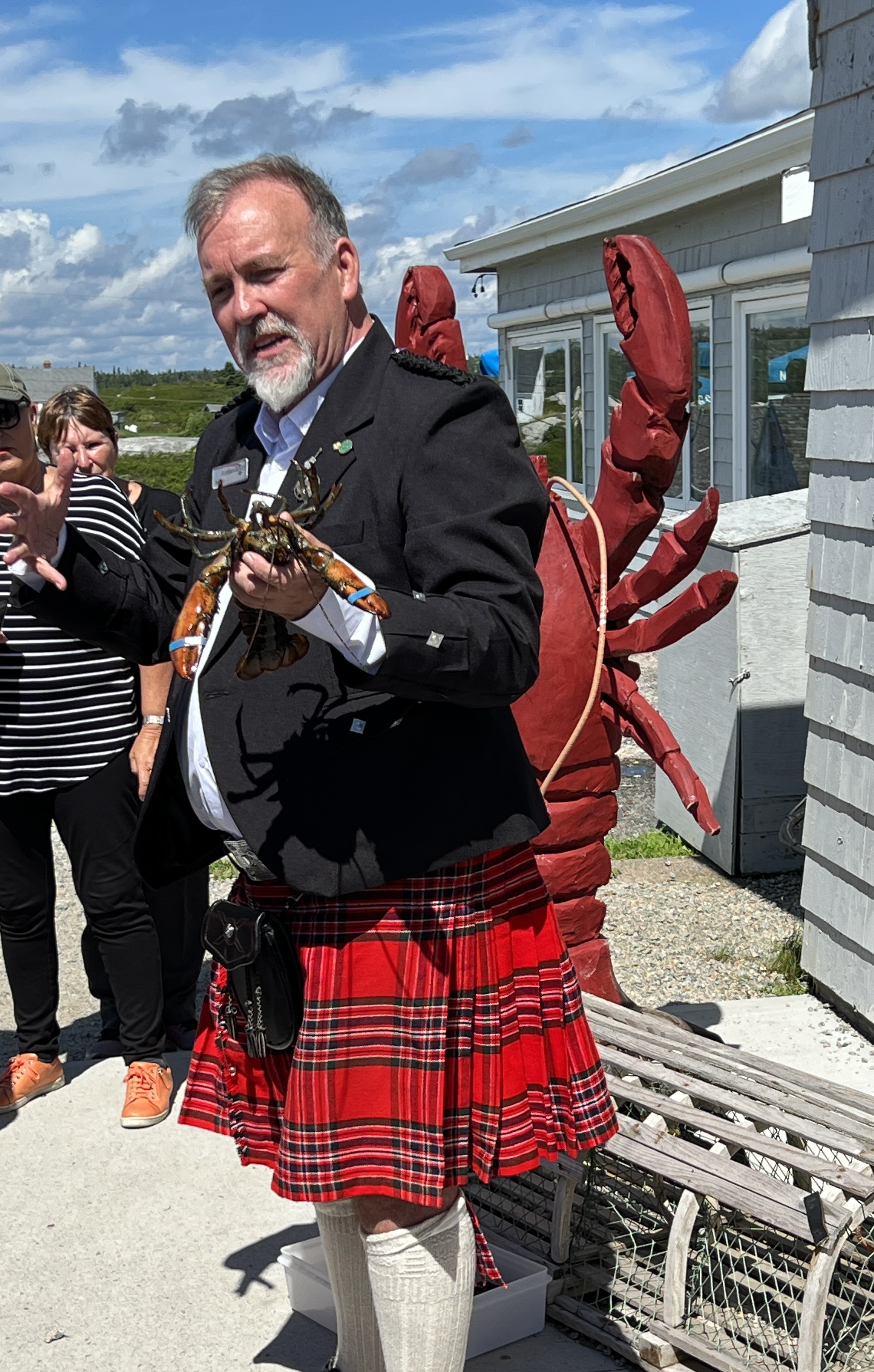
Nova Scotia was initially a colony of France, part of ‘Arcadia’ or New France, in the 1600s and first half of the 1700s. Following the American War of Independence, British loyalists settled here and ultimately the French were evicted after the previously mentioned wars with the English. Sydney was founded in 1785 and a wave of Scottish immigrants followed. Nova Scotia is Latin for ‘New Scotland’. Apparently there is a big Gaelic speaking population here and there are Scottish shops and memorabilia all around the town.
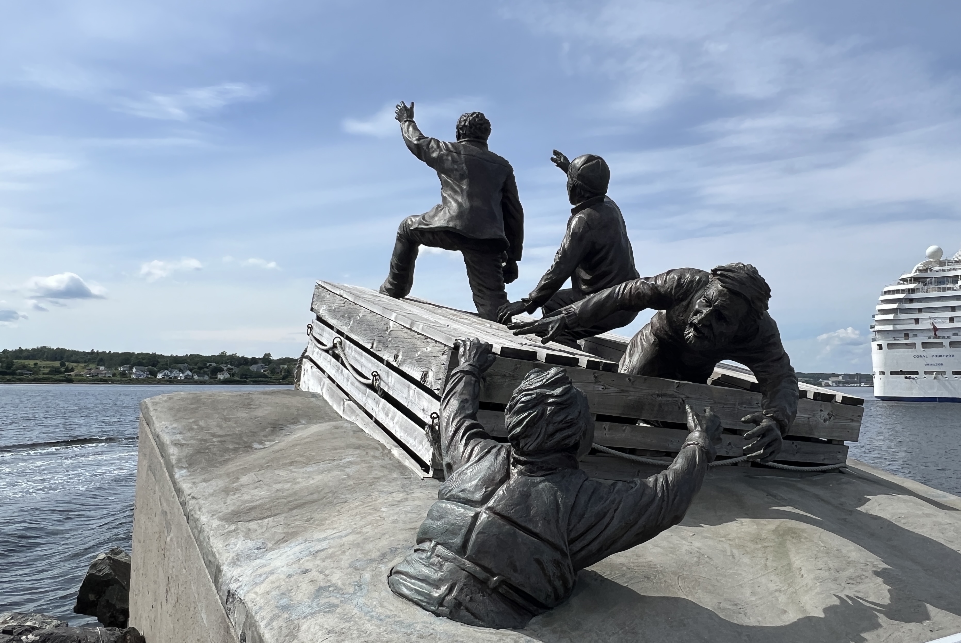
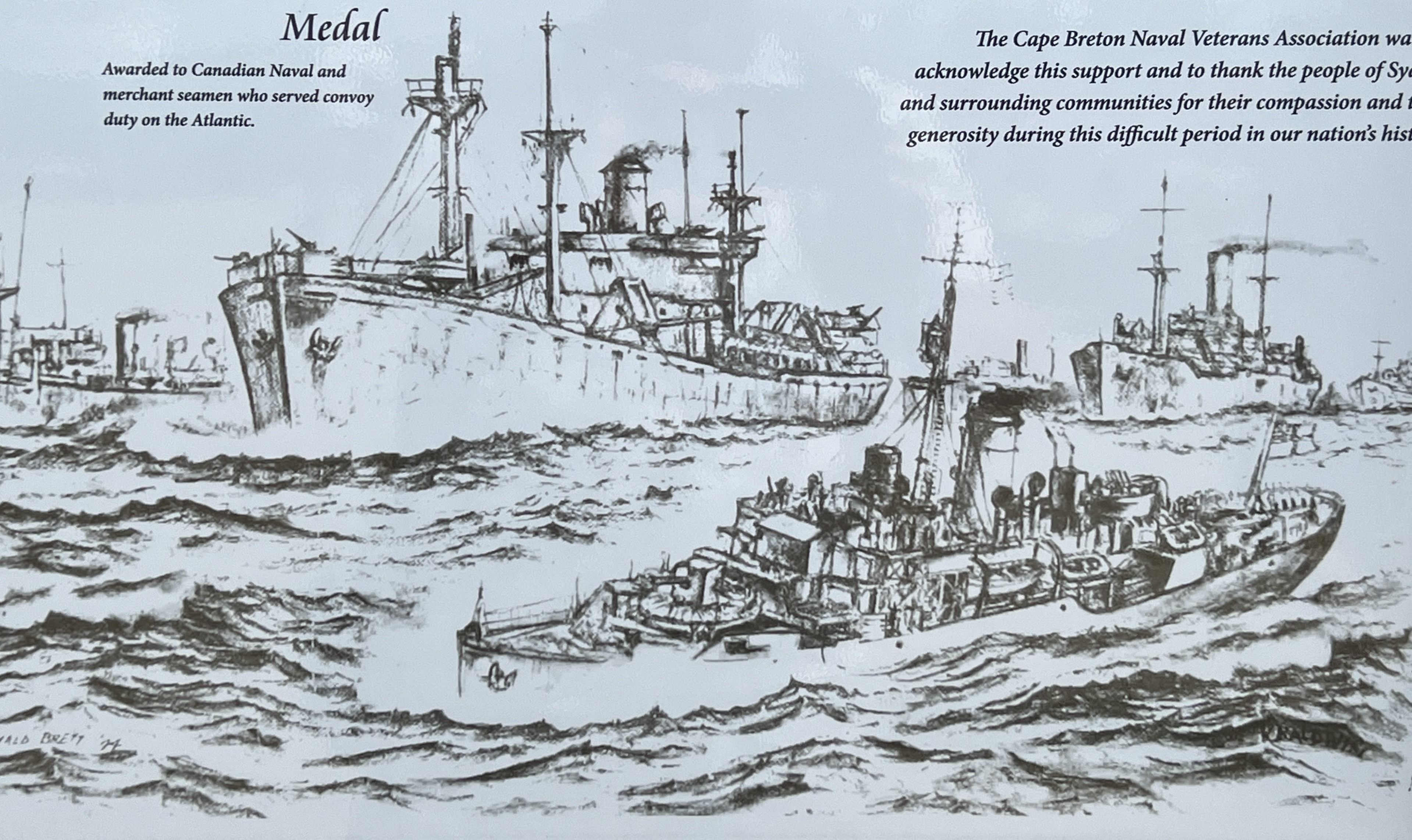
Sydney was a big coal and steel town for much of the 20th century. Steel is now gone but some coal is still mined and exported away. Because of its proximity to Europe, it is the most easterly point of Canada, the large harbour was used as a staging point for convoys to the UK during Botha WWI and WWII.
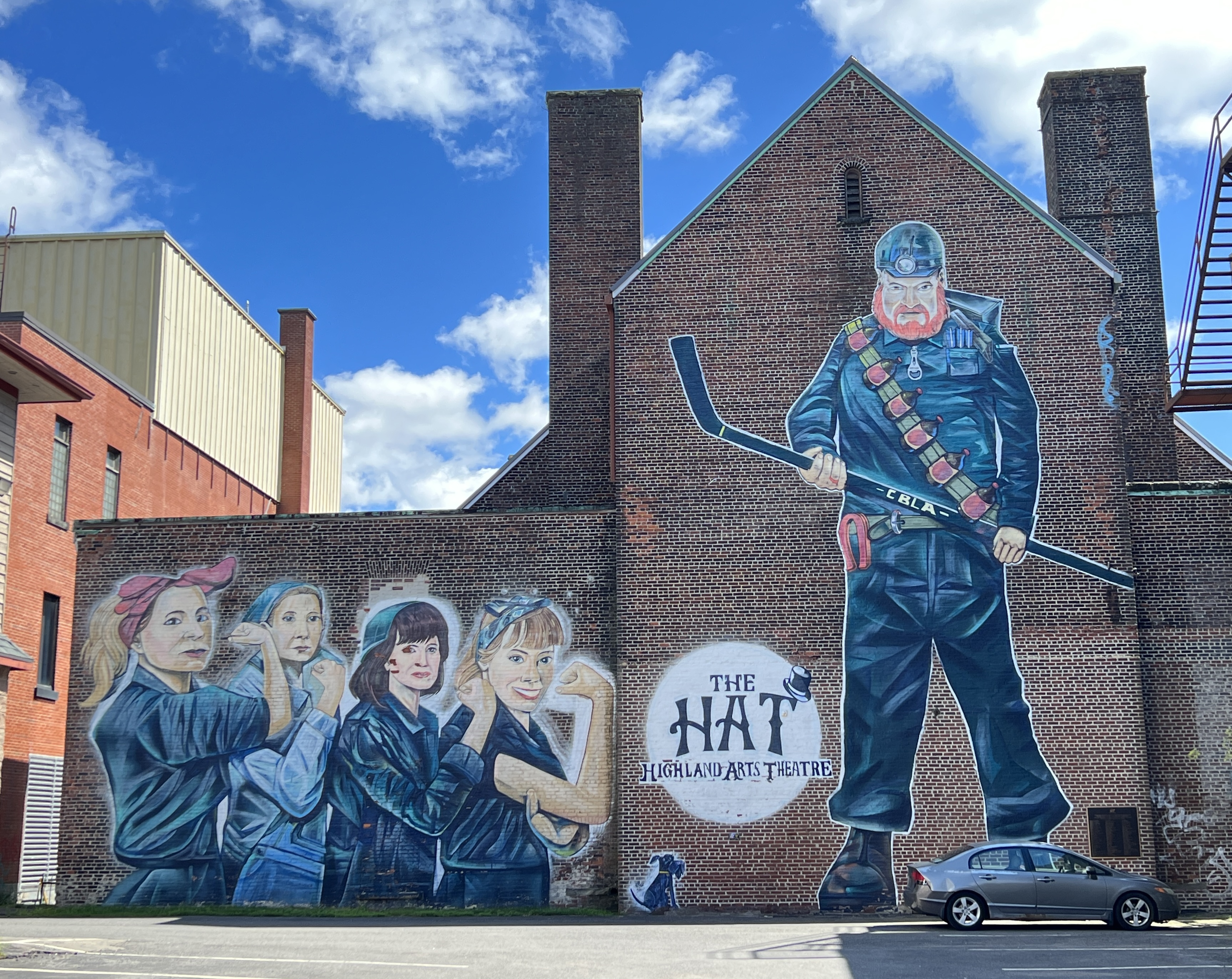
Our walk took us up and around some of the prewar housing areas and then down the Main Street. Avoided the museums. Some great murals along the way particularly near the theatre, a repurposed church complex.
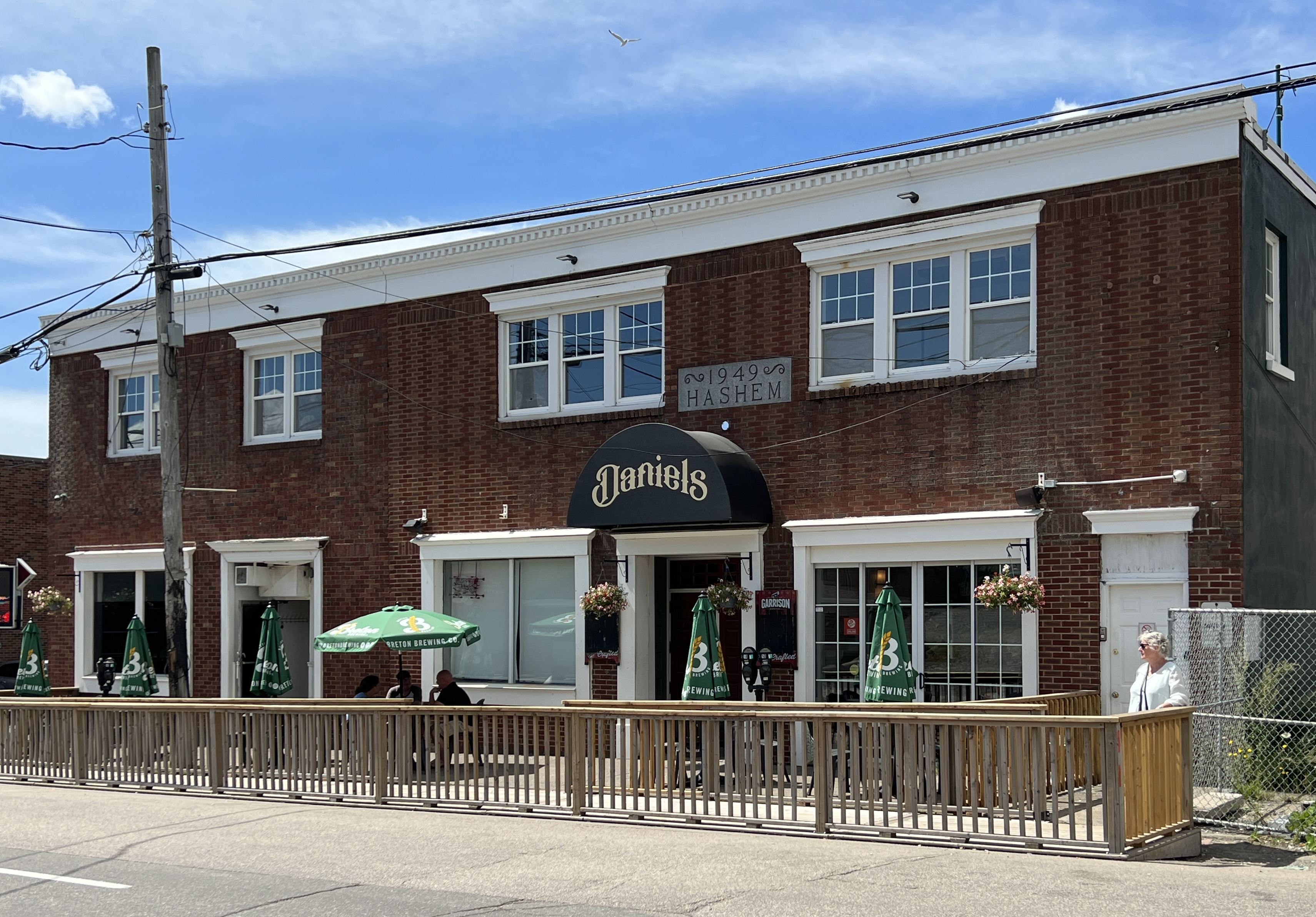
The main game in walking around was to find a place for lunch, it was Sunday so a few of the options were closed .
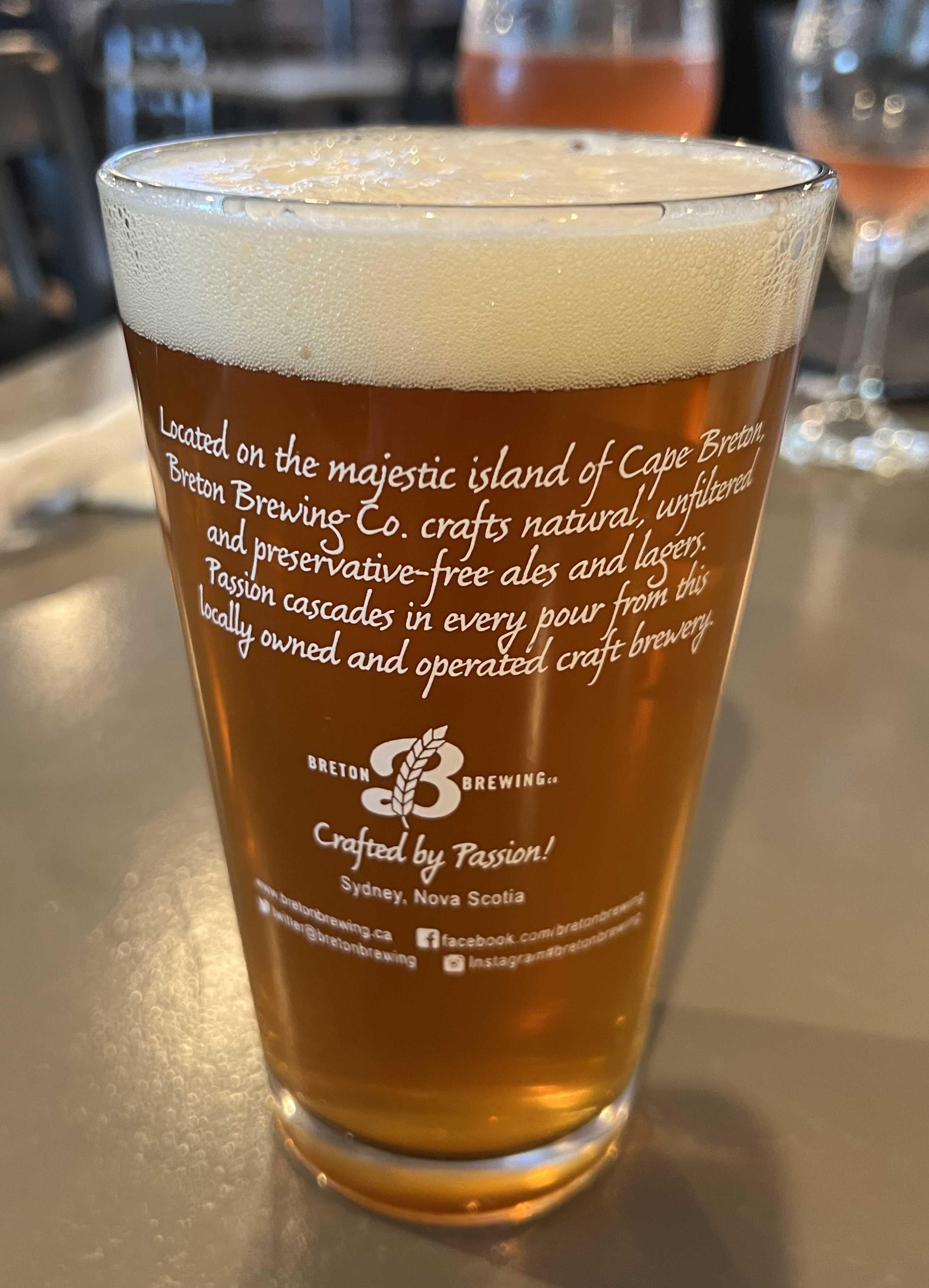
There were a number of French cafes in this closed category, so we ultimately settled for Daniels. It had a Scottish ambience with local craft beers and burgers, wraps etc. Not a bad choice and Allthego was able to secure another glass for the collection back home.
After lunch it was a slow stroll back along the waterfront to the ship, ran the gauntlet of shops with the afore mentioned cheese the only acquisition. Slobro was a little persistent wanting to be photographed with a lobster, settled for an old lobster trap.

Back on board we sailed away down the harbour with great views of the town.
Our next port of call is Halifax, the main city on Nova Scotia. The blog is running a little behind real time. We are now sailing down towards the Caribbean, two sea days out of New York with another two sea days before reaching the Panama Canal. Should be up to date by then!
Saguenay
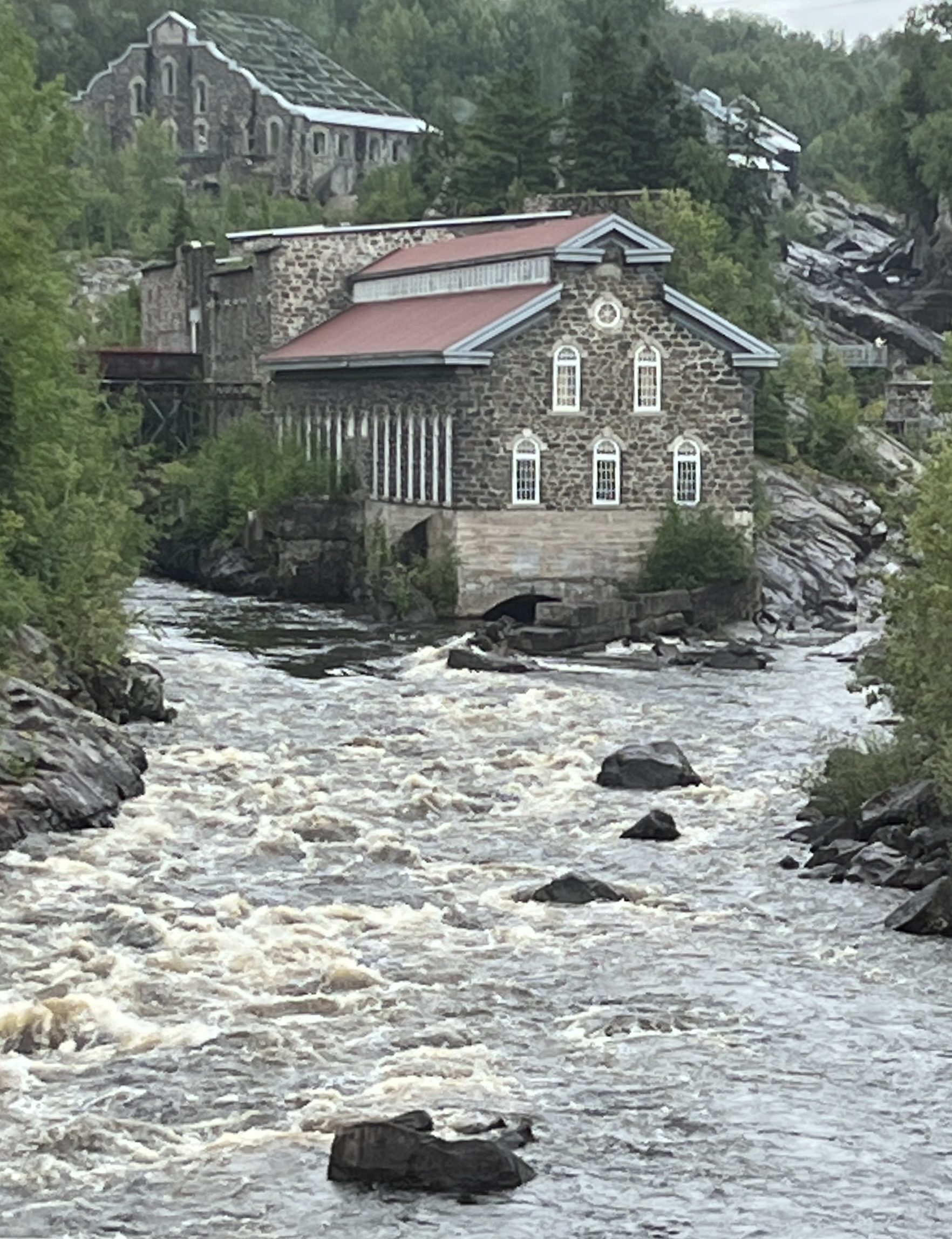
Saguenay is a night’s sail back down the St Lawrence River and up to the end of the Saguenay Fjord, a left turn off the river to the north west. The fjord is Quebec’s largest and the most southerly fjord in the northern hemisphere. It is 105km long and 270m deep in some places.
Saguenay is not a place as such but more the name for a region of districts. We dock at La Baie near the confluence of the Saguenay River and the Fjord. This is a small port town, the main commercial area is around Chicoutimi further up the river.
We had a short shore excursion taking us around La Baie and then to Chicoutimi. Along the way we stopped at a Mohair goat farm, this operation did things the traditional way.


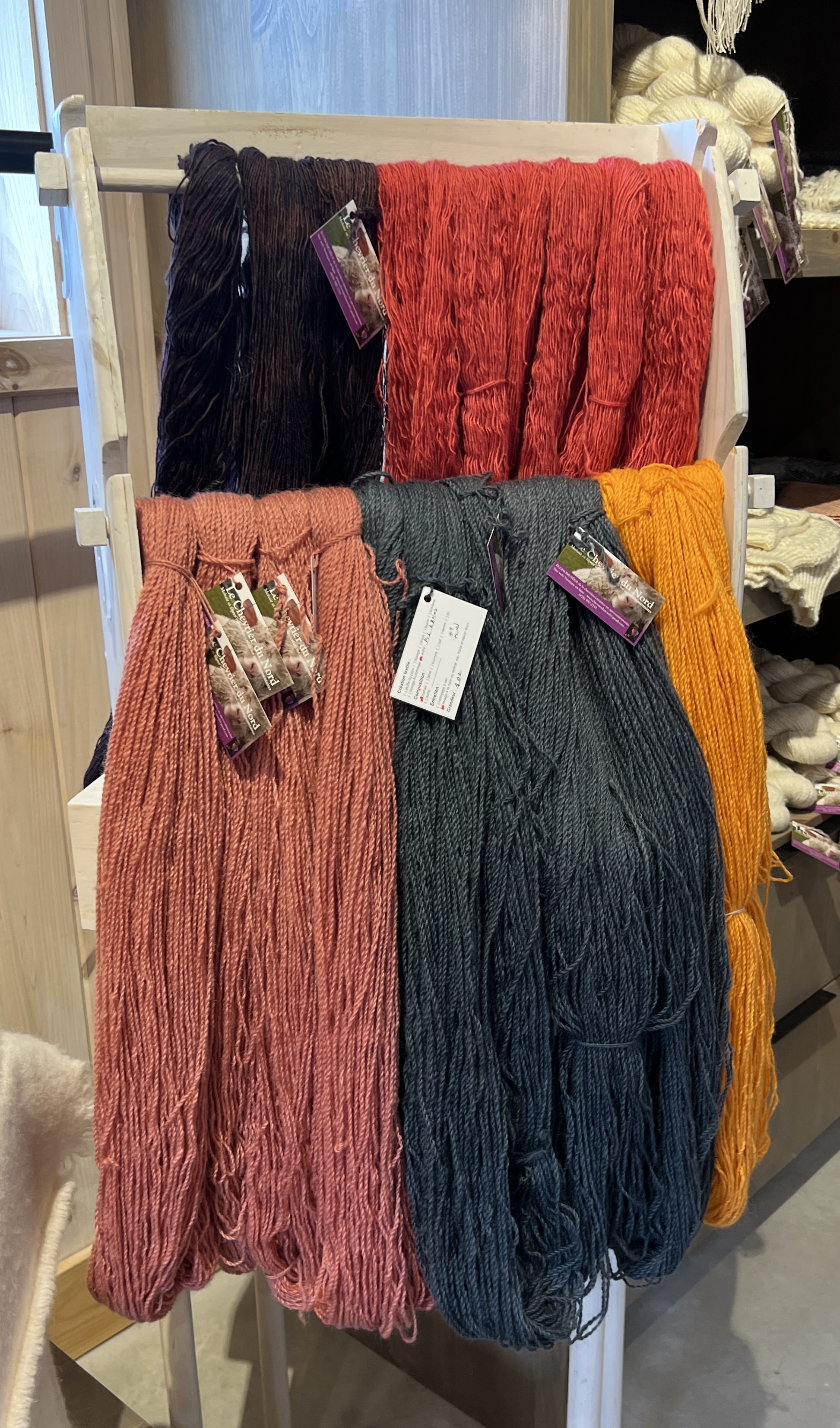
Homealone examined the wool offerings and left with a skein to make something with, not sure what. Allthego found a pair of super socks to keep the feet warm on wintery van trips back home.
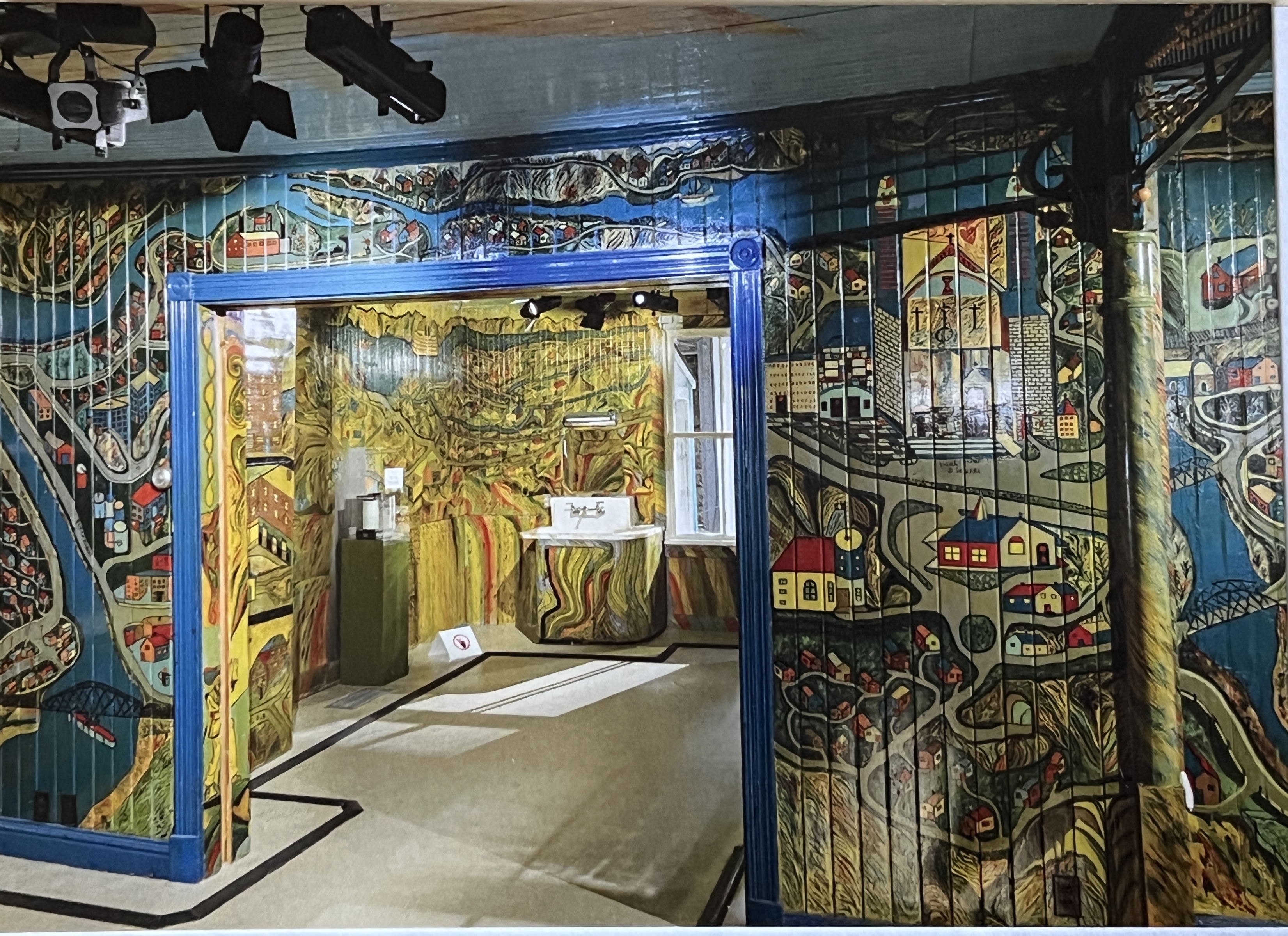
Back on the road we made for the ‘painted house’ of the famous local painter Arthur Villeneuve. This guy used his house as his canvas, apparently a great frustration for his wife. He had a strange style, depicting history, local geography and his life’s activity on the walls of the family home. He wasn’t trained and depicted things in blocks ‘standing’ out from the walls. The house is a maze of frescos in vibrant colours. The house had been relocated to the interior of one of the old paper pulp mills, now a museum. Couldn’t take photos, but the one here is a copy of a postcard.
The other thing the area is known for is the Little White House which survived a devastating 1996 river flood. The house managed to avoid being washed over the falls and sits precariously on the edge. It is the town’s symbol of survival and hope!
Rio Tinto is the town’s major employer at an aluminium smelter. Bauxite feedstock for the smelter comes from various parts of the world, including Rio’s mines in Australia. It is a prominent sight coming into the port after the sail down the magnificent fjord, greenies I suspect think it is a blight on the environment. Probably is!
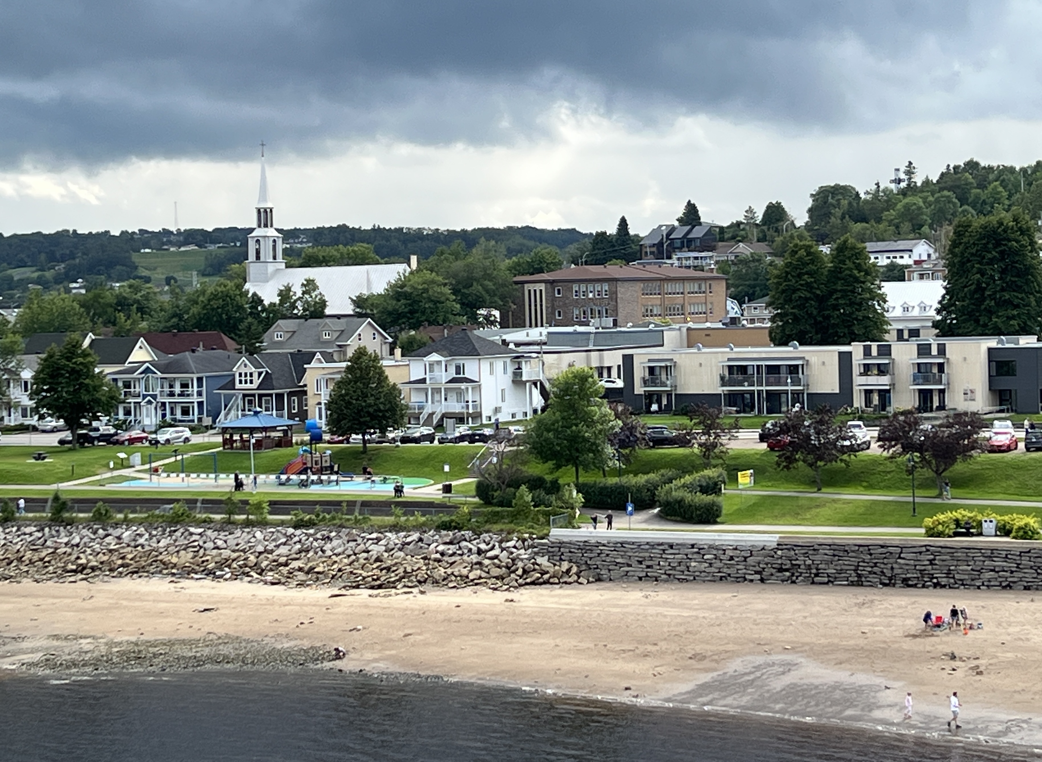
Saguenay has a very French flavour as we found out after the tour when lunchtime arrived. The east coast of Canada is well known for its seafood. Particularly lobsters, crabs and scallops.
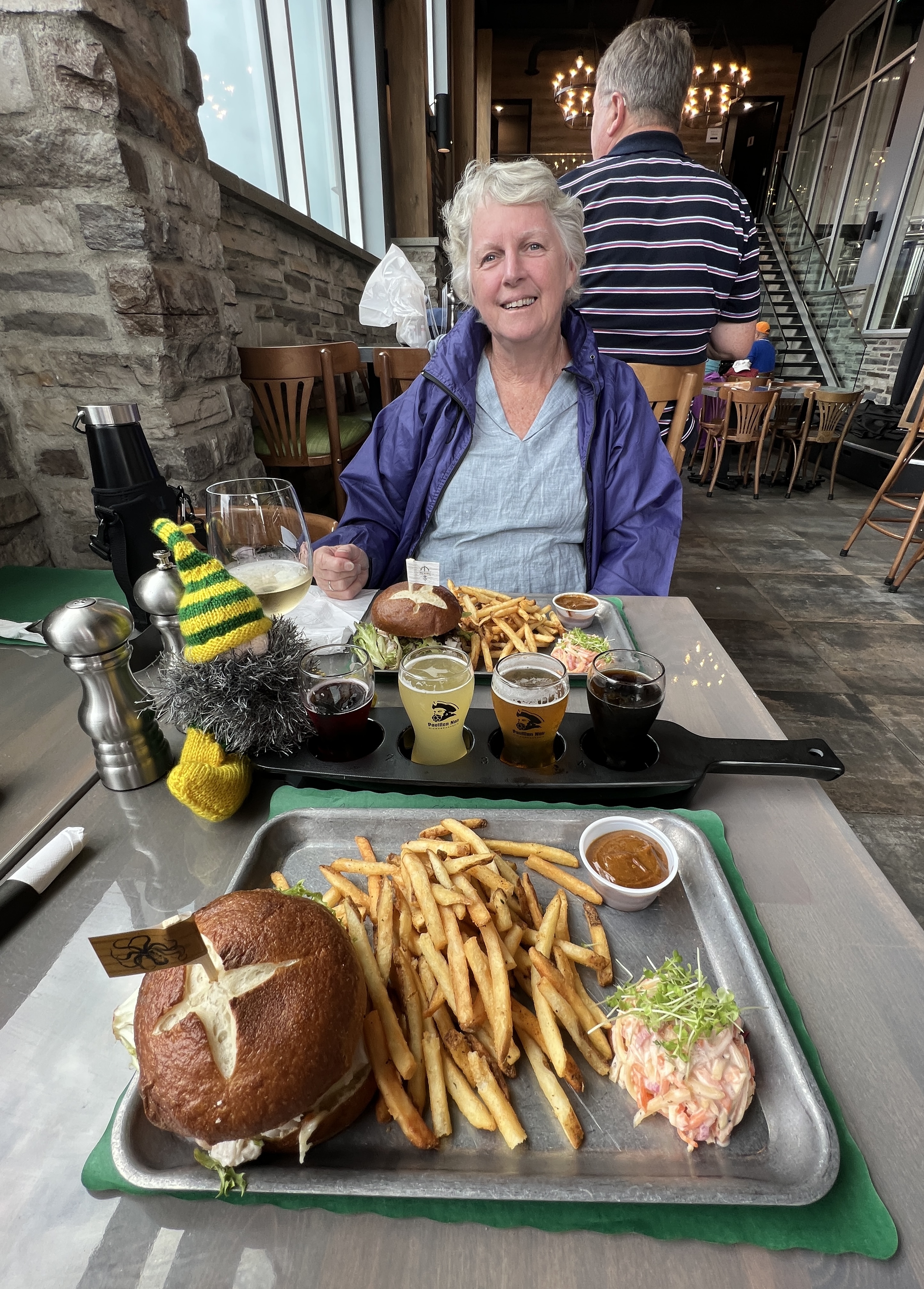
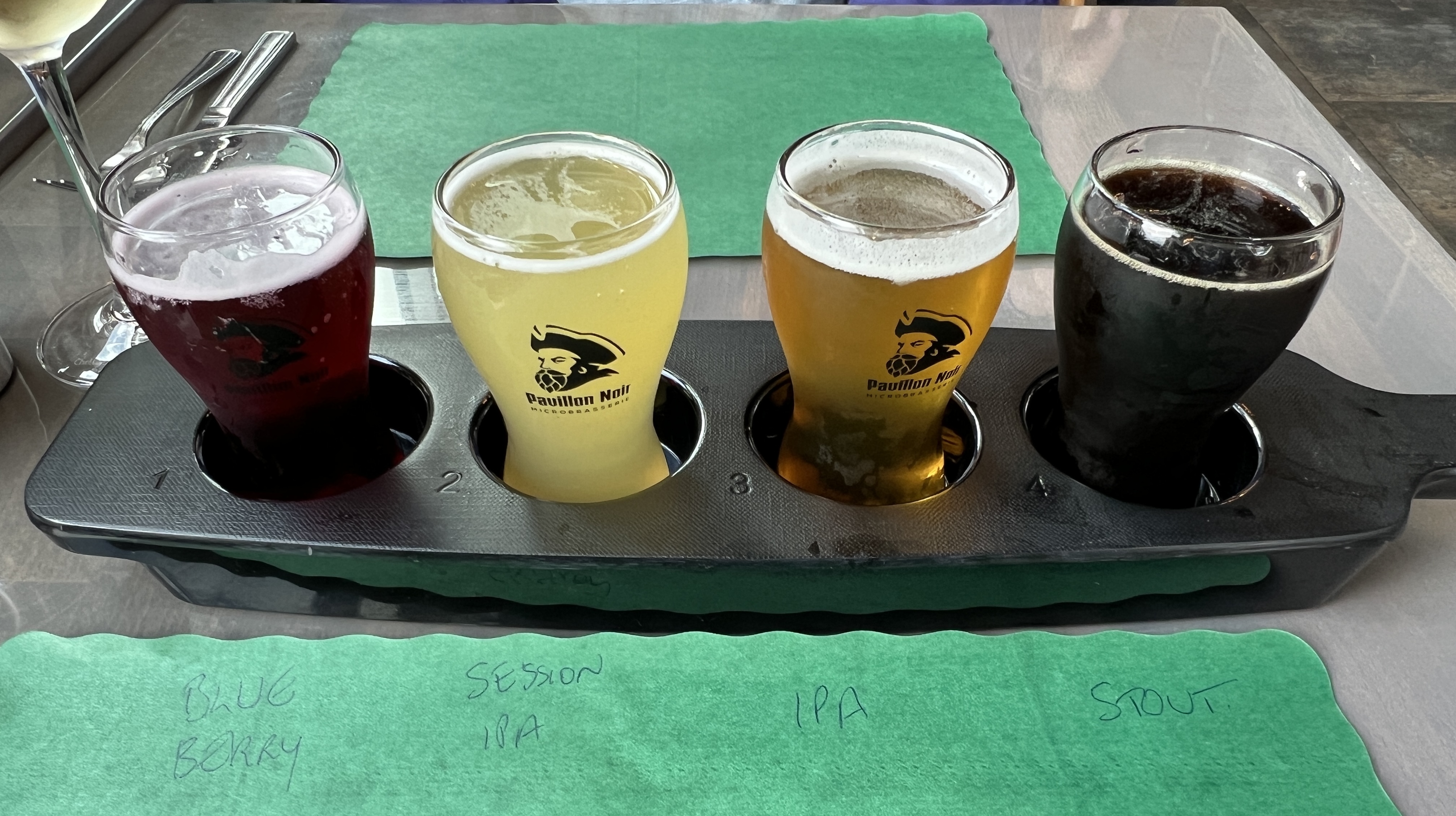
Allthego and Homealone have decided to give these ago in the ports before New York. So we give a seafood burger a go at Pavilion Noir. The waitress struggled with our English, seemed to prefer French. The burgers were great. A combo of crab and scallops in a creamy sauce, with some salad and French fries. A big tick for this place!
Sydney on Cape Breton Island is the next stop, Slobro is very confused thinks we are almost home!
