Could have been Dutch!
We had a day in Dampier and Karratha to check out the activities here. Having seen iron ore and salt ports in Port Hedland these were not to be our focus.
Of more interest was Red Dog and the aboriginal petroglyphs on the Burrup peninsula.
But first we needed to get the tyre fixed. Found a repair place in Karratha and it would be ready after 3pm which was good.
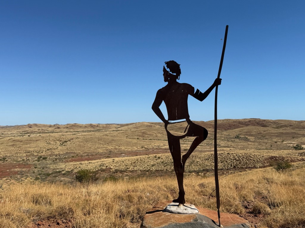
Before chasing down the Red Dog sites we made for Roebourne about 30km north and one of the early settlements in this region. It is inland a bit and has a lookout over the surrounding plains. On top are indigenous statues (7?) that look out over the particular area their clan occupied and called home. An impressive way of showing the hold of country.

Red Dog was a movie star back in the late 2000s early 2010s (two or three movies?) and there have been several short books written about his exploits.
He was well known in the area around Dampier and Karratha during the 1970s. He now has a highway named for him, the Red Dog Hwy. We came along it from Tom Price. The road follows the general direction of Red Dog’s movements around the region. Loyally following people around and hitching rides to get to places. Lots of people knew him and he knew lots too.
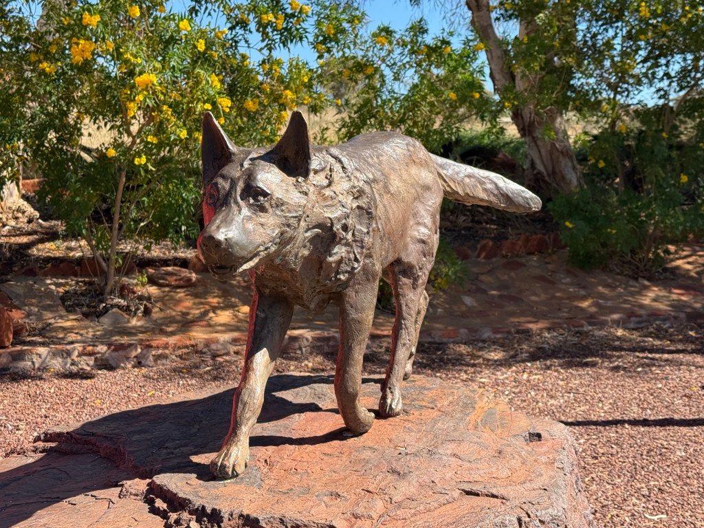
Dampier has a bronze ‘statue’ of him on its outskirts and various landmarks are noted as Red Dog haunts. Allthego and Homealone saw the first movie a while back but don’t remember the details and haven’t read the books. We picked up a small paperback to find out more sometime. Not sure how much longer this Red Dog stuff will last before it runs out of steam. Perhaps memories of Red Dog are fading with subsequent generations.
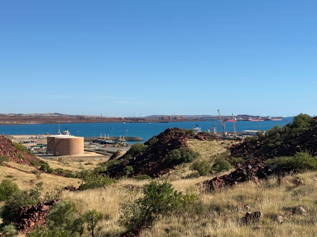
The other big activity up here is the Woodside gas plant on the Barrup peninsula. They bring natural gas ashore here from the North West Shelf gas fields and then process it for export. This is a big operation. The federal government recently extended Woodside’s rights to do all this for another 40 years, till 2070. This has agitated the greenies, anti gas groups and others, including the local indigenous groups, immensely.
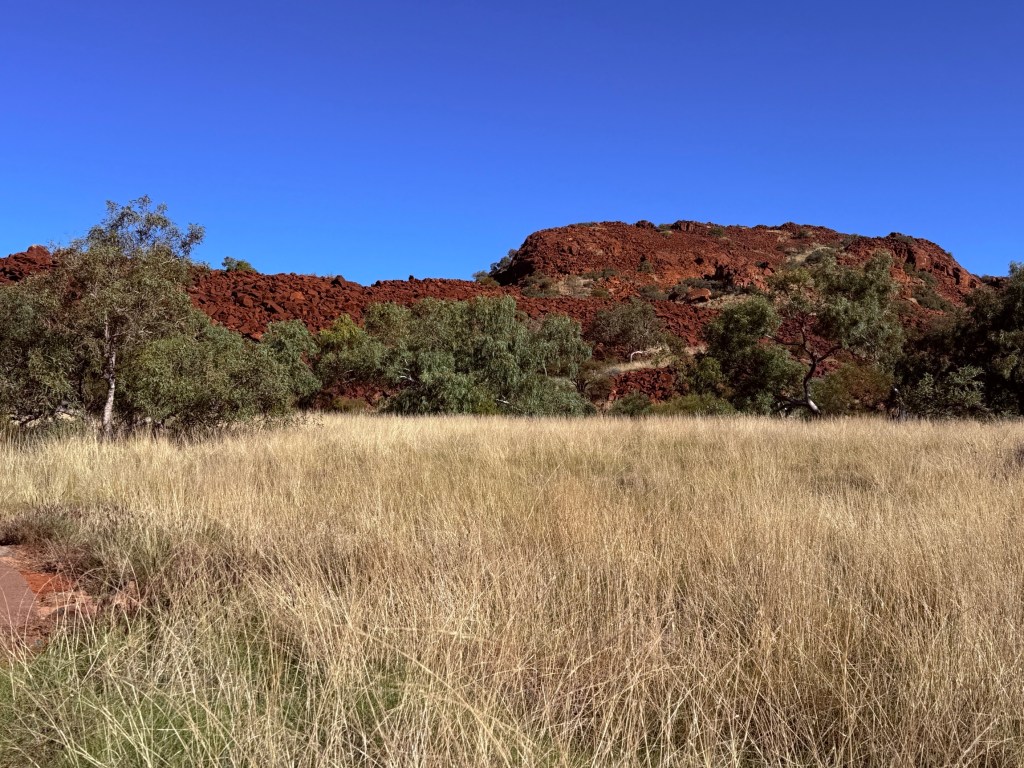
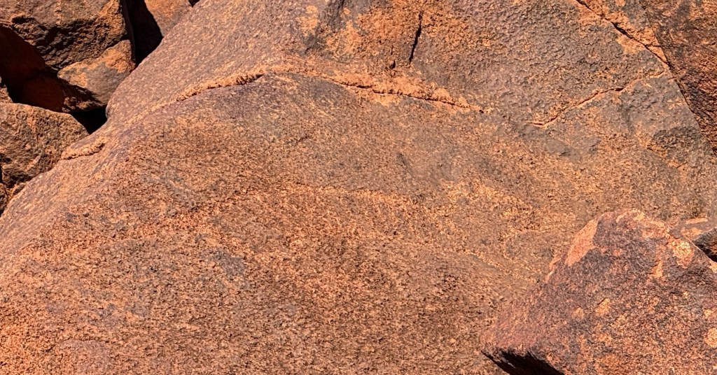
This is because, apart from the decarbonisation issue, nearby there are some big piles (not a geological term) of very old rocks with numerous indigenous petroglyphs on them. The concern is that all the industrial activity going on will ultimately destroy these images. It is claimed some are up to 40,000 years old. They are not rock paintings, like in other places we have been, but etchings in the rock faces. There are animals, images, implements and human forms represented on the faces of the rock.
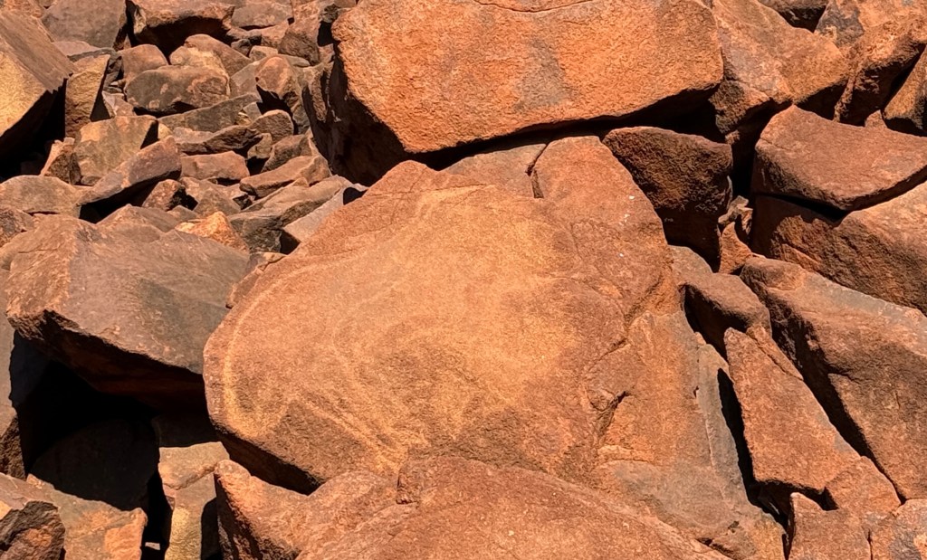
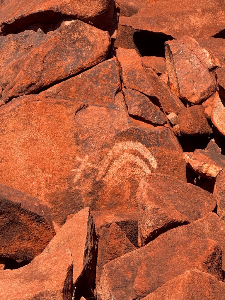
We had a wander around the site that is able to be accessed in the Murujuga NP. Some images are pretty clear, others you need the signage to assist identification and in other cases perhaps a good imagination to help! While we were here it seems the NP was made a World Heritage Site. It is interesting to ponder the human activity in this area over the last 40,000 years. Will the gas plant, the iron ore and salt ports, as well as a new fertiliser plant destroy it all? The industrialists say no. I suppose only time will tell.

We had come mid late afternoon as it was a good time to ‘clearly’ see the images on the rocks, however we had to get away back to town to pick up the tyre before the shop closed. All done!
Back at the van we settled in for another night on the Servo pad, all went well. We made a quick getaway south in the morning on the North West Coastal Hwy.
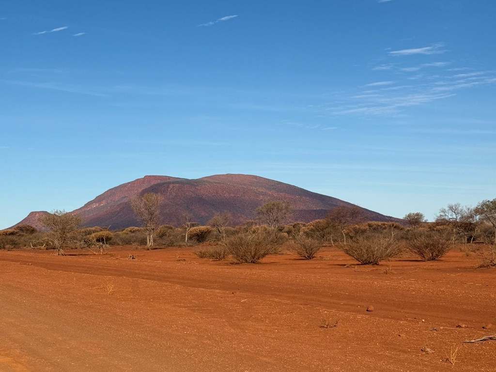
It was going to take us a couple of days driving to reach Mt Augustus, it is around 650km from Dampier inland to the southeast.
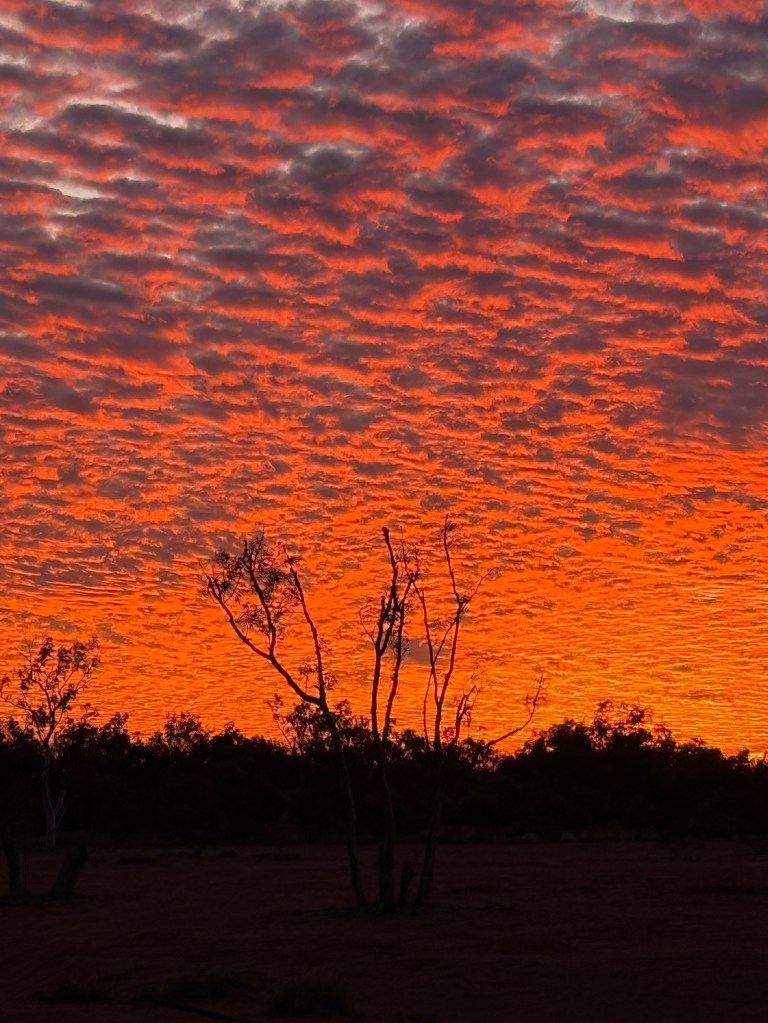
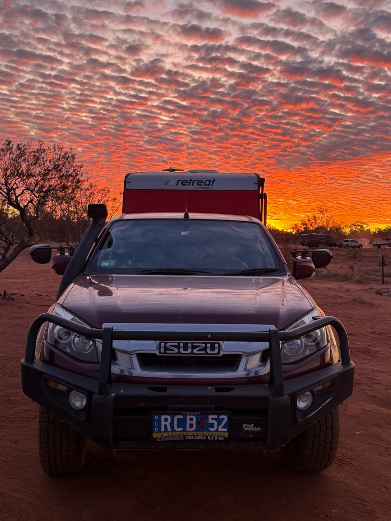
We had a one night stopover at a free camp about half way before turning off the main road to head east. A great sunset here.
The next morning the route took us along a series of mainly good gravel roads for 330km to Mt Augustus. Plenty of red dust to coat the van and contents. We arrived about 4.30pm all ok but with only about 5 litres of fuel left, plus our 20 litre safety gerry can!
By the way Dampier is named after William Dampier the English Navigator who sailed these parts in 1699. He came to check the coast out as the Dutch were sailing up the WA coast to get to the East Indies. A bit of European competition for the Great South Land? Could have been Dutch!
Posted on July 15, 2025, in Western Australia 2025. Bookmark the permalink. Leave a comment.

Leave a comment
Comments 0