Monthly Archives: June 2025
Heading south
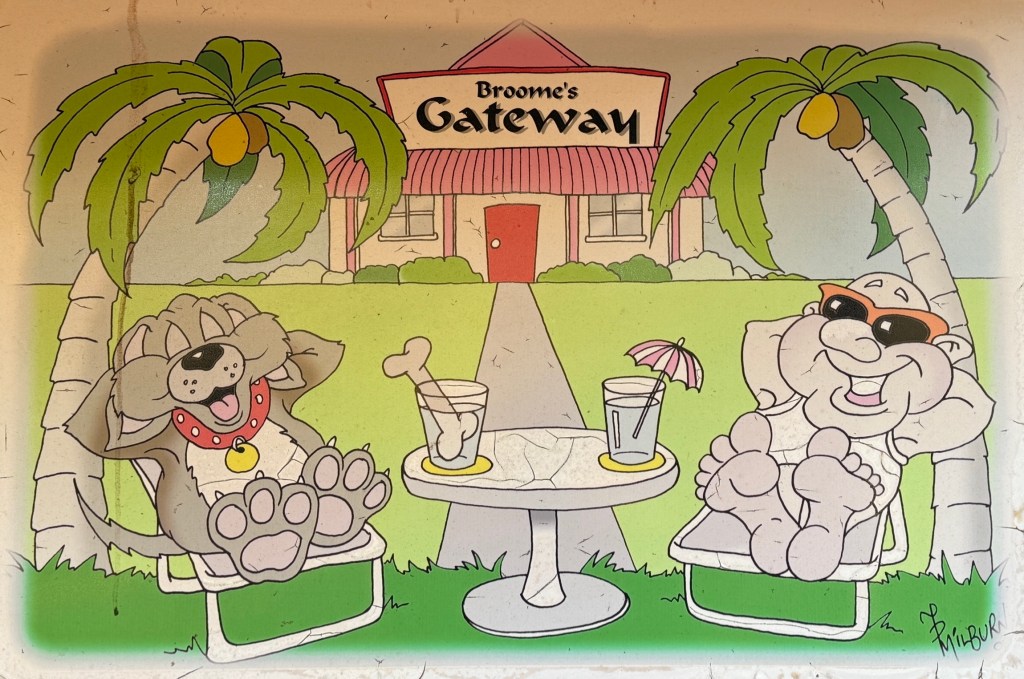
We made it down to the Broome Gateway CP in good time, staying there for one night.
After a quick lunch we headed into Broome for a quick look around the town. A lot has changed in the 15 odd years since we were last here. People everywhere and Cable Beach cordoned off for roadworks and beach front improvements. Looks like the place has become a WA version of Noosa or Byron Bay. One of the parks in town is rumoured to be charging $100 a night for a powered site. Onset of school holidays. Don’t have an urge to go back any time soon!
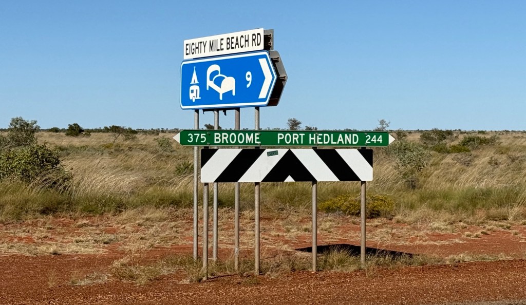
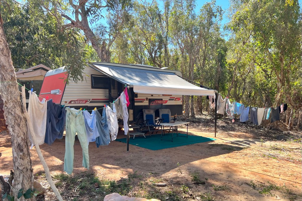
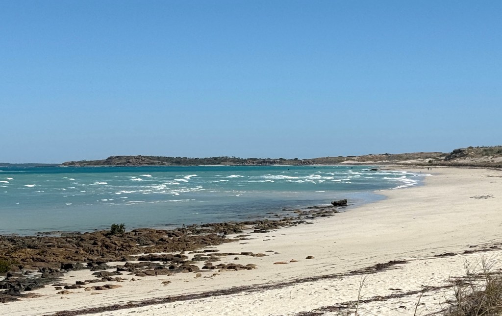
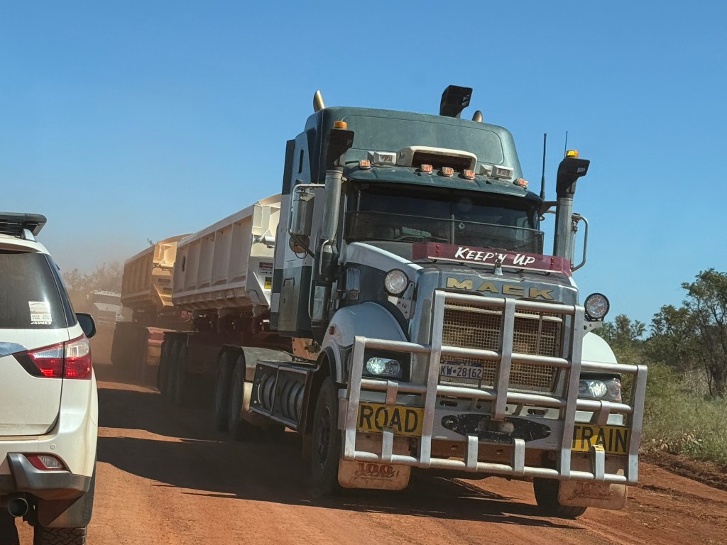
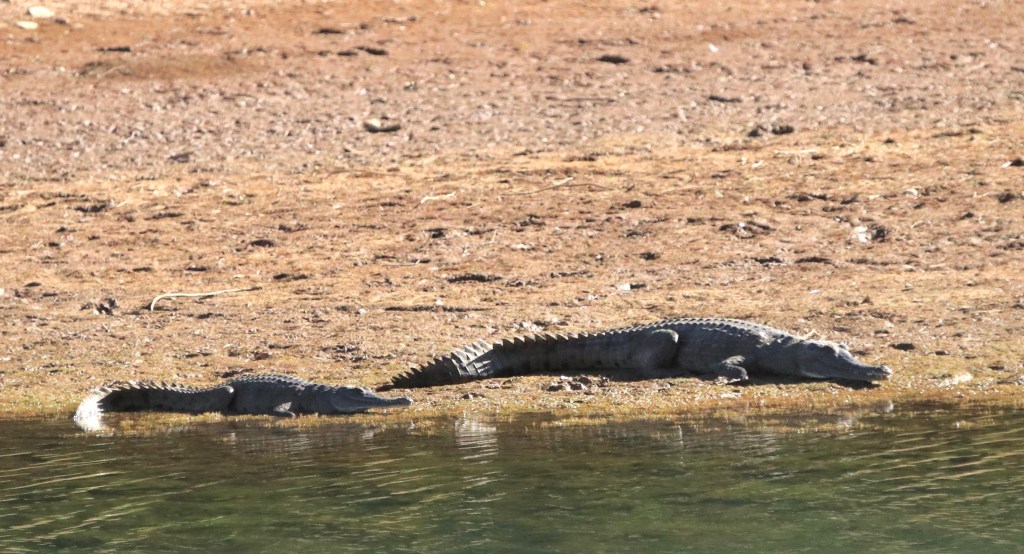
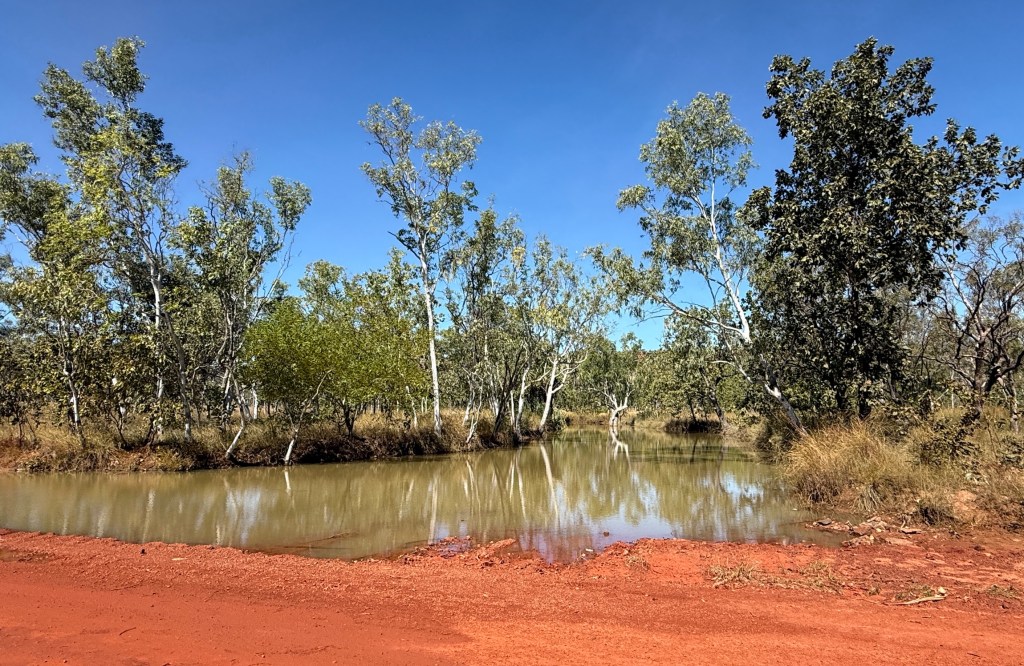
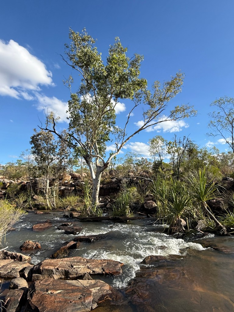
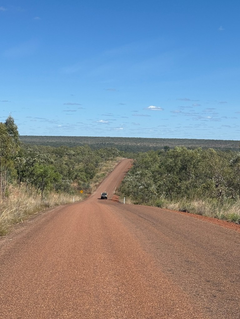
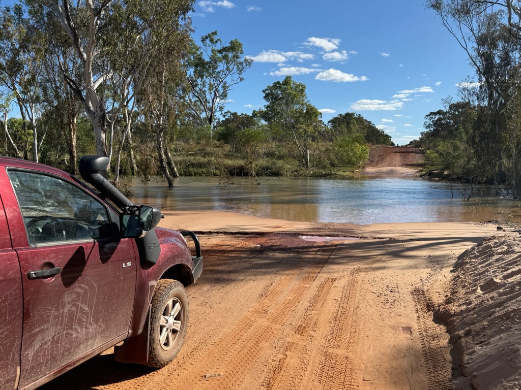
We made an early getaway the next morning. It is a 375km drive to our next stop at the 80 Mile Beach CP. It is an oddity that it is called 80 Mile Beach because it is a 220km long beach, the longest in WA.
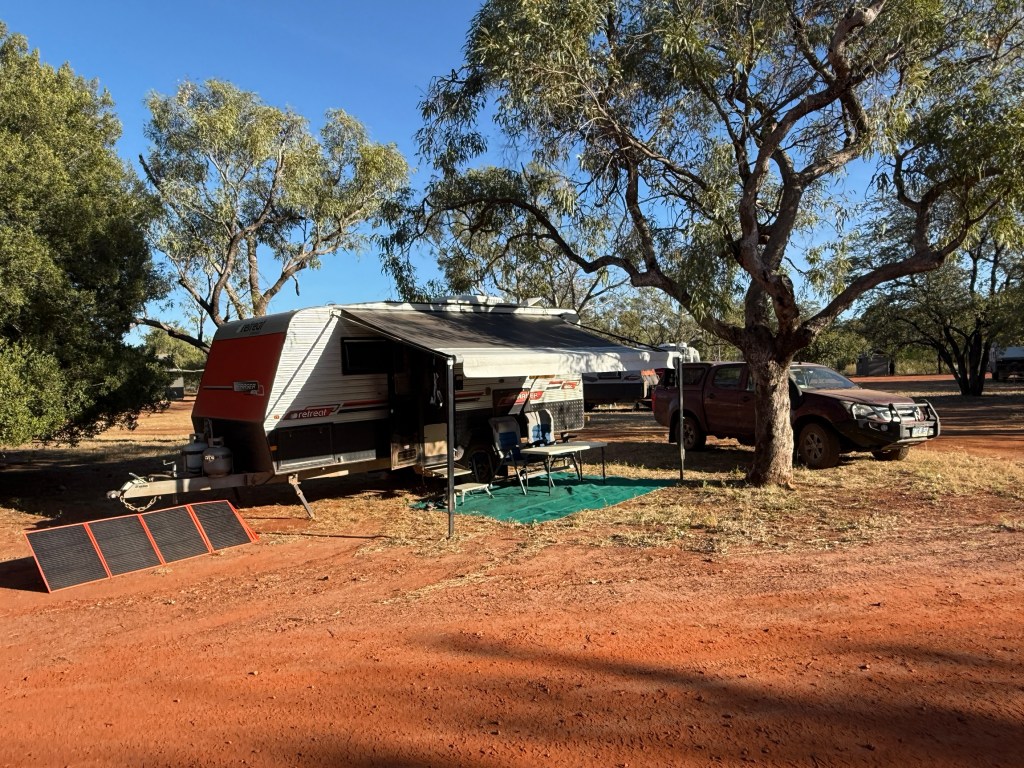
It is quite a big park and the sites are packed in a bit, but there is grass and red dirt/sand. So it is not a concrete jungle.
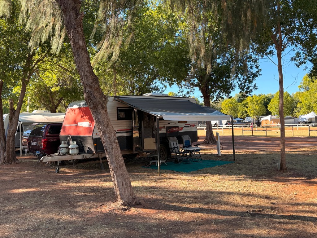
There are a good number of who seem to be ‘regulars’ and who have taken up court in prime spots. The area around us emptied out in the mornings so we had a bit more room until later in the day when others arrived.
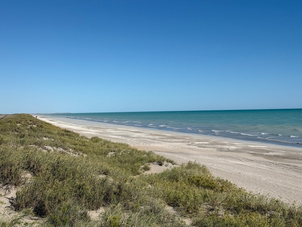
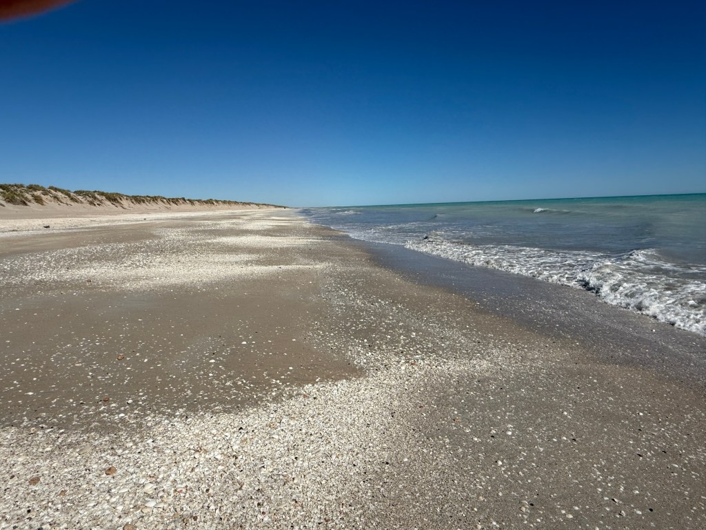
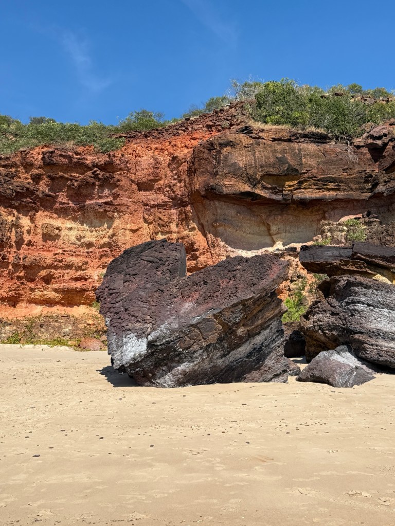
A major activity here for many is fishing and/or driving up and down the beach at low tide. The tide goes out a long long way and comes back pretty quick across the sand banks. Plenty of shells dot the beach, we filled up a small bag with some different types, adding to those from Pender Bay.
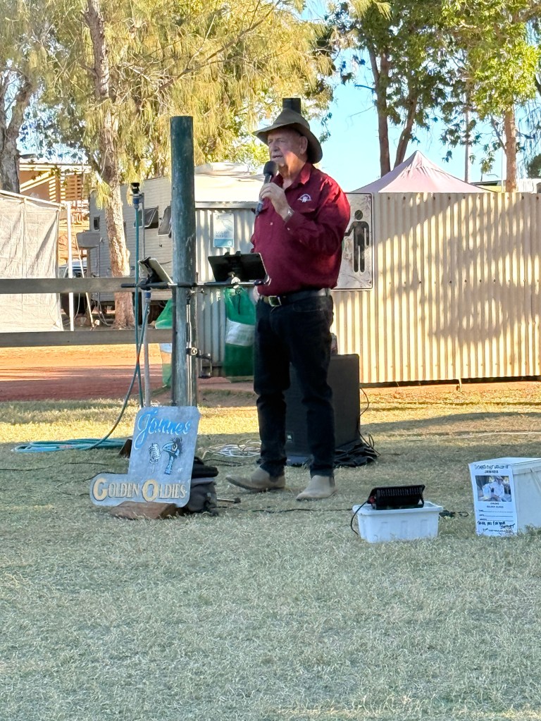
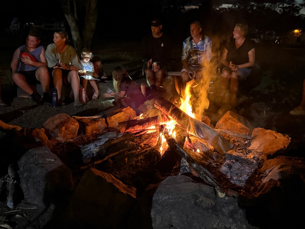
We sat and enjoyed some outdoor entertainment from a chap named Jannes, Golden Oldies. Above are two memorable videos showing his style, he too seems to be a regular here!
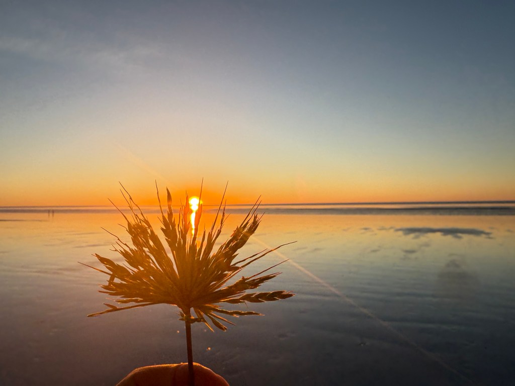
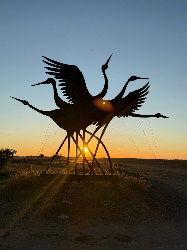
We had a lazy day here before getting back on the road for Port Hedland. Sunset pretty good!
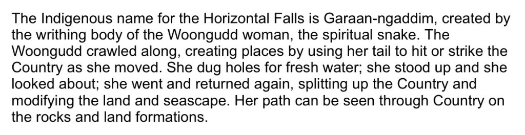
Garaan-Ngaddim
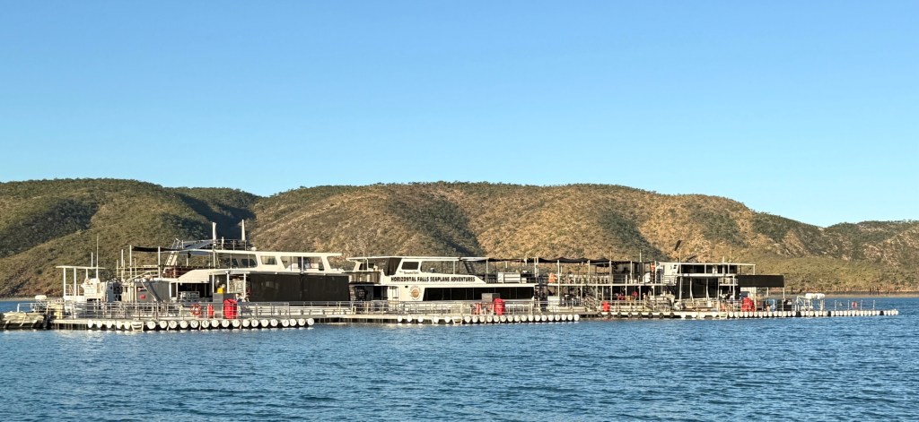
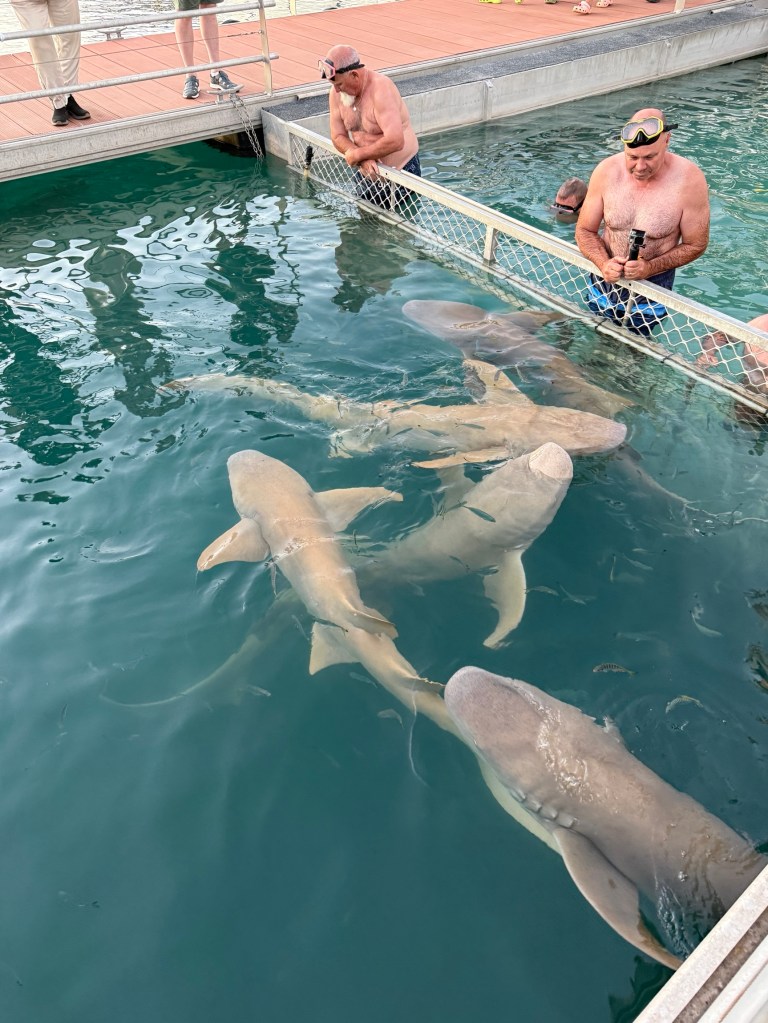
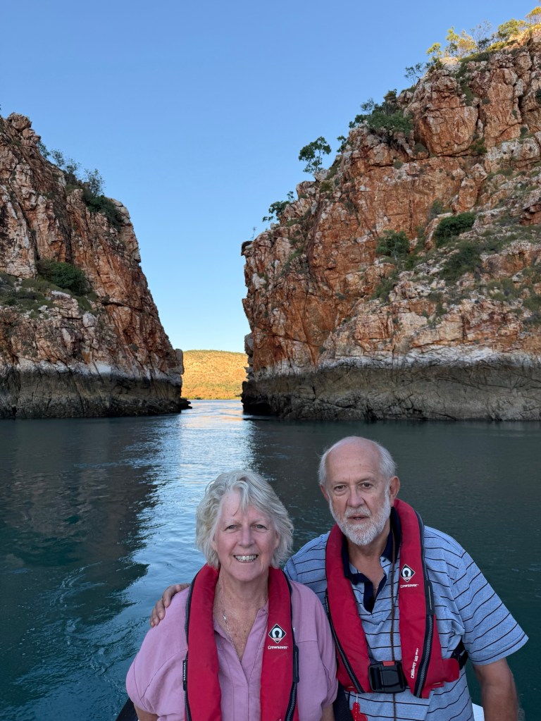
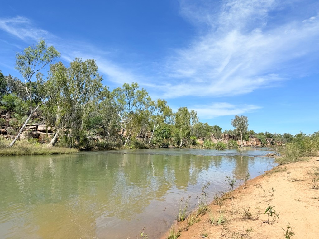
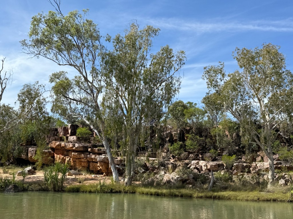
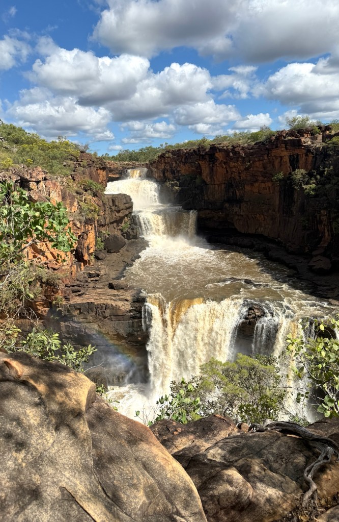
The main game in coming up to Cygnet Bay was to do an overnight stay on the pontoon at Garaan-Ngaddim. Non indigenous Australians probably know it better as the Horizontal Falls.

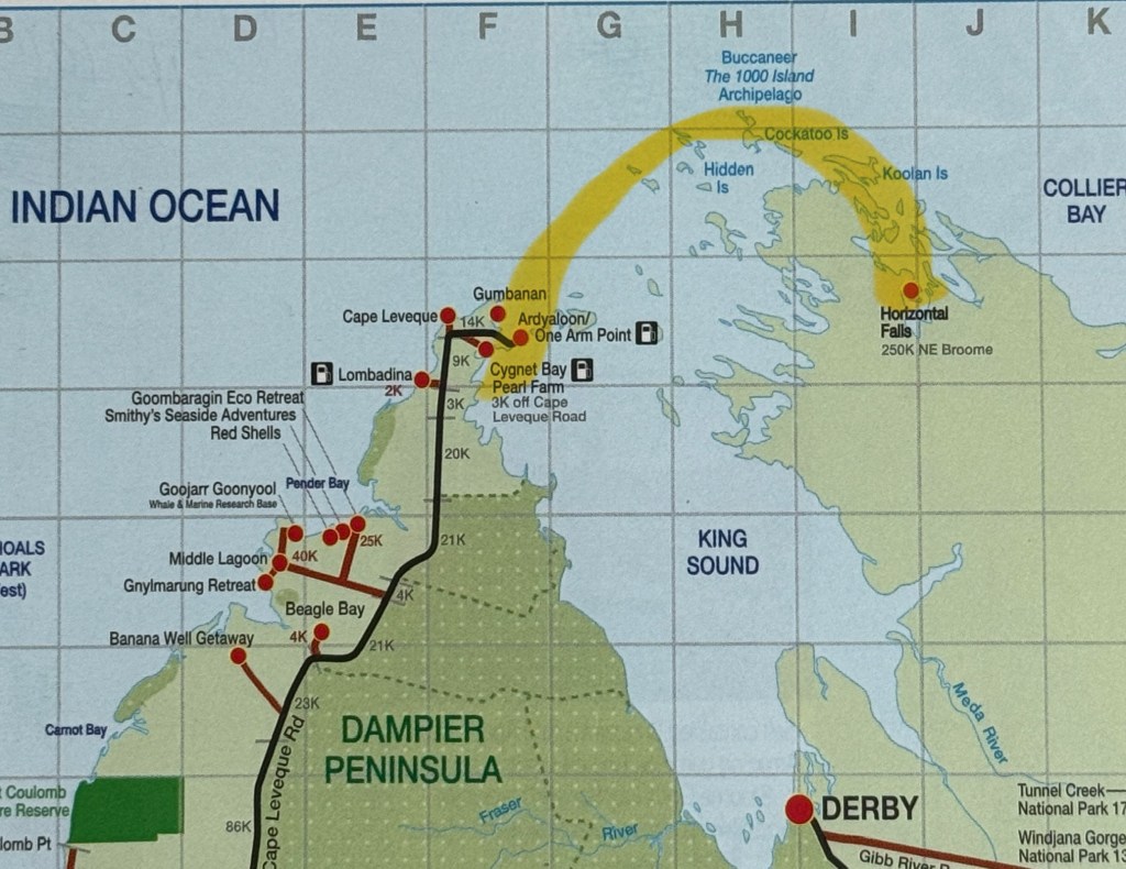
We flew in a sea plane from Cygnet Bay to the pontoon moored in Talbot Bay, about a 45 minute flight.
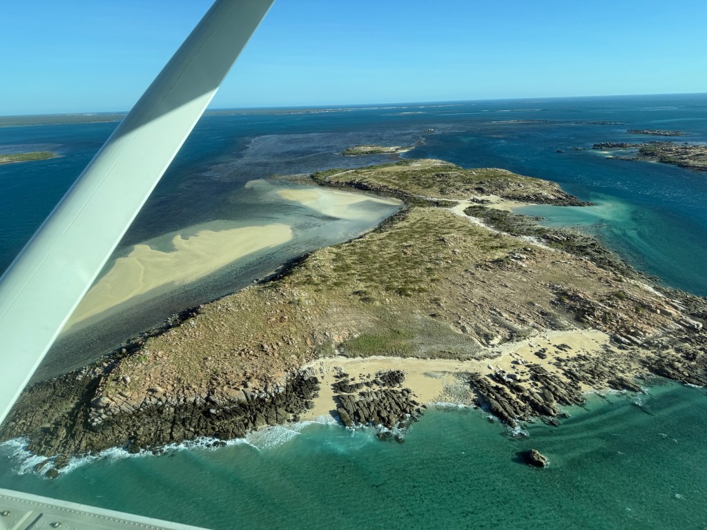
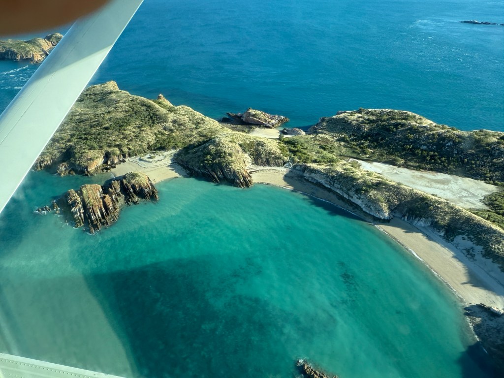
From 3,500 ft there were great views of the Buccaneer Archipelago. Landing on water was a first time experience, much smoother than what I had envisaged.
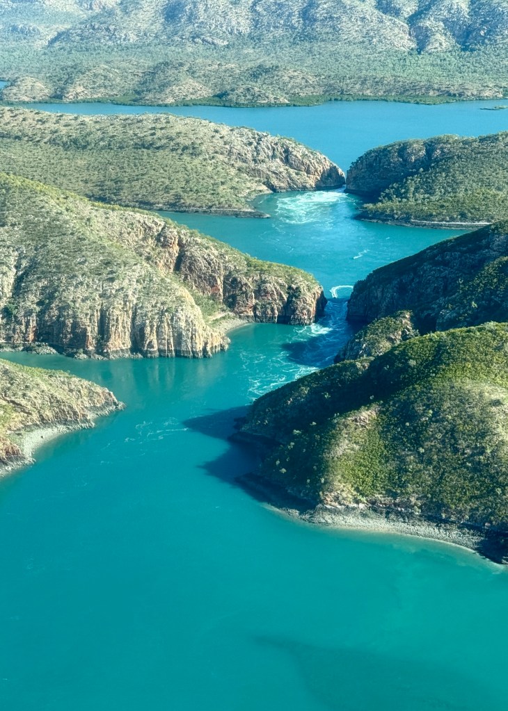
We had our first look at the falls from the air as we circled around before landing. Spectacular sight.
The pontoon works like clockwork. We arrived about 3.30 and were given a quick briefing on what we were going to do and then shown our rooms for the night.
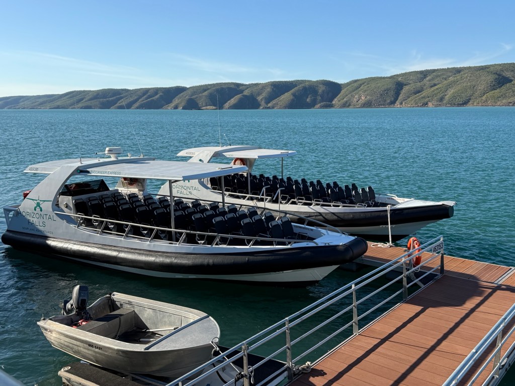
This was quickly followed by a speed boat trip for an hour through the falls and surrounding waterways. An experience indeed!
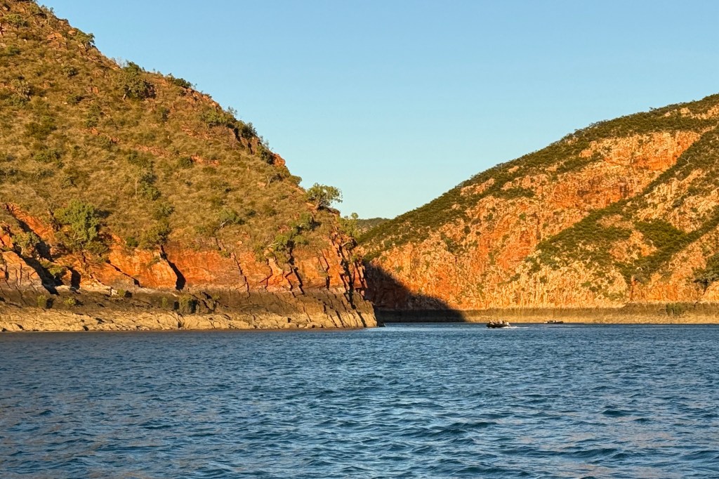
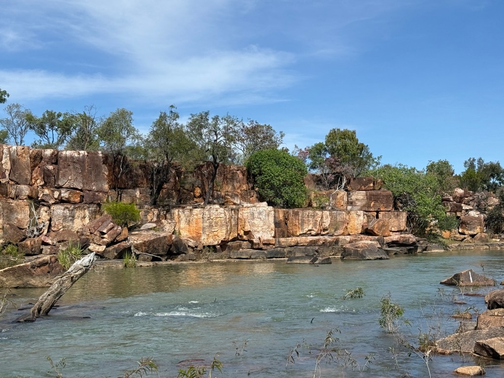
These ‘falls’ are caused by the changing of tides from high to low and the resultant flows of water back and forth through the narrow gaps in the sandstone ranges. The flow changes direction every six hours.
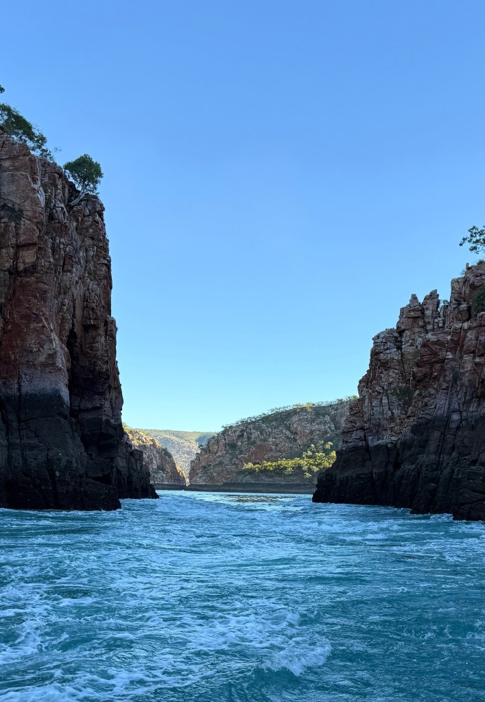
There are two horizontal falls, the wider first one and the very narrow second one. There are generally three levels of water in this chain of waterways. There is the sea level (Talbot Bay) and if we are experiencing a rising tide the water will be flowing down into the ‘inland sea’ behind the first falls.
Across the ‘inland sea’ is the second horizontal fall and the water will flow down through that into the second ‘inland sea’.
For a brief moment when the tide peaks the water levels will be the same across all three ‘seas’. They will then reverse as the tide changes and water flows out.
The Horizontal Falls is a phenomena unique to Australia.
The local indigenous people maintain these ‘inland seas’ are culturally significant and very important to their beliefs. They have native title over the area and allow boats to pass through the first horizontal fall but not the second. The second one would be rather problematical anyway, rather tricky and dangerous.
They believe the Woongudd Woman, lives in the ‘seas’ and was responsible for all of creation. When the water flows out of the ‘inland seas’ through the falls, it is the spiritual snake going out into the world to continue creation.

When water flows into the ‘inland seas’ through the falls it is the snake returning to rest. I hope that is the correct retelling of the story.
So that is why in the near future passing through the first falls may not be allowed.
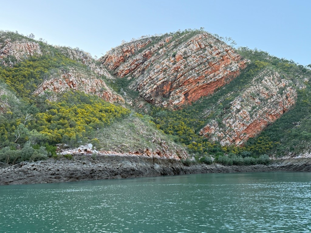
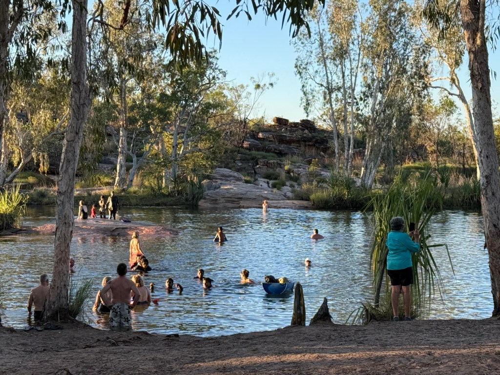
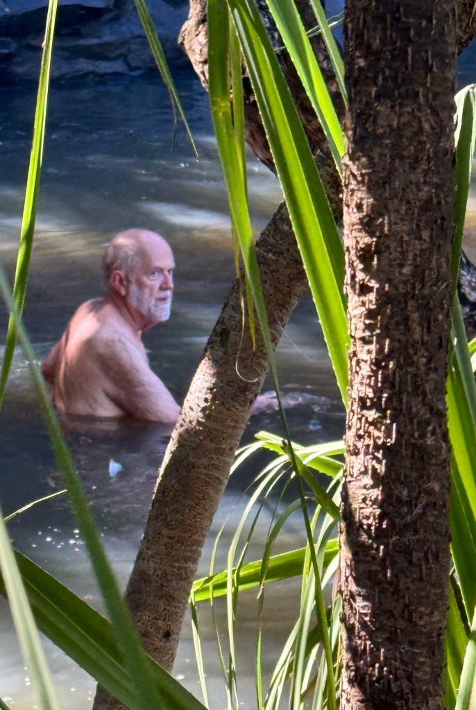
We returned all in one piece to the pontoon a little after 5pm. This was the appointed time for those who wanted a swim, a loose word for waist high paddle, in a cage beside the pontoon.
Next to the cage a flotilla of sharks gathered to feast on bits of barramundi thrown in by one of the crew. Various other fish also gathered for the event. The sharks ignored the swimmers, they are blind and generally bottom feeders and dwellers. The sharks not the swimmers. Entertaining.
After the shark show it was time for pre dinner drinks and nibbles. BBQ Barramundi and salads followed for dinner and we were all in bed by about 8.30pm, having to be up at 5.30am for a 6am breakfast.
Now, why all this haste? At 6.30 we were back in the boat speeding back to the falls for a last look.
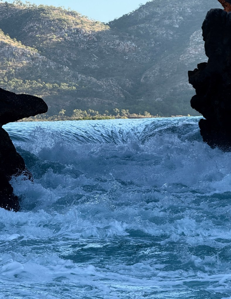
This time it was different and we had a somewhat unique experience in seeing the falls for that brief moment when the water levels were even and the passages through the falls quite calm.
The dark band of rock above the waterline is the usual daily tidal movement. The narrower white band above it is the extra tidal movement at certain times during a month.
As we watched the waters started to turn and began flowing in, was the spirit returning from an enterprising night out? Quite an experience.

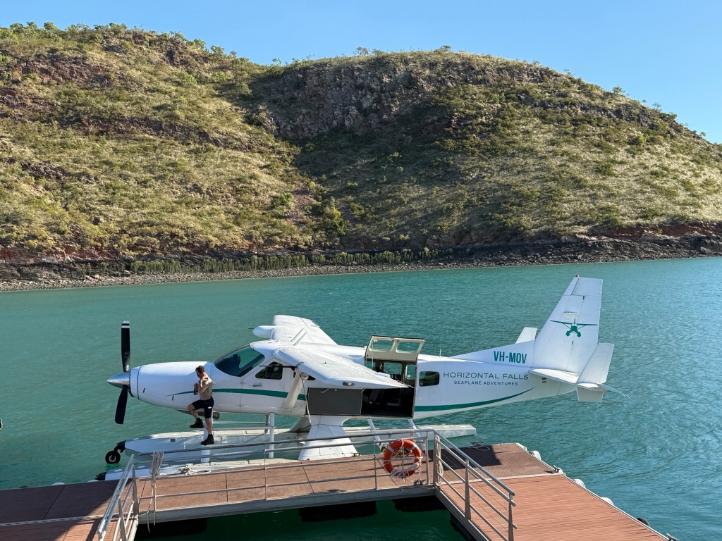
We then returned to the pontoon to get ready for our flight back to Cygnet Bay. As we waited four seaplanes followed one another into view, splash landed and motored up to their docks so that we could board.
We returned by a slightly shorter flight path to Cygnet Bay. Back at the van by 8.30am in good time to finish packing up and head back down the Cape Leveque Rd to the Broome Gateway CP.
Near the top
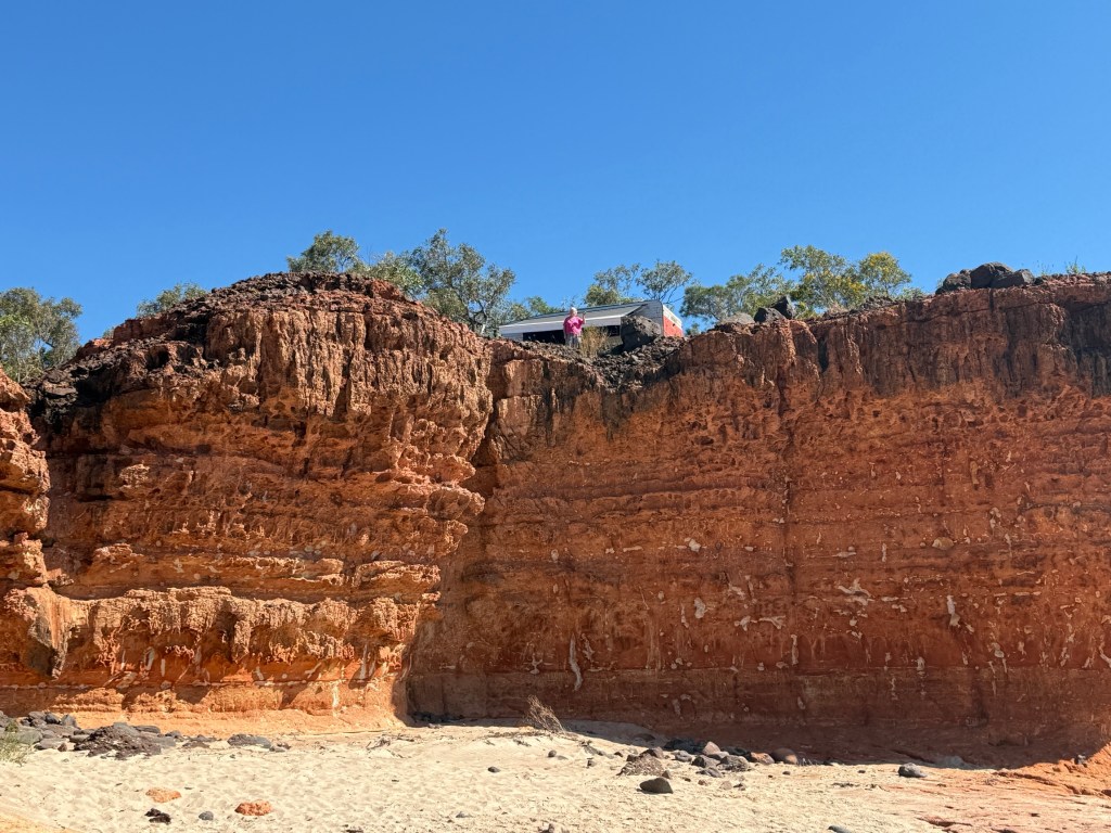
Before leaving Pender Bay Allthego had a wander around some of the headland camping spots. They all had pretty good views but mostly of ocean and other camp sites. The people in a van at one spot had a good view of us, looking down from on high!
We made it up to Cygnet Bay in good time. The track out of Pender Bay seemed better than the track in! After a close look it was the same track. Often the case!
We only encountered two vans coming in and that was near the turnoff from the main road. So no problems getting out.
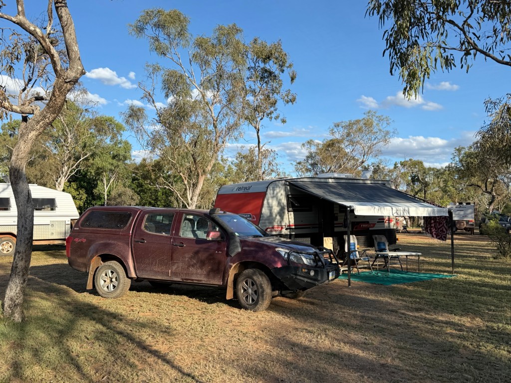
Cygnet Bay Pearl Farm is near the top of the Dampier Peninsular and we took up residence there for three nights. It was our first powered site since Home Valley Station on the Gibb almost four weeks ago. A bit of luxury.
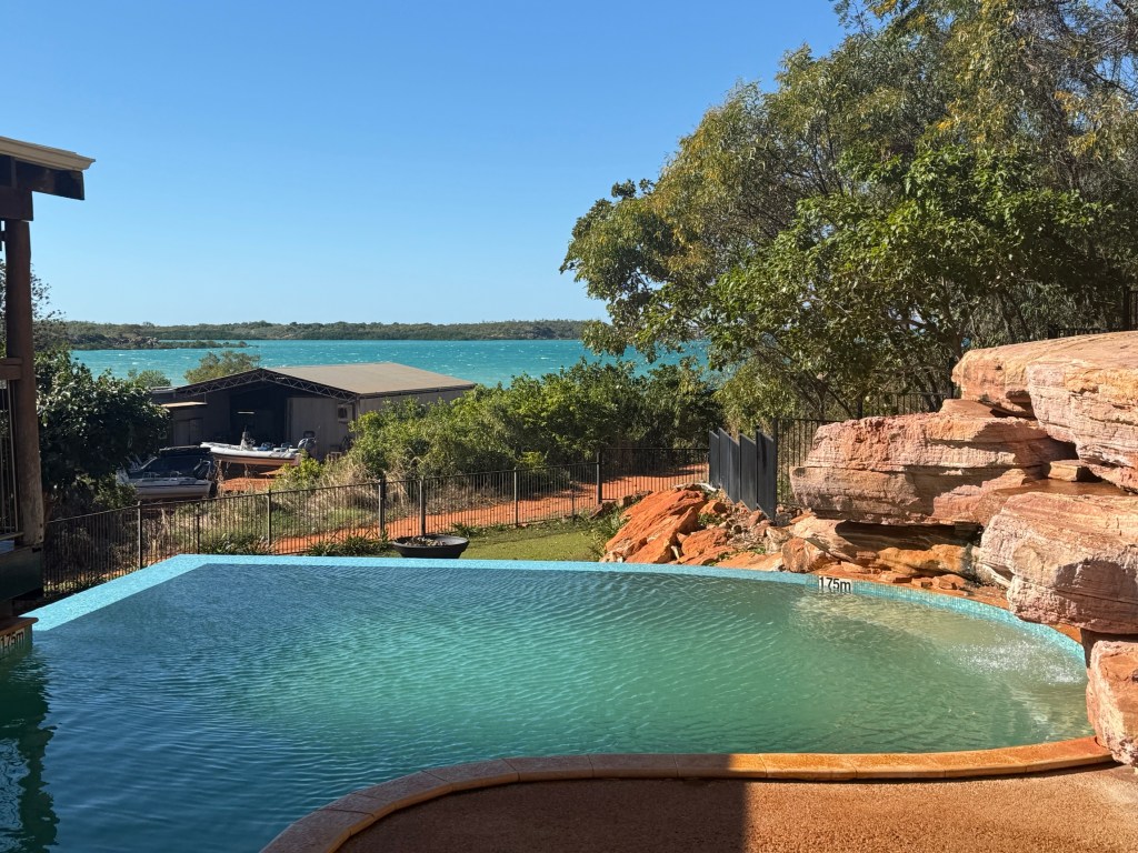
The Pearl Farm runs a tourism operation alongside its pearl business. Camping grounds, infinity pool, restaurant and various daily tours of farm operations. There are also boating excursions on the waters surrounding the tip of the peninsular.
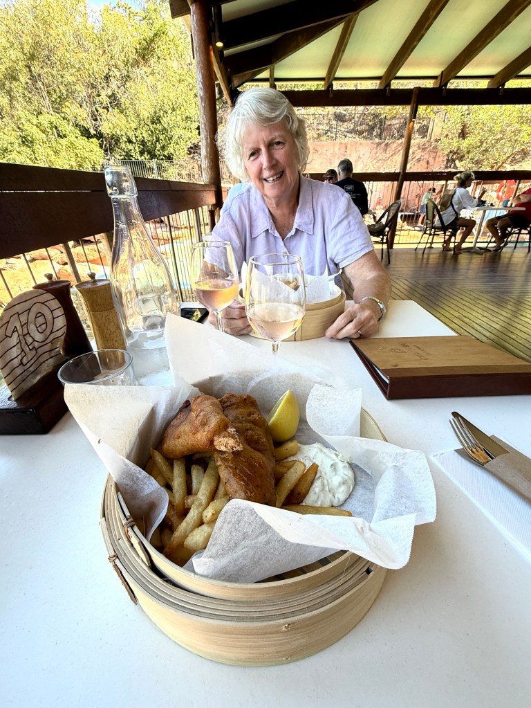
We gave the fish n chips a go at the restaurant. Very generous serve of barramundi pieces and the usual pile of chips buried underneath with the tasty tartar sauce. I think the best F&C so far! The rose helped.
Nearby is the Ardyaloon Aboriginal Community. The pronunciation in these parts emphasises the first syllable and the rest rolls off! Very phonetic too.
So
AR d a loon!
I think that is right?
It is interesting that the little book mentioned below spells it totally differently….Ardiyooloon. Maybe because indigenous languages were not written the English spelling relies on the nuances of pronunciation over time?
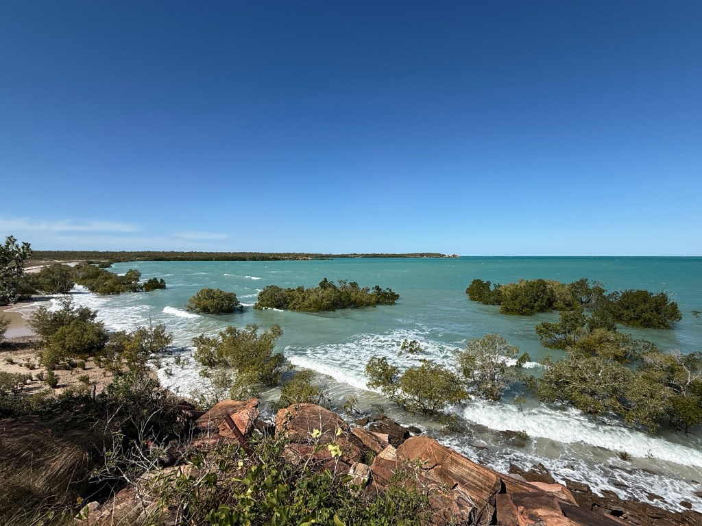
Native Title and a small fee of $11 each to have a look around the town and environs. The waters and beachfront here are pretty special, the tides rip through the channel between the islands and the mainland. Eerie noise!
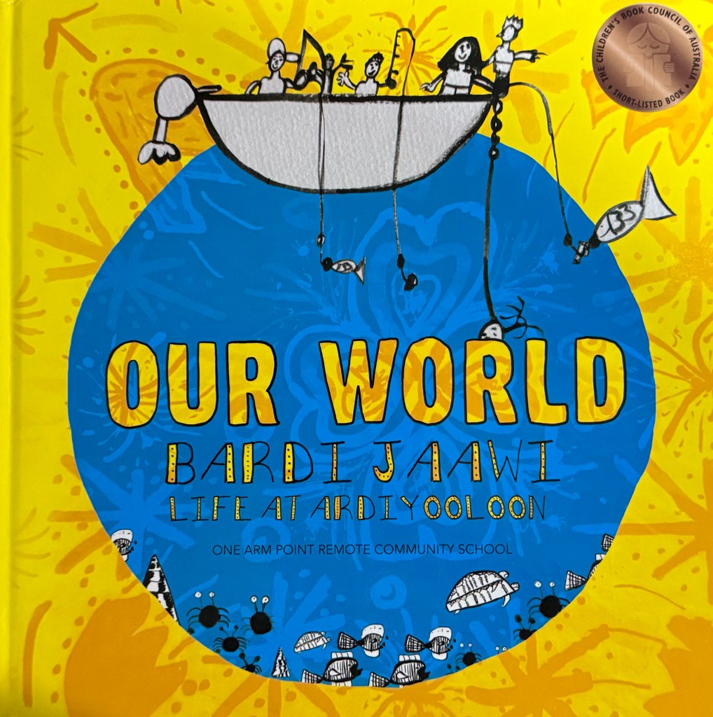
The kids at the local school have published a book discussing their traditional life, plenty of pictures and annecdotes. The Bardi Jaawi people are ‘sea people’ and live in it and from it.
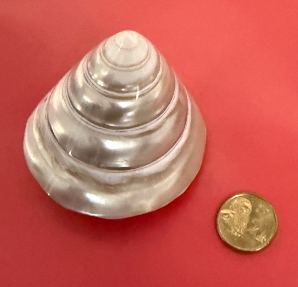
It is a great read, better than a text book or an ABC documentary! Also bought a polished trochus shell, $35 ……mmm…on what shelf am I going to put this now?
They have a hatchery originally set up to grow out trochus for the button trade, now dead because of plastics.

The hatchery is now a mini aquarium with various sea-life from the region. Well worth the visit, a resident turtle entertains!
Back at the camp we had a short tour/chat about the origin of the farm and pearl production. There was of course the opportunity to acquire a pearl or pearls at various prices.
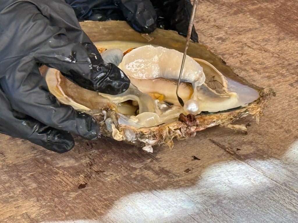
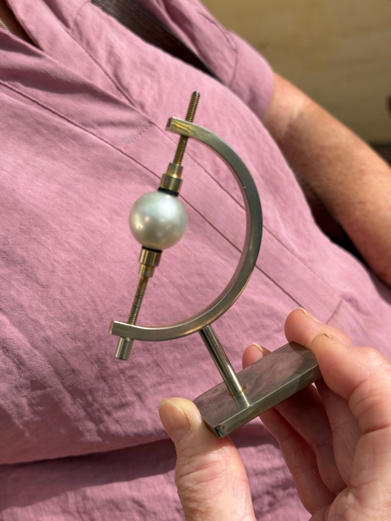
There were a couple of nice strings of pearls ranging from the low $38,000 through to $58,000. These appeared to be slow moving stock items. We did not increase the stock turn rate.
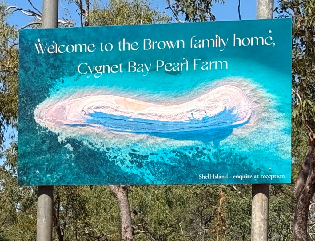
Interesting, it seems this operation is part of the Brown family business empire. No one has ever mentioned this to me, I must investigate any unknown ownership interest.
Our last day at the farm involved a visit to Garaan-Ngaddim. But more of that next time.
Pender Bay
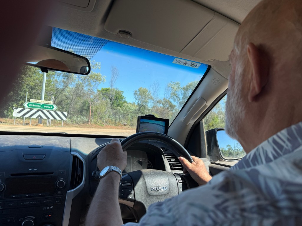
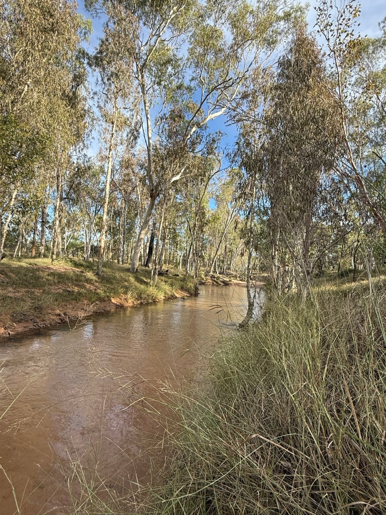
We left Derby with the aim of getting to the Broome Gateway CP in good time so as to make a quick trip into Broome to pick up some supplies. The CP is roughly 30km from Broome. The road down from Derby is fully sealed and passes through pretty flat grazing country.
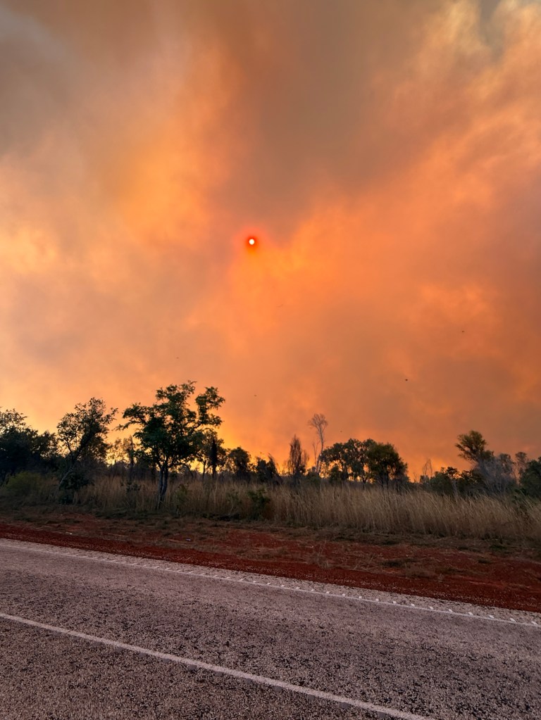
We had a little bit of excitement along the way with an unruly fire that was ravaging the country alongside the road.
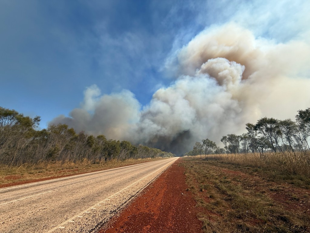
We could see plumes of thick smoke from a way off. For some reason the road headed to where the fire was and this presented a bit of a dilemma as to whether one pulls over and lets it pass or do you battle on through the smoke etc.
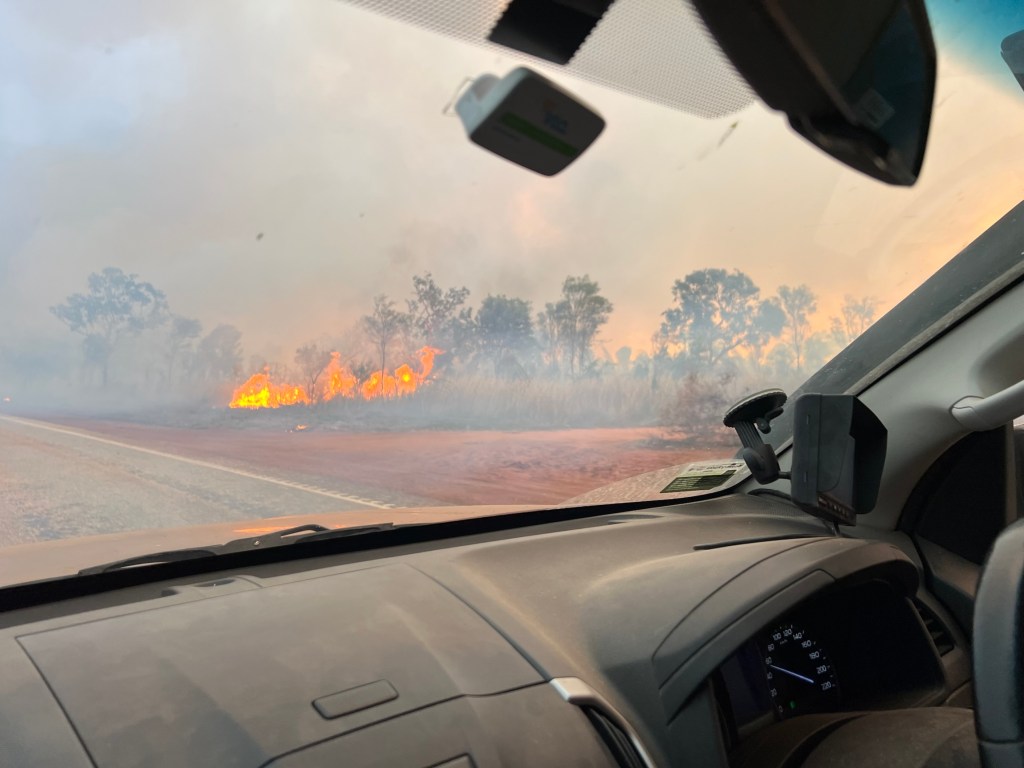
Plenty of cars and trucks were coming the other way so we ploughed on.
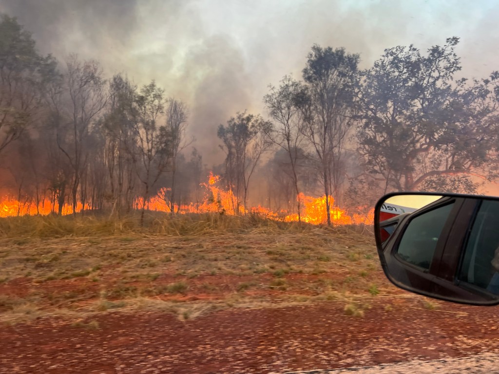
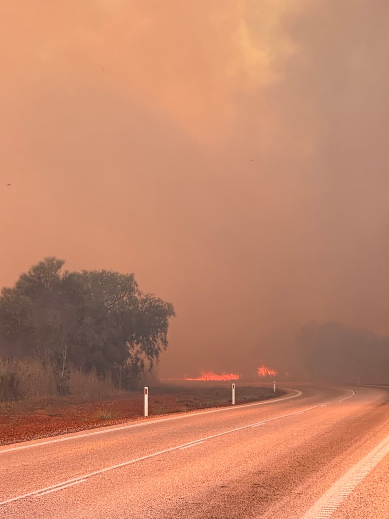
Bit scary I tell you! Couldn’t see much in some places except the white centre line. Homealone took some great photos of the experience. Probably will choose to let the fire go by next time!
Despite the fire we made it to camp in time to set up and make the gquick trip to Broome for the supplies. We had to pick up a few bottles of wine for the days ahead on the Dampier Peninsular. This can be easier said than done in the Kimberley region. Bottle shops are not open Sunday or Monday and when open don’t do so till Midday. And I think you can only buy two bottles without having to sign forms saying you are a bona fide traveller etc. The police can search the car and you need the receipt from the bottle shop to clear your name. All in the interest of restricting access to alcohol in the community. Probably a good idea.
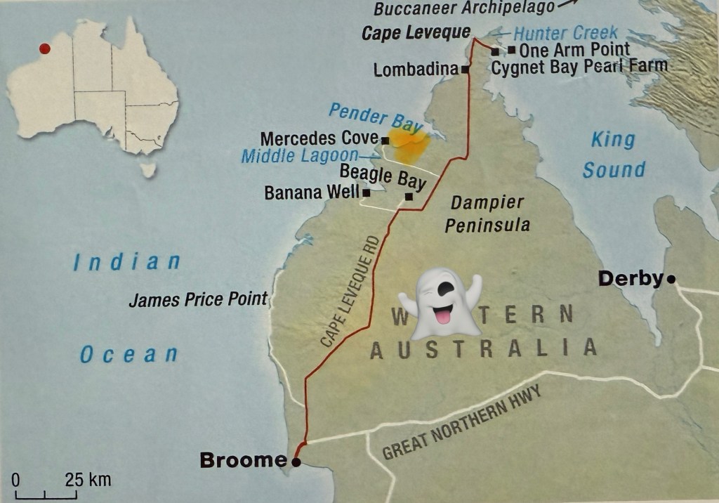
It was only a one night stop at the CP and the next morning we set off up the Cape Leveque Road, which more or less runs up the centre of the Dampier Peninsular. It is only in the last 18 months that this road has been sealed all the way to the top. Apparently, it used to be a nightmare and took almost all day to do the full length. We had left about 10am and made it to Beagle Bay before lunch.
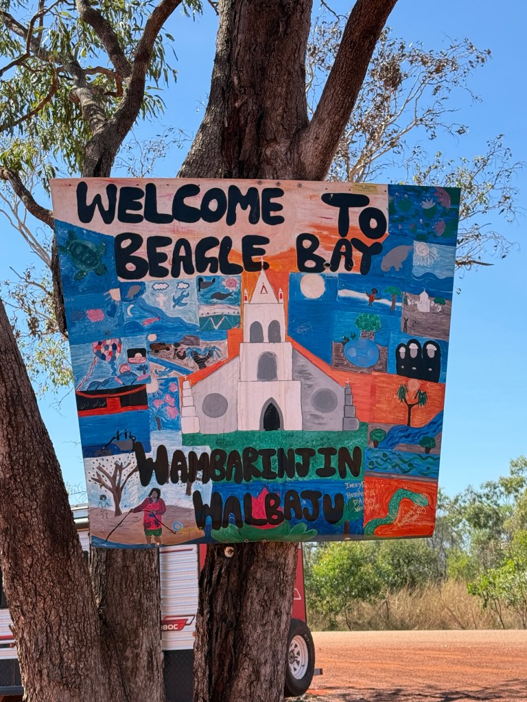
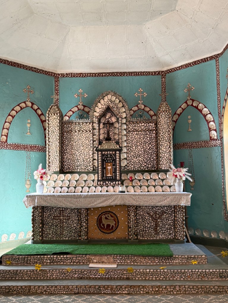
Beagle Bay, about 5km off the main road, is a popular stop with Nomads as you can top up with fuel and visit the Sacred Heart Church, the altar of which is made from Mother of Pearl shells. It was originally built by Pallotine monks and local aborigines in 1918, the bell tower was completed in 1920.
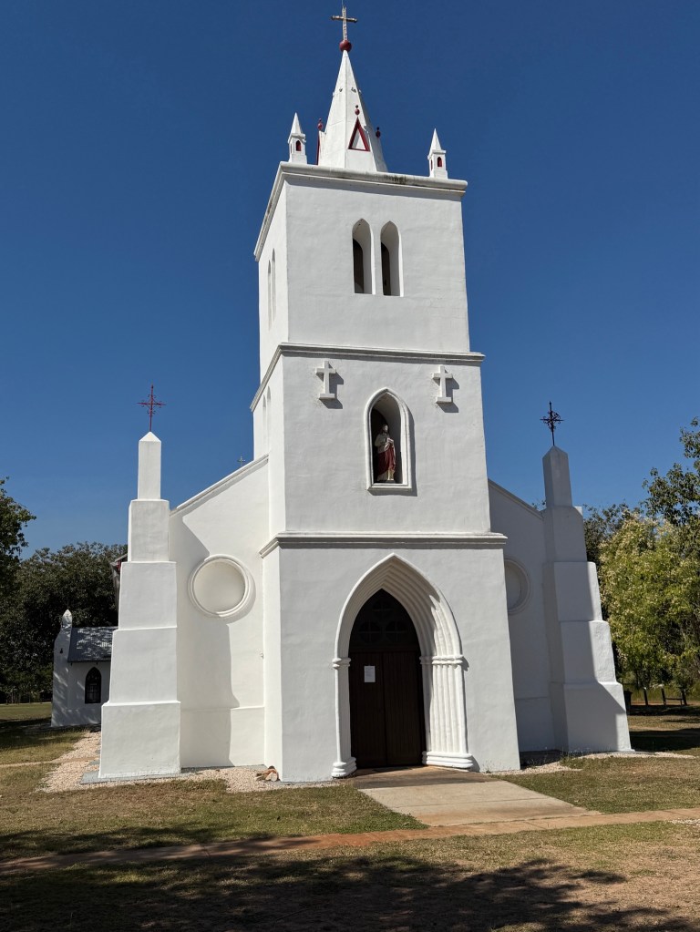
The Church has been renovated a couple of times since then and the bell tower was rebuilt after it collapsed in 2001.
We decided to skip lunch and head back onto the Cape Leveque Road and make for Pender Bay. After 20km we took the turnoff to Middle Lagoon, our destination is a subsequent turnoff off further along.
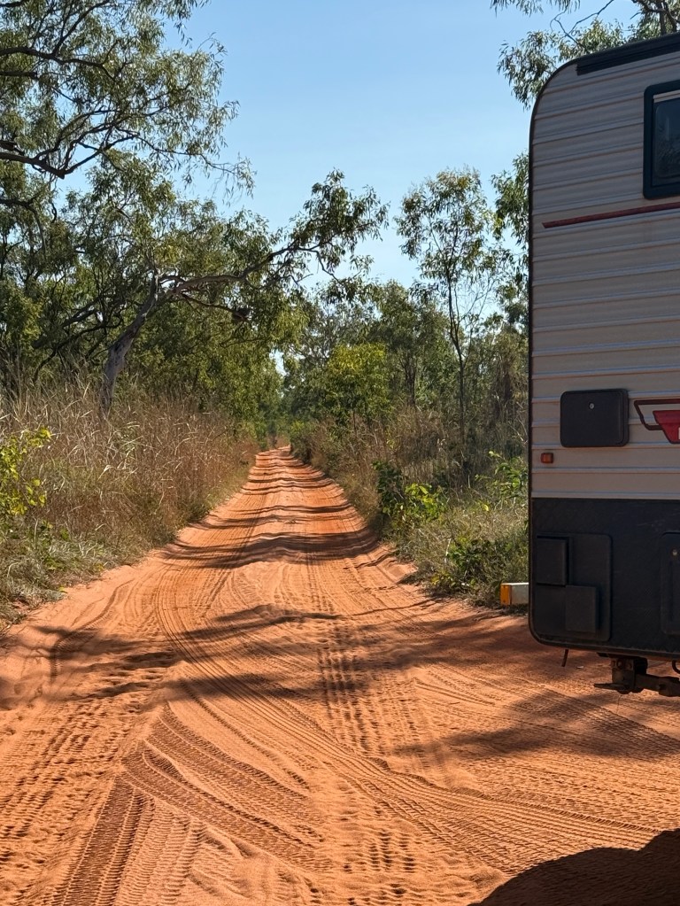
All up an hour and 35km of very slow, corrugated, bumpy and sandy track. Mostly, a single lane bush lined track with limited passing points.
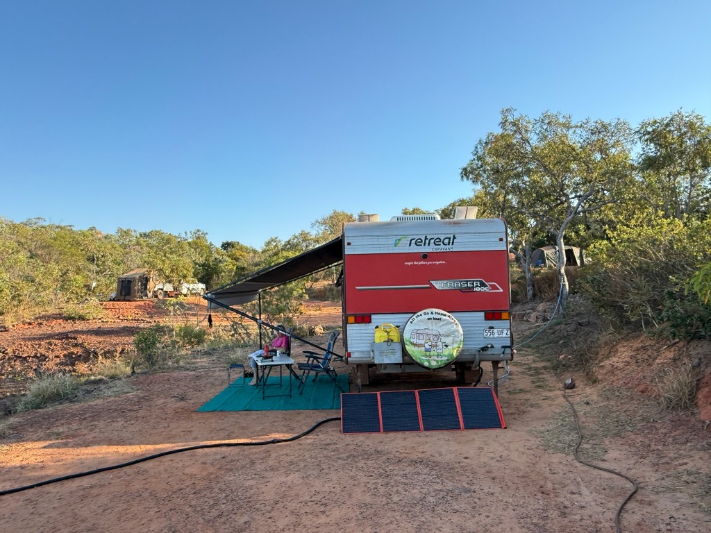
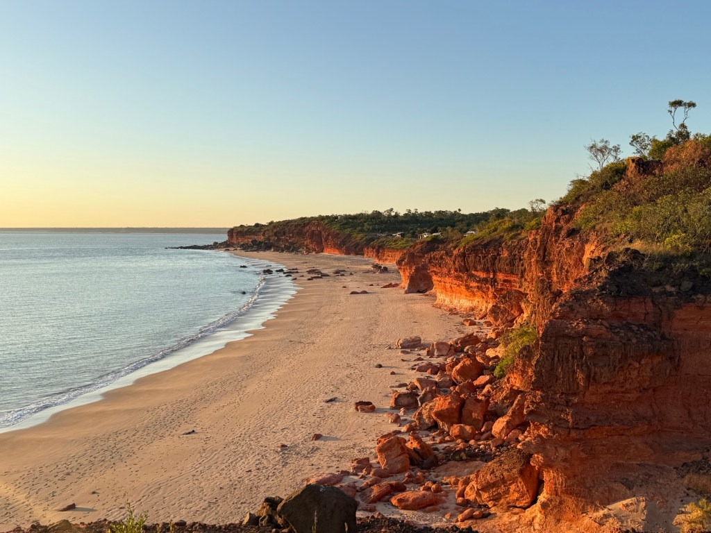
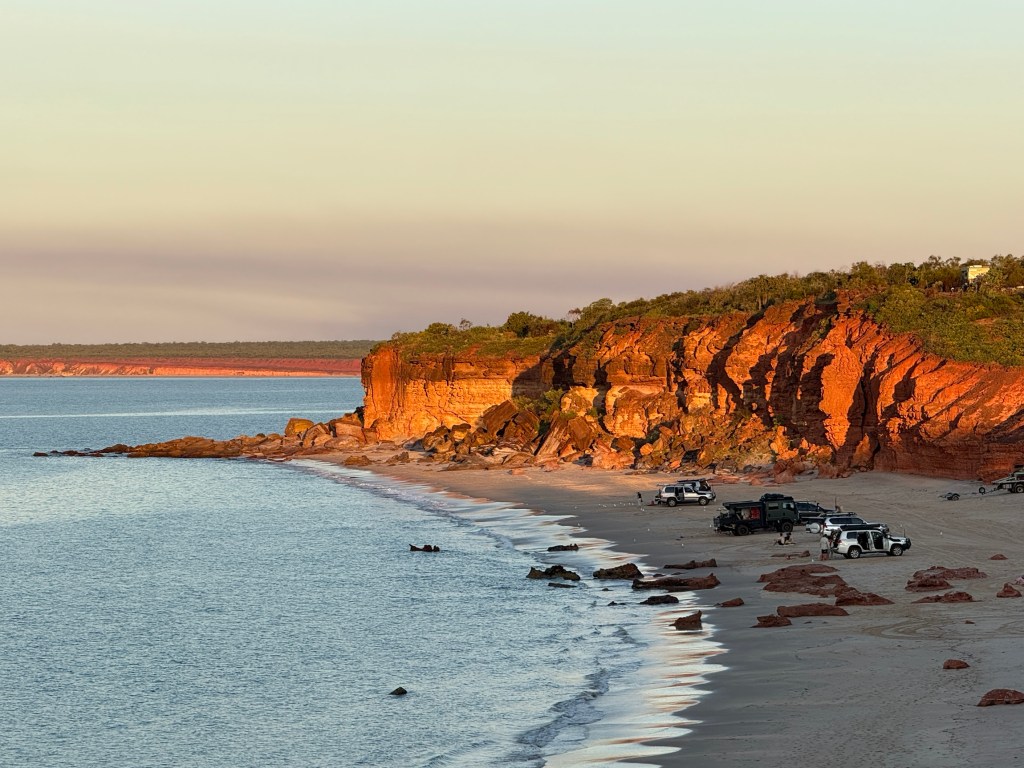
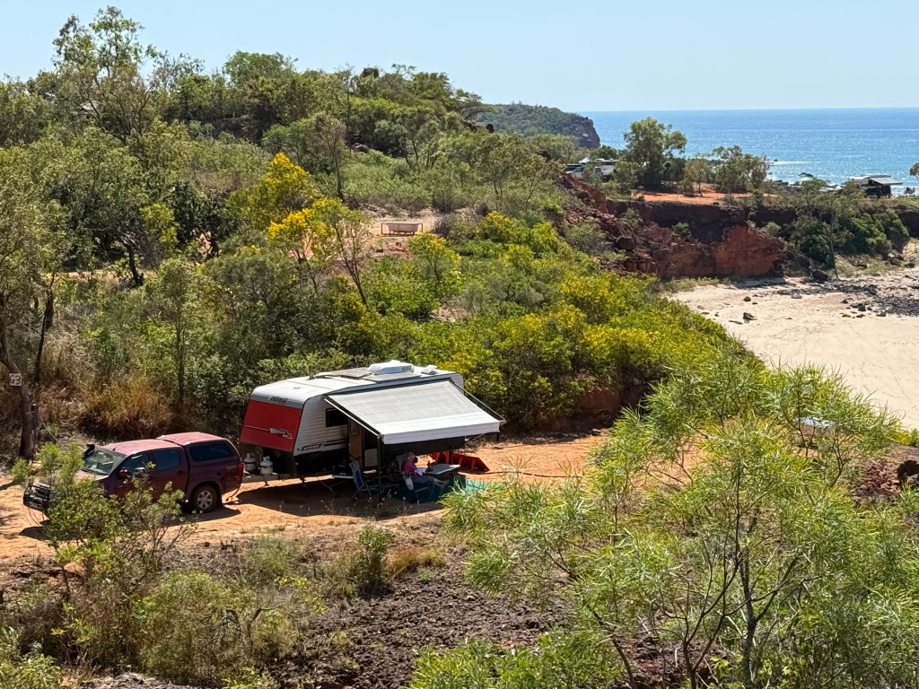
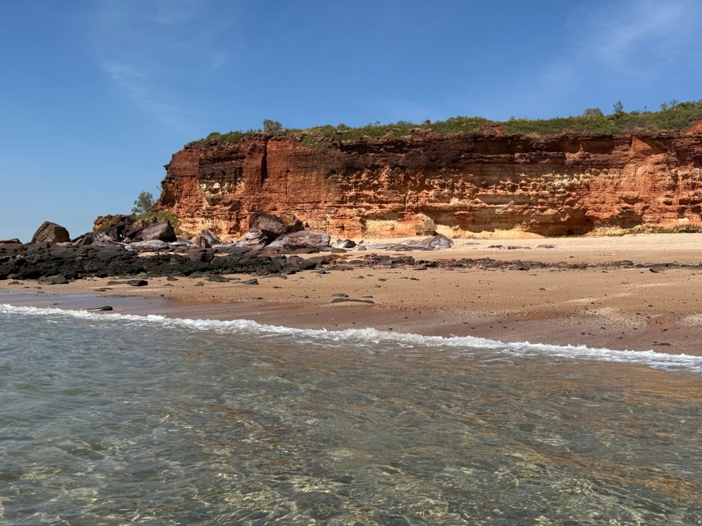
We are camping for four nights at Pender Bay Escape on Native Title land, overlooking the Indian Ocean from cliff tops.
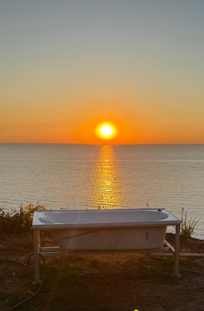
Our site faces east and the sun rises it seems from the waters of King Sound, across the tip of the Peninsular. Pretty good spot for feet up and a swim after the more hectic Gibb!
Allthego spent some time in an on site bath tub contemplating the view from our campsite. Homealone pondered this and thought that he should rename a previous blog entry ‘Soaking in the Kimberleys’, rather than ‘Sucking in the Kimberleys’. It has a much better ring to it, so he will do so at the next opportunity.

After four days it was hard to tear ourselves away from Pender Bay but we had to make tracks for Cygnet Bay at the tip of the Peninsular. We left at 8am to minimise the chances of meeting incoming vehicles, vans and boats along the narrow track.
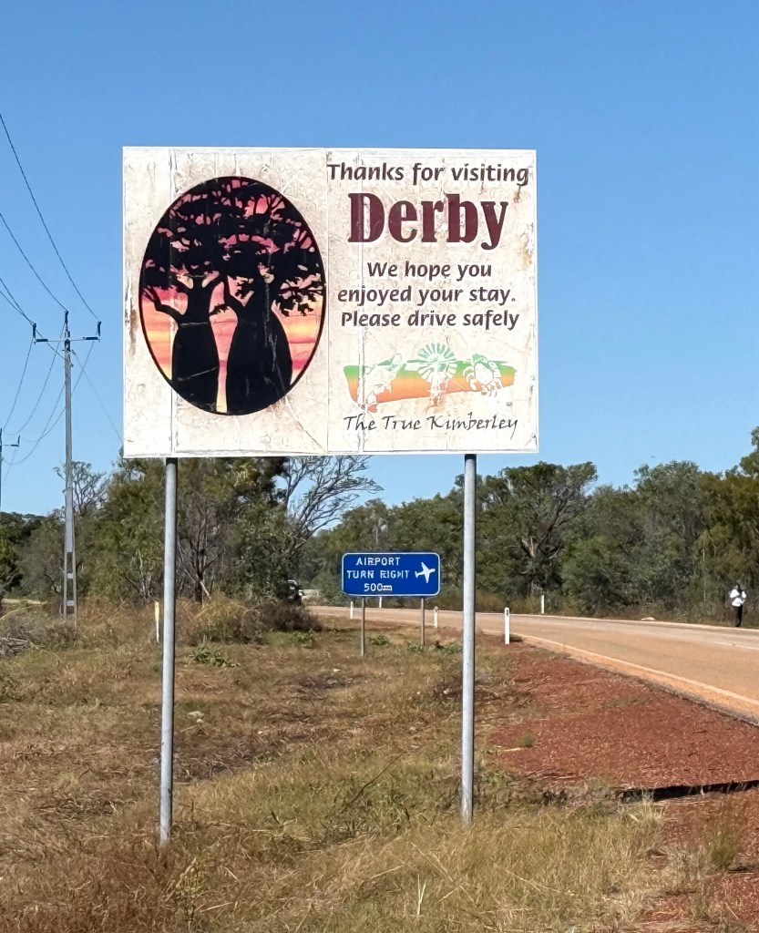
Derby
The Gibb River Rd ends on the outskirts of Derby where it intersects the Derby Highway.
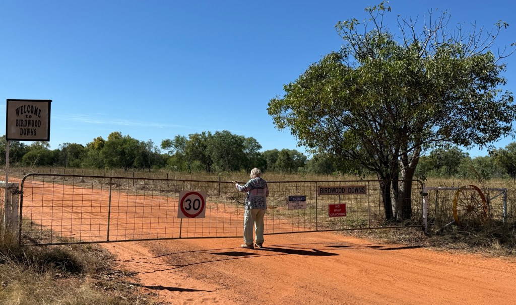
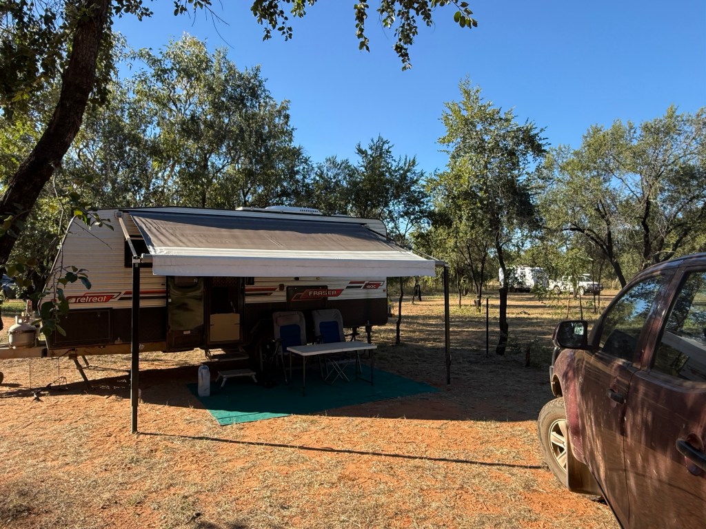
Birdwood Downs is about 10 km from the end of the Gibb. It is a sister station of Mt Elizabeth Station (one of our earlier stops), owned by the Burton family. The camp is run in a similar way, no power or water to sites but good facilities compensate. Homealone was in luck because we arrived on a Saturday and Saturday night is burger night around the campfire. All up sixty seven burgers were consumed by travellers. Dinner all done!
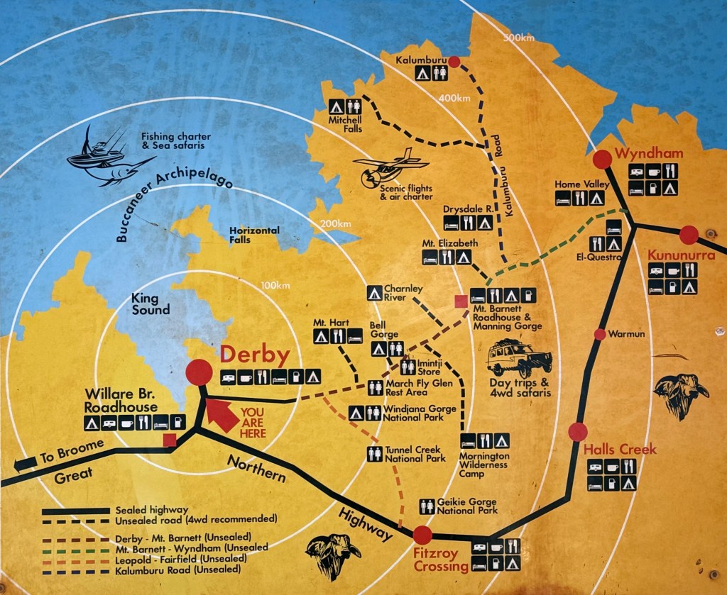
Here is a map of the journey along the Gibb, starting at Kununurra and ending at Derby. Many of our stops are marked on it.
We stayed at Birdwood for two days to explore Derby and restock the pantry after nearly a month following the Gibb.
Derby is a quiet but interesting town. We saw no unrest among the residents. In the late 1800s it was a centre of indigenous unrest, significant resistance was mounted against the expansionary pastoralists.
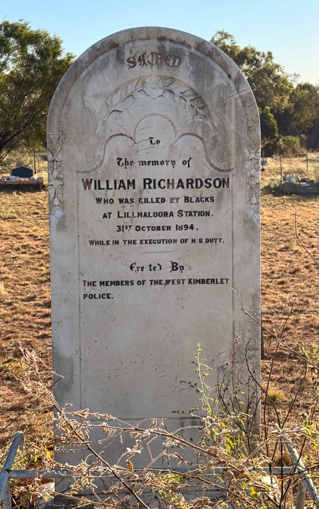
This resulted in numerous arrests and gaol time for aboriginals, possession of cattle meat a frequent offence. There were white deaths as well. There were revenge executions and rounding up, ‘black birding’, of aboriginals for work on properties and pearling enterprises.
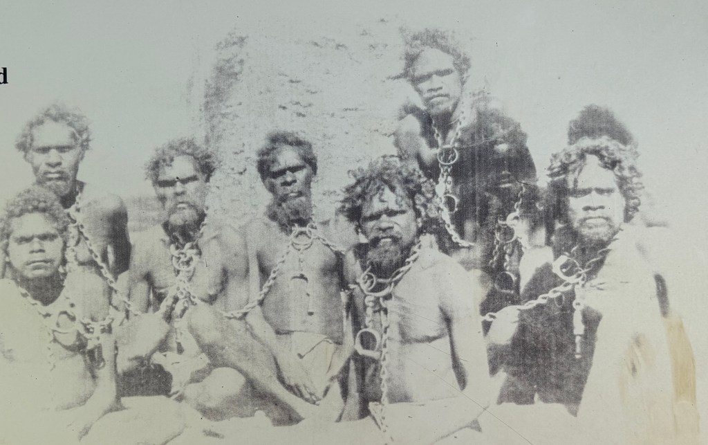
Another example of the ‘frontier wars’, of which our and earlier generations learnt little about in school.
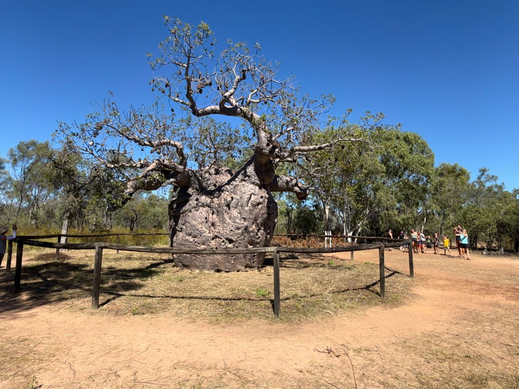
On the outskirts of Derby is the ‘prison tree’, an old hollow boab tree, used as a holding cell for aboriginals being sent to Derby gaol. The tree is thought to be 1500 years old.
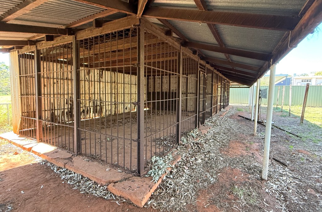
The old Derby gaol is still standing as an historical site. Not pleasant days.
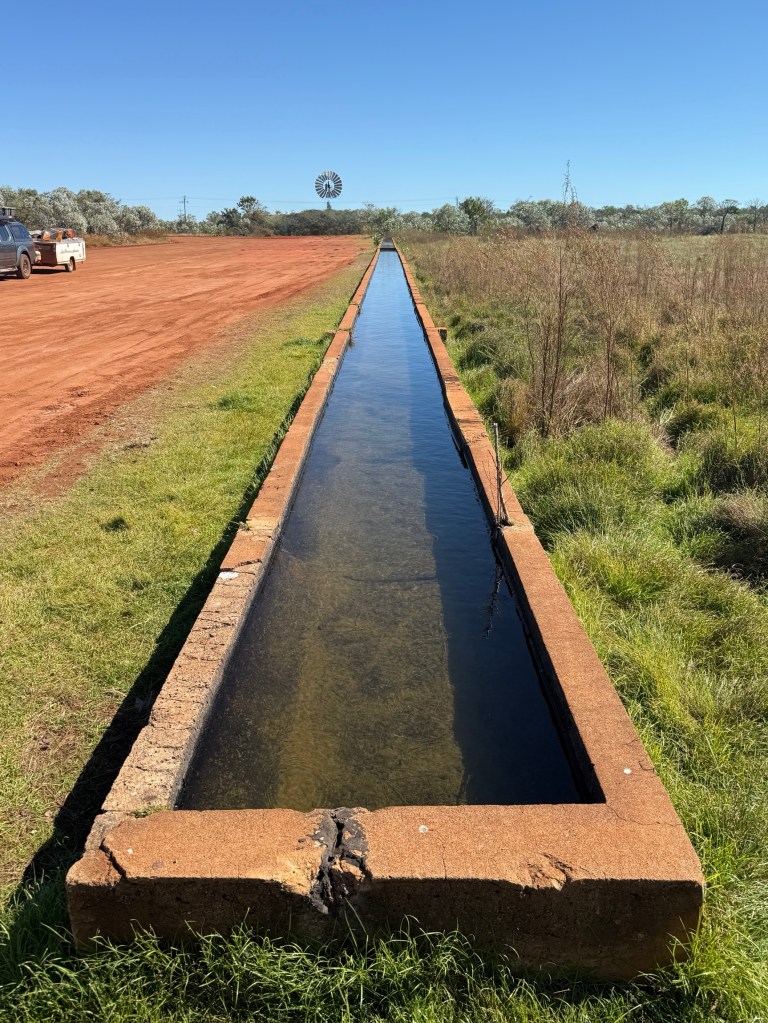
Near the ‘prison tree’ is another relic from the early 1900s, what is thought to be the longest cattle drinking trough in the Southern Hemisphere at 120 metres. Five hundred bullocks could breast this bar! Originally it was directly fed by a bore, a windmill now pumps water into it. No bullocks seen, I suppose they still come along at times; only tourists.
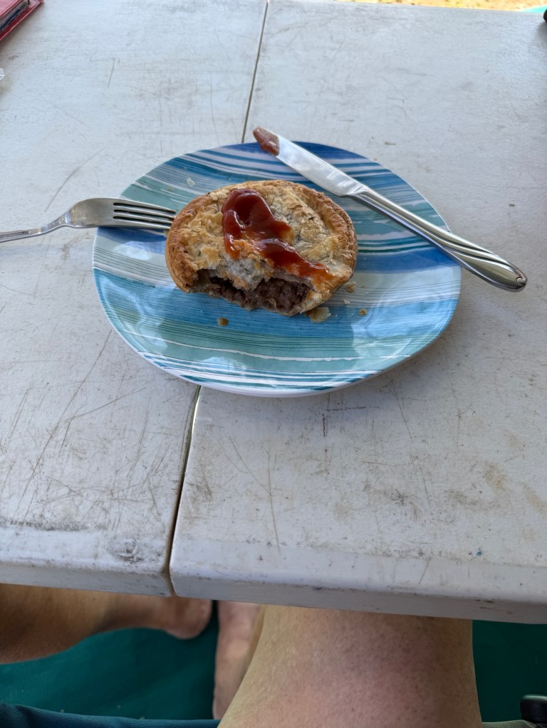
The town itself is a bit non de script, a good bakery from which we had some steak and cheese pies for lunch one day.

There is an interesting art gallery and gardens, the Norval Gallery. He Mark Norval is a long term resident and it would seem a leading artistic light in the town.
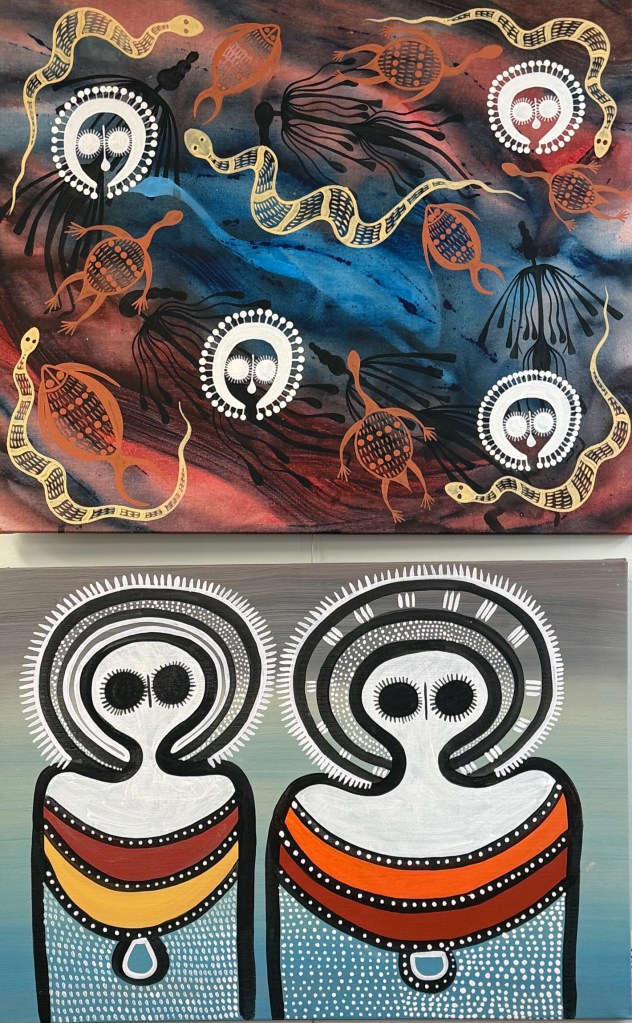
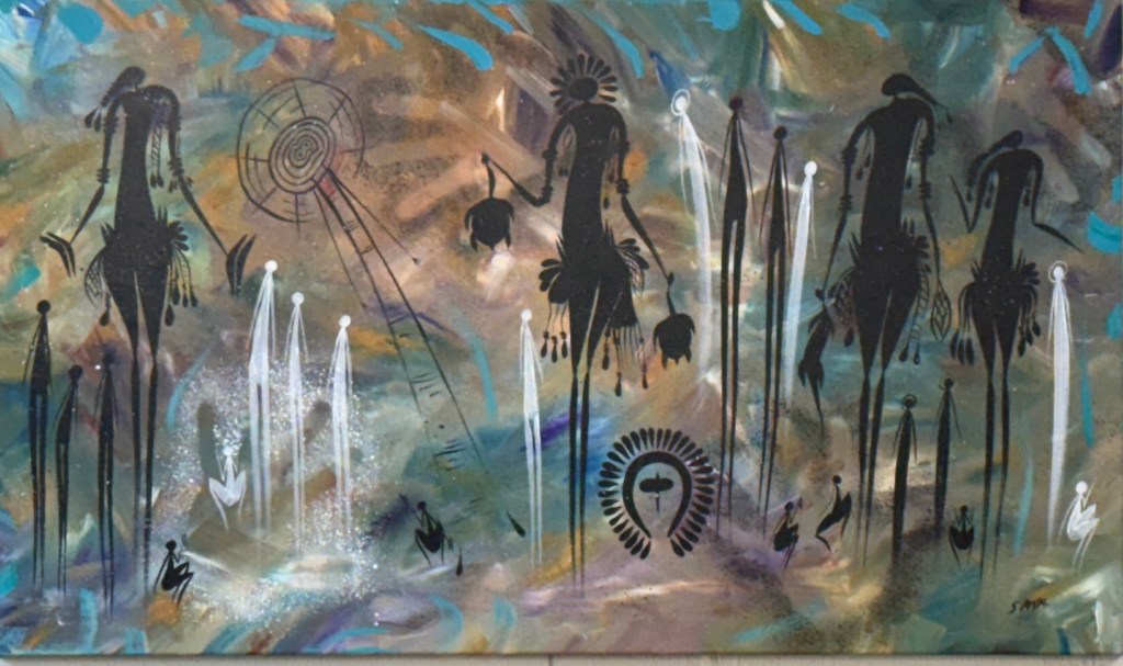
Some interesting works by him and others on display. Indigenous themes, many Wandjina and Gwion Gwions (Bradshaws), the later are the sticklike figures. We had a lunch snack here while looking around.
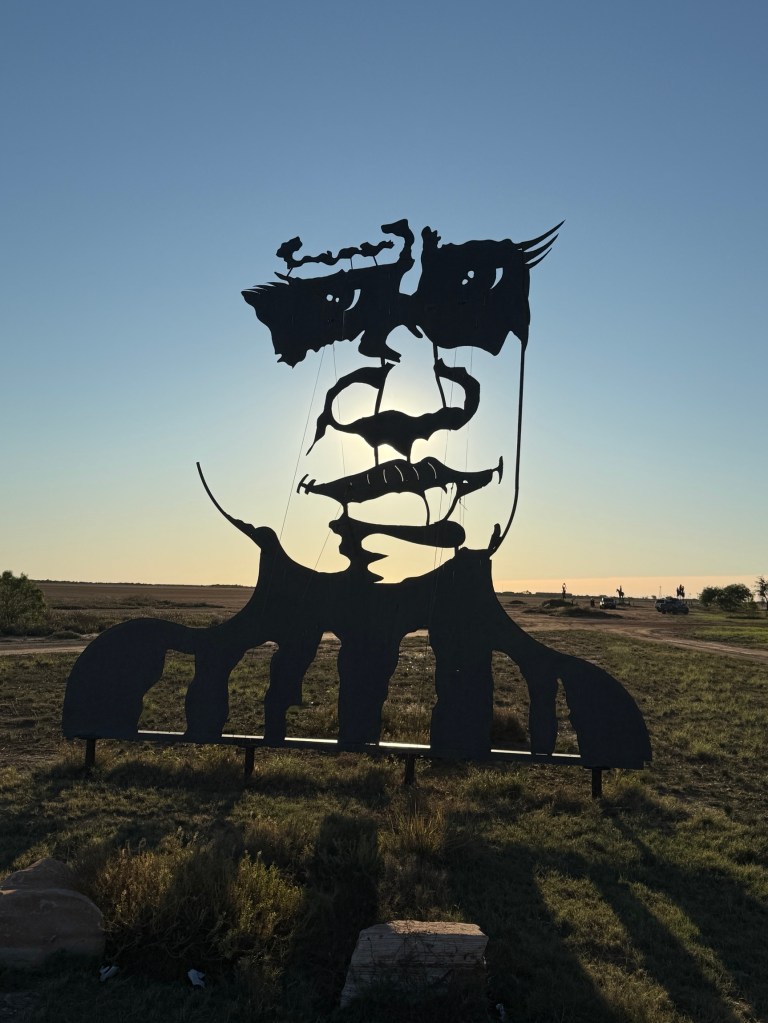
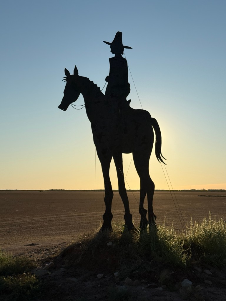
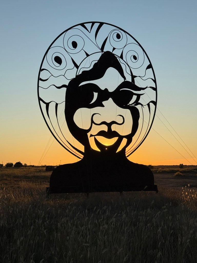
Mark Norval was also instrumental in organising the installation of the sculptures on the mud flats surrounding the town.
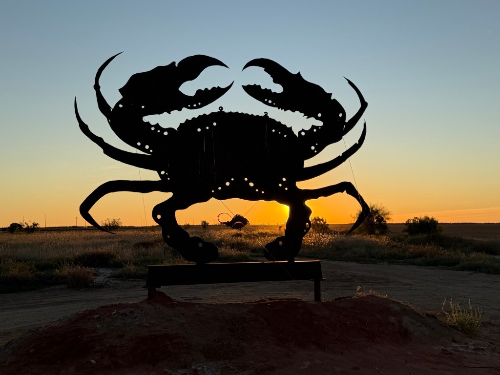
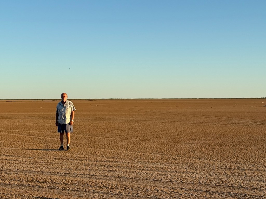
Very flat, bone dry (different story during the wet) and seemingly endless. Some of the sculptures are his and the others by locals. Very impressive as the sun sets.
The Derby port is not very busy these days. It looks out over King Sound and the estuary of the Victoria River. Tide movements here are enormous, upwards of 11 metres between high and low. Reputedly the largest in Australia and second to someplace in Canada.
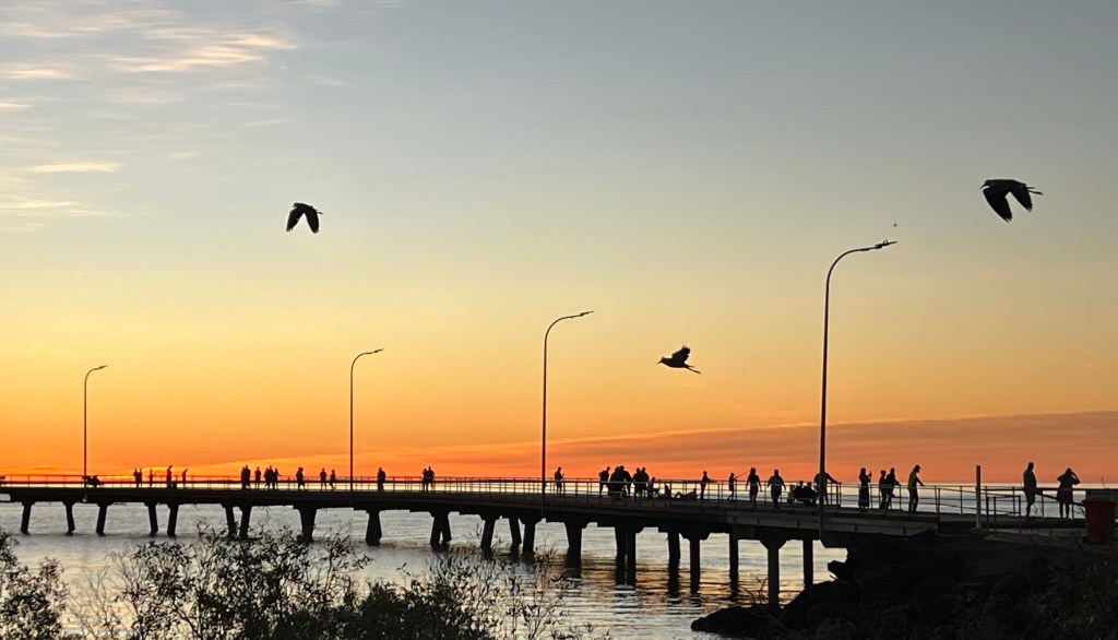
The sun sinking into the Indian Ocean is memorable. It is a favourite spot for the nomads as the sun goes down.
We pack up in the morning and head down to Broome.
The end of the Gibb is nigh
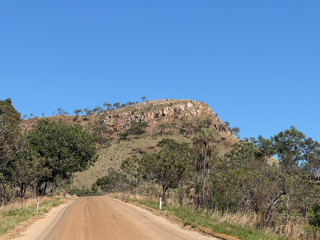
As we left the Bandilngan NP for Birdwood Station we are set out on the last stage of our journey down the Gibb River Rd.
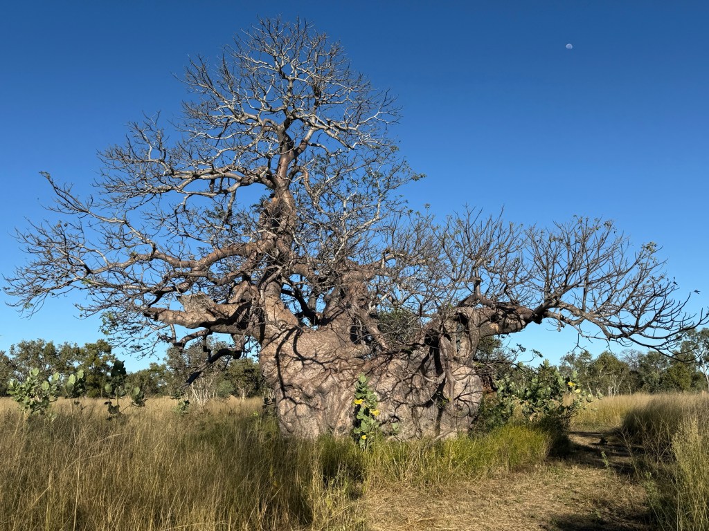
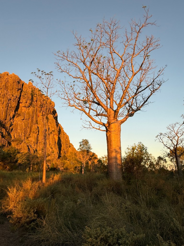
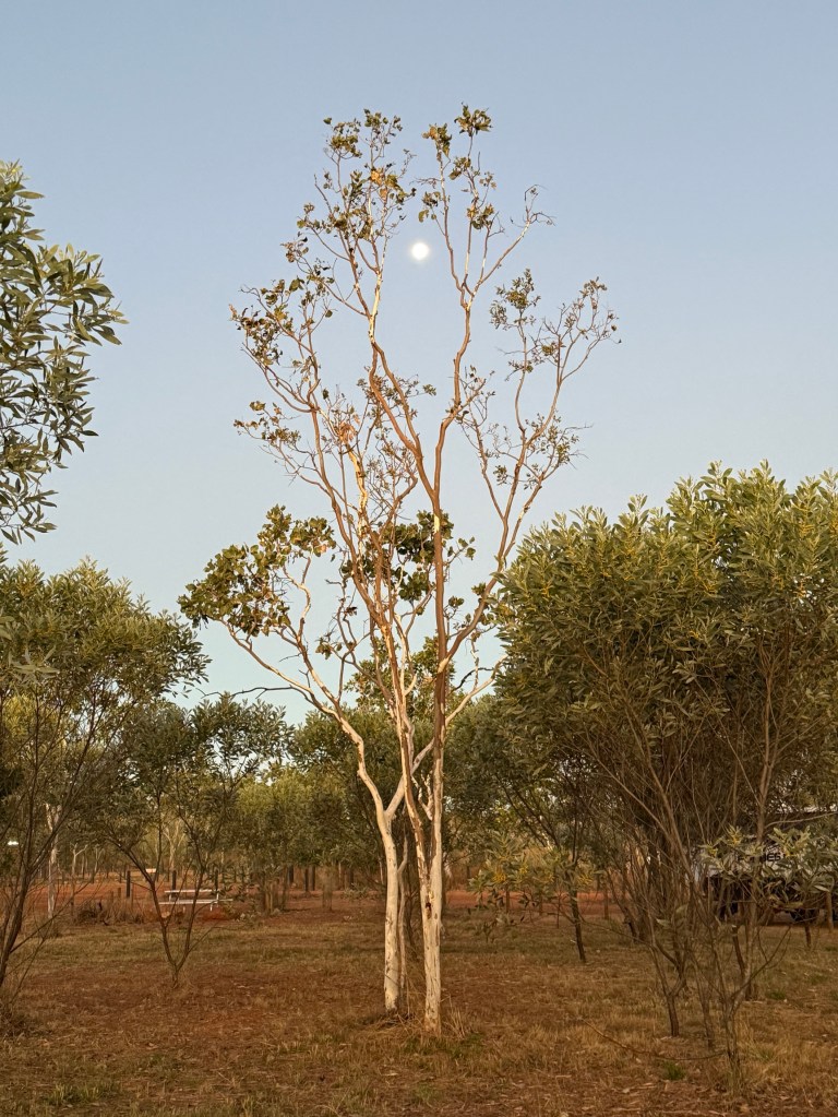
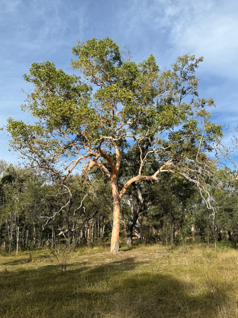
It is all sealed! All the way to Derby, 130km or so. No river crossings, no corrugations, all pretty smooth! The Gibb will never be the same! The countryside is drying out, it is a dead flat Savannah style landscape. Boabs are everywhere and at different stages of leaf loss. This guys yellowing leaves stark against a blue sky.

Driving it is a big change, the elbows aren’t bumping along with the corrugations, there are even lane markings on the edge of the road. Catering for Victorians on the way north!
We are now at Birdwood Station, about 25km from Derby, for a couple of days. We will take in Derby from here before heading to Broome and then north up the Dampier peninsular for a few days. We will be back on the air when internet permits!
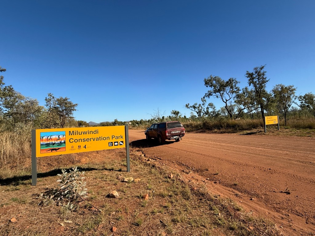
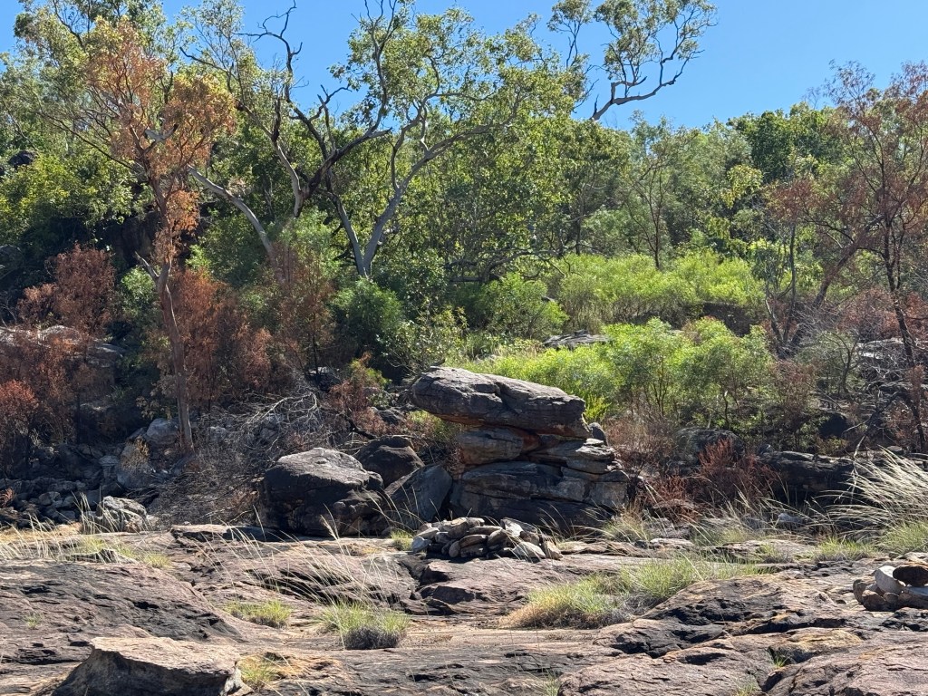
Bandilngan NP.
What’s in a name? Bandilngan is the new name for Wandjana NP. Now, Wandjana itself is a bit of a problem. A European explorer (not sure who) named it Wandjana, after those mysterious indigenous rock paintings. But he misspelt it with an ‘a’ after the ‘j’ instead of an ‘i’. So, when the WA government went about all the renaming/recalling they didn’t correct the spelling but instead gave it the indigenous name, Bandilngan. But Wandjana is still up around the place. Now isn’t that fascinating?
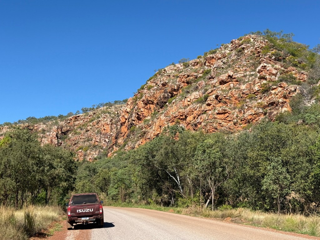
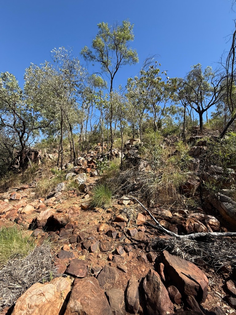
We got away from Inimtji in good time to tackle the steep climb over the King Leopold Ranges, I mean the Wunaamin Miluwindi Ranges. Both names have a good ring to it I think. This is I think the most picturesque part of the Gibb River Road. The road here is now sealed it would have been a challenge as a gravel track.
Twisted beds of sandstone beside the road show the pressures that are applied to rock strata in the mountain building process.
As we got down on the flat plain below the ranges the road returns to good gravel as we travel towards the Napier Range. This is where the Bandilgnan Gorge is found. Unlike the gorges we have experienced to date it is a limestone gorge. It used to be part of a huge coral barrier type reef that almost circled around the Kimberley plateau back in the dim past 350 millions of years before humans were around. It is one of a type in the world. We are looking forward to getting there!
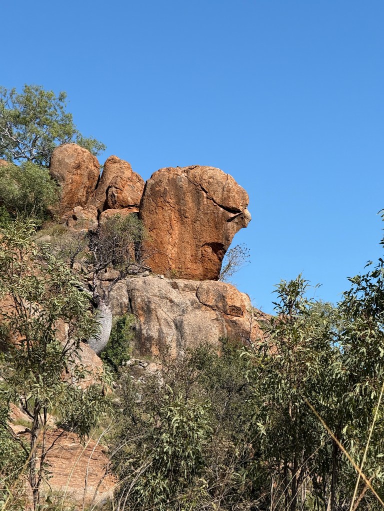
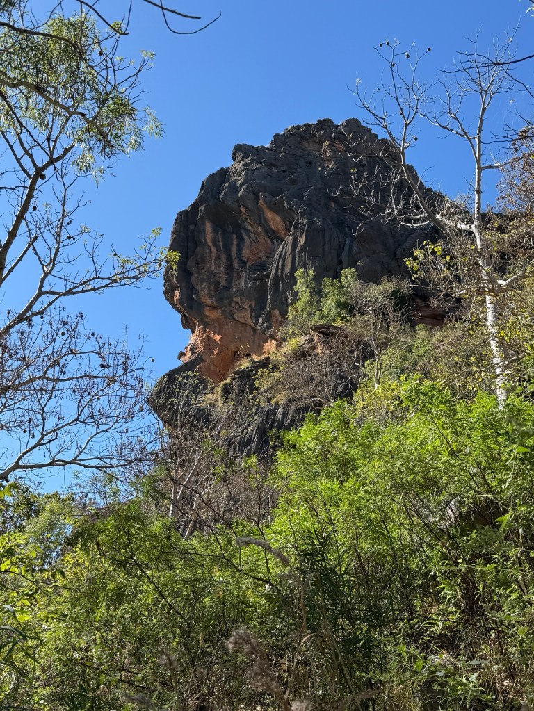
Along the way though we passed by a large rock overlooking the road, Allthego saw a resemblance to one Rev. Ted Hayes (a relative of some readers) peering down at his congregation below! Not in the tourist guide.
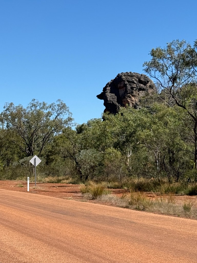
And along a bit further is a big rock that is in the guide, a resemblance of Queen Victoria. So there you are, what luck! Two big heads on one day.
Passing through the gap in the Napier Range we were then on fairly flat terrain, road pretty good with grazing property on both sides.
Encountered some significant roadworks, graders and dump trucks everywhere laying the base for more bitumen. Just making the Gibb River Rd easier!
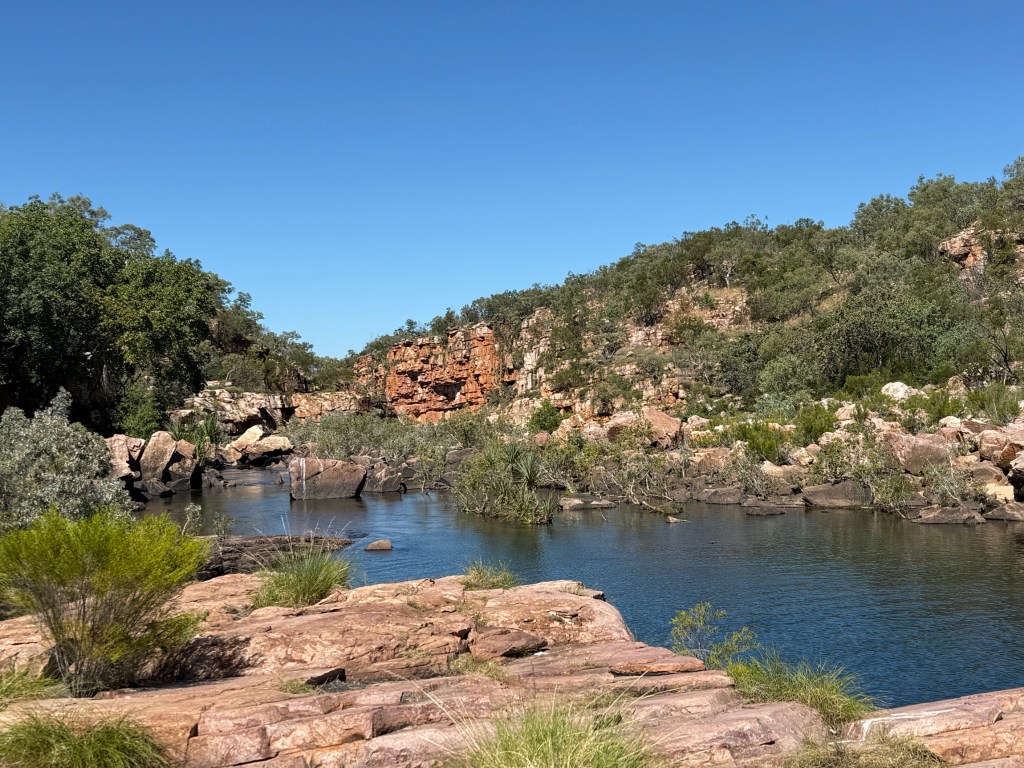
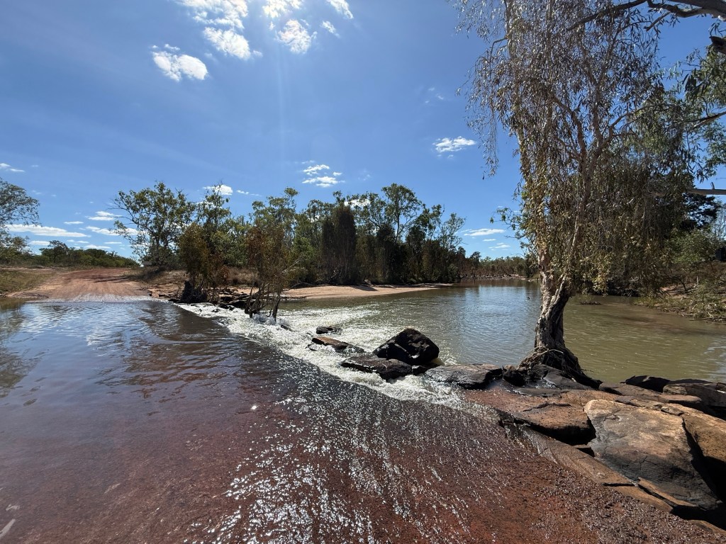
Eventually, made it over a real bridge across the Leonard River. First bridge in over three weeks! The Leonard River is the formative river for the gorge. Shortly thereafter we took the turnoff to the gorge, about 30km to the campground.
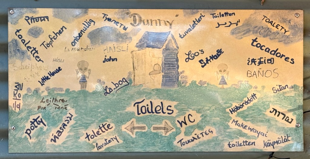
We had a booking in the non generator campground. But it was fairly full, there are no marked spots and you just pull up where you want to stop. There were some good spots vacant on the walkway to the loos and showers, but these are not desirable locations from the point of view of Allthego (even though he does want to go from time to time).
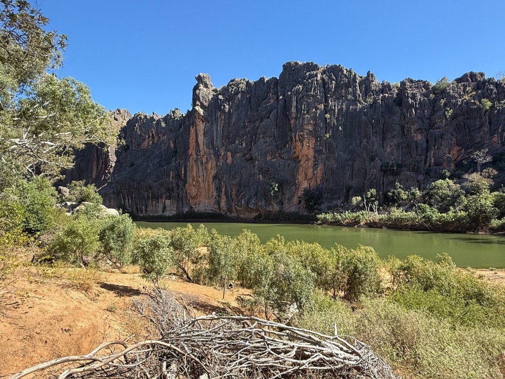
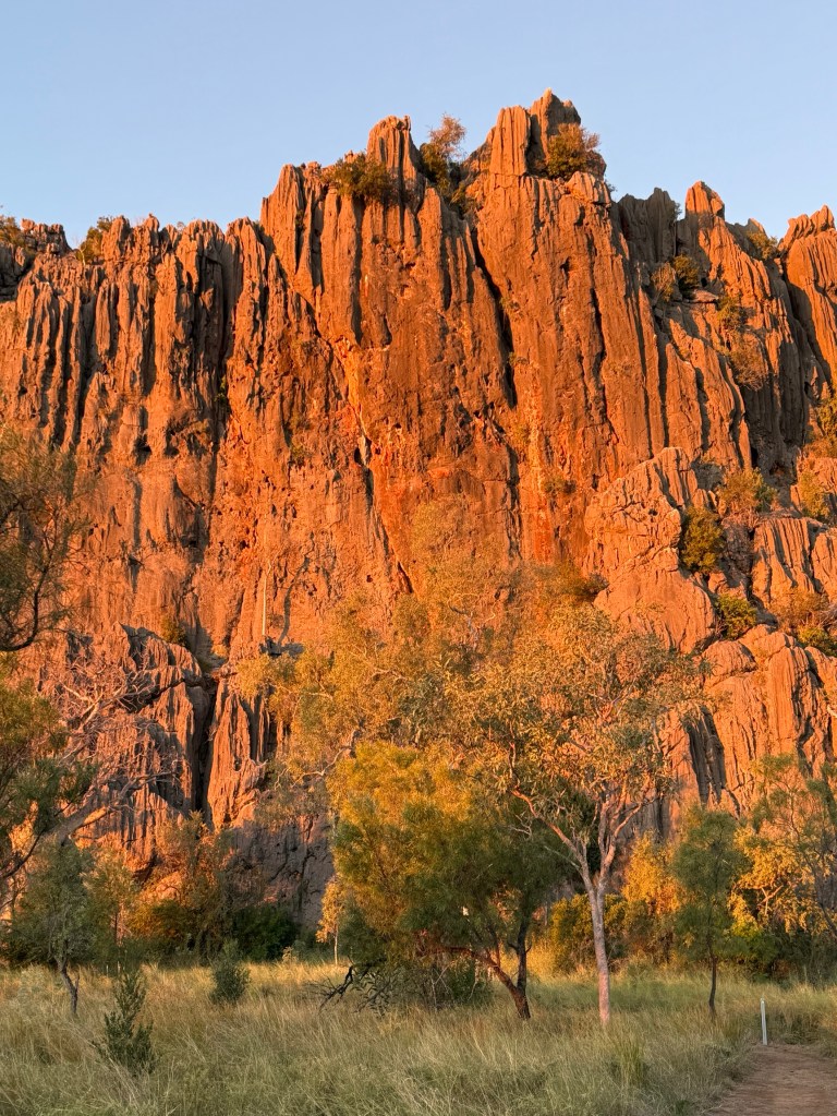
So we shifted over to the generator area, not many people there and we got a great spot looking straight at the gorge wall. As it turned out not many generators either. From here we had some wanders through the gorge, the sun rising and setting on the walls throws a great orange/red hue.
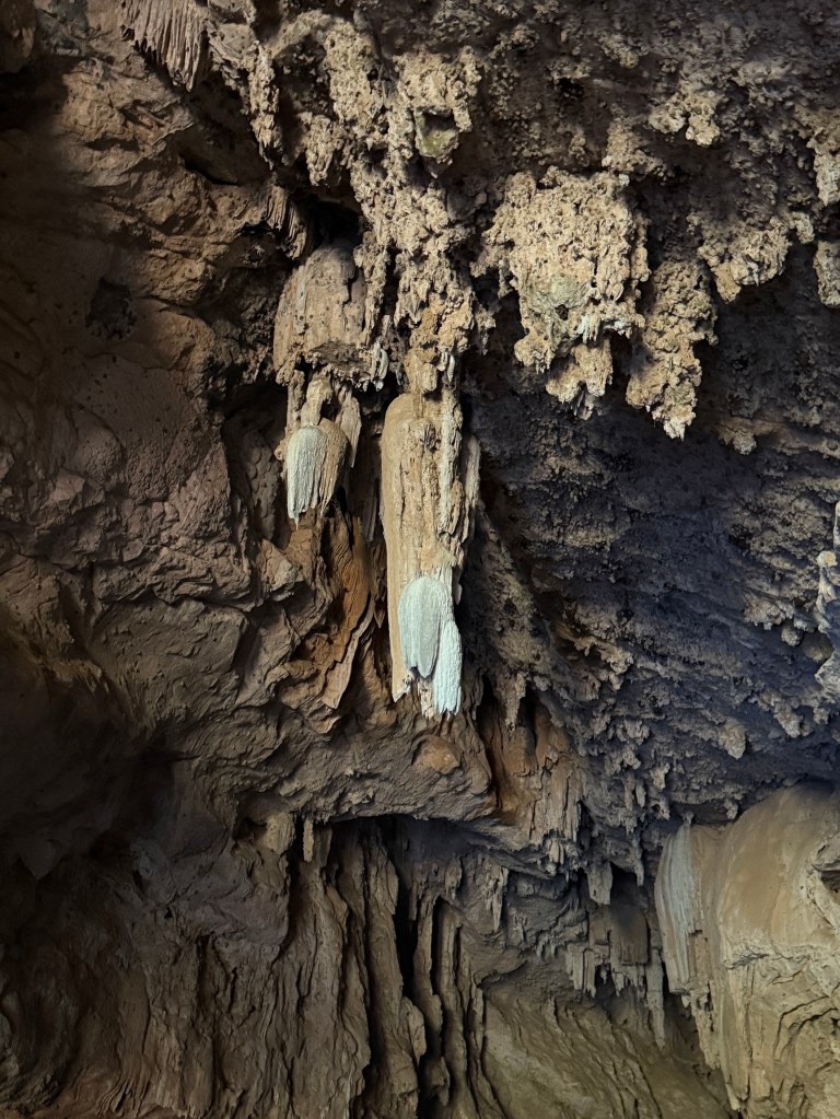
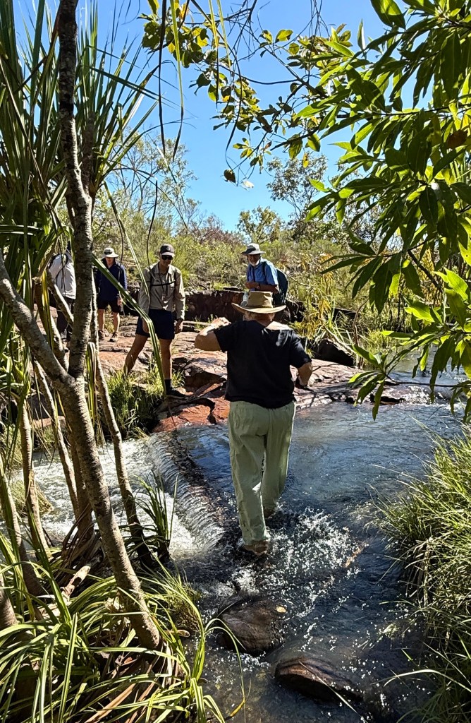
Next day we went a further 30km down the road to Tunnel Creek. This is the well known spot where a stream has eroded under the limestone range and there is a 750m walk along the resultant tunnel from one side to the other. It is about 20m wide with varying heights, mostly well above 4m and 40-50m in some.
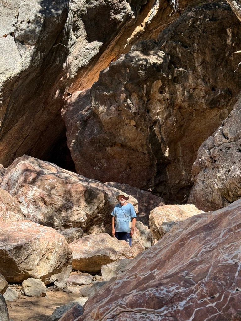
After a bit of rock hopping and boulder clambering Allthego had to wade through a small section of chest deep water, criss cross sand banks and waddle through shin high pools to get to the other end.
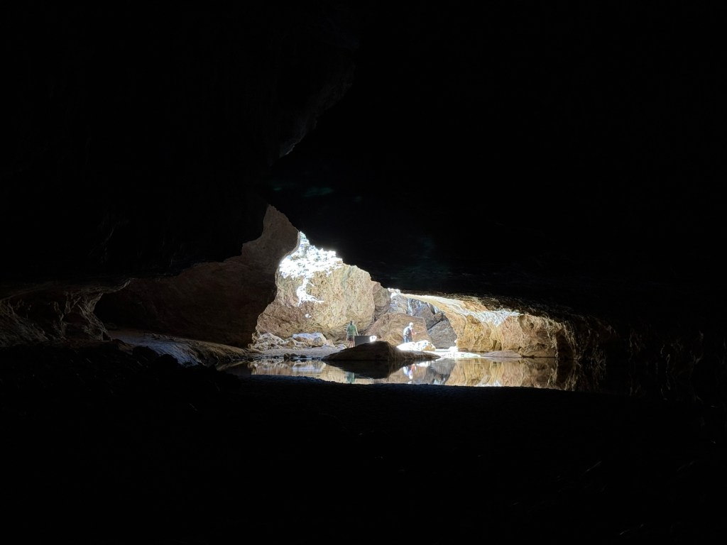
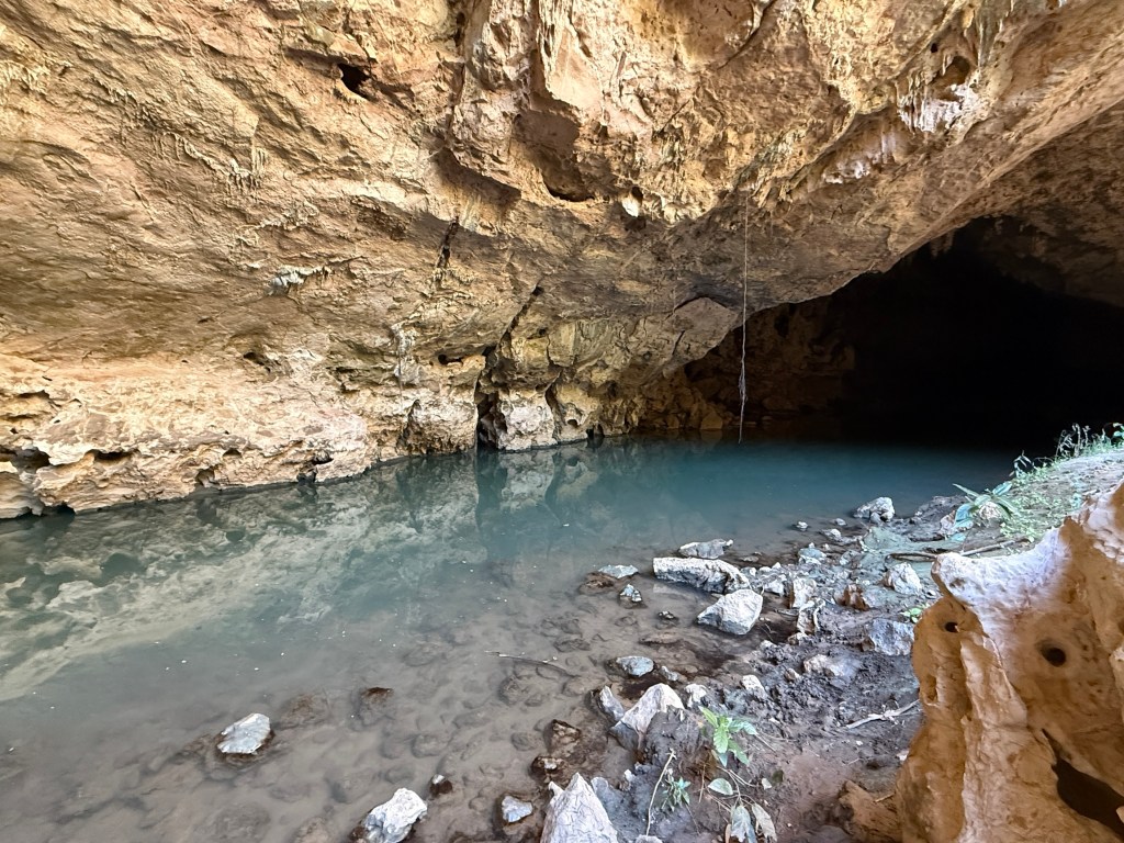
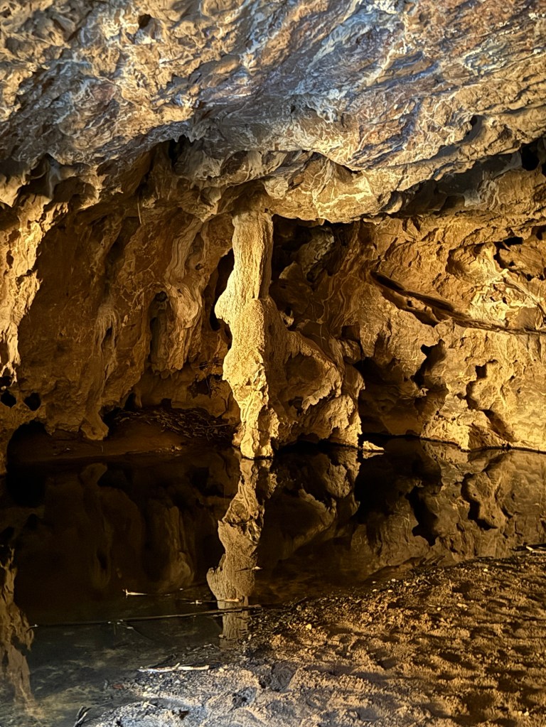
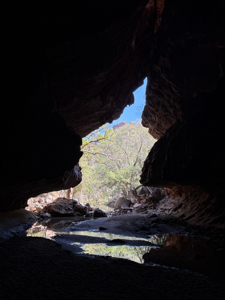
Very dark, people generally had hand torches and head lights. Interesting experience! Absorbed about two and half hours in going through twice, the second time with the phone for pics. We returned to camp for a very late lunch and an afternoon looking at the trees.
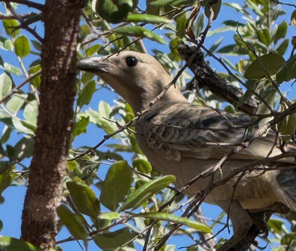
Allthego had a couple of early morning walks in the gorge before the tourists set out making lots of noise along the track. This is when the birds and other critters are out and about. Here are a few of them.
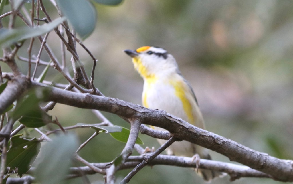
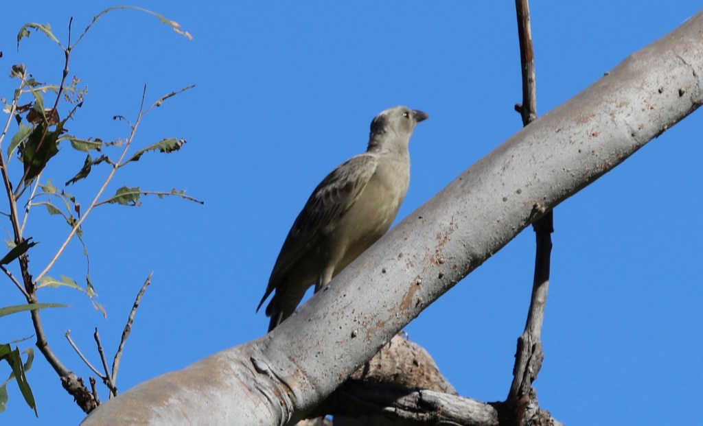
Wandering around this park makes one feel quite small. There is quite a presence in the silence of the gorge in the early morning. Ones impact on the ground walked is almost ant like.
And so it was ‘ant like’, these little guys going about there business to and from the gorge!
We now head off for our last stop along the Gibb at Birdwood Downs, not far from Derby.
A place to lie down
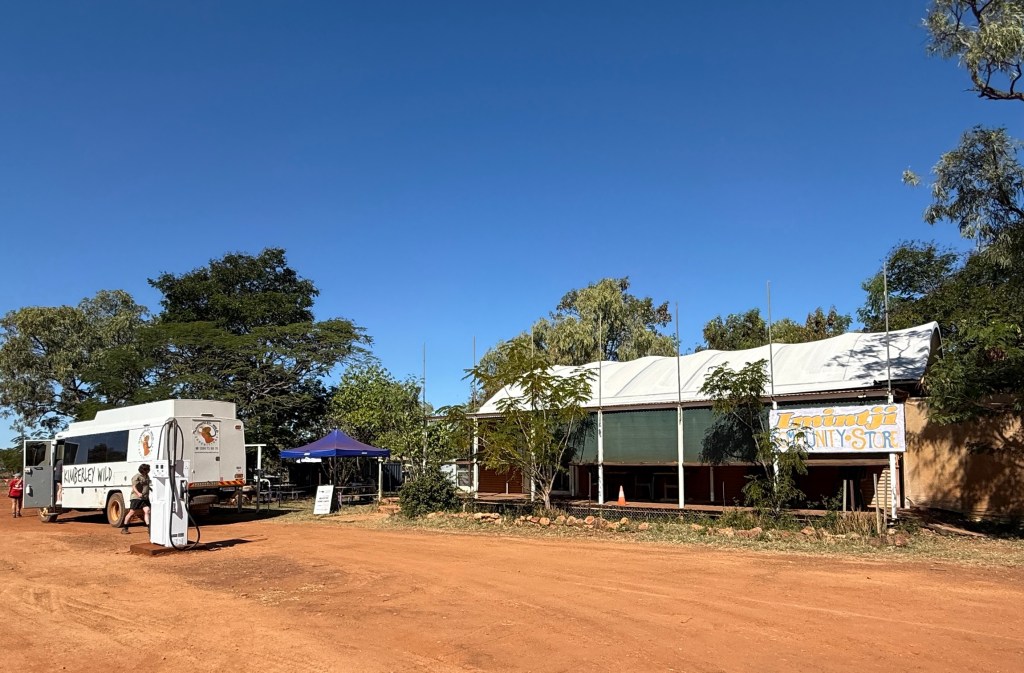
And so it is! ‘Inimjti’ means ‘a place to lie down’, very apt name for a bush campground. The campground and nearby Community Store are owned by the Ngarinyin people. The store stocks a small range of groceries (the only place on the Gibb other than the Mt Barnett RH) and manages the nearby Inimjti campground.
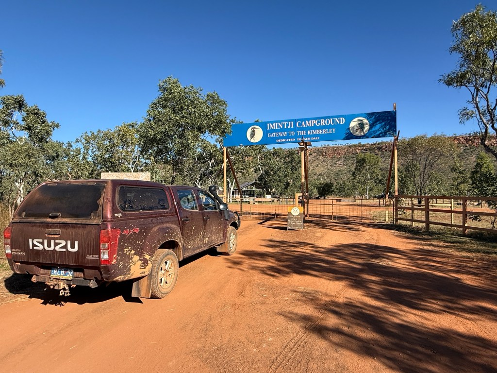
It is a very pleasant stopover point on the grasslands below the imposing King Leopold Range. An early European explorer ‘called’ the range ‘King Leopold’ after the then King of Belgium, who was very supportive of exploration. The Leopolds are now referred to as the Wunaamin Miluwindi Ranges, I have seen it the other way round too and Miluwindi spelt with an ‘i’ instead of a ‘u’.
It is interesting how one writes about place names these days. It seems that it is more culturally appropriate to say that the European explorers ‘called’ places something rather than ‘named’ them, of course we now understand they already had an indigenous name.
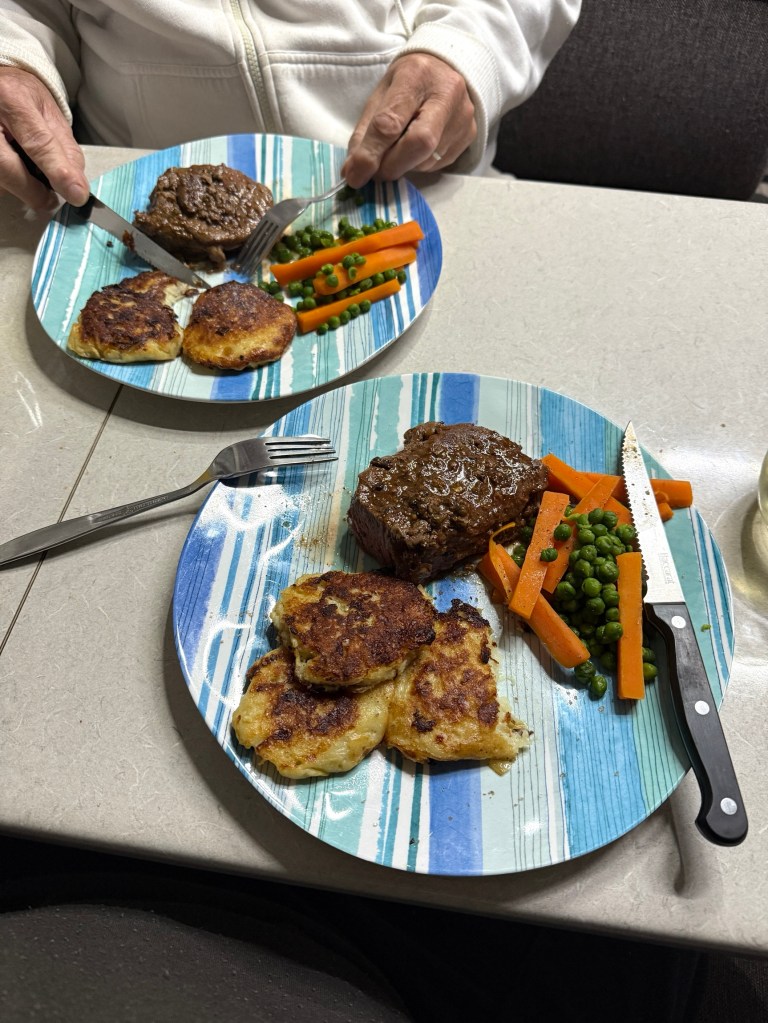
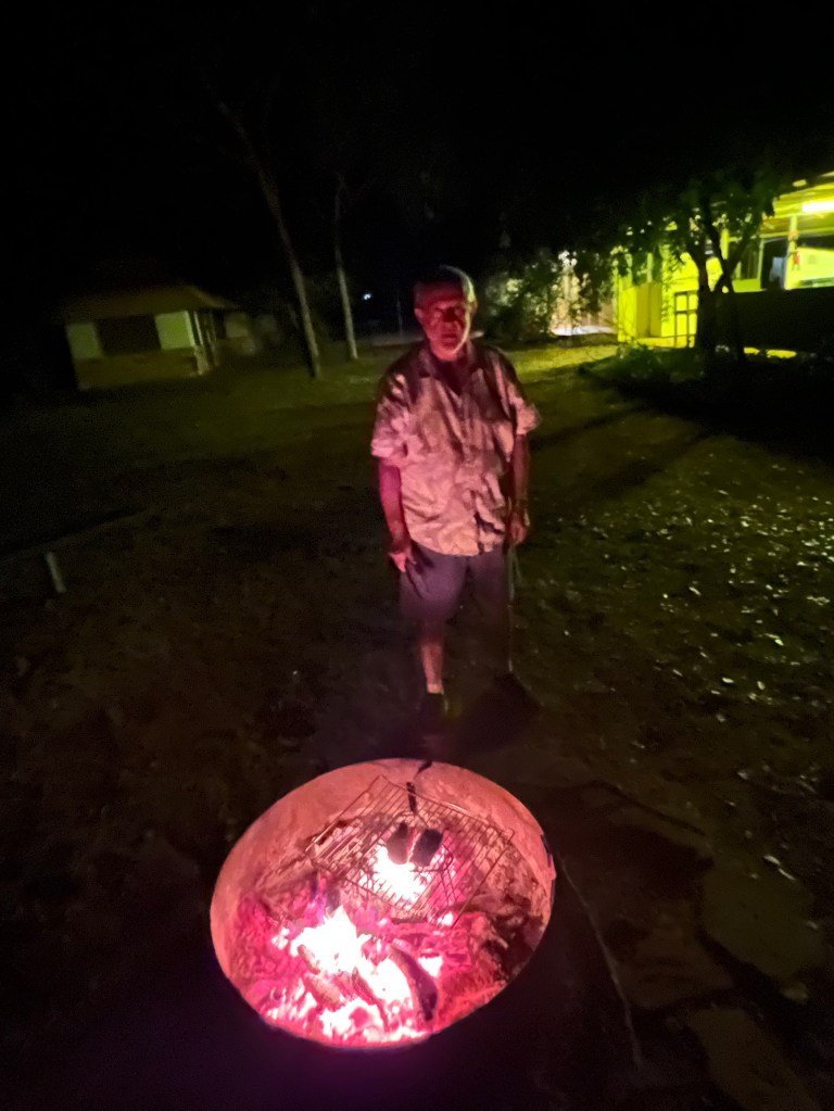
After we had set up camp we did indeed take some time out and sat down in the awning shade for the afternoon, plotting the next days activities. Dinner also called and we tucked into a piece of beef from our time in Kununurra marinated in peppercorn sauce. Homealone knocked up some potato fritters to go with it, all very tasty.
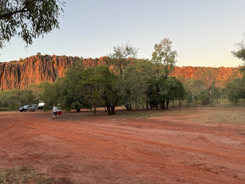
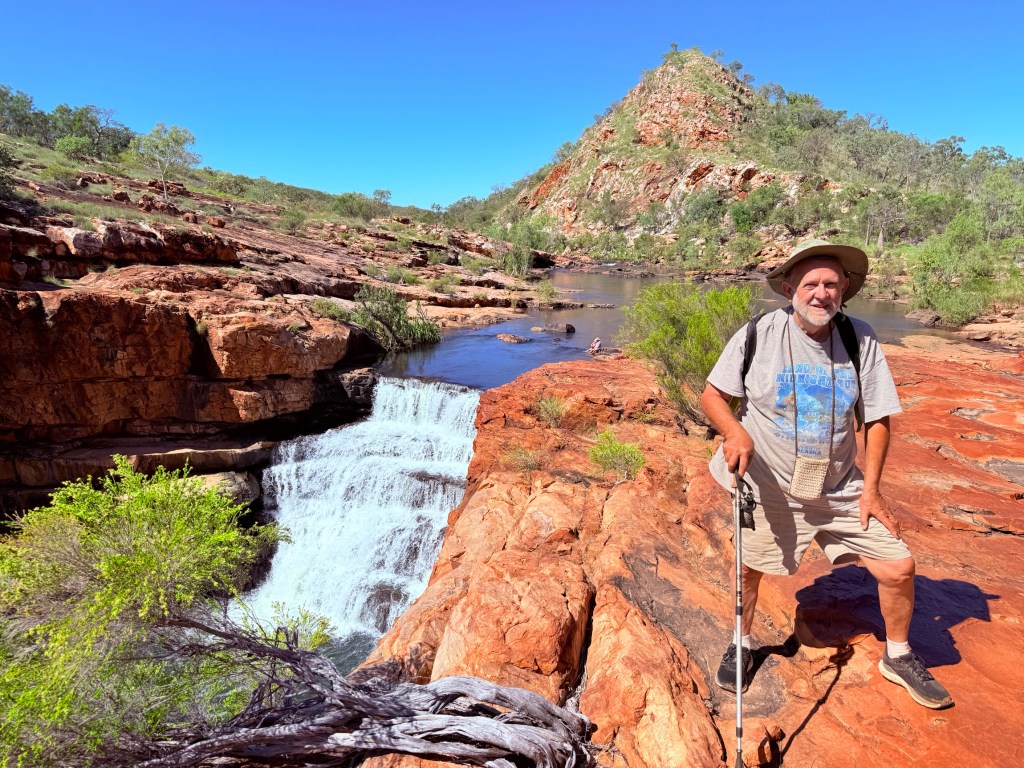
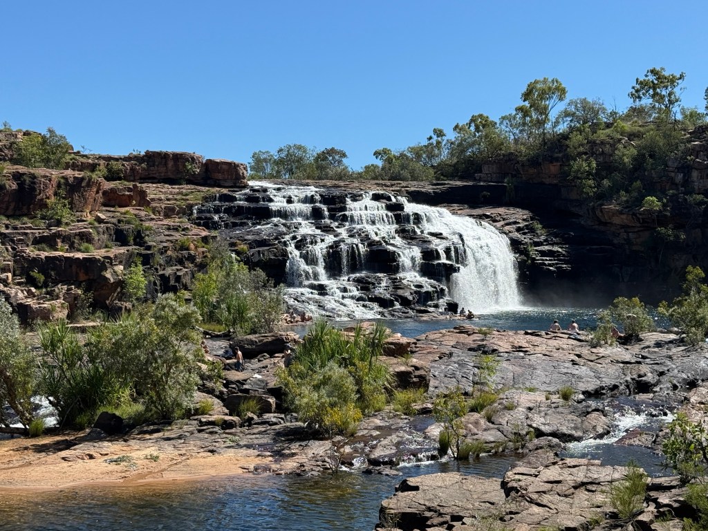
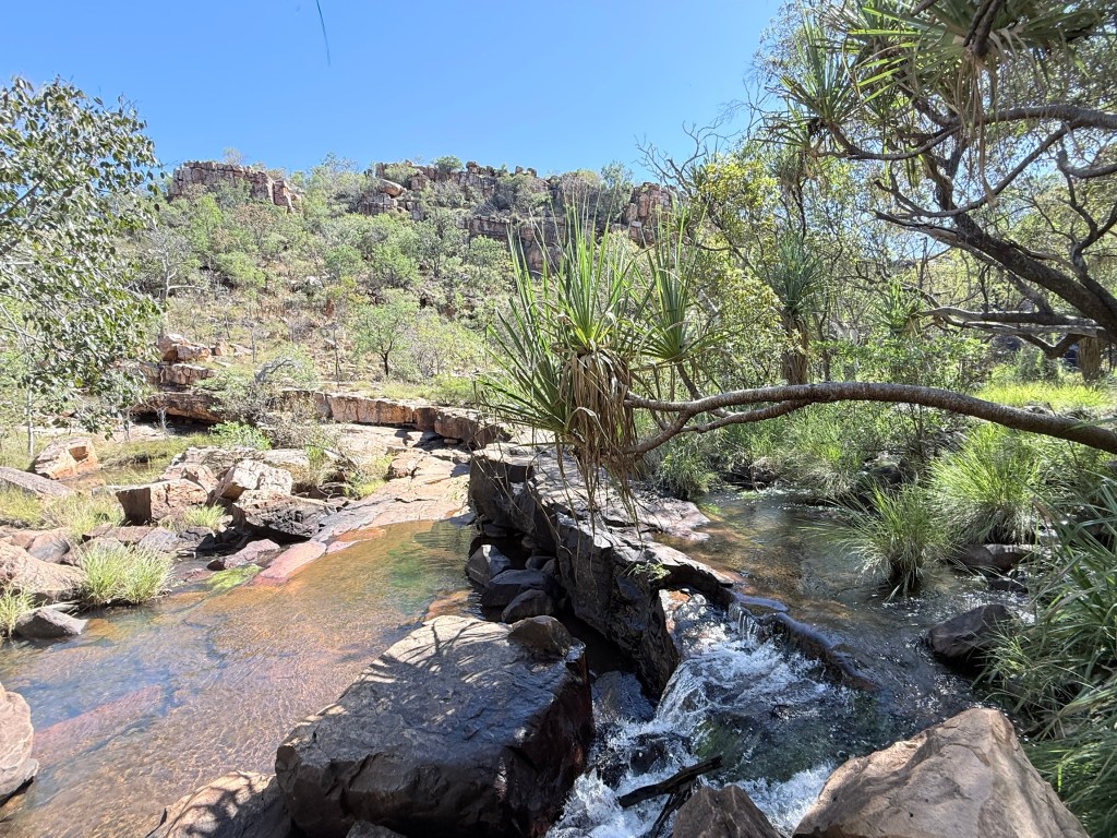
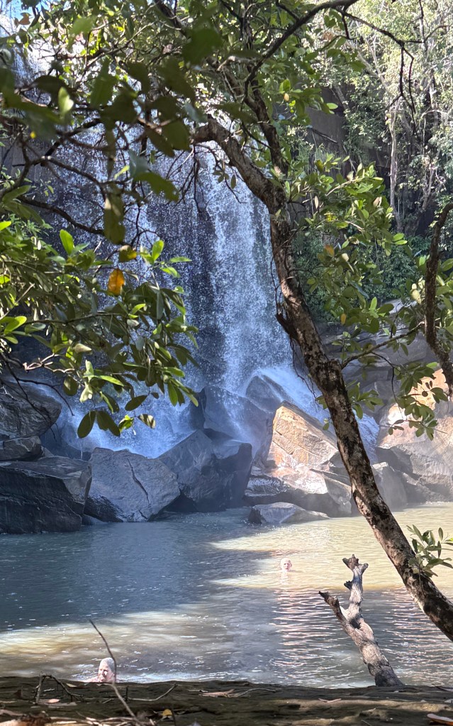
Next morning we were off to Bell Gorge and the iconic falls, now ‘Dalmanyi’. It is in a Conservation Park and we had intended to stay there in the Silent Grove campground.
‘Silent Grove’ was the name of a pastoral outstation, it is now known as ‘Dalundi’. But the late rains caught us out time wise making the road in problematic any earlier. So we stayed at Inimjti instead and went to the gorge without the van.
As it was the 29km track was a bit wet here and there and the creek crossings deserving of care. We made it ok!
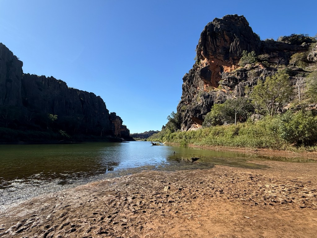
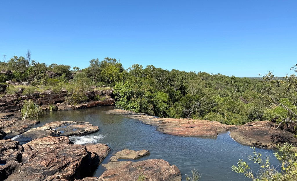
The top of the gorge waterfall is about an 800m walk from the car park. A relatively easy stroll down to a dry creek bed and then along it until the top of the falls is reached.
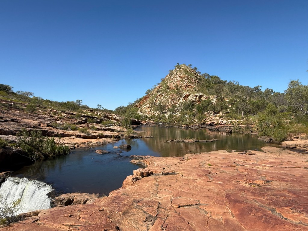
An amazing place and easy to see why it makes great pictures for magazines and TV shows. Like Mitchell Falls there is oodles of water flowing over the top.

The track getting down to the plunge pool at the bottom is a little more difficult. Allthego passes it up for some time sitting on the rocks looking at the whole scene before heading back to the car where Homealone patiently waited.
We retraced the park access track back to the Gibb and then returned to the Inimjti campsite. No worries, it is always a little more comfortable going over old ground. You have been there and done it before.
Next morning we packed up for the journey further down the Gibb and then off on a side track to Wandjana National Park. Or is it called /named something else now?
Soaking in the Kimberley
Journeying along the Gibb River Rd is an experience, particularly towing a van behind. We go along at a gentle 45 to 55km an hour, slowing down of course for creeks and other dicky road conditions. Allthego remembers he did blunder once though! It has now been fixed. Others seem to speed by leaving clouds of dust to peer through.
Going slow allows you to look around and ‘soak in’ the changing scenery. It is indeed a remote special place. The road is nowhere near as bad as media make out, but perhaps it is early in the season and the corrugations are yet to develop. Perhaps, it also depends on what you think is a ‘bad gravel road’ and how fast you go. One of the joys of travelling early!
One of the other joys of travelling the Gibb early is that the wet has not long ended, albeit with a recent unseasonal top up. There is plenty of water still around; rivers and creeks are flowing, waterfalls are pumping and the plunge pools are full. Fortunately, people are a bit light on in numbers and there are no crowds.
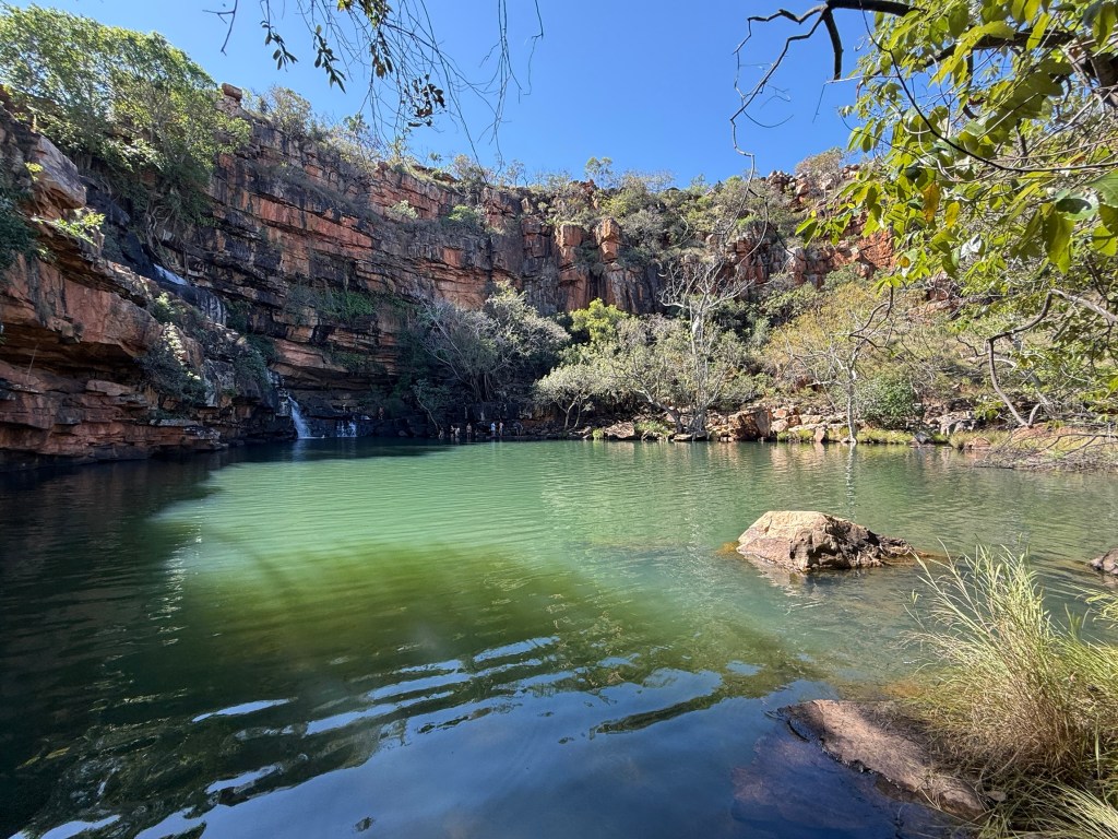
Stopping at Mt Barnett and Manning Gorge for four nights gave us the opportunity to ‘soak in’ the local scenery.
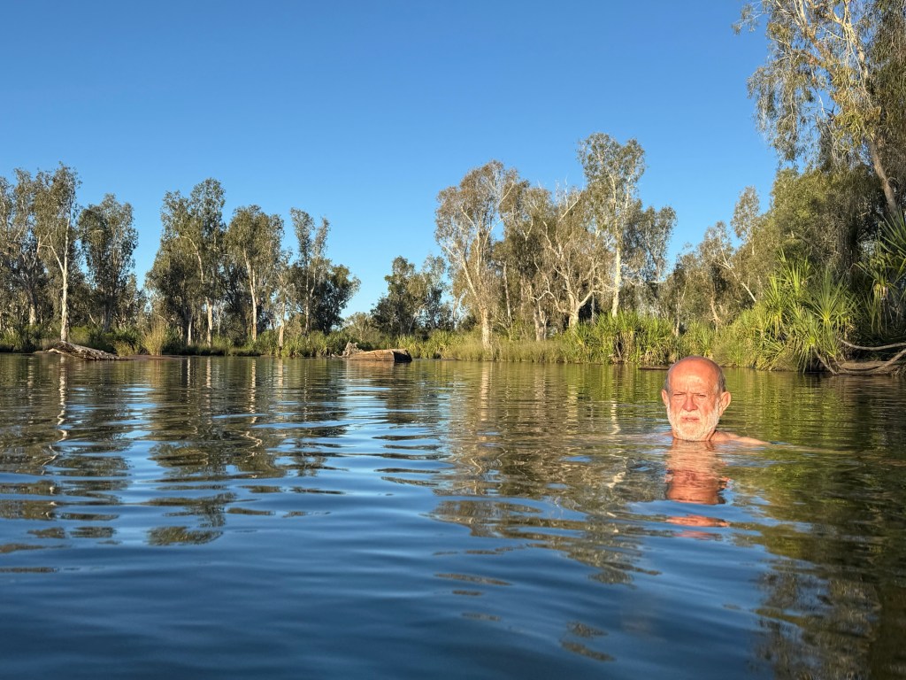
The Manning gorge campground is right beside a big waterhole. Shallow and clear in places and deep in others it is a place for a cool refreshing dip. Late in the afternoon the sun shines down the length of the waterhole lighting up the surrounding vegetation.
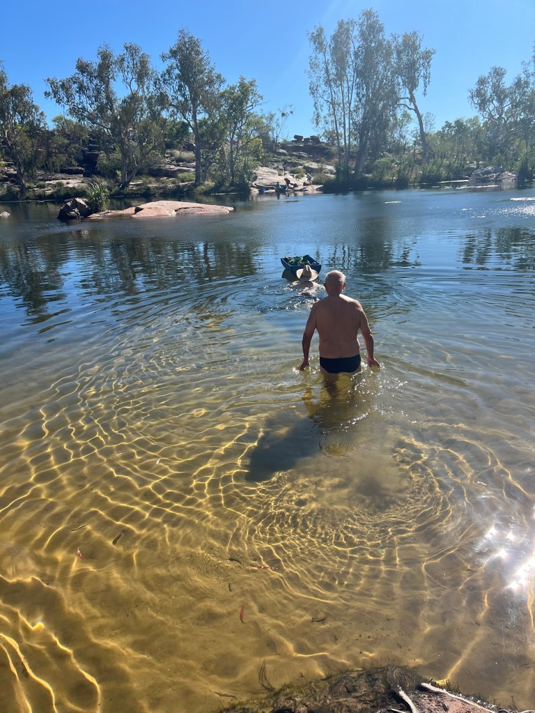
On the others side of the waterhole is the track that leads to Manning Falls, one of the icons of the Gibb. You have to swim across the waterhole with your walking gear in a tub. Then a 5km return walk to the Falls. The first 80% of the walk is fairly easy.
Many pass Allthego along the track in bare feet, thongs, bare chests and bikinis. The last section as you descend to the plunge pool is quite steep in parts. At the last drop Allthego was foiled by a 6 ft drop to the platform below! There are a couple of foot and hand holds.
Others seem to have taken it in their stride. But the view from this point is still great. The return walk to camp went ok, Homealone had progressed a cross stitch.
In the afternoons we generally sit under the awning looking out at what is going on in the camp and thinking about what to have for dinner. Cups of tea and coffee as well of course.
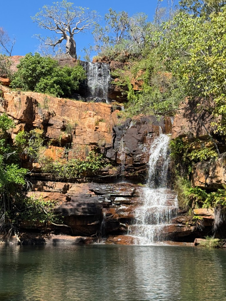
Next on the gorge list was Adcock gorge, we went there after seeing the man about a snake and getting fixed up with the new tyre and rim.
The gorge is about 5km off the Gibb down an average to what Homealone found concerning in parts track. But we made it!
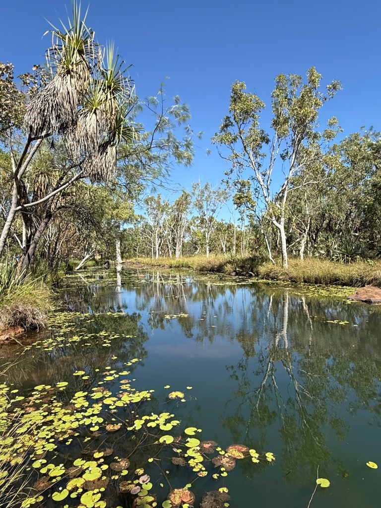
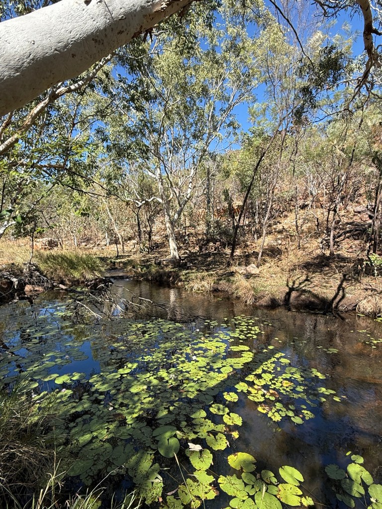
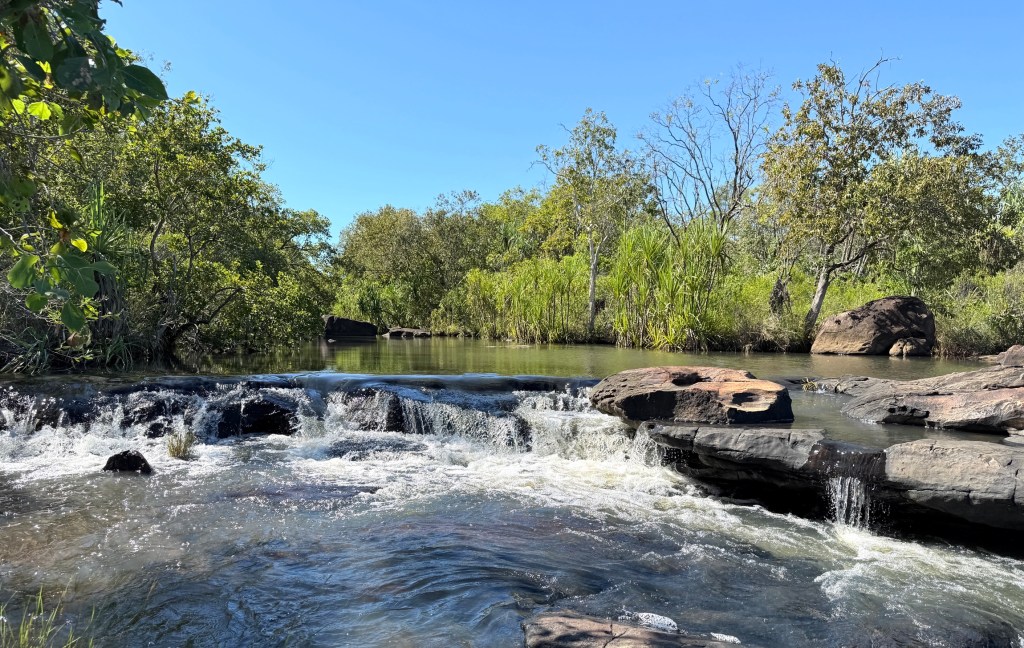
From the carpark Allthego had a 500m walk to the Falls and plunge pool. Had to trot through a shallow creek to get started but the remainder of the track was good going. On the way passed by a Lilly pond. Adcock is a pretty spot with water cascading down the Falls.
Galvans Gorge was the last one we visited from our base at Mt Barnett. The car park for this one is beside the Gibb. There is then a very easy 1km stroll to the Falls.

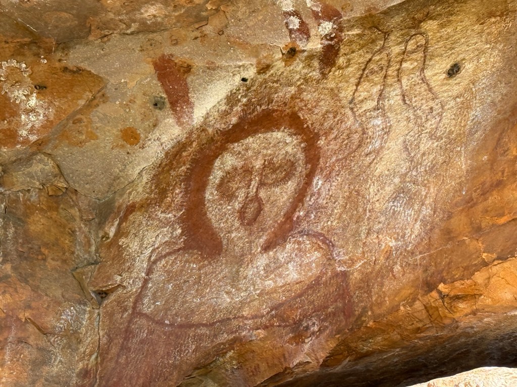
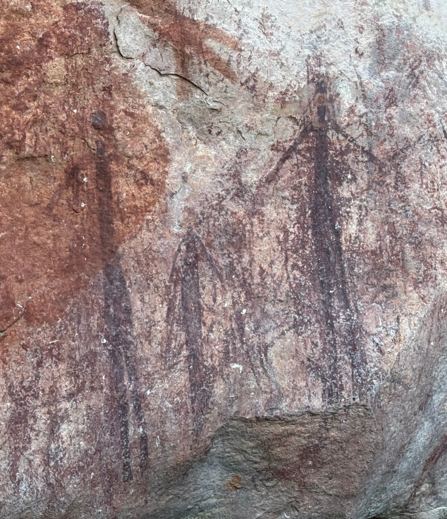
Memorable spot with the old boab tree standing at the top of the Falls looking down on those below. On one side of the gorge there is some aboriginal rock art, the Wandjina is very prominent.
Some great moments over the last few days ‘soaking in’ the Kimberley’s campground life, the gorges and waterfalls.
The next day we moved about 80km further along the Gibb to the Inimjti campground and Community store, an indigenous run business.
Mt Barnett
On leaving Mt E we retraced our steps back along the 30km access track off the Gibb River Road, having come along it in the dark a few days ago.

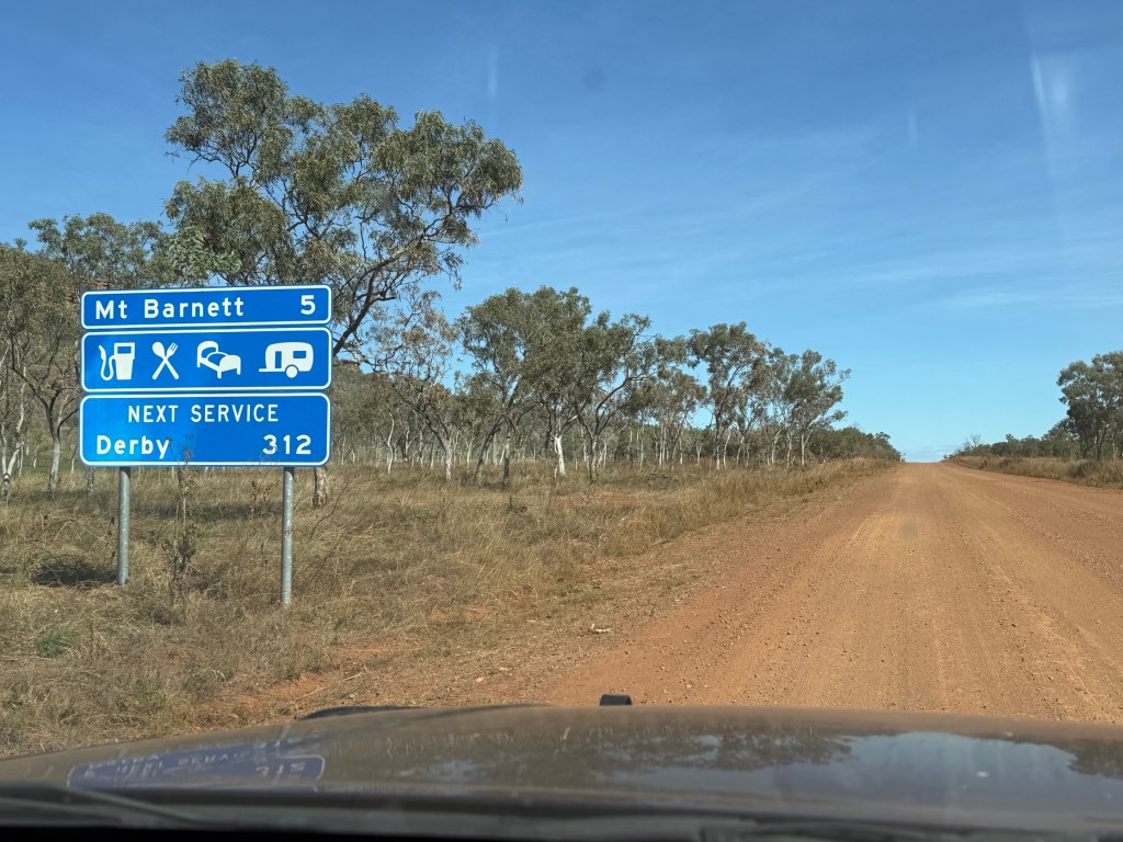
It was then another 29km west along the Gibb to the Mt Barnett Roadhouse. At Mt Barnett we have come 354km along the Gibb and have another 305km to go to where it ends outside Derby. So a bit over half way and reports are that we have done the toughest bit, whatever that means!
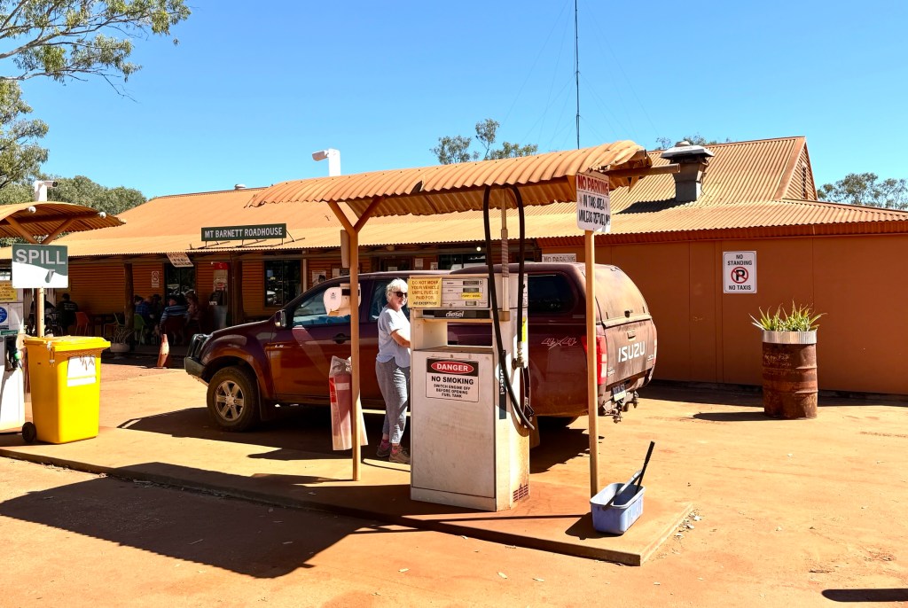
The Roadhouse is the only spot along the Gibb where you can pick up a few supplies of basic groceries including bread(frozen), milk, fruit and veg etc. Consequently, pricing is pretty vigorous.
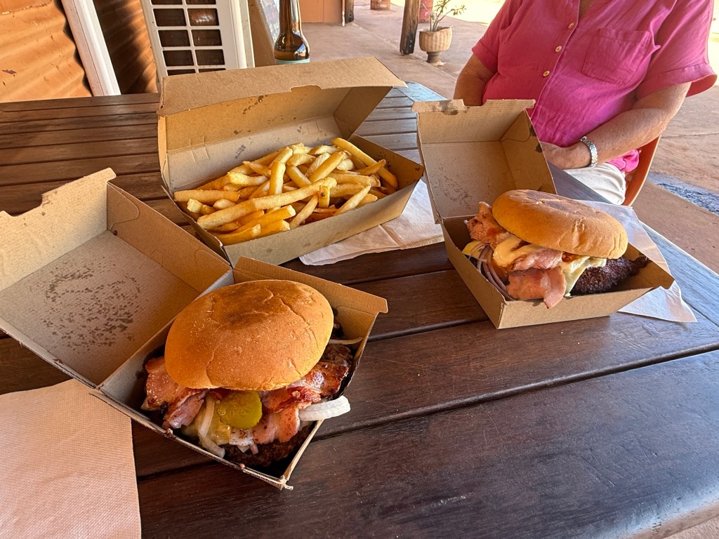
We had arrived at lunchtime and after paying our site fees for Manning Gorge indulged in the compulsory Mt Barnett burgers. Allthego enjoyed a cheeseburger and Homealone a peri peri chicken burger. Now, they didn’t come with chips! Extra $12 for a largish box. All up $58.
They do have something special for sale each morning, fresh sour dough. Baked on site and priced accordingly, $20.

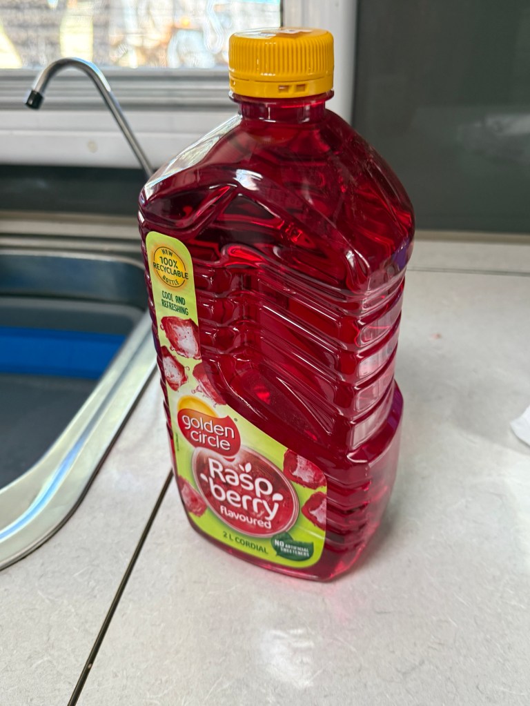
Now, Allthego remembers a saying that ‘man cannot live by bread alone, he must have red cordial as well’. Mt Barnett knows this too and their red cordial, to go with the sour dough, is $16 a bottle. We hadn’t had fresh bread for nearly two weeks, so we couldn’t resist the sour dough. Our supply of red cordial was running low and that was also a need to be satisfied!
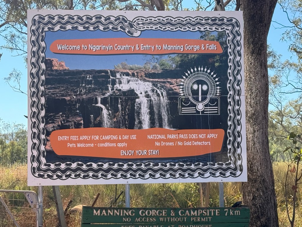
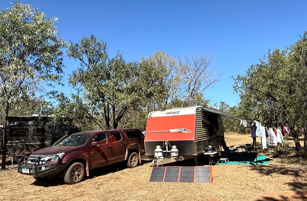
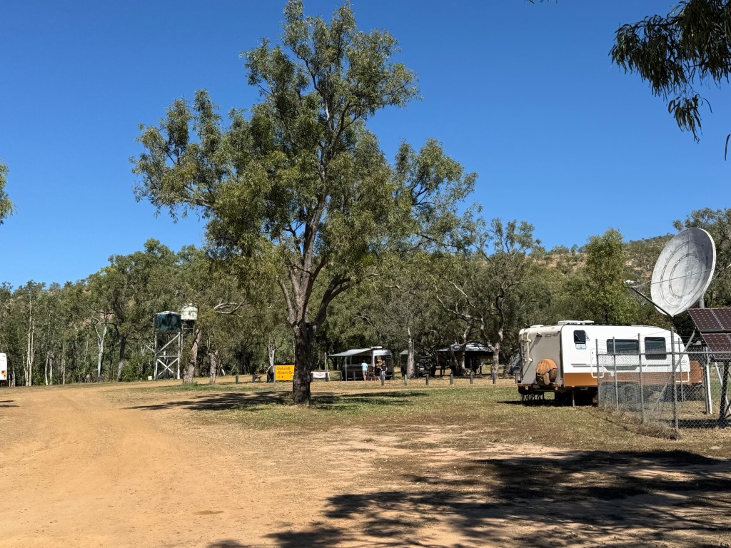
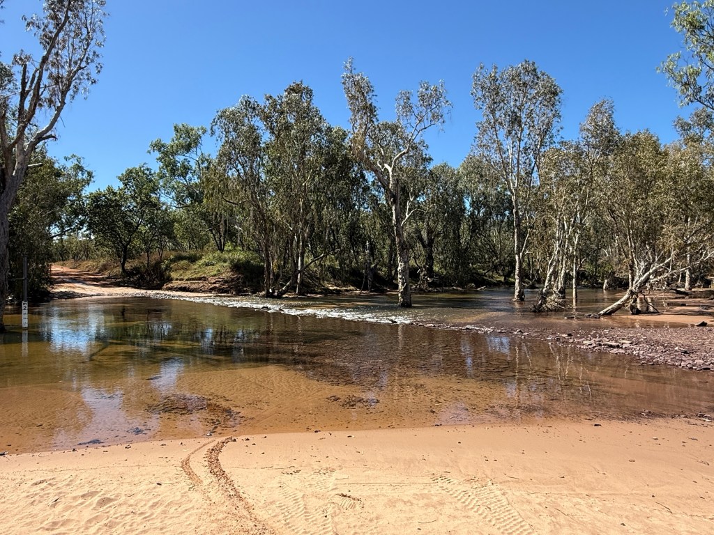
The 7km track down to the Manning Gorge campground starts alongside the Roadhouse. It was generally an easy drive along a well graded track for the first couple of kms, after that it got a bit rocky in places and there were a couple of low level water crossings. But all good! This was our base for four nights.
We now have to visit the repair man about a snake as we head off on 9 June for the next stop.
Mt Elizabeth Station
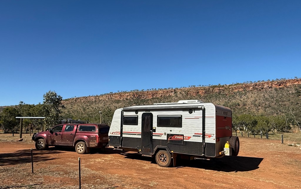
Mt E is a 500,000 acre 6,000 head working cattle station, with the tourism add on. Very big lightly wooded campground, no power or water to sites but great facilities. Recently added a new amenities block and unexpectedly they have a couple of washing machines and also sell diesel, $2.95 litre. Good spot to stay for a few nights.
The other bonus is a cafe set up that does evening meals and warm station beef meat pies.
There is a nightly set menu featuring the Stations own beef. Preceded by some time around the communal fire pit. We indulged in a steak night, great pieces of beef filet cooked to perfection! Came with some salads, haven’t seen a piece of lettuce for going on two weeks! So really appreciated!
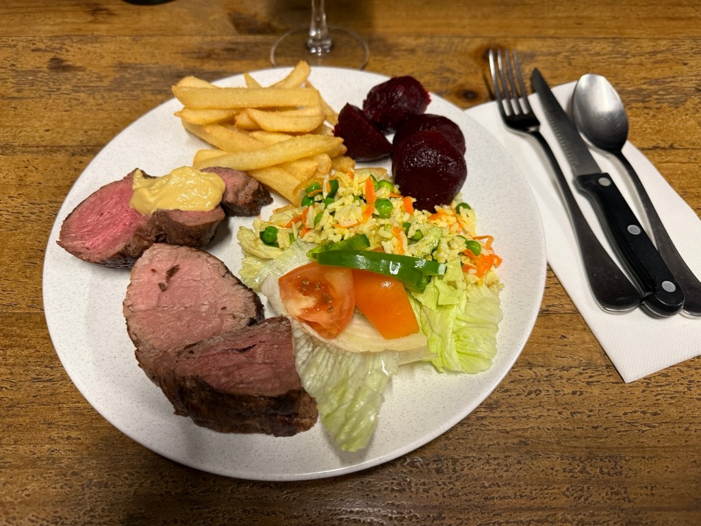
Finished with some pears poached in red wine, plus cream.
A bit of 4WD driving is the main go to thing here. To get to the gorges and swimming holes a bit of rough track driving is required.
The track to the ‘Swimming Hole’ is not too bad, a little creek has to be crossed. Looks worse than what it is. Allthego followed a couple of more experienced characters and no problems at all.
Some great scenery and a pleasant plunge in the pool. There is also a short walk here through the woodland and back along the creek bank, some great old trees in this area.
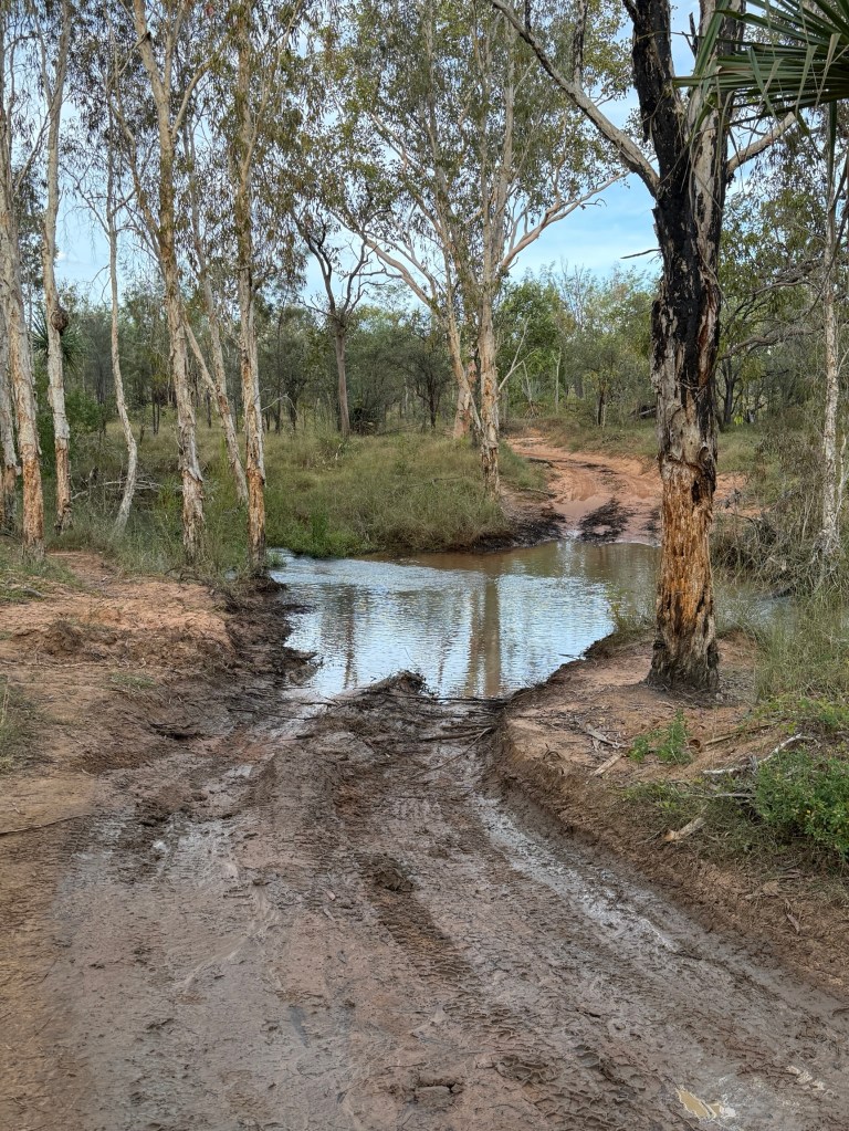
The track out to Warla gorge is a different story to the one to the Swimming Hole, 20 km in total the last 5 of which is rather rougher than some might like. One has to weave along some rock strewn rutted track, cross a bit of thickish mud and a water pool with a greasy bottom. Took it slow. Homealone somewhat unimpressed with the possibility of getting stranded. But a number of people on the track, so help would be at hand.
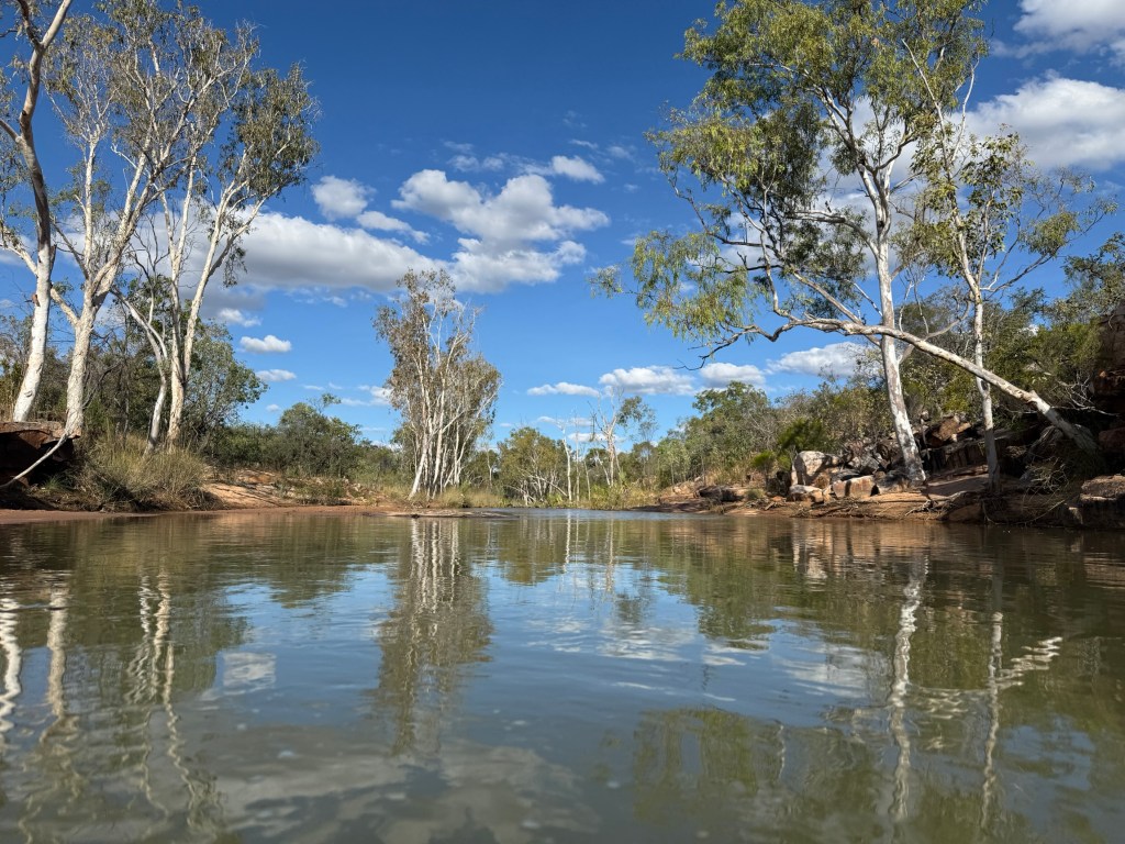
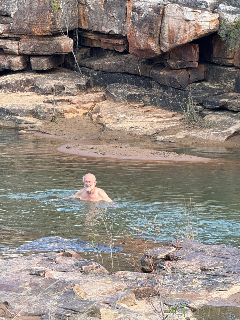
Allthego found the Warla gorge worth the effort. The river was flowing along waist high off a short low waterfall, a big sandy beach for all to sit on and watch the action.
The trip back to camp went ok, but the obstacles hadn’t disappeared!
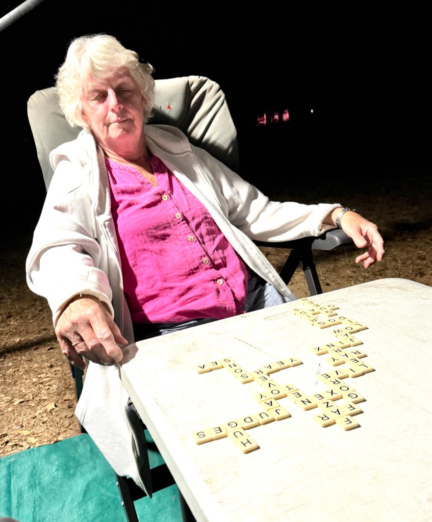
In the evenings we generally manage to get in one or two games of Bananagram, a scrabble variant where you play your own ‘scrabble’ patch. First to use all your letters wins, a few rules of course. Homealone is cleaning up most evenings, leaving Allthego in the wake. It must be all the Wordle that she plays these days.
Time to move on to the next stop at Manning Gorge about 70km along the Gibb. On the way we need to stop at Mt Barnett for fuel and a pantry top up. There is also a spare rim and tyre to arrange!
Ellenbrae to Mt Elizabeth Station
It is about 190 km to Mt Elizabeth Station (Mt E) from Ellenbrae, this includes the 30km along the track off the Gibb to the Station.
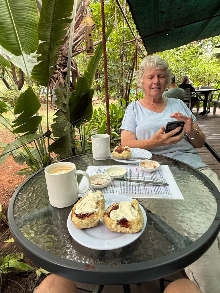
We decided to have a toastee and coffee, tea for Homealone, at the cafe before leaving. Also, picked up some take away scones for later on.

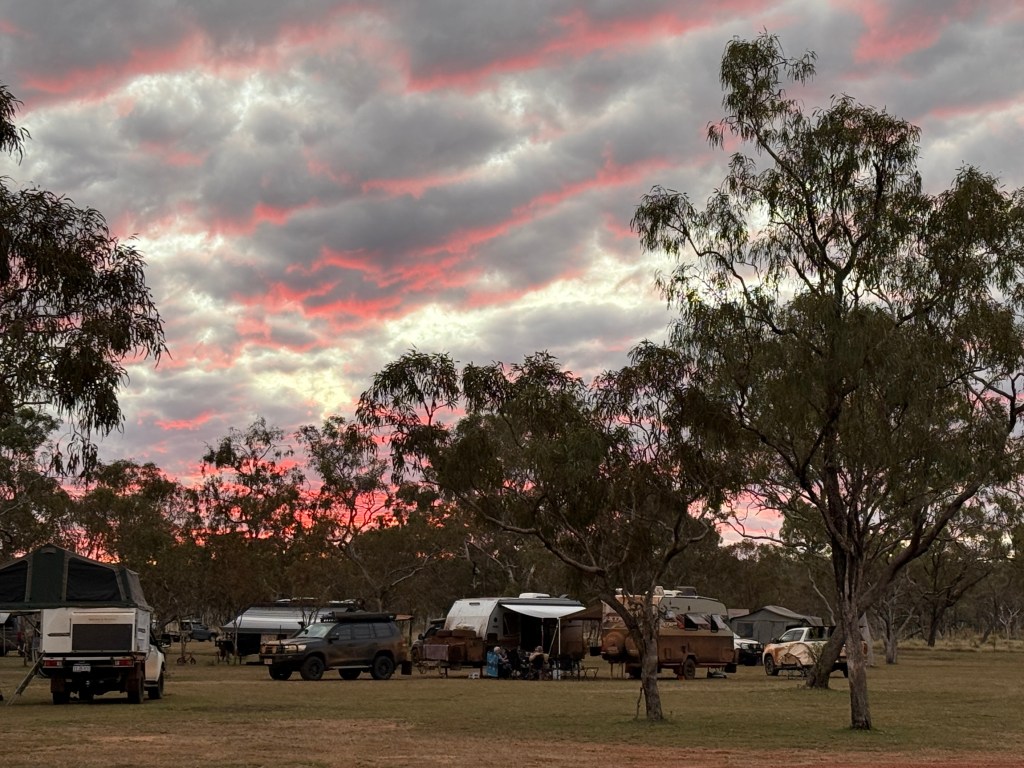
It had been a pleasant few days sitting around watching people and coming and going. All sorts of accommodation. Swags, camper trailers, small off road vans to very large combos with boats attached.
Hitting the road we found it quite good getting through to the Kalumburu Rd turnoff to Drysdale Station. This is the way we would have gone without the rain. Stopped here for lunch at the rest spot.
We later made the short detour down to the Gibb River where it crosses the Kalumburu Road. There were a few vans parked here at the free camp overlooking the river. Tempting to stay!
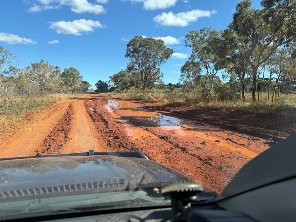
But onwards to Mt E. The road deteriorated somewhat from here on with a number of shallow creek or drainage crossings. Also, a few deeper corrugations and muddy wet patches that were drying out. Some wheel ruts in the drying mud showed just how much water had been on the road. Still rate it though at about 80%.
Navigated through the Hann River ok after passing a chap on a bicycle all by himself. A little further along some poor souls camper trailer was beside the road, axle broken and tyre trashed, loaded with gear. Probably there for good, cost a fortune to recover not to mention the repair costs.
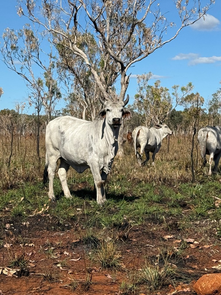
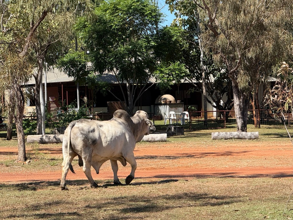
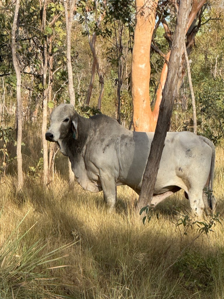
We are starting to see increasing numbers of cattle beside the road. Some impressive looking beasts.
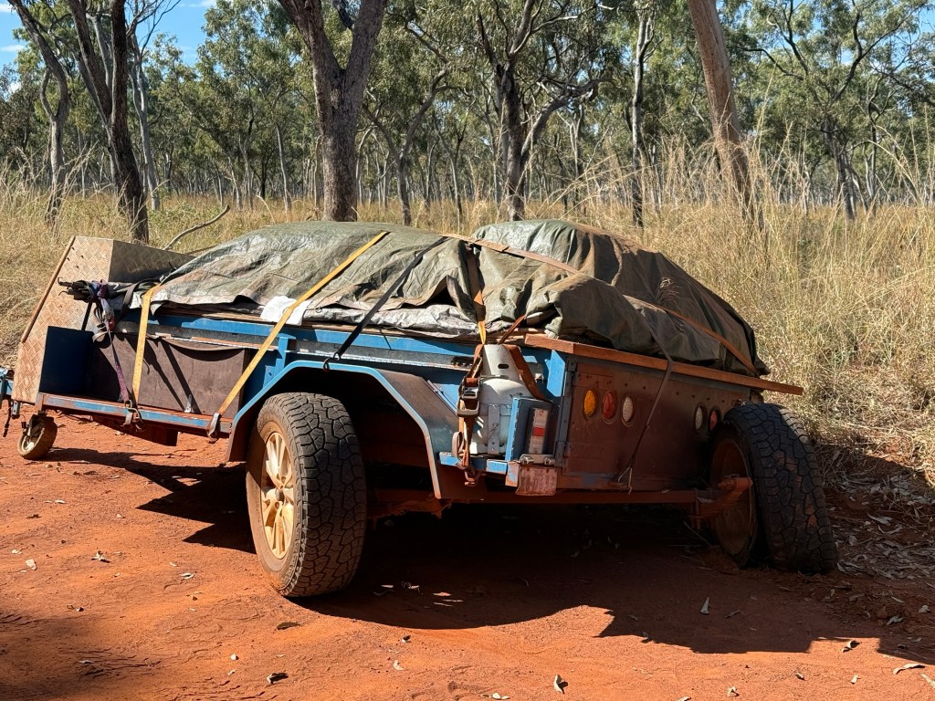
There is always room for an adventure on a road trip. We seem to have a share of them. What would it be like to go the whole length of the Gibb adventure free? We will never know because one of the very small almost road drainage type creeks across the road contained an unpleasant surprise. Allthego probably took it a little too quickly and whooshka a bad bump knocked a van tyre off the rim, we were on low tyre pressures as well which probably didn’t help in this case.
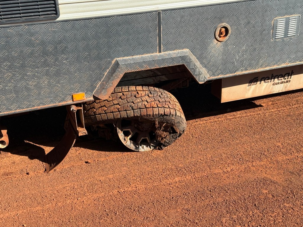
Fifty metres later we pulled up with the tyre hanging shredded from the rim, the rim with a piece broken off was of no further use!
To cut a long story short all was made good, thankfully we have two jacks which allowed us to get the spare on ok. Took a while though including cleaning the tyre remnants and steel wires off the hub. The parking and electric brake cables were undamaged.
The guy on the bike passed by and offered to help but he looked as though he needed more help than us. Other than for him, during the two and a half hours of getting it sorted out no one else came along the road.
We arrived at Mt E at about 7pm, having travelled the 30k up the access track in fading light and darkness. Settled in for the night after some noodles! Alls well that ends well, the first day of winter.
We woke to a nice sunny day a bit stiff in the hamstrings and shoulders.
Mitchell Falls
We have learned that the Gibb River Road past the Drysdale Station turn off has opened, plenty of water still around though. The Hann River crossing has about 60 cm of water. So the way ahead is looking good!
We have decided though to stay another three nights at Ellenbrae, as we are still unable to go up to Drysdale Station and then on to Mitchell Falls by the Kalumburu Road. We have had conversations with APT re the booked lodge accomodation at the Falls. They have actually cancelled bookings, including ours and a refund is on the way.
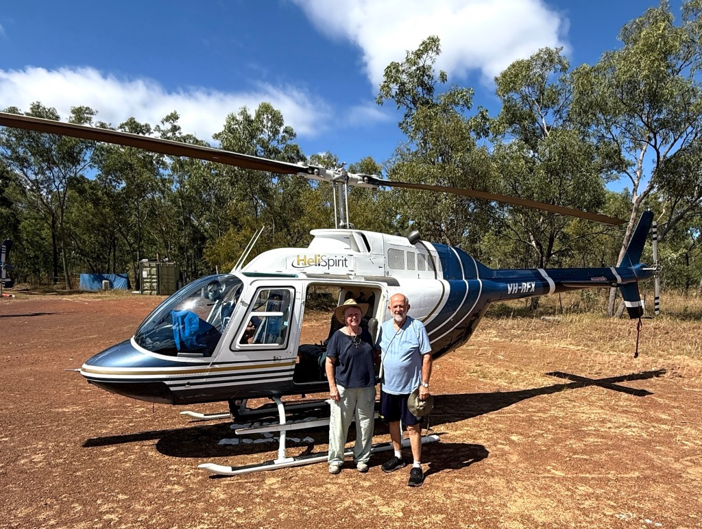
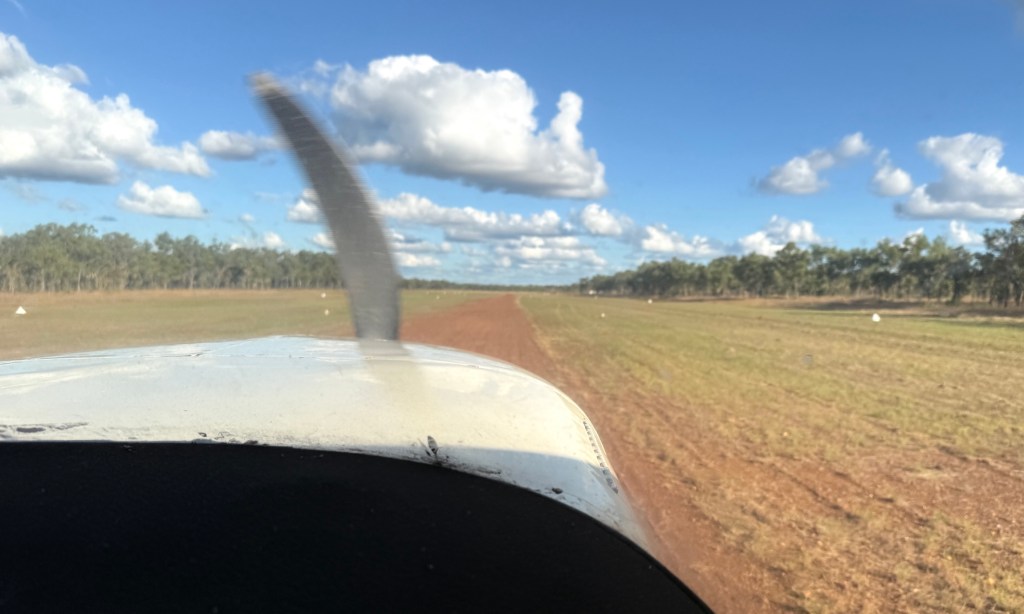
What to do though? The Mitchell Falls visit was one of the big ‘ticks’ for this trip so we have lashed out on a day trip by light plane from Ellenbrae.
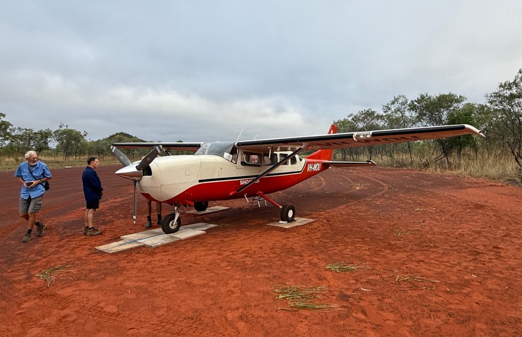
It was an early start. Pickup from the campground was at 6.40am. There were six of us on the Cessna plus the pilot. Allthego was upfront helping him with the navigation and other technical matters, including being told to keep his feet away from the floor pedals.
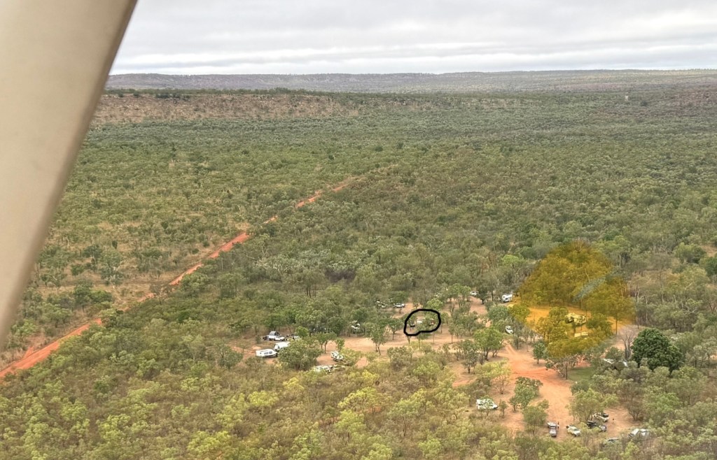
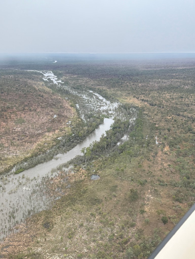
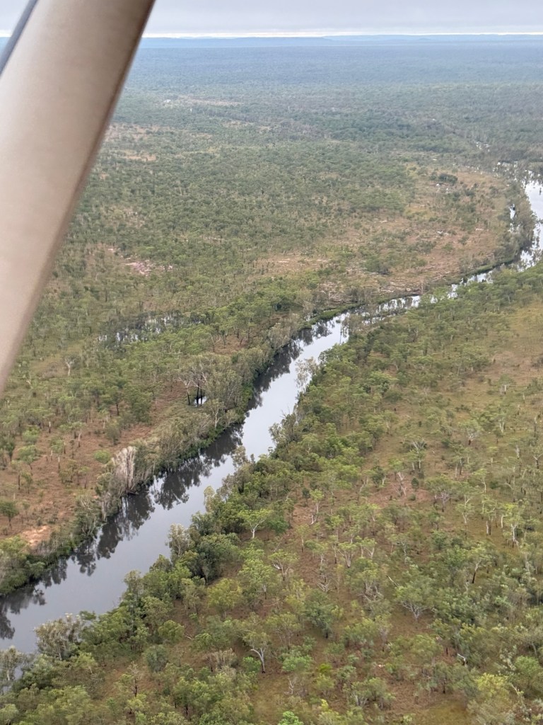
Takeoff from the Ellenbrae strip was a little after 7am. As we wheeled away we passed over the Ringers Camp site, van in view! It was a fairly low level flight, around 2000m, under some broken fluffy low cloud. Great views of the landscape and swollen rivers.
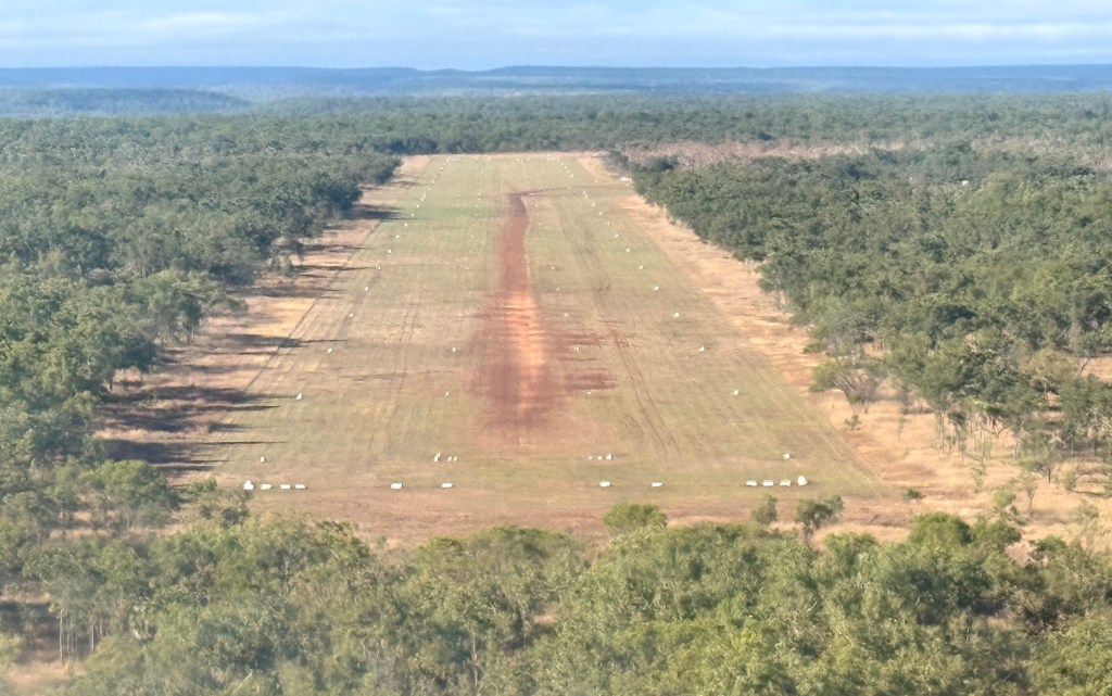
It took just on an hour to reach the Mitchell Falls plateau air strip. The strip was originally built by Rio Tinto when it was exploring for bauxite on the plateau. They did find lots but because of the remoteness it was uneconomic to mine. A good outcome for the country. And the airstrip is ok of course! A nice smooth landing on the gravel, some little bumps here and there of course to be expected.
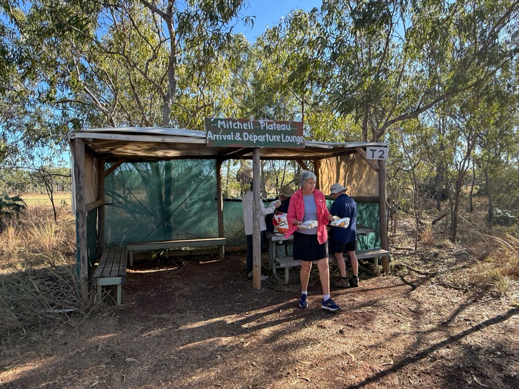
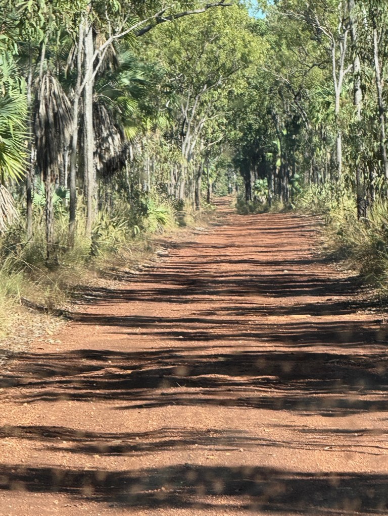
The air strip was half an hours 4WD, along an in places wet and muddy bush track, from the Mitchell Falls NP camp ground. This was our destination and where the next stage of the journey to the Falls would start.
A ten minute Bell Helicopter jaunt down to a chopper pad beside the Mitchell River, 100 metres or so before the river plunges over the 4 level drop to the river far below.
But before we got in the helicopter, it was 9am, we were off on a walk down to Little Mertens Falls. It is about 3km return and along the track that ultimately leads to the Mitchell Falls. It was to take just just 3 hours including time at the base of the falls for a swim and checking out the rock art.
The first part of the walk is reasonably easy going, including a bit of creek hopping and getting the feet wet before reaching the top of Little Mertens Falls. There is a Big Mertens Falls further along, but we don’t go that far.
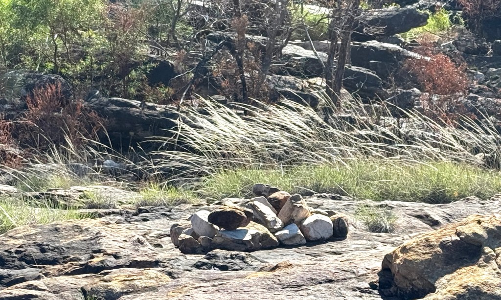
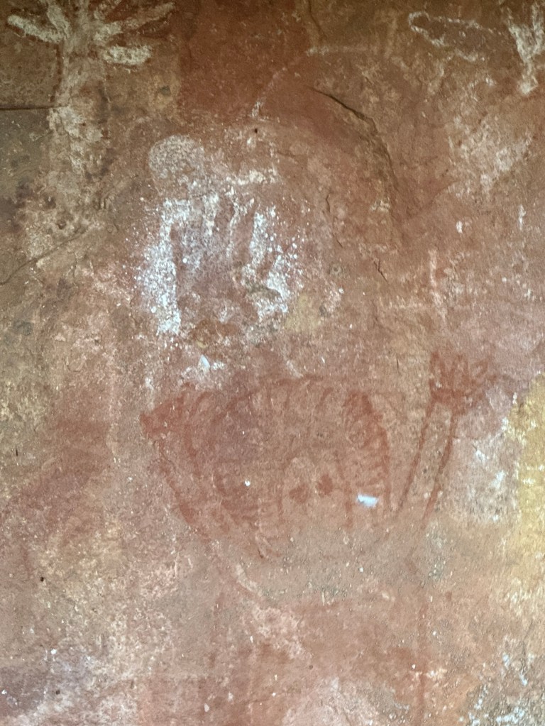
A little further we pass an Aboriginal burial area. We saw two neat piles of rocks on a broad sandstone area. Apparently, when near death an Aborigine would be laid here and covered with the rocks. According to the tradition the body fluids would seep through the rock into the deep pool at the bottom of Mitchell Falls. This is where the Rainbow Spirit creator lives. So the person returns to the ‘country’ from where they came.
Very similar to the Christian concept of “ashes to ashes, dust to dust” used in funeral services.
Behind the hill in the photo is a current day traditional burial area, not accessible without consent.
The descent on the track from the top of the Falls to the pool beneath is a little arduous, up and down a few rocks with trees to help out with the leverage to get up. The pilot, who also doubles as the guide, lends a welcome hand from time to time to the less nimble.

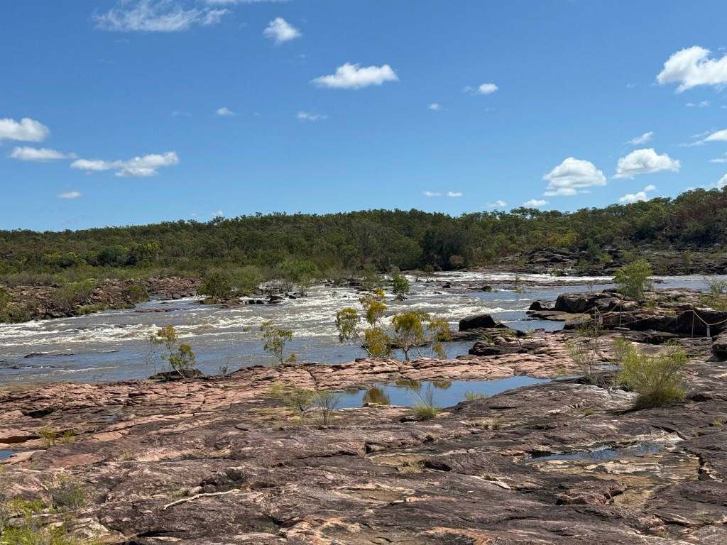
At the bottom the view of the water coming over the top into the pool is special. The swim is refreshing. There are no salty crocs in here, maybe freshies but none were seen.
The area around the lower pool was a place that the indigenous people inhabited for thousands of years. Perhaps not continuously as they moved around in response to changing climate and weather patterns.
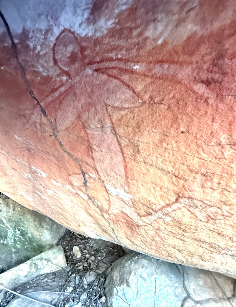
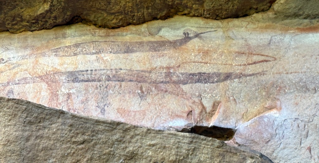
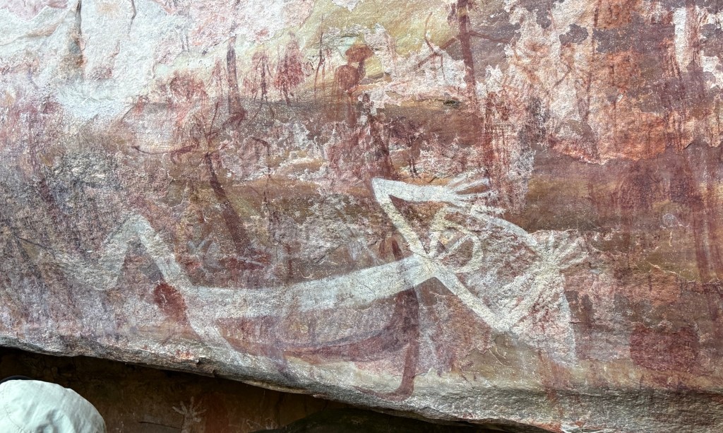
Our pilot/guide showed us around a number of sites near the pool with different ages and types of artwork, some of recent origin but others dated at thousands of years. A few examples in the photos below, I have annotated from my best recall (which might be sus) of the commentary.
We returned by the same route to the campground to get into the helicopter, it holds up to 5 including the pilot. So our group went in two trips. Homealone was very insistent on sitting in the front next to the pilot because it had a door. The seats behind had no doors but we were harnessed in securely.
It was a little unnerving when we did figure eights around the Falls so that everyone got a good view.
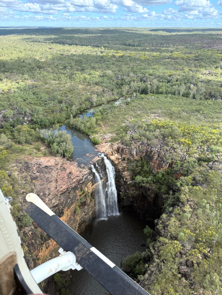
At the Falls we went off on a short walk out along the edge to get a full on frontal shot of the four waterfall levels. We were quite close to the cliff edges.
The Falls were really pumping, massive amounts of water pouring down to the river below on its journey to the sea. Nothing like the pretty postcard views or magazine pics one sees. Spectacular!
Our time was up, back in the helicopter for another figure eight around the Falls before returning to the campground. 4WD back to the airstrip and the plane flight to Ellenbrae. No dramas and a memorable day!
We now head off for Mt Elizabeth Station in the morning, 1 June the start of winter! We have the donnas out at night.
